The Peddars Way
“Peddars Way”- said to be derived from the Latin “pedester”, meaning “on foot”
Back in 2016, I completed The Ridgeway. I quite enjoyed this ancient trackway, walking from Avebury to Ivinghoe Beacon, and resolved then to complete the Greater Ridgeway which comprises a number of ancient (and not so ancient) paths that stretch some 360+ miles from the South Coast at Lyme Regis in Dorset to the north Norfolk coast at Holme-next-the-Sea. It is mostly made up of four long distance paths- the Wessex Ridgeway, The Ridgeway, the Icknield Way and the Peddars Way. The latter is half of the Peddars Way and Norfolk Coast Path, a National Trail that I completed last month.

The Peddars Way has a number of sculptures, by Tom Perkins, along its length. These form part of the Songlines art project. This attempts to link current day travellers with events and people of the past. I prefrred to keep myself in the dark as to when these would be encountered and come across them unexpectedly. This is the third, found near Swaffham
A fine walk for a fine spring
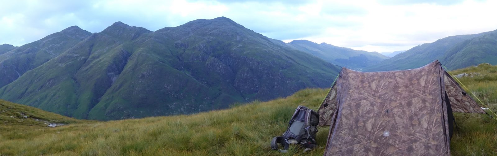
I had considered walking the trail with Mrs Three Points of the Compass last year but reading up on the route decided that, if not actually likely to be boring, that there probably wasn’t going to be much of interest for the two of us. Nonetheless, on 1st April 2017 I set off to walk the 92 miles. Hopeful of at least a night or two wild camping, just a little preliminary research revealed that I would find water sources difficult to locate. To make it far easier, I stayed at recognised camping sites where water would not be a problem. I took my single skin Nigor WikiUp 3 SUL, the inner nest being correctly deemed unnecessary. The remainder of my gear can be seen here.
Other than my tent, which will be changed later this year, this walk was a bit of a final ‘shake-down’, seeing if my current kit list is where I want it for my Three Points of the Compass walk that starts exactly a year after I set off on the Peddars Way and Norfolk Coast Path.

So typical of many National Trails, the Peddars Way and Norfolk Coast Path has an inauspicious start. Setting off from a car park opposite Blackwater Carr on Knettishall Heath

Sedgeford Magazine, now a private house, was built as a powder store or armoury in about 1640. The trail passes right past it
Instead of being a boring route, I found much of interest. Both halves of the National Trail were a bit of a homecoming for me. I spent some time as a teenager, when I was an Army Cadet, traipsing through dripping foliage in the Military Training Areas of the Brecklands of north Suffolk and South Norfolk. The heavy, rubberised poncho I wore then proved to be excellent protection from the heavy rain all those years ago. The ponchos eventually gave way to lighter silicone coverings that were equally as effective when strung as tarps for night halts. No rain was experienced on this last trip, unsurprising in one of the driest parts of the country.

The great majority of the 46 miles of the Peddars Way is in Norfolk but the path starts just a few hundred metres into neighbouring Suffolk. Here, Three Points of the Compass crosses the Little Ouse River which marks the county boundary

Part of a page from my trail journal
Catching a series of trains from home to Thetford, a £19 taxi ride took me to the start of my walk. It wasn’t long before I was in to acid grasslands, chalk grasslands, heathers and pine woodlands. The first couple of days also saw me passing more pig farms than I had ever seen before. Overhead, Buzzards were frequently seen but sadly no sight of the Stone Curlews for which I used to visit this area to see a couple of decades ago.

Easy and pleasant, if unremarkable, walking through mostly agricultural land with few ‘ups and downs’

I passed few people on the Peddars Way, frequently the only people I would see for hours would be farm workers in the fields, or just the very occasional dog walker if near habitation

Little Cressingham combined water and wind mill as it once was
Where a walk of a mile or so would take me to something of interest, I would occasionally turn off the well marked path. The unique water and windmill at Little Cressingham is just the sort of little gem that adds so much to a walk such as this. I passed a number of windmills in Norfolk, few, if any, now filling their original purpose.
On just a few occasions I reined in my forward motion and paused for a few minutes to indulge in a brief sketch. Again, I am narrowing down my lightweight art kit that will accompany me on my Big Walk in 2018 and wanted to see how my small selection of materials is performing.

Just a brief diversion took me to the unique combined water and wind mill at Little Cressingham. Built in 1821, two stones at the base were turned by the waterwheel, while two further sets of stones were turned at the top by the sails. The sails were dispensed with in 1916 but the mill continued to work under oil or water power until 1952. The small white building to the left housed another waterwheel that pumped water up to Clermont Hall a mile distant
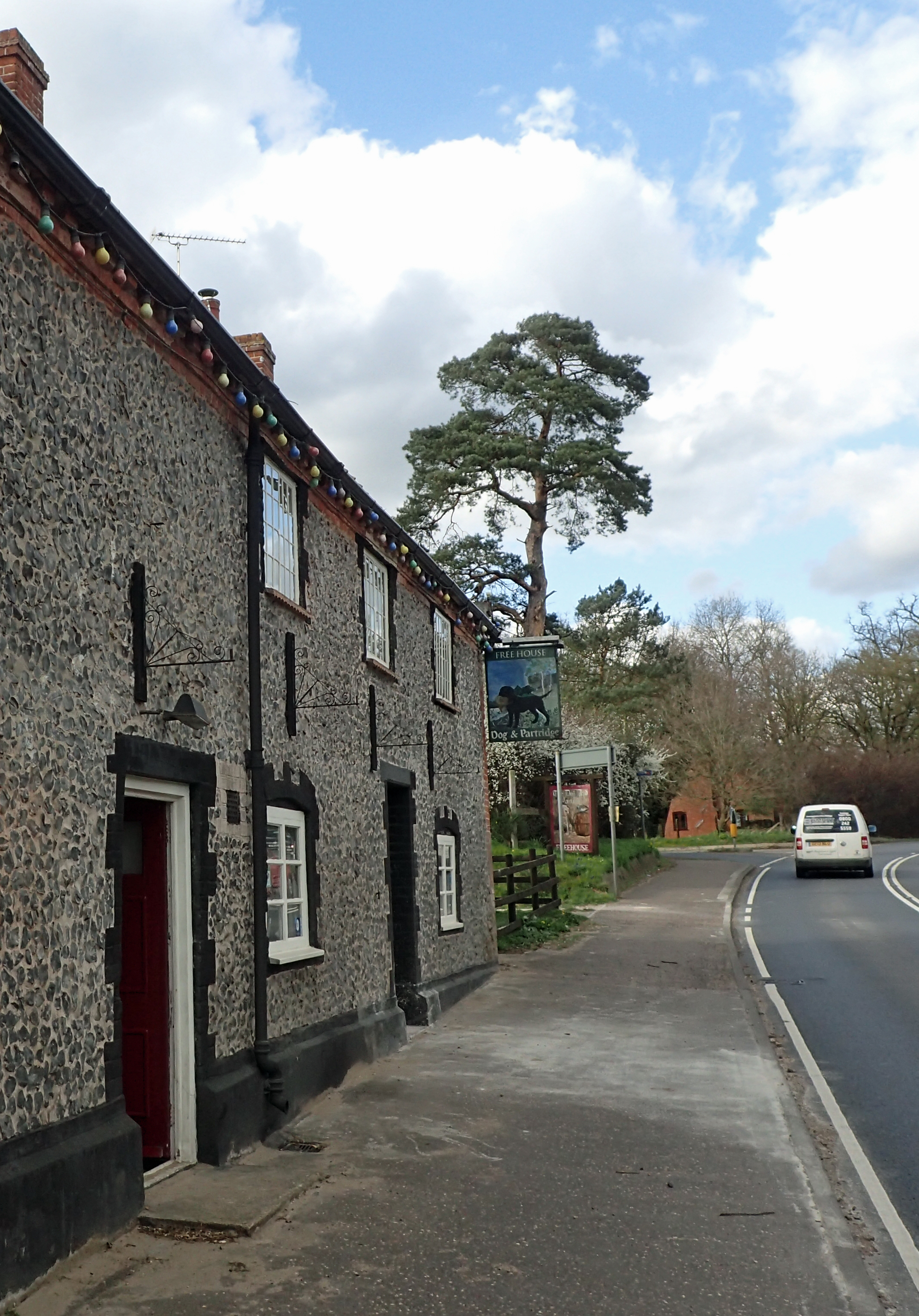
Landlady Karen welcomes the trail weary, dirty and sweaty walker in to The Dog and Partridge at Stonebridge

Re-hydrating with Ostrich Ale at the Green King Ostrich public house in Castle Acre
Other than halting to poke around ruined churches and the like, I happily stepped in to just a handful of pubs. Entering Stonebridge, I followed a road for no more than a couple of hundred metres, but walking past the door of the Dog and Partridge close to the end of a days walking was enough to tempt me in for a couple of excellent pints of Woodfordes Bure Gold. After all, it is almost a duty to put a little trade the way of the local businesses, isn’t it?
It was near Stonebridge that I was almost flattened by a group of off-road motorcyclists. Leaping to the side of the path to avoid being hit (and no, it wasn’t a By-way) I lived to walk another day.
“You’ve got to call it Swaaaaffam these days…” Tony Garrod

Lunch stop at St. Andrew’s Church, the south west tower fell in 1781 and lies in ruins, but the church is still in use

Tony Garrod of the Milestone Society was pleased to stop for a chat. Busy cutting back the vegetation and planting Hollyhocks and Sunflowers around a freshly painted Mile Post dating from c1905, he belied his 82 years and told me of his ‘patch’ of Mile Posts on the Swaffham-Fakenham road

Leaving North Pickenham, the old Roman Road soon follows a lovely wide and grassy path known as Procession Lane. A name thought to derive from the ceremony of beating the bounds. I passed between the brick remnants, dating from 1875, of the former Swaffham – Thetford railway line
The path crosses right through, and close to, much of interest, even if there is often very little remaining to actually be seen on the ground now. I was thankful that I took my trail guide as I walked along the quiet and lonely Procession Lane. I would never have known that to my left was where B24 Liberators of the 492nd Bomb Group had set off for their 64 missions in just 3 months in 1944. It was here that the Thor ballistic missiles had been sited in 1959, setting off vehement anti-nuclear demos. Nothing remains of that to be seen. Little remained too, of the former Swaffham – Thetford railway that crossed both former airfield site and my path.

The gem of the Peddars Way is probably the remains of the Cluniac Priory at Castle Acre. I chose not to join the hordes of people there, instead, walking the circumference

Cooking up an Almond Jalfrezi from Tentmeals on my second night on the Peddars Way
Each of my camp sites was more than adequate. Day one saw me 8.5 miles to Puddledock Farm, day two took me 11 miles to Brick Kiln Farm and the final overnight halt on the Peddars Way was at the lovely Bircham Windmill after a 22.5 mile yomp.

The first time I have ever camped in the shadow of a windmill. Campers get free entry to look around Bircham Windmill, but sadly, I arrived after it had shut and left before it opened

Quiet leafy lanes. This was the least used of National Trails I have ever seen

Littleport Cottages, reached just prior to crossing the B1454 Sedgeford – Docking road, are typical of the little hamlets passed through or close by. No shops, no Post Office, this is the reason I took the majority of my meals with me- there are few opportunities to buy anything en-route
Every now and then on my three-ish days on the Peddars Way, there was a reminder of the thousands of people- soldiers, traders, pilgrims and the itinerant, that had used this route in the past. Fields are dotted with marl pits, there is the occasional tumuli from the Bronze Age, but I had to look hard for the traces of Roman Forts. I suppose the finest record of their passing is the trail itself.

Close to the Anmer-Houghton road, the Peddars Way passes a number of tumuli dating from around 1300 – 1500BC. This is one of Norfolk’s most important Bronze Age sites and of national importance
While there was a great deal of easy going trackway, I had to contend with quite few miles of road walking. This had already begun to cause me problems with my feet, but I will write about that issue another day.

Three Points of the Compass crossing the River Nar on the Peddars Way. The trail is well marked but I was still pleased to have both map and trail guide with me
Is the Peddars Way worth doing? Absolutely. However I would add that it is essential to also complete the Norfolk Coast Path in order to gain the contrast. My next post will cover that section of the trail.

Another piece in the Greater Ridgeway jigsaw completed…
Three Points of the Compass does not always blog on the trails walked. Links to those that have been covered can be found here.

This looks like another gorgeous walk! Thank you for sharing it. 🙂
LikeLike
Thanks for your comment. I wouldn’t quite say the walk was ‘gorgeous’, but certainly enjoyable. I much preferred the coastal section. There will be some images from that in my next post. Jools
LikeLiked by 1 person
Really? I think it’s gorgeous. 🙂
LikeLike
Enjoyed reading your write up of the trip and your photos. I did the trail at the end of last year and I too enjoyed the coastal section more than the Peddars Way. For me the section around Castle Acre was probably the highlight of the Peddars Way.
LikeLike
Great to hear you enjoyed the trail Richard, fortunate to fit it before 2020’s clampdown on such walks. Hope you have plans for when we all get back out there
LikeLike
After a enforced break from work I managed to get the Peddar away, Norfolk Coast Path, cycled from Derby to Berwick on the Pennine Cycle Way and walked the Cumbria Way before the restrictions stopped play for 2020. Was really hoping to get some international trips trekking done this year although not looking overly optimistic. So at the moment the Harvey’s maps for Hadrian’s Wall Path, Cotswolds Way and Settle to Carlisle sat waiting to be used, which feels like they should be possible. Do you have any plans?
LikeLike
Soooo many plans! Yorkshire Wolds to start (try and get a little ‘match fit’ on an easier trail), then try and fit in Glyndwr’s Way, Pennine Bridleway when I can. Skye Trail looks interesting, and and…
LikeLike