
Every year, Three Points of the Compass attempts to fit in a walk across my home county. This year, while still attempting to regain fitness lost with alarming rapidity and extent during a national pandemic lockdown, one particular welcome back to the trail was the modest-in-length Medway Valley Walk. This is a gentle trail of around 30 miles along a west Kent river valley between Tonbridge and Rochester.

I had originally wanted to make this an overnight wildcamping trip, but it didn’t take long to realise that the natural mid-way(ish) point on the trail is the county town of Maidstone. It is never particularly easy finding a decent wildcamp close to a built up area. So, with hotels now being permitted to accept general visitors again, I found a cheap’un for my nights halt, and the pack got considerably lighter as a result.

The River Medway is the largest river in Kent. It begins as a trickle in the sandstones of the High Weald and flows for seventy miles to the River Thames, just beyond the Medway towns. The Medway Valley Walk follows the river for around 28.5 miles from Tonbridge to Rochester, one of the Medway Towns, though I think we are supposed to call it Rochester-upon-Medway these days. The walk can easily be split into shorter days but with Maidstone as a mid-way point it makes two decent day walks.

I caught a train to Tonbridge and set off from the station around 10.30, no rush today so I popped into a Greggs and munched a sausage roll while exploring what there is left of Tonbridge Castle, which is mostly the immense gatehouse. I messaged family just prior to setting off then the phone got silenced. I’m on holiday! The start point is on the Great Bridge, which sits below the walls of the castle but there is an immediate diversion to skip round premises abutting the river before rejoining its banks.


The town is soon left behind, just a few miles later, the most ambitious of dog walkers is also left behind, and then it is quiet and just occasionally muddy paths for a couple of hours walking beside a sedate river, heavy with silt after recent rain.

It wasn’t long before I came across the first of many wartime Pill Boxes along the river’s flanks. Many of these formed part of the General Headquarters ”Stop’ Line, intended to contain any German invasion during the Second World War. There was no invasion, and it is doubtful as to the success these might have had beyond providing strategic observation.

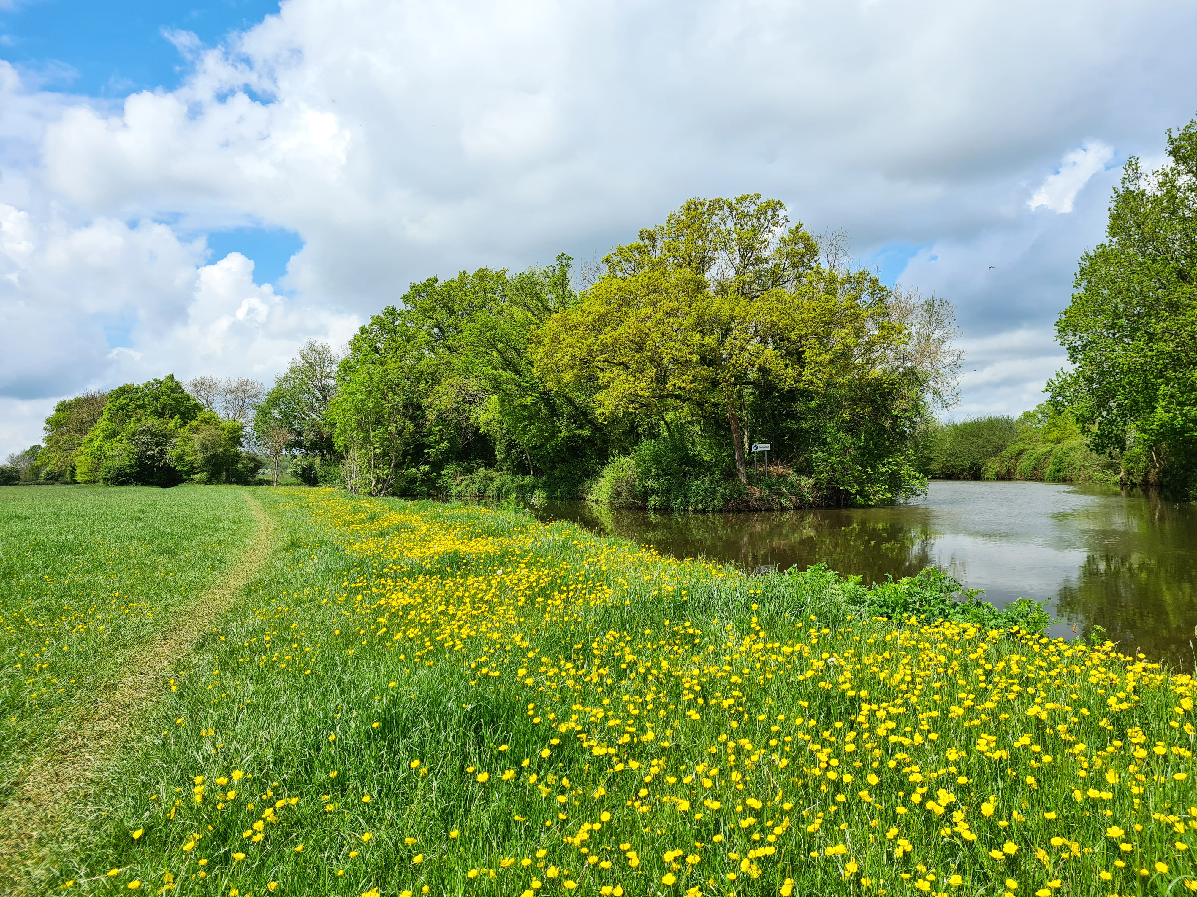

I really enjoyed this part of the walk. Ducks, geese and swans in the water, a Kingfisher shot off, Great Spotted and Green Woodpeckers making their respective rackets. Pill boxes covered in Ivy away from the waters edge, or undercut and in danger of toppling in if close to the river, Bluebells and Ransoms vied with each other for space, Chiffchaffs and Willow Warblers set out their territorial claims, a Buzzard hung overhead, two canoists chatted to each other as I passed them, unseen behind already tall bankside vegetation. It was a good start.

It had been less good for the thirty hop-pickers, sitting atop a wagon that crossed the Hartlake Bridge on 20 October 1853. The wagon went through the wooden side of the rotting bridge, the river was swollen from recent rains and all perished. I diverted off at the plain and rather ugly replacement bridge to go and see the simple memorial. The unfortunates were buried in St. Mary’s in nearby Hadlow. The Medway Navigation Company, found guilty of neglect at the coroner’s hearing, refused to contribute toward burial costs.
All too soon it was lunchtime and I contemplated sitting riverside with a pre-packed peanut butter sarnie- exciting! However nearing Branbridges I came across a sign for a new family leisure venture opening up. It was tucked in to the gap between an industrial estate and the river- offering Paddle Boarding, Riverside Walks and ‘much, much more’, I was more interested in their Big Meat BBQ Cafe that had opened only days previous. Fortuitously, my halt coincided with a brief shower, so while that settled itself outside, I sat inside with an overly stuffed and excellent BBQ Pulled Pork roll, chips and all-important mug of tea.

I don’t normally do sweet puds, but I espied a small Portugese egg-custard tartlet at the counter so ordered one of them too for later. OK, I was being a bit piggy, but I repeated to myself the all-important mantra- “I’m on holiday”. It was only two miles further on down the river bank that I realised I hadn’t received it, curses.


Reaching Yalding, the path crosses the medieval Twyford Bridge (the ‘Bridge of two fords’- River Medway and River Teise) and diverts briefly up a short canal before rejoining an enlarged river, as it was now accompanied by one of the main tributaries to the Medway, the River Beult. The river changed direction and swung around more northward, following the terrain, beginning to sneak a way through the line of the North Downs ahead.


Wateringbury was rammed with boats and riverside residential, though barely a soul moved and no boats were on the river. Further on, a middle-aged and naked ‘boaty’ lady out for a swim looked surprised if unconcerned to see someone on the bank, I never hung around and left her to her ablutions. Nearing West Farleigh the trail again crossed the river and steadily climbed up the gentle river valley slopes on its east side, up through horse pastures, everything looking peaceful. I passed another pill box which shattered that illusion for a while, remarkably, a contemporary Spitfire flew twice overhead. Presumably taking a customer out for an expensive tour of Kent. Was it coincidence that leaden storm clouds were gathering to the west, gradually heading toward me…


I passed the gleaming Mill Cottages and for a brief distance joined the little road linking Teston and West Farleigh, dropping down the contours, to cross the medieval Teston Bridge. It was now ‘that time of day’, and the traffic was increasing. Impatient drivers had no time to permit a mere pedestrian to scoot over the bridge from passing place to passing place, instead trying to squash me against its ragstone sides. It was only more generous van drivers that slowed and enabled me to cross its length unscathed.
Back on the riverside path, everything got a bit busier now. I was only a handful of miles from the days end. Dogwalkers materialised and steadily increased in number. Joggers appeared from nowhere, passed with a nod, and disappeared to somewhere else. The path became wider and better underfoot, not that it have been difficult going so far. I passed through East Farleigh, complete with its own medieval bridge, considered to be the finest in southern England. General Fairfax led his troops over this in 1648 before soundly thrashing the Royalists at Maidstone.

A fox wandered down the path toward me, I halted, but it carried on, getting within a couple of metres before finally realising that the obstacle in front was something to be wary of. I hadn’t flinched, but it leapt a half metre in the air changing direction as it did so, and shot off back the way it came. Further on I passed a small animal track leading off to my left toward the railway, and I could see its face studying me from the fenceline, waiting for me to pass so that it could again emerge.
I was glad that I had decided not to wildcamp, there was nowhere round here that I could have done so without sitting in the rain, nodding at frequent passers-by, waiting for nightfall.

The path was now tarmac and often lined with trees, these were gradually replaced with residential flats the closer I got to town. I presume each of those goes for a small fortune due to their ‘riverside aspect’. Rain was splattering the river but I was mostly still sheltered by the mature treecover. That all changed when I left the rivers edge to head into the town, only a short distance to my overnight hotel. The heavens opened and my pace lengthened. I had a Polo shirt and shorts on and wasn’t stopping to drop the pack and fish out a waterproof. It only took me five or so minutes to reach the hotel but I dripped into the reception like a drowned rat. It was only a half-hour later when I unpacked in my room that I remembered that I had a stowed trekking unbrella not six inches from my head- idiot!


It had been a great first day on the Medway Valley Walk. The trail was well sign-posted and attractive throughout. I had barely seen anyone on the trail itself outside villages and town fringes. The weather had mostly held off. I felt good, so celebrated life in general with a steak, a couple of beers and a bottle of Shiraz.
I had covered 16.73 miles and the following day was expected to be just a tad shorter. The first day follows the river with very gentle walking throughout and is just perfect as a bit of a leg stretch while working toward gaining a little fitness. If not hill fitness, as despite for the most part obviously descending with the river, I had just 715ft of ascent today.
A good nights kip beckoned, I was in a Premier Inn after all. Second day on trail tomorrow.


Three Points of the Compass does not always blog on the trails walked. Links to those that have been covered can be found here.
.

Excellent blog, Thankyou, just a little worried about your diet! Bit short on veggies!!
LikeLike
But lots of grapes in the wine…
LikeLike
Wow – that looks like quite a walk!
LikeLike
Yep, a lovely spring/summer trail. Walking it mid-week takes you away from a lot of weekend visitors
LikeLiked by 2 people