

I was past the half-way point of the Southern Upland Way and had the east coast of Scotland (almost) in my sights. The bigger climbs were now behind me and the paths became easier underfoot. While there was rain ahead, I cared not as I was just about recovered from illness and enjoying the trail immensely.
Southern Upland Way: Part one- Portpatrick to the Glenkens
Southern Upland Way: Part two- the Glenkens to Moffat
My day off in Moffat yesterday had been my eleventh day since setting off from Portpatrick on the west coast of Scotland. I was in no rush and planned on continuing to take my time and keep daily mileage modest. I now felt almost fully recovered from my bout of food poisoning bought on by a dodgy dehydrated pasta bolognaise earlier in the trail and was more than ready to tackle the remainder of the 215 mile Southern Upland Way (SUW).
Day twelve (eleven on trail)– Wednesday 27th April 2022
Moffat to Over Phawhope bothy
Bedecked with freshly laundered clothes and shouldering a pack that had again increased in weight as a result of food resupply, it was time to get back on trail. I do like to stay in a bothy if there is one and had today’s sights set on the last bothy to be found along the SUW. Prior to that, todays high level route alternative would provide what is touted to be the best view on the entire trail.
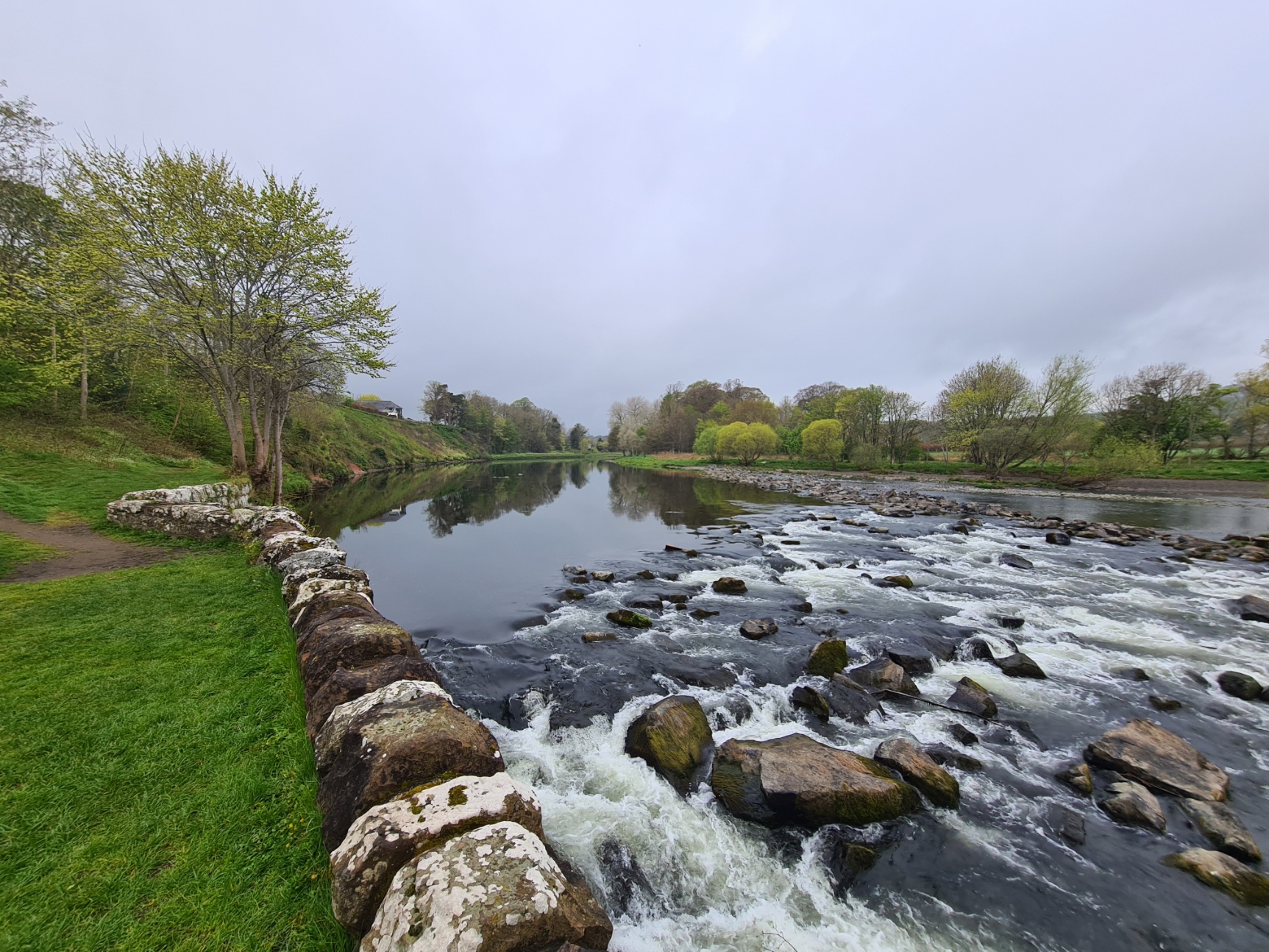
I took a direct route out of Moffat to rejoin the SUW as quick as I could and within an hour was walking through superb old Beech woodland, with just the occasional tree root exposed on the path. Dangerous enough apparently that someone had erected signs at each end- “persons pass through this wood at their own risk”! This was followed by a delightful stretch of riverside trail before heading back up the contours, through fields dotted with sheep and new born lambs, to eventually enter dense forestry where I was soon offered a choice of route. April weather had been fairly kind to me so far so I had no hesitation in choosing the exhilarating high level option that opened in 2007, officially replacing the original low level route in 2018. That lower forest bound path has now become a foul weather alternative. With tendons protesting, it was a steep and winding path to elevation, eventually emerging into the open and views began to offer their reward for effort.

This is a lovely stretch of trail, unlike anything encountered since I had left Portpatrick. Immense windthrow was all too obvious in the forest off to my right and it can obviously get pretty wild up here when it blows a bit. Steep hillside ran off to my right on Croft Head and I wished the trail could have gone on for mile after mile but all too soon I was atop Cats Shoulder and descending the steady switchback to rejoin the low level path alternate. The conjoined trail then continues crossing the contours into a deeply cut valley where I took time out to find another Kist. I will chat more on those treasure seeking diversions in a future blog. The hills around here are convoluted and confused as a result of the collision between the Scotland and England land masses millions of years previous. Further on I was slightly startled by signage proudly proclaiming ownership, I was now entering the Scottish Borders. Open hillside walking was followed by yet more forestry. When this opened up I not only had heavy machinery busy on my right dismembering trees by the hundred, but also a view of Over Phawhope bothy ahead, down on the left. When I reached it, I hadn’t stopped for any lunch and decided to postpone my usual sweep up, and instead enjoy the sunshine at the picnic bench outside, cooking up a late lunch of noodles and hot Oxo while watching the forestry work on the hillside back the way I had come.


Having cleaned up the bothy, which wasn’t too bad for a change, I cut wood and prepared the stove in case I wanted it later. The sun dropped behind the hills and the temperature began to drop. The forestry workers knocked off and first one, then a second van, rattled past on the forestry road outside and the valley fell silent. I changed into warmer clothing and decided to use the smallest sleeping room for the night. I was packing along tealights for use in the bothies and seeing as this was the last on trail, I may as well burn what I had. It is surprising how much heat a candle can kick out and even with the gap below the door, I anticipated being able to raise the temperature a degree or two, successfully as it turned out. My late afternoon and evening were leisurely- notes written in the journal, a little reading of the books found in the bothy, followed by an evening brew and meal of Idahoan mash and chopped pork followed by Tablet and a hot chocolate. Full of calories and sugar, it was time to turn in early.
Day thirteen (twelve on trail)– Thursday 28th April
Over Phawhope bothy to St. Mary’s Loch, Dryhope
I ventured out during the night for a pee and found the sky clear of cloud. The ink was splattered with a million stars and there was a wide smear of Milky Way above me. I am woefully ignorant on constellations but rotated, picking out the few I knew. Shivering, it was back inside to an oh-so-warm quilt.
Dawn came and peering out of the small window in my cell, I could see that the Ettrick Valley had turned white overnight. The frost was intense. With long night hours I had certainly slept a great deal, however it had been a disturbed sleep. The quietly burbling burn behind the bothy hadn’t bothered me but Over Phawhope is infested with mice and the scrabbling of their claws on floor and sleeping platform had frequently disturbed me during the night. I heated up a steaming mug of strong tea and took it outside with a stale bread roll and a slab of triple-smoked Scottish cheese to enjoy the peaceful valley.


I hadn’t been looking forward to the first part of today as it entailed a road walk through the Ettrick Valley but as it was, it was OK, if a little hard on the feet. The road was quiet and only two cars passed me but there was enough of interest to keep my mind engaged. A frustratingly unidentified raptor moving along the far side of the valley kept me entertained. Horses in the fields appeared pleased to see me and galloped up and down, I quizzed my mind as to the odd design of circular sheepfolds with no entrance, many looking like a giant lollipop, or letter Q, from above. Just prior to my turn off away from the road, I paused to assist a farmer directing his sheep into a new field. Not that I did much, just stood on the crown of the road with poles in outstretched arms but that was enough to send a frenetic block of hefty wool into the desired location. The farmer was appreciative and stopped for a natter and the two of us stood in the sun for ten minutes finding common ground to talk of despite our alien lifestyles. I now deemed myself part of the sheepherder fraternity and feeling inordinately pleased with myself I slowly plodded up the only climb of note for the whole day. This is a classic upland route from one valley to the next and at my highest point, I halted to lunch on a meat pasty purchased the previous day in Moffat. The long descent to St. Mary’s Loch seemed to go on forever and once there I crossed the narrow delta that now separates the far larger loch from the much smaller Loch of the Lows. I knew there was the popular Glen Cafe on the far side that enjoys a good reputation but they were undergoing renovation. The owners were at least trying and despite lacking power, water and seating, they were still providing a variety of cake and cans of soft drinks. Now on this side of the loch I at least had an excuse to walk a hundred metres further to view the large statue of James Hogg- the ‘Ettrick Shepherd’. I am not at all convinced that the modest poet and shepherd would have approved of the impressive monument to him for he “held worldly pomp in high derision“. The statue was surrounded by windthrown trees that had somehow missed it. The cafe had been less fortunate and had been badly damaged.

I had originally intended to wildcamp near here, on the shores of St. Mary’s Loch, however it was still early afternoon. I felt good, the walking was easy, so I had no need to stop and just carried on. Having crossed the loch again, I passed the boat club where I had planned camping and on to the initially pleasant and undemanding three and half mile walk along the shore. On reaching the far end of the loch I found a suitably large and flat stretch of grass that was crying out for a wildcamp. It was obvious that a great many people stop here, almost certainly motorhomes and the like as there was a multitude of tyre marks on the grass and too many unsightly fire rings. There was no one else around so I staked my claim. Shelter up, I washed, changed into insulation layers and took a mug of tea down to the loch’s edge, startling sandpipers in to flight. I wandered up and down the shore and had a catch up chat with Mrs Three Points of the Compass while the sun set. As usual, the temperature immediately plummeted. My huge evening meal was comprised of far too many noodles and sweet chilli sauce with a scattered scrunched covering of pre-cooked bacon, followed by further mugs of tea and Tablet.
Day fourteen (thirteen on trail)– Friday 29th April
St. Mary’s Loch to Minch Moor
It was a cold, cold night. The site was exposed and I locked my quilt around me, keeping warm all night in just my dedicated thin and lightweight sleeping baselayer. A quilt has no hood but that doesn’t concern me as my quilt is large enough that I can keep my head covered if it gets really cold. I breathed out through a small face gap so as not to put condensation into the material. I was so cosy that it was with difficulty that I eventually surfaced in the morning. It was only the call of nature that forced me to. Again, the grass was white with frost and ice covered the shelter. It was easy to wipe this off while frozen before the sun crept down the valley sides and across the floor toward me. Once it had, the temperature rose considerably and any residual damp on the Duplex quickly dried up. 90 minutes later it was warm enough that I packed away my puffy and set off in just a polo shirt top layer.

It wasn’t far to my first halt of the day. I wanted to explore Dryhope Tower. This is a four storey Border pele tower built to protect the Scott family from marauding reivers. It had fallen into disuse by the 17th century but today a staircase has been built within the stark ruined interior in order to climb to the top. I had considered camping at its base the previous evening but was more than aware that there were many new-born lambs in the field surrounding and had no intention of causing unnecessary distress to them and their mothers.


From there it was a brief walk to another ruined pele tower at Blackhouse Farm. I wandered around the exterior but it is in poor condition and surrounded by chest high nettles. Before climbing through the Brakehope Rig plantation, I stopped in at a house hoping for some water as this is lowland country and I was wary of run-off. As I crossed the garden a collie crept toward me but cowered away from my outstretched hand. A contractor left his mini-excavator to take my bottle and go inside to fill it. He told me that the house resident (away on a yoga session) had taken in the damaged rescue dog, badly mistreated by a previous owner. If ever there was a peaceful location to undergo repair, these surroundings provided it. While I waited the quivering dog nervously approached again but within minutes had settled and was enjoying a scratch behind the ears.
It was a steady climb through the forestry and out onto moorland prior to a long descent to Traquair. I stopped for a simple lunch of smoked cheese and water, the good life! I was now approaching the south to north route of my 2018 walk across mainland Britain and recalled that there was a large community hall at the crossroads where I anticipated again replenishing with water for my overnight camp. The hall was open and I wandered in. There was a gaggle of teens stringing up balloons and the like for a wedding the following day. I asked for water and was directed to the kitchen, but not before one of the young ladies muttered her protest- “its a private function“. As though she thought I was going to hang around 24 hours and stink out celebratory proceedings. From there, carrying three litres of water, I was back on my route of four years previous and the long, stony, sometimes steep, climb up to Minch Moor. I could see the far corner of a field where I had wildcamped before but, again, had no wish to disturb the hundreds of ewes and their new-borns. Eventually, while there are not that many suitable locations on Minch Moor, I found a more than adequate pitch for my overnight that was set above the trail with a view on the far side. I sat with a brew, airing my feet and quilt in the sun. It was a long and warm evening and I relaxed, ate a veggie meal, drank copious amounts of tea and Oxo, chatted to Mission Control on the phone (two nights in a row, I’m spoiling her!) while listening to the birdsong. I felt great. It had been a good day.


Day fifteen (fourteen on trail)– Saturday 30th April
Minch Moor to Melrose
I was a little surprised to find that there was no frost in the morning and the day had the promise of fine walking. Having slept well I sat around for probably too long basking in the sunshine drinking strong tea and noting that I was probably making them too strong and was running low on teabags as a result. Breakfast was simple- squirts of chia peanut butter straight into the mouth while I packed and a crumbly Nature Valley bar with smoked cheese eaten on my climb up through forestry before emerging out on to my ridge walk. It was yet another lovely day of walking. The sun was out and it wasn’t long before I deemed it prudent to put my wide brim Tilley on as I could feel myself burning. I passed one SUW backpacker, a Dutch lady who warned me of severe windthrow blocking the trail in the days to come. I also met two separate backpackers walking the Scottish National Trail. Other than hikers, I was passed by a multitude of cyclists. It was a Saturday and I should have anticipated people but it still came as a bit of a shock seeing more people on trail than I had in days.

I reached the three cairned Three Brethren and awkwardly hung around longer than I really wanted to, waiting to get my photos as it seemed a favoured meeting place for cyclists approaching it along trails from different directions. Then it was a steady descent, sadly back into forestry. I had been enjoying the wide views and much as I enjoy a decent path through woodland, much of this wasn’t. Storm damage was extensive and while much had been cleared by heavy plant, I was not impressed that said plant had dropped copious amounts of heavy oils on to the dozed paths and in to the water course.


I crossed the wide River Tweed where, predictably, a fly fisherman was in the shallows below. After another climb to height I descended to Galashiels, but the trail, doesn’t actually go into the town. Instead it did an awkward and not particularly pleasant in-and-out through the outskirts. I wished I had made the decision to form my own route prior to here and skip the pointless and unrewarding drop down to Galashiels. Eventually the trail rejoined the Tweed and the walking improved immensely for a final short section to Melrose, the birthplace of sevens. I left the trail and walked into town, passing the Greenyards where a game of Rugby Sevens was underway. This was where the first ever sevens match was played in 1883. I stood for a while watching the game but the sun had gone some time before and the heavens now opened so I crossed the road to the Melrose Caravan Park, my planned halt for the night.

I may have planned tonight’s halt to be at the Melrose Gibson Caravan & Motorhome Club site but hadn’t realised that they didn’t open their tent field to backpackers until the 19th of the next month. I stood, dripping, in the reception and tried to look forlorn. As it was, the staff have permission from the site owners for up to two small ‘backpacker’ tents to be erected out of season behind the toilet block if absolutely necessary, I was given the number two slot. It was a squeeze fitting the Duplex in while also preventing poky out twigs from a hedge from damaging my DCF. I carry a hank of thin cordage in my ditty bag and tied some branches out of the way overnight. Then it was time for a decent shower (banging on the neighbouring cubicle door and cheekily asking for a squirt of shower gel) before changing into clean(ish) clothes and waterproofs and venturing into the next door co-op for a small food resupply. While in town, I nipped into the nearby Kings Head to try the beer (excellent), look at the menu (double-result) and reserve a small table for a meal later that evening. I had noted that my small table had an electrical output for me to charge my powerbank (triple-result!)

The rain persisted from mid-afternoon right through the evening and night. It hadn’t bothered me in the slightest and I slept well. I had enjoyed my meal and evening in the pub immensely which ended with lively chat with a bunch of the locals, all ‘expert’ in long distance walking. It may have been the pints of beers and one or two glasses of Shiraz that had aided my nights kip…
Day sixteen (fifteen on trail)– Sunday 1st May
Melrose to Blythe Water
I had previously tentatively planned a day off in Melrose as there is a lot to see there but was now limited by site restrictions to the one night so was away. I sat and packed inside the shelter while the rain hammered down, breakfasting on tea and scotch eggs. As it was, the rain had eased by the time I was packed. Just before I left the site the occupant of the next door tent emerged. Bike packing his way across Scotland he was enjoying his trip but had got a bit wet during the night, probably due to the difficulty in obtaining a decent pitch on the thin strip of grass.

I was quickly out of town, crossing the Tweed via the Chain Bridge, built in 1826 and rebuilt in 1991. Then it was a walk through Bluebells and Ramsoms along the riverbank before swinging north, climbing and joining the old roman road that remained my companion for much of the day. It may not have been moorland but I enjoyed my centurion like march along this route immensely. The scent of coconut filled the air from the gorse lined path, though I did have to frequently do battle with the prickly border while skirting many flooded and muddy sections. A ‘fun ride’ was taking place and riders were having an obviously fantastic time riding en masse. A final group was made up of younger riders, complete with mini ponies.
The SUW is a grand trail that crosses some fine walking country. However, every now and then, the trail passes through a property or bit of farmland where it is patently obvious that walkers are barely tolerated and route planners and trail wardens have had to bow to compromise. From Melrose there was an increasing number of such places and this afternoon was no exception. Uncomfortable diversions would lead me through scrappy bits of wood and round the back of walls and fences, over rickety stiles and behind farmyard middens. Anything to keep the walker as far away and out of sight as possible.
I had previously considered a campsite at Lauder but much of the afternoon remained when I reached the town so I decided on a wildcamp further on instead. A visit to Thirlestane Castle was out of the question as it was closed to visitors but the trail passes through the estate grounds nonetheless. Storm Alice had caused a lot of damage and windthrow occasionally meant temporary diversion. As well as shallow rooted foreign firs, I was surprised to see how many grand old oaks and other deciduous trees had been cut down or grubbed out in the grounds. I met a local walking the woods and discussed it with him. He told me that there was a lot of local upset about this and from where the two of stood, we could see where the oaks had been pulled down to ‘improve the view’ of the castle from the site of planned holiday chalets. Such is the hunt for profit. Further on there was genuine storm damage and short diversions meandered through the woodland. Obviously we cannot be trusted to simply walk round a downed tree, as had been required a hundred times already.

I was soon back on to moorland with an evening target in mind. I have mentioned before the excellent SUW planning resource that rambling man has produced. If there was one thing that Three Points of the Compass gained from his site, it was the location of tonight’s wildcamp, it was a gem.

My wildcamp at Blythe Water was in a dip in the hills, close to running water. Even the pegs went in easily! Having pitched the shelter, washed and filtered water, I had planned on sitting outside to enjoy my evening meal of noodles, scrunched bacon and oyster & spring onion sauce, however found that sitting inside the Duplex, with vestibule doors open on each side, I had a fine hide from where I could watch the birds visiting the water. Lapwings, corvids, oystercatchers, wagtails, Dipper and Red Grouse. At dusk, the ewes and lambs made their way down to drink, they were joined by two deer. This was probably the best camp all trail.
Day seventeen (sixteen on trail)– Monday 2nd May
Blythe Water to Abbey St. Bathans
With all the vestibule doors open, the gentle breeze barely troubled me all night. The burn burbled and rattled and white noise made for a good nights kip. A second night where the temperature remained a little above freezing. Breakfast was a pint of tea, stale roll and cheese. Yesterdays sun had gone and when I finally got packed and back up to height, I could see there was cloud covering many surrounding tops. It was cool and I kept layered up for todays traverse of the Lammermuirs.

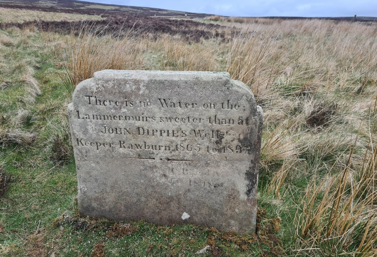
I was now walking across the most north-easterly of the Scottish Southern Uplands and I was enjoying myself immensely. I do feel that the SUW would be a better walk if it finished at Melrose for much of what remains seems almost an add on just to make it a coast-to-coast. However if it did end at Melrose I would have been denied over twelve miles of fine walking across the Lammermuir Hills. Beside a little farmland and just a touch of forestry, most of my morning was easy gradients and lovely heather moorland walking. It was certainly cool today but the rain stayed away and I had the trail to myself, yet again. Twin Law is the only top visited but the two large cairns on it can be seen for miles. I paused for photos but there isn’t much else to do there other than sign the log book kept in an ammo box in the alcove of the larger cairn. I had read that on a fine day the sea could be seen from here however it wasn’t a fine day and I couldn’t see the sea. That would have to wait until tomorrow. From there it was a steady descent to Watch Water Reservoir. As a bit of a purist I kept to the trail that follows a needless road route right round the reservoir though the map does show what appears to be a perfectly good moorland track to the south. I shall never know as I plodded the tarmac.


Longformacus had nothing to offer and I didn’t stop. The trail now moved into farmland, the Uplands were behind me and the quality of the trail declined substantially. I didn’t particularly enjoy much of the farmland paths that I followed in the afternoon. I had my mind on the end prize and there was little to admire for the remainder of my trail, or perhaps I had been spoiled by the days leading to this? I made few notes in my journal, but what there is, is revealing: “up to the turbines and steady climbing again through farmland. Some of the paths were crap ploughed fields and shoddy. Electric fences and crap stiles. Lovely forest path took me almost all the way to Abbey St. Bathans.” From there I followed the little riverside path through rhododendron choked woods and turned north out of the village, looking for a night-time halt. I somehow found a small flat spot amongst the trees on a pathside slope and enjoyed a final on trail evening meal of instant mash, sausage and cheese with the usual pints of tea. I fell asleep early with a tawny owl softly calling in the trees above my head.
Day eighteen (seventeen on trail)- Tuesday 3rd May
Abbey St. Bathans to Cockburnspath

I slept well despite overnight rain. I had set an alarm as I wanted an early finish in order to catch a bus south. I rose at 4.30 and drank my morning brew while packing. As usual on the final day, my emotions were a mix- quietly anticipative, pleased to be finishing, sad to be finishing, resentful to be finishing.
As to the trail, to quote again from my journal:
“too much indifferent farm crossings with usual awkward or annoying diversions round farm buildings. Some farms were OK, but others- no!”
One farm typified the early morning for me. So as to not disturb the farm dogs, the trail leaves a perfectly good path and took me into a cowfield, where I laboured through calf deep cow trodden mud. It was slow and difficult going and I got liberally covered with more mud than the previous two hundred miles. It took me twenty minutes to cross the field, almost losing my trail shoes off my feet, with a decent but forbidden path past the stead not twenty metres to my left, beyond the barbed wire. All the while, four caged dogs were going spare at me. When I finally extricated myself from the field and was back on to a decent path, I could still hear them going crazy a half mile further on.


There was one final stretch to the coast that helped redeem this final day. Having crossed the A1 and railway, the trail moves into a final strip of woodland. Some might cry in anguish at yet another bit of forestry but I really enjoyed the solitude through this quiet and long stretch that led me all the way to the coast, saving the unveiling of the sea until almost the final moment. I met no-one and was frequently accompanied by woodpeckers and tits in the tree tops. Squirrels bounced down the trail in front of me and a couple of deer silently crept off the path and watched me as I passed them.
After a final hurrah of ups and downs on far too many steps, I was spat out onto a road with a caravan park opposite. I looked at the time, it was a little after eight so I walked into the entrance. As luck would have it, a camp shop was just opening and they did bacon and sausage rolls. I ordered one of each and a tea and devoured them on the picnic bench outside. A succession of old boys and old dears , each with attendant small dog visited the shop, leaving with their newspapers, pints of milk and bakery items. Each would say “good morning” as they passed me on the way in, “good morning” on the way out, each pointedly ignoring my mud-bedaubed attire. Possibly not that unusual a sight.
From there it was up onto the cliffs for a final section of coastal walking. The trail doesn’t descend to the sea but of course this has to be done, if only to wash the mud from my shoes. I took the little tarmac path that goes down to Cove Harbour, through the little cliff tunnel, and out on to the low tide exposed sand. There to dip my toes in the North Sea and return back through the tunnel, back up the cliff and a short one mile walk inland to the end of trail at the market cross in Cockburnspath. I posed for my end of trail photos, though I couldn’t hear myself think with contractors on the other side of the road slicing up bricks with a Stihl saw.
My early start to the day had paid off and my end of trail photo at the village cross was taken at 11.35. This left me plenty of time to walk back through the village to the bus shelter. An hour later I was on the bus to Berwick upon Tweed where I had booked a room at the Youth Hostel.
I had a room to myself and enjoyed a decent shower and scrub before changing into my set of lightweight town clothes, carried across Scotland and worn on my train journey up, at Wanlockhead, Moffat and Melrose. Sheer unnecessary weight for many I am sure but I am more than happy to carry my 185g Patagonia Joggers and 118g Rohan SS shirt for such duty and they accompany me on most longer walks. My hiking clothes were sealed in a dry bag deep within the pack until disgorged at home.

Soon after arriving in Berwick I was enjoying fish and chips (properly fried in dripping) at the Corvi Fish Restaurant followed by superb pints of beer in The Curfew micropub just across the street from the hostel. My evening meal was a very poor pizza delivered to the YHA door. A 10.12 train the following morning (4th May) deposited me back in London mid-afternoon for a final hour long train ride back to my home town in North Kent- job done.
So, how would I rate the Southern Upland Way? Easy, the very great majority of it is superb. There is a fair amount of road walking but almost all of that is on quiet farm tracks that see very little traffic. There is also quite a lot of forestry walking but even that is often enjoyable, or at the very least tolerable. I enjoyed most of my woodland walking though paths could be difficult at times. The first half of the trail had a lot of boggy moorland walking, the second half had far drier paths. None of the tops are that high, but there are some decent climbs, and not all are gentle, nor the descents. There are no summits over 3000 feet (914 metres) but over 80 are over 2000 feet (610 metres).
While many walk from accommodation to accommodation, the trail suits the self-contained traveller. For someone walking like I did and combining camping with bothy life, the logistics of food need to be seriously considered as for the first half there are few opportunities for resupply. Many parts of the Southern Uplands are pretty isolated and life could get pretty difficult for the unprepared. I took my time on this trail. This was due to a number of reasons not least that I got food poisoning midway. I had also wanted to take my time and enjoy the trail as much as I could and had planned accordingly. I took eighteen days from Portpatrick to Cockburnspath, including a day off in Moffat. My seventeen days on the trail itself included many short or half days and many of my shorter day sections could be joined with another for a longer day walk. As a trail, the Southern Upland Way is thoroughly recommended.
Three Points of the Compass has written a little on some of the other longer trails walked, links for these are here.

Enjoyed the walk. With you every step of the way.
Bruce
(ex BPM&A volunteer)
LikeLiked by 1 person
Thanks Bruce
LikeLike
Congratulations on completing the Way. I particularly love your straight-talking descriptions and nuggets of detail on kit, food, organisation, etc. All very useful and inspirational.
My wife and I made our own coast-to-coast trip in April (overlapping in time with the start of your walk); Offa’s Dyke Path in perfect weather. In the absence of a blog about the ODP by either you or Rambling Man we found the Youtube videos “What’s on Offa?” helpful. Quality blogs for the long-distance walker are a lot of effort (hence why I’ve never done one) so thanks once again for all your work!
P.S. I suppose one could divert onto St Cuthbert’s Way at Melrose (and reach the coast further south at Lindisfarne) to avoid the less rewarding final section of the SUW. Depends how much of a completist one wants to be.
LikeLiked by 1 person
Thanks for commenting Peter, pleased you are getting something from my ramblings. I really enjoyed Offas Dyke Path when I backpacked it as part of a longer hike in 2018. You are correct, I never did a dedicated blog on that. As you say, blogs can take a bit of time to produce and that was one of many longer paths that I never bothered producing content for. There is a short film I made at the highest point of Offas Dyke on this page.
As to St Cuthbert’s Way, that particular path is on my ‘to do’ list, if I ever get round to it…
LikeLike
Well done Jools. Love your final video; you look so pleased. Pebble thrown, done!
LikeLiked by 1 person
Thanks Jen
LikeLike
It worth paying some attention to farm animals, as you did, as one of the times I have seen tents damaged was by someone leaving a gate open and a herd of sheep trampled our tents. Full sized tents so it was really weird as it was almost like they could not see them or pushed each other into them.
Brilliant blog as always so need to get fitter and get out there more…
LikeLike
I am not normally too bothered by sheep being around when I camp, though I have had a lamb chew and damage a small microfibre towel hanging to dry outside my shelter once. Cows are another matter entirely as they like to rub up against things and can trample a shelter (and occupant) badly. Lambing time is something different however. Sheep frequently heft to a particular place in a field or on a hillside, and lambs will feed near their mothers. The last thing I want to be doing is unintentionally (or even intentionally) moving a ewe and new lamb from ‘their’ spot. I do not want to cause distress to what may be a quite young animal. My hike on the Southern Upland Way coincided with the birth of many young lambs, some being born moments before I turned up. I was quite upset at one point when I happily marched down a lovely gorse lined hillside path and came across a ewe giving birth who had obviously found a quiet spot for her labours, who then had to try and move away when I came merrily bowling along. I wasn’t previously aware of her and there was nothing I could do other than get out of the area promptly and leave her alone. However looking for an evening pitch is different, I then have opportunity to give due regard to the health and wellbeing of livestock and stay clear of lambing ewes, giving wide berth, as we all should do
LikeLiked by 1 person
Did a walk from Buxton to Flash at the weekend and we saw at least 4 or 5 dead lambs it was distressing to say the least.
LikeLike