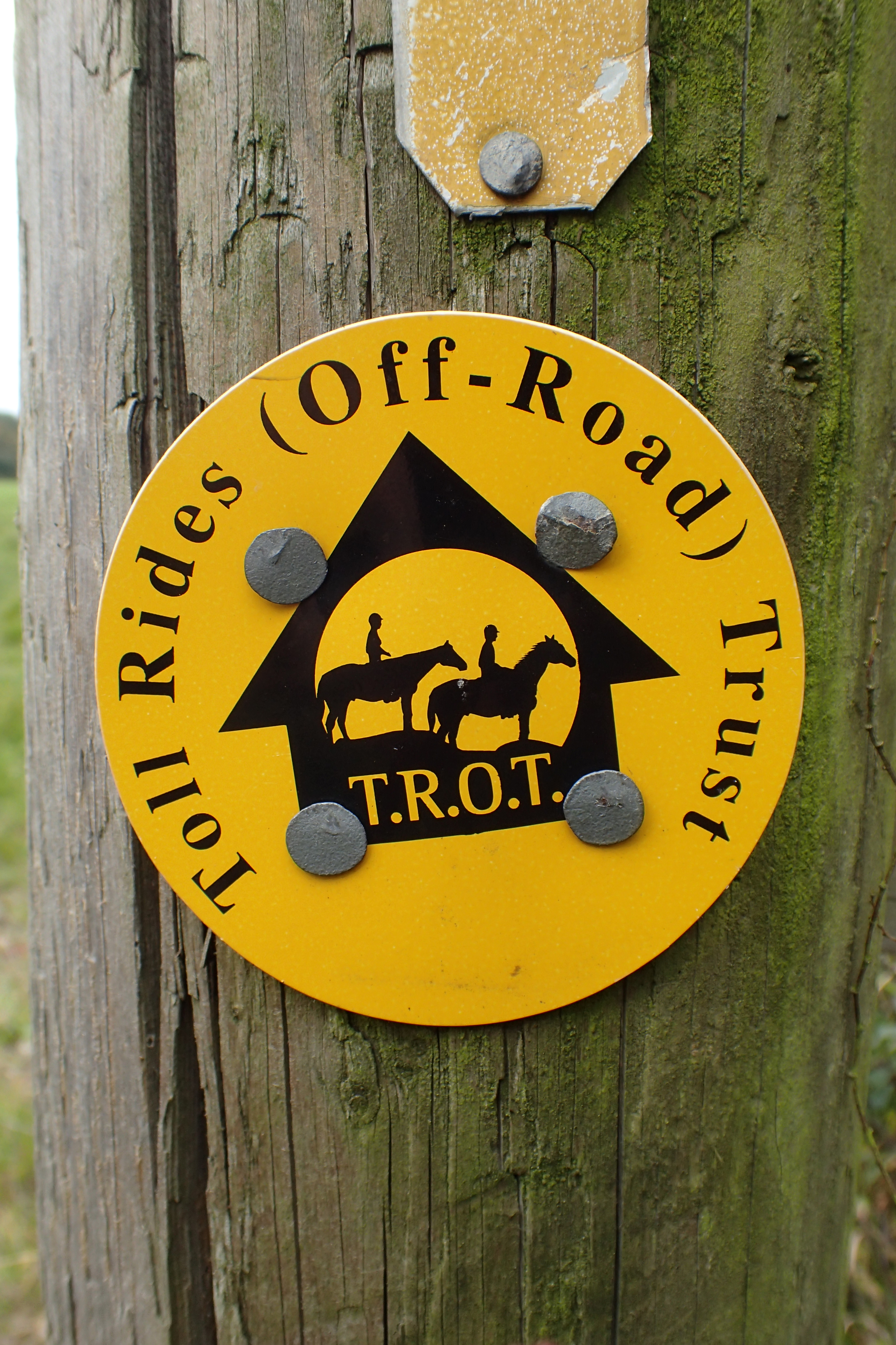
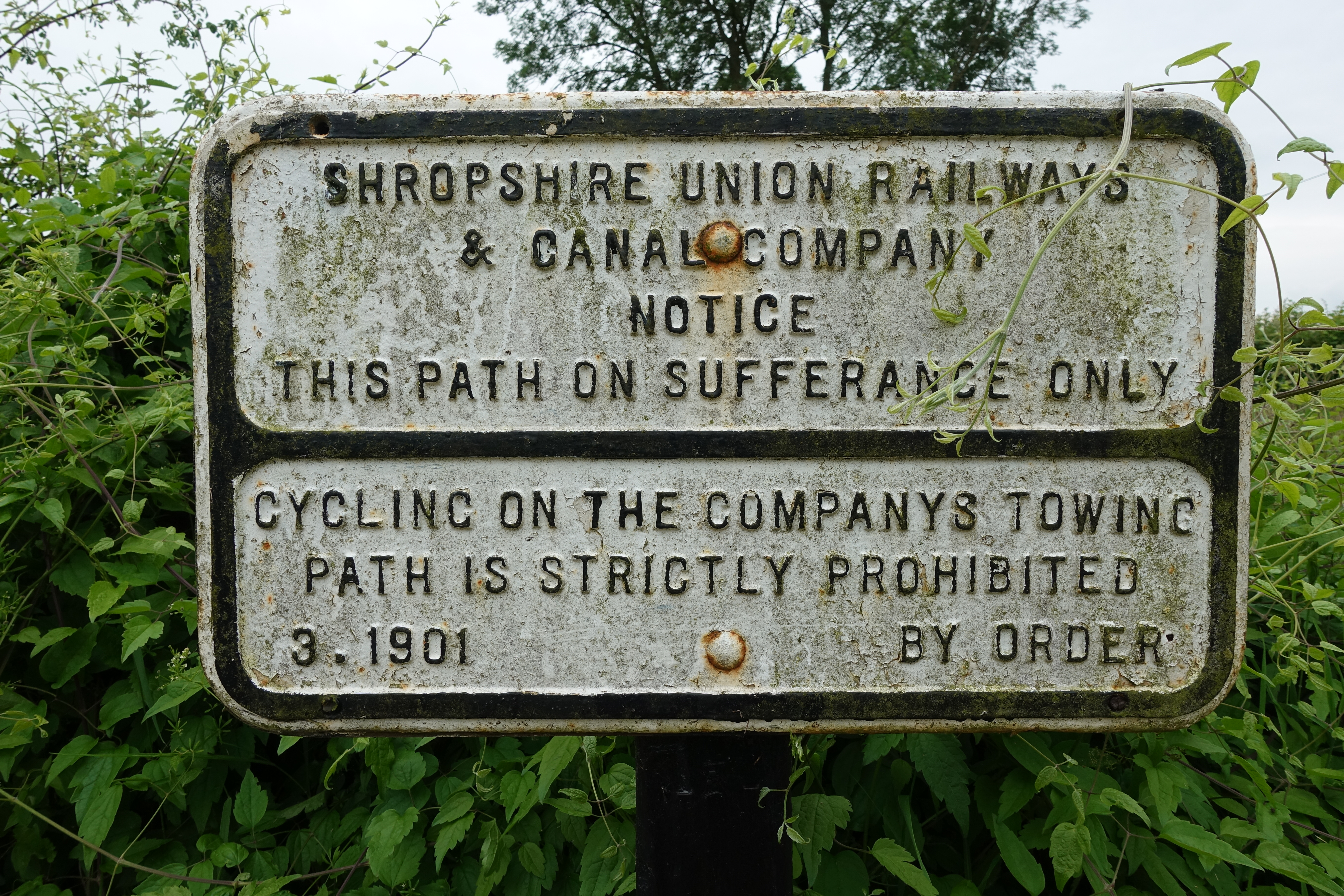
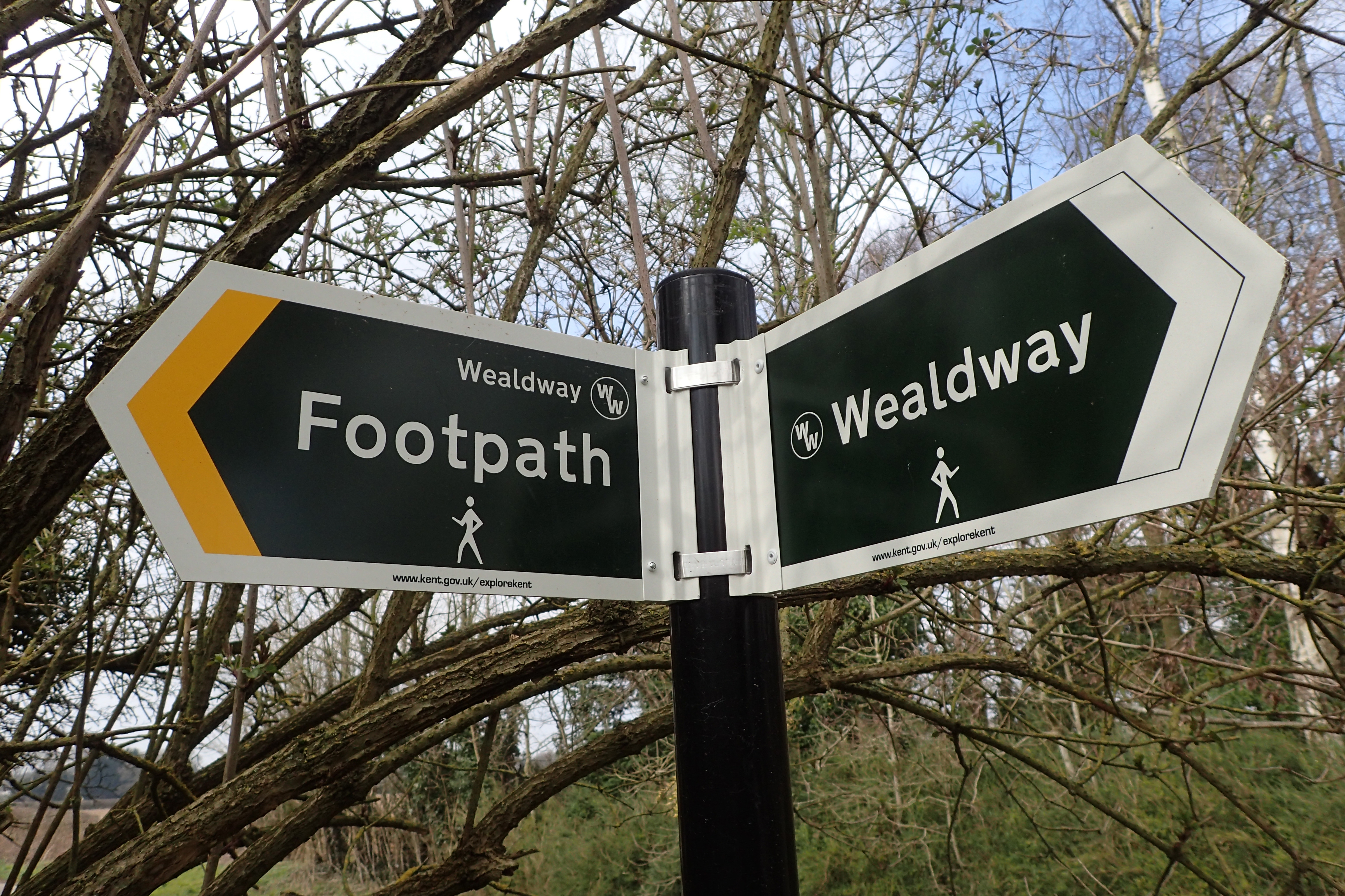
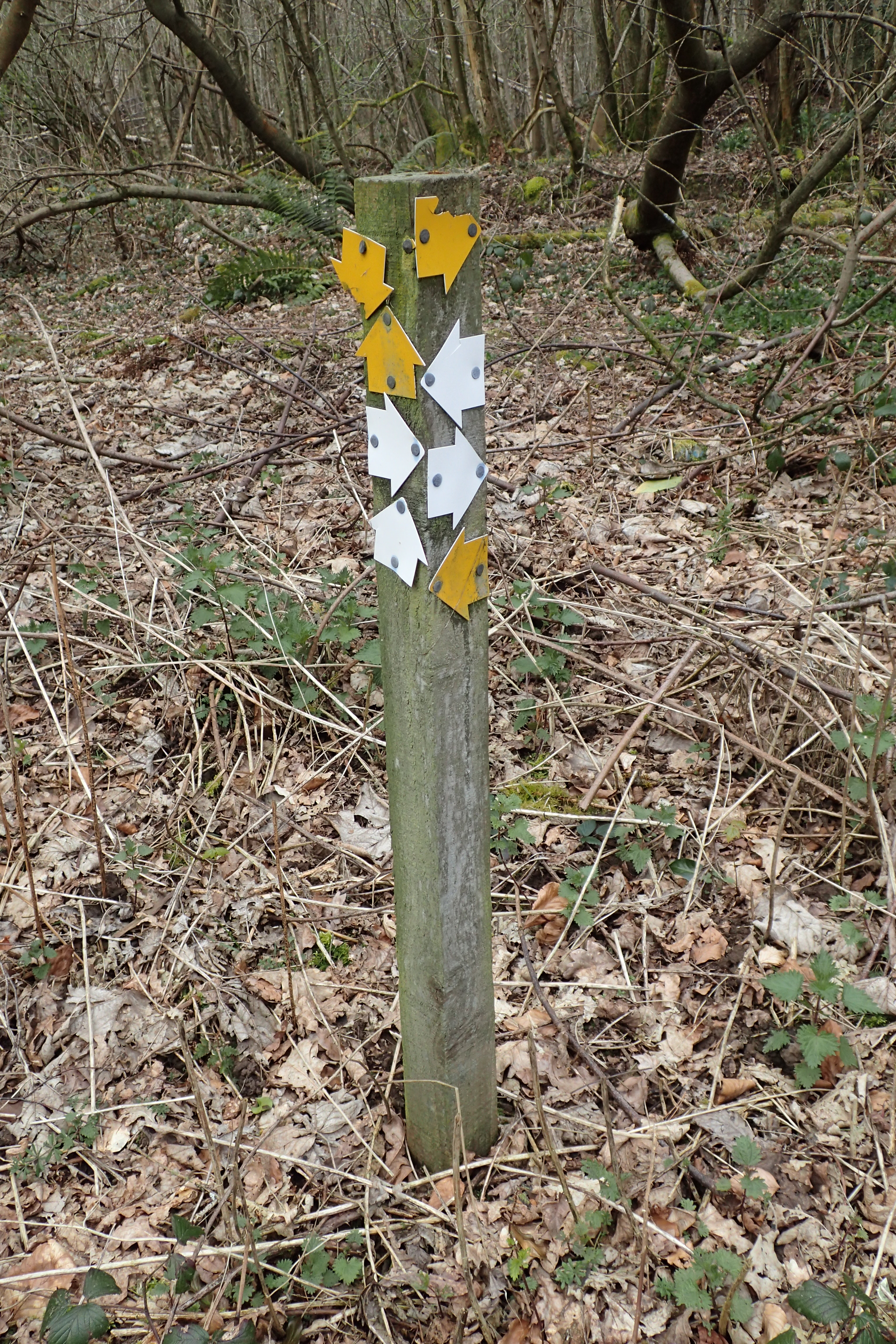
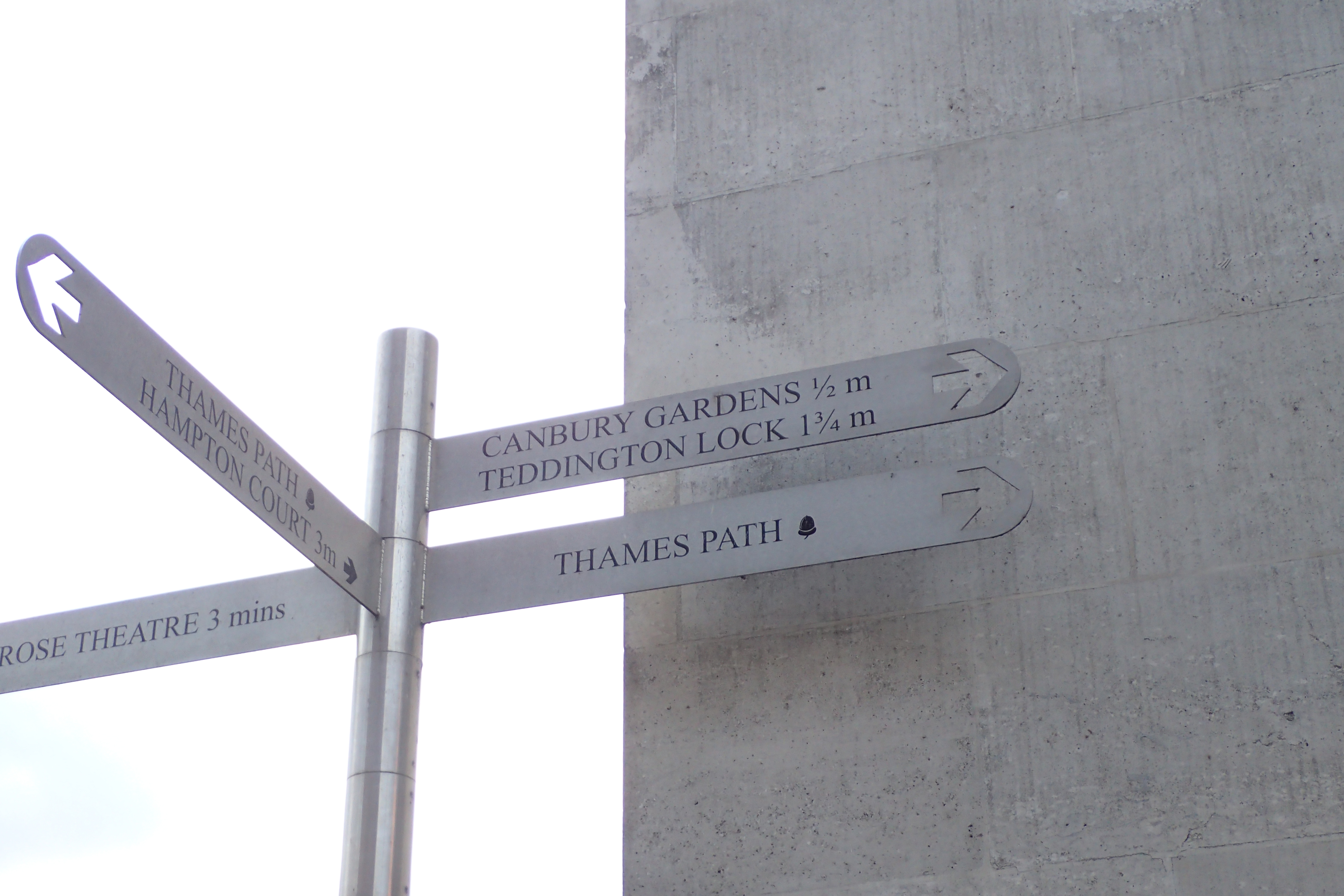
Signs from the trail…
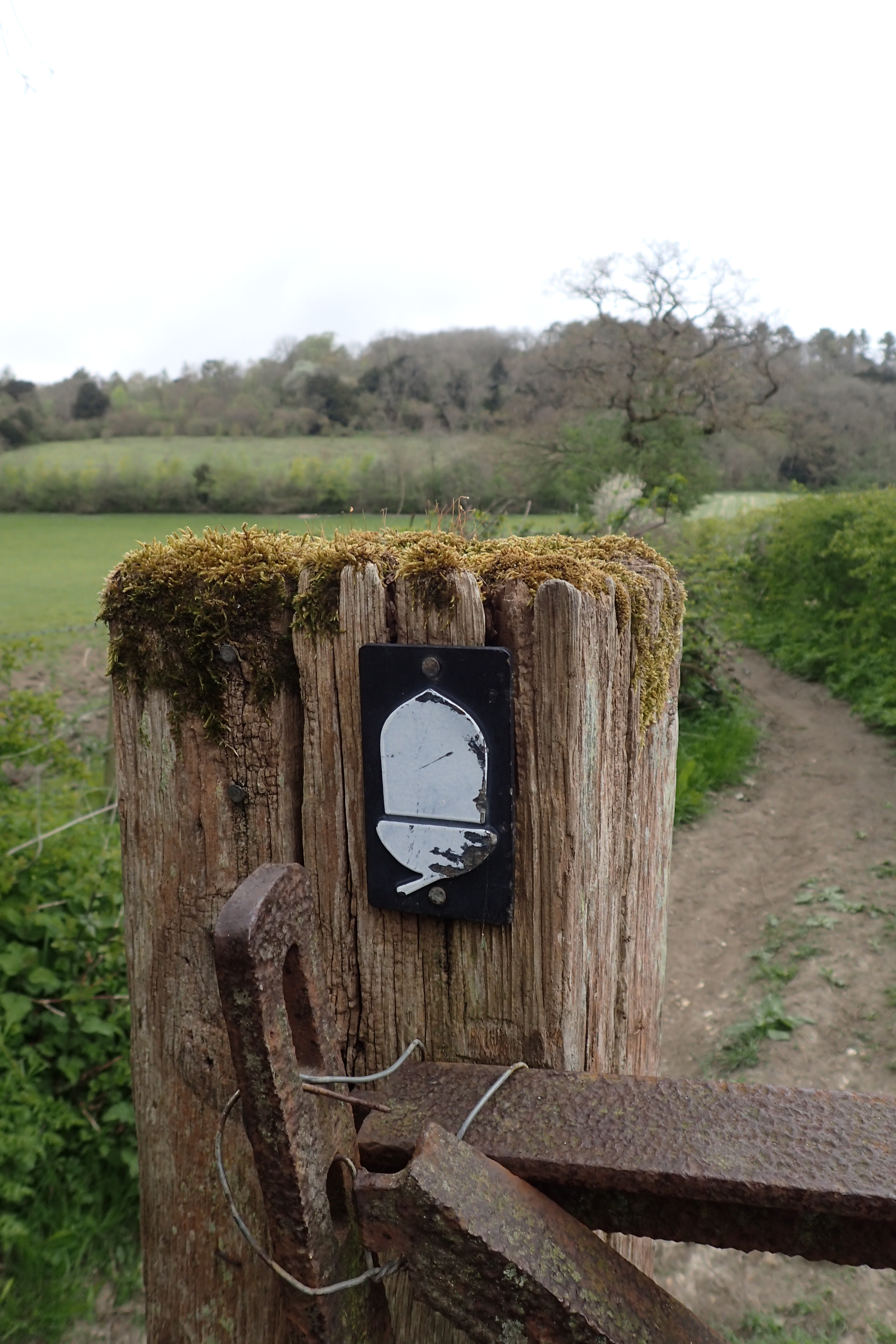
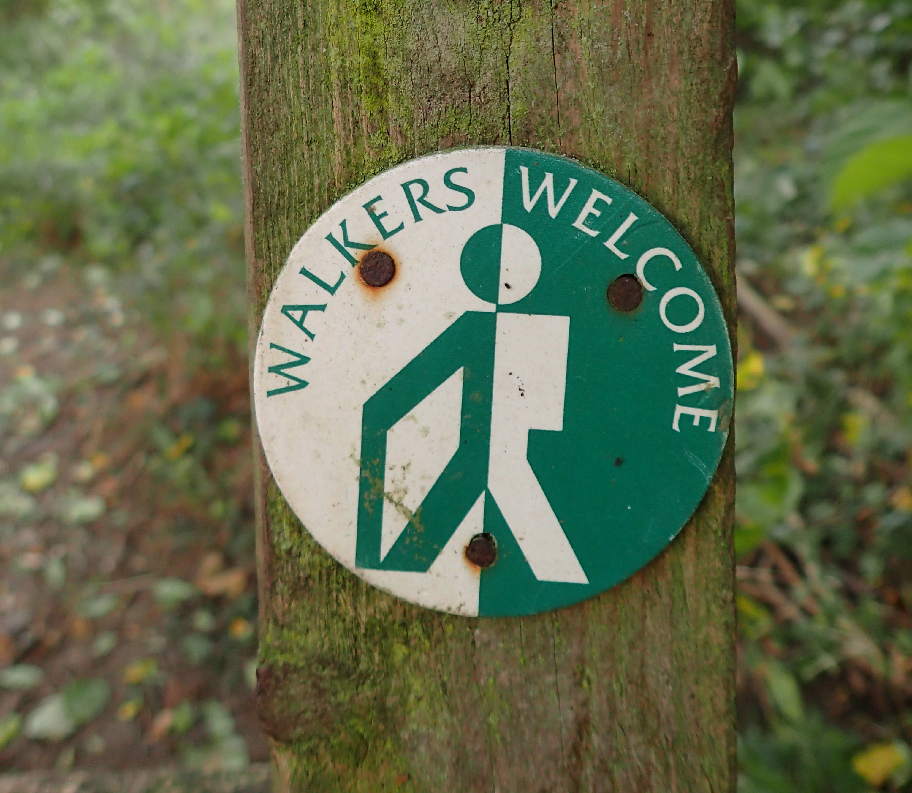
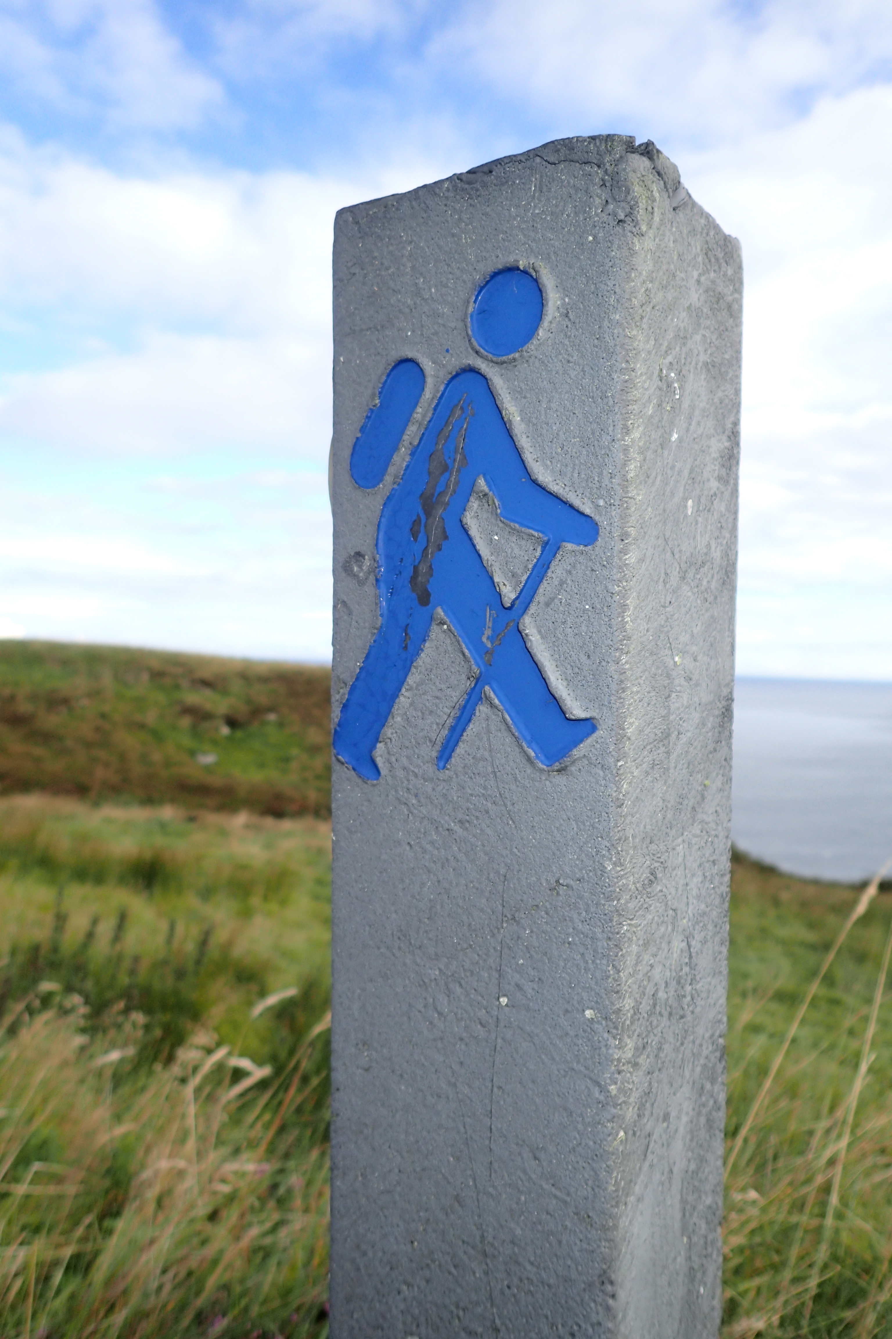
The National Trails Acorn- A standard waymark was adopted for the National Trails in England and Wales. A simple and iconic design, and very welcome when in doubt of the route.
“In a nutshell, it is a symbol of quality and value”
Quote from- Sheila Talbot, Lead Advisor, National Trails, Statutory Access Team, Natural England
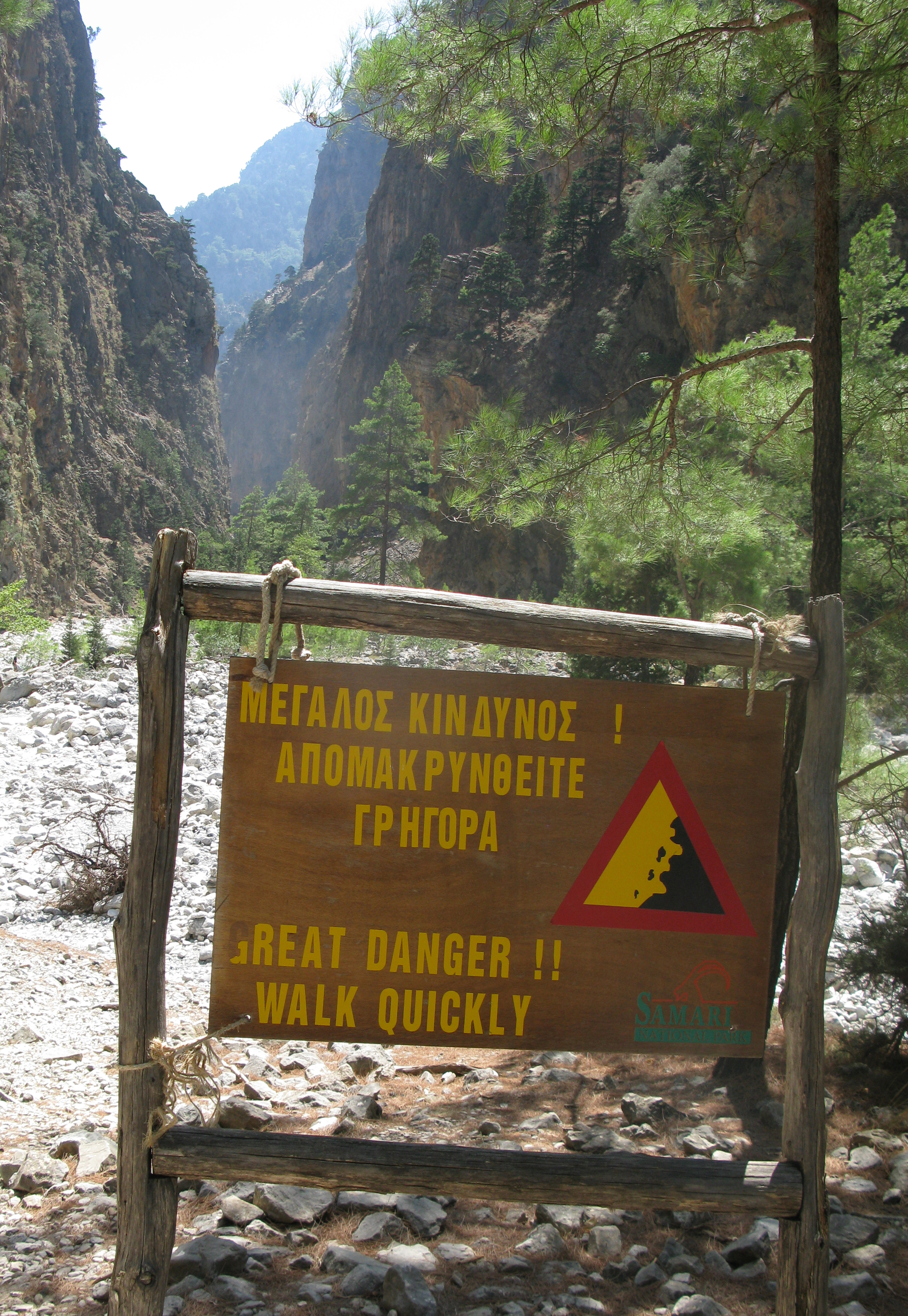
Samariá Gorge. National Park of Greece on Crete. A World Biosphere Reserve. The gorge is 16km long and the route through it descends from 1250m to the Libyan Sea. Rock falls are a frequent occurrence in the gorge
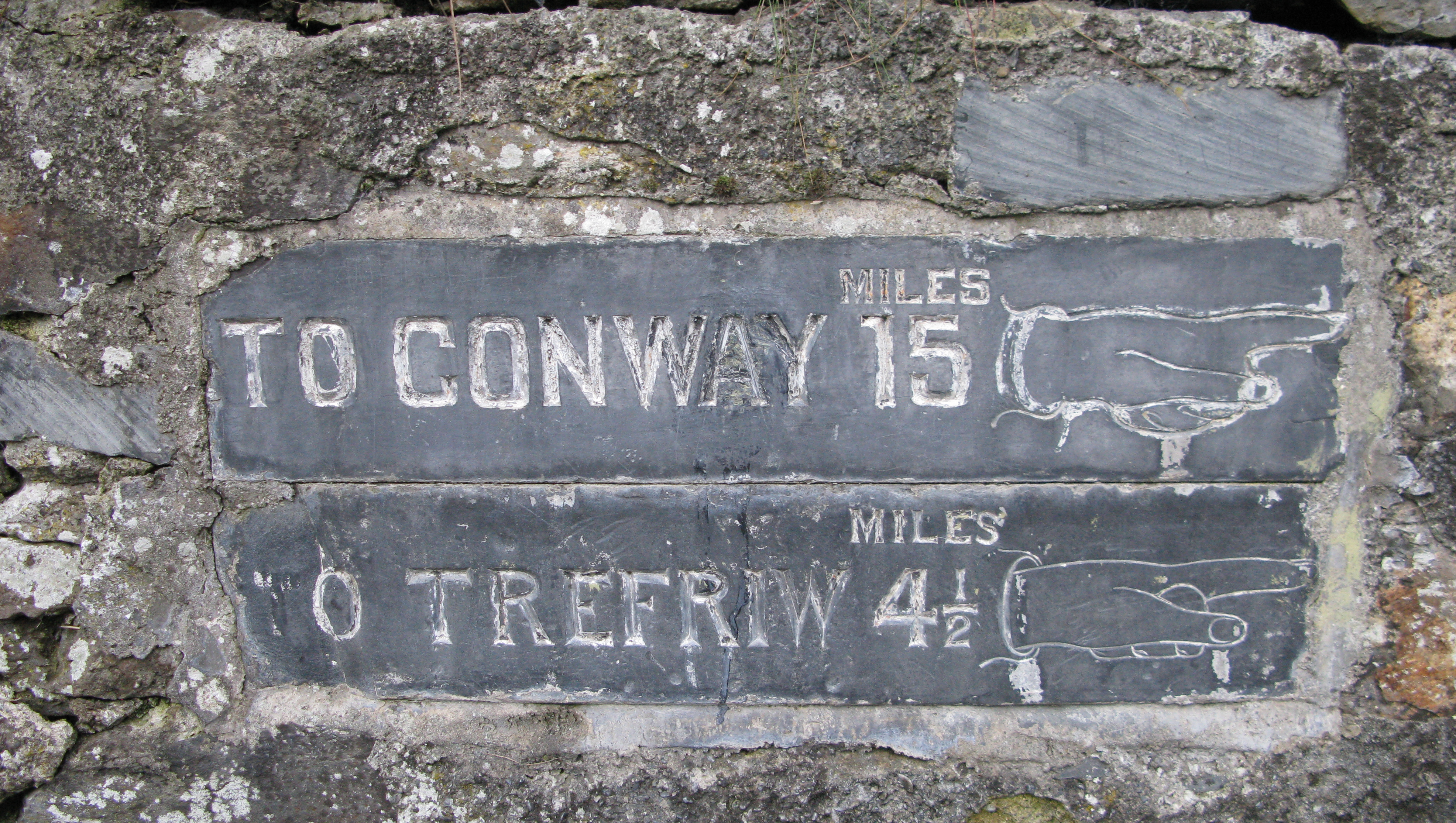
Etched slate milestone embedded in stone wall in Betws-y-Coed. Translated as ‘prayer house in the woods’, this pretty village in Carnarvon, Wales is built almost entirely from stone quarried from nearby slate quarries. Thousands of hikers visit every year before making their way up into the hills of Snowdonia National Park
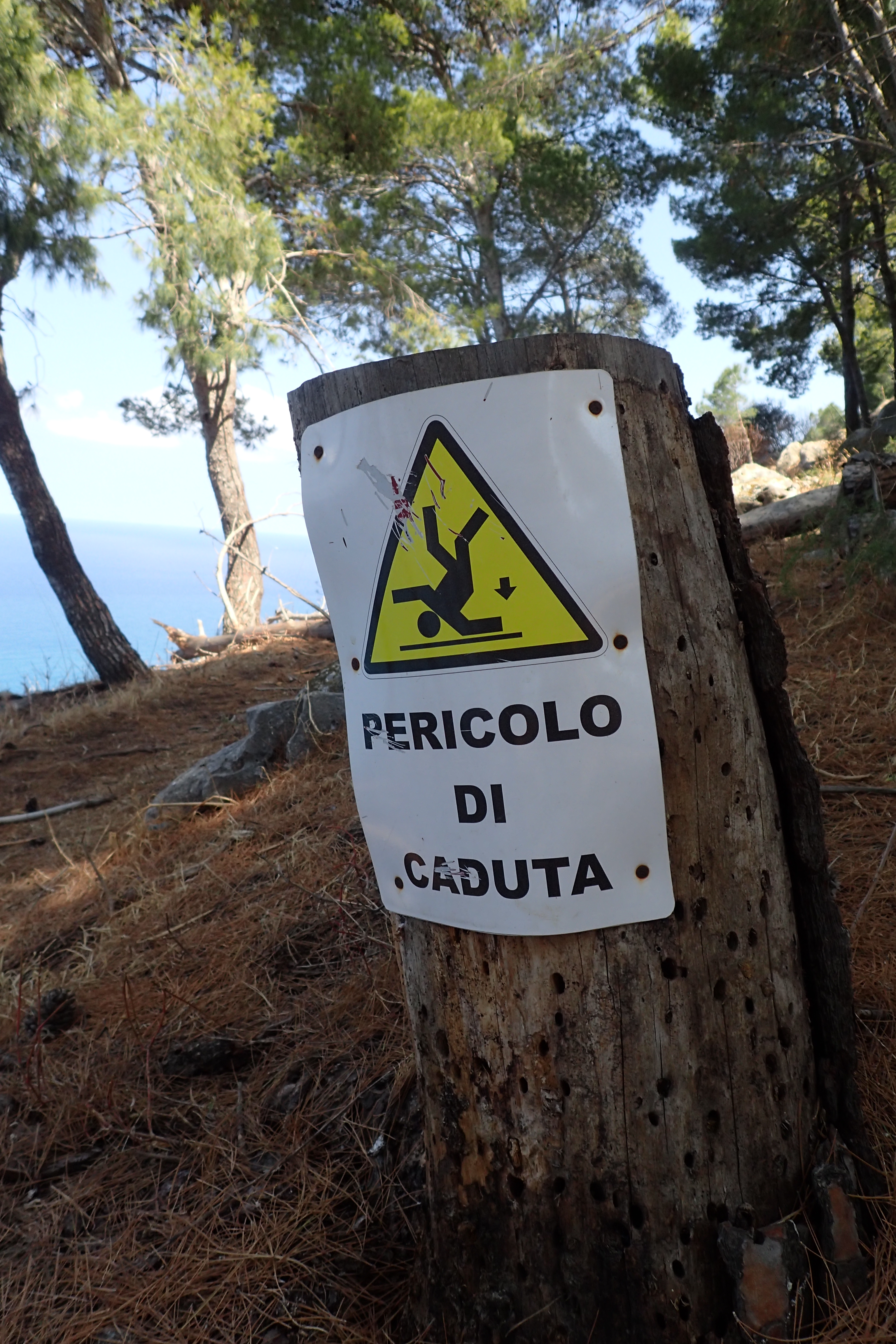
‘Pericolo di caduta’- Danger of Falling
La Rocca di Cefalù , Sicily
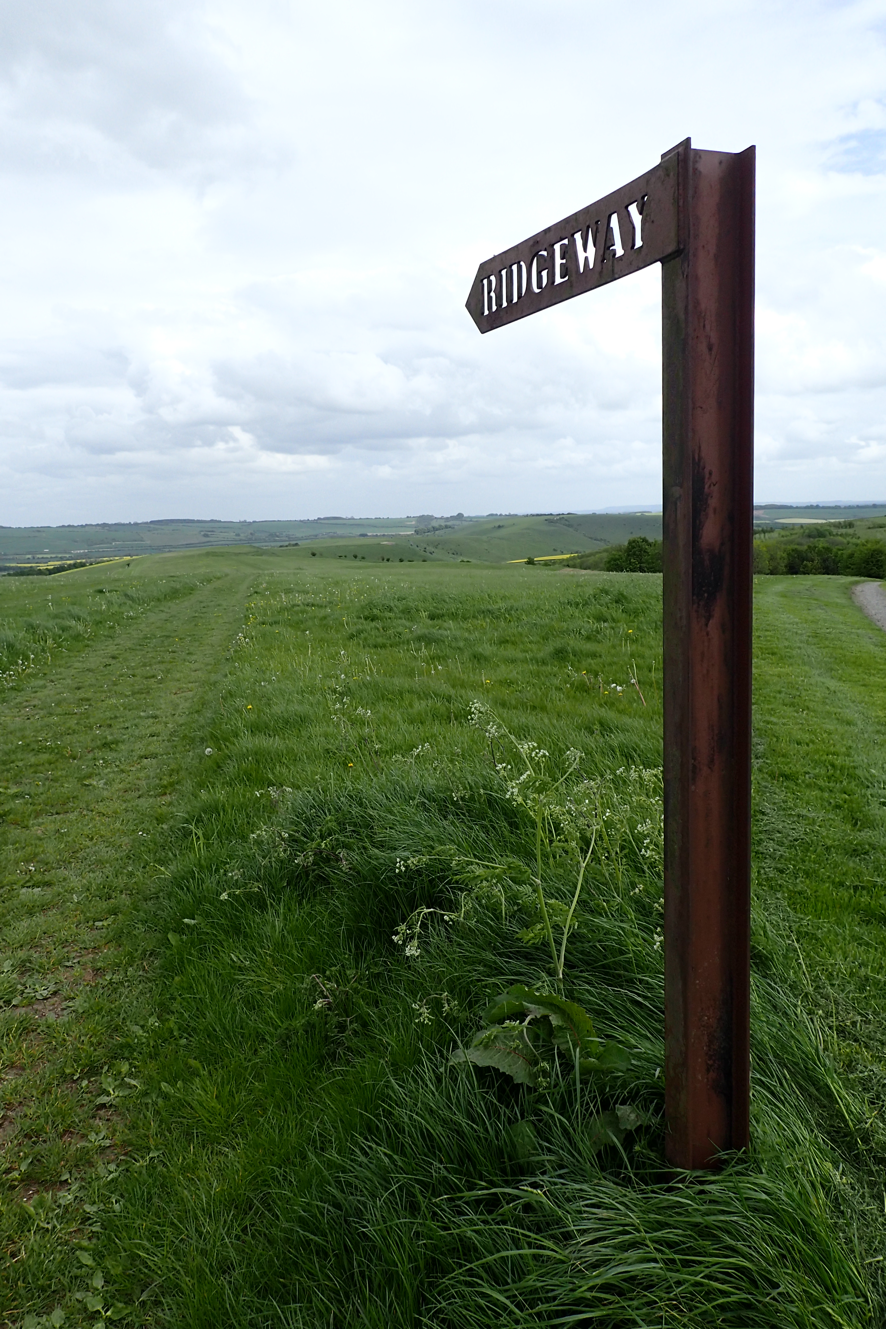
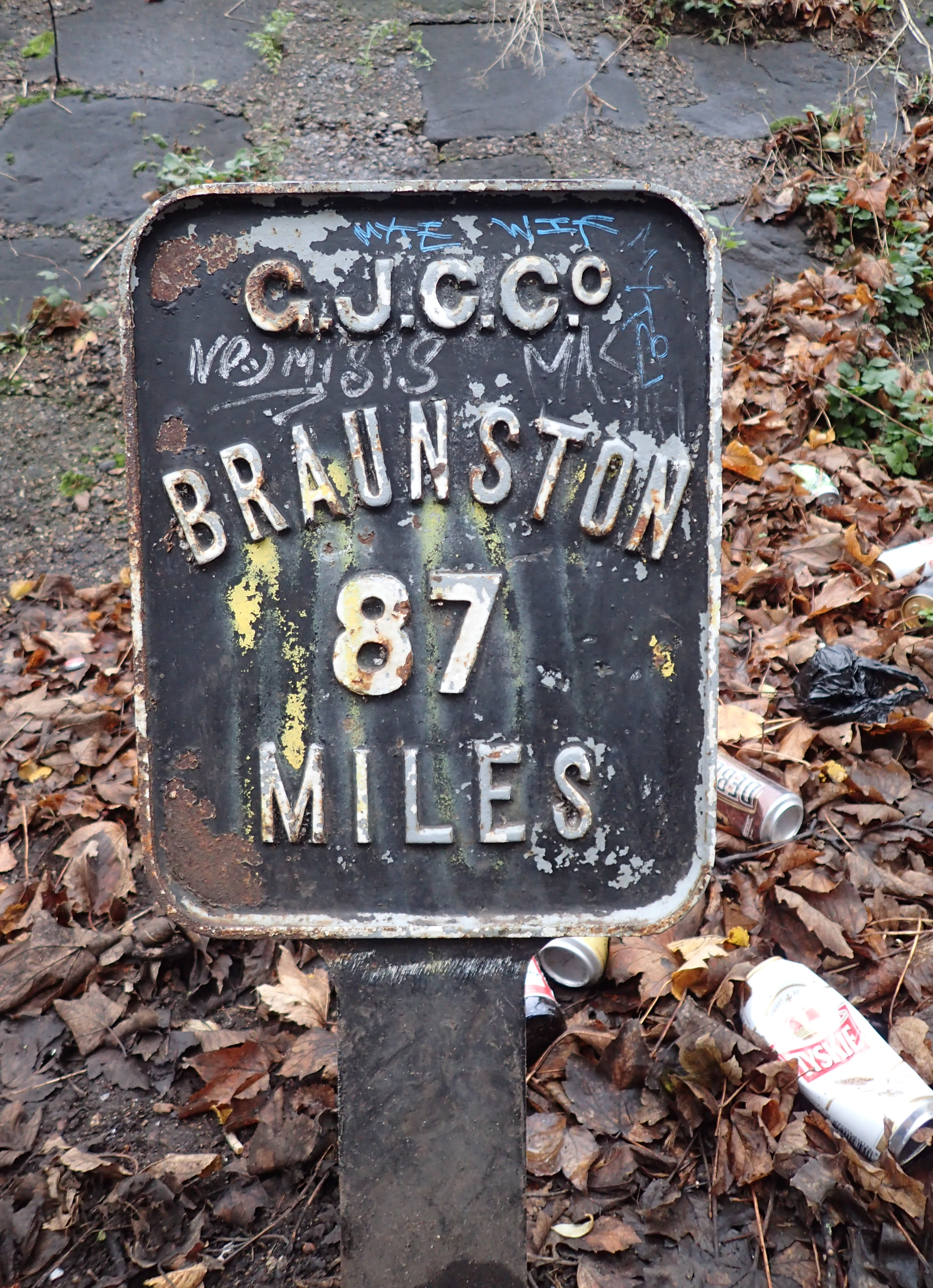
Probably one of the most photographed signs on any UK National Trail. Smeathe’s Ridge stretches out across the grassy slopes toward Ogbourne St. George
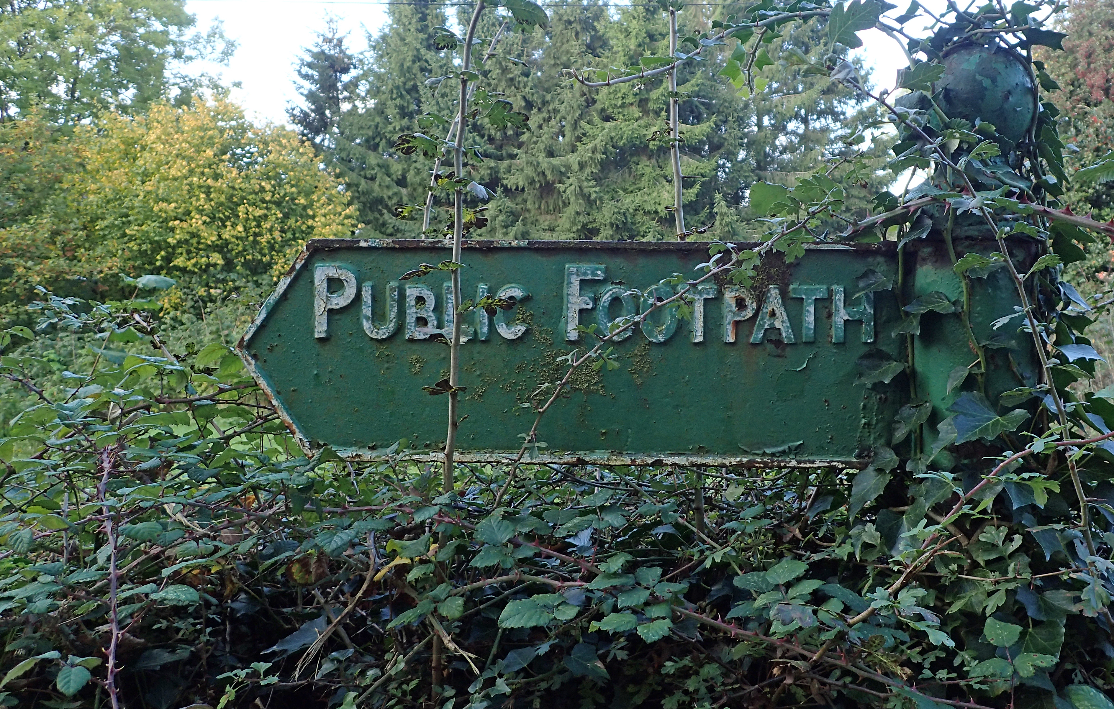
This 87 mile path runs along the escarpment of the Berkshire and Wiltshire Downs, a route used from about 2,000 BC. It passes through two Areas of Outstanding Natural Beauty; the North Wessex Downs and the Chiltern Hills.
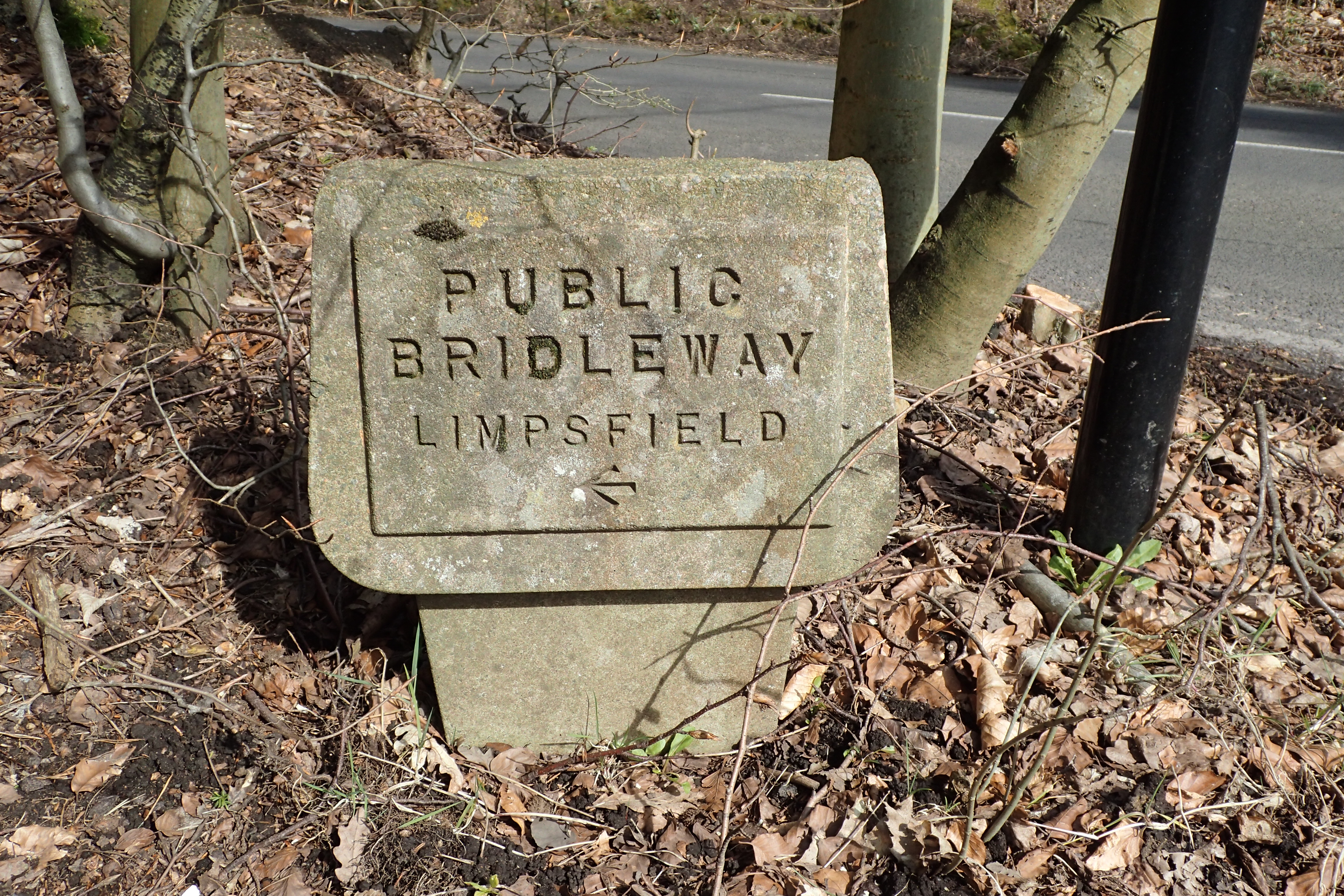
One of the older Public Footpath signs surviving in the Chilterns Area of Outstanding Natural Beauty
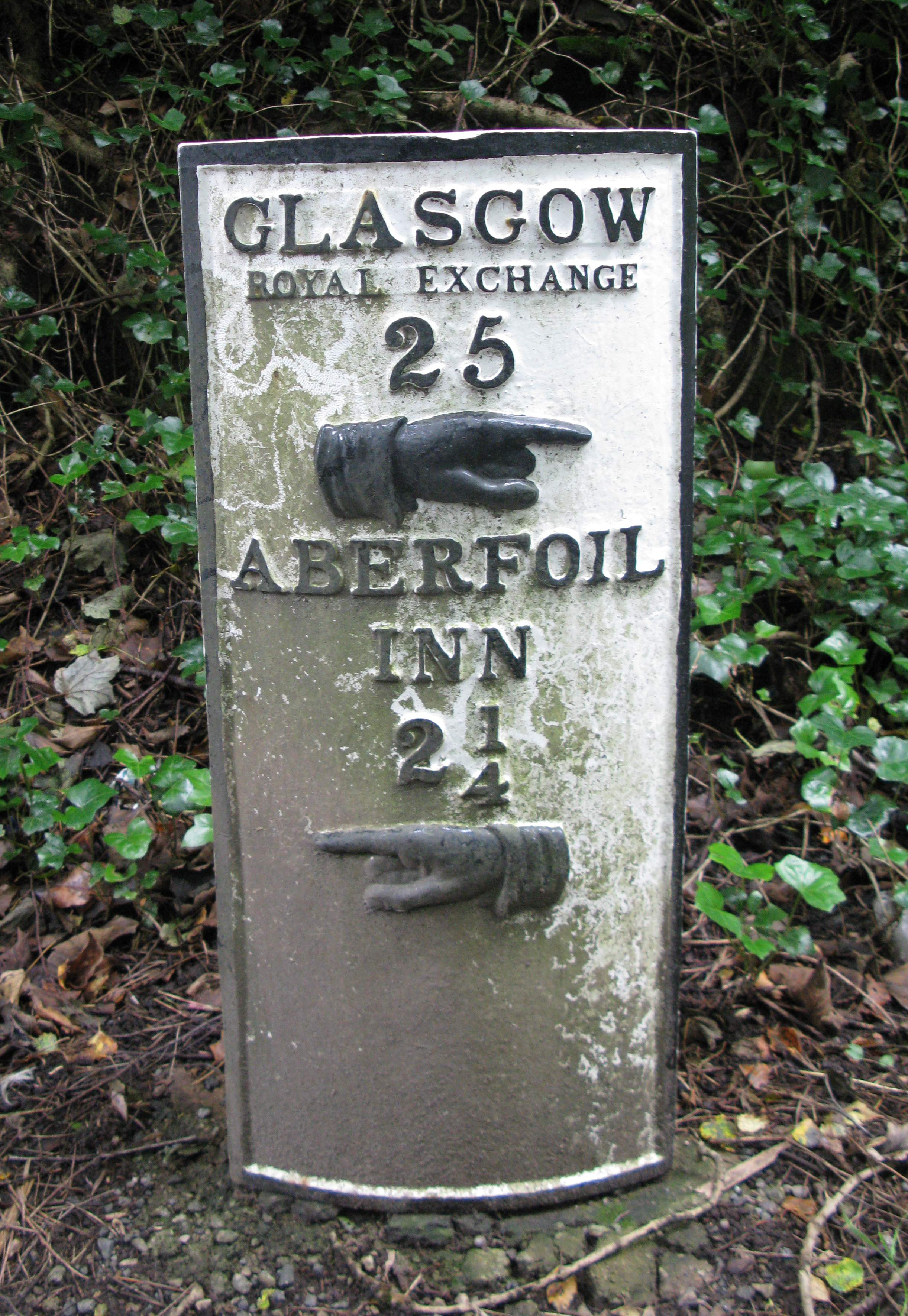
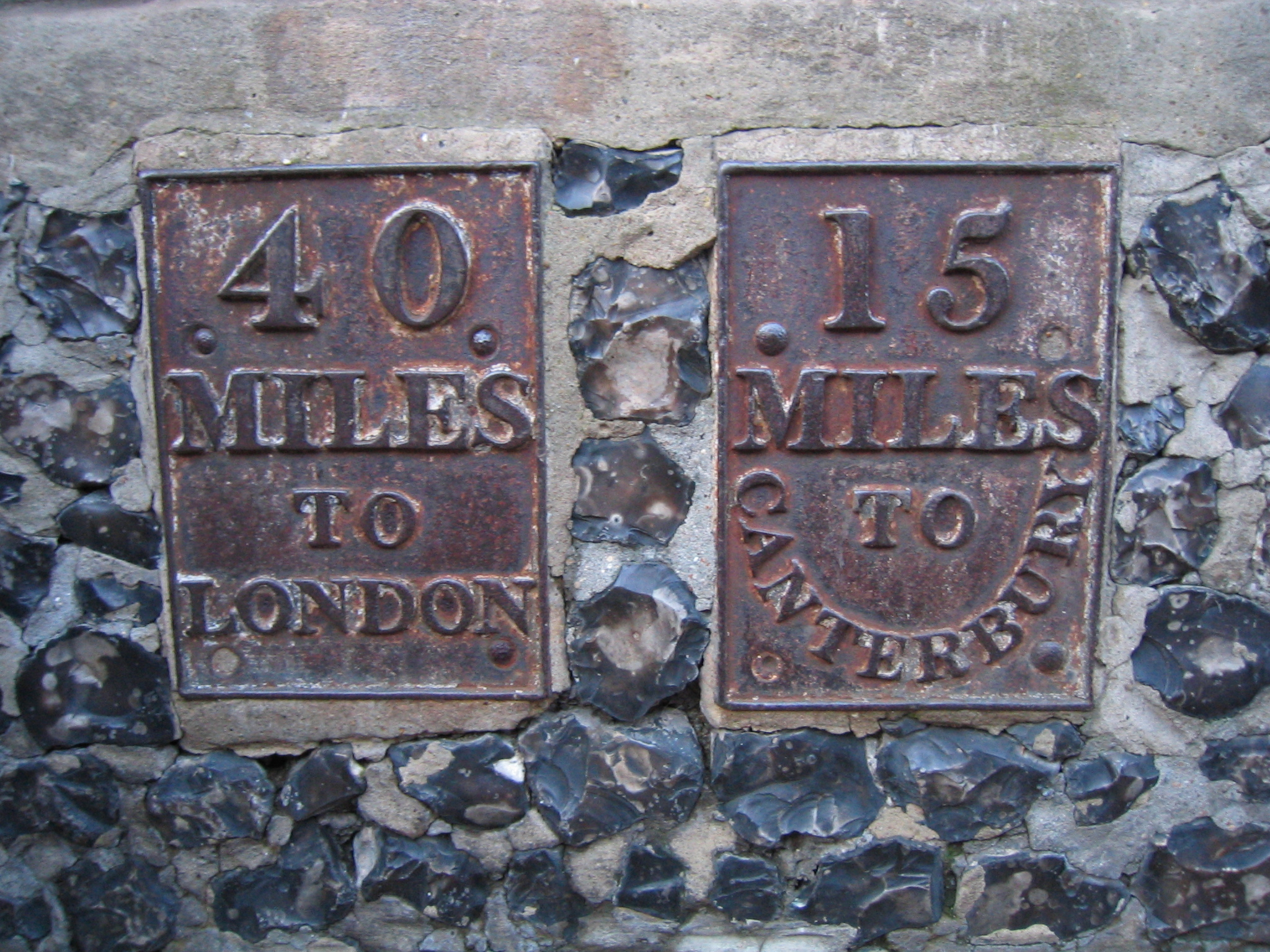
While the Romans introduced measured distance markers to Britain in 55 BC, most surviving milestones are much younger. The majority date from after the development of the roads that followed effective mapping in the seventeenth century. Many Turnpike trusts were formed (from 1663) to manage the condition of deteriorating roads and in 1766 it became compulsory for the trusts to mark every mile. Design and material used for milestones varied. In 1878, highways in Scotland became the responsibility of the newly formed county councils, as did the milestones on their roads. This cast iron milestone on the A81 indicates the distance to the Aberfoil Inn and Glasgow’s Royal Exchange
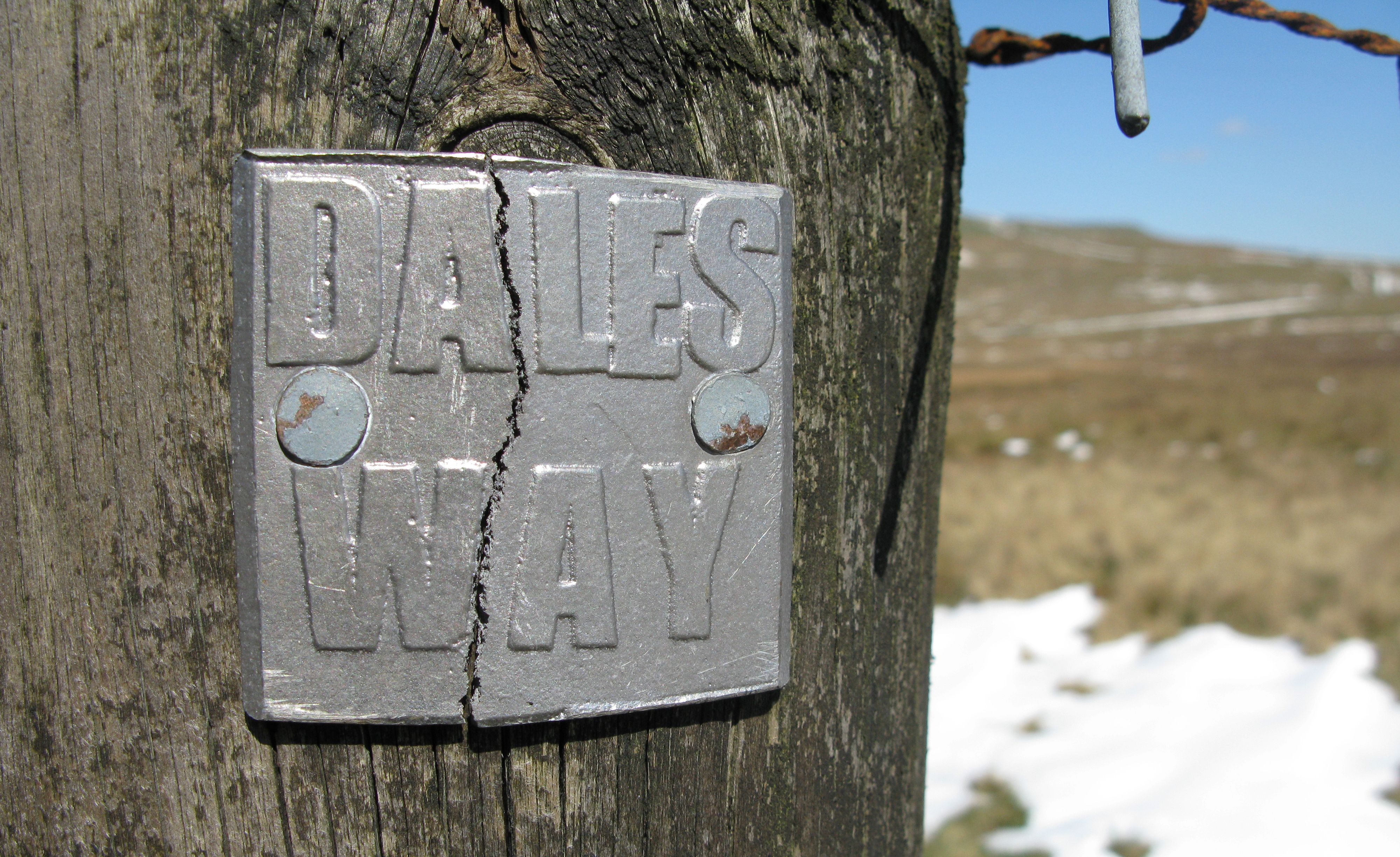
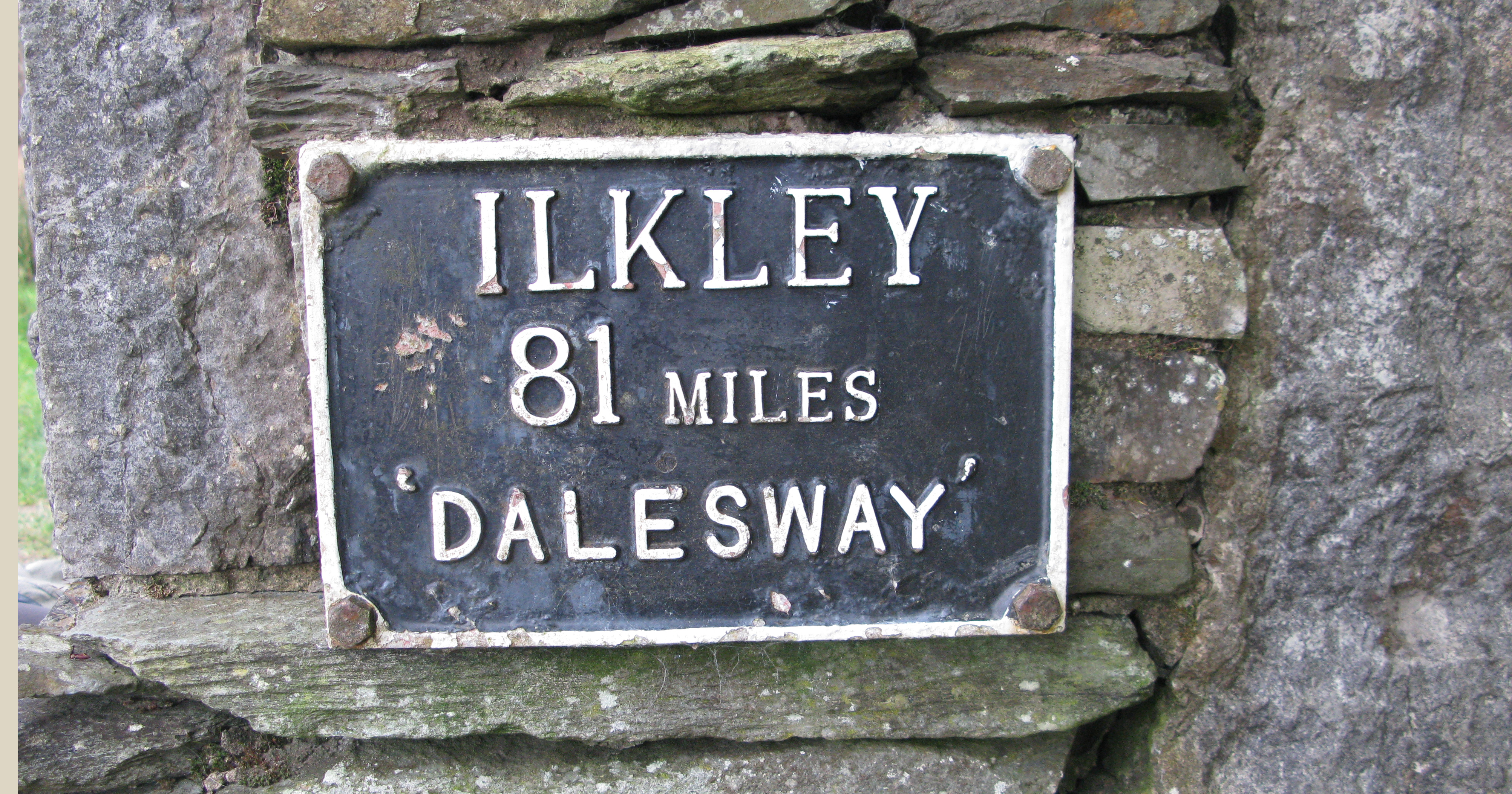
The Dales Way- 78 miles running from Ilkley, through the Yorkshire Dales to Bowness on Windermere on the edge of the Lake District. Running through Wharfedale, into the beautiful Dentdale and onward to Sedburgh, this is a gentle and very pretty route
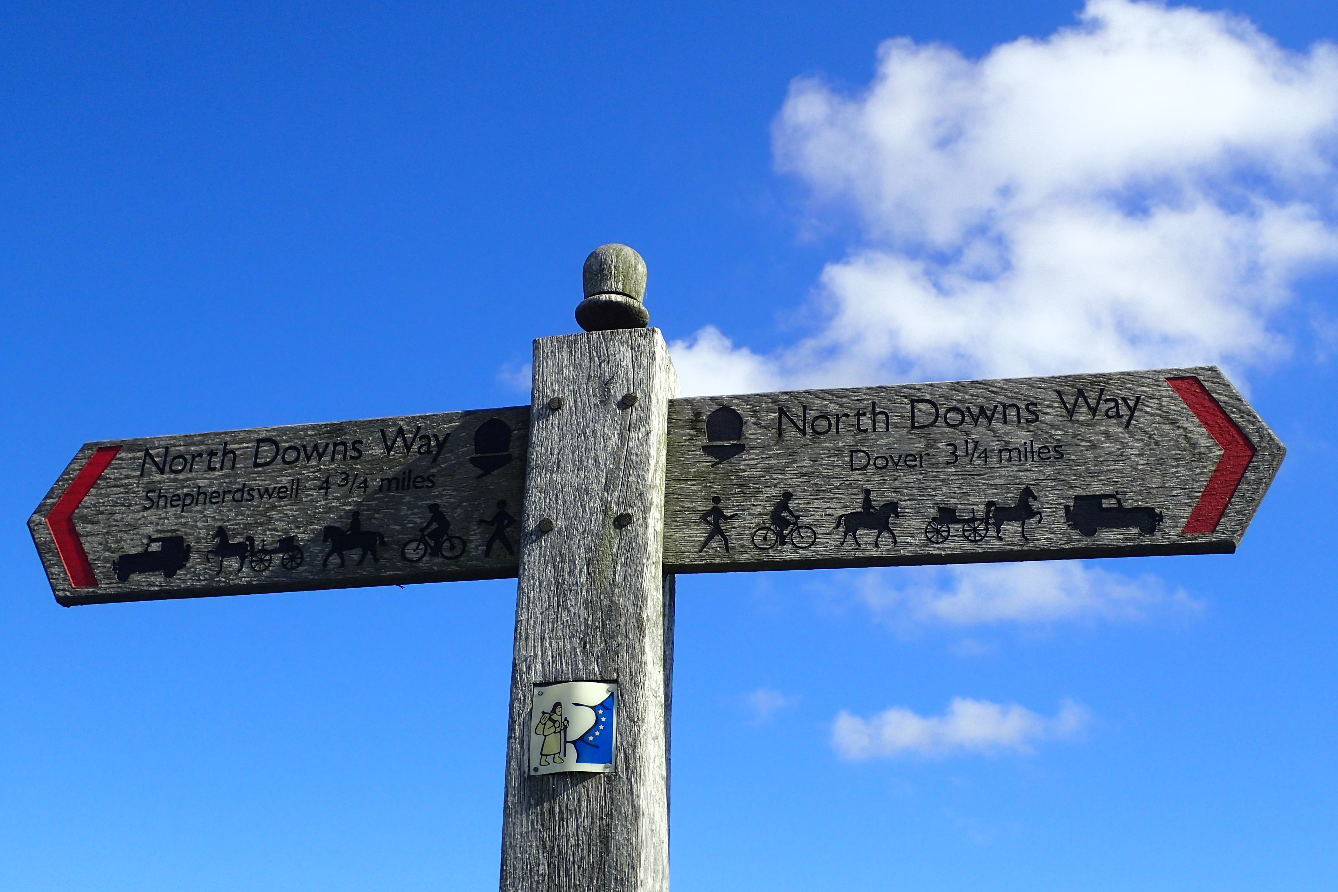
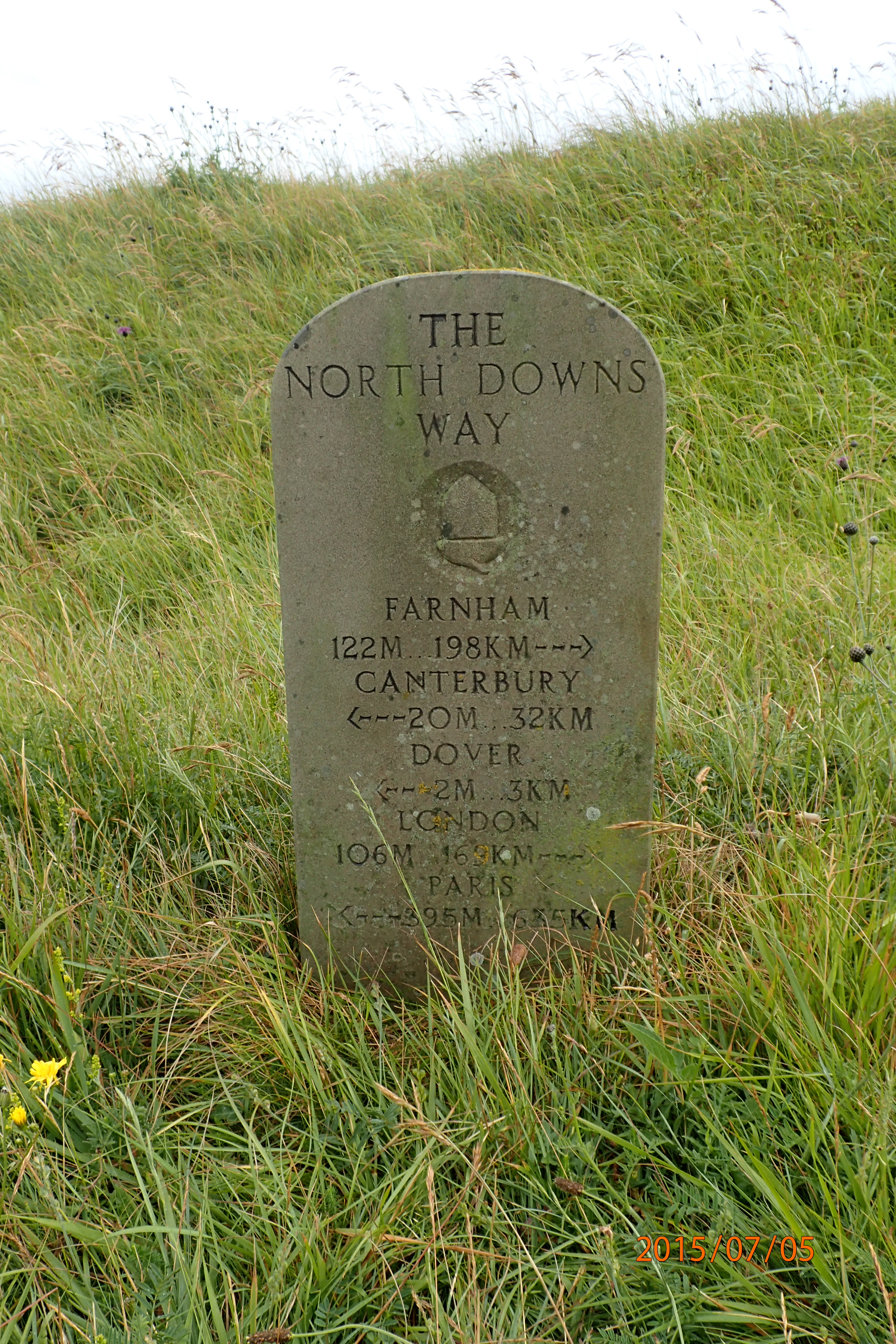
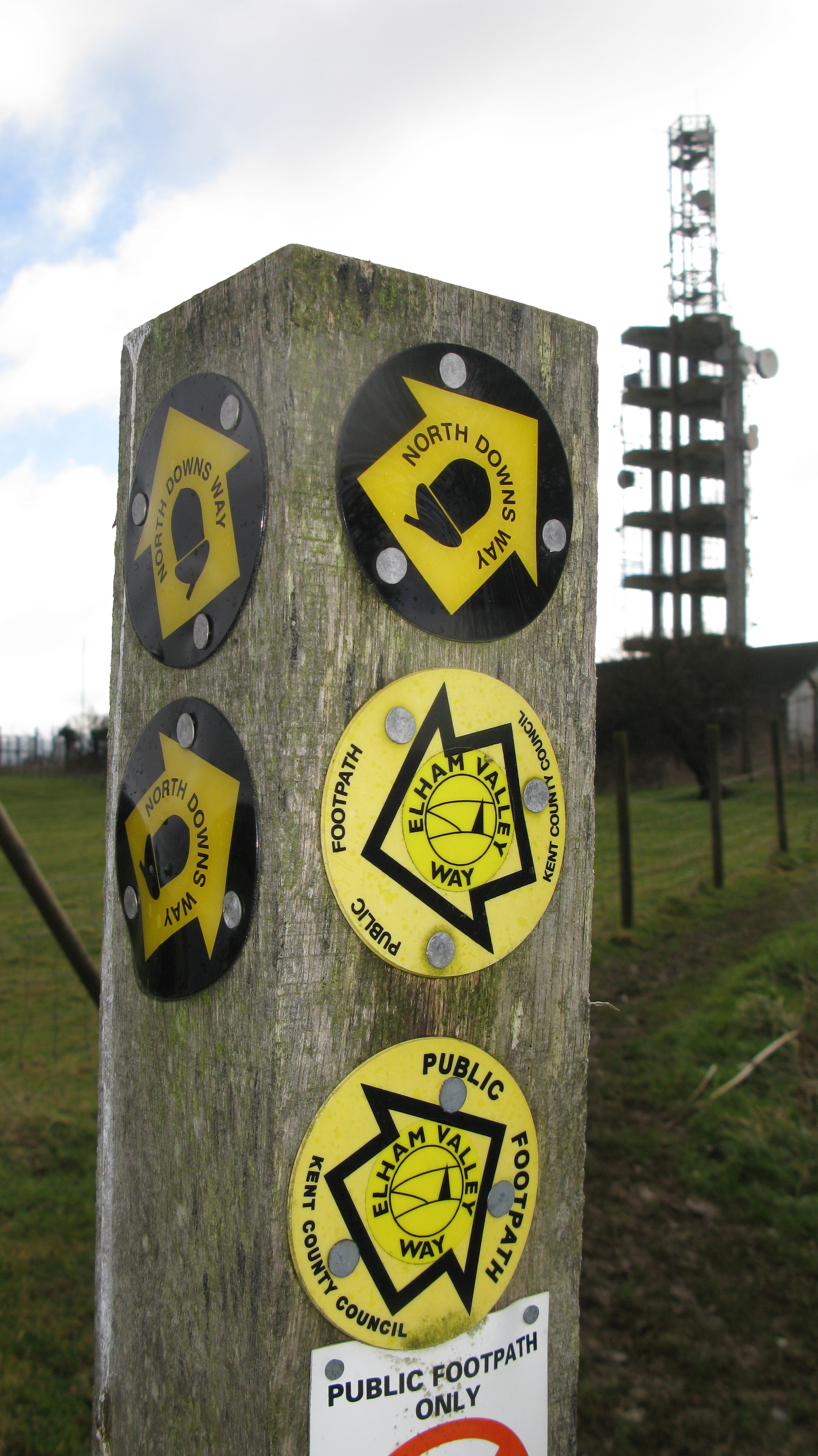
The North Downs Way follows a chalk ridge across South East England. Beginning at Farnham, Surrey, this National Trail is 153 miles long if taking in both of the alternative routes from Boughton Lees that lead to the finish at Dover, Kent. The main route goes over the Downs to Folkestone and along the sea cliffs. This sign is encountered on the northern alternative that loops up and through the cathedral city of Canterbury. The red chevrons indicates this part of the path has Byway status. There are various restrictions to Byways, this one is a ‘Byway Open to All Traffic’ (BOAT)- pedestrians, cyclists, horseriders and wheeled vehicles, including horse-drawn.
The upright post has a small, almost unnoticed, sign that indicates this part of the route is shared with the ancient Via Francigena pilgrim route, connecting Canterbury to Rome, via England, France, Switzerland and Italy. In 2004, Via Francigena was recognised as significant and designated a Major Cultural Route by the Council of Europe.
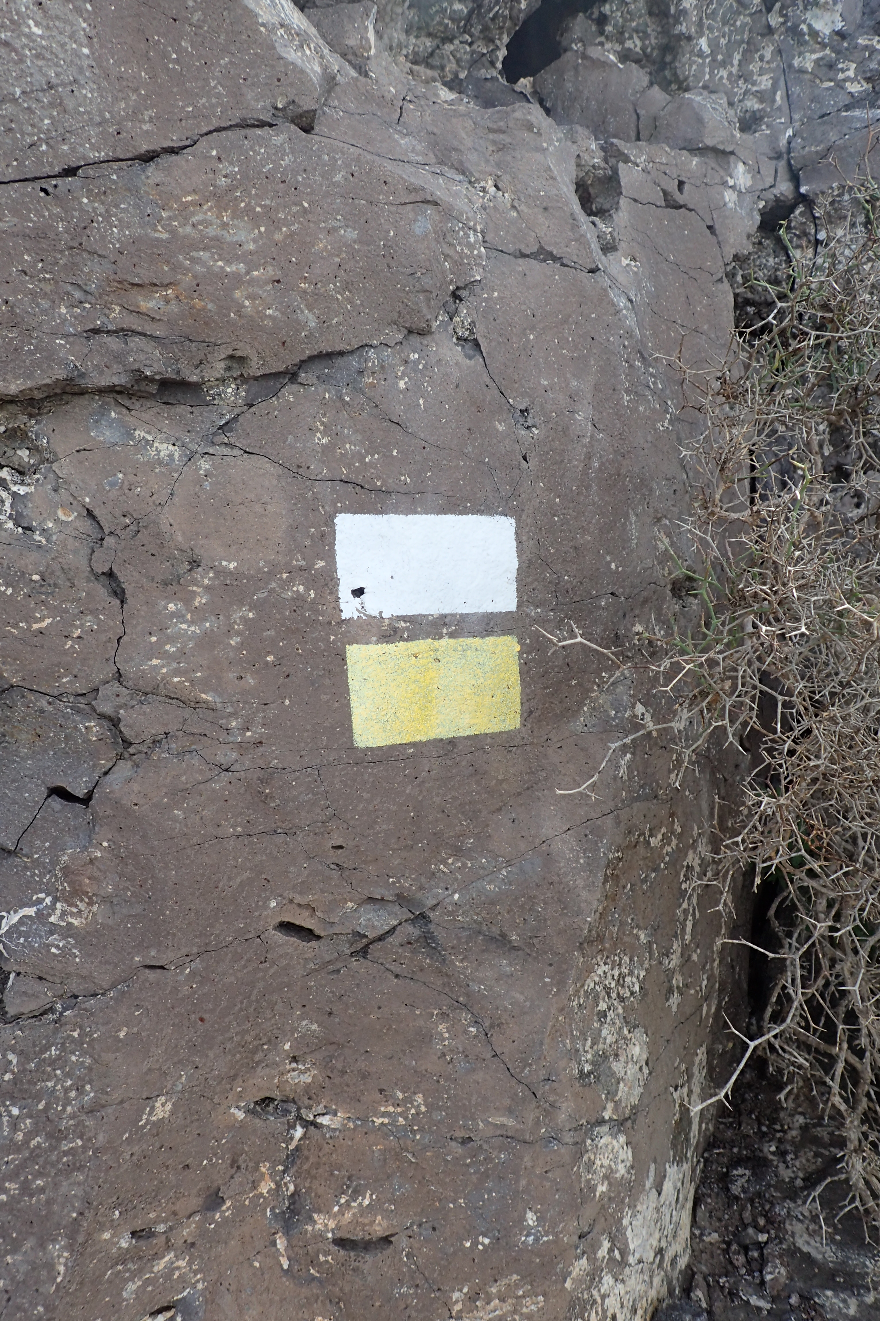
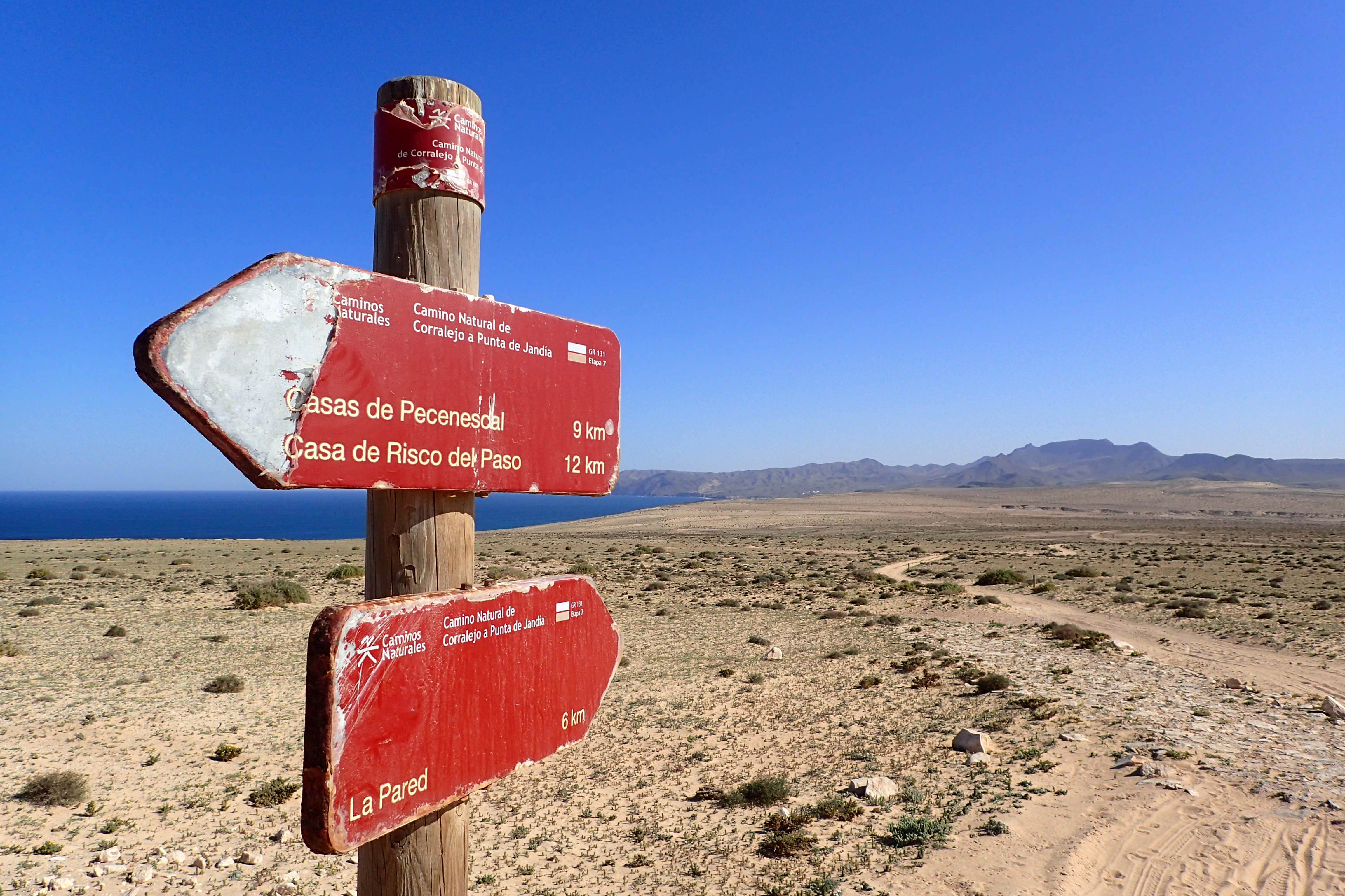
Long distance path GR 131, part of the E7 European long distance path, crosses all seven of the Canary Islands. The section that traverses Fuerteventura is the longest and is known as the ‘Camino Natural de Corralejo a Punta de Jandia’- A ‘Natural Trail’ stretching from North to South. In the South of the island it passes through what the locals call ‘El Jable’- The Sand.
Now mostly hidden from view beneath the shifting fossil sands of the dunes, this section of the path closely follows the route of the Old Way of the Prisoners; cobbled sections of limestone forming an almost forgotten road constructed by political prisoners between 1946-1948.
The GR long distance paths are a European network. In the Spanish Canary Islands, ‘GR’ stands for Gran Recorrido and, on those islands, paths are maintained by the Spanish Mountain Sports Federation (Federación Española de Deportes de Montaña y Escalada). Trails are normally marked by a white stripe above a red stripe, with additional marks for changes in direction or to indicate a wrong way has been taken.
A sign situated just a few miles from the end of one trail, quietly celebrates a new path still in the making.
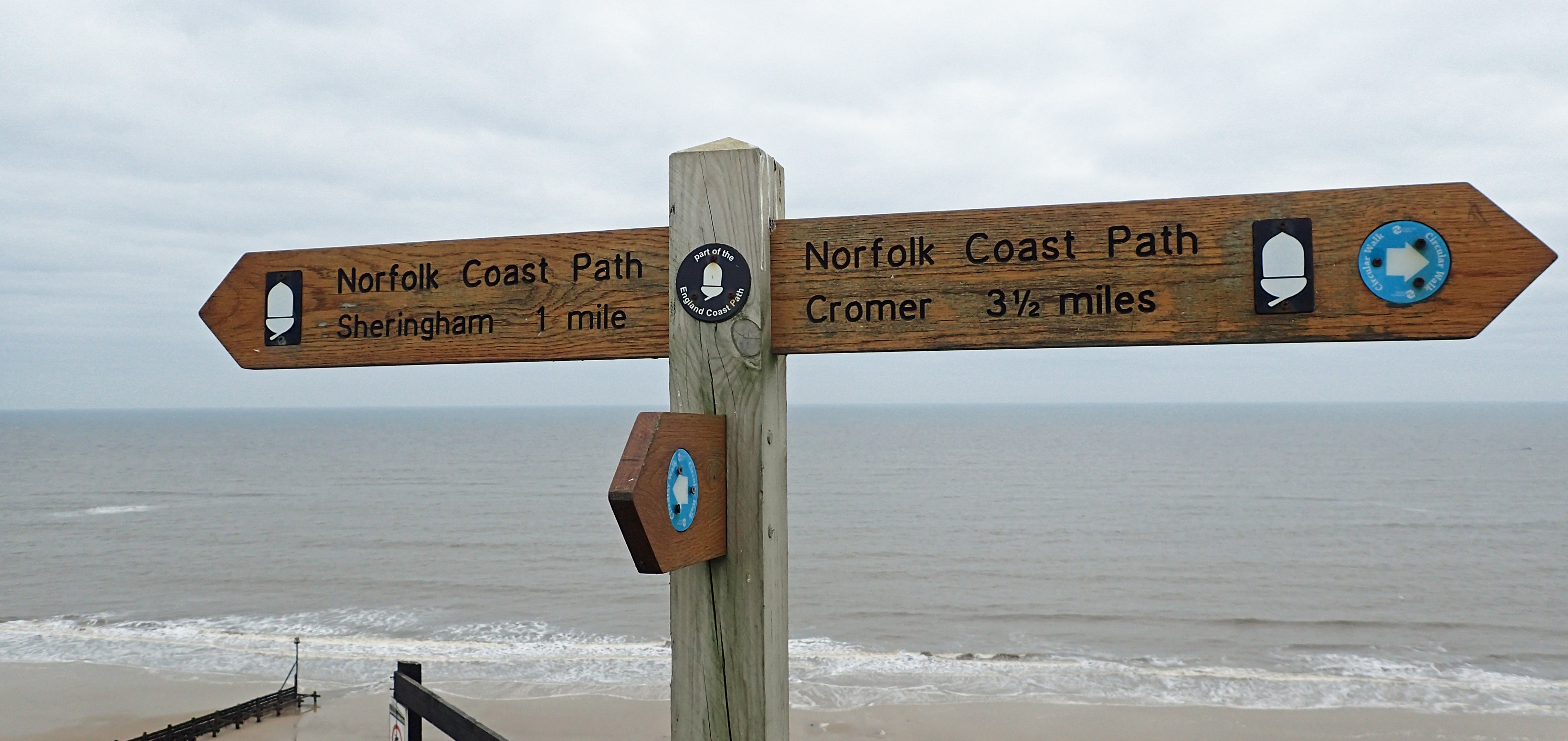
The 47 mile long Norfolk Coast Path is part of a National Trail: The Peddars Way and Norfolk Coast Path. The complete 92 mile long trail runs northward from the Norfolk/Suffolk border near Thetford, to the Norfolk coast just east of Hunstanton, it then turns right and heads along the coast to Cromer pier.
The path was officially opened in 1986 by HRH The Prince of Wales and the area is remarkable in being both popular with tourists, yet also offering lonely and wide open spaces. The route crosses through and past shingle ridges, sandflats and shifting dunes, marshland, grazing land and agriculture, saltings and pine woodlands, neolithic sites rub shoulders with Roman forts. Fishing ports still provide employment and caravan parks sit on the edge of crumbling cliffs. 22 miles of coast-land from Holme to Weybourne is designated a Site of Special Scientific Interest, is recognised as a wetland of International Importance, a UNESCO Biosphere reserve and an EU Special Protection Area and a Special Area of Conservation.
This sign indicates that the Norfolk Coast Path is being extended and is now part of the England Coast Path. The creation of an England Coastal Path was first mooted in 2007 however the development of this path has dragged on, for one reason or another, but probably mostly due to government apathy and disinterest. Commitment was eventually made that it would be completed by 2020. Quite a tight timetable considering how much has been achieved to date. When finished, the 2795 mile long trail will follow the entire coast of England and will be the longest managed and waymarked coastal path in the world.
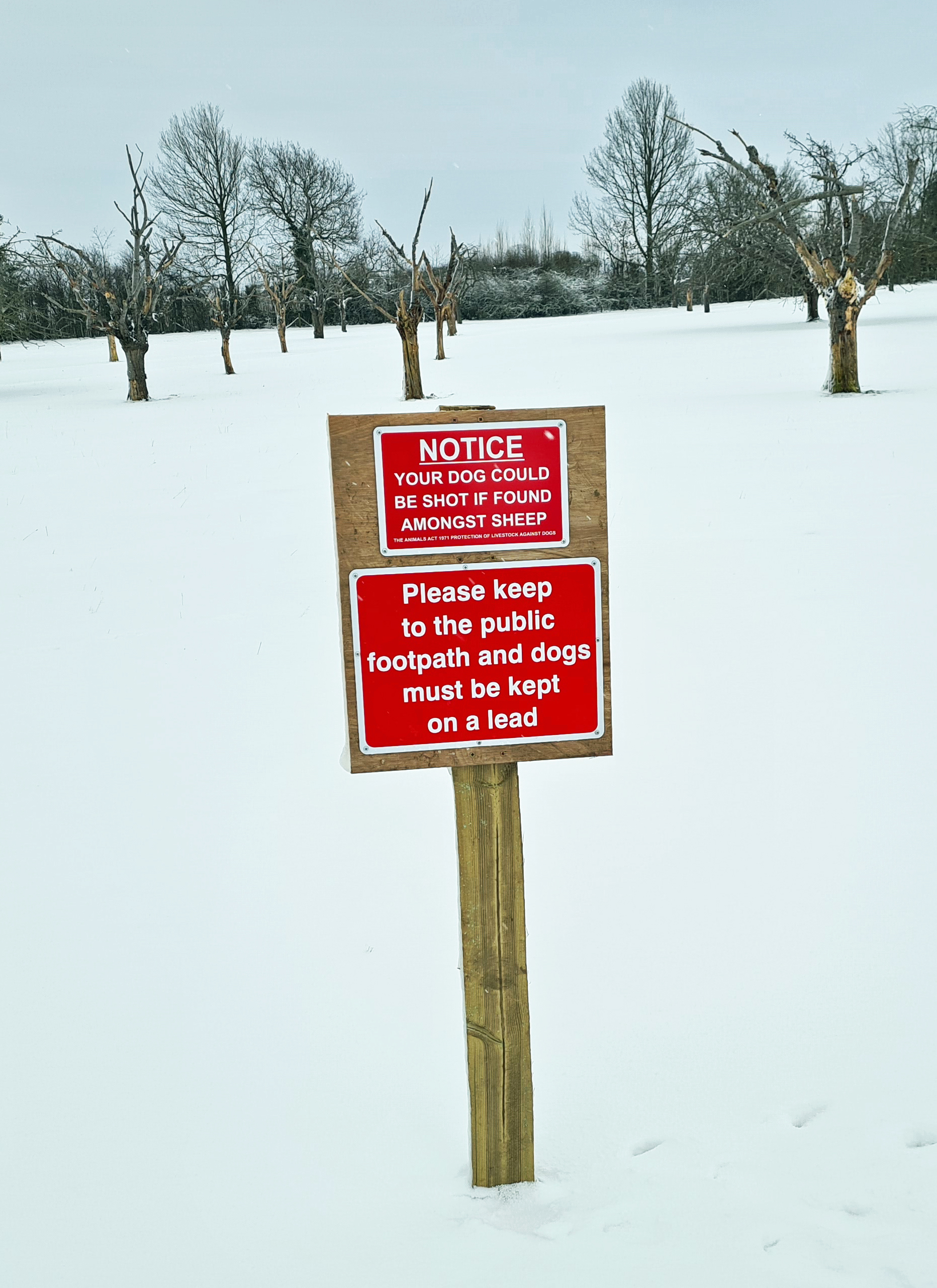
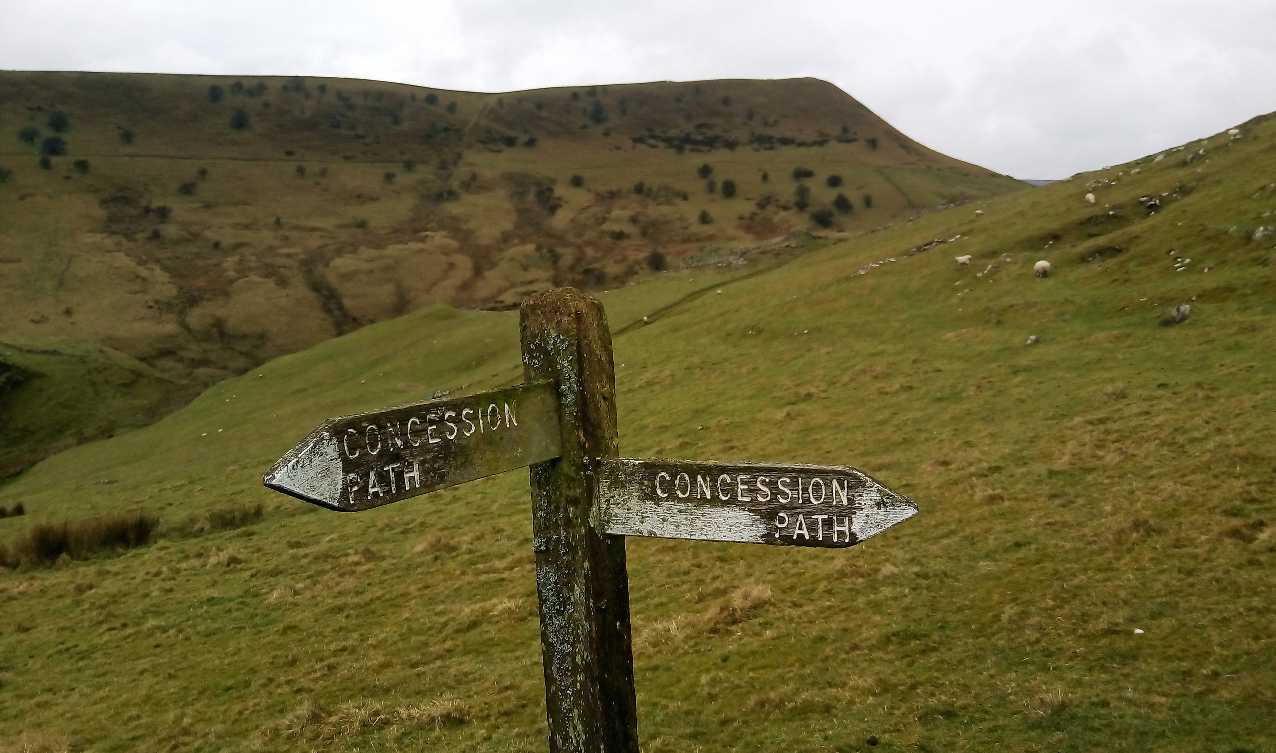
Concession Path below Chrome Hill in the Peak District. The only way of approaching this Derbyshire hill from the north west is via this waymarked route. Concessionary, or Permissive, Paths are paths whose use is allowed by the landowner. Not normally a Public Right of Way, their use may, nevertheless, be a historic route that has fallen from use or a right of way not included on the definitive map.
Some 1:25 000 and 1:50 000 Ordnance Survey maps show Concessionary paths. Alternatively, Natural England also provides considerable information online. Not all permissive paths are shown as their circumstances change with time. Most Concession Paths will close for part of a year to ensure that it does not become a path ‘used as of right’, due to unbroken usage by the public.
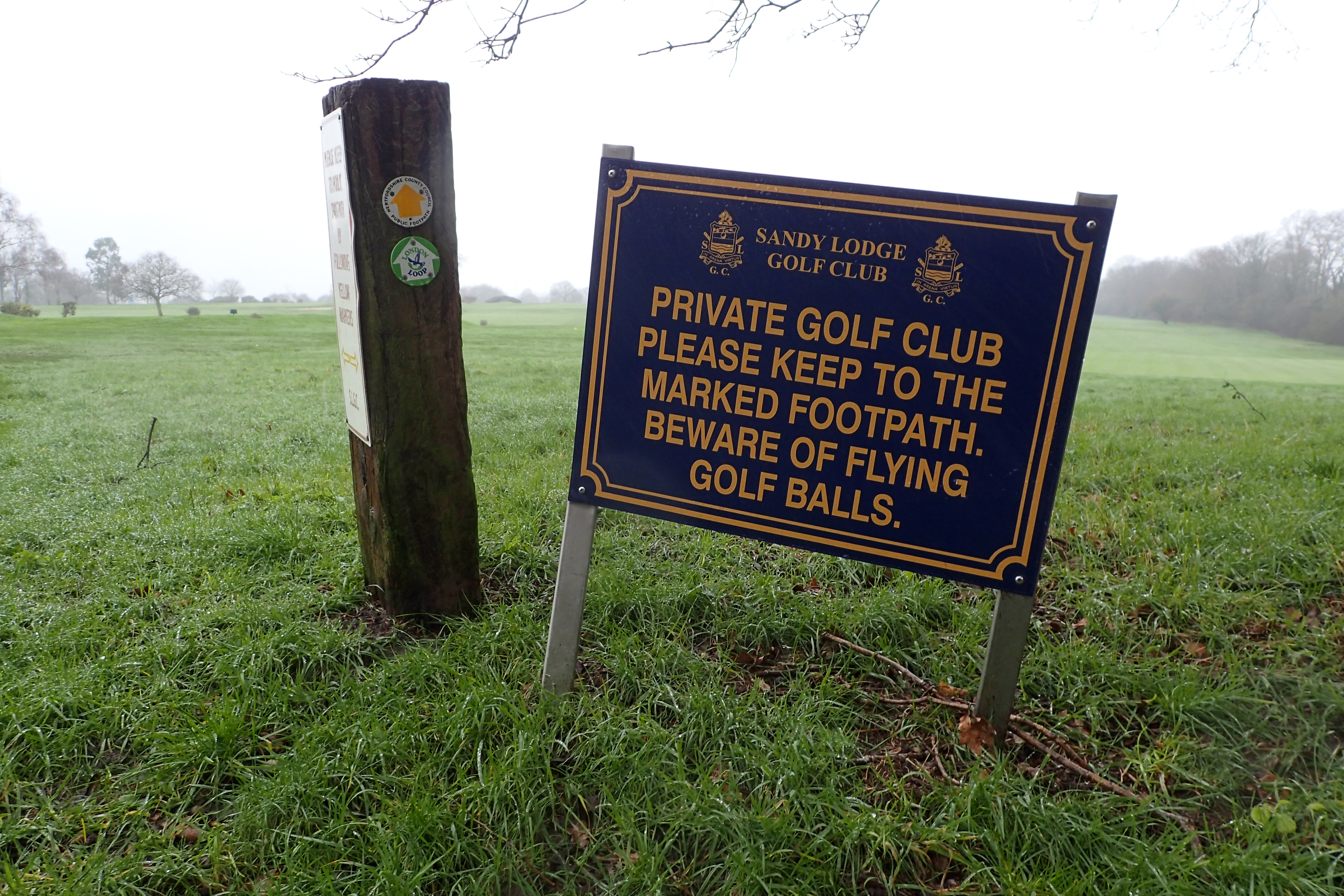
Farthing Downs are both scheduled ancient monument and the largest area of semi-natural downland left in Greater London. Within easy reach for Londoners, such pockets of land require stringent legislation to continue their protection.
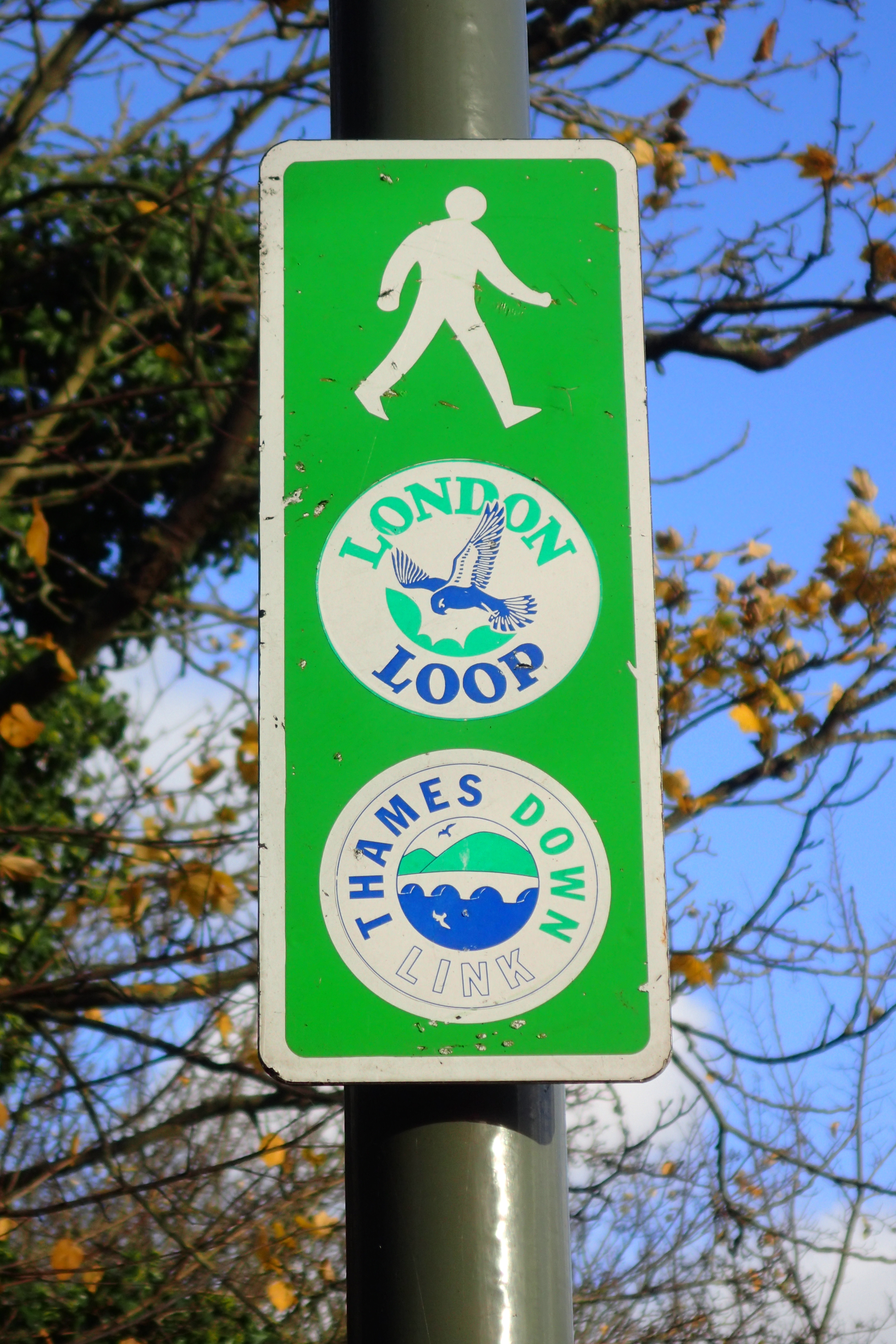
The Site of Special Scientific Interest is situated in Coulsdon in the London Borough of Croydon and is managed by the City of London. This was the first section of the London LOOP to be opened, the trail runs straight through the centre of the chalk grassland.
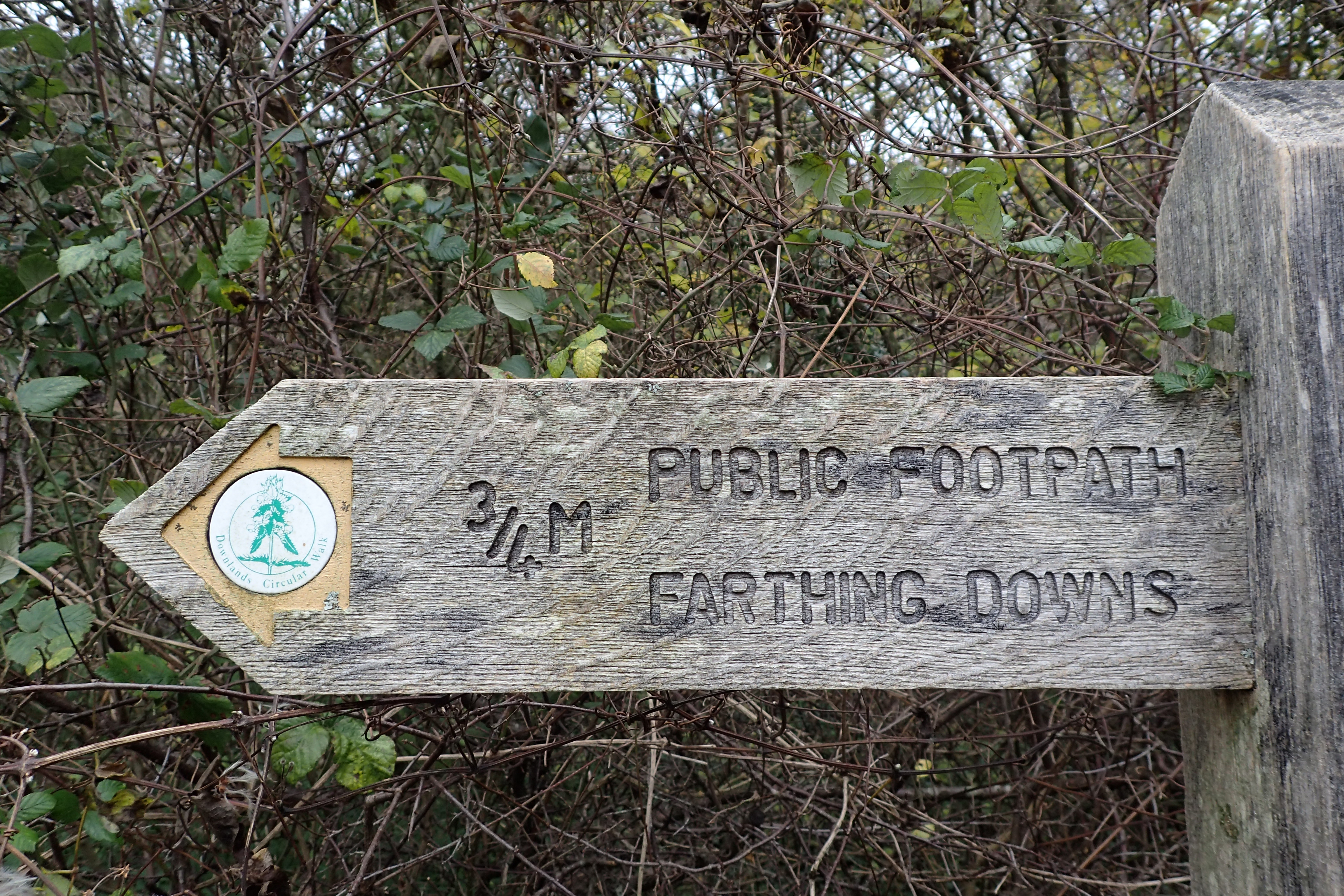
Set into the signpost is a small disc for the Downlands Circular Walk; a popular short walk of three or six miles based around Farthing Downs and neighbouring Happy Valley
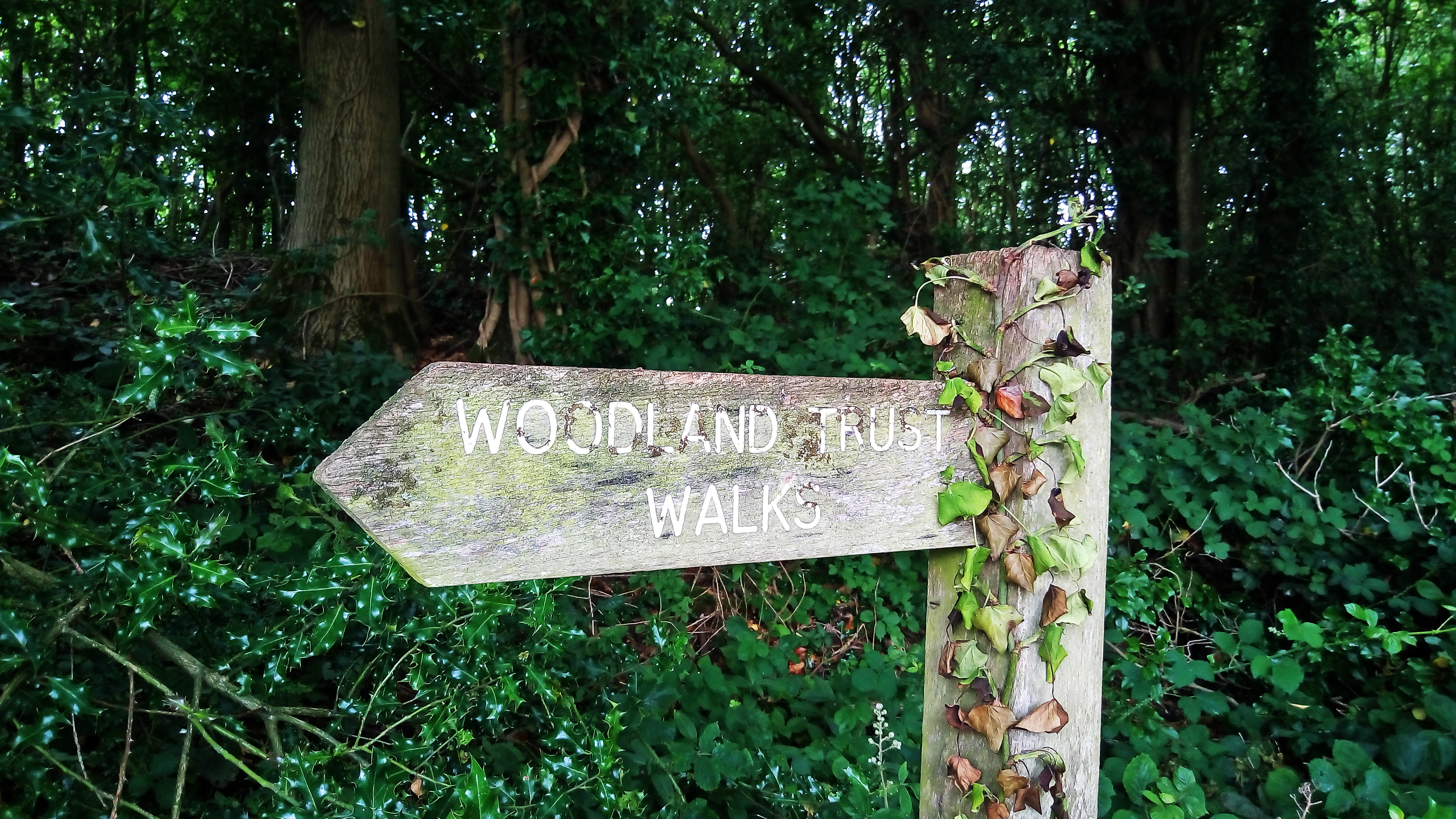
Sign photographed in just one of the 1000 plus sites, covering over 26,000 hectares, cared for by the Woodland Trust. Nearly 350 of its sites contain ancient woodland of which 70 per cent is semi-natural ancient woodland – land which has been under tree cover since at least 1600. It also manages over 110 Sites of Special Scientific Interest.
Founded in Devon, England in 1972 by Kenneth Watkins, a retired farmer. The Woodland Trust aims to see a United Kingdom rich in trees and woodland in which people can walk, cycle, picnic and play. The Charity protects and campaigns on behalf of woods. They plant trees and restore ancient woodland for the benefit of wildlife and people.
38% of Europe is wooded. Just 13% of the UK by comparison. The Woodland Trust have planted 32 million trees since 1972. Their marvellous work continues.
Sign at Inishowen Head, Co. Donegal, Republic of Ireland.
Saint Columba (Irish- Colm Cille) is one of the three chief saints of Ireland and patron saint of the city of Derry. Ordained a priest around 546, he taught and preached throughout Ireland, founding a number of monasteries.
In 563 he went into exile as a penance and sailed from Donegal to found the famous monastery on the Scottish island of Iona. His final landfall in Ireland was near here in Port Cille, where he climbed the hill to get a last look at his beloved Derry before setting sail.
An annual pilgrimage is made to this spot every year on 15th August.
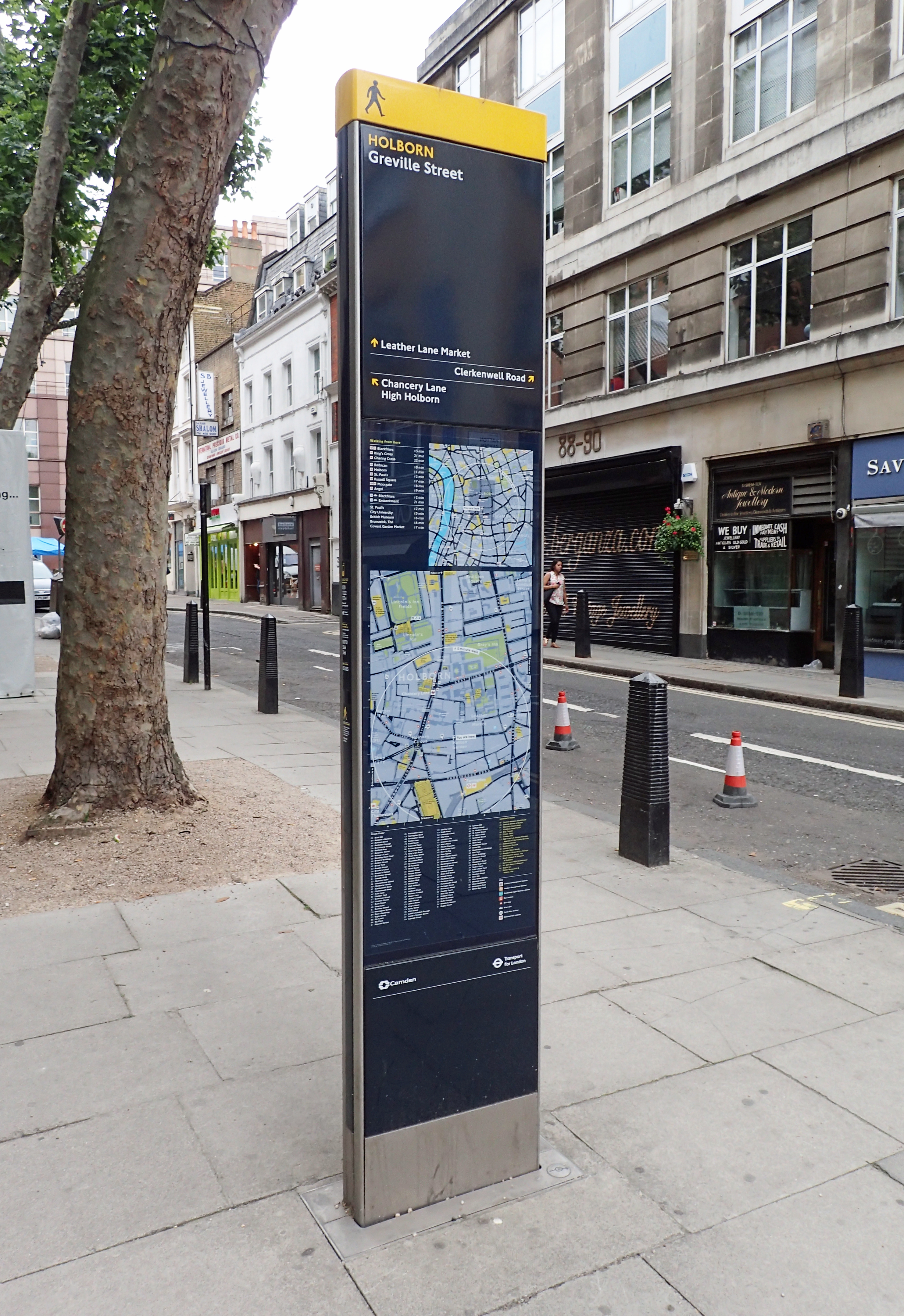
On 27 November 2007, the first prototype of a new design of street signage went ‘live’ in the West End of London. Just about every London Borough now has a number of the distinguishable, tall, upright and informative signs. These form part of the Legible London sign network. Integrated into the transport network, there are over 1700 of the signs providing information for pedestrians, on streets, local buildings, places of interest and bus routes, and enables those exiting London Underground stations to quickly orientate themselves. Circles on the maps indicate a walking time between places, ranging from 5 to 15 minutes. Note the small directional ‘north’ arrow set in to the base of the sign.