
For many years, decades in fact, it had been my wish to complete a particularly long hike across Great Britain. Lands End to John o’Groats seemed the obvious choice for a great many years. For most hikers a LEJOG ‘End-to-End’ takes around three months to complete. For some six years I had been accumulating days from my annual leave allowance in a ‘Holiday of a Lifetime’ scheme at work. However, I believed that a simple ‘End-to-End’ was not sufficient a challenge for me and decided to encompass parts of the UK for which I had an attachment, plus places I had not been to, but I wished to know more of their geology, culture or history. I slotted in a handful of particularly long trails which I could not fit into a week or two holiday. Together, this created a challenge that I was not aware of having been completed in the same manner by anyone else.
I decided to walk from the furthest southerly point of mainland Great Britain, the Lizard in Cornwall, England, to the most westerly point in mainland Great Britain, Corrachadh Mòr in Ardnamurchan, Scotland, to the furthest northerly point on mainland Great Britain, which is Dunnet Head, also in Scotland.
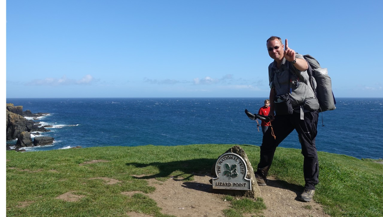
First Point of the Compass. Lizard Point. South West Coast Path. May 2018
I called my expedition ‘Three Points of the Compass‘ and completed a number of long distance trails in advance of my 2018 hike to refine my kit, reduce the pack weight carried, improve my experience and knowledge and worry incessantly as to my declining fitness, ageing body, ailments and increase in body mass.
I walked alone, I carried backpacking gear and pre-planned paper maps were sent on to me at strategic points. I set myself a small set of rules– I did not permit myself to use any form of motorised transport beside the odd ferry to take me across some estuaries or lochs where options were few. Where I could, I waded across estuaries. My hike was continuous with the odd day off for rest and resupply, though a couple of rest days were forced upon me due to exceptionally poor weather. I did not wear boots, preferring trail shoes, which carry with them their own particular foot care regime. I had a couple of small blisters in the first week of hiking and no more from then on.
Cornwall. South West Coast Path. May 2018
My route altered considerably in the earlier planning stages. Having decided to visit Lizard Point in Cornwall as my first ‘point of the compass’, I also decided to use one of the premier long distance trails in the UK, of world renown. The South West Coast Path is 630 miles in length. I commenced my hike in Poole and walked toward Lizard (in the opposite direction) for some weeks before rounding the Cornish Peninsula and completing the South West Coast Path at Minehead. In other words, I walked for a month in the ‘wrong’ direction before turning round and beginning my walk north. In Cornwall, I also had the obligatory photo taken at Lands End for an ‘End-to-End hike, despite already having been on trail for many weeks. This is the most south-westerly point of mainland Great Britain.
Arriving in Minehead, I then struck inland, exploring Exmoor, looping round through Taunton, Glastonbury, Cheddar, Bristol before walking across the road bridge into Wales where I began the 177 mile Offa’s Dyke path running northward, coast to coast, through the Welsh Marches, quite often not sure if I was in England or Wales.
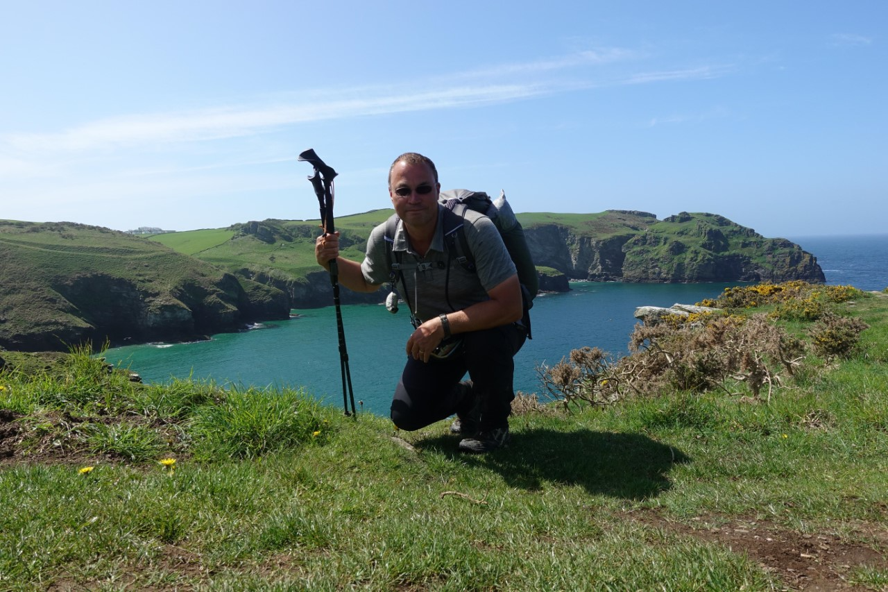
The Black Mountains, Offa’s Dyke. June 2018
The UK had experienced two weeks of rain and mud prior to my setting out on April 1st, but weather steadily improved and I enjoyed a fine spring/early summer walk from there-on. Due to the length of my hike, I carried gear suited to a wide range of conditions, though some cold weather clothing such as insulated trousers and a down stuffed beenie were sent home in June, not having been worn for some weeks at that point.
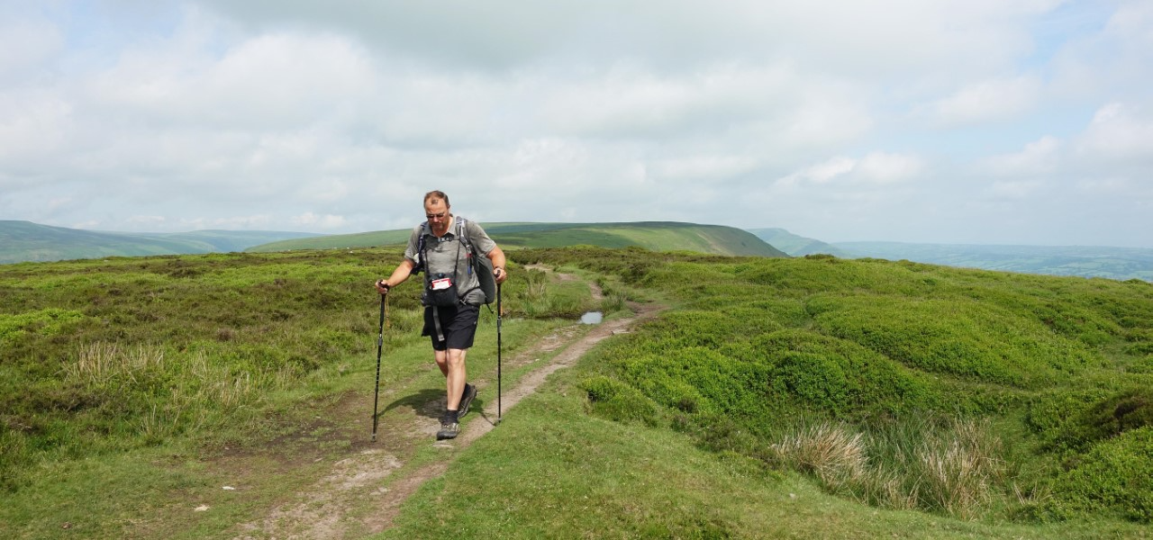
Pennine Way, safely past the fire on Saddleworth behind. 27th June 2018
Once I had completed Offa’s Duke, I followed the Wales Coast Path round to Chester. Then a handful of days across difficult lowland England before entering the stunning Peak District, picking up the very south of the spine of England at Youlgreave. I walked northward to commence the oldest of the UK’s National Trails, the 265 mile Pennine Way, at Edale. This coincided with one of the hottest summers on record. Moorland fires and dried up springs and streams were additional obstacles to contend with.
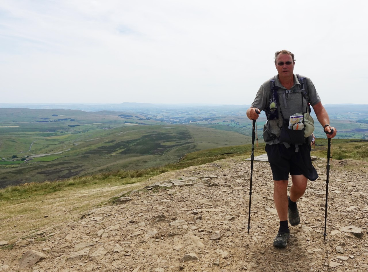
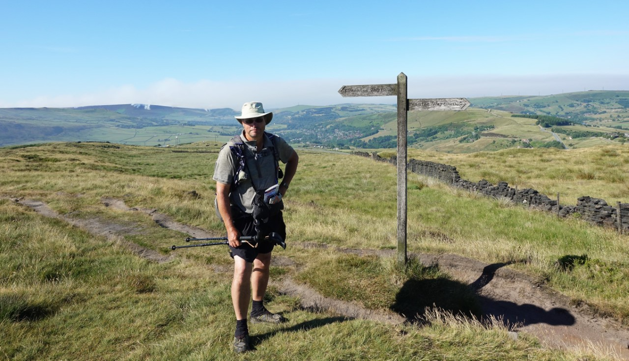
Atop Pen-y-Ghent, Pennine Way, July 2018
The Pennine Way took me, via Hadrian’s Wall, into Scotland. Here, the fine weather continued for a while but was slowly deteriorating and it became cooler, windier and frequently, a lot wetter. The infamous Pennine Way bogs had not troubled me but, increasingly, the terrain became wetter underfoot.
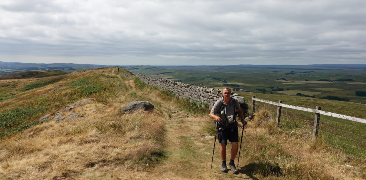
Hadrian’s Wall. July 2018
From Kirk Yetholm I followed a series of Scottish Canals, visited the Falkirk Wheel, Antonine Wall, and eventually picked up the 95 mile long West Highland Way just outside Glasgow. I was already familiar with this route as I had completed it years previous with my wife and teenage daughter. This was a truly international experience and I met more hikers, the majority from overseas, than during the entirety of the rest of the 2000 plus miles.
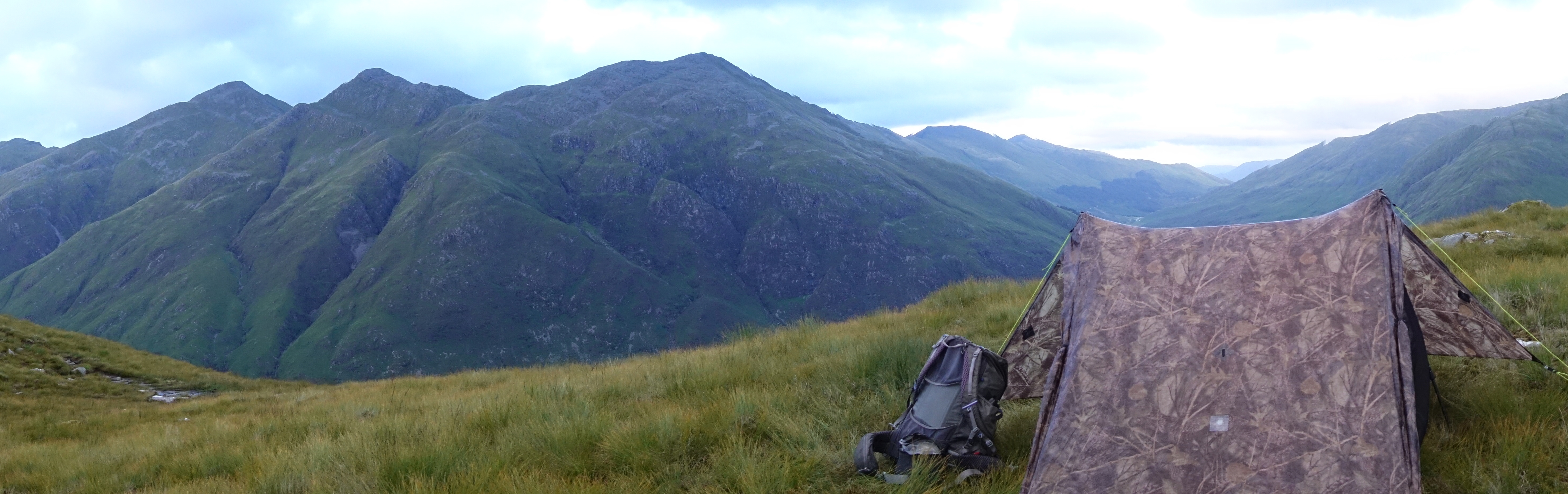
The West Highland Way ends at Fort William, after a days rest and resupply I crossed to Camusnagaul to begin the toughest walking of my entire expedition- The Cape Wrath Trail. This is not a trail as such, but a choice of routes through some of the wildest country we have in the UK- Morar, Ardnamurchan, Knoydart, Torridon and Assynt. After just one day on this trail I briefly left it to strike west to my second point of the compass, Corrachadh Mòr, just south of Ardnamurchan Point. I had then reached the most westerly point of mainland Great Britain.
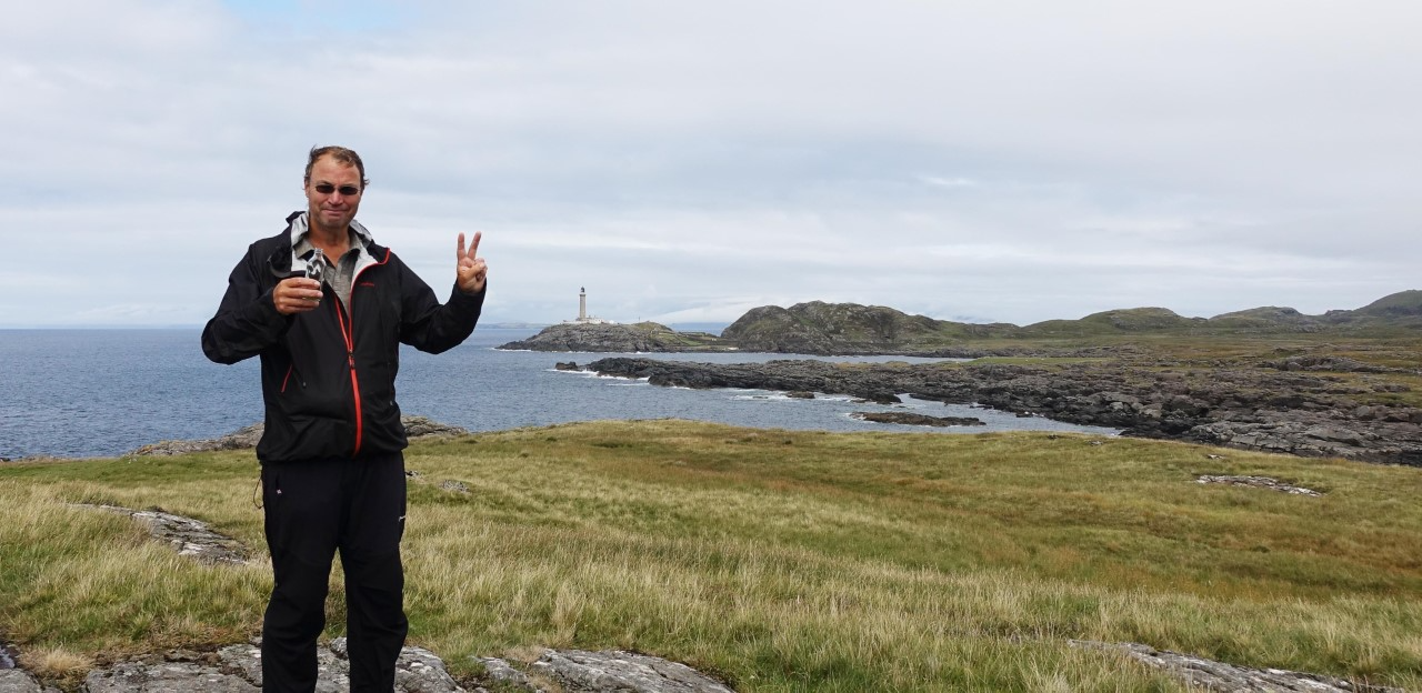
Second Point of the Compass, Corrachadh Mòr, Ardnamurchan. 3rd August 2018
Over the next two days I walked east to again pick up the Cape Wrath Trail where I had left it and continue to work northward. This is some of the wildest country I have ever walked in. The trail was extremely challenging, logistics too. Scenery was breath-taking and the wildlife stunning- I enjoyed great sightings of porpoises, sea otter and Golden Eagle. White Tailed Eagle was encountered further north and I startled more Red Deer at close quarters than you can ordinarily shake a hiking pole at.
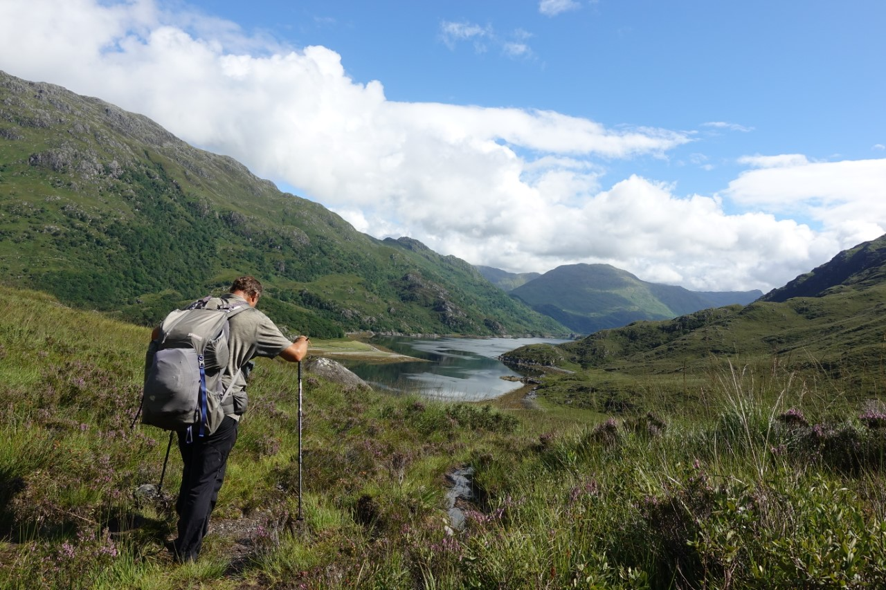
Cape Wrath Trail. 8th August 2018
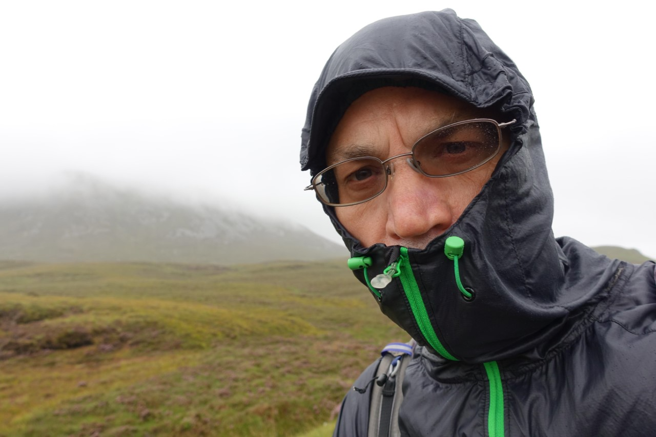
The northwest of Scotland bought particular challenges, not least the constant struggle to consume sufficient calories as the walking was arduous and demanding. Midges were horrific at times and I occasionally removed embedded ticks. Any chance to wash clothes at a hostel or enjoy a ‘proper’ meal in infrequent inns or cafes was rarely turned down. I had, by now, realised that my earlier estimation of four months to complete this hike was unrealistic and had contacted my workplace to request an extension to my unpaid leave.
For over 2000 miles I carried just about everything I required. I purchased food en-route and though choice was often limited, a vegetarian curry became an enjoyable staple in the evening. I used Youth Hostels if they were on my route and had space available. If I camped at ‘official’ campsites I could enjoy a shower at the end of the day, but frequently wildcamped, often in quite beautiful and isolated places.
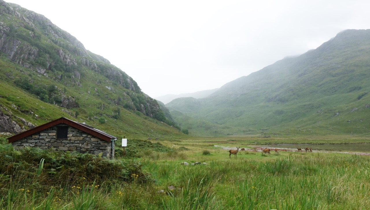
Strabeg Bothy
I stayed at bothies if they were on my route. I camped on a showcase lawn, slept in a salmon fisherman’s hut, was the sole clothed camper at a nudist camp, spread my mattress on the floor of a National Trust shed, acted as sheep herder to earn a night’s stay in a farm field, camped in a cow field- with strict instruction to be gone before the cows returned after milking, erected my tent in the dunes of the ‘most beautiful beach in the country’, was the sole overnight occupant in a nurses training school, lay awake clutching my tent poles in a howling gale and, conversely, lay while trying not to touch my tent poles in the worst electrical storm I have ever experienced.
I completed the circa 200 mile Cape Wrath Trail at the Cape, sleeping the night inside one of the outbuildings of the lonely lighthouse situated there. This is the most north westerly point on mainland Britain, where the Viking ships turned round, it is strikingly beautiful, desolate and extremely windy.
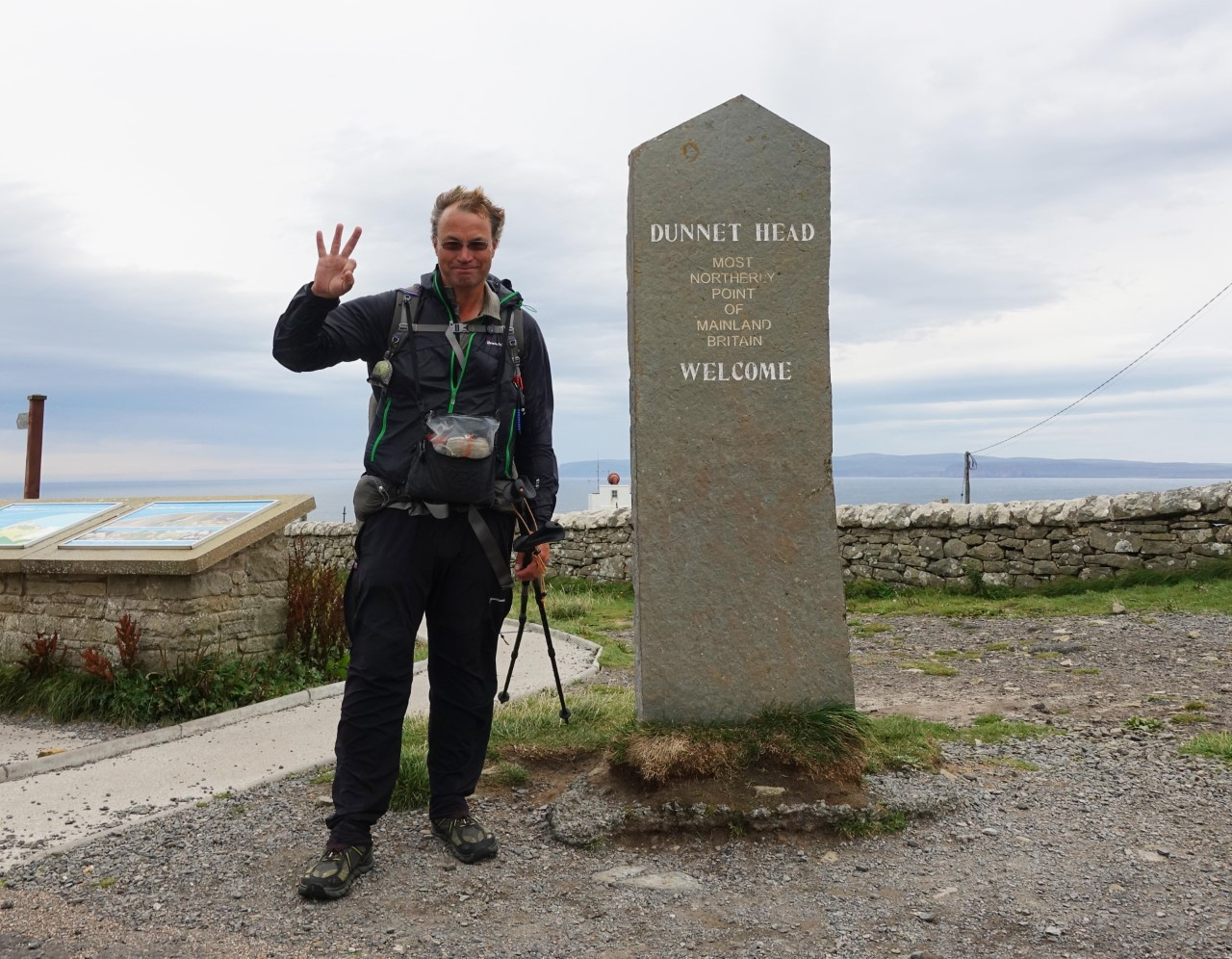
Third Point of the Compass, Dunnet Head, Caithness, 28th August 2018
Having completed the Cape Wrath Trail, I then followed the north coast of Scotland through Sutherland, into the Flow Country and into Caithness. I was headed toward my final point of the compass- Dunnet Head in Caithness. I arrived there on 28th August and the following day rounded off my hike by visiting John o’Groats followed by a final couple of miles out to Duncansby Head. This is the furthest north easterly point of mainland Great Britain and is where my expedition ended.

I was thrilled to have had the wonderful opportunity to explore and discover more of my country that ever before. This was only made possible by the generous support of my employer in permitting me to take extended time away from work. I completed my hike for purely personal and selfish reasons and did not seek sponsorship, nor was I sponsored by any individual or company. My wife, or Mission Control as I designated her, held the home fort wonderfully and I was lucky enough to see her for just a few days in Somerset and Chester where I took a few rest days.
As an adventure, thoroughly recommended…
