
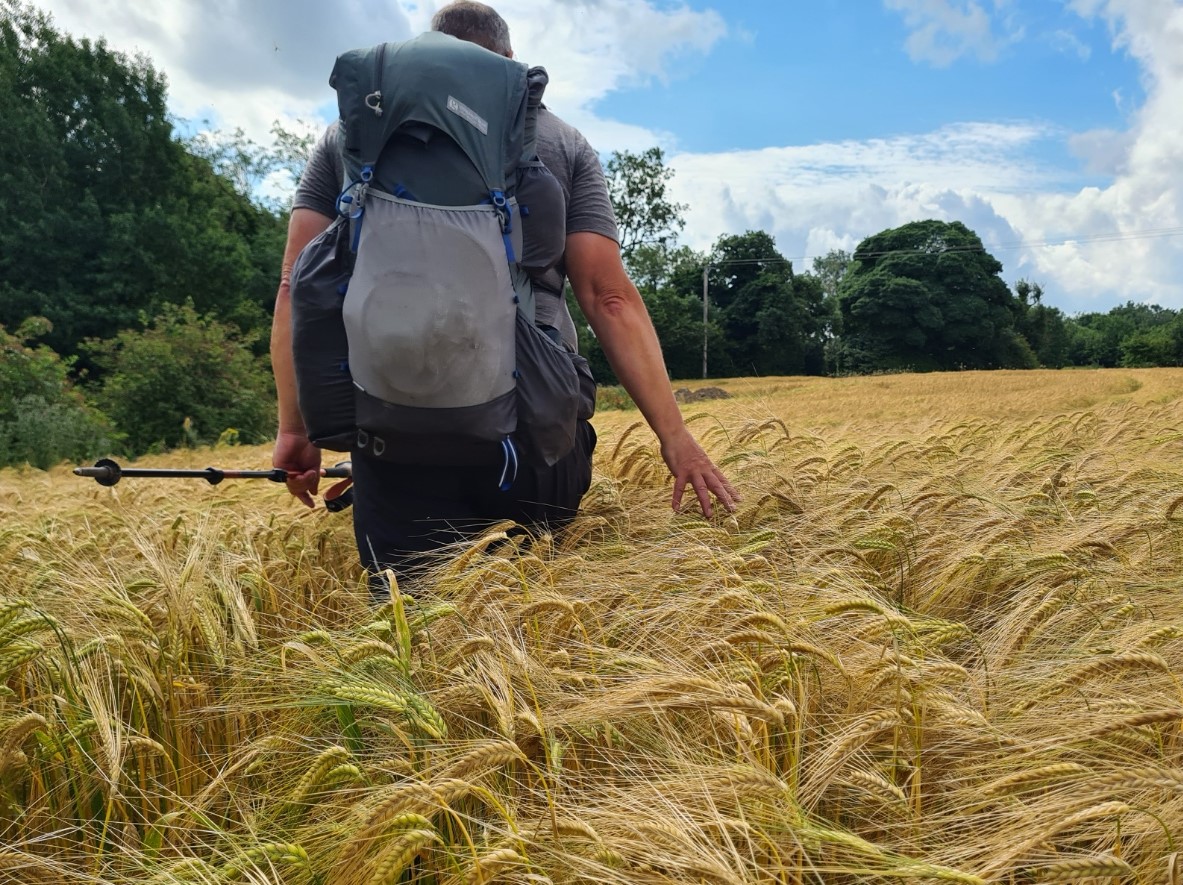
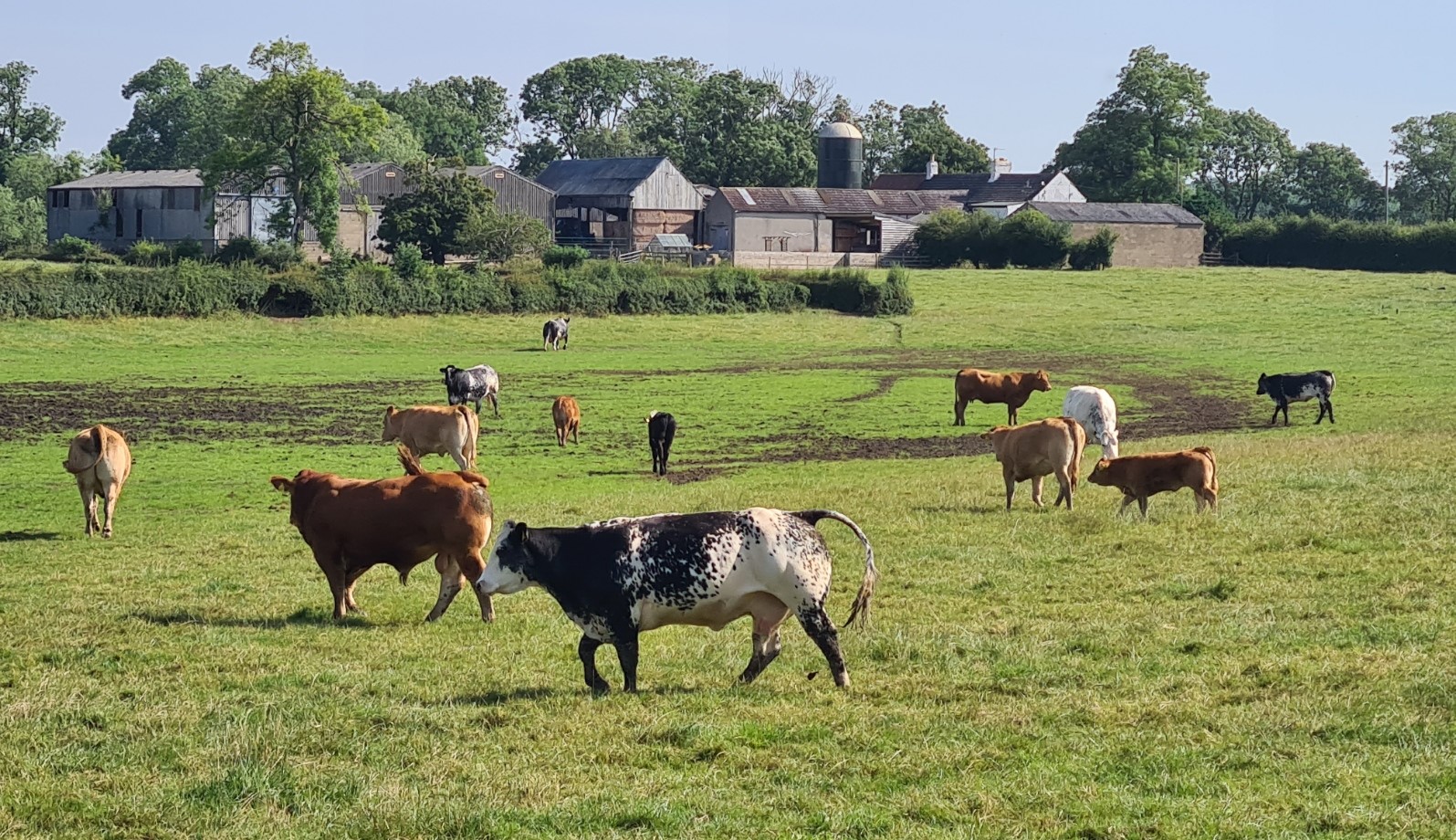
Three Points of the Compass heads toward the least demanding part of the trail- a couple of day’s hike across low lying agricultural farmland, prior to a final National Park on this two-hundred mile walk across northern England.
Day ten: Reeth to Richmond
I slept well. White noise from the river just metres away blanketed any other noise on the campsite. My aches of previous nights bothered me less too so it looks as though my cold is on the mend, a bit. While the early morning sun was on the Durston and drying off the condensation, I chatted to the others C2C’ers that had also stopped here the night. While I planned to continue to keep my days short they were all heading further, so I probably wouldn’t see them again. That is the nature of a longer multi-day hike. The fitter, stronger and younger hikers pull ahead while us knackered old fogies trail in their wake. The exact make of the trail ‘bubble’ can change over the days.
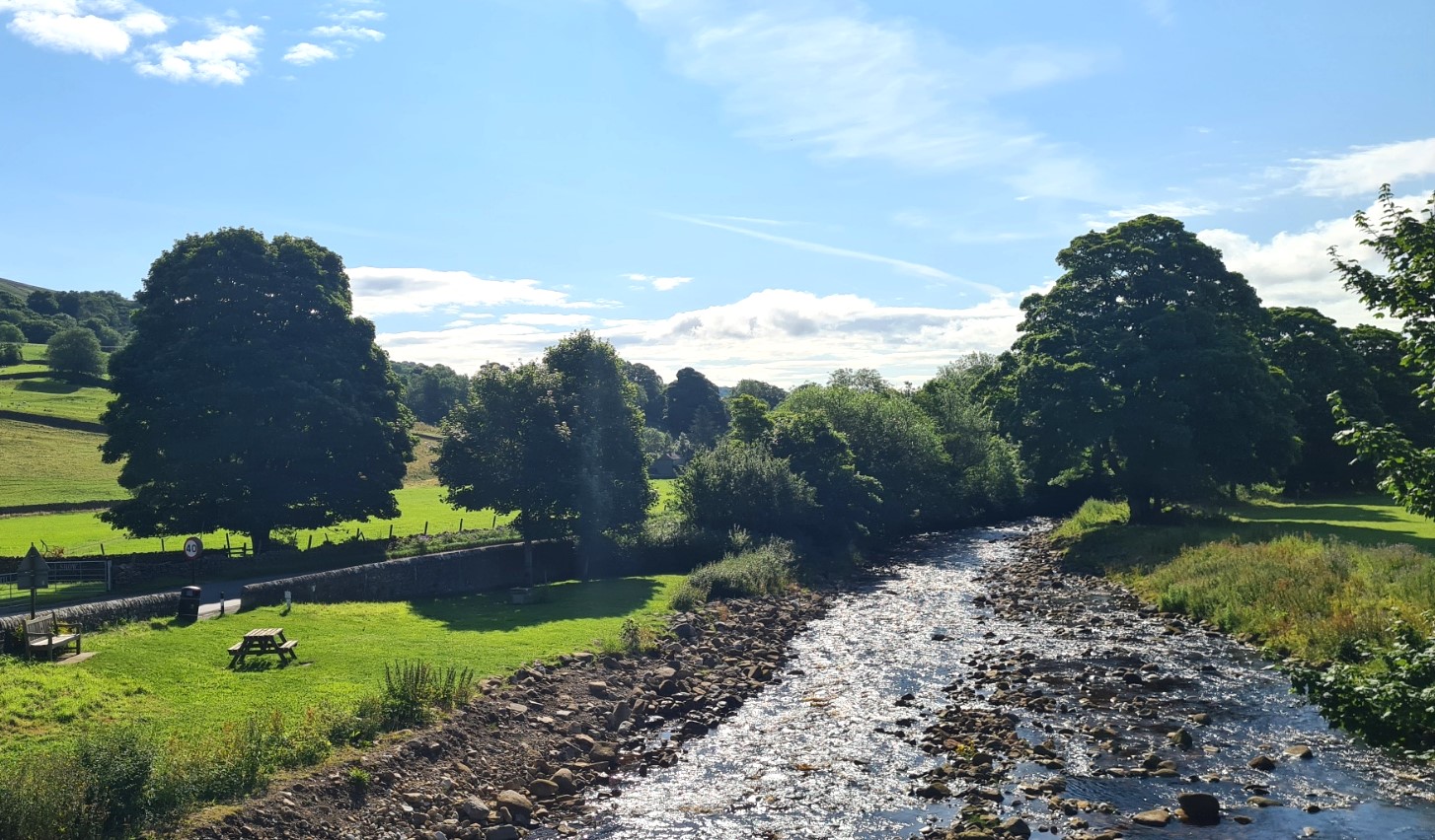
Once packed and away I initially followed the river Swale away from Reeth rather than the road as it looked the prettier option. Despite this, I was soon back on the traffic-less road, which I didn’t mind as I was approaching Marrick Priory. It also meant that I could free a sheep when I saw that it had its horns caught in a feeding trough, it was kicking wildly and could have been there for hours. The ruins of the former Benedictine nunnery, founded in the mid-12th century, are mostly hidden behind a farm and I suppose most people don’t even notice it as they walk past. It has been converted to use as an Outdoor Education and Residential Centre but I wanted to have a closer look so ignoring the ‘no public path’ signage, I swung open the closed gate with impunity and strode down toward it. To be met by the friendliest chap imaginable. Sam was enthusiastic about what they do and was keen to talk about the centre’s activities, the history of the Priory and backpacking gear. I am not sure which of those he was most keen about. It is a decent conversion that has been carried out to the priory and I do like that the ruins were given a new lease of life in the 1960s- the kids even get to abseil (rappel) off the tower. The boisterous children were beginning to gather outside and Sam was very obviously required elsewhere so we parted company, me toward Richmond, Sam walking the youngsters to Reeth, with the promise of ice-creams on their final day.
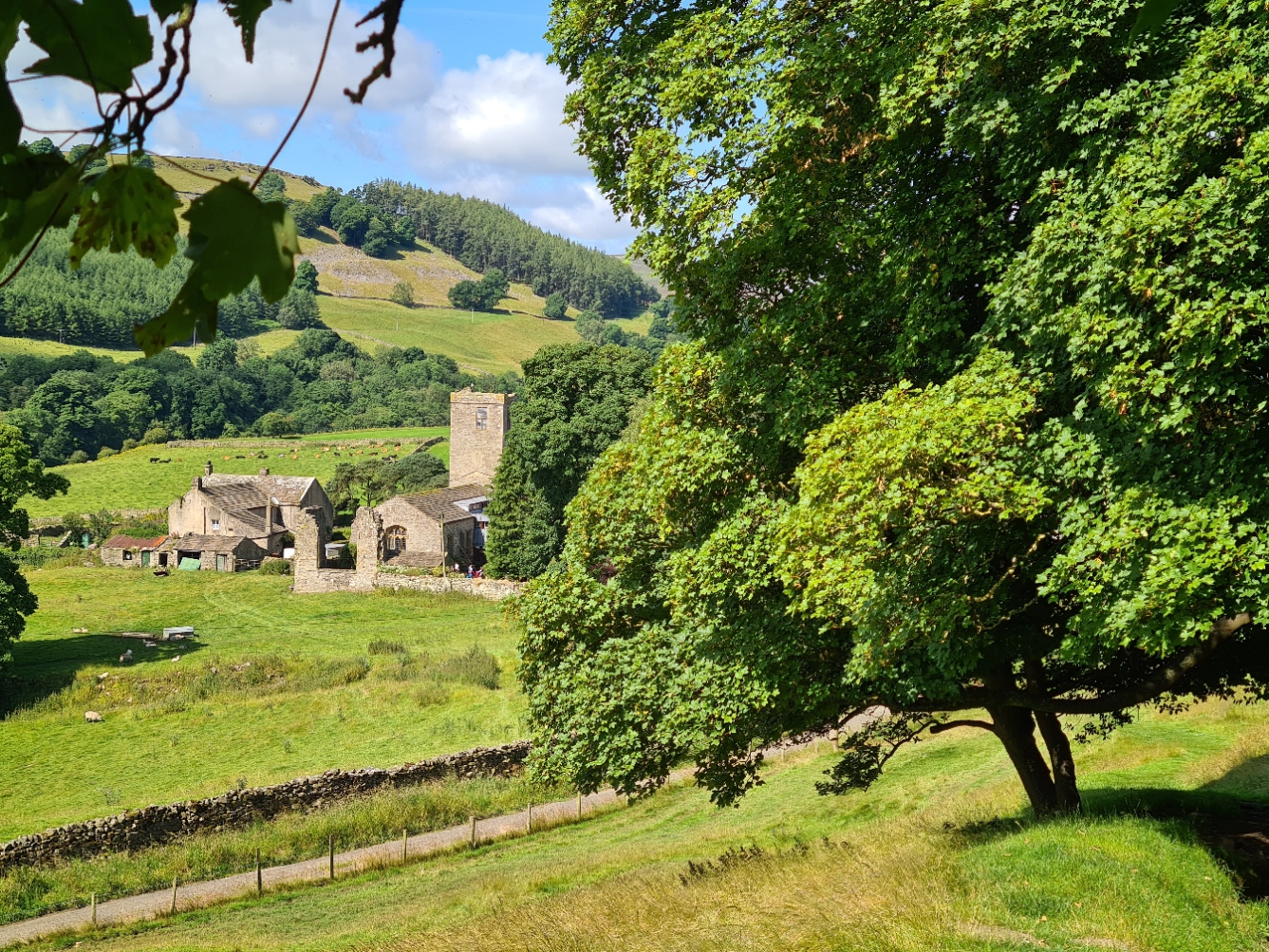
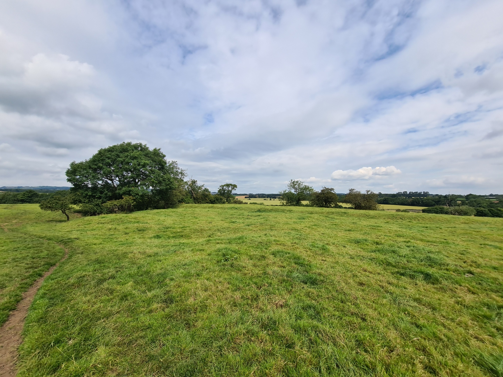
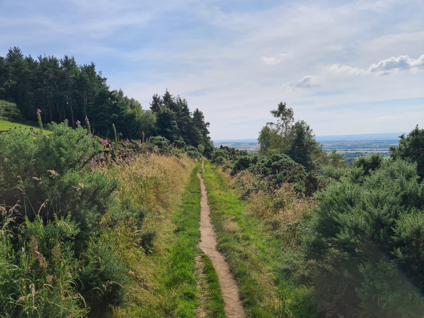
There is a gentle climb up the slope opposite the priory, following the 375 steps purportedly originally lain by the nuns. This took me into a bit of woodland and out into fields, through the little village of Marrick, then a joyous walk through rolling farmland, crossing stiles and gates on the way. This was pastoral England at it’s best and I enjoyed this easy section immensely.
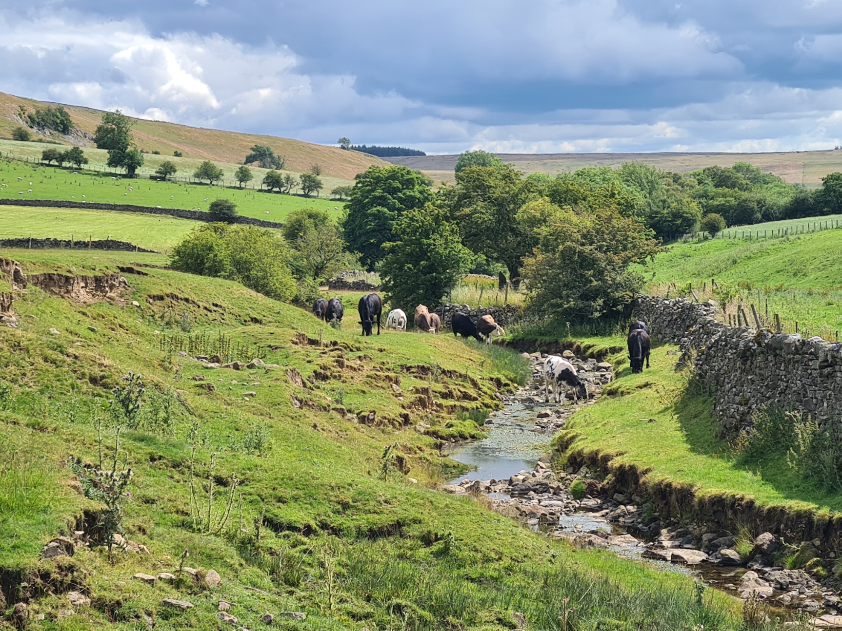
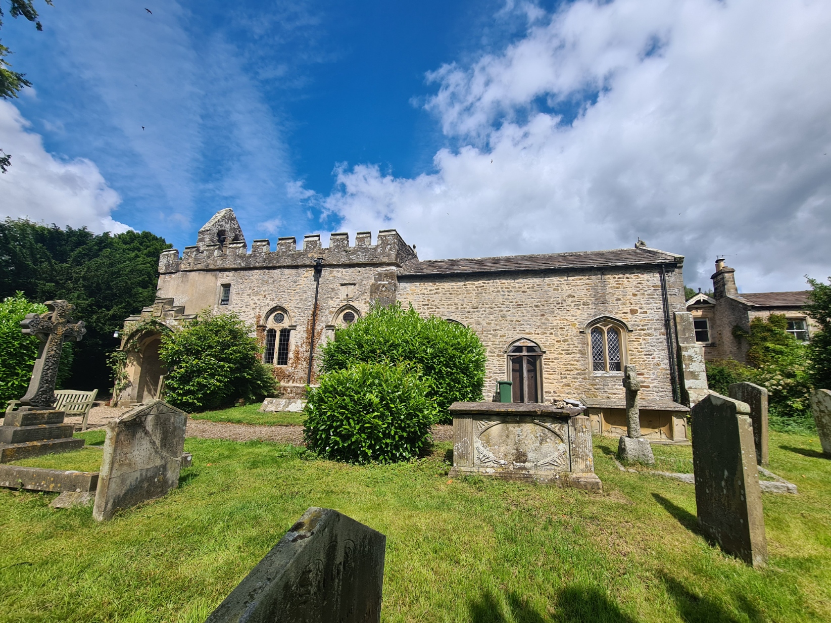
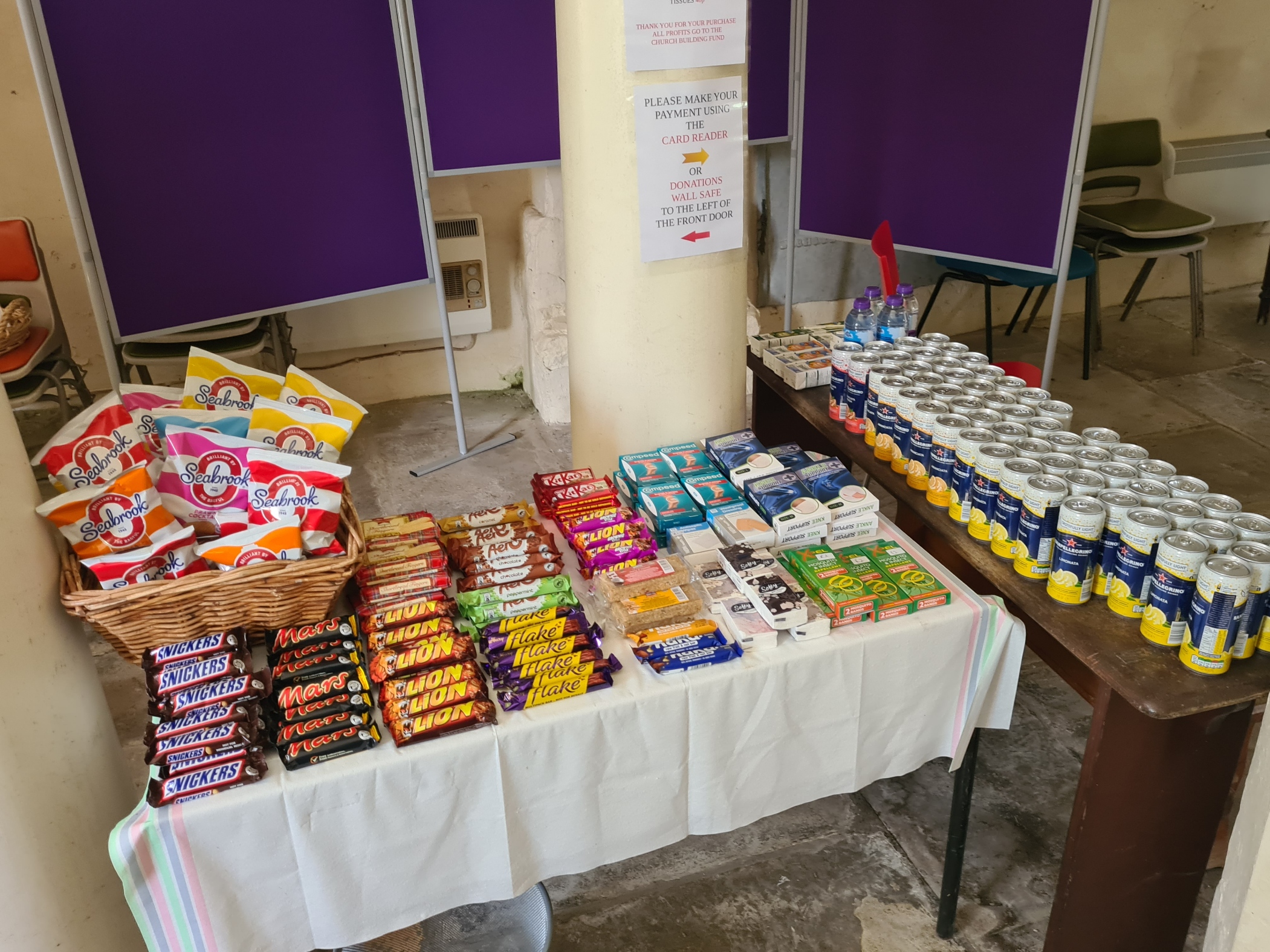
It was hot, with little shade and the flies were out in force again. I passed a few C2C’ers slumped on the grass, in any shade they could find, many looking quite exhausted and over-heated. But I had a destination in mind. My guidebook said that the church of St. Edmunds at Marske had snacks on offer. Though fully prepared for disappointment I walked into the cool interior to be presented with a really decent selection of cold drinks and snacks. I spent some time there, pleased to be removed from the troublesome flies. I cooled down a great deal, rehydrated, and chatted to the C2C’ers that also came in, including a 72 year old on his 25th crossing.
Eventually, somewhat reluctantly, I left, back to the hot trail and slowly up toward Applegarth Scar. The path actually swung round and passed below the low cliffs and began an easy saunter toward the village of Hudswell where I made an error. I hadn’t noticed a comment in my guidebook that the George and Dragon pub in the village had been voted Britain’s Pub of the Year by CAMRA. The trail doesn’t actually pass through the village and the pub went unseen and unvisited. Instead, I continued, through shady Whitecliffe Wood, on to muddy and slippery paths, followed by a road walk, gently descending toward Richmond, the view of the town below slowly opening up, promising rewards of resupply, cold drinks, a welcome shower and a bed for the night, for I had booked an overnighter in one of the pubs there.
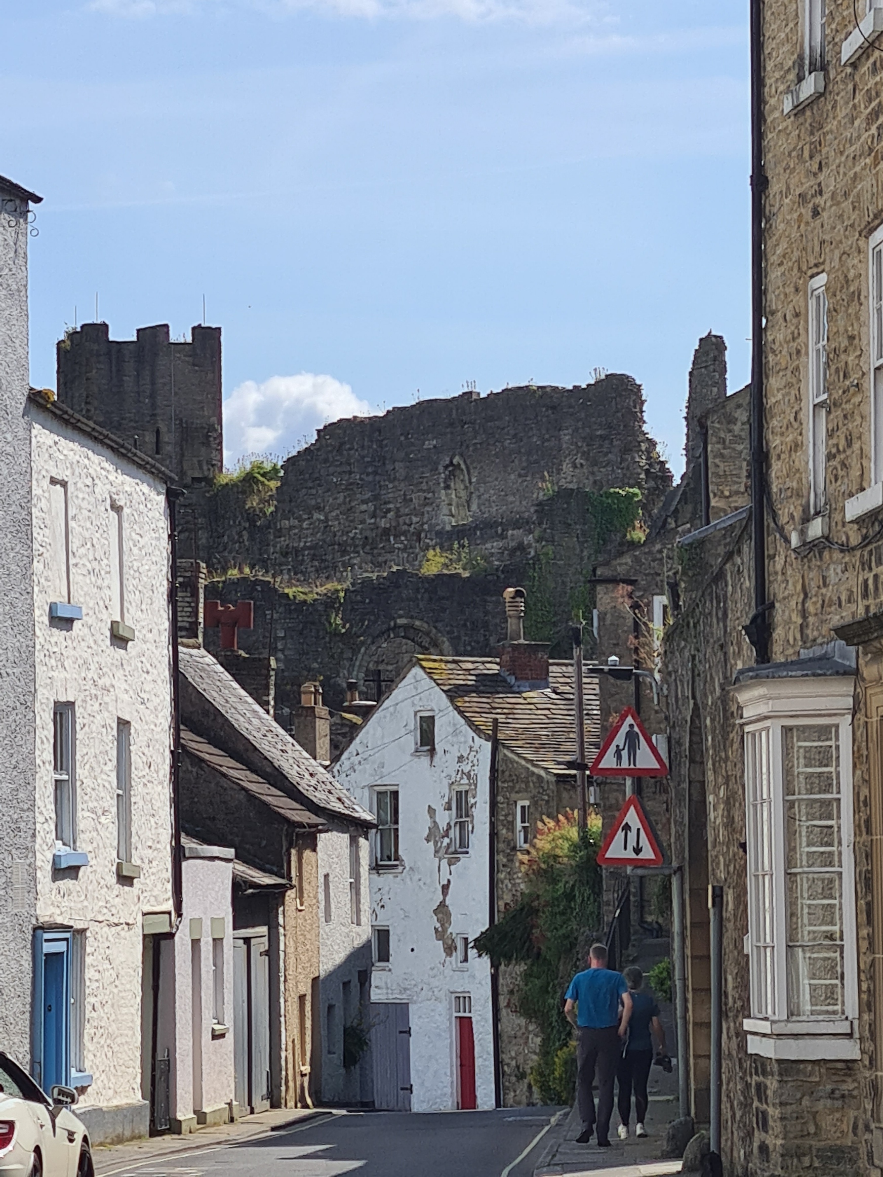
“Richmond is a town unlike others. a place unique, rich in relics of the past, steeped in a long history that still lingers in the ramifications of its castle and the narrow alleys and quaint buildings that huddle in the shelter of the massive Norman keep… it is too good to be by-passed”
Alfred Wainwright, ‘A Coast to Coast Walk’
Wainwright’s Coast to Coast route passes through Richmond on its traverse of northern England and he was obviously keen on the place. Years later, a local MP had been keen to obtain a change in status for the trail that Wainwright devised, hoping for a subsequent uplift in the economy of his constituency as hundreds of businesses provide accommodation, food, drink and services for the many thousands of walkers passing through. In 2016 Rishi Sunak wrote on his website “I launched a campaign this week with the backing of the Wainwright Society to have the route from St Bees Head in Cumbria to Robin Hood’s Bay in North Yorkshire made a National Trail”. The campaign was ultimately successful and the Conservative Government announced in August 2022 that the 190 mile Coast to Coast route had been awarded National Trail status. Sunak’s own political ambitions were also realised, if only for a while. He eventually became Chancellor, then Prime Minister. When I set off from St Bees on 8 July 2024, it was just four days after a General Election and the Tories had suffered the worst electoral defeat in modern history. While Sunak had somehow retained his Richmond seat he was replaced as Prime Minister.
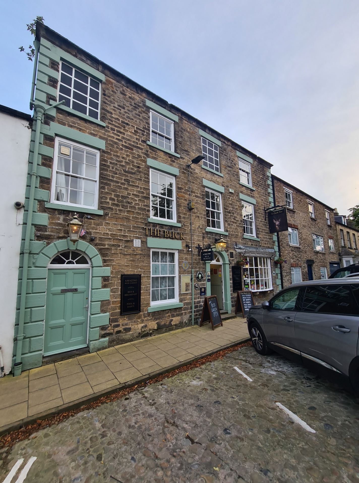
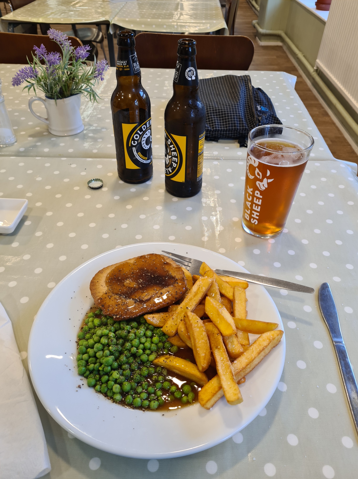
I explored the town as much as I felt I could. It has an impressively large and cobbled market square with numerous winding alleys, ‘wynds‘, leading away from it. It was busy with shoppers, tourists, locals, cars and noise. I was a bit weary and also frustrated. This is the largest town on the Coast to Coast and is a natural resupply point. However no-one seems to have filled the niche. I came across two other C2C’ers I had met previously, both looking for items of replacement gear, both frustrated. I had hoped to pick up a couple of dehydrated ‘backpackers’ meals, nope. Mountain Warehouse had nothing. I wandered the shelves of the nearby co-op and picked up a poor choice of food that would have to suffice for the next few days. Having looked around the town with as much enthusiasm as I could muster, it was off to the pub where I was staying the night. Enjoying a couple of welcome pints of their excellent Yorkshire Blonde session pale ale, 3.9%, from the Ossett Brewery, before going to my room. A hot shower, followed by washing my trail clothes- socks, skiddies, shorts and polo shirt, all hung by the open window to dry. Then an hours nap followed by a sort out of gear and food, a long call home to Mission Control, then a walk back into town. I wasn’t after exploring the many choices of establishment in the search for a meal so opted for cheap-n-cheerful at Spoons instead. A curry was accompanied by pints of Dinga Dinga, 4%, from Rudgate (OK, but a bit light in flavour and body) and Black Sheep Special, 4.4%, from Black Sheep Brewery (not in any way ‘special’, just the rebrand of their standard ale). Back to the Buck Inn for hopefully a good night’s kip. Today had been my final part of the Yorkshire Dales. Richmond is sometimes called the ‘gateway to the Yorkshire Dales. Instead, it was to be my exit. In to the Vale of Mowbray tomorrow.
Day eleven: Richmond to Danby Wiske
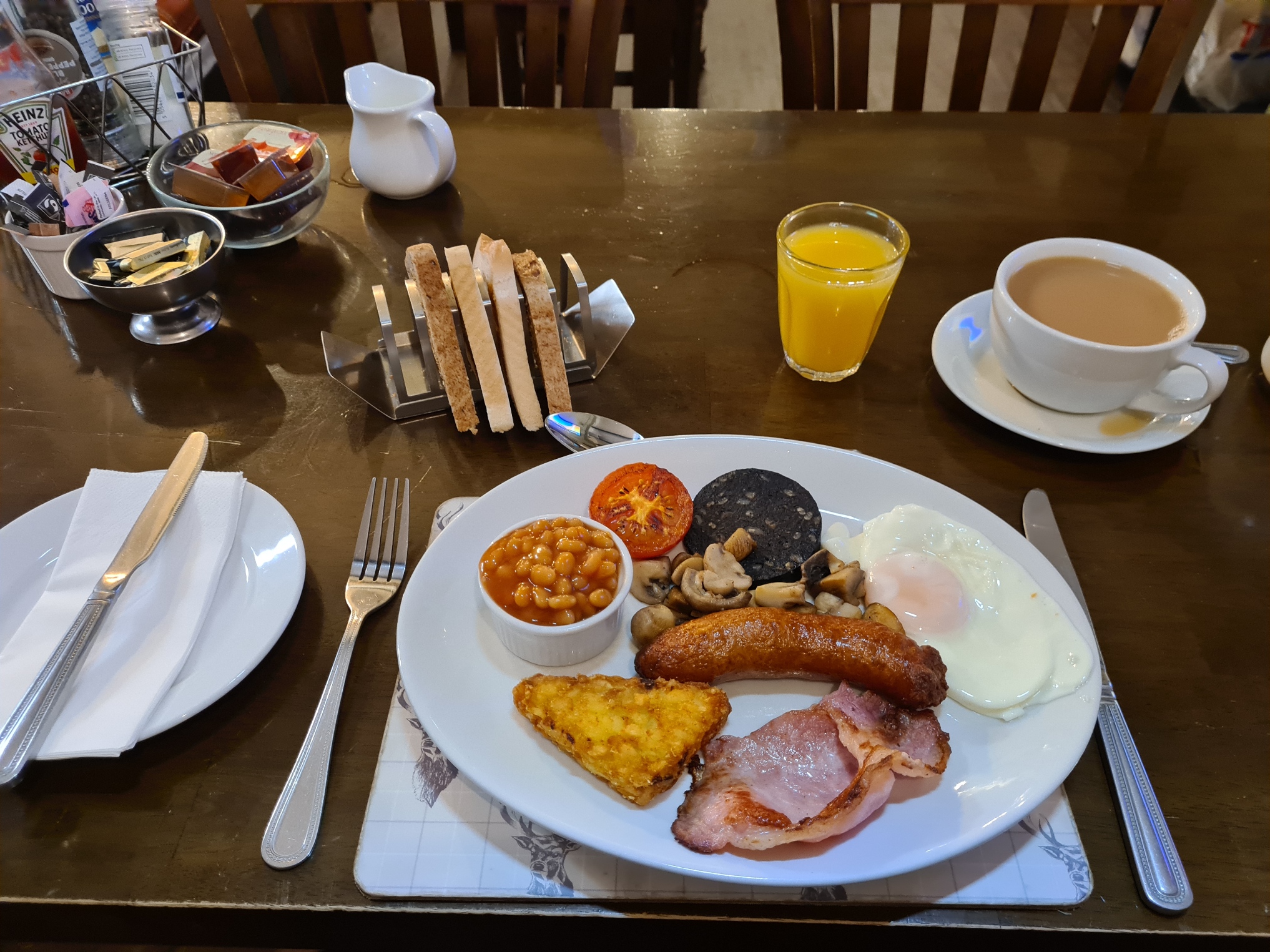
I slept well, despite a return of the aches. I had hoped for a long night’s kip but spent far too long updating a group chat with my progress so far and it was past midnight before I got to sleep. Thankfully, as usual, I was in no rush to get moving in the morning and I went down for my booked breakfast at eight.
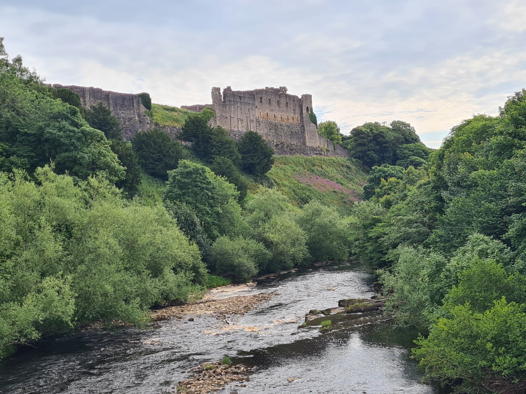
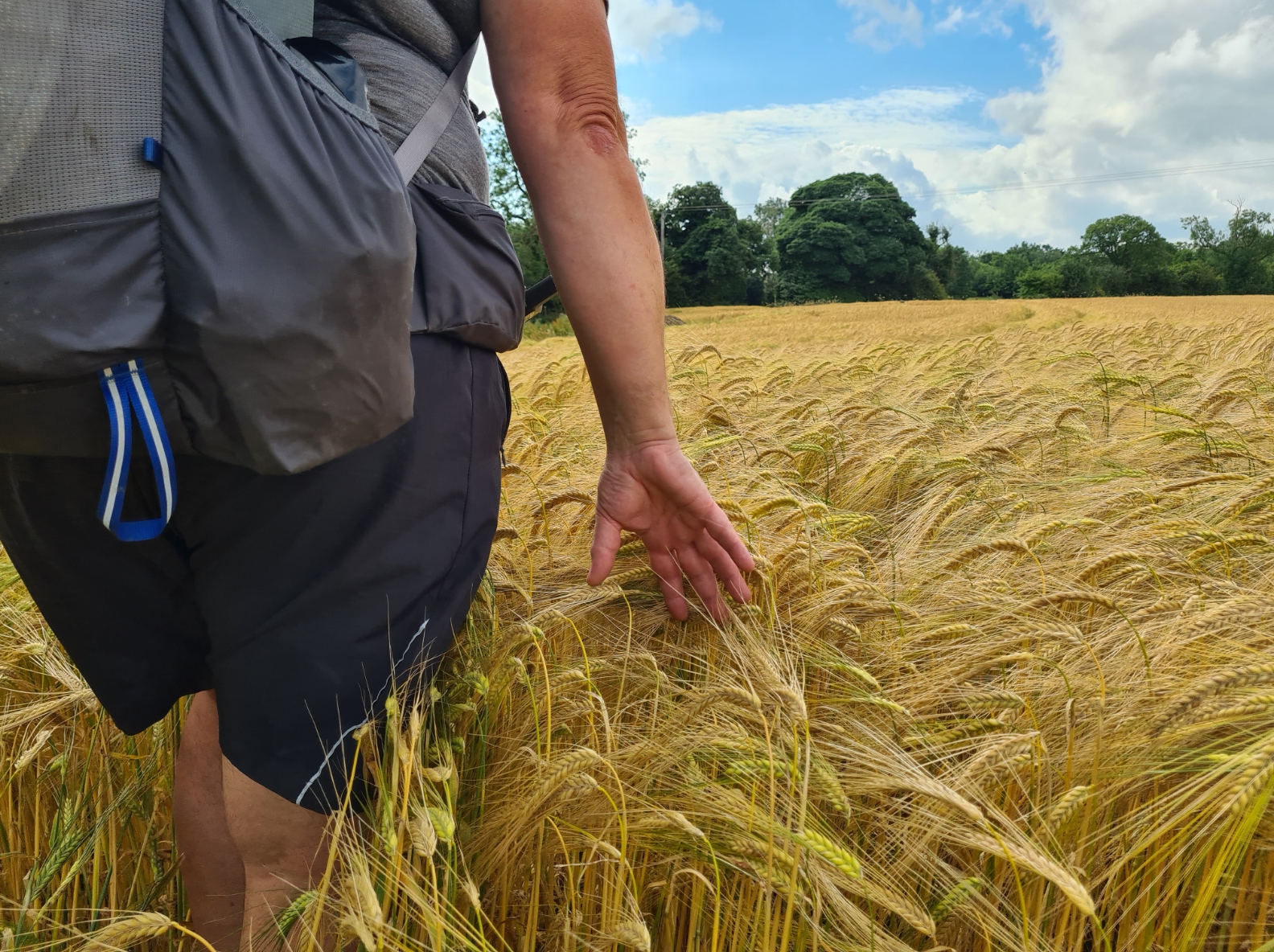
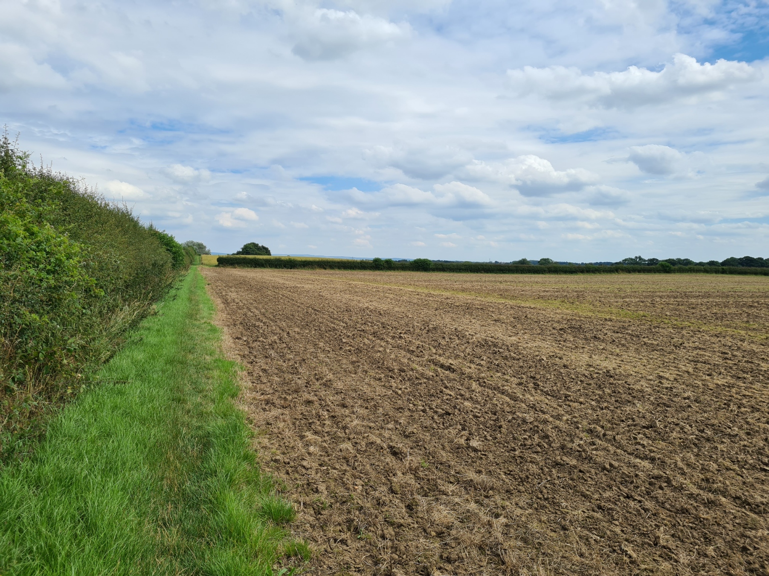
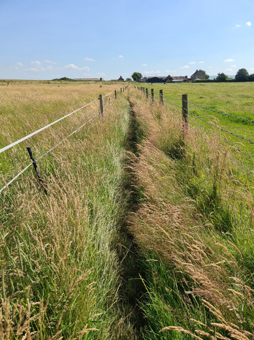
My washing had dried overnight. Once I had packed, and feeling fresher and cleaner than I had in days, I walked out into the still quiet cobbled streets at nine, for the walk down the steep hill out of town, heading to the bridge over the river, the castle looming over it. I followed the path along the river, toward the military training ground, past the evil smelling sewerage works, sorry, ‘water treatment works’, road-walking, agricultural fields, and… well, not a great deal more to say about the day’s walk from there on. Today is easily the least interesting day on trail.
Leaving Richmond the map informed me there is at least 22.5 mile/36km of low lying pasture and arable farmland in the Vale of Mowbray to cross prior to climbing up to the moors that would take the C2C’er to the coast. Some walk it over one day but I had broken it into two. I was actually taking an alternative route via Danby Wiske that would add a little more distance to this section.
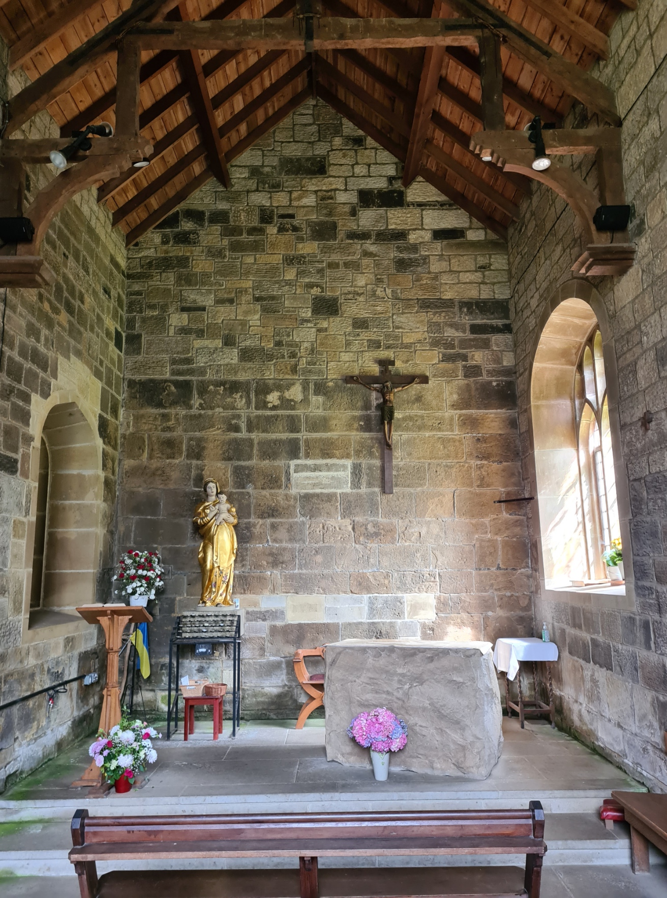
Some Coast to Coasters don’t even bother with the Vale of Mowbray, choosing to use transport to skip this section. I met two hikers days later that had done the same. Their decision to do so could be one of many- time constraints, injury, boredom. Fine, if that is your choice, go for it. But don’t go telling me you have completed the Coast to Coast, because you haven’t. Every long distance trail has parts that are of less interest than other sections. I was counting on a couple of less demanding days to negate any need to take a day off, a rest day. I also knew I had a decent stop tonight. Perhaps the best bit of today’s hike was actually a halt I made. St. Mary at Bolton-on-Swale has an intimate link with Alfred Wainwright. Not only is the church mentioned in a couple of his books, he had also been filmed here during the making of the BBC Coast to Coast TV series. One snippet showed him signing the visitor book, subsequently unearthed many years later.
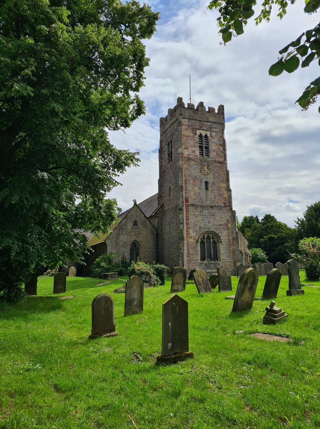
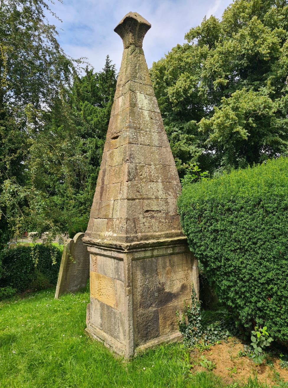
Perhaps unsurprisingly, this is another church that welcomes C2C’ers. I dropped in to mooch about the church, then made use of their kitchen to make a couple of mugs of tea to drink with a roll from my pack that I stuffed with corned beef and tortilla chips. Leaving the church I stopped to view the large memorial to Henry Jenkins. This parishioner was reputed to have lived 169 years!
“Although in the midst of a thriving husbandry, few people are seen: in fact, one feels lonelier here than one does in the mountains. There is nothing to see, nothing worthy of illustration, nothing of interest to anyone but farmers. Danby Wiske is the only village and is less attractive than it’s name. At 110 feet above the sea, it is the lowest point between the coastal extremities of the walk. Verily a slough of despond”
Alfred Wainwright, A Coast to Coast Walk, 1973
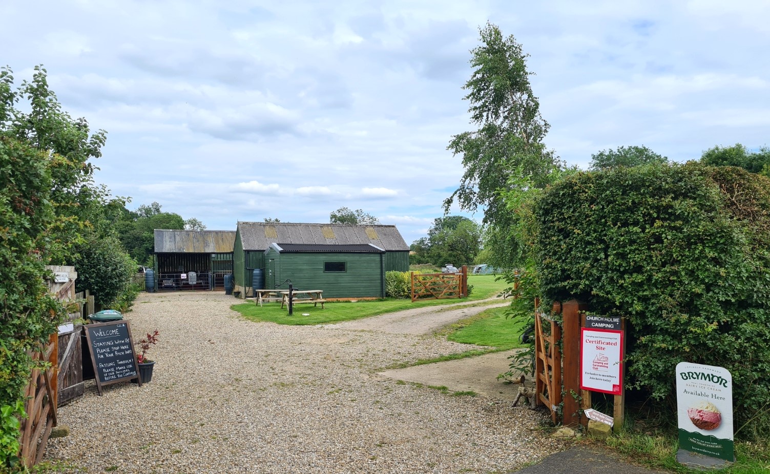
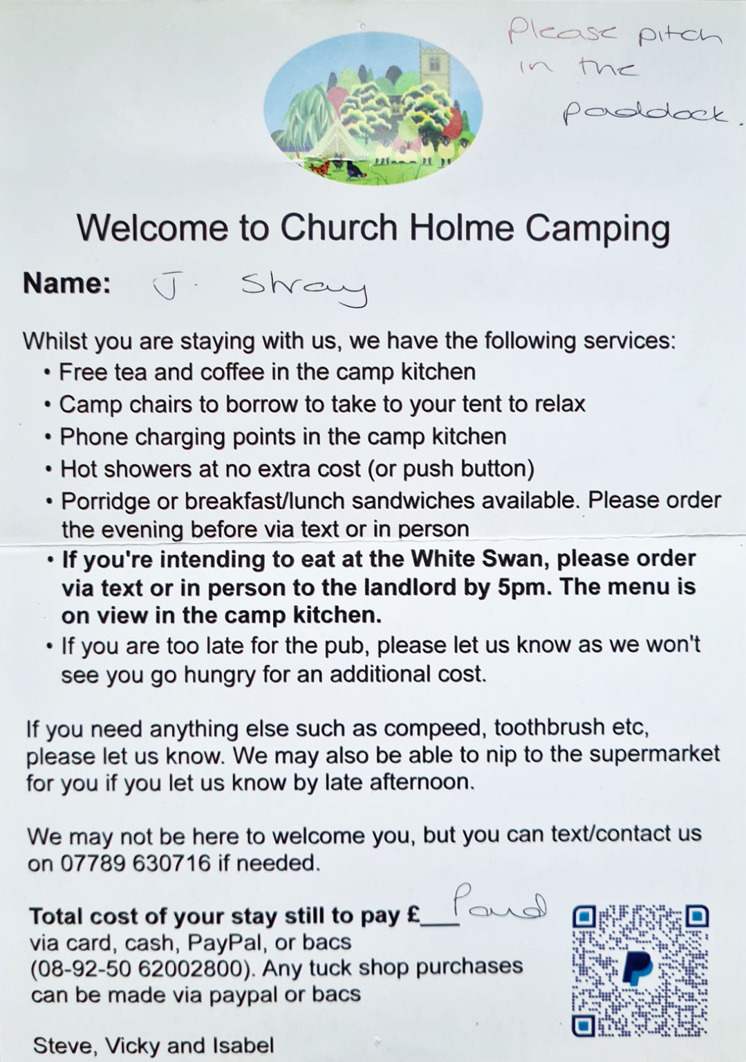
From there it was uneventful walking to the campsite at the small village of Danby Wiske. Wainwright was thoroughly unimpressed with the village but I am sure he would revise his thoughts if he visited today. If my day’s walk had been forgettable, the friendly welcome I received at Church Holme Camping was anything but. This is amongst the best of halts on trail. Made so by the hard work of the owners, Steve, Vicky and their daughter Isabel. They only opened the small two acre site in 2021 and are determined to make it a success. There is a dedicated paddock for C2C campers, a large campers kitchen with plenty of facilities (and chickens wandering in and out), and easily the best showers of the whole trail. They provide a little tuck shop stocked with essentials (and good ice cream) and a resting area for those simply passing by and not halting.
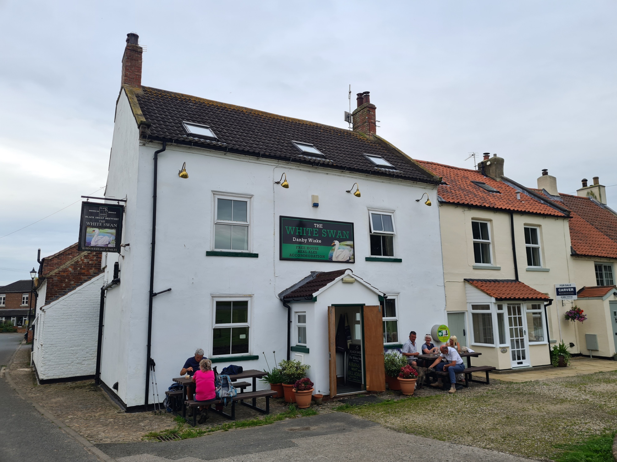
It was here that I met a couple of my fellow C2C’ers. Boots off, one was suffering her first blisters of the trail and neither were looking forward to having to walk another 15km today. Not everyone is as fortunate as I in having no time constraints on this walk. Despite it being mid-afternoon, I settled back, enjoyed a tub of mint choc-chip ice cream and the site owner Vicki relayed my pre-order for my evening meal to the local pub (an odd concept, it has to be done by 17.00). Then I threw the Durston up and enjoyed a long and welcome shower as despite my short day on trail, it had been a hot and dusty walk. I attempted a nap but it was warm and muggy so as soon as decently possible, I walked the short distance to the White Swan for my meal at 18.30. Not to everyone’s liking, my liver in gravy was both filling and tasty. In common with the campsite, the owners were working hard to make the pub a success and I could almost forgive them the peculiar early pre-order necessity for food. Though I was told they would never let a hiker go hungry and would rustle up ‘something’.
The White Swan also keep very good beer and I enjoyed lovely pints of The Bitter Ex, 3.7%, from Three Brothers Brewery, a delicately flavoured blonde- Sleck Dust, 3.6%, from Great Newsome and a truly excellent dark Ruby Mild, 4.4% from the Rudgate Brewery. Enjoying my evening immensely, I over indulged, splurged on a bottle of Shiraz and sat chatting ’til fairly late with a couple of C2C’ers staying that night in the pub. Despite an indifferent section of trail today, my overnight halt was both convivial and appreciated, I wobbled off back to my tent in fine spirits.
Day twelve: Danby Wiske to Osmotherley
Unsurprisingly I slept well, waking to a hot sun burning down on the shelter. It became uncomfortably warm and despite both vestibules being open, there was no breeze. I lay the quilt over the tent to air a while, chatting to a late arrival also camped in the paddock who was quickly packing up. It looked distinctly as though he was attempting to avoid paying a pitch fee. I then went and sat in the campers kitchen, with a couple of mugs of tea, poring over map and guidebook, trying to decide whether to walk all the way to Lord Stones or break the next section in to two. Steve turned up with my two bacon rolls, pre-ordered when I arrived yesterday and we chatted at length about his plans for the campsite.
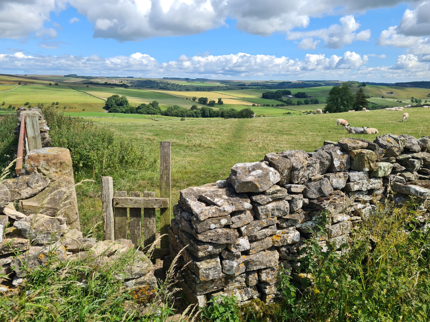
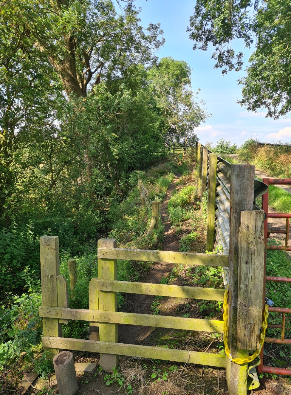
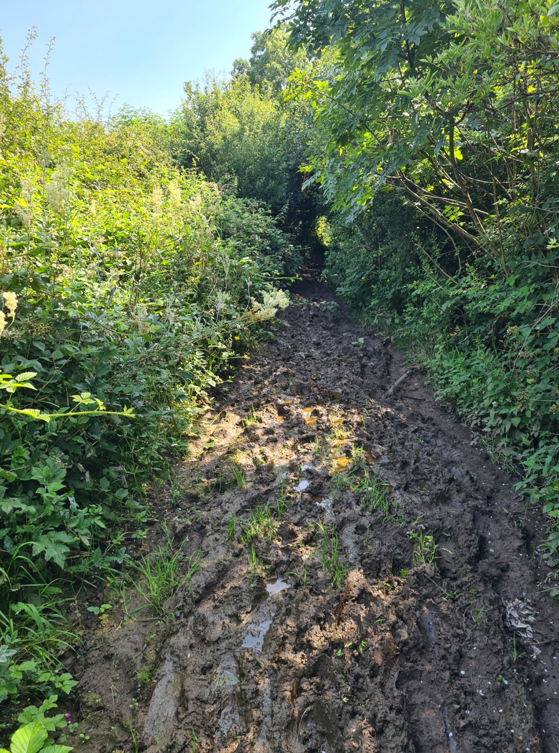
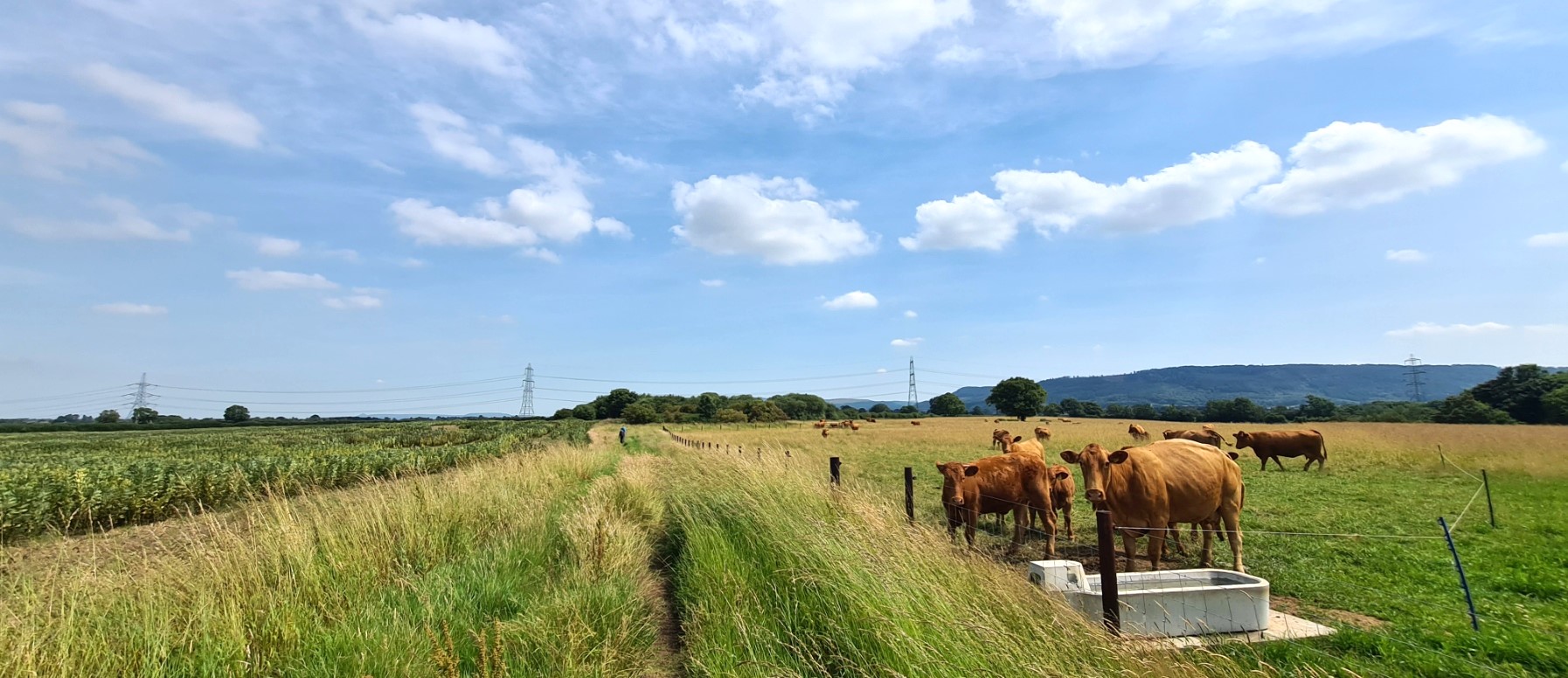
Finally packed and away, I was aware that I probably had a repeat of yesterday’s simple agricultural wandering. But it was even worse. Much of the morning section was crossing an area where they patently didn’t want visitors. The muck spraying I can forgive. That was, I am sure, coincidental. I crossed a field of livestock, what could be intimidating to many, if not me. Young heifers, cows and three bulls. A stretch of the A167 with fast moving traffic and no verge. Three broken stiles with accompanying barbed wire to cross to get round a single locked gate. A narrow overgrown and muddy path where I snagged my pack on overhead branches despite my bending double. An annoying damaging scrape down my solar panel on the top of the pack resulted. There was one good ‘honesty fridge’ at one farm where I halted awhile, but that was an exception. Nearing the A19 the paths improved very slightly, with mostly just nettles and barbed wire to beware.
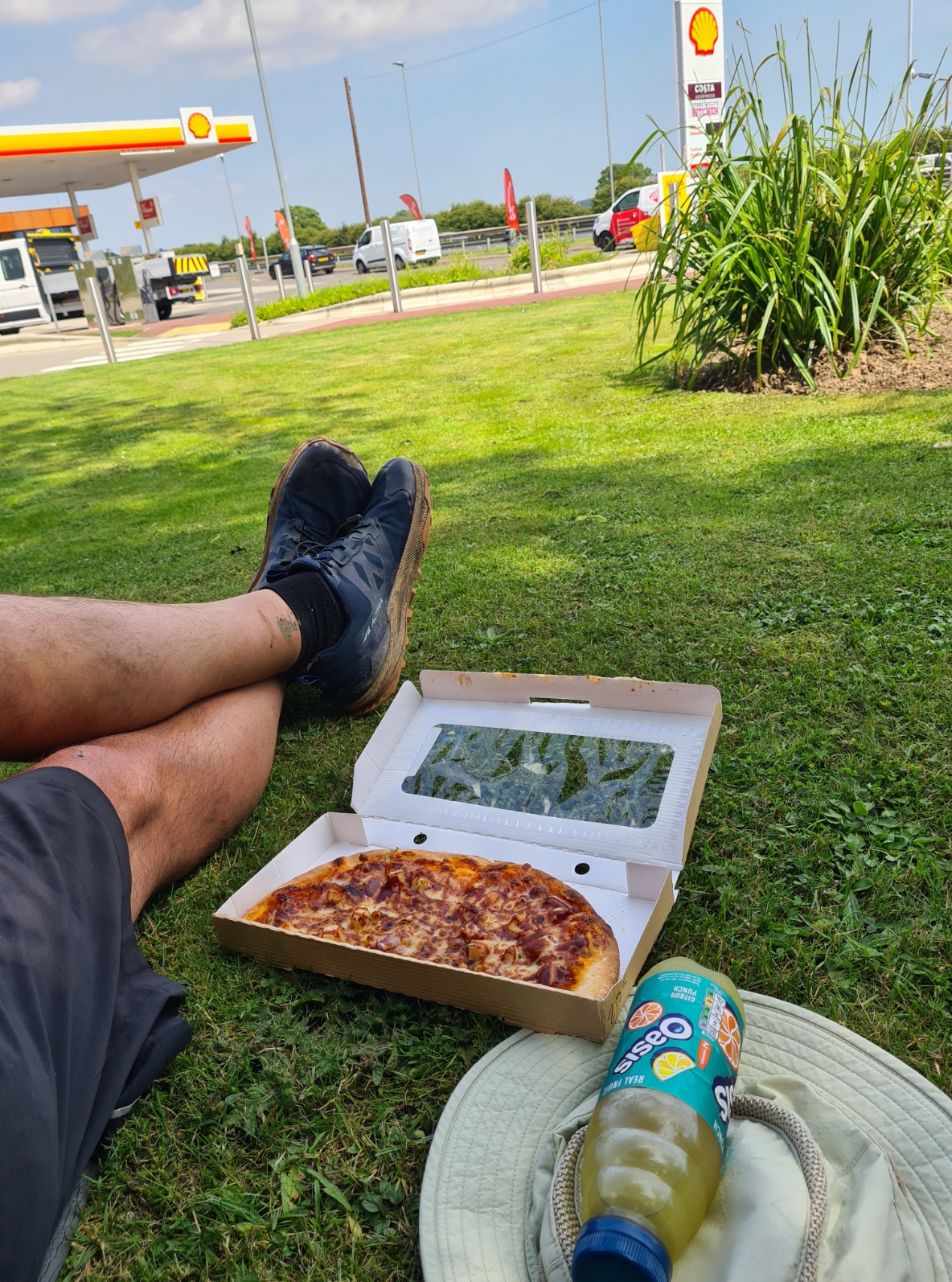
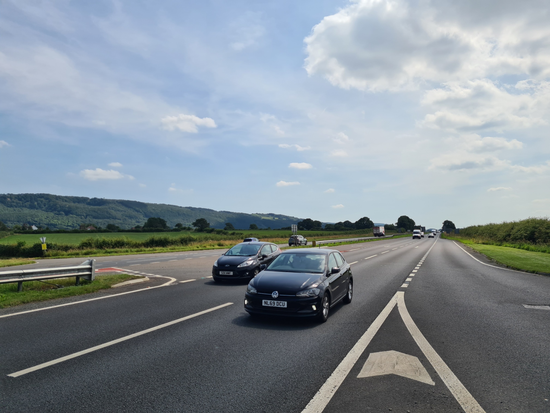
The A19 and A172 make for dodgy crossings. I stopped short of the first, calling into the service station for a pizza and cold drink for lunch. I had a vantage point to watch a succession of C2C hikers braving the road crossing. Some fortunate with wide gaps in the traffic, others inviting loud and insistent blasts from speeding cars and lorries. If ever there was a part of the trail that requires money spent on it, as it moves to National Trail status, it is the building of a footbridge here. Or just a mile or so south where it can cross both roads. It will no doubt take the death of unfortunates to make any change. One death is a footnote, two a coincidence, it takes at least three before those in officialdom sit up and take notice. Depending on where you brave it, there are at least four lanes to cross, with filter lanes as many as seven. I took my time and waited for a decent gap, no doubt making a few drivers a bit nervous, and lived to tell the tale.
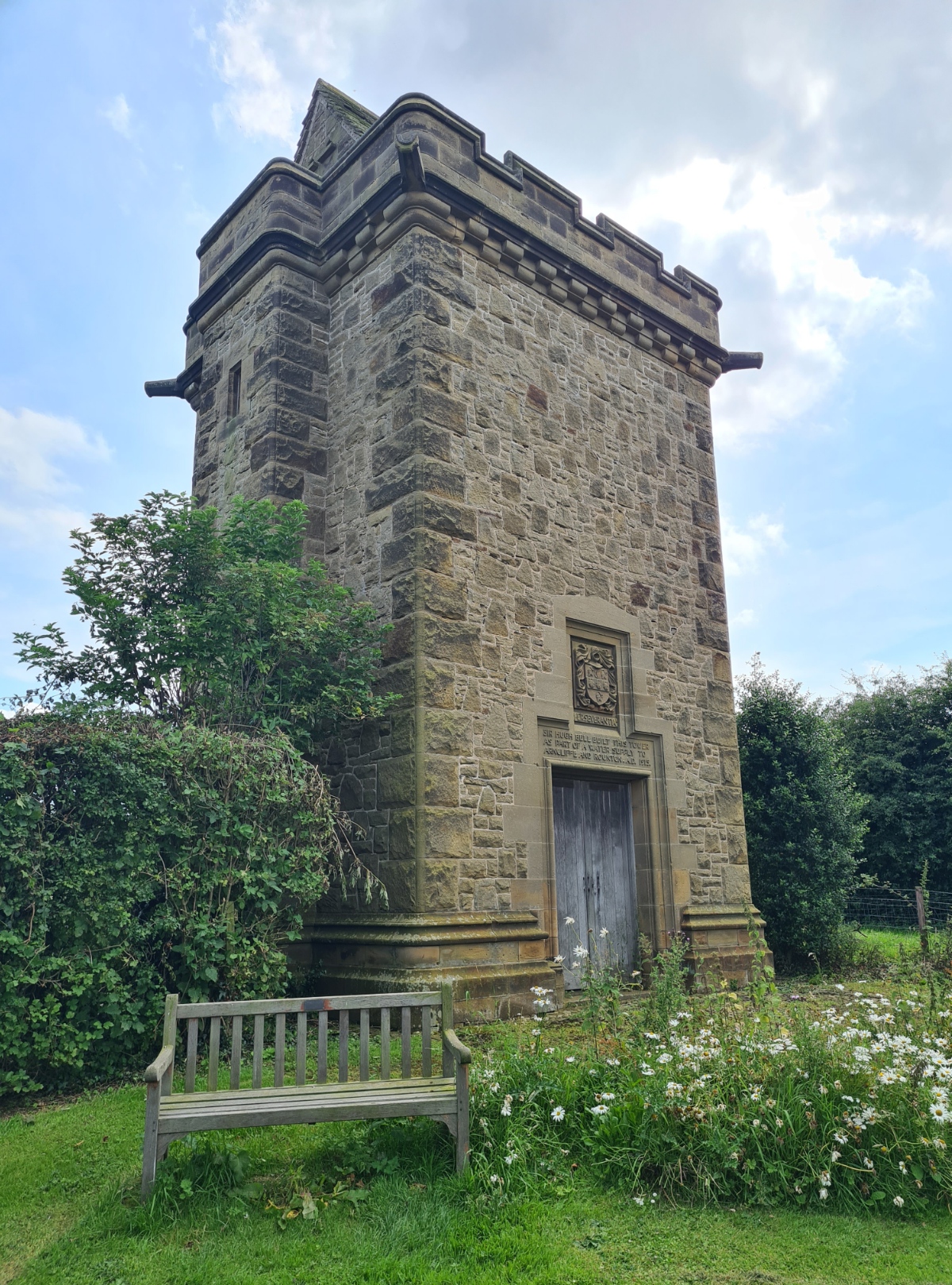
Once across the first road and heading to the next, the trail passes through two small settlements. First Ingleby Arncliffe, with it’s impressive Grade II listed water tower, then Ingleby Cross at the A172. I passed a café at the second with a Coast to Coast sign above it’s door, announcing that I had just fifty miles of trail to complete. Surely something to celebrate!
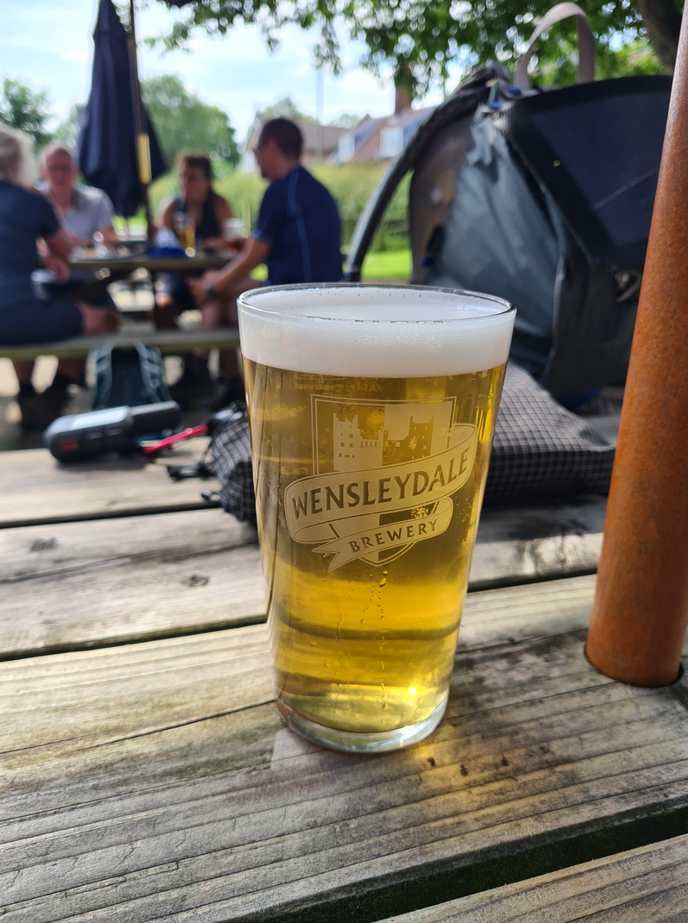
It was hot enough and with plenty of hours left of the day, that I halted for a pint. I am glad I did. The Blue Bell kept one of the best pints I enjoyed on the entire crossing. Fire Starter, 3.7%, from the Wensleydale Brewery was a pale ale, with refreshing bitterness and spiciness from its Apollo and Dana hops. A real treat and just right for the weather. I think I showed remarkable restraint by only stopping for the one. It also set me up for the climb that followed.
It had only been a couple of days since I left the hills behind me to cross the Vale of Mowbray but the climb up through Arncliffe Wood came as a bit of a shock to the legs and lungs that still wheezed a bit. That cold still lingered. Leaving the wood behind, the view of the plain I had just left opened up on my right. I had plenty of time so decided to leave the trail for a little, taking the walk up to the Lady Chapel. Built by Carthusian monks from nearby Mount Grace Priory in the 15th century, it has been heavily restored and I poked my nose in to the chapel for a look around and brief cool respite from the heat of the day.
Because I was staying at Osmotherley tonight I was now off trail. It is only a couple of miles, but still meant a walk down a hill, entailing a walk back up tomorrow.
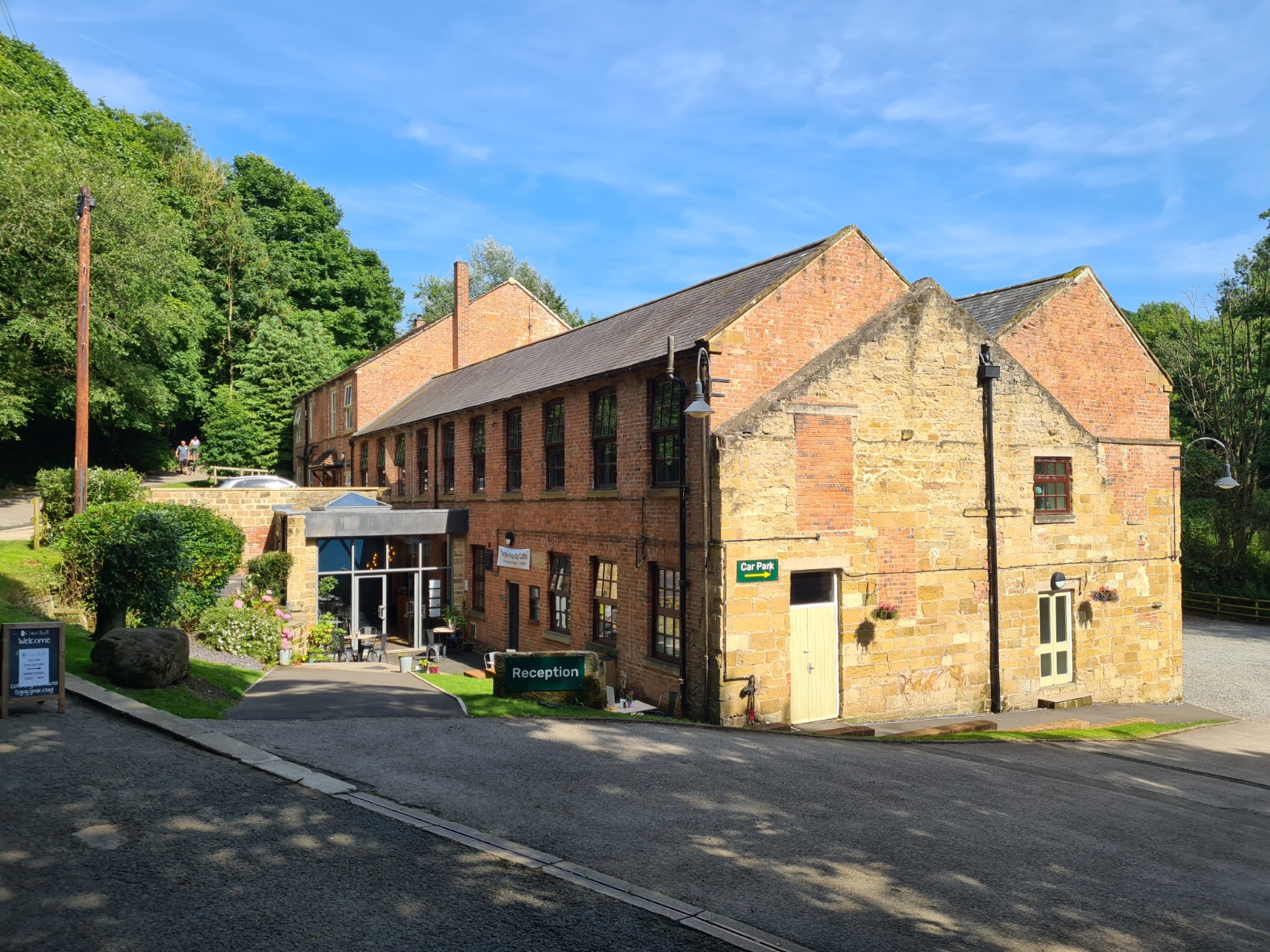
I walked the Cleveland Way back in 2019 and stayed at Cote Ghyll Mill YHA during that hike and knew it would be an OK halt. When the YHA had abandoned direct management of the Youth Hostel in the ex flax mill a decade ago the owners of the neighbouring campsite took on the operation and now run it professionally, making the profit that YHA was incapable of realising. The reception is efficiently operated by a personable bright young lady but the entire hostel does seems to lack the YHA ‘feel’.
I was camping outside and the pitch I was given was a bit poor, slightly sloping and subject to noisy people frequently walking past from the large campsite to the café in the mill. The YHA is reasonably priced, though not as cheap as it used to be. Even the large fluffy towel I hired for the night. The last time I stayed it was a quid, it is now £2.50. But camping here gave me access to a (tiny and poor) shower, laundry facilities, lounge and campers kitchen if I wanted them, and more importantly, an evening meal tonight, and breakfast tomorrow.
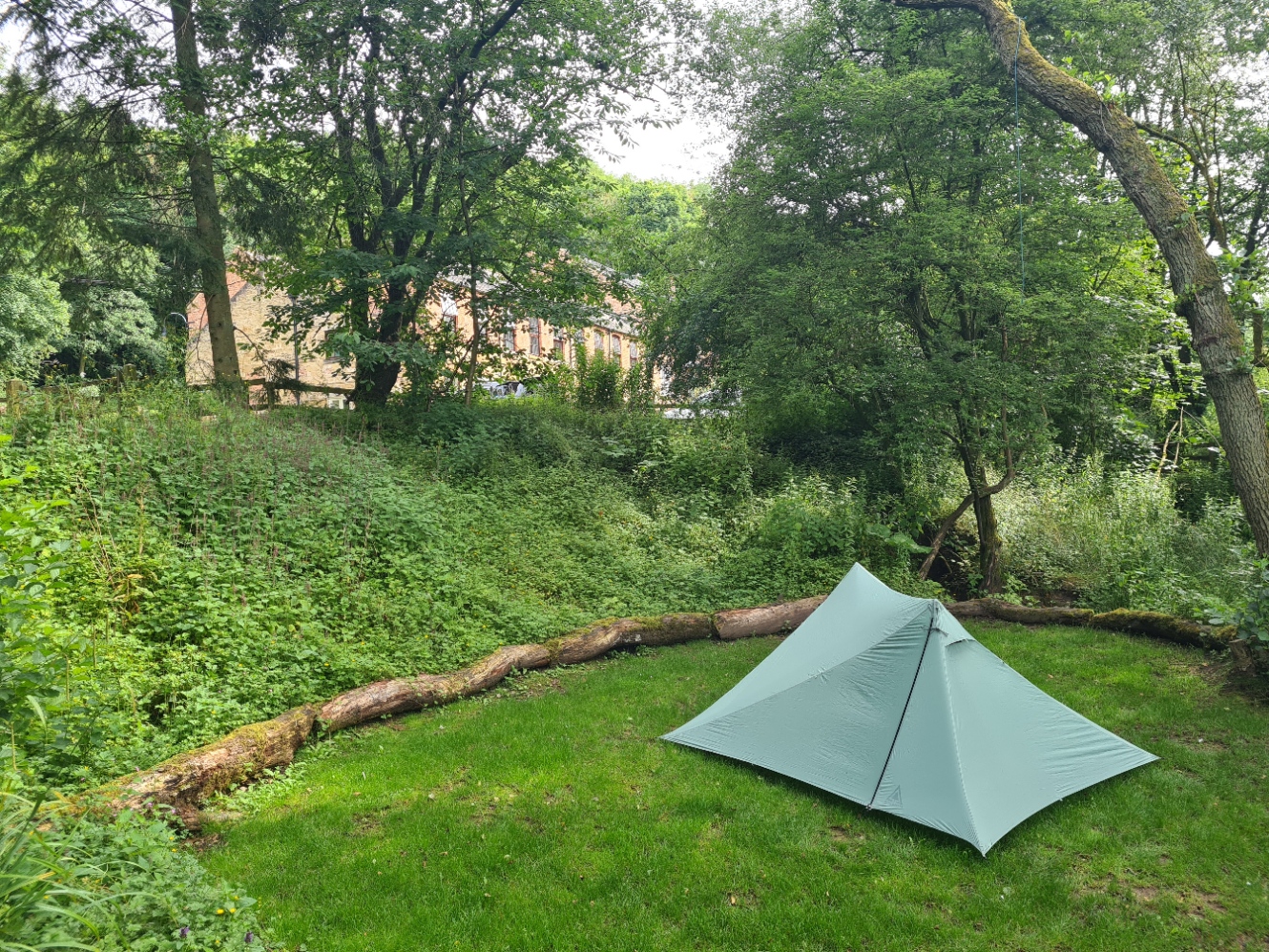
Having showered I took a bit of time cleaning up my small selection of toiletries in their ziplok as my foot balm had melted in the heat of the day, leaked from its tin and covered everything. Not the first time this has happened in hot weather and I must find a solution. To get away from the noise outside the tent I retreated to the hostel lounge, charging electrics and messaging home. Then moved next door to the empty restaurant to sit ‘billy-no-mates’ to eat. If my memory is correct, the quality of food and service in the hostel has dropped considerably since I last stayed here. But… it is a licenced premises so I was able to have a couple of bottles of indifferent and too cold beer with my equally as indifferent, but filling, steak pie and chips. Moving back to the lounge to read, plan tomorrow and make notes in my journal, which didn’t take long as it had been a mostly uneventful day.
When I set off to walk the Coast to Coast Path I had just been excited to begin another trail, a trail with a good rep and I had high expectations when I started. Despite a nagging lingering illness, those expectations had already been met. The Lake District had been excellent and the Yorkshire Dales had delivered a change in terrain and feel. I was glad to now be past the easier hike across the Vale of Mowbray. But it had provided a couple of days to rest a little, an opportunity to gather my strength for the final leg. I was now on the edge of the North York Moors, my final challenge.

Re Church Holme camping – It’s good to hear of a campsite that values backpackers rather than just caravanners, car-campers and glampers. Long may they prosper!
LikeLike
Absolutely Daniel. I think they were a Camping and Caravanning Club ‘certified site’, which I think limits motorhomes, etc, to a half dozen or so, keeping it small and pleasant
LikeLike
Oh that’s interesting, as I’ve always understood “certified site” to mean “a field with permission for camping but no facilities” which excludes anyone without their own toilet due to hygiene regs. Yes, I know you’ve got a trowel, but apparently the licencing authorities don’t recognise that!
LikeLike
Did a bit of digging (sorry!). While it is outside the scope of us campers, referring to those motorised, the minimum requirements as a ‘certified site’ are: ” fresh drinking water tap, a sealed chemical disposal tank, a rinsing water tap with a non-return valve, and dry waste disposal”
LikeLike
Though of course, this is ‘minimum’, and they can provide more facilities
LikeLike
Enjoyed reading this, particularly when I realised from your dates that we’d done our own Coast to Coast just a few days ahead of you in 2024. Although we took a slightly different route to the “official” one, particularly at the beginning and end, we were on the “official” route through Swaledale and the Vale of Mowbray. I thoroughly endorse your comments both about the excellence of Danby Wiske camping (got our vote as best campsite of the trail), and of the awful state of the paths from Danby Whiske to the A19. Indeed, this stretch of trail has become something of a benchmark in family lore for dispiriting, muddy, partially obstructed, overgrown paths! I hope they improve it significantly now its a proper National Trail.
LikeLike
Thanks for your comment Patrick. While every trail has it’s ‘less than desirable’ elements, some parts of this now National Trail do require serious action. However, when every inch of the trail is actually passing through someone’s land, there is probably little the authorities can do other than encouragement, support and perhaps a little injection of cash to improve fence crossings and cut back a bit of vegetation. That said, the Coast to Coast does take in some of the very best that England has to offer and I understand it’s attraction. I enjoyed the very great majority immensely.
LikeLike