
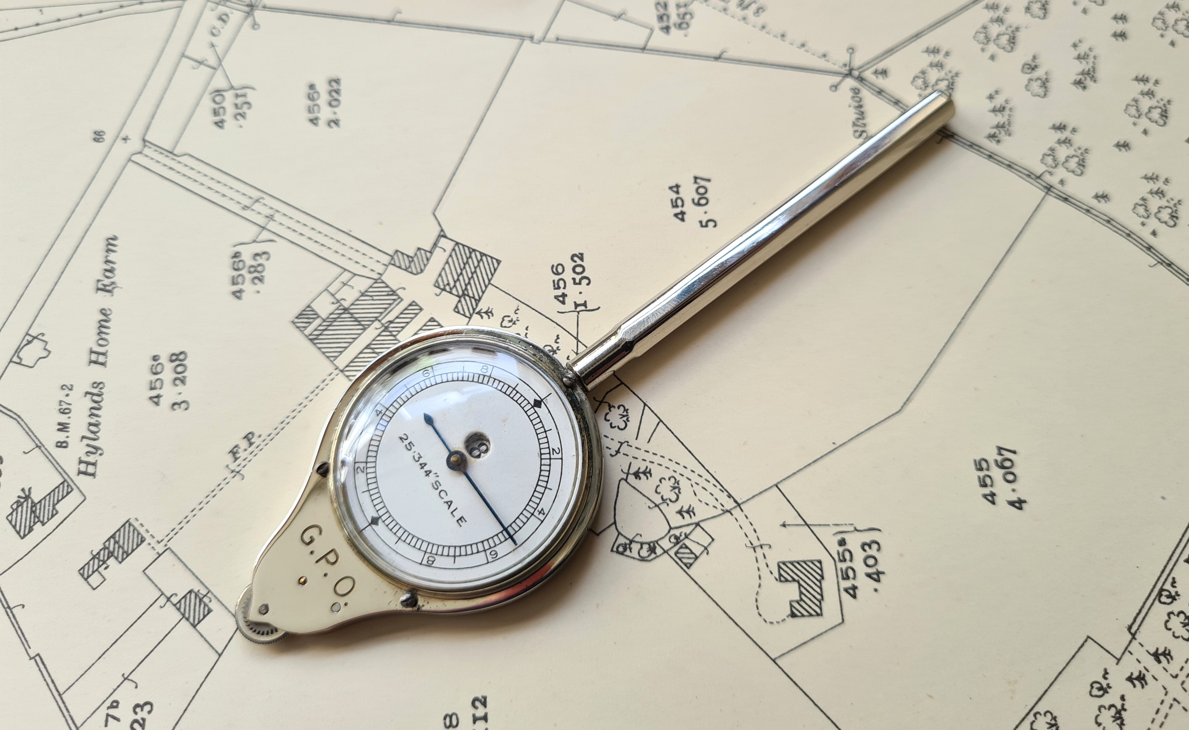
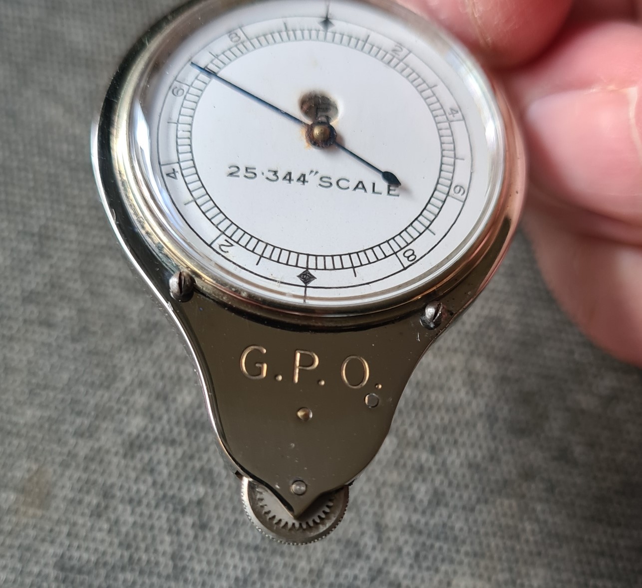
This month’s measure is a bit of an oddity. It is made specifically for large scale maps and measures at 25.344″ scale, also known as twenty-five inch to one mile. It was primarily used by governmental organisations, landowners, estate agents, solicitors, and those engaged in land management.
Maps on the 1:2500, or twenty-five inch (25″) scale, were published by the Ordnance Survey for the whole of “the cultivated districts of Great Britain“. The twenty-five inch scale was officially authorised as the basic scale in 1855 but only two years later was discontinued, until re-authorised in 1858. It was only mountainous areas in Wales, parts of northern England, and high ground in the South-West of England that remained unmapped at this scale. Each sheet measured 38 inches by 25 1/3 inch and contained an area of 1.5 square miles, or 960 acres. They are incredibly detailed maps and examples for England and Wales can be seen here and Scotland here. Houses and buildings are shown to scale. Field enclosures are shown, with each given a reference number and the area of the enclosure printed under it in acres and decimals of an acre. Roads, railways and rivers are also given reference numbers and the area occupied by them on the sheet shown. No contours are included.
Until 1911, these 25 inch maps were the largest scale on which town maps were commonly obtainable from the Ordnance Survey. In that year, enlargements of these were first produced and a large number of 1:2500 scale plans were doubled to 1:1250 scale (50.688 inches to the mile). These were produced for the Inland Revenue Department, covering portions of cities and towns for the purpose of land valuation. They were placed on sale to the general public at the same time. This months measure could be used with both the twenty-five inch scale and the new fifty-inch scale maps.
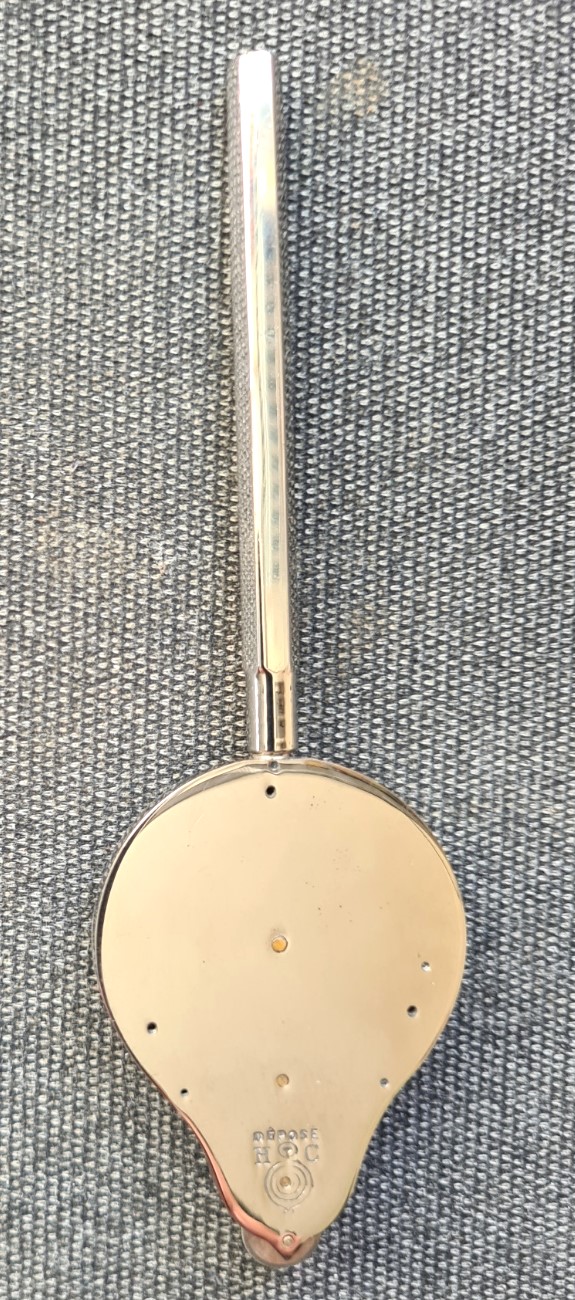
The initials on the rear of the case indicate the maker- ‘Henri Chatelain’. The initials HC are above a curvimeter, the centre of the curvimeter trademark logo being one of the pivot pins for the internal mechanism cogs. There is also the word ‘Déposé‘ above the trademark. This word is not part of the trademark but simply indicates that the manufacturer has registered the design. Despite having left a legacy of beautifully constructed instruments, it is difficult to tie down much information about Henri Chatelain beyond the manufacturer being founded in the late 1870s (variously 1876 or 1878) and based at 10 Rue de Belzunce, Paris, France.
The Henri Chatelain company name was active until around 1898 when the name Fritz-Chatelain becomes more prevalent in relation to the manufacturer. Swiss owner Fritz Gustave Chatelain (FC) registered his company name in Neuchâtel, Switzerland on 14 March 1881. There is some cross-over of the measures produced with either of the company’s trademarks appearing on map measures though HC appears to be, by far, the prevalent mark found on earlier surviving examples. Henri Chatelain died 1 June 1921. F. Baudet took over the company from 1921/2, retaining the Chatelain name. The Chatelain/Baudet company was subsequently taken over by Henri Burnat c1940 and the trademark logo was then altered to HB with a period where both sets of initials were used.
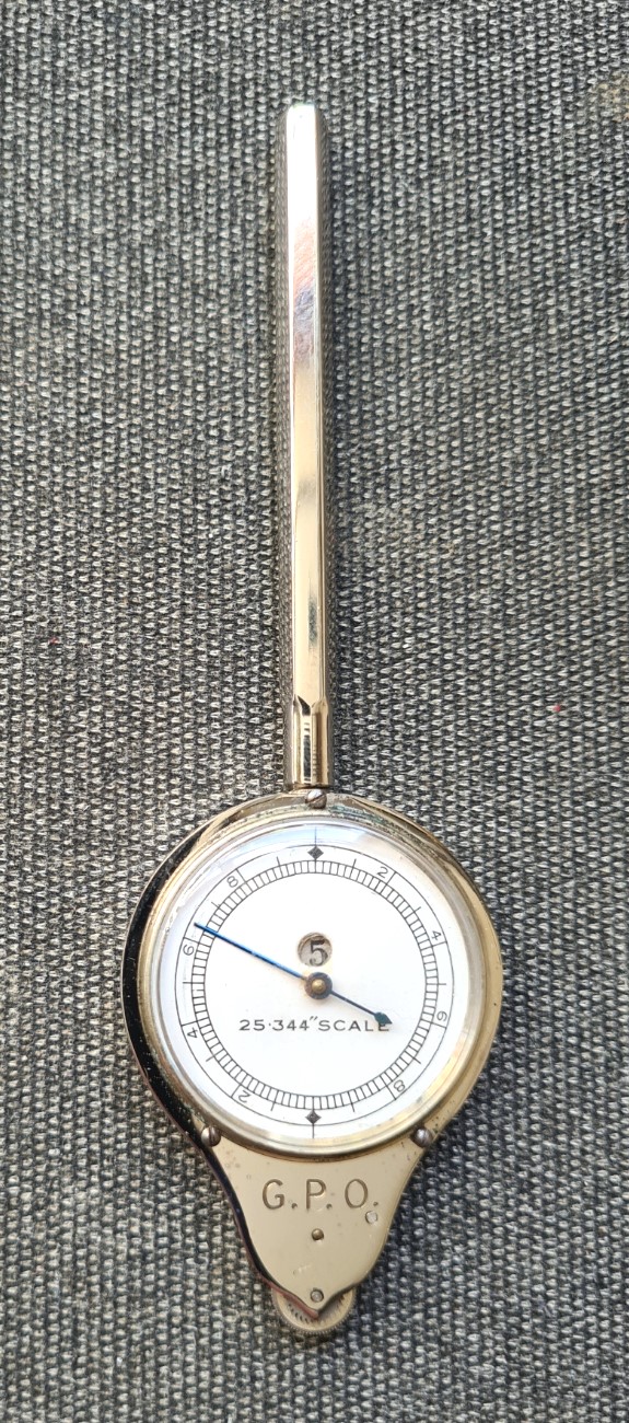
The measure is simple to use- first zero the needle by rolling the tracking needle until O is indicated on the counter and the needle points toward the top of the dial. Hold the measure at less than vertical, and trundle the tracking wheel at the base of the case forward along a line on a map, drawing or chart. Then read off the measured distance at the appropriate scale Despite the lack of any knurling on the smooth handle that would aid in gripping the instrument, the measure is comfortable to use and well sized to the hand. It is 117mm long, including a 67mm handle. The case has a diameter of 35.7mm diameter and is 8.9mm deep, across the domed face of the crystal. It weighs 37.8 grams. The instrument has a hexagonal-in-profile steel handle that screws on to a 5mm threaded section at the top of the polished steel case. The crystal over the dial face is pinned to the case by three tiny screws. Beneath this, a blued needle indicates the measurement as it rotates a round the paper dial. The measuring scale- “25.344″ scale” is printed on the dial.
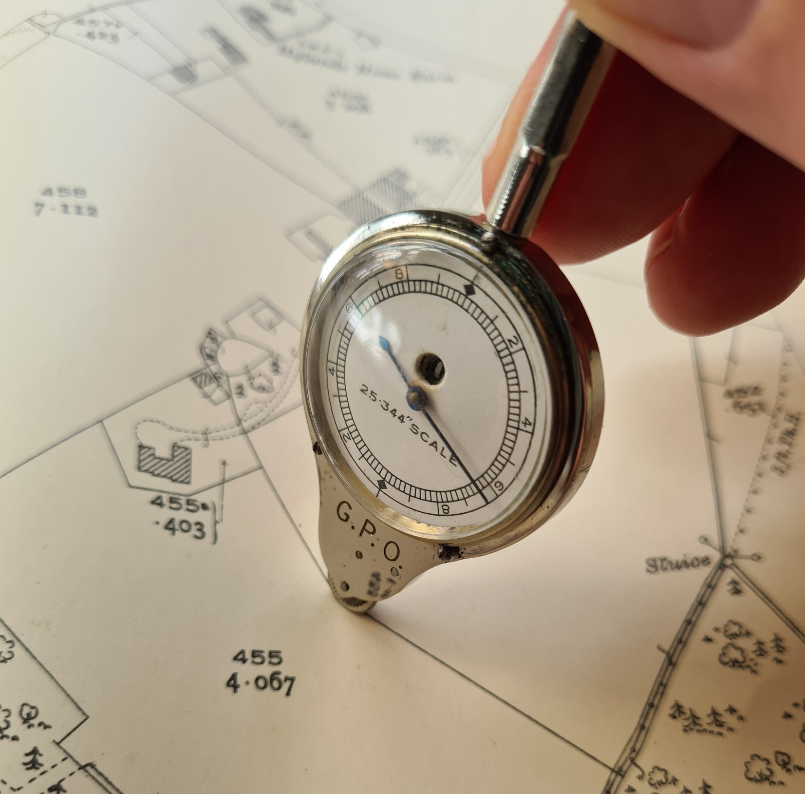
Every feature on a twenty-five inch map is strictly to scale. If a measurement can be made to one-hundredth of an inch, then measurements on a twenty-five inch map can be made to within 25 inches of reality, about two feet. A half rotation of the dial on this measure is sufficient to click on the numerical counter (totaliser) by one digit, and measures five hundred feet (one thousand feet per full rotation). The totaliser moves through digits 1-9 before returning to 0. Numerical increments are shown on the dial for 2, 4, 6, 8. divided into odd number inter-increments, with further one-fifths.
There are three letters stamped on the front of the case that provide a small clue as to the provenance of this particular measure. Below the dial are the letters- ‘G.P.O.‘ which stand for ‘General Post Office’. This was the identity of the British state-owned telecommunications and postal service until 1969. No doubt this particular measure was an official issue and used for measuring the length of postal deliveries or routes to be taken by bicycles or other postal vehicles. These are not the only map measures that have been used by the GPO for these purposes and other examples have also been looked at as Map Measure of the Month. I am sure other models would also have been used.
- Map measure of the month: HB Curvimetre ‘Model No. 52 mesures anglaises’
- Map measurer of the month- The HC Self-Registering Rotameter, model A90
- Map measure of the month: The Oldbury Optical Distameter
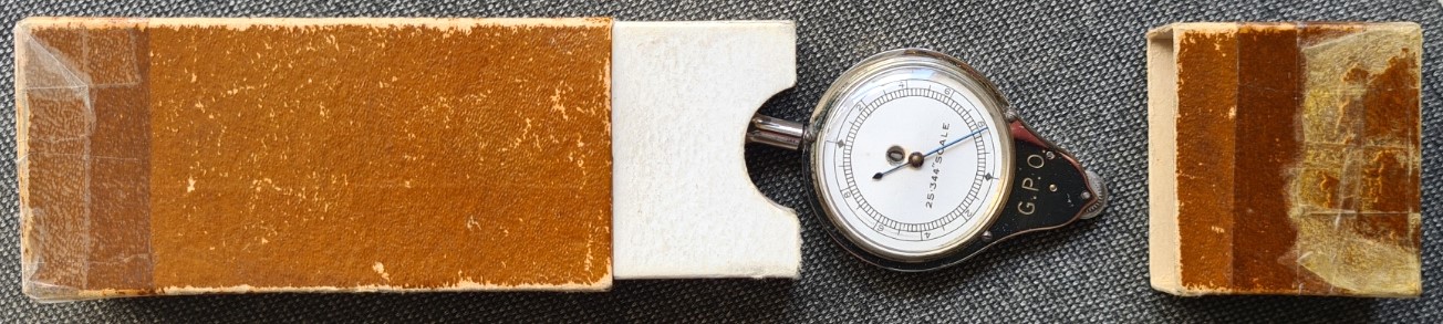
The measure was supplied in a simple two-piece card box. Unlike most other models produced by Chatelain this has no paper indicator on the box as to model type, name, how to use etc. There are no markings or numbers on the box in any form. These boxes are notoriously fragile and the ends are very often torn off My example has been repaired with what is presumably Sellotape, a cellulose-based, pressure-sensitive tape.
This measure is an uncommon survivor. Probably not due to any weakness in the mechanism, more associated with its very particular specialised usage and the fact that measurements of this type are more likely to be produced today via GPS and digital mapping. Nonetheless, this measure is made to the usual high quality maintained by Henri Chatelain and continues to work faultlessly, as intended. However it is now simply a curio, a survivor of another time, and one for the collectors and museums.
Three Points of the Compass has looked at a few more Map Measurers in detail. Links to these can be found here.
