Three Points of the Compass takes a glance at some of the best maps, guidebooks and online resources there are for those hiking on Gran Canaria
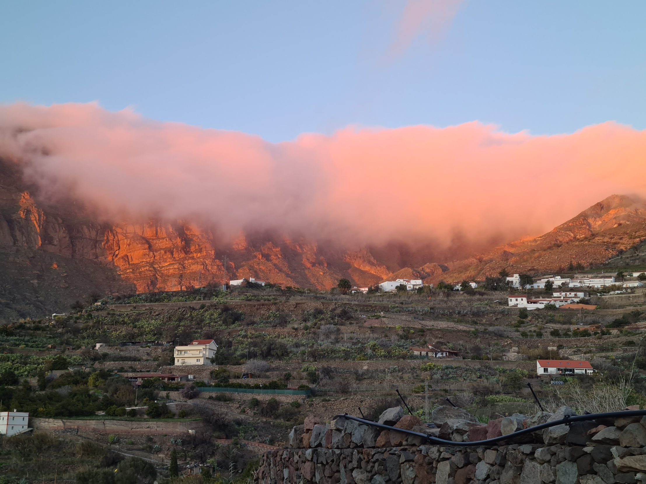
Three Points of the Compass has escaped to Gran Canaria on a few occasions, most recently this year to complete the Camino de Santiago Gran Canaria. This is a trail that crosses the island from south to north. It is also known as The path between volcanos. I look forward to a return to the island as it is a superb hiking destination. The volcanic island offers a mix of high and exposed routes, with dry rocky mountain sides and barrancos, with damp laurisilva ‘cloud forests’, with cultivated terraces, with sandy, rocky coastlines. But it pays to be prepared in advance of travelling.
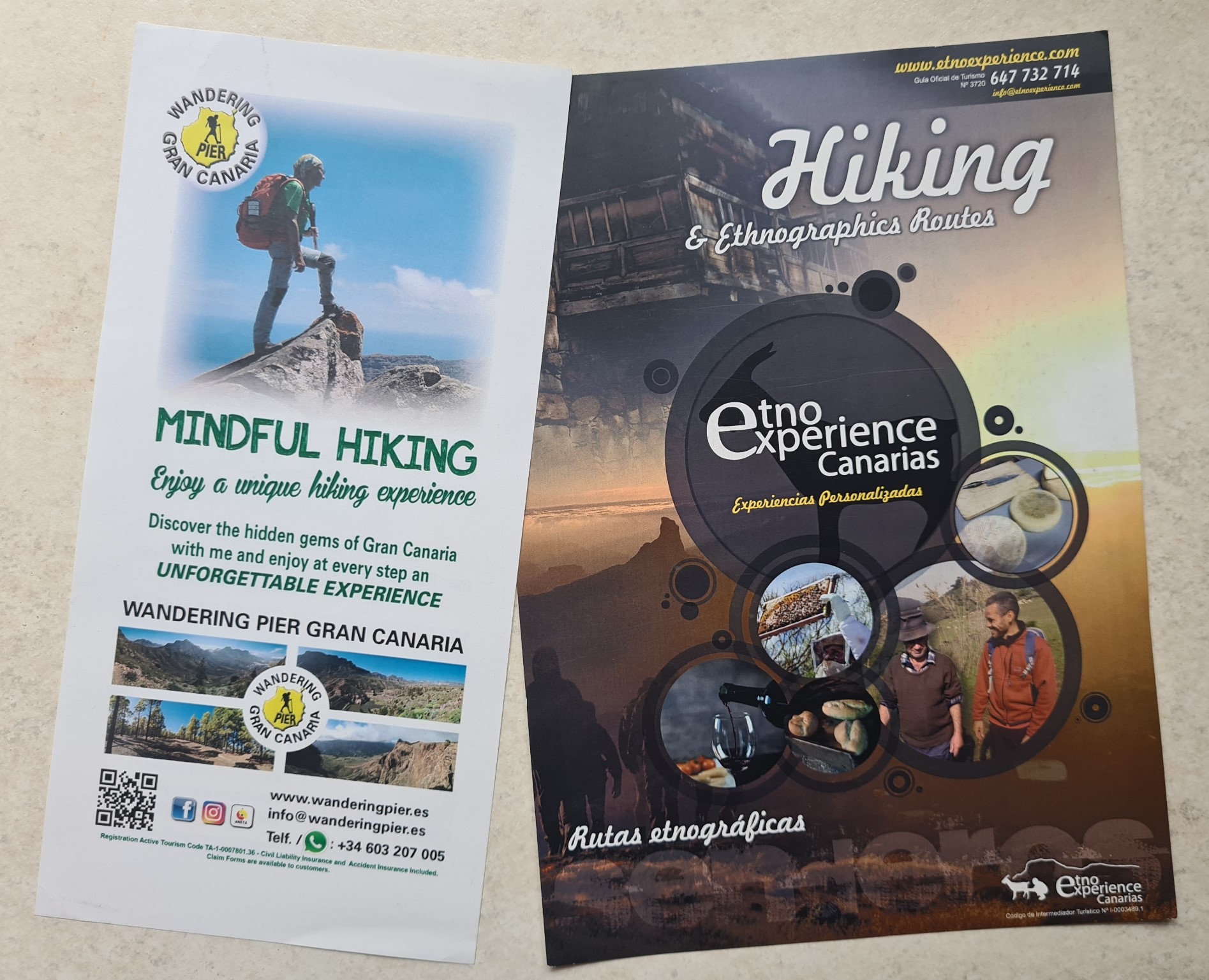
If arriving on Gran Canaria unprepared and wanting to hike anywhere away from coastal towns and tourist hotspots, it is often difficult to find any good advice or guidance when actually on the island. Even tourist centres are limited on what they have, which is why a few printed guidebooks and other commercial ventures have sprung up to fill the gap. Three Points of the Compass has used few of the latter so is reluctant to comment on most as they are often seasonal, vary in quality and come and go each year. Please leave a comment below if you have had any positive (or negative) experience.
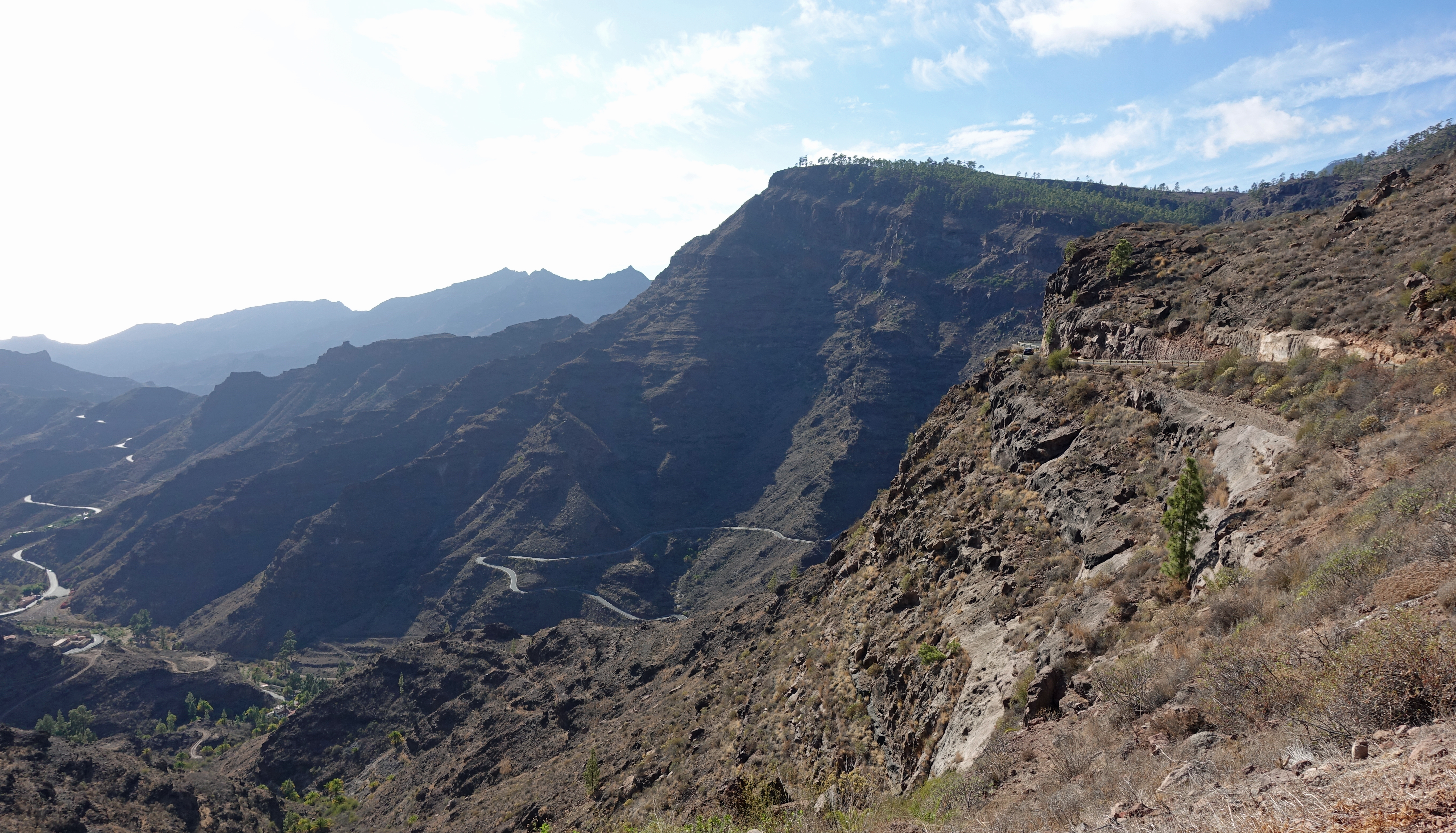
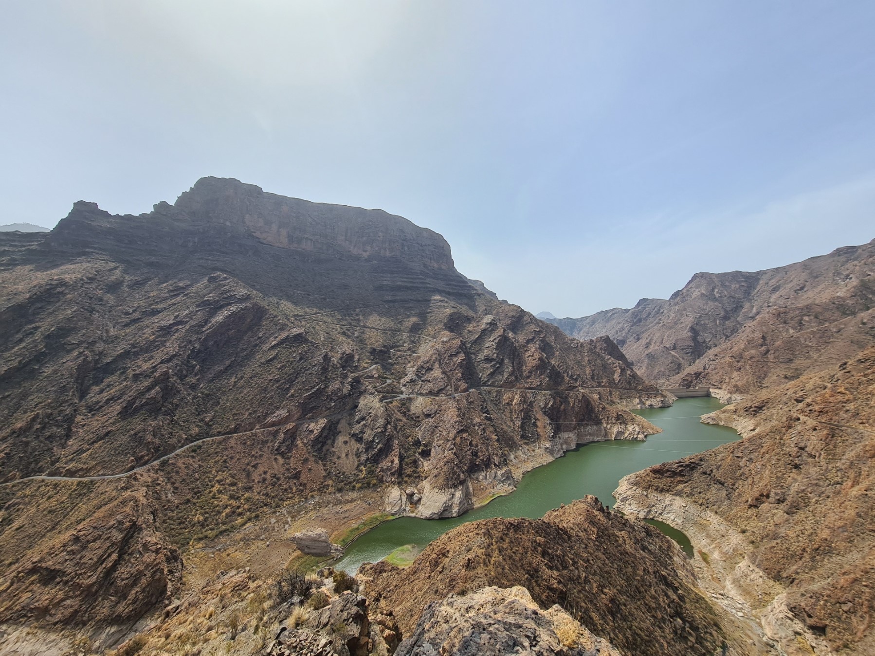
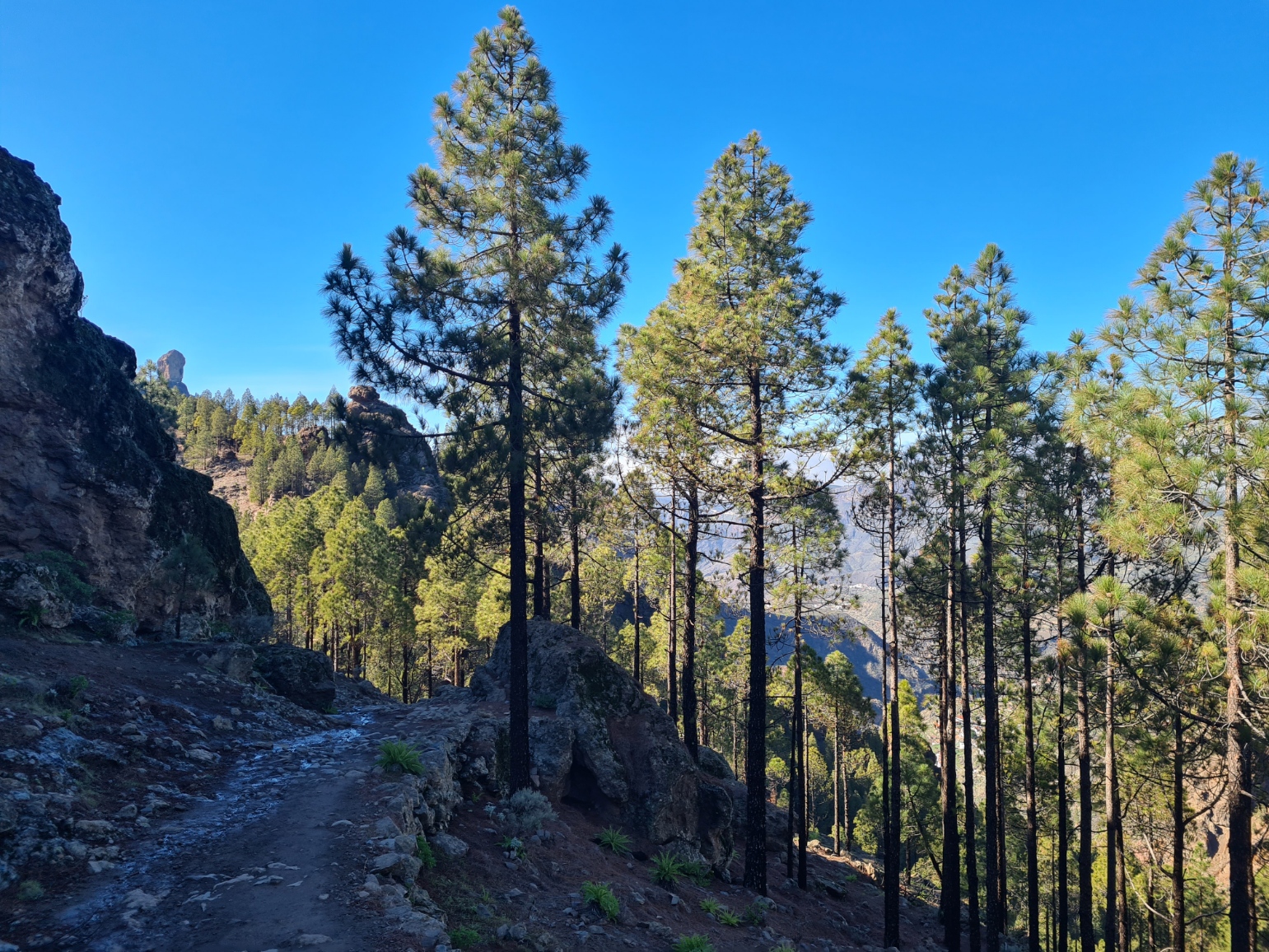
Gran Canaria is one of the larger of the seven island archipelago located off the coast of north east Africa. Lying so close to that landmass, these autonomous Spanish islands enjoy good weather almost all year and as such, can offer the hiker routes in the mountains in every month of the year, though it can still get cold and can frequently rain in the winter months, particularly at elevation. From the centre, the Integral Natural Reserve of Inagua and Nublo Rural Park stretches out from the mountainous centre of the island and down to the sea. Deep ravines cut into the volcanic mass and these contrast with the fertile valleys where almonds, citrus fruits, papaya, mango and avocado grow. Hiking on Gran Canaria can be difficult at times- hard rocky or sandy trails, very hot with little shade, little or no water on trail. Conversely, rain and mist could be encountered, it can be intensely cold at certain times of the year in some localities. But this post isn’t looking at those issues, instead concentrating on navigational aids.
Travelling to/from trails:
It can take a long time to negotiate many of the steep, narrow and winding roads and tracks away from the faster and newer roads that connect coastal towns. The time it takes to travel to and from trail heads should not be underestimated as it can eat in to the the number of daylight hours in which to complete a hike.
When I visit Gran Canaria I travel across the island in a variety of ways. Buses are cheap, reliable, frequent in and between the towns, but less so to trail heads, and it is almost impossible to get anywhere early if relying on a bus timetable. All the island bus time tables are online and shown at bus stops and stations. If wanting an early start or absolute certainty, I have instead often used a hire car meaning that I can devise a circular walk and get there early. Or I have instead relied on a taxi to return to my car if walking a linear trail. But be aware that if walking to or from a mountain village or town, it can sometimes be difficult to persuade a taxi driver to drive the considerable distance from the populous coastal resorts at short notice and it is almost essential to arrange this in advance of committing to a hike that requires a pick-up at the end. Taxis are far more expensive than buses and costs can frequently escalate if using them a great deal. Also be aware that obtaining a phone signal away from coastal regions can also be a hit or miss affair if wanting to call one on a spur of the moment, perhaps following injury or running out of daylight.
Types of trail:
Such is the nature of many popular walks, starting high and steadily descending, that most decent walks are linear in nature. This means that it can be an expensive option to rely on taxis. The whole island has hundreds of trails, most are well signposted and local councils and cabildo are steadily and efficiently working through those remaining unposted. I have relied heavily on the work of others in sorting out a days hike for either myself, or when Mrs Three Points of the Compass has joined me.
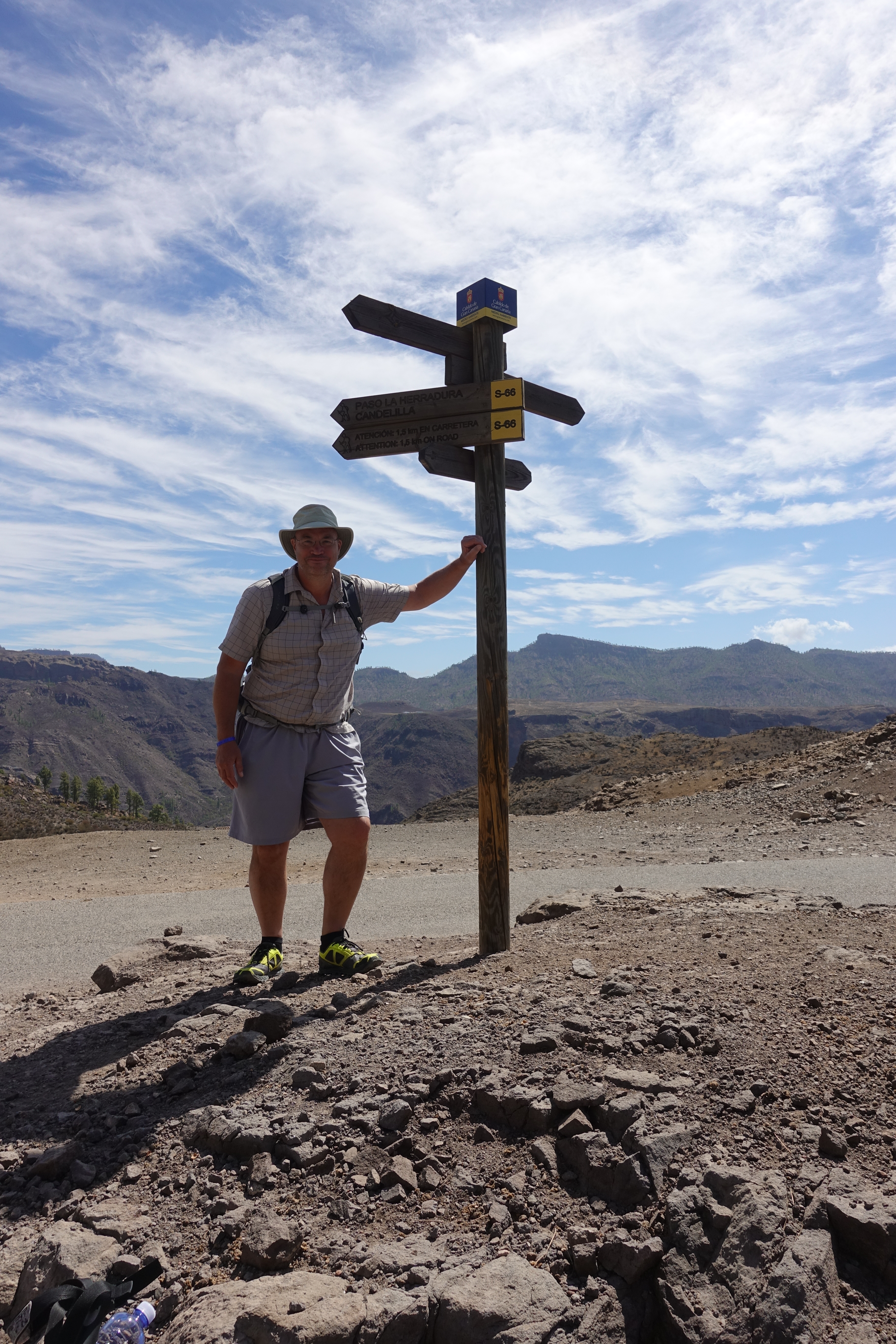
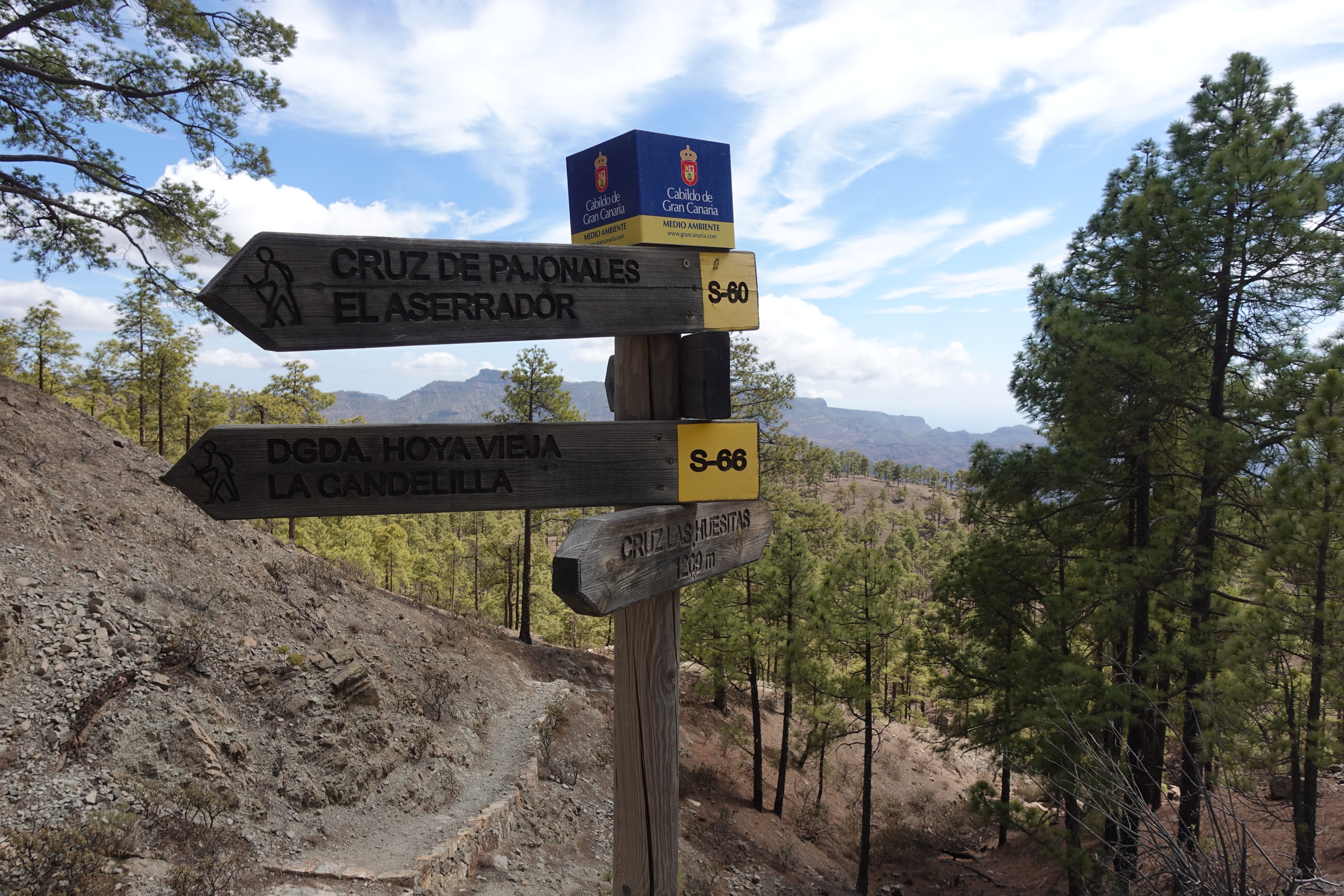
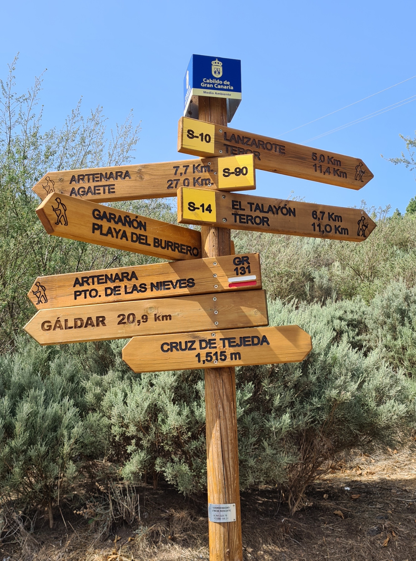
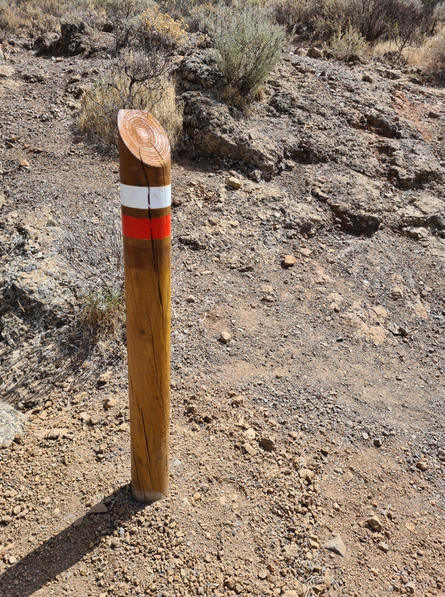
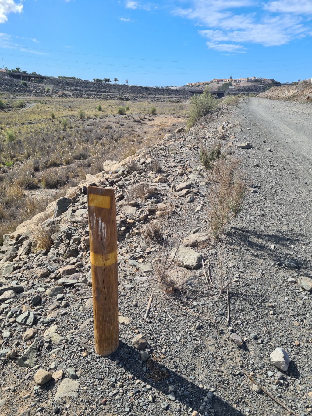
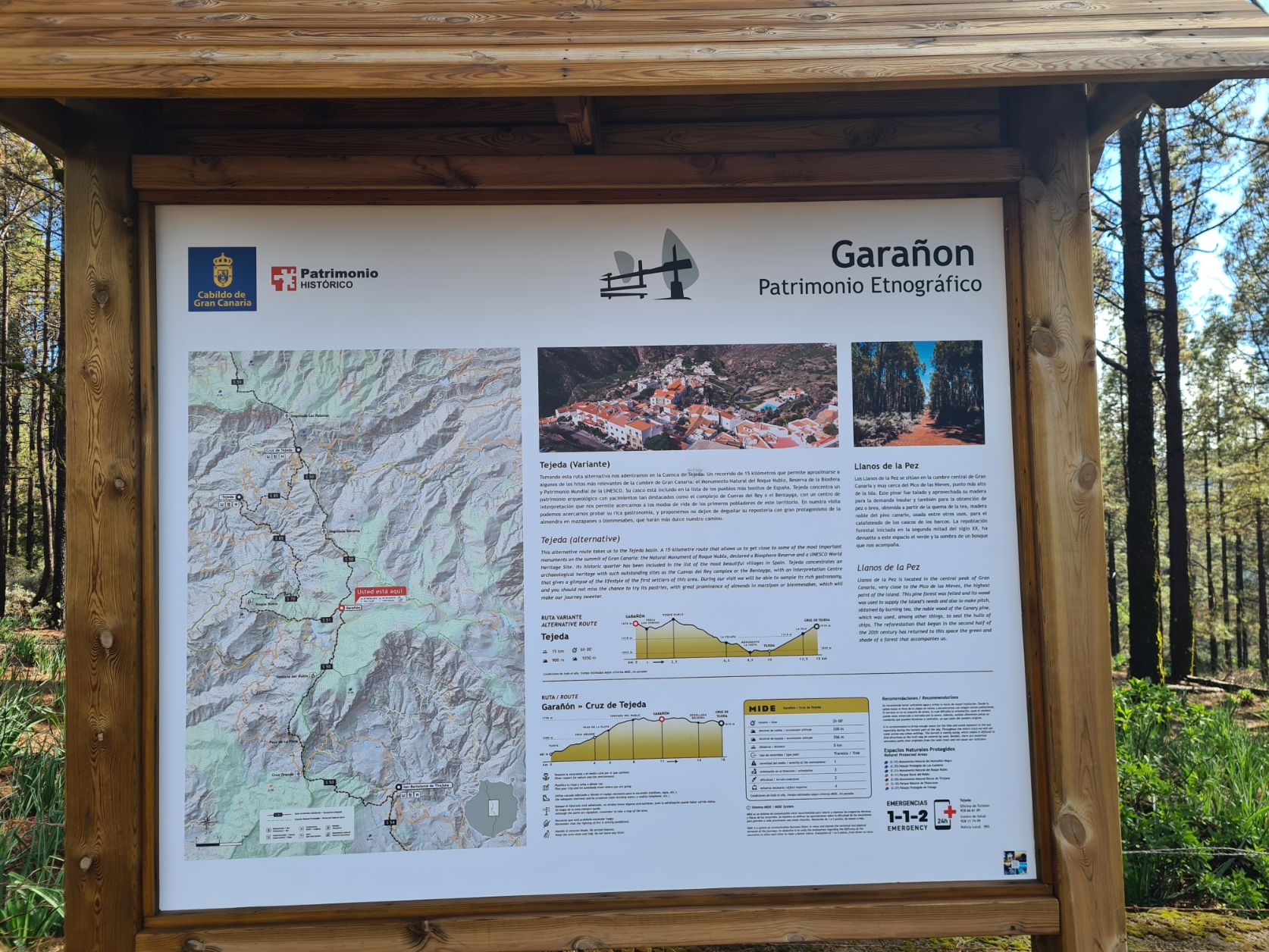
There are different types of trails on Gran Canaria and the wider Canary Islands, trails that often follow the old donkey and mule tracks used for centuries. Gran Canaria seems to be lagging behind the other islands in getting theirs signposted. Most signage is maintained by the administrative council (cabildo), others more locally. The ones that you are most likely to encounter are the S (Senderos = hiking path/trail) and GR trails. These are often colour coded and shown on trail head notice boards, wooden finger posts and short, trail side indicator posts. These are sometimes complimented by daubs of paint on rocks and trees etc. The simple S designation is shown on maps, notices and trails and are shown as black on yellow on finger posts. Shorter walks or sections of longer trails remain undesignated and are not colour-coded, just having a destination shown.
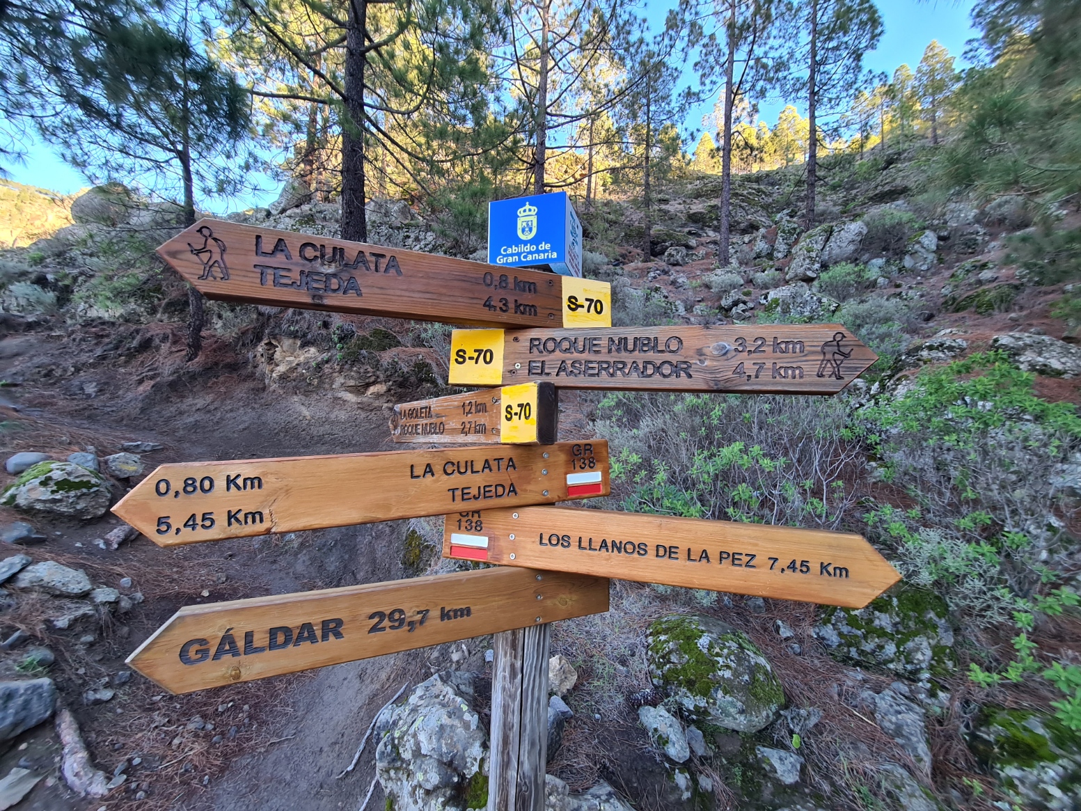
Found across the Canary Islands, SL (Senderos Locales = Local Trails), often indicated in white and green, are short local trails frequently promoted and maintained by local councils. These are of less than 10km in length. These might run concurrent with PR (Senderos de Pequeño Recorrido = Short Distance Trails) trails for a while, however the commonly encountered PR trails, indicated in white and yellow, are for trails between 10km and 50km in length. S is used on Gran Canaria as SL and PL trails have not been officially approved by the Spanish Federation of Mountain Sports and Climbing. Gran Canaria now also has three GR (Senderos de Gran Recorrido = Long Distance Trails). These are the GR131, GR138 and GR139. All are over 50km in length and are indicated in red and white on signage. The long distance Camino de Santiago de Gran Canaria runs across the centre of the island, from Maspalomas in the south to Gáldar in the north-west, and is indicated in yellow on signs and posts. The primary trails of the Camino are the S-54 Maspalomas-Tunte; S-50 Tunte-Cruz de Tejeda and S-01 Cruz de Tejeda-Gáldar though others are also followed. From the second day, the Camino runs concurrent with the red and white marked GR131 for some distance.
I have not been able to find a single resource that lists all of the S trails on Gran Canaria, with start and finish points and localities. It takes a good deal of detective work to find much and invariably you need to look to local council websites and the (very good) notice boards increasingly being situated at trailheads, carparks and viewpoints.
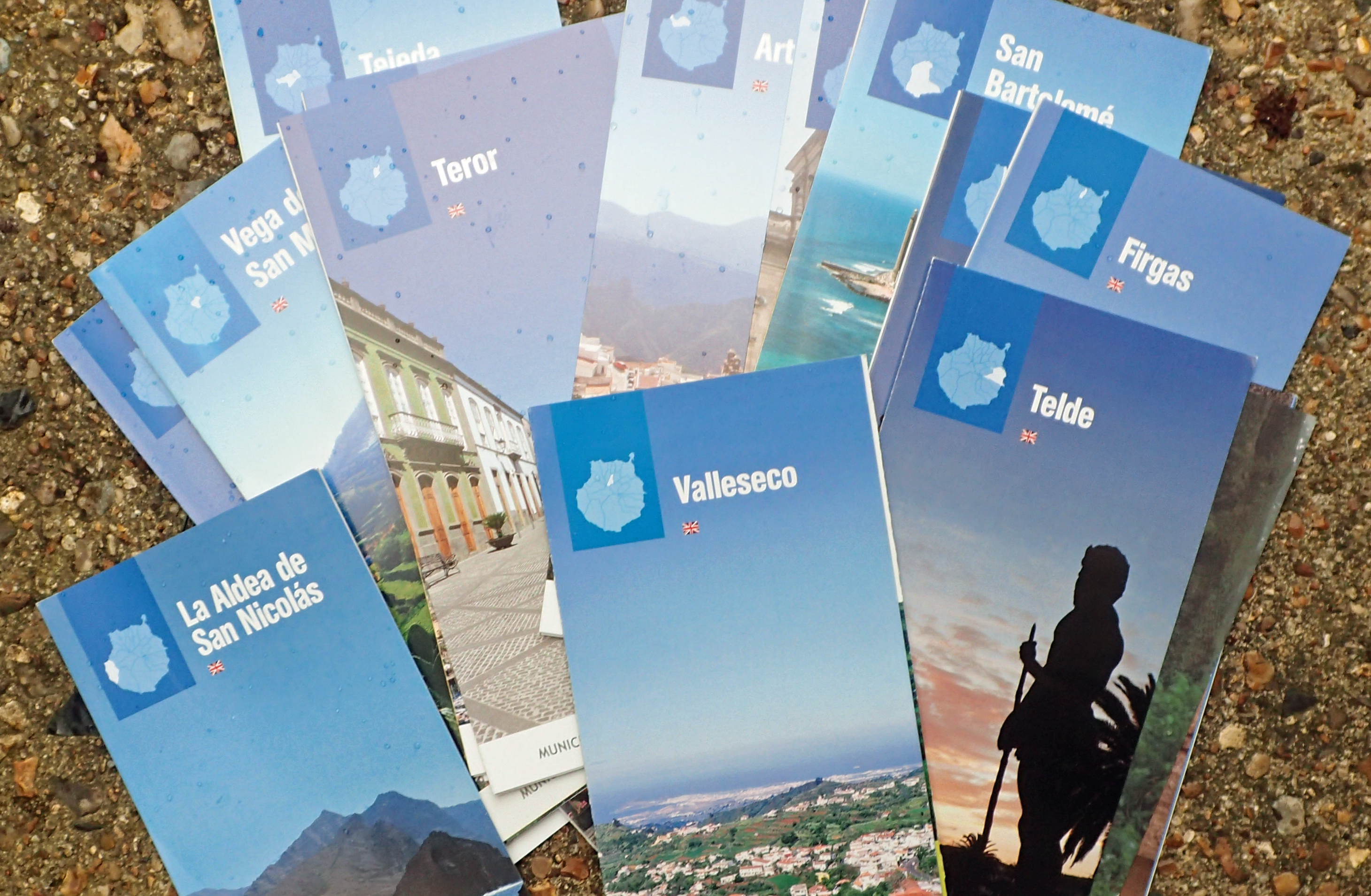
- Artenara, SL1, SL2, SL3, SL4, SL5, SL6, SL7, SL8, and others, also Artenara Trail Map: https://www.artenara.es/turismo/index.php/es/que-hacer-2/senderismo-2
- Arucas. SL2, SL3, SL4, SL5, SL6, SL7 walking trails: https://turismoarucas.com/senderismo/
- Firgas, R1, R2, R3, R4, R5, R6 hiking trails and Rb1, Rb2, Rb3, Rb4 cycle routes: https://www.ciudadano.firgas.es/index.php?option=com_content&view=article&id=138&Itemid=368
- Mogán. guides to R1, R2, R3, R4, R5a, R5b, R6, R8, R9 trails: https://turismo.mogan.es/en/what-to-do/routes-and-trails/
- Tejeda– town guides. Ruta 1, Ruta 2 and others: https://tejeda.eu/en-other-activities/
- Teror, walking routes: https://teror.es/rutas/
- Teror, walking routes, with maps. S10, S14, S15, S18, S22 and others: http://www.rutasdeteror.com/rutas.html
- Vallesco, 12 walking routes: https://www.vallesecograncanaria.com/islas-canarias/senderos-en-valleseco
- Valsequillo, 10 walking routes: www.turismovalsequillo.com/disfruta-de-la-naturaleza/senderos/
- Vega de San Mateo, nine plus hiking trails, with maps: http://www.sanmateoturistico.es/index.php/lugares-de-interes-en-san-mateo/rutas-de-senderismo
- Centralised guide to island trails, with links to municipalities and towns: https://www.senderosgrancanaria.es/
- Local Guide Gran Canaria, includes links to YouTube films: https://www.localguidegrancanaria.com/en/senderismo-en-gran-canaria/
- Rambling Roger. Walking routes Roger and his wife have enjoyed over twenty years on the island, developing an intimate knowledge of the area in that time: https://www.ramblingroger.com/
- Memoria Digital de Canarias (mdC) is the portal of the Canarian documentary heritage that provides access to all kinds of documentation from or about the Canary Islands, always showing the complete documents, freely and free of charge, in facsimile form: https://mdc.ulpgc.es/
Guidebooks:
Many of the resources are moving online, a change that has both pros and cons. Availability and language choice remains pretty consistent but beware of relying on often non-existent phone service out of towns. You should take care to ensure you have an offline map in some form before venturing out into the hills. Also ensuring that you actually understand and can read it. A hard copy guidebook is still an advisable purchase for anyone considering at least a day walk or two on Gran Canaria and these will give a varying amount of information on the S trails and local walks.
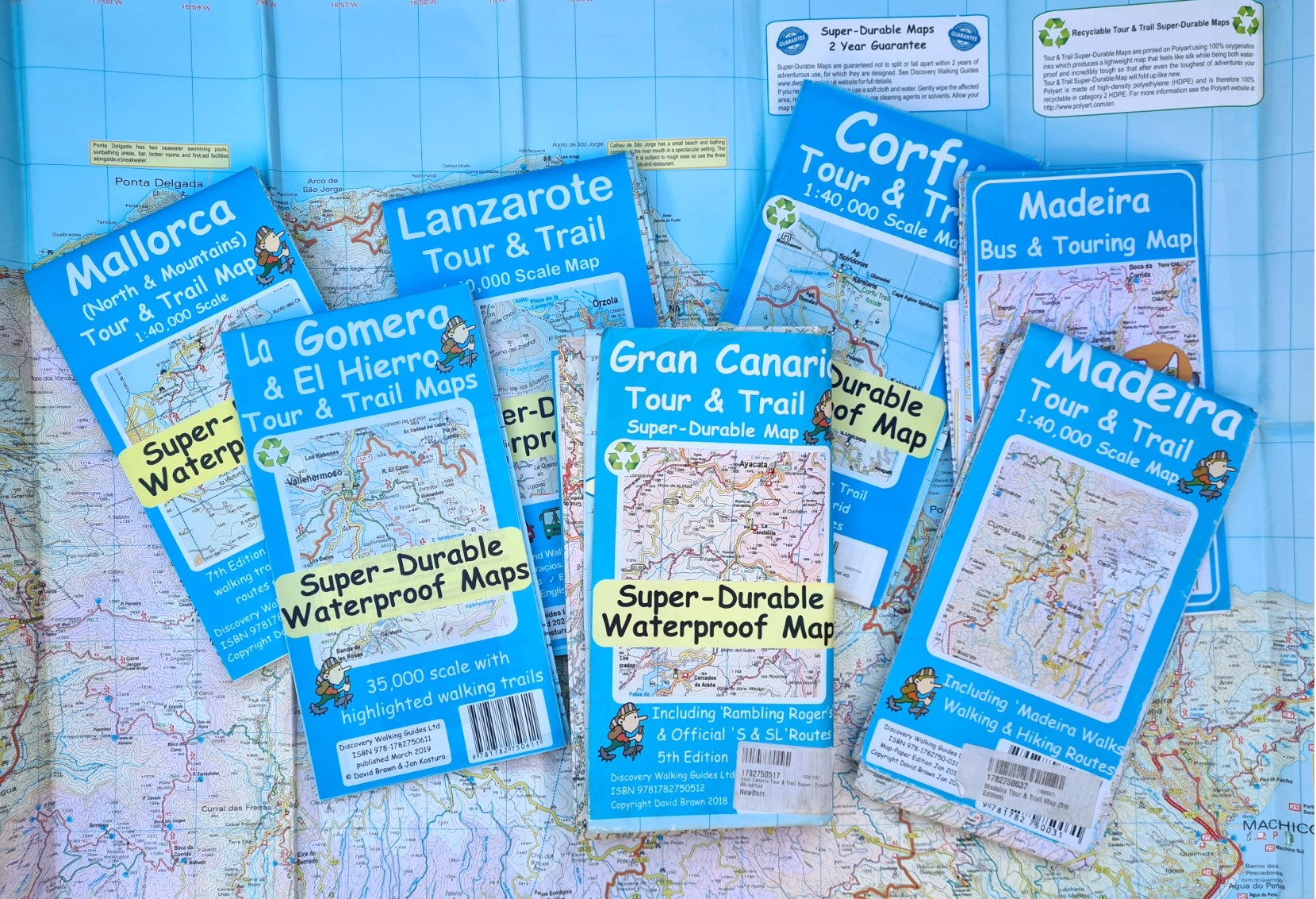
The best of these actually vary little in content or usefulness as there are a finite number of classic walking routes and each guidebook tends to dress these up in different ways. The Sunflower Landscapes of Gran Canaria guidebook has been produced for decades and is frequently refreshed. It contains fewer walks than many alternatives, but includes them alongside decent car tours.
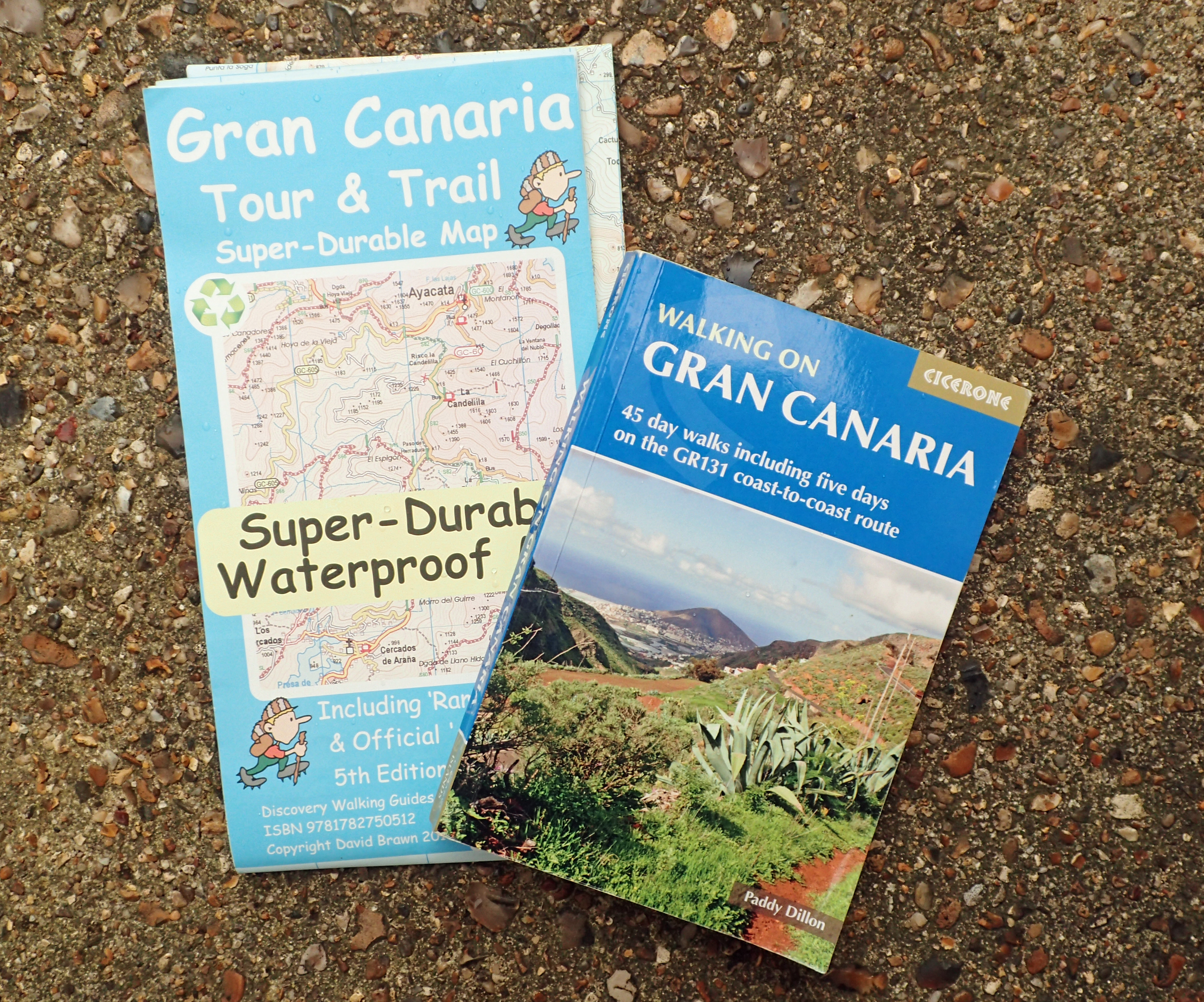
The Rother Walking Guidebook includes 83 suggested walks, together with small but mostly adequate printed maps at 1:50 000 scale. It also includes GPS files for these. This was most recently published in May 2024.
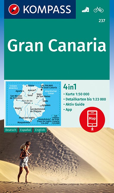
There is also a fairly decent guidebook from Kompass detailing 75 suggested tours across the island. Downloadable GPX tracks are provided for these. This is available with their 1:50 000 scale map to the island. This was last printed in June 2023. However note that this is in German and I am unaware of an English version.
Personally, I feel that for most English speaking people hiking on Gran Canaria, there are two pretty good options, one is a guidebook, the other a map. There isn’t much need to look further for printed resources, particularly if only holidaying on the island for a limited period and only planning on a limited number of day walks.
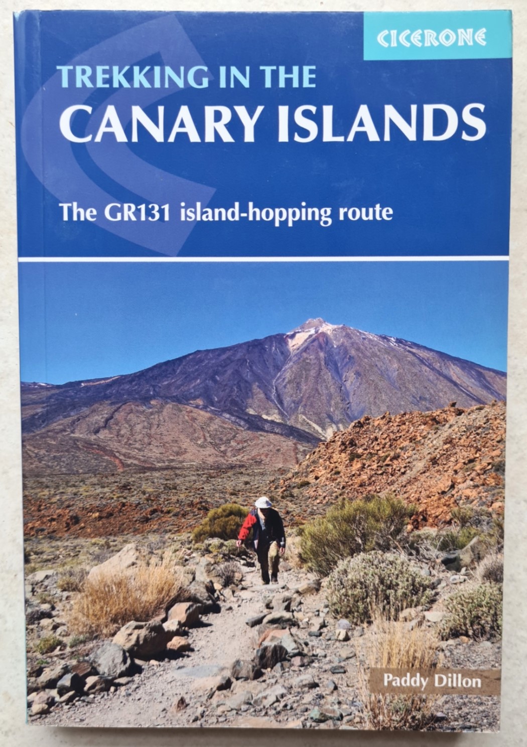
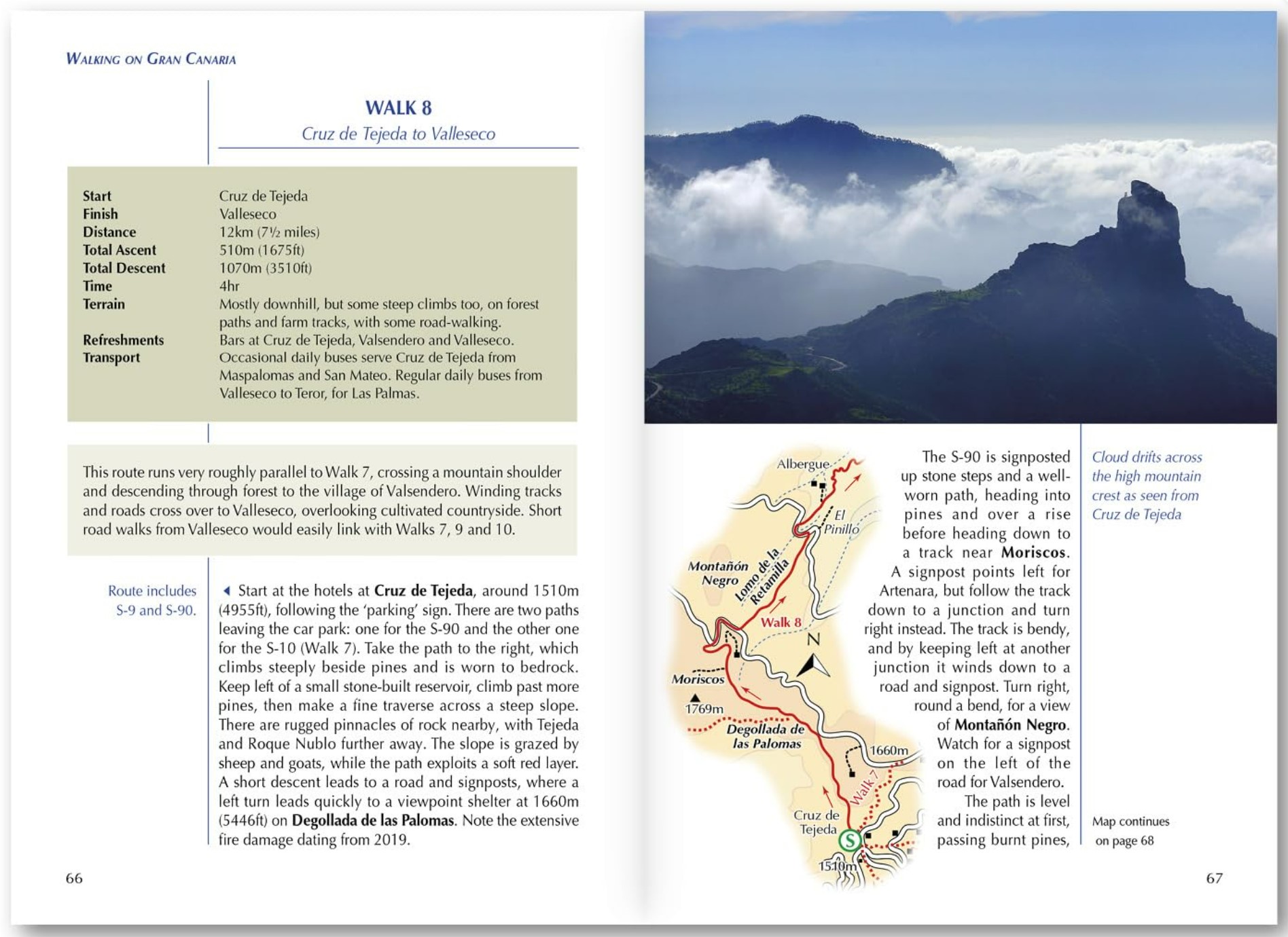
Author Paddy Dillon walked many of the trails on the island while researching the Cicerone Walking on Gran Canaria guidebook. Last published in January 2020, this includes 45 day walks (no GPX files), including five days on the GR131 long distance path across the island. He went on to write Cicerone’s Trekking in the Canary Islands, that describes the entire GR131 route across all seven Canary Islands. As far as I am aware, this is the only printed resource for the entire GR131 and as such, is probably an essential planning resource or inclusion to a pack for anyone attempting that trail. Particularly on Gran Canaria, as this island has lagged far behind the other islands in signposting that particular trail. I haven’t yet walked this route but it has been on my radar for a few years now. The 70km GR138 and 100km GR139 also cross Gran Canaria, but other than these two links, resources on the two, only opened in June 2024, seem to be hard to find.
Maps:
While online resources vary greatly in practicality or usefulness. Spot elevation is easy enough to determine via interactive display. The Instituto Geográfico Nacional have published maps at 1:25 000 and 1:50 000 scale, but as far as I can see, these were surveyed many decades ago and are of little use for more recently numbered or named paths. Though they do show the old donkey and mule tracks that subsequent ‘routes’ tend to follow. These maps are available through Stanfords Map Shop.
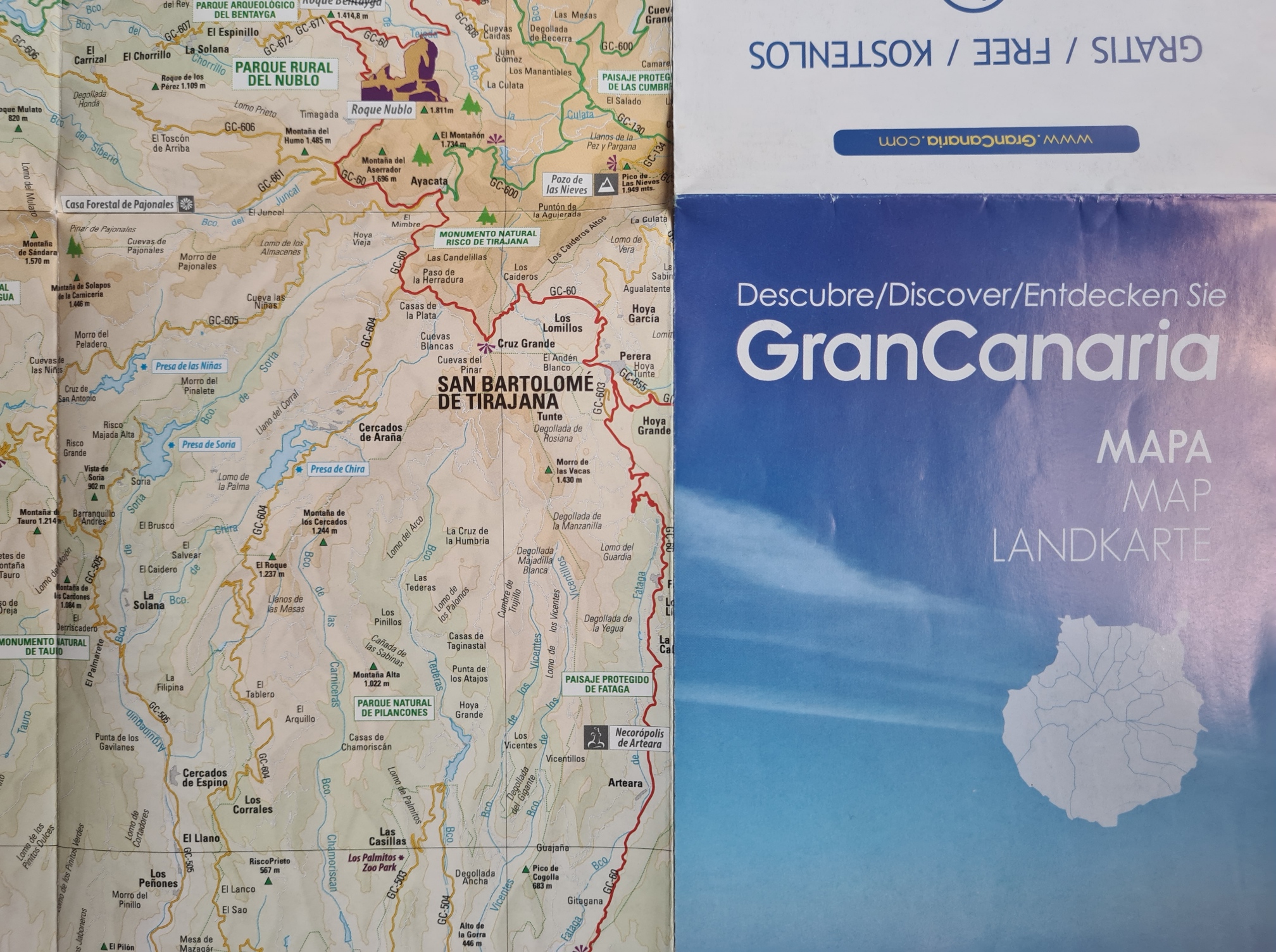
It really isn’t hard to find a hard copy paper map of Gran Canaria when actually on the island. They are found everywhere. However those are for road users. Quality and detail vary a lot, usually dependent on how many adverts are also being squeezed on, as something has to pay for them to be produced. The best of these maps is usually those provided at the myriad of car rental establishments, these show all the major roads and almost all of the minor roads that go into the interior. None of these are in any way suitable for hiking. The detail simply isn’t there. Use them with a car, bus or taxi to get to a trailhead, but abandon hope thereon, unless you have a further resource.
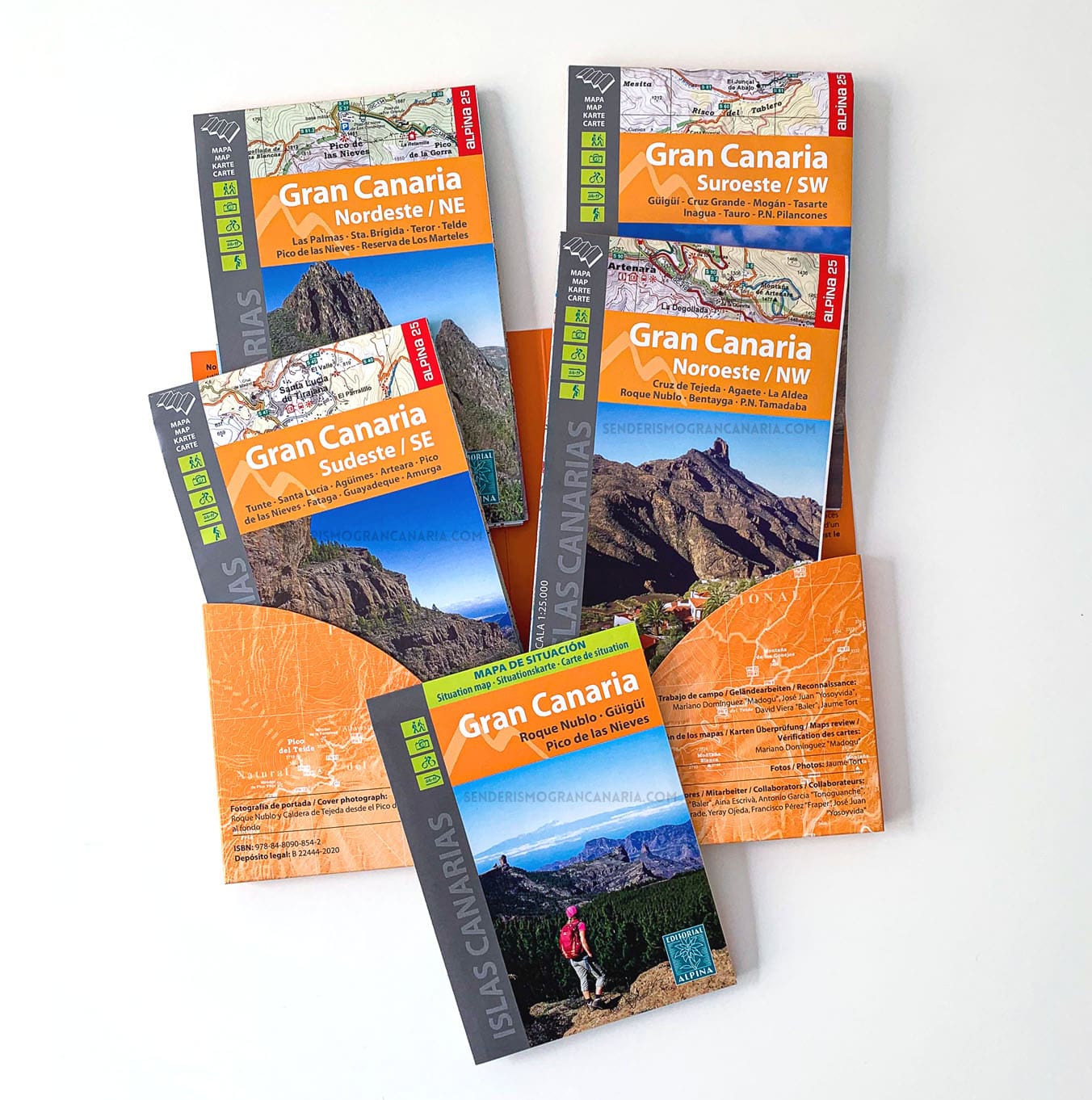
There is a set of recently published 1:25 000 scale topographic maps for the island, and neighbouring Canaries, that show the hiking trails. However I have no experience of them. Published by Alpina in 2024, if ordering via Amazon UK I was advised to expect a wait of 2-5 months for delivery. They look pretty good, but I am frustrated by that wait time. Thankfully there is a good alternative.
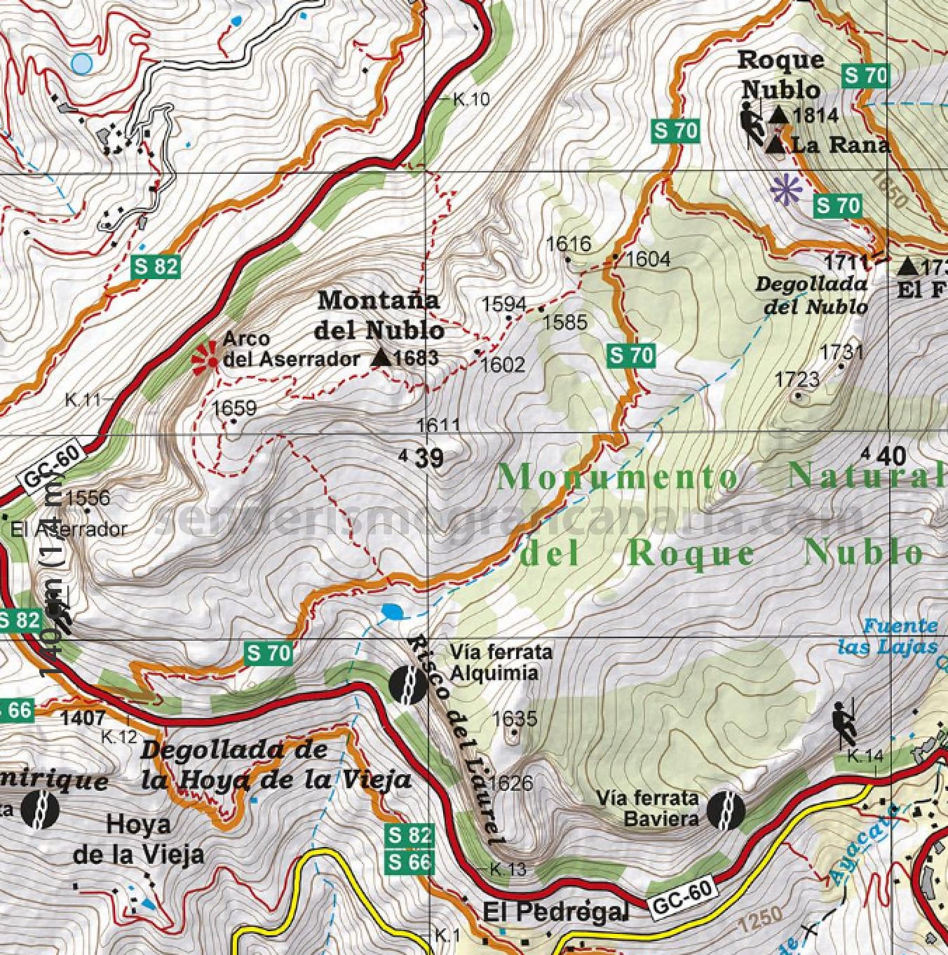
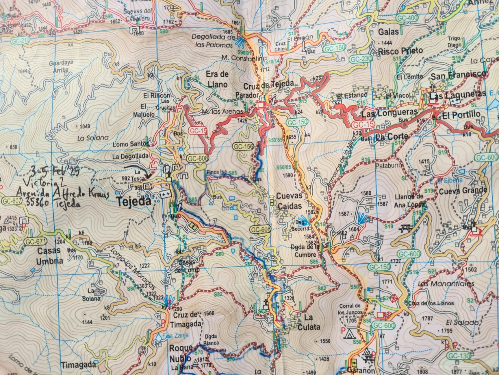
Discovery Walking Guides produces a large range of maps and most are updated fairly frequently. They are waterproof, lightweight and will take a bit of a battering. They produce this as a double sided map sheet, folded concertina style. I thoroughly recommend them. The map for Gran Canaria is also available as a digital edition as in-app purchase for Outdooractive and Locus Map apps. Discovery Walking Guides also offer digital editions of their Gran Canaria Tour & Trail Map in kmz (Garmin), sqlite.db for apps, and Oziexplorer formats. The map includes routes devised (or at least covered by) ‘Rambling Roger’. When I visit Gran Canaria, I almost always look at the walking routes devised by Rambling Roger, as he and his wife have enjoyed over twenty years on the island and have developed an intimate knowledge of the area. Roger also provides his own walking guides, though I have no experience of them.
The ‘Tour and Trail’ map from Discovery Walking Guides is at 1:50 000 scale and in addition to showing a great many of the trails, is topographic, namely, it includes contours, just about essential when planning a walk, and extremely useful on trail too. These are at 20 metre and 100 metre contours, and are combined with altitude shading that give a feel of the landscape being walked across. Rambling Roger maintains a page showing where the maps can be purchased on the island.
As previously mentioned, Kompass also produce a 1:50 000 scale map- Spain Canary Islands Gran Canaria Kompass map 237 that is designed specifically for hiking, cycling and can be purchased with an accompanying general guide. This is in German so might be of slightly less use for English speakers.
There are also obviously the various map apps and maps that can be downloaded, highlighting walking trails on the island. No doubt you will have your favourite. Be aware that many of these will show a route that a hiker has recorded and it is not necessarily correct, possibly straying off any sort of ‘official’ route. Google maps is especially prone to this. Beside the versions on Wikiloc and elsewhere, the Camino de Santiago de Gran Canaria has it’s own dedicated route map, available through Apple Store and Google Play, highlighting points of interest. I found it glitchy and it never really worked for me, but others I met on trail experienced no issues. While I tend to rely on paper maps and guidebook, I do have the island and many trails, including the Camino, downloaded to my phone via the HiiKer app. This has a choice of map overlays and works well for me in Airplane mode.
Other providers:
Specialist holiday providers will, for a tidy sum, do the donkey work in sorting logistics, accommodation etc. for multi-day hikes across the island. If you can afford it, these could be a good choice and provide different vetted accommodation in a new location each night, with a suitcase transported for you while you hike with just a day pack. Tours can be guided or self-guided. All of these providers maintain an online presence and have been in the game long enough to tweak to individual circumstances. It may take away some spontaneity and degree of adventure, but not everyone relishes in that. One market leader, with a good rep, is Macs Adventure. There are others.
For those who regard such specialist providers as too expensive an option, there is a cheaper way of gaining local knowledge and help.
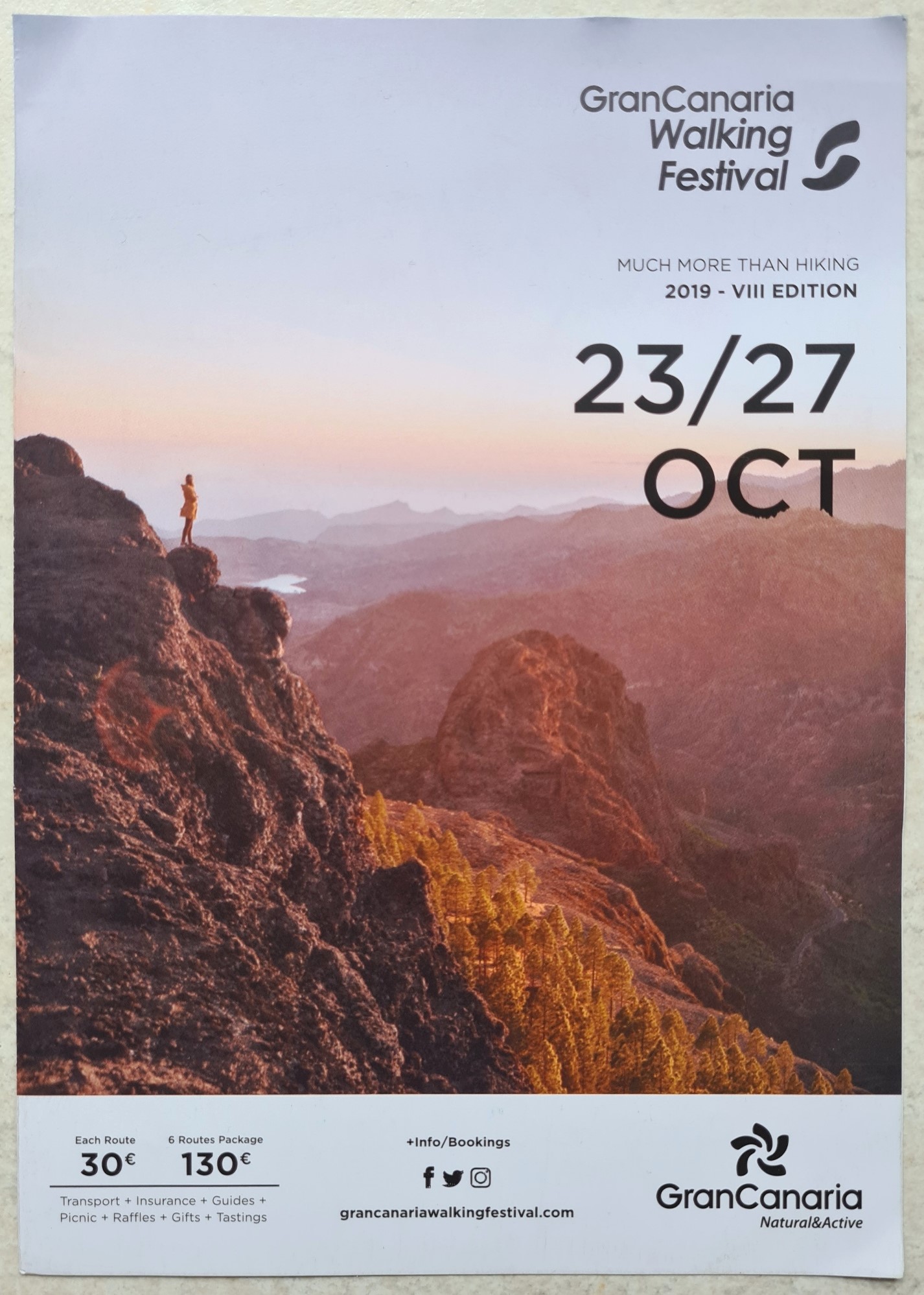
There is a Gran Canaria Walking Festival held at the end of October and routes are devised and advertised each year. Details are always available online or at local TI centres.
“Seven municipalities, six routes… and a night full of stars”
local advertisement for the 2019 Walking Festival
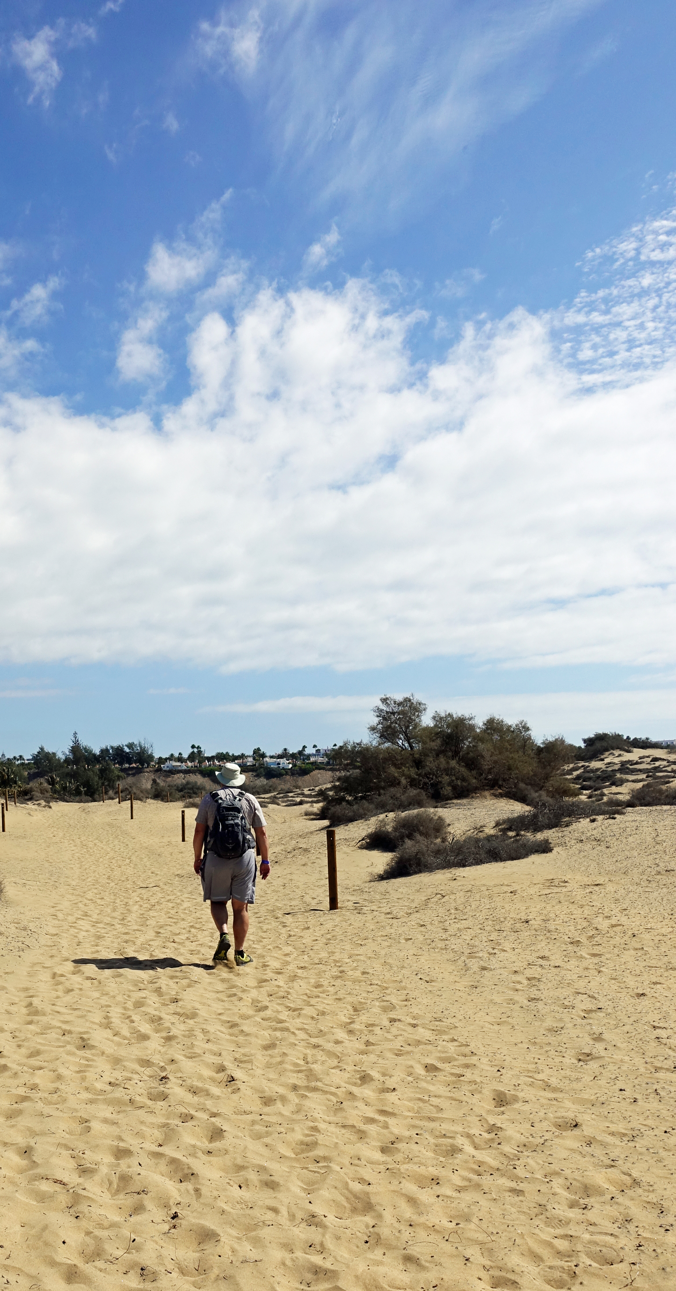
Gran Canaria is a terrific walking destination and has much to offer those prepared to move away from the standard beach type holiday on the coast. It is well worth making the effort. The island offers up a wealth of varied landscapes, from the sand dunes of Maspalomas, to the rugged arid rock faces of the mountains in the south, shady forests of Canary pines at height, with sweeping views to the coast, to the lush arable farm lands of the north. It is possible to experience a different terrain every day if venturing out for a handful of day walks over a weeks holiday. A longer trail offers up even more variety.