
Today’s section takes us to the highest point on the Ridgeway, plus another Iron Age fort and neolithic long barrow. But it’s going to be a wet day…
Ogbourne St George to Woolstone. 13 miles/21 km:
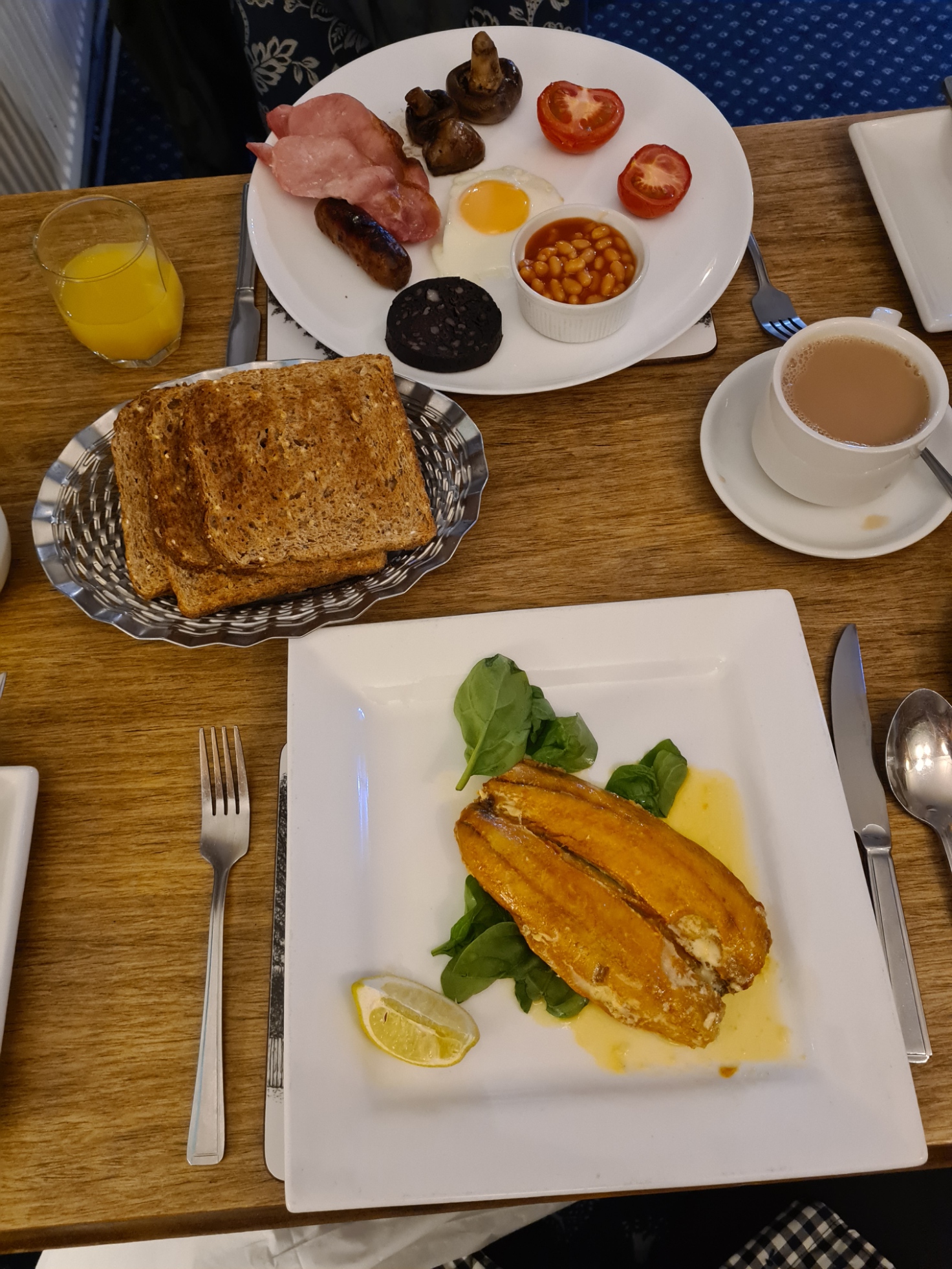
I woke first and made teas for the two of us. As expected, as per the forecast, it was raining outside. One of those day’s where you know what is coming and just have to knuckle down. At least it was also forecast to clear up at some point late morning. The day started positively in one respect. Much as I like a Full English (that Mrs Three Points opted for), there was a choice at today’s breakfast and I went for kippers, with spinach, wholemeal toast and strong tea. I could get to like this walking lark!
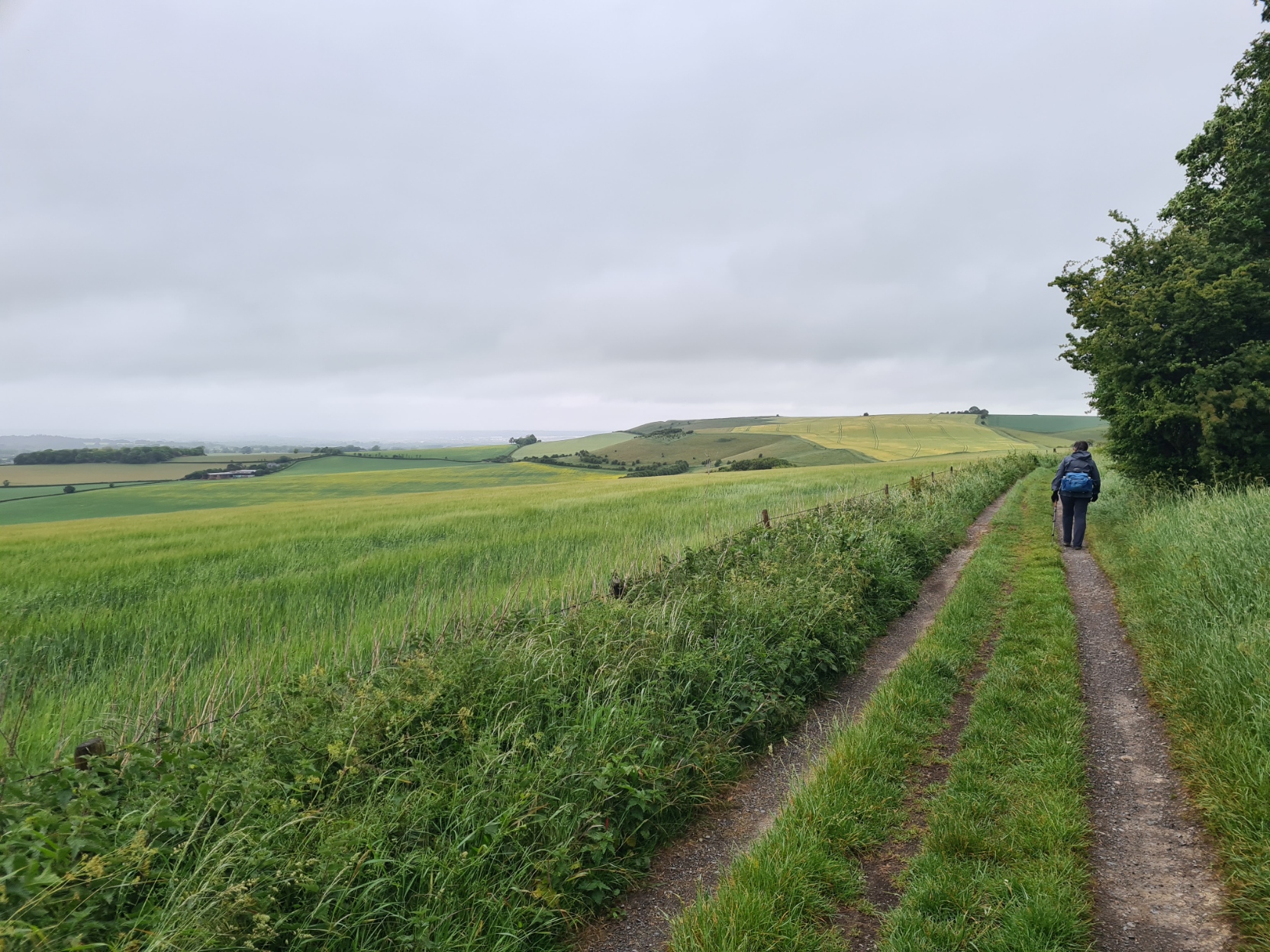
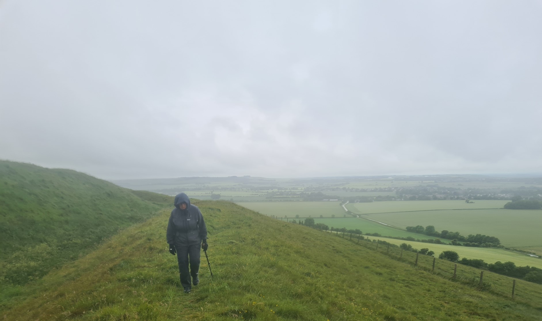
We were away from The Well around nine and followed the wet road out of town, passing Fox Lynch with the horse paddock where I camped last time I walked this trail. Sadly, the owners no longer accept campers. Out of town we began the walk back up the contours to height, it was only a light drizzle and I had my windproof on. I had proofed this before leaving home and that would bead light rain for a couple of days before wearing off. The wet vegetation soaked our lower halves as we pushed through it. We startled both hares and deer on the walk up. Back up to the Ridgeway, I had been expecting a soggy slippery wet trail, but it wasn’t too bad at all with only a few larger puddles across the width occasionally requiring careful circumnavigating. The chalk path was hard which can potentially prove problematic to wet feet over many hours and we both attempted to keep to the softer grassier centre of the track.
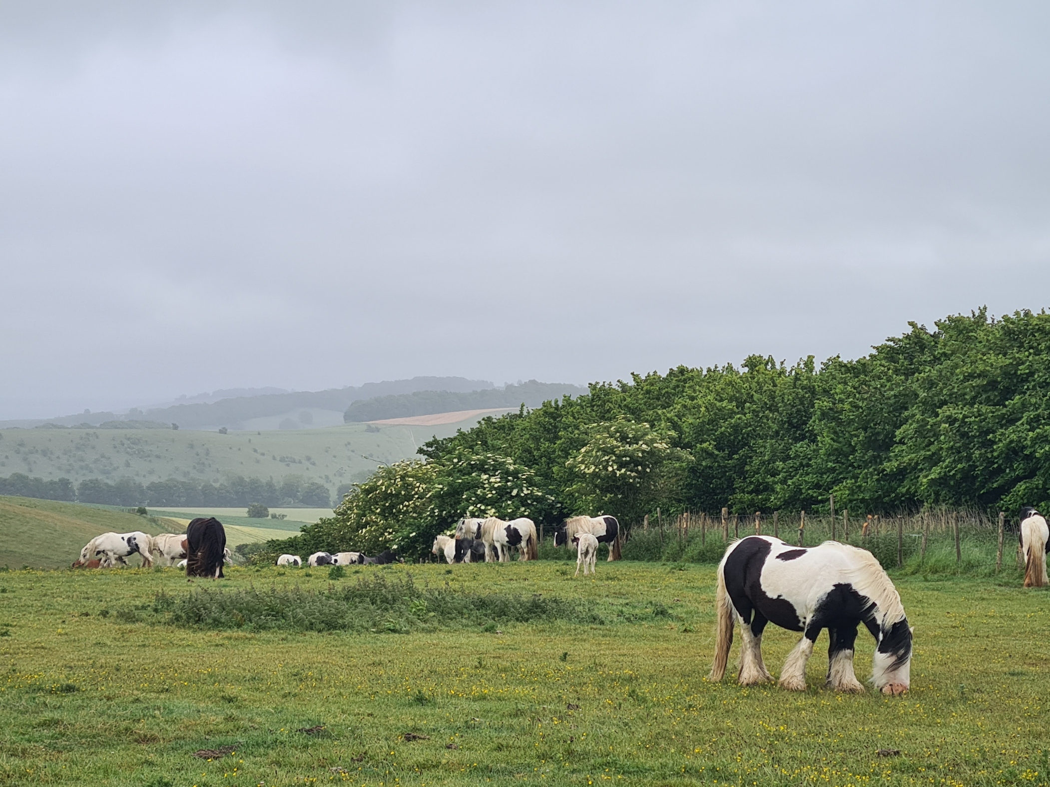
We had the trail to ourselves. No-one passed us and we passed no-one. The inclement weather had obviously discouraged the many dog-walkers normally seen on the Ridgeway. After one brief descent the trail began the fairly long but easy climb up Liddington Hill, hand-railing a long and obviously very ancient earthen bank and ditch to our right. The field to our right held a large number of handsome heavy horses, along with clumsy looking foals.
At the highest point of the entire Ridgeway, a modest 276m, we reached a right-turning dog-leg in the path. But we were ascending still further, as I suggested to Mrs Three Points that we turn left to visit the off-trail Liddington Castle, a late Bronze Age/early Iron Age hill fort. All credit to her for agreeing as this is an exposed place and looking back, not only could we see the four other Ridgeway hikers in the distance, but also a bank of heavy rain slowly approaching us. It was about to get very wet and I changed from my windshirt, that had sufficed so far, into a proper waterproof.
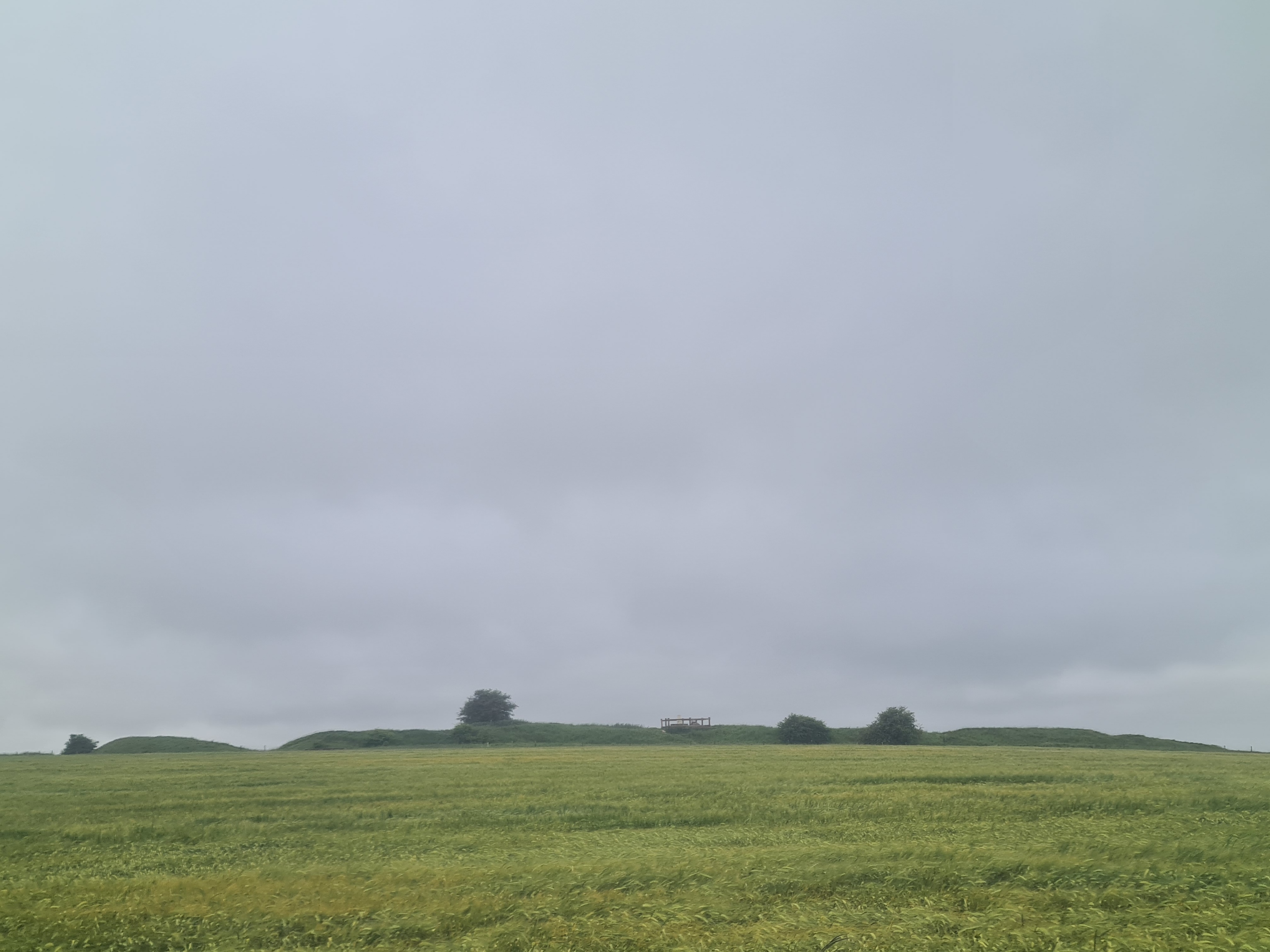
I wish the weather had been better as by the time we got out there it almost totally obscured what would have been far-reaching views. Liddington is one of the earliest hill forts in Britain with little established about it’s actual purpose and history, but having braved a field of curious bullocks to get there, all we did was walk the circumference of the 3 hectare (7.4 acre) fortification. It is supposed to be the site of at least one important battle, but I do rather like the caveat on wikipedia- “because of the limited number of sources, there is no certainty about the date, location, or details of the fighting…it remains unclear whether the Saxons were besieging the Britons or the Britons were besieging the Saxons”.
By the time we had made our simple loop of the fort it was lashing it down and we were reluctant to spend any longer out here on this exposed promontory, so returned to the trail. The clouds moving on and the rain thinning as we did so. At the very least we got a flavour of how awful it would have been for sentries out there in unfavourable conditions.
Back on the Ridgeway we continued, the other four hikers having passed and now out of sight. Across a muddy field I could see a concrete WWII pill box poking from a stand of trees, but it would be a muddy walk over to it and it was left behind unexplored. It is in fact, a Type C Starfish / QL Bombing Decoy. Built in 1941, it was used to control decoy fires that fooled enemy planes targeting nearby Swindon.
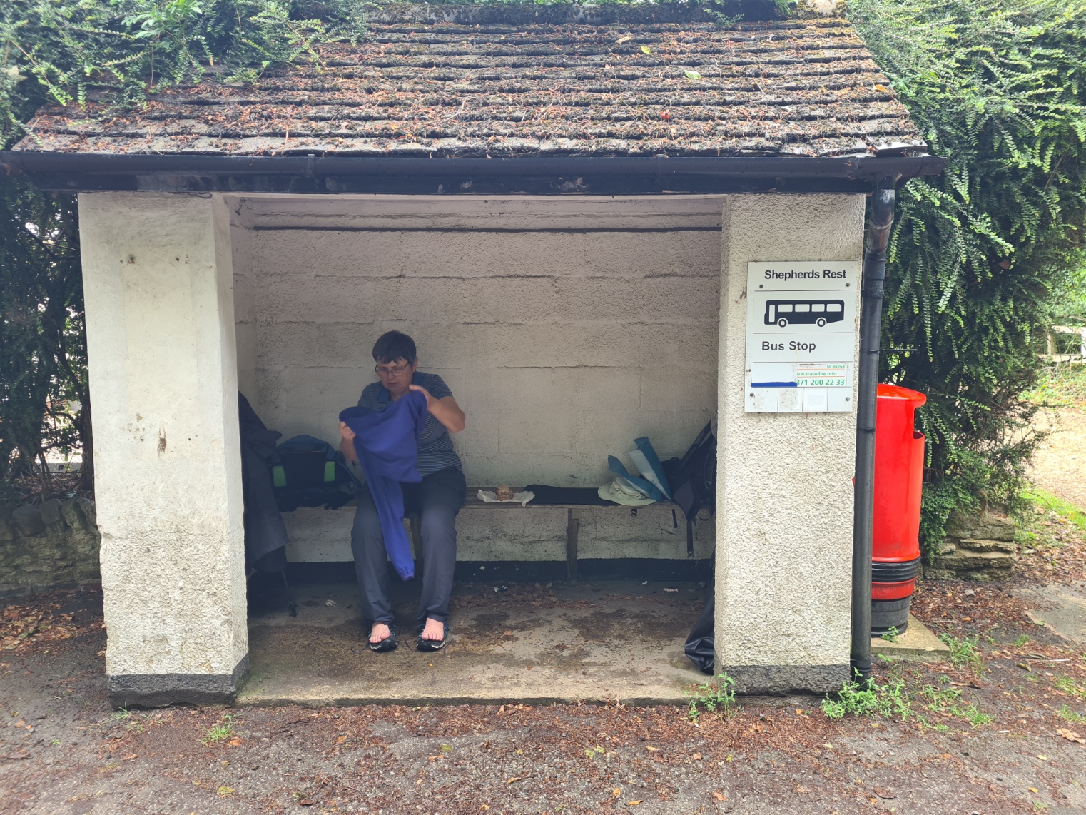
We slipped and slid our way down a steep muddy track to emerge on to the B4192, a short walk then right at a T junction to walk over the M4 and into Wanborough. I was surprised to see the pub that was closed when I came through here back in 2016 has been resurrected as The Burj Indian restaurant. It looked open but Mrs Three Points refused to visit while dripping wet (nope, I don’t know why either) so we sat in the bus stop opposite for shelter. The two of us removing shoes and socks and allowing feet to air a bit while we ate a lunch of sandwiches and bananas.
Setting off again we followed the road out of the village, leaping for the usually non-existent verge when vehicles hurtled down the hill toward us. Thankfully it wasn’t far before the trail again left the road and wandered out and up on to the hills. It was all drying up nicely, the sun was out and the humidity sky-rocketed. The two of us steamed gently.
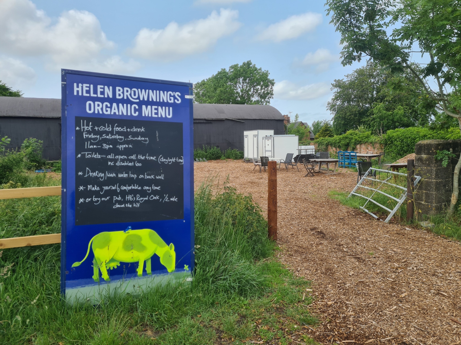
Swindon sprawled across the landscape down to our left and we enjoyed a pleasant saunter along a quiet country lane. There are break options for those that want them. At one junction it was a half mile walk off trail to the Royal Oak but we didn’t feel the need. This turn-off was close to a motley collection of tables and chairs in a farm yard. A sign alerted us to the availability of snacks and drinks, but on Friday’s, Saturdays and Sundays only. It was Tuesday. Truth told, we never felt the need to stop, we had a destination in our sights.
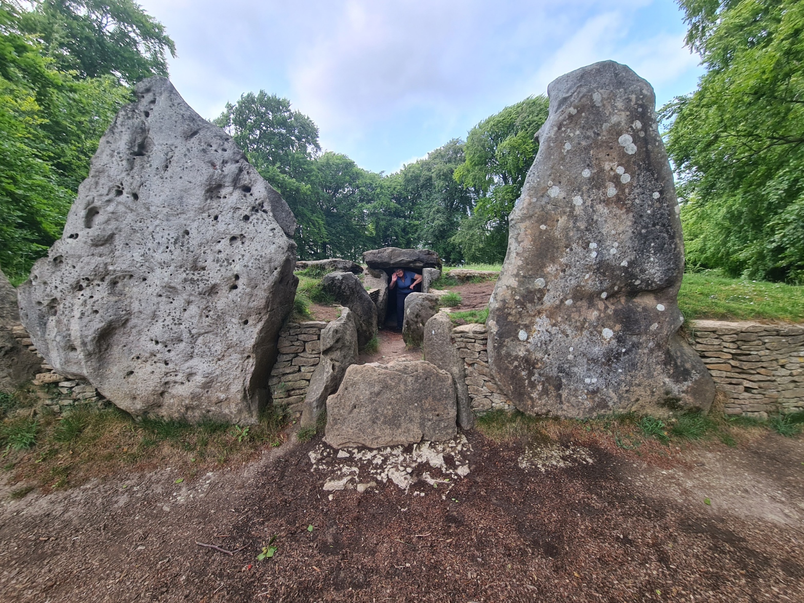
Wayland’s Smithy is a neolithic long barrow. Named after the Saxon blacksmith Wayland, maker of mystical weapons and armour. Local tradition said his forge was located at the nearby long-barrow and legend stated that if a horse required shoeing, if it was left with a sixpenny piece at the entrance to the burial chamber, the work would be carried out overnight. Wayland’s story is rather nasty and far removed from anything romantic.
The elongated oval barrow is only a few paces off the trail and we took some time out to explore it. The Neolithic barrow had been used for burials for some 5500 years and over 14 bodies were interred in the original small central inner chamber, that was then covered and the barrow greatly enlarged. Huge sarsens guard the entrance and Mrs Three Points backed herself in to the cramped interior that has been opened up by English Heritage.

Leaving the barrow behind we didn’t have much left of our walk today, at least not on the actual trail itself. It led us across fields of crops. Here, the Ridgeway is not so much a ridge as simply the highest central point of a pretty flat landscape. We could see a rise in the distance, but the Iron Age Castle/Hill Fort we could see on its ‘summit’ would remain unexplored until tomorrow as we were soon walking off-trail down in to the Vale of the White Horse..
Just prior to Uffington Castle and White Horse Hill we turned off to walk down to our overnight accommodation in nearby Woolstone. When I last walked this trail I hadn’t turned off and recalled that there is a pretty poor view of the famous chalk hill figure from the trail above. I had hopes that it would be clearly visible as we walked down to the village, but our view of the Uffington White Horse wasn’t up to much at all.
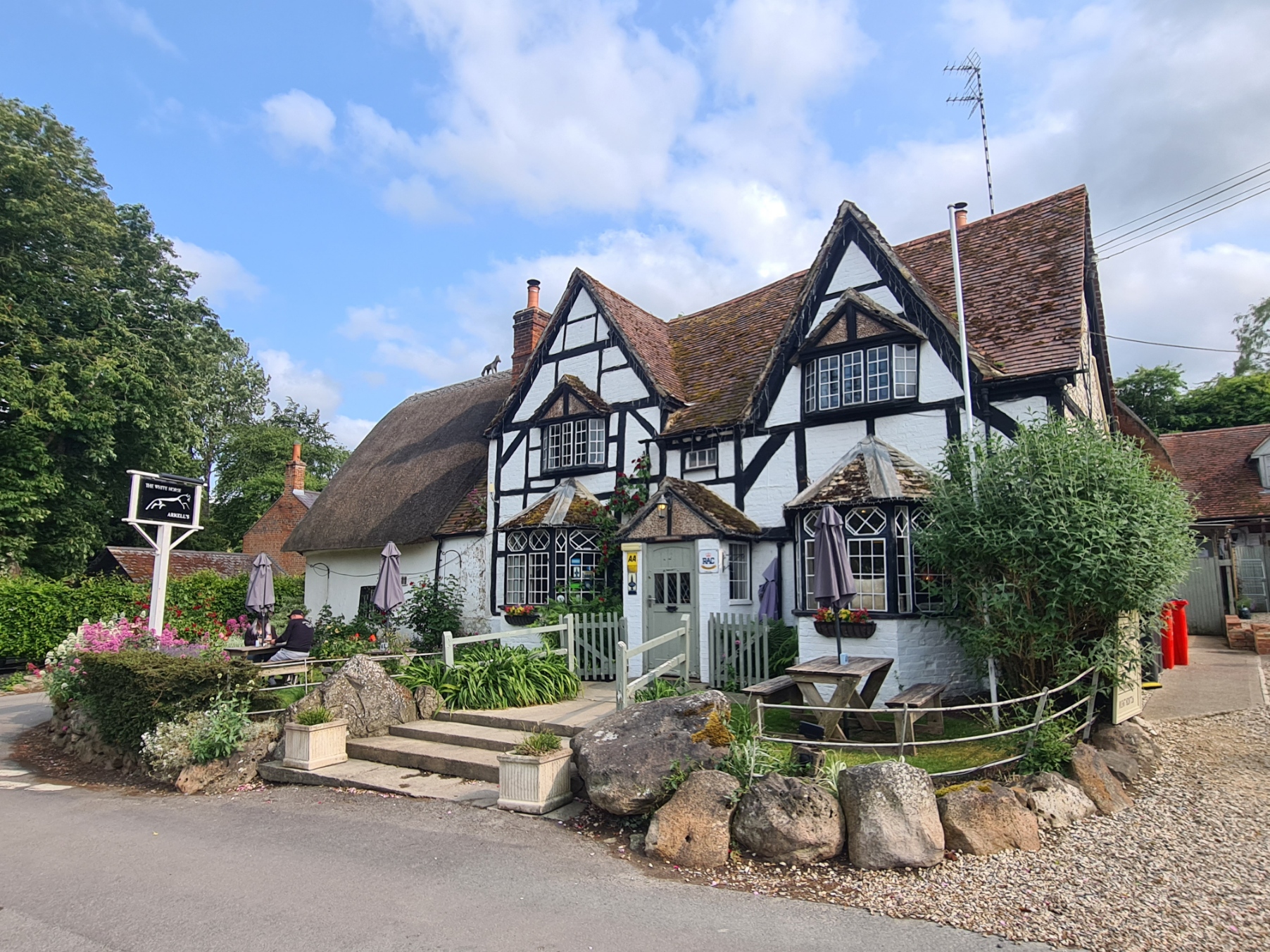
It was about a mile off trail, first following a track, then joining a fairly steep tarmac road to a road junction where we continued into the village. Some parts of this road were really steep and I presume vehicles struggle in icy conditions. Each of these villages seems to be made up of the most attractive places imaginable. Whitewash, wooden beams and thatched roofs proliferate. We are staying at the White Horse Inn in Woolstone. It dates from around the 16th century and is a very attractive pub.
More importantly, last food orders for the kitchen are at 19.45 so weeks earlier I had phoned and booked a table a little earlier than we might prefer, at 19.15. Zak and Johnno were managing the bar between them and both were really friendly and attentive. Something had gone wrong however and despite our pre-booking, there was no record of it the diary. Fortunately it was a quiet night with tables free. Checked in, we eschewed earlier drinks in the bar and hurried off to our decently sized room ‘out back’ as there were chores to complete. While it hadn’t been the longest of days we had got both mud splattered and wet so there was a bit of clothes washing to complete prior to hanging out wet hiking clothes in the hope they would be dry come the morning.
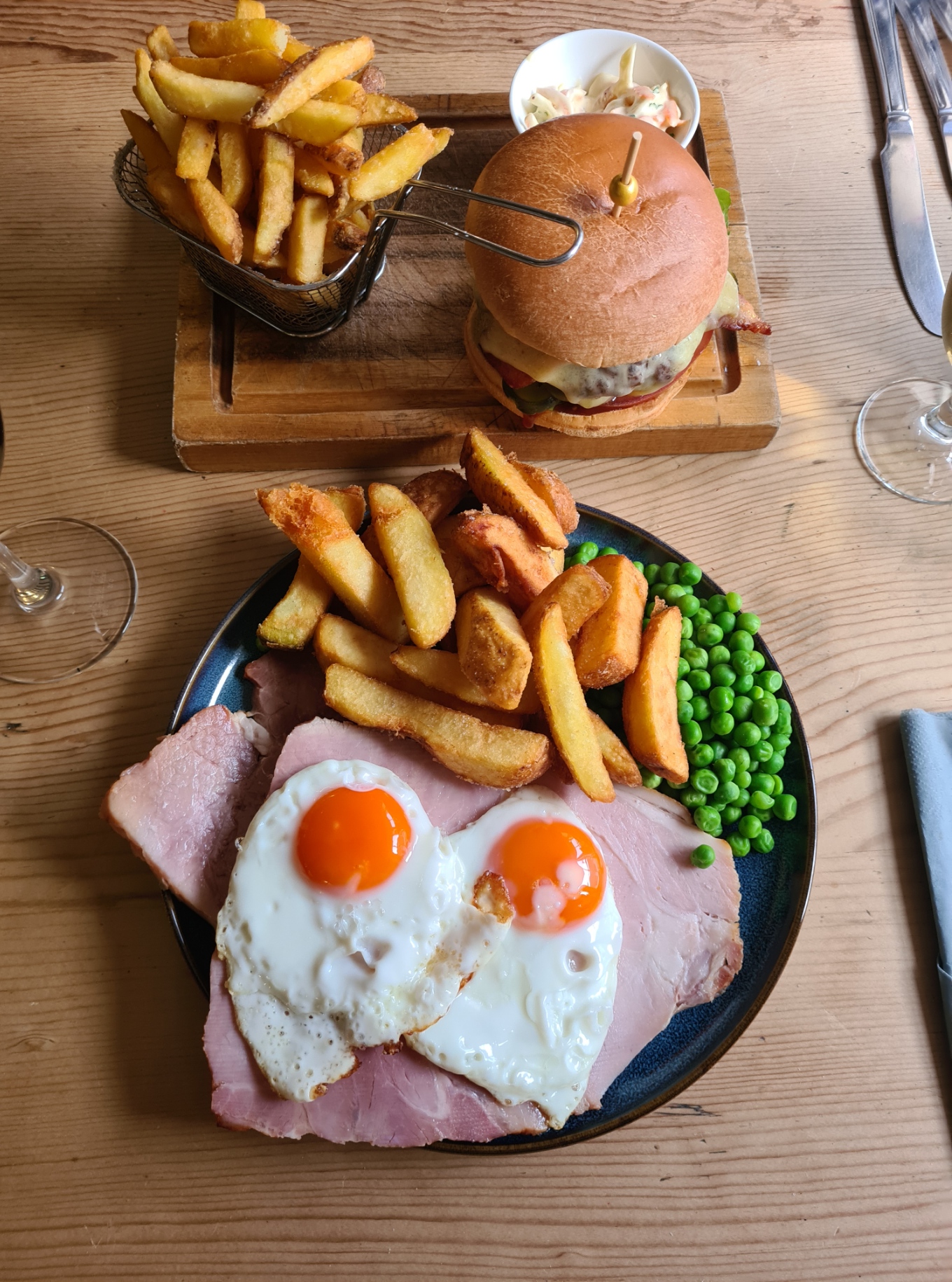
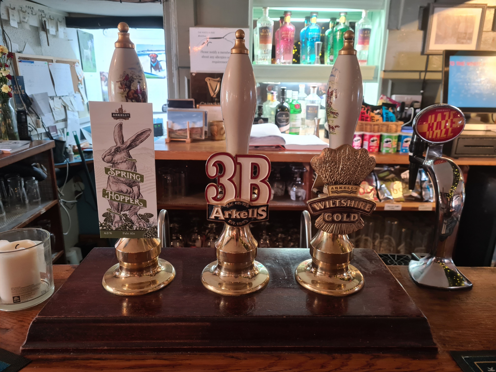
When we returned to the bar, I found three good ales from Arkell’s on handpump. One or two might have been sampled. The menu was simple, but food was well sourced and exceptionally well cooked. It was a good end to a mostly enjoyable day’s walking, only slightly marred by rain. Polishing off a bottle of Australian Shiraz soon dispelled any complaints and most memory of that.
- The Ridgeway- National Trail
- Short film- Grims Ditch
- 2016- Planning
- 2016- Food
- 2016- Water sources on the Ridgeway
- 2025- day zero- Arriving at Avebury
- 2025- day one- East Kennett to Ogbourne St George
- 2025- day three- Woolstone to Letcombe Regis
- 2025- day four- Letcombe Regis to Goring
- 2025- day five- Goring to Watlington
- 2025- day six- Watlington to Princes Risborough
- 2025- day seven- Princes Risborough to Aldbury
- 2025- day eight- Aldbury to Ivinghoe Beacon and the Bridgewater Monument

4 replies »