
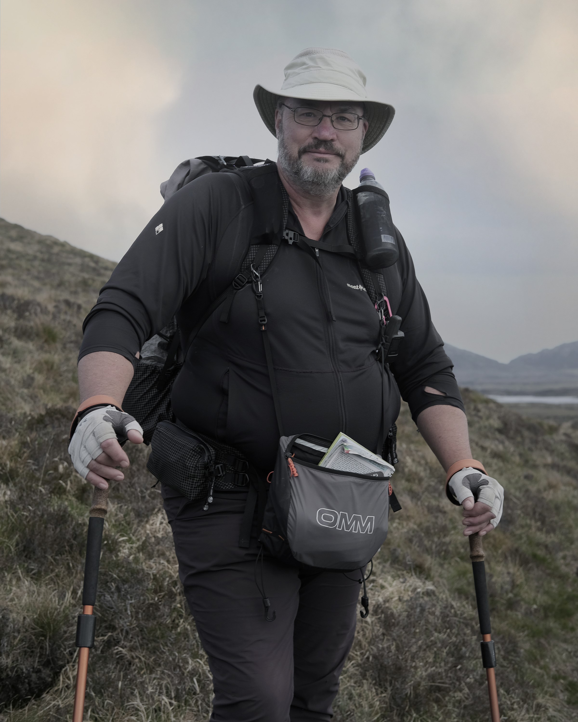
Three Points of the Compass continues heading north(ish) across the Western Isles archipelago on the Hebridean Way
Day Four:
Having enjoyed a good meal with four beers in the nearby bar, after a decent day’s hike, it is unsurprising that I slept well. I took my time rising before sauntering over to the campers kitchen for a mug of tea and the pastie I purchased in the co-op on the walk in yesterday, originally intended as todays lunch. The campsite owner came over for a chat, telling me about his walks in the area and suggested a better route than the dune walk that the guidebook suggested. Having packed and on my way, I followed his suggestion, though am now unsure that it was a better route.
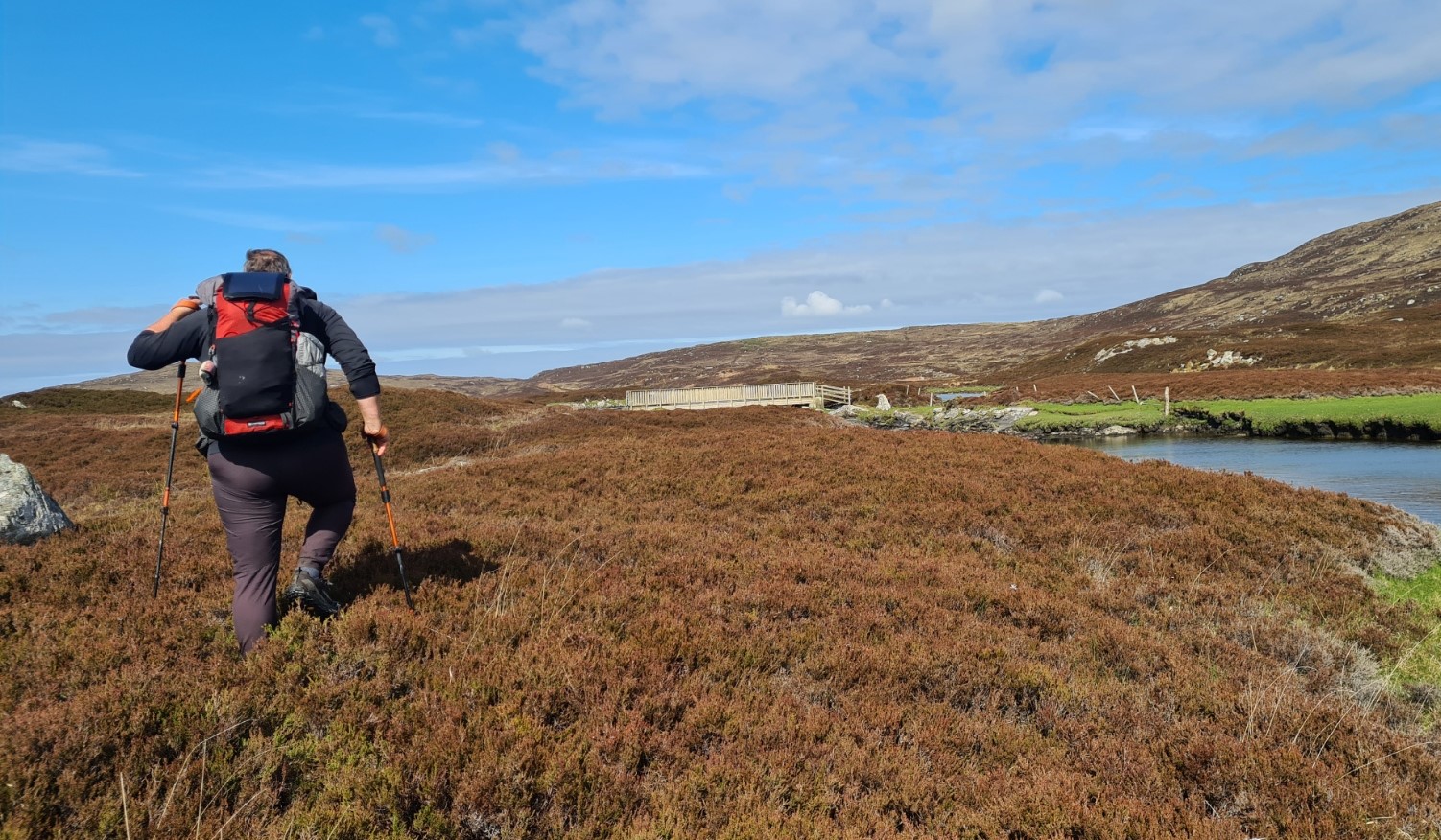
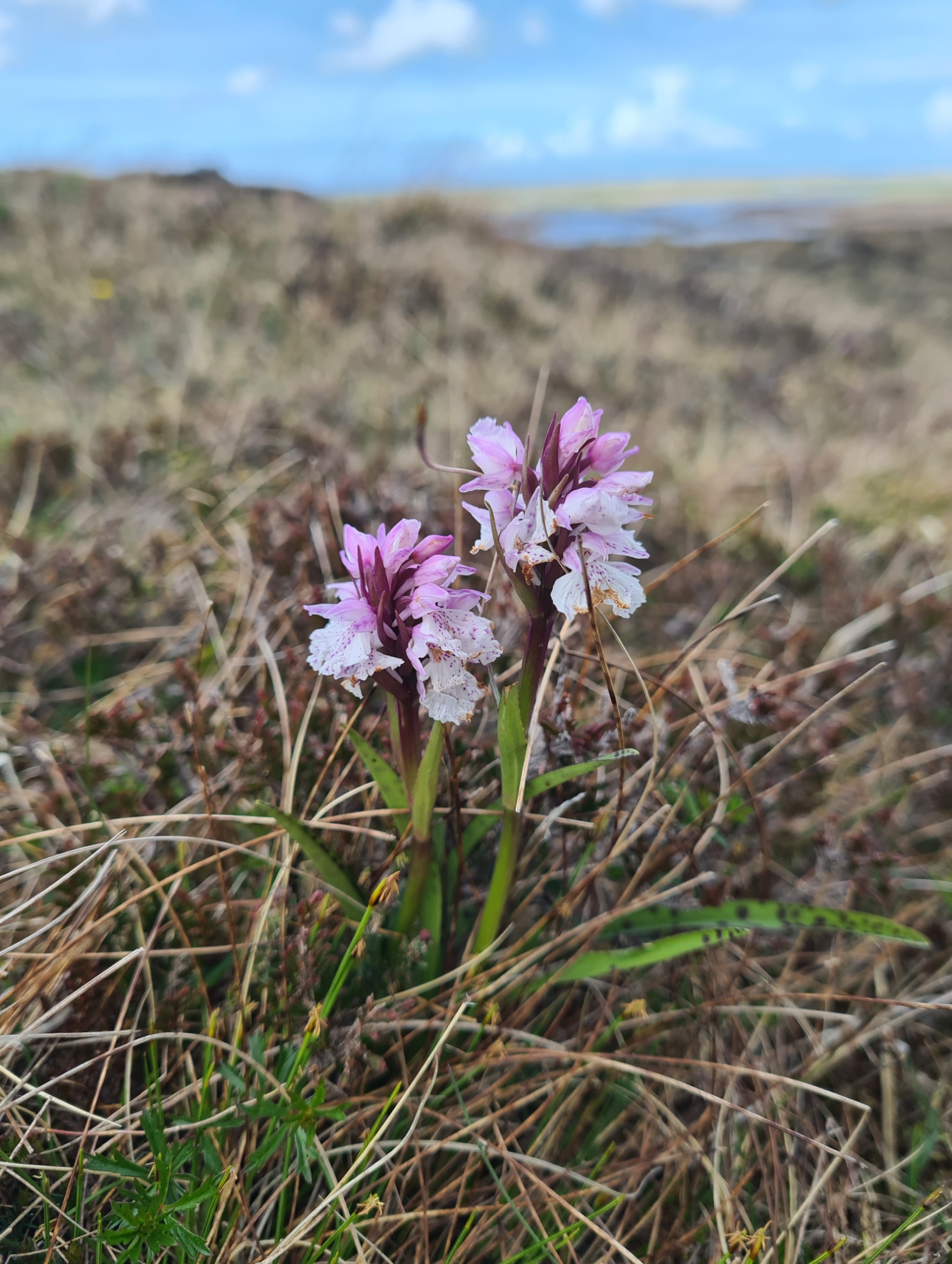
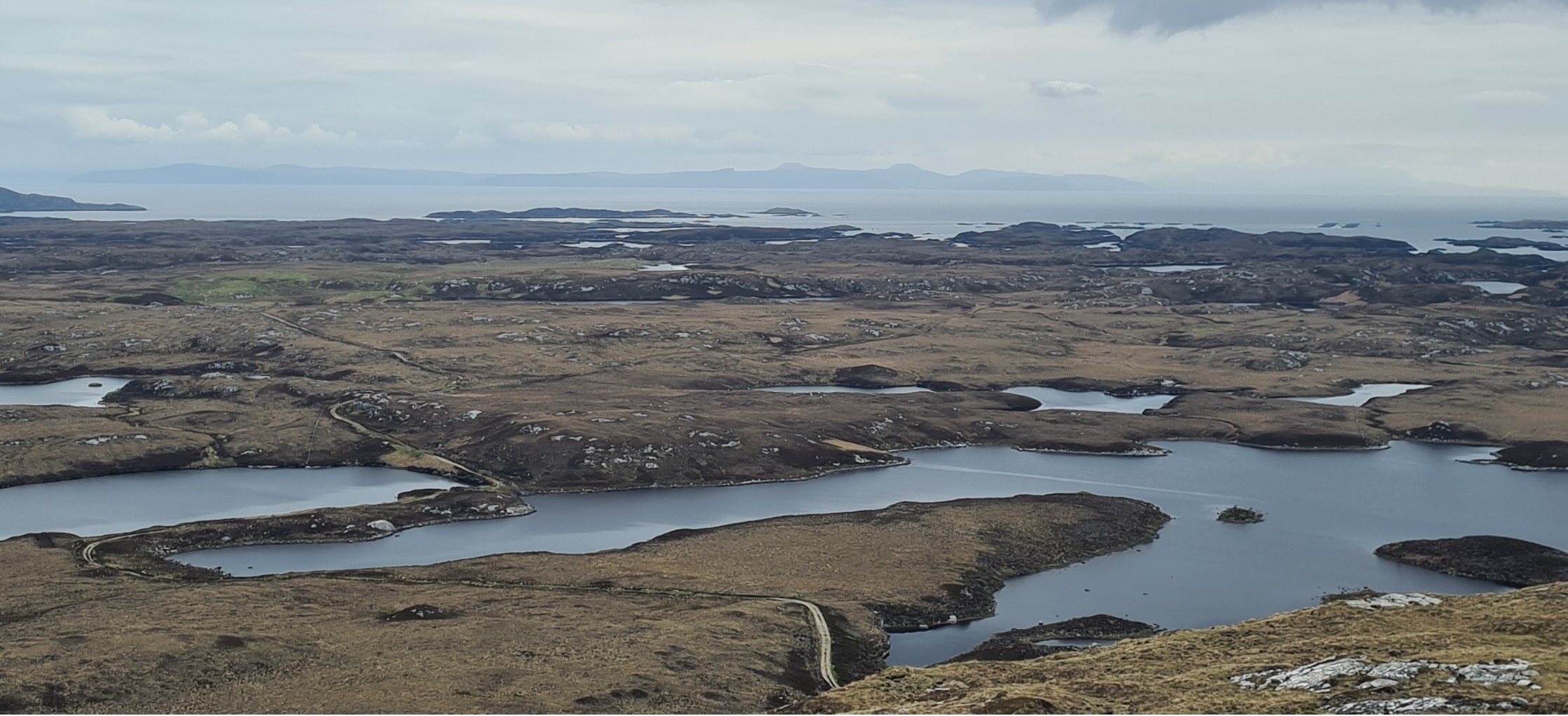
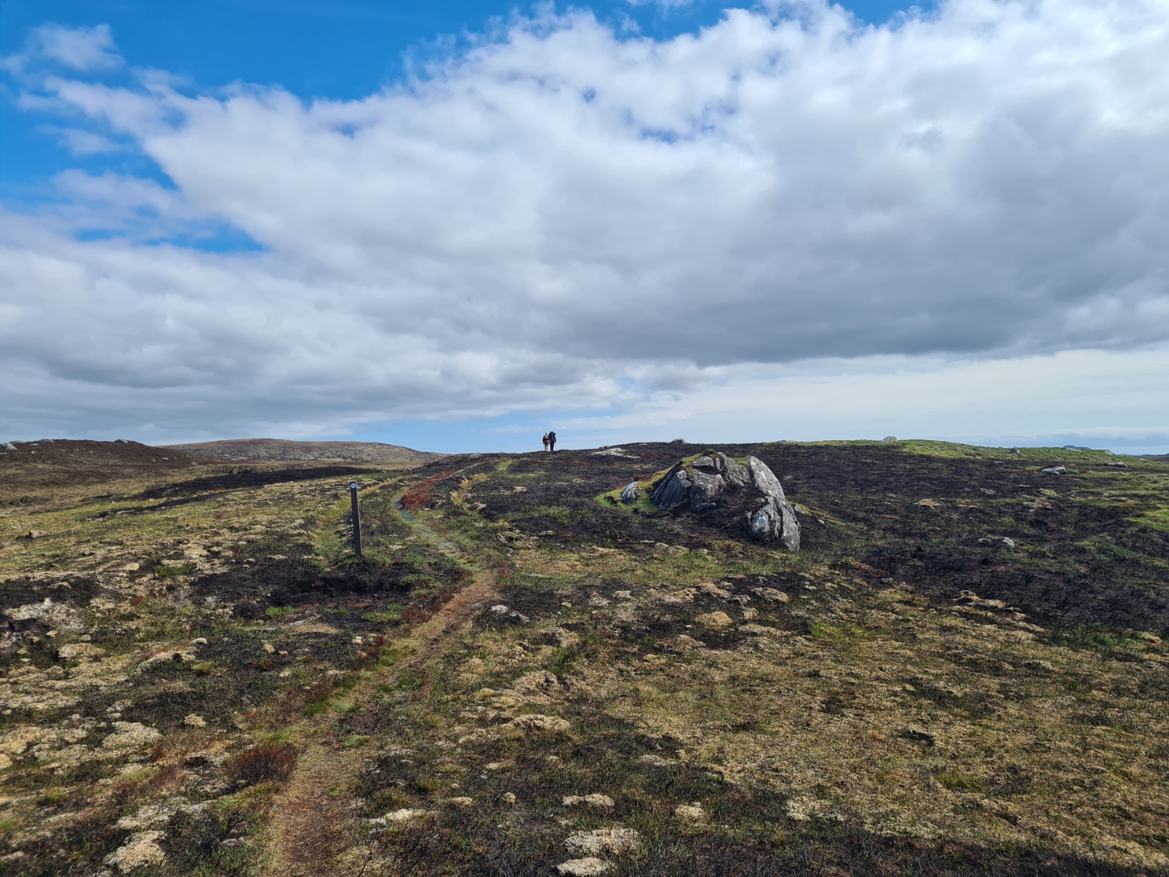
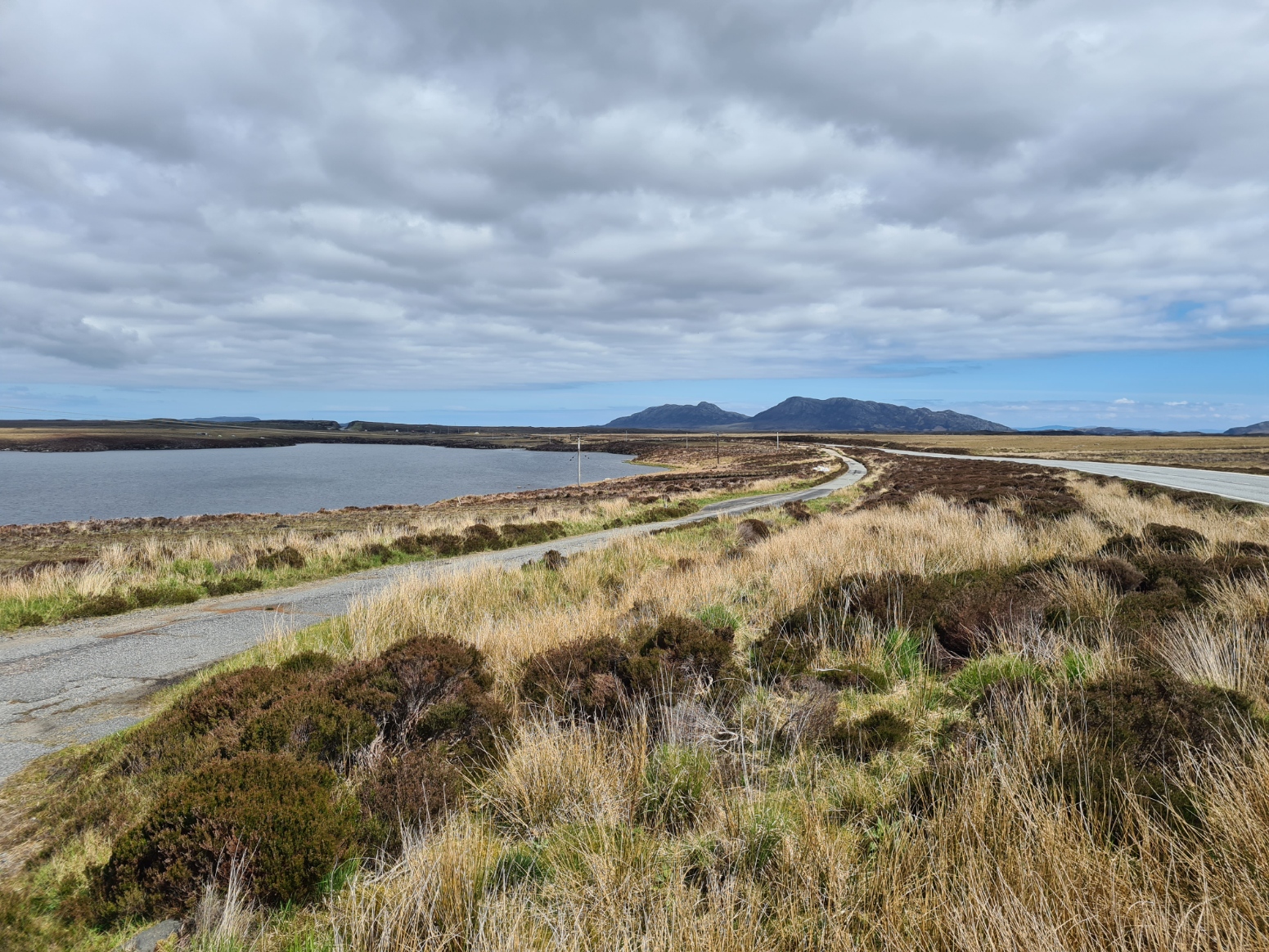
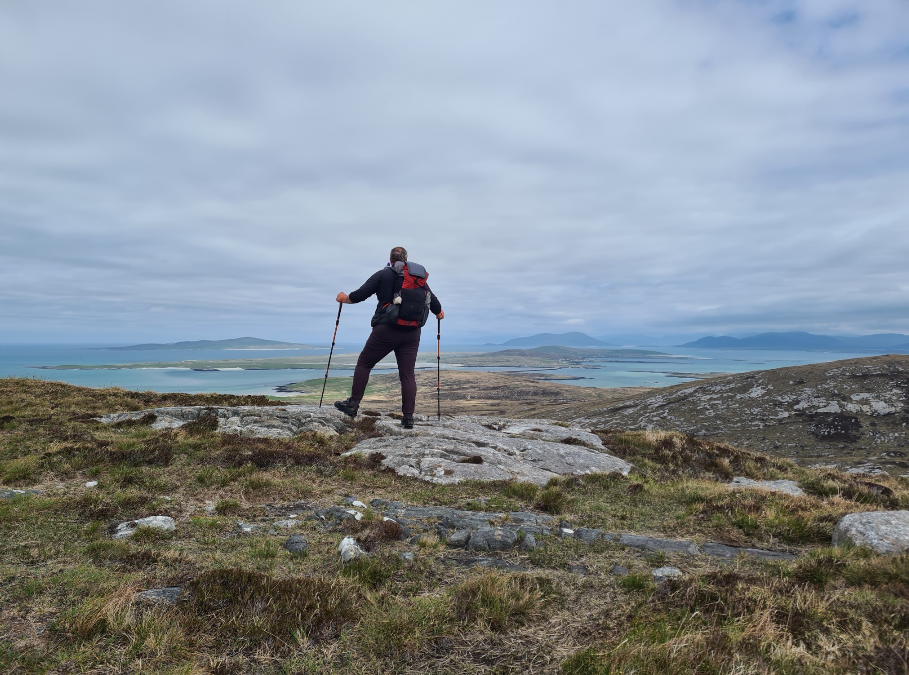
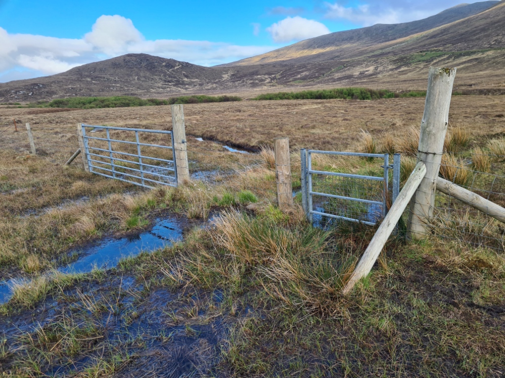
After a short section of tarmac I had to climb a barbed wire fence, picking up a tear in my trousers and a gash in my leg as a result. I then had to struggle through boggy grassy mounds for a distance before being returned to a track. The only real positive was picking up close views of Raven and a lovely Short Eared Owl quartering the ground beside me. I rejoined the official trail, now road walking, to head steadily uphill, past a recycling centre, small quarry and up to the modest summit of Ruabhal, with wide views over an extensive convoluted network of watery lochs and islands. Skye was clearly visible off to the east.
I was again treated to good views of a Hen Harrier, before I left the trig point to strike off north-east’ish to cross the isthmus between Loch Olabhat and Dubh Loch. It wasn’t the easiest of navigation to start, but became much clearer, picking up trail markers and threading through the lochs, eventually coming to a minor road that I followed to join the A865. It would be road walking for almost all of the remainder of today. First to Grimsay and then to North Uist. But before then, I had a treat.
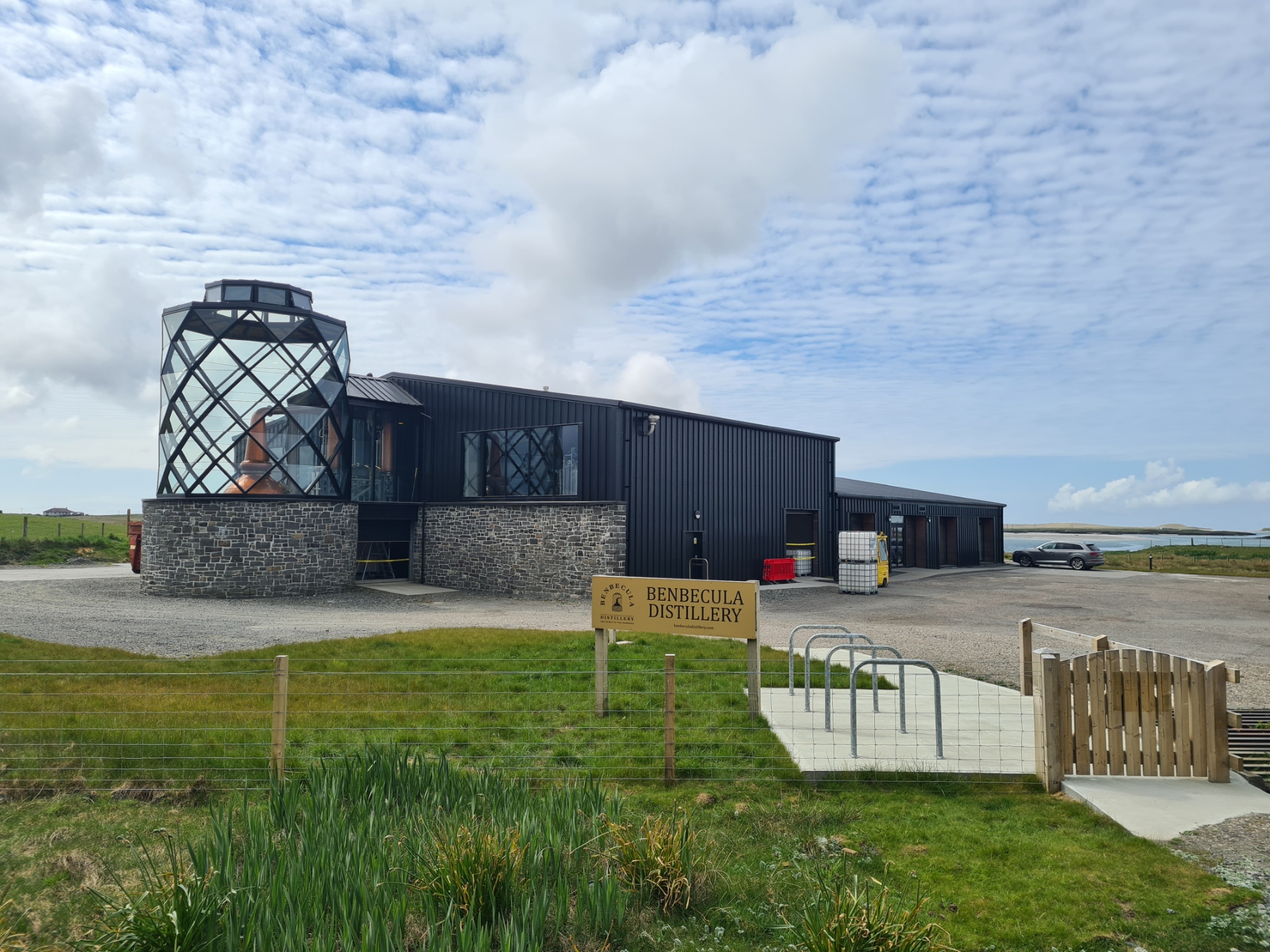
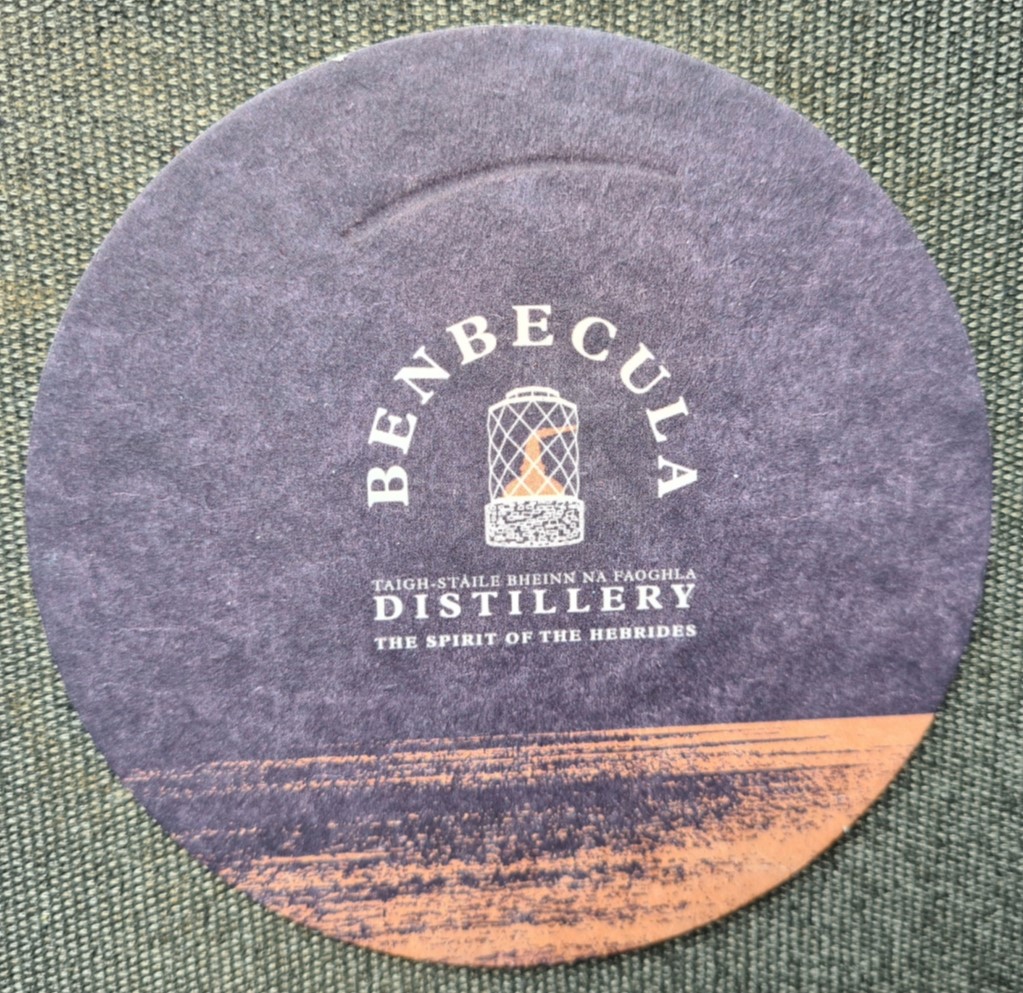
Having emerged on to the road at Gramsdal and turned right, just prior to leaving the island I was a little surprised to find a smart looking distillery sitting at the end of the causeway, as there was no mention of it in either of the guidebooks I had read.
Obviously I had to stop in to the distillery’s visitor centre to see if I could get a taster, possibly even buy a bottle. But no, it wasn’t to be. Benbecula Distillery is pretty new on the scene, just past celebrating their first birthday of turning out spirit. Their USP is working to an ancient rediscovered recipe, and concentrating on using local ingredients for their single malt, which even includes Uist barley grown on soil enriched with seaweed from the local beaches.
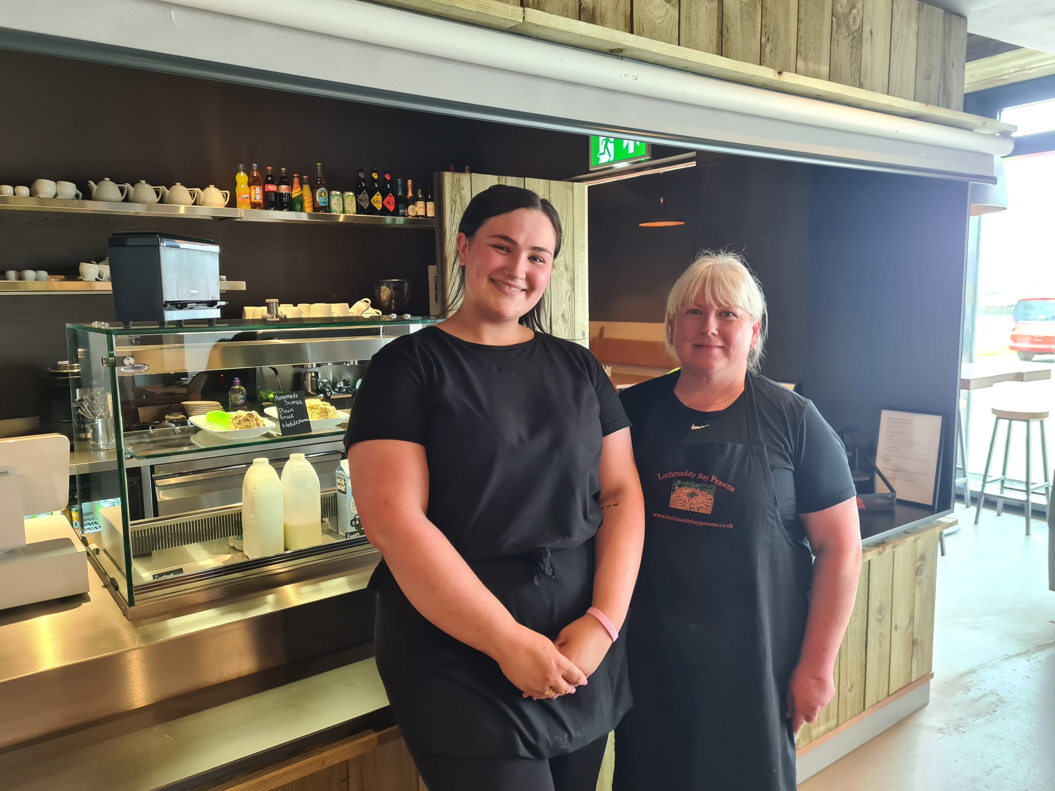
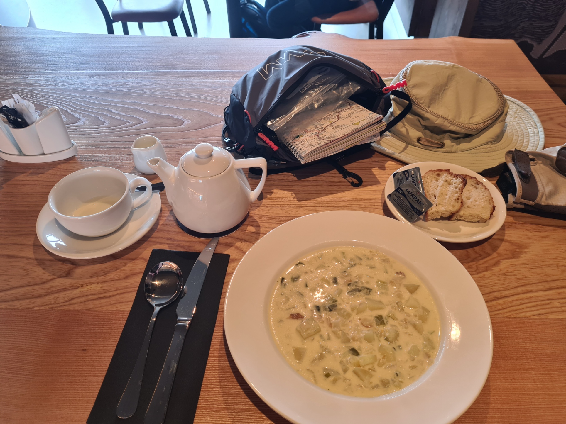
But at least I could get a bite to eat. Especially as I had eaten my lunch for breakfast. The smart café had only opened six days before, and I enjoyed the finest Cullen Skink (£8.20) I have ever had, complete with soda bread and inevitable pot of tea. Friendly café manager Alanna and her colleague Tina somehow found time while serving to tell me a little of the history and vision of the new enterprise. I hadn’t booked onto a tour of the still, I hadn’t even known there was a distillery, let alone tours, but from what I saw, it will be a brand to keep an eye out for, as I do like the occasional drop of the good stuff.
With a full belly, rested and in good spirits, I returned to the trail, though I knew I had a good deal of road walking and my feet were already just a little tender. The hard tarmac really does punish feet made wet from boggy walking. I was now crossing the North Ford Causeway, opened in 1960, the five mile road crosses three bridges and several causeways. But I swung along in fine style enjoying the fine weather and keeping an eye out for otters in the water to my right. I saw two, both were wary and quickly submerged when I paused to watch them.
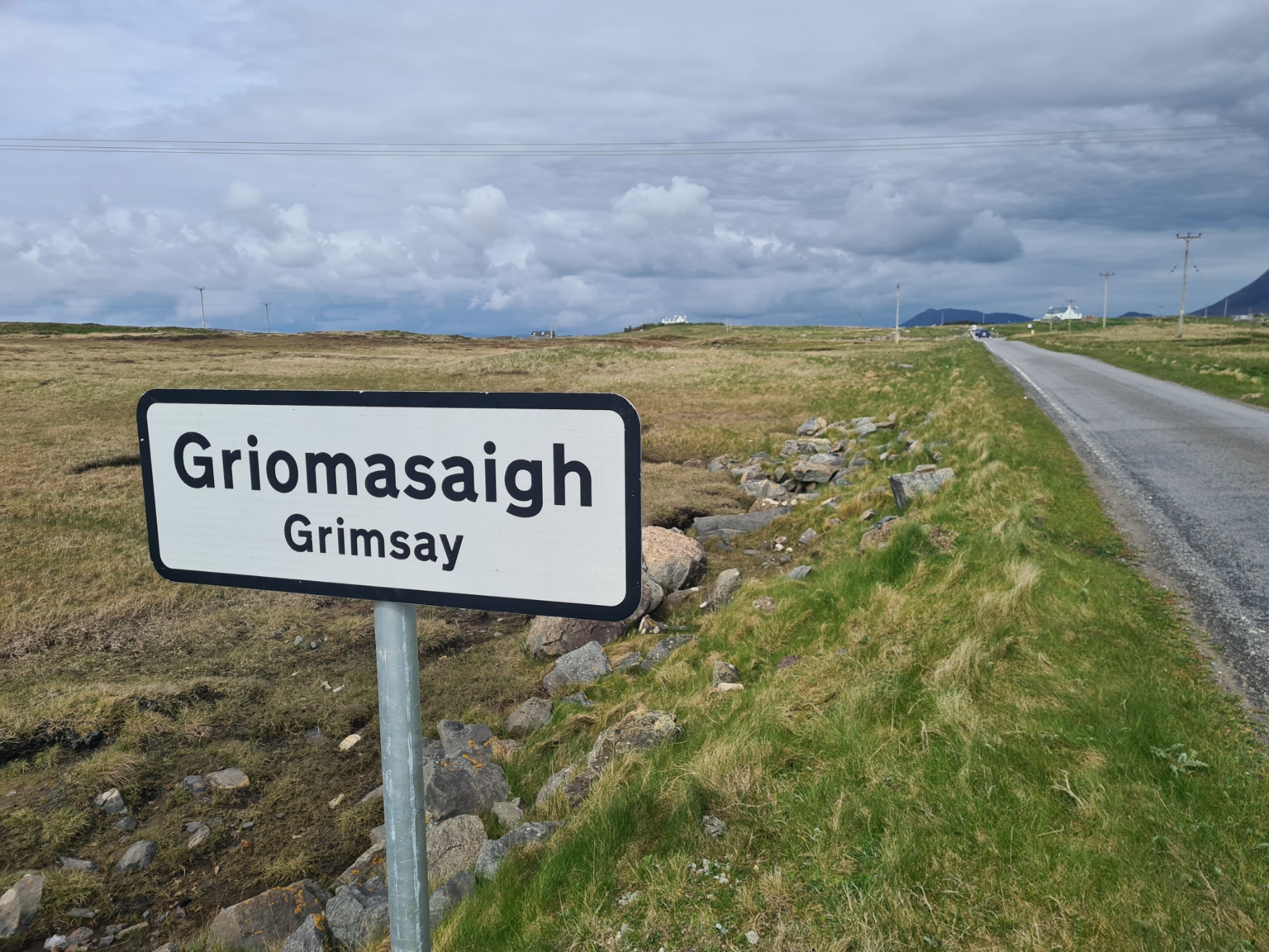
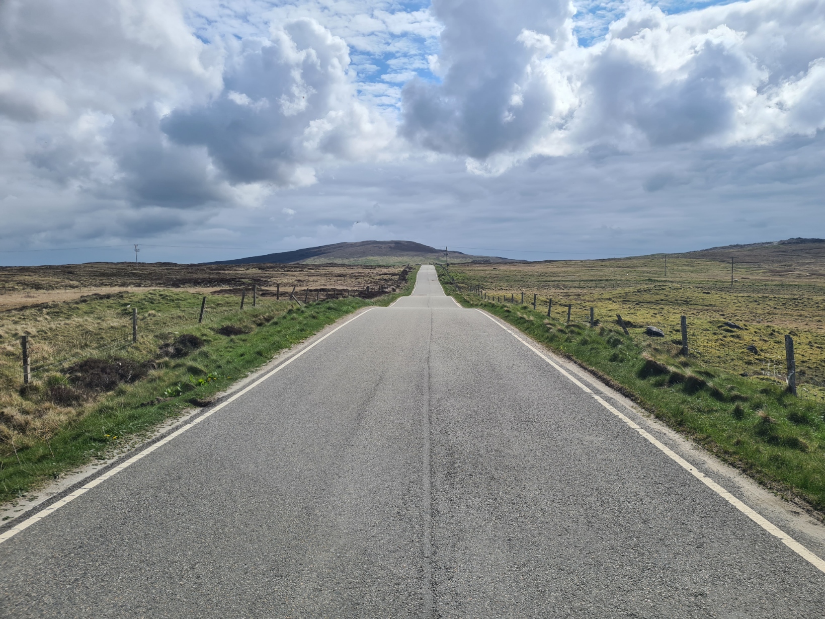
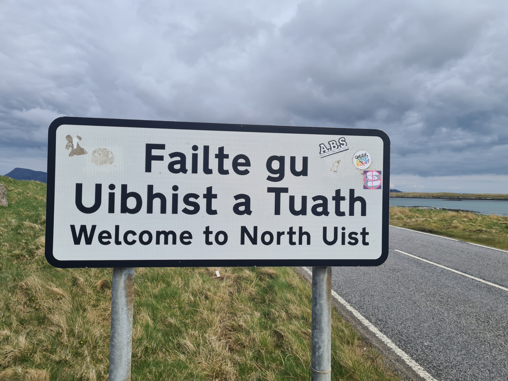
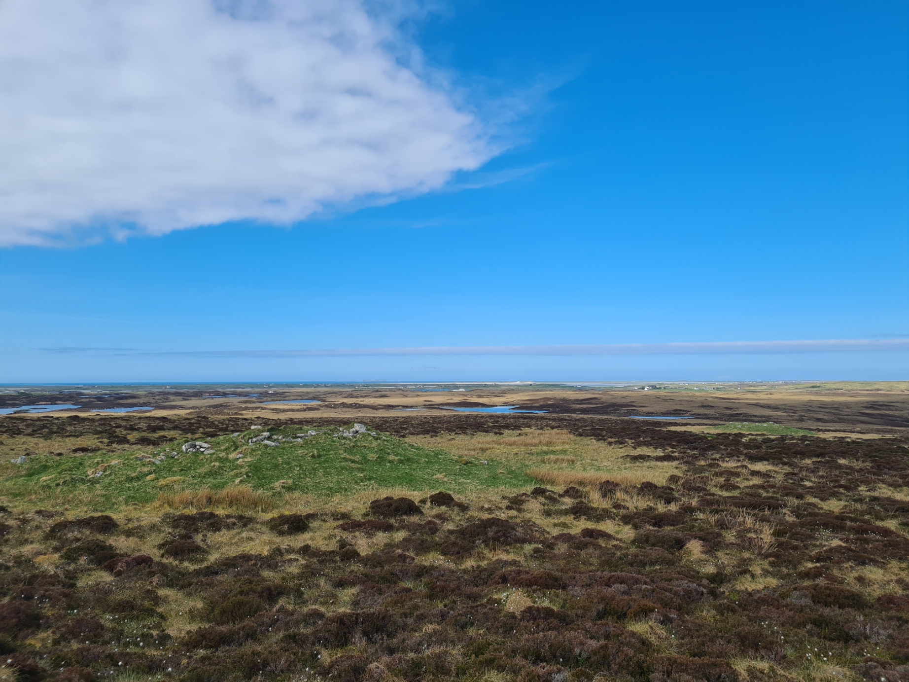
Grimsay, my sixth island, came and went in minutes. Onward, more causeway, to my next island. North Uist is another low lying island with wide views and little in the way of hills. But it more than makes up for it with numerous small lochs. Because the landscape is so wet, there would be more road walking through this island tomorrow.
The few cars all gave me a wide berth when passing. Each driver, and often any passengers, giving a wave. The worst was the motorhomes with their tourist drivers, as few would move over much, if at all. I was in no rush however and adopted a simple method. On the approach of any vehicle, I stepped off the road, as far as I could reasonably manage. It took seconds and saved any potential for grief. Not all Heb Way road walkers do this, but when the amount of traffic is as minimal as it is in the Outer Hebrides, I don’t really understand why not.
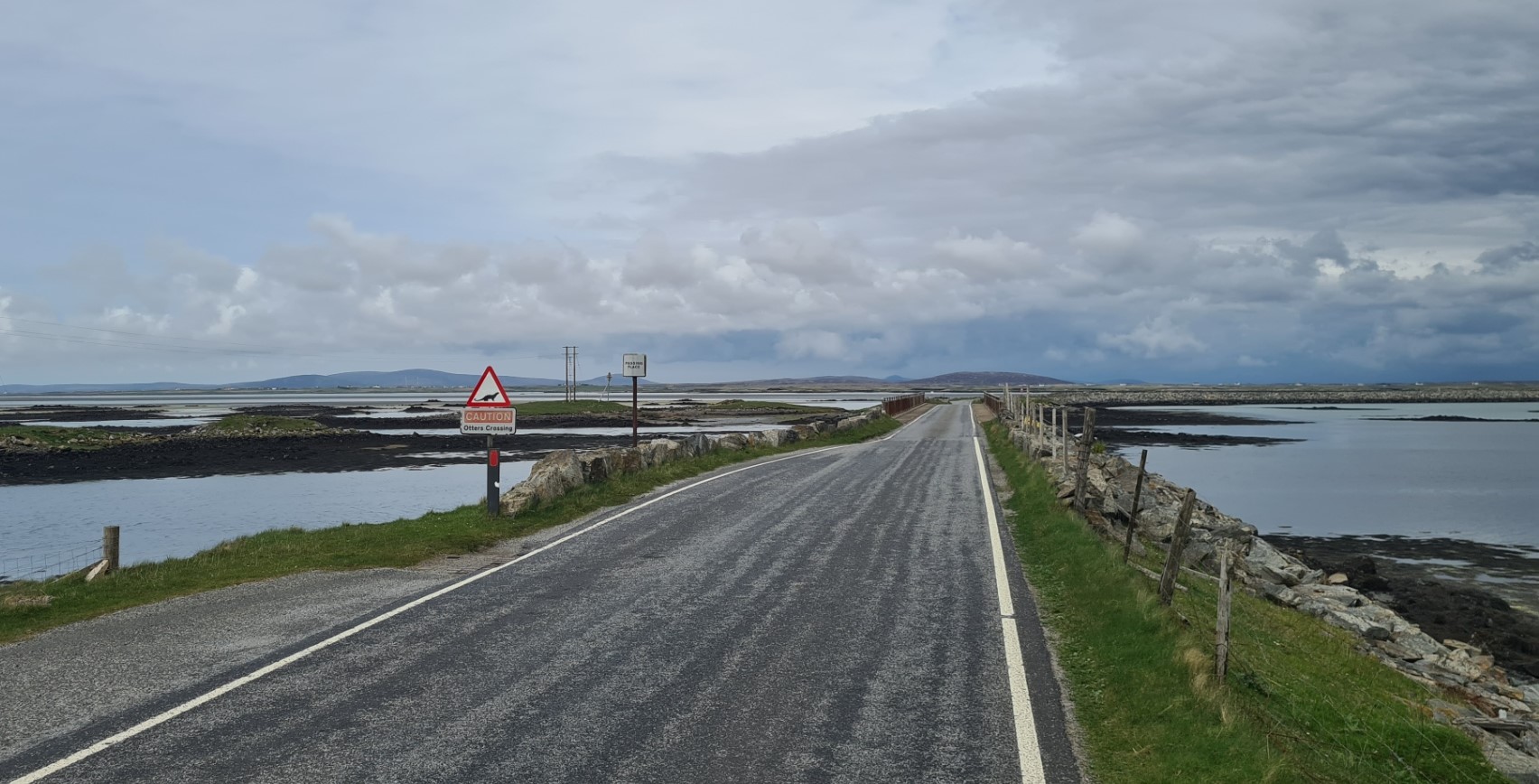
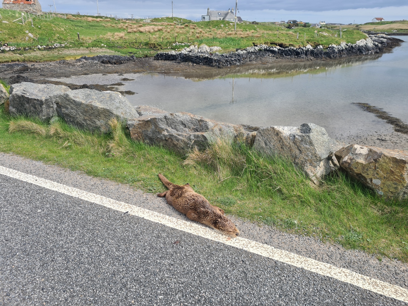
Sadly, not all the traffic necessarily slows down when crossing from one island to the next. Every causeway has a sign at each end “Caution Otters Crossing”, as those sleek animals will frequently cross from one side to the other. Coming to the end of my causeway there was a sad sight, a juvenile otter had been killed on the road. A cyclist who also stopped, told me it hadn’t been there just twenty minutes previous.
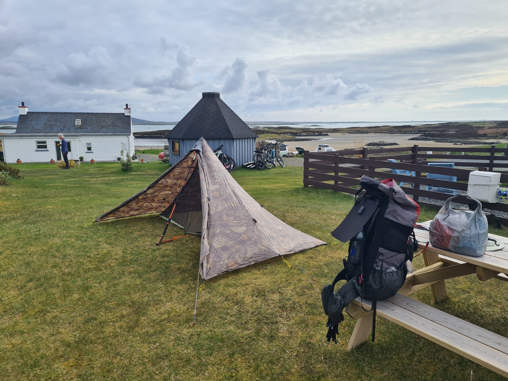
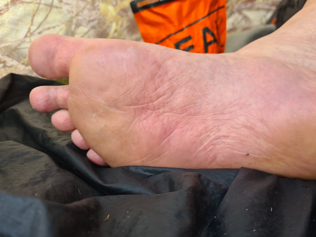
When setting off this morning I hadn’t necessarily planned on stopping early today, but when I reached the smart and carefully maintained Moorcroft campsite at Cairinis I was a little footsore so thought it prudent to give them a break and had no hesitation in calling in to the house at the entrance to pay site-owner Iain my £12 for an overnighter. I was told I could pitch on any flat bit I could find. Most backpackers and bike-packers go down to pitch near the water, where there is a bit of shelter from any wind, but I thought the midges uncomfortably thick down there and it wasn’t a particular flat area. So I went higher on the site, to an adequately large and flat spot behind the little Glamping pods. It was a good pitch with a slight breeze. Tent up, I then went to the nearby amenities block for an appreciated hot shower, finding a tick on one foot. Thankfully, that was the only real issue with my feet, no blisters, just macerated. But a massage, foot balm, dry socks and rest would work their magic. Later, I spent some time chatting to another camper who had recently arrived and pitched nearby. Bike-packer Robert was a little different to other cyclists, he had a third-wheel trailer connected to his e-bike. It was the first time I had seen an electric hook-up power lead trailing into a lightweight tent. He left to cycle off in search of a shop as he was running out of provisions. It was my daughters birthday so after a nap in the tent, I was pleased to have a video chat with her, before going to the ‘campers kitchen’ for my evening meal. This was a, frankly awful, Firepot Tuscan Stew. At least my whole bar of Ritter marzipan chocolate (496kcal) and multiple hot drinks were more palatable.
I spent some time chatting with Heb Way walkers Debbie and who I had incorrectly presumed was her long-time walking partner. But they had only recently met and decided to walk together(ish) for part of the trail. While Debbie was completing the trail in a somewhat odd manner, catching buses, dropping pack, bus back and then run/walk the trail in lightweight unburdened fashion, Fran was carrying a large pack and though determined, was struggling slightly. Hardly surprising, as he had a prosthetic leg, the result of a climbing accident.
As usual, backpackers were charging phones and powerbanks in the kitchen area but the weather had been so fine that my solar panel had ensured my powerbank was fully charged so I could continue ‘off-grid’ to a degree. I have been using the 140g Sunslice Fusion Flex6 6W panel on most of my recent hikes and have found it usually sufficient to keep me in power.
I had again enjoyed my day, if some of it had been Type Two fun as the afternoon tarmac had been fairly hard on the feet. My earlier finish and extended rest would be appreciated. The quick succession of islands was confusing me slightly and my journal contains my final notes for the day: “….now on North Uist. No idea what number island!”
Day Five:
It was a quiet site, the breeze died down and I slept well but woke to hot sun uncomfortably heating the closed tent, but just as well, as this then dried up the heavy condensation on the inside of the fly. While I had been pretty warm overnight, throwing arms and legs out from under the quilt, the chat amongst those who had camped down near the water, was how cold they had got during the night. I sat in the little campers kitchen for some time, drinking tea, consuming granola, and chatting to Robert before finally packing and getting away.
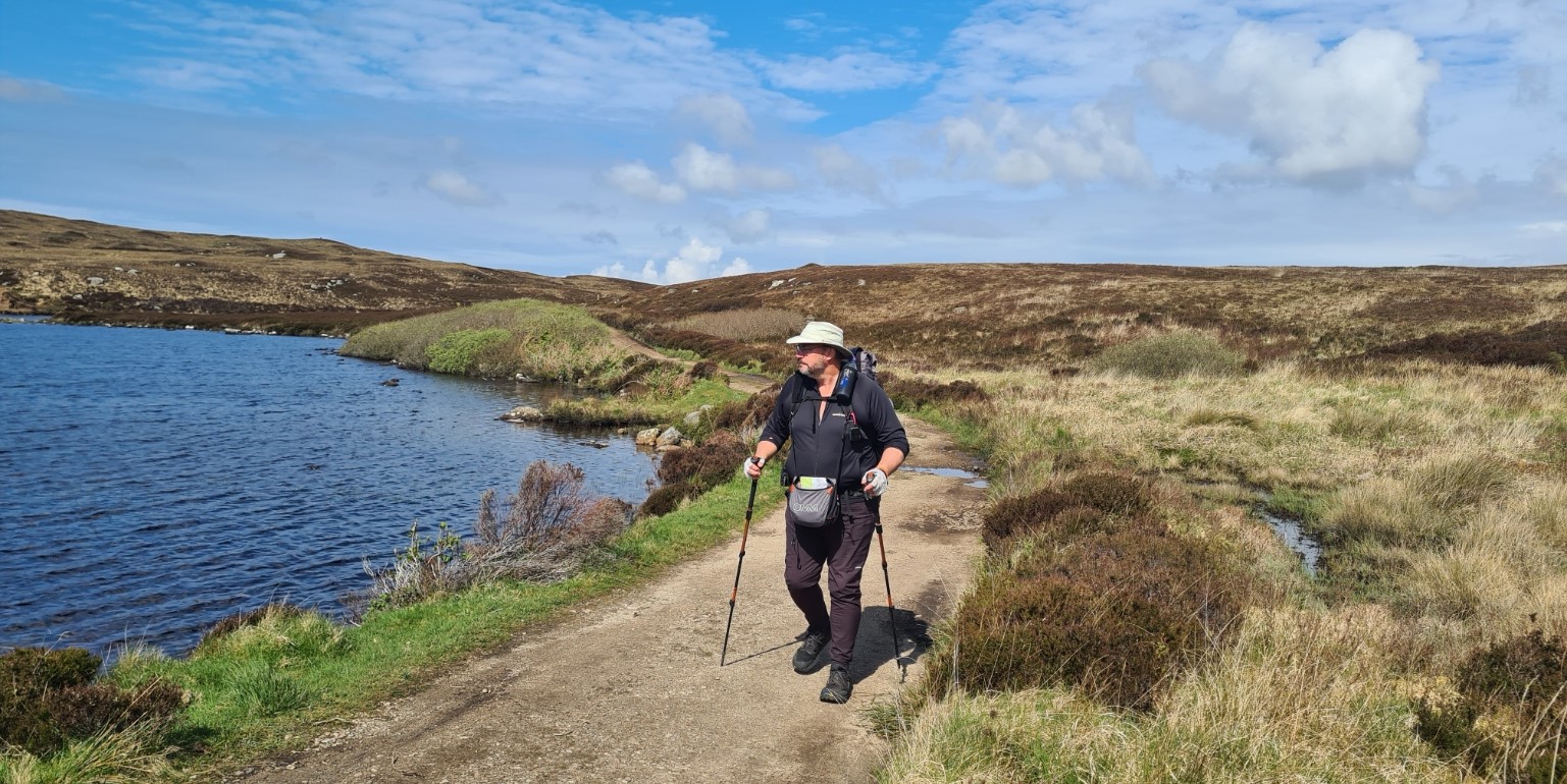
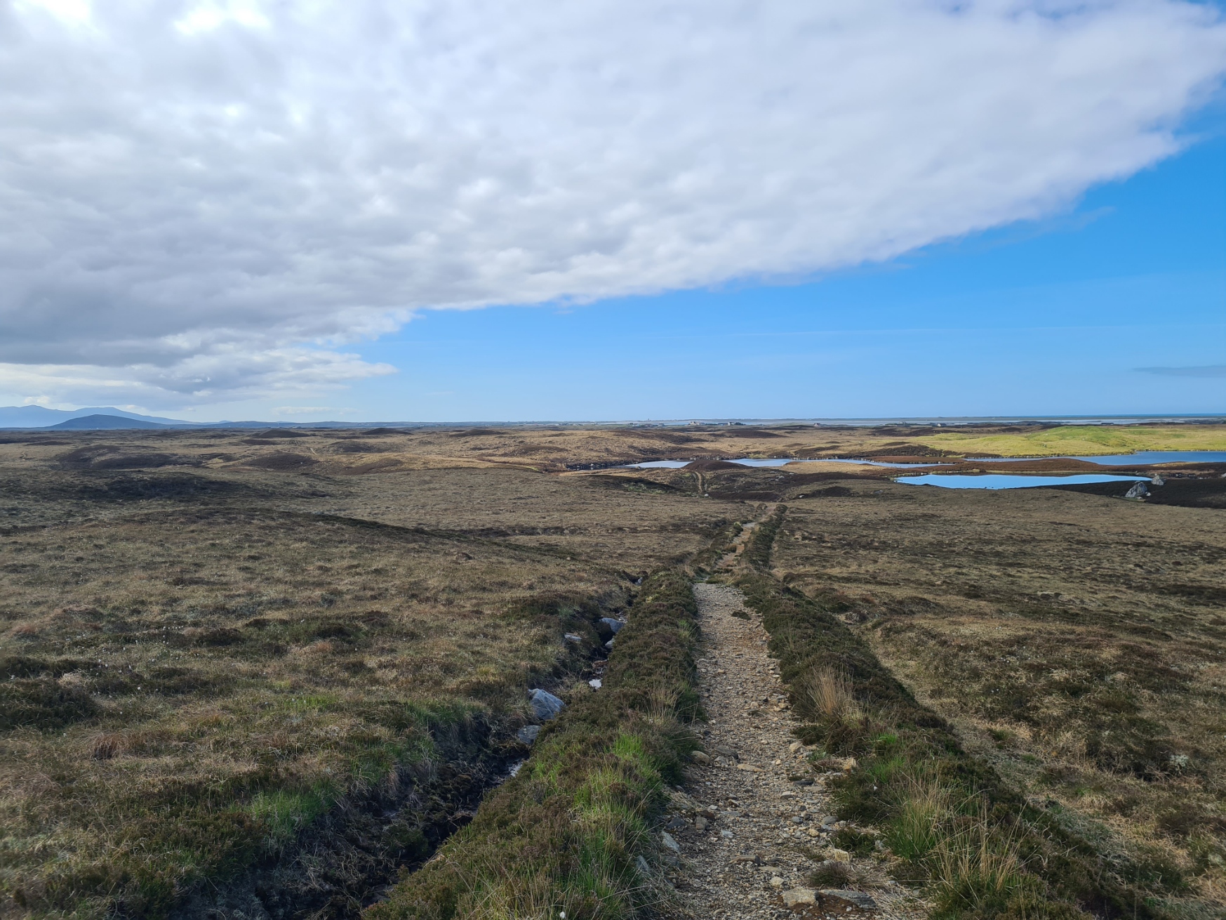
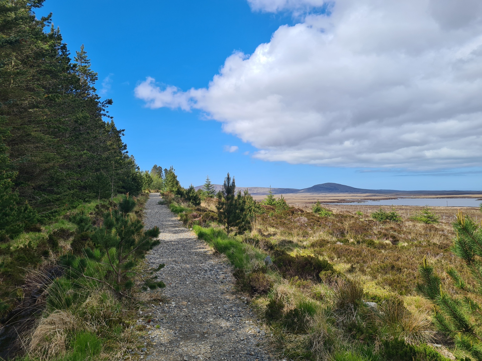
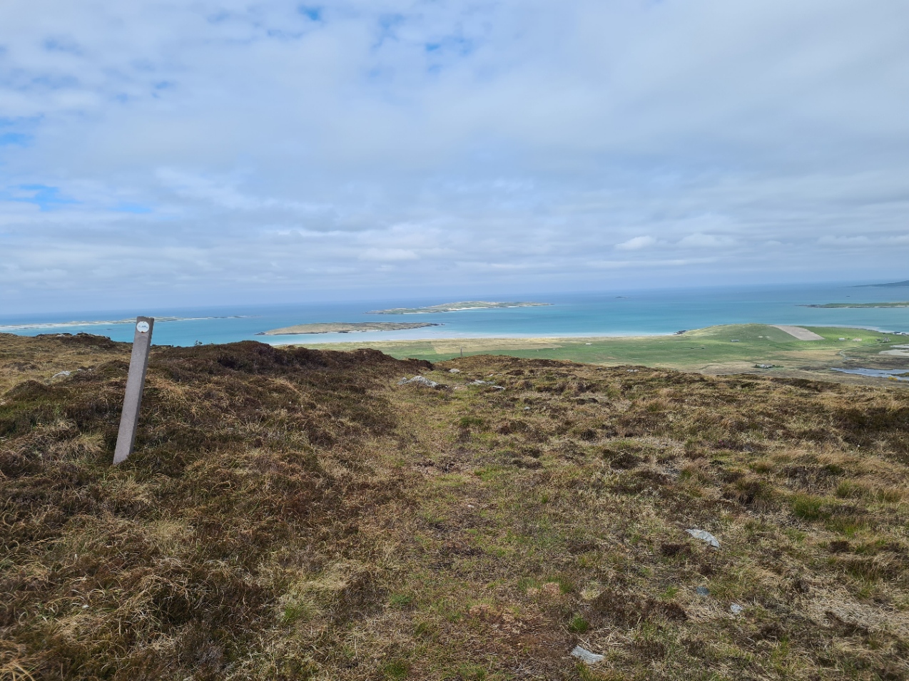
It had the look of a hot day and on the walk off site I stopped at a tap to drink a half litre straight down and fill a two-litre bladder with water. Then it was straight across the road outside the campsite and into the community woodland, though it was a bit sparse of trees. It was good walking through fairly dry moorland on one of the frequently encountered ‘double-ditch’ tracks. These are created by digging the peat from two parallel ditches and piling it in the centre to give a slightly raised and drier track. Sometimes it works, sometimes it doesn’t, frequently it makes for rough walking, especially if newly dug and not yet bedded in. This part of the trail had some of the best I encountered. Crushed rock had even been lain in some parts.
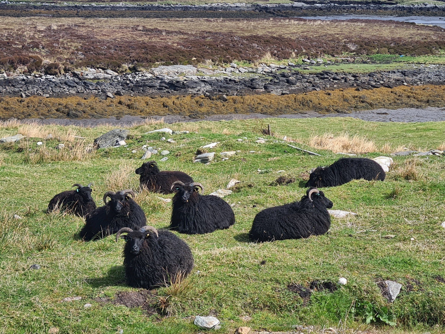
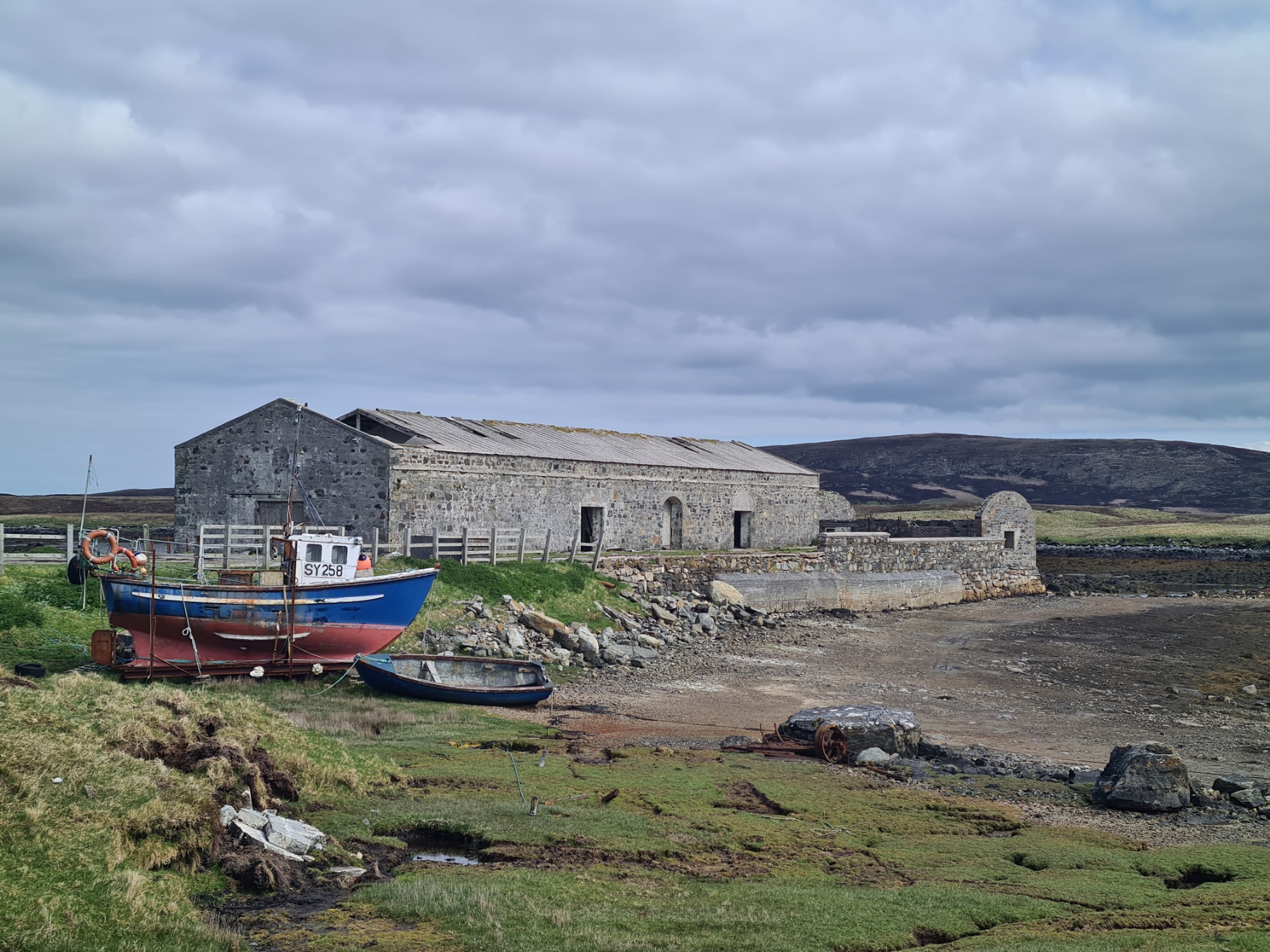
I was caught up by Debbie and Fran. Even a one-legged man with huge pack walks faster than me! I enjoyed this section immensely, though had to stop to apply sun cream as the sun was intense. Obviously the moorland walking couldn’t last forever and inevitably the trail joined a road. Soon after, I passed close to slumbering native sheep, and a pier jutting out into Loch Euphort with its large crumbing warehouse. This was originally built for the woollen industry, however the Tweed trade in the vicinity almost collapsed and it was instead used for a short-lived bulb-growing enterprise in the 1960s.
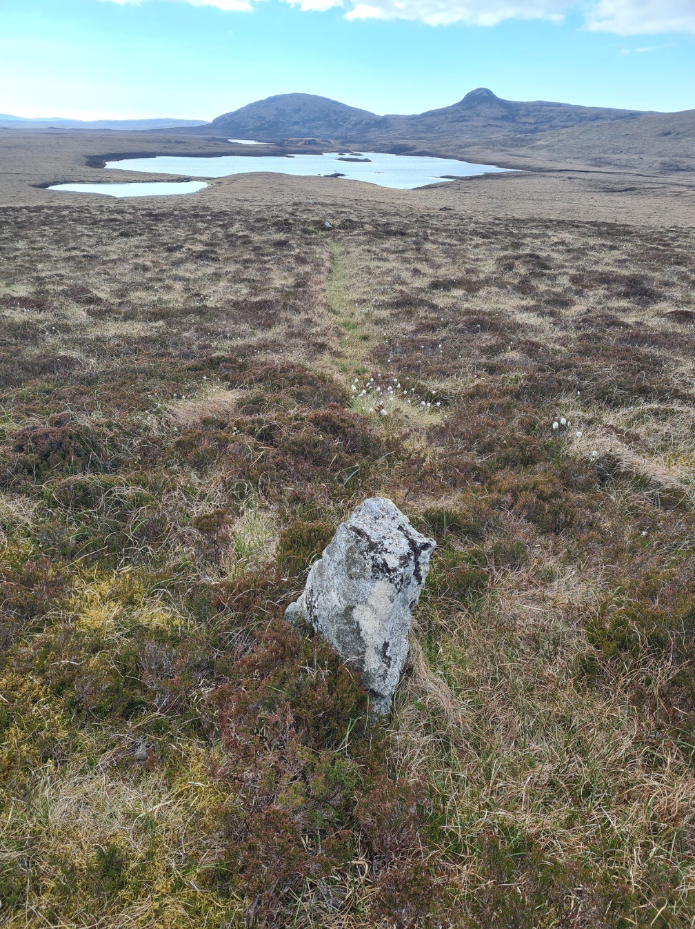
I again left the road, for more lovely, easy tracks across the heather moor. The moorland has a number of chambered cairns and round barrows, some are shown on the map, but not all. The trail passed close by two, a scattering of stones on the top of the grassy mounds. Back to a road that I followed for a short distance to reach a lodge, at Langais.

It was now 12.30. It would have been a crime to walk past it. I called in, to find Debbie and Fran already sitting at a table on the patio. I dropped my pack at a nearby table and went into the bar to see what was on offer. This was an excellent halt, with terrific haddock and chips, mushy peas and salad, with a couple of refreshing bottled beers. We don’t have to rough it.
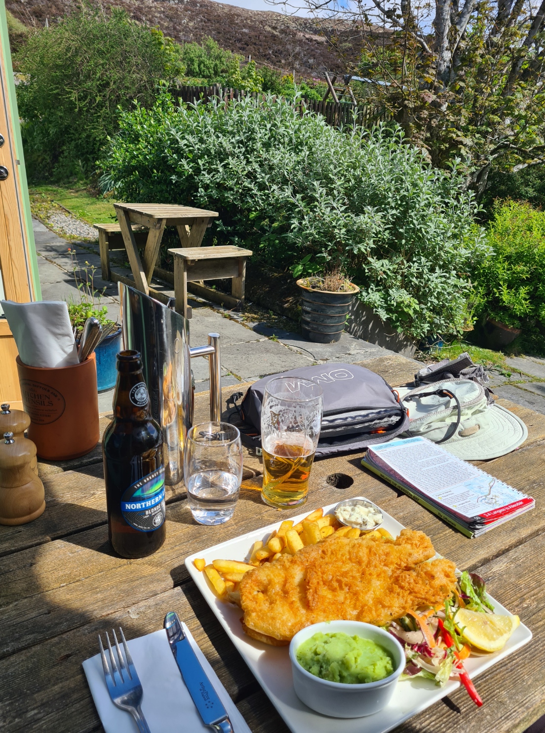
While I ate, a Robin kept coming to join me for crumbs. A cuckoo flew overhead, to sit nearby, constantly calling. I took shoes and socks off, allowing feet to dry and air beneath the wooden bench table. It was an extended, peaceful, if over-indulgent halt, and it was with some reluctance that I shouldered my pack to resume the trail. A short nap would have been preferable.
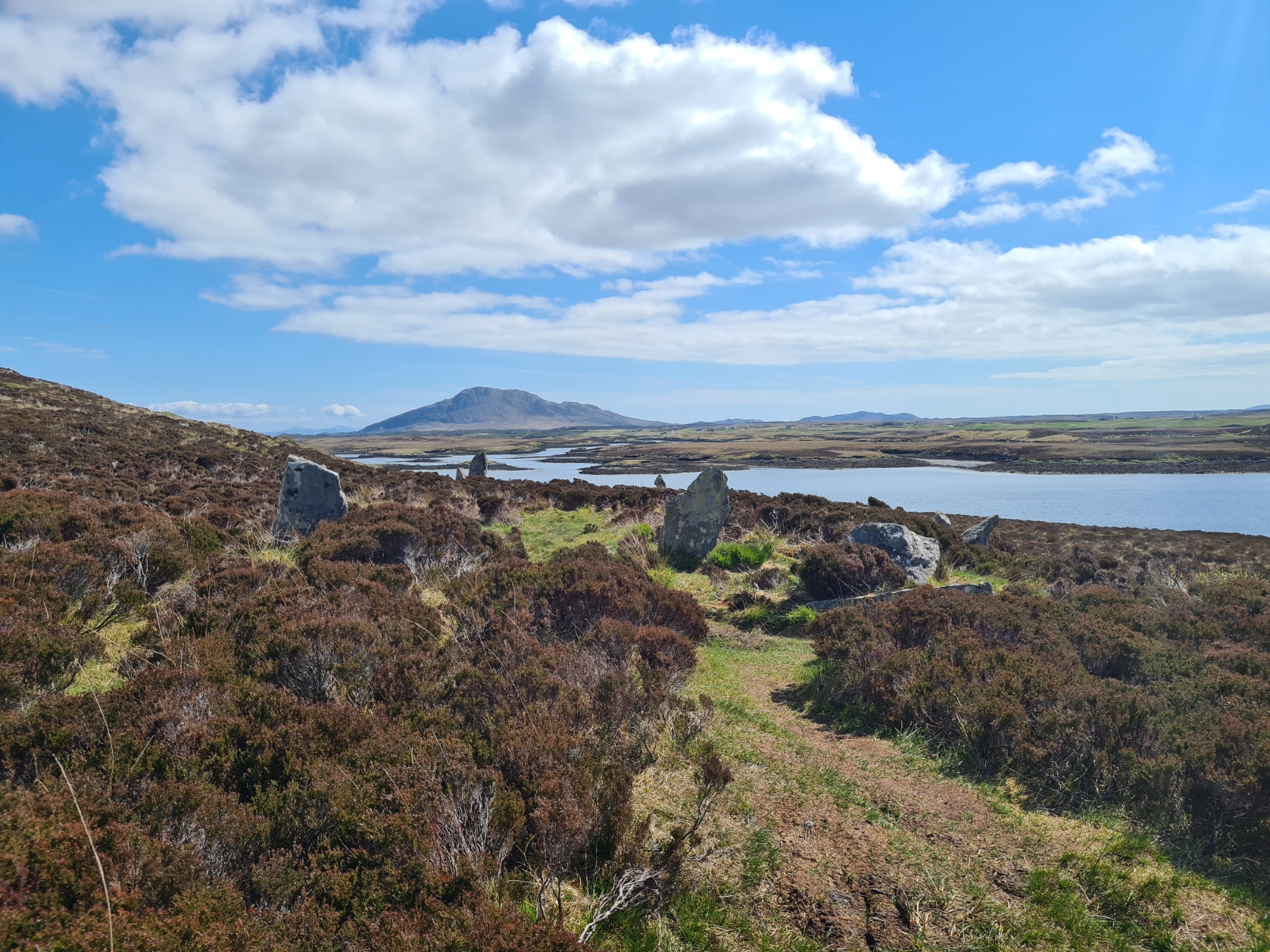
Leaving the hotel behind, it was a short climb, before a brief halt to view the stone circle Pobull Fhinn. The stones are almost lost in the heather. The circle is thought to date from between 2000 BCE and 1001 BCE, and is named after the Gaelic hero Finn MacCool, or Fingal. Further on was the Neolithic chambered cairn Barpa Langass, but that was out of sight over a hill and off-trail, and I lazily skipped the diversion. Probably due to that over-generous lunch.
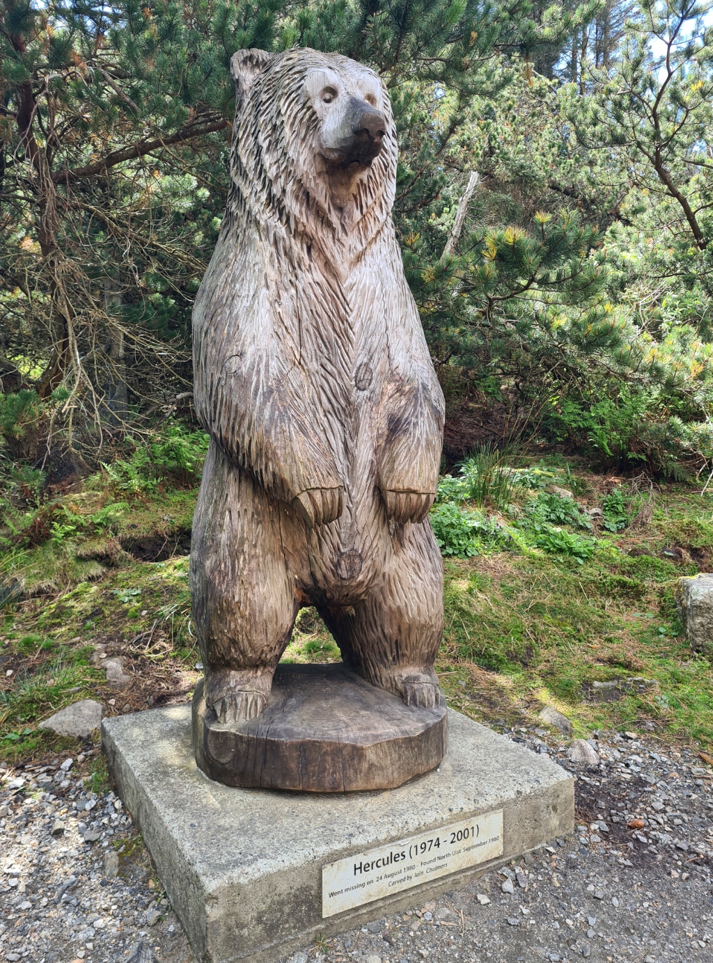
The moorland walking continued for a spell, and it was easy to avoid the wetter parts of the path. Plastic netting had been lain, a somewhat odd dichotomy of erosion prevention via the utilisation of single-use plastics. Just for a change, the trail swung round toward a stretch of woodland, passing below Langass Woods, but I took the diversion up into the trees to go and see the clearing where a wooden statue of the grizzly bear Hercules has been erected. This was a trained bear on the UK wrestling circuit in the 1970s and 80’s. He even appeared in a James Bond film. He escaped captivity in the area while being filmed for an advert for tissues. He eluded capture for 24 days, losing 95kg in weight. I continued on the woodland walk, enjoying the shade, butterflies, dragonflies and bird song. I passed a number of animal sculptures before the path dropped down the hill, emerging at a gate in a deer fence that deposited me at the A867.
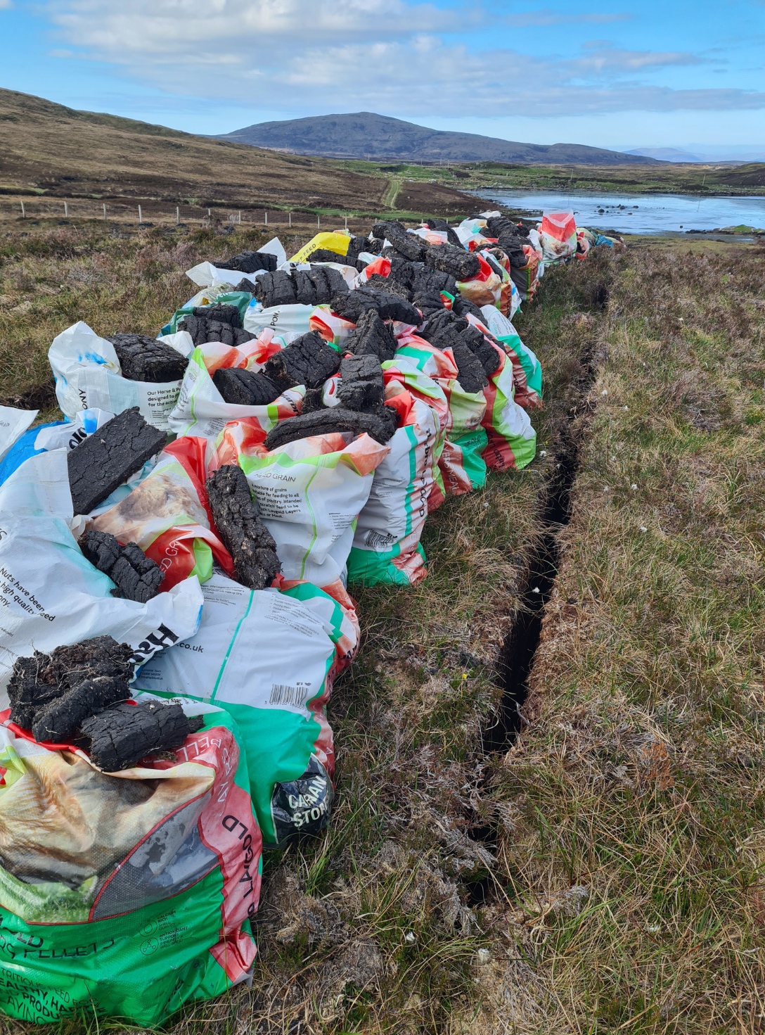
It is a fast stretch of two-lane tarmac, but there was no need to risk life and limb, as the trail crosses it and turns right on the much narrower old road, now almost totally unused by vehicles, unless it is locals accessing the peat diggings to the side, plastic fertiliser bags stuffed with cut peat stacked ready for collection. This was a fairly long walk but my feet felt fine and I quite enjoyed turning the speed up a little, all the while keeping an eye on the sky. A White-tailed Eagle drifted over, being mobbed by two Ravens as it passed overhead. Debbie and Fran caught up with me on the outskirts of Lochmaddy. Debbie was catching the bus back to the Moorcroft campsite, to spend another night there, while Fran was planning a halt in Lochmaddy as he was tired and struggling.
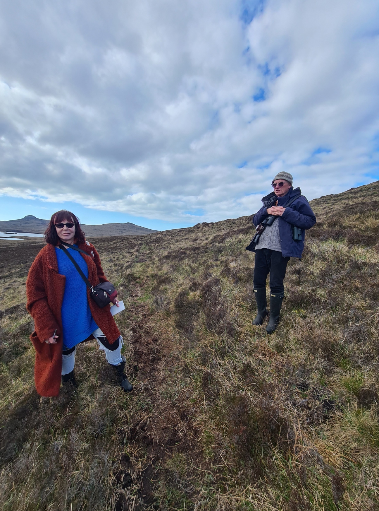
I felt good so was continuing for a little longer, we waved our goodbyes and I left them at the bus stop. A little more road walking, along the A865, before leaving it on a bend where the trail climbed slightly to round the flank of Blathaisbhal, passing below a waterworks and then striking off across the heather. The path is a little faint, but there were occasional marker posts. Enjoying my walk around here I came across a couple walking the opposite direction and we paused to talk. Nicola is an artist, who had set herself the task of walking a mile of this path every day, recording what she saw, for use in her Tapestry of Connection artwork. Her husband John accompanied her, recording her recording her experiences. She took my photo, I took hers, John photographed us both. As she was local, I asked her of possible wild-camping sites ahead and she suggested a locale “next to the fairy loch”. We probably chatted for too long, or maybe not, the conversations with the people I randomly meet on long trails is frequently my strongest memory. But, onward, soon passing the ‘Three False Men‘; three little standing stones, or as John called them, the “three little men”, as they truly are somewhat underwhelming.
I crossed through a little gate in a deer fence then splodged my way down the sodden hillside toward the little unnamed lochan at Aileodair, what Nicola had called the ‘Fairy Loch’. I was a bit peeved at getting my feet wet at this stage in the day as they had been dry for the whole afternoon.
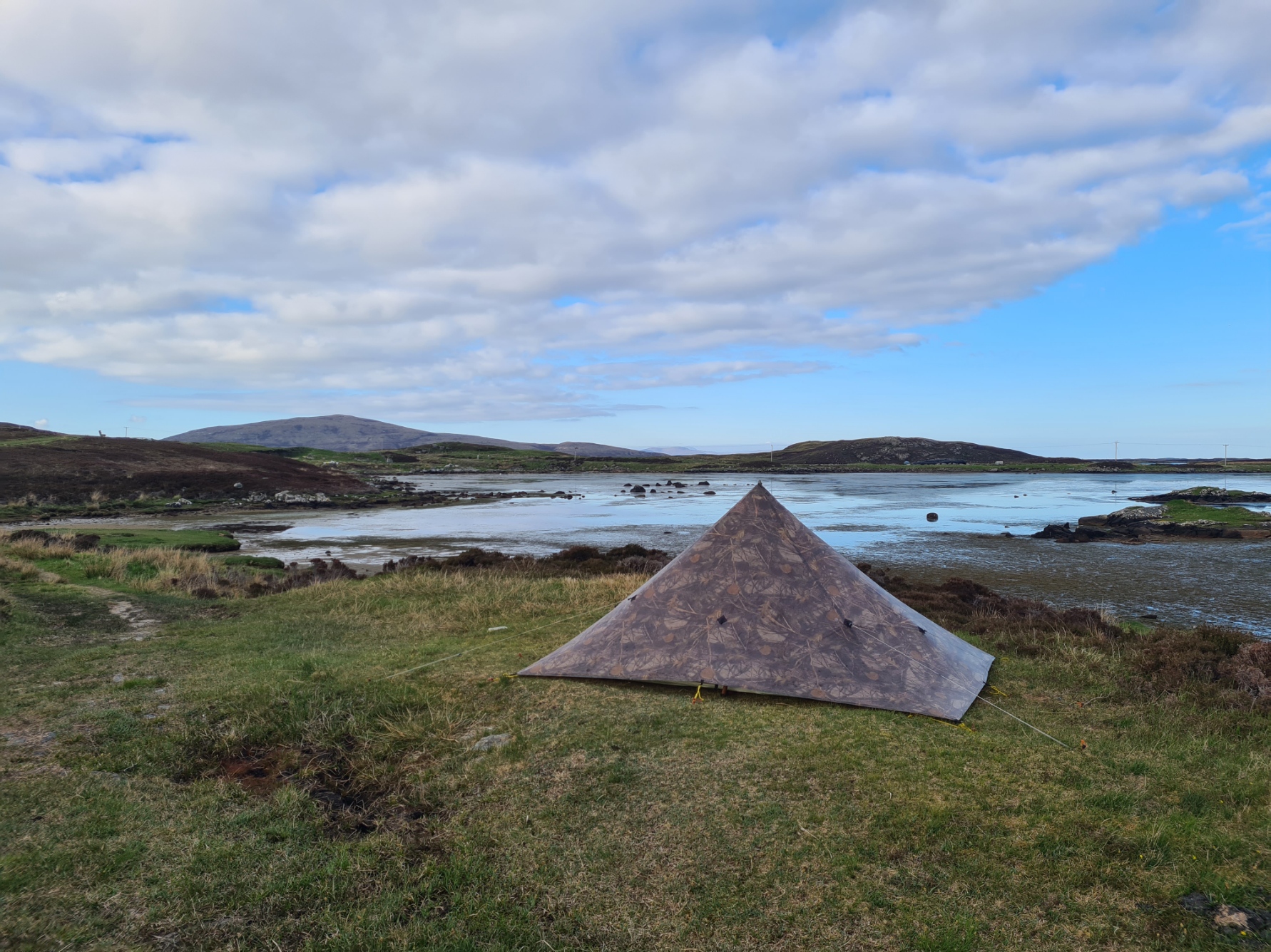
She was right, there was a handily large and flat green patch of grass above the tidal loch, which was mostly mud at the moment. Tent up, then a cursory tent wash with a bit more attention to my feet. My evening meal was a meh Firepot Posh Pork and Beans, I really don’t care for this brand of dehydrated meal. I rehydrated, first with a hot oxo, then walked around outside with a mug of tea, waving off the non-biting midges while I video chatted with Mrs Three Points of the Compass. The sun dropped and the temperature along with it. I sat on my inflated mat with quilt wrapped around me to polish off a bar of Ritter Rum and Raisin chocolate. A cold breeze was wafting in the vestibule but I left it open as I settled for the night, watching the Shelduck and Swans splodging through the mud a few metres away. As it got dark, I zipped the door as it had the feel of a cold night. Another good day.
Day Six:
I slept well and long. It was very peaceful and I eventually and ever so reluctantly stirred to put a brew on. The fly had quite a bit of condensation, mostly due to the windless night. I unzipped the door to find the grass white with frost. A slight breeze started up and I took my time packing to allow the fly to dry off a little. No midges, around 40% cloud cover.
Away at last, the clouds drifted off for an hour and the sun briefly came out in force as I rounded the little loch, reached the A865, followed for just a short distance, before the trail took off on a winding and complicated route between pools of water, all the while trying to keep the driest course, not always successfully.
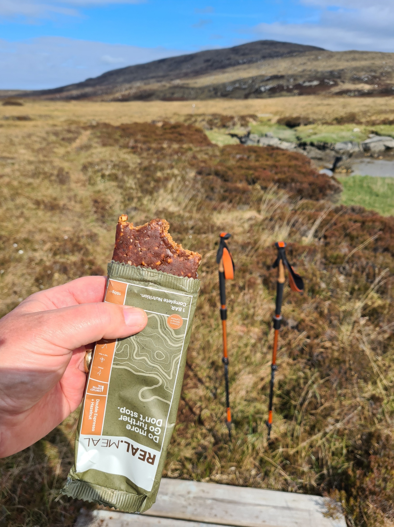
One part was a knee deep wade, and it was clear that many walkers try and find their own way across the terrain. I stuck where I could to the trail, following marker posts and the occasional duck board. I enjoyed the weaving to and fro path and took my time, stopping frequently to eat breakfast, which was an occasional bite from my 600kcal ‘complete meal’ bar. I finished this before beginning the climb up Beinn Mhor, the views, as always, opening up as I gained height.
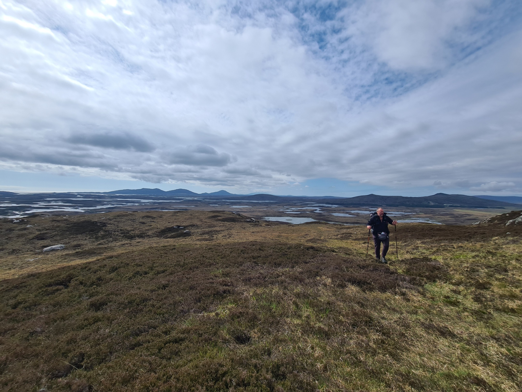
I passed east of the summit and paused to view the way ahead. My final islands were in front, but it was difficult to sort out what land mass and what patch of water was what. I began the descent, the ‘path’ again weaving around, but fairly easily followed via the trail marker posts. It was slippery in places, steep in others. Where both slippery and steep combined, I went down, twice sitting down heavily on my arse on the black peat.
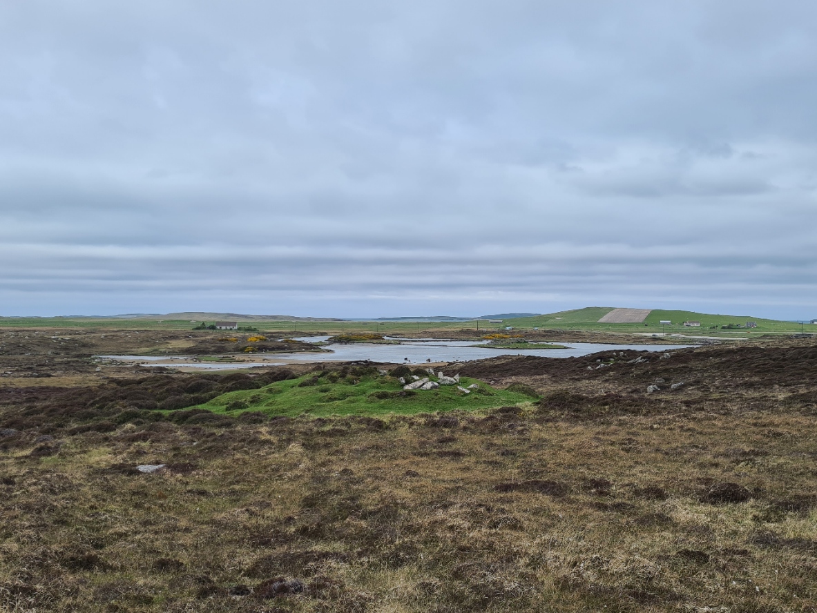
Flattening out, the path crossed the moorland, passing a couple of round barrows that were not on the map and Dùn an Sticir, what was originally a broch, but in the 16th century was replaced by a fort, and is accessed by two little causeways. The trail then, typically, emerged on to a road. A right turn here, and follow the tarmac for around two miles to Berneray.
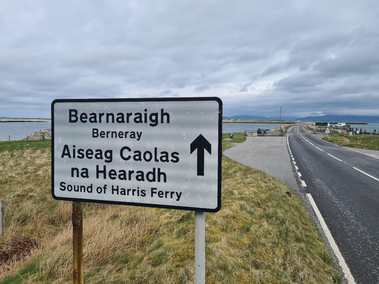
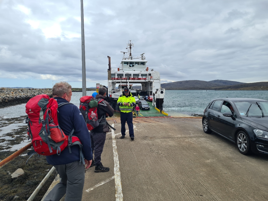
The walk led me between bright green fields, a startling change from the earlier landscape. There were few cars, but again, all gave me a wide berth on my road walk. Then on to Berneray, my eighth island, I turned off to the little ferry port where I would cross the Sound of Harris. I was the first to arrive at the port, but numbers slowly built. First a chatty engineer, waiting to repair something on the ferry, then cars, motorhomes, a couple of cyclists and six backpackers. There was a little confusion and doubt amongst those waiting for the ferry as to when it would arrive as conflicting times were shown online. But I had at least a couple of hours wait so plenty of time to take shoes off in the waiting room, air my feet, and brew up tea and eat a simple lunch. It was now that I found I had torn out the seat of my trousers when I tumbled earlier, so stuck duct tape both inside and out, which lasted me the length of the trail.
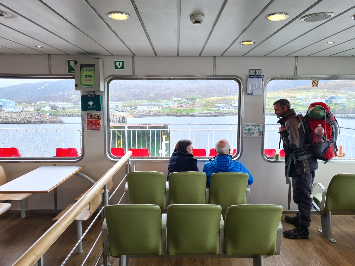
The weather set in a little and it all got cool and rather grey, but remained dry. The ferry arrived and us walkers were told to board first and wait at the purser’s office to pay our fare. He eventually arrived and I paid my £4.70 and because it was so cold, sat inside to watch through the windows, the little rocky outcrops. islands and potential for grief, as we twisted and weaved our way across the Sound. I met another Heb Way walker, who had completed the trail in six days. He achieved this by five a.m. starts and road walking the entire distance, thereby raising 30 grand for cancer research. He was deeply regretting his timetable as his 30 mile days had badly damaged his feet.
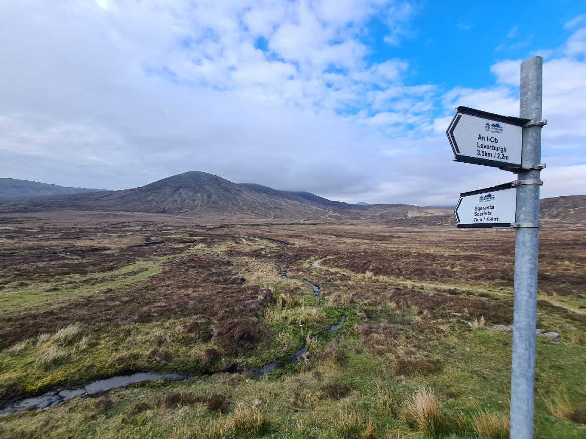
I left the ferry and walked into the fairly large sprawling town, I was now on Harris, my ninth island. I had considered booking an overnight accommodation in Leverburgh, but checking on my phone could see that what remained available was stupidly expensive so I decided to simply restock a little in the large community owned shop as it was the last facility until Tarbert is reached, then strike off into the moors for a wildcamp.
I had also chatted to another backpacker on board the ferry. He was probably the crossest man I have ever met, complaining about everything, especially the inconsiderate drivers who wouldn’t give way to him on the roads. He didn’t seem to be enjoying the Heb Way at all, and was knocking it off in seven days. I didn’t understand how he could manage that pace until I exited the shop, clutching my small haul of sweet goodies, to see him walking off down the centre of the road toward Scarista rather than follow the ‘official’ route. To each his own.
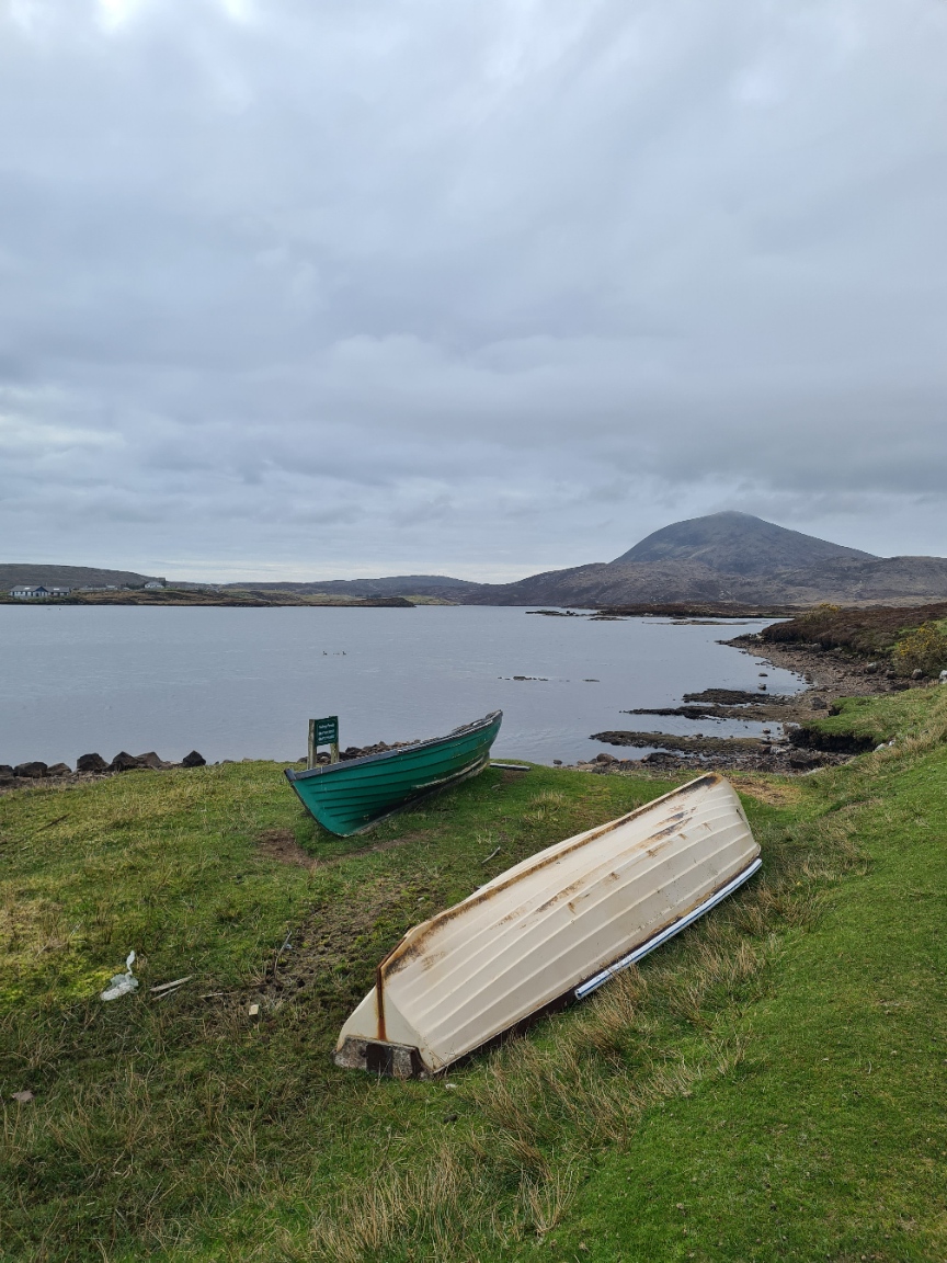
Having packed away my snacks, I followed the track up into the hills, away from Leverburgh, first hugging the shore of Loch Steisebhat, then Loch na Moracha. I left the road at a marker post that pointed my way across the boggy moorland. A raised two ditch path has been created across here, but it was very wet, very muddy, and tough walking. Easily the hardest bit of trail so far. It was now fairly late in the day and though pretty tired I felt good. I would have liked to have halted and pitched somewhere on this section but it was simply too rough, too wet. But I had everything I needed, sufficient water, had plenty of daylight hours left, so knocked my speed down a little, and began to take a bit more care. Most injuries occur late in the day when a walker is tired, often dehydrated and making poor decisions. I stopped, drank, considered my path ahead and plodded on. I actually began to enjoy this part of the trail, accepting and embracing the challenge.
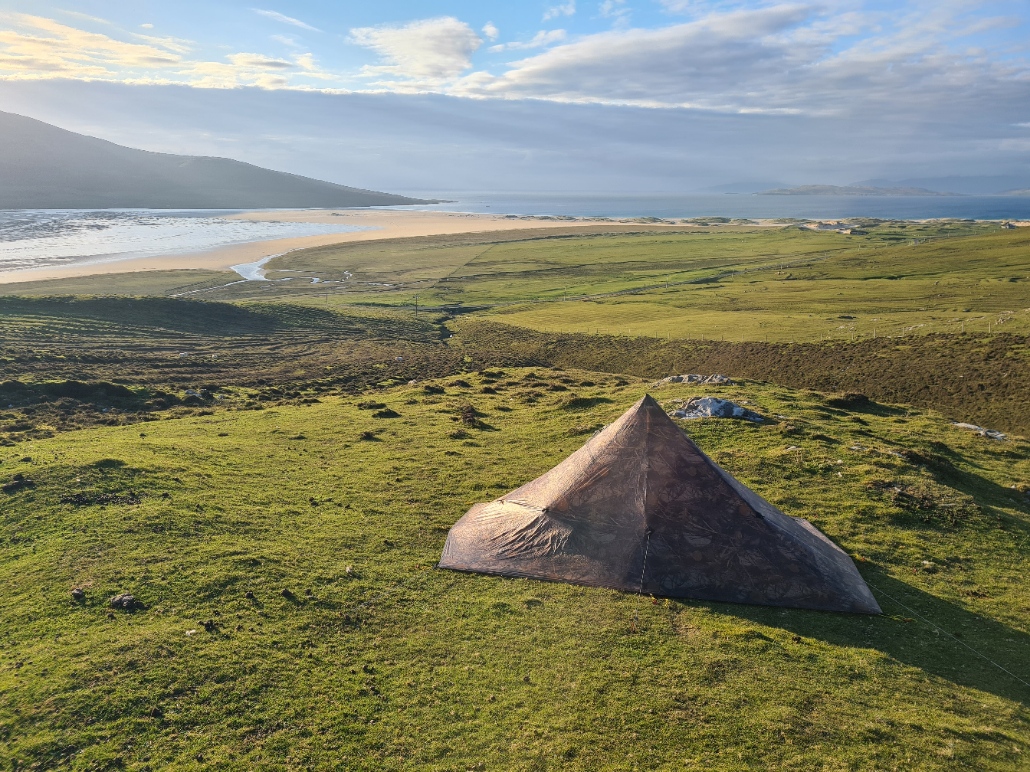
Finally, with the boggy glen walk behind me, I crested the bealach between Maodal and Bolabhal Sgarasta to be presented with the sweeping sandy bay of Tràigh an Taoibh Thuath (Northton Beach) down below me, with the summit of Ceapabhal beyond, on the south western coast of South Harris. When flying in with Loganair to the Outer Hebrides to start this walk, I had landed at the beach airport on Barra, which is now the only beach in the world with a scheduled air service. However Loganair used to operate a service to Northton Beach in the 1970s.
Starting the drop down to the beach, I saw below and to my right a flattish looking patch of green. Result! Despite the slight slope it would suffice and the Duomid was up in a couple of minutes and I placed my pack under one side of the pad to keep it a bit more level. Ten minutes later I was sat on my inflated pad, drinking a mug of tea while I peeled off sodden shoes and muddy socks. I now found my hiking shirt had a large rent in its side, I am literally coming apart at the seams!
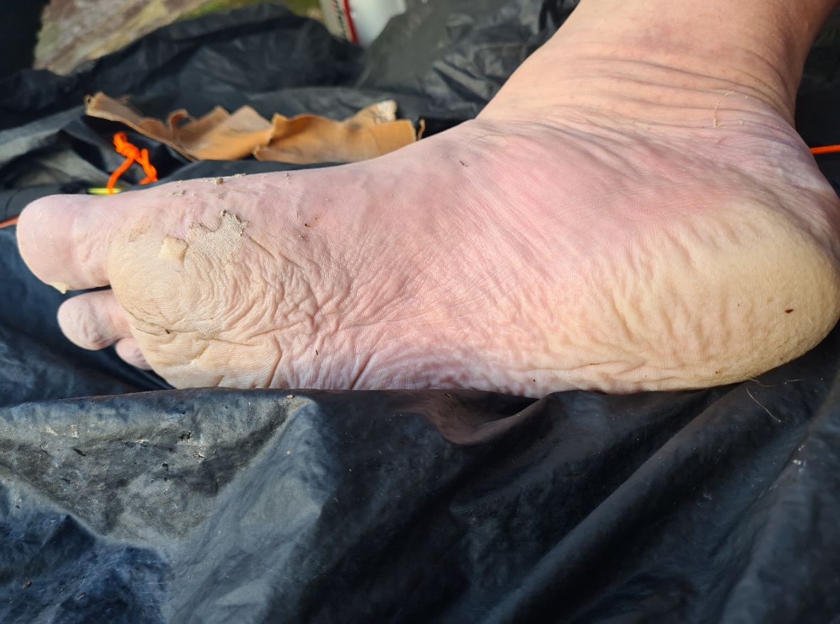
My macerated feet were in a bit of a state, mud between the pruning and it took some effort to peel off tape and get them clean’ish. Drying and applying foot balm, twice, followed by massage and a night in dry socks transformed them.
The A859 was below, and later in the evening, I would see the odd backpacker walking the road. It looked as though quite a few will skip the wetter and tougher ‘official’ section of trail now behind me. I had a bit of a treat tonight. I had been saving one of my favourite dehydrated meals and dug out a Real Turmat Reindeer Stew from my food bag, followed by a pack of peanuts, purchased back in the shop in Leverburgh. I enjoyed another tea while I sat and watched the light change as the sun dropped and dipped behind Ceapabhal. Sheep were wandering across the sands far below. No idea where they had been, or were returning to.
I had given myself as long as I needed to complete this trail. Some people dash it off in a week or so, but I think their experience is all the poorer for that. I had probably walked too far today, but felt good and was looking forward to another good nights sleep, provided the wind that was building would allow me to. I was about half-way through the trail and felt that my slower pace was working well and I continued to enjoy what the Hebridean Way delivered, but I was aware that my final two ‘islands’ would deliver a slightly different trail. Onward!

1 reply »