
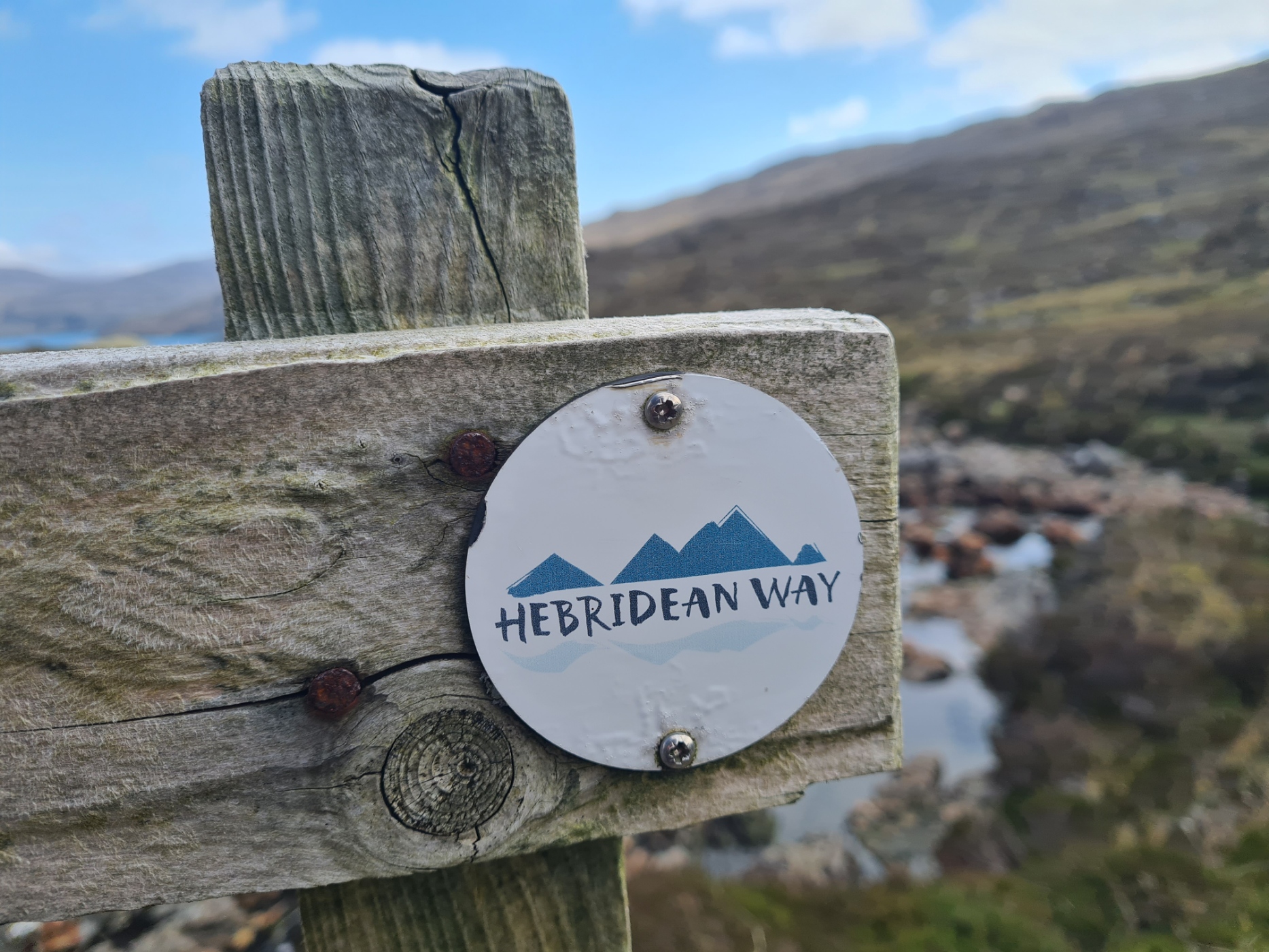
Three Points of the Compass continues his Hebridean adventure, moving from the shining sands on the west of Harris, to cross to the mountainous east and north of the island, before continuing to Lewis, his tenth and final island
Day Seven:
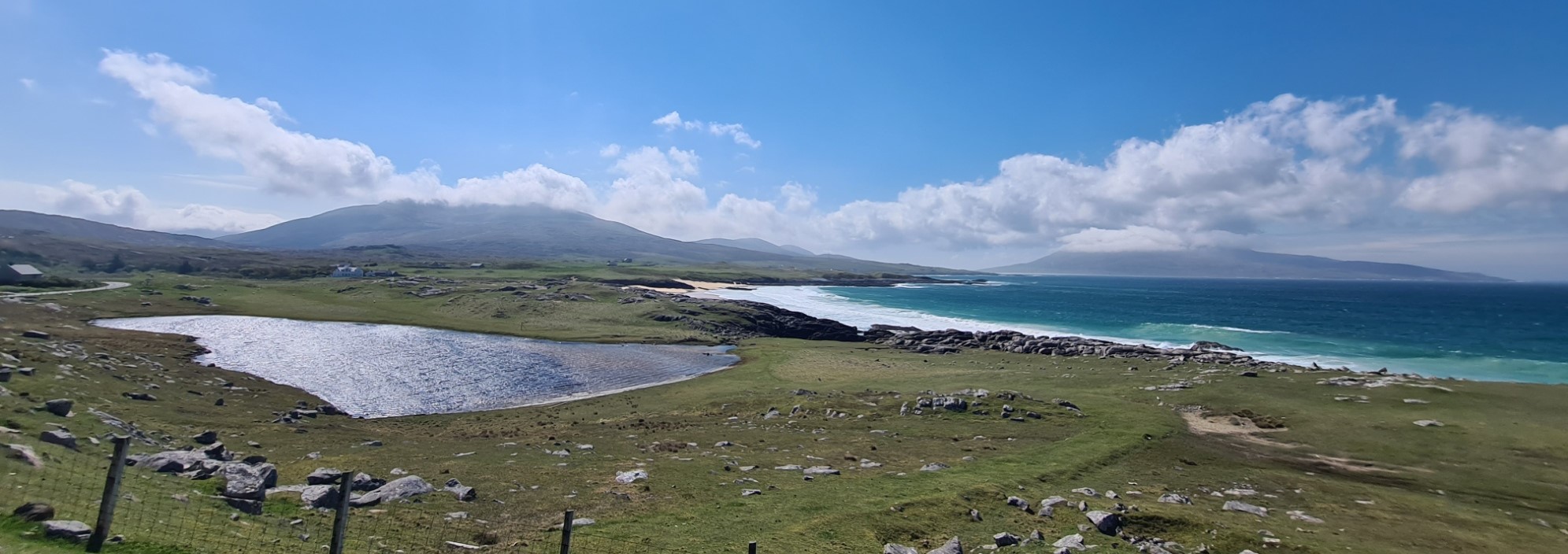
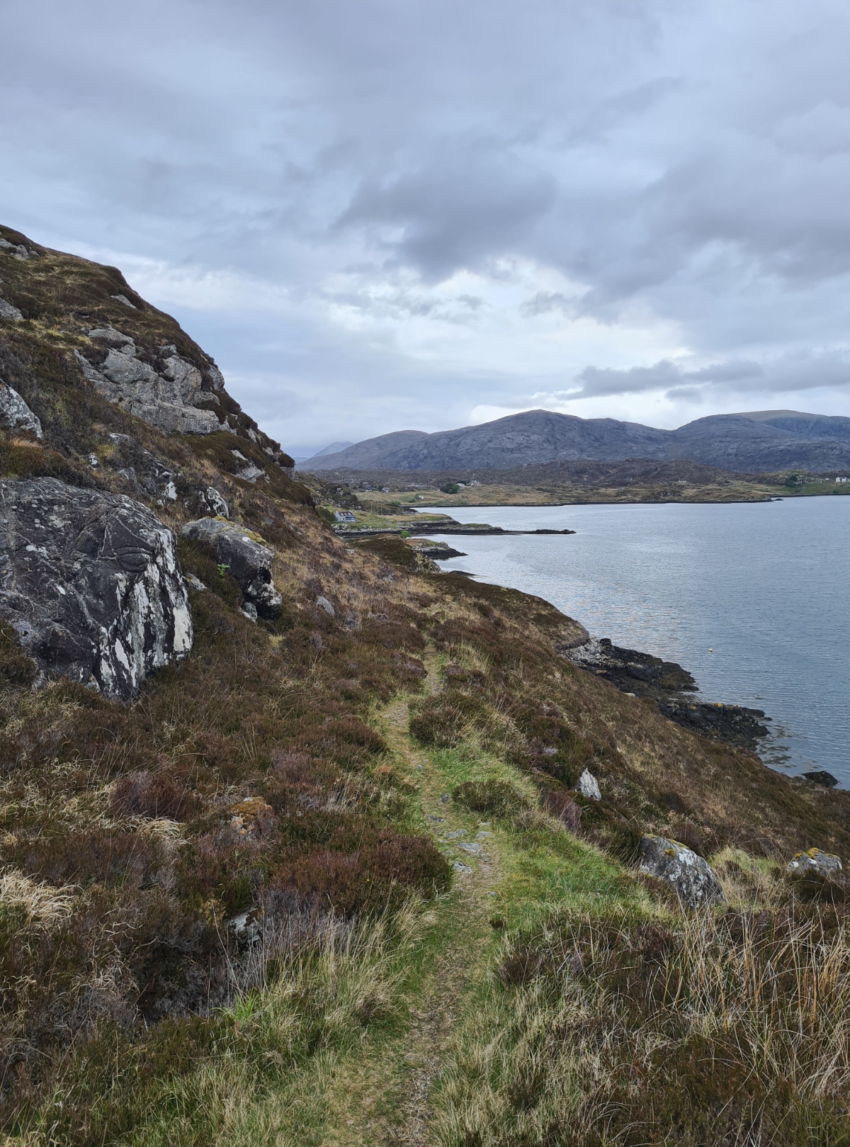
The strong wind of last night had died down a little and also swung round. The tops of Maodal and Bolabhal Sgarasta behind me were now in cloud that was also drifting over the bealach and swirling down to me. I was just below cloud level however and the vista was clear below me. The Duomid was a bit damp from condensation as I had nailed it down close to the ground overnight, but I packed up the Solomid inner nest separately for a change and, not in any rush at all today, hung around camp while I drank a pint of tea to see if the outer would dry off a little. It didn’t, even after a wipe down, but I knew I was likely stopping early today so it would probably dry off this afternoon if the weather was kind to me. Packed and away for ten, it was an easy walk down to the road, flushing a couple of Snipe on the way, then across the road, and continue to the beach.
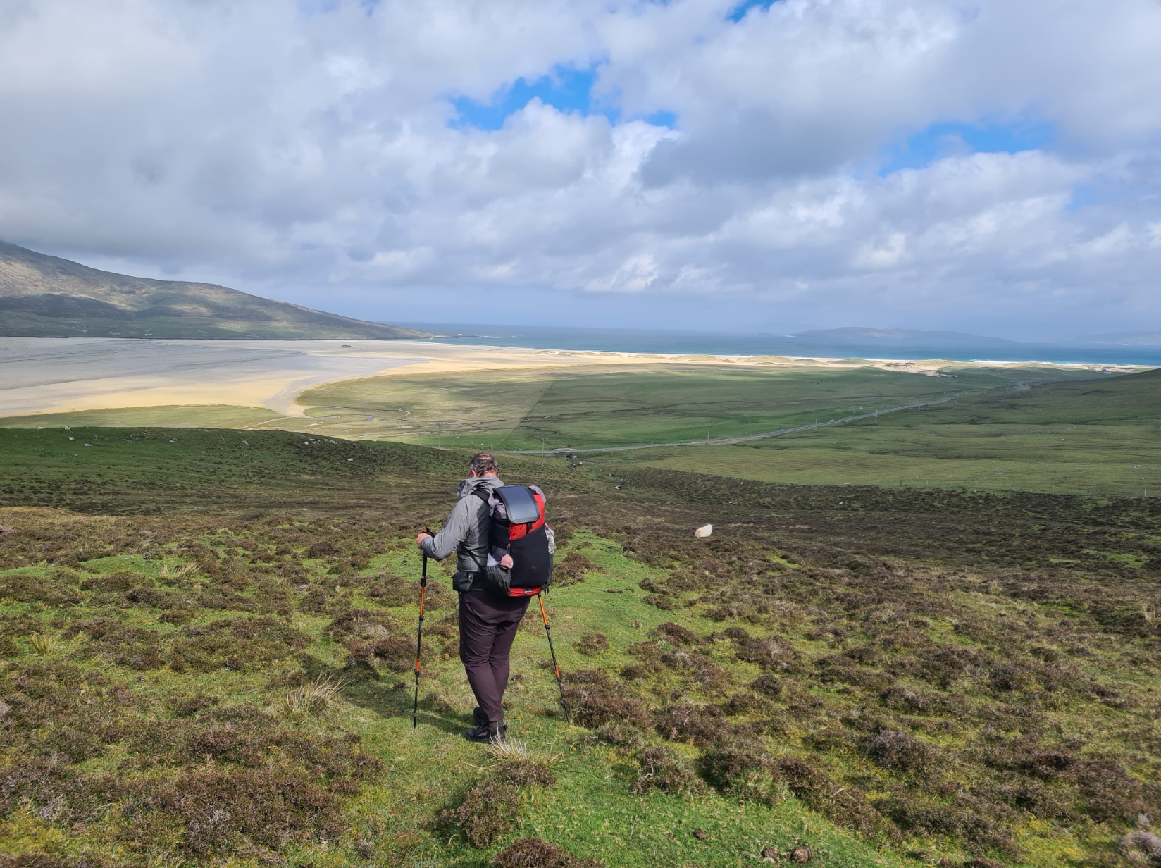
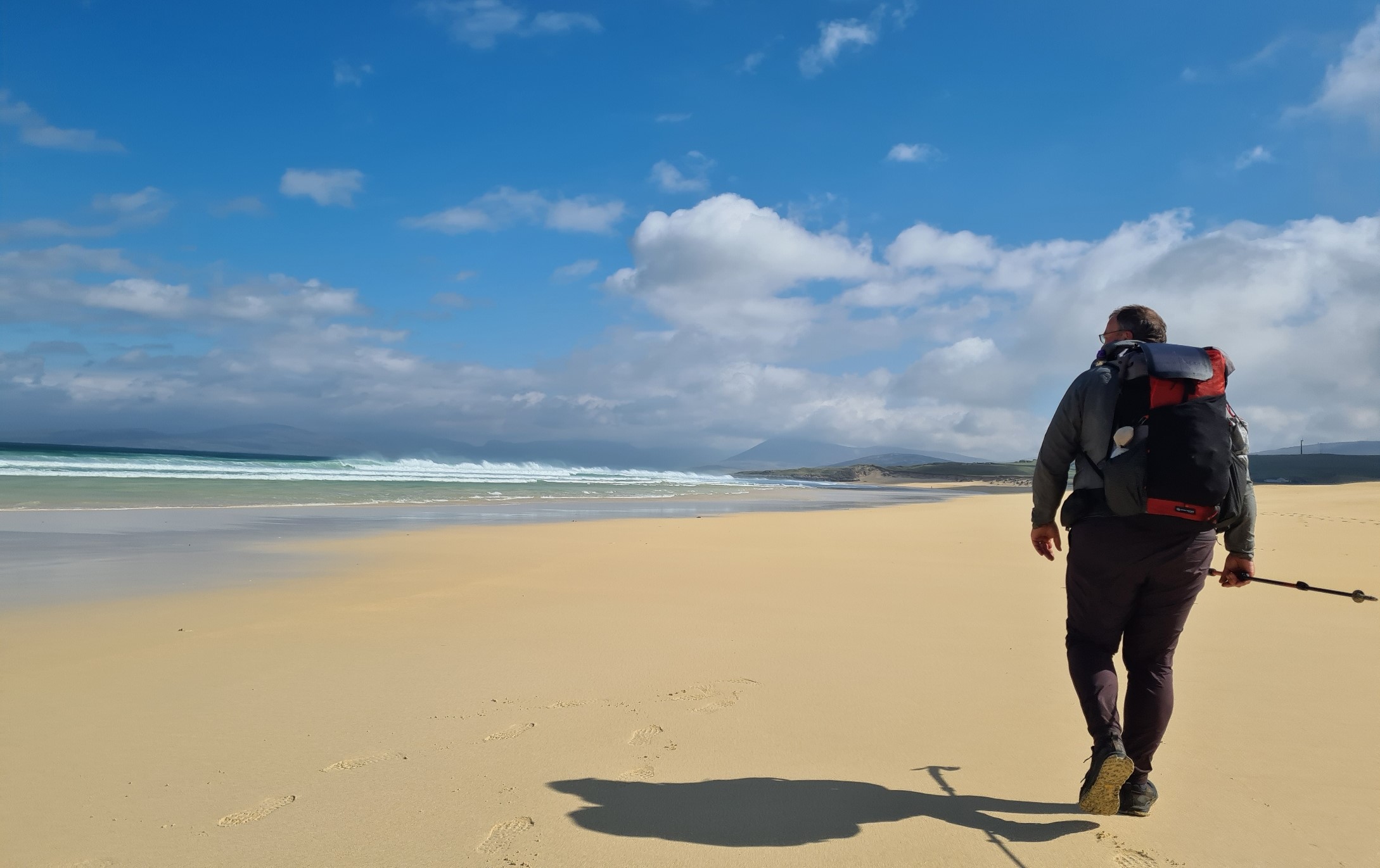
The pristine white beach shifted in form and colour as the clouds moved and the shadows raced across the sand. Having moved down from the dunes to the edge of the sea, it was fantastic walking. The Atlantic surf crashing on to the beach, salt thick in the air. There was a young couple at the southern end of the beach but I left them behind me and walked the sands to almost the far end before moving back up to the dunes. I met a local heading to the beach, he seemed surprised, exclaiming “extraordinarily busy here today”. Apparently a total of four people is busy!
As I crossed the flat green fields back to the road, I met Brian again, he had been walking the fence line. His feet were suffering. His pal Mark had given up on the trail and gone to hire a car, planning on picking him up later today further down the coast. The two had failed to meet up yesterday and Mark had the tent, so Brian had slept in the ferry waiting room last night.
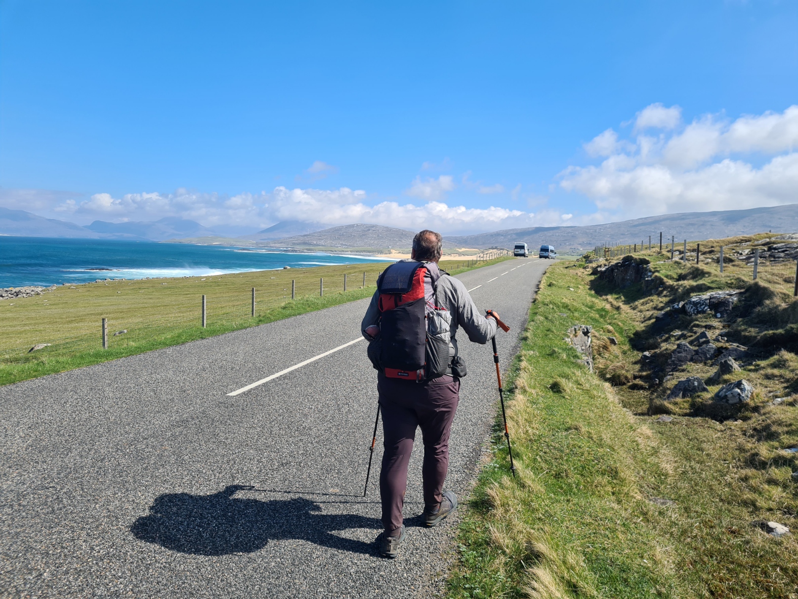
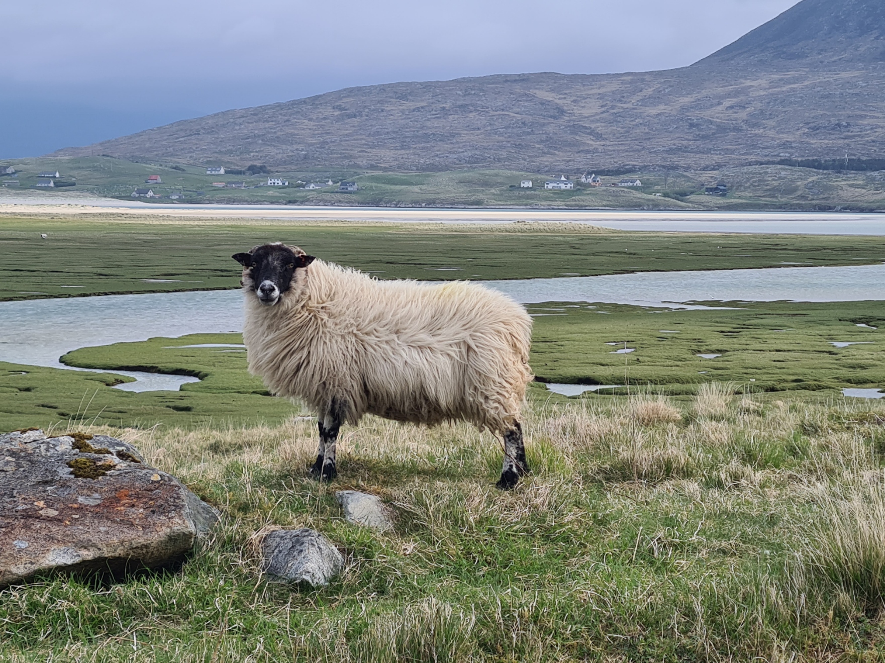
The trail leaves the road after Scarista to climb the hills and then follows the contours before descending again to skirt the Horgabost Township. However despite the sun on the coast the tops were concealed by angry looking grey cloud. My guidebook stated “may be challenging in poor visibility”. That was enough for me! I would join Brian for this short section. I wasn’t going to come a cropper alone up there. Nor down here either. There were a great many motorhomes and I ensured I stepped off the road on to the verge each time one passed on my side of the road. They have wide side mirrors that can easily catch a pack or worse. We walked together, chatting as we walked. Commenting on the large number of the infrequent homes that were up for rent. Hearing a sound to one side of the road, we paused to view a large group of roosting Whimbrel in one field. They were quietly murmuring to each other, each with a wary eye on the two of us.
There was a community run café at just the right time to treat myself to lunch and while Brian walked on, I turned off to walk up to the array of buildings at Talla na Mara, a multi-purpose centre owned by the West Harris Trust where, despite the notice at the road stating “open Monday to Saturday”, I found the place closed, curses! Back down to the road and onward.
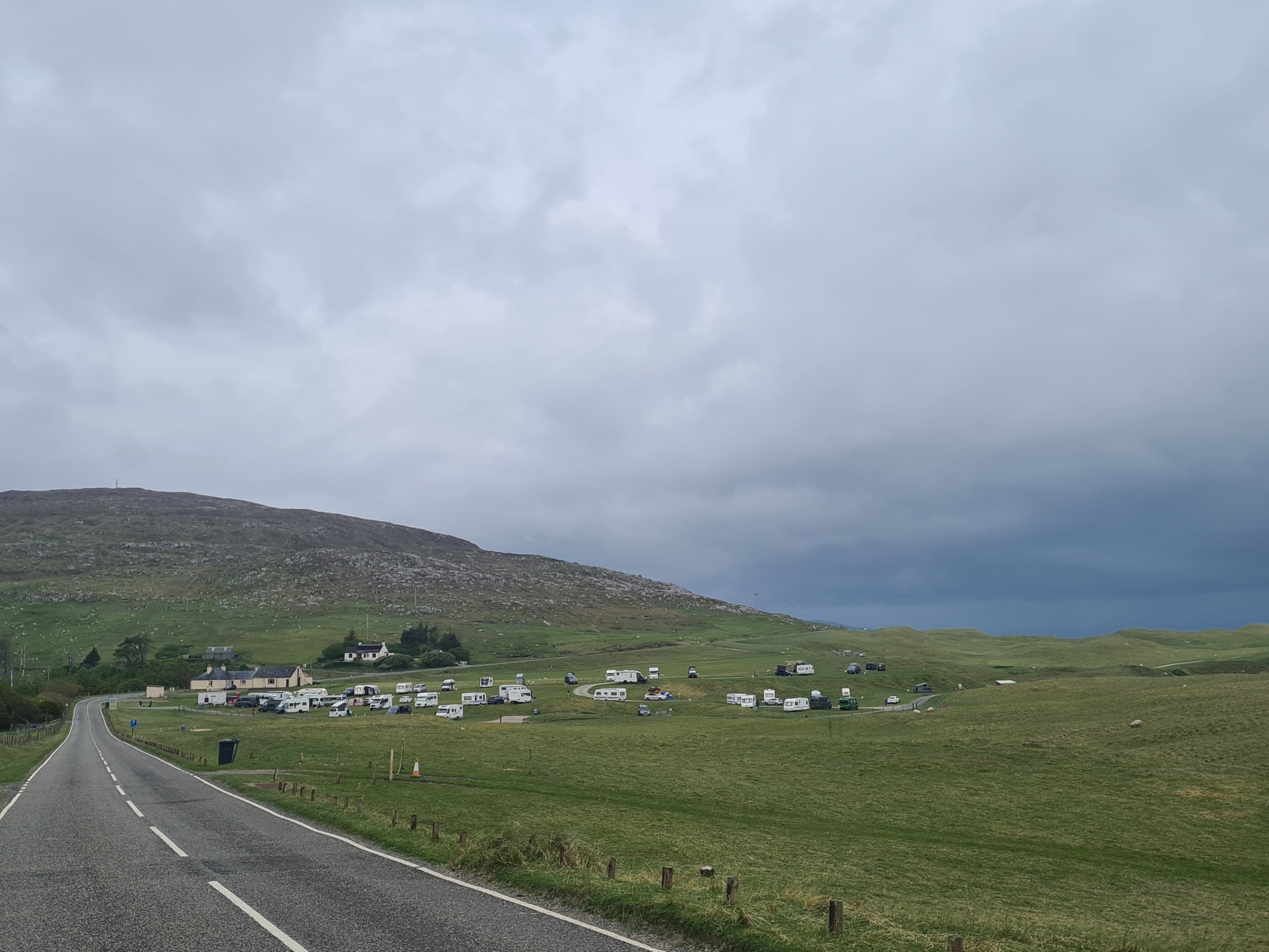
Before travelling to the Outer Hebrides for this trail I had decided to take a day off mid hike and the Horgabost campsite further on down this road had looked as though it would suit. Reaching the large site, I walked down the long entrance road to the reception. An early finish today and hopefully ‘real food’ from the much vaunted on-site snack wagon. But no, that wasn’t open either. A chalkboard on the shuttered van informed me “closed, but opening soon, but not today or tomorrow”.
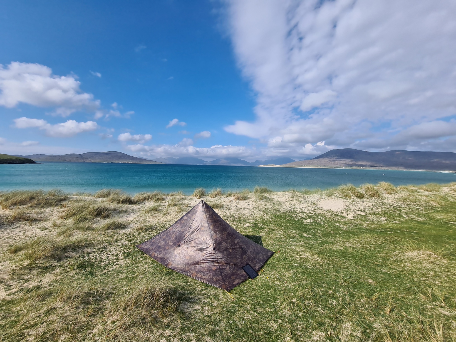
Having paid my site fee, I purchased noodles, two small tins of tuna and some snacks in the campsite’s little shop for a late lunch. There was a stiff breeze blowing and the tent area didn’t have much in the way of flatter spots. I had been looking forward to this site as it has a pretty good rep, but with no snack wagon, sloping pitches and little shelter from the wind, I now decided my day off was simply going to be an early finish today, and I would continue the trail tomorrow. I eventually found an ‘OK’ area amongst the dunes and managed to get pegs to hold in the sandy ground, double pegging with spares where necessary. I now had time to simply relax. Lunch was followed by a couple of brews. I checked the amount of snacks I had remaining in my food bag and adjudged them insufficient so after a shower (£1 for 8 minutes) returned to the reception to stock up a bit. I hung up washed socks and skiddies to dry in the wind, napped, wrote up my journal, studied map and guidebook, sat on the dunes and looked at the crashing waves and distant islands, and after booking an overnighter in Tarbert for tomorrow, did nothing…
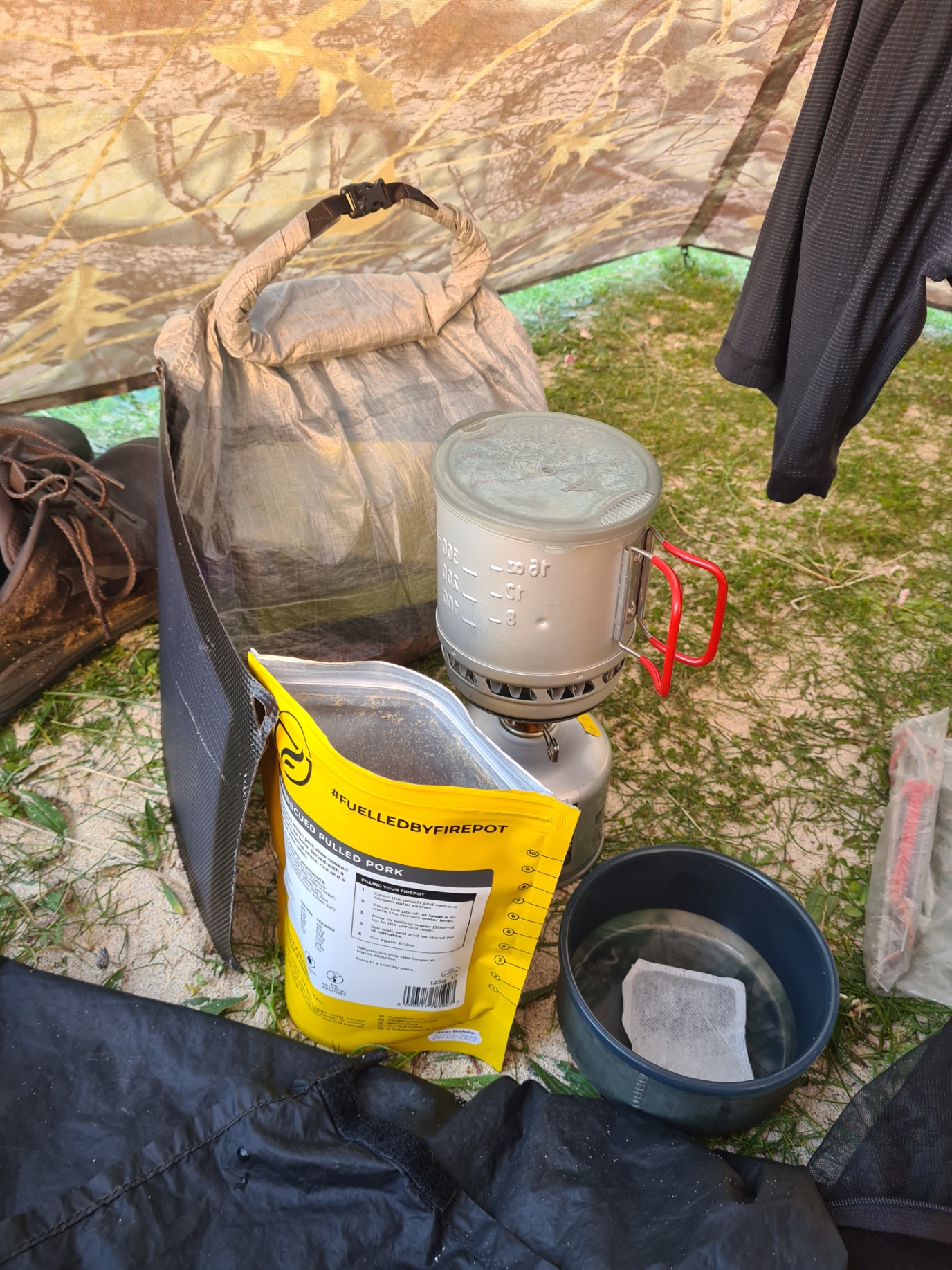
My evening meal was another awful Firepot dehydrated effort. The BBQ Pulled Pork was as disappointing as I had expected it to be. Of more concern, my gas canister was beginning to feel quite light. Obviously as a result of my frequent brews. The weather was on the change. The temperature was falling with rain promised for later and probably tomorrow.
Day Eight:
Even though I had napped during yesterday’s part-rest day, I had again slept well. My carefully selected pitch had kept me sheltered from the worst of the wind and I had zipped the Duomid up to keep any flying sand out, which had resulted in a little condensation overnight, but that had all dried up by the time I was packed and away. No tea this morning, I thought it prudent to conserve gas a little.
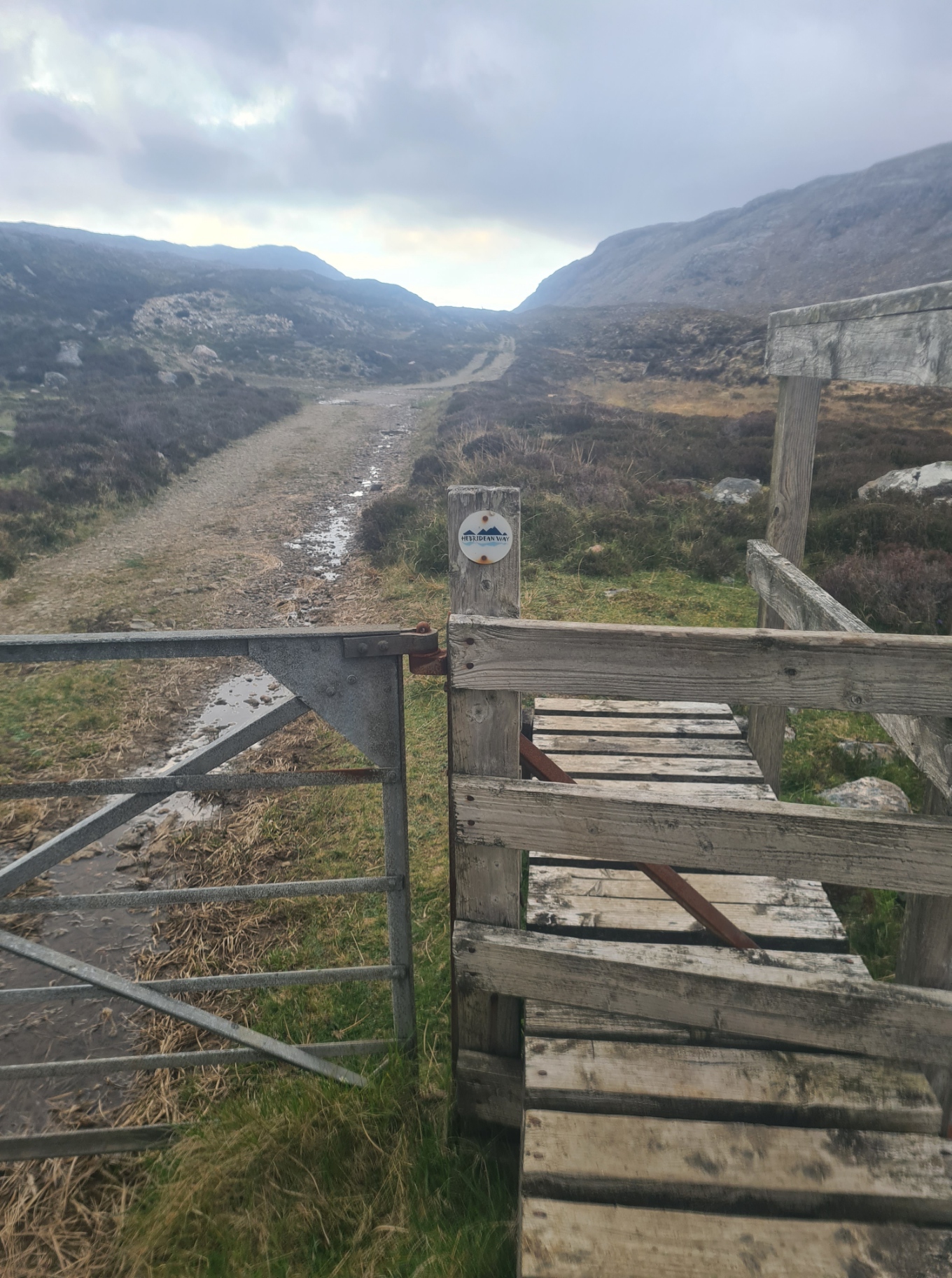
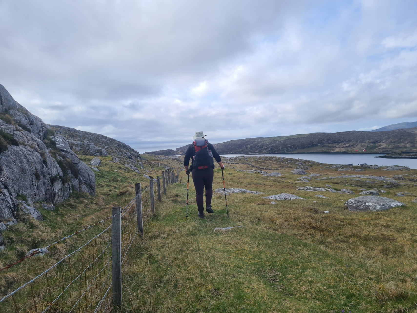
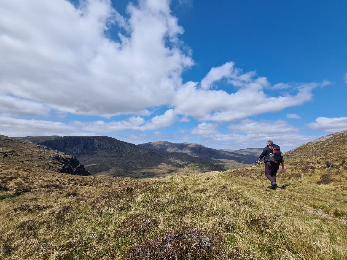
The eastern side of South Harris is known as the Bays. It was populated by those displaced during the 19th century clearances. They somehow managed to feed themselves from crops grown on the shallow soils, enriched by seaweed to form ‘lazy beds’, but to bury their dead, coffins were carried across the island, over Bealach Eòrabhat to be buried in the deeper soils on the west of the island. I followed the coast round to Sheileboist to join the old Coffin Road that led me up into the hills. It is a lovely route, following a number of linked paths. This is the Harris Walkway (Frith-Rathad na Hearadh) that opened in 2001. Part of this trail was later subsumed into the Hebridean Way when that opened in 2017. Today, the Heb Way follows the Harris walkway all the way to its northern end. I found it damp in parts, as a result of recent rain, and there was also a couple of short showers as I headed up the gently inclined route to the bealach so I threw on my FroggToggs waterproof. However the path is good, gritty, easy to follow and my feet stayed dry.
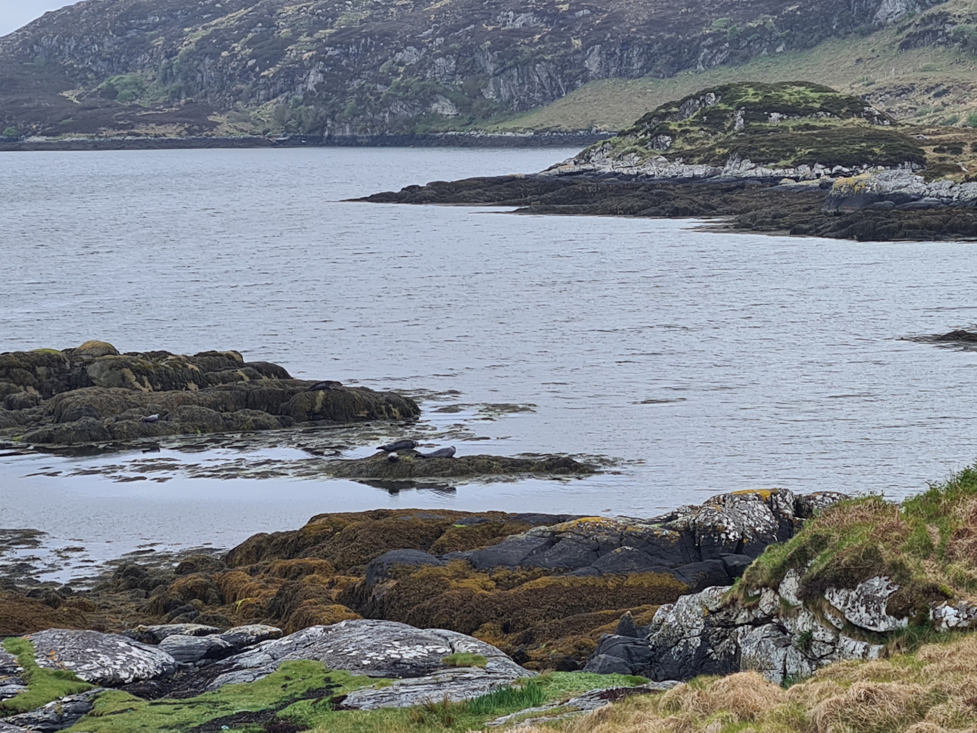
I enjoyed this section immensely, which continued down to Loch Stocanais where I had hoped the little community café at the Bays Centre might be open, obviously it wasn’t. But at least I was rewarded by views of a handful of seals that had hauled themselves out to bask on rocks exposed by the falling tide. I was then immediately back into the hills, more climbing with a few miles of rocky moorland to cross. I struggled at first as a result of painful arthritis in my first metatarsal, something that occasionally bothers me with changes in barometric pressure, but this eventually eased and walking again became pleasant. Which was a relief, as this was turning into one of the best parts of trail experienced so far.
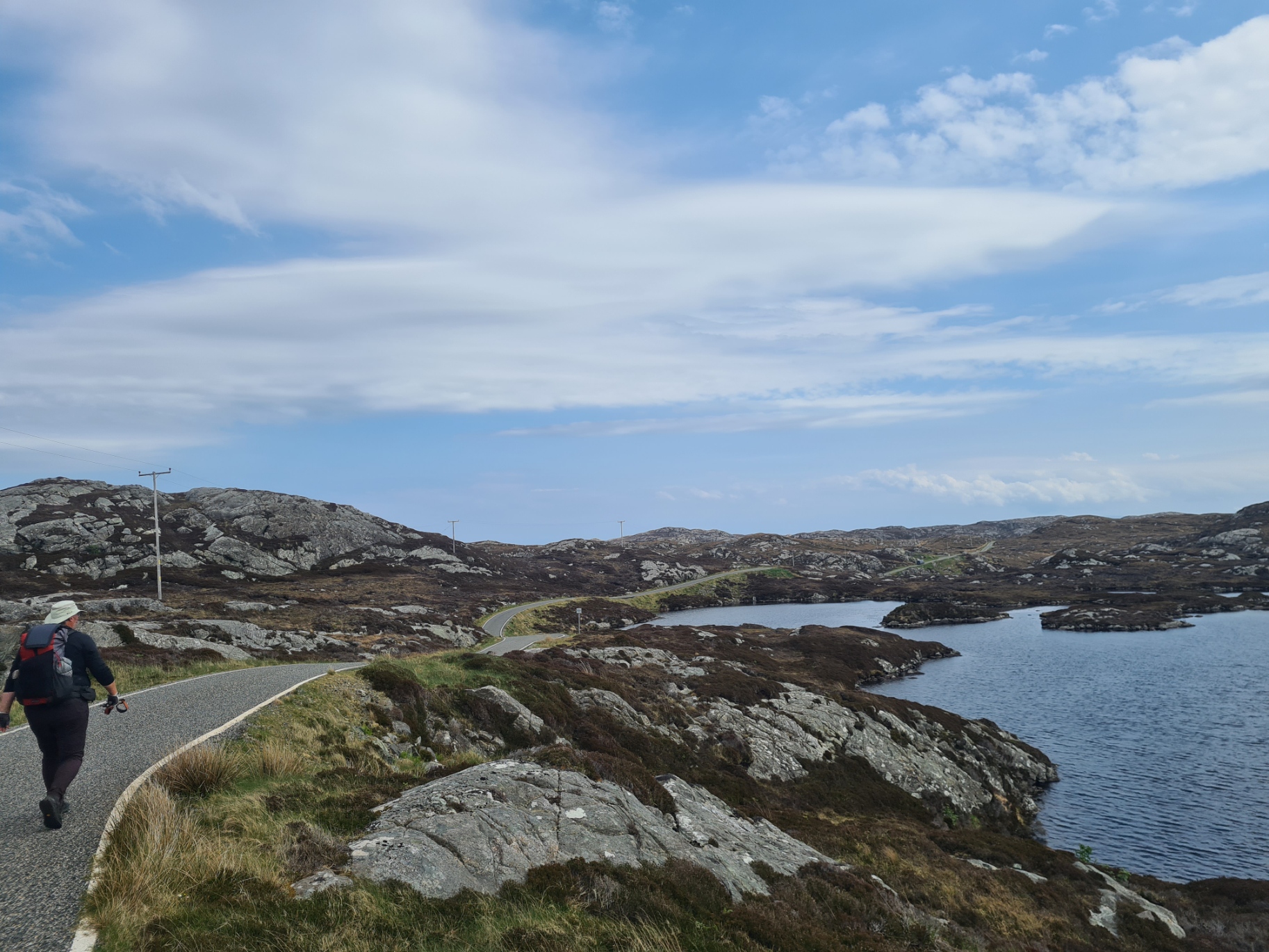
I had about ten miles left to walk today and it was mostly all very enjoyable with a mixture of moors, changing to grassy tracks, a bit of road walking, almost devoid of vehicles, just a bit of boggier ground when passing close to lochs, little lochans or where the path had sunk into the ooze.
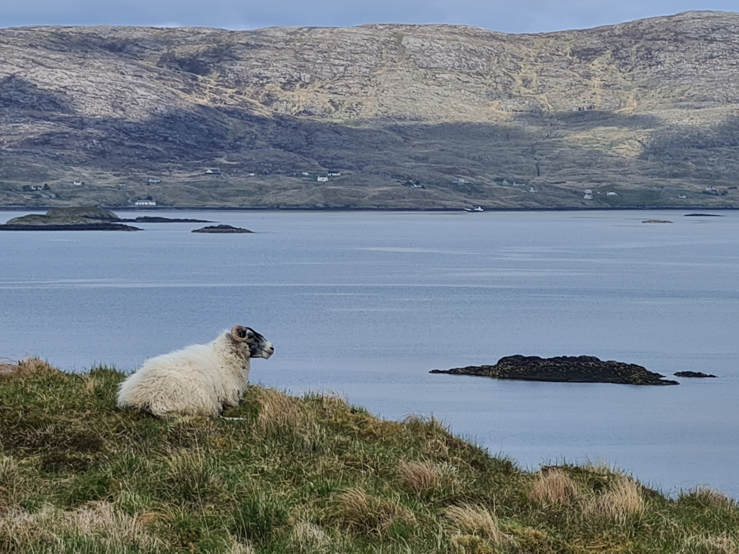
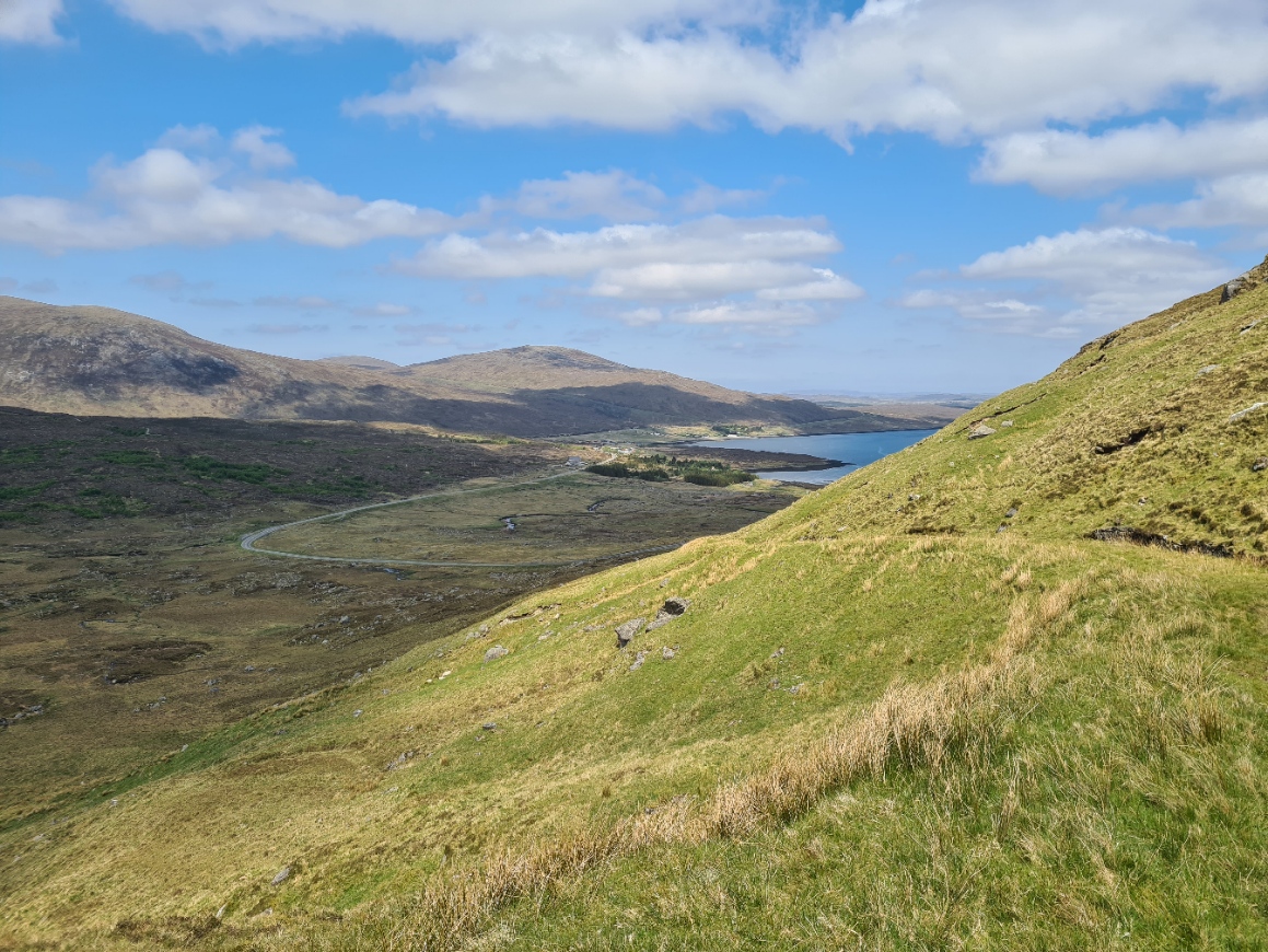
The weather steadily brightened and the view over the large Loch Ceann Dibig. and the seaway bordering it, opened up. Harris Tweed has a dedicated exhibition at Drinishader in Harris, and when I passed through the little village I had hoped to drop in to the converted school building to view this. Maintaining my series of closed establishments, it was Sunday, the only day of the week this was closed. I walked on.
I did have one last thrill before joining the final stretch of road down toward Tarbert. I passed a tiny lochan and found a fantastic pair of Black-throated Diver. They cruised together, sitting low in the water. These are about six times rarer as a breeding bird than Red-throated Diver and the islands hold a nationally important number of birds.
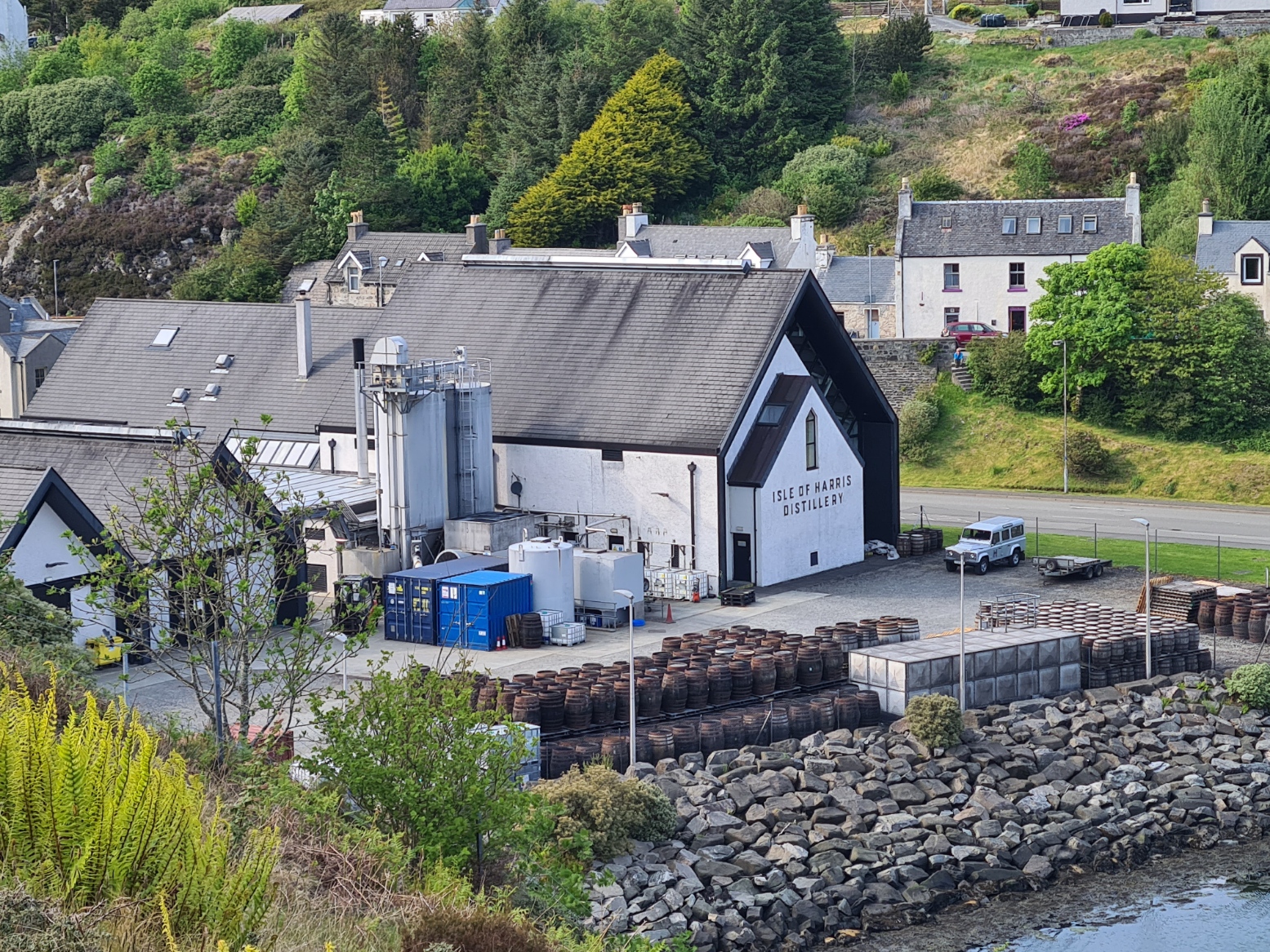
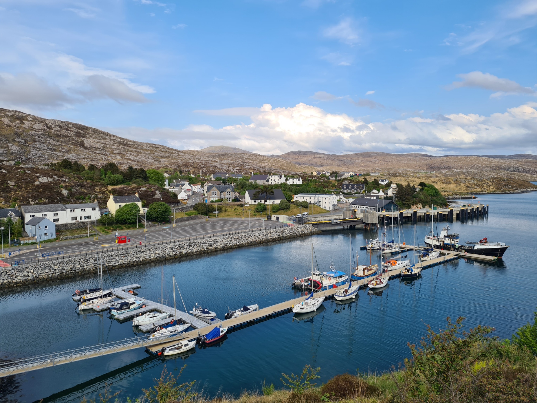
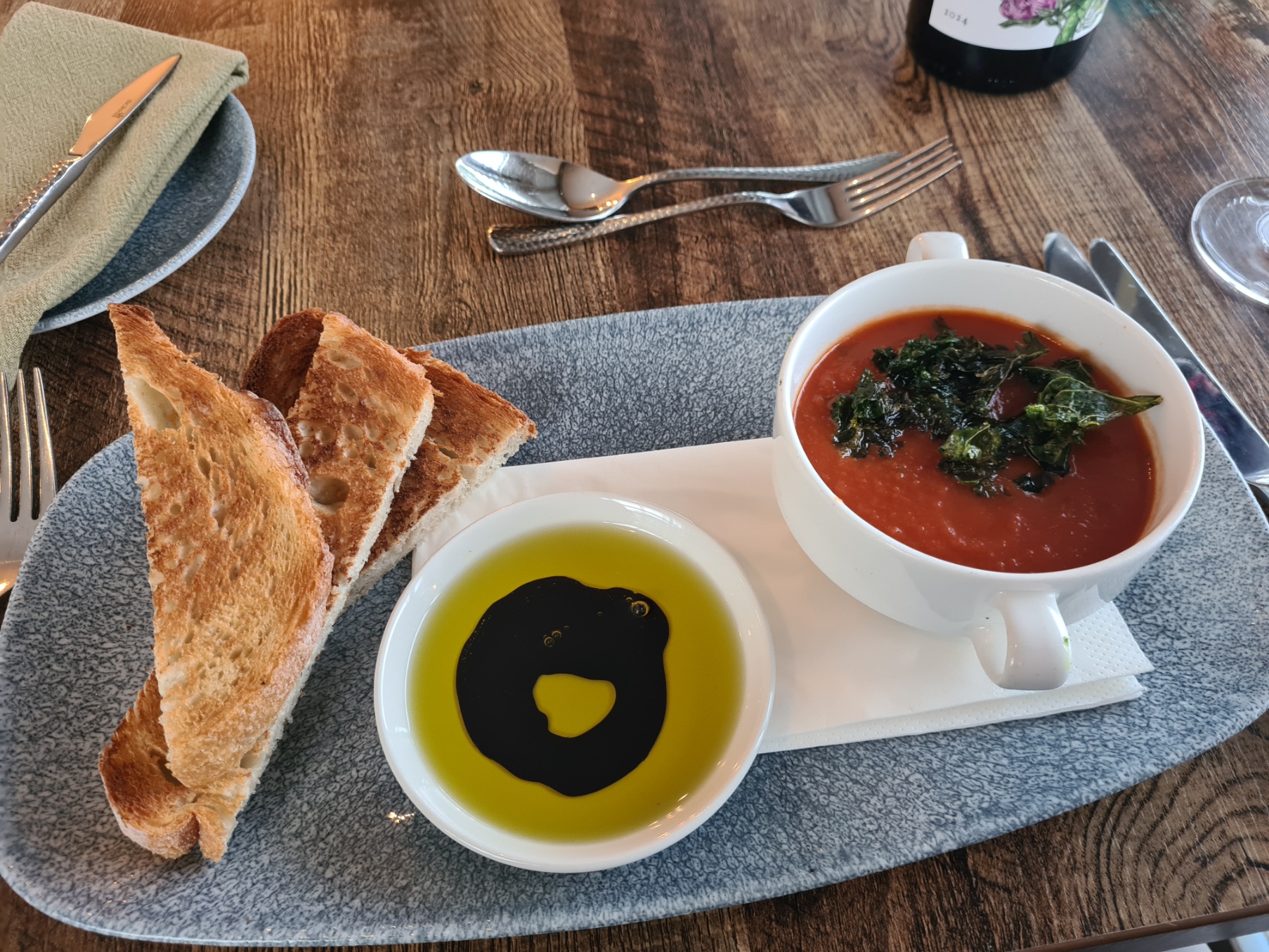
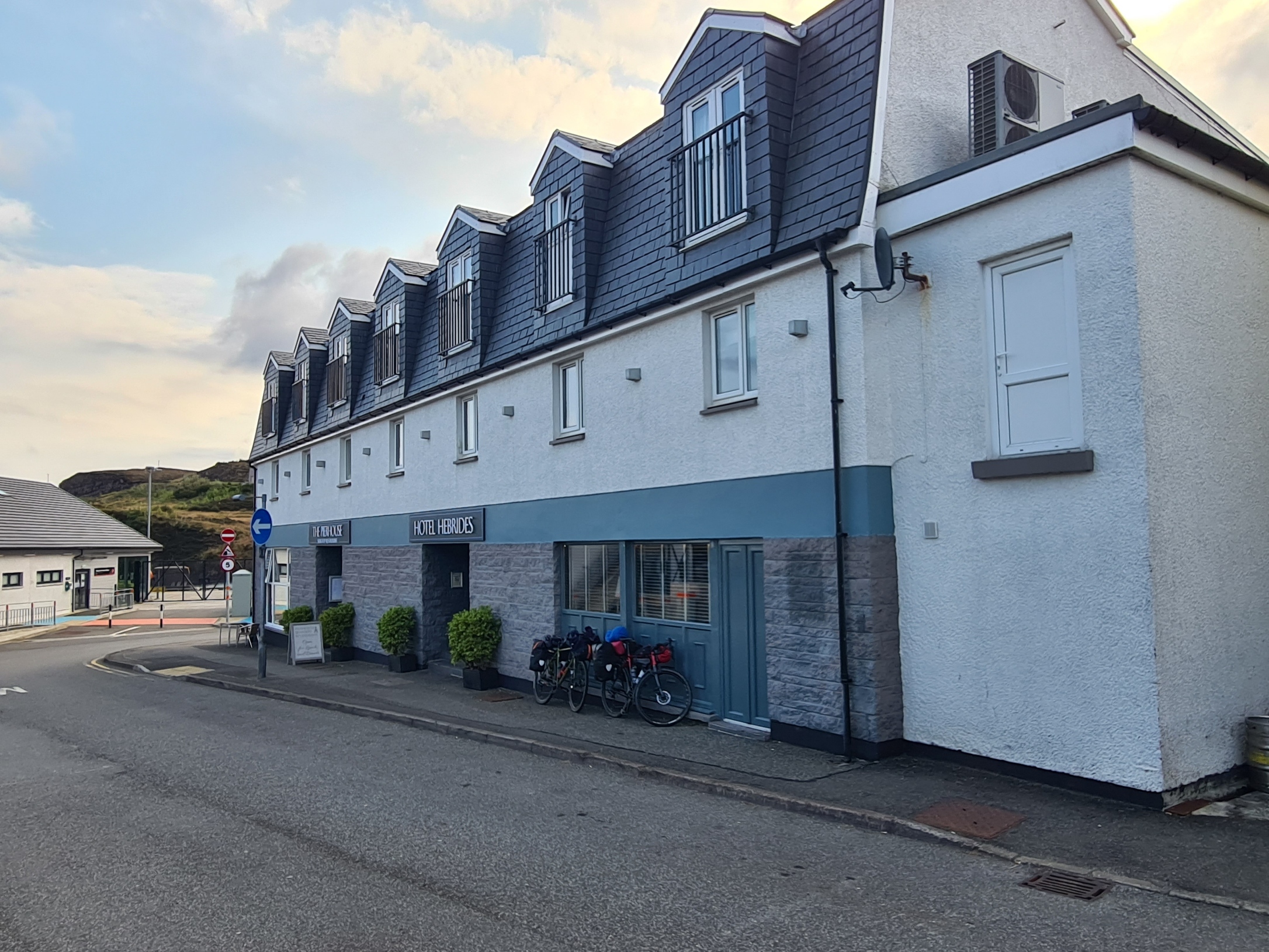
The Outer Hebrides has a reputation for good food, something I hadn’t really had opportunity to enjoy so far. So I had decided to live it up a little tonight and had booked myself into a ’boutique’ hotel very near the ferry port in Tarbert. My road first led me above the harbour, with the attractive town on the far side, before looping down and round to pass the Isle of Harris Distillery (closed!) and the impressively large castellated war memorial, then to Tarbert Pier with its ferry port and, more importantly, my stop for the night.
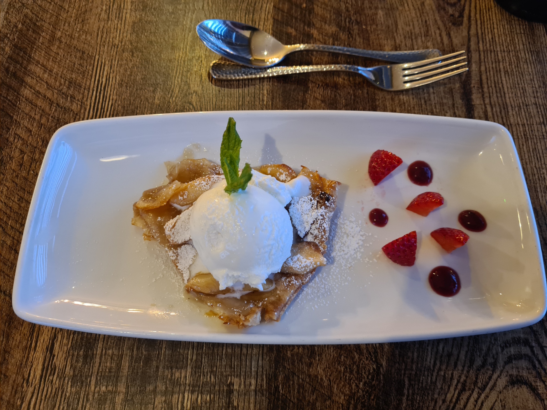
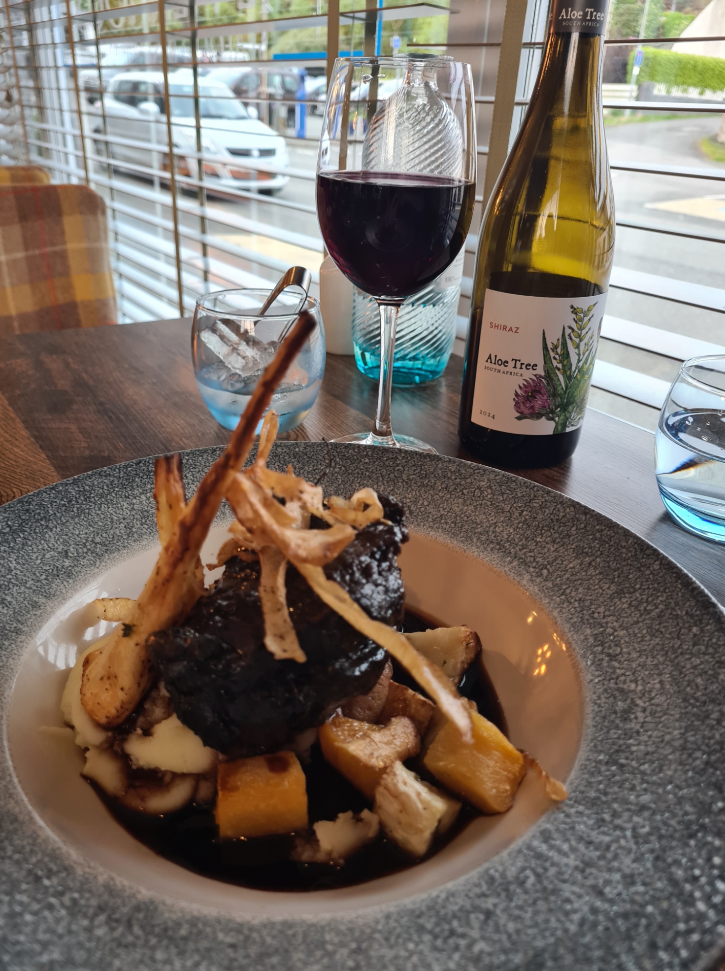
This was going to be an expensive overnighter but I had no regret in first partaking in a few beers in the hotel bar before going to my room for a welcome shower, then change into ‘town clothes’ and a long video chat to Mrs Three Points of the Compass. Later returning to the bar for another beer, followed by a truly excellent meal in the hotel restaurant. Hey, have I mentioned? I’m on holiday! There was also a complimentary dram of whisky in my room as a nightcap. It had been a terrific day’s hike, one that I enjoyed immensely. The terrain on Harris was much improved on a great deal that I had already experienced on the Heb Way. Tonight’s halt was simply icing the cake.
Very full, and probably a bit sozzled, I tottered into bed quite early. It was back to the real stuff tomorrow, leaving such luxury behind for a couple more days. I slept well initially, but was woken in the small hours by the ferry coming in to port. My fault for having the room window open. I dozed off again, but was again woken, this time by the sound of running water through hidden pipework as what seemed like every room occupant around me rose early and completed their ablutions, presumably prior to boarding the ferry..
Day Nine:
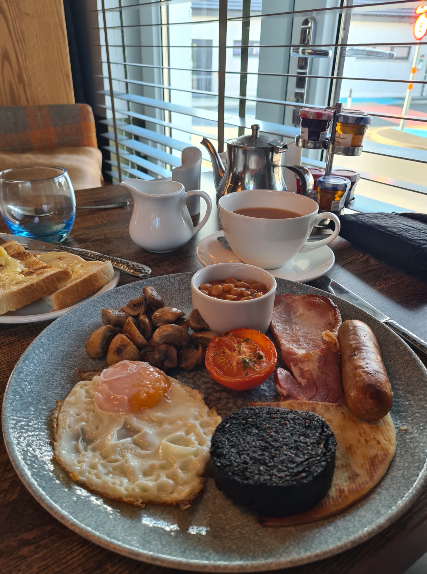
Much as I might have appreciated the grilled West Minch Kipper, or any of six or so other choices off the breakfast menu, I had paid good money, wanted the calories, so ordered the Traditional Scottish Cooked Breakfast, complete with Stornoway Black Pudding and potato scone. It was, simply, excellent. I cannot fault it.
Tarbert is the final place to stock up before reaching the end of the trail at Stornoway. I had carried out an inventory of my food-bag the previous evening and decided that I had plenty of supplies, other than a dwindling gas supply, and didn’t feel the need to visit the couple of open stores I passed on the walk out of town.
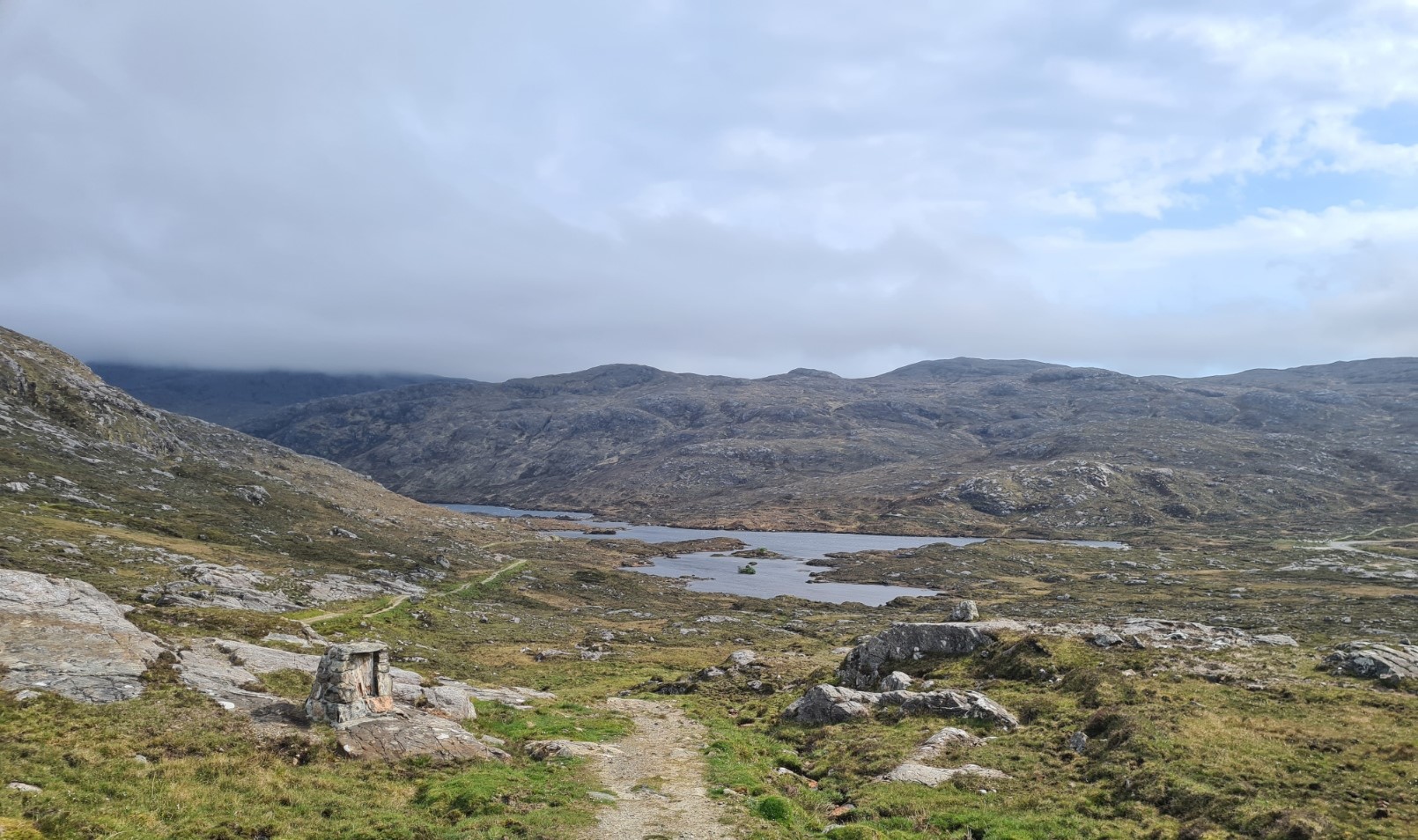
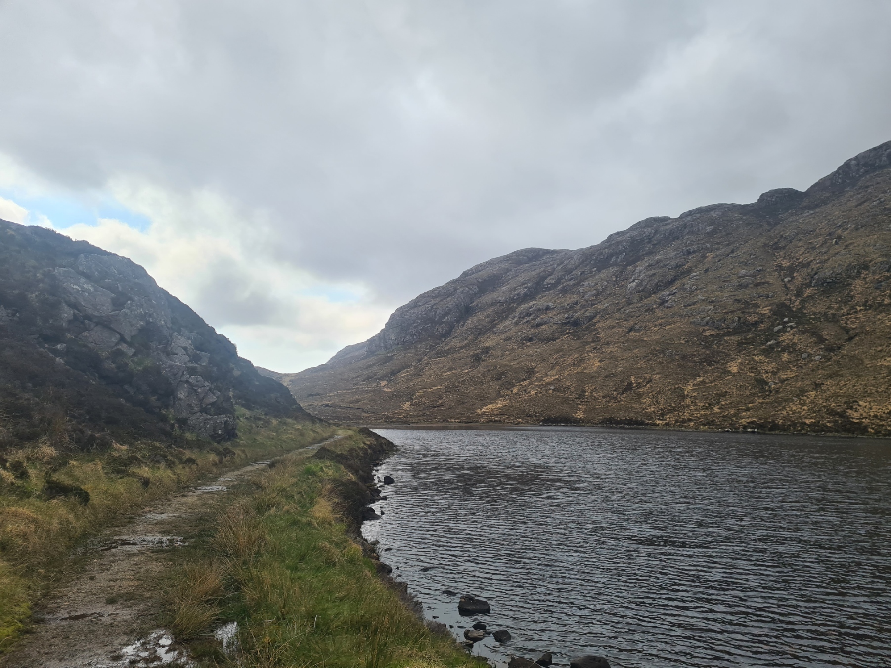
The road exits Tarbert and winds its way up and back into the hills. At Urgha Beag, the road continues off to the right, while the trail leaves it, to follow an old track down toward the elongated Lochannan Lacasdail, again, back on to the Harris Walkway. As with much as the Heb Way in May, at least away from the roads, I again had the path to myself. It is a good path too, that led me through the glen, Todun and Tosgaram high on each side of me, their tops obscured by cloud. The area has one of the densest populations of Golden Eagle and I kept an eye on the skies, unsuccessfully. At the end of the loch the old road began a steady climb out of the glen, heading to the bealach at Bràigh an Ruisg. The cold wind increased in strength and I dug out my merino beanie, to pull it over my ears.
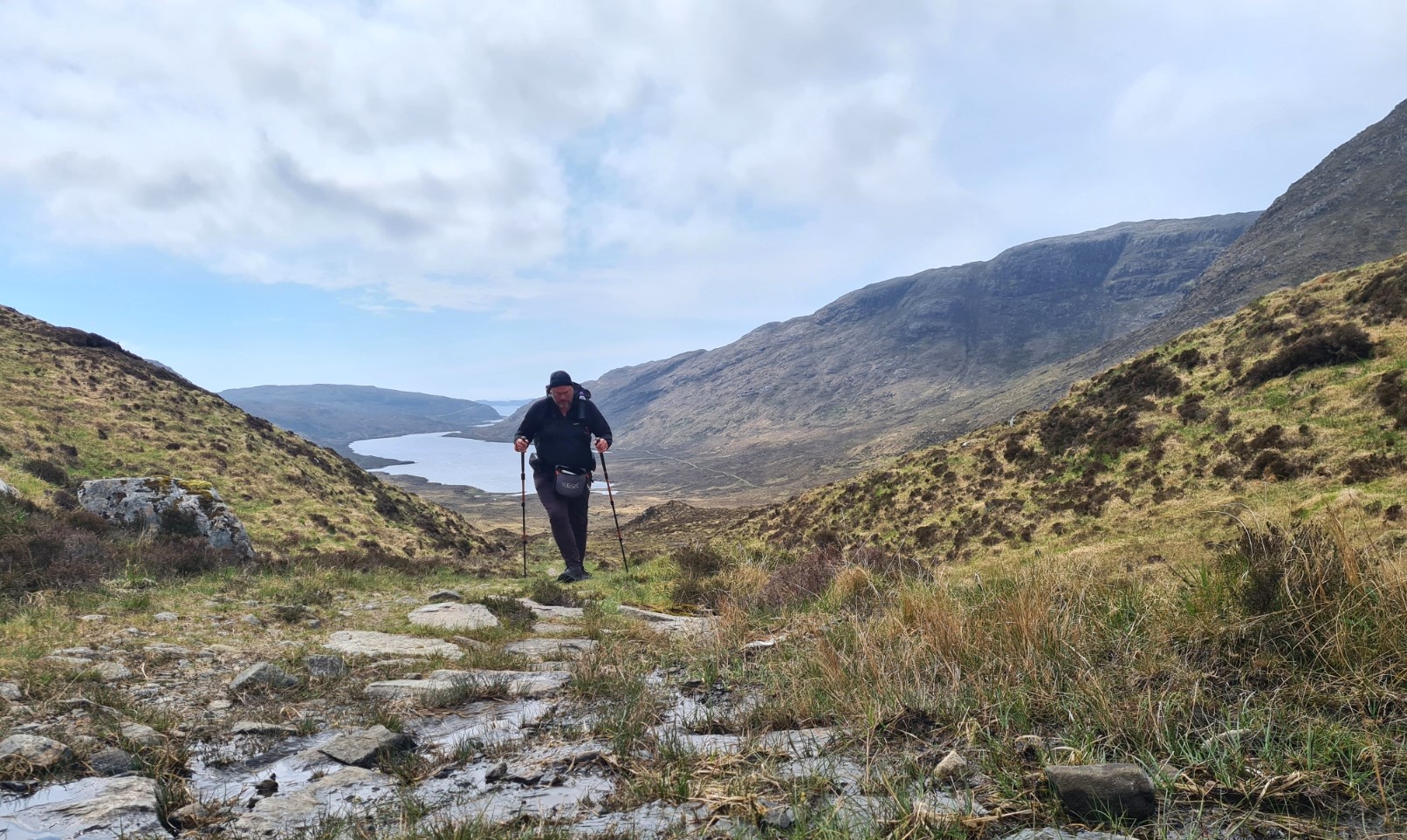
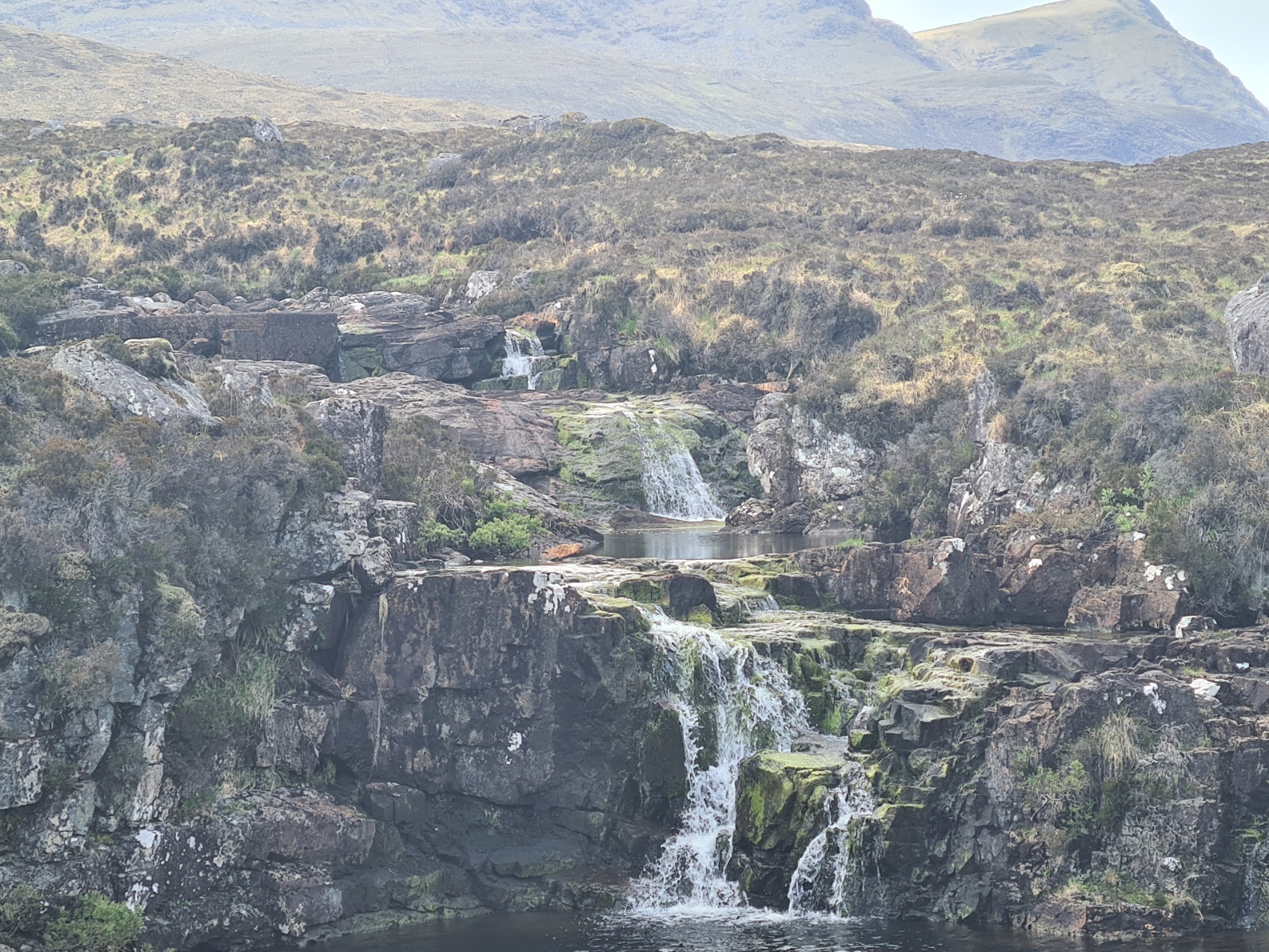
I was more than content. I felt good, my feet felt good, that episode of painful arthritis yesterday unrepeated today. The trail even threw in a series of little waterfalls for entertainment and the path continued to meet a road on a sharp bend above Maaruig, that I joined to then walk uphill to join the main A859, followed for a while before again leaving, to join an old and now mostly unused road that led me to a path that took me to Lochan a’Chleit Àrd. But first, I had to get past the construction work underway by Norpower, Overhead Line Services.
A commitment has been made that every power line on the islands will be replaced and upgraded. It was obvious that this is very necessary work as many lean drunkenly in the peaty ground. In addition to gangs of labourers, the company had bought in heavy construction vehicles to create supposedly temporary roads across the peat on which to transport in the necessary materials. This obviously butts up against those clamouring for more environmental sensitive solutions, but helicoptering materials in and out brings its own issues. The workers waved at me, which I returned, before we all returned to our labours. I was now on an old drovers road, again, part of the Harris Walkway, and again, it was terrific walking, despite one description in the guidebook being very accurate: “it is wet in places, very wet in others…”.
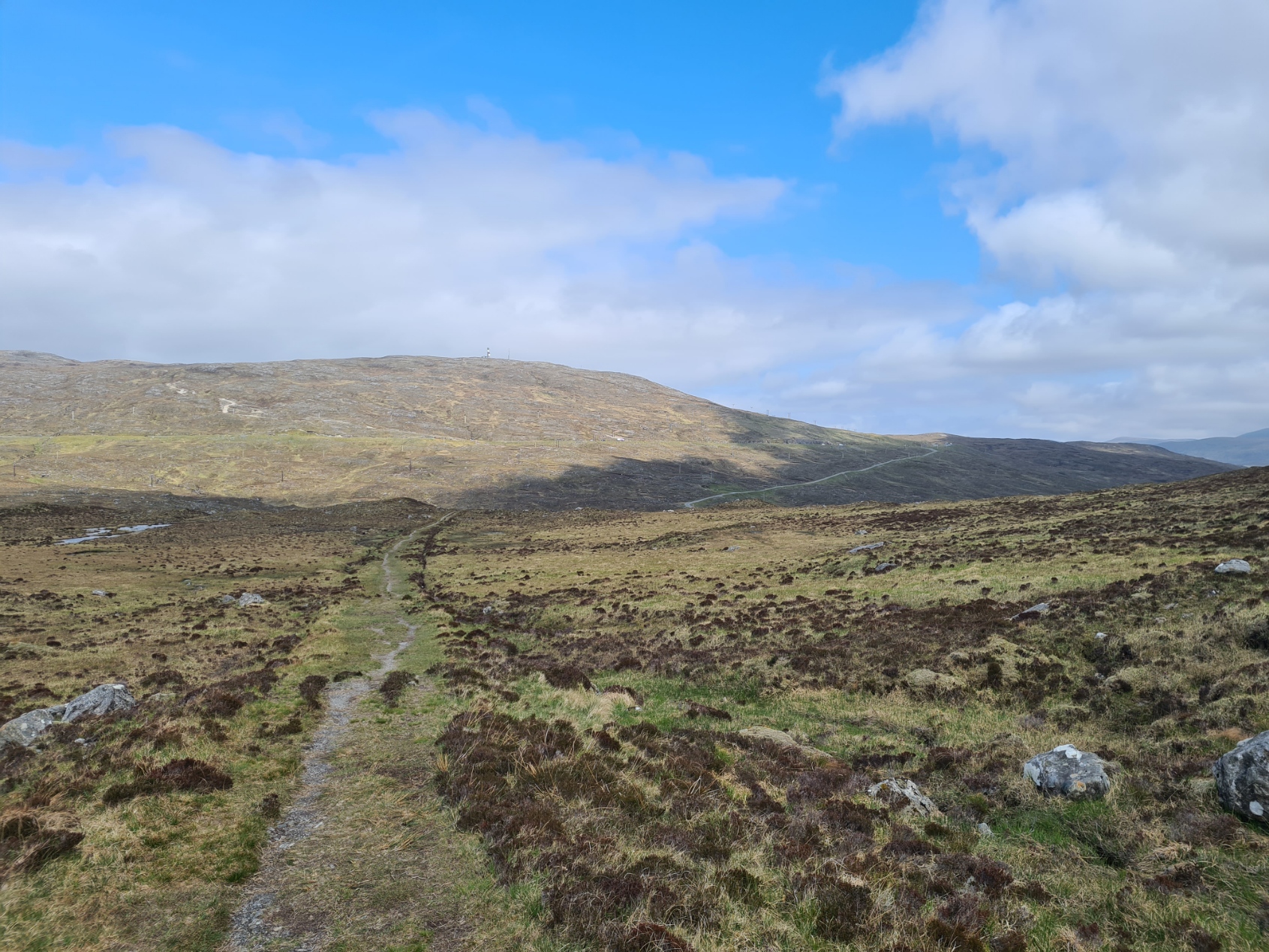
The track swung round below Cleit Ard, the view opening up and I could see the scattered townships of Scaladale, Ardvourlie and Bowglass below. I crossed a wide flatter spot of ground, leaving the mountains of Harris behind, to emerge near the A859. The Heb Way runs beside this for another three miles, often following the old road beside the new. I passed a layby, with its snack wagon, providing local seafood. Needless to say, Taste ‘n’ Sea was firmly shuttered.
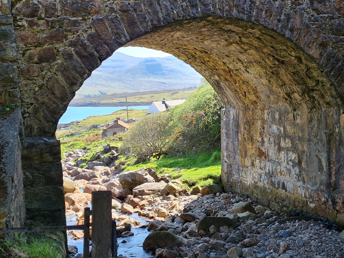
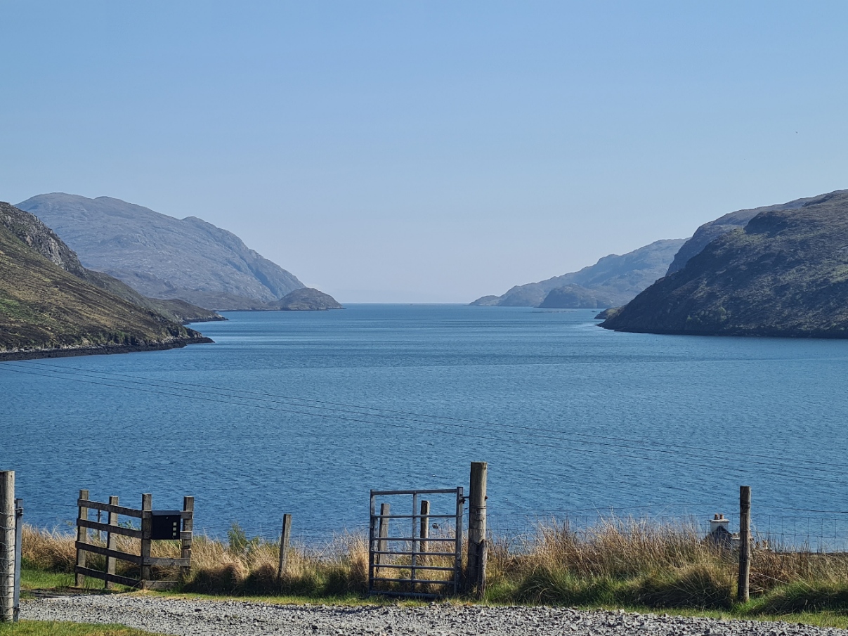
I have mentioned a few times that I was following the Hebridean Way across ten islands. This is a bit of a historical contrivance though there is some geographical justification. Harris and Lewis, my final two ‘islands’ are, more or less, a single landmass; the largest of the Outer Hebrides archipelago. The lumpier Harris is in the south and makes up about a third of the two-part island. Lewis to the north, is more densely populated. Each ‘island’ was governed separately until 1974, frequently by clans, more recently much is owned and developed by local Trusts. Beside an old clapper bridge, a modern road bridge passes over Abhainn a’ Mhuil, a beck that delineates the crossing from Harris to Lewis. Few are aware of them, and still fewer bother to go and see them, but beneath the bridge, inscriptions had been set into the concrete piers.
“Eilean na Hearadh, eilean cùbhraidh nam beannaidh
The scented hills of Harris”
……………………..
“Eilean Leòdhais, eilean bàigheil an fhraoich
Lewis, the friendly heather isle”
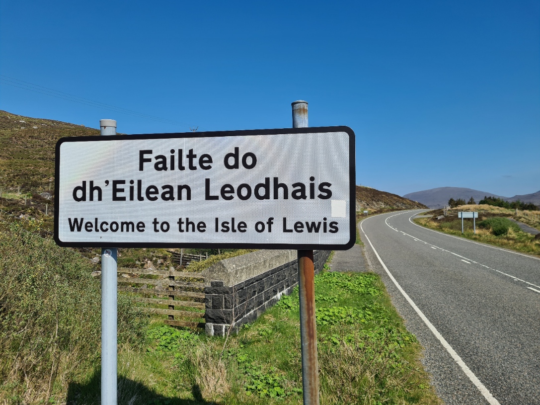
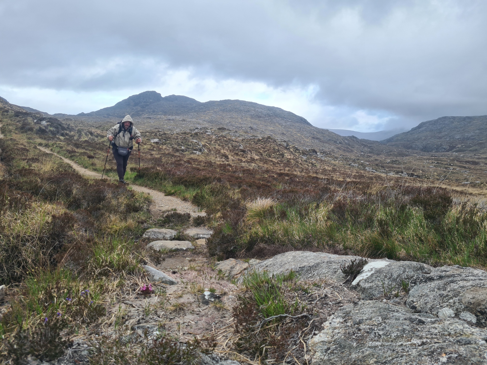
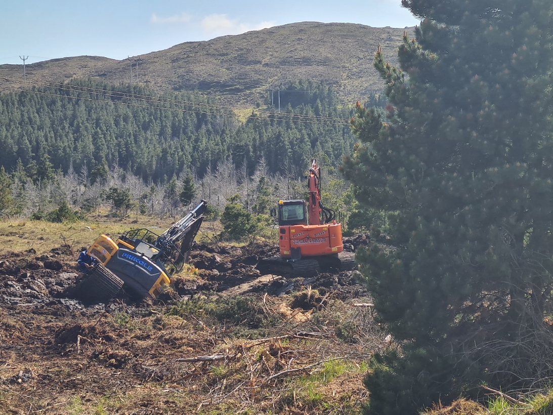
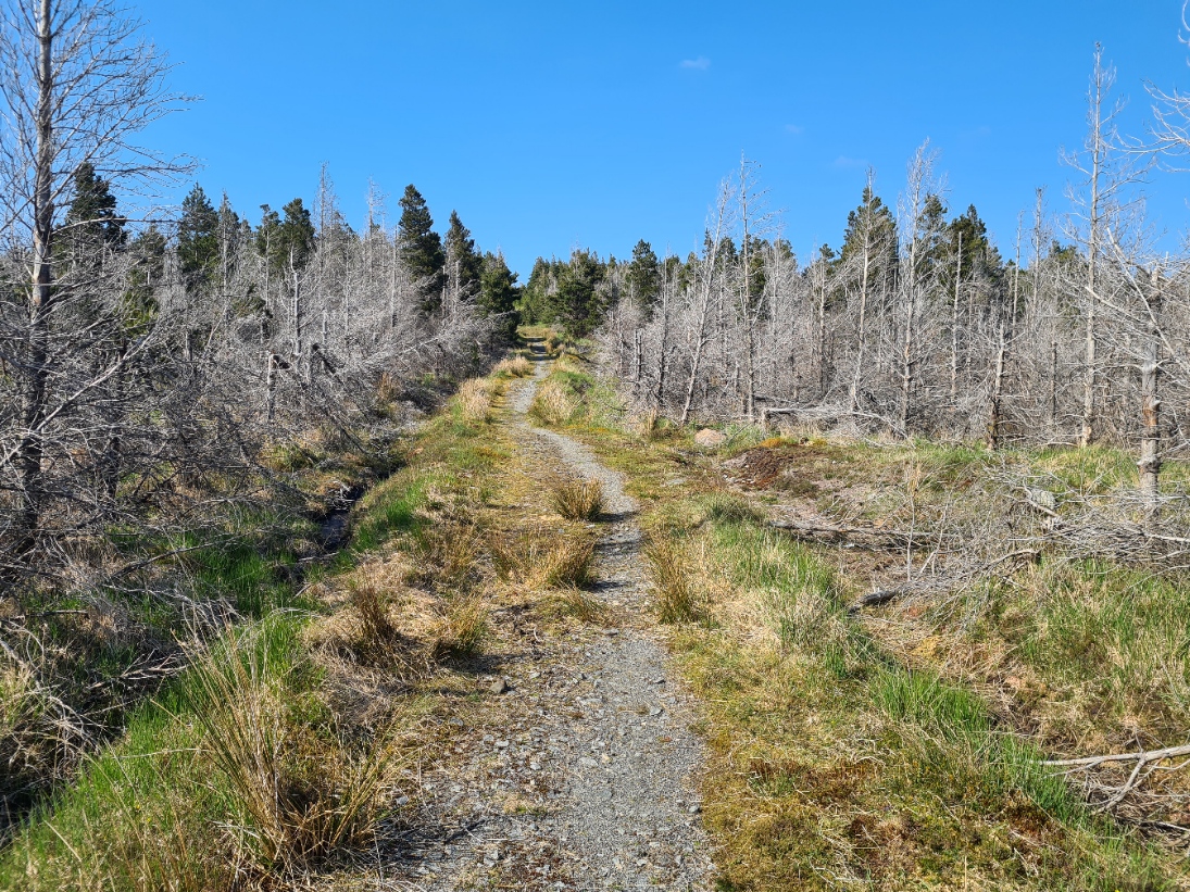
Now on Lewis, my final island, the road walking continued for just a little more, through cuttings in the Lewisian Gneiss, to leave the road and wander up a stony path into the large Aline Community Woodland. It wasn’t always managed by them. it was originally a commercial plantation of Sitka spruce and lodgepole pine, but these were decimated by the Pine Beauty Moth. Stands of grey dead trees stand testament to the power of small creatures. Native trees are now being planted but much of the original woodland persists. Scottish Woodlands were carrying out forest operations. Or were supposed to be, a mechanic was working within the engine cowling of an excavator that was listing badly, having dug itself into the peat.
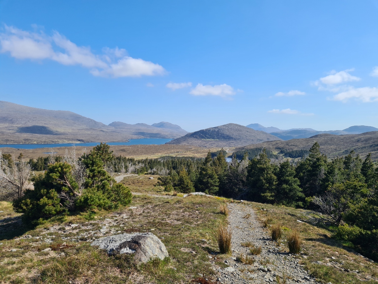
I was a little surprised by the amount of ascent on this section, or perhaps I was just feeling it at the end of my day. The gravelled path swung left and right, winding its way up to the summit of Griamacleit, where, remarkably, a picnic bench had been sited. Kudos to whoever carried that up there. There were wide views, back south to the mountains of Harris, north into Lewis, my destination for tomorrow. I found a tiny lochan and filtered a couple of litres of water. I didn’t much like the look of the dark peaty water, but it’ll do.
I followed the gritty path down from the summit, through a deer fence and continued, following a little beck. There was a wooden bridge that crossed this and the path continued down the other bank. However just beyond the bridge was a small hillock that I walked up on to to check it out. There was a bit of a slope to much of it and some was a bit boggy, but there was a flat dry area perfectly sized for the Duomid. There was even shade from the hot sun beating down. No need to look further, this was tonight’s halt. Once the tent was up, pad inflated and quilt lofting, I then returned to the beck, wearing just my skiddies, to first dump the water collected earlier and filter a couple of litres, then walk in to for a bit of a body wash with my Swedish Cloth.
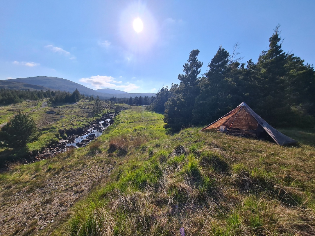
Later, I saw only one person, a man with his dog. Neither noticed me as they passed, a little above them on their right. The dog was too busy exploring the water. Nor would they have noticed me on their return if I hadn’t hailed. We chatted for quite some time and he told me I wasn’t the first to choose this spot for a wildcamp, I wasn’t surprised to hear this as it was a lovely spot and there hadn’t been many suitable places before it. That said, what slight breeze there had been, soon died and the midges came out in force, but thankfully not biting, so I was able to simply zip the mesh door and ignore the few that followed me into the shelter.
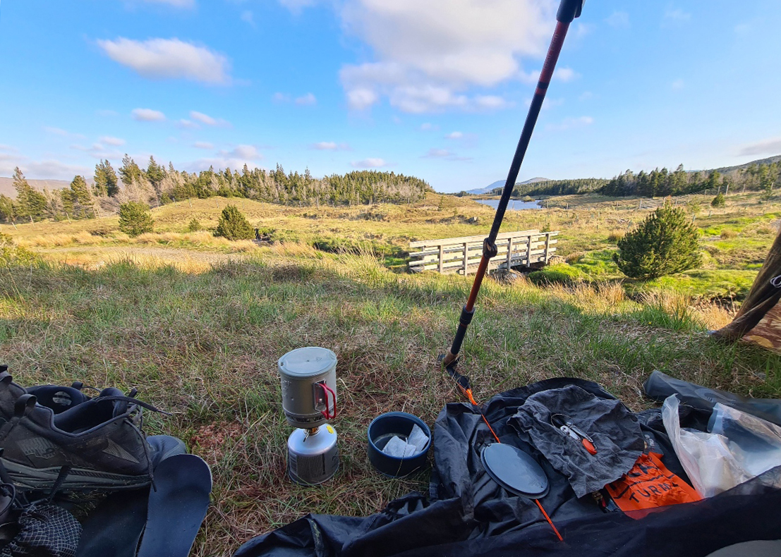
Tonight’s meal was good. I had been saving one of my favourites, a Real Turmat Reindeer Stew. Then I drank a couple of mugs of strong tea while writing notes and reading. The sun dropped and the temperature dropped dramatically. Yet again, it had been an excellent day’s hike. It seemed as though the trail had been saving the best ’til last. Though those who live on the islands south of where I was now would probably vehemently disagree with that.

1 reply »