This month’s instrument is attractive, awkward to use and full of faults. The design was later refined and led the way for many manufacturers of similar map measures.
This example of Victorian engineering amply demonstrates the ingenuity of some individuals that helped shape and improve various engineering and surveying disciplines. The Patent Chartometer was invented, manufactured and sold by Edward Russell Morris, of the Morris Patents Engineering Works, High Street, Birmingham, England. It is capable of measuring a wide range of scales due to interchangeable card dials. Not content with this, Morris went on to improve the design, including a totaliser in a second generation, and reducing the size of the entire instrument over the years, finally creating the basic model that many other manufacturers went on to copy and refine themselves.
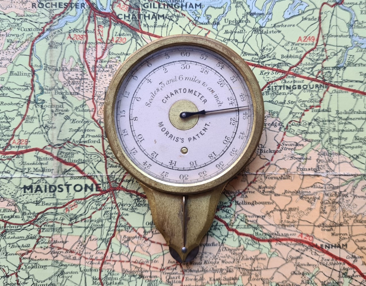
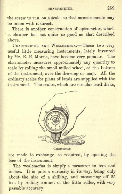
“The only instrument that measures and registers distances on maps, plans, scaled drawings etc, and that is adapted for various scales. By guiding the small steel wheel along any route on a map, the hand registers the actual distance in miles, yards etc, according to the dial in use and the scale of the map, which should correspond. To deal with a map of a different scale, the glass front is opened by pressing a spring; the dial removed, and another corresponding to the fresh scale slipped into its place.”
E. R. Morris
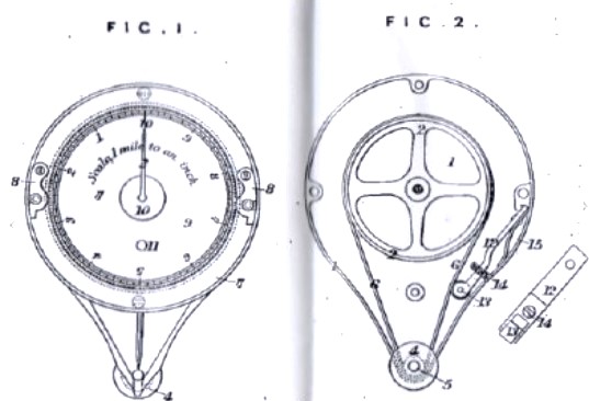
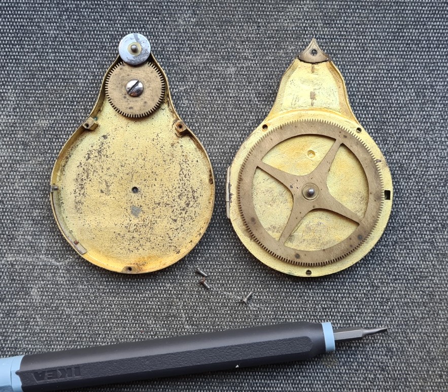
The earliest versions of ‘Patent Chartometer’ were patented by Morris in 1873, though his drawings show that the internal operating mechanism was considerably simplified. He produced two versions of this relatively large measure. The one shown here was a simple device with rotating needle pointer, while a second generation added a totaliser that indicated the number of revolutions of the dial that the needle had made.
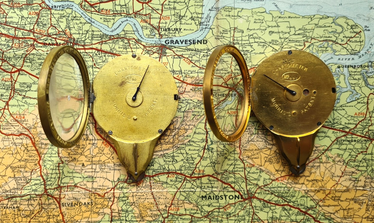
Beyond the obvious change to the internal mechanisms and the addition of the totaliser, there is little difference in the case design between the two generations of Chartometer. It is only when they are compared side by side, that it is noticed that the small pointer ‘fin’, above the tracking wheel, has been thickened, presumably because the first generation fin was more easily bent.
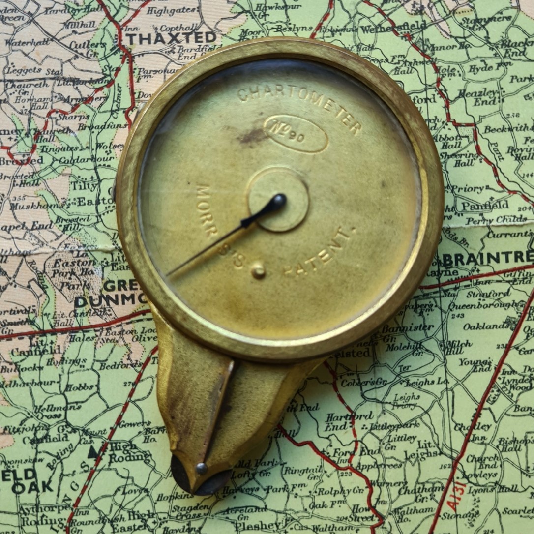
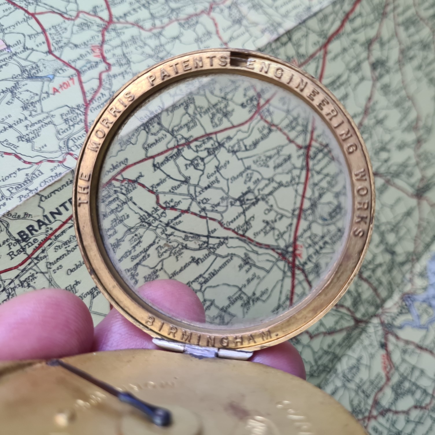
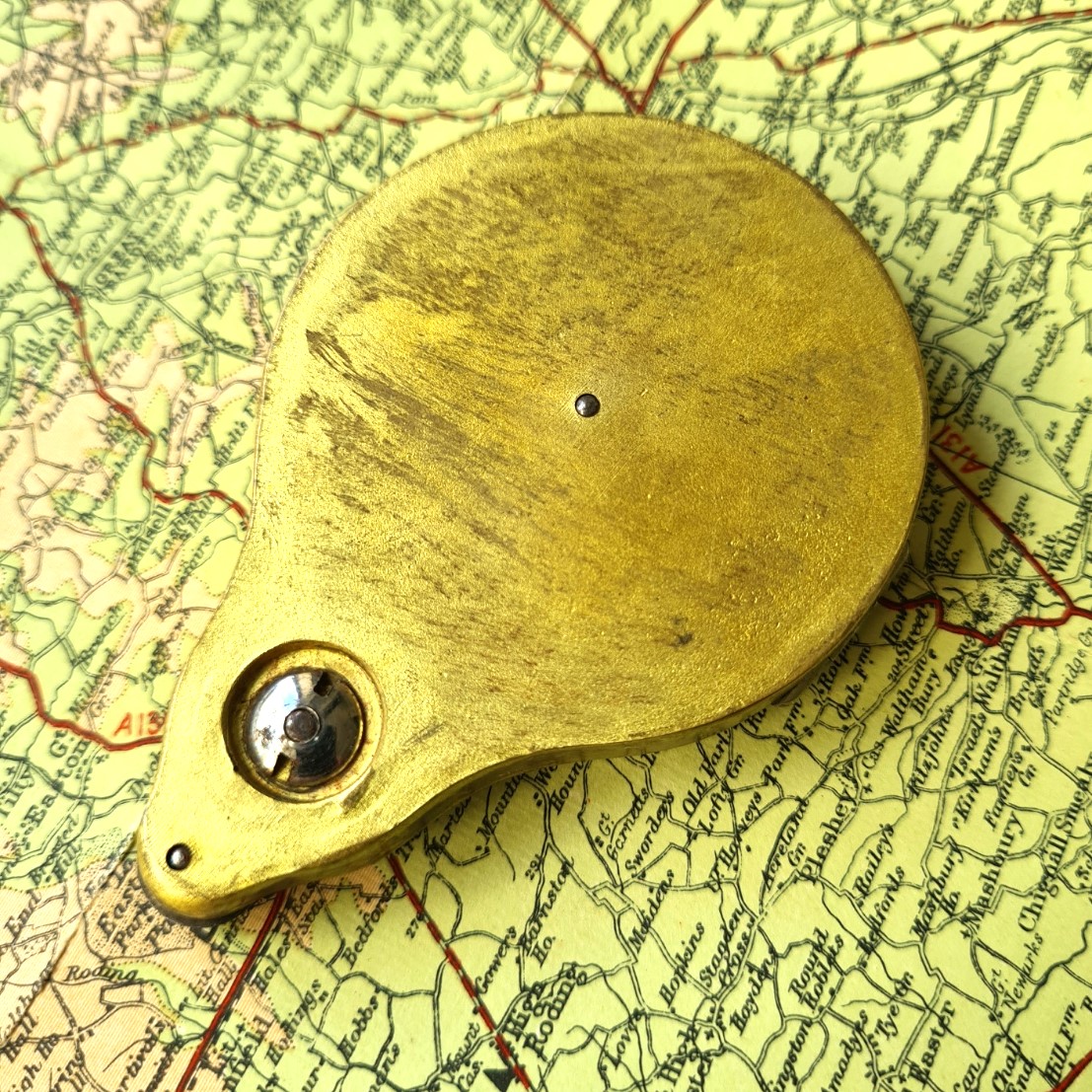
The teardrop shaped brass case of the Chartometer has a hinged glass front opened by a press button catch on the side. On the underside of the glass front are the words THE MORRIS PATENTS ENGINEERING WORKS BIRMINGHAM. On the front of the case, below where the scale dial would normally sit, are the words CHARTOMETER MORRIS’S PATENT. There is also an oval, in which the No is universally included. Each of the instruments had a unique number, this example is number 90. With the desired scale card inserted and hinged front closed, the measure is held in the hand and the steel wheel at the bottom rolled along a line on a scale map or drawing. The measurement is then read off against the scale card. Morris also produced a Chartometer with a removable top cover, that could be locked to the case by two twist catches.
Morris was a member of the Institute of Civil Engineers from 1880 and designed and manufactured map measurers in a range of sizes, this is the largest he produced but not the heaviest. The Chartometer shown here weighs 70g, 10g less than the totaliser version and 14g lighter than Morris’s Measuring Instrument, his next generation of measurer. At 80mm x 57mm x 11.2mm it is quite a sizable instrument.
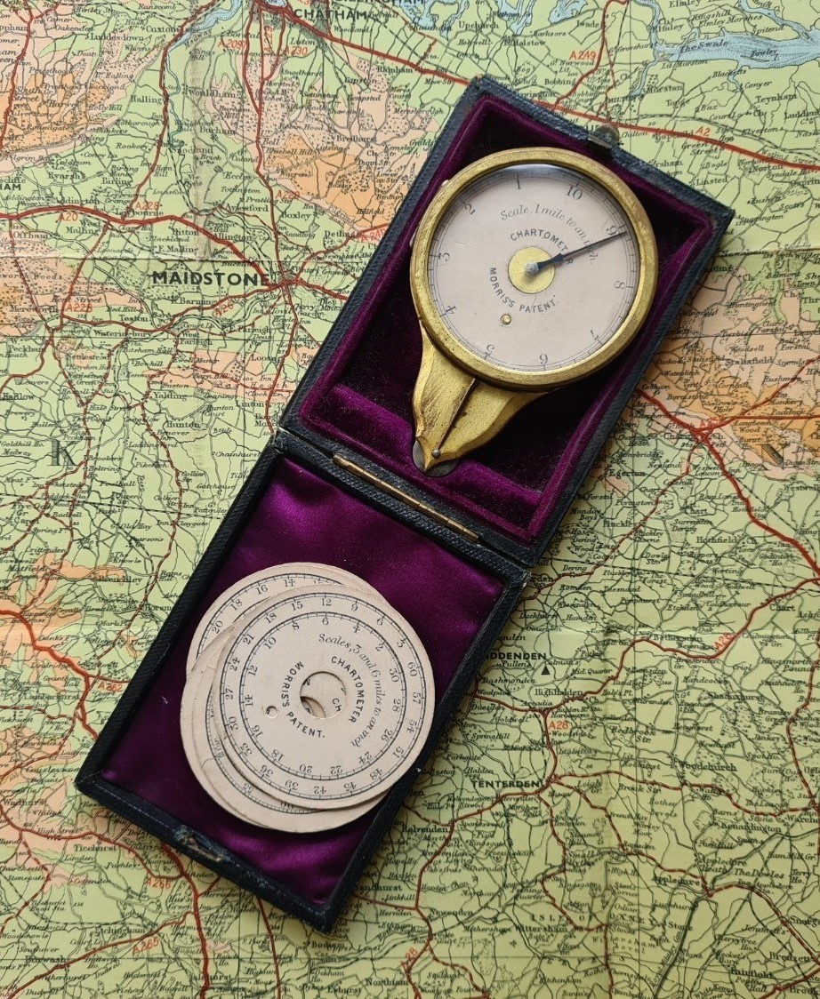
“A set of dials adapted to the scales of all Ordnance maps, and the usual scales of travelling maps etc, is contained in a recess of the leather case, beneath the instrument.”
E.R. Morris
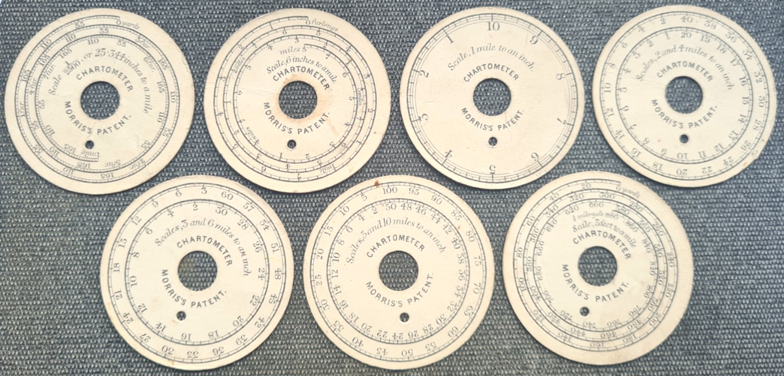
Seven scale card dials are included with my measures, giving 10 direct scales. There were a further two dials, the last two listed below:
- Scale 1/2500, or 25.344 inches to a mile
- Scale, 6 inches to a mile
- Scale, 1 mile to an inch
- Scales, 2 and 4 miles to an inch
- Scales, 3 and 6 miles to an inch
- Scales, 5 and 10 miles to an inch
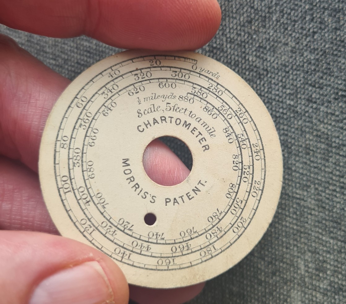
- Scale, 5 feet to a mile
- Scale 1/500, or 10.56 feet to a mile
- Scales, 7 and 11 miles to an inch
Below the large central hole on each scale dial is small hole to orientate it on a protruding metal nub on the face of the instrument. These dials differ from the totaliser version that had an additional hole through which the number of turns of the dial could be read.
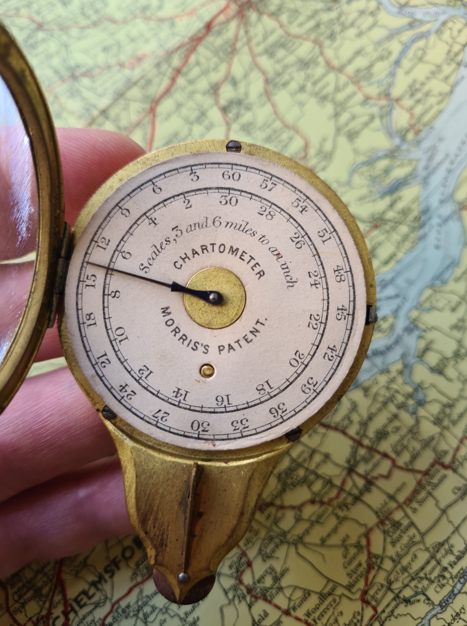
The scale discs are interchangeable. To do this, the needle pointer has to be rotated to a position pointing away from the hinge. This makes it easier to remove and replace the card disc. The front of the measure is opened by depressing a small button on the right of the case, that releases the hinged glass front. This is opened and the required scale card is slid beneath the needle, into position in the centre, rotating as necessary to orientate correctly on the protruding nub on the face of the case back. The glass front is then snapped closed. Care has to be taken not to bend the needle. If this were to happen, it would be difficult, perhaps impossible, to bend it back. Such repeated damage may explain the further development of this measure to eventually become Morris’s Measuring Instrument, that lacked the hinged front. That measure is looked at in another post.
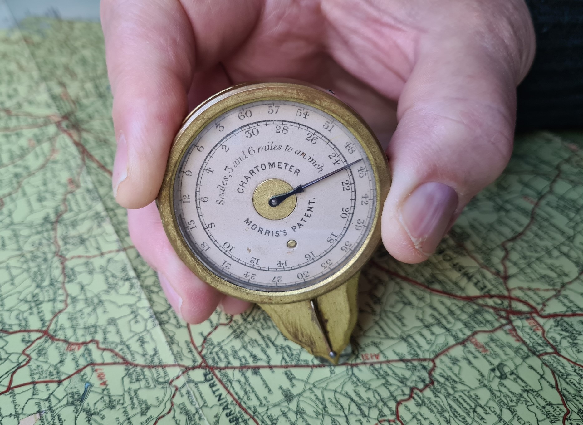
The Chartometer is fairly easy to use, simply rolling the tracking wheel along a line on a map and reading off the registered distance covered. However the case is quite large and the tracking wheel a little hidden at the base. That fin goes a long way in aiding correct placement on a map.
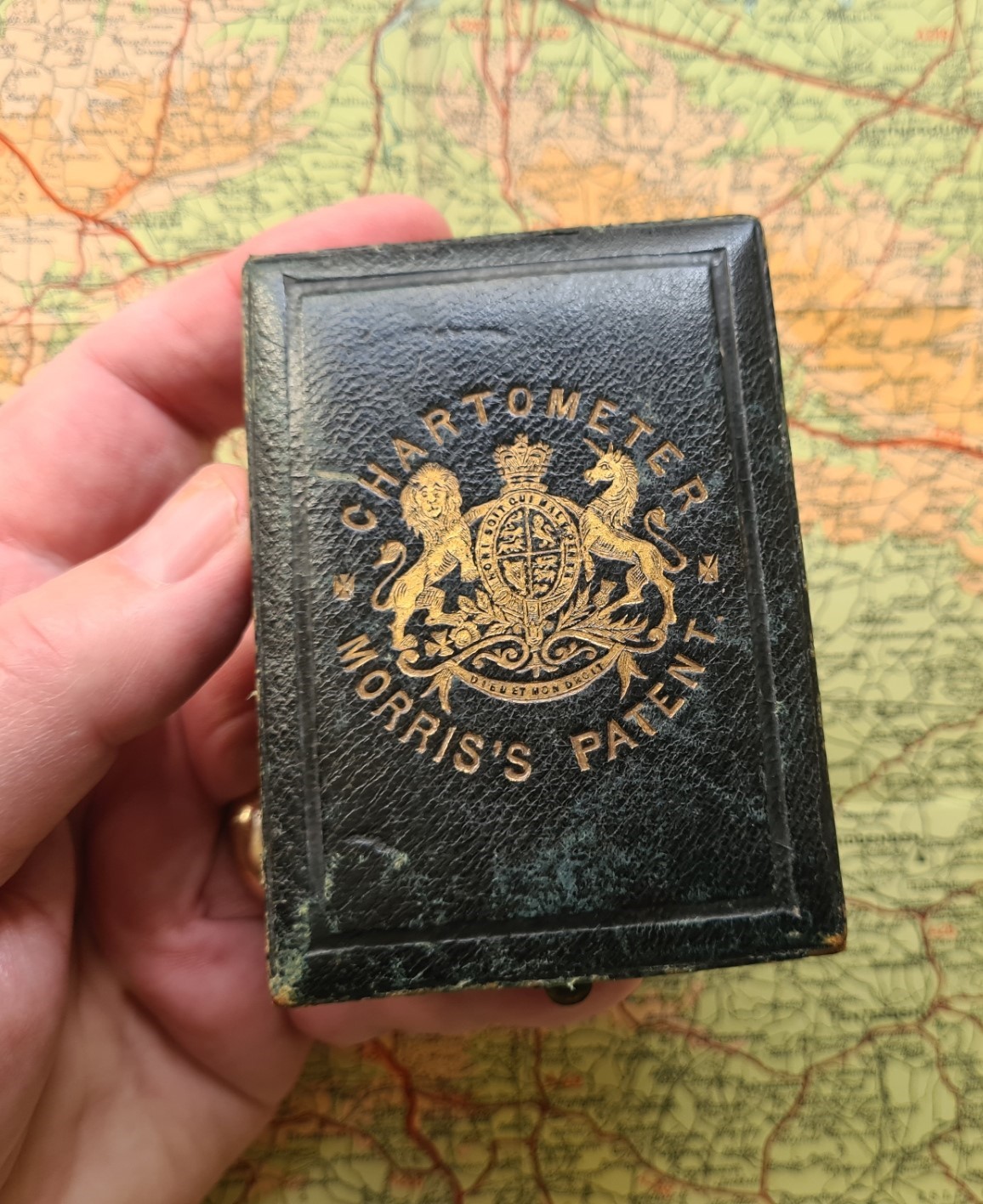
The map measurer shown here is serial number 90 and came supplied in a leather bound wooden case, with silk interior. The highest number I have seen is 10032. That is for a second generation with totaliser. Scale cards are stored below the measure in the case. With the cards it makes for quite a full case and the dials can easily slip out if the case is opened and tipped slightly. The top of the hinged case has an embossed, and rather fanciful, crest, with the name of the instrument within.
Up until the likes of Morris had begin to include a registering scale measurement on their measuring instruments, most people tracking a line on a scale map or drawing were using simple opisometers, that then had to be back-tracked along a to-scale line to indicate the distance tracked. The Chartometer was an important step-change that a great number of entrepreneurs and manufacturers then adapted, particularly those already making instruments such as pedometers, calculigraphes and watches. Stanley’s important 1878 treatise on Mathematical Drawing Instruments included mention of both Morris’s Chartometer and later development of this, his oddly named Wealemefna. It is the second version of the Chartometer, that included a totaliser, that is illustrated. Stanley does say that the tracking wheel is milled, however every example I have seen has a smooth edged tracking wheel, that can skate on smooth paper. Milling would have helped prevent this.
Set against the more commonly encountered map measures seen today, it would be easy to regard this analogue measure as an unsatisfactory anomaly. A bit clunky, a bit difficult to install cards. But that would ignore it’s place right at the start of the creation and development of map measuring instruments that were themselves improving on the simple opisometers that had sufficed until then. Even today, it still works as intended, measuring a route on an appropriate scale map. It is a glorious survivor. This measure has featured as part of an ongoing monthly series where Three Points of the Compass looks at Map Measurers in detail. Links to these can be found here.