
For many decades of navigation, anyone that required a map was also using a map measurer. The military use them, sailors use them, motorists use them, town planners and draughtsmen use them, and still, just a few walkers use them. You run a little wheel along a route, a path, a road, a river, a line on a drawing, then either read off the result or measure against a standard.
Waywisers
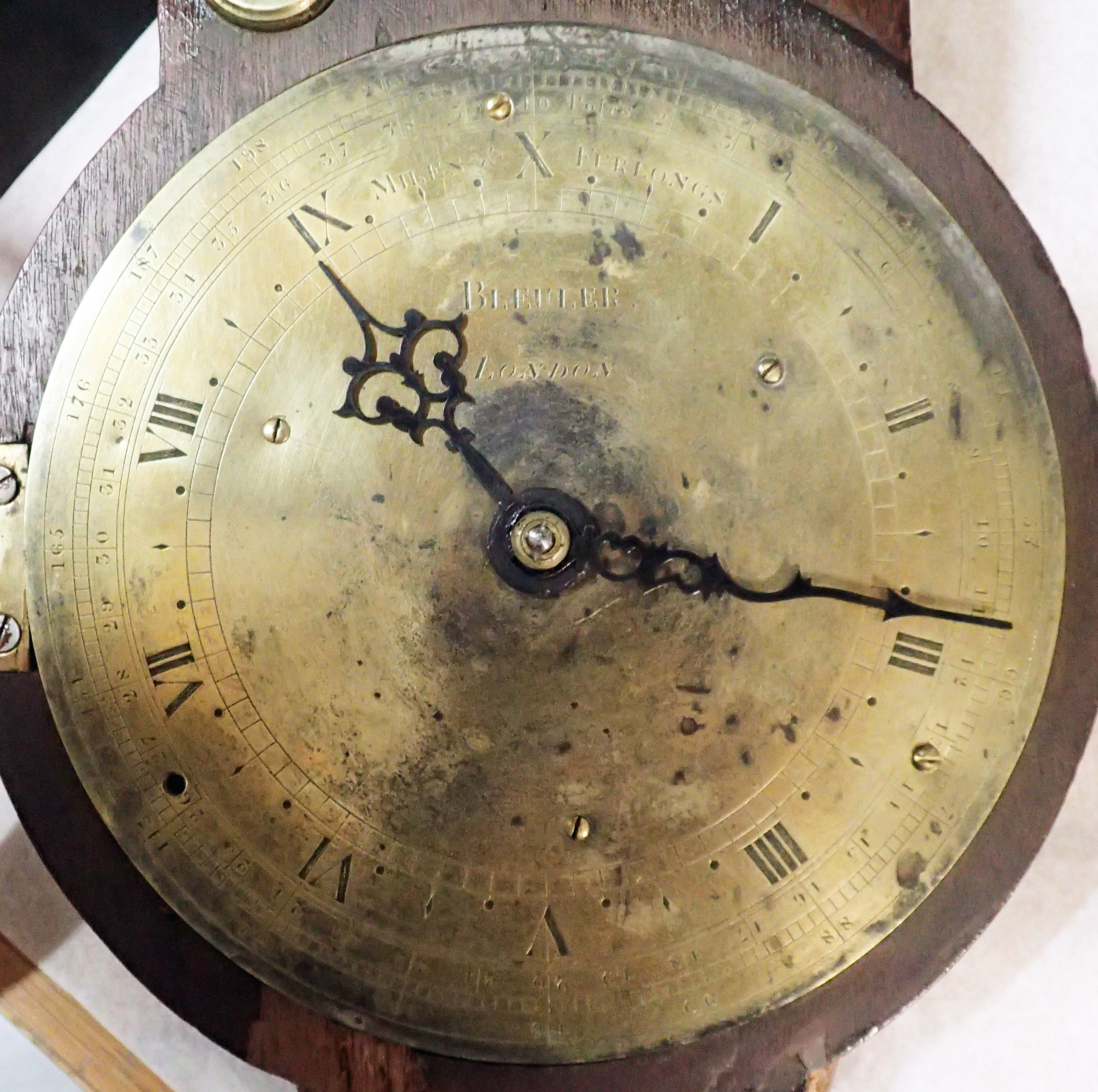
The first England and Wales road atlas was published in 1675. This seminal work, Britannia, comprised 100 maps and was created by map maker John Ogilby. It was the first to use a scale of one inch to the mile and to use the Statute mile of 1760 yards. Each vertical strip map in the atlas showed compass orientation and distances in miles and furlongs. Such accurate measurements had been made possible by surveyors measuring the roads. A favoured and accurate method was walking the ground with a surveyor’s measuring wheel, otherwise known as a perambulator or waywiser. Paying homage, both man and instrument were depicted in Ogilby’s Britannia, shown on the frontispiece and on two maps within.

The idea of map measurers is an old one, probably as old as ‘to scale’ maps themselves. Beyond simple calipers, the earliest of map measurers, or opisometers, were very simple affairs indeed- little wheels on a threaded spindle that could be pushed along a line. With the wheel wound to one end of the spindle, the operator can run the wheel along any line on a map, and, if aware of the scale to which the map is produced, work out by the number of revolutions the distance travelled. More expensive designs of map measurer that incorporated a dial scale didn’t really appear in any great numbers until the late nineteenth century.
Map measures also go by other names- meilograph, kartnemesse and curvimeters (also spelt curvimetre). The latter taking its name from the Latin curvus, meaning a curve. An early name for one of the simplest form of these measures is opisometer. Opisometers were being made by fine instrument makers in the early part of the nineteenth century. Now uncommon, opisometers are still available new today, but seldom applicable to map reading purposes. For a tool with such a long history, it is perhaps a little surprising that they are still required and made today.
Englishman Edward Russell Morris, of the Morris Patents Engineering Works, High Street, Birmingham, began manufacture of his ‘Patent Chartometer’ in the 1870s, the design being patented in 1873. It is a handsome measure and came with a range of interchangeable cards that provided differing scales. There is a link to a closer look at this particular measure below.

Map measures can be sweet little pocket watch style affairs that were tucked into the waistcoats of the gentry, or simple little wheeled opisometers, sold in the likes of Stanfords map shop in the mid-twentieth century.
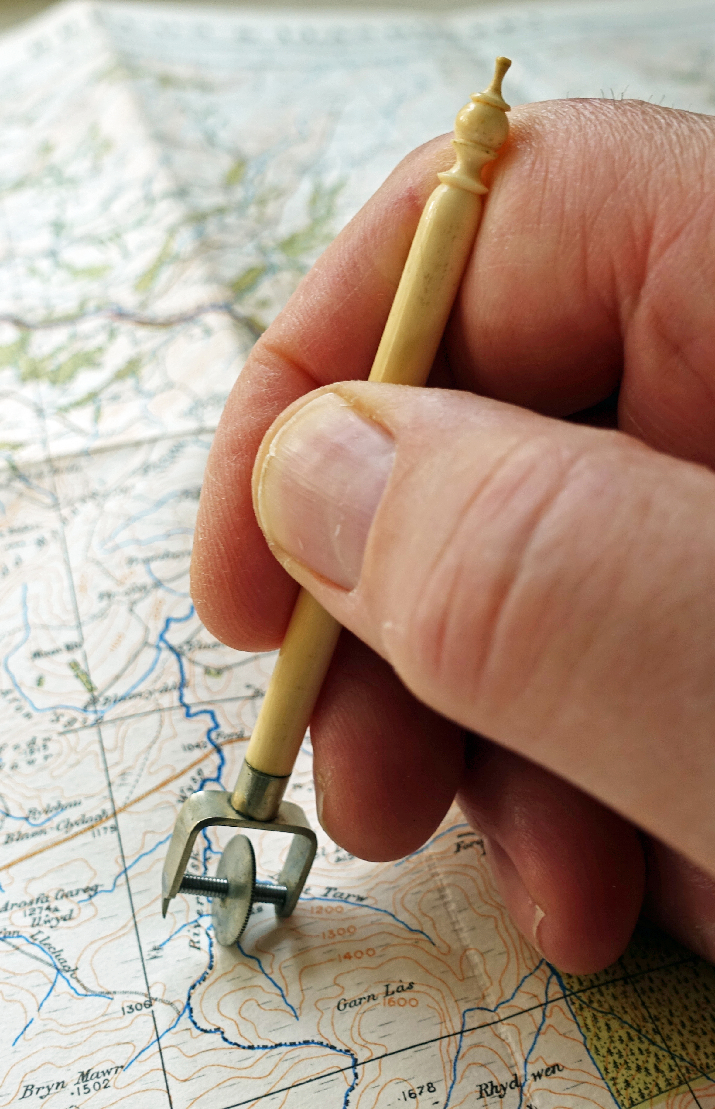
Measures can be made of plastic, Bakelite or metal. They can have handles incorporating plastic, metal, bone or ivory. Cheap versions were given away at petrol stations, or combined into all-singing all-dancing measurer/compass/thermometers made in China by the thousand. That said, they still work. The cheapest will do the same job as the most expensive solid gold measurer ever made, if not necessarily to the same degree of accuracy. They even make incredibly expensive digital versions today. I look on those with dismay, much preferring my little analogue measurers.
A huge array of different measurers have been produced over the past century and more. Some different types are explored below. In recent years however, as digital mapping comes to the fore, they have very much fallen out of fashion.
Not completely though- in 2018 compass maker Silva introduced a map measurement scale on some of their compass lanyards and in 2022 map maker Harvey introduced boot and shoe laces with measuring scales. These flexible and stretch resistant measures are good enough as a rough indicator of distance while on trail.

Three Points of the Compass has taken a closer look at some particular makes and models of map measurers, including the Silva and Harvey measures mentioned above. Links for these are below. Another is added each month as a featured map measure of the month:
- Action Line key tag #199
- ADAC Kilometerzähler
- Aristo 1323 Fächermaßstab/Fan Scale
- Automobile Association (AA) bookmark and measure
- Barker & Son Rotameter
- PB Book Club Measure
- Brenske Marsch-Zirkel
- Bux measure
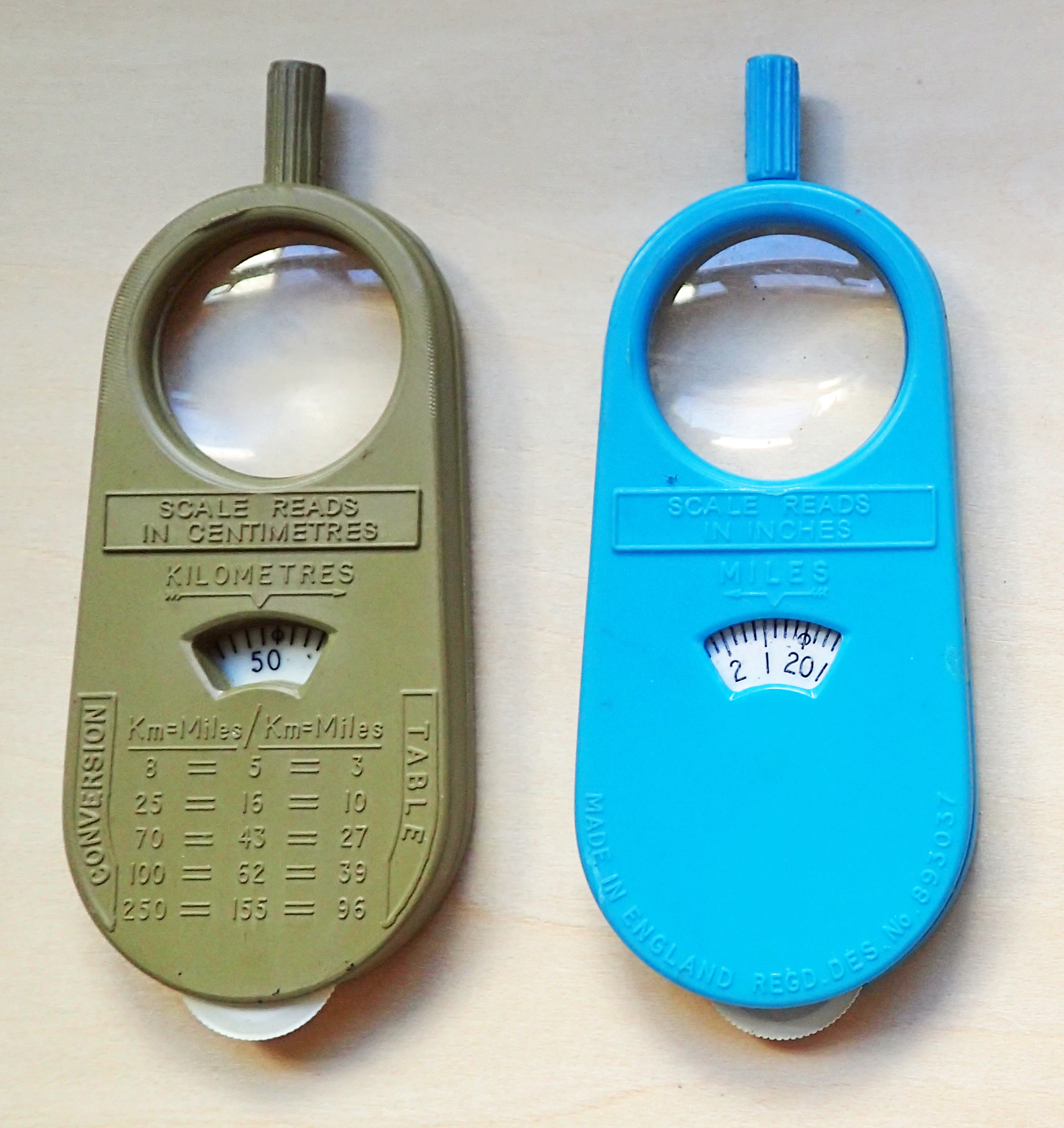
- Chadwick-Miller Mileage Meter and Mileage Meter with Magnifier, model 90278
- Corriere dei Piccoli chilometrometro
- Discovery Channel ‘deluxe map measurer with compass’- model D13777
- Ecobra pocket dividers
- Elliott Brothers opisometer
- Enbeeco ‘Opisometer’ No.102
- Fedtro Precision Map Measure and Compass: model MAP-C2
- Frederick Post model 1368
- Freiberger Präszisionsmechanik/Carl Zeiss Jena Kurvimeter 78
- Fritz Chatelain (FC): an early example of the Universal Map Measure
- Hand & Sons “Miledial”
- Harvey map-measure-go! laces
- Henri Burnat (HB) Curvimetre, model 52 Mesures Anglaises
- Henri Burnat (HB) Curvimetre, model 52 ZA
- Henri Burnat (HB) Curvimètre, model 54M
- Henri Burnat (HB) Curvimètre No. 61 TP ‘Special Grand Modèle’
- Henri Chatelain (HC) model 457, combination pedometer, compass and map measure
- Henri Chatelain (HC) Self-Registering Rotameter, model A90
- Henri Chatelain (HC) twenty-five inch to one mile measure
- Henri Chatelain (HC) Universal, with compass and ‘reading glass’
- Hugh Rees “Regent”
- Inco Krzywomierz Turystyczny
- Krasnogorsk Mechanical Works (KMZ) curvimeter
- Lutz metric and imperial
- McDonald’s Roller Ruler
- Mile-O-Graph
- Minerva Curvimeter C-01
- Morris’s Patent Cartomètrè
- Morris’s Patent Chartometer, with Totaliser
- Morris’s Patent Chartometer, without Totaliser
- Morris’s Patent Bijou Wealemefna
- Morris’s Patent Wealemefna
- Munn’s Map Measurer and Compass
- A ‘mystery’ opisometer
- Oldbury Optical Distameter
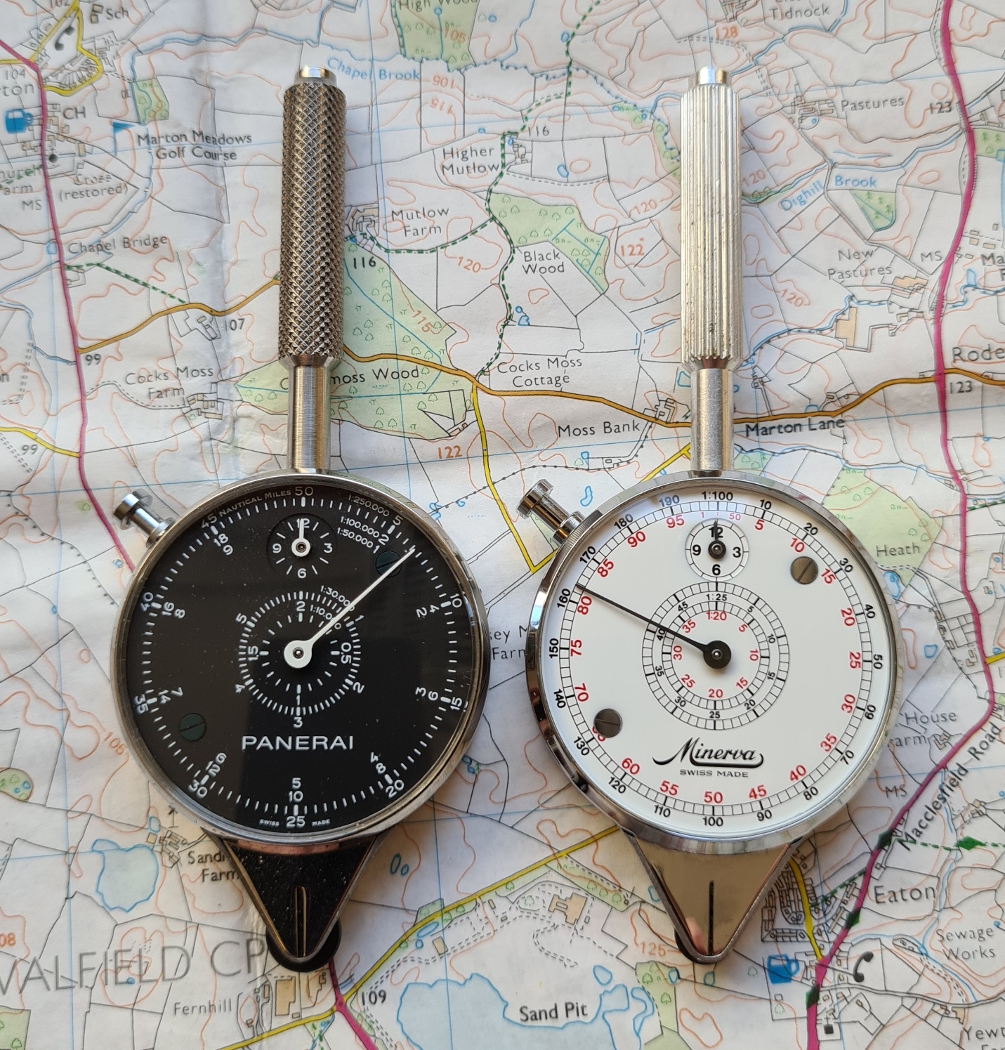
- Panerai Nautical Curvimeter model PAM00302
- Pathfinder Three-in-One
- Philip & Son Rotameter
- Philips’ Universal Simplex
- Practical Motorist map measurer
- Pif Gadget No. 342- Le Curvimètre
- Radix
- Roller Rule
- Ronald McDonald curvimetre
- Roulette métrique brevetée S.G.D.G
- Royal Automobile Club (RAC) bookmark and measure
- Sakurai ‘single-face’ centimetre curvimeter
- Sakurai ‘two-sided’ curvimeter
- Stesco Map Measure with Compass No. 39.
- Silva compass scale lanyard
- Silva compass scale slides
- Société des Lunetiers Curvimeter
- Stanford’s opisometer
- A Turkish military measure
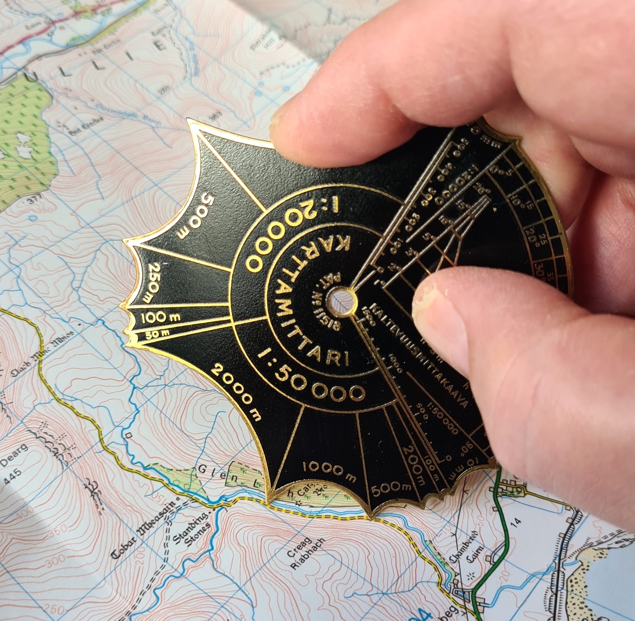
- Uittokalusto O.Y. Karttamittari
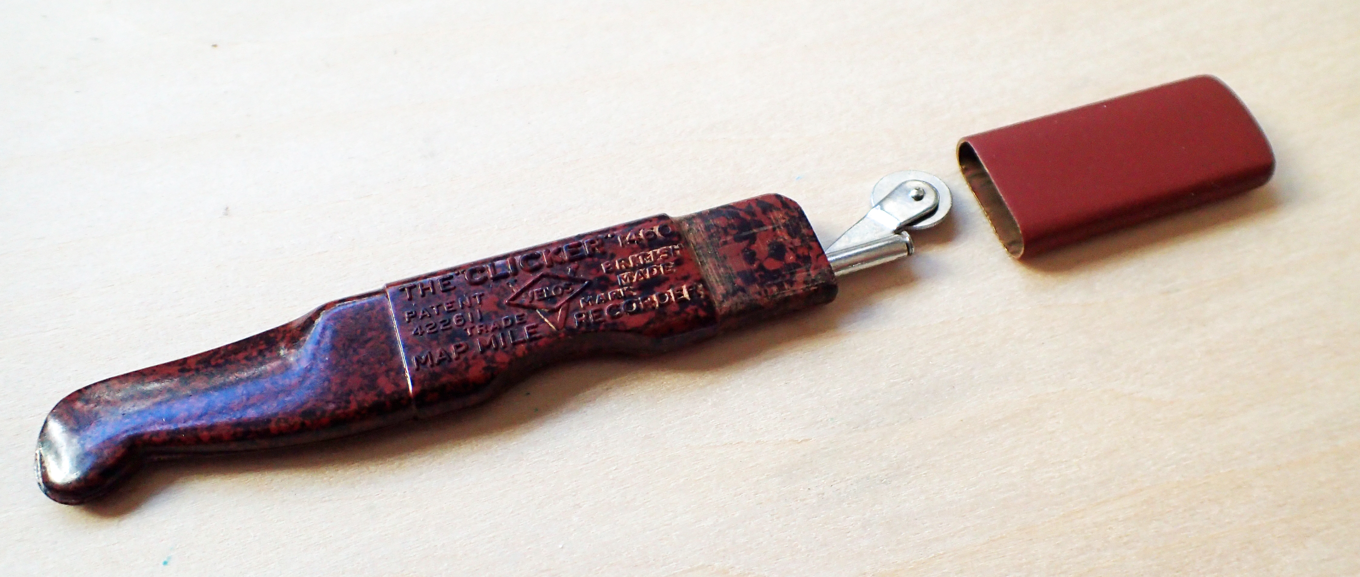
- Velos ‘Clicker’, model 1460
- Vistascreen ‘BP Super’
- Vistascreen Pathfinder
- ‘Wanderer’ Route Marker No. 1114, with compass
- >W&G< Drawing Instruments model WG/5006
- W&HC navigation dividers
- WEDO adjustable kilometre measure
- Wuilleumier Frères four-scale curvimètre
- Zlatoust Curvimeter KY-A
It is only recently that Three Points of the Compass stopped using a simple little map measure for route planning, though my fascination with them has never gone away. I am one of a seemingly dying breed who still likes, appreciates and takes hard copy paper maps on trail. But if I wish to measure a distance on the map now, while sitting in a tent, pub or hostel, I often simply use a length of thin cordage.
Along with thousands of other hikers I also rely very much on my online digital O.S. Maps when planning my routes. This will give me not only distance but also daily elevation. But if I do use an analogue map measurer on my paper maps while planning, it forces me to look at the terrain, the twists and turns, the type of country being crossed- across bogs, through woods, traversing moorland, traipsing through the backstreets of towns. There is still a purpose for these little instruments after all.

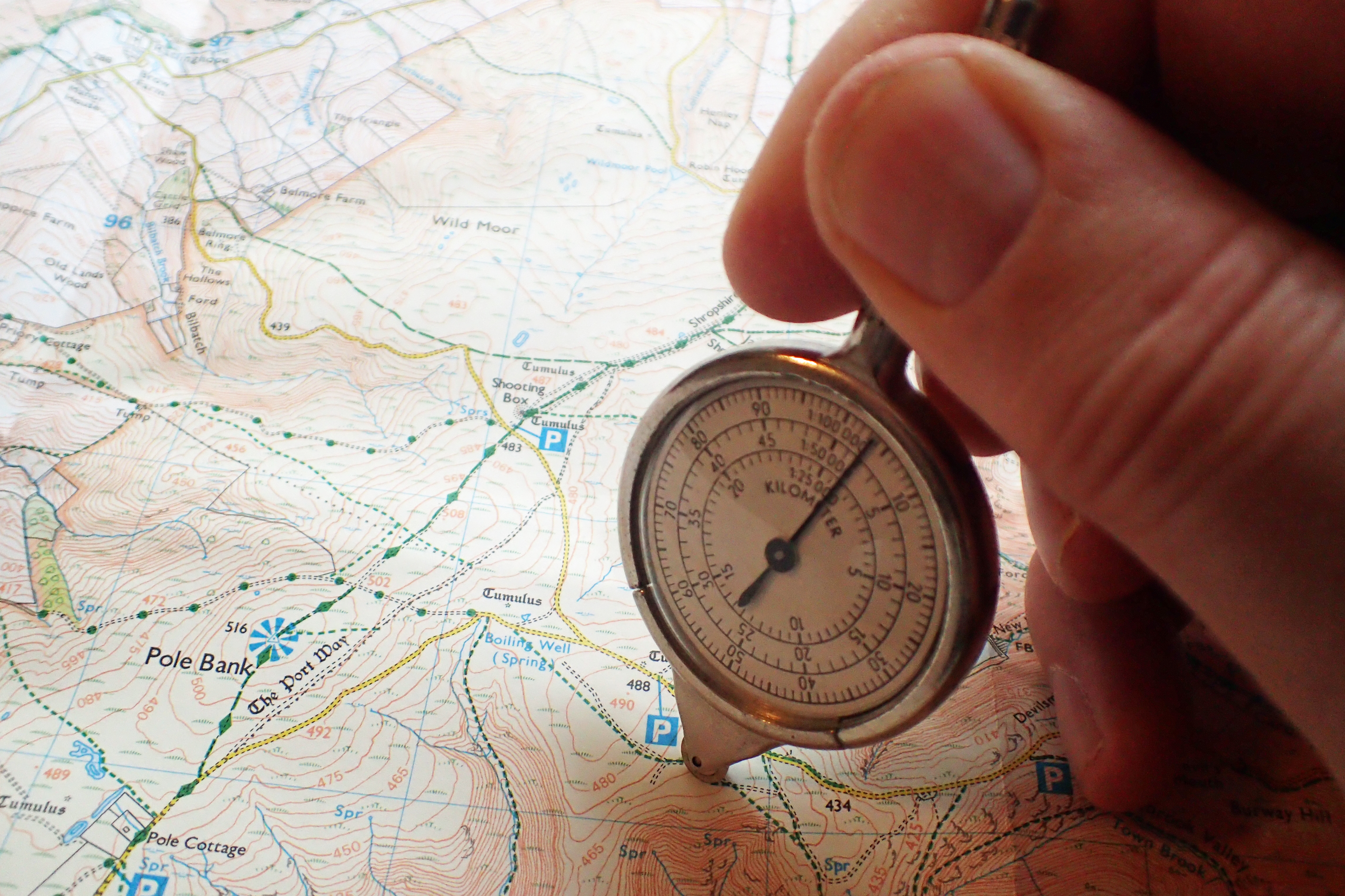
While a piece of cord or length of paper will simply measure a length, more complicated measurers can record in many units- multiples or sub-units of inches or feet, centimetres or metres, versts, miles or kilometres. Also to different scales- The two-faced French made measurer shown below has scales for 1:20 000, 1:25 000, 1:40 000, 1:50 000, 1:75 000, 1:80 000, 1:100 000 and 1:200 000. Made almost a century ago, it is still an effective and useful piece of kit that cost me less than a tenner.

