
“The scale lanyard makes it easier to quickly make a distance judgement of your route or to plan your route in advance”
Silva compass manual
Silva Sweden AB were established in 1933 as an outdoors products company. They made their first compass in 1928 and built an enviable reputation for their compasses, head lamps and other navigational equipment that has only recently begun to decline. Manufacture of outdoor equipment moved to a factory in Shenzhen, China and in 2018 they outsourced all compass manufacture to the HANZA Group. Manufacture was again relocated, this time to a factory in Suzhou, China.
Compasses could include a global needle, introduced to the Silva range in 2016. Amongst the Silva compass range for spring/summer 2018 were features such as magnifier lens, romer scales, GPS scales and clinometer. New features for 2018 were the addition of a slope card and detachable scale lanyard.
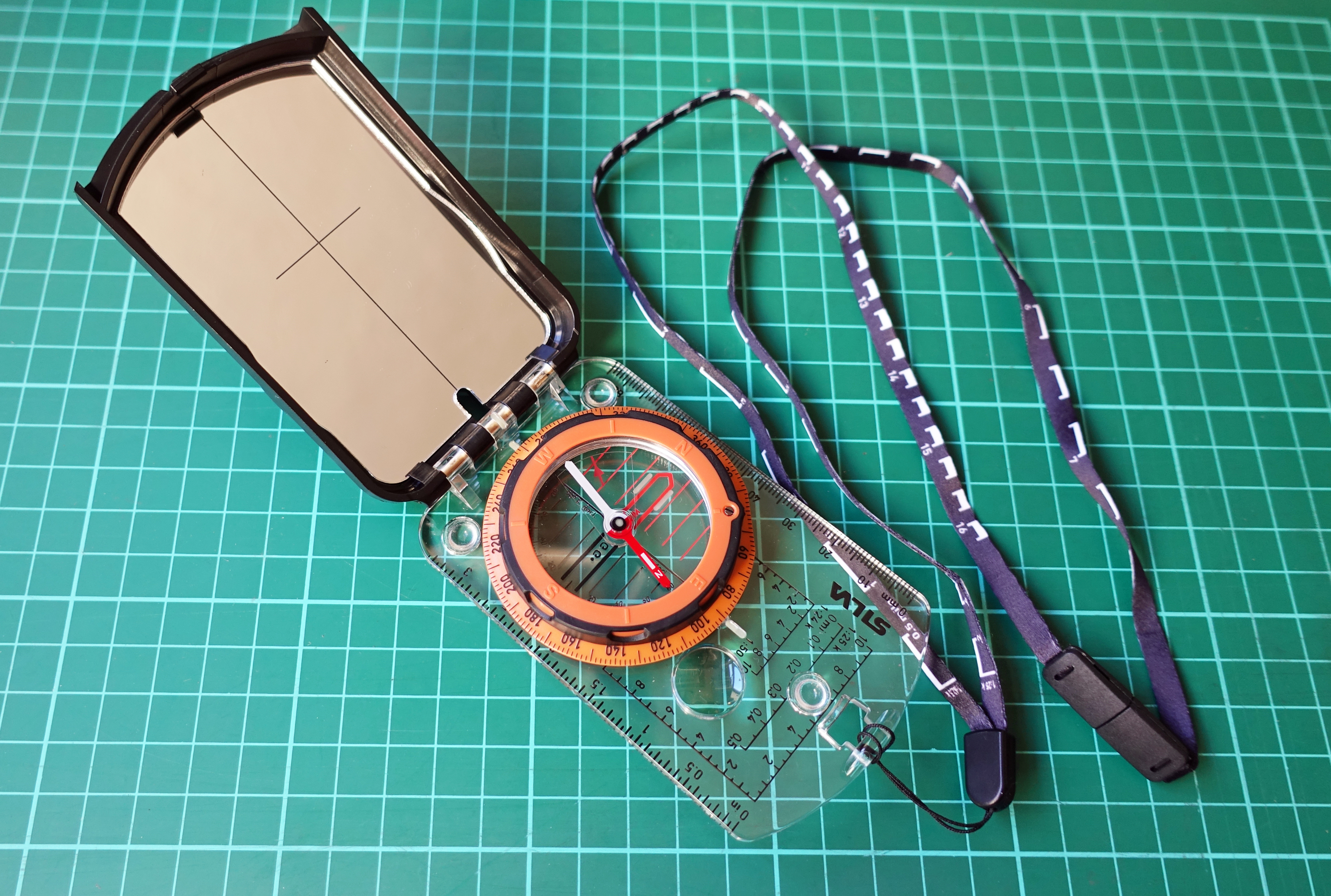
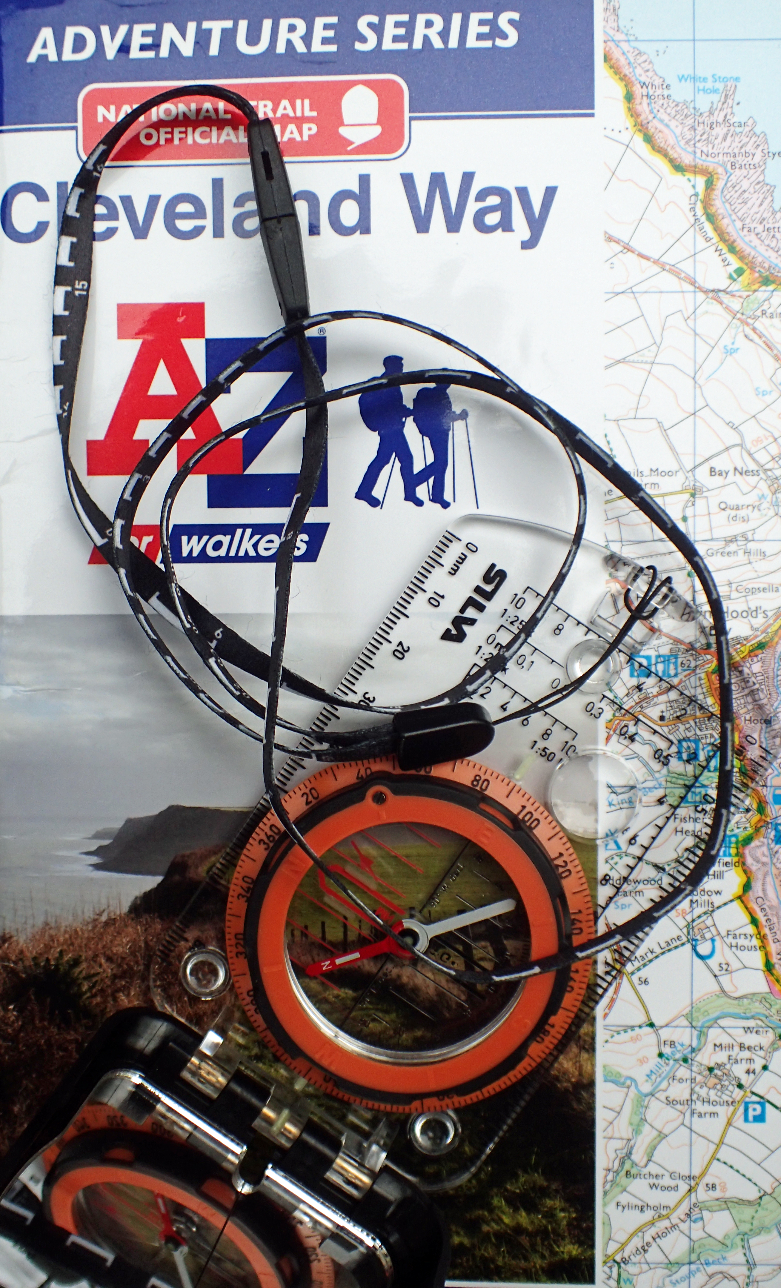
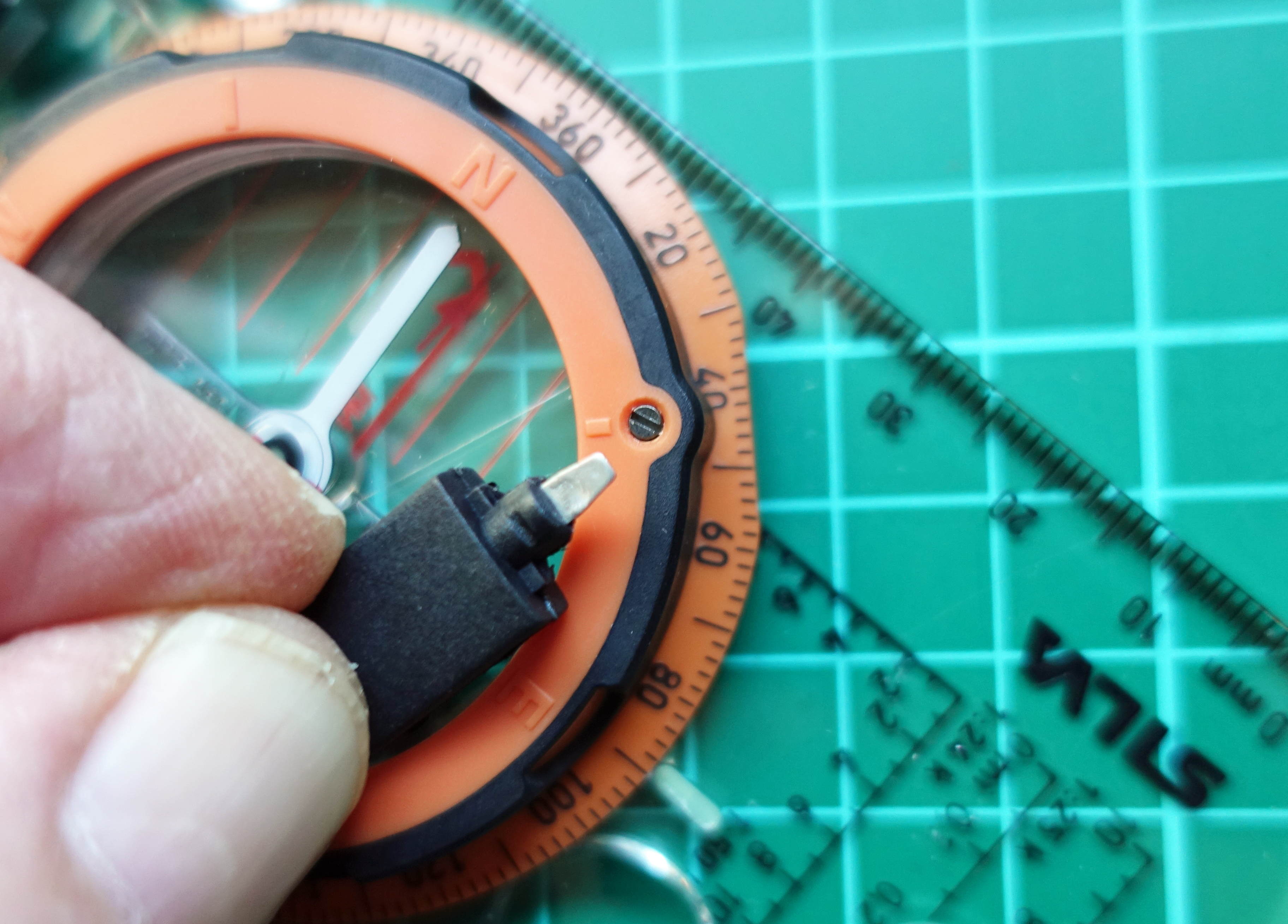
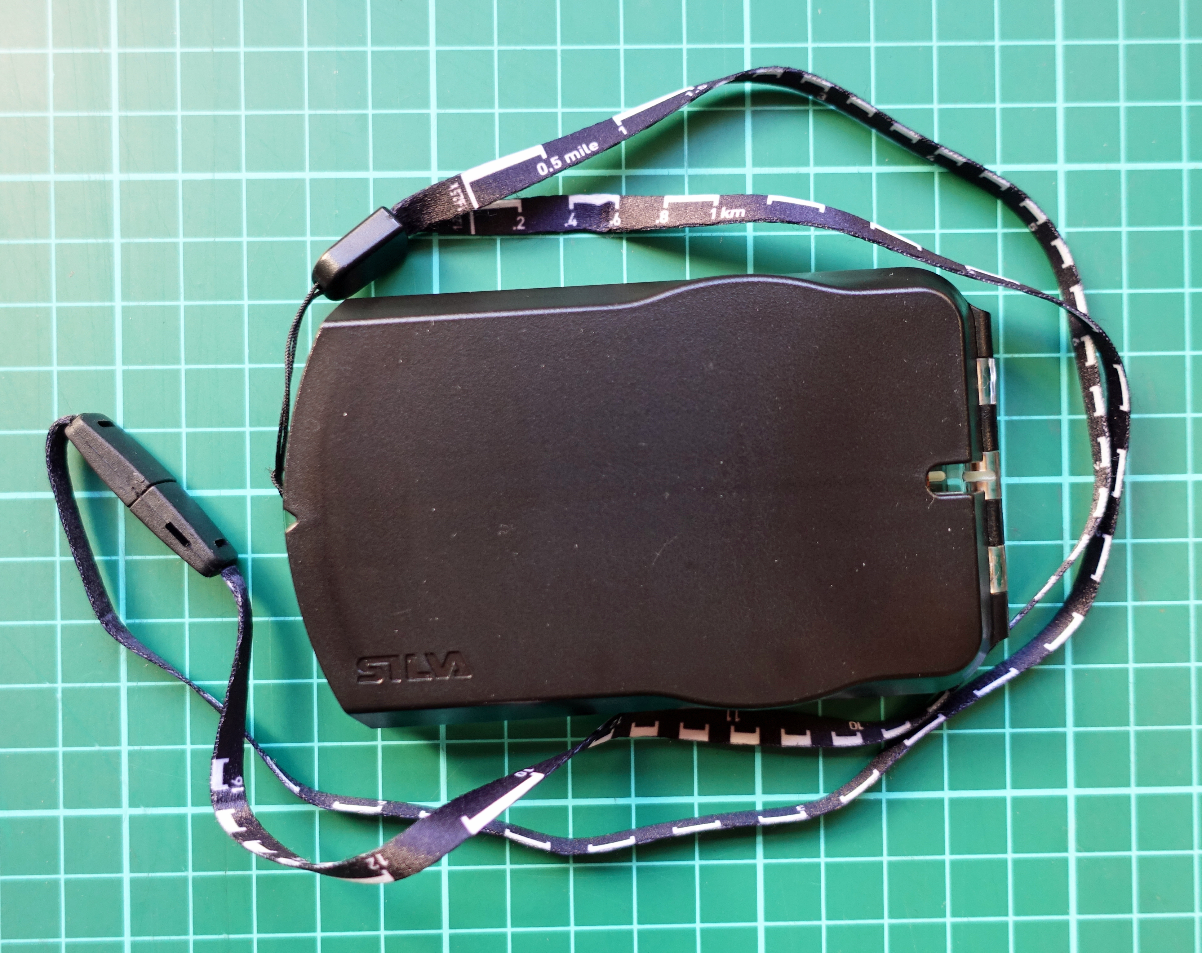
The compass shown here is the Expedition S mirror compass. This is a modern version of the Type 15 Silva Ranger compass, itself based on the original Model 1939, the first mirror sighting, liquid damped baseplate compass. The Expedition S compass is now fitted with a scale lanyard for map measuring. This is a well-made, high quality, premium compass product with various features beyond the basic compass and sighting mirror. It includes luminous markings, magnifying lens, adjuster for magnetic declination and a clinometer. It weighs 86g and the detachable scale lanyard is an additional 5g, so 91g in total. Silva fit just some of their range of compasses with their scale lanyard. The lanyard is identical on all of these.
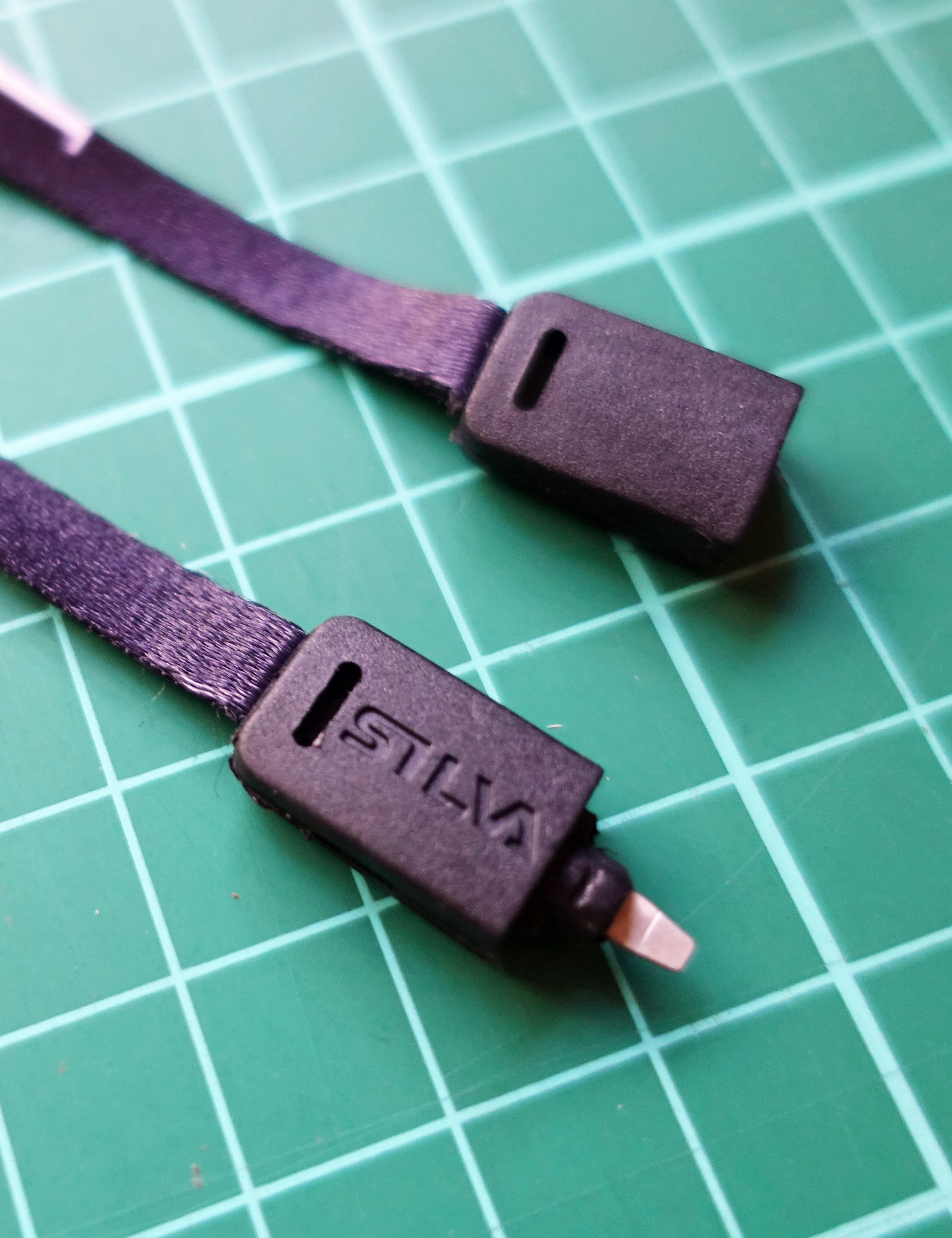
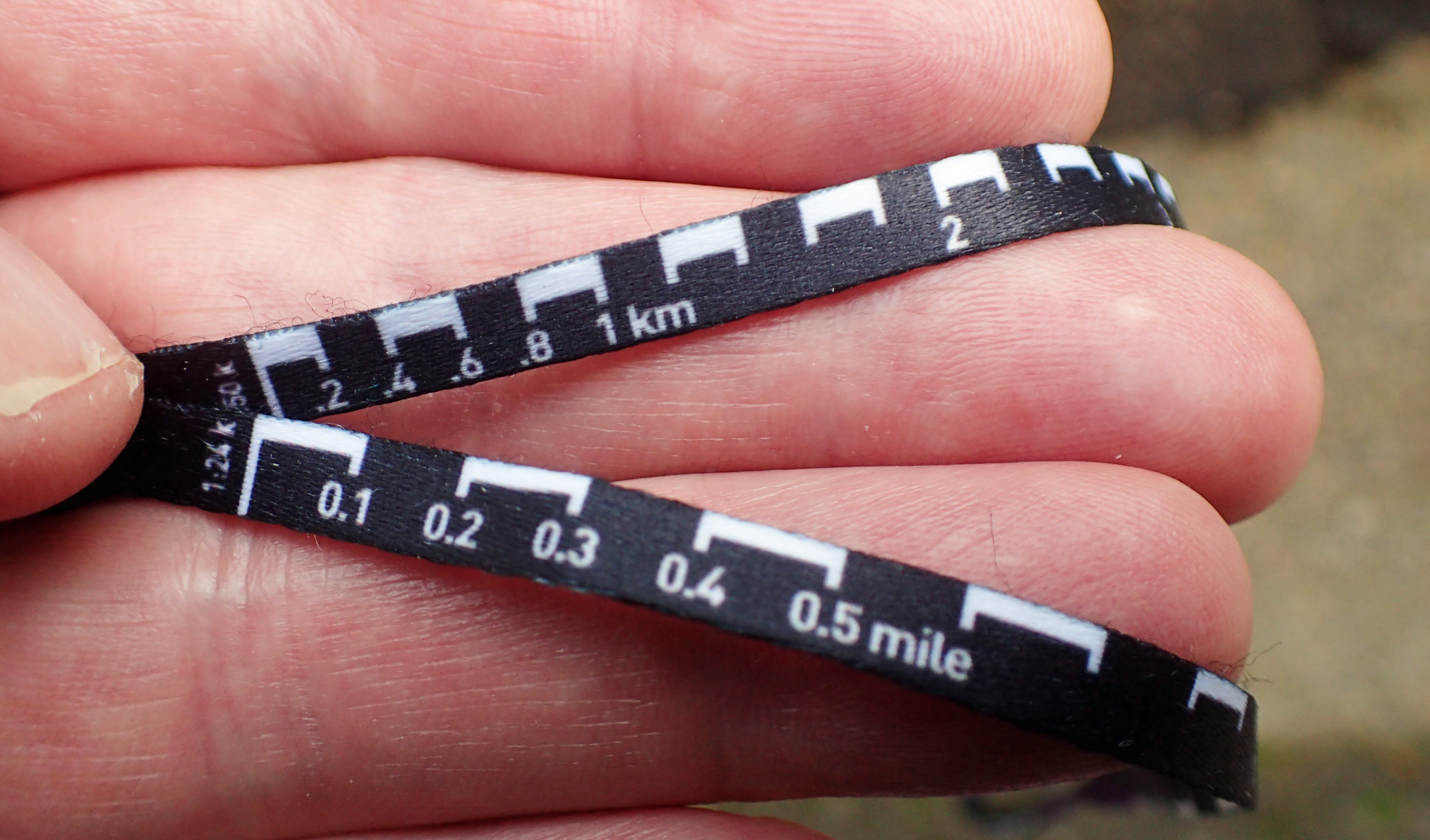
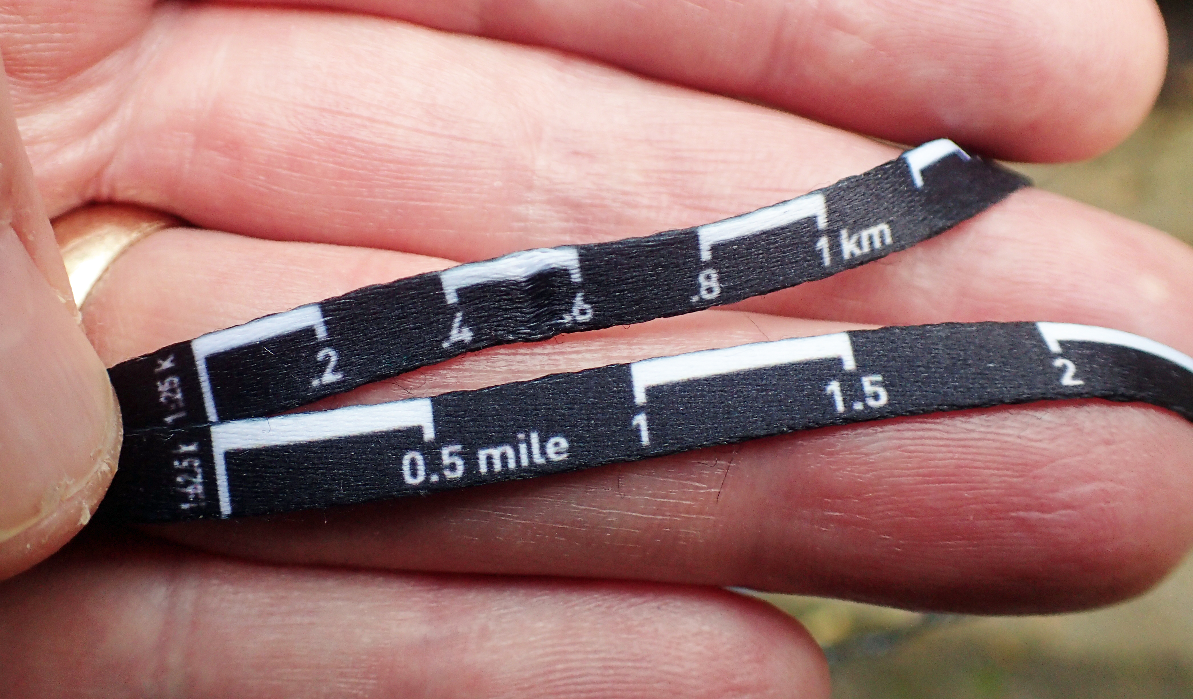
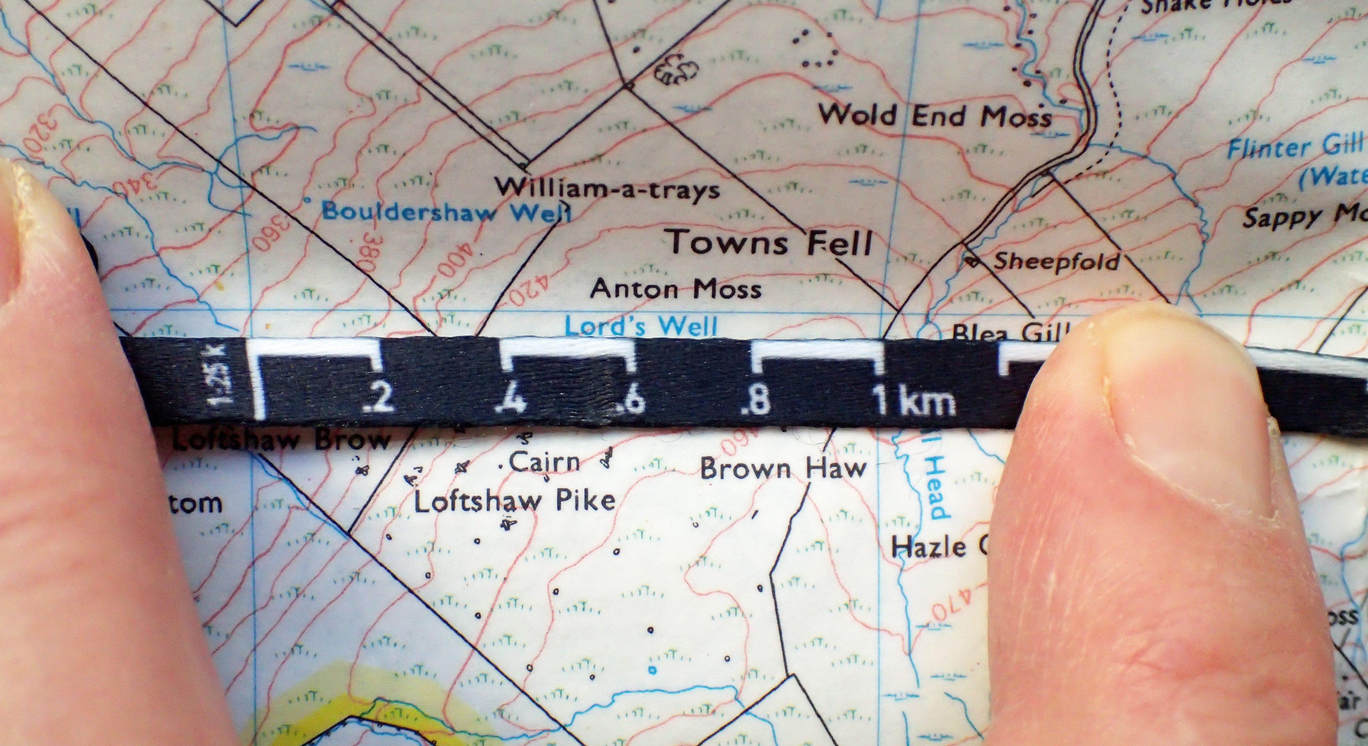
The lanyard has two halves, joined with a snap connector, making a safety release in case the lanyard gets snagged. Each half of the lanyard has a scale on each side. Silva advertise their lanyard as having two scales- 1:25 000, and 1:50 000, but there are two more. One half of the lanyard has a 1:25 000 on one side (capable of measuring up to 8.2km) and 1.24 000 on the other (capable of measuring up to 4.5 miles). The U.S. Geological Survey (USGS) publishes maps at various scales, the scale used for most U.S. topographic mapping is 1:24 000. The other half of the lanyard has 1:50 000 on one side (capable of measuring up to 16.2km) and 1:62 500 on the other (capable of measuring up to 15 miles). 1:62 500 scale is one inch to one mile.
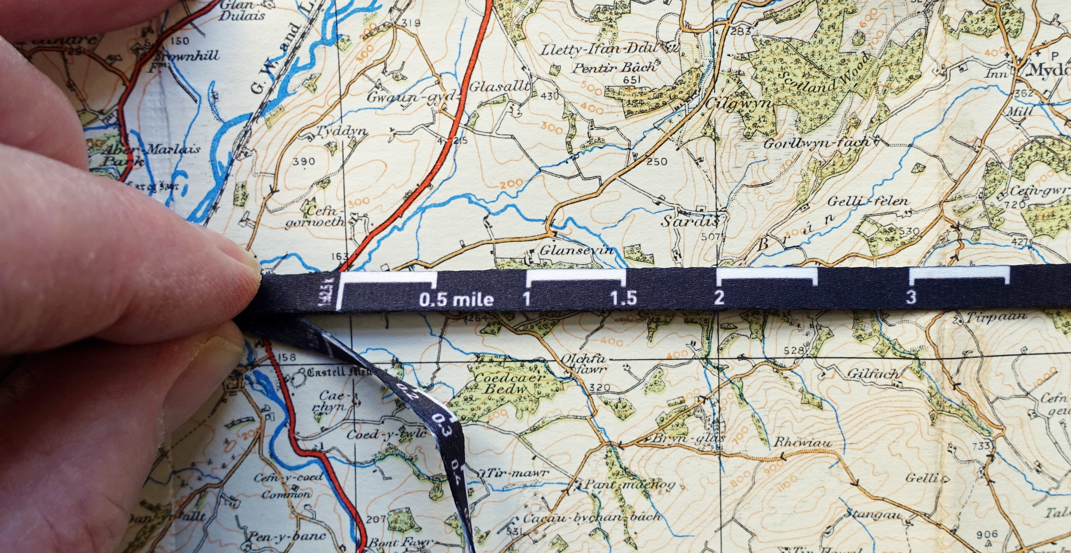
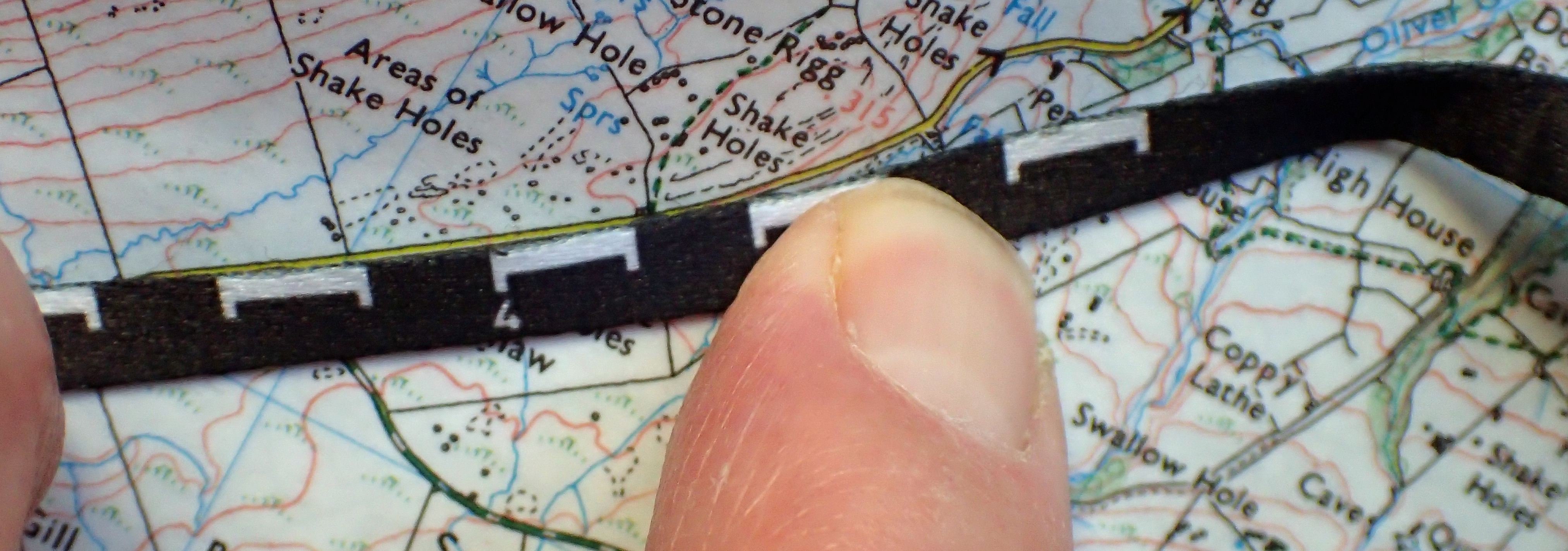
The scale lanyard does makes it a little easier to quickly measure a short distance on a map but it does have faults however. Almost all compass lanyards, of any make, could do with being longer and this is no exception. If the lanyard had been longer, this would have permitted a longer and subsequently more useful map measuring scale to be incorporated.
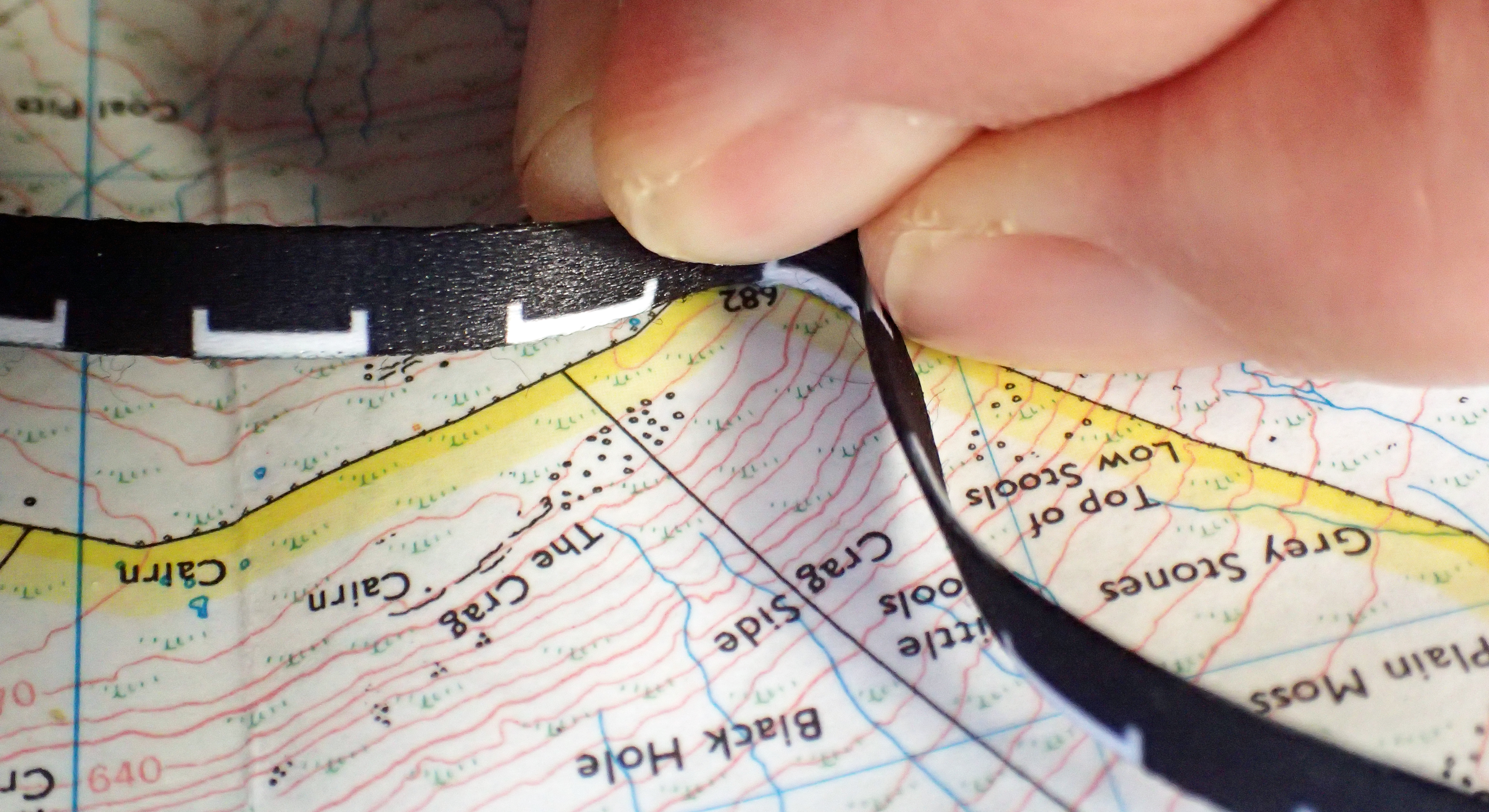
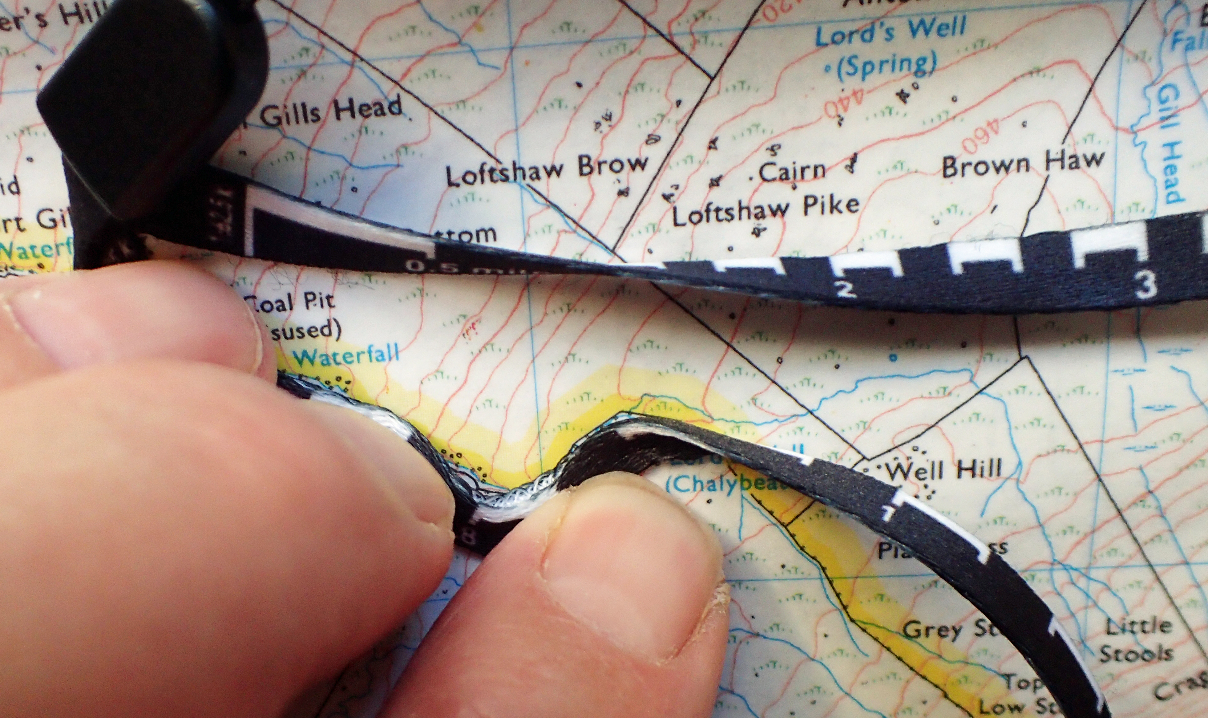
The looped lanyard, including both “safety release” snap connector and thinner loop for attaching to the compass, is only 450mm in length and has a flattened profile some 6mm across. This flattened aspect is not a good design. The measure does not bend when laid flat on a map and does not follow twists and turns of a route or features on a map at all well. The fibres separate with ease and accuracy suffers as a result.
A cord lanyard with defined increments along its length would have been not only an improvement but cheaper to manufacture as well.
To date, Silva seem to have missed a marketing trick and it should have been possible to simply purchase a ‘stand-alone’ lanyard at the map scale required, possibly also buying extra or replacement lanyards of different scales enabling a different scale to be carried according to what map is being used. For example, while 1:25 000 scale maps are perfect for England and Wales, the 1:50 000 scale O.S. maps are more suited to much of Scotland.
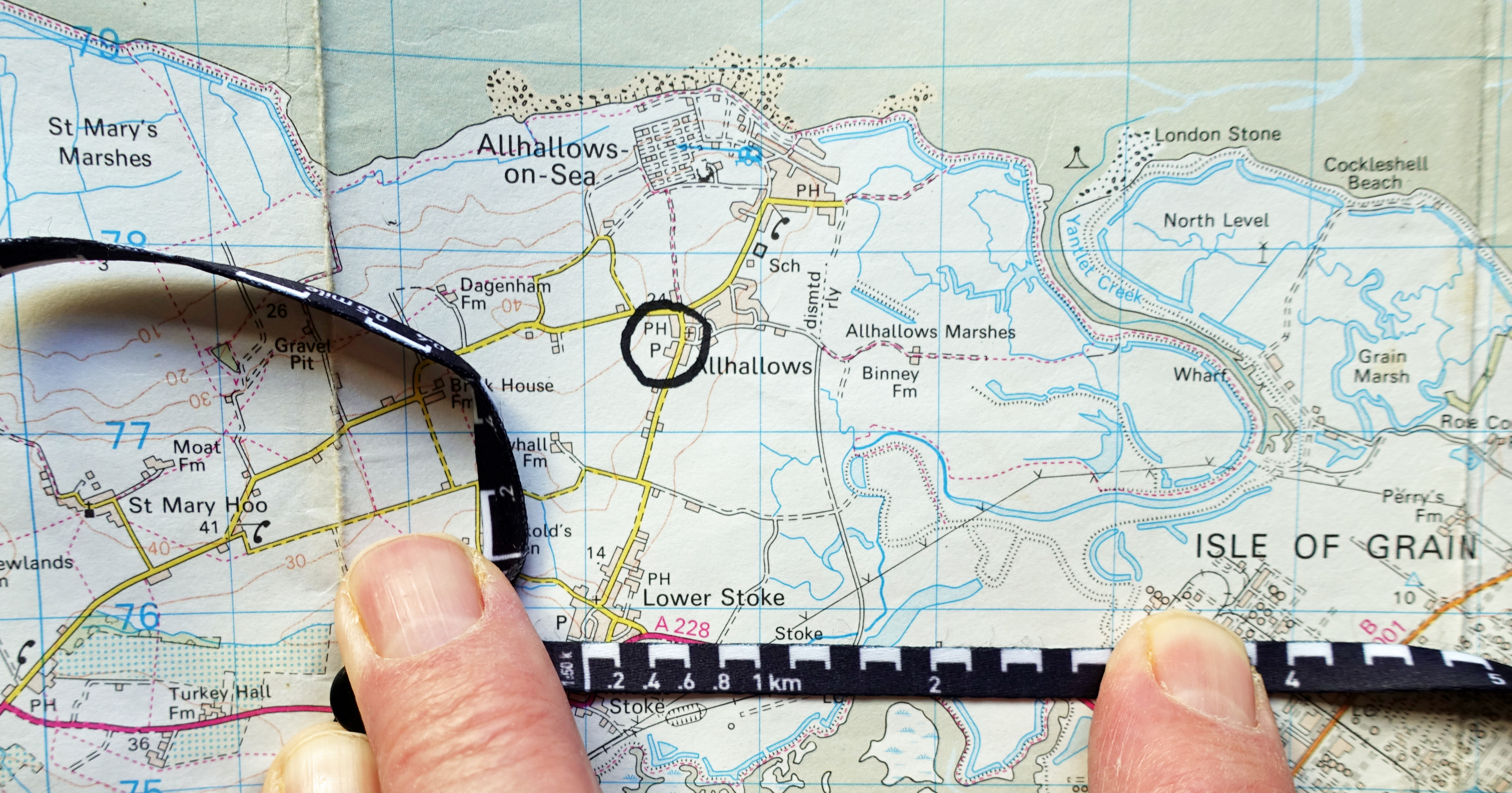
Ultimately, this lanyard is pretty much a failure for the purpose for which it was designed. It isn’t long enough, too many scales are incorporated on to one lanyard, it doesn’t track curves and bends at all well and it could have been a far better measure if a standard cord lanyard had instead been marked up incrementally. When on trail I carry lengths of cordage that are used as drying lines, extra or replacement tent guys or for attaching my quilt to my sleeping pad. Such a cord can easily be used to track a path on a map and then measured off against a map grid or the scale found at the bottom of a map.
Three Points of the Compass has looked at a few more Map Measurers in detail. Links to these can be found here.

2 replies »