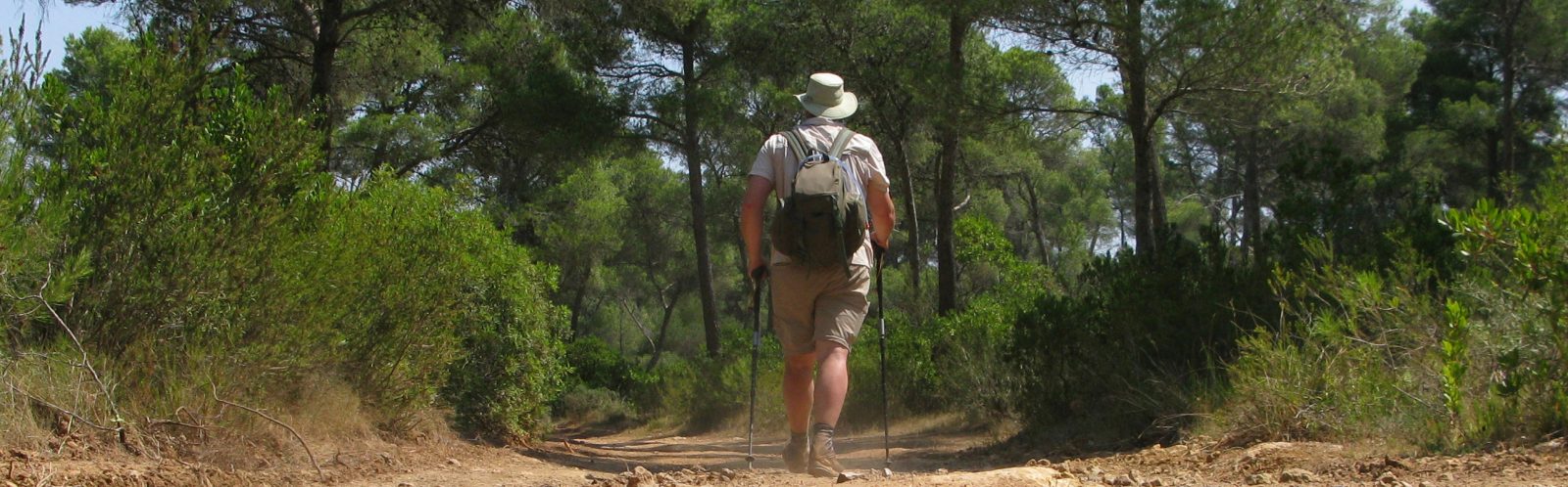
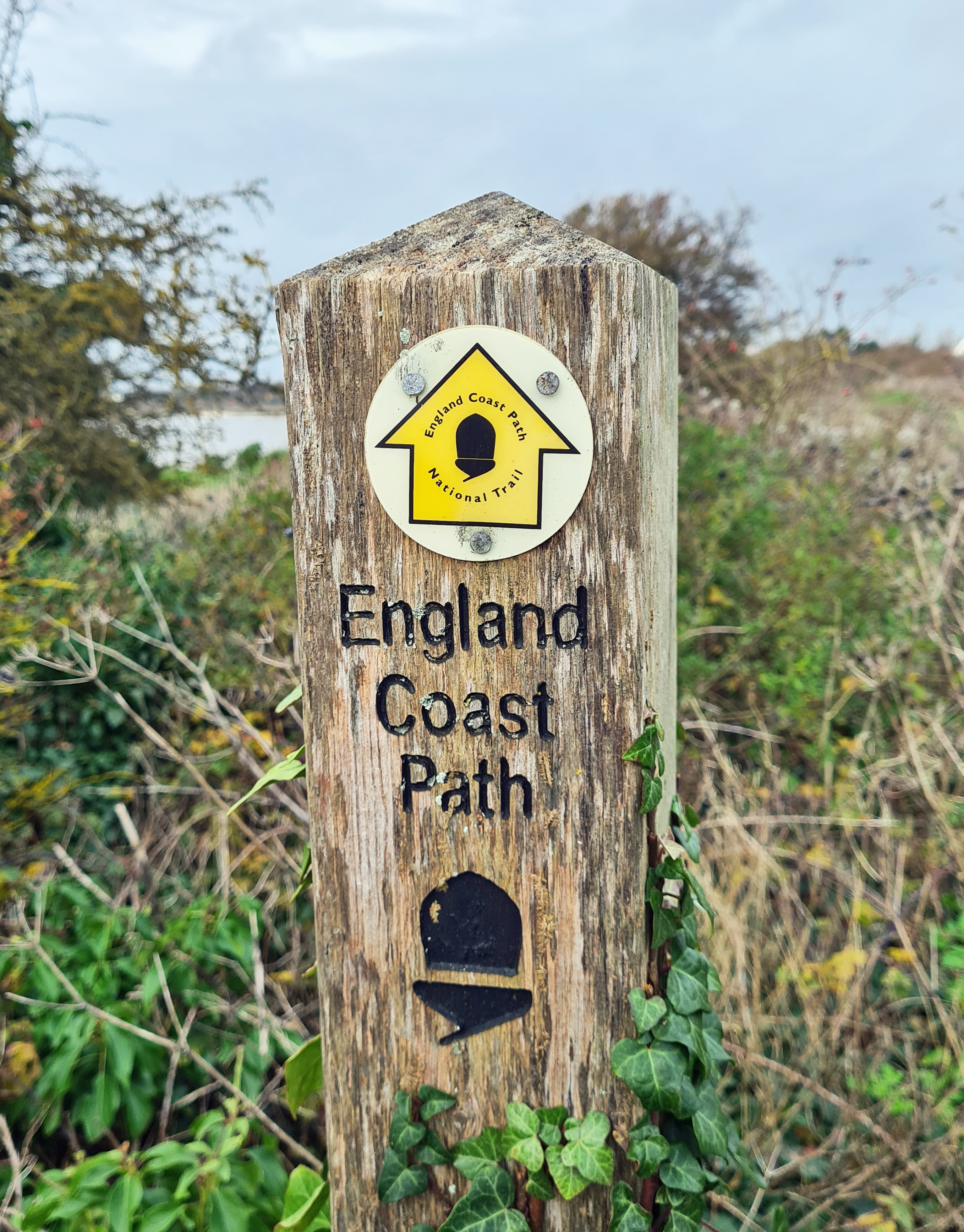
A pandemic year and regional ‘tier rules’ were in place, Three Points of the Compass needed to get out, even if for just a few hours. There had been days of rain and most of the tracks and paths nearby were sticky with mud. Travel restrictions meant I could not travel far but exercise was permissable. It was time to knock off my last remaining section of the England Coast Path on the Isle of Thanet.
A forty minute drive took me to Sandwich and it was then just a short train ride back to Ramsgate. It was cold but dry. Despite few places being open, most having to remain closed due to Covid restrictions, the bright and sunny day had tempted many out for exercise.

“In the immediate neighbourhood are concert halls and croquet lawns, broad walks for loitering, and points of view for sketching, all scattered abroad in open-handed profusion”
The London, Chatham and Dover Railway published a tourist guide to its lines in the 1870s. Flowery in style, this provides striking example of both the promenading elite and others that could muster the fare to this far corner of Thanet in its Victorian heyday.
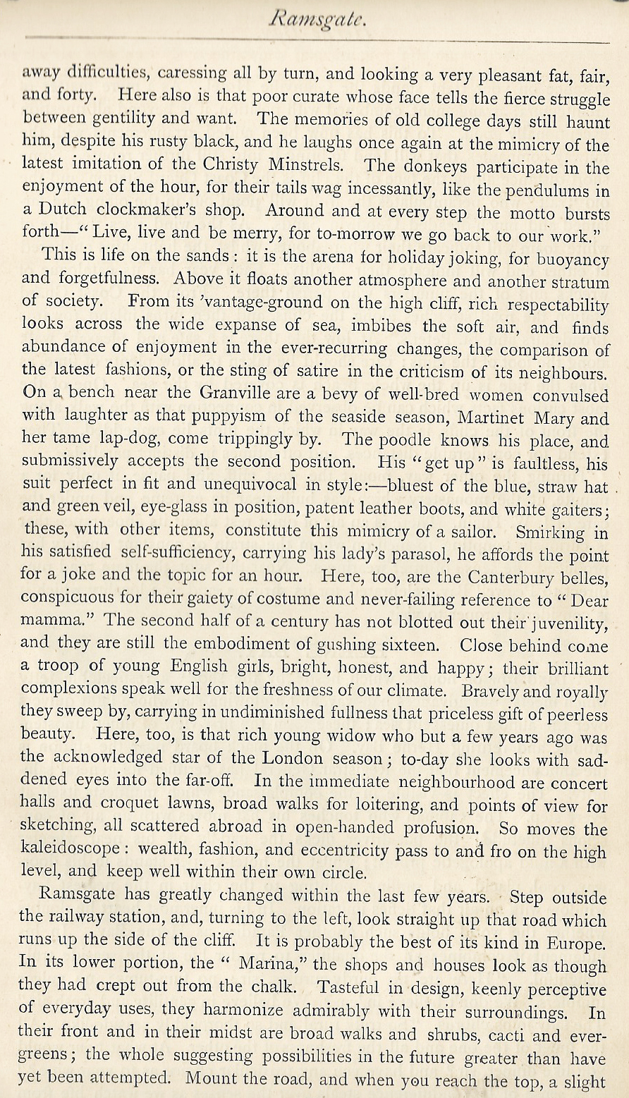
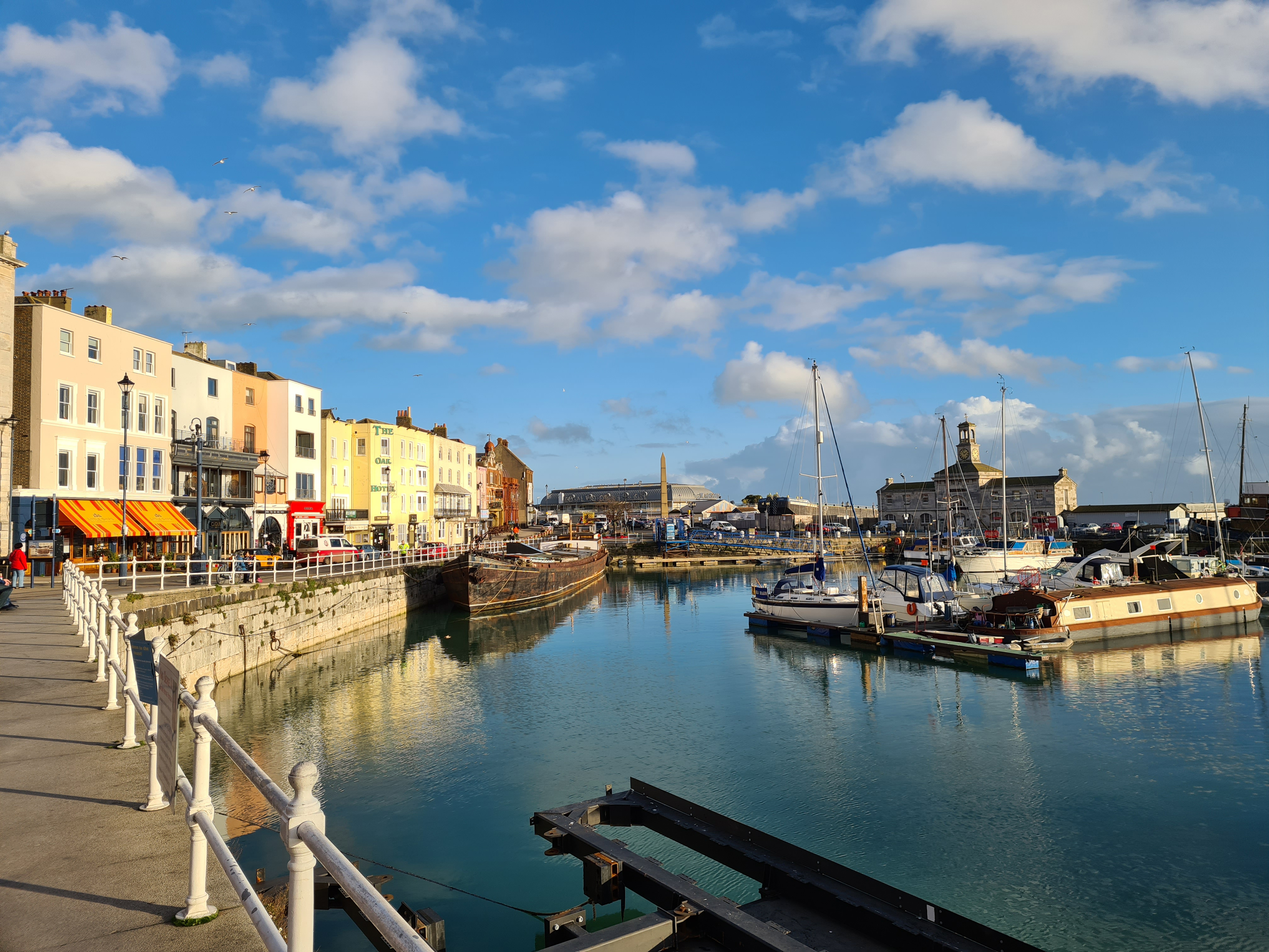
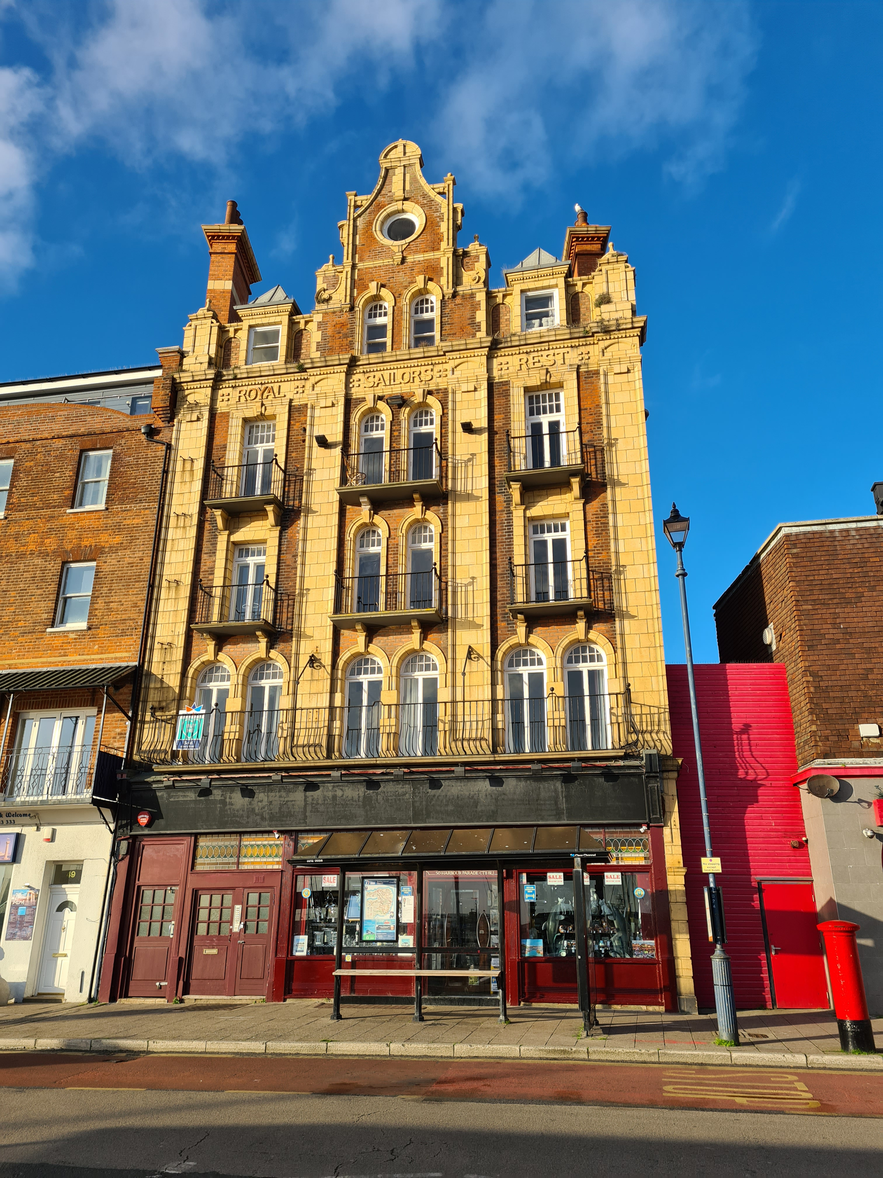
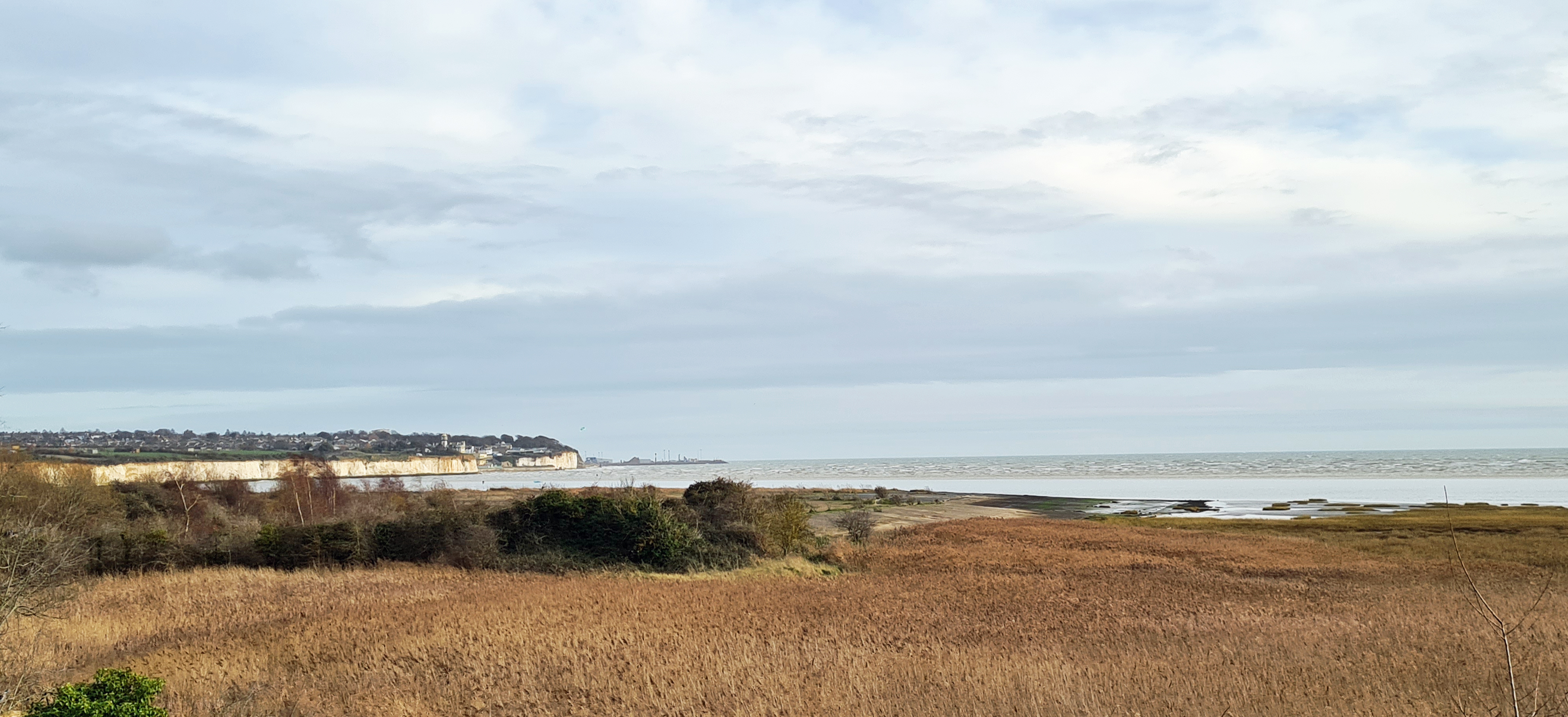
Ramsgate was one of the main embarkation harbours during the Napoleonic wars. This resulted in many of the town’s streets being named in commemoration of that history. From the railway station I walked down to the coast where Wellington Crescent led me into Military Road alongside the harbour and I passed the sweeping Nelson Crescent and up onto the wide Westcliffe Promenade. It was then clifftop walking all the way round to Pegwell Bay.
Pegwell became a popular seaside resort in the late 18th century. Visitors were particularly keen on its potted shrimp and lobsters. Shrimpers would take their catch from the bay up to the town where Banger’s Factory made their famous Pegwell Shrimp Paste. Even the young Queen Victoria sat in the garden of the Belle Vue hotel to enjoy a shrimp tea. Tastes change however and the factory closed in 1916.

I never saw it, but I passed the hamlet of Ebbsfleet, now subsumed by neighbouring village sprawl. This is the eastern end of the Wantsum Channel, which used to separate and create the Isle of Thanet. With safe and sheltered landing opportunity, this site was chosen for three arrivals that changed the course of English history. Julius Caesar landed here in 54BC. Saxon brothers Hengist and Horsa in 449AD and Augustine of Canterbury in 579AD, who converted much of England to Christianity.
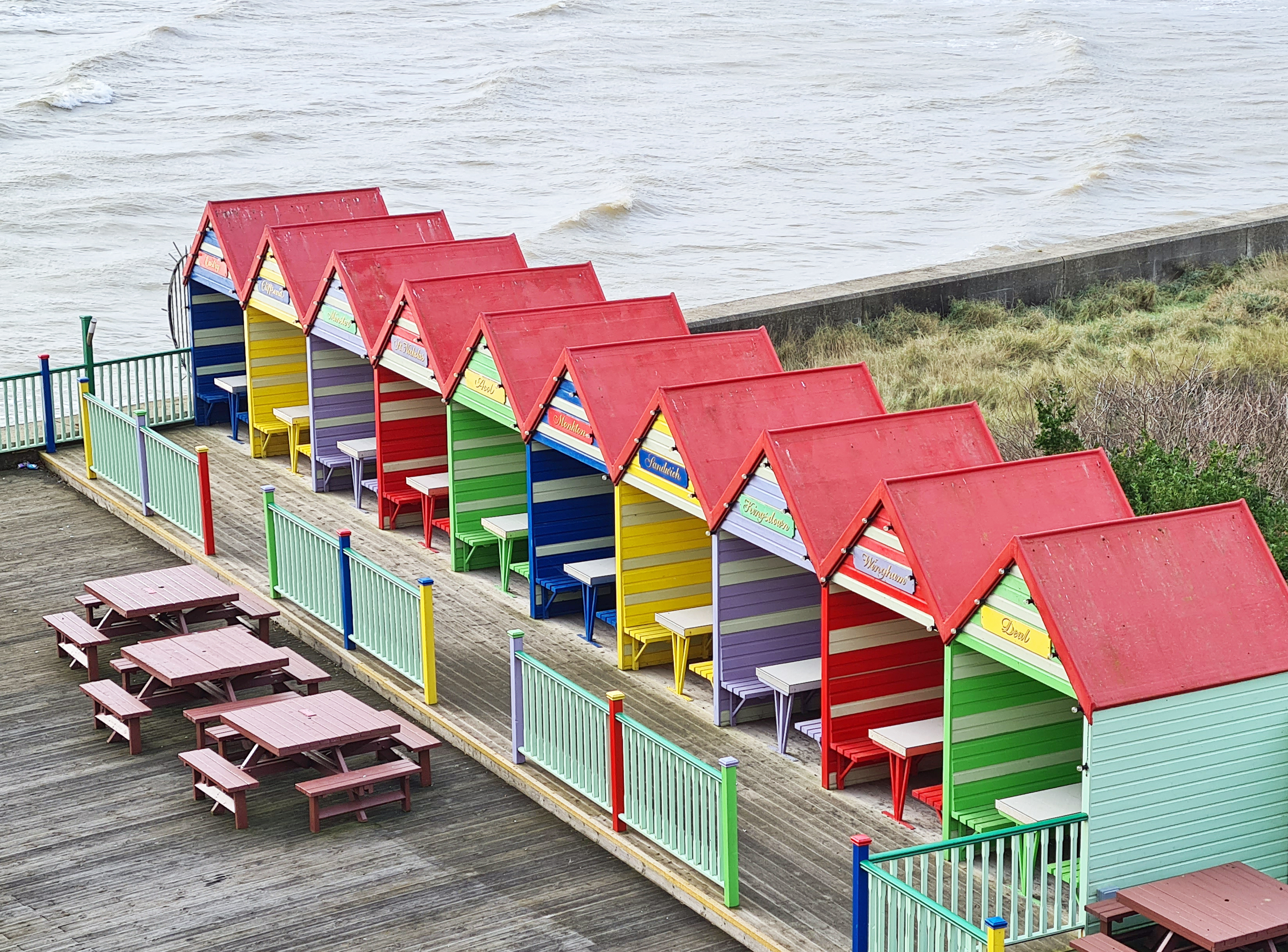
Reaching Pegwell Bay, the path joined a cycle way and I passed a Rowe type Sustrans Millennium Milepost from which a third arm pointed toward Rome. Beside the milepost was the Hugin.
No one really knows what ships from the 5th century looked like. A replica of an 8th century Viking longship was built in 1949 and 53 modern Viking Danes sailed it to the Thanet coast to commemorate the 1500th anniversary of the arrival of the two Saxon chieftains, Hengist and Horsa. Hengist became the first Saxon king of Kent. The Hugin’s landing was filmed and the newsreel can be seen on YouTube. The ship was then put on permanent display here. Nearby an inscribed stone informed me that:
This stone set down and inscribed by the Corporation of Ramsgate was unveiled by H.H. Prince Georg of Denmark on the 29th July 1949 and commemorates the beginning of English History with the landing at Ebbsfleet in this vicinity of Hengest and Horsa in A.D. 449
From the Hugin, I looked down on the wide and flat bay below me. The white cliffs I had just walked along were to my left, and the reedy nature reserve I was headed to was to my right. But below me, steadily being overgrown was a vast stretch of concrete. There didn’t appear to be a soul about, but just a few decades previous it would have been a very different scene. This was where the first international hoverport used to be situated. That peculiar British invention had evolved into the largest car carrying hovercaft in history, and they ran from here.
Hoverlloyd commenced operating their Westland SR.N6 hovercraft out of Ramsgate in 1966. The first singled-engined craft was named Swift and could carry up to 36 passengers. These craft were nifty little things and could cruise at 55 knots.It was manufactured by the Saunders-Roe Division of Westland Aircraft Ltd.
At first only day trips were offered, but these provided valuable experience. A pioneering and regular service between between Ramsgate and Calais Harbour commenced on 6 April 1966 and could make the crossing between England and France in as little as 22 minutes. For these little hovercraft, there was a summer season only.
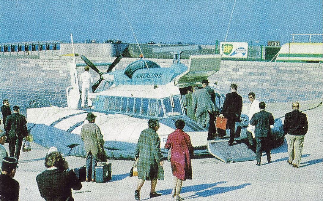
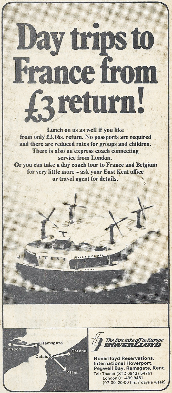
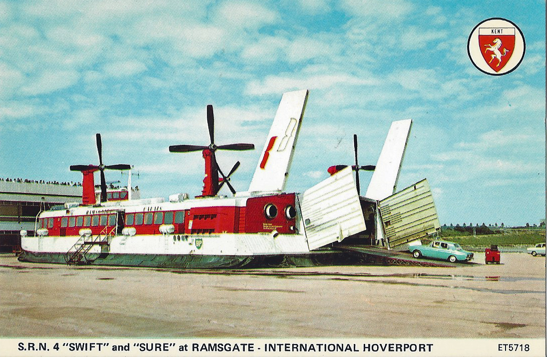
From 1969, the small craft were replaced by four much larger, four engined, SR.N4 Mark I passenger and vehicle carrying hovercraft. These were the second and third SR-N4 hovercraft made by British Hovercraft Corporation Ltd. (BHC) who had taken over manufacture from Saunders Roe. These craft could carry up to 250 passengers and 30 cars. Further development increased their carrying capacity. Surviving colour footage is fascinating. Though shortlived, the Hoverlloyd operations live on, if now just hosted by YouTube. A hoverport on this part of the coast was especially suitable as the treacherous off-shore Goodwin Sands had to be widely skirted by traditional ferries whereas the hovercraft could travel straight across them.
Having decided to open a new base of operations here, just a few miles down the coast from Ramsgate, Hoverlloyds new hoverport at Pegwell Bay became the first purpose built international hoverport in the world and was opened by Prince Phillip in 1969. The port included a large hoverport terminal building, maintenance workshops, offices, all now gone, as well as hovercraft landing pad, access road and parking areas, the only remaining features. These were built and paid for by Hoverlloyd. The land itself was leased from Thanet District Council who still own it.
Looking at a satellite image of Pegwell Bay today not only shows the surviving approach roads and parking, but also the concrete passenger loading and unloading on the aprons, layout of the hoverport buildings and the shaped profile of two hovercraft bays where servicing was undertaken.
“The air-cushioned vehicle has proved itself in public service. It’s here to stay”
The Seaspeed Story, 1970
By 1979 there were 27 ‘flights’ leaving Pegwell Bay each day. Around 1.25 million passengers were transported across the channel from the Pegwell Bay concrete aprons each year. The huge SR.N4 hovercraft were not confined to carrying just cars, they could also load coaches. Passenger coach services to France operated direct from London. Embarkation and disembarkation was swift as hovercraft could be boarded from the rear and exited from the front. This was an expensive service to provide however and Hoverlloyd and rival Seaspeed operations working out of Dover merged in 1981 to form Hoverspeed. After the 1982 season, the four hovercraft based at Pegwell Bay moved to Dover. All SR.N4 hoveraft were phased out from 1991, replaced by catamarans. The final hovercraft ceased operations in 2000. Sadly, early media forecasts that the hovercraft services from the Kent coast to France were ‘here to stay’ were wrong.
My experience and memory of these remarkable vehicles is poor. It starts with our family trips to the coast, when I was probably eight or nine, during which we would simply watch the ferries and hovercraft setting off and coming in from Pegwell Bay and Dover. The lurch over the slight hump from ramp to apron was more noticeable than the transition from sea to land with its cessation of seaspray, followed by a settling down on the concrete apron. Later, I have a faltering memory of travelling on one as a teen- the journey was noisy and both exciting and extraordinary. They have a motion unlike any other craft, a slight rocking/lurching motion and the sideways drift was always disconcerting. Much more recently, I confess that my insisting on a particular business journey across the Solent to the Isle of Wight on the last surviving public hovercraft service in the world was purely because I wanted to travel by hovercraft again. Do we ever rid ourselves of the inner schoolkid?
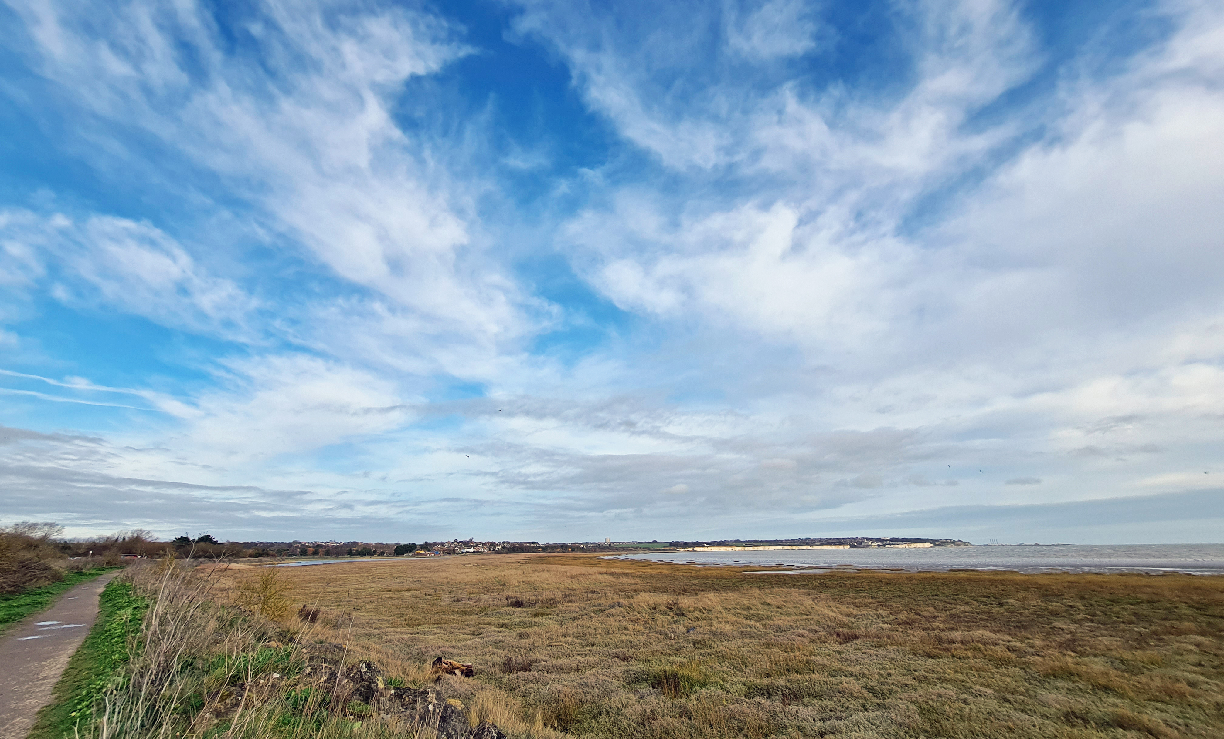
So much mud is exposed in Pegwell Bay when the sea retreats, combined with the high salt content meaning that the mud doesn’t freeze, results in huge numbers of waders and wildfowl feeding and resting here. In the mouth of an estuary fish are plentiful and seals were basking far out on the mud. Further in, a short-eared owl was quartering the saltmarsh. I reached the nature reserve and passed a couple of birdwatchers standing beside their ‘scopes. They looked frozen.
The path follows a surviving raised bank, a wall, built by the monks of Sandwich when they reclaimed the land from the sea here in the 13th century. More visible than this however, for many years the most noticeable sight on this stretch of coastline were the Richborough Cooling Towers. They could be seen from miles away across the flat landscape. The power station was originally coal powered, converted to oil in 1971, then to a particularly polluting fuel- orimulsion. This is a type of watered down bitumen. The plant closed in the nineties and the cooling towers pulled down in 2012. Powerlines are now used to carry the electricity generated by the offshore Thanet Windfarm, which used to be the largest of its kind in the world. Ownership and much of the profit from this is overseas. Don’t get me started…
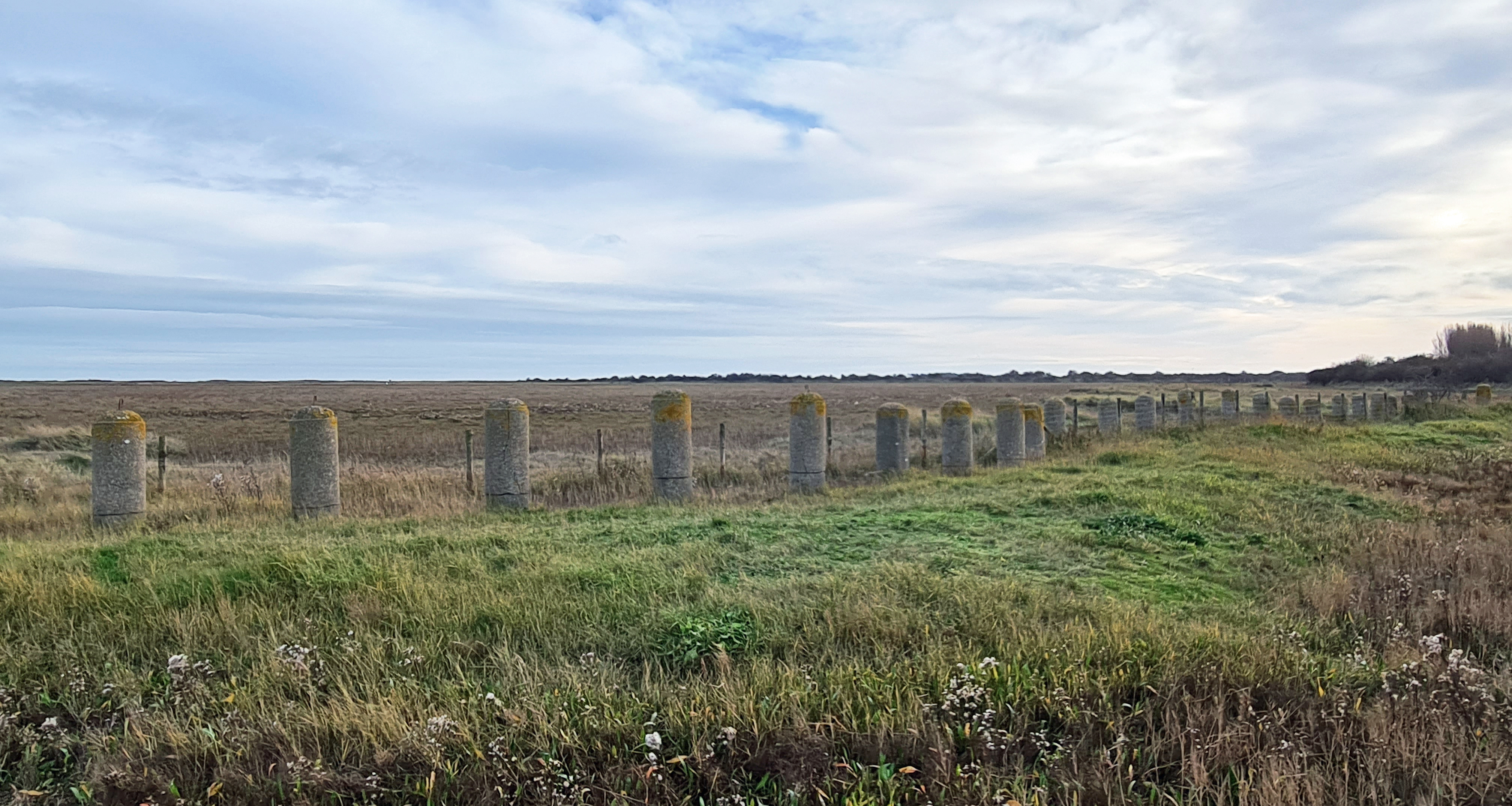
This part of the coast was thought to be at risk from invasion during World War II due to the sheltered and gently sloping approach from the sea. Huge numbers of protective devices were installed. A pill box and many pyramidal anti-tank ‘pimples’ survived beside my path, along with a long line of some 300 anti-tank cyclinders. Their interrupted concrete line stretched across the reeds. While some were covered by scrub, the majority were poking out, many still with a coil of metal in the top through which barbed wire would have been passed.
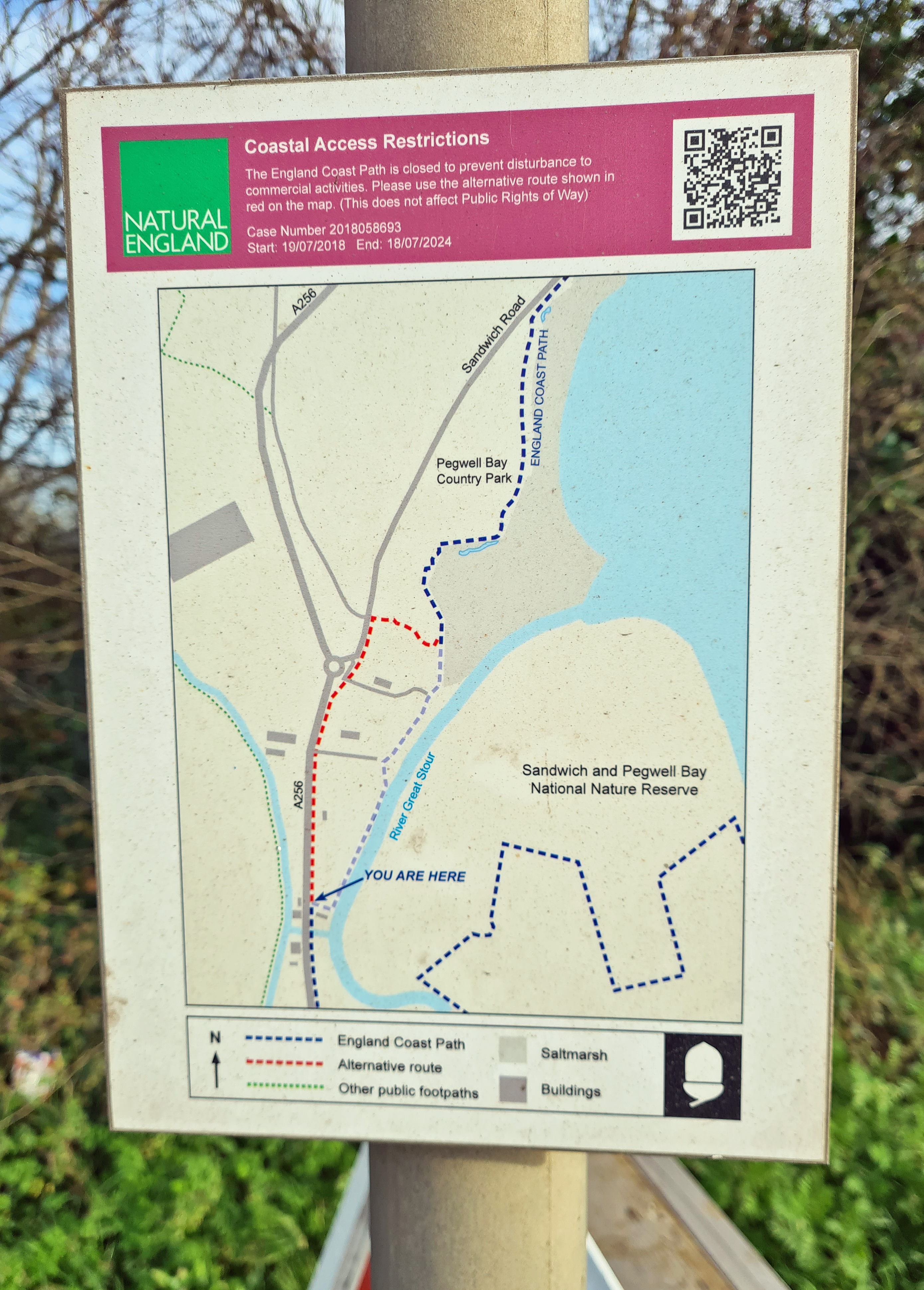
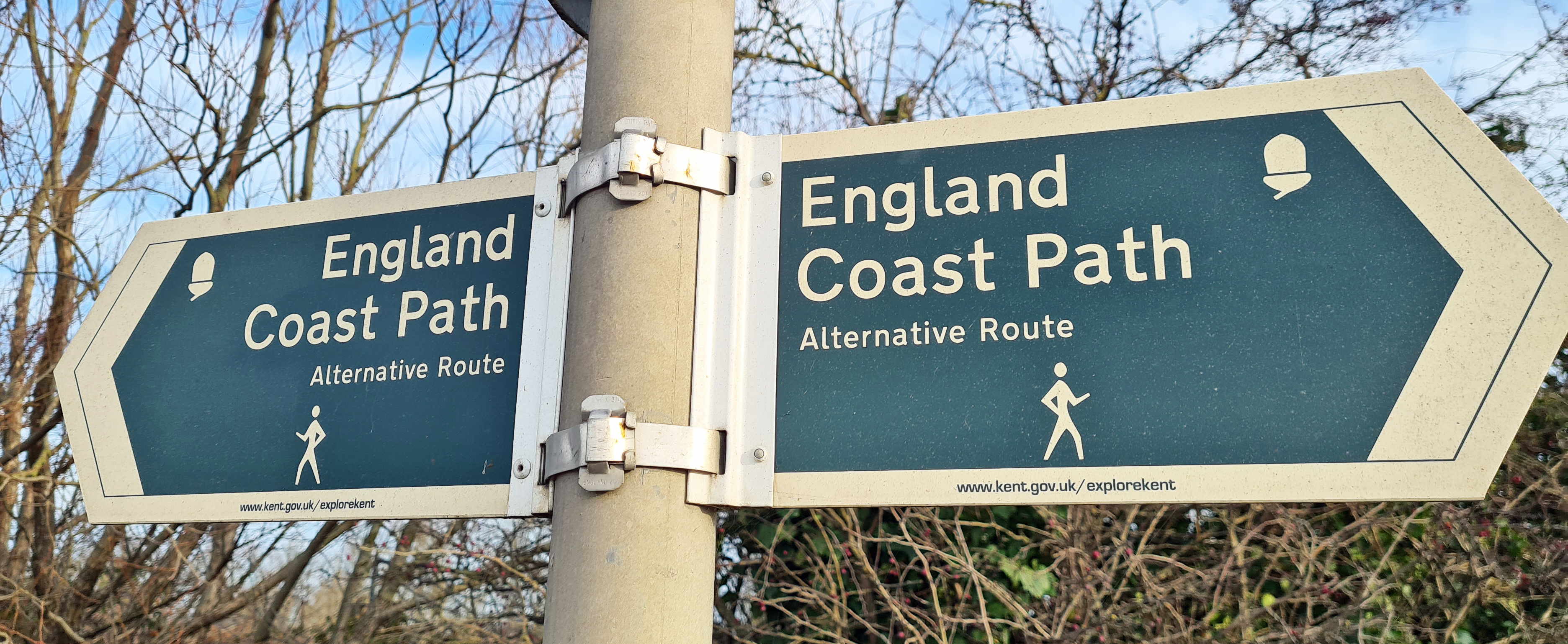
When the England Coast Path reaches Stonelees Nature Reserve, it diverts from the coast. Despite the Secretary of State approving a coastal route, a land owner altered his use of Richborough Quay and the coastal route was subsequently diverted inland along a horrible length of the fast and noisy A256.
While I knew I would have to double back and join this eventually, I ignored the signposted diversion and followed a well used path that continued along the coastline. The tracks died out eventually and I had to duck around some vegetation but I eventually emerged beside what it was I was seeking out.
World War I created considerable logistical challenges for transporting military hardware to France. This part of the coast was selected for a train ferry. The railway was run straight onto a specially built berth.
Train Ferry No. 1 sailed for the first time from here 10 February 1918. 685 tanks, averaging 28 tons each, loaded on to train carriages were run directly onto the ferries for transport to France that year. On arrival at the Richborough berth, a ferry could be loaded with tanks and trains and be sailing out again within half-an-hour. The train berth returned to similar military use during the following World War. Remarkably, the rotting and rusting remains are still poking from the mud a hundred years after it was built. Bits of track and fishplates stuck out of the saltmarsh and grass tussocks beside the pier. I wandered around and over, exploring them for some time.

Walking a little further through the brambly grass, I clambered up a muddy bank, dropped down the other side and found myself unintentionally in the midst of a large vehicle storage unit, whoops!
I walked on as there wasn’t much else I could do. A site worker stopped his vehicle and politely greeted me, helpfully directing me to the official exit.
While walking to the gatehouse, the man from the car rejoined me, explaining he had better escort me as ” *** gets a bit worked up over unexpected visitors occasionally“.
He was right, the ‘man in charge’ at the gatehouse was a bit arsey with me and demanded my personal details. I smiled, politely said Hi, ducked under the barrier and walked out and up the short feeder road, returning to the ‘alternative’ official route along the main road. There may have been a bit of swearing and threats being uttered behind me as I walked away. I hadn’t intended on entering the site and was happy to leave it. No need for talk of police, nonsense threats that they were.
While the stretch along the A256 is in no way enjoyable, it is at least short and a minor road with almost no traffic is soon turned onto. I passed the large Stonar Lake, a regular haunt for uncommon winter wildfowl and Divers seeking sheltered respite from rough seas. Though about all I could see bobbing around were Great Crested Grebes. I noticed that the waters are suffering from Koi Herpes Virus, this is a highly contagious viral disease that affects carp species. The lake has a reputation for large carp, including ‘Big Girl’, a Mirror Carp weighing around 39lb that gets caught a couple of times each year.
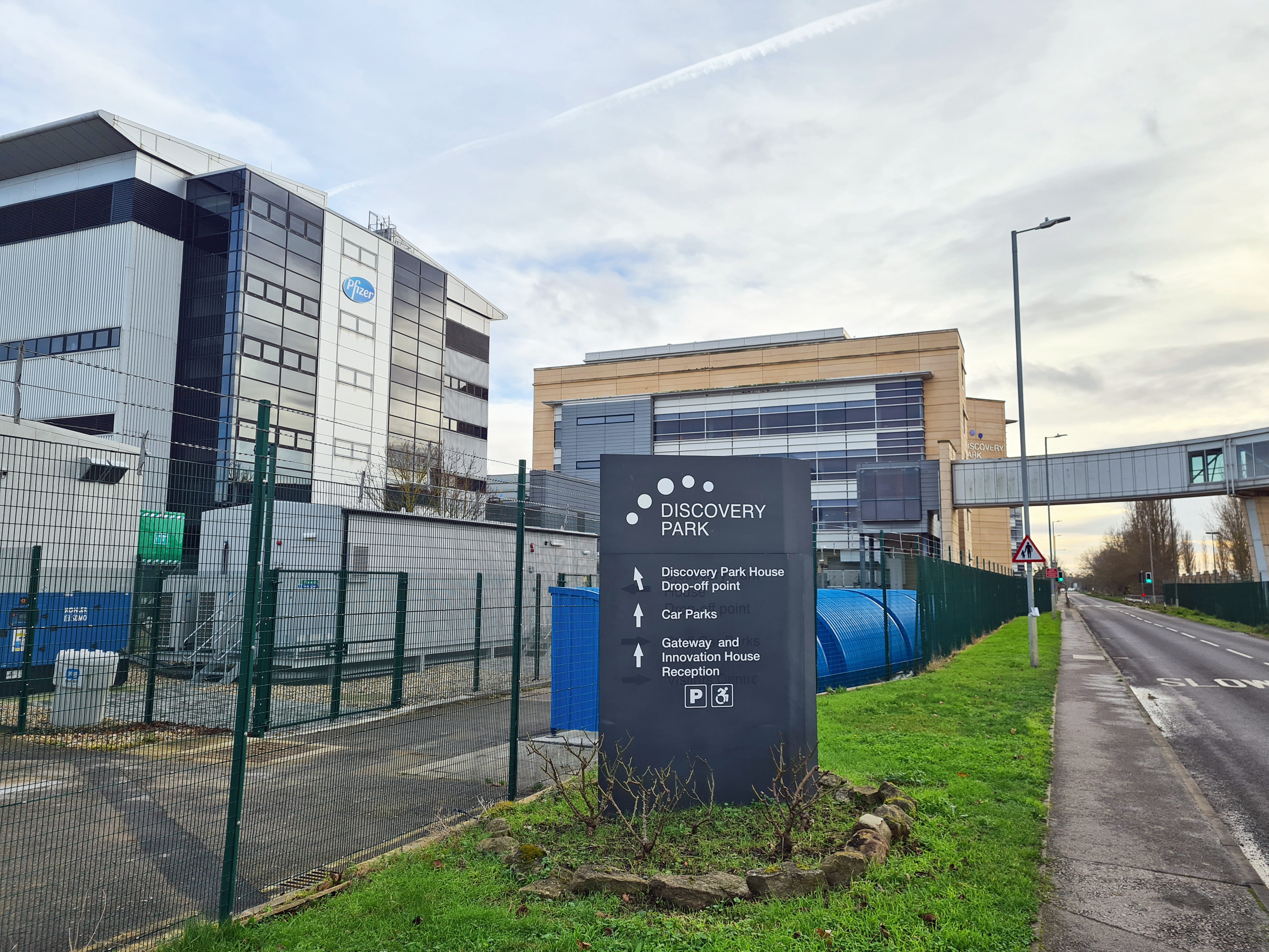
I walked past the Pfizer Discovery Park, now being reinvented as a leading Science park, though the drug company still maintain a strong presence here. Both Viagra and Maraviroc, used for treating HIV, were developed here. Less welcome, was the animal experimentation that took place on the site. That was subsequently moved to Michigan, U.S.
“… and the same year king Athelstan and Elchere the ealdormen fought on shipboard, and slew a great number of the enemy at Sandwich in Kent, and took nine ships, and put the others to flight; and the heathen men, for the first time, remained over winter in Thanet”
Anglo-Saxon Chronicle
The River Stour snakes its way toward Sandwich before doubling back and winding its way to the sea. I followed this river in to Sandwich when I completed the Saxon Shore Way in 2020. I was not far from Richborough Castle, the Roman entry point into England. The England Coast Path takes a sharp turn back on itself when Sandwich is reached as it follows the tidal river out to the coast, passing Bloody Point as it does so. This is reputed to be where the ‘Battle of Sandwich’ took place in 851, a vicious tussle between the West Saxons and Viking aggressors. Remarkably, the Vikings suffered a bloody nose on that occasion. They had more success when they attacked Canterbury the same year.
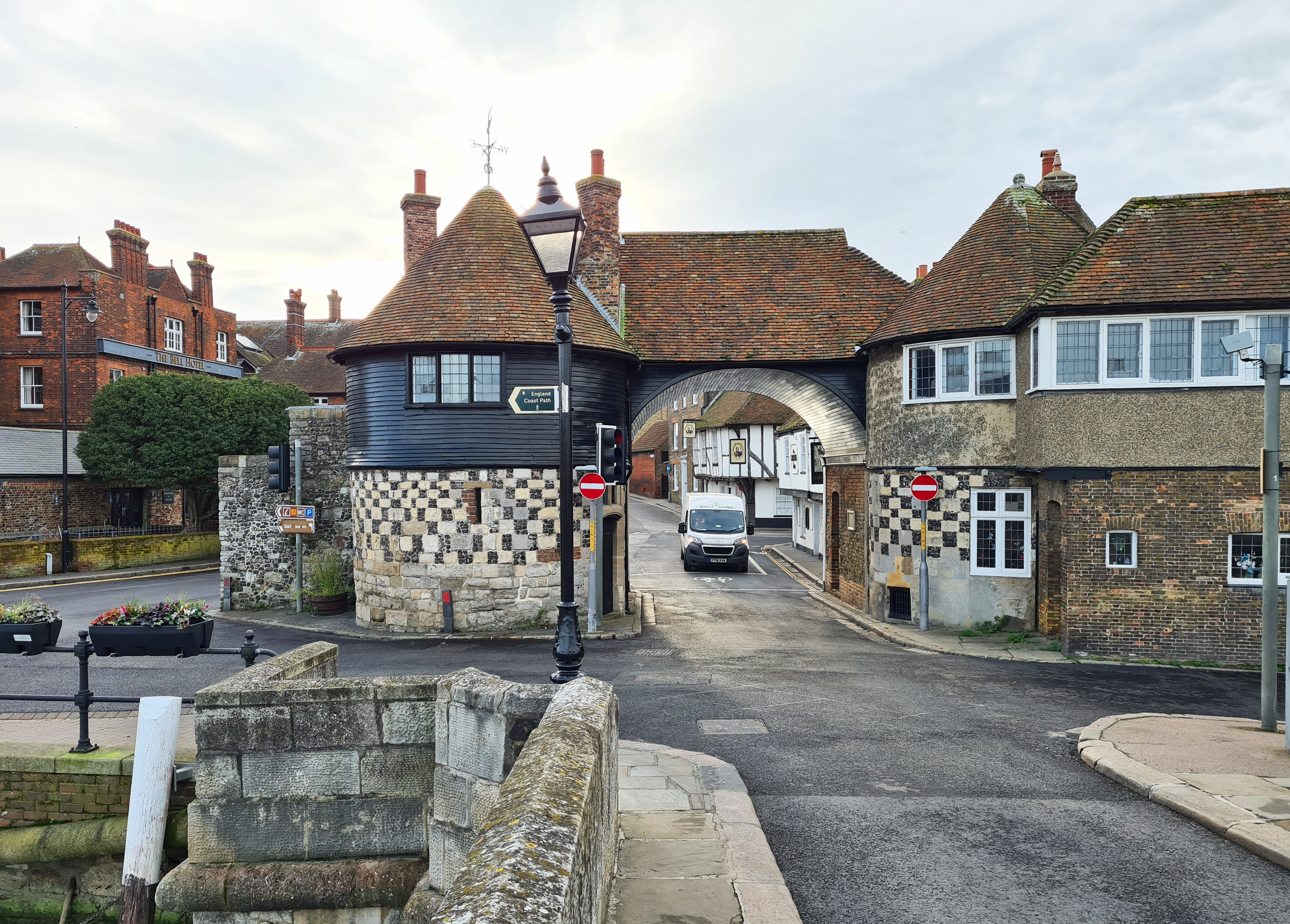
I crossed the ‘new’ Sandwich Toll Bridge, built 1892, and dodged a couple of cars to walk under the barrel roof arch of the 14th century chequerboard Barbican and enter the Cinque Port. It was then just a short walk, passing medieval buildings, to the railway station.
It was mid-afternoon and I had not stopped for lunch, no, not even a sandwich! The foodstuff that gained its very name from this town.
‘John Montagu, 4th Earl of Sandwich did not have time to sit for a meal due to his gambling habits, his valet was ordered to bring him meat tucked between two pieces of bread‘
Today had been a pretty short walk of less than ten miles but I had at least closed a gap on my Kent section of the England Coast Path. There remains many hundreds of miles of this path for me to walk elsewhere in England, and it is doubtful that I ever will walk it all as some sections do not particularly attract me. It hadn’t been the prettiest of walks today either. The road sections had been pretty dire, but there was, and is, some fascinating history to the stretch of coast walked.
Three Points of the Compass does not always blog on the trails walked. Links to those that have been covered can be found here.

1 reply »