There cannot be many of us who have not noticed the squiggly contour lines on a map. Almost any hiker is aware that the closer these are spaced, the steeper the angle. The more widely spaced, the more gentle the slope. There is a rather nifty little aid in determing slope angles when planning a route.
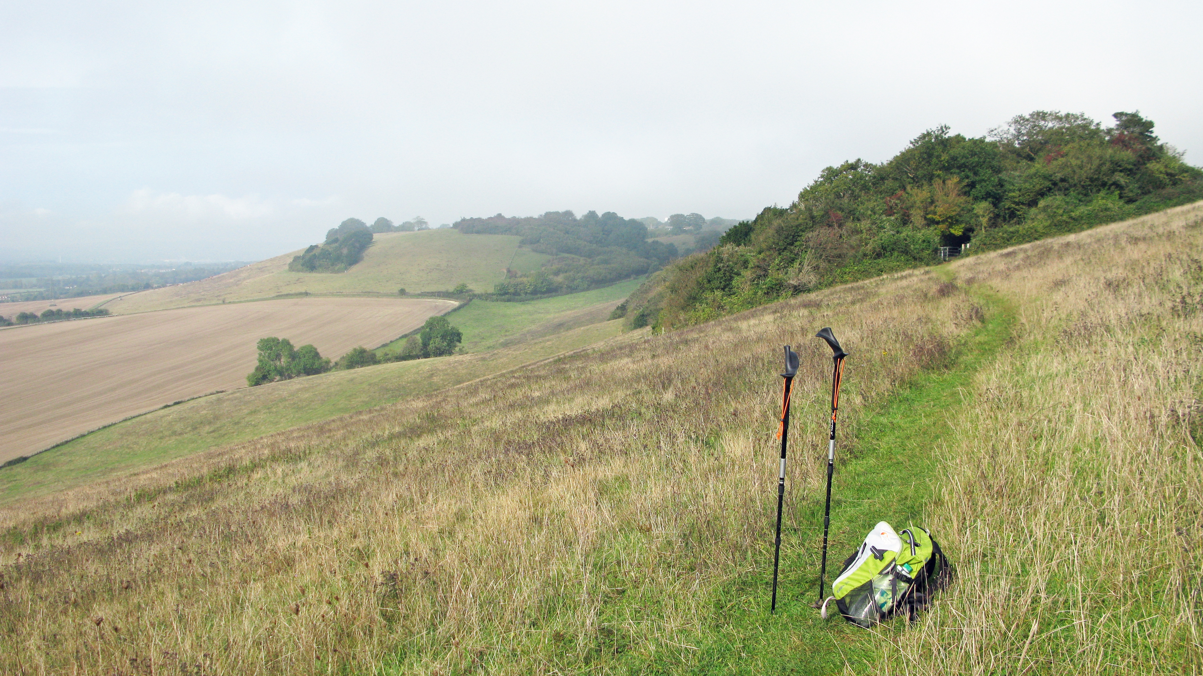
Gradient, or steepness of a slope, makes itself very apparent to the hiker. Unless on Open Access land and just about anywhere in Scotland, it is not often that we are able to reduce the steepness by traversing a slope diagonally. A path usually goes where a path goes. However we are able to gain an idea of how challenging a slope will be in advance (or even retrospectively) by using various aids. One of the simplest of these has to be a ‘slope card‘.
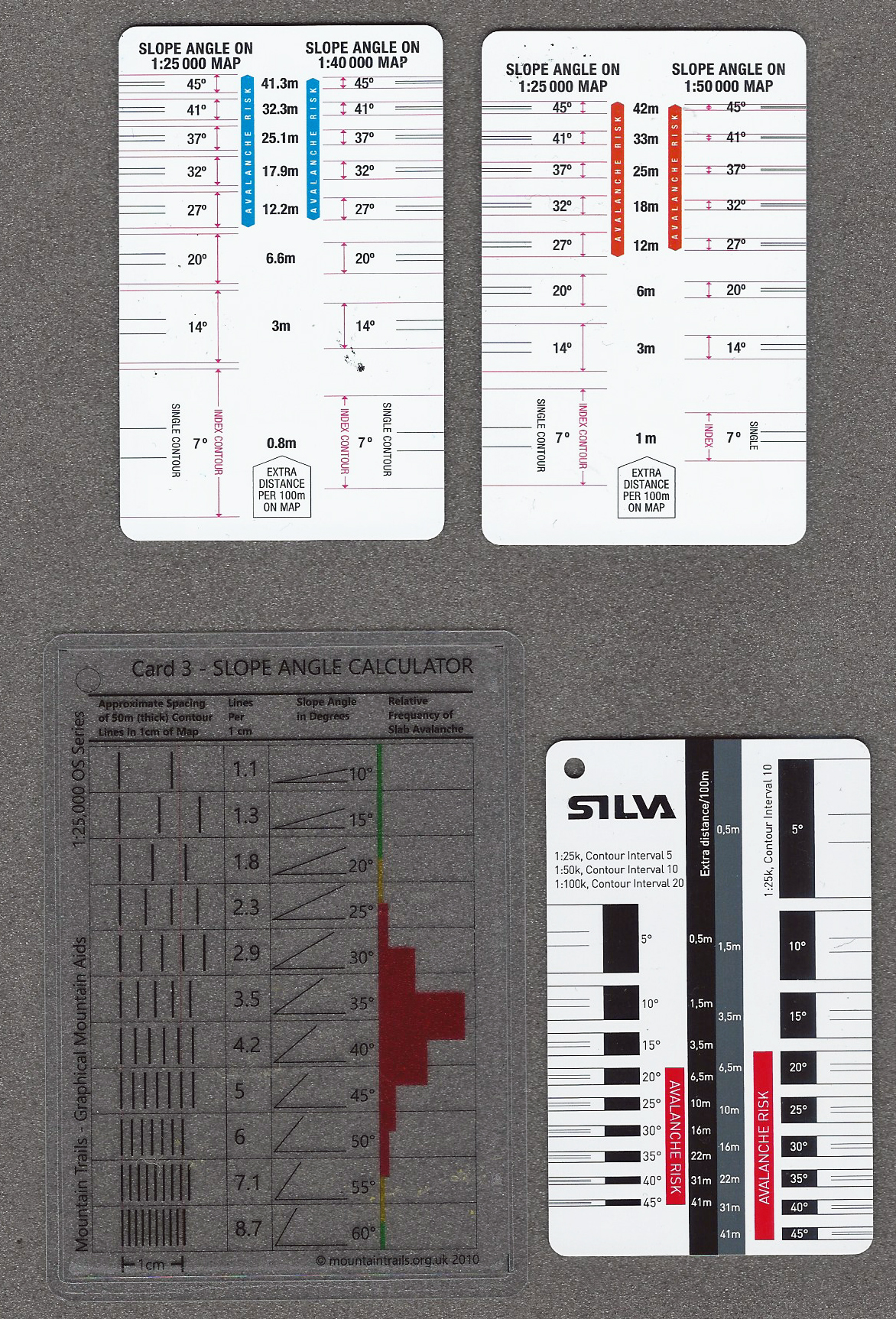
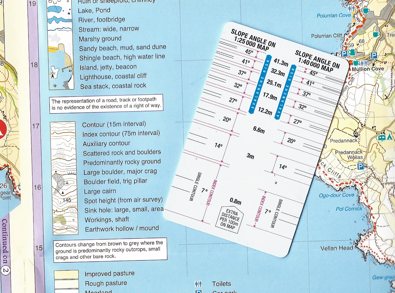
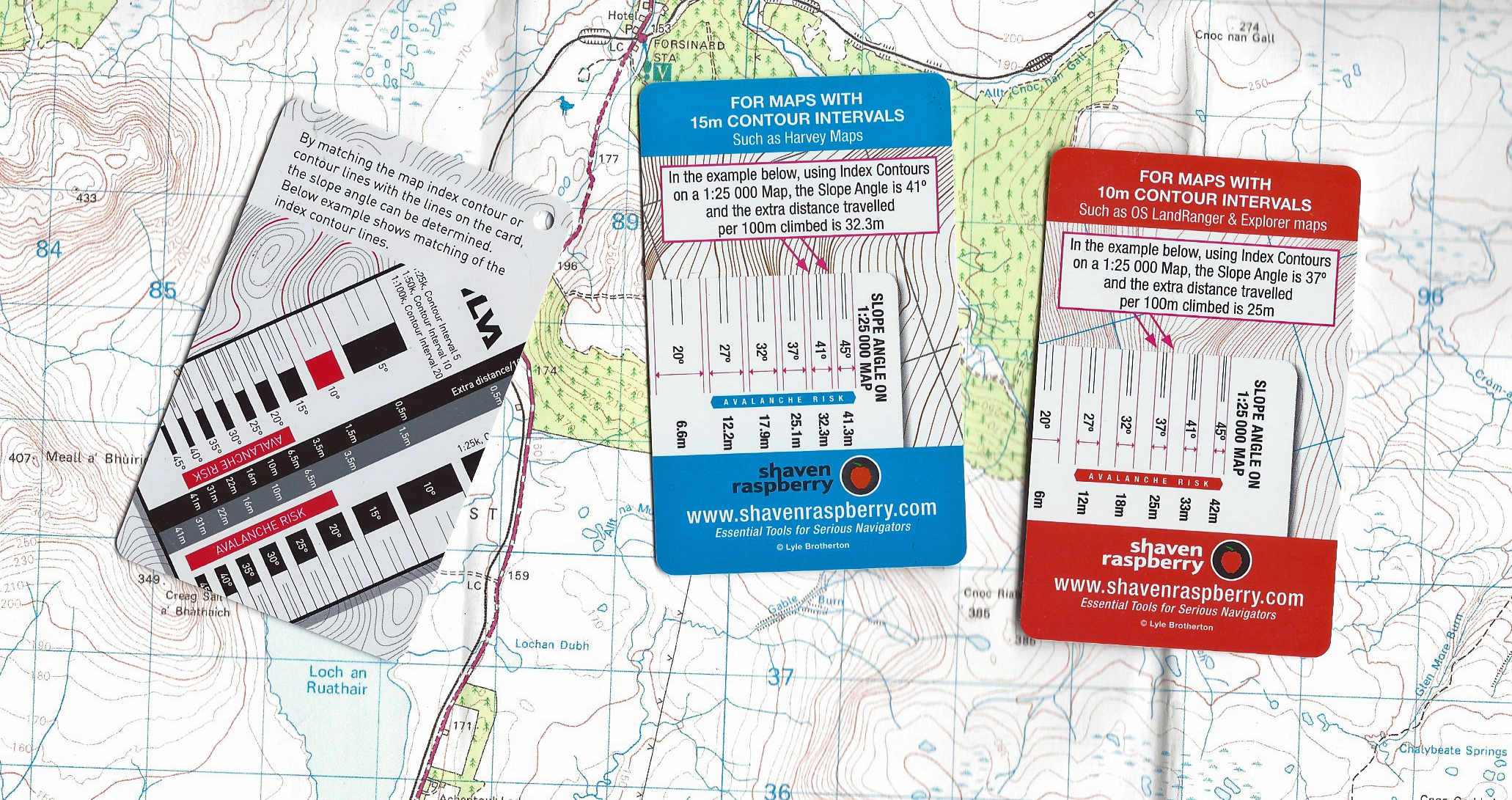
Look at the key of a ‘paper’ map and it will include detail on how height and natural features are drawn on the map. Included in this will be contour lines, both main index and intermediate, and specifically, the vertical interval. These are not always the same and can also vary across a series, for example, the 1: 25 000 maps from Ordnance Survey have different contour intervals depending on whether they are showing upland areas or not. Knowing map scale and contour interval a slope card can be selected. Makers such as Shaven Raspberry produce cards dedicated to specific map scales, this aids in making them simpler in appearance and easier to use.
Usually made of plastic and roughly the size of a credit card, these give an indication of slope angle and frequently carry additional information. Of critical use to hill walkers in winter and shoulder seasons are the angles at which risk of avalanche is greatest. A visual indication (pictograph) of slope might be included on the card, as with the one produced by Mountain Trails. Slope angles of between 25° and 55° deemed as being at most risk from avalanche.
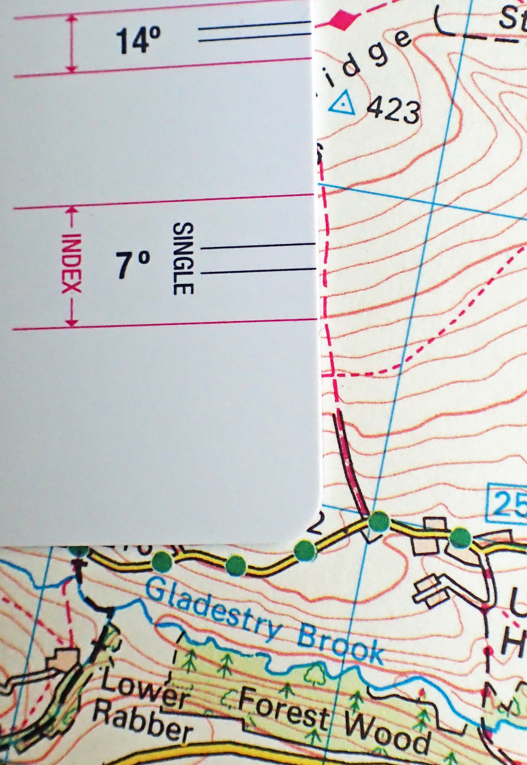
There are various other hints with contours. Where the height of a contour is shown, the top of the number points uphill for example. Look at the North York Moors map sample to see how this is shown. On Ordnance Survey Landranger maps, if the slope is particularly steep, some or all intermediate contours may be missed out. If just one contour is missing, a rough guestimate of a 1 in 3 slope angle can be deduced.
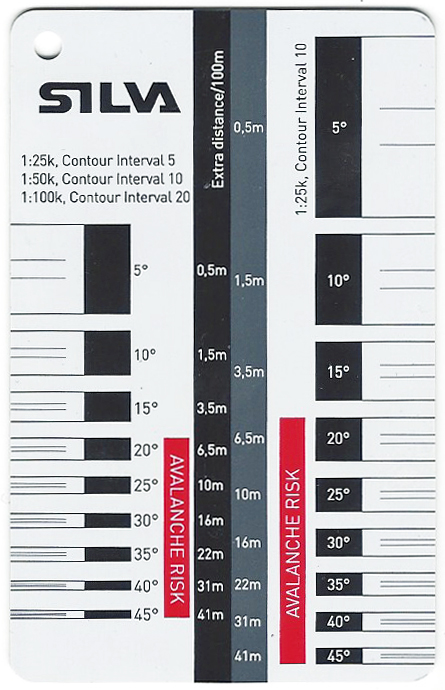
Silva now supply a slope card with some of their compasses. Different versions are produced for different World markets with due regard to prevalent map scales in use.
There is a lot of information on this card and the Silva slope card could be regarded as a little over fussy. But break it down and spend some time playing with it and it is simple to use.
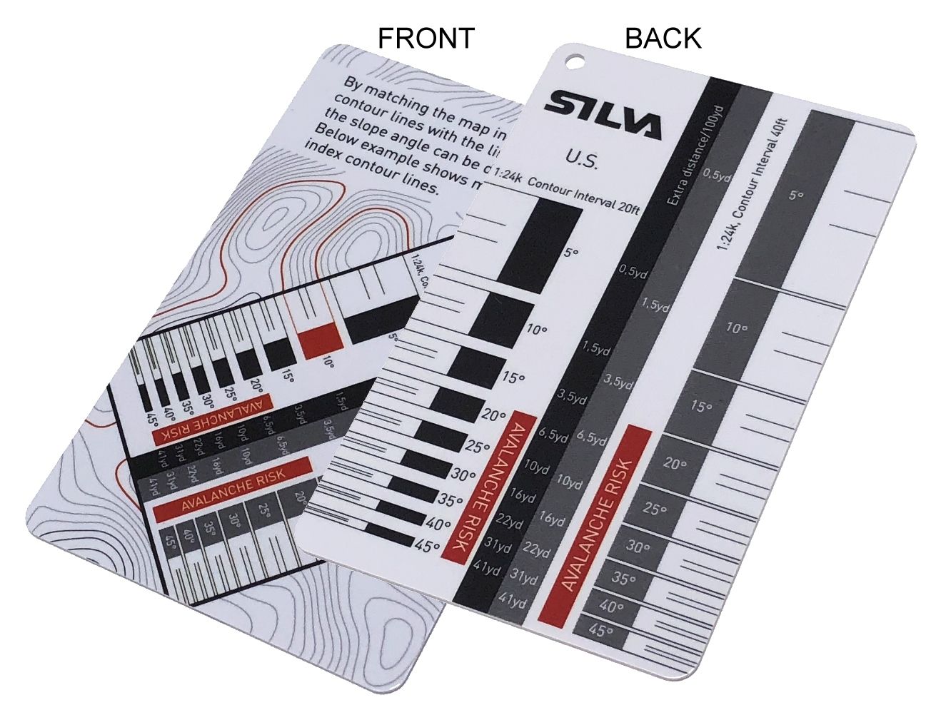
Note that the Silva slope card, in common with some others, also indicates one set of intermediate contour lines between index contours of a specific slope angle.

The sheet used in these two images is OL 26 Explorer Map, this map of the North York Moors and other Explorer series maps are to a scale of 1:25 000 and amongst the finest maps ever produced for hiking. It can clearly be seen that if terrain and features permit, how the steepness of a slope can be made more manageable by tackling it diagonally as on the section of the North Downs Way shown above.

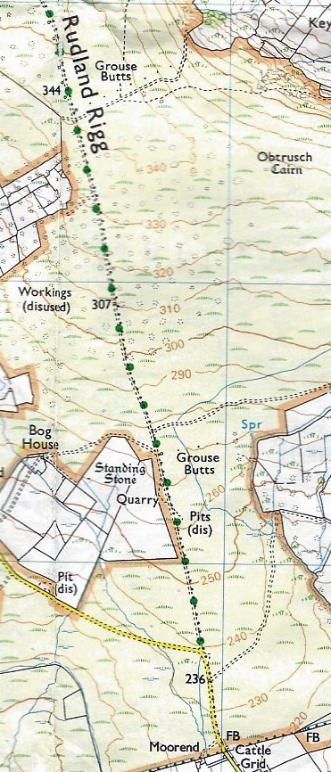
Detail from O.S.Explorer 217, Long Mynd & Wenlock Edge
This is a busy part of a 1:25 000 scale map and the see-through slope card from Mountain Trails is helpful in locating properly on the sheet while still seeing what is happening on the map beneath the card.
Climbing from the minor road in the west a bridleway ascends diagonally eastward across the steep convex slope to join the Shropshire Way above. From the steeper part of the path, it swings round and moves into a more direct ascent. The card is oriented to the path itself and not the contours, thereby showing the actual slope of the path, a 1-in-5, or 20° slope.
Three Points of the Compass does not actually carry a slope card on trail. They are for occasional use when route planning or to answer simple curiousity, perhaps following a hike.
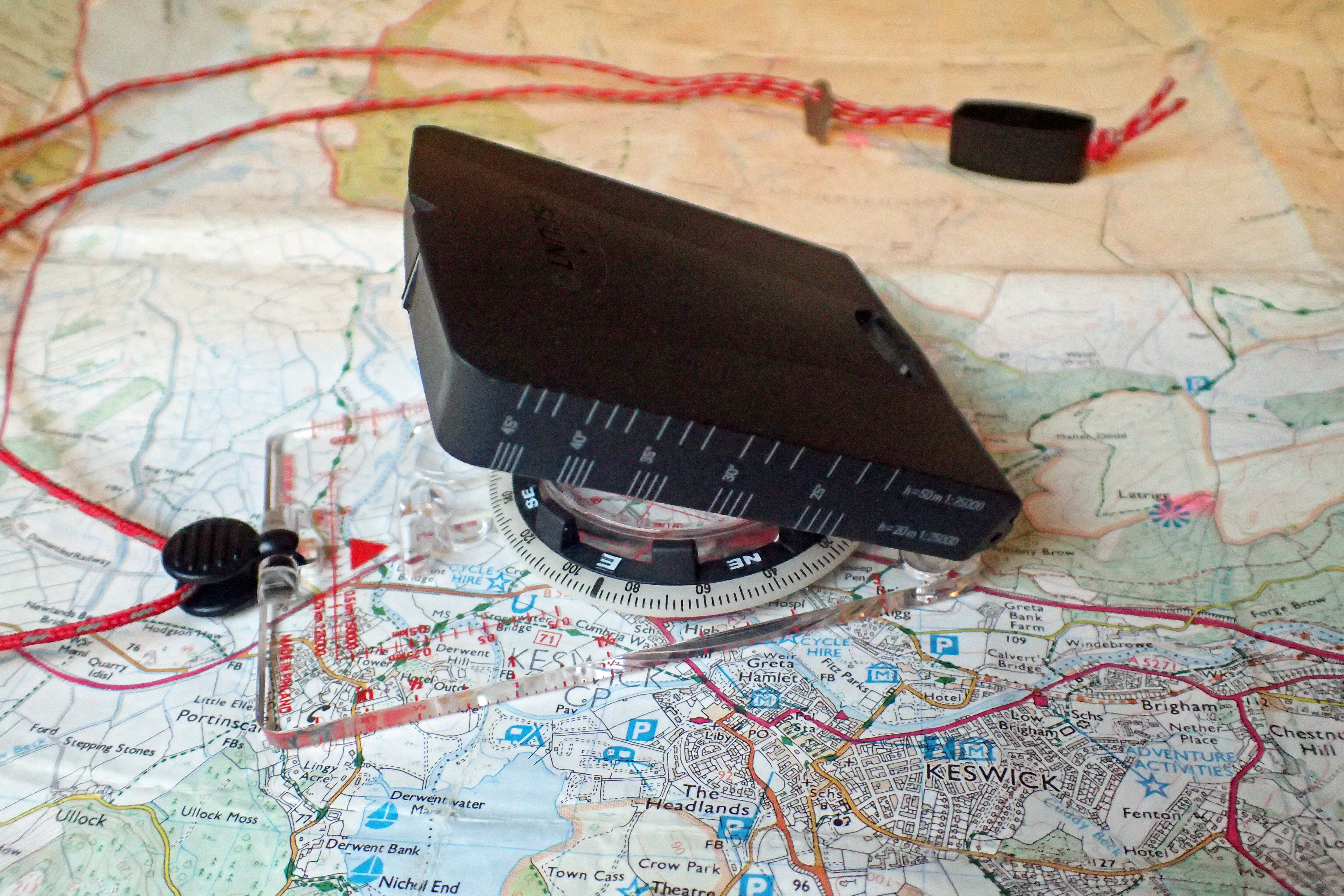
There is one item I might have with me on a longer multi-day walk that can be used if I wish. My Suunto MC-2 Global mirror compass, beside being one of the best compasses available to the navigator, also has three slope scales printed on the side of its mirror housing, or ‘slope ruler’ as Suunto call it.
A degree of extrapolation is required when using these as scales and contour intervals are limited to 1:24 000 & 40ft contour intervals, 1:25 000 & 20m contour intervals and 1:25 000 & 50m contour intervals. These are fairly limited in range of slope angle shown, ranging from 25° to 45°, being primarily of use for those hillwalkers particularly aware of the risk of slab avalanche.
The compass also has a dedicated clinometer needle which is of more use with clear ‘side-on’ sight of a slope angle. However use of this needle falls outside the scope of this glance at slope cards.
There is another aspect to hiking up or down a gradient that has to be taken into account, the distance walked also changes. Covering a horizontal 100m on a steep 27° ascent will mean 112m has actually been covered. Combined with the extra exertion that a slope entails, these additional metres can add up over a day. Some slope cards also give an indication of this, usually down the centre of the card. Shaven Raspberry got a bit carried away with indicating tenths of a metre on one of their slope cards. While this is more accurate, the simpler full metres on their other slope card are easier to read and use.

Experience will be enough for most hikers, backpackers and navigators when looking at either map or the hill in front. Visual clues will be sufficient for many. Slope cards are not essential to planning or enjoying most hikes, though they can be an important tool for those walking in winter. Beside that, they are simply a cheap little tool to be aware of and use if it suits you to do so. As winter draws in, why not spend a half an hour or so at home practicing their use prior to getting out and actually puffing up the slopes.

Thank you Jools for a succinct and easily understood guide
LikeLike
Thanks Bob, you are, of course, very welcome
LikeLike
how do i get an American slope card from Silva
LikeLike
Hi Richard, I would presume that purchasing one of the Silva compasses that comes with a slope card, sold on the US market, would provide one
LikeLike