
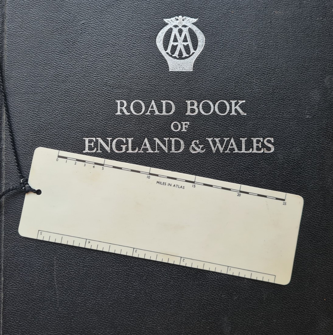
Simple scale rules were included with some road atlases published by the Automobile Association and acted both as bookmark and map measure.
This is a very simple map measure, just a step up from the most basic of measures that has been used for over a century- a piece of paper held against a route, a road, a trail a river, on a map. It is a little strange that among all of the possibly thousands of bound atlases that have been published over the decades, that are accompanied by a bookmark, that so few publishers have thought to include a useful scale on the bookmark itself. Instead, the blank space has usually been utilised for advertising rather than something actually functional to the user.
The Motorists’ Mutual Association was founded 19 June 1905, very soon renaming itself the Automobile Association (AA). It survives to this day, in addition to breakdown cover, the organisation now provides vehicle insurance, driving lessons, financial loans, motoring advice and other services.
AA road atlases have been a staple of British motoring for decades. Each provides a great deal of information, far more than simply maps. Many include detail on AA inspected camping and caravan locations, National Trust and English Heritage sites, tourist attractions and difficult to find places. They have been produced not only for the UK in general, but also for specific parts of the UK or individual countries and abroad. This same scale rule was included, for example, in 1960s editions of their ‘Road Book of Scotland‘. The bookmark, either with or without the additional measuring scale, was not included in every road atlas that the AA produced.
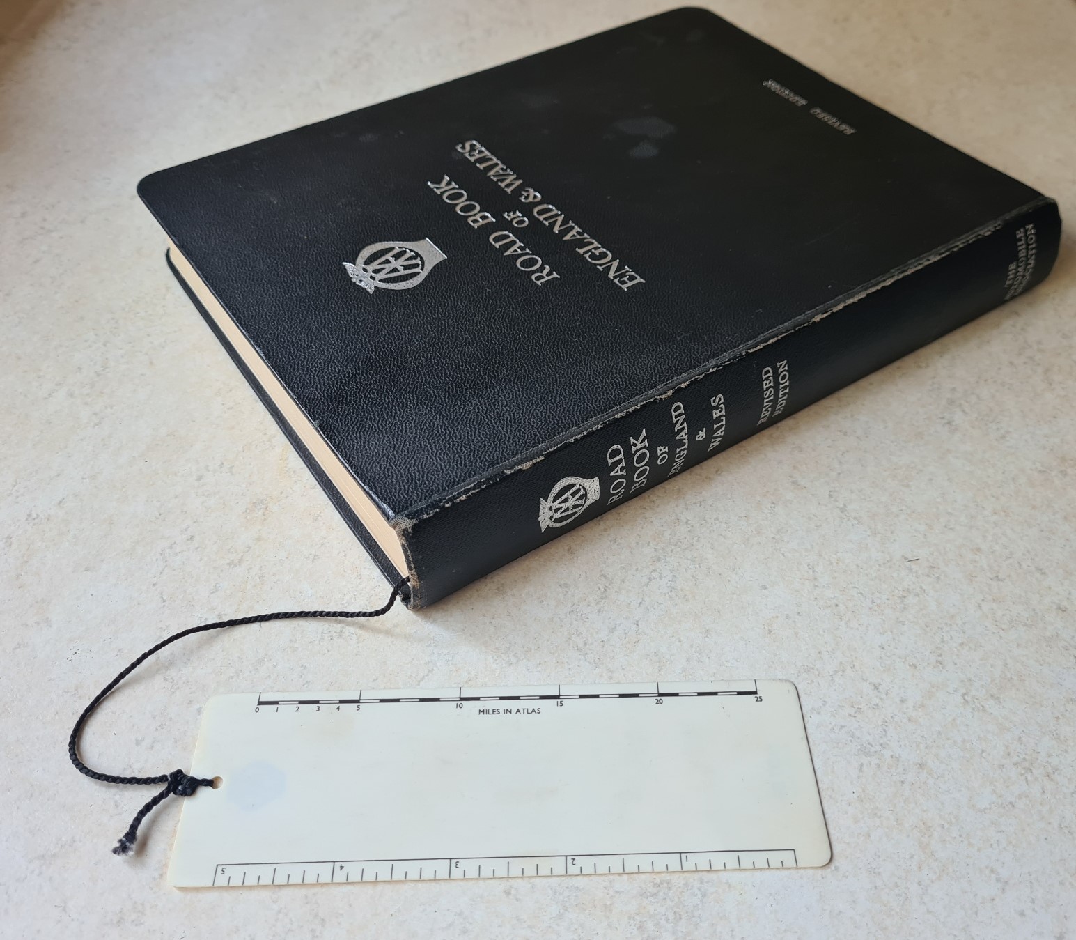
The AA began preparing route cards for it’s members following the First World War. Strip maps were later added to these and bound AA road maps followed still later. The Road Atlas with bookmark measure shown here was first published in 1950. Occasionally revised, it was reprinted in 1951, 1953, 1957, 1958 and this revised and corrected edition was printed in 1959. Road Books were also printed in this format in the 1960s, 1970s and 1980s but without this bookmark measure and have also been considerably revamped and improved since then. AA Publishing is now the UK’s largest travel publisher.
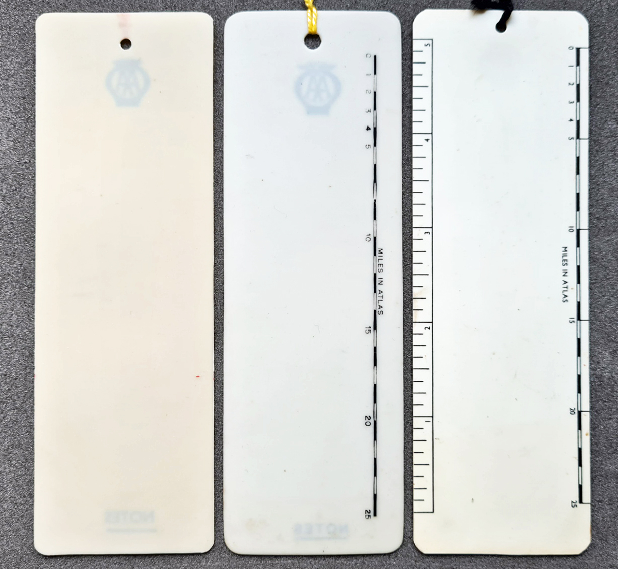
In addition to printed itineraries, the 1959 road book shown here has various maps included, mostly produced by mapmaker John Bartholomew & Son. Also included are many other smaller scale maps and town plans prepared or commissioned by the AA itself. Most of these town plans have no common scale yet the bookmark measure can be used with all of them by simply marking off a distance across the town plan with a pencil and reading off against its accompanying scale. The rear of the Road Book is comprised of 58 pages of “Bartholomew’s Road Atlas of England & Wales“, drawn to a scale of a fifth inch to the mile. This is the ‘Miles in Atlas’ scale shown on the bookmark measure.
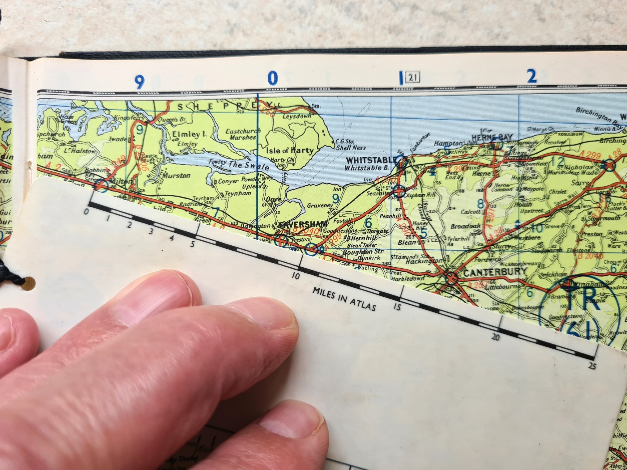
The AA bookmark and map measure is quite small, dimensions are 145mm x 47mm x 0.55mm. It weighs just 5.2g. It can be written on with a pencil and the writing erased afterward, ink can be more difficult to remove. Rather than the card bookmarks so frequently found in road atlases of this era, this AA bookmark measure is celluloid and was produced from 1930s to the 1960s. It is flexible yet extremely tear resistant. They are so robust that the examples shown here date from the 1930s through to the 1950s. The youngest being over sixty years old and still in pristine condition.
The AA logo is common to all generations of the bookmark measures. This specific logo was introduced in 1911 and marks an amalgamation with the Motor Union. You can see the intertwined letters M and AA with Motor Union wings above. This became the standard logo for half a century. There is no reason why this bookmark should be confined to an AA atlas and the other examples shown below are detached from whatever volumes they were originally supplied with. Detaching the bookmark measure from it’s short six inch (150mm) retaining thread would make it easier to use.
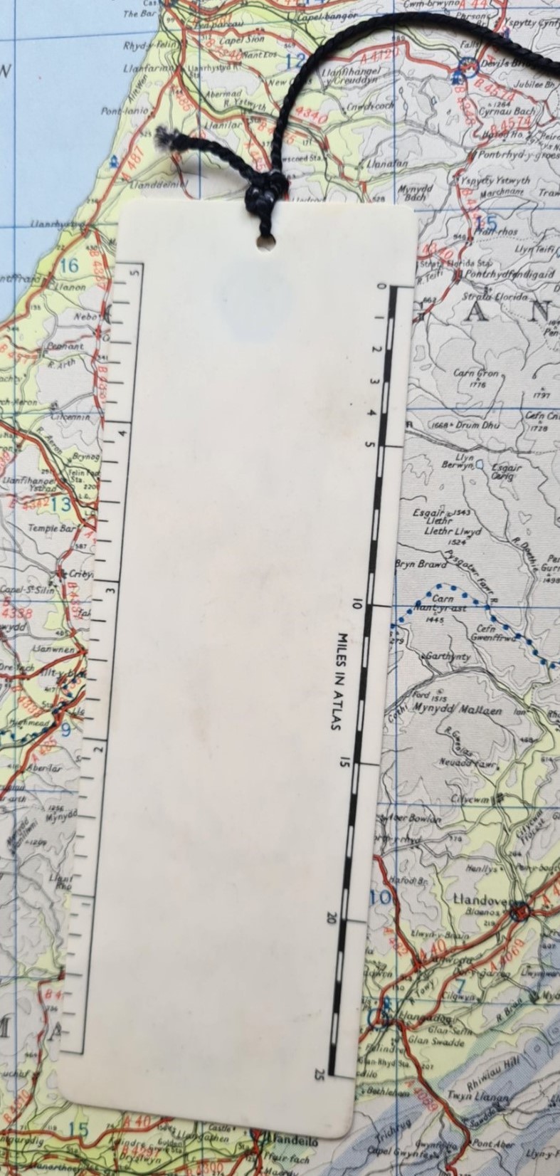
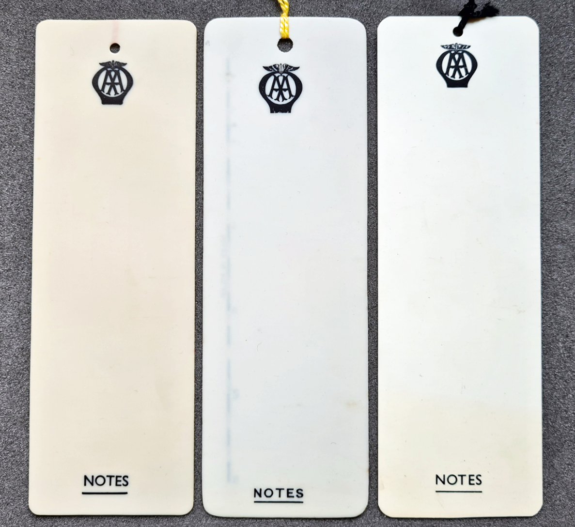
I am aware of three generations of this particular bookmark, shown below. The first of which is not a printed measure at all, but can still be used to measure a route in the atlas with no more than a pencil. I have seen this simpler bookmark included with a 1936 AA Road Book of England and Wales and it may have been included with others. Other than the AA logo, it just had the word- NOTES printed at the bottom. An intermediate design of bookmark measure had a ‘Miles in Atlas’ scale added, and a final design also has an inch ruler in addition to the map measure. The map measure now has its five mile increments marked to the edge of the bookmark to make for easier reading of distance on a map. Sadly, the printing of the five inch long ruler on these bookmarks is not accurate, actually measuring four and 15/16 inches. There is very little printing on these particular bookmarks in order to provide the maximum area for a motorist to record a route card or write notes. In addition to the bookmark map measure shown here there were many other designs of AA bookmark, some with advertising, some just providing a space where the owner could write notes. None of those include a map measure.
This month’s example has been amongst the simplest of map measures looked at by Three Points of the Compass and if you chose not to use it as a measure, then at least you had a decent bookmark! The Automobile Association wasn’t the only motoring organisation to produce a map measure in bookmark format, I shall be looking at another example from a rival later this year. Links to a great many other map measurers can be found here.

1 reply »