
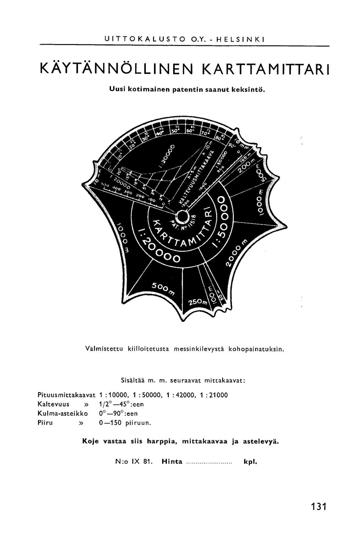
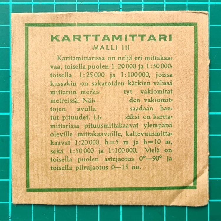
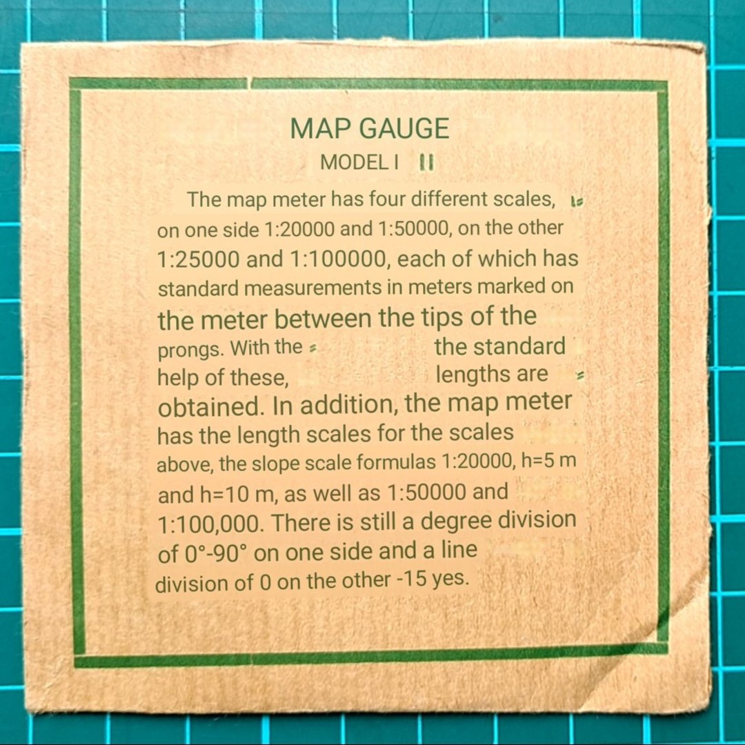
Karttamittari:
Finnish word kartta, from Swedish karta, meaning map.
Finnish mittari, from meter/gauge/indicator, or device for measuring
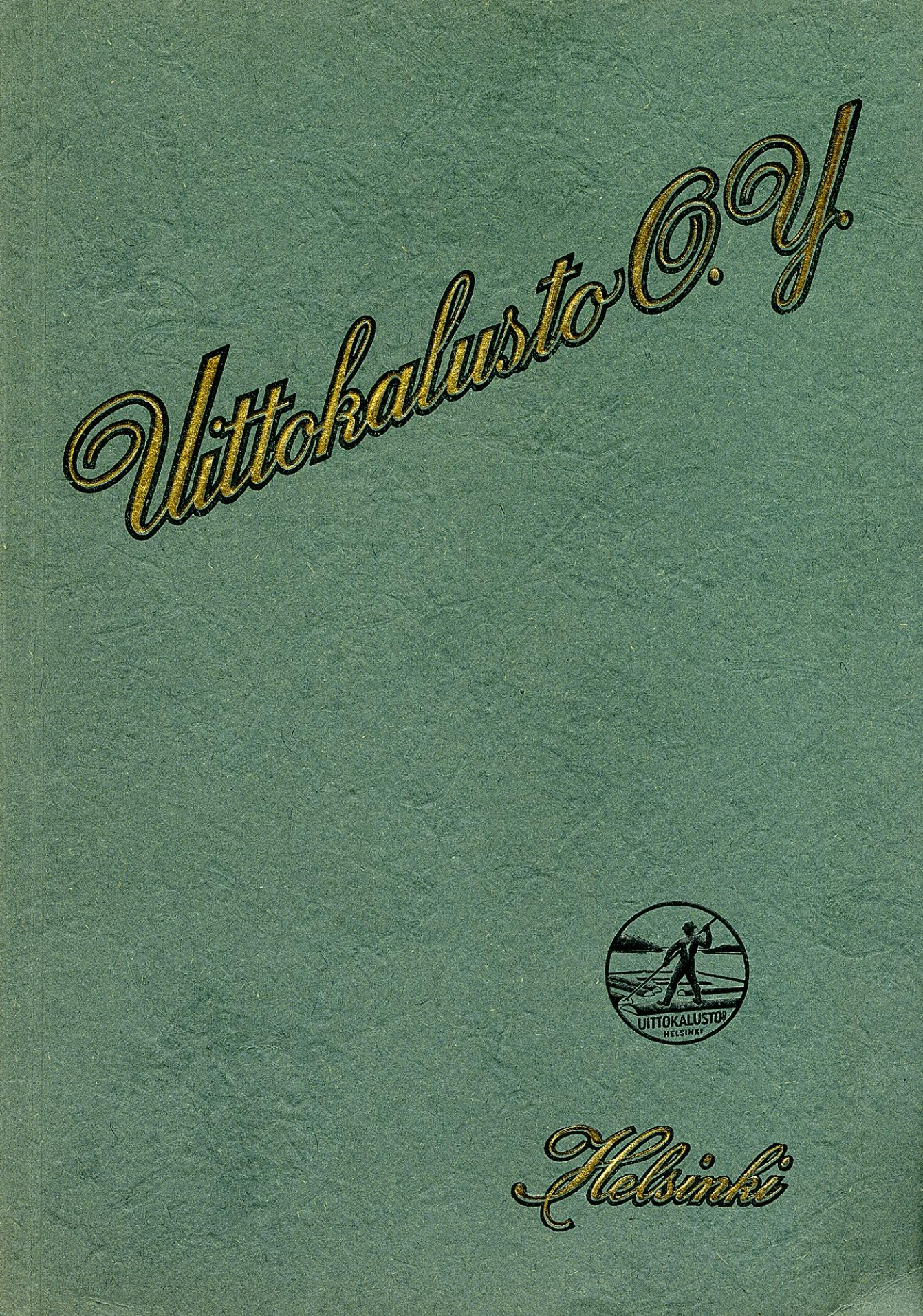
This months measure is a simple brass ‘Karttamittari’ produced and sold by Uittokalusto O.Y. OY is an abbreviation of Osakeyhtiö , meaning Finnish Limited Company. An English equivalent might be Ltd after a company name.
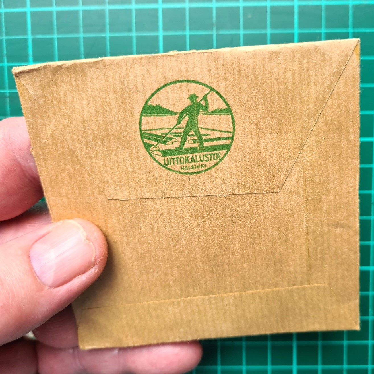
The Finnish company Ab Flottningsmaterial / Oy Floating Equipment was formed 1910 and underwent various company identity changes until the registered business name was revoked in 1979. Uittokalusto O.Y., based in Helsinki, sold equipment and machinery used in forestry work, including the floating of timber. This activity was reflected in the company logo. They originally had various subsidiaries but since 2007, have been absorbed into the German based Grube KG Forstgerätestelle Group that operates throughout Europe.
“a new domestic patented invention”
Uittokalusto O.Y. catalogue, 1930
After twenty years of acquiring, selling and manufacturing equipment for the fishing and forestry industries, Uittokalusto O.Y. were aware of the large developments being made in machinery and ancillary products, especially the new tools being adopted at floating and forest sites. With the aim of remaining the foremost supplier of equipment, they greatly expanded their product list in the 1930s and amongst the large and impressive equipment they offered, modest items such as the Karttamittari were added to their range of surveying equipment. The measure was supplied not only to civilian forestry operations, but also in large numbers to the Finnish military.
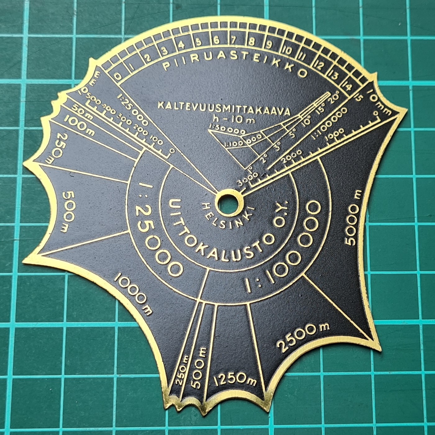
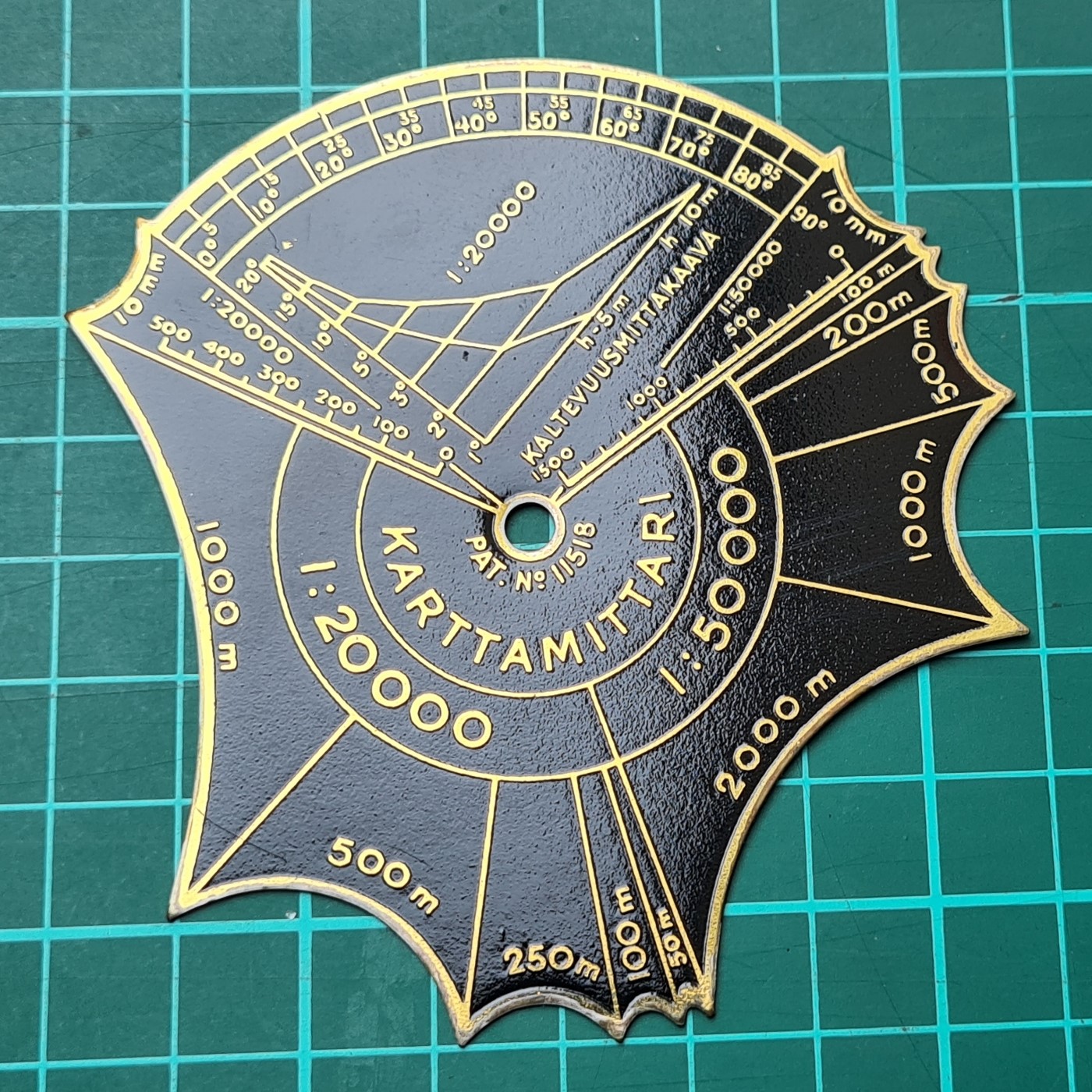
Maximum dimensions of the gold and black painted brass Karttamittari are 85mm x 84mm x 0.5mm and it weighs 18g. The Karttamittari remained in manufacture with no discernible changes, other than two new models being added, for many decades and it can be difficult to put an actual date on surviving examples. They were still being advertised in catalogues into the 1970s and possibly remained on sale even after the Uittokalusto O.Y. company name just about vanished in 1979.
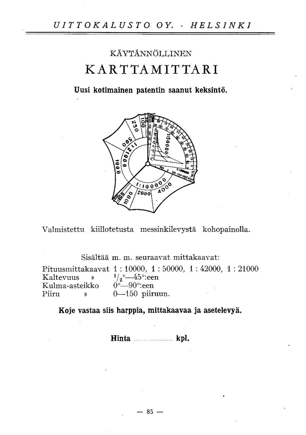
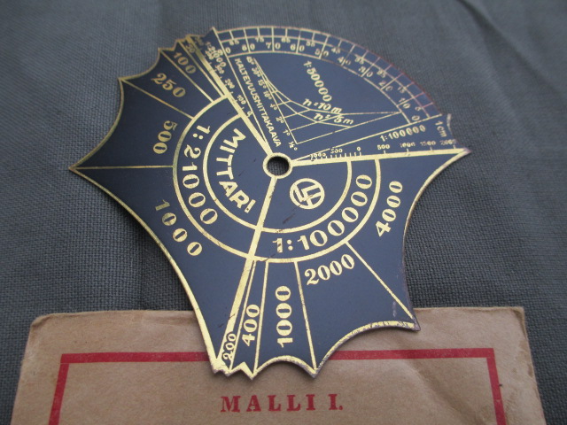
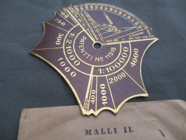
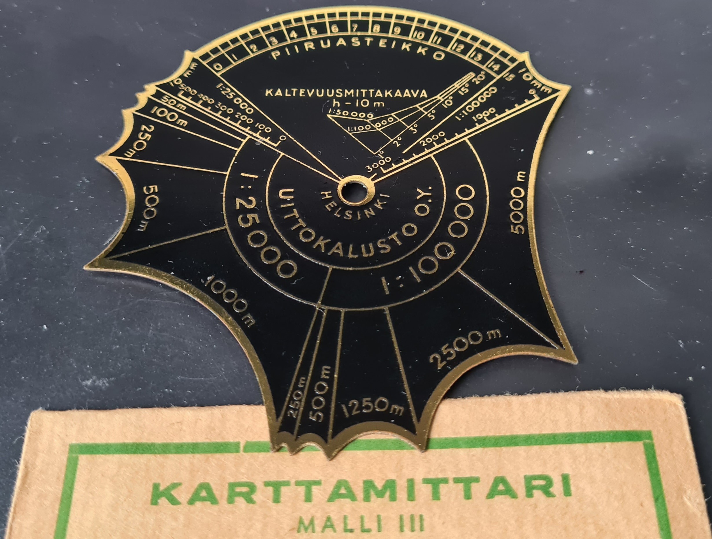
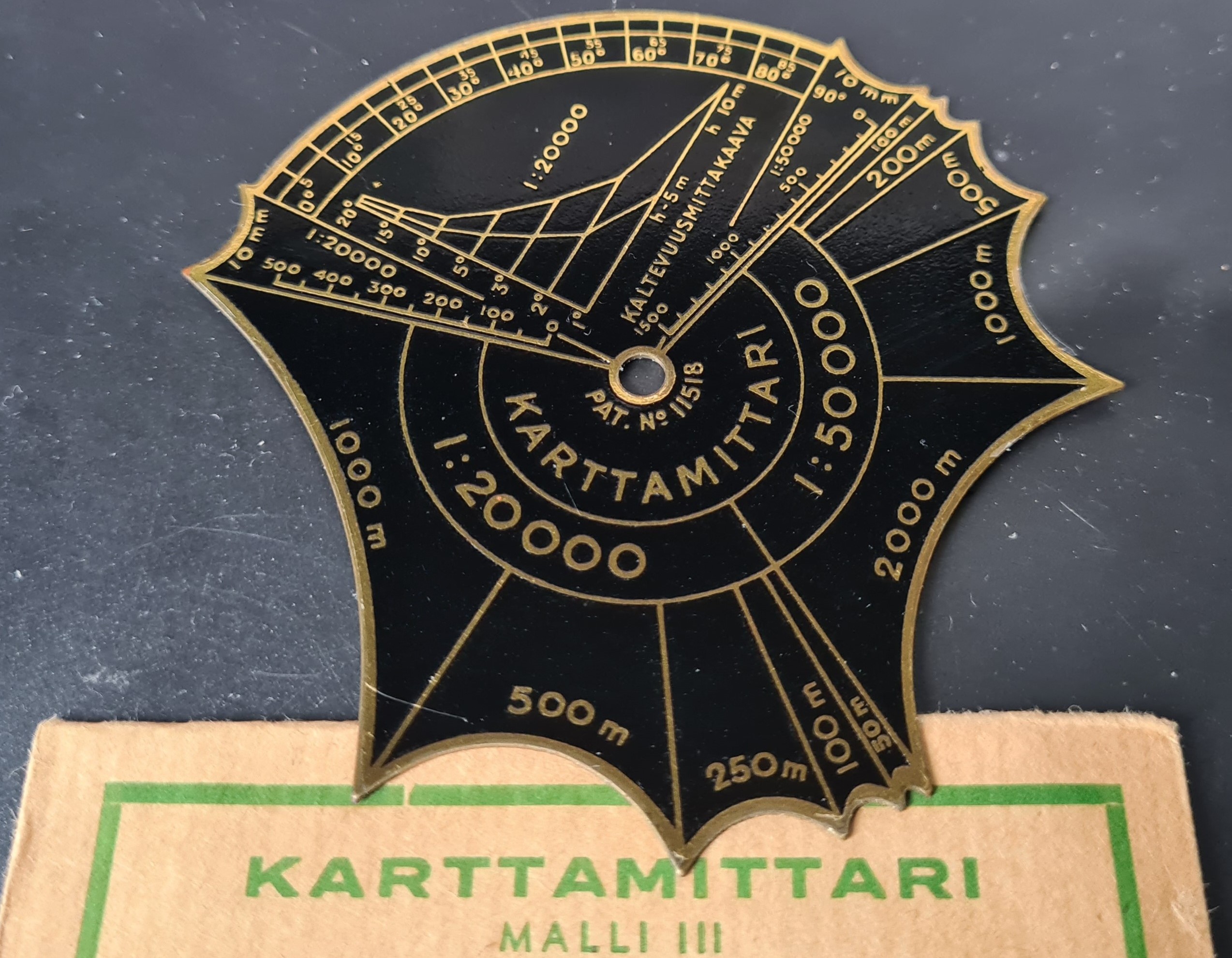
This is an old design of measure that has some resemblance to a former Map Measure of the Month, the Hugh Rees “Regent”. The Uittokalusto company product catalogue of 1925 lists no form of measure amongst their many products and the patent number 11518 shown at the centre of the measure reveals that it was applied for 5 April 1927. Both 1930 and 1938 company catalogues list 1:10 000 amongst the four scales. This should more properly be 1:100 000.
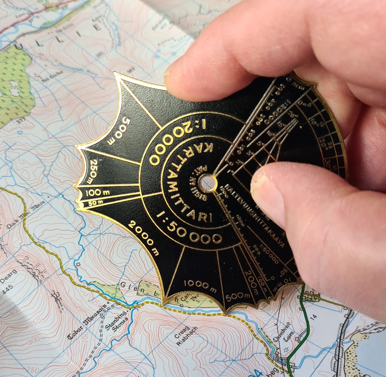
It is fairly easy to see how the measure is used. With a map to the correct scale, the prongs, or calipers, straddling a specific distance (shown on the measure) can be ‘walked’ across the map, giving an indication of the distance traversed. Five different distance ‘legs’ are included for each scale. Note the additional 10mm arc measure for all scales.
1:25 000- 50m, 100m, 250m, 500m, 1000m divisions.
1:100 000- 250m, 500m, 1250m, 5000m divisions.
1:20 000- 50m, 100m, 250m, 500m, 1000m divisions.
1:50 000- 50m, 100m, 500m, 1000m, 2000m divisions.
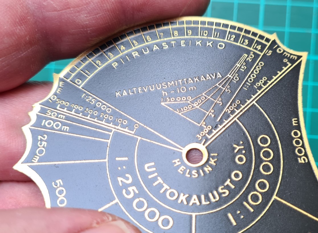
The Karttamittari includes a tool for calculating slope angle. This is the “KALTEVUUSMITTAKAAVA” shown on each side of the measure. This translates as ‘slope scale’. There are scales for 10m contour intervals on 1:50 000 and 1:100 000 maps, and 5m and 10m contour internals on 1:20 000 maps. The distance between map contours is compared (with some difficulty) with those shown on the kaltevuusmittakaava chart and the slope angle is indicated. The closer the contour lines are drawn on the map, the steeper the slope.
The measure includes a couple of other angle scales that may be useful during surveying work. “PIIRUASTEIKKO” is a drawing scale. This is a 0-15 scale for calculating radians. 2π radians equal 360° ⇒ 1 radian (1 rad) = 360°/2π = 1 radian = 180°/π = 57.296°. On the other side of the measure is a, perhaps more easily understood, 90° protractor with 5° increments.
There are three distinct models of the same Karttamittari measure. Models I and II have identical map measuring scales, differing only in their protractor detail. Model III swaps out the 1:21 000 scale on Models I and II for a 1:25 000 scale, and the 1:42 000 scale on I and II for a 1:20 000 scale. Despite being extremely analogue in operation, Model III is still a reasonably effective measure to use with UK Ordnance Survey maps, both 1:25 000 Explorer and 1:50 000 Landranger.
Model I: Four scales:
Side one: 1:21 000, 1:100 000
Side two: 1:42 000, 1:50 000
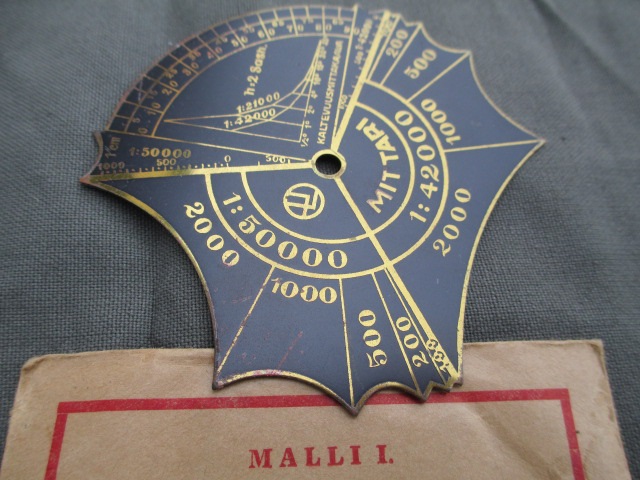
Model II: Four scales:
Side one: 1:21 000, 1:100 000
Side two: 1:42 000, 1:50 000

This month’s map measure-
Model III: Four scales:
Side one: 1:25 000, 1:100 000
Side two: 1:20 000 and 1:50 000
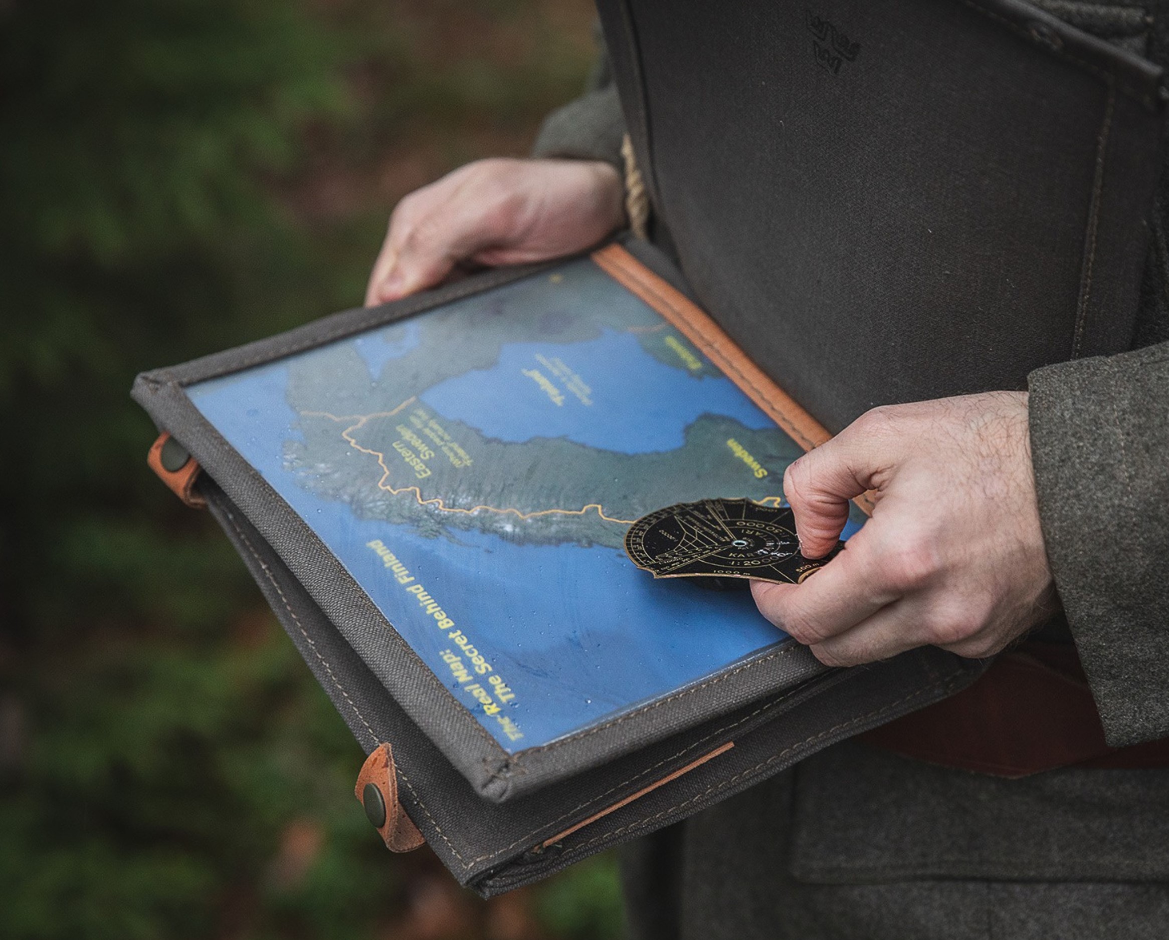
The Karttamittari Malli III measure shown here was purchased by me as new old stock in unused condition in a sealed envelope. They appear on the market quite frequently, mostly sold, unsurprisingly, out of Finland. Most examples being sold are in used condition which is due to their robust build and long period of manufacture with a large number produced.
Three Points of the Compass has looked at a few more Map Measures in detail. Links to these can be found here.

Beautiful item!
LikeLiked by 1 person