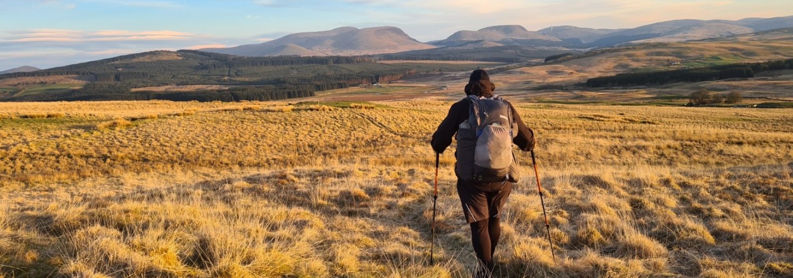
Three Points of the Compass hits the trail in Swedish Lapland, participating in the annual Fjällräven Classic, a 110km walk above the Arctic Circle.
Day one: Nikkaluokta to Kebnekaise
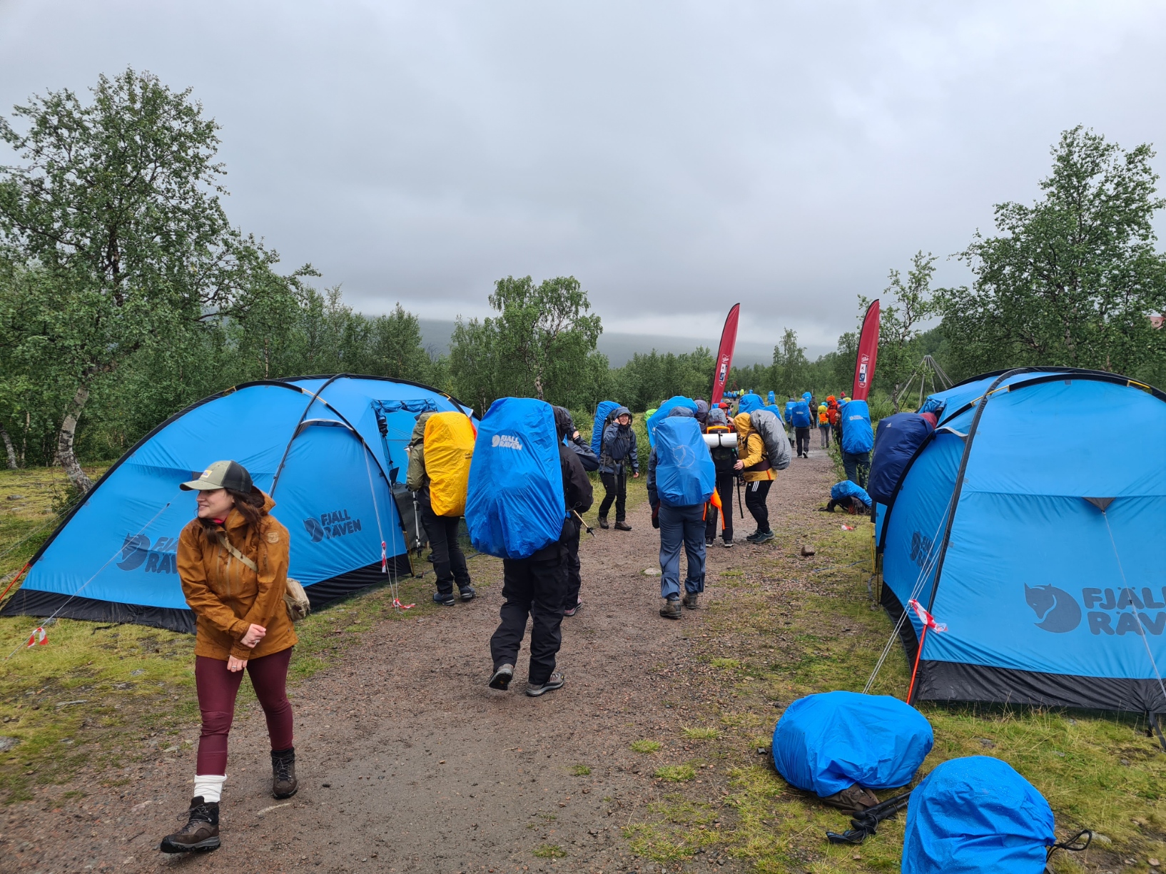
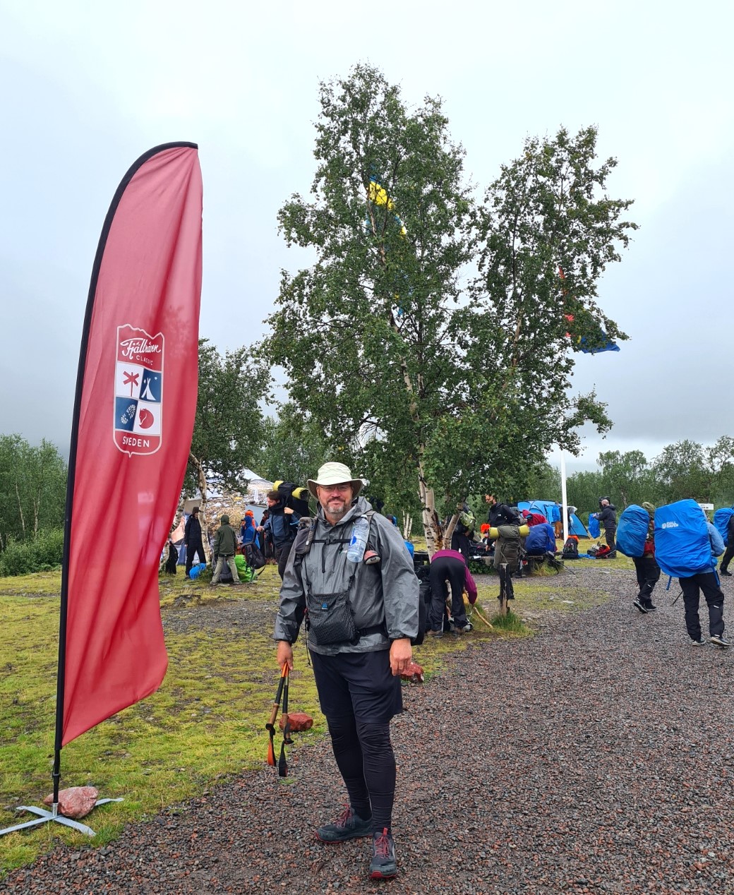
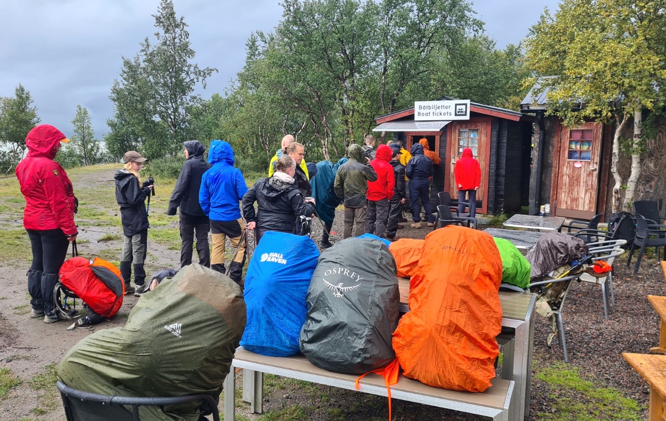
Having travelled out from the UK the previous day, I camped at the mining town of Kiruna prior to catching one of the coaches organised by Fjällräven to transport participants in the Swedish Classic to the trailhead at Nikkaluokta. This is not the quickest of transfers and despite a booked 09.30 start time, myself and a good few hundred other hikers all left town a little later than planned. It didn’t really matter, everyone was in high spirits, one Chinese chap running round the carpark with his country’s flag, to much cheering. Coaches eventually arrived, we all eventually got on board for an uneventful 90km drive through forest roads. Debussed and reconnected with my pack, it wasn’t until midday that I got my hiking passport stamped and I set off down trail. There are plenty of daylight hours at this time of year here and I wasn’t under any form of pressure to get my first day’s stage completed by any particular time. The early morning mist, OK fog, back in Kiruna had changed to the lightest of drizzles which made for easy cool walking. Everyone was in a state of restrained excitement and anticipation and it took me a while to adjust to the pace of the trail.
“Discover trekking the Fjällräven way, on nature’s terms – carrying your own equipment, setting up your own tent, cooking your own food and walking at your own pace, together with others just like you”
Fjällräven
It was today that I found any desire to stick to my initial rate of progress was going to prove difficult. I started quite swiftly out of the gate and soon found that the multitude of hikers on the frequently narrow tread meant that this was difficult to maintain. After a couple of hours I dropped my pace down considerably, decided to play the long game, and adopted a slow ‘n’ steady lolloping pace for the remainder of this trail. My problem is, if it is indeed a problem, once my legs become accustomed to a more sedate pace, I sometimes find it difficult to select an ‘overdrive-mode’ if required.
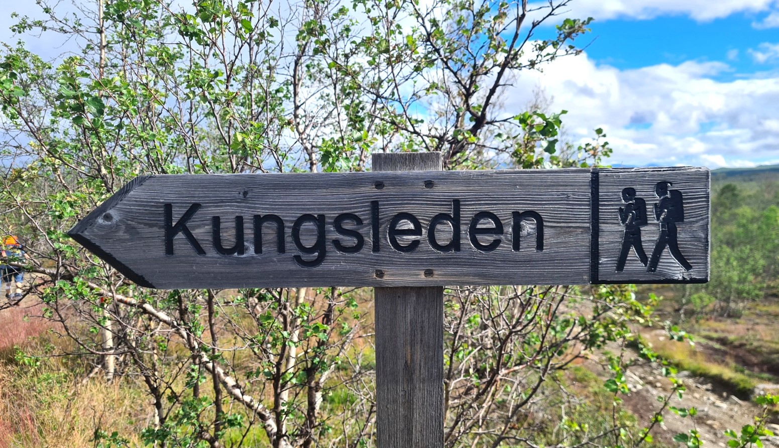
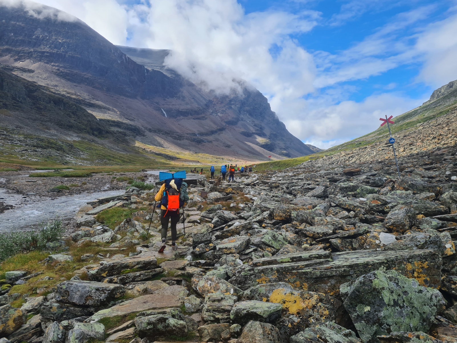
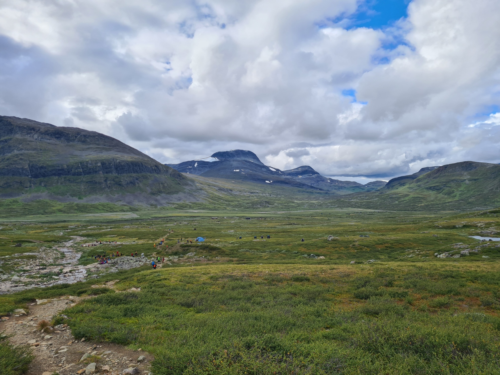
Setting off from the Nikkaluokta trailhead, the 110km Fjällräven Classic Sweden trail heads west toward Singi. From there it swings north to Sälka as it joins the northern section of the Kungsleden (The King’s Trail), heading toward the finish at Abisko. The Classic actually follows the Dag Hammarskjöldleden, inaugurated in 2004 as a pilgrim route between Abisko and Nikkaluokta. You won’t see much about this trail anywhere on the route, other than encountering seven viewpoints, each with ‘meditation stones’. Each stone has a quote by Dag Hammarskjöld engraved on it. I hadn’t heard of the man before this trail. U.S. President John F. Kennedy called Hammarskjöld “the greatest statesman of our century”. Obviously his life is defined by a great deal, but I confess to being intrigued by the mystery surrounding his death in an aircraft crash. I encountered, or at least noticed, the first of these engraved stone monuments later on the trail.
Beside Dag Hammarskjöldleden, it does seem that a great many people either finish or set out from Nikkaluokta to hike the Kungsleden, instead of starting or finishing at Hemavan, a good distance further south, The northern section is reckoned to be the best of the trail and I passed quite a few hikers who had set off from Abisko heading south and were now on the final few miles of their hike.
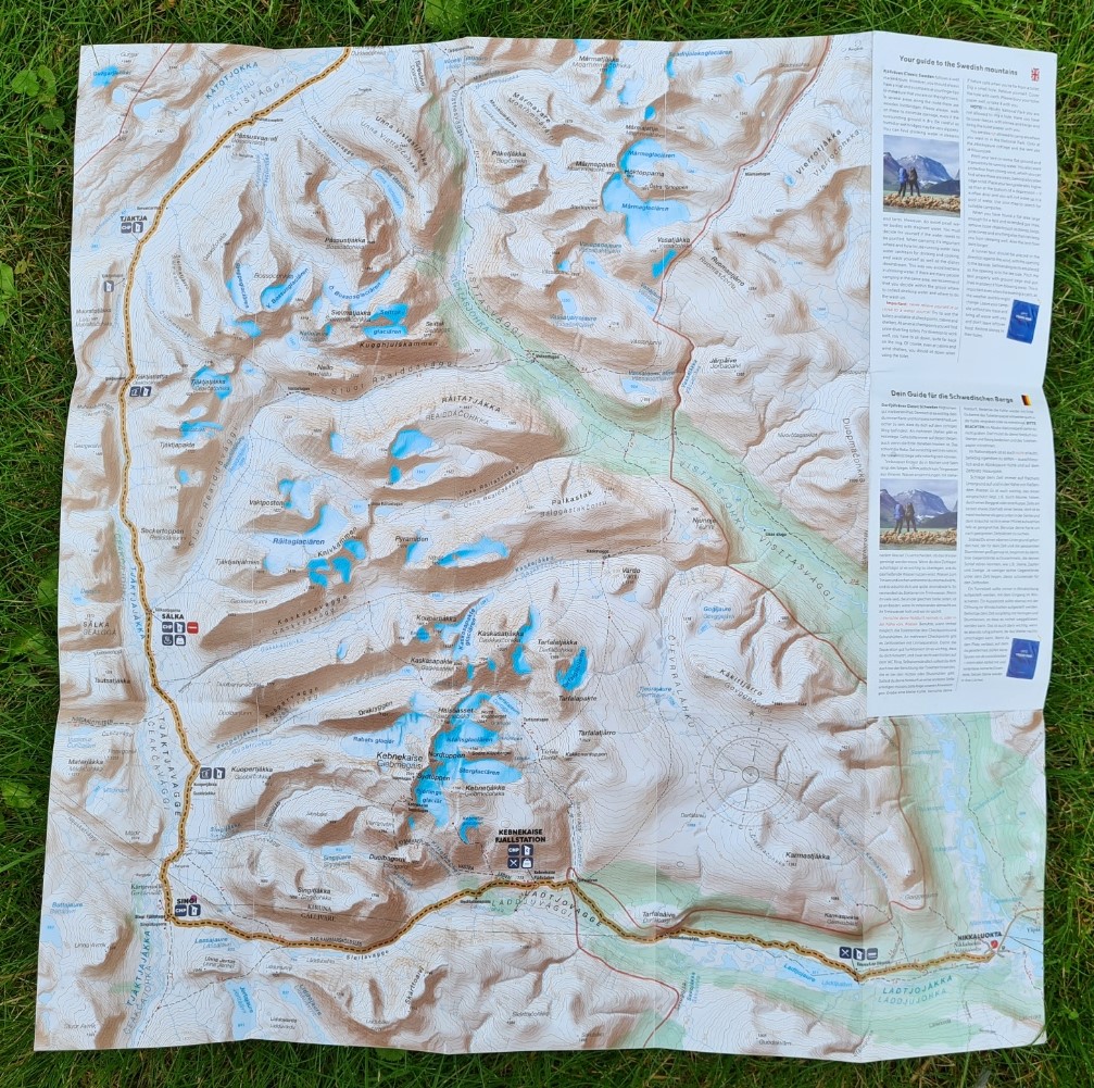
An online AllTrail map of the route can be seen here. I had no need for digital mapping as not only is the trail easy to follow, but Fjällräven supplies every participant with a paper map printed at a scale of 1:75 000. Though note that this turns to pulp with the merest hint of any damp and needs careful protection from the elements. Something I failed to do on the very first day so had to mollycoddle the tender remains of my map for the remainder of the trail. A rookie mistake, particularly as I had failed to pick up one of the protective plastic bags that were on offer in the gym hall last night. The map shown here is an intact second map that found its way into my suitcase at the beginning of the trail, it would have been better off making its way in to my pack as a backup. That said, it is an easy enough trail to follow for the very great majority of it’s length, particularly with large numbers of people on trail that have walked it before.
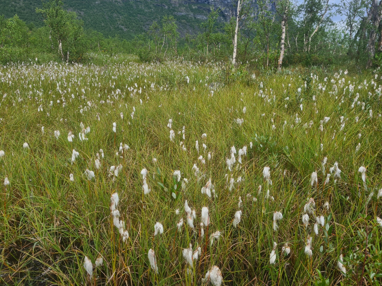
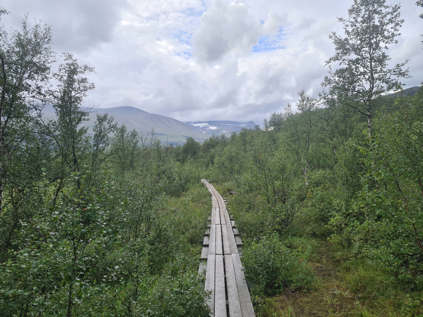
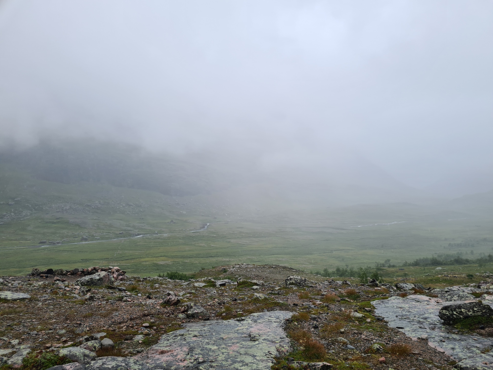
It rained, it stopped, it drizzled, it stopped, it rained again. Waterproof on, waterproof off, back on and back off. It was too humid to keep it on. The birch forest occasionally opened up to wetter ground with low or stunted vegetation. Cotton grass was extensive in the boggier ground frequently traversed by boardwalks. I had been expecting mosquitos but there were few, which frankly, was a bit of a relief as I know it can get pretty horrendous here at certain times of the year. That said, there were enough mozzies to discourage me from taking the breaks that perhaps I should. Bird life was minimal, a few Tits and spuggies in the trees, and I am pretty sure it was Peregrine I heard on the cliffs a little further on.
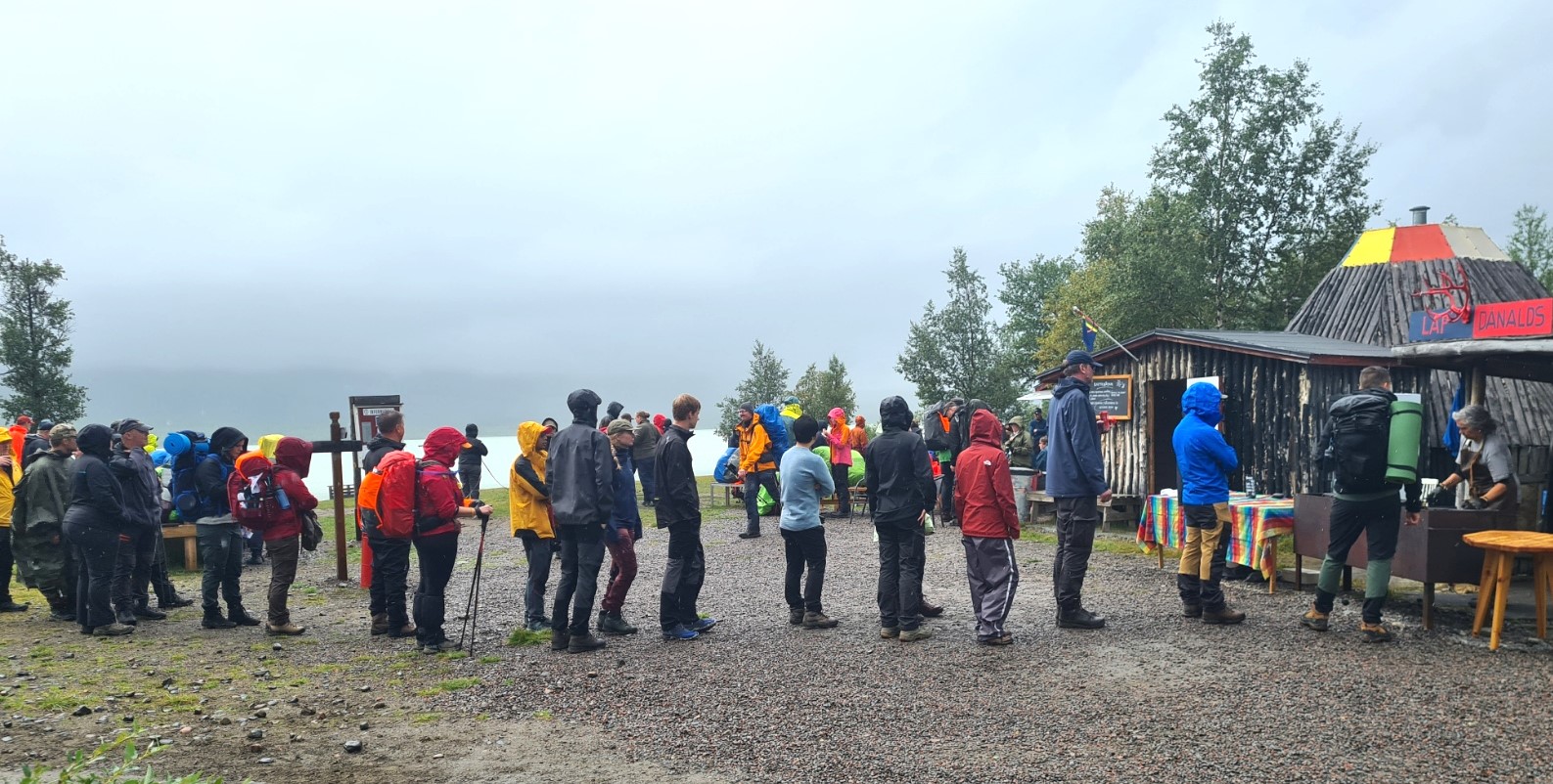
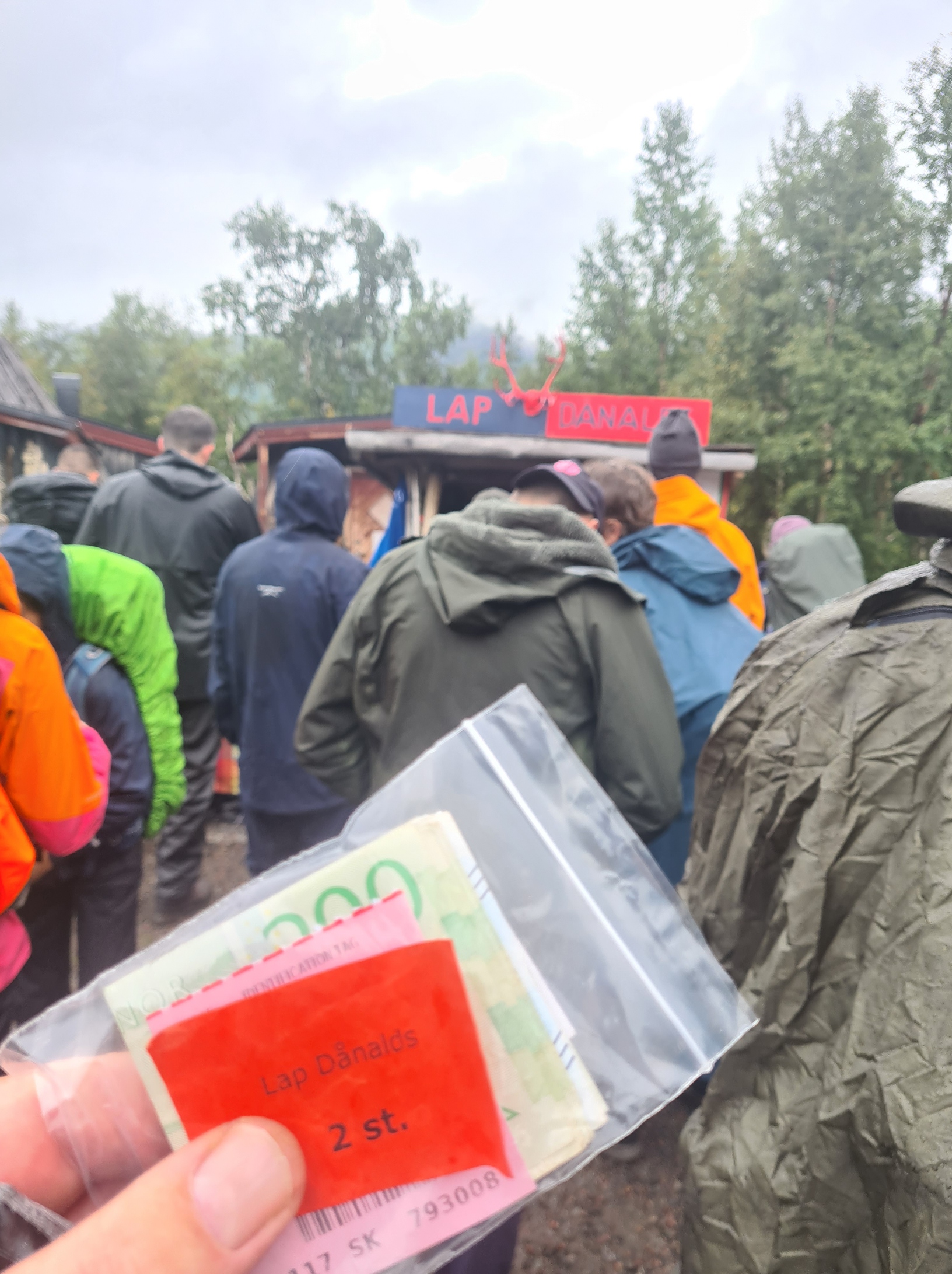
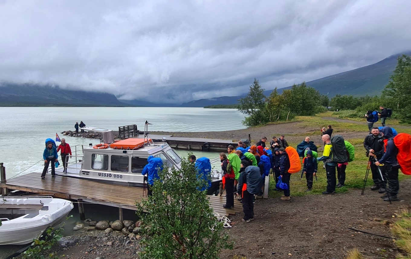
After just 5.6km of walking the trail reaches the Sámi run Enoks at the glacier lake, Láddjujávri. Just about everyone halts here to carry out a Classic tradition- queueing for a reindeer burger at the woodbuilt lakeside huts. Most walk on after this but a fair few ‘hikers’ instead buy a ticket for the boat that takes them to the other end of Lake Láddju. Like everyone else I paused for a half hour and stood in the rain to first pay for a burger, then queue to get it, then eat it. Reindeer meat is extremely lean and the burger lacked succulence as a result. It was tasty enough, however I didn’t bother buying one of the beers also on offer here as I had only just started out and wasn’t that desperate, yet.
Participants in the Classic used to be banned from taking the boat ride alternative to actually walking the length of Lake Láddju, however the organisers have now decided it is a permitted alternative, a decision that somewhat baffles me. Perhaps it is to keep in with the Sámi that run the boat service and I have no doubt that it is an enjoyable boat trip. Just not for me. Obviously I kept walking. The event is billed as a hike through Swedish Lapland after all.
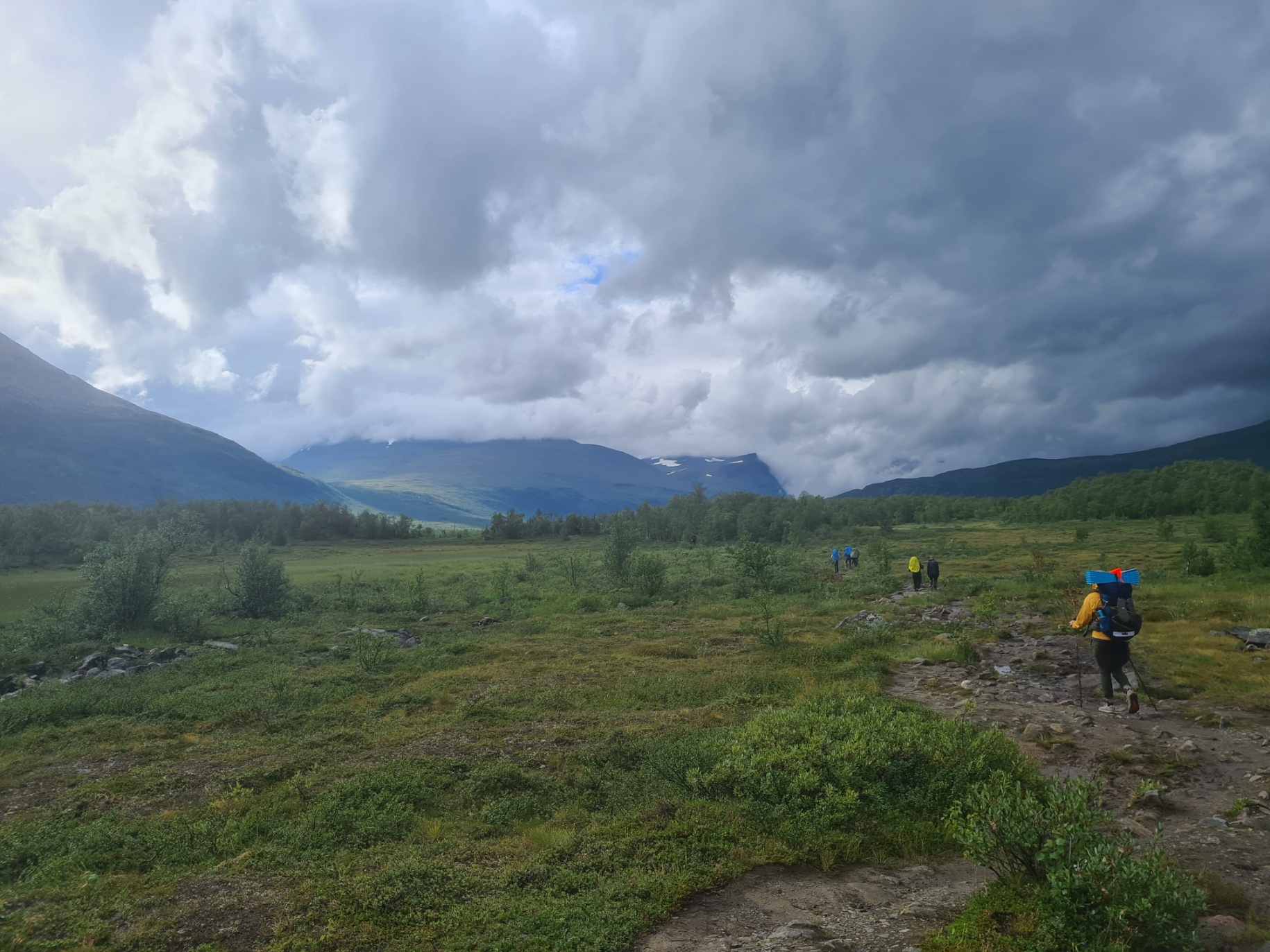
At least the number of people on trail was reduced just a little for the six or so kilometres that the boat ride skips. I had already begun to get just ever so slightly annoyed by the occasional crocodile of parties of hikers. Trail etiquette seemed to be a mystery for most of them. Any time a break was taken by a group of ten to twenty hikers they simply stopped in the middle of the trail to chat and it was difficult to get past them.
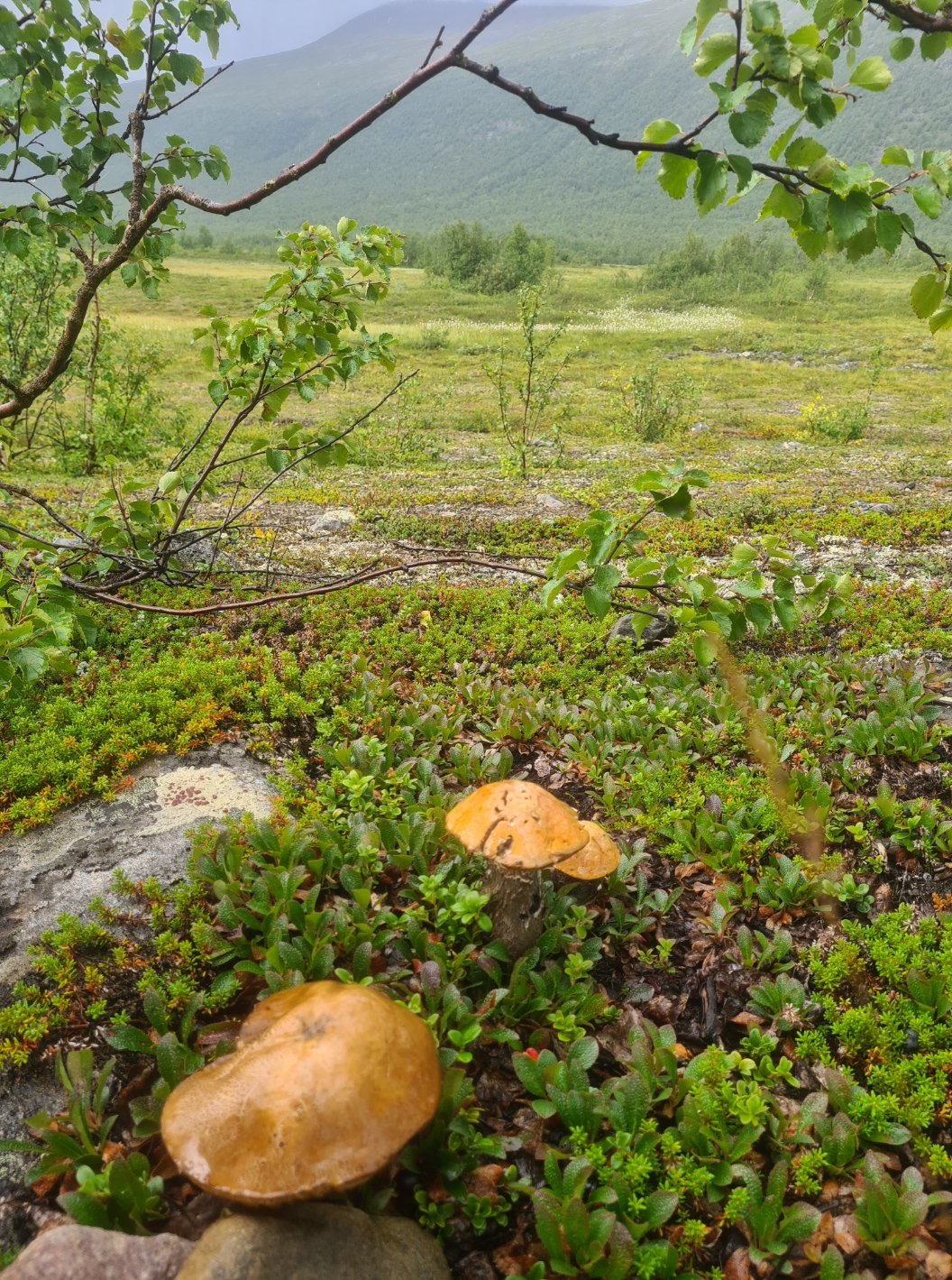
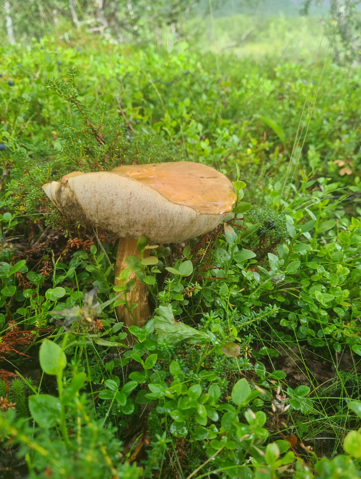
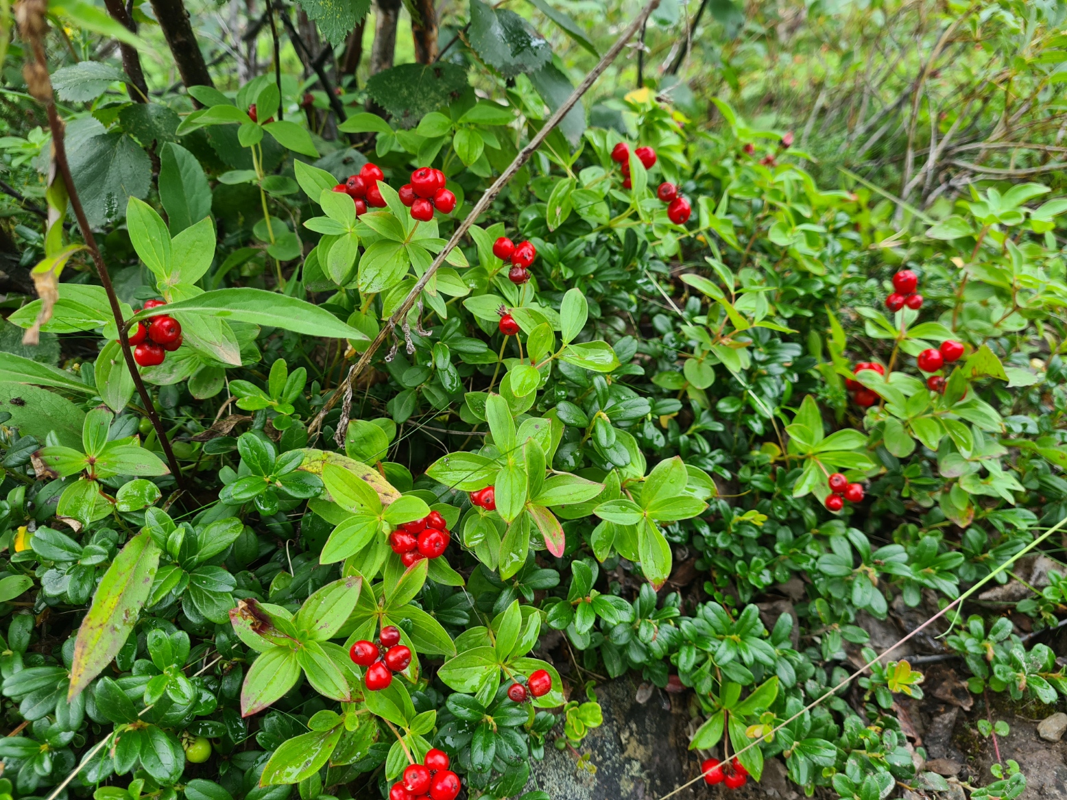
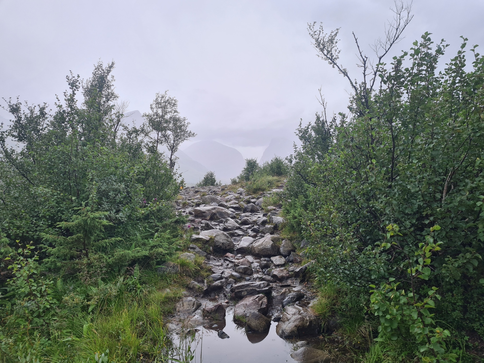
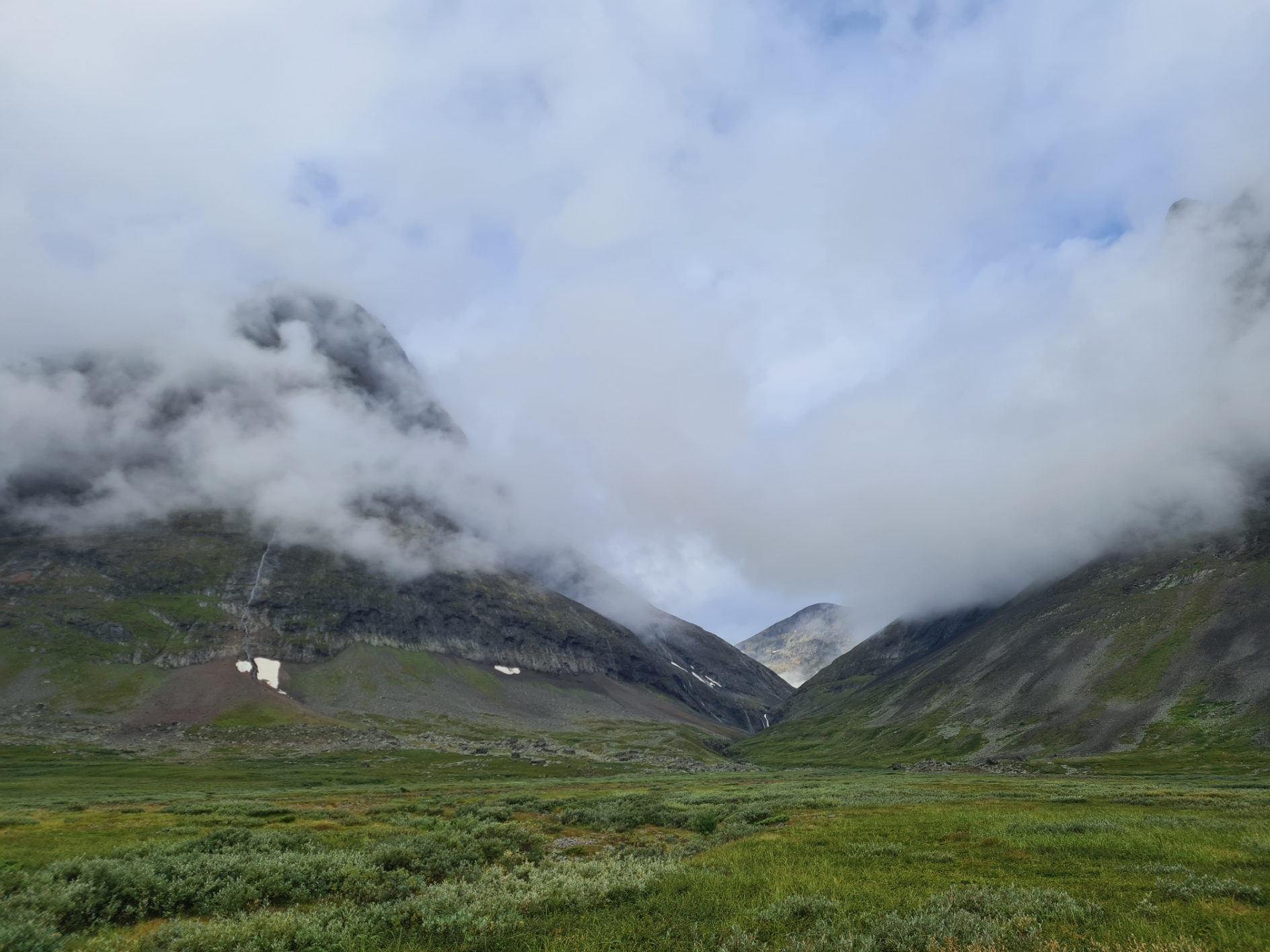
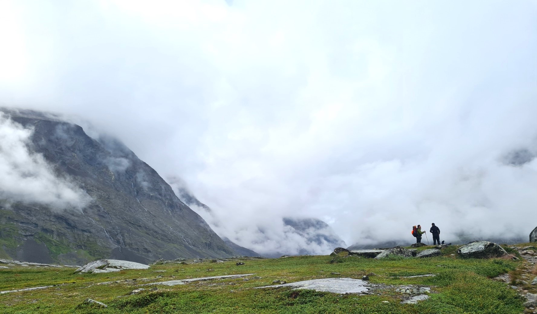
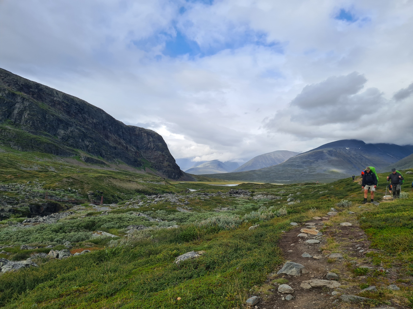
There are quite a few trees on day one- birch, rowan, aspen. Symbiotic relationships mean there is also a few fungi around too. Trees are left behind eventually and the trail opens up with low clouds cloaking the slopes of the hills all around. The trail gets ever rockier and my rate of progress was slowed as a result. Not for some people however, some striding out with impunity. I will note that I heard of two bad injuries on this first day, one gashing a leg on the rocks, another his face. Both were helicoptered out. On boggier sections boardwalks had been lain. Further on down trail these also traversed some of the rougher, potentially leg-breaking, moraine and talus.
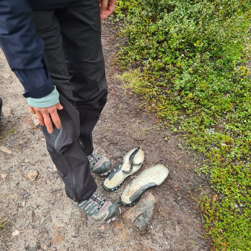
While the Fjällräven Classic is a decent trail for any experienced backpacker, it is also an ideal entry level experience for newcomers. Fjällräven provide a lot of helpful information in advance to help newbies prepare however it simply isn’t for everyone. I passed a Chinese lady talking to an obviously distressed younger (20ish) man, possibly her son, or grandson? He was sobbing and I stopped to ask if I could help. She told me he was just tired and I encouraged the two to hydrate, eat, slow things down and make an early halt. I found out later he had dropped out that day. One of sixty-six who retired from the event for one reason or another. Further on I was passed by a young lady walking back to Nikkaluokta with a broken finger sustained when she fell.
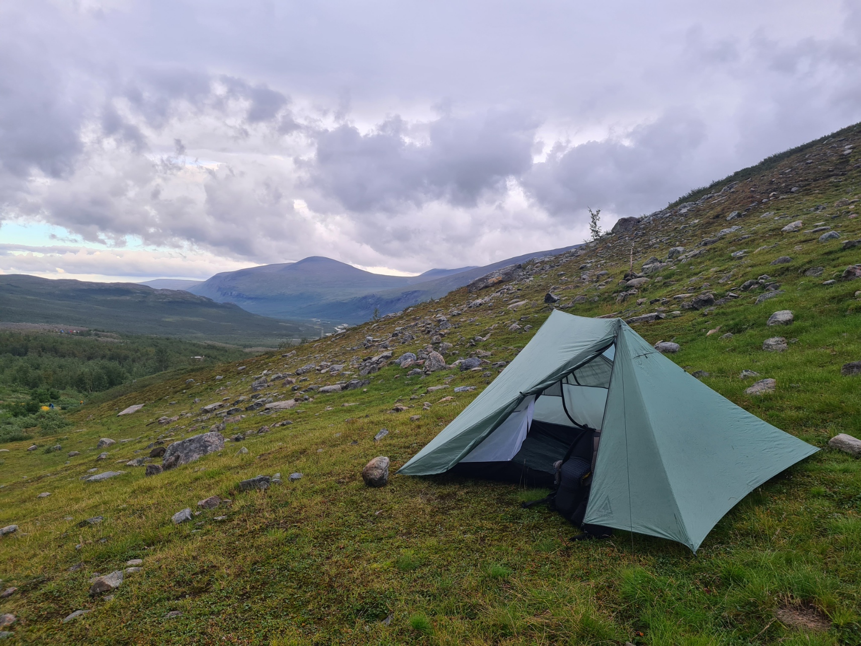
Soon after the Kebnekaise checkpoint, approaching the huts at Kebnekaise Station I came to a sign directing all Classic hikers away from the huts on a long and fairly tortuous (well it was at this point in the day) detour up the slopes and around it due to the reported virus at the huts. I stopped to filter a couple of litres of water for the night at a little indifferent stream on the way up, popping in a couple of Chlorine Dioxide tabs for good measure. Adding the weight to my pack as I climbed. Needless to say, I came across a much better running stream on my descent further on. I didn’t fancy any of the areas that most hikers were choosing, all looked a bit exposed on south facing slopes and the weather promised to be deteriorating later. I carried on to a more sheltered area and quartered the ground looking for something approaching a level pitch. Unsuccessful in finding anything flat enough for the full footprint, I eventually found a gently sloping, Durston sized, pitch with a pad-sized flat spot in the centre, that’ll do!
Once pitched I wandered down the slope to chat to the four southbound hikers camped further down, that were sat around a fire ring. Two from the Netherlands, one from Belgium and a talkative chap from Switzerland. They hadn’t set off together, instead meeting soon after Abisko, getting on so well that they fell in together. The chatter was all about their falling out with the warden at Kebnekaise huts who had refused them use of the showers. They had been able to hire crampons at the hut however and were set to climb Kebnekaise the following day. Some Classic walkers will take a day out to do this, but it held no interest for me. The massif has four peaks that can’t seem to make up their mind which is the highest in Sweden. Climate change had meant 24m of snow has melted on the southern peak, once the highest at 2120m, meaning the exposed rock of the north peak is now the highest at 2096.8 metres.
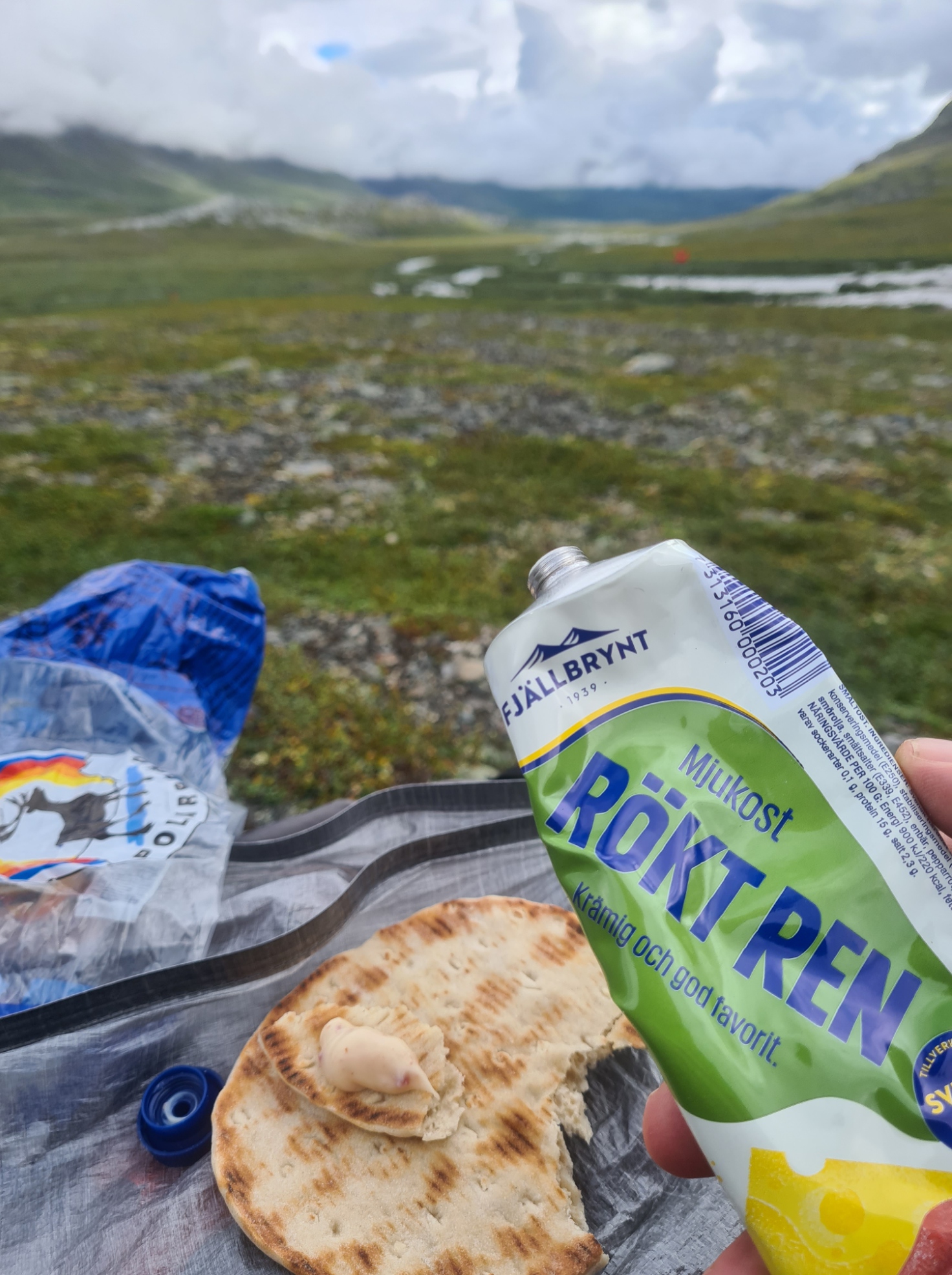
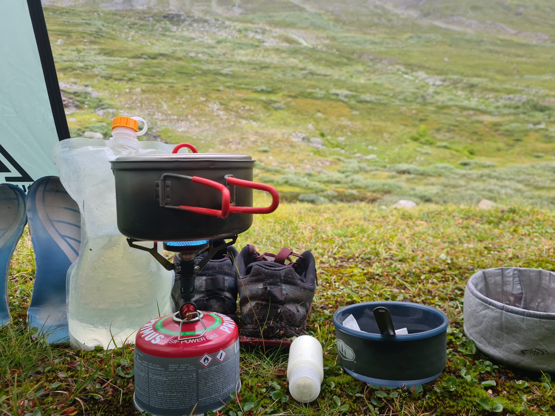
My evening meal was a rehydrated Cod in Curry Sauce that I did not enjoy at all, chewy fish! Sitting outside my shelter on this first night on trail, I was gazing across the valley when I saw movement. I was inordinately thrilled to see my first reindeer, grazing opposite. It shouldn’t have been any surprise as they are farmed by the native Sámi and free to roam and graze within the very large fenced demarcations. There are around half a million reindeer in Sweden and Norway and they are the most important cultural symbol for the Sámi and also their most valuable resource. In my ignorance, I hadn’t realised there are three types of reindeer in Scandinavia- wild reindeer, mountain reindeer and woodland reindeer. Wild reindeer disappeared from Sweden at the beginning of the 20th century though they can still be found in neighbouring Norway. Both male and female reindeer grow antlers, the only deer species to do so. The half dozen or so animals steadily grazed the slope, working their way down to the stream below me.
I brewed a pint of tea and drank it while I had a bit of a sort through of my gear. Remarkably, I got a signal and facetimed Mrs Three Points of the Compass. This was the last signal I got until I reached Abisko. I could hear hikers walking past until quite late. Obviously some had quite a late start and a late finish to their day as a result. Notes written, map checked, then, around ten, to bed, to sleep, perchance to dream.
Day two: Kebnekaise to Sälka
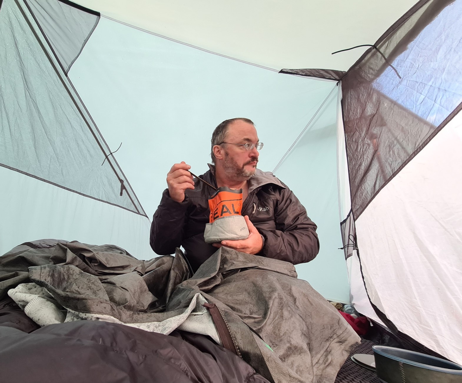
It was a wet night, the rain occasionally rattling across the Durston occasionally disturbing my sleep and dreams, but never really troubling me. I also stirred when I heard pegs being hammered in with a rock quite late, but I rested pretty well considering. In the morning I sat with my tea and awful Real Turmat Blueberry and Vanilla Muesli, contentedly looking out of the shelter at the swirling clouds that surrounded me. Occasionally they cleared sufficiently for me to see the bright red, yellow or blue pack covers of Classic hikers slowly climbing the slopes below me and disappearing around the side of the hill I was camped on. Cloud level gradually rose and left me below. It rained, but half-heartedly and I waited for a pause before exiting to wipe down the fly. Once I had finished, it started raining again so I went back inside for another brew. It stopped raining and again I exited to wipe down the fly for a second time. The rain held off long enough this time for me to stuff the shelter into its bag which was then slipped into one of the side pockets on my pack.
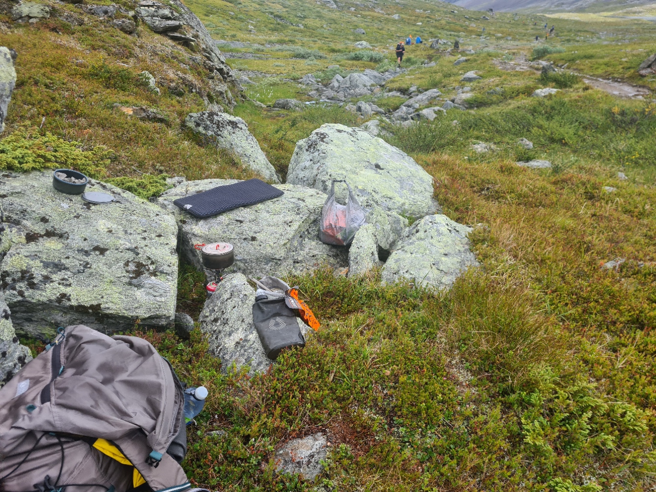
Water is not a problem on the Classic as a great many streams and rivers are passed. I carried a 500ml bottle on my pack’s shoulder strap and filtered water as required, filling a two-litre Evernew ‘clean water’ bladder prior to each evening’s halt.
There were a lot of long-tailed Skuas flying around. These are strong and aggressive birds, very territorial and will dive bomb anything they think shouldn’t be in their patch, including reindeer, dogs, and the odd hiker. They feed primarily on Lemming, also present here in large numbers. I could frequently hear those little chaps calling, but their cryptic colour means they are almost impossible to spot, until you almost tread on one.
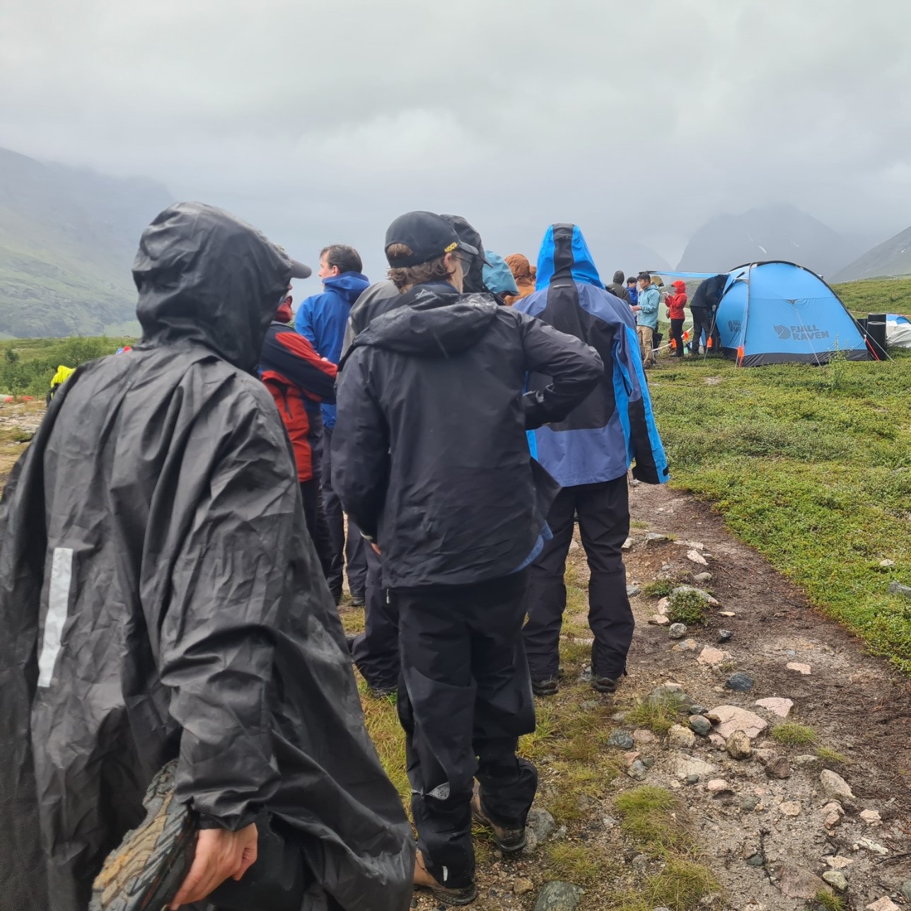
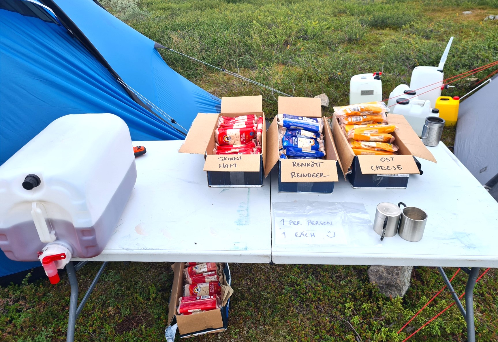
The Singi checkpoint had been placed a couple of km prior to the huts. It was pretty busy. Not only with the necessary business of getting hiking passports stamped, but the organisers had also lain on a freebie lunch of a sandwich and lingonberry juice, very much appreciated. Quite a few backpackers were also laying out their wet shelters on the rocks to dry in the partial sun. Others were actually setting up there, settling for a short day. It was now that numbers started to spread out along the trail as the racing hounds sped ahead and those wanting to make a slower experience were left behind me.
There was another wide berth round the huts as organisers tried to keep those on the Classic isolated from the stomach bugs that had raged through the hut system recently. Rumours were rife. Some scoffed at the precautions saying it was all over, others, over the next couple of days, were afflicted. Whatever the case, from Singi I was now on the main Kungsleden Trail, headed northward to the terminus at Abisko.
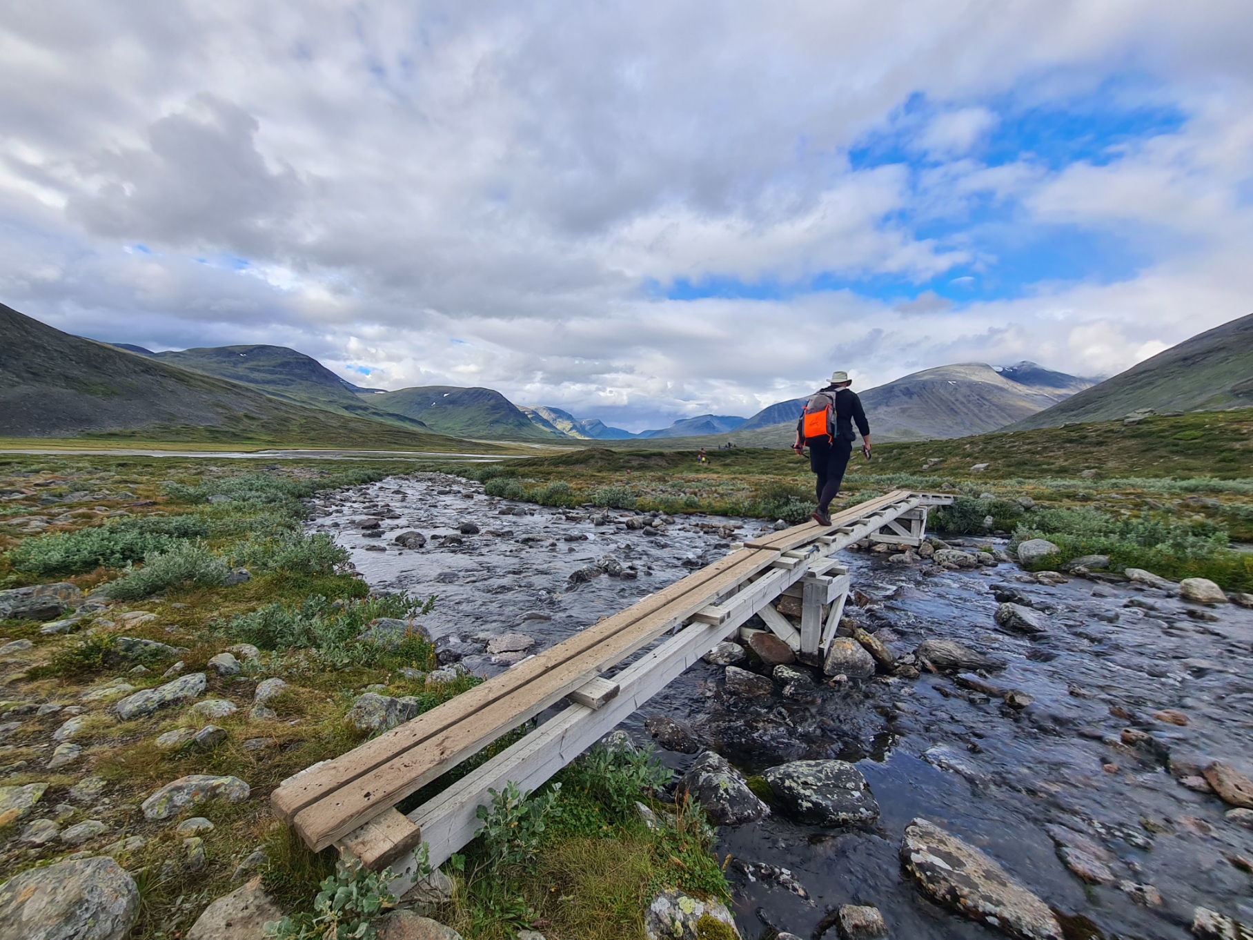
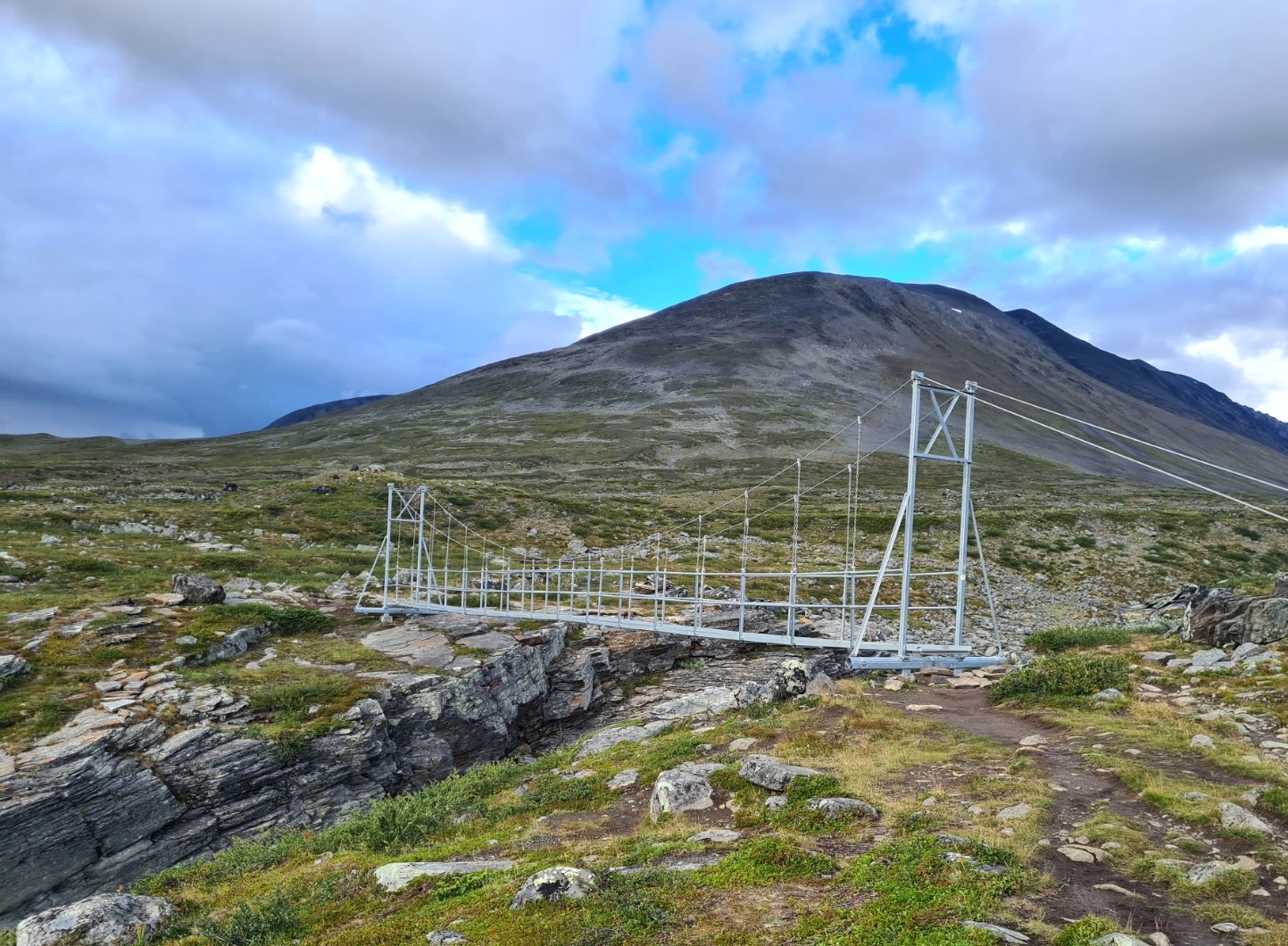
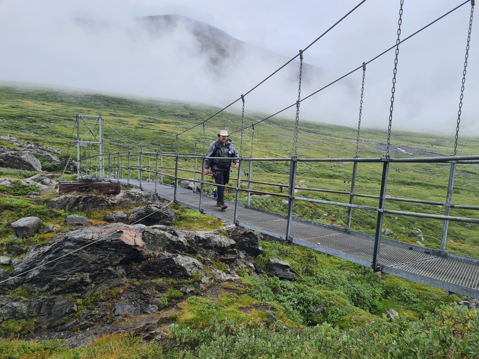
On the nine km stretch between Singi and Sälka, hikers began to peel off and pitch. There are some quite beautiful wildcamp sites along much of this stretch and I was extremely tempted to call it a day myself, particularly as grey clouds in front were threatening the blue skies above me. I was unsure if they would pass down another valley or continue to approach me as I had dried out nicely from my wet start to the day. Nope, soon after crossing the bouncy suspension bridge over the deep gorge at Guobirjohka and briefly pausing at the meditation stone on the other side, I walked into the first of a series of rain squalls that approached, drenched me and then carried on down the valley behind me. Each time the rain passed, the mozzies were out, in force, proving tiresome.
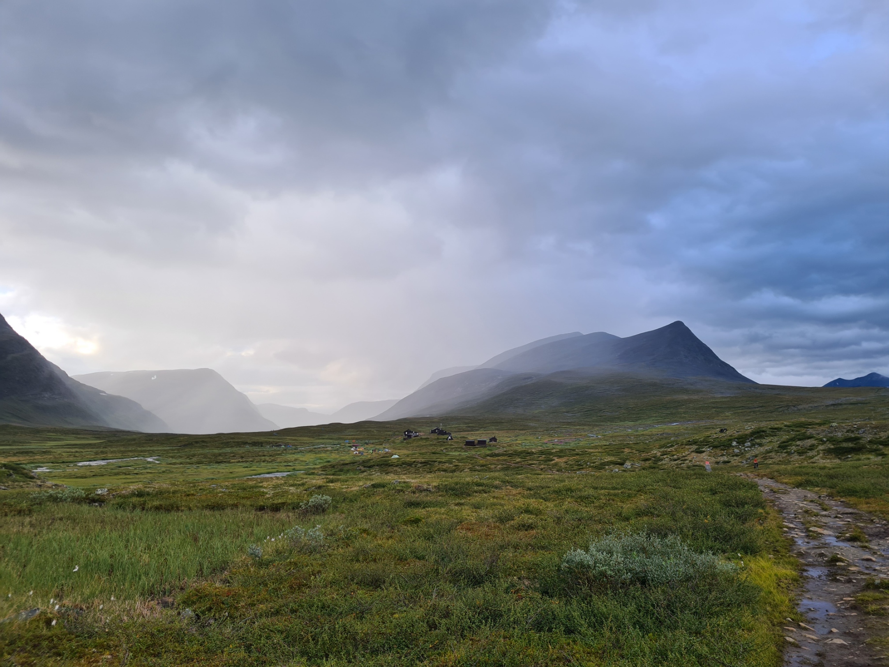
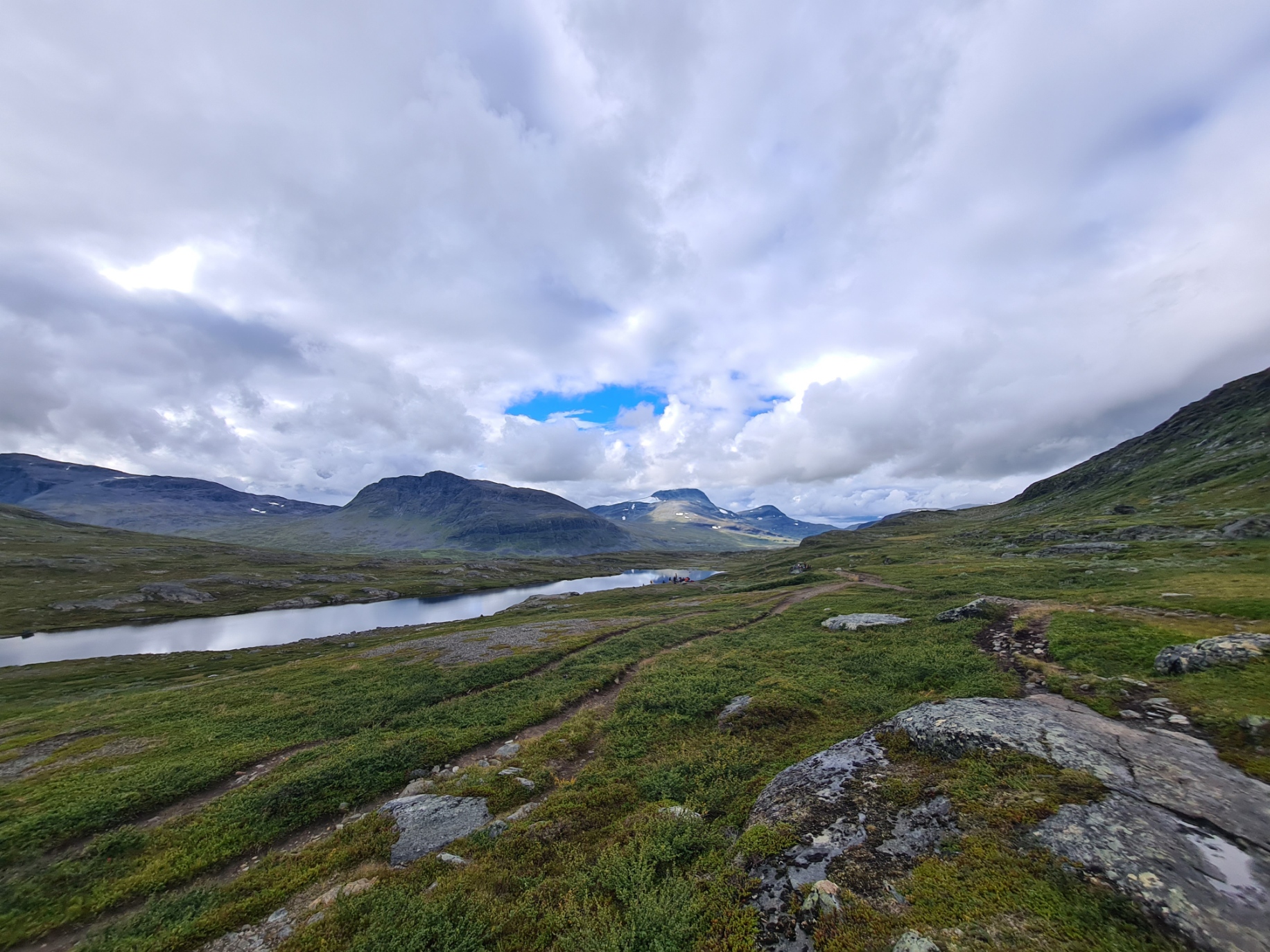
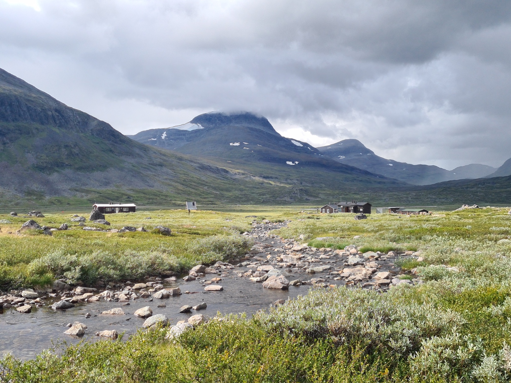
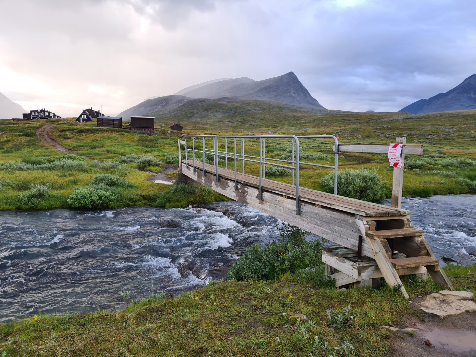
Once past the blue tents at Sälka, the final checkpoint of the day, it was a steady climb through the Tjäktjavaggi expanse to the sprawling huts at Sälkastugorna. It was again raining as I passed the huts. The rain passed quick enough but was enough to give a good soaking. The day was ending much like it had started. I had bought my oh-so-fragile but lightweight FroggToggs waterproof jacket as there is little on this trail to snag it and I found combined with my wide brim Tilley it was perfectly adequate for the conditions. There were a lot of tents pitched a little beyond the huts but I was aware that just a couple of kilometres further on there were suitable spots for tonight’s halt so was prepared to make a long day of it. This is a renowned scenic spot on the trail but the weather just wasn’t having it and I never paused beyond a couple of photos before double wrapping the phone away from the elements. I crossed the two bridges over the rivers that encircle the huts and, slipping and sliding, carried on through to the grasslands beyond, with the river-lake system of Tjäktjajåkka below on my left.
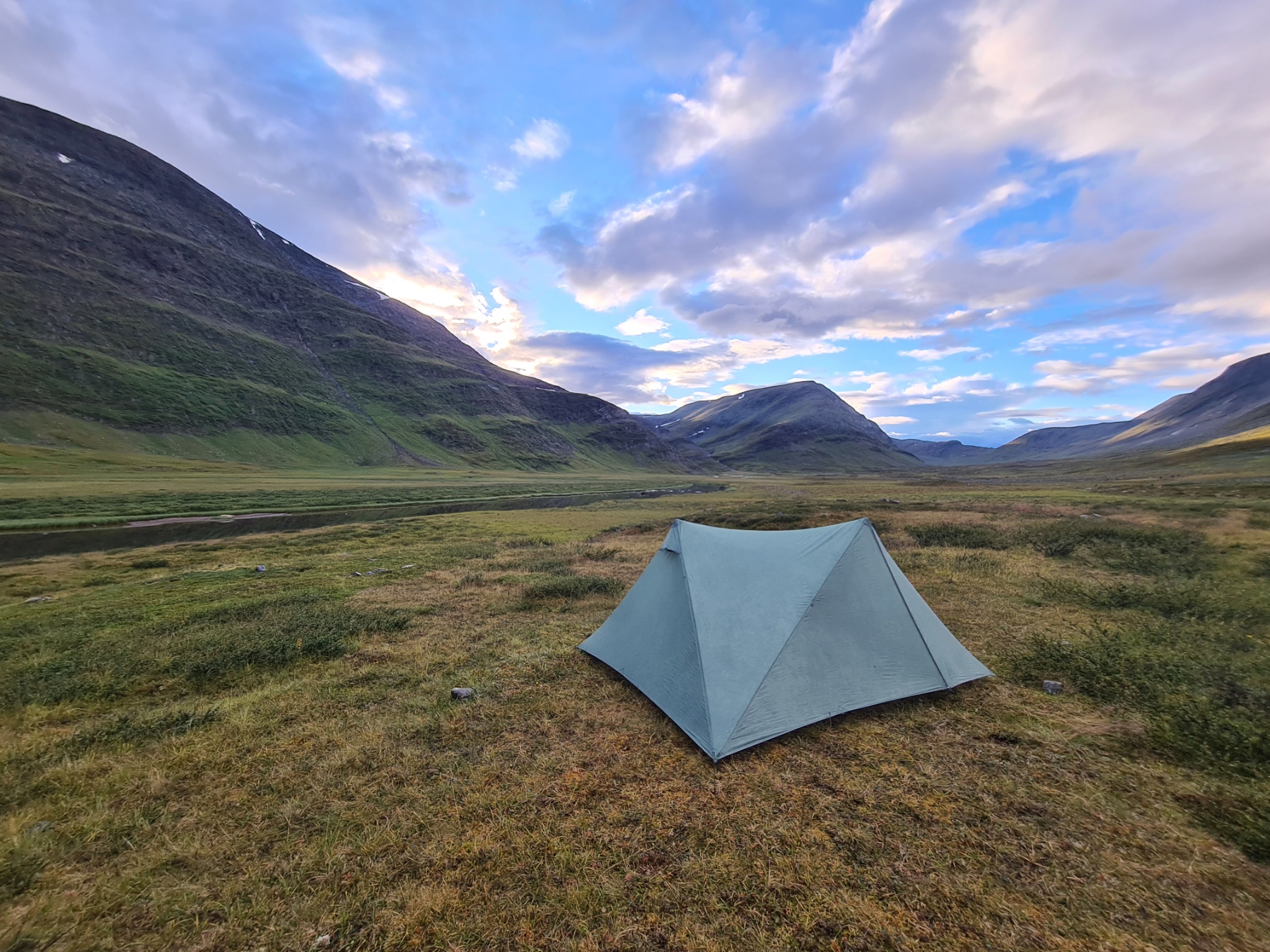
A couple of kilometres further on, the rain went away, the sky turned blue, and there was a wealth of decent flat grassy pitches on both sides of the trail. I turned off left, just fifty metres from the tread, for a decent wildcamp. I was fairly weary after a 29km day and thankfully the mosquitoes and midges were not too bad in the short time it took to throw the Durston shelter up. I dove inside, zipped up the bug netting and draped my quilt over me while I ate as the sun dipped behind the ridge and both the air and my body temperature plummeted.
My evening meal was a much appreciated and enjoyable hot Oxo and Real Turmat Kebab Stew. Despite being desperately tired I managed a cursory body wash prior to changing into my sleeping baselayers and brewing up a pint of tea, drunk with half a bar of decent chocolate, before a hard-earned night’s rest. No sleep for me yet however as a late group turned up and pitched close by, choosing to stand outside my shelter and chat to me for an hour or so. Obviously endowed with a good deal more excess energy than me, or perhaps their slower progress was the reason. They eventually returned to their tents and I settled down, it had been a good day. The Tjäktja mountain pass was waiting for me tomorrow.
Trail talk: Fjällräven Classic Sweden 2023- application, logistics and stats
Trail talk: Fjällräven Classic Sweden- heading north on the Kungsleden. Sälka to Abisko

4 replies »