Despite the route of the England Coast Path on Kent’s Isle of Sheppey not quite being signed off, Three Points of the Compass takes a best guess and knocks off the coastline of the ‘isle of sheep’ over two very different days.
The Isle of Sheppey is a place of contrast- a victim of historical lack of investment, a mix of old and new trades and industry. The main areas of residential, port and naval history are mainly situated at the central north and west of the island. What was once the birthplace of aviation to the east is now replaced by one of the finest places to observe raptors in England. Caravan parks border seemingly endless agriculture and grazing that border marshland, salt flats and estuarine habitat that support internationally important numbers of wildfowl, waders and raptors. There is little in the way of hills on the little island and the tallest point is near Minster in the north and that stands just 76 metres above sea level. The remainder is mostly a low lying landscape. With three prisons, pylons and wind turbines, much of it could be deemed as unattractive. But nonetheless it remains a fascinating and often rewarding destination for those with open eyes and an open mind.
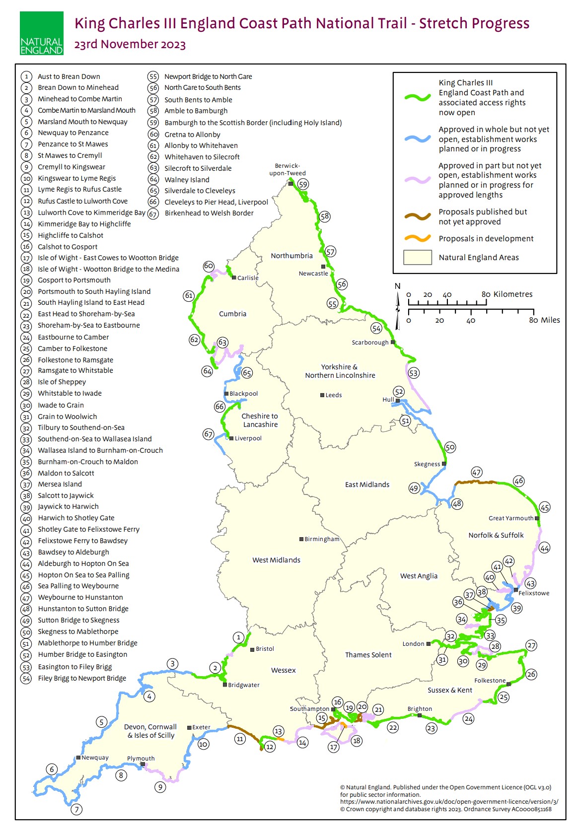
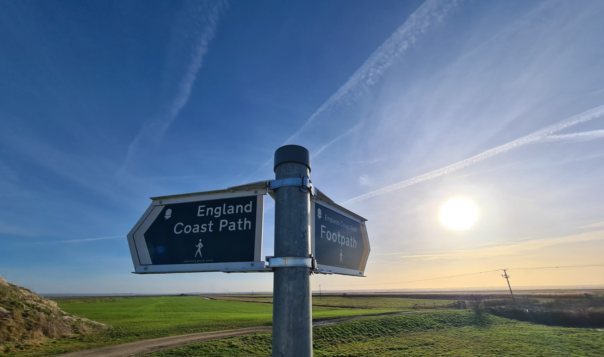
There seem to be a number of people walking the England Coast Path who exclude the Isle of Sheppey in Kent, regarding it as not part of the official route. The definition of what is included as part of the England Coast Path (more properly the King Charles III England Coast Path) was laid out in the Marine and Coastal Access Act 2009. Part 300 of the 2009 Act provides that ‘the coast’ includes the coast of any island other than an excluded island. An excluded island is one that is not accessible by foot from the mainland by bridge.
Despite a solely vehicular Sheppey Crossing having been opened in 2006, the old Kingsferry bridge that preceded it remains in place and in use, over which it is possible to walk from the mainland to the island. So, by definition, around 30 miles of the 2700 plus miles of the England Coast Path encircle Sheppey. This is a distance easily split over two days of walking. Two days that can reveal very different aspects of the island.
Sceapig – ‘Sheep Island’
Old English
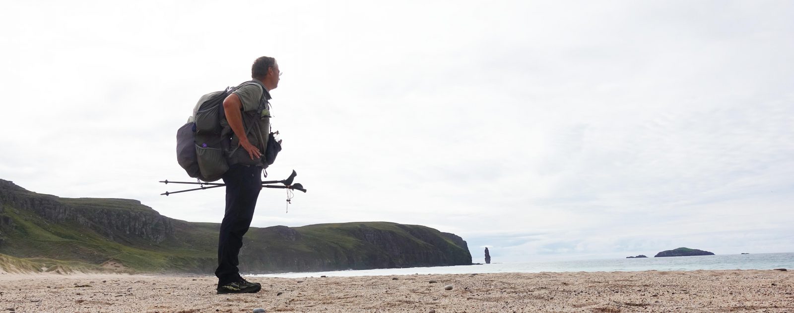
I have visited the Isle of Sheppey hundreds of times in the past but have never attempted to walk around it. Up until a few years ago it would have been a difficult endeavour. Sheppey is not too far from where I live and I have been waiting years for this coastal route to be resolved and it still isn’t quite there. I finally lost patience and decided to venture out and make what I can of what has been decided, what is still being argued over and what will almost certainly result, with a little bit of tweaking where I thought practical and preferable. A few evenings before I set off on day one of my island circuit, I spent a couple of hours reading the Gov.uk site detailing the various submissions being made, alongside counter arguments, for the England Coast Path route around the island. It made for both anticipatory and depressing reading and I am glad I am not part of any team that has to try and satisfy most parties, no doubt failing to please almost everyone. I link the official reference map here.
Day one: the southern half. Kingsferry Bridge to Leysdown-on-Sea, via Elmley and the Isle of Harty
I decided to start each of my day hikes at Swale railway station. Once recorded as the least used railway station in all of Kent, that somewhat dubious title has now been lost, presumably by the ‘hordes’ of England Coast Path walkers now using the station, or not! From there it is a short walk across the bridge on to the island and a coastal route can be taken either anti-clockwise round the south and eastern end, or clockwise round the west and north half of the island, ending each day at Leysdown-on-Sea. There is a regular but occasional bus from there to Sheerness, the major town on the island, that has a railway station and transport links back to the mainland. I walked the more lonely and what I thought would be more interesting anti-clockwise southern half first. Map miles indicated it was going to be around 16.75 miles from the lonely Swale railway station at the southern end of Kingsferry Bridge, to Leysdown. As it was, tracked miles showed I walked 17.34. My route can be seen here.
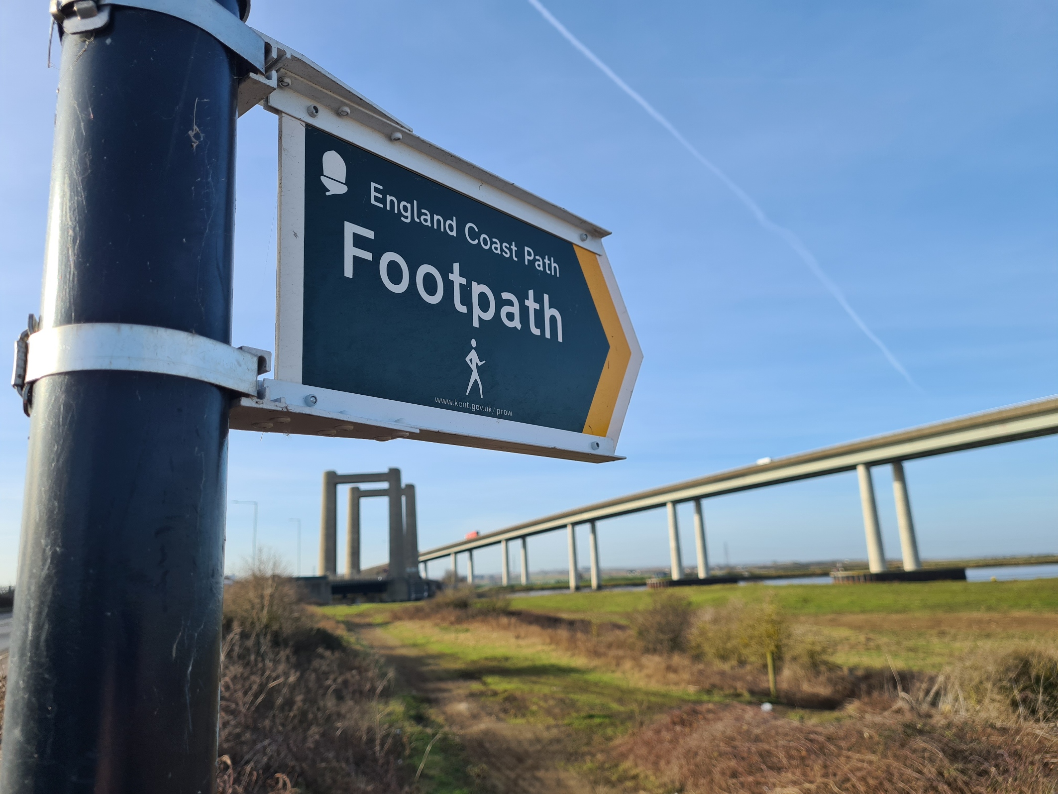
My early morning train from the mainland deposited me at Swale station and it was then a short walk across Kingsferry Bridge on to the island. I had timed my arrival for low tide and immediately over the bridge it was a sharp left turn and I walked back on myself to the foreshore. The now exposed mud and shingle permitting access underneath the bridge to the other side where it is a short scramble up the bank to the other side. Otherwise it is a long walk inland and back along farm tracks to the other side of the bridge. That will be the ‘official’ route once finalised. My route was not an advised route at all.
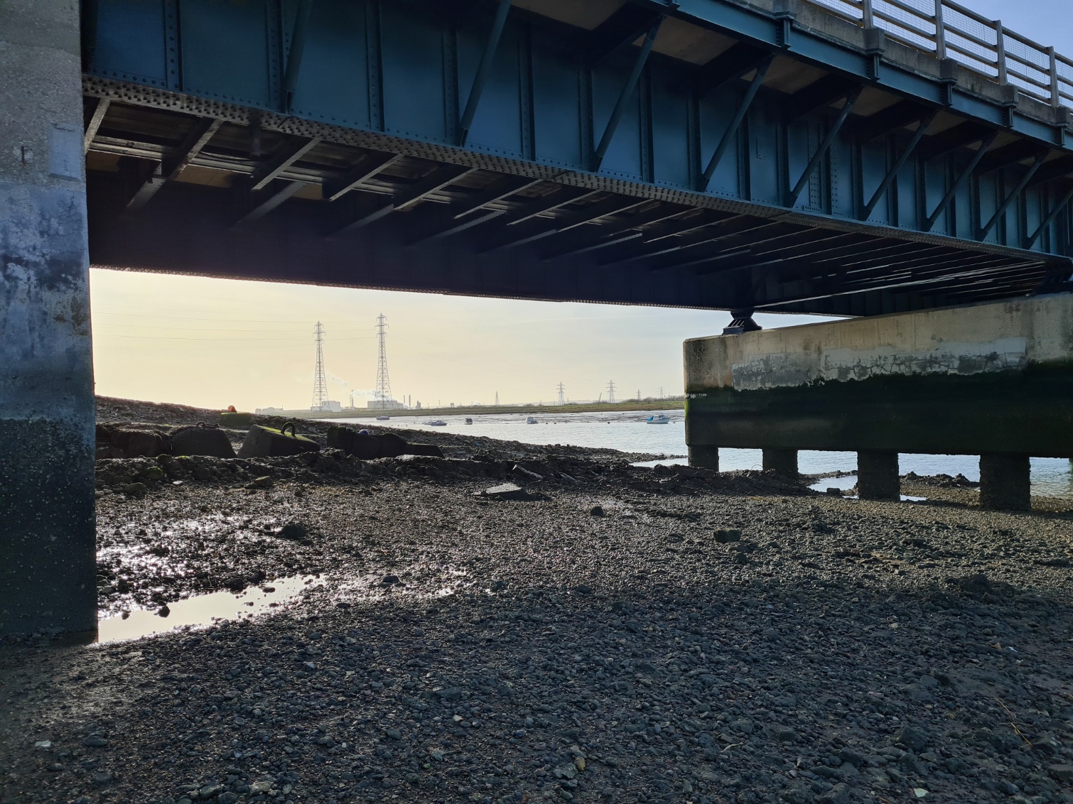
There are dire warnings of strong currents to beware, but timing it for low tide put me far above the water. What I hadn’t realised is there is a ditch beneath the bridge that also has to be crossed, a muddy slippery ditch at that, and I got a hand plastered with mud doing this prior to even setting off on my walk proper.

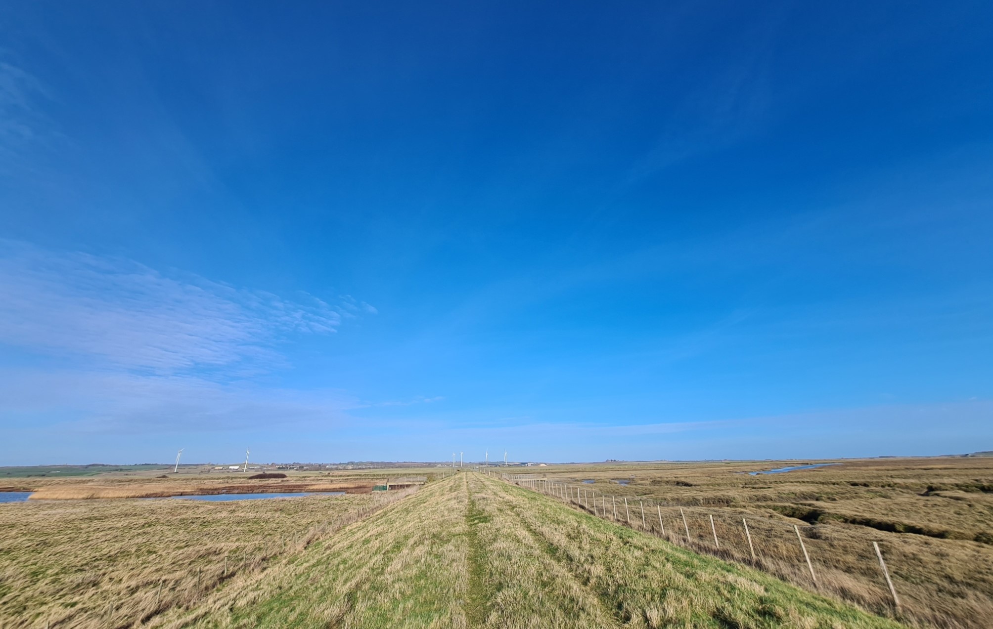
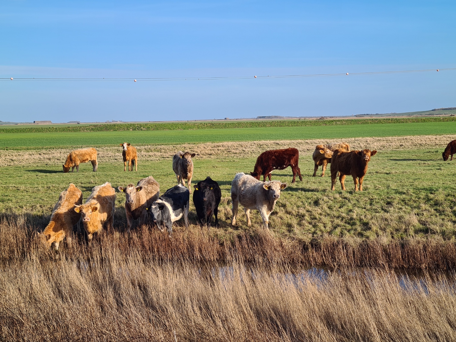
Almost all of my day would be spent following the sea wall or briefly venturing slightly inland to get round the many creeks and saltmarshes. I was almost immediately into what is now advertised as the only ‘farming family run national nature reserve’ in the country, presumably because so many other reserves on farms are actually owned by conglomerates rather than families. There used to be a small brickworks, wharf and accompanying village here, of which almost nothing survives beyond the ribs of a vessel exposed by the mud temporary abandoned by the water. I wandered around a little, exploring the site but there is almost nothing beyond some almost completely demolished walls of the pub that once was, and a few other bricks and concrete poking from lumpy grass. There was even a schoolhouse here, declared the smallest in England with only five pupils in 1919, three of whom were children of the headmaster. Nothing of it remains. Rabbits bounced away on the turf, probably surprised to be disturbed. An entire community gone with little to show they ever existed. There was no bird life on the water to my right either, and very little inland, other than a few Coots, Moorhens and a small flock of Goldfinches.
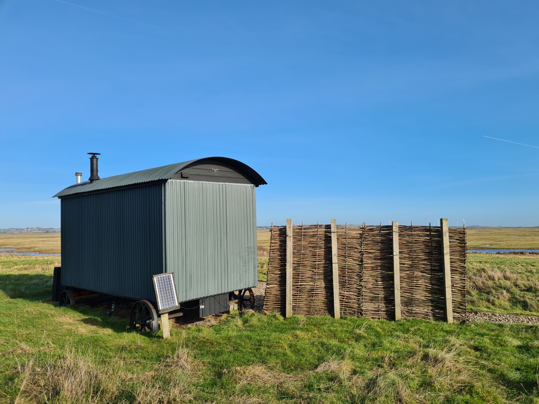
The 3200 acre Elmley has many rills and ditches, kept at optimum water level for wildlife, and the grazing marsh plays host to suckler cows and Romney sheep. There are a lot of visitors but few of those make it down to the seawall and I had it all to myself until I had to work my way inland up toward the farm buildings with it’s carpark, barns and seasonal café. I used to visit this place quite a bit back in the eighties when it was managed by the RSPB, and it is a very different place now. It is very obviously run for profit these days, with glamping and expensive overnighters in ‘genuine shepherds huts’, i.e. paying a fortune to sleep in a shed on wheels.
I stopped at the information board and chatted to one of the visiting birdwatchers, newly arrived in his car. He was disgruntled and muttered that he and his three passengers had almost turned around and not bothered entering the reserve, each of them having paid eight pounds for the privilege at the road entrance. While a public footpath along the seawall allows anyone to enter for free. As it was, I sat on a bench here for a while, drinking tea from my flask and watching birders, each with a good few thousand quid’s worth of expensive optics, scrunch past me down the track to the nearest hide. A distant buzzard wheeled across the fields but it wasn’t until I followed the birders down the track that I began to see the first of many thousand waders and wildfowl in the ditches and fields.
It is a long walk from there down to the far end of the reserve and the Spitend Hide located there. It is the furthest of the three hides on the reserve and few people bother visiting it due to the distance and the walk being below and inland of the seawall with less in the way of views. Reasonable enough as walking along the top disturbs a lot of wildlife in this location and at certain times of the year a lot of these are breeding birds. At other times of the year, many thousands of waders are resting inland on the nearby ‘scrapes’, waiting for the tide to turn. Never mind me, a superb male Marsh Harrier was working it’s way along the reedbeds, putting everything to flight.
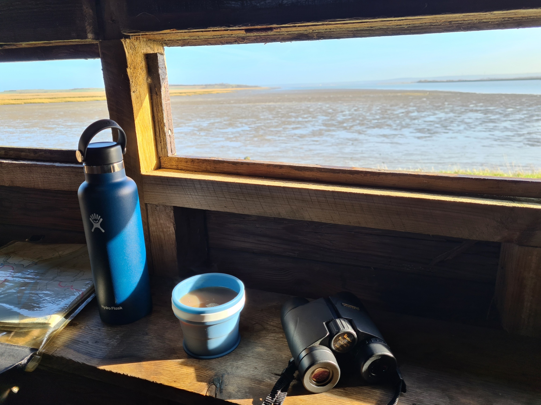
Once at the hide I was pleased to halt inside for almost an hour. Another cup of tea, a cheese and pickle roll, enjoyed while watching the Redshank, Dunlin, Oystercatchers, Curlew and the odd Godwit being pushed up the mud toward me by the incoming tide. I had purposely bought a pair of Opticron 8×32 binoculars on todays walk, in preference to my usual Leica Monocular, as the viewing experience is so much better and easier with the heavier bins.
Gear talk: the Leica 8×20 Monovid- probably the best quality small monocular ever made
Leaving the hide, it was a half mile crash through tiring foot dragging turf obviously visited by no-one, to the end of the reserve and a formidable gate that took me into the neighbouring and extensive farm property.
This stretch of the England Coast Path has been causing considerable discord during it’s planning process and days previous I had read much careful and polite referencing to what is rankling many people with opposing viewpoints.
I pondered what I had found online as I walked along the high bank and deep in my thoughts only gradually became aware of a low murmuring sound to my left. I could easily have walked past them. Thousands of Godwits were roosting amongst the turf, almost invisible such was their cryptic plumage. A photo was impossible so I continued on my way, enjoying their convivial conversation. I must have looked an interesting diversion as every cow in the field to my right decided to wander over for a closer inspection. There can’t be much in the way of entertainment out here.
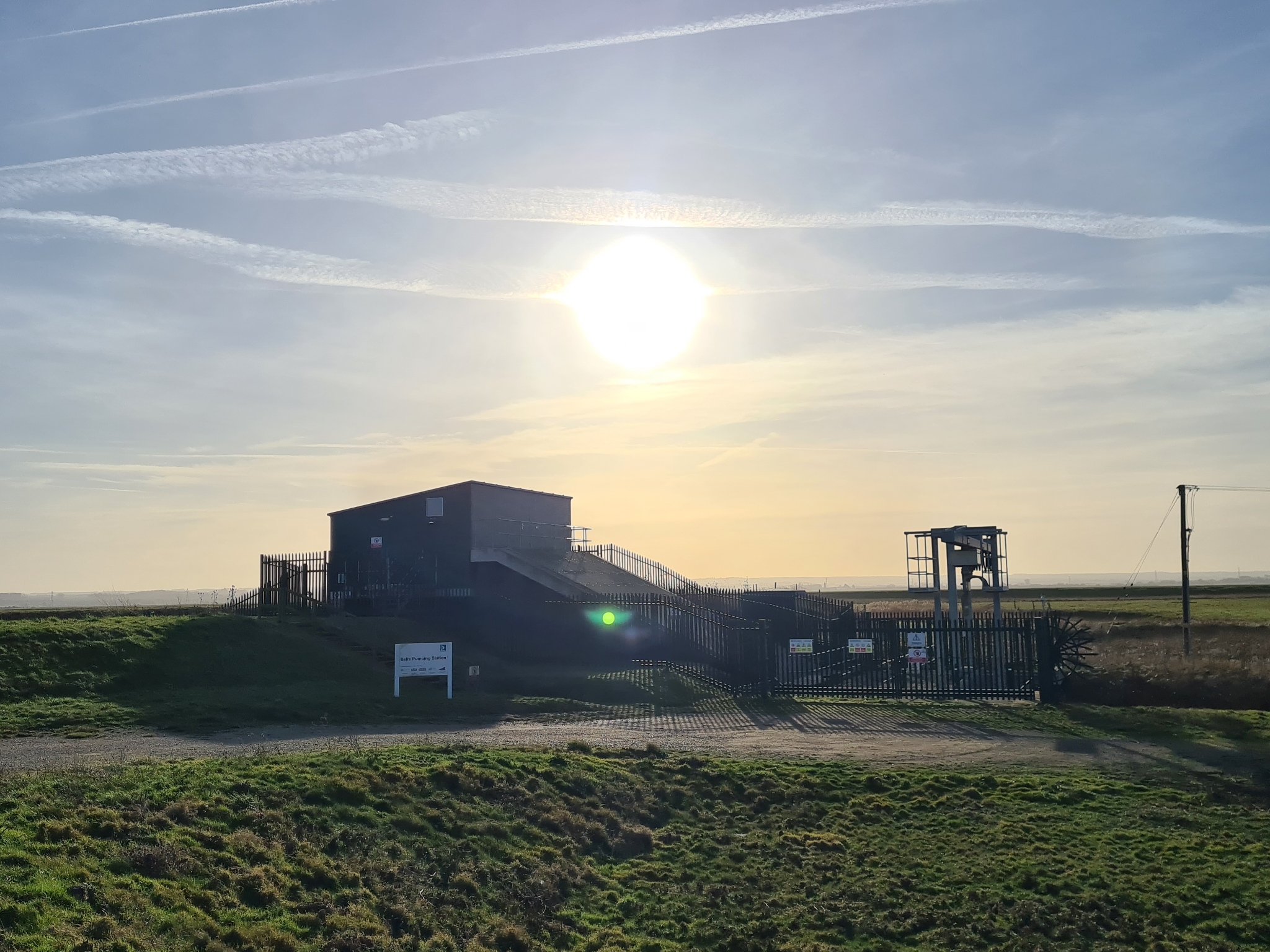
As it was, I managed to walk to the farm buildings without disturbing bird life, or getting run over by a tractor, or having a dog savage a sheep, though having walked up to the farm buildings and turned tight back to the coastal wall and the brand new pumping station, I could see why a public path could easily have been specified during planning approval and effectively built around it, thereby avoiding my half mile inland dog-leg detour.
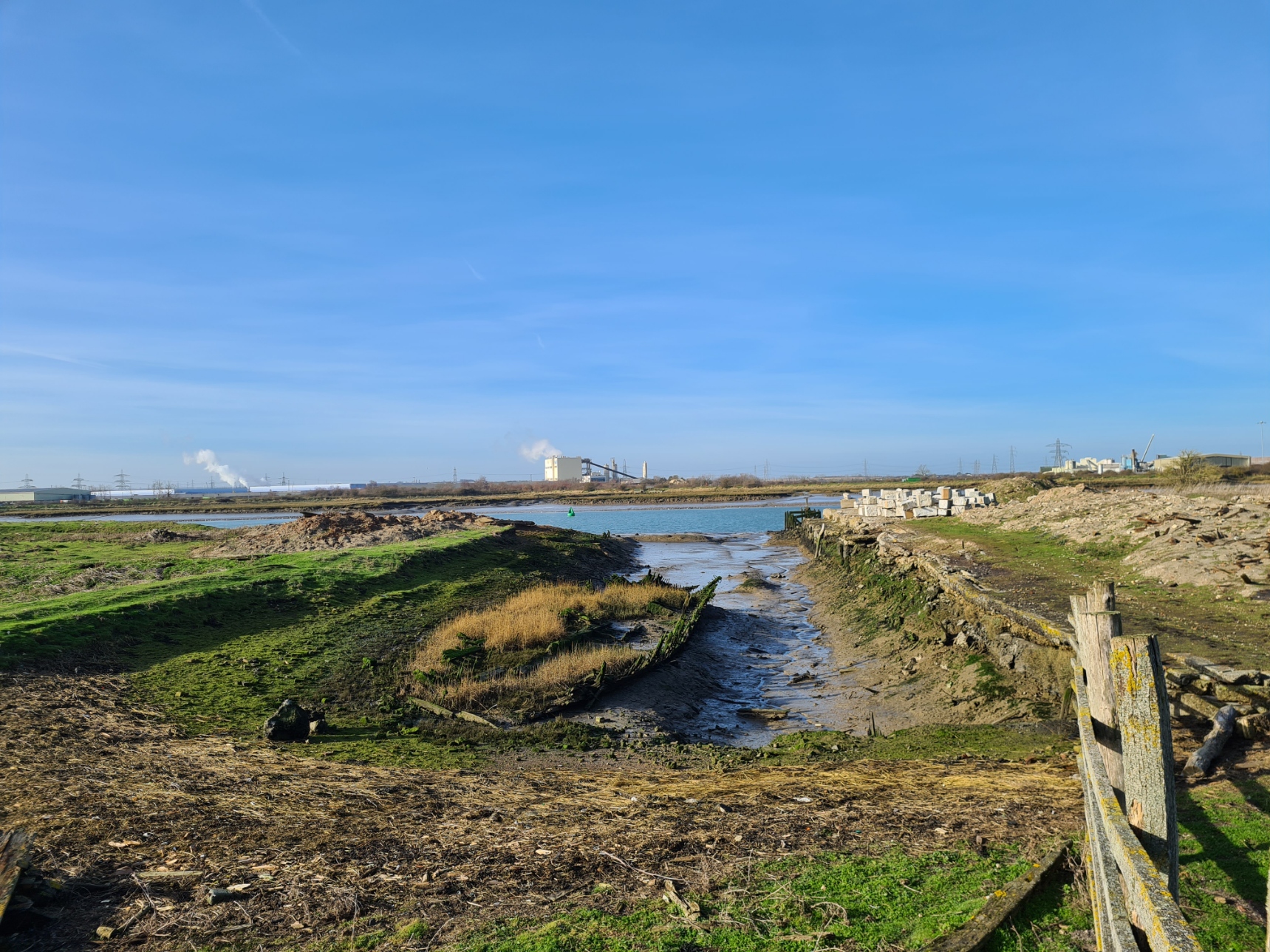
Continuing on the sea wall I now moved from what used to be one island, the ‘Isle of Elmley’, to another, the ‘Isle of Harty’. The two islands are now one, the channels between them having silted up hundreds of years ago. I was completely alone and hadn’t seen another person for hours. This is a lonely part of the coast and some birds make the most of it. A Short-Eared Owl made its way down the exposed mud between the reed fringes on the salt flats on my right. It passed not twenty feet away, briefly looked at me, and resumed it’s hunt. For this often diurnal species, the remaining hours of daylight were brief and the sun behind me was a fist height above the horizon to my outstretched arm. That bird was a treat, but had been almost expected for it is not an uncommon species on Sheppey in winter. However the white plastic bag caught in the scrubby reeds turned out to be a real surprise as I approached. It unfolded its neck, stretched up, took a couple of paces then lazily took to the air. Flying past me in the same direction as the owl had taken, to land a hundred metres back the way I had come. I have only ever seen one Great White Egret in the UK before and while aware sightings had been increasing in the past decade, this was an unexpected delight.
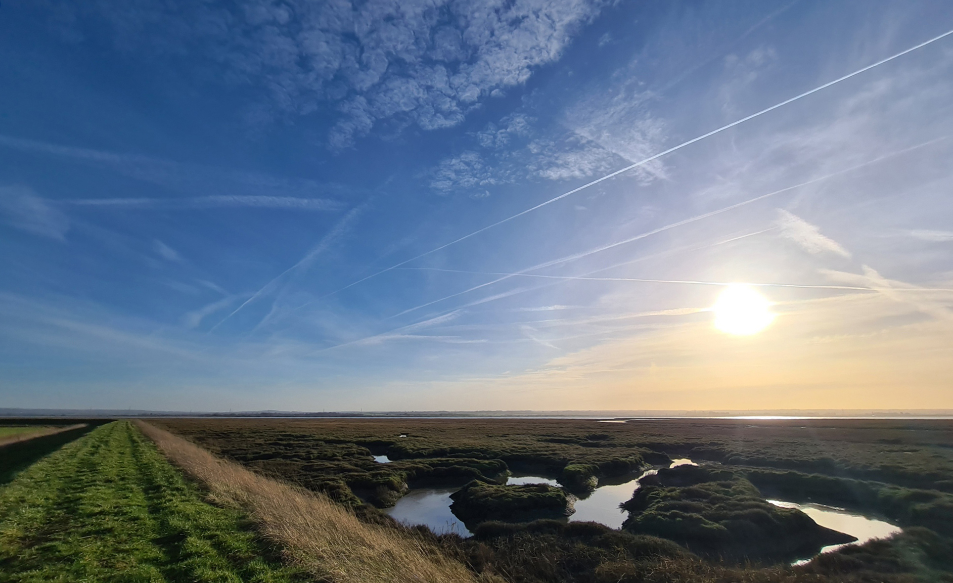
There were a couple of bends in the seawall but it more or less progressed straight to Harty, a slight rise in an otherwise flat landscape at the south east corner of the island. Unsurprising considering the floods over the centuries, this is a corner that people made both their home and place of worship, albeit many miles from anywhere else. The remains of both Bronze Age and Roman occupation have been unearthed here. When I reached the slight rise in the landscape I had expected the path to go straight up and over the hill and there is a bridleway on the map that I expected to join up with. But there was a brand new fence, brand new barbed wire and a brand new sign- ‘NO PATH KEEP OUT’. Instead, the path turned right and handrailed the barbed wire round the edge of the salt marsh to where a path ran down to the waters edge. It was from a jetty here, that the old Harty Ferry used to run to the mainland. The last boat ran in 1941 though remarkably, the landlord of the Harty Ferry Inn started a hovercraft service from here in 1970. It lasted just a few days. Years ago I knew an old-school tweed wearing post office inspector. He had commenced his long service as a young postman and recalled cycling to Oare on the mainland, and being rowed across the Swale to the island in a rowing boat, making his delivery of a half-dozen letters at Harty, then being rowed back. One morning he and the oarsman were surrounded by fog and became hopelessly lost. Hours later they heard activity ashore and rowed toward it, eventually making landfall at Whitstable, many miles down the coast of the mainland.
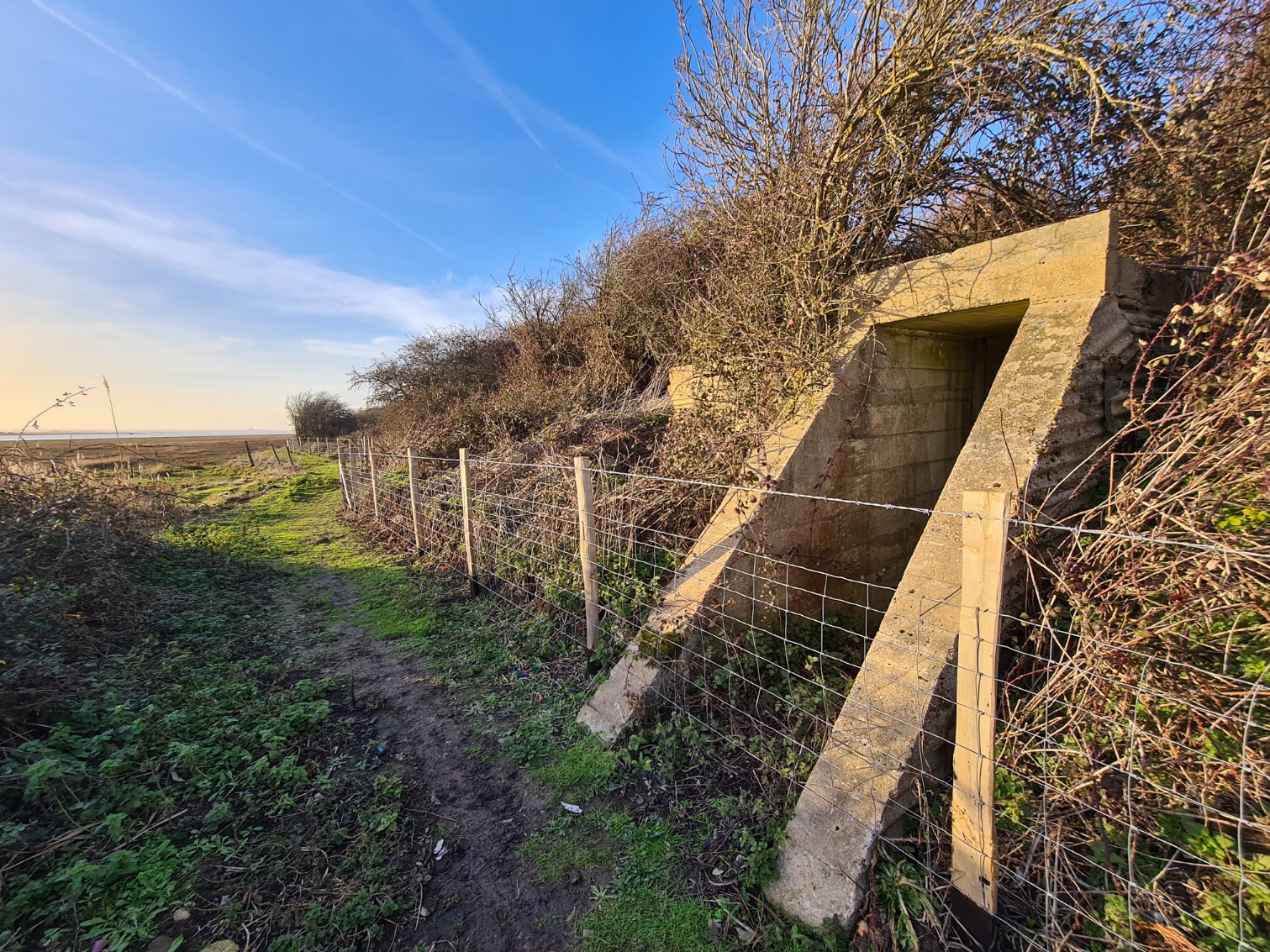
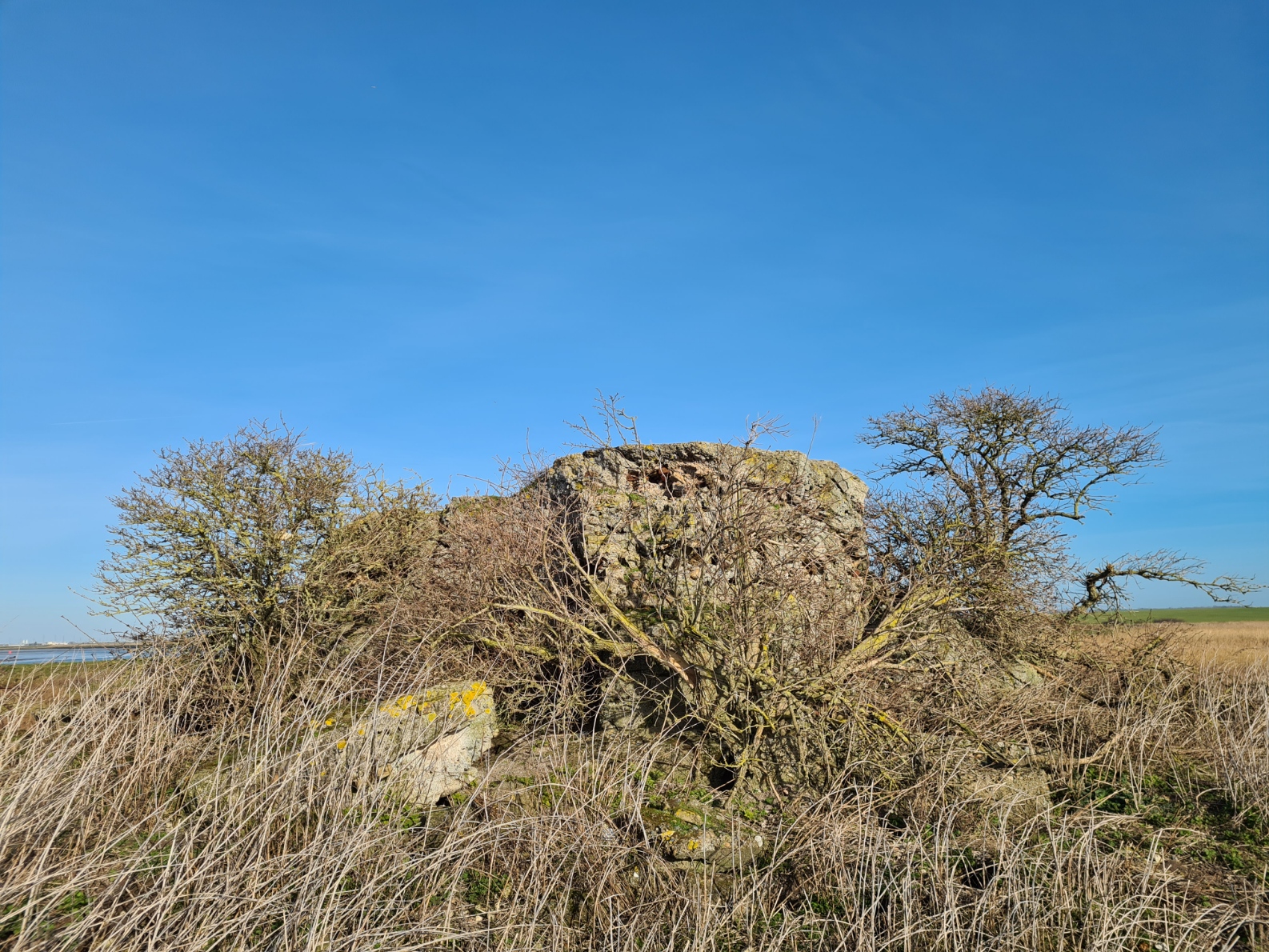
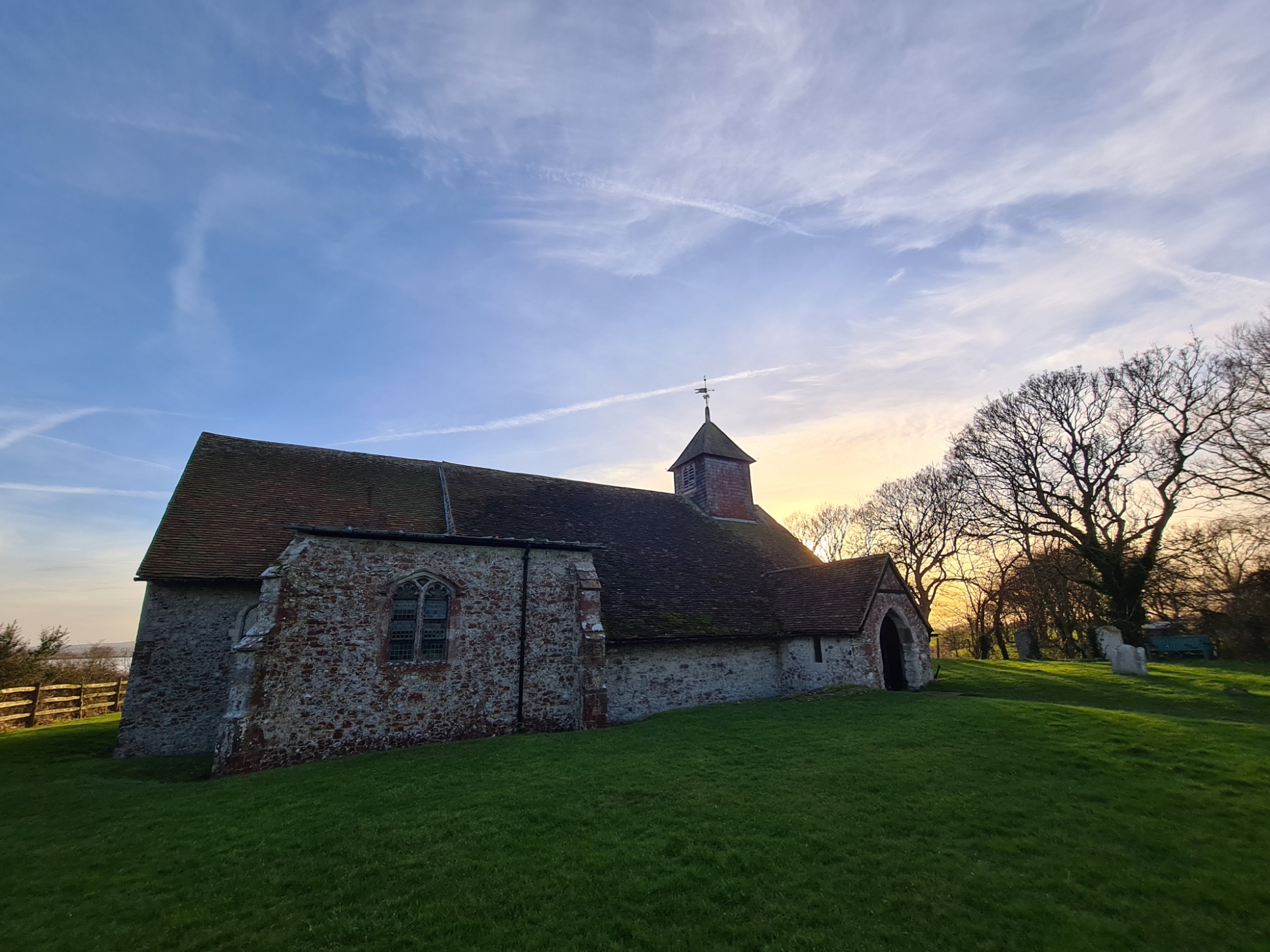
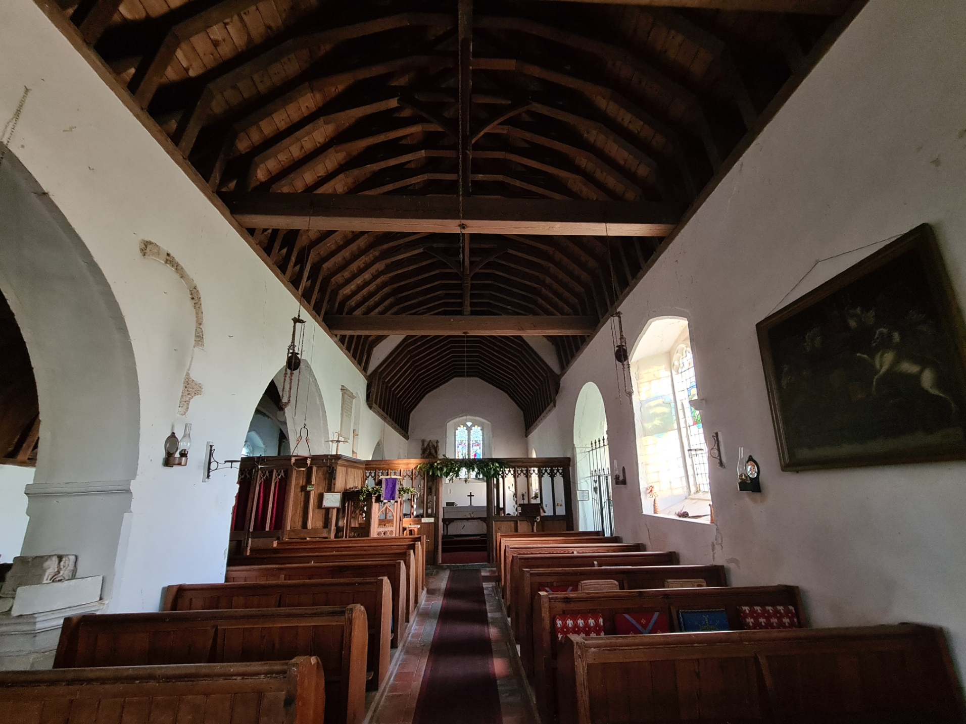
Circling round the salt marsh toward the Harty Ferry Inn a small naval decoy bunker and air raid shelter from World War II is passed. This is set in to the bank and has a blast protected entrance and reportedly has a small escape shaft inside, exiting the roof. The entrance used to stand completely open to the public but a new fence and inevitable barbed wire now bars the entrance. I decided not to clamber over this for an explore as the sun was getting ever lower and I still had a few miles to cover. For the same reason I decided not to stop in at the Inn for a swift pint, instead striding across fields and bashing my way through last years crops to emerge at a road passing through a farmyard beyond which stood the Grade II* ‘St Thomas the Apostle’. I definitely had to go in here as it is a lovely little church with a simple interior. There is no electricity and no water. The lighting is from the last rays of light through stained glass windows or paraffin lamps in the nave. I didn’t stop long, just a quick explore, sign the register and leave three quid for a pot of local ‘Bell’s Honey’ from the honesty box.
A short wander down a farm track and another turn off toward the coastal seawall and path, through yet another reserve, the Swale National Nature Reserve. I stopped at the entrance to scan the sea, picking up Shelduck and Red Breasted Mergansers on the water, though I had been hoping for Eider as they sometimes gather here, at the end of the island. I walked on, the lights of distant Shellness and my final destination, Leysdown, slowly winking on. It was pretty gloomy and if his dog hadn’t come bouncing along the track to greet me I might have tripped over the hunter laying on his back on the sea facing bank of the seawall. A member of the Kent Wildfowlers, his shot gun was still in it’s case but he was hoping for a goose for the freezer “just twenty days left” he sadly said, referring to the wildfowling season of 1 September to 20 February on the foreshore, below the height of an ordinary spring tide. Such is the daftness of a national nature reserve lying tight against saltings where shooting takes place. The birds flying from one to the other. That is the reason that as soon as wildfowl see a person raise binoculars to his eyes, it frantically wheels off as they associate that movement with the sound of a following shot.
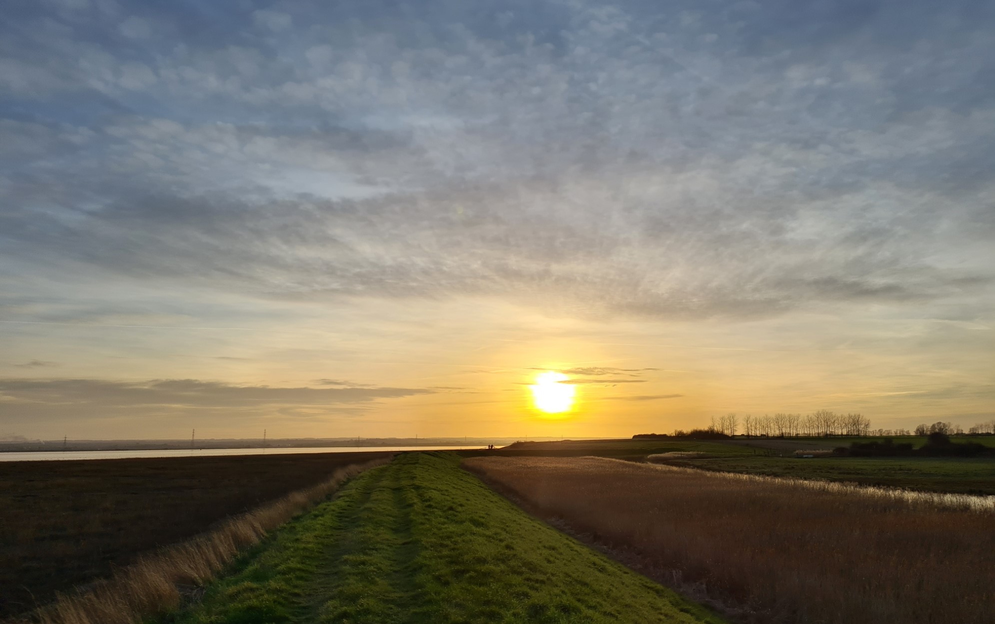
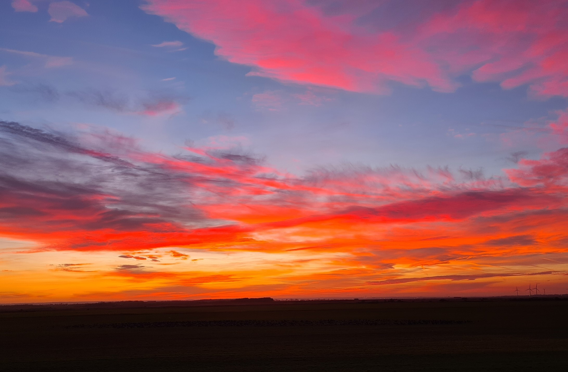
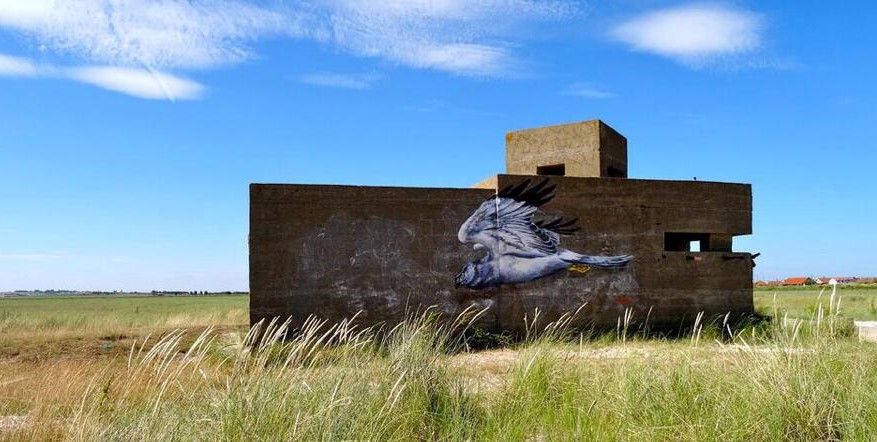
The setting sun gave an orange glow to my final miles along the seawall. I almost missed it in the quickly failing light but ahead I just caught sight of a male Hen Harrier going to roost, not for nothing are they known as the ‘Grey Ghost’. Nearing the carpark at the end of the reserve, I could see another Short-Eared Owl quartering the saltmarsh out toward Shellness Spit. I had thought about walking out to the wartime pillbox out there on the shingle but night was drawing in too quickly so I simply turned left and followed the coastal path, through the abandoned naturist beach, before joining the road into Leysdown, passing a dozen camper vans parked up on the seawall, engines running, lights on and the sound of TVs within.
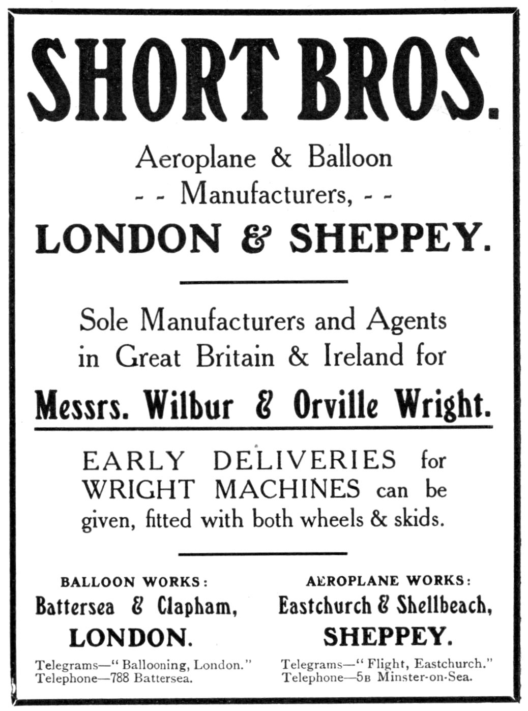
I stuck to the road as I wanted to pause at the statue of the three Short brothers, standing with arms stretched, gazing at the streaked sky, where their planes lumbered into the air from Britain’s first aircraft factory, situated here on Sheppey. The World’s first flying club was also found here, at Muswell Manor, not a hundred metres away. I wrote about an exploration of these fields and that history in another post.
A Barn Owl slowly drifted past me on my left and beyond it I could hear the lovely burbling sound of hundreds of Brent Geese chatting to each other as they drew their families together in preparation of the long dark hours in the fields to come.
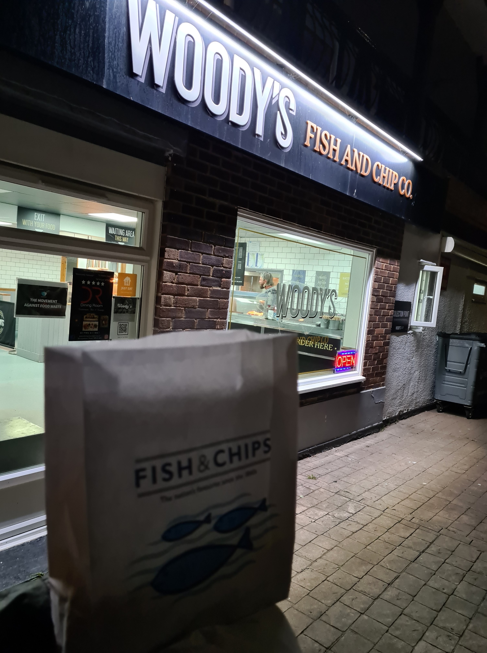
By the time I reached Leysdown-on-Sea it was dark and again cold. I found my bus stop and confirmed I had over half an hour until the last bus of the day. A decent fish and chip shop supplied a welcome bag of chips but I should have also got a cup of tea there as it grew ever colder as night drew in and my inactive body cooled despite the fleece I pulled on. I didn’t want to chance missing the last bus by going in to the nearby pub to keep warm, so stood by the roadside, while bored kids would cycle past every five minutes to abuse me, attempting to get a rise, anything to enliven their evening. Twenty minutes late the 360 bus hove into view and swept past me to turn around. But before returning to my stop, halted who-knows-where so that the driver could take her ten minute break. Finally on board, it was a fifty minute ride to Sheerness railway station and a ten minute train ride back to the mainland. Day one complete.

Just to let you know TPOTC that I always look forward to your posts on this blog and recommend it to people whenever I get the chance.
Best wishes.
LikeLiked by 2 people
Thanks for that Lynn, very much appreciated
LikeLiked by 1 person
Sounds lonely and full of birds. So is the Isle of Wight actually an excluded island? There is no bridge to that one but it’s on the map. Or is it just an option?
LikeLike
Good question. I was aware that the Isle of Wight (and other islands) ARE included within the proposed route of the England Coast Path, defined as being part of the Coastal Margin. The Isle of Wight is an English ‘county’ in it’s own right and I can imagine the howls of discontent if excluded. I was hoping that no-one would ask that as I don’t currently understand why the exceptions. Unlike the Isle of Sheppey, where I DO understand the inclusion. Obviously the Isle of Wight is an occupied/habitable location and does have a coastline that is part of England. Indeed I have walked round it twice in the past. I have had a bit of a trawl through the Gov and Natural England sites but still haven’t ascertained why included, just the seemed acceptance that it (they) are. Link to IoW progress map here. I’ll add to this comment should I find out anything further. Unless someone else can fill in the blanks?
Edit: I have since ascertained that the Ramblers GB, Isle of Wight Ramblers and others took three years to persuade the Department for Environment, Food and Rural Affairs to include the Isle of Wight in the England Coast Path as the original route excluded the island. This was achieved in 2014
LikeLike
You sound like the man in the know for Sheppey. We’ve walked all the open National Trails and are 60% through the ECP but we’re really struggling for local sections. We’ve walked from the bridge to Sheerness but with the current super weather would love to walk the rest of Sheppey, in the next couple of days. Do you think this is feasible even though the ECP isn’t officially open?
Any information and advice very much appreciated
LikeLike
Hi Agnes. I am sure you have seen the Gov.uk updates on progress on each section around Sheppey. Taking a glance just now I see they are still faffing around (Oak Lane, Minster to Hens Brook, Eastchurch Gap), but take a look at an O.S. map for public rights of way, it is easily doable. Or have a glance at this for the proposed modification to route. Take plenty of water, it’s going to be hot!
LikeLike
Hi JoolsThank you very much for your quick and helpful response. The tides aren’t in our favour today or tomorrow as we can’t make an early start. Instead we’re going to head to Burnham on Crouch and spend a couple of days walking to Maldon. Saving Sheppey for another day.Best wishesAgnes
LikeLiked by 1 person