Despite the route of the England Coast Path on Kent’s Isle of Sheppey not quite being signed off, Three Points of the Compass continues to knock off the coastline of the ‘isle of sheep’ on the second of two very different days.
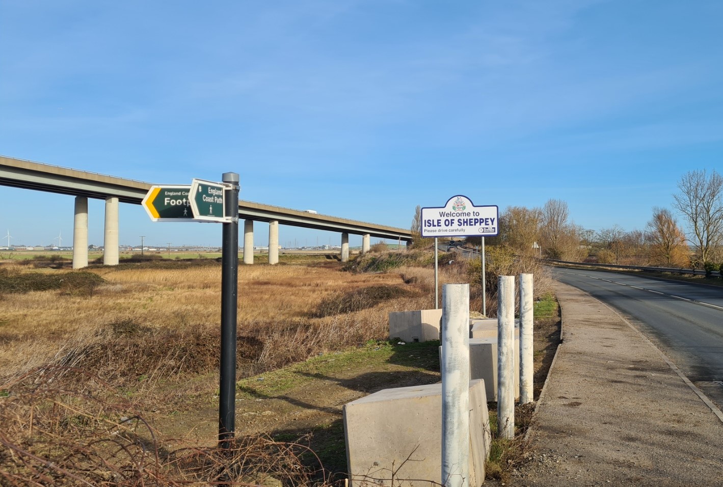
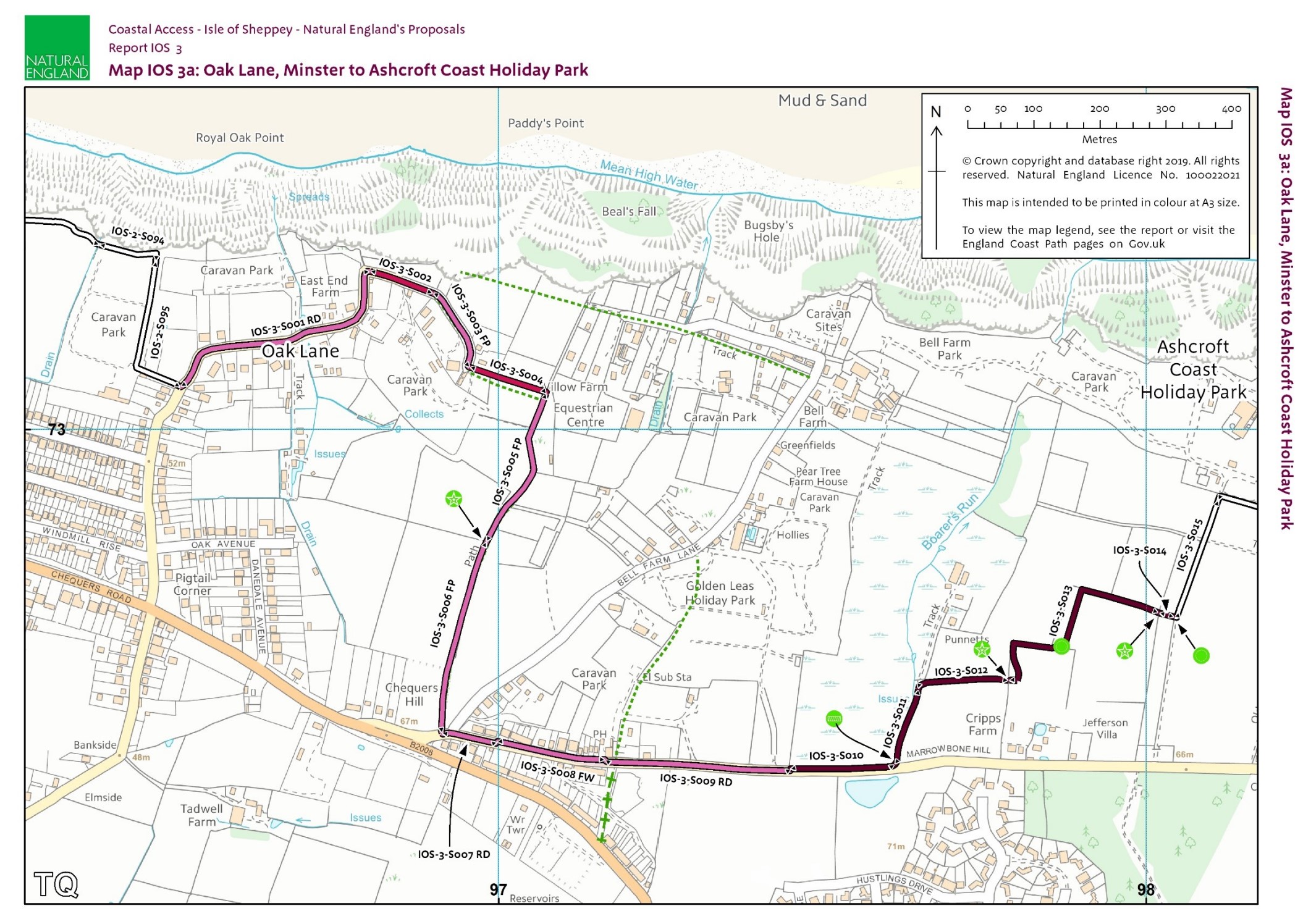
Having walked around half of the Isle of Sheppey (part of the England Coast Path) on day one, it was time to return and polish it off. I was aware that this half was likely to be far less interesting, far less enjoyable and pass through a more urban landscape than my previous wander along lonely seawalls where almost no-one else had been seen. But that is the nature of any longer walk, some parts are better than others. At least today would be a shorter trek. My route mapped on O.S. maps suggested a day of 15.98 miles if following the inland route in the north of the island, however if I had timed it right, I would be reducing this slightly while also making my way underfoot more difficult.
Day two: the northern half. Kingsferry Bridge to Leysdown-on-Sea, via Queenborough, Sheerness and Minster
I again timed my walk for the tides and it was four days before I returned by train to complete my circuit of the Isle of Sheppey, just off the north coast of Kent. Disgorged again onto the empty platform beside Kingsferry Bridge, I exited the station and walked on to the quiet B2231 over the old bridge, most vehicular traffic hammering over the newer bridge, a hundred feet above my head. I was at the precise location that I had seen on the big screen just a week before, Jason Statham driving a truck off the bridge into the Swale in the action thriller The Beekeeper, supposedly a location in the US. Part of that scene appears in the film’s trailer.
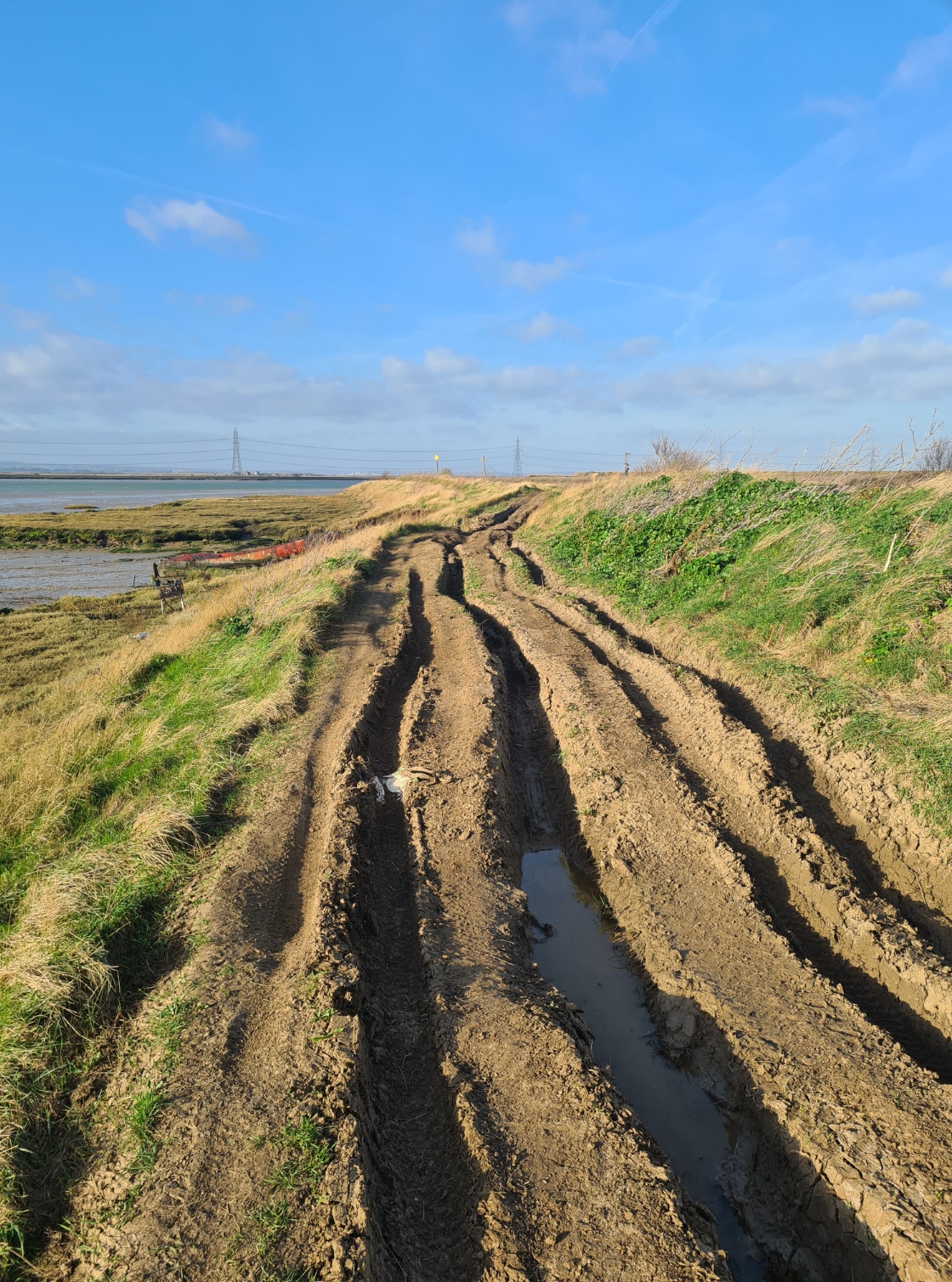
I crossed the bridge and, as before, again dropped down to the shore from the road on the far side. There was no way I could have gone the direction I had last time as the tide was in but had no need to. Up on to the sea wall and pause to get a few photos of the two bridges, light from the low sun passing through their columns. Today I turned west and followed the sea wall toward Queenborough. It was bright and sunny and a good deal breezier than my previous visit. I was obviously lucky with my chosen day too, as the ground was torn up by dirt bikers and off-roaders. There were none here today but I have frequently seen their vans parked roadside when crossing over to the island in my car. Everyone seems to turn a blind eye to this activity but it is tearing up what is going to be a National Trail pretty bad and it would be easy to turn an ankle in the ruts.
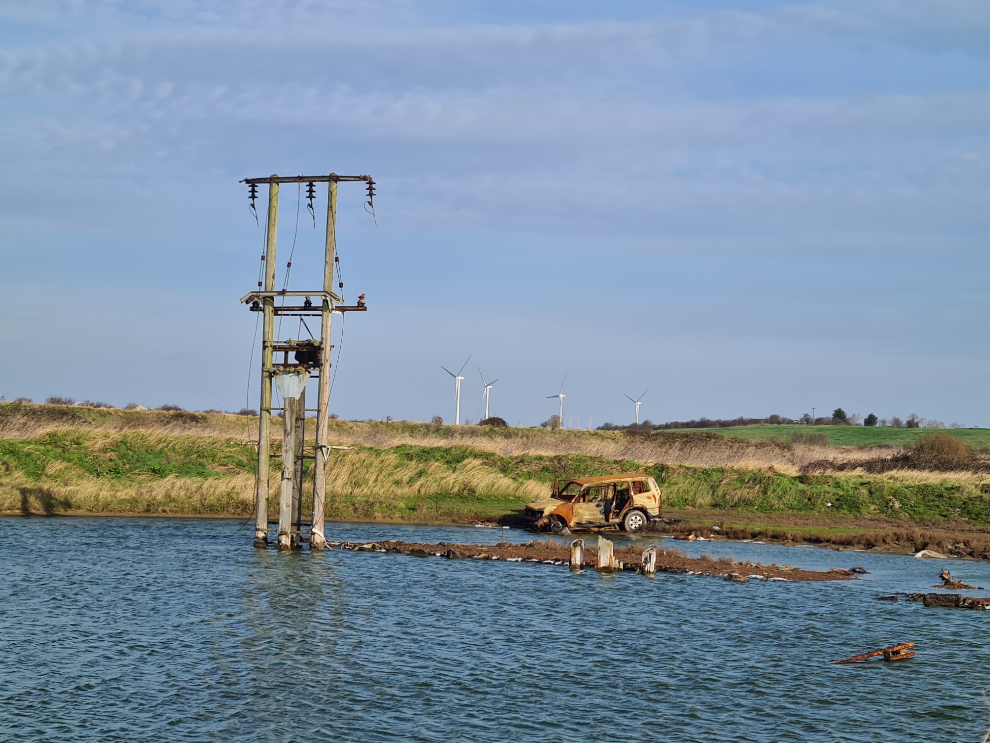
I had known today was to be a day of odd contrast but none more so than here. On my right was a burnt out shell of a stolen car. On my left a hundred or so delicate and quite beautiful Avocets were roosting, occasionally preening with their fine upturned bills. I paused for a while to scan their ranks but the cold wind was making my eyes stream so I turned my back on it and walked on.
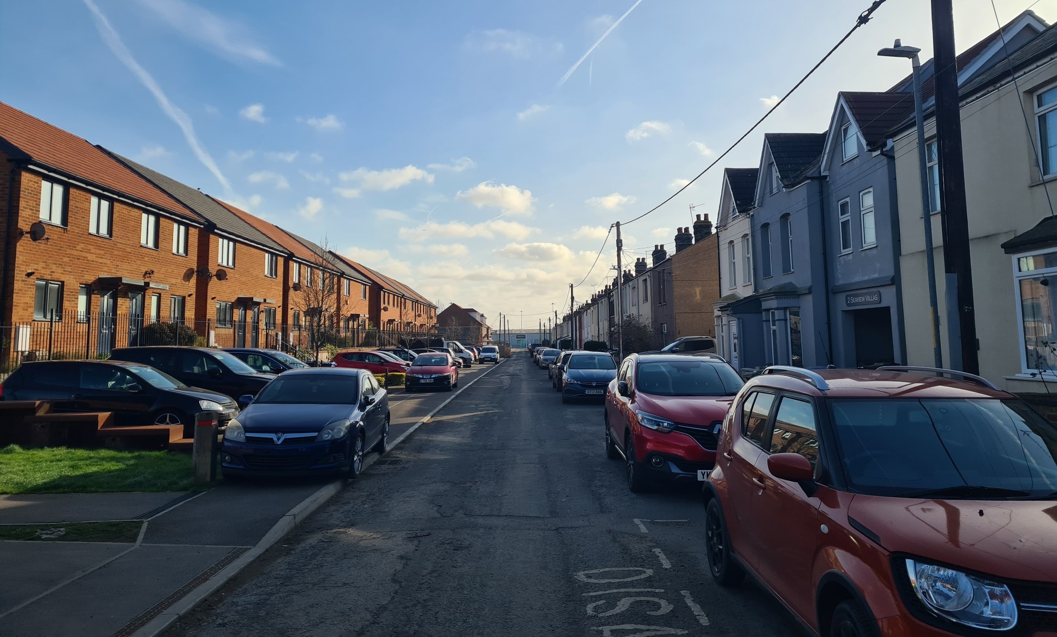
This was probably the best part of the day’s walking, along the seawall, with the Swale running low on my left and scrubby vegetation on my right, with a few flocks of finches in the hawthorn and blackthorn and stonechats perching on the occasional post. It was an all too short wander along the shoreline before reaching the odd-named Ladies Hole Point at the far western end of the island. There is no need to bash all the way out to the end as the path turns sharply back on itself to wander in to built up Rushenden. There used to be just a few houses out here but I see building work is apace and it may likely be quite a large estate by the time they have finished. The route of the England Path itself was impossible to follow for a few hundred metres. The signage removed from the ground and lying in the grass, large wire fencing barring the way. Instead it is a wander through a couple of streets, down the road as a good number of the vans and cars were parked on the pavement. Obviously no one walks around here.
Back on the ‘official’ route I was on to the main road leading into Queenborough. It is all a bit scrappy around here, with the type of necessary small to medium sized industry typical of forgotten backwaters. I used to be quite familiar with this area as I was an owner driver of tipper lorries in another life, but it has changed dramatically and in another few years it might actually be quite a pleasant place to be. Council workers were trimming branches so I again had to take to the centre of the road to circle them, walking over disused railway lines that still crossed Rushenden Road. These reminded me of an industry I am pleased to see gone. Years ago I occasionally ran a tipper into Queenborough Rolling Mill here. It was built on the site of an earlier cement work and, from the 1970s, the rolling mill converted recovered railway rails into 6-20mm steel bars for use in reinforced concrete. The rails arrived by ship and rail and the rolled bars went out by ship, road and rail. It was really good money for the mostly young men that worked here and I am glad I was never tempted or had the need to work the steel.
It was good money because the work was so dangerous. Heated in a furnace, the white hot bars would occasionally get caught up in the rolling machinery and rapidly snake their way into a workspace, injuring many or worse. Deaths occurred all too often but the money on offer was simply too good for many a young couple trying to afford a house in a depressed era with little other work. It closed in 2013 and good riddance for I am all too aware of the heartache it had caused many. Though it actually closed, not because of the hazards, but due to the restrictions put in place by the US steel trade.
On the other side of the road used to be the Sheppy Fertilizer company (which used the old spelling of Sheppey), where Mrs Three Points of the Compass used to work, again, in another life. I recalled her complaining both about the chemicals in the churned up mud in the yard rotting her smart office shoes, and the smell of the neighbouring Glue Works, the stink permeating the air. Both businesses now long gone.
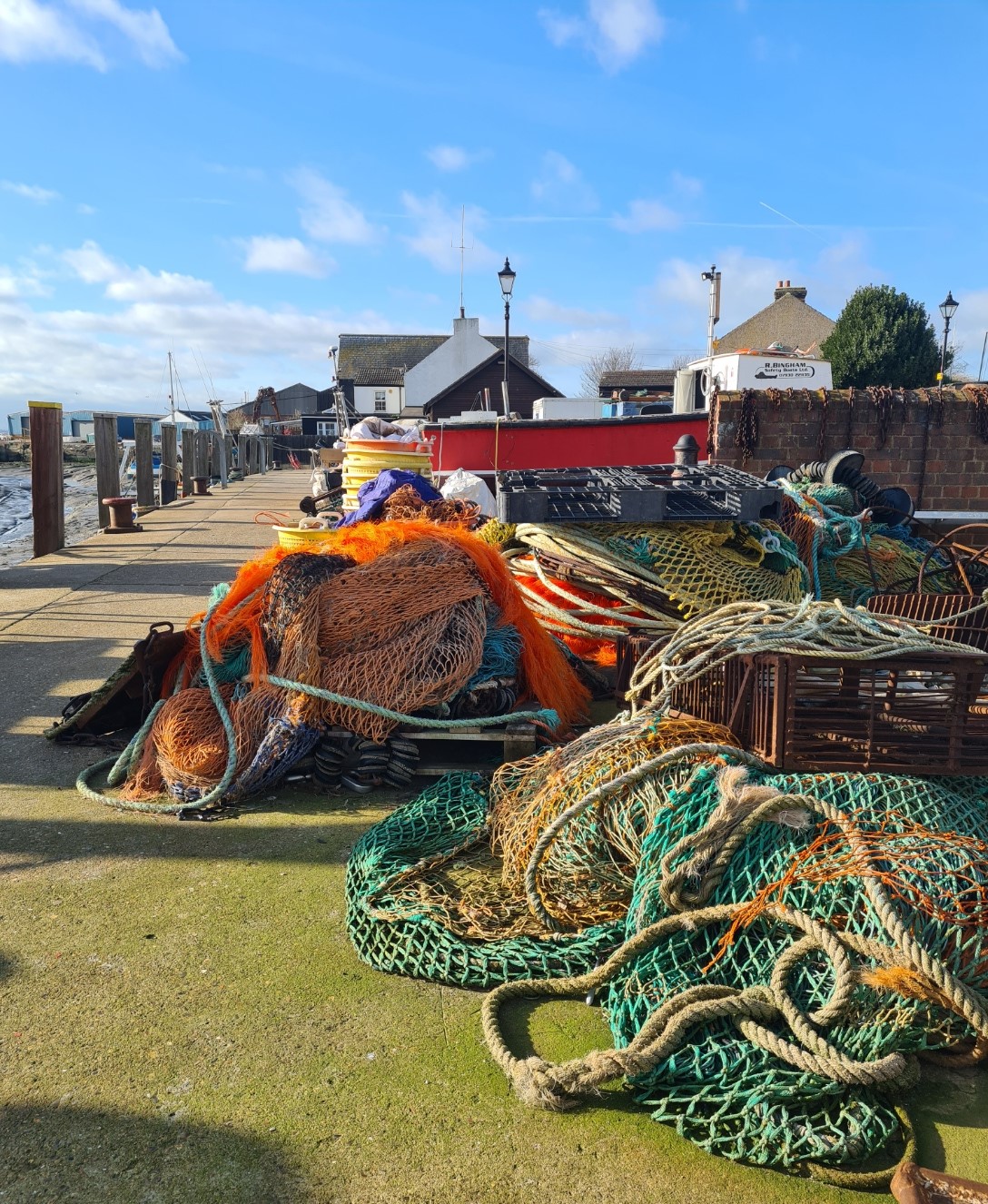
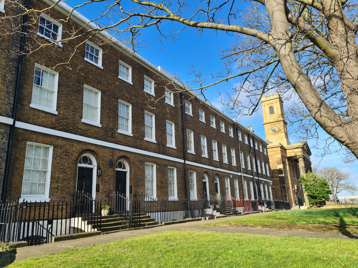
A roadside snack wagon briefly tempted me but I knew it wouldn’t be too long before I could get a sit-down meal in Sheerness, so walked on. Up to the junction with the main road through the little town, Queenborough railway station was on my right, but I headed left, down through streets now beginning to look a good deal smarter and a more pleasant place to be than thirty years ago when I was a regular visitor. Leaving the street, it is a short walk along the side of the quite attractive if small quay, today probably called a marina. It was an important port in medieval times but began to fade in the Victorian era as the navy moved to nearby Sheerness. It is mostly small time fishing and leisure craft moored here now though for a short while, the pirate radio ship Radio Caroline was anchored here.
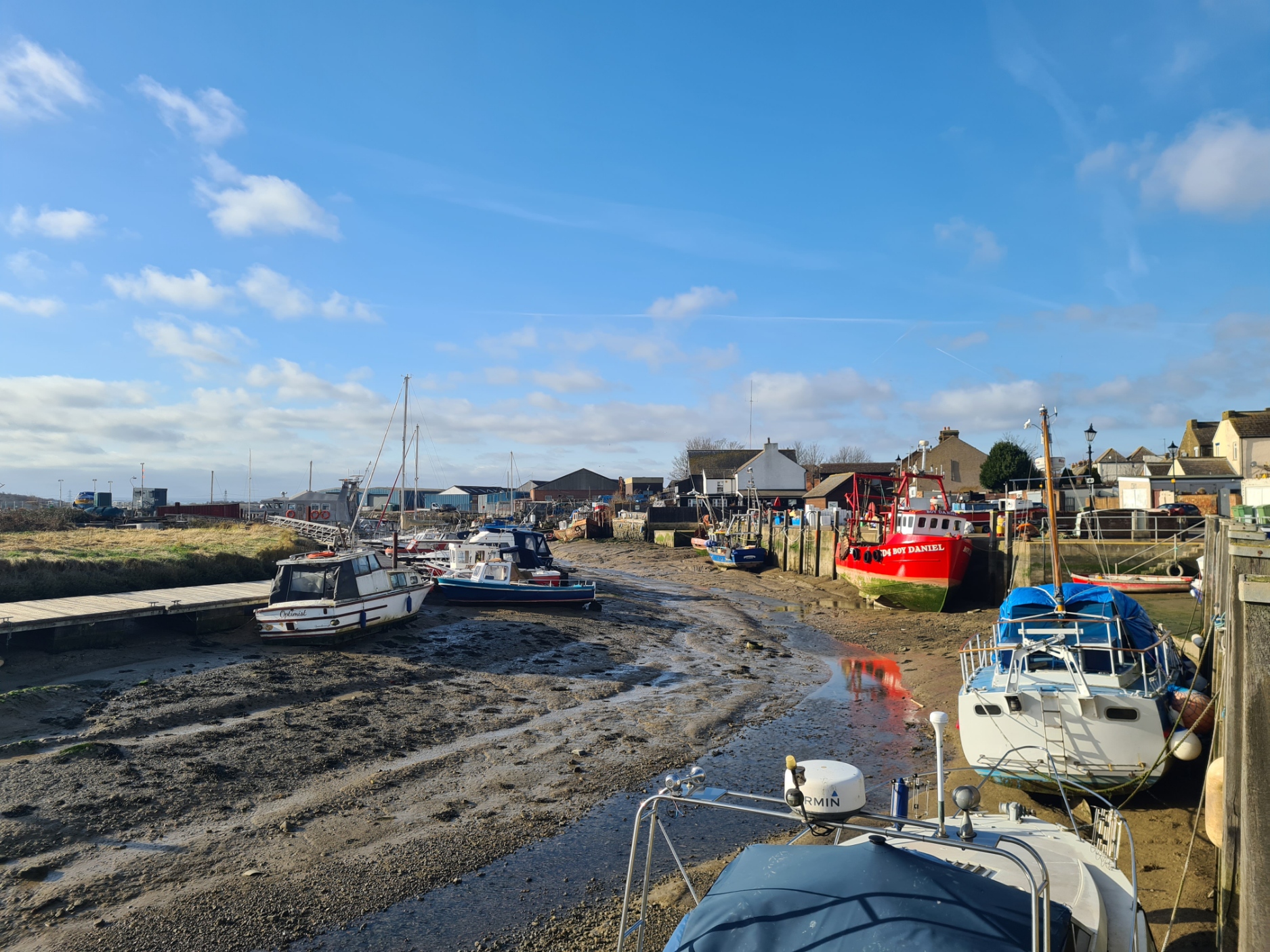
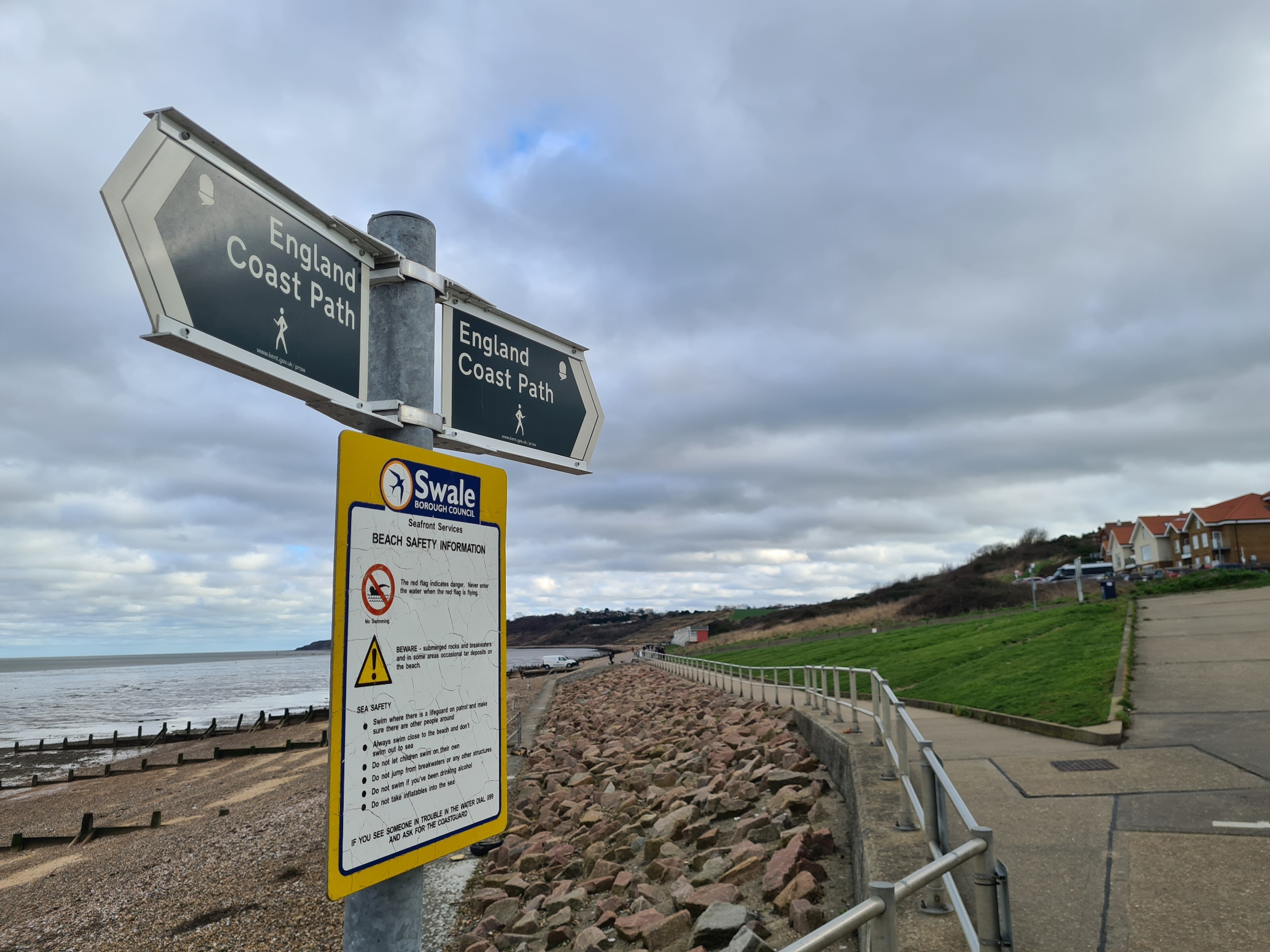
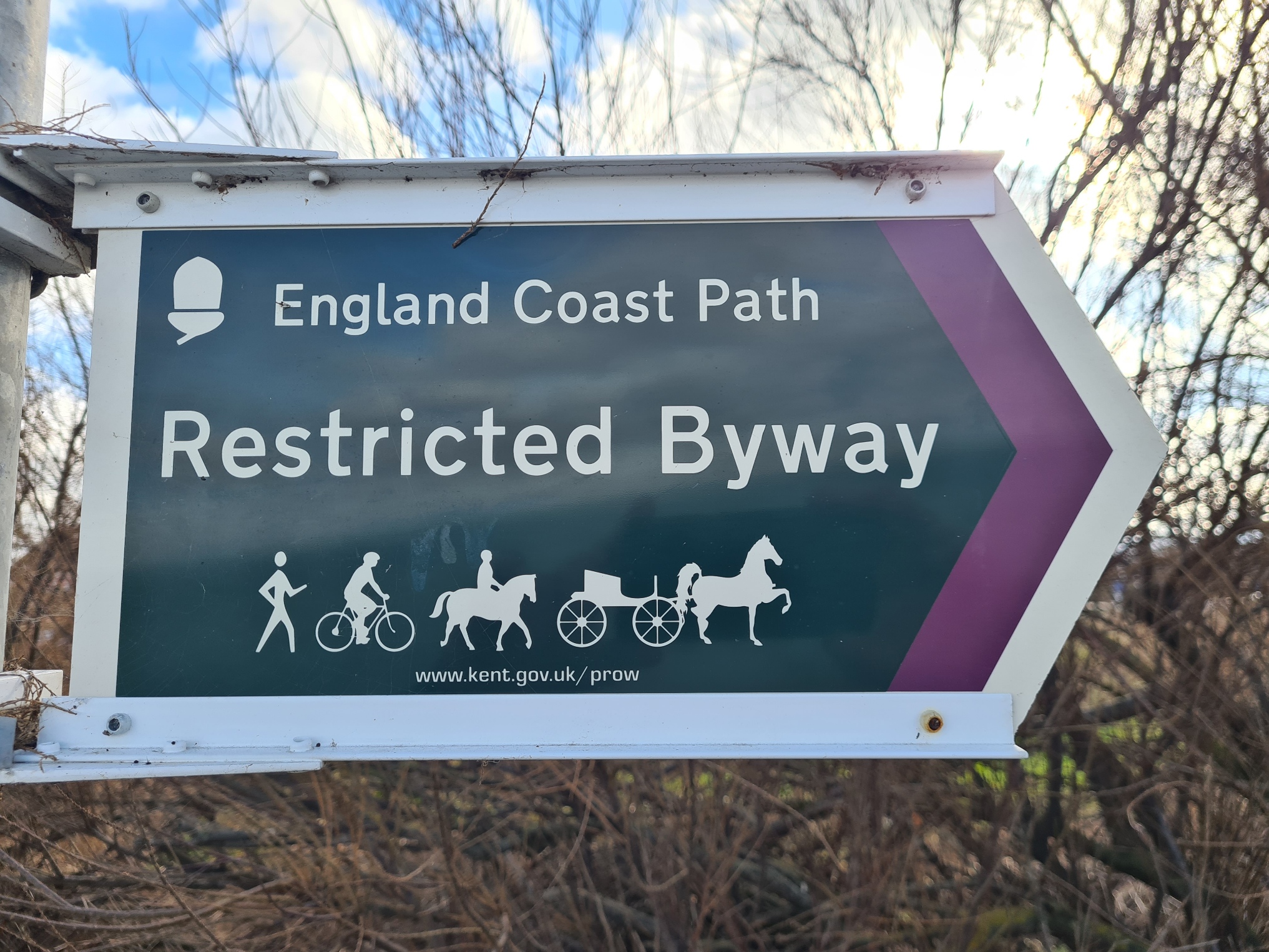
Something was going on with the England Coast Path signage round here. The posts were in place but just a few of the signs had been taped over, whether officially or by those disgruntled by the route I had no idea. But it is an OK route through the town, even if it does eventually lead the coastal path walker out onto the sea side of a concrete apron. It was absolutely fine for me, with views off to my left of Grain Refinery across the water and nearer, Chetney Marshes and Deadmans Island, where the prison hulks used to bury their dead, many were Napoleonic prisoners of war. Others buried here had died while quarantined on ships moored off shore for months on end. They would have been quite miserable places to exist.
There were dozens of rotting wooden piles exposed by the retreating sea, where yee oldie piers used to poke their way out into the water. There is important hidden and almost forgotten history around here. It is remarkable that this little town was once destined to become an important international port. The London, Chatham and Dover Railway had extended their line here by 1860 (I had walked over the rails on the way in) and entered into agreement with the Dutch Government.
The Zeeland Steamship Company ran their paddle steamers to Queenborough Pier from 1876 and it became known as the Flushing Royal Mail Route, carrying mails, passengers and freight. What with fires, the First World War and transferring of some service to other ports, the pier was almost unused by 1933.
In 1913 the Short brothers were manufacturing floatplanes for the Navy. They had to be towed behind a lorry from their factory at the other end of the island, to be launched from the timber wharf here at Queenborough. It was in 1912 at nearby Sheerness Harbour that a Short S27 became the first plane to take off from a ship in Britain. This proving the way and made the inception of aircraft carriers a realistic proposition.
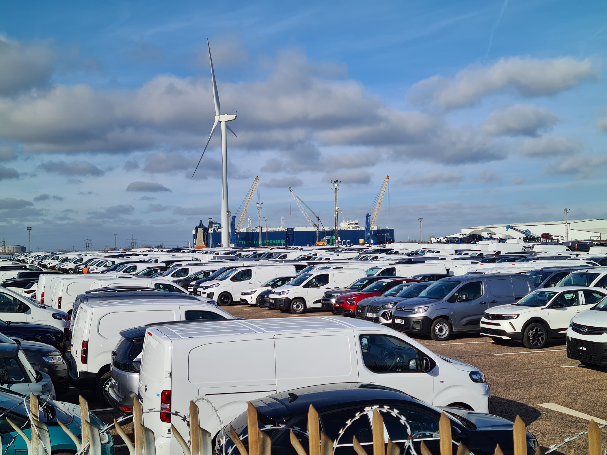
A small notice bolted to one post warned England Coast Path users to expect the route to become briefly impassable every three to four years as a result of extreme weather. We are advised to “wait until the weather improves” or presumably catch a bus or taxi. The extreme weather is exceptionally high tides that have flooded much of the area in the past. My narrow path with the open sea to my left moved slightly inland and changed to a high fence with cameras and signage on my left. To my right was a large fortified fence around a factory manufacturing pharmaceuticals. I passed a small crew busy caulking the joints in the concrete seawall. Too busy to acknowledge me, the two youngest were working while the other three sat on their backsides on their phones. The reason for the high fence on my left became all too apparent. Tens of thousands of brand new just arrived cars and vans are parked here, awaiting transporters to the dealers. My path went up and over a bridge over the storage facility and they were now being stored on my right too. I recalled seeing a news report years ago reporting on the flooding resulting from a high tidal surge here. The film showed thousands of stored cars almost or totally submerged in salt water. How much would that have cost someone!
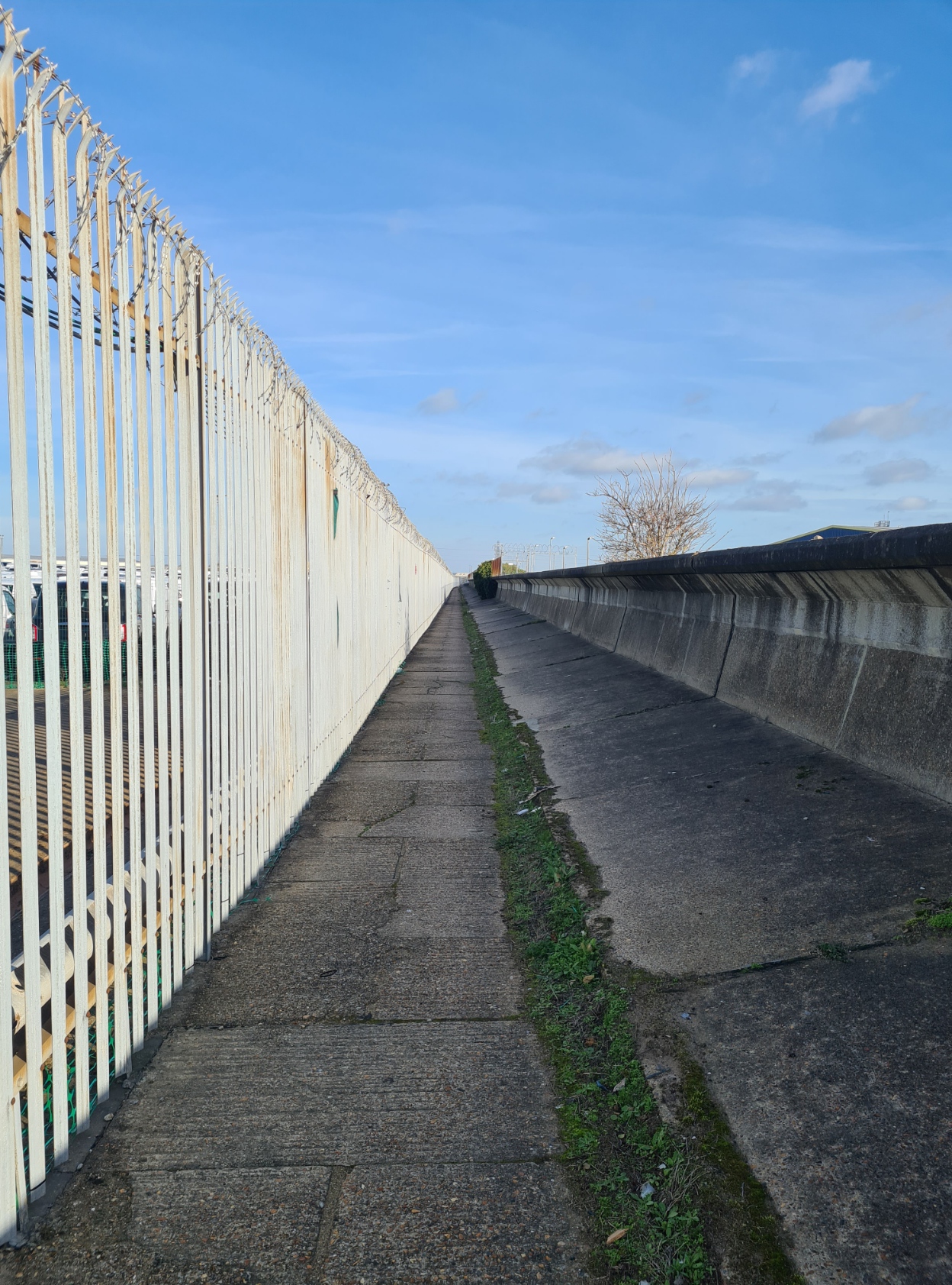
My view changed, but not to the better. Still with new car parking on my left, but now the A249(T) on my right with electricity sub-station and factories beyond. Thrilling. I was pleased to reach Blue Town and turn off to follow the old dockyard wall down through what used to be a busy and thriving high street but is now known for not much more than being the place to buy concrete garden ornaments.
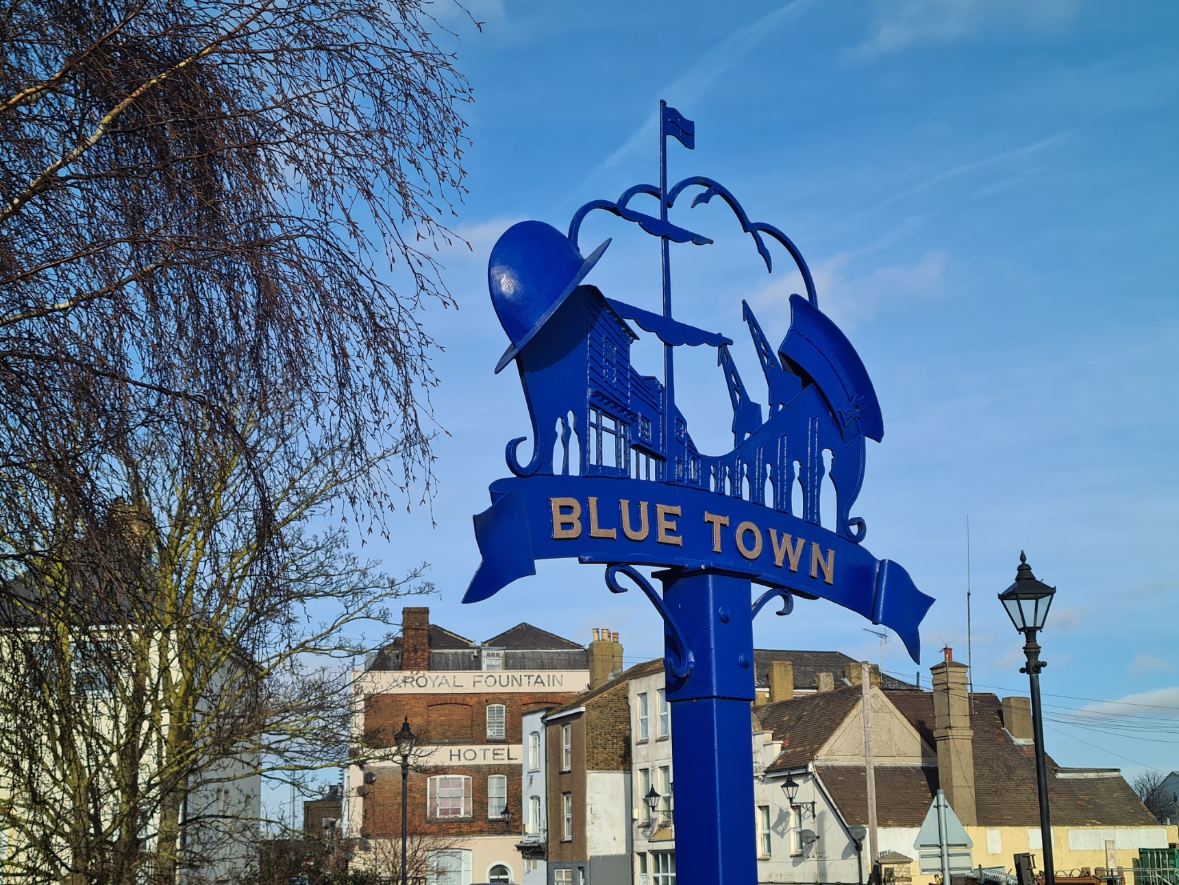
This area used to be called Blue Houses, and was where the workmen from the dock yard lived. They were permitted to take from the dock yard lengths of timber called “chips”. These were to be no longer than three feet in length and capable of being carried on one shoulder. This is what they built their houses with. They painted them with the blue grey paint ‘borrowed’ from the naval stores. In 1802 all the men and their families were forcibly ejected from the area and moved to barracks, their wooden houses accidentally destroyed by fire in the 1820’s. Within three years the brick and stone replacement buildings had been completed, the dockyard surrounded by a high brick wall in 1827, but the name Blue Town persisted. By surviving accounts it was an unpleasant place to live and work. Violence was rife. It was claimed that every other building was a pub and every third one a brothel. I had hoped to visit The Criterion, a little local heritage centre, museum and community cinema, and learn more of the one-time seediness of the area but the door was locked and I walked on.
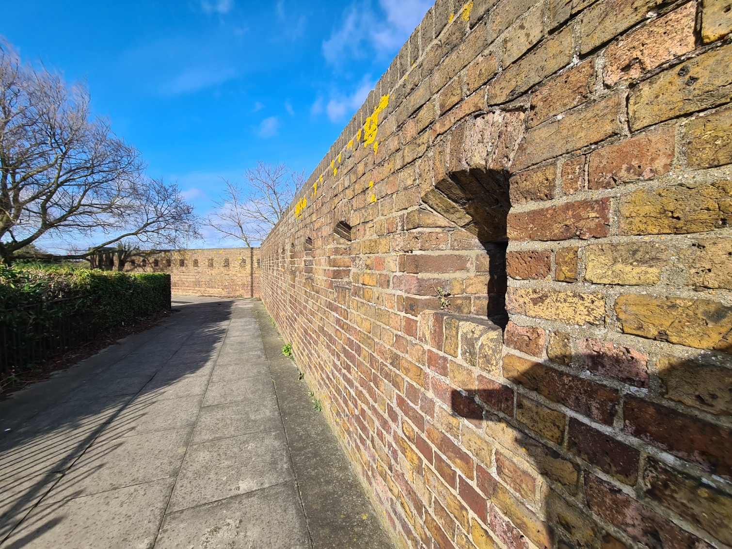
I followed the path round past the old naval residences, pausing at the entrance to what used to be a naval dockyard, but they are all gone now. The port is now run by Peel Ports for commercial traffic and I couldn’t see me getting past security for a look around the old port. As an aside, this is one of the few places in the UK where scorpions can be found in the ‘wild’, they persist in the brickwork surrounding the port. They are nocturnal creatures however so there wasn’t much point in looking for one, instead, I followed the entrance road back out to where it had come off the main route into Sheerness, then took a footpath heading toward a large Tesco supermarket. I passed three military survivors en route. First, and almost hidden in a grassy mound beside the roundabout, was an intact Anderson Shelter from the last war designed to hold up to six people in the event of an air raid. Then it was past the dog legged wall beside the dockyard moat. This was the Ravelin, built in 1816, it was part of the Sheerness Lines, a defensive barrier protecting Blue Town against Napoleon’s infantry, that never came. The brick wall could easily be walked past and ignored, it it were not for the multiple gun loops in the musketry wall. The remains of a small brick building at one end, probably an accommodation block, also remain. It would also have been just as easy to walk over the metal ring exposed in the tarmac path beside the supermarket car park without noticing it. This was the holdfast for an anti-aircraft ‘pom pom’ gun situated here in the last war. It is inscribed, in worn lettering- “C.M. 523. Sir Wm A & Co Ltd. 1939”.
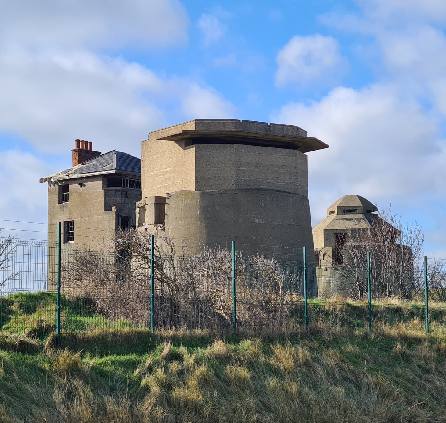
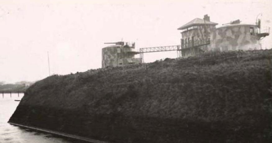
I was desperate for a bit of brekky and a cup of tea, but before that, I went off-track a little to try and find something I knew to be just a little further back along the coastline, visible inside the port I had just circumnavigated.
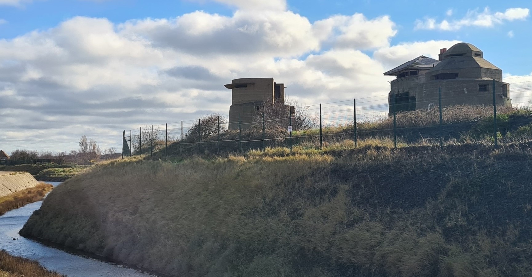
The three main structures are quite different from each other. The lower sections of the two outer round ones have the appearance of Martello Towers and were built for World War I. Between them is the fire control tower, that looks as though it had been disguised as a house. During World War II further concrete structures were built on top of the round towers.
I wandered up and down Garrison Point, but the low sun behind the structures made taking photos difficult. Enough of a reason to abandon history and drop down into Tescos for their w/c followed by an all day breakfast and pot of tea.
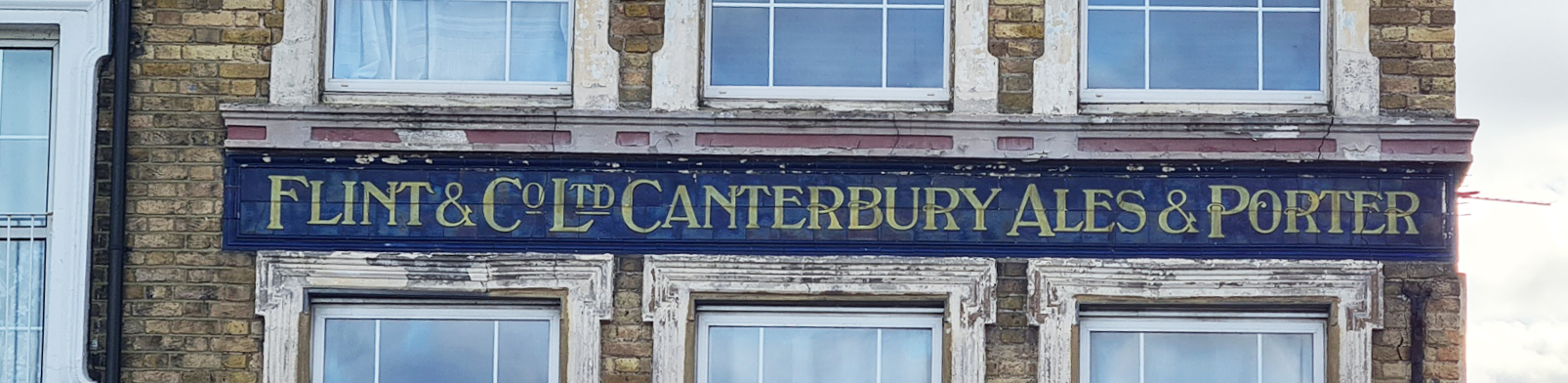
Leaving the supermarket, I was now on the north coast of the island. My timing looked good and it was just simple if fairly uninteresting walking along the seawall with Sheerness town on my right. There were piles of Norwegian granite boulders on my left, shipped here at great expense and placed there to break the force of the waves and prevent erosion and flooding of the town. One of the few parts of the island coastline where expensive work to do so has been implemented. Sheerness is the main town on Sheppey and has it’s problems but it was obvious to see some effort is being made to turn it around. I did notice that the former Victoria Hotel, that overlooks the sea, once selling Ales and Porters from the Flint brewery out of Canterbury, has been converted to what I presume to be very expensive housing.
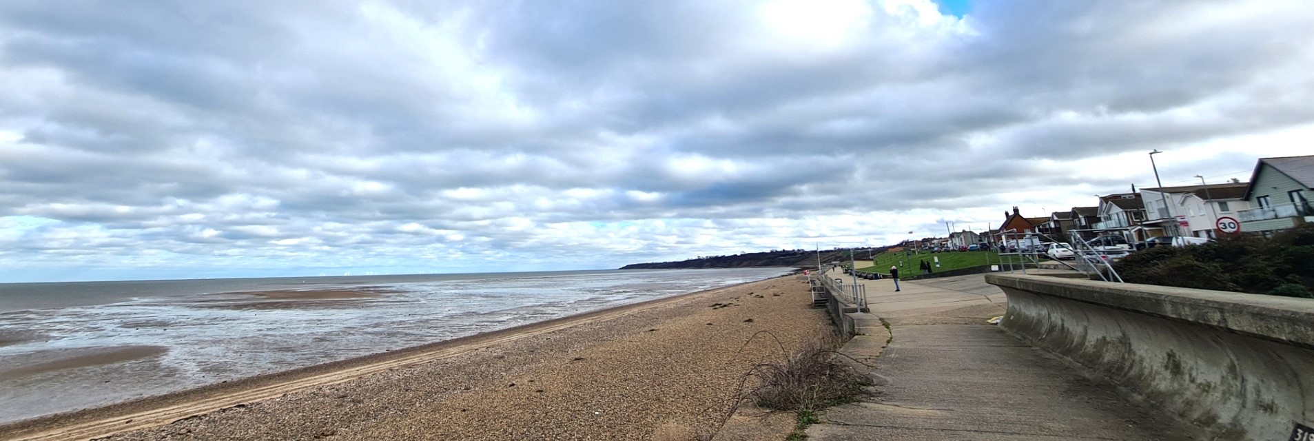
The coastal path continued, accompanying the coastal road out of town, both headed to Minster. Once there, the main road turned inland and a minor road and the coastal path continued ahead. The road slowly climbing with the path following the esplanade below. This was the busiest part I had seen all day, over both days in fact.
In addition to some areas in the south, routing for parts of the northern section of the round-island path has proved problematic for both planners and landowners and an uncomfortable and slightly sketchy route through inland streets is incorporated in to the route plans instead. Objections to the path around the island haven’t been confined to those living and working there. With an eye on re-election, instead of seeking a decent solution that might upset a few people, the local MP spoke out against it’s creation.
“While having a coastal path and having access to the sea for as many people as possible is a good idea, it’s a nonsense that we should have a path, regardless of the risks, just because the legislation says there needs to be one there”
Gordon Henderson, Sittingbourne and Sheppey MP. speaking in House of Commons debate in 2019
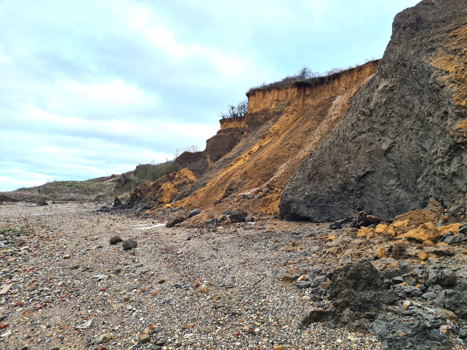
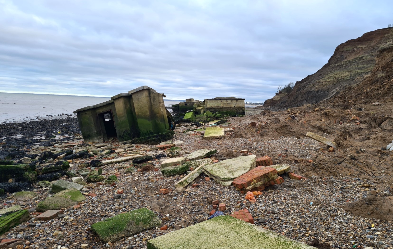
There were many objections to the trail’s proposed route, including demands for a ban on dogs on the path. That demand has been circumvented. Roll back, an essential and laudable part of the coastal path legislation is made difficult not only in places where coastal erosion is a possibility, but where it is actively occurring and the north part of the Isle of Sheppey has an extraordinary amount of active coastal erosion. This is a result of the sea bordering cliffs being comprised of primarily soft London Clay. Many wartime coastal defences, houses, caravans and ‘mobile’ homes have disappeared over the edge. Largely crumbled into tiny fragments as a result of sea action.
The choice for those not wanting to follow an inland route at Minster are limited. One coastal path guide book I have simply suggests catching a bus to miss it out. If you choose to follow the strict coastline, it butts you up against the base of the unassailable crumbling cliffs with little or no refuge when the tide comes in. Every year people have to be rescued. My entire timing for this day’s walk was based around when low tide would occur here, to enable me plenty of time to splodge my way though the London Clay below the cliffs and emerge at the far end of the miles long debris strewn shoreline in good time before I was cut off by the incoming sea. This is not a practical alternative for many visitors constrained by whatever time they reach here and they are faced with dangerous sub-optimal tidal timings. There really is little in the way of escape routes up the cliffs and people are stuck in the mud and overtaken by the sea every year. The safe official route has to be followed if you are either nervous or do not have many hours of clear foreshore with a dropping tide in which to clear the distance. As an additional warning of the danger of walking at the foot of cliffs where there have been recent slips, the news on the morning I set off included a story of two fossil hunters having to be rescued from a cliff mudslide the previous day by the coastguard, at Charmouth Bay in Dorset.
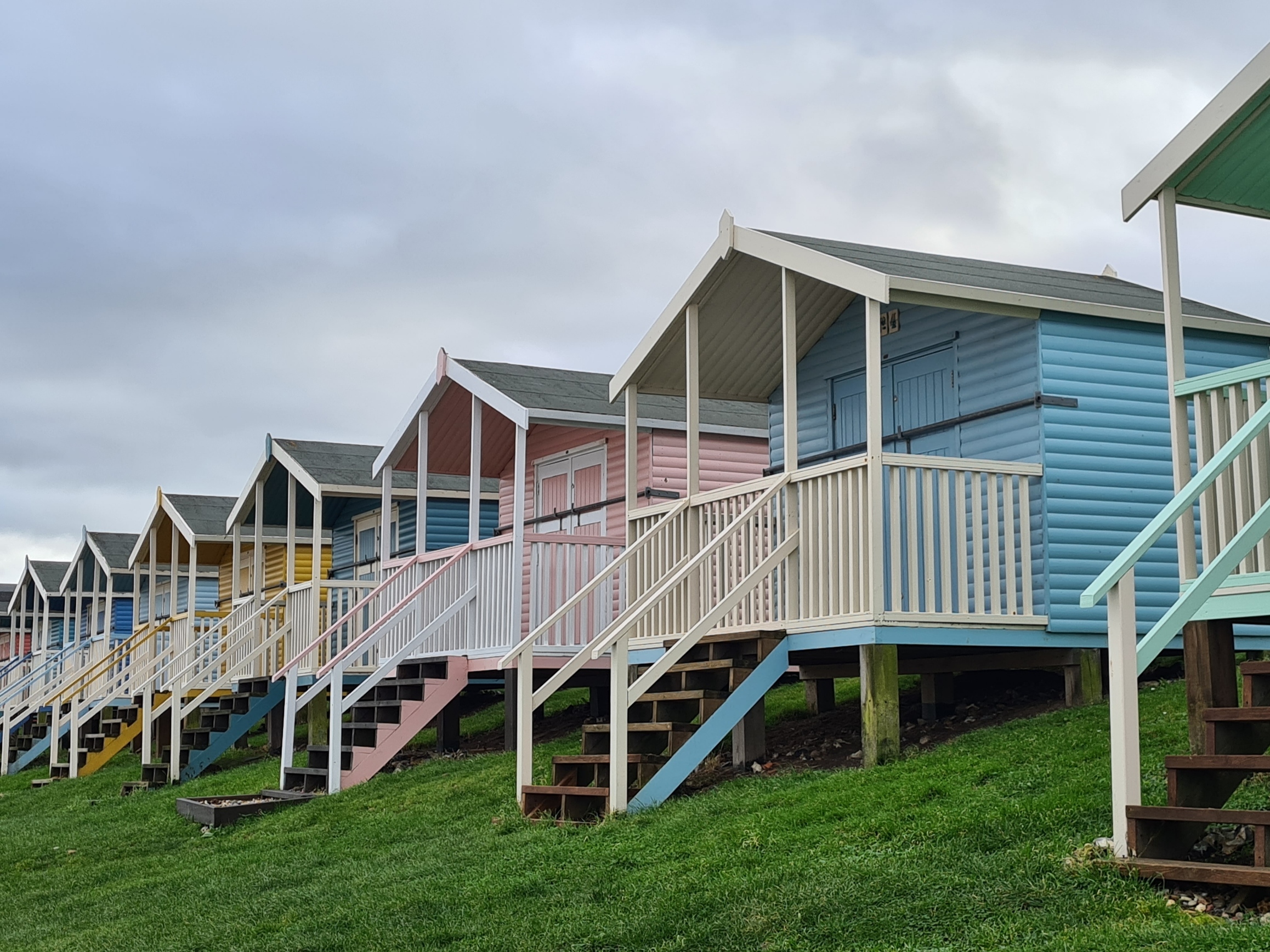
At Minster I continued along the promenade, past the brightly painted and well kept wooden beach huts, each one commanding a hefty price tag. This was obviously a popular place for walking a dog, or jogging up and down, or chatting to friends. Some looked to be combining all three activities. I looked very much out of place as I walked past them all and at the end, hopped down off the concrete apron and carried on down the shingle beach toward the low sloping cliffs. I passed one couple that had ventured along the beach. Kissing and probably annoyed that I had intruded their solitude. Beyond them, I saw just one more person. He was far out and walking back toward Minster along the waters edge, sea that was hopefully a good four or five hours away from me, as I had a four mile walk to complete.
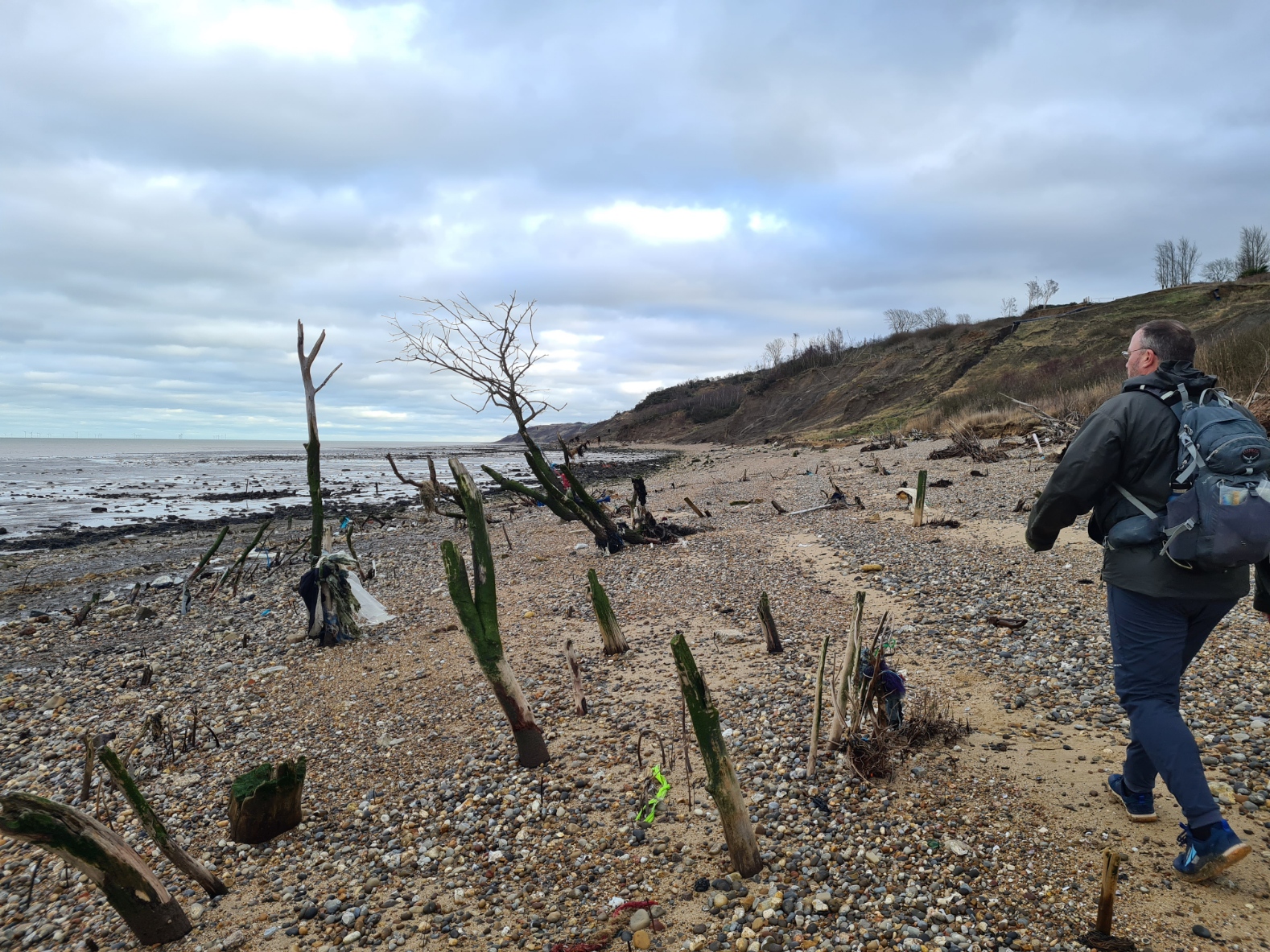
This is not a pretty beach walk. It was akin to walking through an apocalyptic aftermath. Vegetation and dwellings have slipped down to the beach, accompanied by fly tipped efforts by landowners to stop the gradual erosion of their land. The debris is everywhere, smashed to pieces, scattered amongst pebbles and shells, buried in ooze. Alongside this is a million years of sedimentation, dating from the early Eocene epoch of the Palaeogene period, 52-51 million years ago. Near Minster the Bagshot Beds, a fine buff sand with flint pebbles, are separated from the extensive London Clay by three metres of sand and clay, the Claygate Beds.
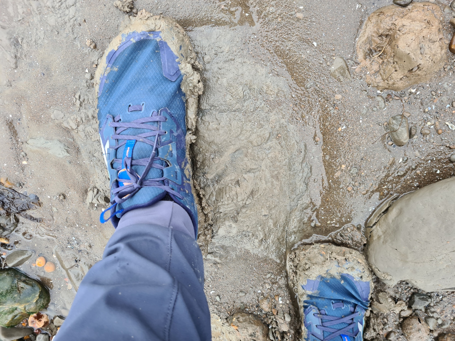
Every tide washes out prehistoric remnants from the cliffs. You won’t find dinosaurs here, it is from the wrong period. But fossil seeds, wood, gastropod, lobsters, crab, starfish, fish vertebrae, shark teeth and more are there to be found in abundance. Even a hippopotamus was dug out years ago. But discovery takes both fortune and time, time I didn’t have. The not-too-bad walking through sand and shingle at the start largely changed to slipping and sliding through crusted mud. That takes time and lengthens what on the map seems a brief and straight forward march.
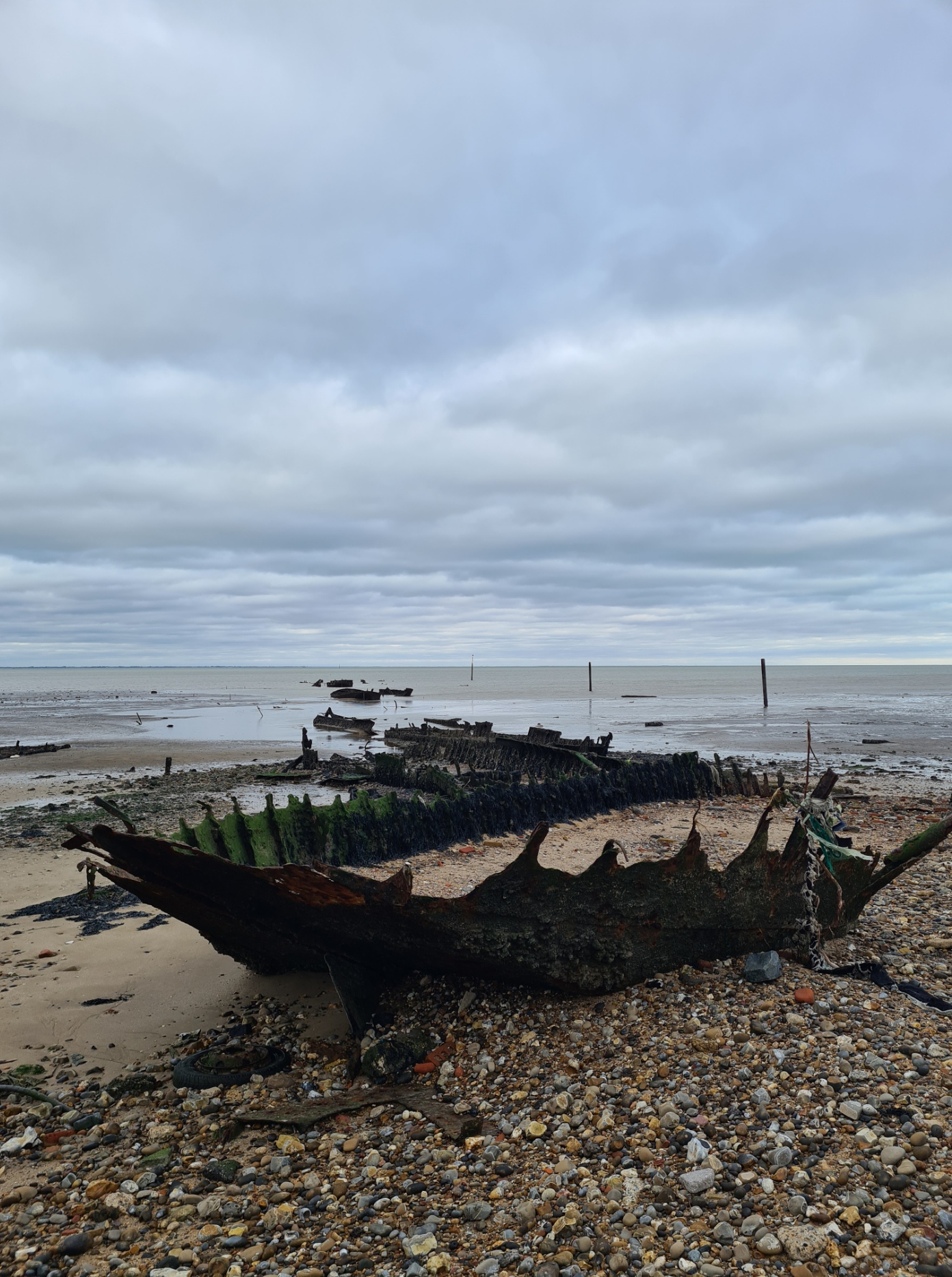
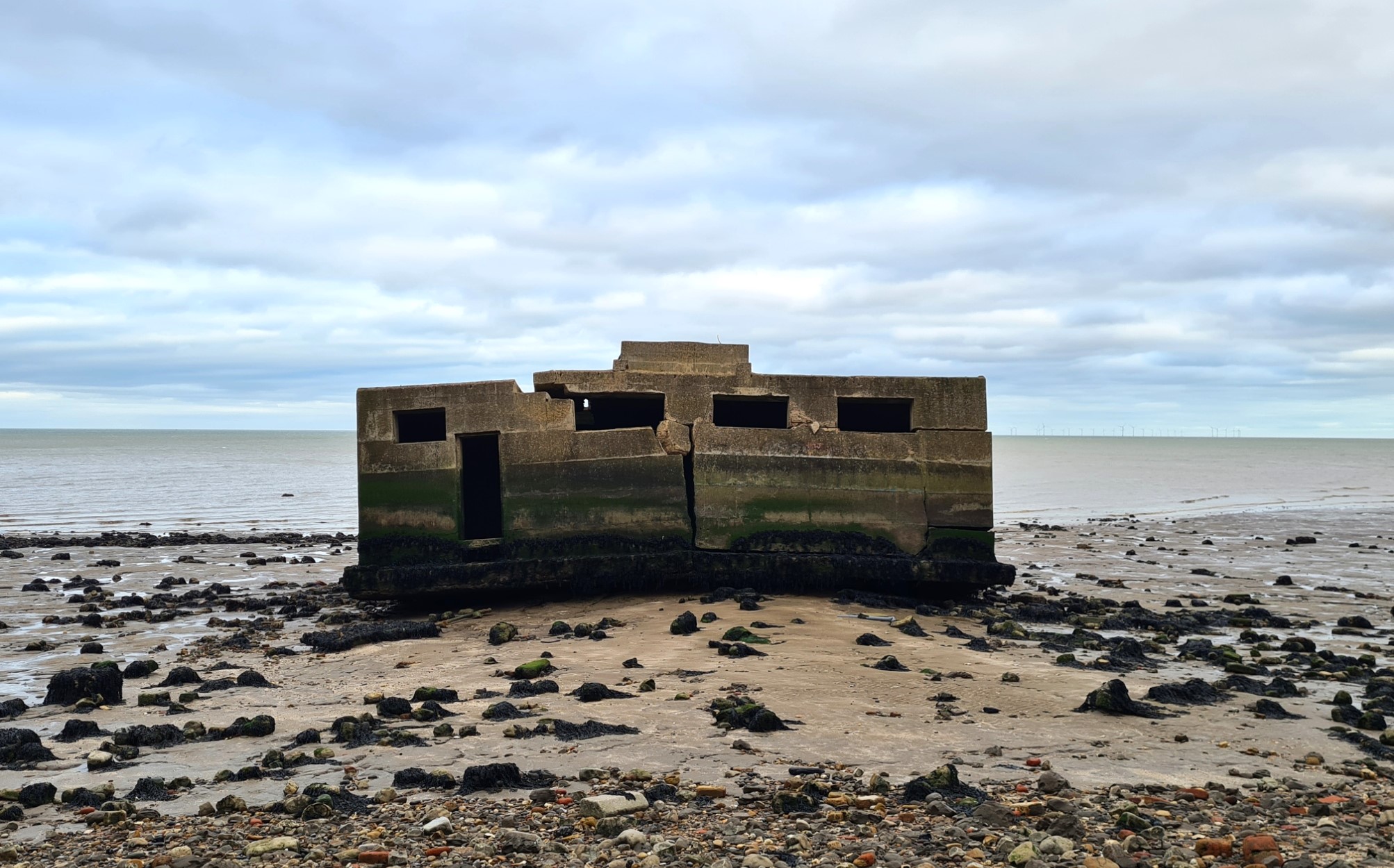
Having rounded Warden Point, a pretty much crucial place to have cleared before any incoming tide, I could take a bit of a breather, slow down a tad, even pause to view the many remnants of the coastal defences that have crumbled from the top of the cliffs in to the sea. The millions of fragments of wave smashed dwellings that I had passed earlier were now changed to fragments of brick and large slabs of concrete. But they were nothing when compared to the three look outs that have somehow survived their passage from the top of the cliffs to the bottom largely intact and now sit in the mud and ooze slightly off-shore.
I left the muddy beach just before Leysdown-on-Sea and stopped to scrape the mud from my feet with a piece of plastic retrieved from the beach. For the first time I could now hear the sea breaking on the shingle. It hadn’t been a particularly low tide and there was about an hour remaining before the incoming sea would have been lapping round my ankles.
I felt a little bit the conquering hero after my dash along the coast, but perhaps reckless interloper might be some peoples thought, though I feel not. As it was, I looked more a mud bedaubed wild man to the few dog owners venturing out for a quick walkies on a cold and breezy late afternoon, just prior to the light fading for the day. It was then a walk of a mile or so along a bit of uninspiring road up in to town. On the way I paused at a bus stop to view bus times, and it then became an ever faster pace to get to the bus stop where I had waited on my first day, in order both catch the next bus (with over an hour wait after that for the next), and to create a continual foot trail around the island. Anyone less daft than I could easily have stopped at the first bus stop passed after leaving the beach. I reached my halt twenty seconds before the bus. I paid my two quid, ignored the glance from the bus driver at my muddy legs, and settled in to a seat for the fifty minute drive to the Sheerness railway station, night falling outside on the way. It was there that I could finally pull my flask from my pack to drink three cups of still lukewarm tea while waiting twenty minutes for the next train back to the mainland.
Isle of Sheppey circuit complete, and another short segment of the England Coast Path done. I doubt I’ll ever attempt to complete it all, but it is good to knock off sections of the coastal path when I can and, in part, it had been an interesting and rewarding two days on the Isle of Sheppey.

Dear Mr. Three Points, Thanks so much for your hiking blogs; I enjoy them very much. It’s a joy to read about your explorations, especially in the UK. You seem to love it dearly.
I’ve hiked in England twice; my first long-distance trek was the Coast to Coast; hope you’ll try it soon (we didn’t wild camp, though). It was fantastic. Last summer, I walked from London to Canterbury, starting on the Thames Path before heading inland near Dartford. The unexpected delight of that journey was the Darent River Path; the people who cleaned it up deserve huge thanks. To see trout resting behind rocks (to get out of the current, I think?), in river water that was practically clear as day, was amazing and wonderful. It was fun to read about your Thames Path walk.
Your hiking solo most of the time gives me courage to do the same. My hiking partner died last summer of a fast-growing brain tumor. Walking alone hasn’t been nearly as enjoyable, but you seem quite comfortable with it. I’m trying to approach walking by myself as something that has advantages of its own. Still a bit lonely, though.
Not sure where I’ll go next; a friend has sent a booklet about circular walks to the White Horses of Wiltshire. Maybe that.
Look forward to reading about your next trek.
All the best,
Susan Hankins, Richmond, Virginia, USA
LikeLiked by 1 person
Hi Susan, thanks for taking the time to comment, and your kind words. Your walk from London to Canterbury may have been the Pilgrims Way route that commences near Southwark Cathedral? I walked part of that over three days from London to Otford, where it joined the main route of the Pilgrims Way. I wrote about those days here (you may recognise some of the subjects in the photos). That is a route I need to return to and complete. The Darent is a lovely little stream, I had thought about walking it source to sea but having tracked it on a map, find there is only a mile or two I haven’t actually walked.
As it happens, I walked the Thames Path down to Dartford again only a few days ago, while completing my Source to the Sea. I won’t be blogging on that particular walk. I have got as far as the Isle of Grain, just need to walk round to Cliffe to round it off.
The Coast to Coast has been on my list for quite some time. I hope to walk it this summer but there are so many other walks to complete!
Another coincidence, I also hope to return to the chalk plains to knock off my final hundred or so miles of the Greater Ridgeway, following the chalk down to Lyme Regis. Though that may have to wait until next year.
Walking alone suits some, doesn’t suit others. You need to be able to entertain a mind for solo hiking, no doubt why I see so many listening to podcasts and music while they hike, which isn’t my thing at all.
Best wishes, happy trails
LikeLike
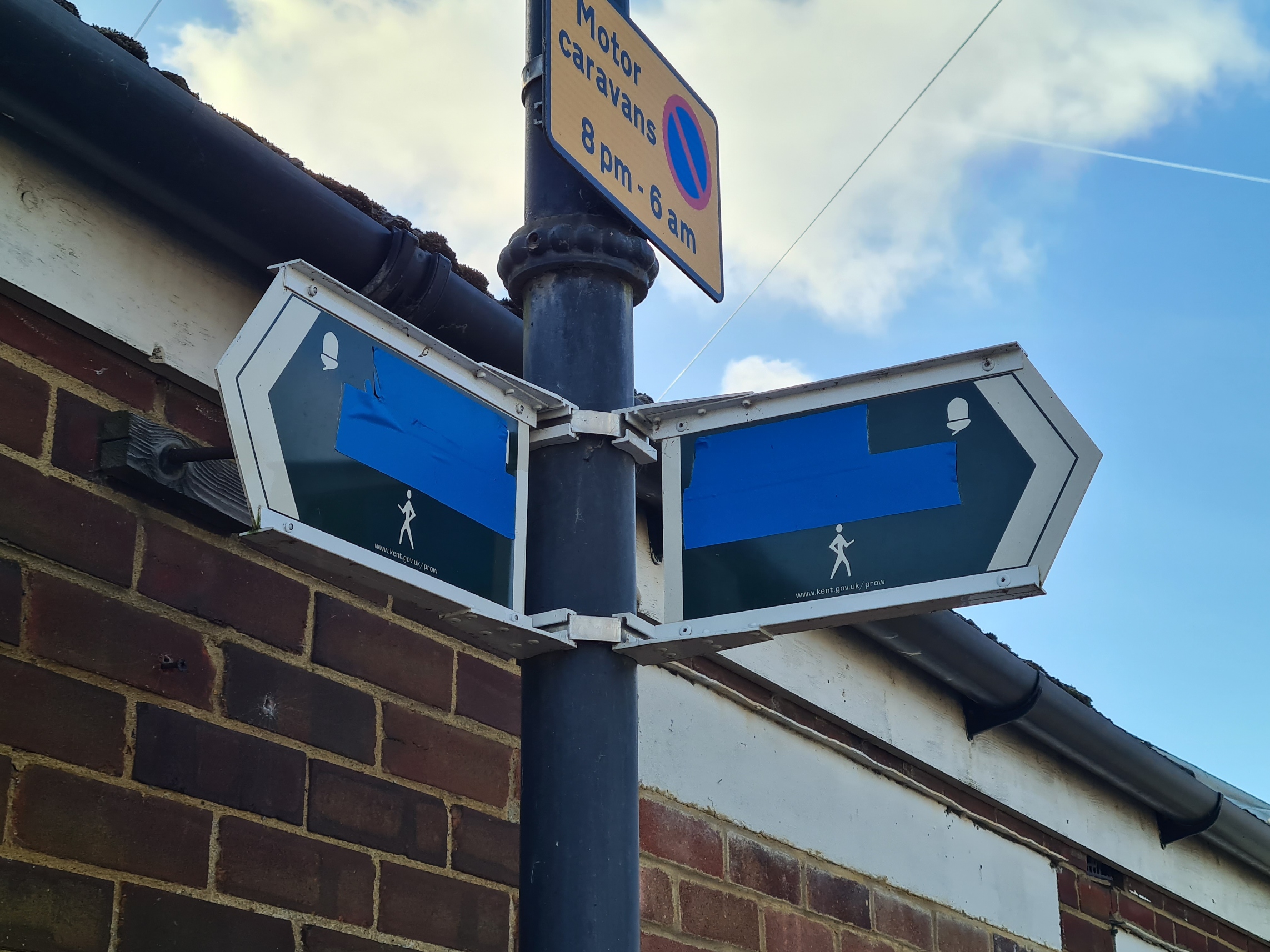
I noticed recently, on a map, that the Coastal Path nationally is in the process of being rebranded the King Charles III Coastal Path. Could this be the reason some of the signs you saw were blanked out – they’re being updated?
LikeLike
It is almost certainly because some parts are not officially signed off yet. As with so much of the round England path, it is well behind at the moment. But still- the post is there, the sign is on the post. People are walking the path, people are going to walk that way. I can’t see much sense in putting a bit of tape across a few words. Unless there are just a few locals holding out hope that the route may yet be diverted to go somewhere else.
LikeLike