
Three Points of the Compass completes his journey from London to Birmingham on the Grand Union Canal Walk.
Day eight: Stockton to Lapworth
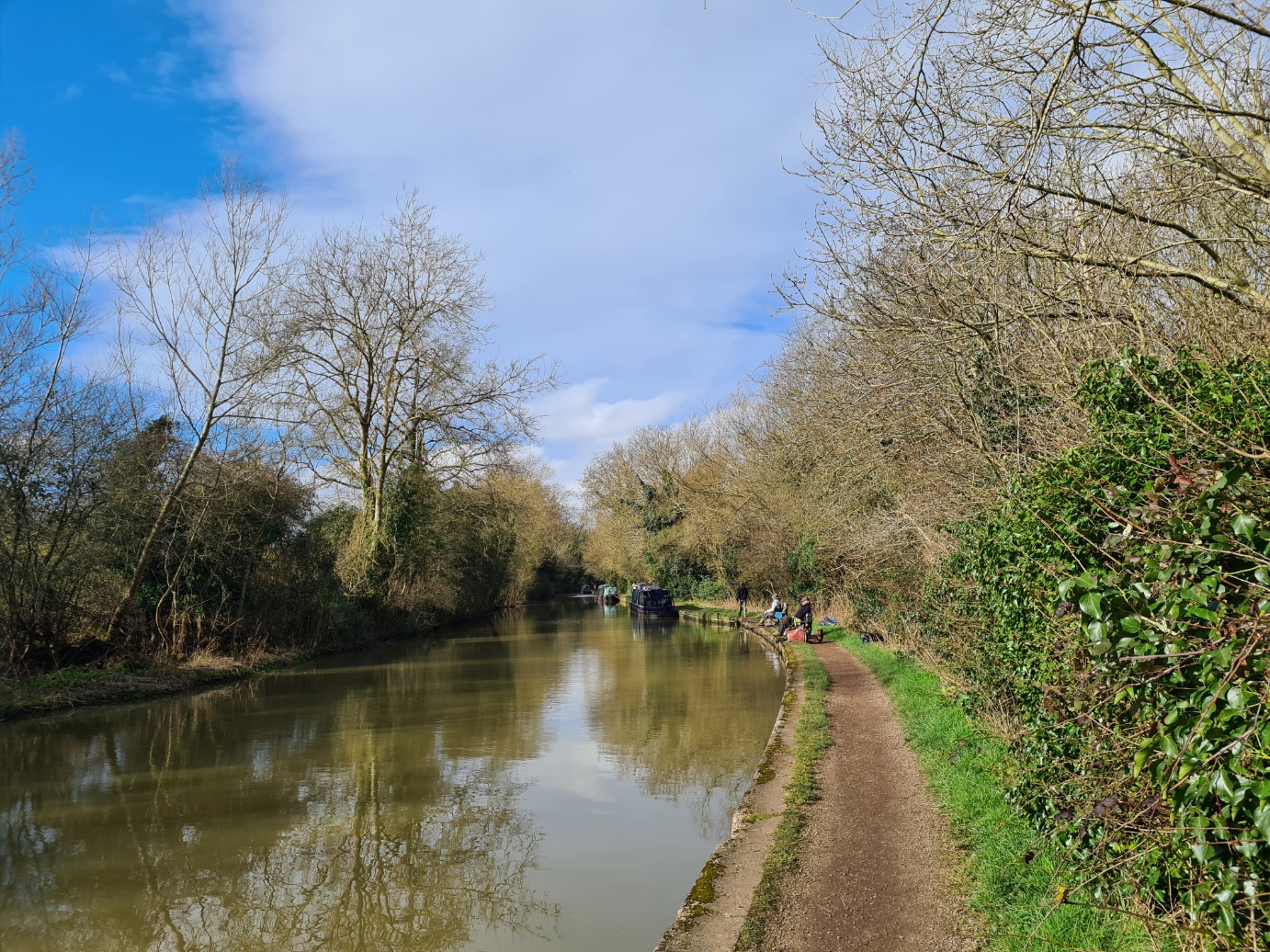
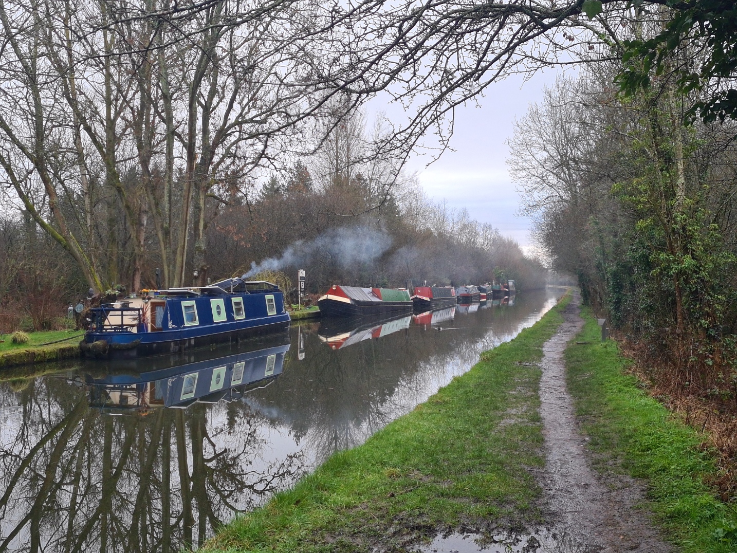
As usual, I slept well, but I was a bit peeved at having to get up earlier than I would have preferred, not only because a long day beckoned, but also to clean the large Airbnb premises a bit prior to leaving. I was away for seven . While the small Josie’s Cafe across the forecourt was open, I decided to crack on with some miles instead. Initially, a walk through town, along lanes and country paths, field edges and woodland, skirting a fishing lake, before returning to the canal. After the mostly poor walking underfoot over the previous couple of days, I was rewarded today by a good 98% of easy towpath walking. It was a Saturday, so the towpath was quite busy with joggers, dog walkers, cyclists, and fishermen. A few boats were on the move too, gently and slowly chugging past me. The sun shone. A bright Brimstone, my first of the year, fluttered down the path toward me. Primroses and Daffodils at my feet, I decided it was going to be a good day.
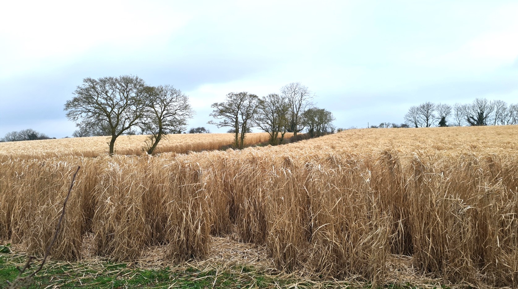
I passed acres of thatching straw, the wind rustling through it and producing an almost spooky sound, really quite evocative, though of what I was unsure. This longstraw would be cut at some point in the future and drawn into sheaves, then stooked to dry. Once dry, trussed into bundles. Stacks of bundles are then made into yealms, four or five yealms to a nitch. This used to be grown across the country but is now far more localised, some areas concentrating on a specific type of thatching material. One of these, water reed, or phragmites, is most commonly grown in Norfolk today, hence the name Norfolk Reed. In Scotland, heather or turf might be used. Here today however, a lone harrier was quartering a wind flattened area, looking for mice and voles I presume.
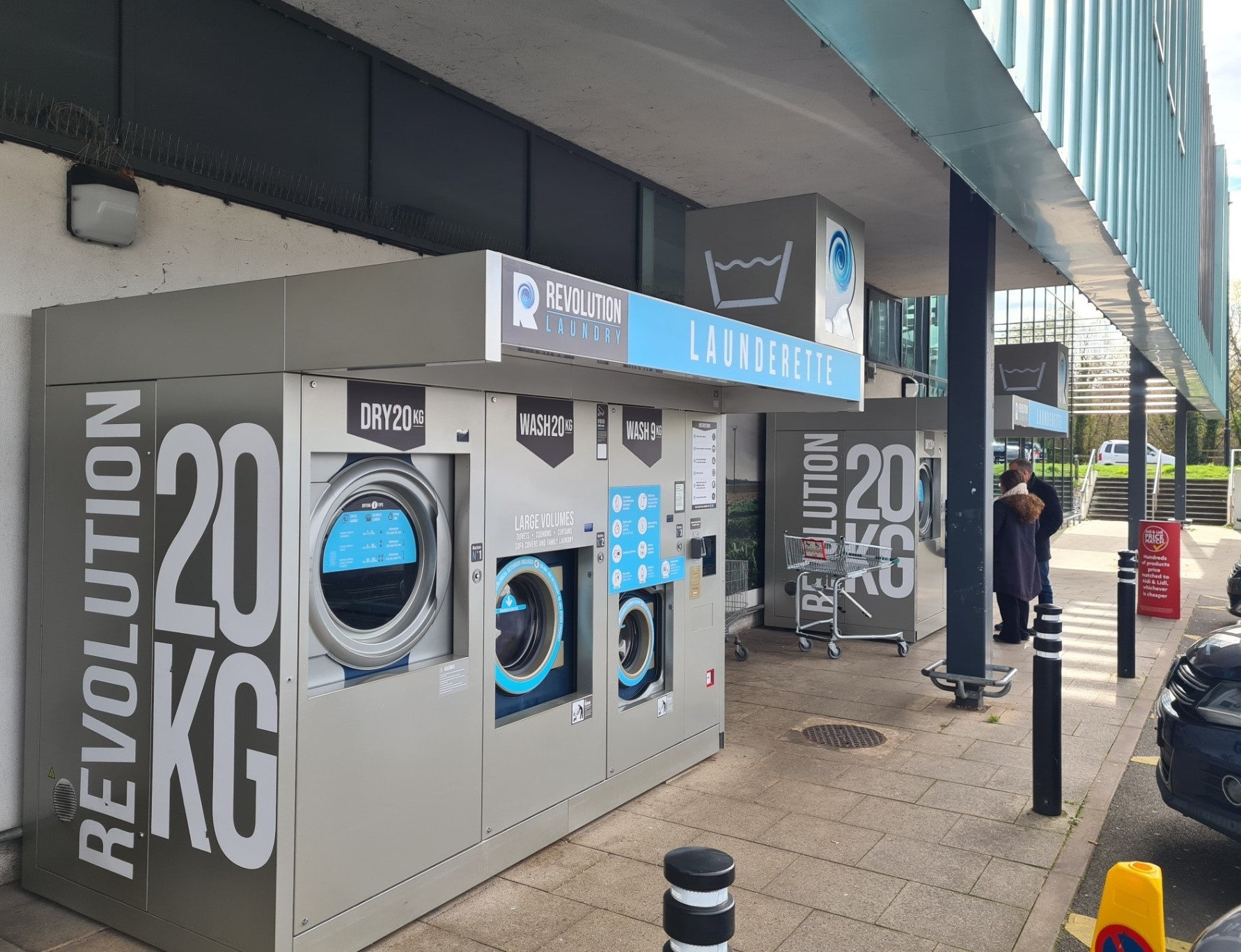
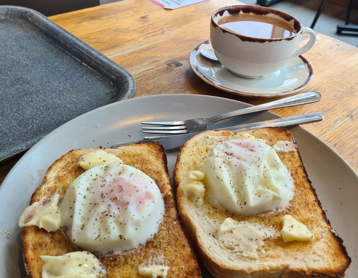
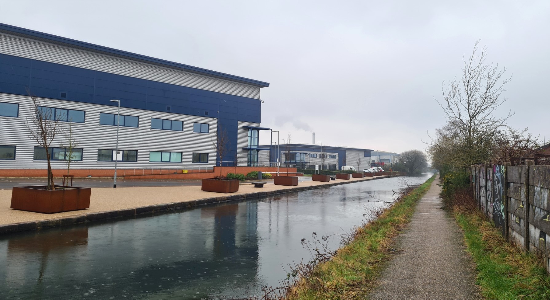
Leamington Spa produced a few things of note. Not that I should be, but I was surprised to find the canal was relatively litter free, an oddity for most larger towns that it passes through. The laundry facilities outside the large canalside Morrison’s supermarket was also a new one for me. I shall have to keep an eye out for these on other longer walks, though I suspect it was more for those living onboard over on the canal. Of far more interest to me however, were the poached eggs on toast and tea in Morrison’s reasonably priced café. While I had eaten a banana back at the Airbnb for breakfast, that was a somewhat meagre contribution and my elevenses was much appreciated. It’s the small things in life…
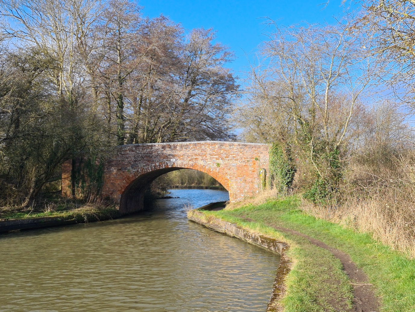
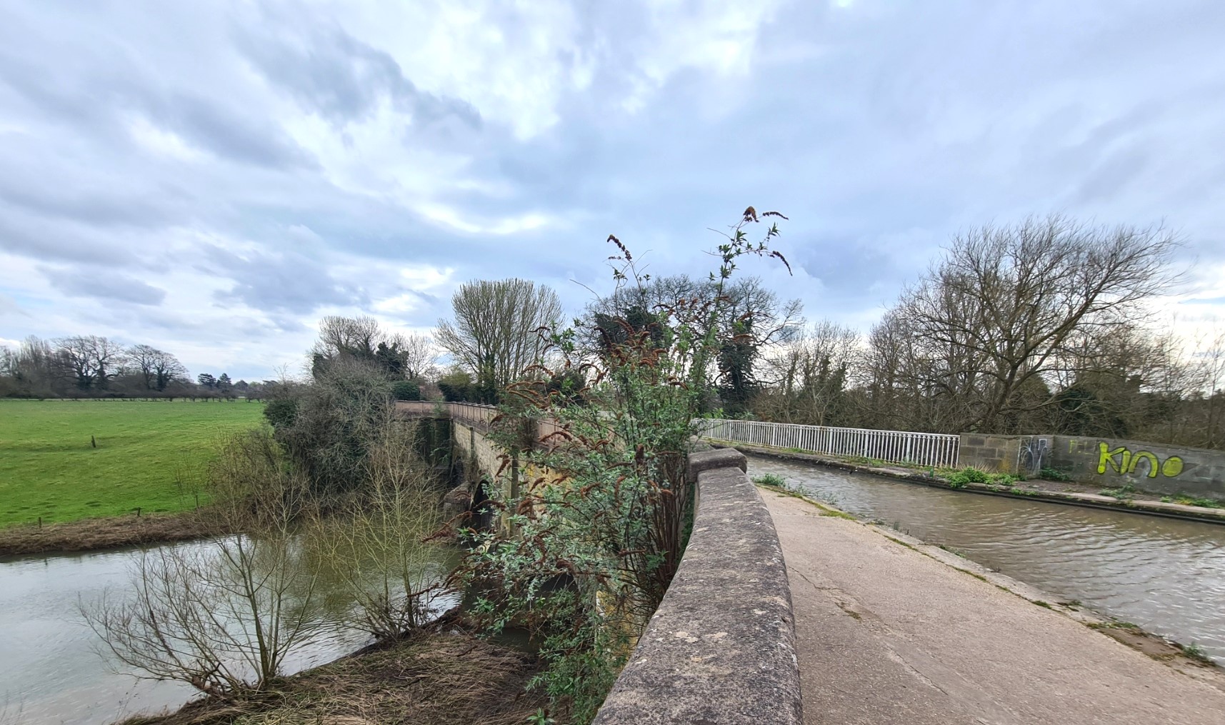
Back on the towpath, the canal made for easy and pleasant walking. The fishermen I had chatted to earlier in the day had told me this was a good spot for large carp. They are so large as the people living adjacent to the canal throw food to them from their windows. Further on I crossed the river Avon, nine metres below, via a three arched stone aqueduct, opened in 1800. I was now on what was originally called the Warwick and Napton Canal, before it was subsumed into the Grand Union. Such was the importance of this route between London and the Midlands that when it opened, the price of coal halved overnight due to the ease of transport that the canal offered.
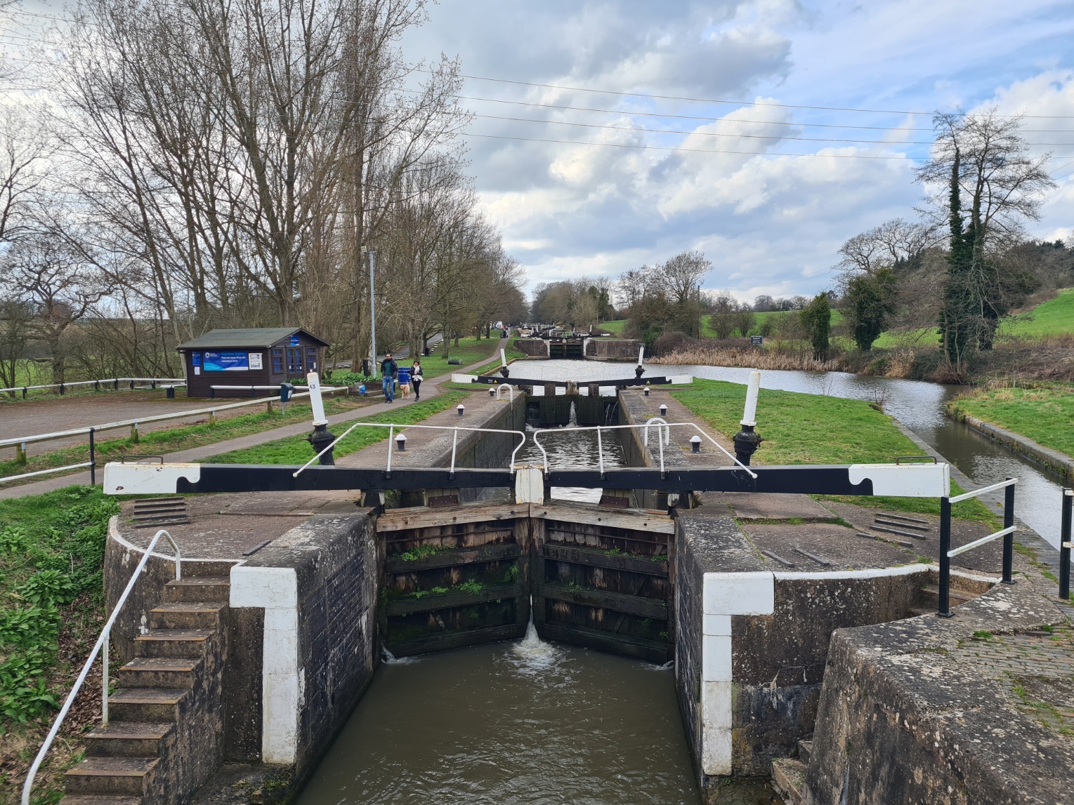
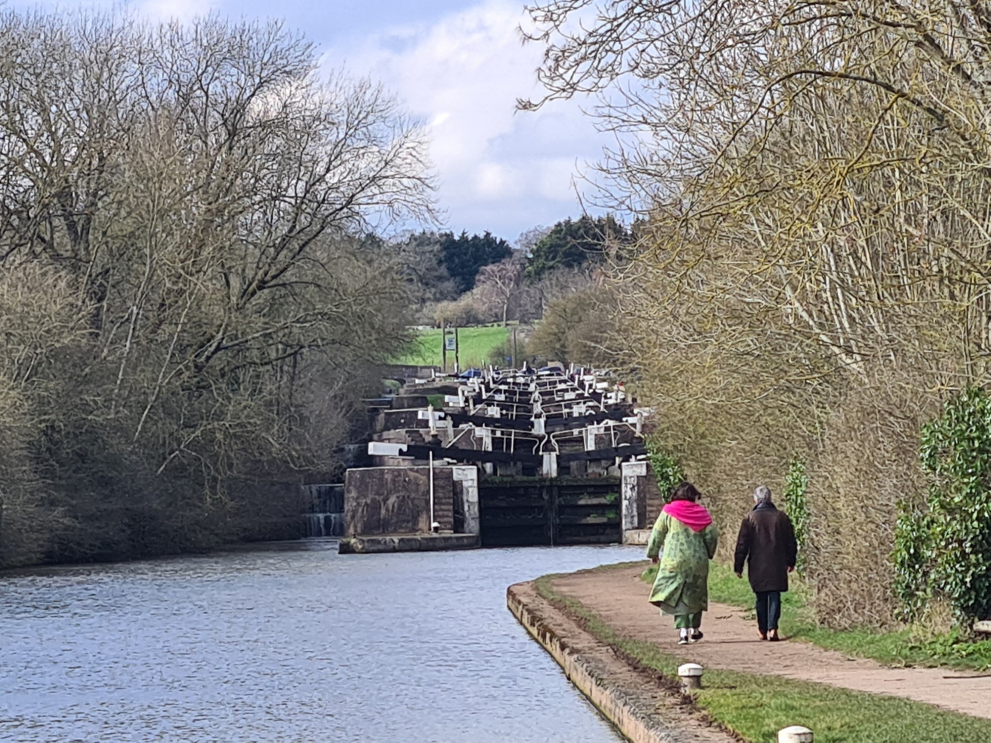
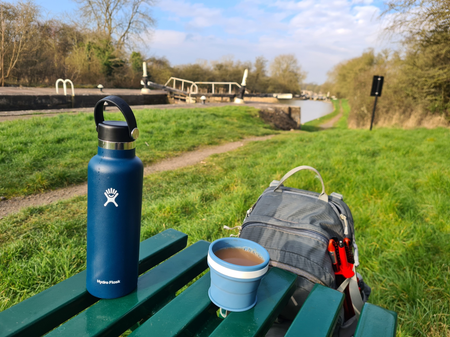
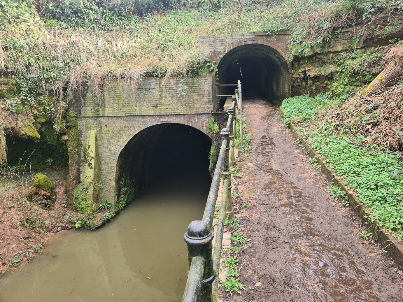
The flight of 21 locks at Hatton is one of the most impressive in the country, but it builds slowly. You pass one, then another, then a grouping, and another. It was once called ‘The Stairway to Heaven’ by the boaters, as they were paid only after they had worked their way to the top. The locks carry the canal up and out of the Avon valley and a considerable volume of water was required to ensure they could operate, so large side ponds were constructed to one side. These have aged beautifully and are now reed fringed. Weirs carry an excess of water away and the occasional narrow lock survives as a now ignored precursor, from where they were changed to wide-beam locks. I climbed the 146 feet to the top lock but eschewed the canalside café, preferring to sit at a bench and drain my flask of remaining tea. It was now sunny and the canal was busy with pedestrian visitors, all enjoying a Sunday afternoon gongoozling. It is all very pleasant here but few walked away from the locks in the opposite direction, and I left everyone behind as I walked to the 396m long Shrewley Tunnel. Another tunnel that the towpath abandons. Boaters used to drag their boats through by the handrail fixed to the tunnel side while their horses were walked up and over. I followed their old path upward to the road at the top. Here, just prior to dropping back down to the canal, I stopped at the small village as it had a small deli-shop and I popped in for a couple of pasties, sandwich and bag of crisps. This was for both breakfast and lunch tomorrow as the former, offered by tonight’s accommodation, was both too late and too expensive.
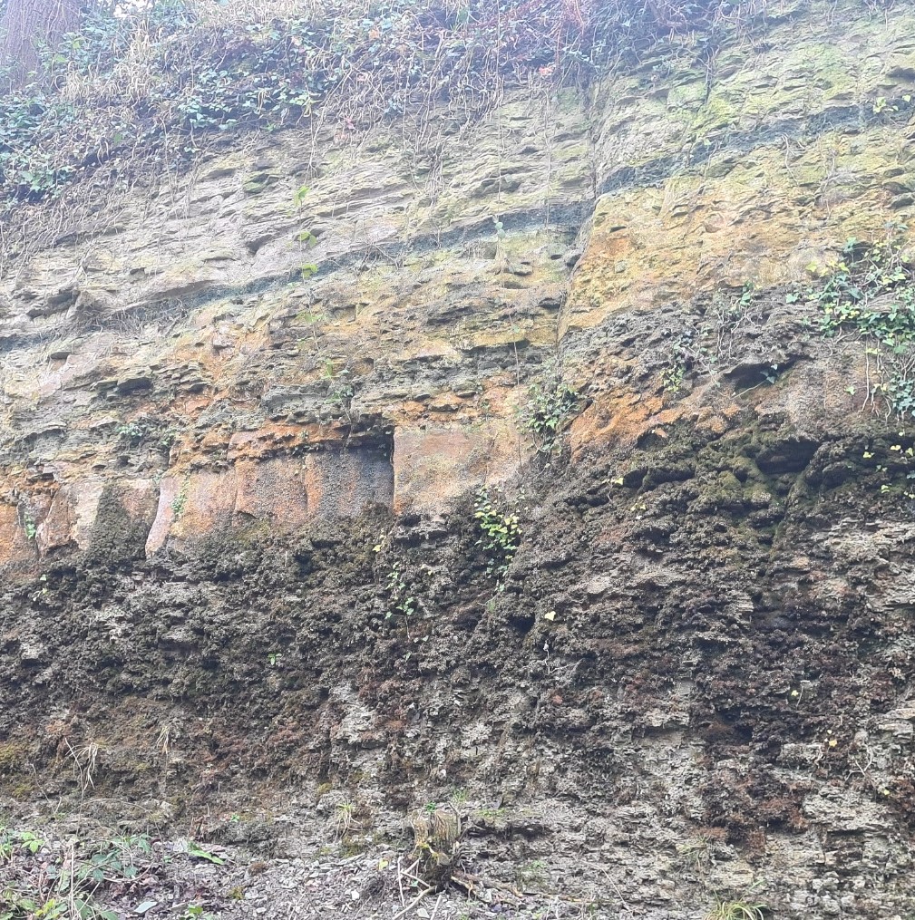
Leaving the shop and crossing the road, the path struck off downhill, hemmed in by houses each side, before disappearing into a brick lined tunnel that opened out above the canal below. Both tunnels emerge into Shrewley Cutting, hewn out of the rock by the navvies. Thin layers of pale pink sandstone are sandwiched along with green mudstones between thicker layers of red coloured mudstone. This is the Arden Sandstone, laid down some 230 million years previous. When the canal was dug many fossils were found, expanding our knowledge of earth’s history and geological processes. The first reptile footprints from the Triassic era, in what is now Great Britain, were found here and the area is now a Site of Special Scientific Interest. Not that I would wish to, you cannot clamber the exposed faces, simply carry on down the towpath as it opens out to countryside bordered easy walking.
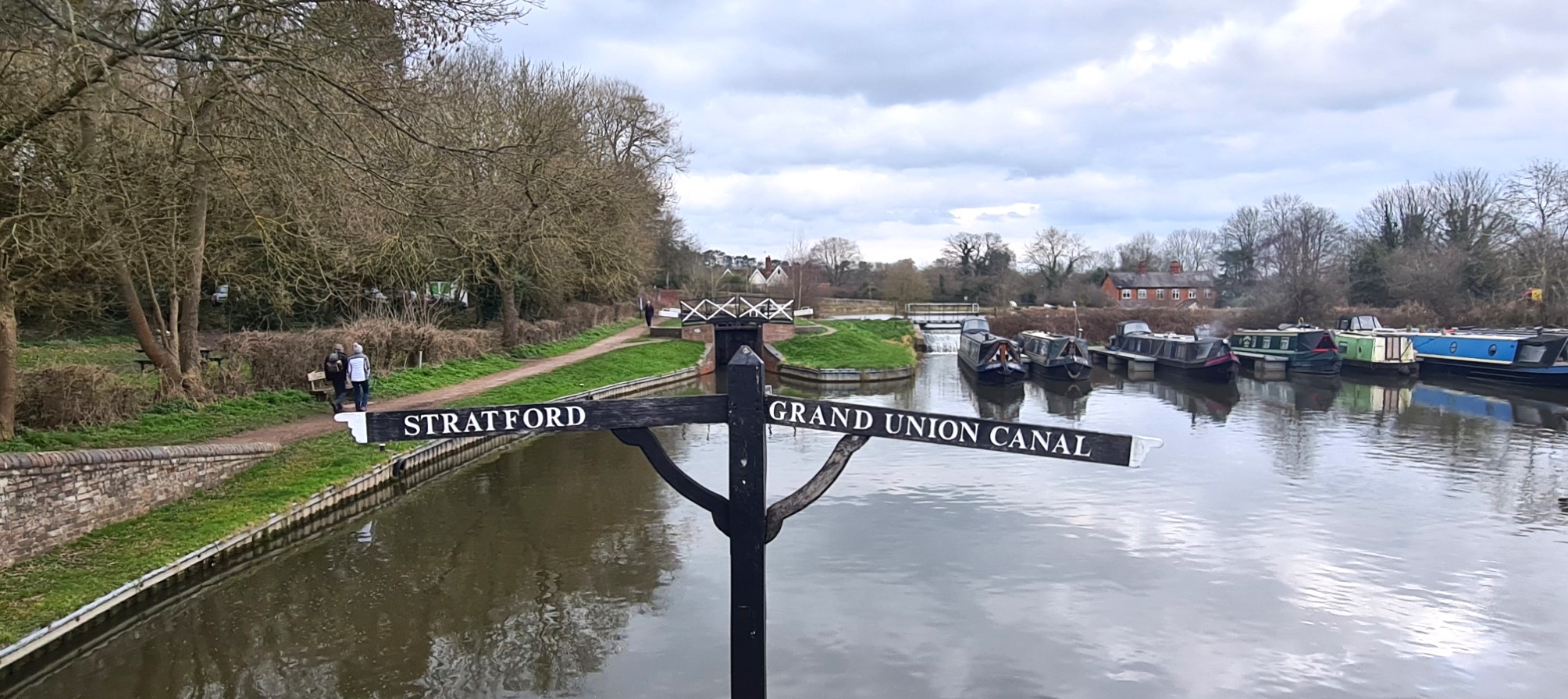
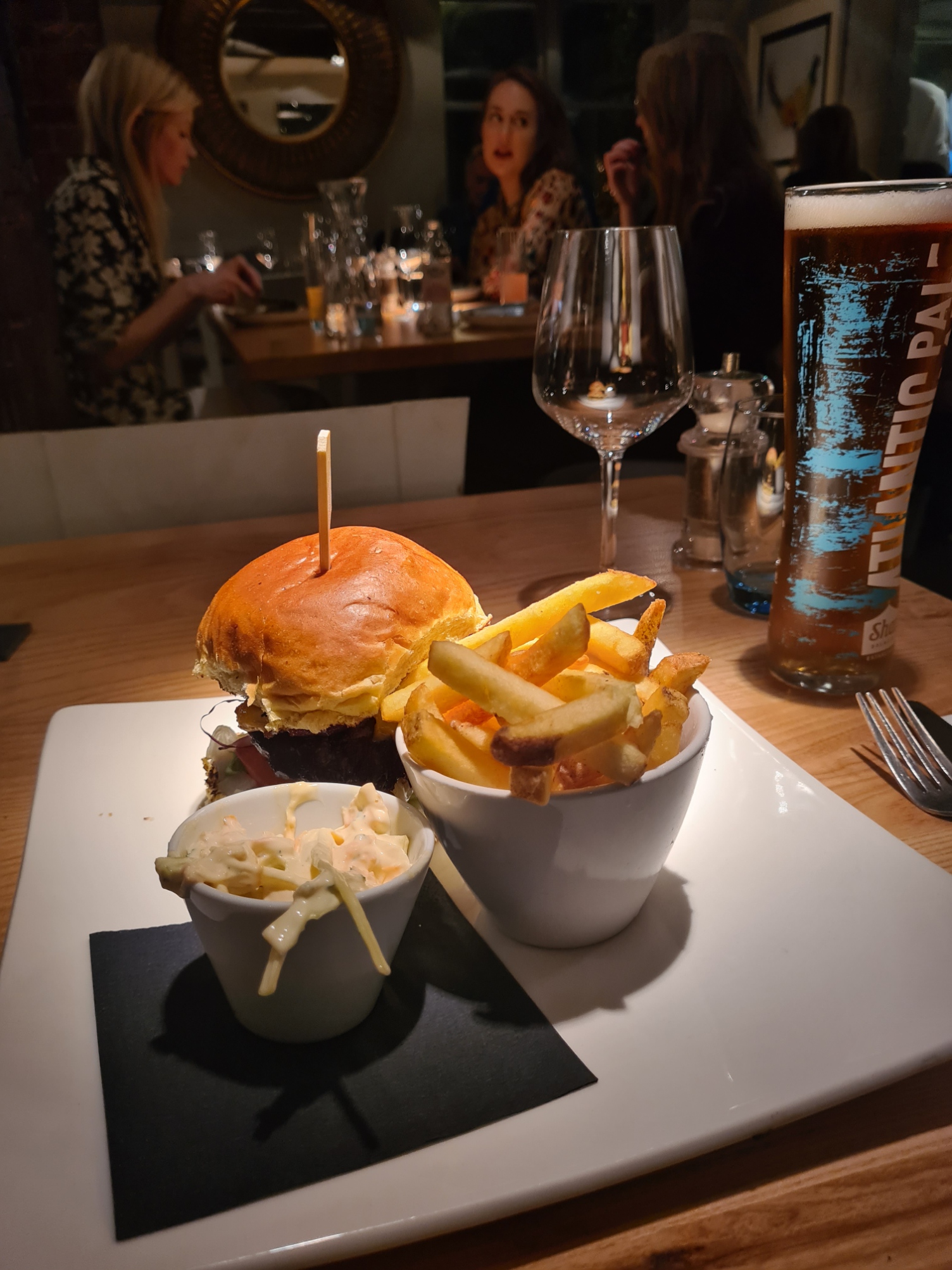
I crossed over from one canal to another at the Kingswood Junction to briefly follow the narrower Stratford-upon-Avon Canal before leaving the towpath for the short road walk to The Punchbowl. A somewhat snooty restaurant-with-accommodation that had pretensions. I was very obviously not their preferred clientele and right from when I walked in, was either ignored or barely tolerated. I never saw a smile the whole time I was there. Such is the problem of a lack of accommodation in some places on this walk. It was an expensive overnighter too. But I liked my room (despite an iffy shower), and when I finally got my table later, I chose the cheapest off the menu. A bowl of soup was seven quid and my simple but good burger £18. If I had chosen my preferred steak, I would have shelled out £35 and would then have to add any accompaniments. I had a couple of decent beers with my meal, but had to get the server to remove a third, that never materialised, from my bill. Determined to finish what had been a mostly good day, my penultimate, in fine style, a too-expensive bottle of Shiraz accompanied me back to my room for late night telly.
Day nine: Lapworth to Gas Street Basin, Birmingham
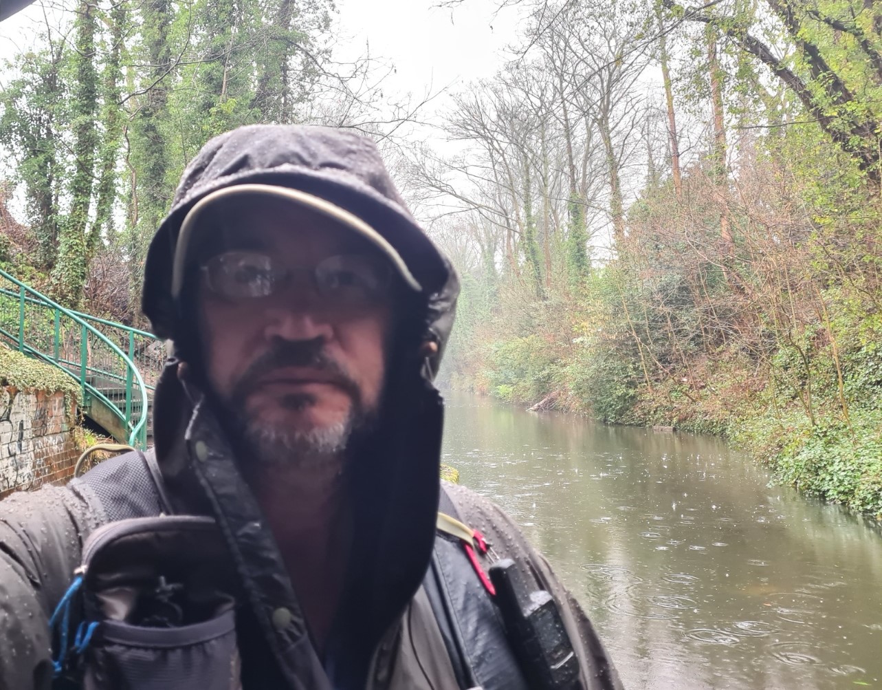
I slept well, not even noticing the heavy overnight rain. Up at six, I filled my flask with tea for later and enjoyed a couple of strong cups of the brown stuff with my excellent pastie purchased yesterday. That saved me twelve quid on the Punchbowls breakfast, that wouldn’t be served for another two hours. I was away at seven-thirty. It was raining hard and forecast to last most of the day. I cared not. I had a wide Tilley hat and a decent Paramo shell for protection and was in good spirits.
I was using my trekking poles today, it was going to be a slippery walk on the muddy towpath. Within the first two miles they had prevented me going over a couple of times and I was relieved I had bought them. My feet were quickly both muddy and wet and I had to resort to walking through flooded parts as there was no way round them. A training walk for the solo hiker isn’t just about muscles and lungs, it is about mental resilience too. It was good to practice mental discipline and concentrate on positives. Difficult at times.
I looked around me as I walked, it was a mixed bag. A dead bloated badger drifted in the water, legs poking above the surface from its gas-distended body. If the prow of a boat hit it, it was likely to explode. Petrichor was masked in places by the heady scent of ransoms. Coconut! the gorse was in flower. Wagtails, tits, wrens, the usual small stuff. Mallard’s were the ‘duck du jour’, mostly randy drakes throttling reluctant females. Other wildfowl abounded. Moorhens would bob and frantically move away from me, before exploding into flight, heavy legs trailing beneath them. Mute Swans and Canada Geese were more territorial and frequently approached me, hissing angrily. I might, just might, have sworn at one or two.
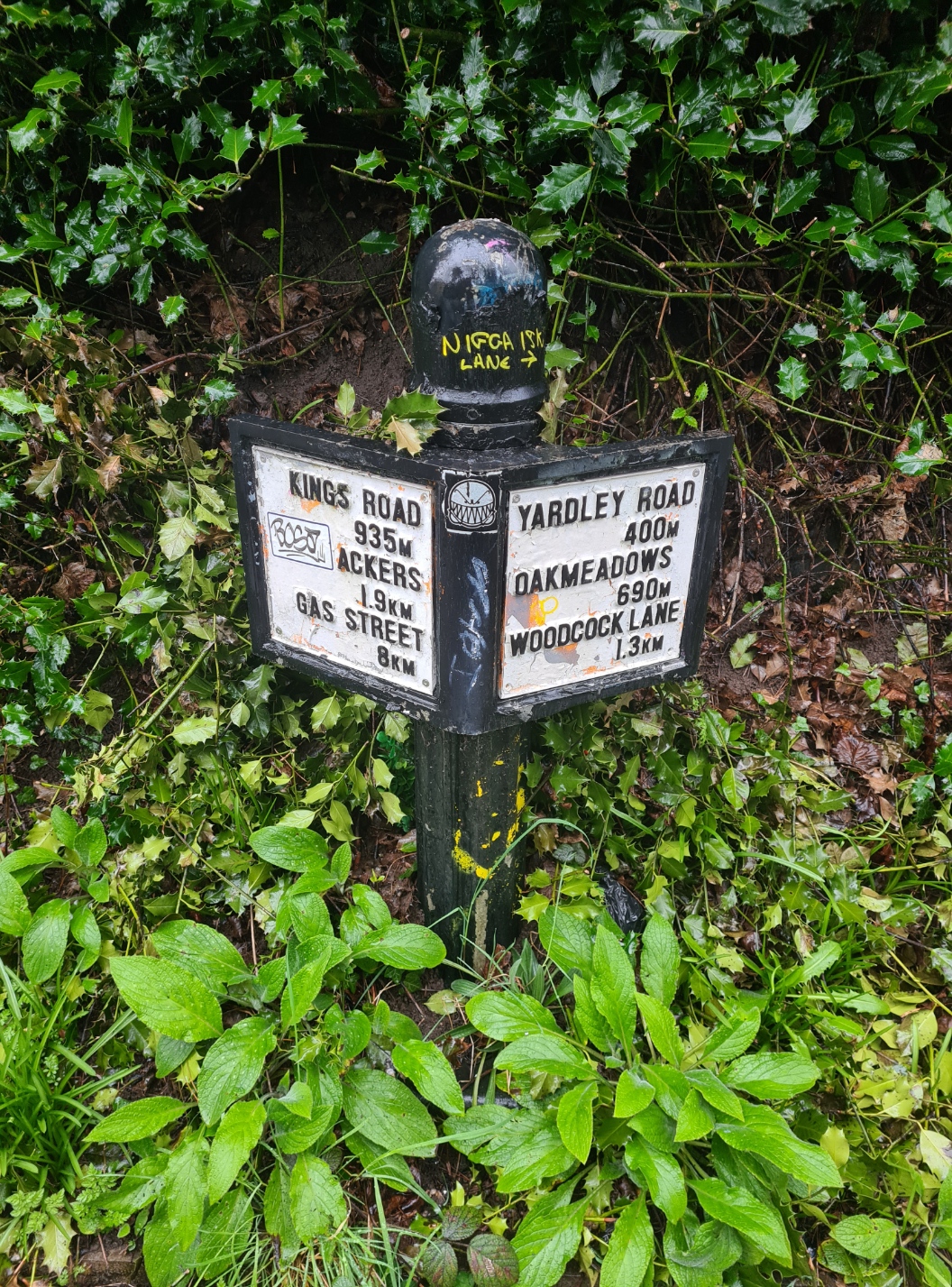
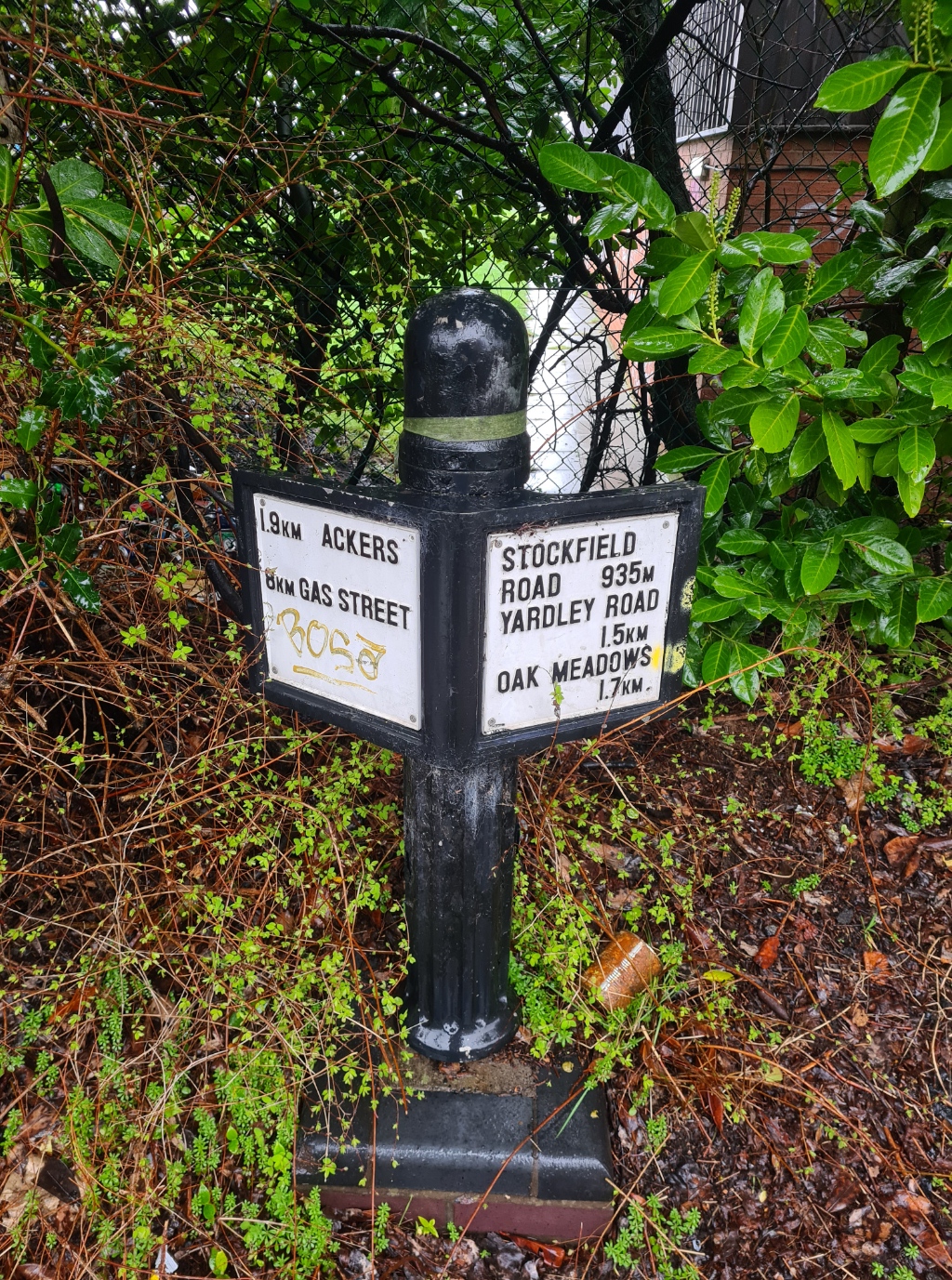
Attempts had been made to create a canal walk into Birmingham and smart new signposts had been erected. A degree more thought needed to go into them. Some were pristine, some unpainted, others unfinished, still others subsequently painted by the taggers. More importantly, the distances shown on them were doubtful. Three showed the same distance to Birmingham’s Gas Street basin, where my walk would end.
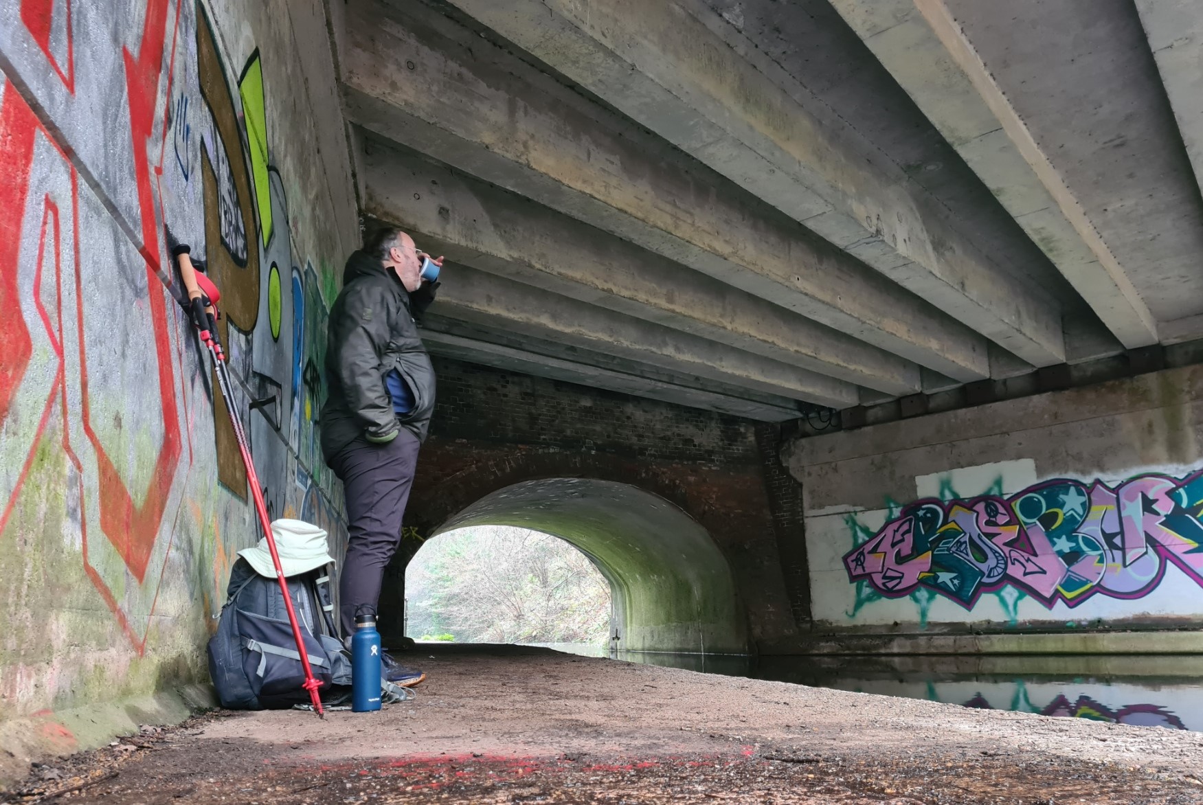
The amount of rubbish increased the nearer I got to Birmingham. It was a bit of a shock after a couple of days of cleaner canal. I spent the miles identifying the favoured debris- cheap cans of lager, equally as cheap strong cider, exhausted aerosol cans bobbing in the cut. I attempted to read the spray-painted tags beneath the bridges, but as usual failed. I took shelter under one dripping bridge for a hot tea from the flask, beneath another for my poor cheese and onion sandwich from yesterday.
Houses began to border the far side of the canal. Some with gardens open to the water, occasional steep footpaths cut out of the bank, leading down to upended rowboats, or garden tables and chairs, many tipped into the water. A child’s play slide ended alarmingly above the steep bank, threatening to eject a toddler straight into the drink. Other houses preferred fencing, shutting the water away, out of sight. Rubbish chucked over their fence, equally as out of sight and out of mind. It could all have been quite depressing if I wasn’t on a bit of a high, my walk drawing to an end.
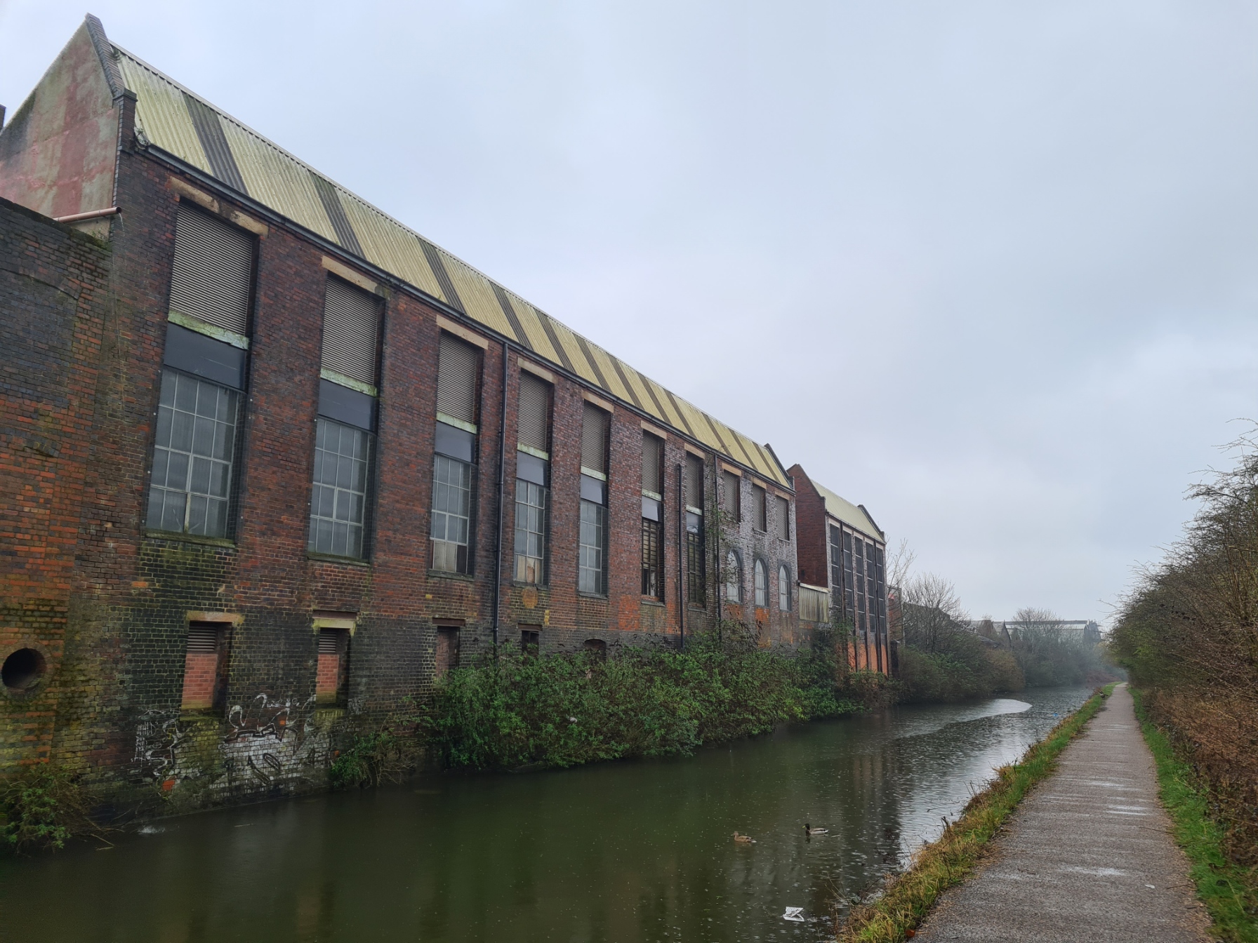
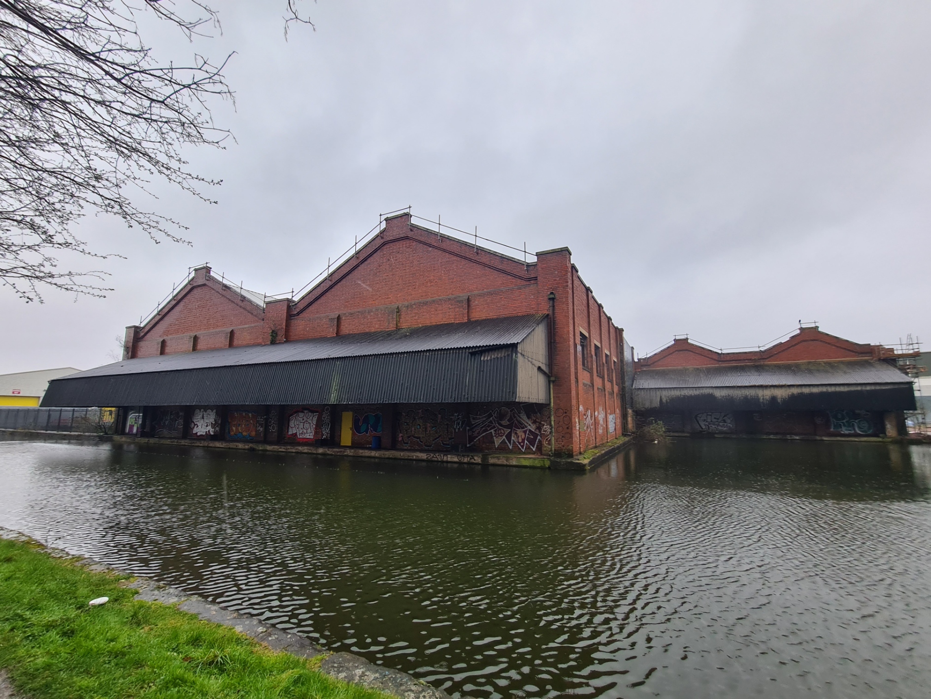
I could tell I was nearer to Birmingham as the air was occasionally full of the sound of planes taking off from Birmingham International Airport. It became steadily more urban. Old crumbling canalside industrial buildings with boarded up and now unused covered wharves, giving way to smarter buildings, that had no relationship with the canal other than location.
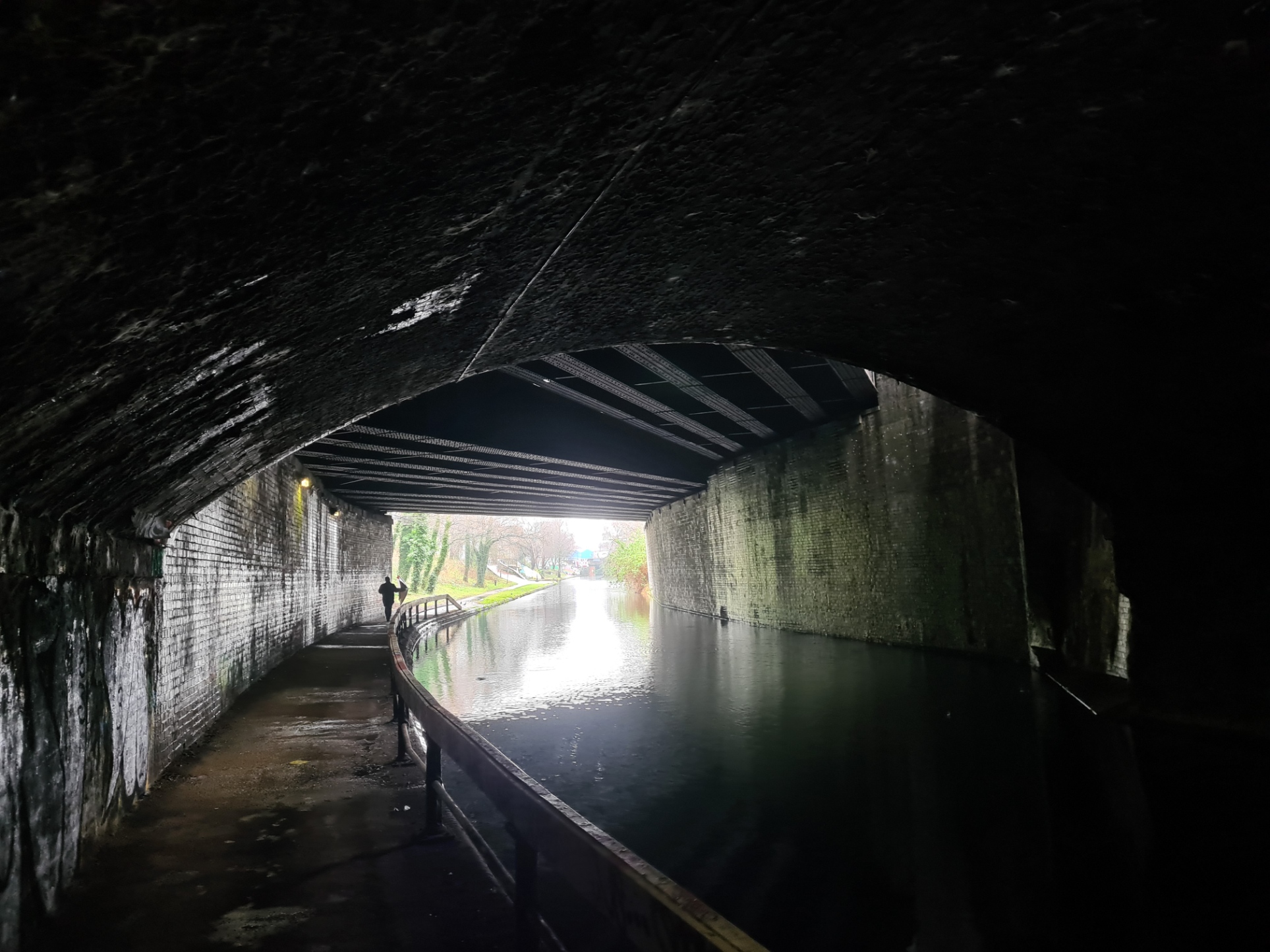
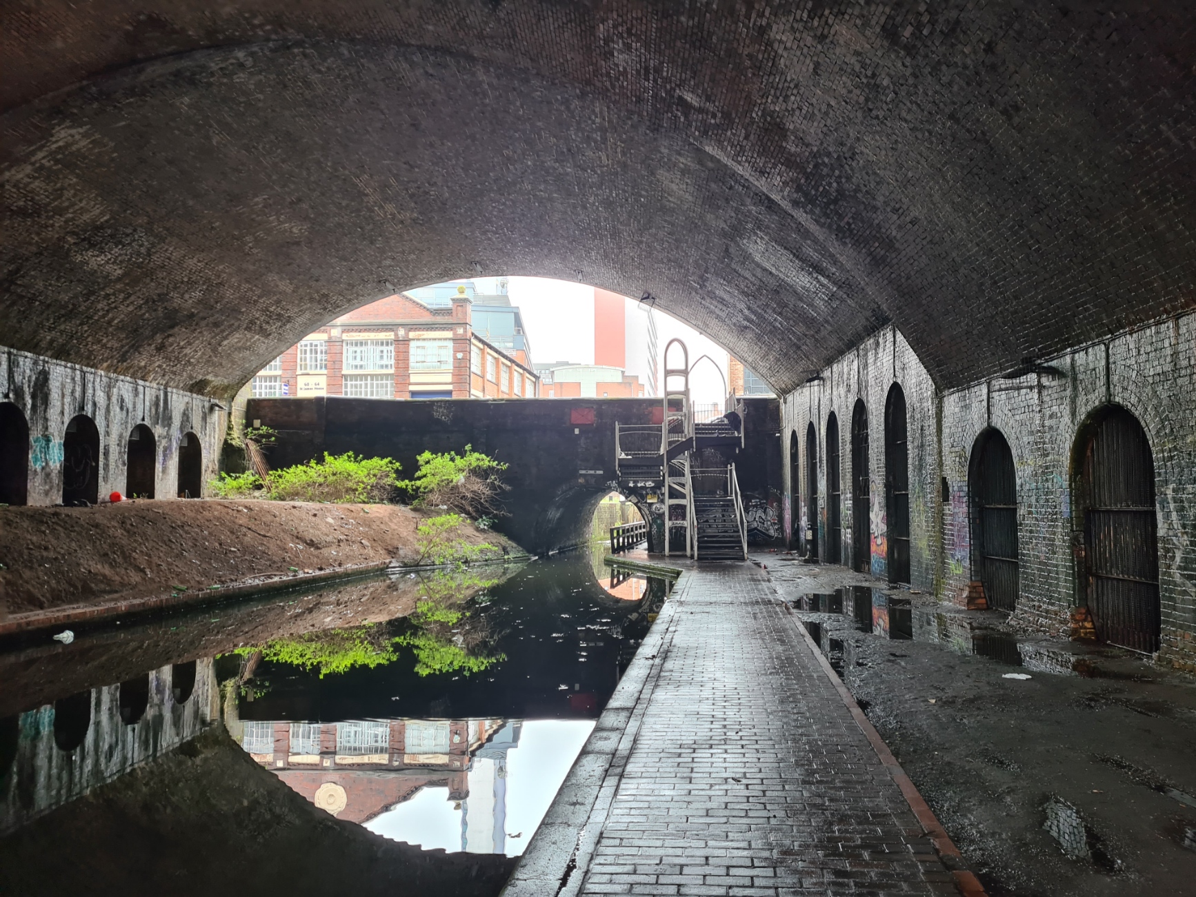
I’ll be honest. It felt a bit of a dodgy area, and increasingly so. Speaking to a local boater later, one of only two I saw moving on the water today, this approach into Birmingham is a known hang out for both recovering addicts and recidivists. Rubbish, abandoned clothing, the usual lager cans and worse were all along this stretch. I was thankful it was a dismal day weatherwise as few people would be bothering to simply hang around canalside today. The canal began to duck under buildings, through tunnels, wending its way through a cityscape. It was only when I was back at home that I realised I had been in the vicinity of Digbeth, an area used for filming parts of the Peaky Blinders TV series.
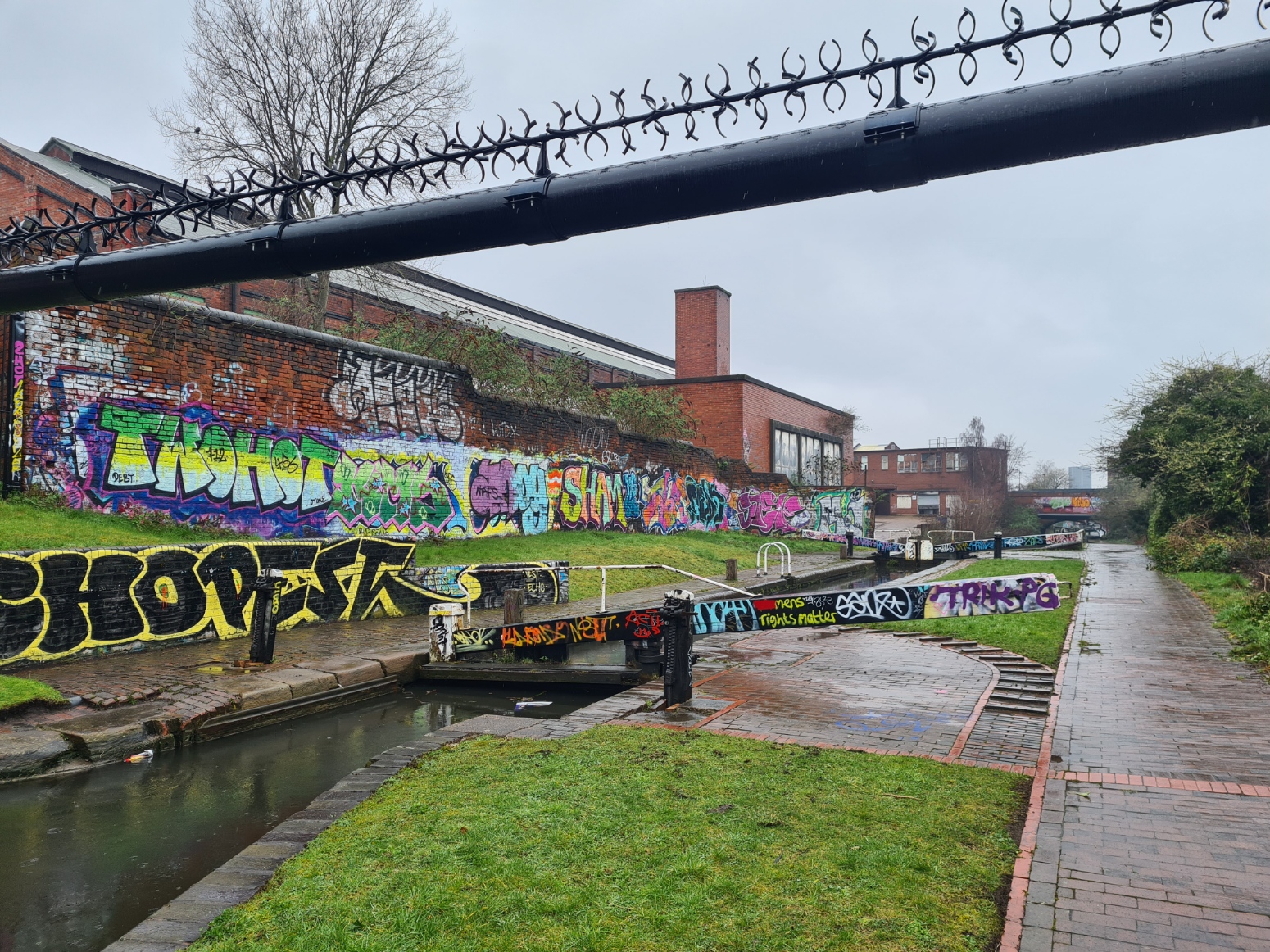
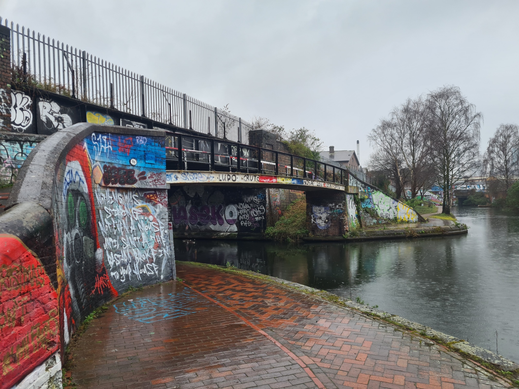
Nearing the centre and various junctions with other waterways it was clear that attempts were being made to reinvigorate the area. It has real potential, and I am sure much will be rather lovely in time, but the developers, authorities and police have a difficult and costly headache for a few years yet.
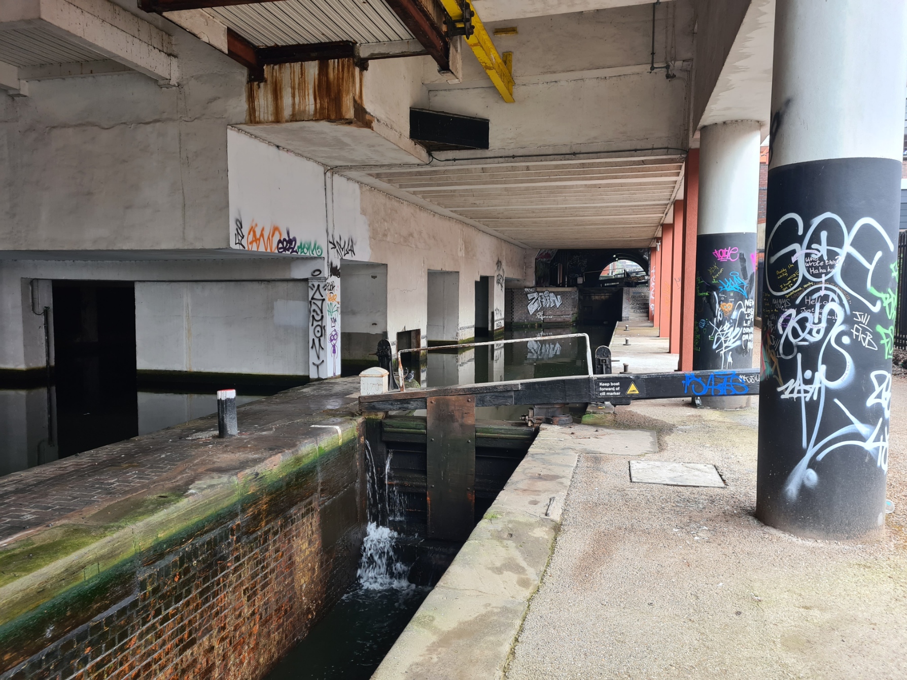
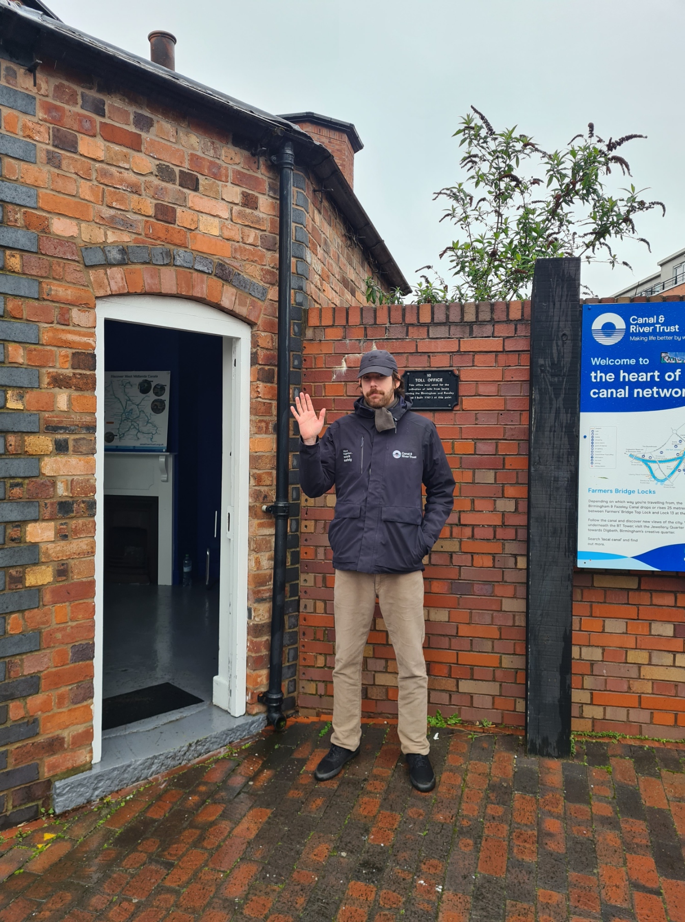
At lock number One, Joshua popped out of the old Toll House to chat. At first I guess he had a hope of picking up a volunteer for the Canal & River Trust, maybe even a donation. Quickly giving up on that he was just happy to pass a few minutes with me, discussing both my walk and his work. I was already aware of the financial woes of the Canal & River Trust as I had picked up a copy of Towpath Talk– “the UK’s number ONE read for all waterways users”, back at The Wharf pub. An article in this newspaper had expanded on the CRT’s forecast of a £5million deficit for the current financial year. Increased costs being the major contributing factor. Not at all helpful when lock repairs for Lock 7 on the Marple Flight were put at £1.89m. £50m was also to be spent on 24 of the Trust’s 70 reservoirs in 2024/25, including Wilstone, one of the Tring reservoirs I had passed, that supplies the Grand Union. Large amounts from a relatively small budget, I don’t envy the decision makers.
Once I had changed onto the Birmingham & Fazeley Canal, leading into the city centre, it all changed. The vibe was altered. There was life and vibrancy. People were out in their droves, despite the persisting drizzle. The canal towpath was now a preferred connecting walkway. Pubs and cafés abounded. The boarded up properties passed earlier were replaced by active retail and places of work instead. Places that actually looked as though they might be OK to visit or hang around. The canal however, was now simply a place of interest. It’s essential role as an arterial trade route has long passed and it is now simply a recreational and historical anomaly, but no less essential because of that.
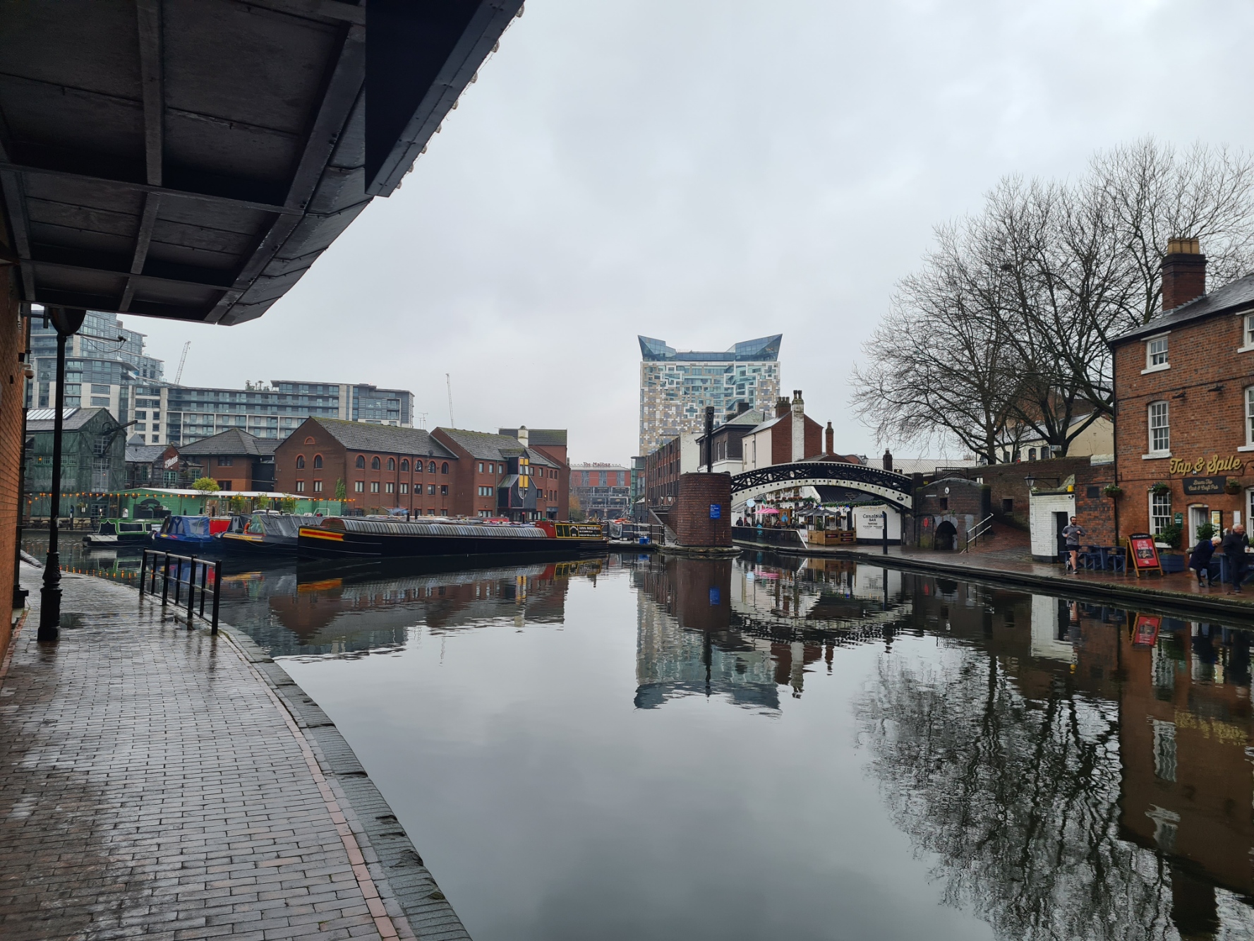
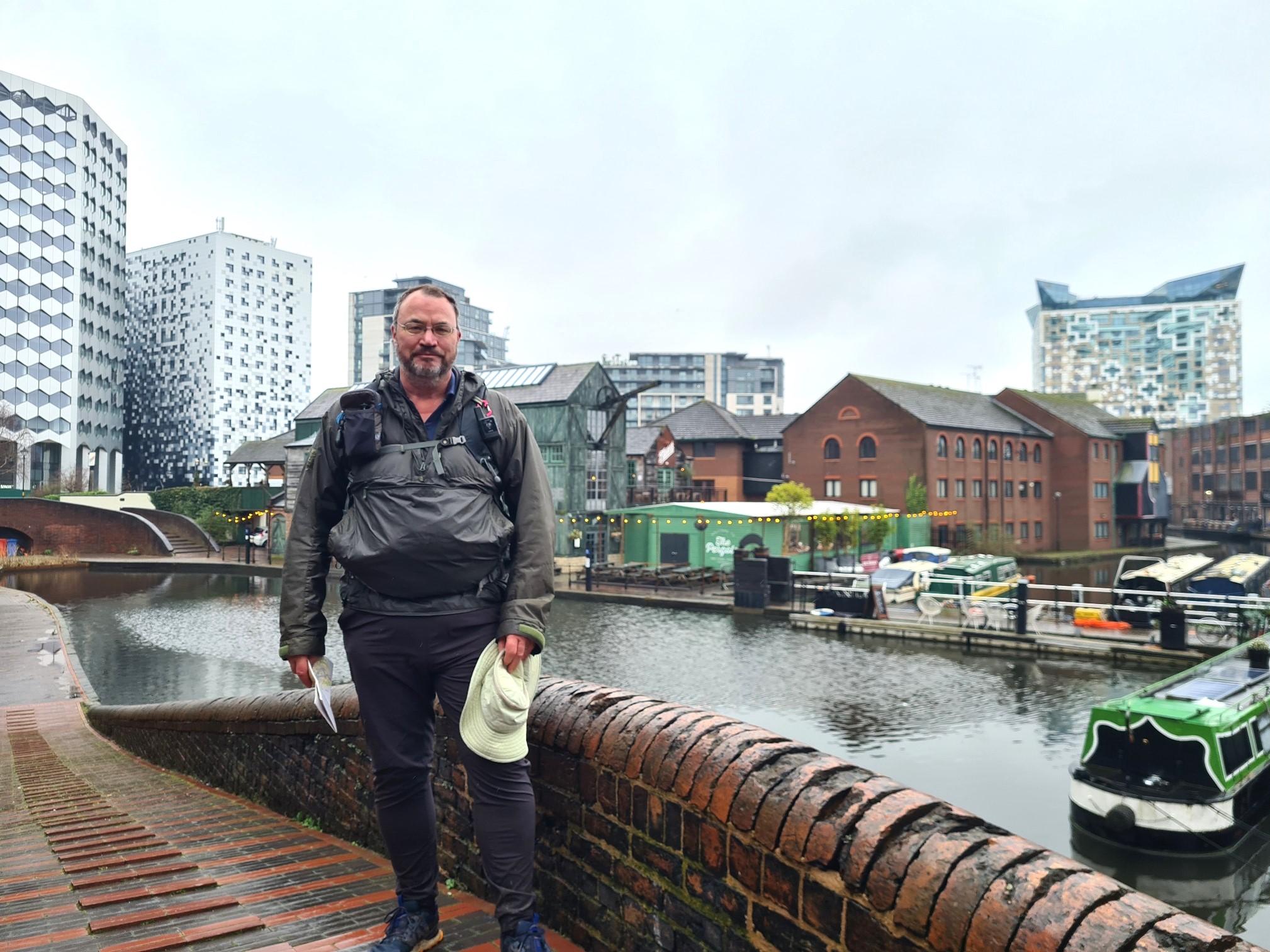
Then a turn onto the Worcester & Birmingham Canal and a short way along that, I reached the Gas Street Canal Basin and the end of my trail. Even the rain stopped for my arrival. As usual, I accosted a couple of people attempting to go about their business and requested an ‘end of trail’ photo. Happy to oblige, the girl then turned into David Bailey and it was a bit of a struggle to get her to stop taking pictures. From here, to where I had started my walk at the Paddington Basin, in London, is said to be 147 miles. However the actual miles I had walked had been quite a bit in excess of this. Mostly due to having to leave the canal to my overnight accommodation each afternoon, and return to the towpath the following day.
- Grand Union Canal: London to Marsworth
- Grand Union Canal: Marsworth to Stoke Bruerne (Roade)
- Grand Union Canal: Stoke Bruerne (Roade) to Stockton
- A hiker’s library: Canals
Conclusions:
So, what do I think about the Grand Union Canal Walk? As a training hike, I suppose it was adequate. It was a decent length and enabled me to get some miles on my legs while completing a long distance trail. There was little in the way of elevation so seldom much in the way of views but there were quite a few things of interest along the way. The time of year I completed it raised complications however. The towpath was a great deal muddier and slippery than I had anticipated it might be and it would make for a better dry spring or summer walk. As I thought might be the case, it could be quite difficult to wildcamp this route as there were few surreptitious opportunities and considerable flooding of ground away from the towpath. This might be a different scenario during the summer months. My walk dictated pre-booked overnight accommodation, an expensive outcome. But it does mean I got a warm bed, a decent shower and good meals throughout. Be aware however that there is a dearth of accommodation in some more isolated localities and a few miles walk away from the canal is required for an overnighter. Pre-booking is a definite requirement for most places.
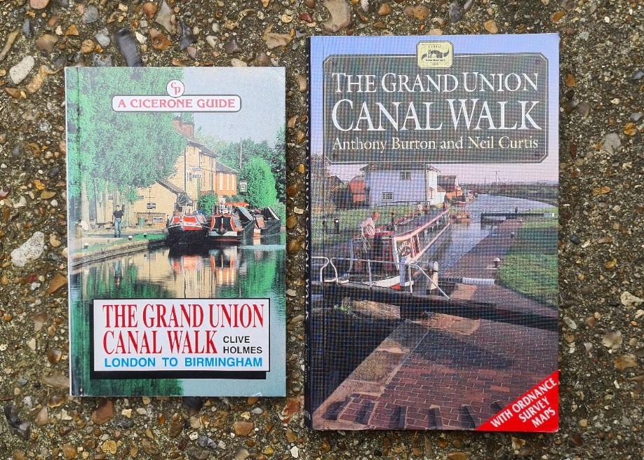
Signage varies a great deal on the canal walk. While it is not exactly difficult to follow a canal, a little care is required at junctions and arms to ensure you don’t go marching off in the wrong direction. Explanatory signage on what there is around you is pretty poor overall, with some notable exceptions. A guide book goes a long way to making the walk more interesting and there are really only the two options for the pedestrian, shown below. Both are out of print and getting more difficult to source. A map is helpful too, and I’ll talk more on paper options in a separate post as not all are suitable.
I had tracked my days via GPS and covered 173.23 miles over my nine days. The shortest being 14.27 and the longest 24.84 miles. I have obviously walked beside many UK canals over the years, but none for such a distance. I am not immediately discouraged from doing such a walk again and have already begun exploring which might be the next canal to tackle.

You could have had a really nice steak around there in the Marco Pierre White restaurant plus a whiskey bar in the hotel.
LikeLiked by 1 person
Slightly out of my price range I think. And please, whisky!
LikeLiked by 1 person
All the good stuff is Whiskey!
LikeLiked by 1 person