
After a tough day on the Trotternish Ridge, Three Points of the Compass continues his hike on the Isle of Skye. Missing one of the most magical of natural phenomenon in the process!
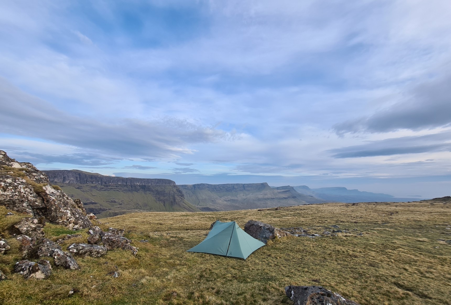
I was tired but slightly relieved at having met my target of completing all of the Trotternish Ridge over one day and getting to a spot behind the Storr. A site that offered a decent amount of protection from the strong winds that can occur up here. Winds on the ridge are responsible for damaging many a tent and I had met two pairs of hikers just days before that had to bail from their Skye Trail hike due to this.
Having completed the ridge the previous evening, once the Durston was up I had climbed inside, eaten a meal and rehydrated with a couple of welcome brews. I slept well and barely stirred until morning, not even exiting the shelter during the night for a pee. I woke on day three on trail and lay there, content, not in any particular rush, wrapped in my cosy quilt, drinking my morning pint of tea. I turned on my phone and messaged home. To be greeted with the news that the entire UK and beyond had just been treated to one of the most intense displays of the Northern Lights in modern times. I live in South East England and they are never seen that far south. But no, just hours before they had put on a decent performance that had been also visible from the street outside my house, hundreds of miles south of me. And here was I, camped high on a ridge on a Scottish island and I had slept right through the event. It was probably one of the best situational photographs I never took. Prior to leaving my overnight halt, I chatted to an occupant of one of the two other tents pitched quite close. They had specifically hiked up here to take astro-photography last night, hoping for decent images of the Milky Way. Likewise worn out after their hike, they had also slept through the unexpected and extreme geomagnetic storm. I think they were even more peeved than I, if that were possible. So. imagine the above image, at night, with the northern lights above the ridge…
Day three: the Storr to Portree
While the toughest part of the Skye Trail was now behind me, I had another hard day ahead. Even after a good long night’s kip, I was still pretty tired and the legs would feel the hills today. I set off fairly early as I knew I would be slow going today. Which doesn’t bother me, it is getting to the end safely that was my intention, not racing through my days.
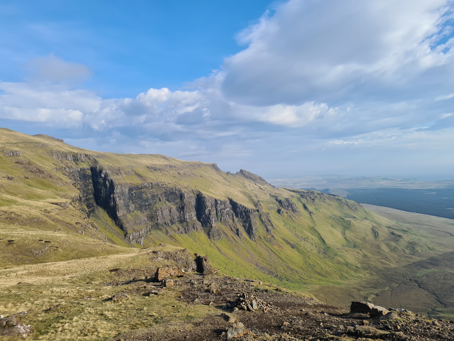
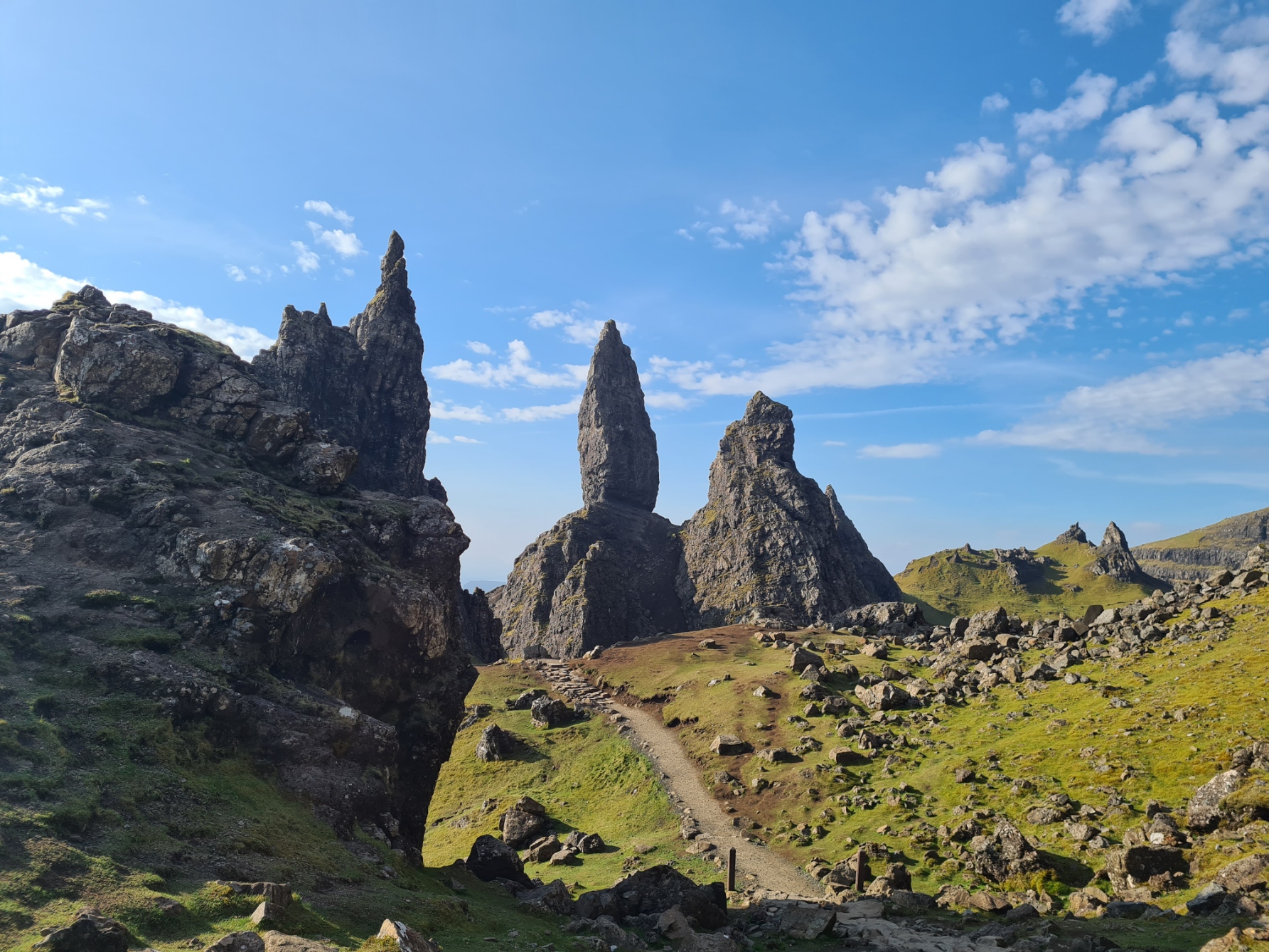
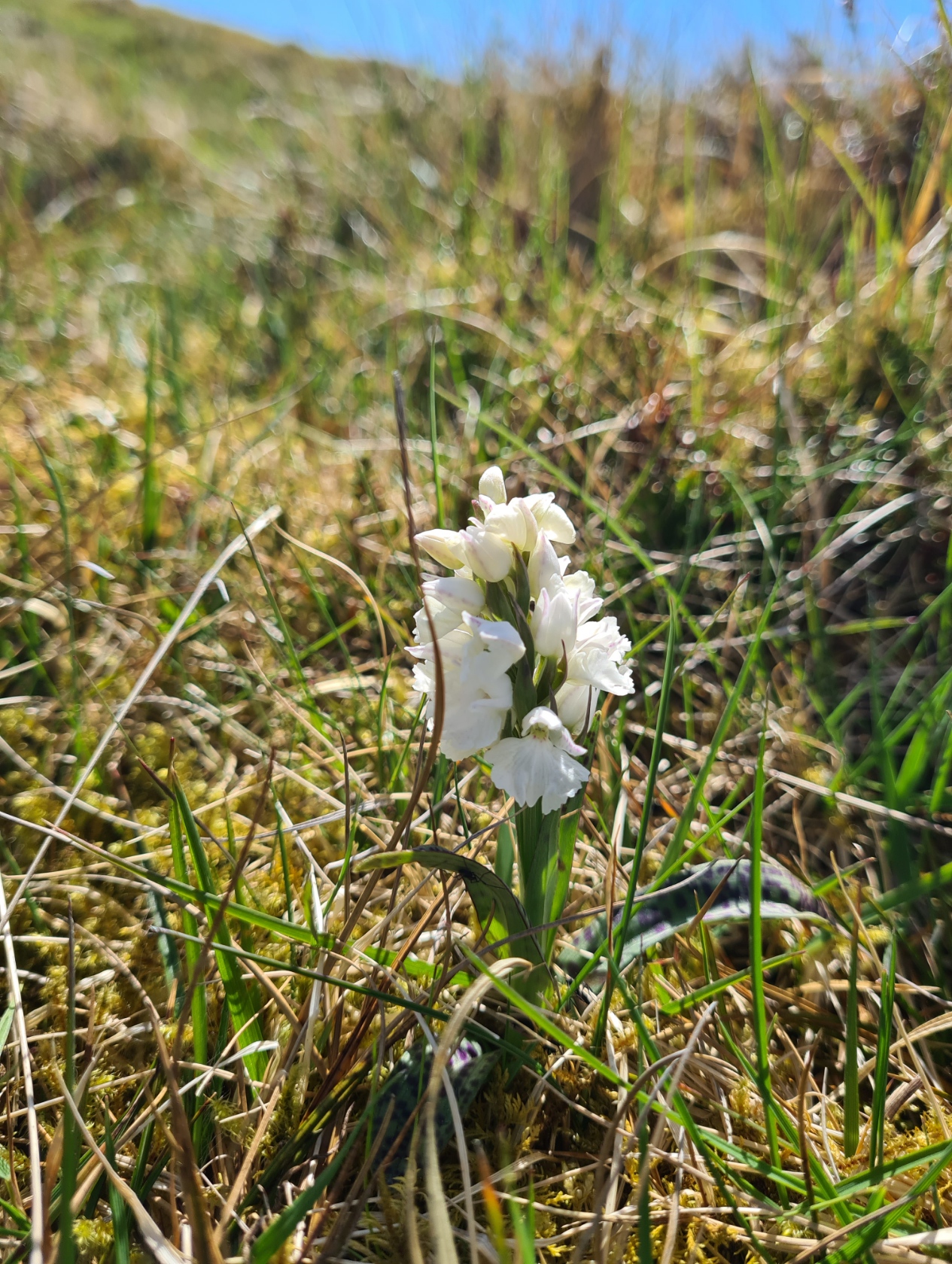
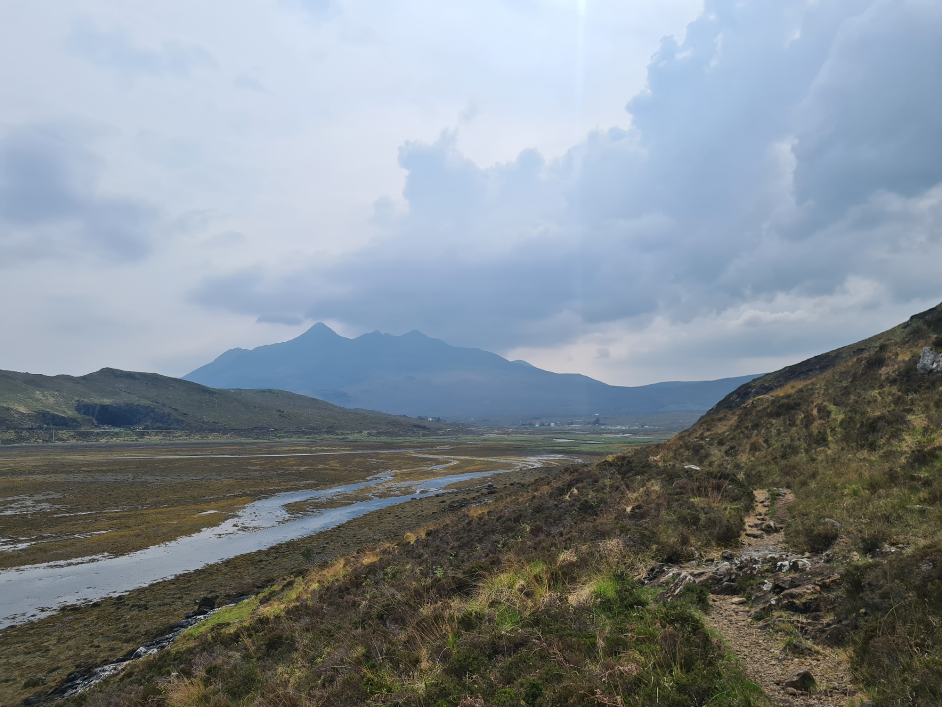
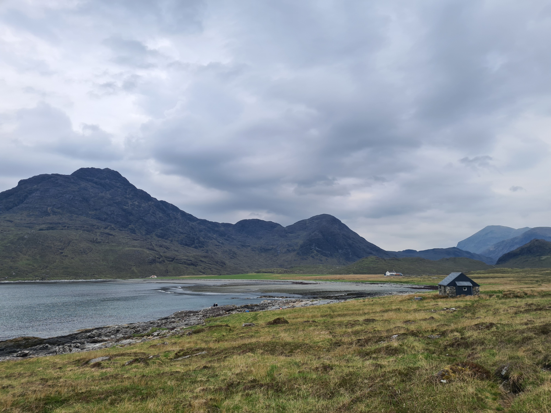
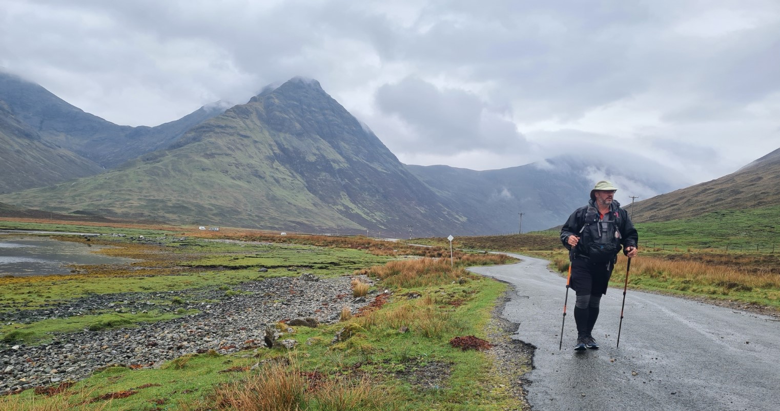
I thought I had got away fairly early (for me) and indeed most of those that had camped further on were still ambling around their tents, but The Old Man of Storr is very much on the tourist must-do list on Skye and it became increasingly busier as I approached and passed this impressive rock formation. These were formed by at least 24 individual lava flows some 60 million years ago though the erect rocks detached and slipped away from the main cliff face only 6000 years previous.
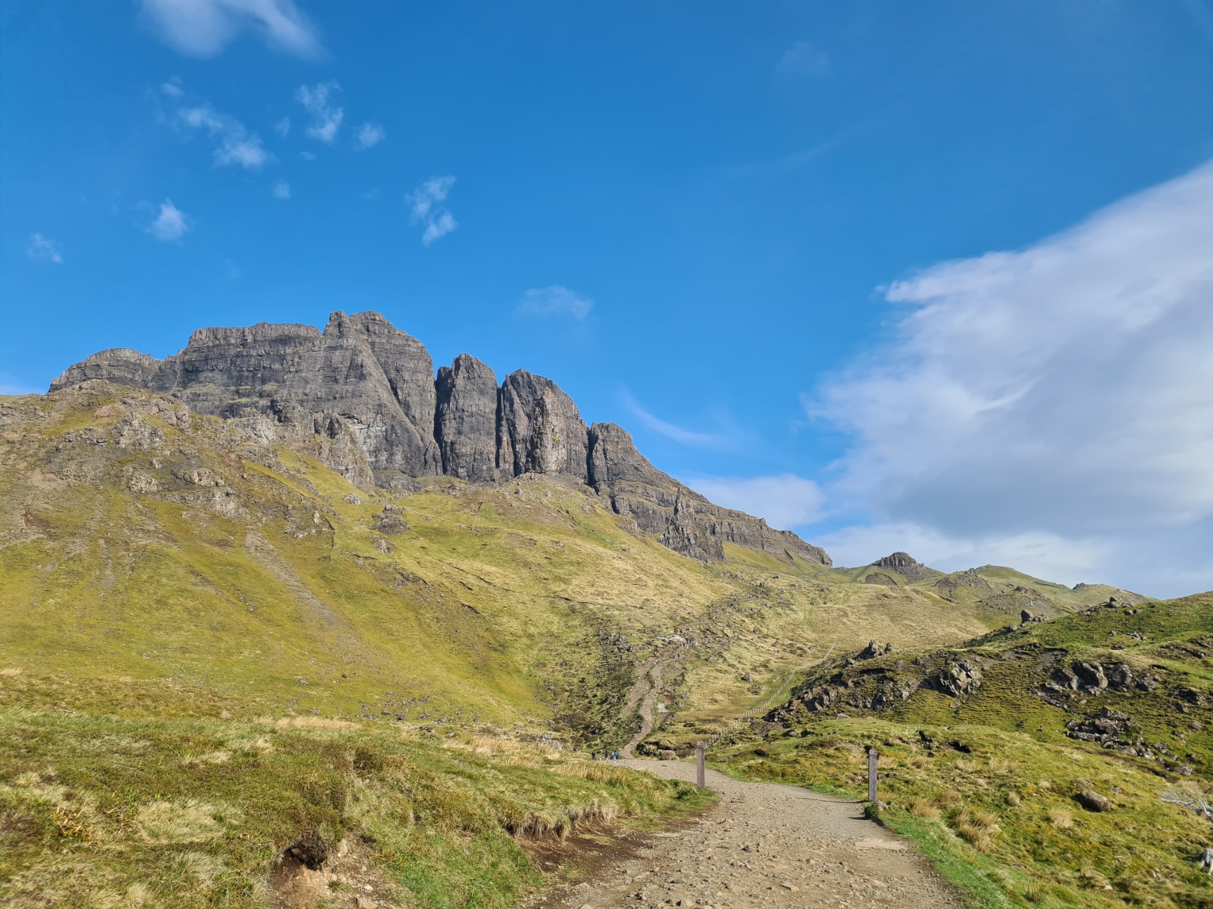
My photos here are mostly unrepresentative of the popularity of the path leading through the rocks and then down to the road and large carpark. Lots of couples and groups, photographers and hikers. A drone buzzed overhead. The odd nutter posed on precarious edges for that perfect Instagram shot. On my long walk down I was passed by a procession of people headed the opposite way- families, many aged but determined walkers with walking aids, a few joggers and speedy day-walkers. Also exhausted teenagers, being cajoled onward and upward. Few turned round to see the view behind them, in front of me. If they had they would have been treated to the occasional Sea Eagle drifting on the morning thermals. A party of Chinese paused and the older male halted me, they were confused- “where is the old man”. Typically, I had anticipated a snack wagon at the car park for breakfast but it wasn’t to be. A lost opportunity for some local entrepreneur, but it may be local regulations that stop them. No bacon sarnie for me here.
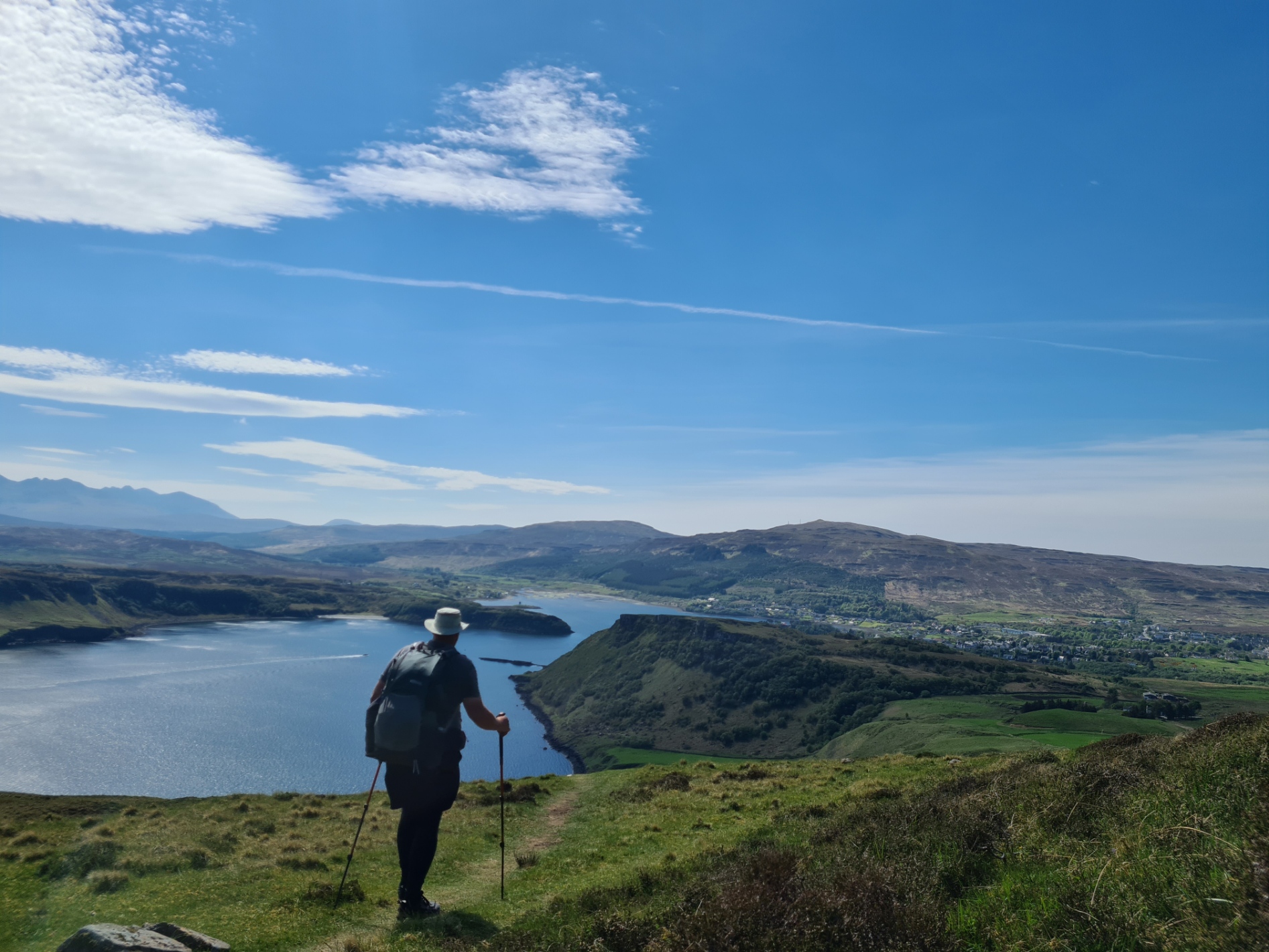
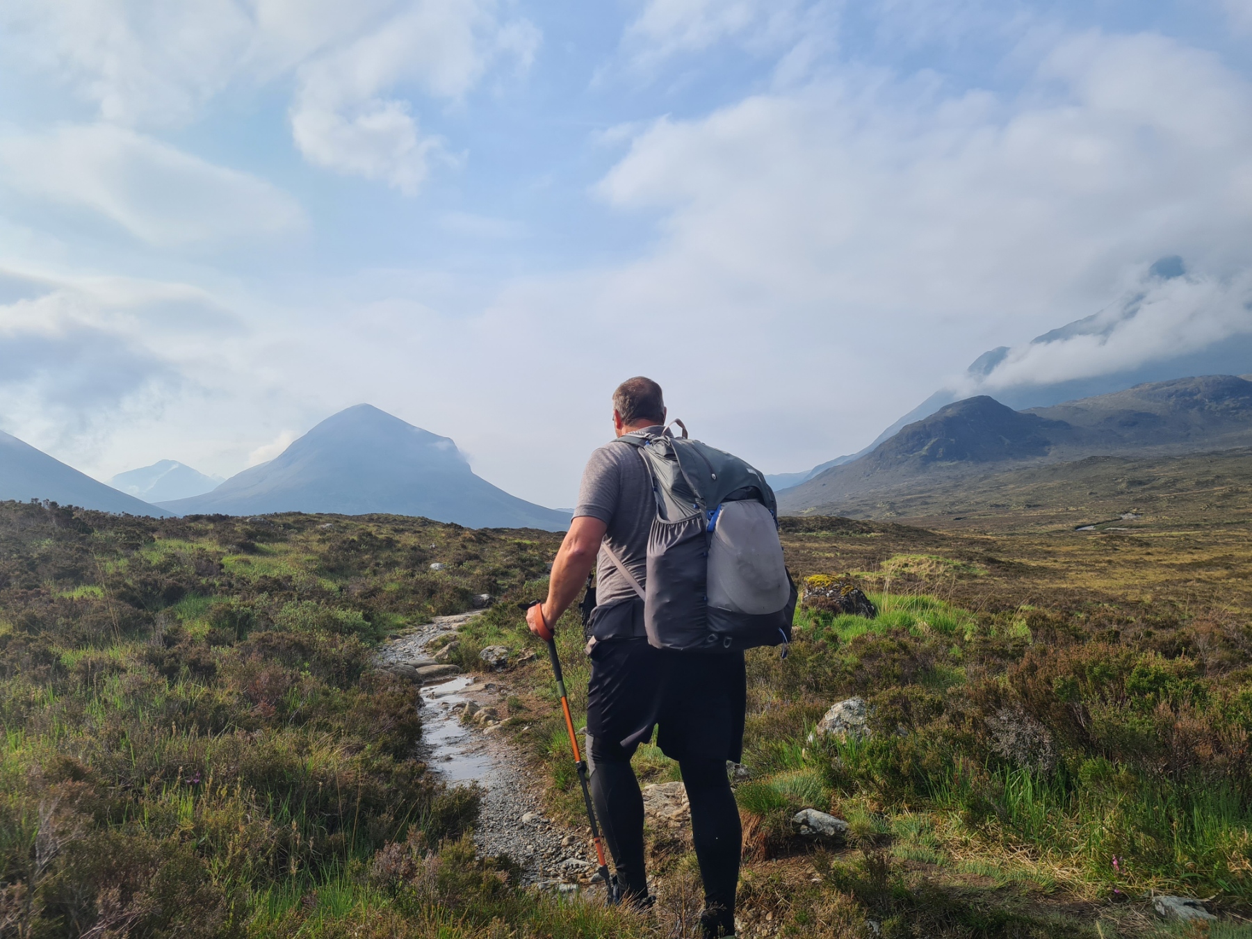
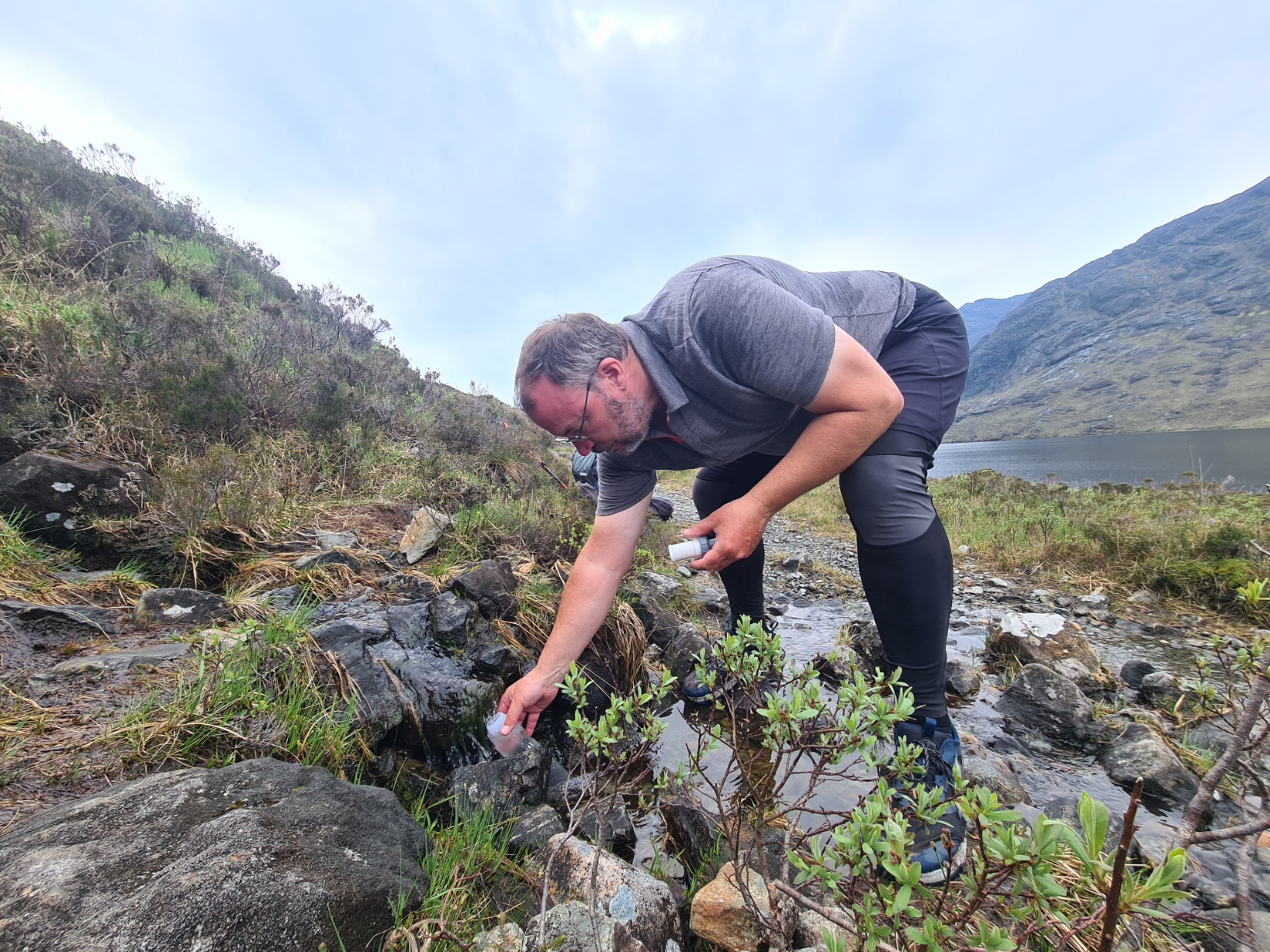
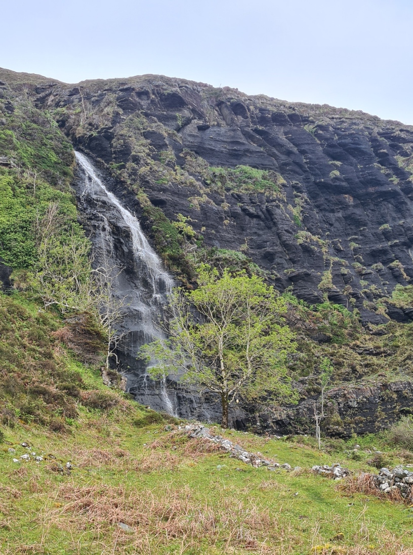
I walked on and crossed the road to follow the short track beside Loch Leathan down to the dam where I left the trail to visit a small burn, to filter water, rest awhile and ring home for a brief natter to Mission Control before beginning the climb round and up to Holm. The sea far below on my left sparkled in the bright sun. It was hot and would be for the remainder of the day. Later on I would be pleased I had taken time out to filter water.
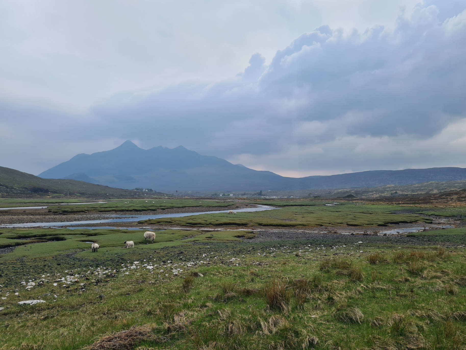
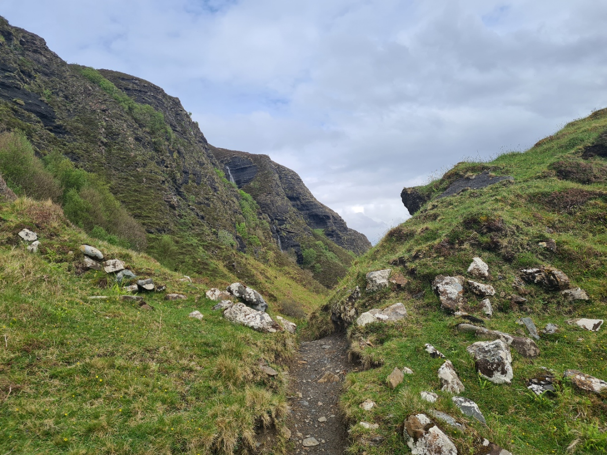
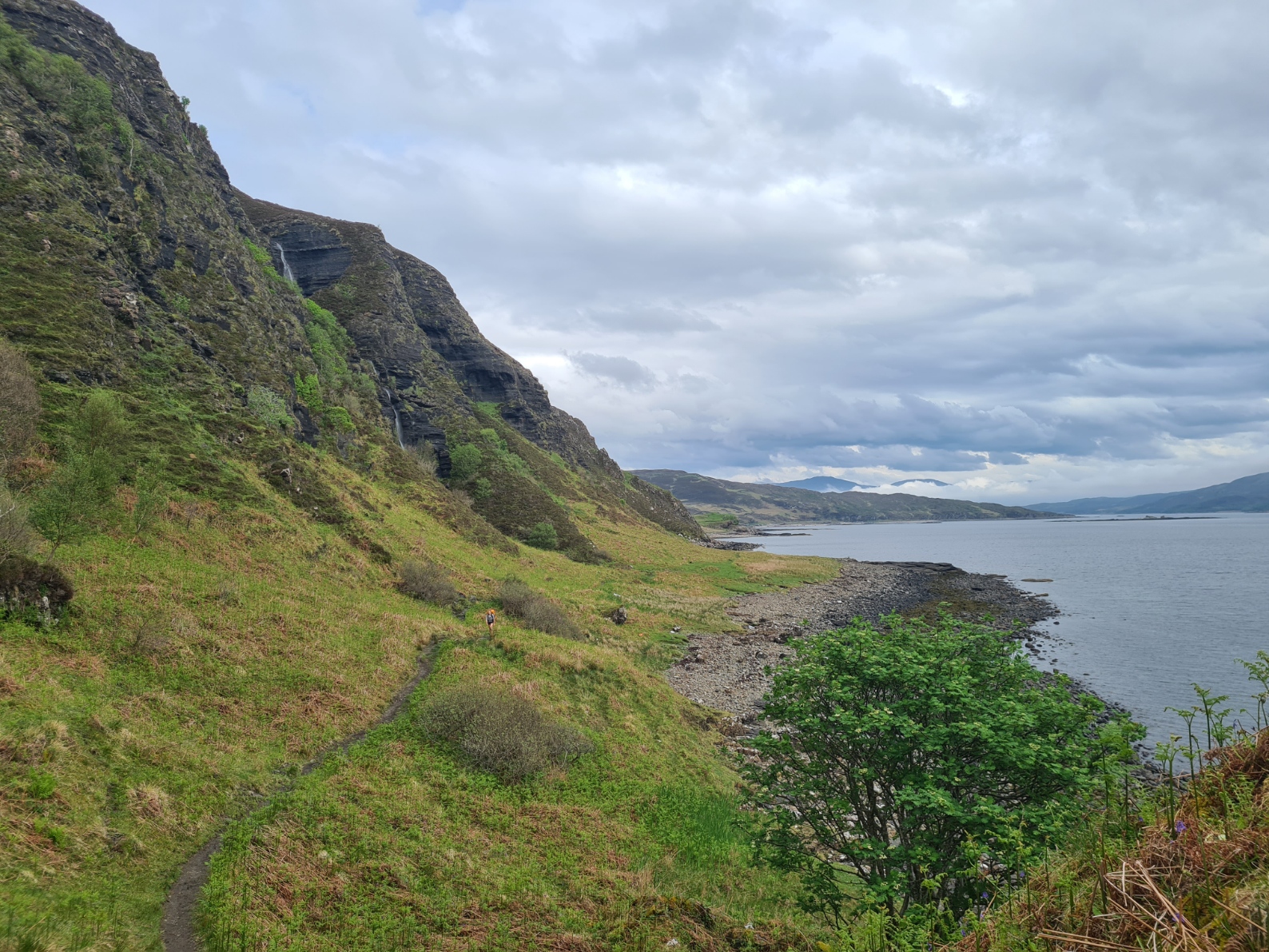
It was a mostly pathless route across rough moorland and was frequently boggy, though this changed to short cropped turf later in my day. Much of this section comprised high cliff top walking. The legs were feeling it however and I was very slow on any ascent. But I was in no great rush and just about any Skye Trail hiker that had set off after me on this section passed me during the day. I rested frequently, gazing down at the sea hoping to see the cetaceans that frequently pass through this stretch of water, sadly unsuccessfully but still picking up the occasional White-tailed/Sea Eagle.
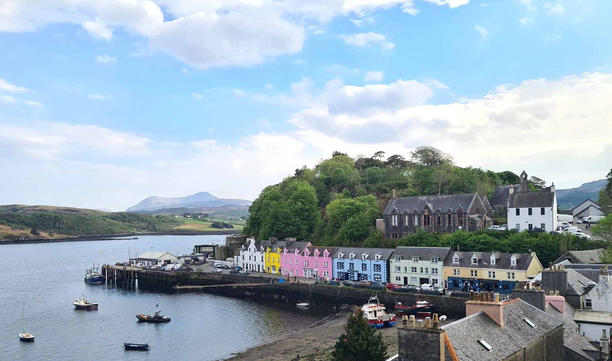
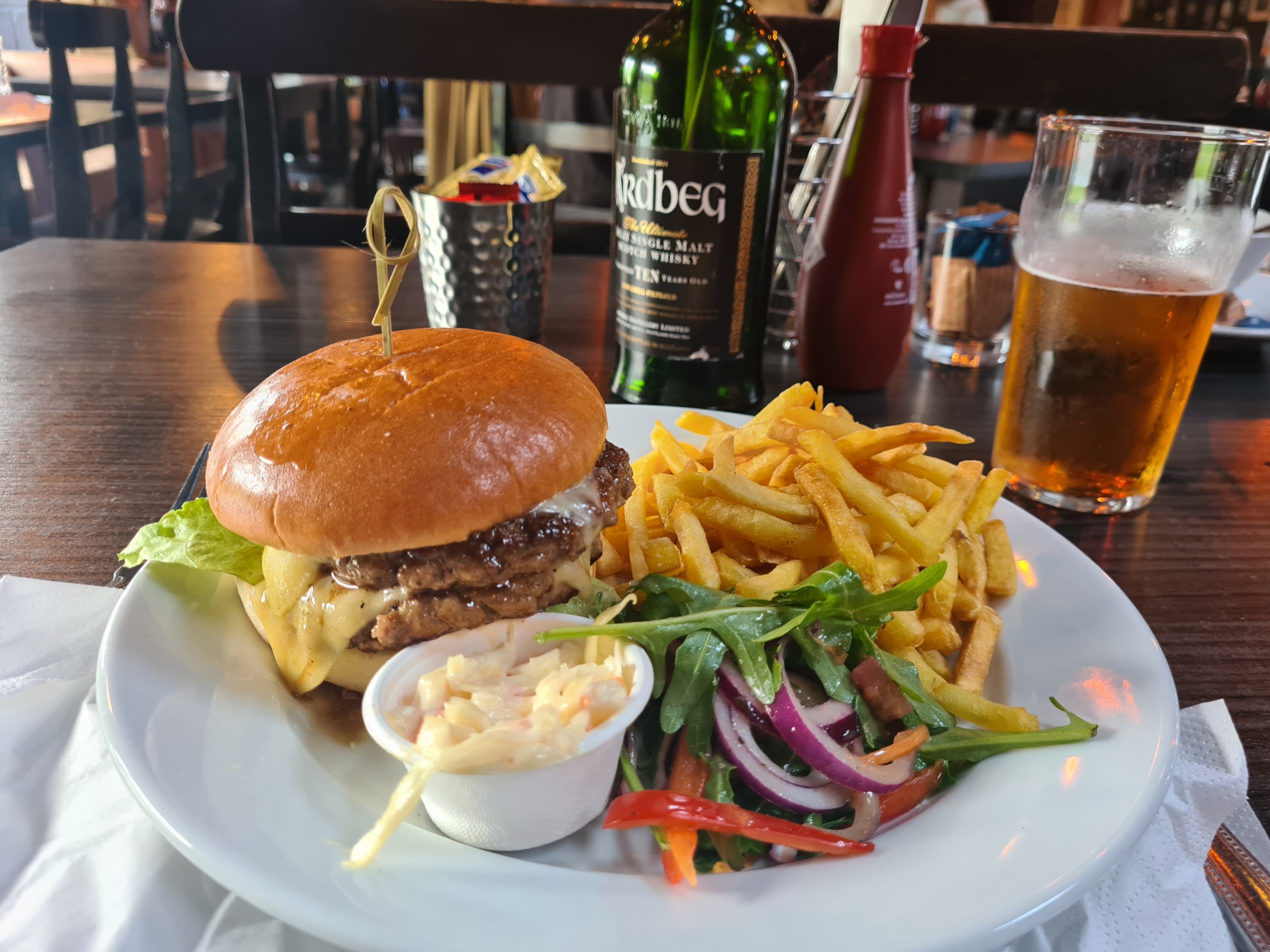
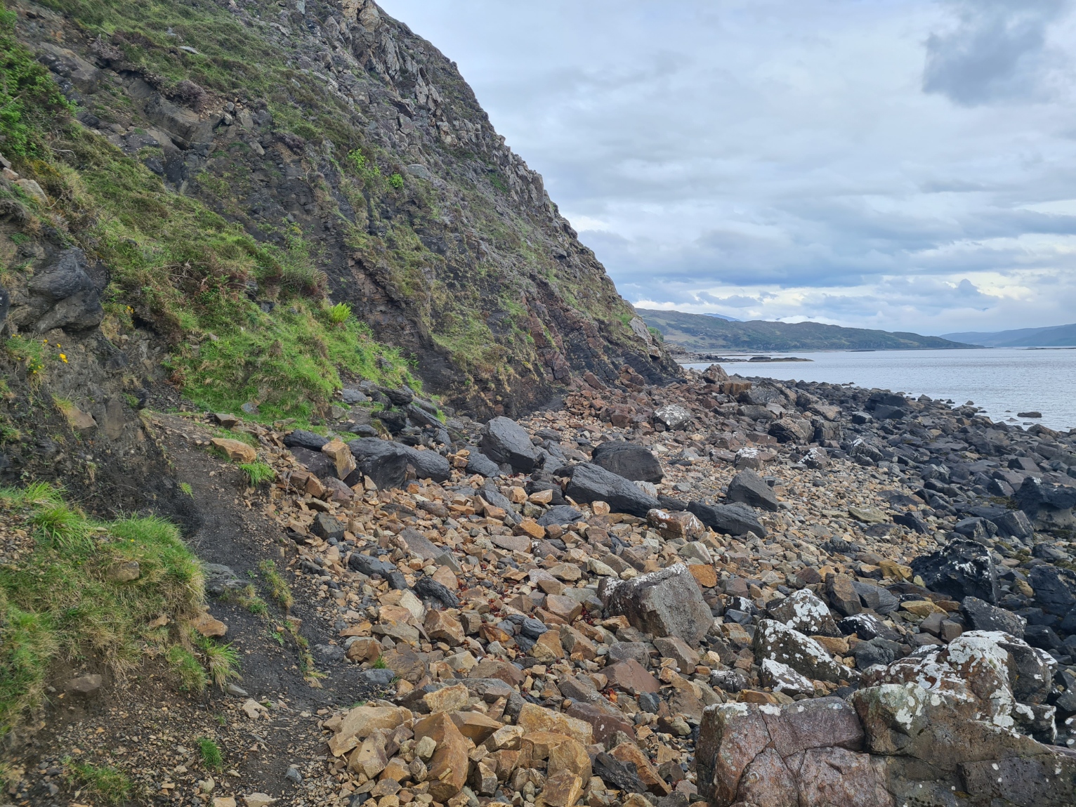
This is superb airy walking and I enjoyed it immensely though was increasingly tired as the day went on. Despite my weariness it is the sort of trail that you wish could go on forever but it is only around six and a half miles between the Storr lochs and Portree and around two in the afternoon the island’s capital came into view, still far ahead and below but it entailed quite a bit of descent before I was back down to just above sea level. Not helped by a careless wander off route. I was following an obvious path and had walked a good few hundred metres before waking up to the realisation that I was off trail. A quick study of the map showed that I needed to backtrack and drop down a steep gully I had disregarded earlier. Once down it was across verdant boggy cow fields and then a stone clattering rough coastal side path round to the outskirts of Portree. The path improved, then changed to tarmac, with a final short road walk down into town. I was in no great rush so had a snack-buying session in the co-op before searching out a pub for a pint. This was as much for rehydration as to escape the hordes of people wandering around town The Skye Live Festival was taking place and the town was heaving. The Isles Inn supplied both cool shade and a pint of water was followed by Skye Red, 4.2% and Skye Gold, 4.3%. Then it was a slow walk out of town, up the hill, to the Portree Campsite, that I had left just three days ago, in very different weather.
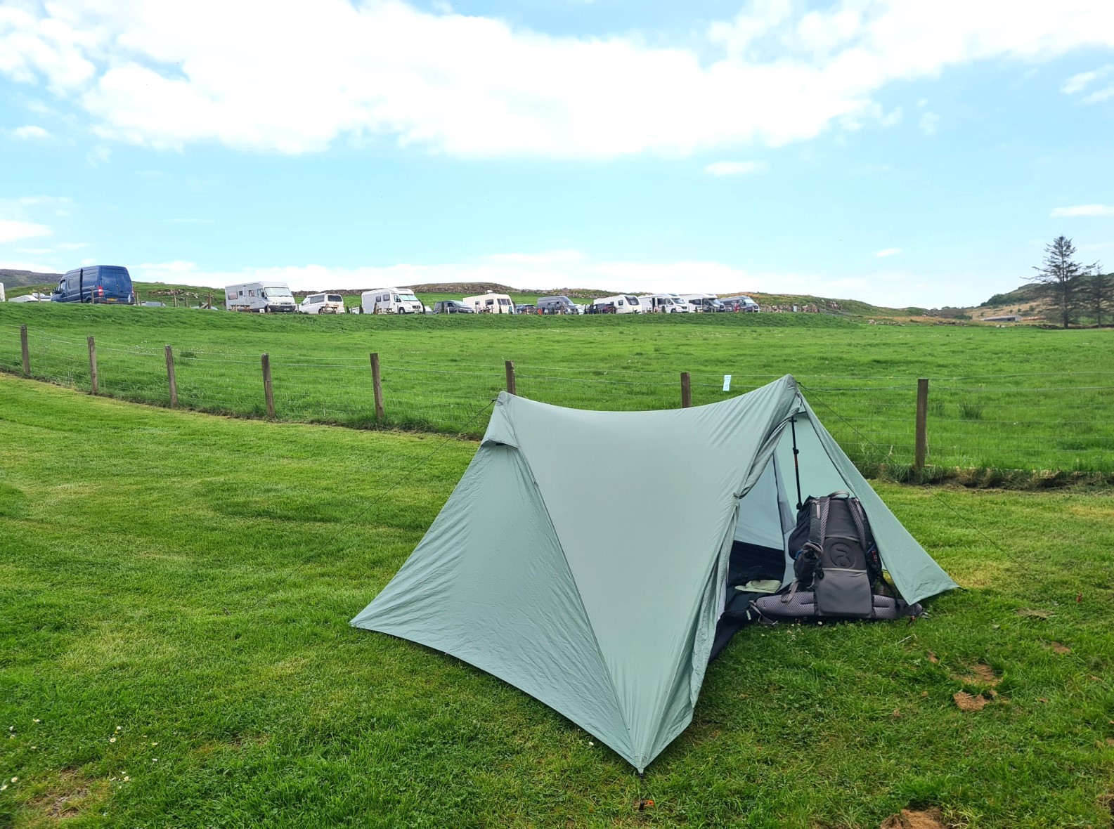
Despite being busy with visitors, most staying here for the festival, there was plenty of room on the site to pitch my tent. The campsite does limit visitors over the festival period as they have had issues in the past with people returning from the festival and starting their own little ‘mini-festival’ on site. They prefer the older demographic that simply want a quiet site and book months, possibly a year, in advance. They also don’t ‘officially’ accept walk-ins but told me they will never turn away Skye Trail backpackers. I put my tent up in the flatter bottom corner of the campsite, unlike most with a tent who go to the top field, but that slopes too much for my liking. Then a much appreciated shower when I also washed my hiking shirt, hanging this on the fence beside the Durston to dry in the slight breeze. This was strong enough to also prevent any midges from bothering me. By now I was so weary that I was pleased I had plenty of time for an hours nap before thinking about eating. I eschewed a dehydrated meal tonight and went back into town for my evening fare. Perhaps I shouldn’t have because it was a very disappointing greasy and overcooked fish and chips from The Chippy. I had initially tried the chip shop in the harbour but despite walking in the open door at ten to eight, the proprietor didn’t even look at me- “we close at eight” . You would have thought they wanted the business as there were a great many people walking around looking for food.
Settling down for a long night of recuperative sleep I still wasn’t sure what I was doing in the morning. Prior to setting off on trail I had thought I might take a rest day at Portree, certainly after two hard days I thought I deserved it. However it was a much easier section next and I might consider that a ‘rest’ day. I would sleep on it and decide tomorrow.
Day four: Portree to Sligachan
The racket from the Skye Live Festival a mile away down in Portree carried through the night air and kept me awake for some hours before I was finally able to drift off. I can’t get on with ear plugs, but certainly wished I could tonight. Having missed the northern lights the previous night I set my alarm for both midnight and one in the morning, poking my head out of the Durston to see if there was anything occurring. However there was nothing to see. Plenty to hear, but nothing to see.
Even with the festival noise and my unrewarded night sky-watching, I still packed in a good number of hours of sleep, felt much rested and didn’t hesitate in deciding to get on with things and get back out on trail. There is quite a bit of road walking on this next section and many have reported finding it hard on legs and feet but in trail runners, I had no concerns. Morning brew was drunk while packing, a final visit to the toilet block, then away from site before most other campers had begun stirring. I followed the road down into Portree, through the town, past the two next-door-to-each-other hostels, and out the other side. Traffic was now building on the A855 which made for a noisy walk to start with but the path soon drops down off the road to skirt the salt marsh at the edge of Portree Bay.
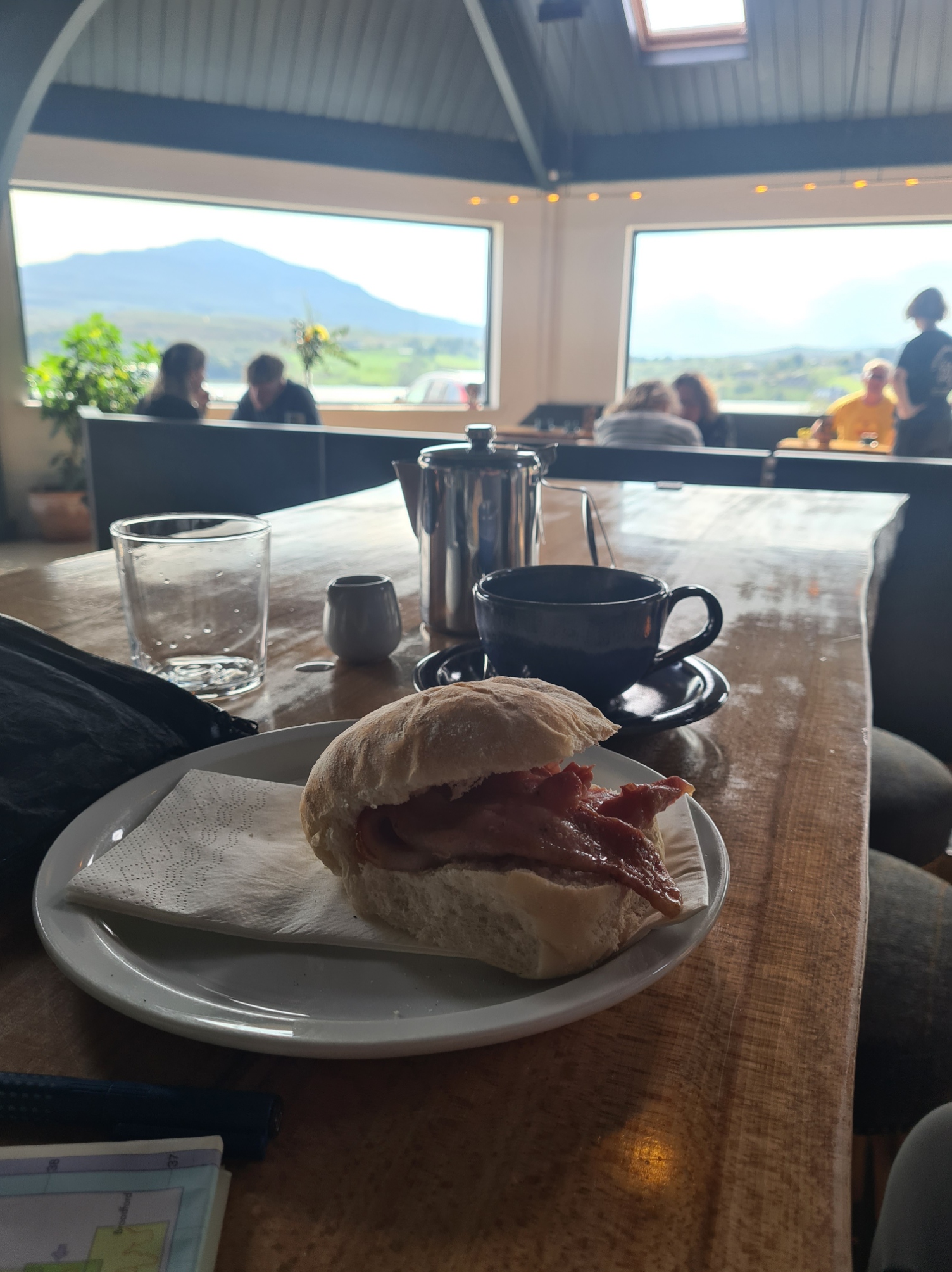
This turn away from the road is nigh on opposite the Aros Experience Heritage Centre, where I knew there was a restaurant. The waitresses barely lifted an eyebrow at my attire and pack as I walked in to join the well-heeled clientele holding important breakfast meetings alongside the equally as smartly dressed tourists, This establishment provided breakfast, a decent bacon roll and pot of tea with a view. After an hour here, it was back to the trail.
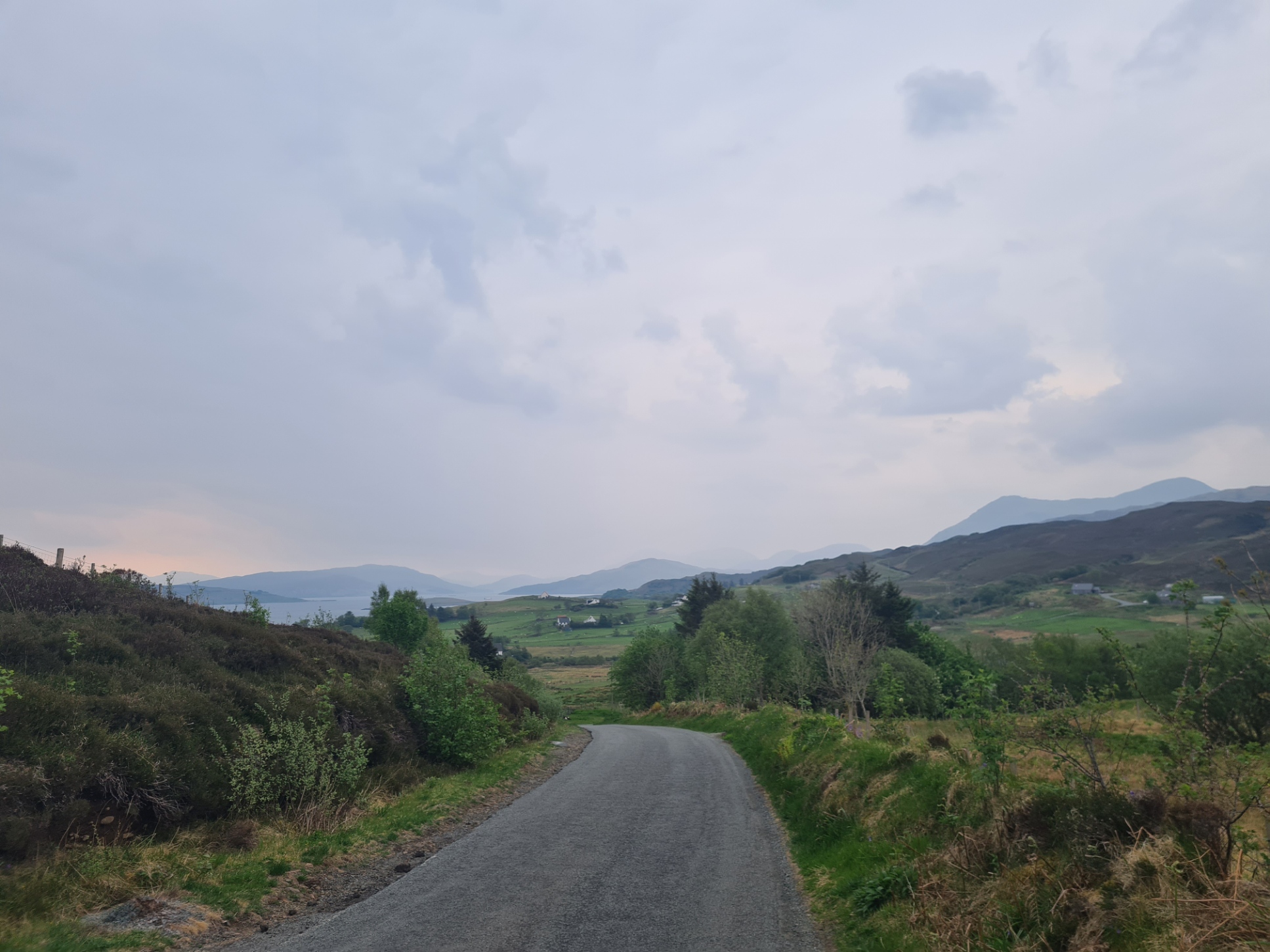
Having reached the head of the loch, the trail joins the road and turns sharp left over the Varragill River, a short climb then a right turn followed by another left turn on to a quieter road that is followed for the next few miles to The Braes. This area became well known when the media reported the crofters’ struggles against tyranny in 1882 during the clearances. Their fight led to the Crofter’s Act of 1886 and gave crofters security of tenure. Before walking through that area however, I had more immediate concerns. Walking up the road from the river, a black Staffordshire bull terrier darted out of a roadside property to have a go at me. He circled me, making repeated attacks at my ankles and I shouted at him to go home, fending him off with my poles. This had almost no effect while I circled my way up the climbing road to the turn at the top, keeping him in sight. I might have managed to successfully fend him off but it became more difficult when a younger brown staffy joined his pal. This meeker animal gained confidence from his mentor and I was now fending off occasional attacks from two directions. It might have become a bloody affair but both dogs then realised they had the run of the road and headed off down it, the direction I was headed. I would have quarter of a mile respite before catching up with them again and they would resume dashes at my bare legs. I would stand my ground, shouting at them to go home and it was usually only when an infrequent car came along, almost running over one or both, that they went on ahead again. This went on for five miles or so and easily removed much of my enjoyment from this part of the walk as I always had to be alert to them suddenly appearing from the roadside vegetation. I chatted to a couple of locals in their cars that had narrowly avoided running over them. They thought they were my dogs and were all prepared to likewise have a go at me, one had an attempt at gathering up the two errant hounds in his car but quickly retreated to his drivers seat when they both attempted to bite his hands. Eventually the two dogs were gone, off to their unexpected freedom, and I never saw them again. Other than this minor excitement, it had been a mostly quiet road with little traffic but I now had more vehicles to step out of the way of. The emergency services were out looking for a “lost person”. Their vehicles passed me, in both directions. I have no idea what they found but counted two police cars, police dog handler van, two mountain rescue cars, two coastguard vans and one fire engine. Thankfully, no ambulance.
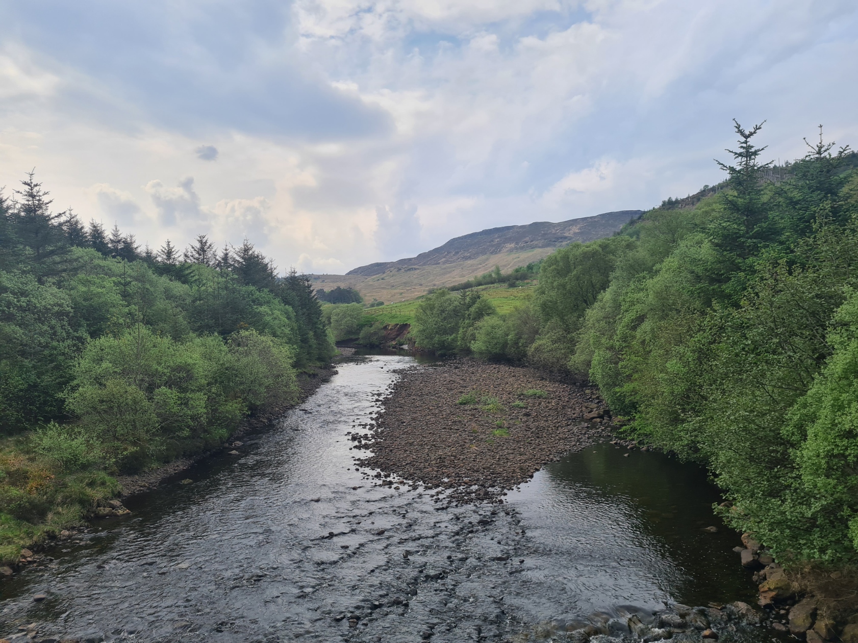
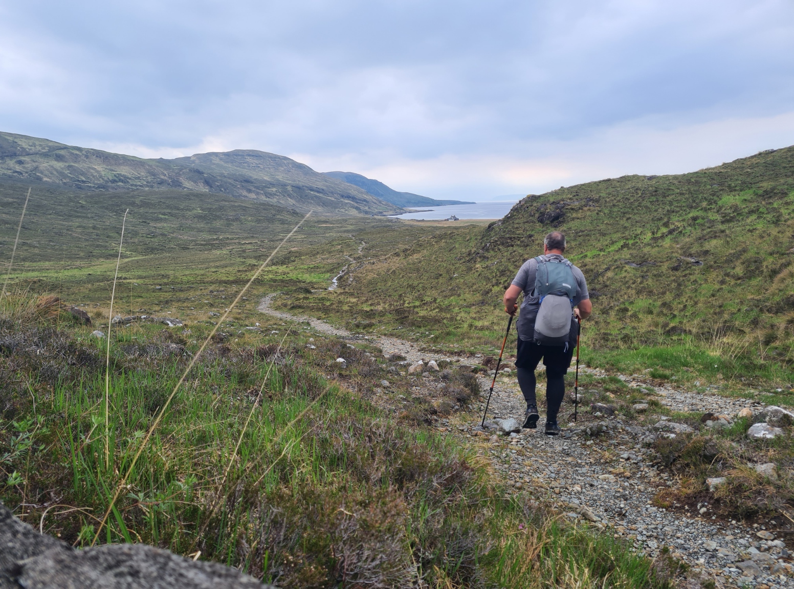
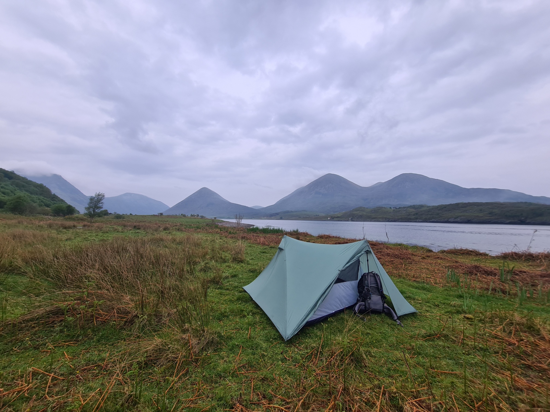
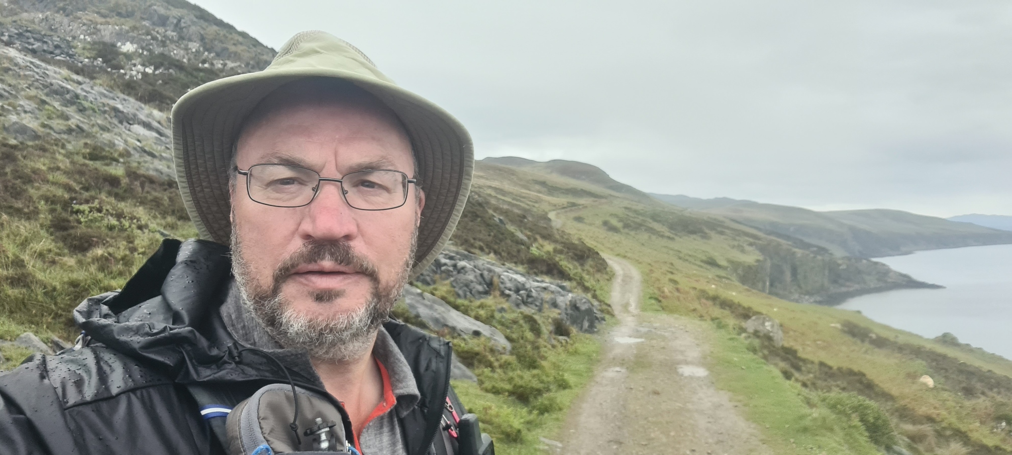
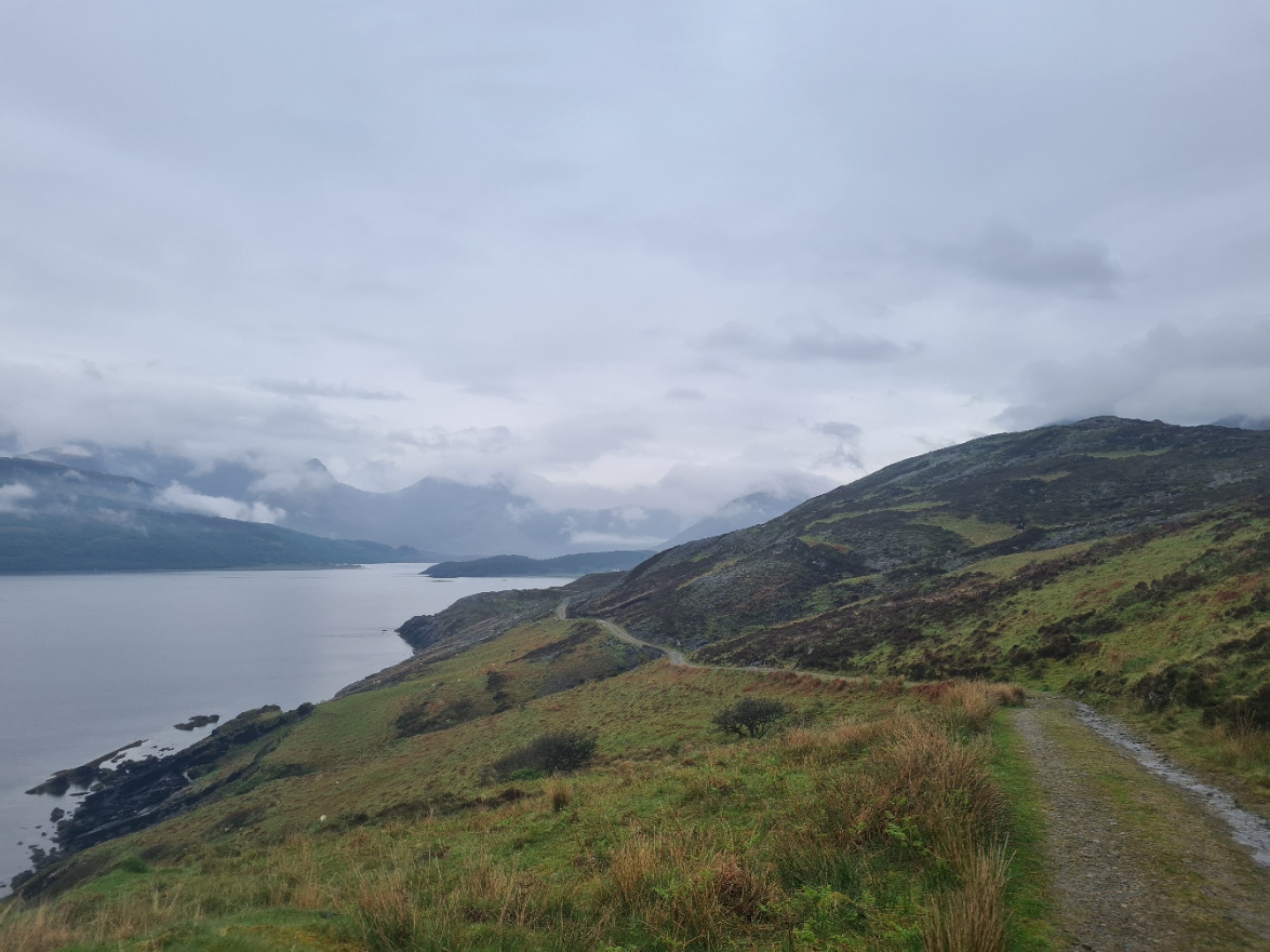
I met a backpacker walking the trail south to north and we stopped to chat. The conversation came round to the northern lights and he showed me the quite amazing photographs he had taken. The road eventually comes to the spread out hamlet of Peinachorrain, where the trail at last leaves the road and turns up loch Sligachan, following an easy line along the contours above the water, handrailing the shore, occasionally dropping down to clamber along the rocky shoreline before again climbing up a few metres. It is an enjoyable walk, with the mountains to my side and ahead, the small ferry pier at Sconser on the opposite shore, crossing small burns and mini waterfalls, getting ever closer to Sligachan and its campsite.
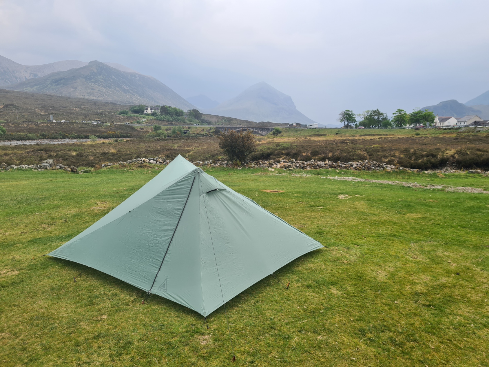
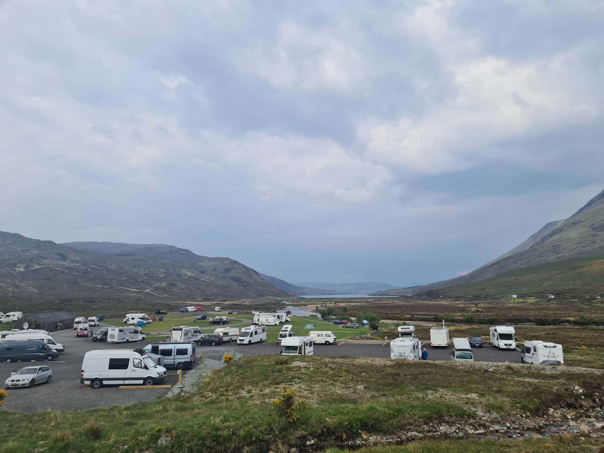
Sligachan campsite doesn’t look much from the road that runs past it. However it is beautifully positioned at the head of the loch and is surrounded by the Cuillins. The friendly chap in reception keeps a close eye on what is going on, the site has good hot showers and only costs a tenner for a backpacker. And there is a pub just across the road! The site does get a mixed bag of reviews but I found it just fine for my overnighter. It was primarily motorhomes on site but I had a wide flat spot away from everyone and took a bit of care putting the Durston up as the overnight weather forecast was not good. Despite it being a calm evening, with quite a few midges, I also pegged down the mid points and ran out a couple of extra guys, just in case, as I didn’t want to be wandering around outside in the small hours. Then off to the decent facilities block for much needed shower, also washing shorts, socks and shoes, changed into ‘crowd friendly’ non-stinky clothes, and walked across to the large restaurant tacked on to the side of the Sligachan Hotel for decent beers (Skye Black 4.5%) and shockingly expensive but truly excellent Cullen Skink followed by a double cheese burger with fries.
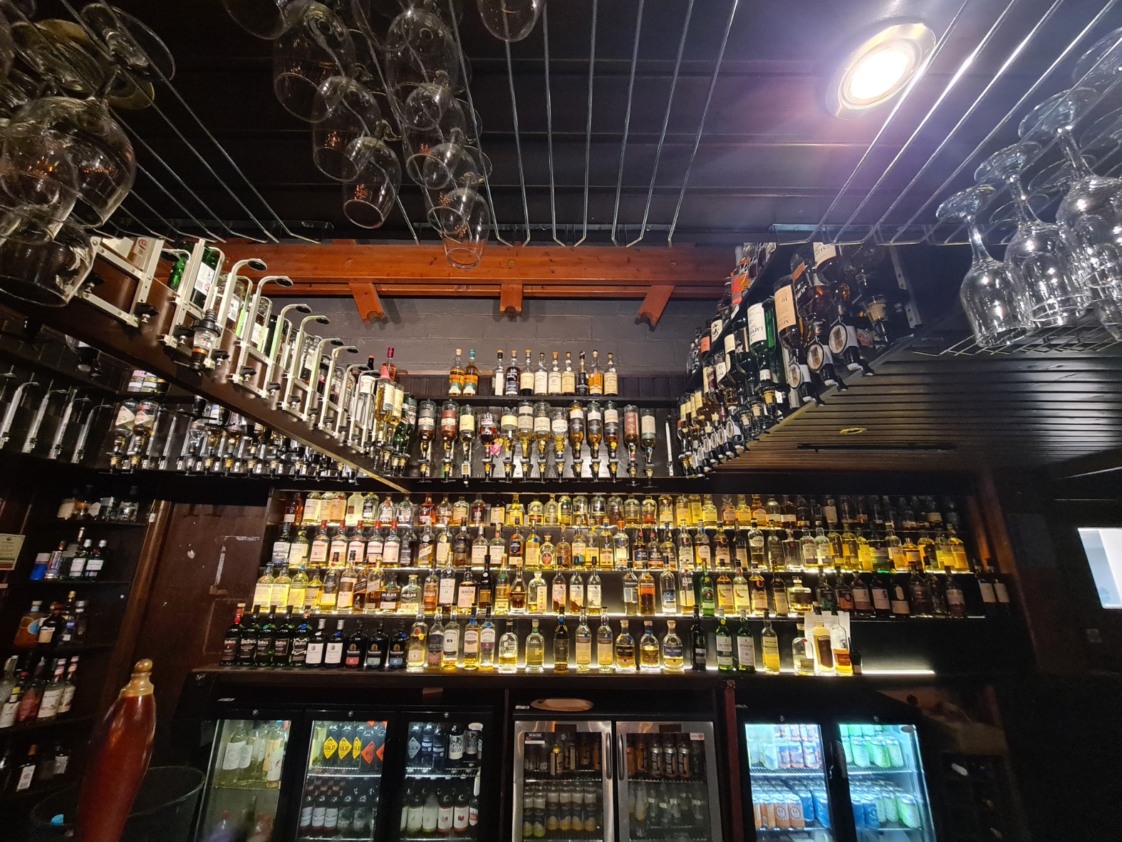
While eating, the heavens opened outside and it couldn’t have rained harder if it tried. The lightning flashed and thunder crashed alarmingly. Rain splattered in though the propped-open back door six feet away, ignored by all the staff, until I went and closed it. I had planned on going back to my tent after eating but instead tried to forget that I had ‘clean’ shorts hung out on a guyline to dry and attempted to also ignore the rather naff ‘Scottish’ music loudly playing in the bar, and settled in to my seat for a couple more hours and beers while charging my electrics. For the final hour I went and joined another group of Skye Trail walkers for a bit of a natter. The Sligachan has a reputation as a ‘whisky bar’, with over 250 on offer. They do colour coded taster-flights, each colour in a certain price range. These are obviously popular with many of those around me and despite often enjoying a drop of the stuff myself I decided therein lay disaster, so abstained. Our group of hikers eventually left to return to the campsite. I was slightly expecting to find flooded disaster but was pleased to find nothing untoward with the Durston other than a pair of sodden shorts lying on the wet grass beside it, all ready for me to don in the morning.
Day five: Sligachan to Faoilean (Loch Slapin)
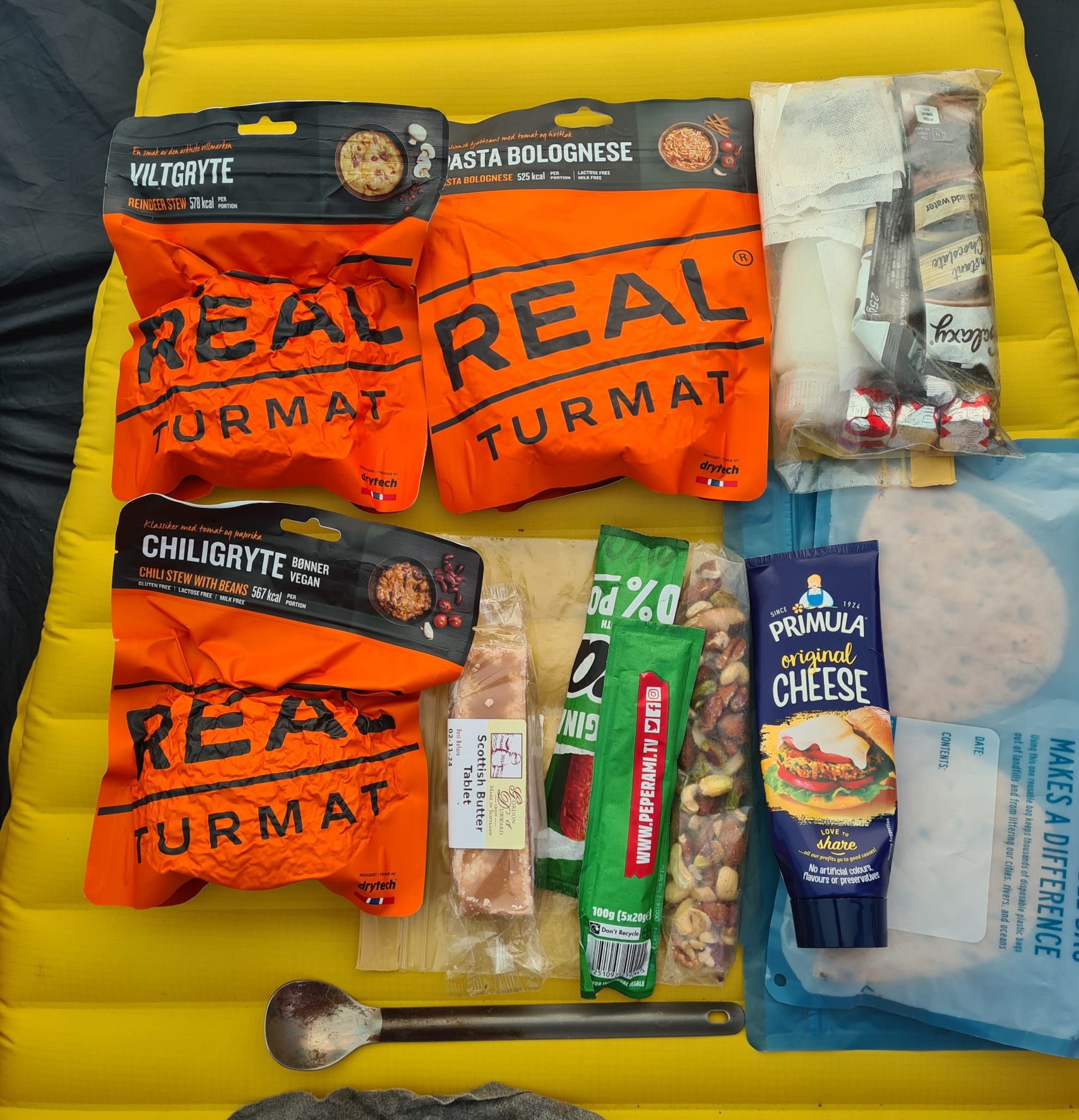
It rained quite hard for much of the night. It never bothered me however and I slept pretty well. Occasionally stirring for a pee. Too much beer in the pub has that unfortunate result. I had set an alarm as I wanted to be away a little before my usual sedate morning departures. But prior to packing everything away, I had a roll call of the contents of my foodbag. It was day five on trail and I wasn’t sure how long the remainder of my hike would take. I had allowed seven days for the Skye Trail, eight if the weather set in. There was supposed to be a couple of cafes at Elgol and Torrin before trail end. A quick check of my food showed I should be fine, with no need to wait for the small campsite shop to open to stock up with any snacks etc.
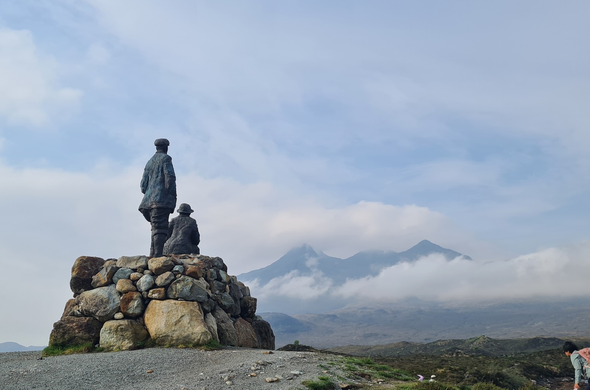
It is a good trail setting off from this junction of road, river and paths. There was already quite a few tourists milling around, visiting the perfectly positioned statue to two eminent climbers. A drone buzzed overhead. The view to my sides and behind showed mountains slightly blanketed by cloud. It was really quite beautiful, only slightly marred by midges, but they were easily avoided by keeping up a good speed while walking and I soon also left any other people behind.
Skye I praise for her peace and rest,
The magic views of her ridges,
Heaven sits firm on her rocky hills
And hell is surely her midges.
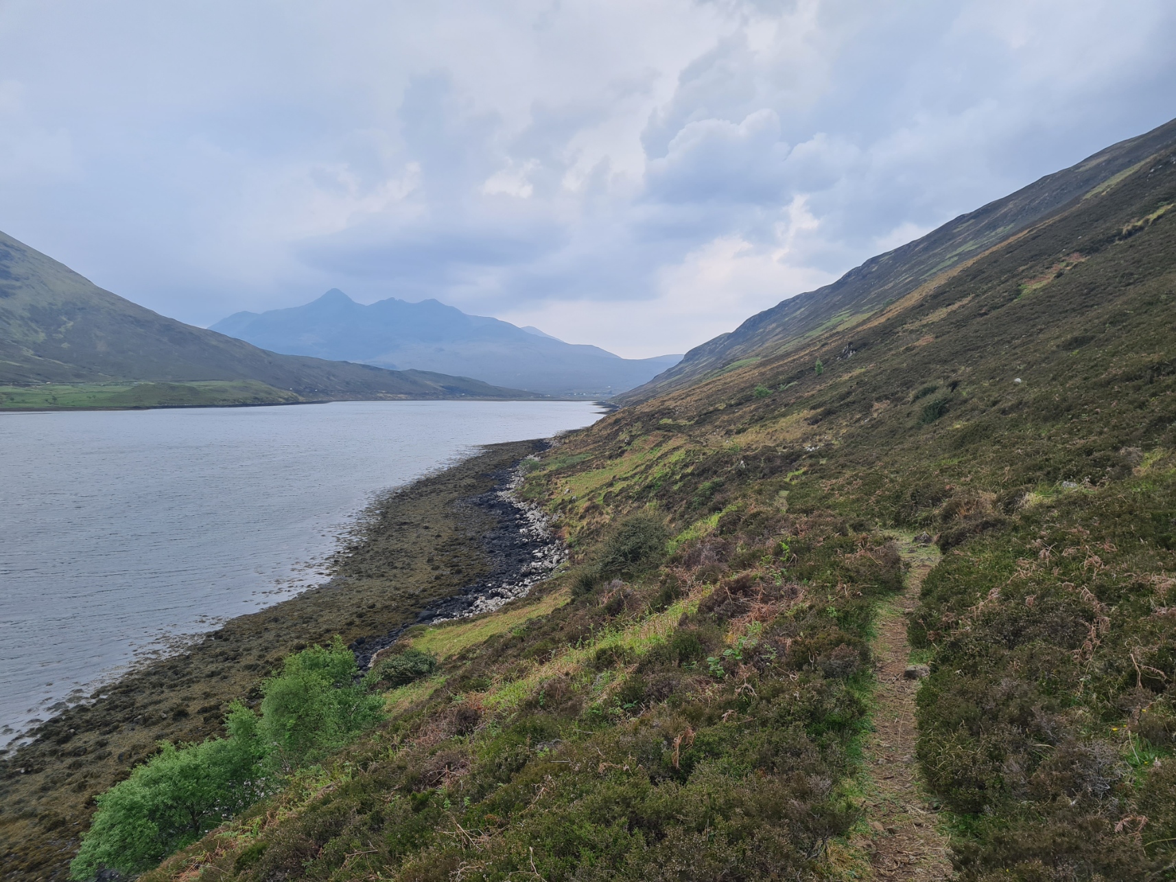
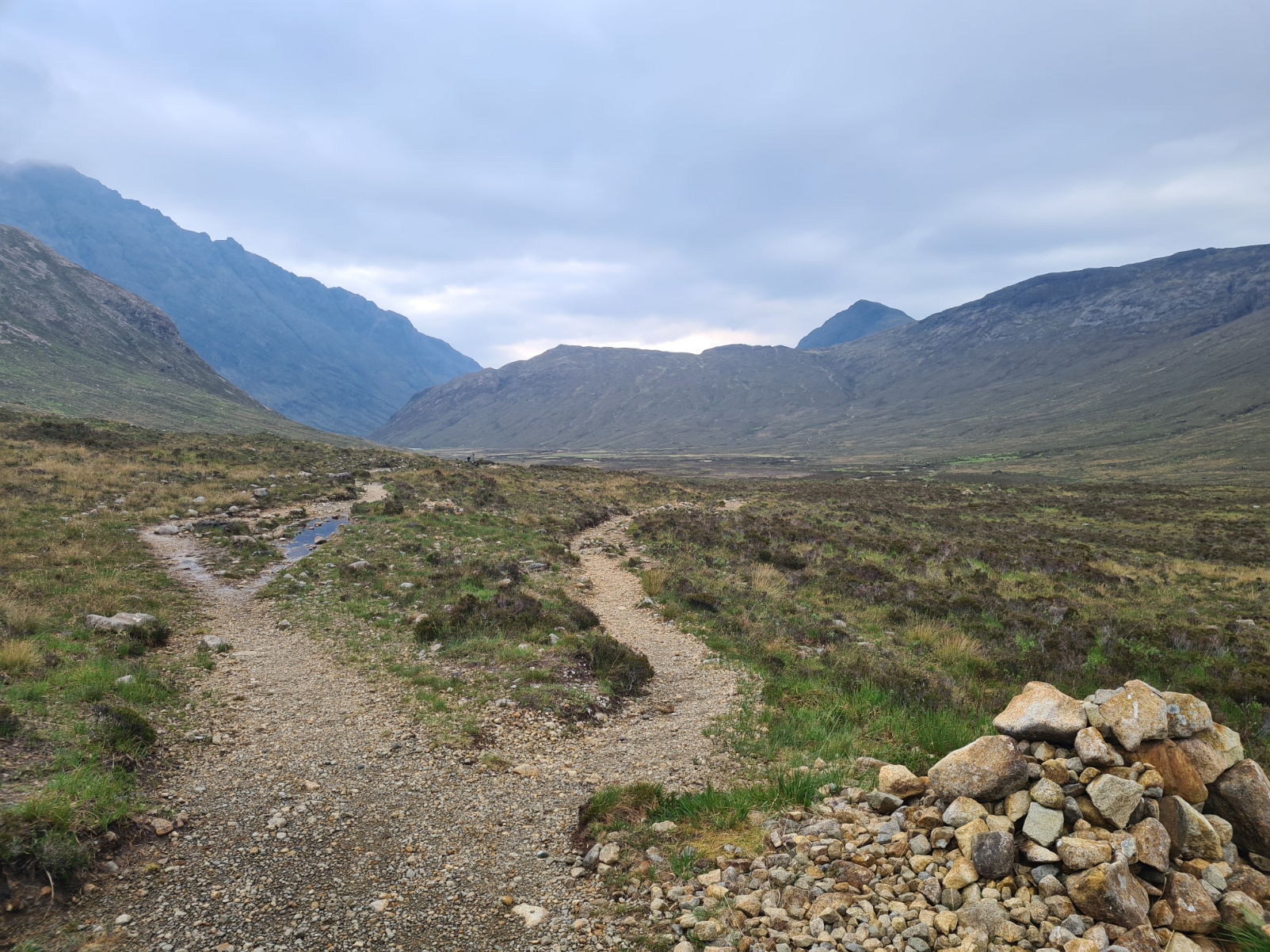
I reached a junction in the path. That to the right was an alternate route leading to Bad Step. This is a notorious short section of the path where the walker becomes a scrambler, wedging toes into a crack across a slab of rock, leaning in, inching the way across, trying not to lose footing and slide straight down the rock face into the sea below. I would very much have liked to do this alternate as it sounds fun but had decided before leaving home that if I were walking alone at this point, or if it was wet, I wouldn’t attempt it. A lone hiker has to make sensible decisions at times. Seeing as it was still quite wet underfoot from the overnight rain and I could see no other hikers in any direction, it was an easy decision to carry on down the official route to Camasunary.
Gear talk: Pure Clear- a lightweight water filter that removes viruses
I had done a pretty good job of staying upright on trail so far, other than one slip on the Trotternish Ridge earlier in my hike. Today’s wet trail had a number of slaistery stretches, usually when crossing the more flooded parts where last nights rain continued to run down off the slopes. I wear trail runners so attempt to pick my way across rather than simply crash through the peaty bog. I was just about at the end of this section of trail, approaching the private dwelling in the bay, before curving round with the path and heading to the bothy. Then… down I went. On to my arse, in a particularly wet and muddy patch. The valley between the mountains may have briefly echoed with a sequence of loud swearing. But, no harm done. I wiped the ooze from my hands with the abundant surrounding sedge and attempted to scrape the majority of the mud from my shorts and legs.
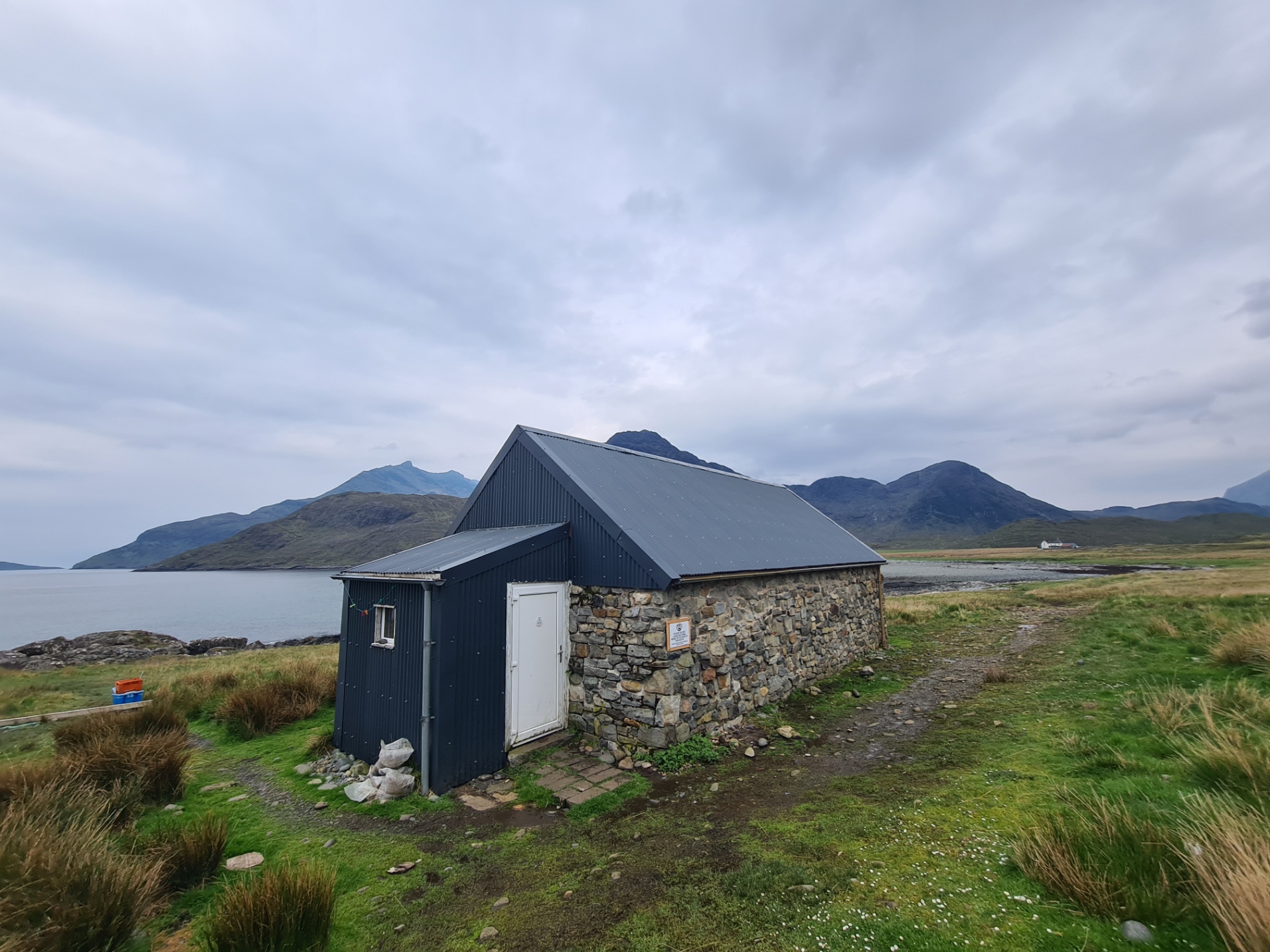
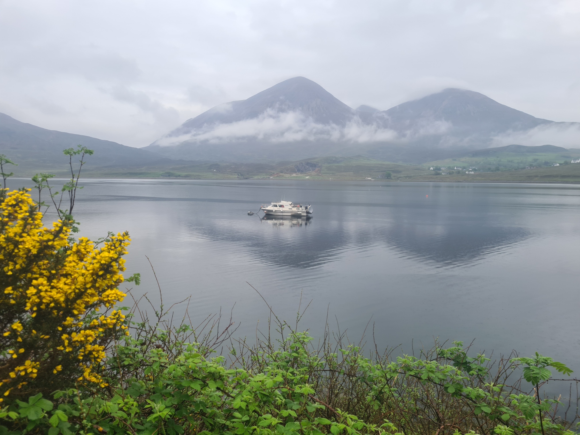
Prior to arriving on Skye I had hoped I might be able to stay at the Camasunary bothy if it fell right for me, as it is beautifully sited in a large quiet bay. But it was far too early to call a halt to my day. I did stop in to have an explore of the bothy, surprising a young couple that had also just arrived and were unpacking contents from packs. They were having a slower adventure on trail and had taken two days to walk here from Elgol. The three of us chatted and watched an otter fishing just offshore. Not a bad view from a bothy window. I lent them my Leica monocular for a better view, also pointing out the Great Northern Divers further out. The girl had turned her ankle and was limping. She was still up for completing her ‘first thru hike’ as she called it. Not sure I would call the Skye Trail a thru-hike! I carry a fairly good First Aid Kit and with the worst of the trail now behind me, strapped her foot and ankle up with athletic tape and left her enough to do the same herself. Her beau had his own problems, a multi-punctured inflatable mat. He had no repair kit so I donated my glue dots and patches. I wasn’t going to sit around for hours fixing it for him so showed him how to, also leaving him some Dr. Bronners for bubble tests and my short length of 3mm closed cell pad should he be unsuccessful in his repairs. Despite it only being midday, they were stopping in the bothy overnight so I left them to it and carried on round the bay and walked up on to the precarious path further on, where the slippery narrow path threatened to throw me down the near vertical drop alongside.
- Gear talk: my 2023 First Aid Kit
- Gear talk: the Leica 8×20 Monovid- probably the best quality small monocular ever made
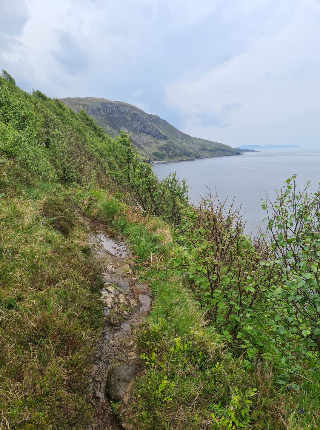
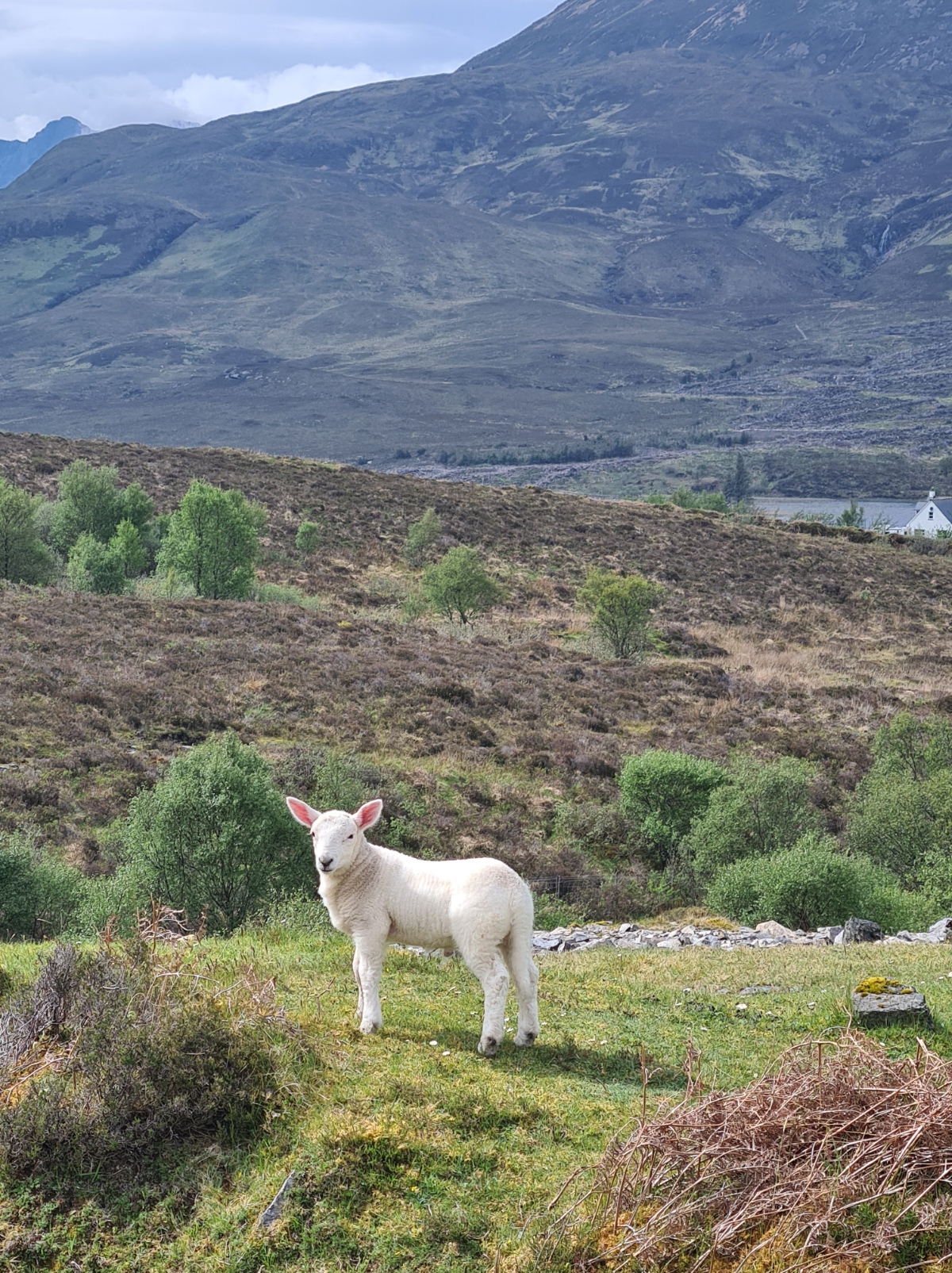
The Skye Trail has great variety of terrain and this section of coastal walking is again different from the previous days. It is badly eroded and care is often required to prevent slipping off down the cliffs. Again, I enjoyed it immensely, even if it did resume raining, making the trail ever more slippery. I was joined by another couple of trail walkers and we walked together for a couple of miles. However I am not a great one for group walking, preferring to go my own increasingly slower pace, take my time on more sketchy drops, halt to look at wildlife and take more photos than my phones memory could probably happily accept. They steadily pulled ahead and we only met up again when I occasionally leapfrogged them during their own halts. There is a drop to a lovely grassy valley before climbing again. This little spot was populated only by sheep and new lambs and I was sorely tempted to halt here, but it was still relatively early in the day.
After three miles we respectively came together again as we reached Elgol, typically, too late for the tea shop there. We were joined by another couple and the hunt was then on for a pitch for the night. Not far down the road out of town the four of them peeled off to a likely place, but I wanted to get a few more miles under my belt so waved goodbye.
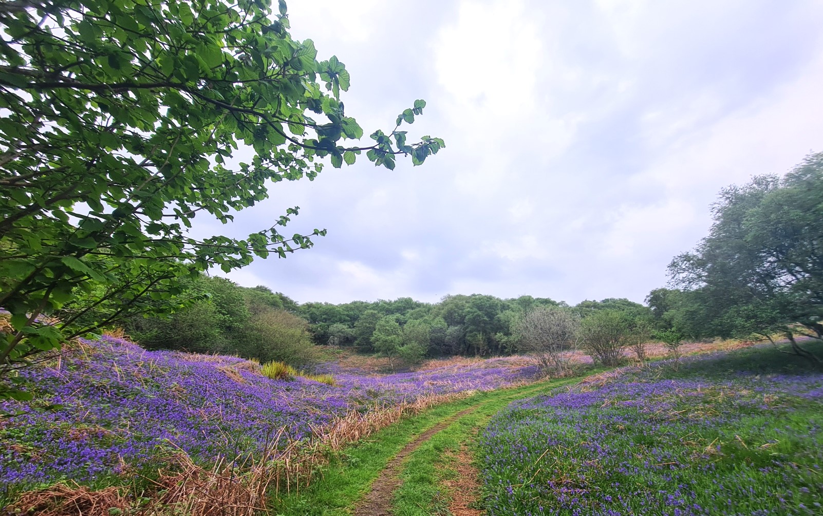
These last early evening miles were probably my least favourite of the entire trail. After a bit of road walking the trail left it to traverse mostly farmers fields. Most of these were heavily populated by cows, shit plastered the path, bracken was thick on sloping fields, it was pissing with rain. I left the trail a couple of times to look for likely wildcamps but nothing was even approaching a ‘three’, my just about minimum ‘out-of-ten’ for a wildcamp pitch. If it hadn’t been for the occasional thick bluebells and a decent burn from which I filtered a couple of litres, and actually feeling pretty good in myself, I could have been quite down as I still had to cover quite some distance before I found a decent overnighter. In the end I covered far more ground than I had originally planned and my seven day hike turned into a six day hike. I was back down to the shore almost opposite Torrin before I found a pitch I was happy with. There isn’t much to identify the non-descript sheep field I pitched in but it was close to the minor settlement of Faoilean. The midges were thick in the still evening air but it mattered not as it was only May and they were non-biting males, but still annoying. Once the Durston was up I just climbed inside behind decent bug netting for the little remaining evening and night. I had plenty of water to not only make a couple of pints of strong tea but also attempt a bit of a clean up of my still mud-bedaubed body. A good meal was followed by my last block of Tablet, that sent me to my quilt a contented man, buzzing with a sugar rush. Perhaps not the best recipe for a good nights kip, but I slept well, stirring only the once during the night.
Day six: Faoilean to Broadford
It was a quiet night and I don’t recall any noise at all other than the occasional baa-ing sheep and pitter-patter of rain on the fly. It was probably my own snoring that woke me up. The rain got steadily heavier while I drank my morning pint of tea, drunk while I packed up. The clouds were low and it was a pretty dismal morning. When the Norse ruled Skye in the 9th to 11th centuries, they called it Skuy, meaning misty isle, and probably supplying the root of its current name. I cared not about any inclement weather, there is a café at Torrin, across the water from me that has a good rep and I was looking forward to a good breakfast when I reached it.
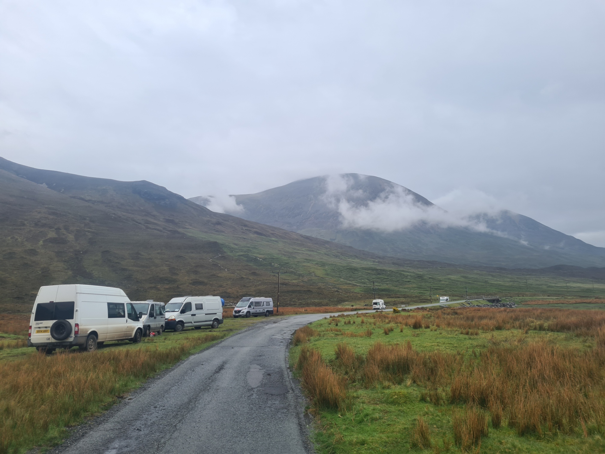
The day started with a bit of a road walk. Around the top end of loch Slapin then past the many motorhomes parked on the verges, their version of wildcamping. There are many places where the churned up mud indicated where vans had become stuck and had to be towed out. Not quite ‘leave no trace’. It was a dismal day weatherwise but the moisture added a beauty and the low clouds were wrapped around the hills. It was spectacular.
I should have expected it. I reached the little cafe at Torrin a few minutes after ten. The door was open but an A-frame in front of it delivered the news: “sorry we are closed“. Curses. The waterproof stays on then. Today offers up some fascinating insight to the older social history of the Isle of Skye but quite a number of hikers skip this section entirely, road walking from here straight across the island to the finish. Unless carrying injury or up against time constraints, I simply don’t understand this as it is a fantastic and rewarding walk for almost all of its length, including the last few miles down into Broadford.
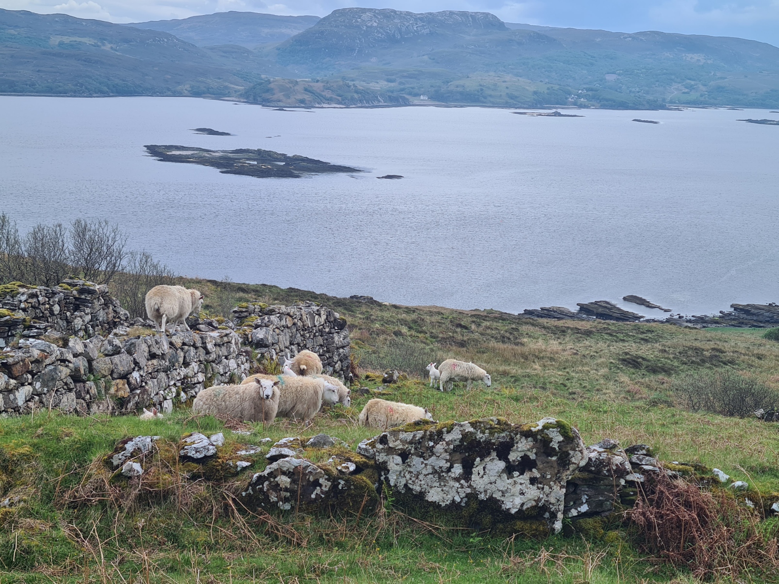
Just a mile or so past Torrin I took the right fork that passes the active quarry, extracting both limestone and white marble, and soon afterward hits the east shore of the loch at Camas Malag. Joining a rough track that hugs the contours above the shoreline. It is a lovely walk along here. The only thing that went wrong was when I was walking round a bend in the track, short cliffs to each side, and met a flock of sheep wanting to go the opposite way. The mums and lambs were extremely wary so I retreated, willing them to walk down toward me and strike off down a sheep path. It wasn’t to be, they were simply too nervous. The stand-off lasted ten minutes then I walked on, sending them skittering in all directions.
It is only three kilometres until Suisnish is reached. This is the first of two abandoned villages. Forcibly emptied of its tenants during the highland clearances in 1853. Unusually, there was an independent witness to the event and his testimony reached the media, though little if anything changed as a result and the clearances continued.
The communities that once lived on this quiet corner of Skye would have walked between their villages and their old trackway remains. It is easy enough to follow but was wet and peaty going after the rain. I met a couple of trail walkers that had set off from Broadford this morning that bought it home to me that my end destination was just a few hours away.
It is a lovely walk, up on to the cliffs, down to the shore, across a sward of sheep grazed grass that would make for an ideal wildcamp, past a couple of waterfalls. It was as though the trail was throwing a handful of last treats at my feet. Just as well as I was hungry and I stopped, high on the cliffs, for a rummage through my food bag to find what last ‘cold food’ I had, not wanting to stop long enough to heat a ‘proper’ meal
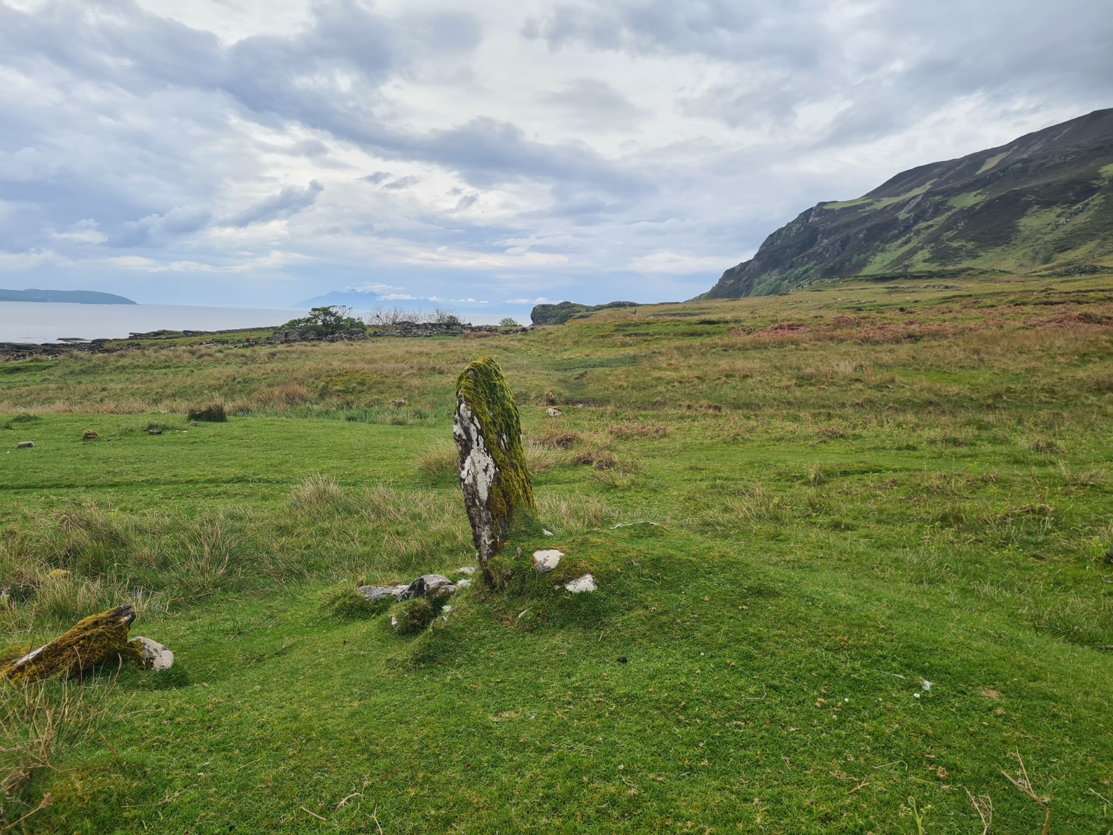
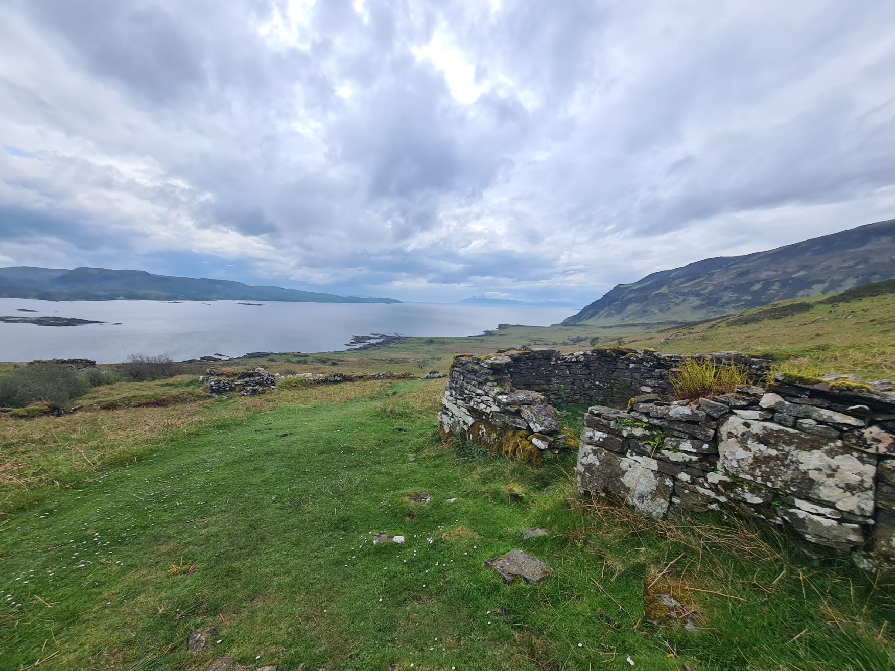
I reached my second ruined settlement of the day. This is the far larger village of Boreraig. You can see why they lived here as it lies in a wide sheltered, south-facing, green glen, with plentiful water coming from the hills and directly on the shore of the loch for fishing and gathering seaweed. It was forcibly cleared in 1853 by the agents working on behalf of Lord MacDonald to make way for sheep. An entire community ripped from their homes. Many emigrated with some dying of fever before reaching Ireland. A handful of people continued to live in the village, probably sheep farmers, but even they had gone by 1877. The sheep remain however, one of them was walking along the walls of a tumbled down home. It must have been a place of importance for centuries, possibly thousands of years. A lone standing stone remains in it’s centre. It is surely noteworthy that the then inhabitants held this with sufficient respect that they left it standing, not using it as a lintel or to lay across a burn.
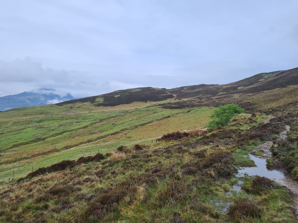
From this last village it is a steady climb up the slopes and back onto the moorland. It is a decent path from here all the way to Broadford as this is quite a popular walk. Though it is quite some miles for an out and back for those not prepared. I met a couple of pairs who carried a single bottle of water and looked ill prepared for any change in conditions.
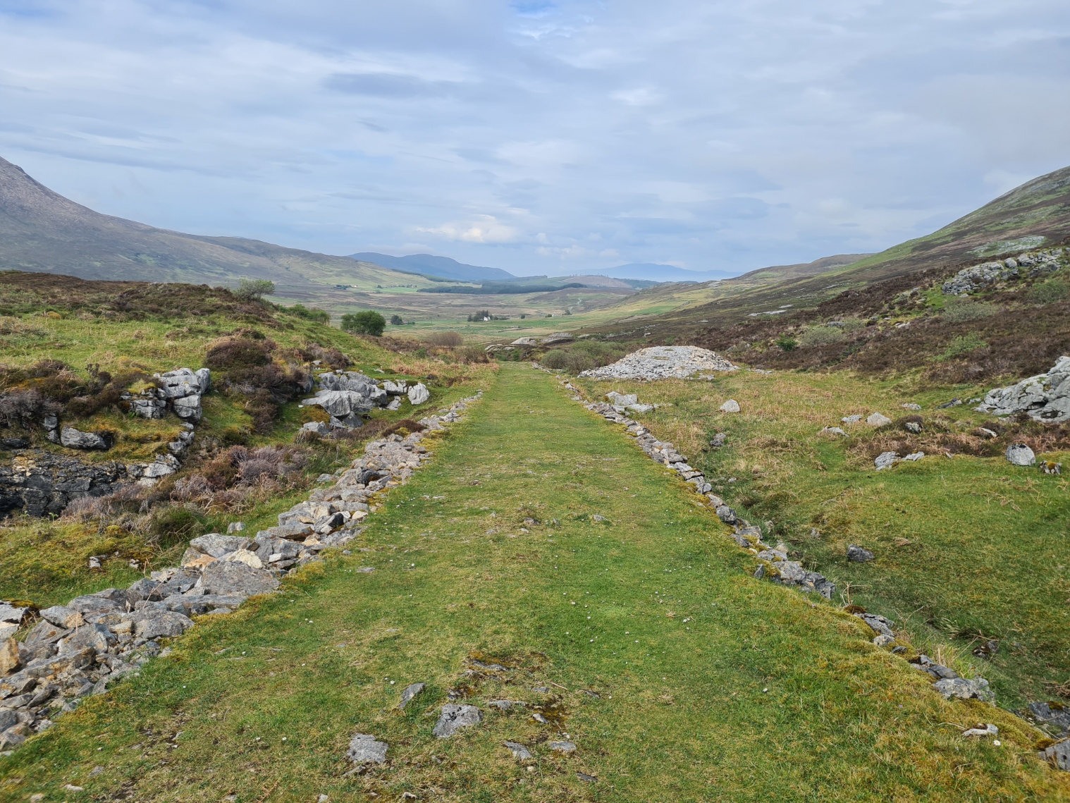
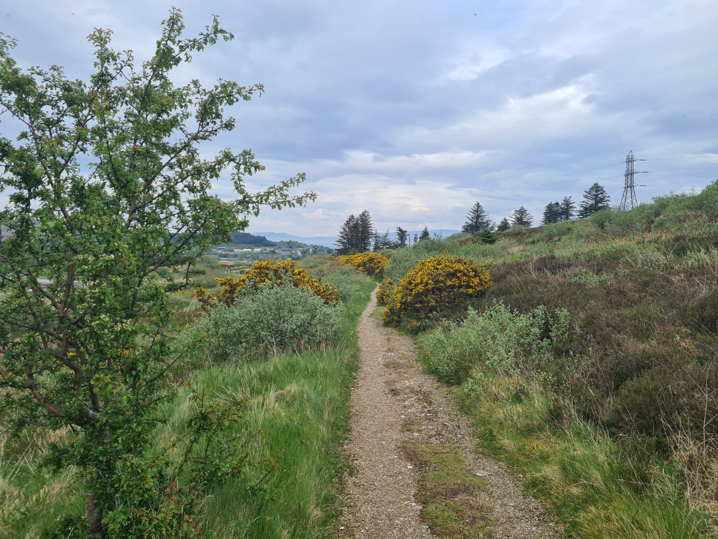
I soon joined the Marble Line. The wide and gently descending trackway used to carry the railway that worked between the marble quarries and the port at Broadford. I marched down here in high spirits, the rain had gone and the sun threatened to break through the clouds. I passed through a gate in a deer fence, placed here to protect a new plantation, then through another, out to join a road for the last few hundred metres down into town.
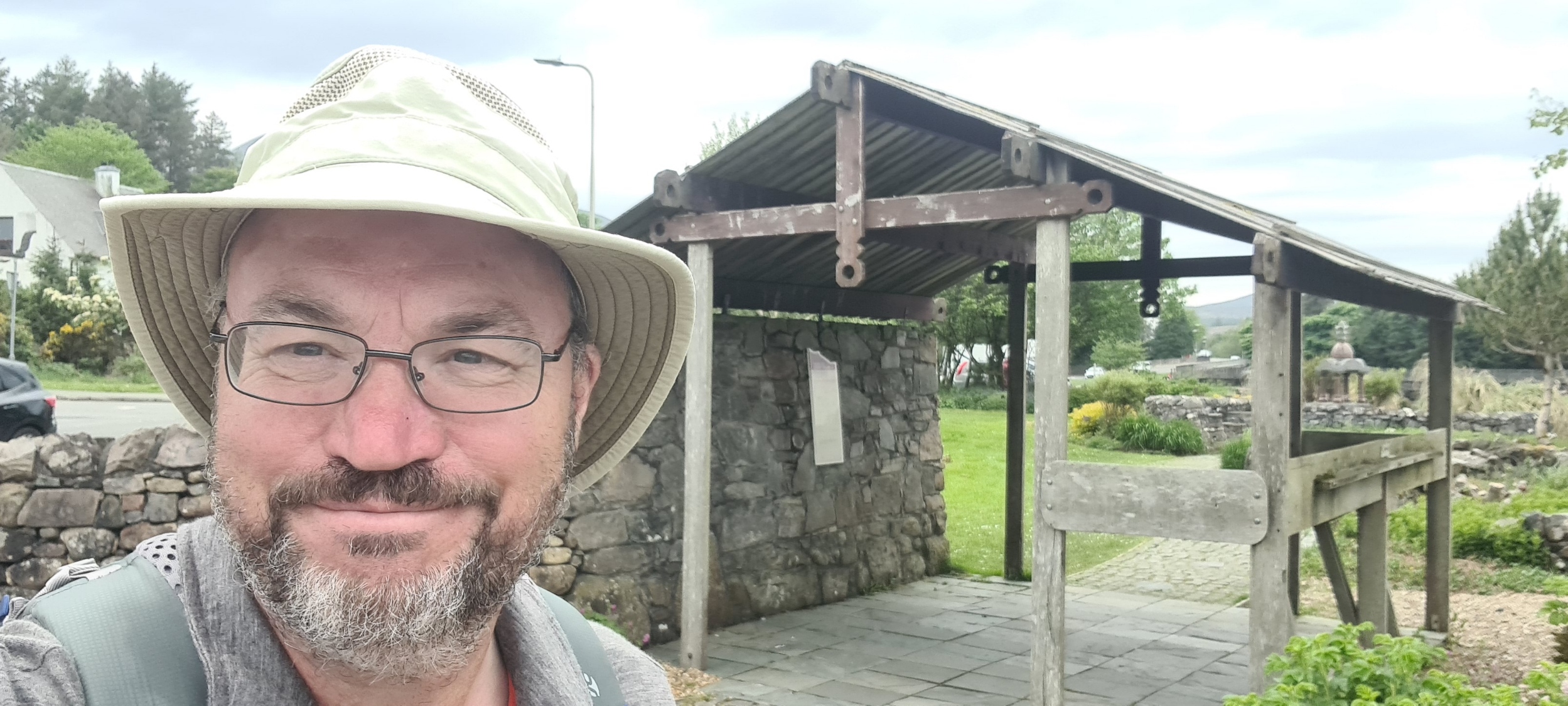
My stomach was still protesting so once in town I halted at an open chippy for a scotch pie, eaten on the move, while I searched around for some form of official start/finish to the trail. I settled on the little shoreline public garden beside the petrol station, taking my end-of-trail photo at three in the afternoon. Then it was simply a case of waiting for a bus to take me back to Portree for a final camp at the site there, where my car was parked. Job done.
So, what do I think of the Skye Trail? Easy. It is a superb challenging walk and I enjoyed it immensely. Poor weather adds to the challenge, really poor weather can potentially make it dangerous in some locations and a hiker should be able to make good decisions. In my opinion it is not suitable as a first multi-day hike and demands respect and appropriate gear and clothing. A hiker should be both familiar with both gear and how to look after themself on a longer hike in often wild country. That said, there are a few options to stay at a campsite and one or two shops and cafes en route, if they are open. Or carry all your food and wildcamp throughout if that is your thing. I did a mixture of the two and found that worked best for me. I walked the trail in May, when I could expect the best of weather, still with the (realised) possibility of rain, and hopefully beat the midges. I did the trail over six days but had originally intended on taking seven. I was also prepared to take eight or nine days if conditions warranted. I met people attempting to do it in far less time and even if they succeeded, it would have been both hard going and much of interest would have been either missed or ignored. Take your time, the Isle of Skye deserves it.

Thank you for posting this as I make my first trip to Scotland. Super excited to be hitting parts of this trail! Thank you for all of the work you put into these ramblings, eh!
LikeLiked by 1 person
Have a great trip Carys. Hope the weather is kind to you
LikeLike