

Three Points of the Compass sets off on the Coast to Coast Path- backpacking across northern England from the Irish Sea to the North Sea, taking in three National Parks en-route.
Alfred Wainwright devised a walking route across northern England, from the Irish Sea to the North Sea, and this was first published in 1973. However he never intended it to necessarily become a prescribed trail, instead urging others to devise their own coast to coast route. The problem is he did a good job and since the first guide book appeared, it is his route that has been followed by thousands of walkers every year. There have been slight changes, mostly to avoid field’s that never had public rights of way across them, but these changes have been pretty minimal. When I walked the trail in July 2024 I met people navigating with O.S. strip maps published thirty years ago and they were experiencing no difficulty in finding their way.
The Coast to Coast is unique amongst our National Trails in that it crosses three of England’s National Parks- setting off on the west coast at St. Bees and threading its way through the Lake District, then crossing into the Yorkshire Dales, across the flat farming lands of the Vale of Mowbray, before climbing back up on to the Cleveland Hills of the North York Moors, ending at Robin Hood’s Bay on the east coast. Various distances are given and I have no idea which is correct, particularly as there are some variant paths to take en-route. Whatever the case, anyone completing the entire route will have walked a shade under two hundred miles, probably more. It is reputed to be England’s most popular long distance trail and around six-thousand walk it every year of which around a quarter are overseas visitors. But many don’t actually walk the entirety. On my own crossing I was aware of many hikers quietly dropping out, or even quieter, skipping sections by utilising public transport, whether through injury, time constraints or simply less enamoured by the prospect of certain stretches, I don’t know.

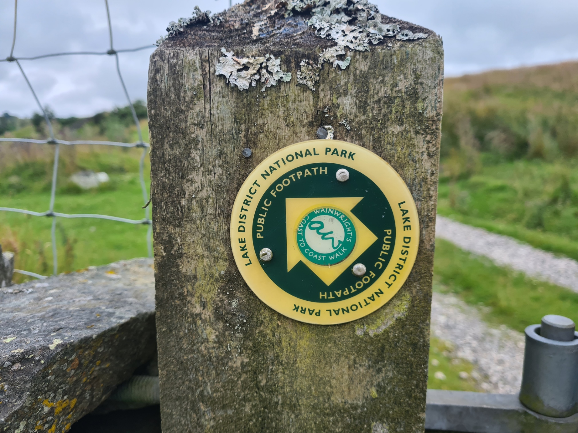


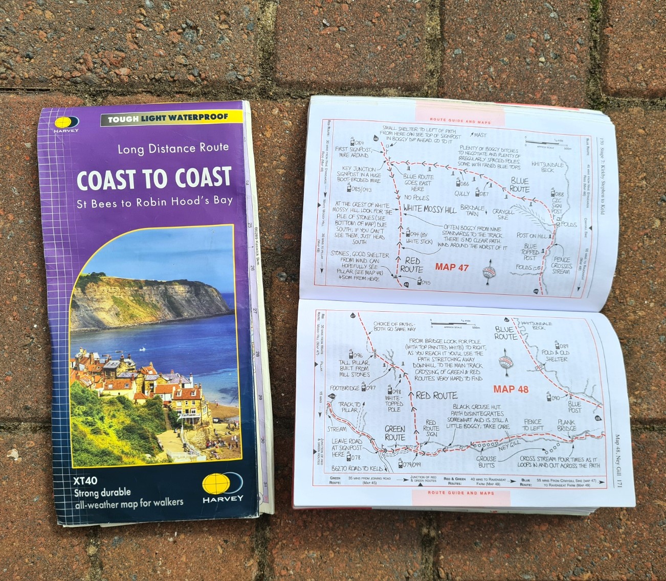
Signage for the trail was pretty good overall but a map is essential in one form or another and I mostly relied on the 1:40 000 scale waterproof Harvey map. Until the upgrades are made to reflect the change in trail status and injection of additional money, walkers have to follow existing signs, which are often normal footpath signs to which small Coast to Coast stickers have been added. The four parts of the trail- three National Parks and the ‘flat bit’ between, lend themselves naturally to a divided account, so I have broken my Coast to Coast journey into four parts, this being part one. Some people dash across the country, knocking off big miles, but I was in no hurry and had planned on taking sixteen or more days at a far more sedate pace.
Arriving at St. Bees:
It was a long journey north from Kent but my trains all ran on time(ish) and I arrived in little St. Bees, on the Cumbria coast, mid-afternoon. I had decided to make this a July walk and, surprisingly, the sun was punishingly hot on my arrival and the small number of quite obviously fellow Coast to Coast (C2C) walkers that also exited the train onto the platform beside me all promptly marched off to their respective overnight halts, or possibly straight on to trail. But instead of heading directly to my hotel, I took just a few minutes out to visit the statue to St. Bega. Namesake of the little village where the C2C begins.
It is a pleasant enough memorial but in common with so many revered saints, facts are sadly lacking as to her actual life, even if she actually existed, and the stories today are derived more from cult and pure fancy. She is shown wearing her amulet, or bracelet, that became a much prized relic in the local priory. The relic itself being said to be the cause of further miracles. I could do with a bit of the wonder stuff myself as I was stiff after my journey, feeling unfit and overweight and had a hint of a cold that I hoped was just hay fever.
It was now time to check in to the Seacote Hotel. This gave me enough time to enjoy a quick pint of refreshing Ennerdale Blonde, 3%, from the Ennerdale Brewery, in the hotel bar. Then a last check and rearrange of my pack’s content’s in my room. Tired after an early start to my day and alcohol on an empty stomach I also fitted in a nap, prior to a call home to Mission Control, before my evening meal back down in the hotel bar. My pie and veg was OK, but any hope of contemplative anticipation was dashed by a group of ebullient Germans on a neighbouring table who kept the bar staff busy. The next time I would run into these chaps would be in two days time, at a lonely YHA on the Lakeland fells, they were a great deal more subdued then.

Day one: leaving St Bees and into the Lake District:
I slept well, beer and wine helped, and I was up in good time for the earliest breakfast that the hotel provided. That said, there were quite a few other people in the dining room when I entered, of which a handful were getting more of a move on than I was, as they finished eating and minutes later I could see them through the large windows, striding off with their packs toward the start of the trail. I was in no real rush. Unlike many others I was fortunate enough to not be up against any time constraint and had every intention of easing myself into the miles, taking it gently through the initial lakeland section, which is the most demanding part of the whole trail.

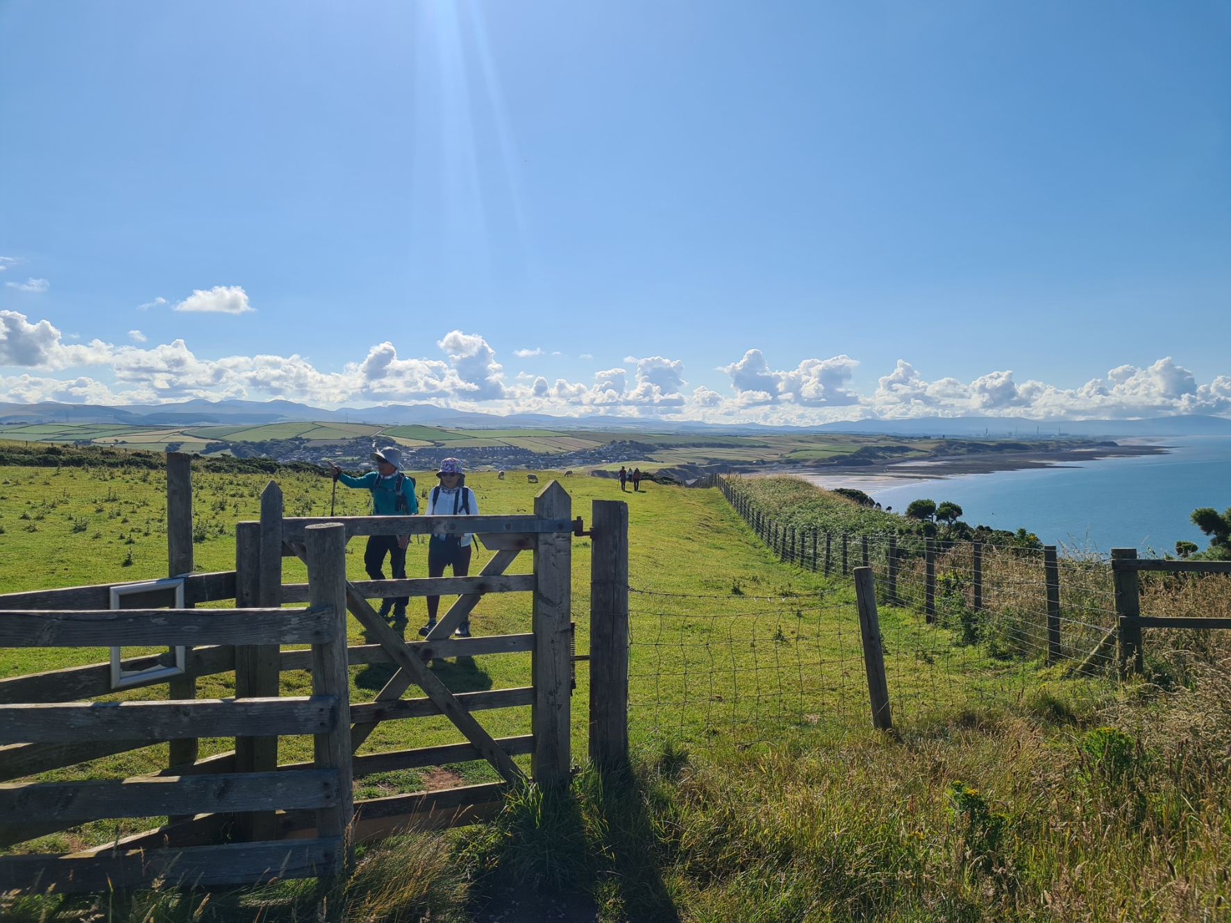
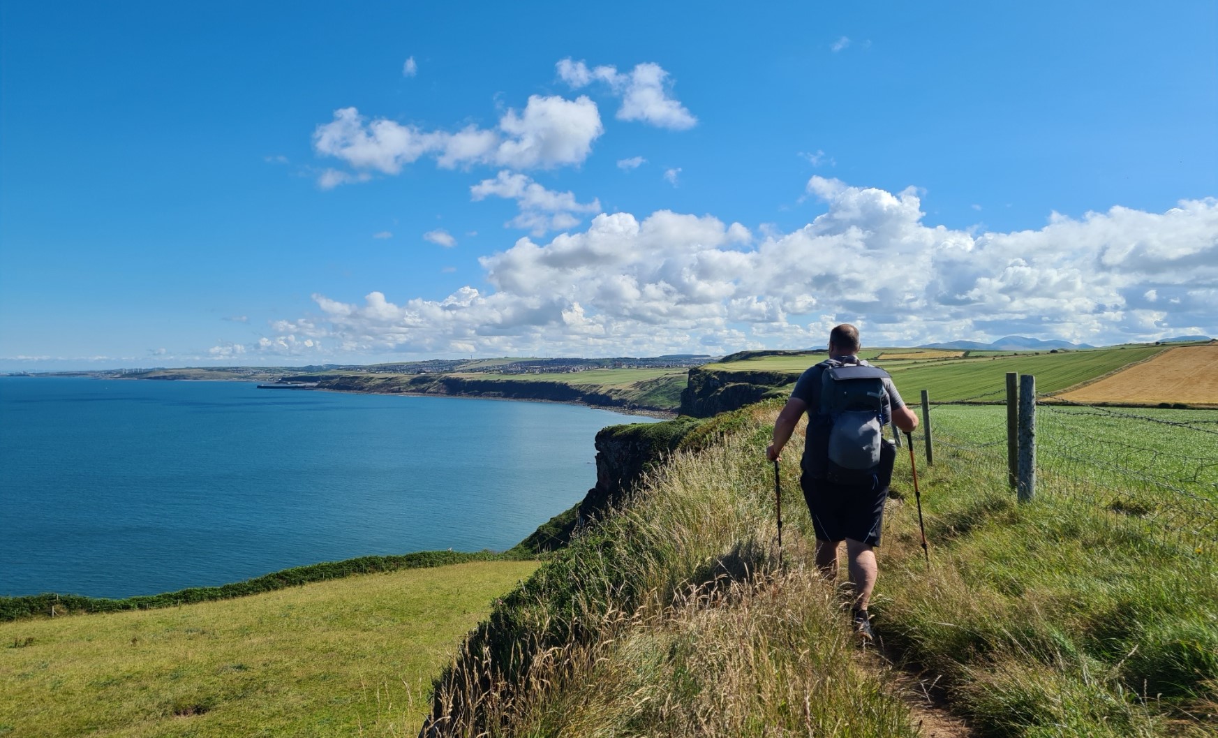
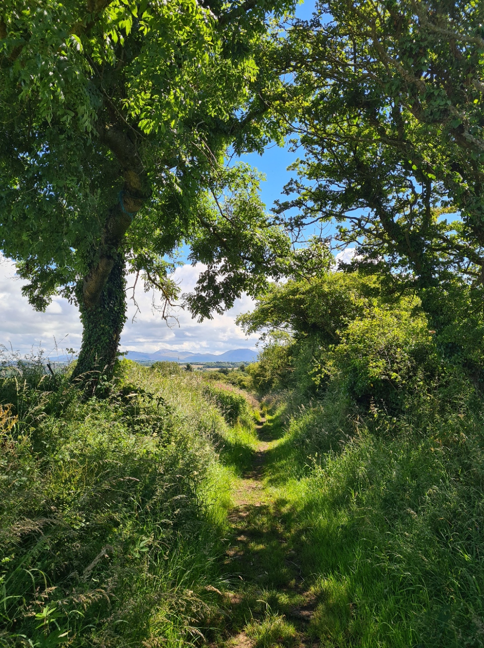
After breakfast, with pack donned, I checked out then walked the short distance to the start point. This is a brick and stone affair, with signage, close to the seaside car park. When I could, between others doing the same, I took the obligatory start-of-trail photo, then walked down to the sea to select my pebble. The tradition is to carry this from one side of the country to the other, depositing it in the sea on the other side and likely confounding geologists for years to come. I was asked by one group of foreign hikers to take their photo as they threw their selected pebble in the water before they set off on their C2C. I don’t think they quite understood the tradition! Then, the short climb up on to the cliffs to begin the coastal walking, that is over too soon, prior to the C2C leaving the England Coast Path and striking inland, heading to the lumps on the horizon that are the Lake District. The cliffs I was walking along are home to the largest seabird colony in north-west England. I could see nesting Razorbills, Kittiwakes and Herring Gulls, but none of the Black Guillemots or Puffins also found here. I watched a large bull seal far below circling one particularly large rock exposed by the sea, before he hauled himself out of the water. Stonechats called at me from the fence posts and the occasional Raven kronked it’s way overhead. It is a lovely stretch of coastline.
There were quite a few other people setting off today on the C2C. While not attempting to judge anyone, I felt some were more likely to succeed in their endeavour than others. I chatted to a young teen and her grandmother. They had no navigational aids of any form but were carrying seven litres of water in their large packs and five kg of ‘stuff’ for their little dog. The two had given themselves twenty days for the crossing and the girl was enthusiastic about her adventure but I heard a couple of days later that they had got badly lost and were struggling.
It is only a short stretch of the England Coast Path that is followed. On reaching the 18th century Birkhams Quarry the two paths separate. The quarry is strictly seasonal to avoid disturbance to nesting birds. I chatted to a man whitewashing the wall beside his cottage, built a hundred years earlier from rock from the nearby quarry. He had retired here following a life as a farmer on the fells I was now walking toward. I asked what it was like when they were blasting in the quarry, but he said he barely noticed it as they use black powder. This has a gentler impact on rock than high explosives and is used to extract large blocks of stone rather than excessively fracturing it. Sandstone from here was used to build Liverpool Cathedral, the V&A Museum in London and even shipped to Canada, Hong Kong, Iceland and the USA.
It is a roadwalk from the coast to Sandwith where I topped up with water from an outside tap at the Dog and Partridge. From there a succession of footpaths led me across the fields and past farmhouses, until I took the alternate path into Moor Row, following the now disused railway that now forms part of National Cycle Network 7.


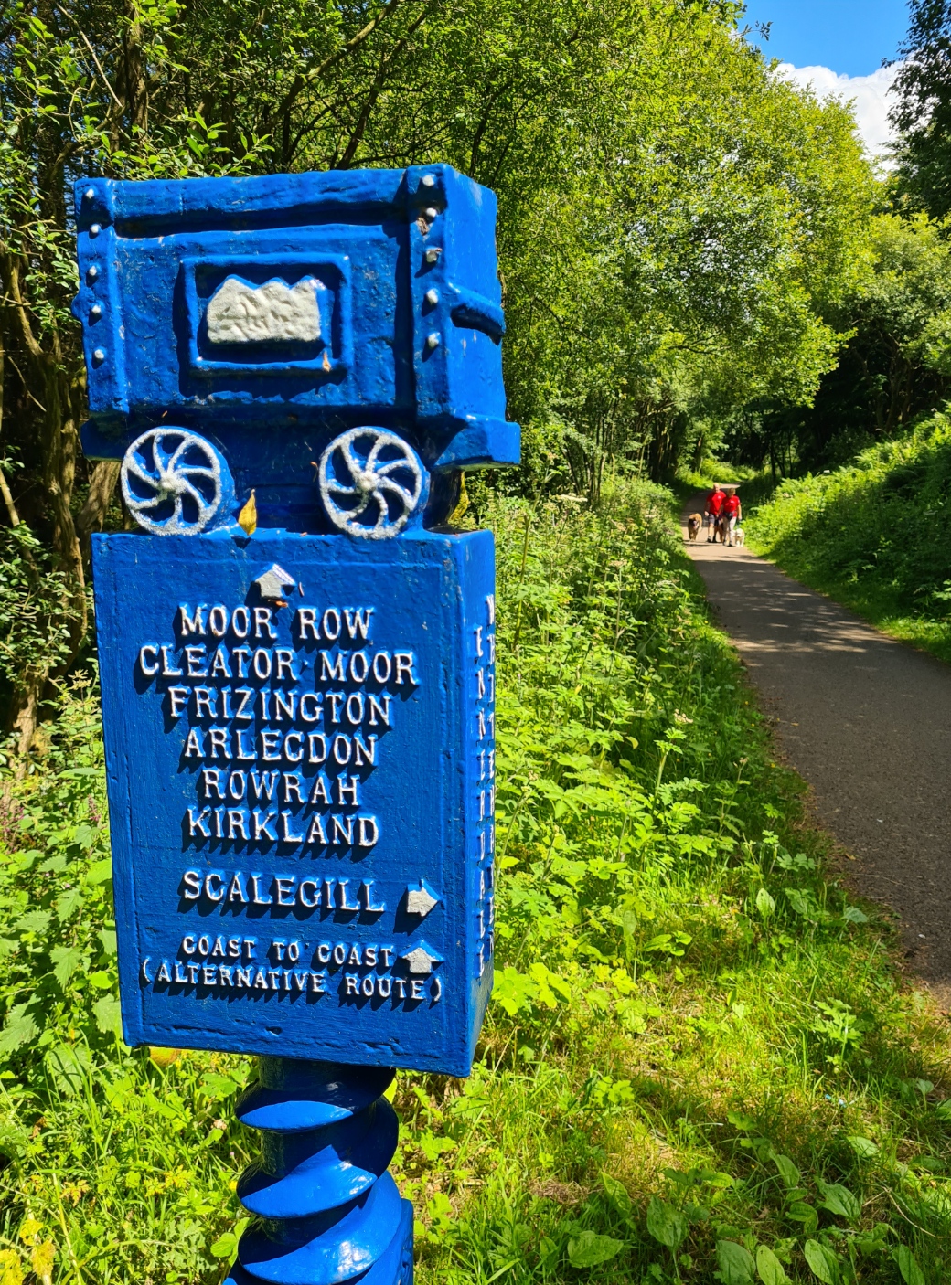

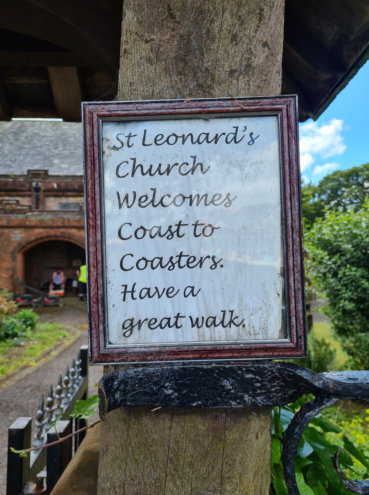
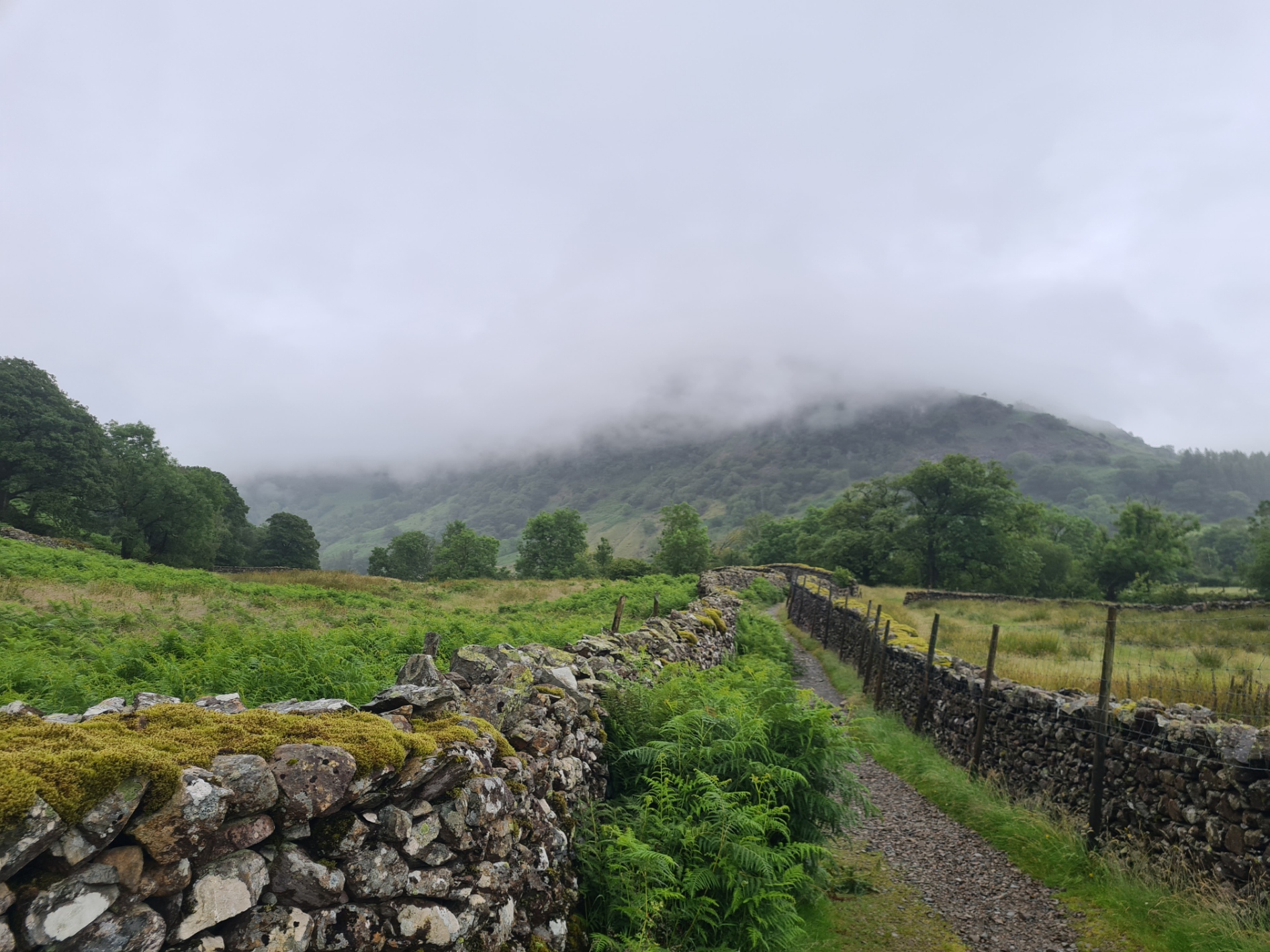
Moor Row itself is a fairly unremarkable little town, but there were a couple of impressively large murals on the ends of buildings. More fields and paths took me to Cleator where I originally hoped to explore the inside of St. Leonards, also slightly hoping for some refreshment opportunity there as it was hovering around thirty degrees but it was locked, so I stood for a while in the cool shade and chatted to the small team taking a break from cutting the grass in the churchyard, a form of community payback. Further on, the village shop was open, though it is more commonly known as ‘the pie shop’. I purchased their most popular, a steak pie, for my lunch the following day. While I stood outside drinking a cold drink from their fridge a succession of C2C’ers all trooped in and out of the shop, clutching their pies, it definitely has a reputation. Out of the village I found a field with a few less clegs than most to have a quick lunch of rye bread, primula cheese and spicy kabanos. After more fields and a walk up through a bit of forestry, it was a steady climb up onto Dent Fell. Even though I still wasn’t quite in the Lake District, this did still provide the first proper test of legs and lungs since leaving St. Bees. It is a lovely climb with ever widening views behind to the coast and in front of what was to come.


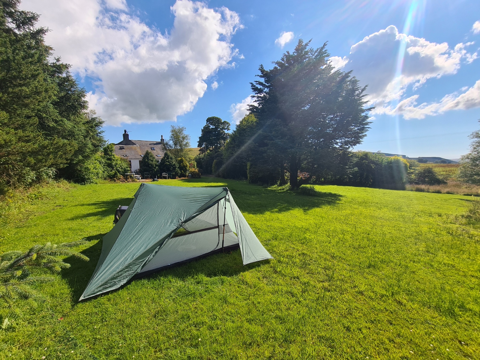
From the top of Dent, it was inevitably back down again. Down the steep Raven Crag and briefly into forestry before following the contours to the lovely named and even lovelier to see Nannycatch Beck, crossing this now put me into the National Park. Most people completing their first day on the C2C carry on to Ennerdale Bridge, I wasn’t. Having followed the stream uphill I turned off toward Low Cock How Farm where I was camping at Bradley’s Riding Centre. I paid £12 for my decent shower and a pitch on the sodden spongy grass behind the farm house.

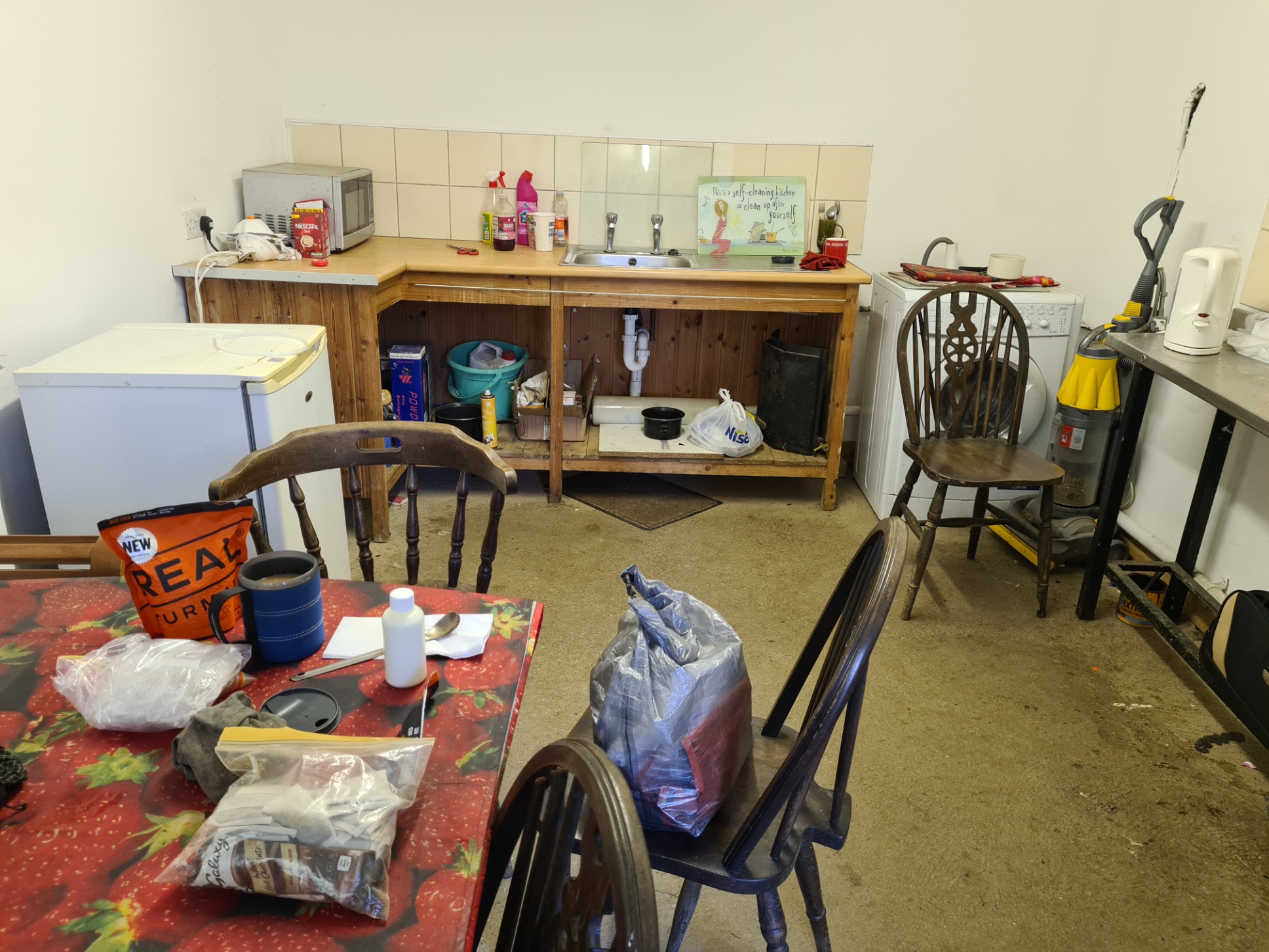

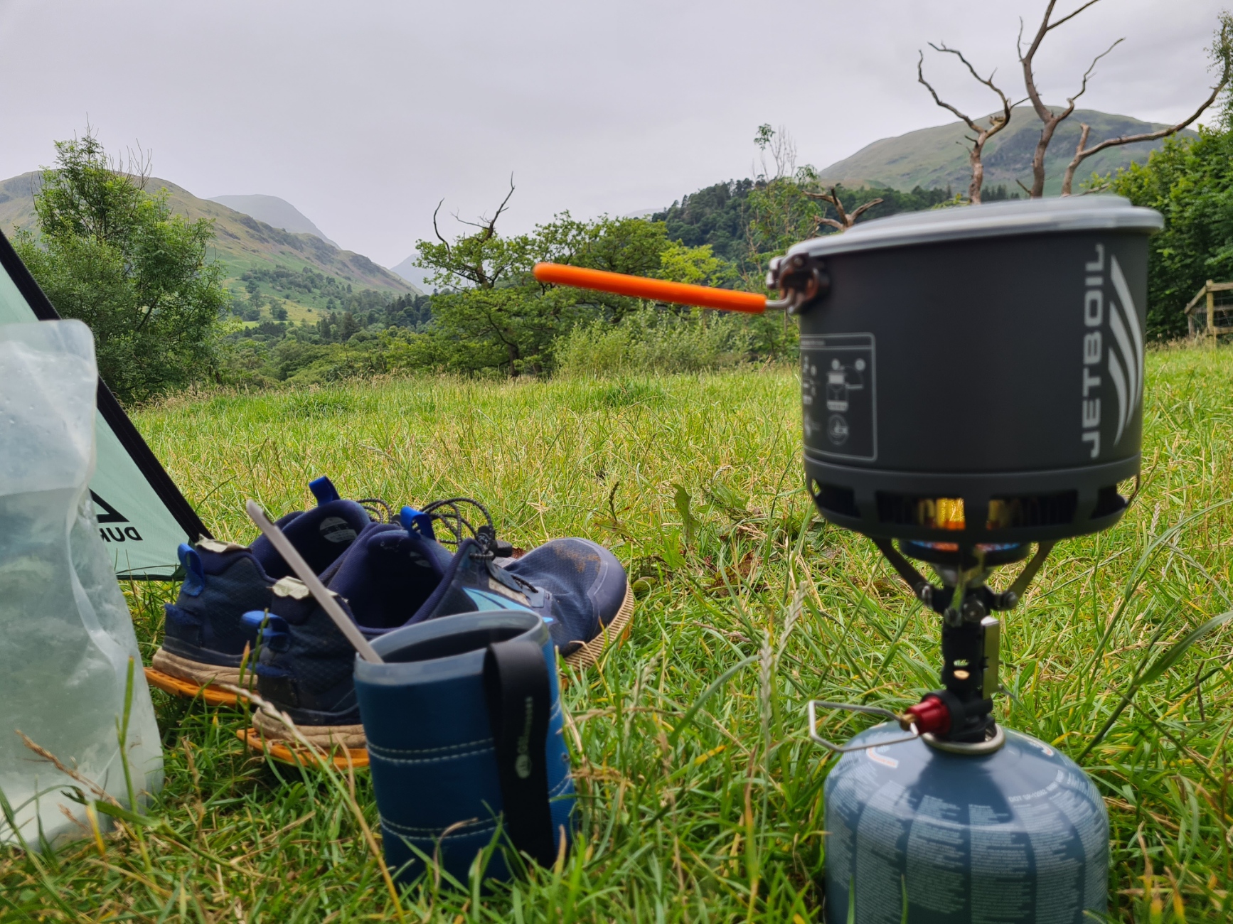
The farm is in a lonely location. The lady I paid for my pitch told me they had recently had 1500 litres of red diesel stolen, an expensive loss, even more so as they then had to install CCTV. They keep a huge number of horses- 97 Shires, with an expected good number of foals about to increase this, plus 800 sheep. Of the nine hundred animals I actually only saw one lone horse, that likes to come in from the fields each night. It’s metal shoes clattered around the concrete farmyard outside the campers kitchen, before it stuck its head in the open door to watch me prepare my evening brew and rehydrated my Real Turmat Beef Stew. Still hungry, I then ate tomorrows lunch, the pie purchased earlier, which annoyingly turned out to be meat and potato. After this, a clean up and I attempted to wave off the midges and flies while climbing back through the bug netting into the tent for an earlyish night. It had been a good first day but the fine weather I had enjoyed all day was about to change.
Day two: Low Cock How to Borrowdale
I slept well but rain hammering on the fly woke me prior to my phone’s alarm. The forecast was 95% heavy rain all day. I wasn’t the slightest bit surprised with this forecast. My Trailblazer guidebook gleefully informed me that Sprinkling Tarn, south of Seathwaite, holds the record for the most rain in a year, an average of 196 inches (over five metres).
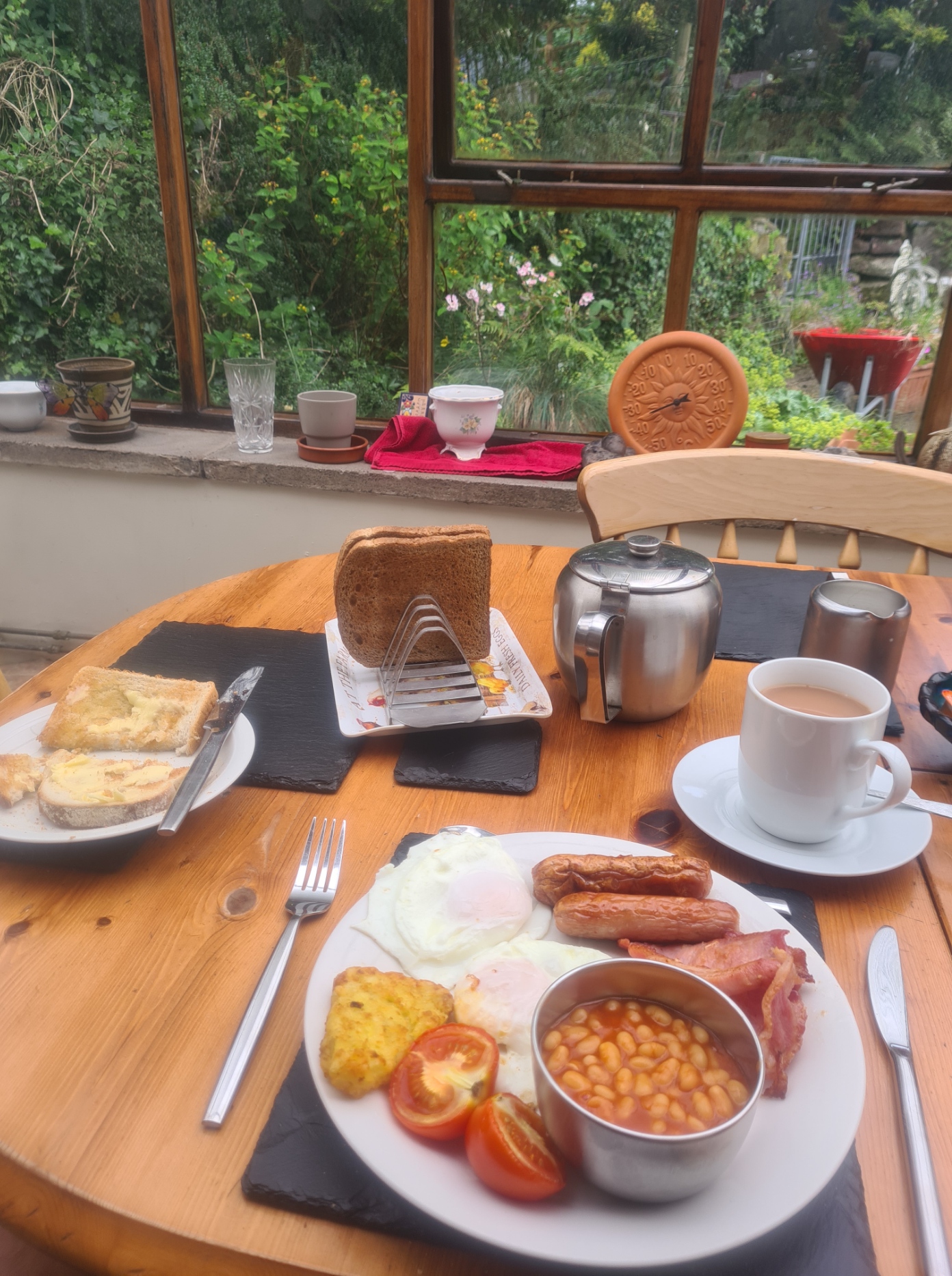
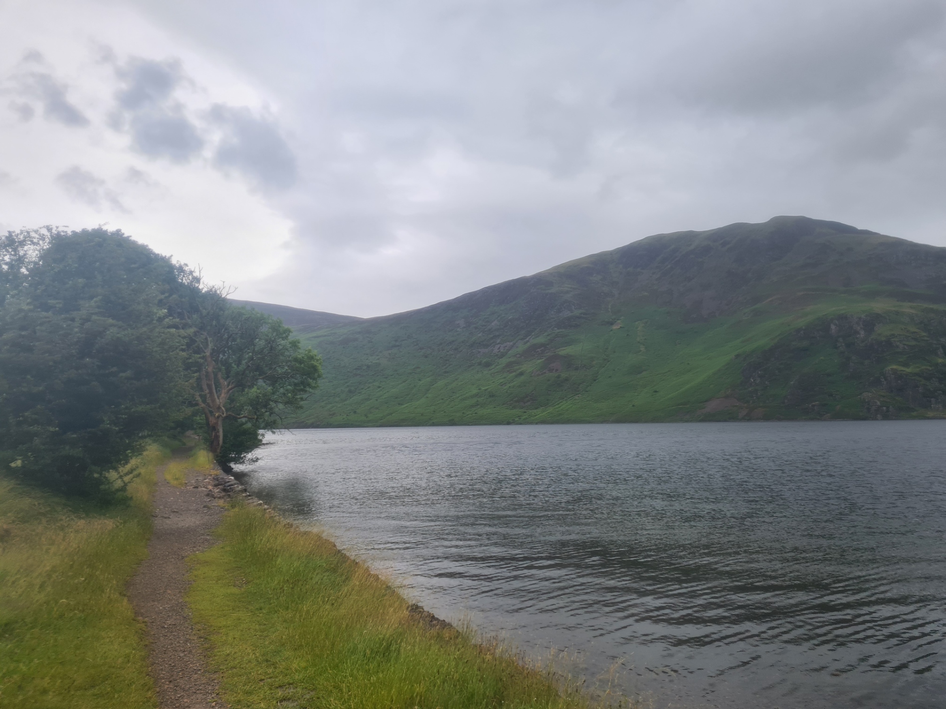
I had booked a cooked breakfast in the farmhouse, joining two other C2Cers that had chosen to stay B&B. It was a good breakfast and well worth the £6 it cost. Afterward, I packed in the rain and was away fairly late at 8.45 for my walk into sodden Ennerdale Bridge. I had no need to stop there so it was straight out the other side and onto what looks to be a new path through the forestry to the edge of Ennerdale Water. It was a miserable morning and the lake’s surface was being whipped into the air and liberally dumped onto anyone walking it’s western edge. That would be me!
I walked the northern shore and once onto that track I was mostly sheltered from the rain. The brightly clad walkers I could see on the southern shore had no such shelter and must have been getting quite wet on that more arduous path, which I had heard can more resemble a river when it is raining.

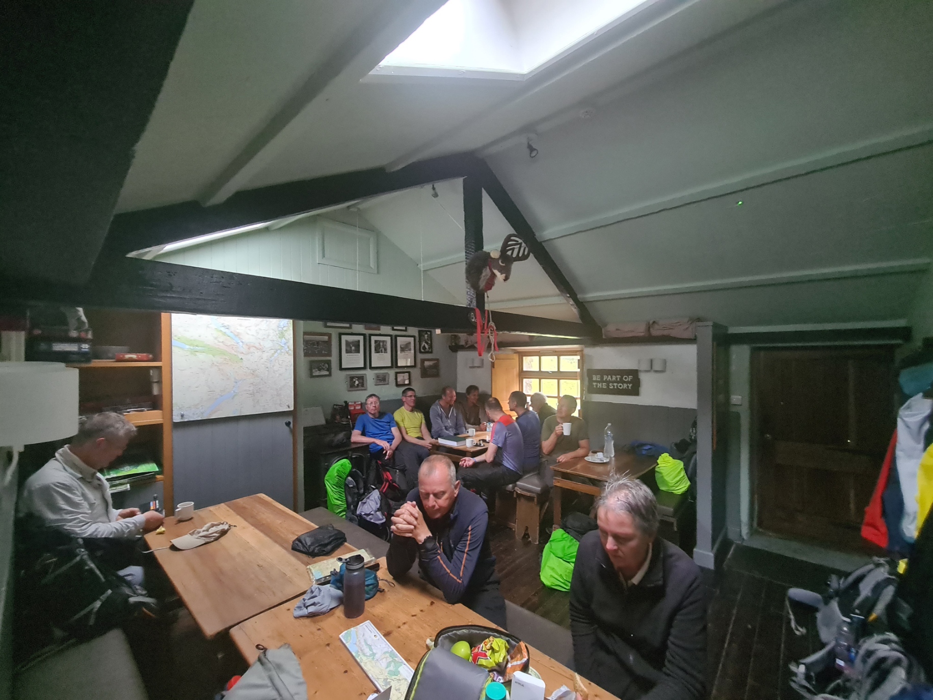
Despite the weather, I actually enjoyed this walk. I had decent wet weather gear, the hills around me were wreathed in cloud and it was classic lakeland scenery. That didn’t stop me halting at YHA Ennerdale. The enlightened staff there leave it open for people to stop by to rest, use the w/c or avail themself of the kettle and honesty shop in the kitchen. I made a brew and drank it with a purchased Mars bar and banana. Shoes off and feet airing, I put my feet up and had the place to myself until just before I left, when three more C2Cers stopped in.
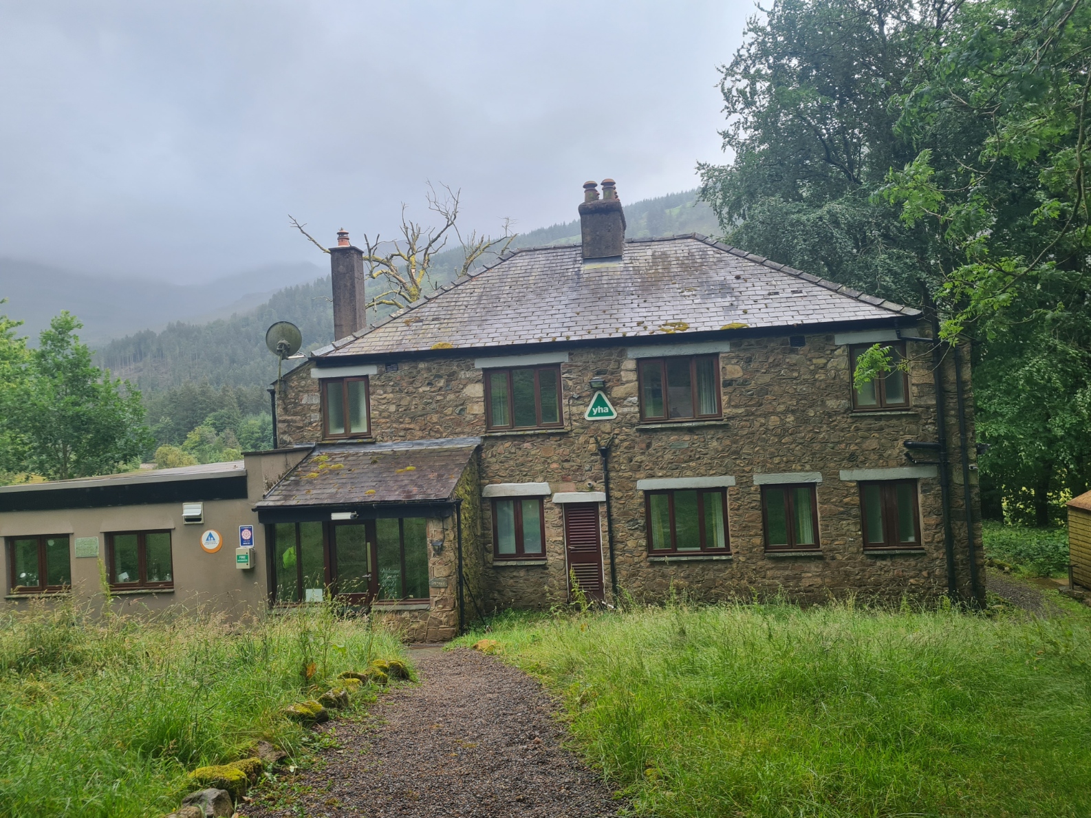
From there it is a steady climb up to another YHA. Black Sail is apparently the most isolated of the English YHAs. It made for another welcome halt for yet another brew. Never pass up an opportunity! It was pretty packed when I arrived but gradually thinned out until I was again, the only occupant. It was nigh on one o’clock so I had lunch, again, rye bread, primula cheese spread and kabanos.


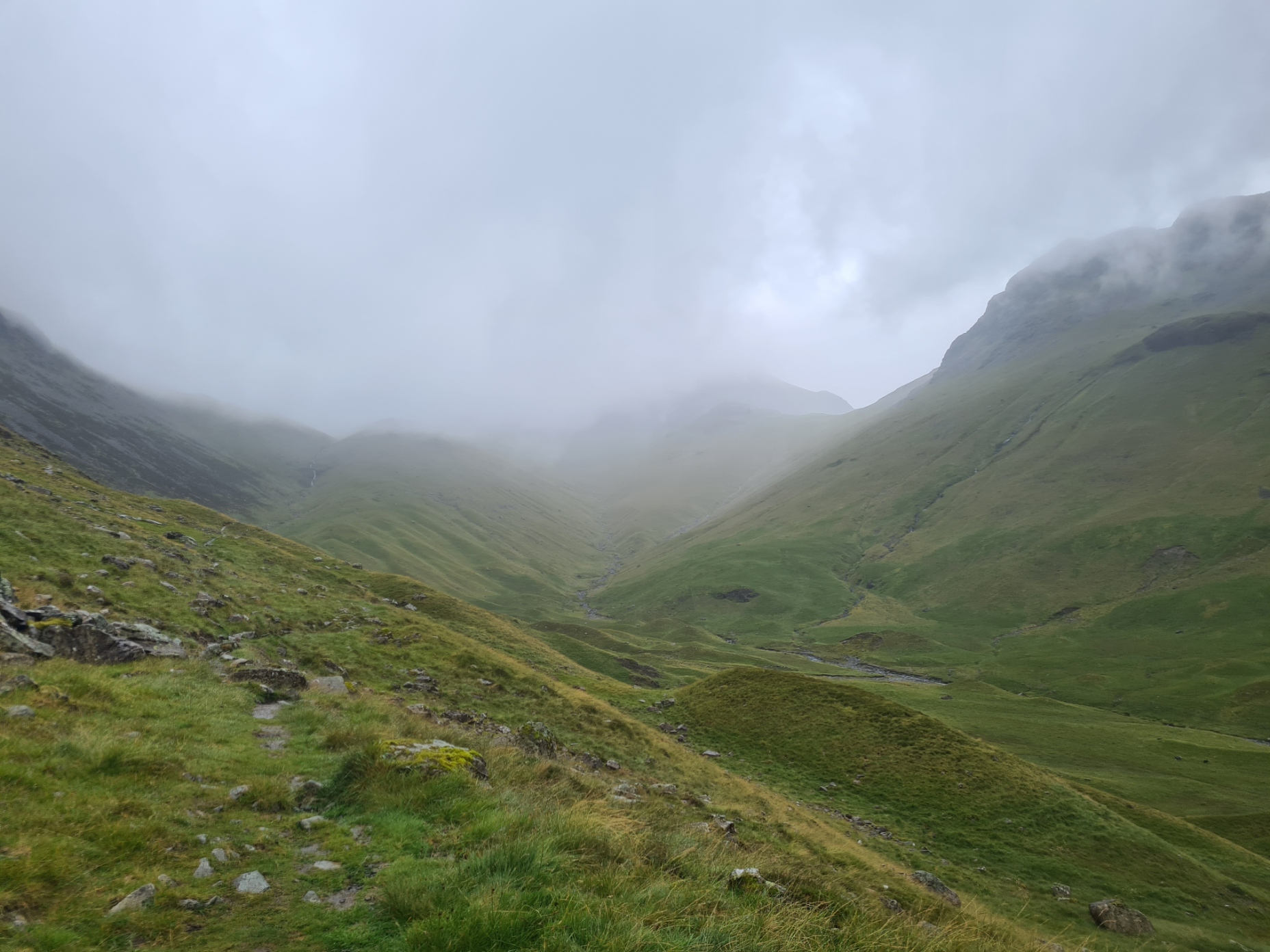
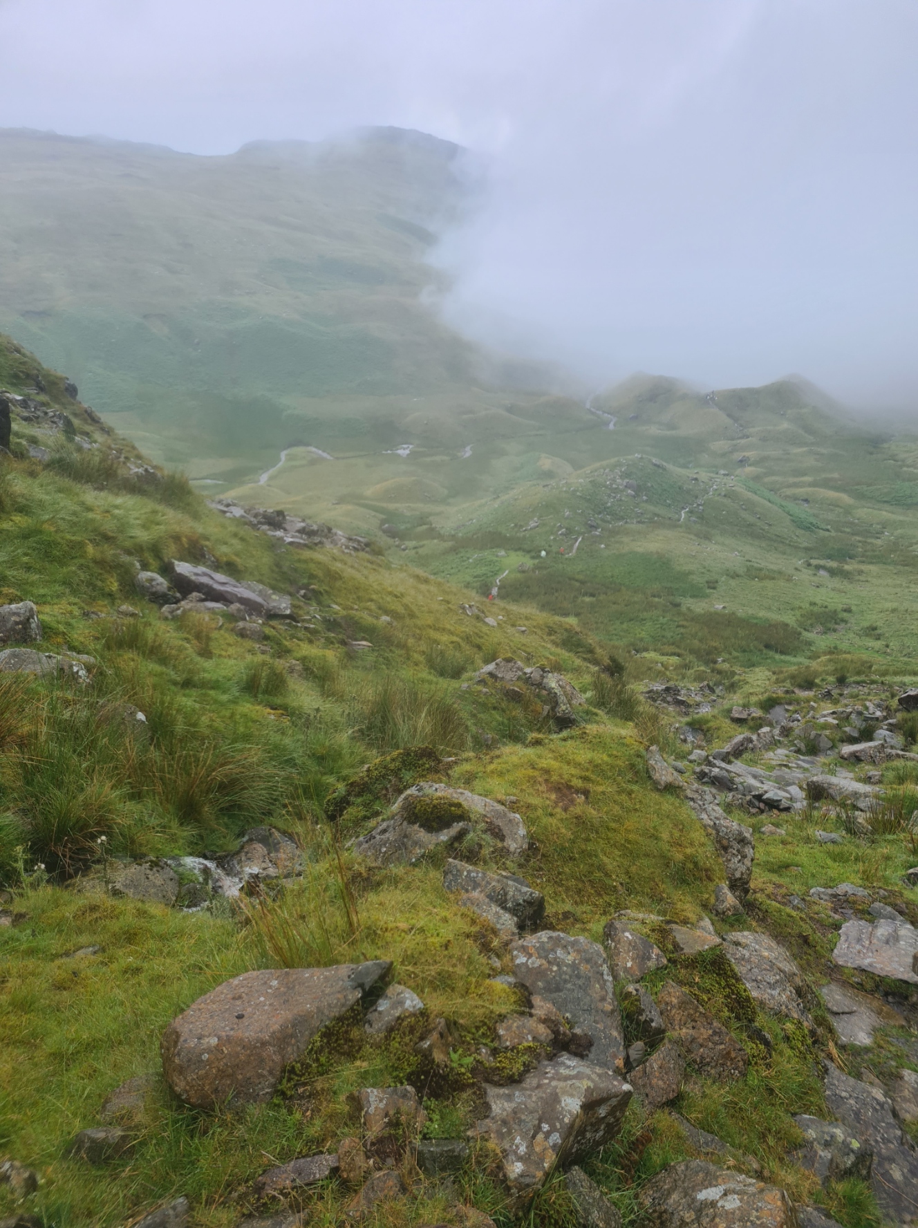
Leaving Black Sail you have to take care to take the correct path up into the hills, which reduces the climbing a little. It is still a steep climb up beside Loft Beck, getting steeper, then crossing the tops. Haystacks to my left and Grey Knotts to my right. Not that I could see much of anything. I was in the clouds and it rained hard most of the time I was up there. Despite it not being the easiest of routes to follow in limited visibility and requiring a check of the compass a couple of times, it was an enjoyable walk across the contours, heading toward the abandoned quarry tramway. Quarrying took place here from the early 1700s until closing in the 1980s.

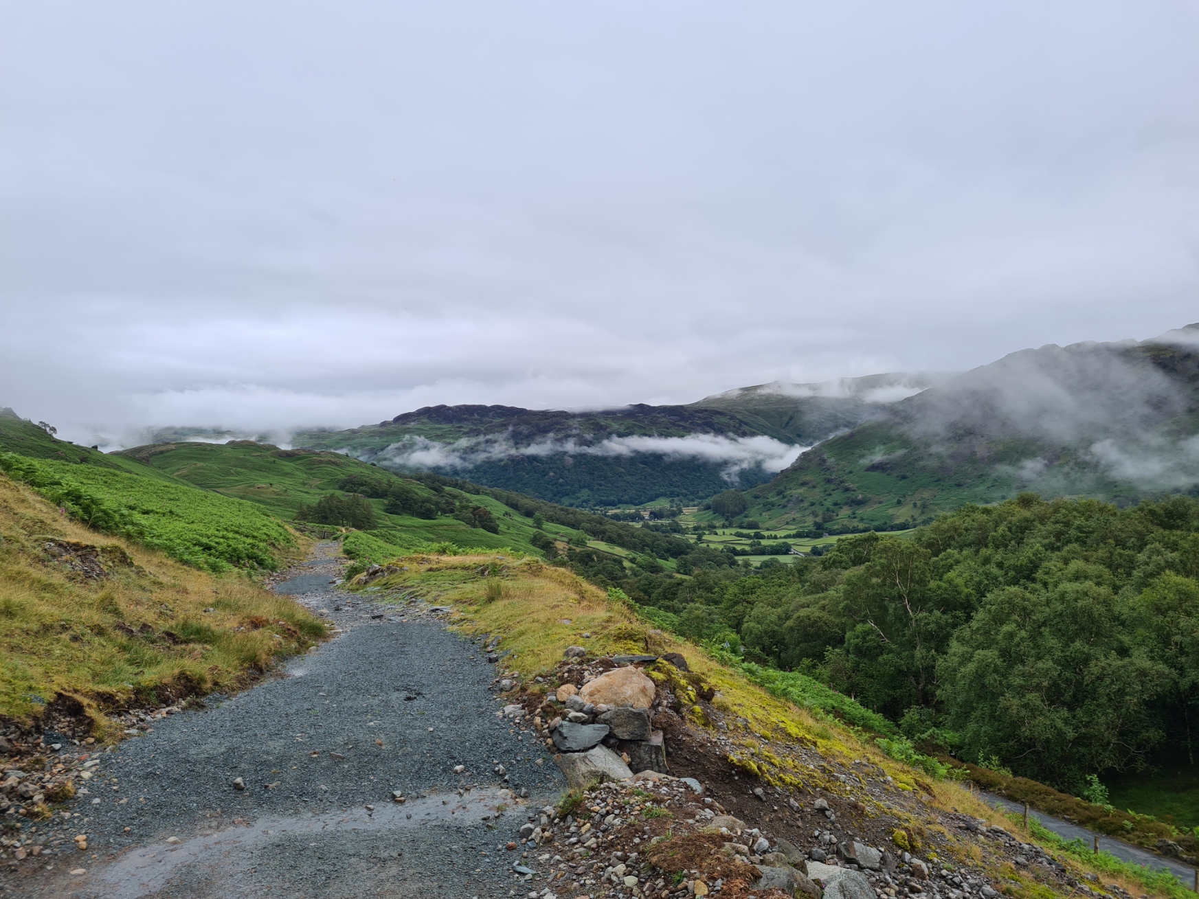
Quarrying was resumed in 1997 and the Slate Mine Visitor Centre is a popular tourist destination today. I have a couple of issues with the enterprise, particularly the actions of a previous owner, so having made the knee jarring descent down to it, I didn’t feel any desire to visit their café. Instead walking past the unkempt sprawling site to the old toll road beyond, that is now a decent pedestrian alternative to the road, down toward Borrowdale. There were noticeable improvements being made to the track surface and new gates were being put in. But whether this is some of the ‘new’ money made available for the upgrade to National Trail status I don’t know. Whatever the case, as I dropped down out of the clouds, the view opened up ahead to the slate-roofed, white-washed farmhouses, fields and drystone walls that make this spread out collection of valley bottom villages such a pretty destination. It was a lovely walk.


Tonight’s halt was YHA Borrowdale in Longthwaite. I was camping outside but eating inside. This is a decent hostel, especially as it has a bar with a small but excellent selection of beers on draught. It was packed with day hikers, C2C’ers and a large contingent of youngsters and their minders. It was exactly as a hostel should be, full of outdoor’ers, poring over maps and planning their next day, or, if of tender years, glued to a phone.

Day three: Borrowdale to Grasmere
When I booked a breakfast in the hostel the previous night I had been warned that not only was this only available from 7.30, but there was a large group of youngsters on an activity break expected at that time. I still decided to attempt an earlyish brekkie and while a few of the little’uns tried pushing in front of me while I queued, their adult minders were on hand to firmly remind them of their manners.
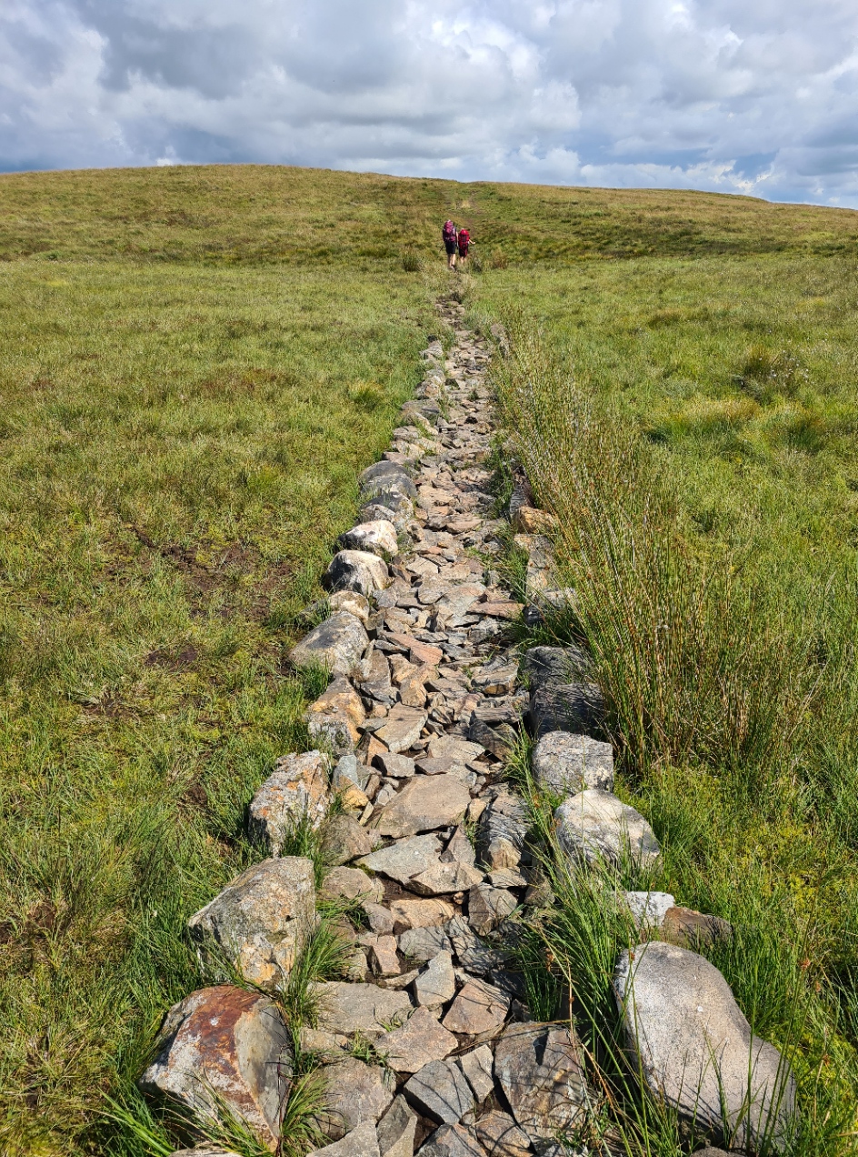
Typically, it was raining again as I set off back on trail. The track beside Stonethwaite Beck and then Greenup Gill was initially fine but became more of a walk through ankle deep water and slippery rocks or grass tussocks. The view ahead disappeared into the clouds. Despite this, I had decided to take the higher route option to make the day a bit more interesting. Possibly a mistake! The steep climb up to Calf Crag was ‘OK’ but views became frequently zero as the drifting clouds thickened and periodically obscured almost all. The ground was largely boggy, with a few hundred metres of stone flags laid, and helpful cairns were frequently hidden from view, so not actually that helpful. The map was pretty useless and seems to have little connection to the track that is actually on the ground. It meanders all over the place trying to avoid the boggier parts so working from a compass bearing was next to useless.


My route up here wasn’t in the slightest bit clear to me and I wasn’t the only one ‘navigationally challenged’. I met a small group of C2C’ers and their guide, who was thoroughly confused as to where he was. I decided to get lower, take an escape route down and get below the cloud and low visibility and hopefully some of the rain. In retrospect I should have tried to stick to the wandering ridge walk to Helm Crag but instead took the indistinct track down what I presumed to be the infant Far Easedale Gill. Due to the recent and still persistent rain there were a few water crossings. Most were swollen affairs that probably don’t even exist in drier conditions. Just the one required a thigh deep wade.
I met a handful of intrepid day hikers ascending but my descent toward Grasmere was a wet and slippery affair. Despite this lone backpacker taking extreme care, at one point my feet went out from under me. This wasn’t a simple heavy landing on my back. It was a steep section of ‘path’ and when I hit the ground I kept going, making a couple of turns as I bounced down the rocks. Within seconds I stopped moving and lay for a moment- anything broken? had I lost consciousness? I rolled over, picked myself up and inspected the damage. Fortunately there was very little. The pack seemed to have taken the brunt of most contacts with the ground during my short descent and I hadn’t smacked my head. A bloodied and bruised right knee and bruised upper left arm. Nothing that wouldn’t sort itself out over a few days. I had been lucky. Thankfully the ground levelled out soon after and it was a simple grass track and bracken bashing affair from there until rejoining the lower path option below Helm Crag.

It was only mid-afternoon when I arrived in a wet Grasmere. This is a popular destination for tourists and there were quite a few milling around. Most seemed to simply move from café to café in an attempt to escape the rain. A couple of obvious backpackers were sitting at the bus stop. They looked forlorn and bedraggled. I guess they were calling an end to their adventure, or at least a hiatus. I didn’t fancy just sitting in a pub and had no need to reprovision. Grasmere is a pretty expensive place so I was staying at the hostel. I went straight there to try and get out of the rain, sit somewhere warm, dry out a little, while not spending money. Fortunately the lady at reception didn’t bat an eyelid at my sodden appearance and directed me to a lounge where I sat with a hot brew, consuming trail mix, until the reception opened (an hour early) for me an hour later.

I hadn’t been able to secure a room or even a bed in the Grasmere Butharlyp Howe YHA as it was packed out with a large group of youngsters. Nor was I permitted to camp there. So just for a change I had booked a Tipi. I had never stayed in one of these, in fact I had never even set foot inside one so was unsure what I would be getting. At least it was going to be spacious as it could accommodate up to four people and I paid £70 for sole occupancy. I had a double bed with quilt, in pristine white. But of more immediate concern, I had issues with the tipi’s wood burning stove due to a jammed air vent and had to get the warden down to try and sort it out. He bashed at the vent with a lump of wood, gave up, and told me to leave the stove door open while it was operating, which went through fuel much faster than normal. I hung my wet gear across the lines I strung across the tipi’s width. The only thing I put in the hostel’s drying room was a pair of washed hiking socks but in the morning found that the little darlings staying in the hostel had thrown these on the floor to make space for their own wet gear.

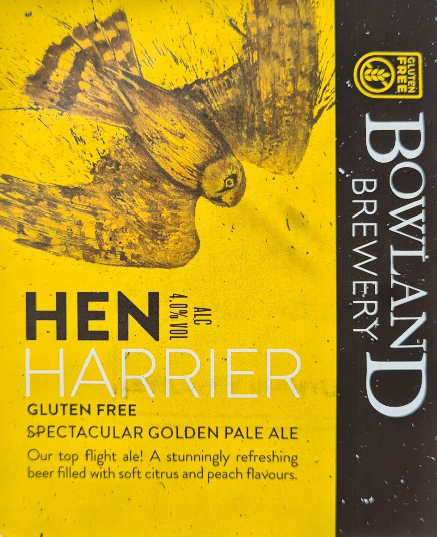
I ate in the hostel both that night and the following morning and had no need to venture out in search of a pint as they were licenced, so I enjoyed a couple of bottles of Hen Harrier, a lovely 4% golden pale ale from the Bowland Brewery. That evenings meal was my hostel staple- pie, mash, mushy peas and gravy, and was very welcome.
It had been a wet and bruising day. Still mostly enjoyable but I felt I had made a poor choice in deciding to take a high route alternate in adverse weather conditions. I had only done this because it was a short section otherwise, but should have accepted it for what it was. Lone backpackers have to take a degree more care in their decisions.


Day four: Grasmere to Ullswater
I had slept well and was up fairly early for my breakfast as despite yesterday’s misadventure, I again wanted to take a high route option as it was another short section. The weather forecast was good with no rain expected and I expected a hot sunny day instead. Such is an English summer! The stove had gone out while I was eating my evening meal in the hostel the previous evening and lacking tinder I had been unable to relight it. So much of what I had hung out to dry across the tipi was still very slightly damp in the morning. I wasn’t concerned as it would dry out later.
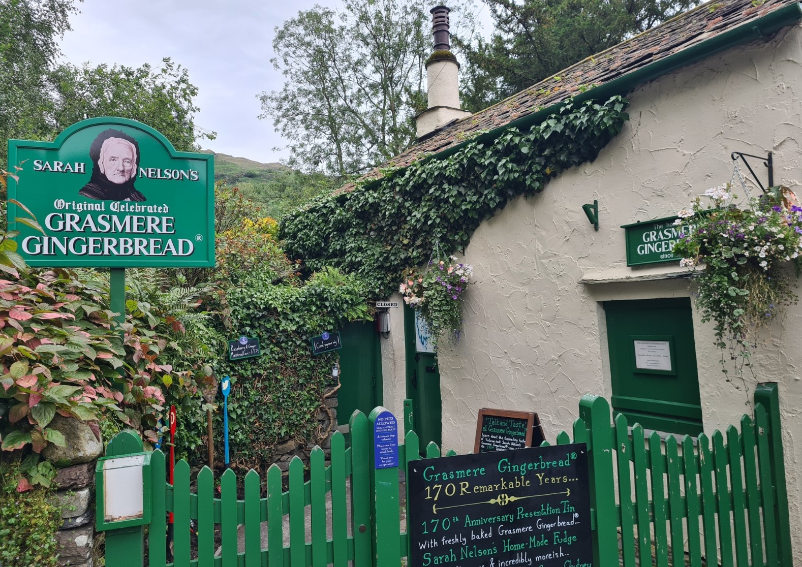
Packed and away, I walked back down into Grasmere, the opposite way to a steady stream of C2Cer’s walking up the hill. I wanted to visit the Grasmere Gingerbread Shop and expecting a queue, planned on getting there before it opened. Despite managing this, I was still third in line.

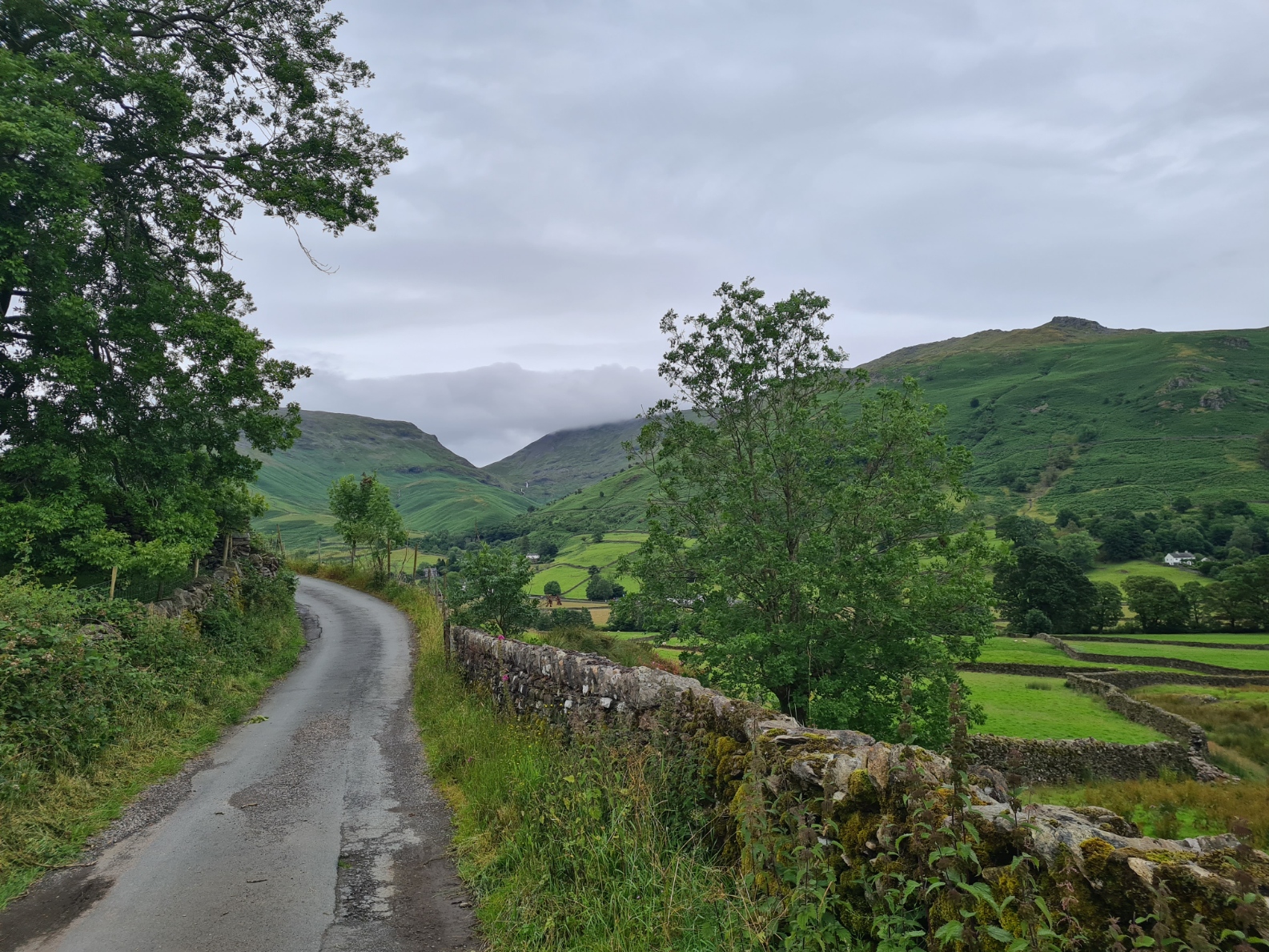
With my calorific purchase packed and eventually back out of Grasmere, it was a road walk, first up, then down to the busy A591. Safely across that I found the track up to the hills blocked by a contractors van. The two of them were sat inside and mutely stared at me, expecting me to somehow squeeze down the bramble and nettle packed narrow space beside their vehicle. It became a bit of a stand off and eventually, obviously reluctantly, the driver moved his van.
From there it is a lovely walk up to Grisedale Tarn. I met a C2C backpacker walking back down the track and he paused to chat to me. The previous day’s weather had obviously got to him- “I’ve pulled the pin, I’m giving up”. I encouraged him to just take a break in town and consider options before quitting entirely, but his mind looked made up. A shame as it was a fine day and a complete contrast to yesterday. I plodded on at my ‘old man pace’, overtaken by a group of three, then two, but passing them all further on as they took breaks, myself again leapfrogged as I neared the tarn on the saddle.


From the tarn there are three options. To the left is the punishing climb up Dollywaggon Pike, High Crag, Nethermost Pike, Helvellyn and down Striding Edge. Or the central path is an easy and straightforward walk straight down into the Grisedale valley and Patterdale. To the right was the third alternate, up to the ridge walk to St. Sunday Crag. Those peaks to my left looked to be mostly in cloud, and I thought the main route too simple, so chose the St. Sunday option. Again, just to liven up the day a little and hopefully enjoy the sort of view denied me yesterday.

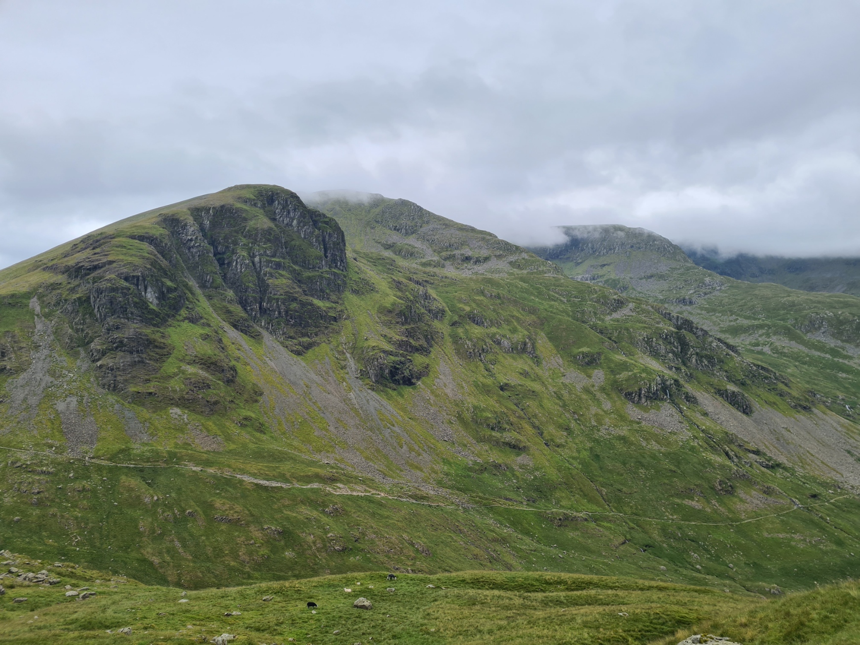

It is a steady track ascending St. Sunday but I still somehow managed to miss the point at which it doubles back to the ridge. The path I was on gradually petered out so I stowed the walking poles and scrambled up the steep 1:1 slope instead. Joining the ridge path part way along its length and continuing to the peak that I had all to myself, other than a handful of midges. I decided to lunch here, which was simply water and gingerbread, consumed while I took in the 360 degree views, enjoying my brief time here.
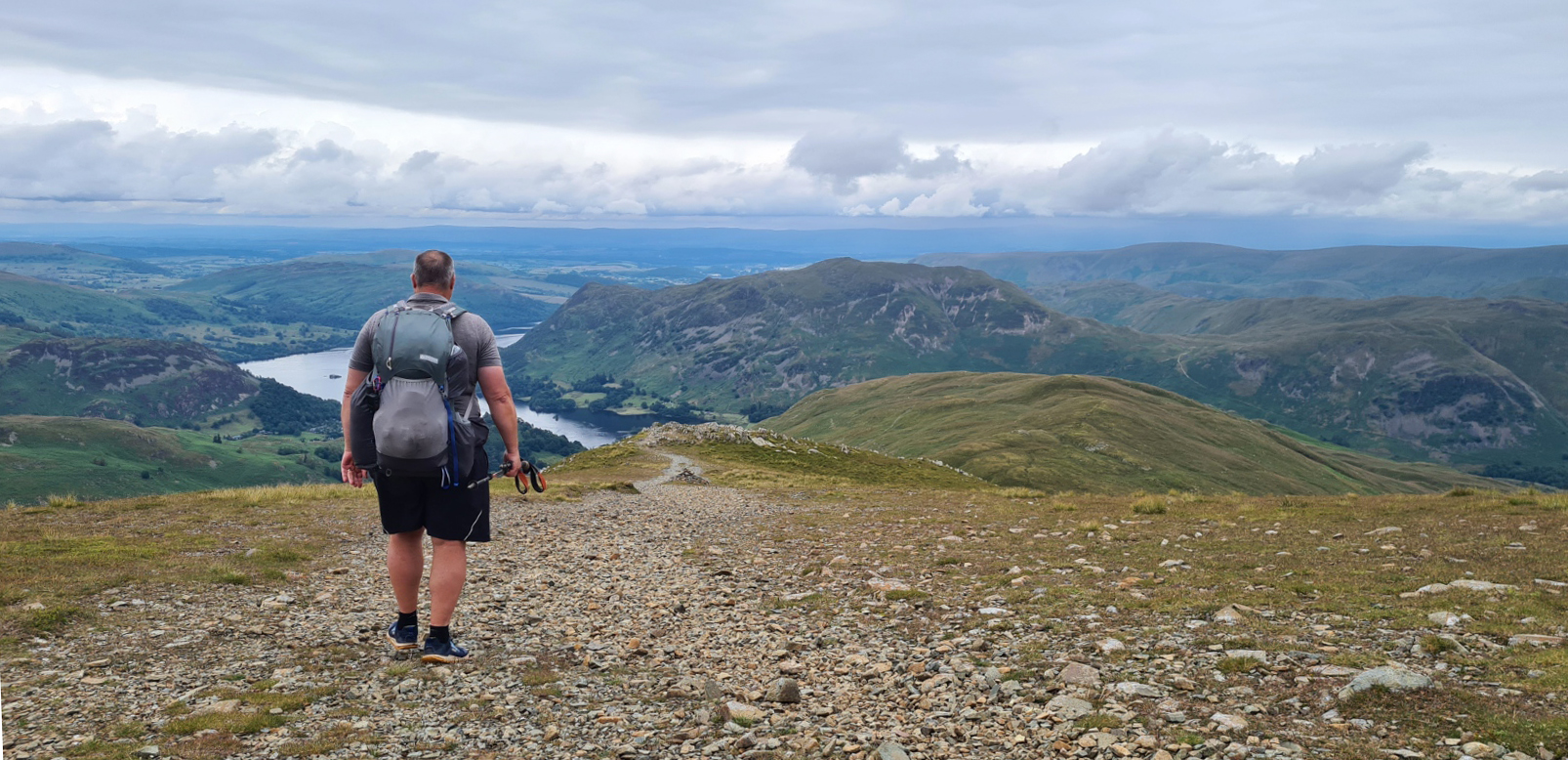
Judging from the gentle start to my descent, I thought it would be a pleasant walk all the way down but it became a knee jarring clamber further on. I wouldn’t have liked to come this way if it were wet. Crossing the side contours of Birks, it was the prettiest of Lakeland walking. Patterdale was below and I fancied I could see the farm I was camping at, but it took me another hour and a half to actually get there.


When I reached the sprawling settlement on the valley floor I walked straight past the White Lion. Not feeling the need to drop in for a pint, thinking I might return in the evening. I was camping at Side Farm, so walked on to there. I paid my £12 at the farm then walked another quarter mile to their camping field on the Ullswater shore. Perhaps I should have pushed on a little further in the other direction and wild-camped beside Angle Tarn, but I do like a shower in the evening if possible and it looked a decent place to stop. There were a few midges around but they were no bother. The camp site was quiet with only a handful of other campers, mostly car-camping. I heard later that a pair of C2C’ers had arrived in Patterdale later this evening and walked straight to the Youth Hostel, expecting it to be open, but instead finding it closed. The YHA had put it up for sale in 2023. Reading the YHA Chief Executive’s briefing for June 2024, I note that the hostel isn’t even going to be run as a franchise in the future, instead, it has been acquired by a large academy trust so… “will continue to welcome thousands of young people for stays in the Lake District”. So, permanently removing an option for C2C’ers. The two I later met had camped beside the closed hostel for free with no disturbance, which sounds like a good ‘wildcamp’ option while it remains so. It also meant they could visit the nearby White Lion for an evening meal.

I skipped the walk back into the village for the pub, instead enjoying a rehydrated Real Turmat Beef Stew and three of the mini Green & Blacks chocolate bars tucked in to my foodbag, a present from Miss Three Points of the Compass. Notes written and guide book and map consulted, I settled down for an early night as not only did I have a longer section coming up, my cold seemed to be manifesting itself and I was getting ever wheezier on any climb so thought a long night’s rest would do me some good. But it had been another good day. Tomorrow, day five, would see me leaving the Lake District and heading into the Yorkshire Dales.


I really enjoyed reading your post. It brought back a lot of memories from my own C2C walk in 2021. Looking forward to the next installment!
LikeLiked by 1 person
Thanks, it may be a couple of weeks before it is posted though. I’m off on my next trail in a couple of days
LikeLiked by 1 person
Where are you heading this time?
LikeLike
That would be telling!
All will be revealed…
LikeLike
Impossible to read this without Sade singing in my head: “Smooth operator”…
LikeLiked by 1 person
Well if it works.for you…
LikeLike
@Modesta
Where are you heading this time?
My guess is that Jools is walking Glyndŵr’s Way as it’s the only remaining National Trail left for him to do. But we shall see…
LikeLike