Three Points of the Compass continues his Coast to Coast. Leaving the Lake District behind to enter the Yorkshire Dales, the second of three National Parks on this two-hundred mile walk across northern England.
Day five: Ullswater (Patterdale) to Burnbanks
Despite the loud snoring from the nearest tent, which is impressive considering it wasn’t actually that close, I slept pretty well. I had set the alarm on my phone for an early hour but it was the racket from the geese on Ullswater that woke me. On checking messages from home I found there was a particular piece of necessary admin that required urgent attention. Despite being on a multi-day hike I was most definitely not off-grid, and my departure was delayed by an hour as a result. I breakfasted on a pint of tea and gingerbread at the same time as tapping my phone screen. I wasn’t going to let that momentary yank back to home life bother me as today promised to be an excellent farewell hike in the Lakes and I was looking forward to it. I wasn’t even bothered by the light rain and prolific midges, which were soon left behind. My cold persisted however and I wheezed a bit on any incline.
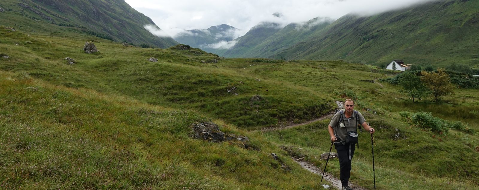
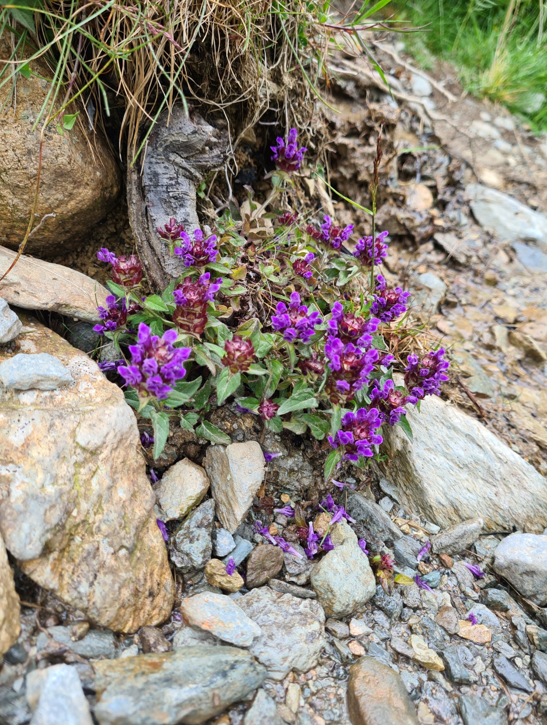
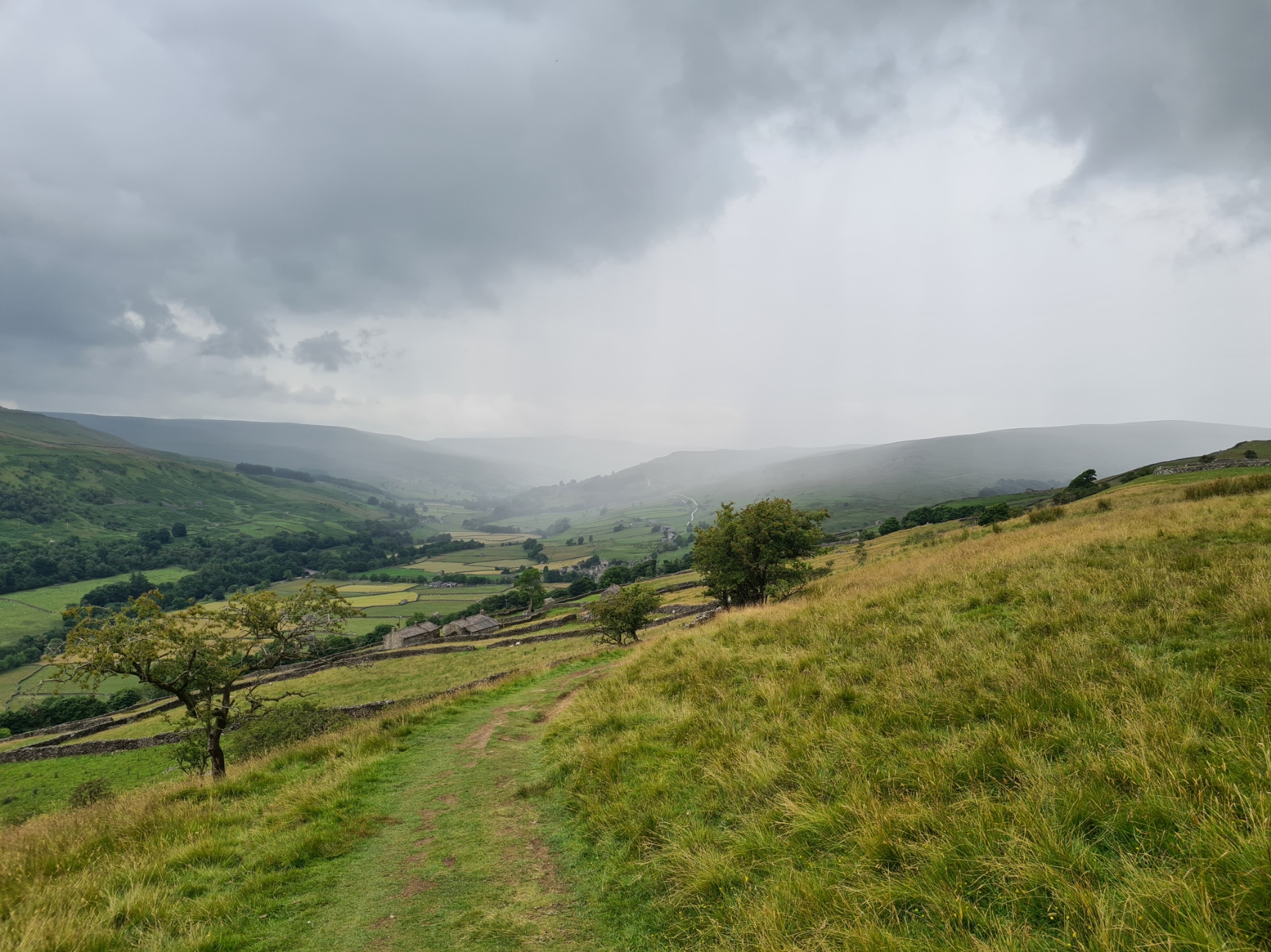
There are a couple of paths to choose from for the climb out of Patterdale and I chose the one that seemed to offer the gentlest of ascents. I met a couple of wildcampers walking down, they were buzzing from their successful overnighter and I slightly regretted my choice of camping beside Ullswater instead of the popular and higher wildcamping option beside Angle Tarn. It is a beautifully situated location and thankfully, seemed to be clear of the rubbish often found at popular ‘fly-camping’ sites. The weather had cleared up considerably and it turned into a beautiful cool days hike in the Lakes.
After about an hour, past The Knott and following a decent path, I was glad I had my wits about me as there is a sharp left turn as the trail branches off to Kidsty Pike. A small group of who I knew to be Coast to Coast hikers just ahead of me proceeded onward along High Street. They were busy chatting and were no doubt in for a shock when they realised their mistake. On my path however, it was a gentle climb approaching Kidsty Pike where I met three of the group of C2C’ers I had last seen a couple of days ago when climbing Calf Crag. I asked one where their guide was and was astonished to hear that he had taken the day off, was taking transport today, and had left the three to find their own way. There had originally been eight in their group but the other five had all dropped out over the previous days, one had already flown home. The remaining three were having a great time though and we took each other’s photos, as it is lovely top, with good views. At least they were up to the navigation, unlike the earlier group who I could see in the distance still climbing the wrong fell.
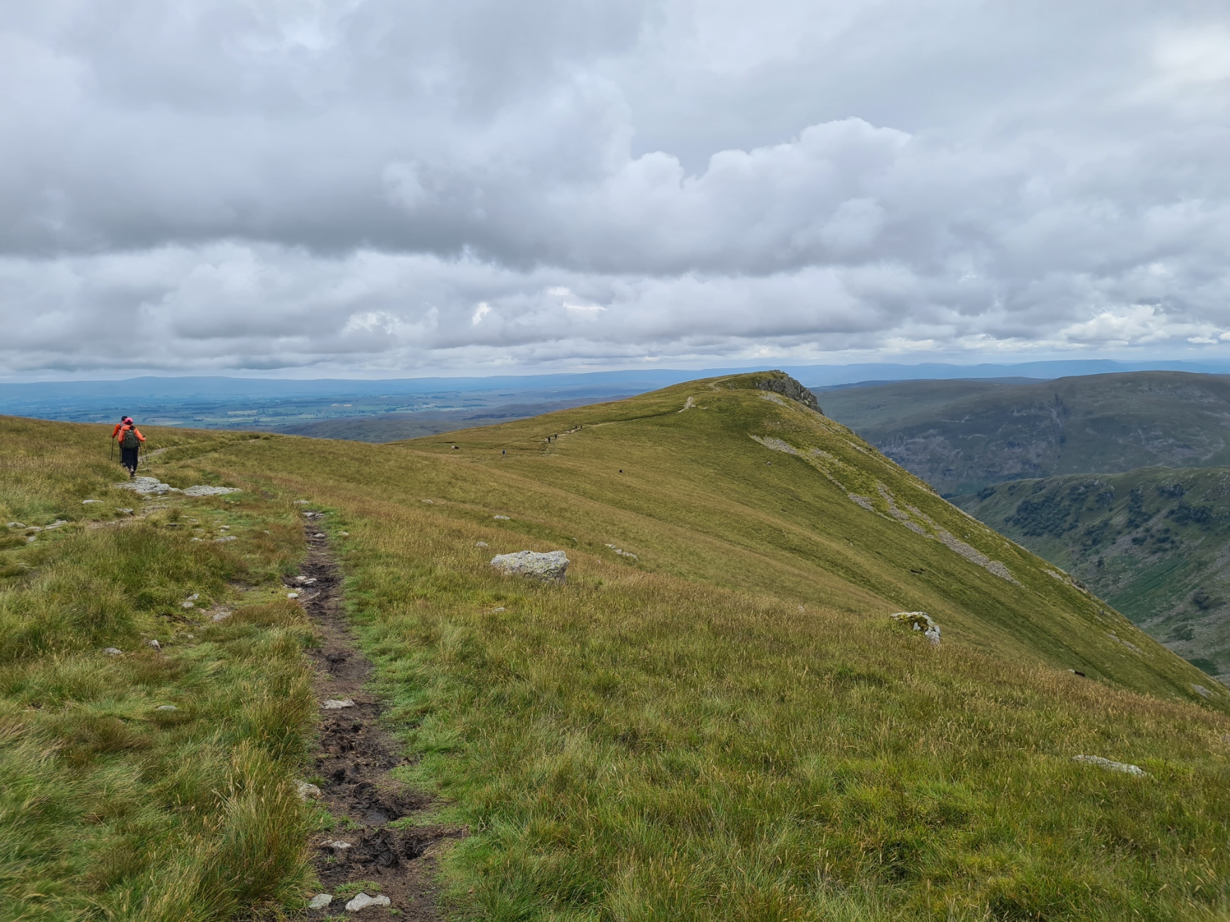
The large group of Germans turned up, took their photos, and as usual, having waited for the slower member of their party to join them, immediately set off when he joined them, denying him any rest or even an opportunity to appreciate the highest point on the main Coast to Coast Path. It was busy up here, another small guided group joined our little band on the top, two of this group being of advanced years. Their guide took them off toward Rampsgill Head and High Raise and a slightly less precarious route down off of Kidsty. A wise decision I later found out.
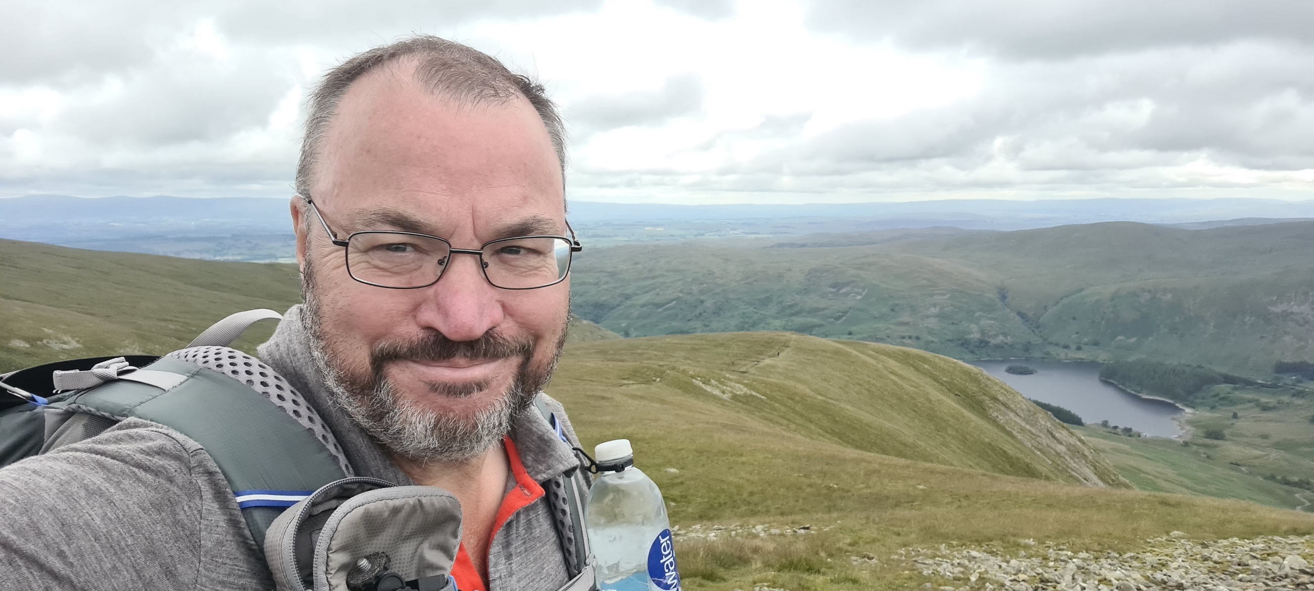
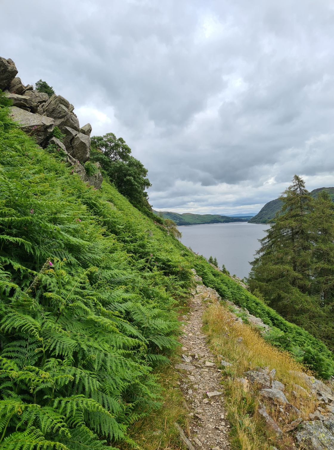
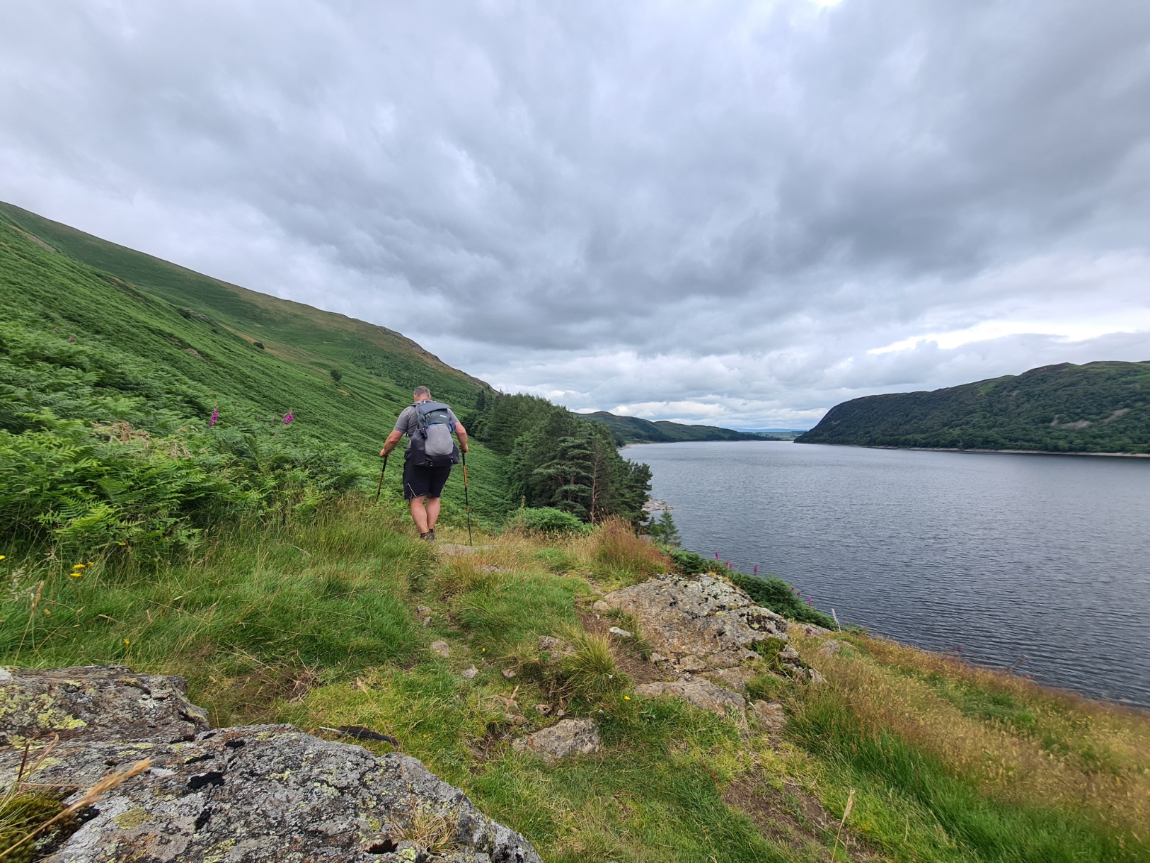
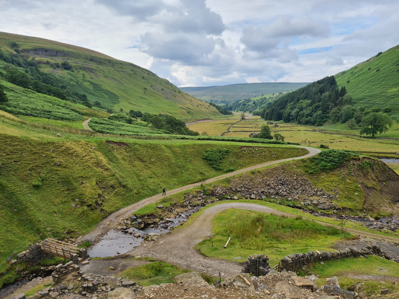
I took the main route down to the reservoir which is OK if careful, but could be extremely dodgy if it were wet, which it was in places. I made it down without mishap, meeting the group of Germans at the bottom, again waiting for their slower colleague, and I set off down the decent path alongside the reservoir.
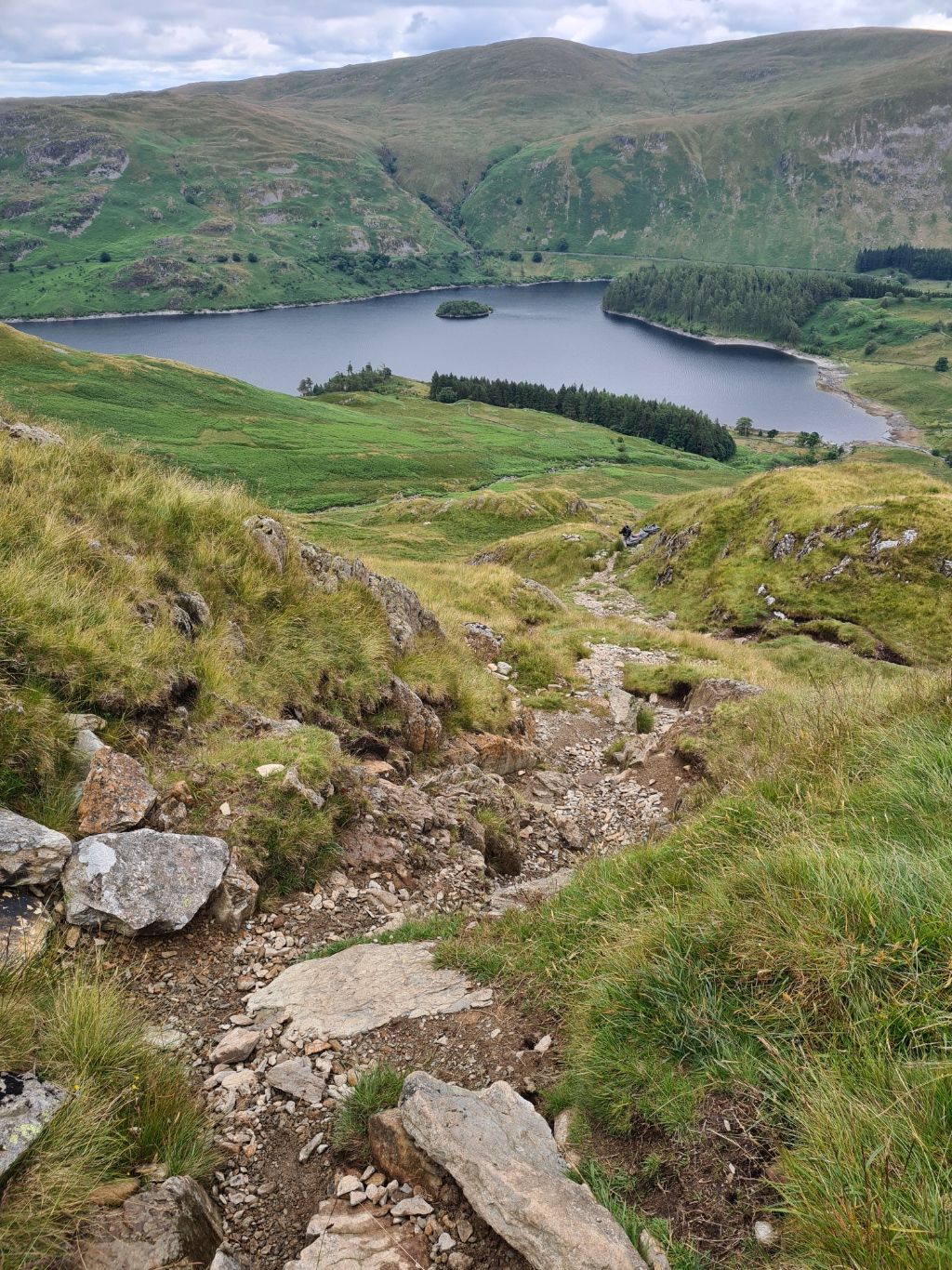
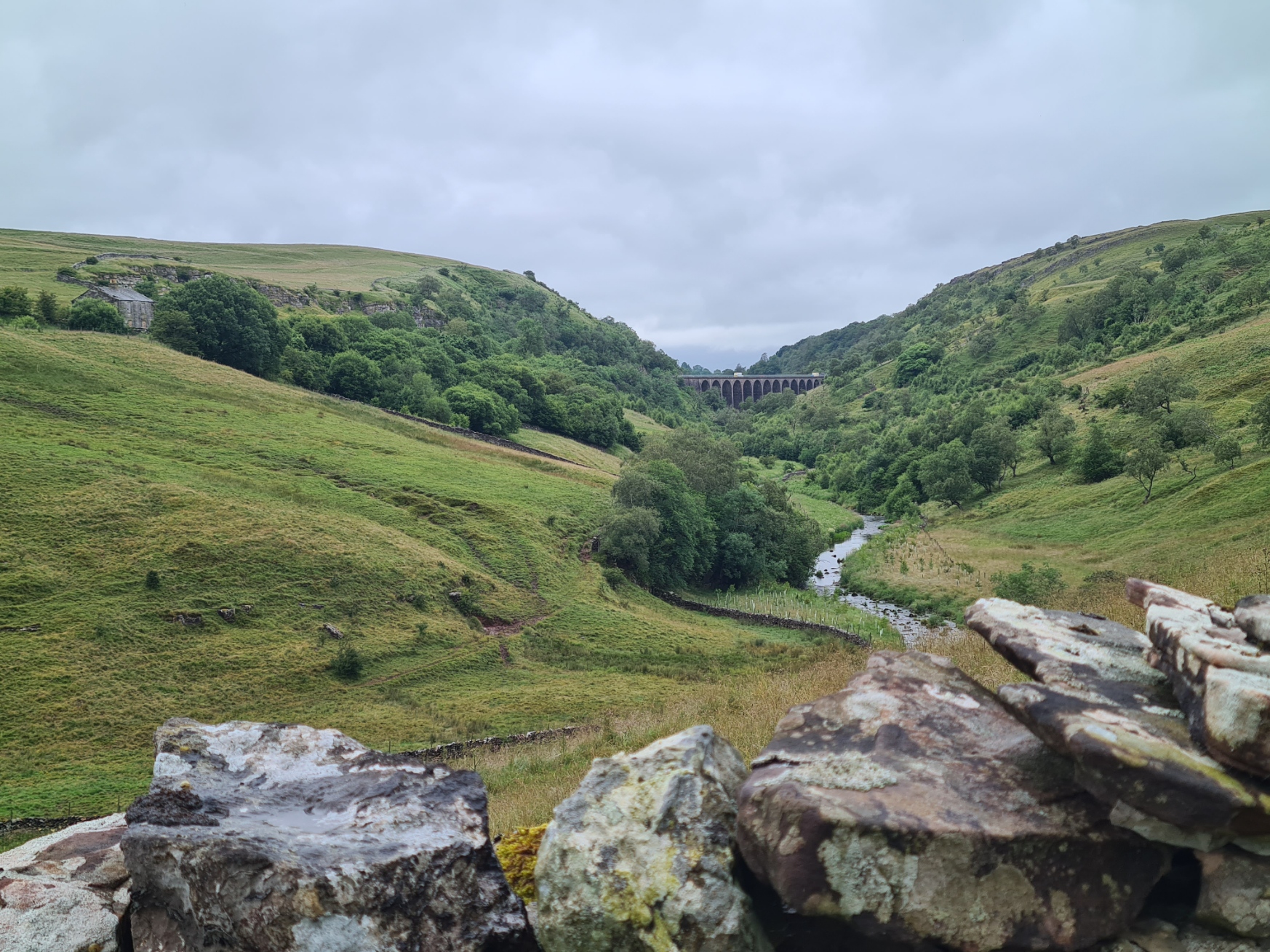
Haweswater was originally a little lake but was dammed in the 1930s to greatly increase its size so as to provide water for Manchester. The level was raised by 30 metres, submerging the little village of Mardale Green. Coffins were removed from the graveyard, the bell and windows removed from the church but the village still pokes above the surface in times of drought.
I was carrying a little monocular with me on this trail, and kept it to hand for this waterside walk as it is reputed to be a good place to see both Ring Ouzel and Red Squirrel. Sadly I was unsuccessful with the former but I also occasionally used it to scan the wildfowl on the water, hoping for something of interest amongst the commoner species.
One bird I was way too late for was Golden Eagle. A pair had taken up residence at Haweswater in 1969, the first to return and successfully nest in over 170 years. They roamed the entire Lake District, demonstrating the size of area that such birds require. The male and female of the pairing changed several times and 16 chicks were raised over the years. the final female disappeared in 2004 and the final male was last seen in 2015. Any Golden Eagle now seen in the Lakes is probably a youngster straying far from its natal home in Scotland.
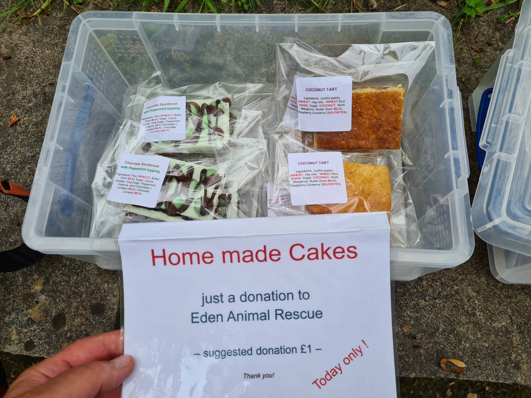
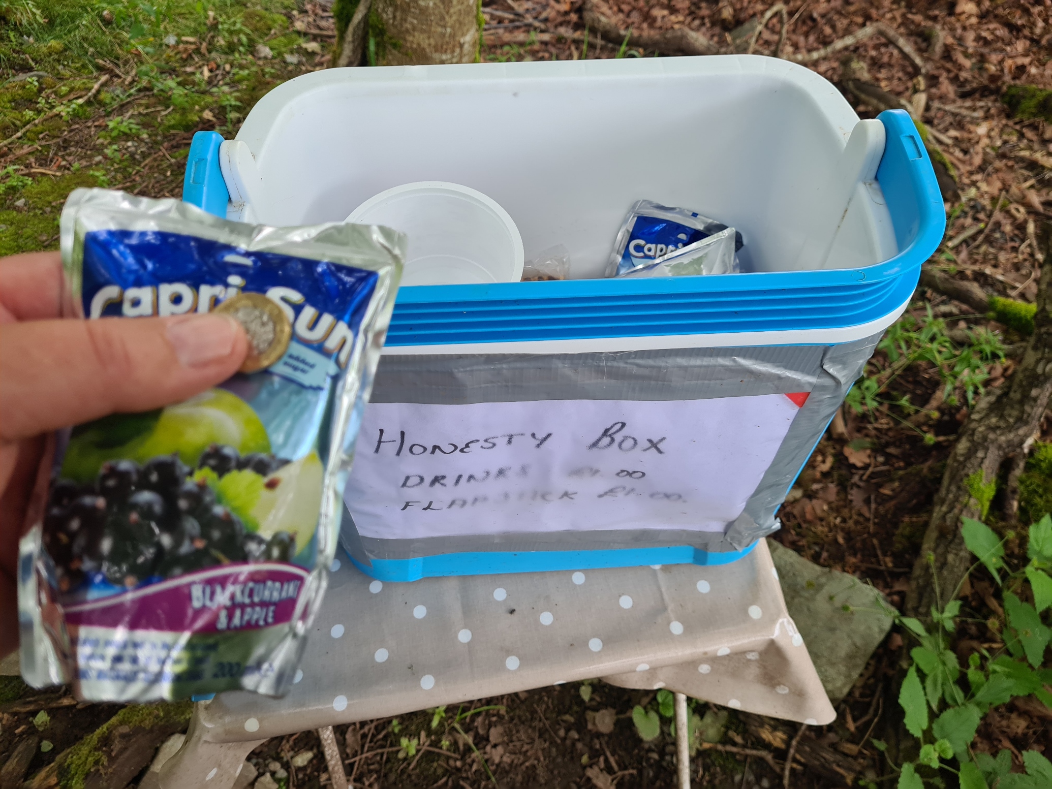
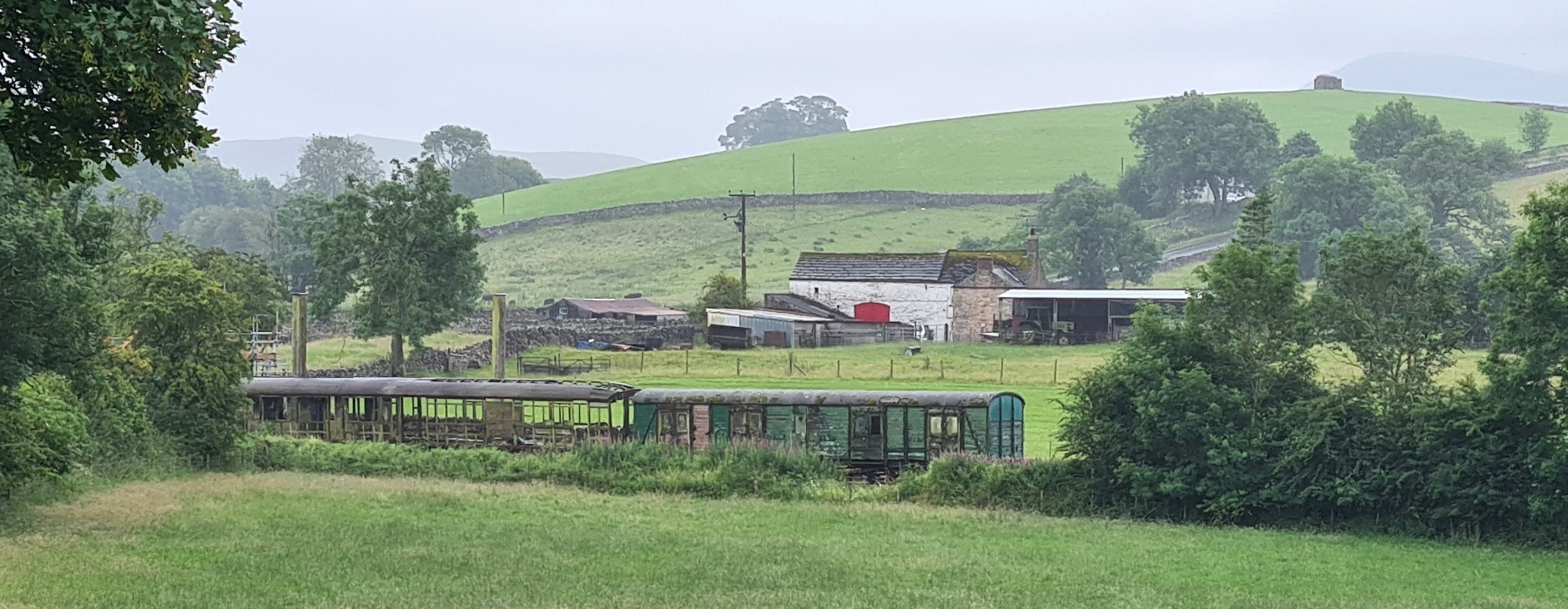
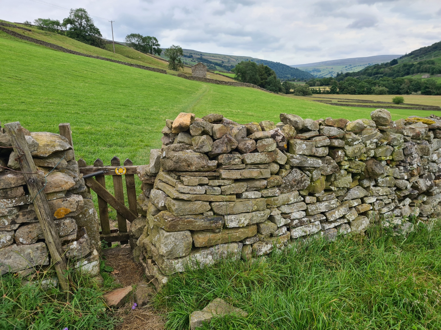
Reaching the end and leaving the reservoir behind I passed through Burnbanks. In the thirties, some of the eighteen houses in this little hamlet were occupied by the men employed to build the dam I had just passed. Such industry is long gone and this now quiet little corner of England is probably mostly enjoyed for the solitude it now provides. I passed a couple of the residents busy cutting grass around their smart well-kept homes. It may have been them that had provided a box full of home made cakes for passing hikers. I wasn’t really interested in food so passed this, however I was a little surprised to come across another honesty box only a little further on. A pouch of blackcurrant juice was enough to persuade me to leave a quid in payment. But I had other things on my mind. At Naddle Bridge I was on the hunt for a campsite listed in the guide book. I had tried calling earlier but had received no reply. I found it eventually but there was no signage, a locked gate and a dog within going spare at me. I walked on in search of a wildcamp as there were no other ‘official’ halts in this vicinity. A couple of days later I received a voice mail replying to one of my calls, saying that I could camp at the Naddle Bridge campsite.
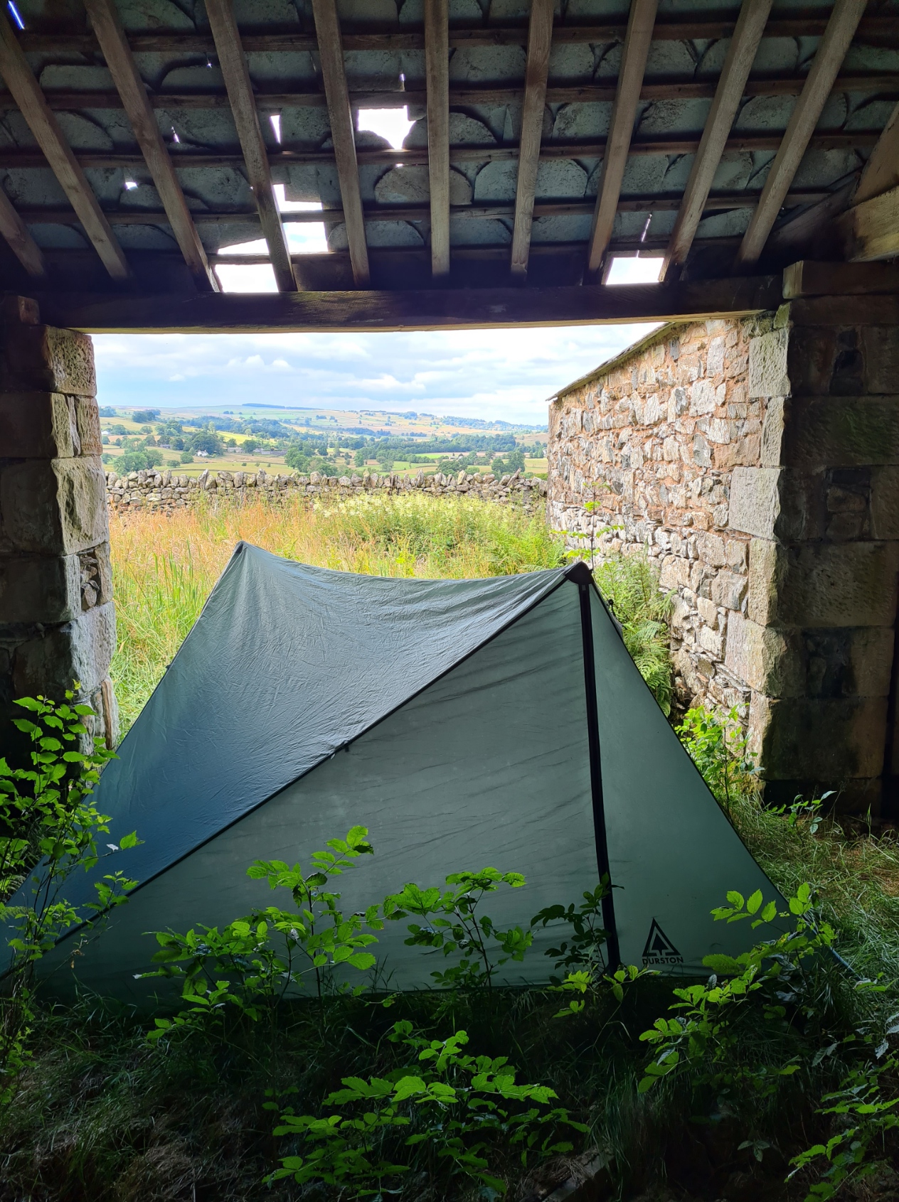
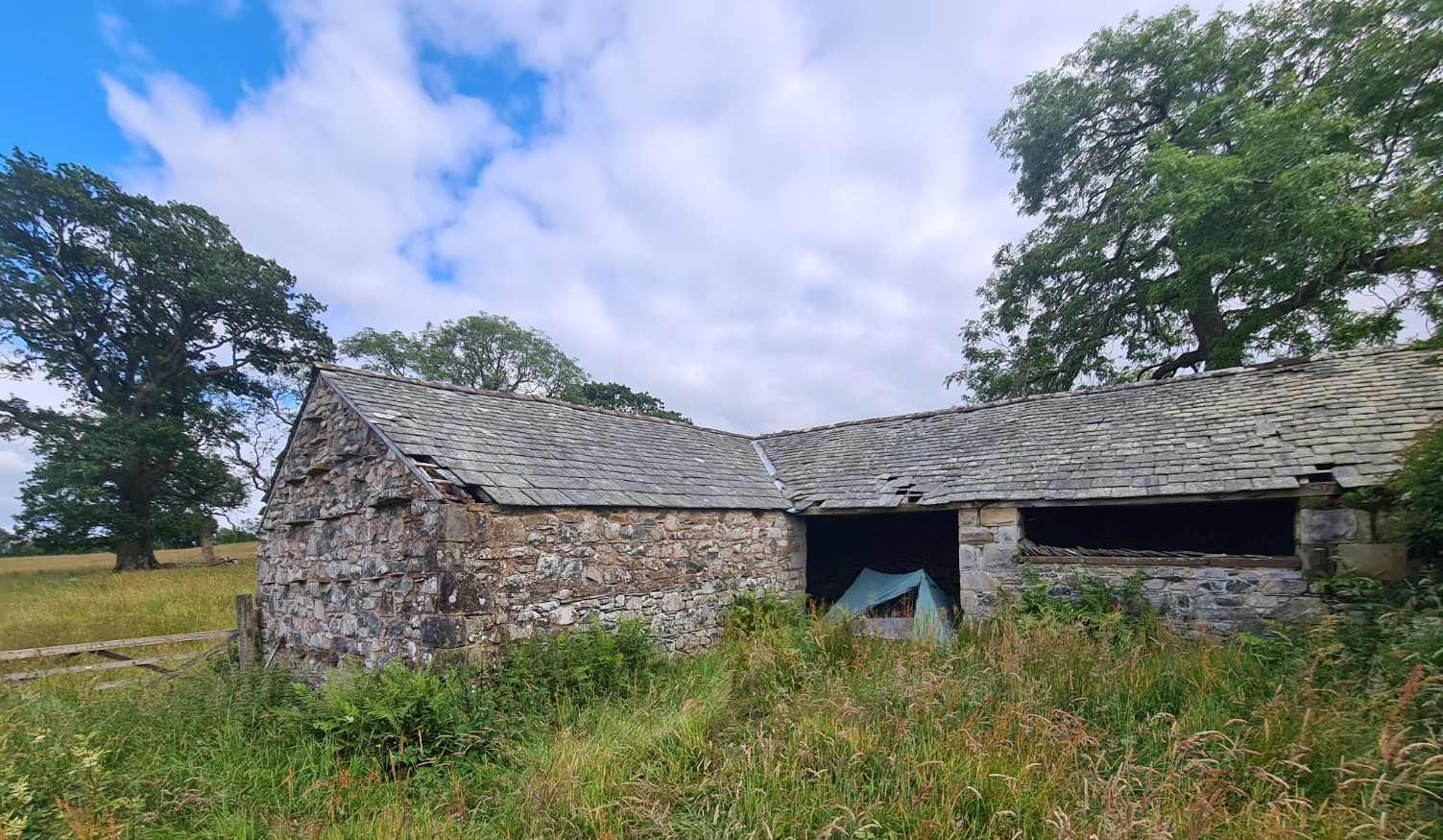
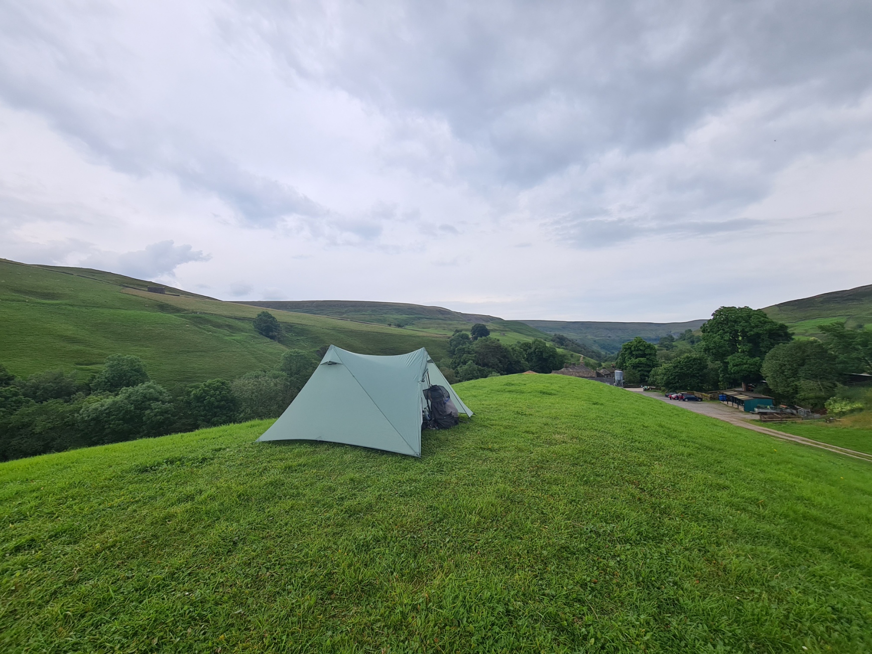
This is not an area that welcomes Coast to Coasters seeking to pitch a tent overnight. There is plenty of barbed wire, plenty of notices ordering walkers to stick to the path and not to stray. Cattle in the fields acted as further deterrent. I thought I might have a long walk today in search of somewhere but came across a cowshed/byre inside an overgrown stone-walled enclosure that had very obviously seen little if any human presence for some months, possibly years Trees and shrubs grew tall within and tiles had slipped from the roofs. I dragged the five bar gate part open through the long grass and explored. It was ideal. Out of sight, no nuisance to anyone, and a patch of grass in one of the entrances to the L-shaped cowshed made for a decent overnighter. A Barn Owl silently flew to the more distant end of the building while I pitched, but there was no nest, it was just solitary roosting and returned to sit on the joists above me once I had pitched and climbed inside the Durston. I hoped his presence also meant I wasn’t going to be troubled by mice overnight.
Day six: Burnbanks to Orton
Before reaching Naddle Bridge last night I had considered a wildcamp beside Haweswater. Speaking to a C2Cer the following day, I was glad I hadn’t. He had camped there and had initially been perfectly happy with his quiet little pitch, until the small hours that is, when a Round-the-Lake overnight race had taken part, that neither of us had been aware was scheduled. Every ten seconds his tent had been brightly lit up by the steady procession of passing runners. He stuck his head out of his tent and could see hundreds of lights moving toward him. He had little sleep for much of the night. It was a lucky escape for me as I slept quite well with no disturbance. I say quite well, as my cold bothered me, I had an occasional wracking cough, not what I wanted while trying to camp surreptitiously, the path being just the other side of the wall behind me. I heard voices from a passing couple late in the evening but other than that it was very quiet. Even the Barn Owl was silent, just bobbing his head at me when I went outside for a pee prior to settling down.
Despite my cough, I slept fairly well. I wasn’t feeling a hundred percent however and was pleased I had an undemanding day today. It would be fairly easy rollercoasting through mostly farmland to Shap and beyond. And again, I had something of interest to look forward to.
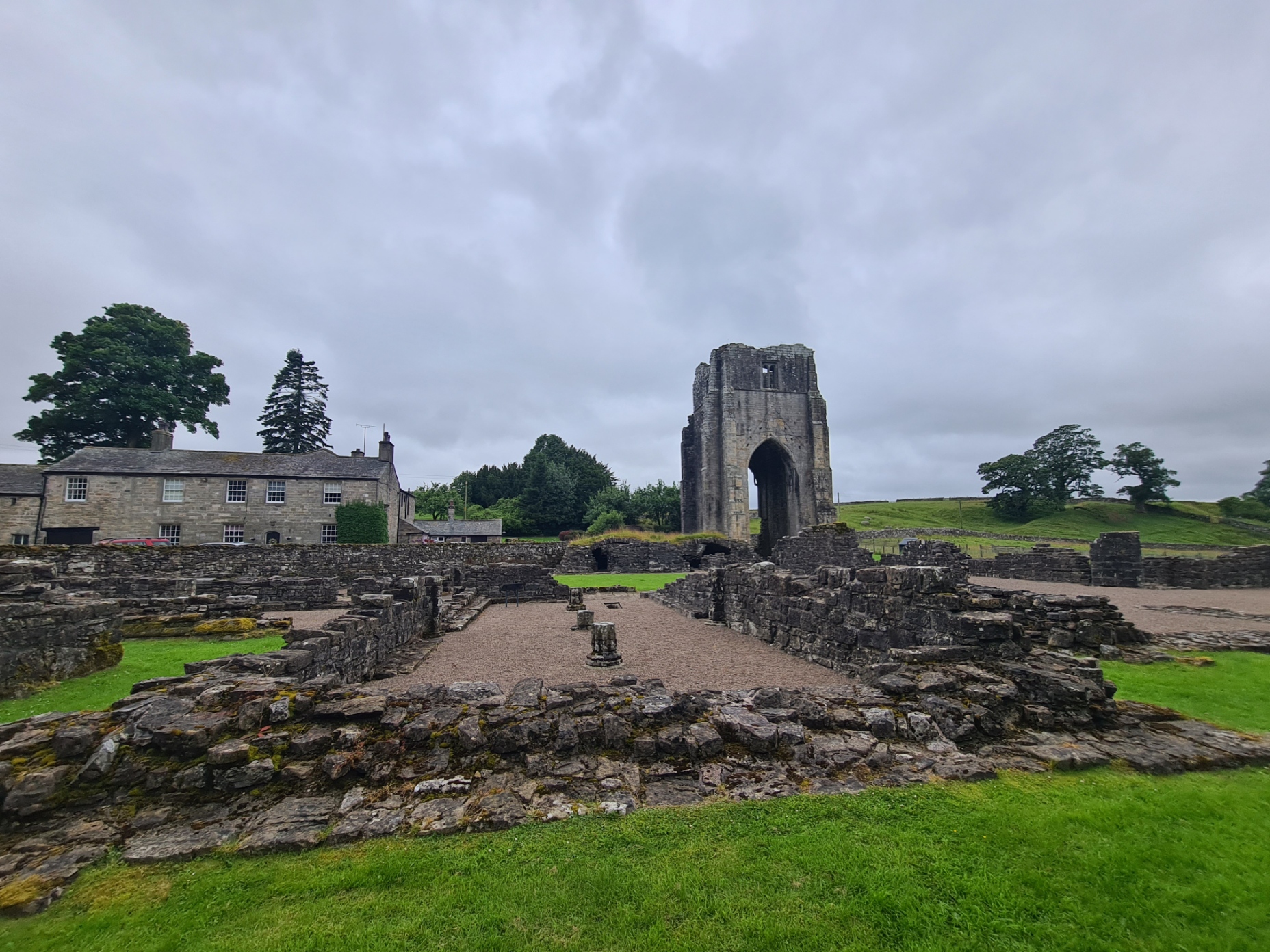
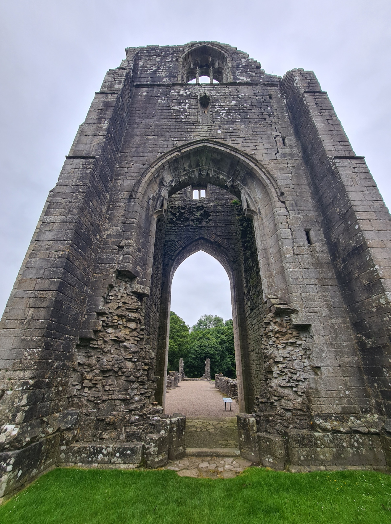
The ruins of Shap Abbey are hidden away in a pretty little valley beside the river Lowther, the area seemingly populated just by sheep on this wet morning. But between c1200 and 1540 there was a large community of Premonstratensian canons living a monastic life here. Following the Dissolution of the Abbeys, stone from much of the abbey has subsequently been incorporated into local buildings, such as the adjacent farmhouse. I explored the ruins for some time, as they are far larger than I had anticipated.
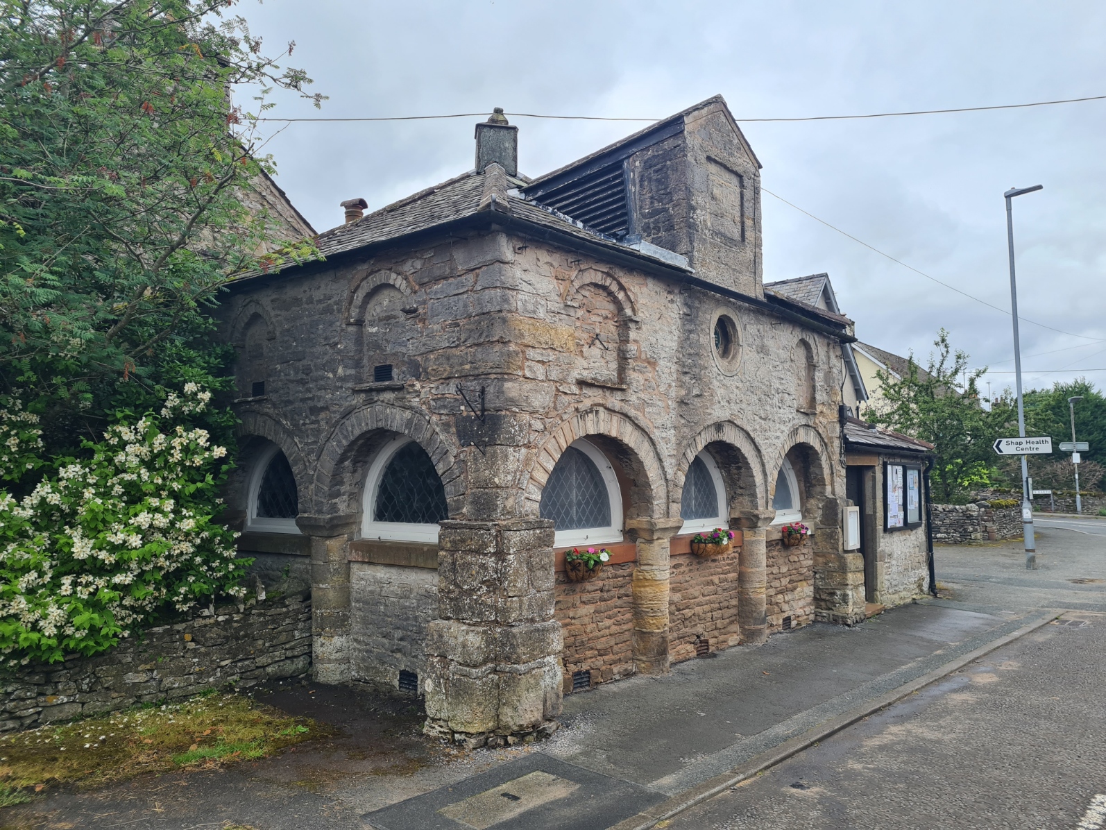
From the abbey there was a little road walking into Shap itself. I called into the co-op in search of some form of medication for my cold as I didn’t feel well at all. I did a small resupply here, some sourdough rolls, ham, corned beef, a pork pie, some cherry tomatoes, and a Cornish pastie for lunch later. Also buying a couple of bacon rolls for tomorrows breakfast. A little way down from the co-op I crossed the road in front of the listed Market Hall to where two bubbly and enterprising ladies had started a business venture. Following the closure of the town’s café they had purchased, fitted out and opened a snack wagon. Having parked it next to the town’s school, they said they were getting good business, not least from passing C2C’ers this morning. I filled up on a large and well priced sausage and fried egg roll, accompanied by a cup of tea. After that it was soon out of town, into the fields and begin a gentle climb up toward a bridge over the M6, crossing a couple of field walls on the way. It was at the second wall that I, for some unknown reason, decided to check my Garmin InReach, hung from the back of my pack. It wasn’t there. I entered panic mode and racked my brain for where I could have lost it. I knew I hadn’t left it at my overnighter and could only think that I had dropped it back in the co-op. I hot footed it back down into town, reaching the shop ninety minutes after I had left it. With little hope I asked the lady who had served me earlier if an electronic device had been handed in. I could have hugged her when she picked it up from behind the counter. I suspect I had looped it through one of the top flap closure straps and it had slipped off while I was packing food away. About face, a lesson learned, and back out of town, back up the hill, finally making it over the bridge this time.
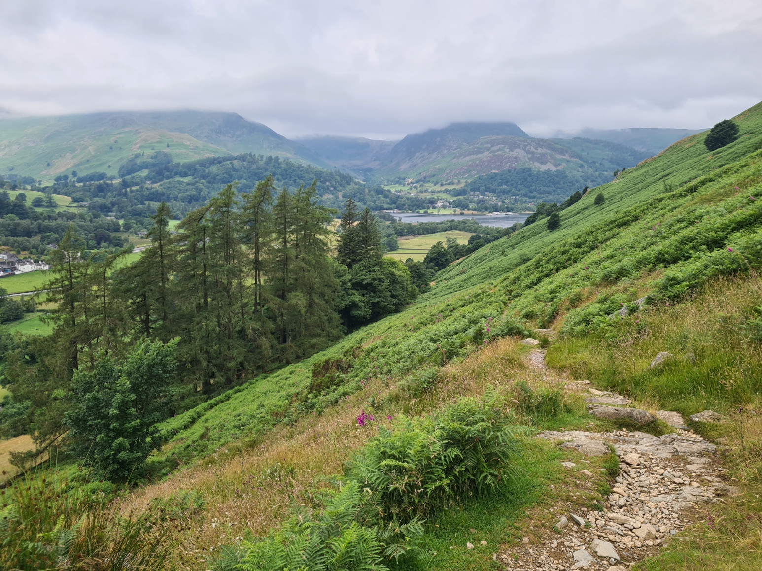
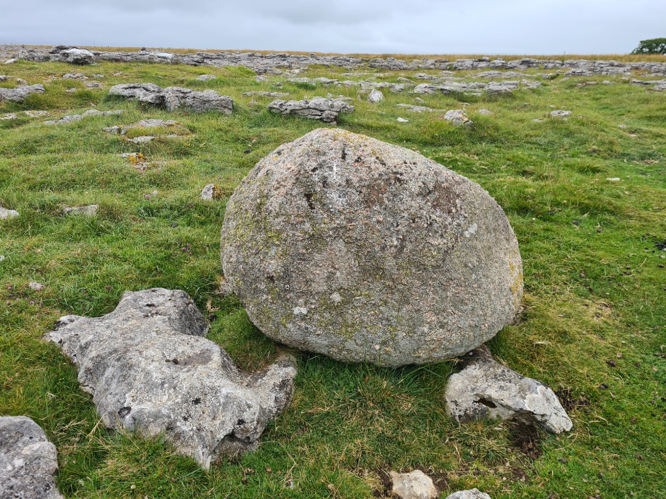
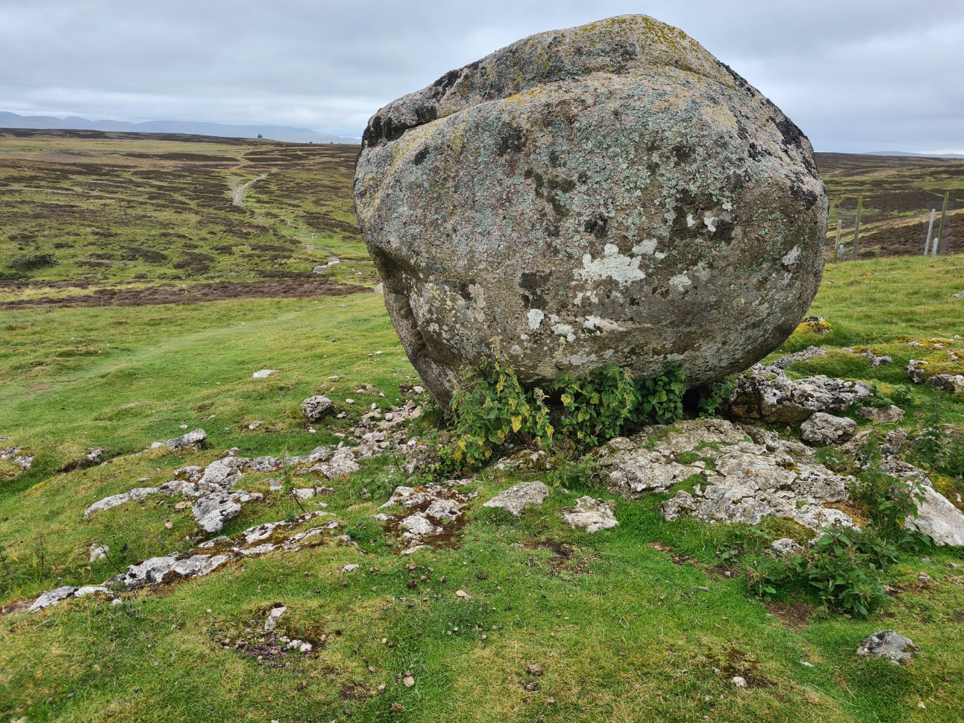
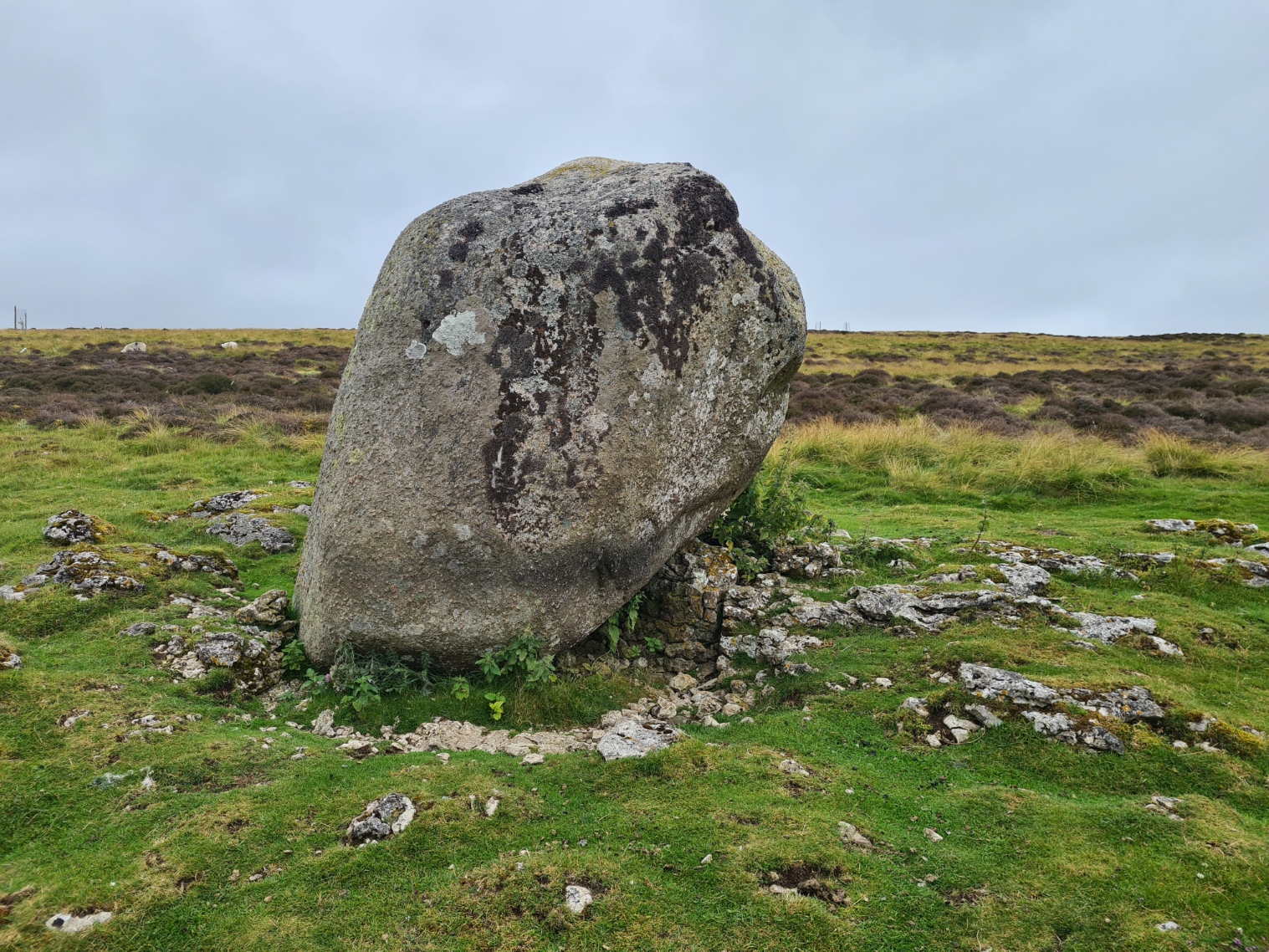
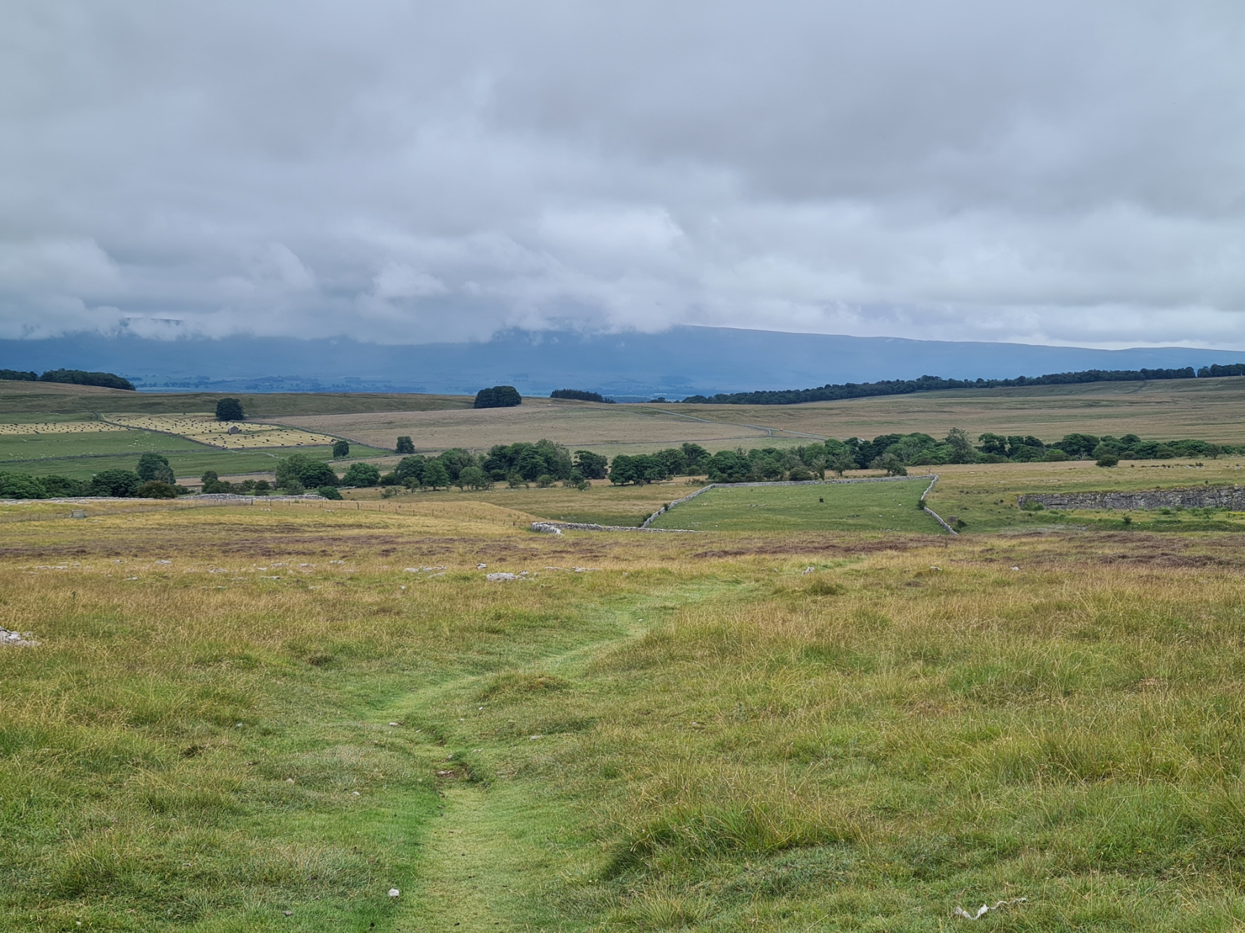
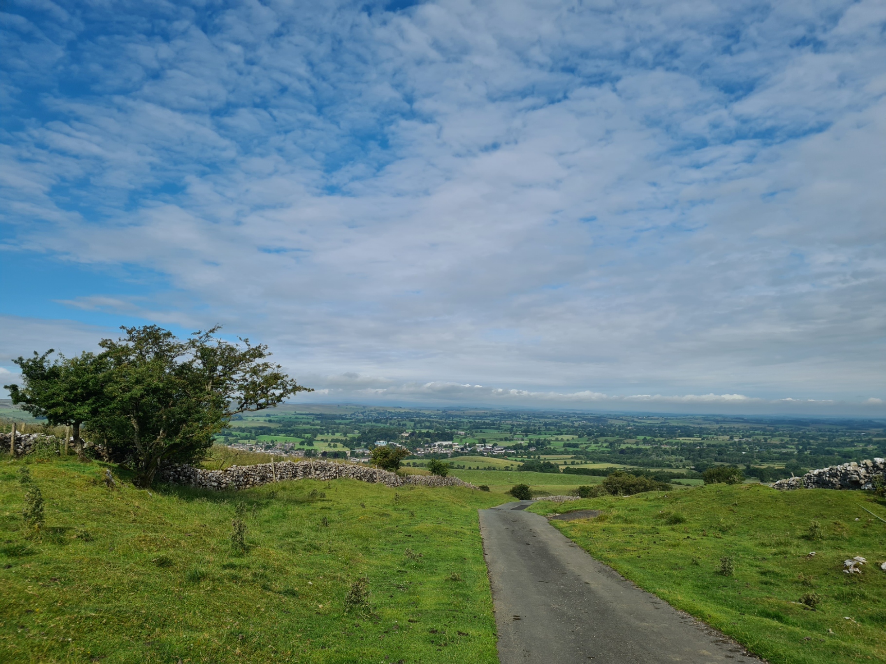
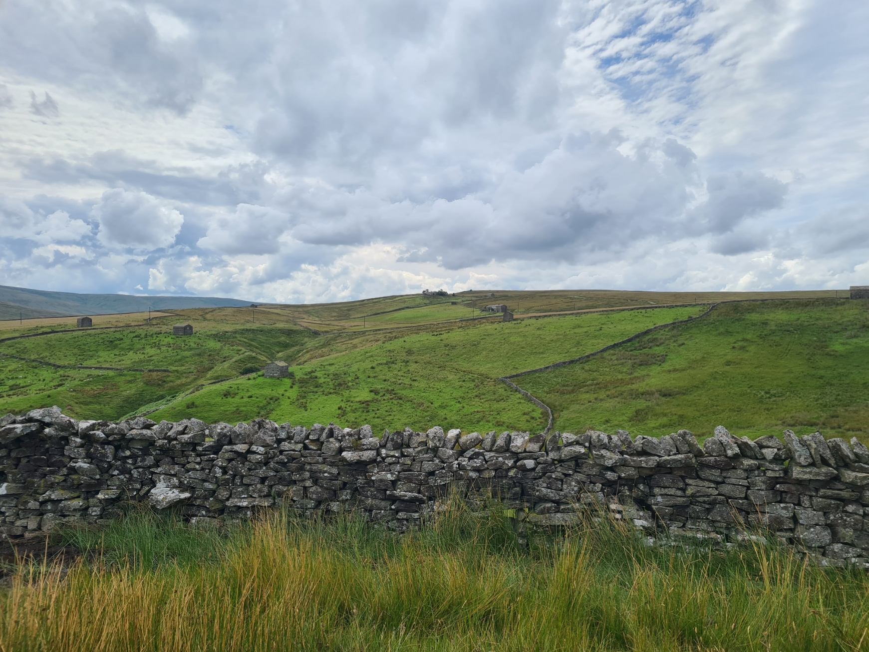
The other side of the motorway led me into not only the Yorkshire Dales National Park, but also limestone country. I passed the extensive Shapfell Quarry, where high purity limestone used to be extracted. No quarrying takes place here now and the owners, Tata Steel, use it for processing limestone taken from other quarries. It is slowly being given over as a nature reserve. Having left the quarry behind it was lovely walking. Across Crosby Ravenworth Fell, passing grazing cattle and extensive limestone pavements, expansive views to my left and in front. There were large numbers of glacial erratics dotting the landscape. Huge rounded boulders of granite, dragged and rolled here by ice sheets from a long way away a long time ago. The deposited anomalies now sitting atop an entirely different rock type. I took multiple photos as I was fascinated by this silent account of staggering geological and environmental change. I am not the only one, for Wainwright included a drawing of not one, but two, in his guidebook.
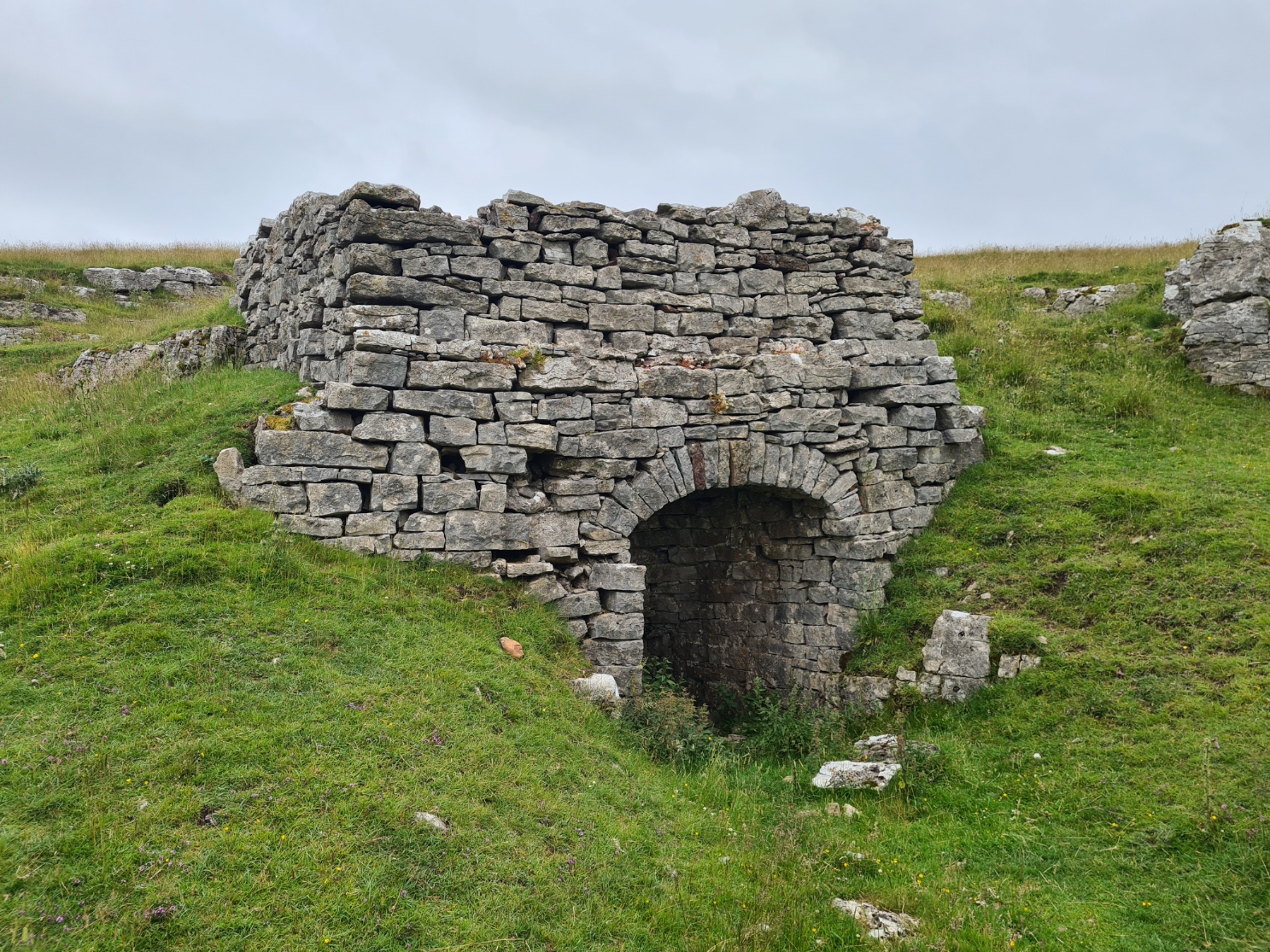
I was under no great time constraints and had broken up a section of the trail that many will walk over one day, into two instead. As a result of this, combined with easy terrain, I was finishing my day early, halting overnight at the next town, diverting slightly off the main route of the trail to do so. My path took me to a road, this took me to a pretty little bridleway. Surprisingly, considering the landscape and underlying rock, I had seen no limekilns, or at least not noticed them. Above Broadfell Farm I passed the only one that I saw on the entire Coast to Coast.
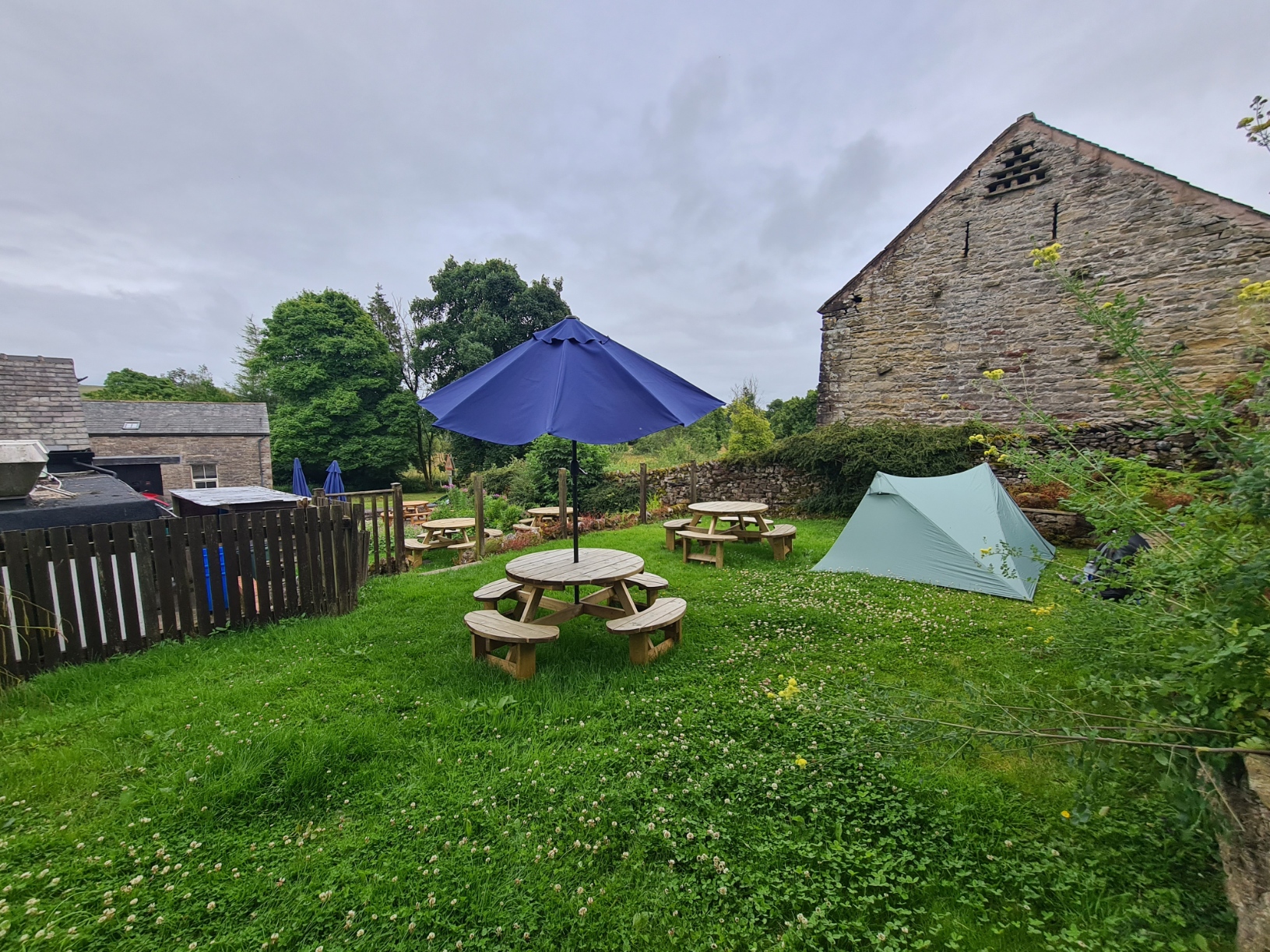
I had decided to stop for the night in Orton, I wish I hadn’t. My guidebook informed me that The George offered camping space in the beer garden. I had thought that the “£5 per tent, plus £3pp for a shower” in the book was likely to be out of date but not to the extent that it was, or just how unsatisfactory an overnight here turned out to be. I arrived at the pub fairly early afternoon and ordered a pint of Orton Scar Ale, 3.4% (a rebadged Marstons brew) from the pleasant young lady at the bar and enquired about camping in their garden. She looked baffled, but promised to ‘ring the boss’ to ask. There has been a change of hands here and showers were no longer on offer but was told I could pay £110 and have a room and was then welcome to use the shower. Neil turned up and reluctantly agreed that I could use the shower in one of the rooms that had been vacated but not yet cleaned. “how much” I asked, “let’s call it twenty for your pitch and shower”. I felt committed and paid up, but should have just left at that point. What happened to the days when a pub would let you pitch up in the garden for free, provided you ate there? As it was, I ate there later that evening, spending a lot of money on a decent steak pie and mash (properly provided with a jug of gravy), accompanied by beer and shiraz. Considerably poorer, I retreated to my tent, but sleep was mostly denied me. What I took to be a heat pump was close to the garden and throughout the night, would start, humming loudly, then stop, allow me to drift off, then start again, waking me instantly. To accompany the racket, the security lights around the pub were on until the small hours, shining straight into my shelter. Obviously, it began to rain…
Day seven: Orton to Kirkby Stephen
As a result of the light and noise I slept poorly and was not in a good mood while I packed in the rain, keeping my open pack dry beneath a wide umbrella spread over one of the pub garden benches. My body ached too. I had no idea why but presumed it was associated with my cold that continued to hang around. A door opened at the rear of the pub and a dog dashed out, up the steps and around the garden, pausing just long enough to pee against the tent before running back in. I was pleased to leave. I doubt I shall return. Campers cannot access the pubs w/c overnight or in the morning. Having visited the (fortunately open) town’s public convenience for morning ablutions and to fill my water bottle I briefly wandered the streets to see what there was interest, looking for something, anything, to raise my spirits and opinion of the town. It is a good looking location, with interesting buildings. None of which were plying trade at this hour. My guide book instructed C2C’ers “you can’t leave Orton without sampling the chocolate at Kennedy’s” but on pushing the door open at nine I was firmly told to go away as they wouldn’t be opening for another hour. So apparently it is possible to leave Orton without sampling the chocolate from this small factory. Taking that as guidance, it was time to ignore the rain and stride out of town, which promptly stopped. The day slowly brightened, both figuratively and literally.
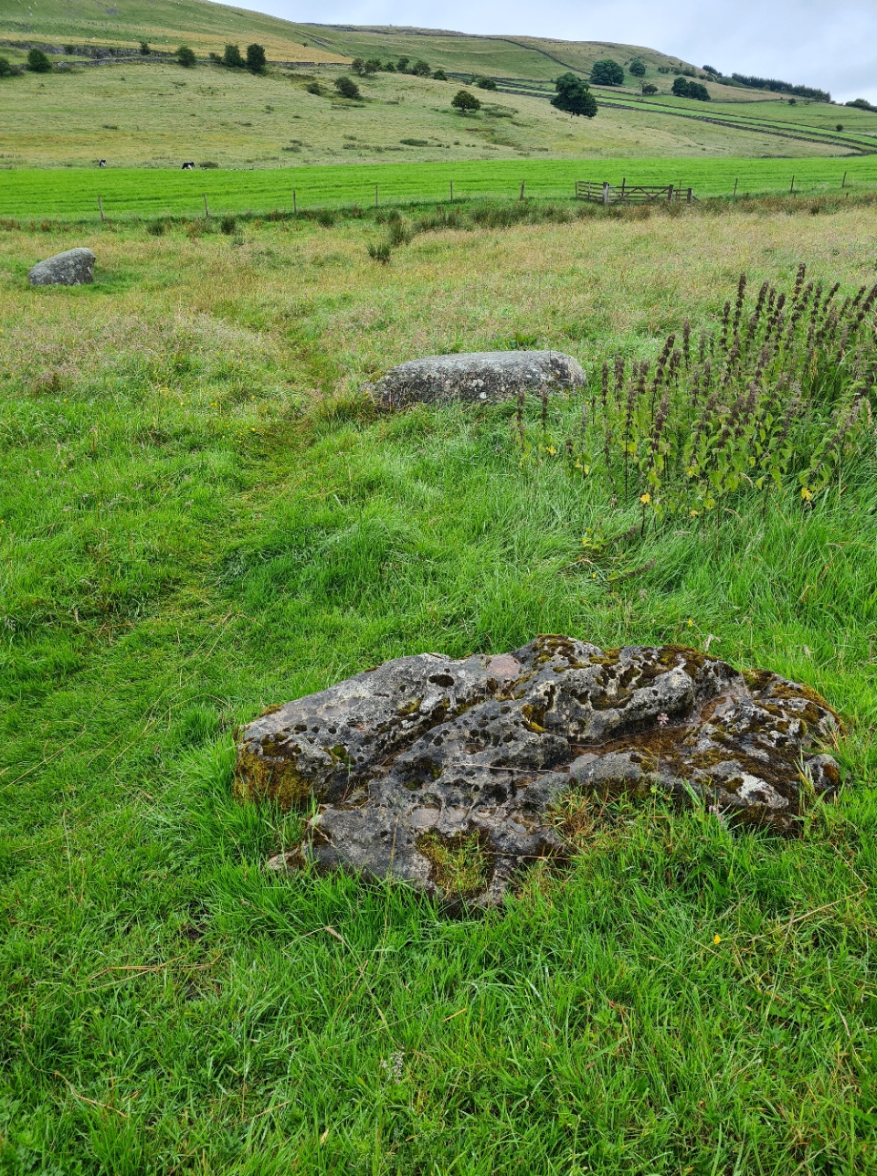
I turned off from my initial road walk on to Knott Lane, a track that led me back up to the low hills. It wasn’t far until I had something curious to visit. Just a mile from Orton a gate in the dry stone walling permitted entry to a farmers field. I found the neolithic/bronze age Gamelands stone circle a remarkable survivor and worth the few minutes for a brief exploration and walked the circumference. The oval shaped feature was constructed over 3500 years ago and 33 large stones and 13 smaller survive. There were probably more stones but some were damaged or removed in 1862. Almost all survivors are red Shap granite, with some smaller sandstone, and a solitary large pock-marked limestone. Why was the circle created? A place for gathering, worship, burial, ritual, celebration? No one knows. Today it is just a mute mystery. At least it gave my mind something to concentrate on as I walked back to the trail, rather than composing snotty, never-to-be-sent, letters to guidebook publishers, pub owners and town councils. I was also a tad concerned about my shortness of breath, wheezing badly on any sort of climb.

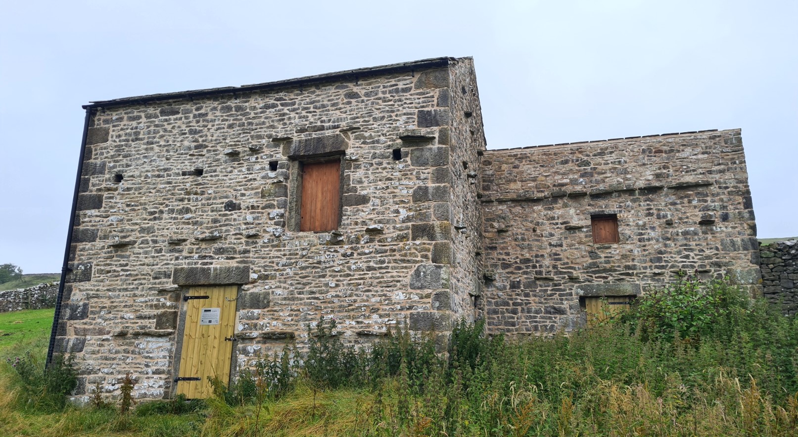
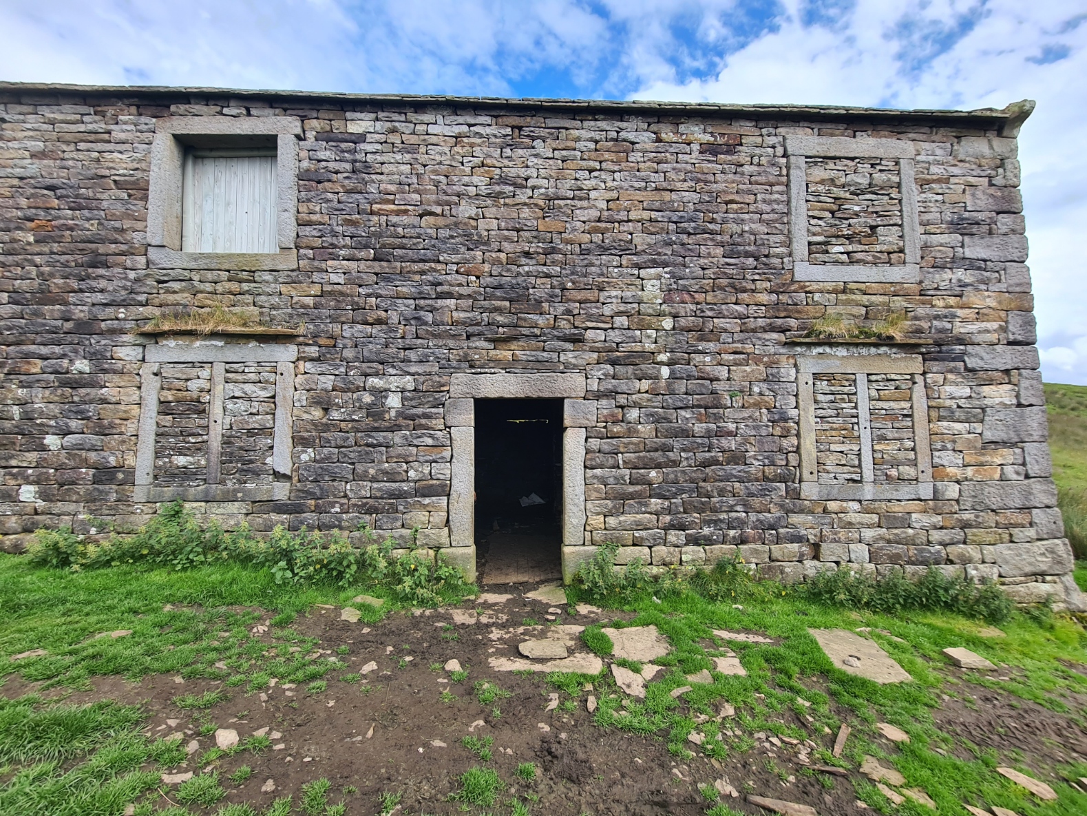
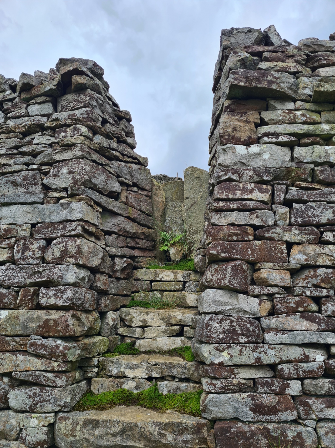
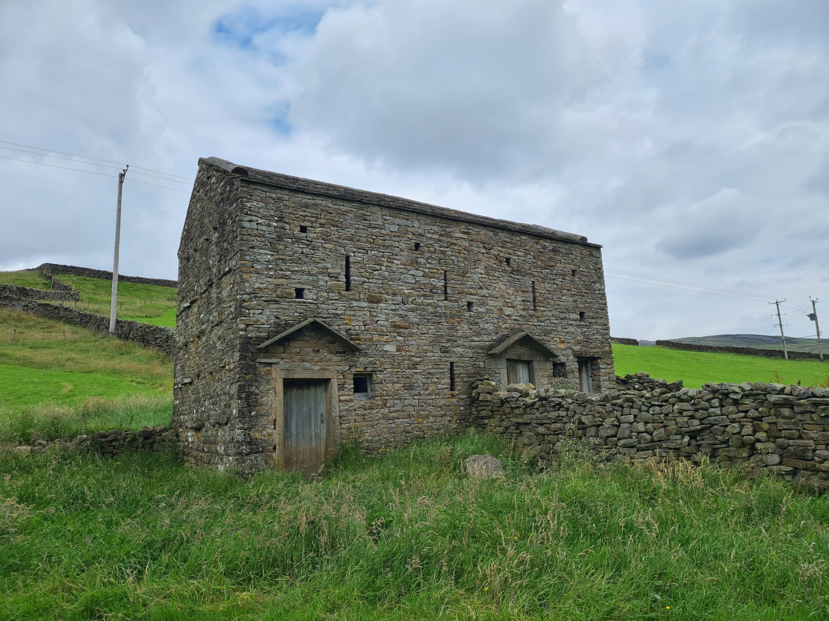
A stand-out feature of the Yorkshire Dales are the many stone buildings that dot the landscape, almost every field seems to have at least one. Invariably these were once used for crops, feed or animals but most seem to be unused today. Sturdily built, they survive down the centuries and it is almost impossible to date them. One that I passed had been restored as part of the Westmorland Landscape Scheme, funded by the National Lottery Heritage Fund and Yorkshire Dales Millennium Trust. It was good to see money being well spent and I heaved the unlocked doors open to explore the unrestored but almost complete interior.
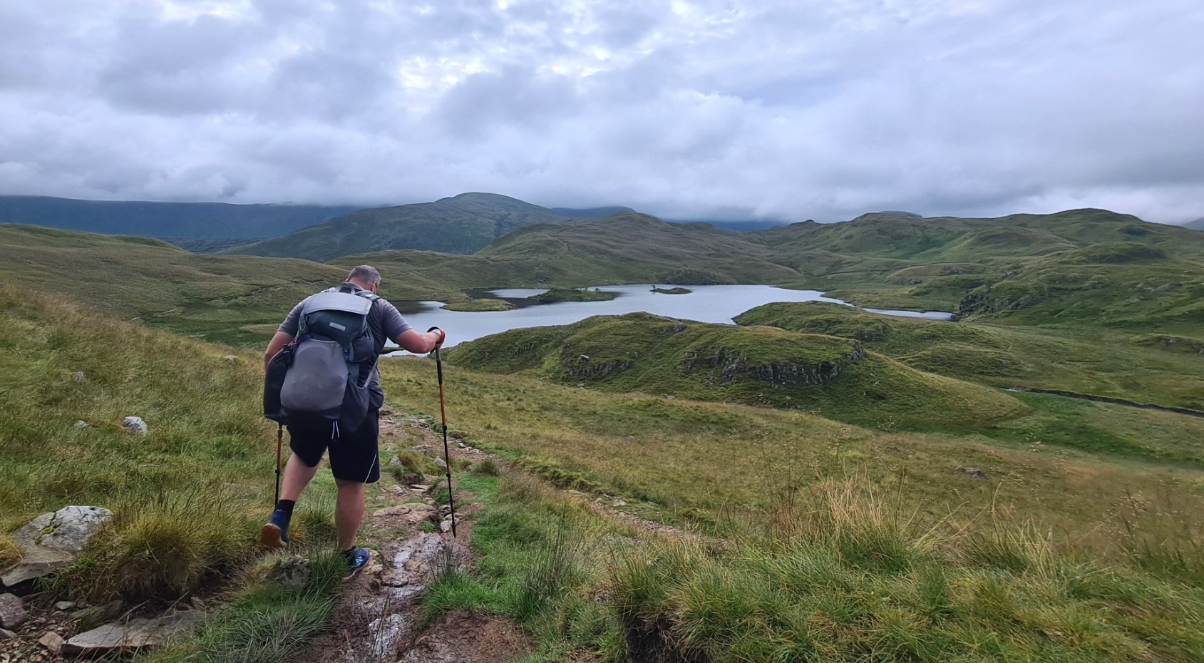
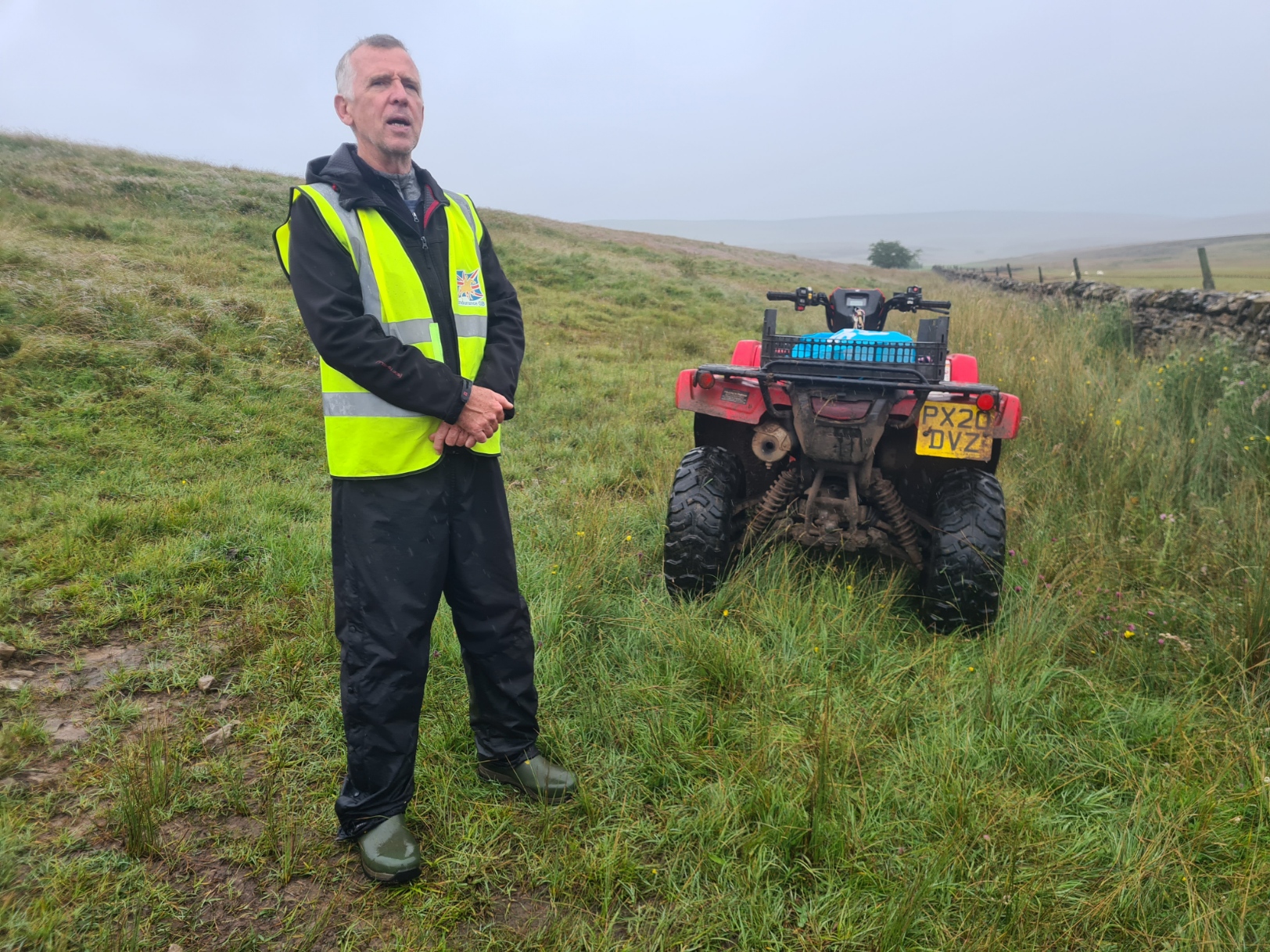
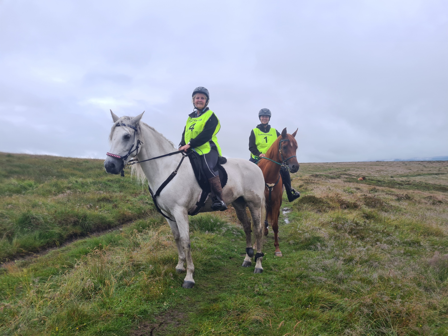
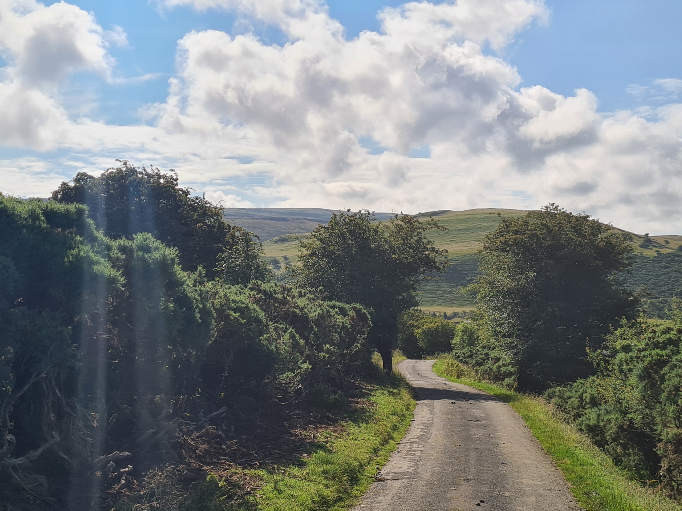
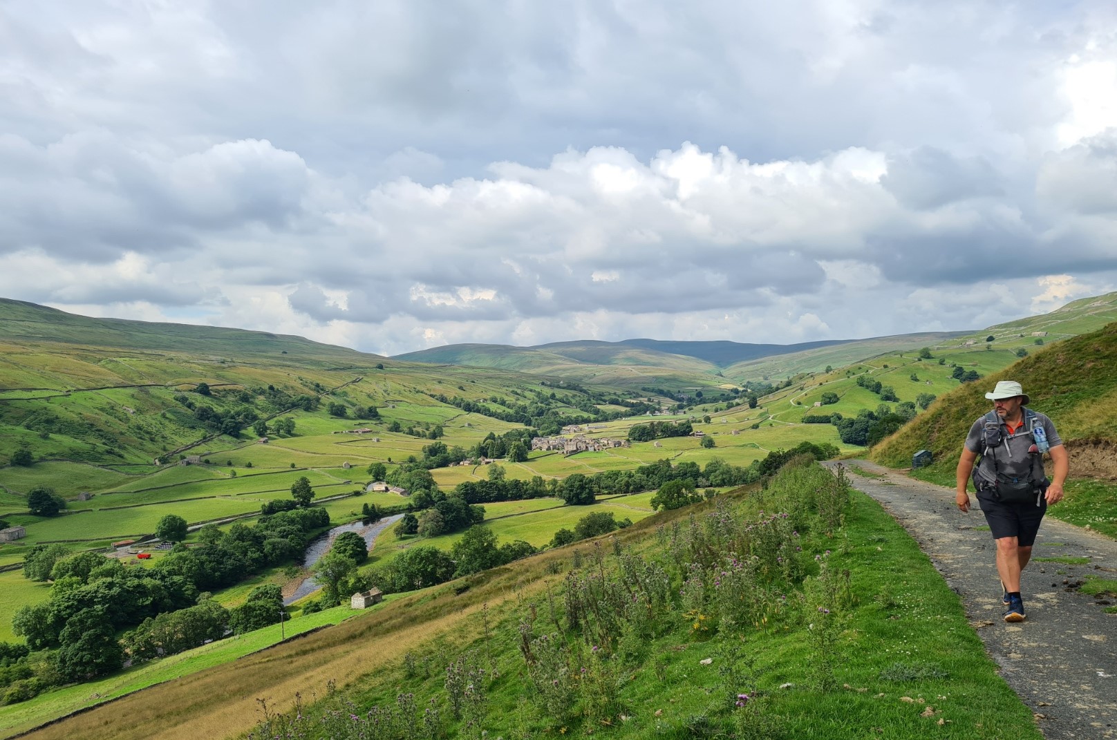
Further on, Sunbiggin Farm had prominent large bright signage advertising their refreshment stall- “a wide choice of drinks, snacks and homemade goodies”. Just the ticket as I fancied a brew and Snickers or something similar. Nope, it was locked. I walked on. Just past the farm a sign instructed walkers- “don’t use lane or adjacent fields if you get caught short”, OK, so what are people supposed to do! The farm track took me up into the mist. Wild looking ponies were cantering through the gorse and with little in the way of views I soon felt far from habitation. An illusion of course but I felt as though I could have been in any era. A fantasy soon shattered when I crossed a metaled road. From there it was a wide bridleway and every now and then a pair of hi-viz tabarded riders would pass me. We exchanged pleasantries but it wasn’t until I came across Pat, standing beside his quad bike, that I found out what was going on. We stood and chatted. It was a practice fun ride for Endurance GB, where riders complete long-distance rides, their horses covering distances of 8-160km. Pat was married to the organiser so had been roped in as a marshal. For some reason all of today’s 38 riders were female, obviously a bit more hardy than the blokes when it comes to a ride through the mud and dissipating mist. I crossed a minor road, stopping to chat to another Endurance GB marshall on the far side. The Coast to Coast ran concurrent with the Dales High Way for a while. This is a 90 mile trail that I must find out more about as it looks to cross some lovely country. Soon after my leaving the Dales High Way, the riders also left me, continuing on a bridleway while my path wandered off, becoming ever boggier.
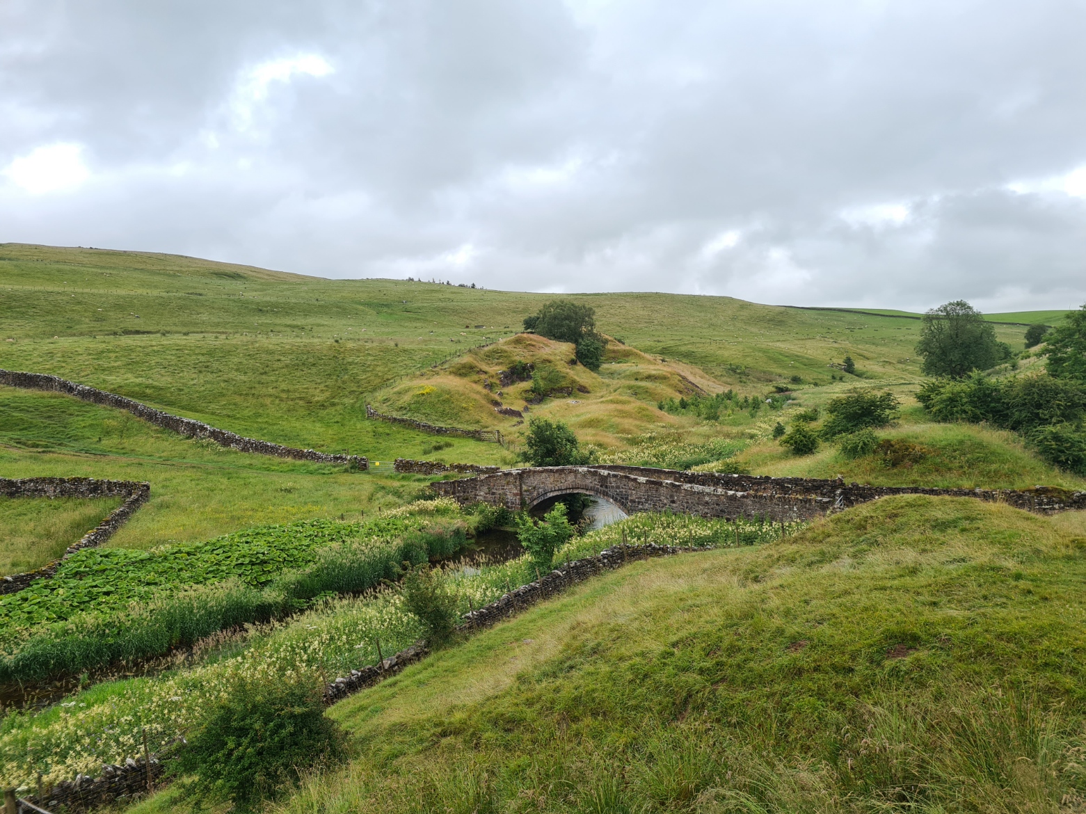
It became drier underfoot as I approached the hill that dropped down to Smardale Bridge. This must be one of the prettiest places around and I took time out to sit on a rock, take a breather and enjoy a roll stuffed with ham, corned beef and a couple of tomatoes. Then down to the old bridge, passing a battered and austere looking railway building on the way. The railway is no more, but once ran to Kirkby Stephen, tonight’s halt. It was Sunday, and I wasn’t surprised when I saw a very large party of ramblers also slowly making their way down toward the bridge from another direction. I thought I would get caught up in their midst but having crossed the bridge and begun the slow long climb up the far side, I looked back to see the whole party had halted on the bridge, enjoying lunch I presumed.
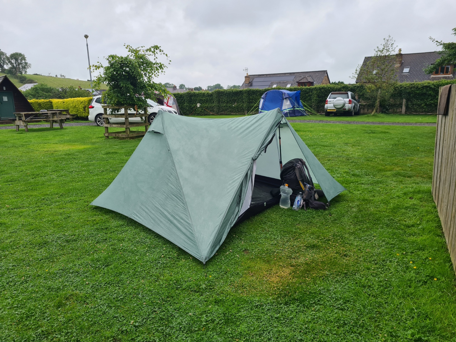
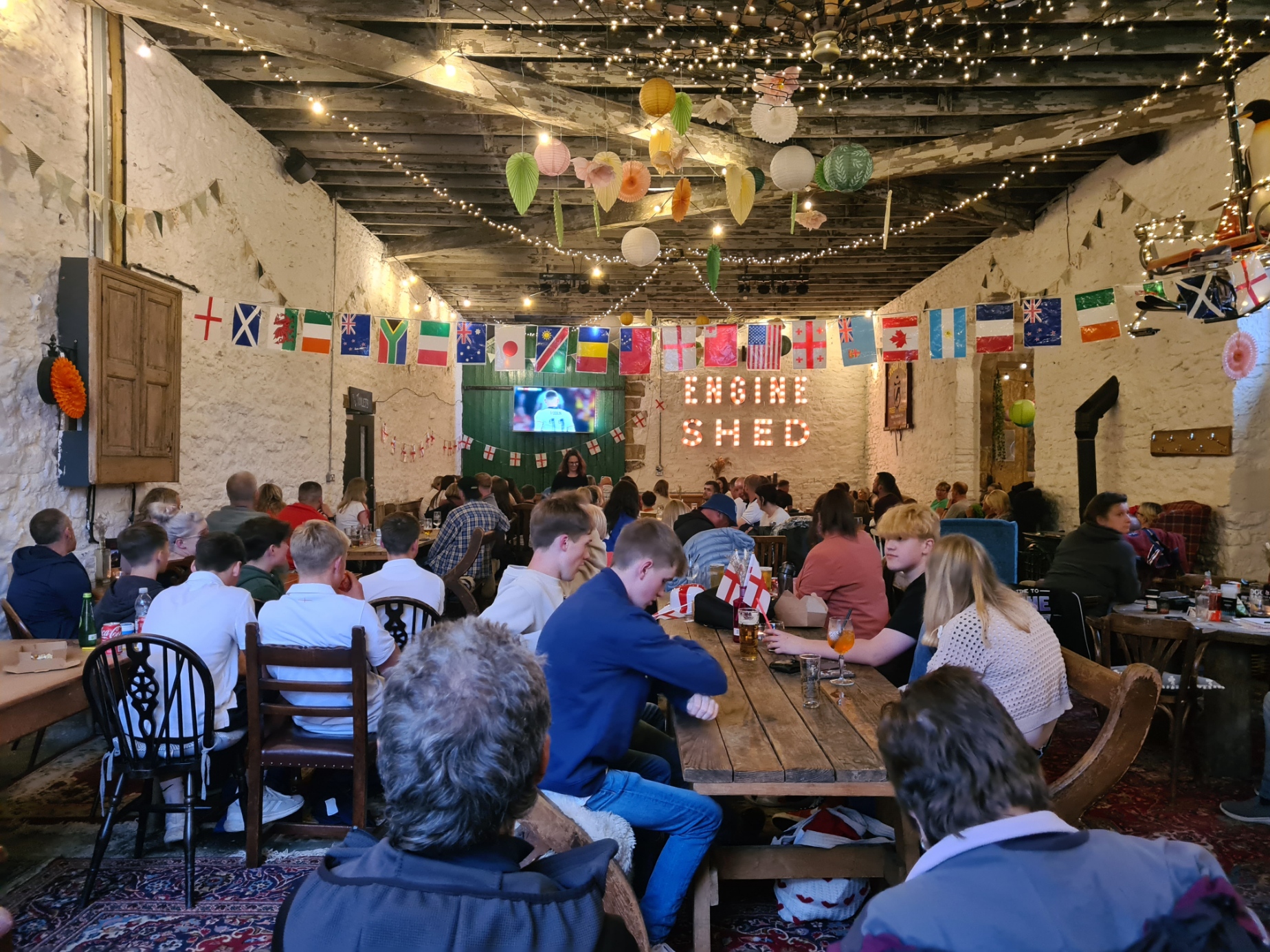
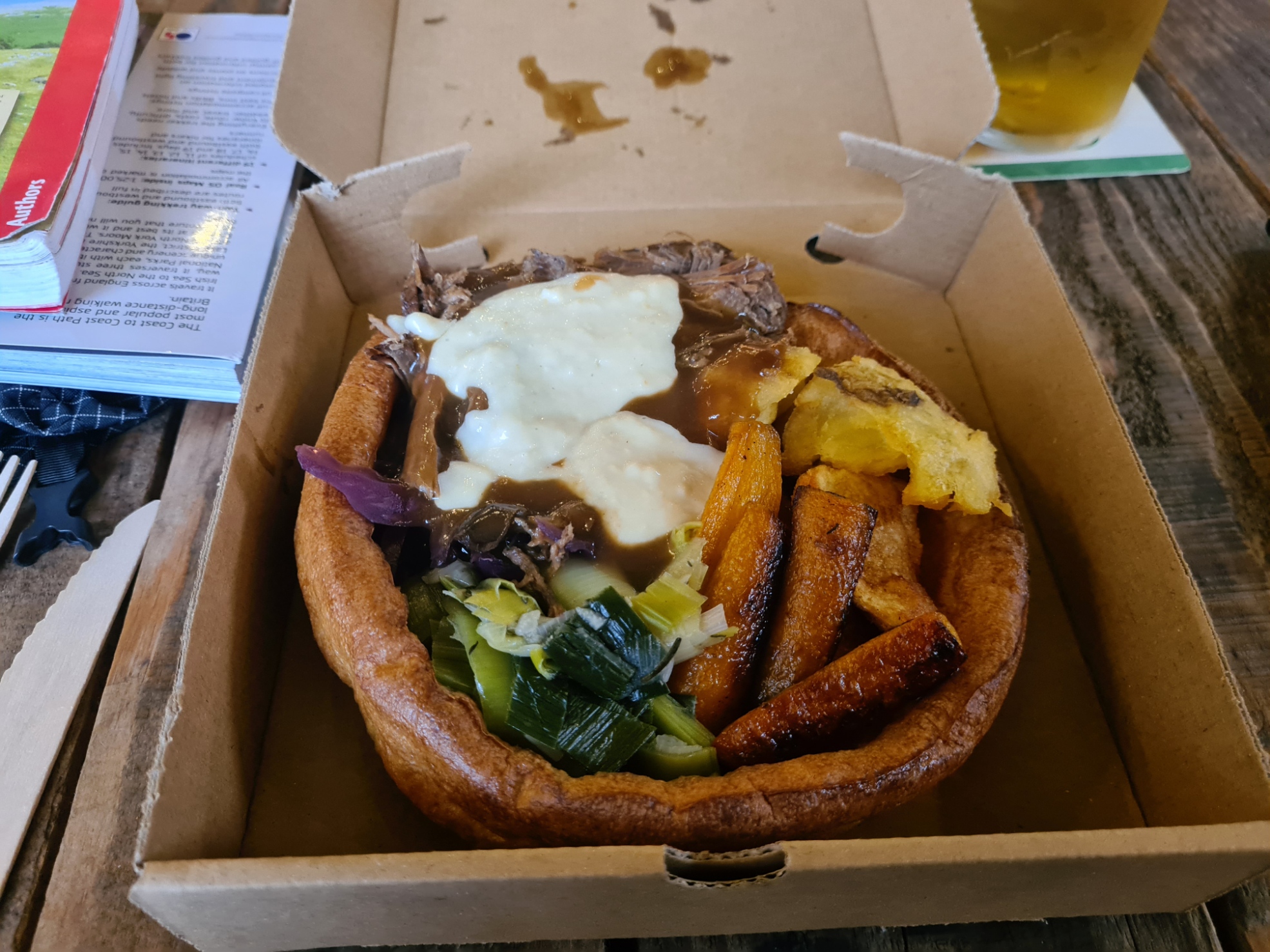
It was now just a further two miles or so across Smardale Fell and farmers fields into Kirkby Stephen, joining a metalled track for the final approach. I was stopping the night at the Pennine View campsite and was pleased to be finishing my day as I was weary, my illness manifesting itself. This is a welcoming site, used to long distance hikers as it is at a crossroads of National Trails. Beside a decent pitch and good shower, it has an excellent campers kitchen where I chatted to Mrs Three Points of the Compass on the phone. I was considering a day off tomorrow to allow my cold time to improve. I was also looking forward to visiting the campsite’s Engine Shed, a large building that occasionally hosts bands and events, but tonight it was football on a large screen TV. It also has a small bar and hosts a selection of food providers. Along with my large Yorkshire stuffed with roast beef, veg and gravy I had a couple of indifferent pints of Attermire Pale, 4.3%, from the Settle Brewery. It was the Euro ’24 final, England playing Spain, and an excited and boisterous crowd had gathered in the Engine Shed. I was simply too tired however and come half time, made my exit. Sleep is nature’s recuperative. It had been a good section to walk, but I was just not feeling up to it in places. I hoped I would feel much improved after rest.
Day eight: Kirkby Stephen to Keld
I slept, I cannot say well, but definitely had many hours of rest during which I had time to consider options. I had decided just a solitary day off trail wasn’t going to solve any health issues so had decided to continue my trail today, just keeping my pace down and keeping it steady. I had been off colour since day one and that technique seemed to have worked so far. I slowly packed and left the site for the walk into, through and out of town. The site was quiet as I left and possibly a little subdued. I hadn’t missed anything last night. England had lost 2:1.
Never mind that, for some reason I was a bit excited about todays section. It crosses the spine of England, the Pennines, and I was happy to recall some glorious walking here in previous years. Especially the terrific Pennine Way in 2018 and Pennine Bridleway in 2022. This was one reason why I had picked the Pennine View for last night’s halt as I was familiar with just how good the campsite is. Leaving town I was a tad surprised to catch sight of a couple of the blue and yellow parrots that fly freely around the town. Climbing the steep road soon after I left it to go and see the Grade II listed Podgill Railway Viaduct, with its 11 30ft arches, but it is impossible to see it from above so returned to my slow plod up the hill toward Nine Standards.
There is a choice of routes today. Each is seasonal and intended to reduce erosion across the peat bogs of Nine Standards Rigg. It appears that no-one pays much attention to their seasonality, walking whichever they wish. This top is the watershed- from the summit, all rivers from here on flow eastward. But not up here, at least not initially, the water sits for some time in the peat, ready to catch out any one attempting to cross. I had already decided to walk the Green Route, that was lower than the other two, a little shorter and easier and more suited to my present state of health. Needless to say, when I got to the path junction, I changed my mind. I wanted to see the mysterious Nine Standards, so chose the Red Route. I took my time on the ascent, pausing mid-way to eat my pork pie purchased back in Shap.
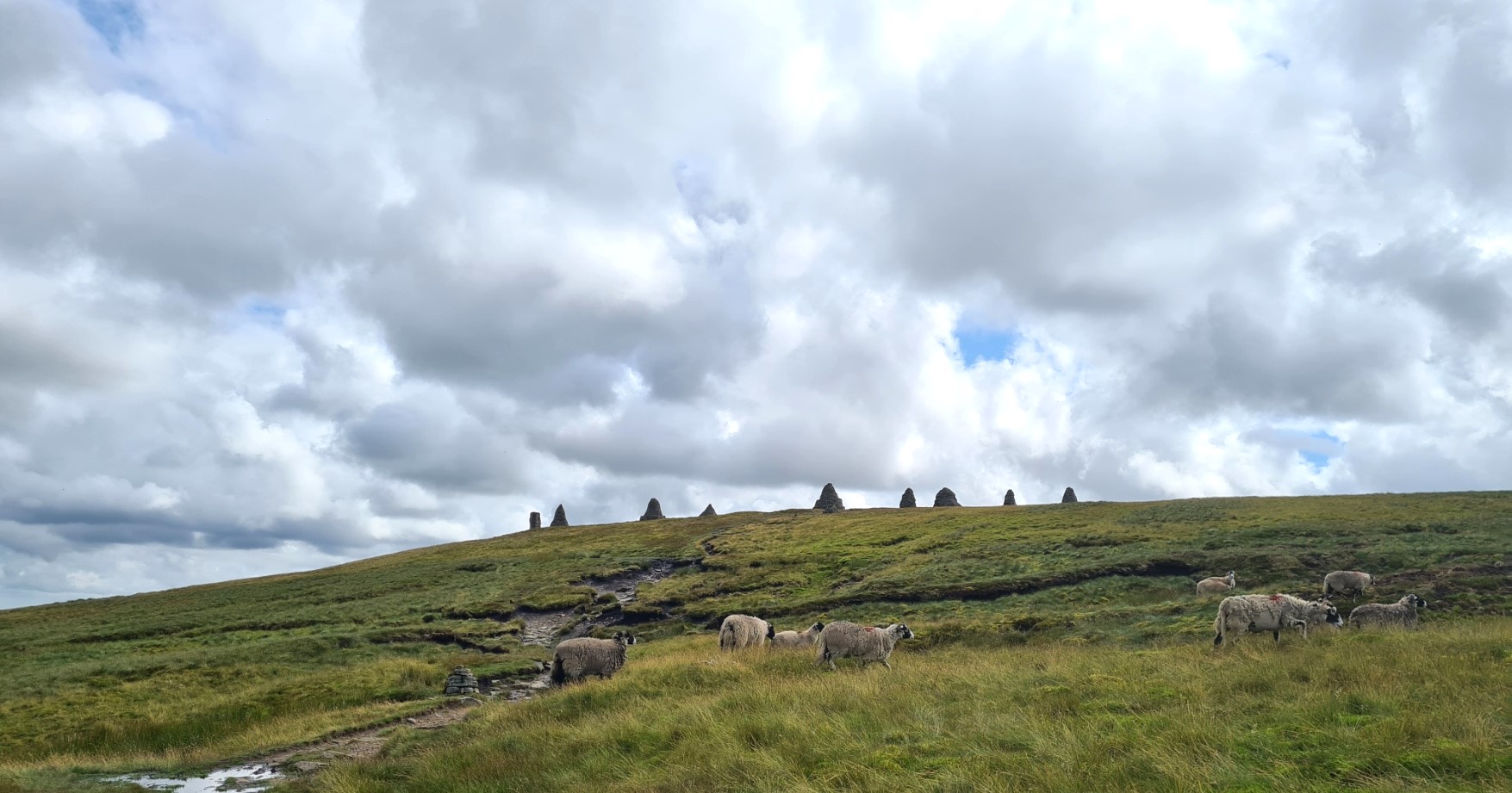
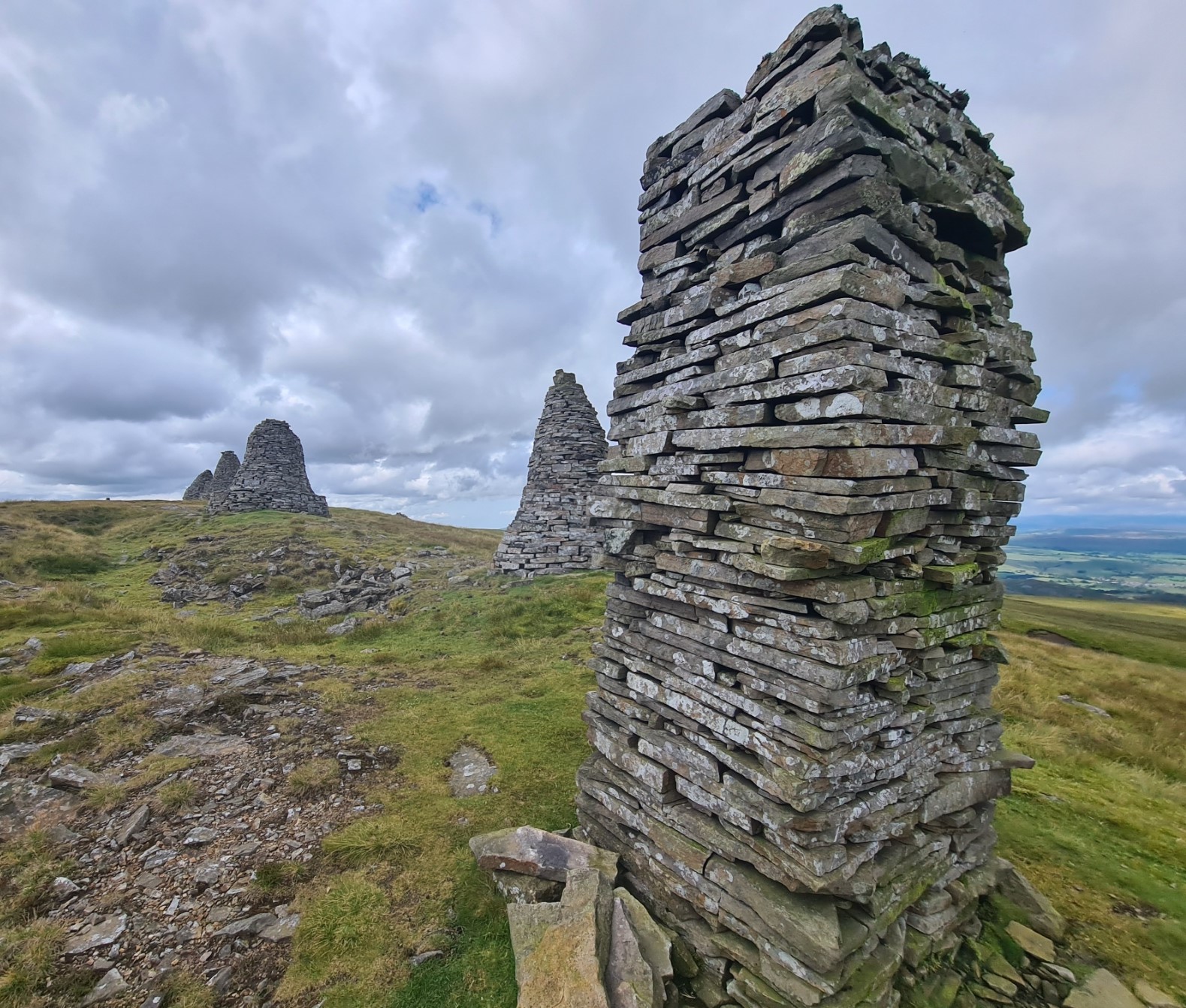
Nine Standards is a group of nine stone built cairns, of differing height and shape. No one knows why they were built, or who built them. They have probably been there for over 500 years and have been recently restored. That said, judging from their condition it appeared they had already been vandalised. But they remain impressive.
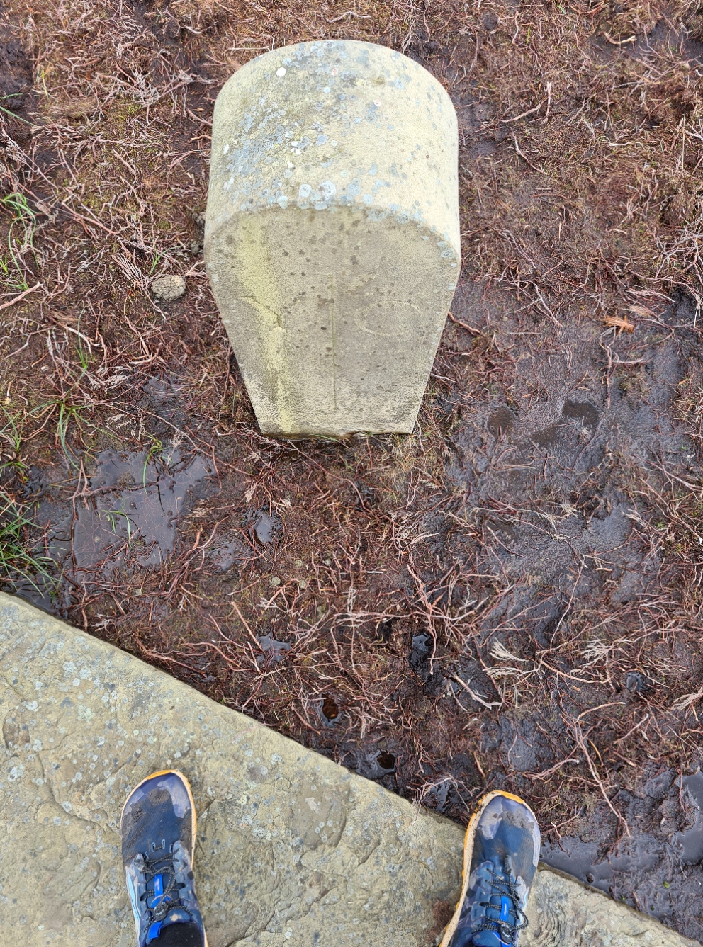
Just south of the cairns I stood at the boundary stone, with a foot in two counties. My left in Yorkshire, my right in Cumbria.
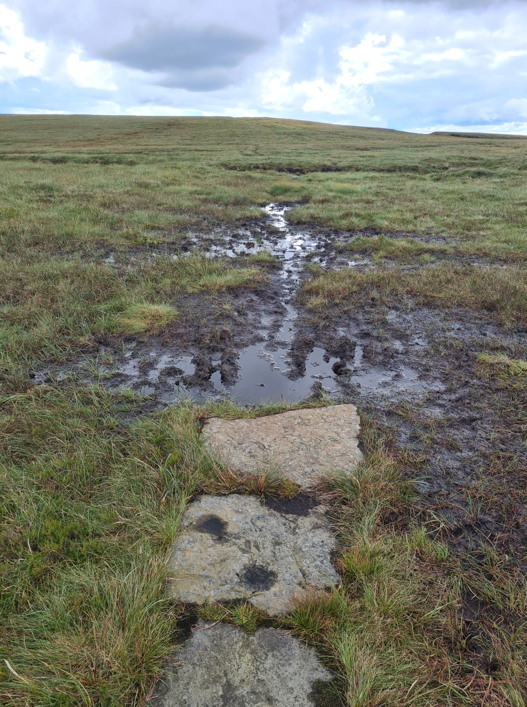
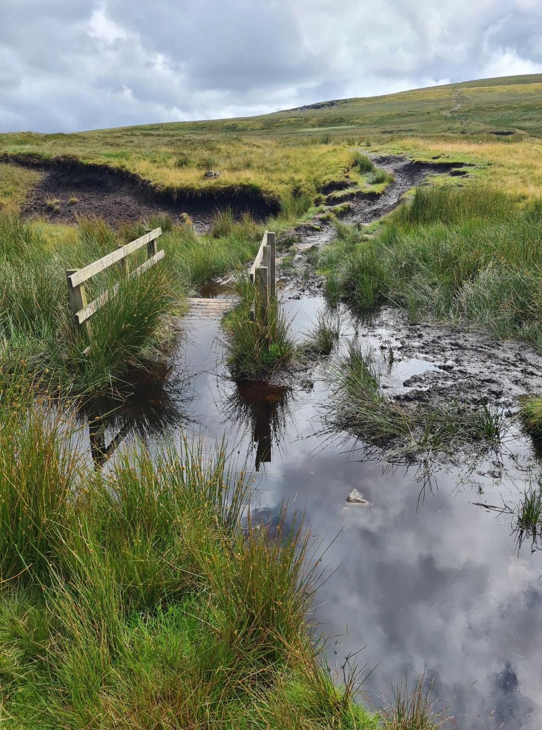
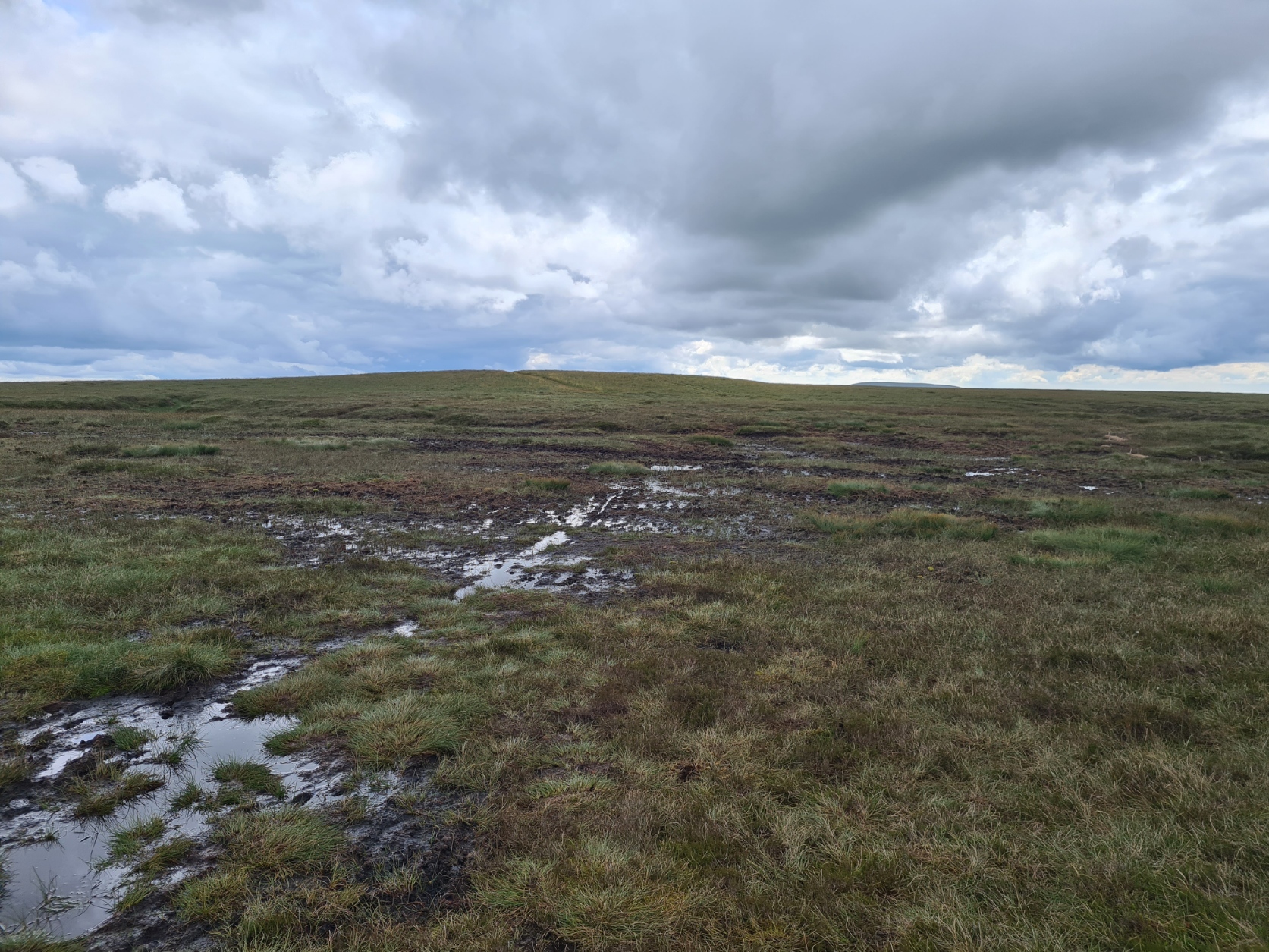
I was over a week in to my trail and I could now feel my movement across the country. But there was still a long way to go and had to continue to pace myself. I was leaving Cumbria behind and entering Yorkshire. But before congratulating myself I had to navigate myself across this peaty morass in front of me. Some slabs have been lain across the tops and anyone who regrets their presence hasn’t stepped off the final one of a line into the peat bogs that abound. In common with their presence on many miles of the Pennine Way, I firmly believe that these need to be urgently placed across Nine Standards Rigg. Some boggier sections are many hundreds of metres wide where hikers have increasingly expanded the track to make their way across without becoming stuck. It is a mostly featureless terrain. I did like that the map shows a ‘Pile of Stones’, having made my way there I was presented with- a pile of stones. I enjoyed this part of the trail immensely. It is very remote , very different from what had preceded.
I passed Ravenseat Farm. There used to be a campsite here but it looked to have closed. They also used to offer Cream Teas, much as I might have fancied such a halt, no longer. I passed the farm and followed the hill contours down the pretty little beck that runs away from it. It is a beautiful walk.
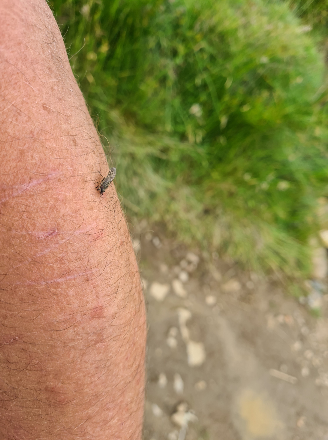
I stuck my nose in a couple of the open stone buildings along here but they were in poor condition with little of interest to delay me. I didn’t fancy stopping for long along here anyway as I was being eaten alive by clegs, silently landing on my legs, arms and neck, unnoticed until they took a painful bite. I was covered with splotches of blood.
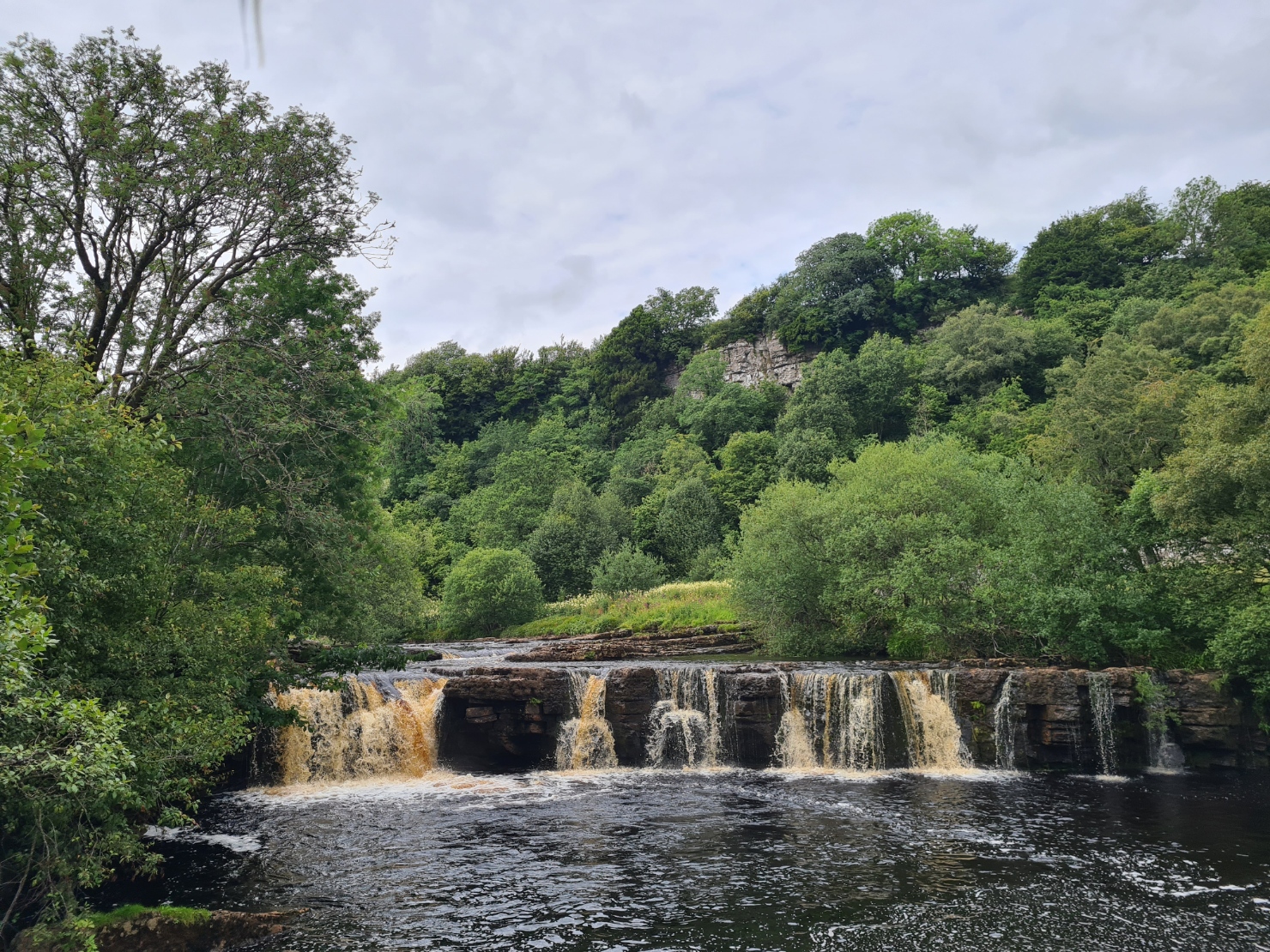
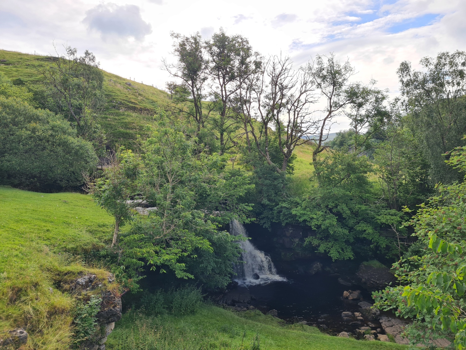
I was stopping at Keld today. I felt good about this as it is approximately the half way point on the Coast to Coast. Instead of walking above Cotterby Scar I dropped down to the road from where it was a short walk down into the sprawling hamlet. As usual with these short sections, I was finishing fairly early in the day and I took time out to wander down to a pretty little waterfall to admire it. It was only when I turned to return to the road that I noticed a man walking across the pebbles to his previously un-noticed camera on a tripod. I am pretty sure I had just spoiled his time lapse photography, whoops!
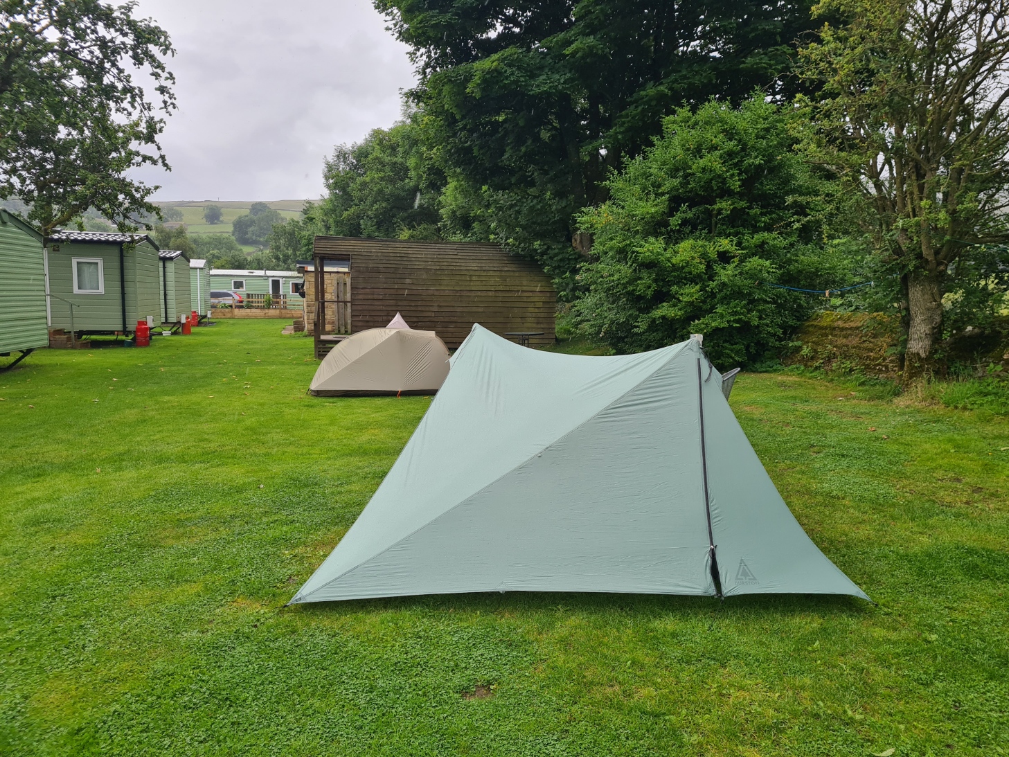
For such a small place, there is a surprisingly large choice of places to stay in Keld. Though perhaps it is not that surprising, as it is a pretty place with abundant walks in the surrounding hills. I might return myself one day. I was camping at Rukin’s Park Lodge. An ambitious name for a farm. They also have a tea room and it was here that I paid my £9 for a night’s pitch and shower. I was also early enough for a late lunch of decent cheese on toast and mug of tea. The farmer’s wife running the show was initially quite grumpy but began to mellow when I praised her for having correctly provided Worcester sauce.
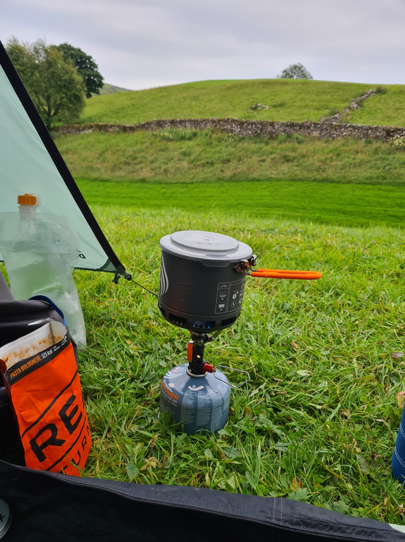
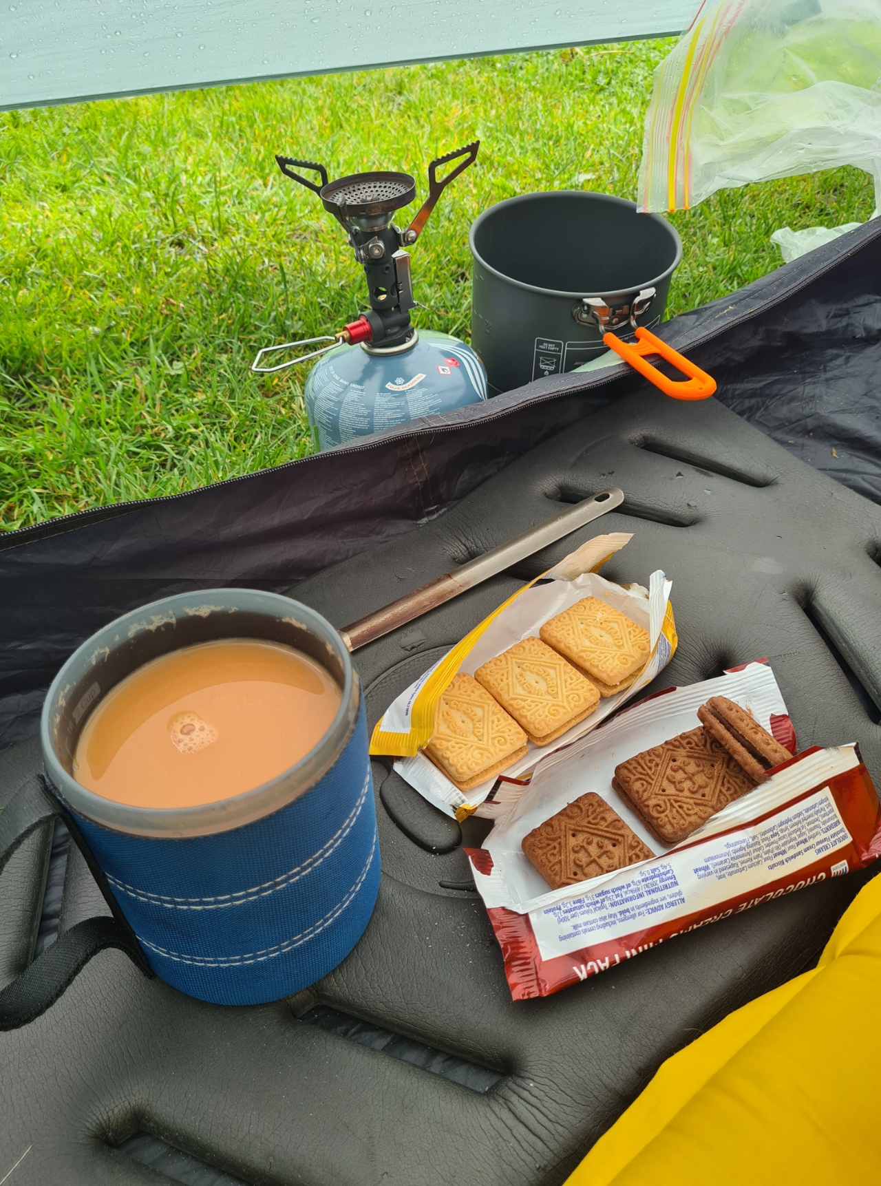
There were quite a few midges and flies around. Most new arrivals went straight down to the bottom of the hill to pitch, by the river, a pretty spot but infested with midges. I pitched at the highest point I could find, with a good breeze blowing through. After showering and changing into some clean clothes, writing my day’s notes and checking map and guidebook for tomorrow, I rested for some time before an evening meal of Real Turmat Pasta Bolognaise, followed by a pint of tea and a sticky, enamel-stripping, sweet, currant slice purchased earlier from the tea room. It had been a good days hike, and despite my illness, I was pleased with my progress. Again, I had plenty of time to fit in far more hours of sleep than I enjoy at home.
Day nine: Keld to Reeth
Perhaps my cold was on the way out for despite rain during the night I slept quite well. The only disturbance during the night had been when some other hikers turned up quite late and began clattering poles around while pitching what sounded quite close, but in the morning turned out to be some distance away. My alarm had been set for six but during the night I changed it to an hour later. I was in no rush to complete this trail and fancied a lie in. Hey, I’m on holiday! I made a brew and once packed, stopped in at the farm tea room for another brew, accompanied by an excellent bacon roll. Our host was in a better mood today, actually quite chatty. I heard all about her previous five generations of family who owned the farm, including her grandmother, the tea room we were standing in having once been her bedroom. The next generation was poised, ready to take over the running of the farm in the next few years, but have already indicated they are less interested in operating a tea room and campsite. It’ll be a sad loss for C2C’ers.
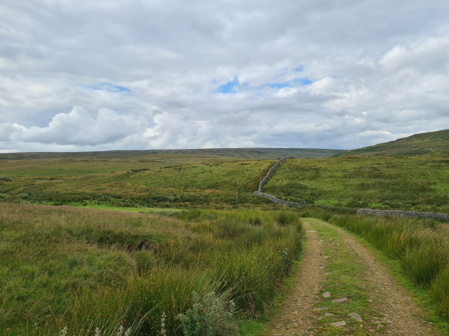
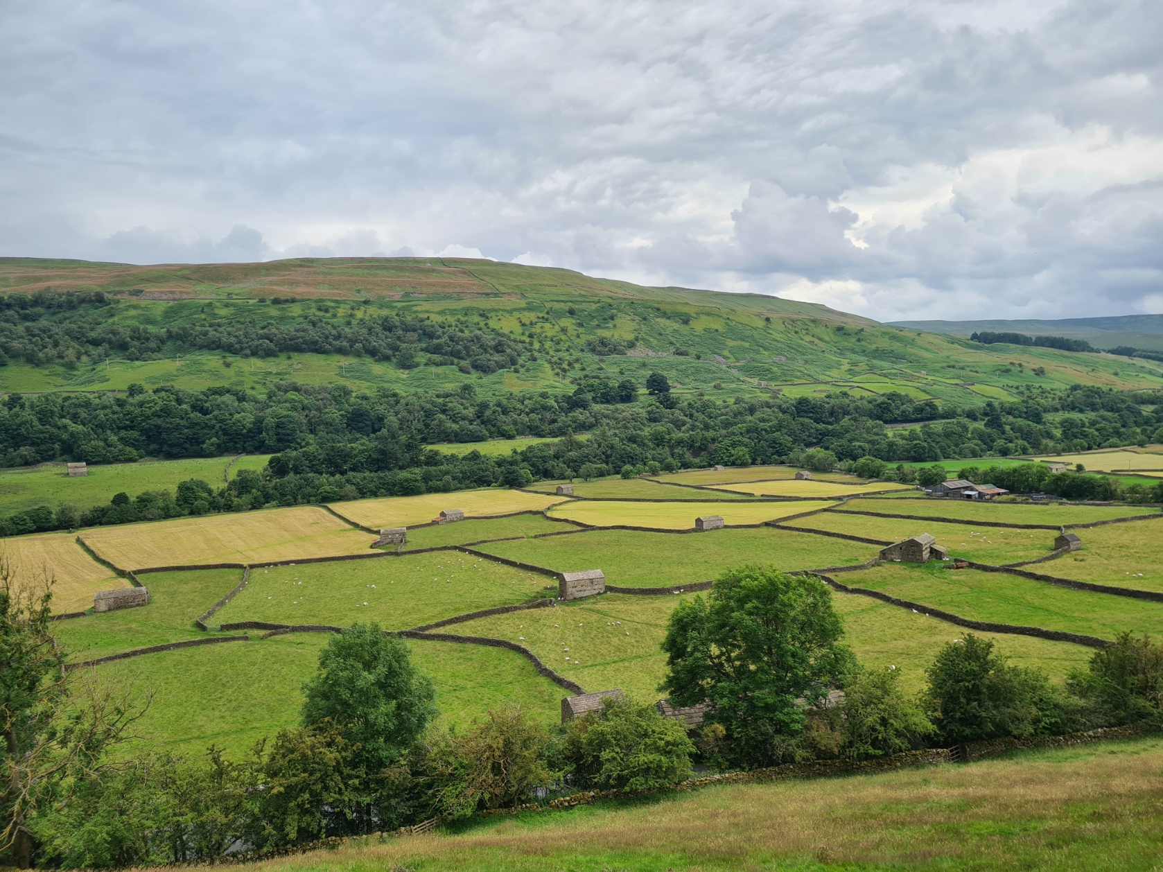
There is a choice of route today. I can go high, back on to the moors, or low, following the Swaledale Low Variant along the river valley. For once, I made a sensible decision, respecting my illness, I took the low route. An easy choice to make as I had heard just how beautiful it is. Correctly it turned out. It is a lovely low level walk, mostly easy underfoot and a highlight of the trail.
The remnants of old industry are scattered along the route. I stopped to explore the ruins of an old lead working, the buildings crumbling to the ground. I can imagine how poisoned the river below was ‘back in the day’. As it was, I had no need to stick to the river path the whole way as there is often a choice of path, at various heights above the valley floor.
There was a large variety of step and gated stiles to cross when moving from one field to another. I do wonder how long these will survive?
Occasionally I went low, occasionally I went higher, but I made sure to call into Gunnerside. It was around lunchtime and I fancied a pint and bag of crisps at the village pub. I was dismayed to find the King’s Head closed. Perhaps my disappointment was a little too obvious. Carolin was hard at work digging up a tree root outside her little cottage opposite and offered to sell me a bottle of beer. I accepted her offer, paid her (quite reasonable) two pound and sat with my cold bottle of Wychwood Hobgoblin IPA, 5%, on one of the pub’s outside tables, along with an excellent sausage roll and pork pie purchased at Rukin’s earlier and tomatoes from Shap. It’s the small things in life… I had company for my meal. A cockerel was pecking around and polished off any crumbs that fell.
I set off. Climbing up the slopes, where having gained some height, it began to rain. That didn’t bother me but after the rain, came the flies. Hundreds of them. Not biting but annoying. They surrounded me, driving me crazy. Walking down the road I came to a bunch of marquee erectors, struggling to turn their oversized trailer in the road, trying to gain access to the property where they were working. I dropped my pack and joined them, forcing the trailer round on its axis. After which, their thanks ringing in my ears, I set off back down the road. Now sans flies, who had detached themselves from me and moved over to the workers.
I returned to the valley floor for a final river walk as I neared Reeth. My halt for the night. I was staying at the Orchard Caravan & Camping Park. The owners are obviously working hard to make it work. Ian was enthusiastic and helpful. I had booked a pitch days previous and he had reserved a slightly raised patch for me. While he went off to get my change (£10 for the night) I quickly threw the tent up as it was very obviously about to rain, hard. Just managing it in time. Ian returned with my change, along with money for the metered shower.
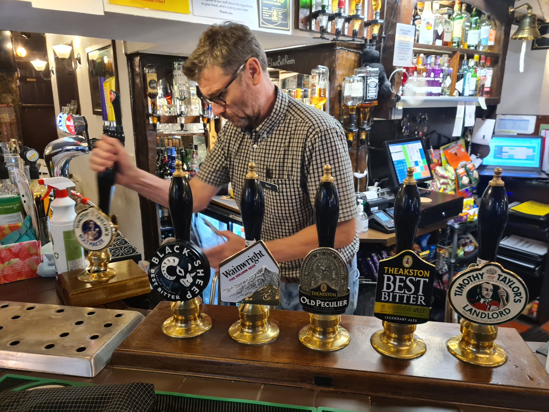
While it rained, I sat in the tent with a brew, along with three custard cream and three chocolate cream biscuits, purchased at Keld. Hey, I’m English! The rain stopped, time for a ten minute hot shower, washing socks at the same time. Later, I walked back into town. Slightly spoilt for choice, I went to the Buck Inn, for OK pints of Amber Necker, 3.8% and Pacific New Zealand Pale, 4.1% from the Pennine Brewery, drunk with a poor chicken goujon starter and indifferent cod, chips and mushy peas. I was happy to leave here but popped into the Black Bull to see what I had missed. I had an excellent glass of Timothy Taylor Boltmaker, 4% while I wrote up my notes. Then took a Shiraz with me to an adjoining table to chat to a couple of C2C’ers, who were staying in one of the Pods at the campsite.
Tomorrow I would reach Richmond, sometimes called ‘the gateway to the Yorkshire Dales’, but for me, it was my exit from that National Park, prior to crossing the pastures and arable farmland of the Vale of Mowbray, then into the Yorkshire Moors, my final National Park on the Coast to Coast.

Great read, I last did the C2C in 2013 and am amazed by the proliferation of honesty boxes, I think there is a fridge in a field near Danby Wiske!
LikeLiked by 1 person
It is a pretty old trail Jim, so I wasn’t too surprised. It does seem to be a modern blight on popular trails I feel. It is not as though a UK hiker is ever more than a few miles from a shop, unlike our US cousins where honesty boxes/trail magic is a tad more important. I have hiked the West Highland Way twice and the difference with the amount of on-trail provision between those two hikes was astonishing. But… supply and demand and all that
LikeLiked by 1 person