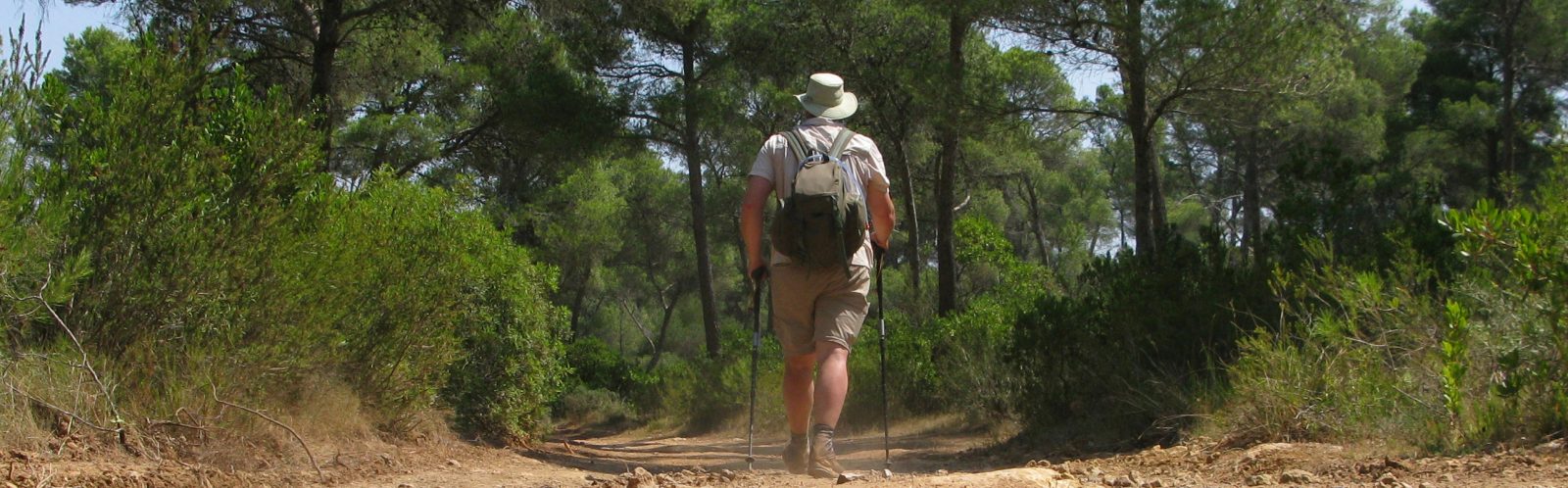
Three Points of the Compass hiked the Arctic Circle Trail during the brief Greenland summer. The first four days took me into the mountains and arctic tundra, to the tidal head of the Maligiaq fjord.
The Arctic Circle Trail (ACT) stretches a little over 100 miles (165km) across Greenland from Kangerlussuaq to Sisimiut, crossing one of the least populated areas on the planet. Though normally isolated by many miles and lakes, the trail occasionally approaches a rough and little used track that has been bulldozed between the two towns. The only people for many miles are other hikers and the infrequent hunter. There is no exit en route, no transport out, unless hoping for Search and Rescue in the event of injury, and even that requires a PLB and possibly a wait of a day or more. The backpacker needs to know what they are doing and should have experience of multi-day hiking in a demanding environment. I was excited, a little nervous and looking forward to tackling the ACT. It promised to offer beauty, solitude and a challenge.
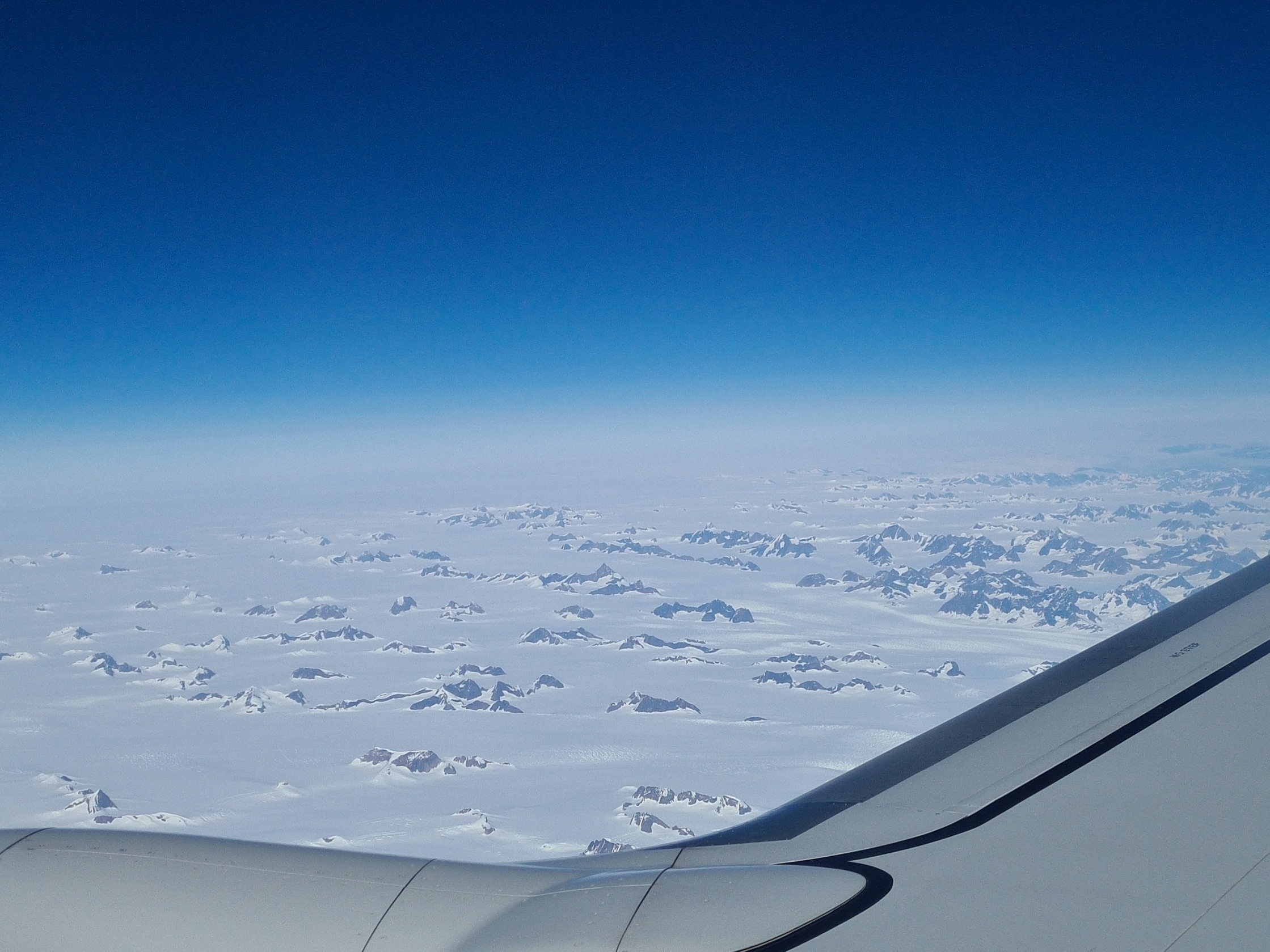
I flew into Kangerlussuaq from the UK via Copenhagen. I gazed out the window at the sheet of snow and ice below wondering what I would encounter but when we bounced down on the runway, the land outside was simply dusty and free of visible ice, though the permafrost remains below ground level all year round. For just a few months each year, a narrow strip of coastline on West Greenland is clear enough to enable hikers to walk the ACT.
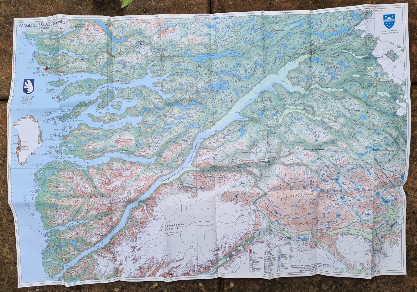
Before leaving the airport I did pick up a map from the little souvenir shop. Not that I needed it as I already had the recommended set of three 1:100 000 scale maps for the ACT, also the route downloaded on my phone via the Hiiker app. The additional 1:250 000 map from Arctic Sun Maps that I purchased in the terminal would enable me to look at the bigger picture over the next few days. I could keep an eye on progress as I headed to the coast and better see how I fitted into this remarkable landscape.
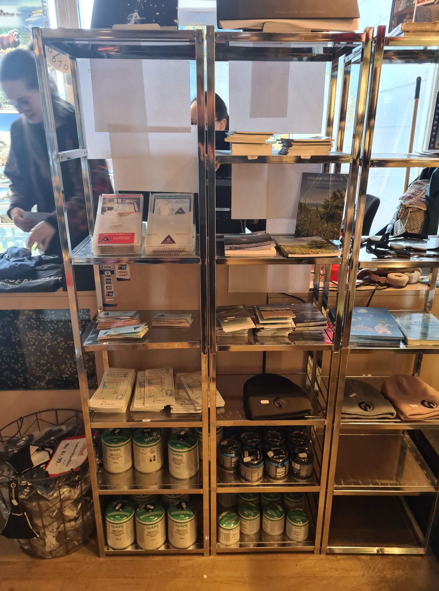
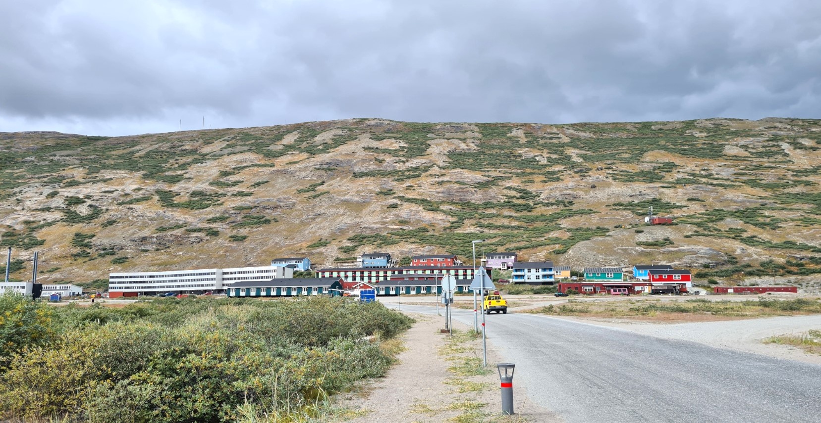
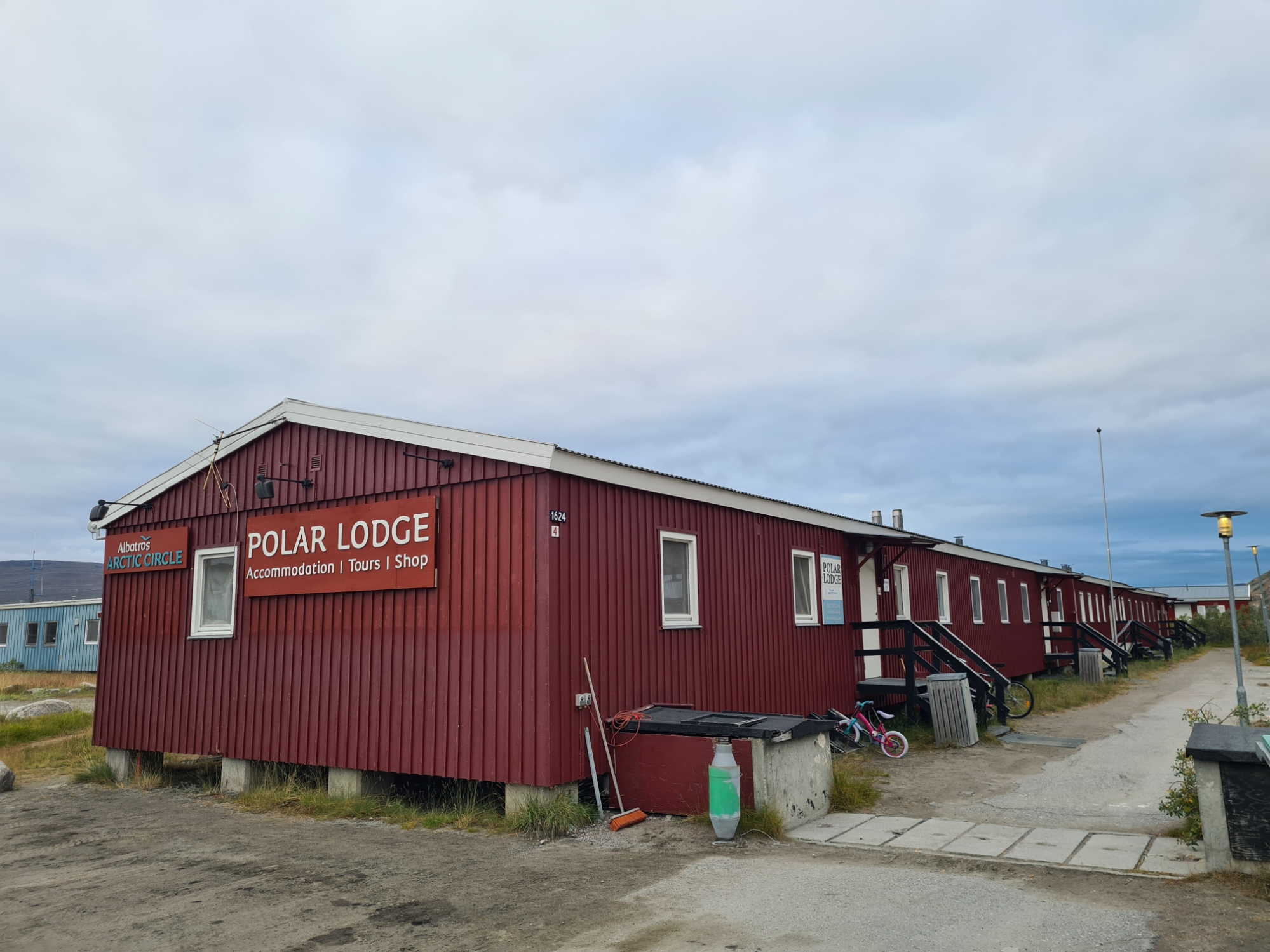
It was a short walk to check into the Polar Lodge for the night. There had been gas canisters on sale in the airport shop but I had held off from purchasing one as I wanted to see what other sizes were available in the sprawling settlement. The lodge had a shelf of large but almost empty gas canisters left by other hikers. They were free to take but I wanted a full one so I would continue my search. I had a comfortable room to myself where I unpacked and spread my gear out, then showered, changed and went off to explore the town. First to the Pilersuisoq supermarket opposite the airport terminal, then a kilometre walk round the end of the airstrip to the other half of the town to the Kang Mini Mart, trying to hunt down the size of gas canister I wanted. Not finding anything of interest I returned to the first supermarket. While I was pleased they actually had the required fuel for my stove, there wasn’t too much in the way of choice of size. I eventually purchased a 300g canister. I didn’t need much in the way of food as I had bought most of what I wanted from the UK. I searched for a block of cheese but found nothing I fancied so just purchased nine Peperami sausages to supplement lunchtime noodles.
In the evening I returned to the airport terminal to eat, eschewing the expensive airport restaurant in favour of the perfectly adequate and more reasonably priced airport café. It was quite busy and seemed to be a favoured place as a number of local families stopped in for their evening meals, as well as the local police force. Chicken and chips, with gherkins and a glass of iced water filled the inner man. I had already found out that the Polar Bear Inn across town was closed. As far as I could tell, there was little in the way of a ‘pub’ in which to try and settle any nerves so I just returned to my room at the lodge and went through my gear for a final check. Not that I needed to do this but it kept me occupied. It was too late now to worry about things anyway. Preparation in advance is very much a necessity out here.
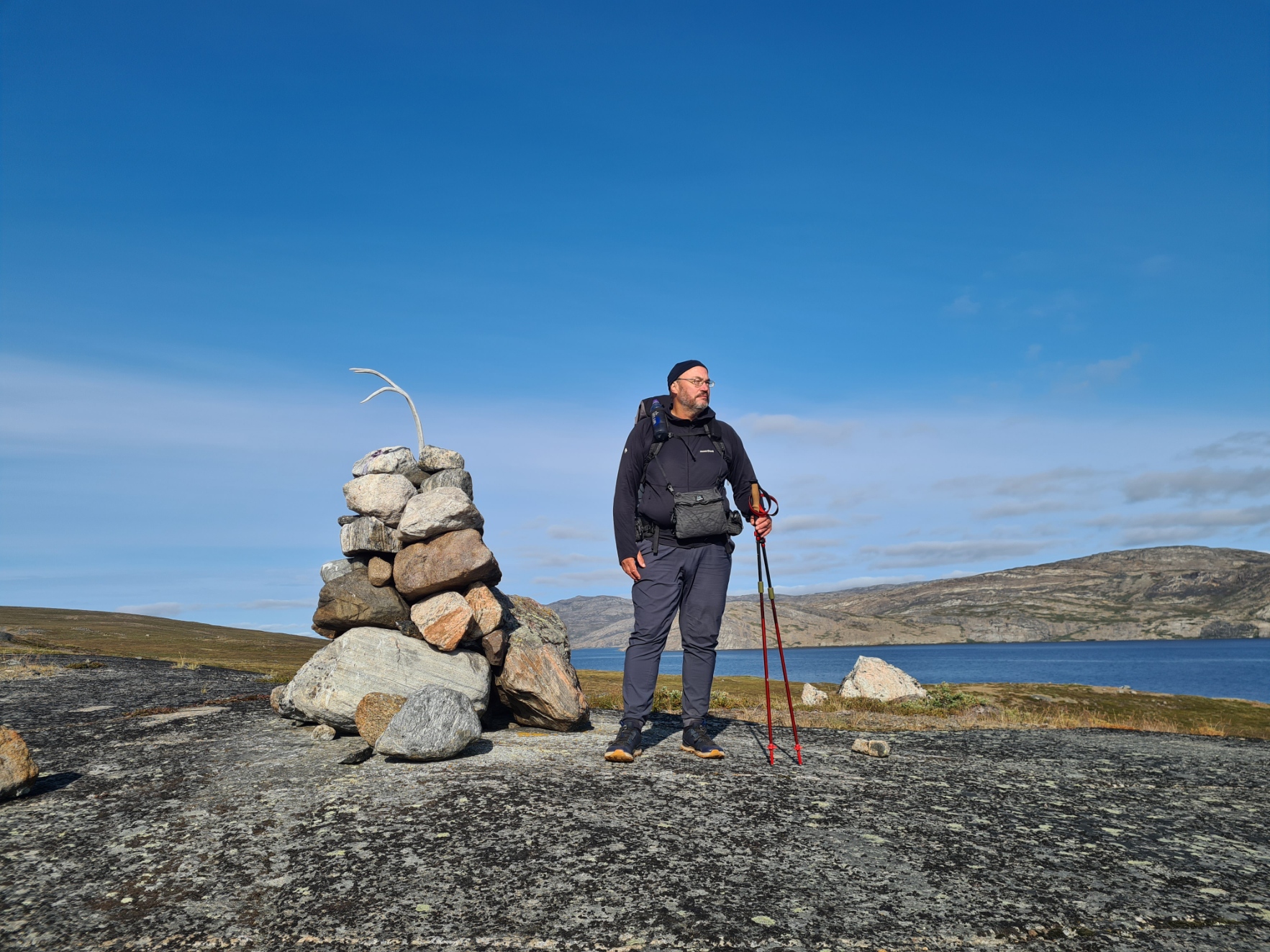
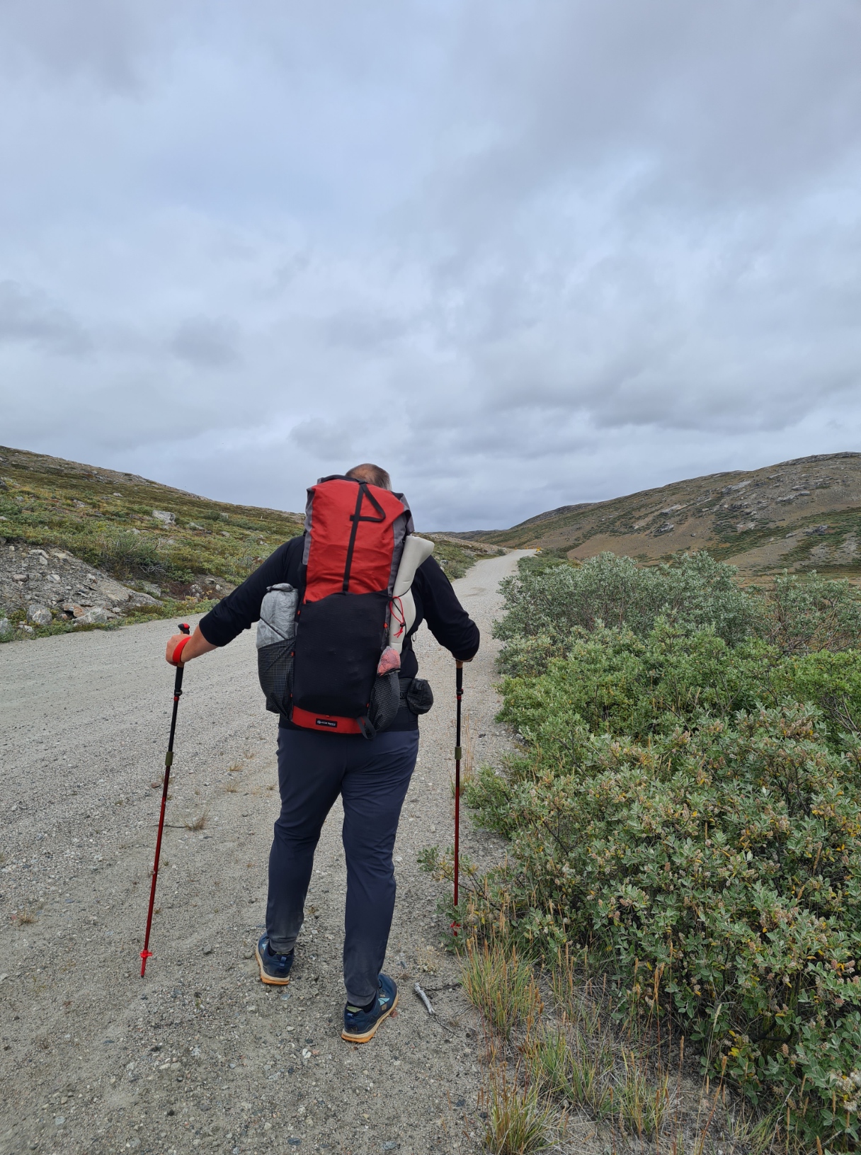
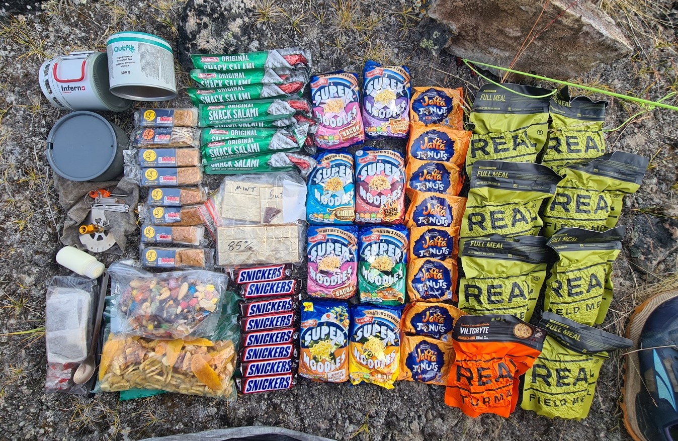
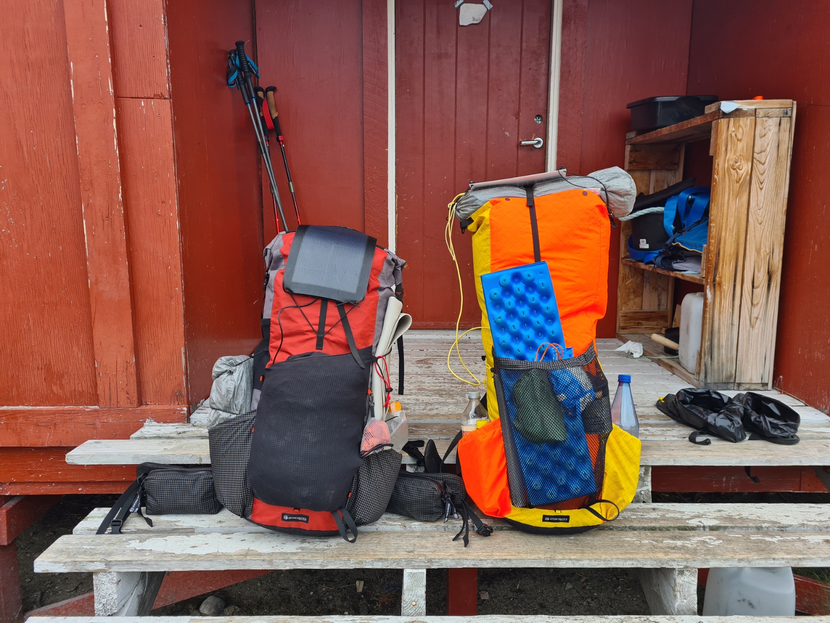
There was a lot to fit into my 60 litre backpack. I had thought carefully about what I would carry, which included nine days of food. Water isn’t an issue on the ACT as it passes many lakes and streams. Less consumables, my pack was a touch under 8kg, but the food added to this considerably. I thought my pack fairly bulky and heavy but it was nothing compared to some loads I saw being carried. With my tent stowed in an outside pocket, I managed to get everything inside the pack with no need to resort to strapping bags and stuffsacks to the outside. My small flexible solar panel would be positioned across the top of the pack in the days to come but not yet as I was setting off with everything fully charged.
Day One:
I was up at six and an hour later joined the quiet group in the small kitchen/dining room for a simple breakfast of slices of tasty bread, butter and cheese, with orange juice and three mugs of tea. There was a little more on offer but that sufficed for me. Back to the room, bedding dumped outside the door, top up my water bottle and a last check of the pack before heaving it on to my shoulders.
The road headed out of town. The sprawling red painted low slung buildings thinned and were eventually left them behind. The police station and a handful of smart blue homes were likewise passed. Due to their short ears and brown/grey coat what I thought to be rabbits bounced along the verge and I barely gave them a glance. These were actually Arctic Hares, the only ones I would see. The dusty road slowly rose and dropped. I paused to watch a military cargo plane lazily drop down over the fjord to my left to land at the airport. Occasional earthworks for pipes to my left. On my right, I passed a compound of shipping containers with stacks of antlers on their roofs. The road split and I took the left fork. It was slightly longer, but I wanted to see Old Camp. This is the oldest settlement in these parts. Most of the barracks that originally housed American servicemen have been converted to now offer hostel type accommodation. The two branches of the road came together again and I continued. A lone hiker was ahead of me and I slowly caught up with Ina. She was subdued, possibly due to the 24kg she was carrying. We chatted briefly but soon parted. Us lone hikers often tend to prefer our own company on trail. We would meet many times, just as briefly, over the days that followed. I was on my last few kilometres of road. Battered yellow painted barrels now lined the edge on my left. Hooded Crows flew from outcrop to outcrop along the cliffs to my right, rock faces often daubed with graffiti. As the road began to round a bend I climbed a mound to my left for a final look back to Kangerlussuaq and its airport, already looked small. The dome of Sugar Loaf mountain loomed behind the town, and beyond that was the Greenland ice sheet, second in size only to Antarctica. Two more hikers were approaching. Fellow Brits Robin and Jon caught up. They were friends on an adventure and we would occasionally see each other on trail over the following days. Remarkably, the three of us would reach Sisimiut at the same time in eight days time.
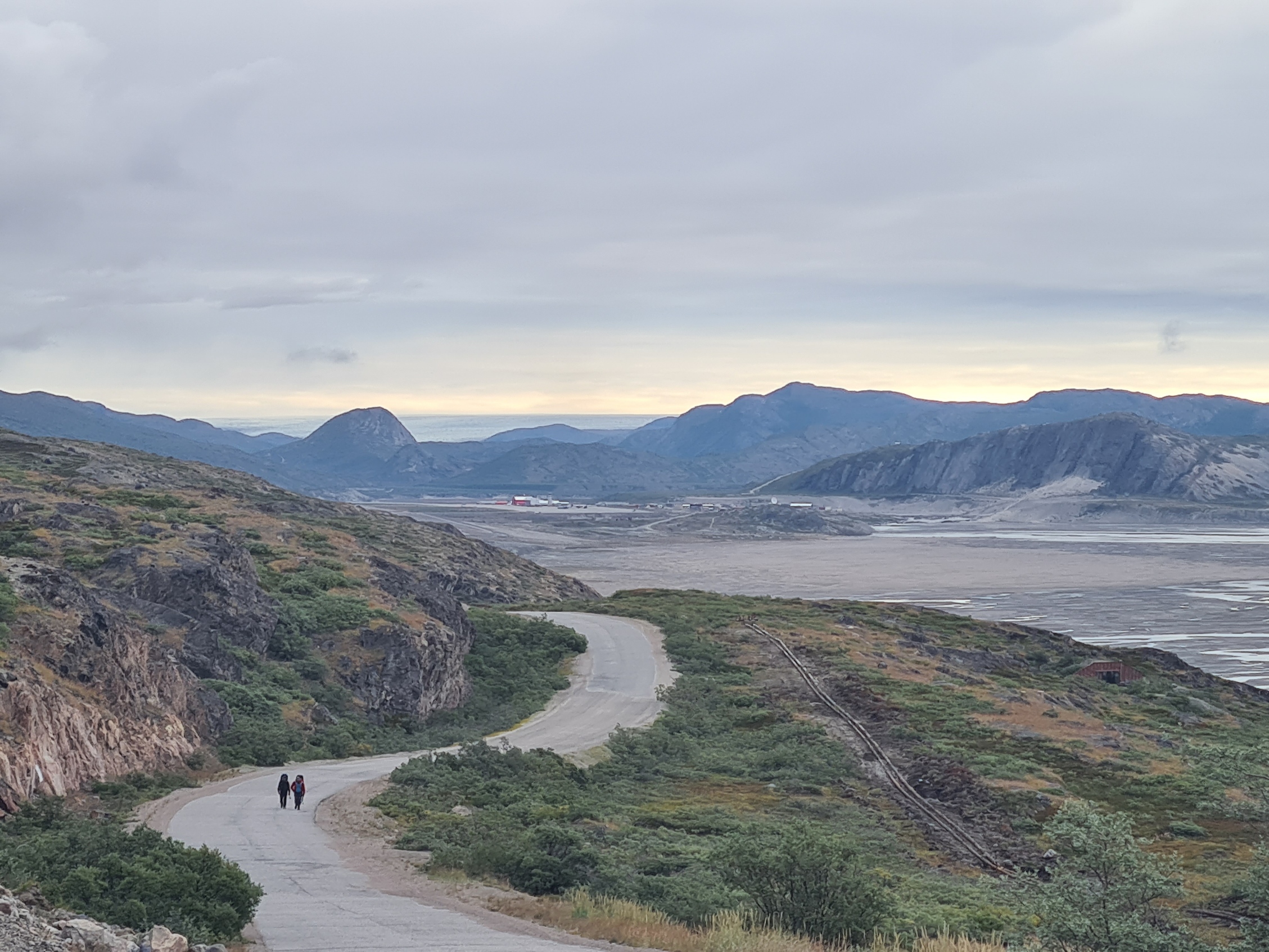
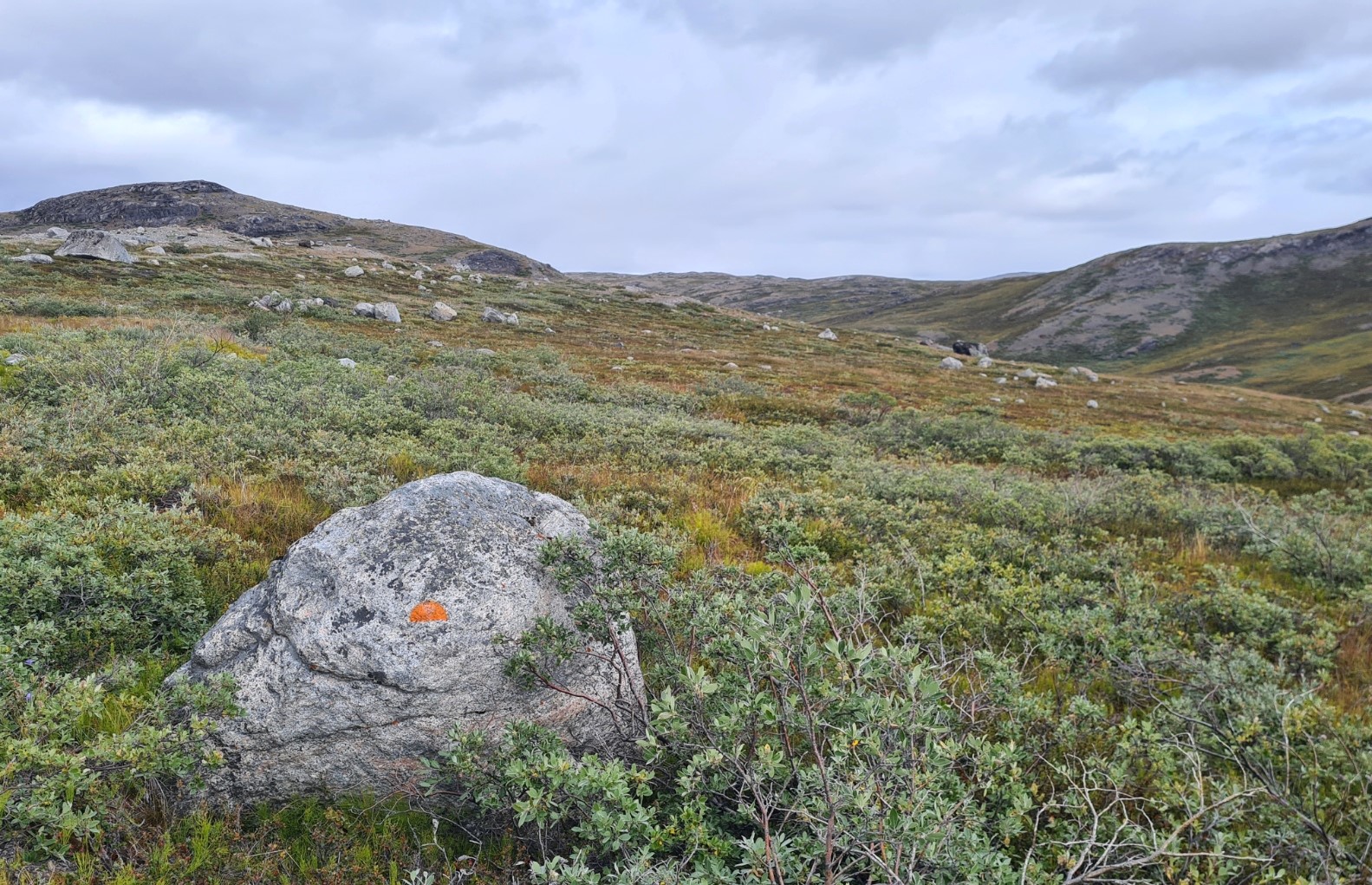
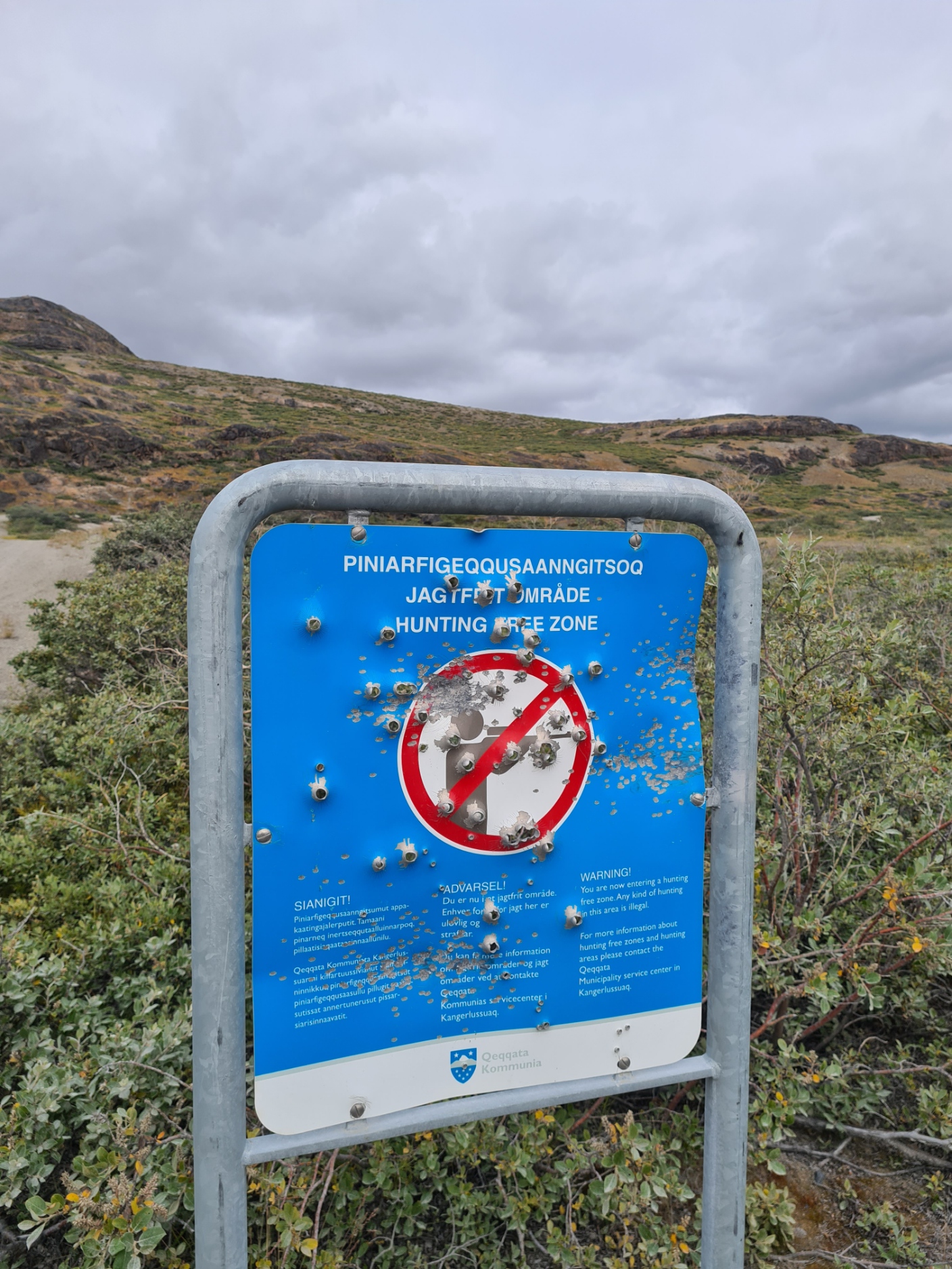
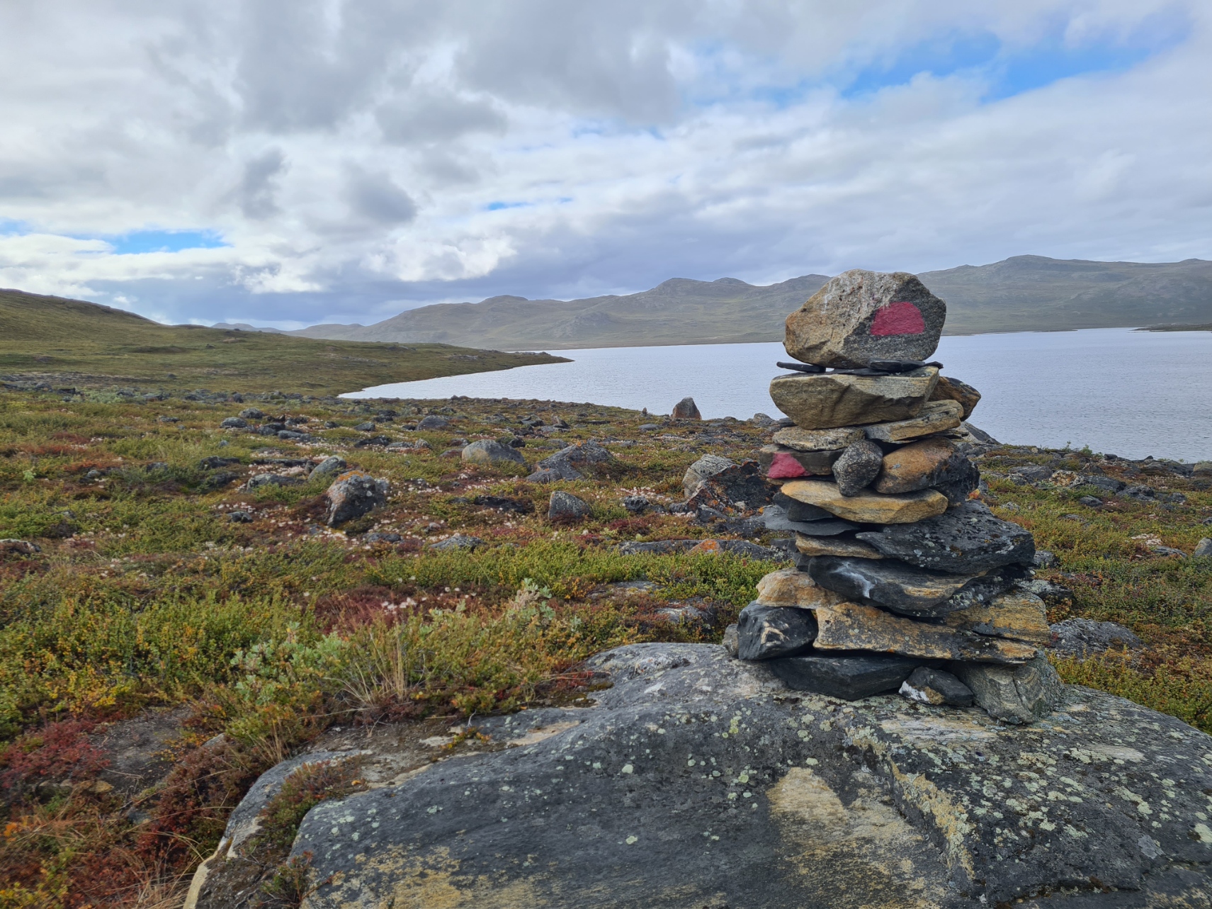
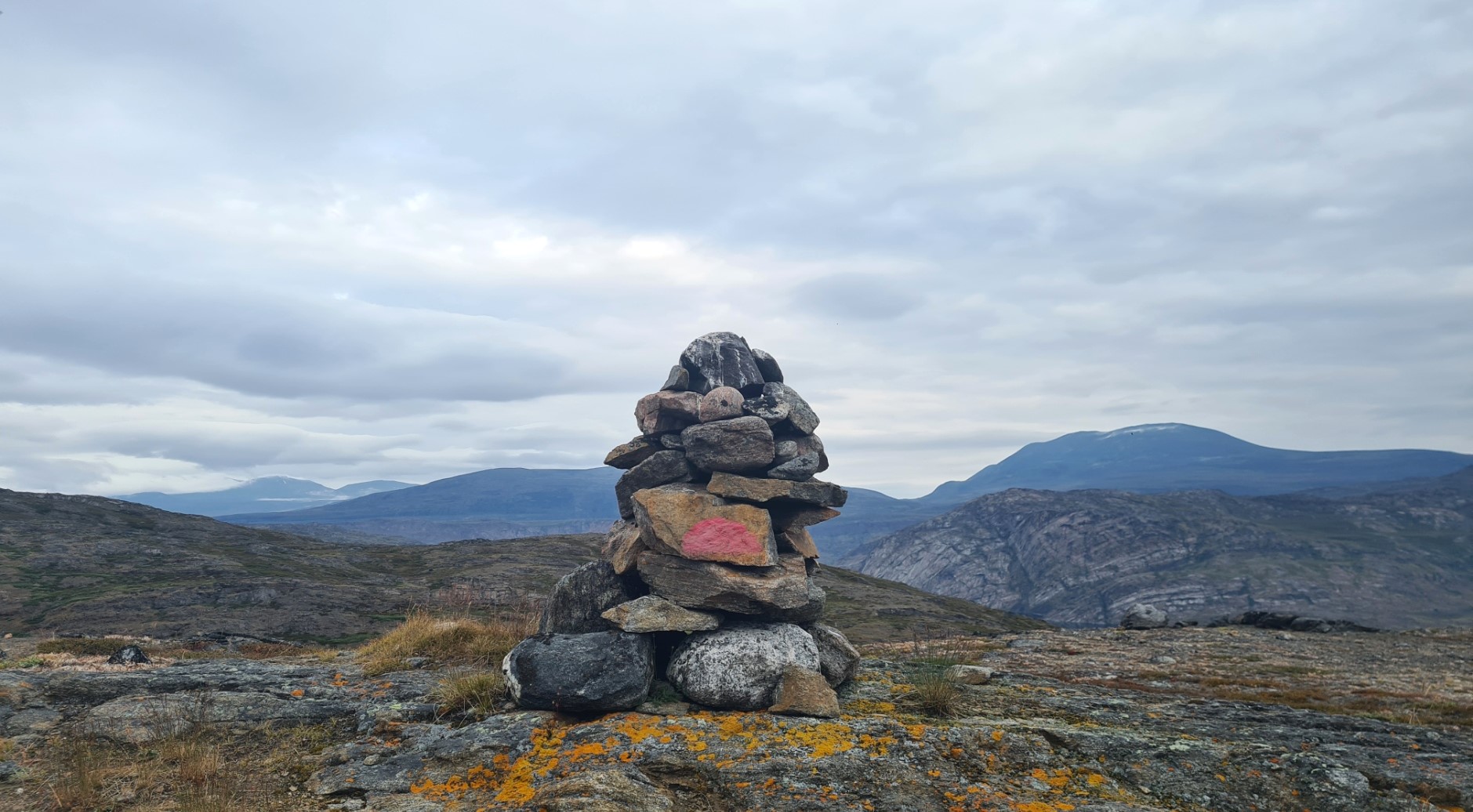
The road approached Sondrestrom Port where the small harbour apparently hosts large ships. There is little here, and before descending to it the trail turned sharp right, past a sign warning hunters of restrictions, and began climbing, occasional tracks branching off to small blue painted houses that dotted the hillside. Eventually I left these behind. Onward, to Kelly Ville, home to a large ‘incoherent scatter’ antenna dish, built 1982 and abandoned 2018, then to the untidy concrete mess of anchoring points left over from a now long gone communication mast. It was here that I saw the first of many red semi-circles painted on a rock., These are the ACT trail markers. I was 20 km from Kangerlussuaq and I felt the trail now ‘properly’ began.
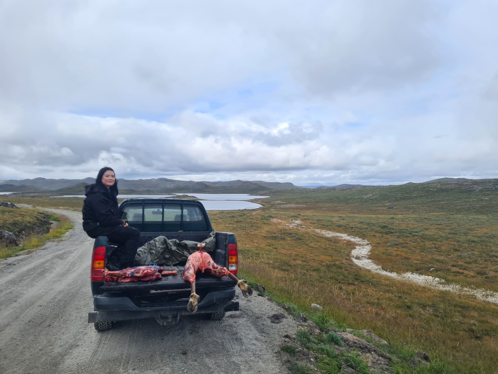
While good water can be drawn from most streams and lakes all the way to Sisimiut, I was entering the Tarajornitsut region, with slightly brackish lakes, so took the opportunity to descend off the track to filter a couple of litres of fresh water while I could, refilling my water bottle as well. Back to the track and just a couple more kilometres before the trail left the 4×4 track. It was here that a pick-up was parked. Two Inuit girls were waiting with it. In the distance I could see a hunter returning, laden with another quarter of a butchered and skinned reindeer. They don’t hunt for sport here. meat is for the table. The haunches he had already loaded were evident, hooves poking from the rear of the vehicle.
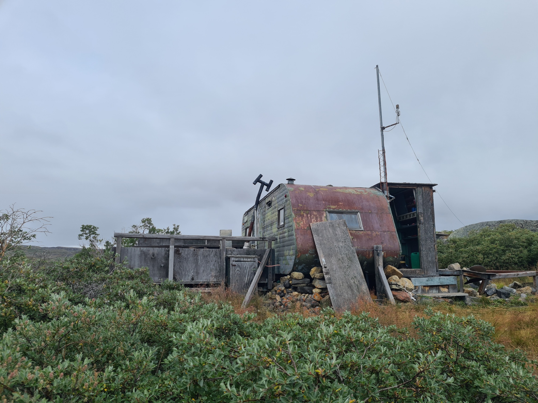
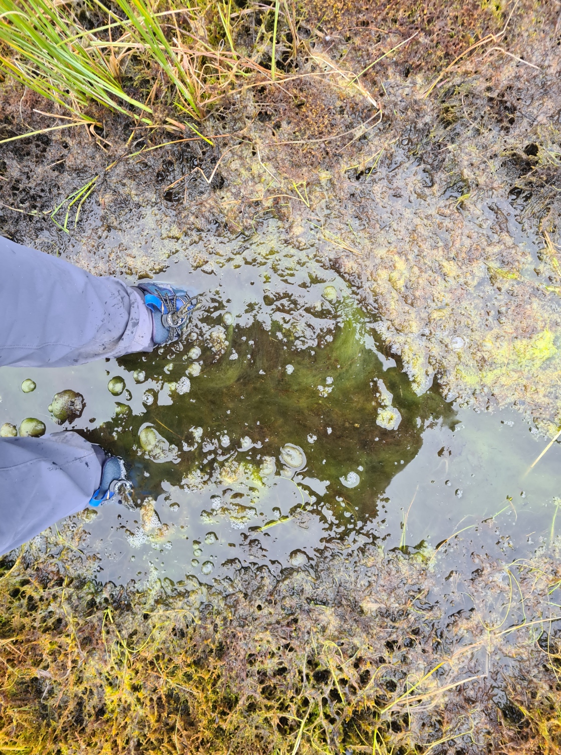
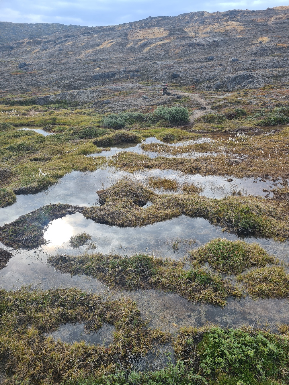
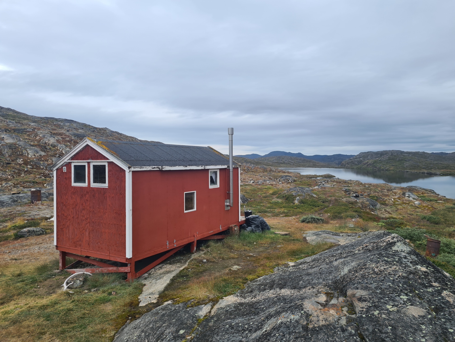
The cotton grass led the way toward the lakes, eventually reaching what I had thought might be my halt for the night. Before setting off on this trail I had no real plan on where I would stop each night, but had thought one option might be to occasionally sleep in the huts found along the trail. My Cicerone guidebook described Hundesø Hut, a tatty caravan with tacked on wooden sheds, as the “least luxurious on trail”, though admittedly it isn’t an ‘official’ hut. I hadn’t been expecting much, but pulling aside the tarp covering the sagging door, which had to be forced open, it didn’t take more than a few seconds to realise I wouldn’t be sleeping in one of the four bunk beds inside. I did shelter inside for a while as it was now raining. I prepared a late lunch of noodles, Peperami and mug of tea, after which I quartered the ground outside looking for a pitch for the tent. I now witnessed first hand the mess that some hikers leave. The only flat dryish ground nearby was littered with faeces. Shredded TP was scattered around. This despite this being one of the few huts that actually had a w/c just a hundred metres away. While this is just a wooden ‘long drop’ facility, it is more than you might find on most trails. I had originally planned on keeping my first couple of days on trail short and easing myself into the ACT, but it had been easy walking so far, I felt good and had hours of daylight left, so I walked on. It wouldn’t be difficult finding a much better place to camp tonight.
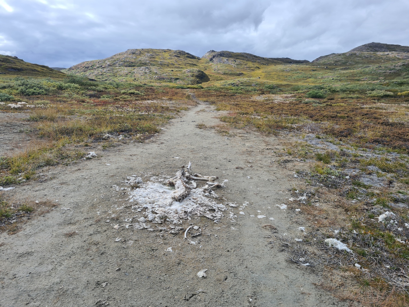
It was fairly easy going, if a bit boggy in places. I came across the remains of a reindeer, butchered directly on the ground. The corvids and foxes would eventually scatter its bones but the detritus would remain for a good few seasons yet. I might have expected flies, but there were none. I only walked another four km or so before reaching a lake a bit larger than those passed earlier, I hadn’t seen anyone since leaving Hundesø so branched off trail, climbed the hill to my left and began looking for a pitch for the night. I didn’t need water as I still had much of the two litres filtered earlier.
The low scrub didn’t lend itself for a wildcamp but I found a flat and clear stony outcrop overlooking the lake below. If the grotty pitch at the hut had been a 2 out of 10, this was definitely a 6 or 7. I couldn’t drive most of my pegs in but there were plenty of rocks to anchor the Duplex down. Then inside for a bit of a tent wash while water boiled and tea brewed. It had been a good first day with decent miles done. I felt good and had loosened up a bit, the stiffness from too many hours of flying had gone. With my puffy on and legs covered by my quilt, I sat with a hot rehydrated meal, looking out at the lake. It was almost silent, other than the plaintive call of a Diver, what Americans call a loon, that occasionally echoed. I would see and hear these aquatic birds on most of the larger lakes over the next few days. It looked like the temperature might drop tonight so I kept phone, water filter and power bank in the footbox of my quilt overnight. I settled to sleep quite early, the door overlooking the lake left open.
Day Two:
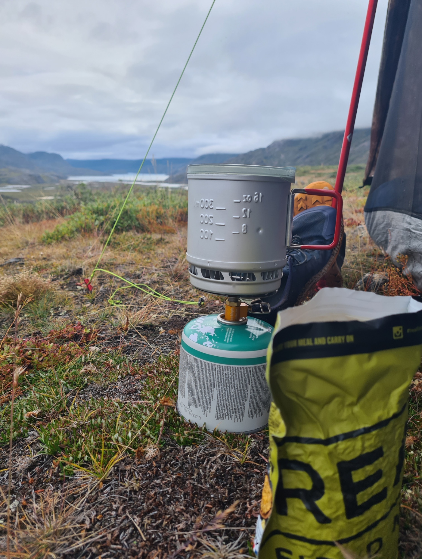
The temperature did drop but remained just above freezing. I had no alarm set and eventually stirred, reluctantly, when I thought it might be around six. I retrieved my phone from the footbox and turned it on, astonished to see it was almost eight. I had slept fantastically well, other than having to reinflate a soft mat in the small hours. Looks like my slow leak has returned. But I was in no great rush and lingered over my morning brew. Prior to packing, I spread out my food for a photo, and in the process almost kicked my gas canister off the rocky ledge I was perched on. A little more care please!
There wasn’t the greatest variety in my food from day to day but I never got bored with any of it. Everything was high in calories. I struggle with breakfast on trail so would rely on a butter flapjack, usually eaten an hour or so after setting off each morning. Also munching on trail mix when I remembered to. Lunch was noodles with sliced spiced Peperami salami. Each evening I had a large hot rehydrated meal followed by a chocolate and orange Jaffa Jonut cake (the best part of the day), with more chocolate later. As well as meals, my trail mix was a large bag of dried banana, apple and lime infused mango, and another of nuts, jelly babies, M&M’s and raisins. I had a Snickers bar for each day, to be eaten whenever I fancied it, which was usually mid to late afternoon. I drank a pint of tea in the morning, usually while I dressed and packed, another couple of mugs of tea and possibly a hot oxo each evening. I drank copious water throughout the day, with the occasional mug of tea at midday halt if I fancied it.
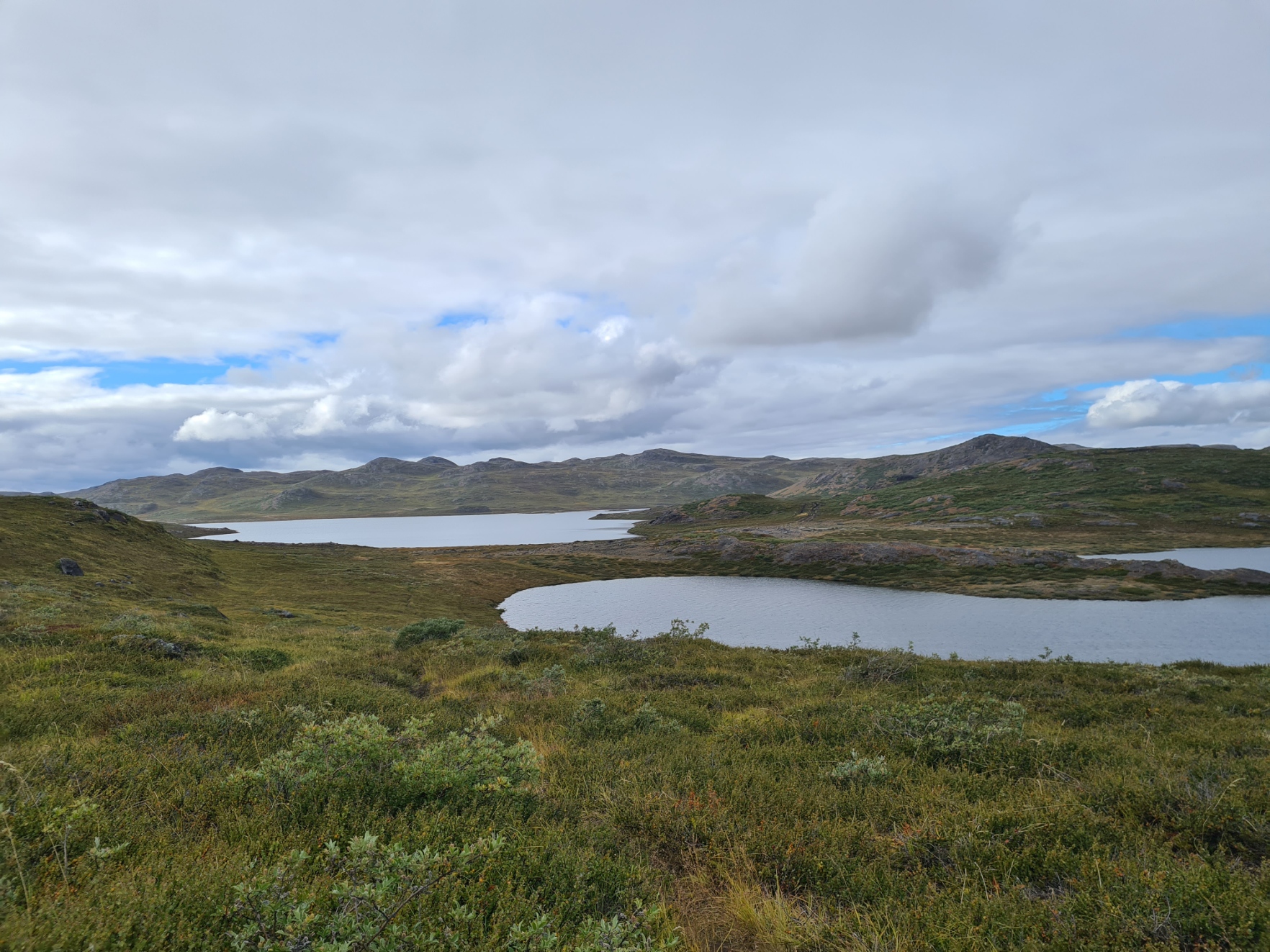
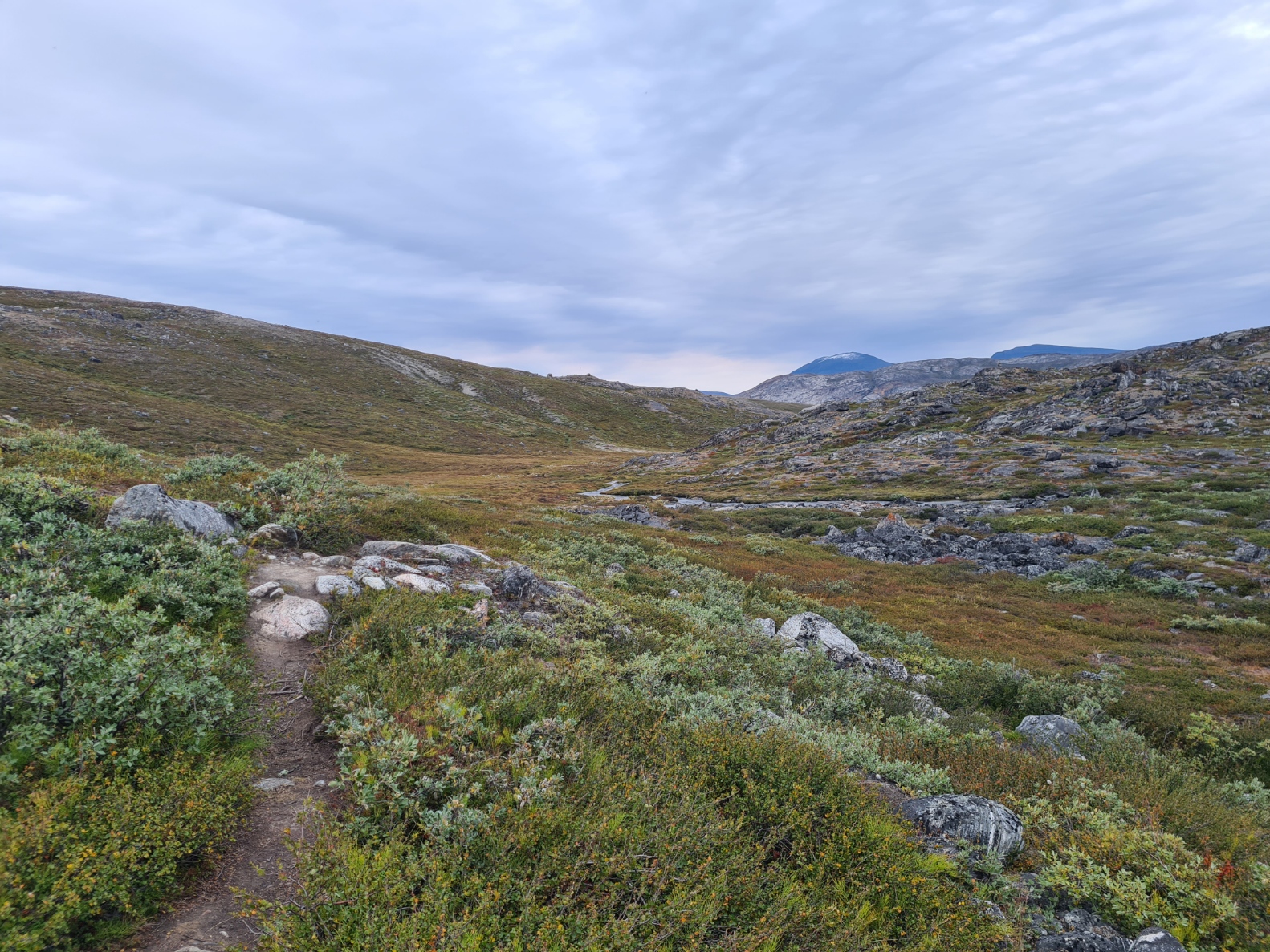
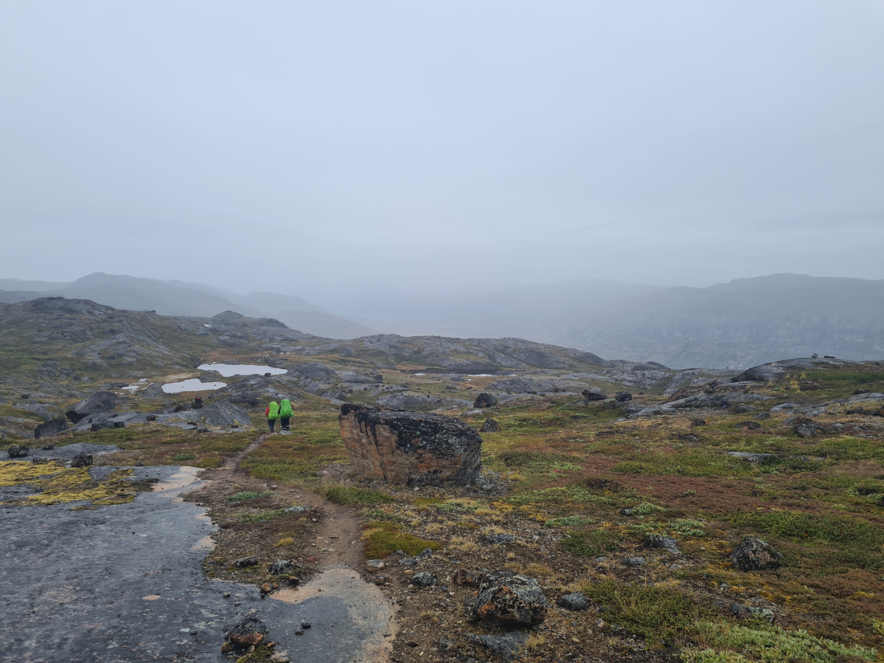
The Arctic Circle Trail is named for its latitude, lying along the Arctic Circle itself at 66.6° N. Despite only modest climbs and drops along it’s length, the terrain would get progressively more mountainous as I walked westward toward the coast. Having left the dusty road out of Kangerlussuaq behind yesterday, I was now following a genuine walking trail. I would guess there is an easy-to-follow tread for around 5% from here on, picking my way along the less clear or non-existent trail across the tundra for the remainder of the time, until the final day where an All Terrain Vehicle (ATV) track is followed for part of the day.
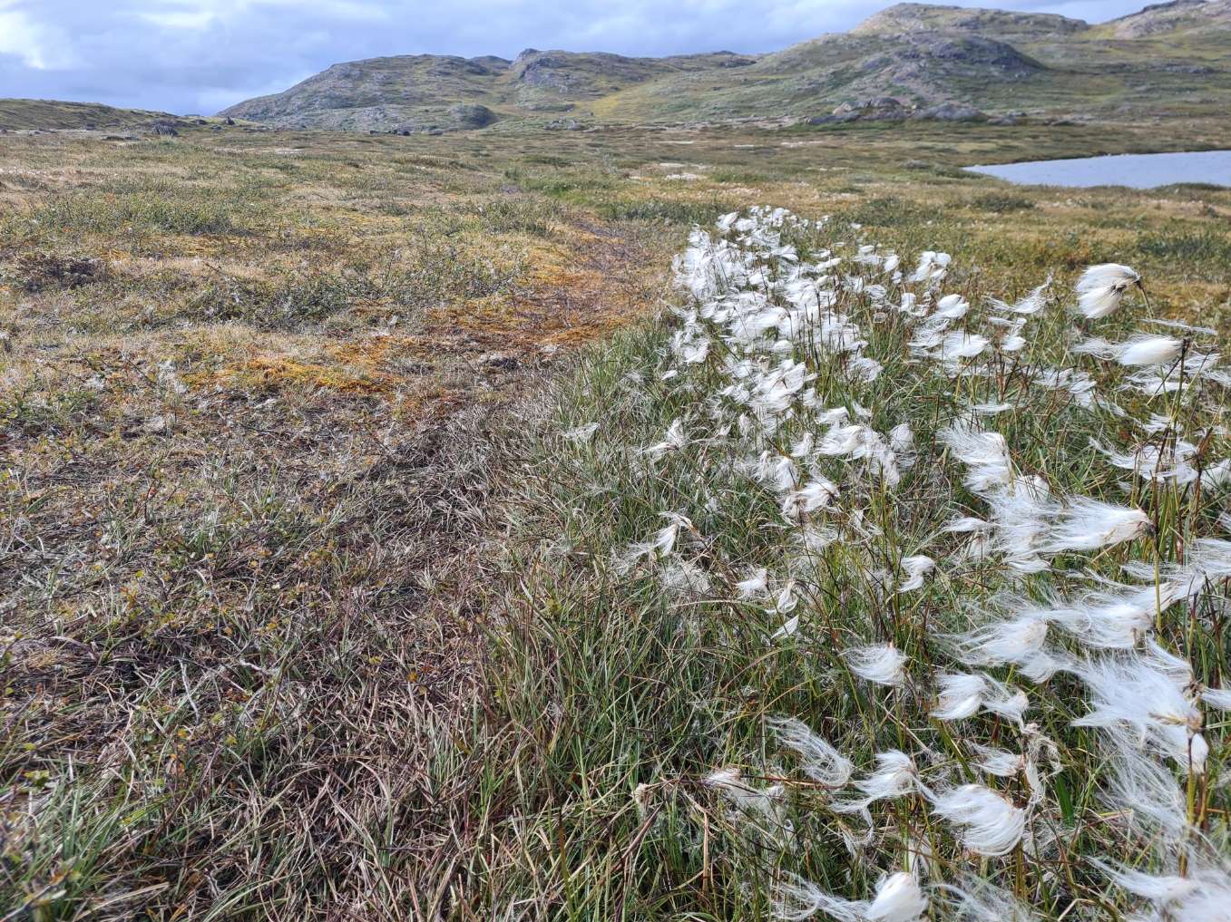
It would be another day of crossing hummocky hills and handrailing lakes. When I set off there wasn’t a breath of wind. There were a few flies around but nothing biting but I pulled my hood up to keep them off my neck and out of my ears. Many hikers these days will simply follow a line on an electronic device, but I usually prefer to remain a bit more connected to the terrain, if generally guided by a paper map. The 30cm wide ACT, when encountered, enables the brain to be switched off slightly (very slightly), but for the rest of the time, it is studying the ground and looking for the often less than obvious route, following whispers of footprints, scrunched dwarf shrub heath, the cottongrass, bashing through arctic tundra, sploshing through bog.
It is a much debated point as to what is the most suitable footwear for the ACT. Some hikers swear by waterproof boots, others wear waterproof socks. I didn’t bother and continued my usual practice, which is good quality merino socks and breathable trail runners. I allowed my feet to get wet and the shoes would easily drain of water. Careful footcare of an evening, washing, drying, massage and foot balm, with dedicated dry night time socks are an important part of this regime. I had no foot issues at all over the trail. But ‘wet feet walking’ isn’t for everyone. I hadn’t bought my winter neoprene over socks for this trail, but in retrospect, they might have been appreciated on just one particularly cold day.
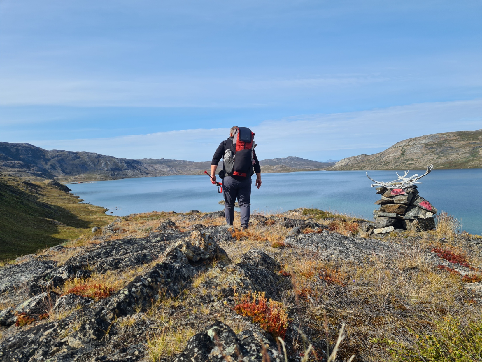
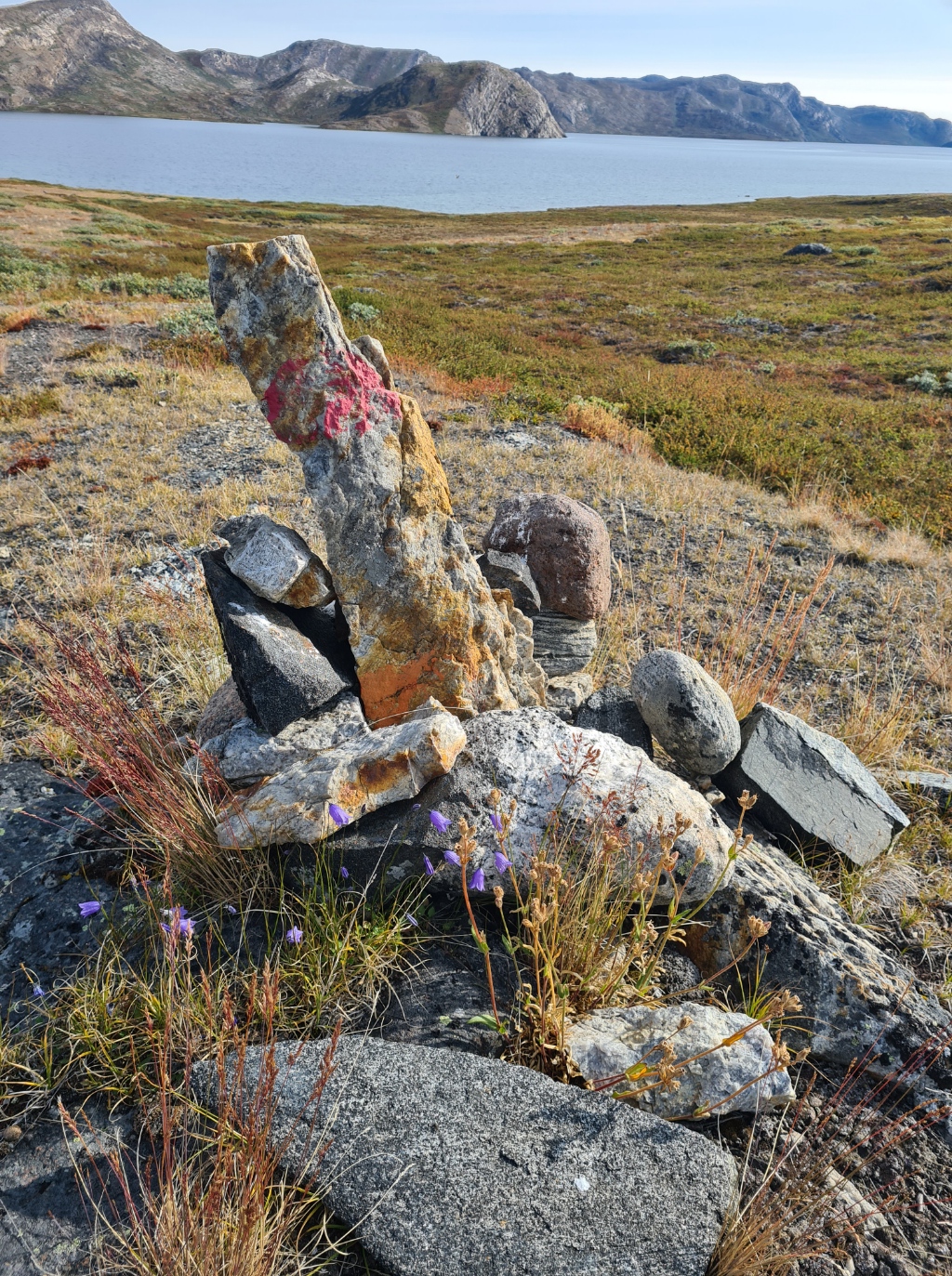
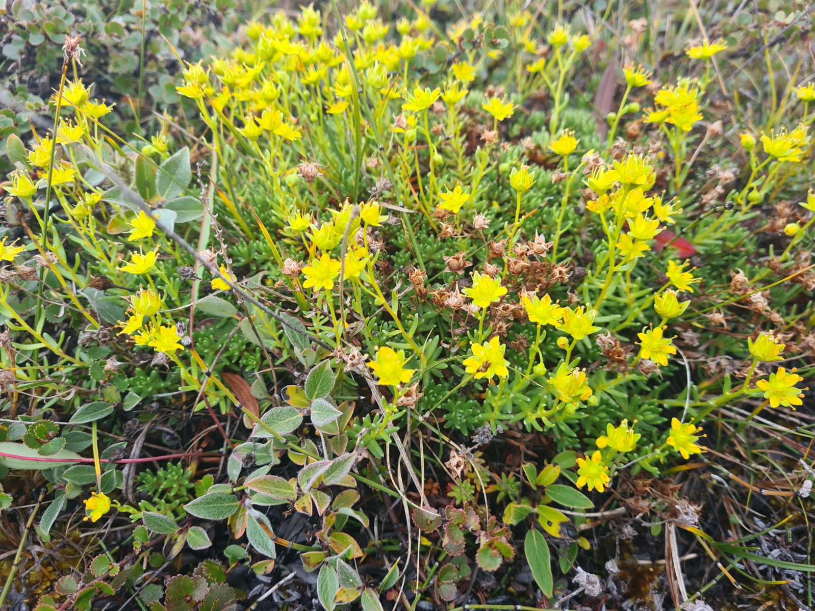
It was the sort of route finding that comes almost automatically with experience. But I always kept an eye out for the cairns. Many of these aren’t up to much at all. Possibly a lone rock perched on another, hopefully with that reassuring semi-circle of red paint. Other cairns are quite impressive towering affairs. The very best however are the ones adorned by antlers. These are the ones that the hunters have marked. I have a separate post sharing a few images of those.
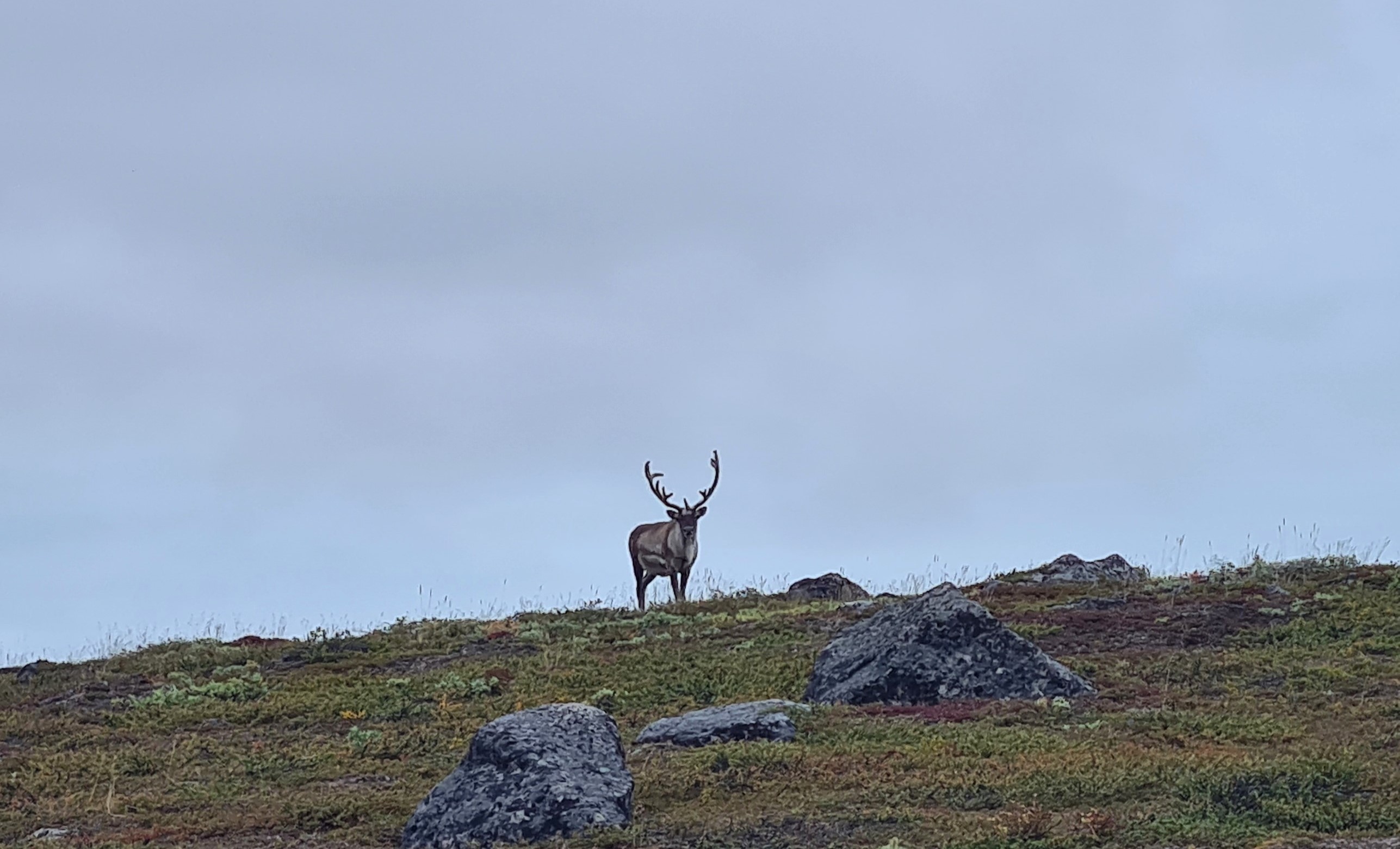
Over the years a steady procession of hikers on trail have made their own mind up where to go and a path can frequently skip a cairn. But those semi-natural signposts were situated by people who knew what they were doing and frequently show the best way to keep above the boggier ground. It was fantastic walking and I was enjoying the trail immensely, made all the better when I spotted a couple of fine antlered reindeer top the high ground to watch me from a safe distance.
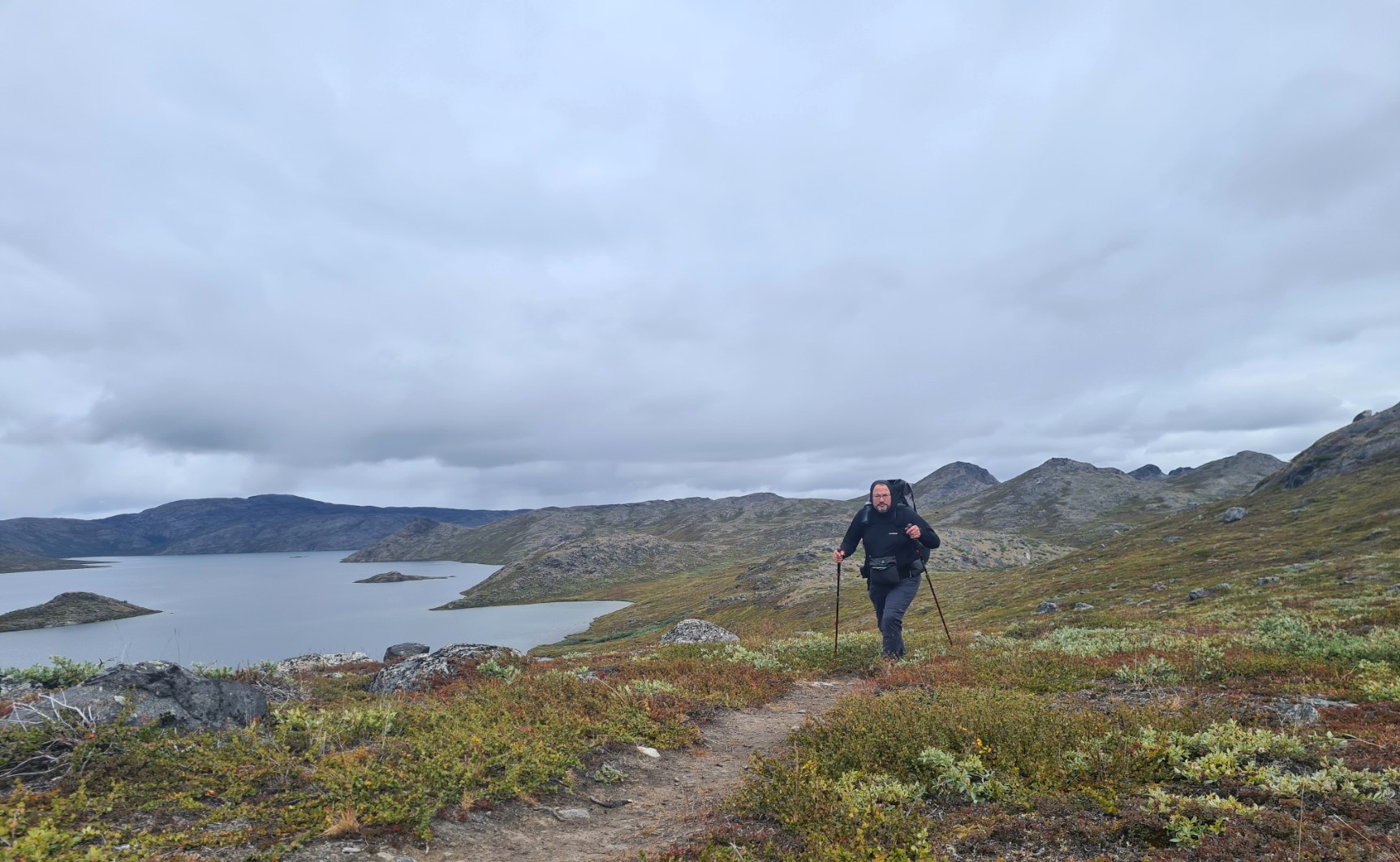
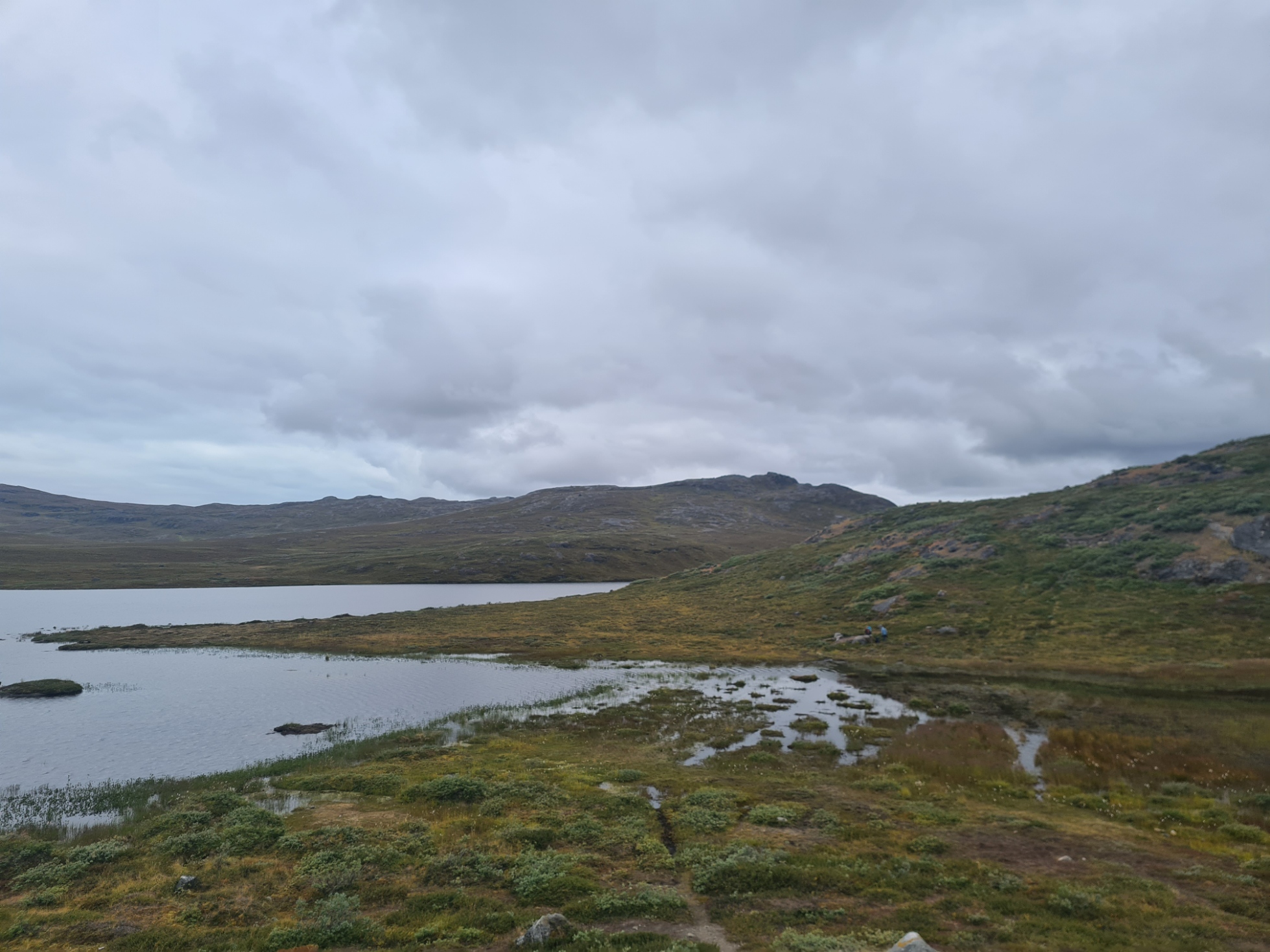
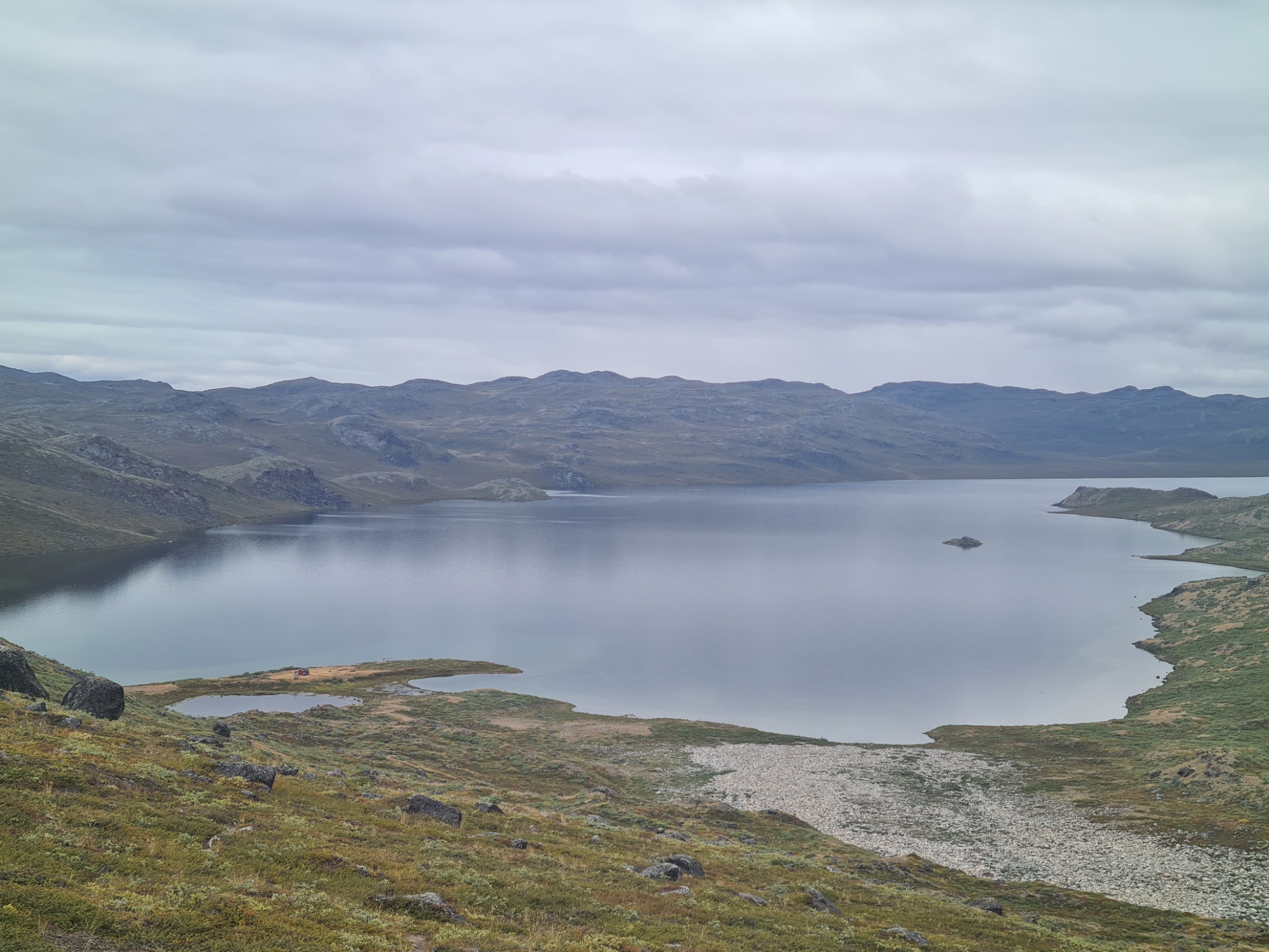
Just prior to midday I reached a fording point between two lakes, the one to my left another seemingly nameless body of water, as so many are around here, the larger lake to my right was Qarlissuit. Freezing cold water slowly flowing from left to right. The ground beside the ford is shown as a ‘tent place’ on the map but I was glad I hadn’t attempted to reach it last night as the ground was mostly sloping and sodden. This crossing varies according to the month and how wet it is. Today the water was cold and clear enough that I was able to see the large rocks below the surface on which to step across, managing to keep the water just thigh deep. It would have been much deeper if I hadn’t found them, and I only knew they were there because the German and Austrian hikers, who had waded across minutes before me, shouted their presence to me. After looping round a low hill beyond, there was a steady climb and having crossed a modest plateau, the large Amitsorsuaq lake could be seen stretching ahead. I could see a little sandy spit poking out into to it, where there is another hut, my lunchtime halt.
It took some time to actually drop down to the hut and lake and when I did, Kattifik had been taken over by hikers that while friendly, were unreceptive to sharing space inside, so I stood outside to boil up water for my late lunch of noodles. While I was eating, another hiker joined me. Swiss hiker Benjamin had set off from the icefield a couple of days previous and we immediately fell into conversation as we had similar hiking styles and gear- Altra shoes, Atom packs, shelter preferences etc. The two of us even carried similar solar panel set-ups. I could have chatted to him for hours but miles don’t get walked if you don’t actually walk them.
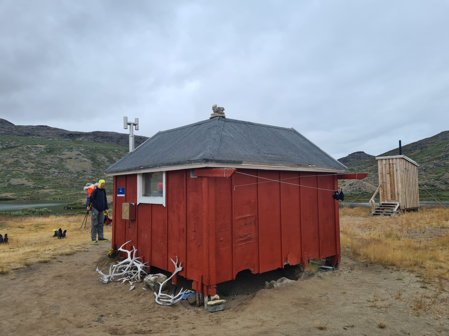
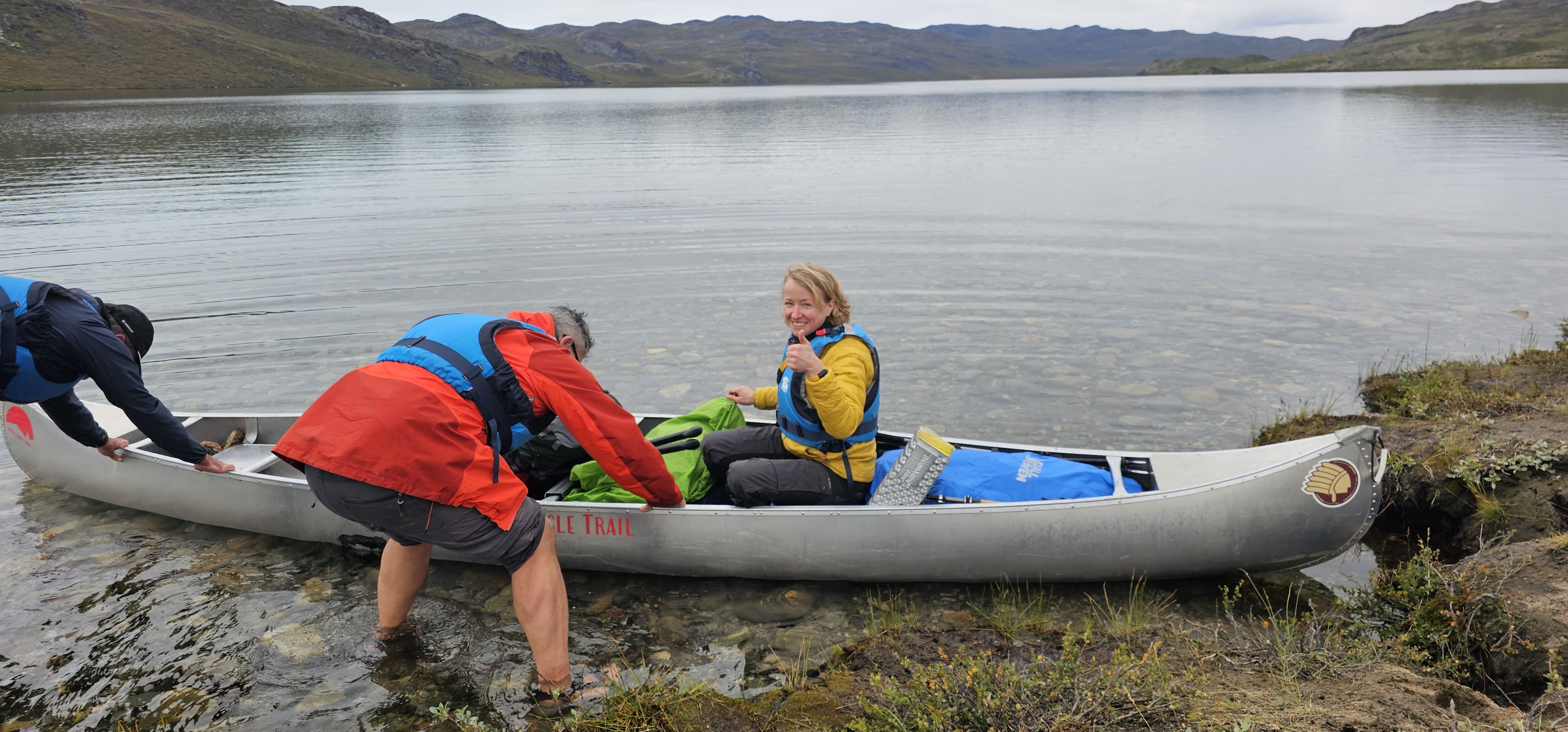
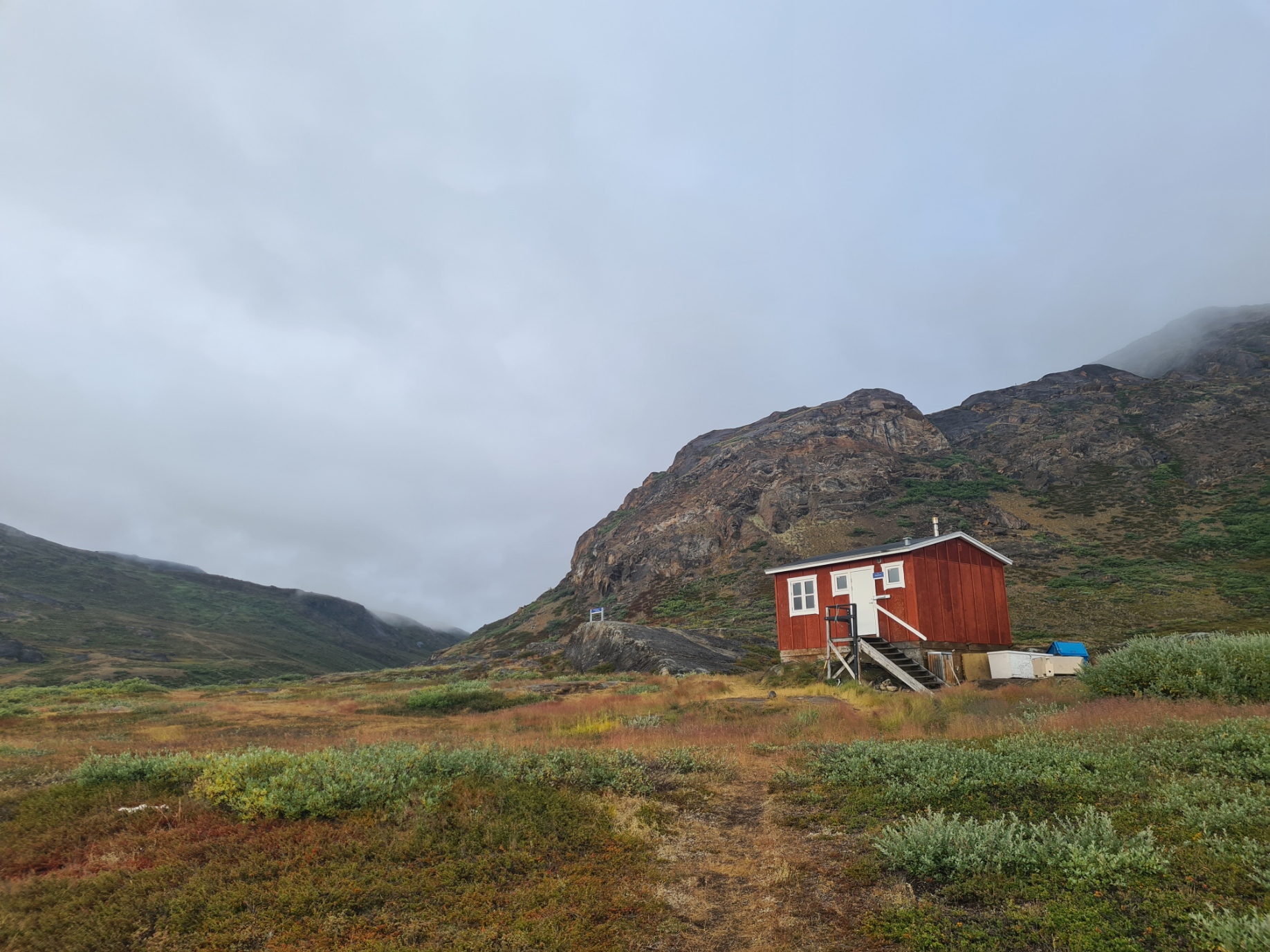
On reaching Kattifik Hut, the hiker might have a choice on how to proceed. This hut is the destination for those paddling from the canoe centre at the other end of the lake and many choose to make a trip on the water part of their expedition and paddle a canoe back down the lake.
Despite being told there was another canoe arriving soon, I was here to walk the trail, not paddle it, so didn’t bother waiting and having packed up after lunch set off walking the lake shore. Benjamin left just before me and I followed him, initially just a few hundred metres ahead. However younger fitter legs prevailed and he steadily drew ahead, disappearing from sight.
Robin, Jon and Ina had arrived at Kattifik just as a small party of ‘hikers’ arrived in a canoe and they chose to paddle the lake instead of walking.
For the most part it was easy enough walking along the edge of the lake but there are a couple of places where large boulders extend to the lake’s edge, requiring slow and careful traverse. Break a leg here and you are in trouble.
The lake is a day long walk and I knew I would be stopping along it’s length. I came across Benjamin where he had pitched his Tarptent on the shore for the night. He said there was room nearby if I wanted to also stop but, ever the loner when I can, I declined and walked on. Again, feeling good and wanting to get a few more kilometres under my feet.
A word about wildlife on the ACT, mammals in particular. I had already seen reindeer (tuttu) on trail. I would see them every day. I had hope of seeing Musk Ox and Arctic Fox. Sadly I was unlucky with both species. The mammal I didn’t want to see was Polar Bear. One of the few animals that actively hunt humans as prey. It would be extremely unlikely however as they are rare and very seldom seen on the ACT. There had been a sighting weeks before I left the UK but that animal had disappeared. A day after completing the trail I heard that another Polar Bear had been sighted. It was on the opposite shore from where I was now, on the same day. Ignorance is bliss.
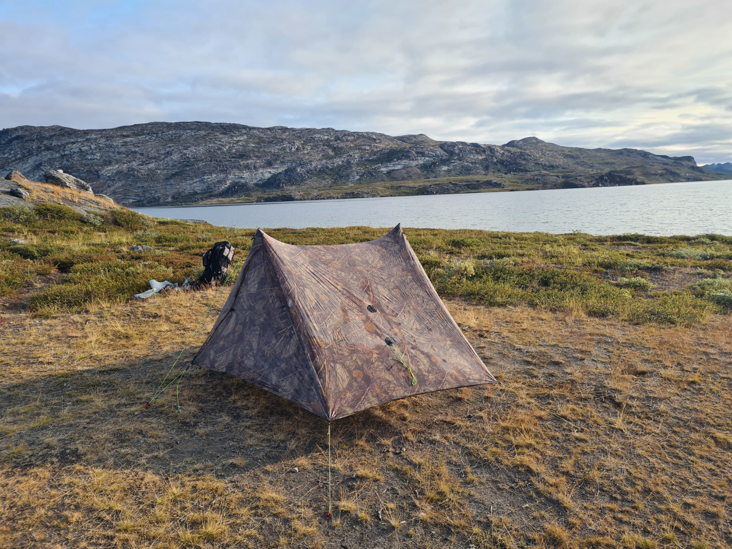
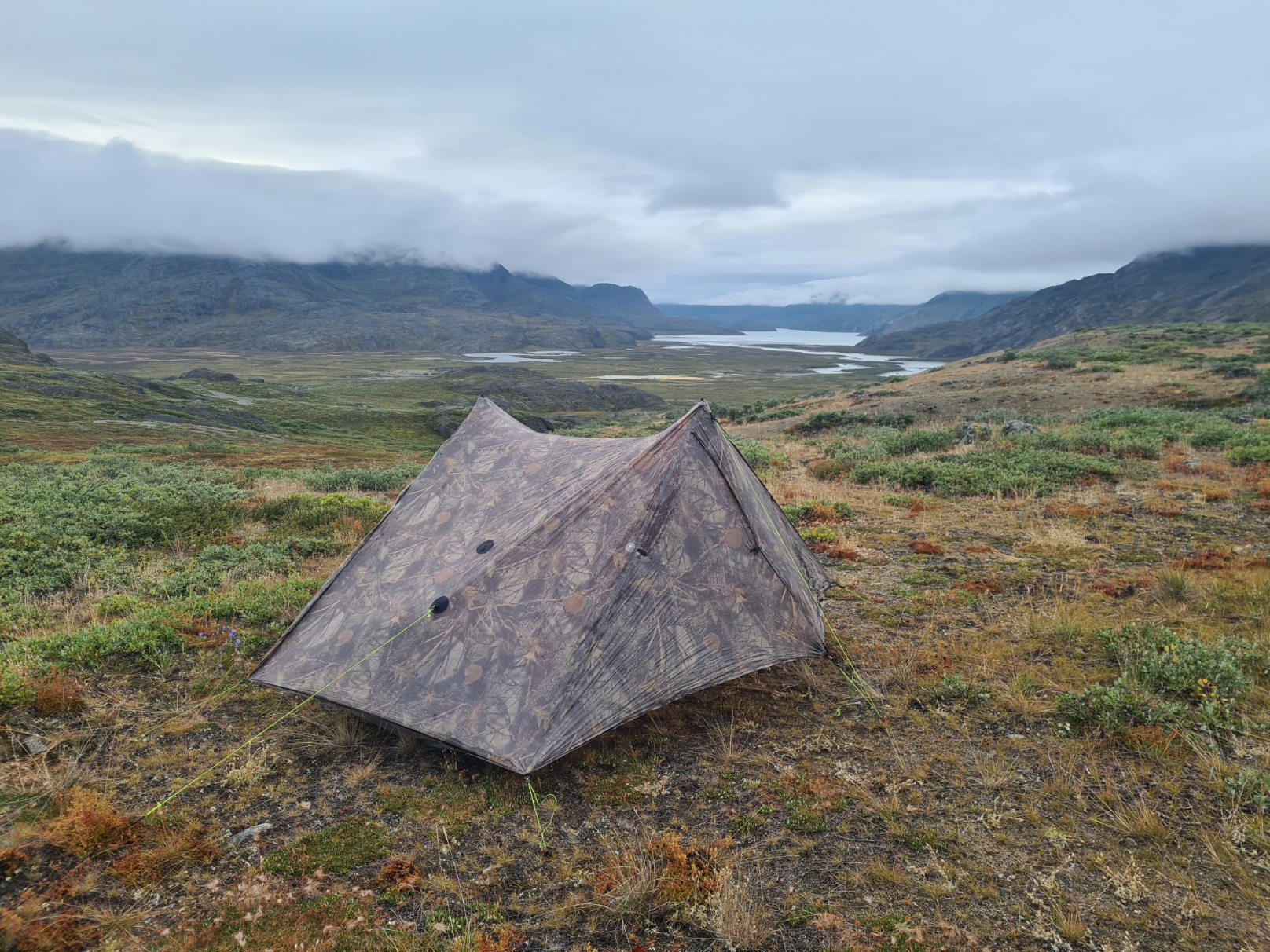
After a few more kilometres I came to the first of two ‘camp places’ marked on the map. This was simply a small dry grassy area, benefiting from views of fantastic convoluted rock formations on the opposite shore. A Peregrine falcon called from the steep rock face behind me. A Wheatear passed through the site, white flashes from its rump as it flitted from rock to rock. The site was also protected by a stiff wind blowing up the lake by a rocky rise. This blocked the wind so well that I pitched the tent high for more ventilation and more room. There were a few midges around so I sat inside the tent with the bug netting zipped up.
Before getting inside the tent I walked down to the lakes edge and straight into the cold water, removing shoes, insoles and socks and washing them and my feet. Returning to the shelter for a cursory tent wash I then found that my foot balm had frozen solid, perhaps it was colder than I had realised! Vulnerable electronics and water filter would be in the footbox again tonight. I propped up footwear outside the vestibule hoping they might dry slightly overnight, but not holding out much hope but at least they would drain of most water. It was now around seven in the evening so I got a bit of a move on boiling water for my brew, drunk while my meal rehydrated. With puffy on and quilt over my legs, I then sat and ate for a solid 45 minutes before writing my journal, consulting the guidebook and map for tomorrow, then another brew before settling for the night. Another good day.
Day Three:
I slept well, with the quilt tucked around me I was cozy warm, apart from when rain rattled across the fly and I had to stir, pulling my shoes back inside the vestibule, later to yet again put a few puffs of air into the mat. This is going to annoy me methinks. I woke early but was in no rush and eventually stirred for the first brew of the day a little before 7.30. My Thermodrop showed that it had dropped to zero overnight and the rain on the fly had turned to ice. It had risen slightly to 3 degrees C by the time I had packed and set off, the cloud cover beginning to open up and reveal blue.
It was a lovely walk along the lake, the clear path occasionally dropping right down to the sandy shore, sometimes leaving it to move inland a touch. An antlerless reindeer kept me company for a few kilometres, walking parallel to me, a few contours up the slope to my left. Small flocks of unidentified birds passed me. The rock formations on the opposite shore were amazing and I stopped frequently in attempts to take photos that did them justice, failing miserably. I passed a couple of beautifully situated lake side rock ringed grassy tent pitches, hearing days later that Robin, Jon and Ina had not reached the canoe centre last night and instead pitched at one of these. My path did occasionally rise some height above the lake, the tread sometimes well drained and free of bog as a result. I reached the large Canoe Centre around two in the afternoon. As I arrived the three former canoeists had just set off and were a few hundred metres away, back on trail, a shout and a wave. We would see each other again at some point.
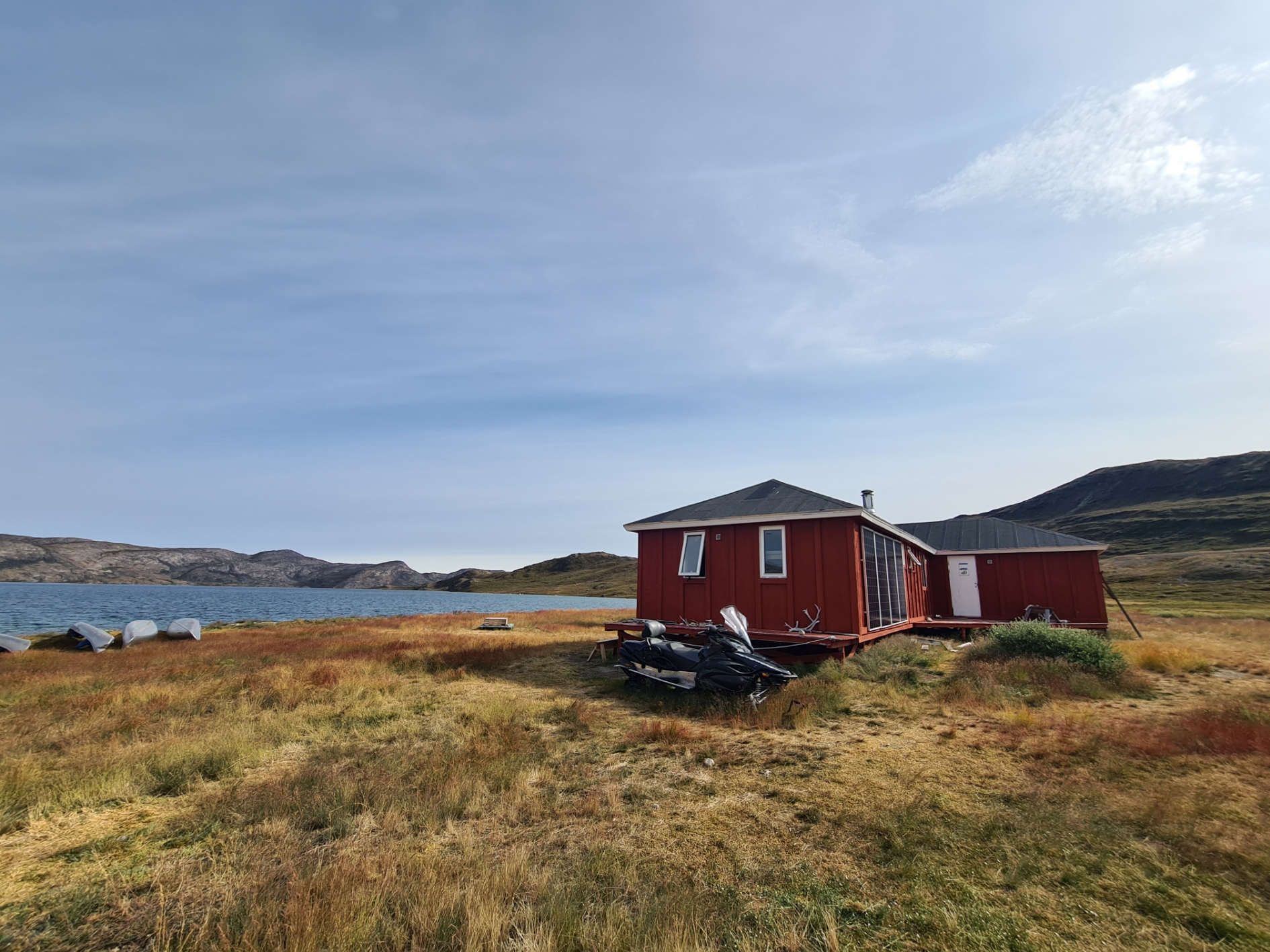
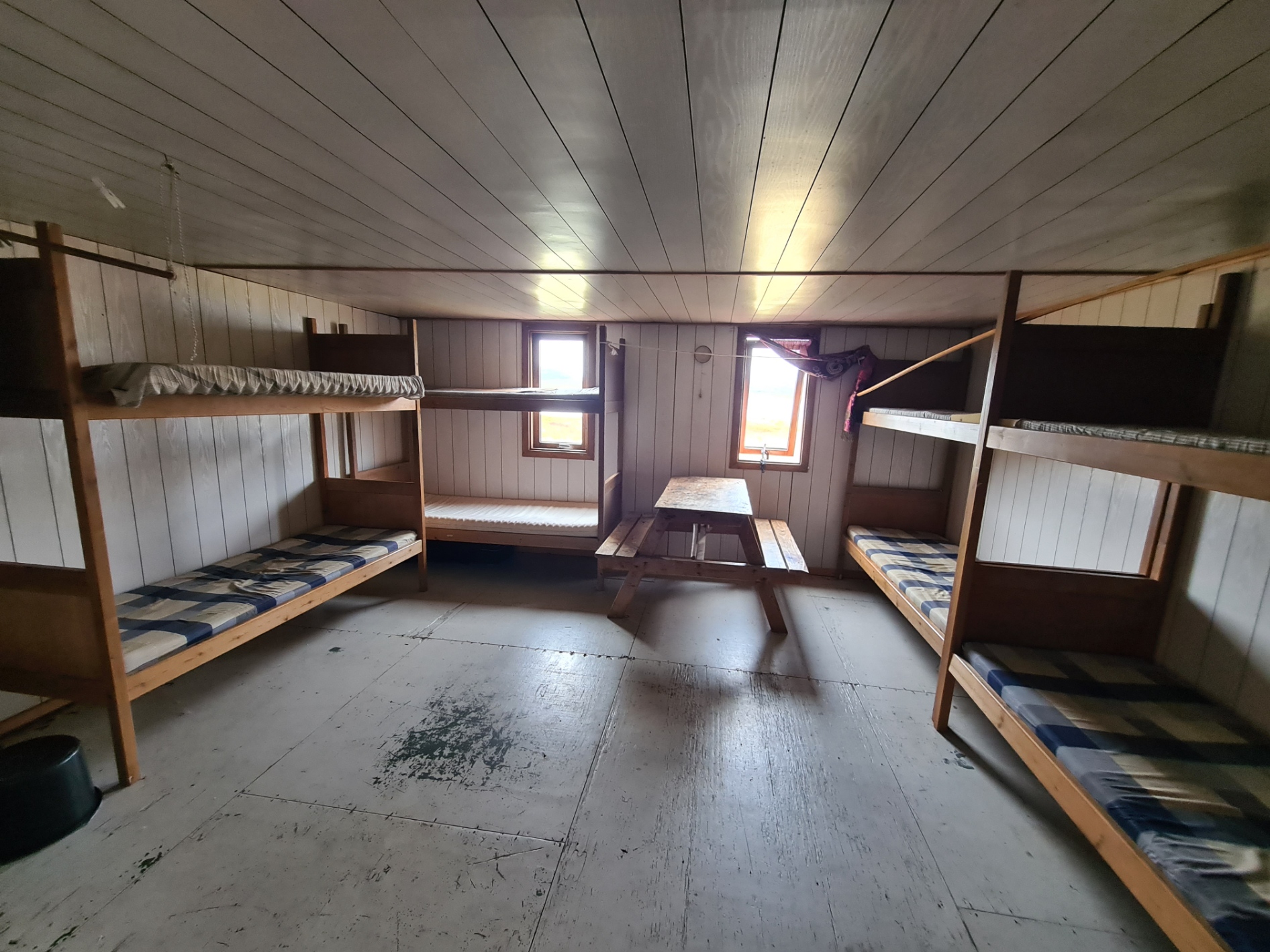
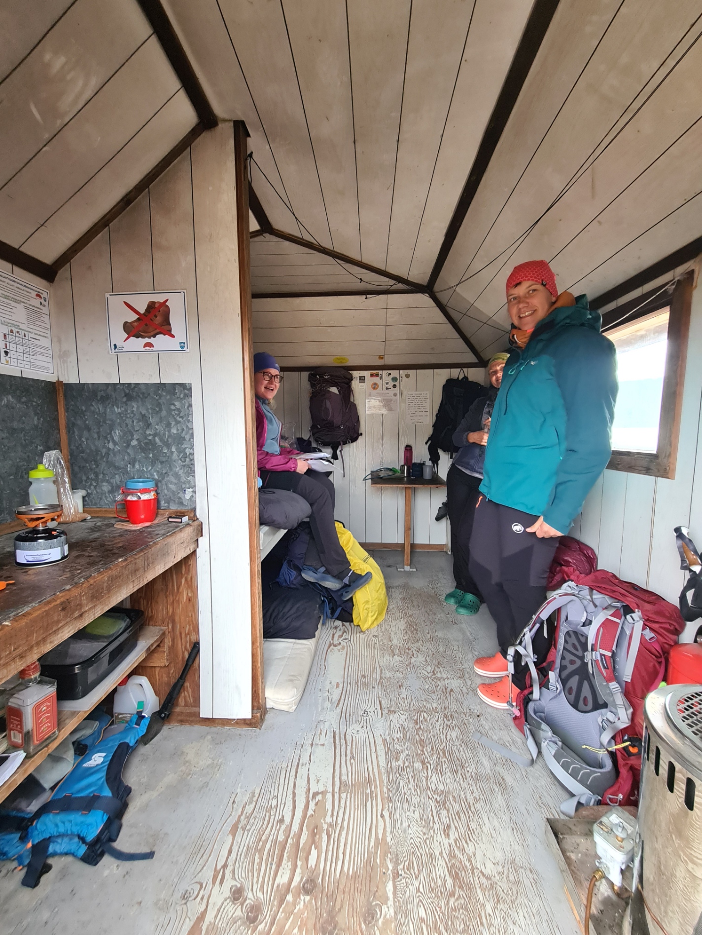
I had the hut to myself and explored its interior, not that I need anything. The Canoe Centre is a large hut with multiple rooms. There was the usual abandoned empty gas canisters and food (who the hell is going to eat opened unlabelled food?). There was even a huge bag of rice weighing many kilograms. I filled out the ACT survey form and posted it in the box provided. I looked at the charge point but didn’t need it, ditto w/c. I did sit at one of the tables to prep and eat a lunch though. While I was at the lake edge filtering a couple of litres of water, Benjamin arrived and we had another brief natter. He was stopping at the hut for the night but I was moving on as I was after a wildcamp for the night.
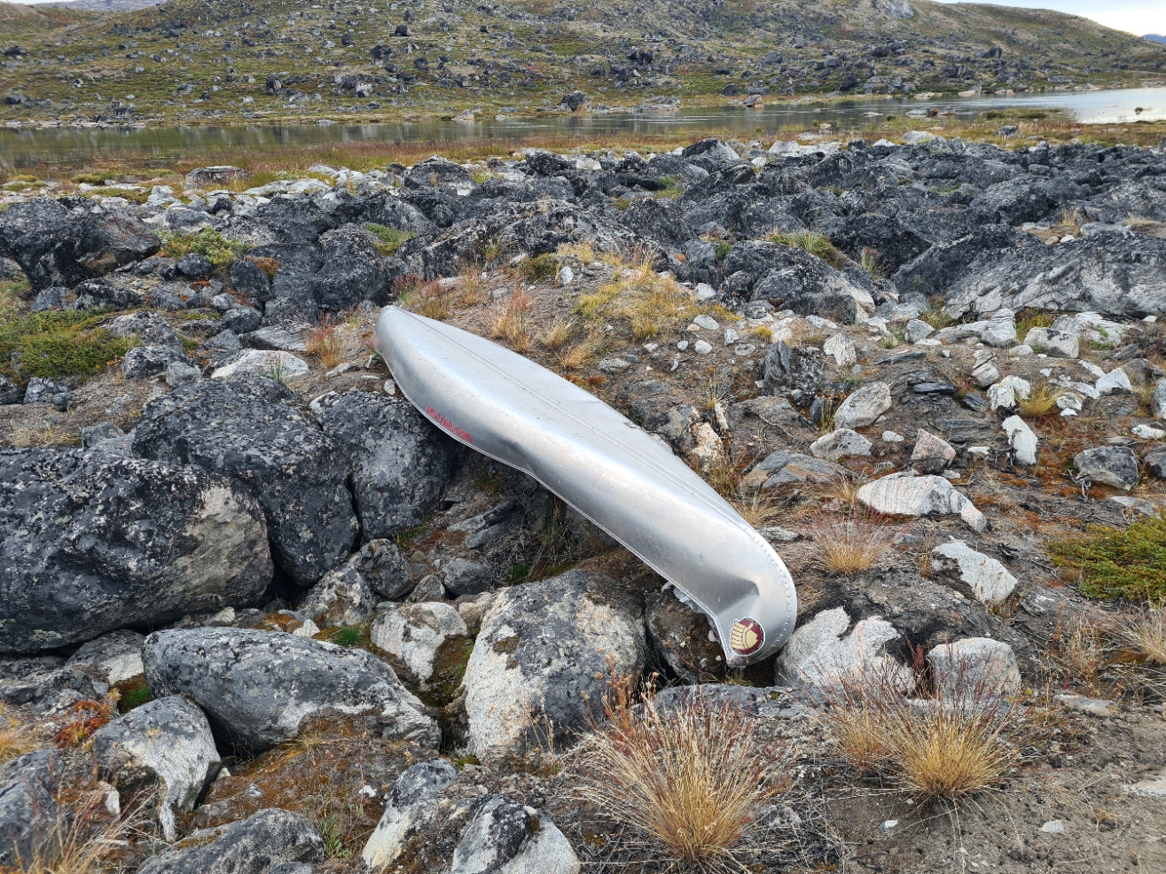
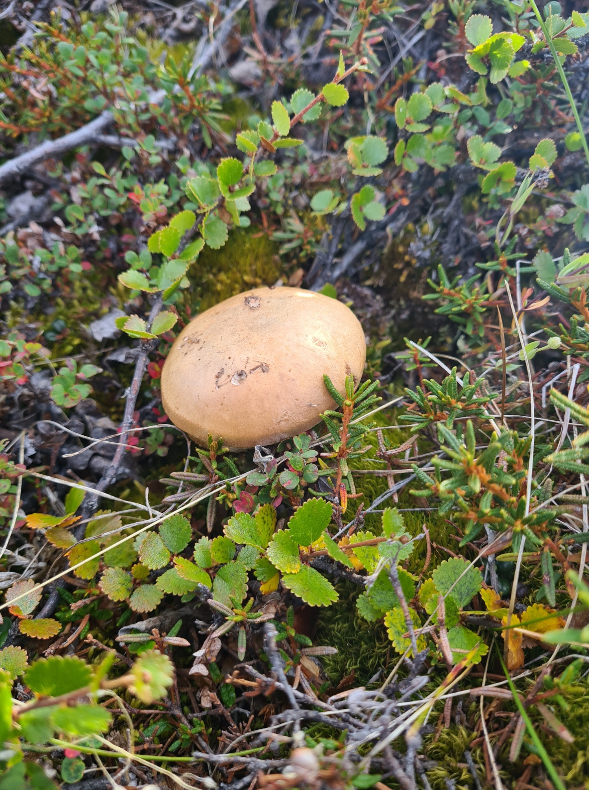
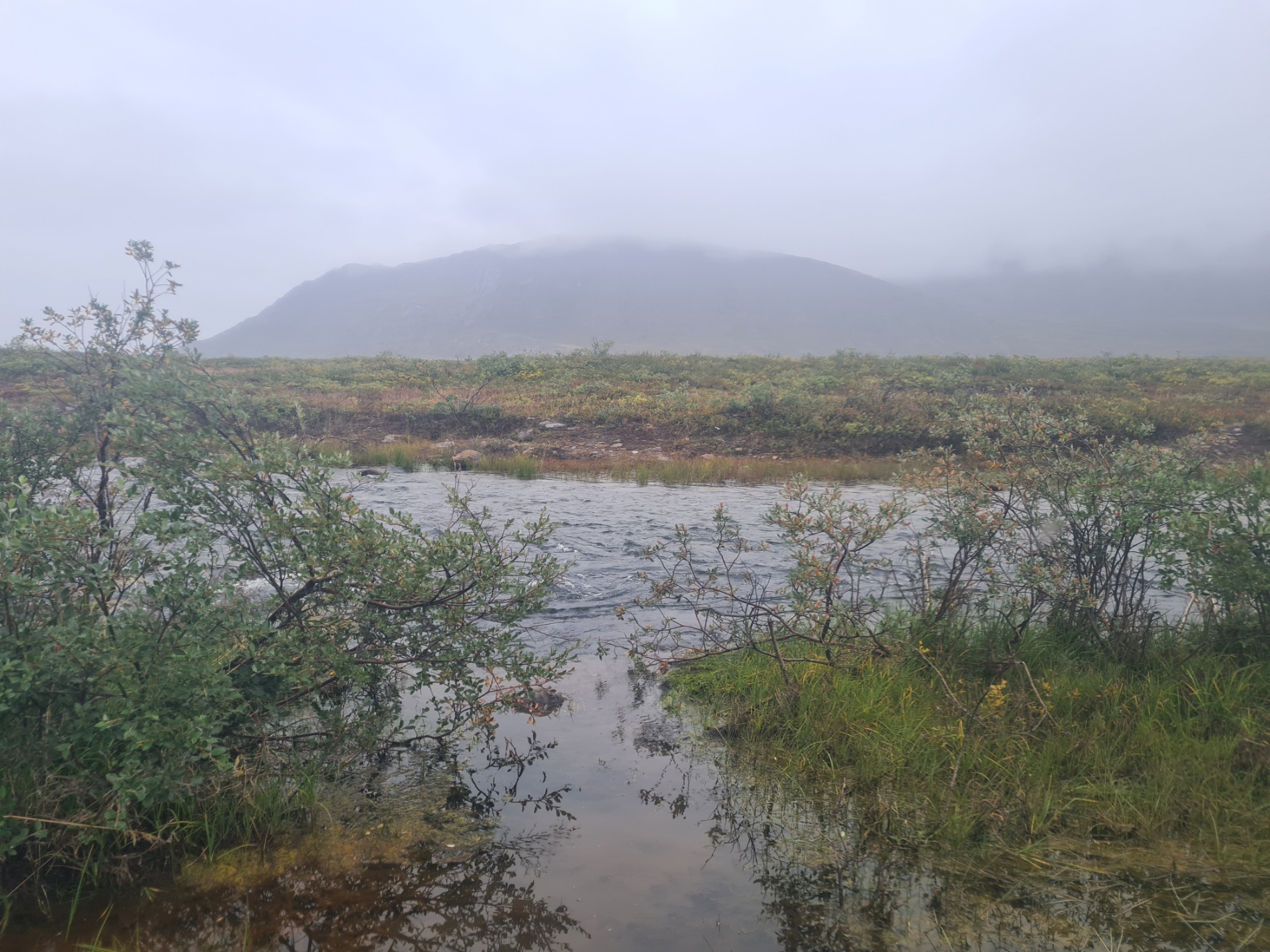
I enjoyed my afternoon walk immensely. At the head of Amitsorsuaq, despite clear instruction not to paddle beyond the centre, a canoe had been left, now badly damaged by crushing ice during the winter. I then followed the outflowing river from Amitsorsuaq down to Kangerluatsiarsuaq. Needless to say it was a bit boggy in places, but nothing to worry about. I photographed a few unidentified fungi, but time was moving on. I crossed the river, wading across without removing shoes.
I was now in the Aasivissuit – Nipisat World Heritage cultural landscape and it would take two days to cross it. I roller-coasted my way over ancient vegetated mudflows, each interspersed by more boggy patches. Reindeer crossed the slopes above to my left. A Goosander cruised low in the lake on my right, Snow Buntings crossed my path in front and Ravens kronked their way overhead.
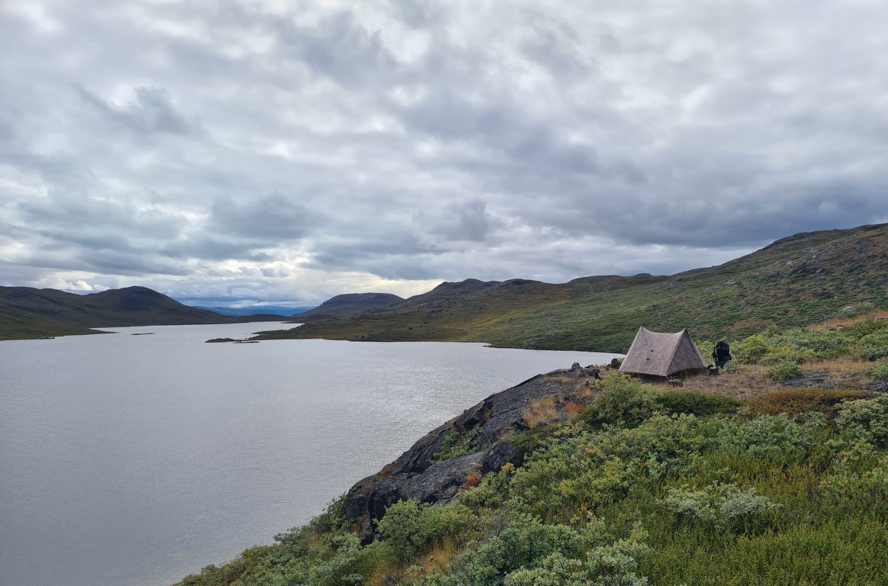
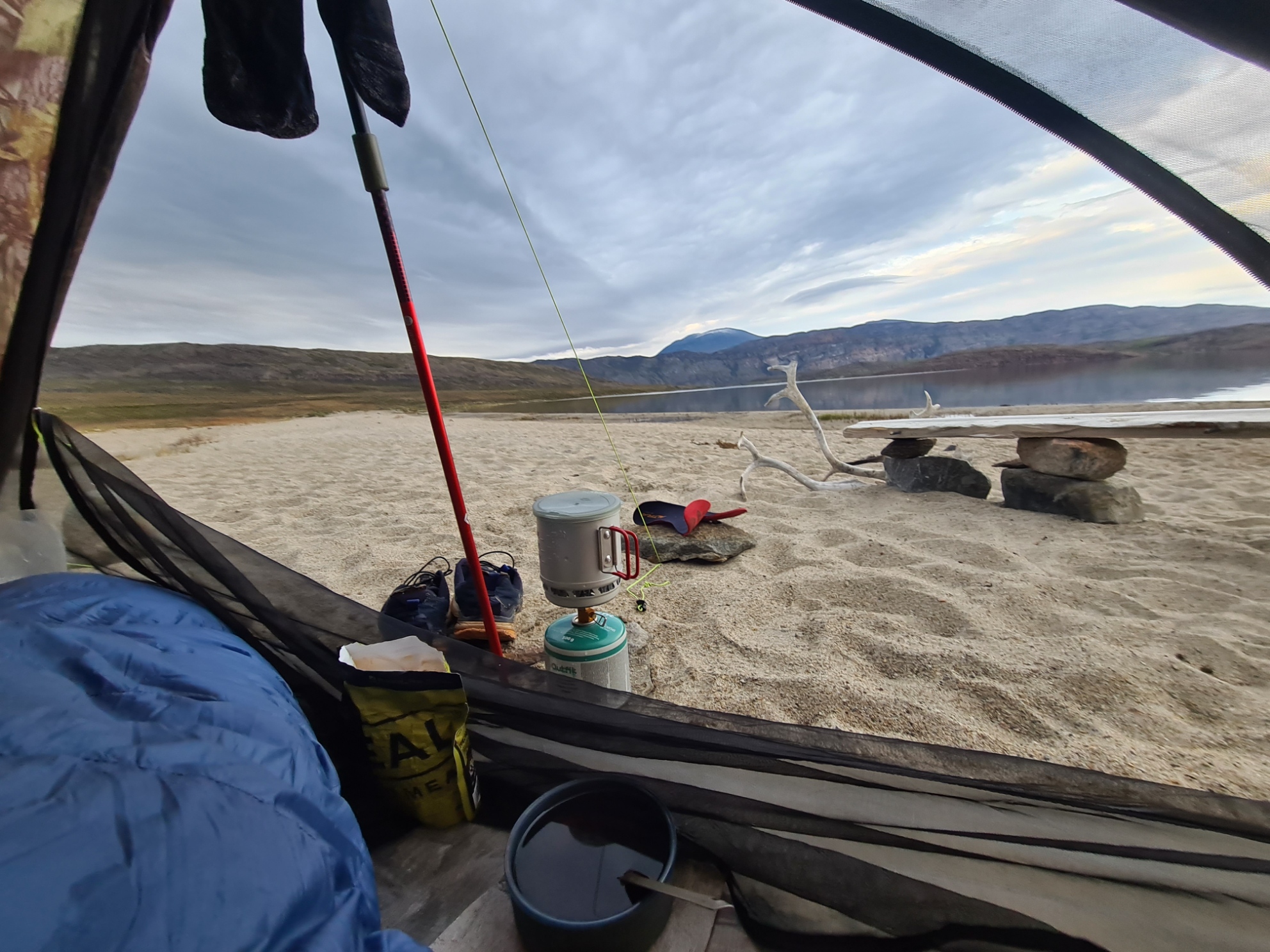
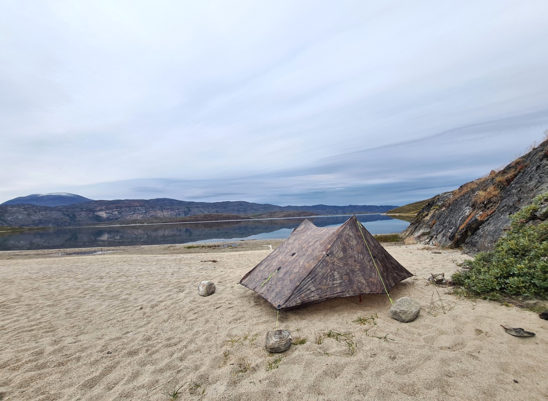
The trail slowly climbed and on a bit of a wide saddle, with Kangerluatsiarsuaq far below and in front, I came across Ina taking a break. We chatted for a while but she seemed to want solitude, something I can very much identify with, and I soon left her. I dropped down to the lake, turning left before reaching it, considering pitching near a pretty looking little peninsula that jutted out into the lake in the distance. I passed the German and Austrian from yesterday, each lounging in their respective tent, each lazily waving a hand in greeting as I passed. I didn’t envy them their sloping pitch but further on found that the trail didn’t go anywhere near my half-planned peninsula halt and it looked an arduous boggy walk to it, so I continued, climbing, now a bit knackered and ready to finish for the day. As it was, the path soon dropped down again and I came to a lovely sandy beach. That’ll do! I ignored the copious human waste that had been left, unburied, at the back of the beach and found a perfect well sheltered spot nearer the water’s edge, at one end of the beach, It was here that I pitched the Duplex, anchoring guys down with rocks over the pegs. Before I climbed inside I again walked into the water to wash the day’s grime off in the freezing water, but getting sandy on my walk back to the tent.
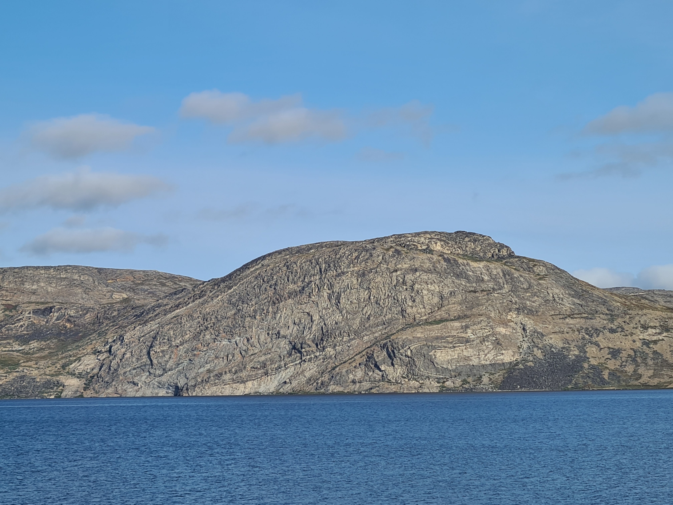
It was past eight and after drying off, massaging and balming feet, I changed into sleep wear. Then puffy on, quilt over legs and enjoyed a kebab stew with a welcome strong mug of tea. This was followed by a Jonut and half a bar of good mint chocolate. While I ate I charged the phone and Garmin. Those then got turned off and again went into the footbox for the night. With a stunning view of snow capped Pingu reflecting in the lake, and a Great Northern Diver persistently calling, I wrote up my journal before settling to sleep around ten. My notes record my sentiment- “a treat to be here, enjoying myself immensely”.
Day Four:
Yet again, I slept well. Though I haven’t a clue what temperature it dropped to overnight as I had neglected to change the tiny CR2025 battery on the Thermodrop thermometer before leaving the UK and, typically, it has now failed. A lesson learned. It had rained heavily overnight. No issue, it just meant I had to close one of the doors in the small hours. As there had been little in the way of wind to blow rain sideways I kept the other door open. There is enough of an overhanging beak on the Duplex to prevent water dripping inside.
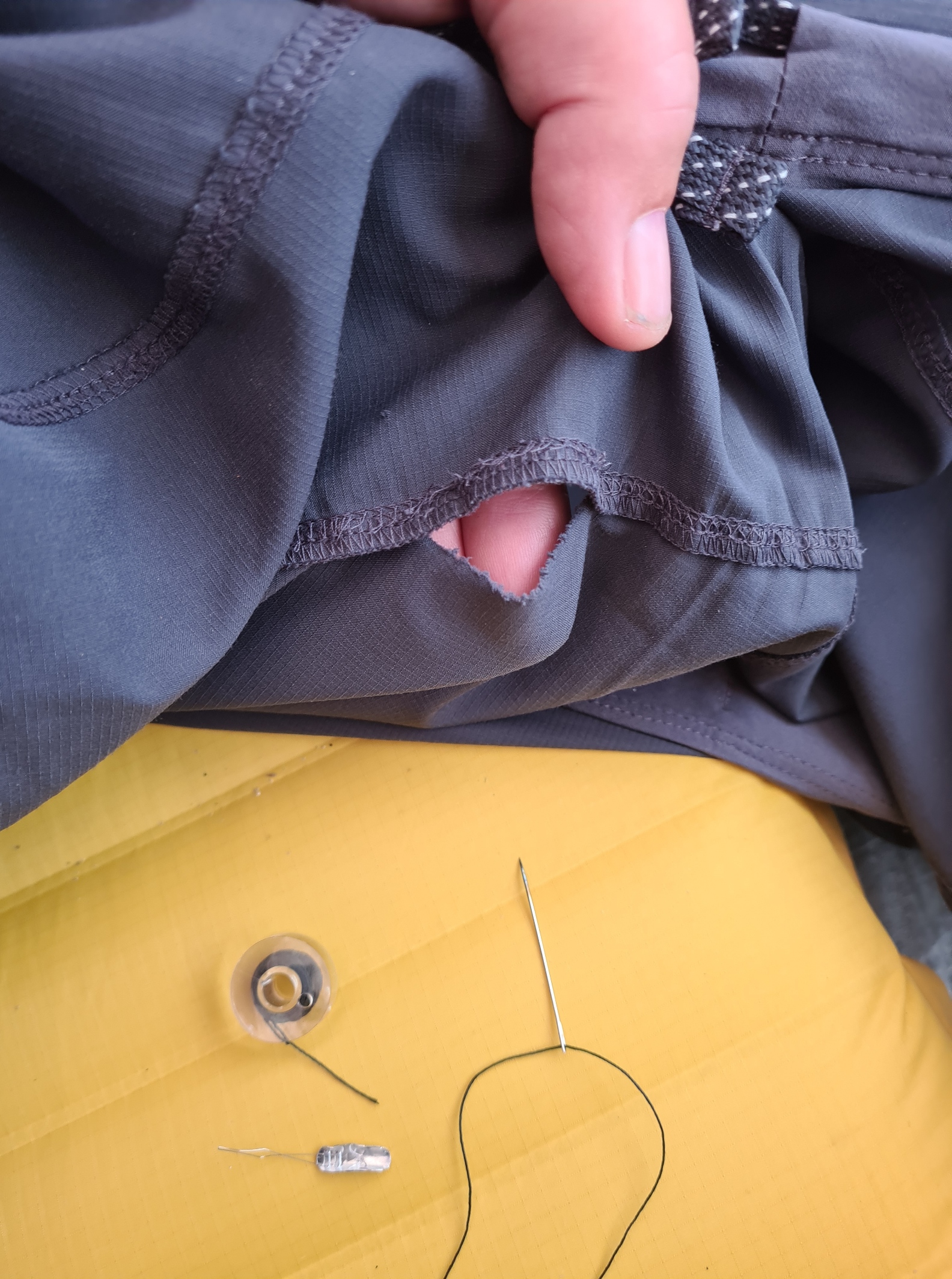
It was now very still, very quiet, very beautiful. I just lay in my cosy quilt looking out the tent door, reluctant to stir. I eventually rose at eight for a brew and a butter flapjack. Before packing however, I had maintenance to do. I was wearing a fairly old pair of Patagonia Terrebonne Joggers and a seam had gone, so I dug out a needle and thread for a quick repair. They lasted the distance and were disposed of on the way home. It pays to be prepared for minor repairs on trail. I had bought a pair of shorts with me, thinking it might occasionally be warm enough to wear those but it was simply too cold. I found my lightweight full leg covering, combined with my long sleeve Mont Bell hoody comfortable and effective attire most days. If it was cold, I would slip my waterproof jacket on. Other than those, fingerless gloves and a hat were sufficient.
Leaving camp it was almost immediately into the climbing that was going to be a feature of today. My hikes earlier in the year were paying off here. I found the going steady, and despite my usual old-guy wheezing, the legs felt strong. There are no dramatically difficult or high climbs on the ACT, but there are certainly a lot of ups and downs.
The low cloud made the tops of the mountains surrounding me look magnificent. There were lakes in every direction. It was windless and a little drop of rain seemed to bring the flies out but they were not too troublesome and I didn’t bother with the headnet.
Eventually, on a slight rise, I spotted Ikkattooq hut in the distance. When I got there, I found German Rike and Spaniard José inside, two long time friends enjoying an adventure together and I joined them in the small hut for lunch. They were slightly regretting their over-reliance on “easy, delicious and perfectly balanced” Huel mixes, I don’t blame them. Fortunately for this lazy mono-lingual Brit, they both spoke perfect English and we chatted about this afternoon’s challenge. We packed up together and I set off in their wake, occasionally catching up with them over the next couple of hours, but soon overtaken by the two fitter faster hikers. Very much the tortoise and the hares.
There were dips, climbs and a plateau to cross, mountainous terrain but all very enjoyable but it wasn’t long before the headnet had to go on as the flies were a menace. It began to rain, making the steeper rock faces slippery. So much so that I slipped the last metre down one face. No harm to me, but my packs waist belt buckle burst open. I couldn’t see any damage to it but it refused to stay closed, clicking open after a couple of paces. So I had to slip one half of the buckle under the under and tighten down on that. This worked fine and was how I had to do the waist belt up for the remainder of the ACT, fitting a new buckle on my return home.
I was heading across the hills to the wide flat bottomed valley below, that stretched each side of the Itinneq river. This can be a bit of challenge to cross. The widest part of the valley was the nearside of the river. One option entails descending straight ahead, then veering right for a boggy walk to the river, then hopefully wading across. The river can be either shallow or deep, depending on recent rain and ice melt. If it is too deep, then it is either wait for the level to drop or try and follow the river downstream to option two, a dilapidated footbridge a further 2.5 km down the valley. However that bridge is most easily reached by deciding that it is the desired option early on, then descending to the left and following the valley side on the left, attempting to keep above the bogs, before turning and striking across the wet valley floor to the river. The three of us stood, looking down at the misty valley that stretched below us. Even with my monocular it was impossible to gauge how deep the water was likely to be, but I decided to head for the river anyway. Rike and José agreed, and the two of them followed me down.

The trail across the valley floor to the river wasn’t too bad at all, but the river was fairly swollen. I walked up and down looking for the best point at which to cross. I started across the widest point, almost certainly the shallowest. However my feet sunk into the muddy ooze on the bottom and I was wary of sinking further, possibly unable to extricate myself, so returned to the shore. The water lethally raced through the narrower parts and I chose something between the two, not too wide and not too narrow, with a stonier bottom free of mud. I set off across. Pack’s waistbelt undone, sternum strap undone, electronics wrapped and packed away, facing upstream and testing my way with the poles. For three quarters of the width the water was only knee deep. I took my time, the water was freezing and while the riverbed was OK to walk on, the final couple of metres deepened alarmingly. I inched across that section, striving to keep my feet on the bottom as the water pushed each foot as I lifted it to move across just a little. The poles thrummed in my hands. It was most definitely sketchy and reached my waist at one point. But one more step and I was ashore and very relieved. I called back to the other two, who had been watching me. Rike is a good deal shorter than me and more slight in build. We agreed that it was best they never crossed here and they set off downstream, eventually using the bridge.
My path from there on was easy to follow, if a little boggy in places. I was able to keep up a decent pace and studied the amazing rock face as I walked. I met a sole Brit walking the ACT the opposite way and we paused for a natter. I asked him about the route he had taken as there was Southern or Northern ACT options coming up. He had taken the northern route. This is the original track and his thoughts echoed what I had heard from others. Despite the presence of the ATV track, it is excellent walking. He warned me that two Poles had taken over the hut I was headed to and had refused to allow him to share it with them. That wouldn’t be an issue for me as I planned on camping there anyway.
I think he must have got confused as when I reached Eqalugaarniarfik Hut and poked my nose inside, all I found was Ina stretched out on a sleeping platform. Tired and cold, she was wrapped in her sleeping bag with just her nose and eyes visible. A large Polish guy was heating up a meal, though he said he was unlikely to eat it as he had been struggling to keep food down and was exhausted as a result. Robert wasn’t in the best of moods- “a terrible, awful day, and the day before”. People can have very different experiences of a trail, I had enjoyed both days immensely.
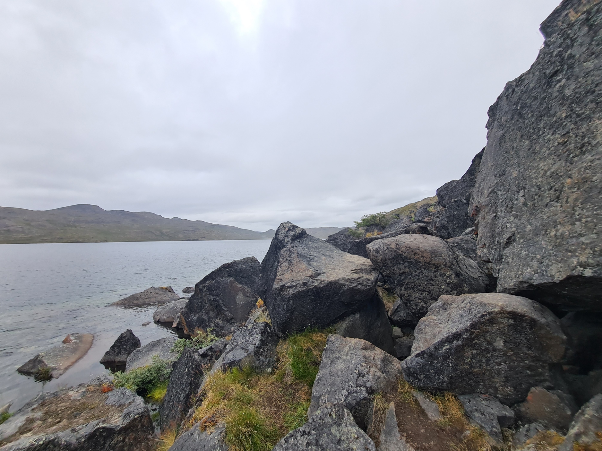
I went off to pitch, walking past a pile of reindeer skins and bones left by the hunters. I stripped off in the cold tent for a clean up, before changing into sleep clothes and draping the quilt over me and again donning my puffy. The mist slowly cleared and I had a wide view over the tidal head of the Maligiaq fjord. Later, warming with a hot brew in cupped hands, I could see Rike and José in the distance, followed by occasional pairs and threes of other head-netted hikers, gradually ascending from the valley below. Each small group spread out to their chosen spot around the hut. It was quite a large number, perhaps twenty or more, that slept in and around Eqalugaarniarfik tonight but there is a lot of space and other than the brief clattering of tent poles and voices as arrivals pitched, there would be no noise from other hikers tonight.
I sat and enjoyed my evening meal, a chicken tikka curry that lacked much in the way of spices, followed by the usual Jonut and chocolate. The sound of shrieking Peregrines echoed around the cliff faces behind me, interspersed by the usual kronking of Ravens. After writing up my journal, studying map and guidebook, I settled down to sleep around ten in the evening.
My days on trail had been fantastic and I felt good with no injuries or concerns. Pack weight had unsurprisingly steadily dropped as I consumed part of the contents and would continue to decrease, along with bulk. The next few days would take me from my overnight halt at Eqalugaarniarfik west toward the coast and trail end at Sisimiut. Will I survive the mosquitos, midges and mire to reach the coast at Sisimiut? Spoiler- I do! But snow is on the way…

This is a great account Jools, I really enjoyed reading it. Looking forward to the next part.
LikeLiked by 2 people
Thanks, going to be a few weeks before I get round to it, my apologies
LikeLike
Mammoth count. Really interesting. The river crossing sounds really hairy!
LikeLike
Yep, that particular river crossing was about my limit. I almost retreated. But at its worse I would have slipped the pack from my shoulders, and clutched that and floated downstream, packs float. Though I would have been very cold and very wet as a result, and sans poles
LikeLike