
Three Points of the Compass travels to the Canary Islands to walk a little known Camino: “the way of St. James among volcanoes”
The Canaries are an autonomous territory of Spain off the coast of Morocco and the Western Sahara. Africa is just 70 miles (100km) away. The archipelago consists of eight inhabited islands and a few smaller uninhabited ones. Gran Canaria is the third largest of the Canary Islands and is criss-crossed by many ancient Camino Reales, the old mule and donkey tracks used for generations before modern road arteries rendered them largely redundant for commerce.
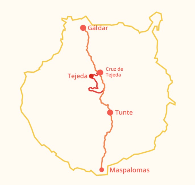
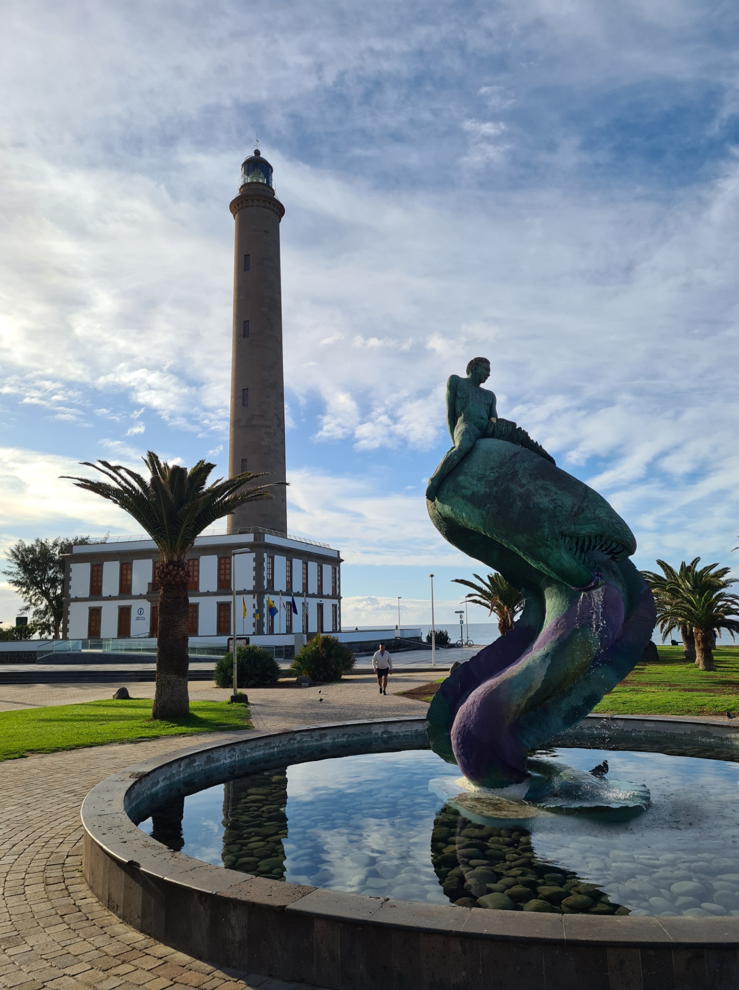
It is these tracks that the Camino de Santiago de Gran Canaria ‘entre volcanes:‘ (between the volcanos) mostly follows, with just a few road miles. The trail starts in the south at the lighthouse (Faro) at Maspalomas, then heads inland, crossing the entire island and its mountainous interior, moving from a harsh and barren landscape in the south to the lush farmlands of the northern slopes. The finish is at the Templo Matriz de Santiago de los Caballeros de Gáldar, in the northwest of Gran Canaria. The trail is roughly 70km in length, though there is an optional variant in the middle that can lengthen this, also adding considerable ascent to the crossing.
I flew out to Gran Canaria at the start of February, carrying both a small amount of kit in a day pack and a lingering winter lurgy that had been doing the rounds in the UK. I wasn’t camping on this trail, planning instead to overnight at Tunte and Tejeda en-route. To that end, I pre-booked the cheapest places I could find on Booking.com. This wasn’t going to be a particularly expensive trip, even the flights were reasonably priced. Despite having a reputation for having a mild climate, the weather in February in the Canaries can be extremely changeable and I was prepared for anything from hot weather to cold and wet.
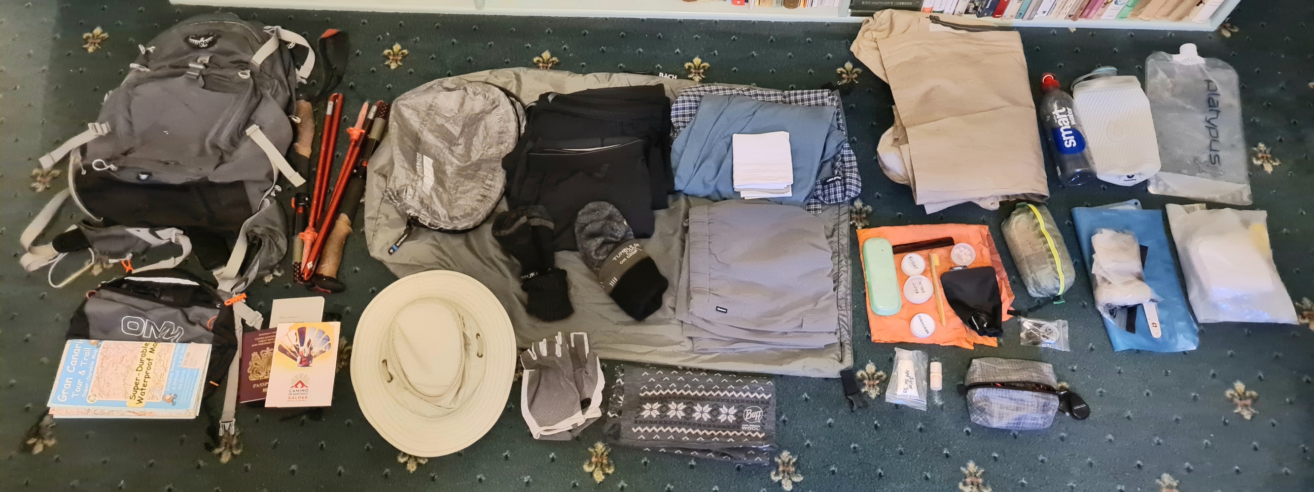
I stayed the night of my arrival on the island in the capital city of Las Palmas and early the following morning caught a direct bus to Maspalomas, in the south of the island. Needlessly early as it was, as I was also carrying a credential (pilgrims passport), intending to collect various stamps in this on my trail. The first of these is applied at the lighthouse visitor centre, but that doesn’t open until 10.30, making for a late start to my hike. This delay would have repercussions.
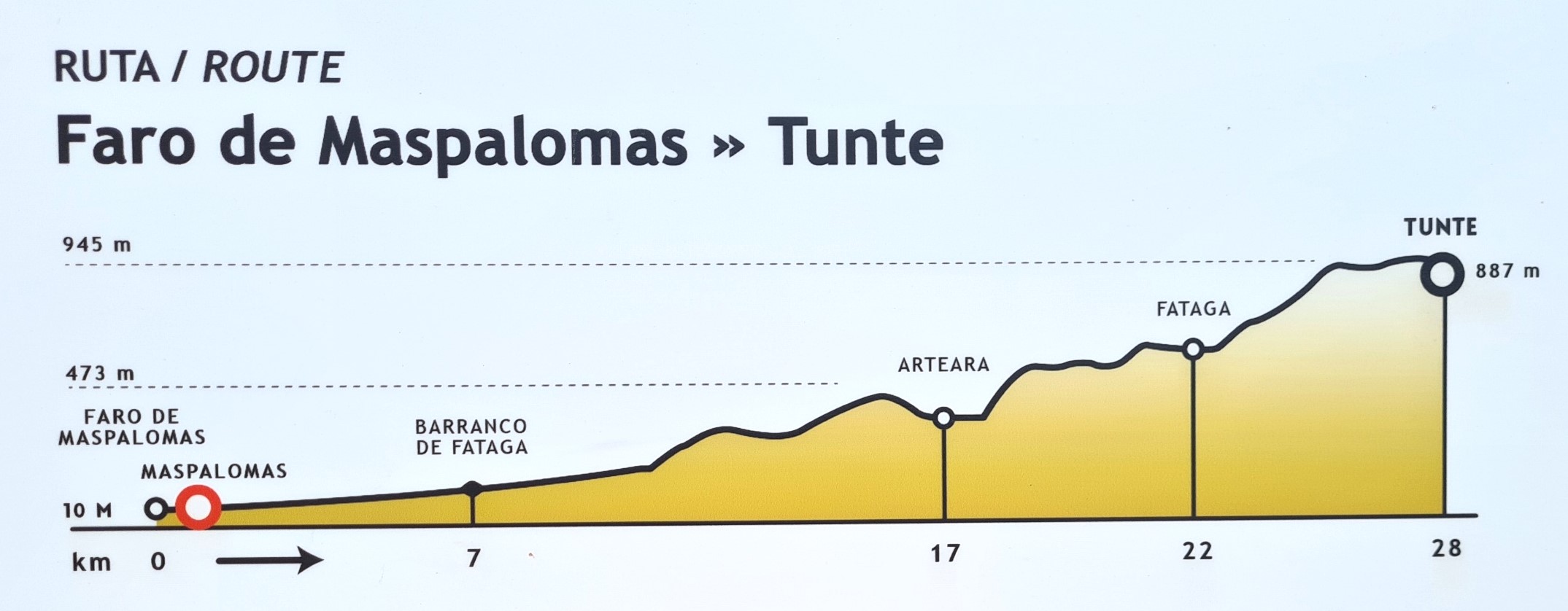
Day one: Maspalomas to San Bartolomé de Tirajana (Tunte)
I sat in one of the beachfront cafes, relaxing with coffee, orange juice and a toastie, wasting time until moving to wait outside the locked door to the lighthouse. I was keen to start walking and resented the couple of minutes delay before the door was unlocked, but the staff were so pleasant, so welcoming, that I felt I was being somewhat churlish in my impatience.
By eleven o’clock I was back at the bus stop where I had arrived two hours previous and then walked the short distance to the ‘Oasis of Maspalomas’ nature reserve. This is an elongated pool on the edge of the sandy Dunas de Maspalomas, with a reputation as a stopping off point for birds- waders, egrets and the like. Bright green parakeets called raucously from the palms above my head and slow moving tourists were building in number, making for a weaving, dodging walk along the edge of the dried up riverbed that led me inland, the mountainous interior of the island could be seen a long way in front of me. There was no signage to speak of, but it wasn’t difficult to head in the correct direction, even though I had to force my way through a packed Sunday market on the edge of town, wares spread across the ground. Beyond here I finally left people behind, and had the now dusty, stony trail (almost) to myself.
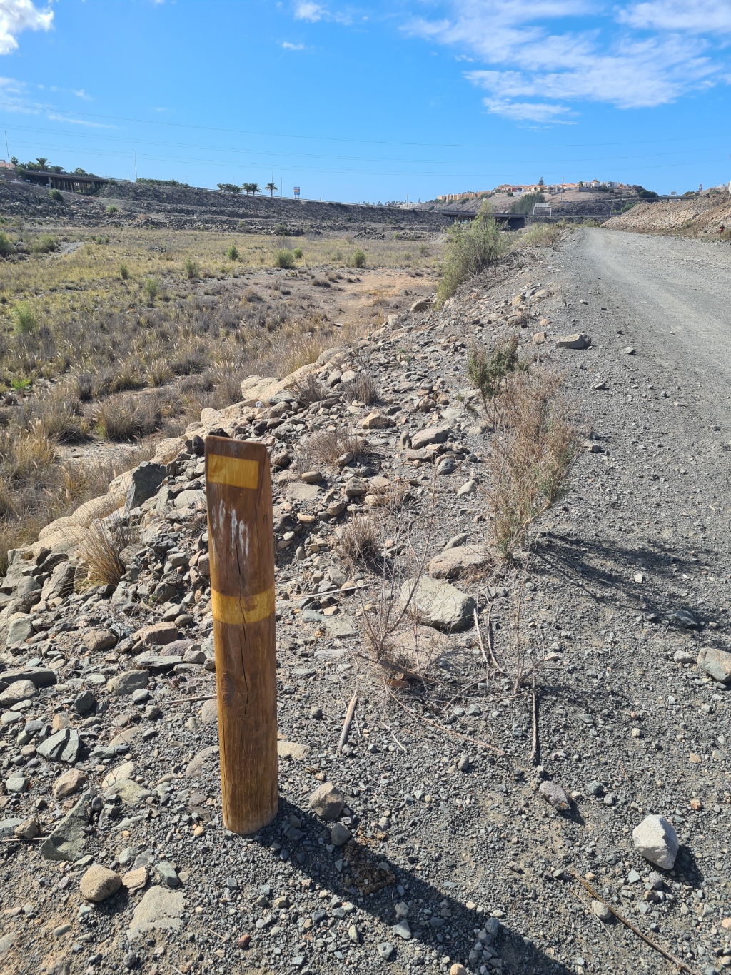
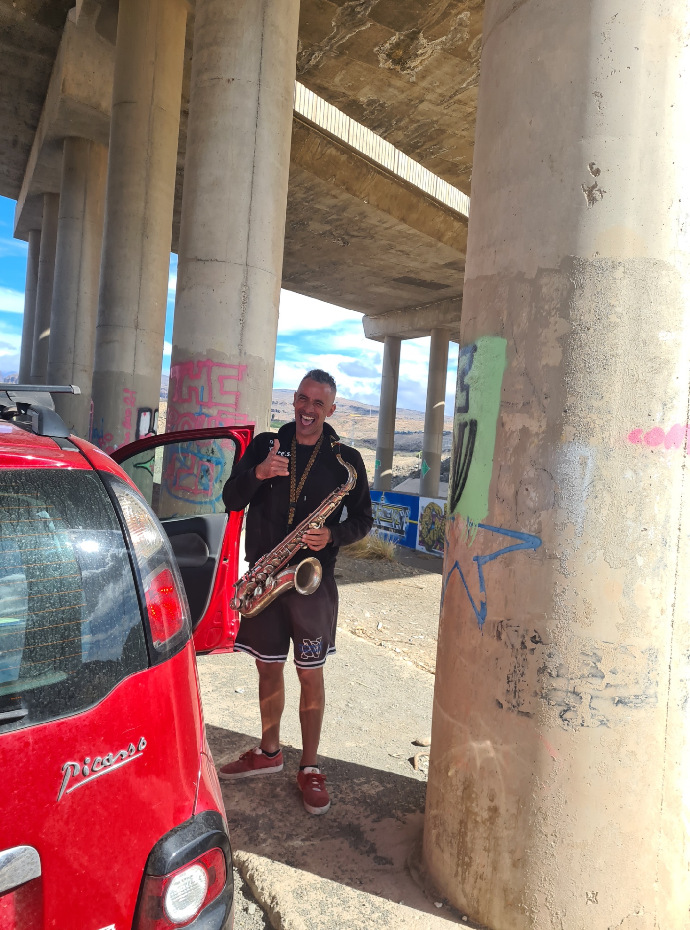
It was approaching the stilt supports for the GC-1 motorway, that skirts the northern edge of town, that I came across the first trail marker. Almost in approval of my discovery there was a not-too-distant toot of a saxophone. I stopped in the shade of the overhead motorway to chat to the local. He drove out here each day to practice, enjoying the acoustics of the structure.
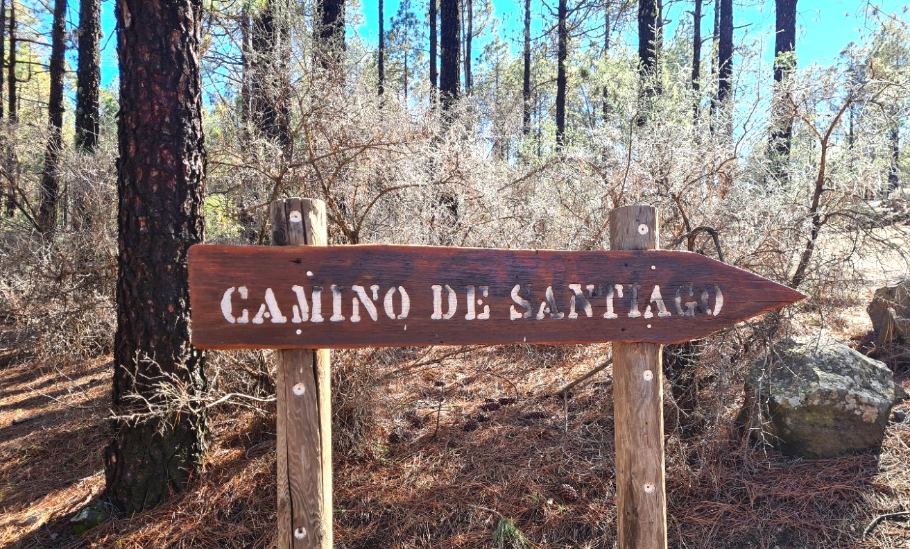
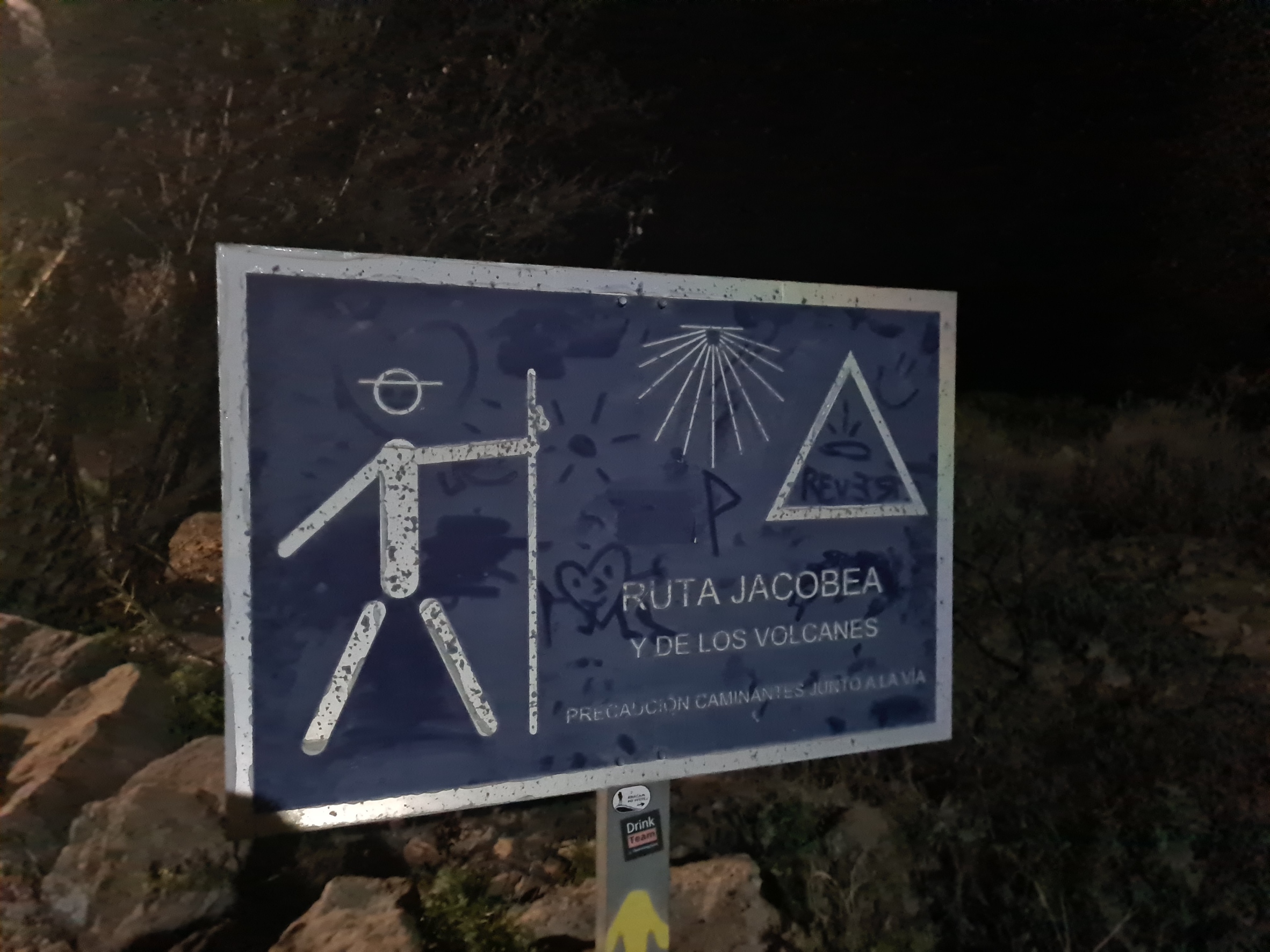
The island Cabildo (government) have previously announced that they would signpost the Camino de Santiago throughout its length and have made good inroads in this, if only by erecting pointers at junctions and termini of trails, and wooden, yellow banded posts between these (the angled top indicates the direction to walk), but the latter are not found on the entire length of the trail. I was mostly navigating old-school, with the route highlighted by me on a paper map. This was the excellent 1:50 000 scale ‘Tour and Trail‘ map from Discovery Walking Guides. There is also a fairly good app, that shows the route and points of interest on the way. I had it downloaded on my phone but never succeeded in getting it to work properly. Others I met were using Google Maps or the app, with no difficulty.
The tall wooden trail markers found at trail junctions across Gran Canaria point out many different types of trail- S routes (Senderos = hiking path) and SL routes (Sendero Local) that might include the Camino, and the small number of long-distance GR trails (Sendero de Gran Recorrido). From the second day, the Camino runs concurrent with the red and white marked GR131 for some distance. The primary trails of the Camino de Santiago are the S-54 Maspalomas-Tunte; S-50 Tunte-Cruz de Tejeda and S-01 Cruz de Tejeda-Gáldar though others are also followed.
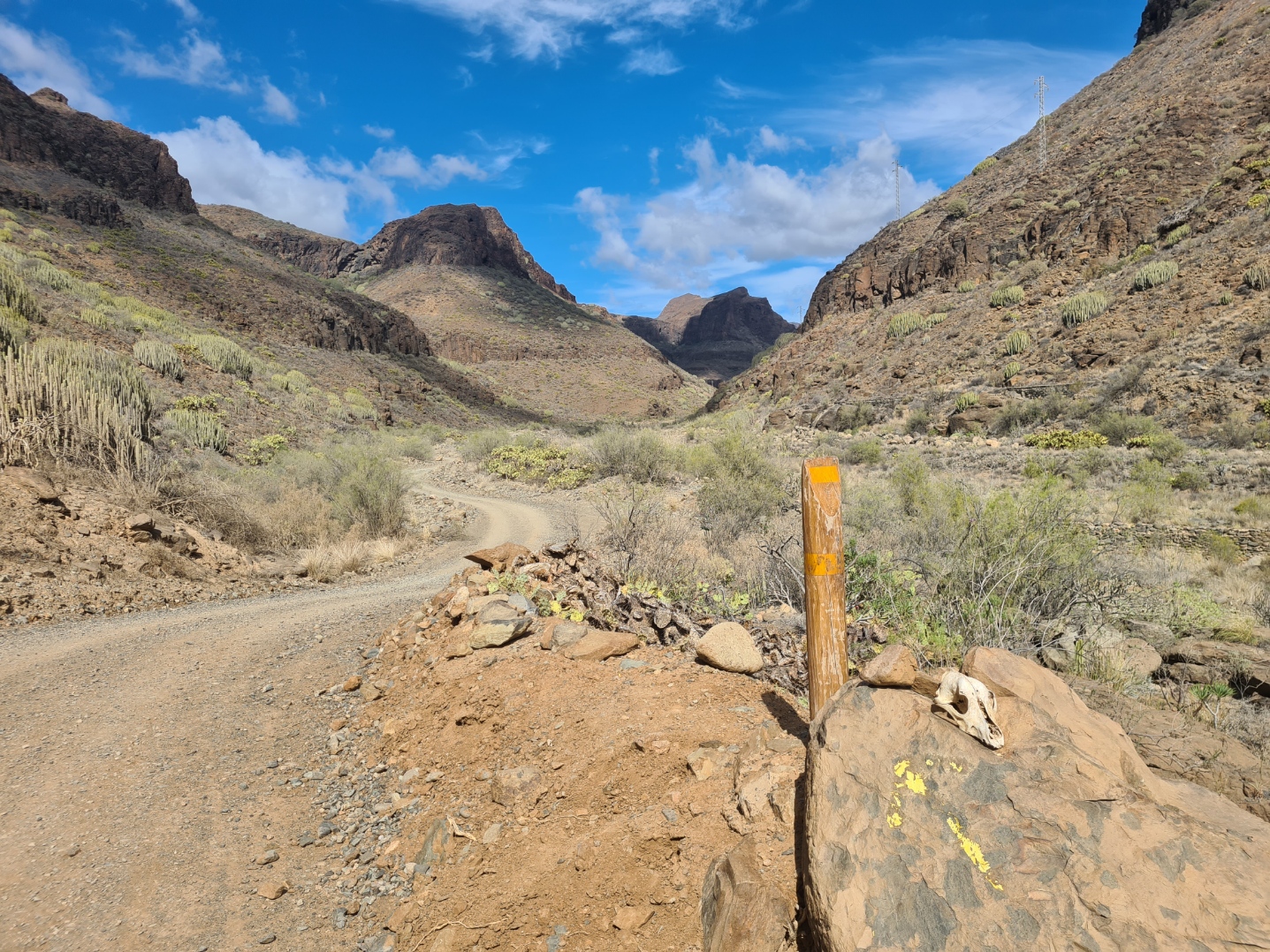
There are also a large number of extremely helpful yellow painted arrows on rocks and trees along the trails entire length. These painted arrows are frowned on by those in officialdom, viewing it as graffiti rather than often very useful pointers in the absence of official signage. Despite these, my map helped enormously in working out exactly which trail to follow as it isn’t immediately obvious. It pays to take a little time at junctions of paths if unsure to avoid tiresome backtracking when realisation (hopefully) kicks in.
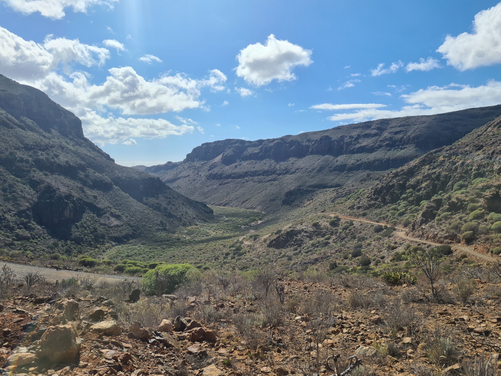
It was hot. Very hot. Besides hydrating back in Las Palmas this morning, on the bus ride and in the café in Maspalomas, I was carrying over three litres of water on the hike itself. There is very little in the way of shade on this day’s trek up into the mountains and nowhere to obtain water for much of the distance.
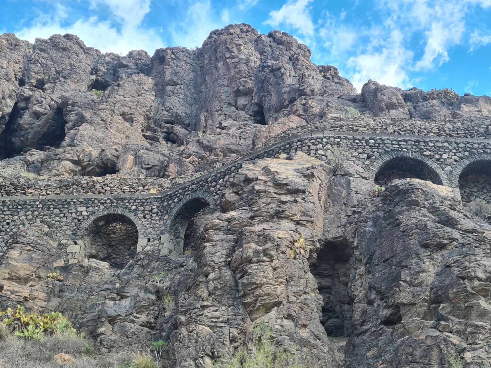
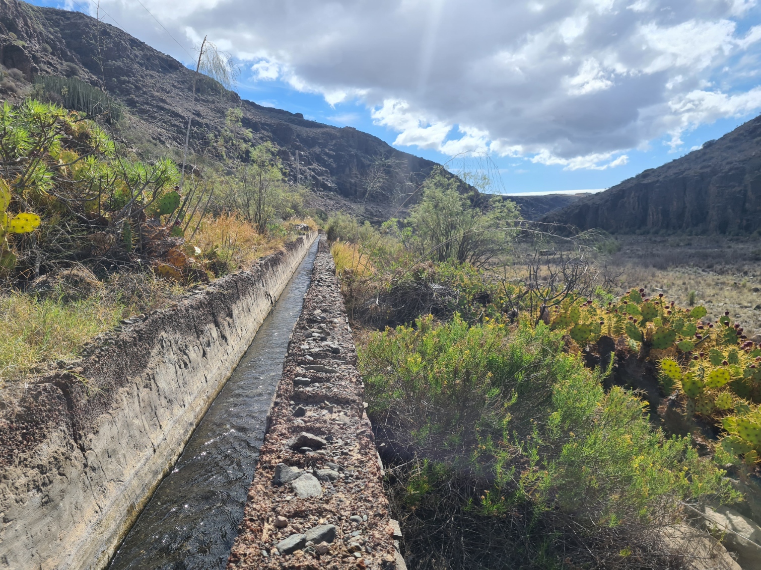
Entering the barranco (ravine) properly, the rocky sides climbed steeply on both sides. Little is supported here other than just a few goats that graze on the sparse vegetation and a chicken coop or two built into holes excavated in the rock faces. In days gone, people desperate for water mined the sides and any water found was channelled down to the villages further down toward the coast. The ‘Aqueduct of Many Bridges’ is an amazing survivor and my imperfect app on my phone describes it as “an ethnographic jewel of extraordinary value”.
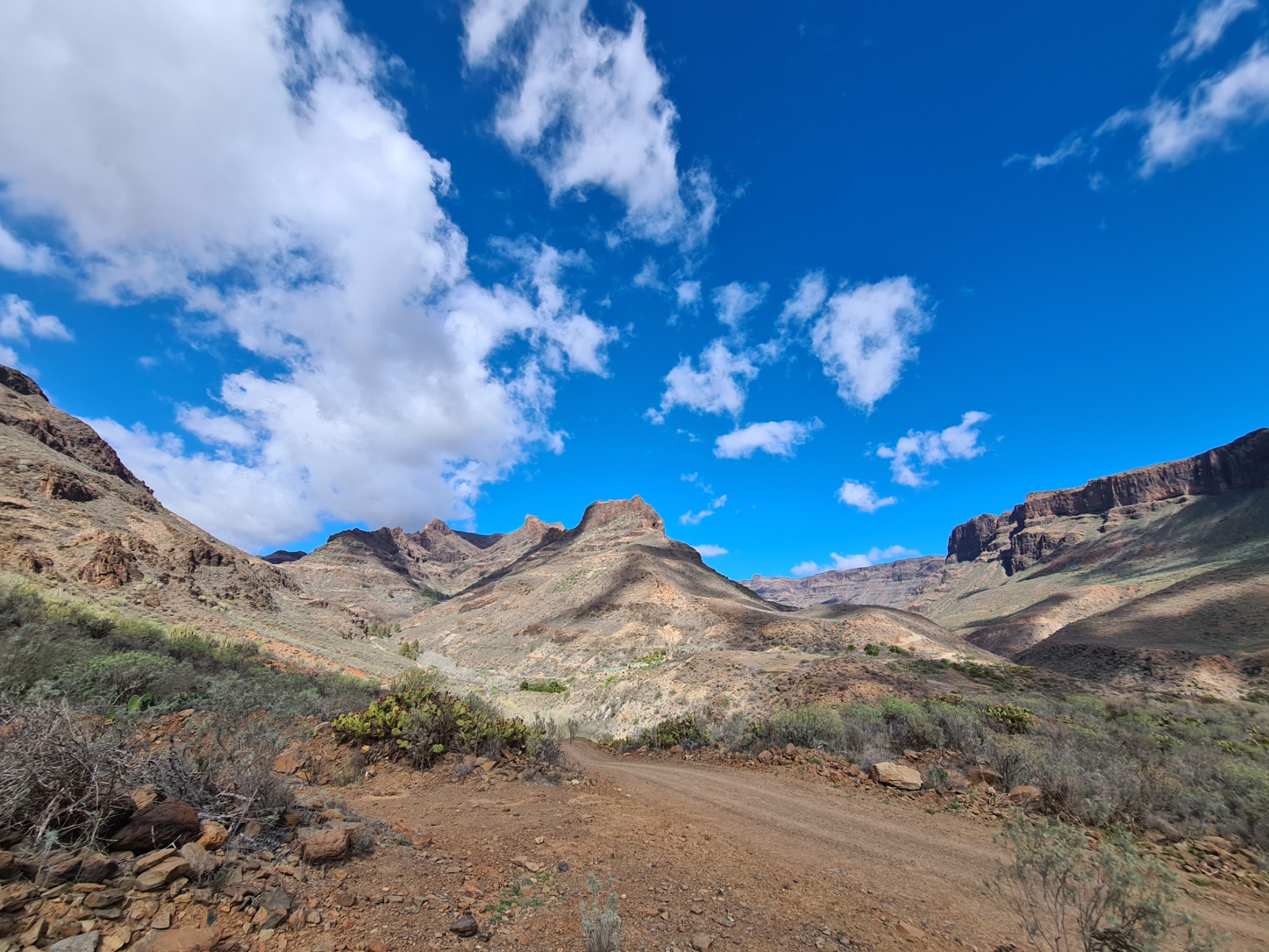
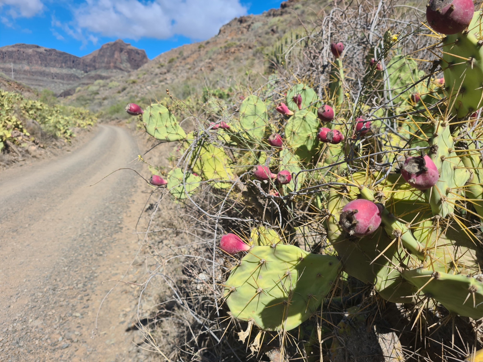
The dirt path became a dirt track. The occasional sweaty Sunday runner pounded past in the opposite direction. Equally as sweaty cyclists also came past in twos or small groups. I presume they had started from one of the smaller villages further up and would finish back at the road nearer the coast. As for me, finding shade from a small patch of micky mouse cacti I stopped to try and cool down. Alarmingly my feet were suffering. Both soles hurt. More than they have on any hike I could recall. Hot and hurting. My right heel was also painful. I taped both my heels and swallowed painkillers. Obviously feeling left out from attention, my left leg cramped badly. I drank a litre of water and forced down some food. I was worried about my feet. After many years with one brand of shoe I was trying out another. It wasn’t going well, but more on that in another post. Despite this being an interesting first day into a harsh and fascinating landscape that I was fairly familiar with, I was worried about my physical condition. Other than my feet, that aforementioned respiratory illness I had bought out from the UK was causing me to wheeze alarmingly on the ascents I was now encountering. I hadn’t realised my breathing was so laboured. I thought about quitting and returning to the coast. But knew I had a shorter day tomorrow, then a day off. I sighed, and after a few minutes, shouldered my pack and continued up the dusty stony track.
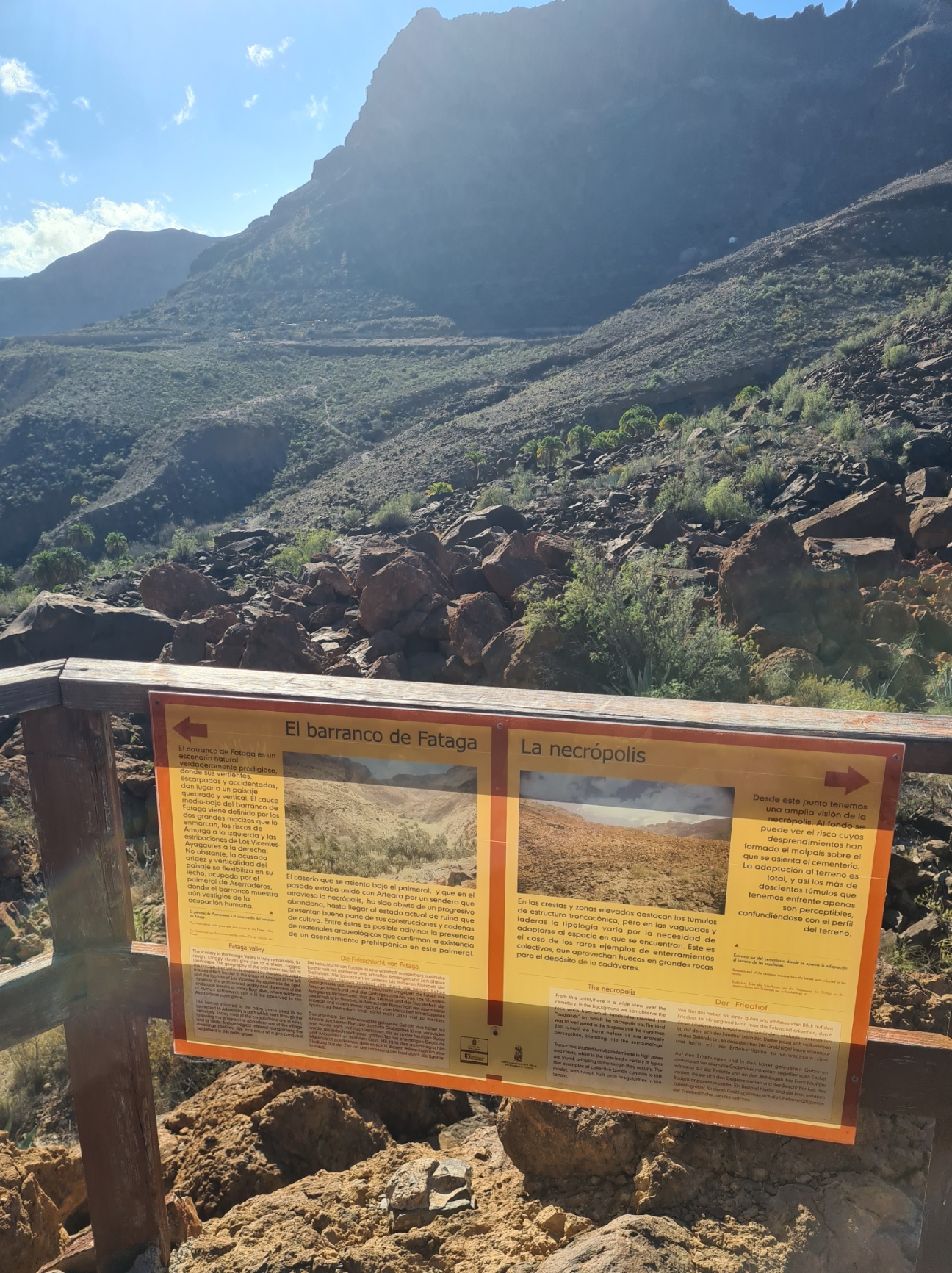
I paused on a small raised viewpoint. From here, I could see around and back across the shattered stone ‘bad lands’ where over 200 burial tumuli have been identified, some holding the remains of more than one occupant. Those archaeologists had far keener eyes than me as the intervening centuries that have passed since the Guanche, the original inhabitants, bought their dead here, have seen the rock coverings settle into the landscape. They are now mostly hidden from easy identification. Without being told of their presence you could easily walk through here unaware.
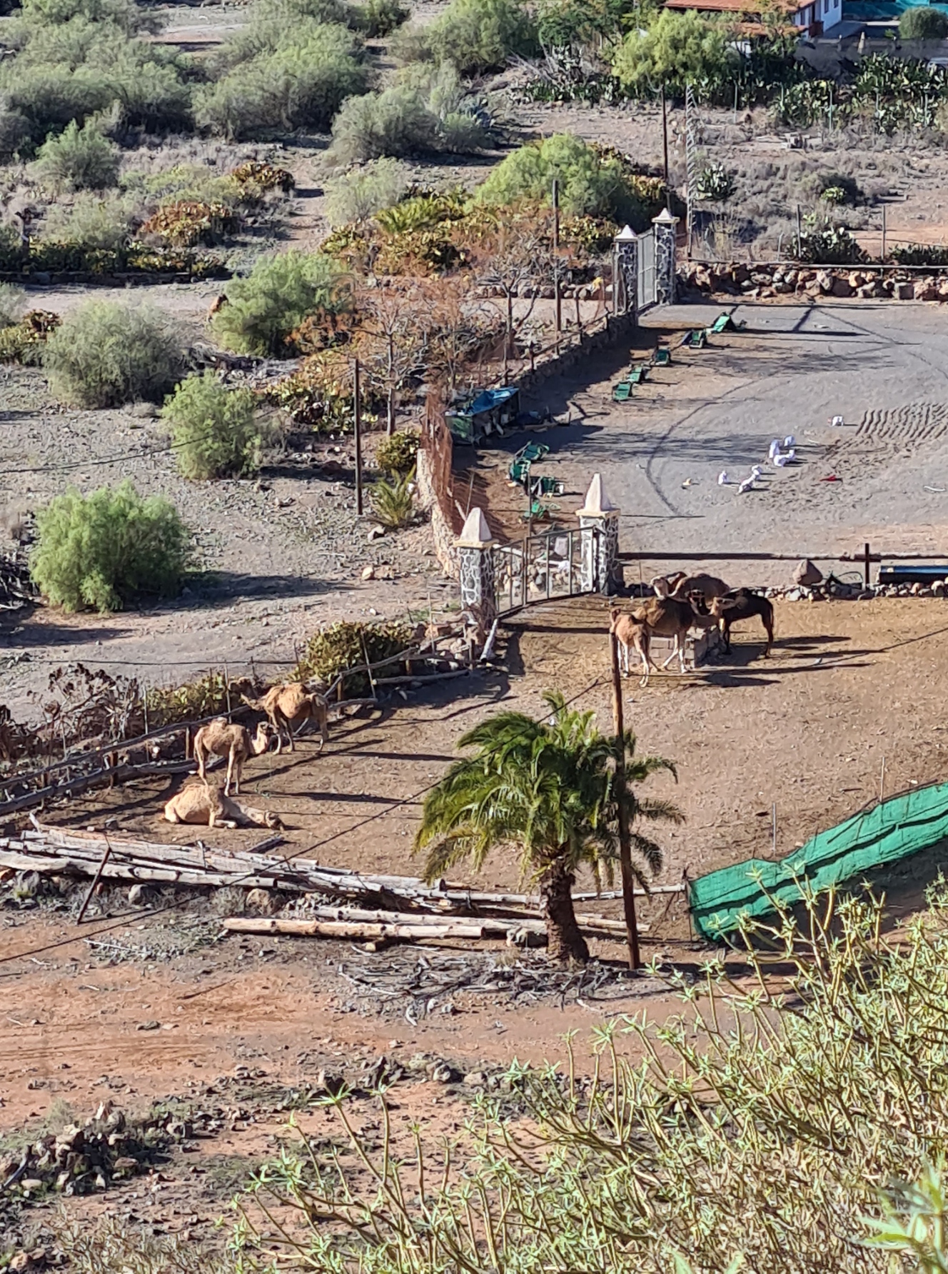
Very soon after passing through the cemetery I reached little Arteara, where I would have ideally halted the night. My feet would certainly have liked to stop the night here as the left heel was also now protesting. But I had failed to find accommodation. There seemed to be little here beyond a camel park, and after pausing briefly just to hydrate, it was on, onward and upward to Fataga. I was already conscious of time passing, the sun dropping in the sky and only another couple of hours of daylight with 13km still to walk across difficult terrain.
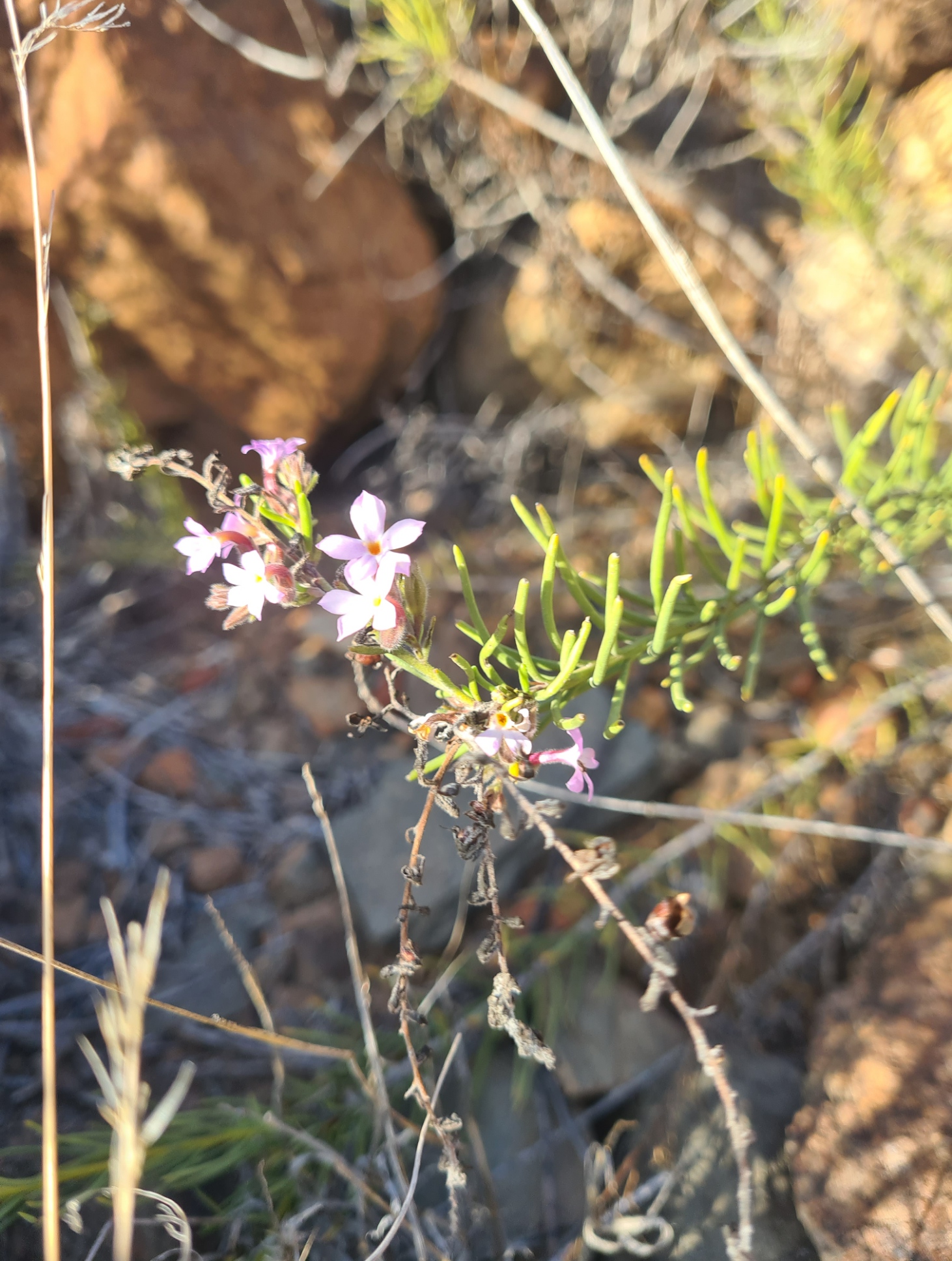
The track came to a road and I crossed, now back on to a stony path, winding my way up and across a rocky landscape dotted with cacti and tough herbs. It eventually flattened out and I could see Fataga in the distance but it took its time coming. This was another place I had failed to find accommodation. I passed some smart homes on its outskirts. Land has occasionally been cleared of rocks and small fields of crops looked to be healthy and prolific. It is water that is in short supply on these southern slopes.
As always on the edges of towns, mistrustful dogs barked at me as I passed but despite not being restrained, they didn’t leave their homes and fields to chase me.
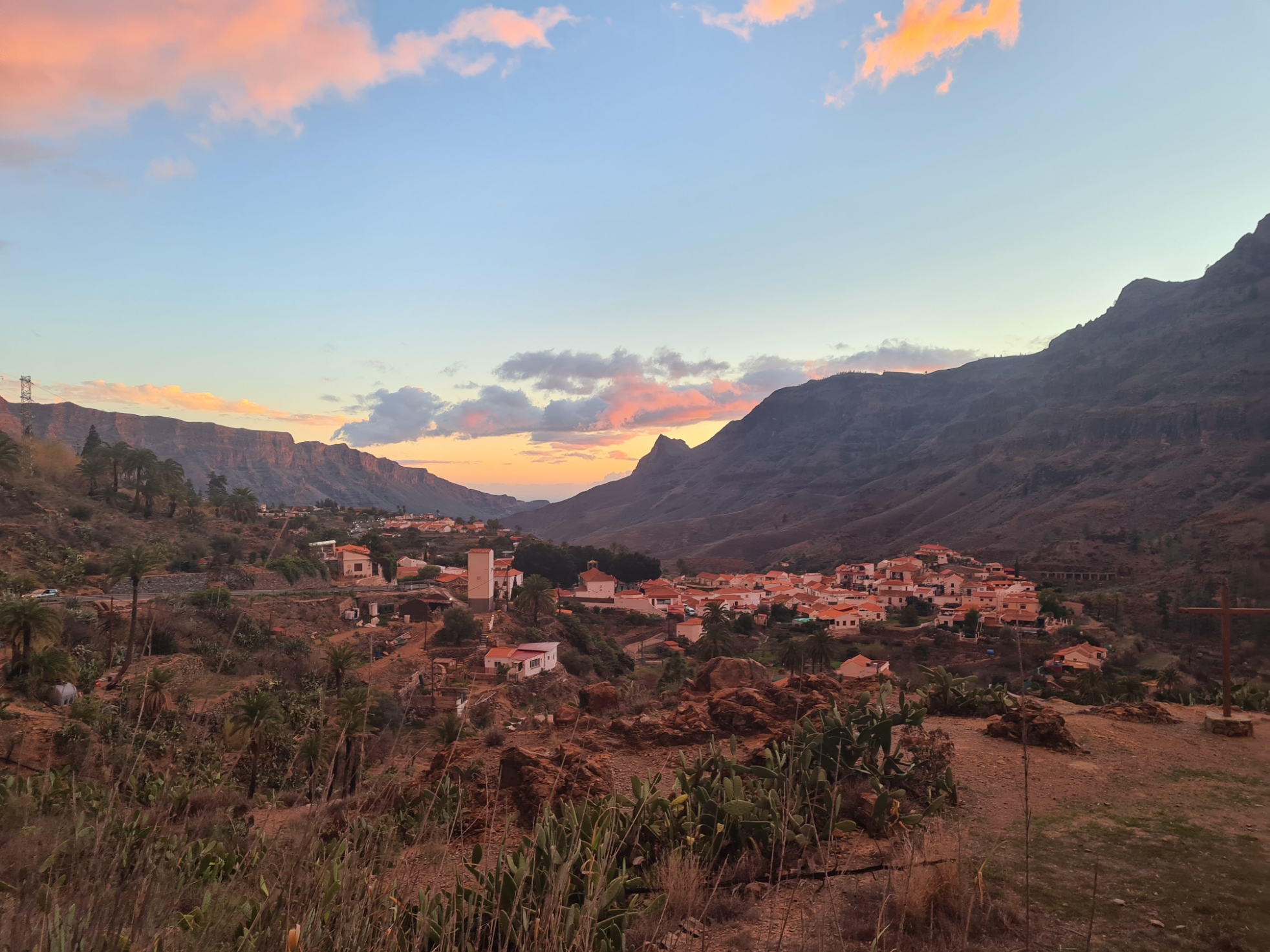
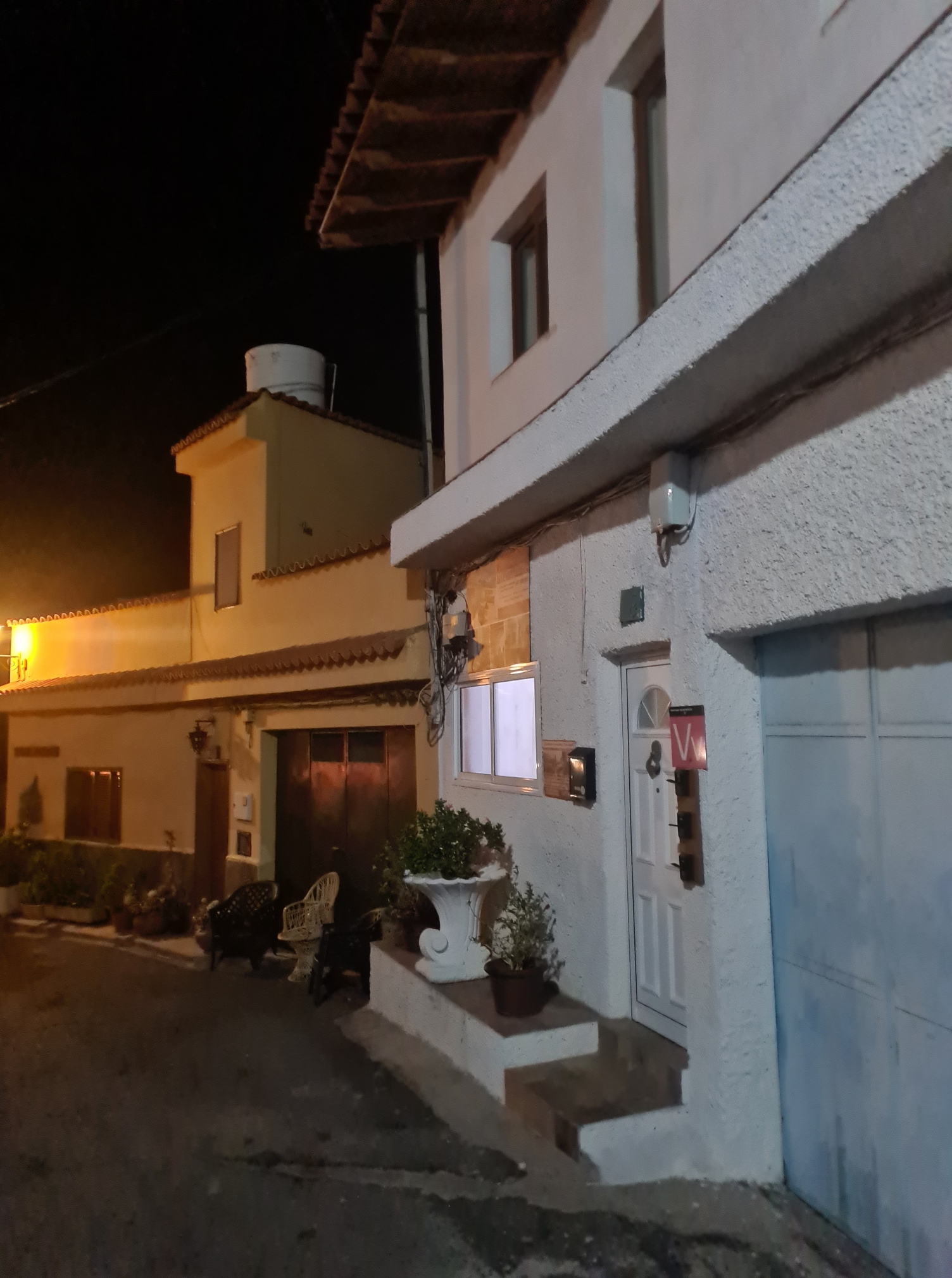
I confess to not enjoying the last couple of hours walk. My feet hurt and I was tired. It grew dark. It grew more than dark, and even with my little flashlight wayfinding was difficult away from the road. Thankfully the temperature dropped to something comfortable. I was more than ready for my day to end. The weather can be changeable at this time of year, and there were a few drops of rain just prior to my eventually reaching Tunte, my final town on day one, I was pleased to find my accommodation without problem.
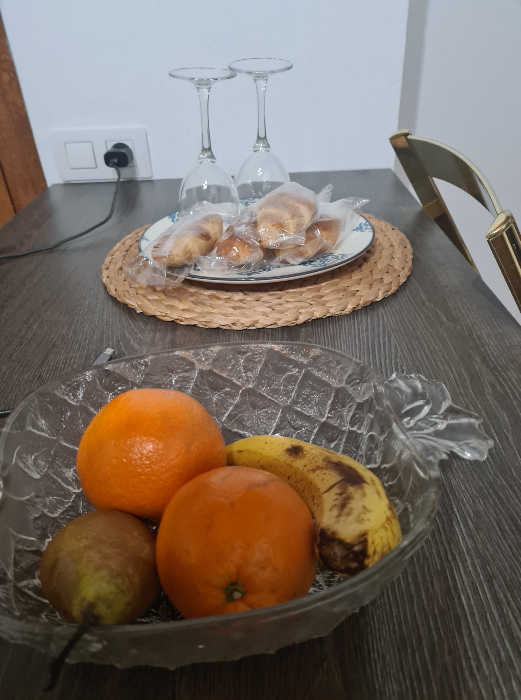
But I also knew I was far too late to get anything to eat in one of the few restaurants in the vicinity as everything had stopped serving long before. Thankfully it was a large and comfortable residence where the host had been kind enough to leave pastries and fruit, which made for minimal, imperfect but adequate fare.
I showered, changed into sweat free clothes, hydrated with copious mugs of tea and inspected the damage to my feet. It wasn’t good. I took my time tending to them. Loose skin was clipped off, dressings and tape applied, medication swallowed. This little trip was not going as planned or expected. Had it reached an end? I would consider options tomorrow. As I went to sleep it was getting wild outside. The wind was howling, furniture was crashing over on the patio, and rain was lashing down in the street outside. Was someone trying to tell me something…

Nice read.
Visited the Northern edge of Tenerife last march. Interesting walks. The diverse microclimates provide dramatic changes in views and atmosphere. Organised wild camping is present. Recommend it. Just avoid the touristic area’s
LikeLike
I’ve done a bit of walking in Tenerife, but no multi-day hikes there. I agree, a terrific landscape, especially the interior, very varied
LikeLike