Three Points of the Compass travelled to the Canary Islands to walk a little known Camino. The first day had not gone well, how would it end?
My first day on the Camino de Santiago de Gran Canaria had been too long and too hot and combined with trialling a new (to me) brand of trail shoe, much to my surprise, my feet had suffered as a result. Due to my late start in Maspalomas I had arrived at my overnight accommodation in Tunte well after sunset and too late to go out for a meal. Fortunately I had a modicum of food in my little day pack. By combining this with a few pastries and fruit left by my accommodation host, I had managed both a very late evening meal and also had something for breakfast. I sat on the balcony, clutching a mug of tea and watching the sun rise, beginning to light up the surrounding mountainous hillsides. I was considering my next steps, or even if there should be any next steps. Last night I had been considering quitting. What to do?
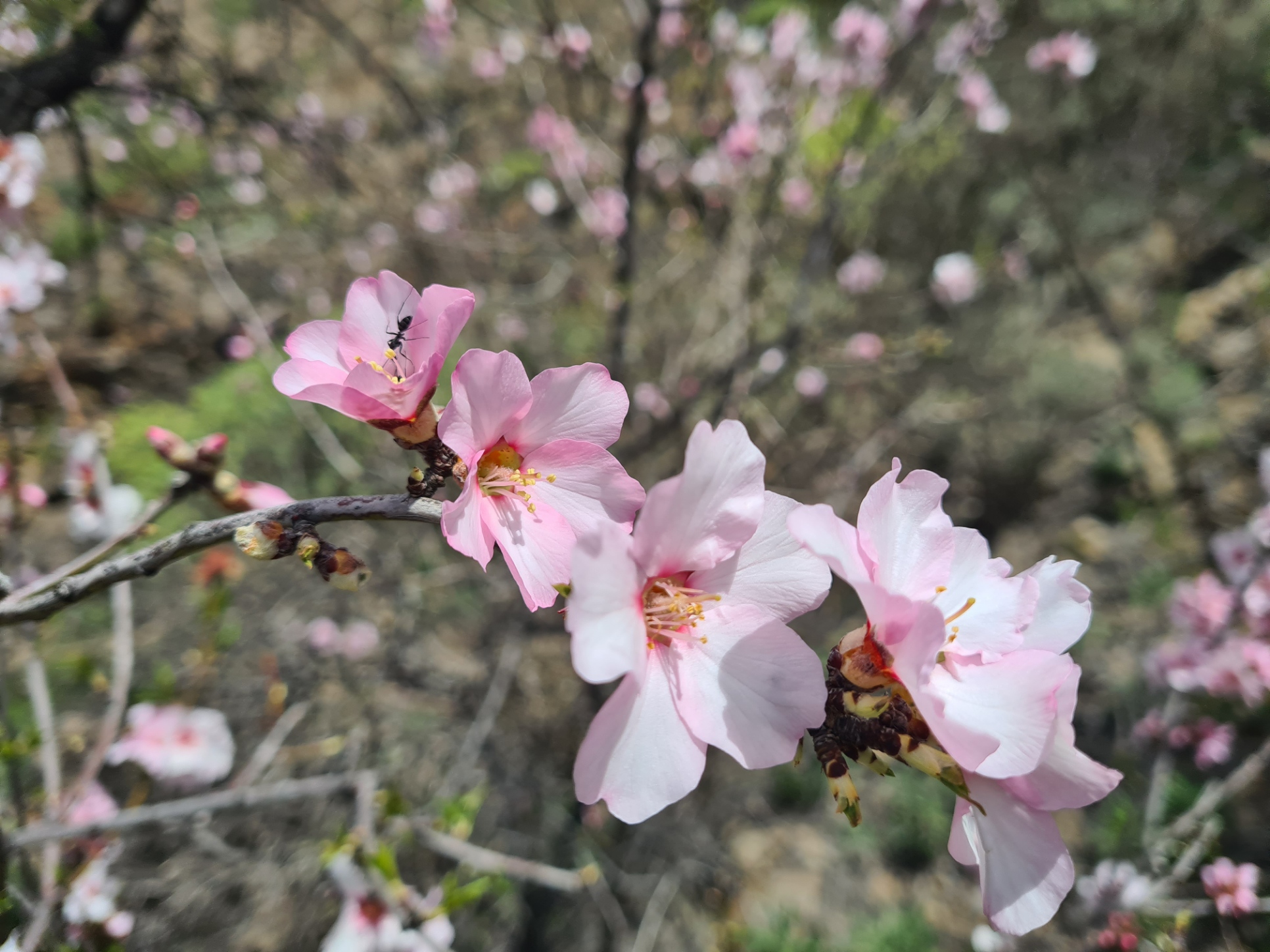
The heat, stony trail and that accursed new brand of shoes had torn my feet up pretty badly. But I carried a decent first aid kit and had applied large hydrocolloidal dressings that were then taped over. I had taken painkillers, I had slept well despite the strong wind and heavy rain outside overnight. I now felt much better and in a far better mood. I have a mantra- “never quit on a bad day”. Yesterday I had been close to quitting but had held off from making a decision. Today, I was in a much better place mentally. So, despite sore feet and a lingering worry, the decision was made, I would knuckle down and continue this hike. It was simply too good a prospect. There was much to look forward to on the next stage- the Paso de la Plata, Degollada de Cruz Grande, the ‘window of the cloud’ of Ventana del Nublo, the Llanos de la Pez, Los Hornos Dam and it would be a shorter day’s hike to attractive Tejeda.
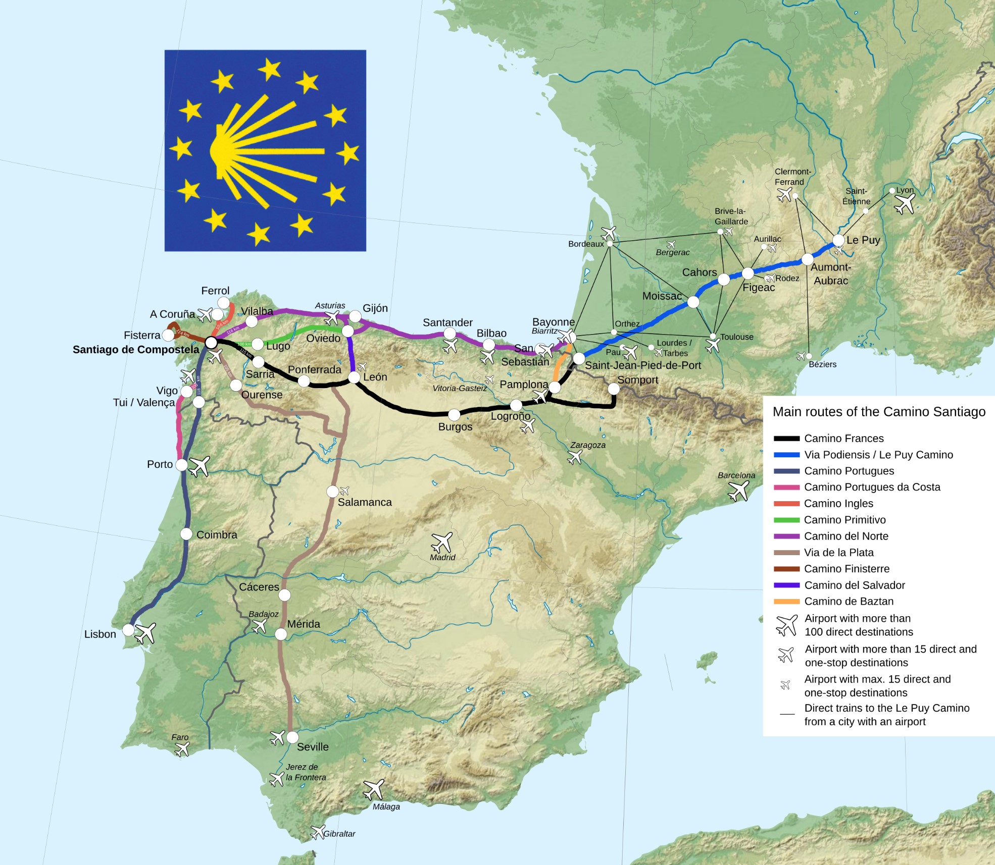
Unlike it’s cousins on mainland Europe, this little known Camino on Gran Canaria is quite short in length and can be completed in just three days. However I was in no great rush, and when planning this walk, while I would have liked to have split it into four days, breaking down the long first day, I had been unsuccessful in finding accommodation. So had instead pre-arranged a rest day in the mountains around the mid-way point. I could rest up at Tejeda for a whole day tomorrow, before the long descent to the finish in Gáldar the following day.
I had first heard about Gran Canaria’s Camino de Santiago a couple of months ago and immediately thought “that’ll do for a winter break”. The longer Camino’s have never really appealed to me as I prefer quieter trails.
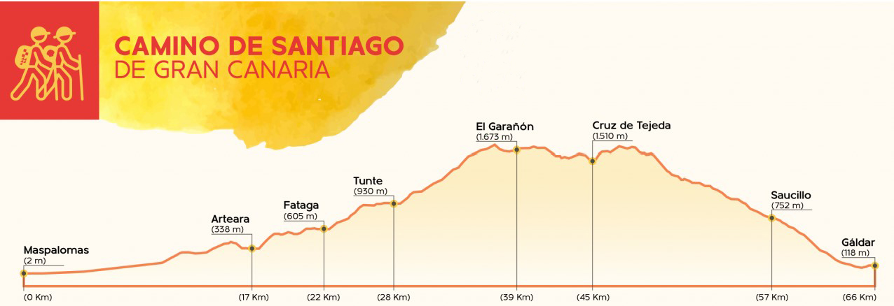
Day two: San Bartolomé de Tirajana (Tunte) to Tejeda
In 1965 Pope Paul VI granted a papal bull, giving Gáldar on Gran Canaria the same privileges of the Compostela jubilee year to pilgrims who visit the Temple of Santiago de los Caballeros. He renewed the bull in 1971 and 1976. In 1982 Pope John Paul II granted “In Perpetuum” (in perpetuity) the Jubilee graces to Gáldar from the Jacobean Holy Year of 1993. So, this trail is an ‘official’ Camino de Santiago. Despite this, it appears to be little known. I hadn’t seen a single person walking the trail yesterday, but having shouldered my pack, locked the door and returned the key, on walking out the front door to the street, I met Teseo, another pilgrim leaving the same accommodation at the same time.
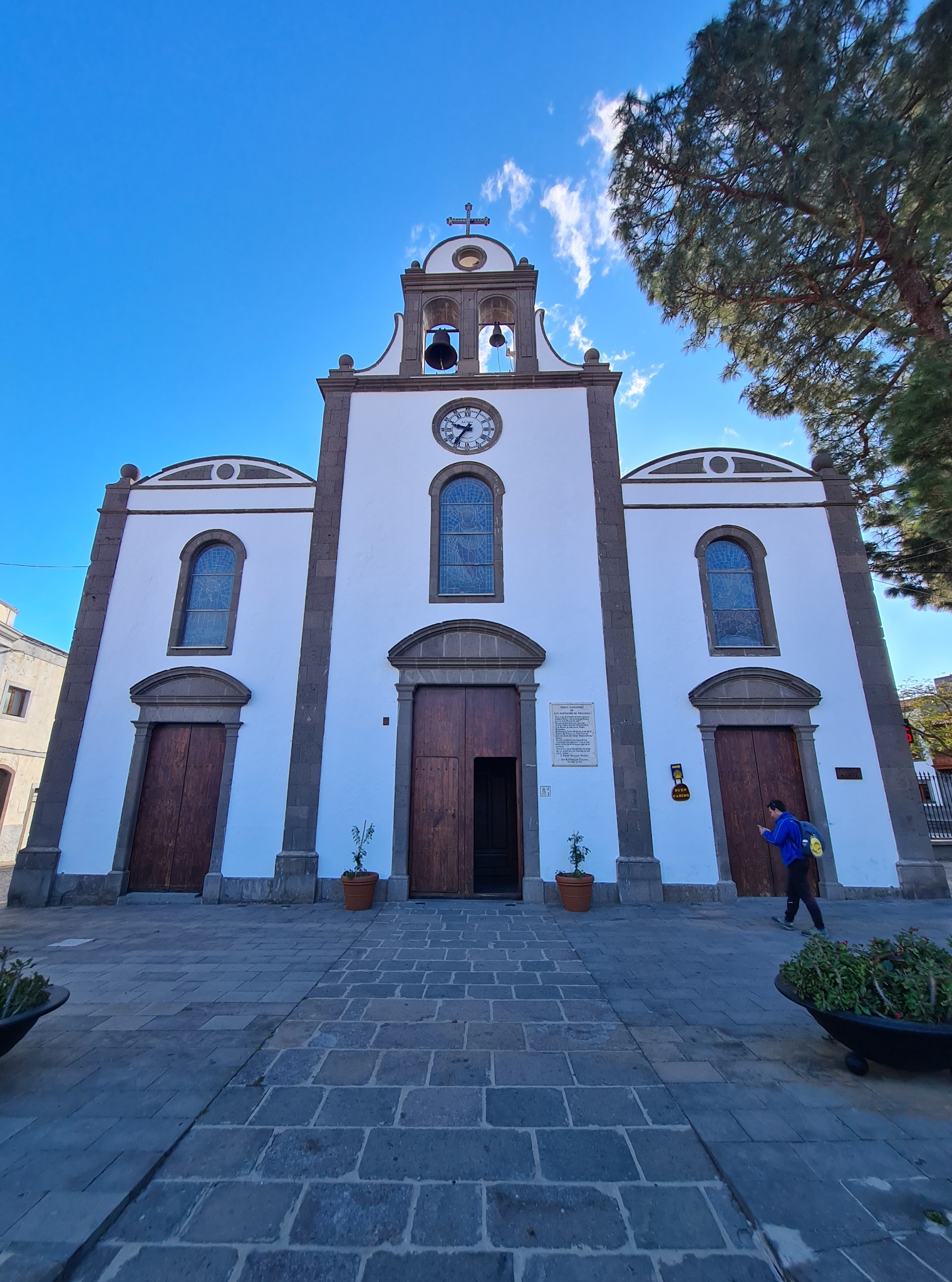
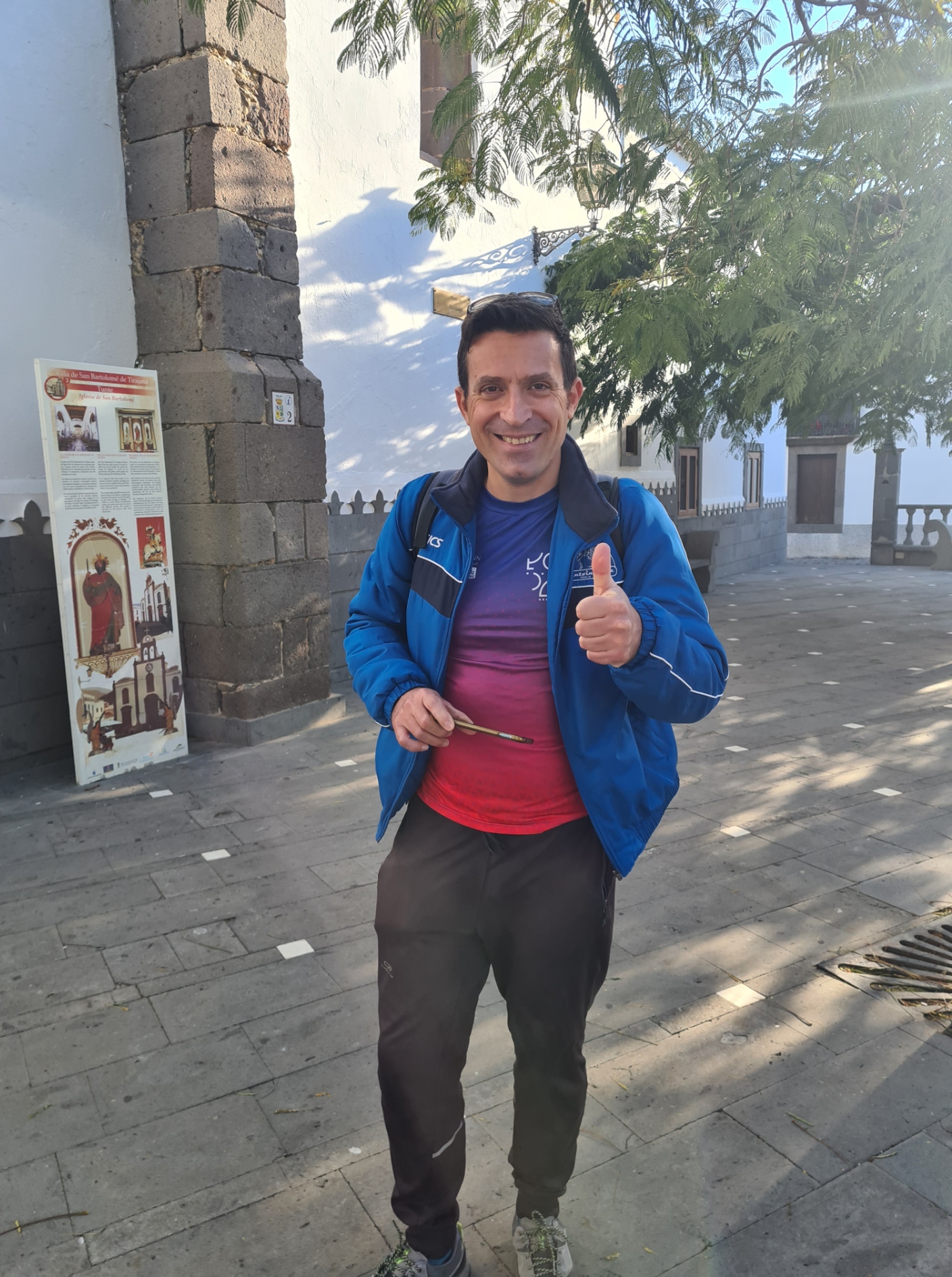
San Bartolomé de Tirajana is more commonly referred to locally as Tunte and it is this snappier name that is shown on many maps, but not exclusively. Tunte was also the original name of an aboriginal settlement of hispanic origin in the area. San Bartolomé de Tirajana/Tunte is around 900m above sea level and is situated at the foot of the Morros del Pinar and beside the Barranco de Tirajana. It’s location in the centre of the Caldera de Tirajana makes it a main crossroads for communication between the north and south of Gran Canaria. I thought it was a pretty little town and worth even a little exploration prior to setting off, so we took a little time out, despite having a trail to walk. We couldn’t afford too much time however. After a long day yesterday, neither of us wanting a late finish today.
It was quiet and the sun was already beating down. It was difficult to appreciate just how wild the weather had been just a few hours earlier. The rain from last night was already evaporating and forming misty clouds on the slopes below the town. The handful of locals that were up and about largely ignored these two temporary interlopers but replied with good-mannered hola when hailed.
My fellow pilgrim was from Italy but unlike this ignorant Brit, had enough command of a second language that we were able to converse satisfactorily and we agreed to walk together despite Teseo being a fit marathon runner with a good deal more energy than I. Having left Maspalomas hours before me yesterday he had reached Tunte at five in the afternoon while it was still light, but I was slightly heartened to hear that I wasn’t the only one that had been extremely weary after that long first day. He had gone to his room tired and due to unspecified ‘stomach problems’ couldn’t find the energy to go out again later.
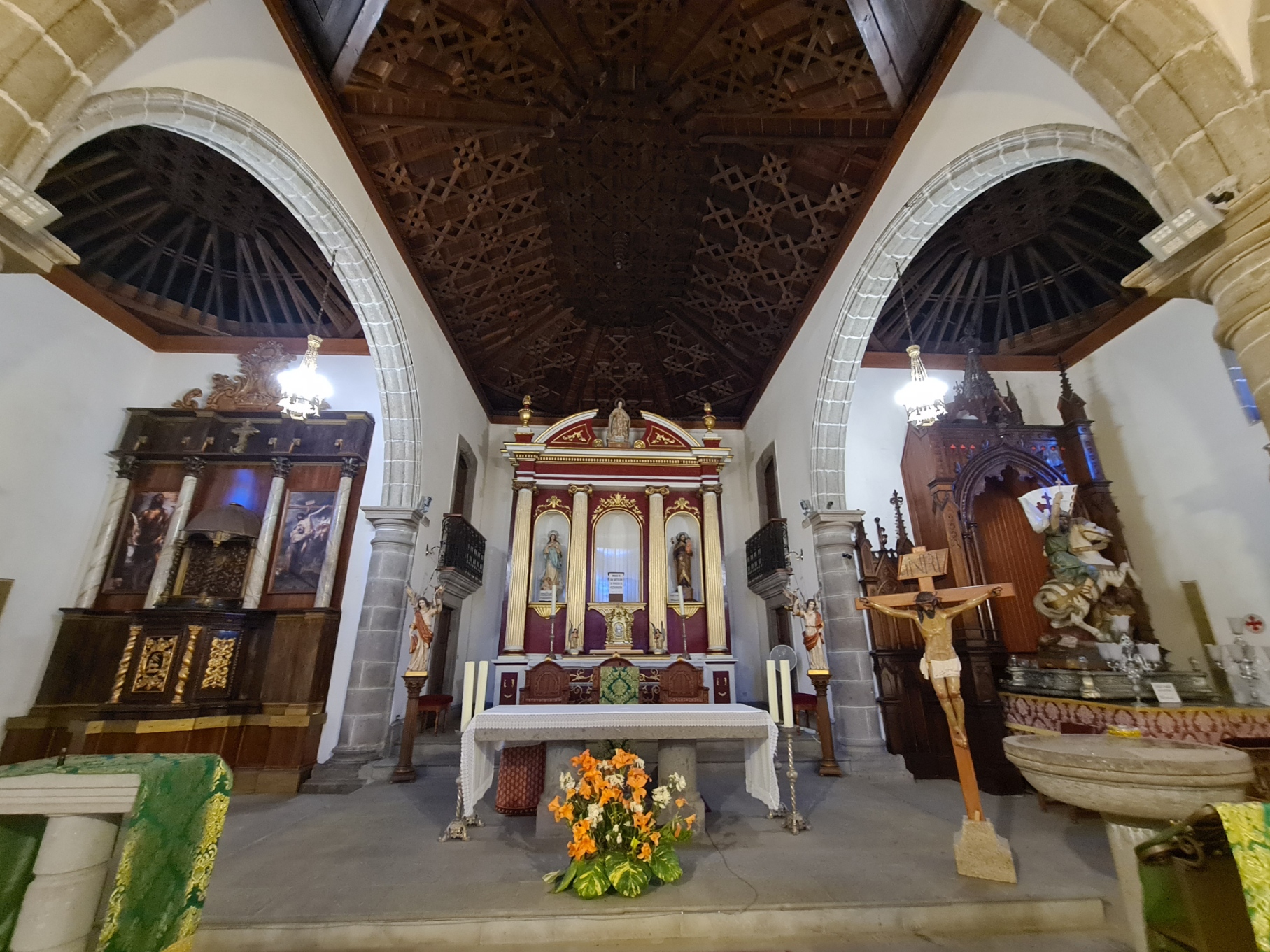
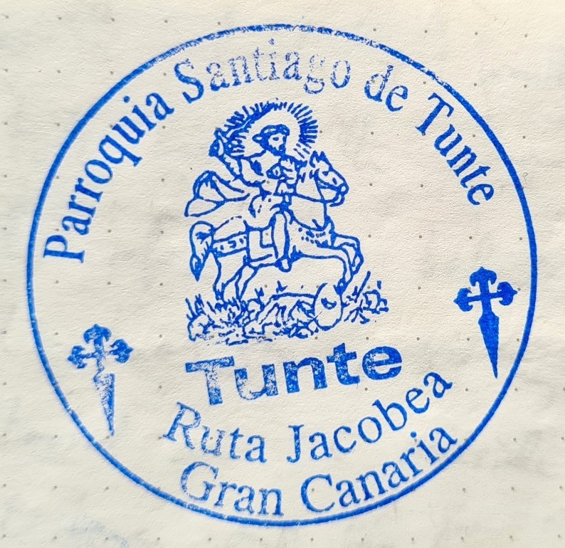
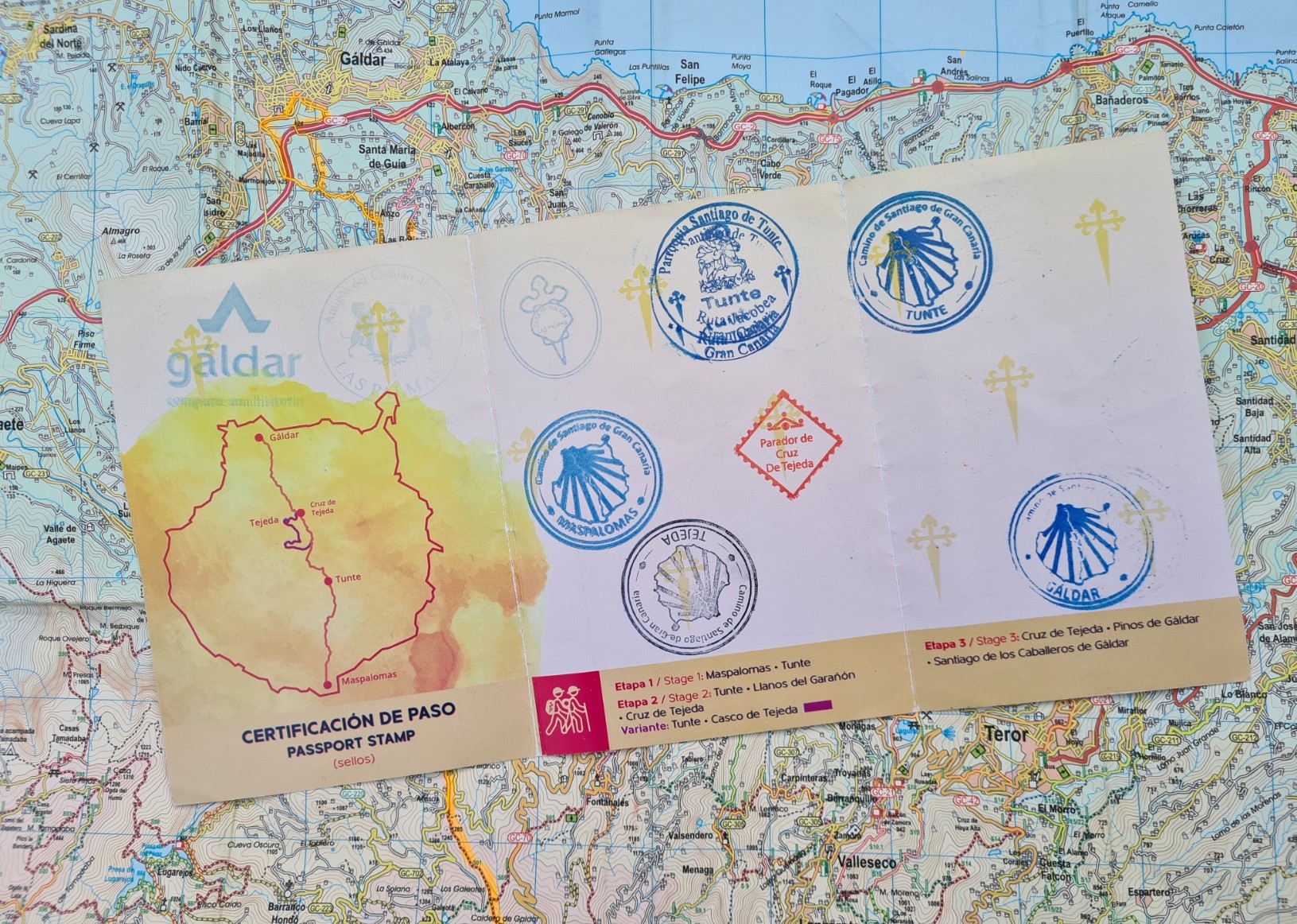
Once we had visited a little patisserie for coffee and each buy a ham and cheese bocadillo for lunch, we wandered around the nearby square with its Town Hall (built 1690), and visited the Church of San Bartolomé de Tirajana, dedicated to Santiago the Apostle. Then I popped into the tourist information centre to collect a stamp in my credential.
The oral tradition is that some Galician sailors were caught in a storm off the Canary Islands. Fearing for their lives, they entrusted them to a statue of the apostle they were carrying, promising that if they were saved, they would build a shrine to Santiago. Having safely arrived on the Arguineguin coast, in the south of Gran Canaria, they kept good to their word. They carried the statue into the mountains of Tirajana, where they built a hermitage- “Santiago el Chico“. The statue was moved from the Pinar de Santiago to the church in Tunte in the mid-19th century. It was replaced in the 1990s.
Teseo had no credential himself and when I returned to the church square he studied mine with interest, before visiting the tourist centre himself to see if they might have a blank one that they could supply him with. Soon emerging with not only a triumphant smile, but also clutching his own ‘passport’ complete with the local stamp, and an additional one for Maspalomas. So much for my waiting for a couple of hours outside the locked lighthouse for that first elusive application of ink.
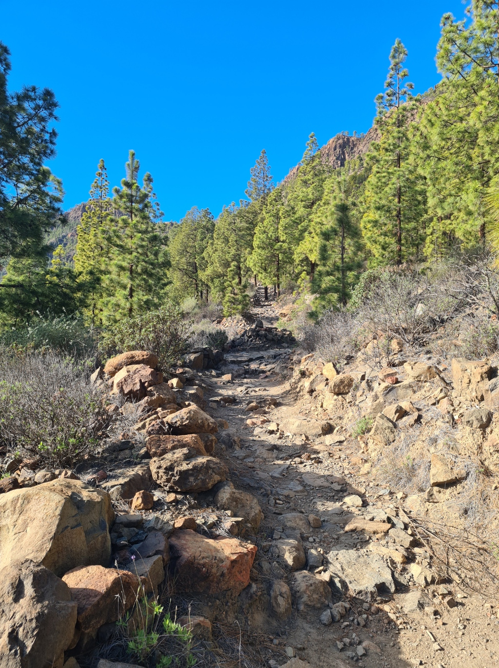
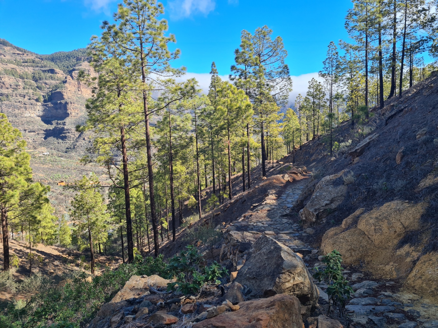
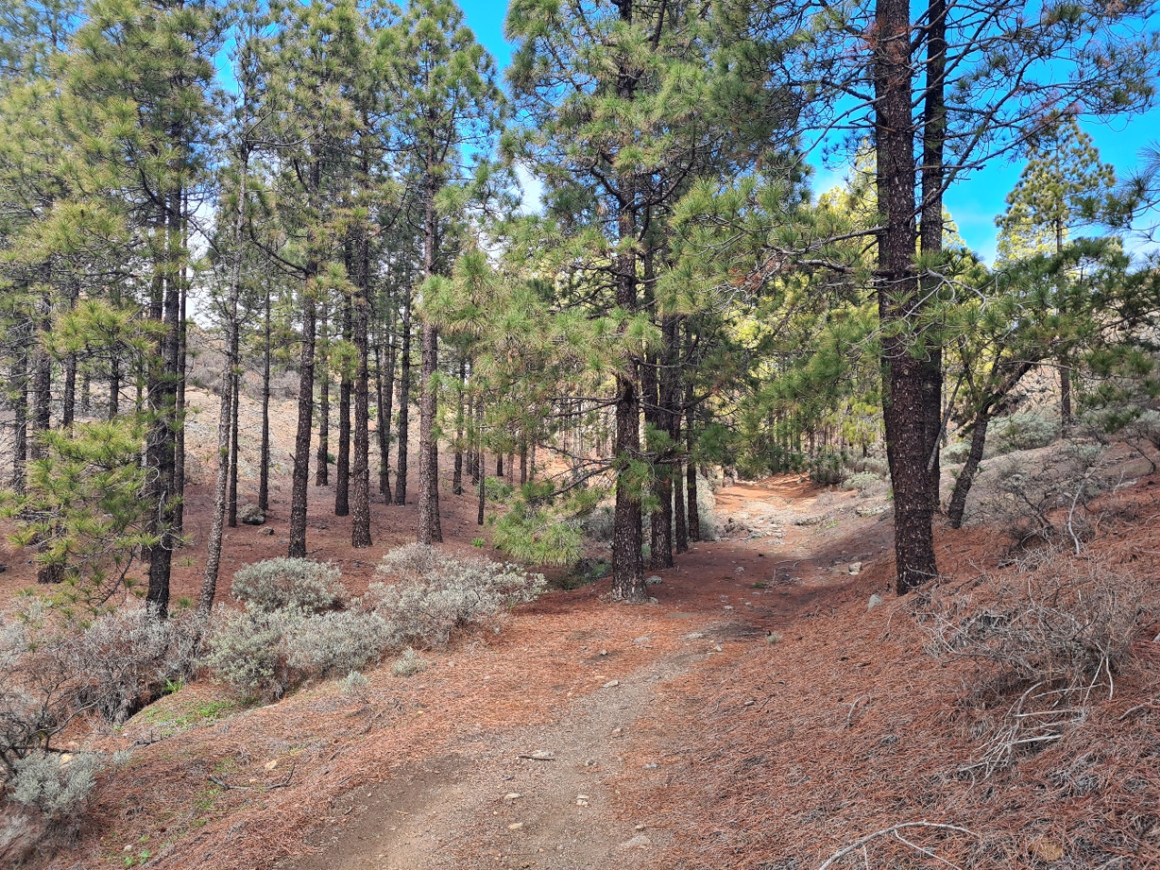
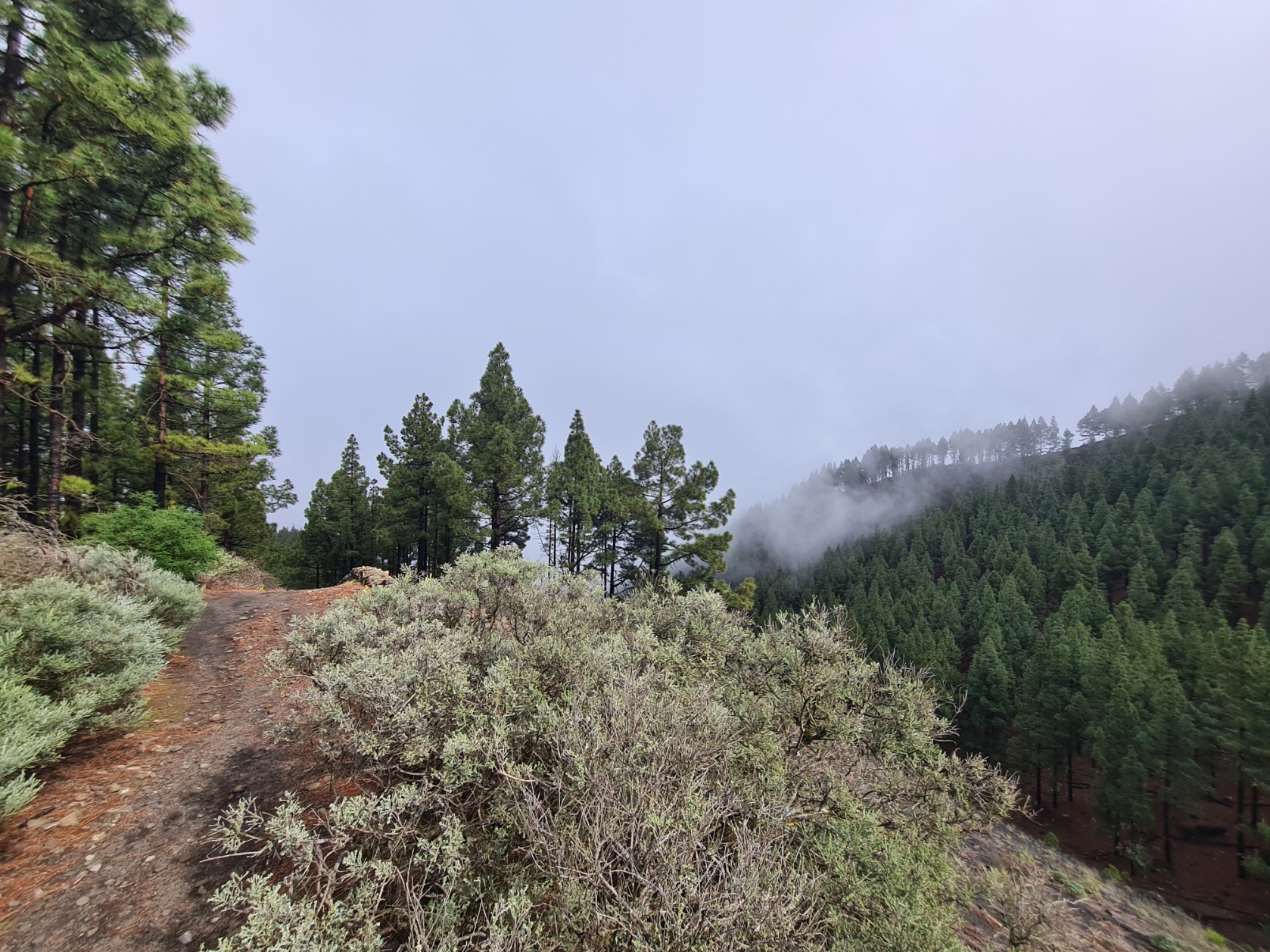
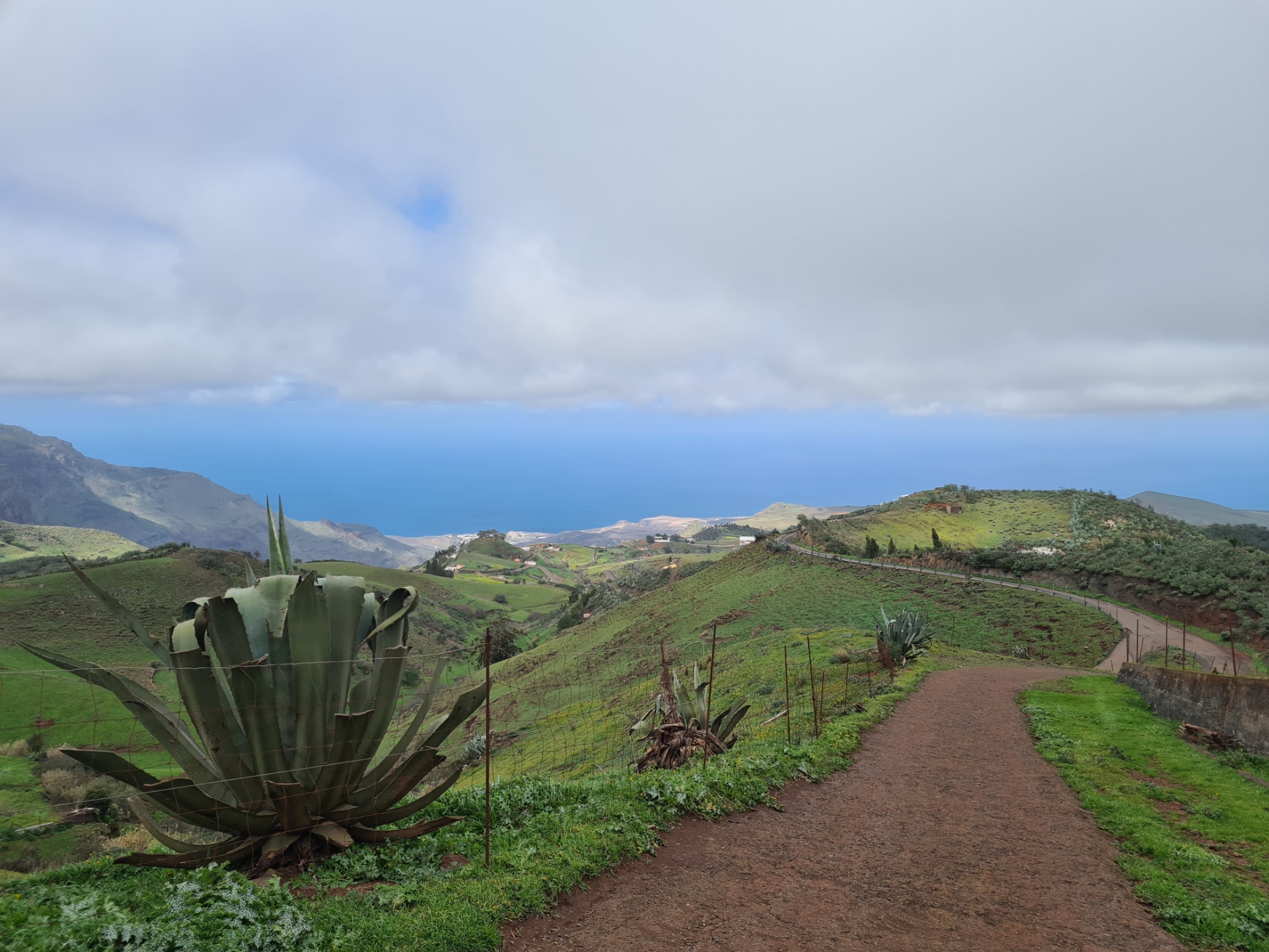
Cats lazily paced the streets, one or two following us for some distance as we found our way up through the winding narrow streets, heading out of town. We were soon on to a lovely climbing track up to Cruz Grande, through scattered pines, the smell fresher and cleaner than any supposed ‘pine’ air freshener. The views back as far as the coast were slowly getting pretty wonderful as we steadily wound our way up and round the mountain side, chatting about anything and everything as we walked.
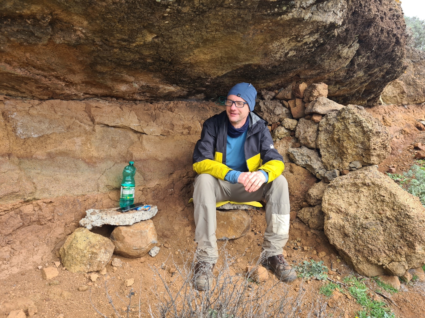
Just prior to the Paso de la Plata, where the road crossed a east/west pass, we halted in the shade of a shelter for hydration and snacks, a cereal bar for me while Teseo cut up an orange with a small Victorinox I carried, before the two of us took some time out for photographs of the views to the east, west and south. The Camino gets a good deal steeper from here and I encouraged Teseo to go on, leaving me to wheeze along in his wake. We shook hands and then, twenty years younger than me, he walked off a good deal faster than I could ever manage. I never saw him again. Such is the transient nature of friends made on trail. Easy-going acquaintance just as easily dissolved.
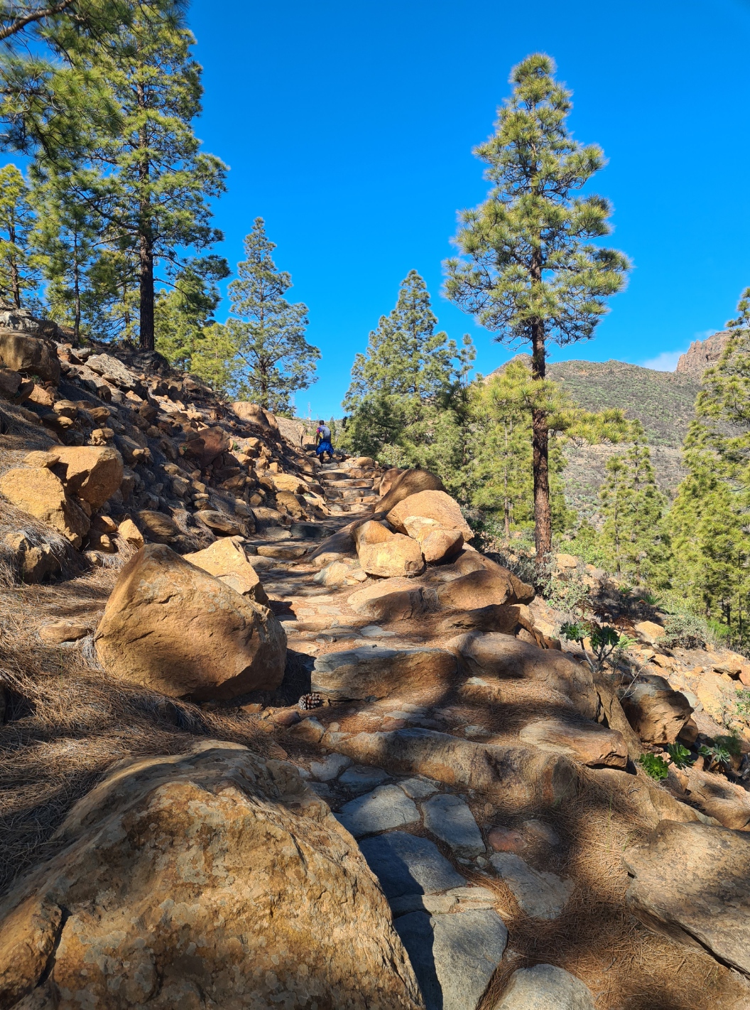
The climb up from La Plata is via an impressively built ramp constructed of rocky paving laid on a tortuously built 1.5km path to the crest. Until the end of the 19th century anyone wanting to travel between the island’s central peak and Tunte had to travel the easier route via Ayacata, or scramble through on small and difficult paths. The La Plate Pass (via Lata) was the vision of Antonia Yáñez, a local landowner. It has been renovated over the years and large concrete pillars, dated 1953, are found along it’s length. The steep two-hundred metre climb to Cruz Grande now provides not only some of the best views of the south of the island, but was also a rude awakening to my lungs, still suffering the vagaries of a respiratory virus I had succumbed to in the UK. There were quite a few day-walkers, every single one passing me as I wheezed up to the pass. The trail flattened out to a slab stone plateau, soon crossed and back into pines, jarón, black tajinaste and shrubby herbs.
A large raptor mewed in the sky high above, but remained unidentified. Closer, small birds called and a woodpecker followed me along the path, flying from tree to tree, a few taps, then move on to the next. Despite being a hot and dry day, the sun beating down, there were a few muddy patches up here, I presume impervious rock holding last night’s rainfall. I had now entered a World Biosphere Reserve.
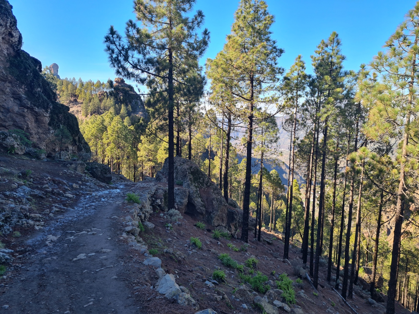
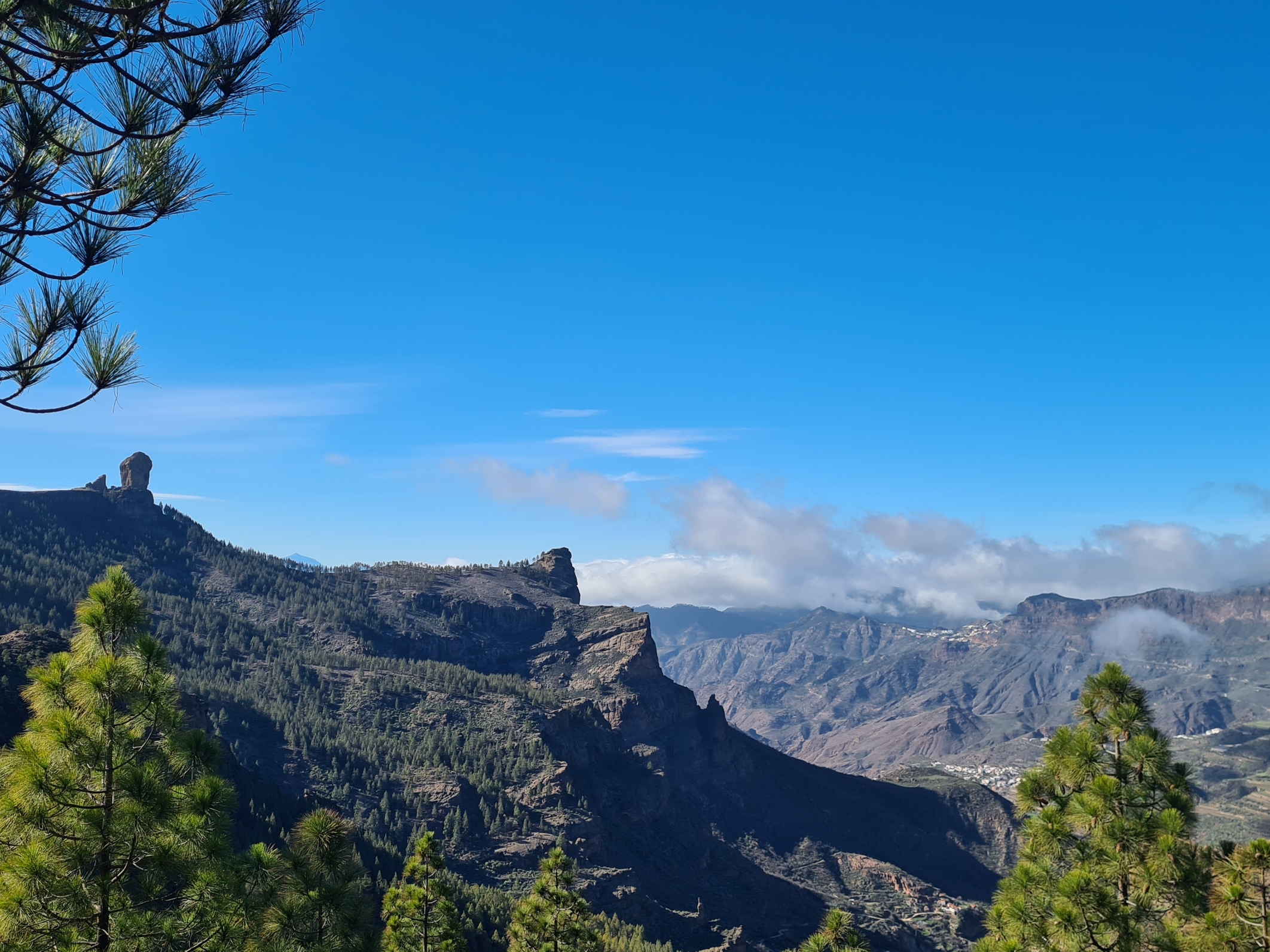
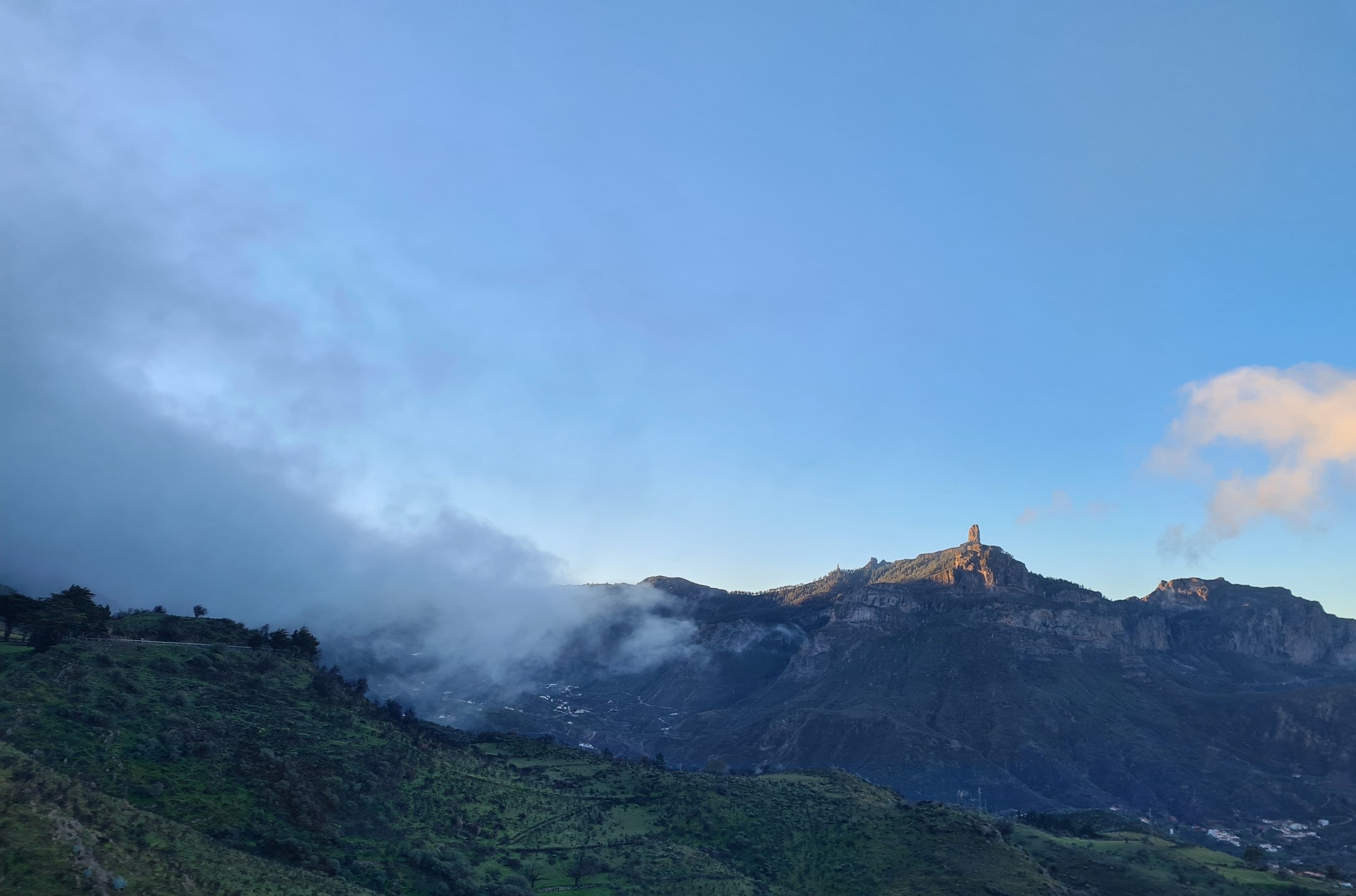
As soon as I had some shade under the pines I stopped for a breather and much needed cool down, hydration and lunch. Also pulling off my shoes to allow protesting feet a little time to air and recover. They weren’t actually that bad today, but I thought a decent halt would mean the remainder of the day might be a tad more bearable. From here, 200m off-trail and uphill is Gañifa, also known as Ventana del Nublo (window of the cloud), a natural sandstone arch that provides a good view of impressive El Roque Nublo, though in truth, it is not difficult to find a decent viewpoint of that prominent landmark from many places.
Setting off again, in much improved condition, I soon met a group of four young backpackers walking the GR131. the second such group I had met today, all walking in the opposite direction. We stopped for a chat for a while. Despite camping out last night and finding the weather a bit wild, they were having a great time, taking their time and only walking the one island rather than continuing on to the other islands that the trail crosses. The GR131 is a 560km trail that I have had in mind for quite some time. I pushed my annoyance with the unprecedented current condition of my feet to the back of my mind. Better that I think on the likelihood of walking that trail when my misgivings of yesterday are not so much to the fore..
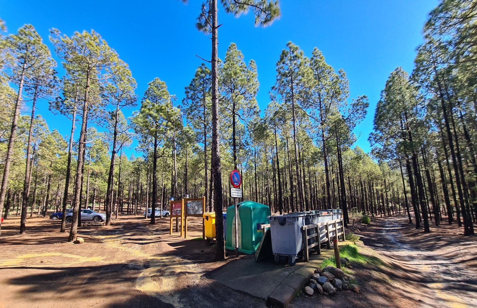
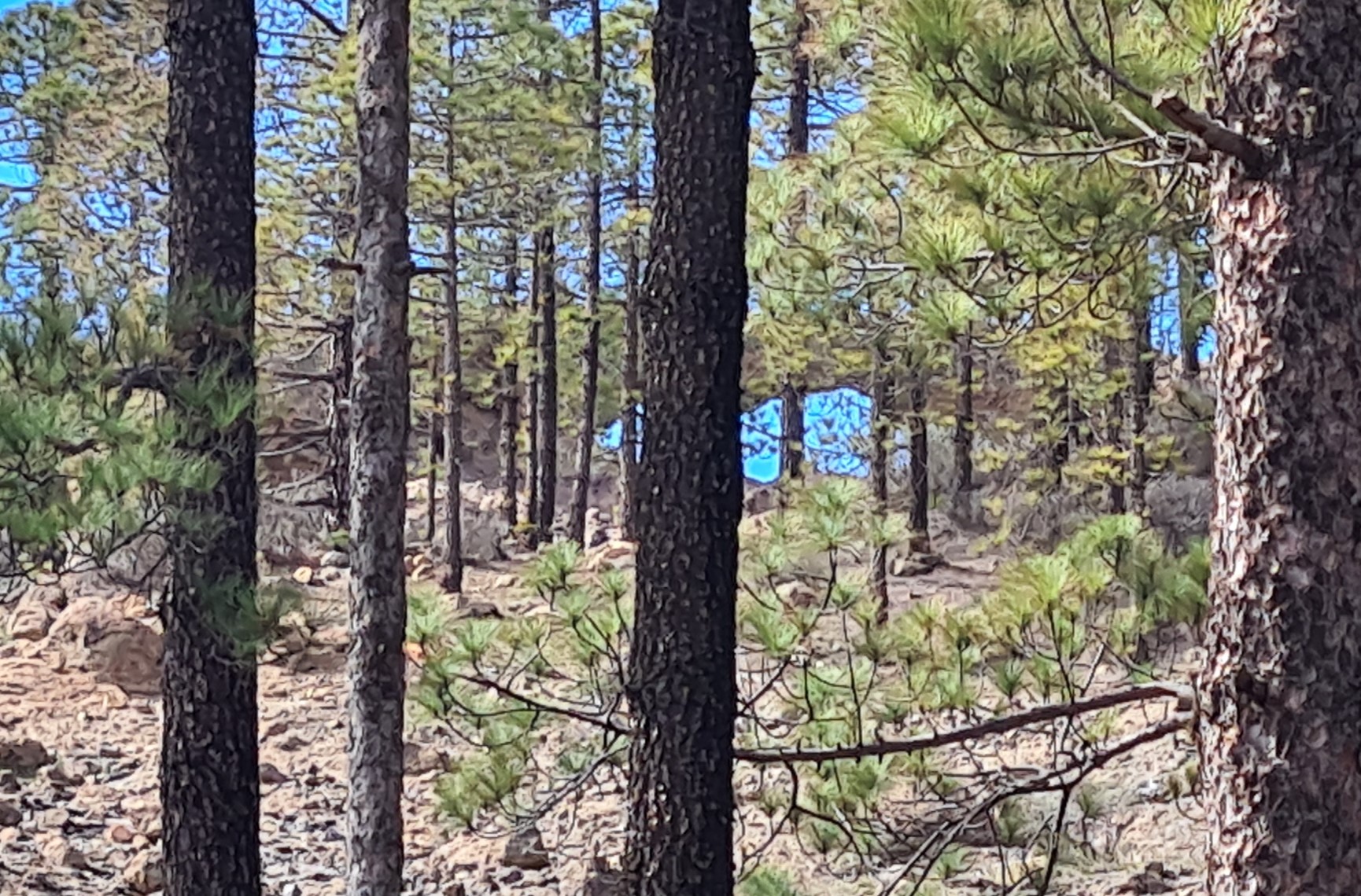
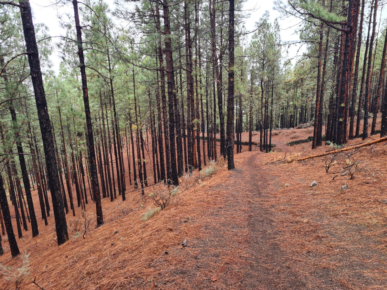
This lovely stretch of path took me down to the Bailico Zona de Acampada, an official camp site amongst the pines that were replanted in the 1950s followed deforestation. I wrote a little on these campsites in another post though I note that the required permits can now be obtained online. These sites amongst the shady Canary Pines provide free parking spots in the mountains for those just venturing up from the coast for day hikes and are popular places. Every now and then the authorities have to close them when there is a high risk of fire in the hotter drier summer months.
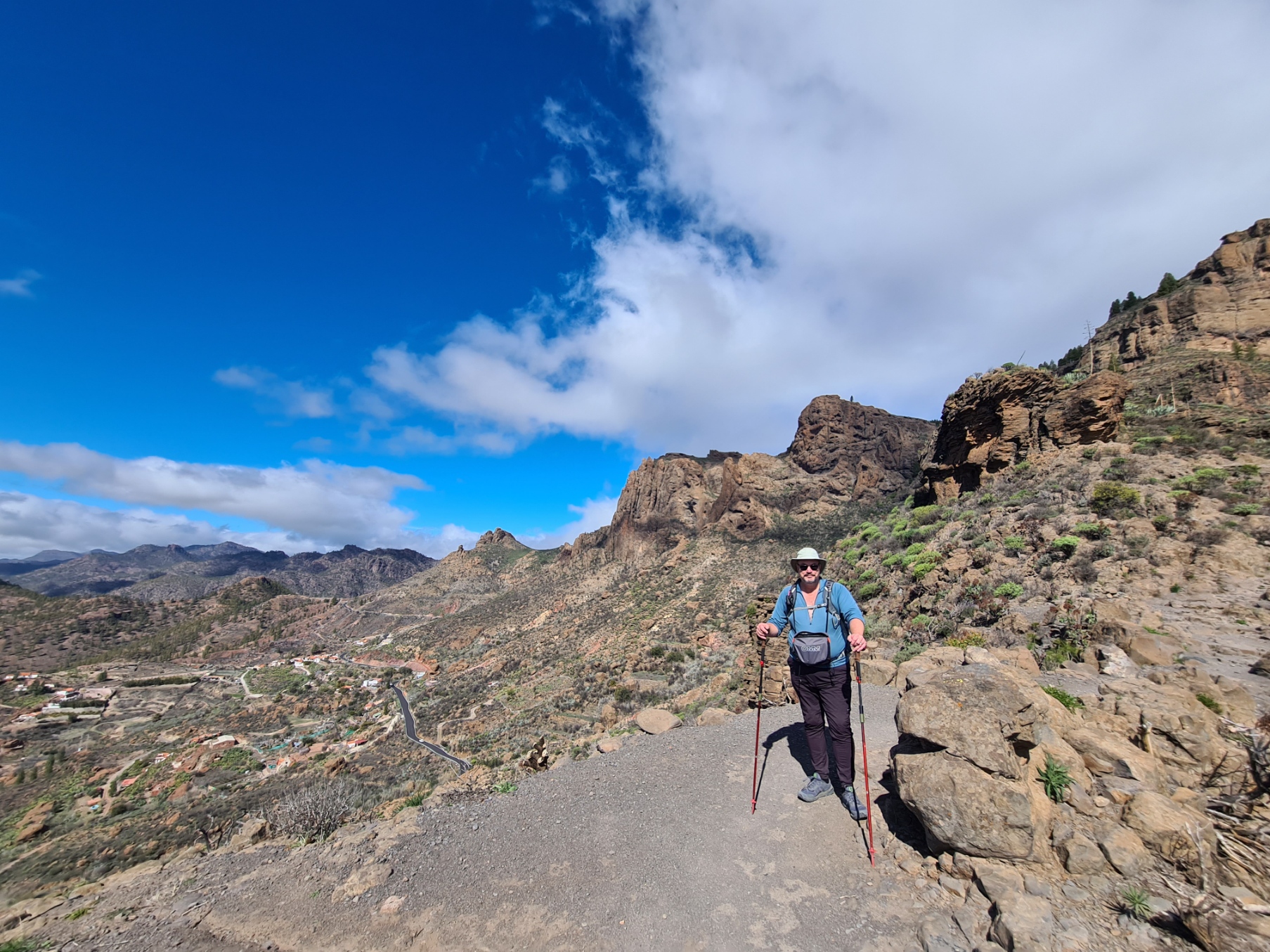
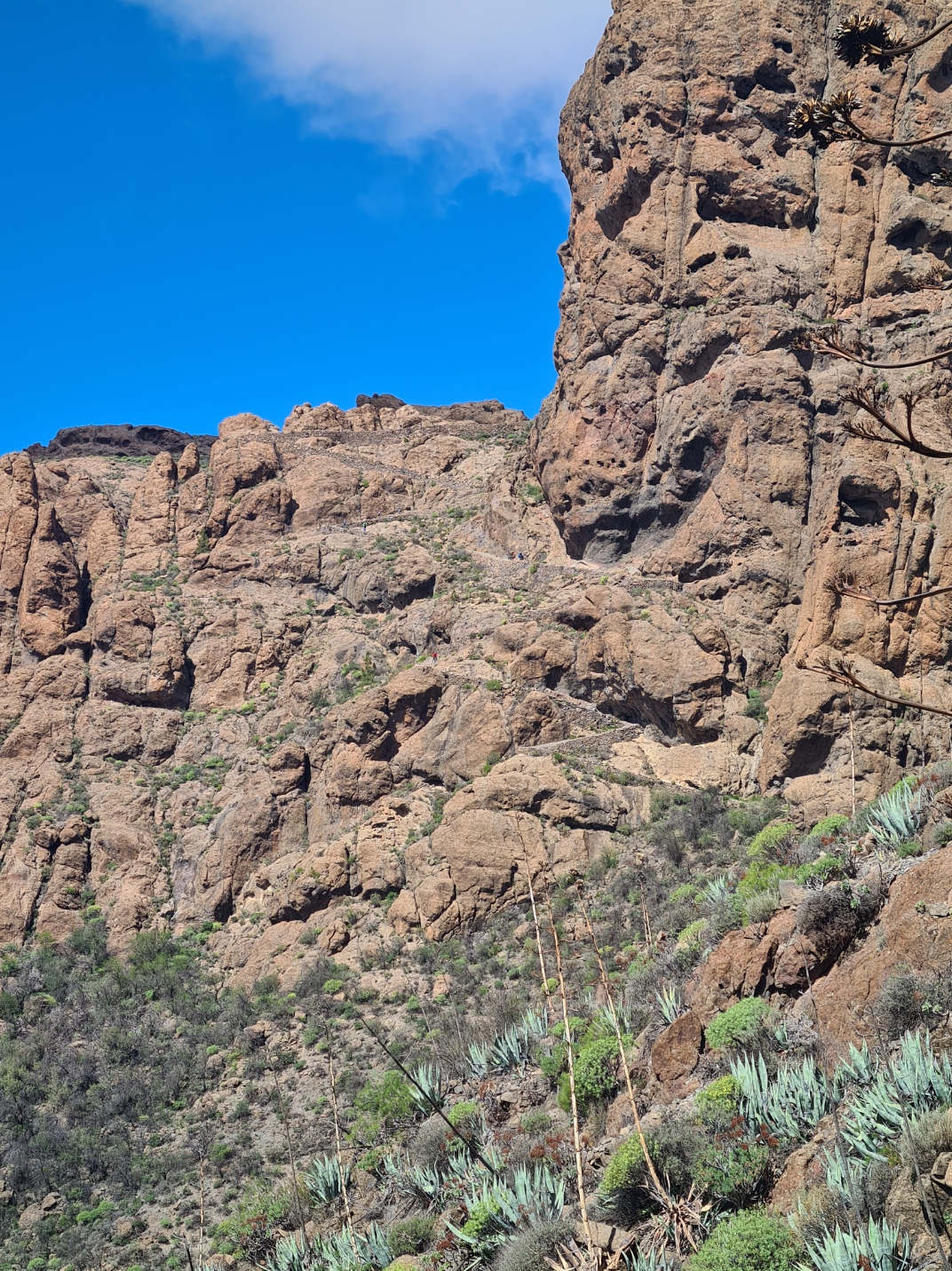
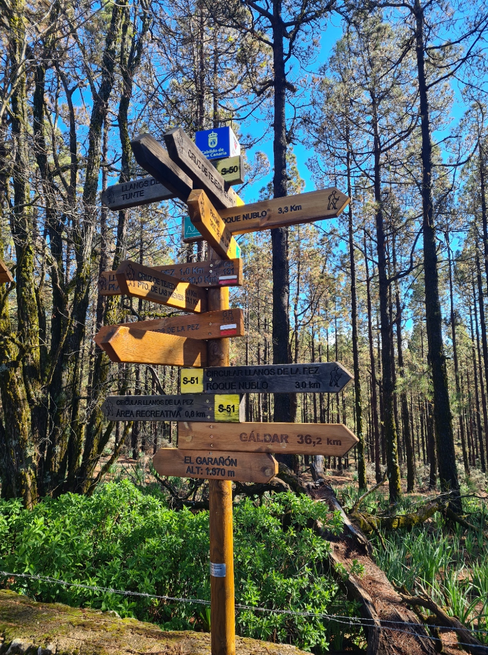
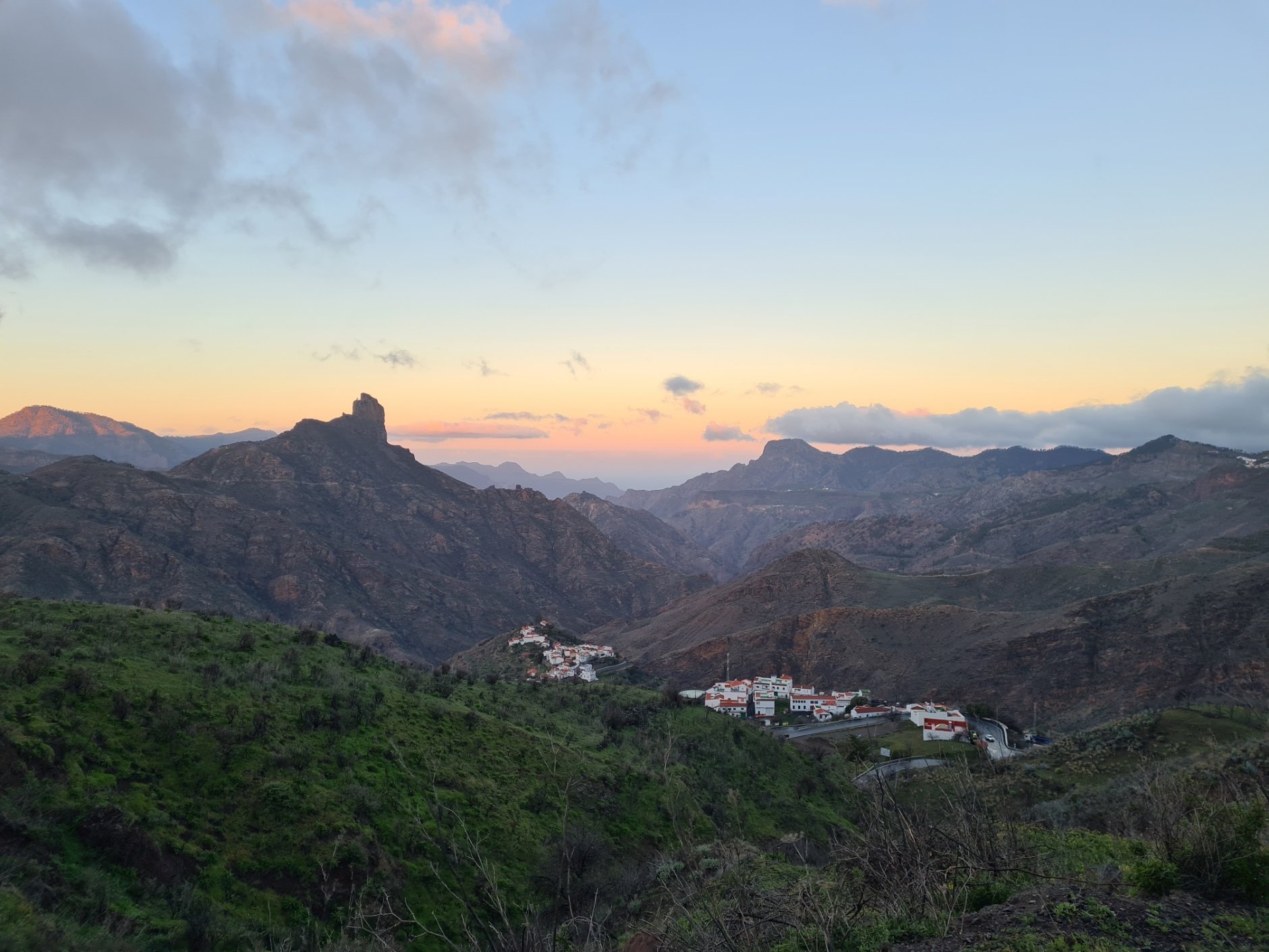
I reached the junction of paths at El Garañón. This stands at 1870m and the pilgrim now has a decision to make though it seems most don’t even stop to consider it. The standard, and far shorter, route turns right and then heads straight on to the mountain pass and crossroads at Cruz de Tejeda. This is actually a fairly level seven km section with just a little descent. Those few seeking punishment, also adding considerable time, distance and both ascent and descent to their walk, can choose instead to head toward Roque Nublo, the 80m tall ‘Rock in the Clouds’. This is not only the third highest point on the island and an important natural landmark, but also visible from just about any direction. Much as I would have liked to have taken the standard and shorter option, my overnight halt was in Tejeda, nestled in the valley far below Cruz de Tejeda, which somewhat made my mind up for me. It would be the longer variant. I didn’t have enough remaining daylight to walk the whole of the variant route, so would have to leave it and make my own way down off the mountain to my village, still adding quite a few km to my day. It was not that bad of an option actually, though it left me with a big climb to start my next day on trail.
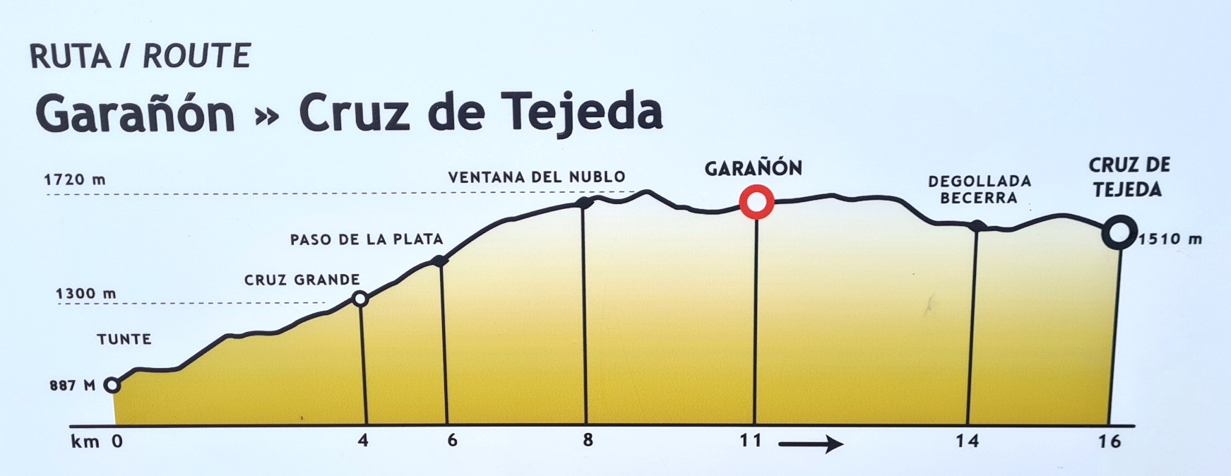
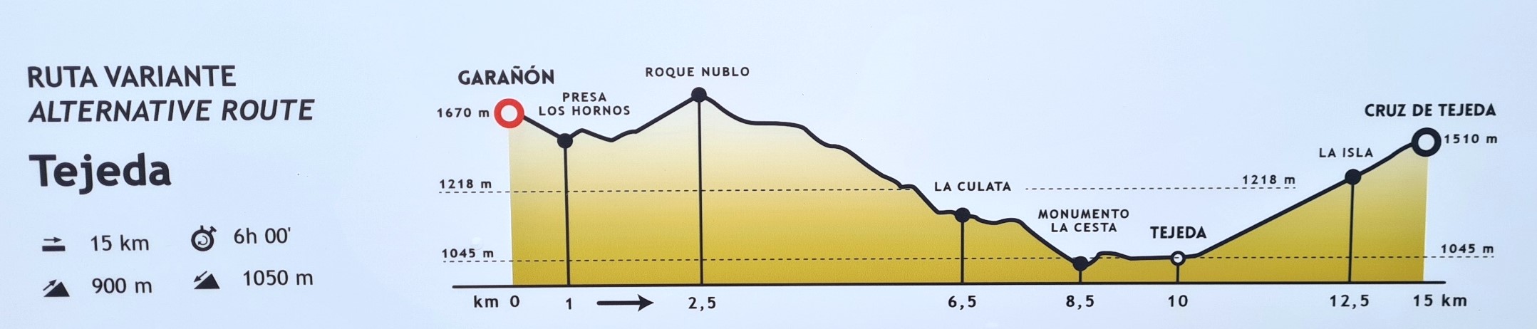
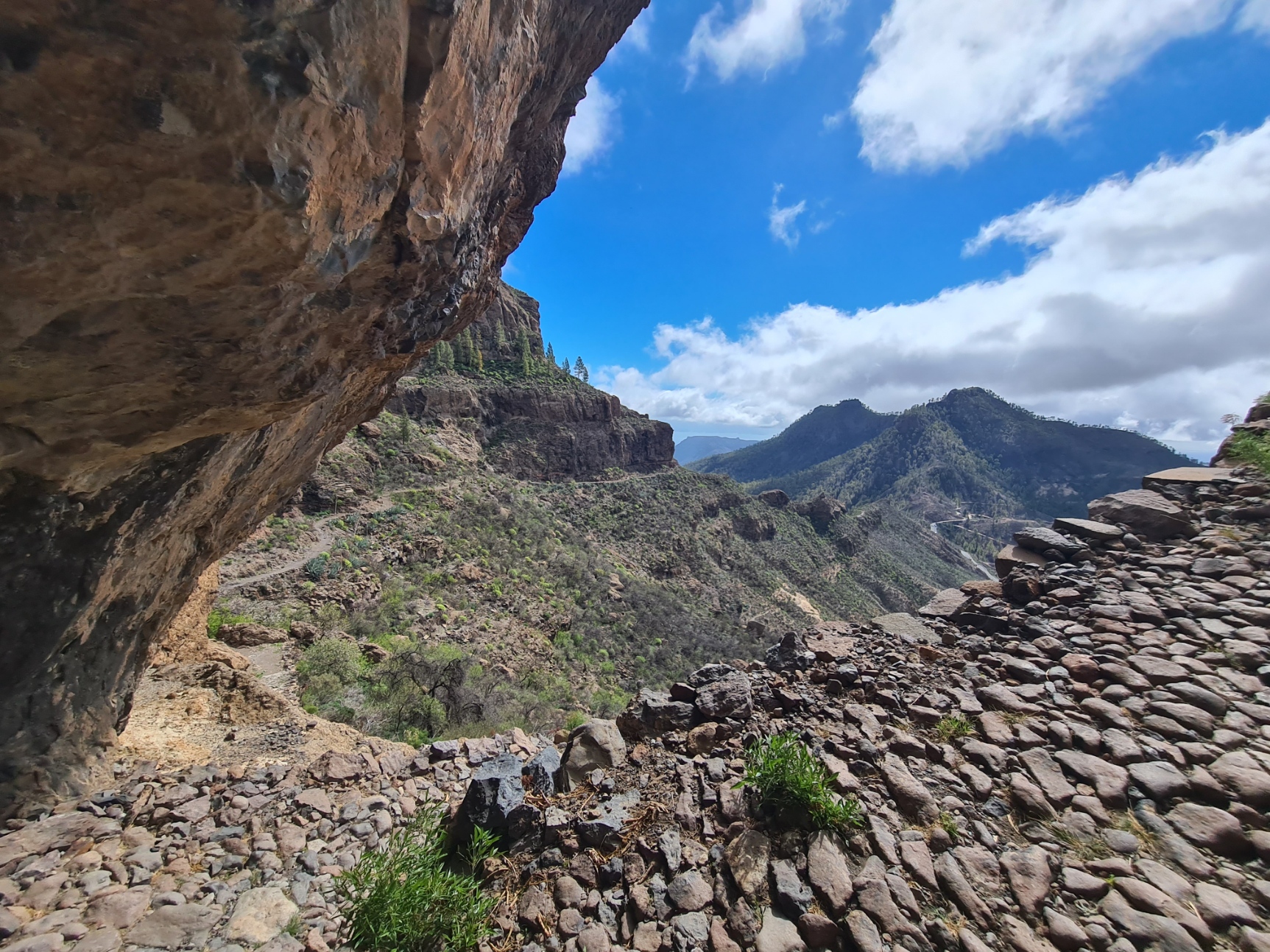
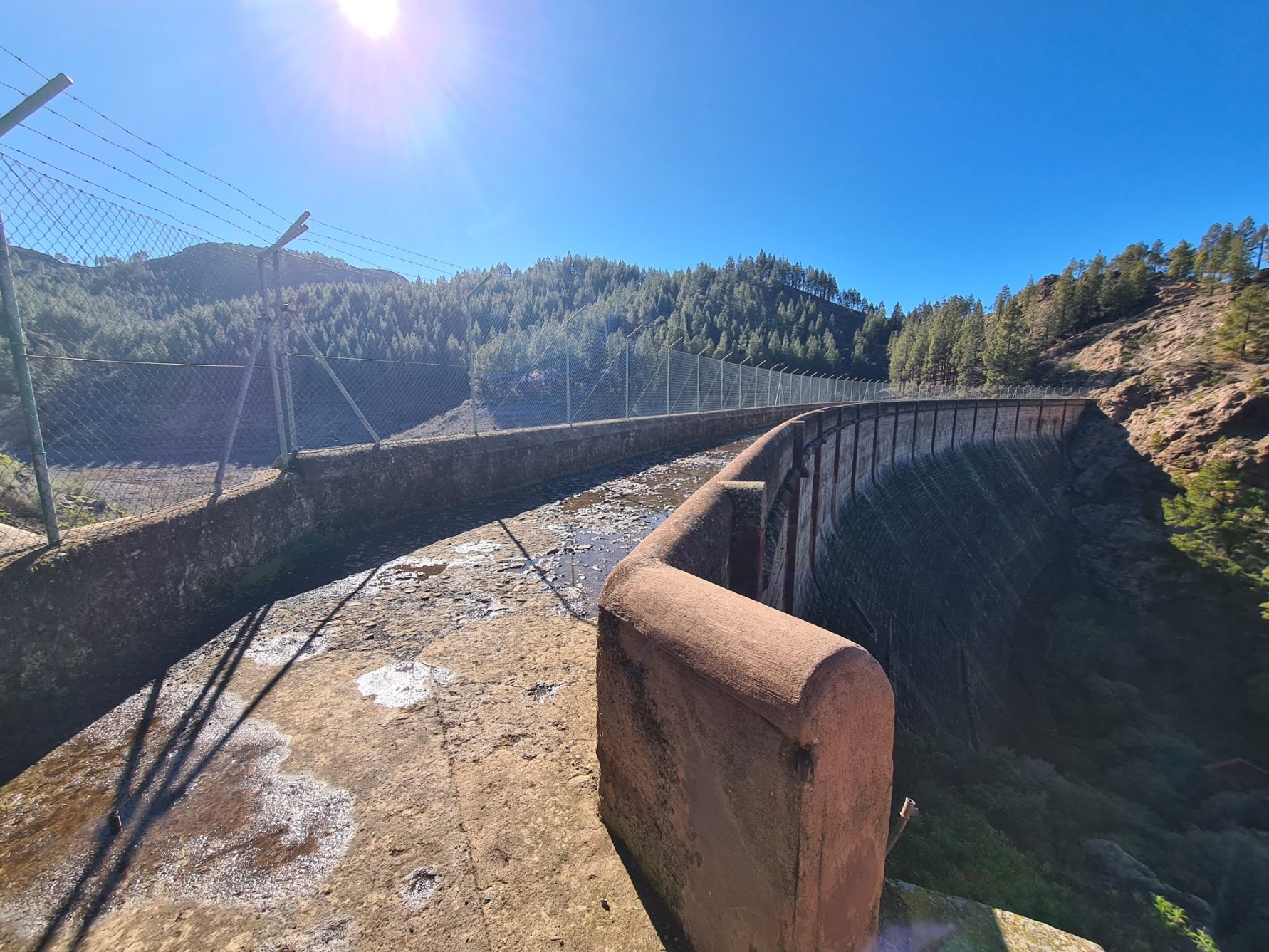
I was able to skip the actual climb up to and around Roque Nublo, saving myself a good bit of a time in the process, by taking the steep mountainside S-70 path about 700m down toward La Culata, dropping down to the volcanic caldera that holds a number of scattered villages and towns, rejoining the variant path later along this route. My path hugged the hillside for a while, then descended to cross Los Hornos Dam. This 27m high dam is built from masonry and was completed in 1933, but was later extended and is now capable of holding 697000m3 of water but had little more than a murky green puddle of water when I crossed it. This type of structure is a fairly typical requirement on a sun-baked island with little standing water. The highest dam on Gran Canaria at 1565m above sea level, any water directed downhill from here goes through tunnels and channels to Arucas and San Mateo. It is often mentioned as a destination in its own right but I wasn’t overly impressed with what I found, if it had been more full, I might have felt differently. On the far side of the dam it was an uphill stretch to join a road on a bend where cars were parked. Presumably the owners off on day walks. But my path immediately left the road and descended a bit before contouring along the side of the hill, a hundred metres or so below the road above. This path would have continued on to Roque Nublo, but lacking the time for all of the variant, I left it at the next junction of paths and began the steep descent into the valley far below.
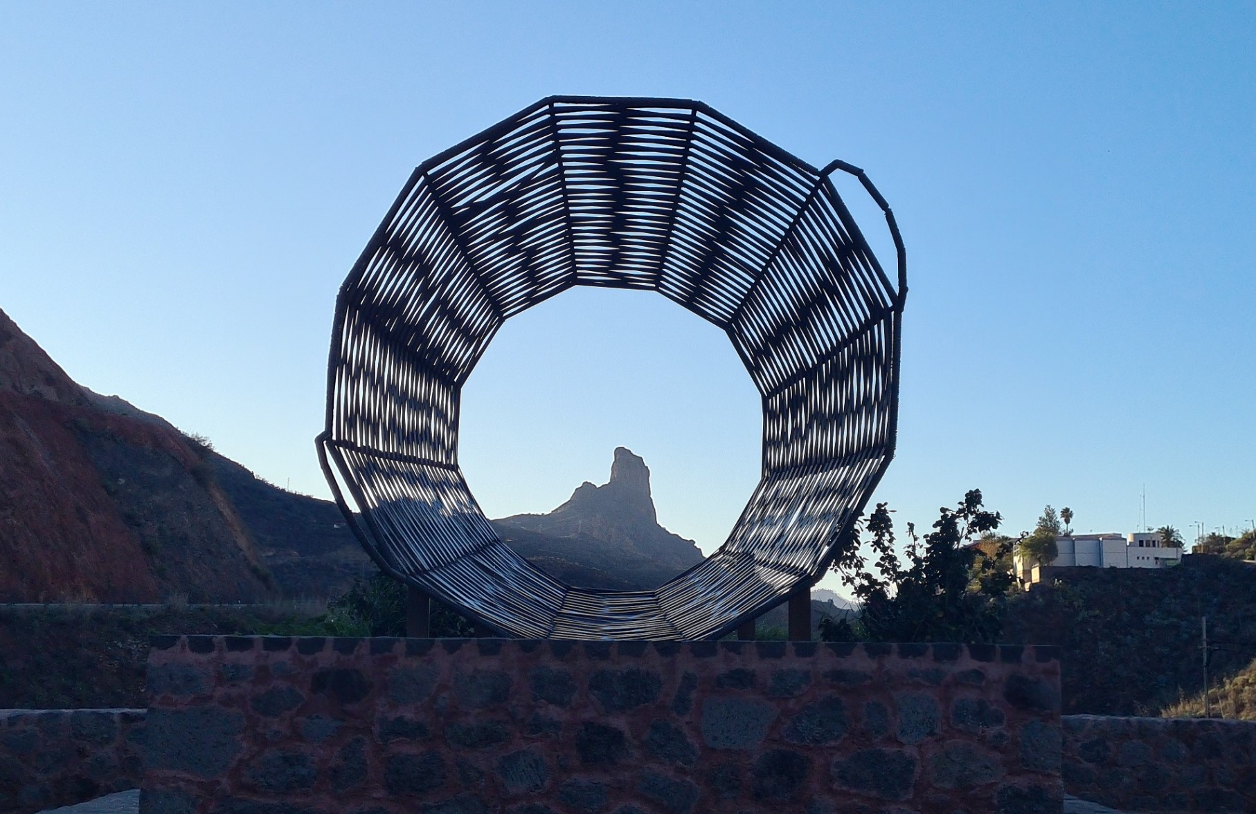
My downhill went on, and on. Having arrived at La Calata there was a bit of a road walk through the town (on the GC-608), before an almost hidden and seemingly forgotten path took me away and down from the road into Barranco de Tejeda. The trail led me down and through scrappy allotments and small holdings that ended at the roadside mirador at Casa de la Huerta, where La Cesta, an oversized basket sculpture, provided ideal framing for the distant ‘Sacred Mountain of the Aborigines’- Roque Bentayga. I was now back on the variant trail but judging by the condition of the path I had just followed down, I don’t think many walk this way. to eventually emerge on the GC-60 main road that is followed into Tejeda. Now tired, I was nevertheless finishing my day in much better condition than I had yesterday.
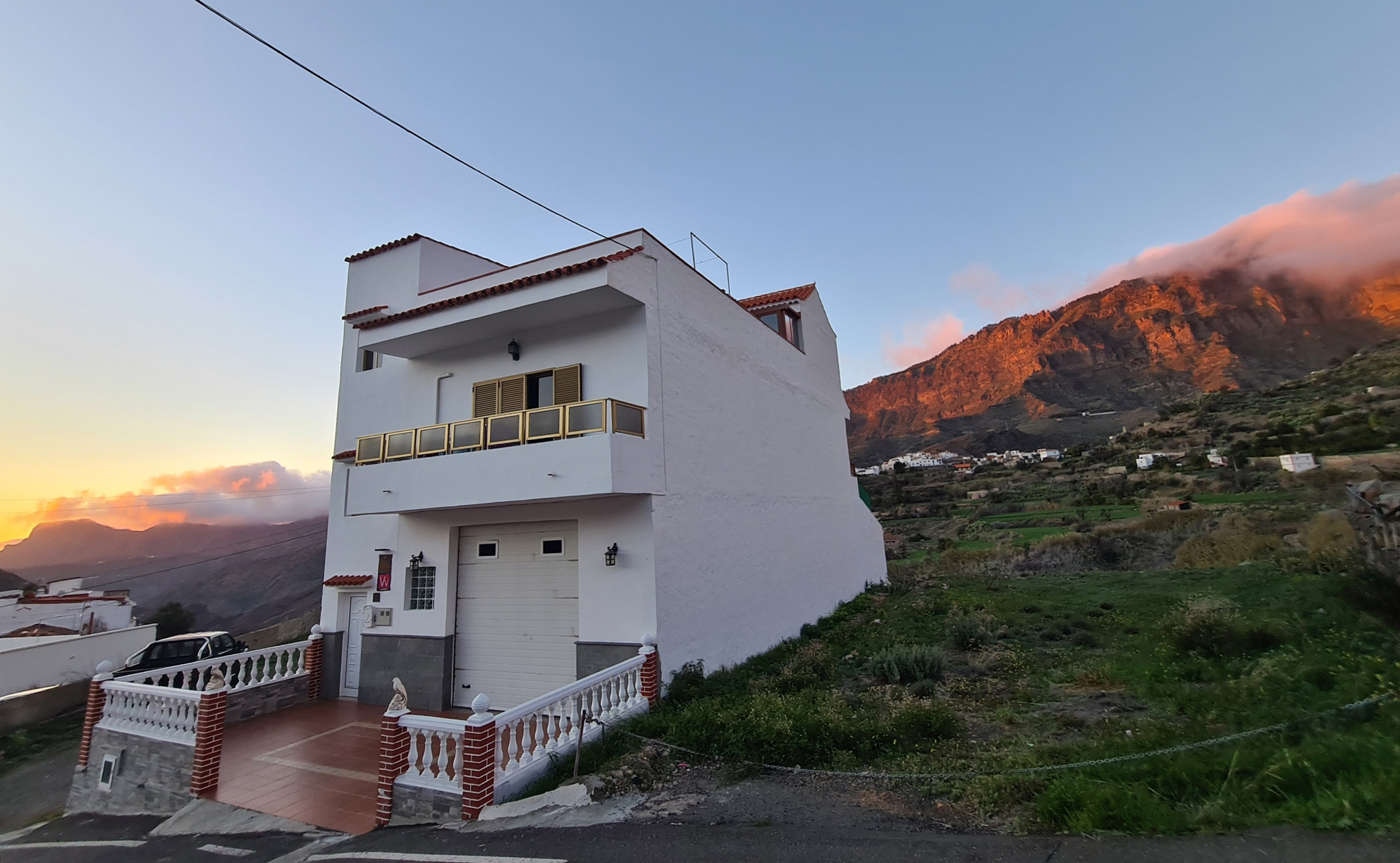
Frustratingly, on walking into Tejeda, my final town of the day, thinking I was finished, I then found that I had yet another steep road to walk down to reach tonight’s accommodation. I didn’t mind this last descent so much as knowing I would have to walk back up here in a couple of hours when searching out a restaurant in town tonight.
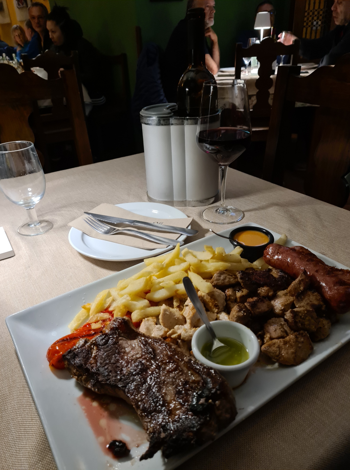
Antonio showed me around my accommodation, home for the next two nights. It was a large and comfortable apartment and would suit me well for my day off. My host had no English and I had no Spanish, but he phoned his English speaking daughter in Barcelona and she suggested a decent place to eat tonight. Then a quick shower, change into ‘town clothes’, and back out, into the night, for my walk back up the hill to Cueva de la Tea, my suggested restaurant for tonight, with attentive staff, beers, decent food and wine.
It was a good deal cooler when I walked back down the hill later in the evening. Again, it was thinking about raining. Back in my rooms, I called home for a long video chat, then to bed. It had been a good day’s hike and my feet had held up well. But that lingering shortness of breath had made the frequent climbs hard work. A good night’s kip followed by a rest day tomorrow might, just might, give me a little more time to recover.
Day three: Day off
There isn’t a great deal to say about today. I slept late, washed out some of my hiking clothes, walked back up the hill to the town centre to visit the Church of Nuestra Señora del Socorro, buy a little food and a six-pack of beer at the Spar supermarket and get a stamp in my credential at the petrol (gas) station.
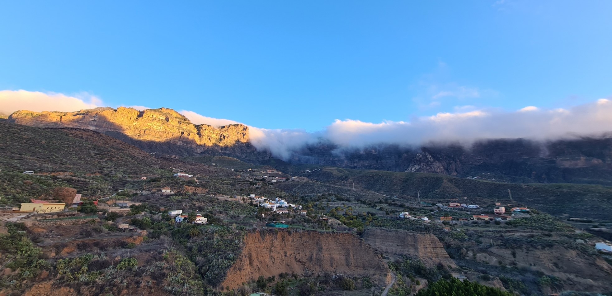
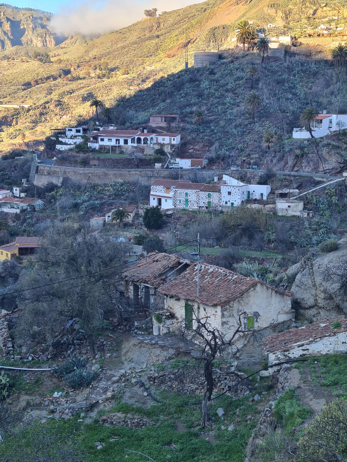
Tejeda, while high in the mountains, is set in a hoya (valley), nestled below the peaks that surround it. It is a pretty place, one of the most attractive on the island and I explored it’s streets. Later, I rested on the spacious balcony at my accommodation and drank some beers while writing up my journal. Returning in the evening to the same restaurant as last night as it had been a good choice, for a mixed grill and bottle of wine. Such a rest day was by no means necessary, but was appreciated nonetheless. This was, after all, supposed to be a bit of a winter holiday…
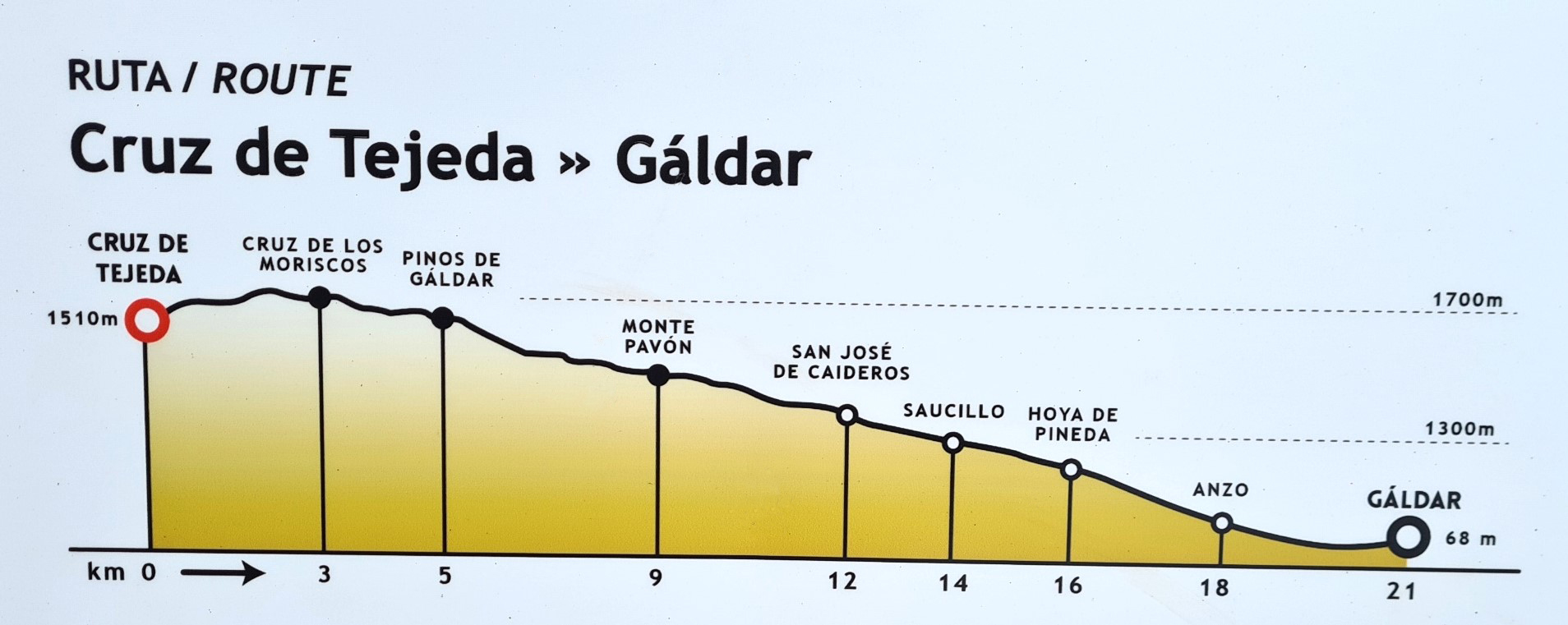
Day four: Tejeda to Gáldar
I rose in fine spirits, keen to be back on trail. I set off an hour before dawn as it was likely to be a long day and I wanted enough time at the end to travel by bus to another town. Even at this hour there were vehicles moving through town as I walked through it. More annoying to the residents I am sure was a chap on a buzzing motor-scooter, shouting loudly as he rode through the darkened streets. The long climb up to the Cruz (cross/crossroads) follows the winding road or crosses the vines and almond trees cultivated on the slopes between the switchbacks. I followed the road for the first hour, hanging a flashing red light from the pack for safety. When it was light enough I could take to the paths.
There wasn’t that much traffic on the road and every single driver gave me a wide berth. I presume it was too early for the less careful tourists in hire cars. After an hours walking up the winding road in the dark, on looking back Tejeda still looked deceptively close. The constantly winding road had slowed my ascent but I now had enough light to follow the hiking trails where they crossed or went under the road.
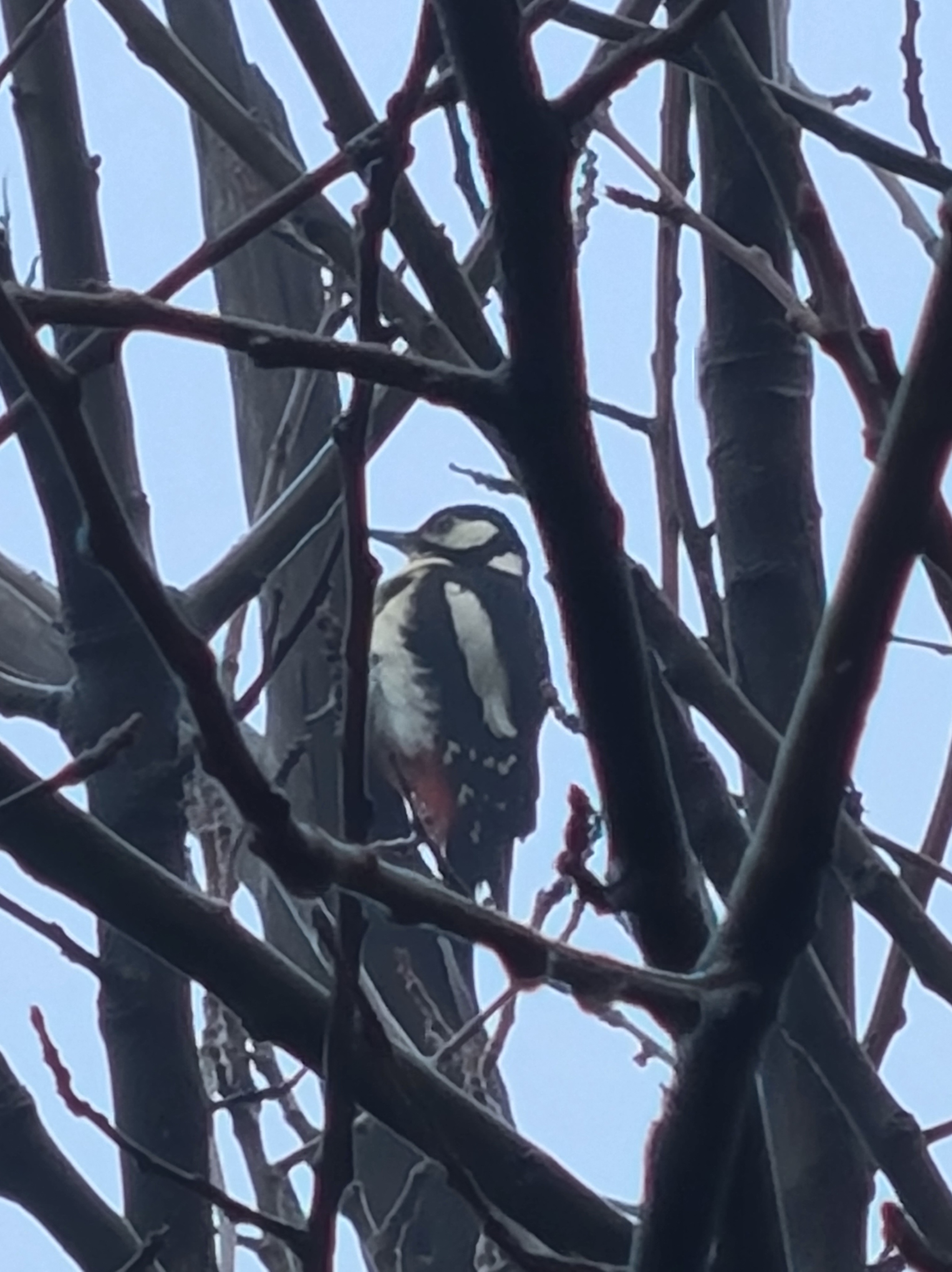
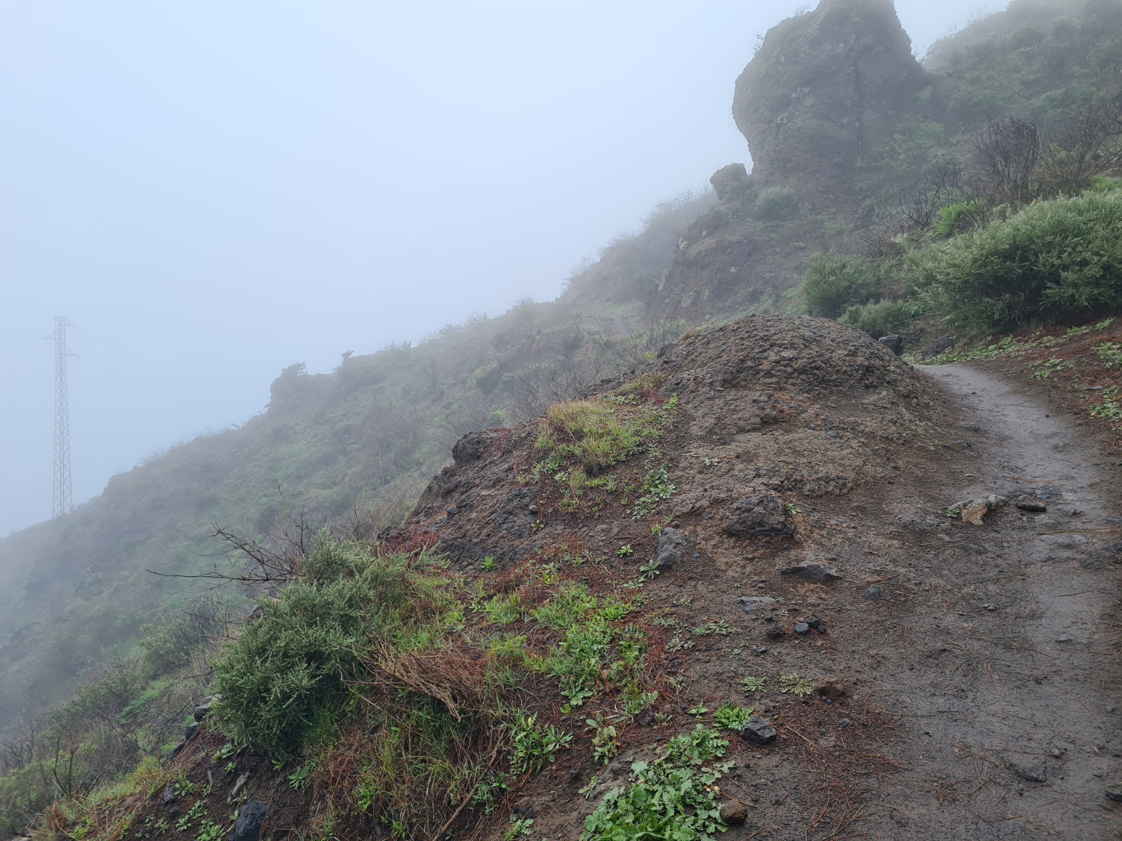
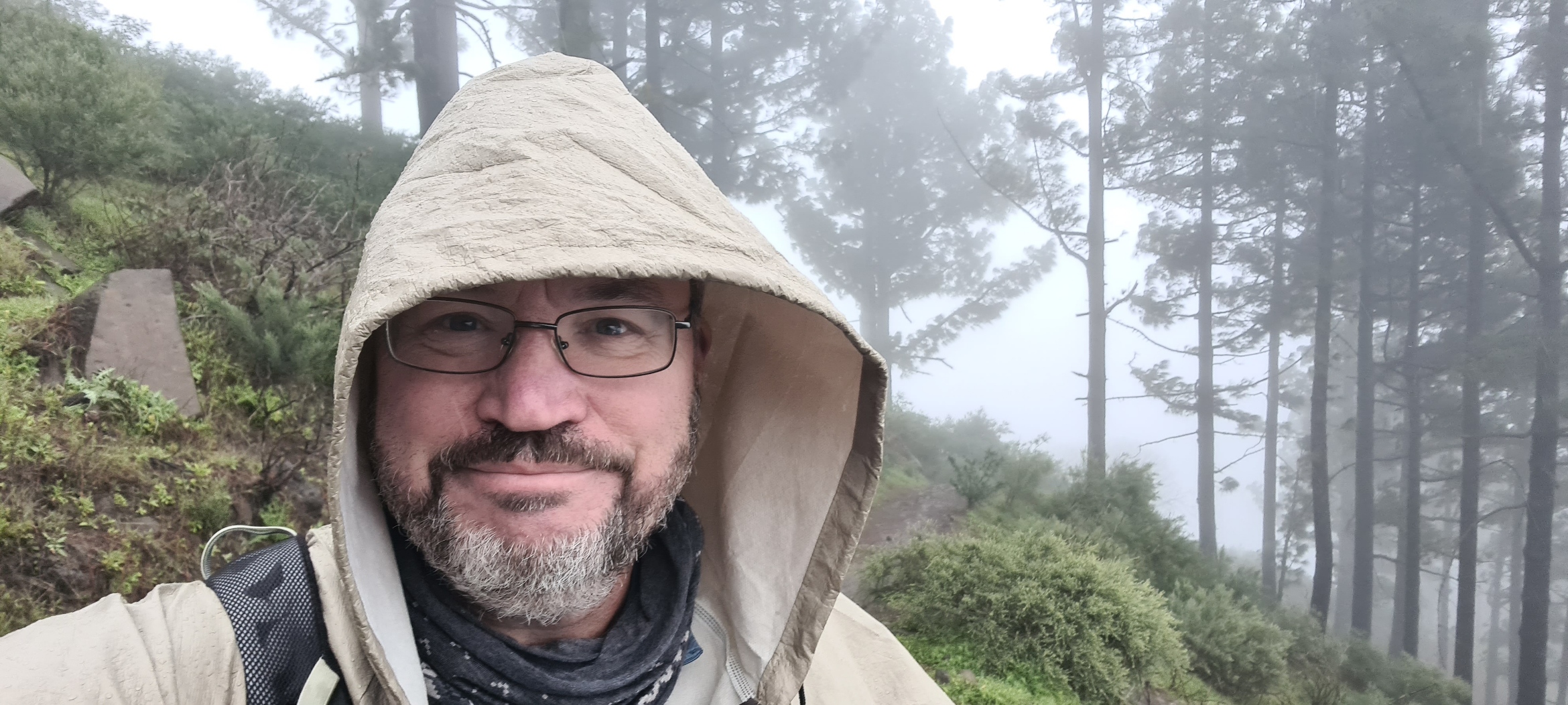
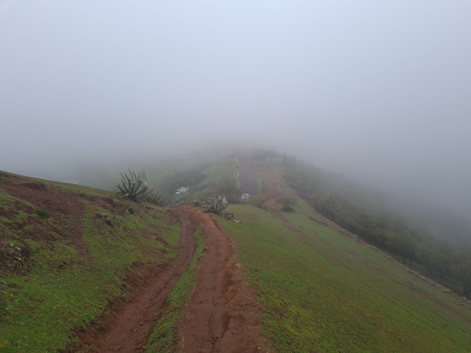
The temperature steadily fell as I climbed and lack of visibility due to the the dark was replaced by lack of visibility due to the clouds I was climbing up into. The tradewinds were blowing through the saddle, bringing both moisture and cold, numbing my fingers. I pulled my buff up from my neck to cover my head. Without my lightweight FroggToggs jacket I would have been soaked. As it was, my spirits were high. My feet felt fine, I wasn’t wheezing so much so my virus had presumably cleared a bit, and I was enjoying my morning immensely. Not everyone was. I stopped to chat to a local runner just setting off to run down to the town I had left a couple of hours before. He muttered his intense resentment at the conditions before leaving me. I could see buildings through the mist above and it was just a short walk up to suddenly emerge near the greenish-grey stone cross from which this spot takes its name. A woodpecker tapped her approval at my having reached the top. As usual, I spent far too long attempting to obtain anything better than my usual poor photographs.
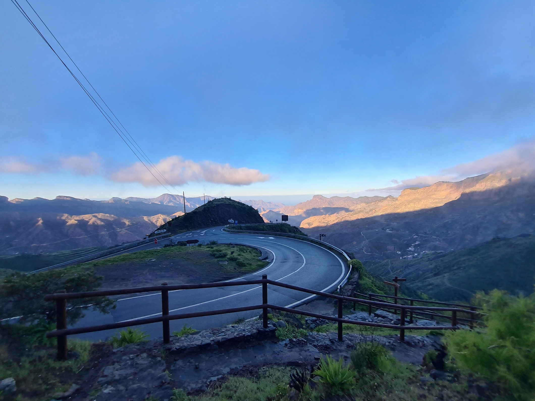
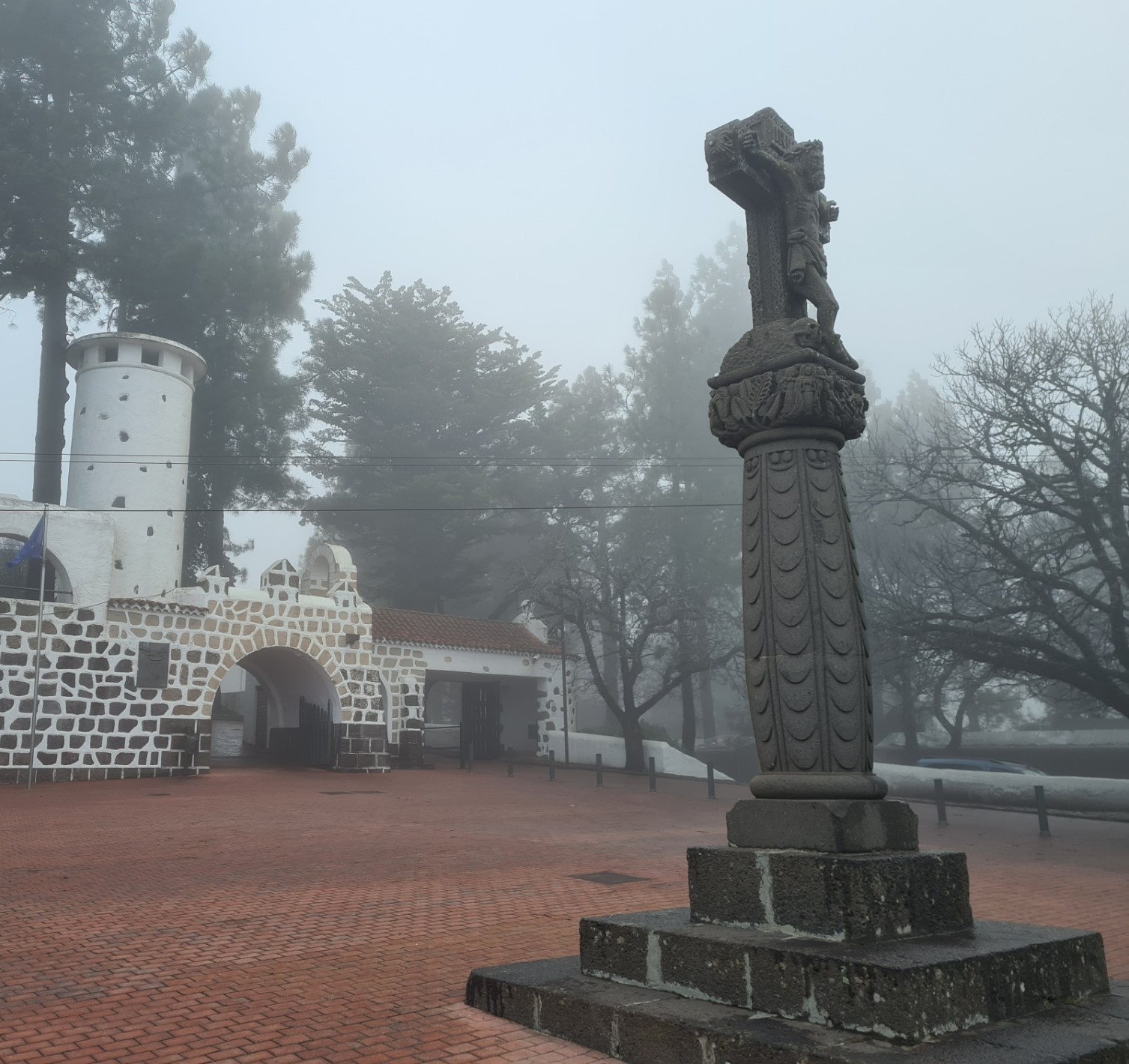
The crossroads of paths and roads at Cruz de Tejeda, that marks the ‘centre’ of Gran Canaria, can be a busy place later in the day but I had obviously beaten any sort of rush and there was no-one to be seen and no traffic. Even with just that brief pause attempting to photograph the woodpecker, I had got cold so went into the little café opposite the stone cross to warm my hands around a welcome caffè latte, devouring a dainty little apple pastry at the same time. I don’t think the establishment was actually open for custom, but were nonetheless welcoming. Warm again, I shouldered the pack and ventured out into the swirling cloud, rain and wind.
Re-crossing the road, I walked past the stone cross and up to the very smart Parador hotel beyond. Approaching the reception desk, one of the two receptionists looked up and smiled, immediately producing a stamp and inkpad when she saw my proffered credential. I asked how many pilgrims they saw a day- “sometimes none, sometimes ten, maybe fifteen”.
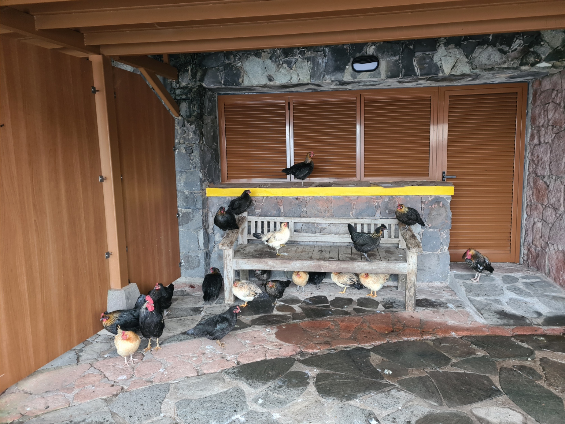
Outside, chickens were sheltering from the rain in the wooden structures that lined the road, that I presume normally host locals selling produce and souvenirs. I joined the chickens. Conditions were so miserable they declined leaving the structure and simply made space for me in the centre of the bench, or walked around my feet, clucking in annoyance. I made a careful check of the map as I didn’t want to set off in the wrong direction from this high point on the island otherwise I would quickly regret it.
The path followed a short road up to a large carpark then branched off from it’s corner where I stopped to read a tourists’ notice board, then hearing voices behind me. It was two young German girls also walking the Camino. Teseo had met them three days ago. They were in even less of a rush than me, taking a week to walk the trail. Each had a short poncho for protection from the rain, each poncho lofting in the wind and doing a poor job of stopping them getting wet. They were full of energy, happy and chatty, urging me to walk with them. I declined, preferring my own slower and more careful pace around the slippery wet and muddy path that contoured around the hill from there, with a steep drop off to the left, disappearing to who knows where. My path then climbed, further into the mist, any sort of view denied. I heard the two girls chatting somewhere ahead, their voices faded, and I never saw them again.
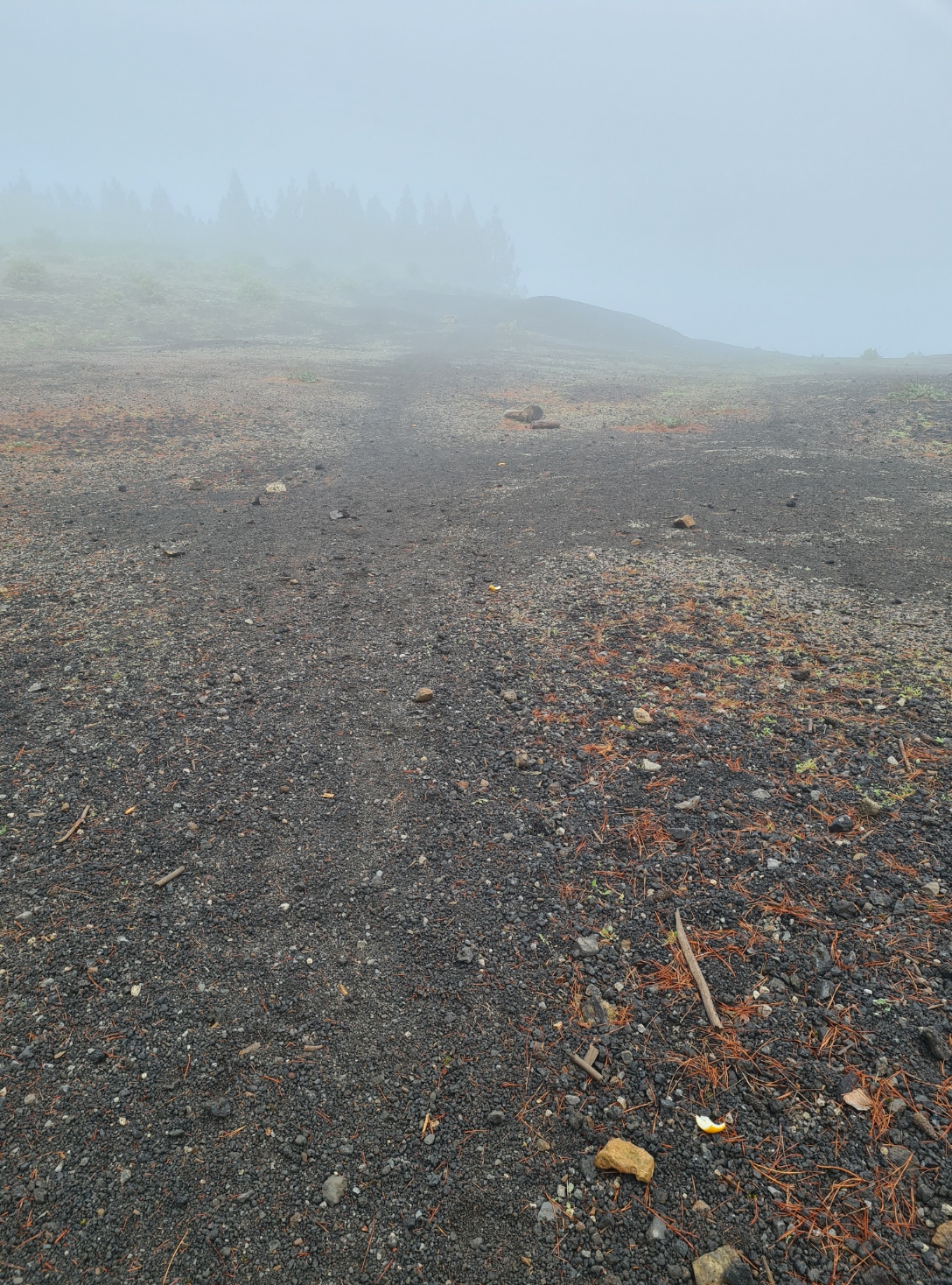
Despite my enjoying this day immensely, I am very aware that by walking in the clouds for much of my time at height, it meant that I didn’t actually experience this last section at its best. I was mostly unable to appreciate the ridge walking that came later, or actually know that I was on the western slope of Monte Constantino, and was also denied the viewpoint of the Degollada de las Palomas. But weather on any particular day is what it is. You just make the most of it you can.
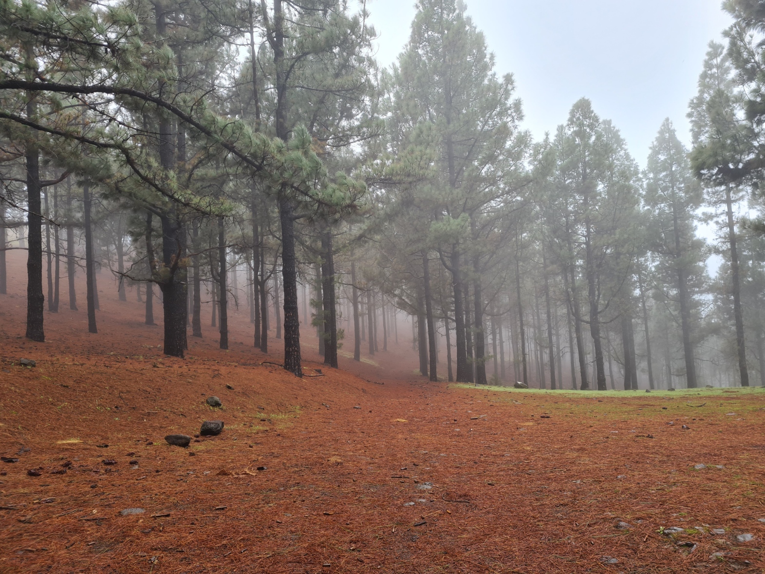
Leaving the muddy contouring paths behind, it wasn’t long before I was again descending, now on really quite lovely pine needle strewn tracks through quiet Canary Pine forests with occasional Chestnuts. It was a fantastic section. I descended steeply to cross a winding road, then back on to another descent through the trees. Having paused to sit on a fallen tree to snaffle a banana, passed by a couple of couples while doing so, I continued along the dripping leafy paths, still mostly denied any sort of view but just occasionally the clouds would drift away a little, briefly revealing tantalising glimpses of hillsides and the suggestion of vistas beyond. Somewhere out there was the Caldera de Pinos de Gáldar, the youngest of volcanos around here, but nope, never saw it.
I left the trees at some point, entering what was obviously farmland, as I could smell the livestock through the mist. It was around this point that another hiker caught up with me. Manuel was a German, taking a month out to explore the paths and climbs on both Gran Canaria and Tenerife. He had hoped to complete the GR131 on both the islands but had heard that the other island had temporarily closed parts of the long distance path, so he was more or less making up where he walked. His pack was large and looked heavy but he bound along with an easy and athletic step of the type I could only distantly recall. After chatting for some time he walked on, into the mist and was lost from view, but I would catch up with him twice over the next couple of hours. Not because I was in any way speedy, more that he stopped for frequent rests while I tend to plod along with less halts.
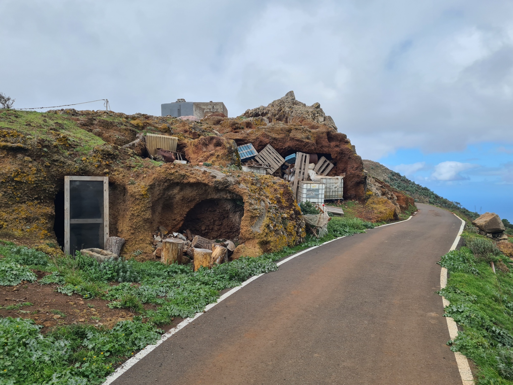
At San Jose de Caideros the trail was handrailing a road and I occasionally stopped to try and photograph the darkened interiors of deep holes in the sandstone. Most of the road side entrances had either metal bars across them, or rickety wooden doors, but some were open. A few of these cave holes were empty but most seemed to be used as a dumping area by farmers for the usual farming detritus.
I was now very definitely below the forests and into farming land. It was quite hard to believe the contrast from just a couple of days before. If it were not for the many stands of Aloe Vera, it would be easy to mistake the landscape for many an area in the UK, perhaps the Peak District or parts of Wales. As usual, on entering farmland and being close to rural habitation, there were dogs. Barking furiously at my approach, barking as I passed and continuing their racket when I was well out of sight. Now below the clouds I could see the coast ahead, still a couple of hours walk away. I passed through Lomos de Alguacilejo and near the village of Hoya Pineda. This area is famous for its cave houses but if what I had seen so far was anything to go by, most people have now opted for the more usual bricks and mortar approach. Manuel had stopped in one roadside rock opening so I also halted for a much needed lunch, sharing my home-made bocadillo with him.
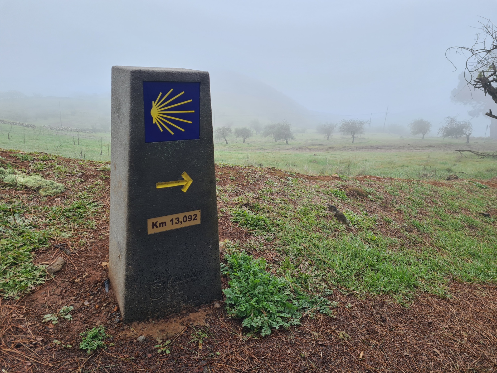
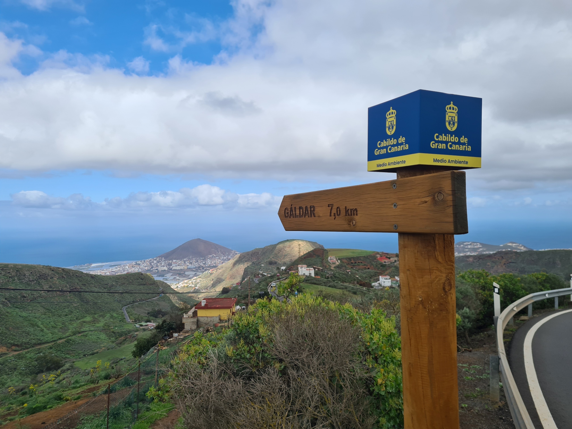
The final approach to Gáldar also has some impressively large and expensively positioned concrete posts. All of these were passed on my third day of walking. I only saw five of these, precisely sited at 13.092, 12.669, 3.275, 2.798 and 1.022 kilometres from the finish. These are similar to those found on the longer Caminos on mainland Europe. It looks as though the money has run out for these, now replaced by the cheaper wooden finger posts. This link provides a little more information on the adoption of official signage for use on the Camino de Santiago.
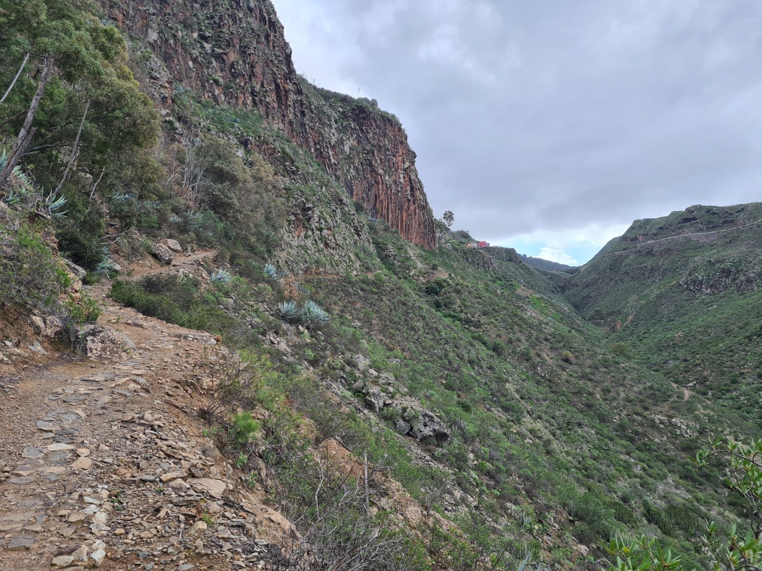
The little farm roads followed toward the coast were very quiet, I think there was only the one car that passed me. Sheep and goats baa’ed and rattled their bells in the neighbouring fields. Brassicas and other greens grew in the fields. I now began to see flowers on this verdant side of the island, in stark dichotomy to the arid southern slopes on day one. Eventually, a fingerpost pointed the way, the pilgrim instructed to leave the road and begin a final descent and approach to the coast. I was now heading toward the stunning ravine-side path that would take me to the outskirts of Gáldar and eventual finish.
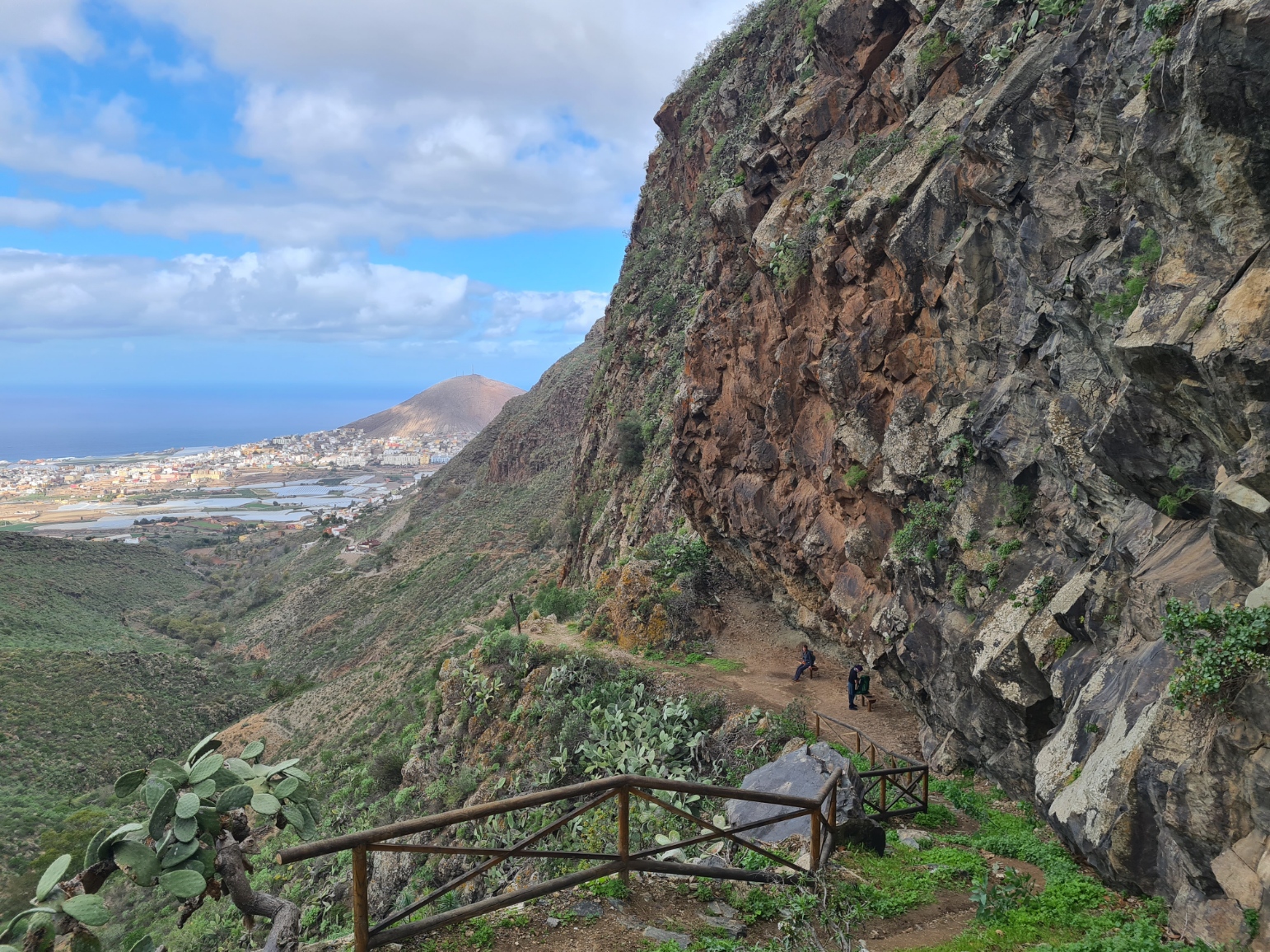
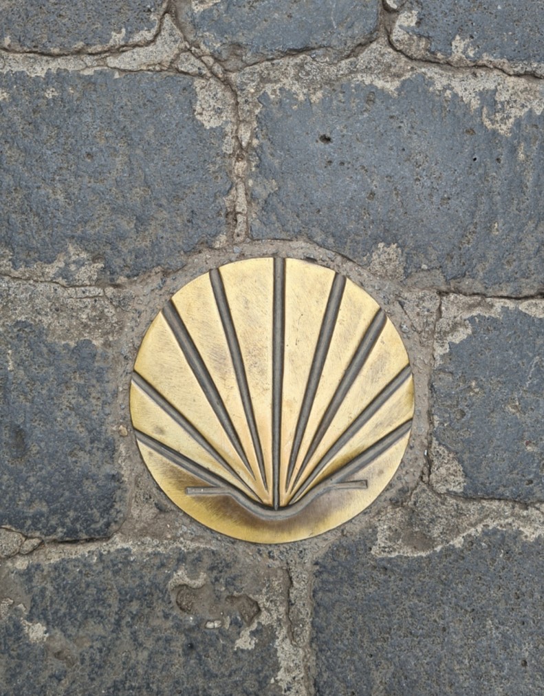
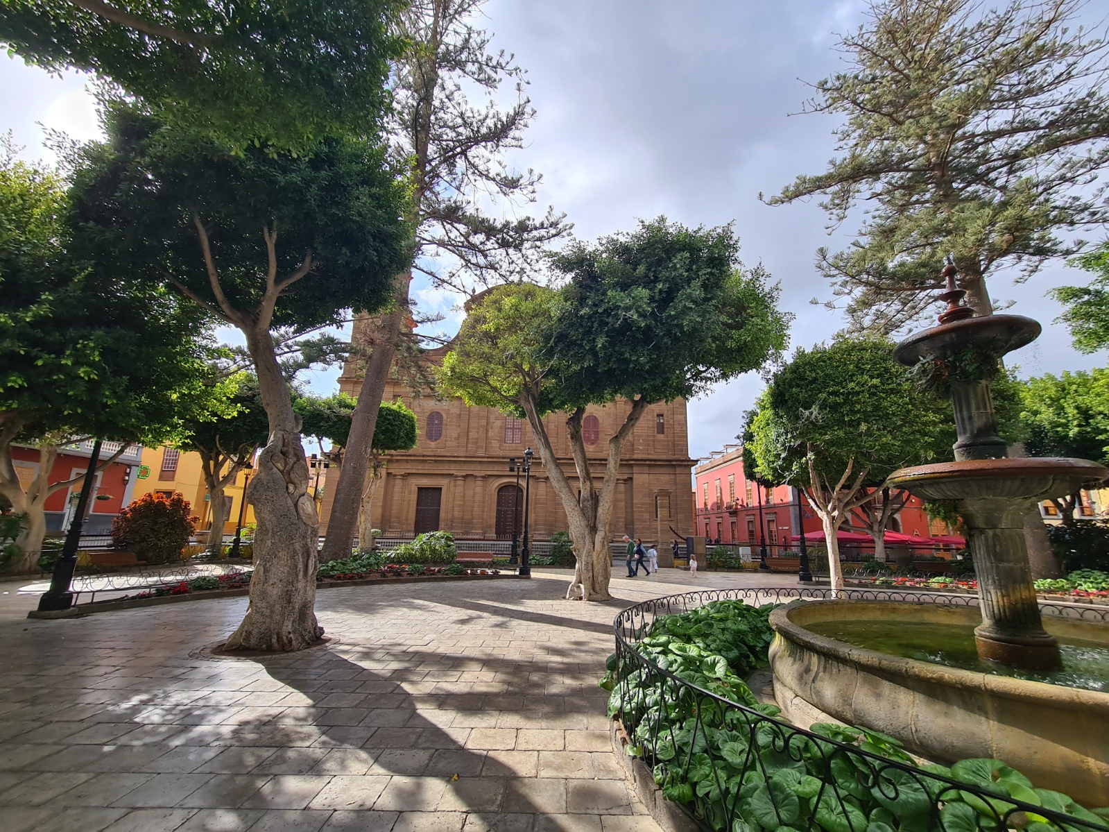
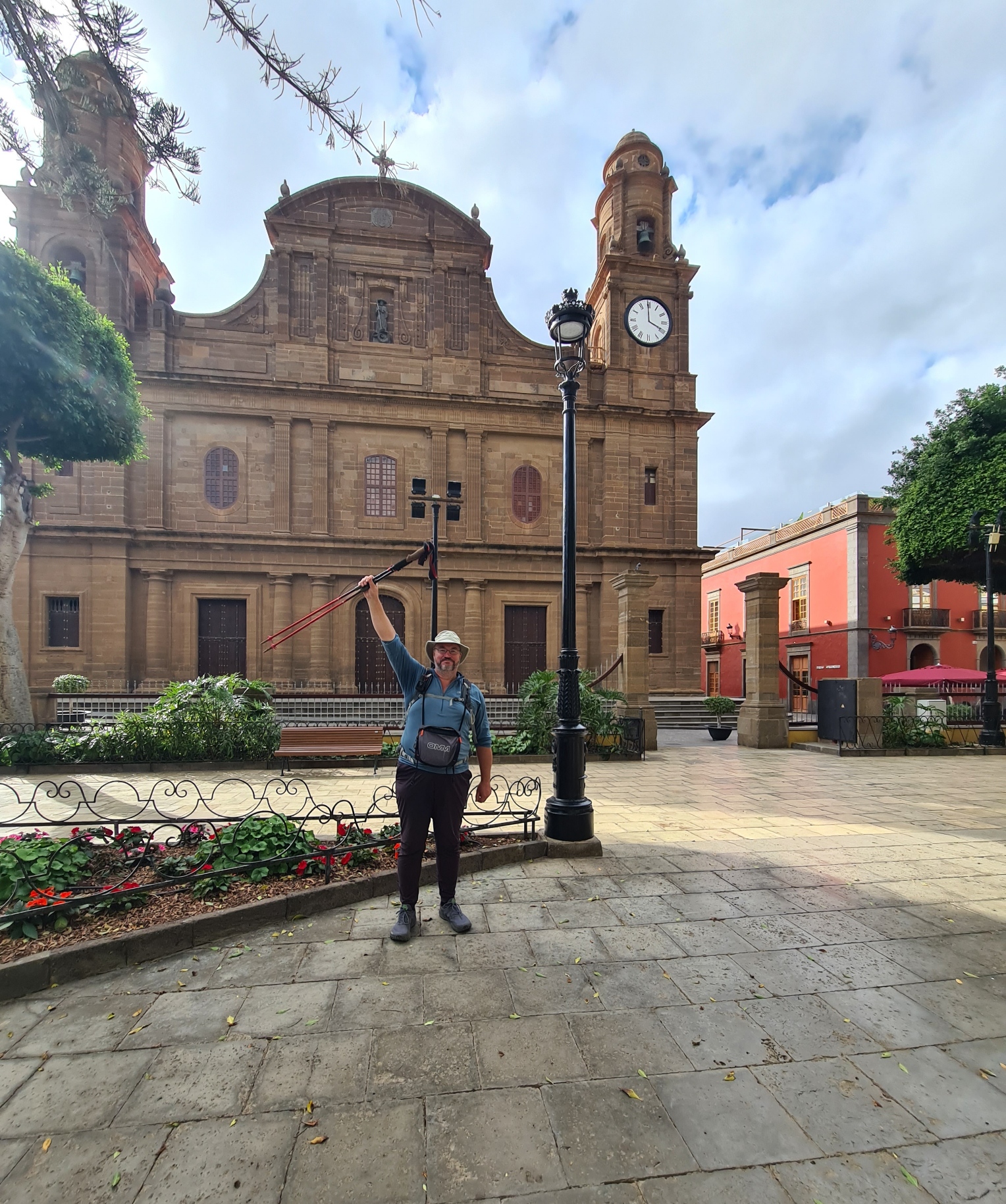
The last couple of kilometres, before entering the streets of Gáldar properly, were a bit scrappy, but quite well routed. First through banana groves, all sheltered from pests and sun. However there were also large tracts of cleared ground, looking more like bomb sites behind crumbling breeze block walls. The dark towers of the Santiago church can now be seen poking above the town in front. After the bananas were fields of the healthiest looking salad leaves you have ever seen. Then the path ducked under the GC-2 motorway, emerging on the far side, it swung right and climbed between walls before abruptly emerging in the town itself. Suddenly- there were cars, buses, pedestrians, shops, all very busy and starkly urban. I crossed the road and turned left, following Calle Capitán Quesada, the ancient entrance to the old island capital that took me up to the Jacobean temple of Santiago de los Caballeros de Gáldar. Sunk into the road were brass scallop shells, that perennial indicator for a Camino- all rays (paths) on a shell leading to a common central destination.
I entered the shady Santiago square with its araucarias and laurels, doing a good job of making it difficult to get a decent photograph of the Temple de Santiago de los Caballeros. As usual, I accosted someone minding their own business, asking them to take my ‘end of trail’ photograph. Then I went to explore the church. But no, it wasn’t to be, the doors were locked. I walked its perimeter, wanting the experience to properly end in some undefined manner.
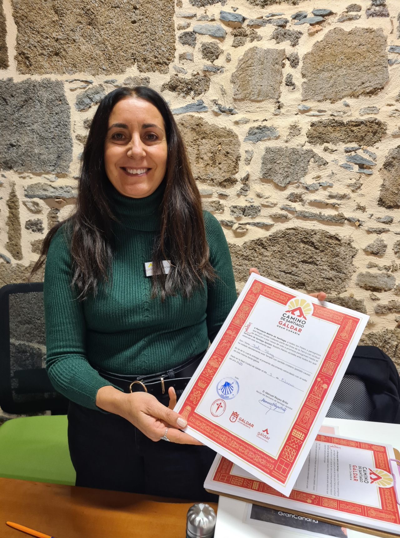
But that was about it. I went off to the large tourism centre to one side of the square looking for a final stamp in my credential. Nuria González was extremely friendly and helpful, not only stamping my passport but also producing a compostela for me, commemorating my completion of the Camino. She gently insisted on taking my photograph, that she would add to their Camino Facebook page. From there, I eschewed visiting a local bar for celebratory drinks, instead walking straight to the town bus station to catch a bus back to Las Palmas for a final overnighter before flying home the following day. Camino de Santiago de Gran Canaria- done!
For those wanting more of an idea of trail conditions etc, beyond my few photos, there is quite a good YouTube film, not mine, that gives a pretty fair impression of the trail. It is in Spanish, but there are English captions. The Camino de Santiago de Gran Canaria is both officially recognised and complete. There have been plans to continue it across more of the Canary Islands but these are less well advanced. A route is in the process of being developed in the south of Tenerife, almost certainly ending at the island capital Santa Cruz. The Camino on La Gomera is 25km and runs between the island capital at San Sebastián and Playa Santiago, in the municipality of Alajeró. This place has been chosen because it has a hermitage dedicated to the Apostle Santiago. The short 6km Camino on El Hierro will run between the island capital at Valverde and Puerto de la Estaca. There are also hopes that a Camino can be developed on La Palma, ending at the island capital of Santa Cruz.

Hi, I have thoroughly enjoyed reading your Gran Canaria trip. Thank you for including all very good information. I have done the Camino Ingles and a lot of the Camino Primitive. In England I’ve done some of the ever getting longer Camino Finchale.I am off to Feutaventura next week and will see if there’s any Camino info there to pick up. Bon Camino Bob
LikeLiked by 1 person
Thanks Bob. Have you done the Southampton to Canterbury ‘Old Way‘? I have tentatively been considering it
LikeLike
I enjoyed that immensely, Jools. Thanks for sharing.
LikeLike
Thanks Nick, defo type II fun for some of it
LikeLike
I like that mantra Jools!
LikeLiked by 1 person