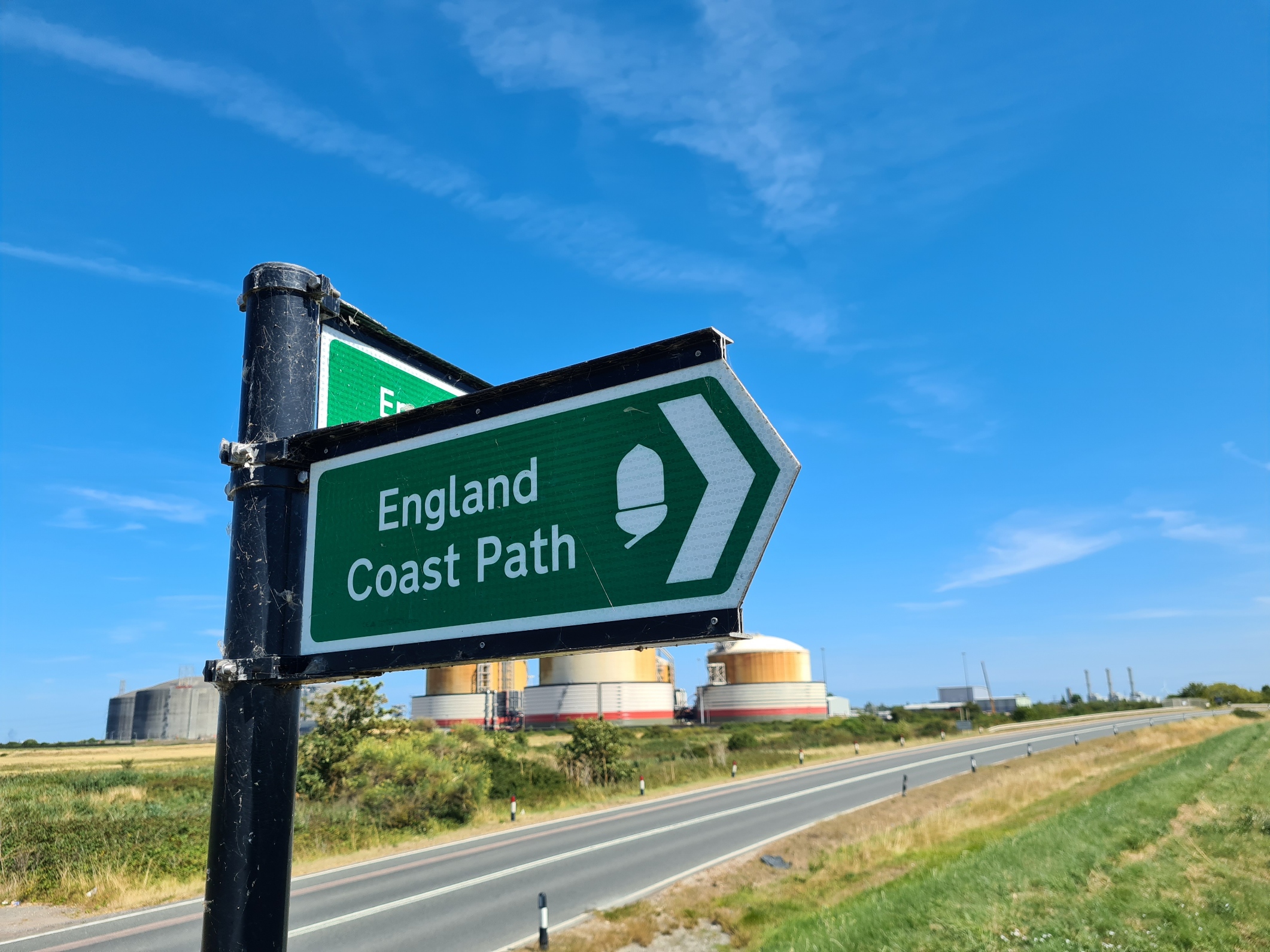
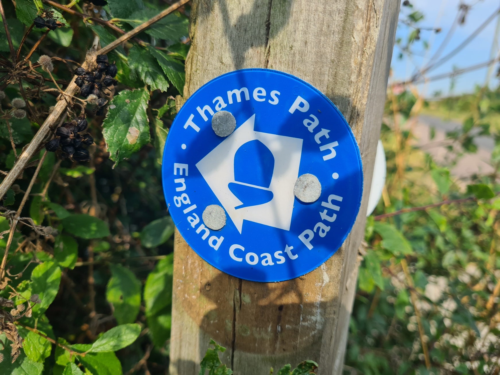
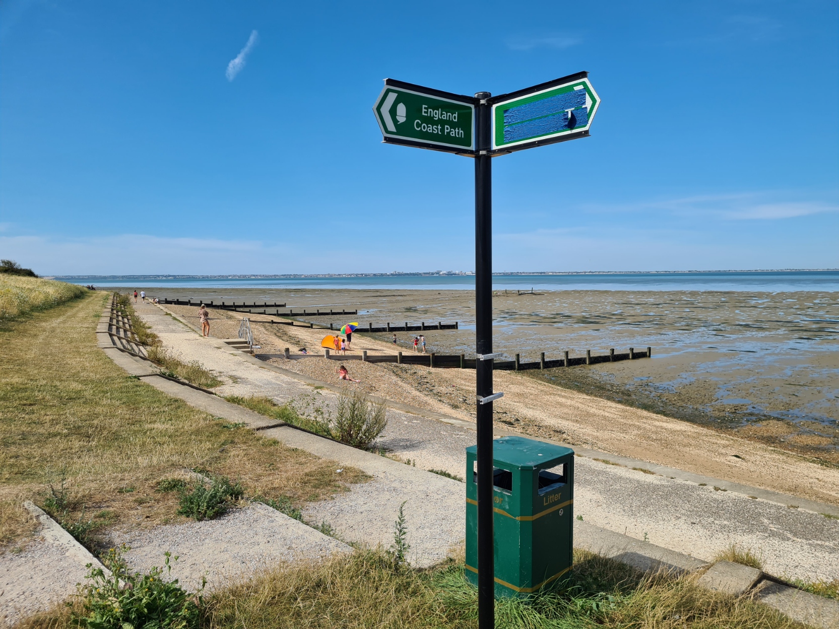
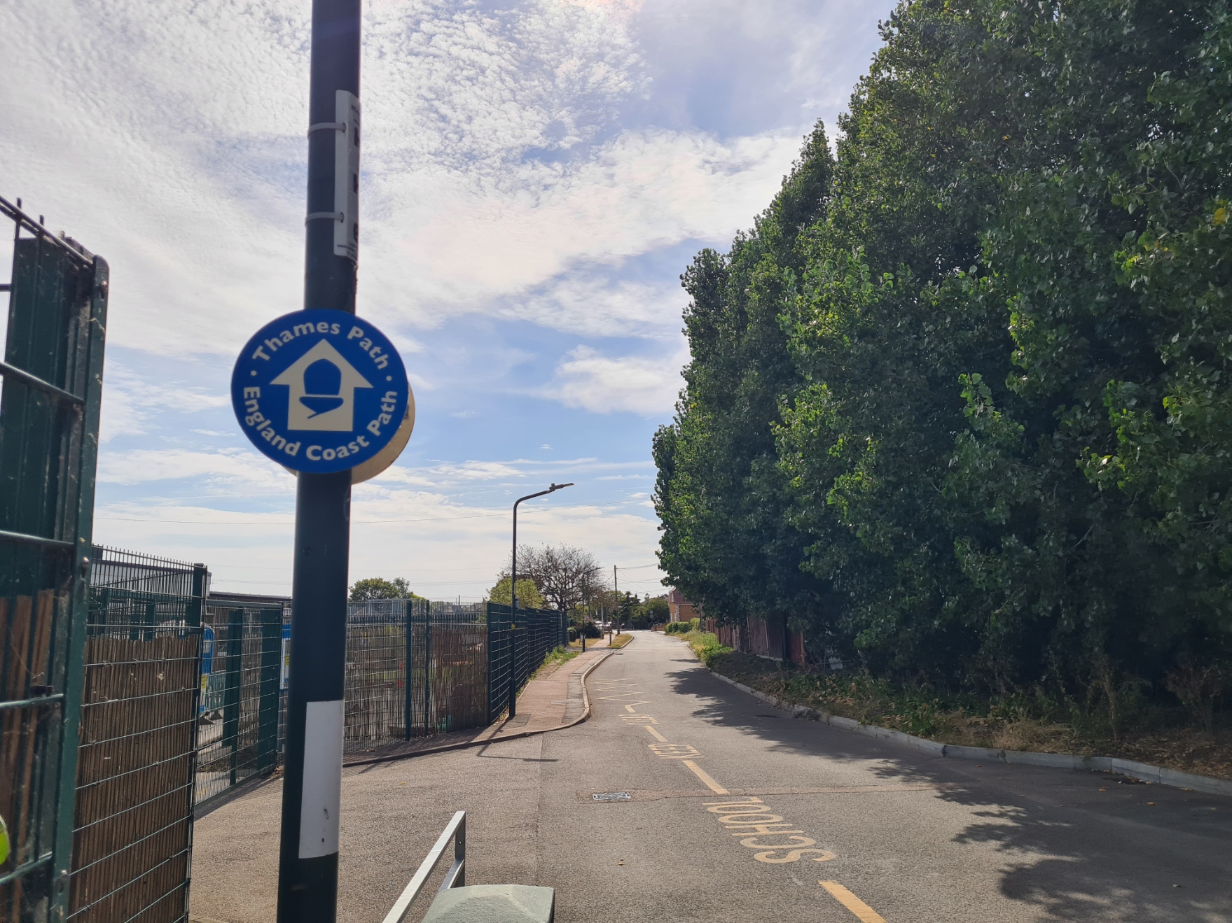
The Iwade to Grain section of the England Coast Path has recently been officially signed off. I walked it last summer when I completed a circuit of the Isle of Grain, enjoying an unusual overnighter on the way.
I completed the Thames Path National Trail back in June 2023. When Mrs Three Points of the Compass and I reached the trail end at Woolwich it was only then that we became aware that some people continue the walk, extending the Thames Path to make a ‘Source to Sea’ trail. I resolved to return and do the same myself at some point.
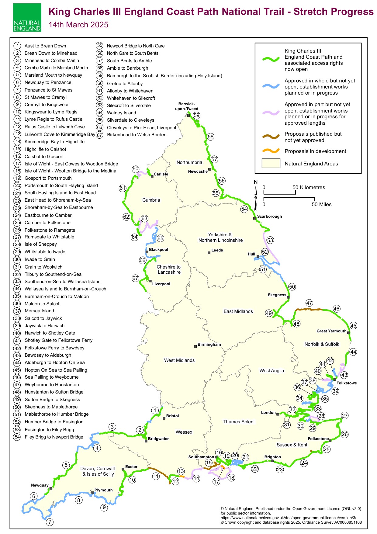
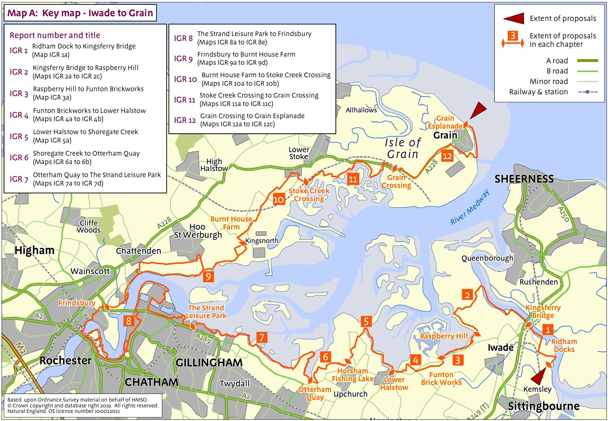
In January 2022 the stretch of England Coast Path from Woolwich to Grain was signed off and those who wished to could carry on to the Isle of Grain in Kent, completing a River Thames-side trail from the Cotswolds to the North Sea. Despite my having walked much of that additional section when I completed the Saxon Shore Way, I returned to walk all of the part from Woolwich to Grain and completed the Woolwich to Cliffe Fort section, leaving myself just a short section from Cliffe to Grain. I completed any remaining Kent coastal path last summer, but it wasn’t until 14 March 2025 that Natural England posted notification that the Grain to Iwade section of the England Coast Path was officially signed off and open.
Following my completion of the Thames Path in 2023, it didn’t take much in the way of planning and plotting to realise a 30 to 32 mile coastal walk could be done over two days as a circuit of much of the Isle of Grain, this took in my short missing section. That also saw me completing the entire coastal path of my home county of Kent, in South East England, in addition to the hundreds of miles of England Coast Path I have already completed in other parts of the country. However, for much of 2024 I struggled to find the time to knock off that final part. The logistics were a bit of a struggle to sort out and on two occasions I had to abandon the walk at short notice due to other multi-day hikes and general life simply getting in the way. In truth, I was also aware it wasn’t going to be the most thrilling of walks either. Then I heard of a novel enterprise by the Churches Conservation Trust (more on that below) and decided to get on with it. I looked on it as a training walk for my 2024 Coast to Coast hike, just a bit of a leg stretch. So over two very hot days last summer (yes, there were actually a couple!) I completed the final piece of this particular jigsaw.
Day One:
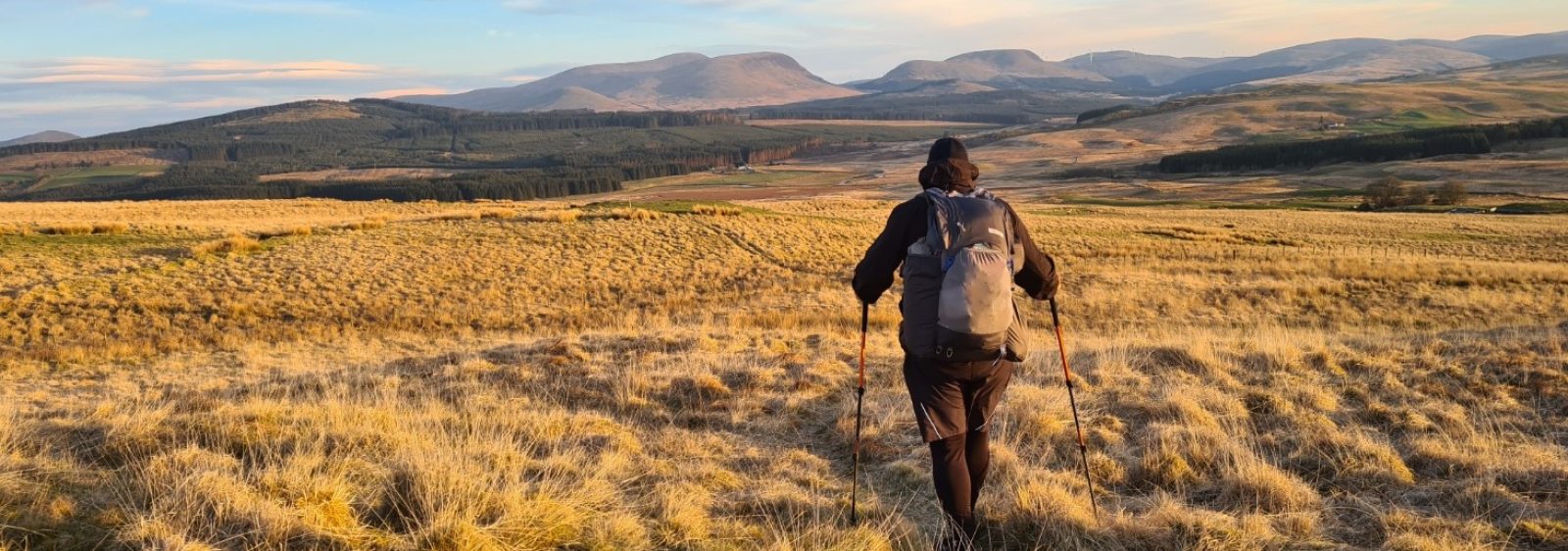
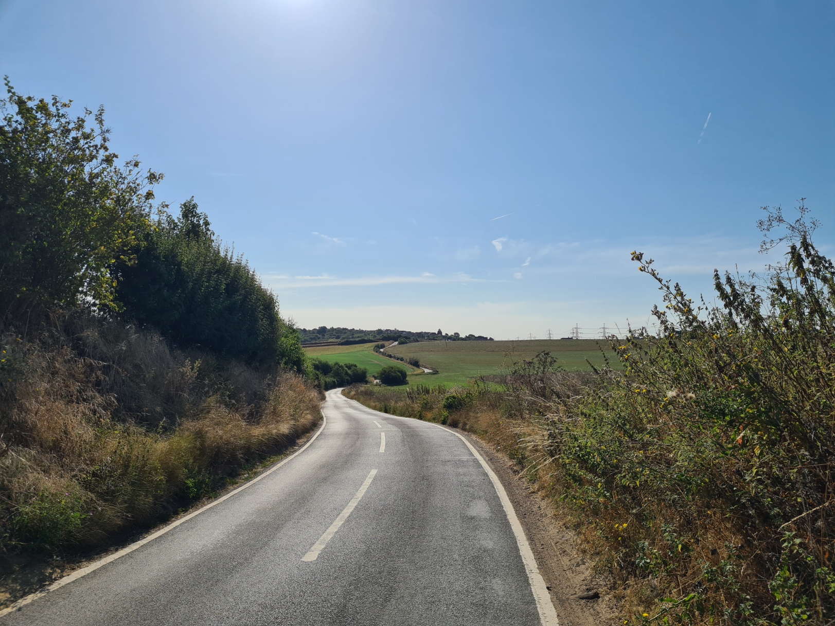
It was an hour and a half drive from my home to Grain, situated on the north-eastern tip of the Isle of Grain. I parked in the back streets of the sleepy little town. It was quiet. No-one was around, presumable all at work or already taking shelter in cool houses. It was just this lone eejit that had decided to go walking on a day forecast to reach record breaking temperatures. I locked the car, shouldered my pack, bulked out by a quilt for tonight, and just a few paces took me directly on to the trail, small blue circles on posts immediately leading me out of town toward the sea. But not initially as a coastal path, instead it headed inland a little, the path routed along the first of the many protective banked seawalls I would be following today and tomorrow. Despite not yet mid-morning it was already warm. Hot would be a better description. It was exposed too. I was packing a lot of water as hydration would be important and I was unsure there would be much in the way of resupply options.
The path immediately led me inland of an almost featureless and seemingly long-abandoned rifle range out on my right, on the Grain marshes, with little other than a few farm buildings poking above the fields. It was from the Yantlett Range that during the 1920’s, experimental long-range ordnance was fired across the Thames to the Essex marshes. Not intended as anything menacing to that county, but because this whole area, on both sides of the river, was scarcely populated and the military no doubt postulated that there was little chance of killing anyone other than the innocent wildfowler/poacher.
I had actually visited the Yantlett Range many many years previous in another life. When I was a young squaddie stationed in nearby Chatham, I had been periodically bundled into the back of a four-tonner, with my comrades, and we all hung on for dear life as it lurched and rattled its way out to the rifle butts built out on the marshes. There to spend the day blatting off rounds at various distances from paper targets pasted onto flimsy plywood. But looking around now, I had zero recollection of anything that looked familiar.
I walked on, the path then followed the raised seawall alongside Yantlett Creek out toward the sea. The tide was out and I gradually gained sight of the deep furrow in the exposed mud, I saw a larger number of Little Egrets along there than I have ever seen before. I usually come across these snow white birds in ones, twos or threes. I counted a group of 33. They flew as I approached, their distinctive yellow feet now brown, covered with ooze.
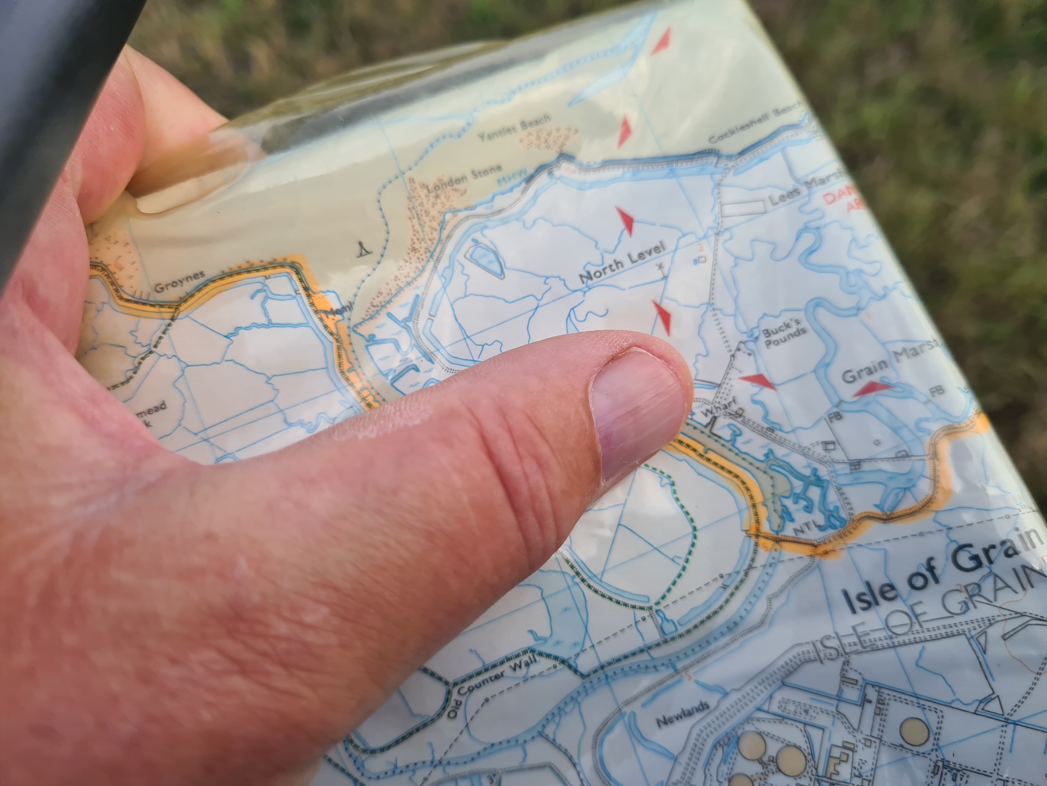
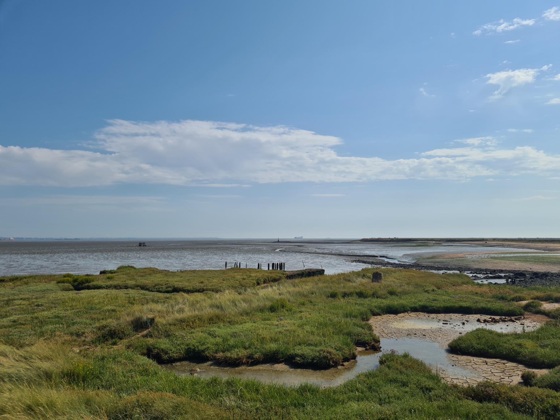
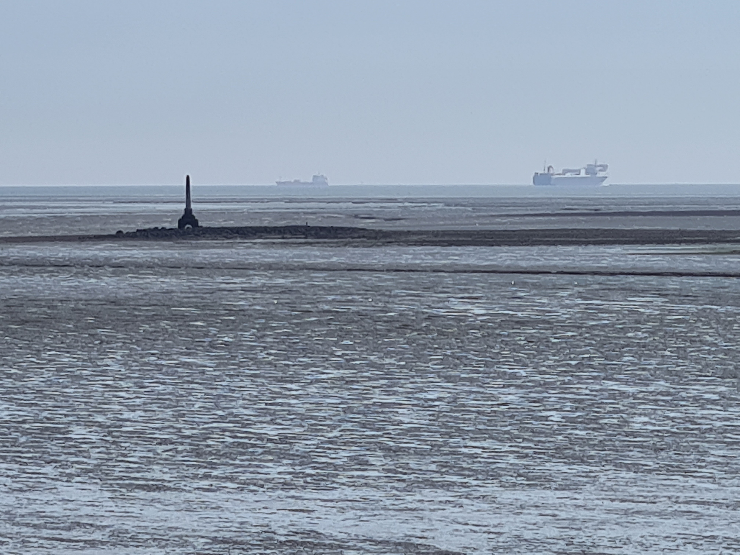
When I reached the sea at the mouth of the creek I could see far out to my right an obelisk, left stranded and its feet exposed by the retreating sea. It was the London Stone. I briefly entertained walking out to see it, but not only was I reluctant to splodge through the muddy silty ooze to it, but I had passed the closest access point before realising it.
Allhallows -on-Sea was a town built in the 1930s. At that time the newly created village was at the end of the Hundred of Hoo Railway and no doubt there were hopes for a thriving community here, possibly even a new North Kent holiday resort. Popularity lapsed following World War II and the line closed in 1961. Instead, the Hoo Peninsula, effectively the Isle of Grain, became a centre for industry, primarily oil refinery and cement works.
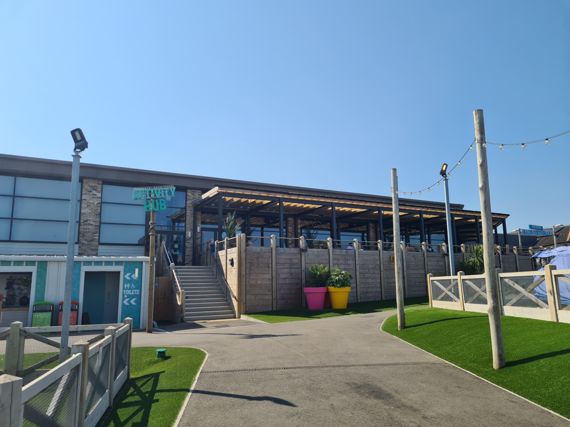
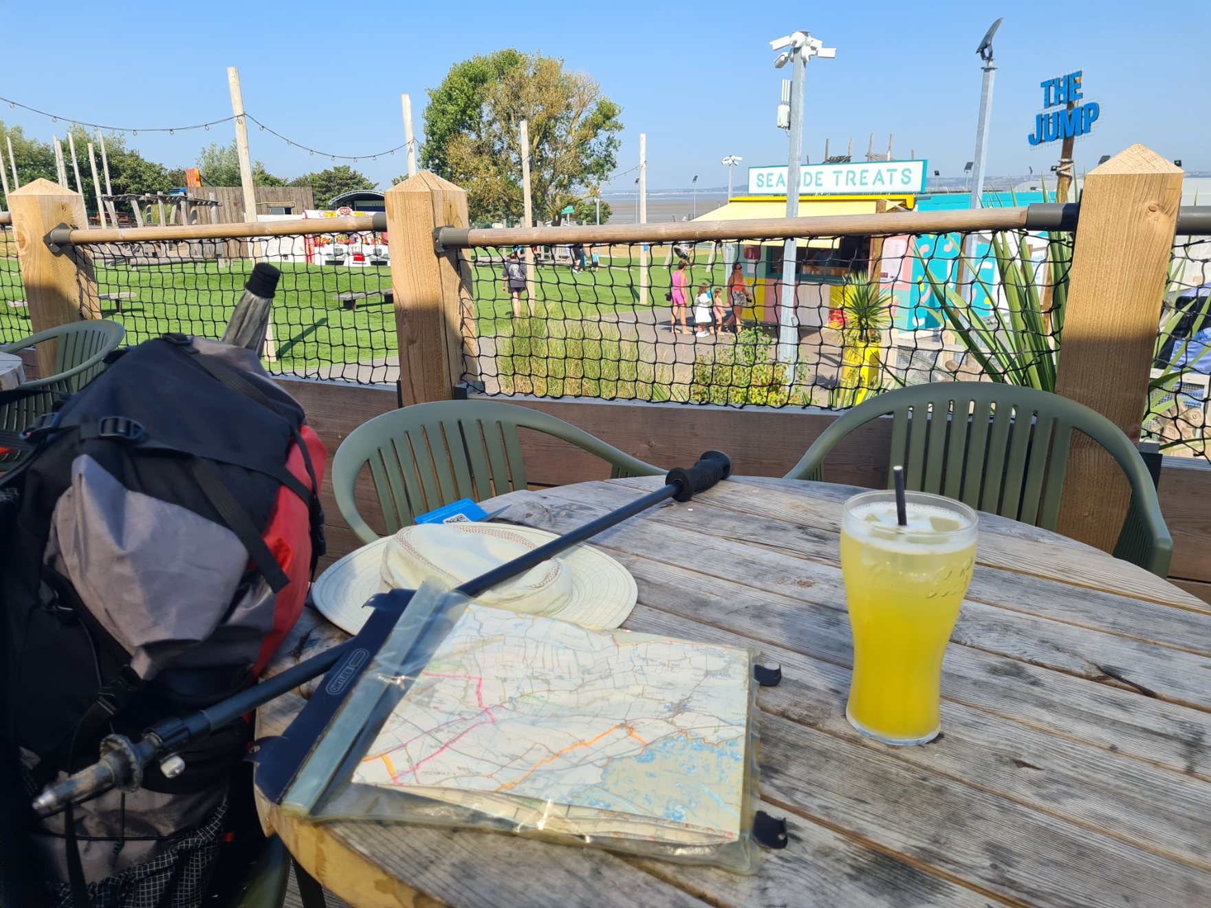
My path took me past a line of holiday chalets. The Allhallows Leisure Park, now renamed ‘Kent Coast’ by operators Haven, was the busiest place I would encounter on my two day walk, and even that was fairly quiet. I turned into its entrance, looking for shade and liquid sustenance, finding both at the large and perfectly pleasant café/bar they operate. I purchased a pint of iced orange and lemonade and sat amongst the holidaymakers on the shady veranda for just a few minutes before continuing my walk. Amongst the swim suits and bright holiday clothes, my already sweat soaked hiking attire and pack raised a few more eyebrows and curious glances than I felt I truly warranted.
Soon after leaving the moderate bustle behind I passed a poignant little memorial to US lives lost during the last World War, a B17 ‘Flying Fortress’ crashing near on the return from bombing V1 launch sites in Northern France. Pilot 2nd Lt. Armand Joan Ramacitti was fighting the controls of a plane reduced to just one of its four engines, nearing Allhallows, the final engine gave way and the plane collided with another in their formation. The bomber nosedived into the mud, 500 yards out from the seafront. There were nine crew, one survived and seven other crewmen later retrieved. The remains of the ninth, Staff Sergeant Cecil Tognazzini, are still buried offshore. The other bomber limped just a little further before crashing at Canvey Point in Essex. Just six of it’s crew survived.
More remnants of World War II were passed at Dagnam Saltings. I never explored the interior of the pillbox as so many of these get used as places to have a dump and are pretty unpleasant. Like so many others it is unsurprising that the many years have taken their toll on what were solidly built at the time but were never intended to last to today. I understand that every surviving pillbox in the country has been given protected status now, but whether that will do anything to ensure the survival of lonely examples a long way from public scrutiny remains to be seen.
Then to St. Mary’s Bay, and an unexpected unoccupied length of sandy beach, I passed the almost unidentifiable remains of a World War II camp inland of me, the concrete remains standing proud of the grazing marsh.
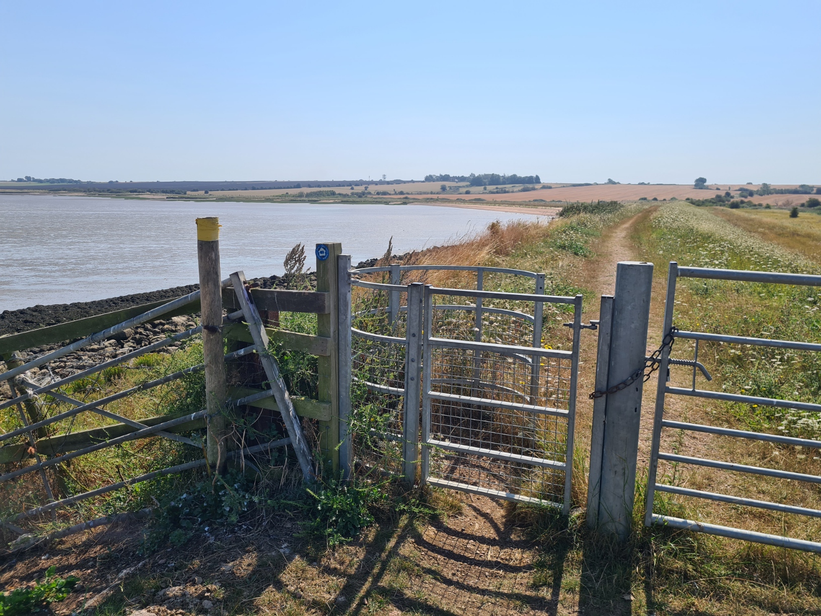
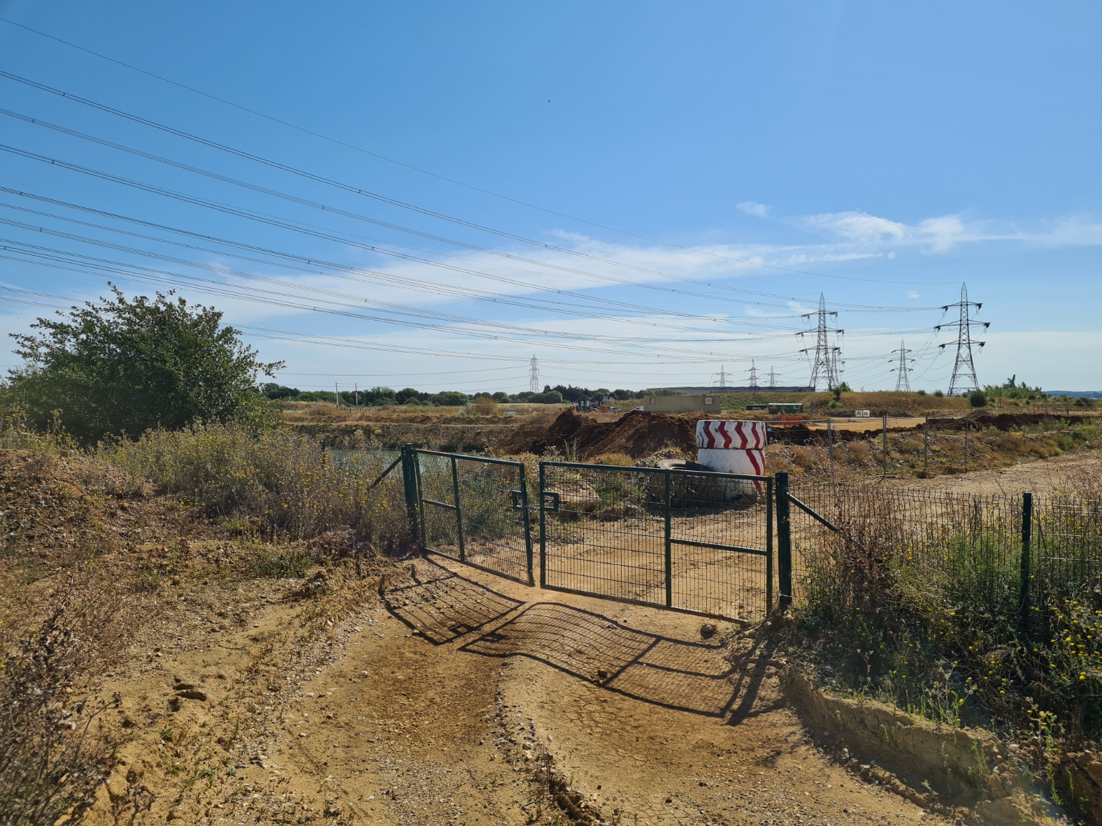
There was an extensive length of saltflats, one part being reclaimed by obviously very expensive machinery. It was a bit of a mess but will no doubt settle down as nature takes hold and covers everything. It is destined to be a nature reserve, replacing land far away on the opposite side of the water when a deep water container terminal was built. It was stupid hot and as no-one was working there today, I walked over the sea wall to find shade from the reeds, lounging on the sea dumped and wind blown detritus for a welcome shaded break, much needed rehydration and a bit of food.
The remains of more crumbling concrete buildings were spaced across the grazing marsh. These were once the Cliffe Explosive Works. a gunpowder and explosives factory from 1892 to 1921. The explosives were once stored and packed at the WWII camp I passed earlier. I challenge anyone to identify it as such but this is the location used by Stanley Kubrick to film Full Metal Jacket, the Kent marshes standing in for Vietnam. He used this area as the director famously had a fear of flying. This earned him an undeserved reputation as a bit of a recluse as he refused to attend film premiers and award shows outside the UK.
I walked up to the concrete apron on the seawall to take a closer look at the boundary obelisk at lower Hope Point, but almost vaulted the wall when startled by sudden and loud crashing behind me. It was just grazing goats, bashing through the hawthorn and rattling their way against and through a metal barred gate in a desperate attempt to flee from me. In this lonely peaceful location neither goats nor I had expected to see each other. From the sea wall my path now headed back inland, past yet more wartime buildings now crumbling in the fields, spread out, with earth mounds around them, they had the look of old ammunition stores. I walked between now flooded quarries, the screech of thousands of gulls filling the air. Then a walk up and away from nature, heading into town, in search of a pint and some grub.
Cliffe is believed to be the oldest settlement on the Hoo Peninsula. This is supported by archaeology unearthing Mesolithic settlements and later Romano-British and Anglo-Saxon habitation. More recently, if ever there was a large population, the continued scourge of plague in the 14th century literally decimated numbers. The little town still has a couple of pubs and I stopped in at the Six Bells for a welcome beer with a decent fish, chips and mushy peas. This was now my evening meal and a decent replacement to the emergency dehydrated meal secreted at the bottom of my pack.
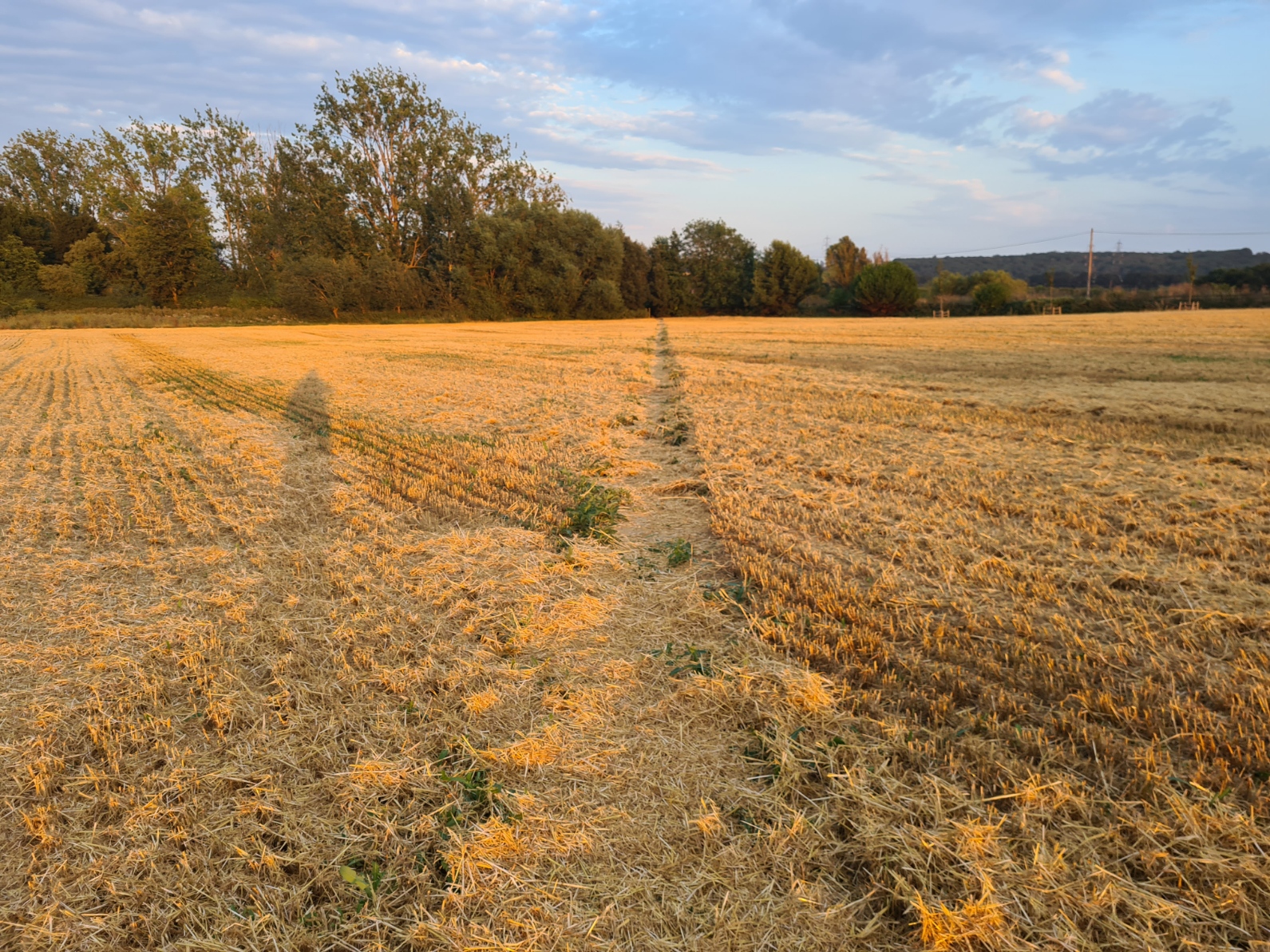
By the time I left the pub it was most definitely evening and the sun was sinking, making the fields a beautiful golden. I enjoyed this last half hour of walking immensely as beside the wonderful light, it was now a good deal cooler and my end was almost in sight. My path crossed fields of stubble and skirted some orchards.
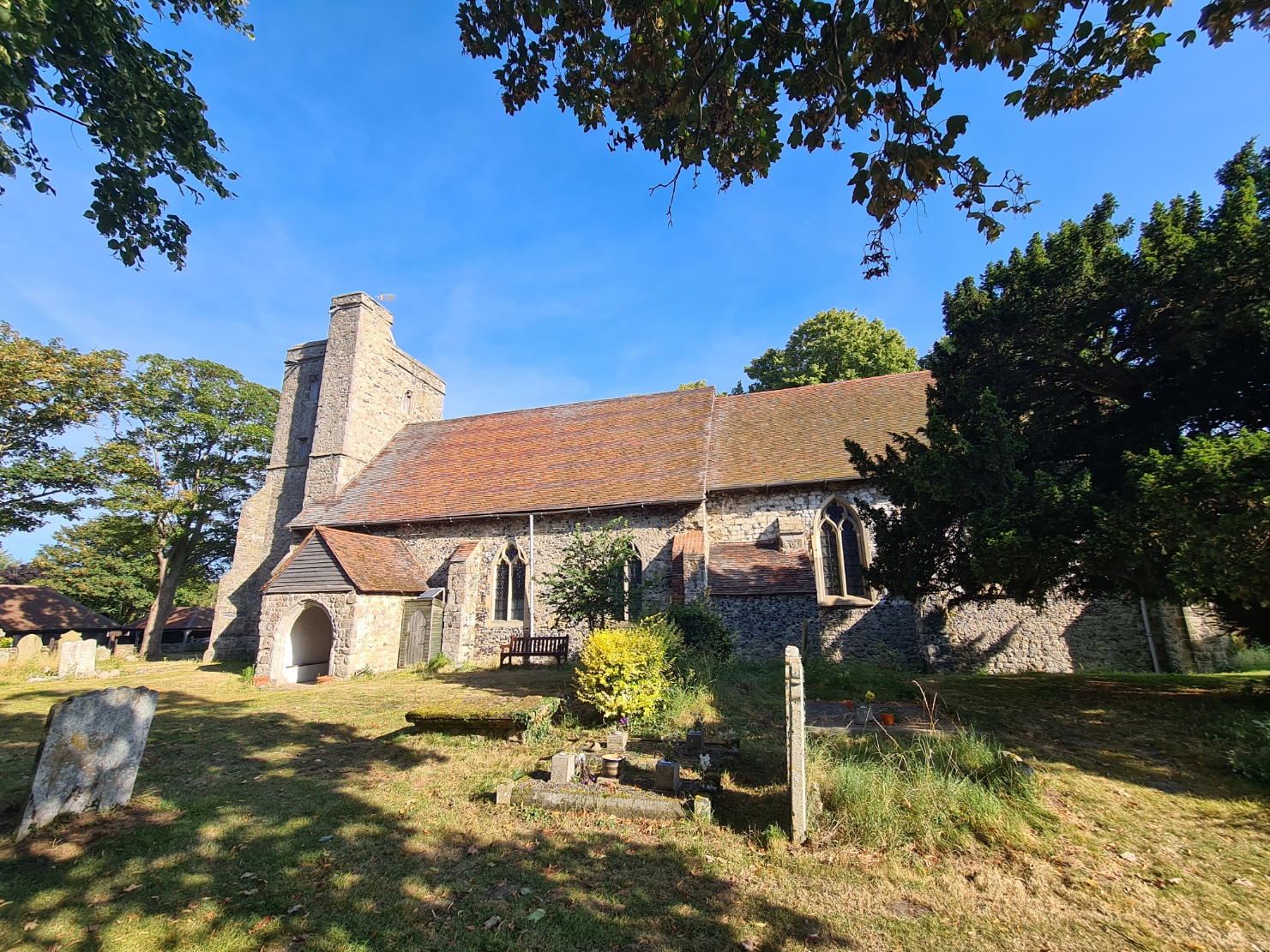

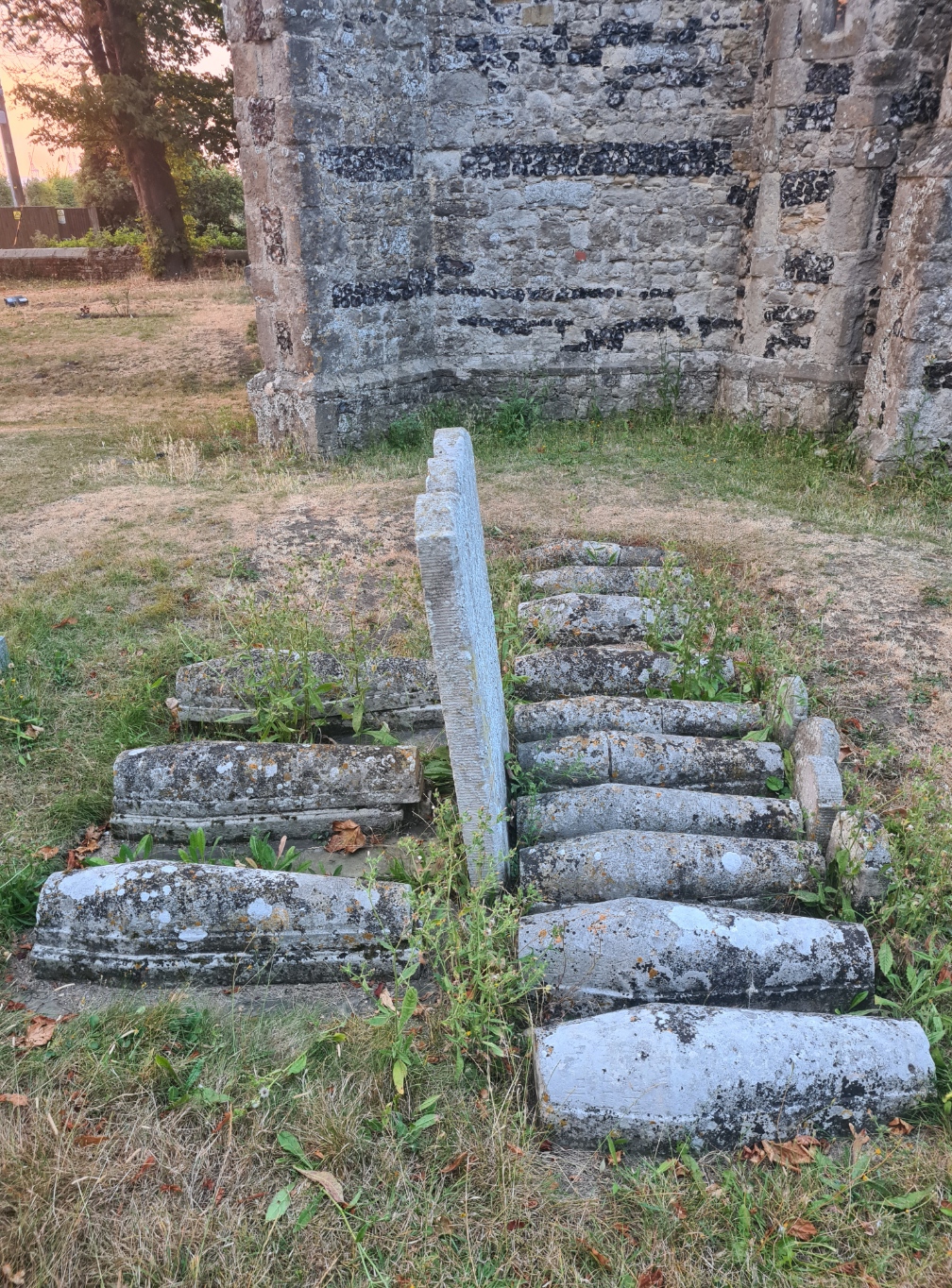
I was ‘champing’ tonight at St James’ church in Cooling. Sitting above the marshes with views to the Thames estuary below to the north, the churchyard was the inspiration for Charles Dickens’ opening chapter of Great Expectations, where Pip meets Magwitch. Today, it remains the location of a group of 13 sad little gravestones. The final resting place of 13 babies. What Dickens described as “little stone lozenges”. I let myself in to the church and locked it from inside so that I could have a bit of a wipe down body wash, prior to changing in to a set of clean clothes I had stuffed in to my day pack, then a wander round and explore the churchyard and church before it got too dark.
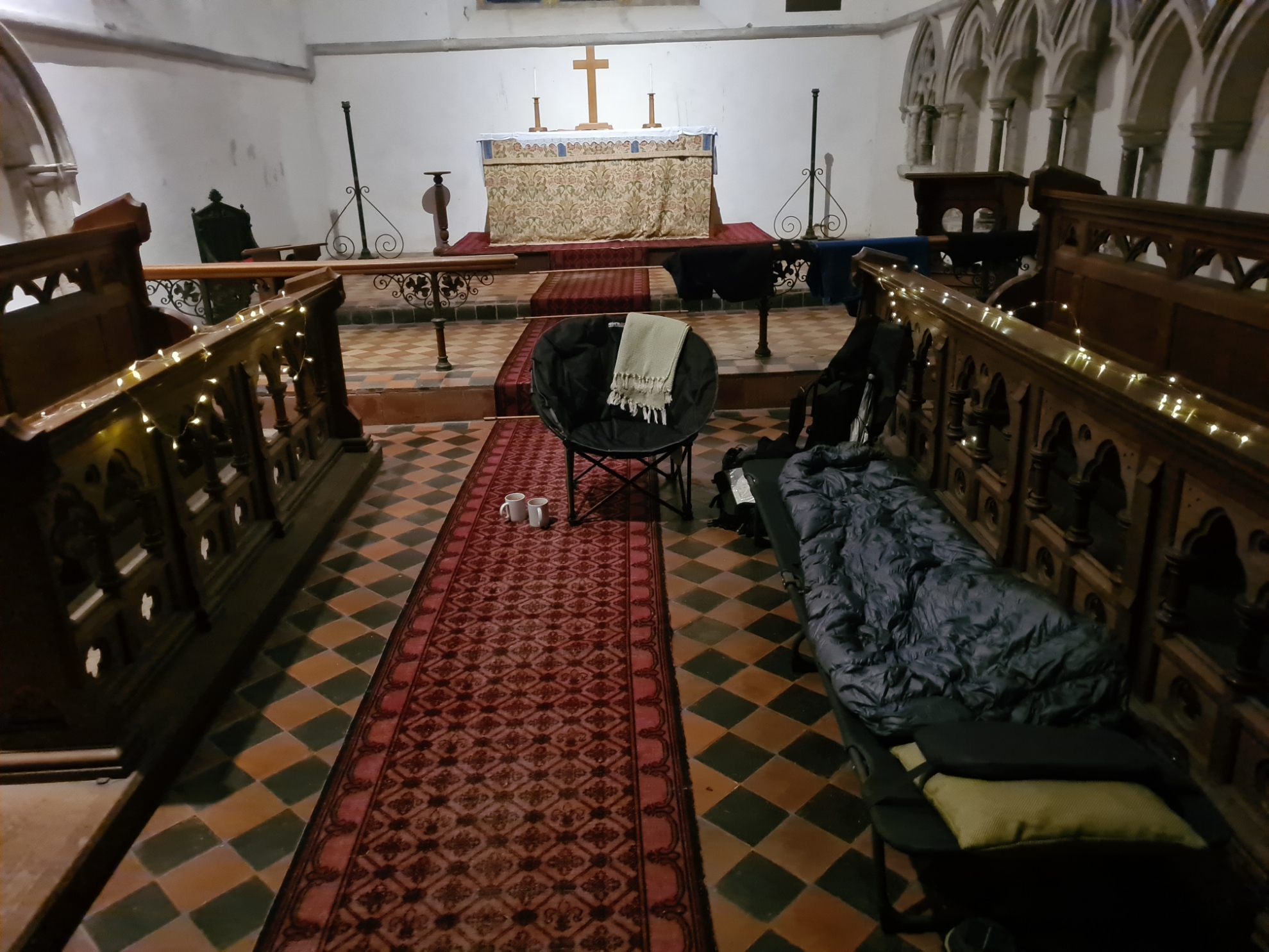
As arranged, there was a cot made up in the aisle inside the church and I spread my quilt over it to loft while I drank a couple of hot brews. As it darkened the interior of the church got quite cold, unsurprising in a large unheated stone building. This is why champing is only available spring to late summer (other than three churches that are year round), it is too cold in the winter months.
I went to sleep with the slight light of battery powered fairy lights for company. I was cosy warm and slept well other than having to rise the one time. As a result of those late night drinks, I had to pad outside, over stone cold flags, for a pee in the small hours. Almost a cliché, an owl hooted its disapproval at my watering the churchyard.
Day Two:
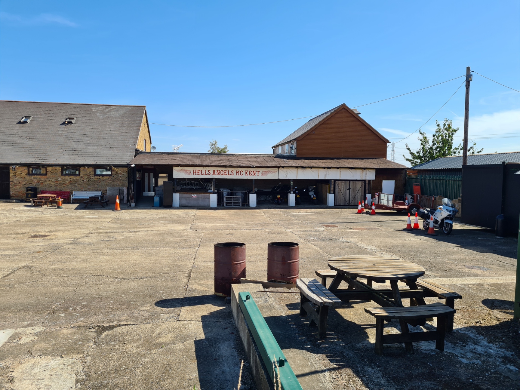
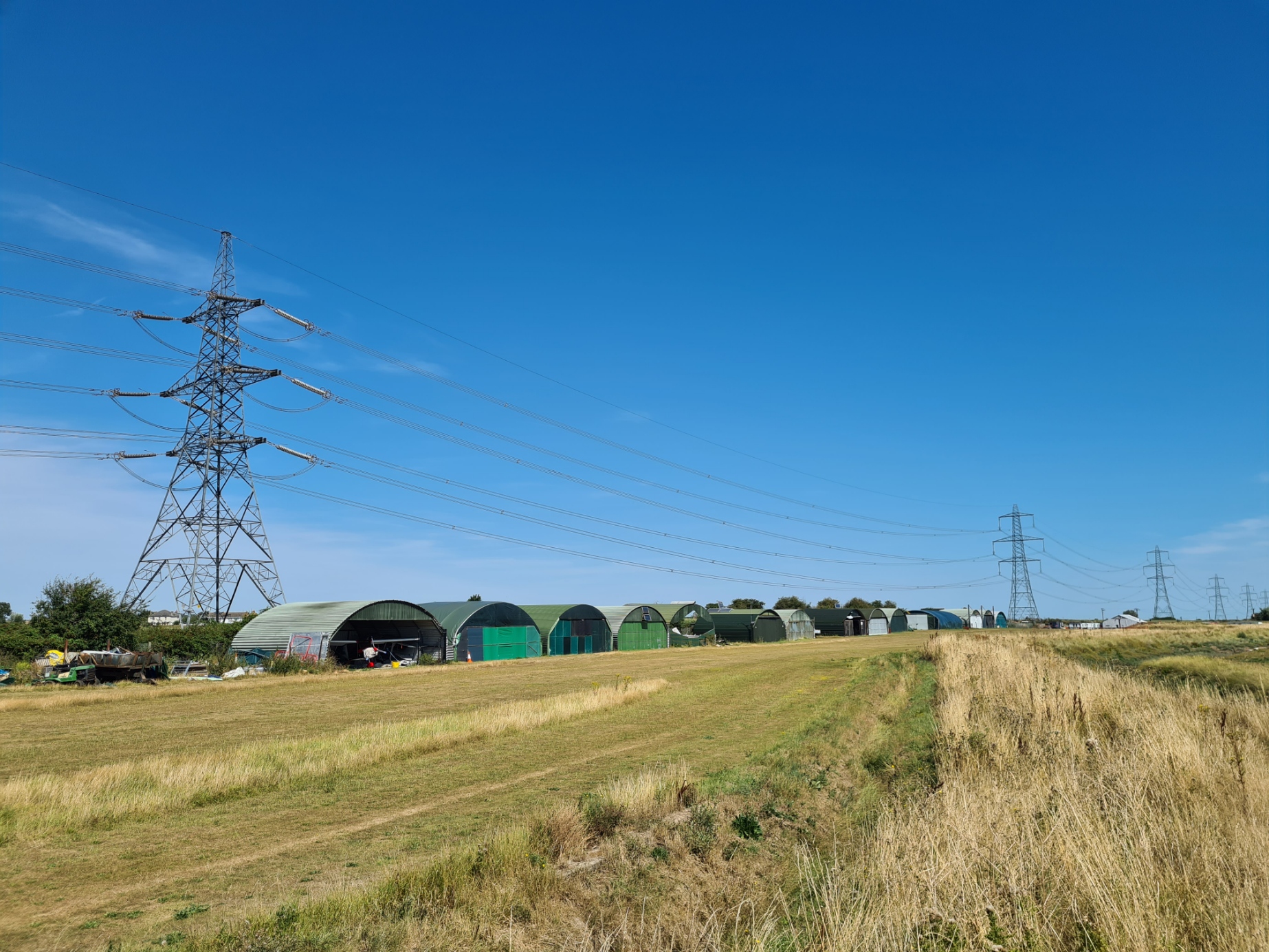
Once packed and away, it was a bit of road walking, compressing myself against the verge less vegetation that lined the road whenever a van or lorry hurtled past. I was glad to turn off and strike across fields. Under some buzzing pylons, following scrappy field edges, heading up to the tallest bit of ground around here, Northward Hill. I had walked through here when I did the Saxon Shore Way, but it had been a blustery wet day back then. Totally different conditions today. It wasn’t long before I was turning off from my familiar route, instead dropping down toward the coast at Hoo St. Werburgh. I passed a storage yard for caravans. Probably one of the safest places there could be to put one of these, as the club house of a Kent Chapter of Hells Angels was immediately next door.
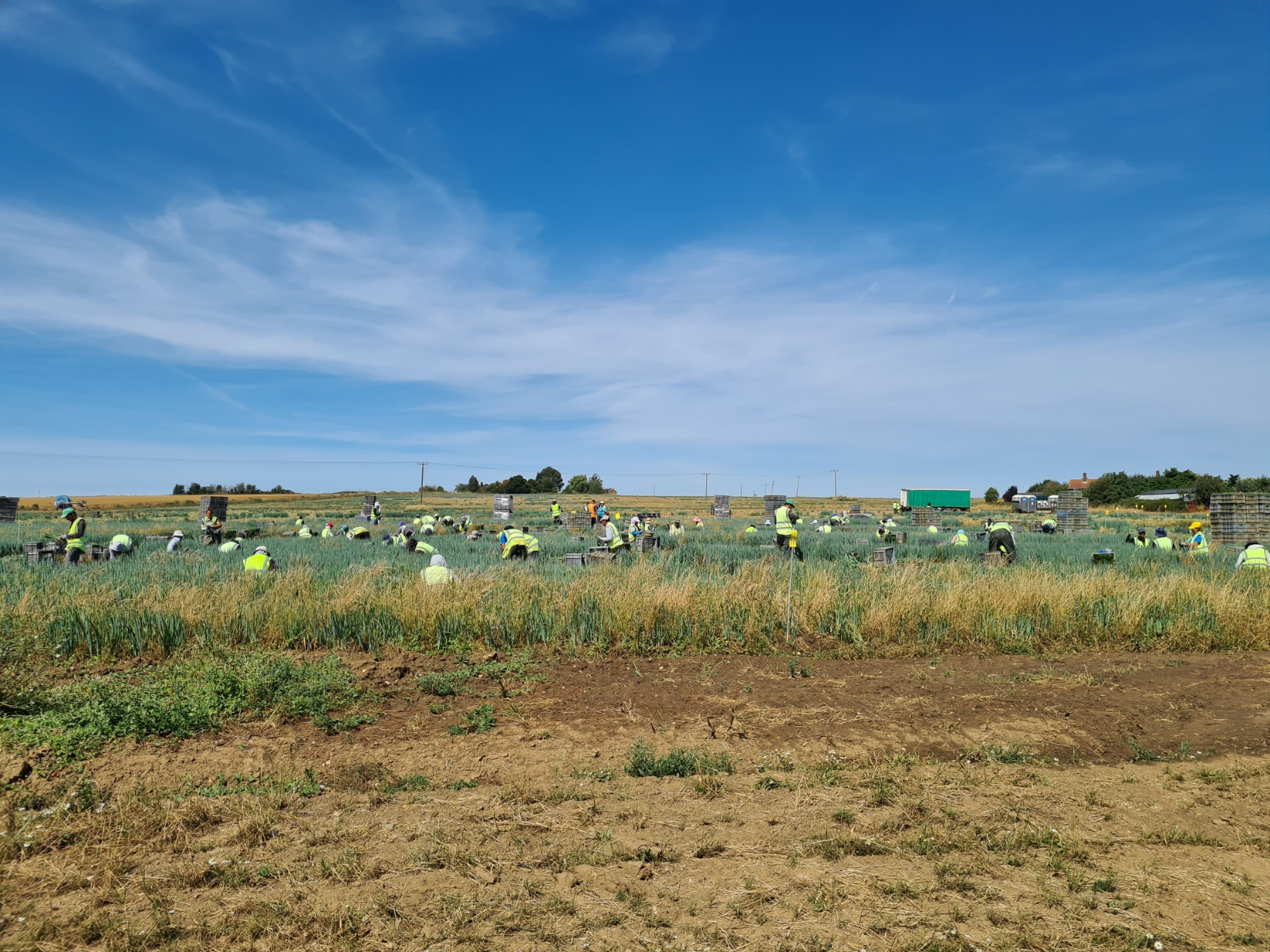
I got a little lost for a few minutes around here. The line on the map led me straight toward a fenced off area with Kingsnorth Quarry workings beyond. There was no obvious re-routing in place and I had to find my own way round this, crashing through the undergrowth, until emerging onto a little country lane that was devoid of traffic other than huge tractors towing large trailers that would have wiped me out if I had met them on any place other than the thankfully wide points where I did encounter them. This road became a track, that took me up through a large farm, dozens of field workers bend double over their labours, Their overseer watched me with suspicion when I paused, refusing to return my wave. Probably unsure if I was some official checking the status of the likely migrant workers.
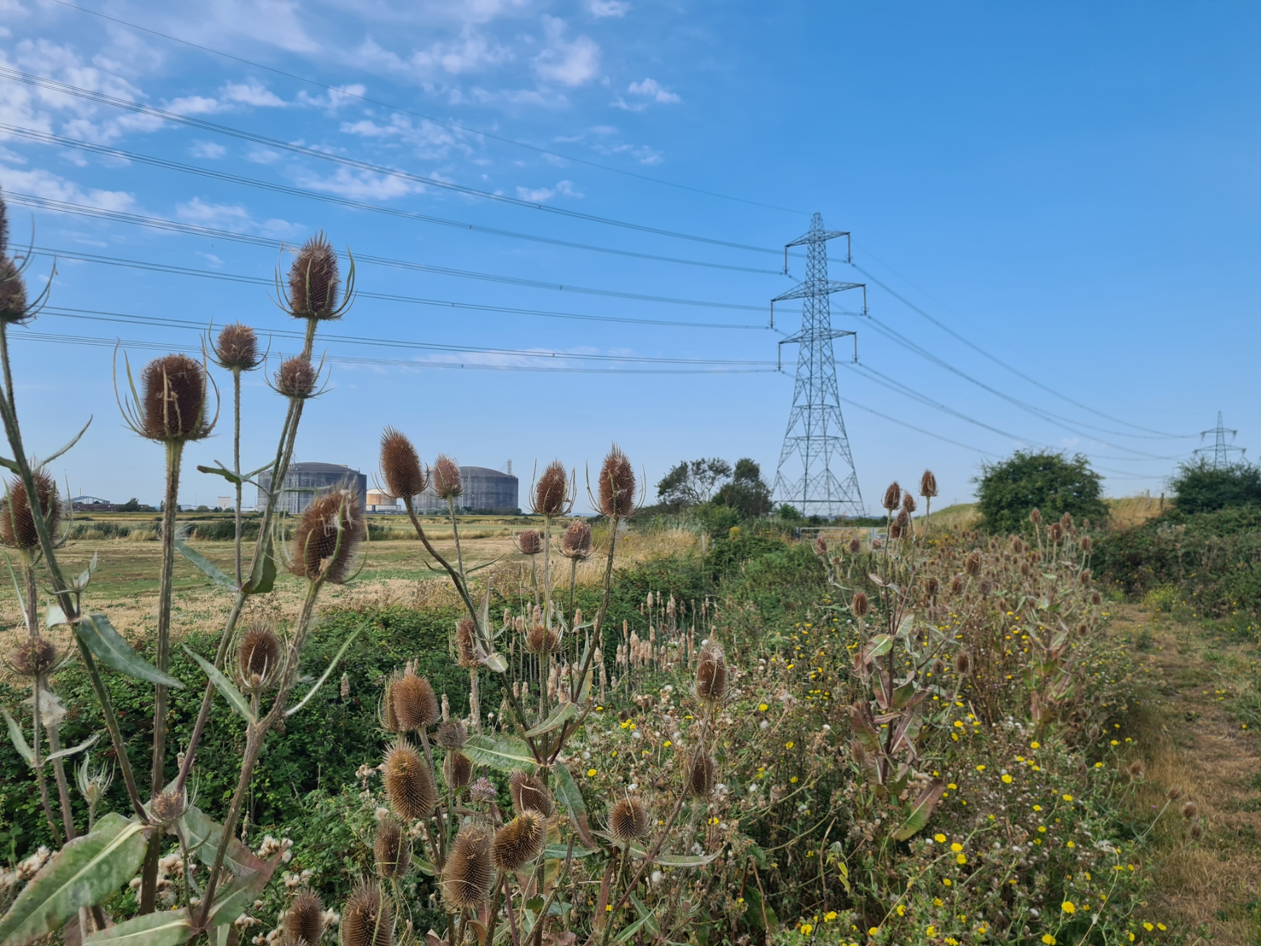
Hoo St. Werburgh looks down on the sea from it’s modest elevation and it was a welcome scrunch scrunch down toward it. Immediately turning left when reaching the coast. But not for long. Approaching Kingsnorth Power Station the path doesn’t follow the shore, but wanders inland for a while. This is not a particularly attractive section of the trail, but there were things to see. Not least the small Stoke Medway airfield alongside the path as I headed to the coastal sea wall again. As to that little airfield, I am not at all sure of the wisdom in having light aircraft landing right alongside electricity pylons. It was high and exposed walking along this. The sun was now burning down and there was little in the way of cover or shade. There was little movement, even the gulls had cleared off somewhere cooler. A couple of grey herons did lazily flap away on my approach but I kept my eyes mostly on the ground, attempting to avoid both the gaping cracks in the dried earth, that could swallow an ankle, and also try and avoid the copious cow pats deposited by a couple of herds. There is supposed to be a U-Boat wreck out in the mud, the last of 100 deliberately scuttled here following World War I, but I failed to see it, probably because I was still paying attention to the path under my feet and one muddy wreck of a boat is much like another without careful inspection, and there were quite a few out there.
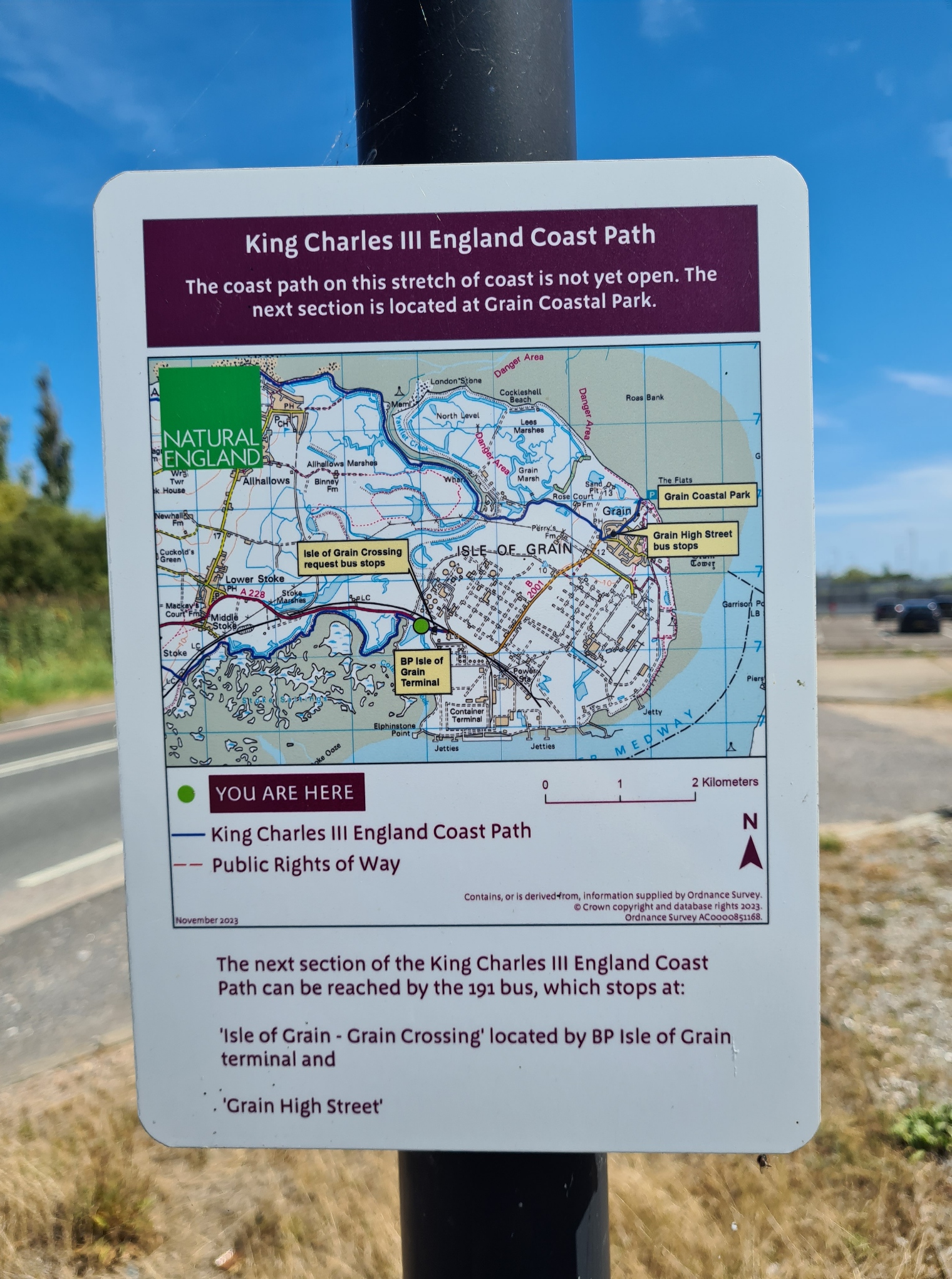
At the Grain Crossing the path heads inland quite a bit to skirt the Grain Power Station and its new gas storage terminals. After a reasonably pleasant but all too short bit of county walking, it was onto the busier B2001 for a couple of miles, with tanker lorries joining the island residents and power station workers in their cars. A sign instructed me that the coast path wasn’t open and advised walkers they should catch a bus to the next section. Ha! Looks like more road walking for me…
Approaching the village of Grain, when I was only a couple of hundred metres from my car, I was a bit tired, hot and had had enough. What to do? Obvious, turn right and walk off in the almost opposite direction, heading away from the village to the coast again!
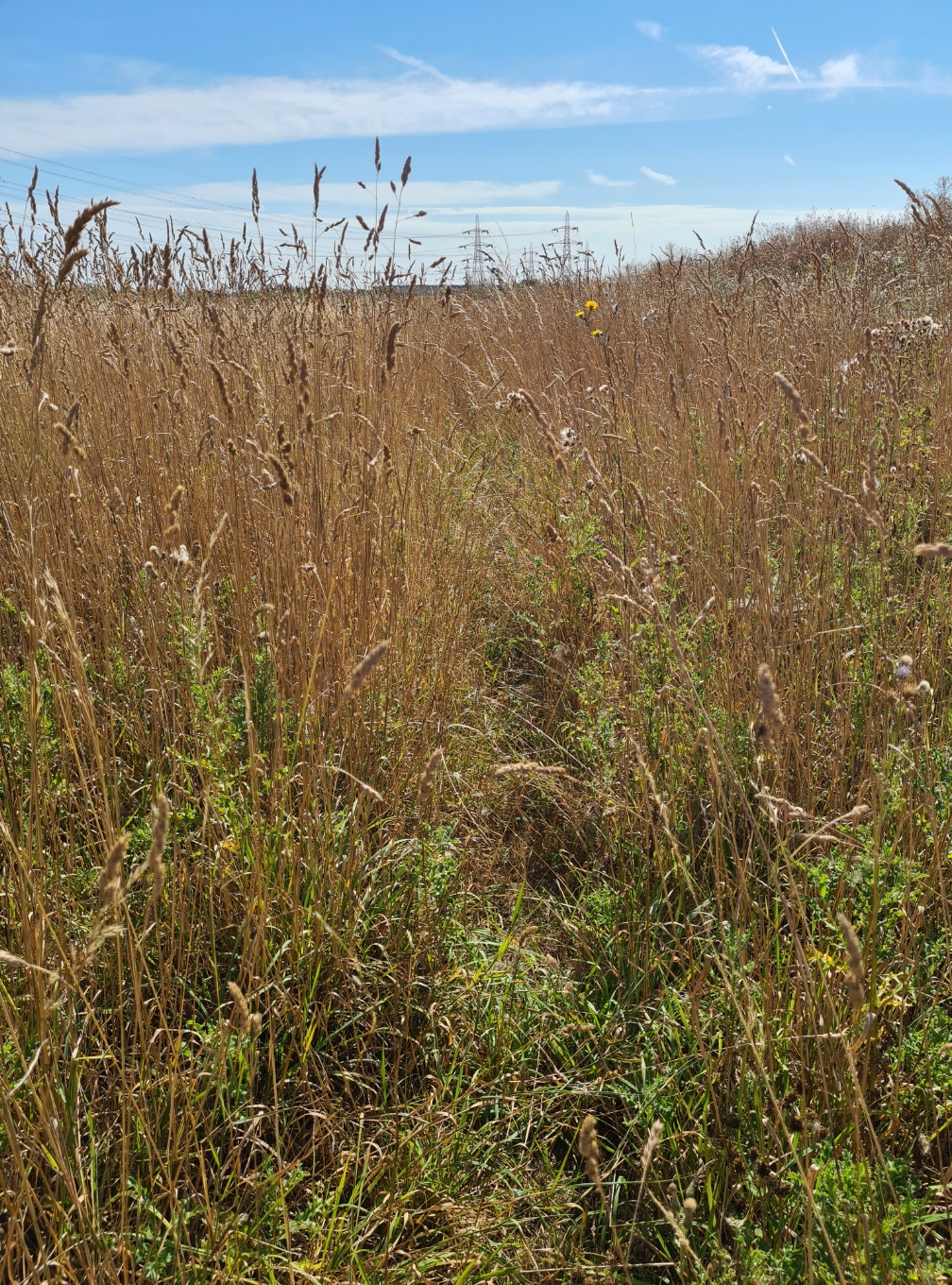
There was a further couple of mile walk around the peninsula in order to ‘properly’ complete this section of the England Coast Path though I guarantee that few would bother walking this additional dog-leg. The signage had returned and it was no longer a section of trail awaiting sign off. This is not to say it was enjoyable, I was simply punishing myself. After a walk down a long road to industrial units, the path wanders off into the undergrowth.
Judging by the overgrown state of the path it was an area that hadn’t seen anyone walk this way for weeks. I had to fight my way through the brambles and nettles, getting stung, scratched, bitten and my exposed legs were snagged and torn up badly. I emerged into the housing estate beyond bloodied, dusty, bedraggled, covered with burrs sticking to my clothing and hair.
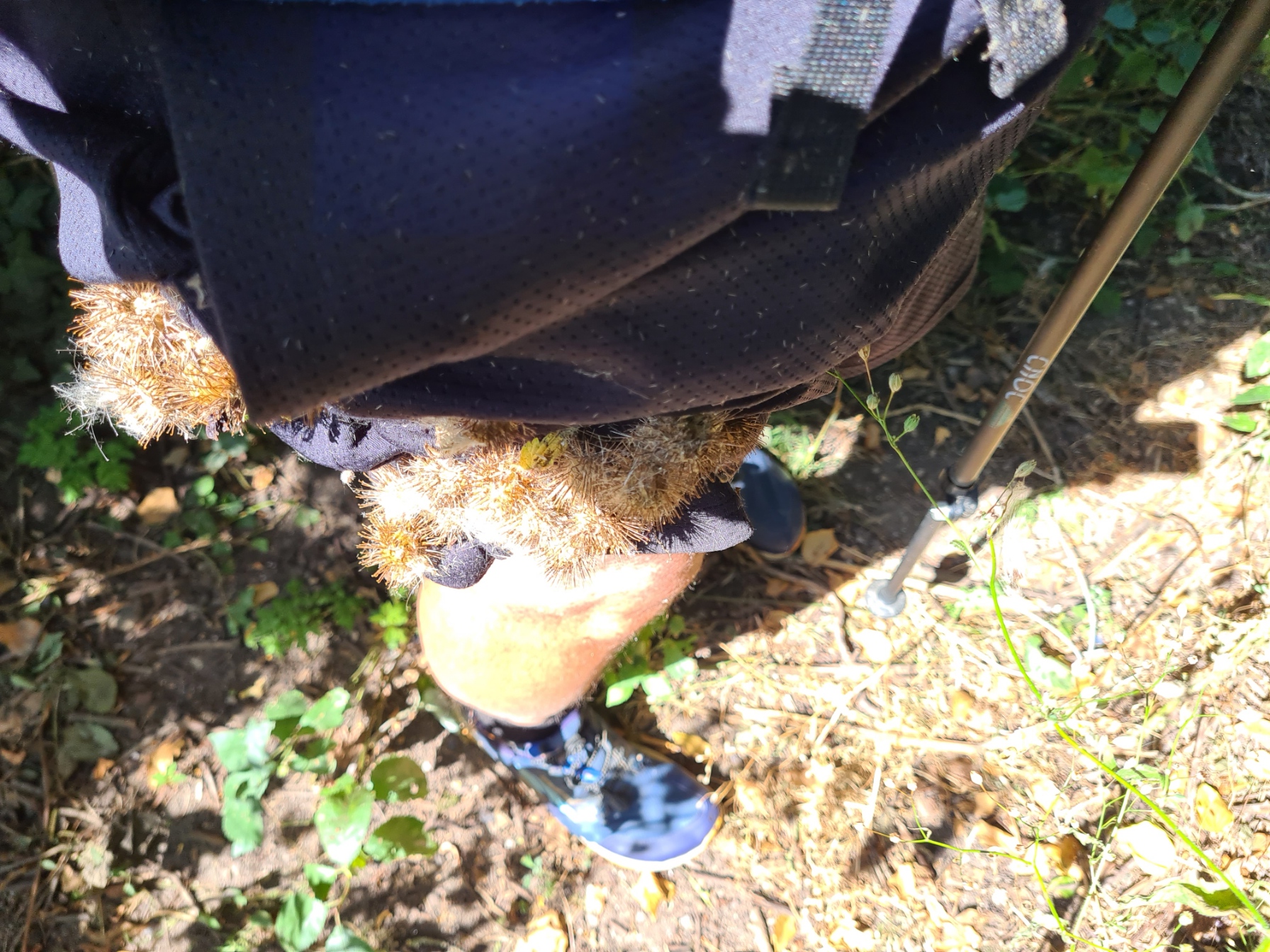
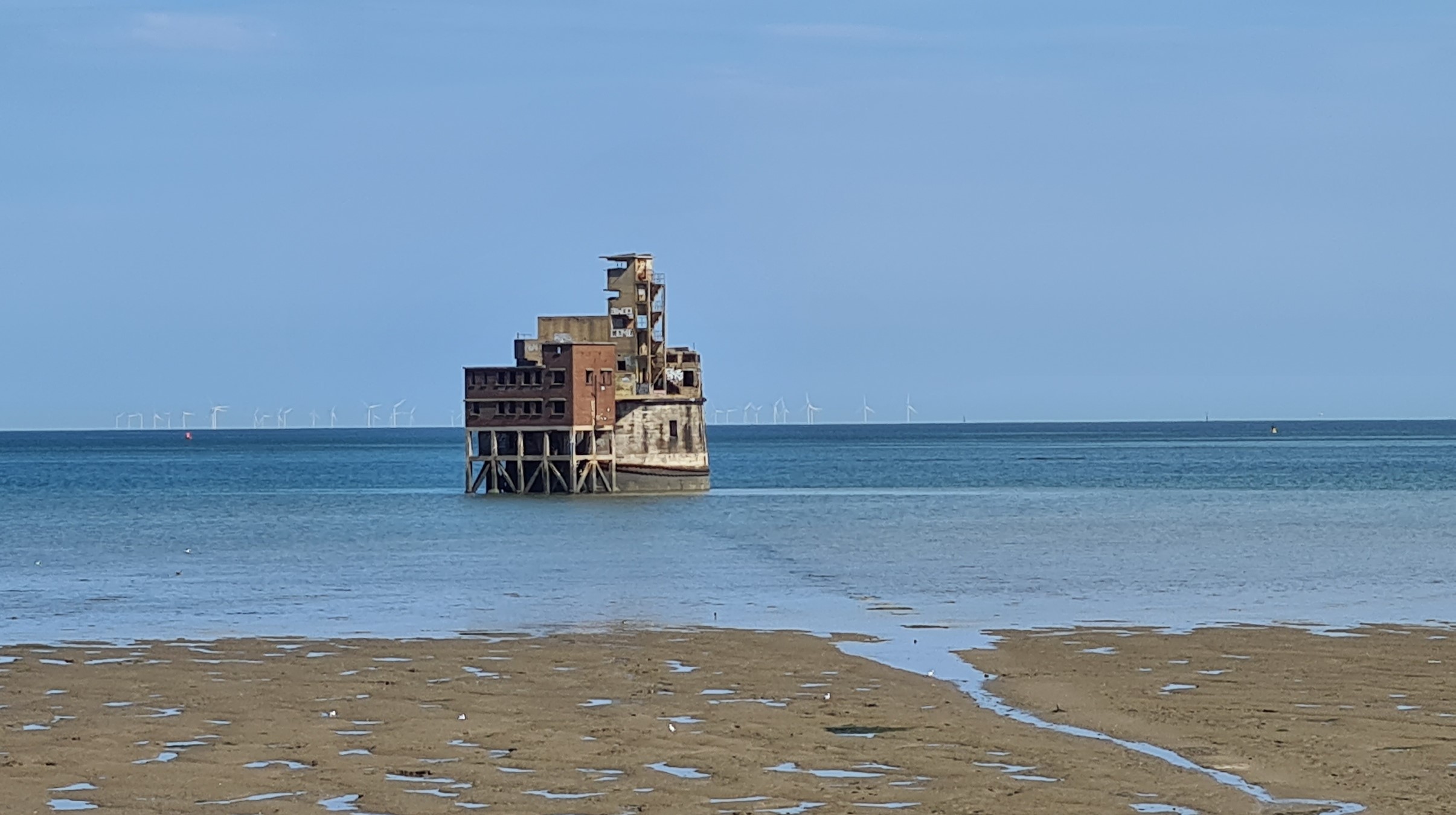
I picked off what I could, mopped the blood from my scratches and walked on, inwardly cursing my completist self. There isn’t much more to relate. A walk down a track past a field of alpacas and then join the concrete sea defences at the coastal edge. An ancient battery is out to sea but cannot be accessed, at least not easily. I couldn’t care less, I was more than ready to finish this walk. The path continues around the Grain Coastal Park, where families were out enjoying the sun. The path then turned inland to pass the carpark, soon reaching a Co-op where I ducked inside to enjoy the air-conditioned cool and pick up a sandwich for a late lunch, along with two refreshingly cold bottles of juice from their fridge. From there it was a short walk to the nearby parked car, job done.
I cannot say that this was a particularly enjoyable two day walk. I found it lacking in interest for many of its thirty plus miles, and, my fault entirely, in the height of summer I had found it hot and exposed hiking. The Champing overnighter was interesting, and a little more on that below, but it is not something I can see myself repeating much in the future. Not because I have any issue with it, just that I doubt locations of the churches taking part will often be convenient for future walks. But if I can make it work, I will, as it is a laudable exercise.
Champing:
The word champing comes from church-camping. This is operated by the Churches Conservation Trust (CCT), the national charity that protects historic churches at risk. The idea of camping in a church to raise money for the CCT was launched in 2014 in Old Saints church at Aldwincle, Northamptonshire. The church was close to the River Nene and the CCT partnered with a local canoe hire company to provide overnight accommodation for those exploring the river. The idea caught on and spread to other churches in the care of CCT. At the time of writing (March 2025), there are twenty six churches across England and one in Wales that offer champing.
This is a simple idea that ticks a lot of boxes. Not only does it provide a rather special opportunity for people to sleep the night in a church, but also provides accommodation for the likes of me, in locations where there isn’t a great amount of choice. Perhaps more importantly, it retains activity and interest around almost forgotten churches. Some might think the experience spooky, I certainly didn’t. I just appreciated a safe and secure covered overnighter, in a peaceful location. True, there was the occasional sound of the odd mouse skittering around the stone floor, but I doubt there is a church that doesn’t have these non-paying guests. They never bothered me.
The participating churches are mostly available March to October and bookings are made online and costs are kept reasonable, reflecting the basic facilities, but vary according to time of the week. Cost is £49/per adult/per night Monday to Thursday (children £25), or £59/per adult/per night Friday to Sunday (children £30). Dogs and infants stay free. The fee always includes provision of camp beds, chairs, lanterns, candles, tea/coffee-making facilities and a w/c. You can hire bedding, but I bought my own quilt with me.
Some localities may even have somewhere local that can supply a breakfast but my church at Cooling was unfortunately not amongst them. For the cost, you get exclusive use of the church between 18.00 on day of arrival and 10.00 the following morning and you are not expected to share the premises with any other individuals or parties outside your own booking. Water is provided (and a kettle) but cooking inside is not permitted. For that you need to wander out to the churchyard.
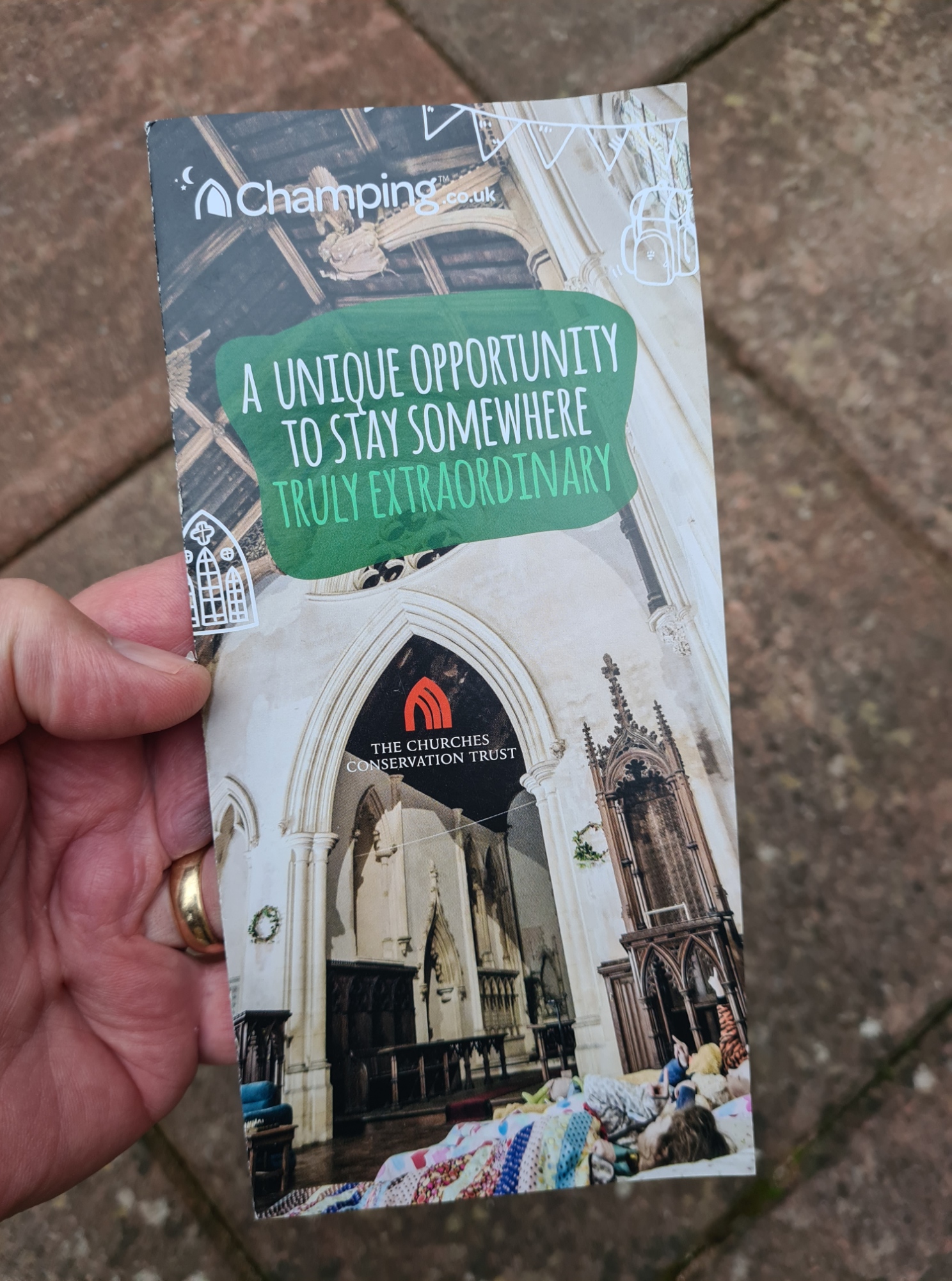
If you are interesting in Champing, you can sign up to the Champing newsletter for updates.
What’s in a name?
I acknowledge I have used ‘England Coast Path’ when referring to the new National Trail (very) slowly making it’s way in to existence. This is, of course, the wrong name. In March 2023, a press release announced that in celebration of the coronation of King Charles III, the ‘England Coast Path’ would be renamed the ‘King Charles III England Coast Path’, this despite the monarch having demonstrated little interest in walking or national trails. I have no beef with our King, but do feel this was a bit of needless sycophancy and just created an unwieldy name. It remains the England Coast Path for me and it is this shortened name that is shown on almost all of the trail signage I have seen. At over 2700 miles in length, it will become the longest managed coastal path in the world. I have probably walked about a thousand of these. Whether I actually get round to walking it all, I doubt it, but who knows!

Hi Jools
Fascinating and, as always with your blogs, I learned a lot. I didn’t know about the CCT. It’s a great idea although, as you say, locations may be limiting.
Have you heard of The Golden Valley Pilgrim Way? It’s a not dissimilar idea (and rather cheaper!). Not something I’ve done, but a glorious part of the country and ‘on my radar’
All the best – Nick
LikeLiked by 1 person
Thanks Nick, for letting me know about the Golden Valley Pilgrim Way, and the link. That British Pilgrimage Trust site also threw up some interesting ideas for overnighters on future trails.
LikeLiked by 1 person
New to walking and live in Chatham, am thinking of doing some local national trail walks with my 10 year old son and stumbled across your blog quite by accident when looking for some information on the Saxon Shore Way.
LikeLike
Plenty of walks in the Medway Towns area Sarah, and pretty good rail links if you are planning on completing the Saxon Shore Way. Though not essential by any means, I do suggest you try and find the old Aurum guidebook through eBay, Amazon or Abebooks. Hope the two of you get out and build some memories. Lovely for the two of you to look back and say “we did that”!
LikeLike