
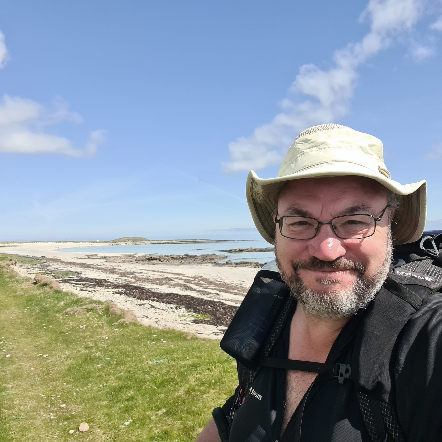
It was May. That means one thing- backpacking in Scotland. Three Points of the Compass sets off to traverse ten of the Western Isles archipelago, on the Hebridean Way.
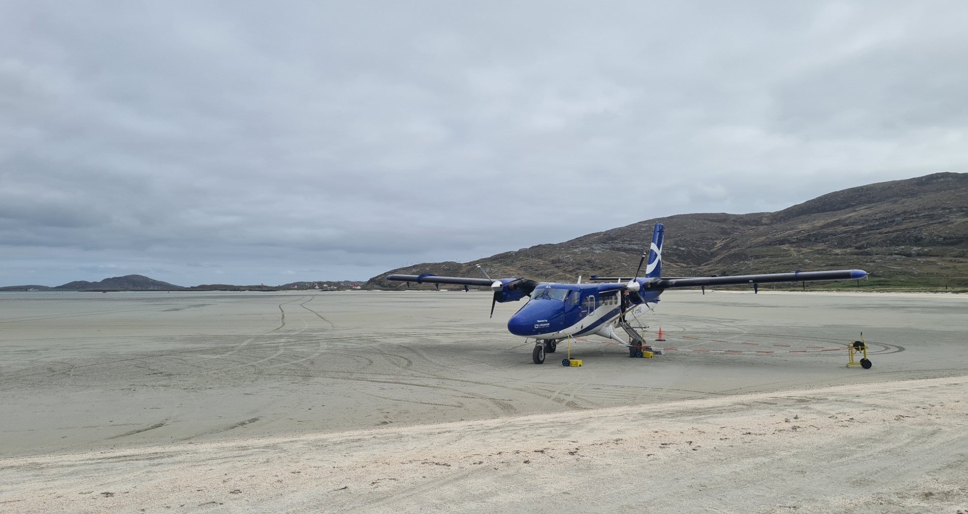
Looking down the short length of the cramped DHC-8 Twin Otter I could see the ‘airfield’ through the pilots window. We were descending to the Tràigh Mhòr cockle strand where minutes before, the staff at little Barra Airport had checked that no sheep had wandered out on to the sands. Accessible only at low tide, it is the only beach in the world with a scheduled air service. We landed smoothly and raced across the sands. The turboprop briefly continued its noisy journey, before stopping close to the small but well-appointed airport terminal. We de-planed and on entering the compact facility most fellow travellers immediately left, to meet friends and family providing lifts. I had a brief wait for my backpack to be carried up from where it had been crammed into the rear of the aircraft. Perhaps foolishly I hadn’t pre-booked a taxi, thinking there might be an enterprising local bus service meeting each new landing. It wasn’t so. A lone taxi was driving out of the carpark and I flagged it down to ask if they could return. The driver turned to speak to her two passengers and seconds later I had joined them for the short drive to Castlebay, my halt for the night before commencing the trail tomorrow on the neighbouring island.
The Outer Hebrides archipelago is a chain of over 100 islands, of which 15 are inhabited, west of mainland Scotland. My plan was to walk the 156 mile trail south to north across ten of them, following the Hebridean Way. I try and visit Scotland each May if I can as it is often fine weather, and is pre-midge ‘season’. Male midges will be out but the biting females usually follow two or three weeks later. It promised to be a rewarding if occasionally challenging hike, offering pristine beaches, machair and peat bog, with also, I was well aware, quite a bit of road walking. Foot care would be everything, as I knew many withdraw from this particular long-distance trail with foot issues.
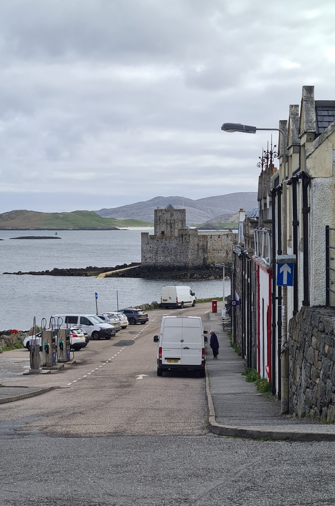
Taxi driver Cursty also acted as unofficial tour guide on our short drive- the three of us made the required appreciative noises when shown the ‘Victoria Rock‘, the ‘wild Atlantic’, ‘our schools’, ‘our swimming pool’, and obviously, ‘the castle’, from which the eponymous town gets its name. I asked Cursty if she travelled to the mainland- “why would I when I have all I want here?” I concurred, it was, indeed, a beautiful surrounding. Arriving at Castlebay, I felt the least I could do was pay the whole of the journey. However, the couple who had actually booked the taxi refused, insisting they would pay.
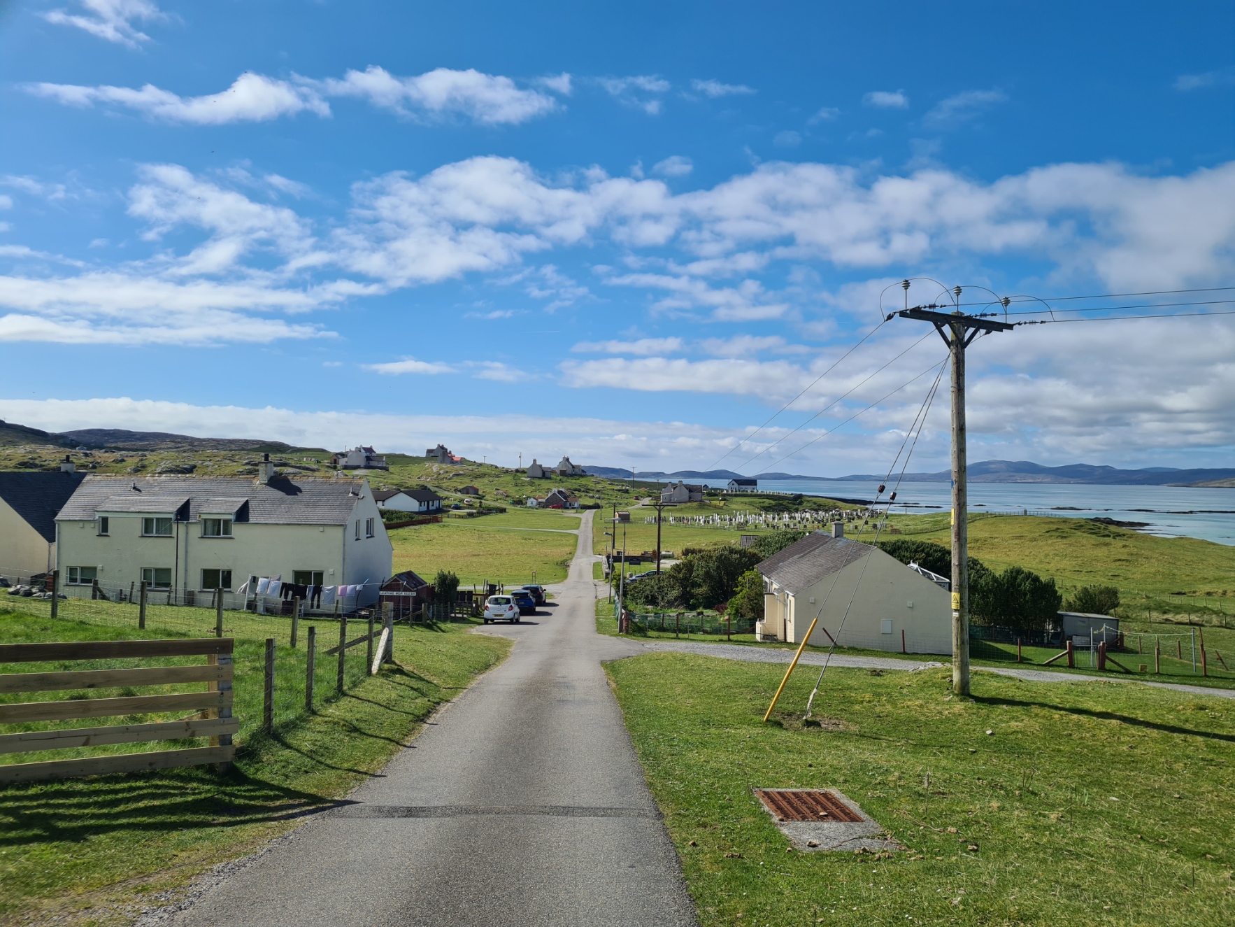
I was dropped at the town butchers, where I had arranged to pick up a gas canister for my stove. However I had arrived a few minutes early and it hadn’t yet been dropped off by the proprietor of the ‘Top Shop’, the well-known store at the top of the hill, that closed in ten minutes time. I was pleased to find it wasn’t the 500g canister I had been told to expect, but a smaller and more practical 220g. I then walked back up the road, past the large Castlebay Hotel, to the far cheaper Dunard Hostel. I checked in, was told to expect another room guest later, who never actually arrived and briefly explored the hostel before settling into my unoccupied four-person room. It was a typical hostel, with everything I required and would make a fine springboard to the start of my adventure tomorrow. I showered and changed. Electrics charged and after a call home, I went down to make a mug of tea in the communal kitchen with its large sea facing windows, watching the Oban ferry come in to port. Those on board had experienced a five hour sailing, unlike my enjoyable, far swifter, more expensive but environmentally less acceptable flight. In the evening I walked back to the hotel where I had booked a table for tonight’s meal. Despite being primarily a backpacker and it being fairly expensive on this far-flung part of the UK, I was determined that where I could, I would put a bit of money in to the local economy. I had already heard that those cycling the Heb Way contribute comparatively little- “they come, are here three days, then they are gone”.
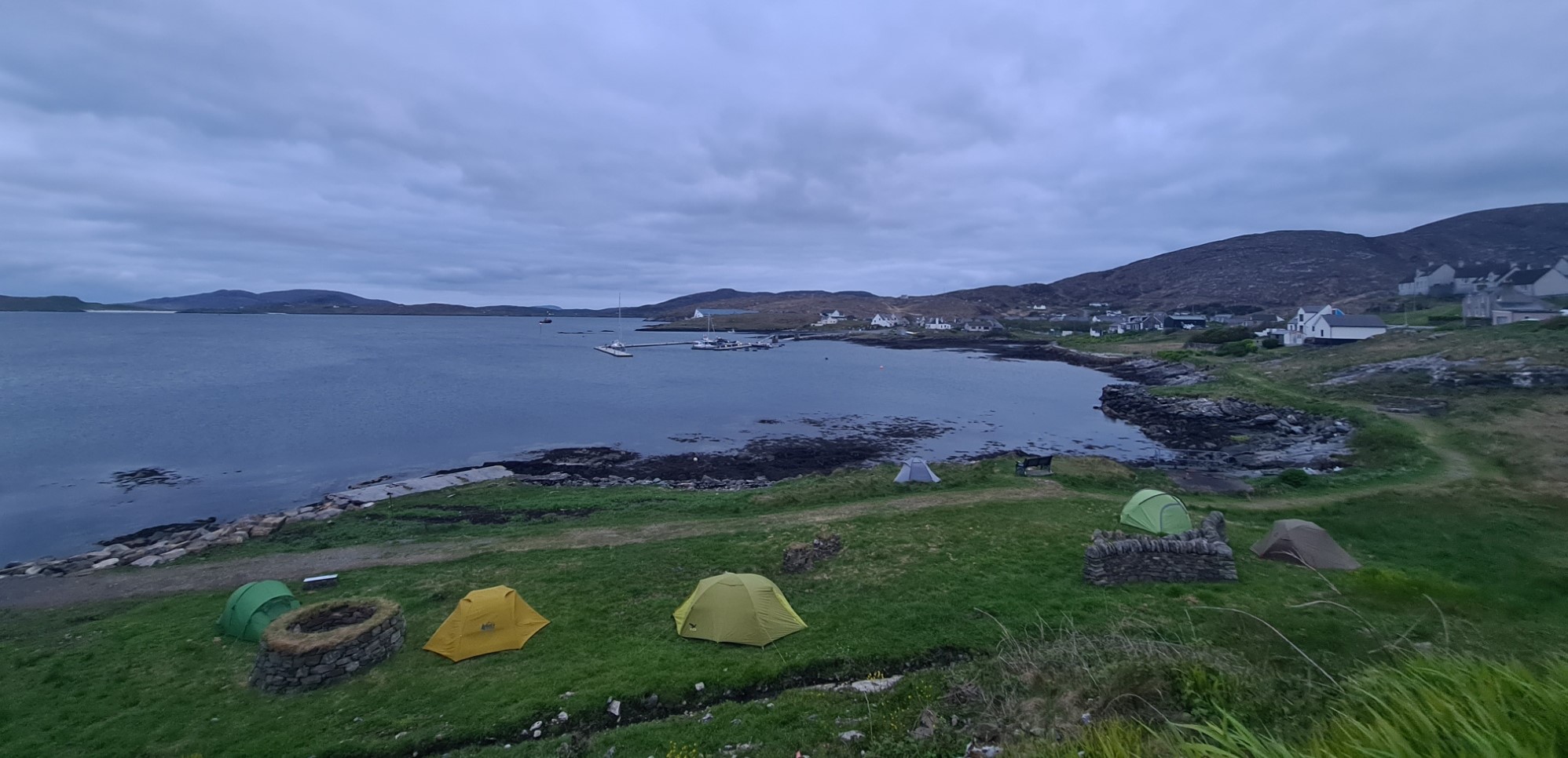
After my ‘OK’ soup, pie and veg, I went next door to the hotel bar. The choice of beer was poor, so I sat and mellowed with a couple of large glasses of decent Shiraz, watching the locals arguing over their pool, almost coming to blows, I pondered the last few hours. Following an early morning departure from home, it had been a long and fairly fraught day’s travel to where I now was. I had experienced a late train, a cancelled train, a missed bus, delay checking in ‘outsize’ luggage, resulting in ten minutes to catch a flight, but all that was behind me. Another trail was before me. Back along the road, passing campers erecting tents down on the grass below the road, back to my room, for a quiet and much needed nights sleep.
Day one:
I woke with a start, thinking I had overslept, but it wasn’t yet six. I rose an hour later and slowly packed my pack, while attempting to get in the single shared w/c on my floor, that the family in the neighbouring room were monopolising. Ablutions eventually complete, I went down to the kitchen and communal seating area for a bowl of granola and two mugs of tea, chatting to a couple of other guests. One was driving around the islands, spending a couple of days at each of his halts. He told me of the ‘official’ Harris Tweed shop, where he had purchased his Tweed cap. It cost him £40. While the nearby Tourist Information shop on Harris sold Tweed caps made in China, for £25. Something is wrong there.
I had arranged the previous day for a local taxi to pick me up from the hostel at 9.00 but due to a misunderstanding on my part, it was a half hour later that we left. Cursty had decided this was a shared trip. Obviously this is the way things are done around here. Beside myself, there was already a second passenger in the back and we made a further halt for a third, both of them headed to work in the café on the neighbouring island of Vatersay.
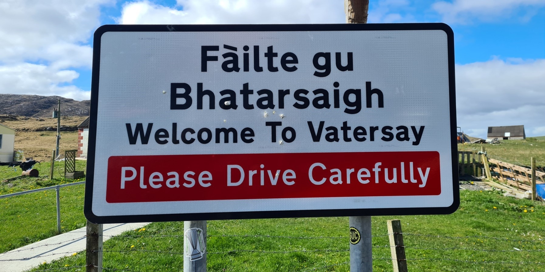
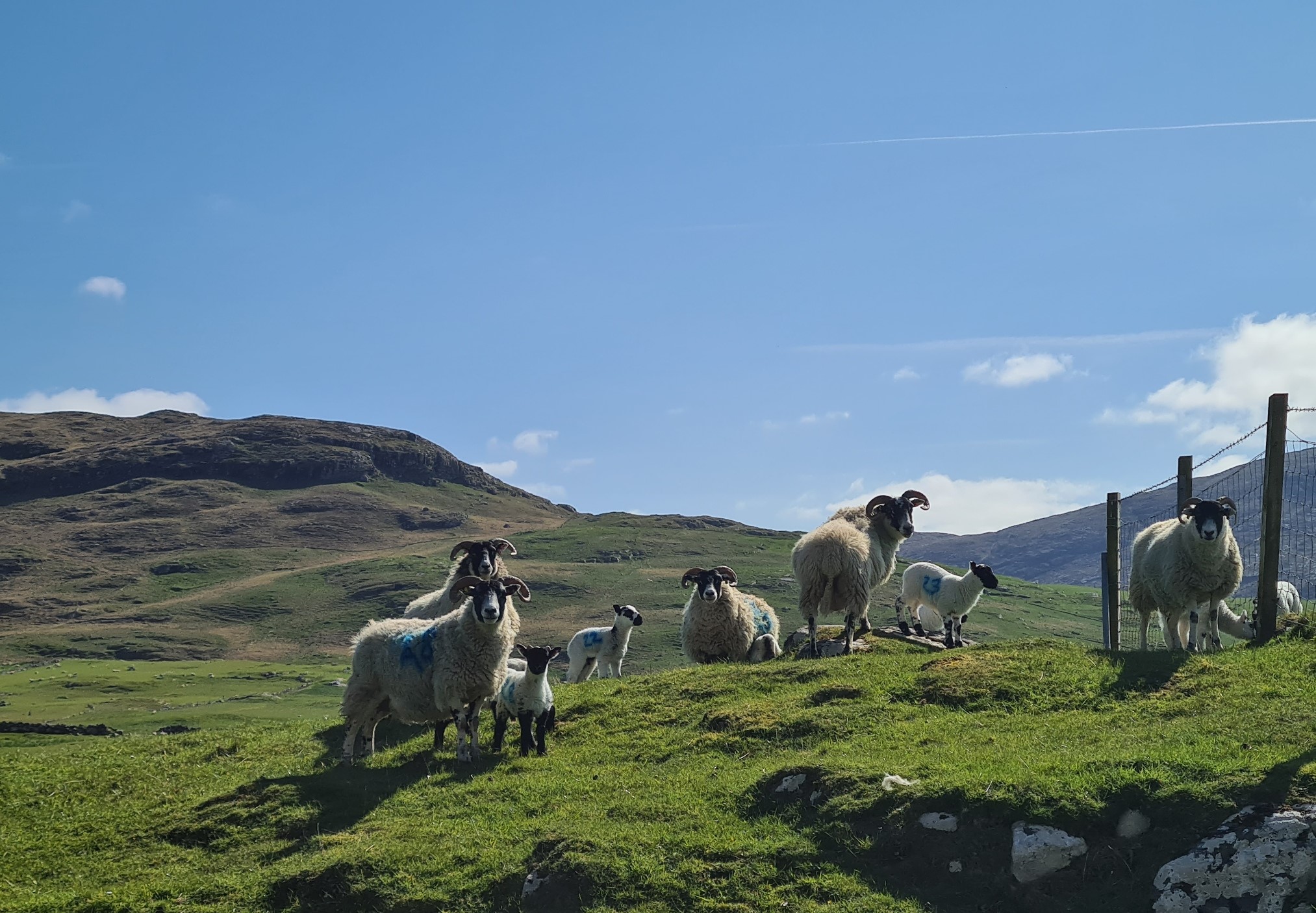
This was the first of ten ‘islands’ that the Hebridean Way would cross and where I would start my walk. The weather was fantastic. It was May and as hoped for, the islands were experiencing fine sunny weather. Not too hot, not too cool. There had been wild and wet weather just a few days previous but the outlook was now good for the next few days, but peat would be holding a lot of water. It was only a short drive and not long before the four of us arrived at the Vatersay Community Hall. Paying it forward from yesterdays kindness, I paid the total fare. I was a tad surprised to receive no acknowledgement of this from the two minimum wage girls.
Outside the café, the girls went one way, the taxi another, and I climbed the short stretch of close-cropped grass to a tall metal column, the start point for the Hebridean Way. I now had somewhere over 156 miles of islands to cross to the end point on Lewis. I was very excited and keen to start walking, I was also determined to continue my resolve to inject just a few quid into the local economy. After my obligatory start photo, I made the shortest walk on trail I have ever made before visiting a café, all of 75m. It wasn’t even open. I impatiently paced up and down, to go or not to go. I waited, it wasn’t long, but it took a cyclist hammering on the door before they actually unlocked it. After a bacon roll and pot of tea, I was finally off.
Following the road I had just come in on, round past the old ferry slipway, now unused, I was headed back to the causeway, opened in 1991, that replaced it. It immediately altered and improved the lives of those who lived on little Vatersay, and for those wanting to access it. But it had taken the drowning of a prize bull, being swum from one island to the other, to finally persuade authorities to build the long overdue and much needed causeway.
For the first quarter of a mile of trail there is actually a signposted trail, to keep pedestrians safe from traffic, just a few metres up to the left of the road, but no-one follows that as there is little on the road, just the very occasional car or van giving wide berth, but mostly the Heb Way cyclists I had met earlier, each giving a friendly wave and a shout as they passed me.
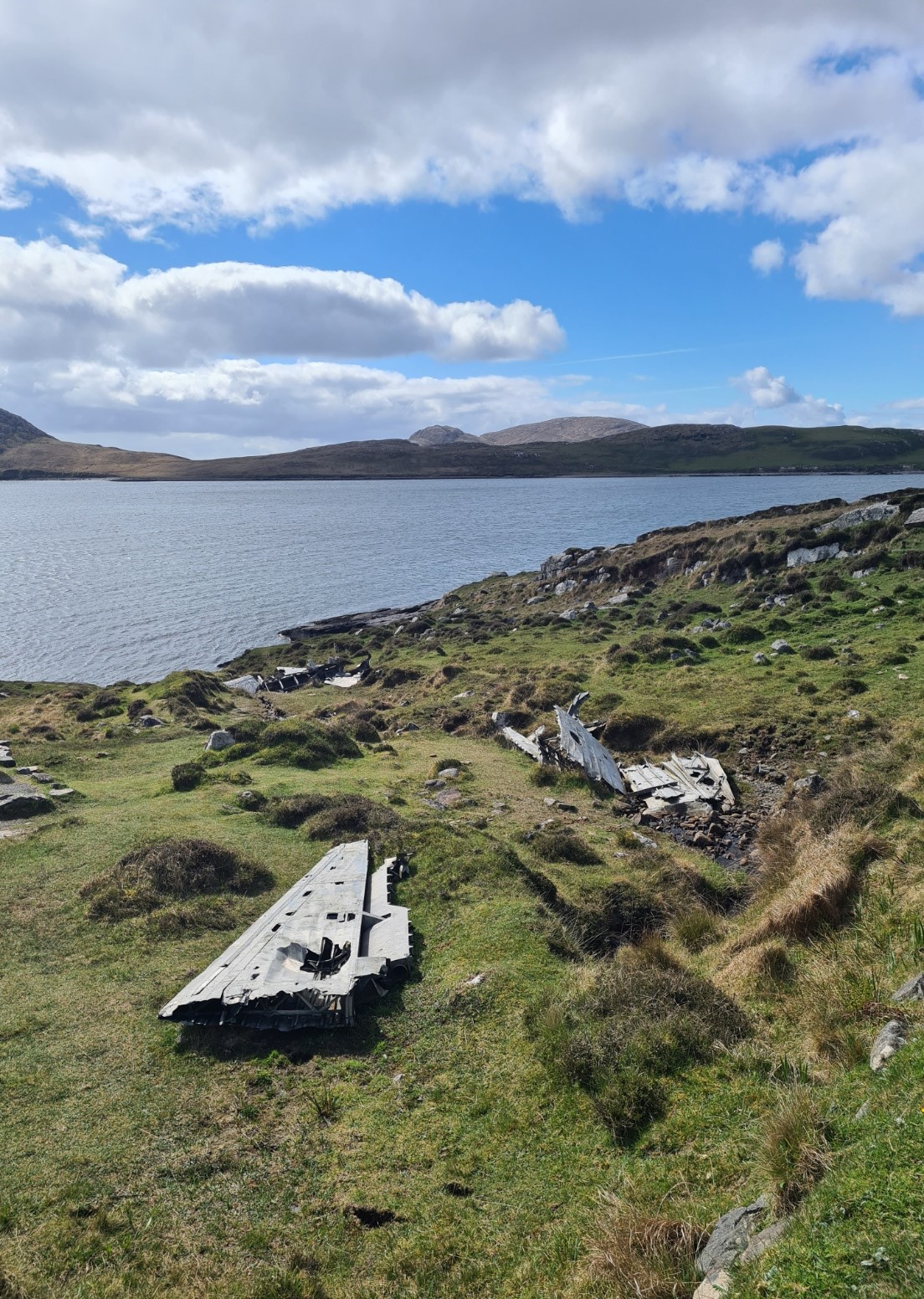
With a larger school now accessible on Barra, the school on Vatersay had closed. The road swung round below the large whitewashed building, now an expensive Airbnb. This short section of road also passes a stretch of shore with the scattered wreckage of a Catalina that crashed here in May 1944, killing three of it’s nine man crew.
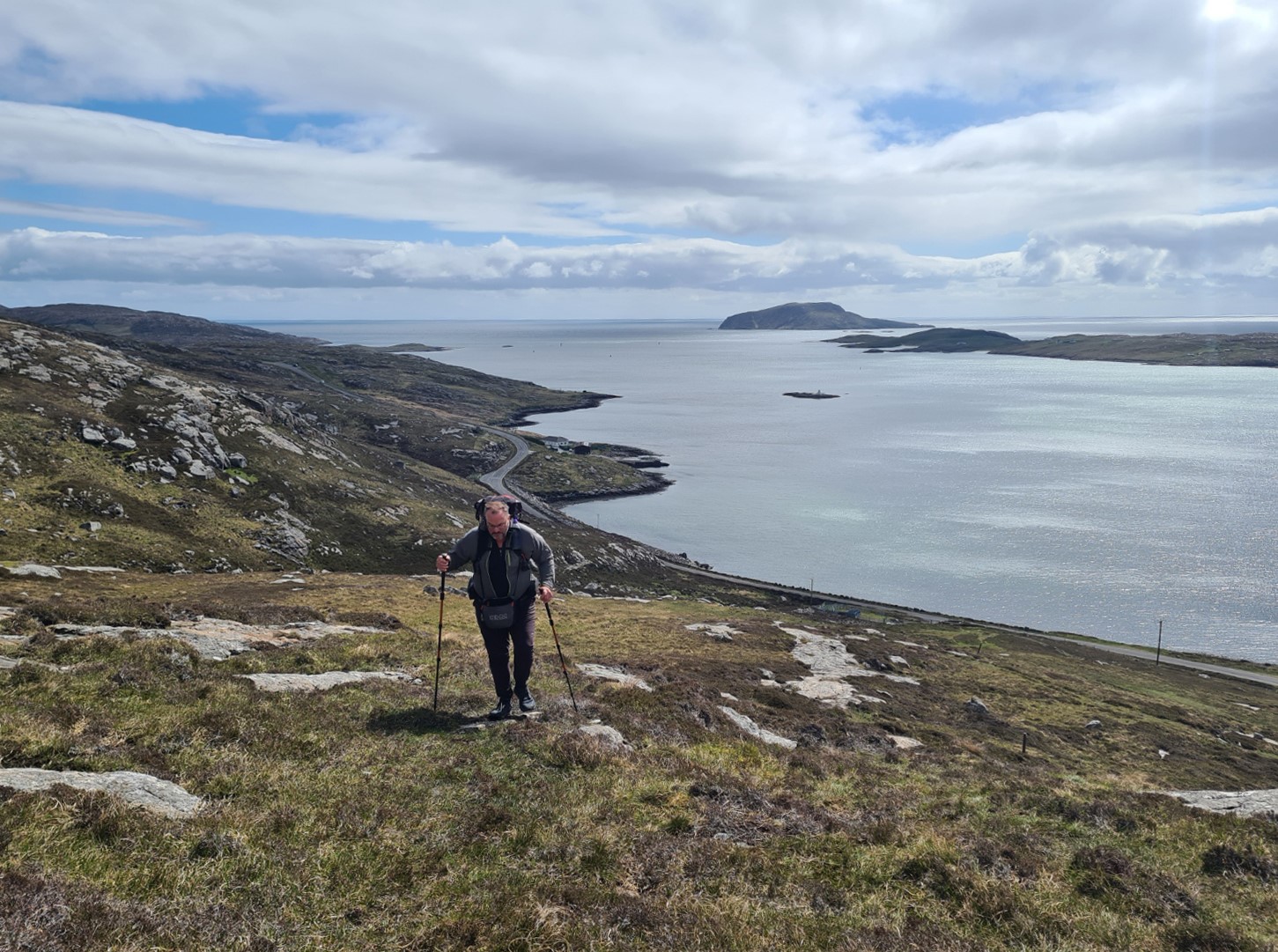
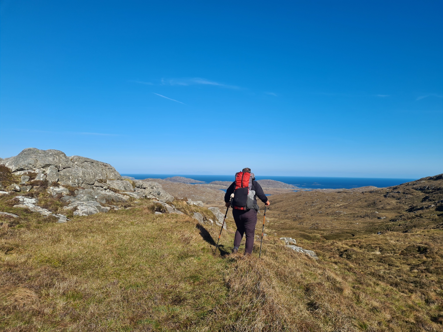
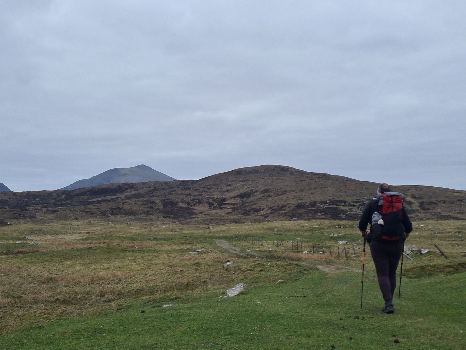
I crossed the causeway back on to Barra and after a short walk, past the handily sited quarry from which the causeway was built, the path left the road and began a fairly steep climb up to the flank of Beinn Tangabhal. This is one of the largest climbs of the entire Heb Way, but I just took my time and enjoyed it, stopping frequently to look back at the tiny islands and headlands of Vatersay behind me, the view constantly changing as I gained height.
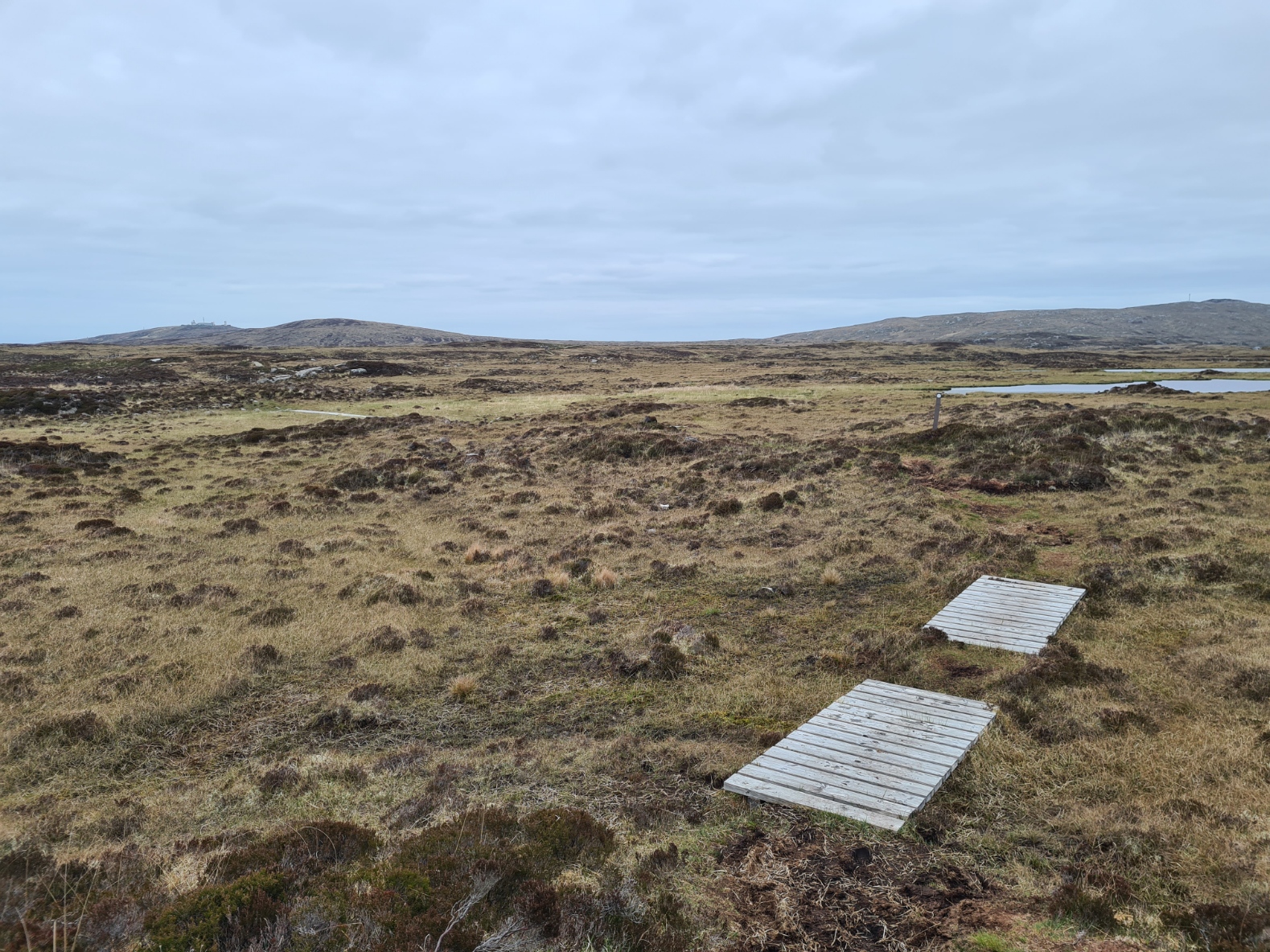
Once across the top(ish) it flattened out, dipped and climbed, avoiding the boggiest parts (mostly) before a descent, swinging round and heading north, down toward Halaman Bay (Bàgh Halaman). I was careful across the rockier and slippery sections. Cursty had earlier told me that a walker had broken her leg here, slipping just a few days earlier. She had to be helicoptered out. Along this section I met a resting group of DofE youngsters with their three ‘minders’, also on the way down. Setting off ahead of me, they bound along with careless abandon, making me feel the over-cautious soul that I am. That said, at least I can keep my gear on my person, one of the lads had already lost a pole and I came across a drinks bottle as I followed in their wake. The path again swung round, now heading west, the peat dropped down to machair, then past a small loch, then my first taste of beach walking on this trail, before up to join a road.
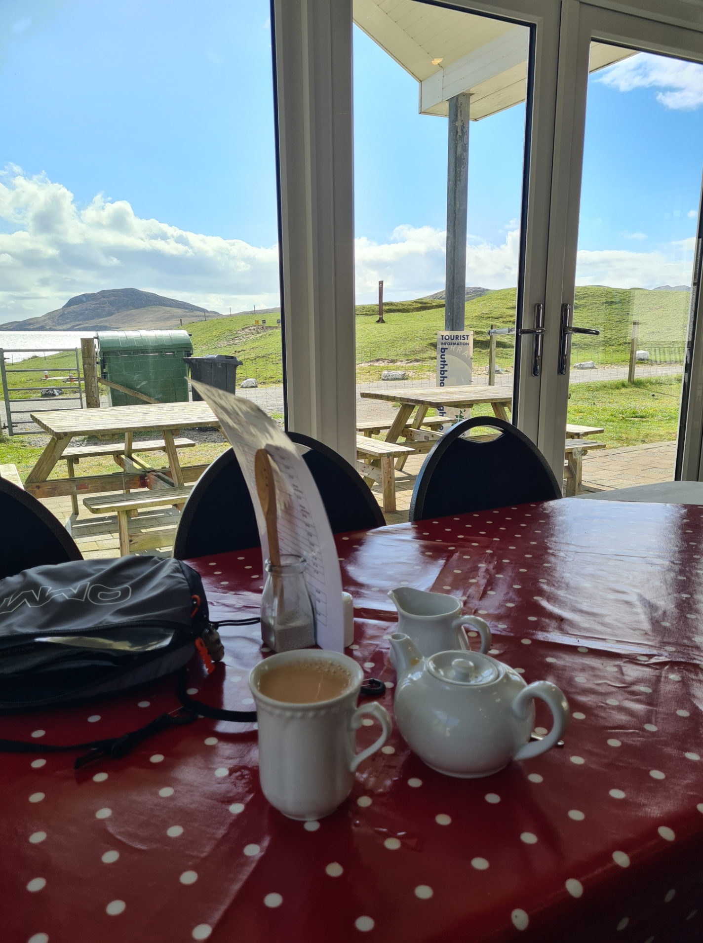
Reading a couple of blogs and watching YouTube videos of others walking the Heb Way prior to arriving in the Outer Hebrides, I was aware that some backpackers had decided at this point that the moorland walking wasn’t for them, and go on to complete the trail by road. I can perhaps see why, though they will have missed out on much that is best about the trail. This lovely stretch of off road quickly gives a first taste of a major issue when walking the Heb Way. Wet moorland peat soaks the socks and feet, when followed by several miles of tarmac walking, the hard road punishes macerated skin. As it was, I only followed this road for a short distance before I was presented by a sign beside the road- “Isle of Barra Beach Hotel cup of tea by the sea, coffee and cake“. An ideal opportunity to dry out socks and shoes a bit.
Needless to say, I stopped in. It was very quiet and the lady on reception led me to the empty comfy guest lounge, later either not noticing my shoeless feet or choosing to ignore them, when she returned with a large pot of tea and chocolate sponge cake, not my favourite by any means, but todays lunch. I took the opportunity to have my water bottles filled here.
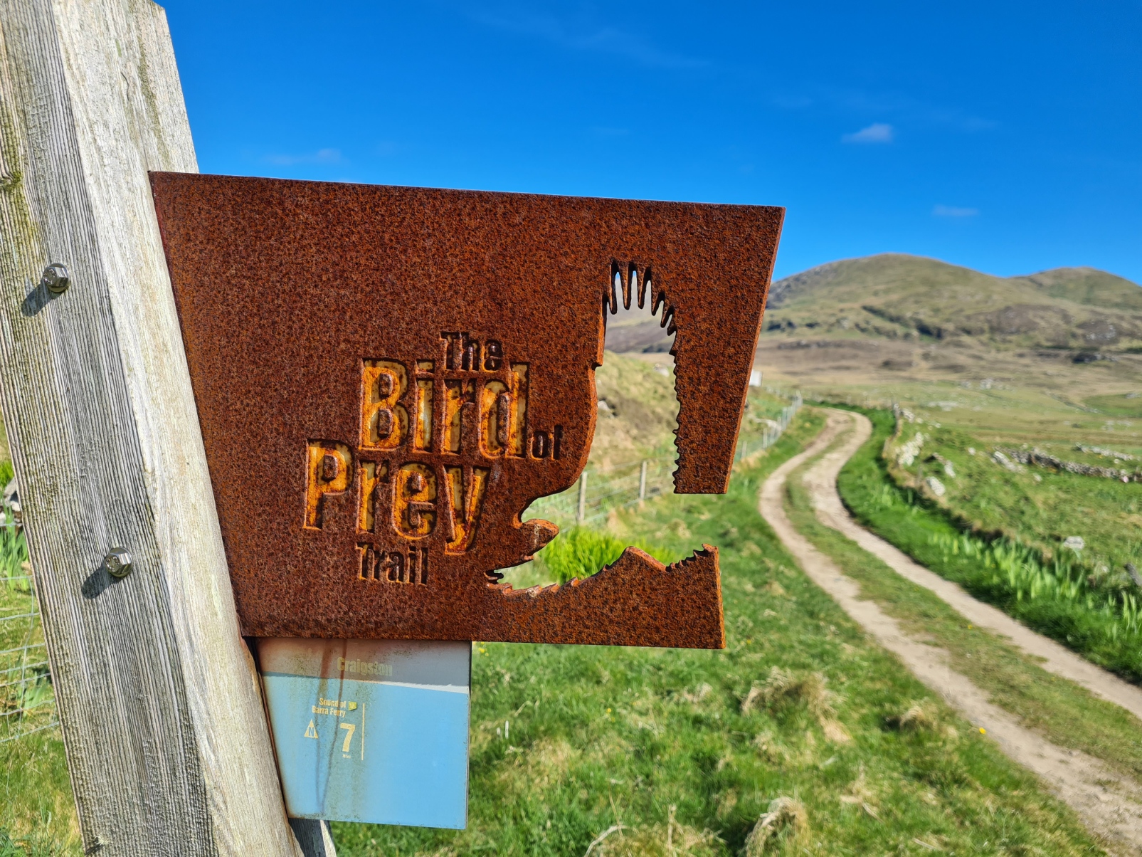
Buzzing with a sugar rush and feeling slightly queasy from the richness of the cake, it was then a short road walk before turning off on a trail that led me back up into the hills. The Heb Way then follows one of the Outer Hebrides Bird of Prey Trails for a while. I was more hopeful of seeing, or even hearing, one of the Corncrakes found in this area. This is an elusive and rare bird, though I was probably too early in the year and it unfortunately remains a species I have never seen. A good reason to return one day. The path was often indistinct, but the way was easy to follow until it again became clear. I again topped up with water, filtering a couple of litres from a small reservoir.
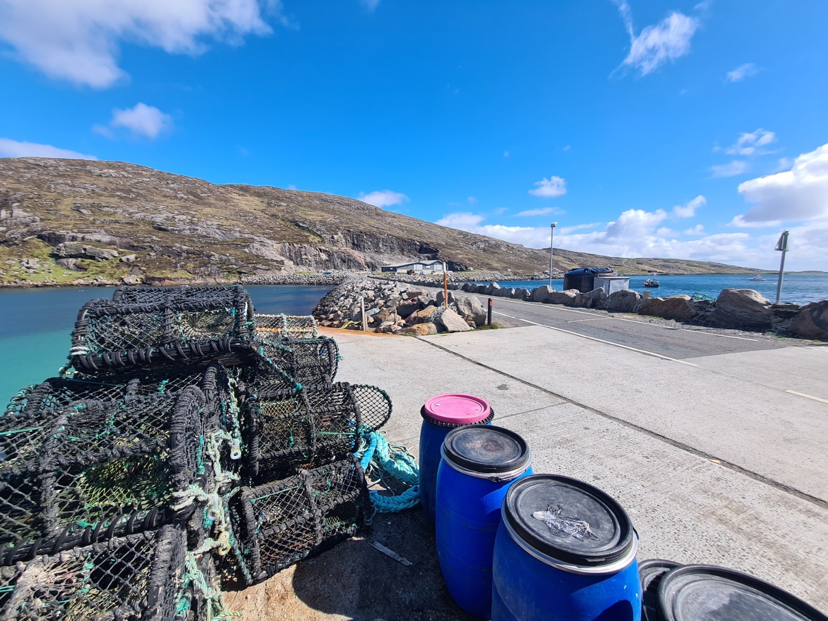
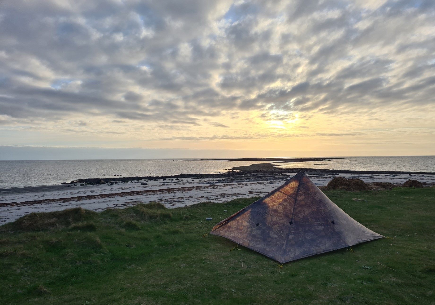
After a short section of road walking, the trail again strikes off across peat, climbing to give a view of the Barra airport from above, before dropping down for a final road approach to the ferry port. There is no choice here. A ferry has to be taken to the next island. But that would be tomorrow’s walk. I reached the Ardmhòr ferry port on the north-east corner of Barra around 19.30, in time to see the ferry leaving. This didn’t bother me in the slightest as there was plenty of wildcamping opportunity not far from the little port. After using the facilities in the unlocked ferry waiting room, I went further than I needed to, to both get out of sight or any vehicular traffic, but more importantly, find a bit of shelter from the stiff cold wind that was now blowing off the sound. Just for insurance, I put out a couple of extra guys and pegs to keep the Duomid nailed down. Also putting both walking poles up in inverted V fashion for even more rigidity.
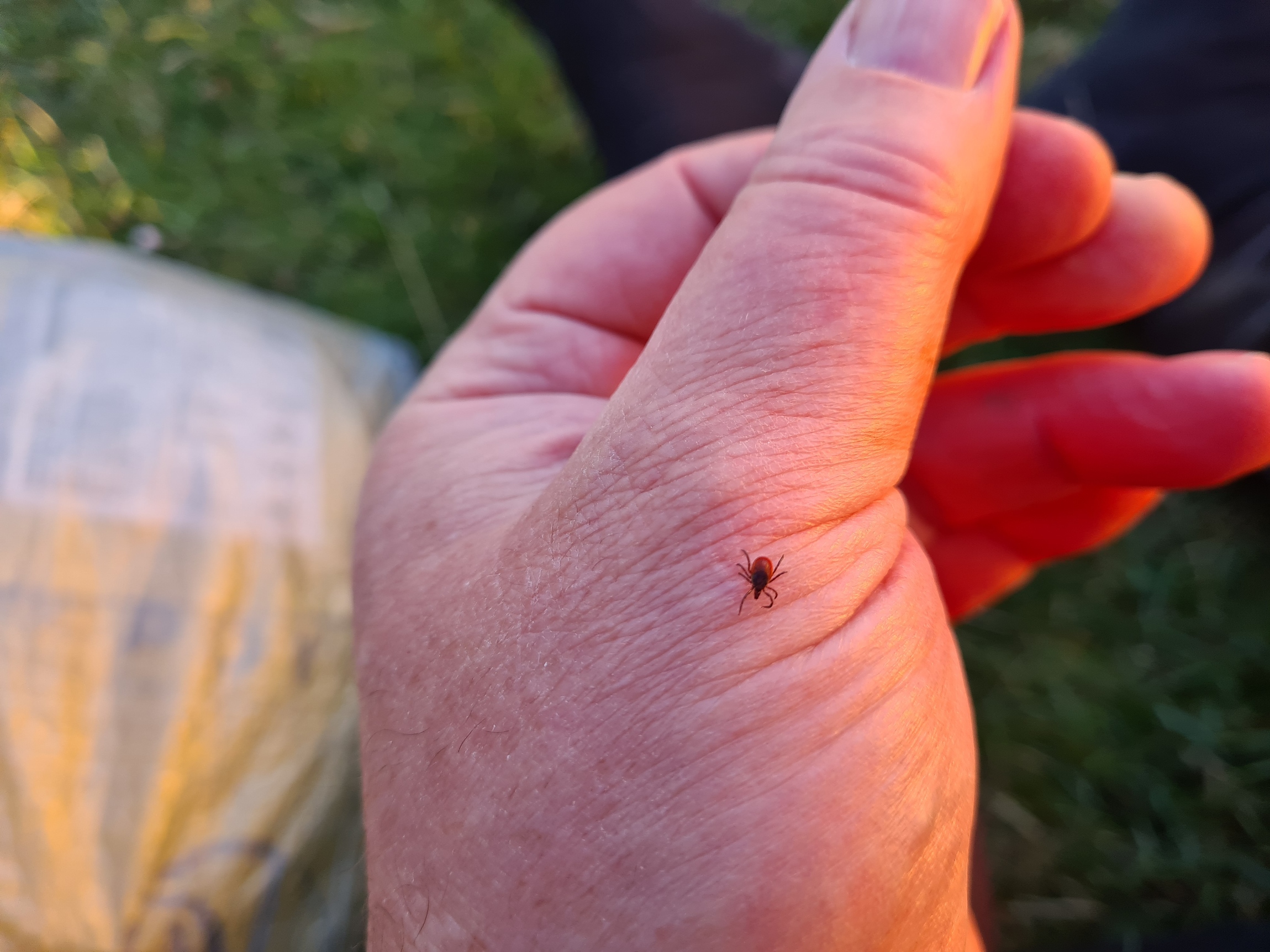
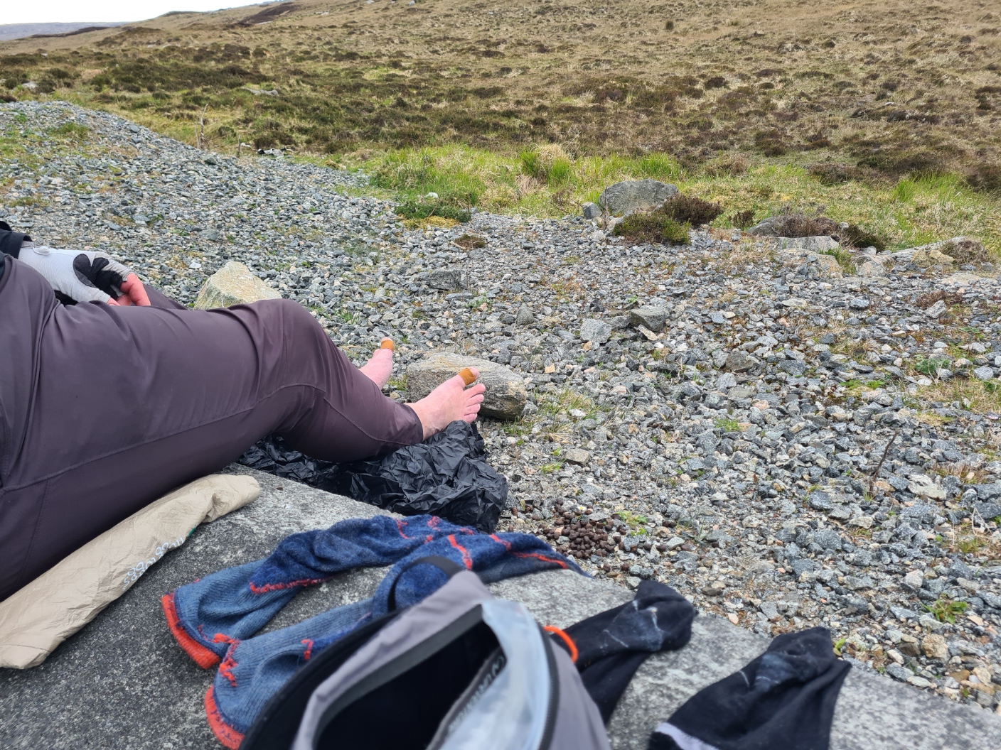
Despite getting pretty tired in the afternoon, it had been a good first day and I had enjoyed it immensely. That was until my evening tick check in the tent revealed two of the little blighters on me. I exited the tent to strip off naked in the cold wind, shaking my hiking clothes, and checking seams for any more lurking out of sight. Back in to my shelter to tent wash, balm and massage feet before changing into my sleep clothes and Alpha fleece hoody and a puffy jacket. Quilt thrown over my legs for warmth. Evening meal comprised excellent Real Turmat Reindeer Stew, two ibuprofen, a whole Ritter Orange choc bar and plenty of hot drinks. I felt good and feet were in good condition. I messaged home on the Garmin and eventually settled for the night around ten.
Day two:
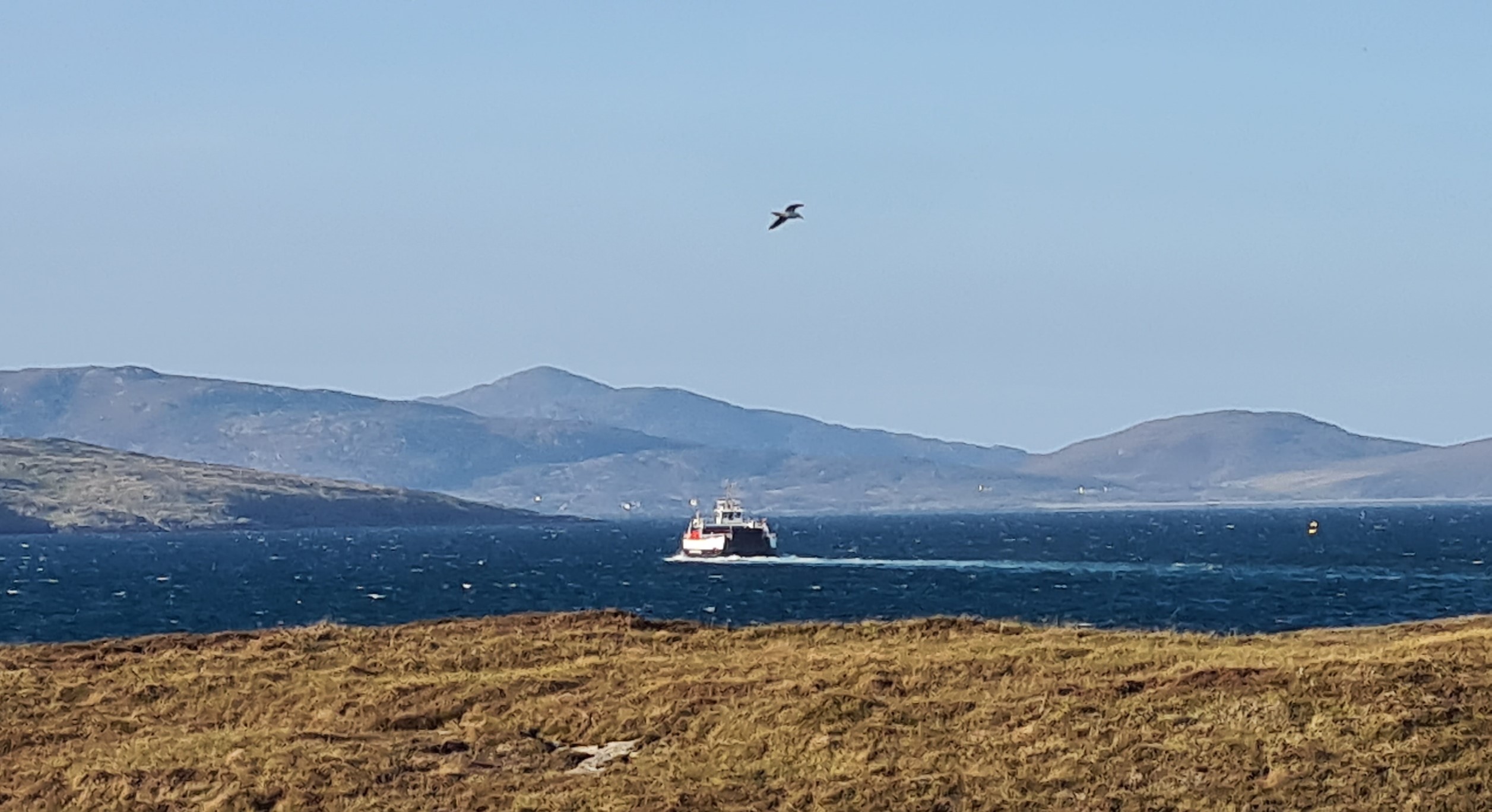
Once I had settled, I had slept well until my phone’s alarm at 6.30. Nope. Hit snooze, alarm, snooze, alarm, snooze. Just as well there was no one else around to annoy with my constantly sounding phone, I hate it when other campers let this happen. It was a beautiful still morning. Pint of tea while I slowly packed. Geese were noisily flying overhead, I found out why when I poked my head out of the tent. Four dogs bound up to me, their owner following behind. We stood and chatted, putting the world to rights. He was husband to a lady who made the cakes she sold at the little ferry terminal. He left to finish his dog walk and I resumed packing. Tent away, I then walked back to the ferry port to use its facility prior to joining others waiting to board the ferry.
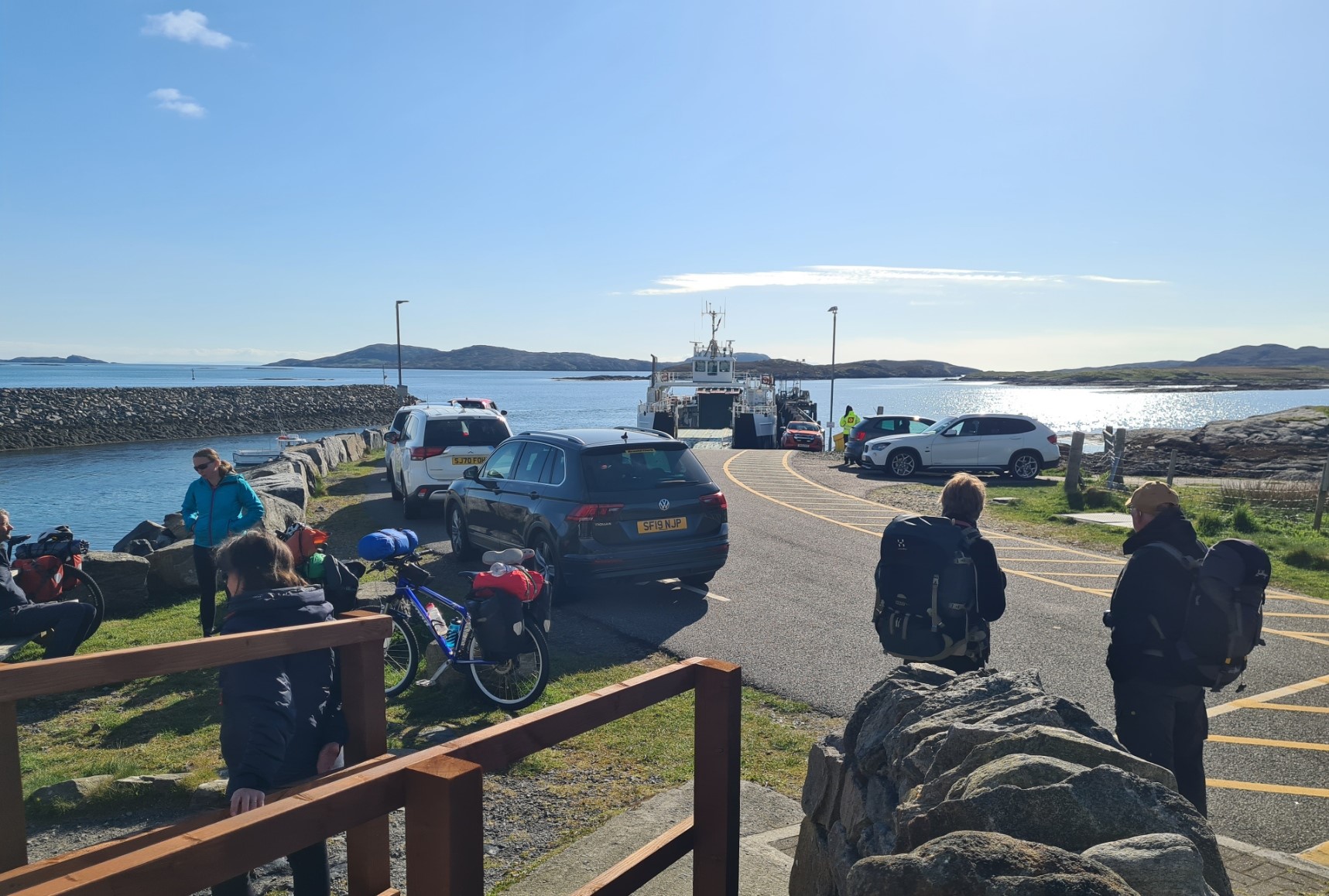
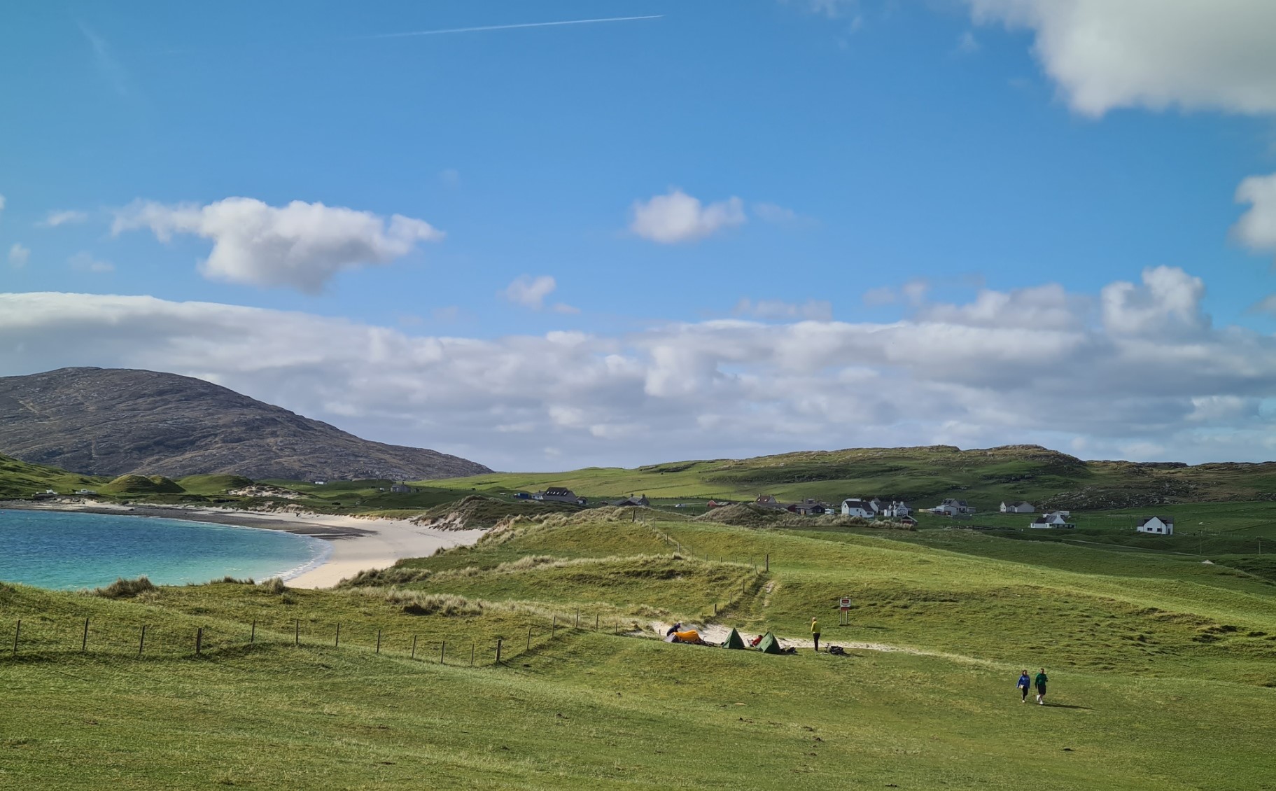
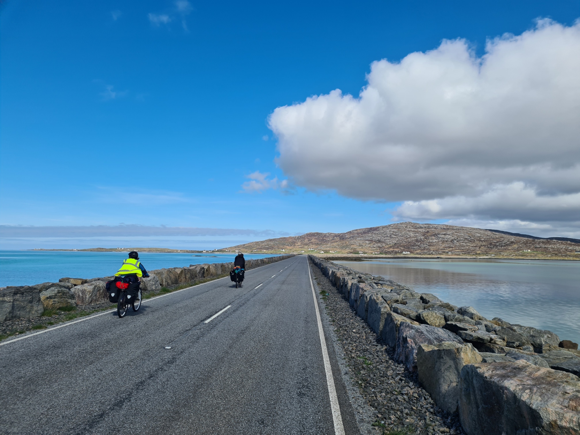
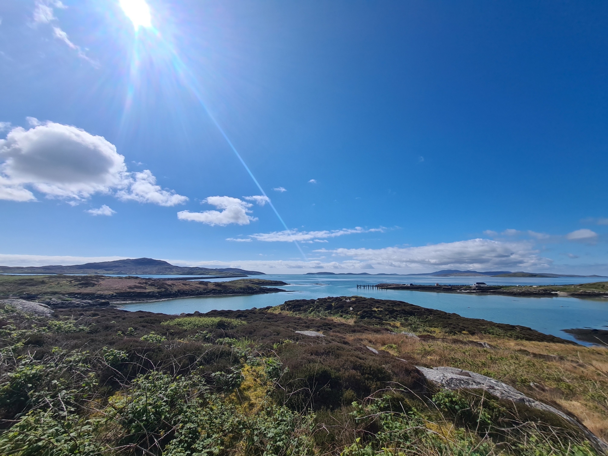
It was a mixed crowd. A couple of Heb Way backpackers, other walkers with day packs, their luggage being transported for them. Quite a few cyclists, cars, vans, motorhomes, and one large lorry. Somehow, I was the first to board the little Loch Àlainn ferry. It was a smooth crossing and the sun was pretty strong. I took the time to plaster on the sunscreen. We swung into the beautiful little ferry port on Eriskay, my third island. I found a tap round the back of the waiting room and collected a couple of litres.
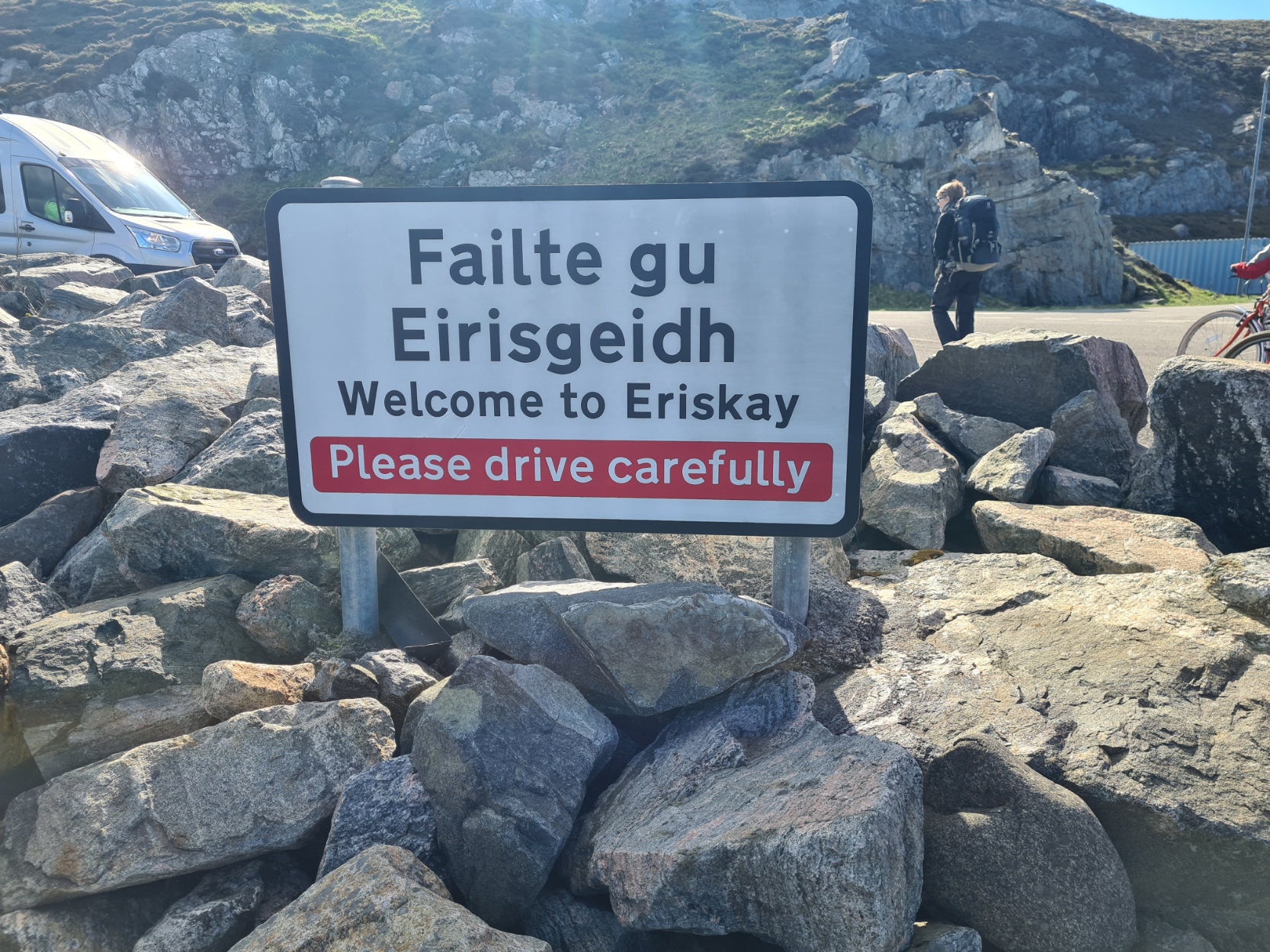
From there, it was a short road walk before dropping down to the beach.. It was pristine with lots of shells. I crossed the bay then climbed up on to the grass, rounding the headland, below the houses, Then back on to the road and through the little village. I had vainly hoped that the Am Politician pub might be offering breakfasts but, of course, it wasn’t, doors were firmly bolted shut. It was a pretty village though I was through and out the other side in just a few minutes, with no need to visit the village shop as I was carrying quite a bit of food in anticipation of finding few supplies over this trail. Before I realised it, I was at the causeway, leaving little Eriskay after just 50 minutes, sadly, without having seen any of its famous ponies.
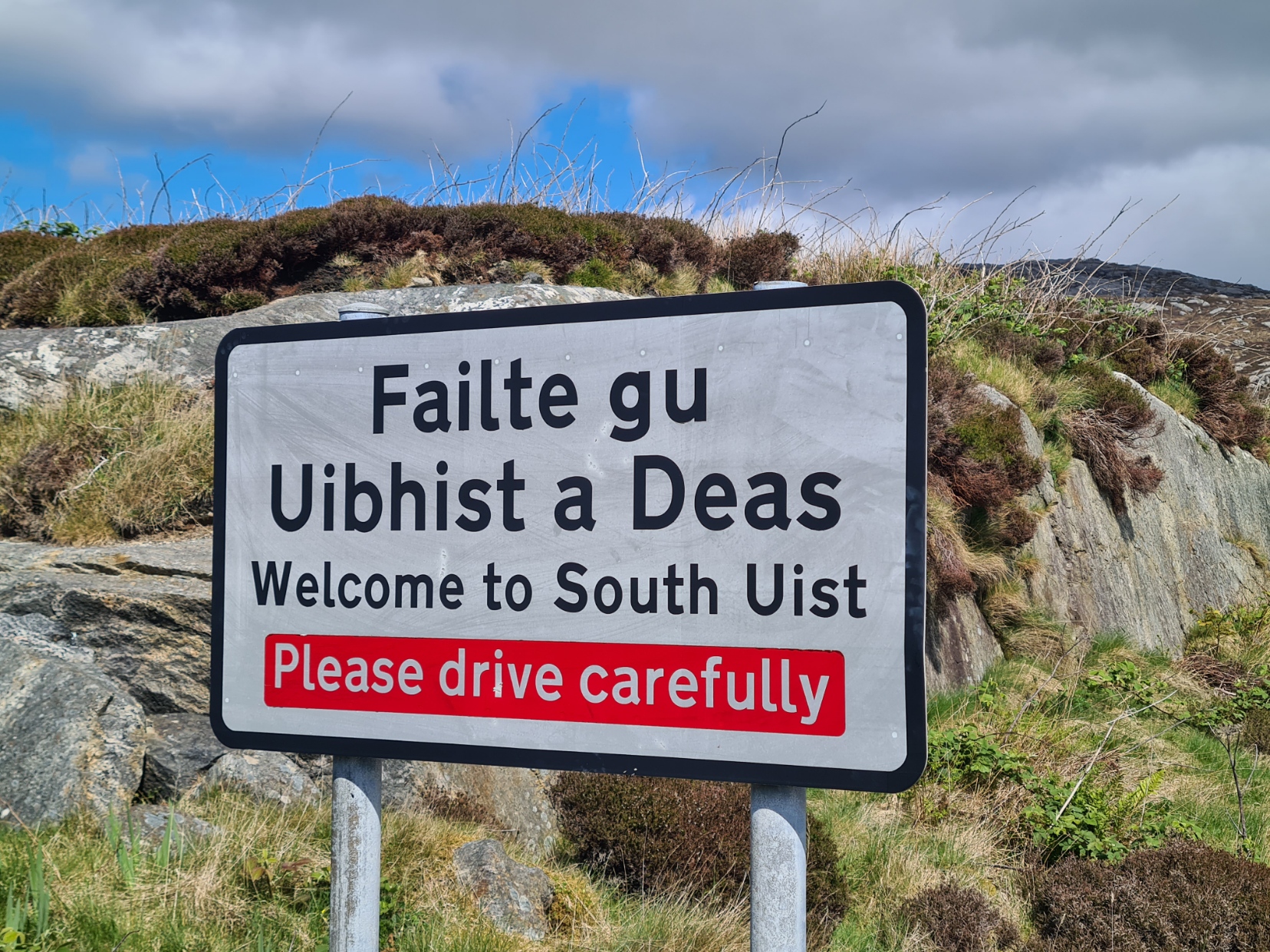
On to South Uist and continue road walking. It a fantastic day, with lovely wide and far views across the Sound to my left. A cuckoo was calling, I would hear these every day from now on. I stopped to chat to a local clearing brambles from his front garden. He told me of one intrepid adventurer who had recently completed the road version of the Heb Way by Penny Farthing.
The sun was beating down and I felt hot and exposed on the road, though every vehicle that passed gave a generous wide berth, drivers waving as they passed. I reached the handily sited Kilbride Cafe at 12.05, near enough to lunchtime to pull in.
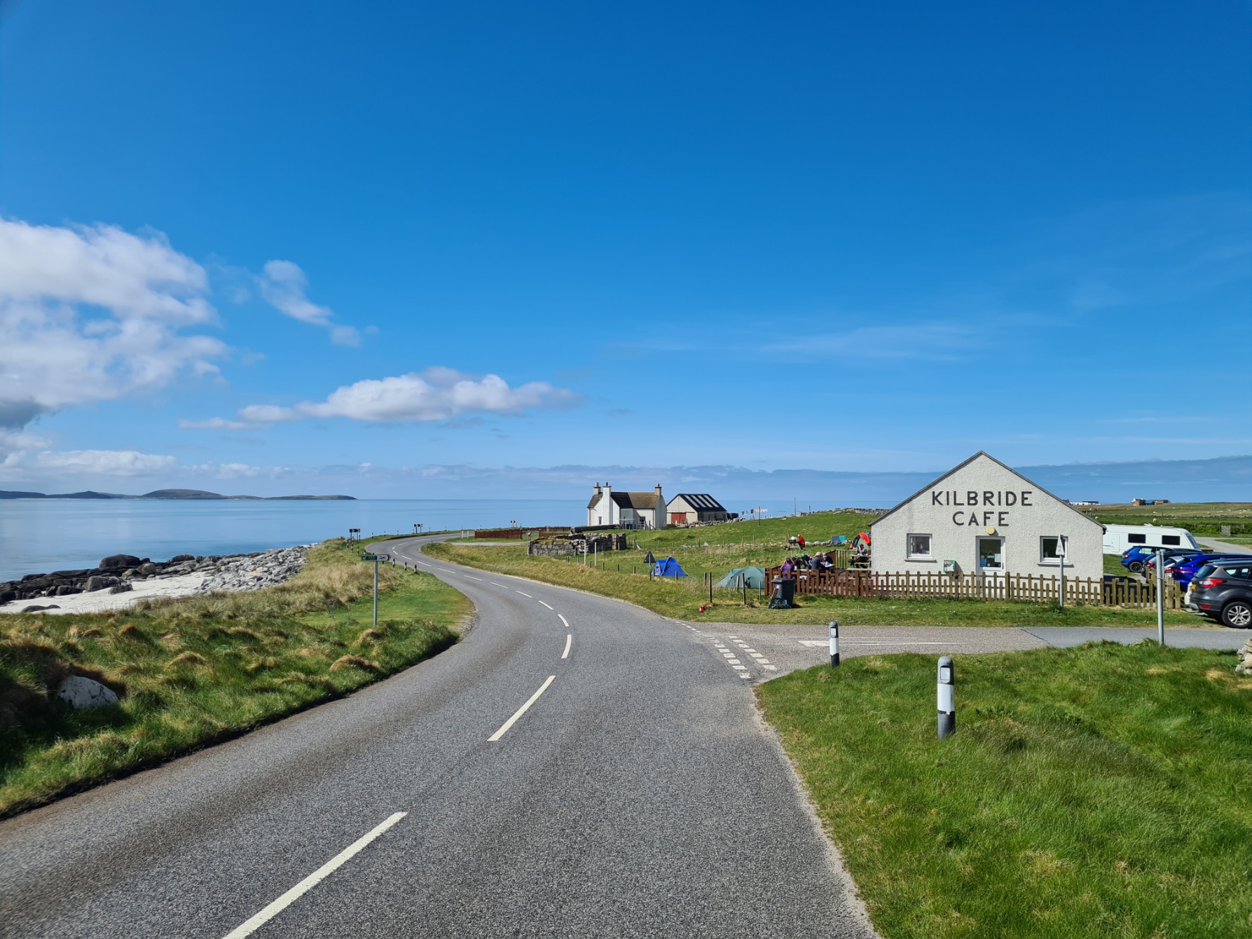
I had been hoping for a breakfast, but the server told me I was five minutes late. I pointedly looked at the clock on the wall and back to him. But, no. Rules is rules! So I ordered a breaded haddock and chips instead, with usual pot of tea. To be honest, the food was poor. Later, chatting to a couple of hikers who had eaten breakfast there, they were equally unimpressed with the quality. Regardless, it was packed with visitors, mostly families, all spending a lot of money on meals. Raking it in, it seems a shame they couldn’t make the effort with, I suppose, no need to encourage return visits from ephemeral tourists.
I watched a couple of Heb Way backpackers outside, through the window. Their packs seemed twice the size of mine and I wondered how they got them on. They sat down to pull straps over their shoulders, then each helping his companion to stand. There are many ways to tackle a trail, some seem a good deal more onerous than others. Each to their own I suppose.
When ordering my lunch, I had also requested a take-away ham, cheese and tomato sandwich for tomorrows breakfast or lunch. I pushed it into the stretchy mesh pocket of my pack, and set off in the wake of the two other hikers. More road walking until I reached Polachar where the trail turns to hug the coast, a lovely walk along what is called the Machair Way.
I caught up with the backpackers while they were stretched out on the grass beside a walled cemetery, now isolated out on the machair. Mark and Brian told me they had made the crossing to Vatersay the previous night and enjoyed a good evening meal and beers in Am Politician. Brian had only recently lost his wife to cancer and she was never far from his conversation. His friend Mark was the more experienced backpacker and was looking after him. We set off together but I am a slow and steady walker and despite 23kg packs, the two of them were a notch above my comfort speed and slowly pulled ahead.
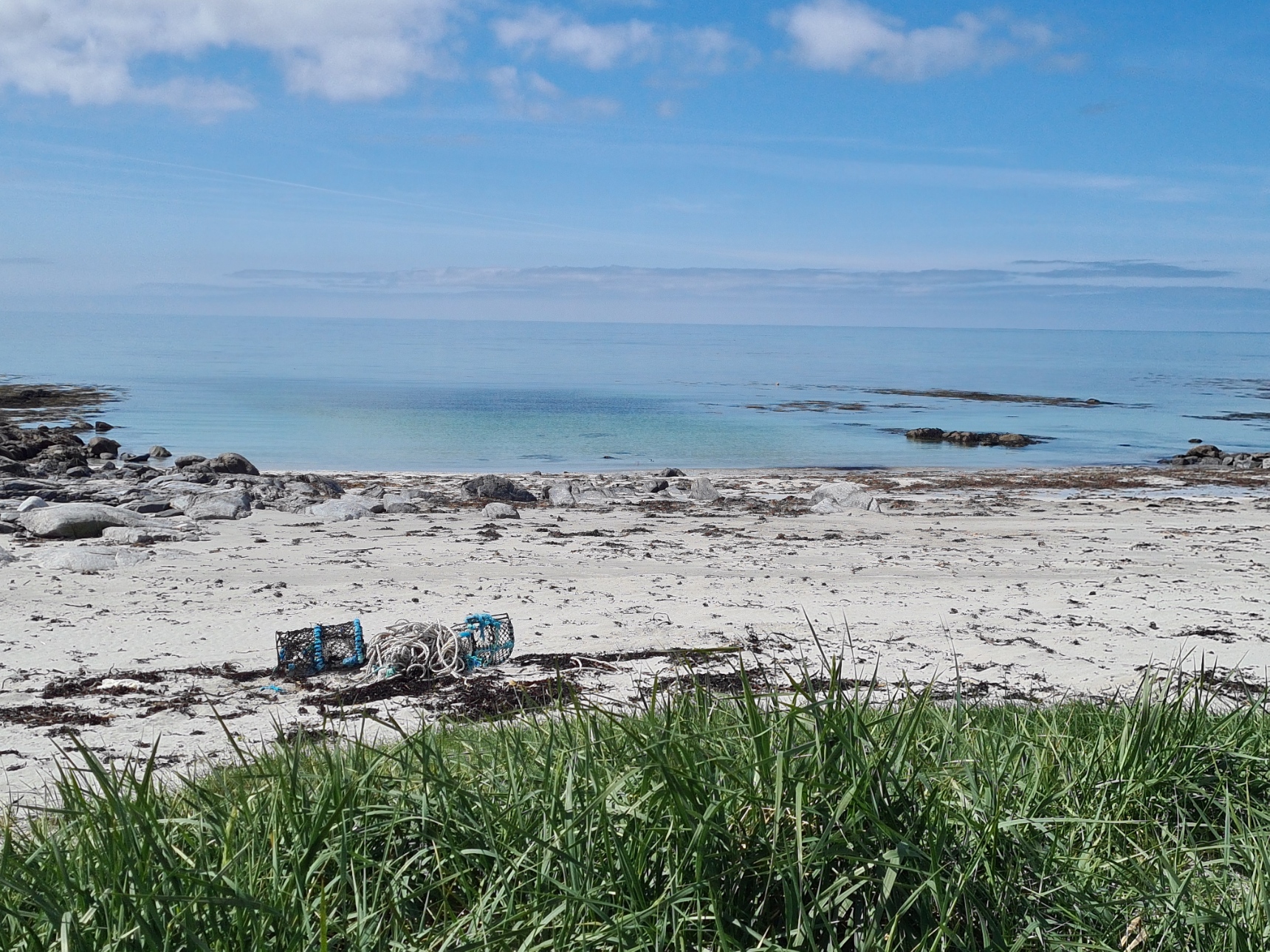
I left them to continue their undulating path through soft sand up on the dunes, while I moved down to the easier walking along the firmer stretches of beach. Many people describe this as pristine beach, but it isn’t. The blindingly white sands were littered with what has washed in. Beside the usual plastic bottles, there were floats, buoys, lobster pots and fishing nets.
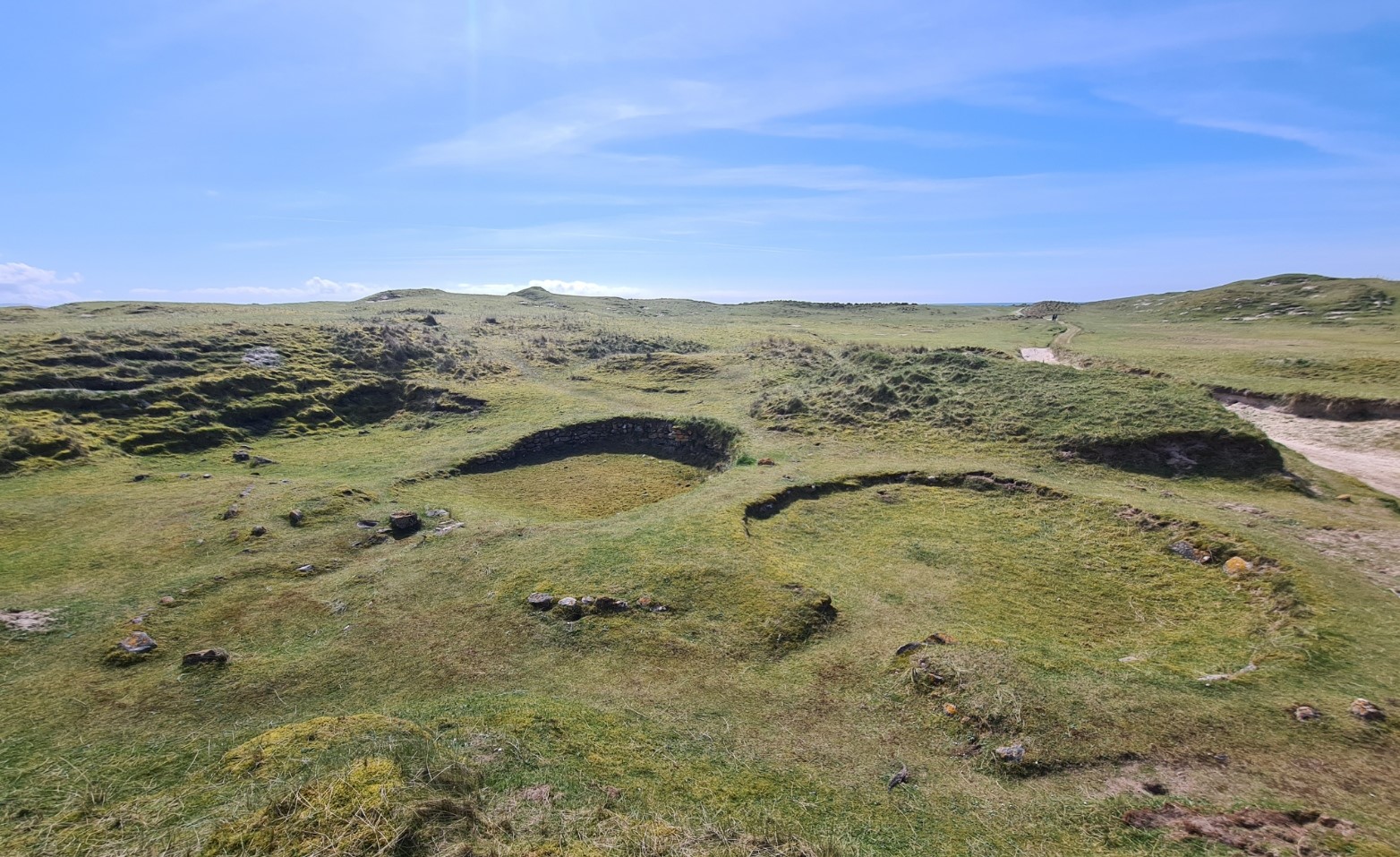
After a mile and a half the Machair Way moves inland slightly before reaching the North Boisdale burial ground but I was more interested in what is found further on down the coast. I headed back through the dunes toward the beach to mooch about the fascinating remains of the round houses at Cladh Hallan. The machair was inhabited during the late Bronze Age and the remains of roundhouses rediscovered as sands shifted over time. The finds include the only prehistoric mummified bodies known from Britain. The settlement is remarkable and quite amazing work has been done working out a timeline of their occupation. Mystery remains however, the male mummy comprised the head and jaw of two different men who died around 1400 BCE, while the torso is of a man who died around 1500 BCE. Three large ring depressions with stone walls and a nearby smokehouse survive. The largest of the three was likely inhabited for over nine hundred years.
I continued my walk along the beach. I could see Mark and Brian toiling through the soft sands above and inland of me and steadily left them behind. I had the long long beach to myself and thankfully it was largely devoid of the rubbish seen earlier. There is a golf course just inland here and I was aware that many on this section halt around here, making use of clubhouse facilities and access to water. However I felt I had a few miles in me yet, so continued. Though I knew I was going to miss the ruins of Flora MacDonald’s birthplace, a few hundred metres inland.
Eventually, at Trolaisgeir, I had to move inland, eventually meeting a track that took me to Ormacleit. I passed the ‘castle’ ruins nestled close to farm buildings. The sandy track was reinforced by stones for farm tractors and I switched around as much as I could, trying to follow the softer grassier parts as my feet were now a little tender. It was probably time to think about finding somewhere to pitch.
The trail passed through the farmlands, many strips ploughed for spuds. Lapwings were in profusion and they wheeled about me, peewhitt-ing their disapproval. I stopped to briefly chat to one family group of locals out ploughing ‘their’ sandy stretch of croft land. Four generations were assisting in the work of putting in four varieties of spud. However I didn’t stop for more than a few minutes. I was now getting weary, in addition, the sun was sinking in front and blinding me. However I was now unsure where and when to stop, I was into the farmland proper and there were cows around. I don’t like to camp near cattle as they like to rub up against things, including tents. It was also very flat, very exposed and not particularly scenic. I walked on.
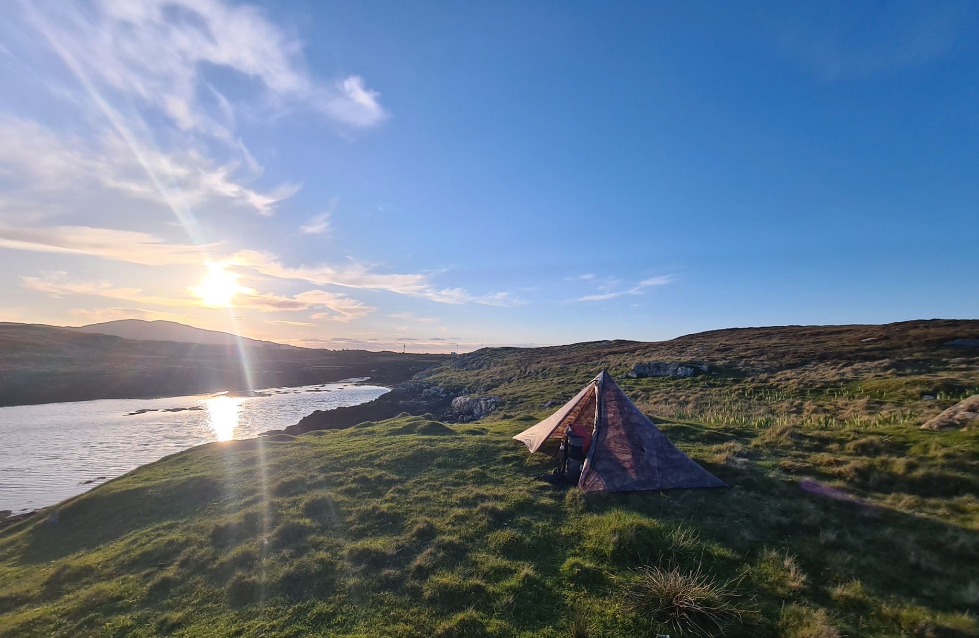
Eventually back to the coast I walked back up onto the beachside dunes and found a decent flat grassy spot for a night’s pitch. Pitching the Duomid I found a tick on the underside of the inner. It had obviously hitched a ride from last night’s halt. It was past eight and I was a bit dehydrated. First a hot OXO, quickly followed by a pint of tea. It was the most cursory of body wipes, however the feet got a good clean, massage and balm while the evening meal rehydrated. Sadly, after last night’s excellent Real Turmat, tonight I had a barely acceptable Firepot Chicken Keema Curry. Followed by an appreciated whole bar of Ritter Salted Caramel chocolate, all 524kcal of it!
The sun sank into the sea and the temperature plummeted. Despite being very tired I was buzzing with caffeine and sugar, so no sleep for a while. I sat and watched the sea, listening to the waves, Oystercatchers and Curlews. It had been a good day and I felt very content.
Day three:
I was woken by the piping of the Oystercatchers going daft at 04.30. I poked my head out of the fly to find it was already light, but cool and overcast. I have no idea what had set the waders off and went back to sleep. After a fairly long second day on trail, despite the alarm call earlier, it is unsurprising that I had slept well, though the mesh wall of the Solomid inner flapped against my face in the wind which died to a slight breeze, ensuring no condensation on the fly. Again awake at 6.30, I finally rose an hour later. I packed while drinking a pint of tea and was away an hour later.
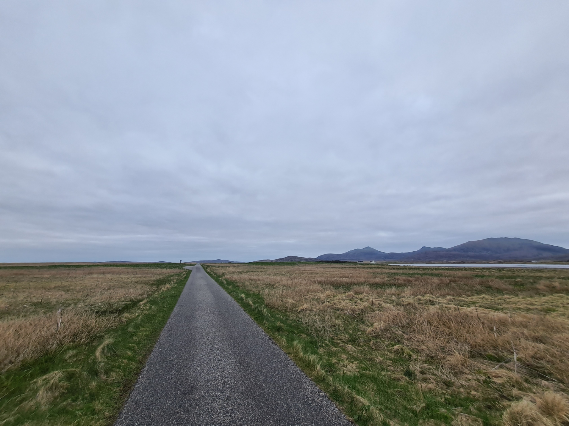
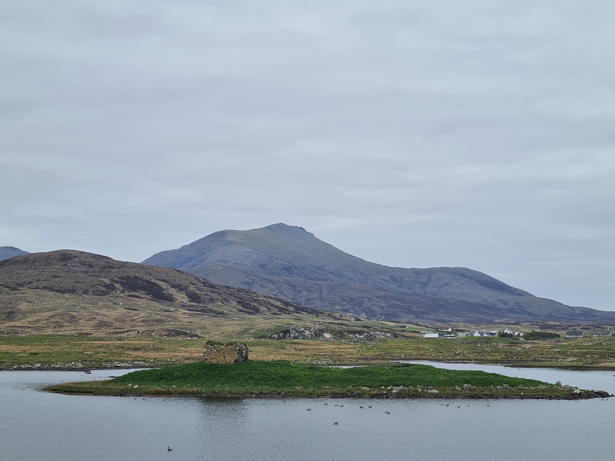
Back on to the road as per the official ‘Offcomers’ guidebook, but I later found that the Cicerone guidebook suggests staying with the beach. Again following the machair along the coast, through farmlands, past little Loch an Eilan, with evocative ruins of 15th century Castle Bheagram on a tiny island. It was here that I realised I had walked straight past the turn for the hostel at Howmore, where I had planned on visiting for a couple of litres of water, as I suspected most water I would be passing today would be saline. Never mind, onward. However, in hindsight, this was a mistake, as I only had half a litre of water. I was now heading inland, mountains in front. This was a lovely piece of wilder country and despite (undrinkable) water all around, wasn’t too bad underfoot, with the occasional boardwalk over the wettest parts.
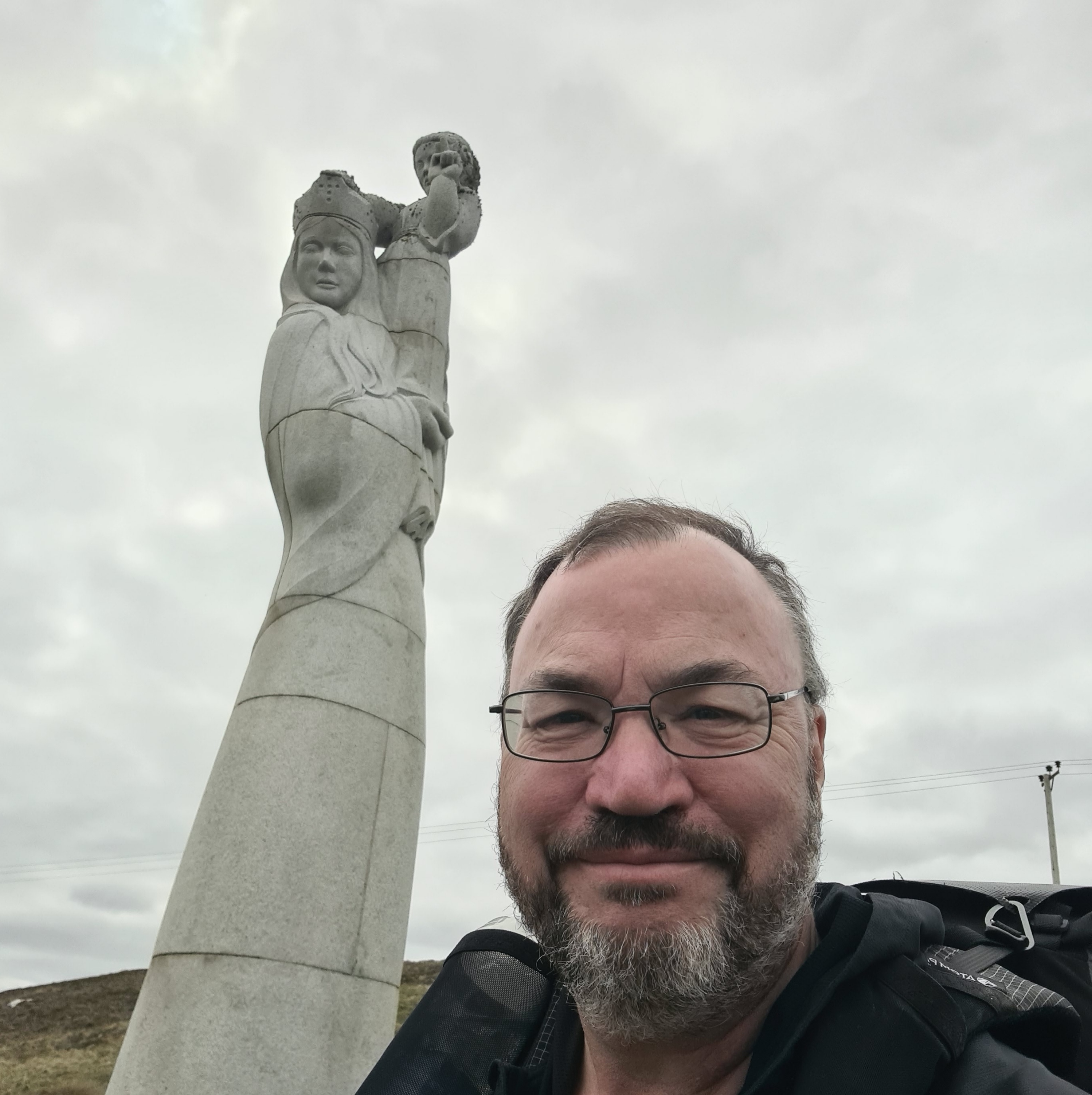
Unfortunately, this lovely bit of trail didn’t last, I reached the traffic less B890 that headed back toward the coast. But nope, another dog-leg as the trail again swung away from the coast. A right turn on to the A865 for a while. Various sneaky beaky radars and listening and the like stations and paraphernalia are perched up on the hills watching out for who knows what. I again left the road-walking to climb up to view the 9m tall statue of Madonna and Child that gazes down over the myriad assortment of pools and lochs. The statue was carved from granite by local sculpture Hew Lorimer and paid for by the people of South Uist.
From the statue it was a short climb to another minor road on which I turned left, though I could see military vehicles up to my right. I had been hearing the occasional crumpf from afar, and had presumed it was quarry blasting or something. It was days later that I found out that in a hush hush test, the Royal Navy’s HMS Dragon had gunned down a specially-modified Sea Viper supersonic missile off the coast.
It was only a short walk down the hill before again turning off to the peat. I was immediately thrilled by the sight of a magnificent quartering Hen Harrier. At first, it was an easy winding trail, good underfoot, it steadily deteriorated until it briefly became a bog fest.
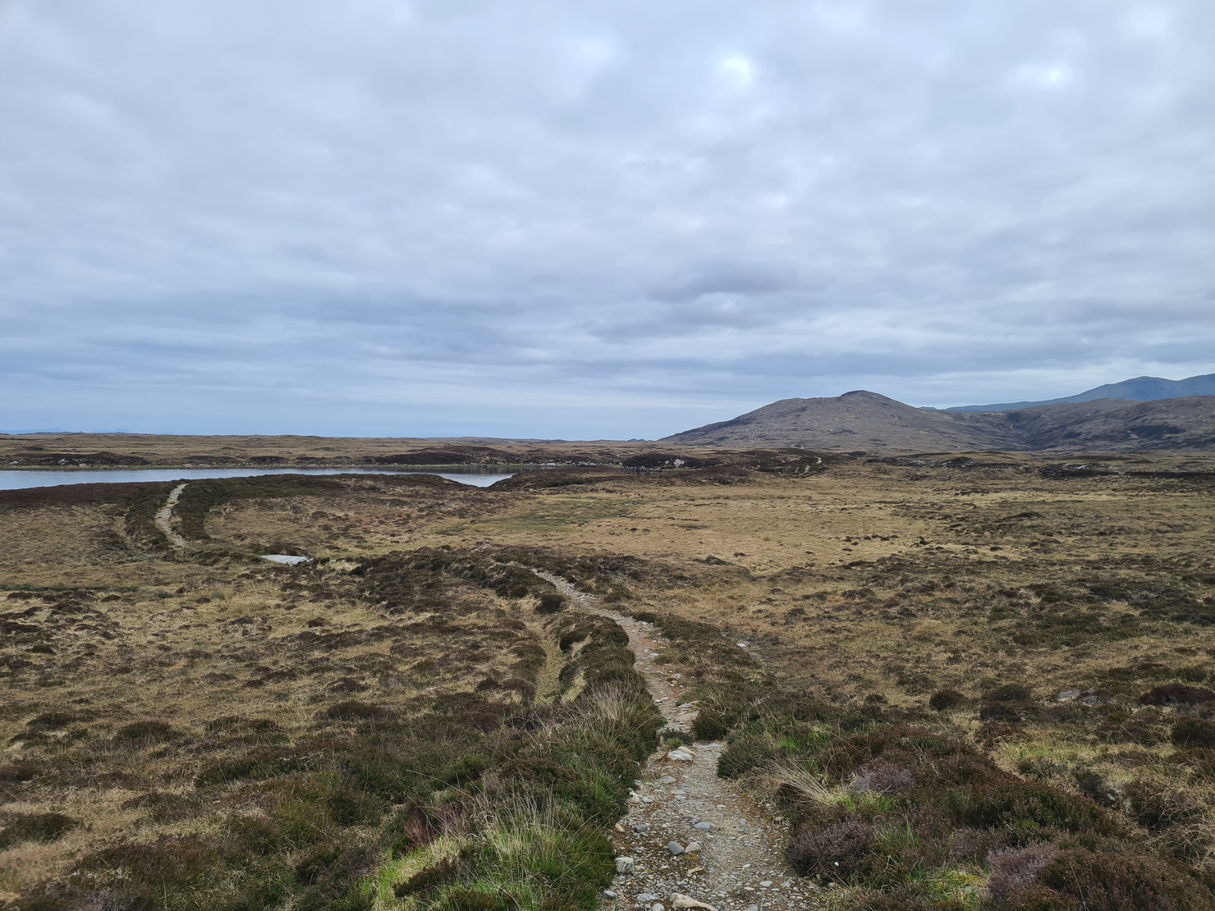
I was astonished to meet a couple of cyclists, with road bikes and full bikepacking set-up struggling through a wetter part of the trail. We chatted briefly and they asked if the trail improved, crestfallen to hear no. I reassured them it wasn’t for long and they continued. Just a few hundred metres further on I came across two Kindles, that had very obviously been shaken off the second bike. I turned, shouted and waved my arms, but the two were gone. Not really knowing what to do I retrieved them from the heather at the side of the path and leant them, in inverted V, in the centre of the path, in the hope that the cyclists might realise when they reached the road and come back. A quarter mile further on I then met an older couple out for a day walk, explained the Kindles and asked them to carry them to where the trail had left the road, again, in the hope that the cyclists would return at some point and find them. Later that evening I actually met one of the walkers at the campsite. They had carried the Kindles to the road and saw two cyclists in the distance, one of them blew on a whistle and they came back, reunited with their possessions. Both relieved and very thankful.
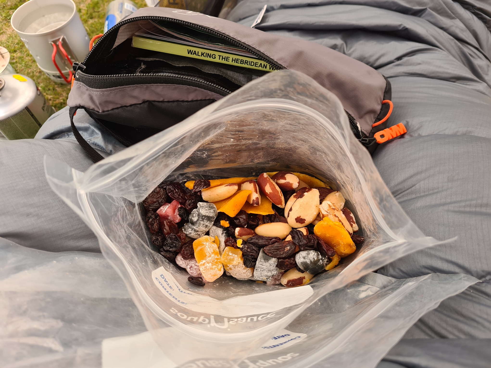
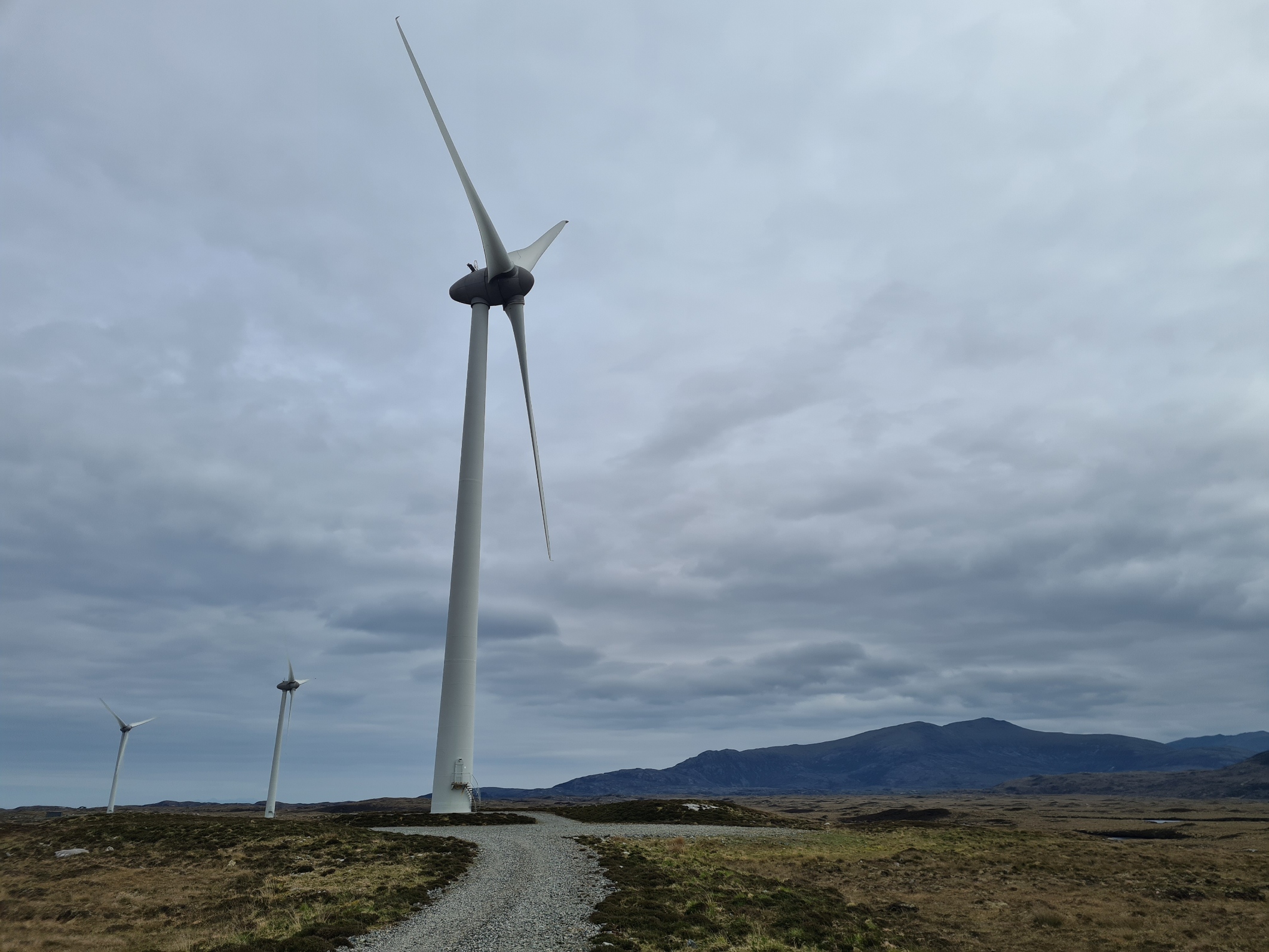
Fortunately the poor state of trail didn’t last long and as I approached the Lochcarnan Community Windfarm, it again began to improve. But the feet were now wet, it was midday’ish and I thought it prudent to halt at the service road to take shoes and socks off and let feet dry out a bit, I applied some Sudocrem before slipping socks and shoes back on. This was my lunch halt and I ate yesterdays take-away sandwich. I was still hungry, so also ate a Snickers and bar. But I was almost out of water. That was a bad decision earlier.
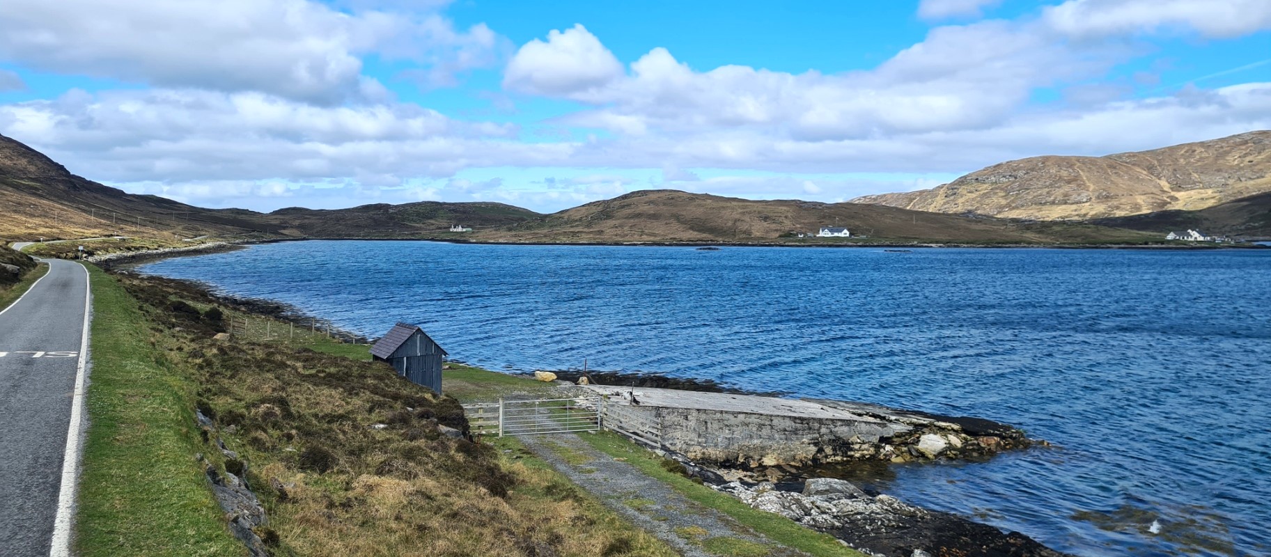
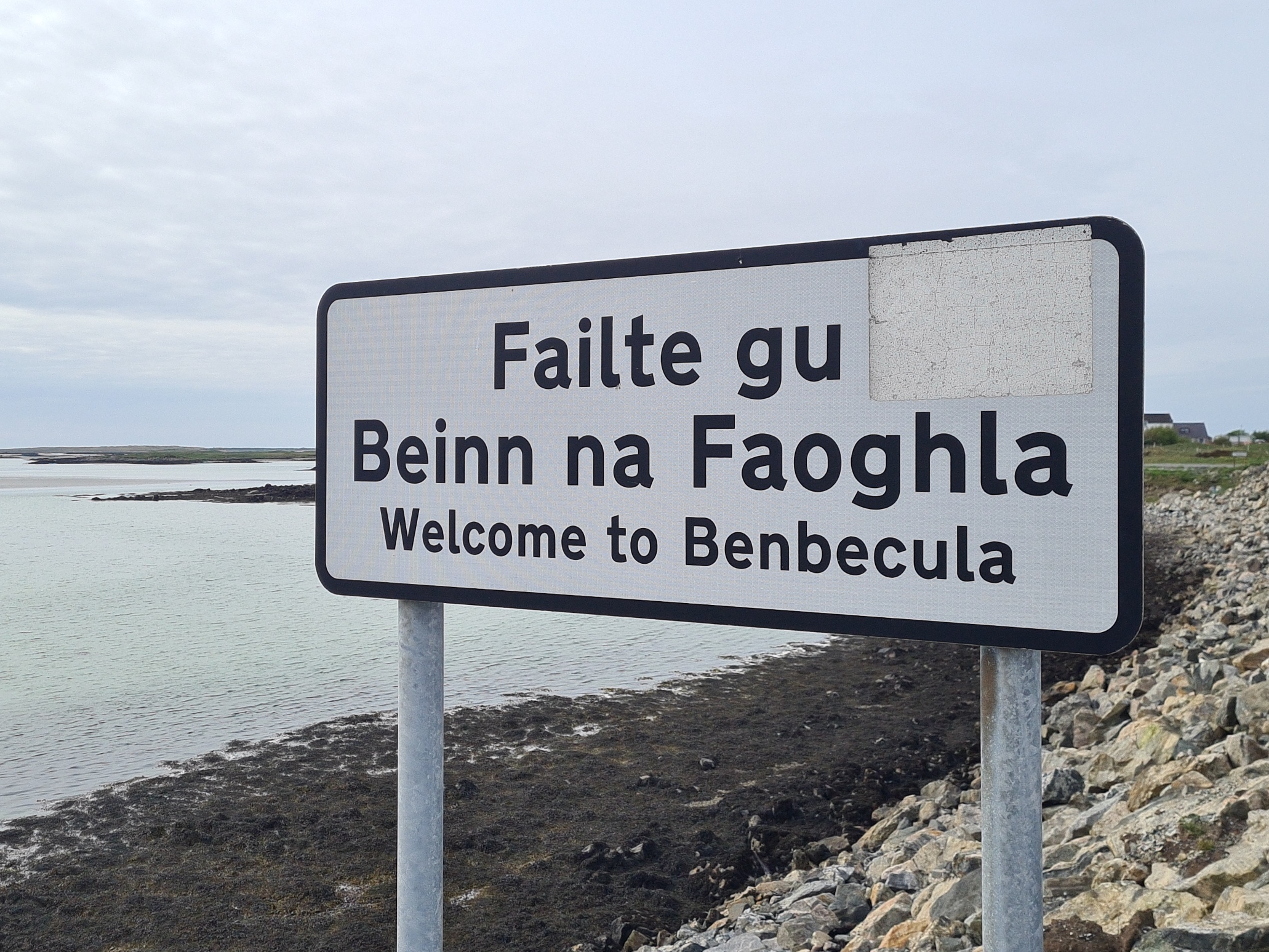
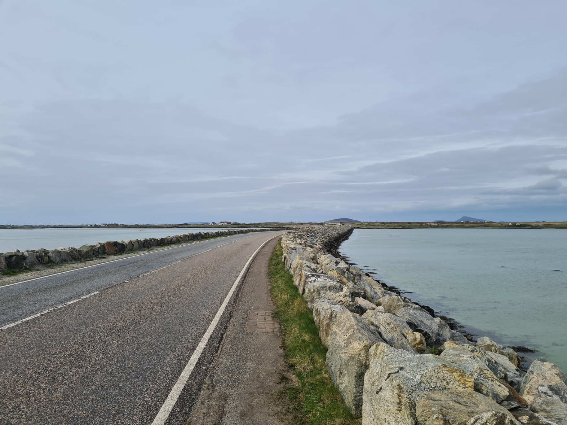
I set off down the crushed stone service road. It was hell! This was really punishing on the feet and it wasn’t just me. Days later, talking to other hikers, this section of the trail was frequently mentioned by them. Fortunately, everything comes to an end, and I eventually turned onto a decent (!) bit of road. This took me through the widely scattered crofters homes to the main road that led me toward the causeway off the island. Now heading to Benbecula, my fifth island. At the end of the causeway was a large co-op and I popped in to pick up some snacks and a pastie for tomorrows lunch. Also a couple of bottles, drunk immediately. Not far left for today.
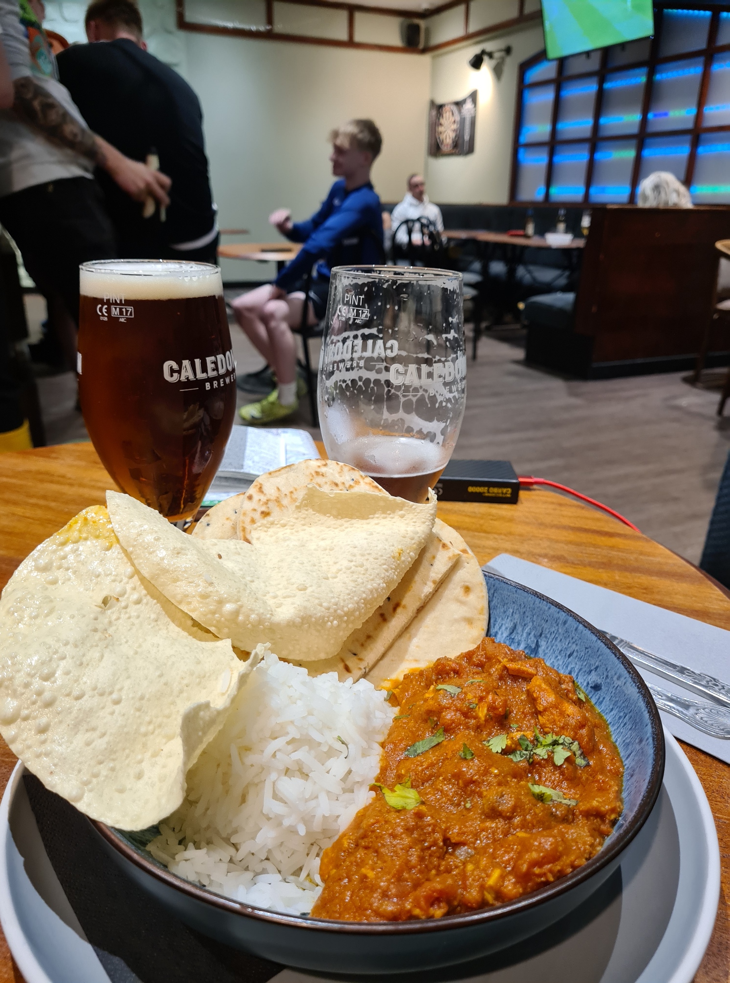
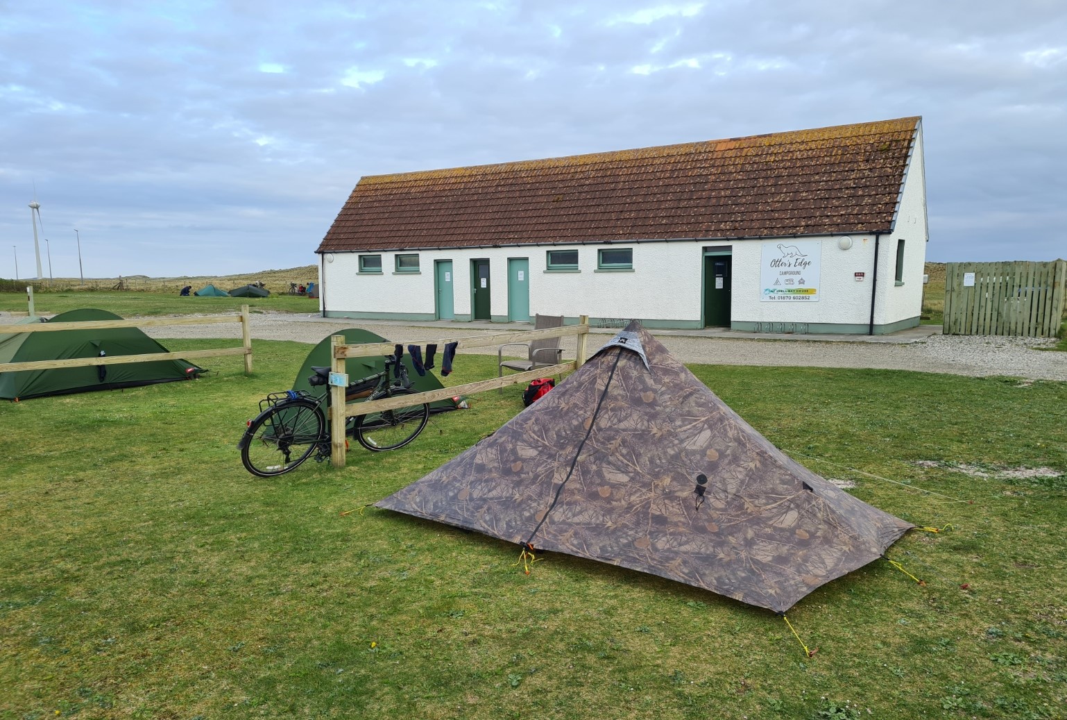
Less than an hour after walking on to Benbecula I reached tonight’s halt, at the perfectly well-appointed Otter’s Edge campsite. Not only was this popular with motor homes and the like, but being beside the road, many of those cycling the Heb Way stop here. Site manager Michelle met me as I walked on to site, took my £14 and showed me an OK pitch for the night, not too far from the combined w/c and campers kitchen building, that also provided a bit of shelter from the wind. Tent up, after showering (very much appreciated) I washed out both inner and outer socks. While I had plenty of food, I rarely turn down the chance of a ‘proper’ meal if I can get it. However when I rang the large Dark Island Hotel, back down the road a bit, and asked to eat in their restaurant, I was informed they were not accepting any more walk-ins. However Michelle had told me that if I walked down the side of the hotel to the rear, there was a locals bar tucked away where I could order a take away pizza from the kitchen. On arriving, I ordered a pint and a menu, looking around I saw a couple eating at a table and asked if I could eat there. “Of course“, result!
It was a basic place, but despite being on tap rather than draught, the Coast to Coast Pale Ale was good. I might, just might, have had a second (or fourth) pint, accompanied by vegetable samosa starter, and a (very) hot chicken Balti, with rice, nan and poppadom’s. It was a friendly place with polite and convivial young locals coming and going, many excitedly watching the Barcelona-Inter Milan match on the TV. Between the action, I chatted to the chap seated beside me, who wasn’t actually a local. Nor should he have been there either. Instead, he was supposed to be on a seven-month census of breeding seabirds on St. Kilda. However, stepping off the helicopter on arrival on the island, he had immediately torn his cartilage, and was now strapped and booted up, marooned on Benbecula and reluctantly destined for a long recovery period. There was a great deal of banter in the bar and I enjoyed my time here immensely and it was with some reluctance that I left to return to the tent. I felt good, feet again felt good, the trail was going well. I was looking forward to tomorrow.

Long time reader, first time commenter here. A fascinating read – I walked a similar route back in the 90s, although north to south, starting in Stornoway and ending at Lochboisdale. A beautiful part of the country. Like you seem to have been, I was very lucky with the weather and made do without putting up my tent most nights.
LikeLiked by 1 person
Thanks for commenting. Many years ago, when he was still alive, my Uncle would frequently travel to the Outer Hebrides with his motorhome, spending many weeks travelling the islands. I never really understood what it was that attracted him to make the long and fairly difficult journey and keep returning. However I now ‘get it’. There is a peacefulness here, an other-worldness, something intangible. A remarkable place.
LikeLike
Very inspirational blog post! What is your favourite destination?
LikeLike