Three Points of the Compass winds up his Hebridean adventure. A last couple of days would throw midges, bogs and yet more road walking my way
Day ten:
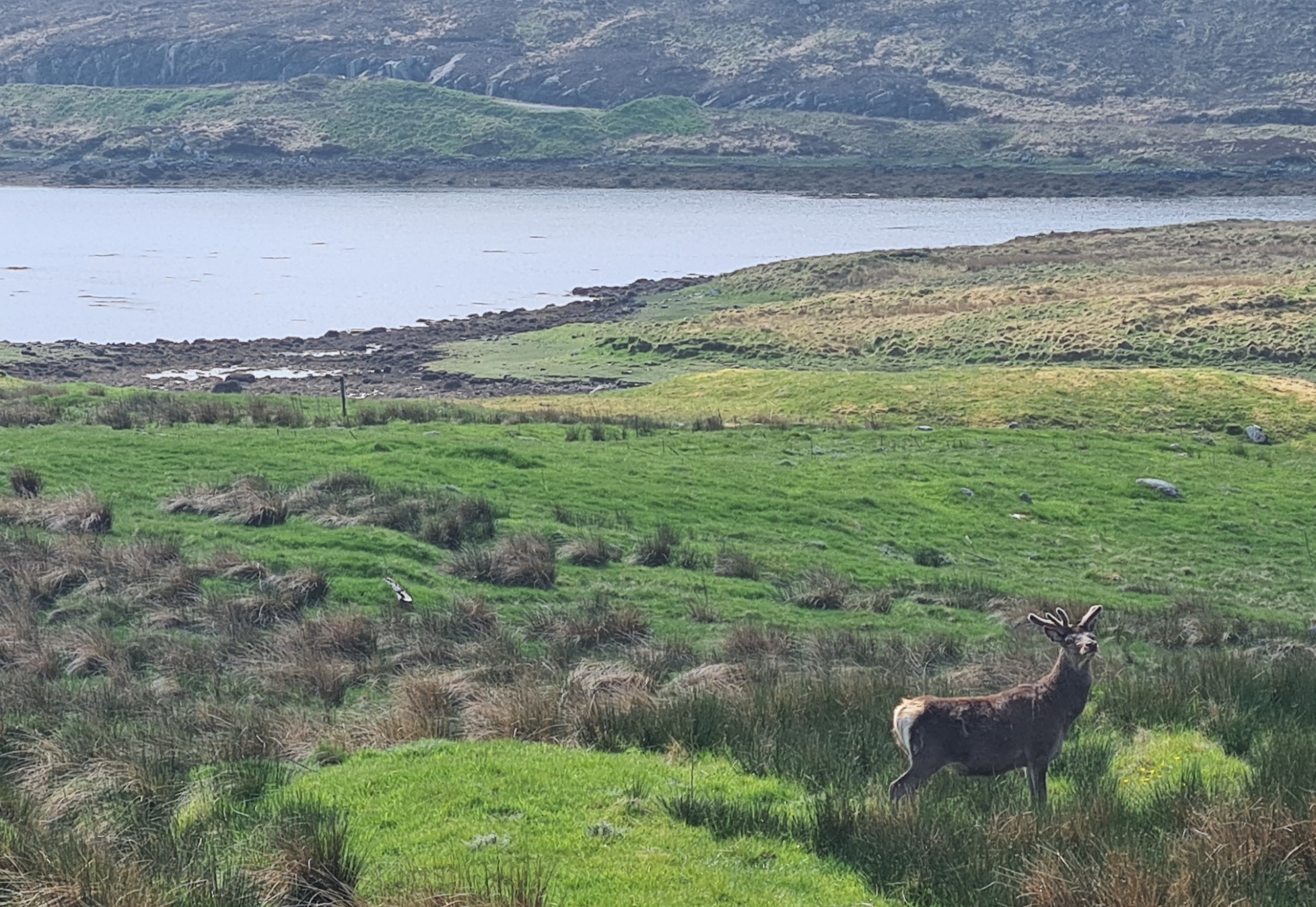
As has been the case on most nights on this trail, I slept well. The white noise from the little nearby beck no doubt assisting in that. I did wake a few times when deer began to bark nearby overnight, but easily drifted off again. There wasn’t a breathe of wind and there were a lot of midges. The most I have seen on this trail. I sat inside the Duomid and poked an arm out of the part unzipped mesh to make my morning brew. Drunk while I packed up with mesh closed. The low flat profile of my GSI Sipper Mug, with a close fitting lid, aids greatly in preventing a hot brew from tipping over. I found a lone tick on the bright yellow pad while packing but think that came in with my skiddies, that I had hung outside to air.
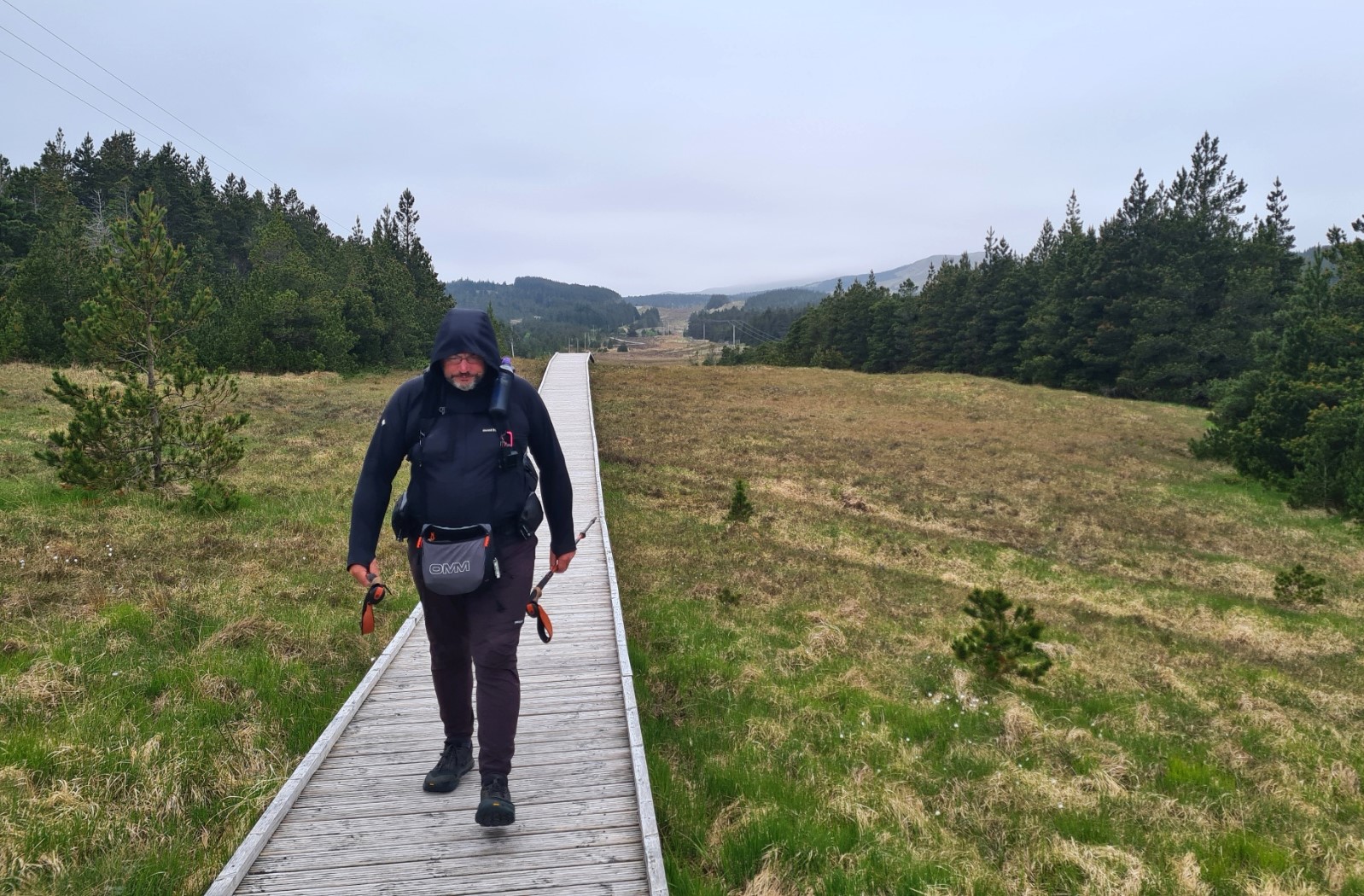
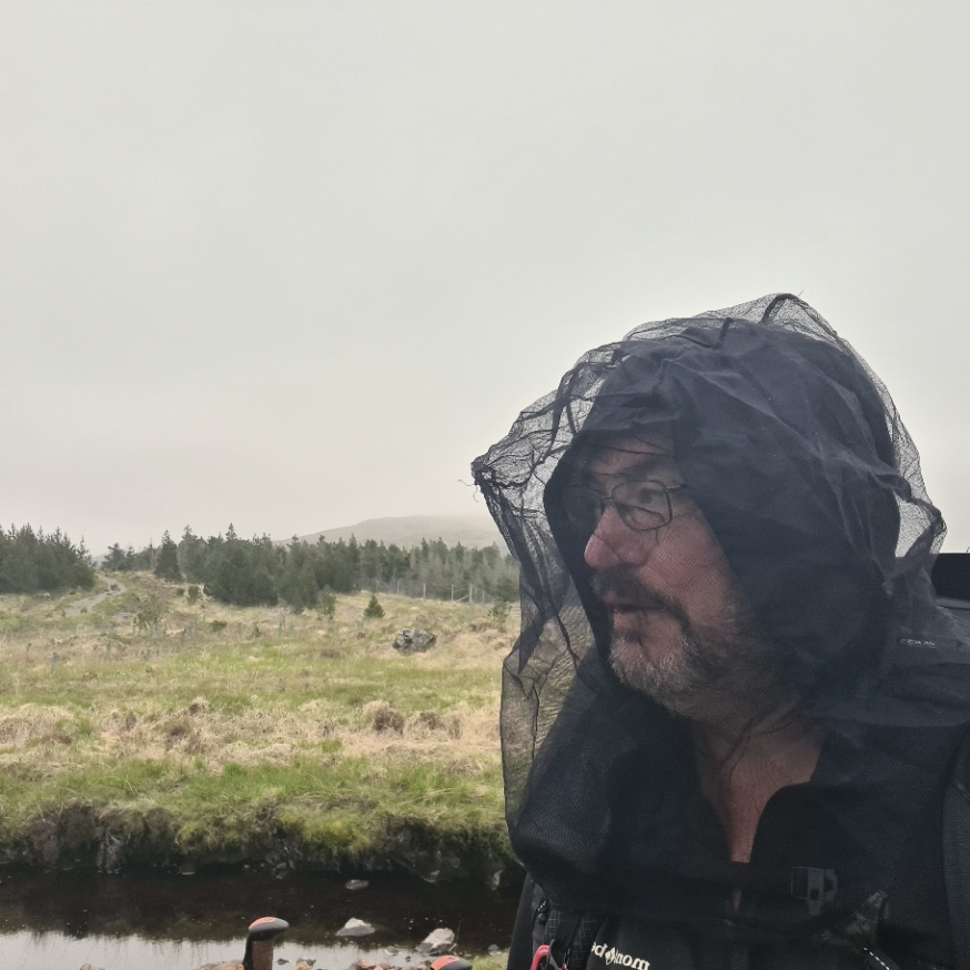
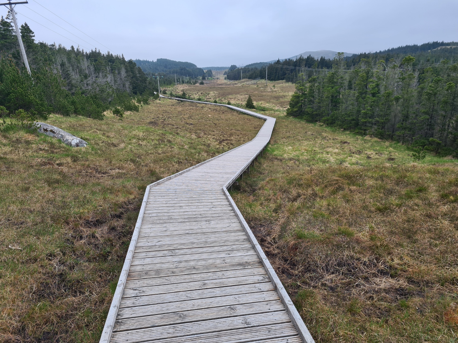
Out into the cloud of midges. They were all males, no biting females, so just intensely annoying. I tried just pulling my hood up but that was insufficient around camp and the midge net had to go on. This was packed away once I got walking. A cuckoo bade farewell, it had been a pretty good pitch. The trail steadily climbed up through the Aline Community Woodlands, the ground is phenomenally boggy here, so much so that money has been found for a good long boardwalk to be lain. This made for easy swift walking. Somewhere off to my right, hidden beyond the trees was the A859, but the traffic was so minimal that it barely intruded.
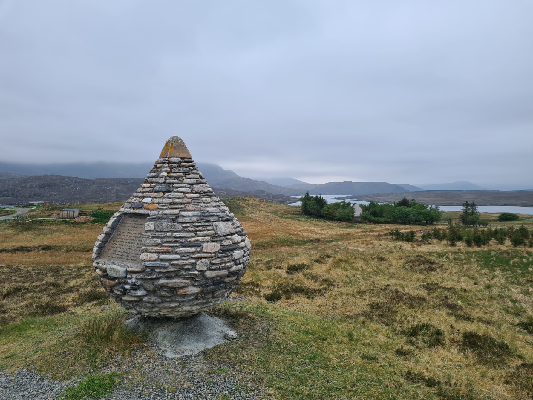
The path joined the road but briefly, as it moves over to a parallel single lane road, left in place when the new dual carriageway was built. It is steadily deteriorating but makes for more easy swift walking. The trail eventually leaves the road, for a looping wet walk out into the moors, across the flank of Sullanan Ard and round the north shore of Loch Stranndabhat before returning to a track that leads back to the road. There are a couple of memorials alongside the road. The first is to Bonnie Prince Charlie, who landed here in 1746, 18 days after the defeat at Culloden.
“On 4th May 1746 Charles Edward Stuart landed here while on the run having sailed from Scalpay. It was 18 days after the disastrous battle of Culloden where over 1200 highlanders had died. He travelled on foot from here to Arnish where he was given shelter by Lady Kildun. He then sailed south to Eilean Lubhard with a massive price of £30 000 on his head. It is to the eternal honour of all hebrideans that regardless of their loyalties he was not betrayed to the authorities”
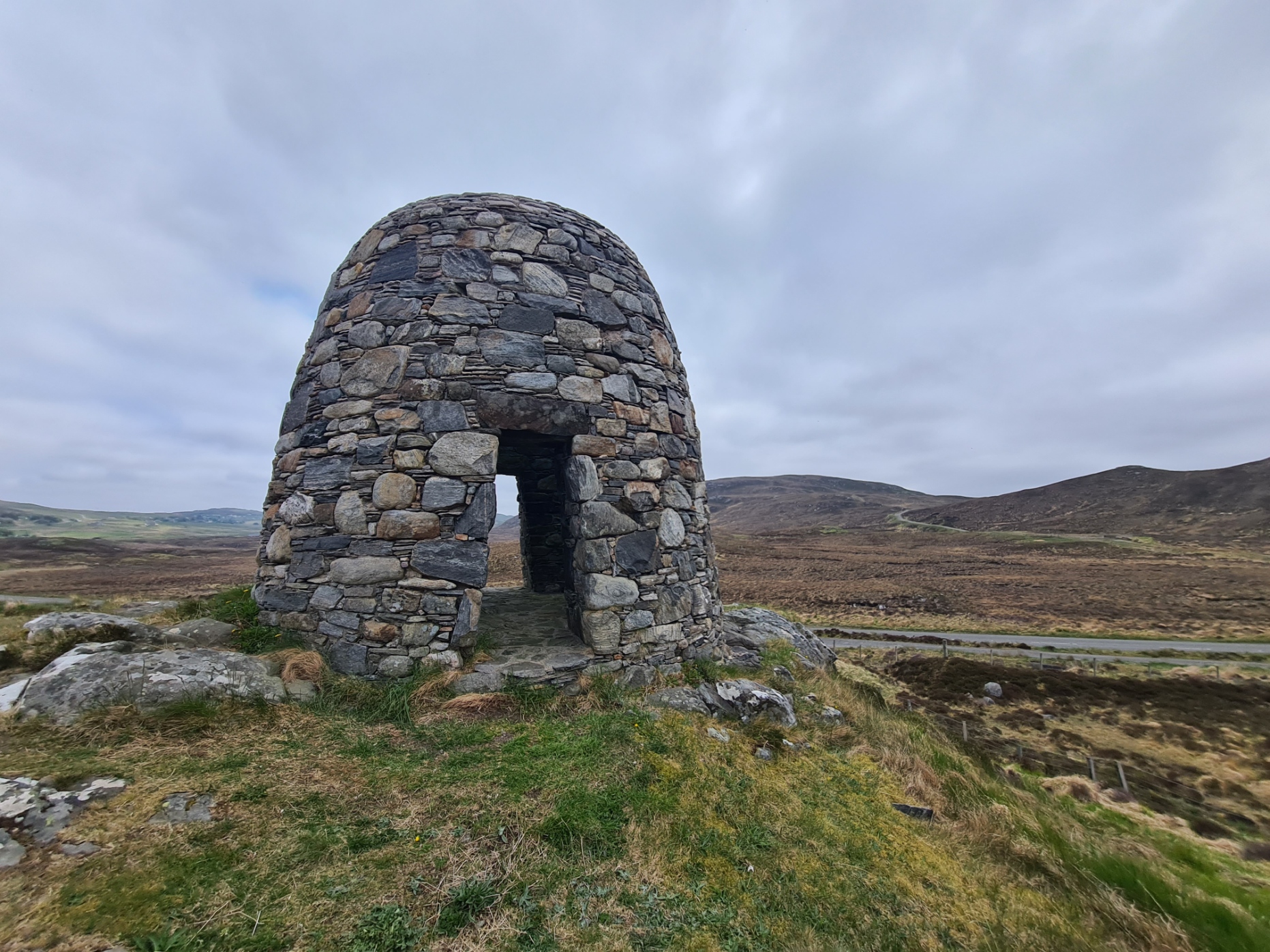
The second memorial is to the local people who raided the Pairc estate in 1887 after Lady Matheson had ordered their eviction. The Royal Navy and soldiers were called in to quell resistance and arrest the ringleaders.
Between the Pairc hills to the right and behind is the low lying profile that has created the “Old Woman of the Moors” or, rather more fanciful, “Sleeping Beauty”, a line of hills that is thought to resemble a sleeping female form. I suppose you can find anything to spin a yarn with to entertain the tourists. If I hadn’t read it, I wouldn’t have thought of it.
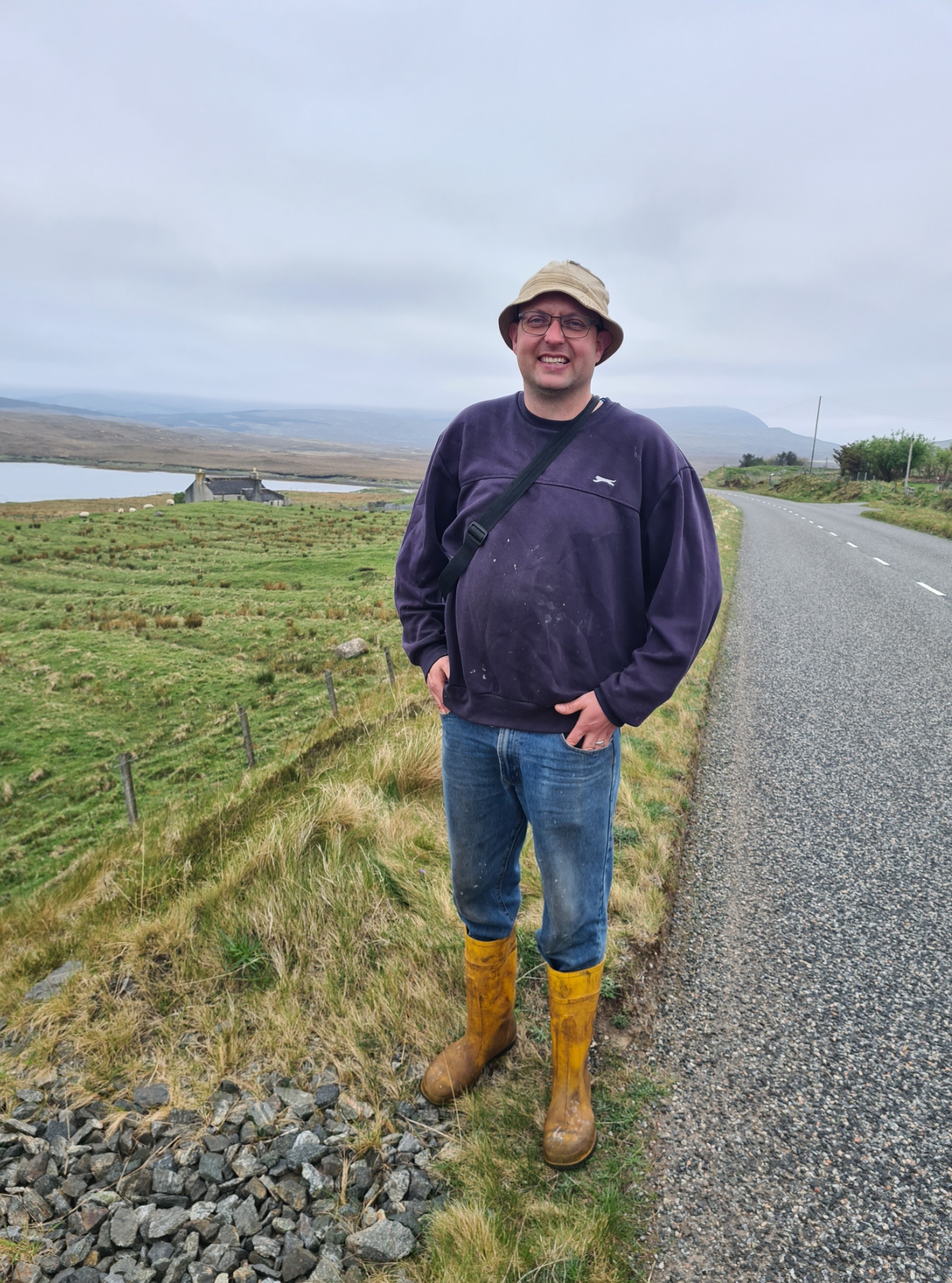
I stopped for quite some time to talk with a crofter busy strimming roadside vegetation. A friendly guy, like many, he holds down multiple jobs to try and make ends meet. Norman’s latest venture was providing two roadside honesty boxes for passing hikers, these were stuffed full of cold drinks and snacks. The road passes various crofts before reaching the strung out village of Balallan where I found the door to the café locked. Instead, I wandered into the adjoining Kinloch Historical Society to see what there was of interest. Here I was welcomed by Gemma like an old friend and directed to walk through the corridor to the empty community honesty café and help myself. I stopped here for some time, drinking tea, hot chocolate, both utilised for dunking the biscuits also on offer. There is also a w/c here, and, in or out of hours, an outside tap, where I filled my bottle. It was a decent and welcome halt and standing outside on the road, taking my photos, I almost backed into Brian who was walking past at that moment.
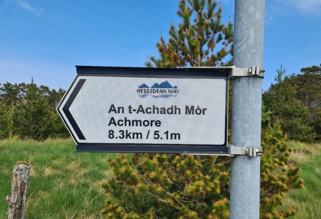
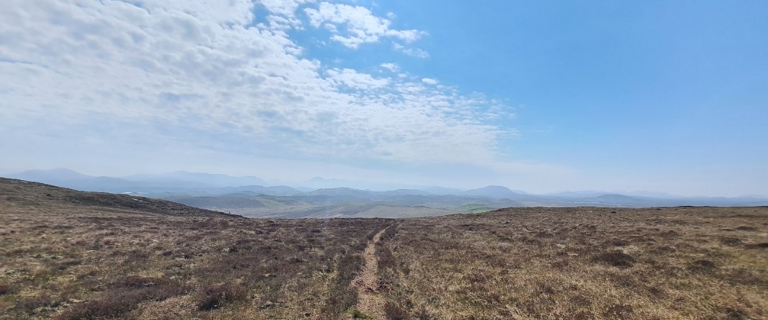
He was walking at speed, far faster than what I wished to go. He was on a mission, determined to meet his friend Mark in his hire car further down the road. As for myself, at Laxay I was leaving the road again, back to the moors. This part of the trail began on a fairly new and decent track, but it soon left this to begin a five mile walk through grass and heather, sometimes on a double ditch raised turf path. Good walking to begin, this is the final stretch of moorland walking prior to the roadwalk to the trail’s end at Stornoway.
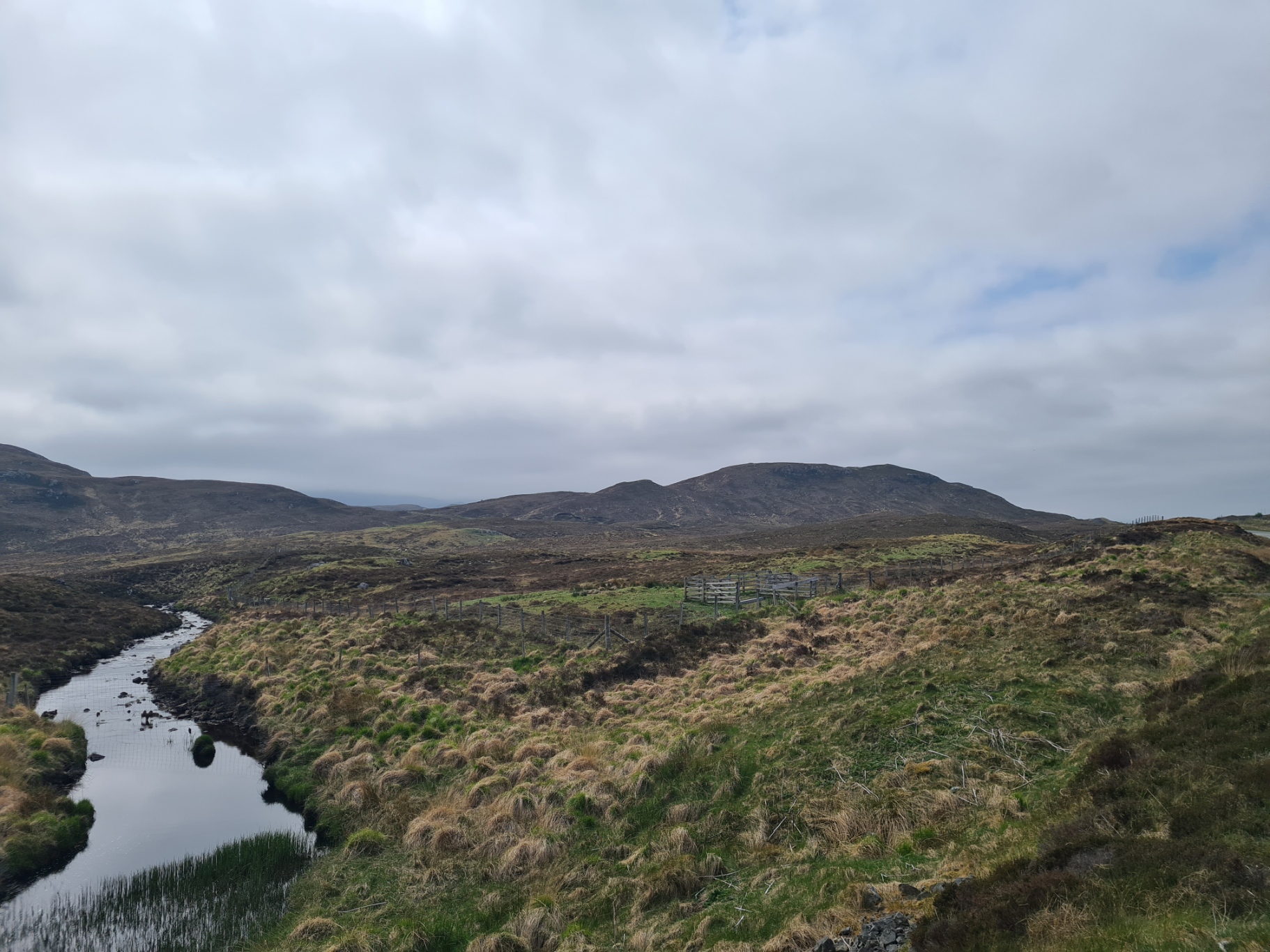
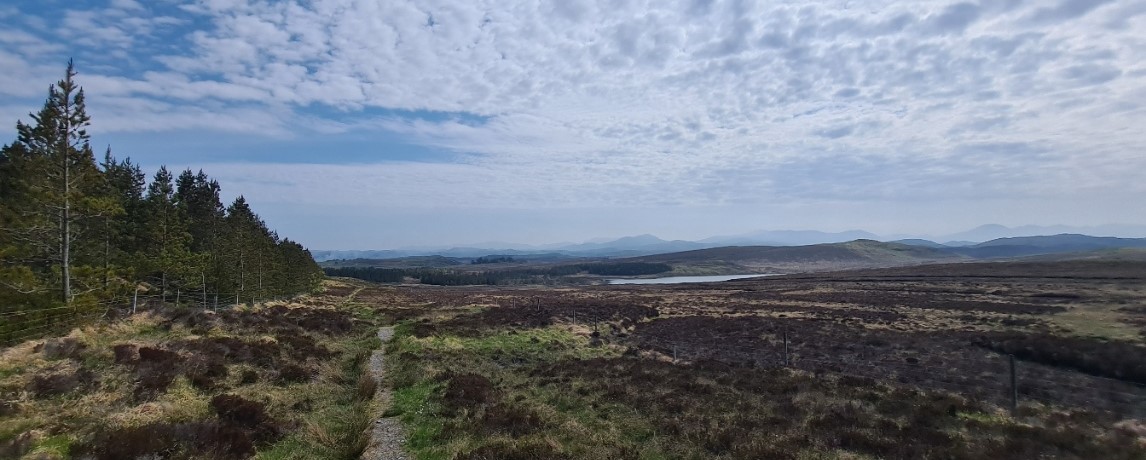
The trail flanks Beinn Ceadraiseal and rises to drier rockier tops and drops to very boggy, shoe sucking valley bottoms. There are no options, regardless of whether you try and avoid the obviously wet trail, walking to one side or the other still runs you into sodden ground. The wetness of the area probably explains the numerous little lochs passed. Nonetheless, despite being tiring walking at times, I found it great fun. I shouldn’t be surprised at the ground I was crossing. The island’s name- Lewis, is derived from Leogach, meaning marshy. The afternoon was drawing on and the light had that late golden quality. I often came across little frogs in the grass. I had originally looked at the map and thought I might camp on this section, but it was all simply too wet or too lumpy.
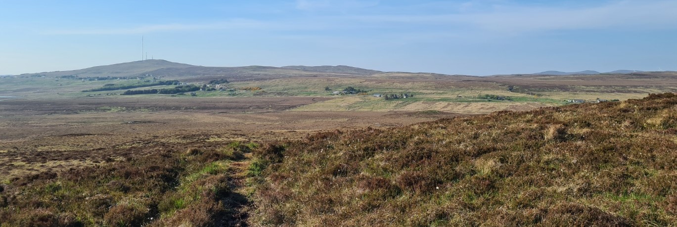
Having ascended and flanked Stèiseal, I was climbing Oidreabhal, one last top before a long drop to yet another boggy patch below the landlocked village of Ardmore, I froze to watch a silent drifting Short Eared Owl quartering the ground each side of me, as it passed ten feet away, it twisted its head to appraise me, an odd shaped tree that it didn’t recognise. Onward, for the day was drawing on. Beyond Achamore was the radio mast atop Eitseal, my navigational guide for the past two hours. I had a dogleg to avoid the fenced fields below the crofts, then a final climb to join the A858. I found this surprisingly busy but there is a footpath. I followed this left then off right, on to a minor and far quieter road that headed off, again, crossing the moors, heading directly to Stornoway. This was less than eight miles away and I had already walked further than I had originally intended. With luck, I would find somewhere to throw up my tent for the night prior to what was now obviously going to be a very short day tomorrow.
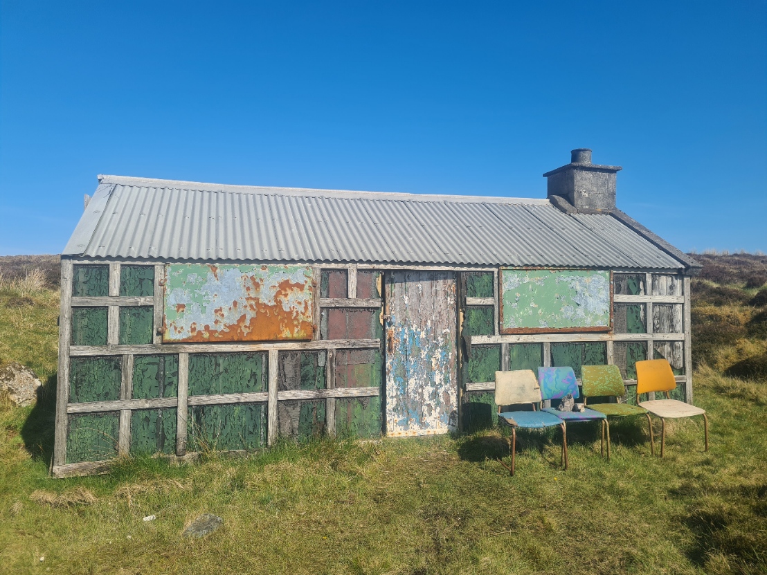
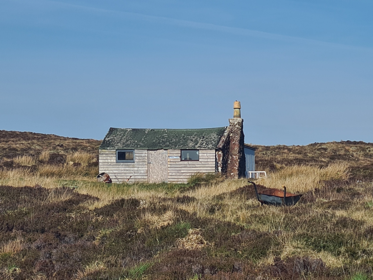
I began to see a few of the shielings dotted across this part of the landscape. These little buildings would once have been lived in by the women and children who bought their livestock here to graze on the young heather and grass in the summer months. While these simple buildings can be seen all over the island, there were dozens along this road. Some are obviously in use, others had a padlock across the door. I went to look at one close to the road. The door was hanging off its hinges and the interior was filled with debris and rubbish. Further on, the sun now dipping ever further, I climbed up a hill to see another, flushing Red Grouse on the way. The interior was likewise full of rubbish and broken wooden furniture, but round the back, well-positioned for the morning sun, was a largish flat spot, just right for the Duomid. It was stony and I had to pound pegs in with a rock, but it would do me well for my final wildcamp.
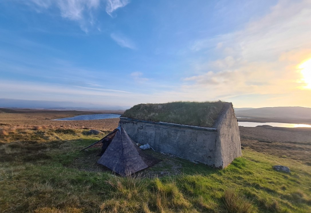
It was around eight in the evening so I had to get a bit of a move on with body wash, tick check and foot massage/balm before I lost my light. With my breath condensing in the cold, I then dressed in night attire, with fleece and puffy, and quilt over my legs for warmth, then at last getting a brew and meal on. My gas had thankfully lasted the distance. My last meal on trail was supposed to be a Firepot vegan Chilli, that someone had forgotten to put chilli in. But it was so poor that I couldn’t stomach it. Fortunately I had another meal in my food-bag, an ‘OK’ Pork and Noodles. I will be glad to see the back of these Firepot meals. Then two mugs of strong tea with a Cadbury’s Flake choc purchased from Norman’s honesty box. I felt good, with feet in fine fettle. I was very content. It had been yet another good day.
Day eleven:
Unsurprisingly, I slept well. The cold wind that had been drifting into the tent last night had died down and when I rose, there was quite a bit of condensation inside the tightly zipped Duomid. I furled the doors and the rising sun warmed the inside, warming me and drying it out while I sat there under my quilt contentedly supping my final morning brew on trail. I was a bit excited to be finishing the Heb Way today and conscious that I only had a handful of miles down into Stornoway.
Breakfast was shortbread biscuits from yesterday’s Kinloch community café. Packed and away, there is not a great deal to report on those last few miles. It is road walking all the way. There is very little traffic on this narrow minor route. All that I recall is a lone four-wheel drive pulling a rattling sheep trailer, two feet wider than the towing vehicle, that would have killed me if I hadn’t, as usual, stepped right off the road. The road, and trail, does cross over a couple of lovely becks and passes small lochs, not that I needed any water, but pretty nonetheless.
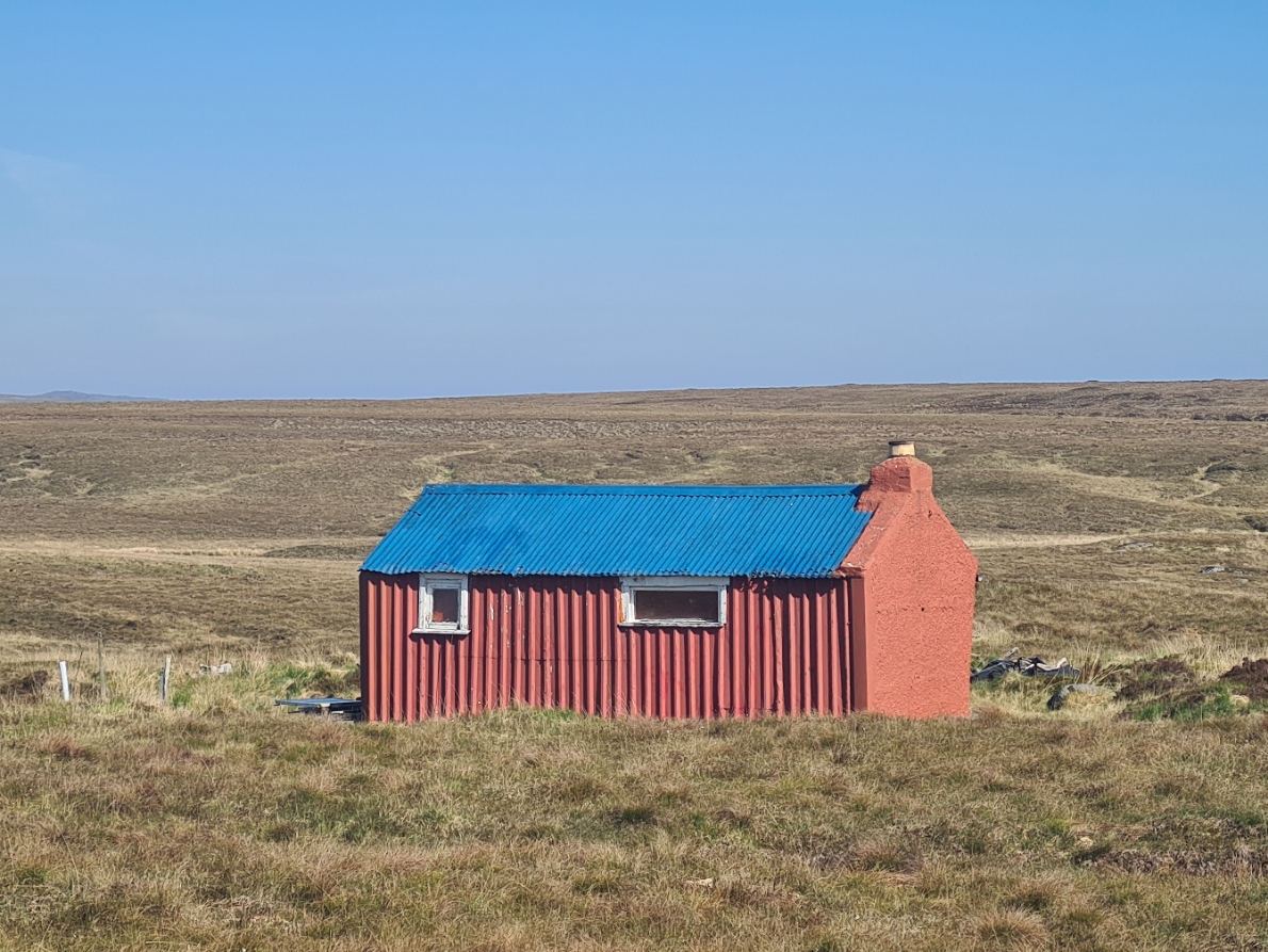
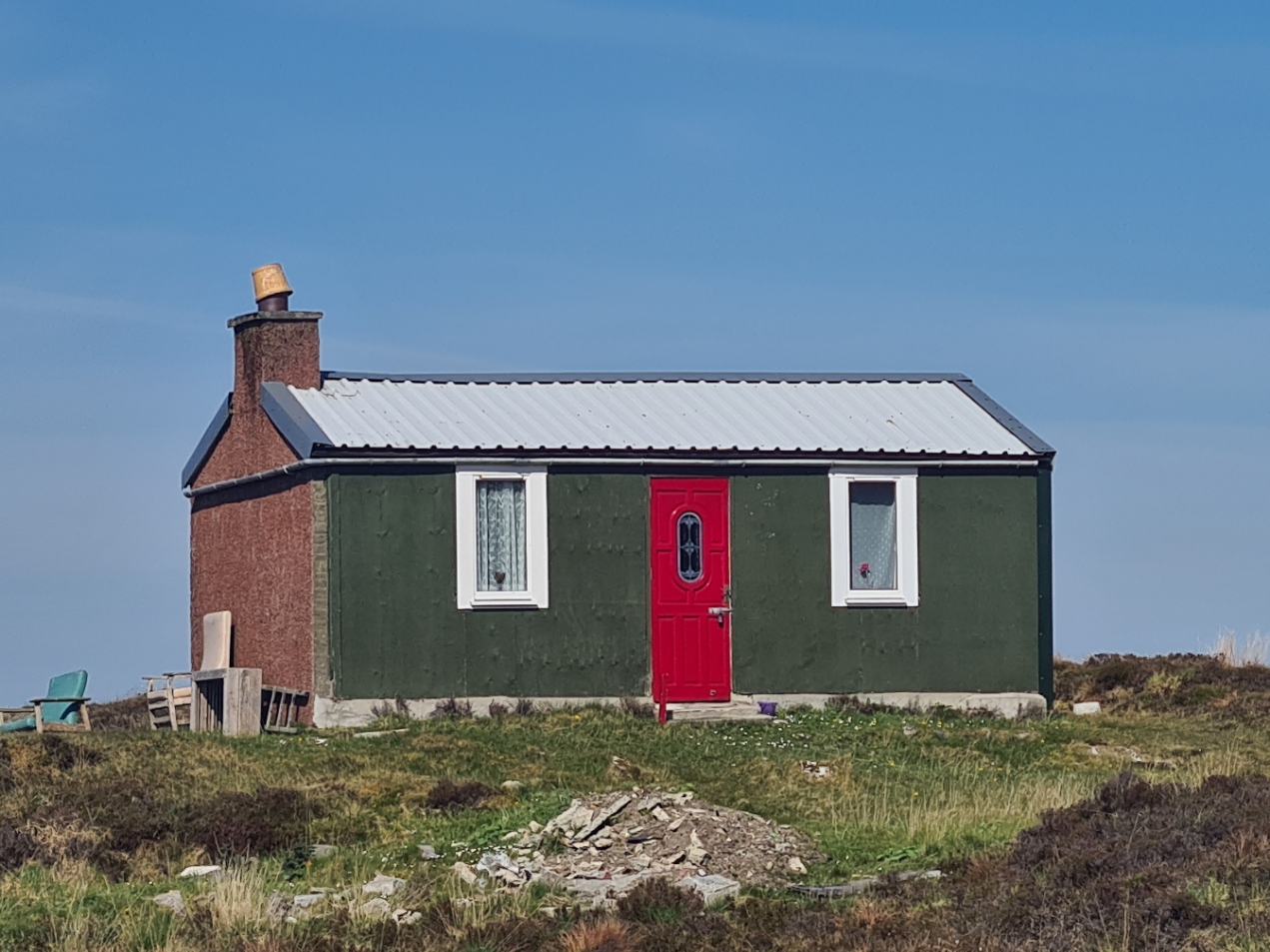
As with yesterdays walk along this road, I passed a number of shielings, some in quite good condition, some in ramshackle repair, most barely ‘still-there’. In places, poking above the grass and heather, there might be just a still-standing chimney breast, but I likely passed most unseen as they are now lost in the peat. One of my guidebooks calls the better of the shielings ‘man-sheds’, where town dwellers come for temporary retreat. Interesting that on a sparsely populated island, people still have a need to ‘get-way from it all’.
I turned on to the Pentland Road, once planned as a railway, to transport fish to market more quickly. It links Stornoway on the east coast with Carloway and Breasclete on the west coast. I began to pass occasional mixed species woodland. Chiff Chaff, Willow Warbler, Robin, Wren, Blackbird and Cuckoo variously serenaded my triumphant march, swinging my trekking poles in fine style.
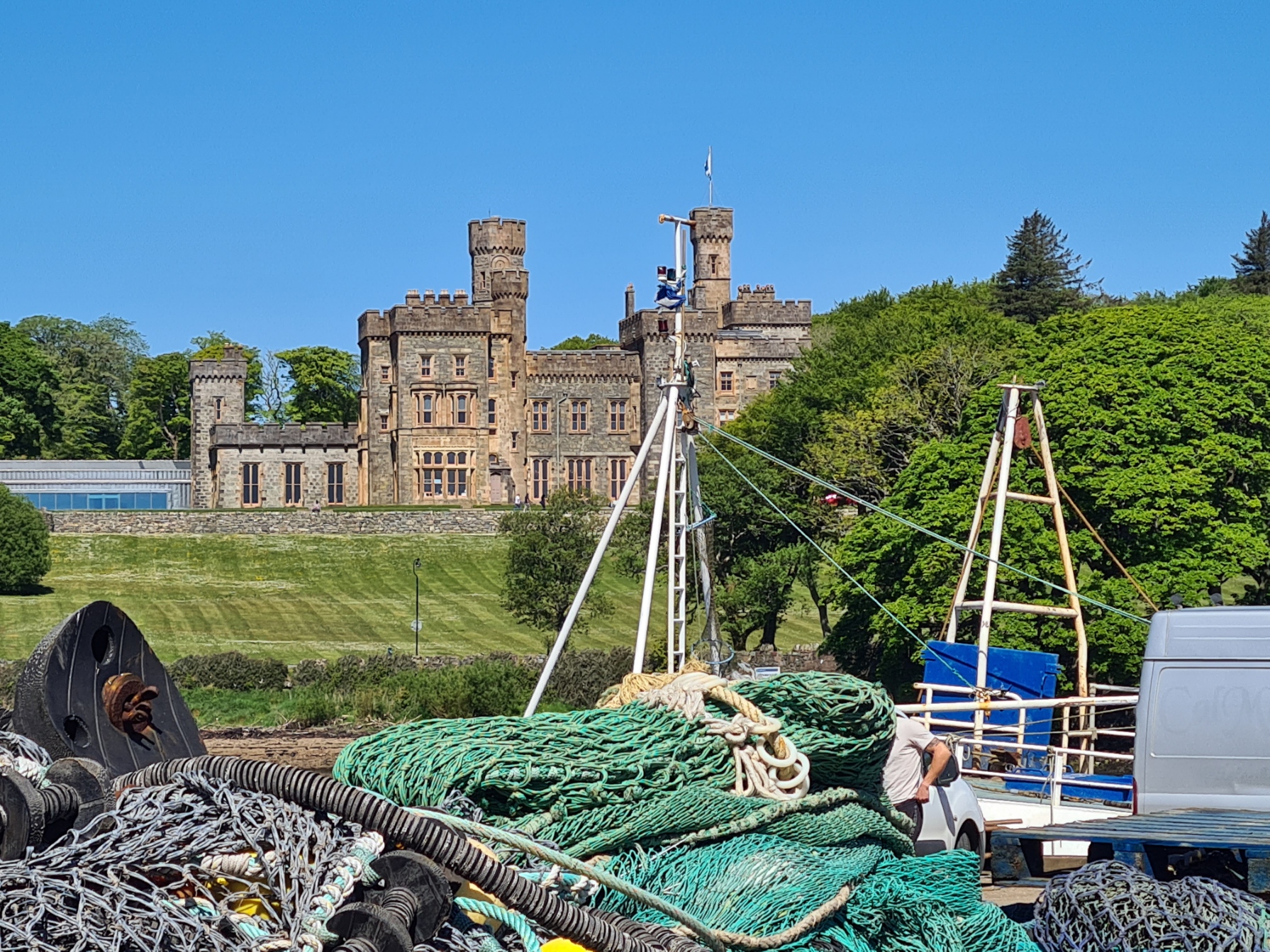
Into the fringes of town. Well maintained houses and gardens, that led me to the busy A859, Stornoway tantalisingly somewhere out of sight, down the hill beyond. I turned right, soon crossing the road to follow modern trail marker, into the back service road entrance to Lews Castle estate.
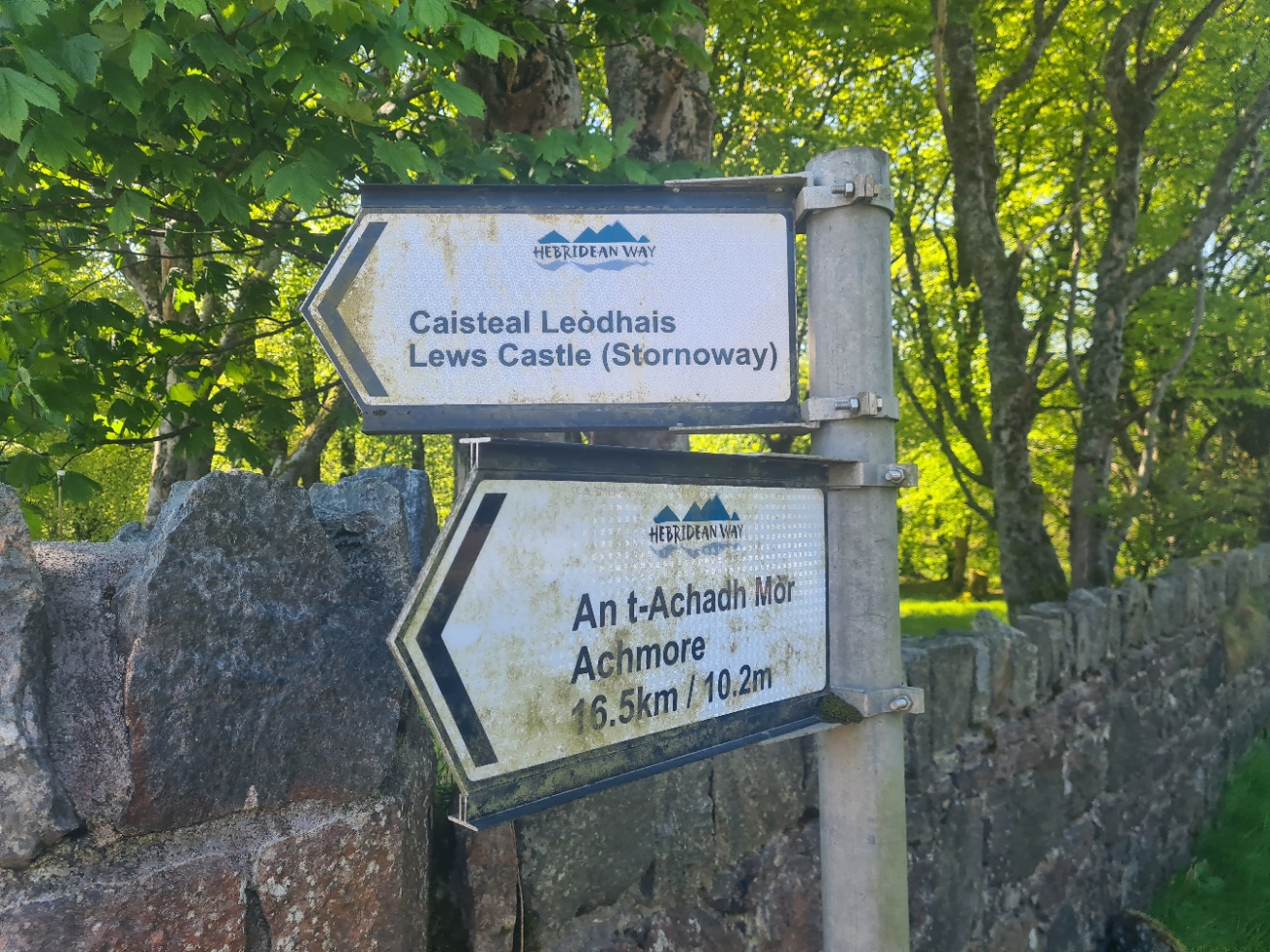
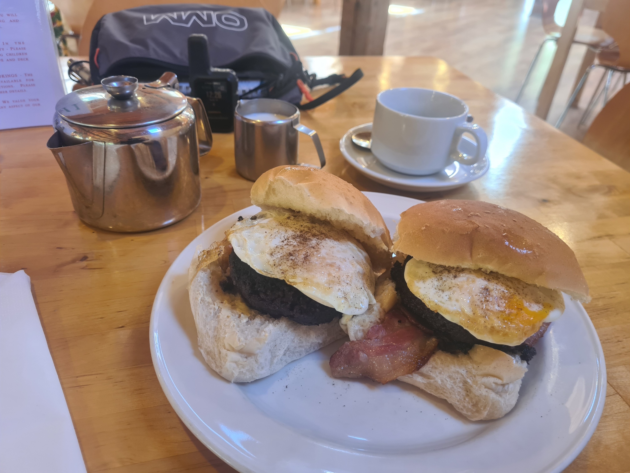
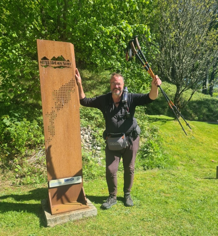
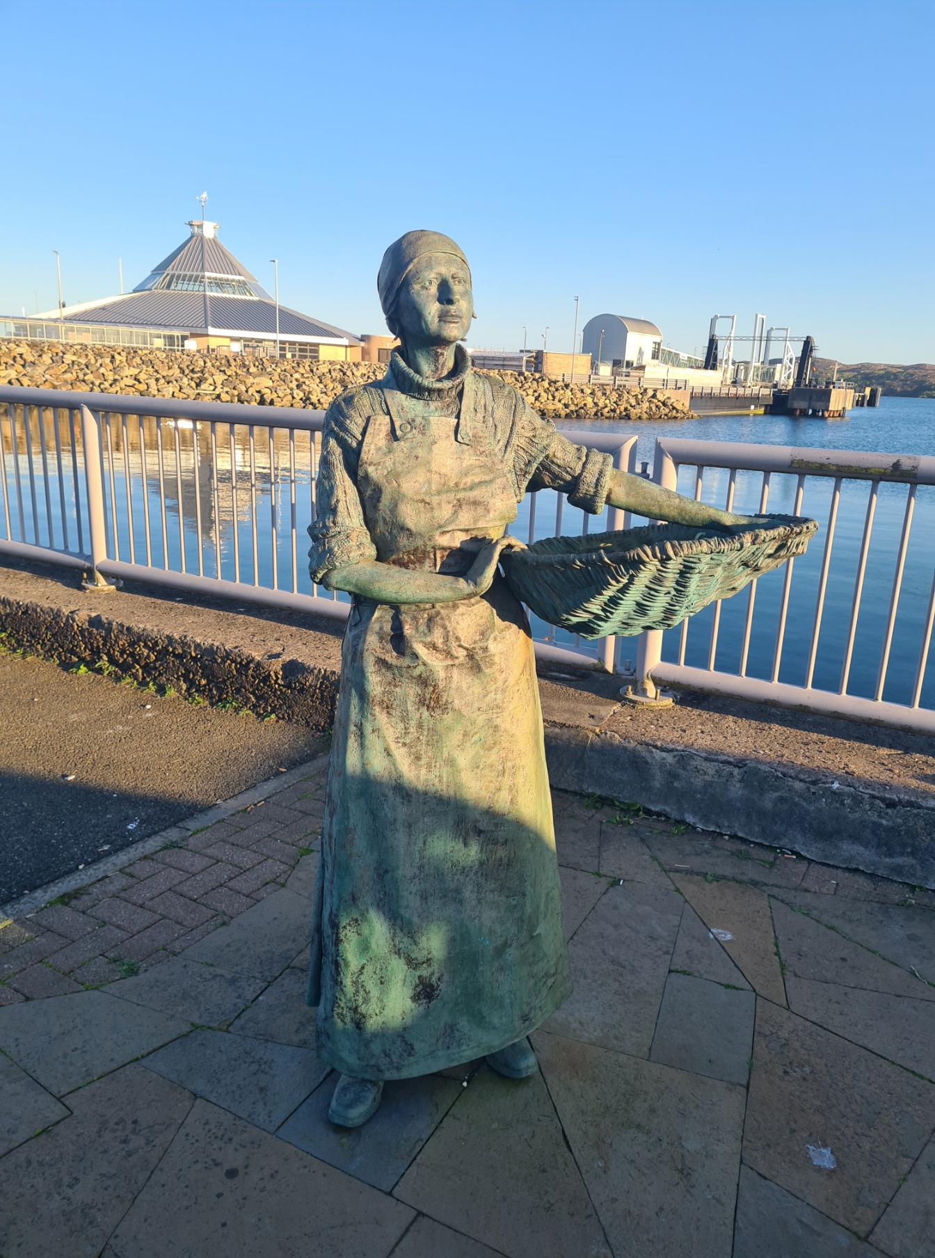
It was a long walk down the service road through the grounds of Lews Castle to the official end of the trail, which isn’t the easiest of things to find. It is another of the tall metal marker posts, as seen at the start of the trail on Vatersay and at the Sound of Harris ferry port on Berneray. I hung around a bit, waiting for someone to pass and ask to take my obligatory end-of-trail photo. Then, feeling quietly satisfied and a little lost as to what to do next, decided that obviously such an endeavour needed marking in some way, so a decent lunch sufficed. There is a pleasant café very close by, where I got a couple of more than pleasant morning rolls, stuffed with bacon, Stornoway blank pudding and fried eggs, together with a much required pot of tea. After which I had another treat in mind.
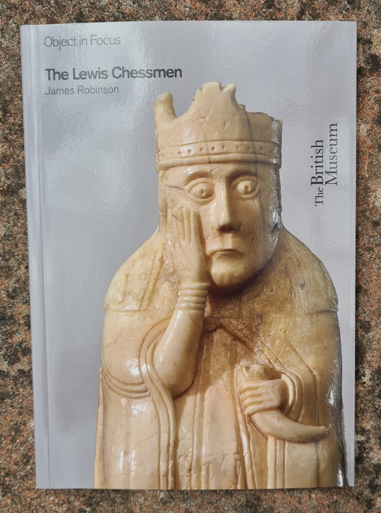
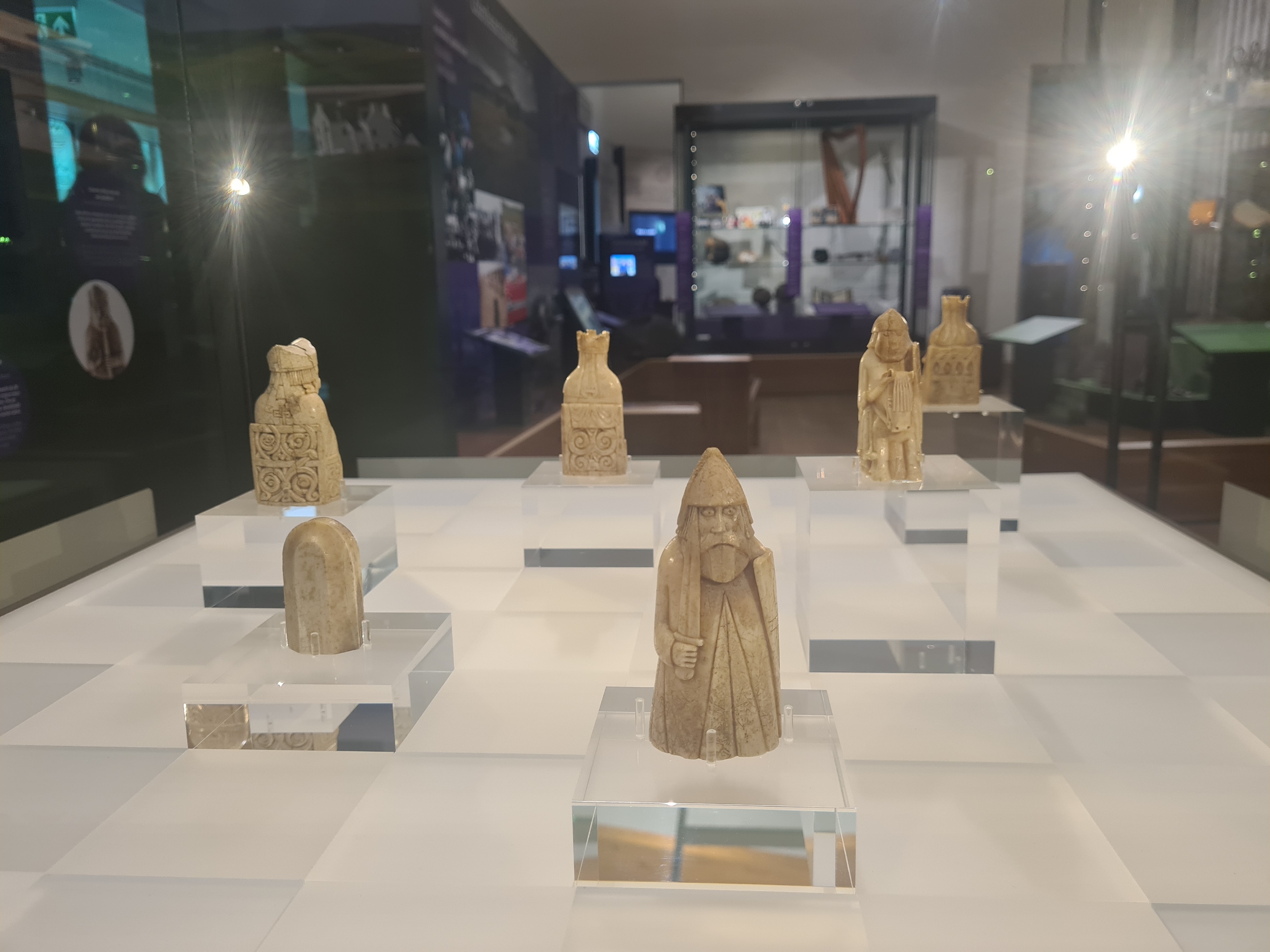
While in the Castle grounds, I went to view something I had long wanted to see. These were some of the Lewis Chessman. It is not over-stating it to say that I was absolutely thrilled to see these in the nearby Castle Museum as I have long held a fascination with these. The story of the discovery of the remarkable chessmen on Lewis is constantly evolving, not only as to the history of chess and the islands, but also the skill of the ancients, trading across the seas and just how cultured the inhabitants of these islands was many centuries ago. It wasn’t all about farming and fishing, any more than it is today.
Crafted from walrus tusks and whale teeth in the 12th or 13th century. The origins of the Lewis Chessmen are Scandinavian. A collection of at least 93 gaming pieces, including 78 chessmen, 14 tablemen for a board game, and an engraved belt buckle, were discovered in 1831 on the Isle of Lewis, having probably been hidden by a trader. It is no one set, instead the pieces are from almost four sets, with some missing pieces turning up over the decades. One of my prized Christmas gifts as a child, because I was keen on chess back then, was a replica set of Lewis Chessmen, given to me by my uncle. It was only now that I realised he had likely purchased them for me on one of his frequent lone visits to the Hebrides in his motorhome, back in the 1970s. It felt almost as though I was completing a personal full-circle.
Having spent quite some time in the museum, viewing exhibits and chatting to gallery staff, I walked in to the nearby town. I was booked in to the Dragonfly B&B for tonight, and a very comfortable stay it was too. Some people completing the Heb Way continue on beyond Stornoway. It is two further days north to the Butt of Lewis and I had considered that option. However the first day is comprised entirely of a 14 mile road-walk. Most skip this by catching the W5 bus to Tolsta, something glossed over by a multitude of YouTubers and bloggers. The final 16 miles follow coastal paths to the lighthouse at the northern tip of the island. I didn’t want a whole day of road walking and having walked every step of the land trail between Vatersay and Stornoway, also didn’t want to skip half of this additional section by catching a bus. So, this was the end of my trail.
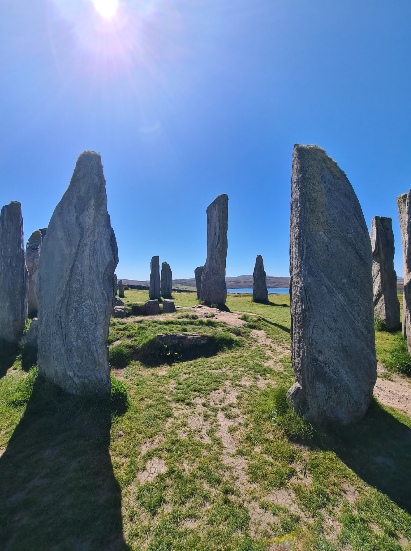
That was it, my Hebridean adventure was over. But not quite. I hadn’t committed myself to completing the trail in any particular time and had built in a handful of extra days should I require them. This gave me time to eat and drink well in Stornoway and visit some of the attractions in the vicinity, amongst these, a bus ride out to the remarkable 5000 year old Standing Stones of Calanais.
While staying in Stornoway, I bumped into Debbie in the street. Over a fish and chip lunch she told me that Fran had decided to get off trail, his exhaustion and injuries proving too much. As for her, after pausing in Stornoway, she caught the bus half way north and from there walked on to the Butt of Lewis, camping at the tip of the island, later messaging me that it was: “stupendous… an extraordinary end to the islands…. Like visiting another planet”. I was only slightly envious!
The Hebridean Way is an excellent trail. It is not a National Trail, nor one of Scotland’s Great Trails. But it is a well-known and fairly well supported long distance path, with a slightly differing route for cyclists, that many walkers follow instead. The trail is fairly well marked, other than occasional parts in rougher country where a degree of experience and a guidebook were helpful on occasion.
I carried two guides, just because I wanted to. Either of these would add interest to a walk and while I found they complemented each other, only one would be necessary. One was The Official Guide: Walking the Hebridean Way, by The Offcomers (Vatersay to Stornoway). This includes maps created with Memory Map utilising 1:50 000 scale O.S. maps. These show a slightly larger area than Cicerone’s Walking the Hebridean Way, by Richard Barrett, which also includes 1:50 000 scale O.S. maps (which includes the Stornoway to Butt of Lewis optional section). This is a more compact and lighter volume (227g against 245g). I preferred the Cicerone guide, but both are good. Neither are waterproof, keep them in a ziplok to stop them turning to a soggy mess, it rains up here, a lot.
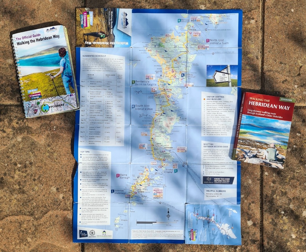
I carried the little two-sided walking route map from Outer Hebrides Tourism at 1: 200 000 scale. While ‘contours’ are colour graded at 100m intervals, the Hebridean Way is mostly a low level walk so this is of little concern. It is pretty much useless for navigating away from roads, though a lot of information is stuffed on to it. I liked having this minimal 33g folded map for an overview of progress and marking overnight halts on. It is not waterproof and a bit fragile.
The Outer Hebrides are an extraordinary destination. It takes a bit of effort to get there but once on the islands, you are rewarded with a remarkable mixture of landscapes with truly lovely people. Gaelic is the first language but every islander also speaks English. Greet them with courtesy and you are guaranteed the same. There is a long and proud history to be discovered on this beautiful archipelago and while the Hebridean Way isn’t a high level walk by any means, it rewards in different ways. It is true that much of the trail involves track and road walking, though roads are invariably quiet. Some people who have ‘walked’ the trail will tell you it is all road, it isn’t, unless you want it to be. There are challenging moorland sections across often rough terrain and it is not a trail to be taken lightly. Logistics have to be considered, and those prepared to wildcamp will find it easier going. The Independent Hostel Guide maintain a useful listing of Hostels, Bunkhouses and Bothies on the Hebridean Way. Not that there are many.
Resupply can be a challenge and I found that many little shops, snack wagons and cafes were closed. Other than ensuring I could pick up a gas canister at the start (having flown in) I had little need to resupply, other than buying snacks, occasional treats and ensuring I supported local economy where I could. As to how long to take to complete the trail, that is up to you. The Cicerone guidebook suggests a 10 day itinerary, while Outer Hebrides Tourism suggests a 12 day itinerary. I spoke to people who dashed it off in six or seven days, and they regretted it, having to road walk most if not all of it. I spoke to people planning on 11 or 12 days, and some still found it hard going. In my opinion, the islands deserve a slower pace and shorter days walking, but not everyone has the luxury of time. I walked it in 11, with the last day being just five miles or so.
- Hebridean Way:

Excellent write up, Jools, as always, which I’ve thoroughly enjoyed. Thank you.
It brought back very fond memories. To add to your chagrin, I can confirm that the northern section, from Tolsta to the Butt, is highly worthwhile. I had a fabulous wild camp en route, with night time views across to the Cape Wrath light.
LikeLiked by 1 person
Yep, I thought I might be missing something special at the tip of the island. However I had another trail not long after I returned home (the Ridgeway, that I wrote about) and really didn’t want to risk damaging my feet on a substantial road walk. Also, I admit to getting a bit peeved by countless people saying they have walked the Hebridean Way, while catching buses, taxis and accepting lifts willy-nilly. No doubt the ‘official’ trail will one day be extended to take in the Butt of Lewis, but by then, I am sure an appropriate cross-country route will have been developed
LikeLiked by 1 person
I think the issue is as you touched upon in your write-up, in that there is sometimes just nowhere for a route to go as the present day roads cover what would, in the past, have been the only available space for a viable track.
My understanding is that the route was originally scheduled to go as far as the Butt, but they ran out of money, hence the ending in Stornoway. And, as you’ll have noticed en route, much of the vital infrastructure was supported by EU funding, which of course is no longer available ☹️.
By the time I got to Stornoway I, like you, had had enough of road walking, having walked every step from Vatersay. My planning had envisaged walking on to the Butt, but good sense prevailed and I took the bus to N Tolsta, from where the walking was grand, especially around Tolsta Head and then across the beach
The amount of road walking was, for me, a significant draw back, but overall the HW as an experience still rates highly in my book
LikeLiked by 2 people