
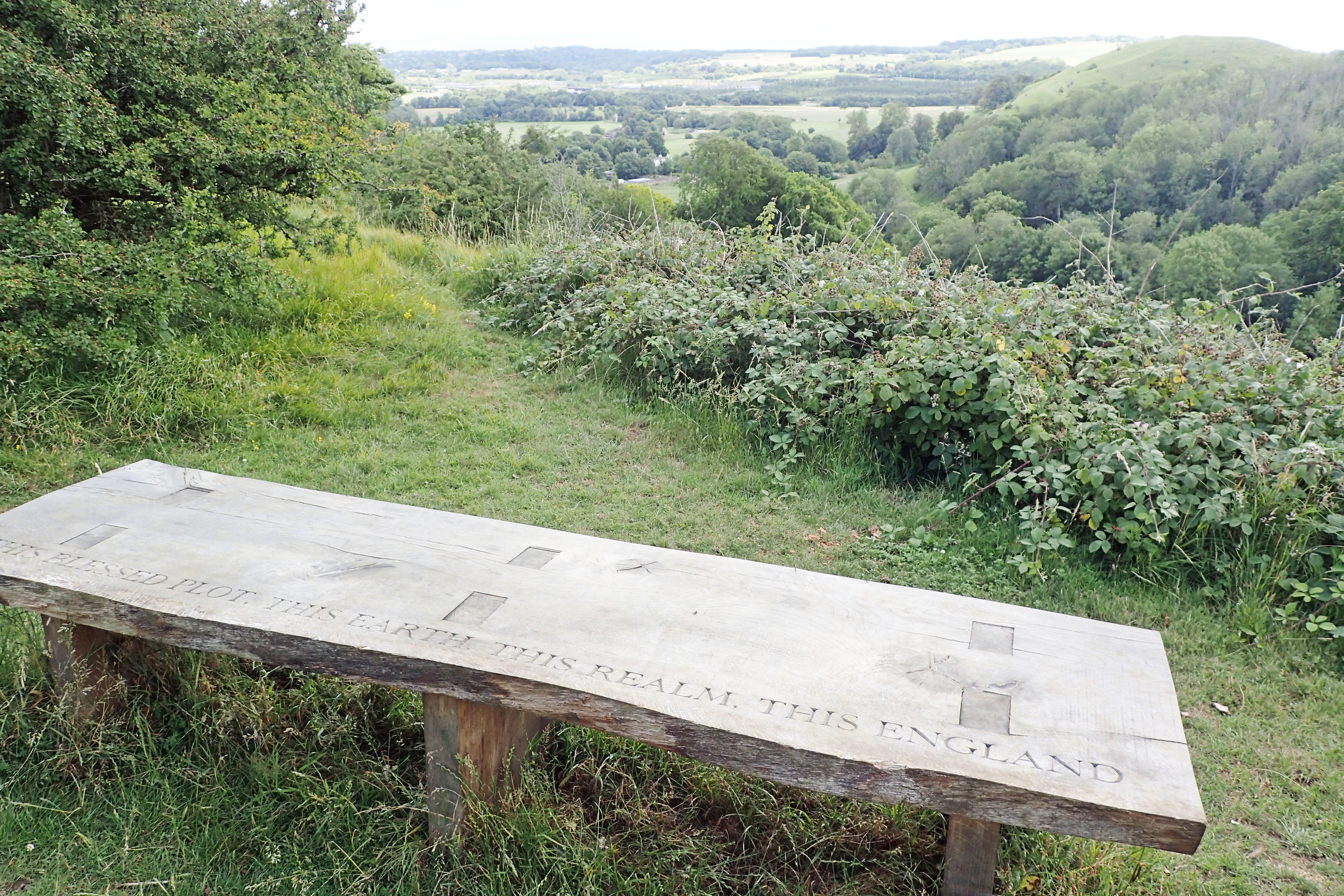
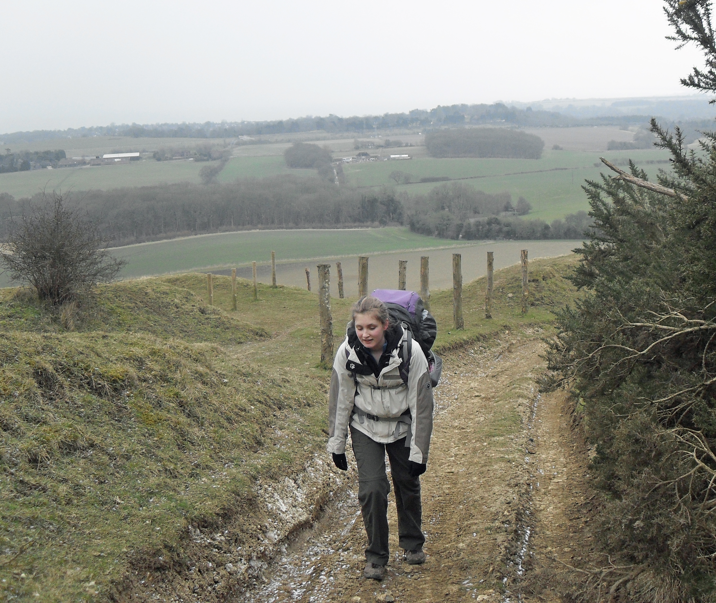
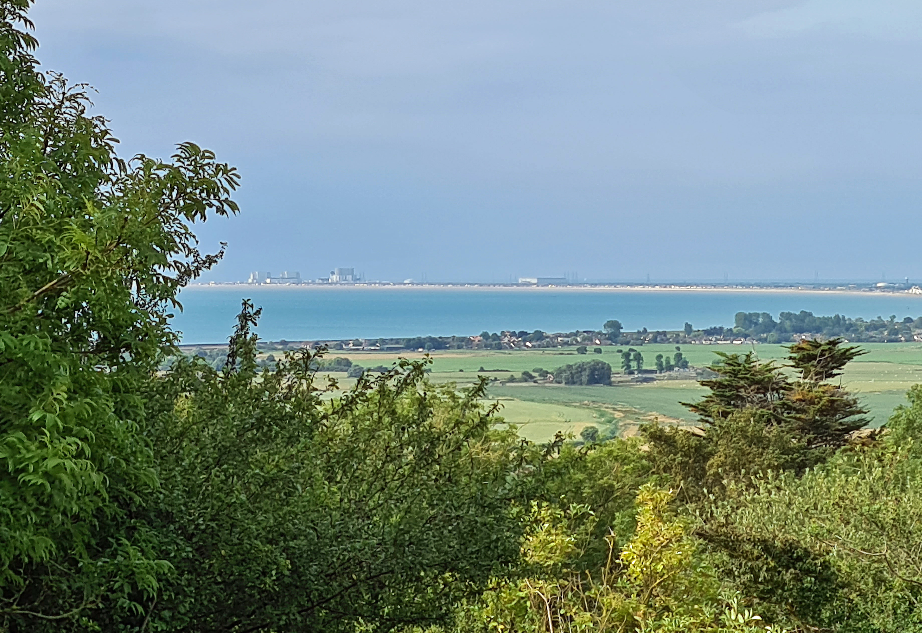
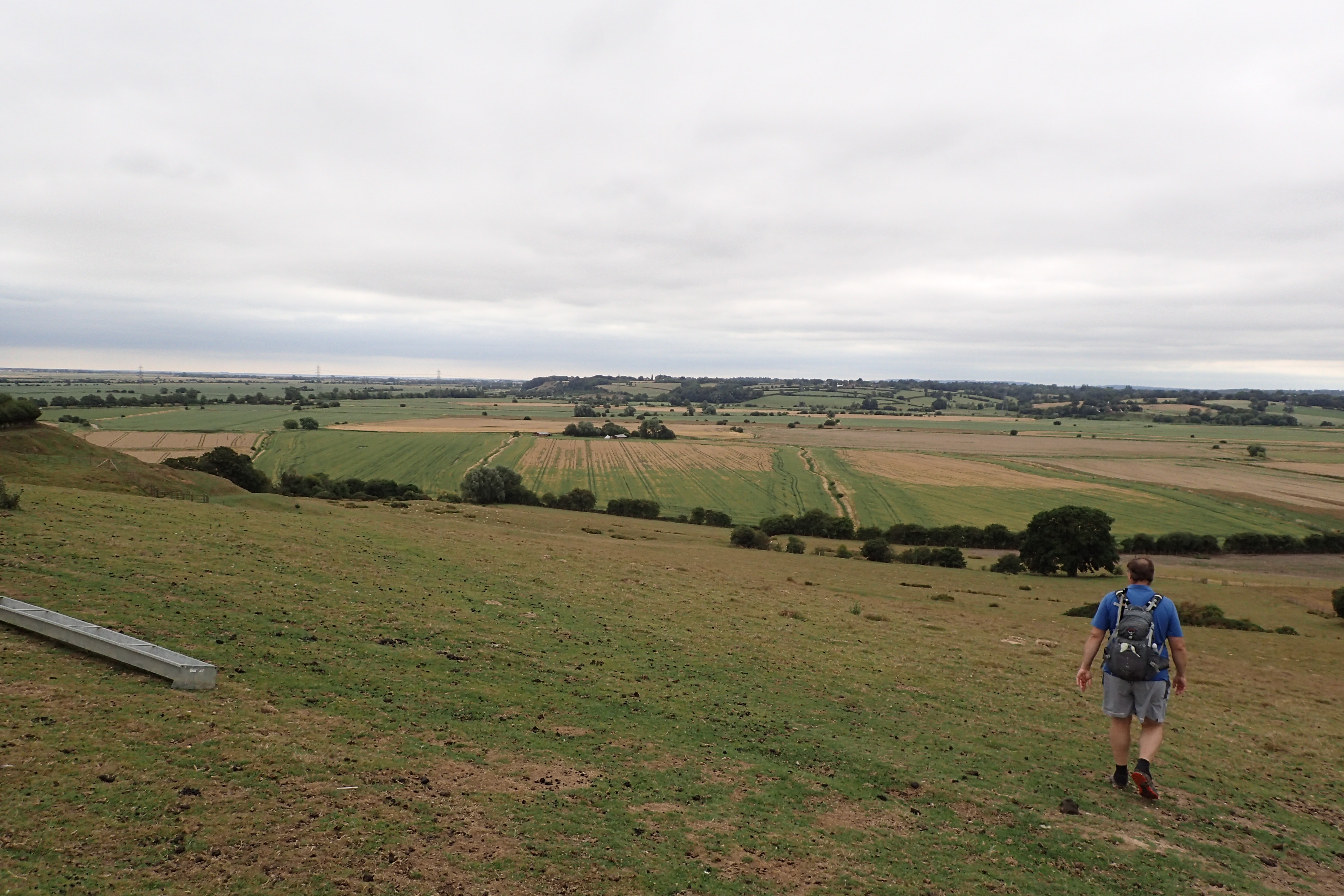
A lunch time halt on the hills above Folkestone- ‘This blessed plot, this earth, this realm, this England’
This royal throne of kings, this scepter’d isle,
This earth of majesty, this seat of Mars,
This other Eden, demi-paradise,
This fortress built by Nature for herself
Against infection and the hand of war,
This happy breed of men, this little world,
This precious stone set in the silver sea,
Which serves it in the office of a wall,
Or as a moat defensive to a house,
Against the envy of less happier lands,
This blessed plot, this earth, this realm, this England
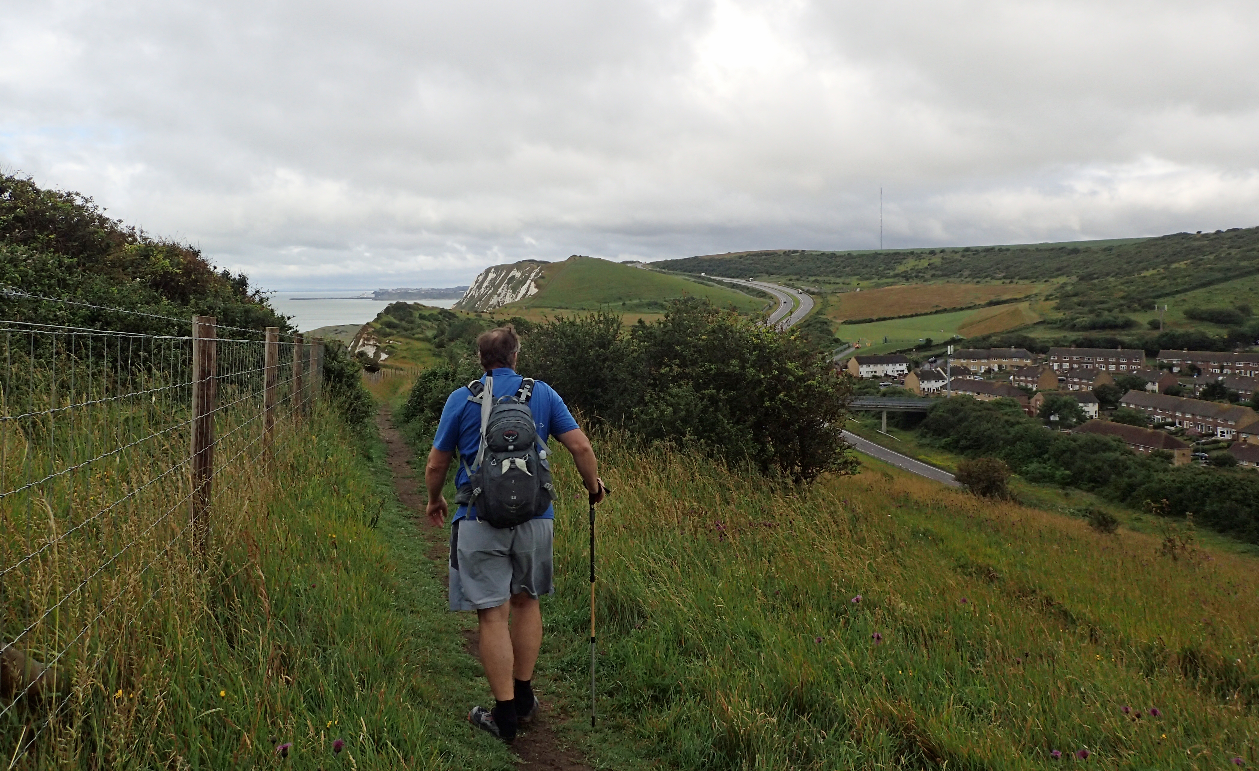
My final four days on the Saxon Shore Way beckoned. These offered possibly the most enjoyable walking of the whole trail. For my section from Dover to Sandling, I arrived at Dover Priory station early and despite the heavy rain and slippery grass on the slopes, I was up on the Western Heights, overlooking Dover, before seven. The rain clouds cleared and I looked forward to a walk along the chalk meadows above the cliffs. Before that I had to wend my way through various paths and peculiar routings, the route went up, down and most definitely around.
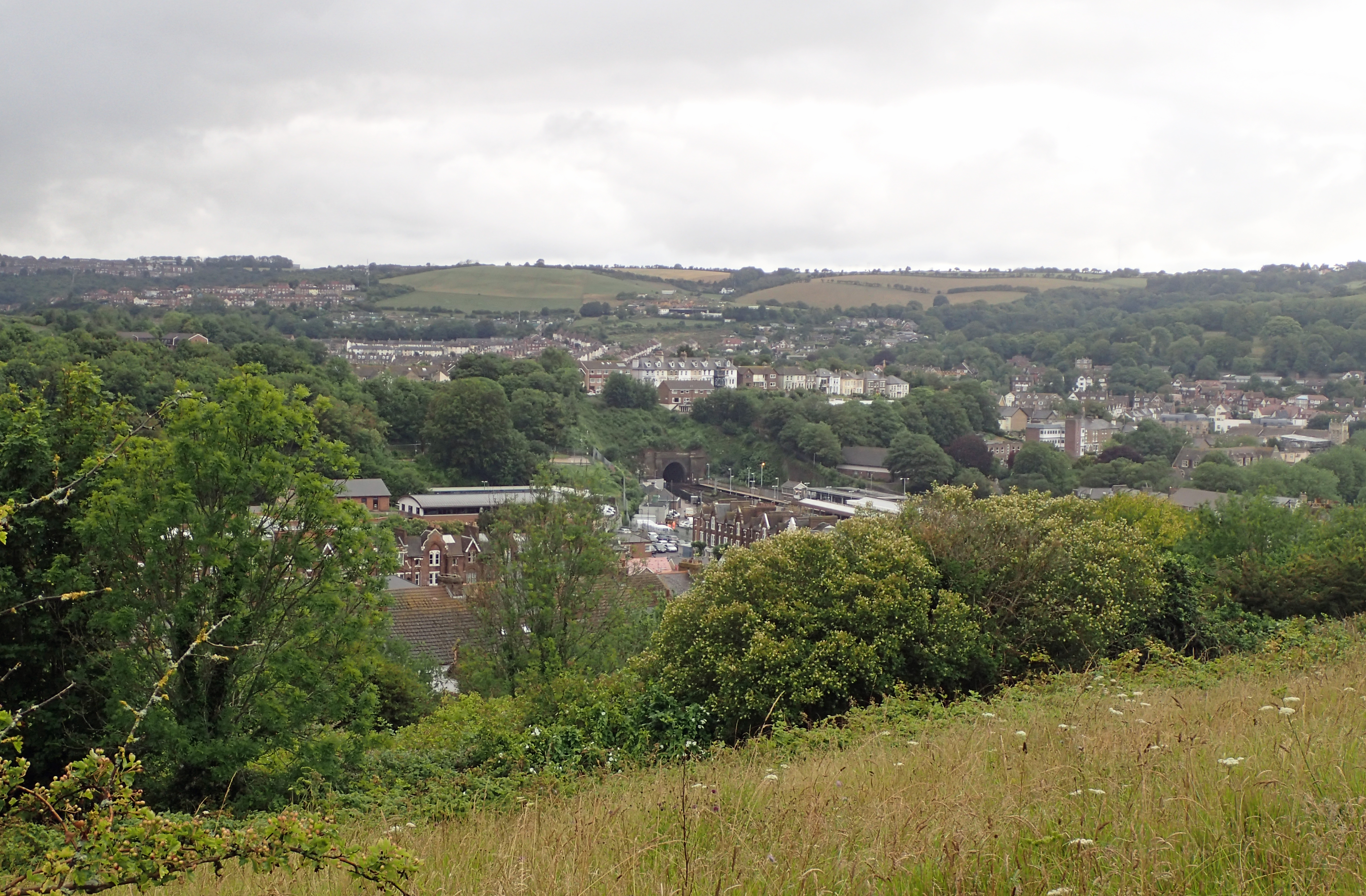
Looking down toward Dover Priory railway station from the Western Heights. The rain clouds are clearing and I only have sodden grass and muddy paths to content with
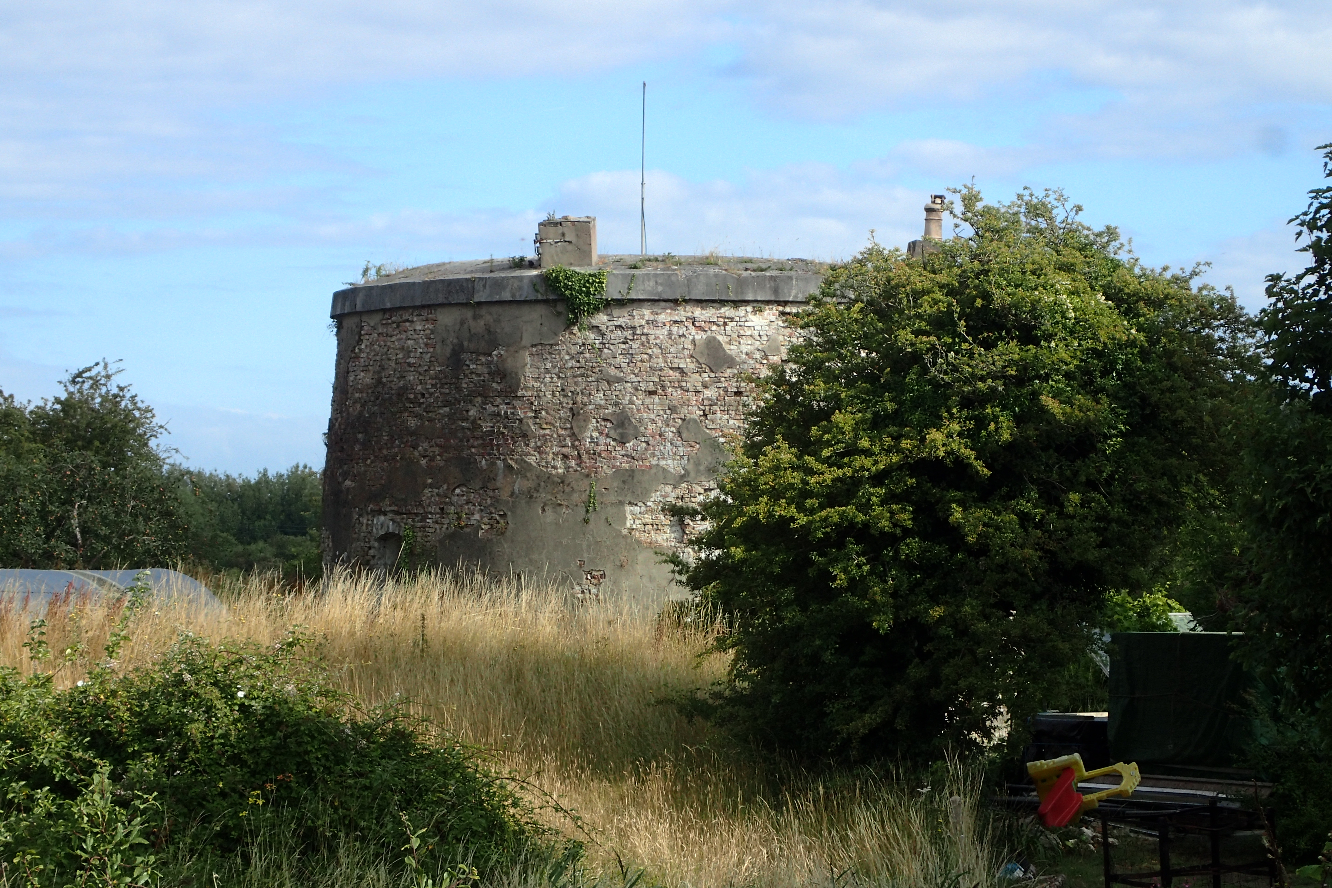
The 18th century Western Heights deserve a day to explore. Access to these will improve over the years to come and a lot of money will need to be spent to do this. The Western Heights Preservation Society is doing impressive work to the site though no public access to the Drop Redoubt at all is being permitted in this coronavirus year but a wander round the exterior is fascinating. The fort certainly warrants attention as these extensive defenses are impressive. Building work began prior to the Napoleonic Wars and occupancy by the military continued right through to 1961. Much is very well preserved.
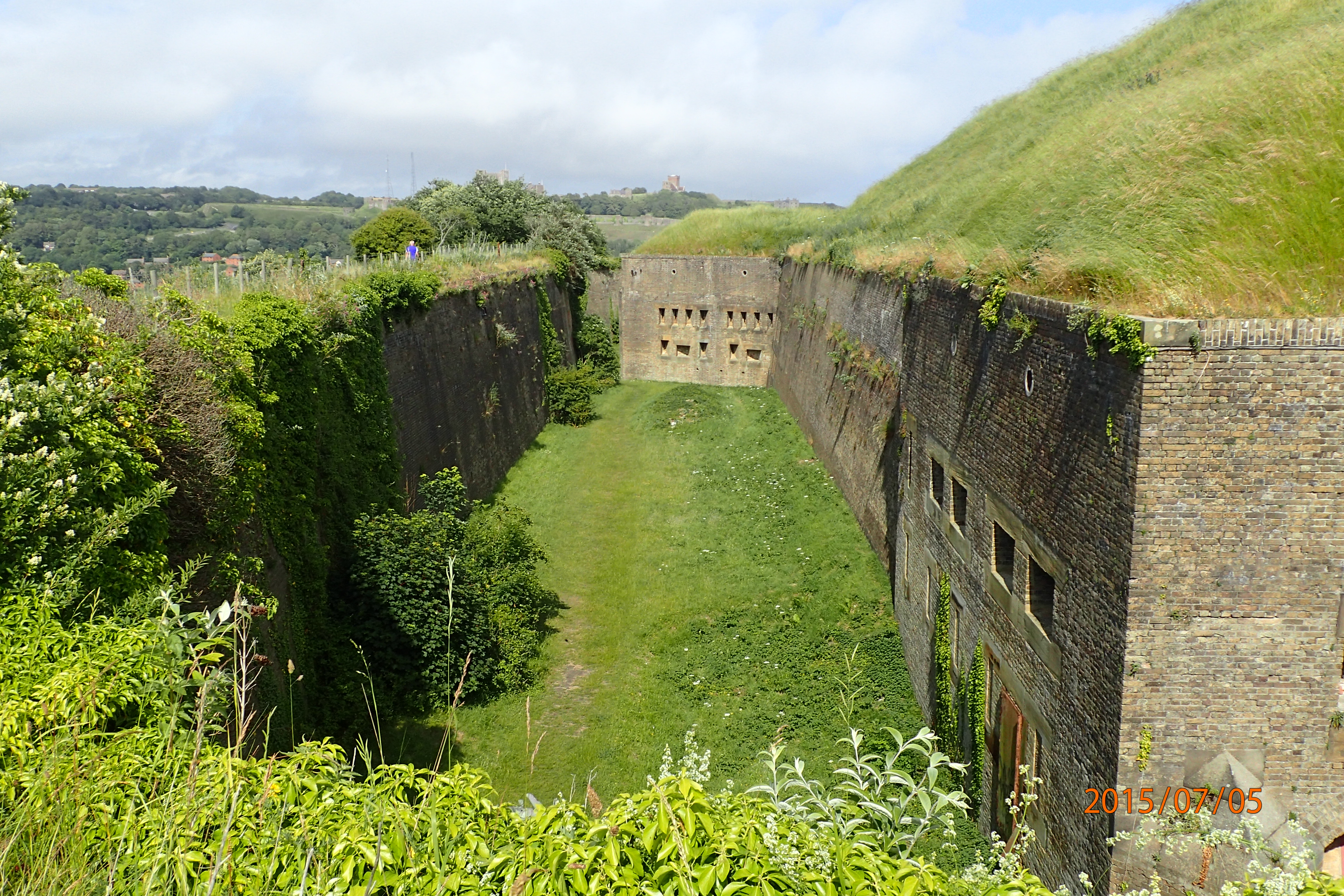
Part of the impressive Drop Redoubt of the Napoleonic Western Heights is passed by the Saxon Shore Way on the cliffs above Dover. Photographed by Three Points of the Compass when completing the North Downs Way in July 2015
Pre-dating this fort by far, the Saxon Shore Way also passes the clear remains of a 12th century Knights Templar church with its curious circular nave, the shape being an imitation of the church of the Holy Sepulchre in Jerusalem. The remains were only found when military engineers were strengthening the Western Heights in the early 19th century. The Knights Templar were formed in Jerusalem in 1118 to protect pilgrims visiting the Holy Land after the First Crusade.
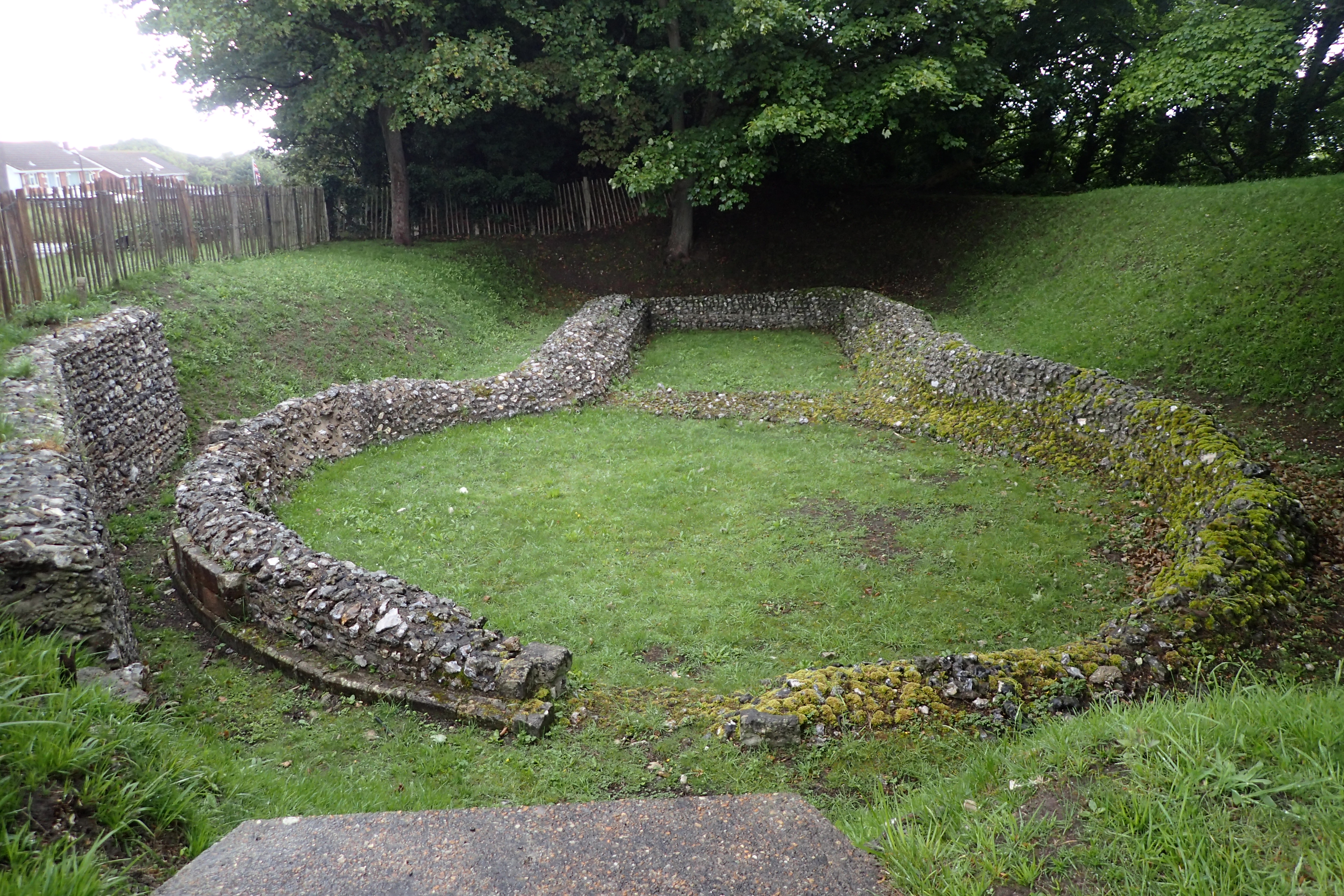
Knights Templar church, Dover, dating from soon after 1128 when the order reached England
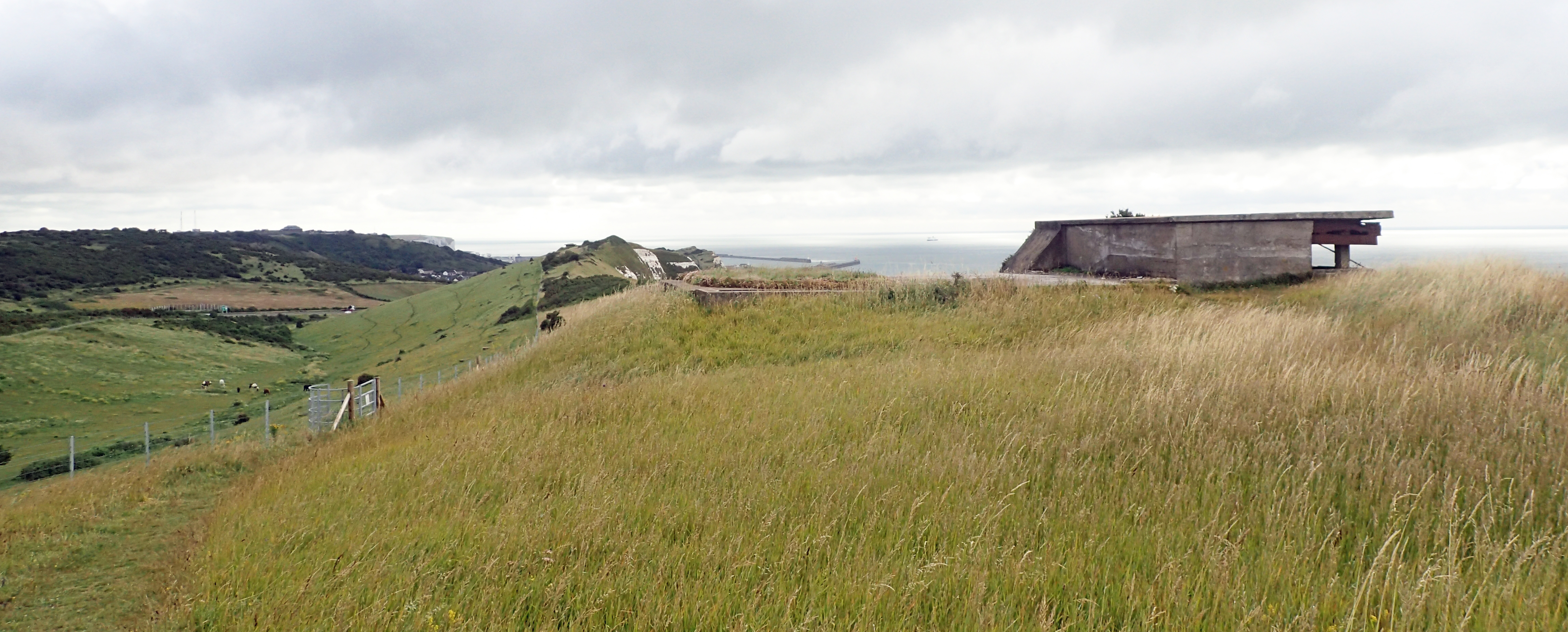
Military look-outs from World War II are dotted all the way along the cliffs south west of Dover, though most are now overlooking the far newer Samphire Hoe Country Park, constructed from spoil dug from the Channel Tunnel
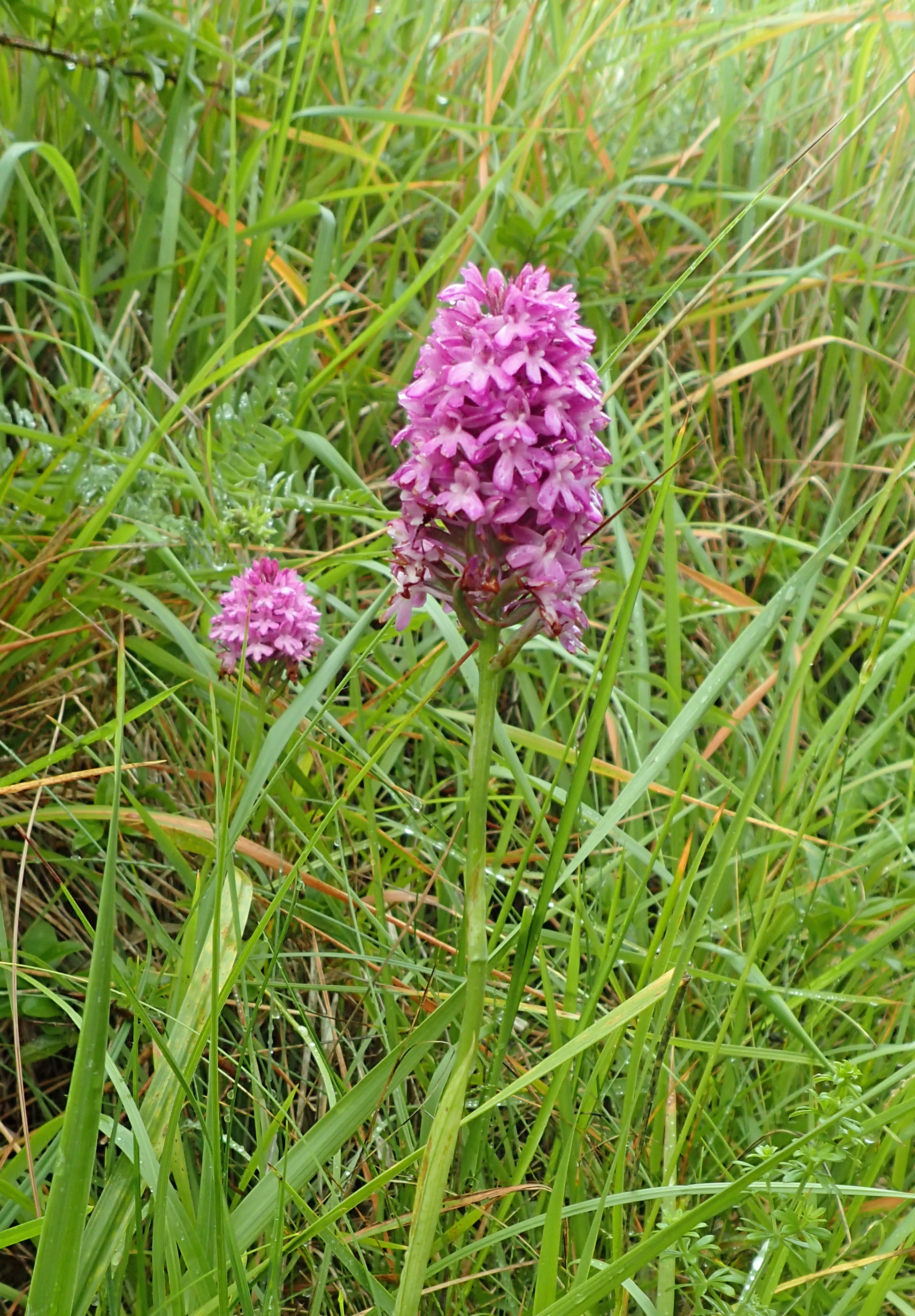
Pyramidal Orchid (Anacamptis pyramidalis
The grasslands along this stretch are rich in chalkland specialist plants and invertebrates, though few insects were around I was battling my way through countless raindrop sprinkled cobwebs. Bees that had got caught out in the rain were buzzing in small pools in the grass, battling to shake off the rain before crashing off through a forest of grass stalks.
Concrete look-out posts left over from the last great world conflict abound along here. Some have toppled over the cliff edge or hang on precariously, others are barred with no access, some are very obvious favourite halts for those wanting to drink cans of cheap lager or have a crap. Two I wandered into were being used to store feed for the many horses grazing the landward slopes.
Walking the cliffs out of Dover and heading toward Folkestone
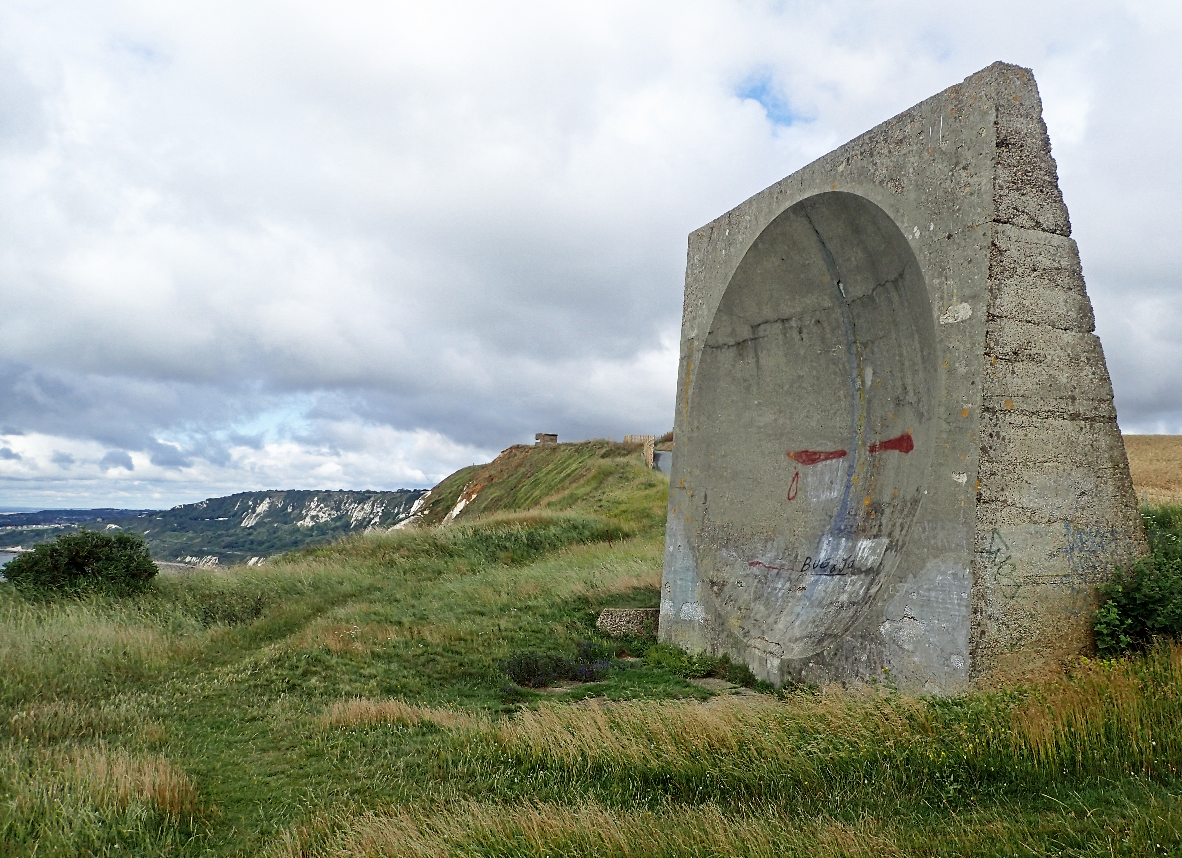
Concrete parabolic sound mirror
Beside one of the national cycle network ‘mileposts’ there is a rare survivor pointing out to sea- one of the ‘listening ears’, a large concrete dish, or mirror, that was used to focus and concentrate the sound waves from approaching enemy aircraft minutes before the sharpest of hearing could do so. More experimental than crucial, the building of post-WWI sound mirrors was cancelled due to the developing radar system.
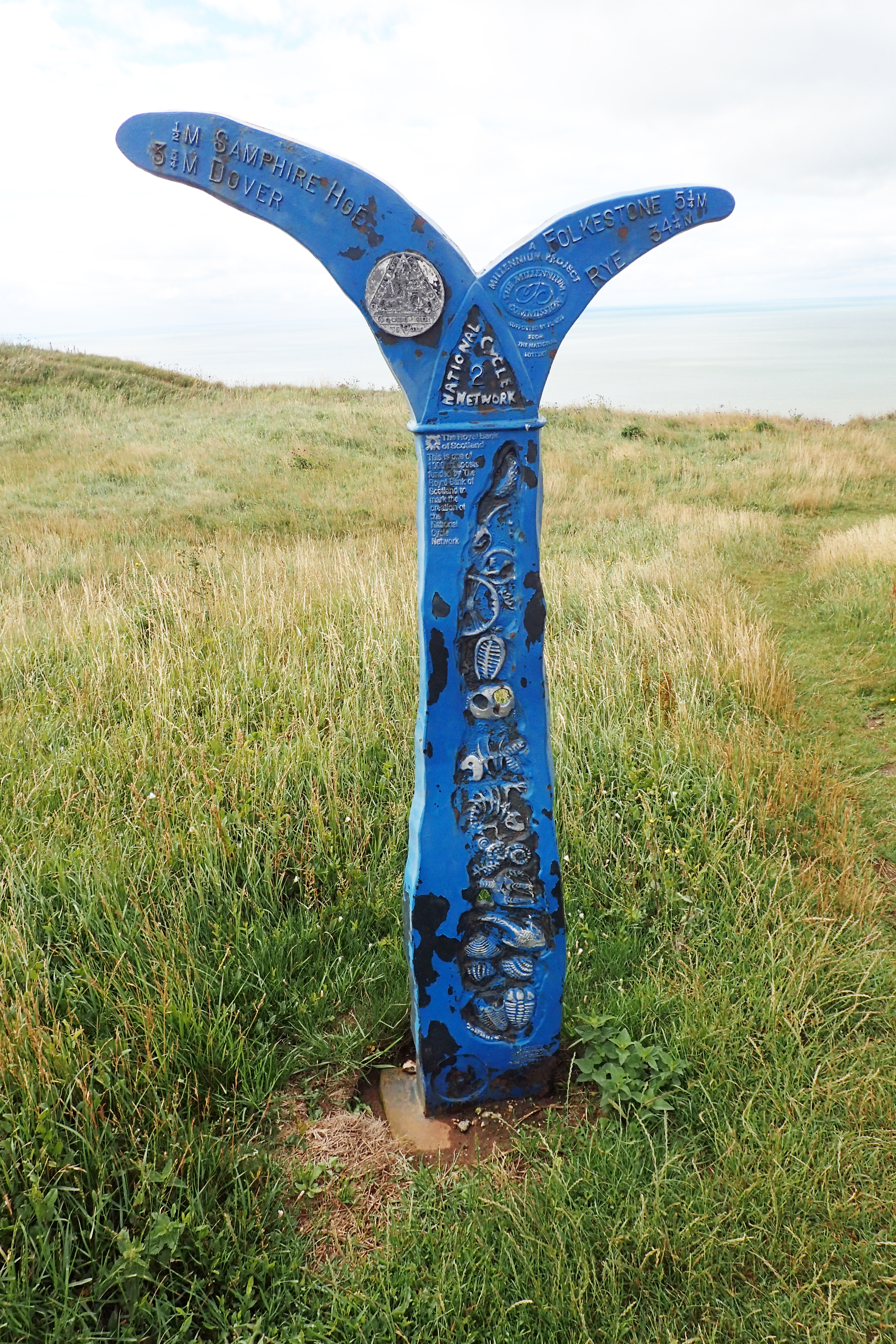
National Cycle Network 2 milepost
I saw four of the iron millennium cycle network mileposts on this section out of Dover, all were of the ‘fossil’ design and each had its special code disc, not that I am collecting these.
Sponsored by The Royal Bank of Scotland (now NatWest Group), there were originally around 1000 of these mileposts when first erected twenty years ago but few, if anyone, seem to know how many have survived today and what condition they are in. Even the list kept by Sustrans appears to be incomplete.
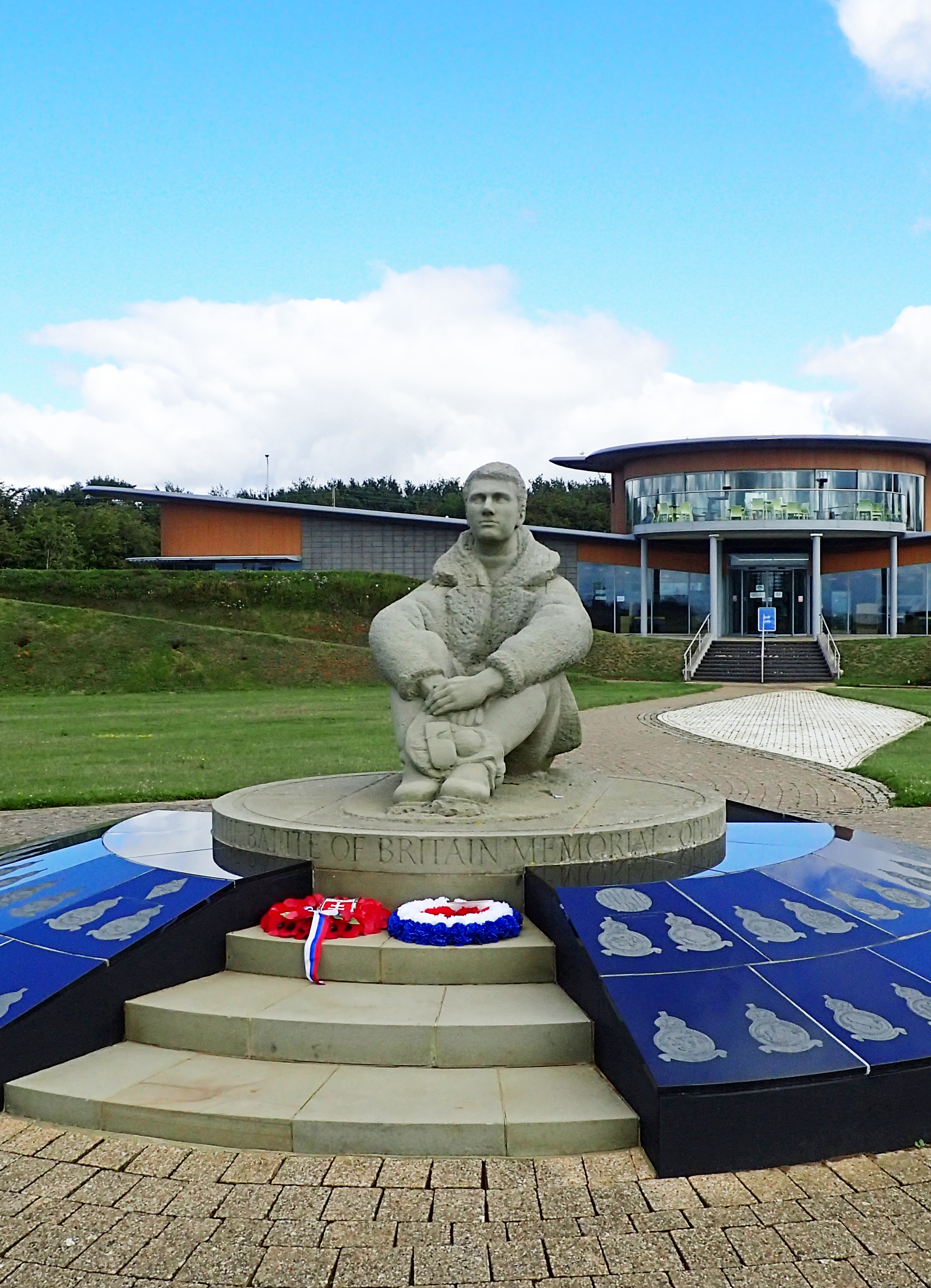
Statue of RAF pilot at Battle of Britain Memorial
From there it is enjoyable walking all the way along Abbots Cliff to The Warren, a country park at Capel-le-Ferne. Here I took a little time out at the Battle of Britain Memorial with its memorial wall listing almost 3,000 fighter aircrew who flew in the Battle. I get the fullsize replica Supermarine Spitfire MkI and Hawker Hurricane sited to one side, but I thought the large stainless steel sculpture of a Junkers JU87B Stuka crashing into the ground behind them of somewhat dubious taste. No-one else appeared to be around and the doors of the visitor centre were locked, so that meant the upstairs cafe overlooking the outside memorial was also not going to profer the hoped for mug of tea. A shame as I have been here a number of times and it is an interesting place. On my last visit I sat in swirling mist on the veranda and couldn’t see more than fifty feet, other times you can easily see France, just as one of ‘the few’ might have gazed over the water. Fittingly, there is an evocative statue of a seated RAF pilot looking out to sea.
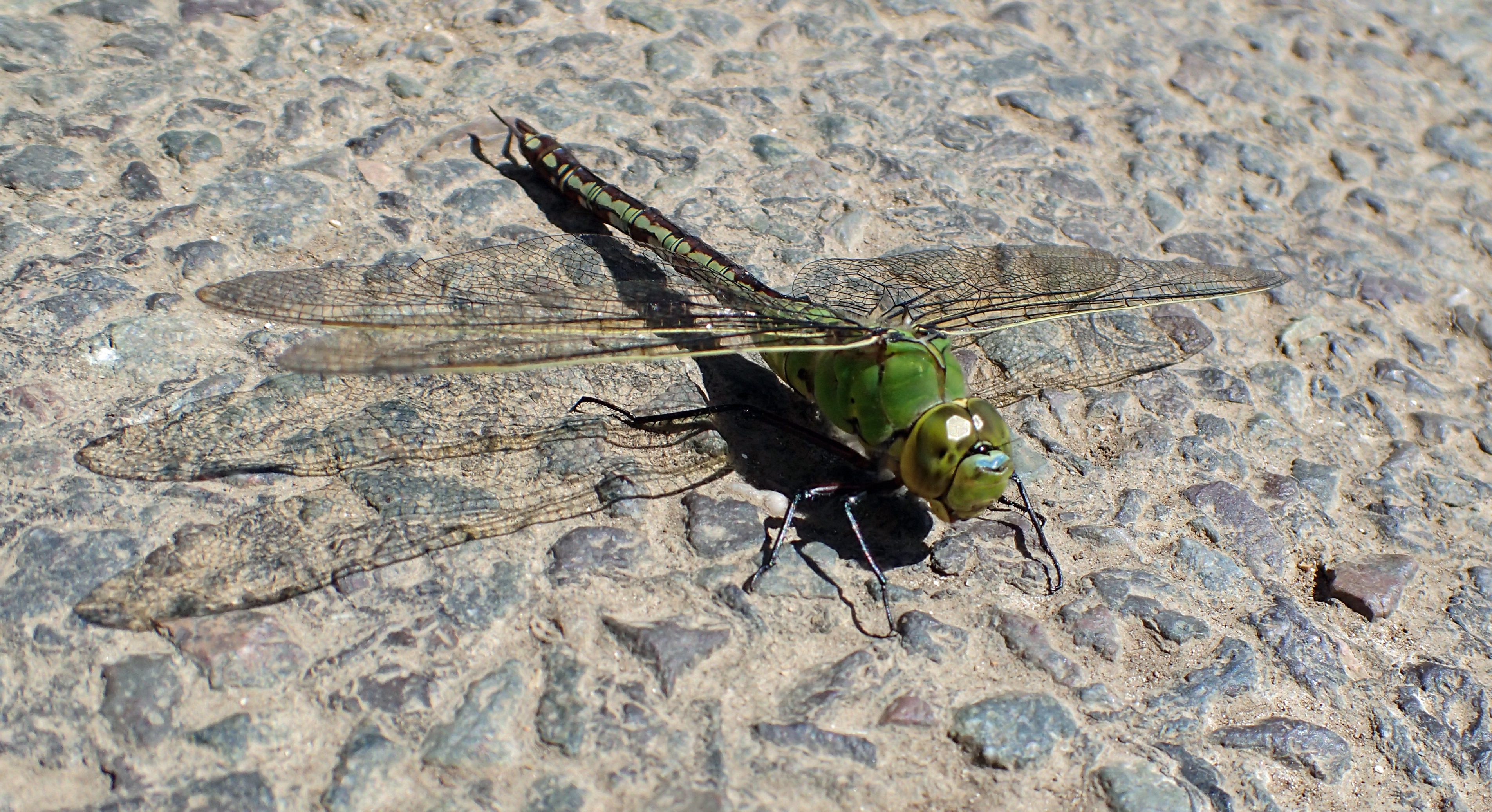
Resting female Emperor Dragonfly (Anax imperator), aggressive, and the largest of the hawker dragonflies
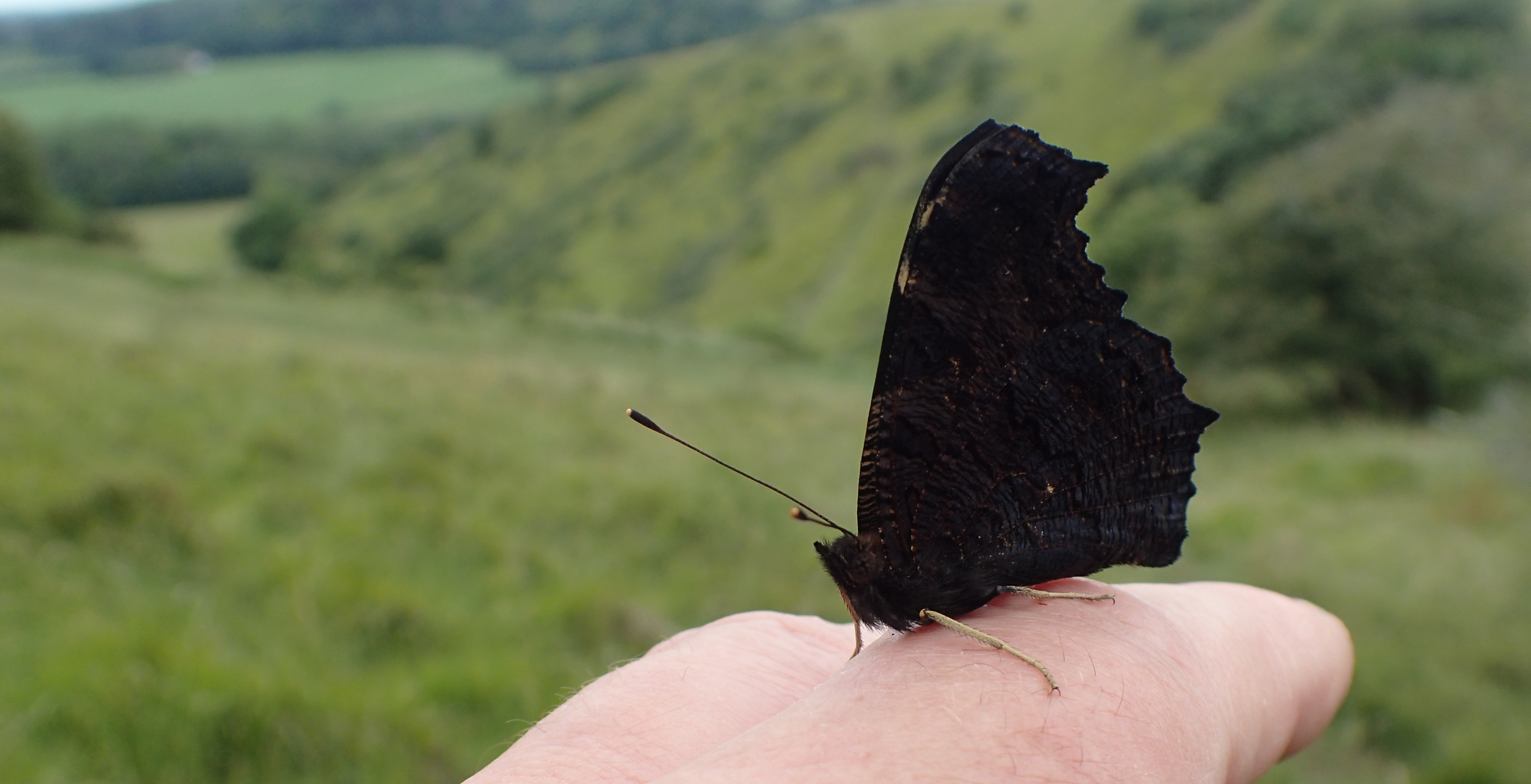
Peacock Butterfly (Inachis io). A commonly seen and brightly coloured insect on the wing, with wings closed, these can mimic a dried and withered leaf while hibernating
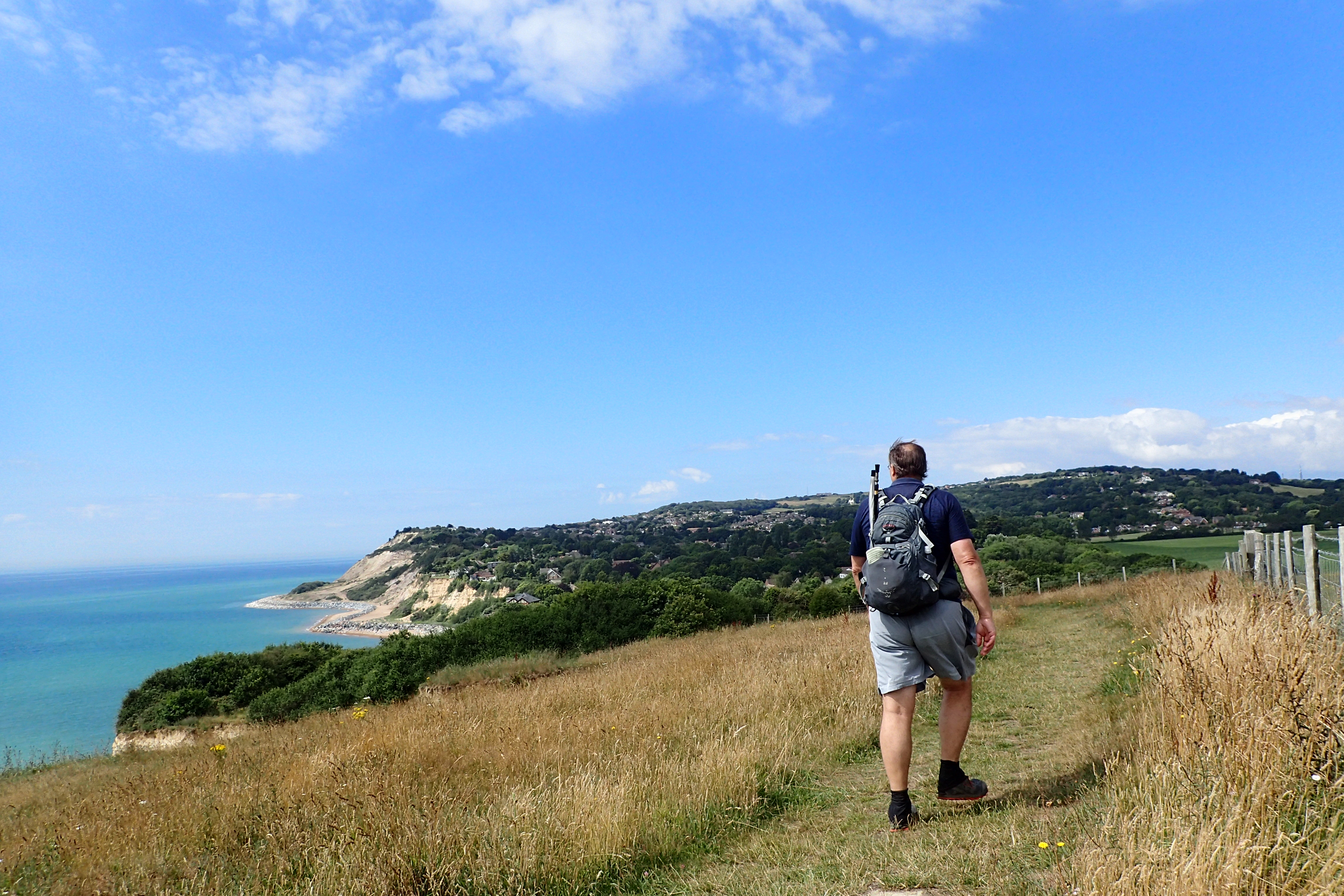
The trail then diverts a little inland to skirt coastal Folkestone. It is a cleverly laid route that keeps mostly to the best on offer, frequently with good views. And if not good, then interesting- the rattling huge trains with their artics and containers loaded in skeletonised carriages frequently passing below prior to disappearing beneath the Channel. Both railway and the noisy A20 tunnel deep beneath Round Hill and the remains of the ring and bailey castle atop Caesar’s Camp. I wandered the earth ramparts at the top, enjoying this stretch of the walk immensly. Later, a well placed bench with engraved Shakespearean quote provided a more than adequate lunch halt. The distinctive transmission mast on Tolsford Hill near Etchinghill is then the skyline target for much of the short remainder of the day. The last time I passed this mast was seven years ago, then with my teenage daughter when the two of us walked the 22 mile Elham Valley Way over two days as part of her ‘training’ for her Duke of Edinburgh expedition. We did it as a winter walk, camped in a pub garden overnight, it snowed and was bitterly cold. The two of us had a great and memorable time. This time I was walking in the opposite direction and the Saxon Shore Way loses the modest height it has gained as it drops down off Tolsford Hill.
Annoyingly, there was yet another of those pathside residences us hikers occasionally have to contend with- two snarling dogs came to the open gate, making short, threatening bluff charges until I was past, then venturing out to follow on my heels, snapping at me when I looked away. No-one around and I wasn’t going to try and find an owner. Instead I showed a fine turn of pace to get away from them, keeping my Leki pole ready. After crossing the M20 it is a sharp right turn off the route and a short walk to Sandling station, arriving mid-afternoon after a walk of slightly less than fifteen miles.
Miss Three Points of the Compass climbing Tolsford Hill when backpacking the Elham Valley Way in the winter of 2012/3. The Saxon Shore Way decends this hill toward Sandling
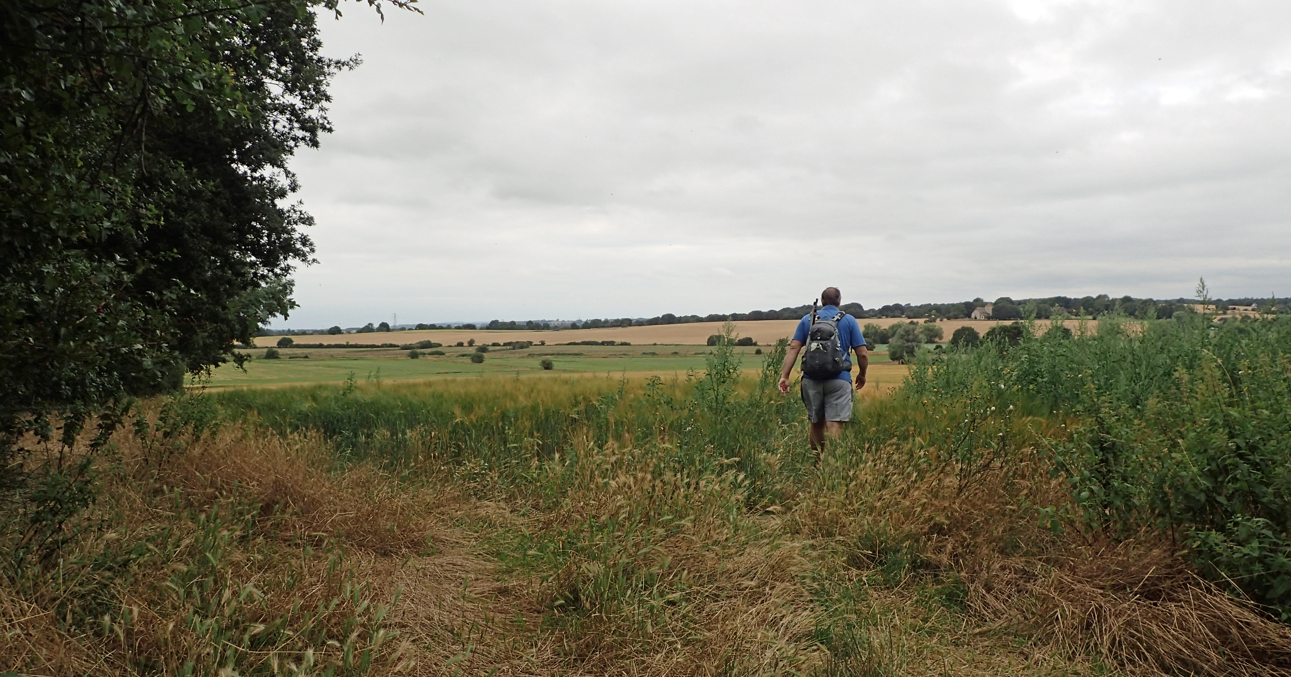
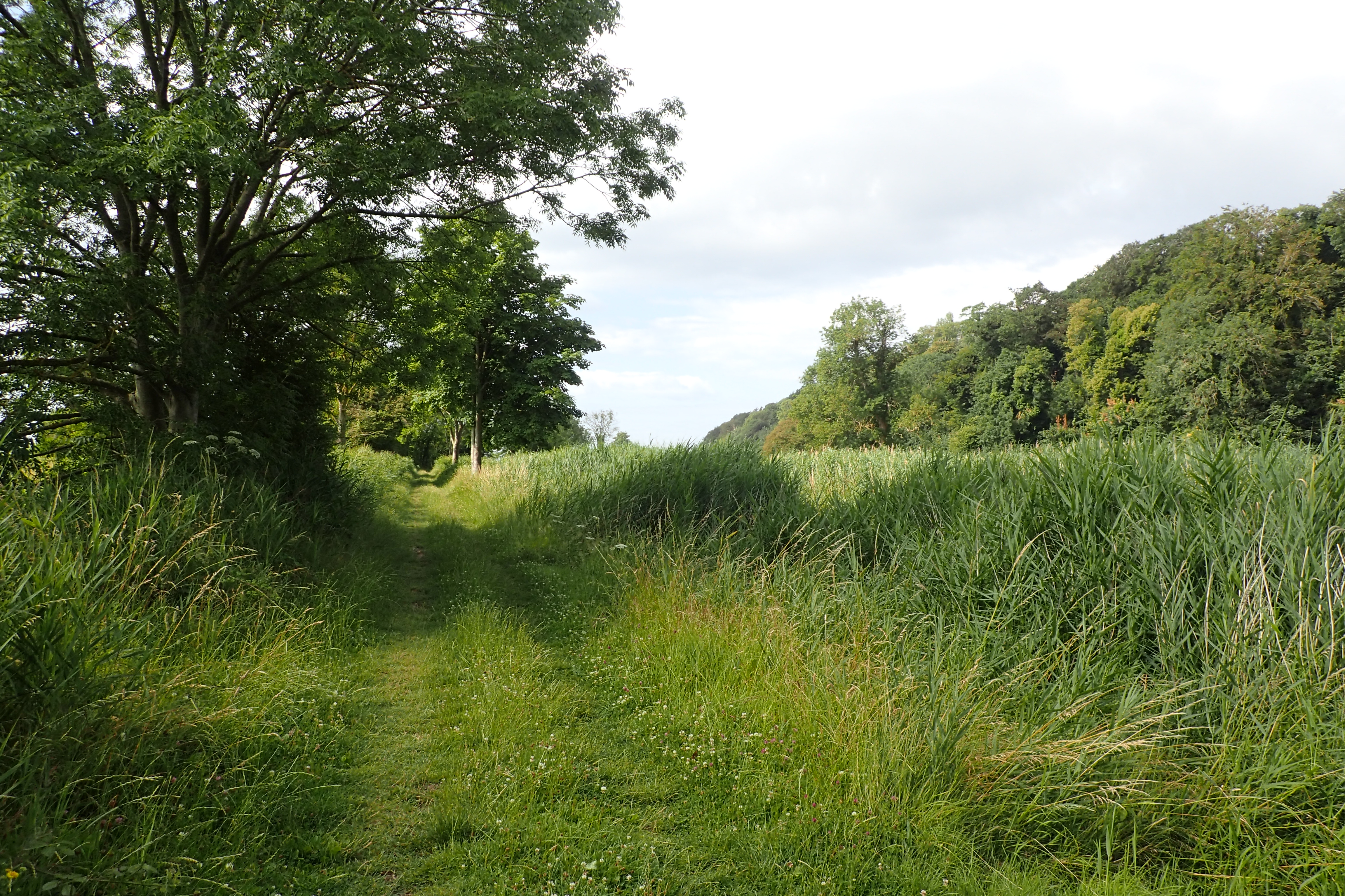
A return to the trail the following day sees good weather forecast, perfect for a walk through the Kent Downs Area of Outstanding Natural Beauty. To begin with there are attractive and cool, if brief, stretches of mostly deciduous woodland, interspersed with cereal crops. These little woods with their birdsong would have been a lovely place to halt for my brief and meagre breakfast however I was intent on a ‘halt with a view’ at the Shepway Cross, or more accurately, the Cinque Ports War Memorial.
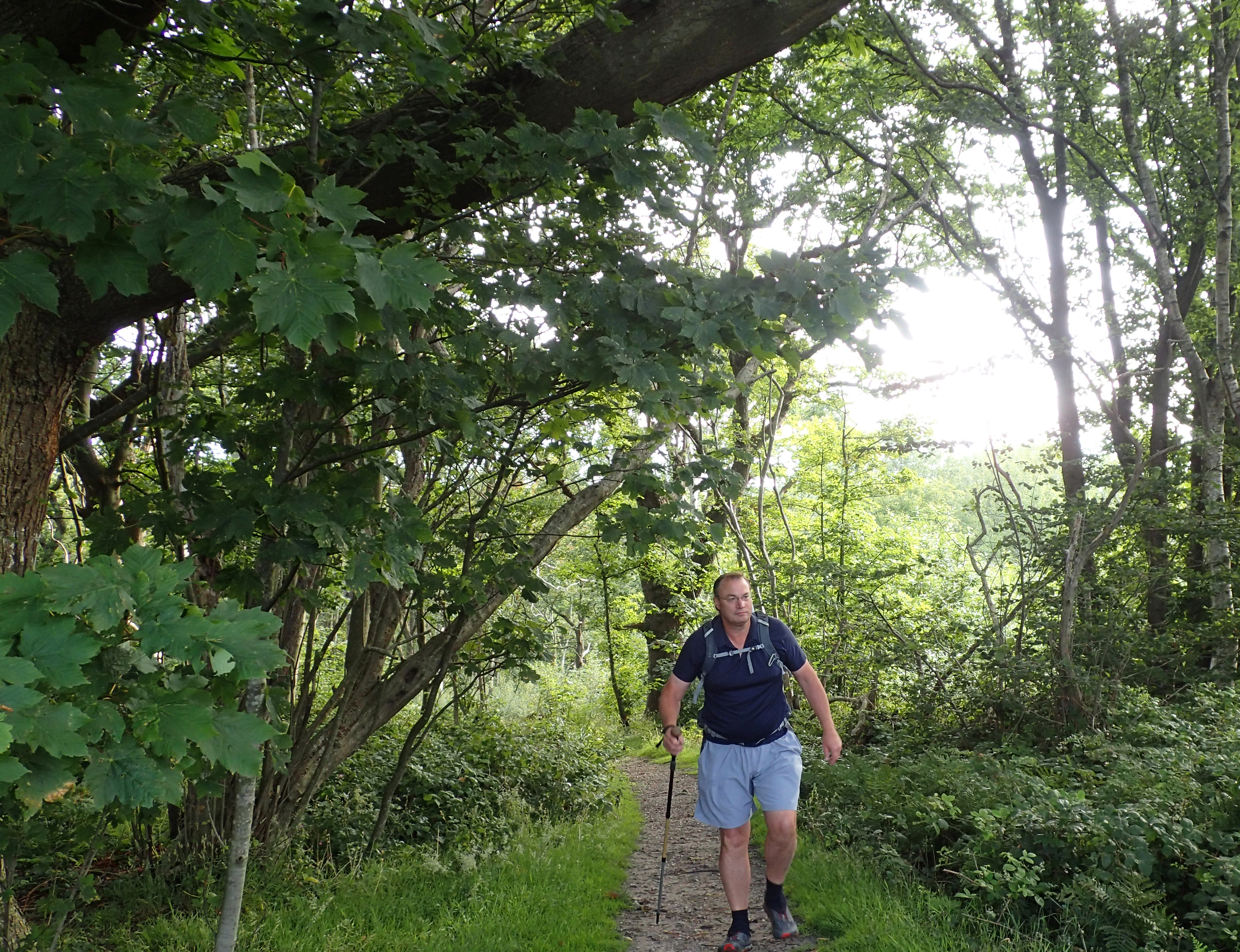
Woodlands approaching Pedlinge
Crossing a field of barley and I was alerted to a low head peeking above the crop to my left. A small and rebellious group of sheep had escaped from their field a mile up the road, wandered down the lane and then broken through the hedge and were happily munching down on fresh greens in the neighbouring farmers field, I left them to it.
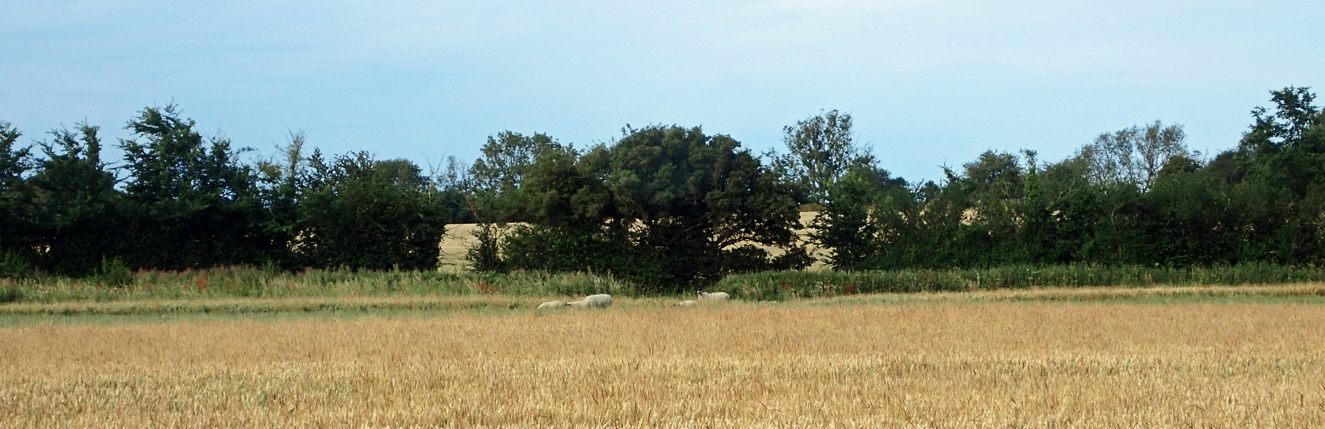
Embarrassed looking sheep pretend they are not playing truant
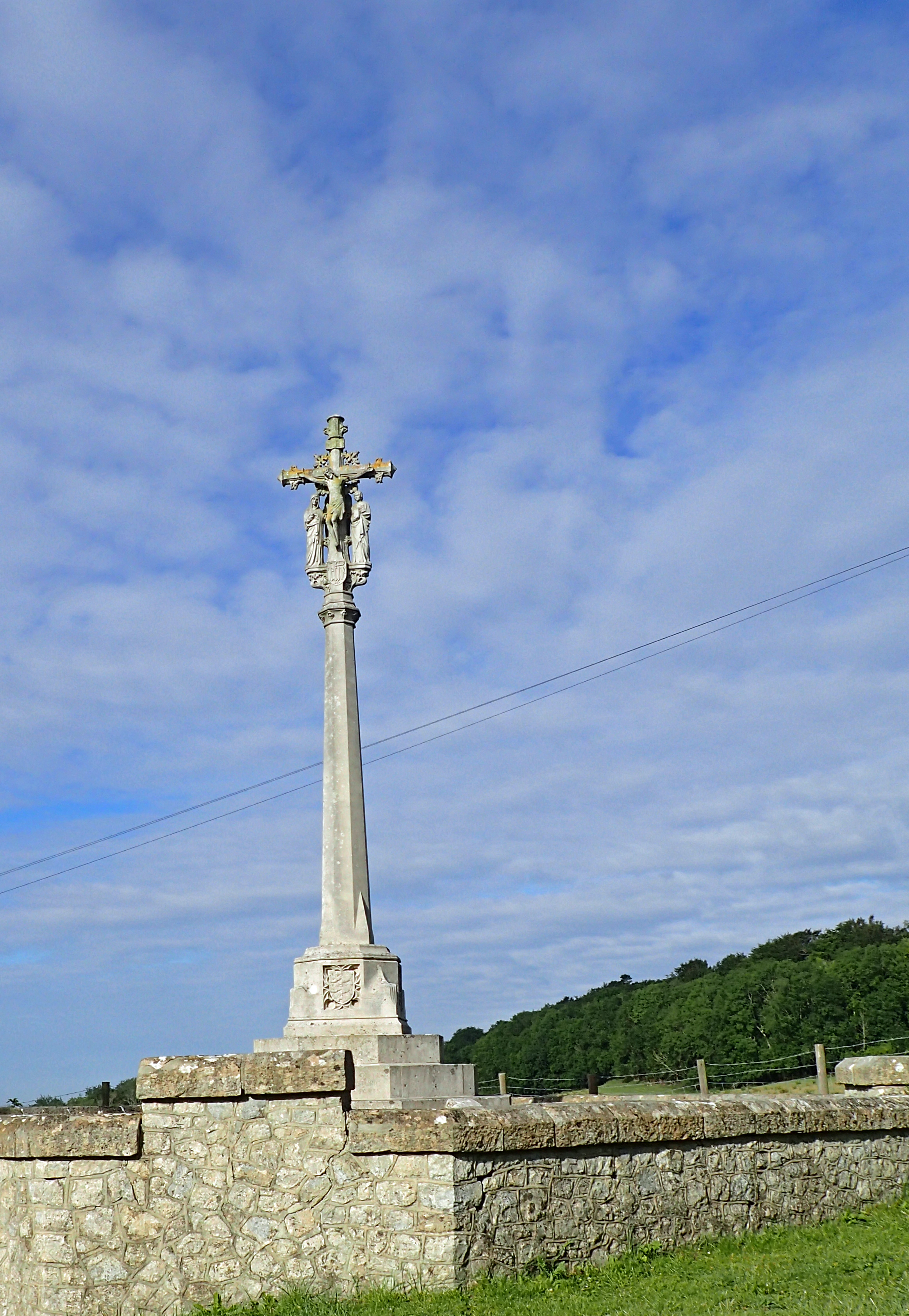
The Shepway Cross
The Shepway Cross makes for a lovely halt. It is now a listed monument and walking round to the back of the low wall encircling it gives opportunity to view all sides and provides a more than adequate rest point at which to consume a breakfast bar and rehydrate, the temperature was beginning to build and I was already sweating.
“where Grisnez winks at Dungeness
Across the ruffled strip of salt”
George Meredith
From my halt I could see across the flattened Romney Marsh to the distant lighthouse at Dungeness standing on its prehistoric strips of shingle. That stands only some twenty miles from its cousin on Cape Grisnez in France. The marsh was originally mostly under water and much of my remaining walk today would follow the old coastline (hence ‘Saxon Shore Way’). A glance at the map reveals the contour lines stretching south west along the marsh periphery. My route would hug the hills before dropping down the slopes to the Rother Levels, where the River Rother and Royal Military Canal cut across it. Two days of walking would take me to the inland port of Rye at the far side of this strange little reclaimed island.
The view from my breakfast halt revealed much of the days walk before me. Additionally, beyond Romney Marsh and the sea, can be seen the lighthouse and squat blocks of the nuclear power stations on the Dungeness headland
The paths are old rights of way around here and no doubt they have proved meddlesome to recent land owners who have had to contend with people, quite rightly, snaking their way past their properties and businesses. Lympne now boasts a nondescript industrial park built on top of what used to one of the most important airfields in the country. In 1919 it was one of the first four customs appointed aerodromes in the country, In the thirties it was the starting point for numerous long distance record flights by the likes of Amy Johnson, her husband (to be) Jim Mollison, and Jean Batten. The World’s first air car ferry briefly operated from here to Le Touquet. Years later, during the Second World War, there was a plot to kidnap Adolf Hitler, once captured he was to be bought to Lympne. The list goes on, and on, but the airport stopped operating in 1984 and nothing remains today.
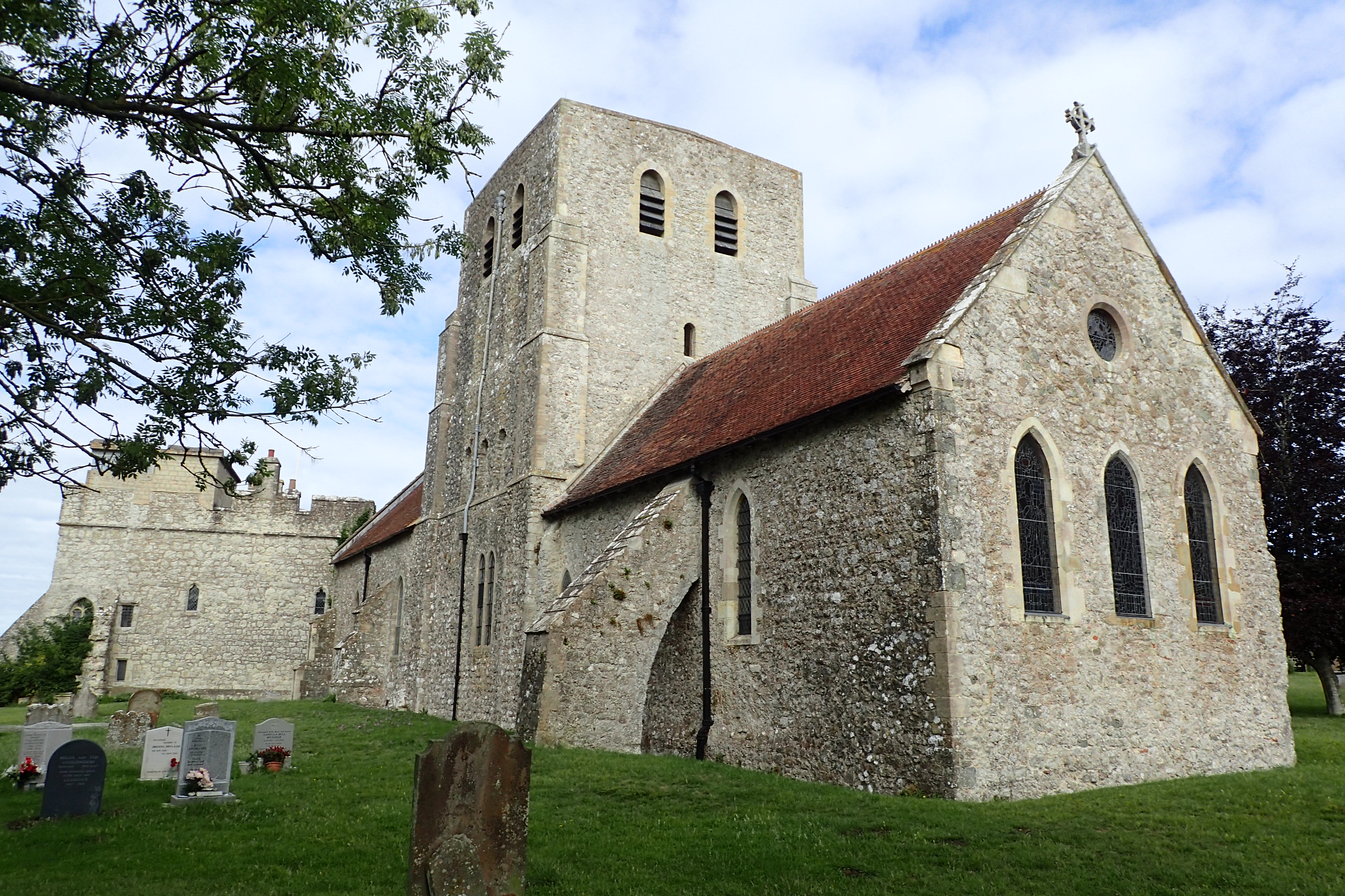
12th century St Stephens Church, Lympne
“keep along the bank, then turn down the hill, go past the giraffes, keep on to the canal, then turn right by the camels”
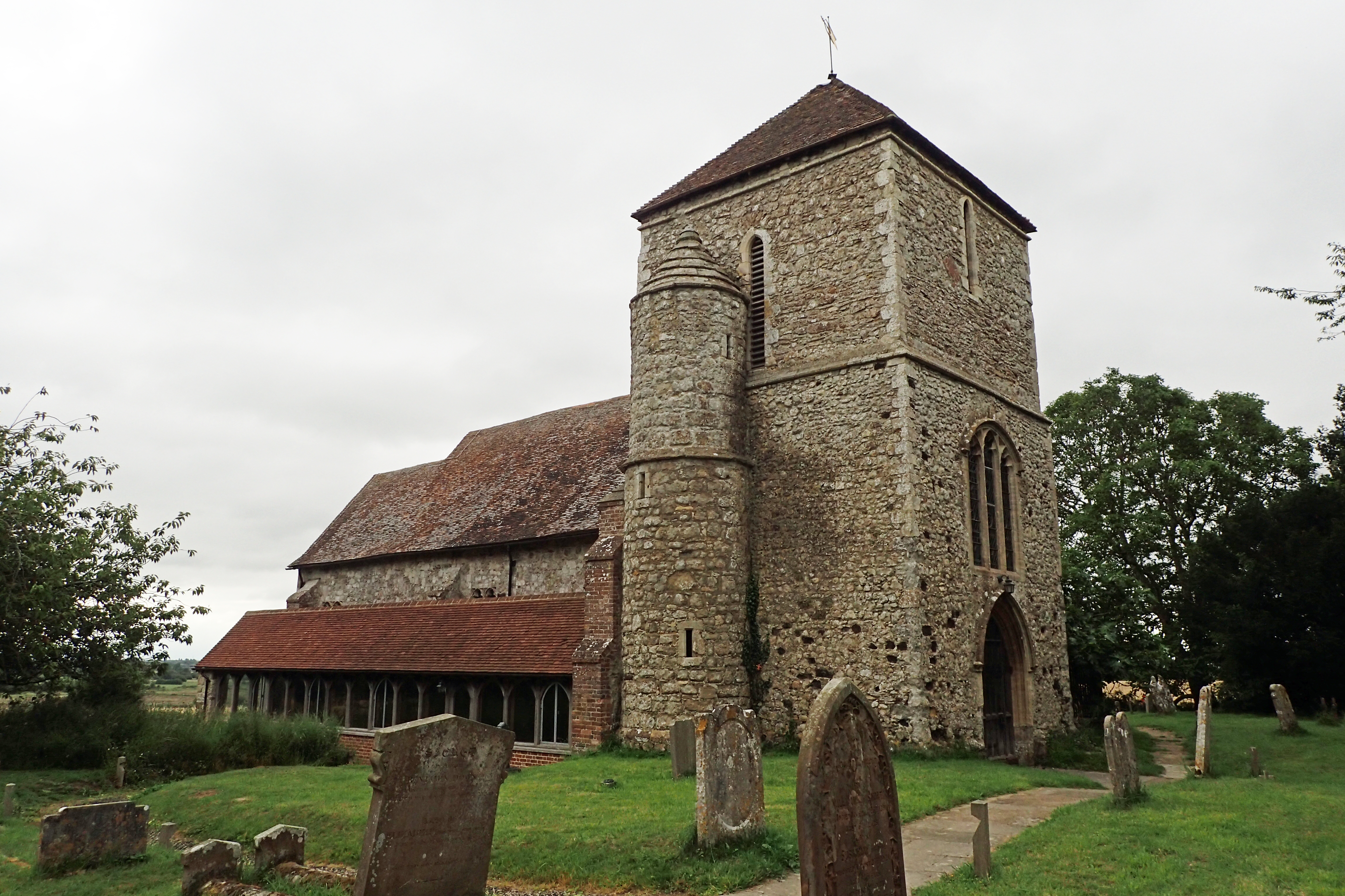
A little past Lympne is Lympne Castle, this is privately owned and used for weddings and such like so no general access. I was more interested in seeing the lovely 11th to 14th century St Stephens church adjacent. With its well situated bench overlooking Romney Marsh it would have made a far better halt than my previous one. It was here that one of the older residents pottered round with his dog and amiably spent a few minutes (socially distanced) chatting to me. Proud of ‘his’ church and ‘his’ view I remain a little unsure if he was just parochial or actually a local dignitary. It was Jim who delivered what must be my oddest set of directions.

View over Romney Marsh from behind St. Stephens Church, Lympne
For a while the Way hugs the edge of the high ground but having reached the first of the fenced enclosures of Port Lympne Wildlife Park (a zoo to anyone else) you pass the zebras and then drop down left, down muddy, slippery paths, snaking between enclosures holding bison (or is it buffalo) and impressive looking big-antlered gazelles of some type. Giraffes I can identify, so it was past them to the banks of the Royal Military Canal. Masticating camels peered at me from the fields on my right as I began the easy low level walking along the canal. This is a popular route for cyclists so to avoid them I moved up on to the adjacent snaking thin little track beside the canal, tripping over tree roots and catching my furled umbrella on overhanging trees, but I was away from dinging, splashing, bloody annoying, cycles being ridden with little thought of pedestrians.
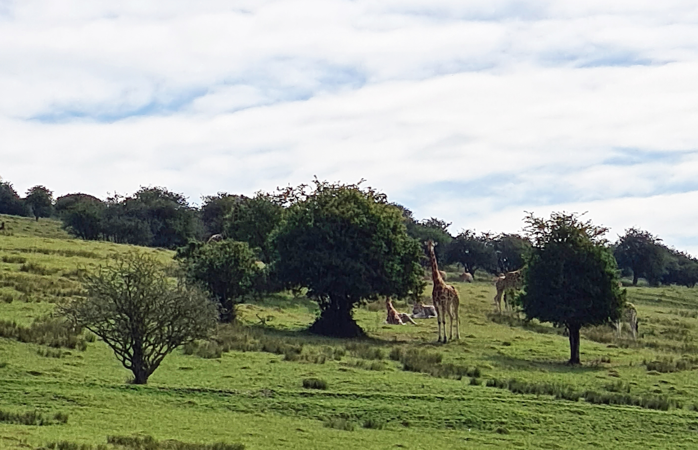
How many UK walks offer views of giraffes striding the hillsides?
Easy walking beside the Royal Military Canal
Eventually the Saxon Shore Way emerged from the trees and it became a hot and sweaty walk. I left cycles behind me and had the trail to myself, no-one was around. I paused for a good while trying to get a photograph of Turtle Doves above. I haven’t seen one for a decade or so, but failed miserably to catch an image as they kept flying as I got near enough.
There were a lot of cows around and one some five hundred metres away decided I was of great interest and started, literally, to gallop toward me. I have never seen a cow move at that speed. Nervously I hopped over a fence and it slowed to a simple trot as it neared. It lost interest, I hopped back over the wire, carried on, and immediately attracted the attention of a large bull that decided to take a closer look. I am not normally bothered by bovine presence but these looked to be too inquisitive.
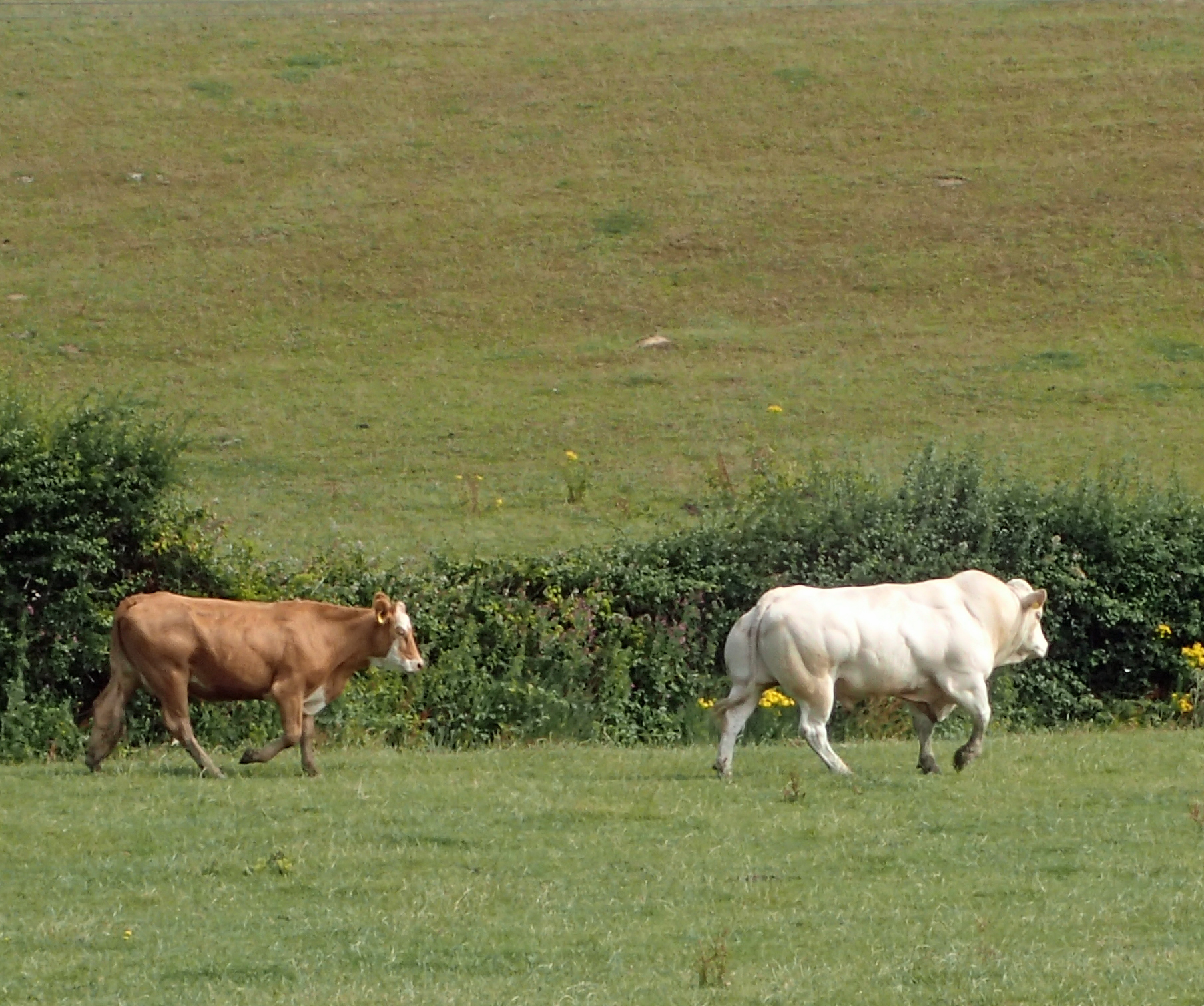
Curious bull- probably, possibly, maybe, nothing to be concerned about
Studying the map, I climbed a fence and escaped the herd by taking an early path back up the contours to soon join the awkward constantly changing route inland that eventually emerges at Hamstreet. If there is one fault with the Saxon Shore Way it is this part. The trail here is a right mixed bag and it requires constant attention to remain on the right path. I think it would be better staying with the Royal Military Canal as I am not even convinced it is following any historic route by striking inland. As it was, the trail passes close to the railway station, a mile north of the canal and that was the end of another day with a further thirteen miles completed.
Leaving Warehorne the Saxon Shore Way follows ancient paths through the Low Weald
My next day on trail had me arriving at Hamstreet station with grey skies though I hoped these would clear later. It was comfortably cool walking and it is a treat to follow the very obviously old routes across the fields that join one isolated community with another, paths lead from church to church. The Woolpack Inn at Warehorne looked a treat, I vainly hoped for the usual mug of tea and a bacon buttie but nope. I shall return…
Church of St. Mary, Kenardington
Window on south wall of St Marys reveals ‘ghost tracery’ of the original and much larger window
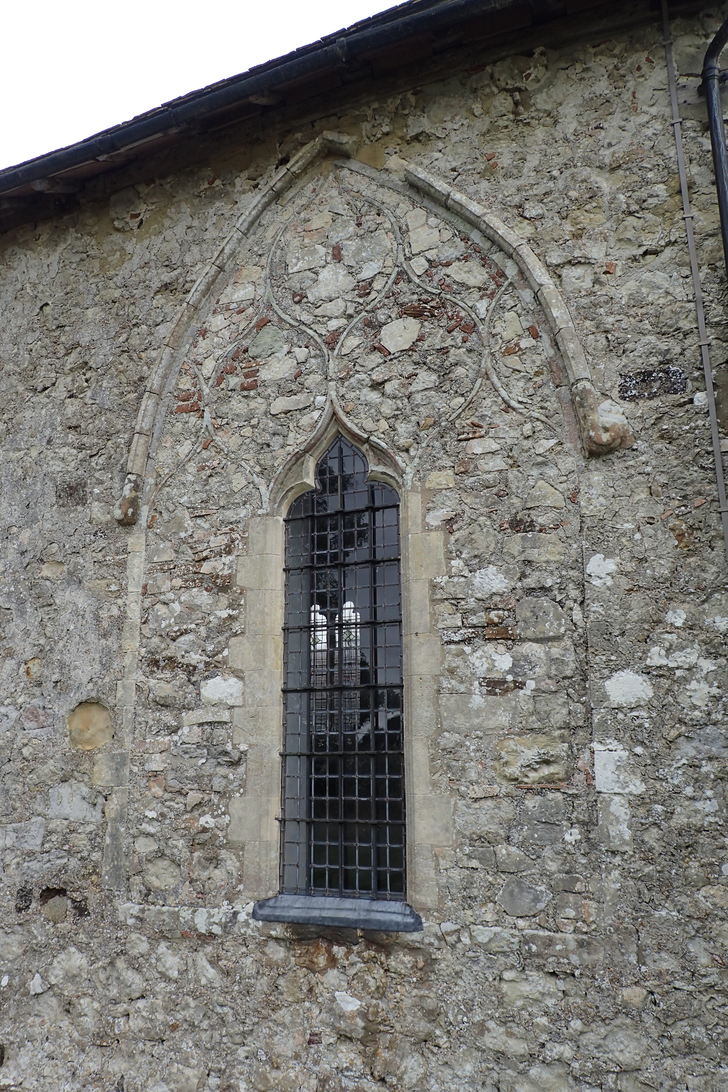
Leaving Warehorne I struck across fields, crossing the Horsemarsh sewer en route, sounds horrible, it is simply a ditch. The Grade II* listed parish church of St. Mary, Kenardington overlooks Romney Marsh and was, remarkably, open. I wandered in and explored the medieval church. This used to be a much larger church but has a chequered history. Built on the site of a Saxon fort, the church was severely damaged by a French raiding party in the 15th century and it was almost ruined after being struck by lightning in 1559. It was then rebuilt, greatly reduced in size and windows were partly or fully filled in.
In 2013, to open up its use to both the local community and those walking the Saxon Shore Way, a new-build ‘pentice’ was added that links with the previously isolated tower at the west end. The work is sympathetic and new glass has also been installed, marking the life of St Mary. I do hope that it occasionally fills with people as it all seemed very lonely and quiet when I visited.
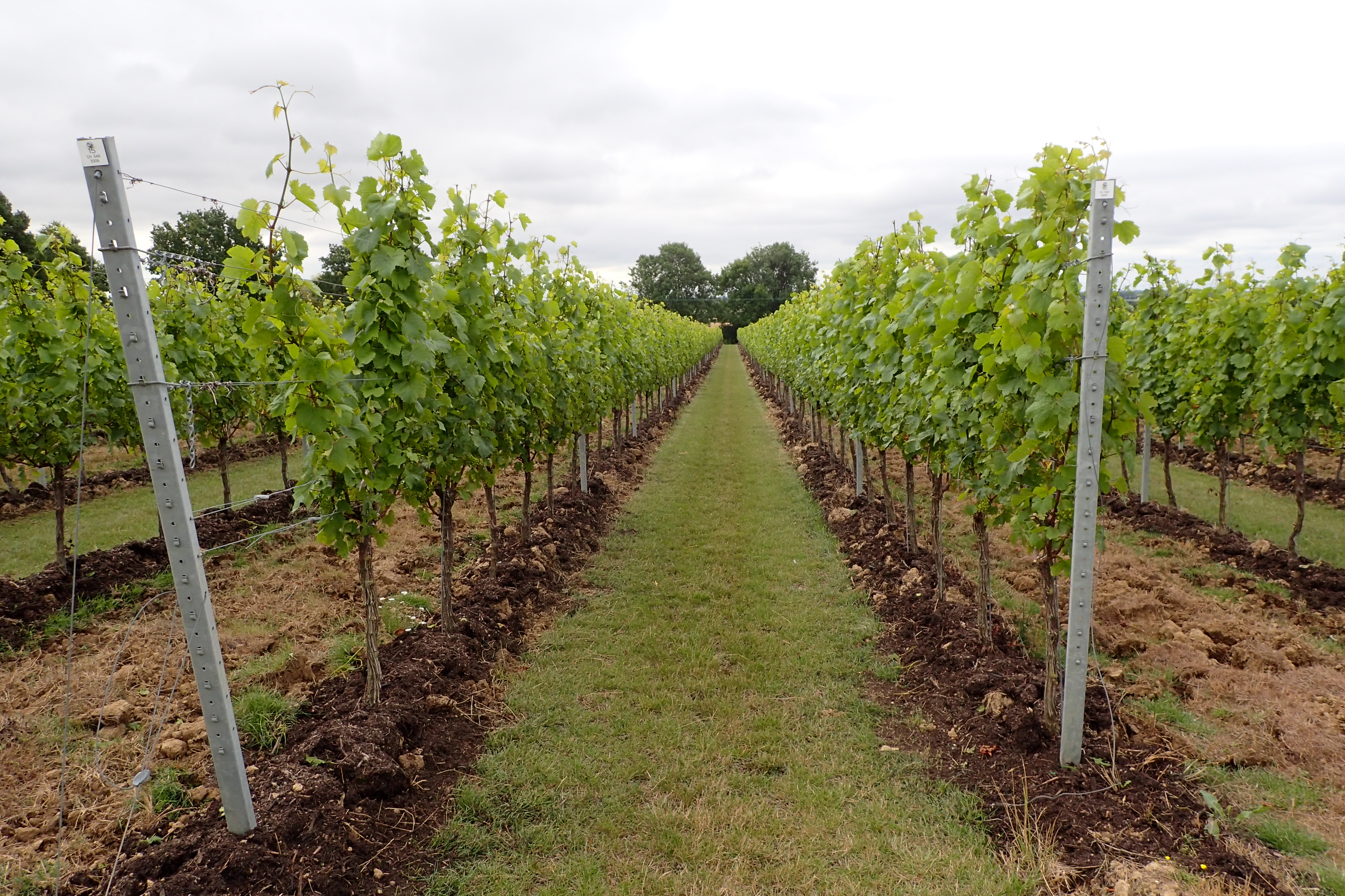
Gusbourne vineyards- established 2004. The Saxon Shore Way passes through the centre of these
The gently sloping south facing slopes in this part of the country have been farmed for a thousand years. I do wonder if the Romans had attemped a little grape growing when they were occupying the land here. Today, the Gusbourne estate extends over more than two hundred acres of vineyard and the Saxon Shore Way marches straight through the middle of them- Chardonnay, Pinot Noir and Pinot Meunier grapes produce award winning wines. The estate is immaculate. Frosts can occur here though and frost fans are used in the lower fields to protect the buds in April.
Then it was back to crossing cereal crops. A rustle to my left and a familiar head showed above the grain, followed by another, and another. What is it with these renegade sheep? Another bunch that had decided that the grass was, indeed, greener in the next field and had formed an escape committee.
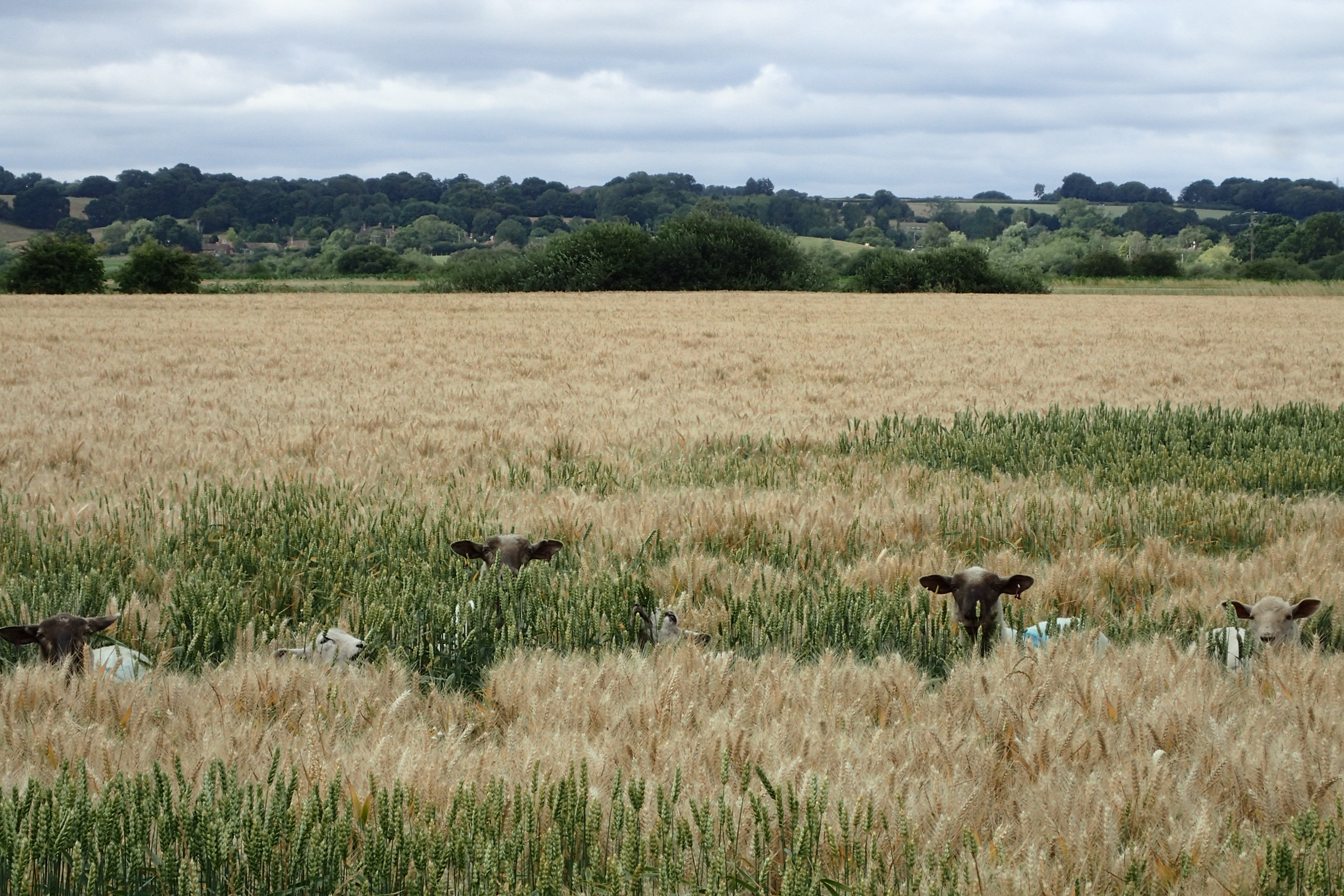
If anyone asks, you haven’t seen us
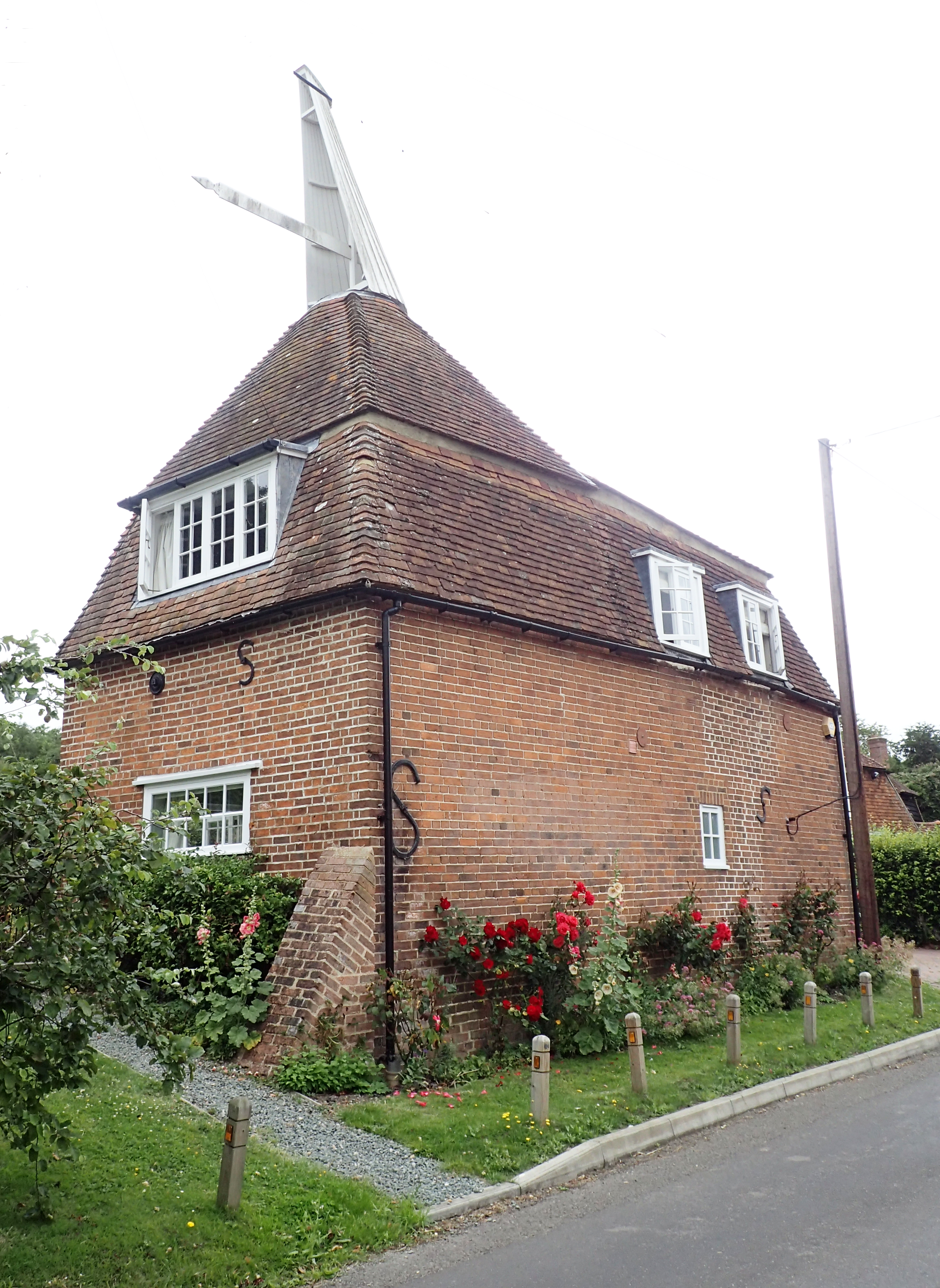
Oast house at Stone in Oxney, now converted to a residential dwelling. The corners of these older square oasts developed cold spots and circular oasts proved more efficient
This is a Public Footpath, Right of Way and the Saxon Shore Way- deliberately (allegedly) obscured and unofficially re-routed to keep walkers off the field edges and on a road instead. No-one has walked this way in weeks, until me
The remainder of my walking today was mostly uneventful. At Appledore the path does a short loop round to Stone in Oxney before dropping, yet again, down to the lower levels- billiard table flat it appears. It was approaching the Military Canal here that I encountered the only piece of obvious trail route tampering. Way marker posts had been ripped up and slung into the nearby ditches. The absence of one very necessary sign led me the wrong way for a while, taking me along the farm road, the route the farmer obviously preferred, but then I backtracked and walked the correct public Right of Way at the field and ditch edge to rejoin the canal beside the accompanying ‘Military Road’. I did wonder if there had been a diversion of the official route but it was at the far end that I found signs pushed over and uprooted. Once off that particular farmer’s land and onto the Highways England maintained verge there was a good well appointed sign indicating the way I had just come- peeved. Who the hell will halt and instruct these damned people who decide that established routes no longer apply just because they don’t like it?
Dropping down from the higher ground, again, toward the lower marshes
The waterside path then leads the walker all the way to Rye where the Saxon Shore Way used to end before being extended to Hastings. The path itself is mostly unremarkable and follows scrappy field edges until branching through a small (seemingly) residential caravan and boat mooring, but the canal is pleasant. Most noticeable is the long line of low cliffs off the right shoulder. These very obviously mark where the original and ancient Saxon shoreline used to be.
More recently, disaster could still occur. On 18 November 1808 a terrific storm at sea was battering Hythe, further back up the coast toward Folkestone. The sea broke through the coastal defences and the sluice linking the canal with the sea at Seabrook was breached. A surge of water flooded much of the Romney and Walland Marshes. If the lock-keeper at Iden hadn’t opened the gates in time the flood would have broken the lock gates and extended much further, causing huge loss of life, as it was he diverted the surge into the River Rother and the unoccupied Rother Levels were flooded instead. The canal linking with the River Rother, with the sea to its other edge, means that the Romney Marshes are effectively a low lying island. Much of it was back under water following this flood.
Royal Military Canal near the Iden lock. The low cliffs to the north west show the original Saxon land edge that abuts the Rother Levels
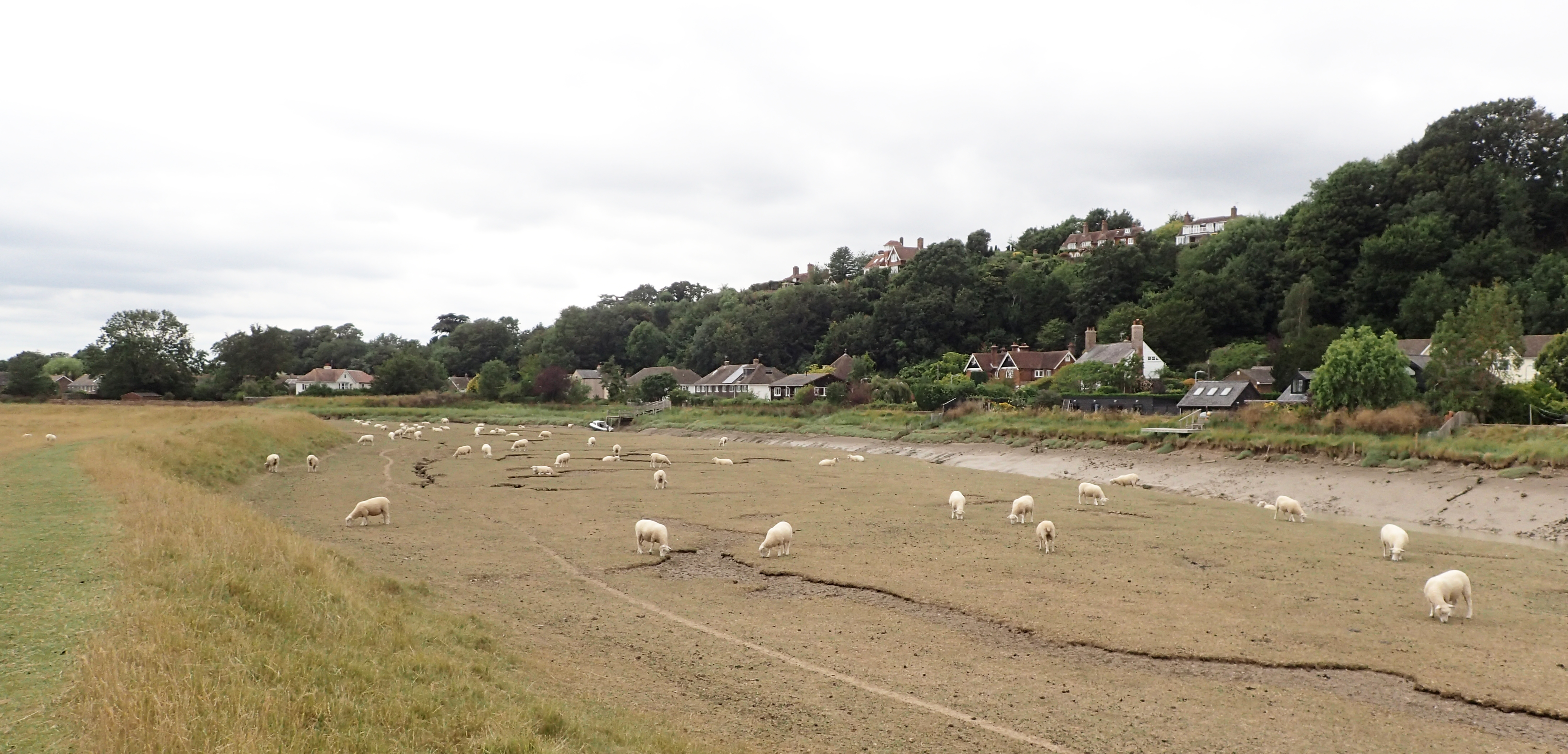
The canal joins the River Rother and becomes tidal but the path at its edge is still easy going. I began to see the odd dogwalker, which felt a little strange as I had barely seen anyone on the actual trail for the last few days. With low water the muddy edges were exposed and sheep from the grazing marshes were wandering the tideline, picking off seaweed, spike grass and samphire. Their meat must taste fantastic. The saltmarsh found here is a rare habitat in Sussex. When I reached Rye the town was busy. Lots of traffic, lots of people. Yet again the chip shop was closed so I never hung around as I had a couple of changes to make on my rail journey home. I was now in East Sussex having left Kent. Another thirteen miles done and my final day on trail tomorrow.
Approaching Rye beside the tidal River Rother. The higher ground on the north side is still very obvious
Back in Rye the following day it was already hot and sunny. A cloudless sky and a very exposed first half-day followed by just a little shady shelter in the afternoon. Exiting the station it is only a few hundred metres and the trail is already back into the country. I took time out to try and find Martello Tower No. 30 that is shown on the map. It was built there to protect the sluices of nearby Brede and Tillingham rivers. The tower is hidden away on private properties and I had to dodge the traffic to stand on a scrappy verge trying to see it.
Martello Tower No. 30- hidden away behind private properties in Rye
There were 47 Martello Towers built along the East Sussex coast, 46 between Rye and Eastbourne and another at Seaford. These were a chain of gun towers built between 1805-1812 to defend the south eastern coast of England from invasion by Napoleonic forces, an invasion that never came. The British were so impressed by the resistance put up by the fortified tower at Mortella Point in Corsica in 1793 that its design was copied. Tower No. 30 was also one of only two that was built with a Cunette, a narrow moat in the middle of a dry ditch. I could see none of that from my precarious vantage point. Time to walk on to a much more accessible object of antiquity- Camber Castle.
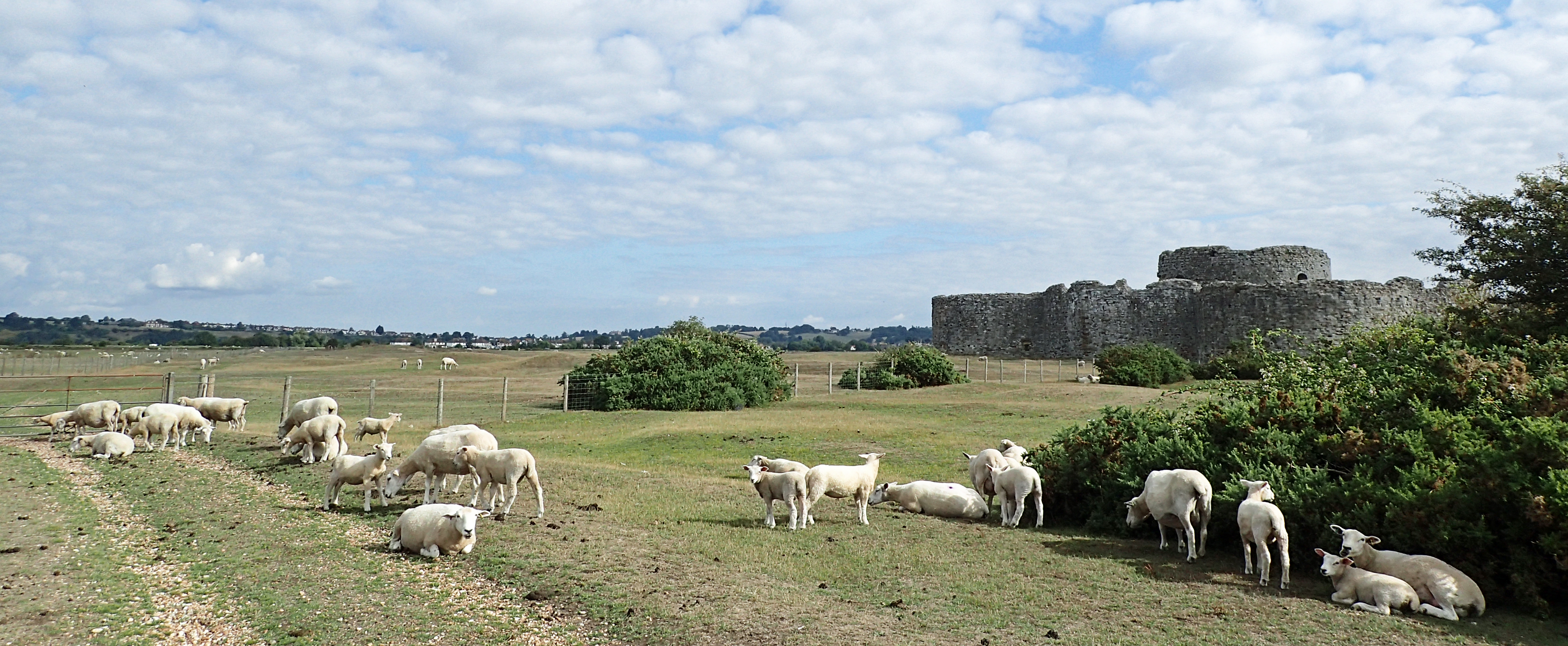
Camber Castle
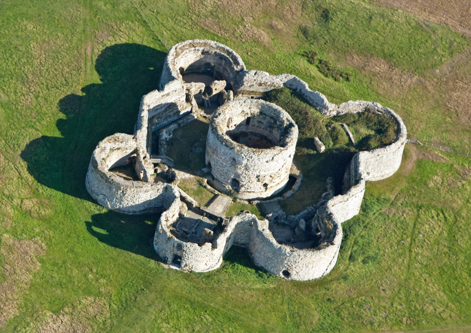
‘Tudor Rose’ Camber Castle. Image edited from that on Wikipedia
The low grazing marsh was all to myself this morning, no one else could be seen for miles and the squat Camber Castle, sitting on the slightest of rises, is a dramatic feature on the distant landscape. Enough so that Turner visited to sketch it between 1805 and 1807.
It is not really a castle, more a fort. The medieval forts signified the end of castle building for national defence and the move to defences that recognised the increased range and power of cannon. Henry VIII had twenty forts built to protect the south coast and construction was complete by 1540.
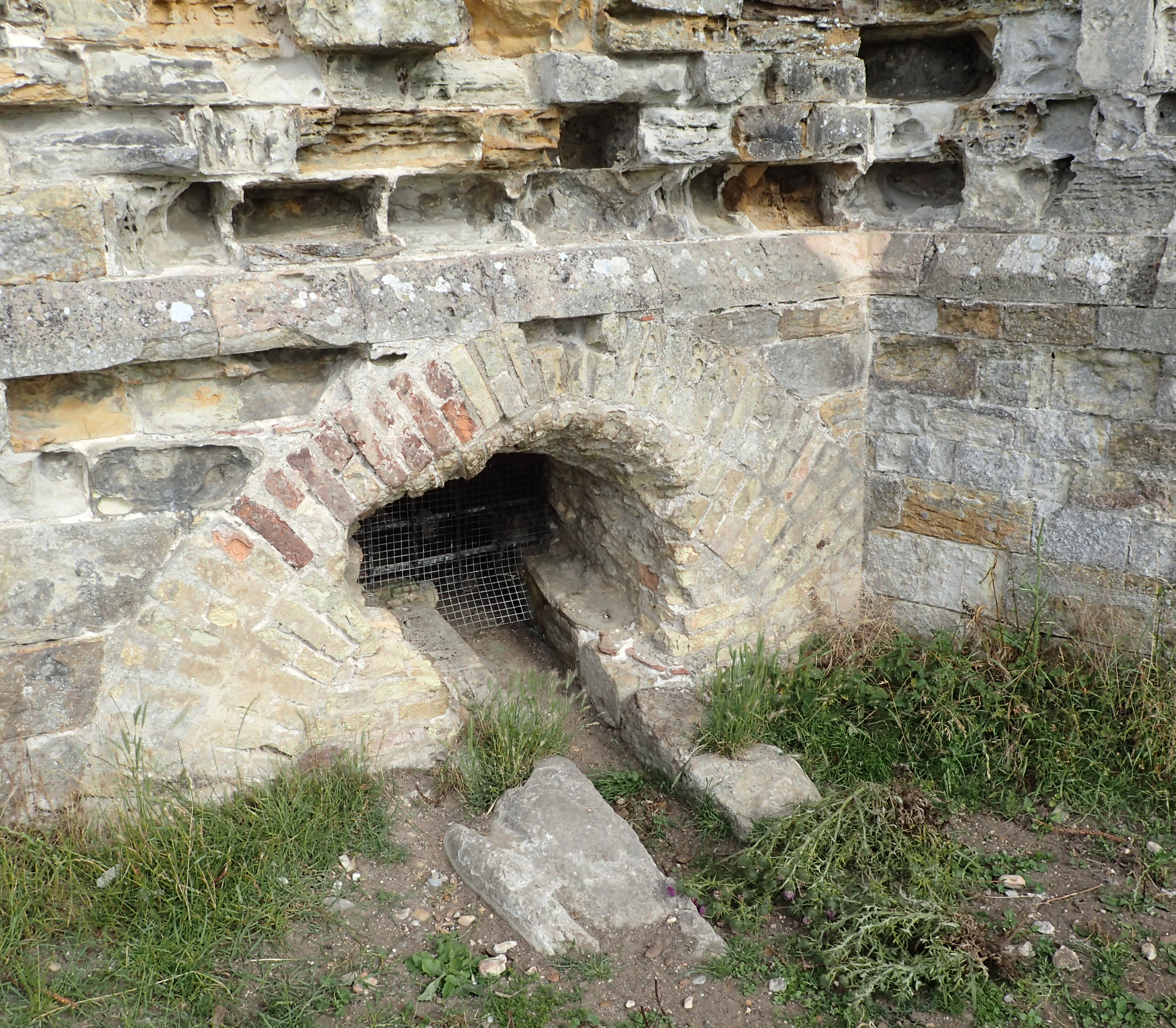
Exiting drainage channel through worn and weathered exterior sandstone walls of Camber Castle
Because of their shape they are known as ‘Tudor Rose’ forts. I had already passed others in this line of defence- Deal, Walmer and Sandown amongst them. By 1626 the sea had receded so far, today almost a mile away, that the harbour was out of range of its cannon and Charles I gave permission for the now useless castle to be demolished. For some reason it remained standing and eleven years later the military finally abandoned it. Today it is maintained by English Heritage and access to the interior is limited to only a few days a year. I peered through the locked wire gate before walking the exterior and returning to my path. It is then only a further mile and a half before rejoining the Royal Military Canal that had been my occasional companion over the past days. Exiting Winchelsea, this is an exquisite walk. First tree fringed, with reed and Greater Reedmace along the waters edge. Occasional gaps in the vegetation led to the water, each gap filled with a silent occupant surrounded by the paraphernalia of a modern day angler- green tent, chair, multiple rods with a miriad of tackle, and cooler bags filled with cans of lager. Before exiting the tree shaded section I paused to enjoy a melted Mint Chocolate and Nut Kind Bar (the very best of snack bars) and hydrate while watching a pair of buzzards with their noisy fledged youngsters quarter the far bank and the trees on the slopes beyond. Obviously good for raptors around here, a mile further on a Merlin flashed past me chasing a sandpiper.
Leaving Winchelsea behind, it is beautiful walking along the tranquil Royal Military Canal across the Pett Levels all the way to the coast at Cliff End
Built as a defence against a possible invasion of England during the Napoleonic Wars, the Royal Military Canal stretches 28 miles from Seabrook near Folkestone to where I was now headed- Cliff End, a little short of Hastings. Construction began 1804 and was completed 1809 having employed some 1500 navvies and troops. The canal is staggered, a kink being included every 500 yards (460 metres) to permit artillery fire along that length. A military road was built along much of the inland side and removable wooden bridges employed to cross the canal. Beside being a physical barrier to invading forces, the canal was also used for quickly transporting soldiers, stores and equipment across the levels. It is a lovely walk in its own right and there is a dedicated trail that does this. The canal may not have seen much in the way of military action but did later aid the authorities in attempting to control smuggling. It was more profitable to export untaxed wool from the heavily fleeced flocks grazing on Romney Marsh than to import contraband French lace or Flemish brandy.
Approaching Ecclesbourne Glen with Hastings beyond
Cliff End, where the canal ends, is well named, for this is where the only slight sting in the tail for the Saxon Shore Way begins. The end of the days walk involves some rollercoasting along the cliff paths to Hastings, taking in Hastings Country Park, Warren Glen, Fairlight Glen and Ecclesbourne Glen, some of the climbs and drops are steep, some paths diverted due to rock fall and I found one dip, having dropped all the way to the stream crossing at the bottom, entirely blocked to passage due to ‘deterioration in the path’, necessitating a climb back out and another route round. Some sections are thick with growth and impassable other than via the established paths but grazing Belted Galloways and Exmoor Ponies are slowly crashing through and opening the slopes up.
Reaching East Cliff it is a gentle walk down the slopes to the edge of Hastings Old Town. The East Cliff funicular railway isn’t working these days so it is a steep descent by steps down into the town, suddenly emerging to a throng of people out enjoying the lovely coastal town, ice creams and, wait for it… freshly fried chips from numerous open chippies.
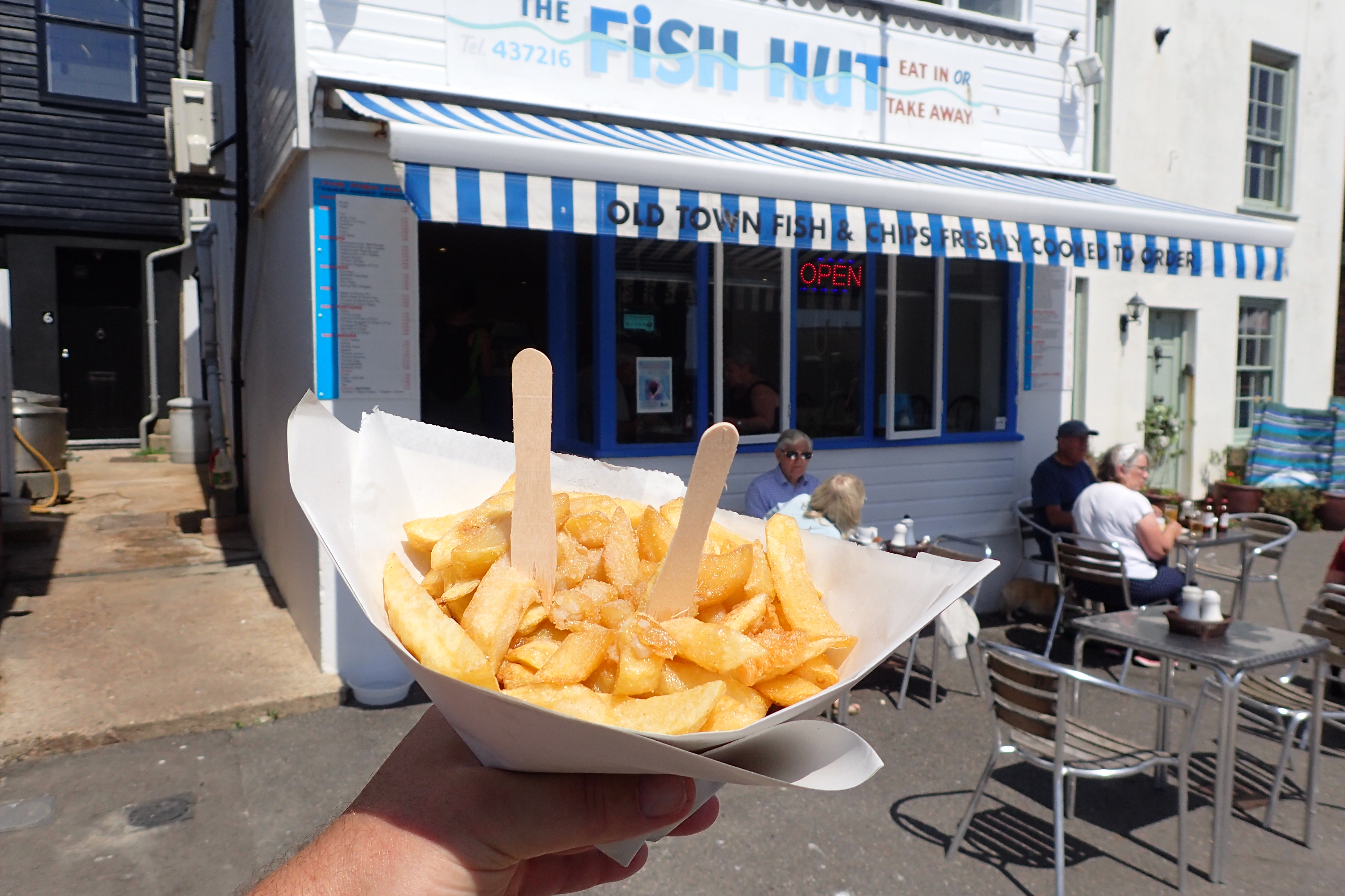
Part reward for completing the Saxon Shore Way- socially distanced chips at Hastings
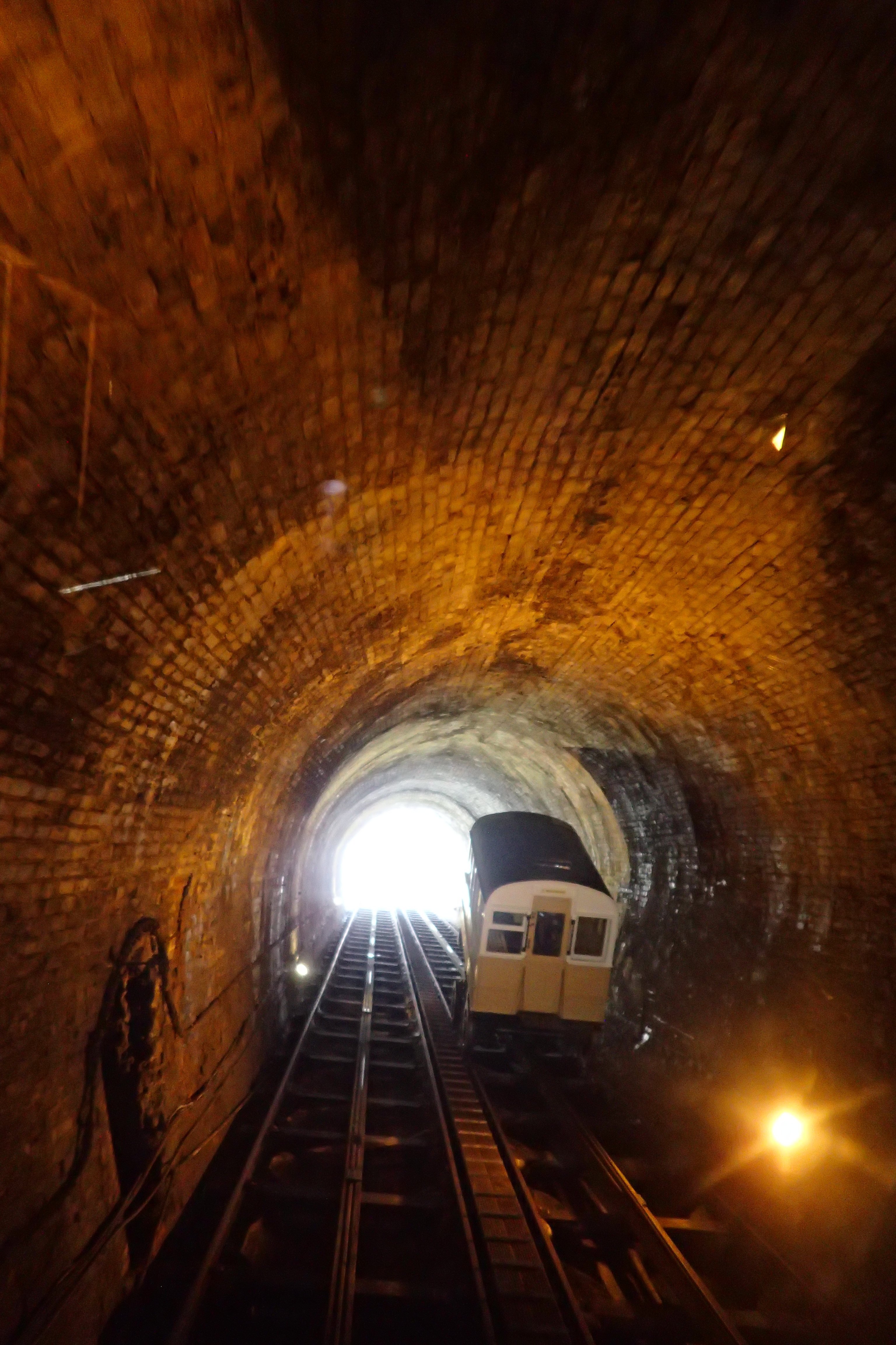
Descending on the West Cliff Funicular railway, the second carriage is ascending
Entrance to the lower station of the 1891 built West Cliff Railway, Hastings
I had one more treat before walking to the railway station and making my way home. The West Cliff funicular is tucked away off the main drag, but it was open. Despite the new railings installed to control visitor numbers, I was the only one travelling up and down the 19th century cliff railway. Building work began in 1889 and was completed 1891. It travels up through a brick lined tunnel rather than up the outer surface of the cliff. Originally powered by gas, it has been electric since 1971. A short and smooth ride up and down, I enjoyed it more than I perhaps should.
 Having placated my inner schoolboy, it was a short walk from there to the railway station after walking a little over 13 miles on the final section of the Saxon Shore Way. The trail is 163 miles long and with a little extra walking to and from railway stations I had covered 176 miles over 11 day sections.
Is the trail worth following? Absolutely. Some days are better than others, but that is the nature of any longer trail. Every day offers up something of historic interest, every day offers at least modest views, every day is different. For those in the South East corner of England who may wish to shy away from hills, or wish to indulge in what is mostly low level walking, or like Three Points of the Compass, have been struggling to regain a little trail fitness, it is ideal.
Saxon Shore Way
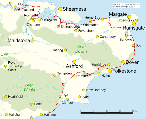
The Saxon Shore Way:
- Section 1: Gravesend station to Strood station
- 21.12 miles, 1304 feet ascent
- Section 2: Strood station to Rainham station
- 11.25 miles, 785 feet ascent
- Section 3: Rainham station to Sittingbourne station
- 17.2 miles, 764 feet ascent
- Section 4: Sittingbourne station to Faversham station
- 14.73 miles, 470 feet ascent
- Section 5: Faversham station to Herne Bay station
- 21.93 miles, 580 feet ascent
- Section 6: Herne Bay station to Sandwich station
- 19.26 miles, 733 feet ascent
- Section 7: Sandwich station to Dover Priory station
- 16.83 miles, 2686 feet ascent
- Section 8: Dover Priory station to Sandling station
- 14.77 miles, 2540 feet ascent
- Section 9: Sandling station to Hamstreet station
- 13.19 miles, 1310 feet ascent
- Section 10: Hamstreet station to Rye station
- 12.85 miles, 693 feet ascent
- Section 11: Rye station to Hastings station
- 13.15 miles, 2331 feet ascent
Three Points of the Compass does not always blog on the trails walked. Links to those that have been covered can be found here.

cool pictures.11 days, wow. Never seen an Oast House. A Hamlet seem ideal. Who uses them? I ponder if this walk is the best in the UK. I’ve never been to this part of England. It seems to have less tourists, more residential strolls that may include locals, no rocky rivers to cross, fewer vast farm fencing to confuse navigation, fewer roadways, a nice beach boardwalk section, a trail that offers many pit stops, easy marked paths, what else is good about it? Lake District is nice. Maybe Wales Coastal path is not as good as this Saxon Shore way.
LikeLike
Hi, thanks for commenting. Your description of positives I would agree with however something like the Wales Coastal Path is, in my mind, always going to be head and shoulders above the Saxon Shore Way.
Wales is far prettier and more enjoyable walking. But, for those in the South East of England, The Saxon Shore Way is a fascinating and historic ‘coastal’ walk
LikeLiked by 1 person
yeah, Snowdonia is great. And for some reason being able to reach peaks is great. But for continuous days of walking, Saxon Shore way seems nice. I saw the dragon fly picture again. The only time I’ve been able to get that close to take a picture of an insect is when it had a broken wing, but I haven’t tried that many times. Well done. Thanks for the views of this hike. Is there a post on your site about Wales Coastal? Perhaps I am not seeing the blog search widget.
LikeLike
I haven’t yet walked the Wales Coastal Path, only across Wales south to north on the superb Offas Dyke Path. Coastal Path, or at least the Pembrokeshire Coastal Path, are on my ‘to do’ list
LikeLiked by 1 person