Heavy with cold, Three Points of the Compass set off to backpack Scotland’s Slighe a’ Ghlinne Mhòir over six days in November 2021. My first three days had led me from Fort William along the country’s greatest geological fault line to Fort Augustus. Rain was promised to change to snow and the trail was to begin climbing up the slopes overlooking Loch Ness. The next three days would see me finally descending to Inverness and the end of the Great Glen Way.
Days 1-3 on trail can be seen here.
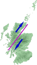
The Great Glen Way, days 4-6
Day four: Fort Augustus to Ruskich Wood, 12.5 miles, high-level routes, 3248 feet ascent
The weather forecast for my hike above the forest overlooking Loch Ness on day four was poor. I cared not, I was eager to get back on trail after a comfortable overnight stay at the midway point. I had been told to help myself to tea, cereal or toast in the self-service kitchen/dining room. I would have preferred the latter but there was no bread, so just muesli (with copious runny honey). I felt a bit of an interloper rattling around both kitchen and dining room by myself.

I strongly suspect there wasn’t another soul in the whole building, certainly no staff to be seen. After a couple of mugs of tea and my mostly unwanted and too early breakfast it was back to the room to repack just about everything following last nights pack explosion, drop the key over the counter at reception and immediately back on trail at the entrance to the lodge.
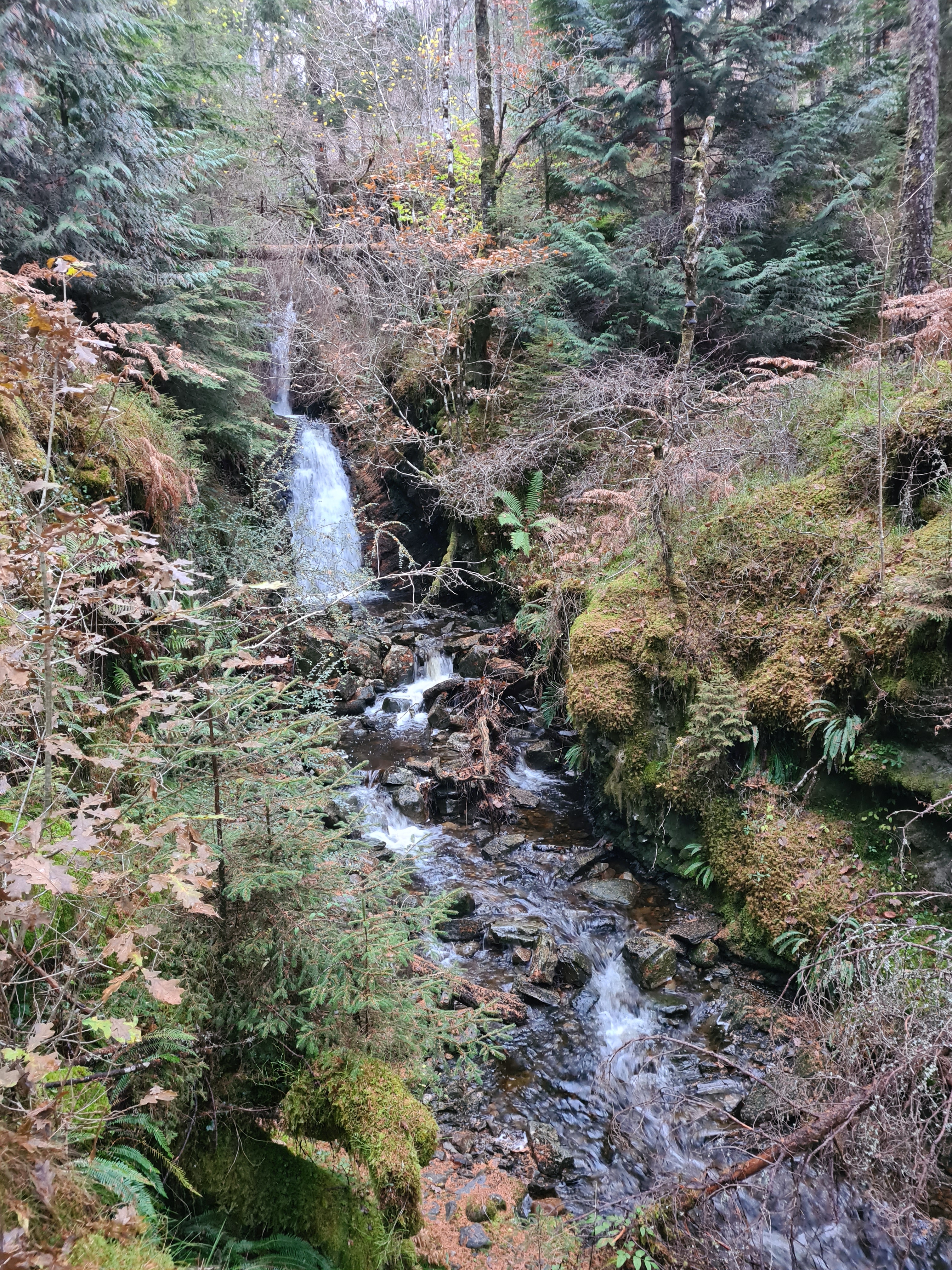
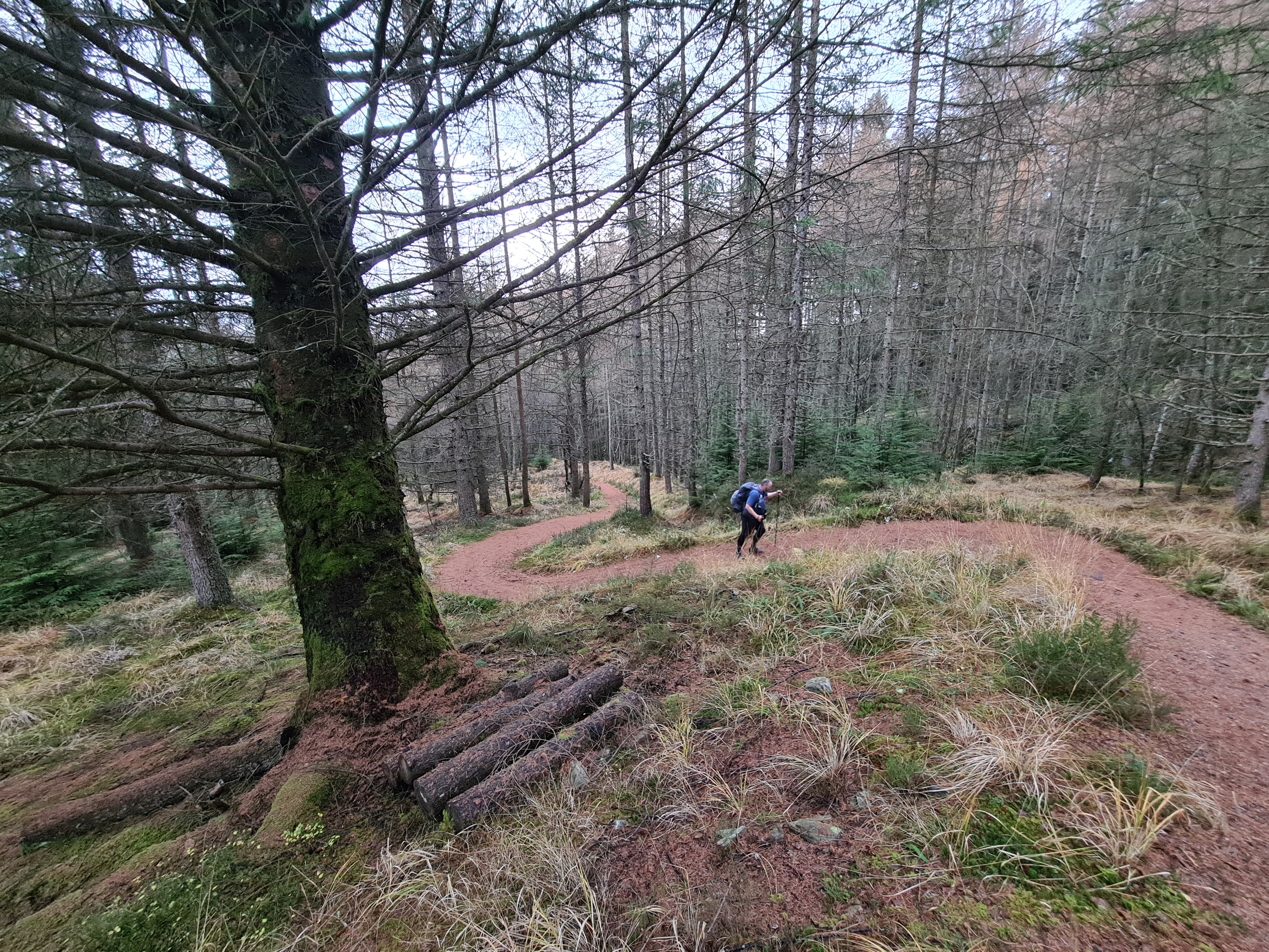
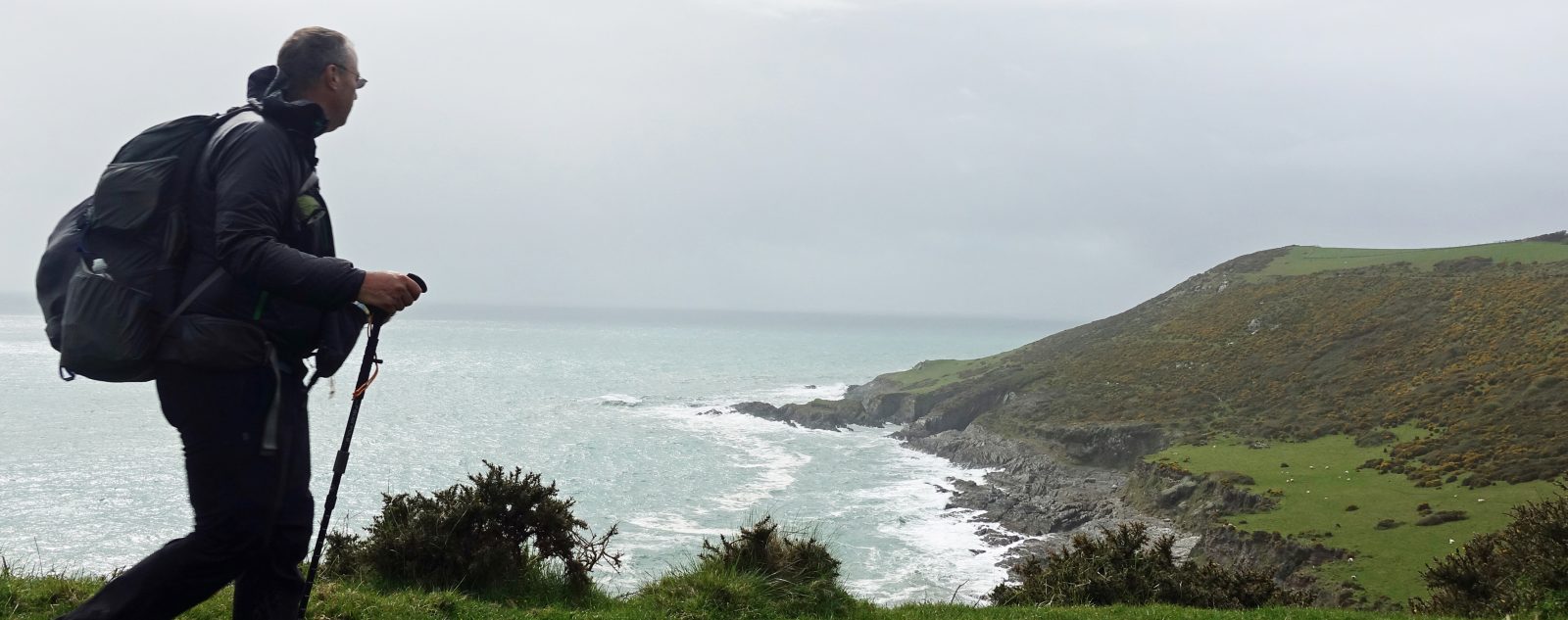
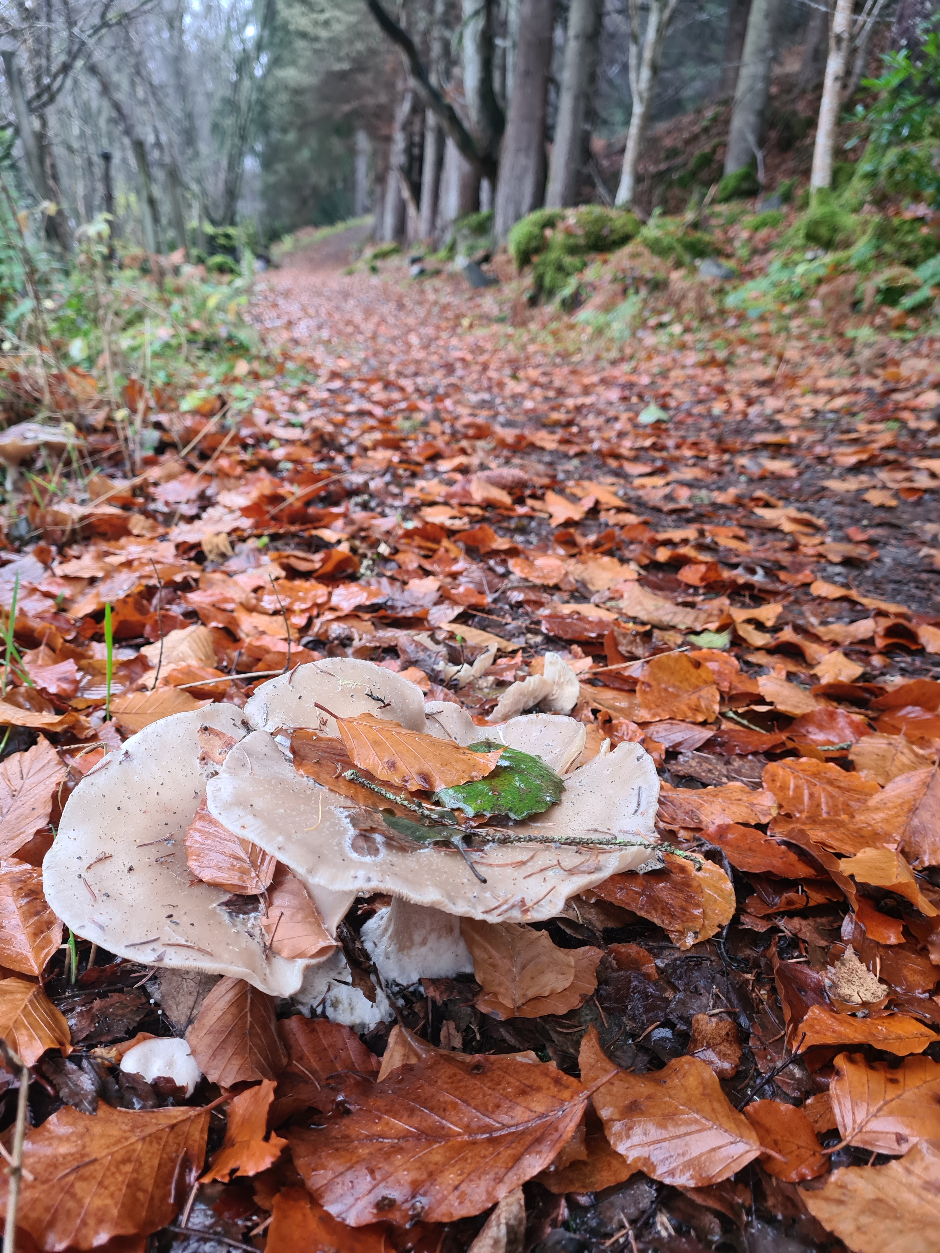
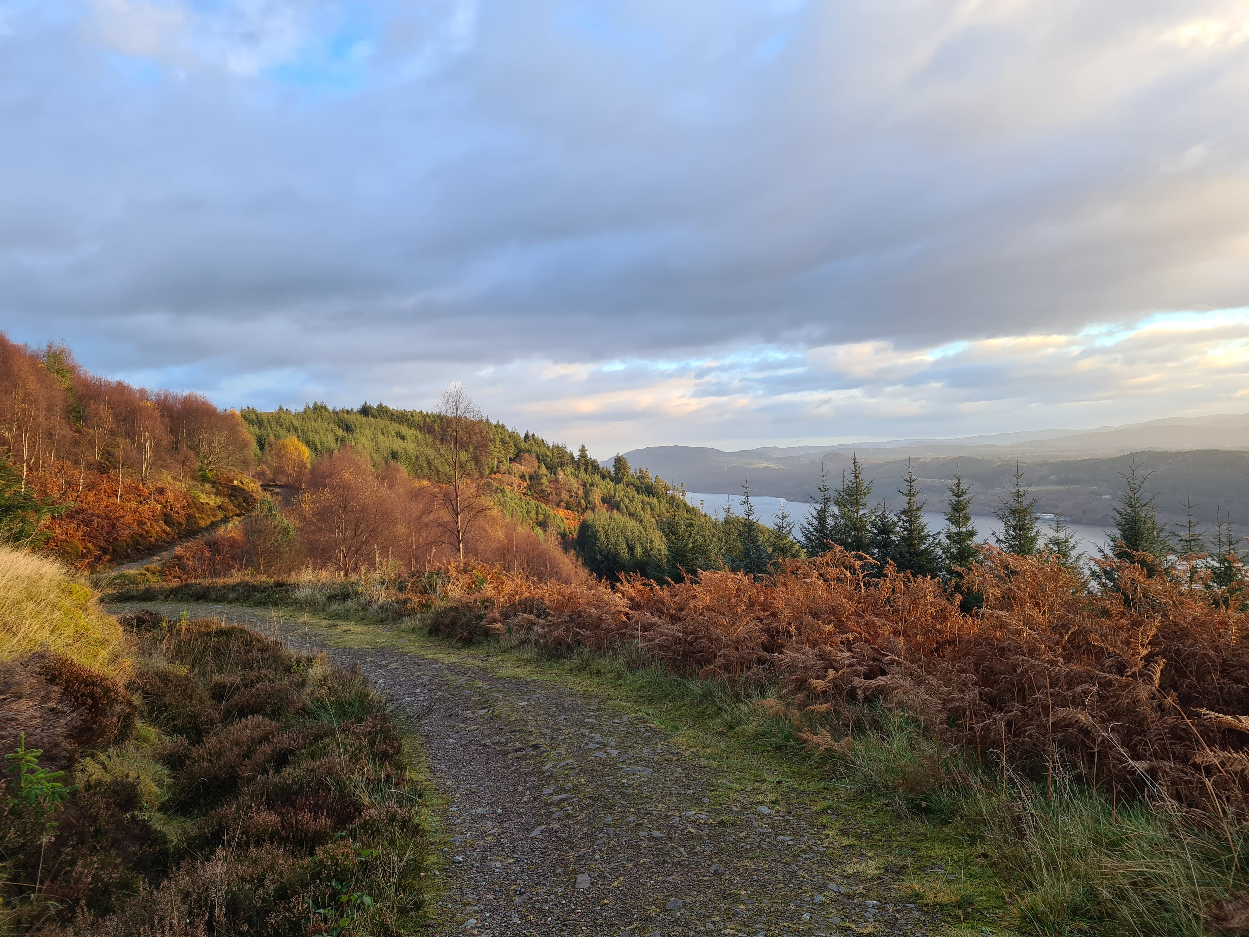
The hill road out of Fort Augustus was steep with a slippery leaf covering that I wouldn’t like to have met a car on, fortunately there was no traffic. Then into the forest for lovely switchback climbing to elevation, choosing the High Level alternate was not a difficult decision. There are quite a few small waterfalls to enjoy on this steady climb up the pine needle covered track and no one else was around. I had the paths to myself. Much as it was for the remainder of the day.

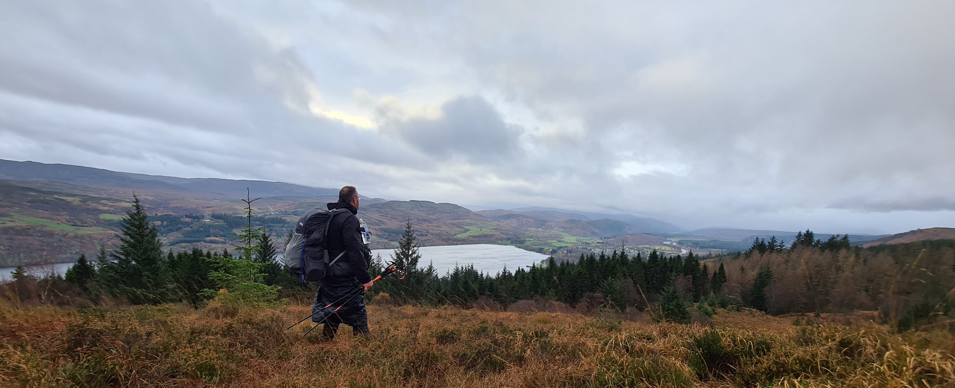
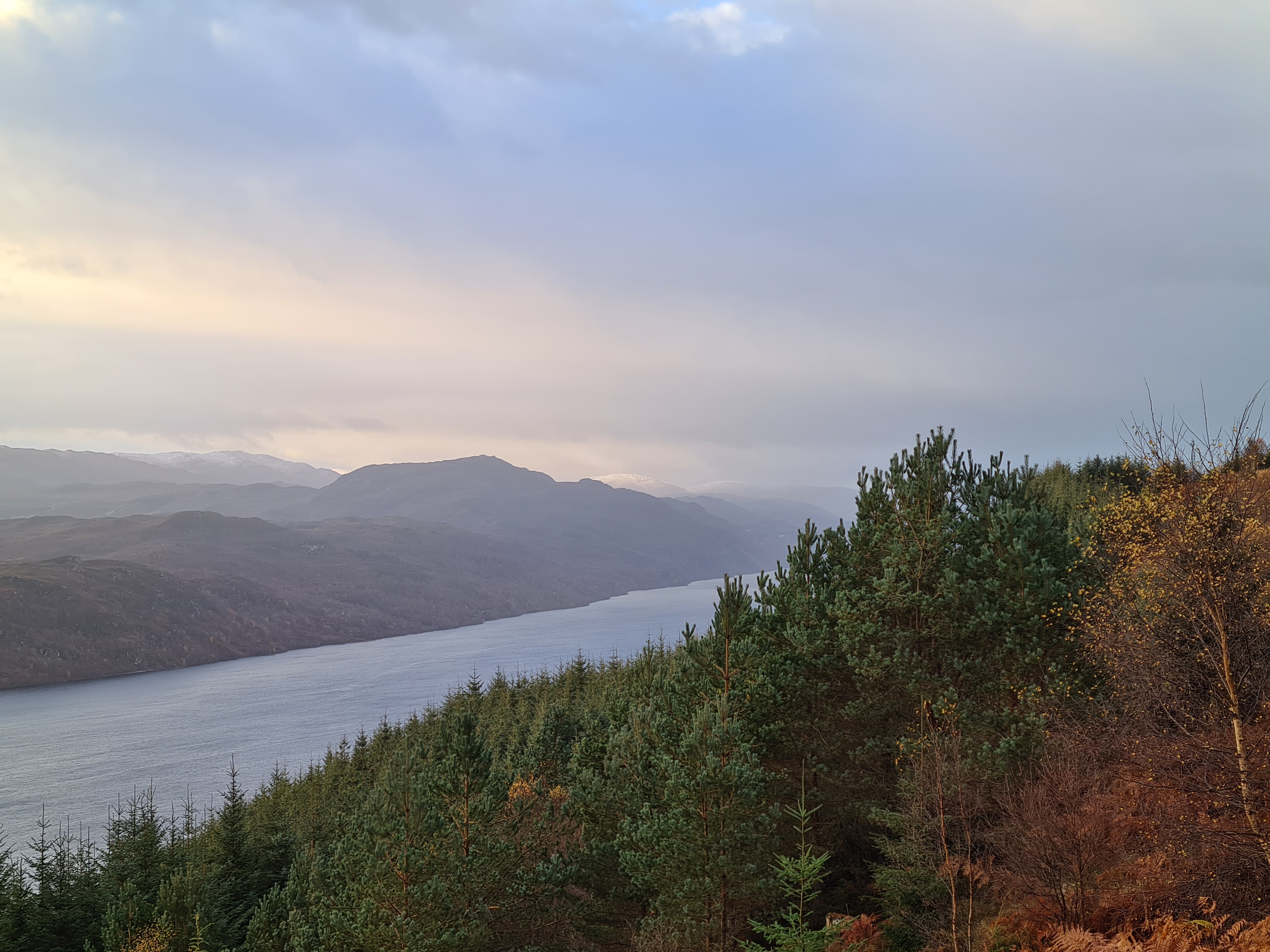
Once clear of the forest there were pretty good views over Loch Ness. The grey Monadhliath mountains stretched before me in the distance. The wind stiffened, the rain occasionally swept across but it was in my back and never really troubled me. It paused entirely for much of the higher walking and I enjoyed the undulating track immensely while munching on peanut breakfast bars. I was still heavy with cold however and any protracted ascent was causing me to pause as mucus stained airways struggled.
With the steep zigzag descending path down to Invermoriston the rain returned with a vengenge however the track was so good that there was no dodgy walking at all.

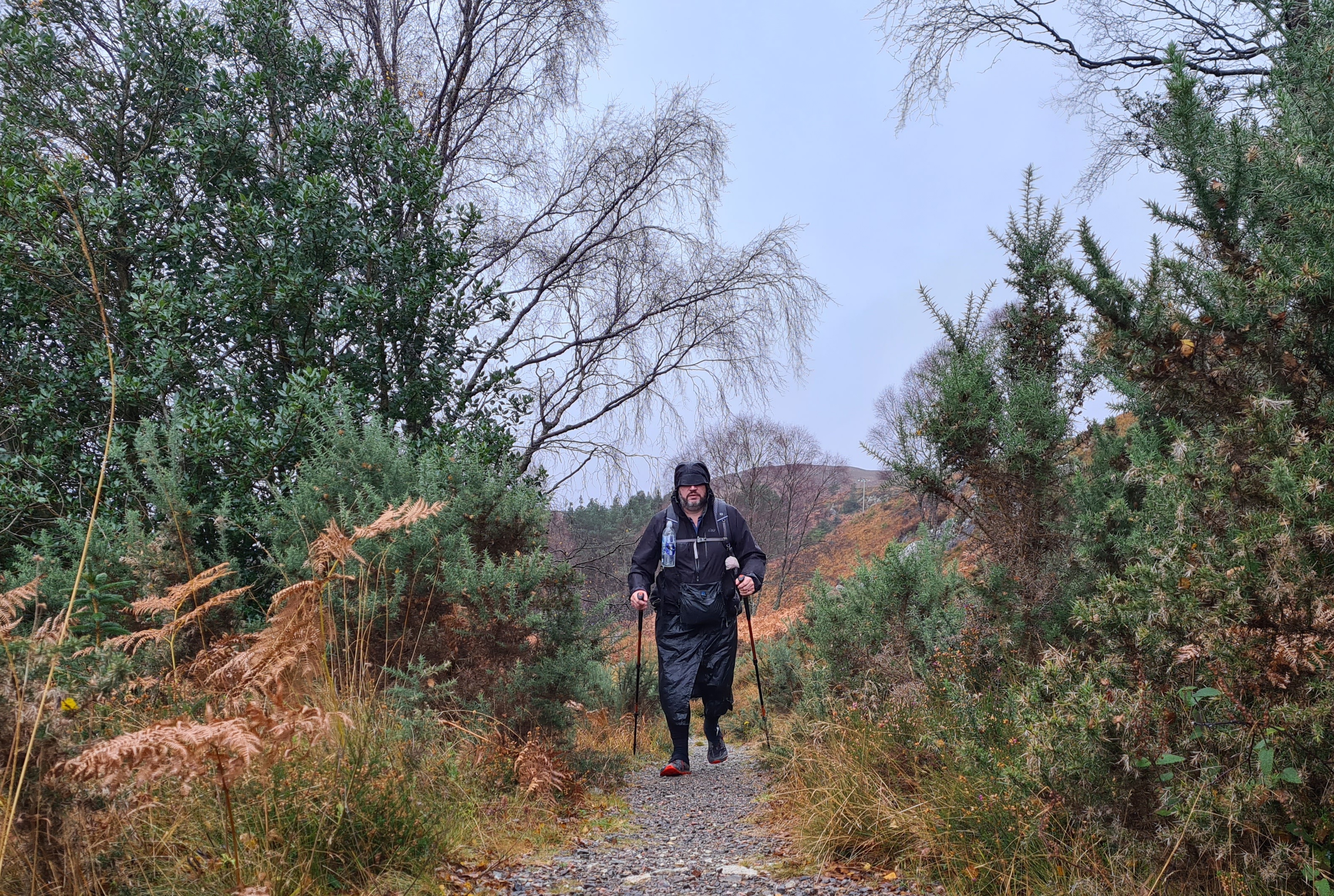
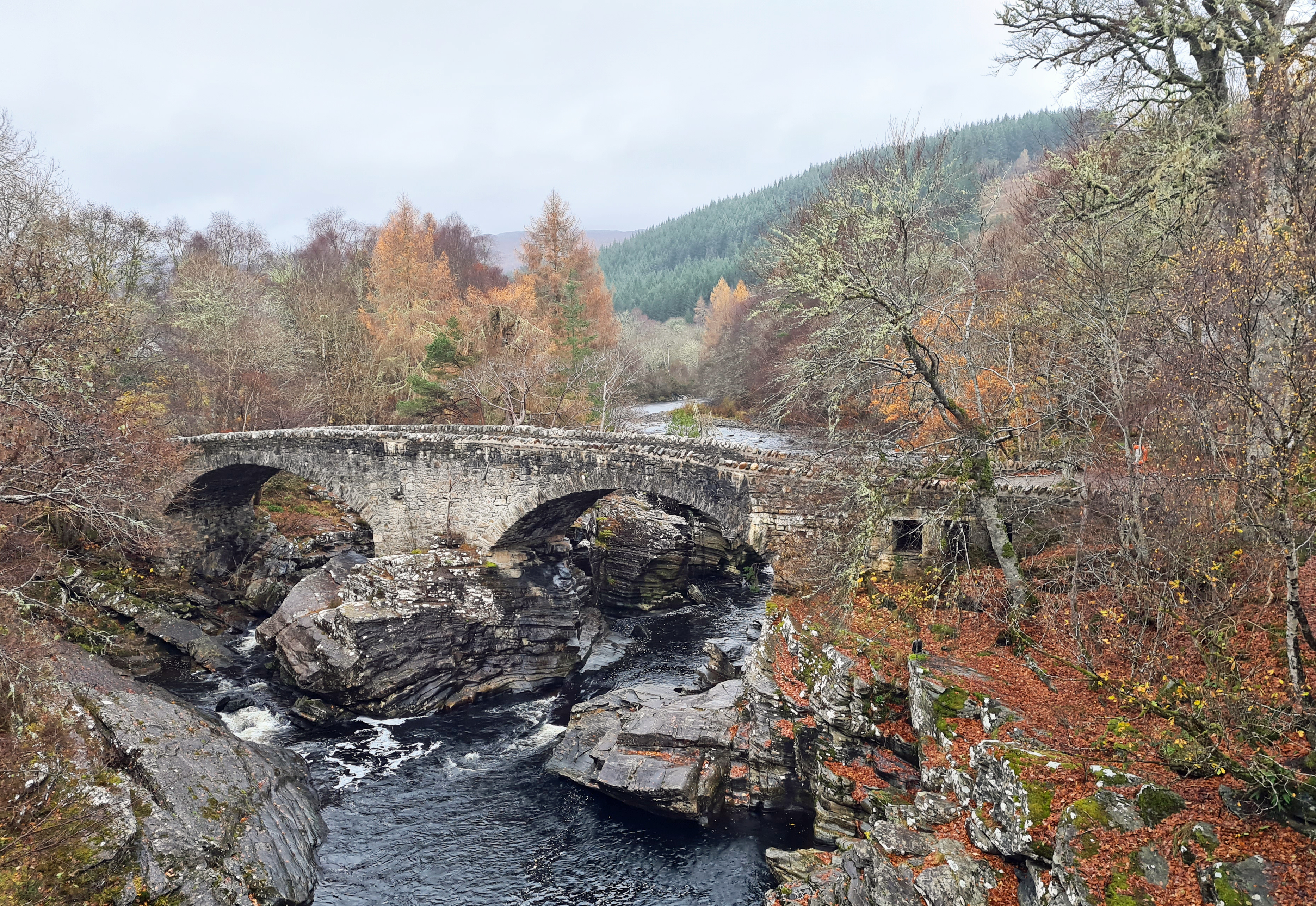
Building work on Telford’s bridge at Invermoriston commenced 1805. However completion was delayed due to ‘idle workers‘ and a ‘languid and inattentive contractor‘. The guarantor for the project lost a fortune and the bridge wasn’t finished until 1813. Having walked over this beautifully situated bridge that fitted into the landscape so well, I then foolishly followed a Will-o’-the-Wisp on a whim. Signs were displayed- ‘CAFE-open‘. I walked the few hundred metres further on through driving rain, diverting off trail, smelling bacon sarnies in my mind. A nonsense of course. The Glen Rowan Cafe was firmly closed. I returned to the steep road that led me out of town that bore more resemblance to a river. I didn’t hesitate in choosing the High Level alternate again.
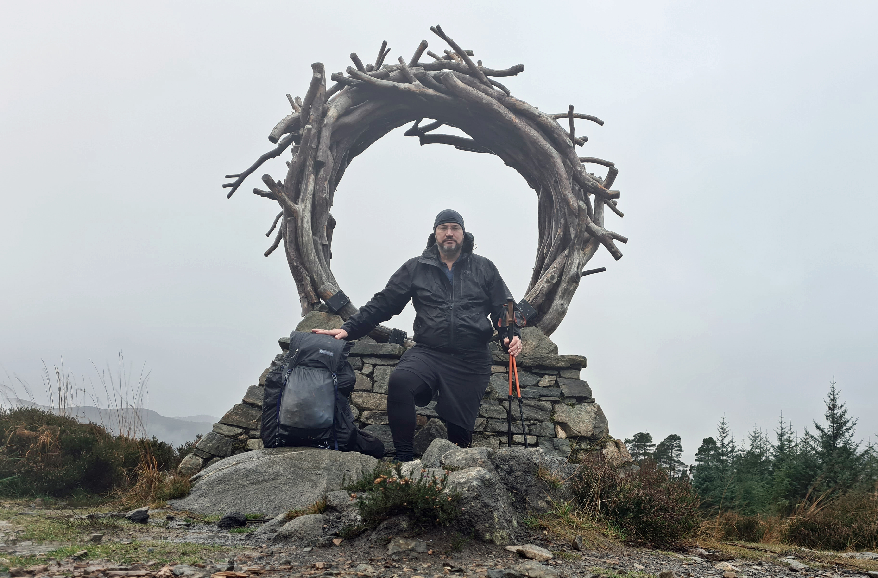
On the hills above Invermoriston an excellent Viewcatcher sculpture has been contructed from Caledonian Pine and local stone. Thousands must have struck their Instagram pose here for the views are usually wide. In the sleety rain, with fairly limited visibility in any direction I stood before my camera, why not?
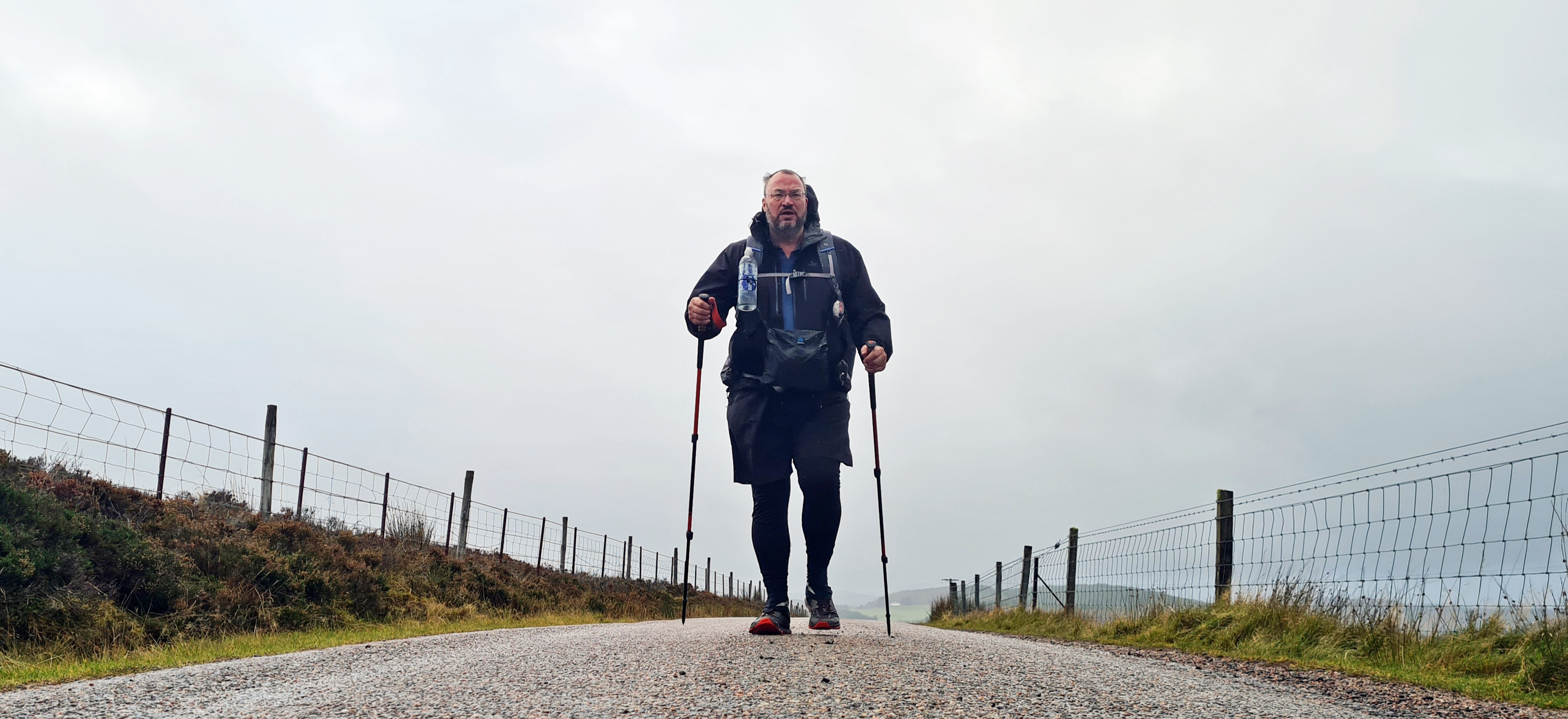
Day four was going to be a fairly long day. The ascents slowed me and time was often lost simply gazing at and enjoying clouds scudding across hills and loch. Daylight hours are short up here at this time of year however and I dug my headlamp out of my hipbelt pocket to keep moving in an attempt to get off the exposed higher ground.
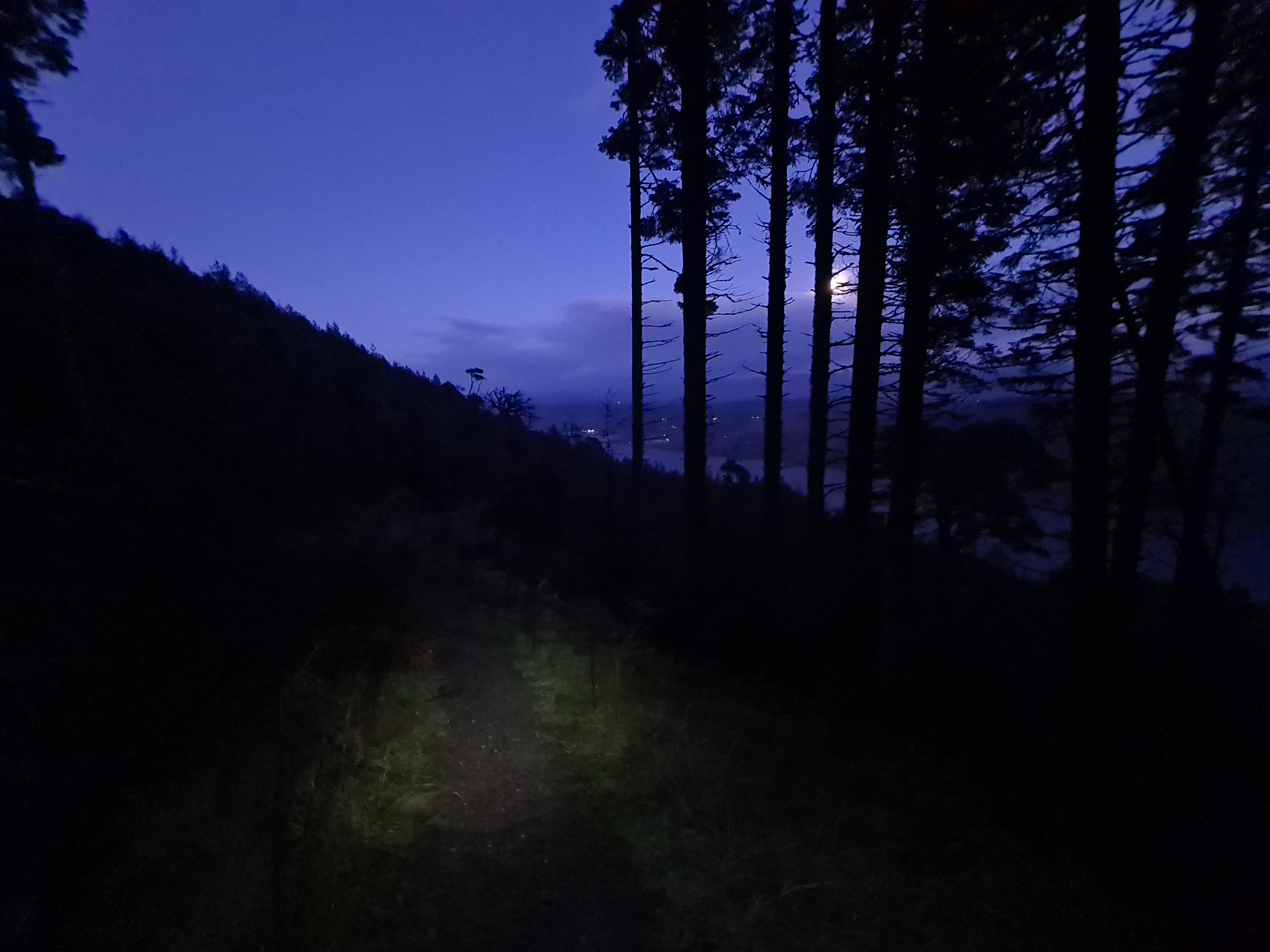


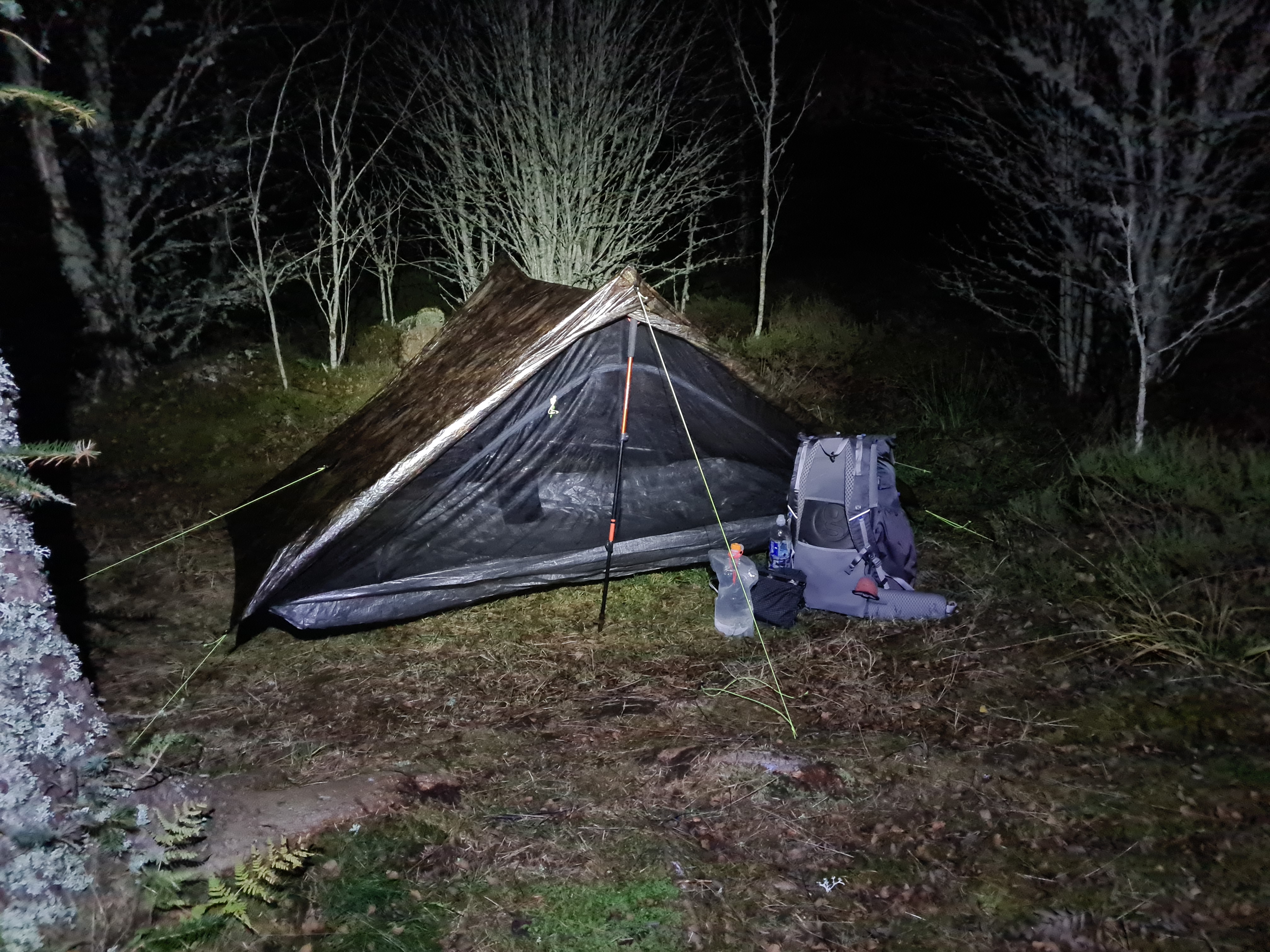
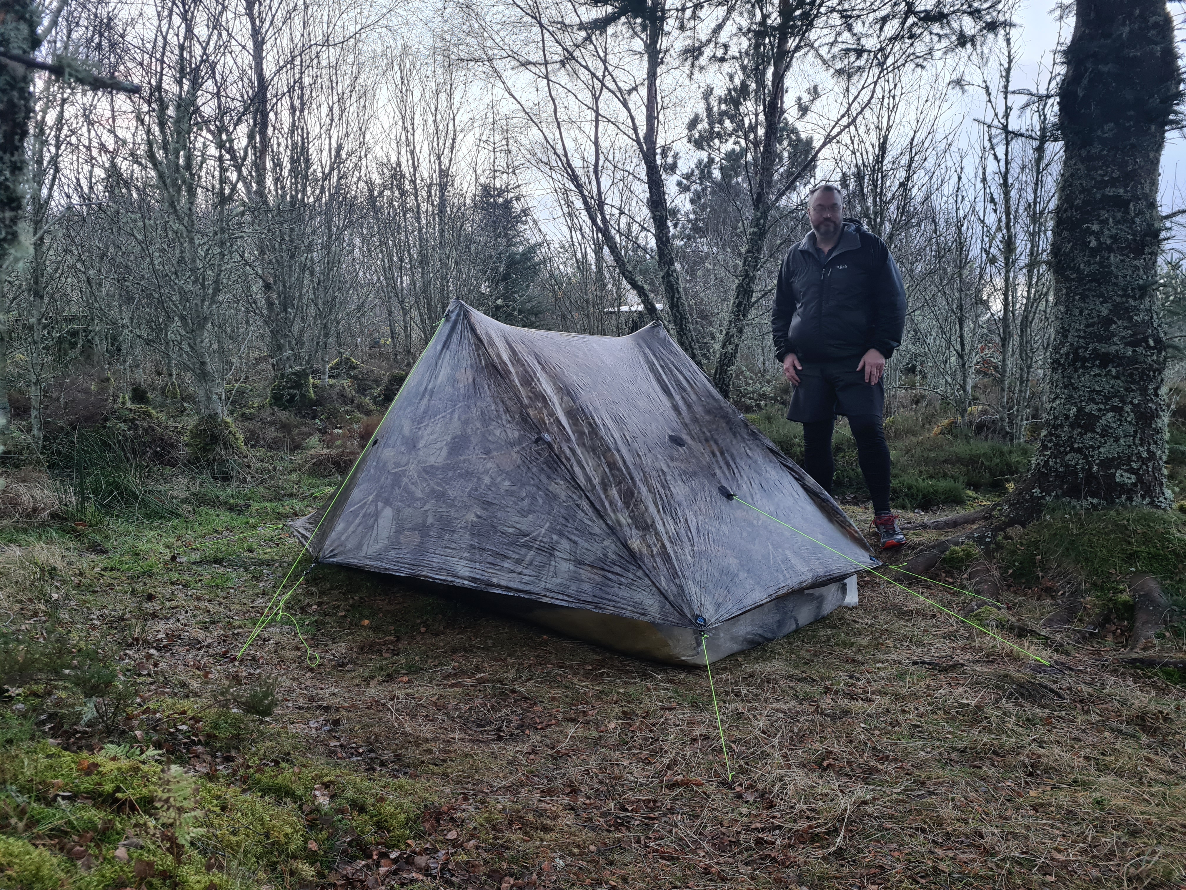
I came across a wide junction of paths and realised this was where my route rejoined the Low Level route. It seemed level enough and despite having to pound my pegs in with a rock, the tent was secure. All the pitches so far had been stones at or just below the surface and my choice of full and mini sized MSR Groundhogs, supplemented with a couple of thick titanium pins, had proved justified. Just as well, as the wind built overnight, rain turned to sleet, sleet turned to snow. Spindrift swirled into the windward vestibule but I just snuggled deeper in my quilt and slept on, my water filter joining me for safety from freezing. Snow turned to sleet, sleet turned to rain. The wind died. Morning came and with it the inevitable welcome pint of strong tea.

Day five: Ruskich Wood to Abriachan Eco-Campsite, 17 miles. 1706 feet of ascent.
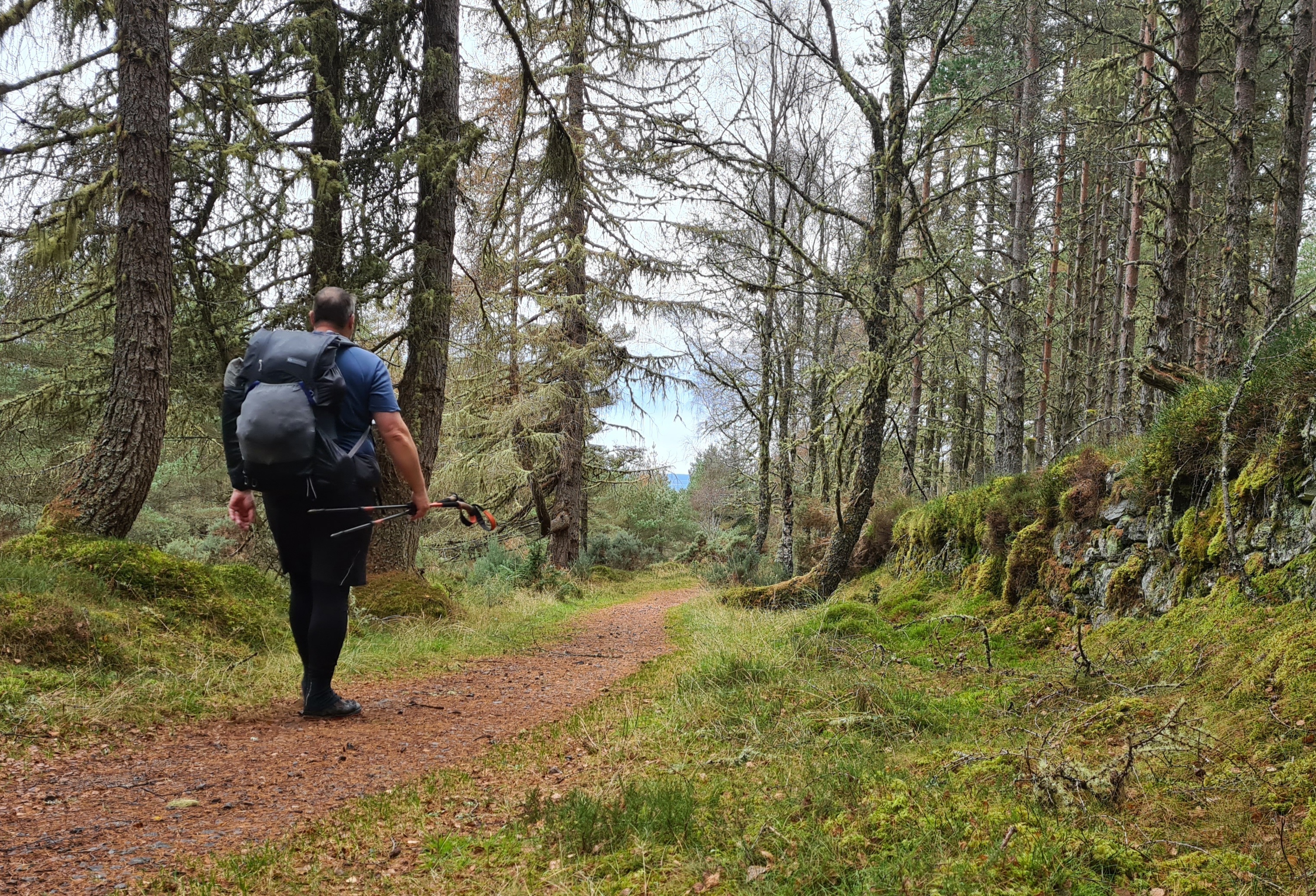
Having slept pretty well I was happy to rise but the old bones took a bit of loosening before I really got motivated and I went for a short wander around my overnight halt, tripping over the protruding bent pegs left by others in the rocky ground. It was a clear morning and only the tops of the hills showed any settled snow. The temperature was in single digits and puddles were frozen on the track to Drumnadrochit but it remained frequently quite lovely forest walking.
I later heard that the Great Glen fault had shifted slightly during the night. Many thousands reported on the noise from the tremor. I never heard a thing, no doubt masked by wind, heavy rain or snow.
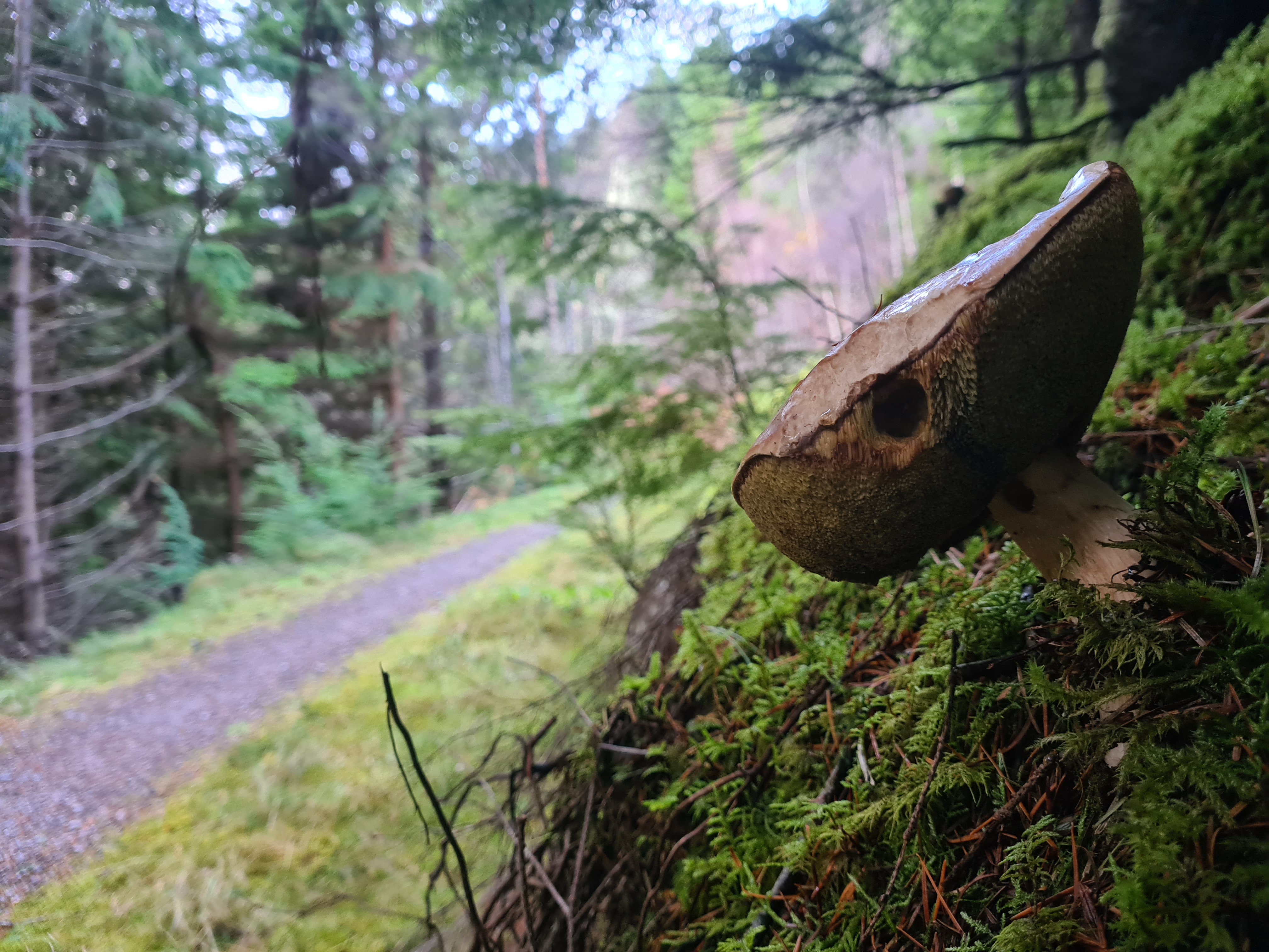
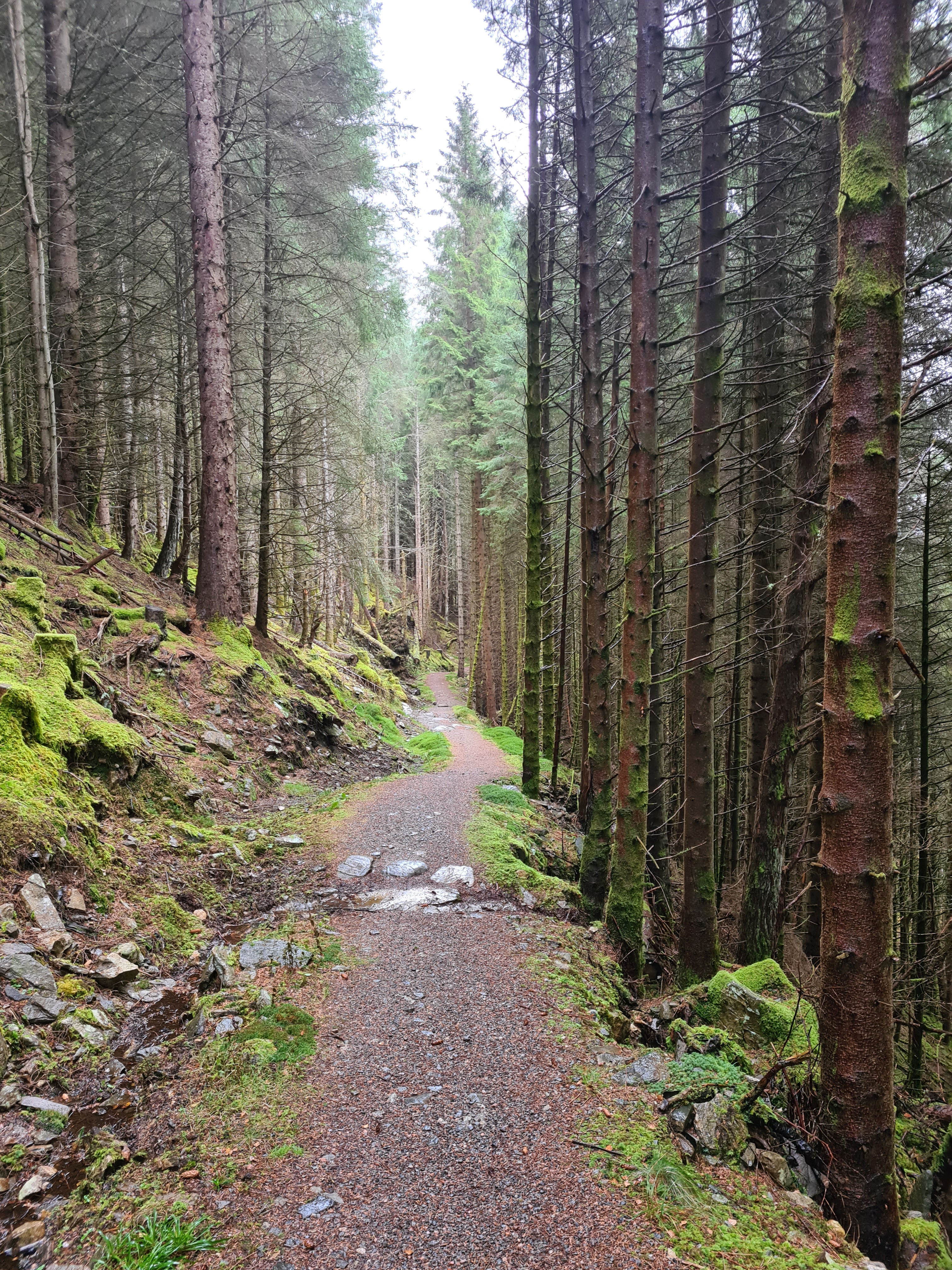
Steep slopes left and right, lots of fungi, lots of moss. Deer fences began to appear but unlike the wilder stretches of the Highlands there was no need to clamber over them here, each had its gate even on the temporary path diversions. Due to forestry work (which I saw no evidence of) there were a number of annoying little path detours around Borlum Bridge.
Drum did offer up an open cafe however. The Village Store and Tea Room supplied good strong pots of tea accompanied by ‘OK’ reheated sausages and bacon in good floury wholemeal rolls. That was lunch sorted and slightly overstuffed I uncomfortably rolled out of town, declining the opportunity of joining a couple of coach loads of November tourists and visiting Nessieland and the Loch Ness Monster Centre and Exhibition. Perhaps next time…
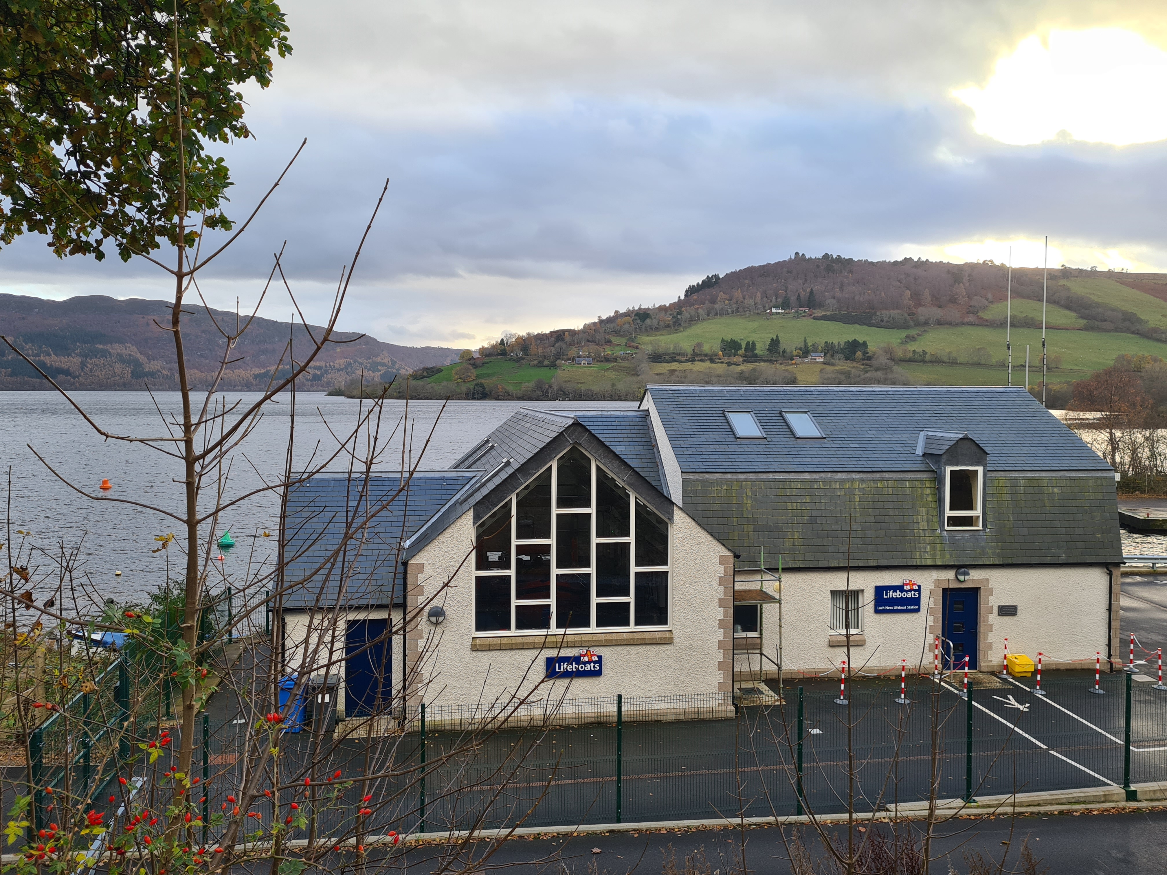
Leaving the road out of town I rejoined a path that began to climb up the slopes. I paused to look behind me, across to the distant Urquhart Castle, perched on the edge of Loch Ness, and the much closer Lifeboat station with its inflatable just visible through the large windows. This station adjoins Temple Pier, a place with a tragic place in history.

On 26 August 1952 John Cobb arrived at Temple Pier with his revolutionary jet-engine propelled boat Crusader. His mind was set on a World speed record on water. Trials were held over the following month and on 29th September Cobb set off on his attempt. He reached a speed in excess of 200 miles per hour, however the record never stood as he was killed on the return run when his boat disintegrated.

The path climbs and levels in the afternoon, to pass through some fascinating and complicated rock strata, fractured and convoluted. Canadian lumberjacks lived and worked around these parts during the war, logging for the war effort. Some marrying locally and remaining after hostilities. Apparently there is still evidence of their works to be seen, remnants of a hillside railway for example but I couldn’t find anything. The landscape opened up, becoming moorland. The highest point on the trail was also reached this afternoon, a modest 1245ft in Abriachan Forest. The day drew on and light faded. Unseen Sika began to whistle. I could have easily found a wildcamp pitch around here but still chose to keep on to my choice of halt. I had heard varying accounts of the Abriachan Eco-Campsite and Cafe. There are many favourable reports. Others called it water-logged and hopeless, some reviews called out the proprietors for rudeness and over-pricing. I chose to form my own opinion. If I didn’t like it, I would leave. But I still had a way to go and again dug out the headlamp.

I turned into the entrance for the Eco-Campsite and splodged up its narrow muddy path to a conglomeration of rough huts and seats situated amongst the wood chippings. I heard a voice in the gloom, hailed, and Sandra made her way through the dark to me. A more friendly greeting would be impossible. She offered me any pitch I could find but had already selected a well-drained area in the shelter of trees. She took me to it, pointing out the eco-urinal (read- bale of straw) and eco-toilet (read- compost loo surrounded by headheight wriggly tin), much as I had expected. The pitch was easily the best of the entire trail. Level, soft and dry ground despite having rained hard for much of the week. The pegs went in easier here and didn’t require hammering in with a rock. Sandra later bought down a five litre bottle of water for me and enquired if I wanted a breakfast. I was unsure as to the exact details of what would be provided, but we agreed on bacon, beans, possibly eggs, possibly something else, plus tea for 08.30 the following morning. For my evening I had a sole Adventure Foods dehydrated meal with me and my Pasta Carbonara was head and shoulders over any of the Firepot muck eaten the previous nights. That didn’t stop me also enjoying a mug of noodles an hour later. After the last of my dark chocolate and a Hot Chocolate drink I settled down for another long long night.
Day six: Abriachan Eco-Campsite to Inverness, 11 miles, 328 feet ascent
I slept fairly well but these long nights do get to me and my back begins to stiffen after eight to ten hours. It is high time that I started doing some stretching exercises to relieve this on long winter night camps that can last 14-16 hours. Strong tea at six-thirty kick started the system enough for a visit to the compost loo. I packed and went over to the covered if rough built ‘cafe’ area.

I spent a while writing up notes in my journal and checking today’s route in the guide book before a cheery ‘good-morning‘ from beyond and a booted Sandra hove into view carrying a tray.
Fresh fruit, rolls, butter, pot of loose leaf tea, jug of milk, tubs of trail snacks, it was a meal in itself but was only a first course.
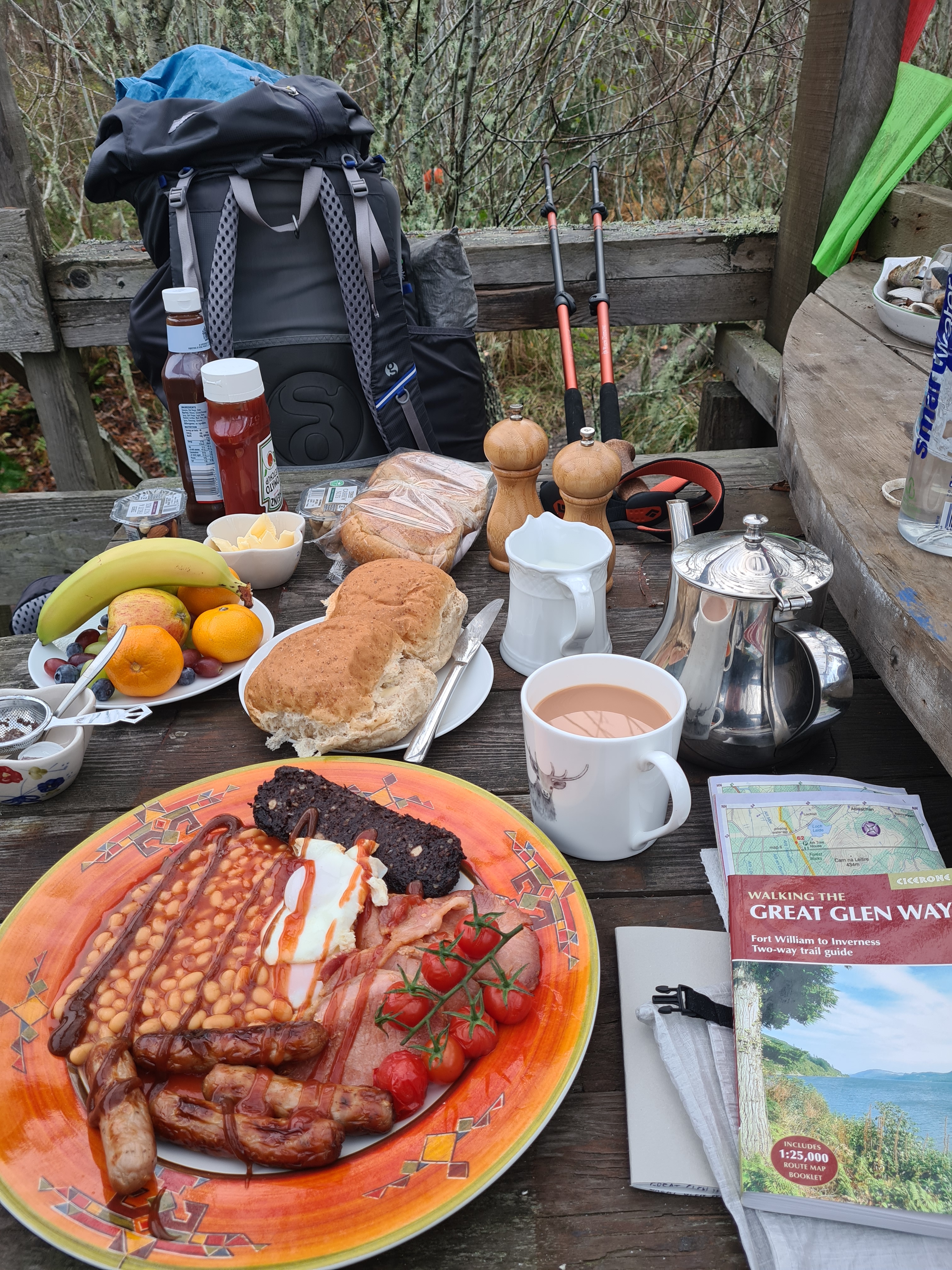
More was to follow. A terrific cooked breakfast consisting of bacon, sausages, beans, eggs, black pudding and cooked cherry toms. She offered a second pot of tea. I managed what I could but before doing so, enquired how much- “let’s call it fifteen pounds“. It was fantastic value for money and an excellent night’s halt.
Leaving their woodland site after breakfast it is a short walk to again begin a stretch of road walking across the moors. Dry earlier, it couldn’t last and the rain came in thick belts from behind, chucking it down. A few minutes respite, then another band of the wet stuff. There was no traffic and I could keep up a good pace until thankfully leaving the road for a moorland path. I am never keen on roadwalking in the rain with a hood up and not being aware of traffic from behind. Back on to a decent path the rain went away and the sky began to brighten. That was the last of the rain I experienced on this trail.
If I had been wary of traffic, I wasn’t the only one. Approaching an aged gent with his dog, I hailed him from behind. Surprised, he fair leapt in the air, landing in the heather to one side of the path- “I thought you was one of those bloody cyclists“.
“The Highlanders in particular are masters of this difficult trade of driving… it affords exercise for all their habits of patient endurance and active exertion. They are required to know perfectly the drove roads which lie over the wildest tracts of the country, and to avoid as much as possible the highways which distress the feet of the bullocks”
Sir Walter Scott, 1827
Having left the stretch of road, and the small piece of moorland walking, the trail joined an old drovers road for the slow descent down to Inverness. I had a short walk of just eleven miles for my final day, not far removed from what drovers expected of their animal charges each day. I was feeling good on my last day and it also looked as though I had finally shaken off the worst of my lingering ‘super-cold’. Perhaps a six day hike through the Scottish Highlands is what the Doctor ordered!
The Beauly Firth could be seen through the trees on my left. After just mountains, hills, lochs, clouds and rain in the distance for much of the trail, distant sprawling buildings began to dominate and the quality of the trail deteriorated as the outskirts are reached. Nature gradually gave way to suburbia. I crossed a road behind a bus, the exhaust from its idling engine startlingly intrusive.

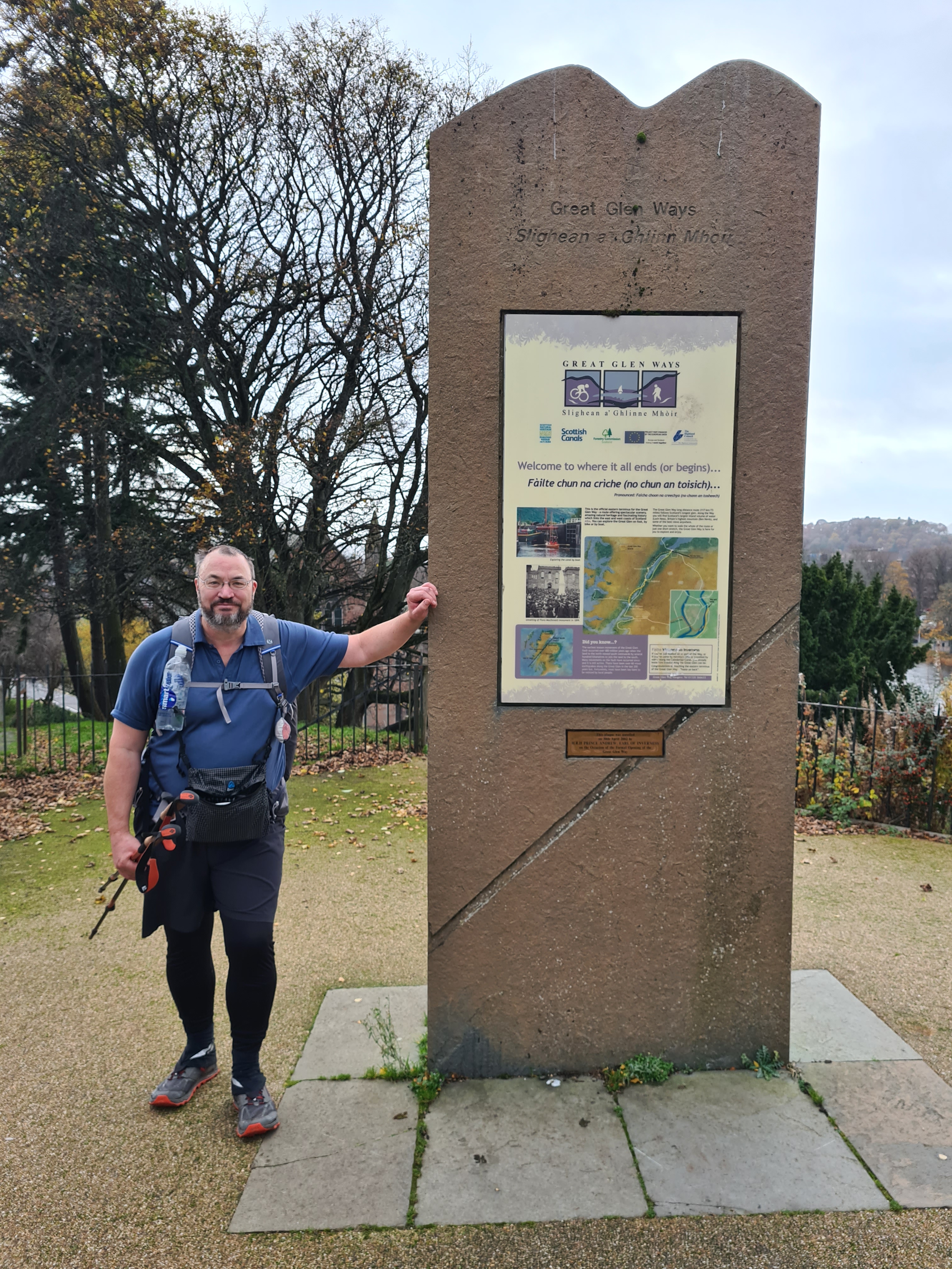
The trail planners have done a good job routing into Inverness. One green space is linked with another and so on until a final short and welcome stretch along the Caledonian Canal, walking in the opposite direction before leaving it to follow the seabound River Ness into the city centre. There are a couple of thin islands, linked by bridges that the trail crosses to join the Ladies Walk that leads almost all the way to Inverness Castle, the end of the trail. The marker post stands on Castle Hill and I stood around for twenty minutes or so feeling incongruous in walking garb amongst the small number of locals. Eventually encouraging a young mother to take my obigatory end-of-trail photo.
And that was it, almost. Back down to the High Street for a decent malt whisky to toast myself, followed by a couple of leisurely pints. Killing time until I could book myself into the Highland Hotel. This was a reasonably priced bed for the night prior to my earlyish train the following morning from the railway station next door that took me all the way to London.
In Conclusion
The Great Glen Way- is a lovely walk. Walking it in the direction that I did, it starts off gently and eases you into the trail, stretching the legs on mostly level paths before surprising the unwary with a change in altitude, pace and scenery. It is a geological wonder, linked by fascinating engineering with history to be discovered. A walk at another time of year would offer a different experience- wild flowers, summer colour, ticks, midges and people. But I had autumnal colour, early winter weather and empty paths.
The tread and trail marking is good throughout its length. I enjoyed it immensely. There are a couple of alternative slightly lower sections and someone staying in accommodation may walk far more than it’s official length. Mostly backpacking, I covered just a little more than 75 miles. I shall write more on the facilities I used in one final blog on this trail.
I don’t think I’ll do a gear list as it was pretty much my standard three-season backpacking set-up. Though I did choose my Zpacks Duplex over my MLD Duomid for its greater internal space. While the Duomid is also a two person shelter I have the single person Solomid XL inner for this that lacks much room to move about. I took the warmest of my Katabatic down quilts (the Flex 15°F) and was thankful for it as the temperature drops significantly at night. I did additionally pack along a synthetic puffy jacket, synthetic insulated trousers and a down beenie for the many hours tent bound.
Note– Some original road signage for the Great Glen Way in Gaelic has attracted criticism. FOI inquiries to Transport Scotland had them revealing that a contractor neglected to use an official translator and some road signs have subsequently been corrected from Slighe a’ Ghlinn Mhóir to Slighe a’ Ghlinne Mhóir as a result. However the National Trail itself still exhibits most signage with the incorrect gaelic.
Three Points of the Compass does not always blog on the trails walked. Links to those that have been covered can be found here.

I thought you were mad doing it at this time of year and then you reminded me that there be midge country!
Think I have said this before however there is research that men and breakfast sometimes do not agree with each other. Typing this I have realised that the move a bit and then eat would work better as it how I always used to do it. When I first started work we used to work and then breakfast.
LikeLike
The Great Glen Way is so good underfoot that it could be tackled year round I reckon. Obviously colder and wetter conditions bring additional challenges but I would say this trail would make an ideal walk for those new to longer-distance multi-day walks as the ‘wild-camping’ mostly isn’t, and on trail facilities are plentiful. More on those in the final blog on this trail, to follow in a few days. My breakfast on trail has almost completely changed to bars etc. ‘on the go’. My dear departed mother wouldn’t have liked that. “you’ll give yourself indigestion” I can hear her saying…
LikeLiked by 1 person