
There are many ways to tackle the Pembrokeshire Coast Path. Section-hike, thru-hike, bed & breakfast or backpacking. If camping, which to choose- campsites or wildcamping? What follows is simply how Three Points of the Compass broke down the trail for September 2022.
The Pembrokeshire Coast Path is around 186 miles in length and can be walked north to south, or south to north. The tougher sections are in the north and some will prefer to enjoy these first while others prefer to walk toward them. Three Points of the Compass decided to walk the trail south to north, keeping the first days modest in both accumulated ascent and miles. I would get hill-fit and then push out some longer miles and longer days toward the end of the second week. Click on any day’s route title for a map of that day.
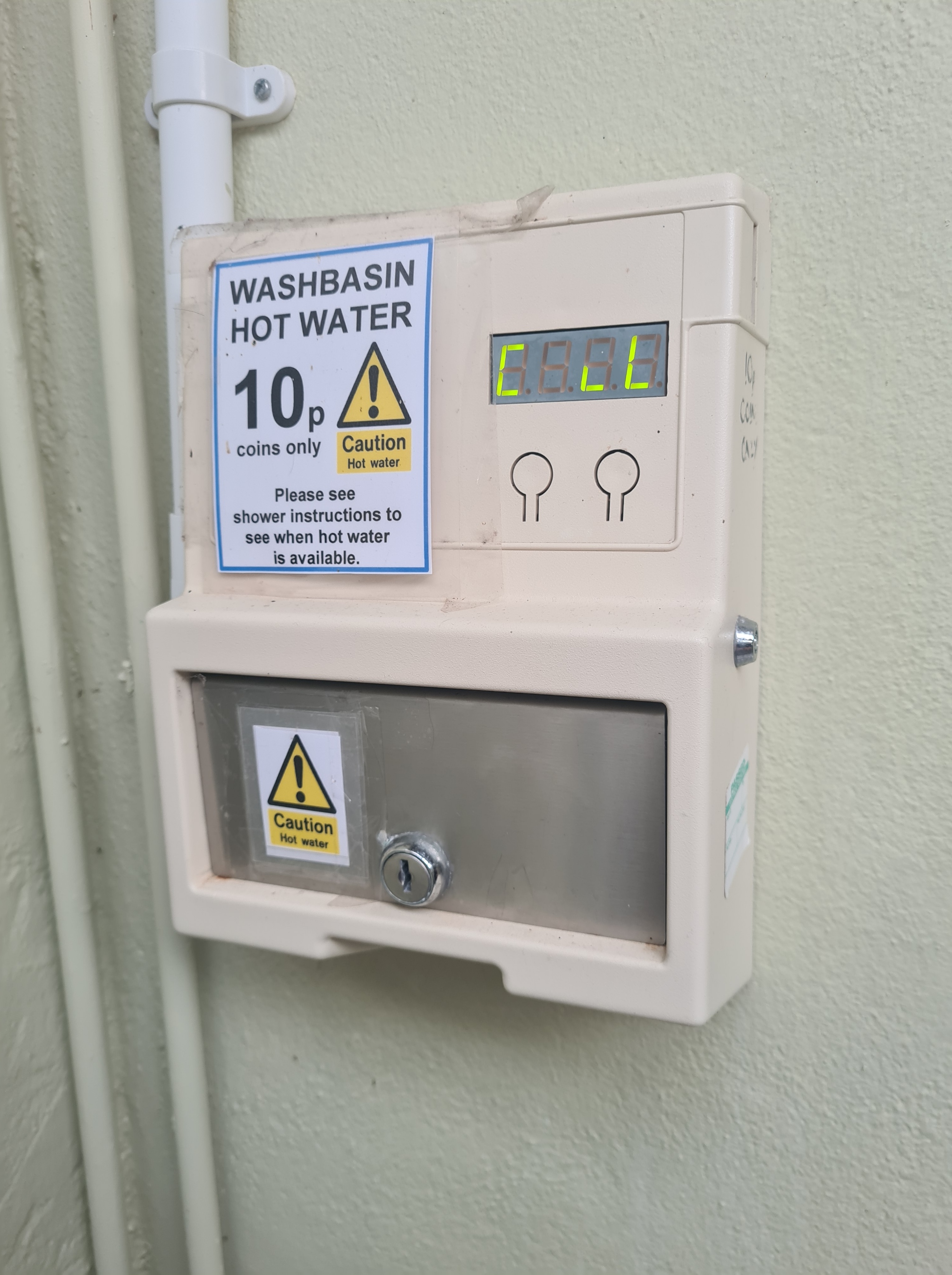
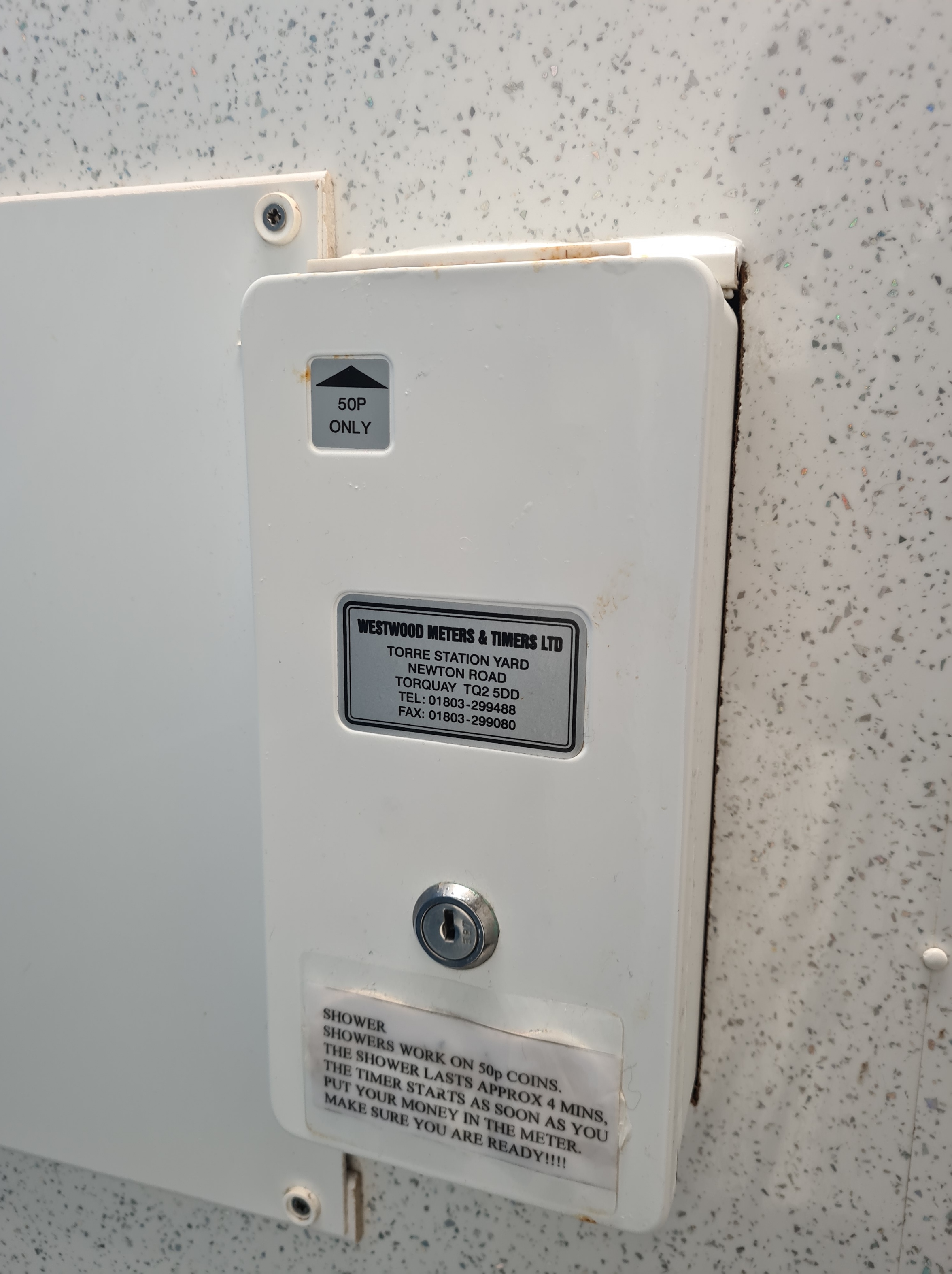
The trail has quite a few official campsites along much of its length. Many backpackers will wildcamp the whole 186 miles however I chose to use a few campsites for a couple of reasons. One of which was access to water. A coastal path can be a little problematic when trying to find water and I had little trust in the small streams that exit into the sea. I anticipated many would be contaminated with agricultural and chemical run-off from the many farms that border the coastline. Water at an official campsite is no problem at all. Additionally, many businesses have had a hard time of it in the wake of a covid pandemic and if I could put just a few quid their way, I would. And finally, who doesn’t appreciate a shower at the end of the day! So, I was a softie for this trail.
Amroth to Trevayne Farm campsite 5.48 miles, 1269 feet ascent
I, like most people, had to travel to the start of my hike by public transport. This took almost all day, and I didn’t arrive in Amroth (the start) until five in the afternoon. It was September. While I had a few hours of daylight I certainly wasn’t going to fit in a full day’s hike. But I still wanted to make a start. To that end, I had a walk of just five miles or so to begin with. This took me to Trevayne Farm campsite, beyond Saundersfoot and near Monkstone Point. But before that, I had to walk from the bus stop in Amroth in the ‘wrong direction’ to the start of the trail, take my photos, then turn around, walk back into Amroth and out the other side. This added a little distance to my day, but it was still less than two hours until I reached my first campsite of the trail.
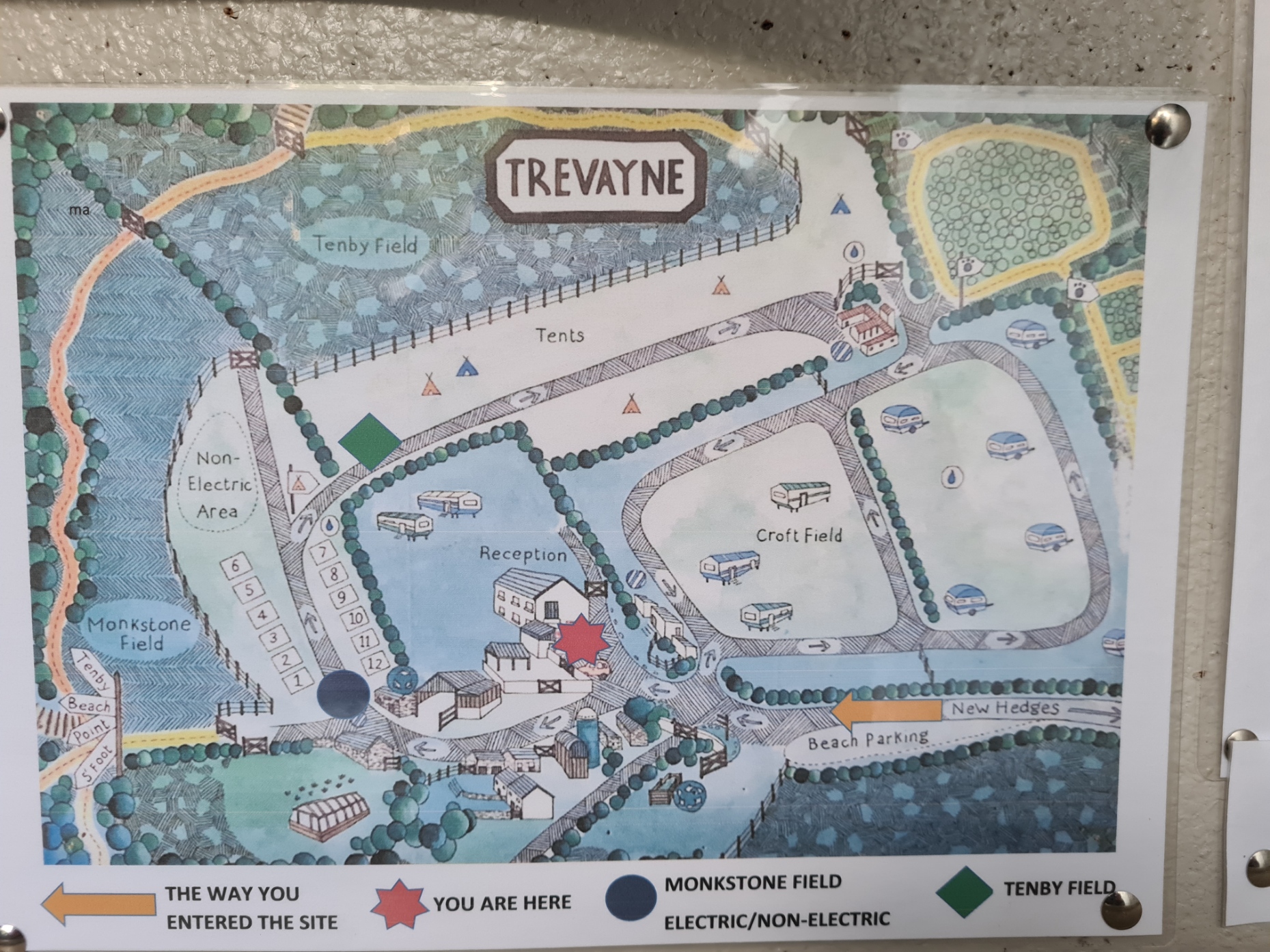
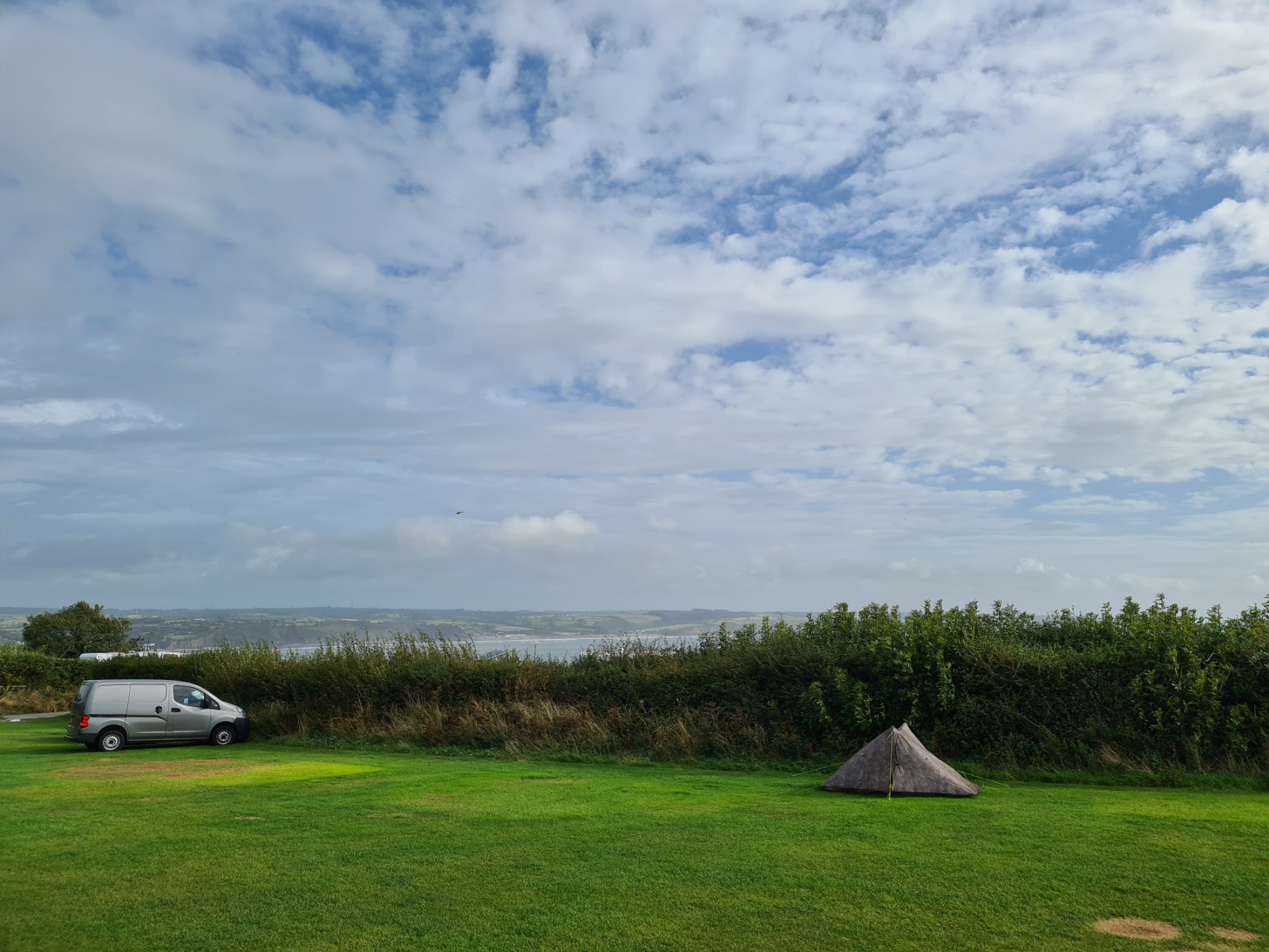
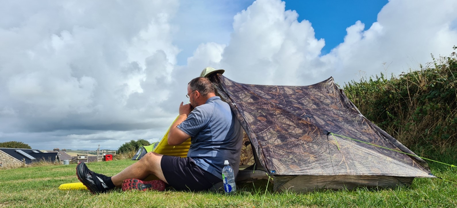
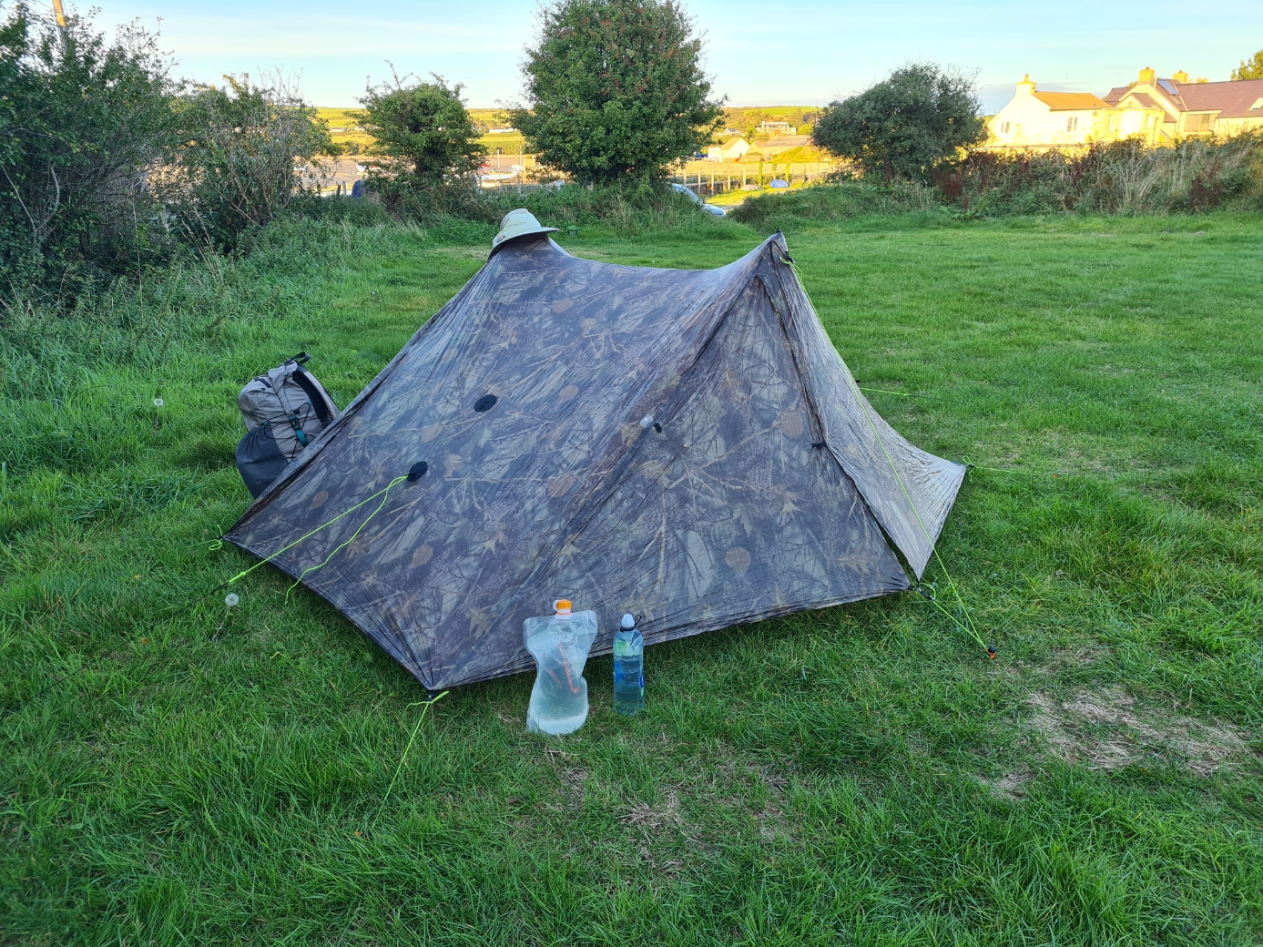
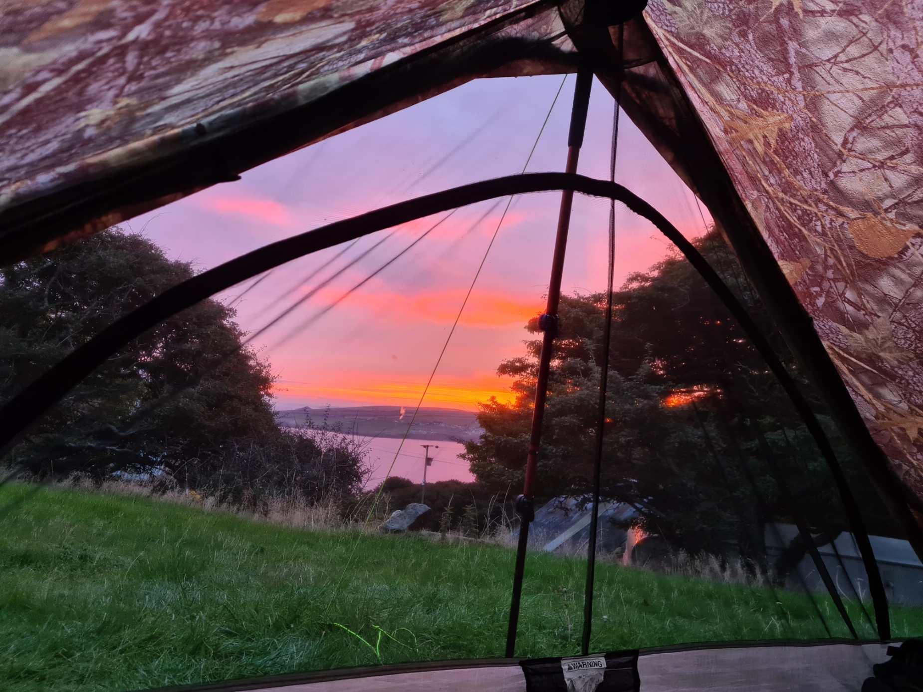
A note from the owners directed me to Trevayne’s large camping field and due to the weather forecast I selected a pitch with the best protection from the wind. However, the wind swung round during the night, and I had plenty of time to wonder if I had made the right choice of tent. Before leaving home, I had debated whether to bring my Duplex, a lightweight and very roomy shelter, or my slightly more cramped Duomid, that would shrug off strong wind better. The Duplex is light and strong, but it is no mountain tent and the increasingly strong gusts buffeting the tent had me leaving the shelter at two in the morning to rig up an extra guy. But it hung on in there and no pegs were pulled, and no damage caused. The morning dawned with wind diminished and too few hours of sleep for me. A few car campers had packed during the night and gone. I chatted to a couple in a large and impressive motorhome. They had dressed at midnight and sat in their rocking vehicle, wondering whether to leave or not.
The campsite is good, flat pitches, with large and well laid out shower block. I had no need to avail myself of any other facilities beyond the w/c and water and was away, as usual, a little later than I would have preferred. My night’s halt cost £10.
Trevayne Farm campsite to YHA Manorbier 8.18 miles, 1139 feet ascent
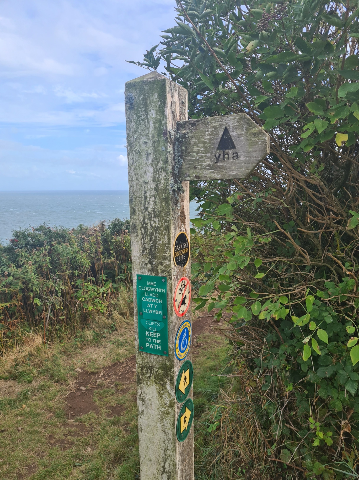
Because I had broken the back of the first section the previous day, today was a short one, just eight miles. This gave me plenty of time to explore Tenby where I stumbled across a brewery and was able to enjoy a decent fish and chips in their restaurant, exactly while the heavens opened. My pre-booked nights halt was at YHA Manorbier.
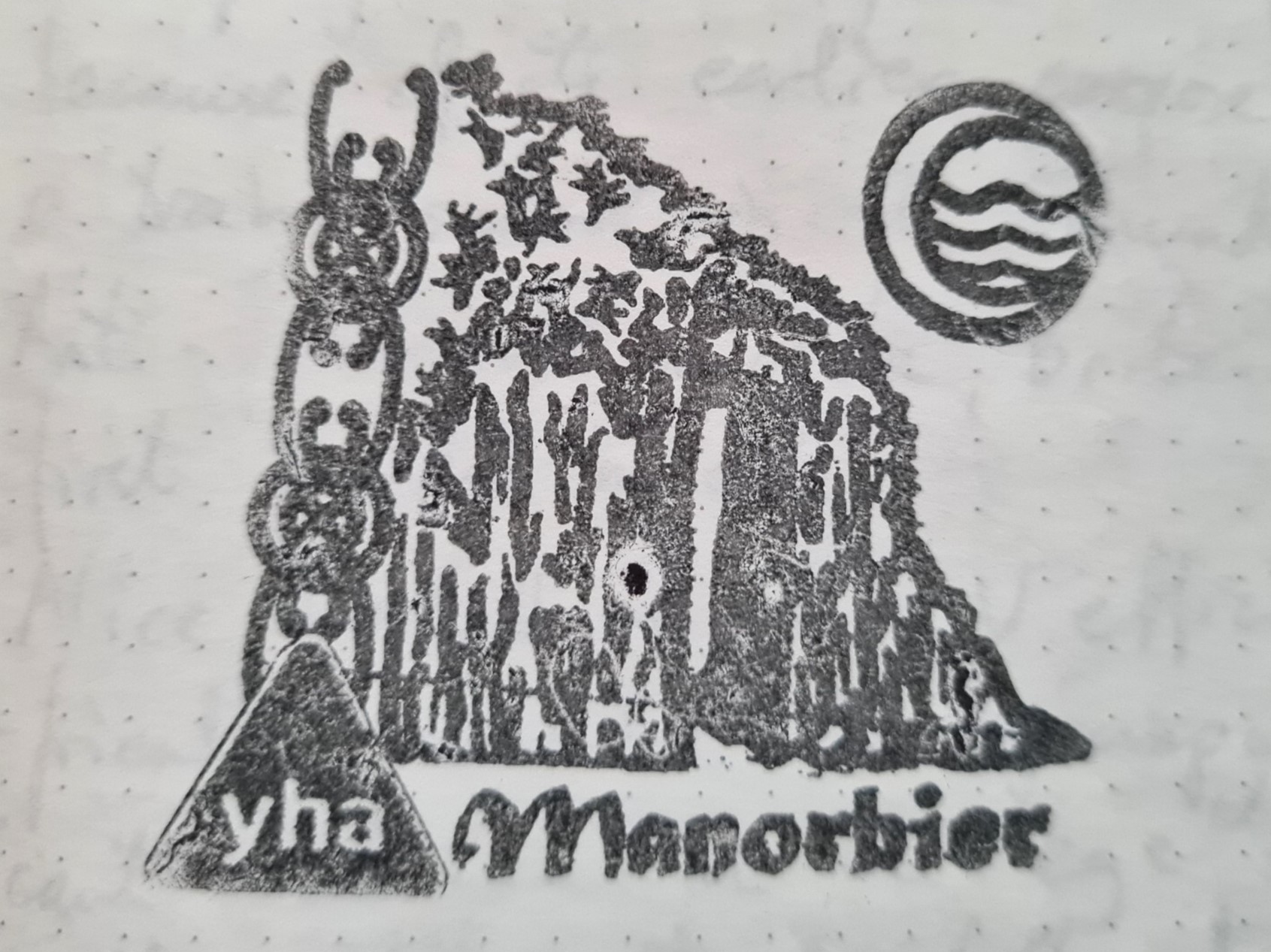
The hostels slightly odd outward appearance is due to it originally being the instructional building for the Thunderbird Anti-Aircraft missile system, the first guided weapon used by the British Army. As usual, the welcome from staff was fantastic and due to the YHA having a deal on during their Festival of Walking, I had nabbed 25% off a private room, paying £29.75 for my night’s halt. A shared dorm room would have been much cheaper, pitching my tent outside would have been cheaper still.
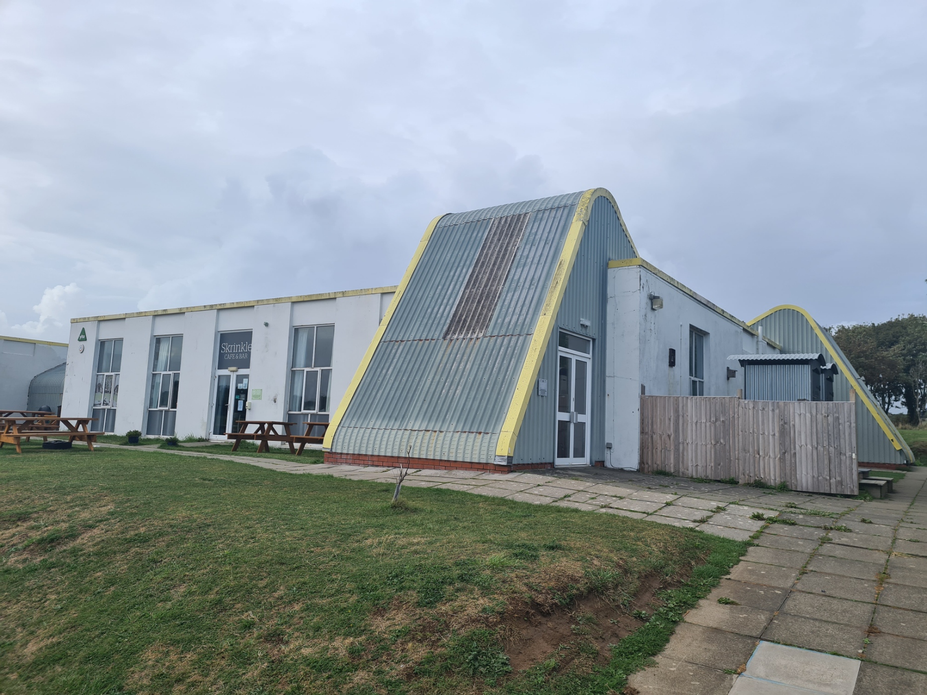
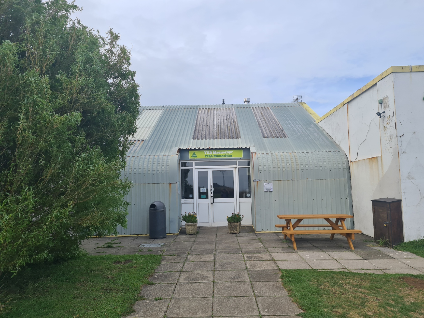
I was reluctant to undertake the twenty minute walk in the driving rain into the neighbouring village in the hunt of a meal at the pub, so ate a well-priced, basic but filling evening meal in the YHA, followed by an equally OK Full English the following morning, I had hoped they would put out a few individually wrapped cheeses amongst the yoghurts and jams, but they didn’t, so that slightly scuppered my lunch plans. I am a fan of the YHA. They have their (many) faults but they are reasonably priced and geared up to the needs of a backpacker, though I had no need of their laundry and drying rooms on this occasion. If I had got into Amroth many hours earlier, this would have been my first night’s halt. There is also a basic campsite diagonally across the road. However, it was a foul night with heavy rain for most of it and I was pleased with my choice.
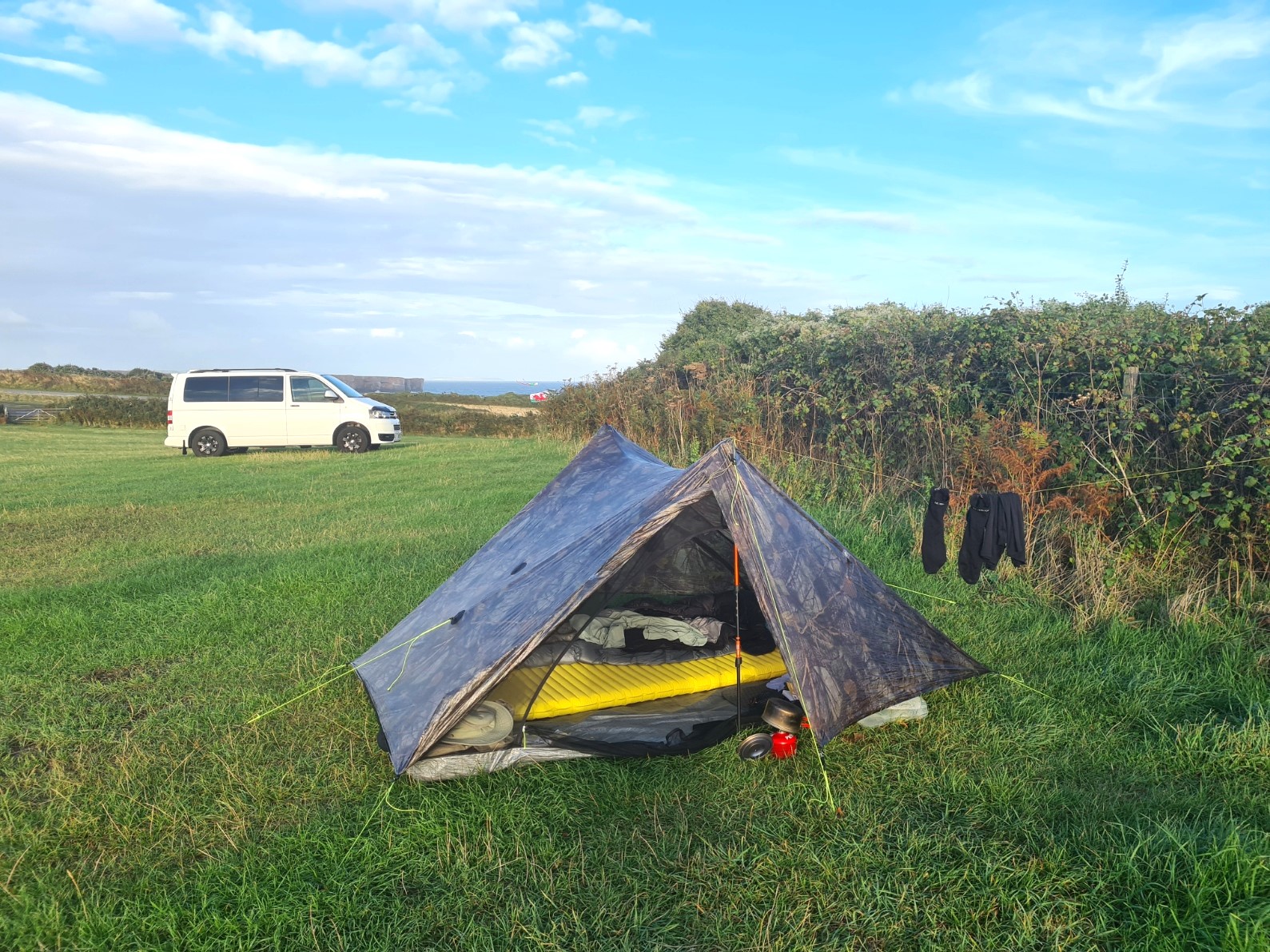
YHA Manorbier to Trefalen Farm campsite, Bosherston, 12.11 miles, 2460 ascent
Trefalen Farm campsite charged me just a fiver for my night’s halt, but they do only offer cold showers in a small and very simple amenities block. But the day was warm and I actually enjoyed this, finding it refreshing after the day’s hike. This site was a large, flat and basic field where I was able to get decent shelter from the wind and the frequent but very brief rain that kept blowing through. The large dog with the neighbouring camper took offence at my presence and kept barking at me until the owner re-aligned his van so it couldn’t see me.
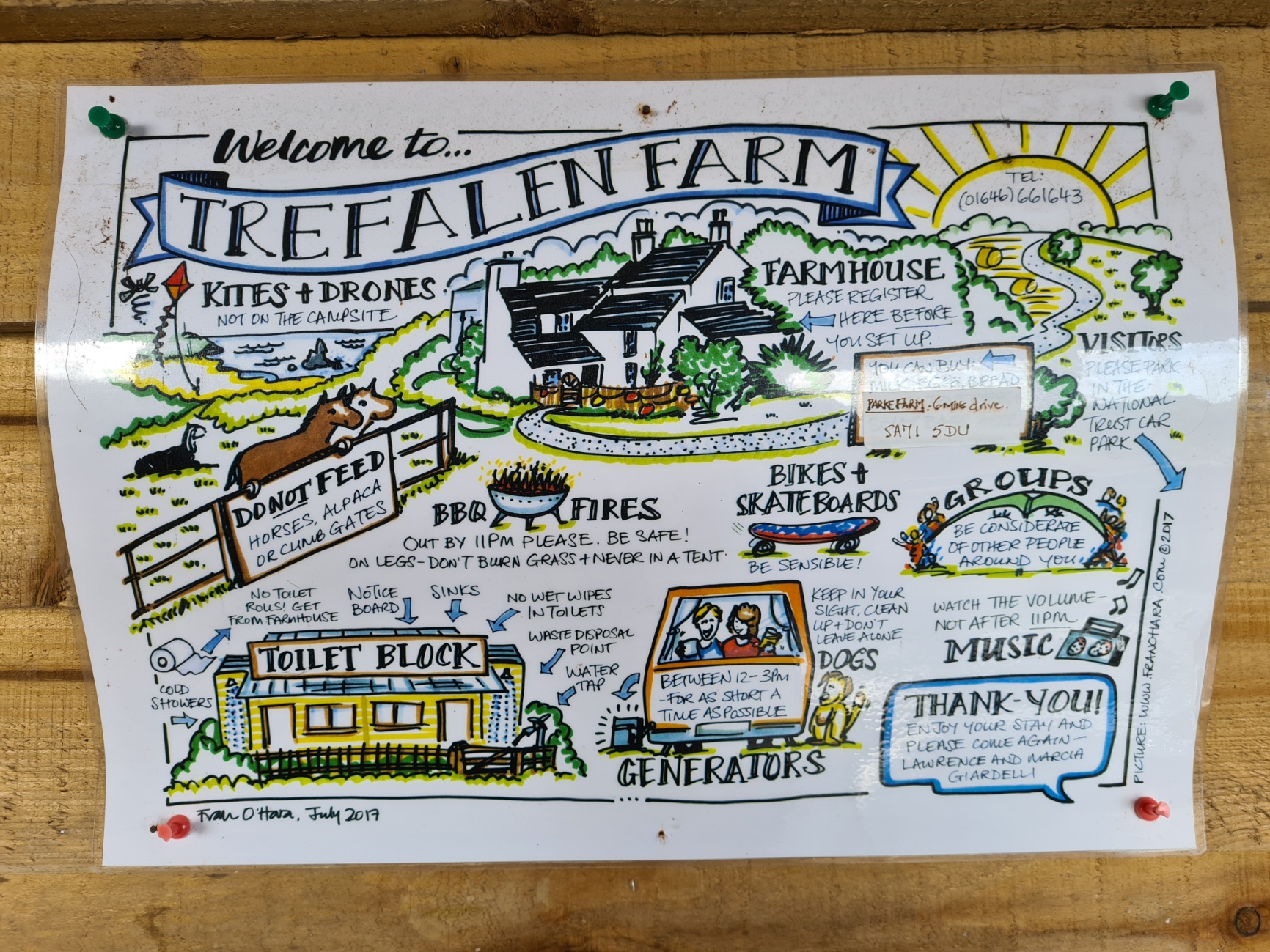
I had arrived early enough to do a bit of clothes washing and rest and read for a couple of hours prior to evening meal. Later, it was yet another night of strong wind, this time accompanied by heavy rain. This time, I just about slept through it as I was correctly aligned for shelter by a large hedge.
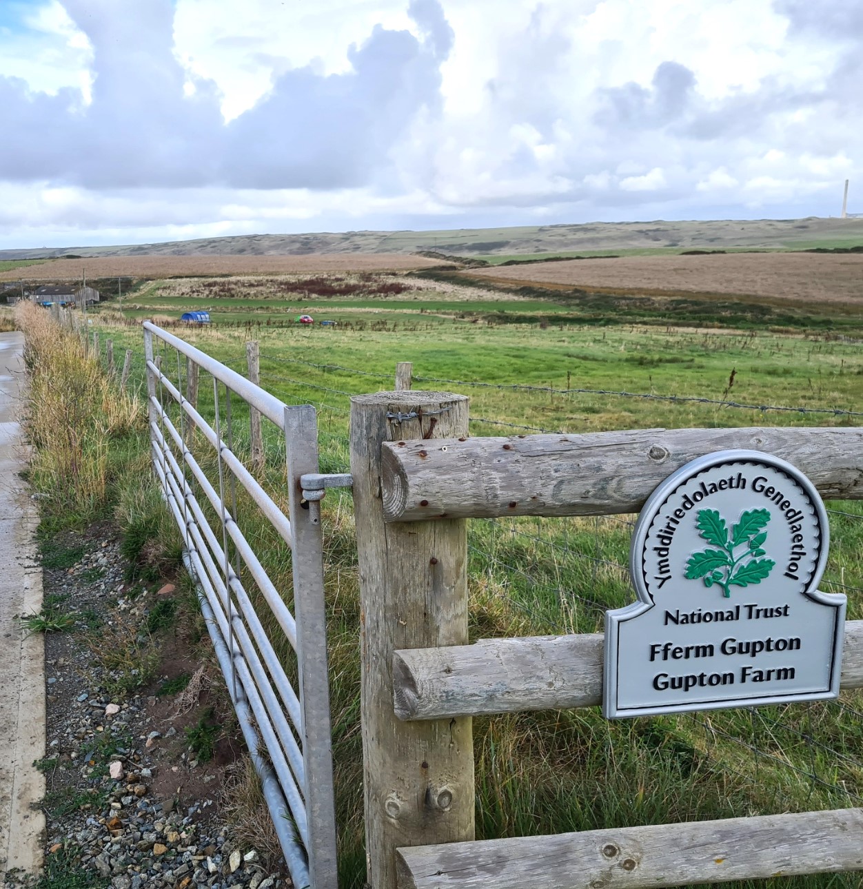
The next section is just a tad awkward logistically as I would soon be reaching the Pembroke/Pembroke Dock/Milford Haven section. Many people will probably attempt to complete a long hard day and camp at Angle, just prior to the conurbation. However, I was still easing myself into the trail so broke this next section in to two far easier and shorter days. My next day took me to the National Trust farm site at Gupton, close to Freshwater East, west of Castlemartin. The following, also short, day would take me to Angle.
Trefalen Farm campsite to Gupton Farm campsite. 9.79 miles, 622 feet ascent
The next section of trail passes through or round the Castlemartin Ranges East and West and the route is dependent on whether firing is underway or not and red flags flying or not. It was, and I had to take the inland route over easier terrain which meant I had an earlier finish. The Gupton Farm campsite, popular with surfers, is a basic site but what facilities there are, were well maintained and sufficient to my needs. I do feel the £14 fee was a little excessive considering that showers were cold, it had rained for much of the day, often heavily and I appreciated their all-weather barn in which I cooked my evening meal and recharged electrics. The website states a two-night minimum stay, but I had no trouble booking a single night. The weather cleared, the stars came out and I had a peaceful night’s kip here.
Gupton Farm campsite to Castle Farm campsite, Angle. 9.11 miles, 1623 feet ascent
After the previous easy day’s hiking following the Castlemartin Range trail round the firing area, there is a little more ascent/descent the next day, though in no way difficult, for another short day round to Castle Farm at Angle. This is a small sloping field with ageing facilities that are kept spotlessly clean and well worth the £8 fee. Most caravans seemed to be in storage rather than being occupied and it was a quiet site.
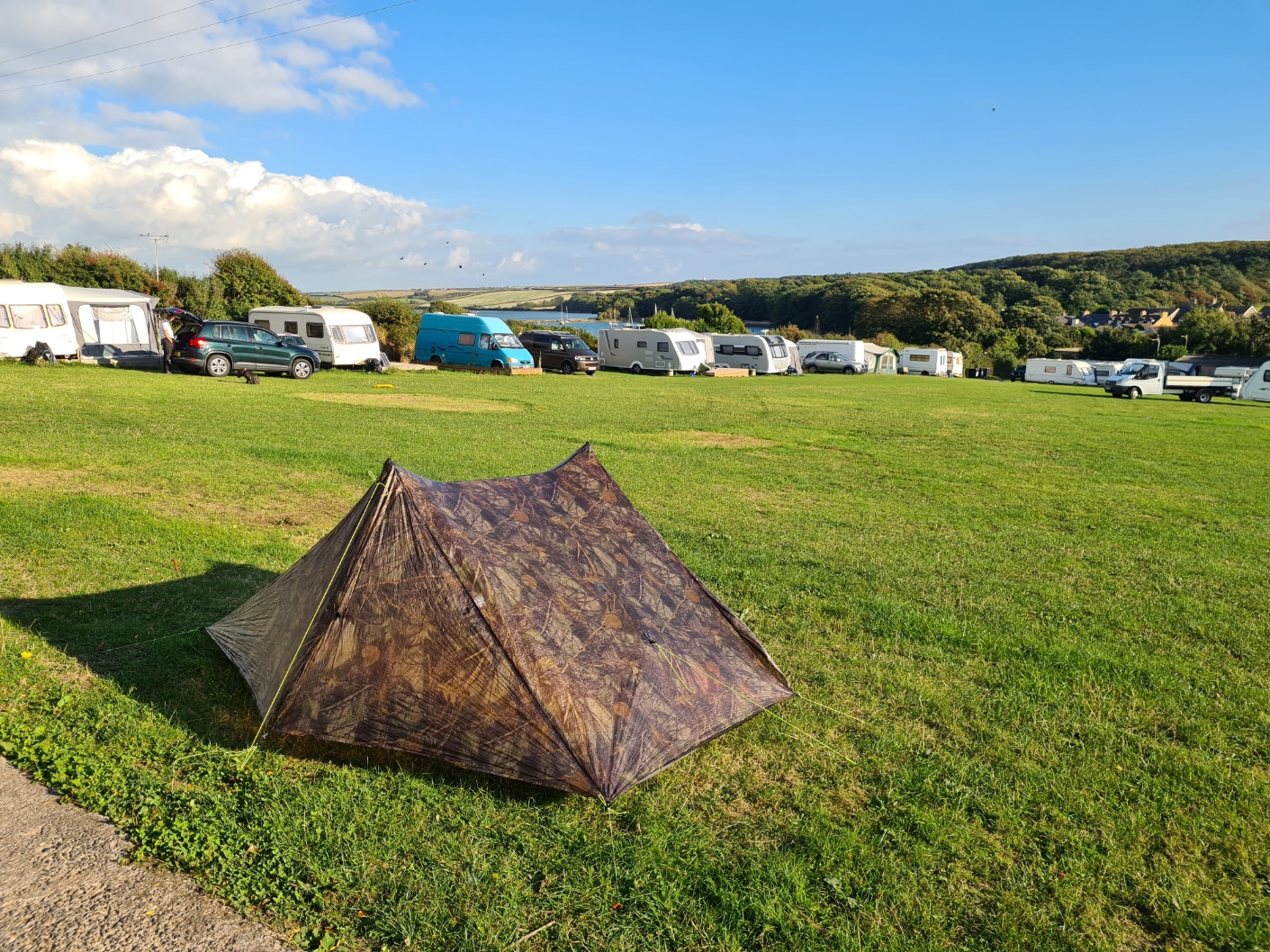
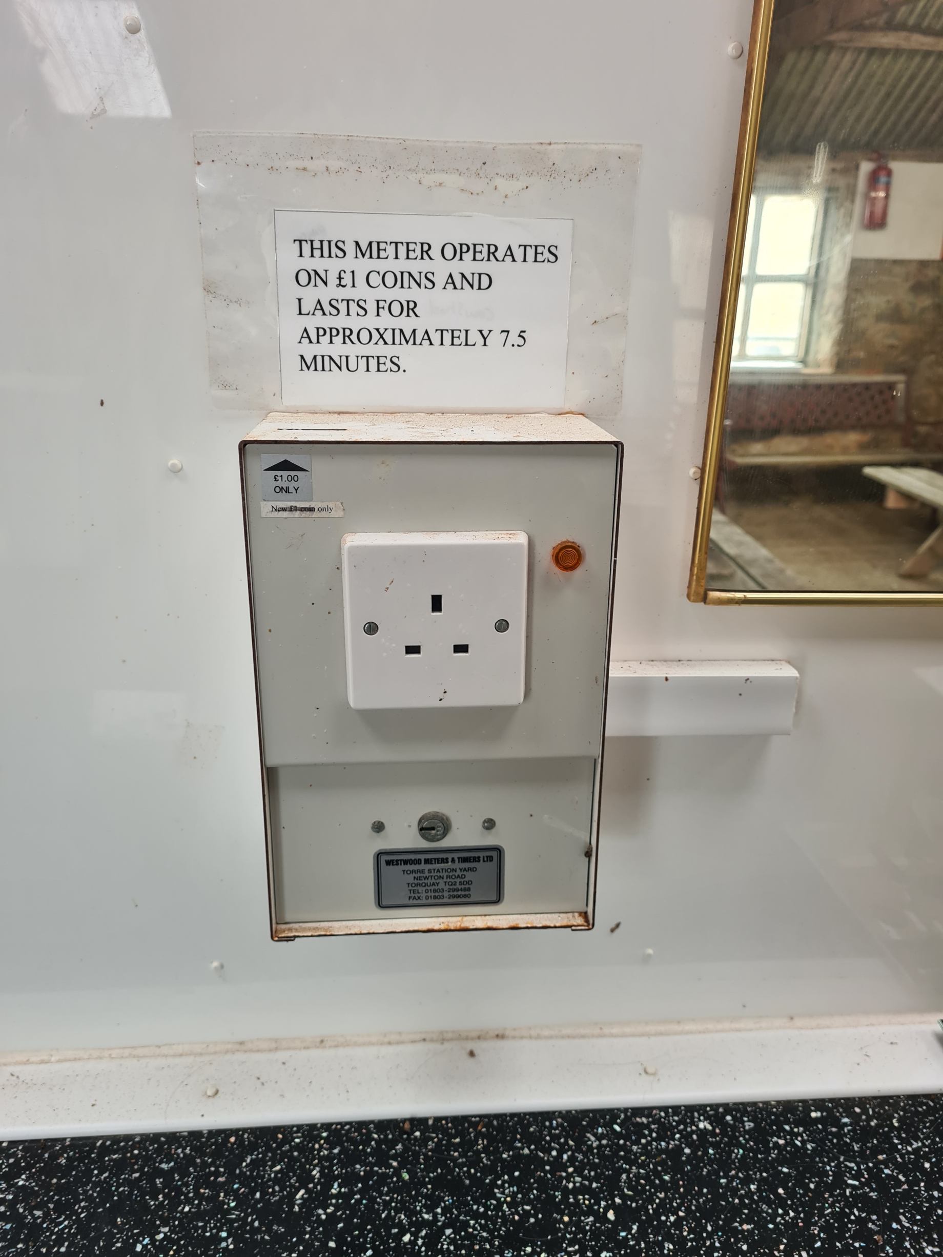
Castle Farm campsite had meters for both showers and hot tap but each were working with no time restrictions on a free basis when I was there. I was the only tent camper and fortunately managed to find a flat pitch at the very top of the field. Near enough to the trees that the morning raucous chorus from the rooks woke me far too early. I was also pissed off to find that the farm cat I had seen hanging around had torn a small hole in my shelter’s bug netting while I was out at the local pub or showers.
The following day leaves Angle and loops round Angle Bay. There is then a fairly long mid-trail section that passes through busy ports and towns of Pembroke, Pembroke Dock, Milford Haven along with oil refinery, power plant and natural gas plant. I met a number of hikers that either deliberately skipped this section or left it out due to accommodation problems. Despite being the most urban part of the entire 186 miles of the trail, there is much to enjoy in this section and by far the easiest way to tackle it is to find a B&B or similar in one of the towns.
Castle Farm, Angle to (hotel) Pembroke Dock, 14.19 miles, 1744 feet ascent
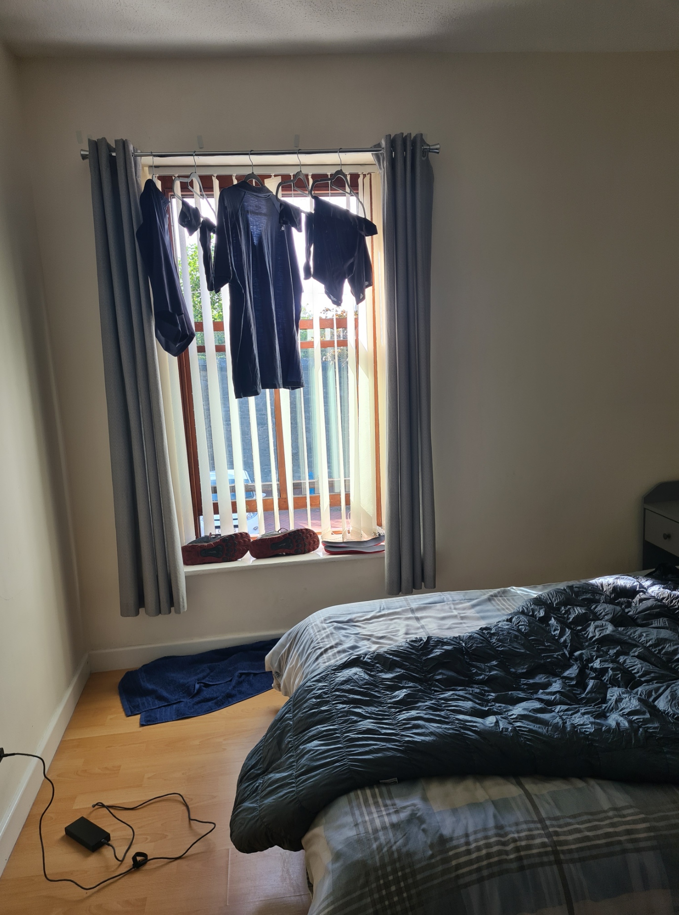
The route planners have done a good job of tackling the most industrial and built-up area on this coastline. I found a cheap night’s halt on booking.com and my £42 overnight ‘B without the second B’ at The Helm hotel in Pembroke Dock was probably the cheapest available. At that price I was not surprised to find it was a little run down, but it was clean enough and the room wasn’t as tiny as I have had to endure at many other places. I was able to also wash my hiking clothes and hang them at the window to dry in the last vestiges of warm afternoon sun.
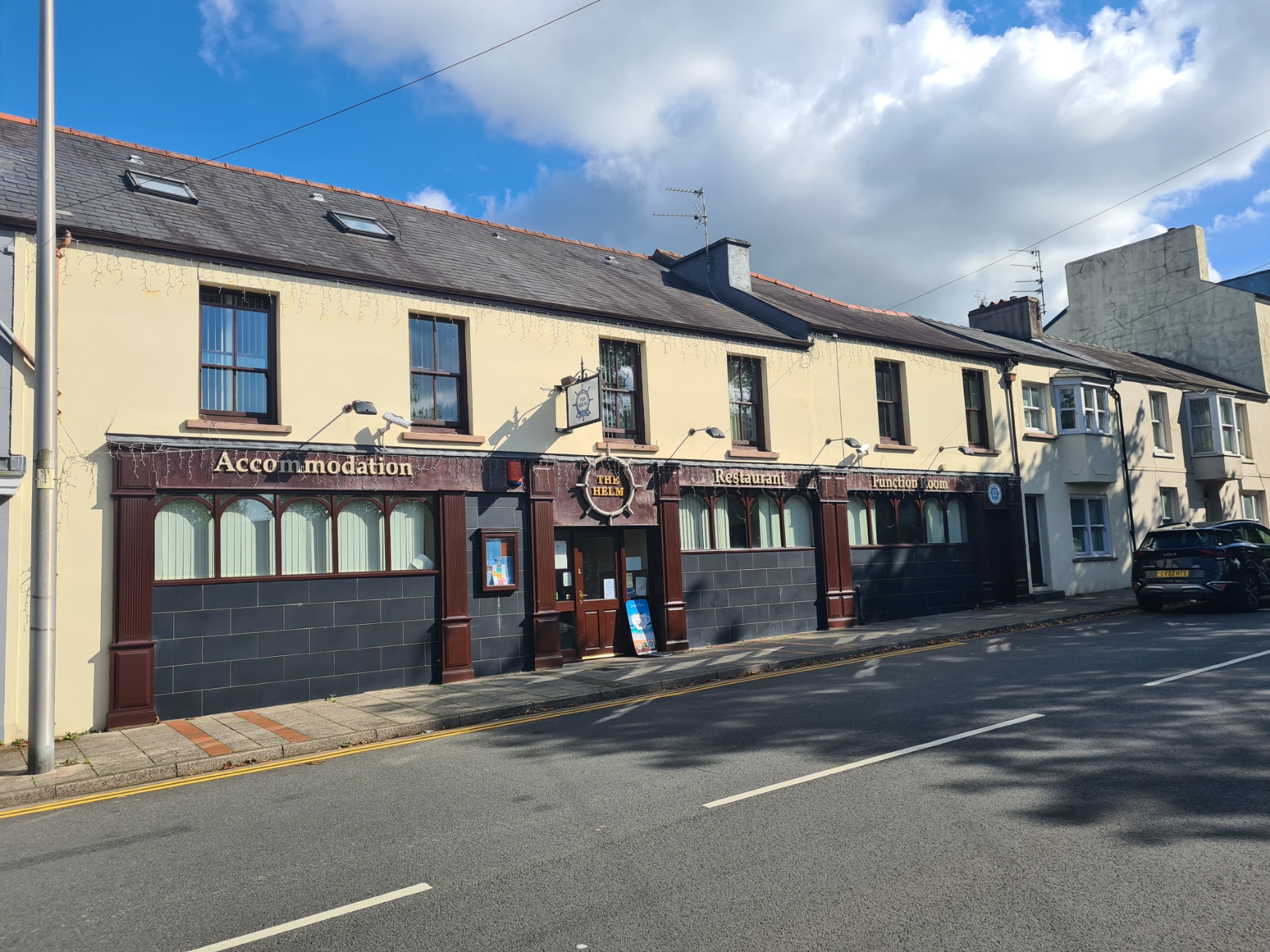
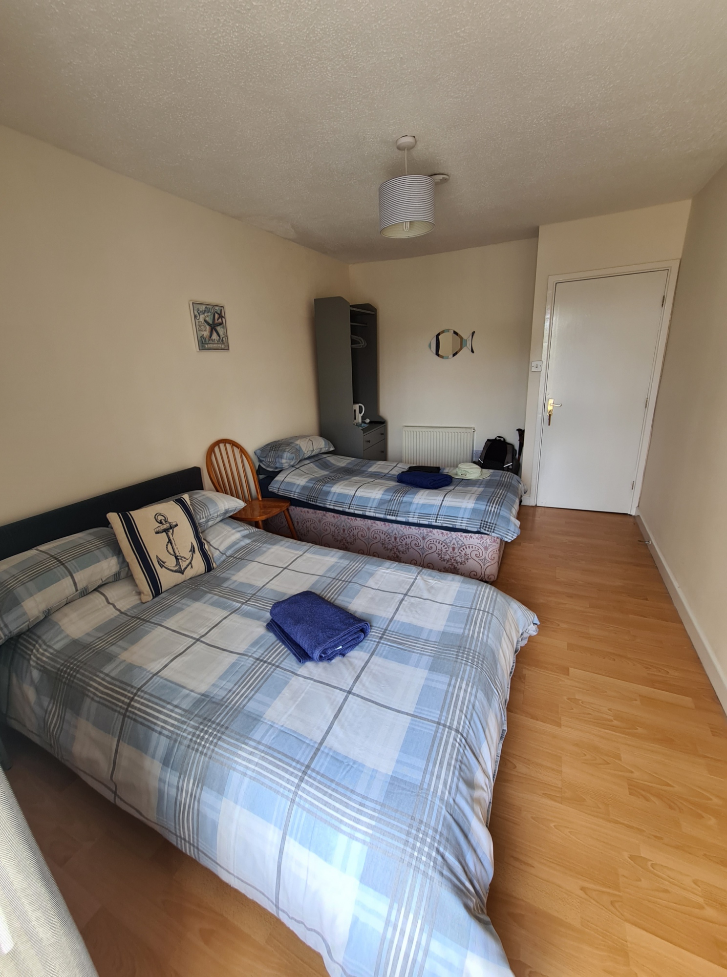
Despite a slightly increased mileage and taking time out to visit Pembroke Castle, I still arrived at my hotel at three in the afternoon. Having showered and washed clothes, there was no breakfast provided, so I took a short walk out to the local corner shop who supplied the necessary goods for the following morning. The Helm was licensed and had a restaurant. I took advantage of both.
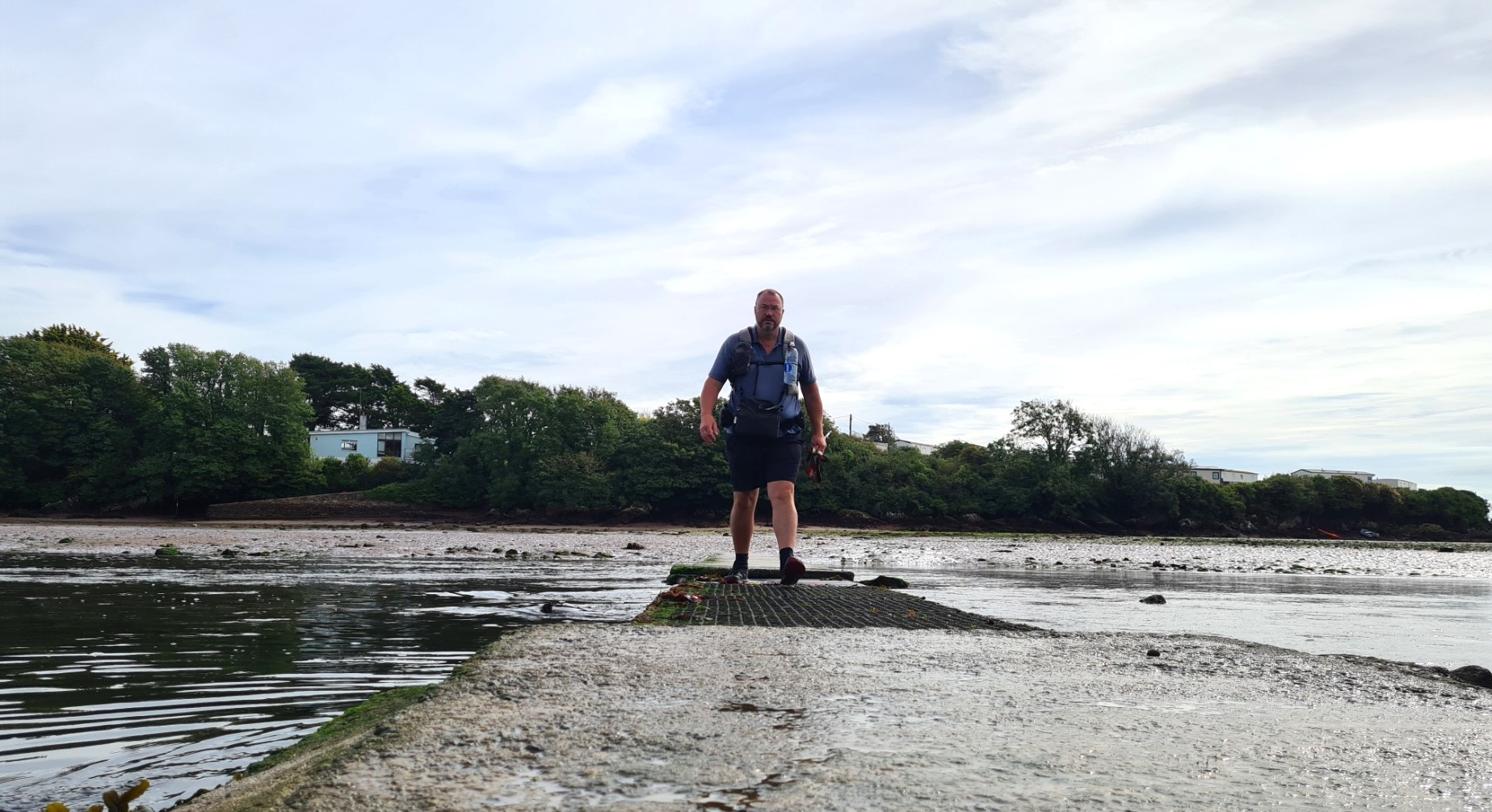
Pembroke Dock to Sandy Haven. 13.79 miles, 1968 feet ascent
There are a small number of tidal crossings that have to be considered when hiking the Pembrokeshire Coast Path. Other than when there are very high tides, only two are matters of concern to just about everyone. These are at Sandy Haven and across the Gann estuary. These are a two hour walk apart. My initial intention was to camp as near to the first as I could and them make my crossing at low tide regardless of the time of day.
I had emailed Sandy Haven campsite previously to ask if I could pitch there. They had actually closed for the season but the owner said no problem and left me a hidden key for the shower block. On their request, I left a fiver for my night. This small site has a slightly sloping field for campers, is immediately on trail and overlooks the tidal crossing just a hundred metres away. More importantly, it was chucking it down when I arrived, and I managed to find both a level and reasonably sheltered pitch for the Duplex. I was, unsurprisingly, the only camper. There is also another site, Upper Neeston Farm a mile walk away at Herbrandston. The next low tide was in the small hours of the morning but because I didn’t fancy night walking a coastal path in foul weather, I revised my plans and crossed at midday the following day knowing this would also mean a late finish.
Sandy Haven campsite to West Hook camping. 16.63 miles, 2457 feet ascent
Despite being a late start to my day’s hiking, this was an enjoyable day on the coast and, though getting a little nervous as the sun in front of me sunk to the sea, I still rolled into West Hook farmyard in the early evening gloom at eight o’clock. There was no-one around, it got darker, no-one answered the doorbell or phone. Written notices forbade anyone to pitch without direction. I eventually found an alternative number and the voice assured me ‘no problem, pitch and we will sort it out in the morning‘. The tent was up just a few minutes after the sun had sunk below the sea and a cold wind began to blow in. I suppose with the present energy crisis, I shall have to get used to it, but I found the site a little mercenary with its charging for just about everything. And this after my pitch costing £10. But the shower was welcome, and I was again able to sit in a lit barn to prepare my evening meal and brew.
As with so many farm sites along this coastal path, it is beautifully situated. Wild camping may be an option somewhere else along the trail, but again, at the farm site I had drinking water on tap, a decent hot if brief shower and a flat pitch.
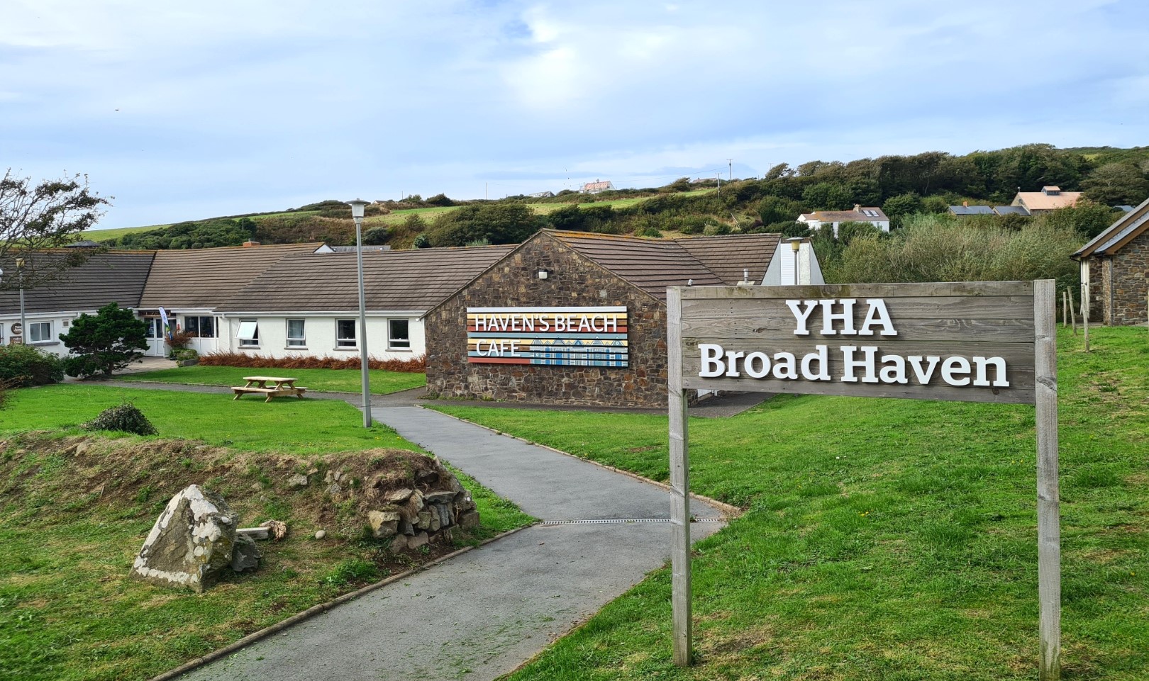
West Hook camping to Broad Haven YHA. 6.65 miles, 1892 feet ascent
It had always been my intention to take a day off mid-trail. The Youth Hostel at Broad Haven seemed an obvious location. There isn’t much in the town but I knew I would be able to carry out a small food resupply for the remaining trail. I left West Hook late, took my time, enjoyed the trail and explored anything of interest, had a decent ploughmans in a pub at Little Haven and still rolled into Broad Haven YHA before four. Remarkably, they let me book in early too. So, I had that afternoon and evening to wash just about all the clothes I had other than a pair of shorts and a hoodie and run them through the tumble drier. This left me all the following day to get up late, eat too much, complete a small food shop, rest and enjoy a couple of beers while planning the next few days and booking trains home. With my member discount, my two nights in a private room at the hostel, including two breakfasts, cost me £106.10.
Broad Haven YHA to Caerfai Farm campsite. 15.44 miles, 3762 feet ascent
The trail now began to pick up a little. Much that I had walked already had been superb. The remainder of the trail however is possibly the best. The ups and downs became steadily more difficult, and I had decided to pick up the daily mileage a little. Mostly because the weather had improved immensely since I had set off and I was a little more hill fit.
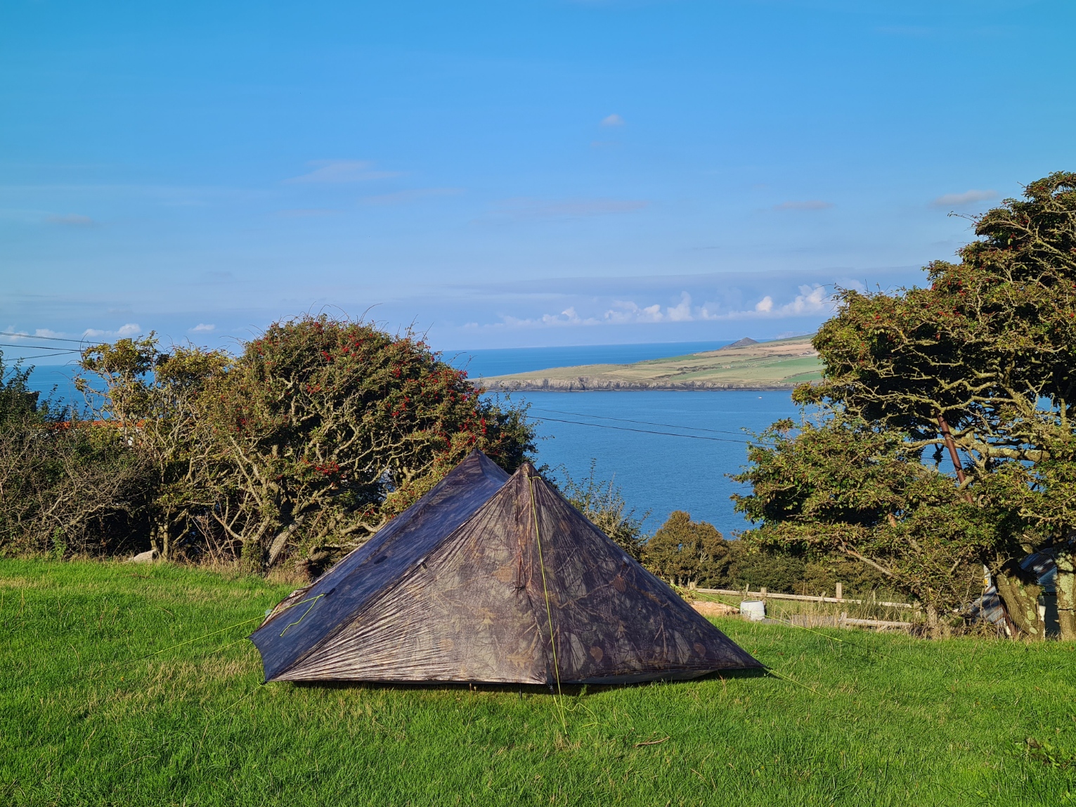
There are two campsites at Caerfai, next door to each other. Caerfai Farm campsite is pretty large, right on the trail and has all a backpacker could want and was just £7 with really good showers.
Caerfai Farm campsite to Celtic Camping. 15.01 miles, 3779 feet ascent
After a cracking days walking I reached the huge National Trust site Celtic Camping. There is less choice of campsites on this stretch of coastline and Celtic Camping has a bit of a reputation as a decent stop for coastal path backpackers. There is also a large bunkhouse here which is frequently packed out with youngsters undertaking some form of geology or ecology learning. As many as 200-300 people can be accommodated indoors. A fairly large group were arriving later that night, but the rest of the site was very quiet with few campers.
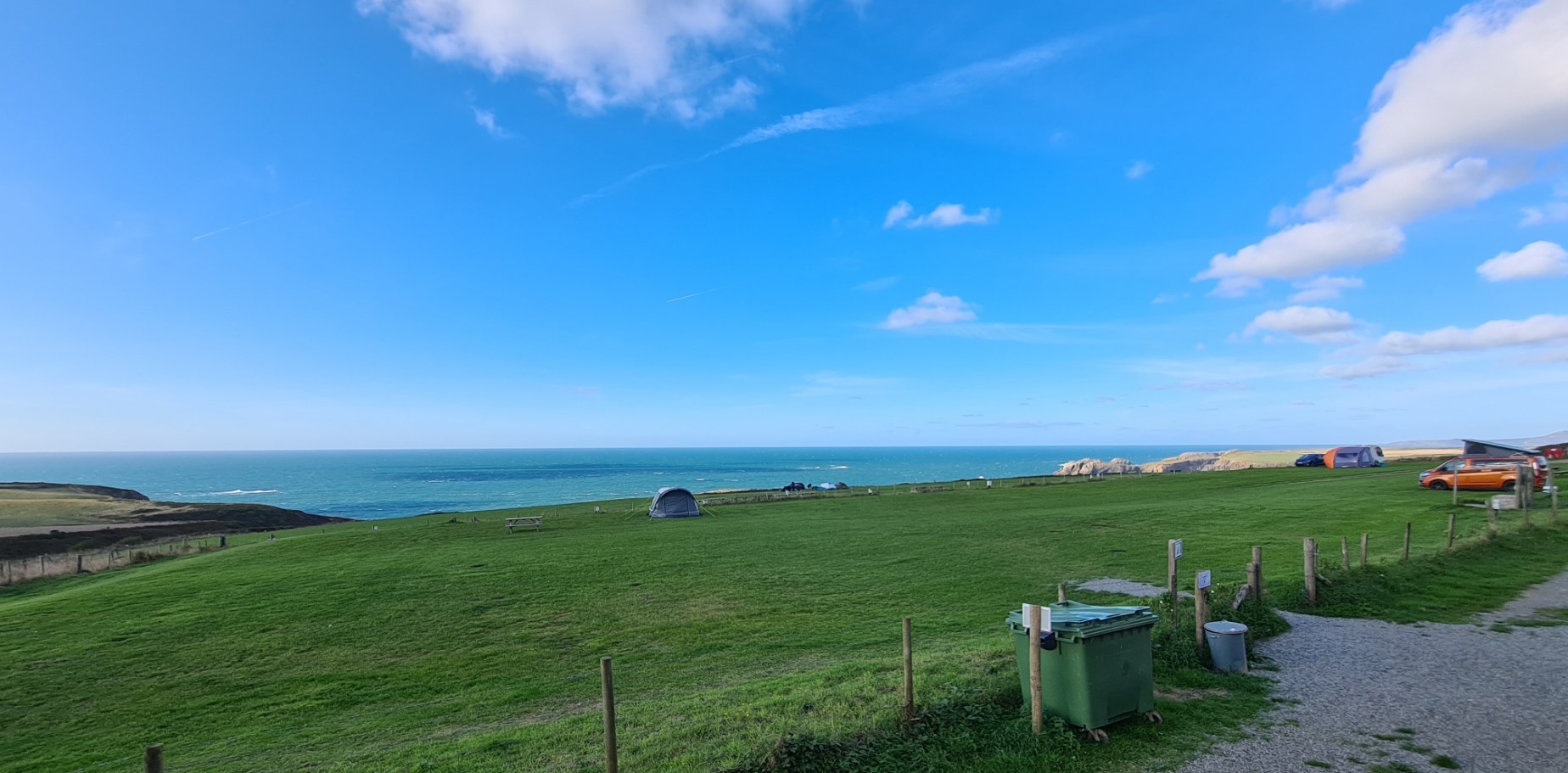
I was welcomed into reception and enjoyed a good chat. I asked how much for the pitch and was asked if I was walking the coast path. Following my affirmation, the fee was (exceptionally) waived. I insisted and was told I could put a couple of pounds in the Lifeboat collection box if I wished. I left a tenner in it. A strong and cold wind was whistling up through the camping field and I asked for as sheltered a pitch as was available, I was then offered the small, enclosed garden of one of the ‘for rent’ cottages on site and that did me fine on what turned into yet another wild night.
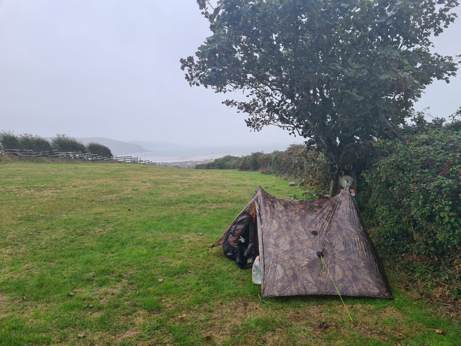
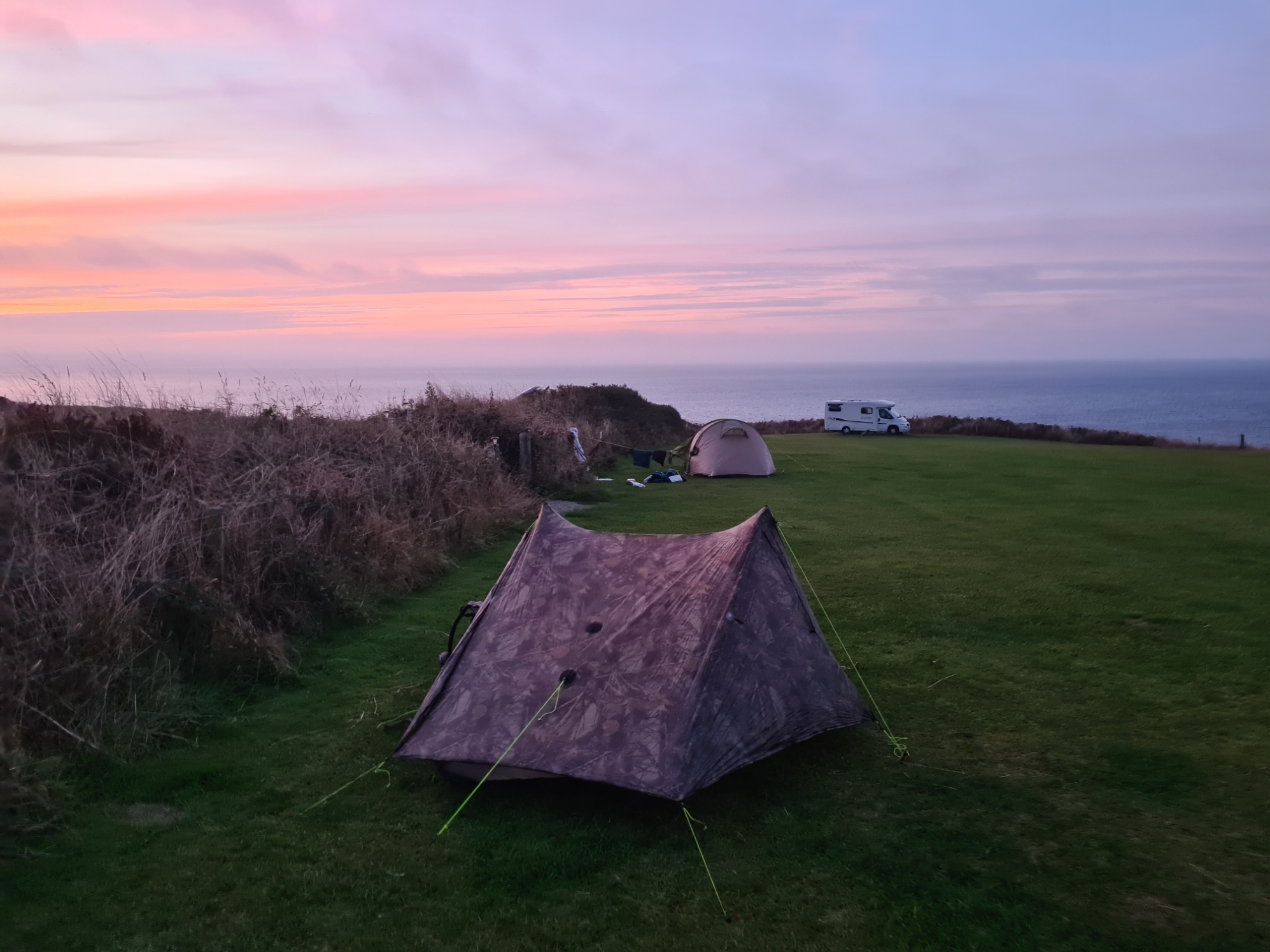
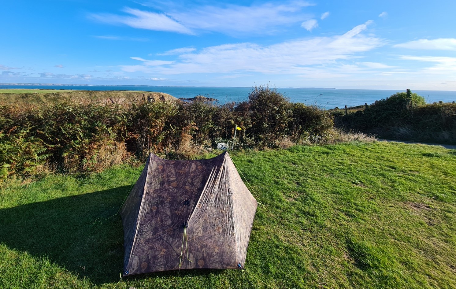
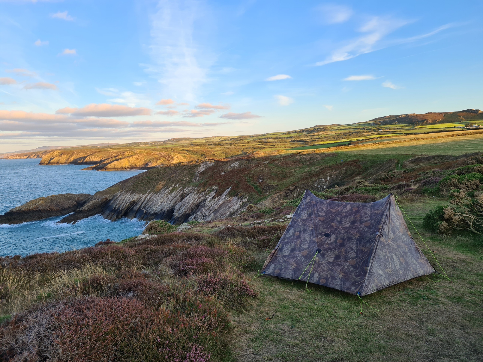
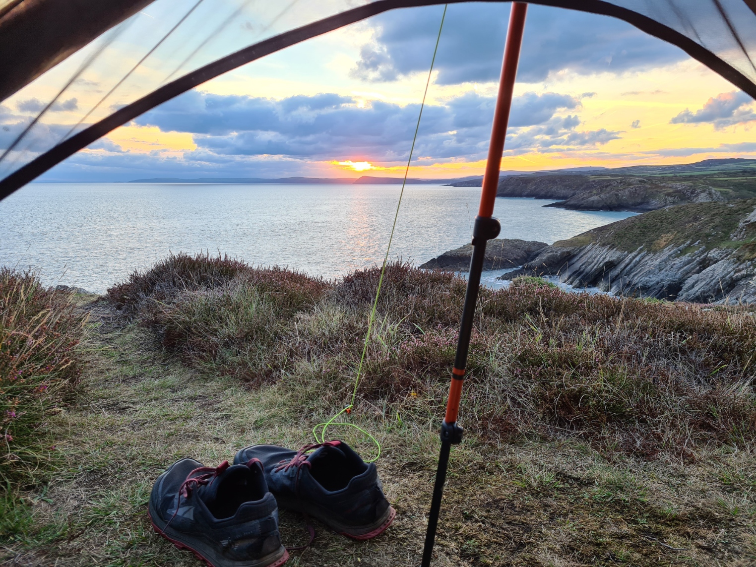
Celtic Camping to wildcamp at Pen Caer (Strumble Head). 17.46 miles, 4852 feet ascent
Another superb day’s walk. Longer than my preceding days and with more ascent too. I could almost smell the end of the trail though and was enjoying myself immensely. I also looked forward to my first and only wildcamp on this trail. There appeared to be no ‘official’ sites at which to stop. Pwll Deri YHA was available only to those booking the entire facility for at least two days (ridiculous) but I knew there was an outside water tap there at which I could pick up a couple of litres of water for the night. I found a good wildcamp site a little beyond the lighthouse on Strumble Head and pitched so that I had the sun coming up in front of me the following morning. The night was still without a breath of wind and I enjoyed a little star watching and constellation identifying in the small hours.
Wildcamp at Strumble Head to Morawelon campsite, Newport. 18.36 miles, 4602 feet ascent
At the risk of repeating myself, it was yet another fantastic day’s hike. There are very few people on this part of the trail, and I battled with cobwebs across the path for the first two hours. Goodwick and Fishguard were fairly unwelcome mid-morning, but I was at least able to breakfast there. Then it is soon back to great cliff top and coastal walking. As usual, lots of ups, lots of downs. From the few coastal path walkers I met I was already gaining the impression from conversations that some of the stronger and faster walkers that passed me the previous week had either abandoned the trail or decided to skip sections due to injury or other circumstances. I think my strategy of easing myself into the trail had worked to my advantage. But I had the luxury of few time constraints and could take my time. Not everyone is so fortunate.
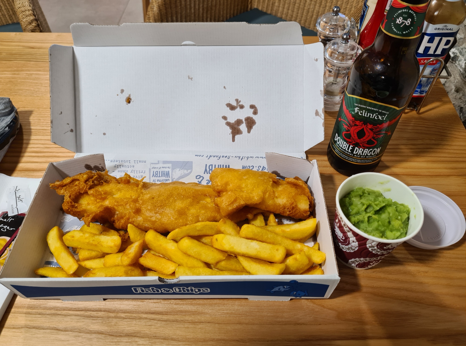
There is more than one campsite at Newport but there is no need to go anywhere other than Morawelon campsite. Nicky, the cafe owner and site manager for the small campsite behind it, is as friendly and effusive a person as you could meet anywhere. She loves people, loves campers and loves talking. If you need help with anything, she is there for you. The pitch was good, the showers are good and I got a bit of a move on and was also able to fit in a decent fish and chips and a couple of beers in the licenced cafe before it closed.
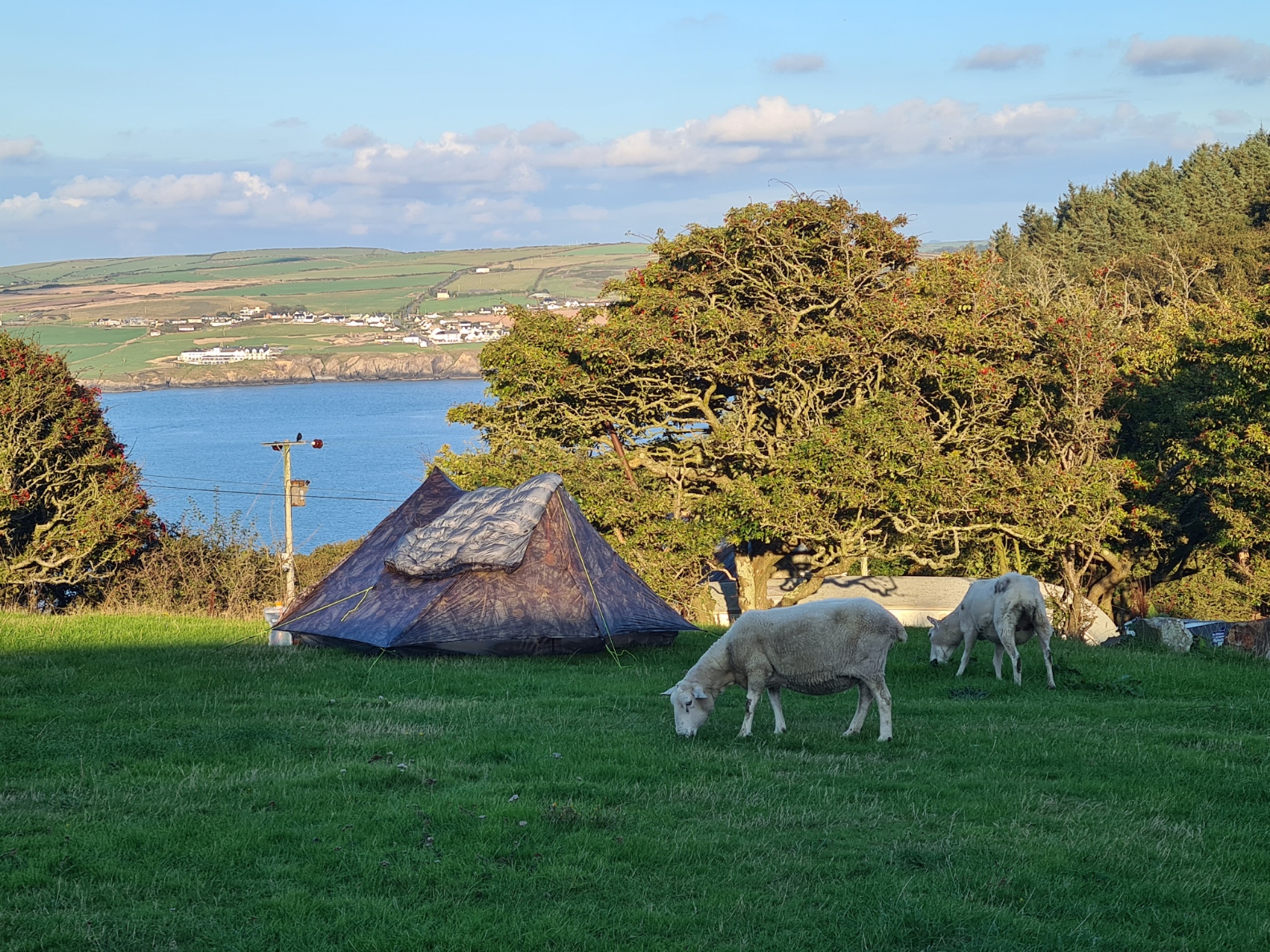
Morawelon campsite, Newport to Allt-y-coed farm campsite. 12.77 miles, 3716 feet ascent
There wasn’t even the slightest of breezes during the night, I was pitched near water and the condensation was heavy. I was away fairly early the following day for my final day on trail (well, almost!). I could easily have finished the trail today but had no need to, so was fitting in a last camp prior to wandering the final couple of miles or so down into St. Dogmaels the following morning. This is the toughest section of the entire trail and probably the most enjoyable day too. It is worth taking your time and enjoying the geology, views, climbs, choughs and for me, the many seals and pups in the bays below.
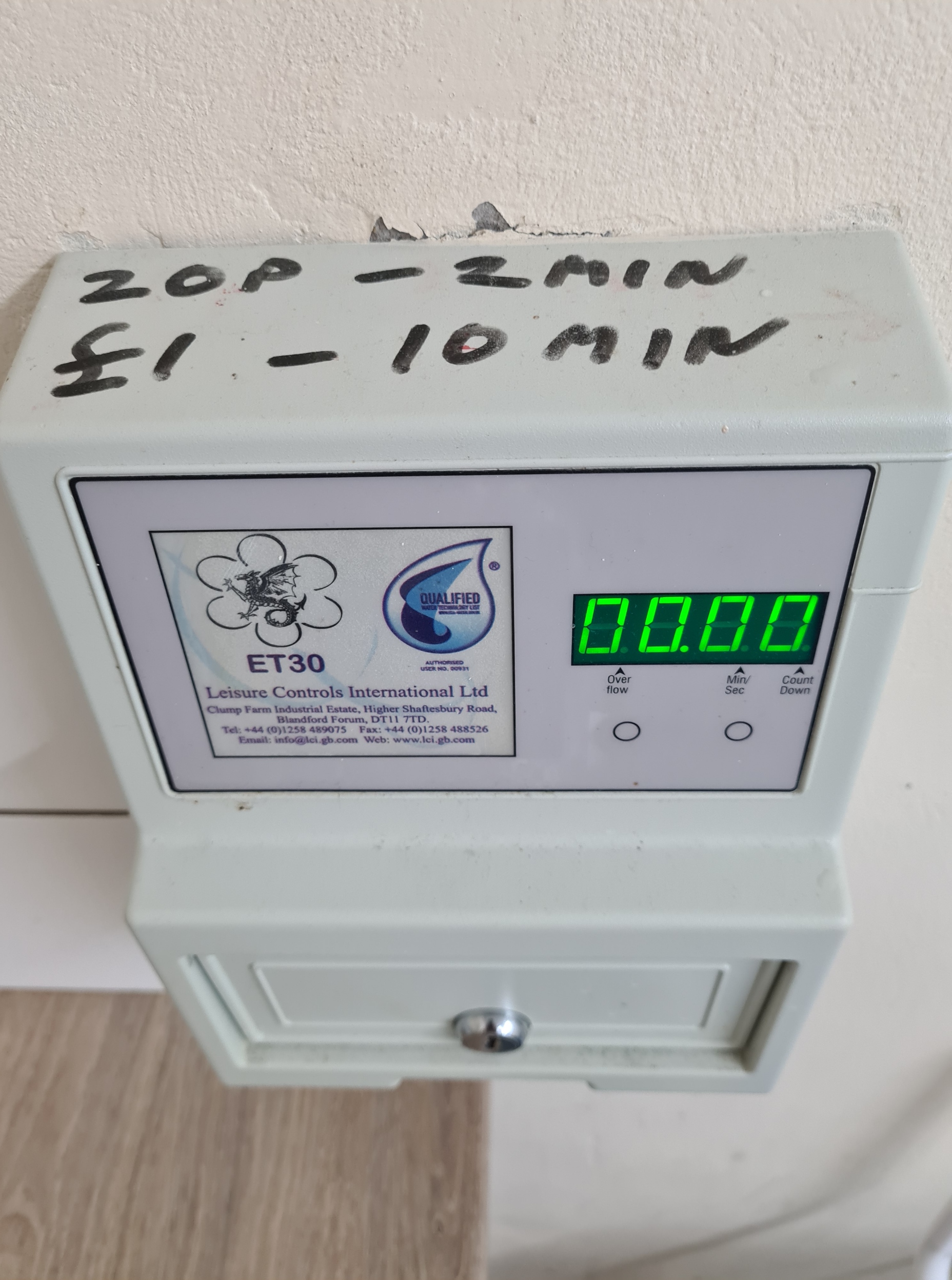
The YHA at Poppit Sands was booked up so I was headed to the farm campsite at Allt-y-coed. It is the tattiest farm imaginable but with lovely owners and an almost pristine small field and facilities behind. I paid a tenner for my pitch. Again, the showers are metered, either 20p for two minutes, or £1 for (much) longer, but the owner Helen simply gave me 20p without my asking. So, I had £1.20 worth of shower.
I got the impression that there are a few oddballs using this site but it was very quiet and made a suitable last night for contemplative thought on the trail behind me. It was only the occasional munching from grazing sheep that would occasionally disturb me.
My final morning on trail was short. Just 2.8 miles, (passing the Poppit Sands YHA on the way after 0.9 miles), followed by a 2.26 mile walk into Cardigan to catch my bus after a late breakfast in a cafe there.
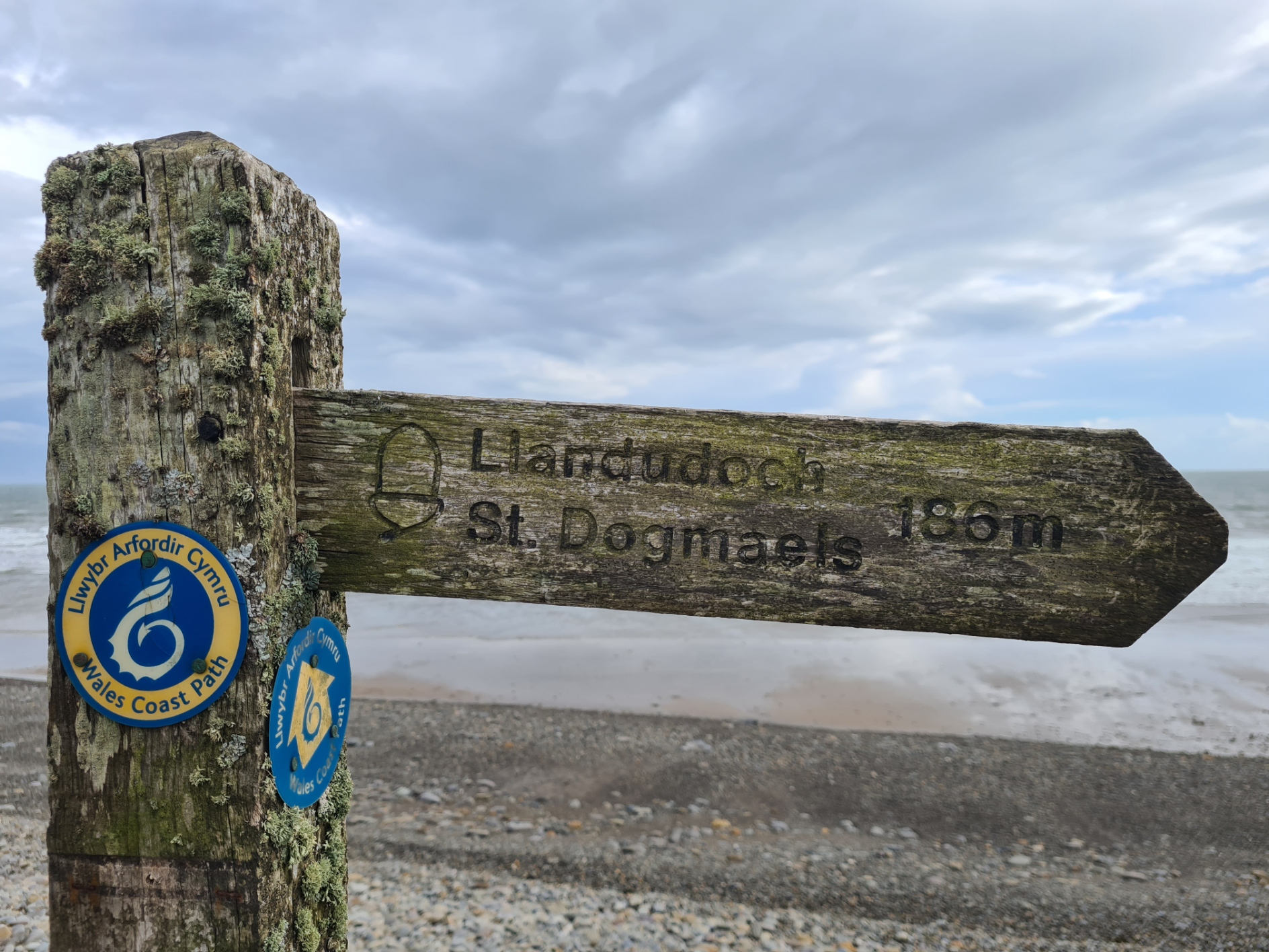
Allt-y-Coed campsite to trails end at St. Dogmaels. 2.8 miles, 225 feet ascent
Trails end at St. Dogmaels into Cardigan, to T5 bus stop, Finch Square. 2.26 miles, 246 feet ascent
The above is simply how I tackled the overnight halts on the Pembrokeshire Coast Path. It is by no means a recommendation on how you should do it. But it worked for me. It is a fantastic trail, recommended. Note that my calculated miles for each day only total some 178 so a few more have got lost somewhere, go and find them!
Gear talk: the Pembrokeshire Coast Path- post-hike gear review

Thank you for sharing details of your walk – I’m planning to walk the PCP later this year and it sounds great. One question if I may – did you pre book all your campsites etc or just turn up on spec? Thanks
LikeLike
I didn’t prebook any campsites more than a day or two ahead at most as I was unsure where I would be stopping. I did prebook the first YHA, and was pleased I did, but chanced it with my second. For Pembroke I just looked on (I think) booking.com for the cheapest place, the day before. Good luck with your hike, enjoy!
LikeLike