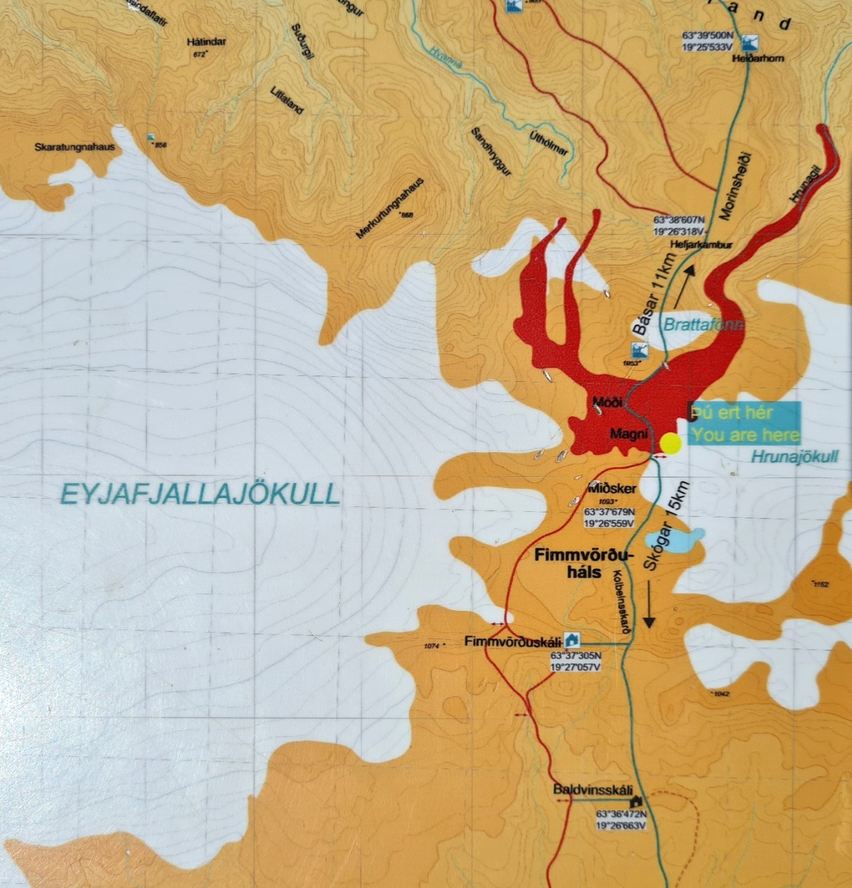
Three Points of the Compass rounds off a 56km hike of the Laugavegur Trail with the 25km Fimmvörðuháls Trail, passing high between two glaciers, to then descend to the sea, following the Skóga River and one of the finest collections of waterfalls in the world.

Many Laugavegur backpackers tack on the tougher but shorter Fimmvörðuháls Trail to their walk. If starting their hike at Landmannalaugar, it then feels more of a ‘complete’ hike to finish at the coast rather than a forest in the middle of nowhere in particular. However the opportunity to actually tackle the Fimmvörðuháls Trail is very much dependent on the weather and amount of snow over the top. It was mid-July and I was very fortunate that the weather continued to be kind to me. There was no reason why I couldn’t include this 25km trail. There are about two kilometres between the two trailheads but by camping at Básar I had already knocked these off.
Some hikers, especially northbounders, break the trail in to two days, staying at one of the two huts, high, and roughly at the midway point. For southbounders, on reaching the mountain huts, it is almost entirely downhill from there and it makes little sense to pause overnight, though this does make for a long day.
My pitch at Básar was sheltered and quiet. There was one late arrival in the evening. A pair with a trailer tent but they were respectful and extraordinarily quiet and I barely noticed them. I was asleep early and for the first time in Iceland, set an alarm on my phone. As it was, I was awake before it sounded. After a mug of tea and wiping the condensation from the Duomid, I left camp at 07.15.
Day Five. Básar to Skógar on the Fimmvörðuháls Trail:
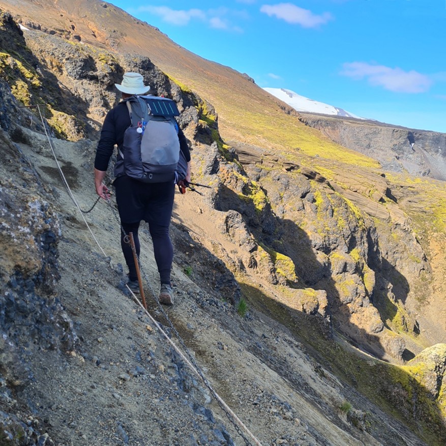
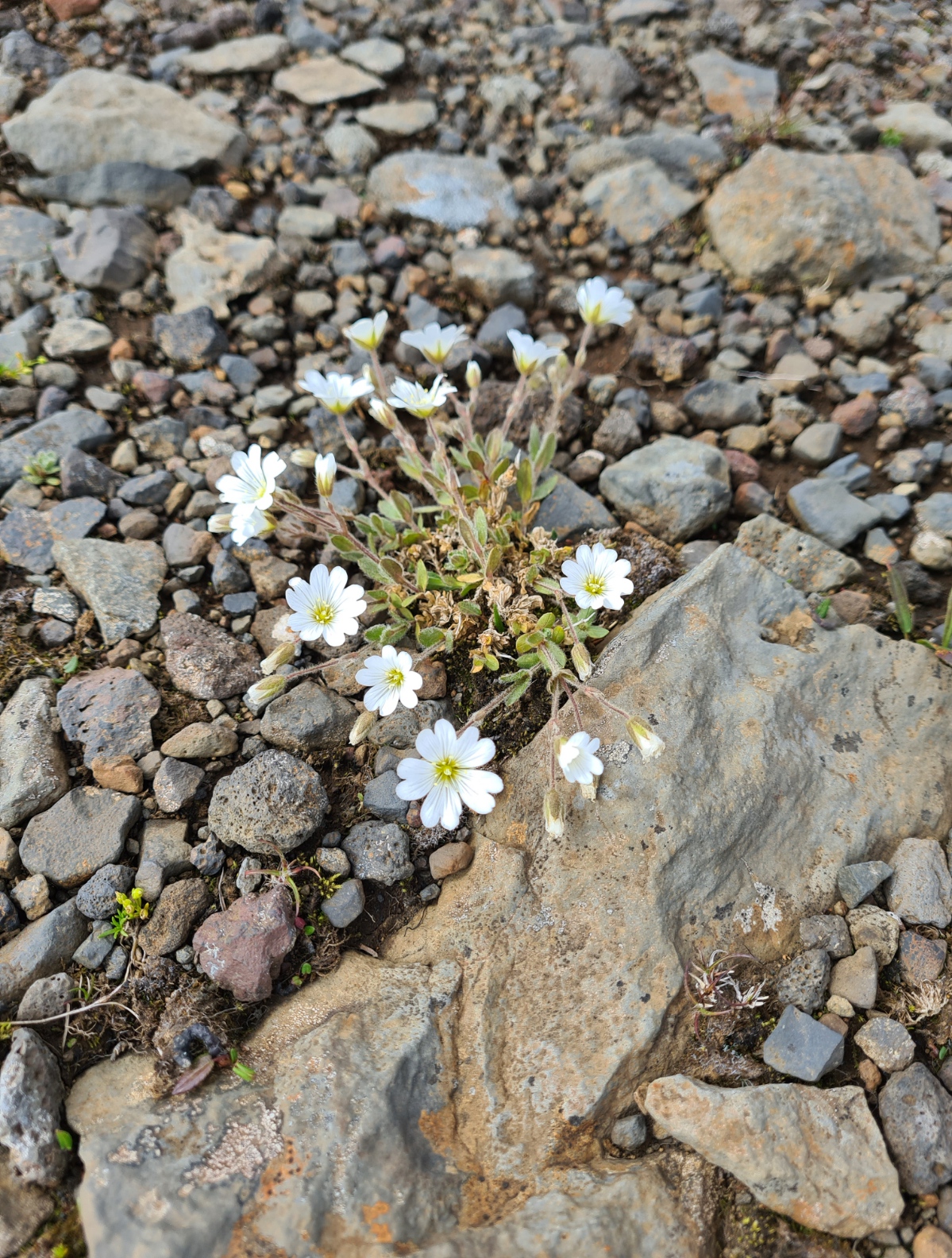
On leaving Básar campsite the trail immediately headed uphill. There was no need to dwell on the climb as the pretty path is bordered by stunted trees and orchids and the views soon open up. There are some very steep sections, but these are interspersed with gentler inclines, even a few short descents, before climbing again. This early in the morning it was a cool climb as I was in shade, the sun still behind the ridge to my left.
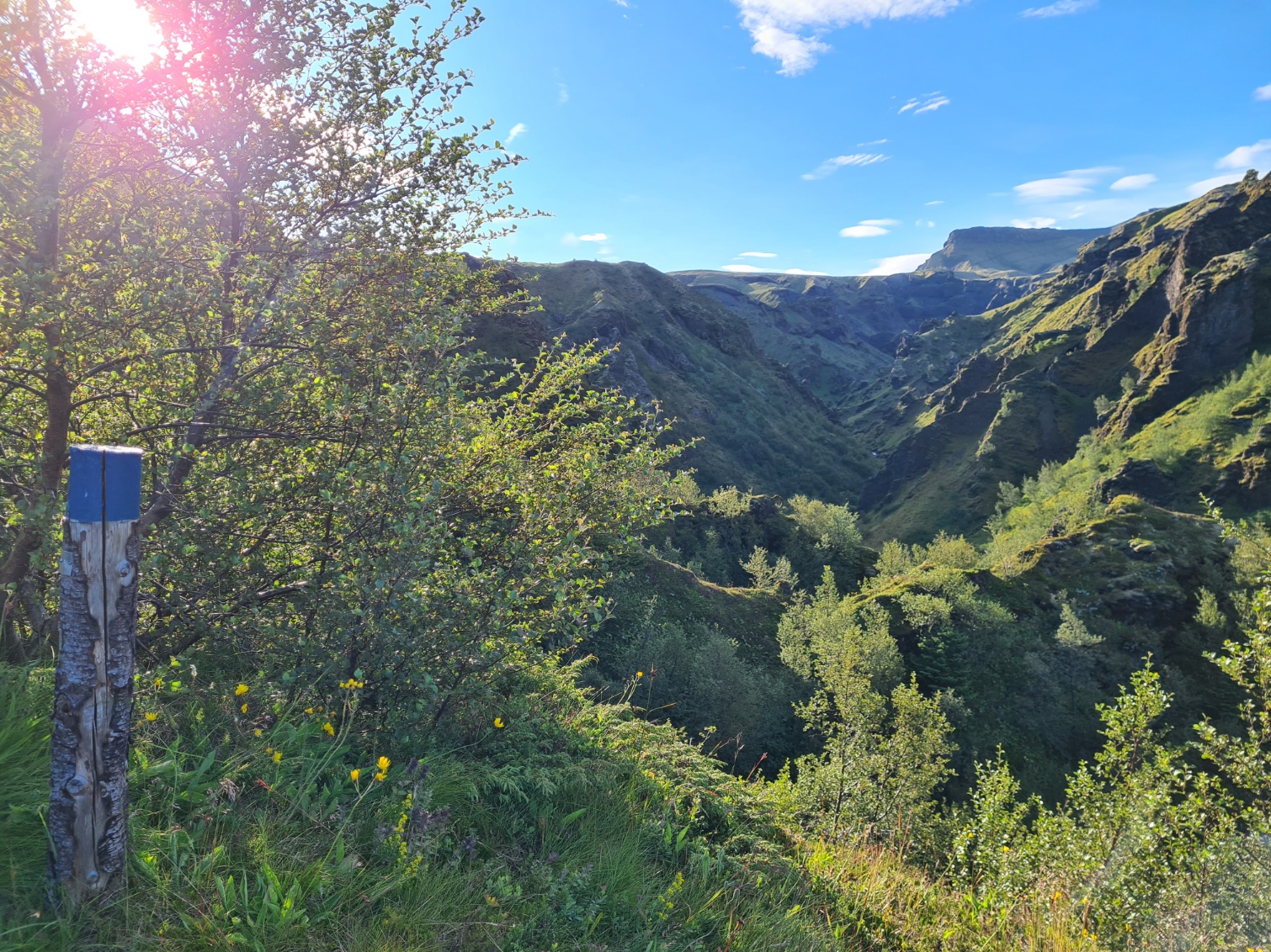

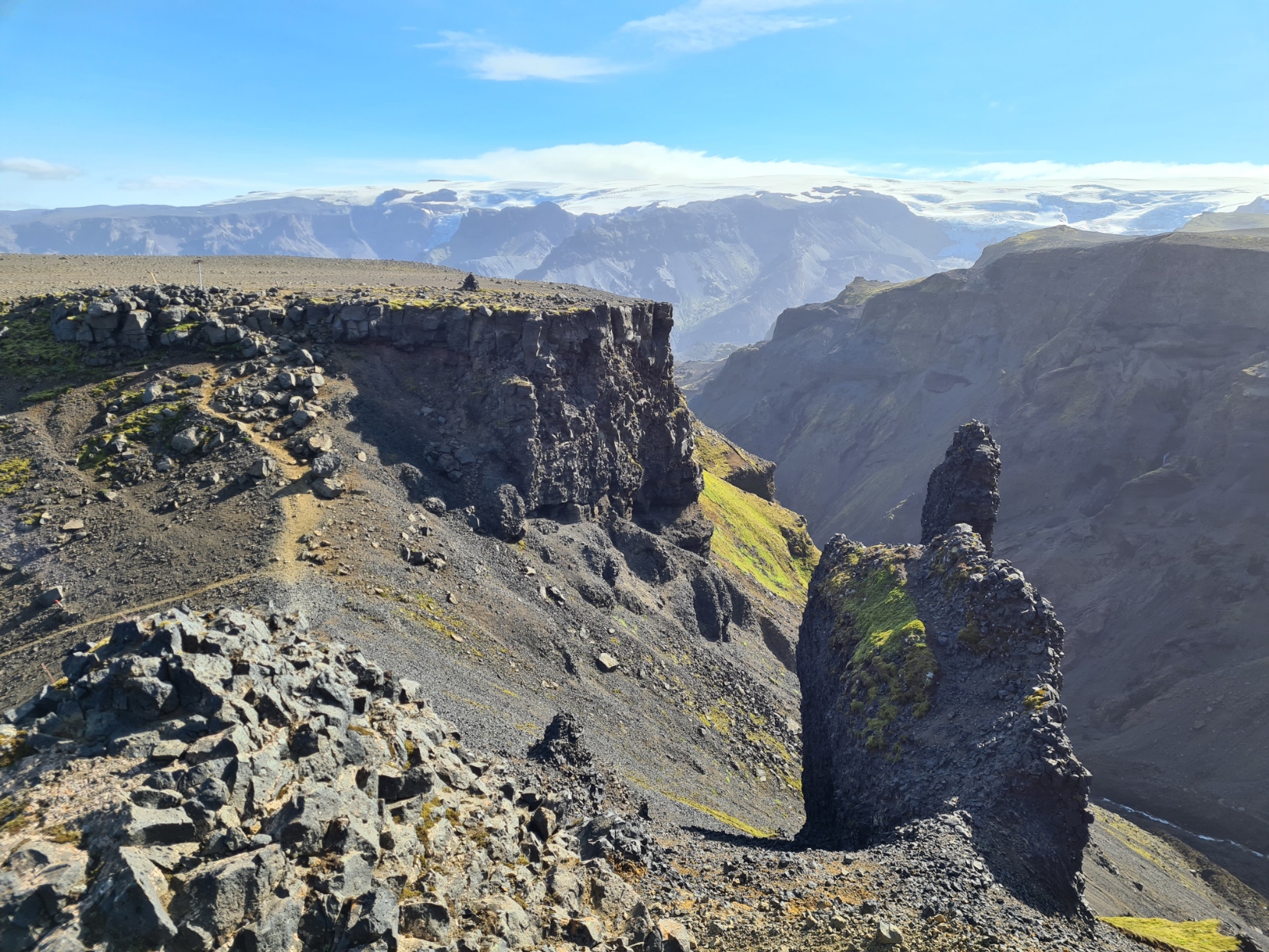
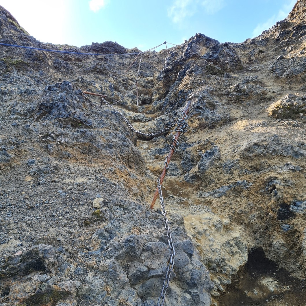
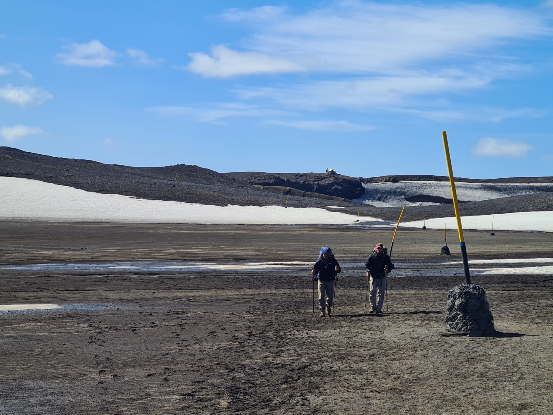
The Kattarhryggir knife edge ridge that leads up to the plateau is brief and not particularly difficult though I imagine it would be a worrying experience in high winds. I didn’t have anything like that to contend with. On a flatter spot I found a rock to sit on and view my surroundings and back to the wide Krossa valley, consuming chocolate covered raisins and water while doing so. I could see two other hikers approaching the way I had come and waited until they had passed before setting off as I hate being chased down and didn’t want any pressure on me to travel faster than I was comfortable with as while most of the path was easy enough, there was the occasional short section that required care. Two sections have chains put in to offer a handhold and there were a couple of slippery descents with sheer drops alongside. Again, nothing to worry over, just somewhere to take a bit of extra care
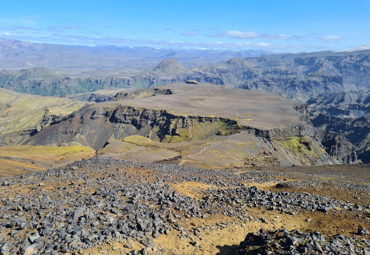
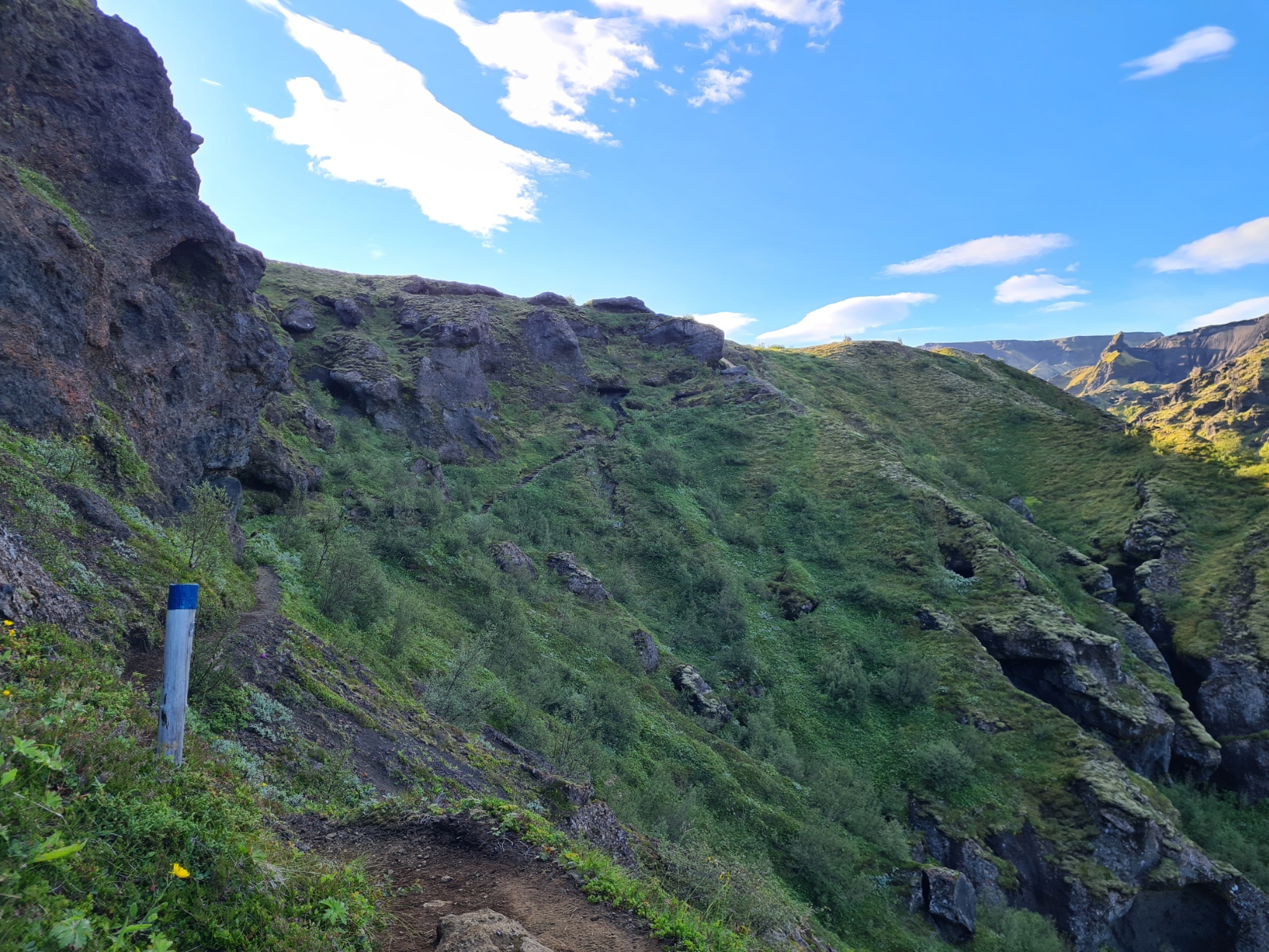
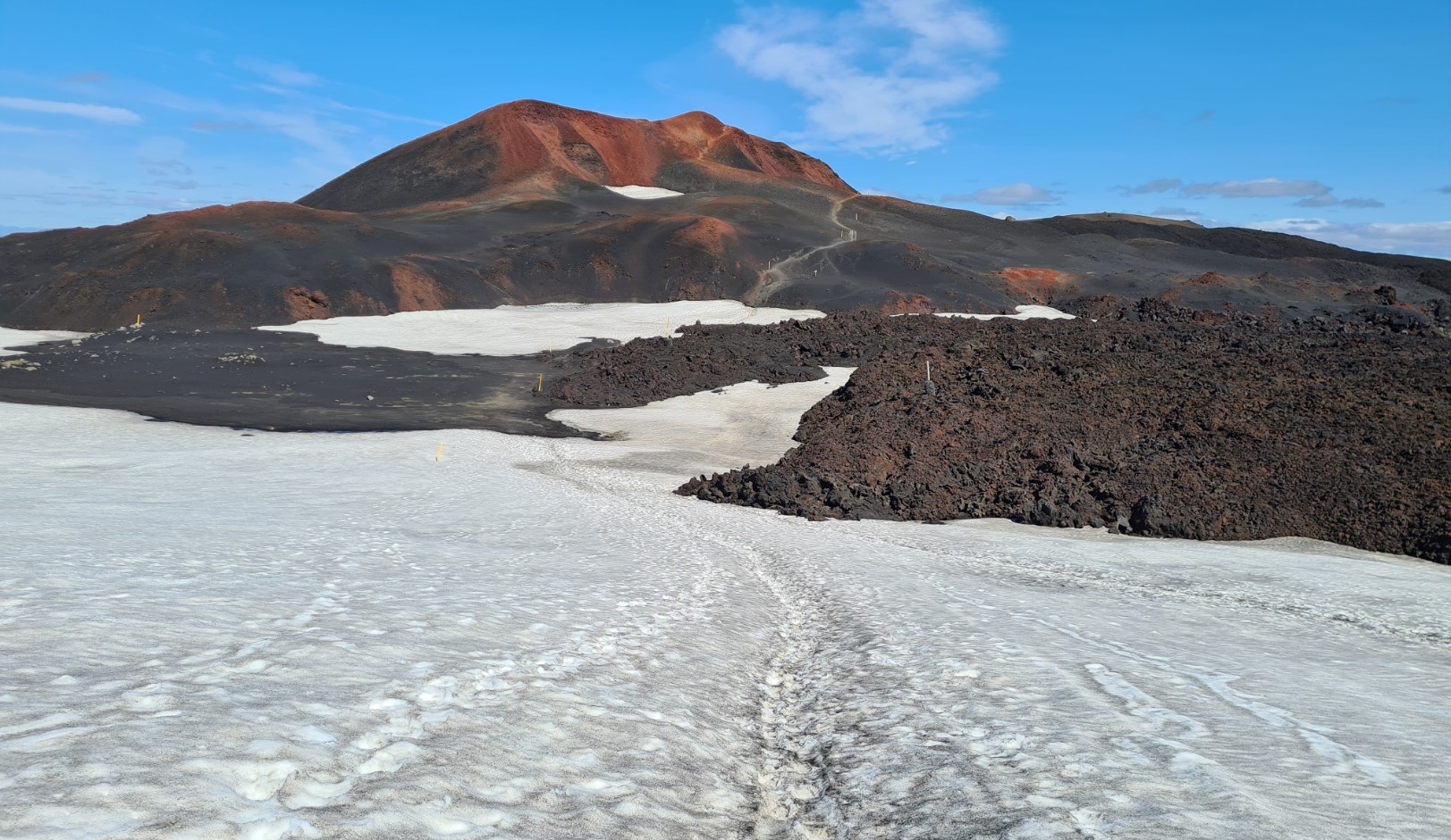
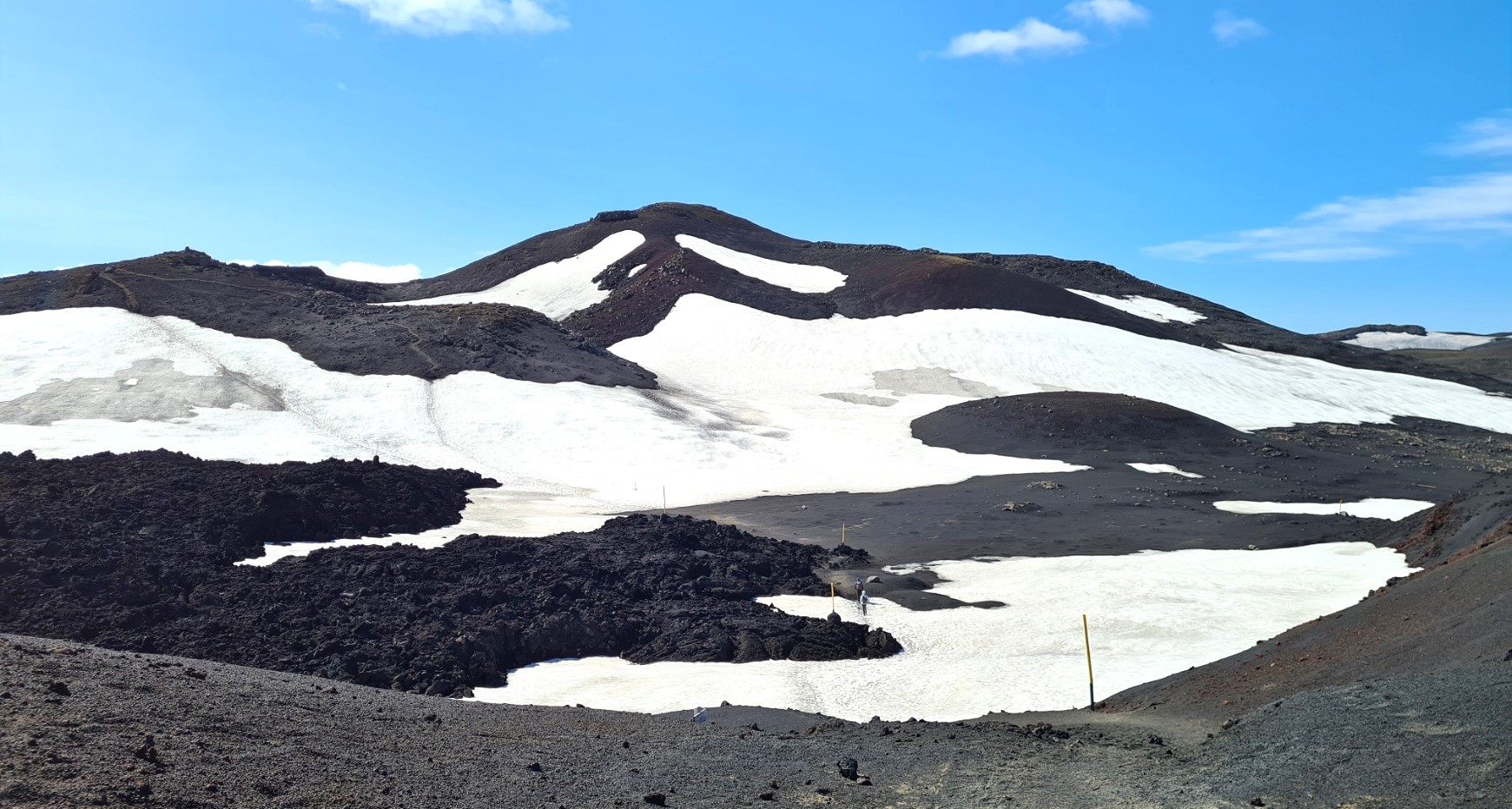
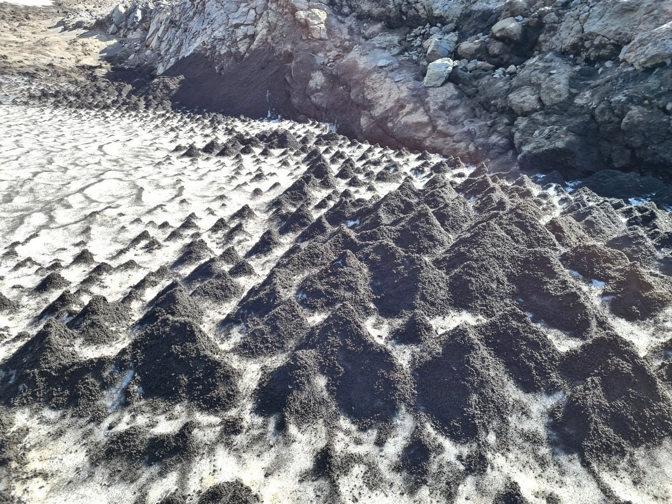
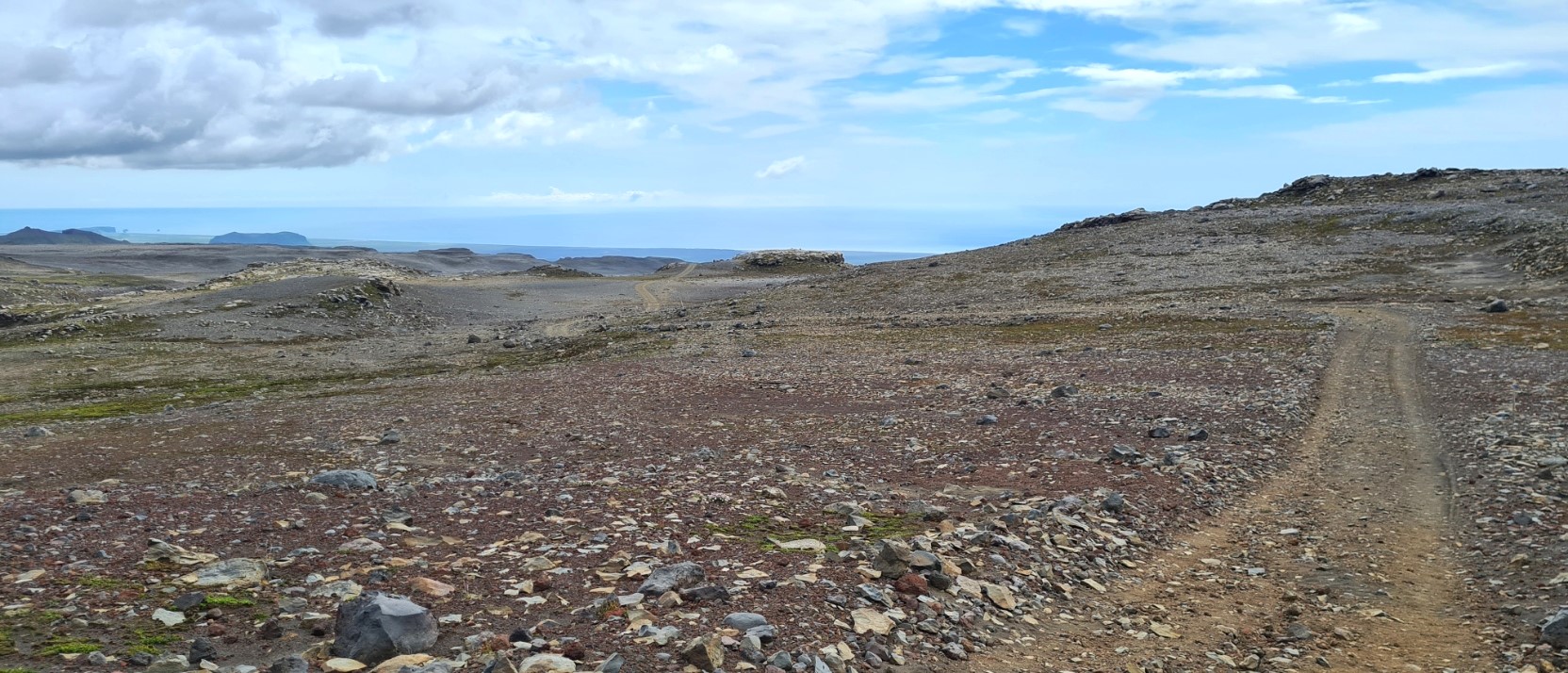
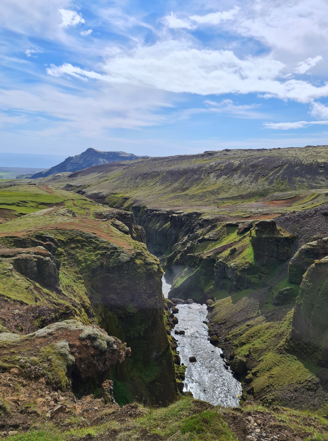
After more climbing I crossed the Morinsheiði plateau, cinders littered with thousands of rock bombs from the 2010 eruption, though that has nothing to do with its name as ‘morins‘ translates as ‘rust red sheep’. There were fantastic views all around and it was very obvious that these were going to improve dramatically as the trail continued. A more sobering sight was a memorial to a hiker who had lost his life here when conditions overtook him. The slight trail could easily be lost if visibility was poor and there are sheer drops on all sides.
The plateau is followed by a drop to the Heljarkambur ridge with a vast glacier to my left. I could just hear the melt water from the glacier tumbling hundreds of feet down the gorge walls. After that brief traverse, it is a thankfully short(ish) slow and winding slippery ascent. I continued to climb, and either the Eyjafjallajökull or Mýrdalsjökull glacier was in view for much of the morning.
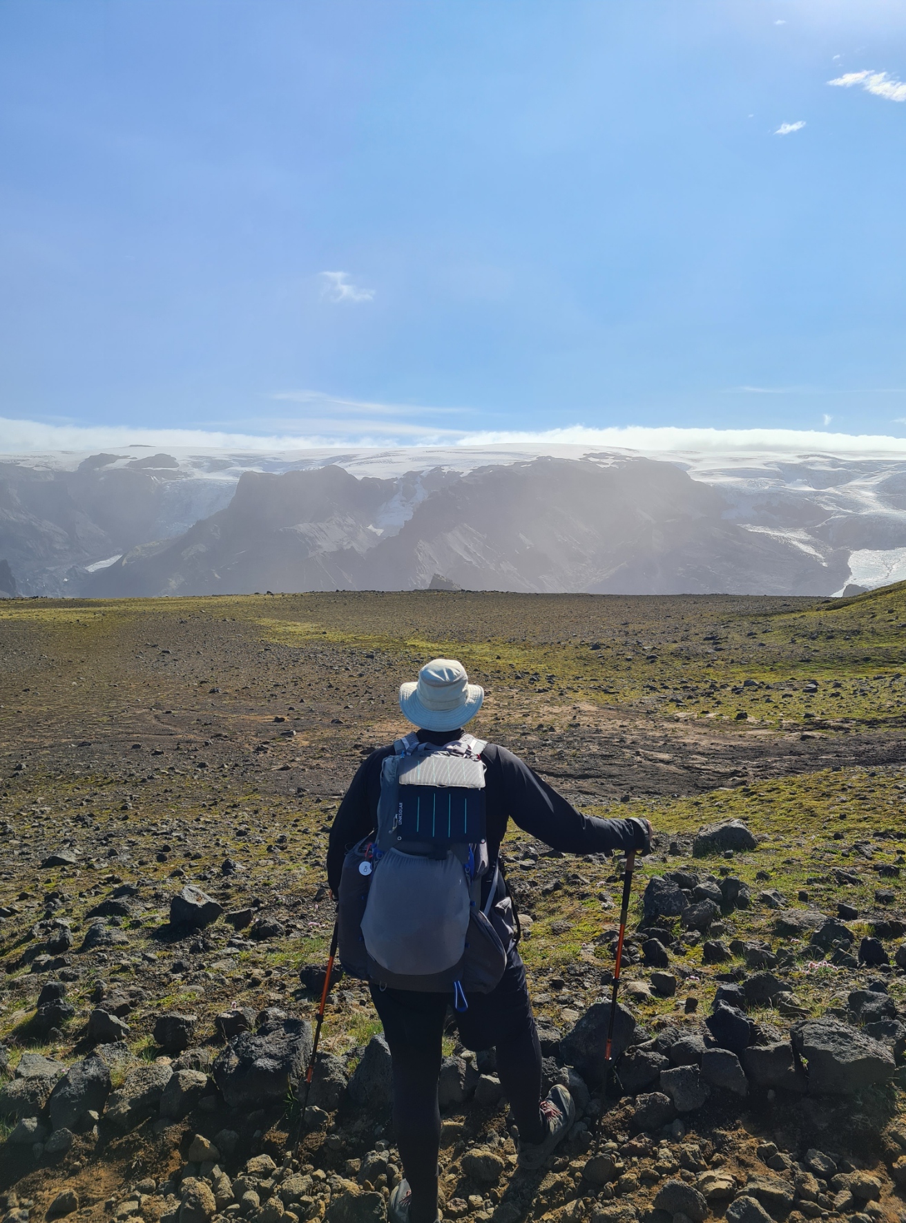
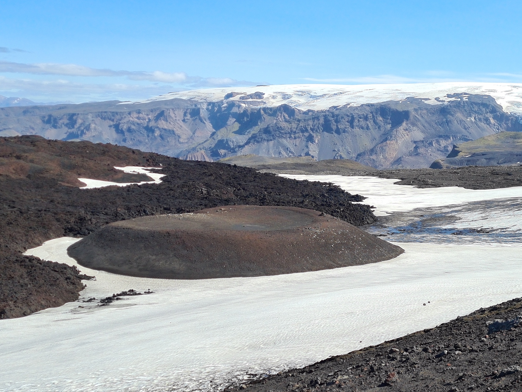
Eight kilometres out of Þórsmörk there is little if any vegetation and it becomes much more of a barren, volcanic environment. Hardly surprising as the trail is now crossing the site of the Eyjafjallajökull eruption. In 2010 vast plumes of smoke, steam and ash had risen into the sky, creating thick choking clouds that poisoned farms downwind and grounded aircraft across Europe for weeks. This large eruption succeeded another. On 20 March 2010 a 0.5 kilometre wide fissure opened to the north of where I was standing. A week later two new craters were formed. They were named Móði and Magni after the sons of Thor.
.

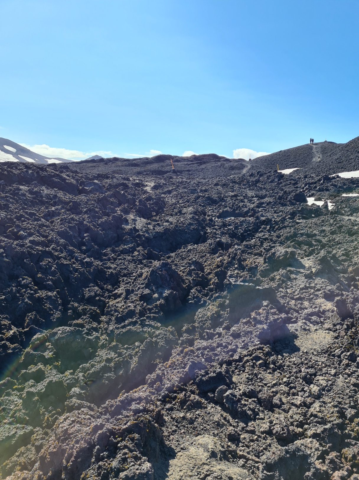
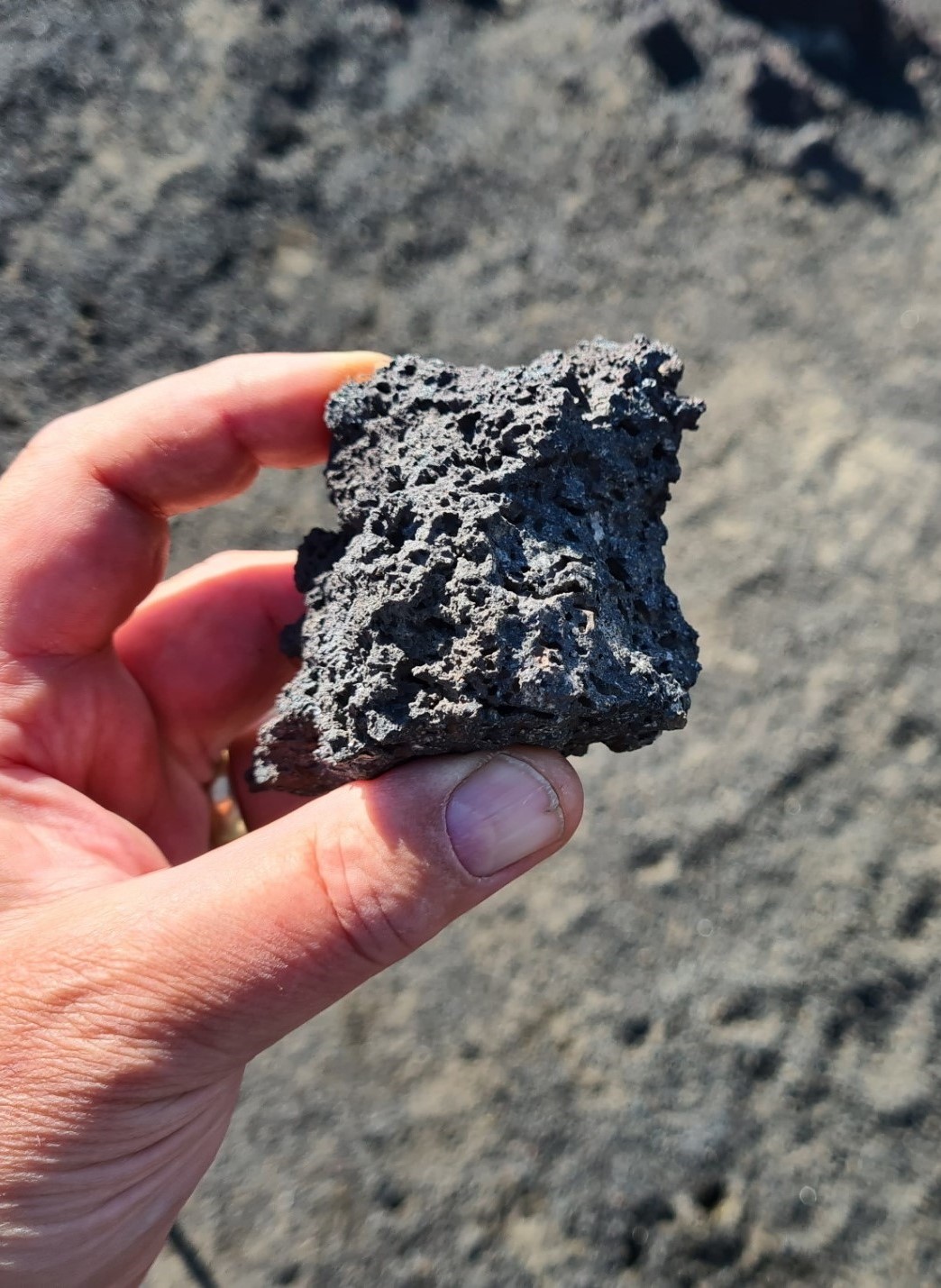
I was really careful crossing the jagged rocking fresh lava fields. They are not consolidated yet and while there are some obvious paths across parts, others require a little clambering and it would be all too easy to come a cropper here. As it was, it was later, while descending one long steep, dusty, crumbly slope on a final approach to the mountain hut that I slipped and fell, not once, but twice, and I was lucky not to break or bend a trekking pole, or worse. As it was, I got a dusty arse and picked up a hole in my Arc’teryx leggings. No harm done.
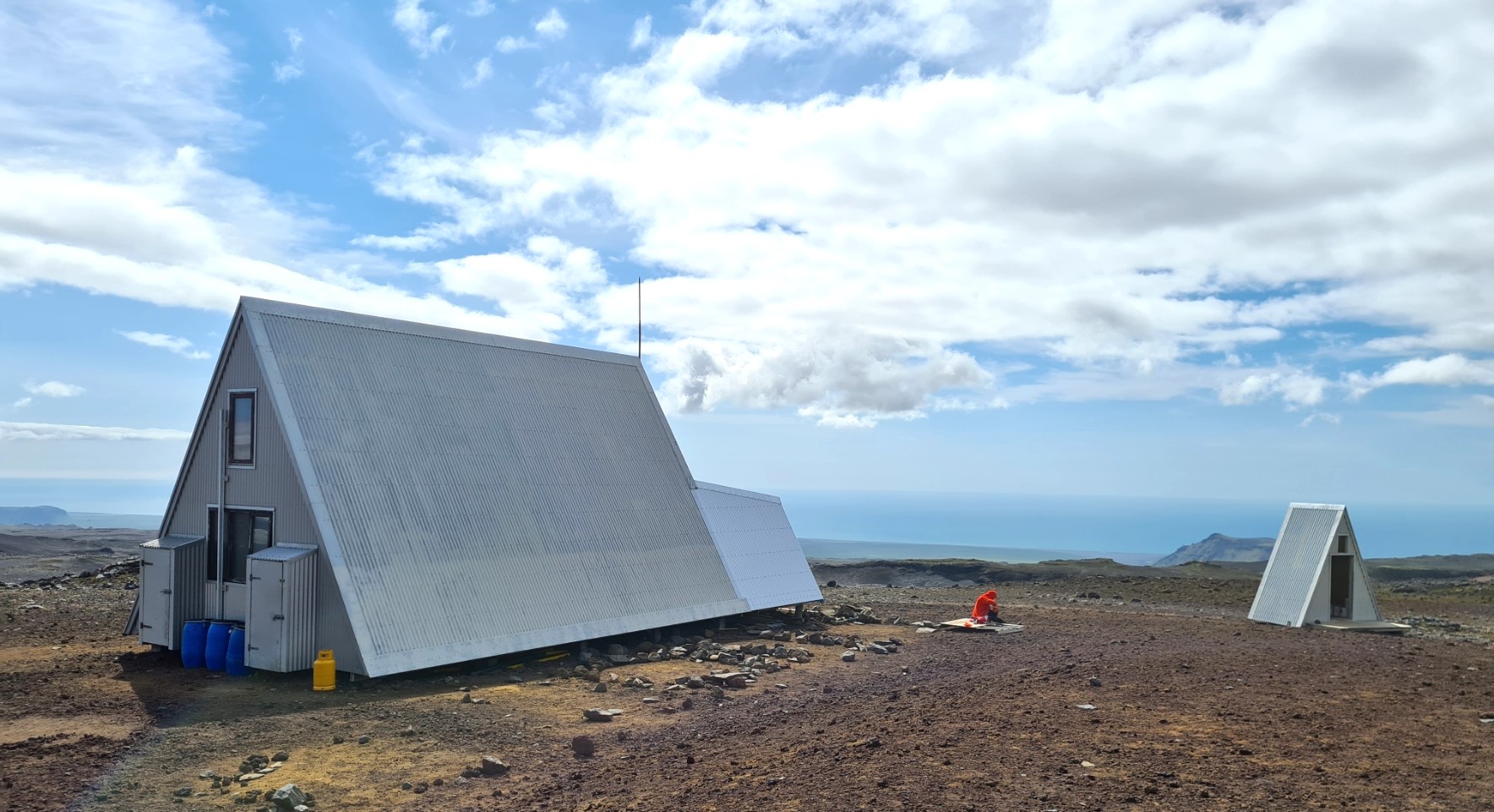
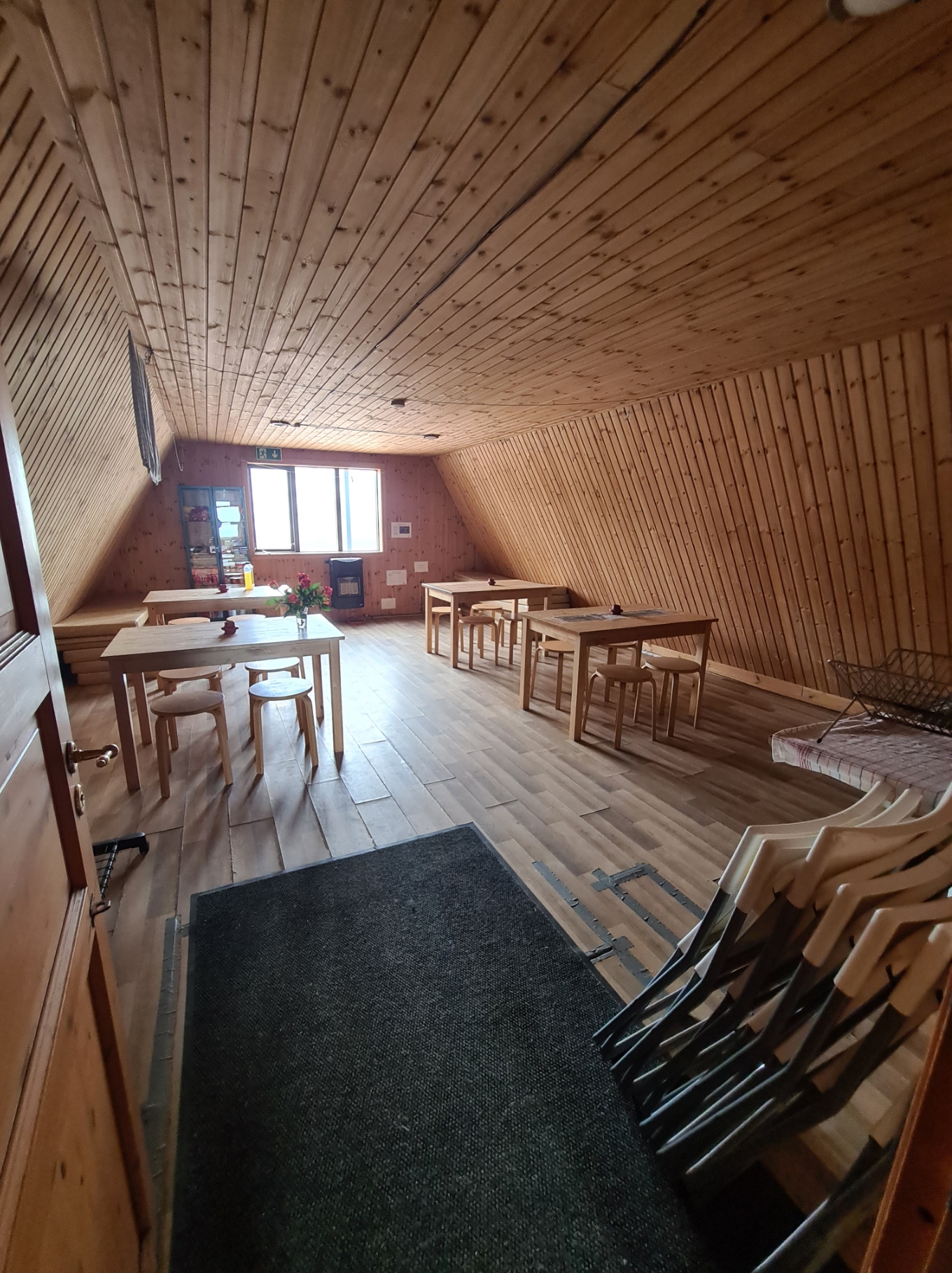
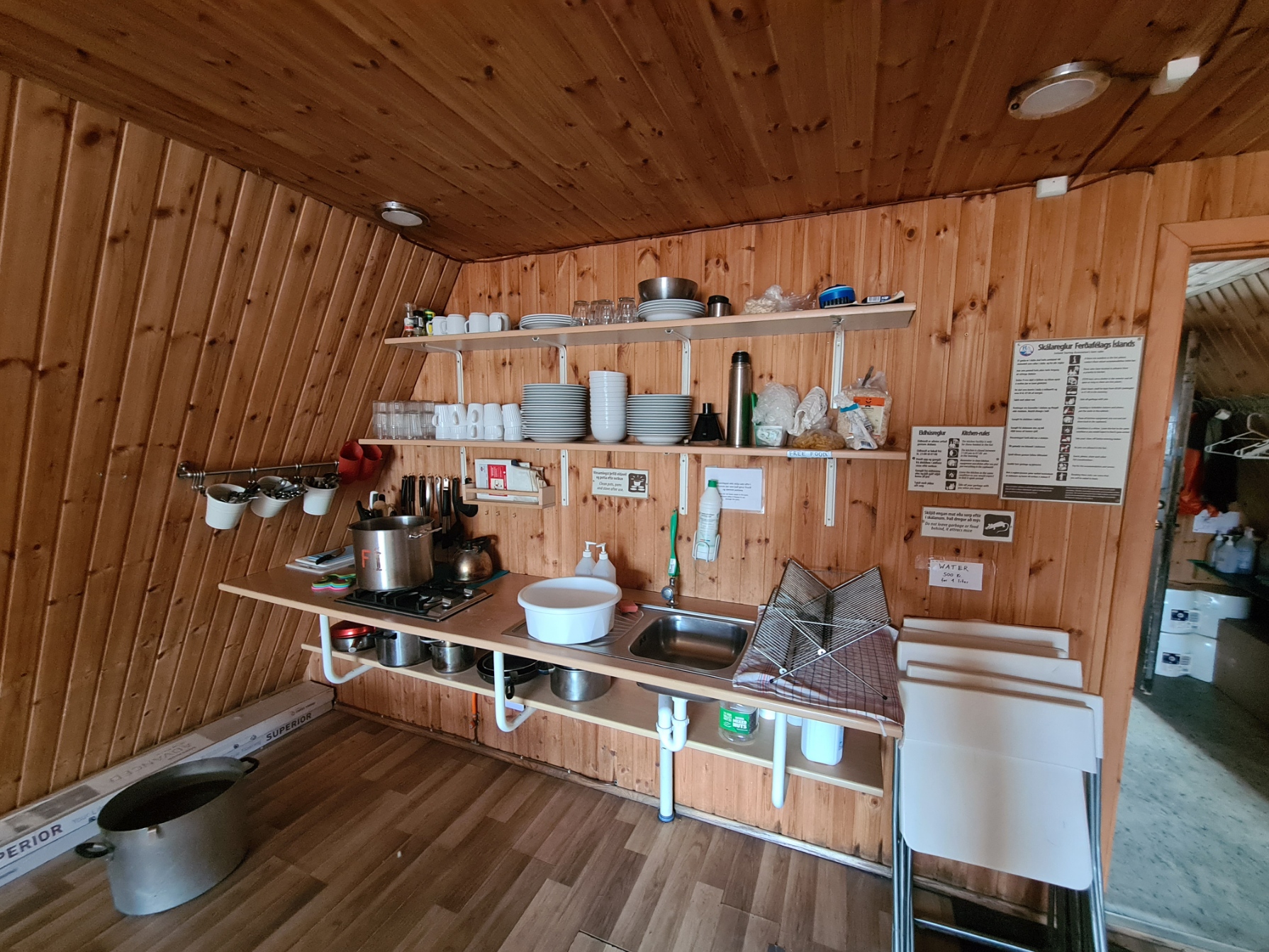
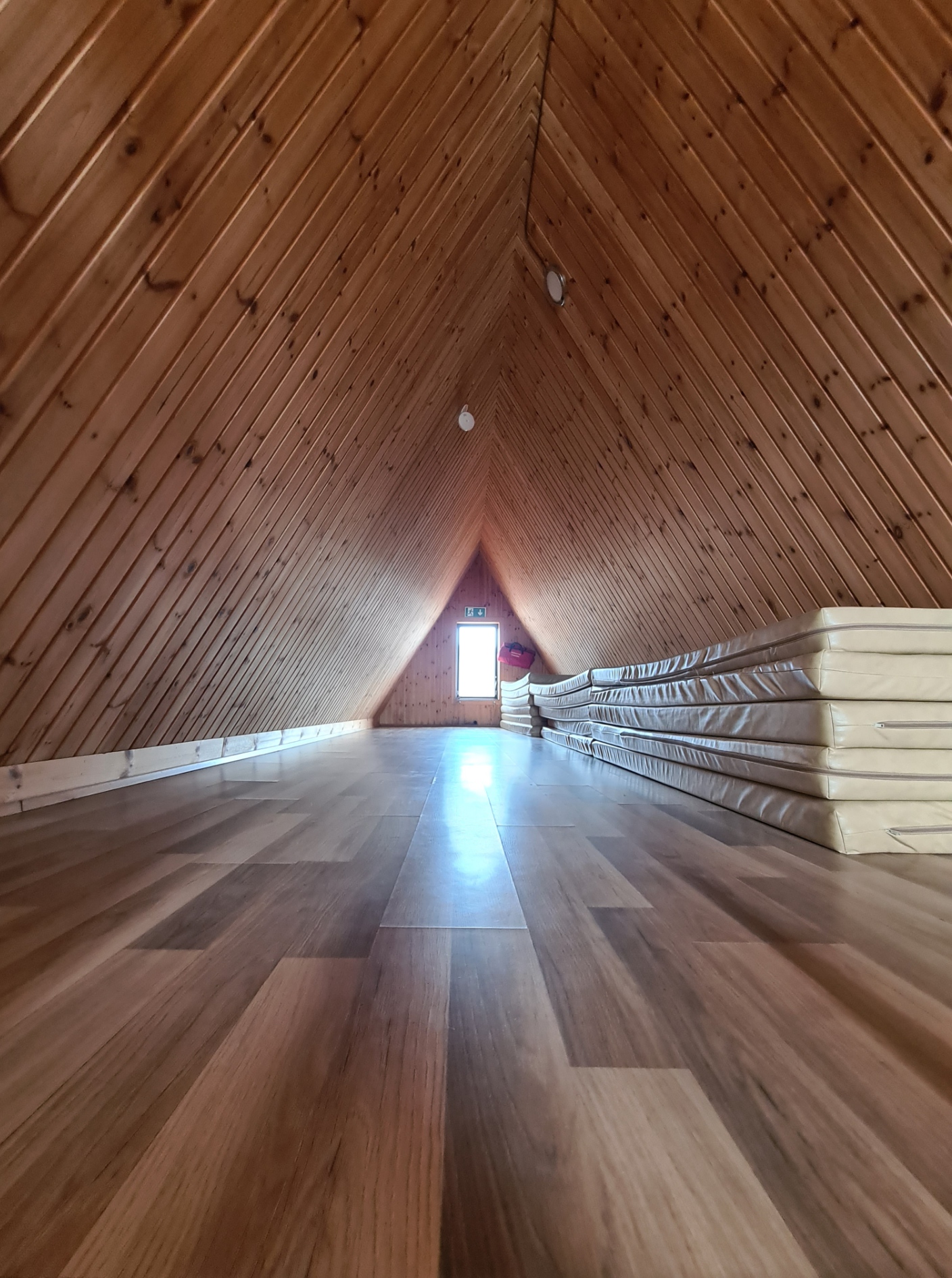
I arrived at the small pointyBaldvinsskáli mountain hut on Fimmvörðuháls to find the warden was away collecting supplies and a friendly contractor unloading tools and materials from his purposeful looking 4×4. I sat on a sunny little veranda, protected from the wind and while I heated water for a hot chocolate and cut wedges of cheese to munch with my Icelandic mutton jerky, we chatted about his work, extending the hut to add on a drying room at one end. While he got his tools together, he invited me to have a look at the hut’s interior. Seeing as I had not had opportunity to explore inside any of the previous huts I was keen to have a glance. Campers can not use the kitchen or other facilities in the huts and access is not normally permitted to them unless the weather is particularly threatening to life and limb. His work was immaculate, though I did tease him about the vicious pointed nails on the interior of his roof beams. He was unconcerned, saying if money could be found for insulation, this would cover the evidence.
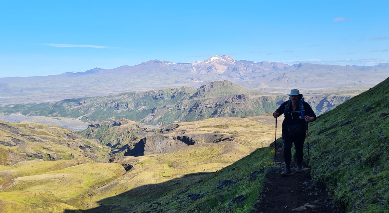
From the hut it is just about all downhill all the way to the trail end. The first few miles after leaving the hut were the worst hiking of the past five days. It was a rough stony 4×4 vehicle track with little of interest to view. I passed many people stumbling up the track. What they were expecting to find I haven’t a clue. All seemed to be heading just to the hut and there seemed to be some expectation of a cafe style facility with veranda, coffee and pastries. A couple mentioned the beers they were looking forward to. They were all going to be severely disappointed.
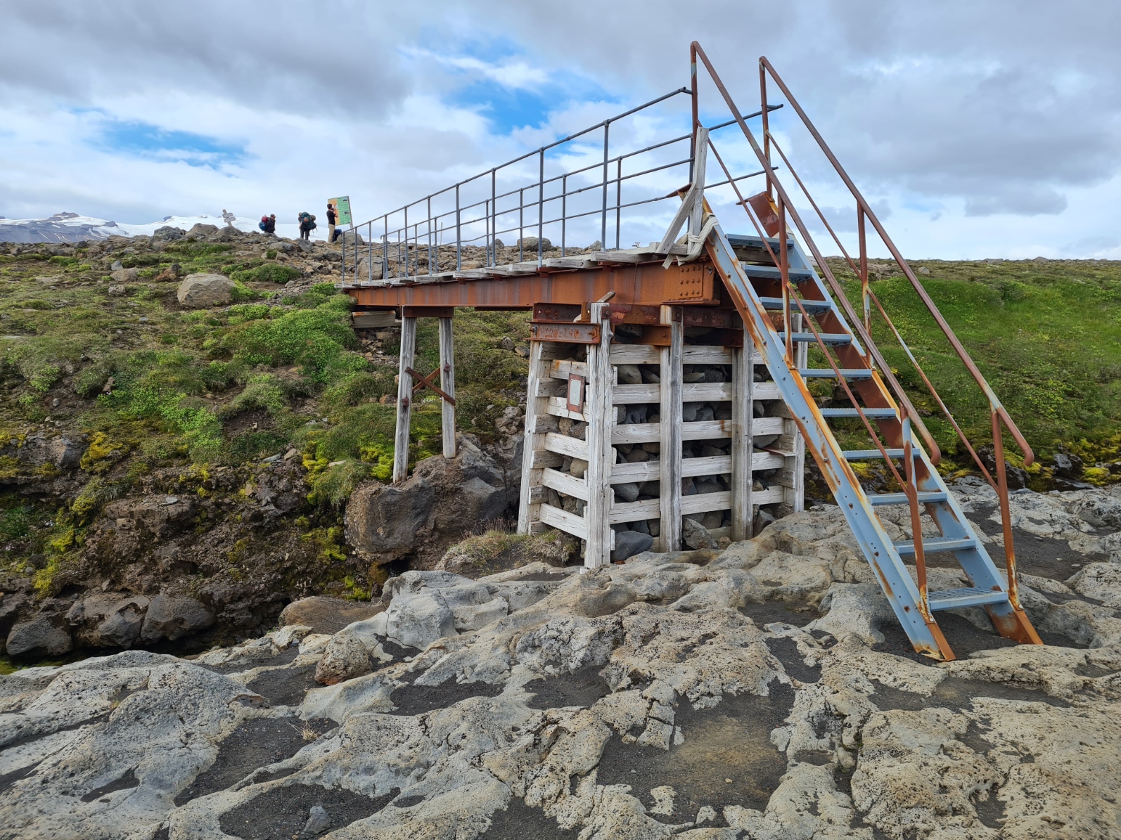
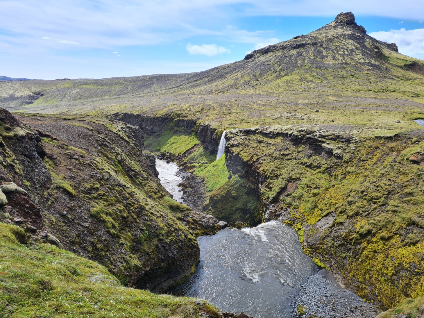
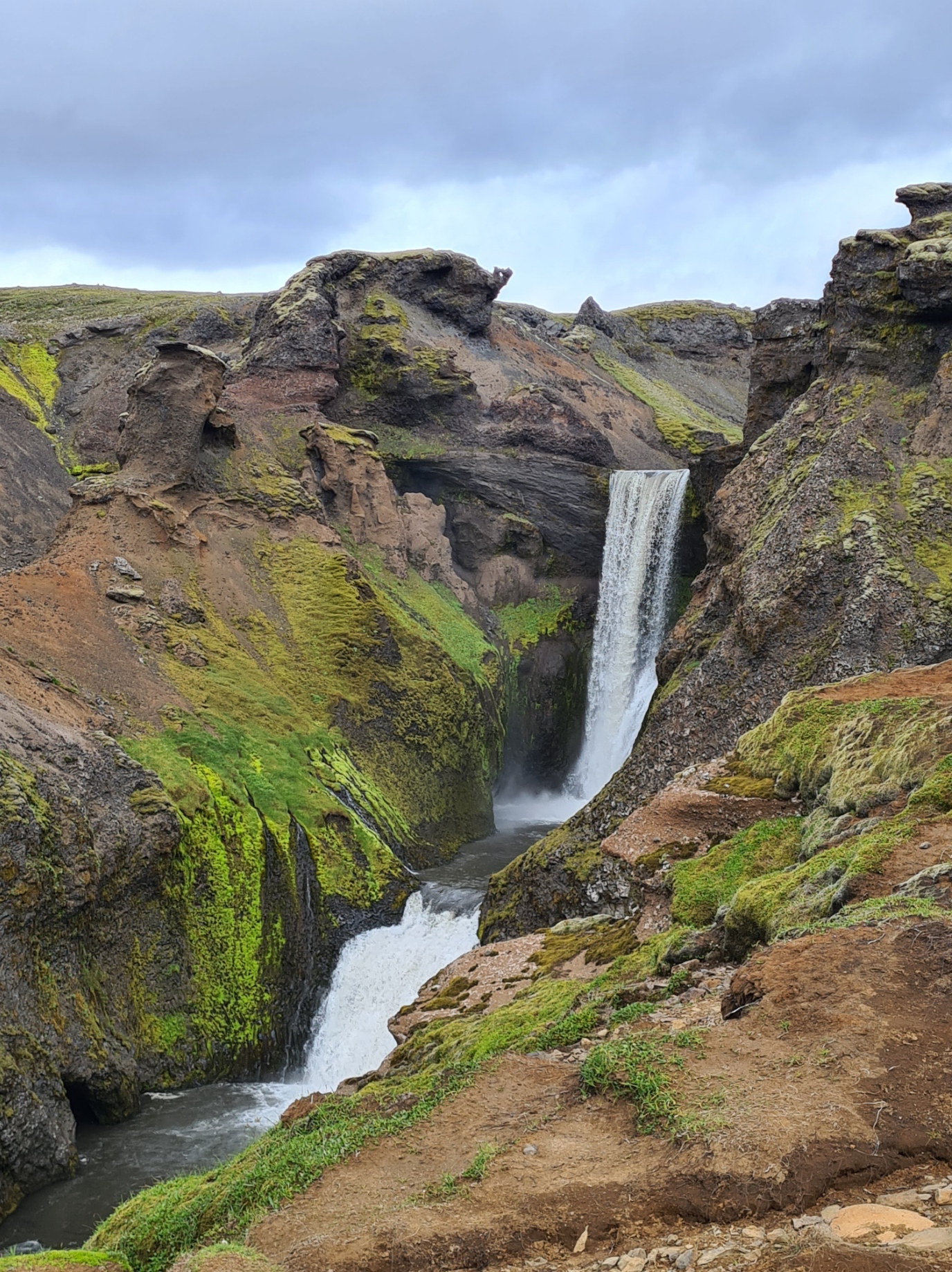
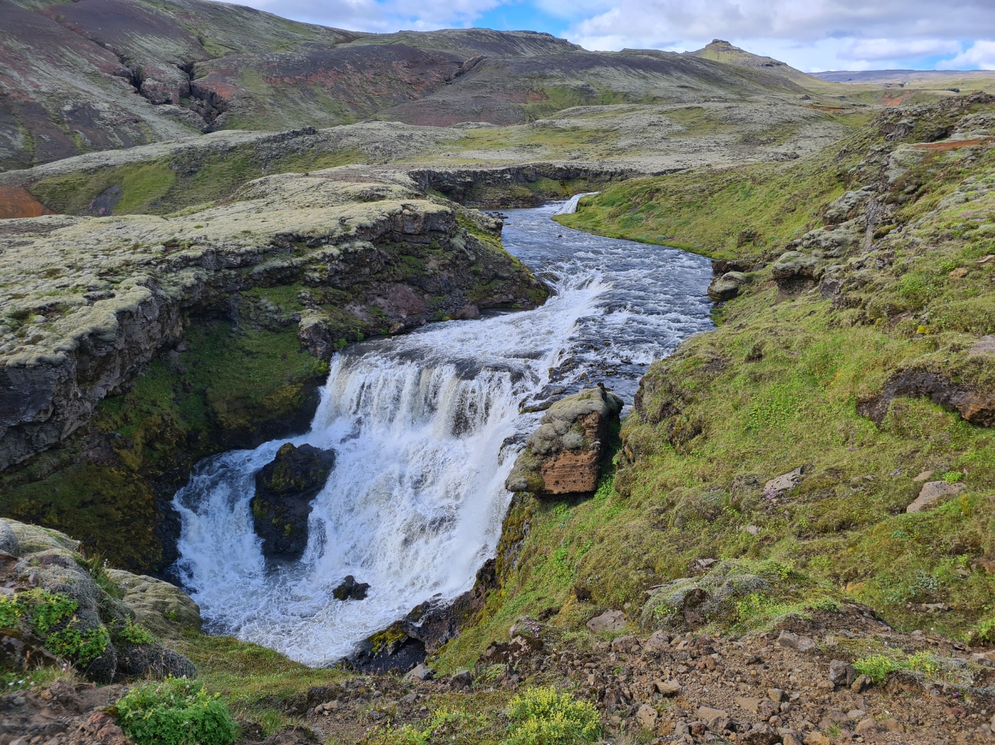
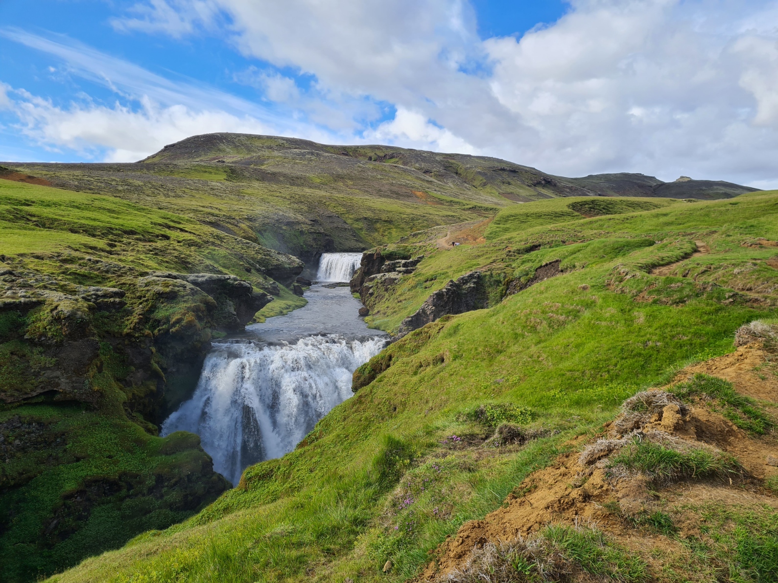
Thankfully the trail soon left the track and crossed the rock strewn cinder fields toward a footbridge over the Skóga River. I was now encountering the first of the twenty-six waterfalls passed on this section, on the approach to the sea. Smaller streams dropped into the gorge, the main river gaining in volume and strength with larger, more dramatic waterfalls as a result. I was passed by more and more people the further I descended. These were the more intrepid of car tourists having ventured up from the carpark at the bottom, for those Instagram moments. While a myriad of photos of waterfalls are an obvious excess, that is what the last few kilometres down to the carpark, hotel and campsite at Skógar comprises and I only show a handful here.
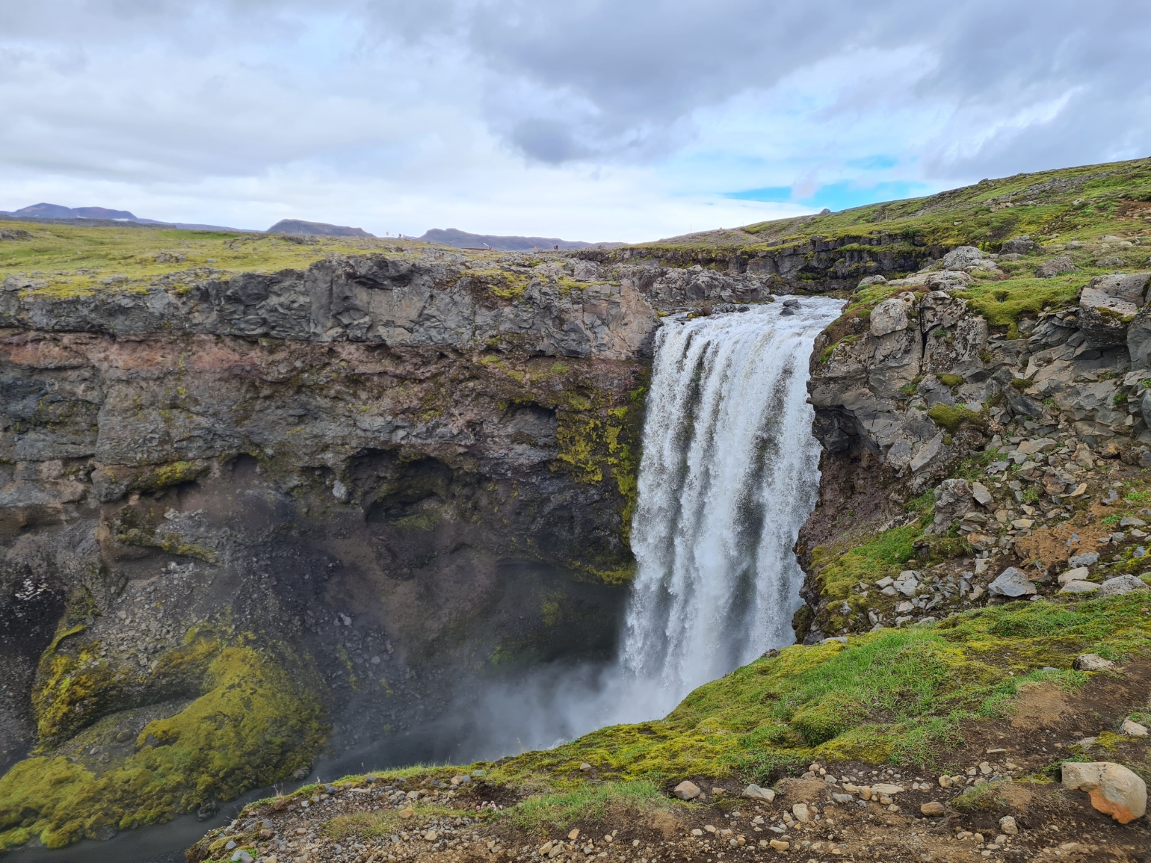
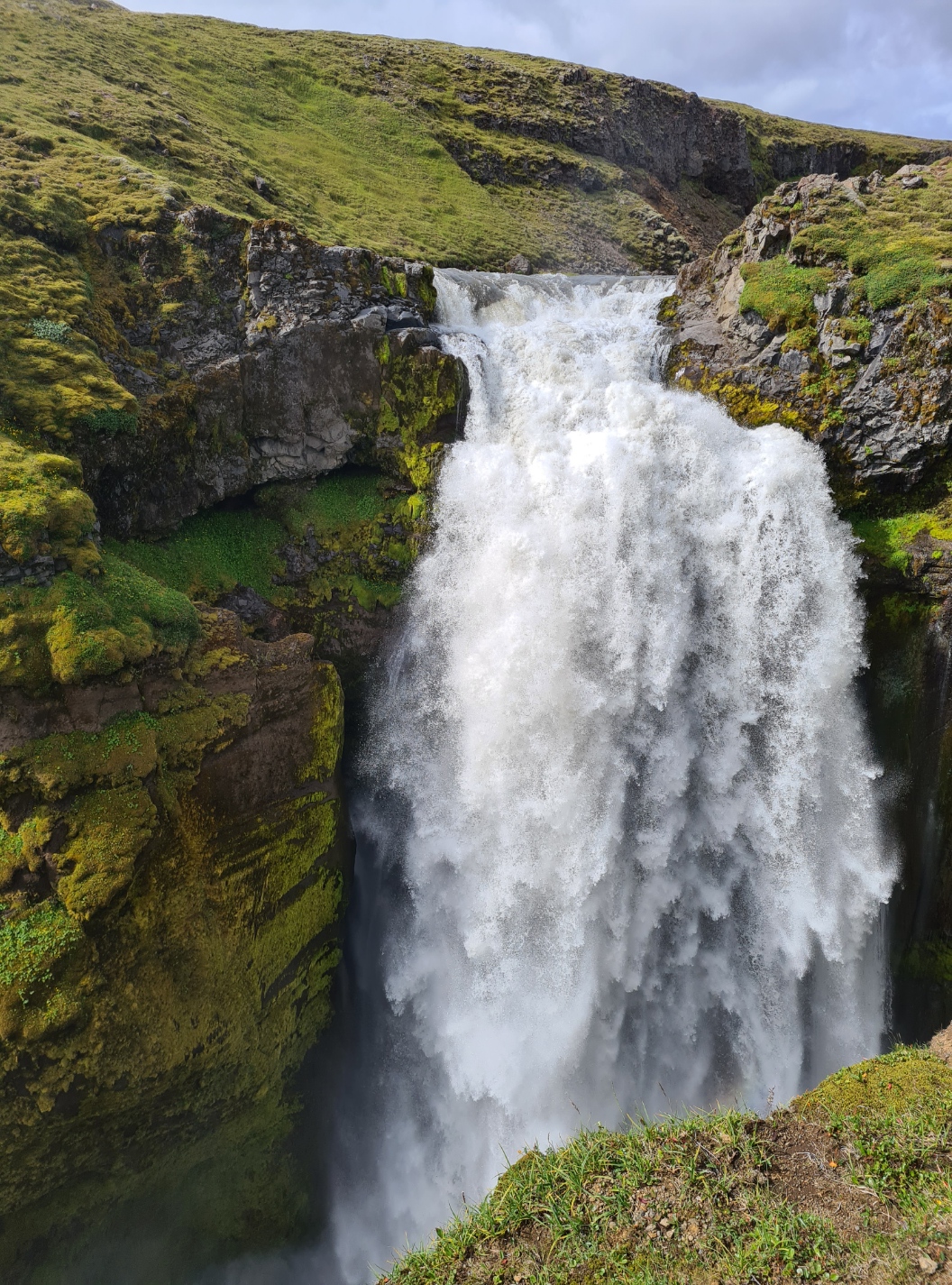
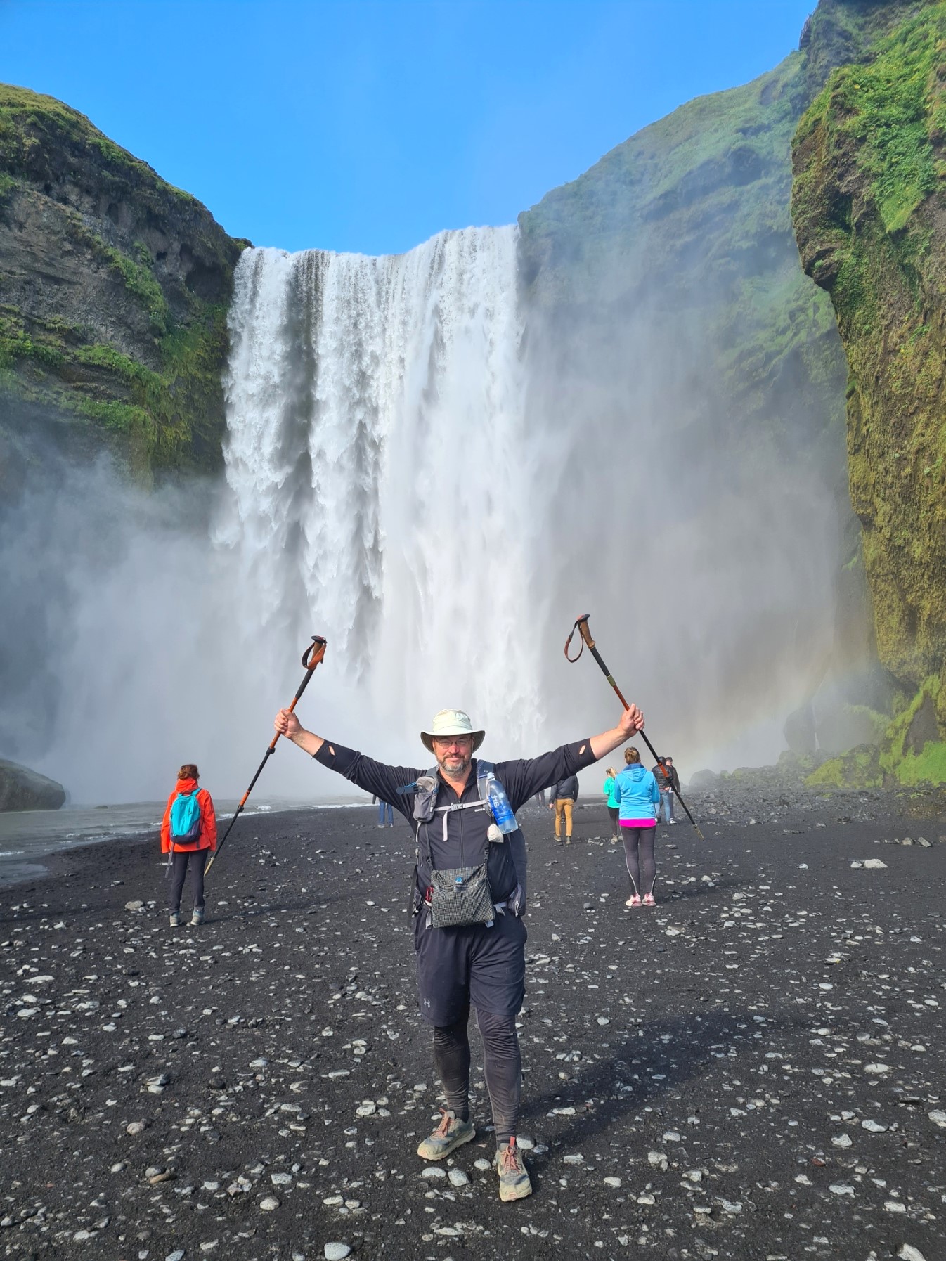
The Fimmvörðuháls Trail ends with a flourish. The final fall is the dramatic 62 metre drop of Skógafoss itself. This is one of the most popular of tourists sites and it was very busy. Most seemed to make the long climb up the steps to the viewing platform at the top. Which is, in fact, a terrific viewpoint.
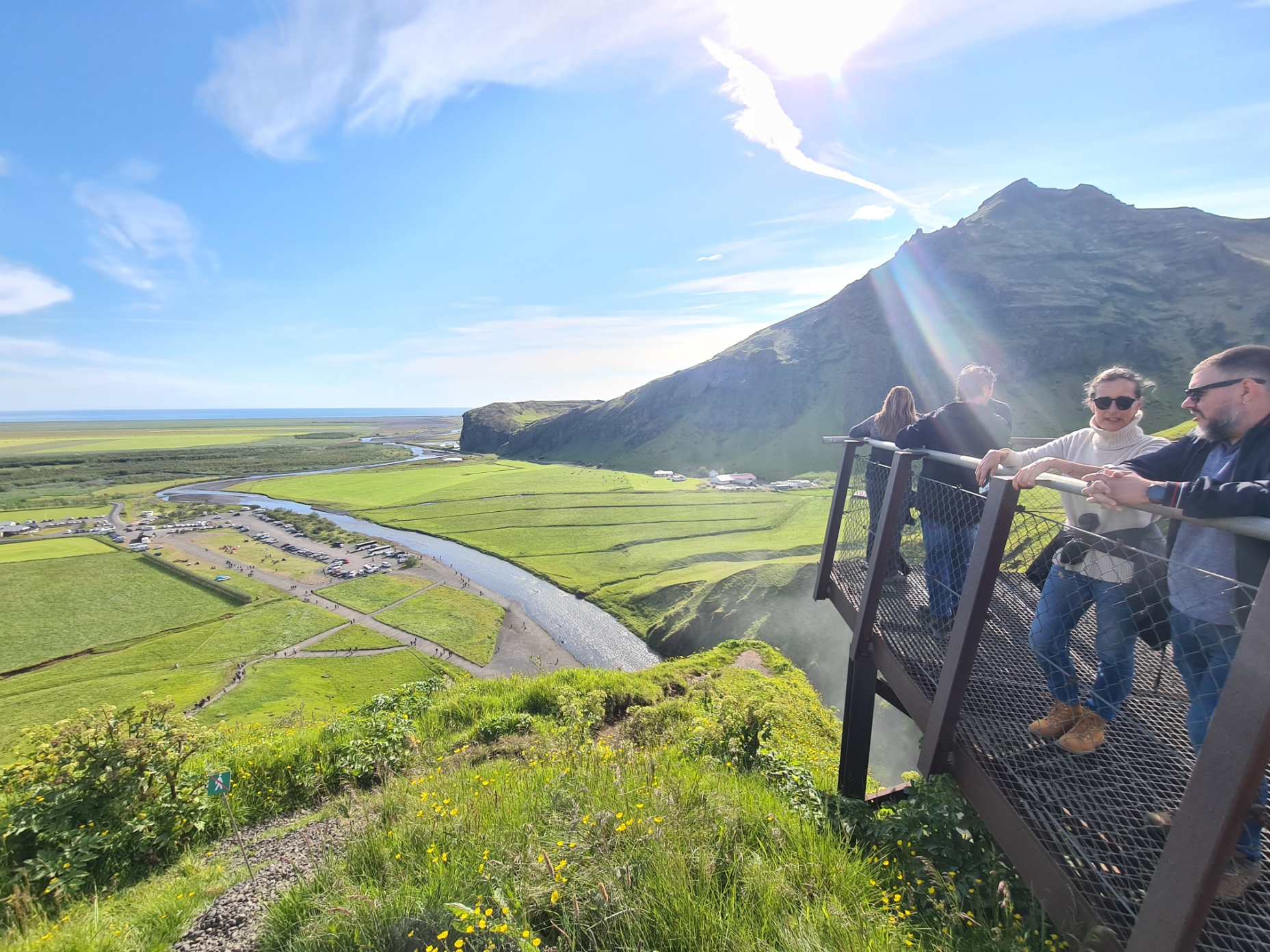
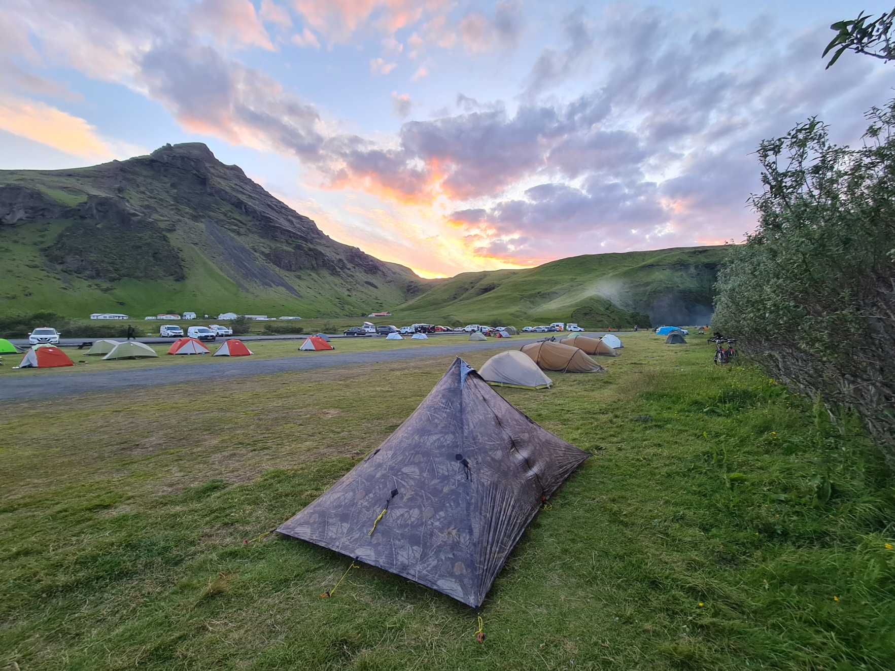
All too often a decent long distance trail finishes with a bit of a whimper. Fizzling out at some nondescript location. In contrast, the Fimmvörðuháls Trail ends well. Standing at the foot of the impressive falls, complete with shimmering rainbows, is marking such a walk properly. I finished the Fimmvörðuháls Trail around 16.00, giving me plenty of time to continue marking my accomplishment with a couple of beers at the Hotel Skógar. Rather than sit there for too long, getting sozzled, I left to pitch up and consider options. I was a day ahead of schedule and I had a Hikers Pass bus trip booked the day after tomorrow. Looking around the site I could see there was little to keep me entertained here for another day. Standing outside the hotel I got both signal and wi-fi so WhatsApped, emailed and eventually phoned the bus company. Result, there was a seat available on the bus the next morning and I swapped over to that. The site management showed up at 19.00 to take monies and I also managed to get change out of her for the campsite’s shower, as the bar staff in the hotel had refused to give this to me, even as change for a beer.
Clean, changed and presentable I returned to the hotel restaurant for a celebratory end of trail meal of excellent smoked salmon with salad starter followed by an indifferent lamb burger and chips. I commiserated with a couple more of their really tasty beers from the local Olvisholt brewery. Weary, full of food and alcohol, I returned to the Duomid for a decent nights sleep on a busy but thankfully quiet site.
The following morning, I even had time for a leisurely buffet style breakfast back in the hotel before packing up and making my way to the bus stop in the site carpark. The bus arrived in good time for the multitude of hikers and their packs to be loaded. I was by now aware that my pre-booked Hikers Pass, which provided me with transport between trailheads and Reykjavik, was not the best choice, at least not on the return trip. Departing from Skógar at 10.15, it takes all day to travel back to Reykjavik, depositing passengers at a service station for around five hours en route, before finally reaching the city campsite around 19.45 in the evening. If I had known earlier, there is a ‘town bus’ that reduces this journey substantially. No problem. It was debus, eat, drink, find a park to sit in and read, explore, eat, drink, then, finally, back on the bus.
Having arrived back at the Reykjavik campsite, this now meant I had a rest day there, before my return flight the day after. This gave me ample time to dwell on the past five days on the two trails. Each is a superb walk. I much preferred the Laugavegur because of the multi-day element, ever-changing scenery and geology, fascinating environment and generally good, challenging walking. That said, the Fimmvörðuháls Trail is an excellent add on, apart for those initial poor few miles leading down from the hut, if the weather is good. In truth, while the waterfalls are fantastic, once you have seen half a dozen, it is simply another, and another, and another. Though the final fall is magnificent. I had been extremely fortunate to enjoy about as good a weather as it is possible to get in Iceland. They are expensive trails to complete, primarily due to the expense of getting to and from Iceland and the southern highlands. They are now, together, right up there with the most memorable of trails I have ever walked.

3 replies »