
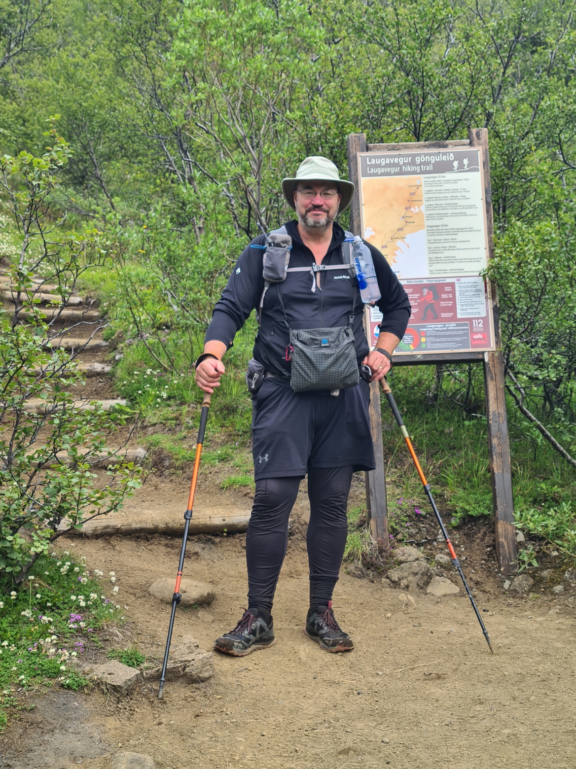
Three Points of the Compass continues his Icelandic adventure. Two more days of hiking would see me finish the Laugavegur. But would the notorious changing weather conditions permit me to continue to the coast, on the Fimmvörðuháls Trail?
It was the end of day two on trail. Full of expensive chilli and beer, at 22.00 I returned to my tent to find a late arrival had pitched right beside my shelters door. This despite there being hundreds of square metres of space not that far away, it was quite late, I was tired, I was sure that camp etiquette would mean I slept well…ha!
I wrote notes and read while the two of them sat outside their tent clattering pans and loudly talking until past midnight. When they eventually retreated to their tent and settled, I settled. Well as much as you can with the persistent snoring that surrounded me and the rustling of turning bodies on inflatable pads. It rained briefly and during the all too brief period that this masked every other sound in the campsite, I drifted off, but it didn’t feel like I had much sleep.
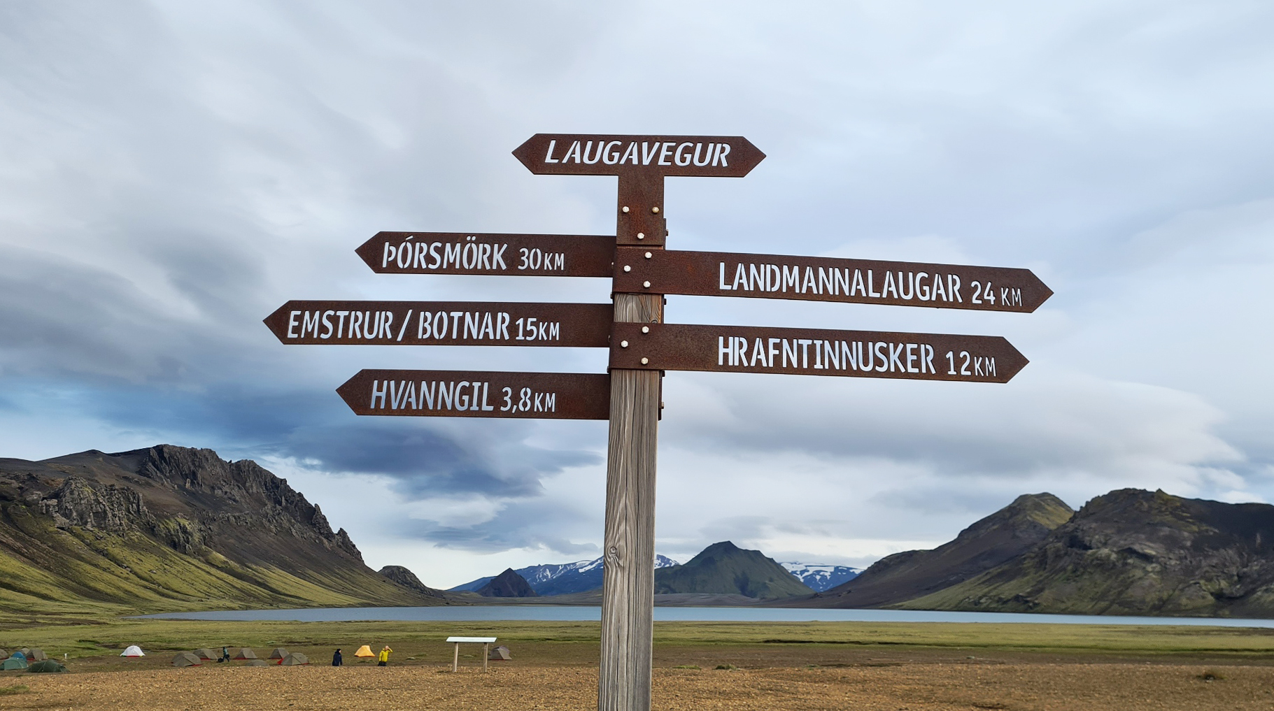
Day Three: Álftavatn to Emstrur/Botnar. 16.4km. 350m ascent, 435m descent
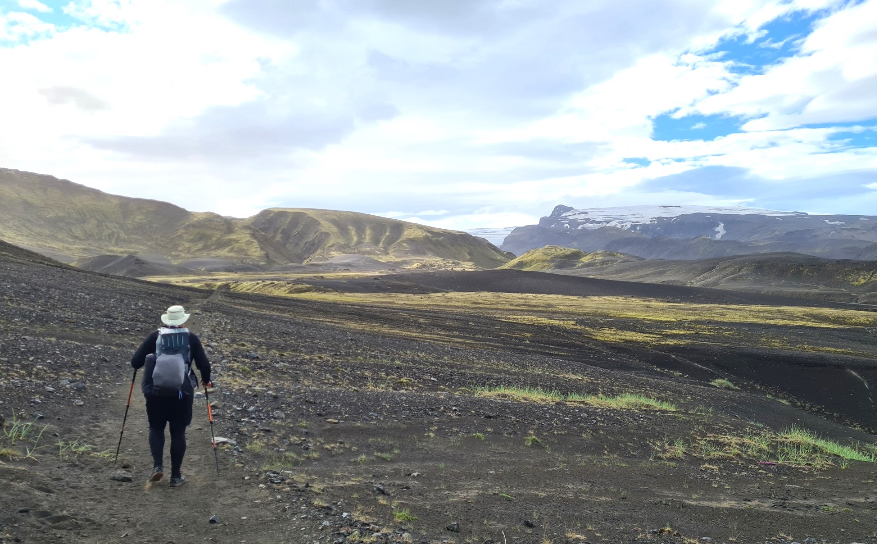
By 06.30, some of the other campers had risen, clattering tent poles and shouting to one another across the now crowded site. A loud phone alarm went off in the tent next to me, they hit the snooze button, alarm sounded again, snoozed, sounded again, snoozed, sounded again. What is it with people. At 07.15 the sun came over the ridge and shone on my Duomid, I gave up and got up. I tried to regain my good humour with a leisurely mug of strong tea, rye bread, cheese and salami. By 09.50 I was away from that accursed site, that had been all too welcoming and pleasant on my arrival. I continued to be extremely fortunate with the weather. Two weeks previous they were experiencing 125mph winds. There was the slightest of breezes while walking, just enough to keep me cool. At these lower altitudes I was devoid of the cold winds that had swept across the snow dotted volcanic slopes on the first two days.
Leaving Álftavatn, the trail heads toward the Hvanngil chasm, crossing the Bratthálskvísl river en route. This is a shallow easy river and, as usual, became a bit of a bottleneck while hikers changed into and out of river shoes. I simply waded across in my trail shoes, leap-frogging twenty of so hikers in the process.
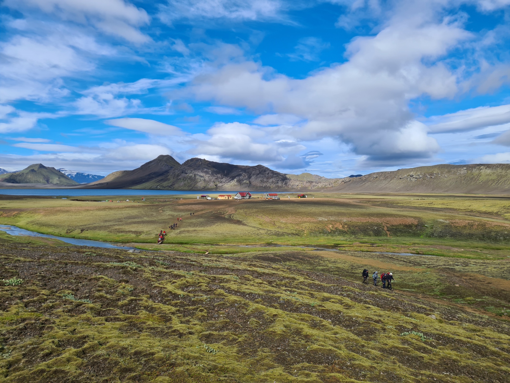
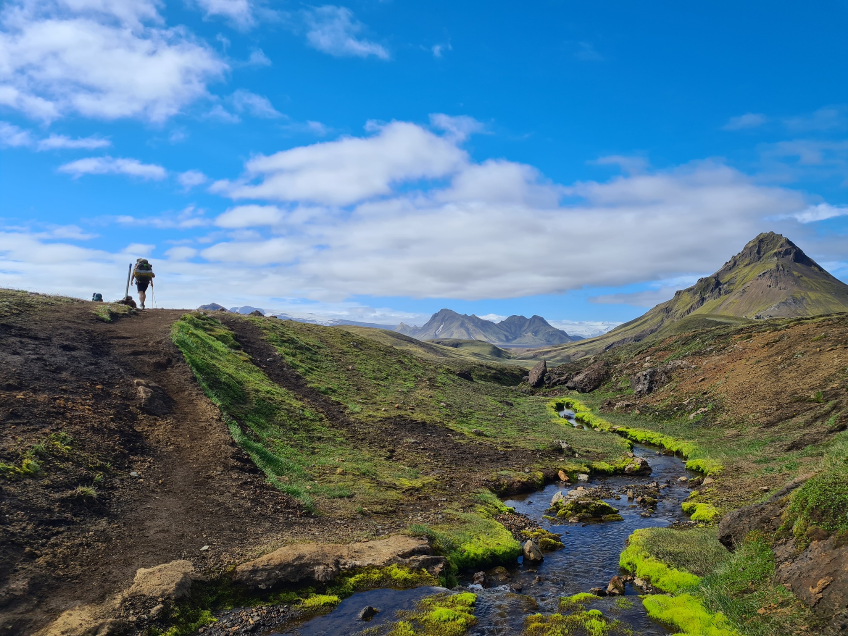
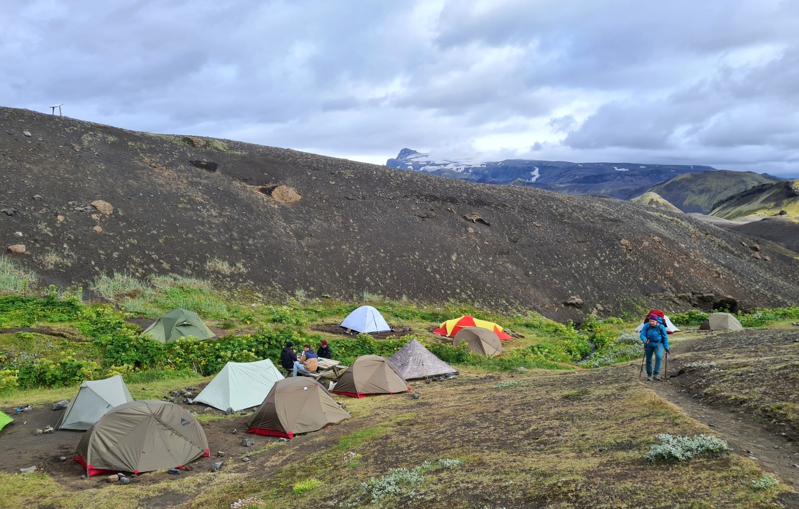
My lead along the Brattháls ridge didn’t last long as I briefly paused in the Hvanngil valley at the hut and campground to use the facility there and poke around the site, again filling up with water while I did so. Quite a few of those walking the Laugavegur don’t stop at the Álftavatn campsite, choosing to halt here instead. It is a lovely place, sitting in a low flat valley between the hills. I am sure it would have been a good deal quieter. If leaving the Álftavatn huts in the morning, as I had earlier, there isn’t actually any need to halt so soon, but did I mention, I’m in no rush on this trail.
Almost all other hikers simply walked straight past the huts without halting. I may have been at the back of the pack again, but once through the black lava flows, I caught up with most, again, at the wider Bláfjallakvísl river crossing further on. We were all directed to cross a little further up the river by a race official keeping the usual crossing clear for runners.

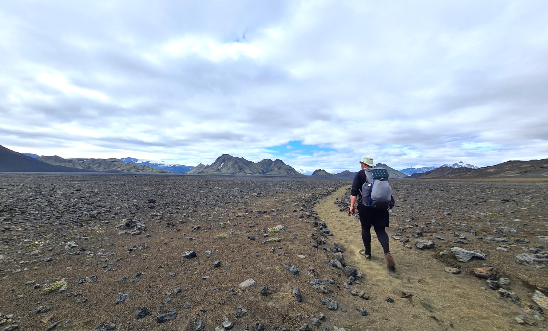
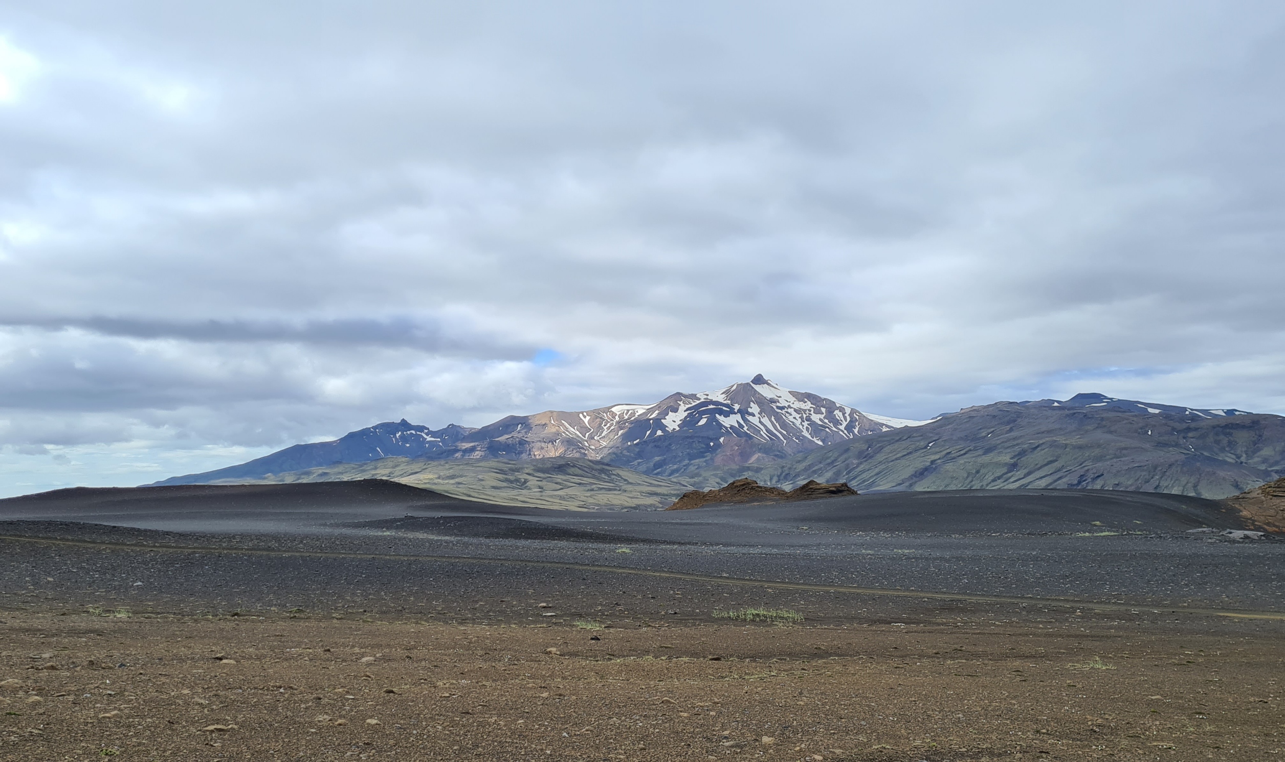
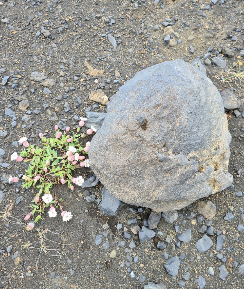
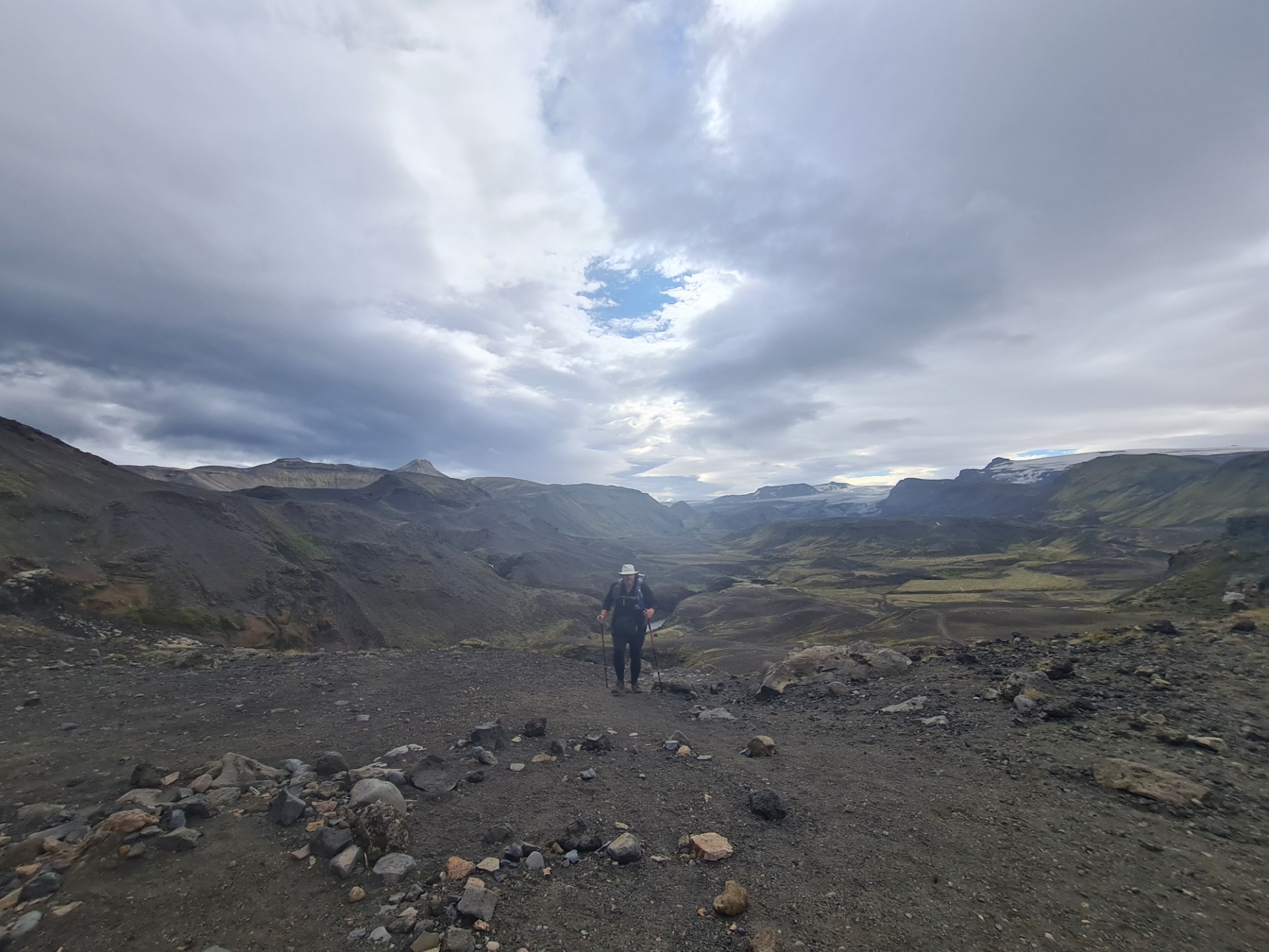
Having crossed Bláfjallakvísl it was back into the extensive black ash desert that so many people say they dislike. Why I cannot fathom. It is a fascinating environment. You will read that it is devoid of vegetation, it isn’t, small clumps of flowers hang on in many a place. Lichens and mosses create a bright green coloration to distant hills. I would guess that when the wind is whipping across it’s surface, it might be a blinding, skin shredding experience, but it wasn’t when I crossed it. Thousands of lava bombs have peppered its surface and you can spend hour after hour working out the different types, rock consistency and considering how violent it must have been at the time they flew through the air to land here.


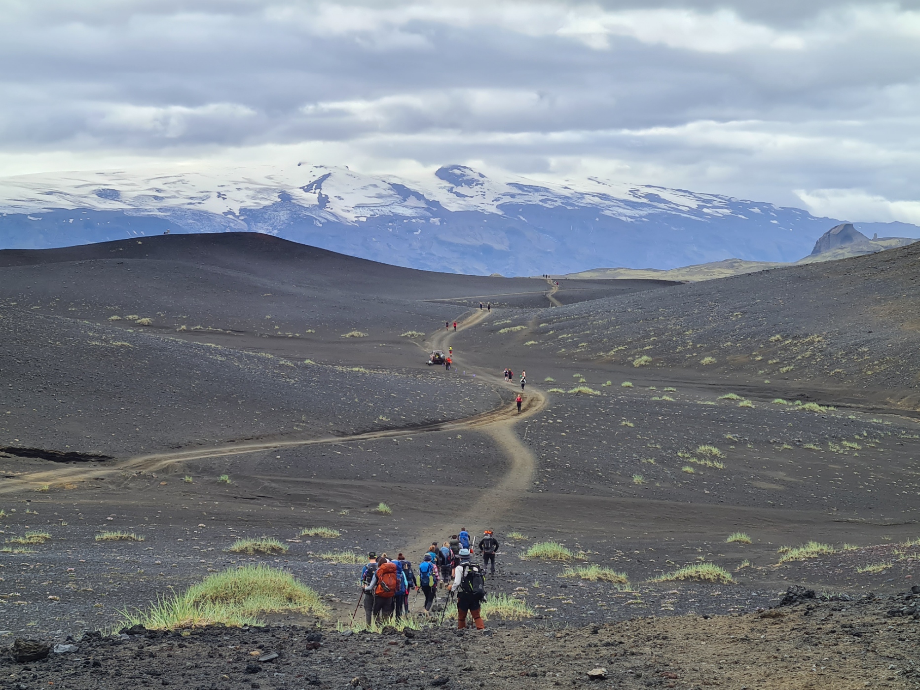
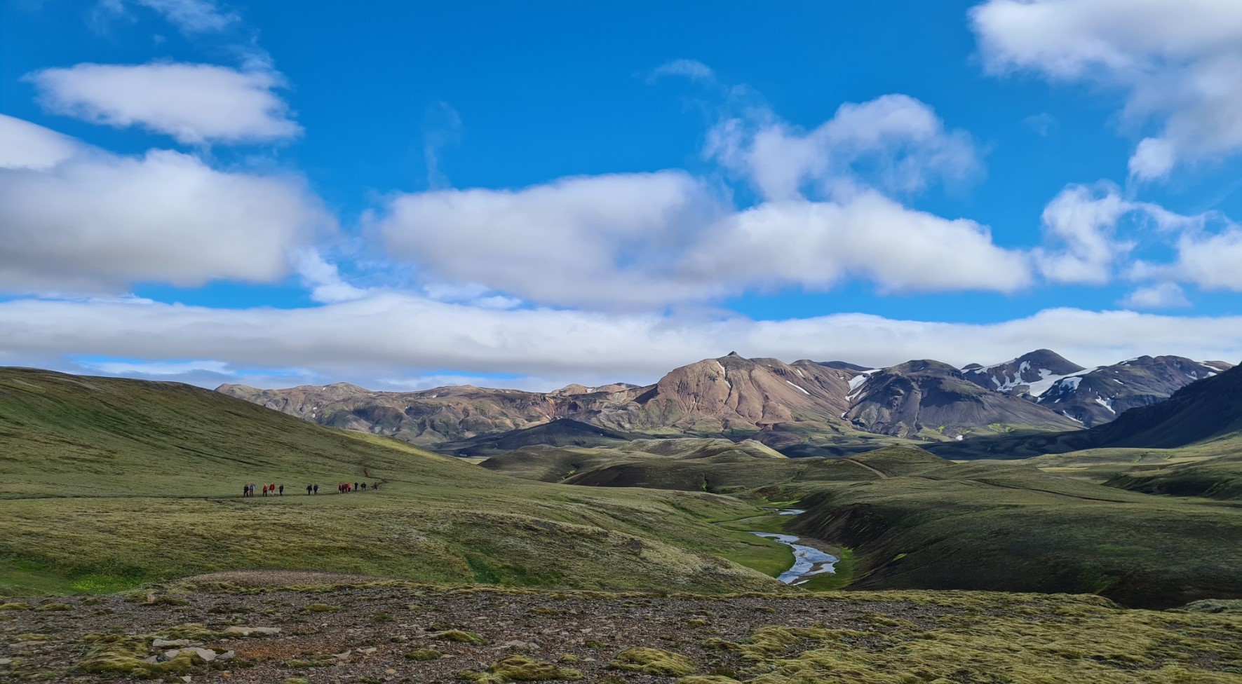
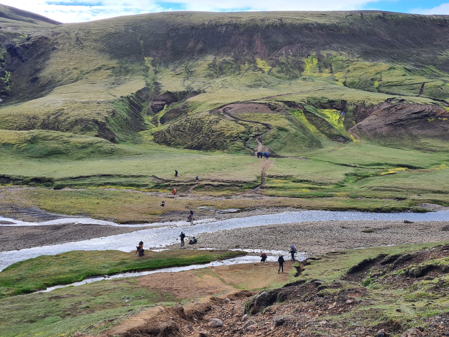
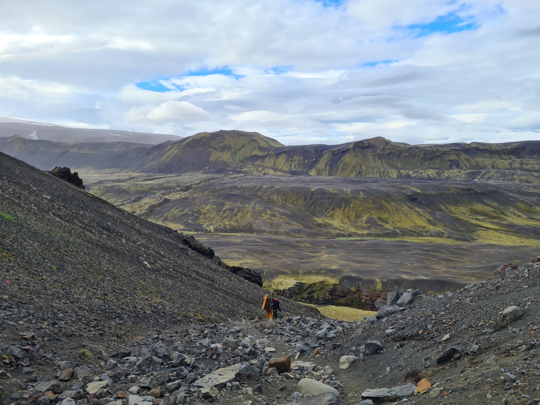
Two more wide rivers are crossed, the Kaldaklofskvisi and Innri–Emstruá, fed by the mighty Mýrdalsjökull glacier, however both of these have decent bridges. I may have given the impression there are a lot of hikers on this trail. While there are certainly a few leaving the huts and campsites each morning, these soon spread out and since I had left Landmannalaugar it was often that I looked across the exposed miles before and behind without a soul in sight. That was not to be the case for me today.
My walk across the ash desert coincided with the annual Laugavegur Ultra Marathon that takes place along the trail’s length. I am amazed no one had broken a leg or fallen through a snow bridge and perished. A few were sporting bloody injuries where slips and trips had occurred. I stepped off trail or to one side whenever I could as they approached from behind. The runners didn’t bother me. What did annoy me were the infrequent but incredibly intrusive checkpoint stations for the athletes. Music blaring from speakers could be heard, literally, miles away. Passing through each checkpoint garnered a cacophony of clapping, bells vigorously shaken, shouts and whoops. Even I got congratulated. I am sure it is great motivation for the runners, but I found it all just a bit grating. Or perhaps I am churlish and getting old. I actually had comparatively few of the 579 runners pass me (no, I didn’t count them) until my final river crossing at Innri–Emstruá when numbers slowly built. But it was when I was pitched for the evening later, that the great majority passed through that checkpoint.
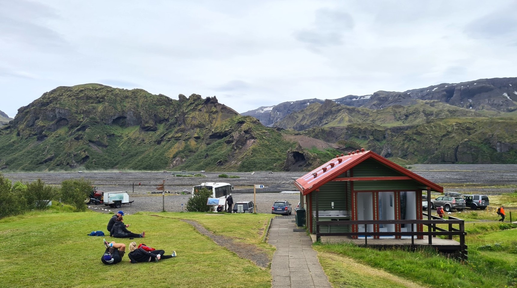
The moss covered hills beyond the black plains were impressive. I saw no bird life at all. I saw no invertebrates. I paused infrequently, just to take photos, or step off to one side to let yet another runner pound past. I did wonder at one point if I had wandered off trail somehow as I reckoned I should have reached the huts, but I walked another thirty metres around an ash slope and the busy Emstrur /Botnar Huts and campsite was suddenly in view. It doesn’t appear until the last moment and must have been a relief to the runners as it was also being used as checkpoint, medical point and feed station for the ultra-marathon. Boxes full of sliced banana, ditto oranges, large tubs of salty pretzels, gallons of coke and what I presumed to be orange squash.
It was at the wardens hut that I found out that the first runners had already finished the ultra-marathon. Arnar Pétursson won the men’s category with a time of 04:00:48 and Andrea Kolbeinsdóttir won the women’s category with a time of 04:22:56. I find these times incredible. It was also here that I purchased a couple of tins of (poor) Egils Pilsner lager from the warden, purely to get the 5 x 100Kr coins I required for the shower you understand.
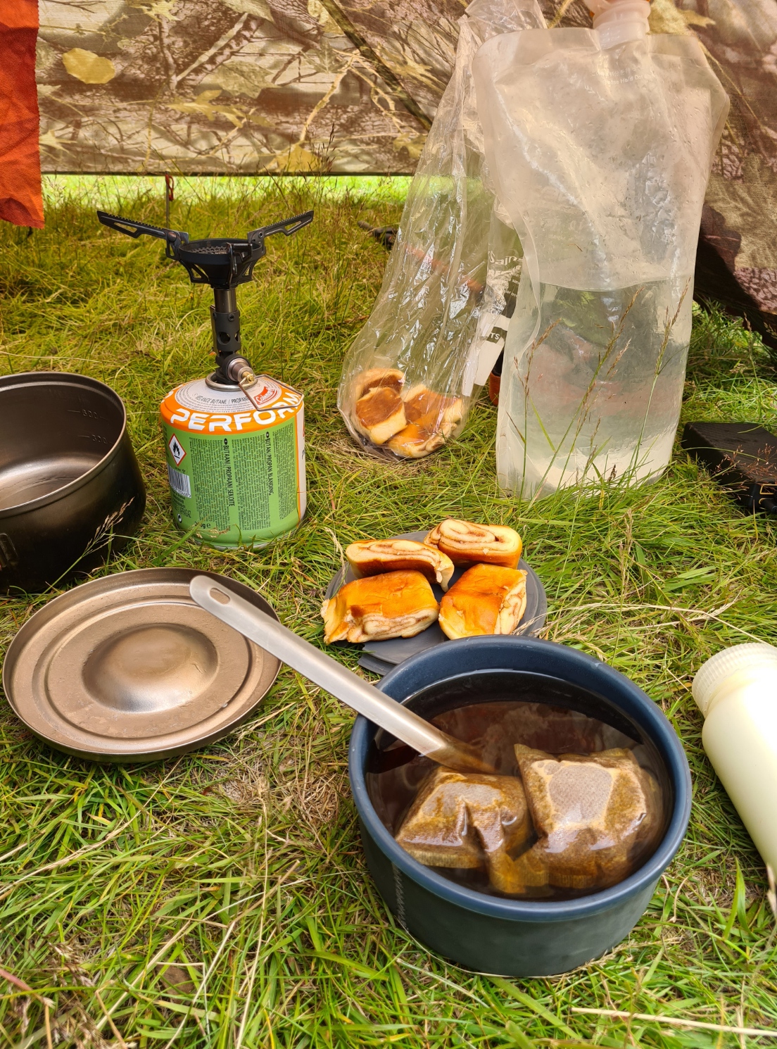
This had been a short and easy day and having left camp at not-too-late an hour, it was now only 14.30 and I had time to get the Duomid up, rest, brew up and hydrate, watch the runners passing through, drink one of my lagers, eat cinnamon buns, drink more tea, write notes and read, drink yet more tea and watch the later arriving backpackers search the site for anything approaching a flat spot.
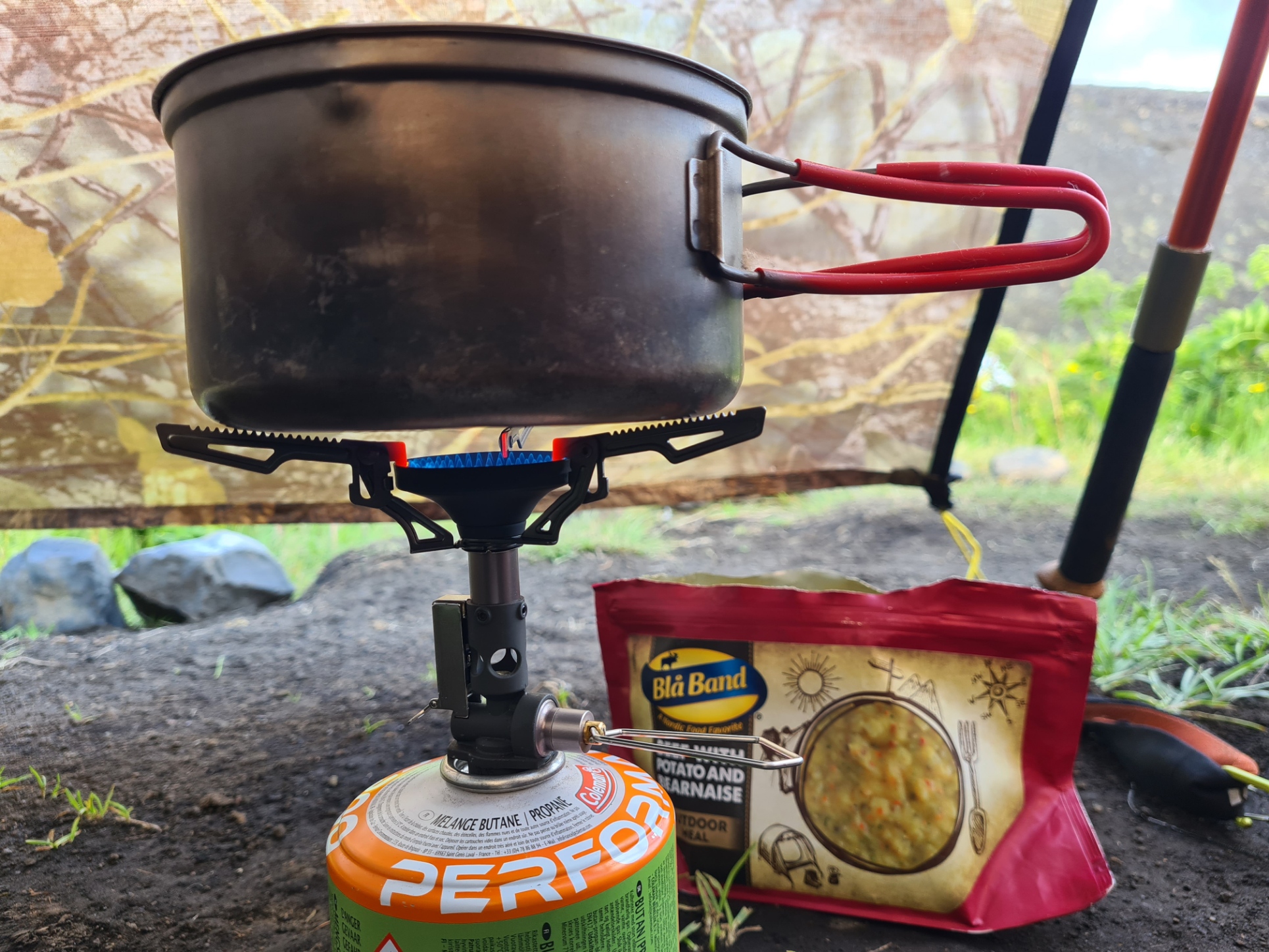
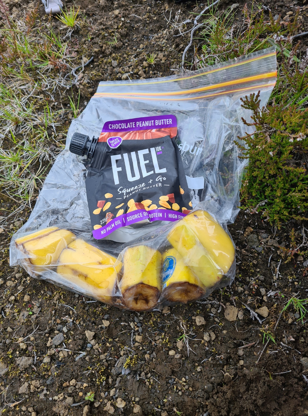
The shower I enjoyed was hot enough to remove a layer of epidermis but each user is limited to five-minutes of hot water as there is only so much. On a later visit to the w/c, I could hear the squeals from those left with cold water. Having showered and washed my skiddies, socks and rinsed the day’s ash and grit from my trail shoes and insoles, I changed into warmer camp clothing as the temperature was fast dropping. My evening meal was accompanied by my second lager, both followed by working my way through my food bag and eating half of the chocolate I found, before it went off…
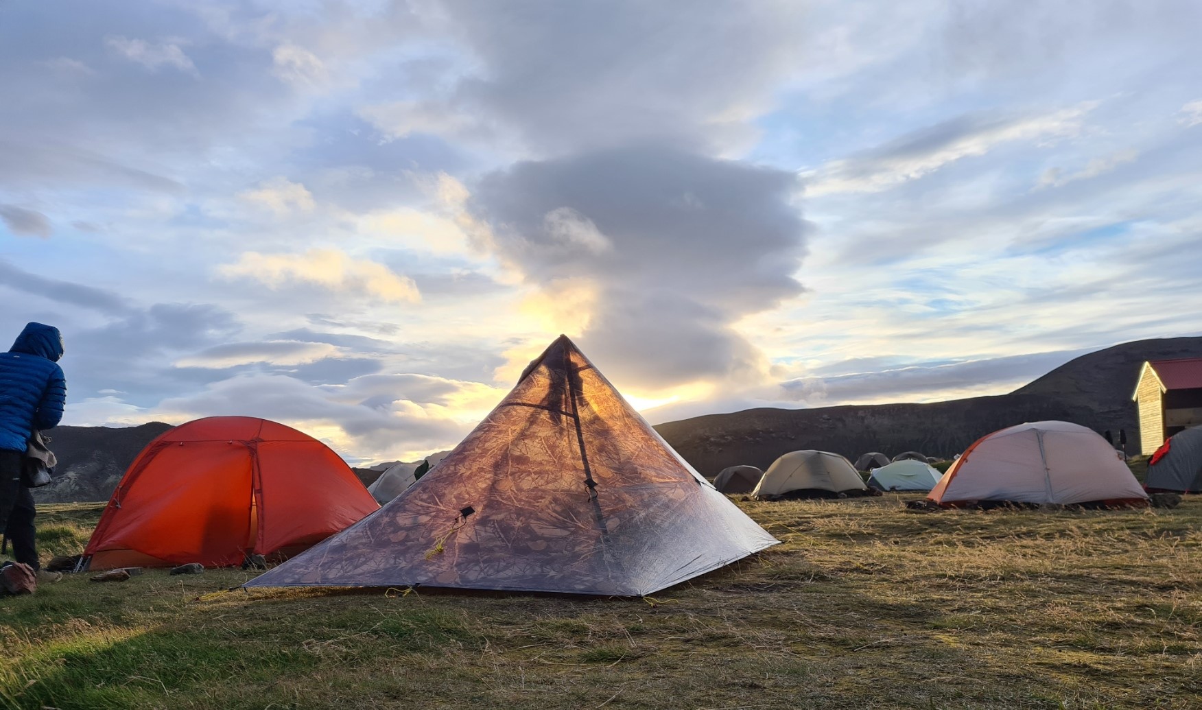
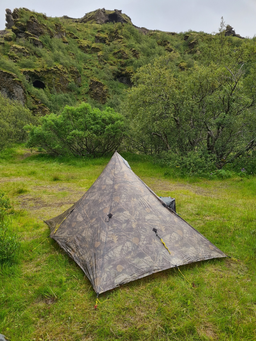
Emstrur is a sheltered site. There wasn’t a breath of wind (which didn’t help my washing hanging from a strung line) so there were a few flies around. Non-biting thankfully. Also, no phone signal, so I was also relieved of people shouting into their phones. It was a decent quiet site with campers respecting those pitched close to them. Such a contrast from the previous location. The campsite was almost silent by nine, though I later heard that many of those staying in the huts had been whooping it up ’til late.
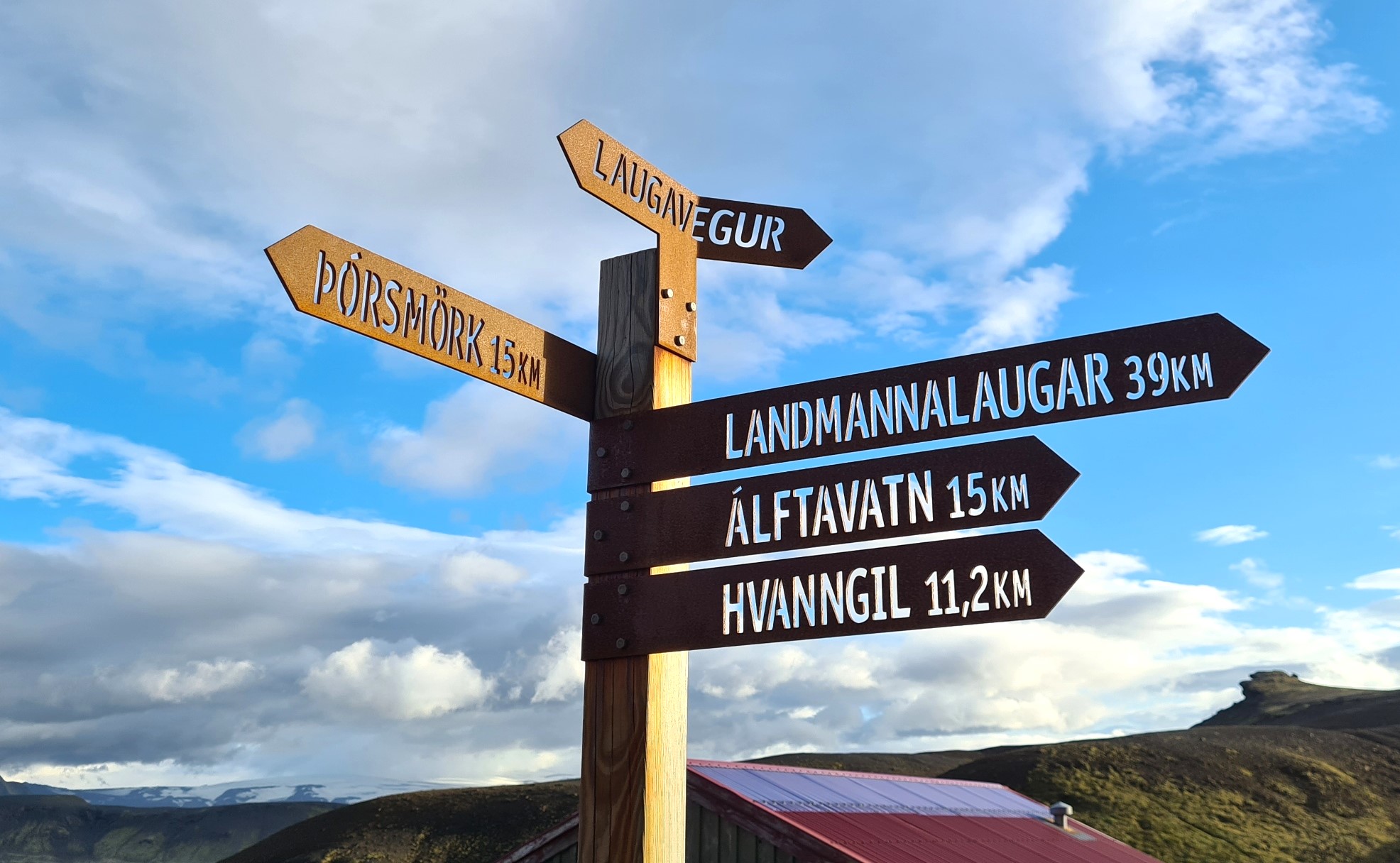
Day Four: Emstrur/Botnar to Básar/Þórsmörk. 18km, 436m ascent, 680m descent
I slept fairly well. The white noise from a small stream just a few feet away masking any snoring from nearby campers. A cold breeze had sprung up during the night, which didn’t bother me in the slightest and meant that, again, no condensation issues in the DCF Duomid. I was the first to rise and sat at a little picnic bench drinking tea with cheese on the last of my rye bread, slowly consumed while reading. As usual I was in no hurry. The other campers, one by one, rose, packed, and I was content to watch them leave, quiet best wishes and waves all round. This was the final day on the Laugavegur. A bit longer than previous days and I was quietly anticipative at what I hoped would be another interesting day on trail, crossing the deep Markarfljot canyon, climbing in and out of small ravines and valleys on the way.
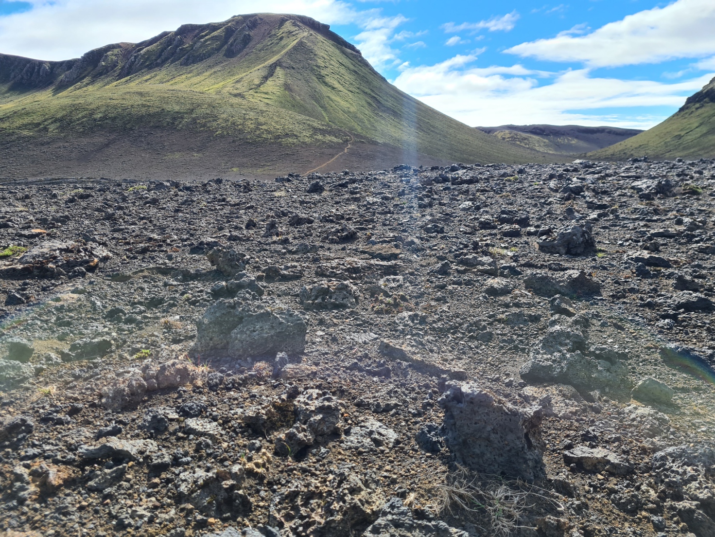
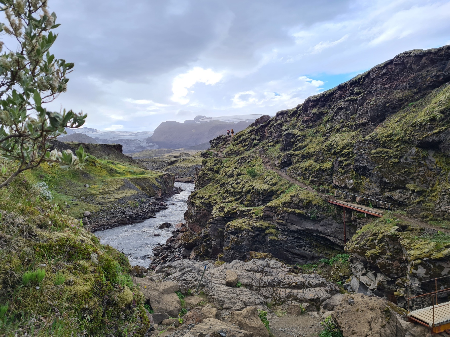
I was away prior to 09.00. A short climb up the basalt slopes out of the site and immediately presented with a sweeping view before me. I descended to another caldera and crossed a short plateau, then the trail descended steeply into a gorge, down to the Syðri-Emstruá river, crossed by two wooden bridges. Then a climb back up the other side to cross a higher plateau that swung round and back-tracked, handrailing the gorge, a tall narrow waterfall beside me, before climbing up beside columnar basalt to a ridge. My journal records my thoughts: “a bit of climbing, then more dropping, more climbing. What is there to say? Just excellent interesting walking”.

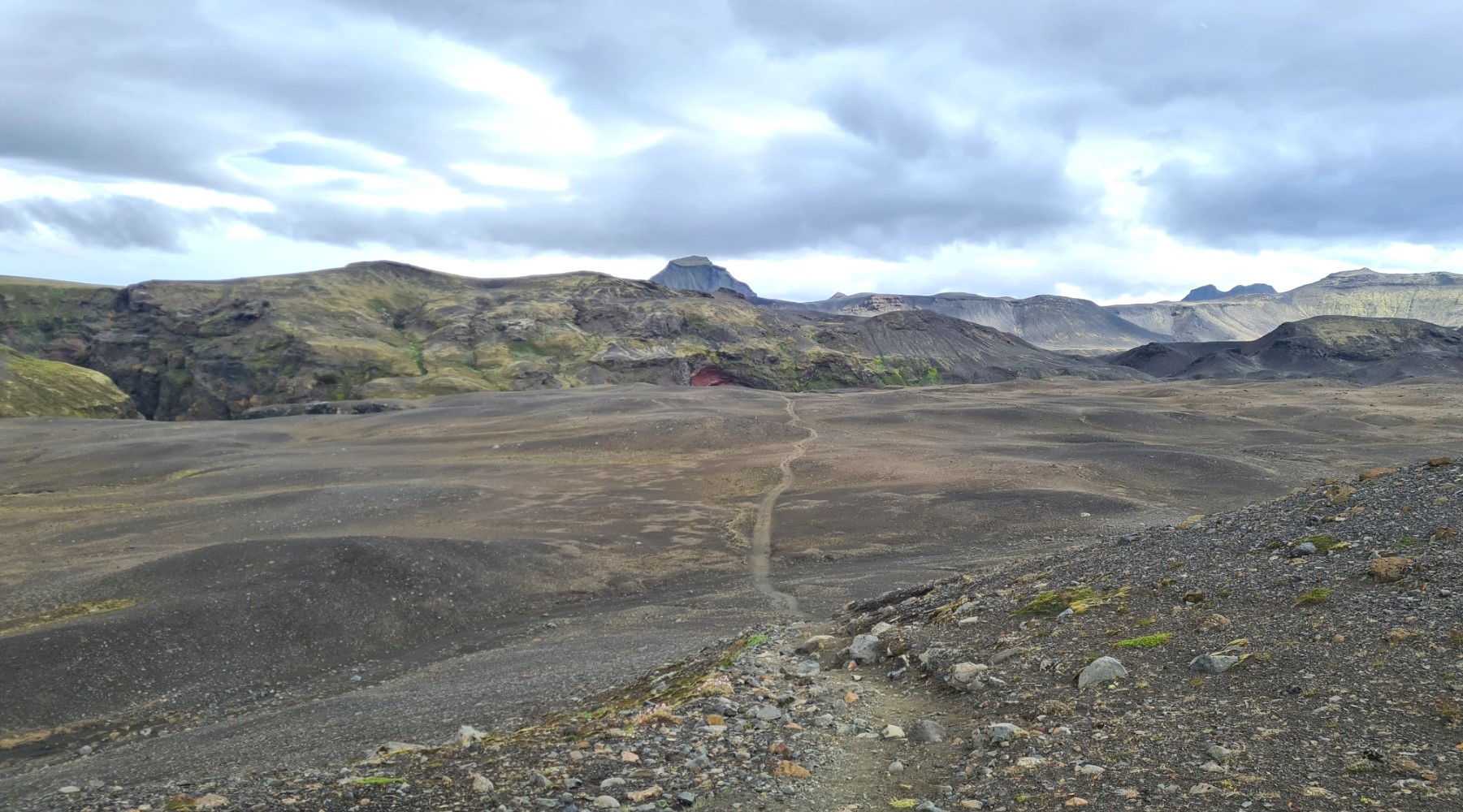
I then walked through the Almenningar hills, crossing another two ravines at Slyppugil and Bjórgil. From here, the vegetation changed and I began to see greater numbers of trees, birch, aspen and rowan, all very small and stunted at first. I spotted four sheep, the first and only such creatures I saw on the whole trail. There was another steep climb, to the summit of Kápa. This was followed by my penultimate river crossing of the day. For much of the day I had the trail almost to myself, seldom seeing any other hikers, even in the distance. Later in the afternoon I was passed by a couple of small groups of northbounders.
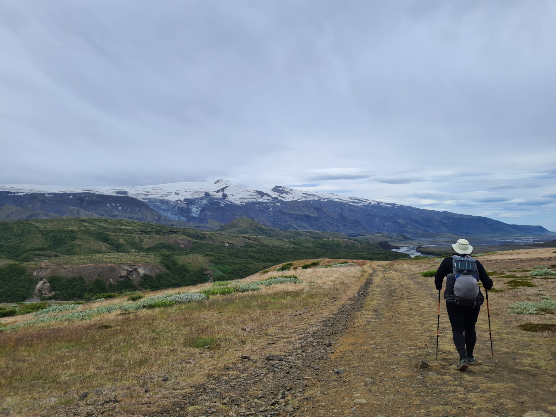
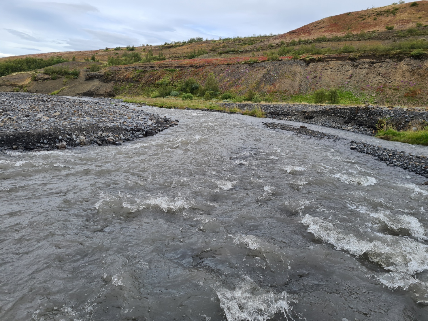

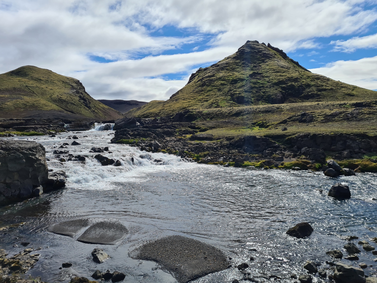
The river Þröngá meanders through a wide gravelly canyon. Þröngá means narrow, which is an odd name for what was a pretty wide crossing. This is a lonely place to come unstuck and again, I took care. Trail shoes remained on for grip, hip belt was undone, most electronics and pack contents double wrapped, face upstream and carefully test my way across the rocky, uneven river bottom. It was an easy crossing. I sploshed out the far side and carried on, water gradually squeezed out of the porous breathable Altras.
The trail walks through and toward impressive rock formations. Most caused by volcanic activity rather than erosion. One dramatic hill, Einhyrningur, looks distinctly like a rhino’s head in profile. The author of a guide on the trail’s geology comments: “the diligent observer will potentially see two or three dragons circling the peak”.
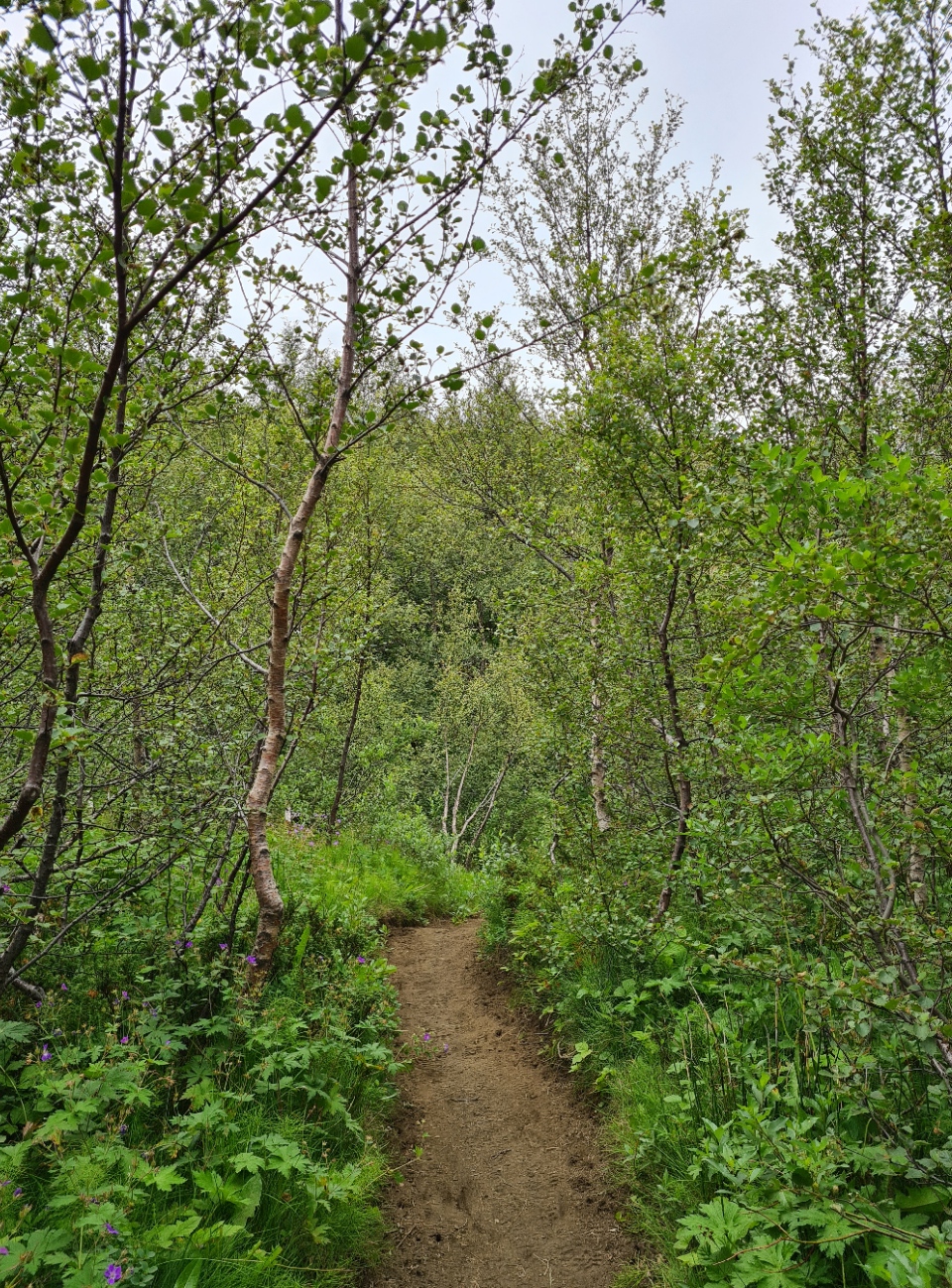
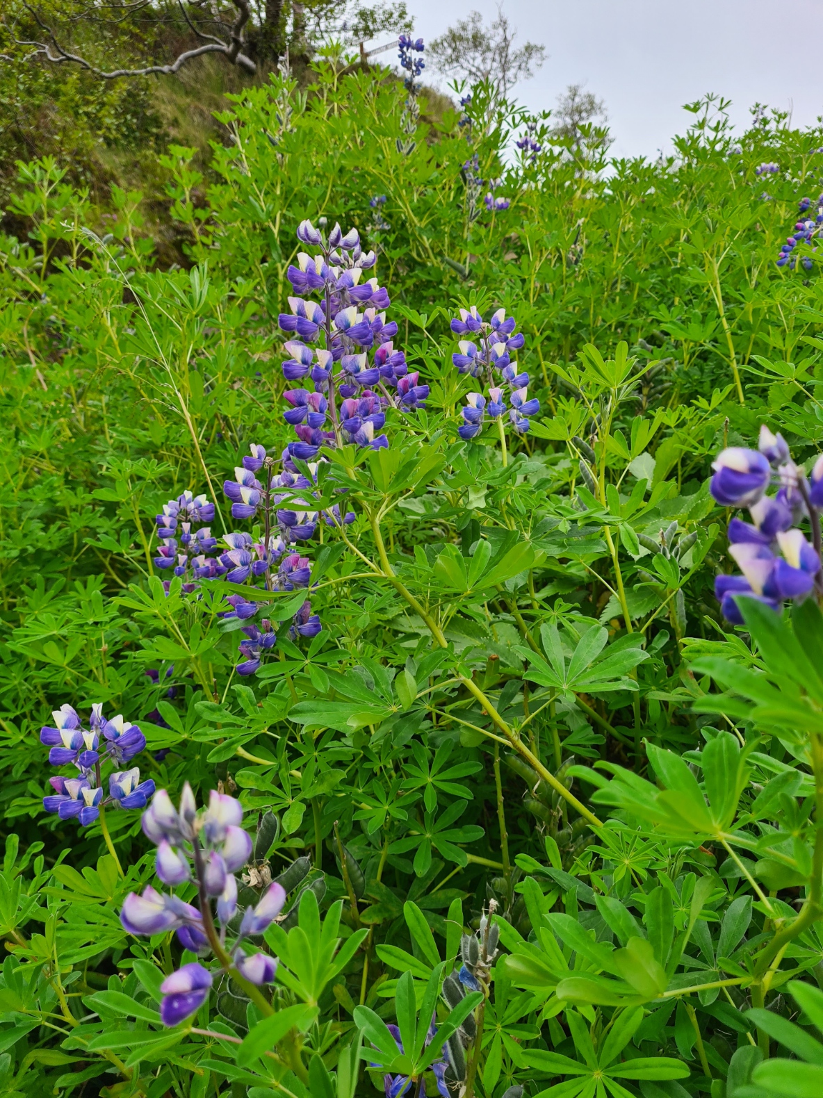
The trail again changed dramatically. I entered Hamraskógar, a forest of birch and other trees and part of Þórsmörk (Thor’s Forest), mostly naturally regenerating but assisted along by the authorities. It is reckoned that Iceland once had as much as 25% of its surface forested. The Vikings arrived and in their ignorance cut down most of them. The fragile thin soil simply blew away. Only about 1% is now forested but efforts are being made to increase this. I now had grass beside the path, sedges and moss abounded. Ground flora is now protected from grazing and is thriving, sadly including the invasive lupin, a problem plant across much of Iceland.
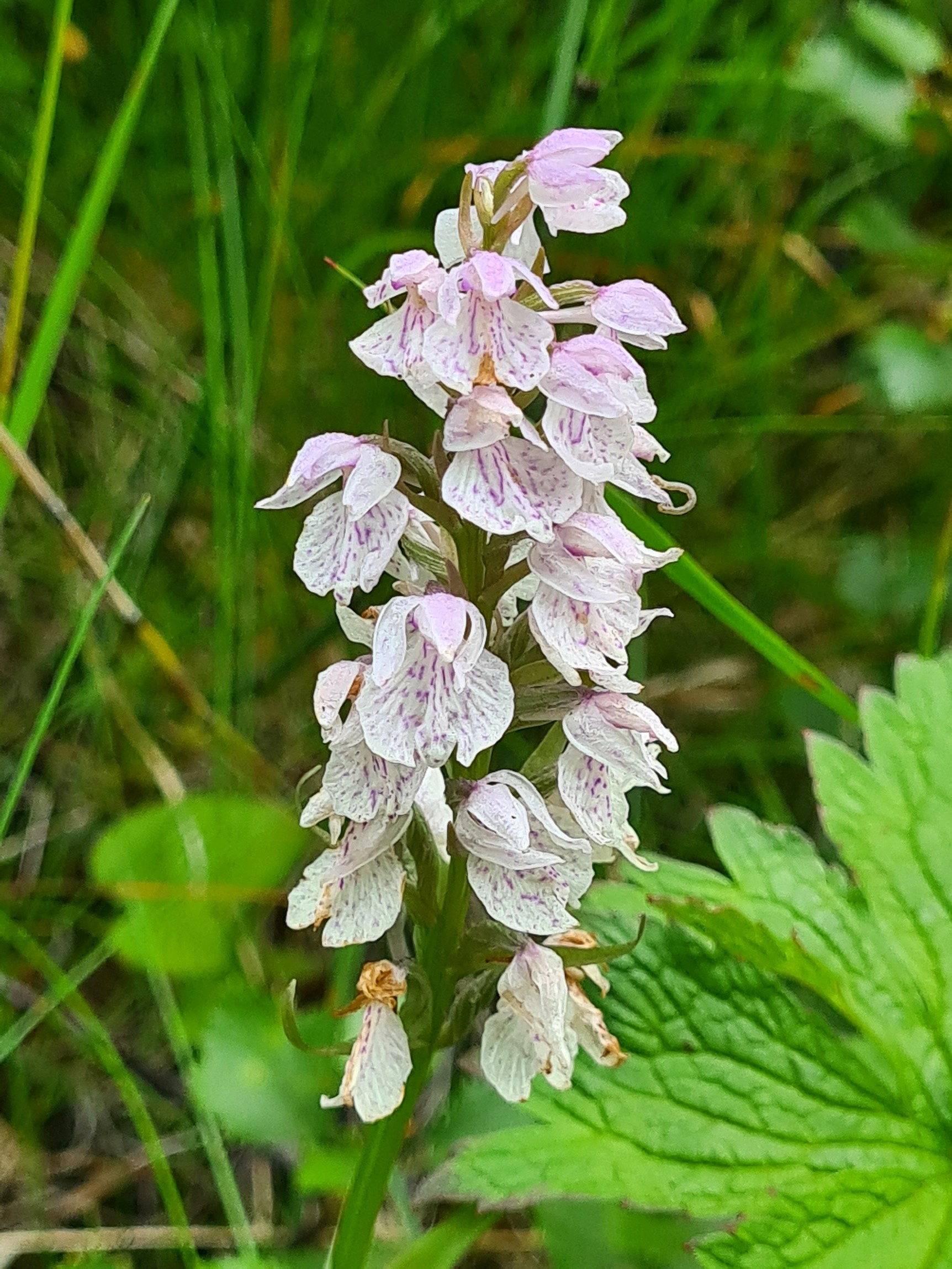
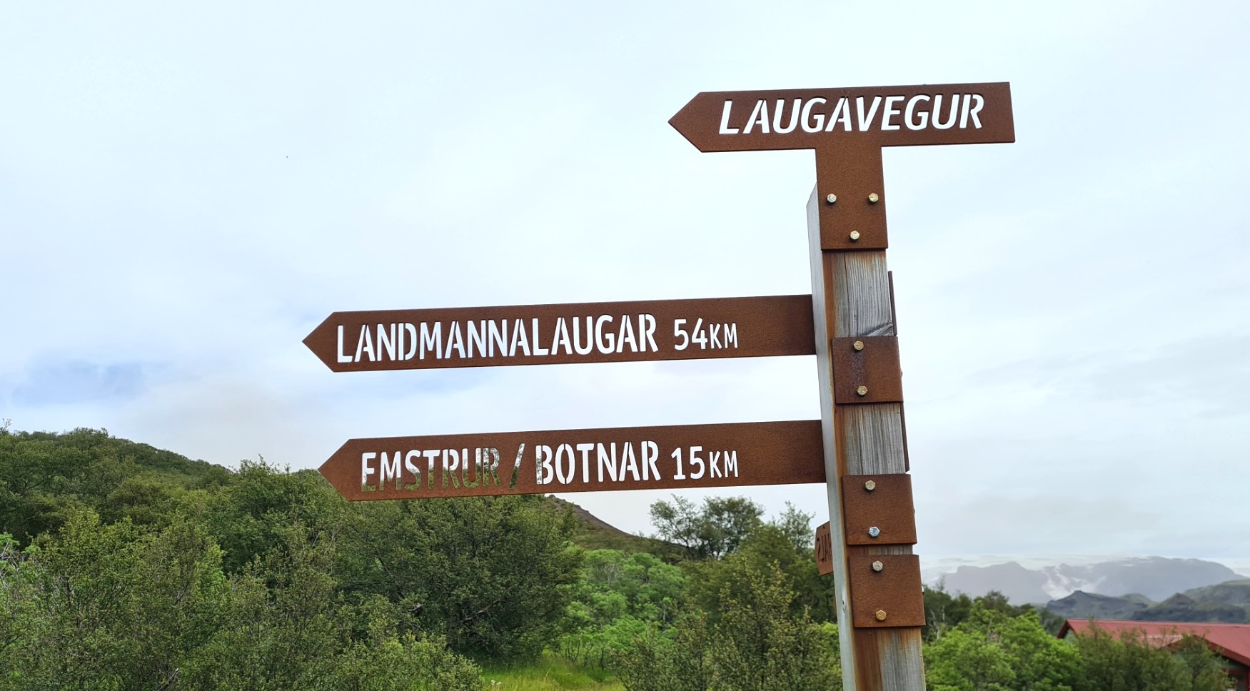
Orchids and other flowers were in abundance and it was a lovely walk through the leaves and scent. I reached a junction in the trail. I had long decided that it was here when I would make the final decision on whether to hike the 25km Fimmvörðuháls Trail in addition to the Laugavegur, but in truth, I had made my decision days ago. Despite being a little weary, I was in good shape, I had plenty of food, the weather could not have been better. I would have a long night to rest and prepare myself. So instead of coming off trail and walking ahead to the Volcano Huts, complete with camping, restaurant, showers, sauna and other luxuries, I turned left.
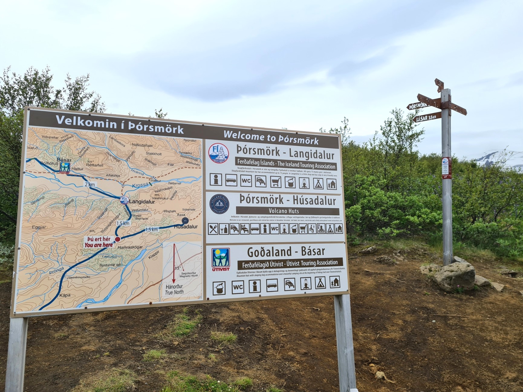
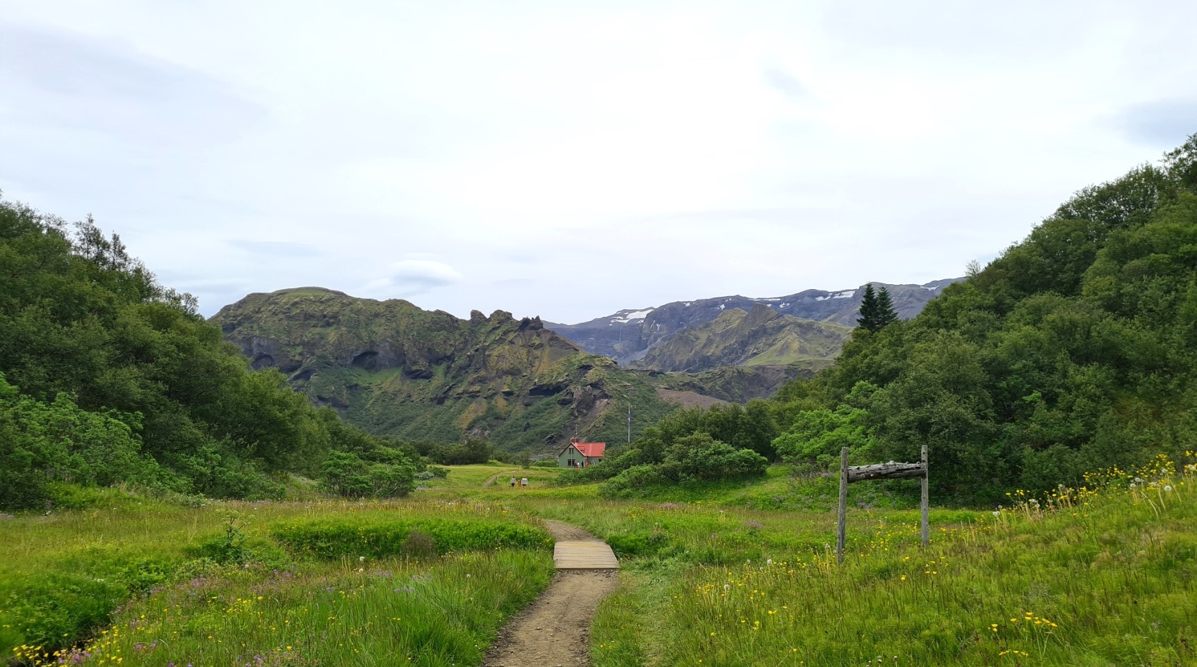
I barely paused at the Skagfjörðsskáli hut in the Langidalur valley at Þórsmörk. It was busy with hikers and day trippers who had either come in by 4×4 bus, or had parked on the other side of the valley and walked across the wide Krossa river via the two movable bridges that are placed over whatever braids of the river bed the Krossa has decided to follow this time. Day visitors clear off in the evening and this site has a reputation for being the quietest of the three Þórsmörk campsites. There is a small shop at the site, but I required nothing and once I had disposed of the bag of rubbish I had been carrying for a couple of days, which included my emptied cans of lager from last night, walked straight out on to the shingle river bed,
I crossed the Krossa, using the two movable bridges when necessary. Further up to my left I could see an ash cloud slowly approaching down the valley toward me. This is an uncommon event caused by certain winds picking up the ash, scattered in the Fimmvörðuháls pass by the 2010 Eyjafjallajökull eruption, and creating a thick fog.


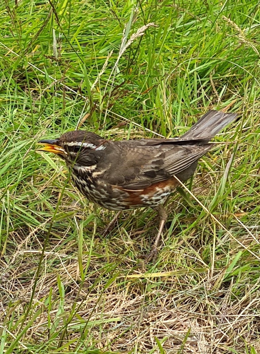
It was then turn left on to the rough road and walk into the dust cloud, added to by occasional 4×4’s passing me. It was a 1.5km walk to the Básar campsite. This is obviously a popular place for car campers but they also have plenty of space for backpackers. I paid my fee at the little camp’s shop, then it was a roughly 1km walk to a pitch amongst the trees, picking up three litres of water on the way. I was pitching on grass for a change! The tent was up by 16.15 and I celebrated having completed the Laugavegur with the remainder of my (now stale) cinnamon buns and a two-bag mug of tea. I know how to celebrate! A confiding and handsome Redwing joined me for crumbs. Could I ask for more? I was pitched just a few metres from the start of the Fimmvörðuháls trail. More adventures tomorrow.
I sorted through my foodbag and decided what to take with me up over the pass tomorrow and what to leave for other hikers. As it was, I ate two Real Turmat meals this evening, still only slightly more than a 1000 calories. Fed and watered, washed, feet cleaned and creamed, I was asleep by 21.30.
The Laugavegur is a remarkable trail and I was pleased that I took my time over it. Over just four days I had walked from brightly coloured rhyolite mountains into a monochrome landscape with snow contrasting against dark glassy obsidian rock. I weaved my way across ash deserts peppered with lava bombs. I had camped high, in the cold and bitter wind, and low, amongst grass and trees. I had crossed snow fields and ravines, passed steaming vents and spluttering hot springs. I waded freezing glacial rivers and wandered orchid bracketed dusty trails. I had met backpackers from a dozen or more countries across the globe. It had been a privilege and I feel fortunate to have visited this amazing country and walked this superb trail.

3 replies »