
For those that like to venture out on a long distance path in the UK, be it National Trail or some other route, a physical map, with the trail highlighted through it’s centre, is a useful resource. And if that resource comes with Ordnance Survey mapping, it is a match made in heaven, well, almost!

So who amongst us is still using paper maps on trail? Three Points of the Compass for one, if not always. There will be many people venturing out on to National Trails in the UK that do not have digital mapping, or choose not to use it, or may be put off by it. And for those who do rely on it, it still makes extreme good sense to have a paper copy of the trail for when electronics fail or batteries fade. There isn’t a long distance path in the UK that hasn’t had a good paper map produced by someone. And for those who are venturing out on paths beyond the national trails, the Ordnance Survey (O.S.) has surveyed and mapped every square metre of the UK. It is O.S. mapping that has been utilised in the A-Z Adventure Series for walkers map booklets. If a problem with digital mapping is that the screen view is too small, the problem with paper maps is that they can be too large. Flappy, awkward things that need folding and refolding, put wind and rain in to the picture and things get even more tiresome.
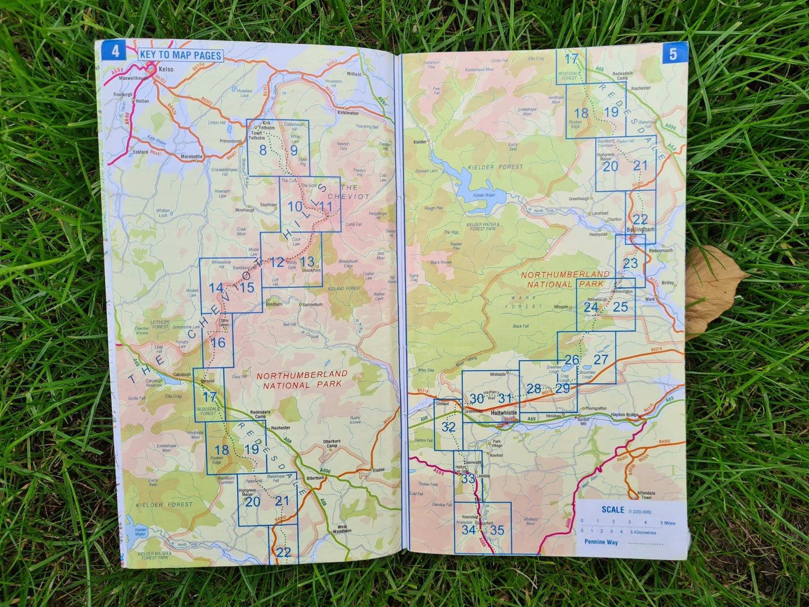
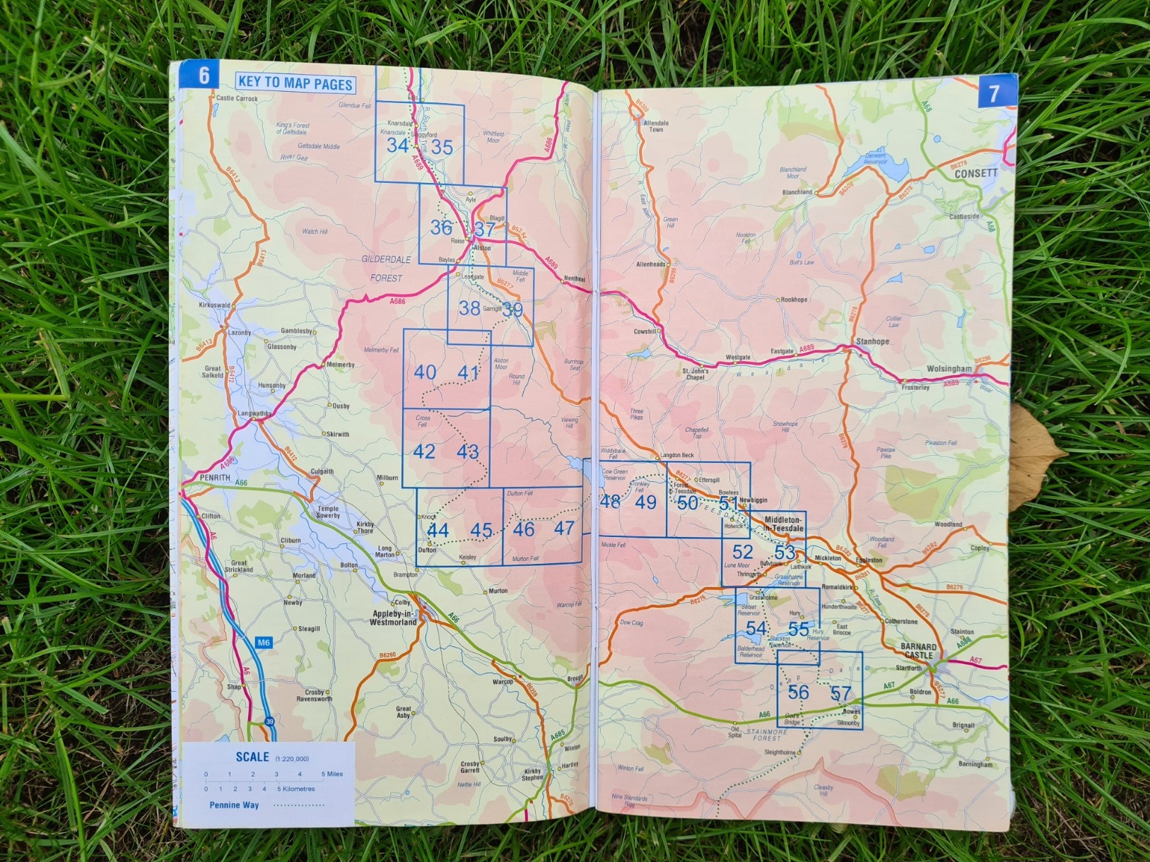
First launched in 2012, the A-Z Adventure Series maps in booklet form have been around for a few years now. First produced by the Geographers’ A-Z Map Co. Ltd. Walk Unlimited, responsible for promoting the National Trails in England and Wales, chose A-Z as the official mapping partner to produce maps for the National Trails in 2017. They are now published by Collins. Three Points of the Compass has held off from offering an opinion on these, but having now completed over 700 miles of national trails in England and Wales with these particular map booklets, I am sufficiently familiar with their merits and deficits to write this review. In addition to the longer trails, some A-Z Adventure Series maps cover wider ‘honeypot’ areas, such as the Lake District.
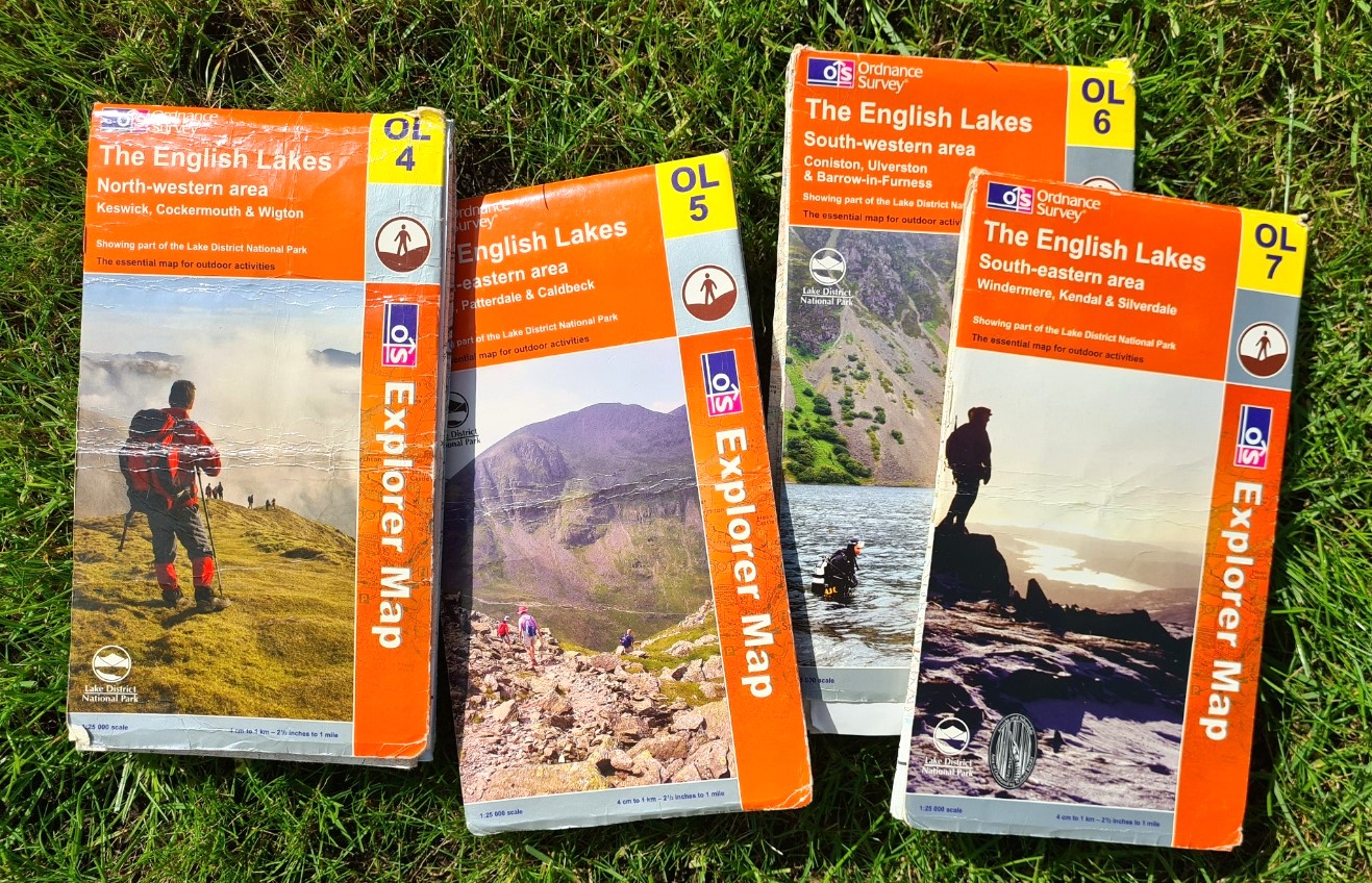
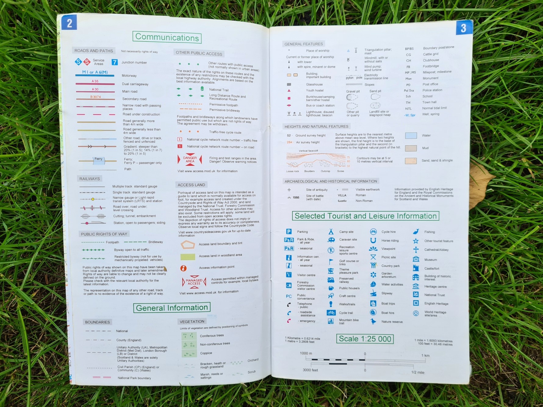
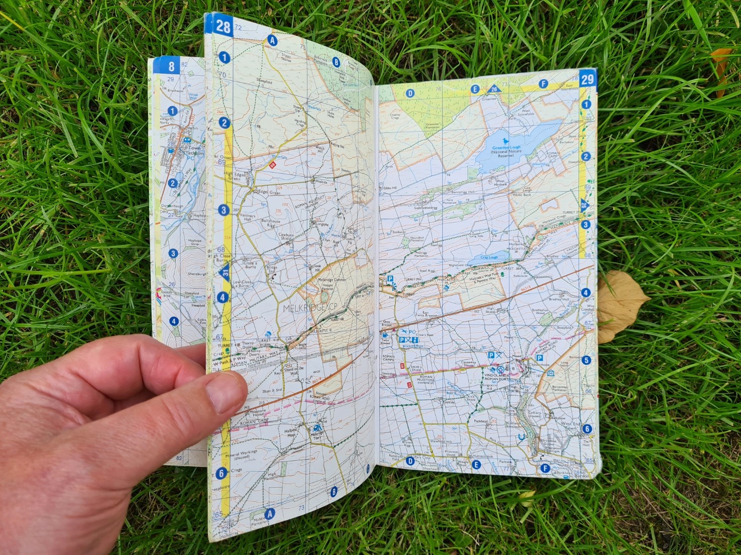
The dimensions of the A-Z Adventure Series map booklets are all the same, only varying in thickness and weight depending on how many pages are required to contain the maps for trails of differing lengths. Some longer trails are spread across two or more booklets. For example, the 630 mile South West Coast Path requires five A-Z map booklets to cover it. Some other walks, areas and challenges are also covered in this series, the National Three Peaks Challenge for example. But my experience is limited to the National Trail ‘For Walkers‘ sub-series of map booklets. The Cartography is 1:25 000 Ordnance Survey mapping, as found on their Explorer maps. This is amongst the best, if not the best, mapping in the world.
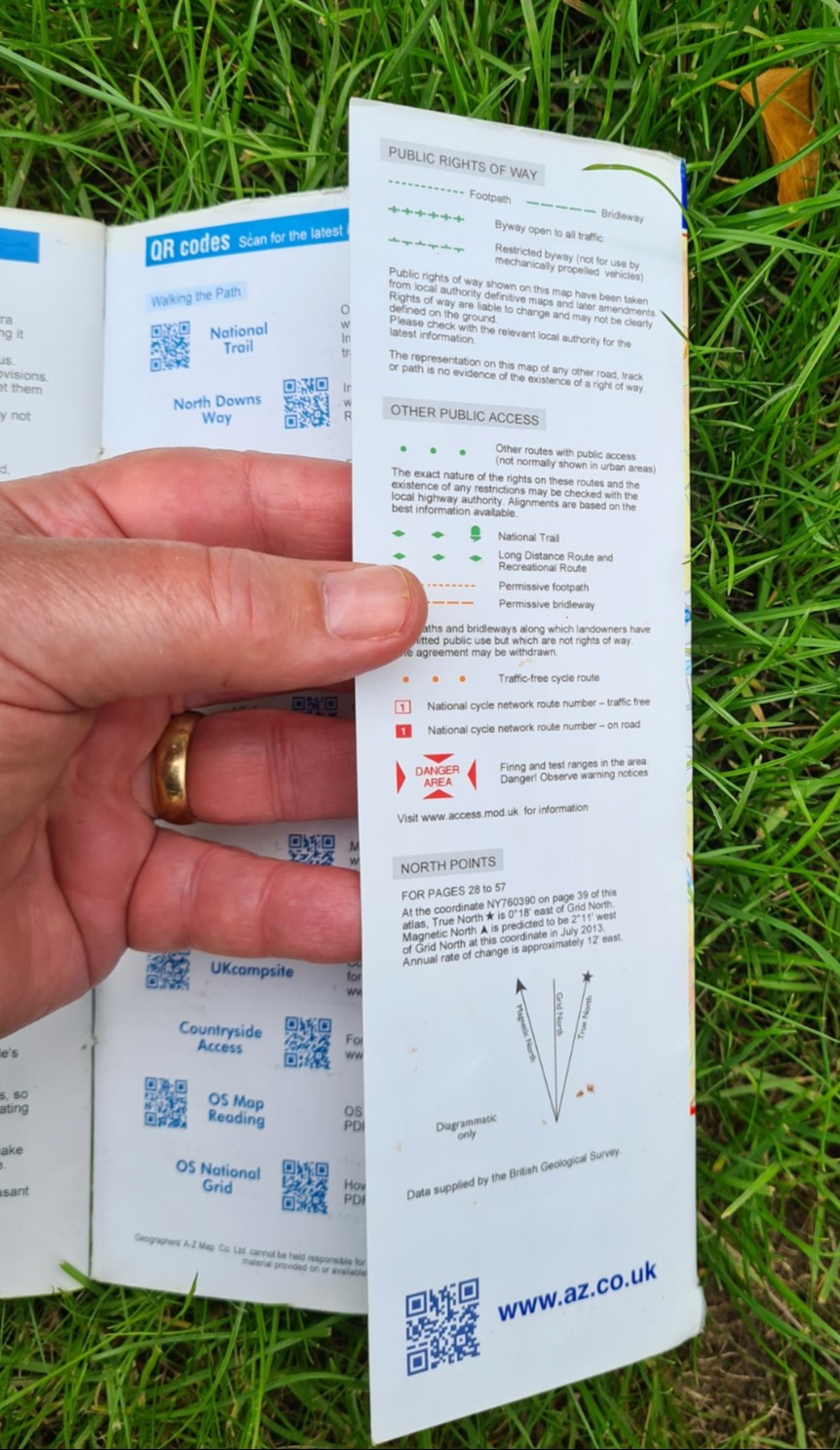
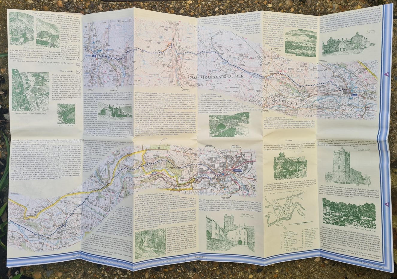
The maps include public rights of way including footpaths, bridleways, byways and many permissive paths. In addition to the highlighted National Trail being shown wandering through the centre of each page, the status of other long distance routes is indicated, including National Trails, Regional Trails, National Cycle Network etc. Many camping and caravanning sites are shown but, in common with just about any other map, I have found that not only is the status of these uncertain, i.e. do they accommodate backpackers, but our recent covid pandemic saw many closing. Youth Hostels are also shown, but bothies are not named, though are usually shown as an anonymous building. As expected, view points, picnicking areas and carparks are also shown. Telephones and Public Houses are included but again, either covid or business decisions have seen many close. Public Toilets are frequently included but with no guarantee they will be open when you get there. It can be difficult to navigate a townscape with these maps due to the amount of detail and they really find their place when in the country. Open Access land, fences and walls, even on which side of a fence or wall a path is, all the detail you would expect and hope from such a map can be found. Contours (5m and 10m vertical intervals), surface heights and trig points. Natural features and vegetation such as water, mud, sand, shingle, coniferous and ‘non coniferous’ trees, bracken and heath and most useful for those finding their own way- marsh, reeds and saltings.
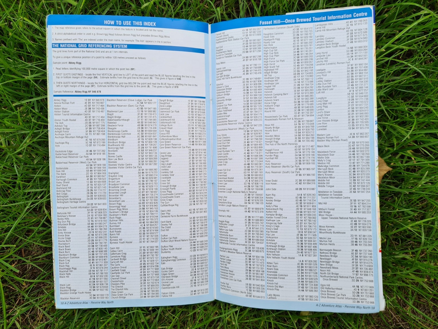
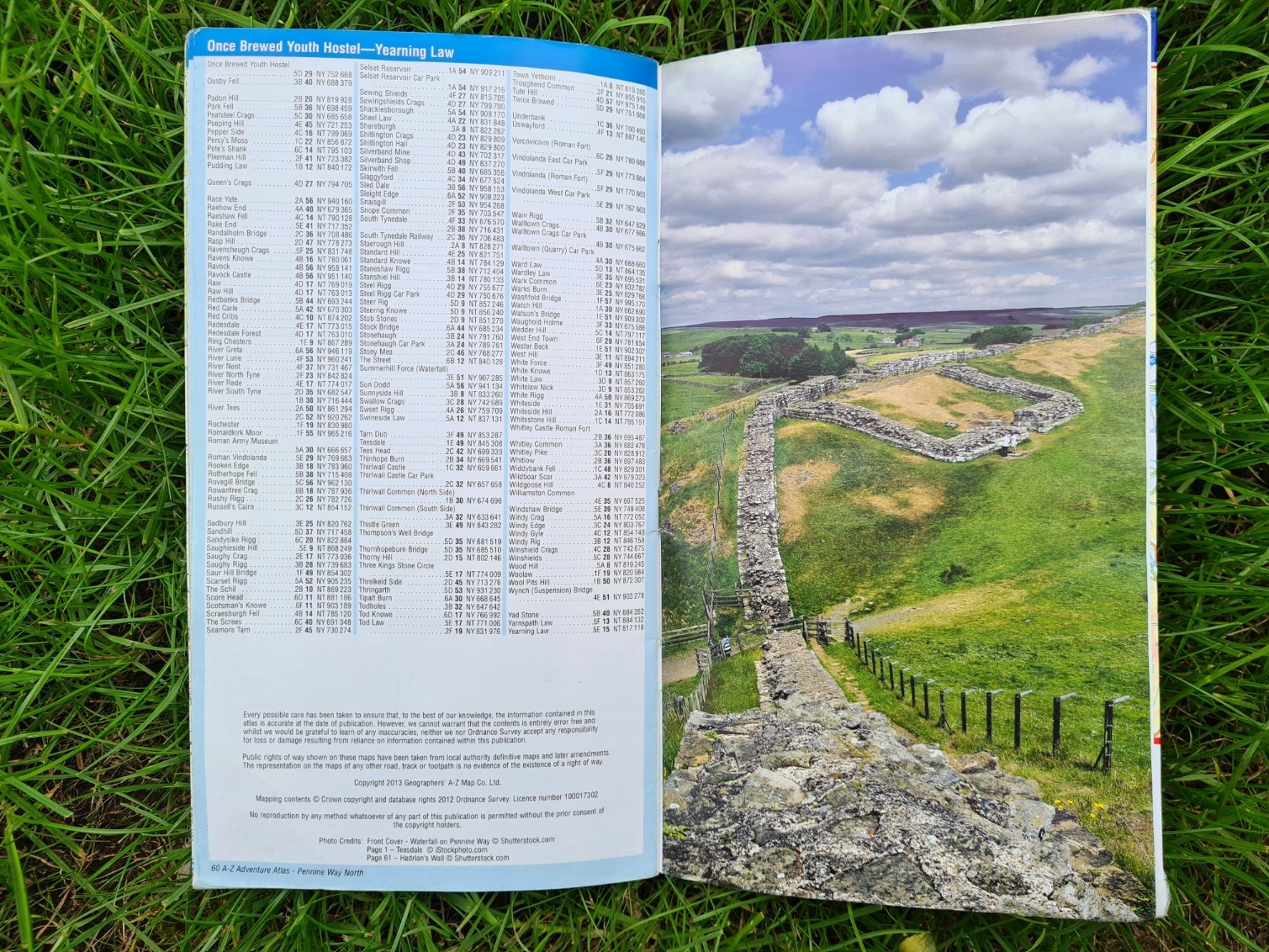
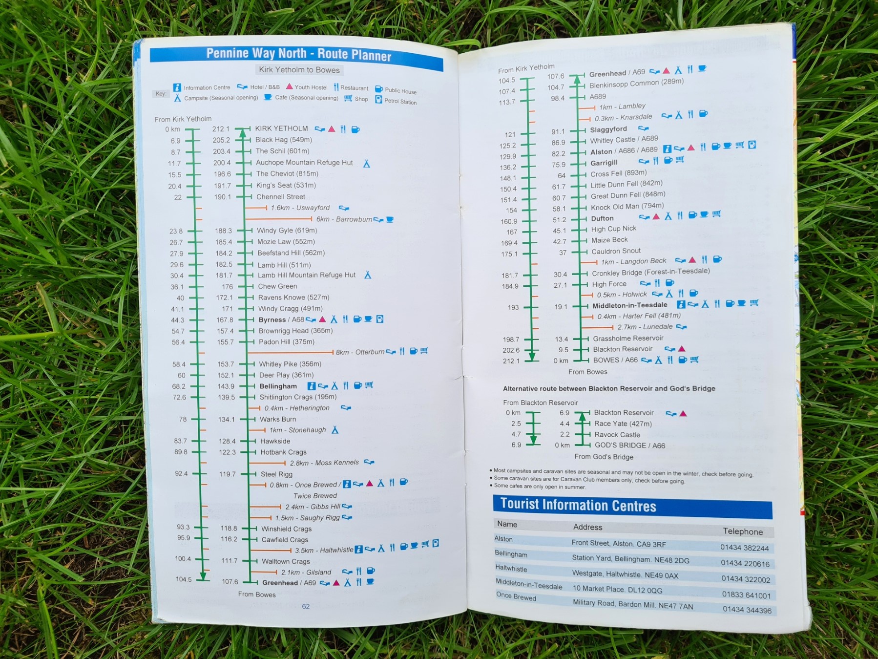
One feature included in each map book, that you won’t find on sheet maps, that can be very helpful at times, is the index in the rear, each with page and grid references to towns, villages, places of interest, car parks, hostels, camping barns etc. An alpha-numeric 1km grid is overlain across each page and this can be used in conjunction with the index to locate these places of interest. The Route Planner in the rear of each book is a helpful resource too. This has distances between locations with a basic idea of what facilities can be found en route. An illustrative route profile beside this would have been a welcome addition, but I suppose you can’t have everything.
I have used A-Z Adventure Maps on a number of trails but have not sought them out for all the National Trails I have walked. As strip maps, there are often similarly designed maps from other brands that are lighter, better or more practical options. For example, I preferred to use the waterproof map from Harvey for the West Highland Way, twice, once in 2012 and again in 2018. It was robust enough to last the vagaries of trail use and still sits on my shelf today. I might equally have used the just as good and also waterproof Footprint map for the trail.
While A-Z Adventure Series maps should have been produced in a waterproof format, they were no doubt aimed at someone who would typically have purchased a paper map sheet, that person would be expecting to put that paper sheet into a map case if conditions were wet. Hence A-Z booklets being the same size as O.S. sheets. But still, an opportunity was missed here, and the simple fact is that they are left behind by similar products due to their lack of robustness whenever the heavens open.
I have included a few notes below on five trails where I have used the A-Z Adventure Series map booklets.
Pennine Way
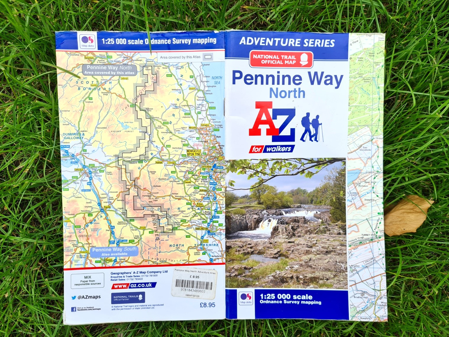
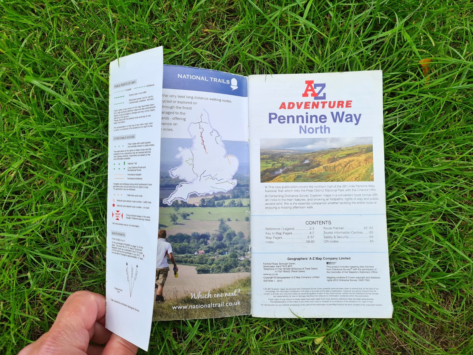
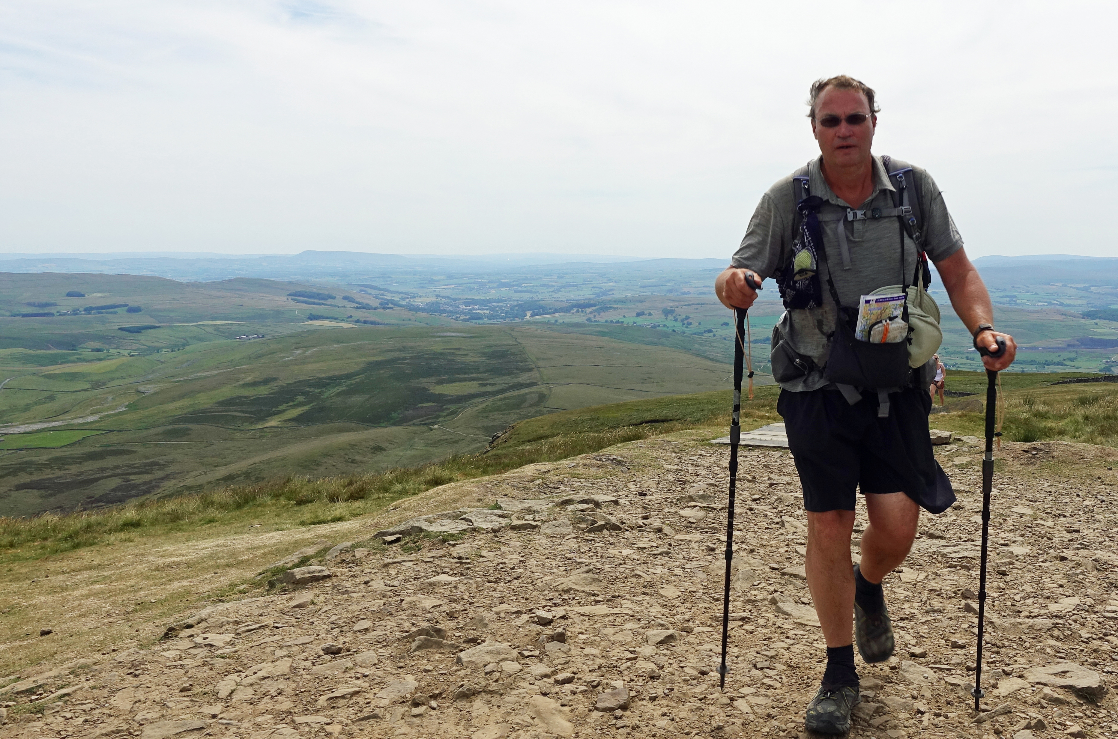
When I hiked the 268 miles of the Pennine Way as part of a longer walk across the UK in 2018, I navigated that fantastic trail with two A-Z Adventure Maps from Collins that each feature 1:25 000 scale Ordnance Survey maps in book form. They were a terrific resource and far lighter than numerous individual map sheets would have been. South weighs 113g, North weighs 118g. Other than their slightly awkward dimensions when stowed in my chest pouch, my main complaint about these was that they are not printed on waterproof paper. You can be sure that along with some of the hottest summer days experienced in recent years (accompanied by moorland fires), there were frequent downpours and despite best efforts to protect them, both map booklets got a bit soggy at times. They survived the trip however and I still have them. The Pennine Way is the sort of trail from which it is often necessary to leave, perhaps for resupply, food, accommodation, safety or to visit somewhere. While not as generous as a sheet map might have been, a good distance each side of the trail is included and was definitely useful on occasion. There are many other maps to this trail but these are of differing practical use. I know, on a couple of occasions I helped fellow hikers who were frustrated by the lack of information on the resource they were using. The maps in the very well written Cicerone guide for example, are 1:100 000 scale and are not much use on the ground. Cicerone do produce a handy little map booklet (the optimum word being ‘little’) that squeezes the entire trail in at 1:25 000 scale. Individual 1:50 000 O.S. sheets would have required ten maps to be carried, though why would anyone would do that when ‘only’ eight of the far more useful 1:25 000 Explorer maps are required. Alternatively, three Harvey strip maps cover the entire trail at 1:40 000 scale.
I found the A-Z Adventure Series maps for the Pennine Way just about perfect. My biggest gripe being the dimension of the map books, not being able to keep them horizontal in my chest pouch, instead having to keep them vertical and poking out.
South Downs Way
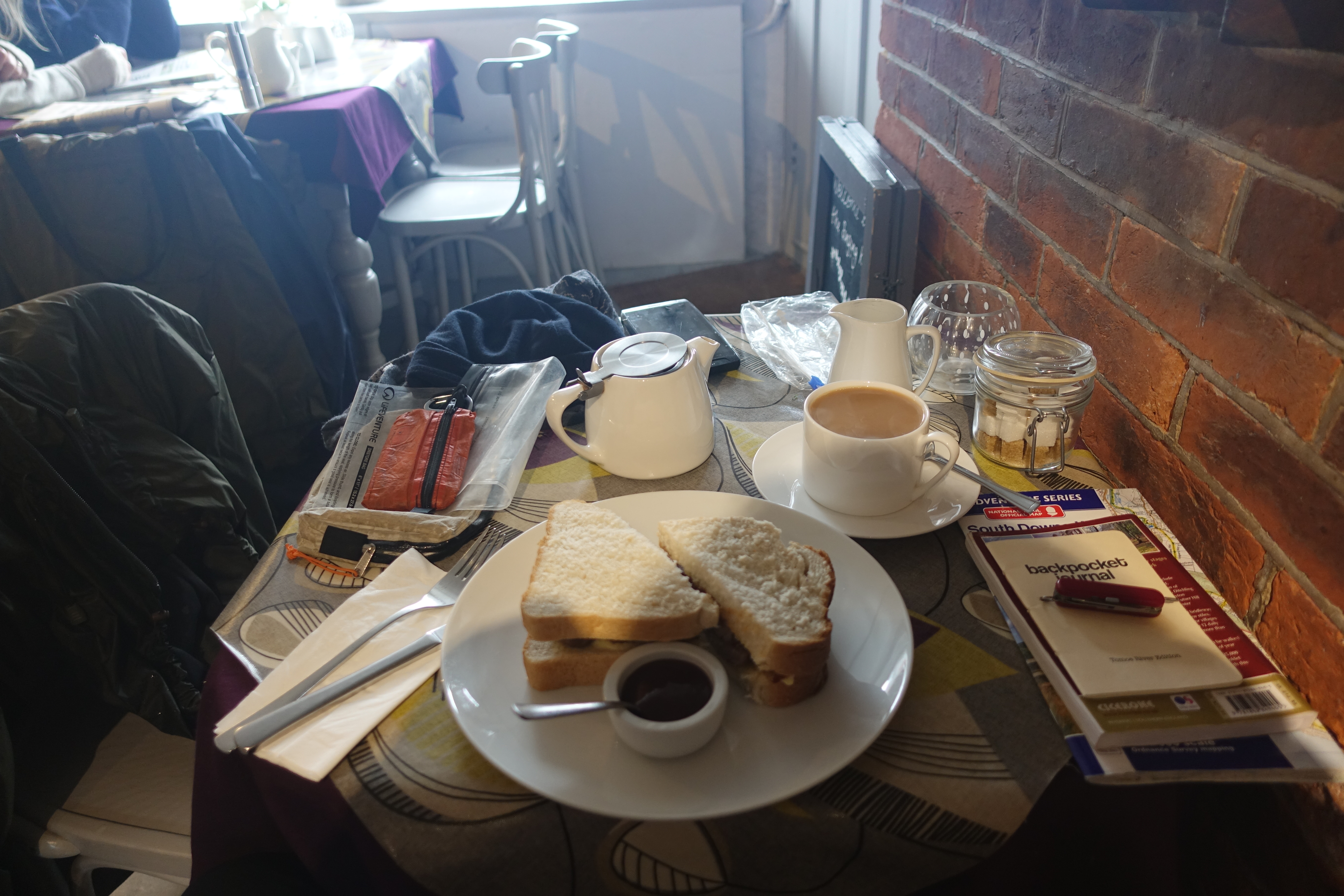
I completed the 100 mile South Downs Way as a winter backpacking trip in 2018. There are a lot of guides and maps for the South Downs Way. Despite being well-waymarked, it makes sense to carry a map and a guide book usually adds enjoyment to the walk. I carried the 195pp 222g Cicerone guide book, but left the 69g Cicerone map booklet at home, preferring to take the 113g A-Z Adventure Series that also contained good 1:25 000 O.S. mapping but with a wider coverage than the Cicerone version. I was frequently battered by heavy rain and occasional snow and was fortunate in not requiring the non waterproof A-Z maps at those times, keeping the book encapsulated in a thin poly bag inside which it is difficult to keep turning the pages as I moved across them.
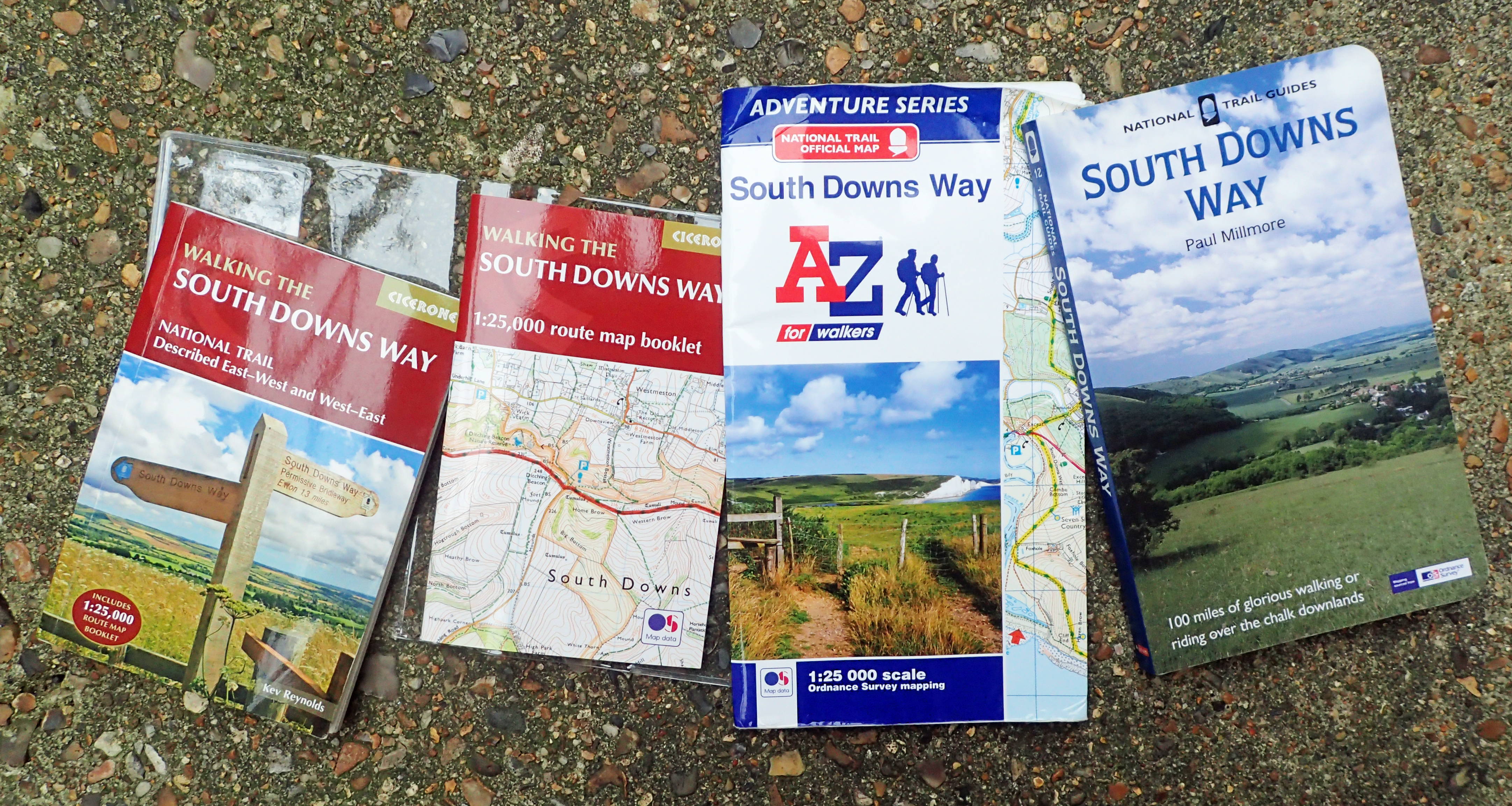
Despite being a quite well-signposted trail, it was surprising how many times I just wanted to make the occasional check of route with the A-Z Adventure Series map. It was almost certainly all that I required, useful on a number of occasions. However the well-written guide book was less useful. I didn’t need the small maps in it and despite having long winter nights to read the content, I had short winter days to visit anywhere interesting, so usually didn’t. I popped into a couple of churches (looking for a cup of tea), visited a couple of windmills, and that was about it. More a guide book to read before setting off.
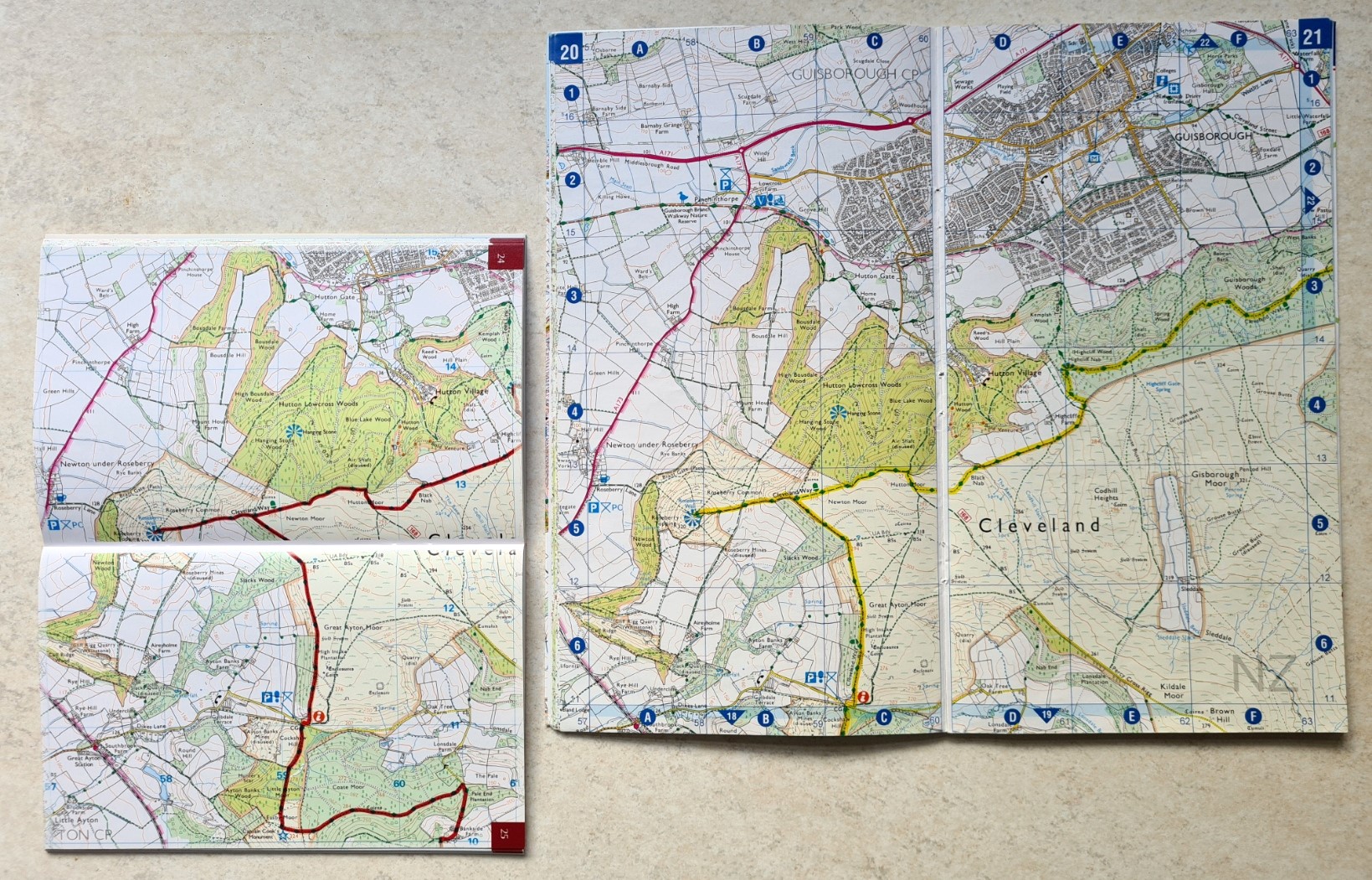
Cleveland Way
I backpacked the 109 mile Cleveland Way in 2019. The weather varied considerably- everything from warm or hot, to very wet! This is a looping trail that goes north up through the North York Moors, to hit the coast which is then followed back down south. If I had used Ordnance Survey 1:50 000 sheets, then six would have been required, if 1:25 000 sheets, six are still required!

The Cicerone trail guide includes 1:25 000 extracts and small O.S. 1:25 000 squares are also available in the Cicerone book. Those in the guide are tiny with sometimes no more than a couple of hundred metres off trail shown. The non-waterproof Cicerone map book is a better option and is probably the handiest size too. It measures 166mm x 106mm x 4mm and only weighs 69g, compared to the larger format, also non-waterproof, A-Z Adventure Series option at 102g.
Yorkshire Wolds Way
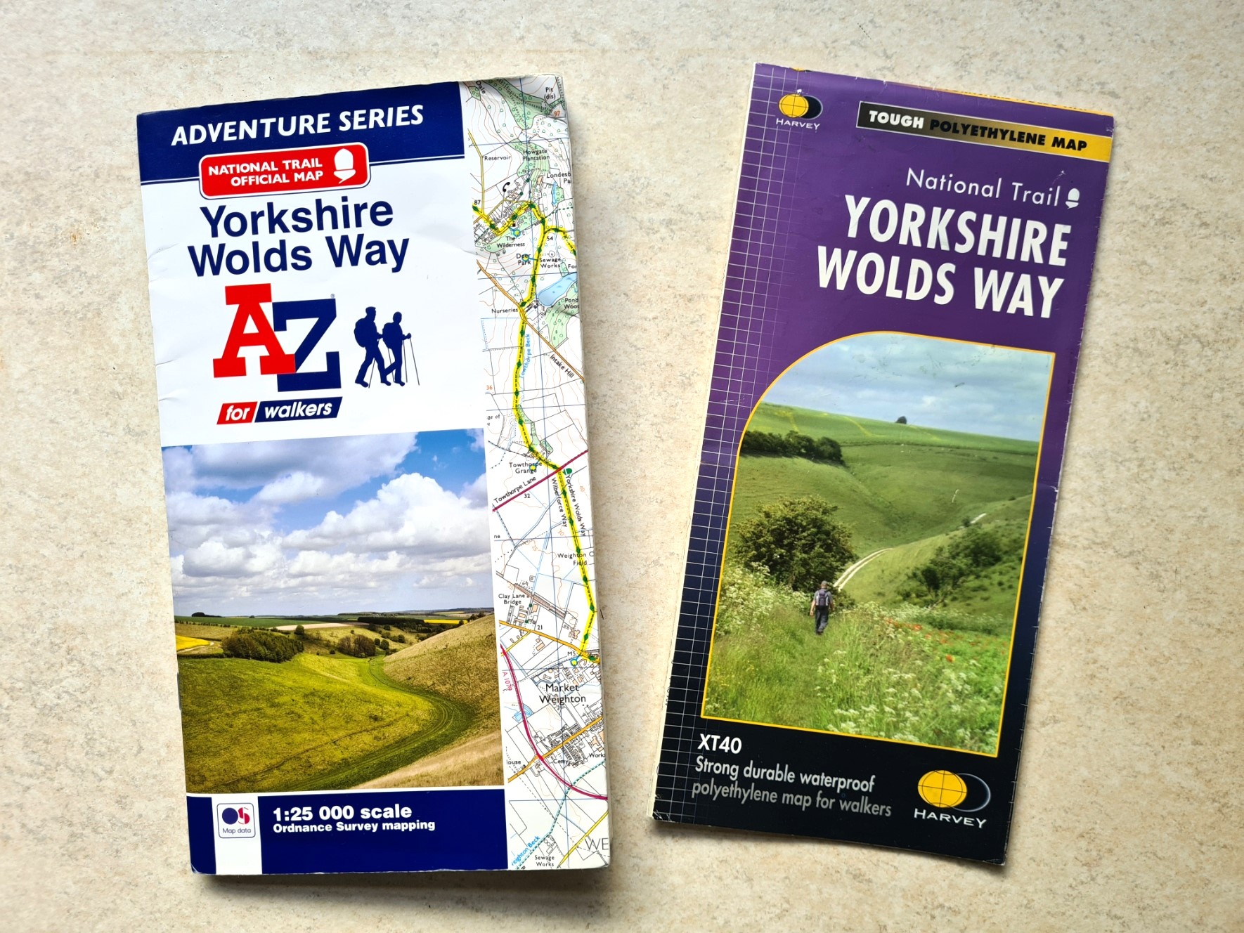
I backpacked the 79 mile Yorkshire Wolds Way in 2021. I really don’t know why I purchased the A-Z Adventure Series map book for this trail as I already had the 1:40 000 Harvey map. I took both, purely to compare the two for this blog. Each is absolutely up to the task of navigating this fairly easy trail. I used the A-Z map most days but on one day especially, it was tipping down with rain. I dug out the waterproof Harvey map and that got soaked over the day, suffering a bit of wear at the creases as a result. It never tore though, dried out fine and would easily do the trail again. In the same conditions, the A-Z guide would have turned to pulp. The Harvey guide is quite slim, a small map indeed and only weighs 29g. The A-Z guide is bulkier and weighs 91g- three times the weight for little in the way of gained practicality and requiring an additional waterproof cover.
Thames Path
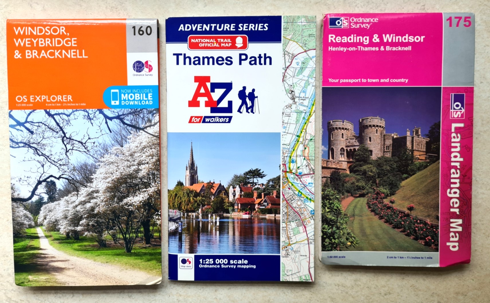
For some trails, the A-Z Adventure Series maps are overkill. Mrs Three Points of the Compass joined me for a summer amble along the western 87.5 miles of the relatively undemanding 185 mile long Thames Path in 2022. We return to complete the remaining eastern half of the trail in 2023. Because I had (exceptionally) the services of a baggage carrier on these summer saunters I took two maps in 2022 to gain a proper appreciation of which worked best on trail. These will be joined by a third in 2023, simply because it has been given to me and I want to see how it compares to the other two. These were the 142g A-Z Adventure Series map for the Thames Path at 1:25 000, and the 54g Harvey National Trails Thames Path map at a new-to-me scale of 1:60 000. My third map is the 56g River Thames and the Thames Path from Heron Maps at 1:55 000 with additional town plans for Lechlade, Oxford, Abingdon, Wallingford, Henley-on-Thames, central Reading, Windsor and Eton, Marlow and Kingston upon Thames at 1:12 500. While this is more aimed at those actually on and using the river, it is equally as useful to those walking alongside the river but any detail on topography is entirely lacking.
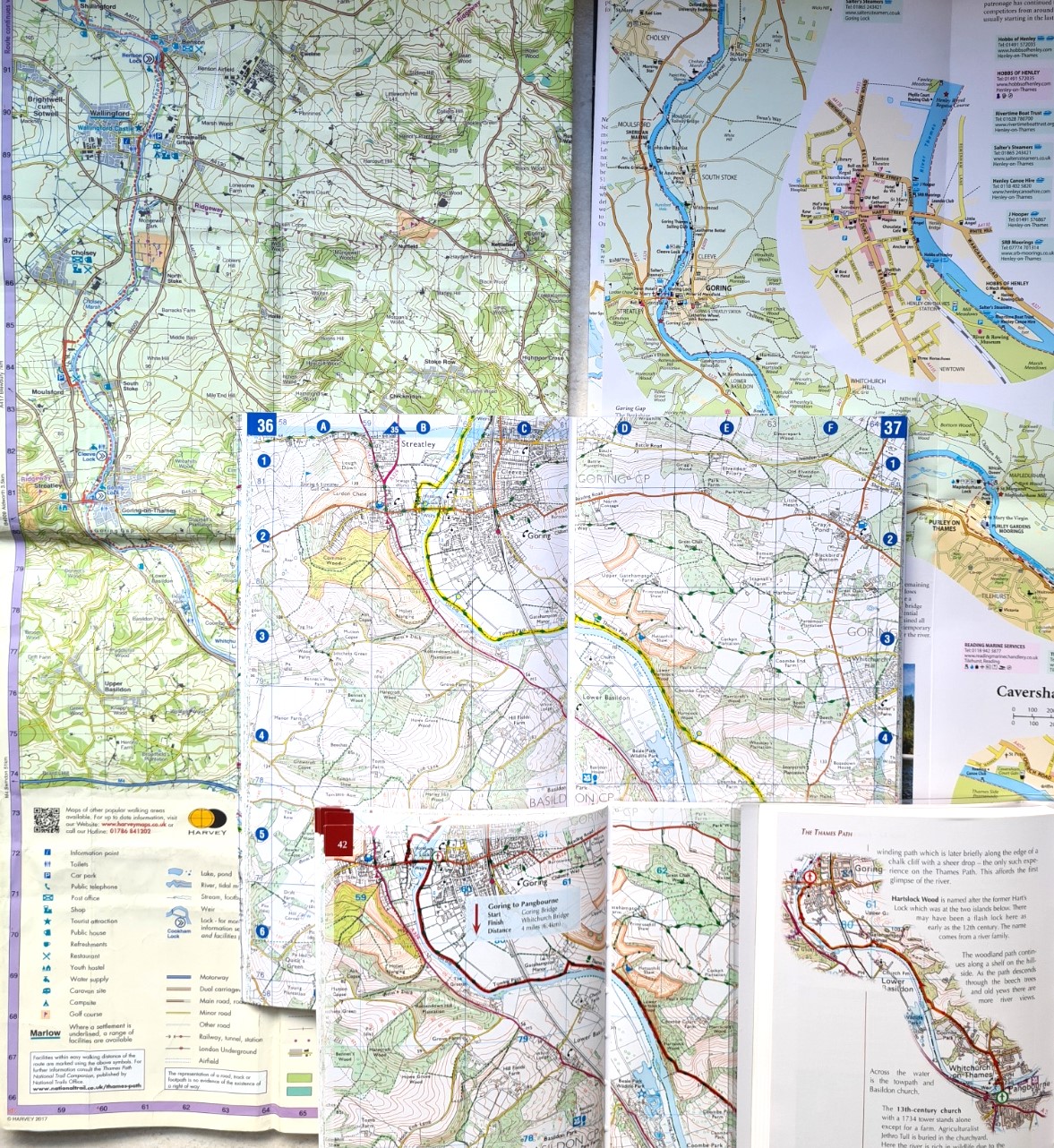
I should add that the two of us had guide books too (don’t judge me) to extract from a suitcase each evening to read about the following day, or what we had neglected to look for during the day. We took the ‘Official National Trail Guide’ from Aurum Press, an imprint of The Quarto Group. This guide comes in two volumes, the 165pp 299g Thames Path in the Country, and 154pp 282g Thames Path in London. Each volume includes O.S. 1:25 000 mapping. Keeping close to the river with little need to wander ‘off map’, despite the guide book containing frequently small maps, each with highlighted trail centred, this guide book is more than sufficient to follow this trail and the format lends itself well to the considerable number of points of interest en route. We didn’t use these guide books on trail, but we could easily have relied solely on this resource.
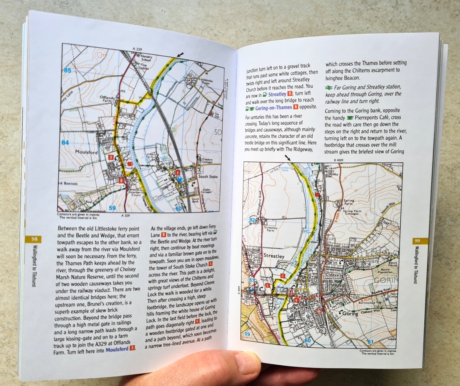
The second guide book was one of the excellent Cicerone volumes. Thicker and heavier than many of their stable, this is their 220pp 251g Walking the Thames Path guide book that includes tiny 1:50 000 O.S. strip maps, frequently with just one or two hundred metres each side of the route shown. This is accompanied by a 92pp 113g dedicated 1:25 000 O.S. map booklet with a far more generous border shown each side of the highlighted route. These can be held together if wished in a 28g waterproof cover. Or, alternatively, just one of the two carried on trail. While the mapping is to the usual high O.S. standard, the contents of the respective guide books may determine which is preferred. The Cicerone guide is certainly more compact, with smaller, tighter text. The Aurum guide is just a little more user-friendly in layout, though both guides are excellently researched, each containing much of interest and use.
The Thames Path is a simple to follow, well sign-posted trail. There is no ascent. Outside of towns it is just about impossible to get lost. All that might be required is a map from which to gain an understanding of progress or what towns or villages are coming up. Perhaps also to see where the next bridge or road crossing might be. A 1:25 000 scale map is simply overkill for much of the Thames Path. Almost all of the Harvey Long Distance Trail maps are 1:40 000 scale and I wondered how I would get on with the 1:60 000 scale that Harvey used for their Thames Path sheet. As it was, I found it perfectly adequate and contained all the information that I required, even if I did move across it painfully slowly. The A-Z map book is not waterproof whereas the Harvey map is. So for that trail, there is a better alternative. This is not to say there is anything wrong with the A-Z option, just that there is a lighter, smaller and more suitable option. The Heron map is simpler, lighter, non-waterproof and far cheaper than any of the alternatives. It is more than sufficient for those wanting to squeeze a paper map into their pack, perhaps as a backup to digital mapping or to gain the ‘bigger picture’. The A-Z Adventure Series map booklets are simply overkill for this trail, nothing wrong with them at all, just not the best choice.
A-Z Adventure Series map sheets:
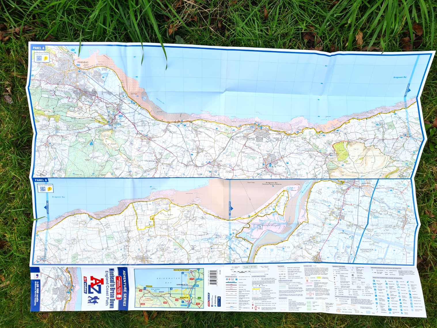
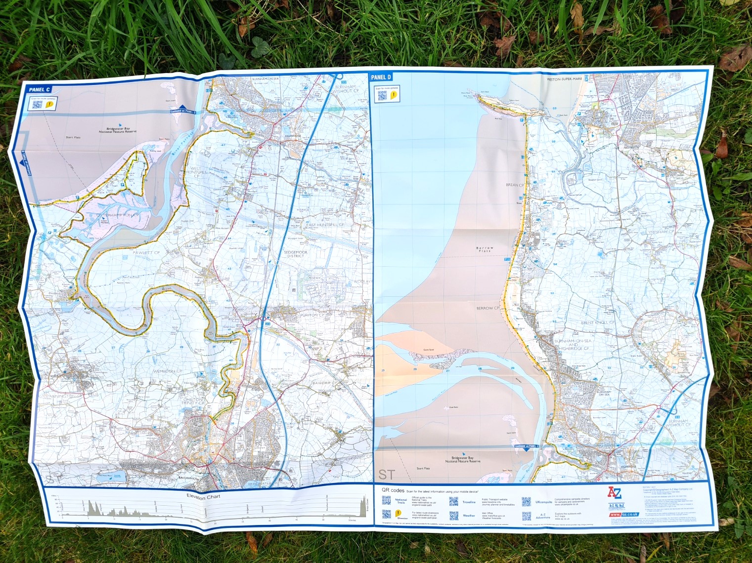
Be aware, not all of the Adventure Series have been produced in the aforementioned useful booklet form. Map sheets have also been produced. Published by the Geographers’ A-Z Map Co. Ltd. in 2017, I show the sheet for the stretch of King Charles III England Coast Path from Minehead to Brean Down that covers just 58 miles. This is at 1: 25 000 scale and again printed on non-waterproof paper. Folded, it measures 100mm x 210mm. Unfolded 590mm x 840mm. This particular sheet weighs 53g.
There is nothing much wrong with this little sheet, but it is a far less practical format than the booklets and simply mean that less sheet maps would have to be purchased if walking this stretch of the coastline.

Final thoughts:
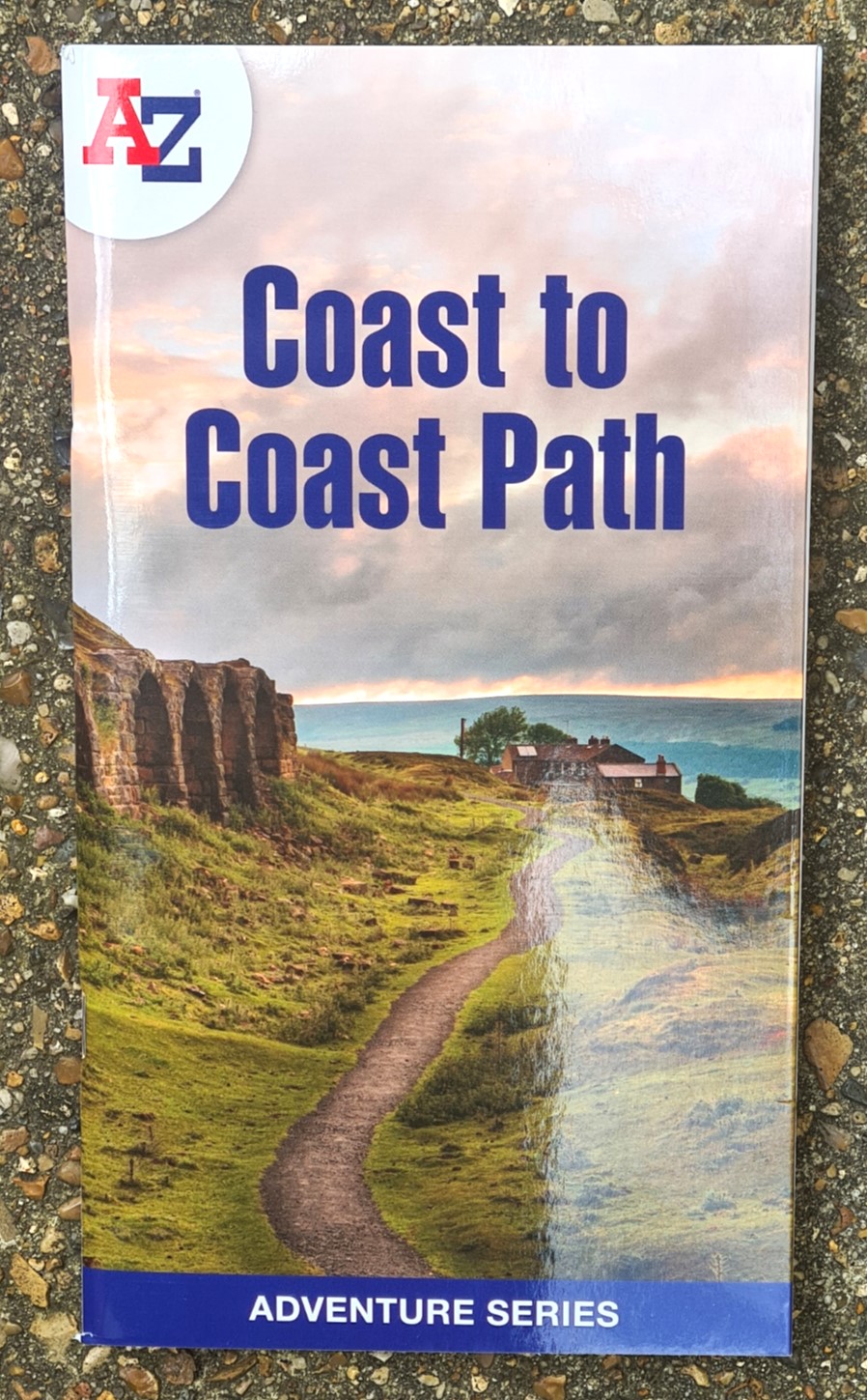
The A-Z Adventure Series for walkers map booklets are no ‘one solution’. For example, I am not convinced as to the usefulness of their Camber to Folkestone map booklet. This covers just 29 miles of the ‘King Charles III England Coast Path’, a trail that will ultimately stretch some 2700 miles. At that rate you would require quite a few of these books. Is the sheet format they produced more suited? I am not convinced.
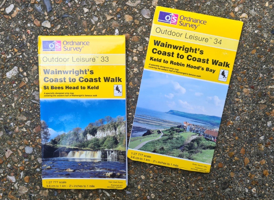
I am completing Wainwright’s Coast to Coast in 2024. There is little chance that I would use standard O.S maps for this. I would require seven 1:50 000 Landranger or nine 1:25 000 Explorer maps, despite most of these already sitting on my book shelf. I will almost certainly take a Harvey map, or the A-Z Adventure Series booklet for the trail. The latter was unavailable for quite some time but 2024 marked not only it’s republication, but the cover design also mirrored a change across the entire series of A-Z Map booklets.
This particular trail does throw up the thought of lost opportunity. First published in February 1994, the Ordnance Survey, in partnership with Michael Joseph, prepared special two-sided sheets that covered the entire Coast to Coast trail. Not only were (are) they particularly beautiful to look at, but they were also very well designed, incorporating wide strip maps at a scale of 1:27 777 (3.6cm to 1km or 2 1/4″ to 1 mile), geological detail, and vignettes from the great man himself alongside some extra detail on places passed. They were republished (I have the 1999 editions) but it was a loss when these slipped out of production and despite other strip maps being available, the very particular design of these two maps is not replicated elsewhere to the same degree. It would have been good to see A-Z reintroducing this unique format.
That about sums up what my thoughts are. The A-Z Adventure Series National Trails For Walkers map booklets are all excellent products. Carefully designed with useful indexing. They are of strip-map design, being slightly more generous with how much is shown each side of the trail than some alternatives. The 1:25 000 scale maps are universally good, with more than enough detail. Easily their biggest let down is that they are not printed on waterproof paper. Because of that, they have to be kept in a waterproof ziplock or map case in our typically wet UK weather conditions. The book format also means we do not have to struggle with turning a page in our frequently draughty UK either. When encapsulated, their generous scale means you move across the map quite quickly and pages need turning frequently, which can be awkward when inside a waterproof case. If it is raining, sliding a hand into a map case, is sliding a wet hand into a map case. With the advances in paper technology that have been made (i.e. Yupo), non-waterproof maps are simply often not the right medium for frequently inclement UK weather, especially when they are expected to be called into service across multiple consecutive days. The waterproof strip maps from the like of Harvey and Footprint are almost always more robust, even if they lack the card covers. That said, Three Points of the Compass will continue using the A-Z Adventure Series map booklets where they appear to be the best option. Particularly as their individual cost compares favourably to that of a single O.S. map sheet.
Other map related blogs that may be of interest:
- Harvey maps– a growing relationship with these excellent maps, particularly on longer trails
- Ordnance Survey maps: Three Points of the Compass has had a long relationship with the finest maps ever produced. A retrospective glance.

Good article Jools. I got ordnance survey, but on my phone only. Sometimes inconvenient to use.
LikeLike
Thanks Modestas, I must agree, I find a phone screen so small for using maps with
LikeLike