
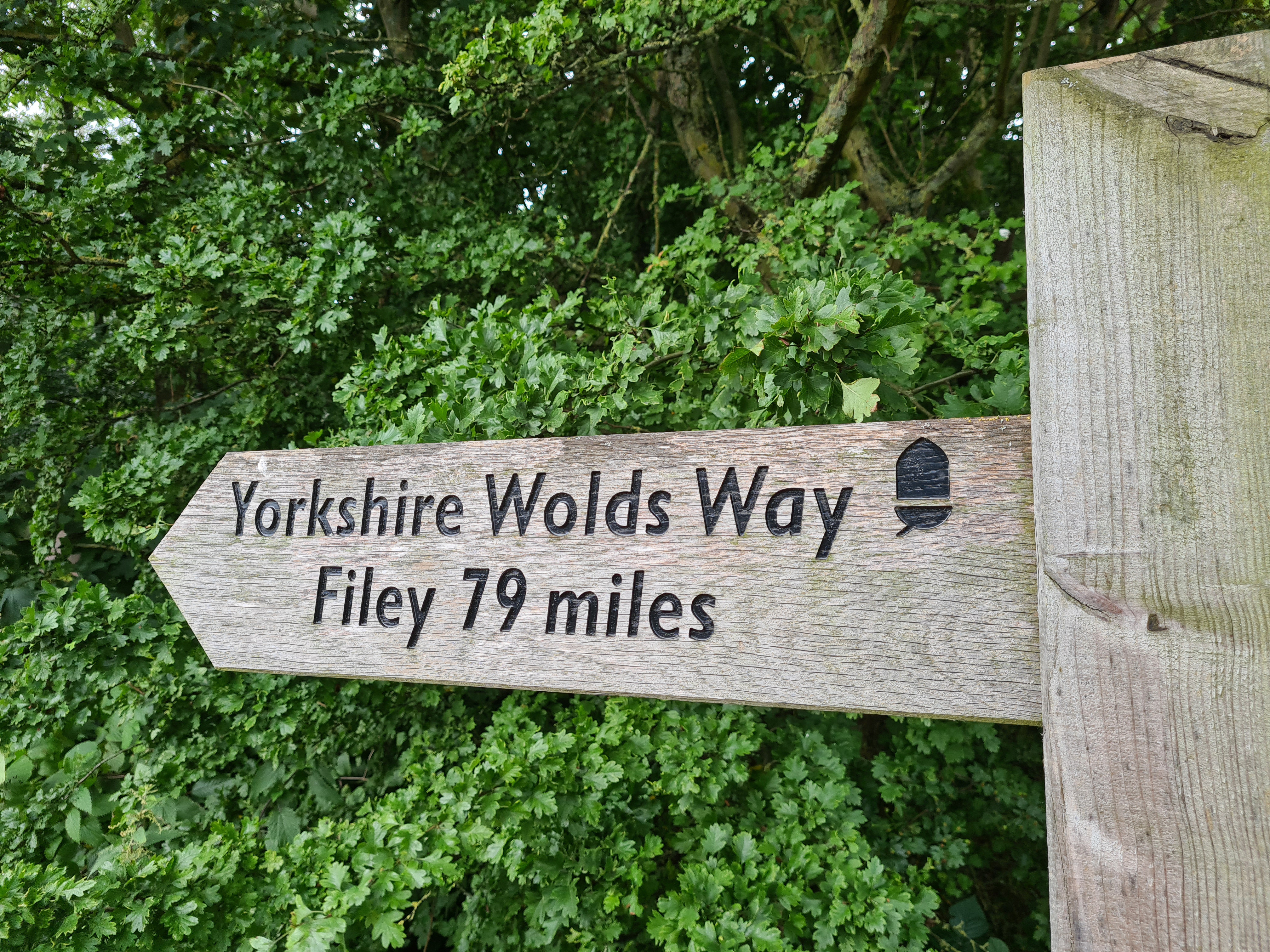
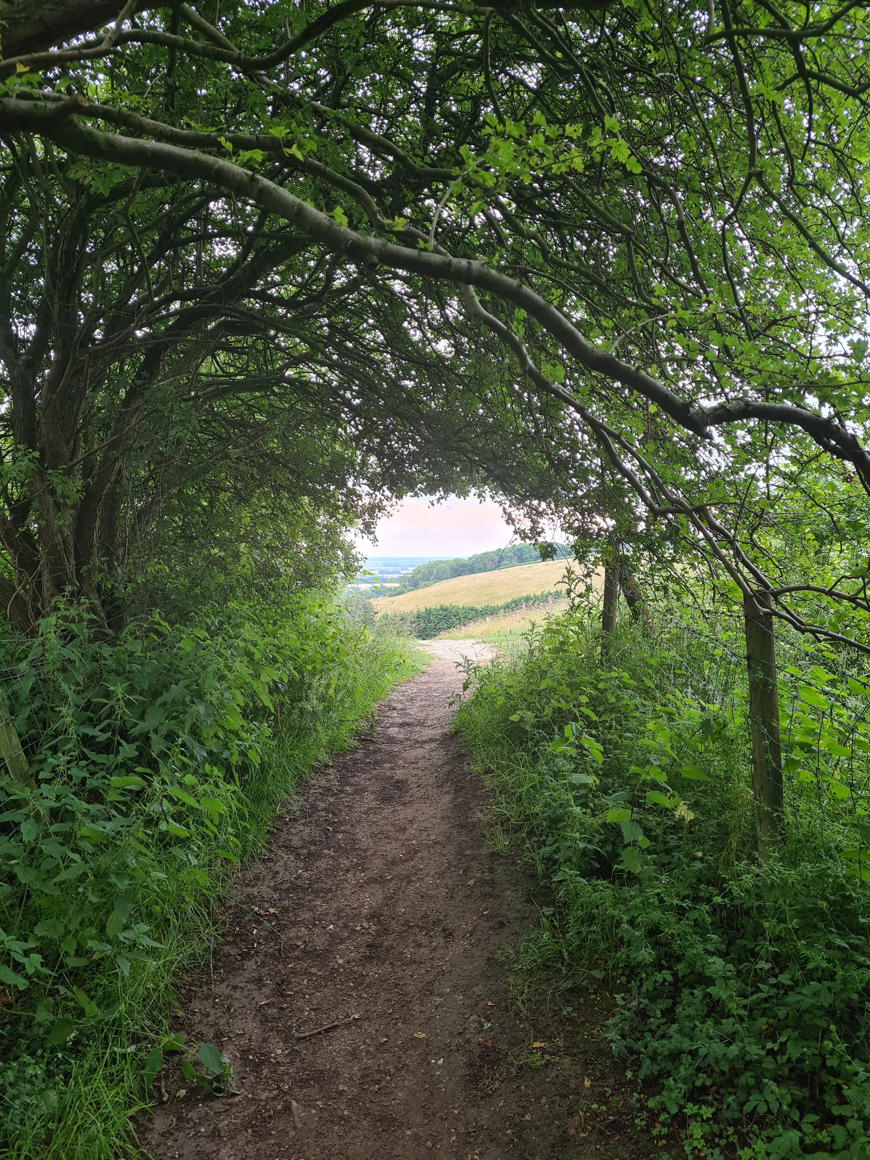
The Yorkshire Wolds Way ambles 79 miles across rolling chalk hills between Hessle and Filey. Open skies and grassy dry valleys on a little used National Trail make for tranquil walking over a handful of days. It was time for Three Points of the Compass to venture out on a short backpacking trip.
Three Points of the Compass completed the Cleveland Way in 2019. Instead of finishing that walk at the windswept Filey Brigg, I turned inland and followed the Tabular Hills Walk back to Helmsley. I wondered at the time if I had made the right choice and should have continued on to the Yorkshire Wolds Way instead. I thought I would return to do so in a couple of months, instead, a worldwide pandemic reared it’s ugly head and things got delayed. Finally, in the summer of 2021, a few days were found to hop on a train and set off for a brief backpacking trip, on this, the shortest of the National Trails to be found in England and Wales.

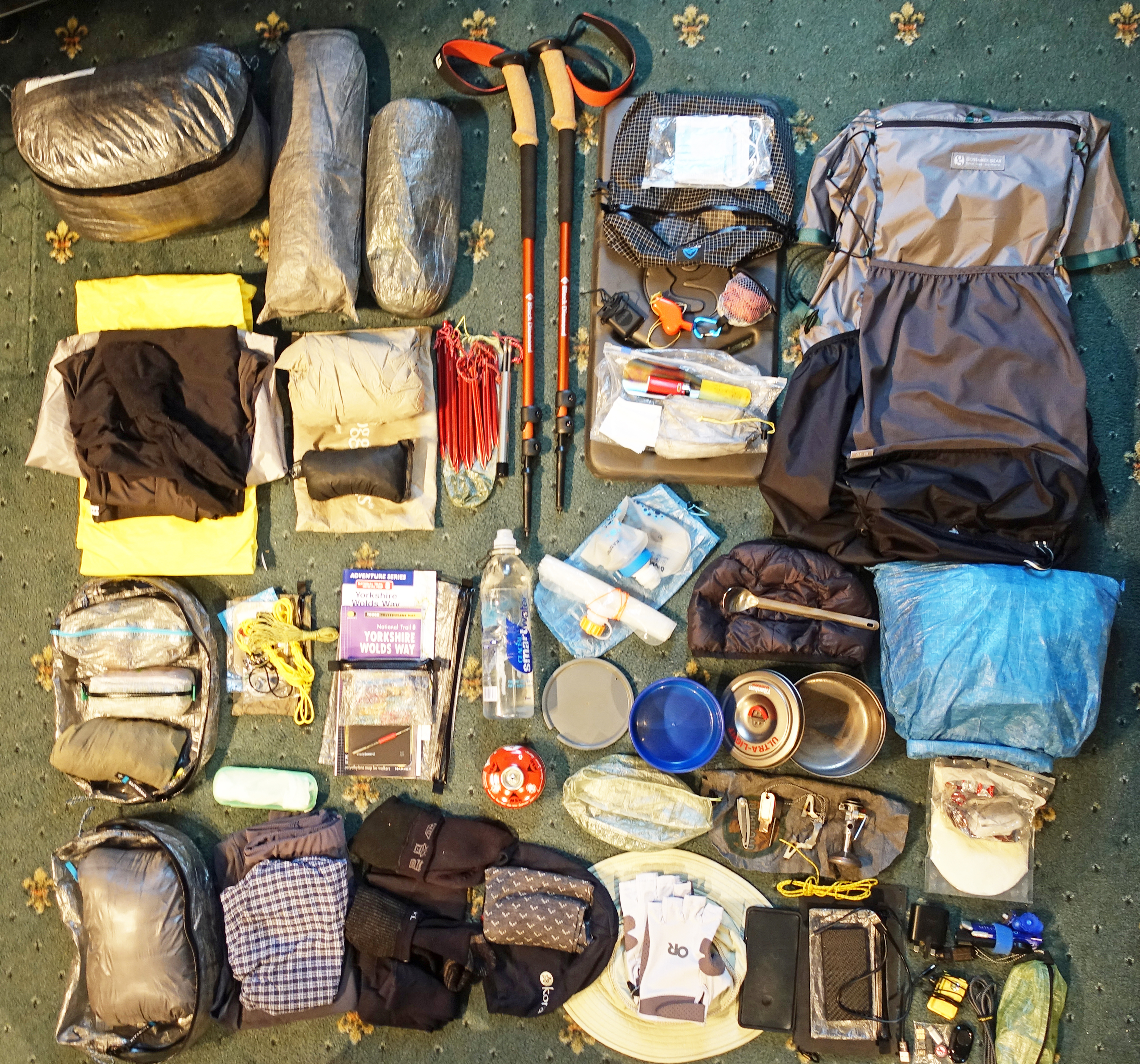
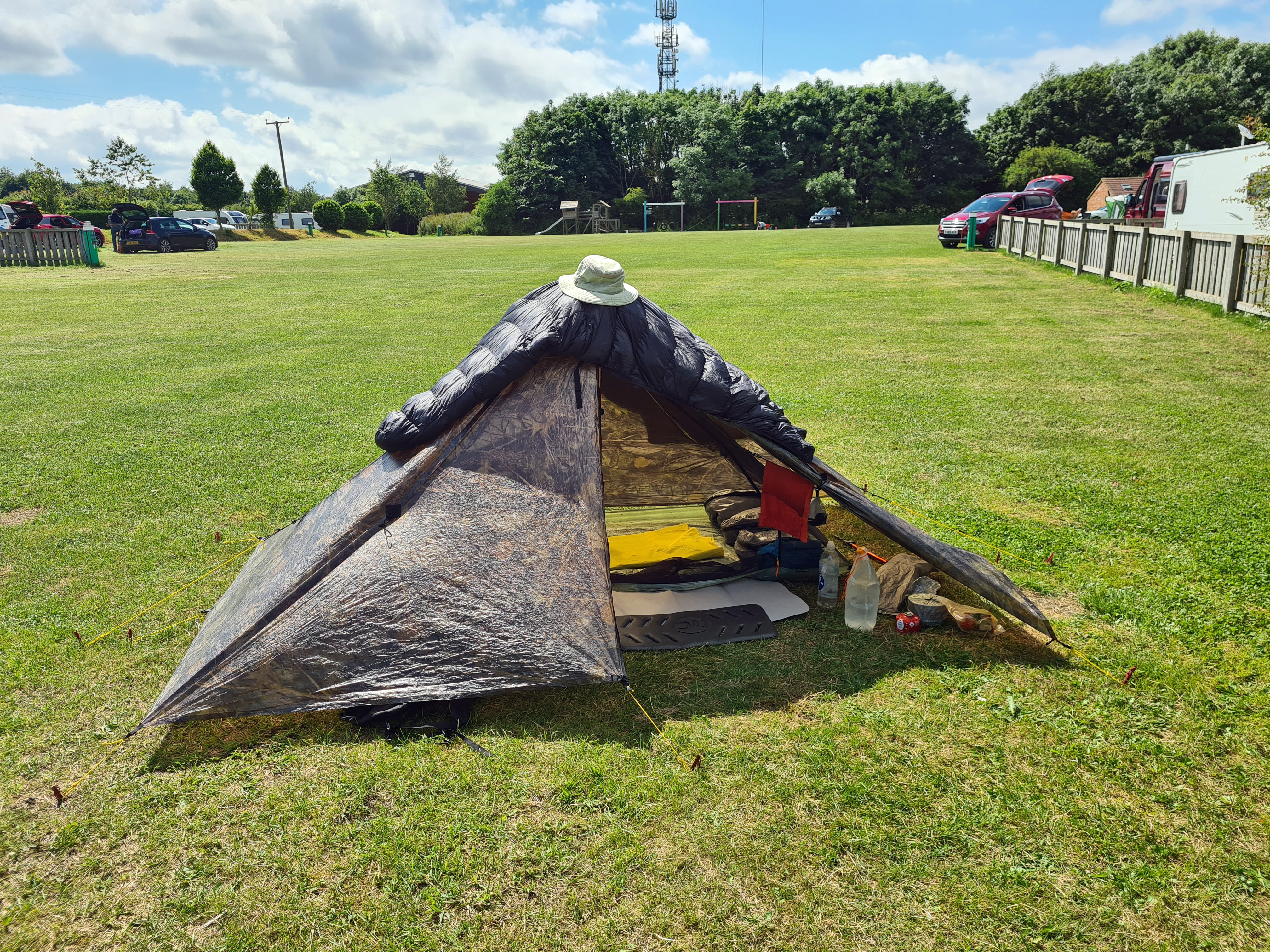
In 2021 I was unsure on what facilities I would find in a country struggling to reopen it’s economy following loss of trade, jobs and visitors. I was also aware that some areas of the UK were wary of incoming visitors, potentially bringing infection with them. I decided to make this a backpacking trip and also carry four full days of food with me in case opportunity to restock was denied. There is a separate blog looking at the contents of my food bag, but standard backpacking gear was taken. There is Lighterpack list on this. My base weight was 6.8kg.
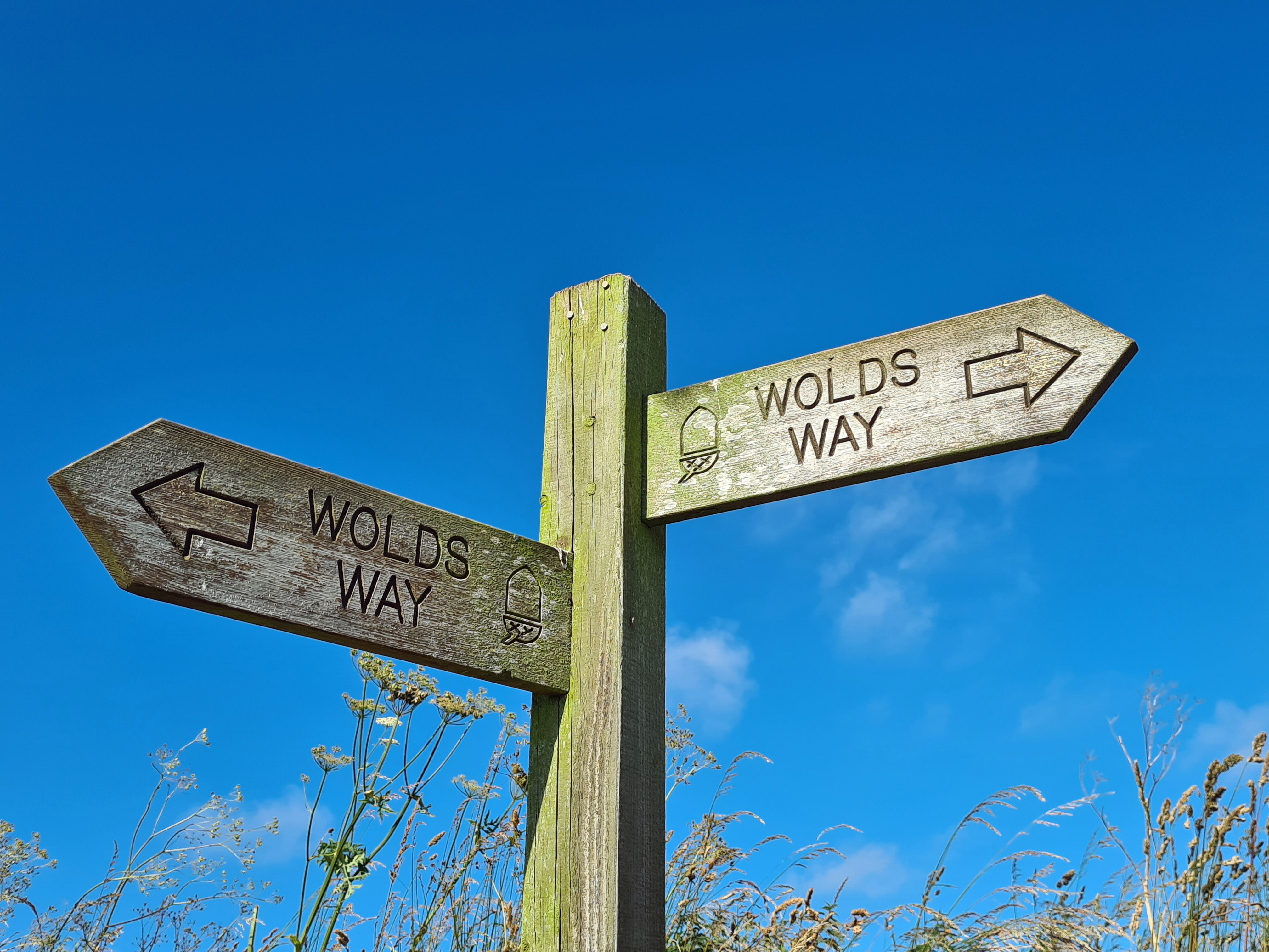
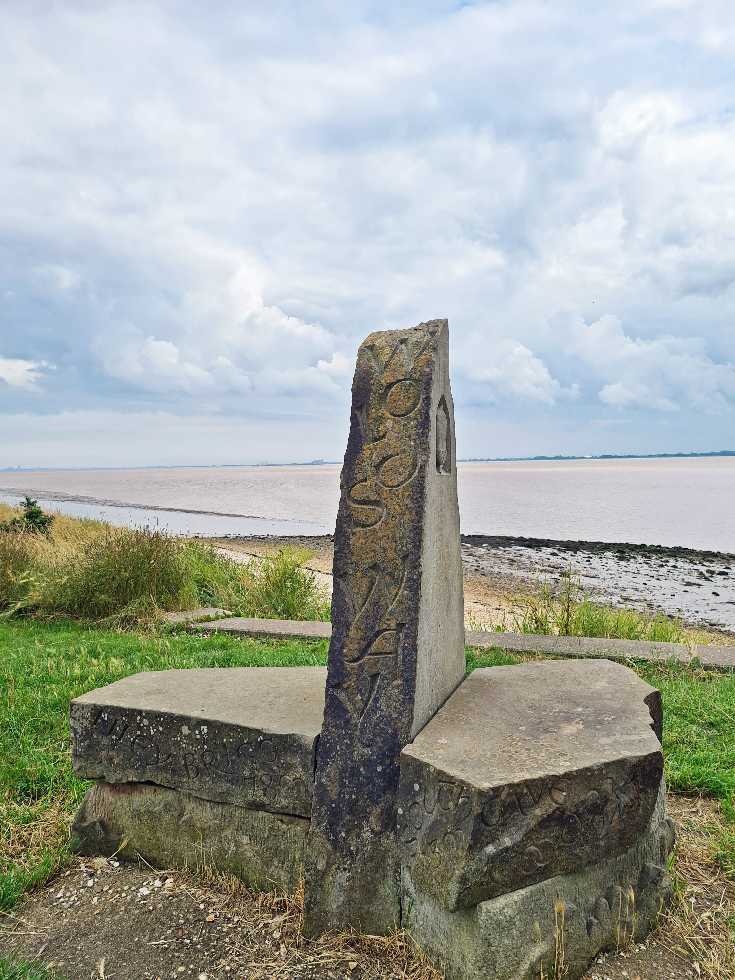
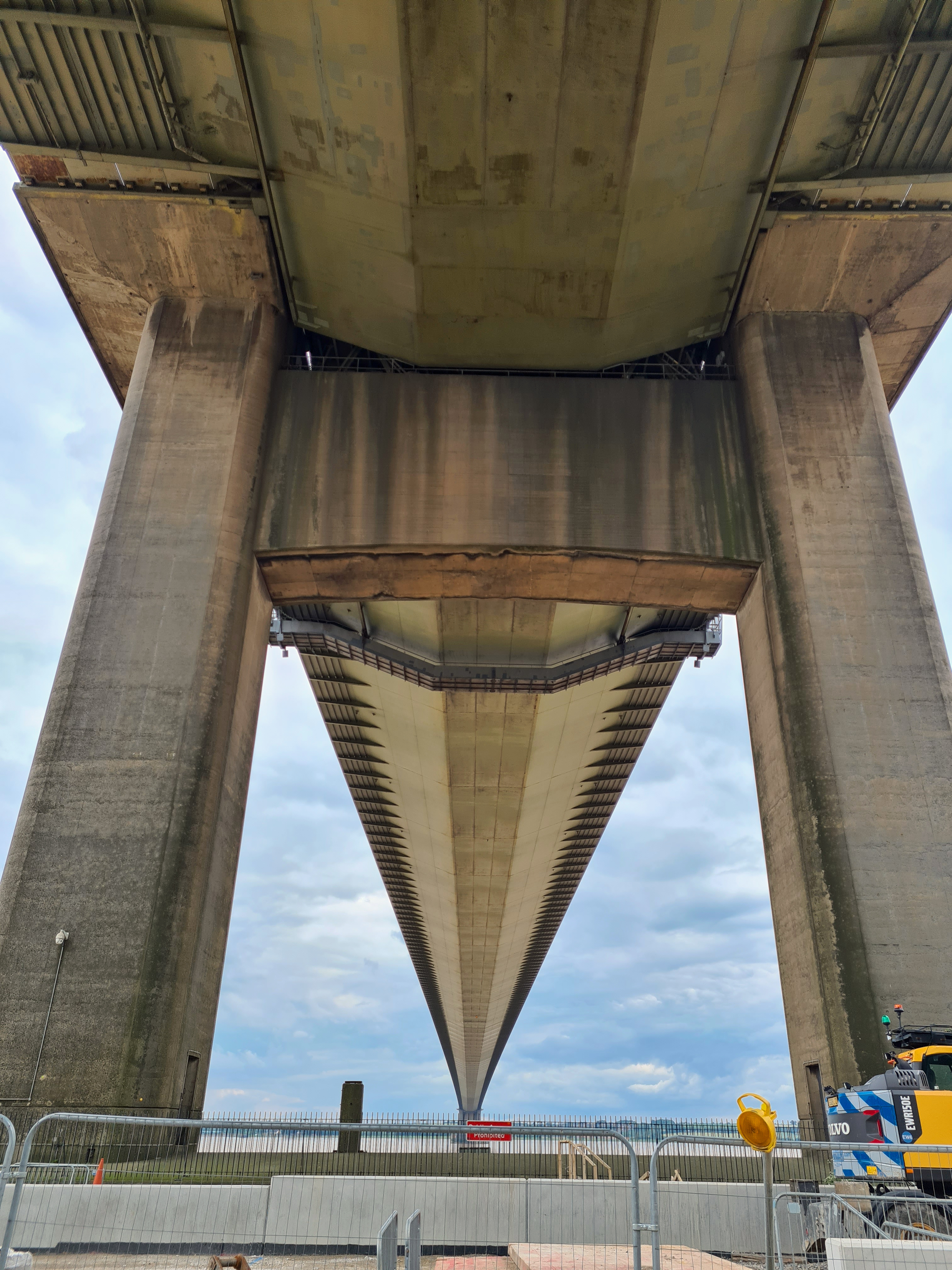
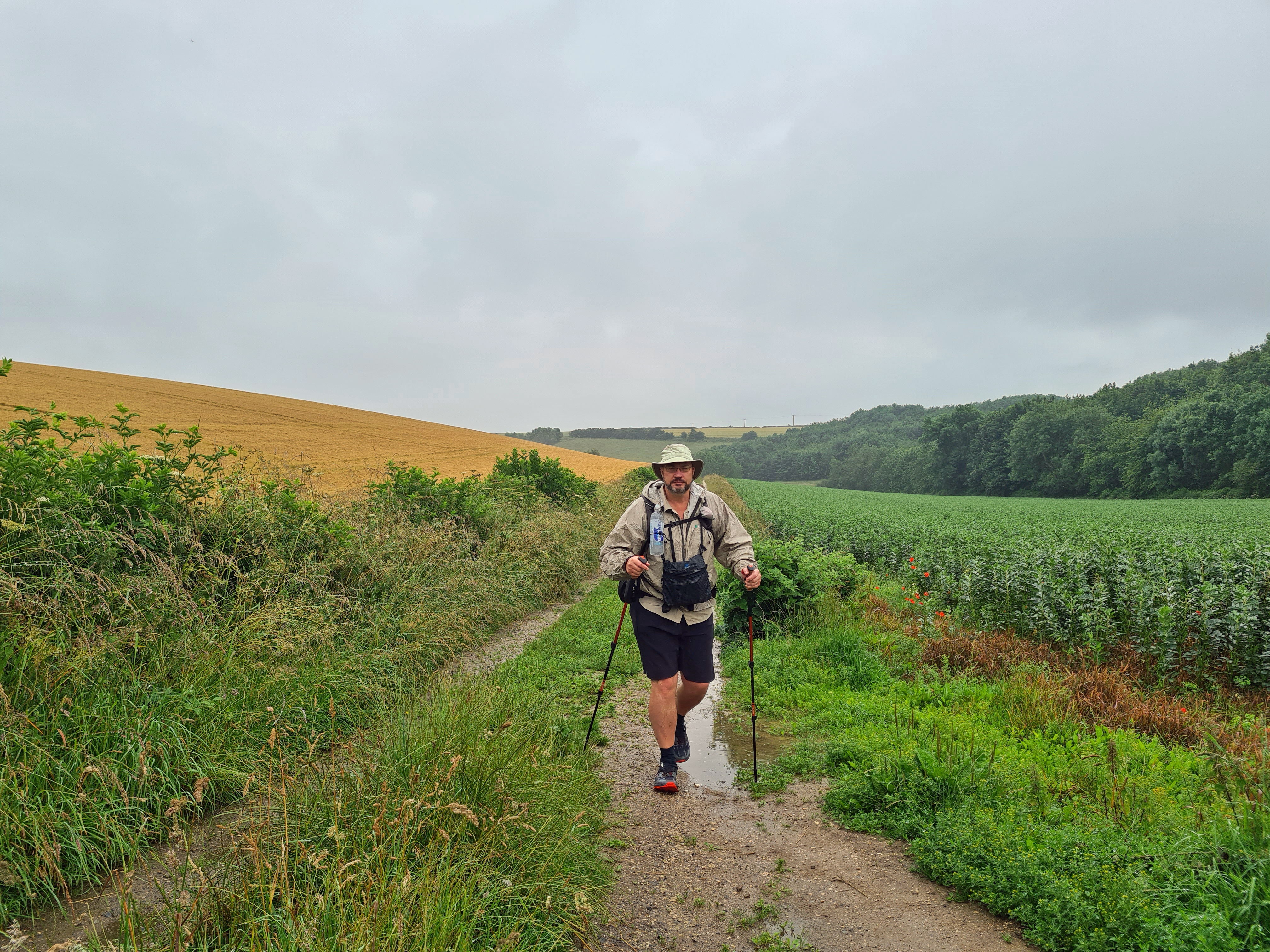
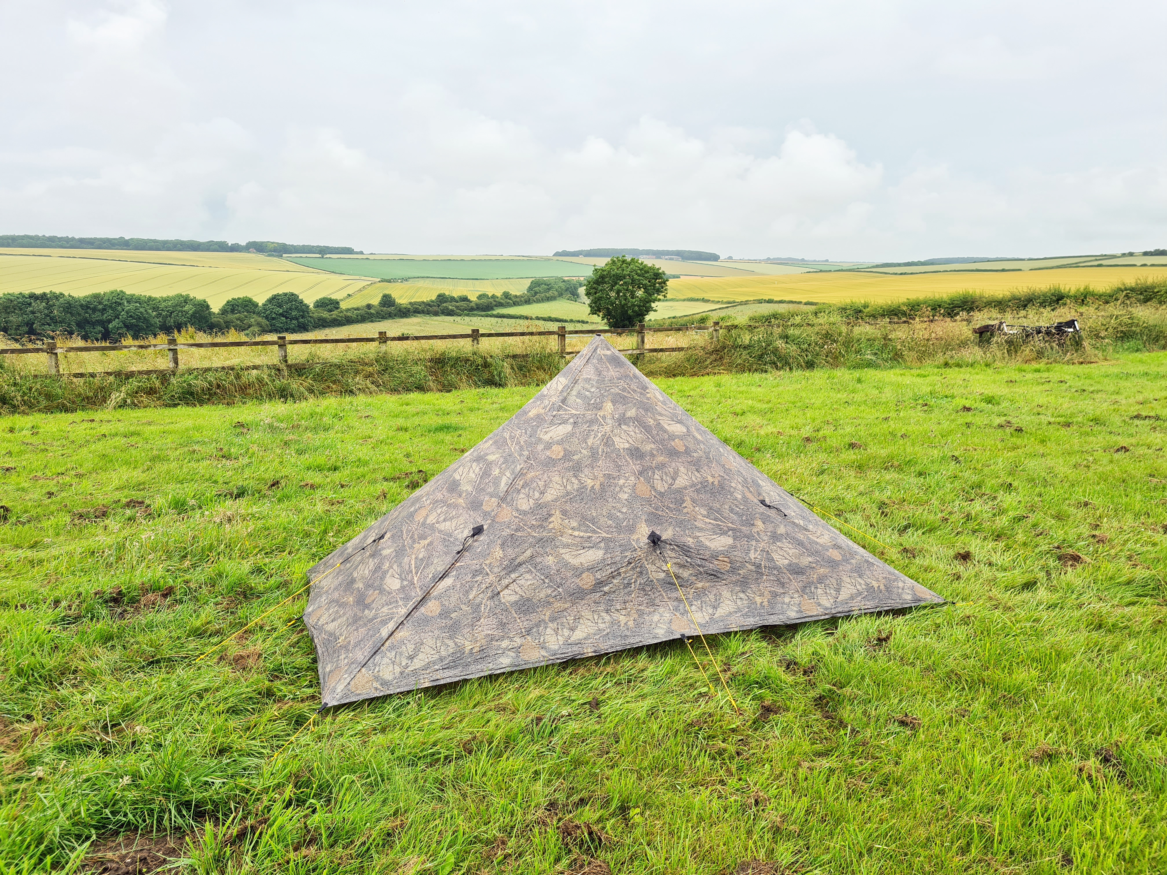
I took my MLD Duomid with me as I anticipated that the camo, sorry foliage, pattern DCF would permit more stealthy wild camping. There is a dearth of official camp sites for much of the trail. Despite my intention of completing the walk over four days, my train deposited me in Hessle early afternoon so I decided I may as well knock off a few miles immediately. Moving along the coast and striking inland, I intended to get clear of habitation for a first nights wild camp thereby shortening my ‘first’ day considerably. The first few miles follows the bank of the River Humber, passing under the mighty Humber Bridge. Many people start (or finish) their walk here, where there is a rather nice Wolds Way sculpture. However I started further back, at Hessle Haven where the first wooden finger post is to be found. There isn’t anything else to actually indicate that this is where the trail commences. Just a neighbouring rubbish bin.
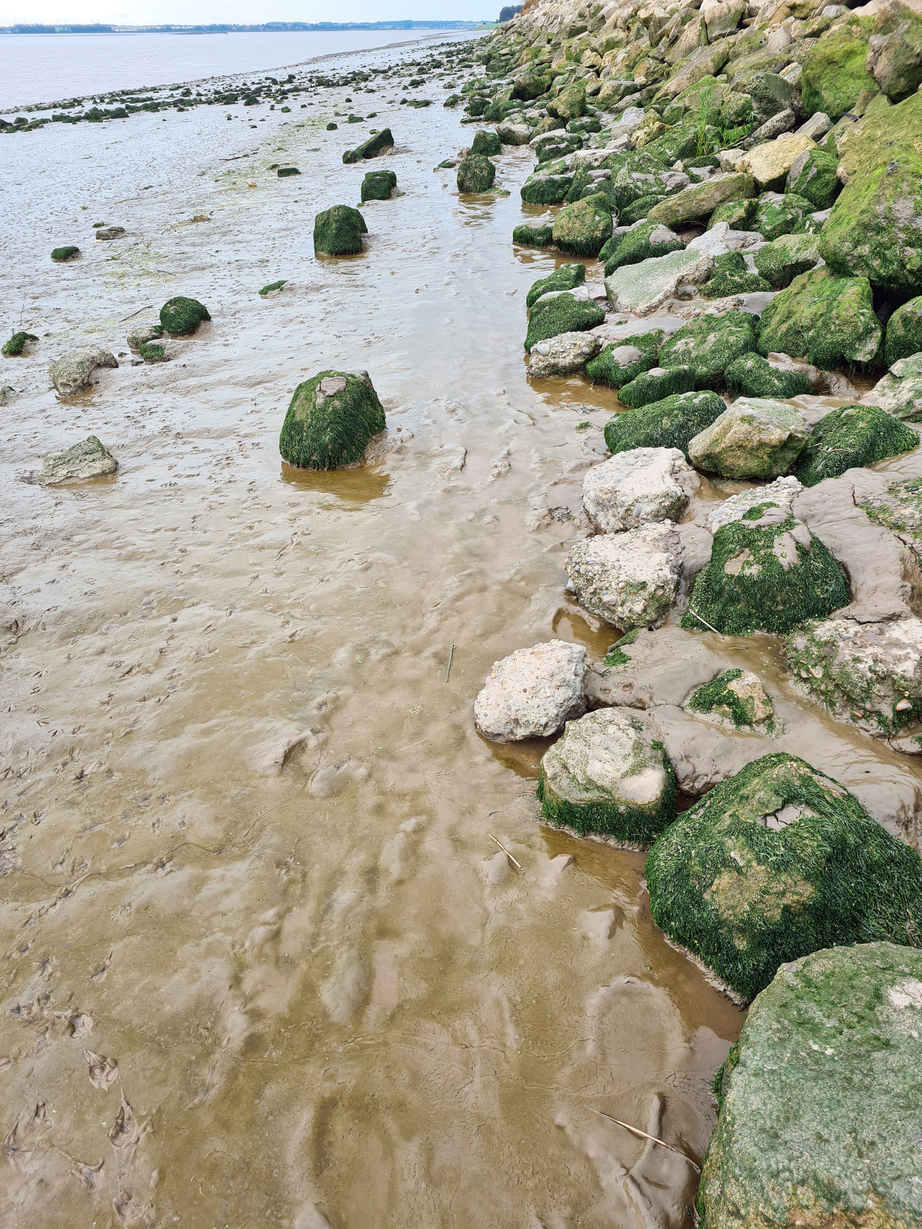
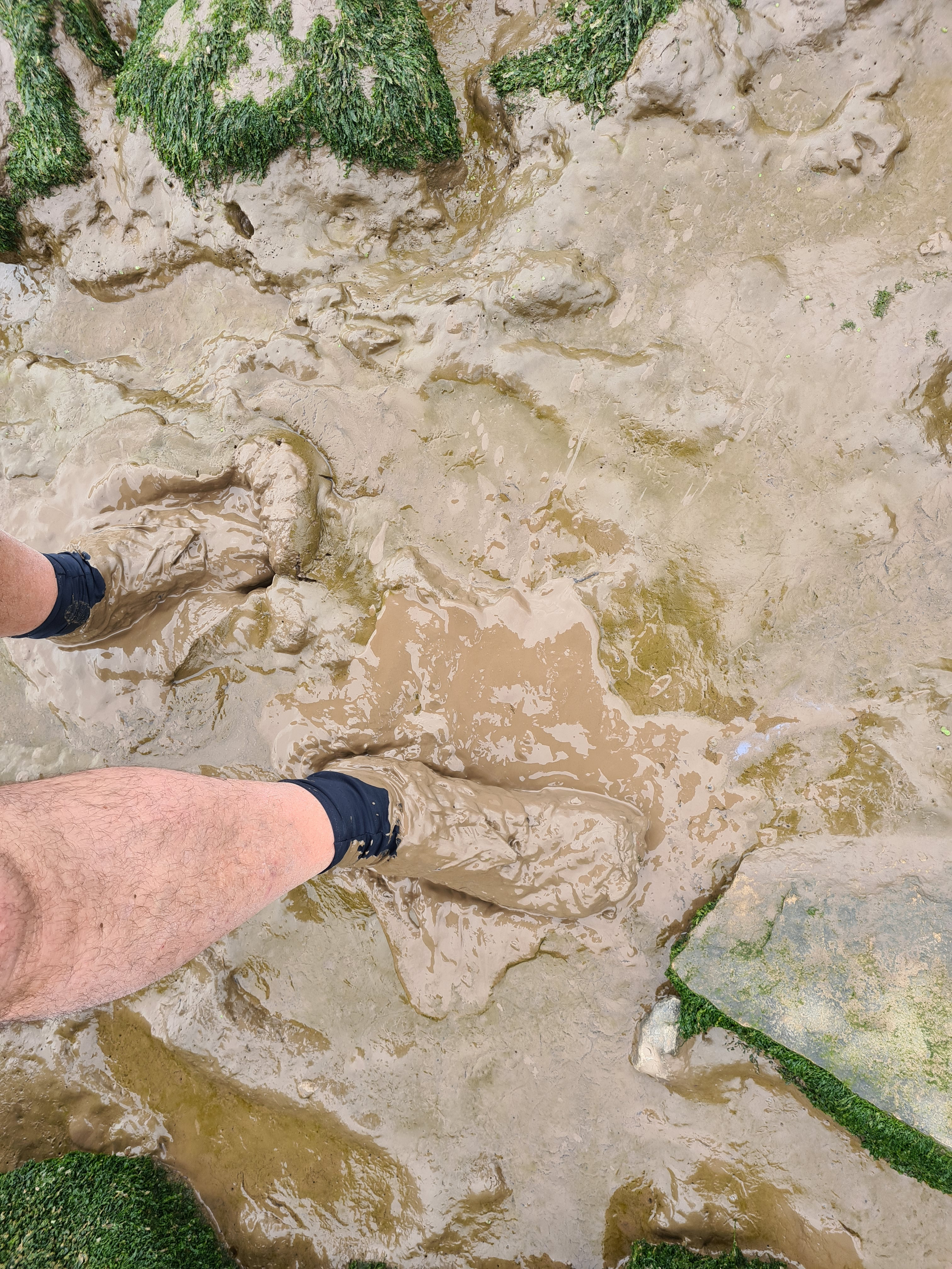

There is a choice of route while moving along the Humber estuary, if the tide is in you can walk through North Ferriby. The tide was out so I took the foreshore route. A foolish decision as I got plastered with pale brown mud which I carried with me for the remainder of the afternoon. Walking through wet woodlands for the first couple of miles, the mud was black and I turned partly two-tone.
As I got to the end of the coastal section I reached a family, the father with metal detector, seaching the layers of mud for historical treasure. Young daughter was excitedly running to her mother shrieking “we found a coin, we found a coin”. I asked her father what they had found and he sheepishly confessed that it had been a 2006 penny.
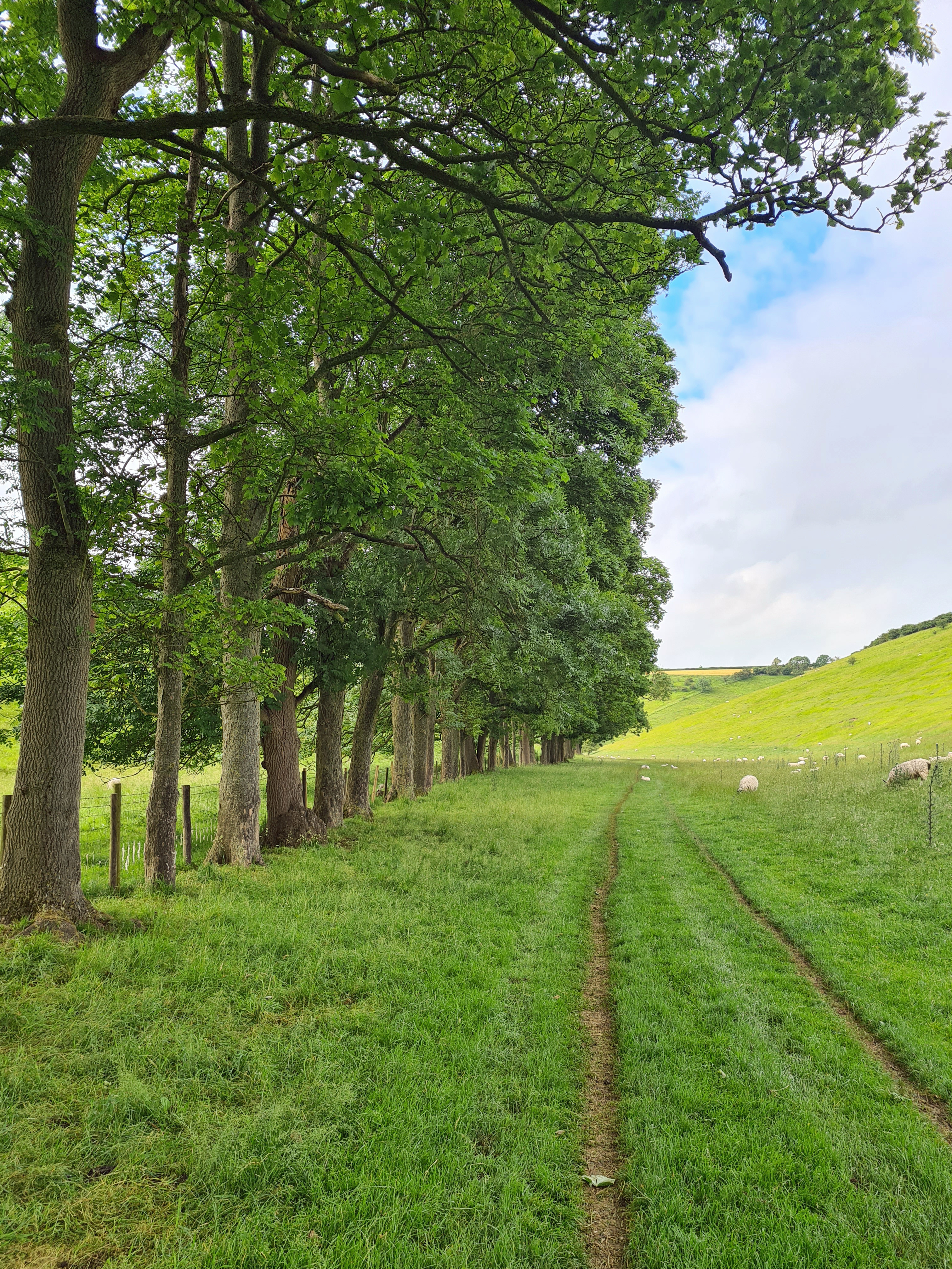
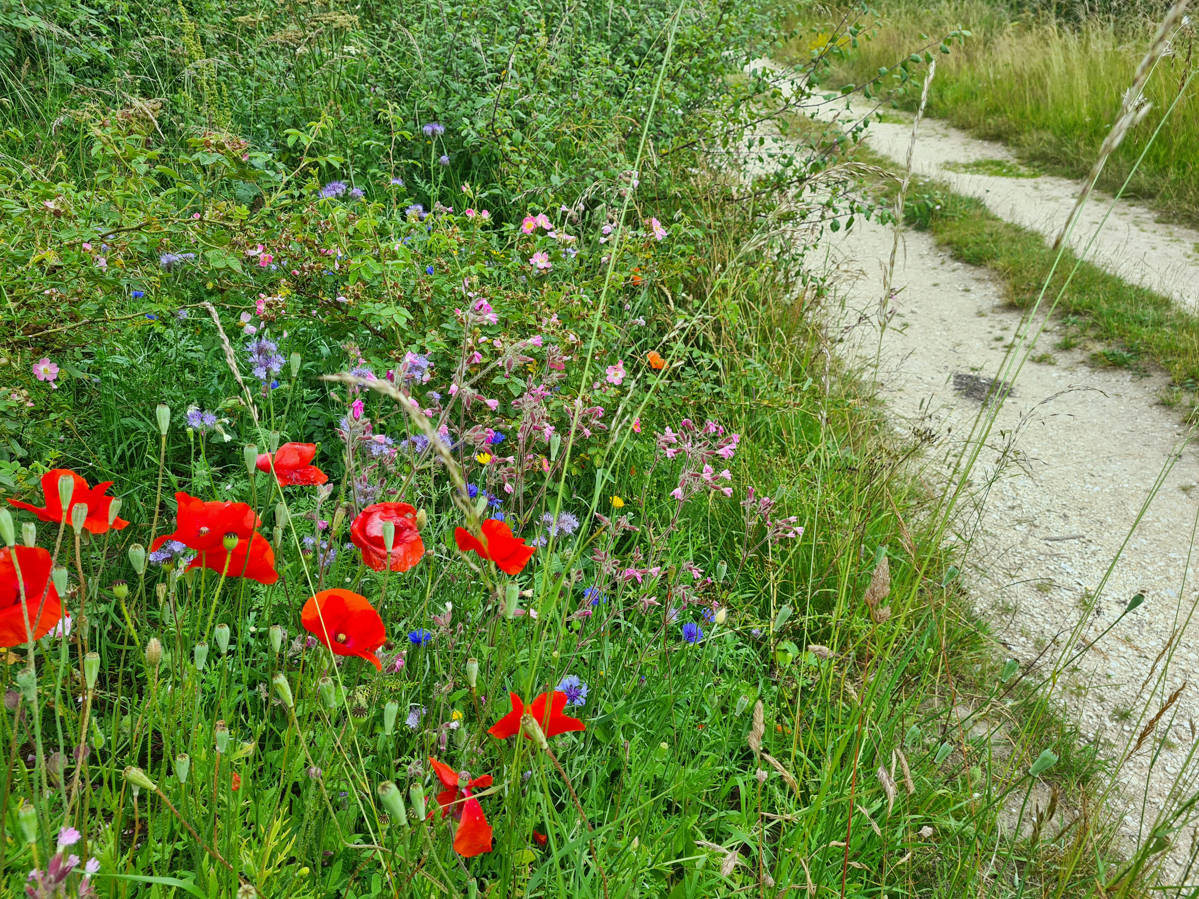
There are not too many opportunities for a wild camp in this early stage. The availability of water is, I found, very much a deciding factor on night halts on the Yorkshire Wolds Way. The route follows and crosses a series of dry valleys and as this first section began to move away from the coast, the views gradually opened up and there were frequent wide panoramas behind.
There are occasional little streams though chemical run-off, or worse, from agriculture must always be considered. An occasional scummy cattle trough might be encountered however these cannot be relied on. In the latter stages of the trail I would come across a handful of dewponds, liberally ringed by or containing abundant sheep and cattle faeces, though I never needed to rely on water from those. I carried a water filter and think such a piece of equipment a necessity on this trail.
I had my eye on some springs shown on the map at Comber Dale, a little beyond South Cave and they delivered. My journal notes from the day are approving- “few flies, few nettles, hardly any sheep shit“. Not only was I able to filter and fill my Evernew bladder, but could also partially strip off and wade into the little pond and wash myself free of sweat and dried mud. I am sure that many people must wildcamp here but signage was quite clear that this is not permitted so, now carrying four and half litres of water, I moved on a couple of miles, past East Dale into the gathering evening gloom and found a patch of earth, just off the trail in the corner of a potato field. Pitched by nine in the evening.

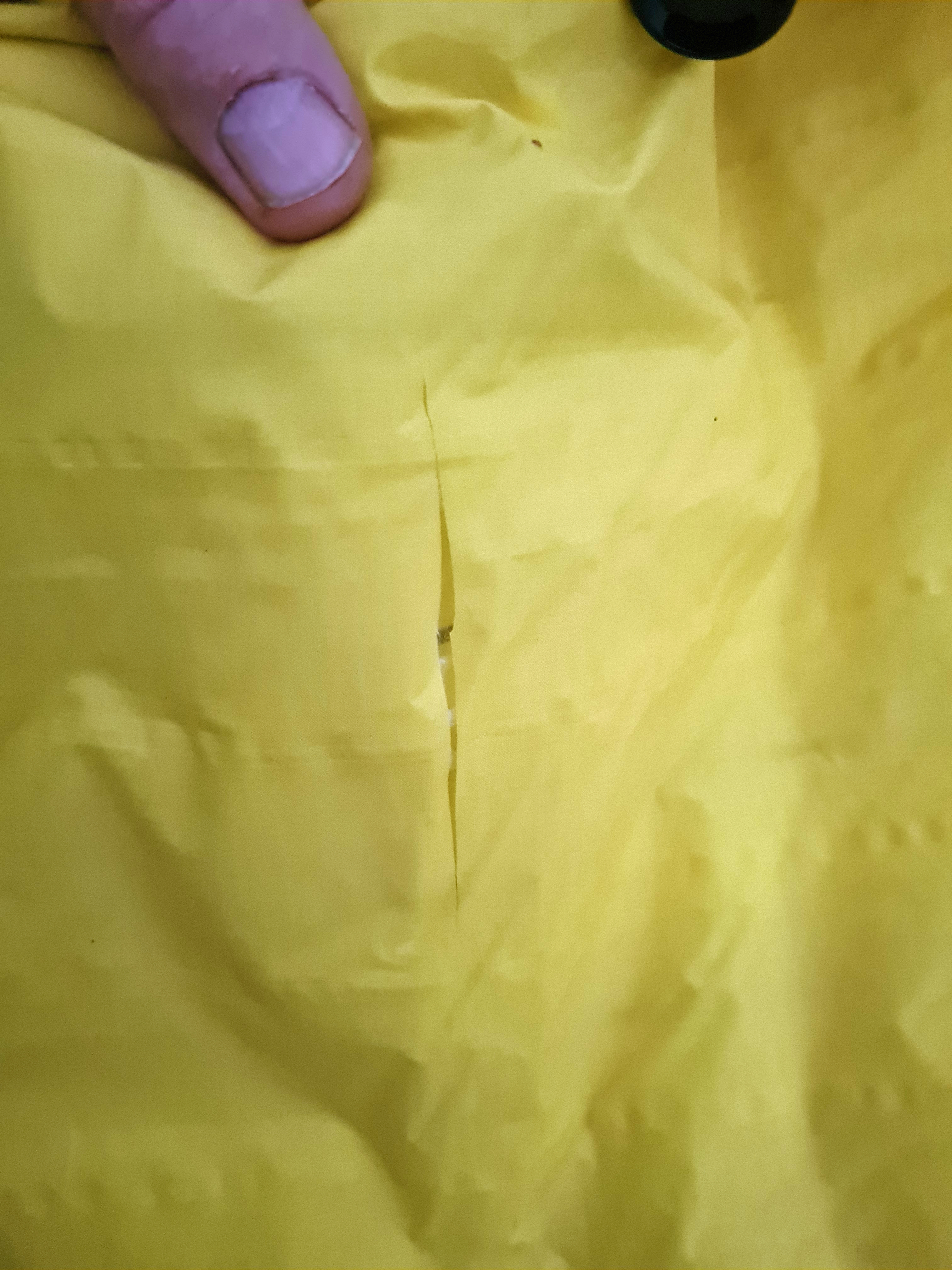
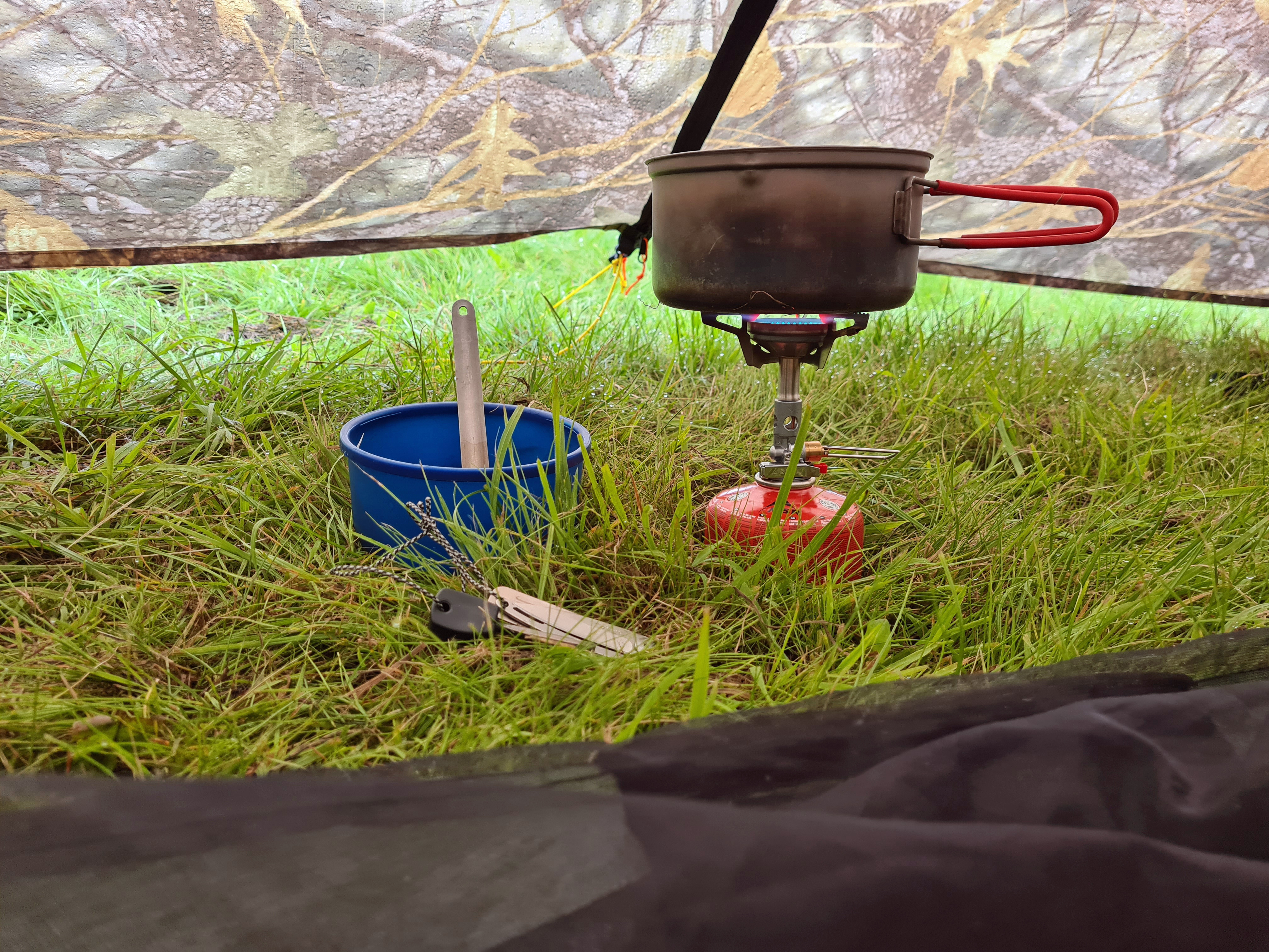
The bare earth of the potato field was thick with flints and I cleared what I could prior to setting down my shelter. I carry a small piece of 3mm closed cell foam with me and put that under me in the vestibule while preparing an evening meal of lentil curry with mash. What with leaving early morning, travelling a few hundred miles by train followed by a dozen miles walking I was tired and ready for a decent night’s kip, it wasn’t to be.
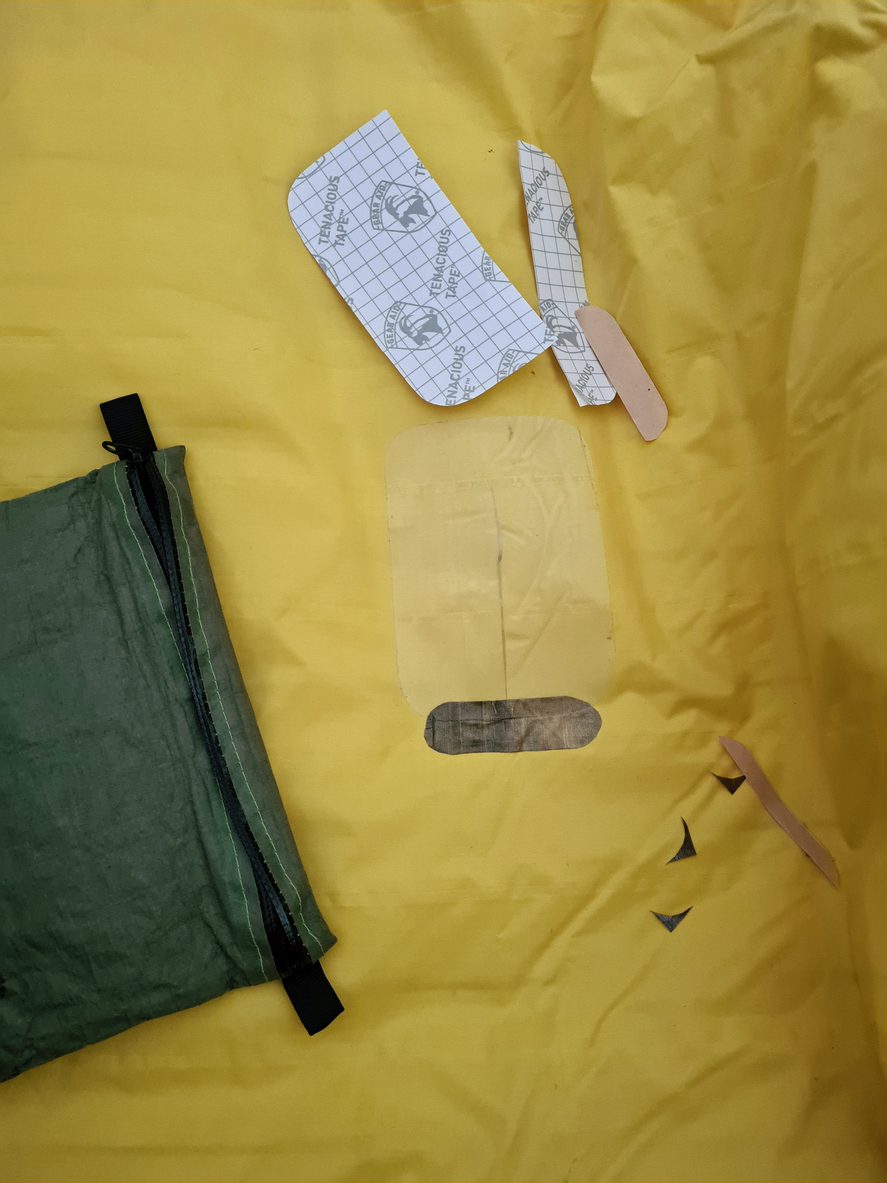
I had left my muddy piece of foam in the vestible though this would normally go under my inflated mat. I settled on my pad for the night but had obviously missed a sharper piece of flint. At some point in the night there was a whooofff and instant deflation. A rent had appeared in the bottom of my Thermarest NeoAir mat. I attempted a repair in the dark, it failed. For the remainder of my hike, uncomfortable nights were spent with my hip on the Gossamer Gear G4/20 sit pad, my torso and shoulders on the folded 3mm map, and the wrecked and folded mat under my legs. I am a side sleeper and failed to get any decent sleep until I returned home. Fed up with lying on flint nodules, I rose at four-thirty and irritably drank tea, looking out at the rain.

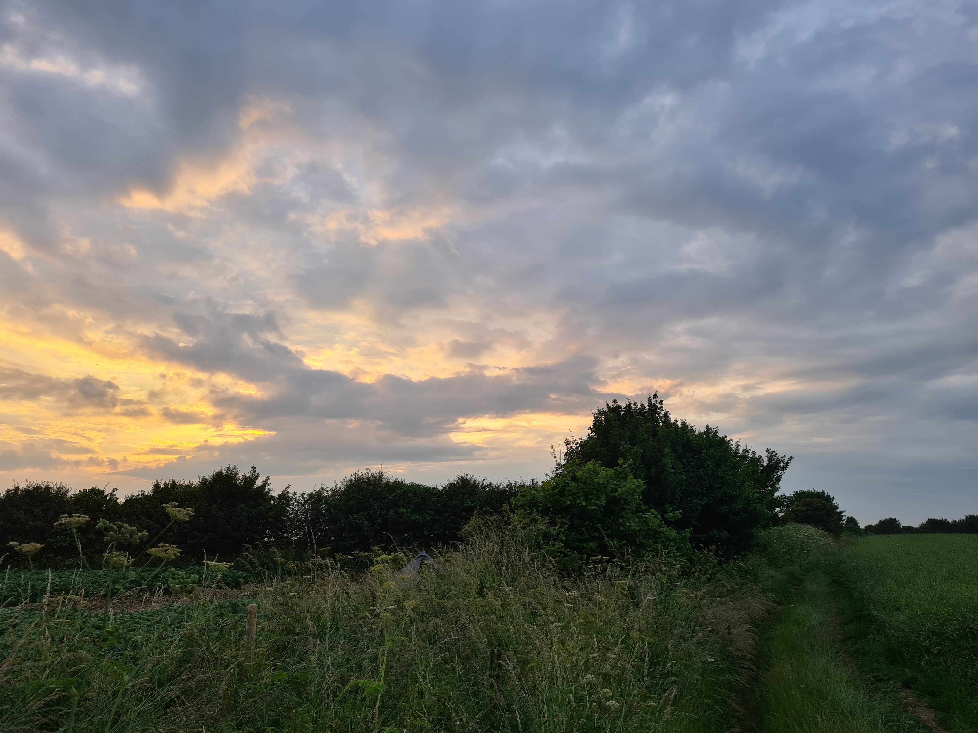
Having enjoyed a bottle of muscle relaxant along with my meal in the pub earlier, I thought that my night’s sleep would be improved, it wasn’t. It rained for most of the evening and night but paused for me to pack up a wet shelter in the morning. A lovely day’s walking followed. It was a fairly long day to tonight’s destination and dry valleys meant carrying my days water with me.
Bird of the day was Redstart, I haven’t seen these little beauties for too many years and was pleased to encounter them in a couple of the wooded wold valleys.
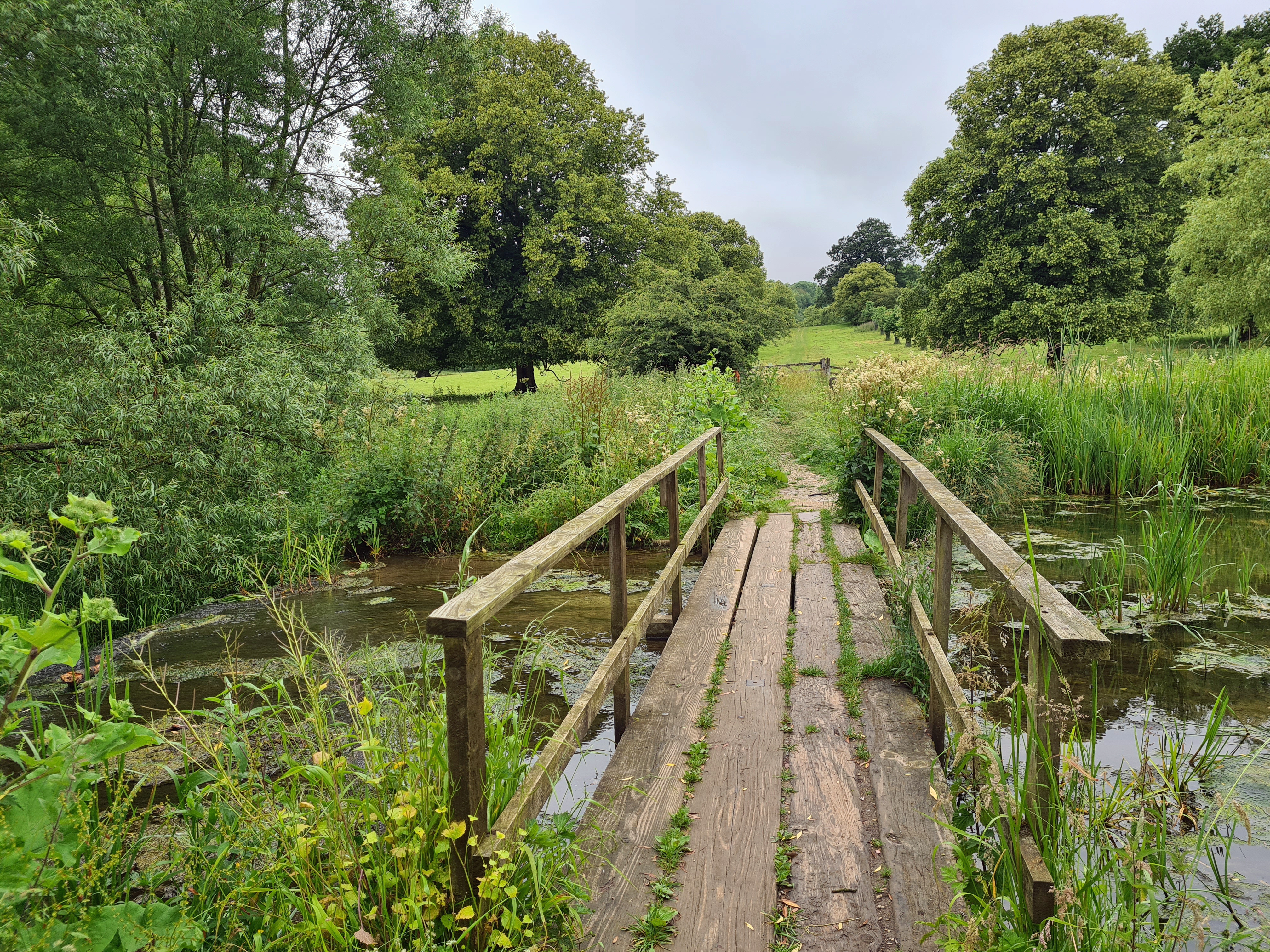
Londesborough Park is a picturesque location and I was aware that many wild campers will halt here. It had been very apparant that this would be a ‘bad idea’ as so many fields on this hike, including those each side of this lake, were populated by ‘sucklers’- calves and their protective mothers. There was a bull in each field too.
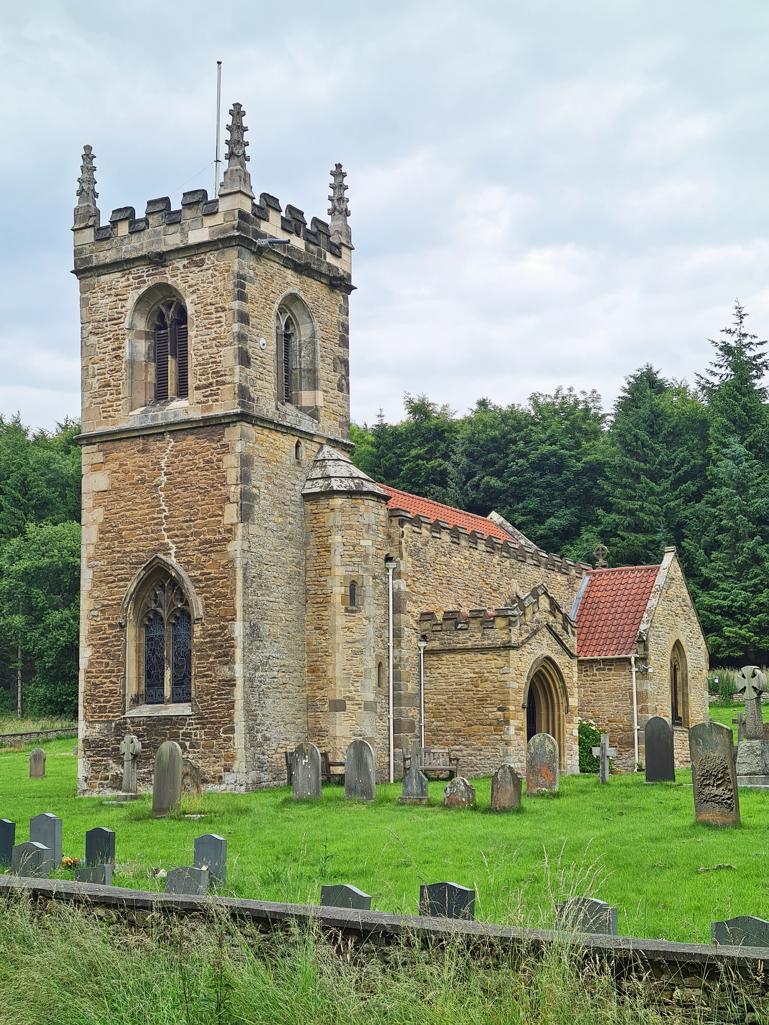
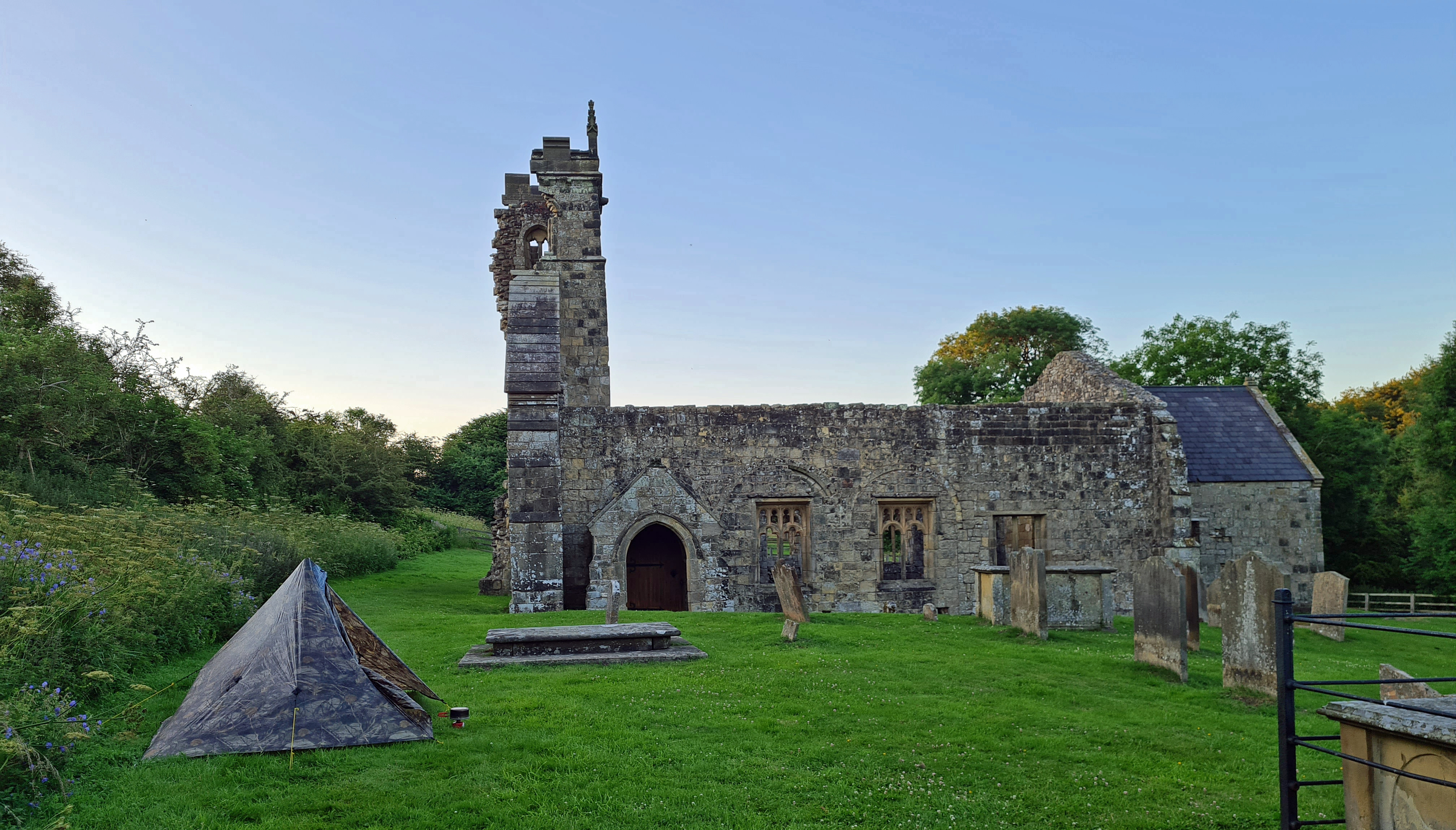
The wold valley walks really are pretty, not dramatic by any means, just simple good hiking. I got a couple of hours under my belt prior to halting for a cold soak breakfast at the church at Nunburnholm.
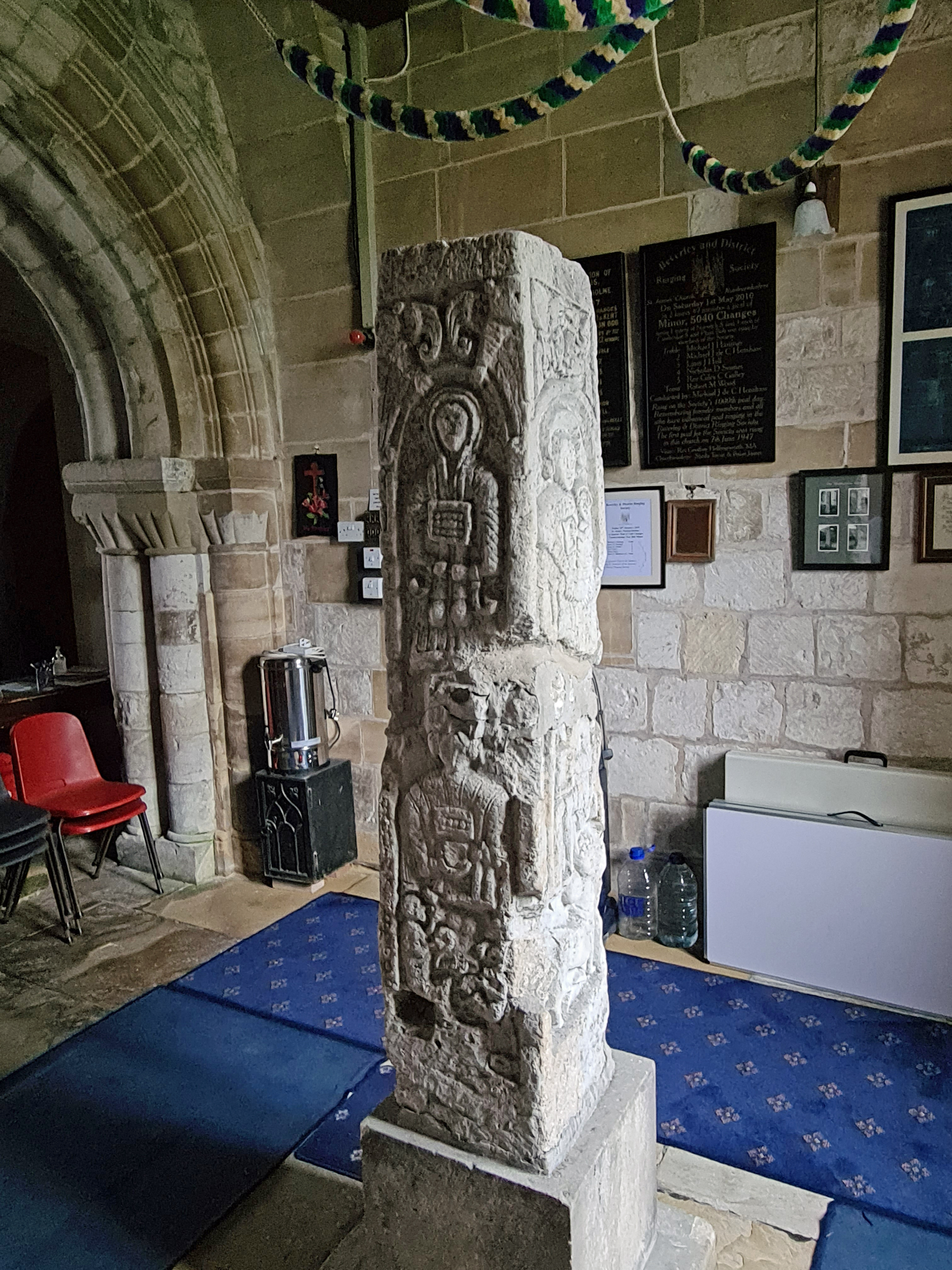
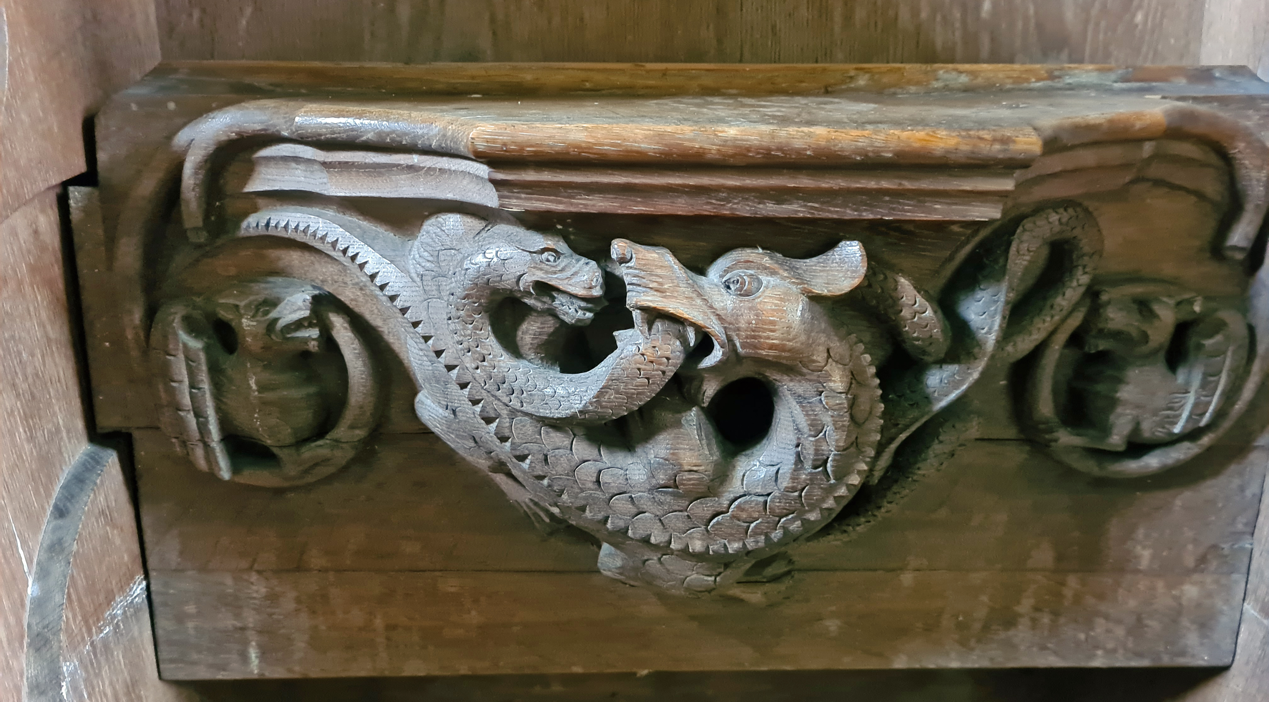
After my breakfast halt in the churchyard at Nunburnholme, I nipped inside the church to view the intriguing Nunburnholm Cross. Discovered during restoration work in 1872-7, it was moved inside the church and incorrectly re-erected. The faces show Anglo Saxon figures, warriors, centaur, pagan Viking and Norman effigies.
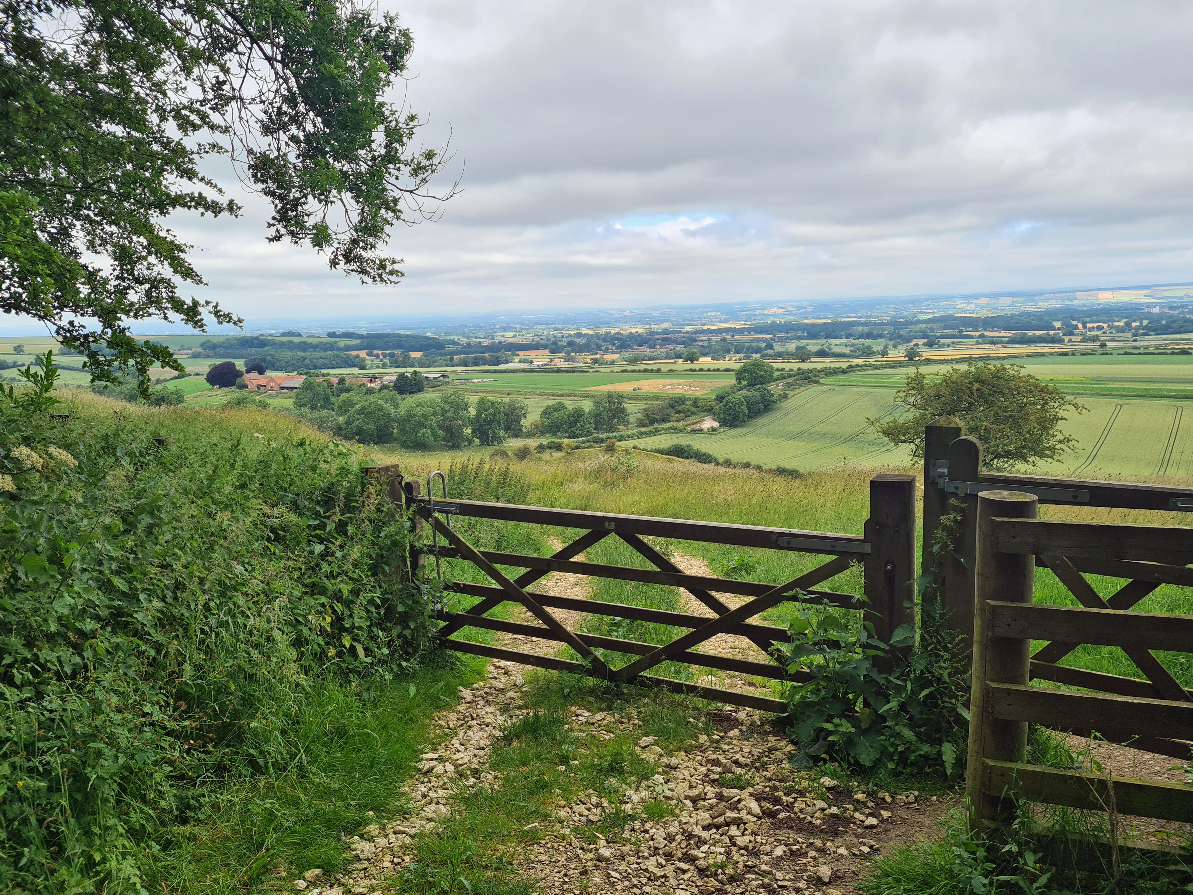
Leaving Londesborough there is bit of road walking. Closed to traffic, it was being resurfaced. Bored hi-viz jacketed workers ignored me as I squeezed past machinery that only just fitted into the lane. Red Kites wheeled overhead and I had my first sight of the expansive Vale of York. Complete with not one, but four power stations on the horizon. York Minster could also be seen in the distance. Yellowhammers were the bird of the day and their simple song kept me company throughout.
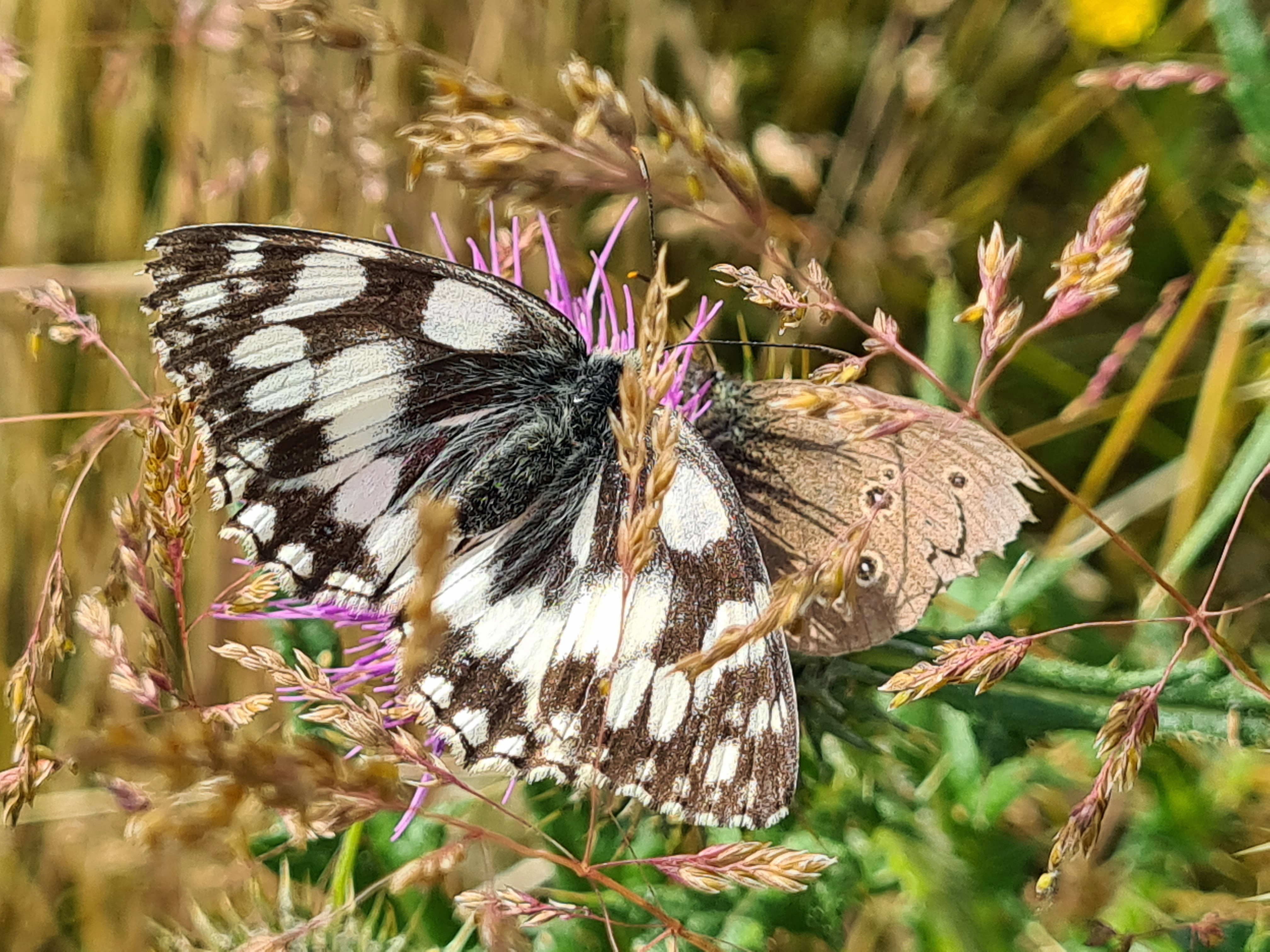
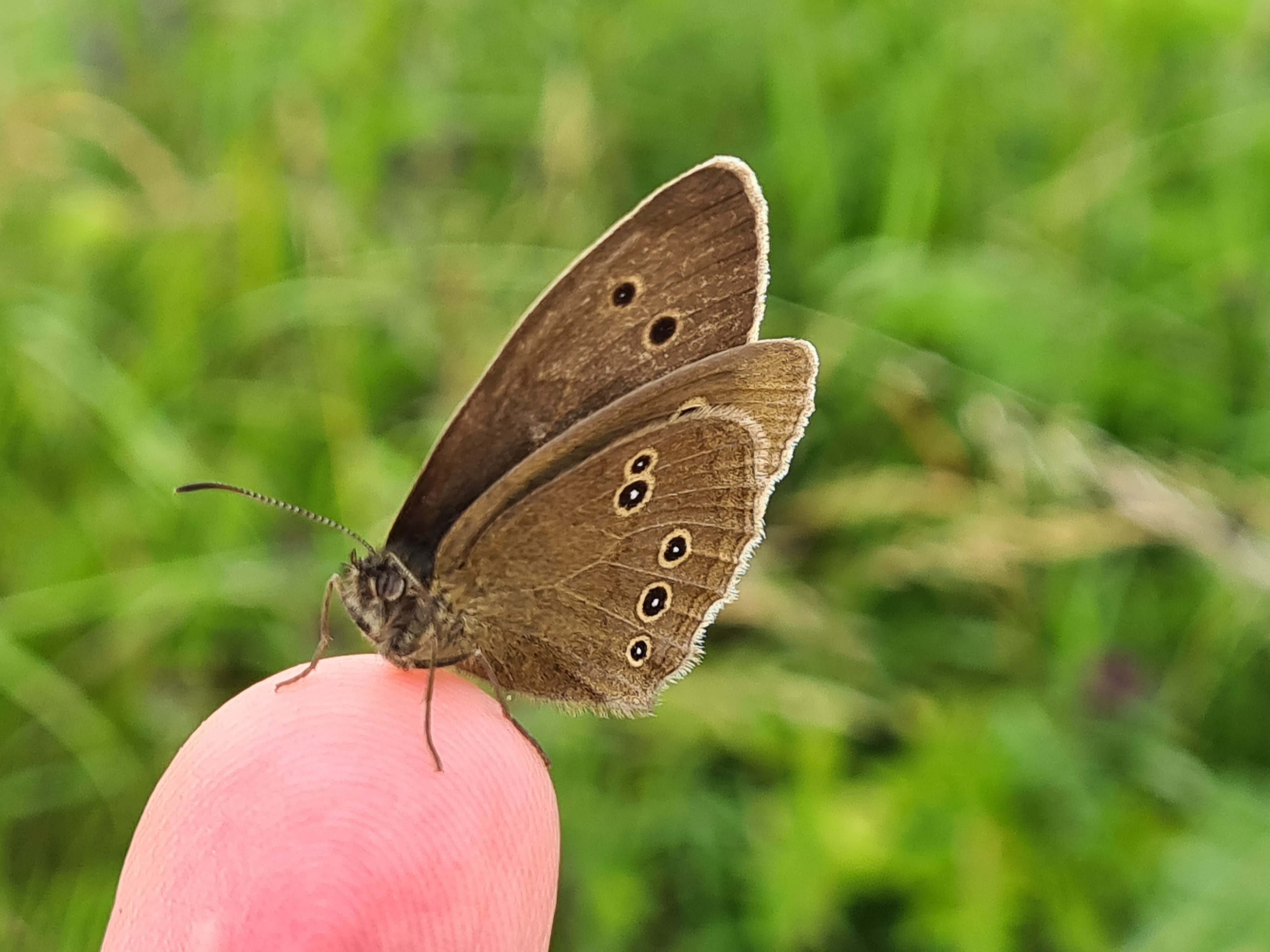
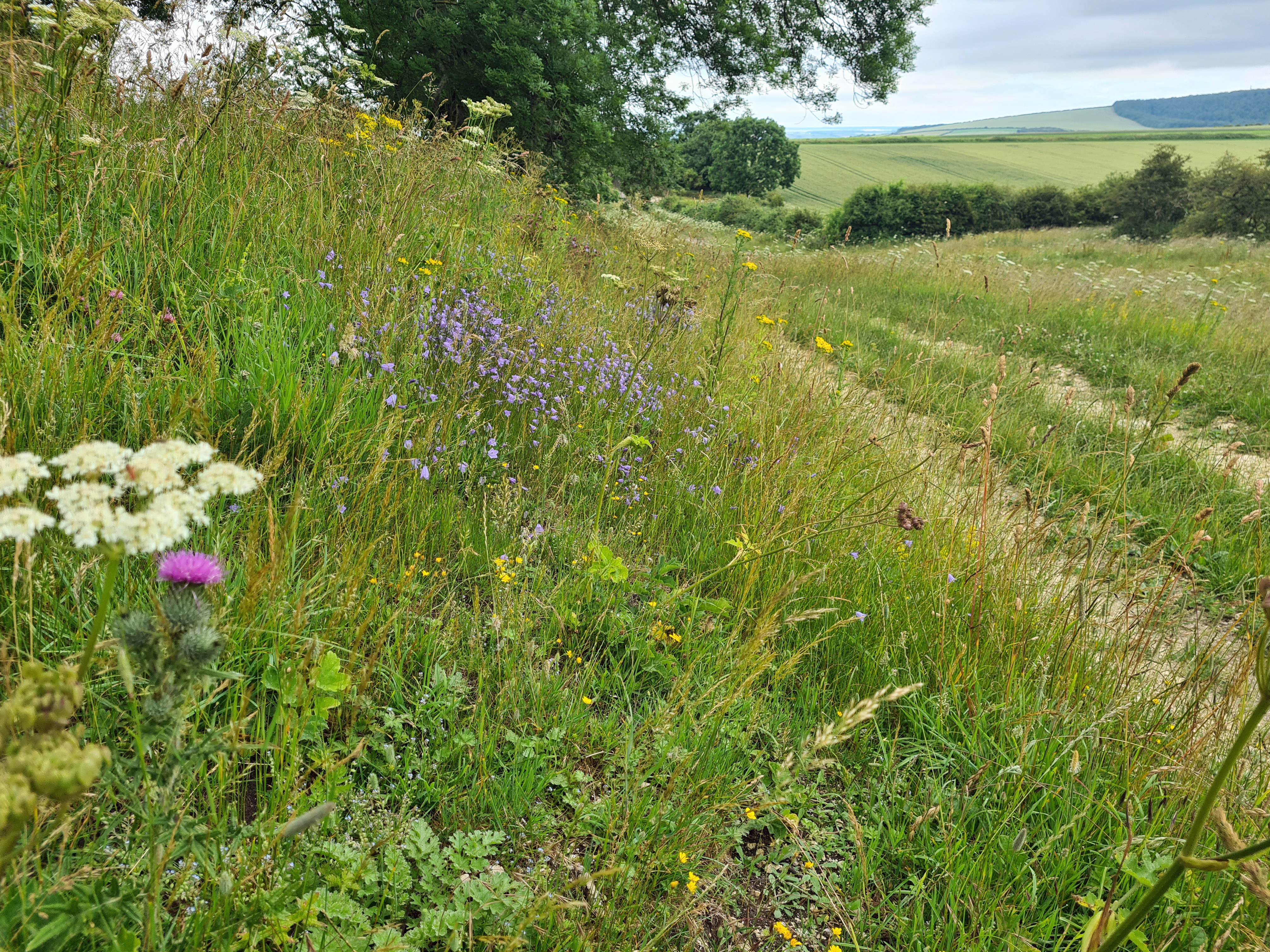
I was crossing typical Wolds countryside here. Grassy pasture alternated with prolific cereal crops. I was constantly in and out of fields holding cows, sheep, horses, even llamas in one. Thankfully there is not a single stile the whole length of the Wolds Way. Butterflies were prolific though bees definitely rivalled them in numbers. Unseen until the last moment, heart attack inducing partridges often whirred into flight from my feet.
Despite having set off with three litres of water, by the time I reached Fridaythorpe I was rationing myself, always a bad idea. So I swung off trail just a little to visit the town’s petrol station and, ‘cough‘, buy water. I hate doing this, buying single use bottles for something that comes out of a tap and all that. But needs must. I still had a good few miles to my night’s halt where, again, the map strongly suggested accessible springs for the evening meal and rehydration. The good walking continued with pleasant valley tops and bottoms, then a final pull along the top of Deep Dale, giving wary maternal cows plenty of space, to then drop down to the medieval village of Wharram Percy. There was plenty of water here in the mill pond but that was a bit scummy, so I found a clean outflow for a bit of a clean up and filtered four litres for tonight and tomorrow before looking around for a decent pitch, of which there is no shortage.
As uncomfortable as ever with no pad, this was still my best night’s rest of the hike despite an early morning drizzle. So I found it easy to rise early to be away before anyone arrived. It stopped raining for me and once packed I made a pint of tea and did a hunt around the whole site to gather sweet wrappers, soft drink cans and bottles left by other visitors. I always try and leave a site better than when I arrived.
Today was another fairly short day, the previous longer day being dictated by water availability. After a dripping mile-long wander along the Centenary Way, which follows a disused railway, I rejoined the official route just outside the present day village. As usual, I hunted down the village church to find a quiet tucked away bench to have a leisurely eaten cold-soaked breakfast. A cold drizzle set in and I began to cool down so left the village at a fair march, climbing the gently inclined flinty path into the cereal fields at speed in a successful attempt to warm up. This was not my last church visited today. Later, reaching Wintringham, I briefly diverted off down the main street in the vain hope of a cafe or similar for bacon roll and mug of tea. It wasn’t to be but my diversion did take me past the superb church of St. Peters. The medieval church was described by Pevsner as “the most rewarding church in the East Riding”.


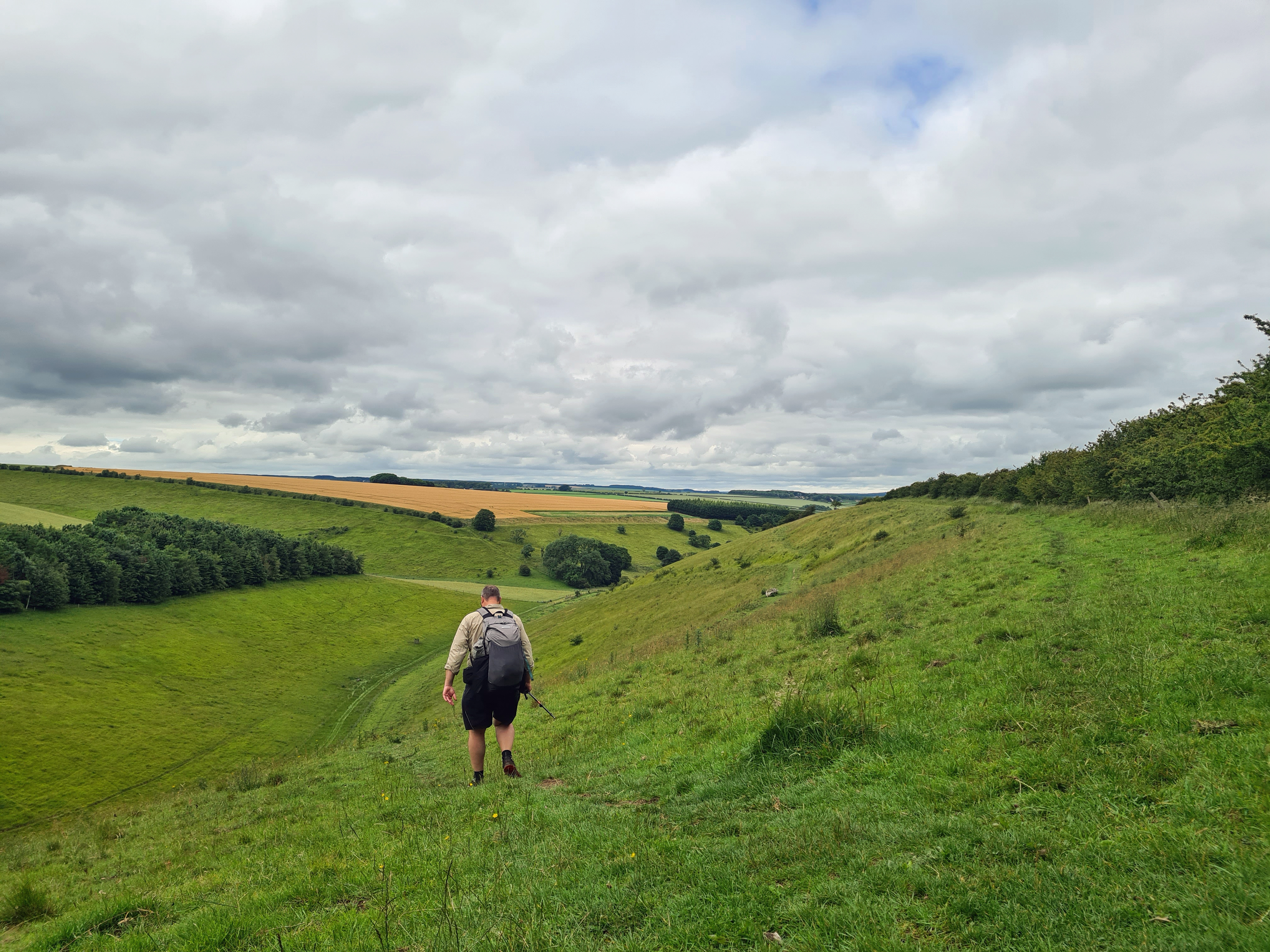
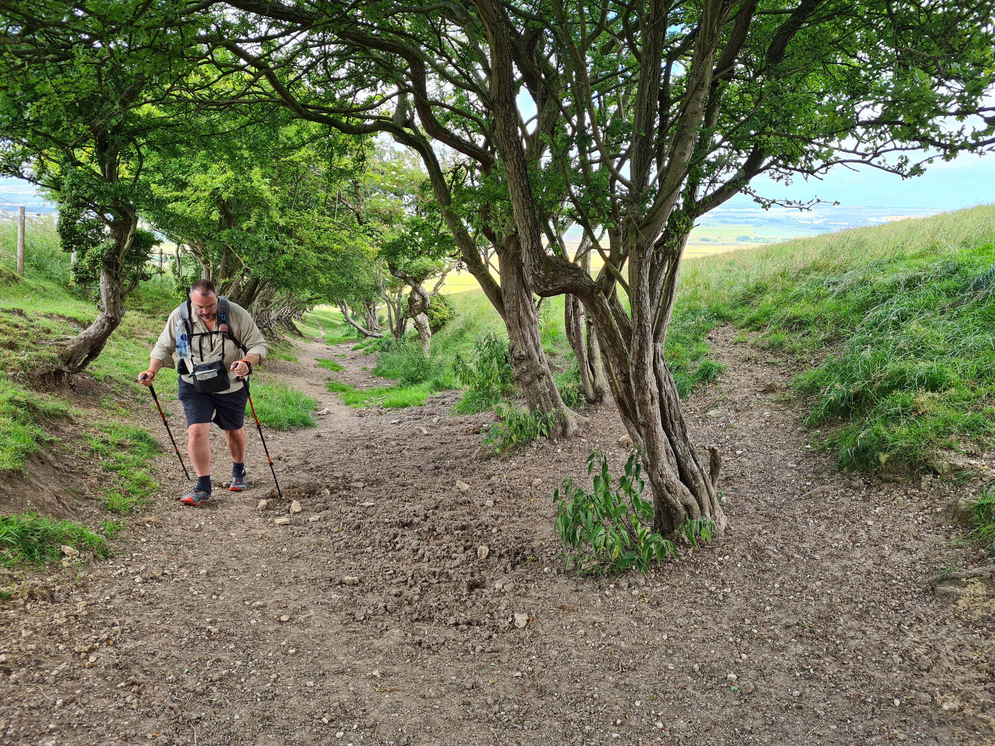
The Yorkshire Wolds Way is mostly pretty gentle. There are some climbs on the first day that make you pause and wonder if that statement is true, but for the most part ascent and descent gradients are well graded. The end of today has a mercifically short, but steep climb with an upward pointing signpost at its base that leaves you in no doubt as to what is to be expected. Enough to open the lungs and stretch the ligaments prior to a short walk along the road to a decent camp site with excellent showers. A short walk today, the tent was up with quilt airing on top by two.
Derek, the site owner, charges Wolds Way walkers just a fiver to stop the night. I had a field just about to myself. This was typical for the whole trail. I never saw another backpacker at all. The only people walking the route on any day were day visitors and local dog walkers. If you want a quiet introduction to long distance walking, this is the trail for you. As said, the deciding factor if backpacking is availability of water but by all accounts, there are plenty of B&B and similar type accomodation for those who prefer that approach.

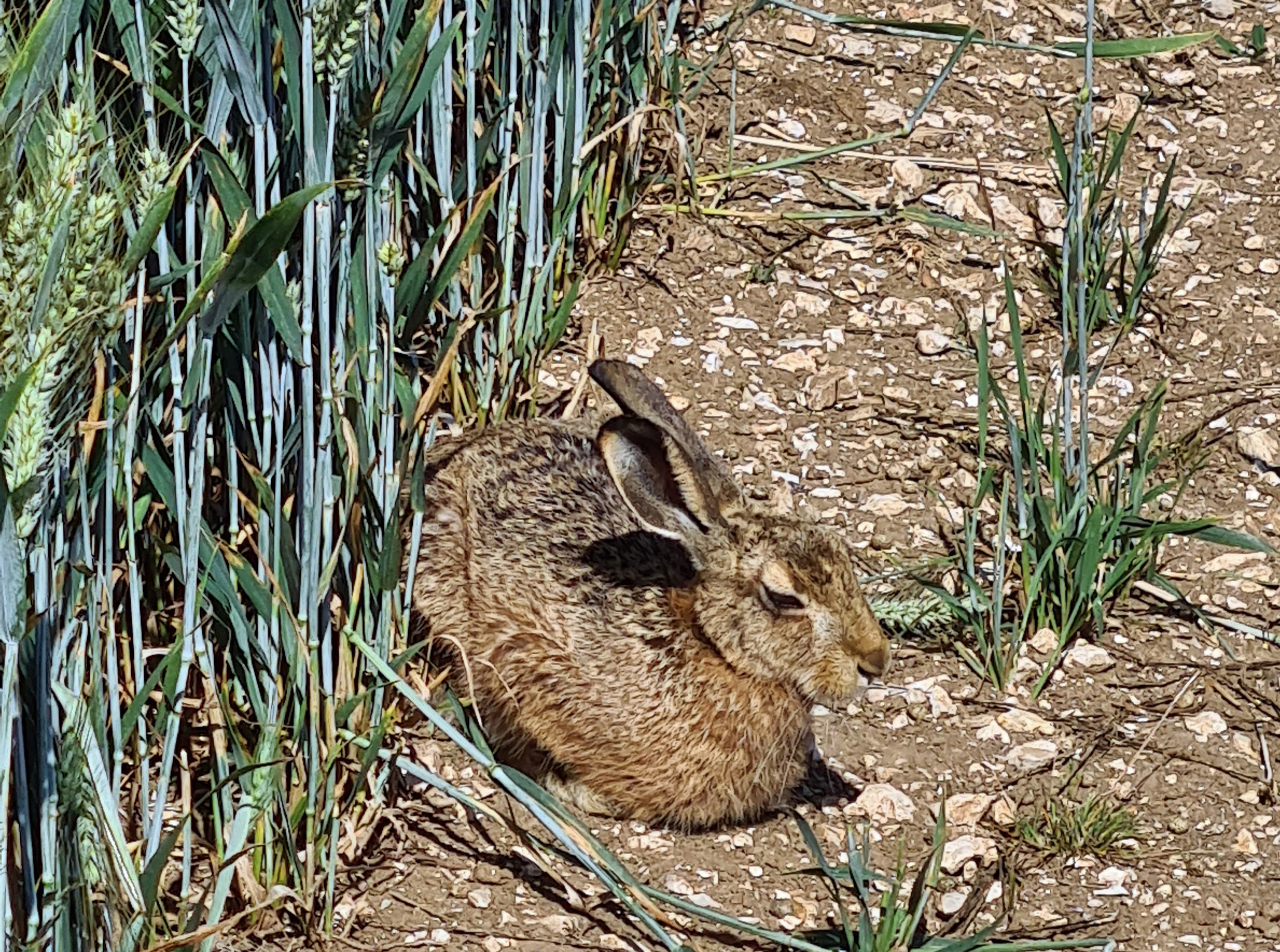
I thought that the actual wolds, the rolling hills with their dry valley bottoms had wandered off. But I was wrong, they came back to join me on my final day on trail. And it is a great day too. No major towns are passed and it mostly skirts any form of habitation until Filey at the end. It must see few walkers for it was only today that I was able to silently approach a dozing and normally alert Hare. When it eventually heard me, only some six feet away, it fair leapt into the air, turning midway, and ‘hared’ off at impressive speed, no doubt cursing itself.
Crossing a road there was a contractors van parked. Further on I could hear strimmers and as I approached the two chaps cutting the long grass, they paused work for me to pass, I stopped for a natter. Contracted by the council they had a target of five kilometres to be cut each day- “which is actually ten kilometres as we cut a second width on the way back“. Not only that but the fuel in the strimmers only lasted a km or so, so walks back to the van to refuel had to be made. I was hot in just OR sunshirt and shorts, these two guys had full hi-viz PPE with boots, gloves and helmets with visors. Rather them than me and I thanked them profusely for their efforts. Further on I reached an uncut stretch and the grass was two to three feet high and the going pretty difficult. Some parts have to be strimmed two or three times a season. I chatted to a local dog walker. He was only now venturing out on to this cut section of trail as his dog picked up too many ticks when the grass was long- “I can brush dozens off his underside“.
As I dropped down toward Sherburn I could hear music. The Wolds Way doesn’t enter the village, following the edge of a couple of adjacent fields instead. One of these was hosting an annual Fair. If there is one lesson in backpacking, it is never turn down an opportunity. I walked in the back entrance, past the showmens’ trailers and paraphernalia, squeezed round a booth, to emerge in the public area next to the fair’s foodstall. It was time for second breakfast and a mug of tea.

It was a perfect last day. The sun shone, walking was easy underfoot, I had the paths to myself, wildflowers were in bloom and the bees and butterflys crossed my path from flowerhead to flowerhead. Buzzards and Red Kites wheeled overhead. Hares raced away, deer gazed at me from woodland edges. I paused and a shrew ran round my feet. A rare day indeed and it was only when I was some four miles from the sea that I finally caught sight of it. I didn’t particularly enjoy my last couple of miles road walking along the busy A1035 and A1039 to my nights camp, but roadwalking is frequently the case at trail termini.
My last night’s halt was at the Centenary Way Camping and Caravan Park, a fifteen minute walk from Filey town centre. The management here were taking covid caution to the extreme. It wasn’t even permitted to brush teeth in the washrooms. This was most definitely the worst site of the whole walk. Over-priced, over regulated, under-provisioned with, frankly awful, broom cupboard sized, 30 second duration push button showers. I got the tent up, somehow showered, spat my toothpaste into the undergrowth beside my tent, changed into ‘town clothes’ and walked into town for my last few trail miles, intending to whoop it up.

The trail ends on the high cliffs just beyond Filey and there are a few hundred steps up and down to get there. My celebratory fish and chips in town almost never happened as the chip shops were closing. I found one locking the door. They had an uncollected order and sold it to me for a fiver. Everyone’s a winner. I went along to the memorial gardens to enjoy my quite superb haddock, under the baleful eyes of local Herring Gulls. They went without, I didn’t. Then off to try and find a pint. That was almost disaster. I checked online to find the closest recommended hostelry. A nearby large hotel bar was proclaimed to be excellent. Venturing in I found a bingo night in session. I sat at my table and drank a too-cold pint of indifferent Marstons followed by a too-warm pint of equally indifferent Hobgoblin Gold. I gave it up as a bad job and returned in the gloom to my tent for a final rubbish night’s sleep.

I had a 09.24 train home from Filey station in the morning. Challenges hadn’t ceased as first I found the public footpath into town through a neighbouring caravan park had been blocked off by the park’s managment. Then the ticket machine at the station was down for maintenance and I was unable to get my pre-booked tickets. A journey home then consisted of trying to convince successive train guards that I was, indeed, entitled to travel. My only further drama was when I turned Flight mode off on the phone while on the train and was immediately ‘pinged’ by the NHS Covid app and told to self-isolate.
Would Three Points of the Compass recommend the Yorkshire Wolds Way? Yes. This was my eleventh of the UK’s National Trails and though I wouldn’t walk it again, it would make a great introduction to those new to multi-day trail walking. The landscape is pleasant if undramatic, terrain is mostly good underfoot and ups and downs are mostly gentle, with just the occasional huff ‘n’ puff creating climb to make you realise that you are, indeed, on a multi-day walk that demands continual effort day on day. It must be one of the easiest of the National Trails to complete and certainly short enough to be knocked out in no more than four (long) to six (easy) days. It traverses a lovely part of the country and I enjoyed my time, brief that it was, on the Wolds Way immensely.
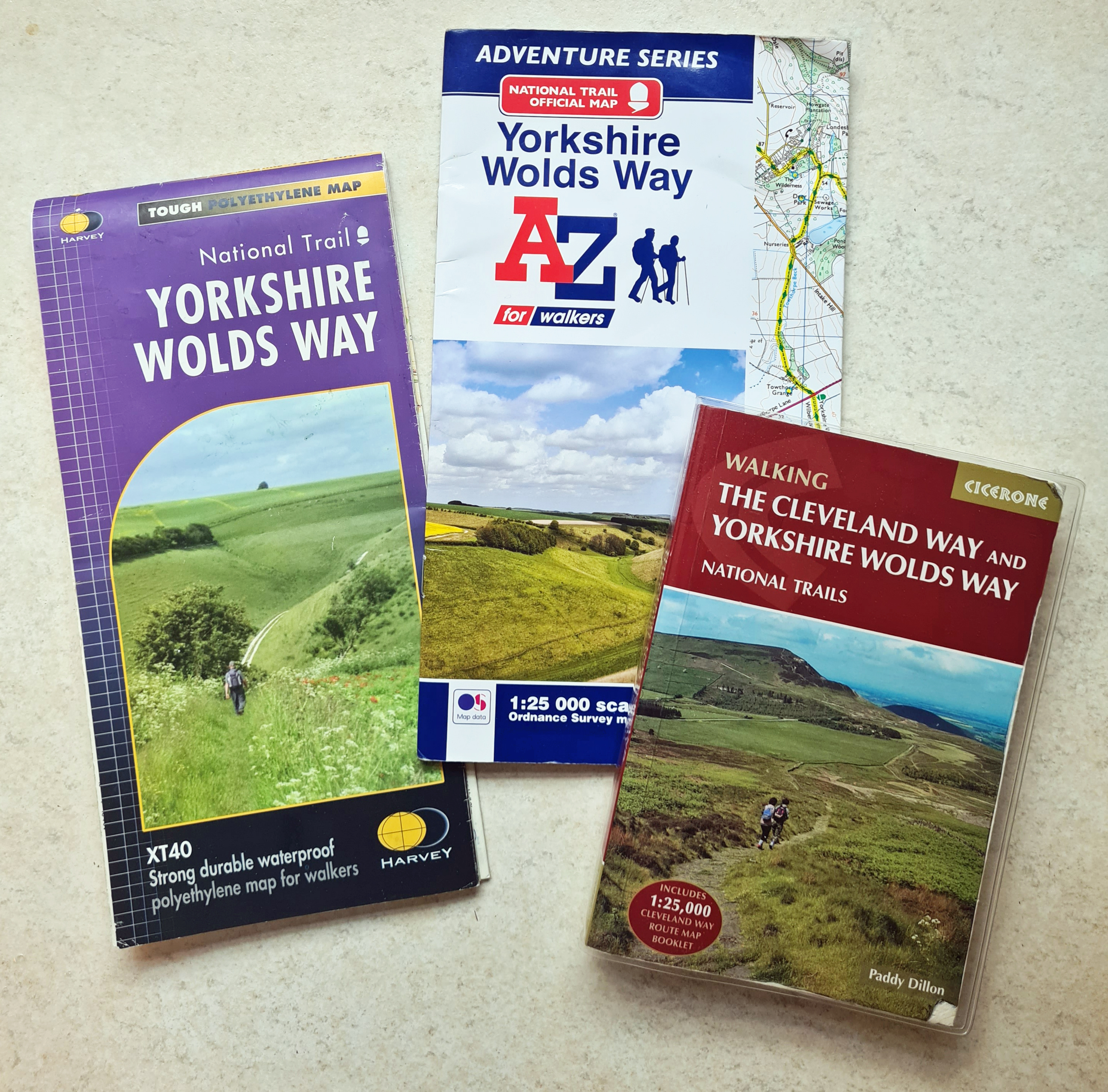
The route is very well-signposted. There are just a few occasions, frequently due to undergrowth, where there may be a little uncertainty. Regardless, if it had been blazed every ten metres I would have still taken a map as I like to have an idea on progress. I actually carried two maps, though one would have sufficed. By far the best is the 91g Adventure Series strip map in book form, complete with 1:25 000 O.S. mapping. These are terrific National Trail maps with one big failing- they are not waterproof. Expecting rain, I took along the 29g waterproof strip map from Harvey and used that on my one consistently wet day. This is at 1:40 000 scale and though very good, is not quite up to the standard of the O.S. offering. I already had the 218g Cicerone guidebook for the Cleveland Way from when I walked that trail. This book also covers the Yorkshire Wolds Way, but as it is a short trail I just photographed relevant pages and left the book at home.
Three Points of the Compass does not always blog on the trails walked. Links to those that have been covered can be found here.

Hmm. Seemed a bit of a trail with trials.
LikeLiked by 1 person
Certainly a deflated sleeping mat was a trial, I like my sleep…
LikeLiked by 1 person
Really enjoying your work as always. Well really enjoyed it after I checked my list to confirm you were right and it is the shortest National Trail in England. Now will spend the rest of the day wondering what way is 56 miles???
Are you gold or diamond now or are there a surprising amount of the National Trails yet for you to complete?
I have a question around the Thermarest, are they worth it? Everyone seems to use them however everyone also has a tale of replacing them due to mystery leaks or actual leaks. Everyone seems to say they are so comfortable and then spends a lot of time talking about leaks equalling bad nights sleep.
My main thought around this is that everything from a 4mm yoga mat costing £5 to the NEMO Switchback at £49.95 will work always and is lighter. You could even go hardcore with a Gossamer Gear Thinlight Foam Insulation Pad. My stumbling block is it seems counter to the whole lightweight philosophy to carry something heavier that gives you issues. Also based on this experience is the comfort worth the weight?
Thanks for pointing me in the direction of the mappiman.blogspot.com been really enjoying his walk, beer and Covid tales.
LikeLike
I have only ever used the Thermarest inflatable pads so could not comment on any rival offerings. I slept on closed cell pads when much younger, resilient and tougher, I simply can’t now. I’ve got soft! I am a side sleeper and need both comfort and insulation to enjoy a good night’s kip on trail now. And a good night’s sleep is important, especially on longer trails and for comfort.
That said. Inflatable mats are not cheap and there is only a thin layer of material away from puncture. I have slept hundreds of night’s on the thicker Thermarest mats and have had to replace two, including this last. I don’t think they are fragile, but you do have to be careful with them. This last failure was all my fault
LikeLiked by 1 person
I missed the inflatable pads so went from ground sheets to foam and currently air beds. Obviously I am not taking the air bed hiking however I do have a cheap inflatable pad that I am going to try however sort of wondering if toughing it out might be worth thinking about. I might have an advantage as I am that rare thing a front sleeper.
Forgot to add earlier, have you thought about just printing maps and laminating them?
Also have you thought about a mill bag as a pre-filter? You seemed to have issues with clean-ish water to filter this time.
LikeLike
If you are happy with CCF pads then go for it! Always going to be lighter, always going to be tougher. Not for me though. Bulky too.
I have printed maps before, no need to laminate, just use waterproof ink and paper, or slip into a map case or ziplok. Give me decent map anyday though. I also subscribe to OS Maps, so have them on the phone.
Millbank bags have no place in lightweight backpacking. Big, heavy, bulky and unnecessary, i did use them oc. in the army but they are more for bushcrafters and the like. Use a coffee filter or a bandana if straining sediment. But I use Katadyn Befree that has an open cover to the filter and regularly swish that around in clean water to clear sediment. I have had no problems with that yet. It isn’t the sediment I am concerned about, it is the likes of giardia and cryptosporidiam
LikeLiked by 1 person
Not sure happy going to be the word used however might suffer for a while and see what happens.
Looked long and hard at the OS Map app and think I would be very tempted to only pay for it the month of a walk maybe. The Ramblers Pathwatch app is very useful I found out the other day, nudge, nudge, wink, wink.
I have got OS to make me my own personal local area map as I live in or near map overlap. I have put my house in the bottom right corner so got a great map of the area in-between Birmingham and Coventry. If you have read Mappiman’s Heart Of England way blogs he comes down the centre of my map to start with as more by luck than judgement that is in the centre of the map.
I really like the idea of printing my own maps because it means I can overlap, play and also write directly onto them. I am going map case browsing today to see what the ones used by people are like if I can find them in shops.
LikeLike
Yep, I used the O,S. bespoke map service myself. Not cheap though I waited for one of their periodic offers. When I walked the length of Scotland, I was able to really reduce the number of 1:50 000 maps required with personalised map tiles.
And remember, nothing stopping you writing on an O.S. map!
LikeLiked by 1 person
Yeah wait for the offer as even then it double.
Write on a map… that like writing in a book!
LikeLiked by 1 person