
Three Points of the Compass takes a walk from Iceland’s southern Highlands to the sea, across a landscape continually shaped by the forces of nature. Both Laugavegur and Fimmvörðuháls Trails are exceptional.
I arrived at Luton Airport at a silly hour of the morning for my 06.15 flight to Iceland. This would give me almost all day after landing to simply orientate myself, buy some food, fuel and find the city campsite where I was staying, and hopefully catch up on lost sleep, before catching my pre-booked bus to the trailhead the following morning. My head was too thick with weariness to manage much more than that. I was in no particular rush on this trip. Almost every report I had read or watched of other people’s experience had those who had dashed it off, saying they wished they had taken more time. I had built in a rest and supply day at the start and another rest or slippage day afterward, leaving myself five to six days to walk both trails, 54km and 25km respectively, with the option of skipping the Fimmvörðuháls Trail entirely if conditions were unfavourable.
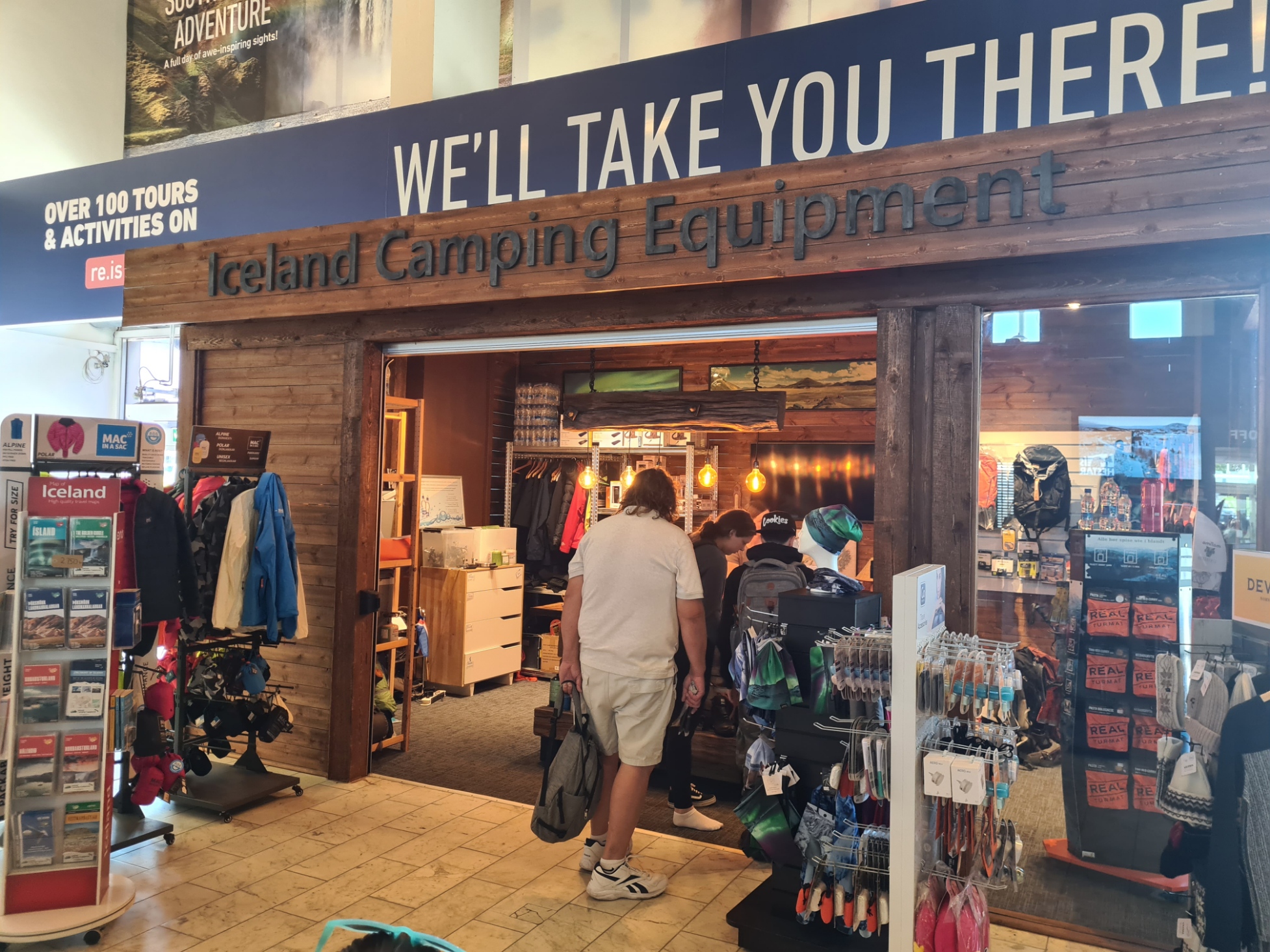
As it was, having caught the Flybus connection between Keflavik airport and the city, I entered the BSI central bus station in Reykjavik looking for a town map where I also found the small Iceland Camping Equipment shop. I undoubtably paid over the odds for my 240g gas canister but I wasn’t going to mess about, I had my fuel, that was one thing sorted.
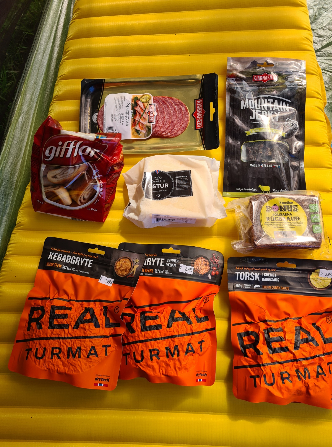
I had bought some food from the UK with me- a couple of Bla Band dehydrated meals (the best there is in my opinion), bars, decent chocolate and a brew kit that included some hot chocolate. So I then walked to the Nesti at the adjacent petrol station to see what food they had to add to this. Finding nothing I wanted I did note they also had gas canisters; screw valve, nozzle and pierceable Campingaz, also liquid Colman fuel. On my freebie paper map I plotted a route to the campsite, about an hours walk away, via the Everest outdoor equipment shop at Skeifan. Here I was able to buy a handful of Real Turmat dehydrated meals for the evenings. These had also been available back at the bus station, but I had hoped for a wider range, then into the Bónus supermarket opposite for a perfectly adequate choice of supplementary food for other meals on trail, mostly rye bread, cheese, salami and pepperoni (I hoped cooler temperatures would allow meat to last two or three days) and cinnamon buns. From there, it was a twenty minute walk to the Eco-Campsite, situated next door to the busy and ‘very noisy-’til-late’ sports grounds and facilities
I had pre-booked pre and post hike nights at the Eco-campsite as online booking saves you 10%. It is a busy site but large enough to take the large groups that were also present. There is also indoor accommodation but I felt no need to avail myself of this. Once pitched and sorted, I was in time to take full advantage of the happy-hour at the hostel’s bar. I sat outside on the warm and sunny evening and enjoyed the ‘OK’ tap Boli (5.6%) and excellent bottled Úlfur Nr. 3 IPA (5.9%) and Snorri NR. 10 (5.3%) from Borg Brugghus. It was here that I met and chatted with Canadian backpackers Krista and Deb, who had already endured difficulties in getting here, losing luggage en route and having to buy replacement gear. They were meeting up with a friend, Lauren, who was waiting at the trailhead for them, and I would see the three of them quite often over the next couple of days, usually in the evenings. That proved to be the case with a number of the international hikers on the Laugavegur. While it is easy to hike alone, there are various bottlenecks, especially at the huts each night, where you will encounter the same faces.
Now tired and full of alcohol, it was back to the tent to have the first of my dehydrated meals and hopefully sleep, despite the noise from both in and beyond the camp, and the bright light, for it doesn’t really get dark at this latitude at this time of the year.
Day One: Landmannalaugar to Hrafntinnusker. 11.7km, 680m ascent, 233m descent.
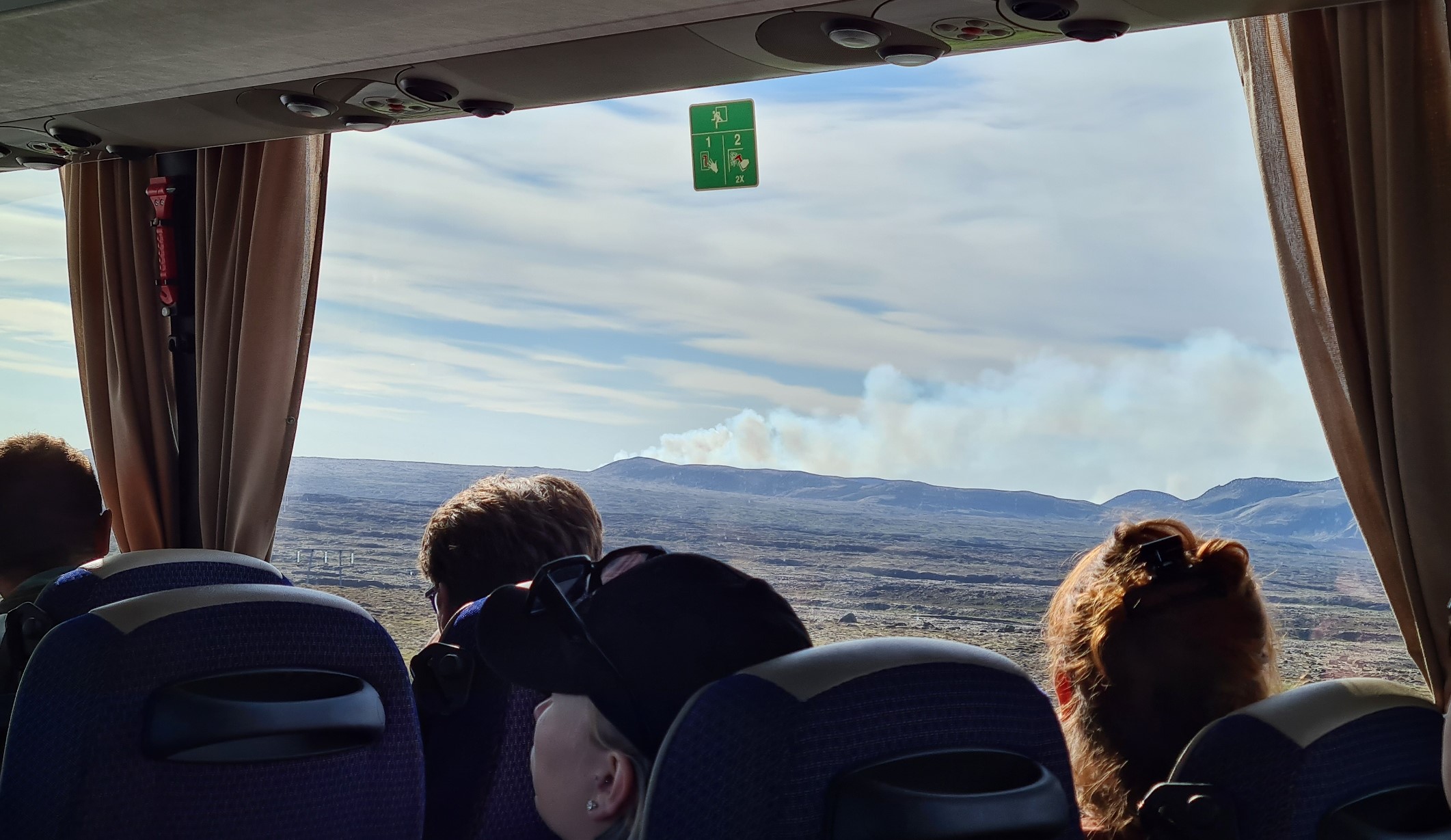
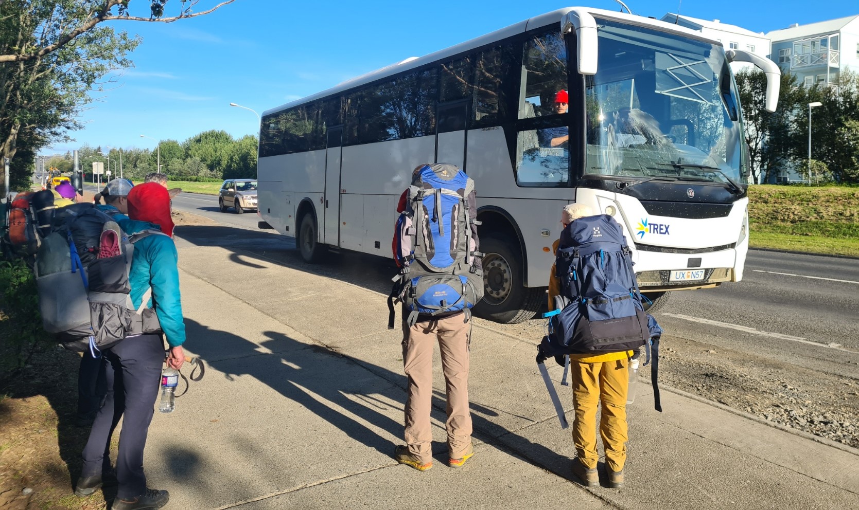
The Reykjavik campsite had got quieter eventually and I slept well. Up by six, packed and ablutions sorted, I was at the bus stop on the road outside the campsite well before my advertised 07.30 transport to the trail head. The bus actually leaves the BSI station at 07.30 so it was a few minutes later before it hove into view. The simplest way to get to and from the trails is to prebook a Hikers Pass online via TREX or Reykjavik Excursions, though there is an issue on the return trip, more on that later. The bus was about 70% full and we all settled in for the long ride, with a w/c, coffee and pastries break at Hella.
Leaving the road, the bus took to a rough ash and gravel ‘F’ road, bouncing along and crossing streams with impunity. There was a bunch of geology students on board and their leader/teacher gave occasional snippets of info on the various geology we were passing through, all much appreciated. Eventually, just before midday, busy Landmannalaugar came into view.
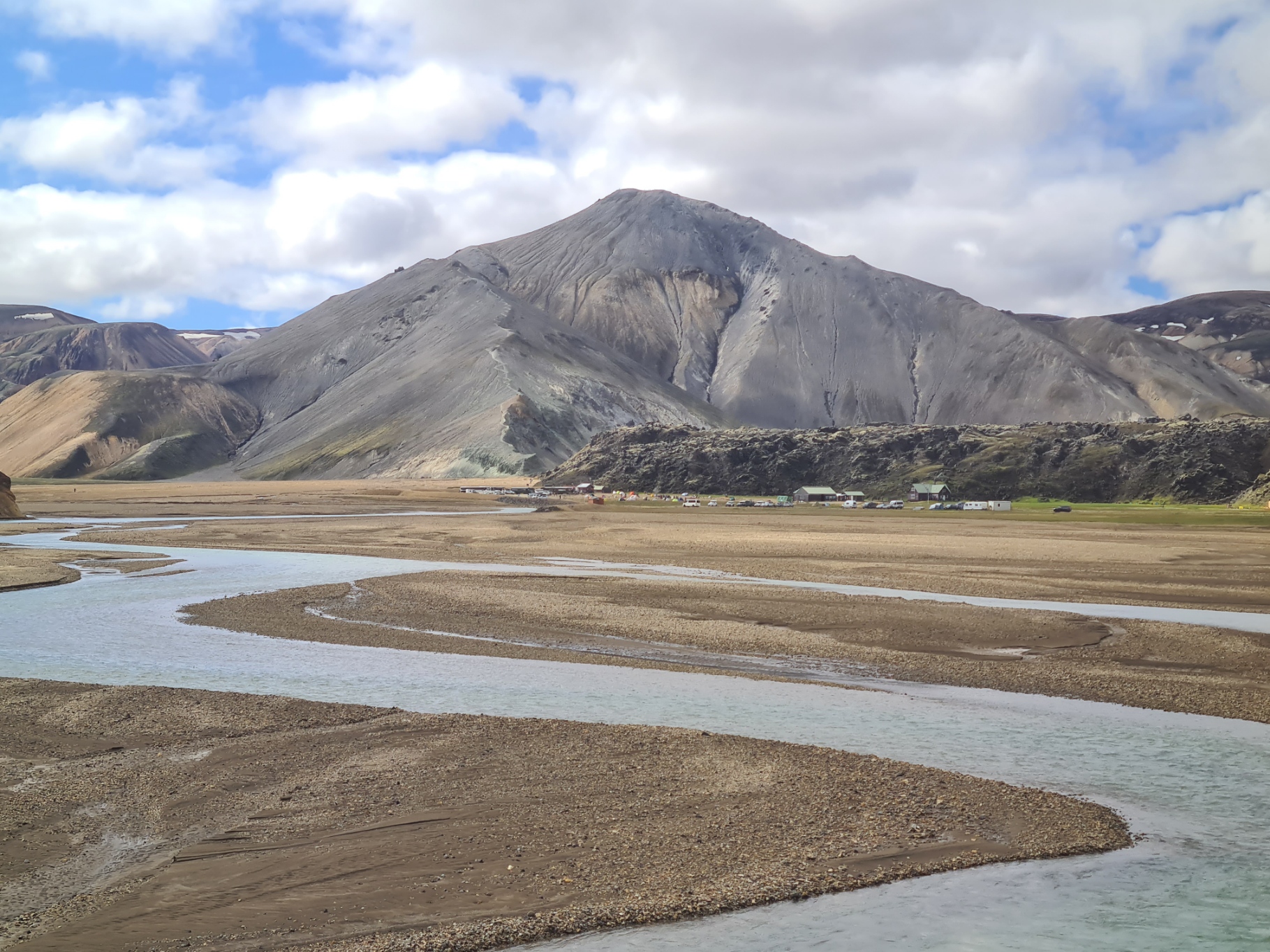

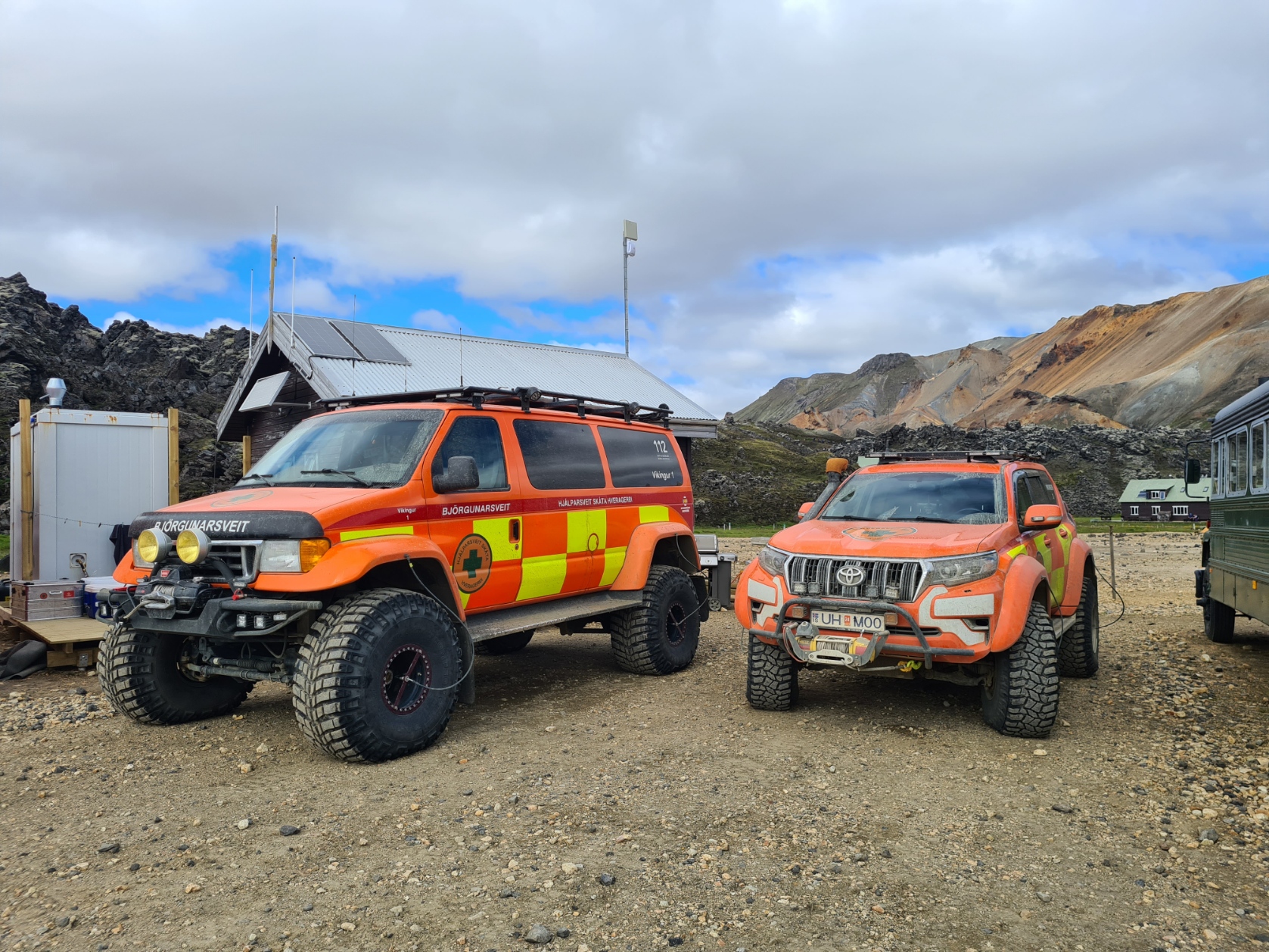
Landmannalaugar is quite a popular destination for the more intrepid tourist, located in Iceland’s southern Highlands. Spread out across the site and walking in the nearby hills, there were probably a couple of hundred day and trail visitors, exploring the rhyolite mountains, geothermal hot springs and lava fields of the Fjallabak Nature Reserve. There are huts (pre-booked months in advance) and a campsite here, also a w/c, though there is a charge of 500 IKr to use the latter (about three quid).

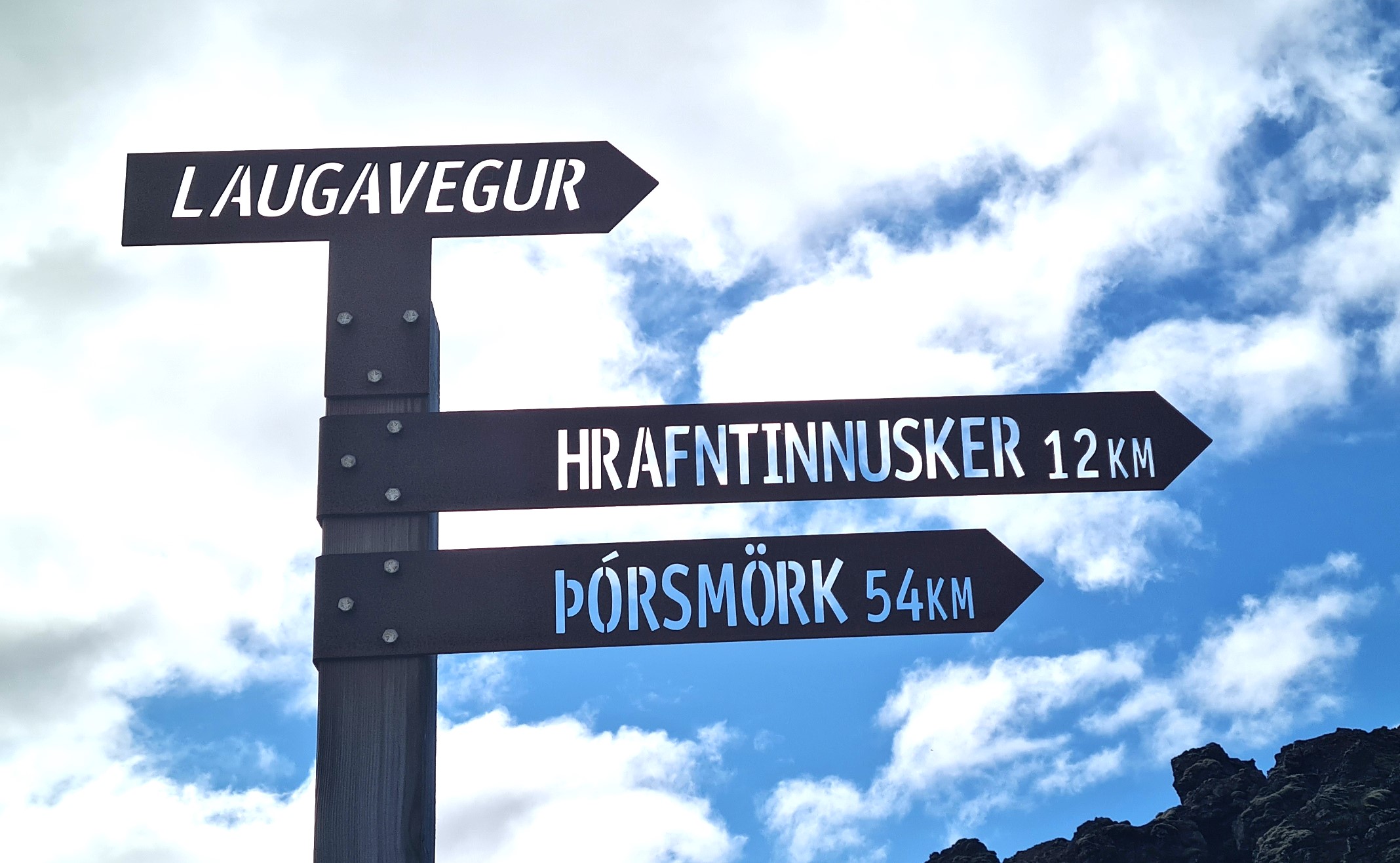
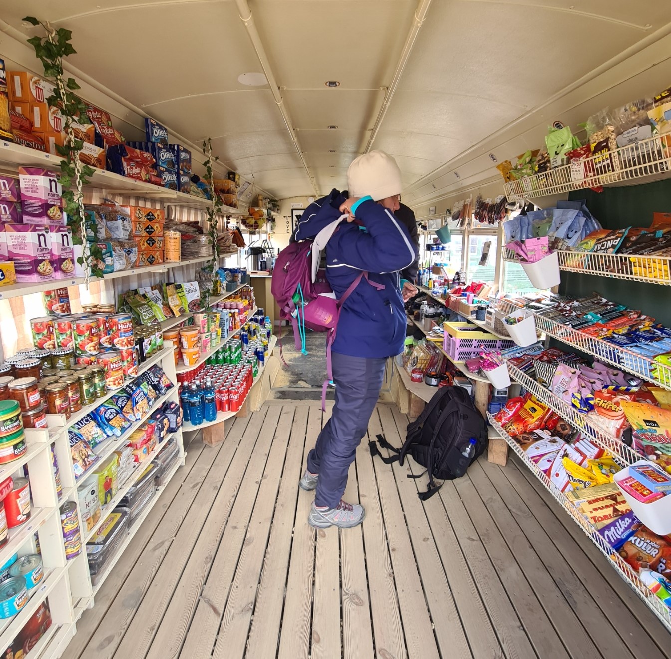
Packs were extricated from the bus and I left the driver forlornly looking at the rear bumper hanging off the back of his vehicle. I briefly explored the site though I needed nothing. I visited the famous and extraordinarily well-equipped Mountain Mall, poked around but didn’t buy anything, filled up with water, chatted to the warden- “how is the weather“- “it’s supposed to be fine, but…” shrug of the shoulders “…this is Iceland, it could be anything“. Then, it was time to hit the trail. From here, it would be four days and around 54km to the glacial valley and ridge of Þórsmörk (Thor’s Forest) where I had a choice of three huts to end at, depending on weather conditions and whether I was going to tack on the 25km Fimmvörðuháls Trail. I would decide on that when I got there.

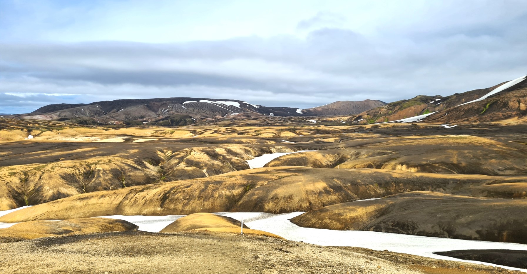
It is a spectacular first day on trail and volcanic activity surrounded me. I was determined to take my time and enjoy it all. I stopped to photograph constantly. The trail first runs through the Laugahraun lava fields, concurrent with one of the day hike trails, many visitors to Iceland wish to get at least a flavour of this area and shorter walks take in the Brennisteinsalda volcano, the Bláhnúkur mountain, or the Suðurnámur mountain ridge. That said, I was pleased to eventually reach the point where my trail went one way, and the, if not hordes, but certainly plentiful visitors, went another. The hills are an amazing range of colours, mostly due to the rhyolite, which is a type of volcanic rock made of quartz and silica. Minerals such as iron and sulphur add extra colour.


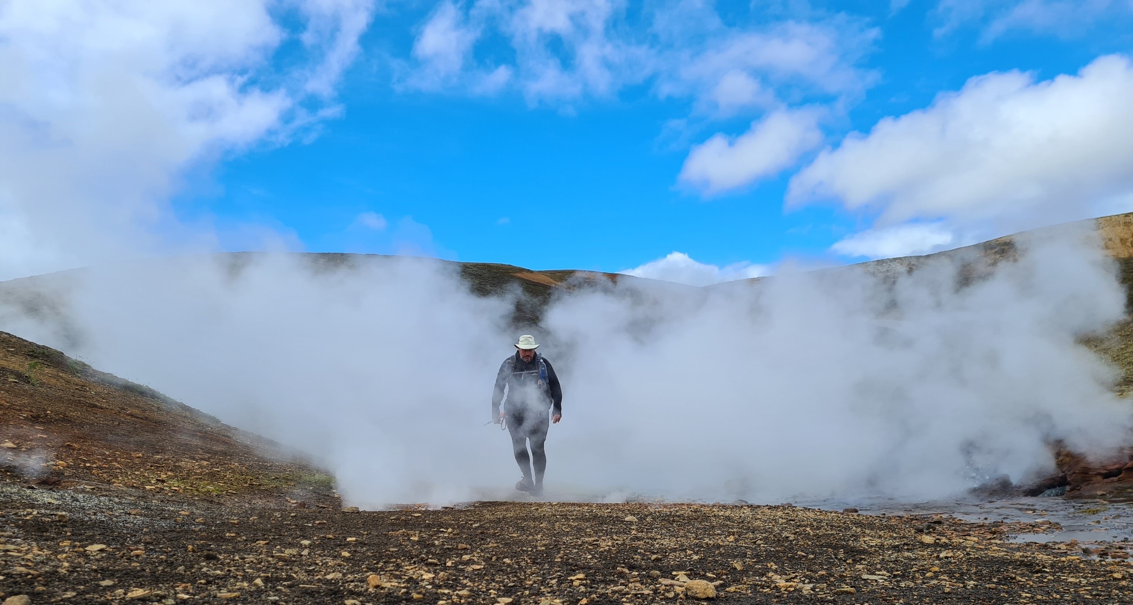
Iceland is well known as the ‘Land of Fire and Ice’, this is due in part to it’s volcanic nature, also that it has 269 glaciers covering some 11% of the island. It is not a dormant landmass, it is very much active. It wasn’t long before I was approaching the first of numerous fumaroles. These are obviously popular photo opportunities and can get busy with the Instagrammers.
As it was, I had many steaming, spitting fumaroles and hot springs all too myself and hung around taking my photos. The spluttering hot spring at Stórihver is a much photographed location. I was unsure whether I was loitering so much that the majority of hikers were in front or behind, I cared not. With so many daylight hours, I could finish any of my days on this trail at whatever hour I wished.
I have visited many a volcano in the past, but on how many long-distance trails had I witnessed boiling water and steam being strongly ejected from the earth’s crust, I can think of none.
There is little in the way of bird life on these volcanic hills but further along the trail, I became conscious of the faint cry of Golden Plover. These cryptically summer plumaged waders nest where they can on the moss covered slopes, presumably feeding on sufficient flies to successfully raise a brood. Pickings must be scarce as I hadn’t even seen a fly, or any other invertebrate, since leaving Landmannalaugar.
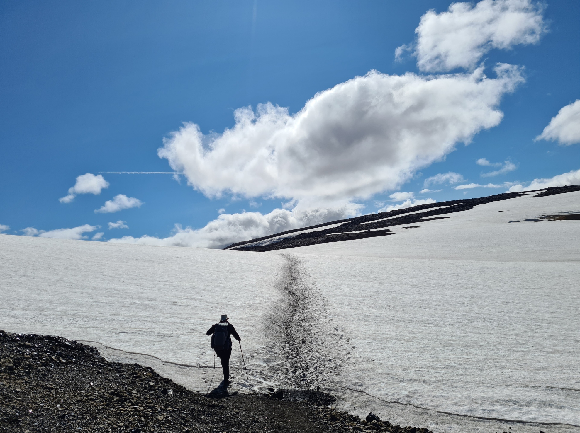
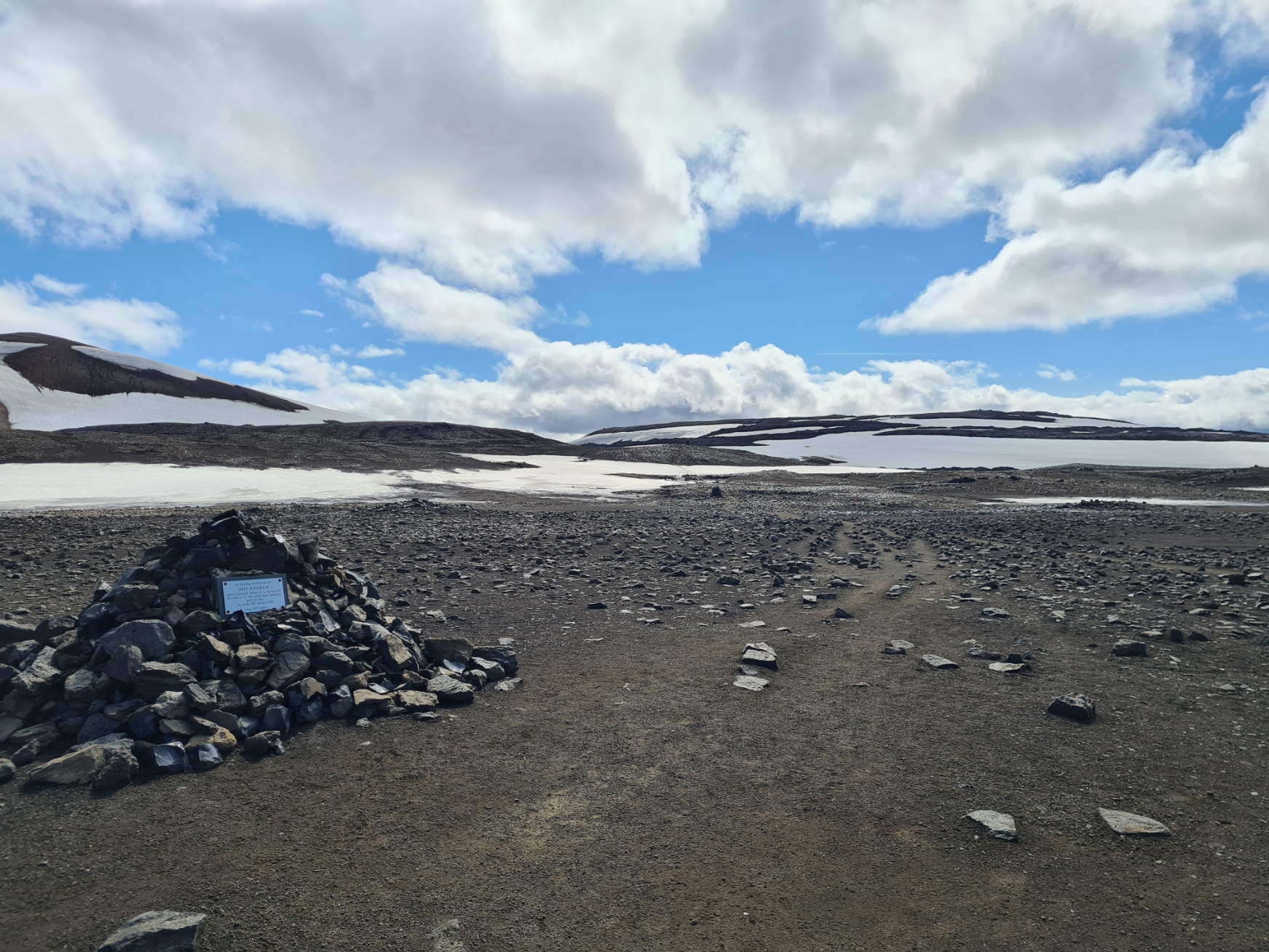
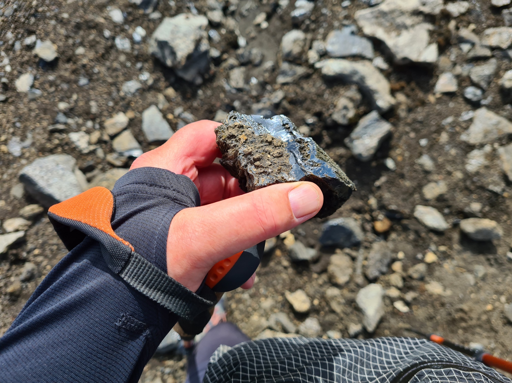
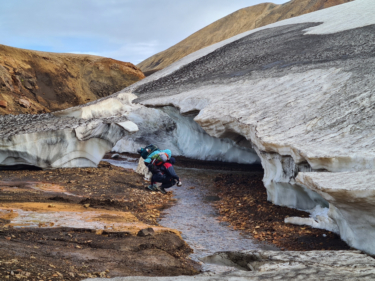
I started to encounter snow fields, despite it being high summer, the only time when this trail can be hiked. Snow never leaves many parts. This is often melting from below, either as a result of running water, or due to a ground surface warmed from below. This can make crossing some patches of the white stuff, especially in ravines, a bit dodgy. In some summers it can be treacherous, people have died here on trail or got into trouble and I was extremely fortunate in how good the weather was. Also, nearing the huts, I passed through extensive areas littered with black glassy obsidian rock.

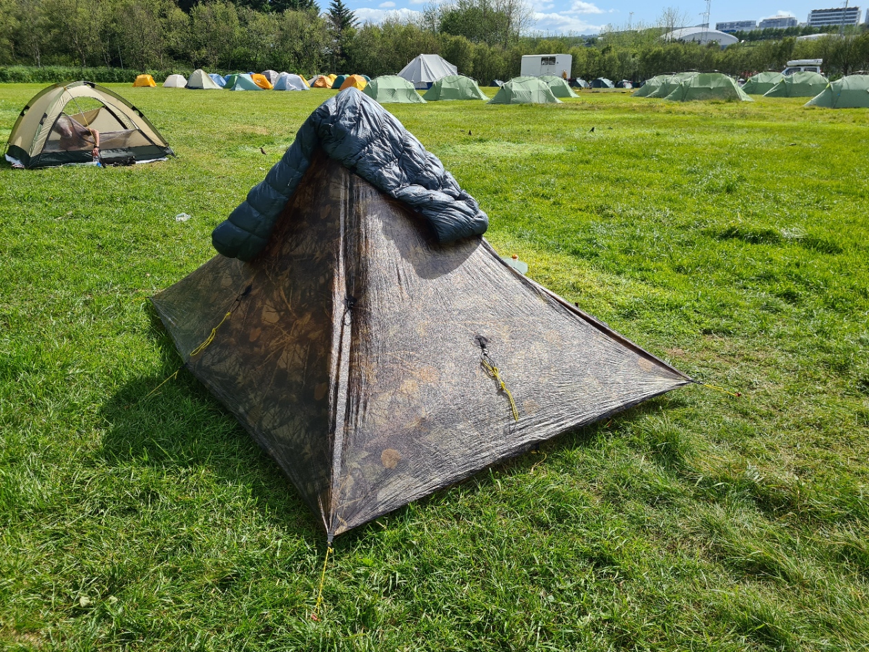
When the trail is busy there can be a bit of scramble to be amongst the first to reach the Höskuldsskáli huts at Hrafntinnusker and claim one of the stone circles that provide considerable protection to a tent from the strong winds often present at this overnight halt. I had bought the MLD Dual Pole Connector & Jacks with me in case I wanted to set up the Mid in inverted V pole configuration, either to give more interior space, or for a little more stability in rougher weather. With strong overnight winds expected, I used this set-up at Hrafntinnusker. There was no shortage of decent pitches when I was arrived there at 16.00 and I was happy that the Duomid was adequately nailed down and protected even if it blew a gale later. Some hikers refuse to stop at this location due to the wind, preferring to make a long day of it and walk on to Álftavatn. When I arrived at that location on my second night on trail, I met some hikers coming in that had done just that. Finishing their day at gone 20.00, they were dog-tired.


While I had eaten a couple of bars on the walk in from the trailhead, I hadn’t eaten anything much else beyond a pecan pastry on the bus trip to Landmannalaugar, so as soon as the shelter was up I got a brew on to have with a late lunch, followed just three hours later by my evening meal of Bla Band Wilderness Stew, bought with me from the UK. A Hot Chocolate and Cinnamon buns may, just may, have been consumed later. It was too cold to stand around and chat much with other campers, though one interested US hiker came down from the huts to discuss the various merits of the Duomid with me. On a visit up the slope for a pee at the w/c, I was also chuffed to see a lone Snow Bunting near one of the huts.

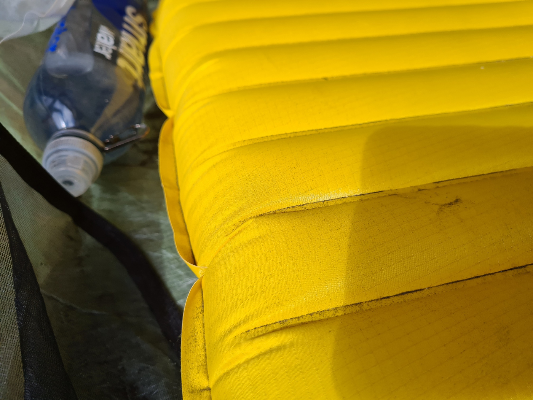
While it was already all too obvious why Iceland is called ‘The Land of Fire and Ice’. I do think …and Wind‘ should be added to this. Knowing how windy Iceland is, had dictated which of my shelters I carried, and the MLD Duomid proved to be an ideal choice other than one issue that has to be properly addressed on my return to the UK. This was the fine ash carried in the wind that gets everywhere, which included the zip closure for the tent. This proved problematic over the days that followed and despite my attempts to wash it clear, I frequently had the zip jamming, refusing to close all the way, or jumping teeth.
The temperature dropped considerably once the sun dropped below the ridge and a cold wind blew through the site. This was the coldest night I had on trail and I put cords on the pad to really lock my Katabatic Palisade quilt around me and eliminate draughts. This was the only night I wore a beanie to sleep. I slept well, so cosy warm that I stirred little during the night, once to have a pee, and once when rain briefly rattled across the taut shelter.

Day Two: Hrafntinnusker to Álftavatn. 12.1km. 240m ascent, 722m descent
There is usually no need to rush on this trail. The only thing to be aware of if the weather is kind and shorter sections are being tackled, is that the rivers to be crossed can hold greater amounts of water later in the day due to melting from the sun. I reluctantly stirred at 08.30. Breakfast was a repeat of yesterdays late lunch. Steaming fumaroles could be seen in the distance, looking like illegal campfires, though no one is wild-camping on this trail. You have to camp at the huts, and pay for the privilege and quite high fines are levied against anyone caught wild-camping. It was all very peaceful and I sat for quite some time nestling a mug of tea (or two) simply enjoying the silence and solitude and staring across the vast Torfajökull caldera. Other hikers left in ones and two’s, becoming far off dots against the snow, eventually disappearing over the ridge.

I sat and enjoyed this halt and it wasn’t until 11.00 that I finally shouldered my pack and set off across the valley bottom along the slopes of Reykjafjöll toward the first of many snow covered ravines that have to be carefully crossed. This took over an hour as these gullies have steep slippery sides and the snow is melting from below. My left leg disappeared deep into a hole on one snow bridge, but no panic, carefully extricated, and onward. The trail was soon back onto colourful rhyolite slopes, most with a slippery fine covering underfoot, then west of Kaldaklofsfjöll and up to the spine between them and Jökulgil


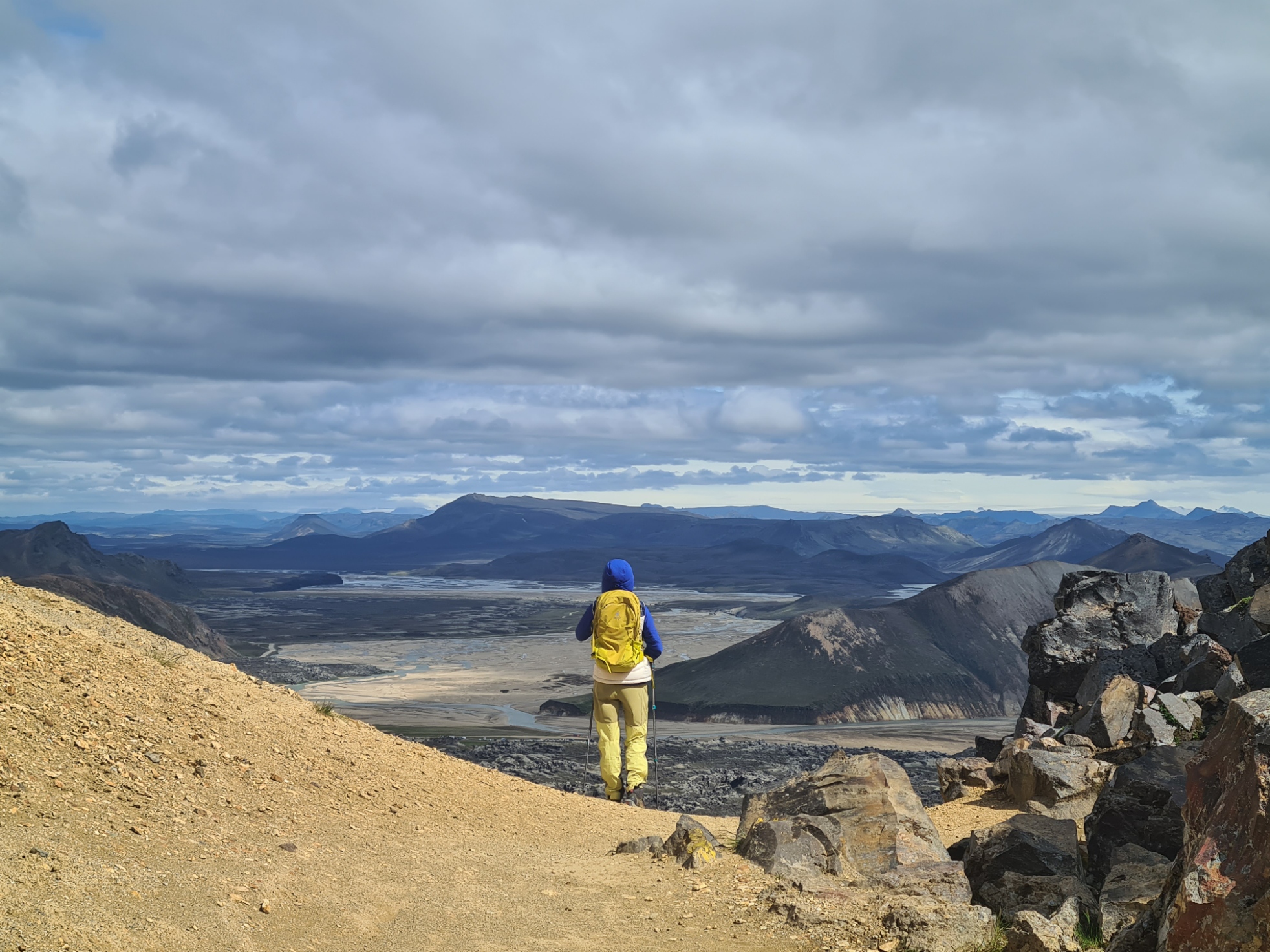
I moved from high in silica, felsic rock, to low in silica mafic rock. All formed in the belly of volcanoes. Often the very ground beneath my feet steamed. The air was sulphurous, bad eggs all around. Frequently, I could feel the warmth from below. This was in contrast to the freezing melt water that had to be crossed in any gulley large enough to permit water to run where the snow had left. The trail descends and ascends until it reaches the saddle of Jökultungur, from where I could see three glaciers- Tindfjallajökull, Eyjafjallajökull and Mýrdalsjökull. Equally as striking was the change in colour, I now had green, moss covered valleys below me.
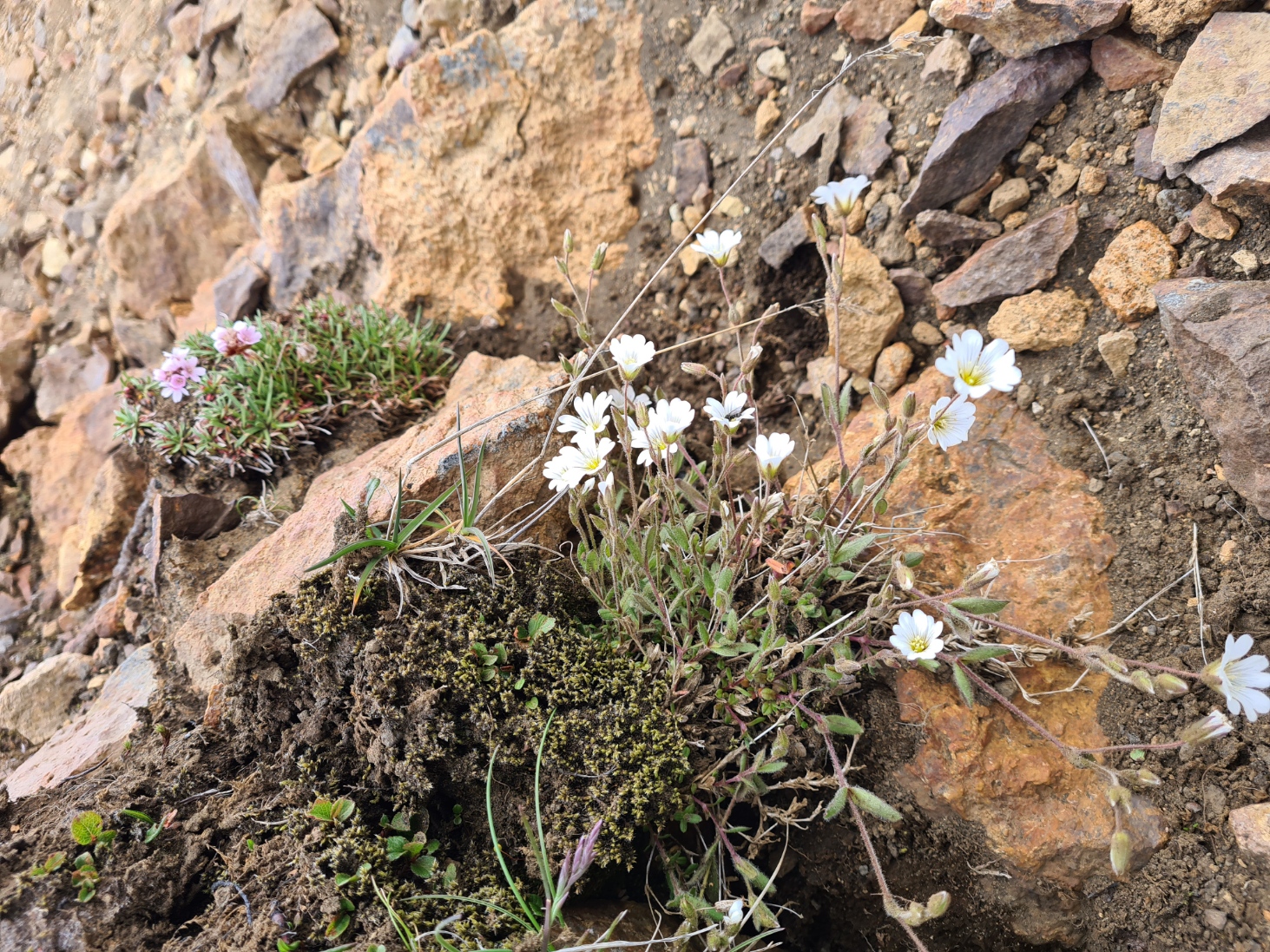
I was now passing the northbounders. I wondered why most of them were pretty silent, if not downright rude, but soon found out why as it was a long long stone clattering descent of Jökultungur toward the rift valley (a climb for those approaching me) where the Álftavatn huts are to be found. It was here that I began to see the first flowers since leaving Landmannalaugar. The pleasant campsite is situated not far from the large Álftavatn Lake [Swan Lake (lake)]. A body of water only present due to the ground sinking when the continental plates separated. My view from the hills above showed the series of parallel rift valleys stretching to it’s west.
Even once the lake had come in to view, it took me two hours of careful walking down the slopes to where I then encountered my first ‘proper’ river crossing, that entailed more than stone hopping to cross. The Grashagakvísl is narrow but fast running and I walked downstream further than most other hikers seemed to be doing, looking for the safest place to cross, eventually finding a cable strung across its width. Lone hikers have to take extra care on river crossings, but as it was, two more hikers crossed immediately after me.

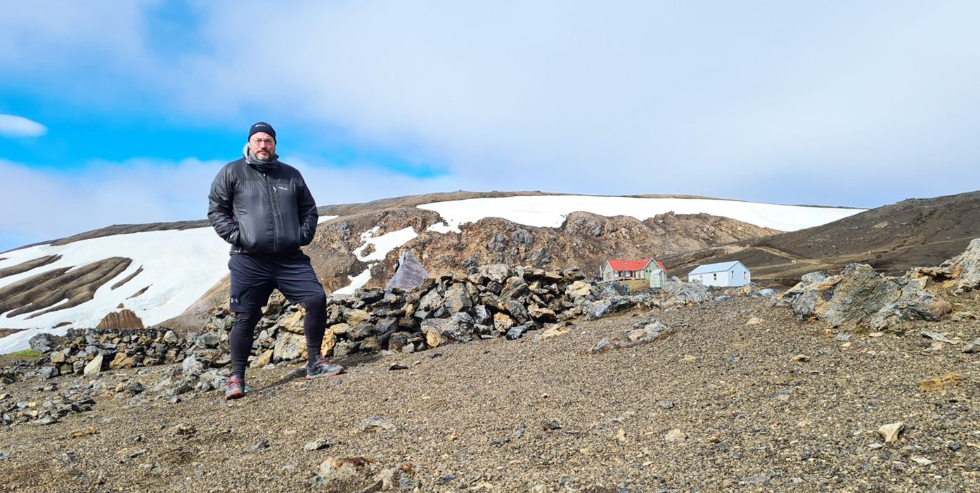
The final mile or two follows a vehicle track across ash and cinder fields and it was here I met Bart, flying his drone. Despite my having passed him and his mate the previous day, he wasn’t really attempting the Laugavegur, more visiting various locations on Iceland to film it from above. We chatted a while about his Mavic drone, but I eventually moved on, I had promised myself a treat at the huts. Álftavatn is one of the better sited campsites on the Laugavegur, nestled in a valley with a small river running through it to the large lake. It is quite sheltered and a large site. Despite this, most campers cram themselves into just the one area, and I later found that one late arrival had pitched right outside my shelter’s door despite there being a couple of football pitch sized areas only metres away.
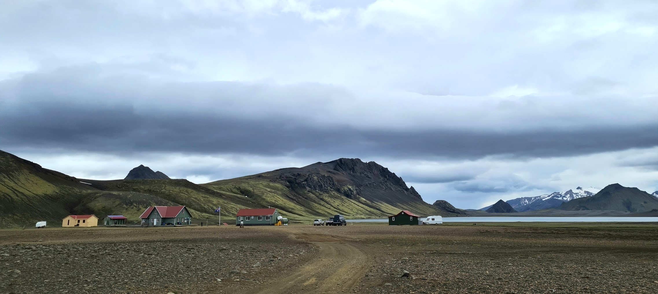
Despite a late start to my day, it was still only 16.45 when I reached the wardens hut and paid my site fee. Before pitching however, I visited the small ‘restaurant’ hut for a very good mushroom soup, bread and side salad. I had heard there would be a large party arriving later (forty slackpacking Danes, with tents being ferried to each nights halt for them) so also pre-ordered a chilli for later that evening. This was not a spur of the moment decision and I had already decided to have this if available. Despite knowing it was going to be pricey I foolishly did a cost conversion. With 11% VAT added, the large (and very good) chilli I enjoyed later cost me over thirty quid. I may have consoled myself with one or two Viking beers (5.6%) and a glass of wine. Hey, I’m on holiday!


3 replies »