
The South Downs Way is a 100 mile National Trail between Winchester and Eastbourne. it follows the northern escarpment within the South Downs National Park for most of its distance and is a fairly gentle walk along the chalk downs with only occasional drops to cross river valleys.
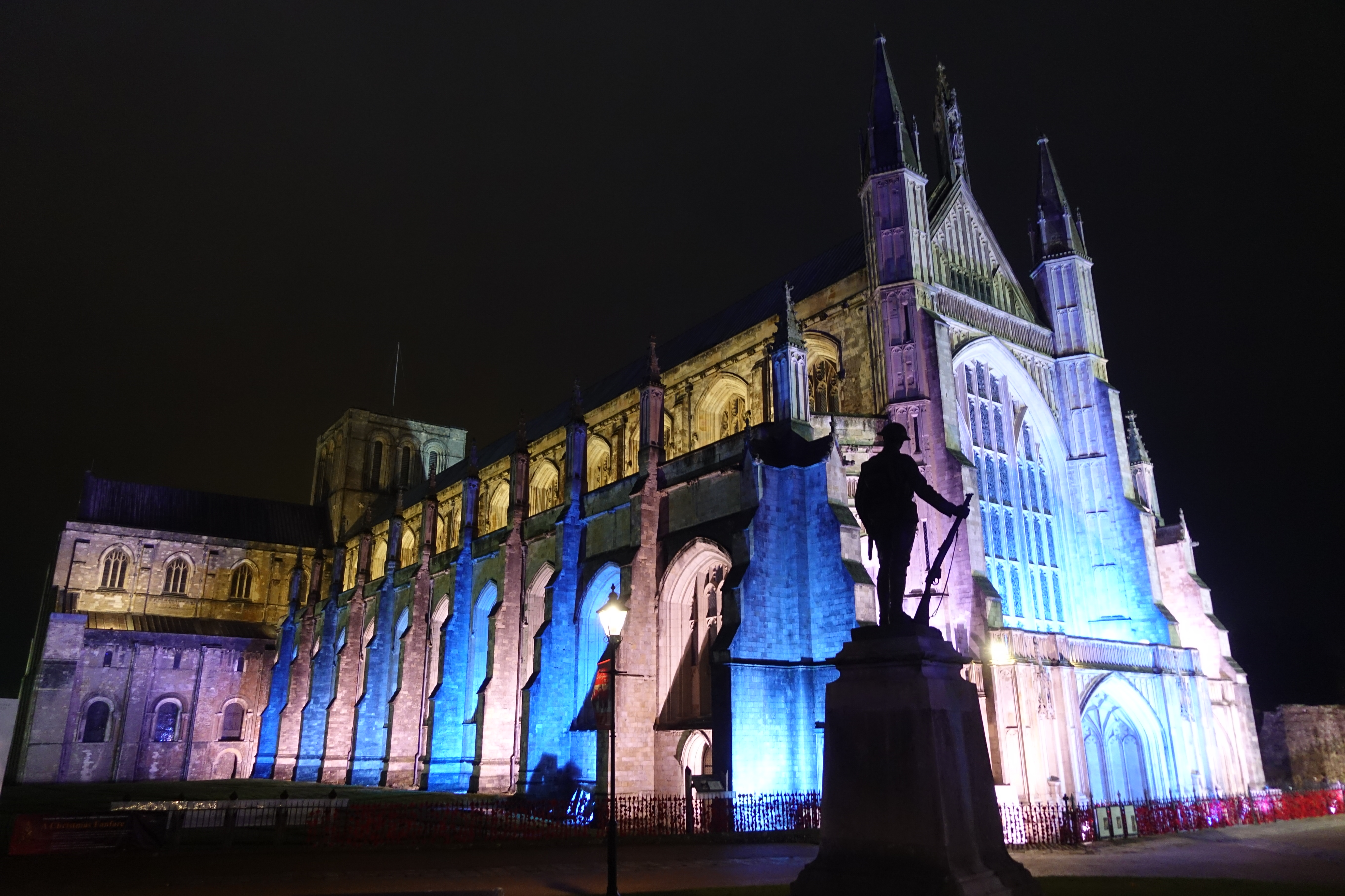
Three Points of the Compass travelled down to Winchester to stay there overnight prior to commencing the South Downs Way. This not only permitted a late night wander of the city, taking in Winchester Cathedral, but also a pint in the Royal Oak, reputed to be ‘the oldest bar in England’. Building of the cathedral commenced 1079 on the site of an earlier Saxon Church. The pub dates from around 1002
Three Points of the Compass completed a five month 2000 mile hike in 2018, much of that time was taken as unpaid leave so consequently still had a few days holiday left to fit in before the end of the year. So I decided to knock off another of the National Trails. I walked this trail decades ago when I was in the British Army, but the memory has dimmed. Not only that, but it used to be considerably shorter, originally extending only as far as Buriton until the circa 25 mile extension to Winchester was approved in 1989.
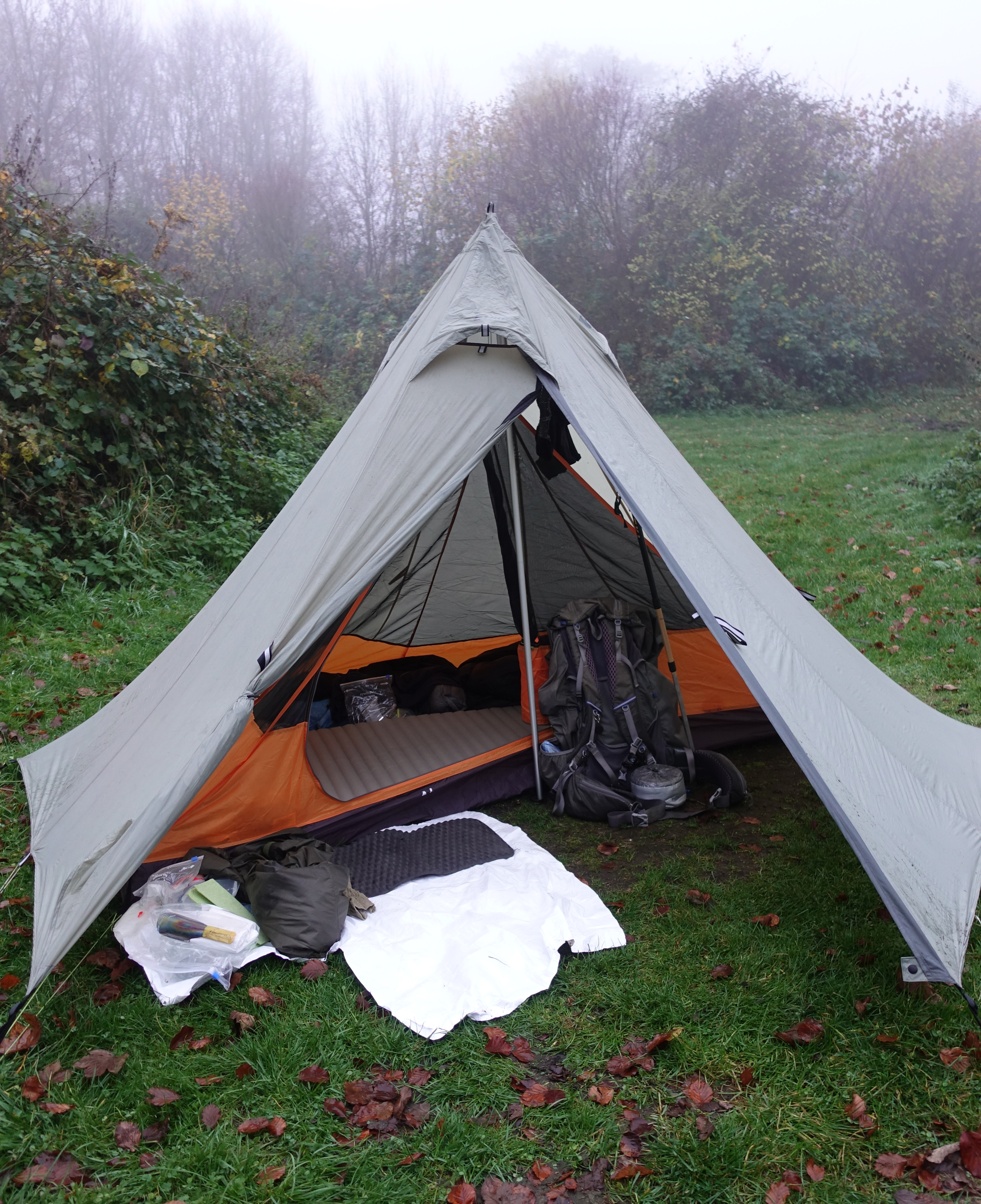
Nigor Wiki-up 3 with Hex Peak V4 single person inner nest
I decided to complete the Way as a winter thru-hike, doing a mix of camping and accommodation. My Z-Packs Duplex had been worn out completely on my Three Points hike earlier in the year so I took my Nigor Wikiup 3 pyramid tent instead. In a nod to the colder conditions expected, instead of simply using a bivi-bag inside the shelter as I have in the past, I took a small one person nest to make the nights a little more comfortable. This was the Hex Peak single inner V4A. It worked brilliantly and the three nights slept inside were all very comfortable despite winter arriving with a vengeance while I was on trail.
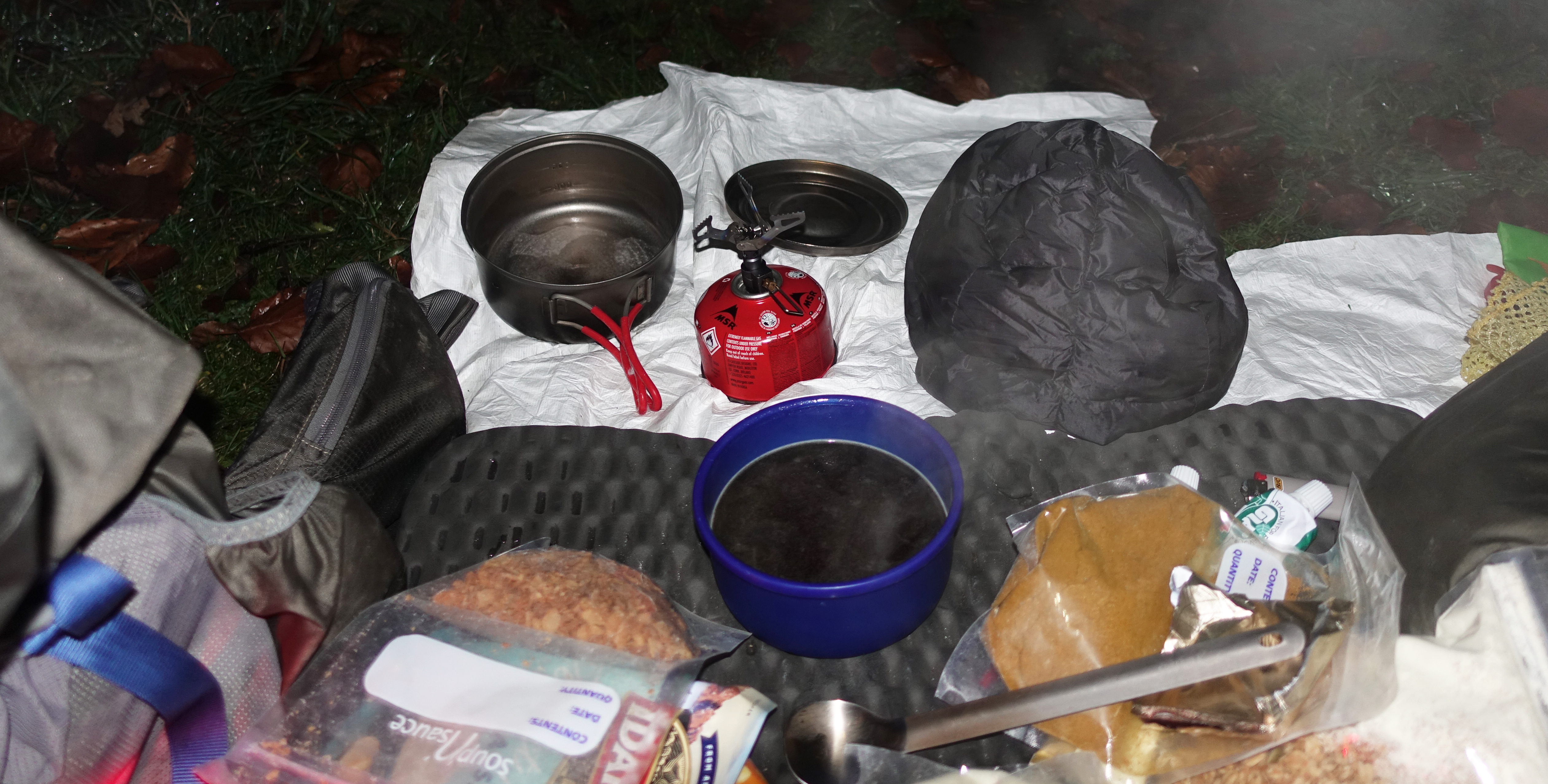
The paraphernalia of an evening meal on the South Downs Way- sitting in freshly boiled water, my lentil curry continues to cook beneath my down beenie while a hot OXO provides much required re-hydration while waiting. There is plenty of room within the Wiki-up 3 shelter to enable cooking inside while it rains outside
My complete gear list can be found here. Accepting that the weather had turned, I carried a few more comfort items of clothing in addition to those I usually take on longer hikes- a mid-layer, puffy trousers and jacket, down beenie etc. Base weight was 9615g but because it was a pretty short hike I carried much of the food I would require. This meant less reliance on infrequent shops, less time spent hunting down meals when the daylight hours were short and less miles added to my total. Cooking was simple- lentil curries, hot drinks such as tea and OXO, granola for breakfast, plenty of chocolate. Tortillas and tuna pouches for three lunches. A few flapjacks were also stuffed in. For this trip I carried the little 25g BRS 3000-T ‘bumblebee’ stove and a 110g gas cartridge.
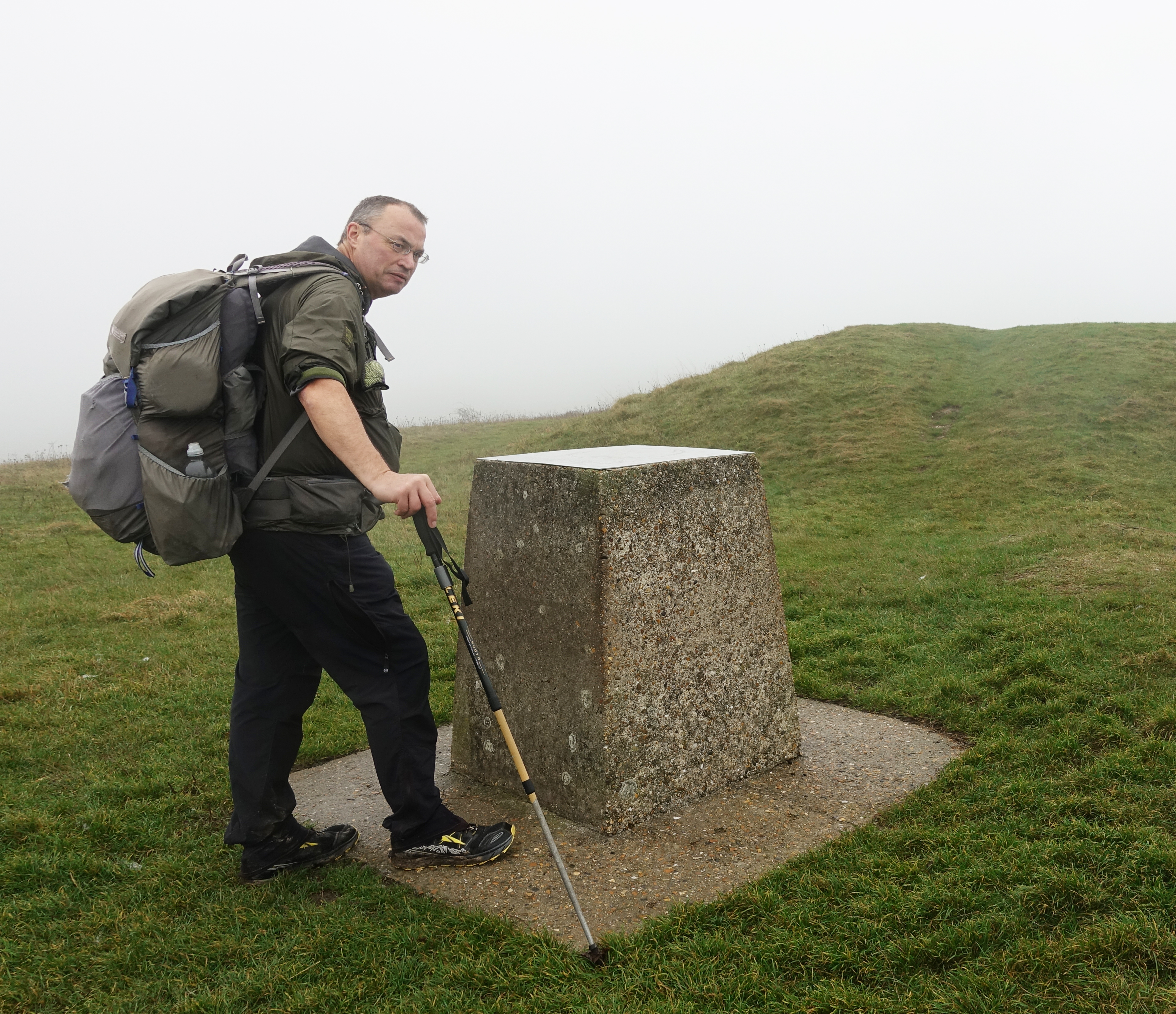
Tried and trusted, if a little worn out, my Gossamer Gear Mariposa pack was used for this hike. This had ample room for everything I required, including a few extra cold weather items
Having enjoyed a pint in one of Winchester’s older establishments, I followed this with a meal in the local Wetherspoons. A big mistake, going for cheap and plentiful calories I waited over an hour for my food which was dire and even the selection of beers was poor. A shame as I can normally rely on a ‘Spoons to deliver what a hiker needs.
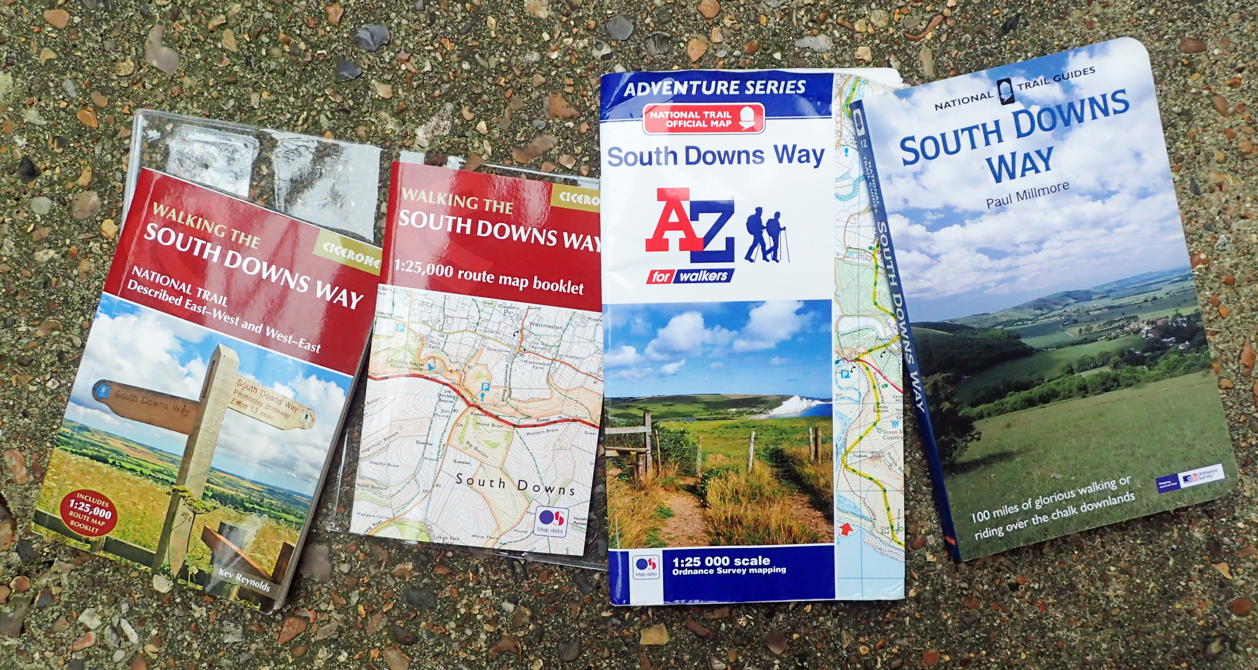
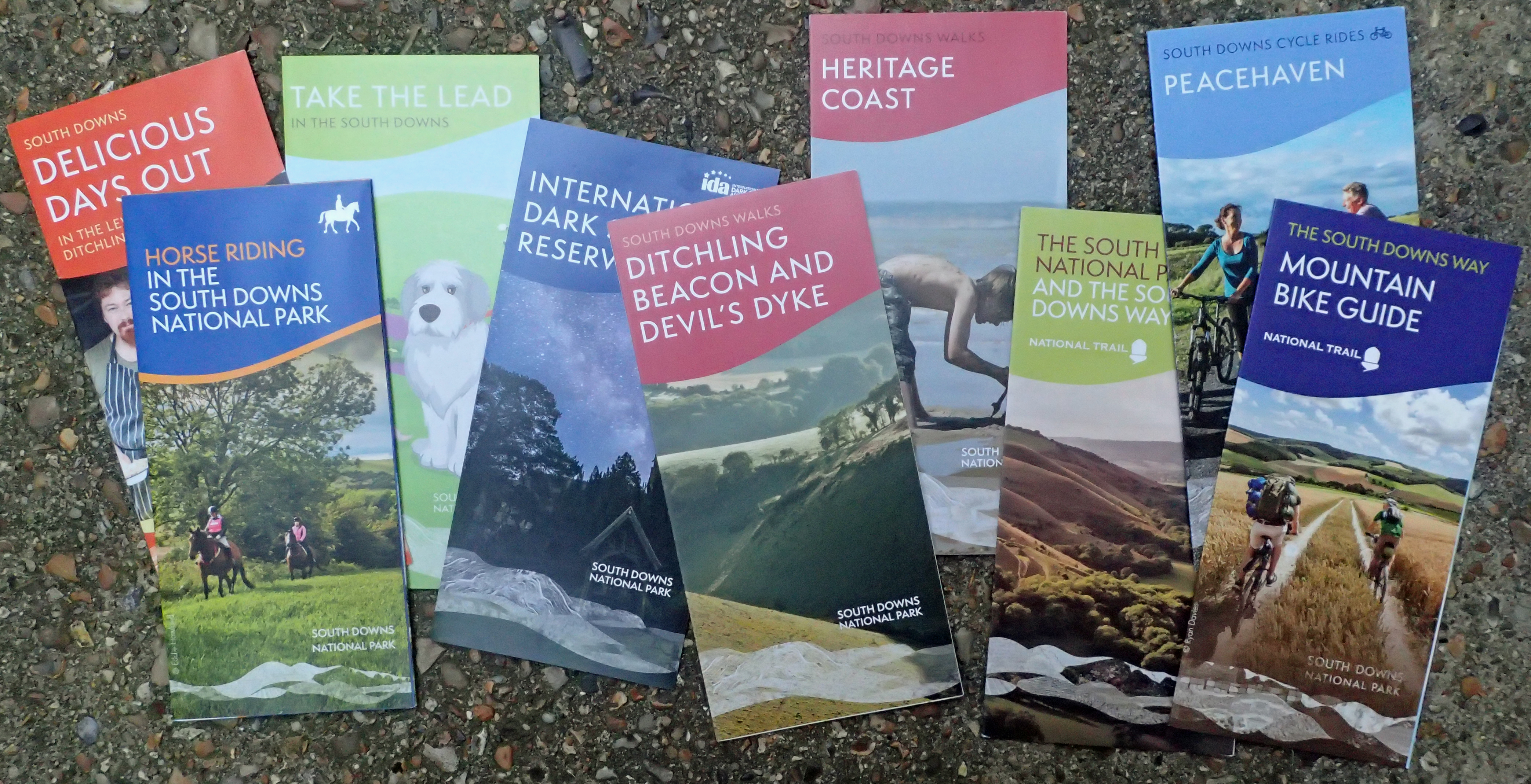
There are a lot of guides and maps for the South Downs Way. Despite being well-waymarked, it makes sense to carry a map and a guide book can only add to the enjoyment of the walk. I carried the Cicerone guide book, but left the Cicerone map booklet at home, preferring to take the A-Z Adventure Series that contains good 1:25 000 O.S. mapping with a wider coverage than the Cicerone version
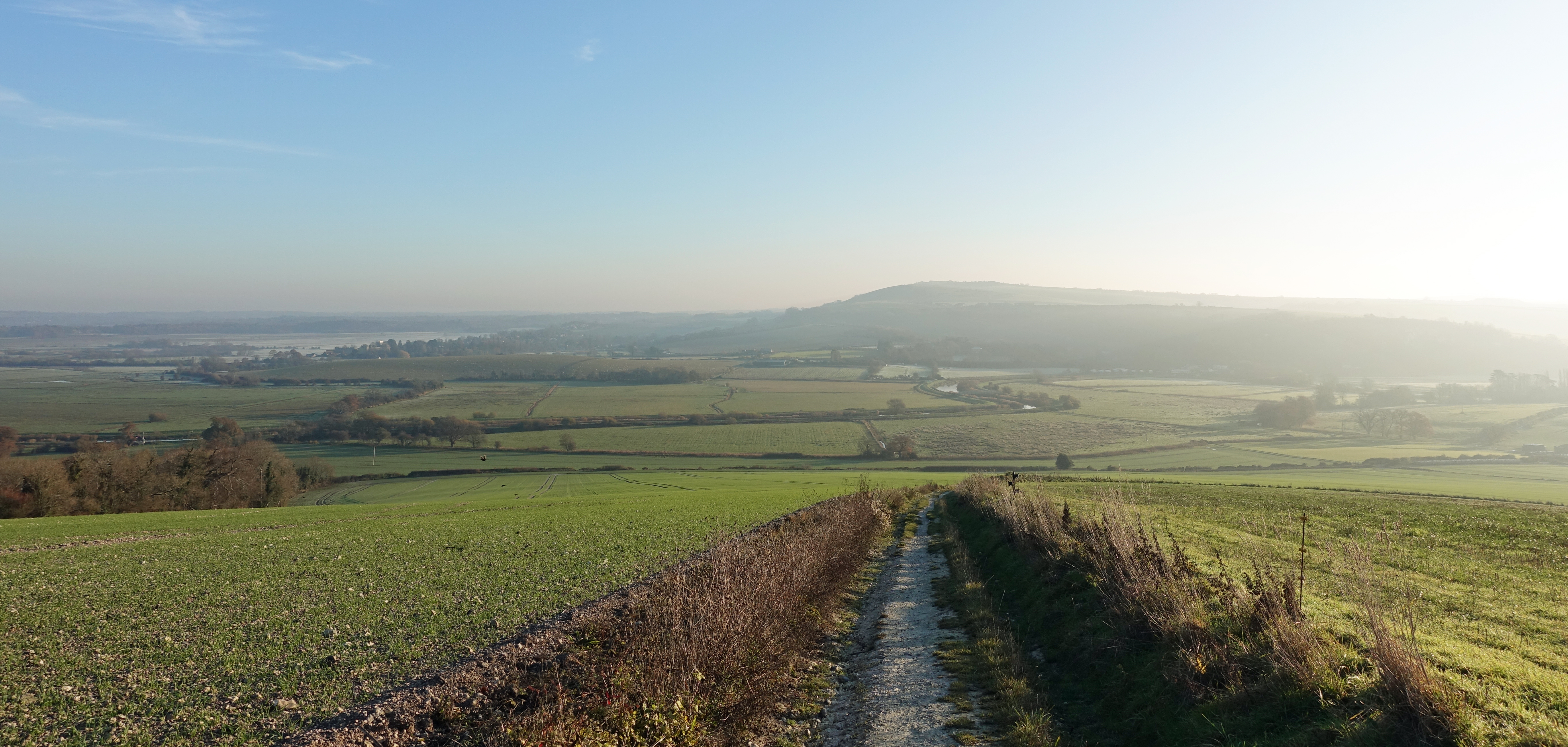
The following day, a Friday, I left my hotel at six-thirty, an hour or so before dawn and it was a short walk to the start of the trail beside the City Mill, from there it was an easy well-marked trail, following the River Itchen out of town. I crossed the M3 and was immediately into the countryside. I was carrying around 1.5 litres of water as I set off as I was unsure on how water supply would be. I had been told that many taps are turned off from the end of October. I’ll do a separate blog on the water sources I used. Suffice to say, I had no problems sourcing water throughout the hike. Highlights of that day were lovely leafy tracks, mostly soft walking, deer, partridges and around a million pheasants…

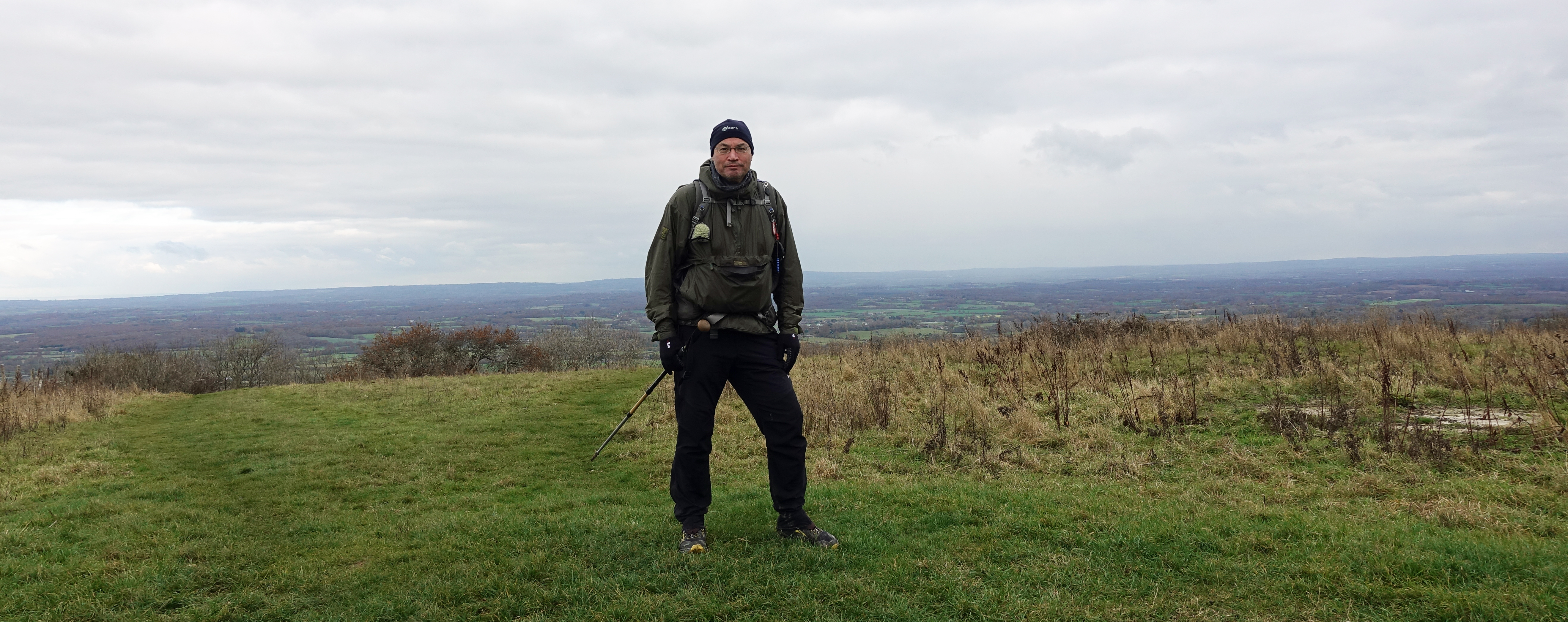
Beacon Hill on the South Downs Way. The mist barely cleared on my first day on trail
With sixteen miles completed by 11.40, my first halt was a little later for lunch at the Bronze/Iron Age site on Old Winchester Hill, just one of many National Nature Reserves I passed through. I knew that with short day light hours I was going to have to get a move on to that night’s halt. But I still took a break for a mug of tea at the fly fishers little cafe adjoining the tackle shop at Meon Springs. Friday’s camp site was at the Sustainability Centre, Wetherdown Lodge. Arriving at 14.40 after slightly more than twenty miles, I had a winter pitch booked which still meant I had a warmish shower and compost loos to use. There were no other campers and after pitching the tent, I managed to get to the cafe on site minutes before they closed for a pint and a bag of crisps. Back to the darkened tent for lentil curry and instant mash. With a long night before me, I settled down in a warm quilt at 18.50.
I slept well, the campsite was silent beyond a few owls, a mouse rustled through my rubbish bag outside but cleared off when I muttered at it. I rose at five as I had a twenty four plus mile day to complete to where I hoped to wild camp that night. The temperature had dropped considerably and I was pleased I had bought a full set of insulated clothing as camp wear. Quite a bit of condensation on the inner surface of the shelter, nothing within the nest however. I wiped this down while the tawny owls set off again, breakfast, ablutions, packed and away prior to seven. A bit later than I had hoped but I frequently faff around a bit too much on my first morning. It wasn’t long before I was into the Queen Elizabeth Country Park. it was good walking through the wooded park until the wonderful long and sweeping descent down to the crossing of the A3. I held a gate open at the bottom for a couple of horse riders who after thanking me, set off at a fine gallop up the slope toward the ancient field systems below Butser Hill that were very evident that morning with the misty low sun and long shadows.
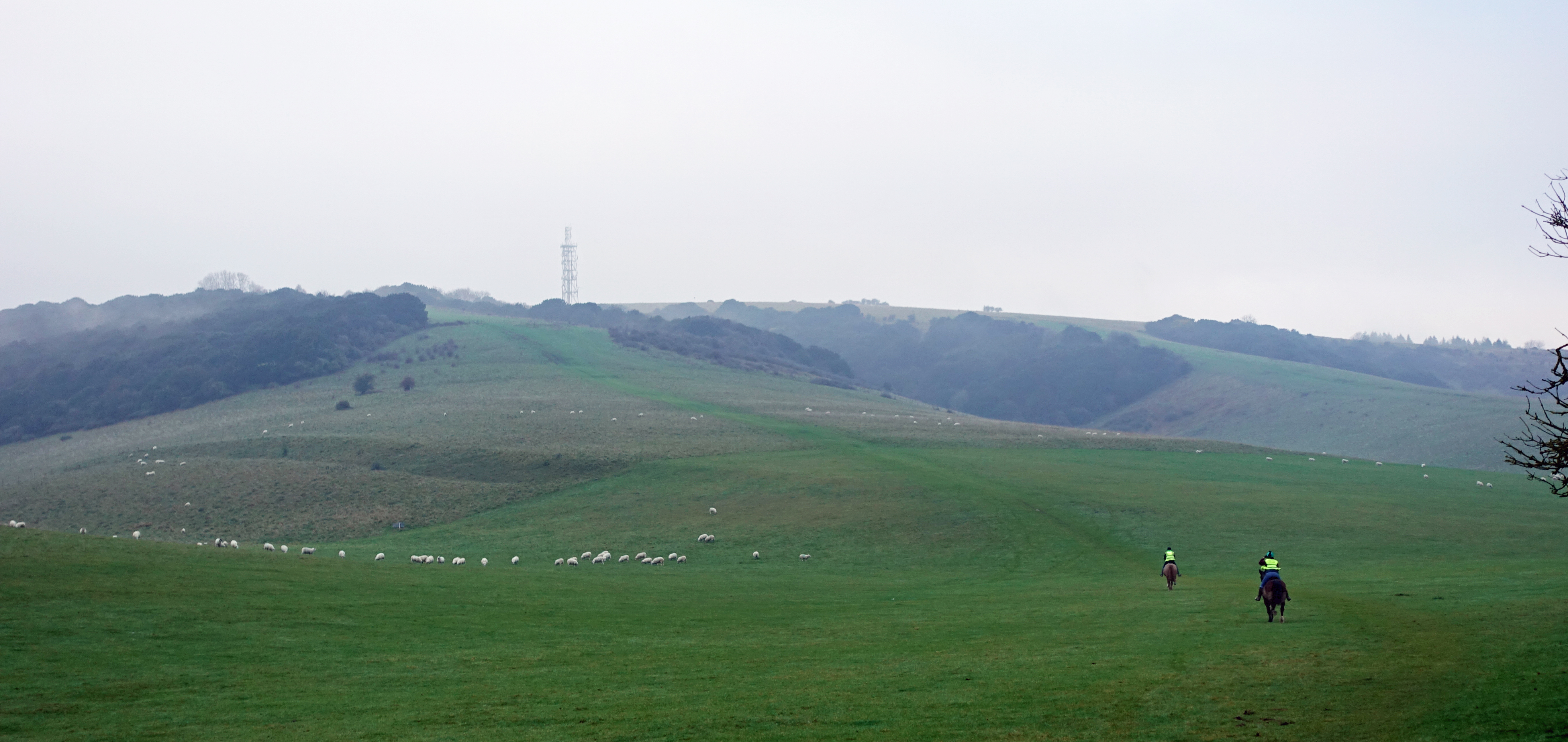
Horse riders gallop up the national trail toward the radio station on Butser Hill
I had held faint hope of a bacon sarnie at the cafe in the visitor centre beside the carpark but that didn’t open until ten. I wasn’t waiting around for two hours so after a brief chat with a marshal setting up for a Park Run taking place later (it was a Saturday), I walked on through the park and out the other side. It sounded as though World War 3 had kicked off as there were shoots taking place in all directions. The path was pretty stony today and the feet felt it a bit in my mostly worn out Altra Lone Peaks. Time for a new pair perhaps.
The mist cleared a little in the afternoon but soon gathered again as the early evening approached, so views were modest. My planned halt that night was at Glatting Beacon but I found that there was a cold wind whistling up the slopes so hunted around for a bit looking for shelter. I eventually settled for a quiet little flat space immediately next to the entrance to the compound containing the masts. It looked as though the place had few visitors, as evidenced by what appears to be arson attempts to the buildings within the compound.
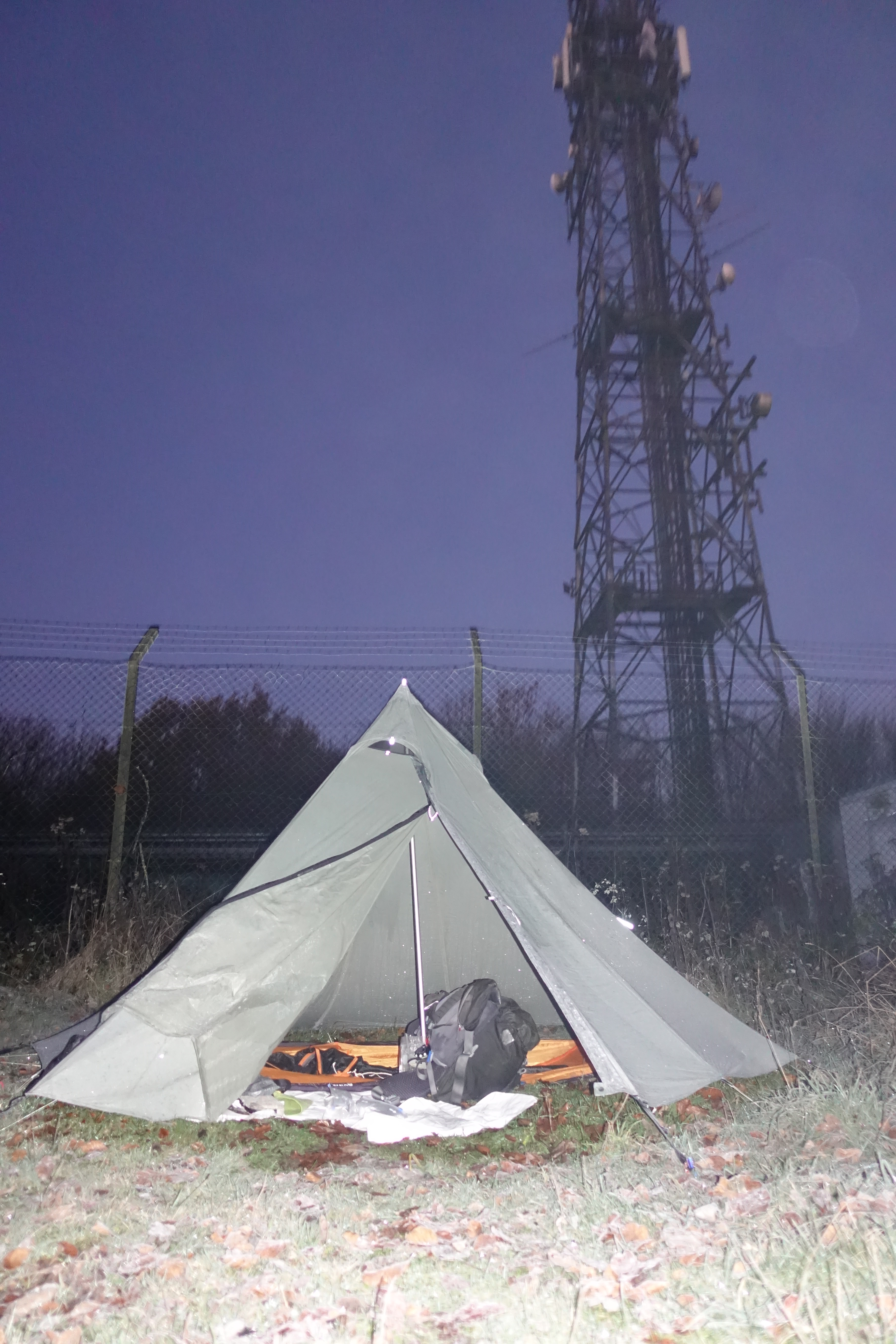
Saturday night’s camp was on Glatting Beacon. I arrived around 16.30 and immediately pitched, it was dark by the time my shelter was up
Another lentil curry and plenty of chocolate. I had a good signal there so was able to chat to Mrs Three Points of the Compass for a while as I sank hot drinks, first an Oxo, then tea, finally a hot chocolate, then early to bed as I could feel the temperature dropping.
I didn’t sleep fantastically that night. I was warm enough but the cold was evident in the morning with a heavy frost. My alarm failed to sound at five thirty, possibly affected by the cold, but I woke soon after anyway. Hot mug of tea and granola followed by ablutions. I had picked a pitch away from the cold wind but condensation was heavy, this immediately froze as soon as I opened the tent flap in the morning. Being frozen, it was easy to shake this off when packing up. It was a lovely clear morning when I hit the trail a little after seven. It was Sunday and this was the busiest I saw the trail with quite a number of dog walkers out.
Little mist on my Sunday on trail. Gentle slopes could have made for reflective walking if it were not for the blasts of shotguns reverberating from the wooded slopes. Quite a few pheasants would not see another morning
There were quite a few deer in the fields, running as soon as they saw me, stopping to gaze at me from a safe distance, then turning and running again. Partridges cher cher cherred away in low loping flights. Yesterdays Buzzards were now joined by numerous Red Kites. It was a good days walking with the best views so far on trail.
Disused chalk pits on Chanctonbury Hill
Approaching Chanctonbury Ring. A feature of the South Downs, it is visible for miles to the north and south. The original ring of trees, long since replaced, were planted on the site of a prehistoric hill fort
Sunday was a nineteen and a half mile day to Truleigh Youth Hostel. I hadn’t been able to book it as it was on exclusive hire but emailing them, the warden had kindly informed me I was welcome to camp in their field opposite- “hide in the field, by the pond or under the trees”, she had also left the campers w/c and shower unlocked for me. I made sure to leave a generous donation in the charity jar when I left the following morning.
Sunday night’s camp was in the field opposite Truleigh Hill Youth Hostel. A lovely still evening and a cold night
When I arrived at the hostel, quite a few of the group that hired the hostel were outside the entrance smoking. What they were smoking I had my suspicions. Drinking and dancing was taking place on the first floor. In chalk smeared outdoor clothes, I felt alien to what was going on but stood chatting to the small group on the steps. I was asked where I had camped the previous night, I told them it had been a wild camp- “wow, that’s awesome”, I quietly demurred- “it was just the one night, not much of a pitch, no view to speak of…”, he interrupted ” yeah, but wild anything, that’s cool”.
A couple of them were unloading a large sound system from one of the vans- “its a fiftieth birthday party, it’ll be going on ’til the morning”. Oh great! I held out little hope of any sleep but as it was, barely heard anything tucked away some 100 metres away. I slept pretty well that night and condensation was limited in the morning.
The weather was cold with clear skies and good views for much of Monday mornings walking. There were a couple of highlights to visit today. Having crossed the Hulking escarpment, it wasn’t long before I was passing through scrubby downland above Devils Dyke; Britain’s largest single coombe of chalk karst, this is a steep dry valley. Through Saddlescombe, the Hikers Rest cafe closed at this time of the year, then a leisurely halt at the Shepherds’ Church at Pyecombe. The village itself was hit badly by the plague in 1603 and is now split with part of the village now situated half a mile away from the remainder.
The Norman built Shepherds’ Church, Pyecombe
Famed for the Pyecombe Hook, a particular design of shepherds’ crook, I was only slightly more fixated on the dedicated room newly built on to the rear of the church specifically for pilgrims. I declared myself a pilgrim and stopped in to use the facilities and make a cup of tea followed by a hot chocolate. Eating flapjacks and bars and chatting to a parishioner meant this was a prolonged halt.
The tapsel gate at Pyecombe church is opened by one of the famous shepherds’ Pyecombe Hooks. These hooks were made for shepherds and Church of England bishops for around 200 years. A tapsel gate is made of wood and rotates through ninety degrees on a central pivot. Unique to Sussex, only six such gates survive
Then on to the equally famous Clayton windmills, better known as the Jack and Jill windmills. I diverted slightly off trail to go and see these. Jack, a dirty black smock mill is a pretty poor sight now. It has no sails and is a private residence. The nearby Jill, a white painted post mill looks superb.
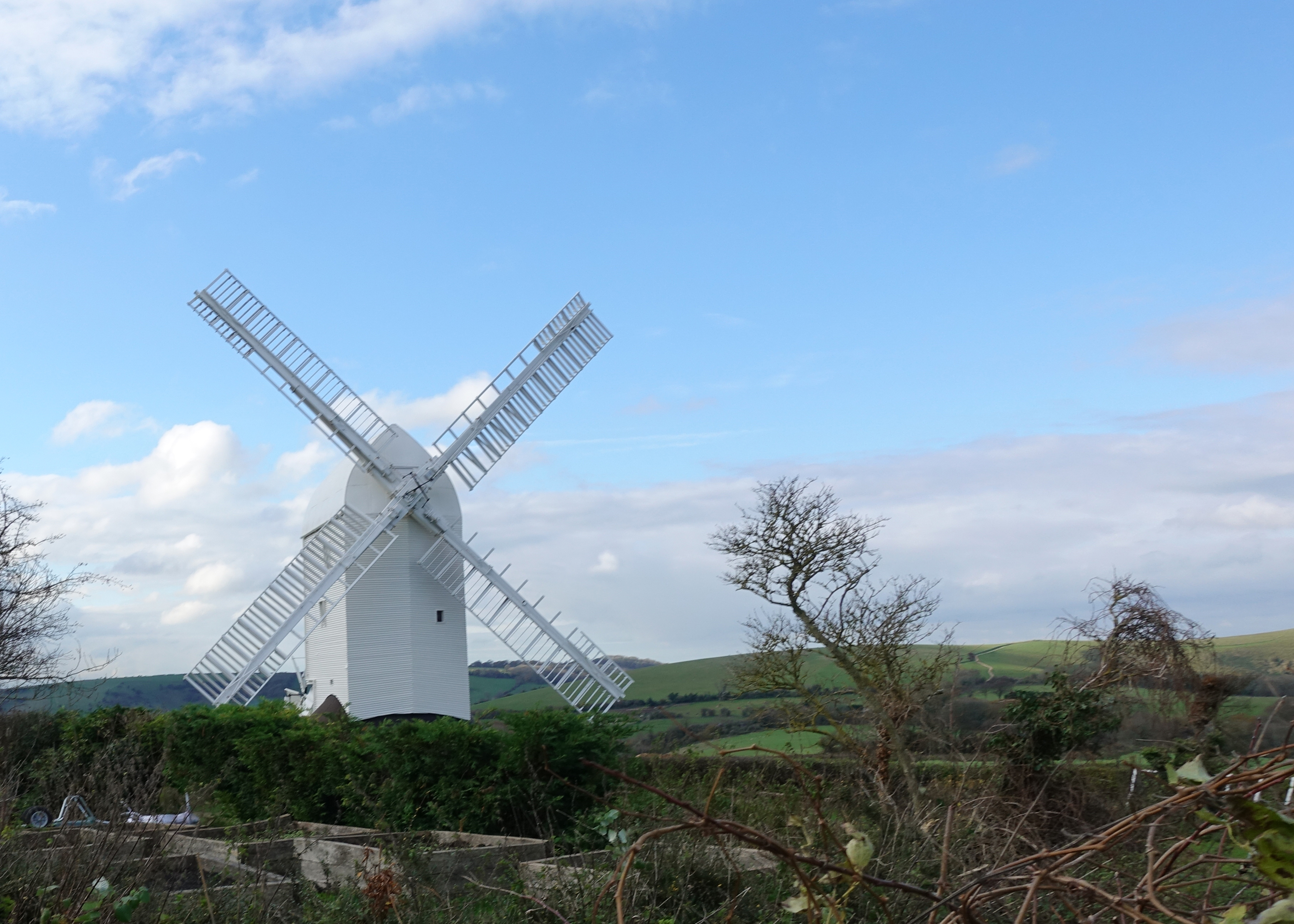
Post mill Jill is one of the Clayton windmills and can be seen for miles. She was originally sited in Dyke Road, Brighton and was bought to its current site by a team of horses and oxen in 1852. Occasionally open to the public, she was closed during my visit
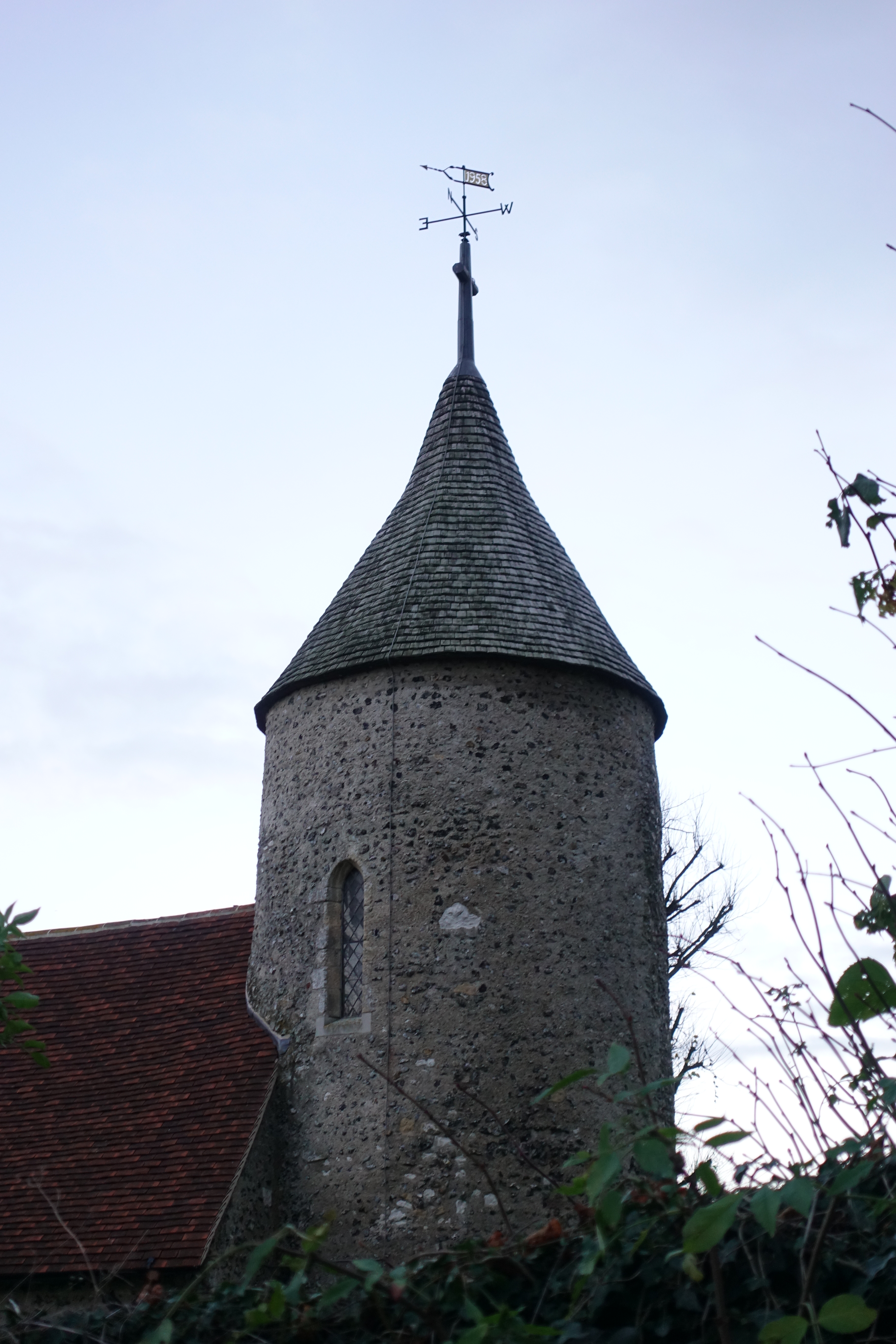
Southease church tower
Hostel handstamp impression from my journal
Despite my halts and diversions, Monday was still a hike in excess of twenty one miles but I was less concerned with finding a camp site as tonight’s halt was YHA South Downs. It was still cold but dry, however the blue skies were clouding over and it was obvious that a change in the weather was imminent. I still made time for a halt at a roadside caravan where two huge bacon rolls were consumed. Also a brief halt to admire Southease church with its rare circular tower. There are only two others in Sussex.
Three Points of the Compass on Ditchling Beacon, the highest point on the South Downs in Sussex
Having booked in to the attractive Youth Hostel, situated on a farm, I found myself sharing a room with one of the most taciturn men I have ever met, also one of the friendliest! Showered and clean, I made my way to the hostels courtyard cafe where the two young wardens- Chaya and Steph, provided me with a series of good beers and the unhealthiest of food options.
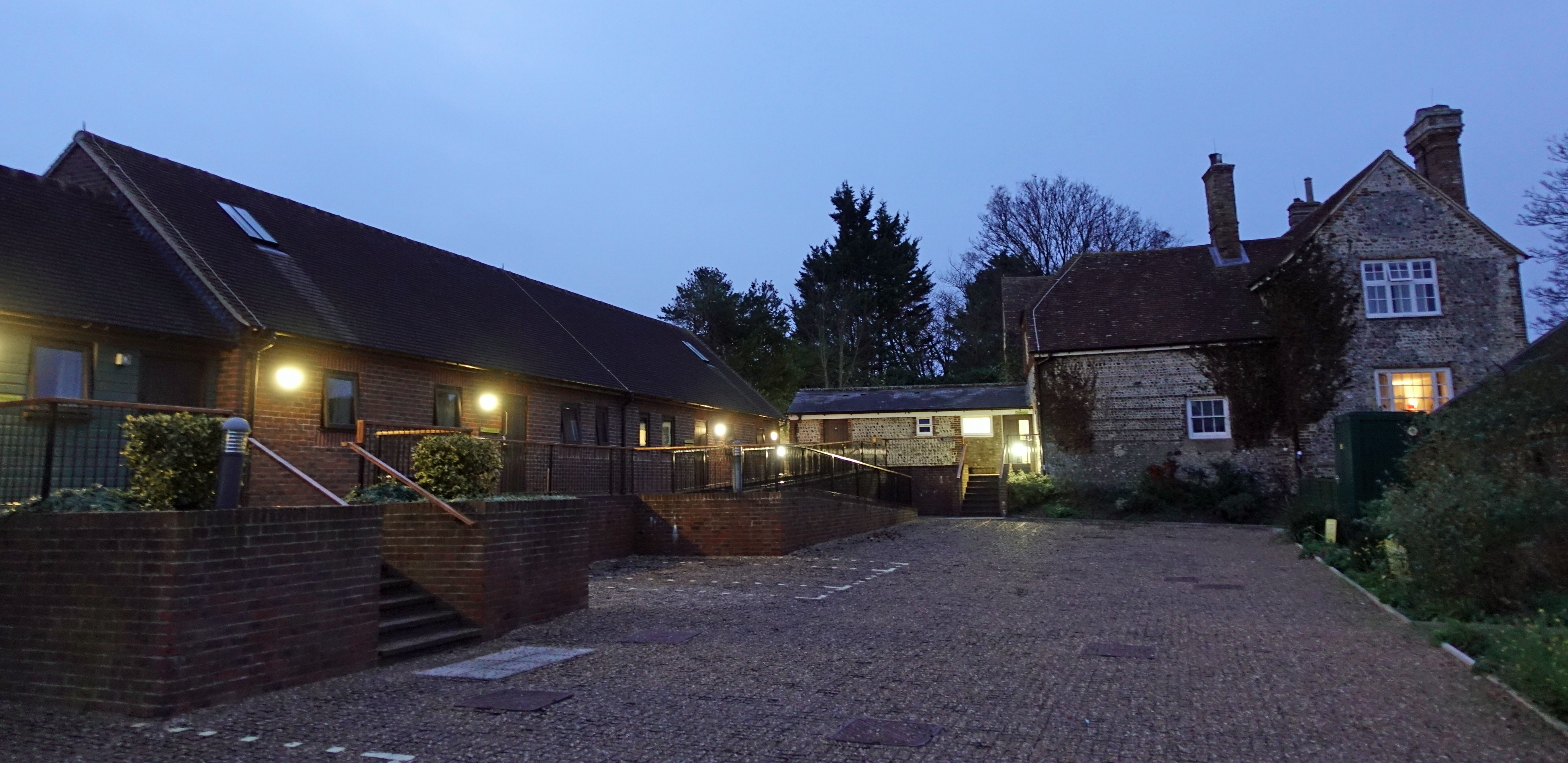
Accommodation buildings at YHA South Downs
I slept well in an overheated room, only a little snoring from the other two occupants. Both were contractors and were away early to their work. On my final day, Tuesday, I had breakfast in the campers kitchen and was away soon after eight for my walk to the coast, I enjoyed second breakfast at the Singing Kettle Tearoom at Alfriston. I was headed toward the lovely walk along the Seven Sisters via Cuckmere Haven. My final day also had the greatest amount of ascent- 4892′. This was all easy enough though and would make for a great finish to the hike.
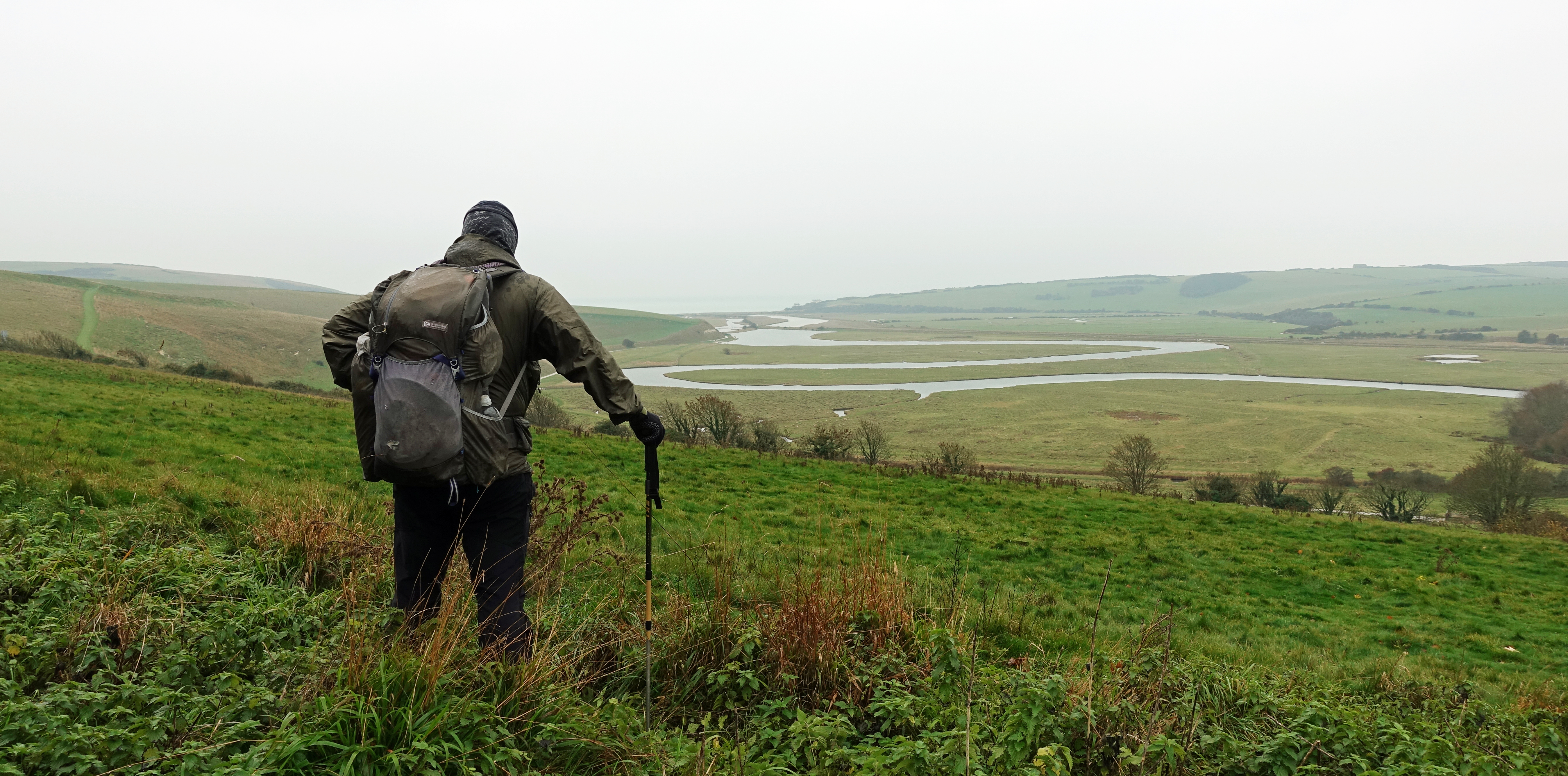
About to descend to the famous winding meanders of the Cuckmere River
However the weather had indeed changed and it was rain for much of the day, if it wasn’t raining, it was mostly sleet or hail, such fun! It didn’t really bother me as it was driving in to me from behind or my left, so I was able to keep the hood of my Velez Adventure Lite smock up and was warm and dry to the great extent. My legs got wet but never cold, if it briefly stopped raining, the Montane Terra trousers dried quickly in the stiff wind. This was almost twenty two miles from the Youth Hostel to Eastbourne Pier where I was finishing my South Downs Way hike. Then about face and another long ascent back out of town to that nights halt at YHA Eastbourne. I arrived before five and had to stand outside until the warden unlocked. This remains a ridiculous YHA requirement that has been largely done away with by independent hostels. I was also less than pleased to find there was no food provided on site and there was nowhere in the vicinity. Not fancying another slog back down into town that night, I was able to rustle up sufficient from my almost totally diminished food supplies supplemented by a little pasta left in the kitchen to make an ‘OK’ last meal. The warden even found a bottle of wine for me, bonus.
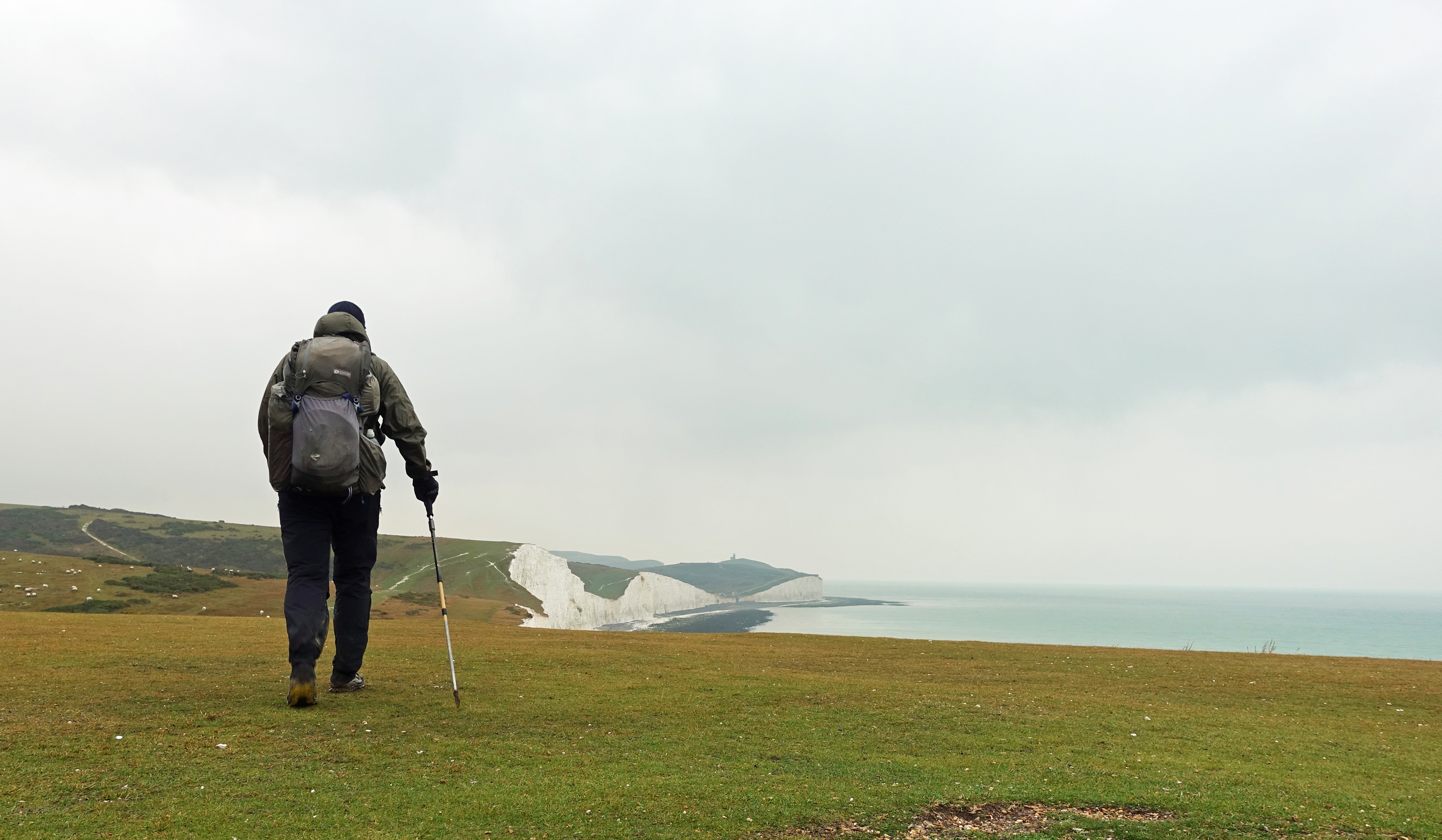
Walking toward Birling Gap on my final day on the South Downs Way
With my little diversions off trail and the extra couple of miles up to my Youth Hostel from Eastbourne Pier, I completed 108 miles over my five day hike of the South Downs Way. It had been a cracking walk. The mist had obscured views at times but it added another element to the walk in itself. This has to be one of the finest chalk downland walks to be found anywhere. I wouldn’t do it again in a hurry but am pleased to have completed it.
While the South Downs Way originally opened in 1972, the South Downs National Park is much younger. It is the youngest of England’s national parks and first became operational from 1st April 2011. It is heavily advertised for all forms of leisure activity and can become swamped at certain times of the year. A winter walk means that it is much quieter and beyond a handful of horse riders, three cyclists and less than a dozen walkers, all of whom seemed to be on day walks, the paths were empty beside dog walkers never more than a mile from their cars

5 replies »