
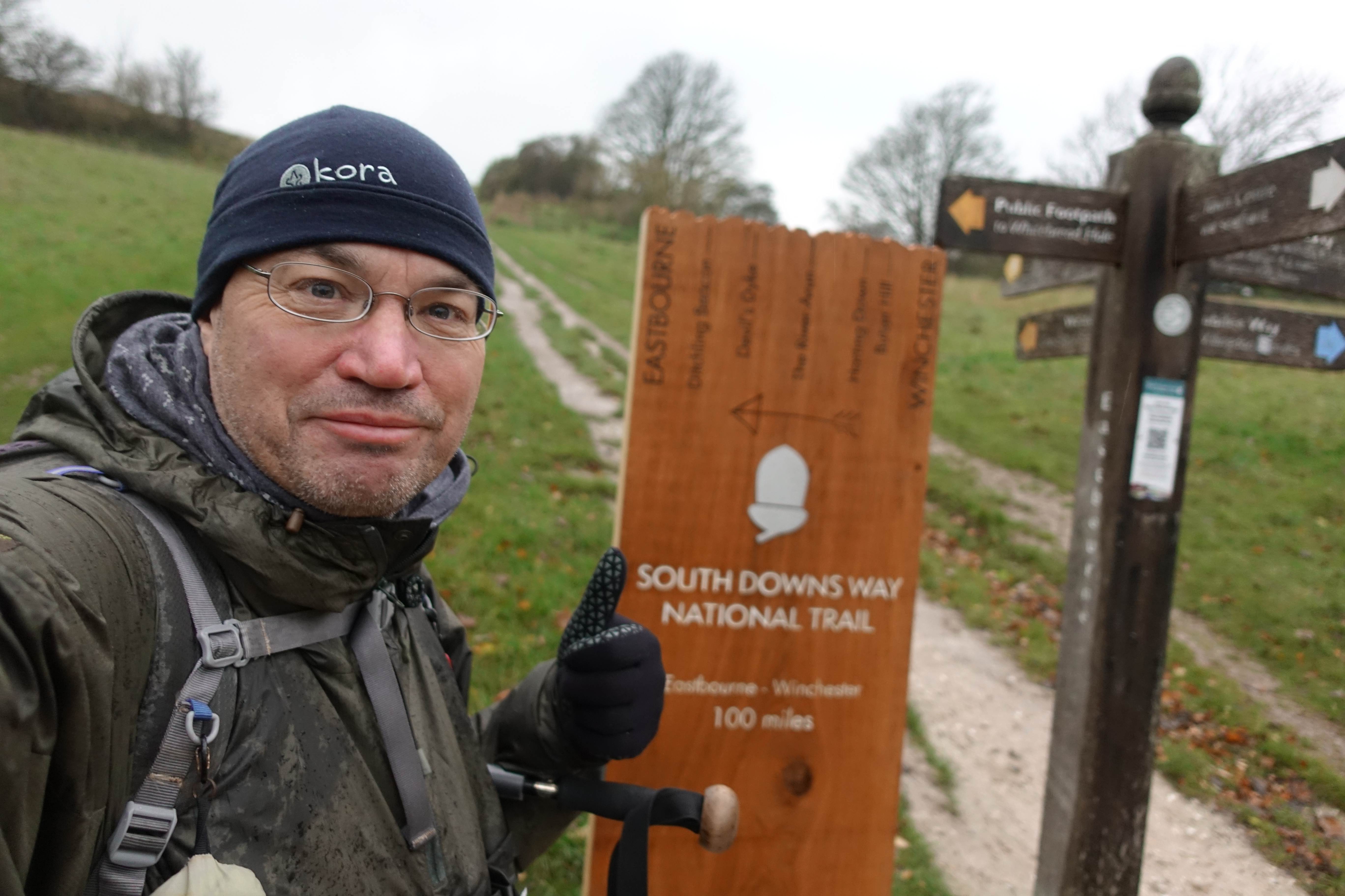
Three Points of the Compass walked the South Downs Way in winter 2018. I wrote a brief blog on that walk soon after. This piece covers my water sources on that five day trip of a tad over a hundred miles. I carried clean and dirty water bladders and a water filter, also a 0.85lt. bottle for drinking from during the day.

Three Points of the Compass travelled to the start of the South Downs Way at Winchester by train. The blue cuben bag in the side pocket of my Mariposa is my hydration kit comprising 2lt Evernew bladder for clean water, 2lt HydraPak Seeker bladder for unfiltered and a Katadyn BeFree filter. I also carried an 850ml Smartwater bottle for drinking ‘on the go’.
I was fortunate to enjoy fairly good weather for most of the walk. It was often simply cool and bright. However, it was a late in the year walk and I also experienced occasional thick mist, driving rain and sleet on the final day and cold frosty nights. Snow blanketed the hills two days after I finished. Some of the water taps provided along the trail are turned off for the winter months and I did find a couple that were not working. Other than that, I had absolutely no problem in keeping myself well hydrated both during the day and for night halts.
I set off early morning from a Winchester hotel where I had spent the night. I had a couple of mugs of tea prior to leaving and carried one and a half litres of water from the get go. My first halt to refill was at a tap near Keepers Cottage, SU 537 288. This is immediately beside the path and was specifically installed with cyclists in mind and also has a pump etc. This is a popular trail for cyclists and some times of the year can see as many cyclists as walkers. However, at this time of year I saw few hikers and only a handful of cyclists and horse riders.
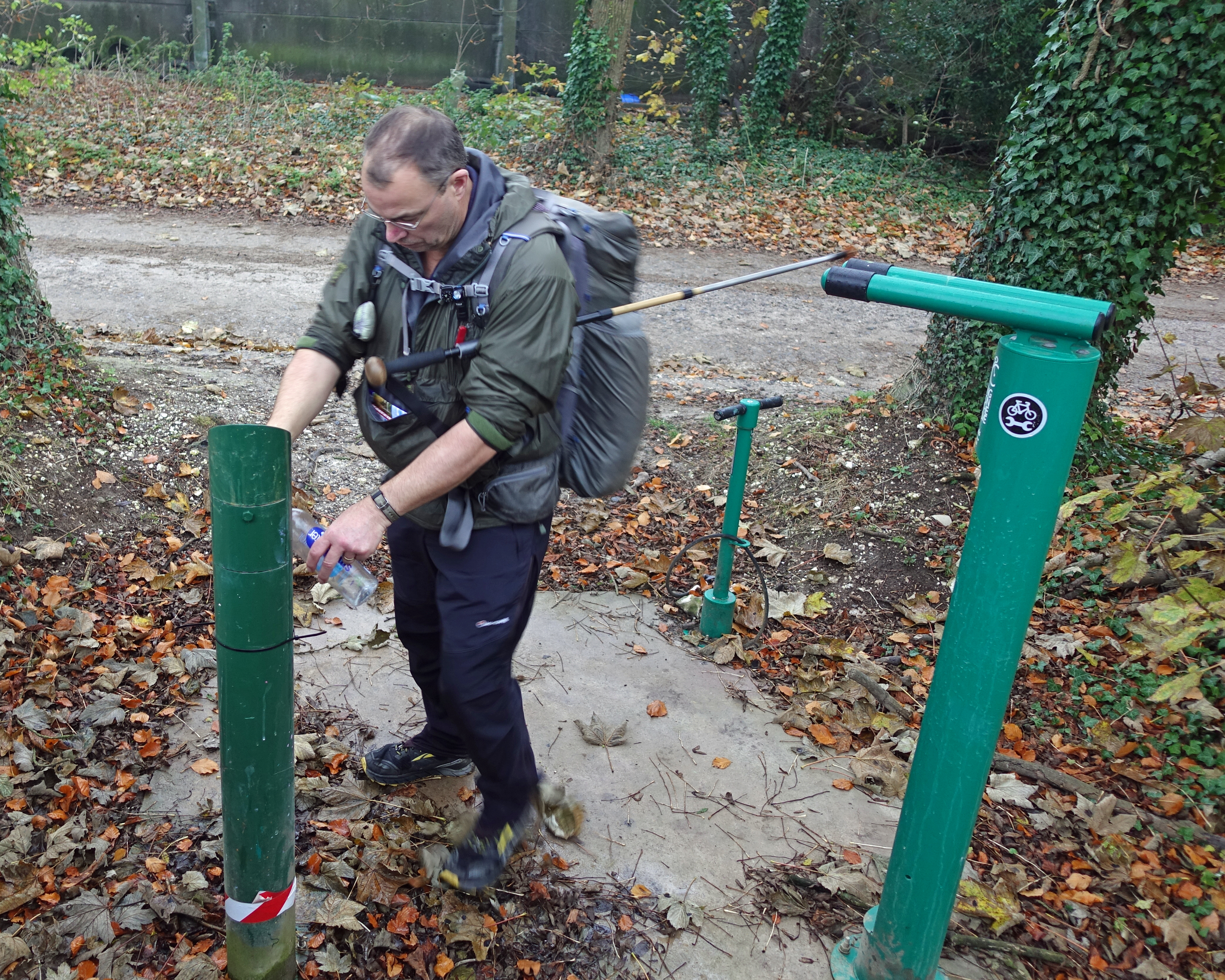
My first halt on Day One for water was near Keepers Cottage in the Temple Valley
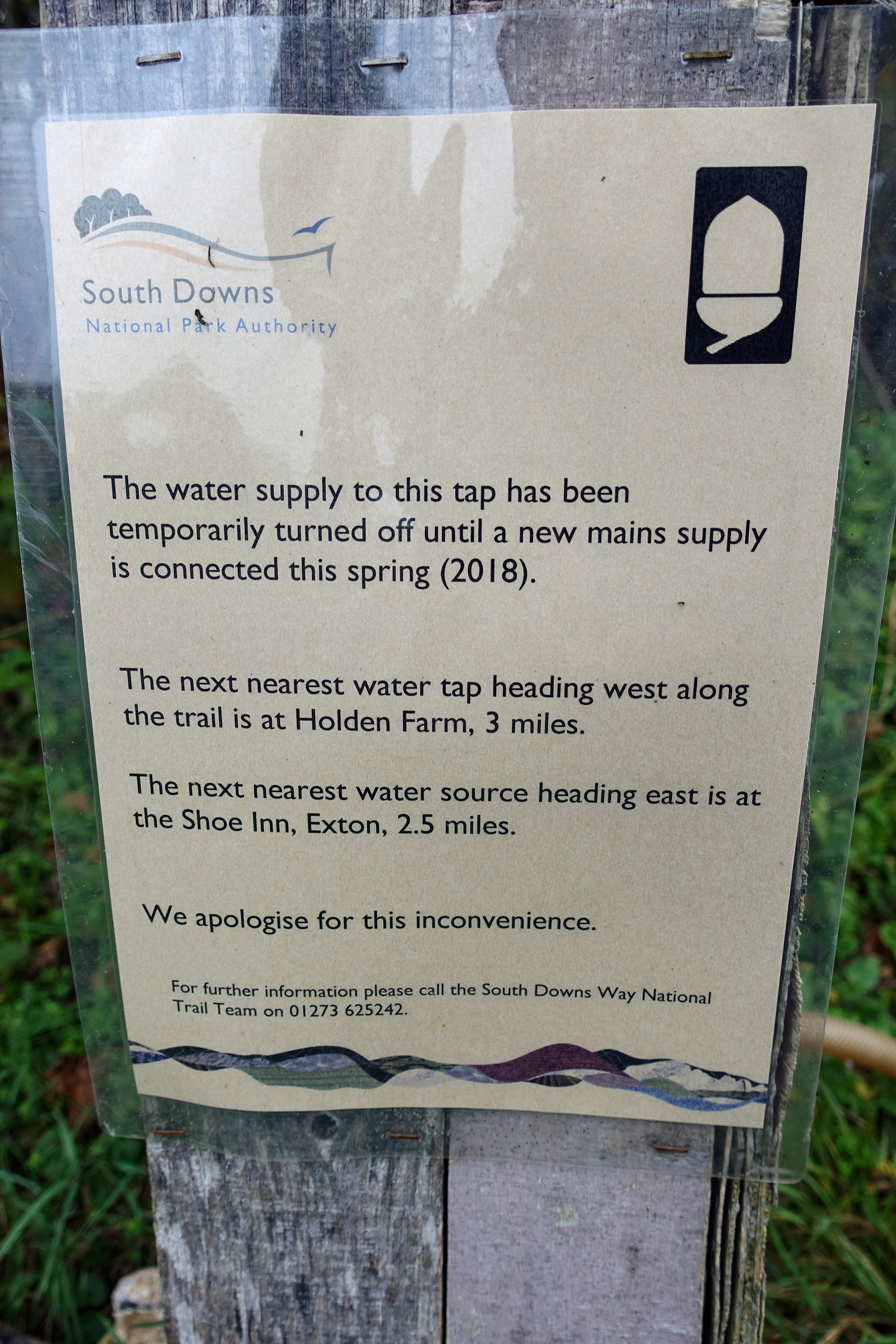
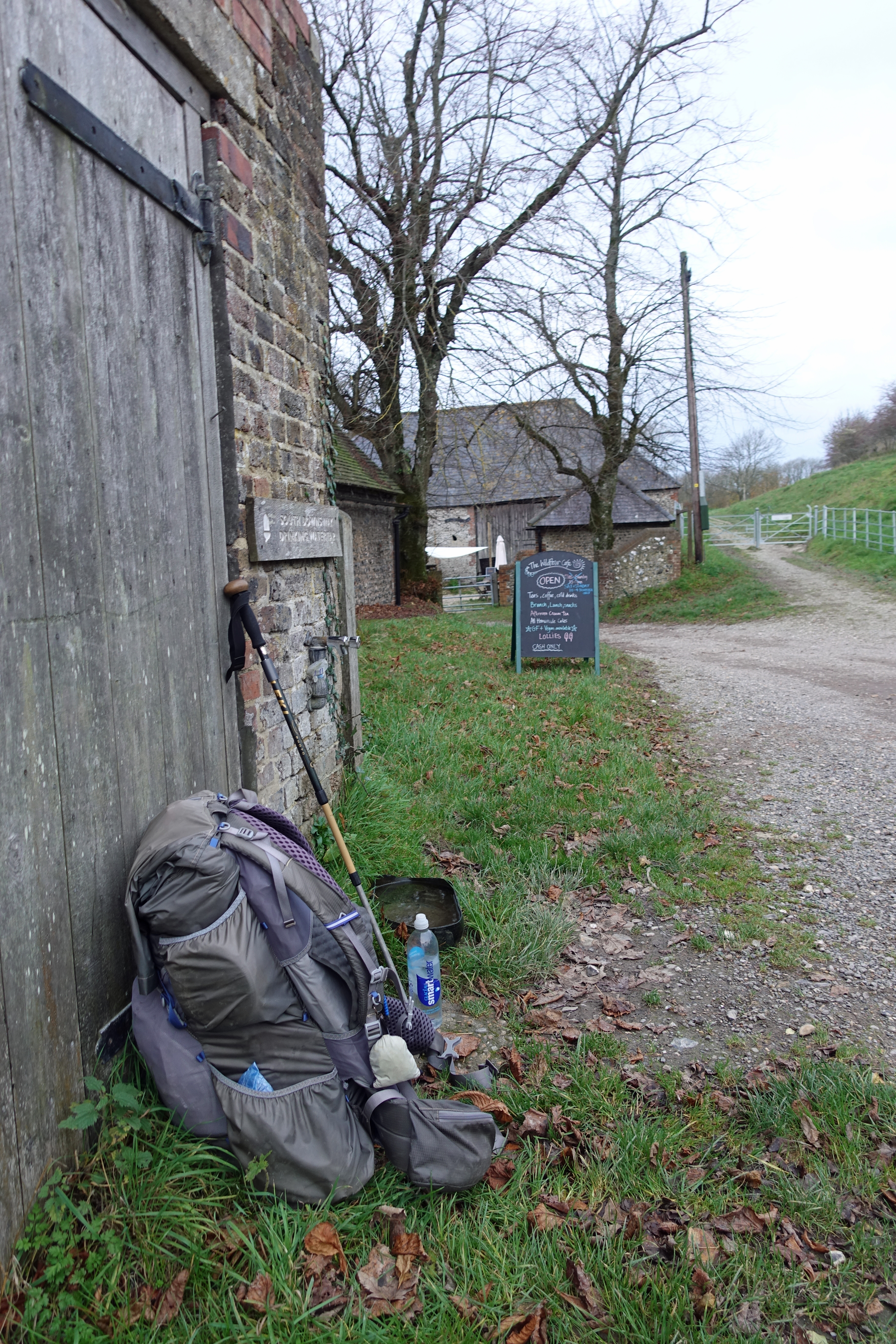
Lomer Farm. Despite this notice stating that repair would be made in Spring 2018, it still hadn’t taken place

If I had not replenished with water at Keepers Cottage my next halt would have been at Lomer Farm- however the tap was out of use (SU 601237)
It is advisable to take any opportunity to replenish with at least a bottle of water if a tap is passed as some sources are not only seasonal but could be vandalised, under repair or simply no longer in commission.
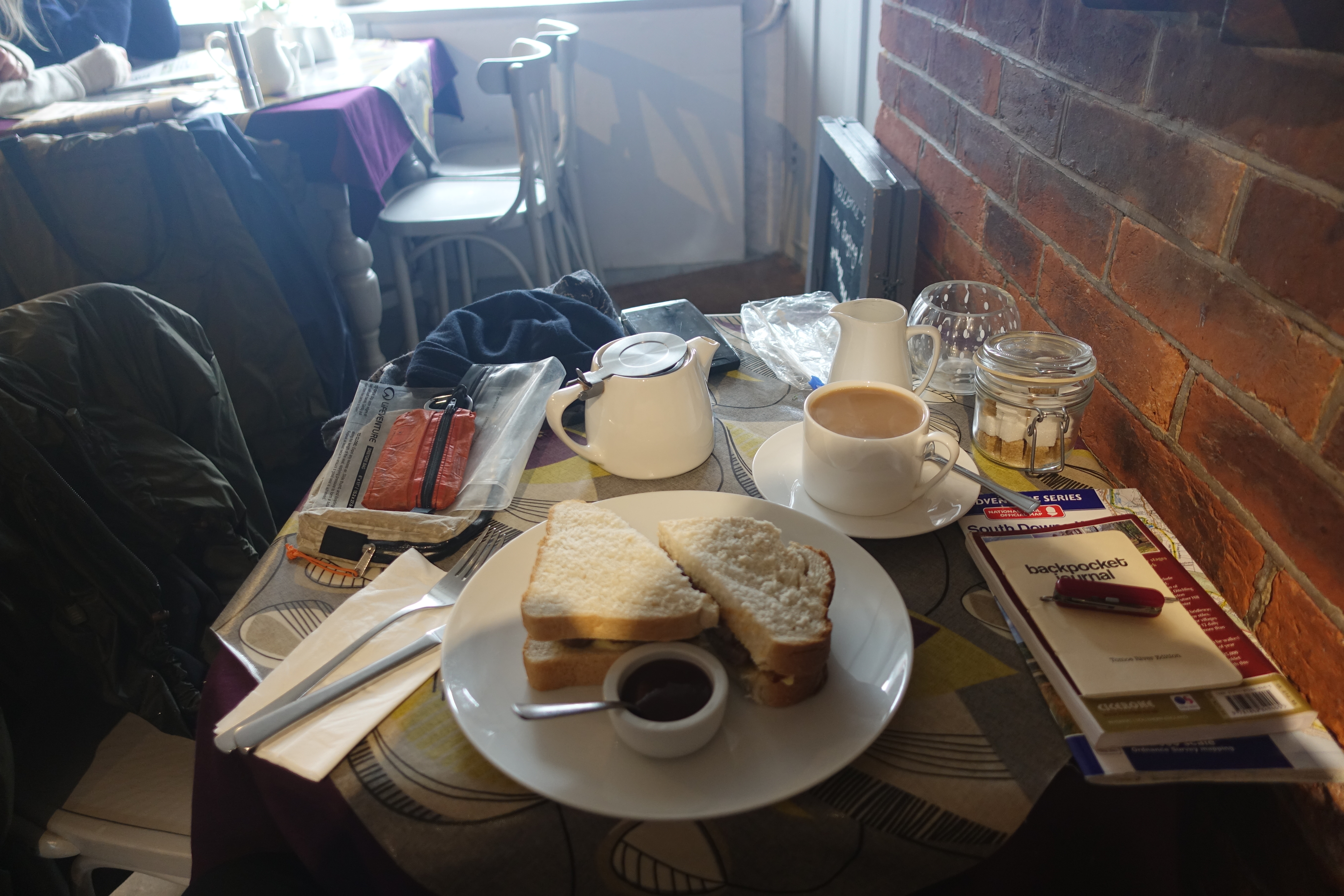
My first day was a little over twenty miles so I felt I had earned yet another halt in the afternoon when I passed the fly fishing ponds at Meon Springs. The fishing lodge (SU 655 215) at Whitewool Farm is often open as the fishery offices are situated inside, alongside a tackle store and ‘help yourself’ to hot drinks facility. Snacks were also available but I didn’t need anything as I was carrying just about all the food supplies I required for the whole trail. Instead, a mug of tea (£1) was very welcome. A tap was available here if it had been simply water I was after.
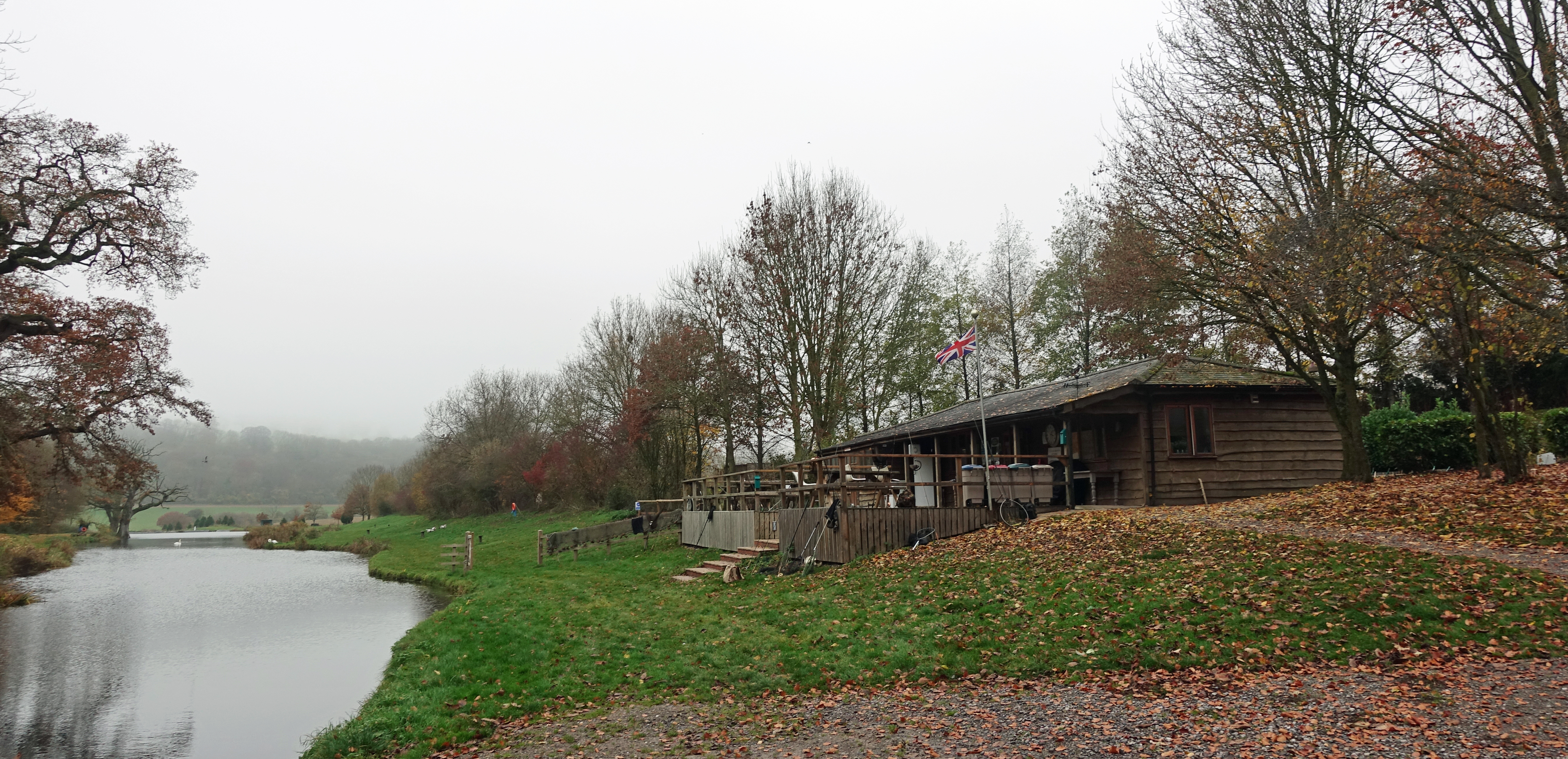
Fishing Lodge at Meon Springs, Whitewool Farm
My first nights halt was at the Sustainability Centre, Wetherdown Lodge (SU 676 190). This is a Friends of Nature Eco centre and due to my early away from Winchester in the morning, I arrived around 14.40, so not only had time to get the tent up in the lower fields, but also managed to get to the onsite Beech Cafe five minutes before it closed for a welcome pint. At this time of the year, night comes early and my evening meal of lentil curry was obviously eaten in the dark.
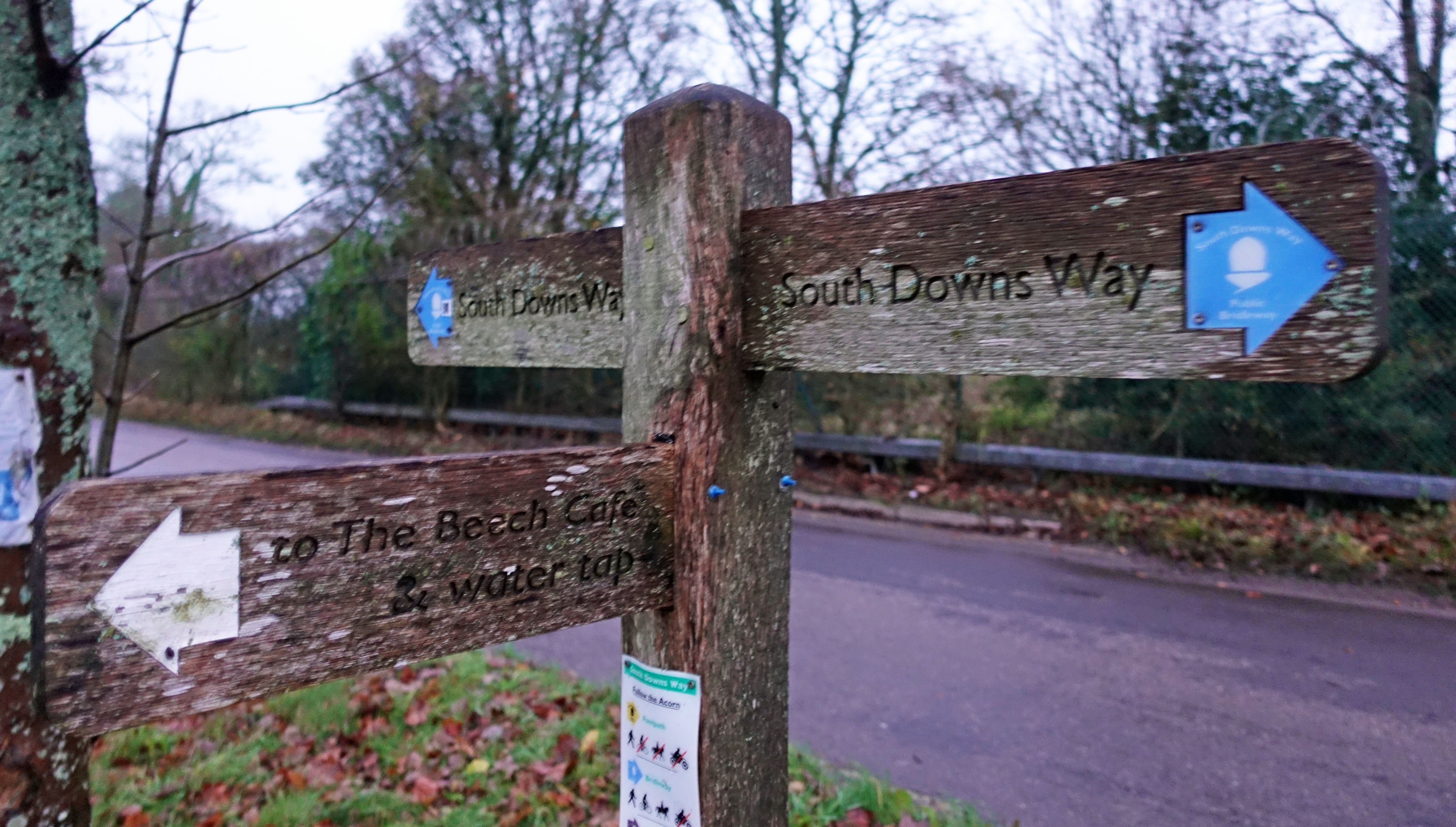
Day One on the South Downs Way saw me camping at the Sustainability Centre where water is readily available. Even if not staying there, a water tap is only a hundred metres off the main route
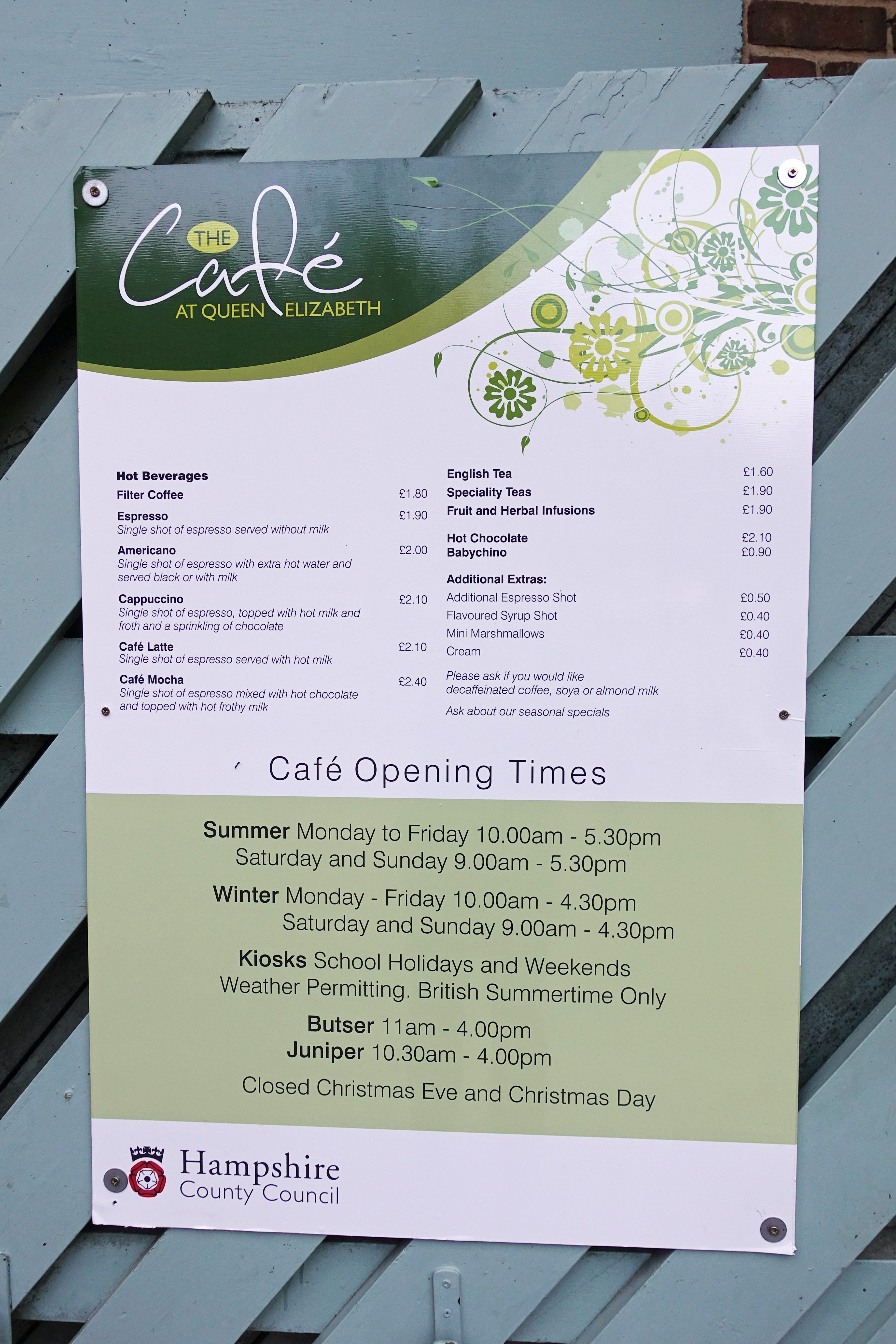
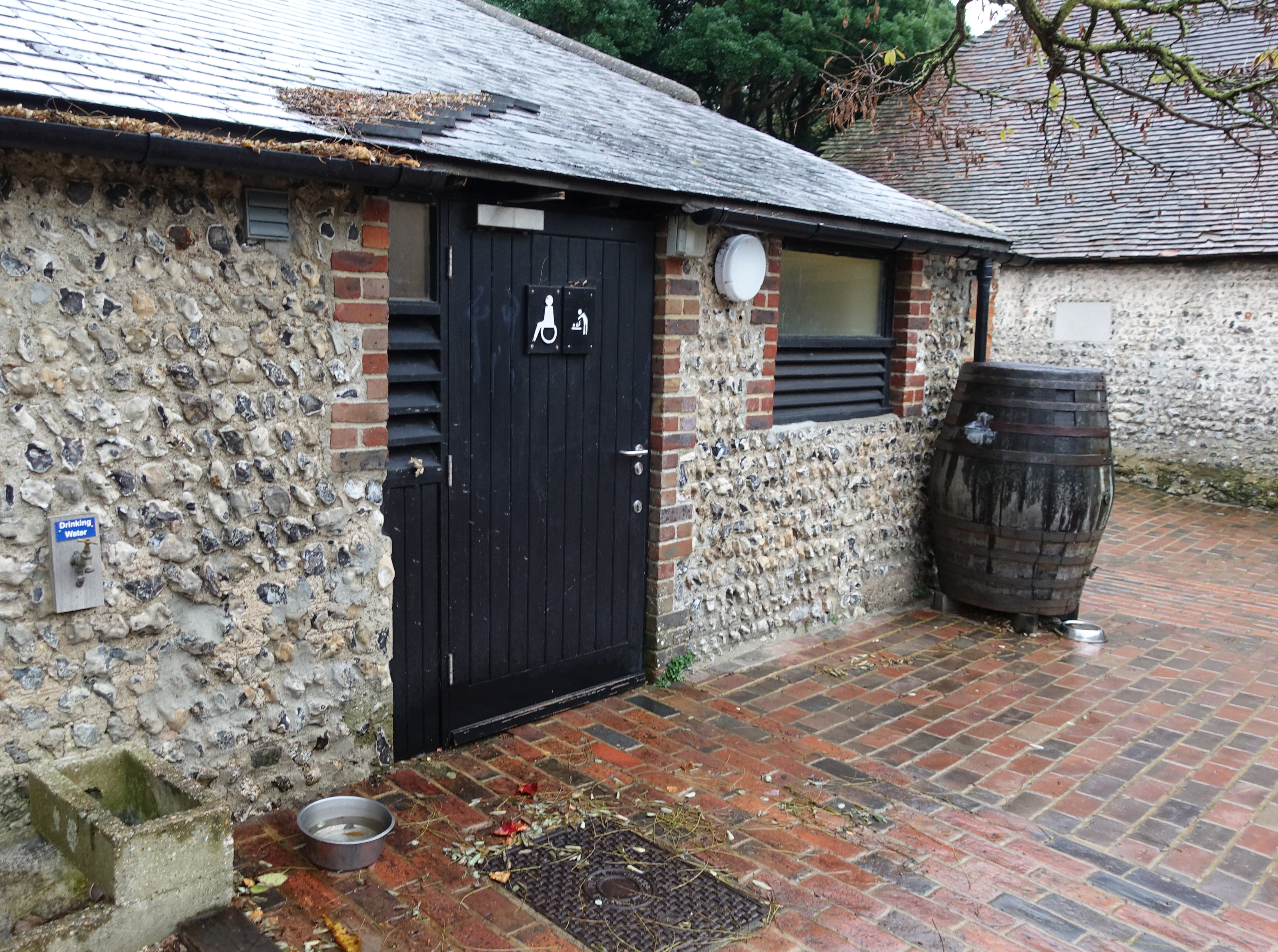
There is a cafe at the Queen Elizabeth Country Park however no water outside of opening times
Day Two was a twenty four mile hike, so I rose early and simple breakfast and 500ml mug of tea saw me on my way while it was still dark. I had hoped for second breakfast at the Queen Elizabeth Country Park visitor centre (SU 718 185) but arrived to early and wasn’t prepared to sit around for a couple of hours waiting for it to open.
I was carrying just under a litre of water with me and this was sufficient until a water tap opposite Manor Farm at a minor crossroads of tracks at Cocking (SU 879 166).

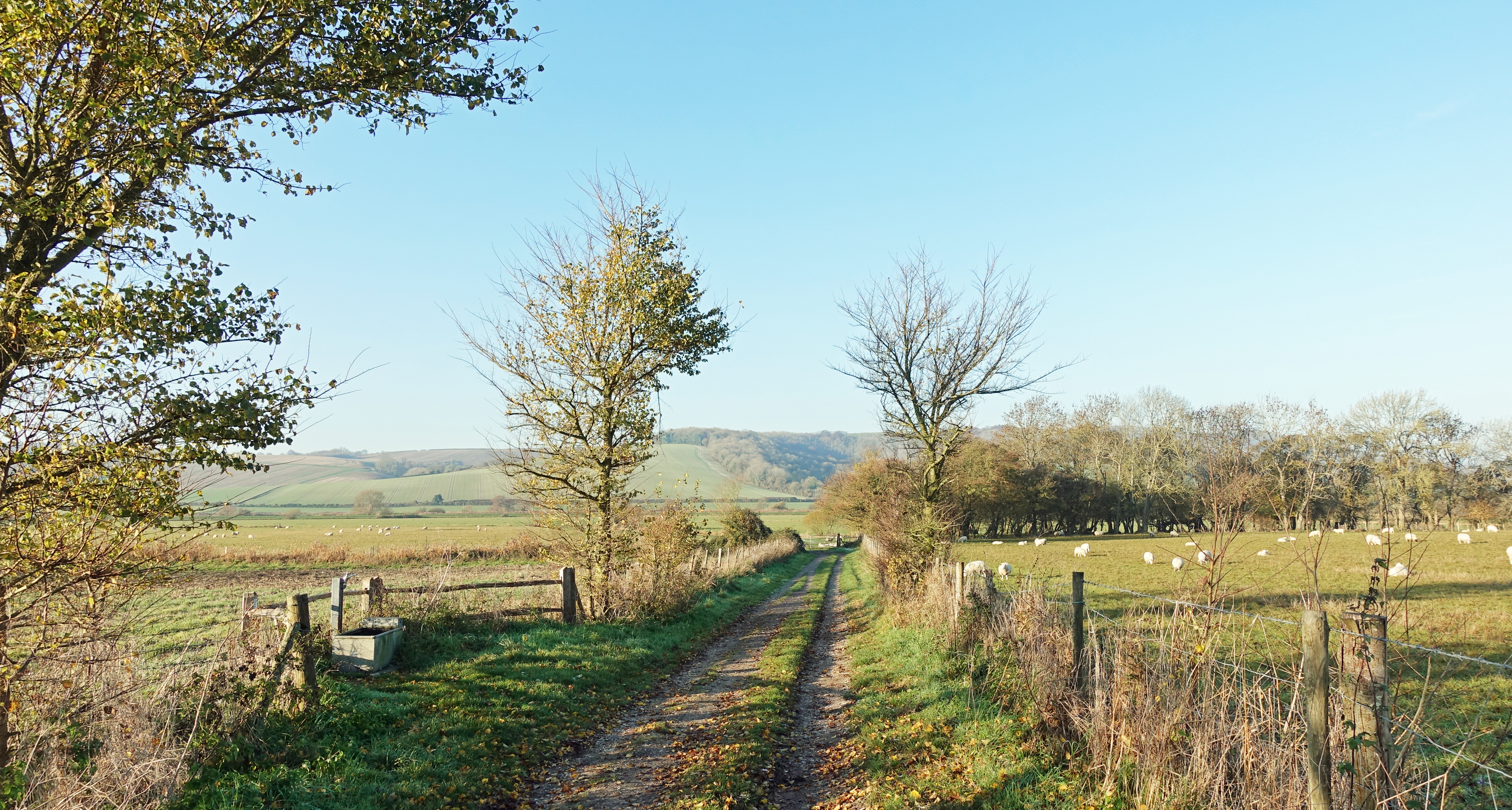
A number of cattle troughs are passed on the South Downs Way, mostly on days two and three out of Winchester. Any water from these sources requires purifying or filtering. I had no need to use these sources as there were plenty of others
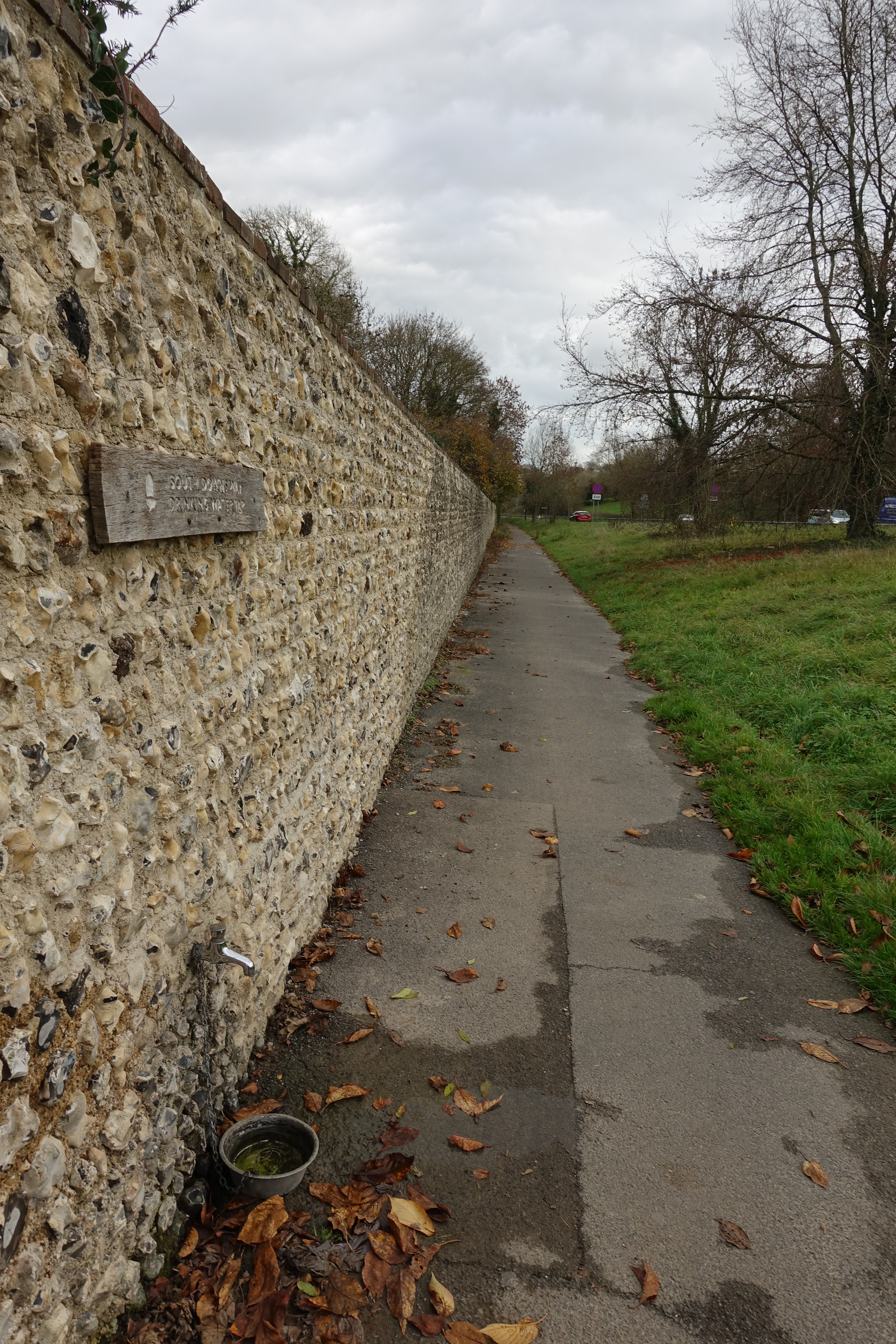
Some of the taps on the South Downs Way have been placed there by cycling or walking organisations, others have been sited in memory of a much loved individual. The tap at Cocking was sited in memory of 14 year old Peter Wren.
“He loved the English Countryside and walked the South Downs Way in the summer of 1978”
Any wise hiker not only tops up with water at these sources but also drinks as much as he can before moving on. I had doubts on finding another source before this day’s halt so took opportunity to carry another two litres away from here in addition to my 850ml bottle.

Tap directly beside the path at Cocking. A notice beside the tap records that the next available sources are at Amberley, 11 miles east, or Buriton Farm, 4 miles west
I wild camped at the end of Day Two and it was a cold evening and even colder night so plenty of hot drinks with my evening lentil curry followed by the usual mug of tea in the morning took just about all the water I had with me. It was a cold and bright day with deer in the frosty fields and red kites overhead. Soon after crossing the River Adur, prior to reaching the B2139, south of Amberley, there is a tap and trough (203 124) provided by the Rotary Clubs of Arundel, Steyning & Henfield, and Storrington in the hope that…
“…those who drink here will remember those elsewhere who have nowhere to drink”
Tap provided by the local Rotary Clubs soon after crossing over the River Arun at Houghton
I reached this tap a little after nine in the morning and this refill saw me well until another, six miles on, in Glazeby Lane, near a road crossing south of Washington (118 119). As I mentioned earlier, there are quite a few water sources on this trail and if one if unavailable for one reason or another, it is usually not too far to another. It is only if wild camping that a little care is required to ensure that enough is available for a nights halt.
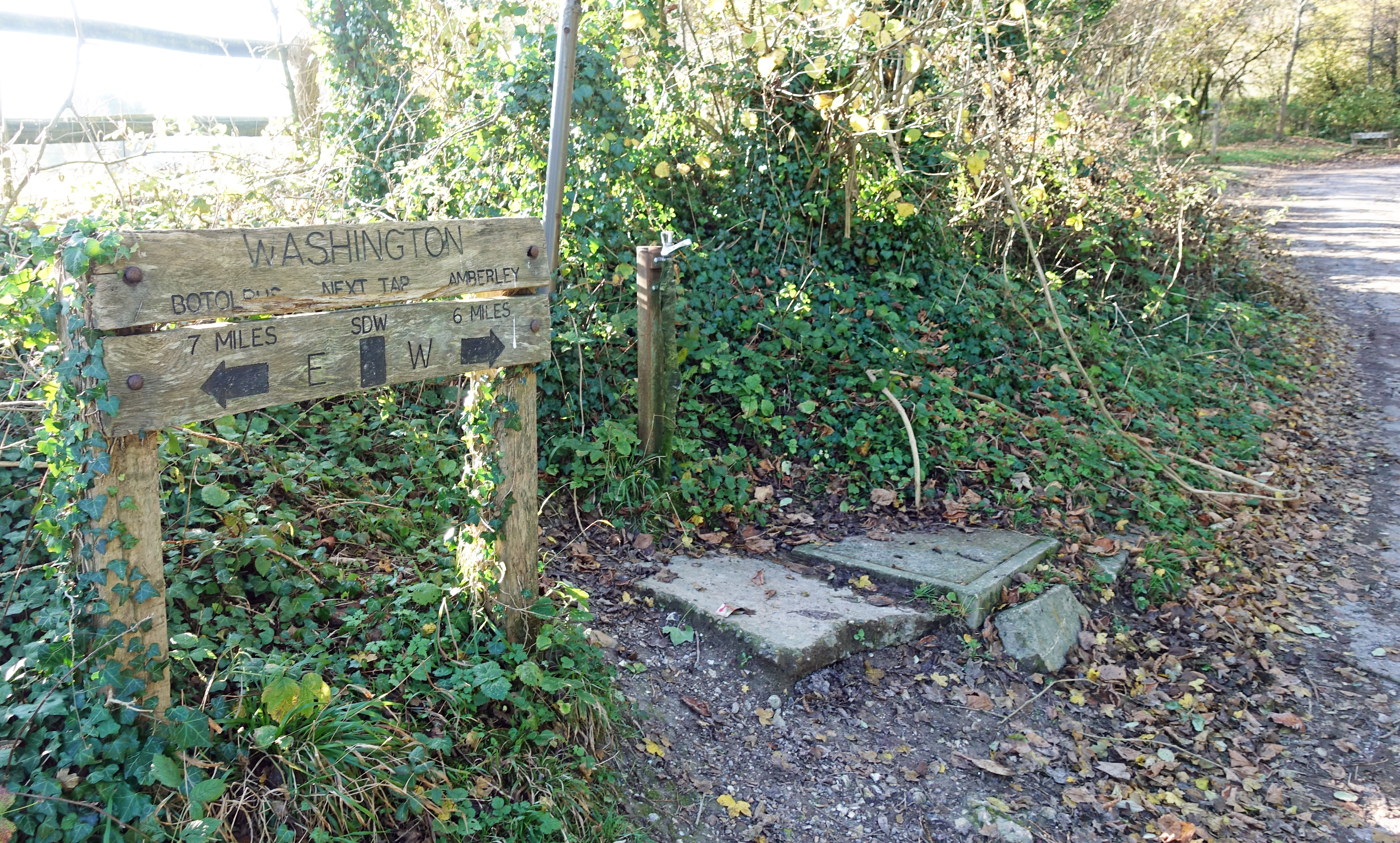
Another water tap directly beside the path south of Washington. Many of these are supposed to be turned off in October once the weather turns colder and there is a danger of freezing, but Three Points of the Compass found many were still operating at the end of November
I didn’t require it but there was also a working tap between the River Adur and the road crossing of the A283
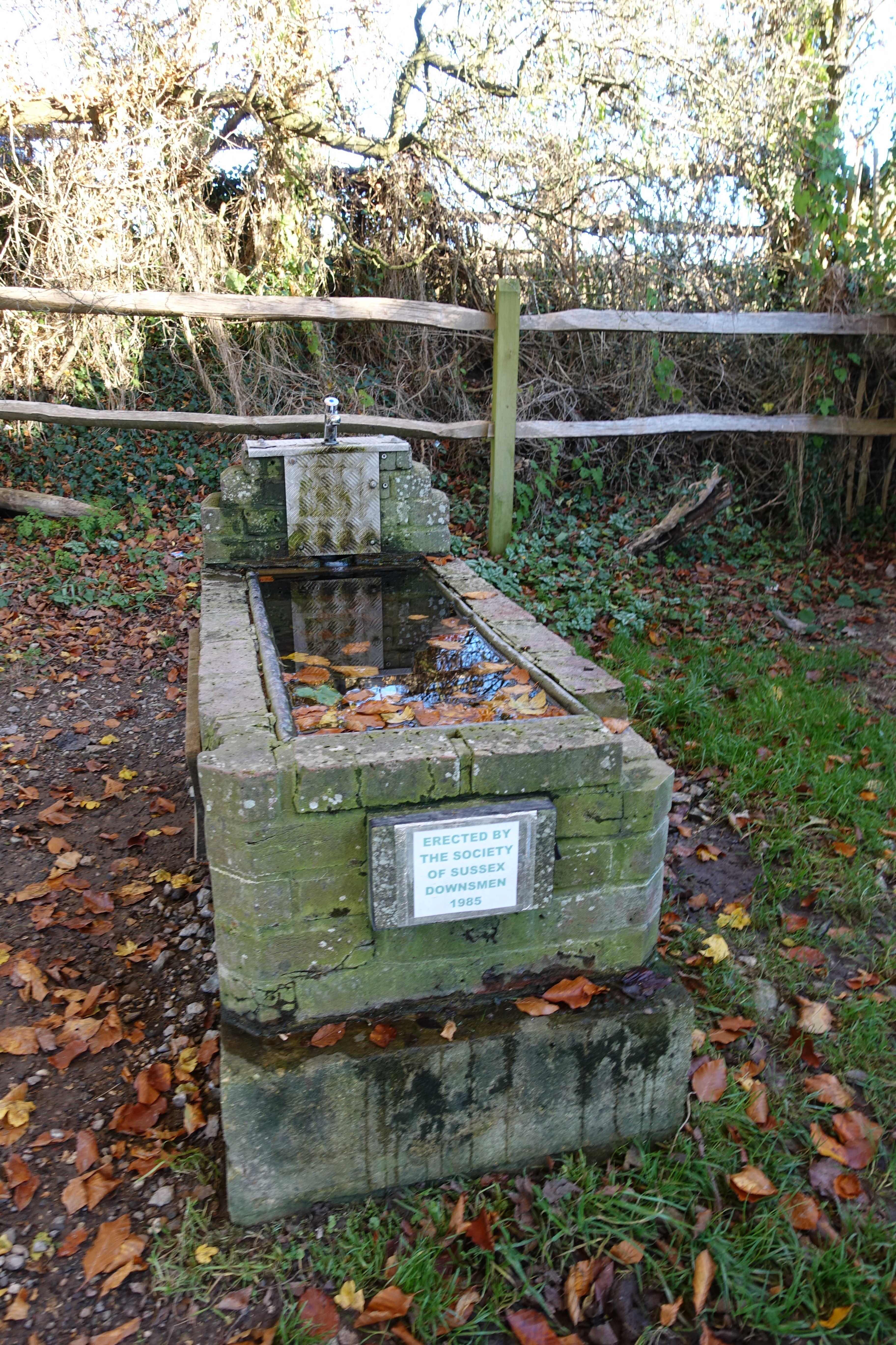
While I had plenty of water with me and it was only a relatively short hike to my days end, I also drank a litre at the tap provided by the Society of Sussex Downsmen at Botolphs (TQ 197 093).
Day Three was a 19.5 mile trek to the YHA at Truleigh Hill. I knew that I couldn’t stay in the hostel at it was on exclusive hire however the warden had kindly agreed to my camping in a field opposite. Not only did I also have use of the campers w/c adjacent to the building, but there is also a tap outside for passing hikers (TQ 220 106).
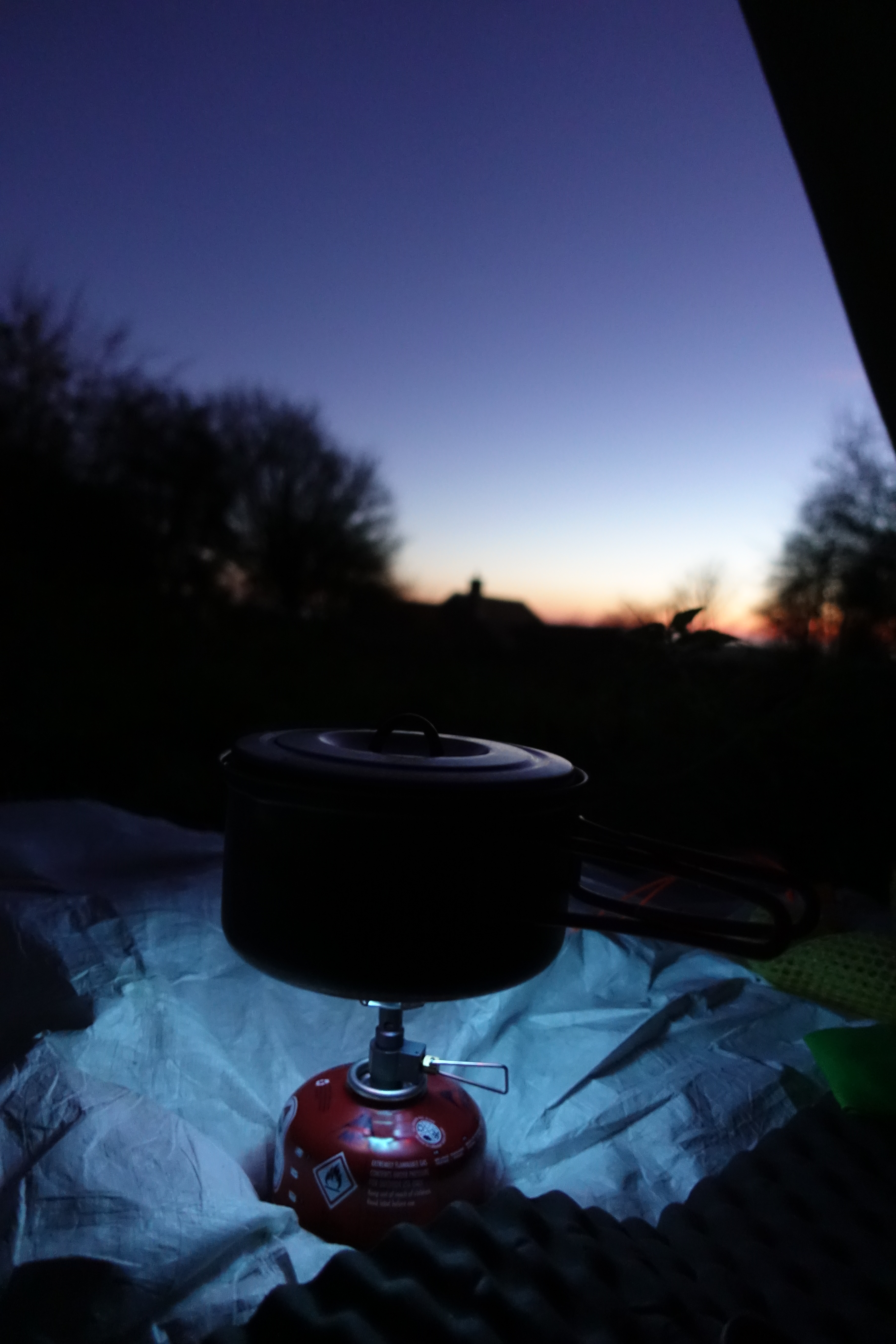
Brewing up at Truleigh Hill
It was another cold night and I was pleased to have ready access to unlimited water as I rehydrated and kept myself warm with a succession of oxo, tea and hot chocolate drinks.
Hikers water tap outside entrance to the Youth Hostel at Truleigh Hill
There is a small cafe, the Hikers Rest, at Saddlescombe Farm, but that was closed as I passed through. However the tap in the wall was still working
Day Four was just over twenty one miles to the South Downs YHA just three miles from Lewes. Not only did I have a dorm room booked for the night, but I knew I also had a couple of decent halts on this section. Setting off with a full water bottle, the first halt was at the tap in a wall at Saddlescombe Farm (TQ 271 114).
I had no real need to stop here as it was only another fifty minutes walk to the ‘Pilgrims Church’ at Pyecombe. With the aid of grant money, the parishioners here have provided an excellent extension to the church with not only w/c, but also tea and coffee making facilities for walkers. Just be sure to leave a donation.
I spent some time at the church wandering around and looking at items of interest, there is much to see here and it makes a great rest point.
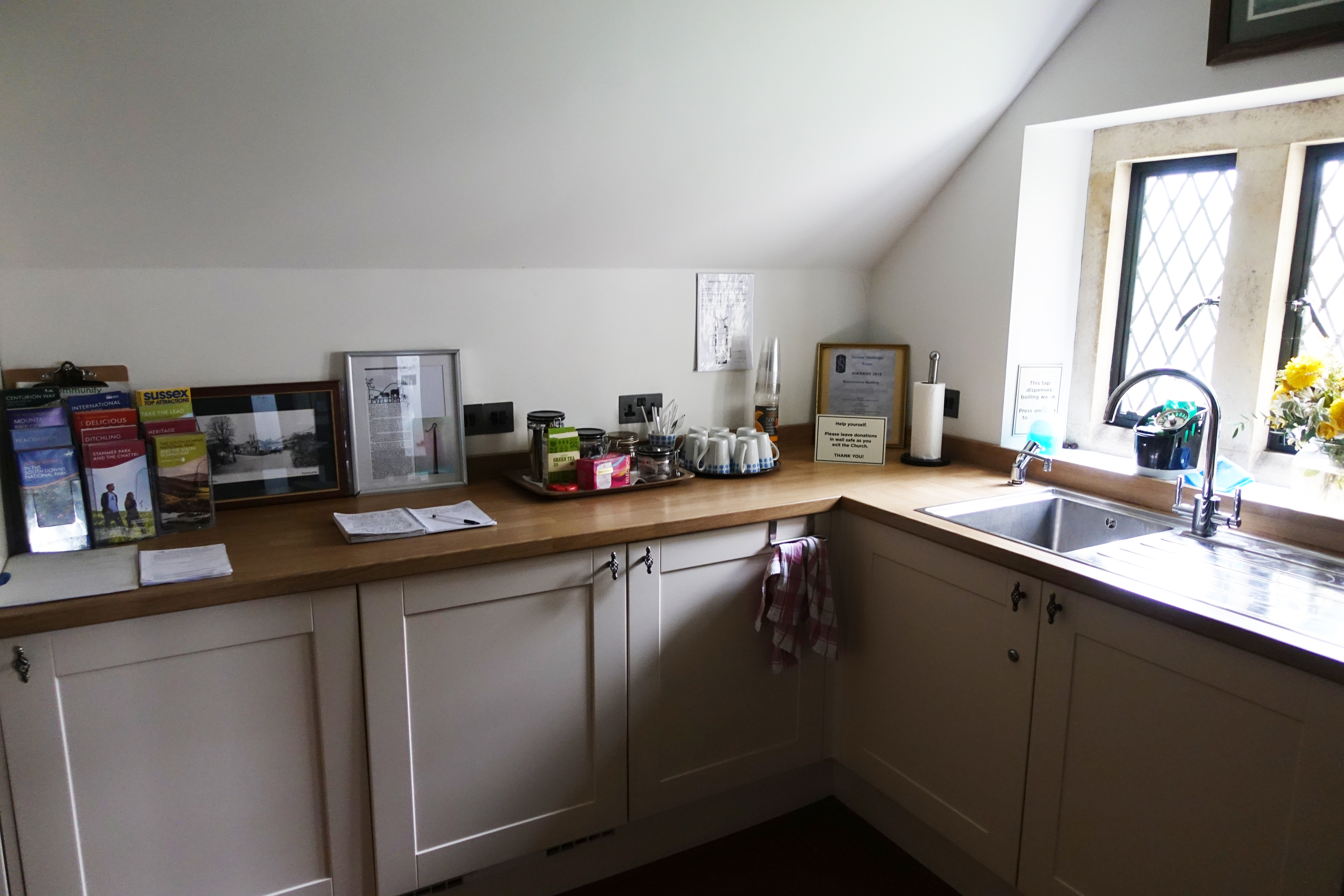
Really good facilities are available at the Downland Church of the Transfiguration at Pyecombe. Open 10.00 – 18.00 in the summer, until 16.00 in the winter

There are a number of dew ponds situated on the top of the rolling South Downs. All are contaminated with animal faeces and filtering and purification is an absolute necessity if using as a water source
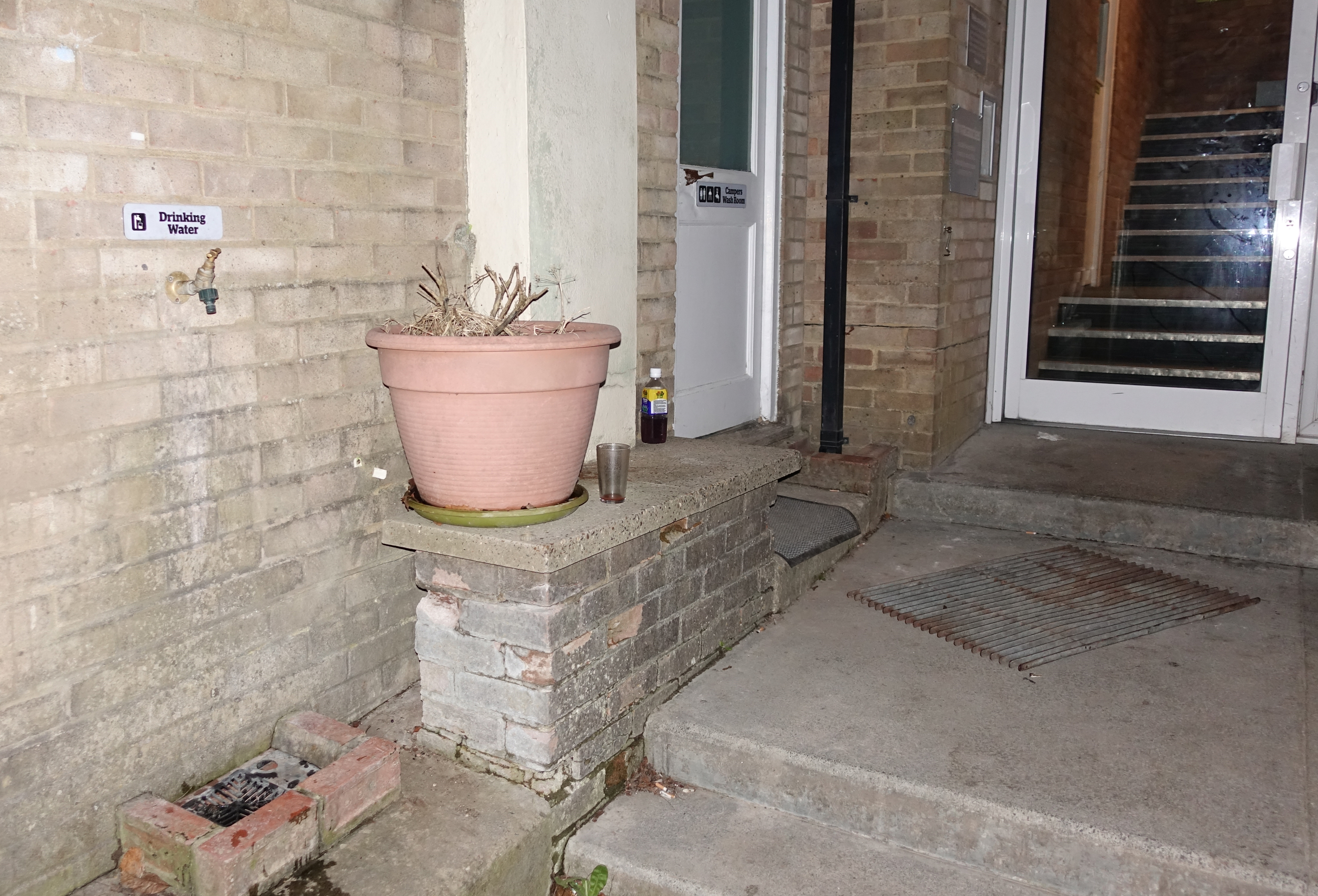
Tap in wall of Housedean Farm, A27
Walking on, I took time to explore the slightly off trail Jack and Jill windmills but my next halt for sustenance was a late lunch once I reached the A27. The trail turns right here to pass Housedean Farm prior to crossing the road via a bridge. In the wall of the farm is a walkers tap (TQ 368 092). However, a more favourable option is to turn left instead and walk down to the truckers stop where there is often a sandwich wagon.
It is only a hundred metres or so to the busy and noisy lay-by to ‘Oscars mobile catering’, where I chomped my way through two huge bacon and egg baguettes alongside a couple of mugs of tea. Never look a gift horse in the face…
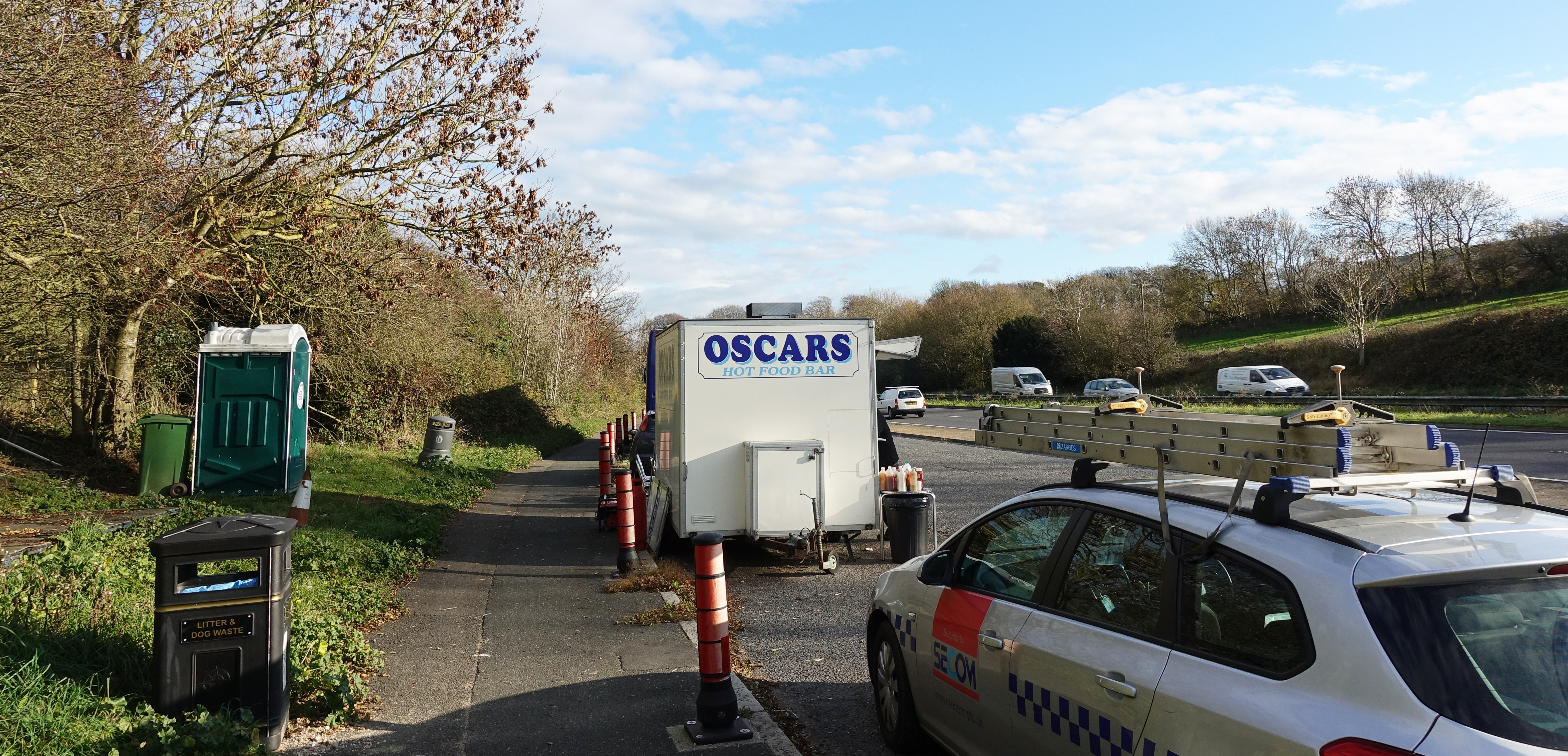
Snack wagon beside the A27 on day four. Only a hundred metres off trail
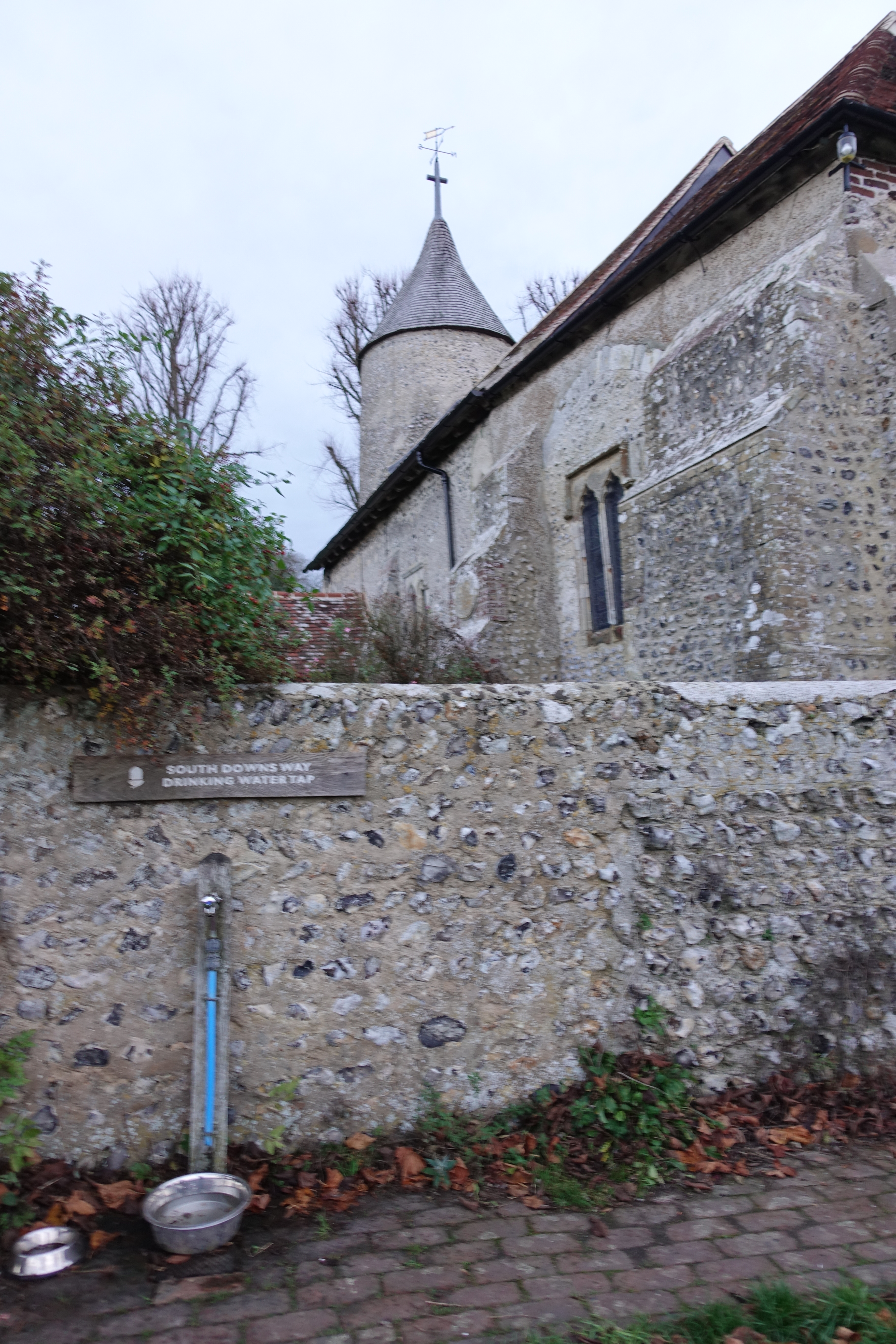
The uncommon tower of Southease Church is one of only three round towers found in Sussex. There is a walkers water tap in the wall here
Back on trail, I crossed the road and carried on, in deteriorating weather, back up on to the Downs. This is an arid stretch, with a lot of large agricultural fields however it was only a three hour walk to my nights halt at the relatively new and quite large hostel of YHA South Downs. Only a kilometre before my days end, I took time out to explore the fascinating interior of Southease Church. I had no need to avail myself of the working tap in the wall of the church ( TQ 423 052).
Reaching the YHA around 16.30, I booked in and was shown to my shared dormitory room.
Having showered, changed into clean clothes and rested, I declined from cooking yet another lentil curry in their campers kitchen and chose instead to eat in the hostel’s Courtyard Cafe. Hydration here in the form of a few decent beers alongside my evening meal of pizza.
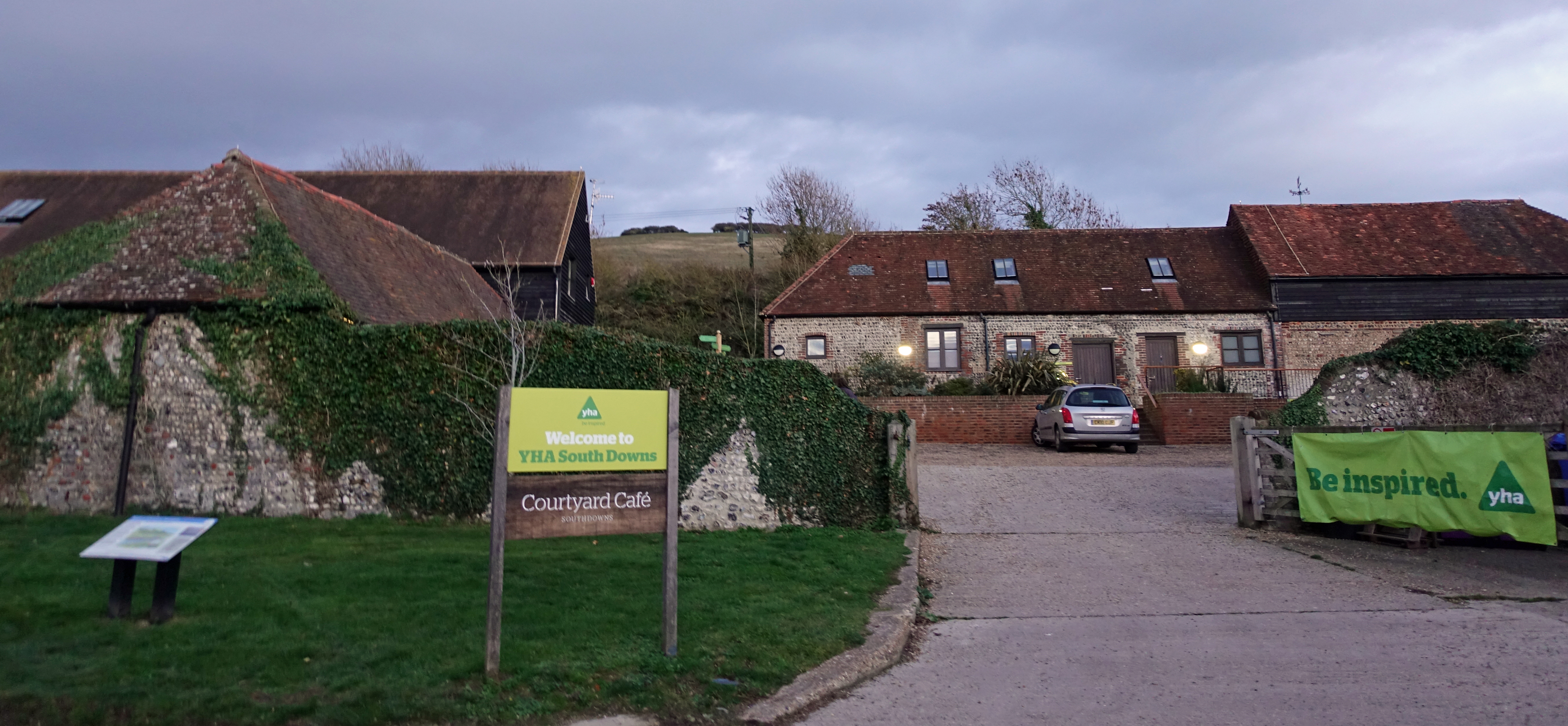
Opened by HM The Queen in 2013, YHA South Downs is situated in a Sussex farmhouse
After a nights decent snoring on the part of the two other room occupants, I rose at an early hour ready for my final day on trail. I had the usual mug of tea in the campers kitchen alongside a simple breakfast as second breakfast was only a few miles away. It was just under 22 miles to my day’s end halt at YHA Eastbourne, via the walk into town and back out again, finishing at the town pier rather than the official halt at the towns western edge. I don’t think that the sad little start/finish post is a fitting end and was to happily continue past it further down the coast to the impressive Victorian Pier. Prior to that I had a day’s walk to complete however.
Second breakfast in the Singing Kettle Tearoom in Alfriston
It was raining hard when I set off from YHA South Downs and a halt at the Singing Kettle Tearoom (519 031) in Alfriston three hours later proffered an opportunity to dry out on the outside while I put a pot of tea and a sausage sandwich on the inside. The proprietor filled my water bottle prior to my leaving and this did me until I pulled into the Seven Sisters visitor centre (TV 518 995) overlooking the spectacular Cuckmere River meanders.
There was little open at the Seven Sisters visitor centre, however there was a working tap outside the open public w/c
Most visitor centres have a working tap somewhere outside. While many are intended to provide water for dogs, a tap is just as welcome to the thirsty hiker. It had only taken me around an hour and a half to reach here after leaving Alfriston and it was another ninety minutes jaunt along the lovely rolling Seven Sisters before I reached my final tap (TV 553 960) on the South Downs Way. This was at Birling Gap, adjacent to the Coach Park.
Easily missed, there is a tap at Birling Gap. Again, with an open w/c alongside
I was on the home stretch now and I had no need to refill my bottle for the rest of my walk as it was only another two hours walk to Eastbourne Pier. After which it was the long haul back out of town where, rather than travel home that night, I was stopping for the night at Eastbourne YHA. And that was it. 108.11 miles since I left Winchester. I had absolutely no problem in finding plenty of water or alternative drinks along its entire distance. There are a lot more options than I have shown above. There are other farms and pubs that can also provide water either directly on the trail, or close by.
The above was correct for the dates of my walk- 16th – 20th November 2018. As it turned out, I had no need to use my water filter, not the emergency sterilisation tablets that I carry in my ditty bag. There was good potable water readily available on every day.
There is a downloadable guide to water sources on the South Downs Way via the National Trails website. But it doesn’t appear to have been updated in some time and fails to list quite a few points. Their mapping system is useful as you can list the points of most interest to you which can include water points. An online cyclists’ guide has a similar list, equally wanting in places. However it includes some useful images.
Three Points of the Compass walked the South Downs Way in November 2018

We’re re-walking the South Downs Way, having first done it in 2011, and we know how good it is to find water taps on the route.
One particular tap gave us pause for thought – that for Peter Wren. We have encountered another, similar tap, with an almost identical dedication, on the Ridgeway near Uffington. It was early August 2018, it was 35 degrees, and it was the bestest water tap in the entire world on that day. Here’s a link to our blog post which includes it: https://sandhurstgeocachers.wordpress.com/2018/08/03/august-3-sandhurst-gloucs-to-sandhurst-uffington-to-sparsholt-firs-ridgeway
LikeLike
We liked this post and thought it so useful that we have included a link to it on our blog http://sandhurstgeocachers.wordpress.com in our post about walking from Cheesefoot Head to Exton on the SDW. Thanks you for your post – if you are not happy about being linked, we’re happy to remove the link.
LikeLike
Great write up! Really appreciate the tap info too, thanks! Ken
LikeLike
No problem, enjoy the hike!
LikeLike