
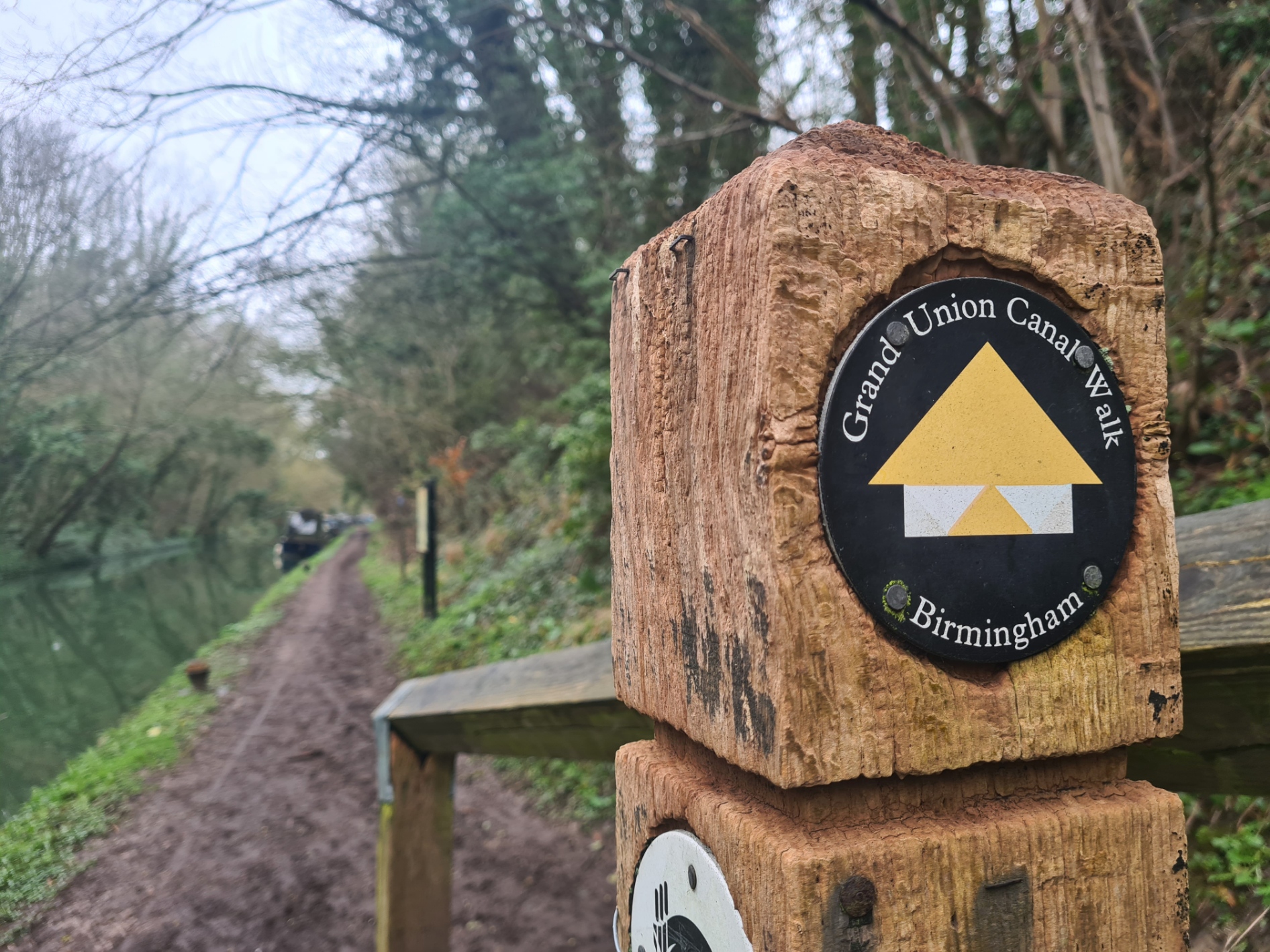
Three Points of the Compass returns to his walk from London to Birmingham, along what was once the main artery of the country’s transport system, but is now a much quieter experience.
I had first attempted the Grand Union Canal Walk back in January 2024 when I set off on what was supposed to be a fairly easy training walk for trails later in the year. A poor choice of footwear saw me retiring after three days with just a third of the distance completed. Feet recovered and having completed a couple of sections of the Source to the Sea trail and a two-day circumnavigation of the Isle of Sheppey to ensure there were no lasting issues, I returned to the canal six weeks later to complete the walk. The weather was a couple of degrees warmer and I anticipated rain during my walk, it was going to be a muddy experience.
Day four: Marsworth (Tring Station) to Fenny Stratford
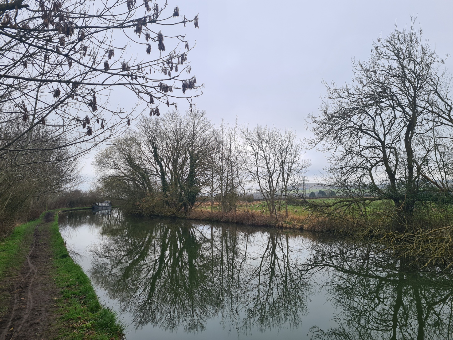
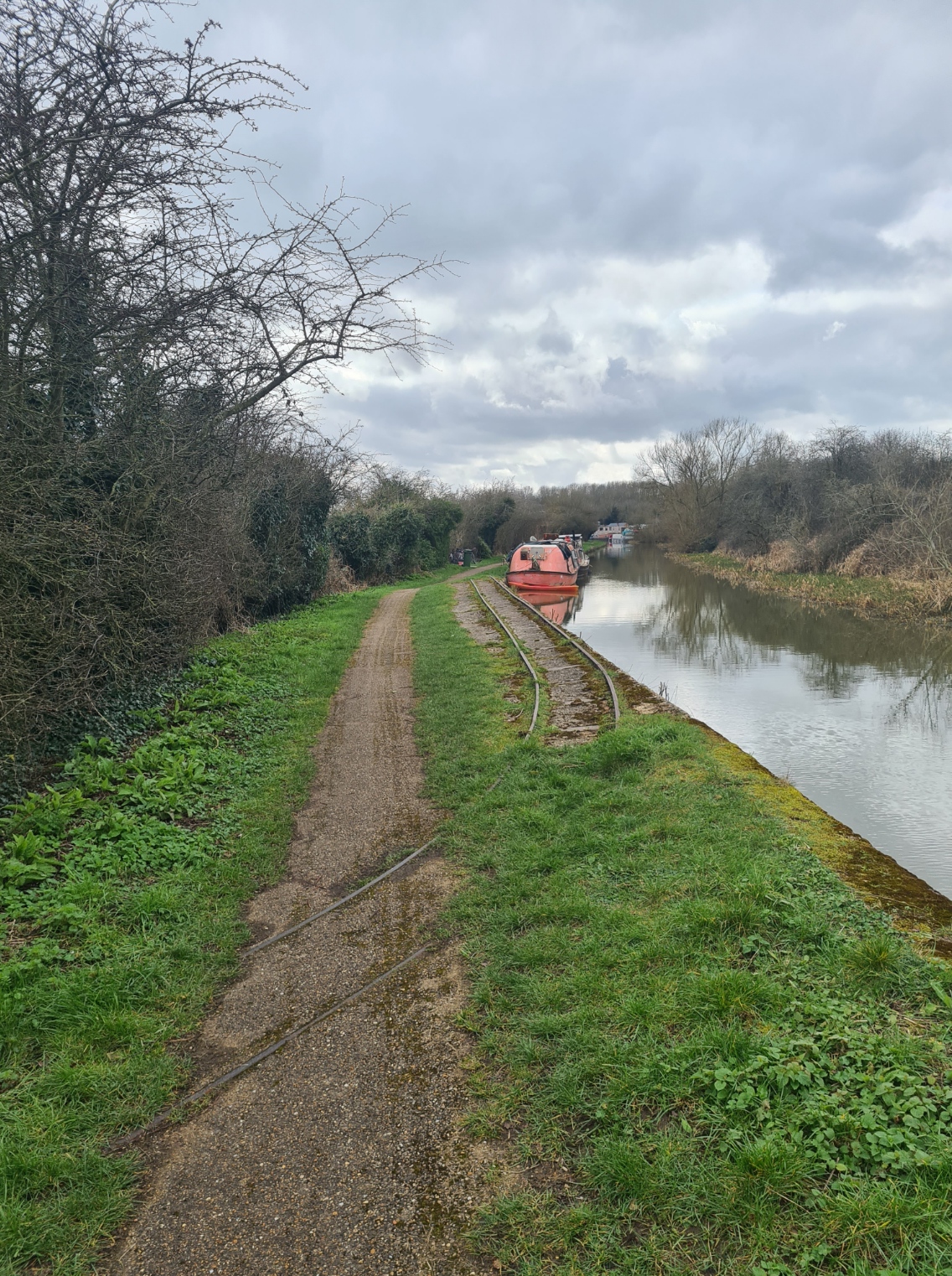
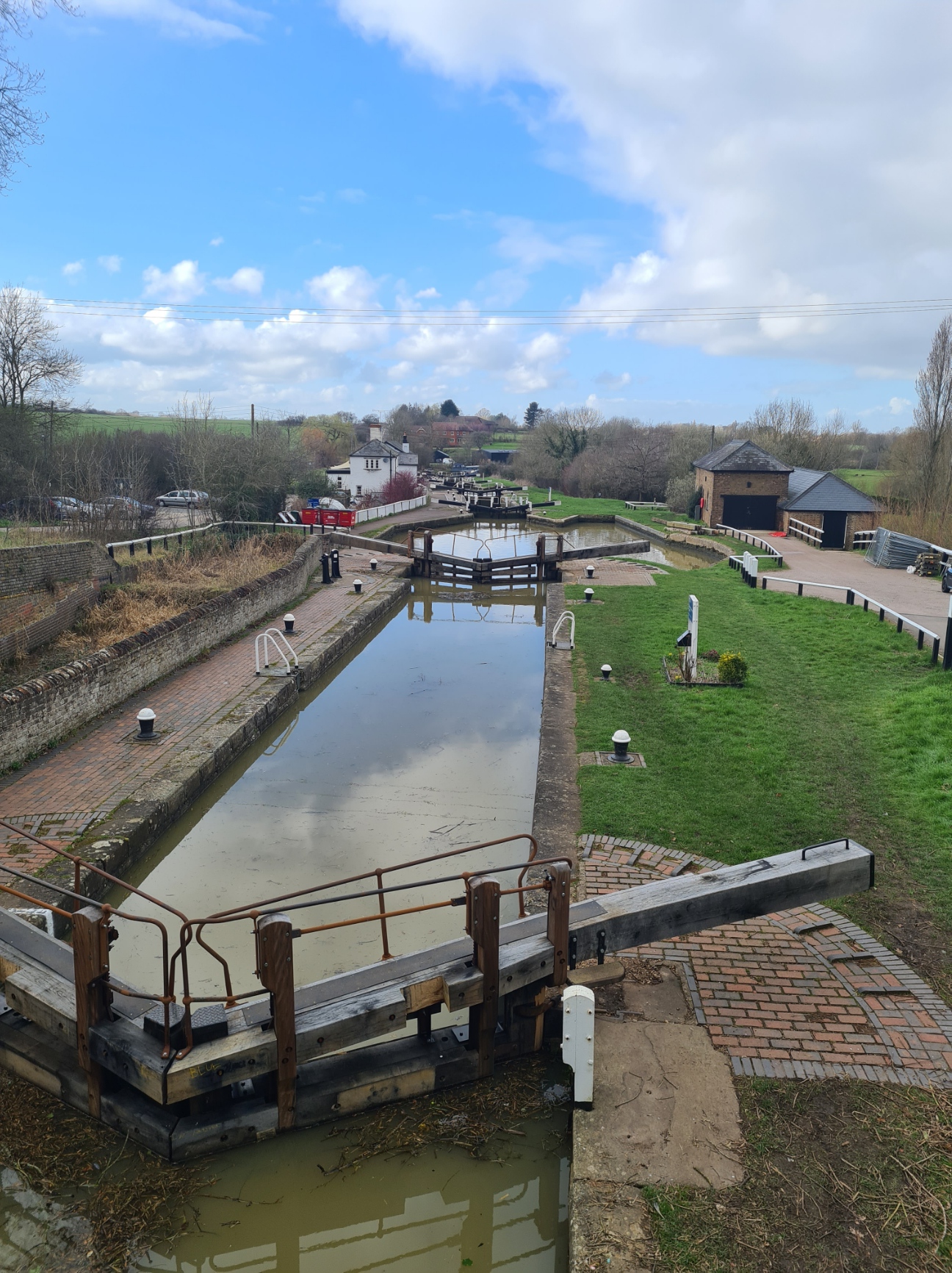
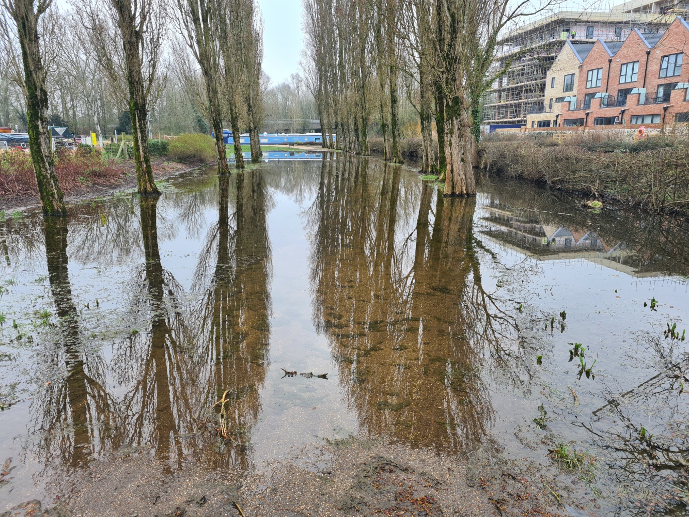
An early train from my home town got me to Tring at 8.30. I had hoped for a taxi outside the station to return me to my last night’s halt, when I abandoned the trail back in January. There was none. I paced up and down and pondered whether to call one. I was champing at the bit, I wanted to get going. Decision made- I walked the short distance down the road and was back on to the canal towpath, prepared to add on the couple of miles this would entail. I would have preferred it a bit cooler, as it was for my first miles on this trail a few weeks back but it started off a comfortable 8-9°C and didn’t rise above 13°C all day. Well above freezing there was no chance of a frozen ground either so, as before, I slipped and slid along this muddy stretch to Marsworth. Finally on to virgin trail, it was, in truth, fairly unremarkable walking. It was a quiet stretch of towpath with few other users, the canal was equally as quiet with no boats moving. Perhaps just as well as there were a few dodgy sections that required careful walking along the slippery concrete edging to the cut, The last thing I wanted was to slip into the canal.
Ivinghoe Beacon was a prominent feature off to my right. It was there that I had finished the Ridgeway National Trail in May 2016, returning to the same spot the following year for an autumn walk of the Icknield Way. Both trails are part of the longer Greater Ridgeway (that now seems to have been renamed) running from Lyme Regis to near Hunstanton on the Norfolk coast. The line of hills was a reminder to me that I need to get that trail completed as it has fallen off my radar recently. A Red Kite wheeled overhead, I twisted my neck to watch it, then quickly realised that looking at distant hills and birds above is exactly how I would end up in the drink.
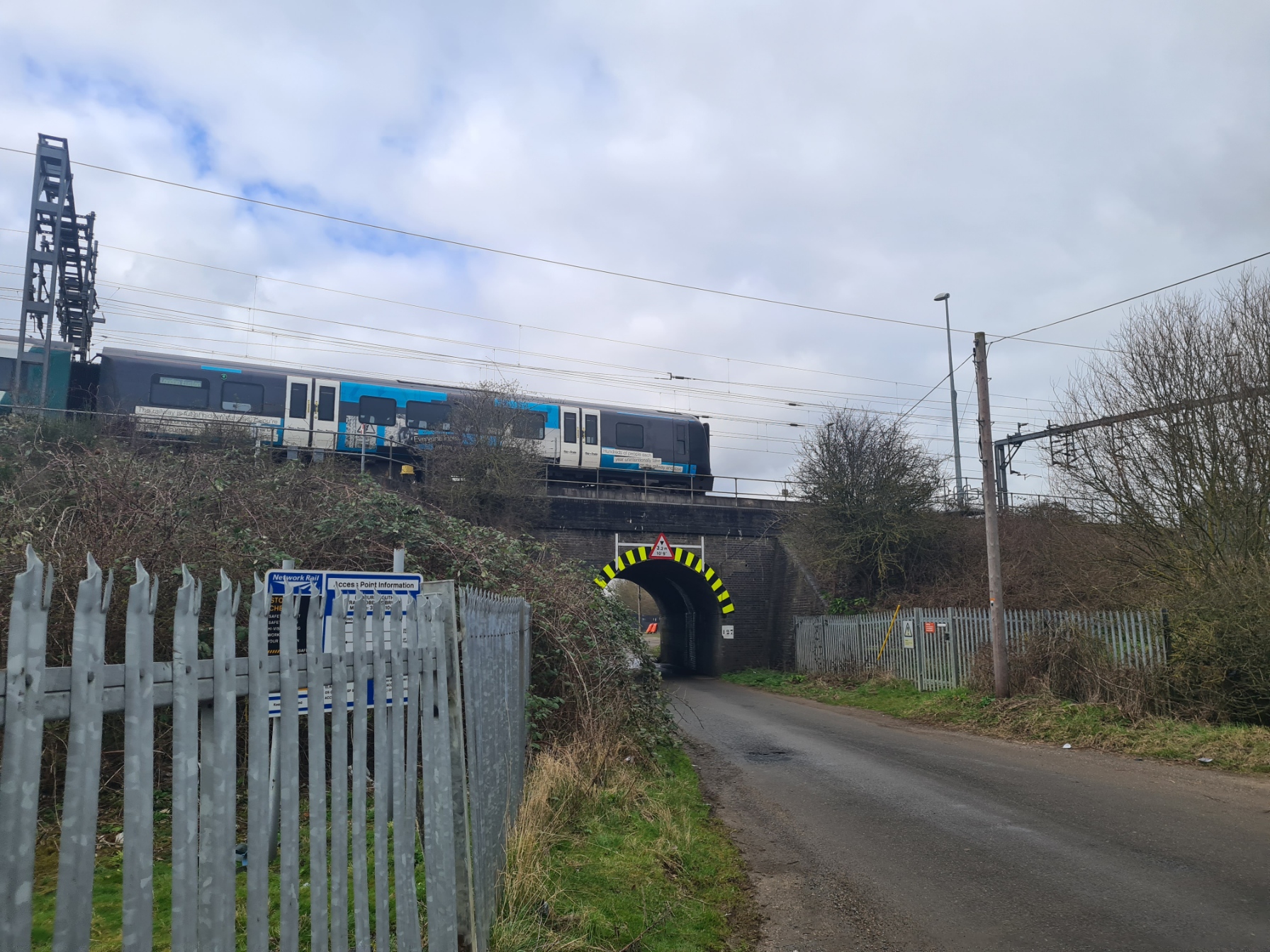
I had a short off-piste exploration planned for today. I left the canal at bridge 118 to go in search of a railway bridge a half mile away. Many years ago I interviewed a number of people involved with, and key to, the investigation that led to the arrest and conviction of a group of notorious robbers. Their stories went into an oral history collection I curated but I had never actually visited the scene of the infamous event. After yet another slippery walk along the edge of a farmers field and a short walk up a road. I arrived at Railway Bridge 127, otherwise known as Mentmore Bridge, or Train Robbers Bridge. This is where the Great Train Robbery took place 8 August 1963 and where the mail sacks from the Royal Mail’s Travelling Post Office, containing high-value packages, were taken down from the track and loaded onto a waiting truck. It all came as a great shock to the institution, never dreaming that such a robbery from a mail train could ever take place. I include a snippet from Michael Maxted’s account, one of the mail sorters on the train.
Once I had looked at the bridge, walked under it and looked at the other side, photographed it, then walked back under it, and photographed it again, it was back along the road, back along the field edge and return to the canal. I doubt there would be many others that would have taken such a diversion!
It was then just a case of keeping the mind busy and continue knocking off the miles. I was intrigued by a set of narrow gauge rails beside the canal at one point but there was no explanation and it was only later that I found they had been built in the 1920s to bring sand and gravel to the canal for onward transport by water. Most of the lines are now removed and that little piece of industry ceased many years ago.
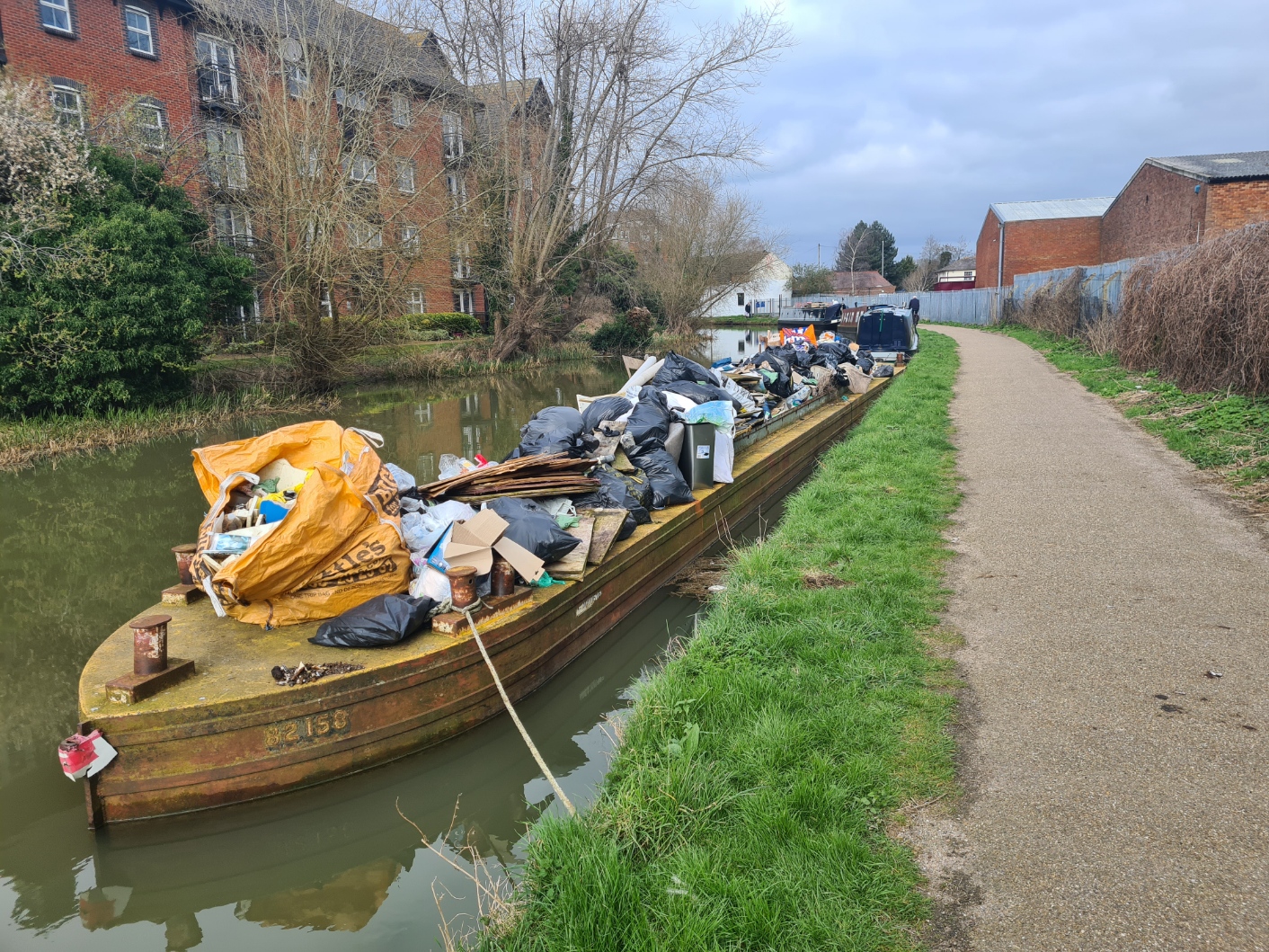
The canal remained quiet, even when it passed through Leighton Buzzard and while this remained a mostly litter free section, there were still the usual beer cans deposited around the road bridges. One large barge was almost overflowing with gathered rubbish. Much more added and it would simply roll off the far side into the canal.
I had eaten a poor quality bacon roll, purchased at Euston, on the train so never felt the need to seek out a midday café or pub in Leighton Buzzard and a banana from the pack and a flask of lukewarm tea sufficed for a snatched lunch on a handy bench, despite being approached by territorial Canada Geese that wanted me off ‘their’ patch. They weren’t the only ones laying claim to territory and quite a few hostile Swans, with wings raised in aggression, approached me as I passed, hissing at me.
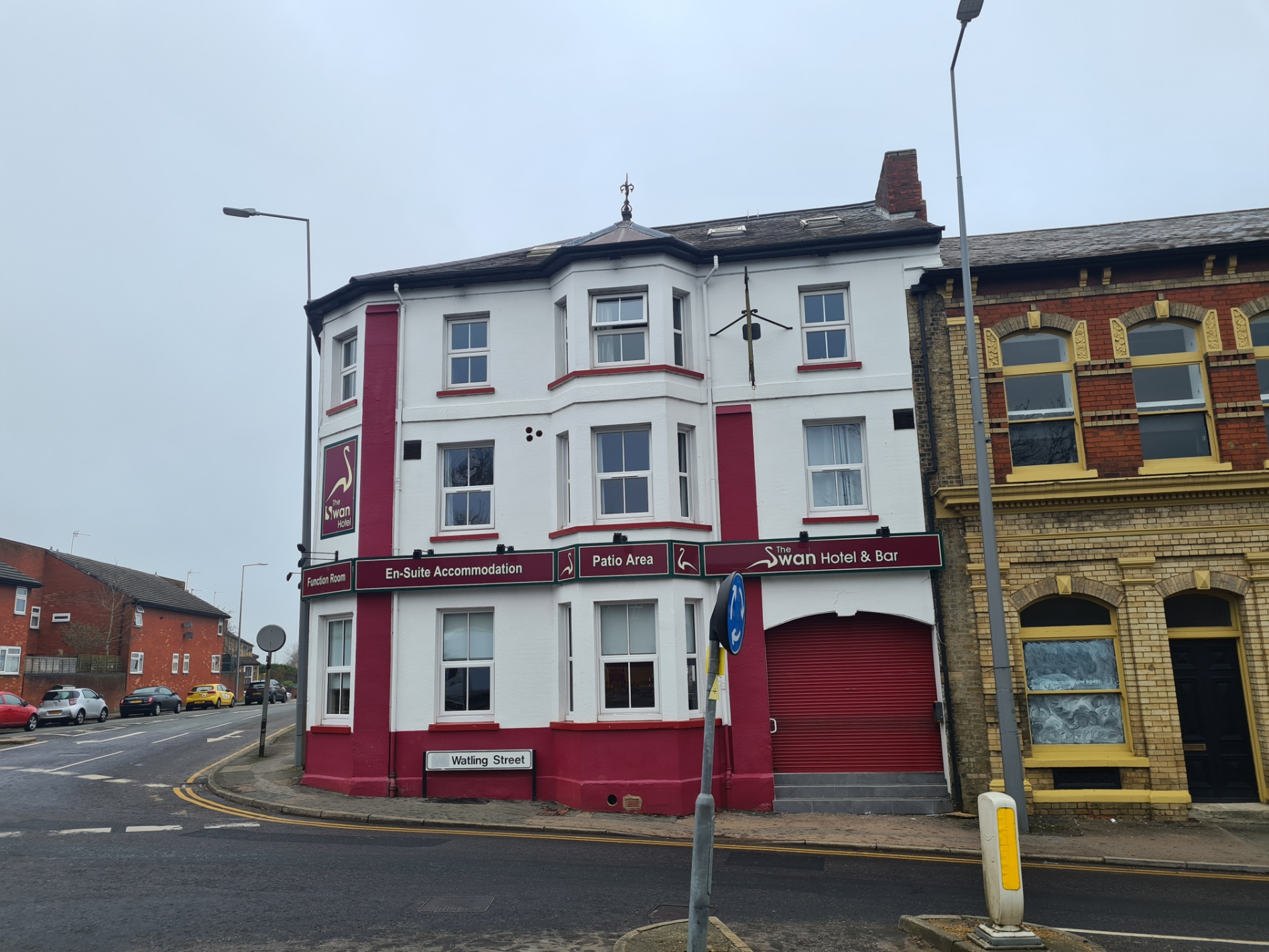
Tonight’s halt was at the Swan Hotel and Bar and I confess to feeling a bit weary when I reached Fenny Stratford and left the canal for the short walk up the road to the pub. I had originally thought that my day would be in the region of 16.3 miles, plus the extra couple of miles from Tring station, but my GPS revealed I had walked 21.3 miles instead. At least my toes were holding up with no repeat of the problems realised in the first fifty miles of this canal walk. I was ready for a pint of beer or two before going up to my room. However when I went to pay, the tills were not working as there was a wake about to start and a free bar was in operation. Thankfully I was a couple of floors up so shouldn’t be disturbed as it had the appearance of becoming a noisy affair in the bar later.
I had plenty of time in my room to wash the mud from my shoes and leave them on the scorching hot radiator to dry, then a shower and a brief nap before calling Mrs Three Points of the Compass for a natter. Notes written and map and guidebook checked for the following day, it was then out into the darkened streets, having fought my way through the packed bar downstairs, in search of evening fare. Tuk Tuk Thai provided an OK meal but I got exasperated when it came to pay my bill. They had added an extra beer on, when the bill came back with it removed it had been replaced by an ‘optional’ service charge for the same amount as the beer. I took the option and had that removed. Back to the Swan where the ‘lively’ wake had spilled out onto the pavement.

Day five: Fenny Stratford to Roade (Stoke Bruerne)
I slept well with no disturbance from the throng downstairs. The alarm on my phone eventually wakened me from my deep sleep. Two cups of tea later, and flask filled, I was aware that it would be another twenty plus mile day so was downstairs prompt for 7.30, the earliest I had been told I could have breakfast. The boisterous gathering from last night had thankfully cleared when I poked my head in to the bar area as I had wondered if it might be a two or three-day wake. I then found that I could have had my vittles a half hour earlier. The sandwiches I chose for brekkie may have been basic but were stuffed with good bacon and mostly set me up for the remainder of the day, topped up by a banana four hours later down trail.
Other than some flooding, the trail underfoot was mostly good all day, especially when I took to the landscaped Grand Union Broadwalk, a Poplar bordered metalled path that ran just a few metres to the right of the towpath for many miles. It was very popular with runners, mums with buggies and one large walking group, but wide enough to accommodate all. Todays walk would take me through a couple of quite large towns but was primarily rural. The highlights of today’s walk were a couple of aqueducts, one modern, the other much older.
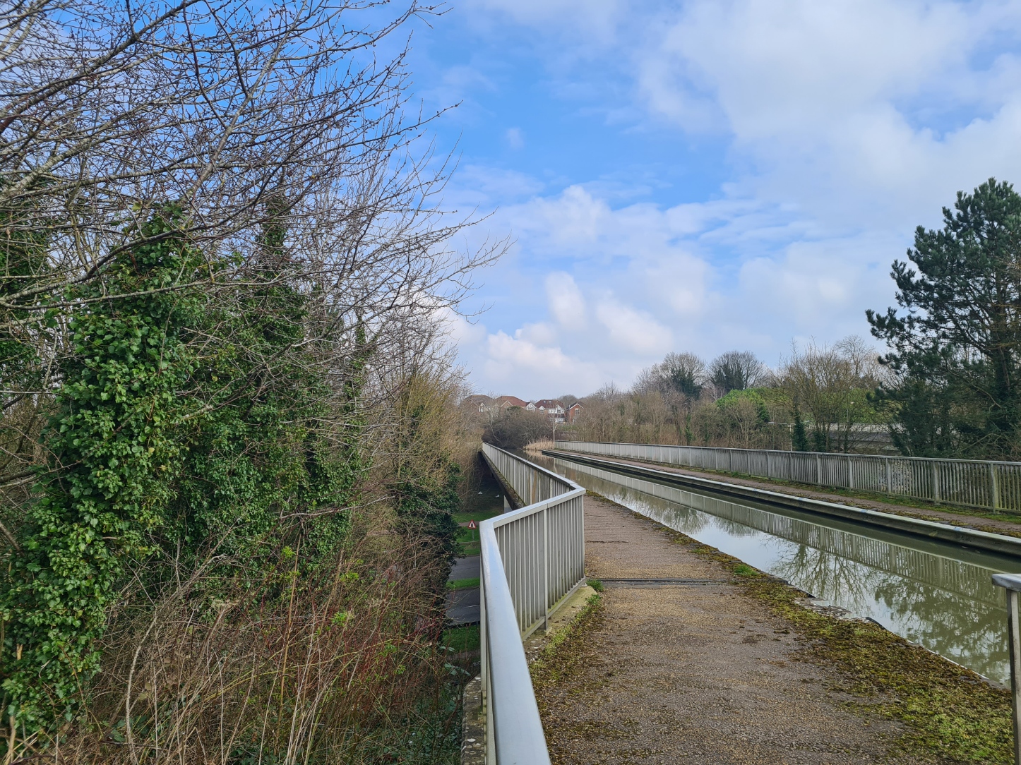
I reached the first of two impressive aqueducts. This was a modern affair, only built in 1991, and is high above the V6 dual carriageway and a tributary of the River Great Ouse, on the outskirts of Milton Keynes. It probably doesn’t raise much of a glance from most people and shows how blasé we now are about such engineering. It wasn’t always that ‘easy’ to construct these. Grumpy cyclists were passing me along this section, none of them giving an inch on the not-so-wide path and fully expectant that I would step completely to one side. I received nary a nod nor thanks.
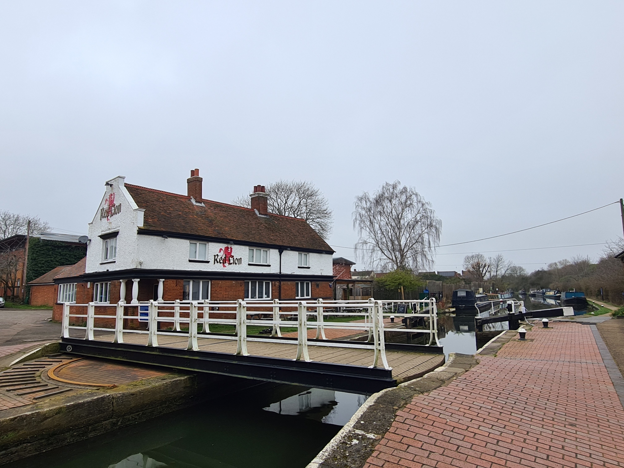
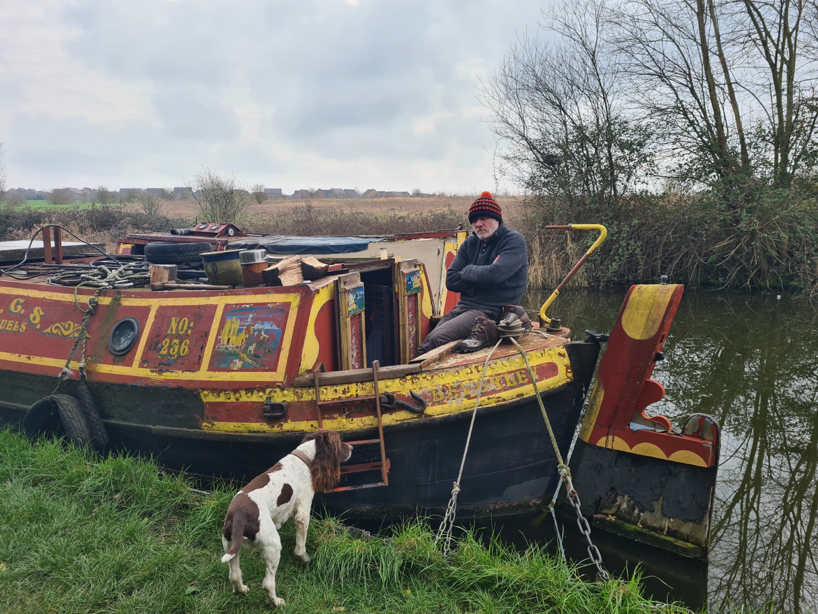
I paused beside one boat to chat to the owner. Gary had been living on boats for thirty years, twenty of those on the 1930s ex-working boat he was sat on. He used to operate this and the butty moored alongside on the Grand Union Canal, delivering and selling fuel- coal, wood and propane. He had given that up two years ago and was now considering also giving up his two boats. I asked if he planned on moving ashore- “oh no, I’ll probably get one of those pleasure boats, a narrow boat or something“. It was surprising how much the two of us had in common as he had visited many of the same places as I in Scotland and England, we were both familiar with many of the same bothies too. He wild-camped extensively and was planning a Hebridean Way trip later this year. Tearing myself away, I told him I needed to get on as I was hoping to visit the Canal Museum at Stoke Bruerne and he told me to look out for the photograph of his two boats included in the displays there.
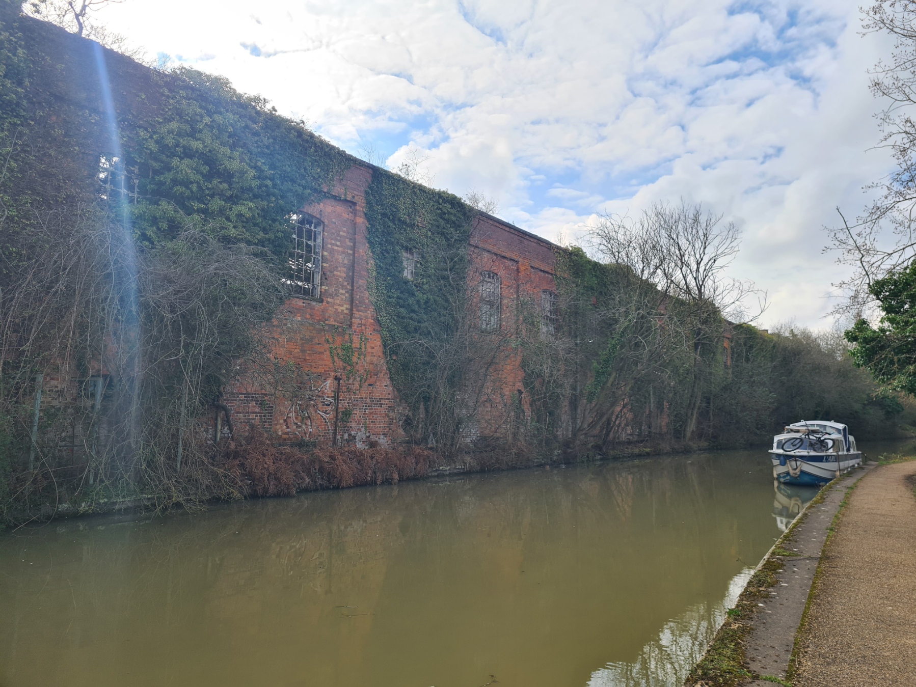
The canal passed through Wolverton where decrepit industrial buildings rose tall on the far bank. Daylight showed through holed roofs and shattered windows. It was once an important place for railways, established in 1838 as a locomotive repair shop. They were built here too as were carriages. The Royal Train was once housed here and dozens of mail trains were built here, including the one robbed back in 1963. As with so much, all that industry is long gone.
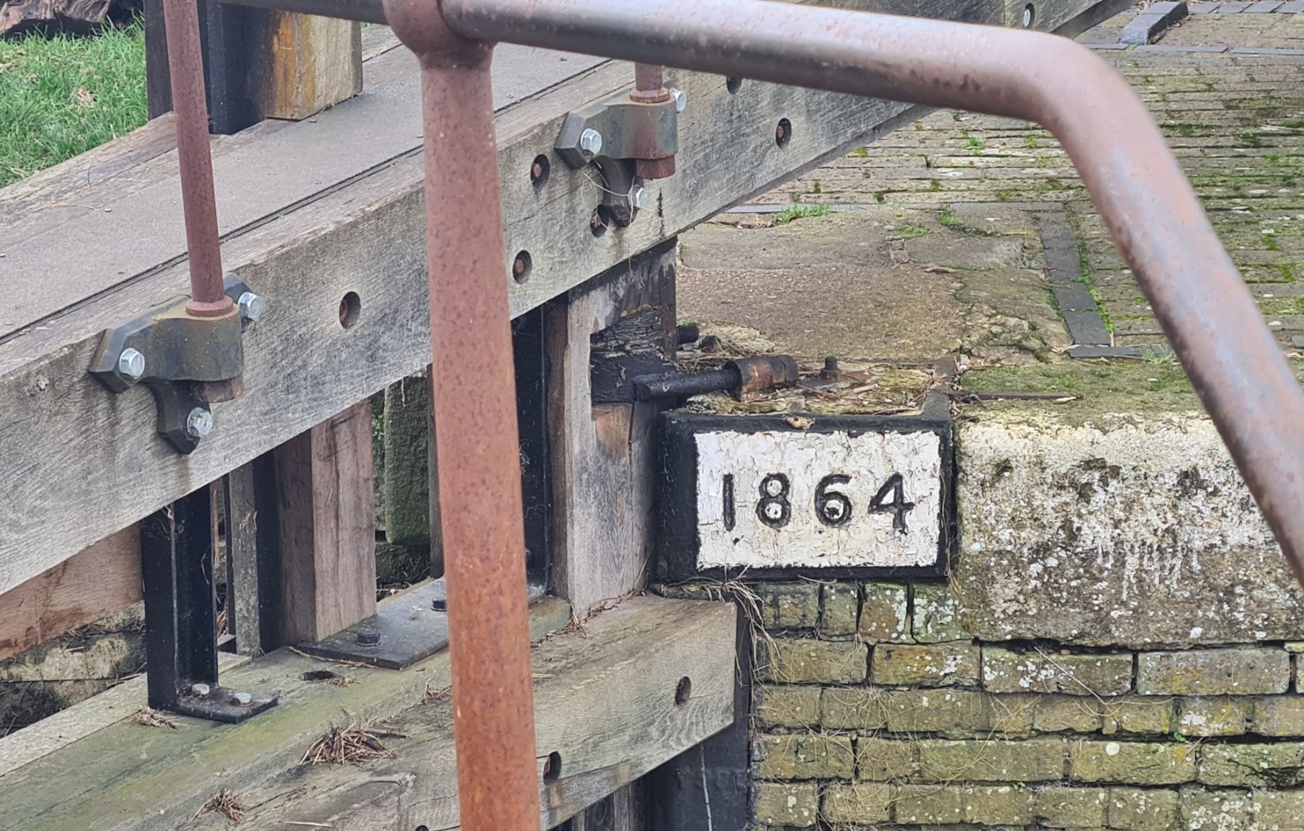
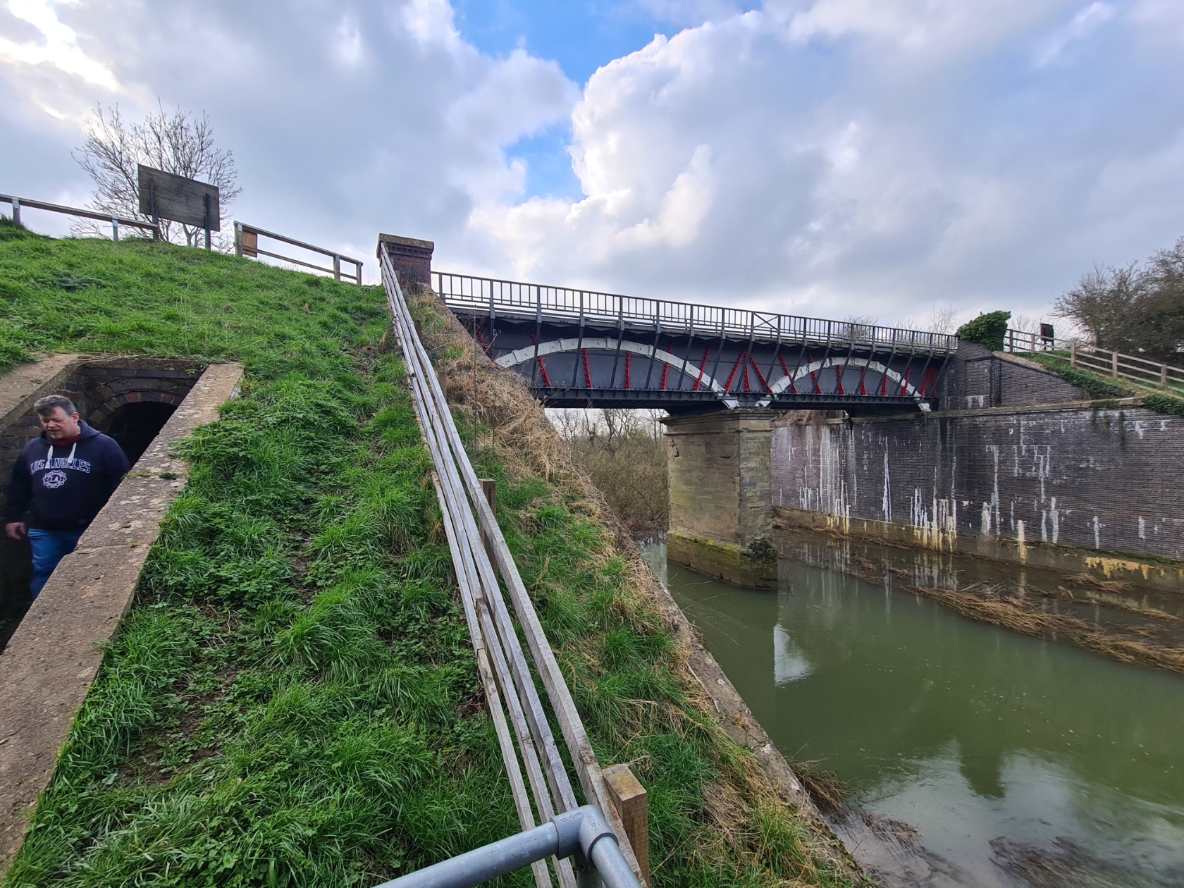
It wasn’t much further to the Iron Trunk Aqueduct that now carries the Grand Union Canal high above the River Great Ouse. The canal used to descend through four locks to the river, then ascend through five locks on the far side. William Jessop’s first attempt at an aqueduct collapsed in 1808. I was walking across the fourth attempt, built by canal engineer Benjamin Beavan and fortunately still standing. Built in 1811, it is the oldest broad canal iron trough aqueduct in existence.
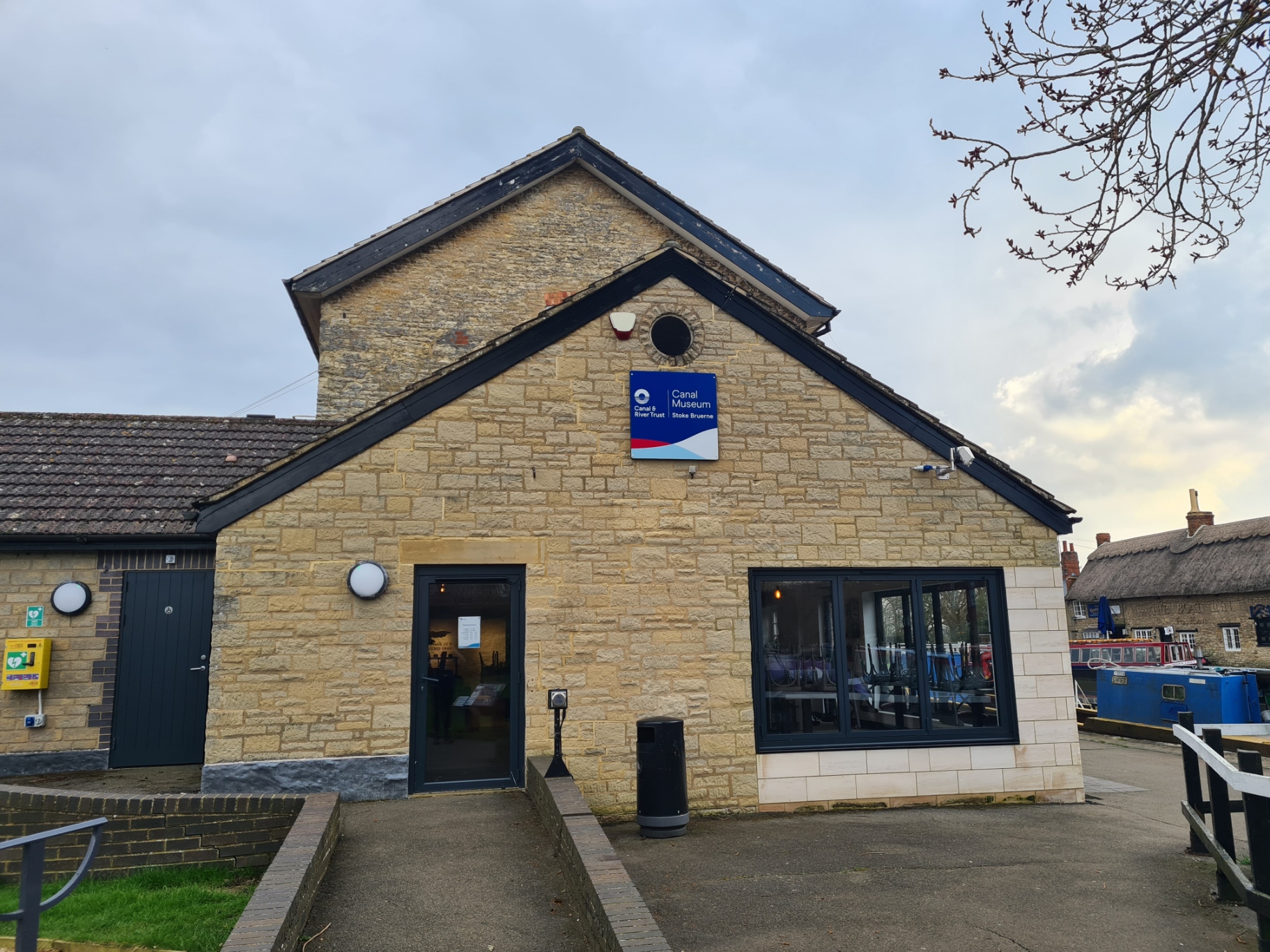
I got a bit of a move on now, well, as best I could with an often slippery towpath. More narrow gauge railway tracks, deeply incised rubbing bars on bridges, locks, pump house, ornate bridgework, it all now received the most cursory of inspection. I was pretty much determined to have a decent period to explore the canal museum at Stoke Bruerne. It wasn’t to be. I got there at 15.55 to find it closes at 15.00 every day. I peered through the glass but that was about it.
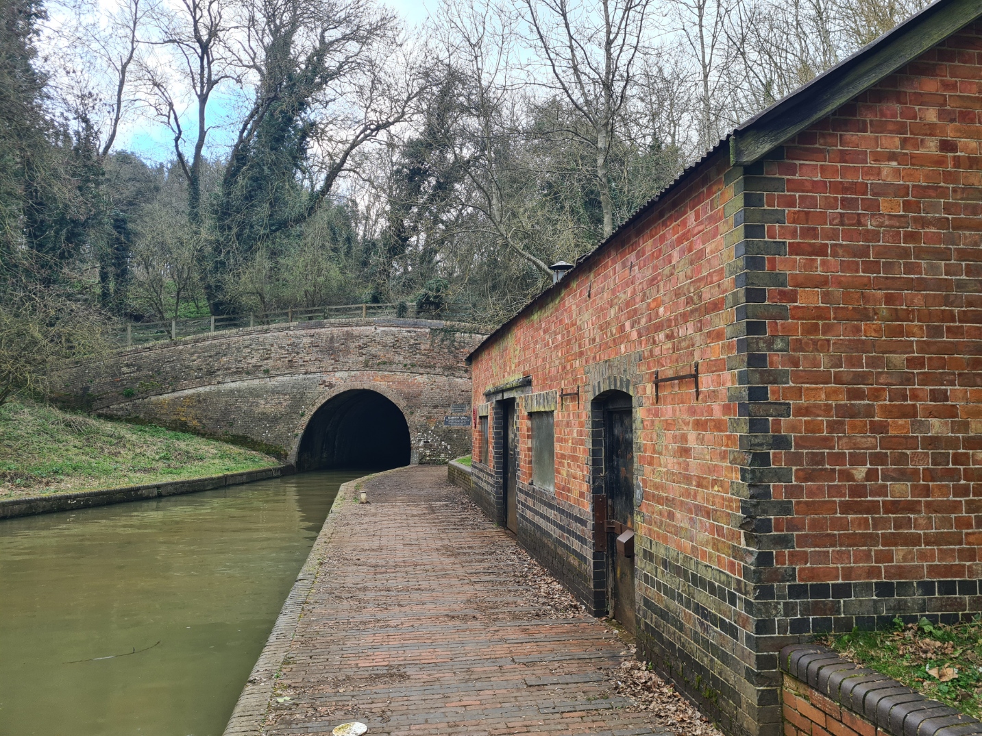
It is a very short walk from there to the Blisworth Tunnel. This opened in 1805 and it’s 1 3/4 miles (2812 metres) make it the longest broad gauge, and the third longest overall, canal tunnel on the system. When constructed the navvies used the spire on Stoke Bruerne’s church as a sighting point, and relied on plumb lines lined up with it, to ensure the correct line of digging. There is no towpath and boats were legged through the tunnel, though steam powered tugs took over this role from 1871 to 1936. Horses were walked over the hill above and that is where the path goes. I followed it up, but not for long. I took a right turn on to the Mid-Shires Way that led me across the fields to Roade.
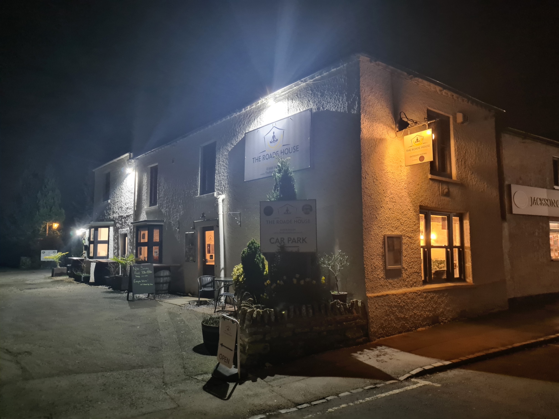
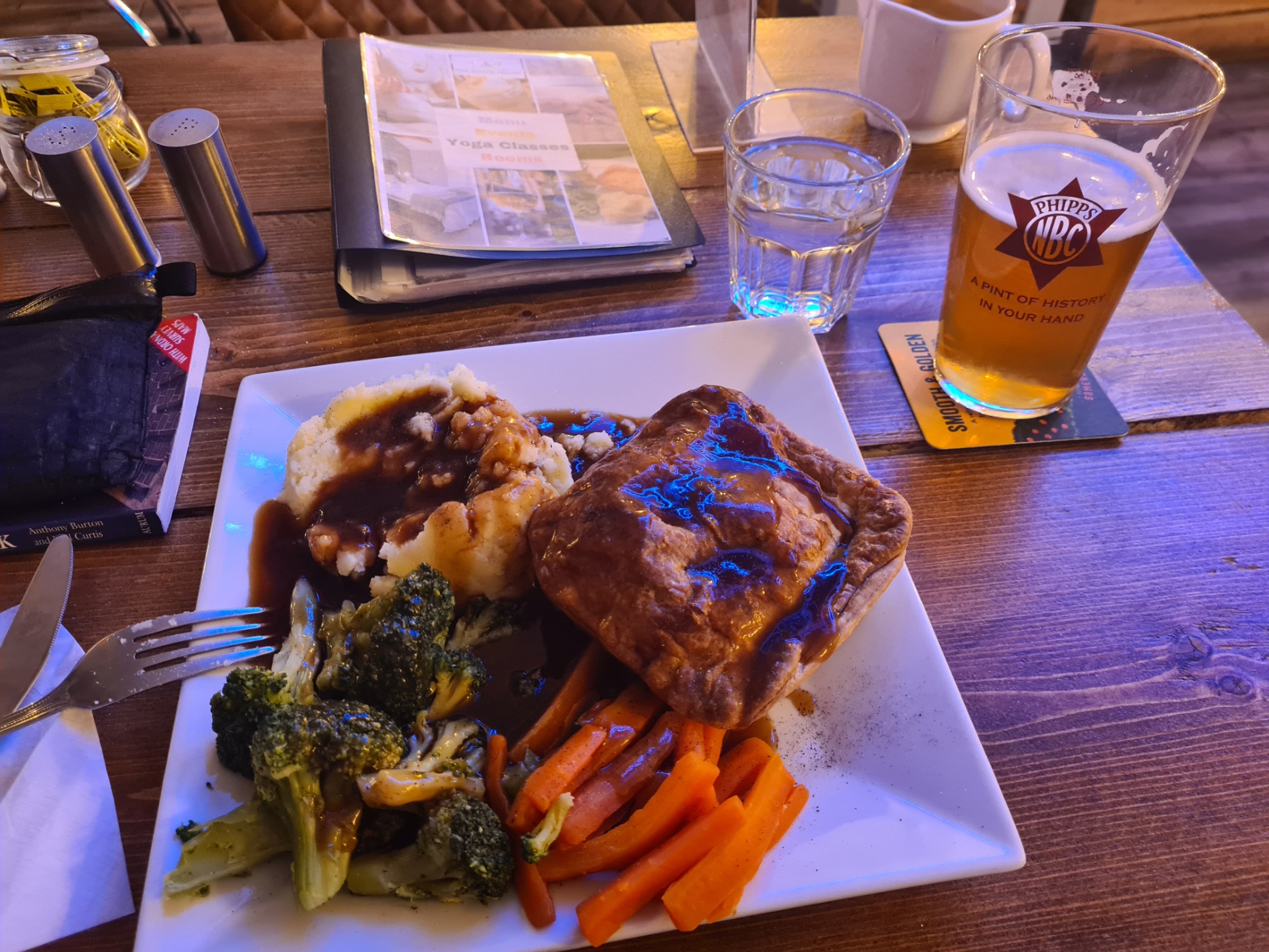
A half hour walk through the streets bought me to The Roade House, tonight’s stop. The owner Paul, was the only person to have offered me the opportunity to rebook when I had been forced to cancel bookings on my last aborted trip to the canal. Due to the short notice, all the others simply took the money. Paul made me welcome and while checking in I noticed he had various home-baked cakes for sale. A large slice of coffee cake might, just might, have accompanied me to my room to consume with a pot of tea. Again, it was wash the mud from my shoes and put them to dry on the radiator before getting myself equally as clean and into ‘fresh’ town clothes. As usual, I fitted in a nap prior to calling home for a chat, then simply had to walk downstairs to eat. Pie and veg amply filled the inner man. I did then venture out to the nearby pub. But while the staff were busy pointedly ignoring me I had time to view what beers were on offer. Not particularly fancying any and a bit peeved with the lack of service I about faced and walked back out. Instead, a bottle of Tempranillo accompanied me to my room for a film while I wrote up my notes for the day.
My estimated 20.32 miles to Roade was again less than what was actually realised on the ground. I walked a tracked 24.84 miles. These little side excursions to overnight accommodation can really add on to the actual canal miles, making this walk considerably longer than the suggested 147 miles. But, five days done, another four to go, and tomorrows walk to Weedon Bec was going to be a good deal shorter.
- Grand Union Canal: London to Marsworth
- Grand Union Canal: Stoke Bruerne (Roade) to Stockton
- Grand Union Canal: Stockton to Birmingham
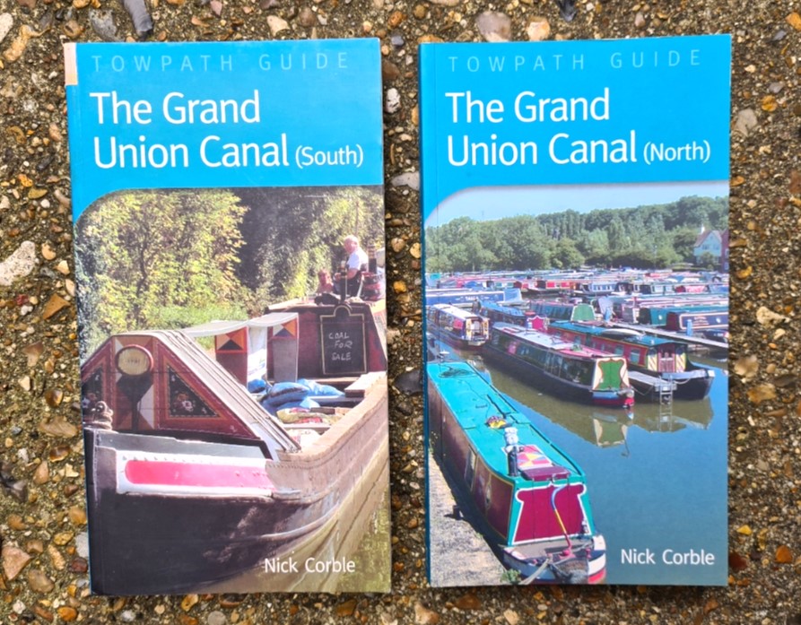
- A hiker’s library: Canals

I noticed the mention of a “rubbish boat” in the post—what exactly is that? Does it collect trash from the canal, or is it something else?
LikeLike
I confess to not being sure in my answer. As you will have seen from my photo, it is an open barge full to overflowing with rubbish. Whether most has been placed there by boatowners or, as I suspect, gathered together by excellent Trust workers/volunteer rubbish collectors, I don’t know. Whichever is the case, it has obviously been added to since.
LikeLiked by 1 person
Will it be removed/solved? Doesn’t look good… Anf where is one bag, soon will be 10!
LikeLike
Well that was a year ago, so I hope it is long gone by now!
LikeLiked by 1 person