
The British love a royal occasion, well at least most do. The focus of many of these have been based in London- Coronations, weddings, births and birthdays and just the occasional jubilee. On these occasions anything from tens of thousands to millions of people can descend on the capital. Swamping public transport, many of the visitors are unfamiliar with the streets and free maps showing processional routes have been produced on just a few occasions to aid the public in walking between destinations and also relieve the transport network. A handful of paper maps produced over many decades and given away free are shown here. Click on any image to view an enlarged copy.
Free paper maps for anyone visiting London to attend royal events were not available until the 20th century, and even then, few have appeared as many, often well produced, commercial souvenir items of a ‘special day’ have been available for an ever expectant public to purchase. This changed in 1936, together with the shock of an uncrowned King…
Coronation processional routes
The production of free paper maps of London is an expensive affair and would normally only be justified where there was commercial advantage in providing them. Edward VII was crowned at Westminster Abbey on 26 June 1902, the first coronation in Britain since his mother, Queen Victoria, in 1838. The public flocked to the nation’s capital for the occasion.
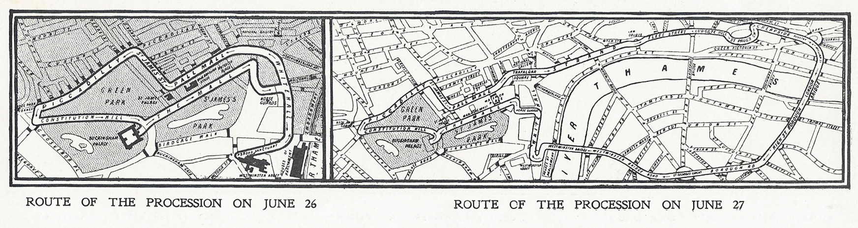
While there were no free maps of the processional route distributed to the public, a map was published in many newspapers, however most papers did not actually show this until after the event, so were not of much use to people visiting London who were unfamiliar with the street layout. Similar maps were published in newspapers for the various processional routes during George V’s coronation in 1911.
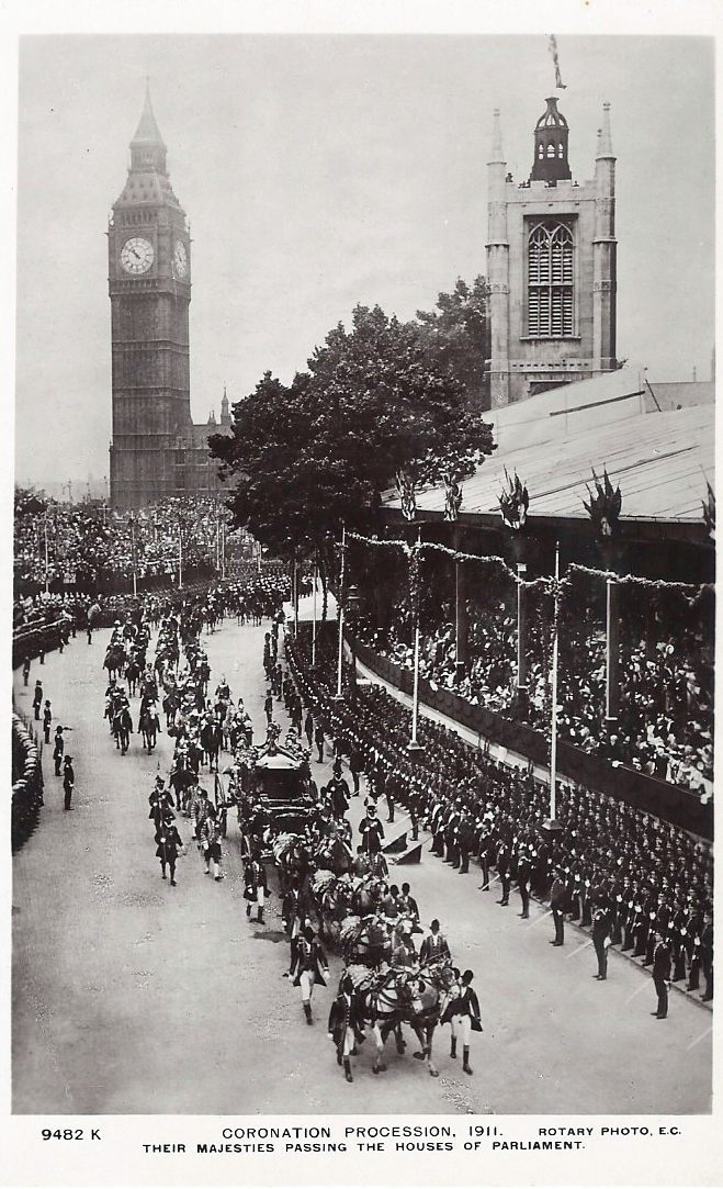
Producers of pictorial postcards also sold souvenir cards showing scenes from the procession and of the coronation route itself. While some attendees may have purchased a card showing a map, to be able to say ‘we stood THERE‘, it is likely that a great many more real photograph cards showing the procession itself were subsequently purchased as a memento of the day.
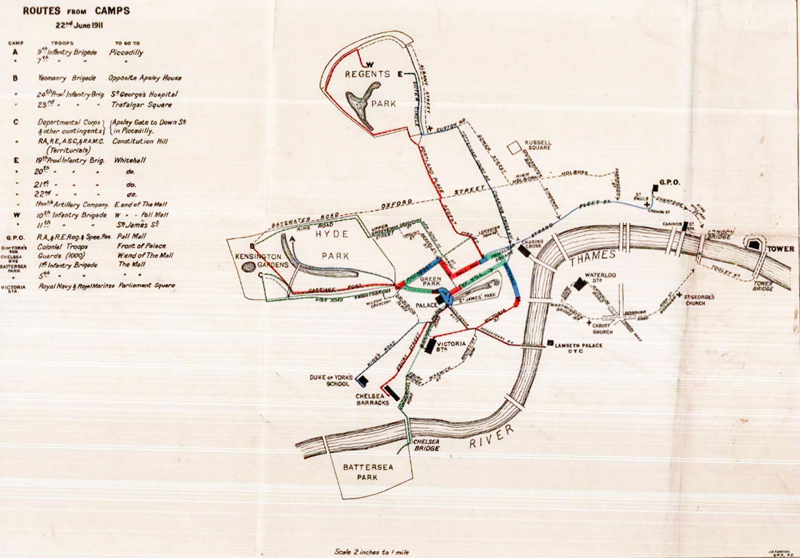
While free paper maps of London for the public were not available for the respective processional routes for the coronations of either Edward VII or George V, both members of the police force, and officers and senior NCOs amongst the thousands of military guard that marched and rode the route, or lined the streets, were provided with maps showing their detail or route from barracks.
‘Long may he reign’
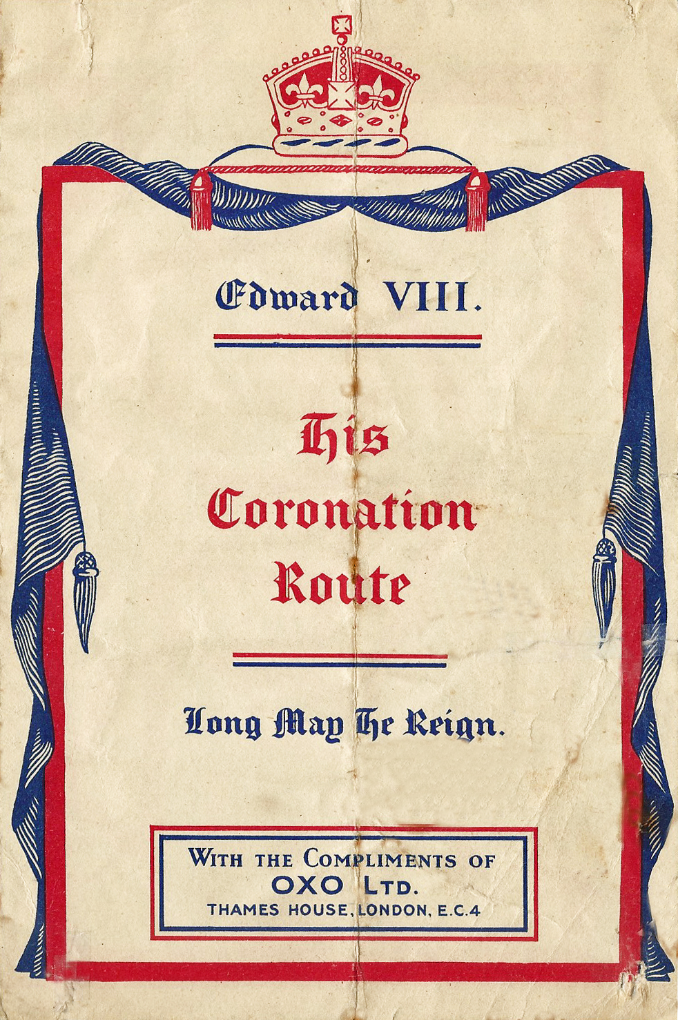
1936 was a hard year for the British. The monarchy had suffered turmoil and loss. George V died in January 1936 and his successor, Edward VIII, abdicated on 11 December the same year.
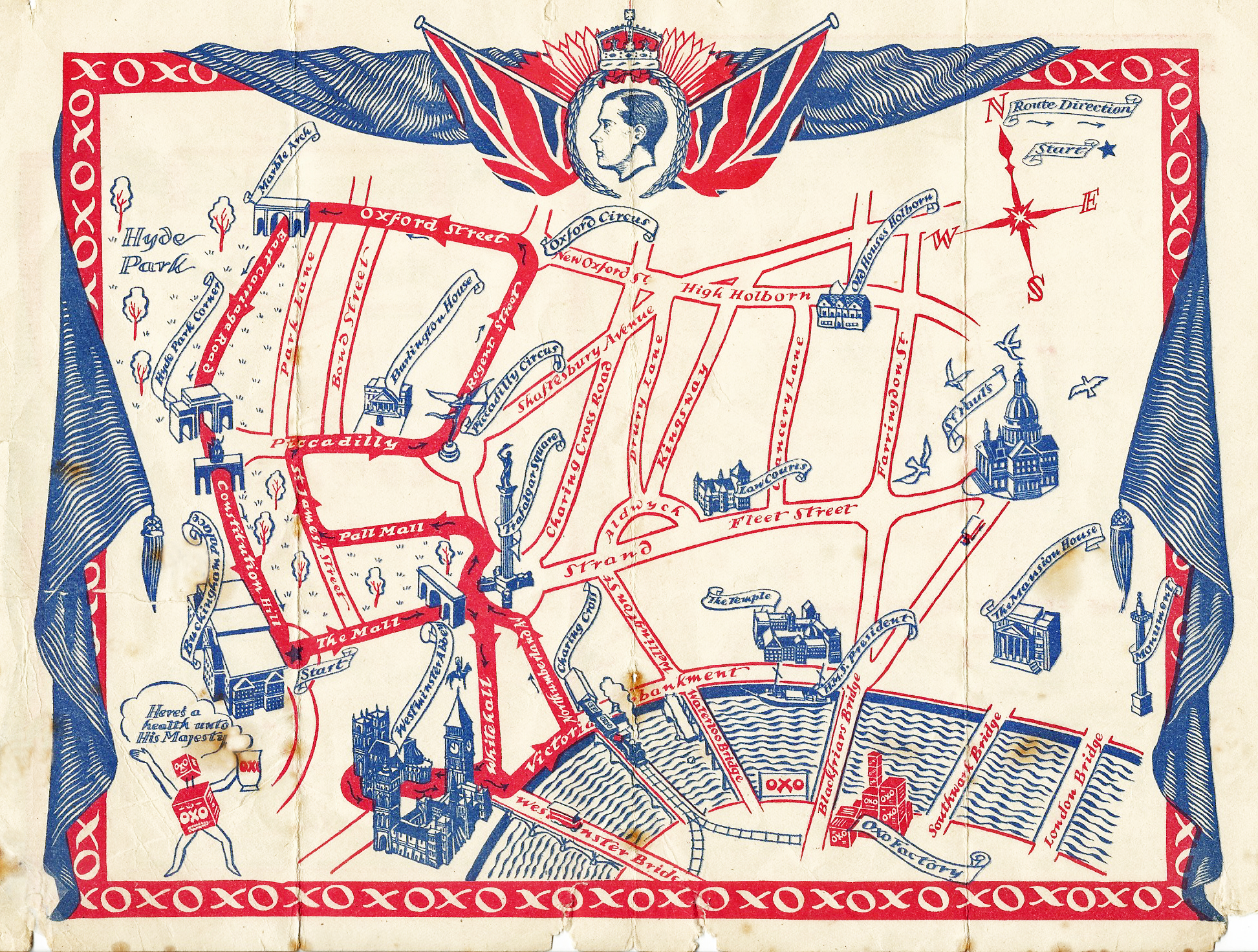
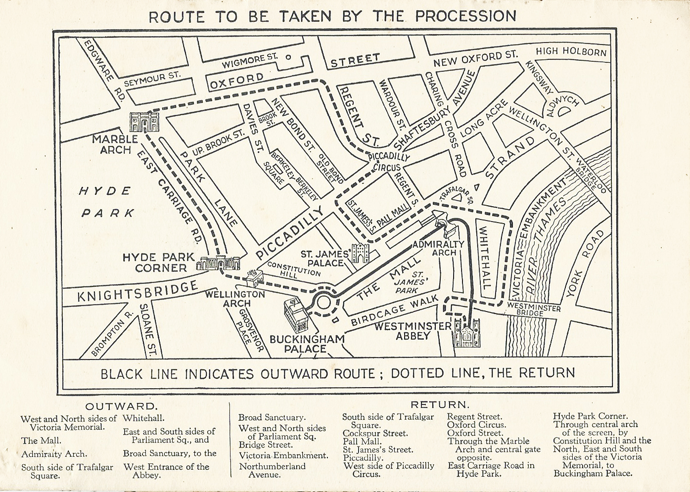
Prior to Edward’s abdication plans were already being made for his coronation. The logistics were planned and processional coronation route through London decided, the route had been widely circulated. Enough so that some firms had begun to produce commemorative material anticipating national fervour.
The map shown here was produced by Oxo Ltd. in 1936. Oxo produced a concentrated beef extract, available to the public since 1910 in solid cube shape for a penny and the company recognised the benefits of strong promotion. Prior to the coronation, Oxo had sponsored the 1908 London Olympic Games, alongside Odol mouthwash and Indian Foot Powder, this despite Coca Cola claims to being the first commercial sponsor of the Olympic Games.
While this map is a remarkable survivor from the short-lived era of an uncrowned King, the plans for his coronation at least proved useful for the actual coronation that followed so soon after his abdication.
The coronation of George VI the following year ignited the populace. The coronation took place in Westminster Abbey, London on 12 May 1937. The procession left Buckingham Palace and headed up The Mall, through Admiralty Arch, down Whitehall to the Abbey. Following the ceremony the return procession to Buckingham Palace was over six miles (10 km) in length. There had never been anything like it and hundreds of thousands of people were expected to attend including 40,000 schoolchildren. Over 32,000 soldiers took part in the procession and 20,000 police lined the streets to control the crowds. A large area in central London was closed to almost all traffic and most attendees were expected to walk to their vantage point.
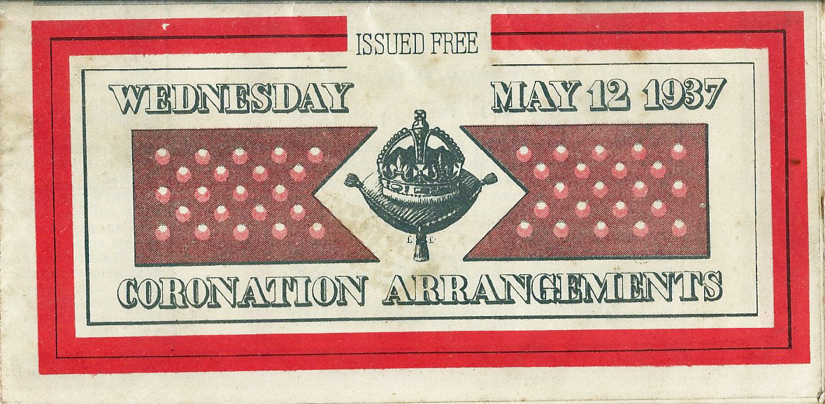
While the public could use the London Underground and buses and trams outside the Coronation Area, many visitors were unfamiliar with London streets and a paper map was available in advance, free of charge, to aid people in getting to their view point. The map was produced by Geographia Ltd. Cartographers, a London based firm established c1910 who became well known for their folding pocket maps.
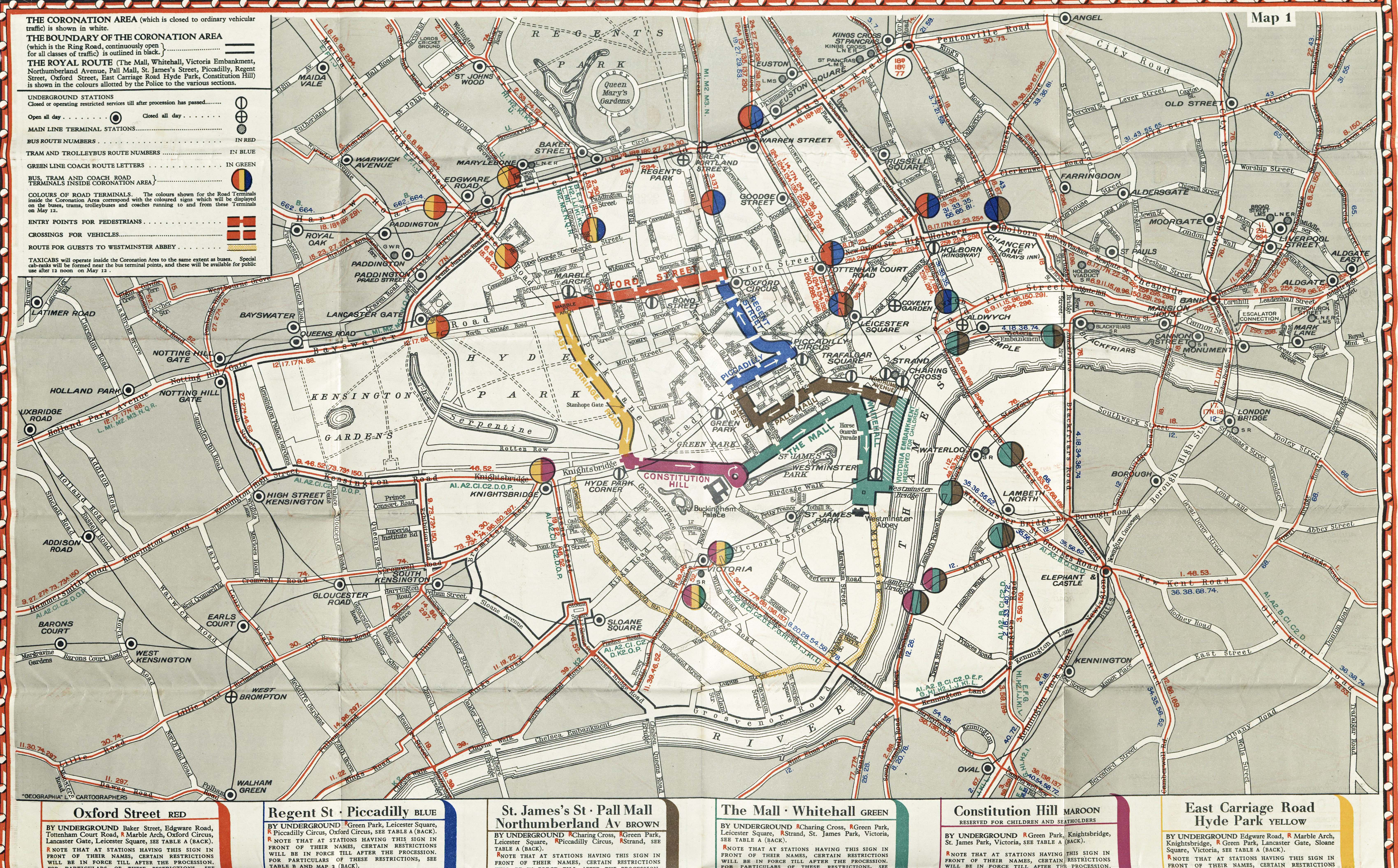
The map extends beyond the coronation route itself and would have been of immense help to people unfamiliar not only with London’s streets but the bus, tram and coach routes to be taken outside of the area closed to most traffic. The rear of the map contains a great deal of information- day and night public transport, also two further maps- each showing train services.
Other than the ‘official’ map produced for the royal occasion, some other business also saw this as an opportunity to produce their own maps showing the coronation route. When issued free, these included information about the businesses themselves and were mostly intended to create more business or customers, as well as assist existing customers.
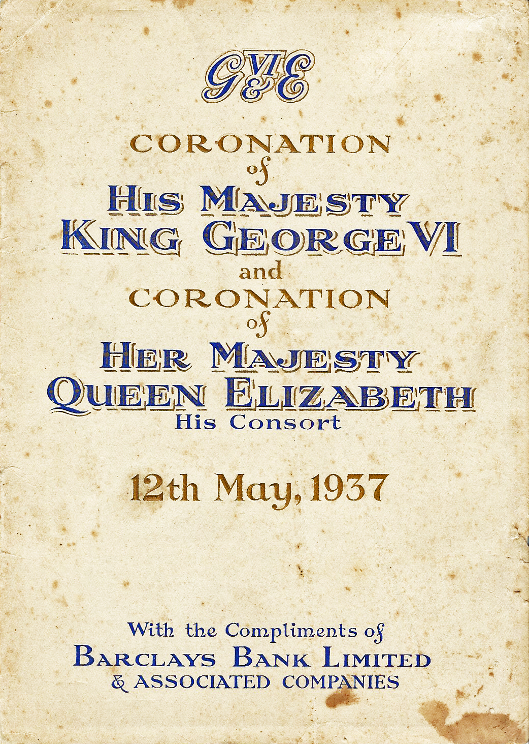
The small free booklet produced by the Barclays Group of Associated Companies includes four maps- a small one of the coronation route, plus three others- one showing principal places of interest in inner London, a second includes locations of branches of Barclays Bank Ltd, Barclays Bank (Dominion, Colonial and Overseas) and the British Linen Bank in Inner London. A final diagrammatic map illustrated the London Underground Railway system. One of the central London maps in this booklet can be seen in part one of this series on free London maps.
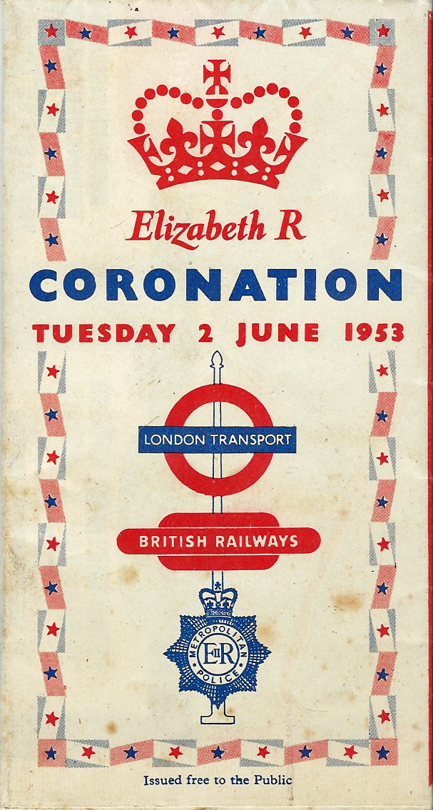
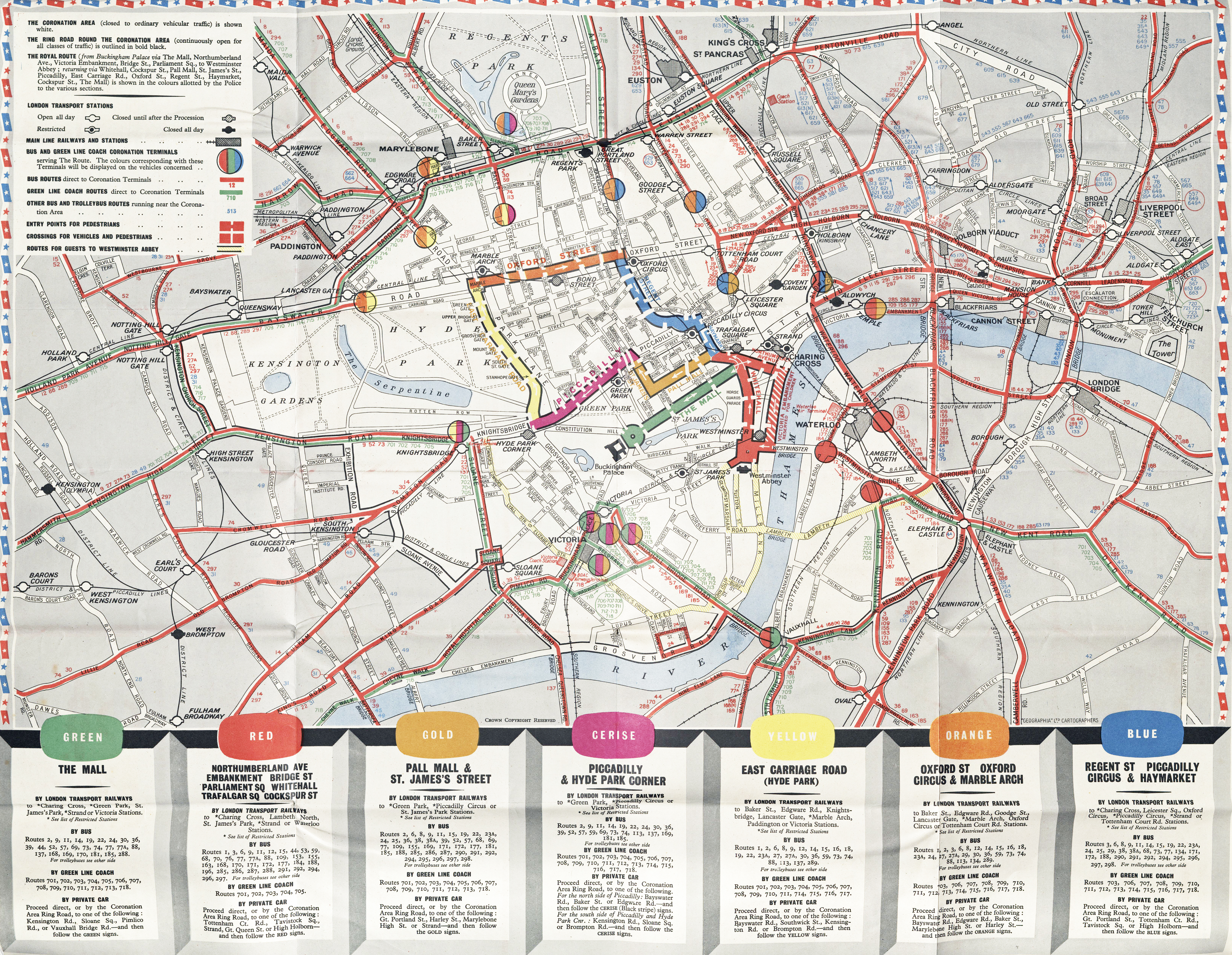
King George VI died 6 February 1952 and was succeeded by his daughter Elizabeth. Her Coronation took place 2 June 1953 and, as before, huge numbers of well-wishers were expected to line the processional route. Again, a free map detailing both route and travel arrangements was available in advance of the event.
Jointly published by the London Transport Executive and the Commissioner of Police of the Metropolis, the free issue of the map anticipated the influx of visitors unfamiliar with the streets and was a much appreciated aid to route finding. As with the 1937 Coronation, Geographia were the chosen cartographers. A smaller area of London is depicted than before but similar information on public transport arrangements, outside the coronation area, is included on the reverse. A map of the London Transport Railways (the Tube) was included.
The return coronation route was five miles in length. 29,000 service personnel marched in the procession and a further 15,800 lined the route. There were some three million London spectators which justifies the free issue of such a map. Thousands of copies were retained as a memento of the day.
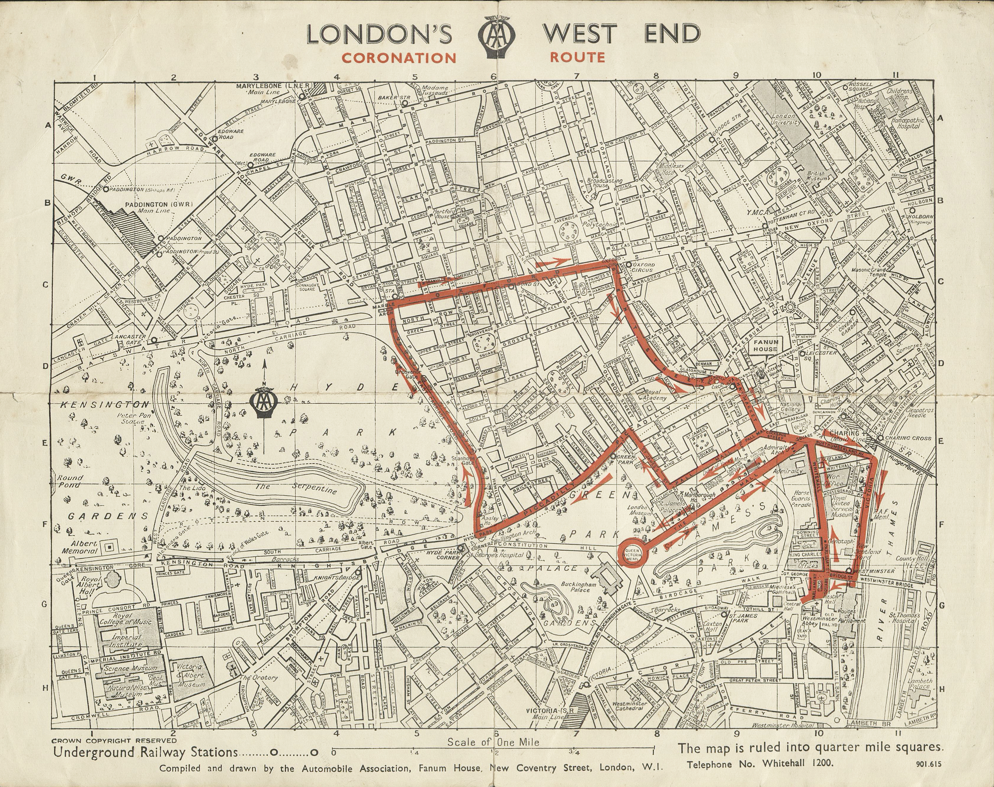
Many of the streets within and close to the coronation’s processional route were either closed or had severely restricted access for the day. Some of the London street maps produced by the Automobile Association (AA) were illustrated in the first part of this short series. These were produced not only for their own staff attending breakdown but also supplied free of charge to members when requested. An additional special map was produced that included the coronation route marked out in red. The AA was especially suited to producing these maps as they had been tasked with managing road signage, parking and traffic control for the royal event. Motorists were instructed how to apply for coloured windscreen labels that permitted them to park within the coronation area. An index to streets, theatres and cinemas is included on the reverse. Drawn by the AA, the small map is to their usual clear, simple and high standard. Anyone leaving their car outside of the restricted area would have been able to navigate the streets with relative ease using one of these maps.
Not all complimentary maps were given to the general public. Some were produced by companies and only given free to suppliers and existing or prospective customers. Usually these would also include a little information on the company itself, possibly identify their premises on the map itself or, at the very least, include contact information.
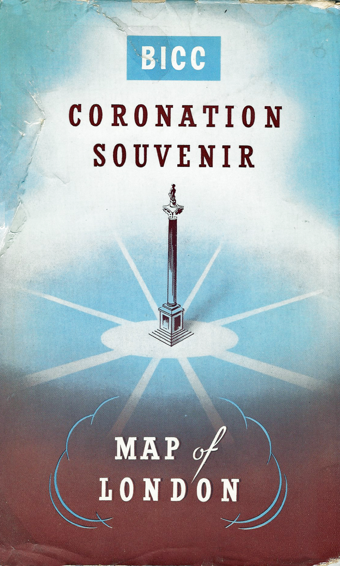
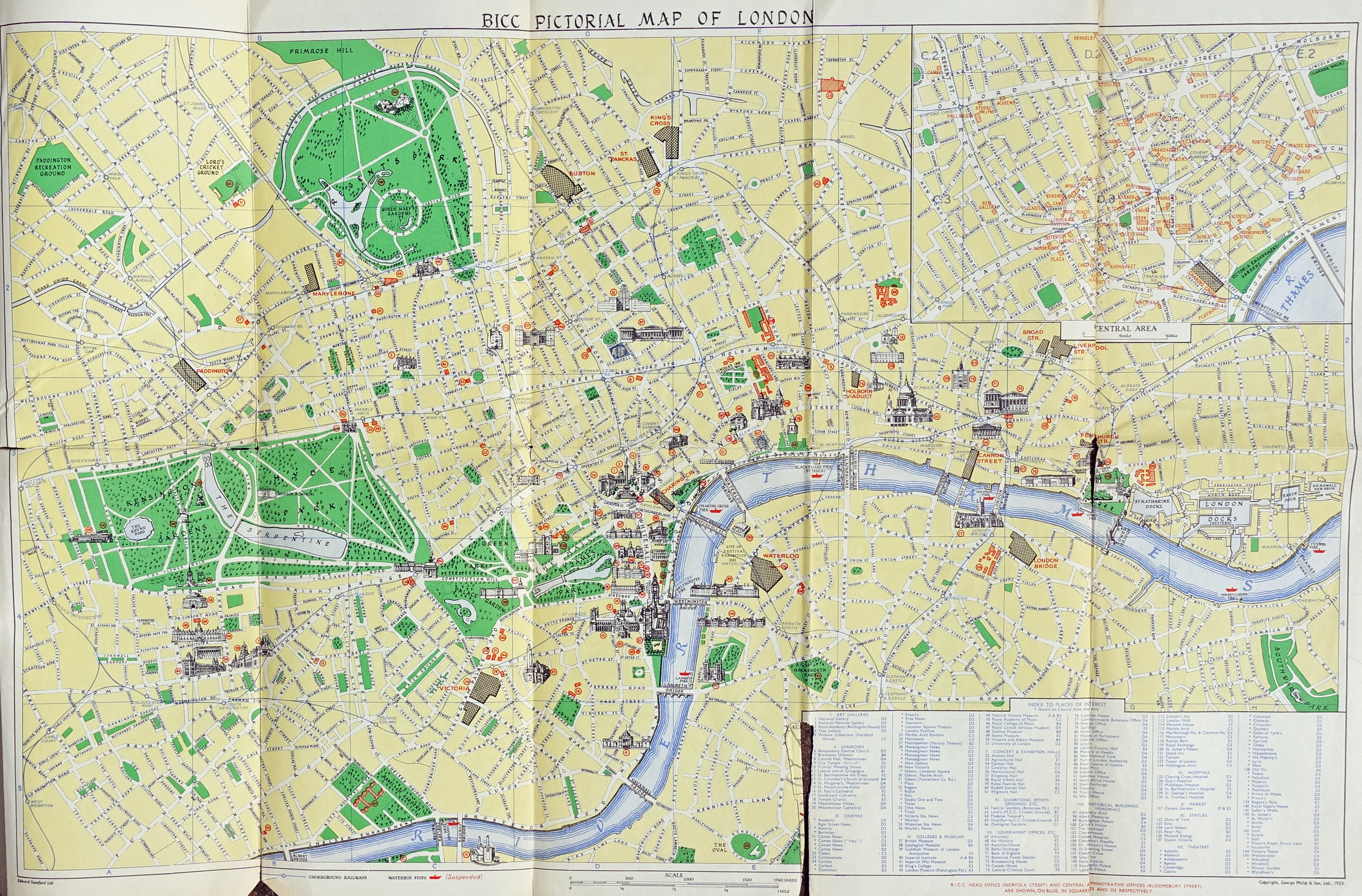
The complimentary map booklet produced by British Insulated Callender’s Cables Limited is pretty much typical of this type of map. It is quite large, includes a potted history of the business, contact info, and two maps. One side of the sheet shows a road map of London and it’s suburbs produced by, and licenced from, mapmaker Edward Stanford Ltd. While the other side has a large scale, and more useful while walking, pictorial map of London with enlarged section of central London. This second map was prepared by and licenced from cartographer George Philip & Son Ltd.
While these free maps were promoted as a ‘Coronation Souvenir’ on the exterior cover, the large scale map of central London actually fails to include any information at all as to the coronation route. None the less, it is an excellent and detailed map of London, not surprising considering its cartographic credentials.
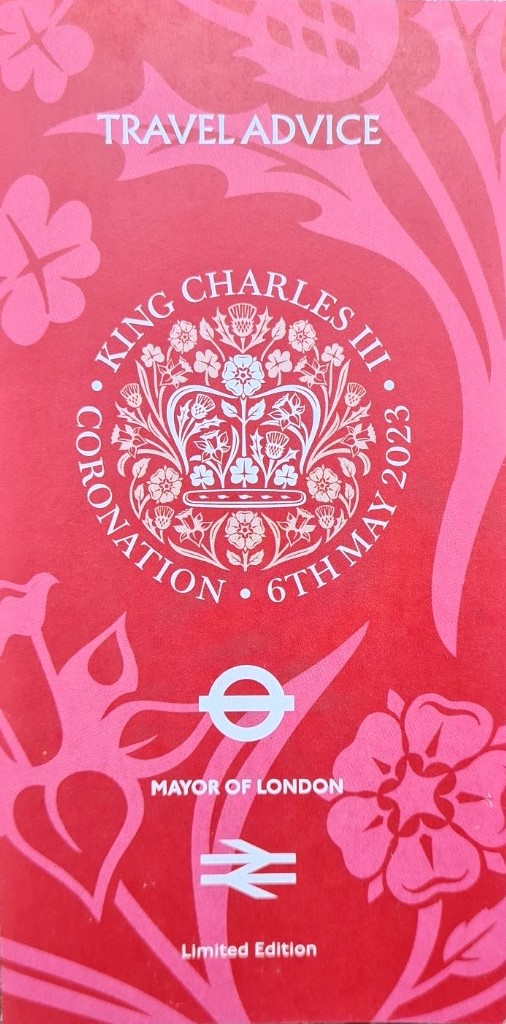
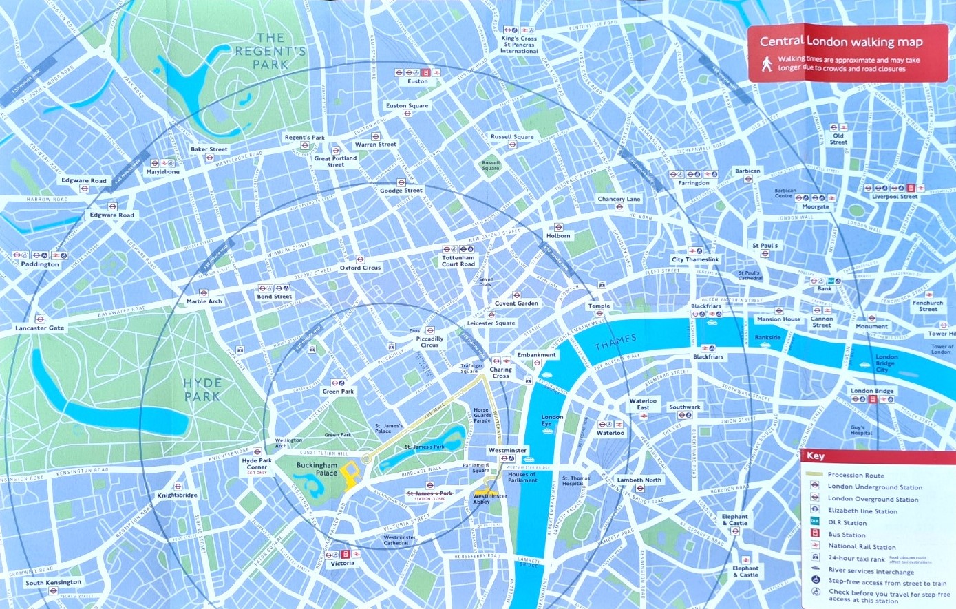
Queen Elizabeth II died 8 September 2022 and the coronation of King Charles III and Queen Camilla took place 6 May 2023. By then the digital era held sway and the time of free paper maps had almost passed, but not quite. There was one notable exception. Jointly produced by Transport for London (TfL), Network Rail and the Rail Delivery Group, a special ‘Travel Advice’ leaflet was freely available for London visitors to the coronation and this included a map showing central London and the coronation processional route from Buckingham Palace to Westminster Abbey and its return. This simple route was much reduced from that used during previous coronations.
It was estimated that upward of 100 000 overseas visitors visited London to view the coronation procession, both to and from the Abbey. Despite being a much scaled back occasion, it was the largest military procession through the streets for decades. The free travel advice leaflet was equally as useful to those disinterested in, or even resistant to, the whole occasion. As before, the free leaflet immediately became a memento of the coronation. Possibly the last such leaflet to ever be produced.
Royal Wedding
It appears that it was not until the late 20th century that any free paper maps were produced in connection with any Royal Wedding in London. Princess Elizabeth had married on 20 November 1947. Britain was only just beginning to recover from the hardship of a long hard war and the occasion was termed the ‘austerity wedding’. Three Points of the Compass has been unable to identify any free maps that were issued detailing the processional wedding route but in common with coronation routes through London, it was published in various newspapers, a trend that has been followed for subsequent royal weddings. Though most recent weddings have simply had the processional route overlaid on a satellite view.
Princess Elizabeth travelled through the public lined streets to her wedding by horse-drawn landau. This tradition remained unbroken in the years between the 1963 marriage of Princess Alexandra and Kate Middleton, when Kate married Prince William in 2011. Like Alexandra, Kate chose to be driven past the estimated two million onlookers by limousine to the Abbey. However the usual pomp ensued after the ceremony. A procession of horse-drawn coaches transported Princess Catherine and the Royal Family on their return to Buckingham Palace via Parliament Square, Whitehall, Horse Guards and The Mall.
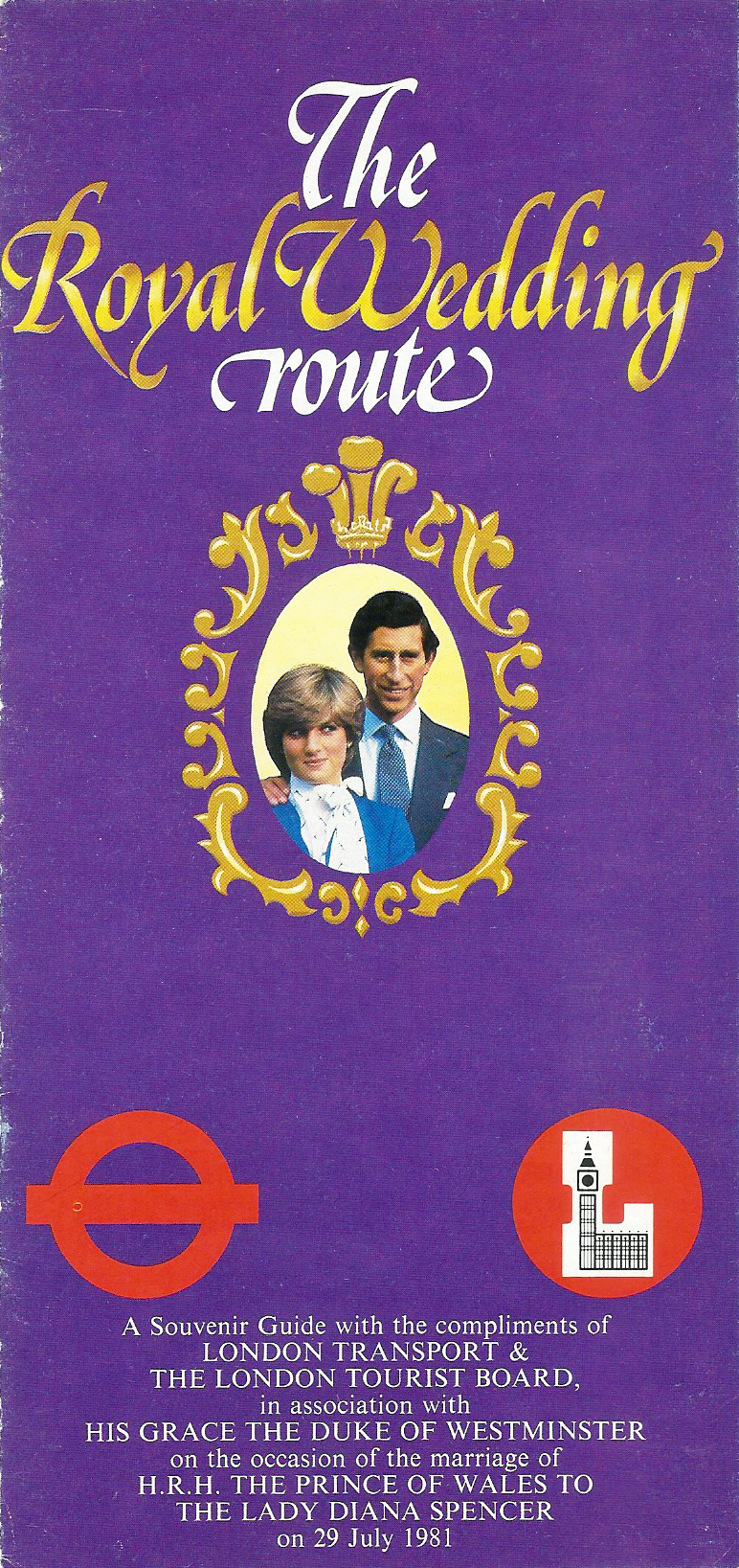
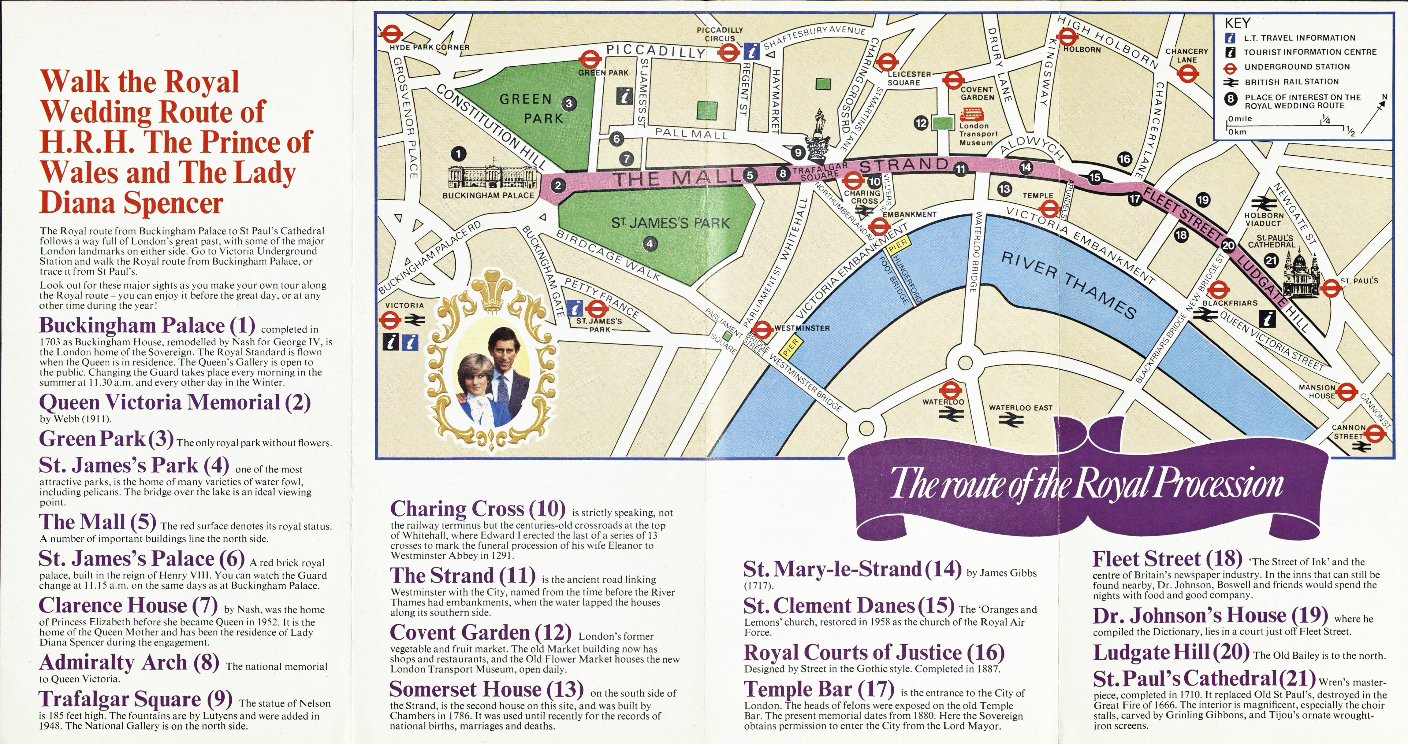
It appears that it was not until the marriage of Queen Elizabeth’s eldest son Charles that any free paper map of London was distributed for a royal wedding though it is a poor addition to the collective. A printed map was produced by London Transport and The London Tourist Board ‘in association with His Grace the Duke of Westminster‘ for the 1981 wedding of Prince Charles and Lady Diana Spencer and was available free of charge. Despite it’s simplicity and relative lack of attractiveness, it is likely that thousands were kept as souvenirs of the day.
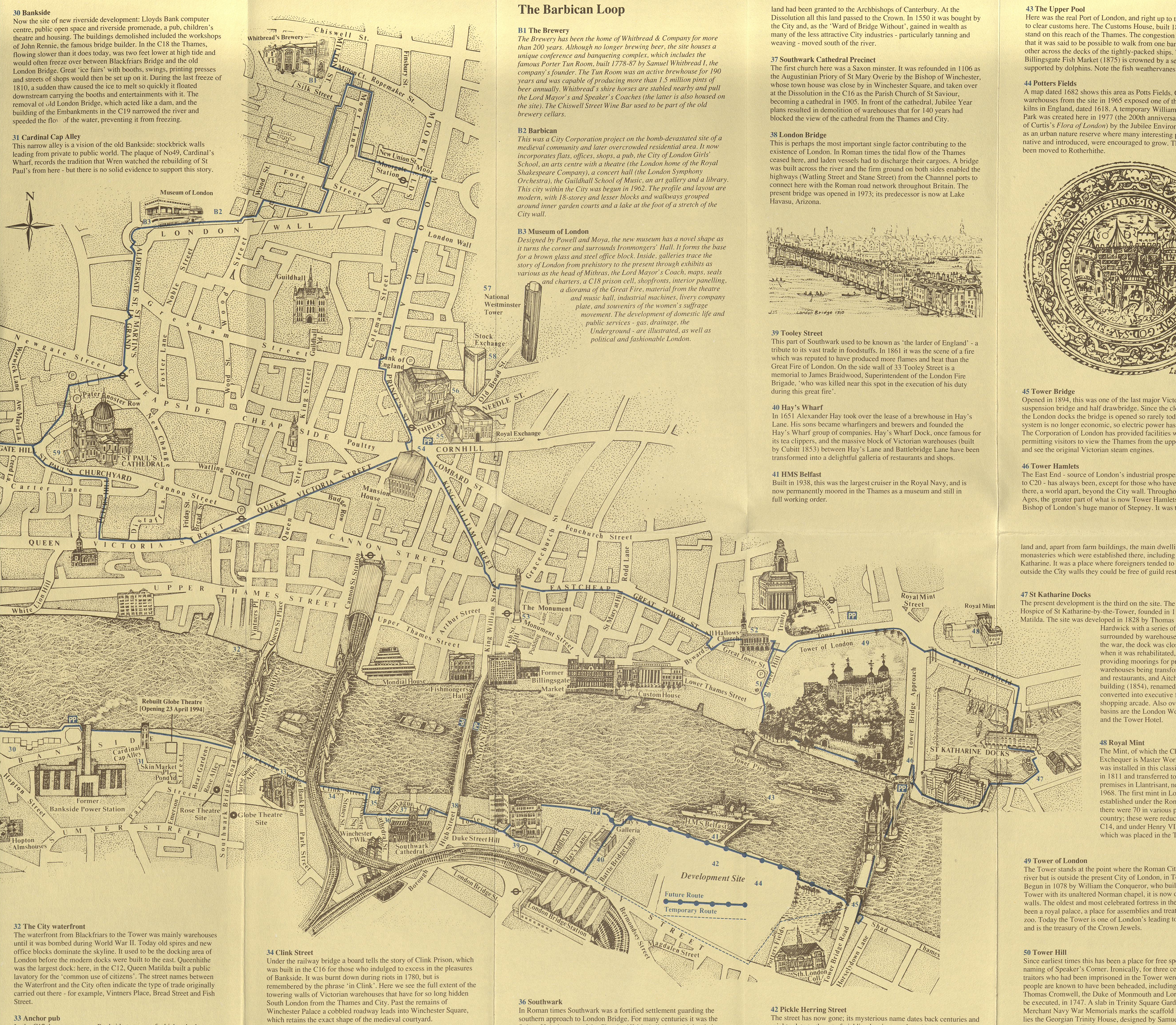
On 29 July 1981 around two million people lined the route of Lady Diana’s procession from Clarence House (number 7 on the map) to St. Paul’s Cathedral (number 21 on map). It was termed the Fairy tale wedding, however they divorced in 1996. The map of the Royal Procession is very simple in design. It included a map of the London Underground and provided enough information for pedestrians to walk the route between St. Paul’s Cathedral and Buckingham Palace where the newly married couple kissed on the balcony, establishing a new tradition.
Royal Jubilee
King George III celebrated his jubilee privately and other than a few fireworks there was little for the public. However there were were a number of grand parades during Queen Victoria’s reign such as for her Coronation and Golden and Diamond Jubilee’s. Though it was probably the relaxation in drinking hours for the Queen’s Jubilee that appealed to the public most.
Beyond any planned celebrations for Queen Victoria’s Jubilees there was an undercurrent of resentment amongst many of the working class. Trades Unions actually boycotted some festivities and despite the many thousands of people that did attend various celebratory events, this may partially explain the lack of any free maps to London being then made available to the poorly paid.
Three Points of the Compass is not aware of any street maps being distributed free of charge for any of the various jubilees celebrated by either Queen Victoria (Golden- 1887, Diamond- 1897) or King George V (Silver- 1935). While George V’s Silver Jubilee was revolutionary, no such 25th anniversary ever having been celebrated publicly before, no free maps were made available for that. This was probably due to the period of austerity in which the country was mired. The closest to a free street map that Three Points of the Compass has encountered are the simple diagrams given to members of the social elite to aid them in locating their numbered viewing stands. It would be quite some years before a free map was given away for any royal jubilee, in fact, it was not until 1977 when Queen Elizabeth II celebrated her Silver Jubilee.
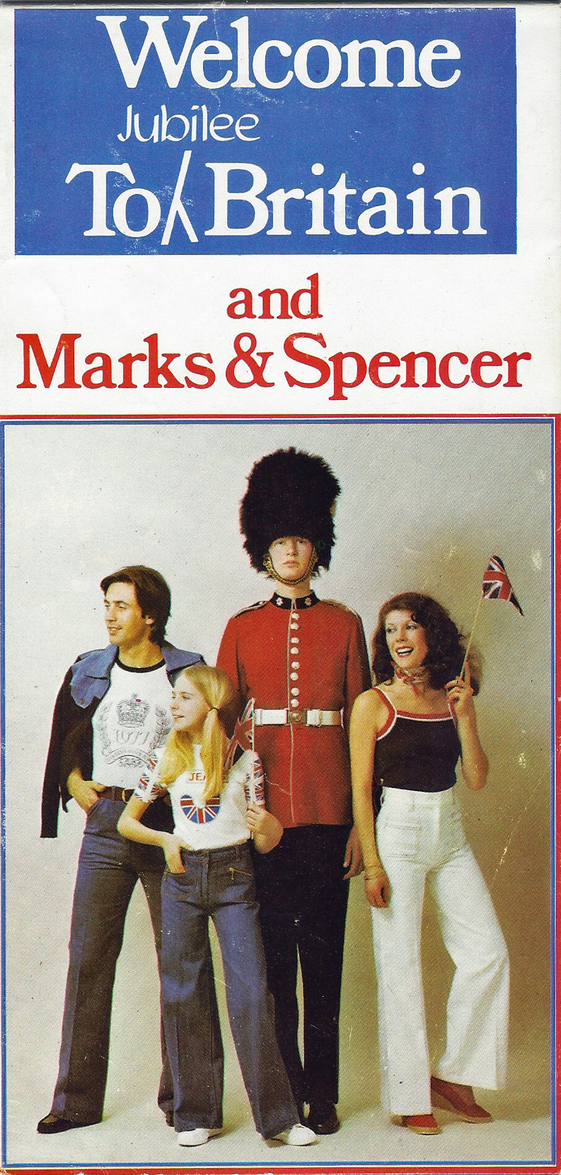
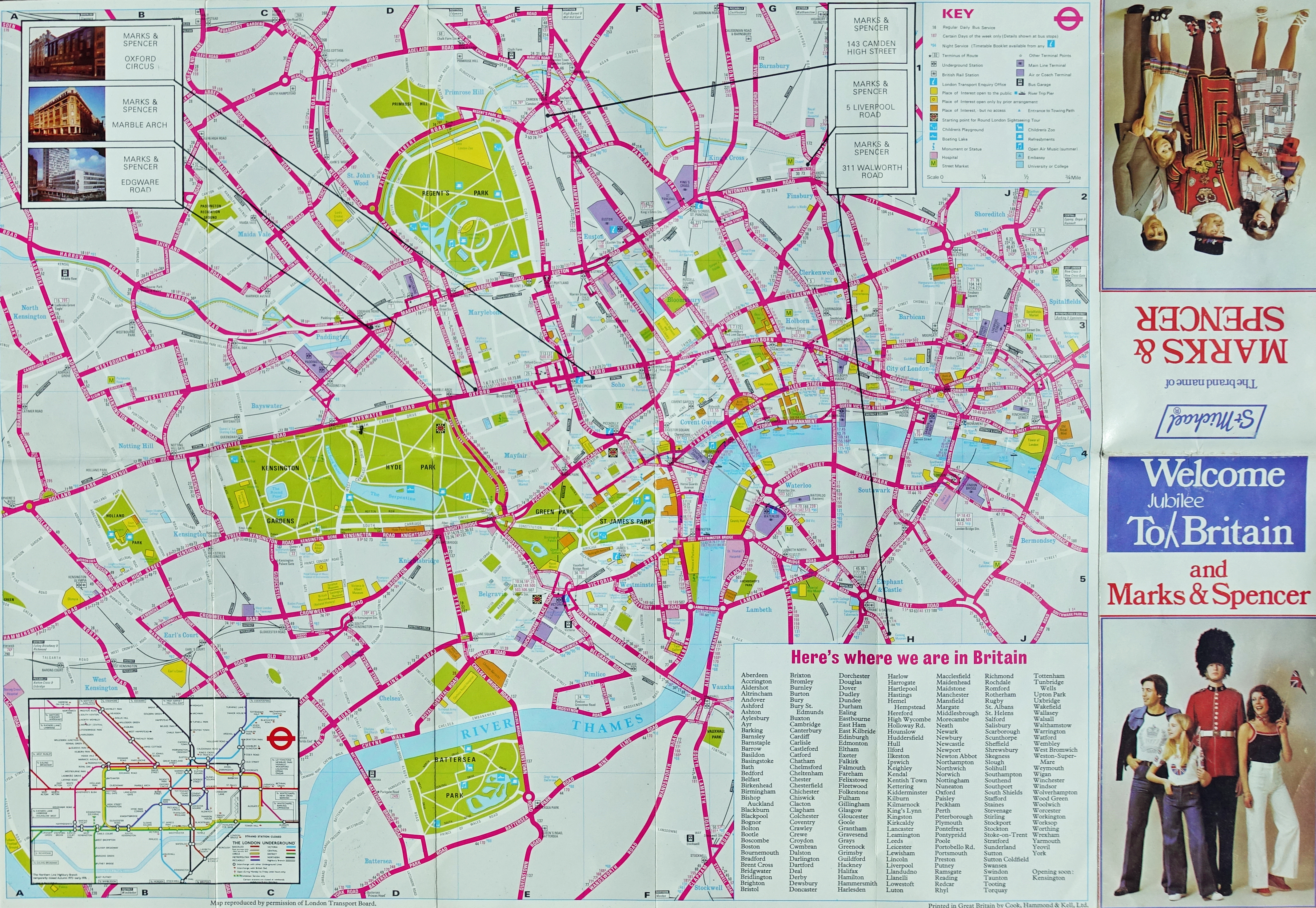
No doubt expecting a swathe of visitors new to London, some businesses produced guides or maps of London which included the necessary information for the visitor to London to visit one of their outlets.
The map I have shown here was produced by High Street retailer Marks & Spencer, though with a change of branding and accompanying information, it could have been supplied by just about any retailer. The map itself was produced by and licenced from the London Transport Board but it is a fairly poor effort and only includes names for major streets, minor streets going either un-named or excluded altogether.
Beyond the title on the front, there is nothing on this map that directly relates to the Queen’s Jubilee itself and instead just seeks to take advantage of a general fervour surrounding the royal occasion.
This could be regarded rather cynically, but nonetheless, it is a free map that would have been of some use and appreciated by those unfamiliar with navigating the complex of streets in the nation’s capital.
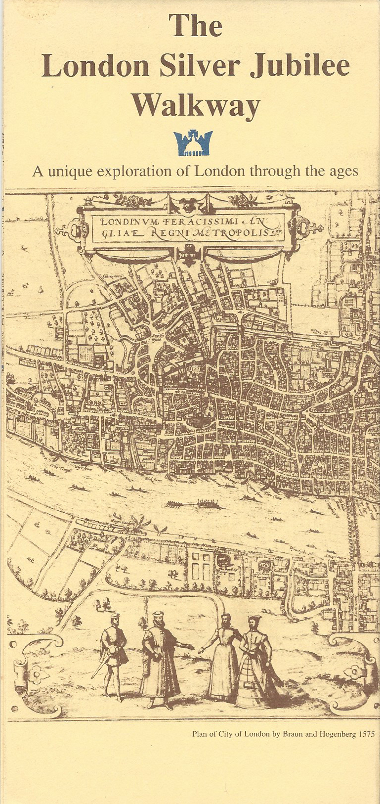
In addition to free maps for the jubilee, a new signposted trail was produced that is still followed by tourists, historians, hikers and the merely curious to this day. A special way-marked trail was created through London for the occasion and maps prepared. Three Points of the Compass covered this trail in greater depth when he walked on two occasions, one during the day and once at night.
- London Jubilee Walkway
Various corporate sponsors enabled the Silver Jubilee Walkway leaflet to be produced and distributed free of charge in 1977. The walkway has been so popular that a reprint of the map was produced in 1993.
Over 400 aluminium discs were set into the pavement, these are augmented by smaller discs to indicate change in direction, particularly useful for those following the full 12 mile or so route. Various information boards, similarly sponsored, were erected along the trail’s length.
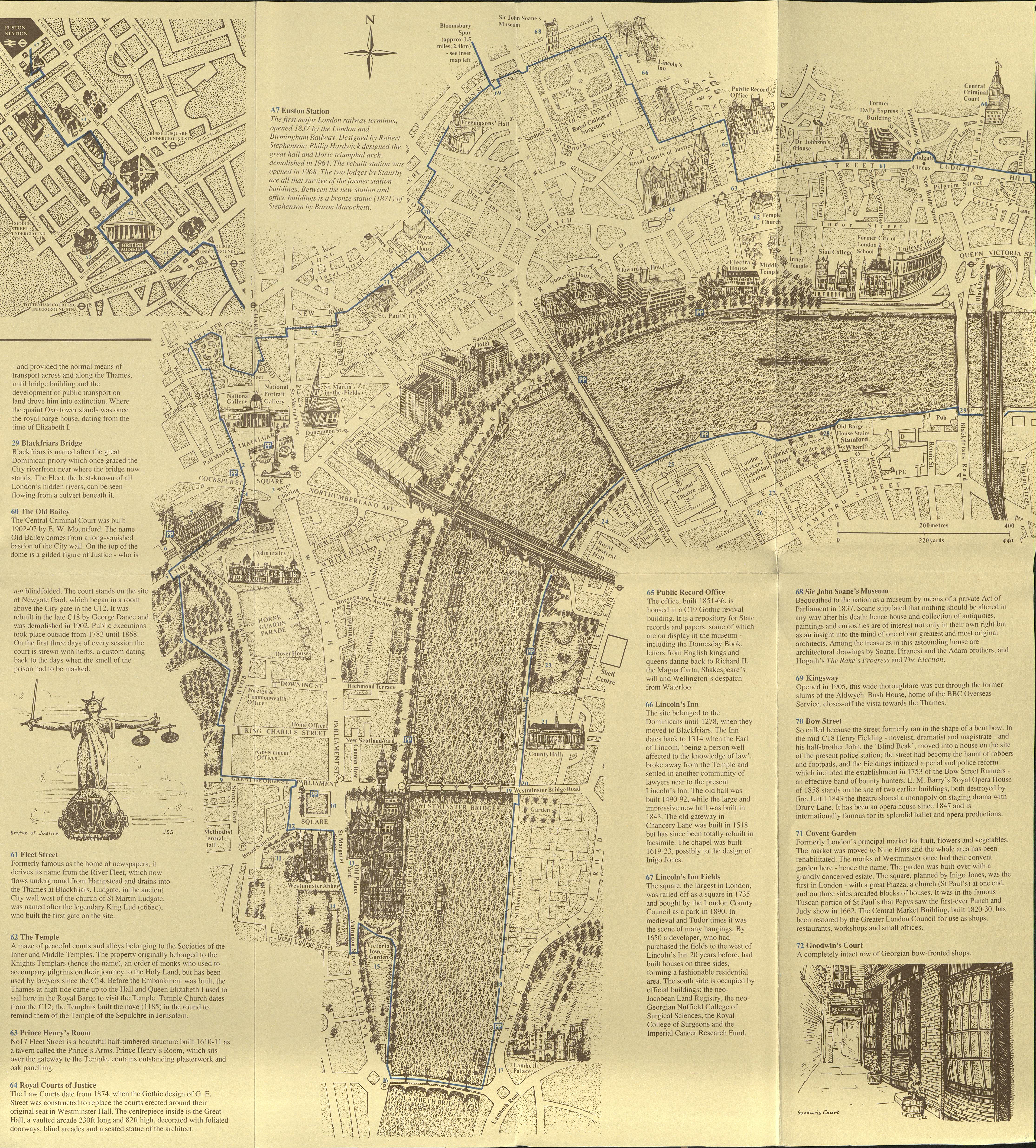
The trail’s name changed to the Jubilee Walkway on the occasion of the Queen’s Golden Jubilee in 2002 and the length increased to 15 miles. A further loop taking in Camden was added in 2003. As well as the free map leaflets shown here, a couple of printed route descriptions have been produced over the years but these are all commercial offerings with a cover price to match.
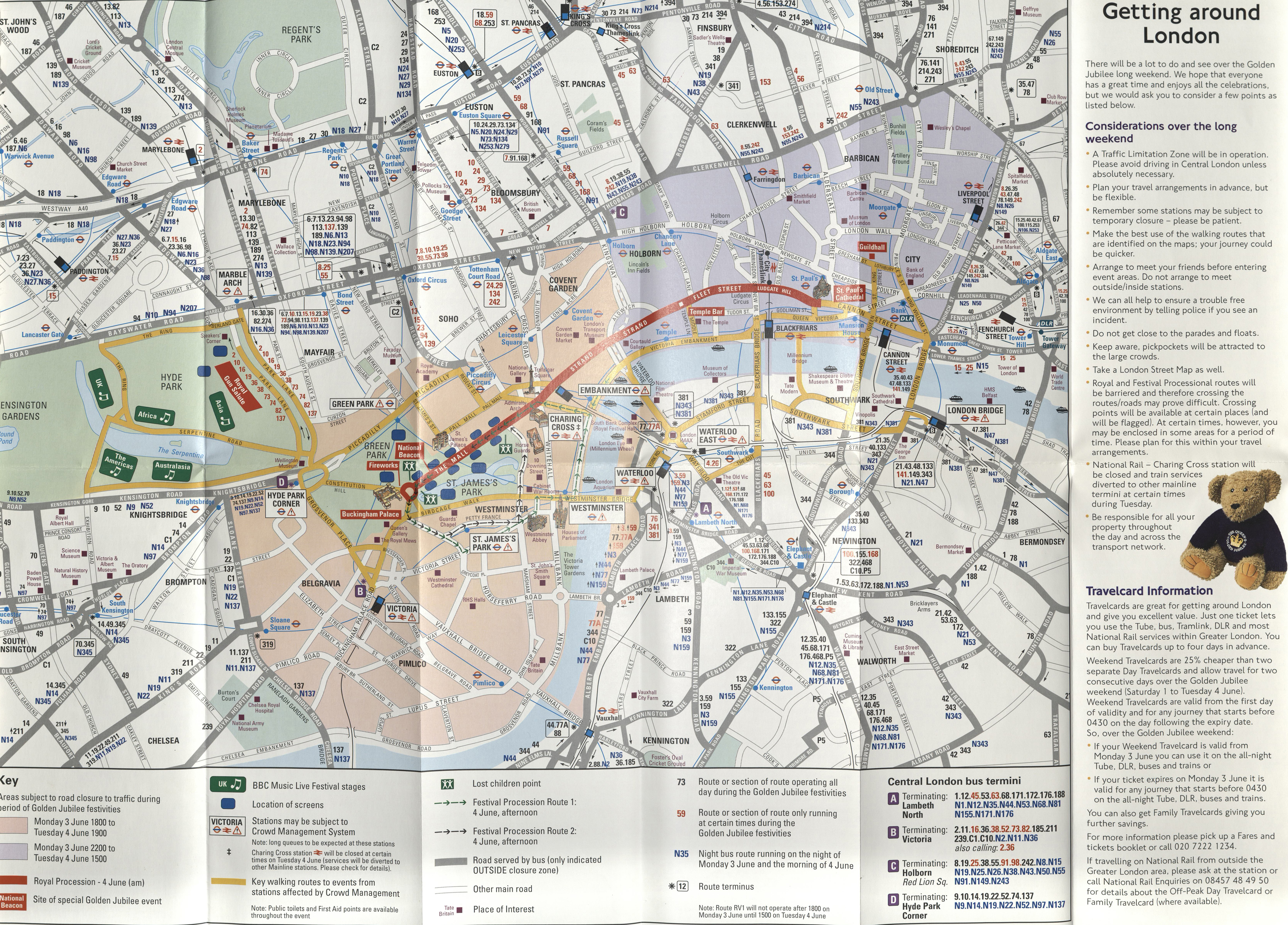
Twenty five years later, as well as changes to the Jubilee Walkway, other celebrations were held in London on the occasion of the Queen Elizabeth’s Golden Jubilee. Rather than a day long celebration, a series of events in London were planned over four days: 1- 4 June 2002. A free leaflet detailing event times and locations, which included a London street map, was prepared, jointly paid for by a number of London and national agencies.
The free map included in the London Travel Guide leaflet was fairly basic, showing unnamed streets, but included further written detail on the reverse along with a map of the London Underground network.
Not only did the provision of the map aid those travelling around London by public transport to the various events taking place across the capital, but it also provided just about sufficient information for anyone choosing to walk from location to location over that four-day weekend in the summer of 2002.
The Jubilee events were diverse- an exhibition in Hyde Park in July and August, an exhibition of Contemporary Sculpture in Battersea and London’s South Bank featured an exhibition of litter bins, bus shelters, bollards and poster hoardings, chosen for their ‘fine design‘.
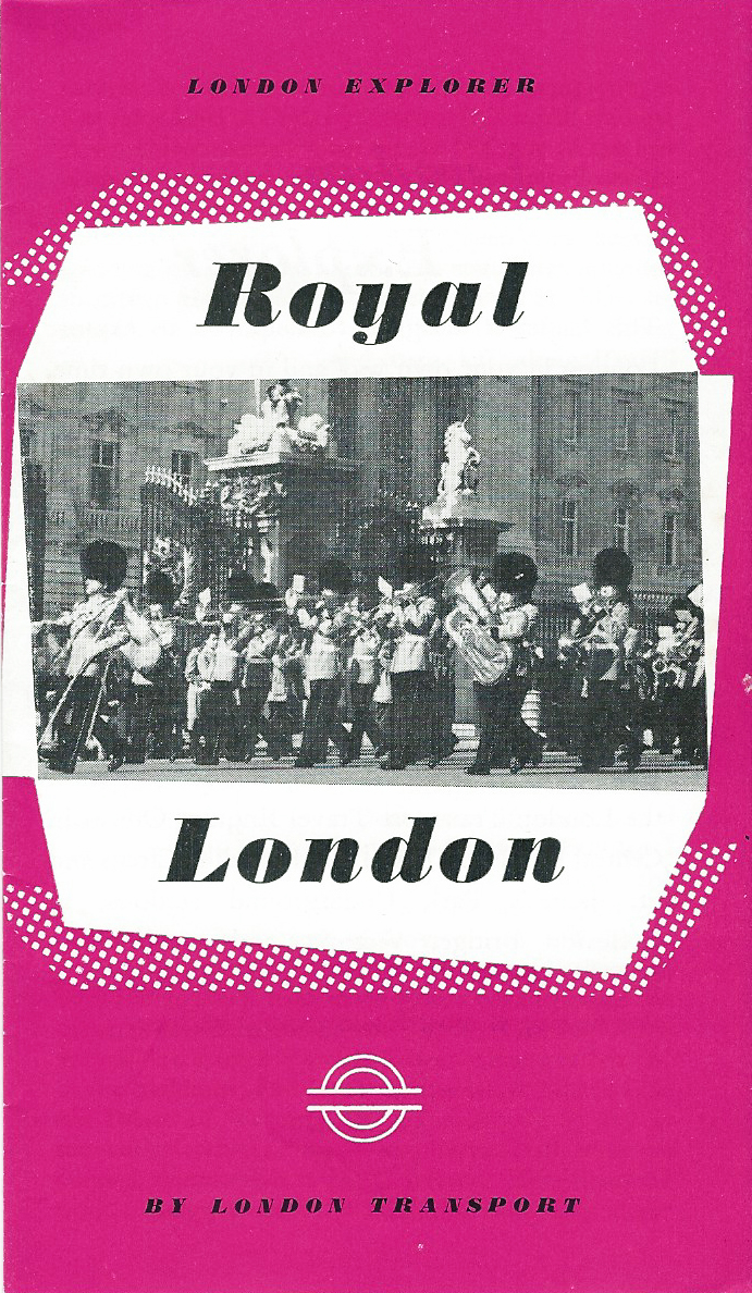
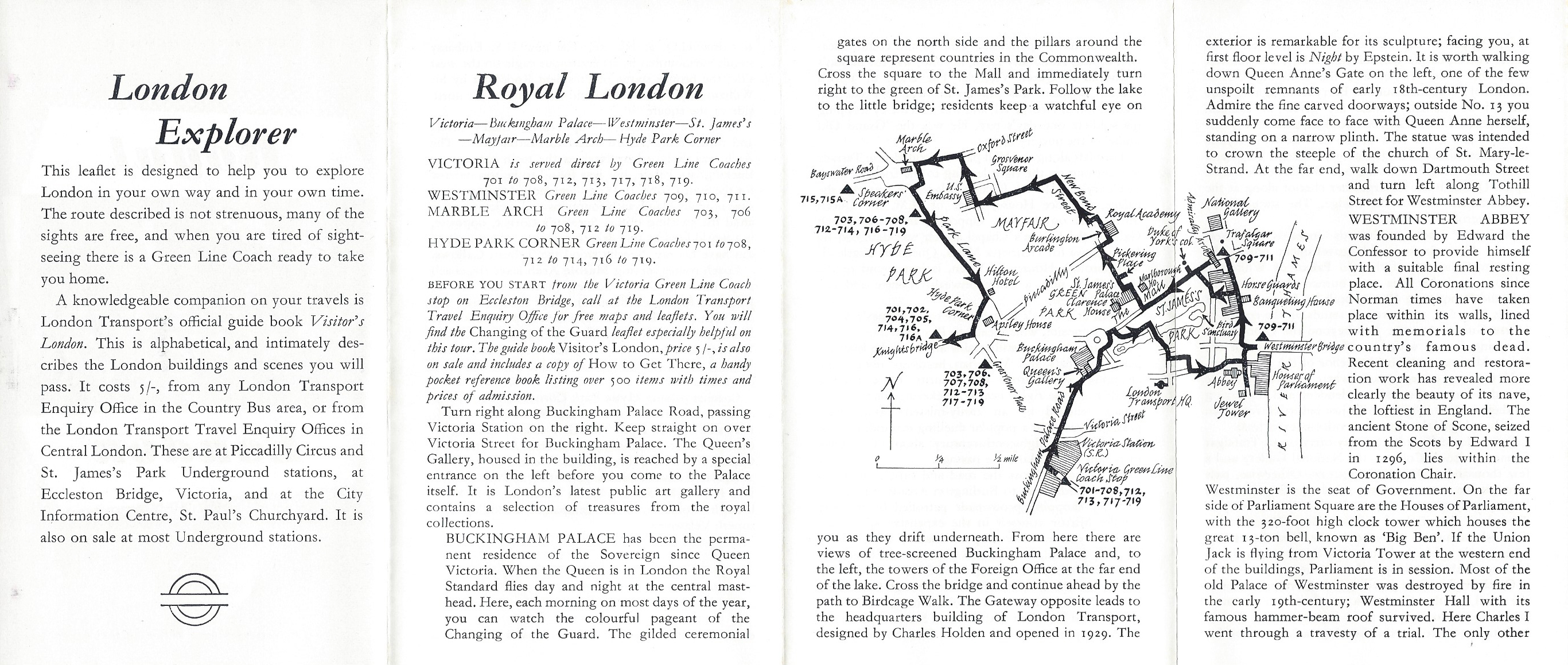
Tourist maps
Today, tour companies and the like continue to entice paying tourists by utilising the royal connection though few, if any, produce free maps of the streets of London. Maps tend to be sold or made available more cheaply as an online resource. Such exploitation of ‘Royal London’ is nothing new, there have been good free map resources produced in the past.
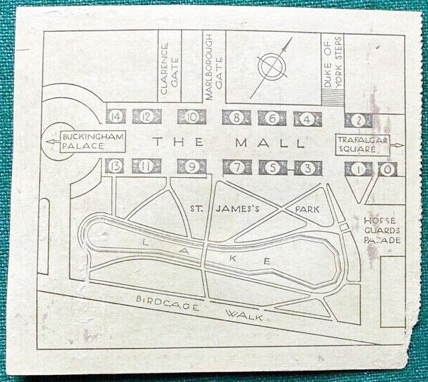
The map below was part of a series made available free of charge by London Transport in the 1960s. The primary aims of these leaflets was to both tempt paying customers onto buses during quieter times of the day, and potentially purchase a more lavish walking and exploring guide commissioned by London Transport.
Any pedestrian following this particular trail is given no opportunity to wander off the route and street detail is minimal, many thoroughfares are excluded entirely. While this works for clarity in such a small diagram, how many people were left completely stymied having taken a wrong turn…
The final part of this short series, looking at free maps produced over the decades to aid with walking in London, will review the material produced for various sporting events taking place in the capital, in particular the plethora of maps given away in association with a certain event in 2012.

2 replies »