
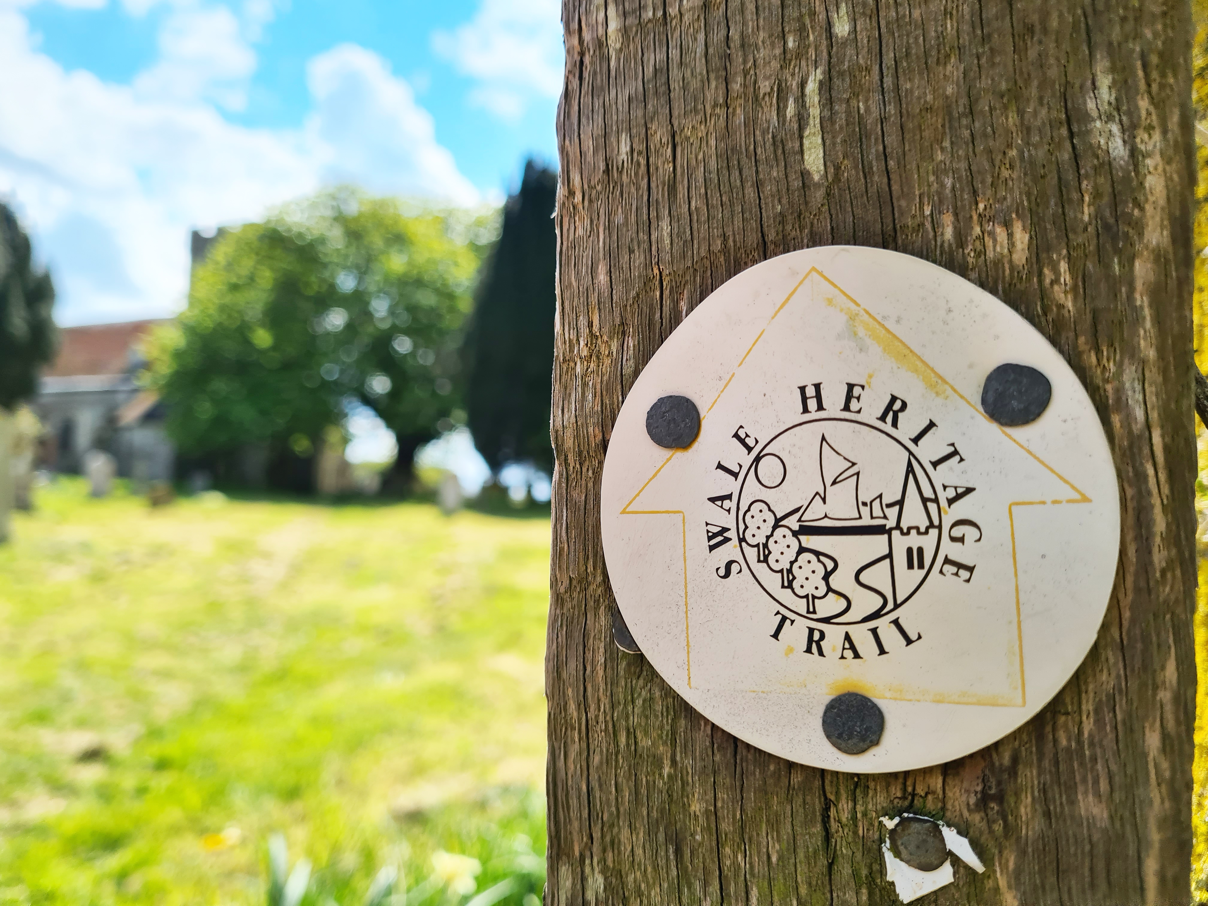
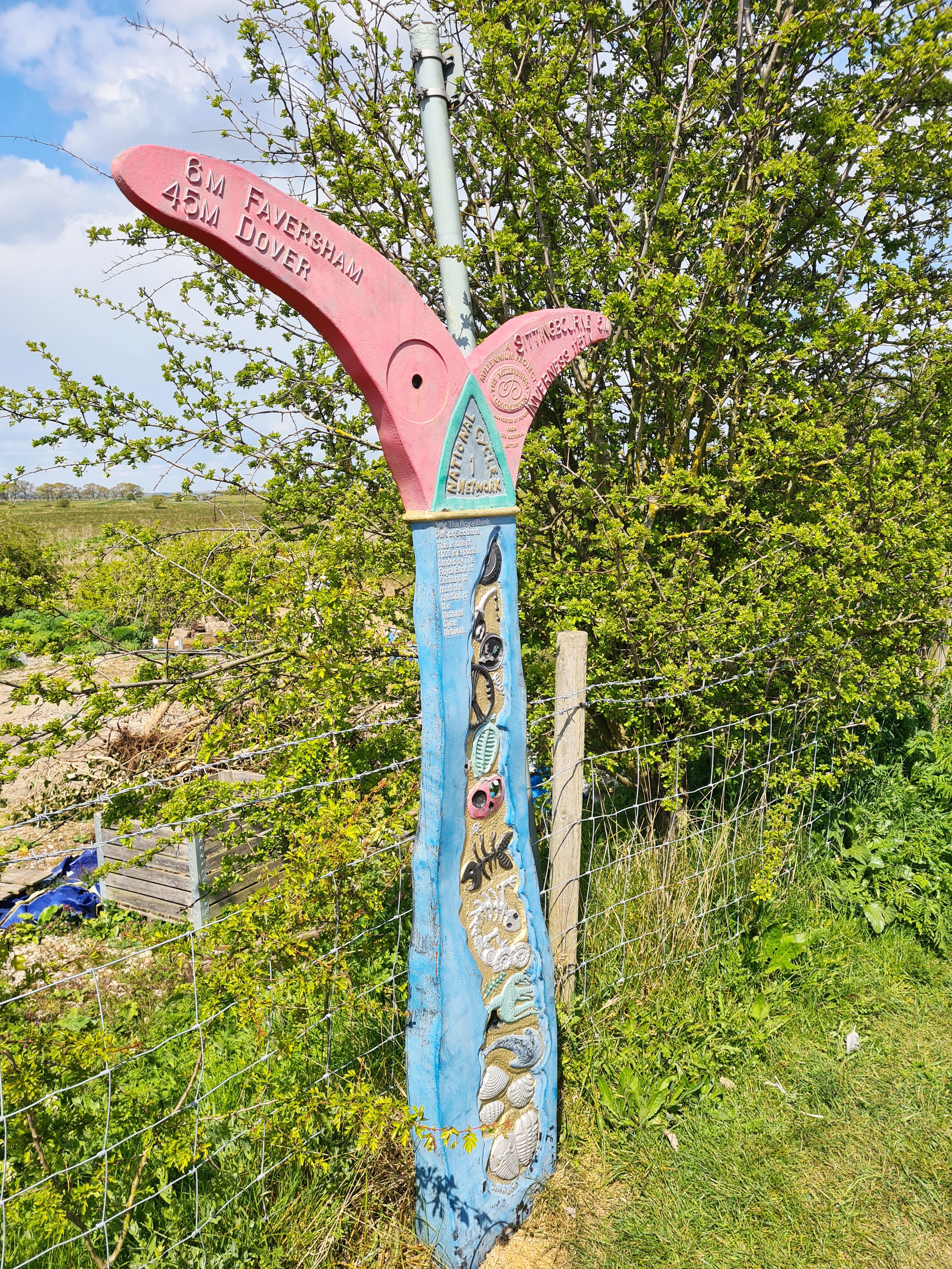
No more than a day’s walk, the Swale Heritage Trail traipses across the North Kent marshes, visiting lonely hamlets and churches en route. This is not a high ridge walk- the land rarely reaches more than ten metres above sea level, much of the short trail sees few visitors, it can be extremely rewarding but has recently fallen out of favour.
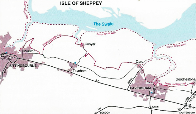
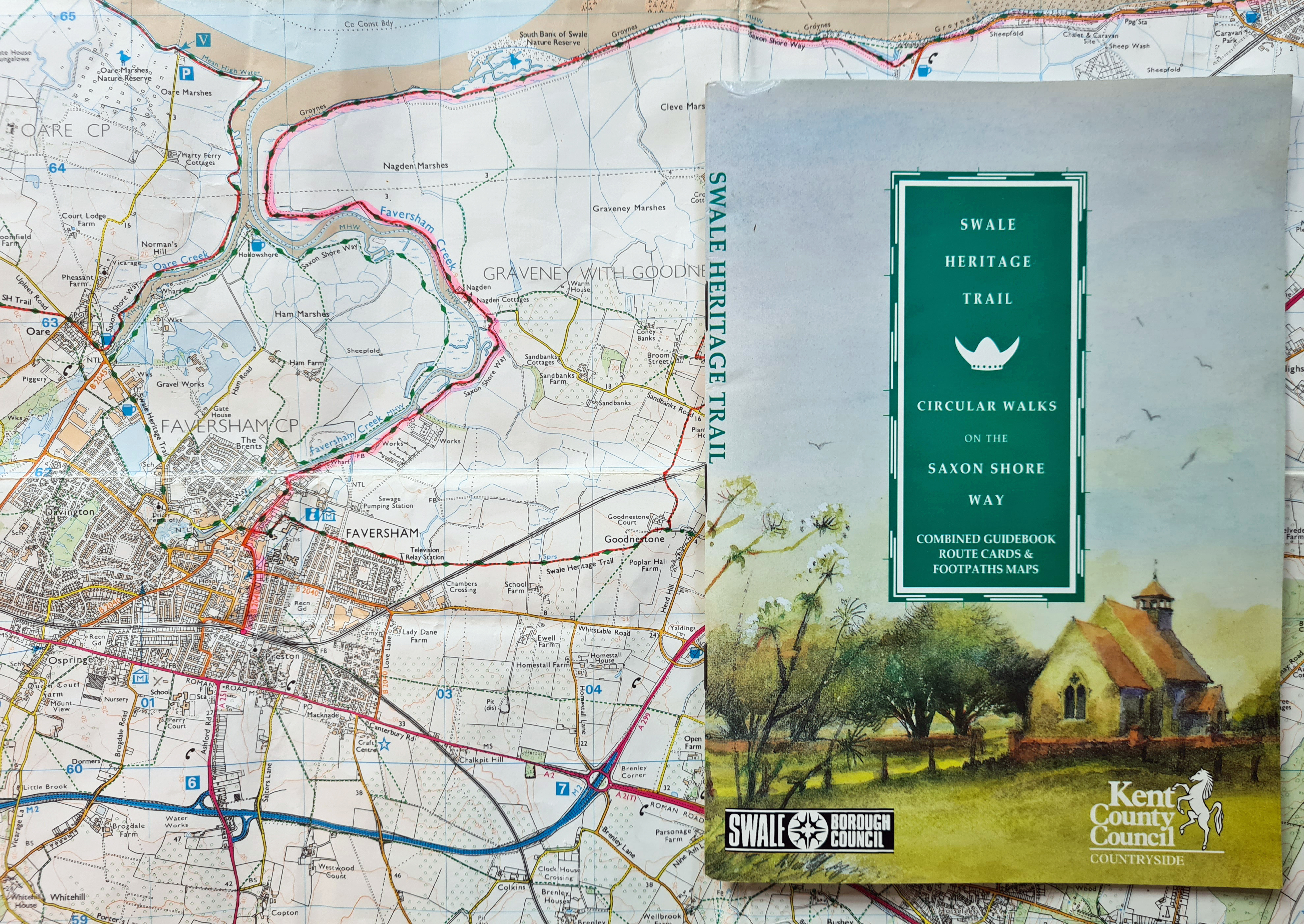
During the 2020 Covid-19 pandemic lockdown in the UK, Three Points of the Compass spent some time looking at older or forgotten walking routes and guides in my home county. I subsequently wrote a short history of rambling guides for Kent. One small guidebook I had, that never found it’s way into that history was for the Swale Heritage Trail. The trail was conceived by the Swale Borough Council and development and promotion was jointly funded by Kent County Council and Swale Borough Council. A guidebook was produced with financial assistance of the Countryside Commission. All parties then promptly forgot all about it.
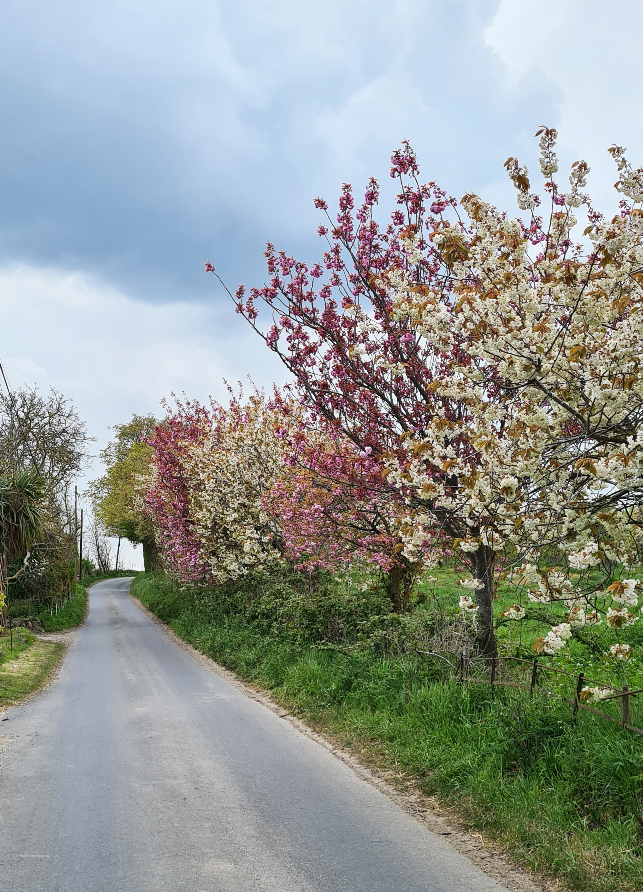
As the country unlocks and slowly releases itself from the strictures placed upon us, as Three Points of the Compass ponders the weight gain and wasted muscles, it was time to set off and explore this trail that runs from Goodnestone to Sittingbourne.
It is an easy days walk, at leisurely pace, stopping off to explore a few medieval churches on the way. Even though I know these marshes fairly well, having most recently walked their fringes when completing the Saxon Shore Way last year, I had never walked this little trail before. I won’t give a step-by-step, turn-by-turn account of my walk as it is not a route I can now recommend. Instead, mostly some images…
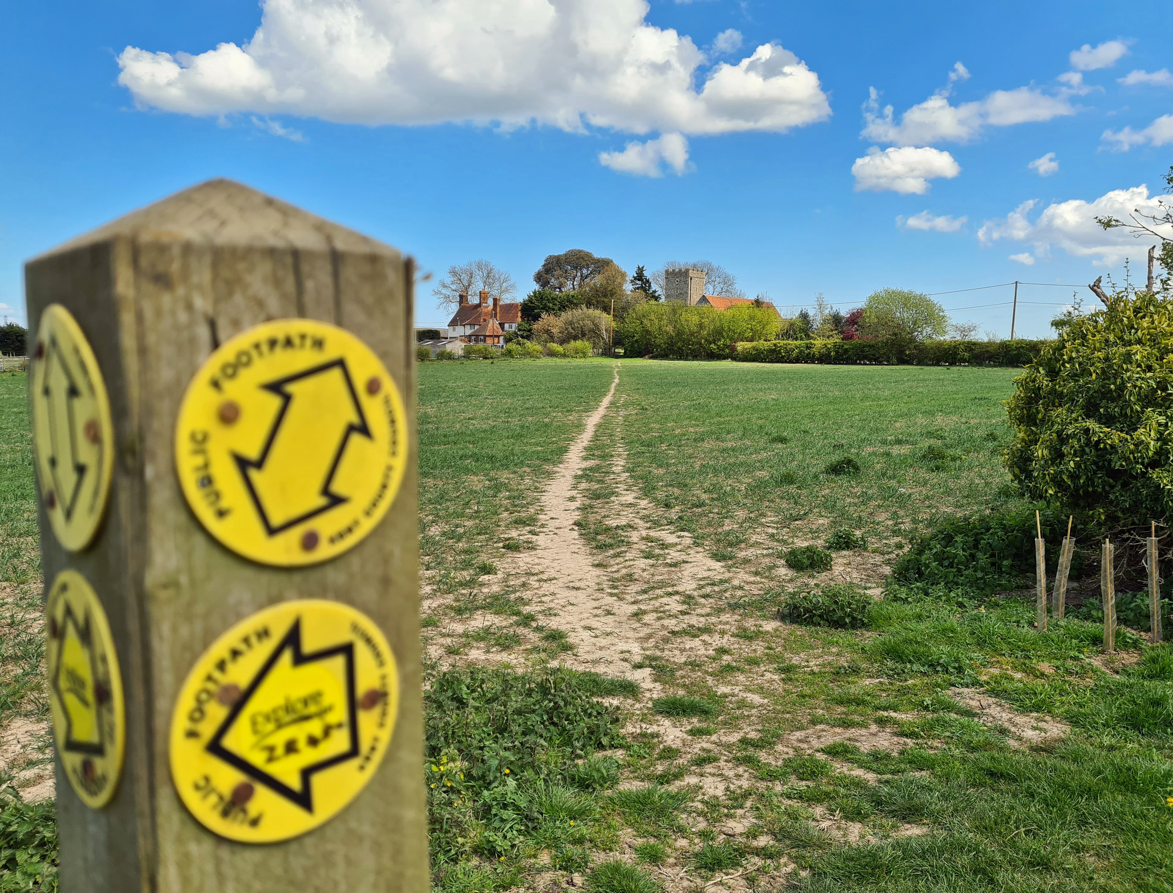
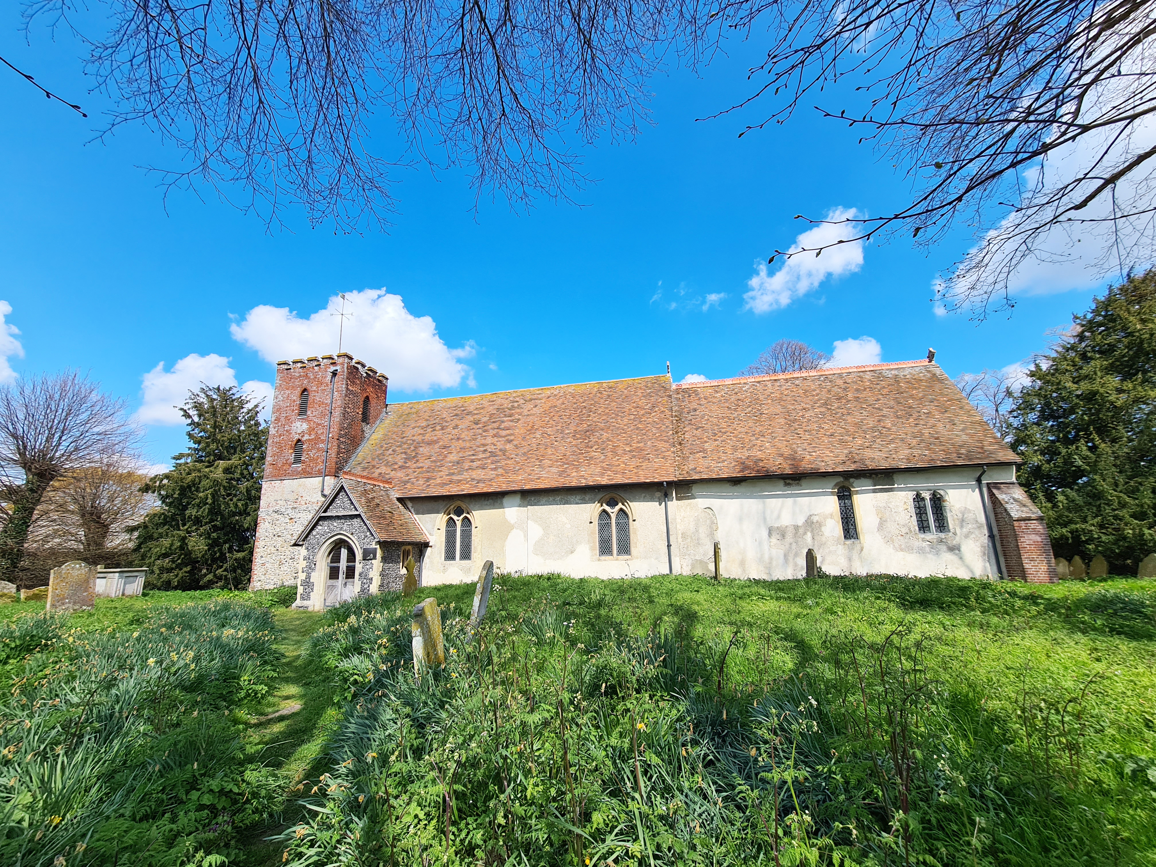
For some very strange reason, the trail starts (or finishes) at the small village of Goodnestone in Kent. It has no railway station, buses are uncommon, there is nowhere to park. Not the best of ideas perhaps. Outside the village there is a nearby community hall with carpark shared with the neighbouring hamlet of Graveney, but that means leaving an unattended car in the sticks for hours. Graveney is a better place to start anyway. Exploring the All Saints Church at Graveney is a gentle introduction to the major theme of the day- lonely and mostly forgotten old churches. Though I soon found out that it was more a case of exploring the outside of these as few places of worship are open during these strange pandemic days.
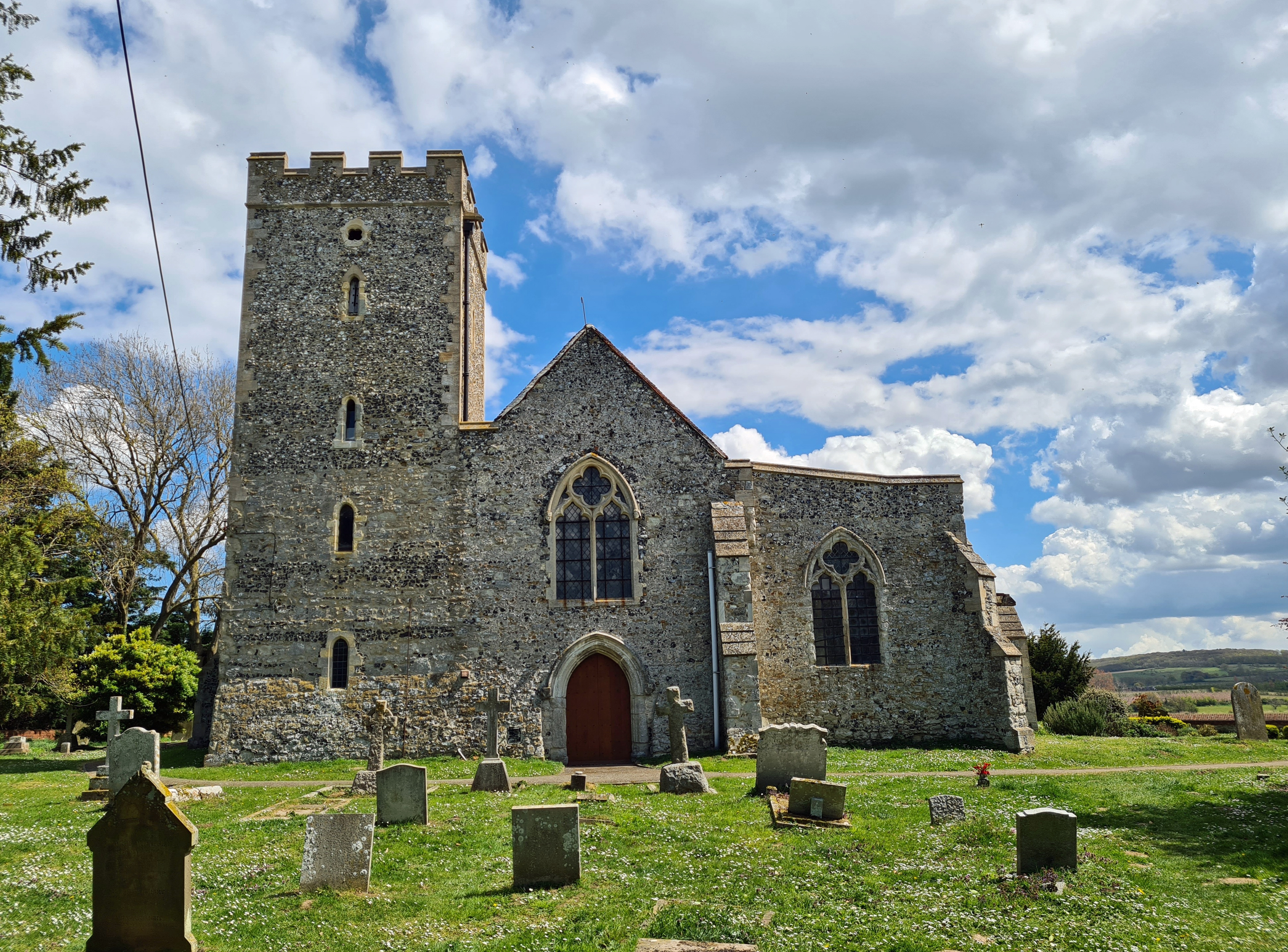
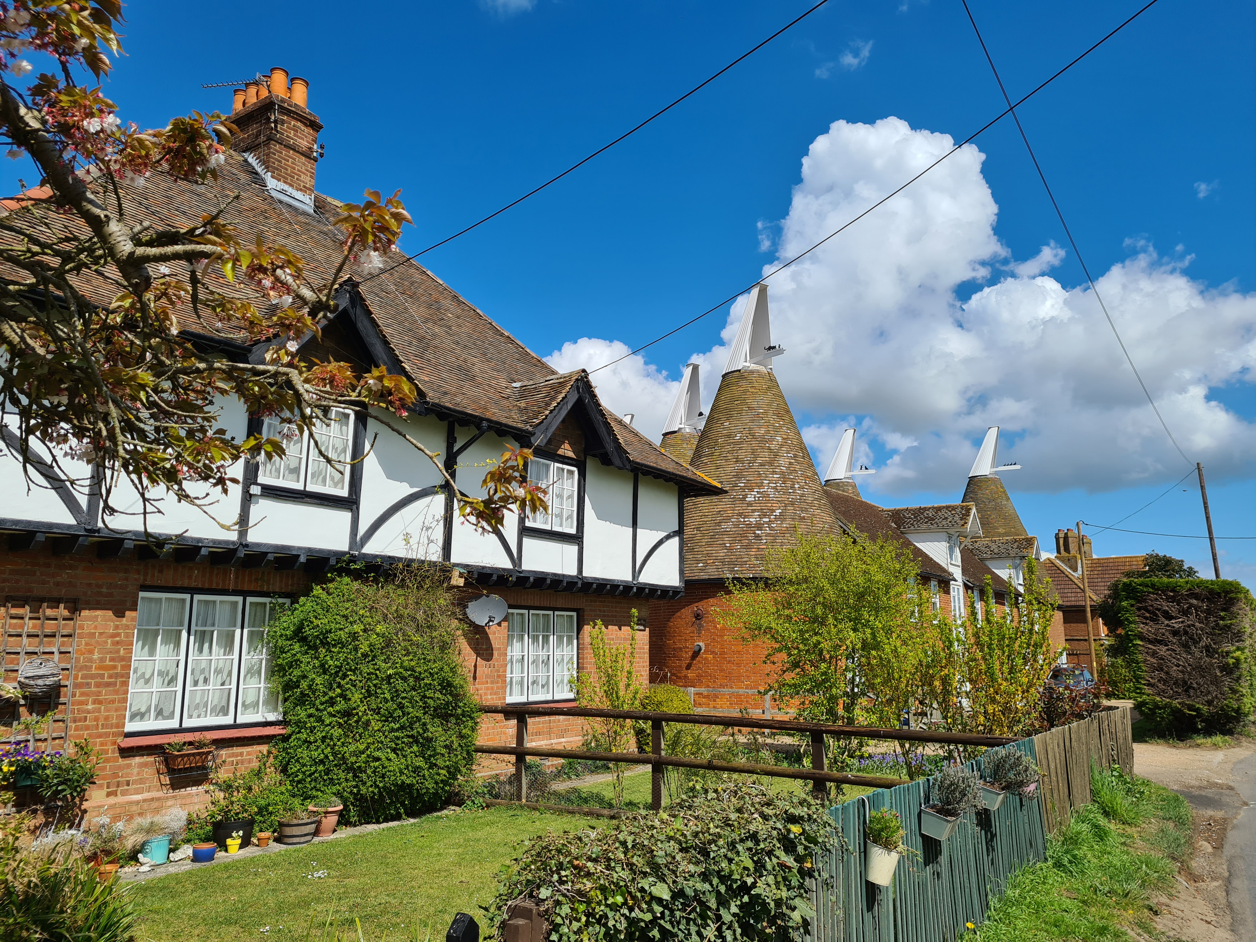
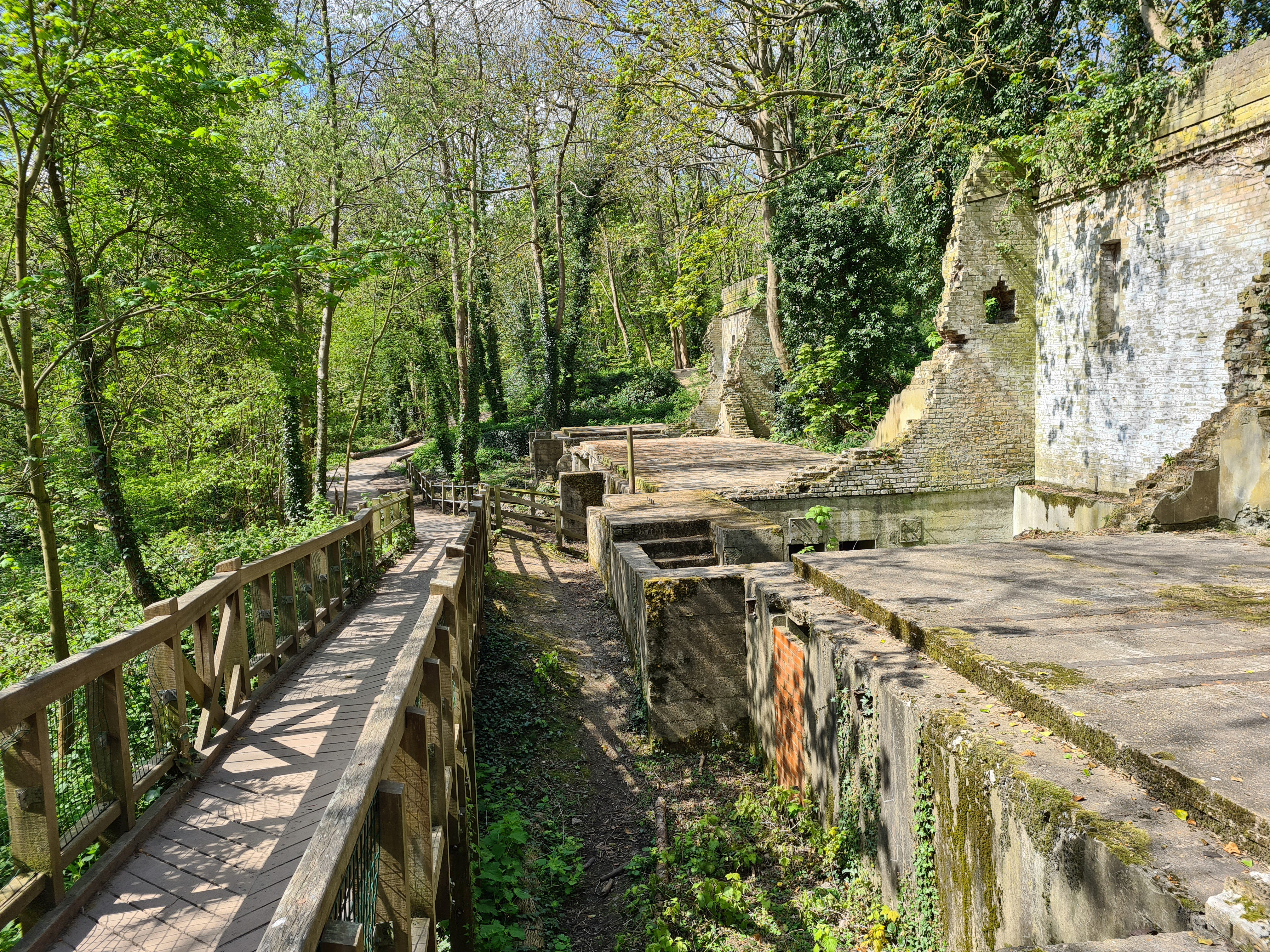
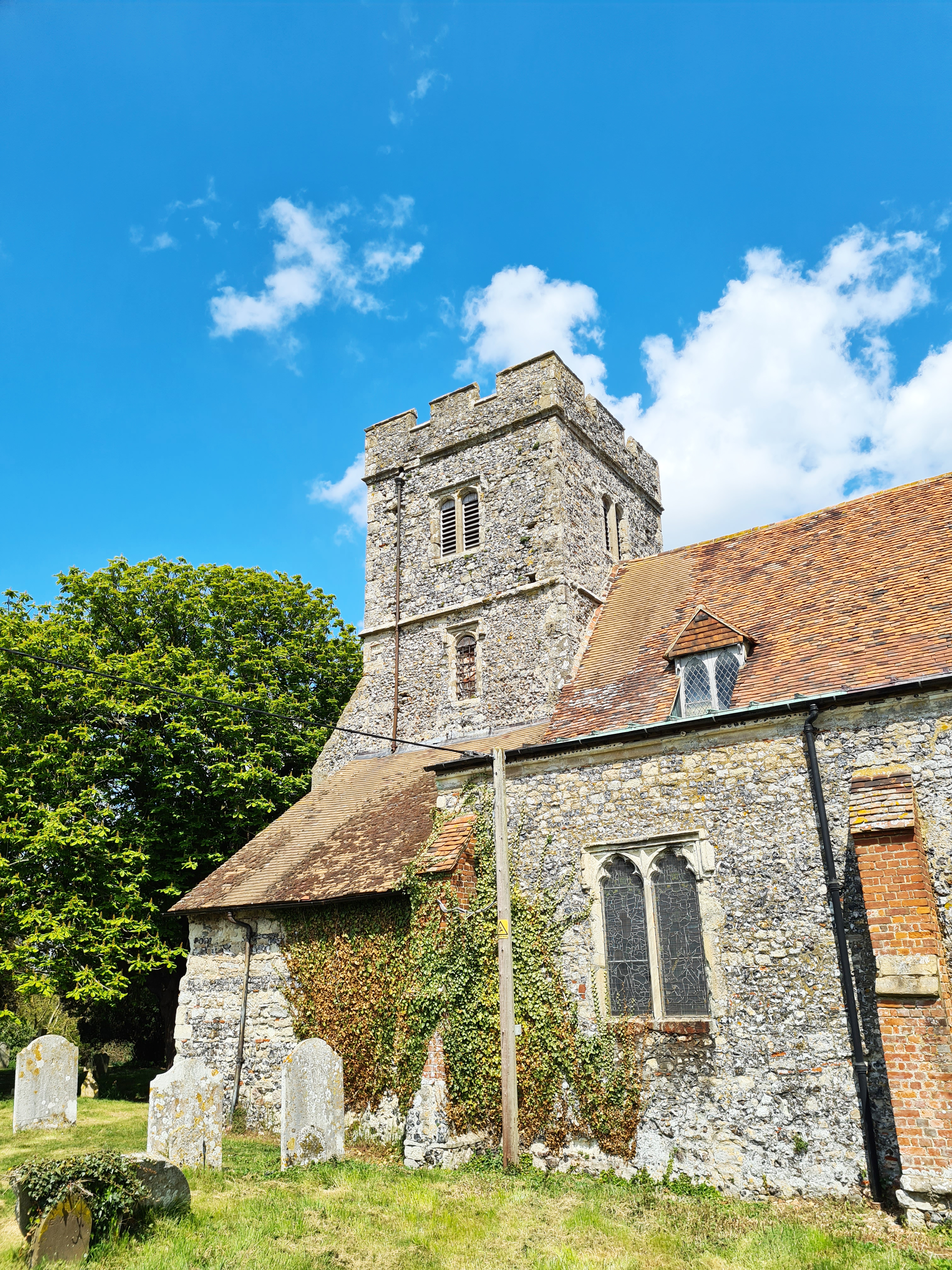
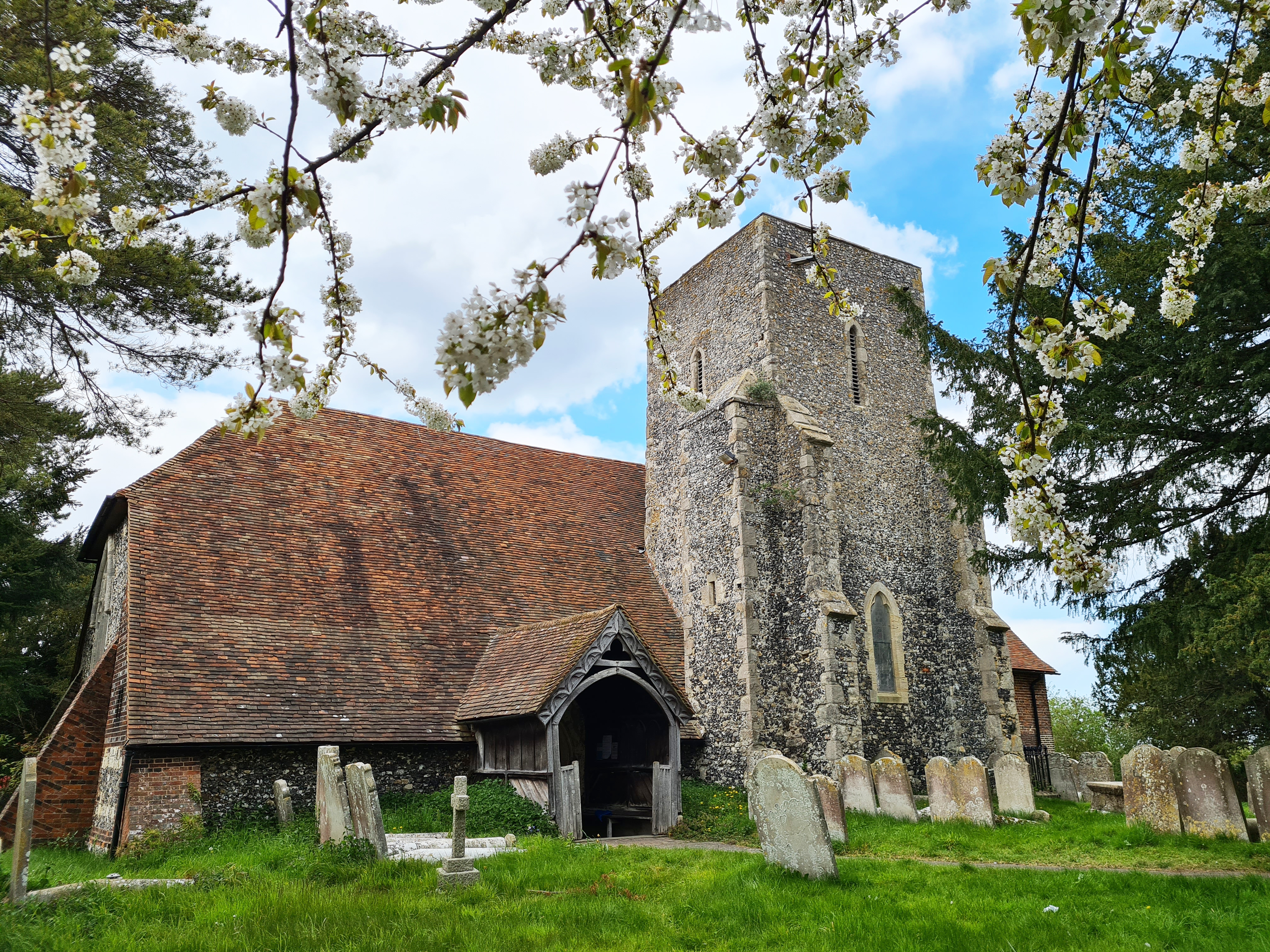
From Graveney it is a short walk of less than a mile across fields, crossing a trickle of a stream and a railway to skirt a silent farm to arrive at the neighbouring hamlet of Goodnestone. It is all rather lovely here. Admittedly a country road does run through it but anyone on that is probably unaware that a couple of hundred metres away, behind the houses and oasts, lies a church now under the care of the Churches Conservation Trust. This fantastic charity looks after churches that are at risk, one such being St. Bartholomew’s at Goodnestone. It remains consecrated and remarkably, when I tentatively tried the door, it was open. No other visitors were around so I pottered about for a few minutes in the cool interior.
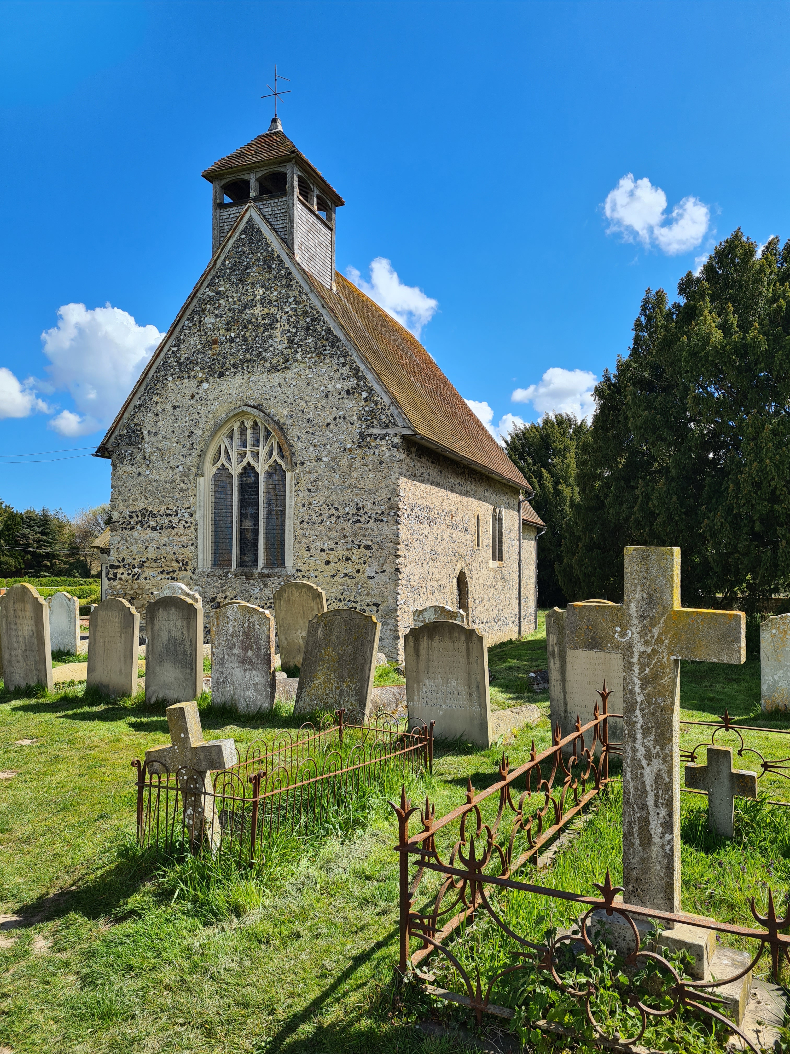
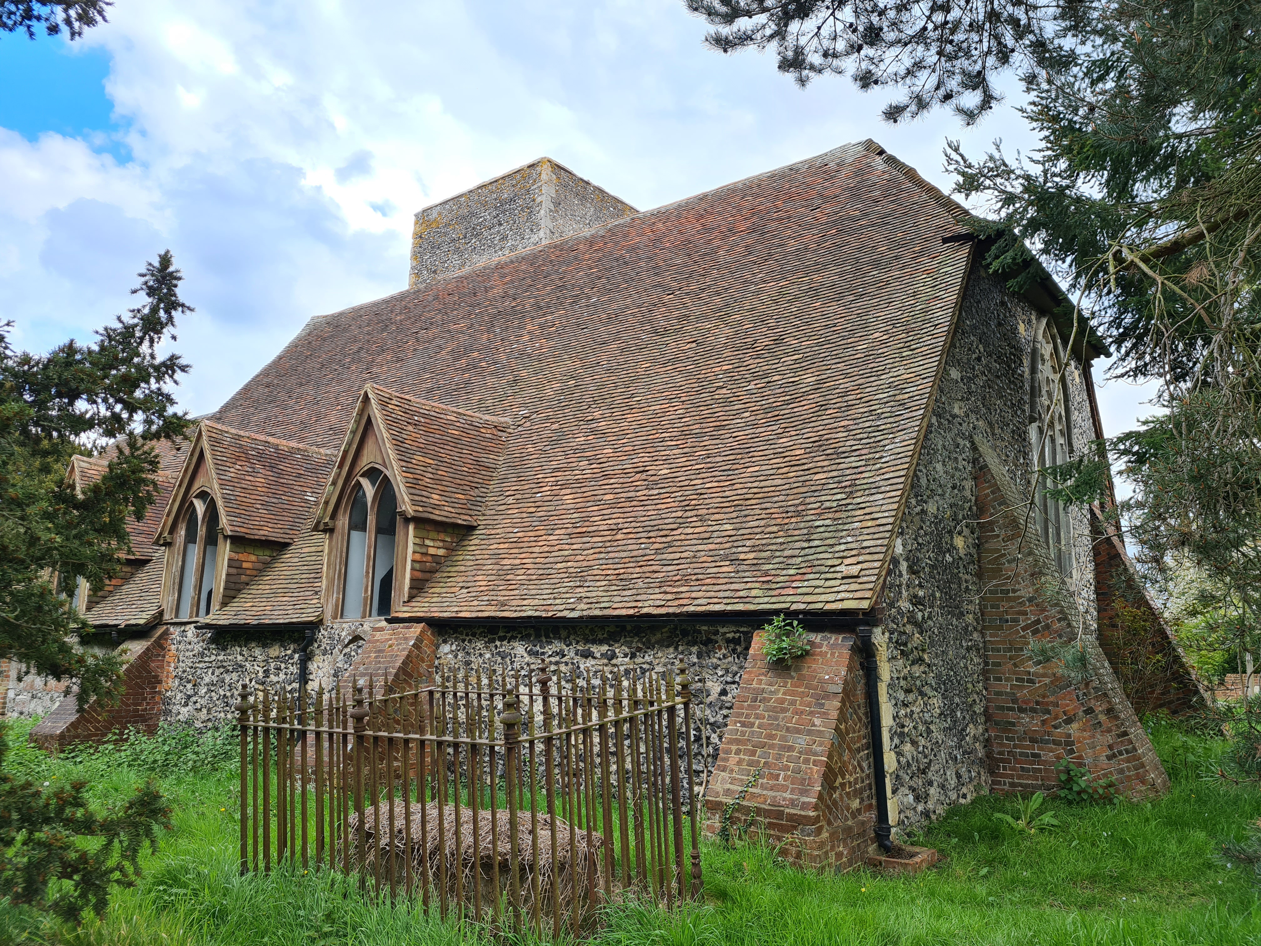
This is a Grade I listed Norman church built around 1100. There is no tower, just a belfry. It has a very simple interior. One of the most modern parts of the church is the porch, rebuilt in 1837 when the previous one was first damaged during an earth tremor, then subsequently collapsed in high winds,
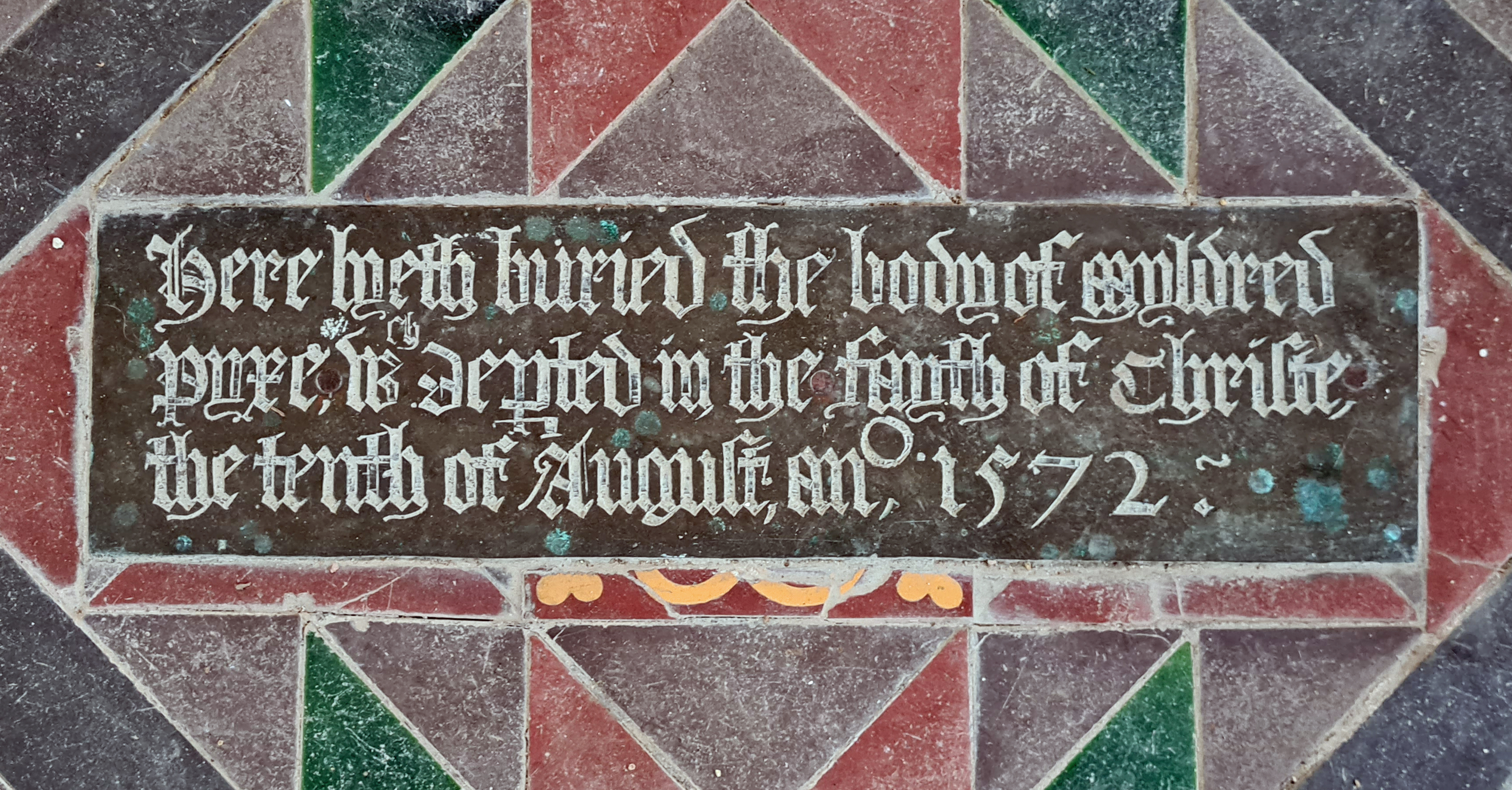
A small number of memorials to the local great and good are dotted around. Two brass inscriptions in the sanctuary floor commemorate Myldred and Thomas Pyke, who died “in the fayth of Christe” in 1572 and 1573 respectively.
The churchyard is left via a little gate in the corner of the wall at the rear. The wall was built in 1871 at a cost of £80 12s 11d,
It is then through scrappy farm fields and past polytunnels for a couple of miles, again crossing the railway to walk toward the outskirts of Faversham. Nearing the town, smartly dressed kids were out having a kick around on the playing fields of the equally smart and ‘modern’ Queen Elizabeth Grammar School built 1968. Opposite this is it’s not quite so modern forerunner, built 1567.

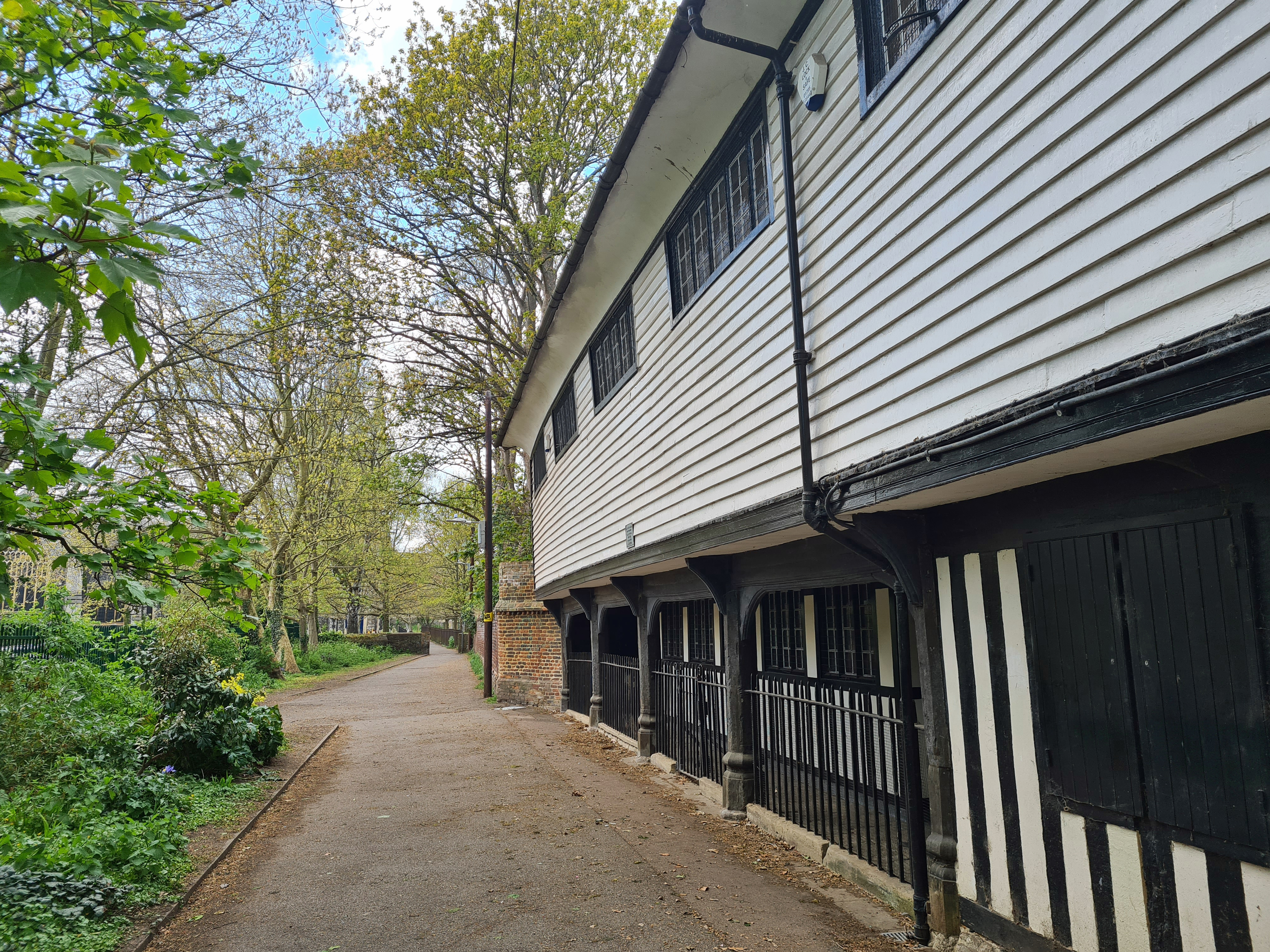
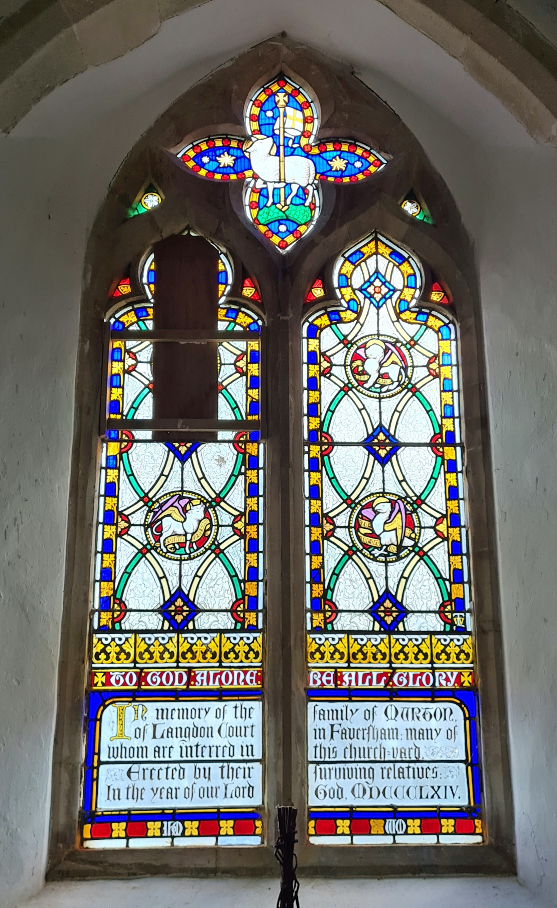
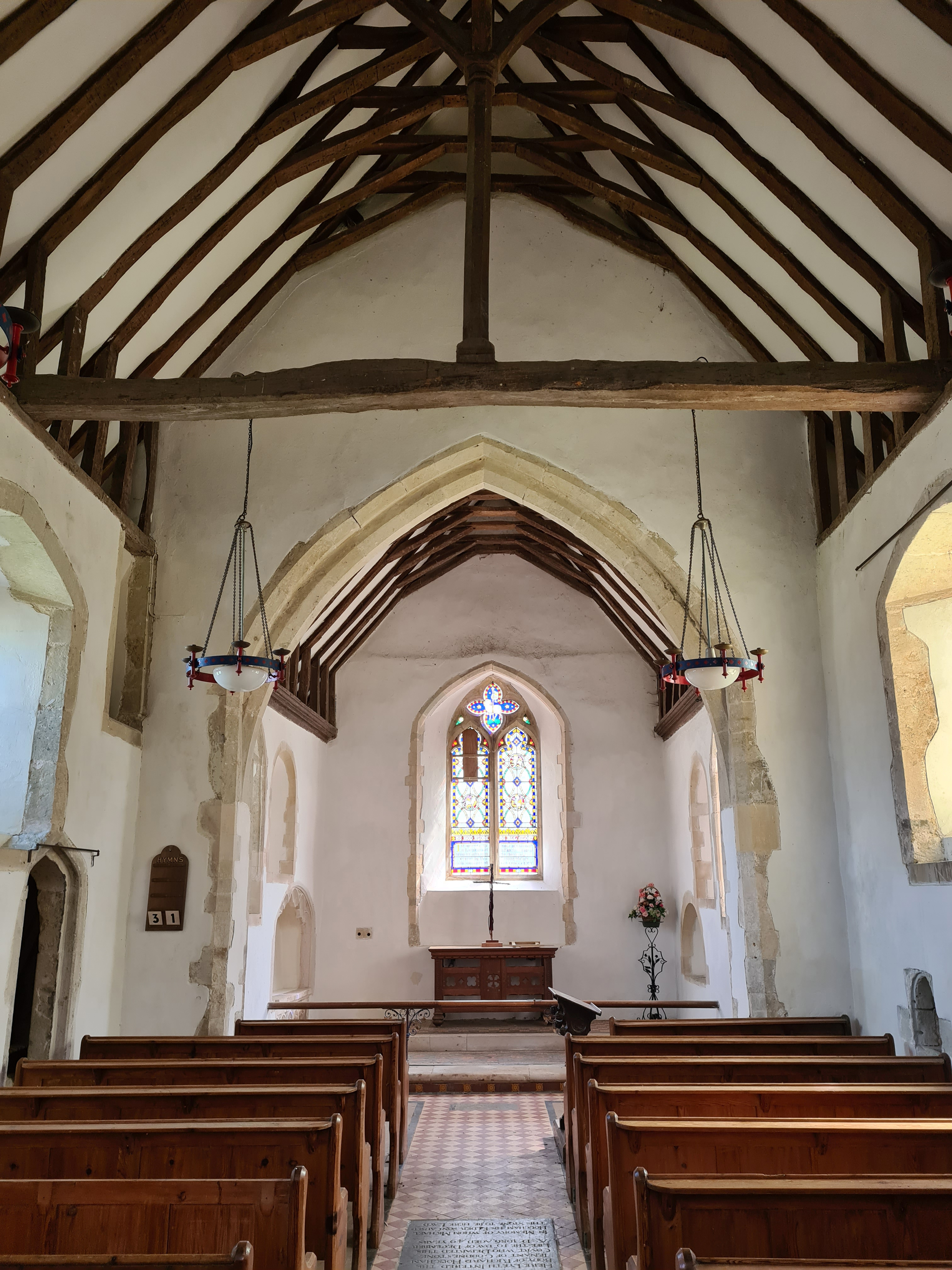
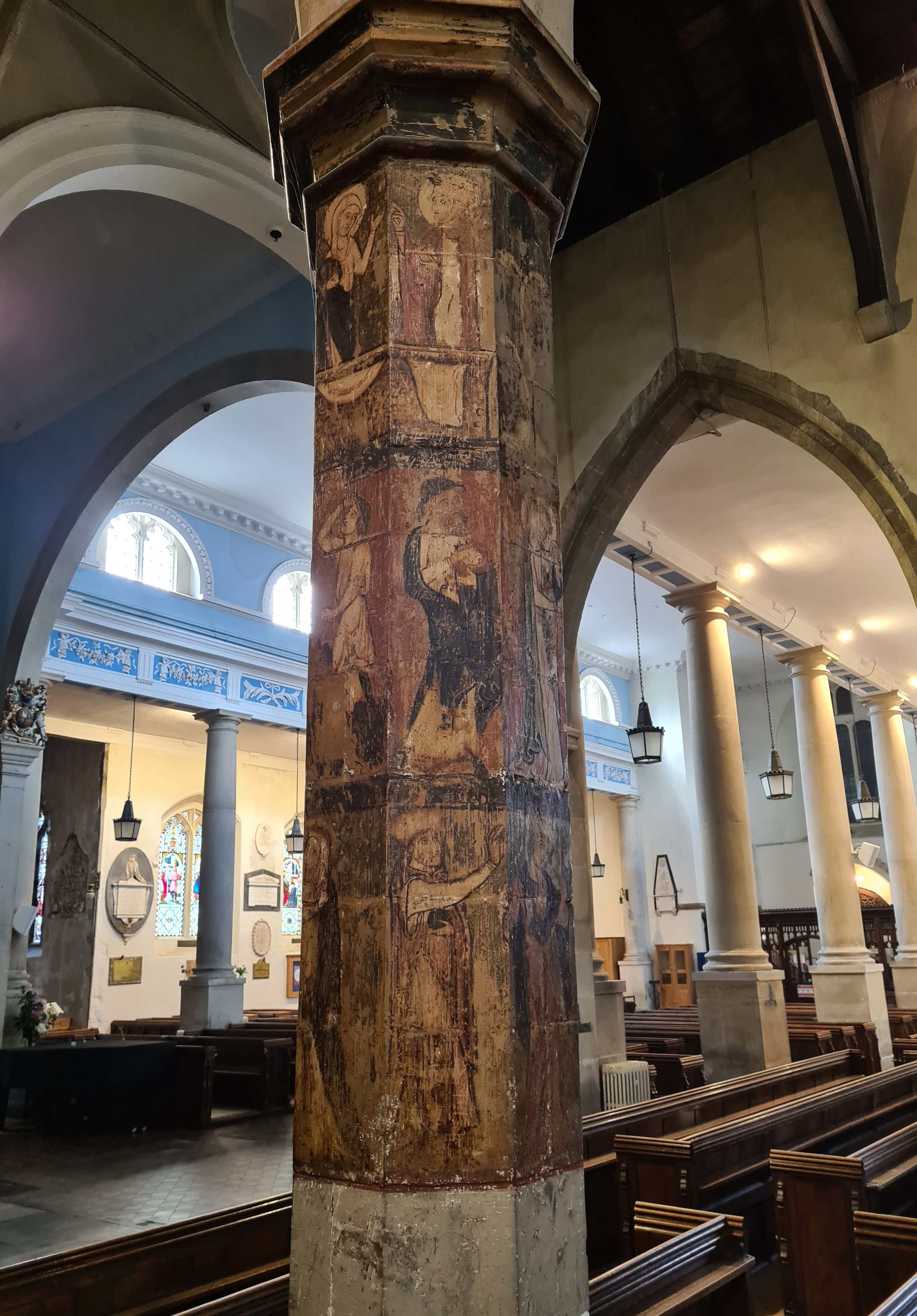
The gates to the churchyard of St. Mary of Charity Church were locked, but again I was pleasantly surprised to find the door open and having donned a facemask, ventured in, disinfecting hands as I did so. I was immediately accosted by the vicar who seemed disappointed that I wasn’t there to worship. He retreated but before doing so assured me I was welcome to explore the interior. I doubt he was particularly surprised as this church can be popular with tourists as it is one of the few outside London that has an interred King- King Stephen (1092 or 1096 – 1154). Much of the Norman church in Faversham was pulled down as unsafe and various bits of the building rebuilt in the 18th century.
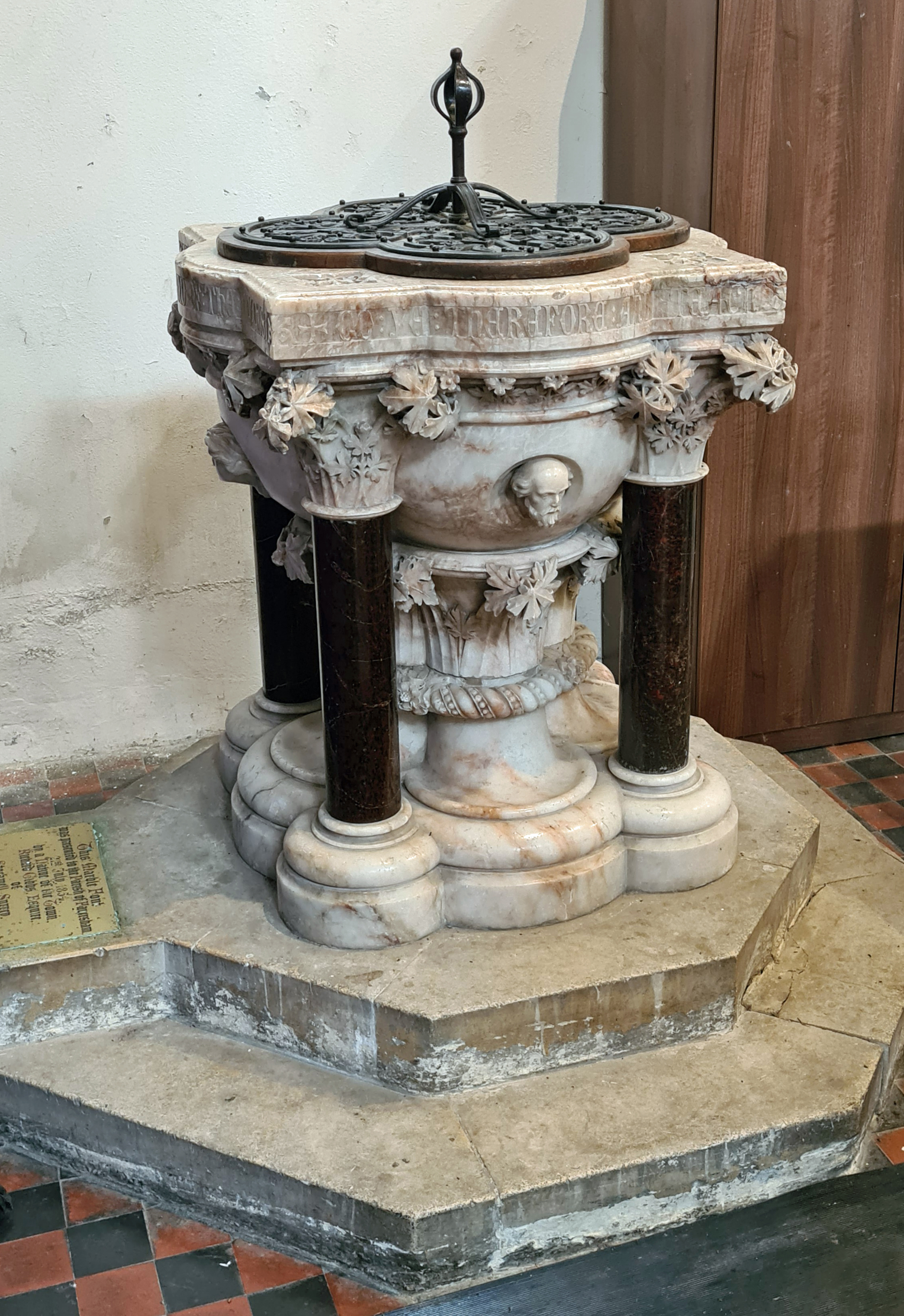
With Social Distancing rules in place, the size of the congregation was obviously being kept to a minimum as loose chairs were widely spread in the chapels. Various bits of furniture and clutter obscured many of the walls and it looked as though a bit clear up of old exhibition panels and various club and society paraphernalia was taking place. I stopped to admire one of the two fonts- a four columned affair designed by George Gilbert Scott and made of alabaster and serpentine.
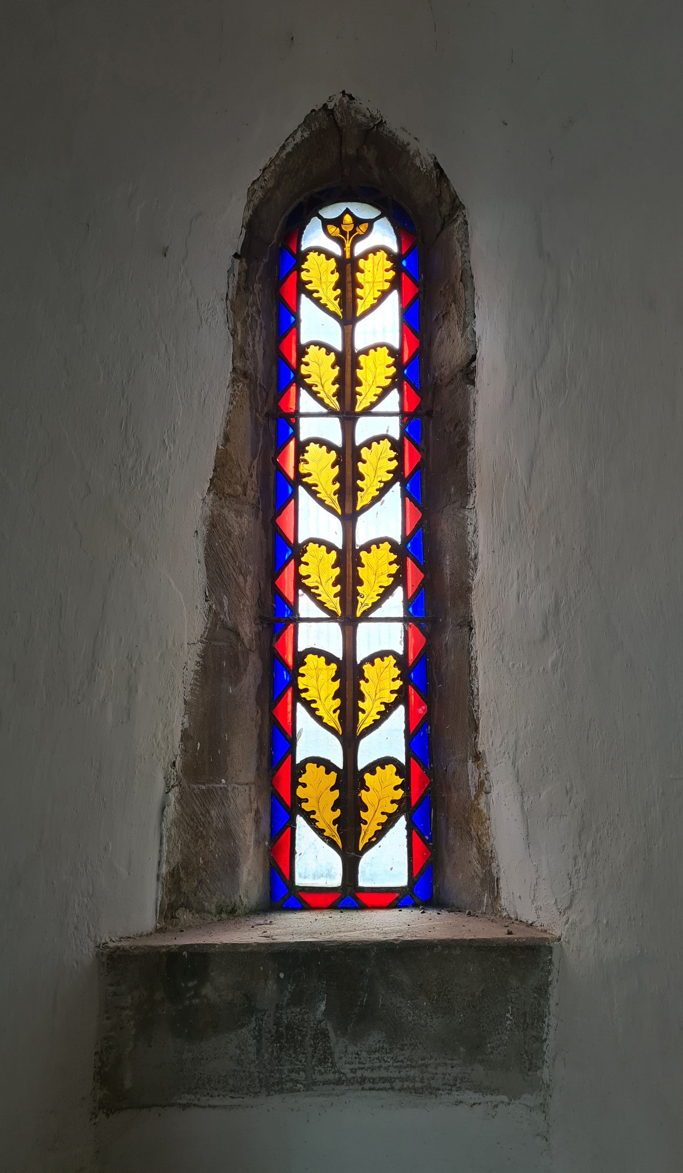
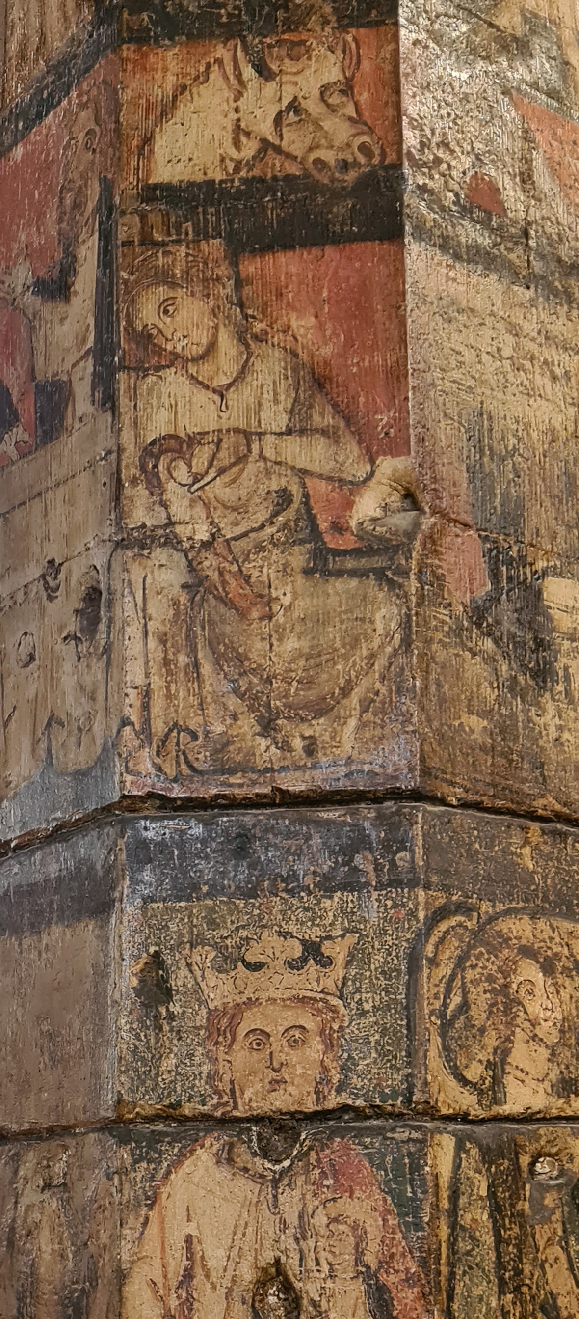
Font and other delights aside, there was one feature that I was particularly keen to see. This church is home to one of the very few surviving medieval painted columns in England. This octagonal pillar dates from c1306 and depicts the Christian story from Annunciation through to the Passion. A bit of help in interpreting the images would have been appreciated as it jumps around a bit across the faces of the column and unsurprisingly, some parts are a tad worn. The expressions on the faces of both animals and people are superbly entertaining, just as it must have been for a perhaps slightly bored parishioner ‘back-in-the-day’.
“I like to think that the sacred meet the secular in the church”
Rev Simon Rowlands
The large parish church is one of the gems of a town that has many delights, not least a brewery in it’s centre. It was very obvious that the local community hold this place dear to them. In fact brewer Shepherd Neame hold their annual AGM in the church.
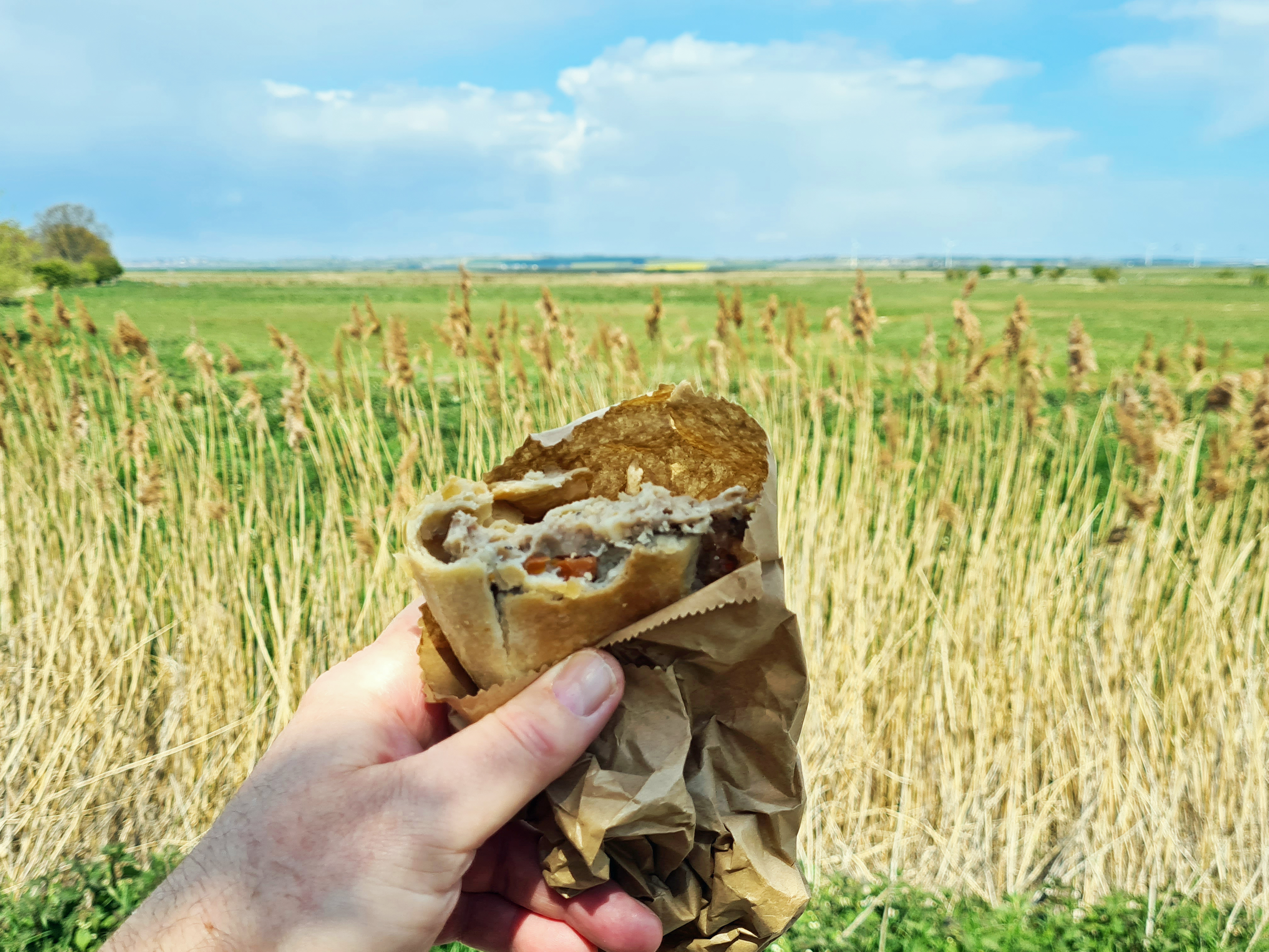
Leaving the church, I wandered the streets of Faversham briefly. Abbey Street is wide and attractive but I was more interesting in locating lunch. The market in its centre has been operating for over 400 years, today, one of the stalls was selling breads and pastries. A decent meat pasty was slipped into my pack for a munched meal on the move later.
Crossing the creek exiting the town, it is possible to peer over the walls of Davington Priory, the cloister and nuns’ domestic quarters were converted into a house. This was purchased by Bob Geldof in 2013. Alternatively, round the corner, I wandered into the churchyard of Davington Church to see what survives in use.

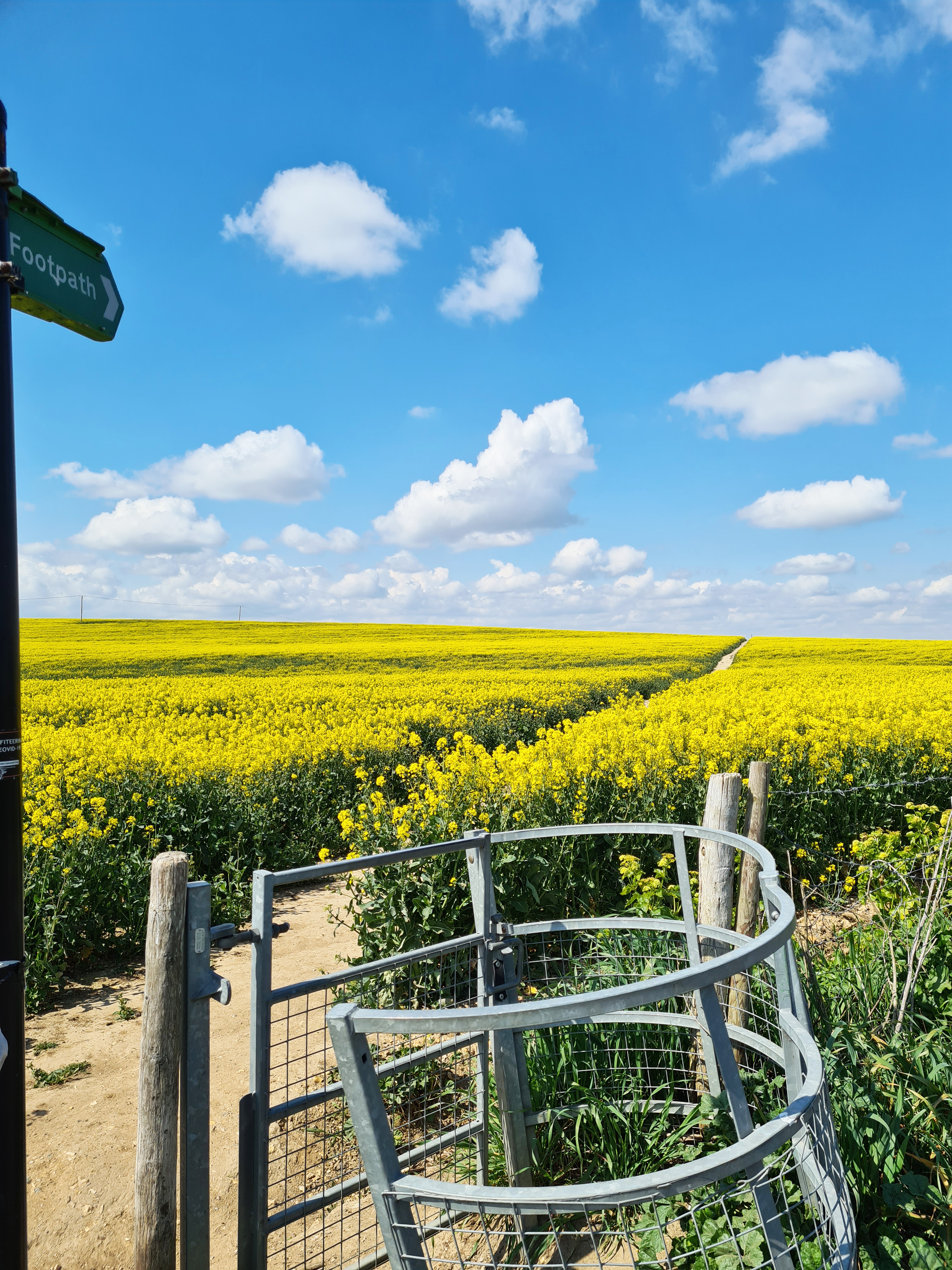
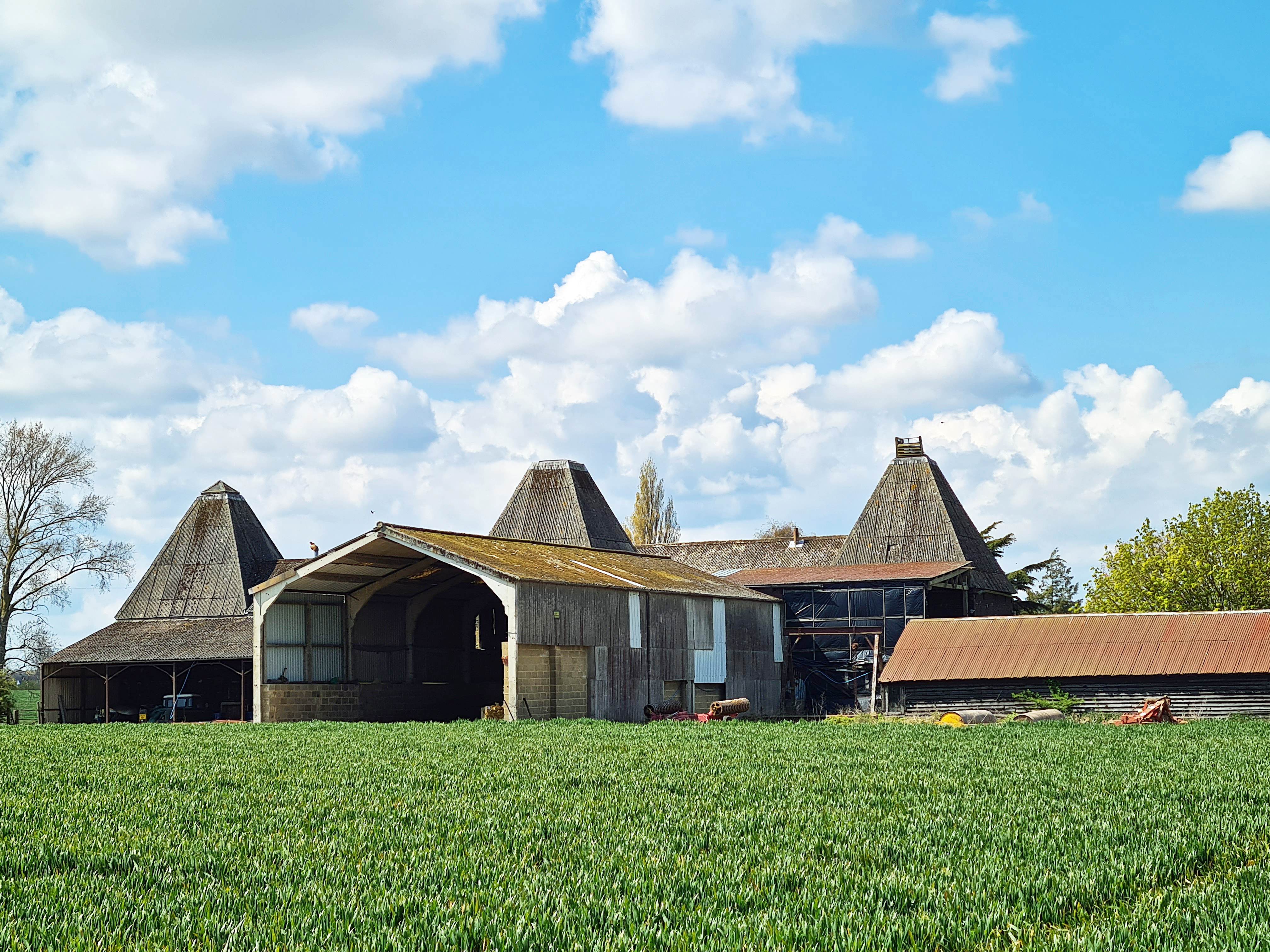
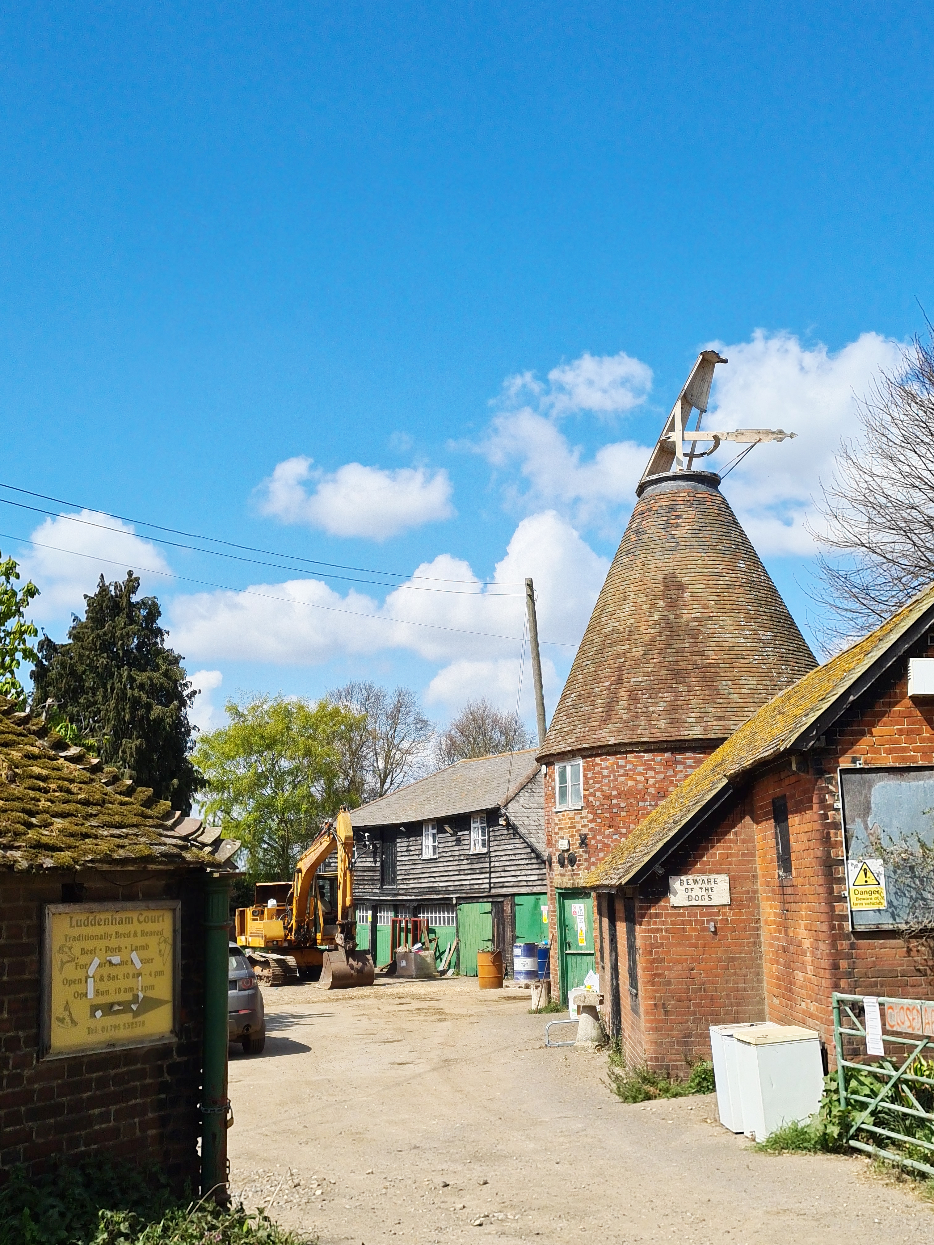
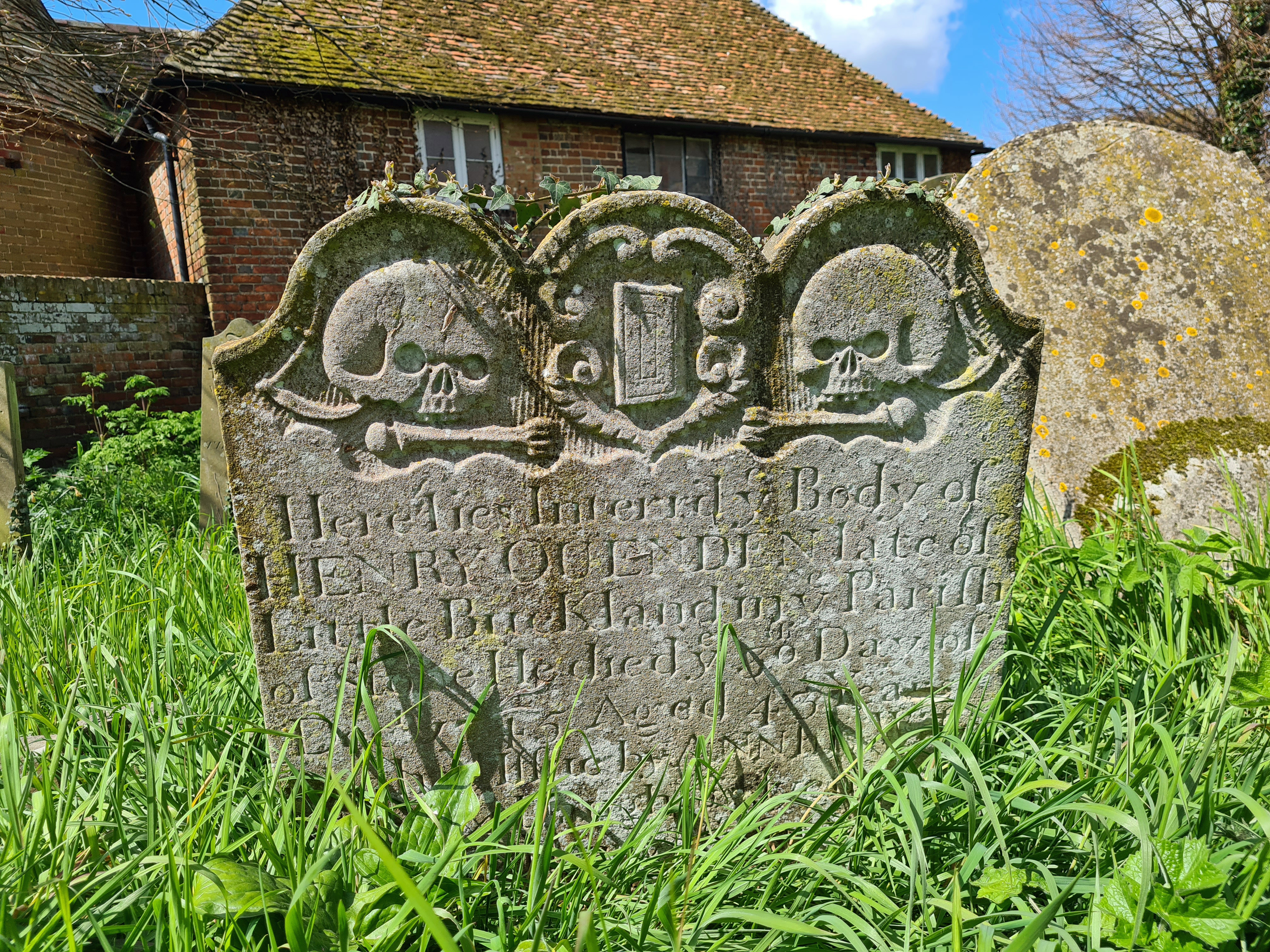
Soon out of Faversham and into, and almost immediately out of, the neighbouring village of Oare, the trail slowly rose up through bright yellow fields offering a view down to Luddenham Court in the middle distance ahead. There is no village here, just a few scattered houses and farm buildings. And another church, this time locked. There were still a few daffodils in flower in the churchyard and the grass was uncut, but it was still possible to wander round the graves where I found a lovely example of ‘skull and bones’ headstone, a bible separating the two skulls.
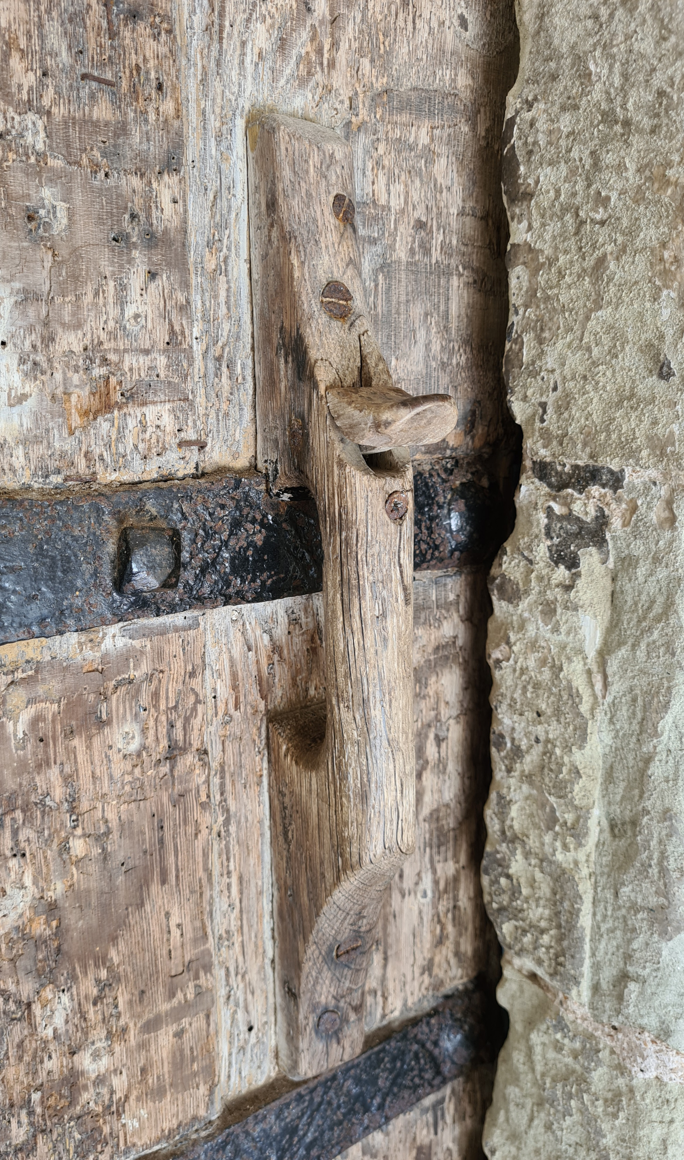
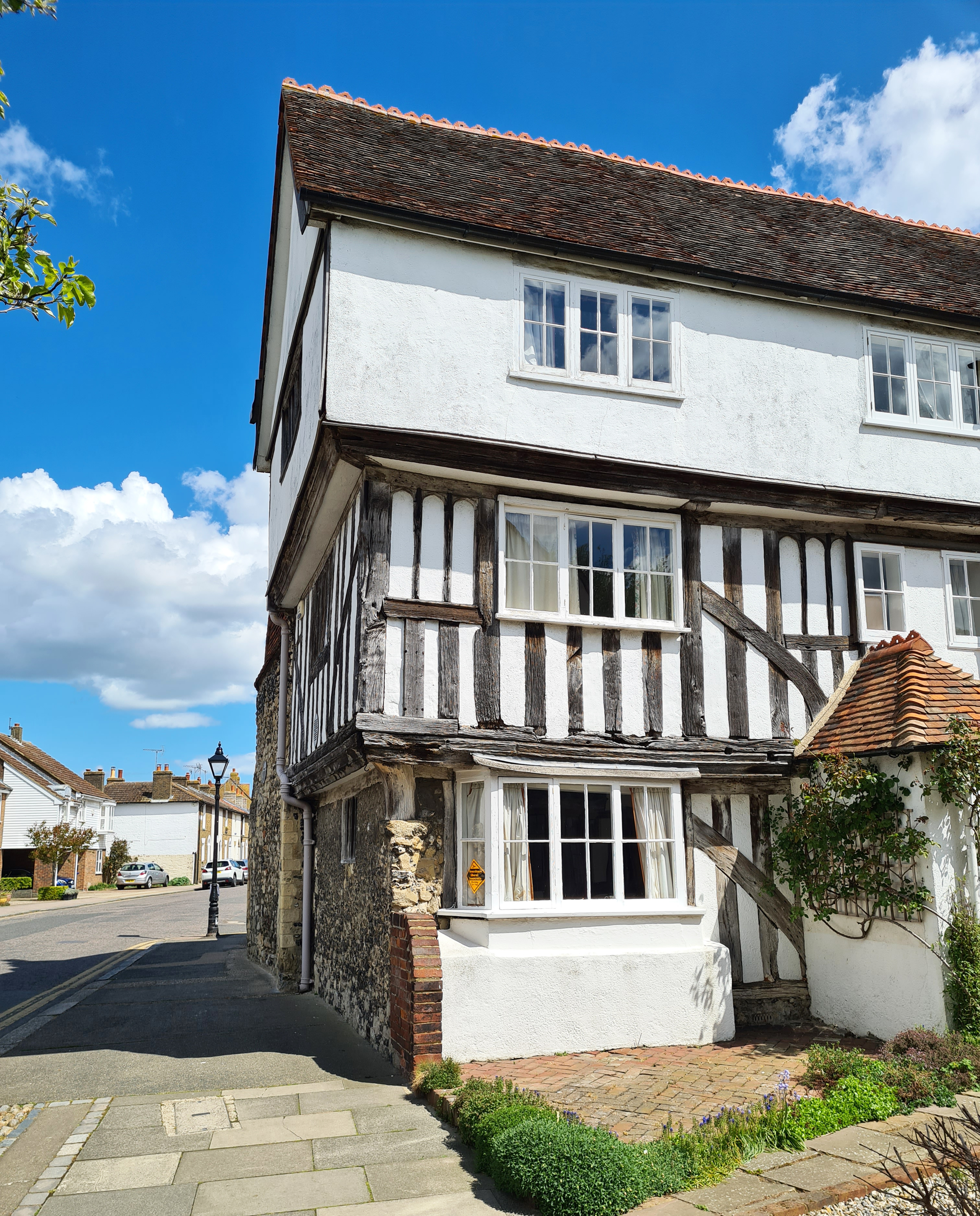
Luddenham Church closed in 1971 and is now cared for by the Churches Conservation Trust. While part of the tower is brick, much of the walls of the church are flint, with parts rendered. The 12th-century west doorway has Norman zigzag patterns, and there are fragments of Roman bricks in the walls. It is still consecrated and, needless to say, Grade I listed.
I left the 850 year old church and it younger surrounding buildings and again struck my way through tree fringed farm fields before coming out on to a quiet country lane. There was no traffic at all and I followed this to a sharp turn at Elverton, passing the Mounted Rifleman on the corner.
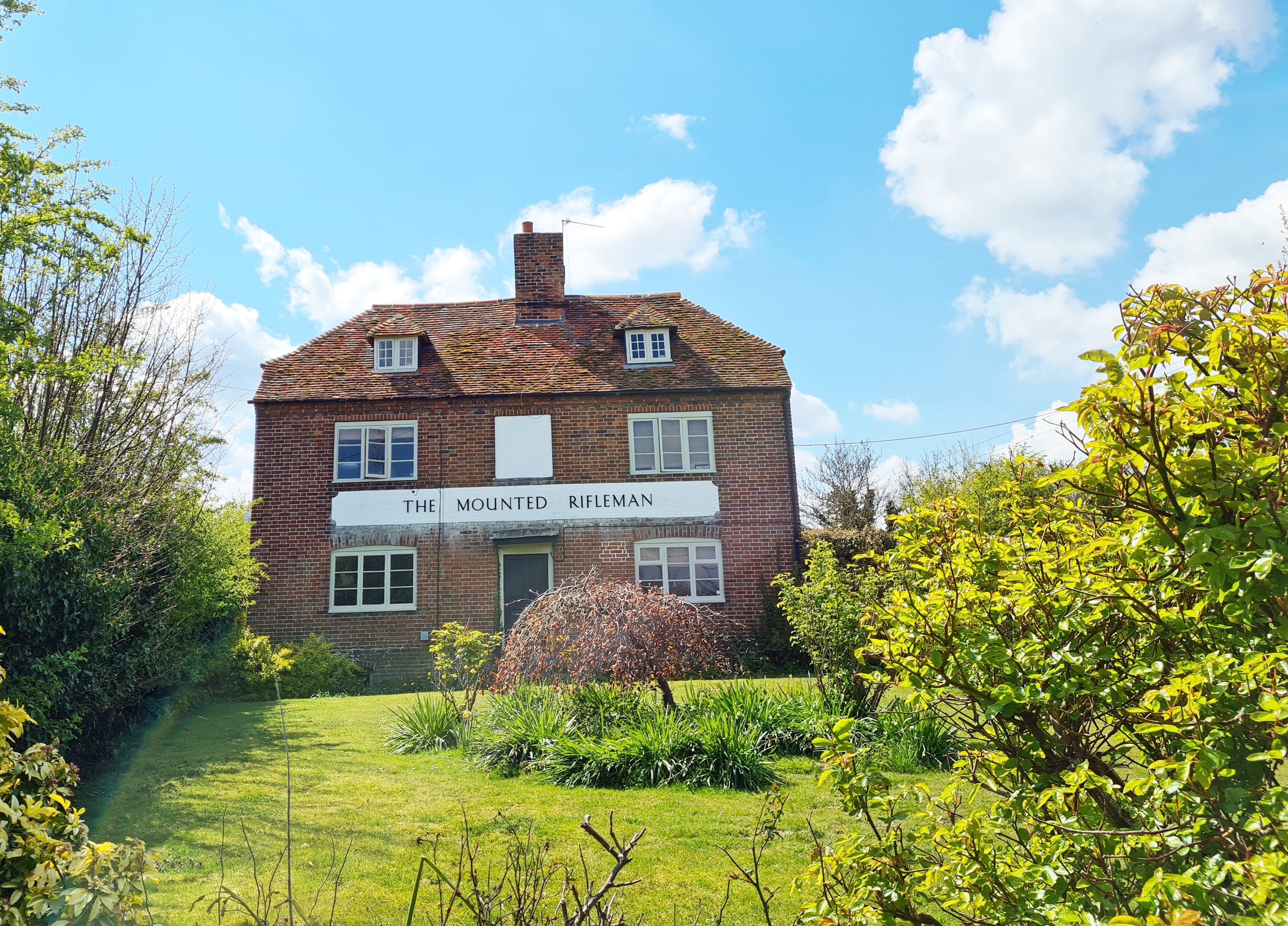
Despite still being shown as a pub on my old O.S. map, sadly, no beer is now served here. Back in the eighties, every time an old army mate of mine came to stay with me, he demanded that we drive here, he couldn’t quite believe how it operated. From plain, wooden seat lined rooms, you ordered your beer from John Austin, the landlord, who would then descend the steep steps behind him to the cellar, to pour superb pints of well kept Fremlins Bitter straight from the barrel, and carry them back up on his battered tin tray. It closed in 1993 and is now simply a house.

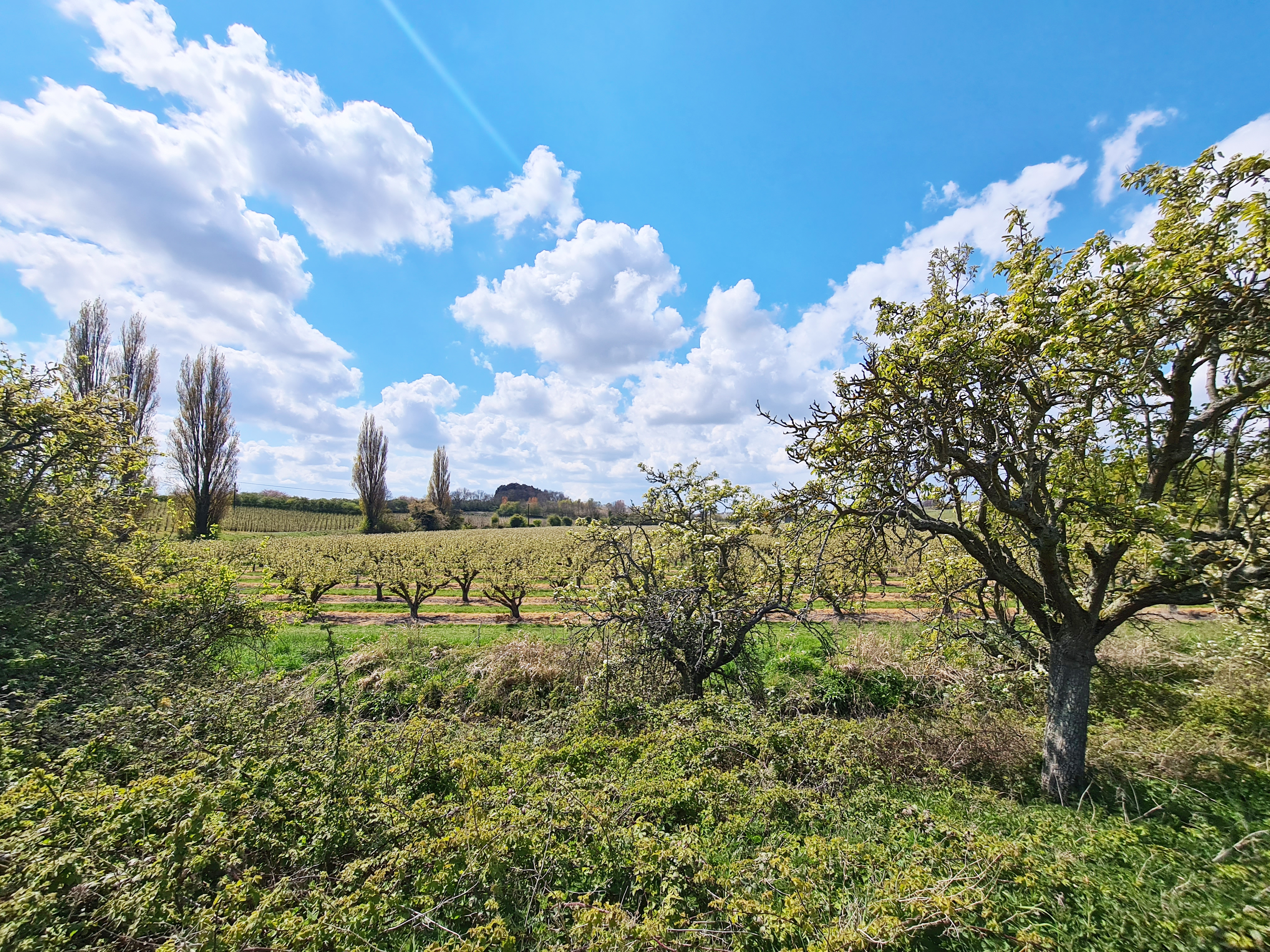

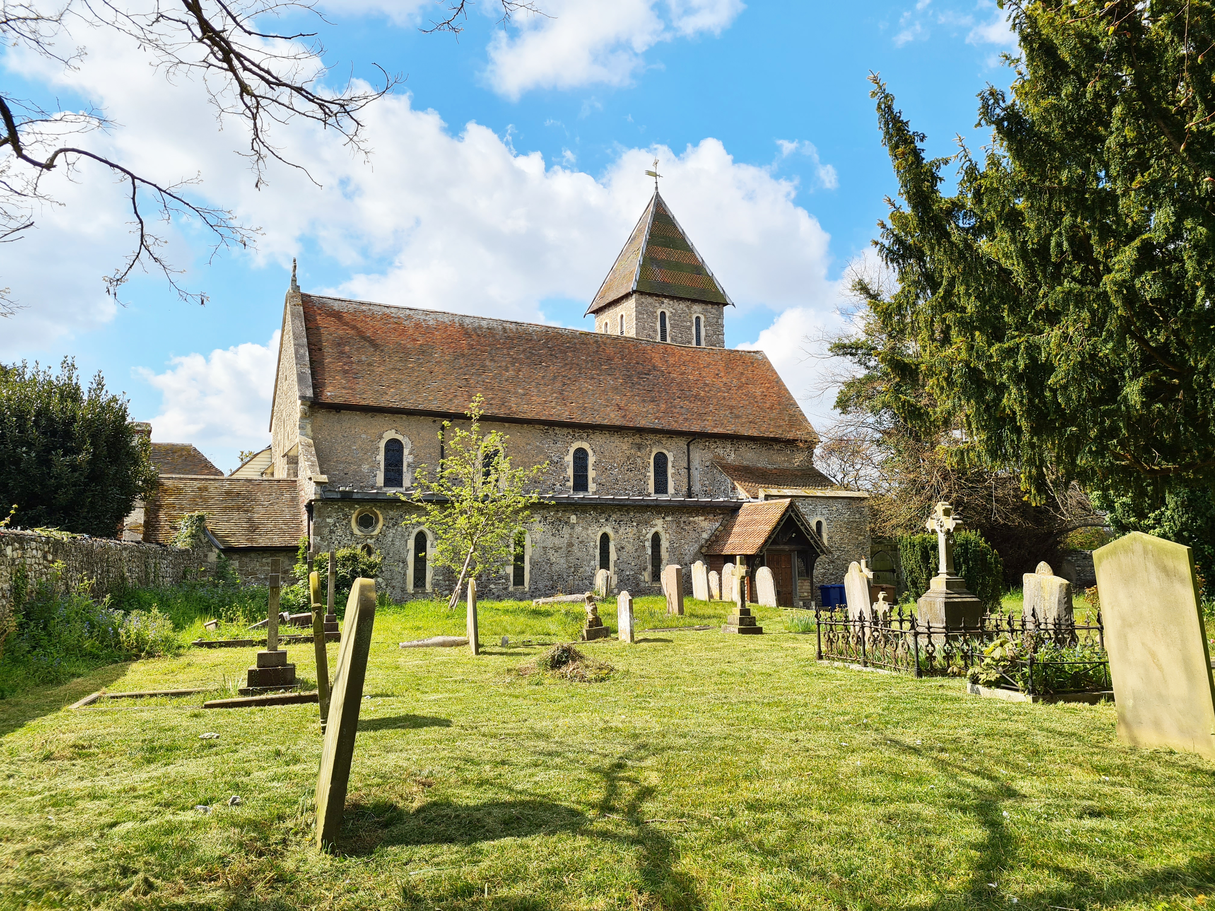
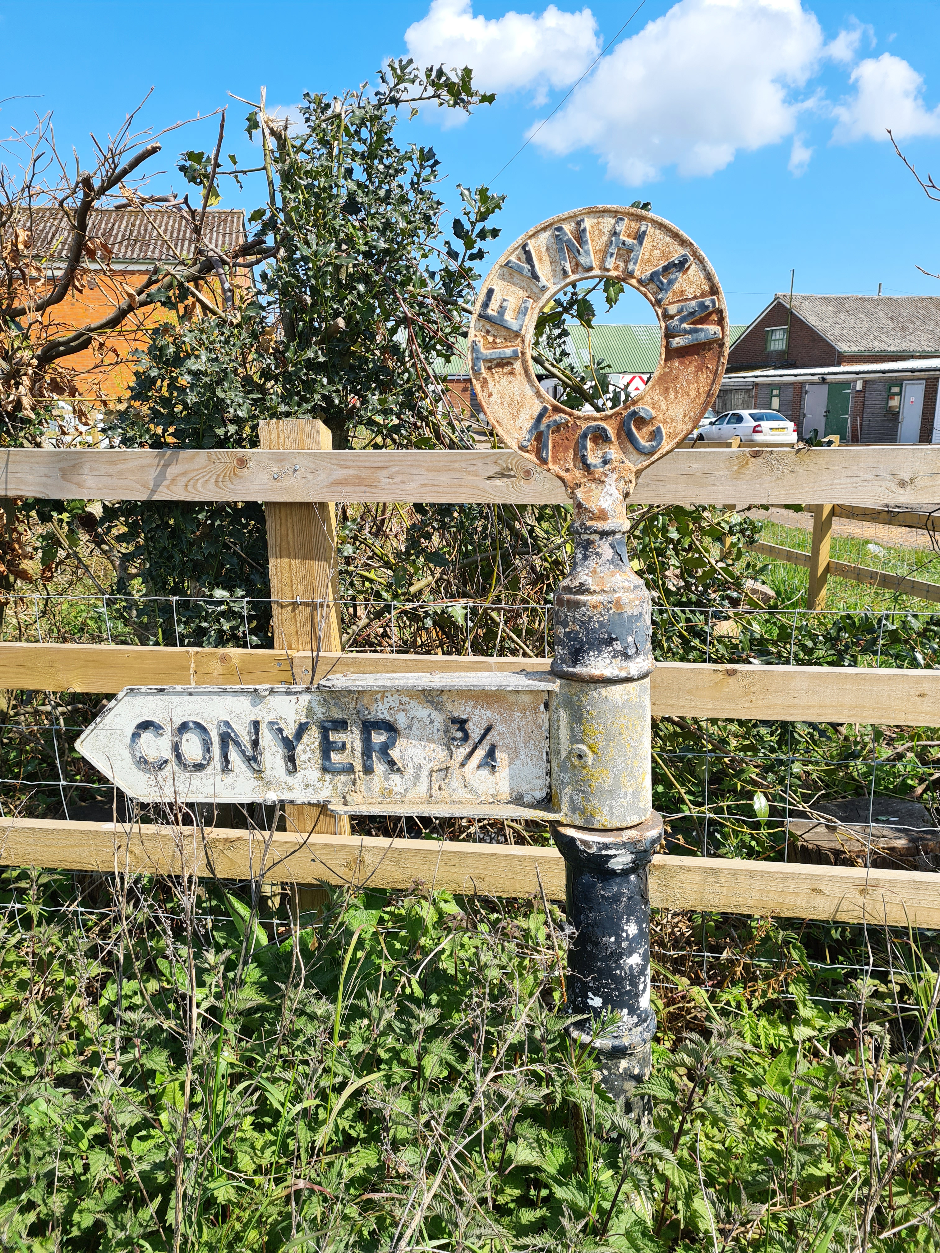
More quiet field paths and lanes, through acres of apple orchards and other fruit all the way to Teynham Street. I passed the Natural Burial Ground at Deerton. Here, small trees are the only marker for each grave where only bio-degradable coffins are permitted. Now full, it is becoming more of a nature reserve than a traditional cemetery. Teynham was originally named Tenham, from the ten hamlets that made up the parish. Most of the inhabitants had to move further inland due to the mosquitos and ague that troubled them from the sodden marshes on their doorstep. The area was only returned to once the marshes had been mostly drained. Reaching Teynham I left the still quiet lane to follow the grassy path up between apple trees to St. Mary’s Church. My brother-in-laws parents are buried in the churchyard here so I popped by to say hi, then wandered around the church. Doors inevitably locked. Much of the Grade I church dates from the 12th century but the tower is probably three hundred years younger. Despite pausing to view the massive 15th century door, I completely forgot to look for the holes in the door, caused by bullets fired by Cromwell’s Roundheads at Royalists taking shelter inside the church.
Teynham Church is built in the shape of a cruciform and constructed from a wide range of materials, primarily flint, but also Reigate stone, Kentish marble, Caen stone, Kentish Ragstone, pebbles, tufa with bits of reddish Roman brick and tile.
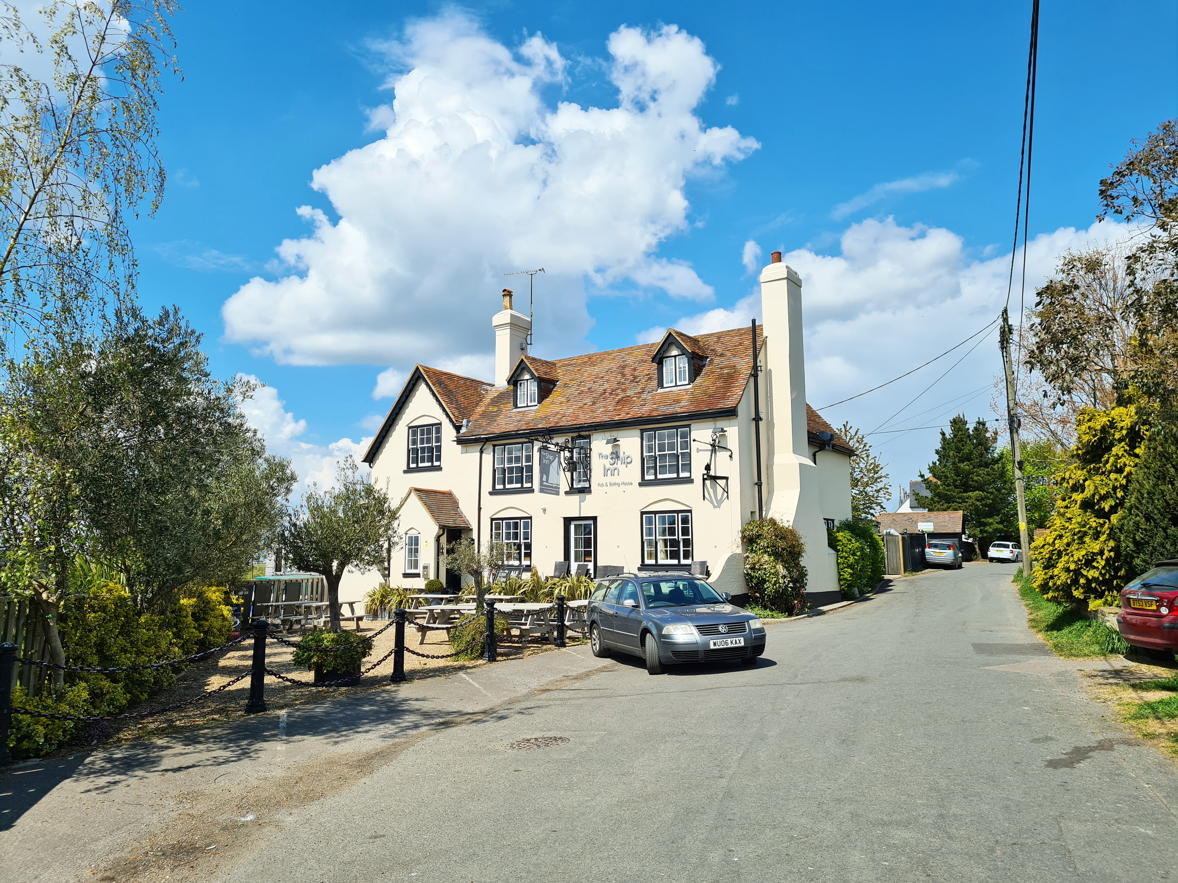
Some pubs had recently been able to accept limited numbers of people for outside drinking, I had been hoping for a pint so on reaching Conyer Creek, I walked up to the Ship Inn. All looked quiet. The landlord came out of the door as I approached and I enquired, it wasn’t to be. I had heard of the problem he was experiencing elsewhere and struggle to understand how anyone can do this- the bane of every publicans life- No Shows. Typically, just a few days previous, on their first day of reopening, four of the nine bookable tables outside, failed to turn up. The trend had continued. How can anyone do that to a business struggling to recover? He was packing it in and handing back the pub.
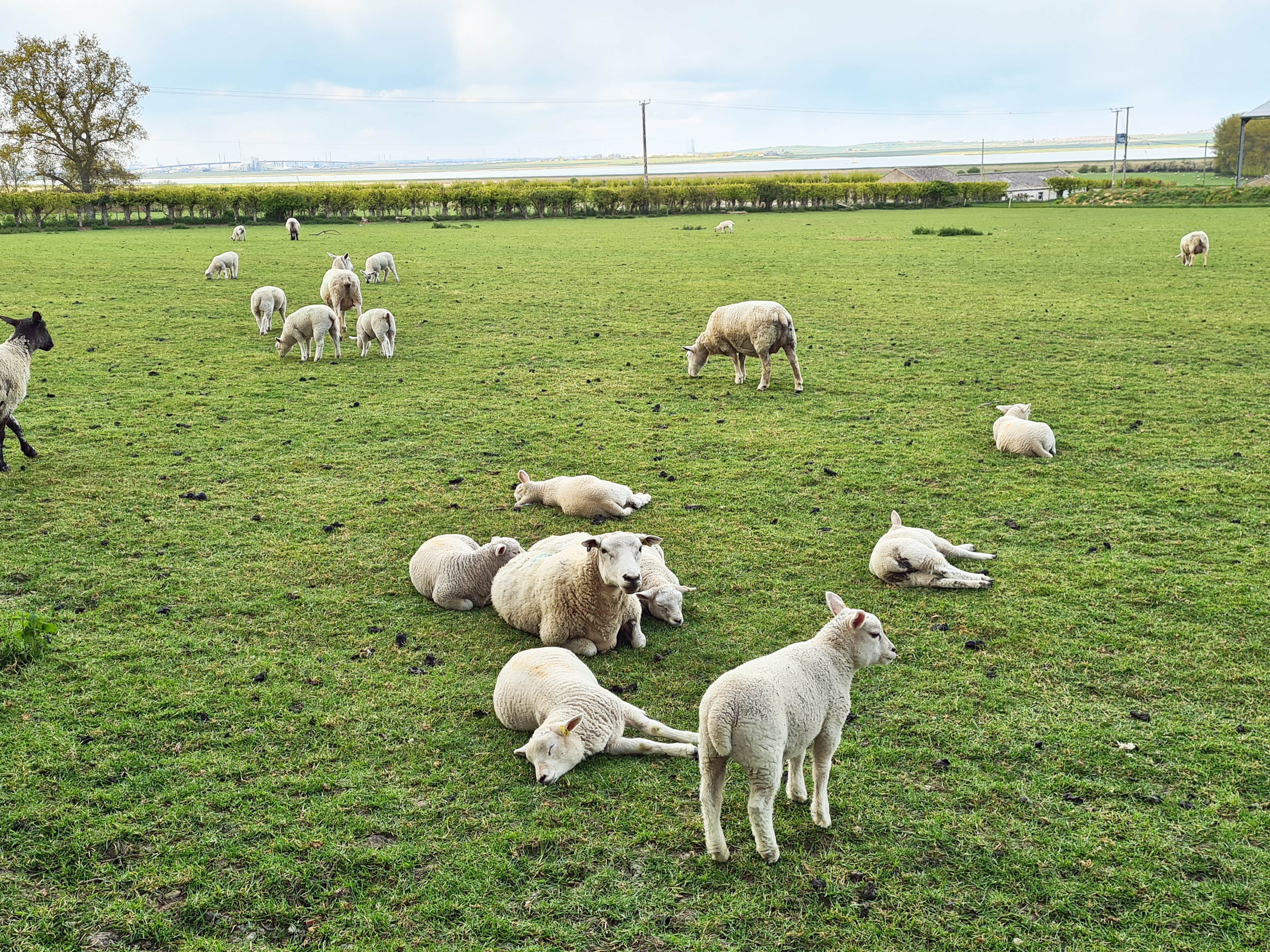

I walked on, hungry now, so once clear of the village and after a brief walk along the seawall and back heading inland, I paused to consume my Faversham pasty. I was now leaving the orchards behind me and rough grazing pasture became the norm. Sheep and their lambs lazed, I passed cattle and horse, polytunnel after polytunnel of strawberries, and a few more forgotten phragmites fringed ponds, no doubt to be filled in at some point in their future. Fields and lanes became a bit tattier the nearer I got to Sittingbourne. Flytipped rubbish and that casually thrown from a car window became prevalent. I stopped at St. Giles at Tonge, built in Norman and Early English styles. But in keeping with the general unkempt state of the area, the c12th century church is in general disrepair. Hard to believe this is yet another Grade I listed building. A notice said that works were underway to replace wiring , heating and lights, but they could do with looking at the blankly staring glassless windows. A recent condition assessment I found online informs me- “Slow decay; no solution agreed”. It is still a gorgeous church though.
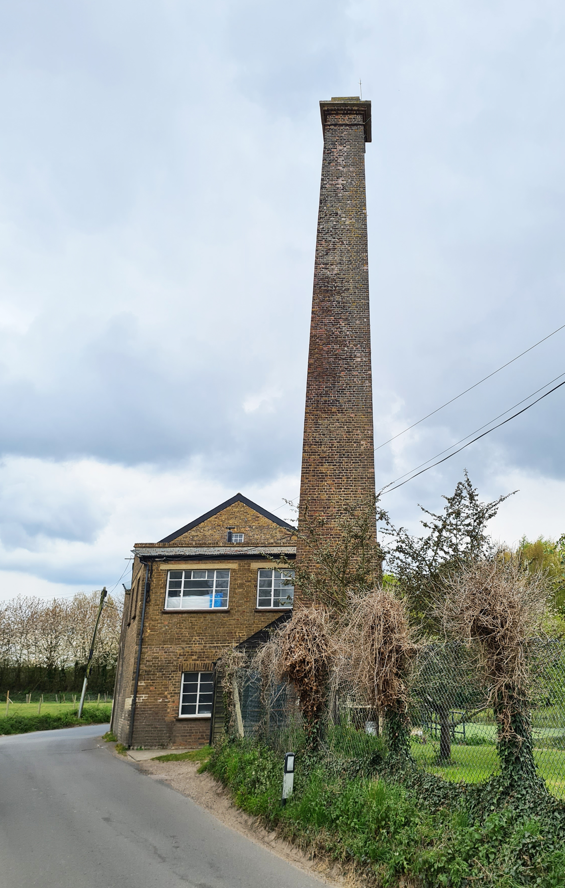
Shortly after leaving St. Giles, the trail turns abruptly toward Sittingbourne, keeping north of the railway. But I still wandered off trail to visit Tonge Mill to the south. I was hoping for more than I got. I knew that there was both a remnant mill and pond, and also one of the ‘historic buildings of Kent‘. There has been a watermill at Tonge for over 900 years and I had high hopes. Tonge Mill is a grade II listed Georgian former flour mill and mill house converted to residential properties.
I am sure they are lovely inside but are obviously private and a wander up and down the road outside doesn’t exactly thrill, not only that but the road is on a blind corner, there is little in the way of a path and traffic seemed to be building. You cannot see the old millpond particularly well, there is nothing to see of the remains of Tonge Castle and it was a diversion not worth taking.
Back to my trail. There wasn’t much more to expect as I was now into recently built overspill from Sittingbourne. Towns and villages continue their insidious expansion, whether it is advisable or not. What is worse is the type of growth. Non-descript identikit abodes, built to a standard profit-making plan. Get lost in the streets of one of these new estates and you could be in there for days, doomed to roam identical streets lined by identical non-local brick built houses with identical doors, windows and gardens. Even the cars can be barely distinguished these days. I will not pause to admire a garden here, I need not halt in a new build estate to look admiringly at local building design as there isn’t any- no kentish pegs, weatherboarding, ‘eyebrow’ windows, catslide roofs and more. So, I attempted to ignore houses and mostly unkempt gardens, fence panels kicked in by bored youths, dumped rubbish and more clumps of Horseradish than you can shake a stick at, walked on, and eventually popped out in the business park area of Sittingbourne near the football stadium.
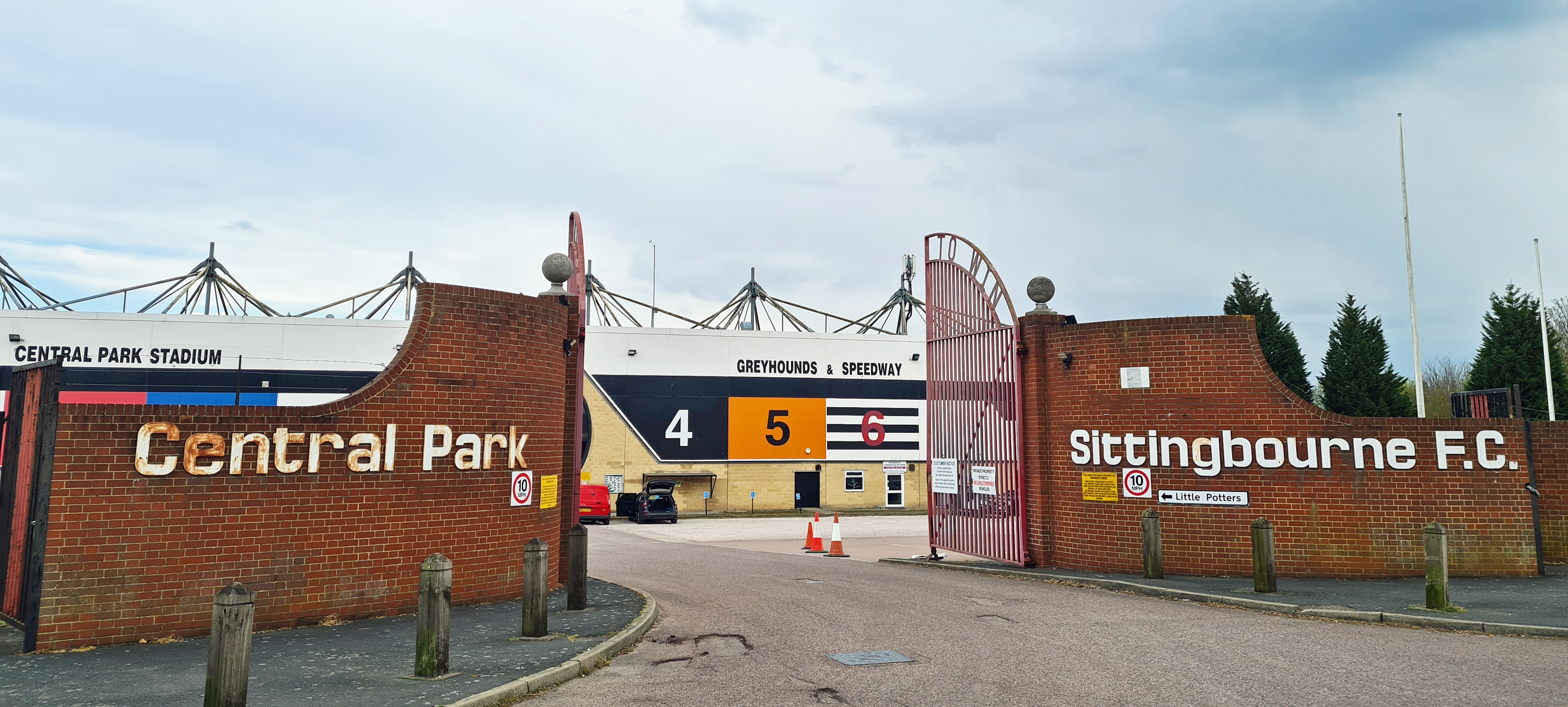
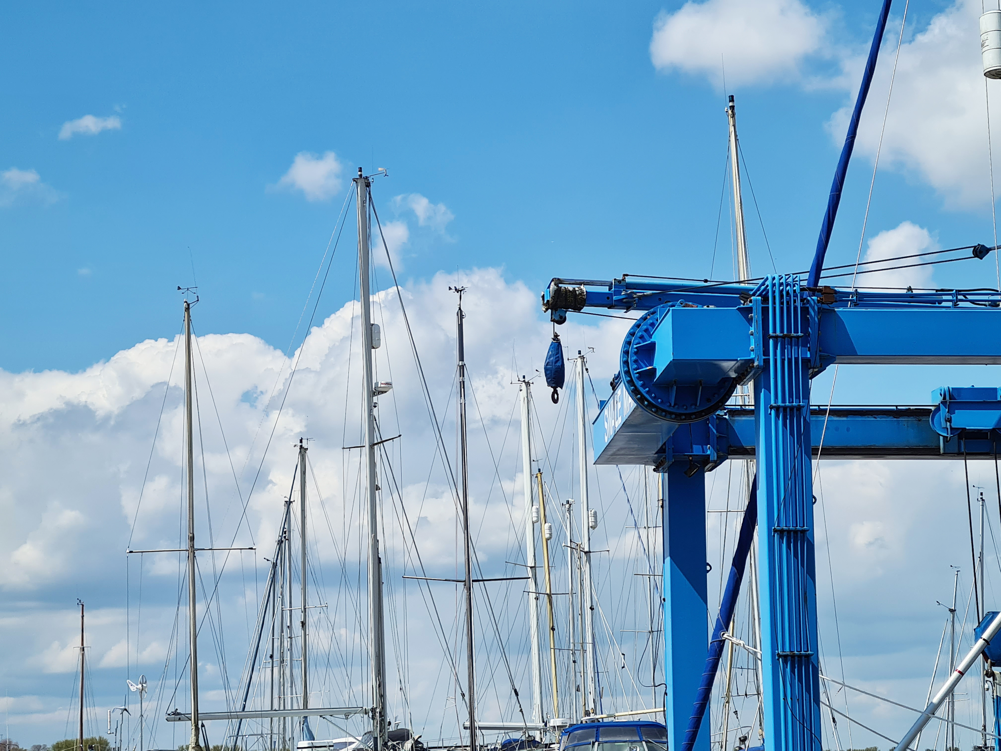
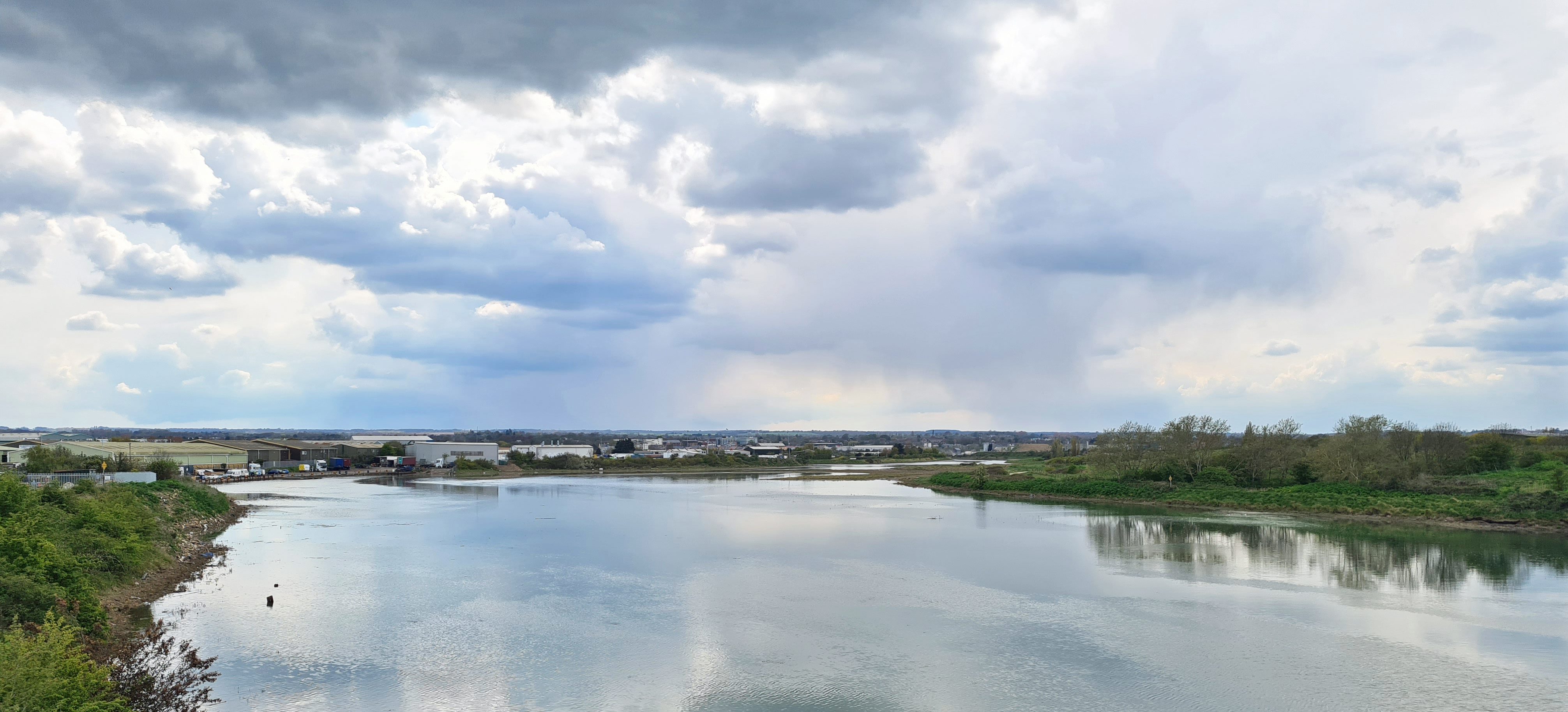
I say football stadium, financial difficulties meant the club had to sell the stadium to the council and then rent it. Subsequently priced out and with issues of availability, they moved to playing matches on their training ground. Central Park Stadium is more the home to speedway and dog racing today. From there it was easy to walk into Sittingbourne via the creekside path. And there my trail ended.

“The trail outlined in this brochure traverses an area within the marshes which has been least affected by changes and industrialisation over the last century”
Council guide- The Swale Heritage Trail
While the precise trail is around 11.5 miles, I had covered around 14 miles today and the Swale Heritage Trail had been really quite enjoyable to begin with and some fantastic churches are visited. But it was not a good end to my walk. The above statement regarding the trail no longer holds true. The last few miles were on either quite busy roads or, away from those, I was hugging the indifferent edges of recent or ongoing building projects. What would have been an overall enjoyable walk only a decade or two ago, is now badly in need of re-routing.
It isn’t difficult to study a map and adapt the Swale Heritage Trail to make a more satisfying walk. Rarely does Swale Borough Council bother to promote such walks these days, being more interested in bringing visitors into town rather than encouraging them to go out. It seems as though there is a belief that no one will walk further than four or five miles these days and only cycling is to be encouraged for distances in excess of that. You will find no mention of the Trail on the council web pages, perhaps just as well given the increase in road use and changing nature of the Sittingbourne end of the trail from rural to urban. That said, it is surely not beyond the wit of someone in authority to tweak or replan such a trail, making it circular rather than linear, yet still taking in much of interest?
Perhaps not…
A hikers library:
Despite no longer being a trail I can recommend, the only guide to the Swale Heritage Trail that I have seen is:
Swale Heritage Trail- Circular walks on the Saxon Shore Way, Swale Borough Council, Kent County Council. 1995, 23pp. ISBN 1 873010 50 8
There are a number of books on church architecture and history that can help the inquisitive hiker. Three Points of the Compass has made a few suggestions here.
Three Points of the Compass does not always blog on the trails walked. Links to those that have been covered can be found here.

Thanks for the blog. But doesn’t sound as if the trail will survive, particularly near Sittingbourne.
LikeLike
Nope!
LikeLike
Thanks, I enjoyed reading this blog and finding out more about the places and history. I love this route but I don’t go past Tonge!
LikeLike
Hi Aisling, glad you are getting something out of my ‘ramblings’
LikeLike