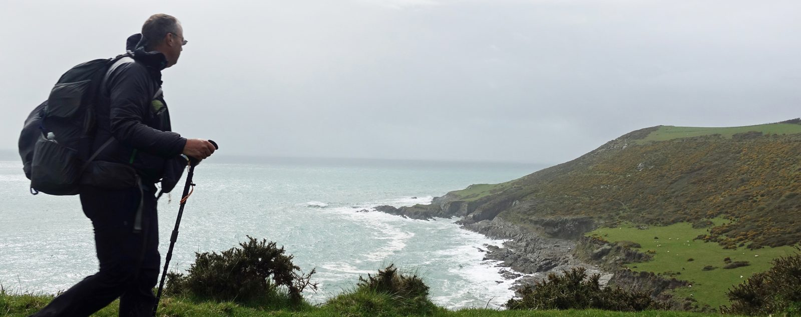
2020 has been an odd year for us all. Upsetting for many and permanently life changing for quite a few. The plans Three Points of the Compass had made for walking various trails were dashed alongside a national lockdown. Furloughed at home, muscles wasted and the pounds piled on. Finally, as lockdown eased and we were allowed to make tentative steps outside it was time to look at what was ‘do-able’ close to home. Overnight camping was still not allowed at the time and hotels and hostels were still closed, I cast around for something and settled on a trail that I first heard of in the 1980s and had languished on my ‘to-do-one-day’ list for far too long.

Three Points of the Compass picked up five locally produced Saxon Shore leaflets around 1987 thinking that the trail could be completed the following year. The trail at that time only ran between Gravesend and Rye. It has only taken me 33 years to complete it!
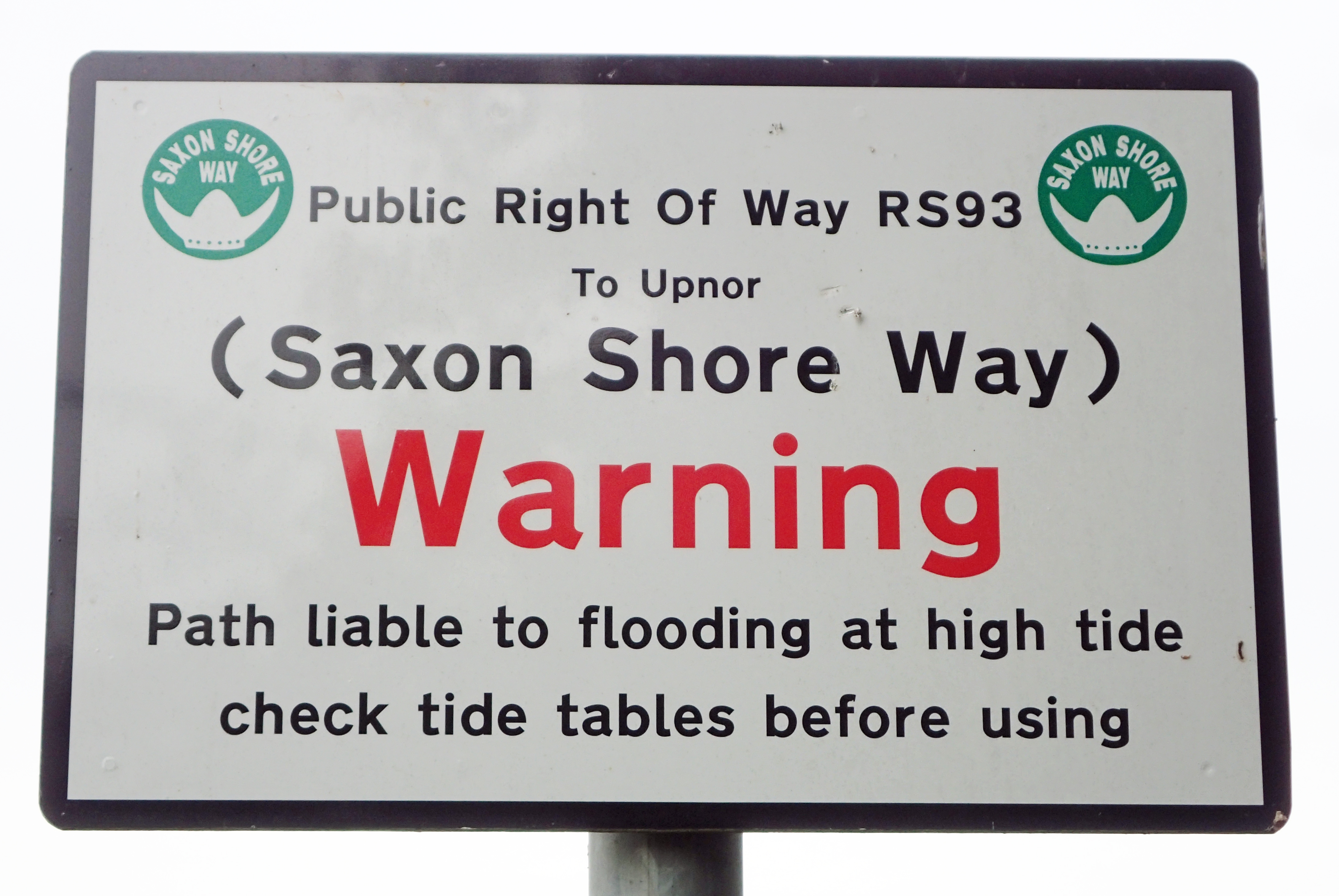
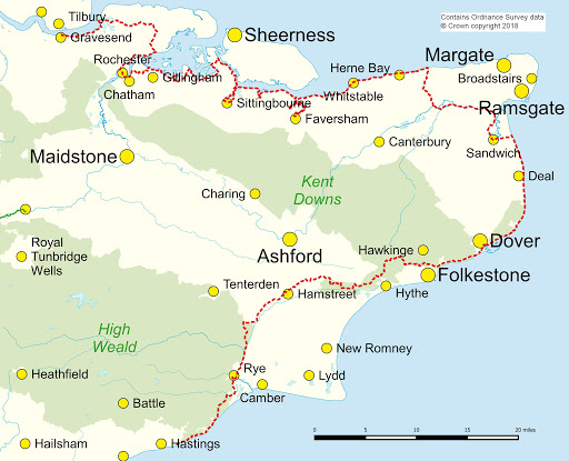
The Saxon Shore Way is a mostly forgotten route these days. If follows the ancient and changed coastline from Gravesend in Kent round to Hastings in East Sussex. It starts off following the flat marshlands of the River Thames and Medway estuaries. A number of forts are passed on the walk and much of the way follows a shore line that the Romans would have recognised. It is mostly easy going so well suited to someone who has been getting steadily heavier in this Covid-19 lockdown year. Castles, churches and a cathedral are passed, Victorian seaside towns abound, lonely Romney Marsh is a delight and the sea cliffs are met near Dover along with reminders of Norman presence. The final day on trail says a decent goodbye with a few dips and climbs. There is even a zoo for good measure! While parts of the trail are well marked and followed by thousands being contiguous with other known walks, other parts are lonely, unloved and forgotten and probably only have a handful of hikers passing through each year. Supposedly measuring 163 miles in total, I completed 176 miles over 11 day walk sections, which just accounts for a few extra miles walking to and from railway stations.
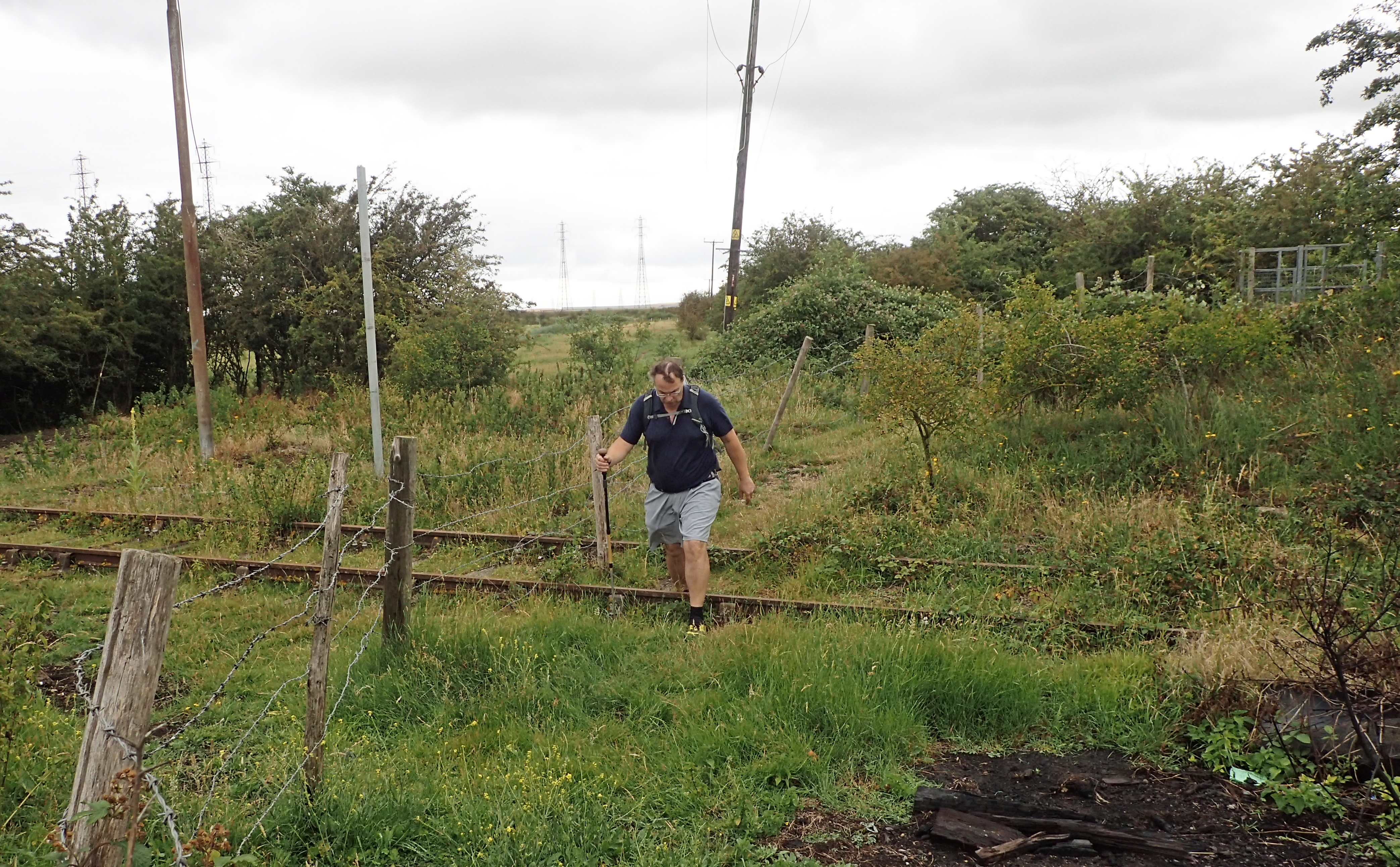
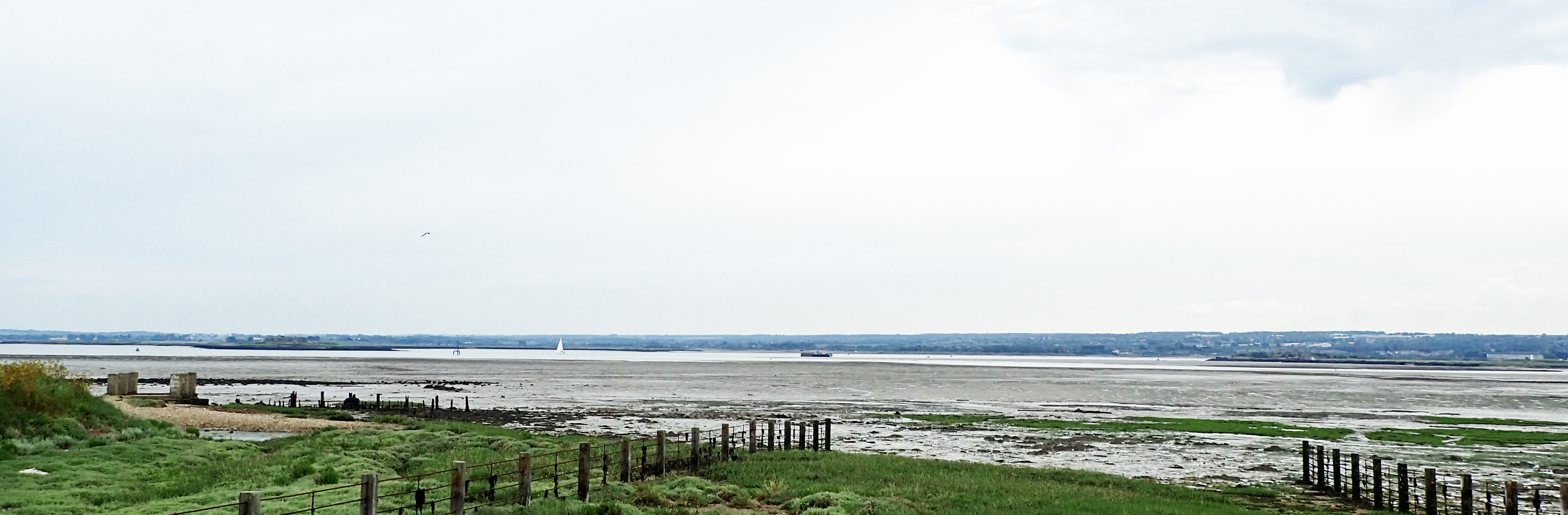
Crossing a long disused railway line poking from the grass of rough and scrappy grazing land on a little visited section of the Saxon Shore Way- day three, approaching Sittingbourne
The route has been slightly revised and also extended in the intervening years and little seems to exist today in the way of readily available guide books. Three Points of the Compass found five little simply printed leaflets in the 1980s, two of which are shown above, but they are not really up to the job of aiding route navigation today. The author Alan Sillitoe did also write something in 1983 but I was reluctant to rely on anything that failed to account for route revisions. Even the official Arum press trail guide by Bea Cowan hasn’t been revised or republished in many years and the only second hand copy I could track down online was being offered for silly money. It is an official regional route however and is shown on the appropriate Ordnance Survey maps. For on trail navigation I carried the paper O.S. maps (with trail highlighted in pink the previous night) but these stayed in the pack and, unusually for Three Points of the Compass, I relied each day on my cached route on O.S. Maps, which I followed on my phone.
Saxon Shore Way
I broke the trail in to sections that I could easily access by train and made my plans. Three days of walking would see me to Sittingbourne and these were completed over my first week so I looked for the best days of forecast weather, it didn’t look great so just went for it. As it was it turned out to be grey, breezy and hard rain set in later. Regardless, it was grand to get out on trail.
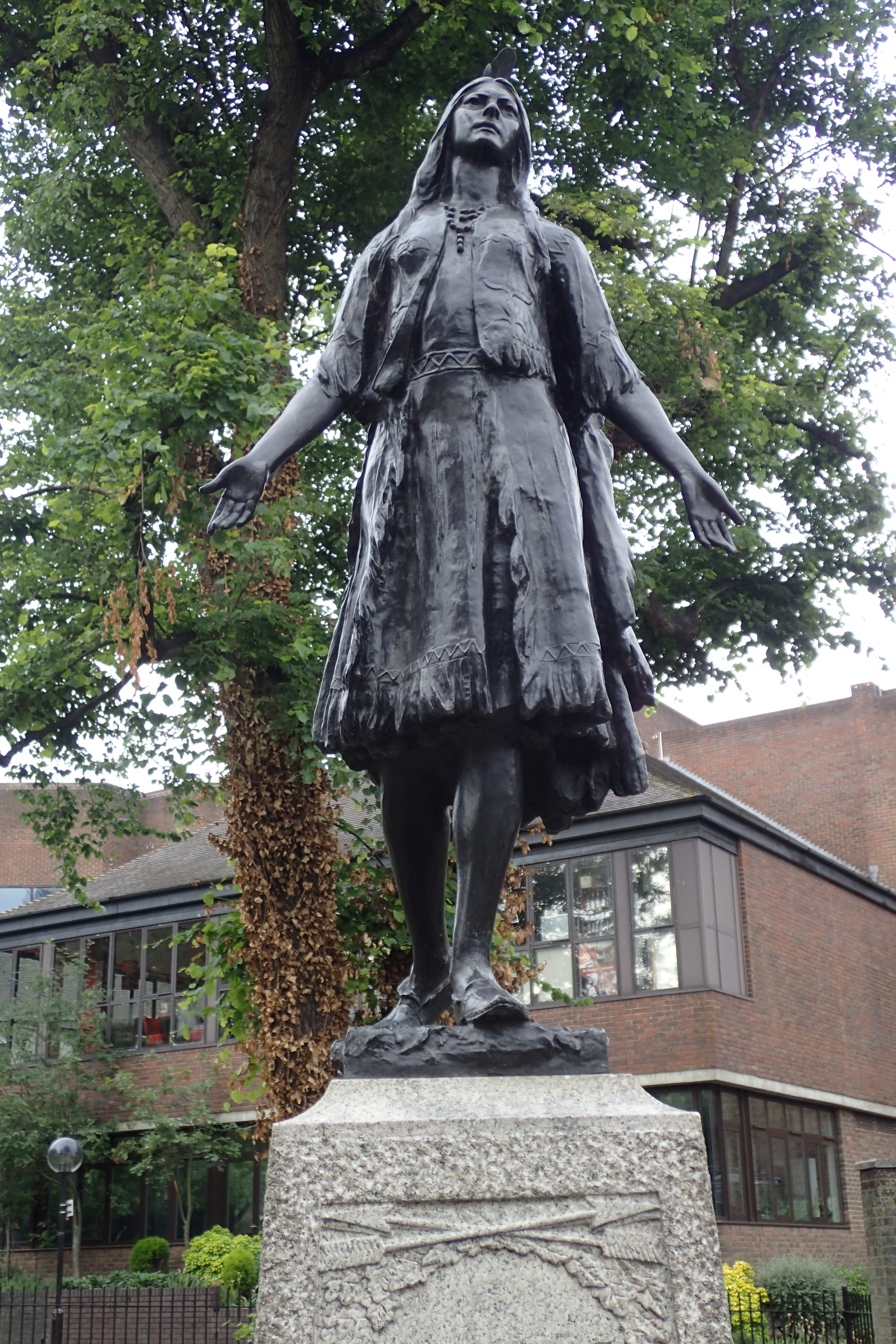
ill on board ship, the lauded though unfortunate Pocahontas was bought ashore at Gravesend where she died. She is now buried in St. George’s Church
I never dawdled long in Gravesend, having travelled there in the morning by train it was a short walk to the coastal start to the Saxon Shore Way. I paused briefly to view the lovely statue to the kidnapped native American Pocahontas, now buried in the vault below the parish church of St. Georges. Having been presented to the court of King James, she was returning to her native land in March 1617, unwell, she was bought ashore at Gravesend either dead or dying.
The oldest existing cast iron pier in the World sits somewhat unloved and ignored, close by the start of the trail. The town itself is quite tatty in parts but retains much of its historic past and would warrant further exploration however I had a day’s walk to complete so set off.
Gravesend is still a gateway port to London and tugs abounded, waiting to be set to work. I took a couple of snaps as my uncle used to be a skipper on one and was based here for a number of years. Then it was properly off, wending my way through various parks and streets, then back alleys and past light-engineering works to finally exit the town and find extensive green space- the rough pasture that forms the beginning of this part of the trail.
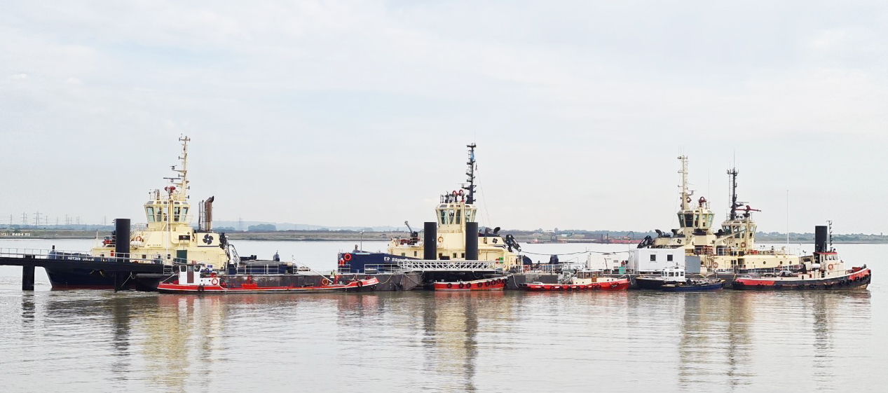
Tugs at Gravesend
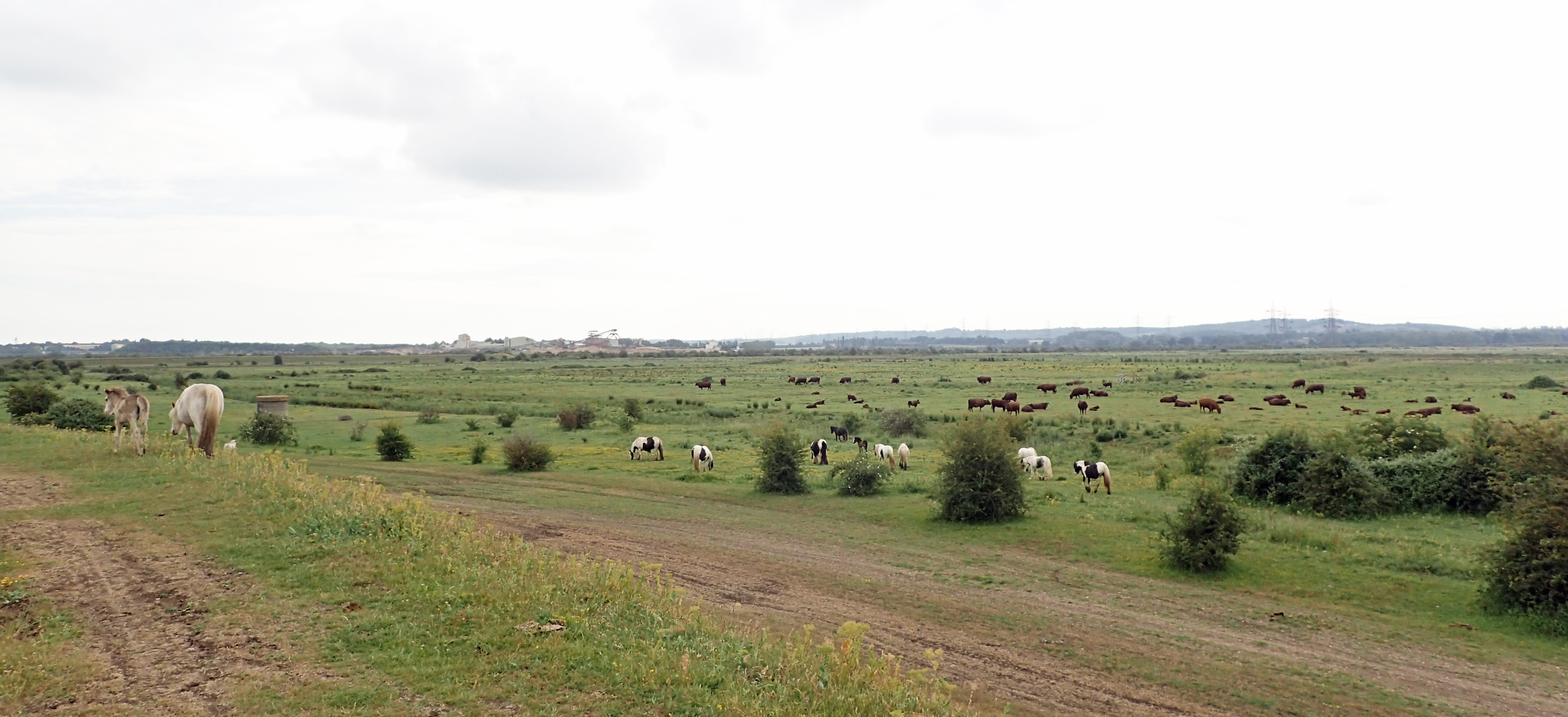
Hundreds of horses were grazing and there was no-one around. The occasional small vessel passed close to shore and large ships further out. The walking is easy and I never halted until I reached the first point of real interest, taking time out to explore the easily accesible and extensive remains of Shornmead Fort.
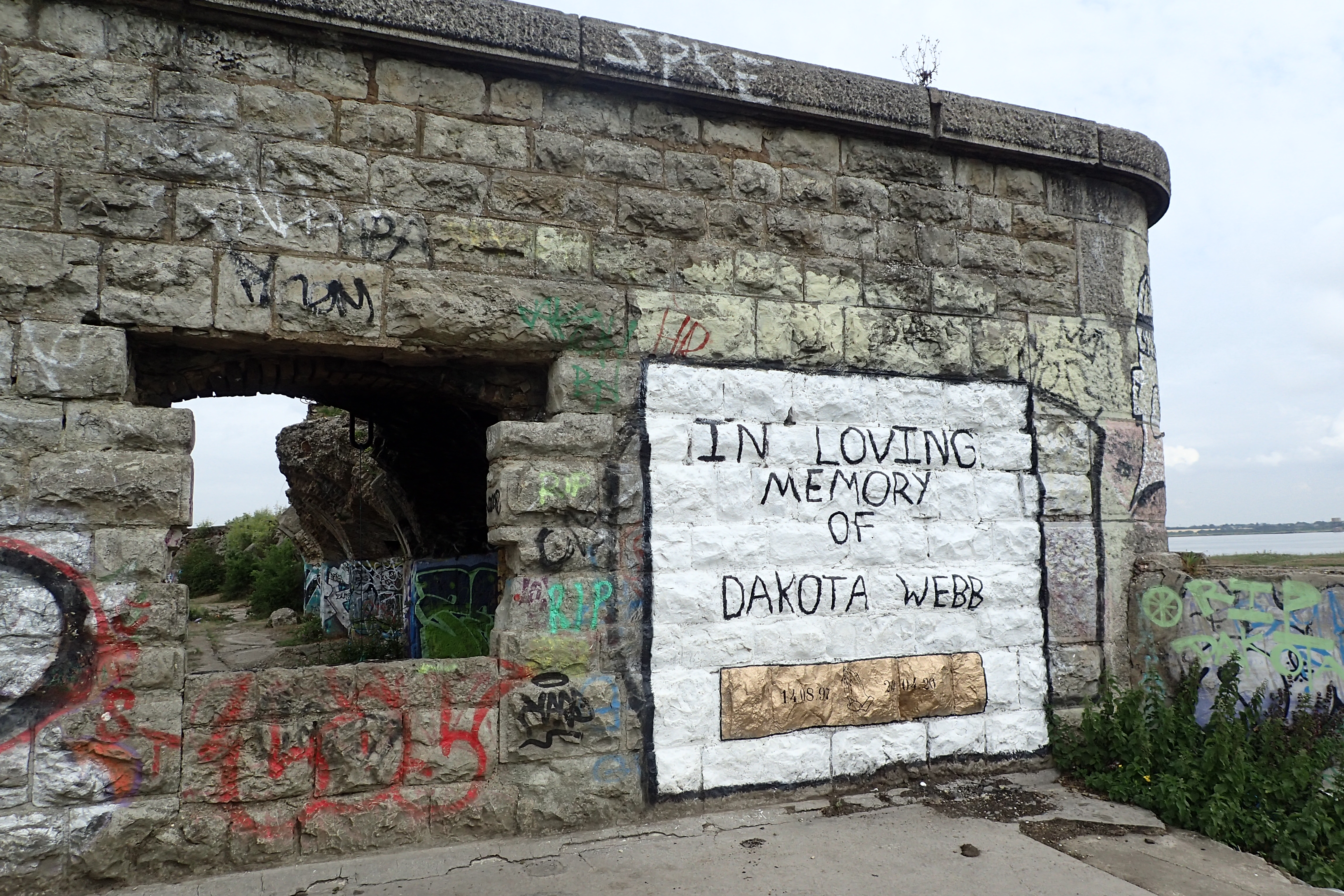
Grafitti on Shornemead Fort. Built by General Gordon in 1868 to protect the river approaches to London
Forts were built by the Royal Engineers along this stretch of the coast to protect the mouth of the Thames from invasion by French warships. These mid-nineteenth fortifications were the first built since those constructed during the Napoleonic Wars. It doesn’t seem as though anyone visits these fortifications today besides those seeking solitude to drink cheap alcohol and practise their graffitti skills. In recent years, one young lad died while off-roading on a friends motorcycle. It appears someone felt spray painting a memorial to him on the walls of a Victorian fort a fitting way to show respect.
Rough pasture between Gravesend and Cliffe pools
The coastal marshlands along this stretch have now been mostly drained and make for rough grazing with a sea wall bordering these all the way round to the small promontory at Cliffe where there is the option to cut the walk short but I continued out through scrappy and thorny Mallow, Hawthorn and Blackthorn, nettle and thistle, beside the excavated pools, complete with numerous wildfowl and gulls, toward the next point of interest.
Irish born Australian Louis Brennan patented what was probably the world’s first practicable guided weapon in 1877. For 15 years the Brennan torpedo became a standard harbour defence throughout the British Empire until being replaced with something with greater range. Little remains to be seen of their history anywhere in the world and an anonymous rusting launch station at Cliffe is a remarkable survivor, though how much longer it will survive I have my doubts. I wandered past the iron rails to the waters edge and attempted to place myself in the minds of those who planned on sending a torpedo out in to the sea here.
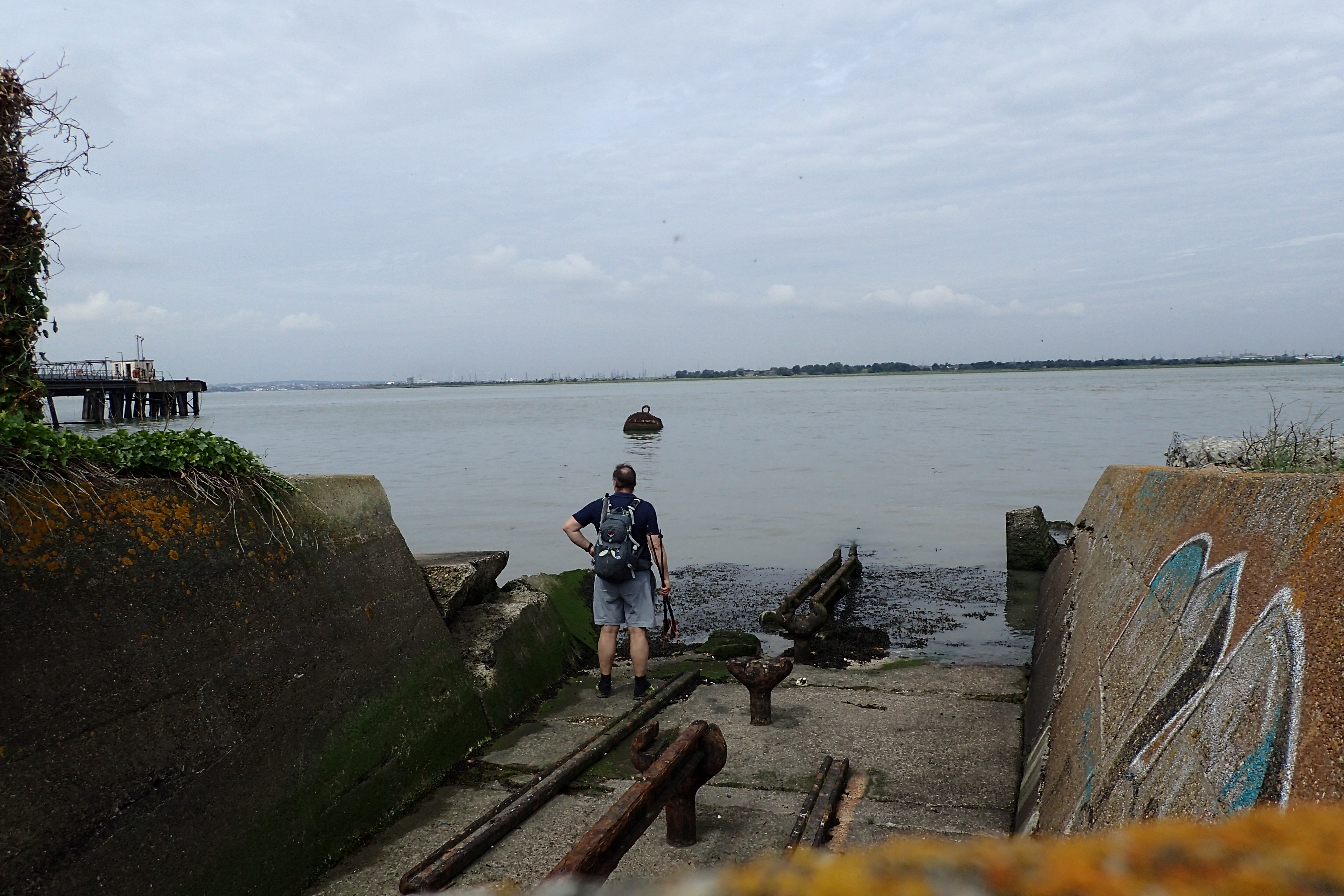
Exploring the remains of a launch site for the Brennan Torpedo
“The officers’ quarters at Cliffe are a mere hut, an abominable stinking place in summer, very cold and wet in winter. It stands by the side of a foul ditch which cannot be cleaned, for the mere disturbing of its contents would endanger the health of the officers”
Report of the Chief Royal Engineer, August 1864
The remains of the torpedo launch site lay beside my second fort passed today. This was another built by General Gordon in response to the fears of a French invasion. Building of Cliffe fort began in the 1860s and was completed in 1870. All of this land around here is pretty marshy and the newly built fort was unstable and cracks soon appeared. There were frequent outbreaks of malaria and bronchitis amongst the military personel. Military use continued though. Despite being abandoned due to flooding in 1927 it was used for anti-aircraft guns during World War II. I wasn’t able to explore it as it is now overgrown and lies behind a palisade fence marking the boundaries of privately owned land. Various diggers were being driven around the site shifting aggregate. The unloved and ignored state of these two forts is a national disgrace and both will continue to simply rot away over the coming decades.
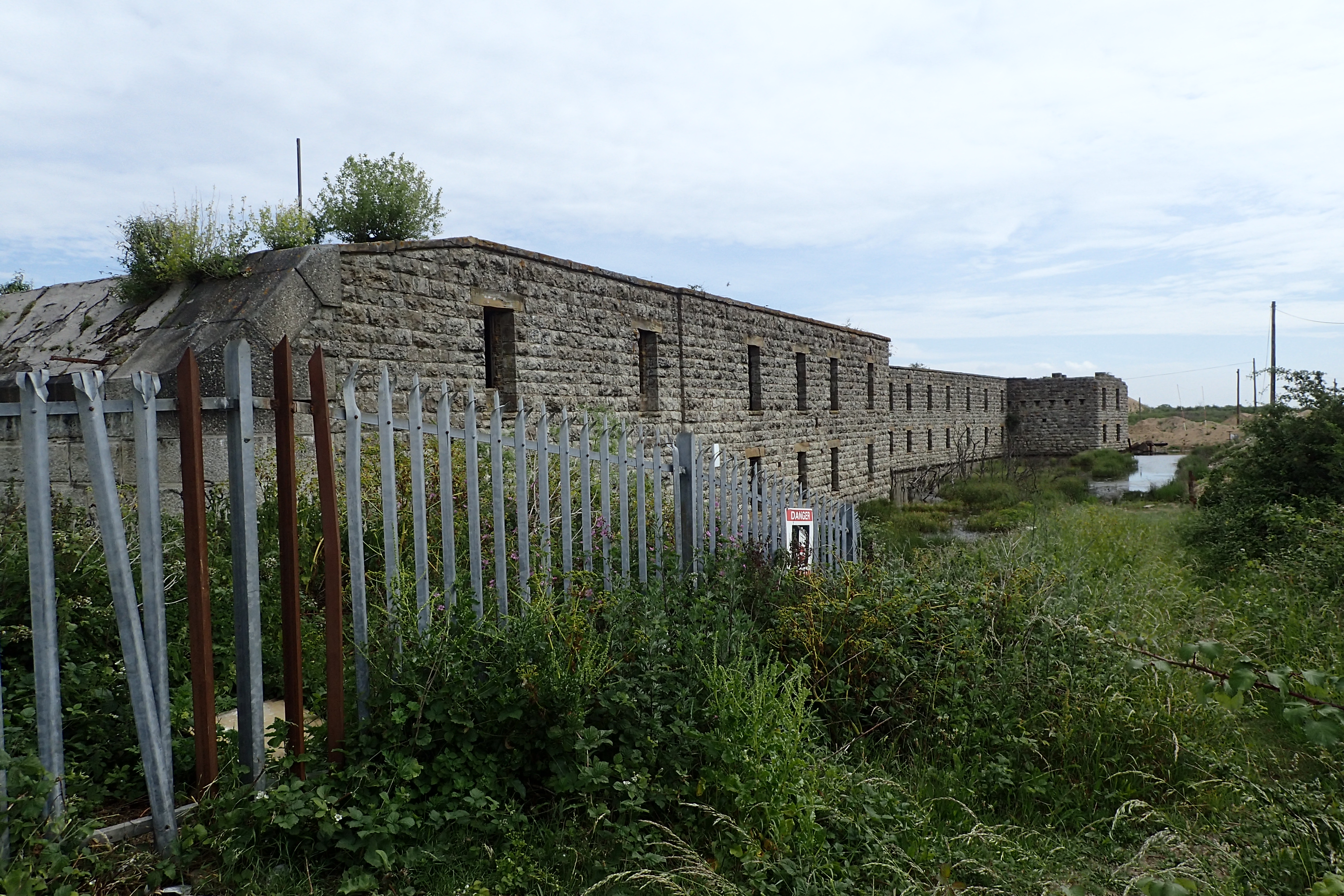
Cliffe Fort, now on private land owned by an aggregate company
On the far side of Cliffe fort my route passed directly beneath the trundling conveyor belt loaded with aggregate being bought ashore from a ship and I made my only extended halt of the day to prep a hot chocolate and eat an oat bar while watching both the ship unload and the large ships passing close to shore.
Some sizable ships pass close to shore near Cliffe

Outer gatehouse of 14th century Cooling Castle
After Cliffe fort the trail passes through Cliffe Pools where the racket from thousands of nesting gulls and terns is pretty impressive. The extensive lagoons here were originally dredged for clay to mix with chalk for use in cement making. With an excess of raw materials, from the second half of the nineteenth centrury there used to be a large number of cement works situated along this coastline- more than sixty between Dartford and Faversham. All are now gone.
The route then moves inland a little and having photographed the impressive gatehouse to Cooling Castle I paused briefly in the adjacent churchyard at Cooling for a quick bite to eat just as Dickens might of as this churchyard was his inspiration in part for Great Expectations. And it was a quick halt as the thunder rolling around me was increasing. I was going to get wet…
Soon after setting off I began the enjoyable climb up Nothward Hill and it was here that the rain moved through, thankfully the wind and rain was on my back and there is some tree cover atop the rise. Through the woods and it wasn’t long before I was descending again, toward the River Medway.
Climbing up through the rain to the national nature reserve at Northward Hill
On reaching the Medway, or Mudway as we used to accurately refer to it, there is a choice of routes, inland if high tide, along the shore if low tide, I followed the shoreline as I wanted to see the two forts off shore in Gillingham Reach. One of their orginal purposes was to string a chain between them in an attempt to halt any invading war ships.
Darnet Fort (left) and Hoo Fort (right) can be seen on islands in the River Medway. Both were built on the recommendation of the 1859 Royal Commision and were eventually disarmed prior to the First World War though both were used as observation posts in the Second World War
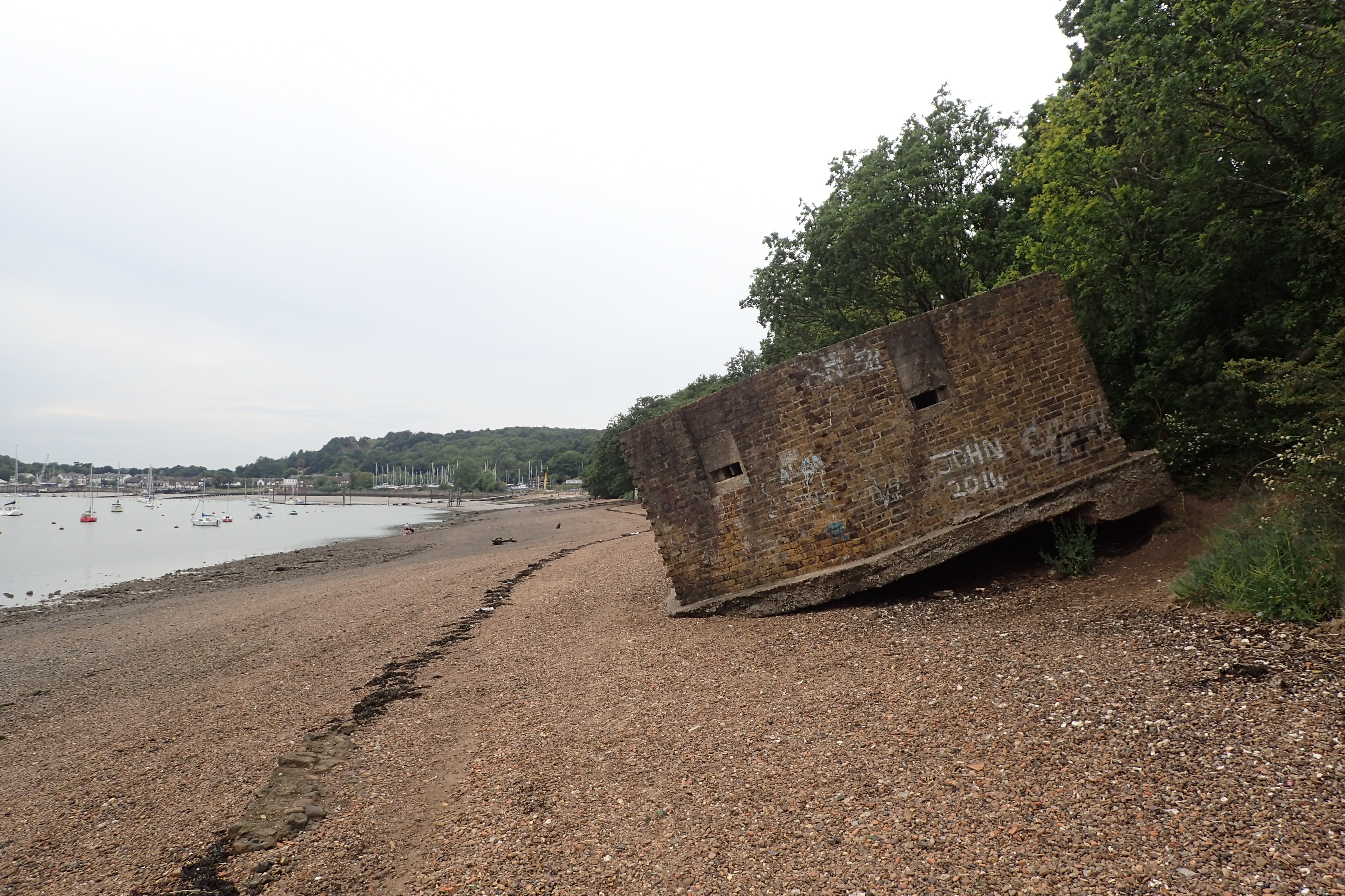
Following the shore approaching Medway, the Saxon Shore Way passes a Second World War pillbox that has been undercut by the River Medway

Just metres from the railway station at the end of a days walk, the Saxon Shore Way passes a retired Russian submarine moored at Strood. Rochester Cathedral and Castle beyond
From here it was a fairly short jaunt along the shore and paths into Strood to catch my mid-afternoon train home. Despite having paused frequently for photographs all the way along this stretch of river, I was still early enough to miss any commuter crush. I had completed 21 miles and it had been a grand first day on trail.
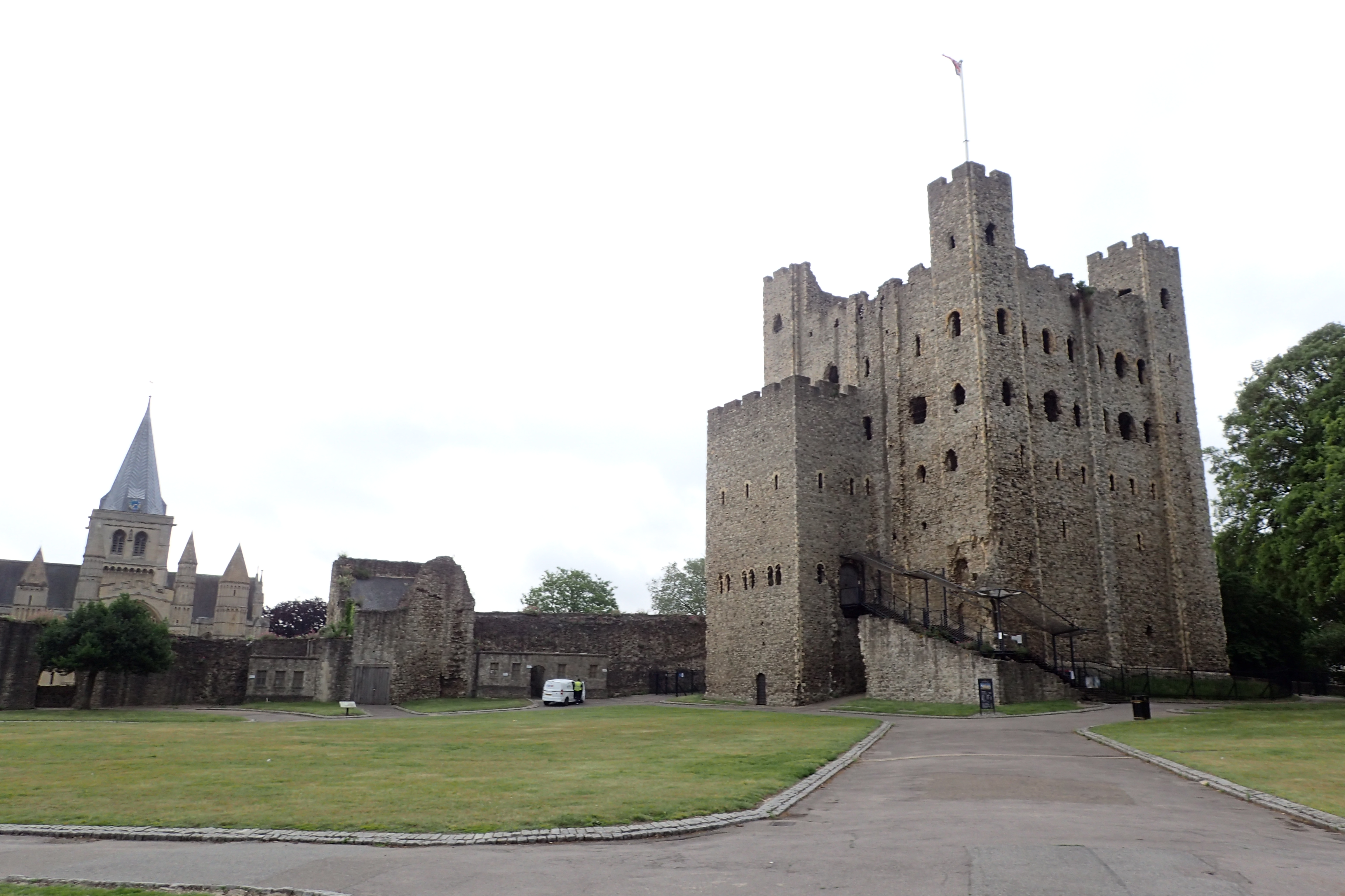
Norman tower keep and cathedral in Rochester were both closed as I passed through the Medway towns early morning on my second day
The following day was also wet but I expected it to dry out later. After another early train, I was too early to visit either Rochester Cathedral or Castle as neither were open so I simply walked around their exteriors before a wet and long walk through various backstreets and a few greenspaces of the Medway towns. There were a couple of paths closed off which was a tad annoying considering there was no re-routing or signage as to why despite this being a Regional Trail, albeit, little used.
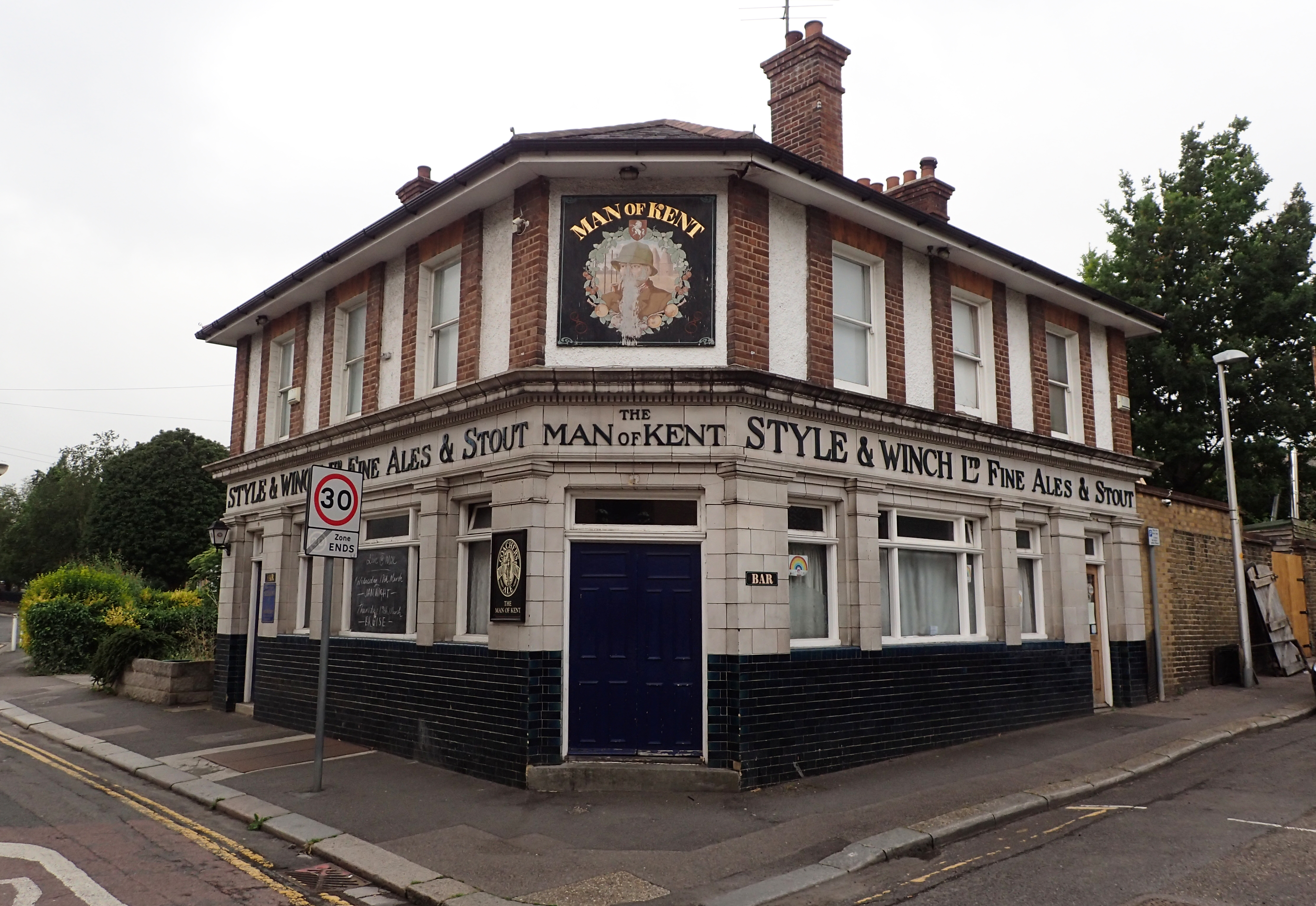
Classic English public house. Due to Covid-19, these wouldn’t be allowed to open for some weeks yet. The roots of the Style & Winch brewery in Medway go back to 1799. They ceased brewing in 1965. The pub sign relates to the dividing line I was now crossing- Kentish Man to the London side of the River Medway, and Man of Kent having crossed the river further into the county
I began the steady climb up toward Gillingham, passing the old naval dockyard where the period buildings are much sought after for fim location work. I was saddened to see the state of what remains of the barrack block in Kitchener Barracks on the other side of the road. Dating from 1757 and named after Earl Kitchener in 1928. The British Army vacated the site in 2014 and they were sold to a property developer who is building 295 homes. I was stationed there for two years in the 1980s when serving with the Royal Engineers. My old home looked a mess.

Kitchener Barracks. This ‘modern’ block, where Three Points of the Compass was stationed when serving with the British Army, was rebuilt in the 1930s-1950s and construction (or destruction) work at the site is now a sad testament to the declining military presence in the Medway towns.
Notice in window of closed cafe in Gillingham
Across Great Lines, the old squaddie married quarters, more back streets and tatty little paths. In this coronavirus year, it was strange walking up the length of Gillingham High Street, past extended and silent queues of people waiting to access small supermarkets, cash points and Greggs, all stood two metres apart, many wearing face masks, all staring fixedly at their phones.
I paused at the lovely medieval Church of St Mary Magdalene, though the doors were locked. With parts dating back to the late 13th century it is the oldest building in Gillingham and its raised situation acted as a navigational aid for shipping. I could occasionally see it far behind me hours after I left. Soldiers from the Dutch raid of 1667 are buried in its churchyard.
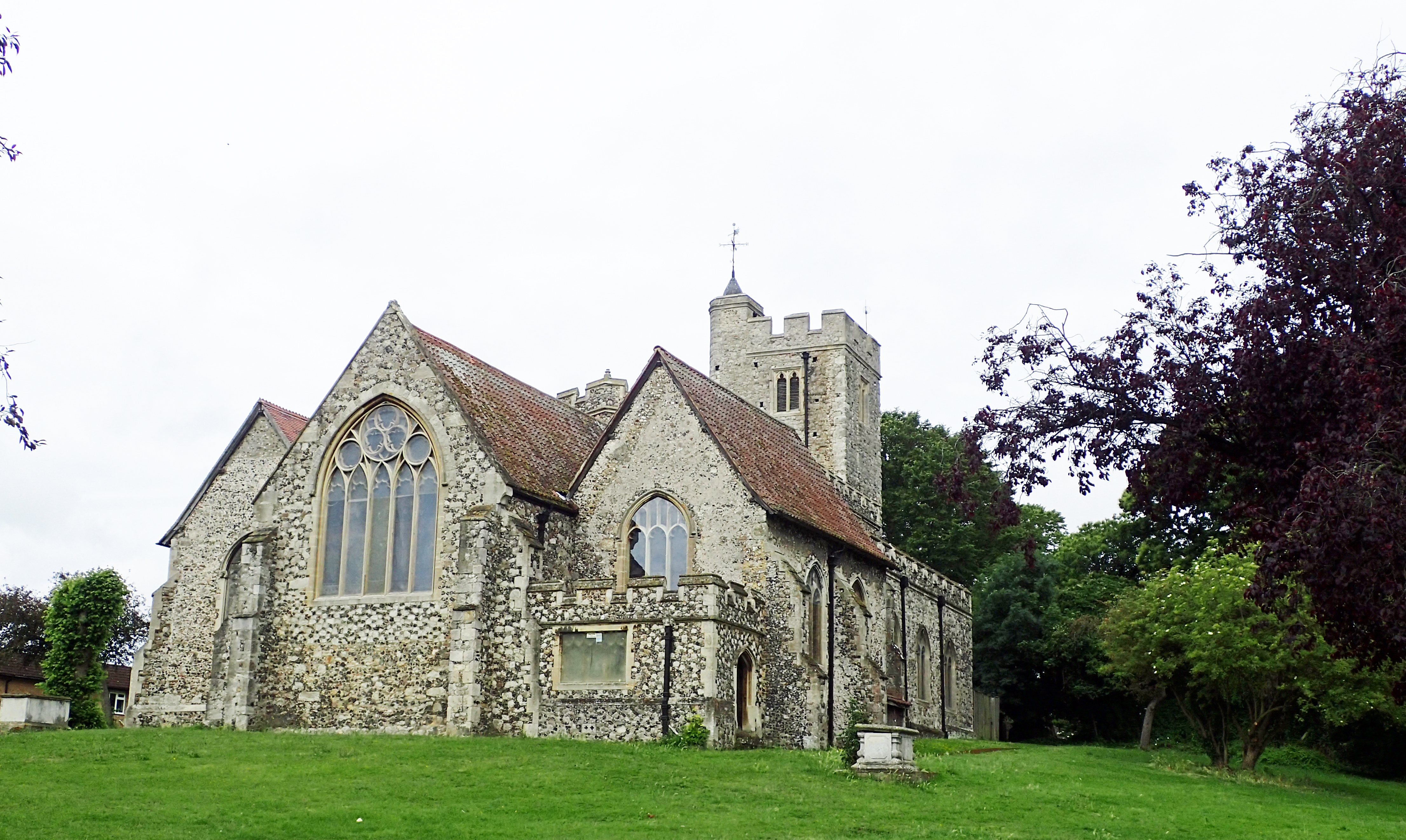
The Saxon Shore Way passes through the churchyard of the Church of St Mary Magdalene, Gillingham. Will Adams, the first Western samurai and the man who built Japan their first navy was baptised here in 1564.
Back down to the shoreline, past silent sailing clubs and the almost deserted Strand with its sea water bathing pool built in 1896. This used to welcome 22 000 visitors a day. Today, beside myself, there were just a couple of dog walkers. Beside this sits a squat and now rare, surviving gasometer, usurped by the introduction of natural (North Sea) gas. My mother and uncle would often tell me of the admiration held by their community of one of their neighbours who climbed atop the edifice one night during a raid by German aircraft in the midst of the Second World War. He threw a flaming incendiary off and saved every house in the vicinity from being flattened by a cataclismic explosion of the coal gas stored within. The admiration amongst the children was tainted slightly by knowing that their school, beside the gasometer, would also have been levelled.
A ‘modern’ esplanade led my way along the shore past more rotting hulks all the way to Riverside Country Park where I enjoyed a cup of tea from the cafe that I was surprised to find open there. I was instructed to take my drink far from the open window and adjacent area to consume it. After a bit of a wander out to Motney Hill, the sewage works there, sorry- ‘water treatment station’, mostly unobtrusive, it was a short walk through orchards and residential housing up into Rainham to catch my train soon after midday. A further 11 miles completed.
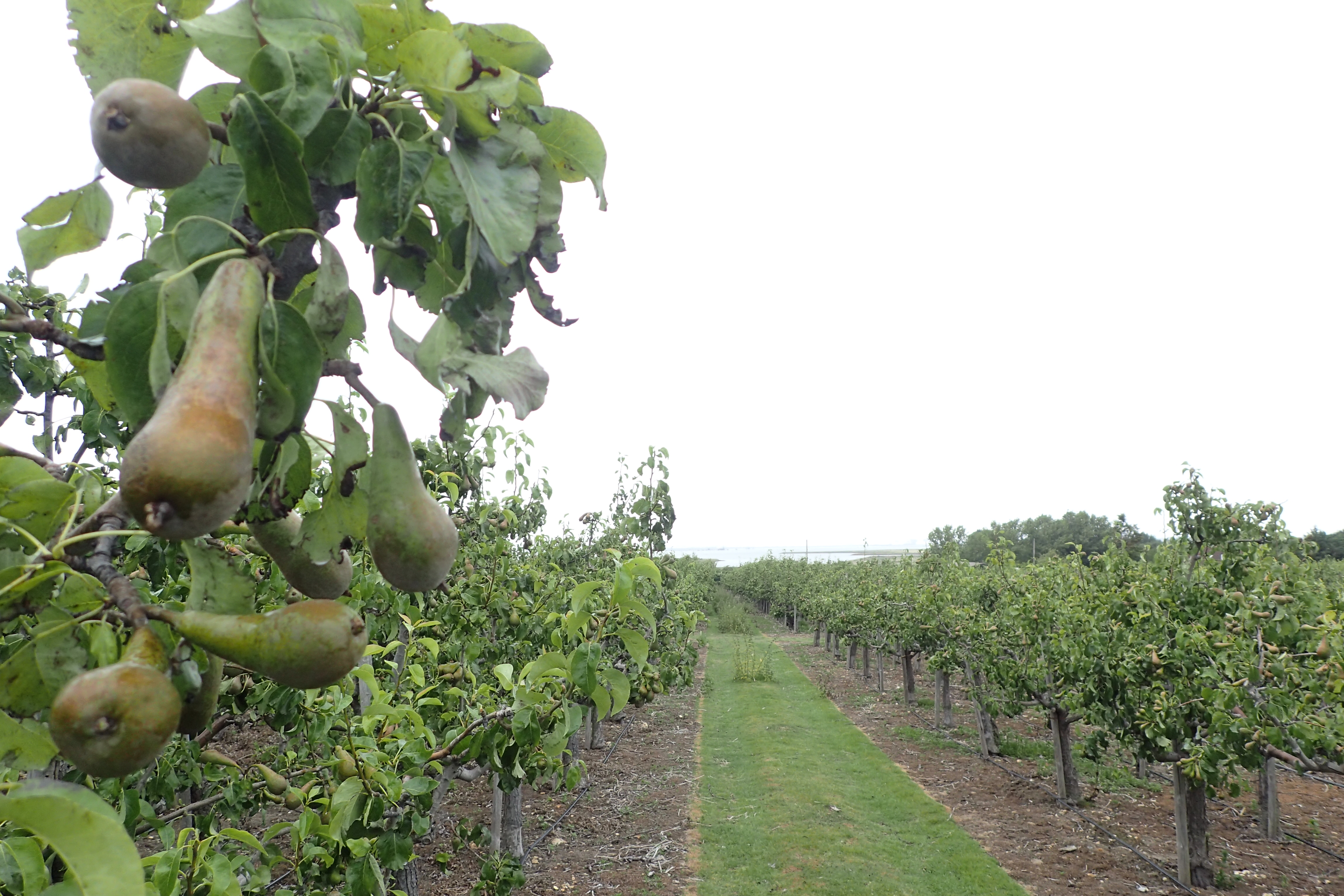
Pear orchards on the slopes leading down to the waters edge at Rainham
My third day on trail this week coincided with yet another bank of weather moving through. I knew today would be a lonely days walking as despite being fairly near to habitation, it is a lonely stretch of North Kent that sees few people. The banks of rain moving through today provided a great opportunity for me to continue my recent experimentation with a trekking umbrella from Euroschirm. Combined with a lightweight jacket from Frog Toggs, it worked great. It wasn’t cold so I simply allowed the lower half of my body to wet out and then dry in the wind.
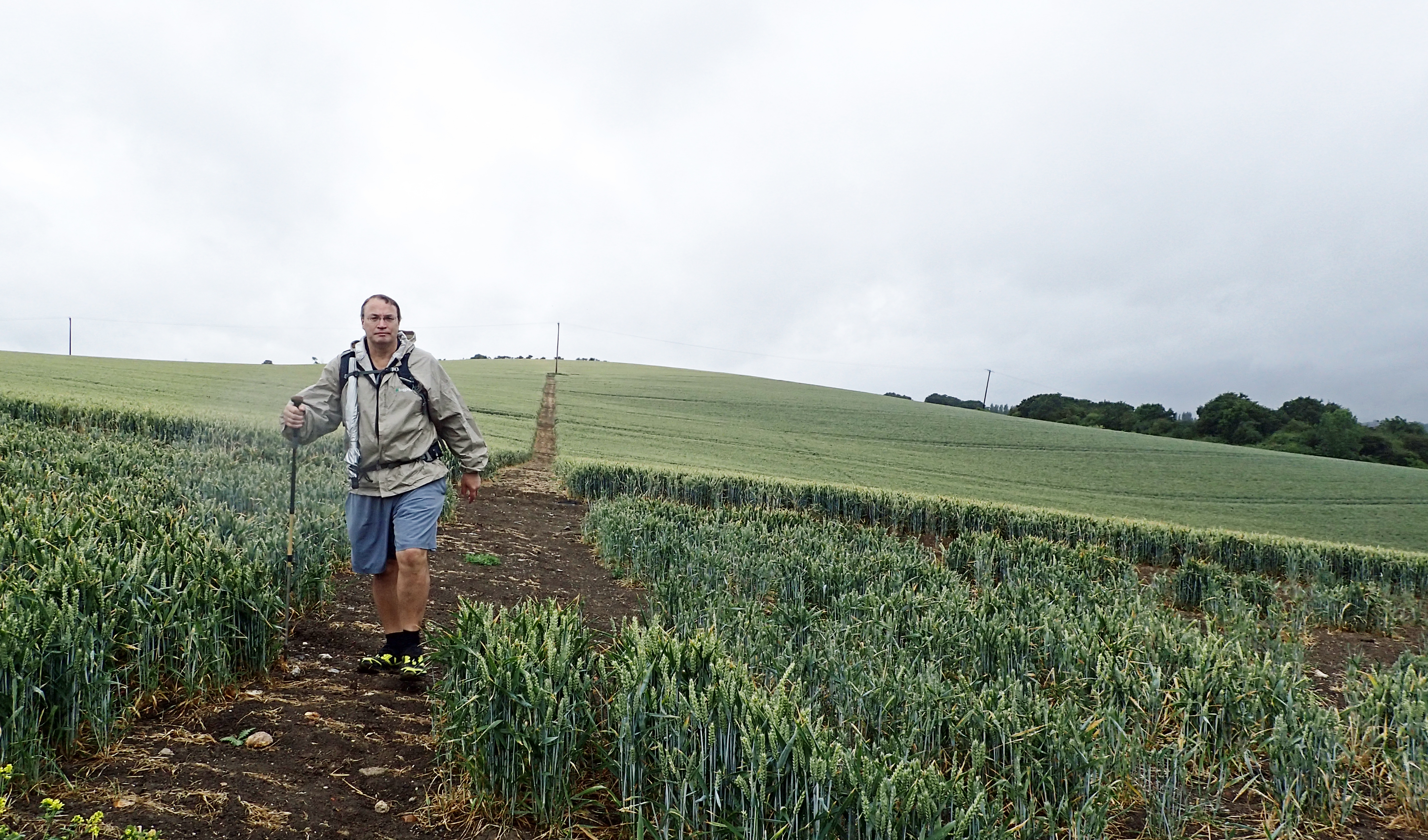
Crossing sopping wet cereal crops on the slopes at Lower Halstow. A break in the rain so my Swing Liteflex umbrella is temporarily stowed
A short stretch of coastal walking then saw me moving slightly inland, passing through apple, pear and plum orchards, trudging through muddy and wet cereal crops before moving out on to the desolate counter wall toward Chetney Marshes. I am sure there are many that would abhor this section, I found it fantastic and the ghosts of disused brick works, wharves and long gone local industry can be felt in the rotting remains, spoil heaps and shoreline. Many old wooden built lighters and Spritsail ‘muddies’ were abandoned long ago and the rotting ribs protrude from the mud all along this part of the coast.
Three Points of the Compass likes to potter around a church if the trail goes past it. In this coronavirus year, most were closed
Creeks, docks and wharves between Medway and Faversham used to support various industries- brick making, cement works, oysters and cockles, paper making, gunpowder and ship building amongst them. Cement to build the Aswan Low Dam across the Nile River came from Frindsbury and cement from Gillingham cement works repaired the damage caused in the San Francisco earthquake of 1906. I passed those two Medway towns yesterday.
The little quay at Lower Halstow was once used for loading of bricks from the Eastwood Brickworks, a firm that gave its name to the street where Mrs Three Points of the Compass grew up. Now, the Edith May, a wooden Thames sailing barge built in 1906 is a lone occupant of the dock. This and the neighbouring village appeared in 2016’s Wonder Woman film- imitating a military camp on the Belgium coast.

Passing the Edith May moored at Lower Halstow, rain fell steadily

Rotting and abandoned wooden remains poke from the mud at Bedlams Bottom, off Chetney Marshes. Three Points of the Compass counted at least 22 barges in just one bay here
My trail took me up through cereal crops above the burnt out and abandoned Funton brickworks. This factory was built in the 1930s but didn’t start production of bricks until after the Second World War, they used to turn out lovely hand-made sandy coloured bricks, each imprinted with the brickmakers name. Then a walk past a messy, extensive and probably illegal tip and down to follow the lonely sea wall out and around the isolated Chetney Marshes, passing large groups of geese in the pools. Waders mobbed me frequently as I passed their nesting sites. A male Marsh Harrier quartered the ground beside me, probably picking off the fledgling waders. Two hundred years previous, the corpses of convicts from the prison hulks moored off shore were buried on these marshes and coffins and bones had recently been found exposed by the shifting mud at Deadmans Island a little further round. Eventually my route swung round to head toward and then pass under the ‘new’ Sheppey road crossing. Actually the third bridge to be built across the Swale to the Isle of Sheppey- the ‘Isle of Sheep’, where I completed a walk at the ‘birthplace of British aviation’ on another day.
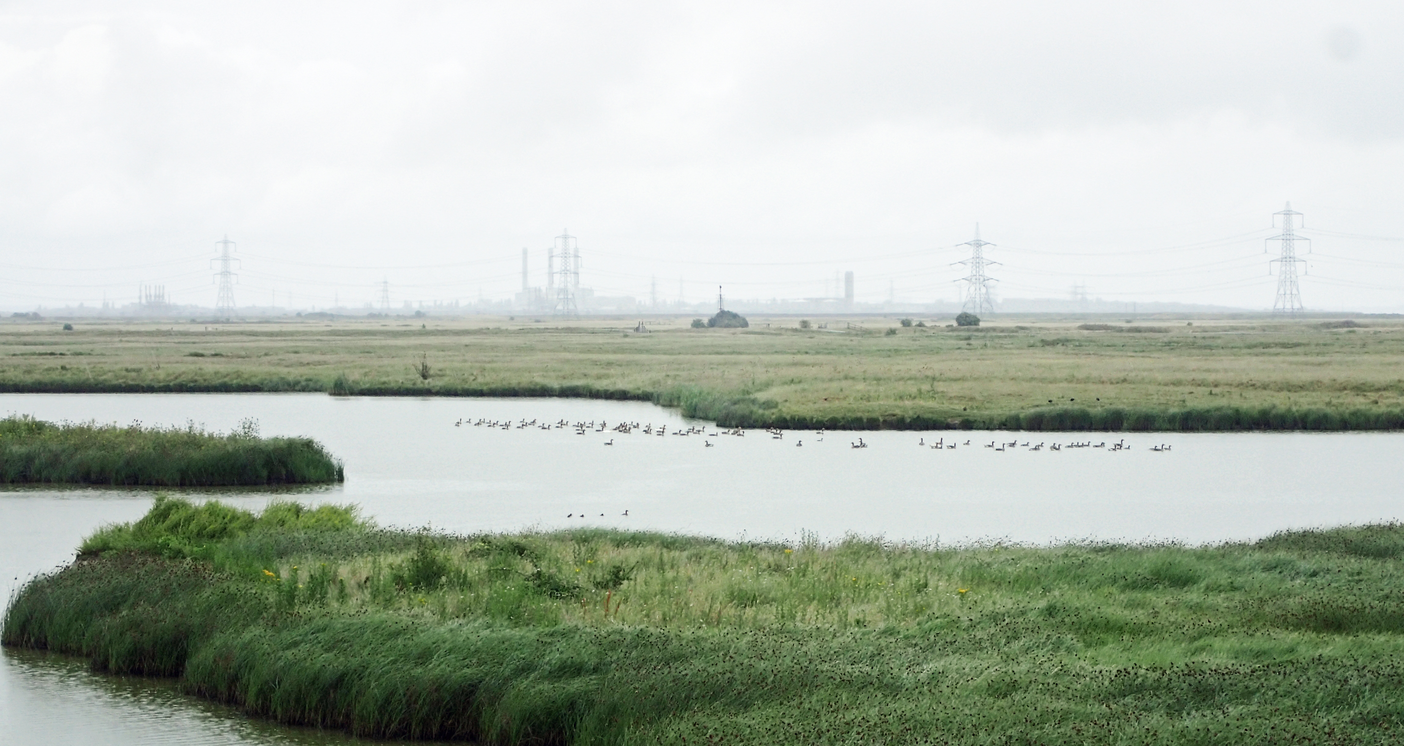
The landscape here could by no means be called pretty, electricity pylons link the industry clearly visible on the skyline. However the marshes are a fascinating place and wildlife abounds
In some UK beauty spots the electricity companies have buried their cables deep below the surface. The marshes here are unloved and didn’t fit that criteria, consequently, it is almost impossible to look in any direction and not see gaunt pylons stetching across your field of view. Pylons have their fans. Though I am not one of them, I do feel that pylons have become as much a part of this sodden North Kent landscape as the abandoned barges rotting in the mud around the shoreline.
Now over these small hills
they have built the concrete
That trails black wire
Pylons, those pillars
Bare like nude, giant girls that have no secret
from: The Pylons, Stephen Spender

Saxon Shore Way approaches the A249 Sheppey Crossing, completed 2006, it largely replaced the vertical lift Kingsferry Bridge, over which a train is crossing, that in turn had replaced the bascule bridge built for the London, Chatham and Dover Railways in 1860
From here the Saxon Shore Way worked its way through increasingly scrappy paths, between lorry parks and river side industry, mixing with overgrown fields and rough grazing. I shouldn’t think more than a hundred hikers pass this way each year. I then followed the Milton Creek up into the depths of Sittingbourne. The creek used to be very important to the town, enabling vast quantities of goods to be transported to and from London and the continent. None of that industry remains and yet more hulks poke from the silt. The weather had brightened up and I reached the end of my days hike, another 17 miles completed, soon after midday. This was the end of my first three sections. The next week would see me leap frogging the four sections to Dover.
The Saxon Shore Way:
- Section 1: Gravesend station to Strood station
- 21.12 miles, 1304 feet ascent
- Section 2: Strood station to Rainham station
- 11.25 miles, 785 feet ascent
- Section 3: Rainham station to Sittingbourne station
- 17.2 miles, 764 feet ascent
- Section 4: Sittingbourne station to Faversham station
- 14.73 miles, 470 feet ascent
- Section 5: Faversham station to Herne Bay station
- 21.93 miles, 580 feet ascent
- Section 6: Herne Bay station to Sandwich station
- 19.26 miles, 733 feet ascent
- Section 7: Sandwich station to Dover Priory station
- 16.83 miles, 2686 feet ascent
- Section 8: Dover Priory station to Sandling station
- 14.77 miles, 2540 feet ascent
- Section 9: Sandling station to Hamstreet station
- 13.19 miles, 1310 feet ascent
- Section 10: Hamstreet station to Rye station
- 12.85 miles, 693 feet ascent
- Section 11: Rye station to Hastings station
- 13.15 miles, 2331 feet ascent
Three Points of the Compass does not always blog on the trails walked. Links to those that have been covered can be found here.

3 replies »