

Kemble to Cricklade, 11 miles
Breakfast was at 08.00 as the B&B doesn’t provide anything earlier, not that we really needed any earlier as we were setting off on the first of a series of short days. We have gathered the impression that the proprietors have decided on an easier life and very much now run things with the least amount of effort. No single night stays, short window for brekkie, not even any signage up to attract trade. That said, our room is comfy and the Full English was excellent.

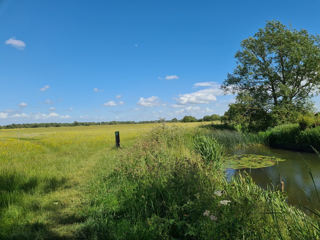
There had been heavy rain overnight so we now had a ‘proper’ river to follow. Depth and speed gradually increased today but the new born Thames still retained a youthful air.
It was a gentle day of walking. Soft wide paths through flower meadows and livestock grazing, interspersed with funneled in tracks between flooded former gravel pits.
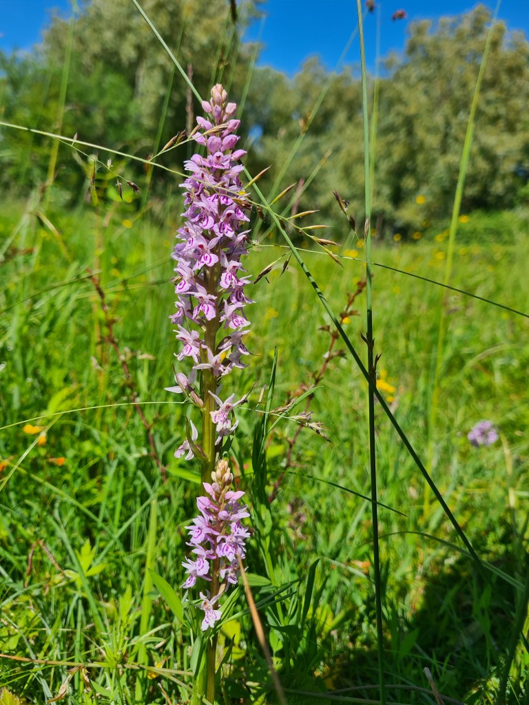


Wild flowers were in good numbers, some patches of orchids were impressive while solitary examples peeked from the grass elsewhere. Sadly we were a month too late for one of the gems of English meadowland. Approaching Cricklade the Thames Path borders North Meadow. Possibly the finest example of ancient uncultivated meadow in Britain. In season, this is a remarkable sight, holding 80% of the UK population of Snakes Head Fritillary.
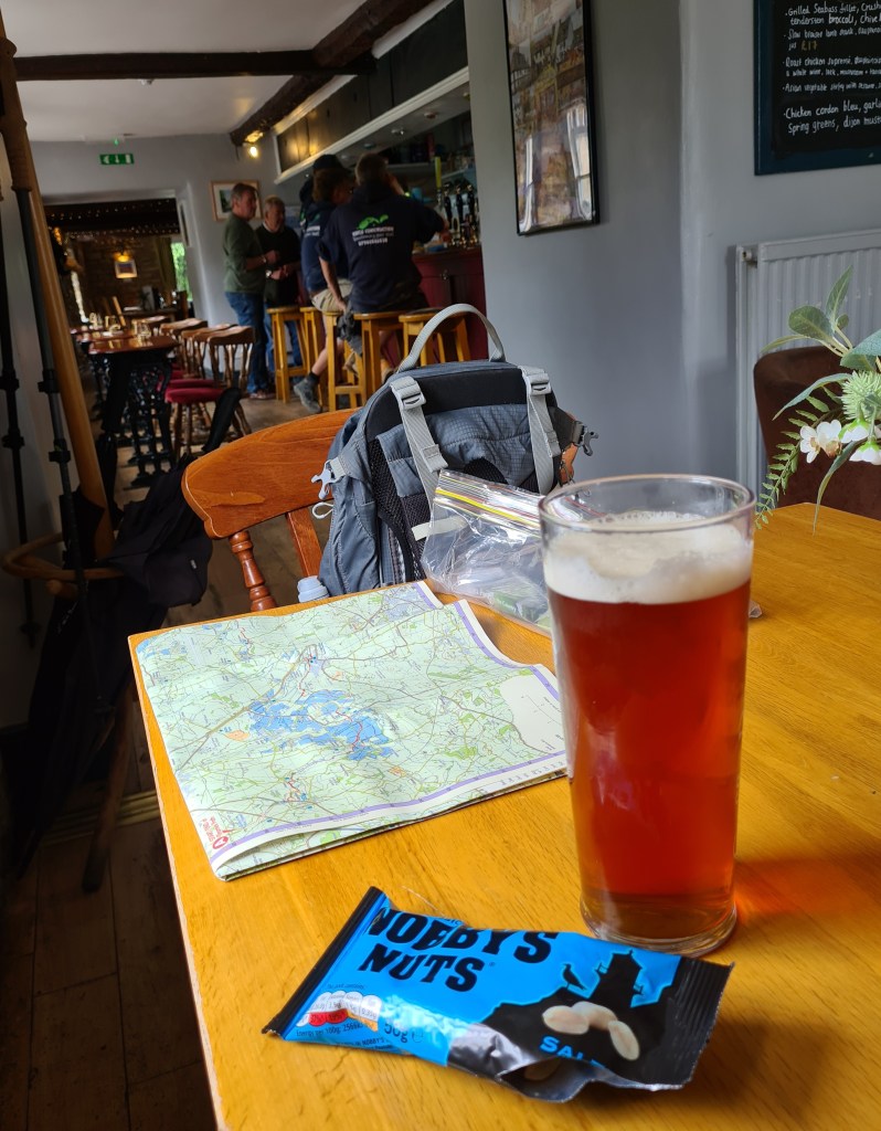
It wasn’t a particularly early start walking but we were both struggling to keep to a sedate pace in order not to arrive at our afternoon pick up point too early for our booked transfer. Arriving at Ashton Keynes it took little persuasion for me to pop in and try a couple of local beers.

I don’t think I have seen the pretty little Common Blue Damselfly in such profusion as today. Tens of thousands drifting in our path. Accompanied by just a handful of Blue Tailed Damselfly and a solitary Beautiful Demoiselle.
We enjoyed today’s walking immensely but appreciate there are a lot of miles prior to completing both this western section and the remainder next year. And the trail is longer now than when we first decided to hike it. The Thames Path opened in 1996, joining the rest of the long distance National Trails to be found in England and Wales. It’s length is variously recorded as 180 miles, 183 or 184 miles, however the ‘official’ National Trails webpage now says it is 185.2 miles (298km), so there!
Back at Ewen for a second night in the same B&B, I had chosen a different location for our evening meal, purely for variety. The Baker’s Arms had been recommended and like the previous night, we were fortunate to have the car to be able to drive the two miles to the pub, on the outskirts of Cirencester. This is a sister pub to last night’s choice. Another terrific steak for me and fish and chips for Mission Control.

- The Thames Path- National Trail
- The Thames Path
- The Thames Path: Kemble to Cricklade
- The Thames Path: Cricklade to Lechlade
- The Thames Path: Lechlade to Tadpole Bridge
- The Thames Path: Tadpole Bridge to Bablock Hythe
- The Thames Path: Bablock Hythe to Osney Bridge, Oxford
- The Thames Path: Osney Bridge, Oxford to Abingdon
- The Thames Path: Abingdon to Shillingford/Warborough
- The Thames Path: Shillingford/Warborough to Goring
- The Thames Path: Goring to Sonning
- The Thames Path: Sonning to Marlow
- The Thames Path: Marlow to Windsor
- The Thames Path: Windsor to Chertsey
- The Thames Path: Chertsey to Hampton Wick/Kingston-on-Thames
- The Thames Path: Hampton Wick/Kingston-on-Thames to Putney
- The Thames Path: Putney to Tower Bridge
- The Thames Path: Tower Bridge to Woolwich Foot Tunnel

Sounds like a great challenge!
I notice you’re using the Harvey 🗺 for the trail. Good choice.
Please let me know if a fabric version of the same would have been of use. We sell a number of these each year.
Happy trails!
David
LikeLike
Thanks for your comment David. The Harvey map is probably the very best choice of map for this trail. They have done well to fit the whole length on to the one sheet. Though 1:60 000 is a new scale for me. I will get round to trying out your Splashmaps eventually, honest!
LikeLike