
The Pennine Bridleway doesn’t get a lot of attention from backpackers. Cyclists will tackle much of it over a couple of days, horse-riders will go out for a day’s hack along parts of it, however few people walk the complete path. Three Points of the Compass ventured out in the summer of 2022 to walk the 205 mile National Trail from south to north.
From the outset, let me say that the Pennine Bridleway is not the Pennine Way. The Pennine Way, that oldest of official Long Distance National Trails in England, is the better known, is better provisioned and serviced, follows a better route, and is the better walk. That said, I found that there was much to enjoy about the Pennine Bridleway, even if the weather had it’s own plans for me!
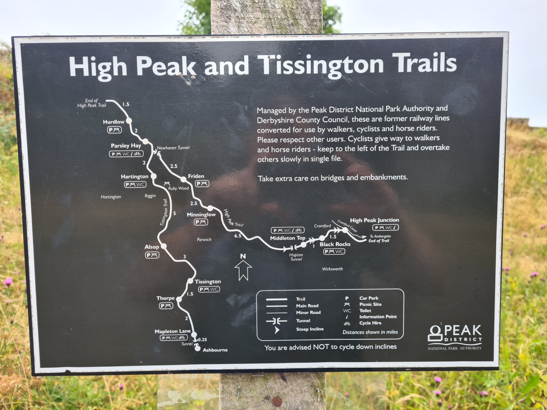
This is a brief account of my first few days on trail. Following me from Middleton Top, one of the two southern termini, 72 miles northward to the first of the trail’s loops; the 47 mile Mary Towneley Loop. Click on each Day to see a map of that day’s route. Links to subsequent days on trail are below.
Day One– Cromford railway station to the Royal Oak, Hurdlow. 16.7 miles. 1456 feet ascent
I had no pre-determined time limit for my walk on the Pennine Bridleway. I anticipated anything from two to three weeks and had only pre-arranged my rail travel to the start and a first night’s halt. As it was, I had to change both of these twice in the days prior. The UK experienced record high temperatures that caused cancellations and delays on the rails, so I put off the hassle of battling with an uncertain timetable and the potential of walking in the 40.3C (104.5F) that was being recorded. My rearranged travel, for a couple of days later, also became inadvisable as problems were still being experienced on the rails, so I again put travel back by a day and finally managed to travel up on the morning of 21 July 2022.
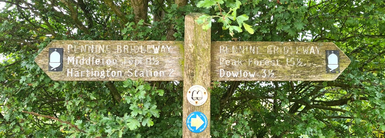
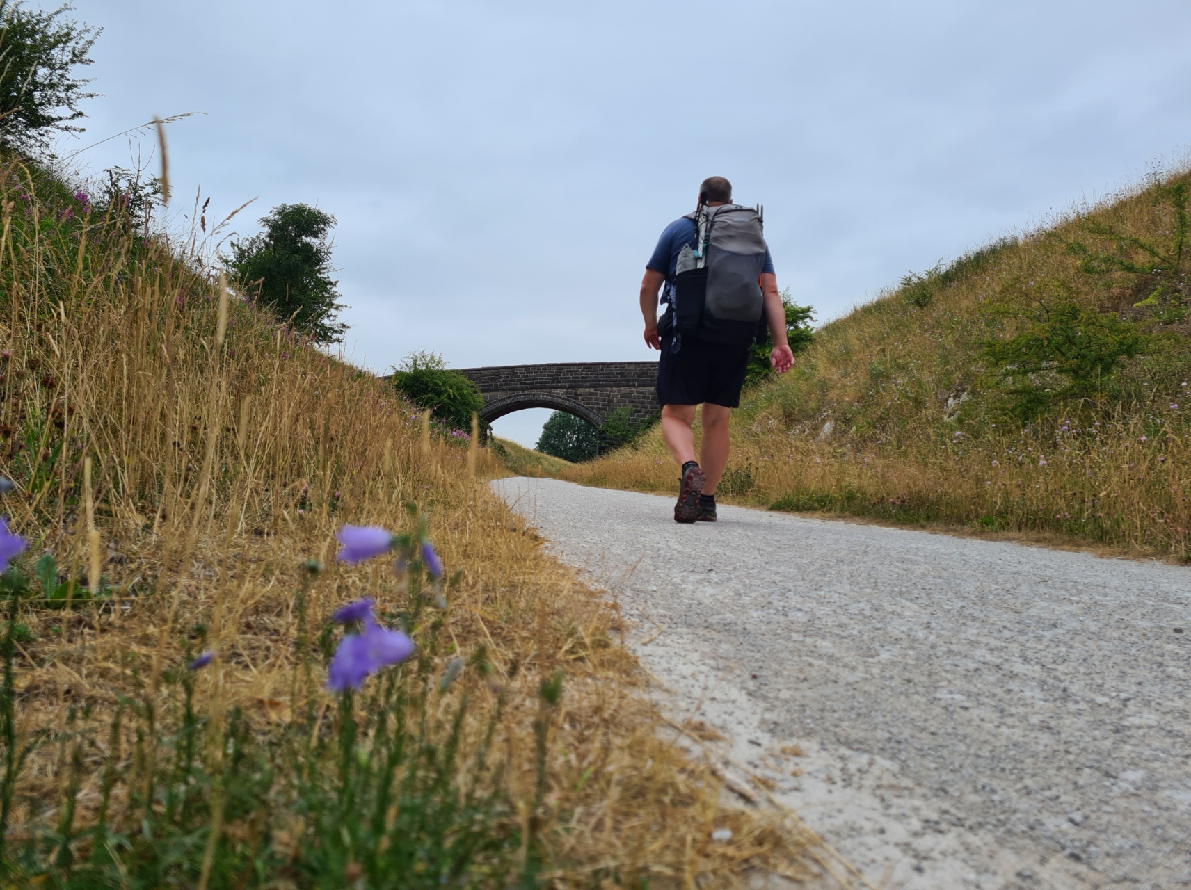
Day One actually started at Cromford Railway Station where the East Midland Railway disgorged me around 11.20 in the morning. From there I had a three mile walk to Middleton Top where the National Trail actually starts (or ends). This was a pleasant enough preliminary walk, steadily gaining height to the High Peak Trail, a cyclists route, and the official start of the Pennine Bridleway trail for walkers and cyclists. The Pennine Bridleway initially follows much of the High Peak Trail and when that ends simply carries on, becoming more of a cross-country route. Horse-riders are expected to start the Pennine Bridleway from Hartington Station further along the trail. From the Middleton Top start point I then had a further 13.7 miles to my first nights campsite, making 16.7 miles in total for Day One.


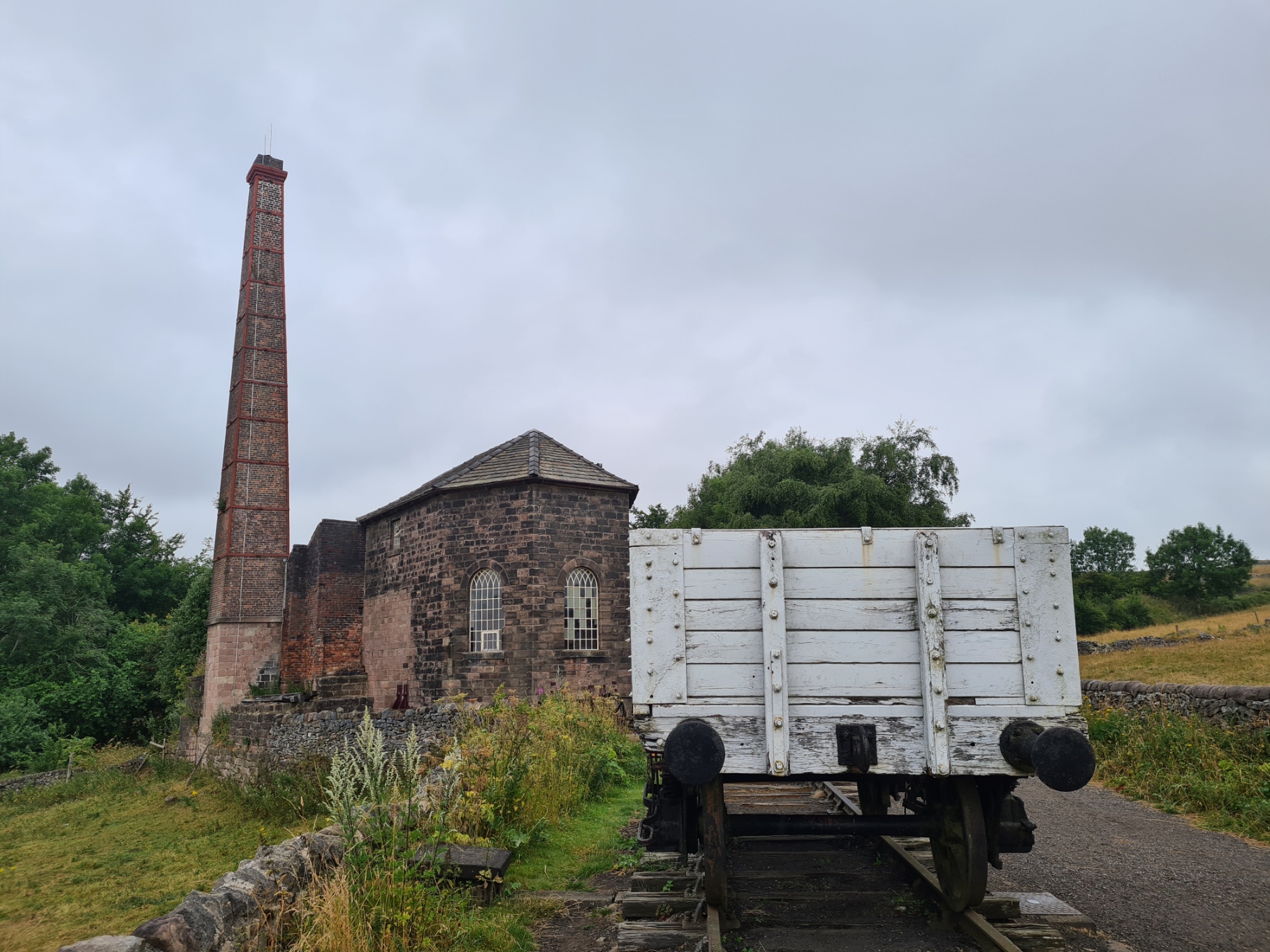
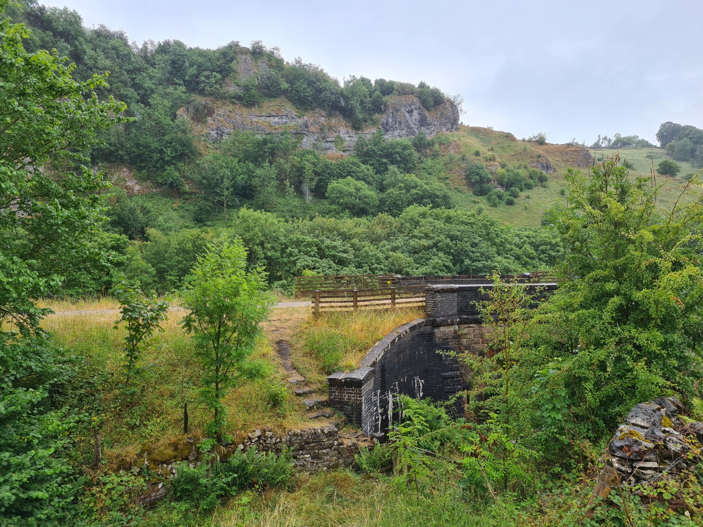
My first day of walking was fairly easy underfoot on a cinder track that follows the route of the old Cromford and High Peak Railway. This was a very early railway and construction techniques were in their infancy when building commenced in 1825. As a result, the railway included some inclines too steep for a locomotive so wagons were hauled up by cable. Each incline had its own engine house at the top and a wheel pit at the bottom around which the endless steel rope turned. There are some good remaining elements of these activities to be seen. Middleton Top is where the best of the engine houses survives. Also found here is a w/c, outside water supply, cycle hire and a basic cafe complete with information centre. It was now midday, the cafe was of most interest to me and a cup of tea, accompanied by simple tuna sandwich and bag of crisps made a welcome lunch prior to commencing my days ‘actual’ walk to Hurdlow.
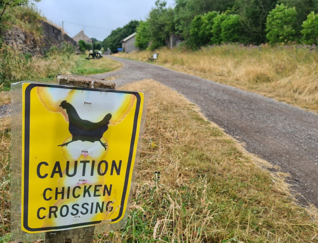
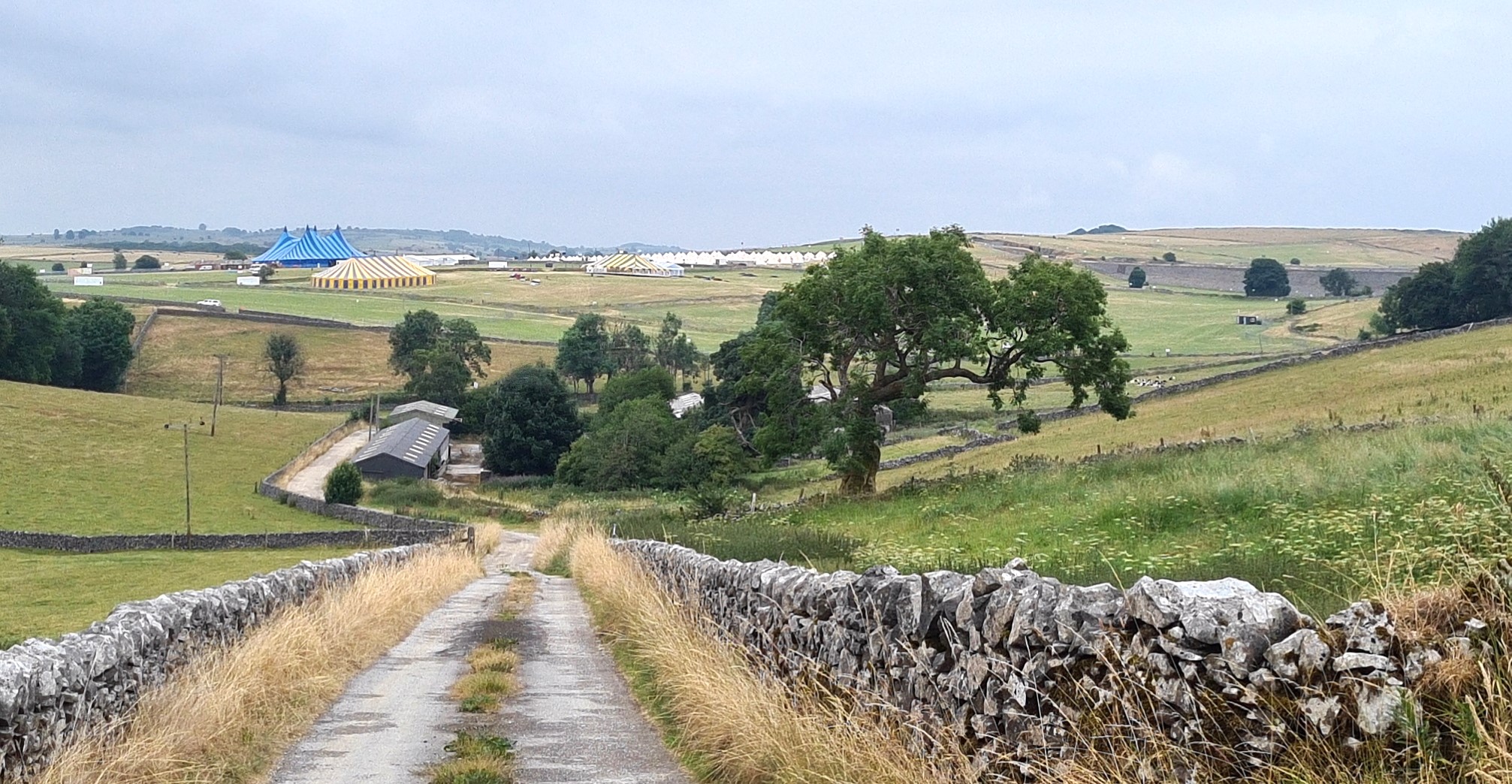
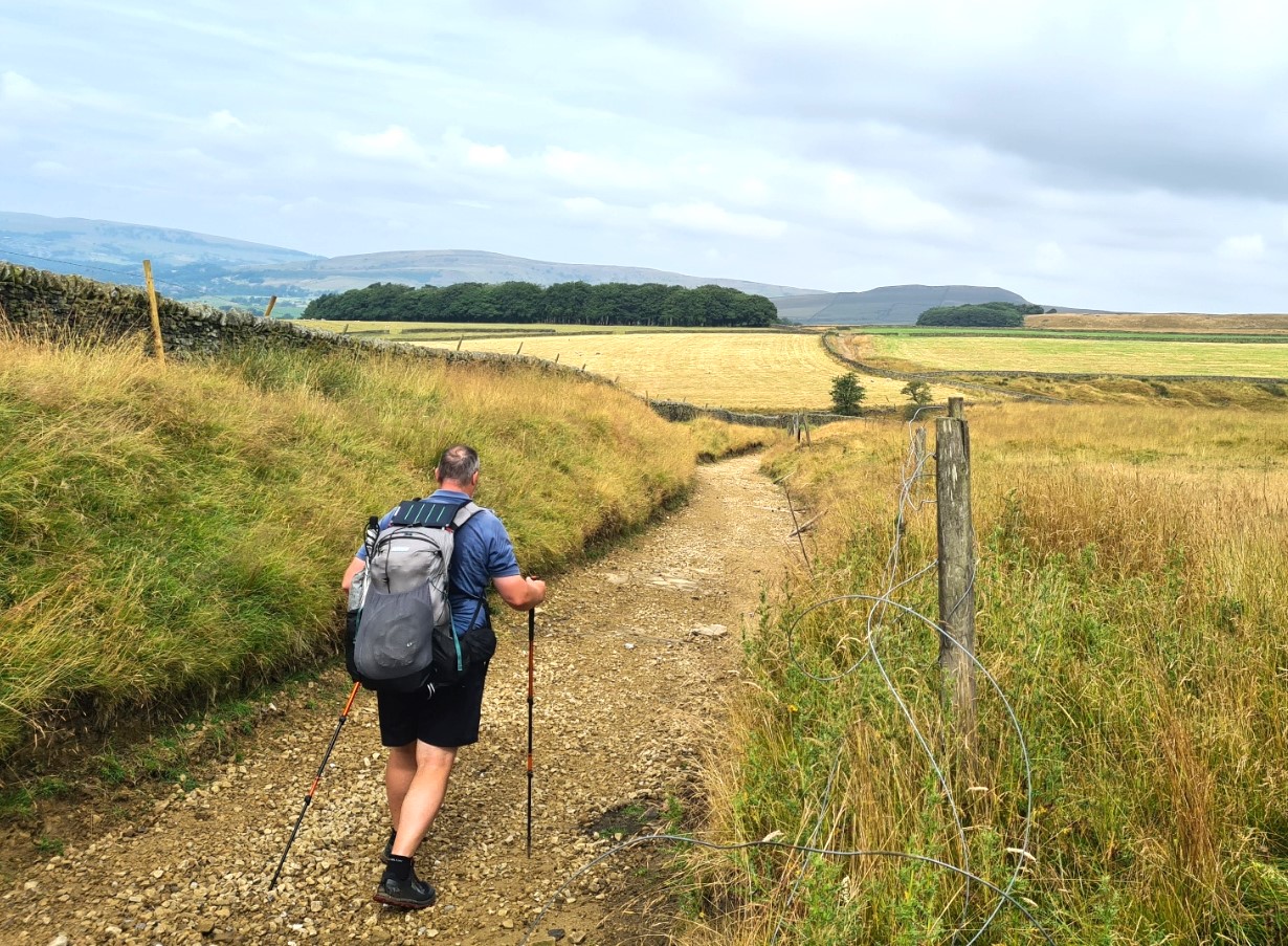
Passing Harboro Rocks I could see climbers up on the rocky outcrops. This was the second bunch I had passed and obviously the modest rock formations round here are a learning ground for new generations of climbers. The Pennine Bridleway passed right through the centre of the dry Derbyshire valleys where a music festival was due to be held in a few days and preparations were well underway. Fences maintained the narrow Right of Way and it would have been a very different experience a week later. Activities provided a slight attention diversion and something to look at for two or three miles where there was not a lot else to appreciate. The first day’s walk does not have a great deal of variety but it is enjoyable enough and slips you gently into the trail.

Some local traditional industry is hanging on. I passed the Friden brickmaking works. DSF (Derbyshire Silica Firebrick Company) began making bricks here in 1892 and there is obvious pride in their heritage. Retired employees had put information boards about the company history and brick making industry along the external walls of the works that bordered the trail. Some might view such industry with distain, but I would argue we all need bricks and we all need such industry to continue. It has to take place somewhere and it continues to provide local employment, it is a longer established part of the local working environment than just about anything I would see today other than agricultural and livestock farming.
I camped in the field behind the Royal Oak at Hurdlow, situated alongside the Pennine Bridleway. This makes a really good first nights halt with not only a decent shower at the end of the day, but good food and beer in the pub itself. I have stayed here a couple of times before with the Three Points of the Compass family and had no hesitation in stopping here again as I knew the field was small with ‘OK’ facilities alongside a decent well run pub. The bunkhouse they used to operate is no more but I was happy enough with camping. Having pitched I was resting with a brew when a backpacker passed on the far side of the perimeter fence. We waved at each other and minutes later Flavia appeared, having decided to also pitch here for the night. I asked what trail she was following- “actually, I am walking John O’Groats to Lands End“. I replied “actually, I did that in the opposite direction back in 2018“. Needless to say, after I had enjoyed my evening meal of lambs liver, mash and gravy in the pub, a couple of hours that evening were spent discussing routes, food, gear and logistics. It was a good natter.
Day Two– Royal Oak, Hurdlow to Peak Forest. 14.35 miles. 1643 feet ascent
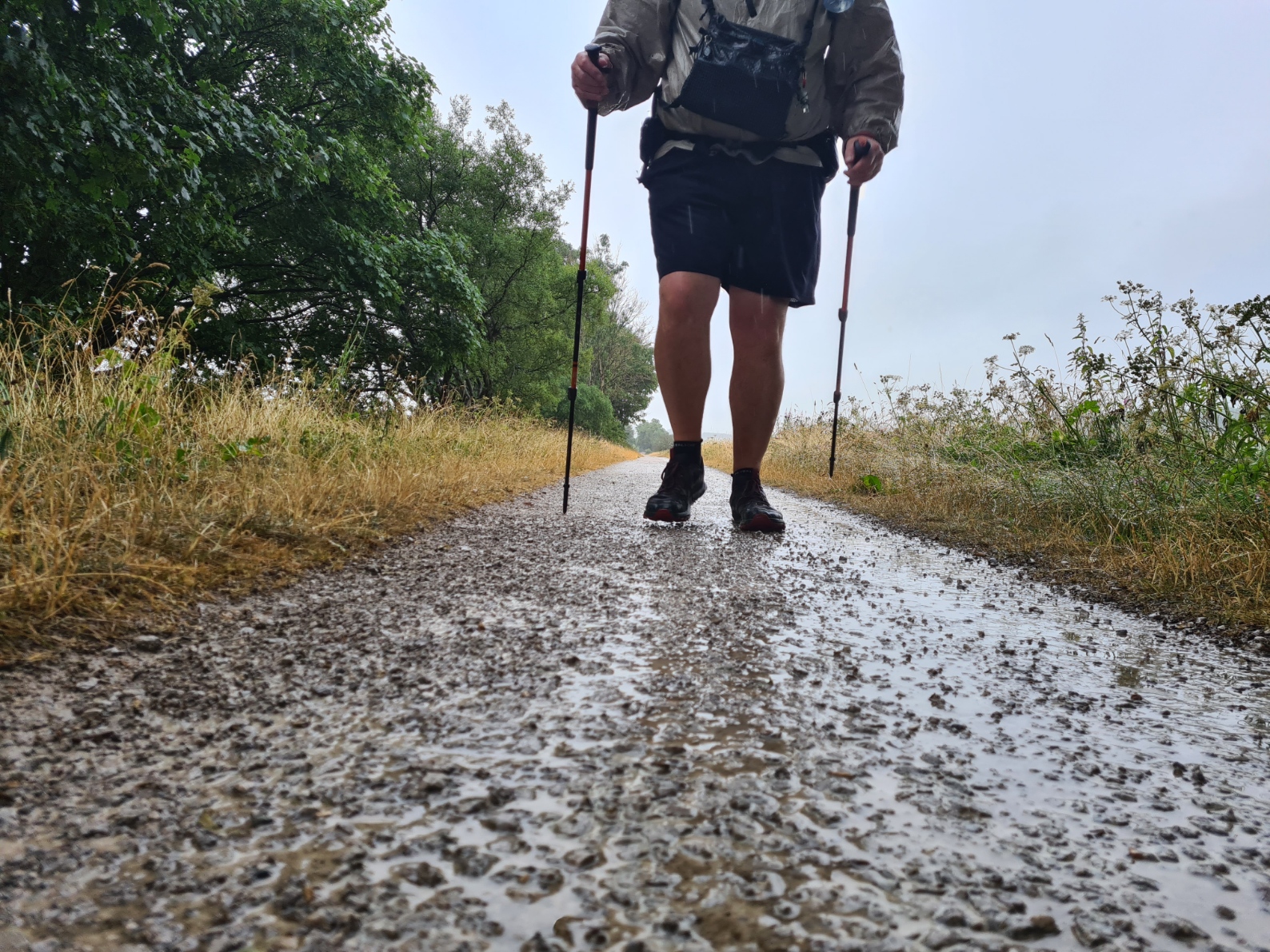
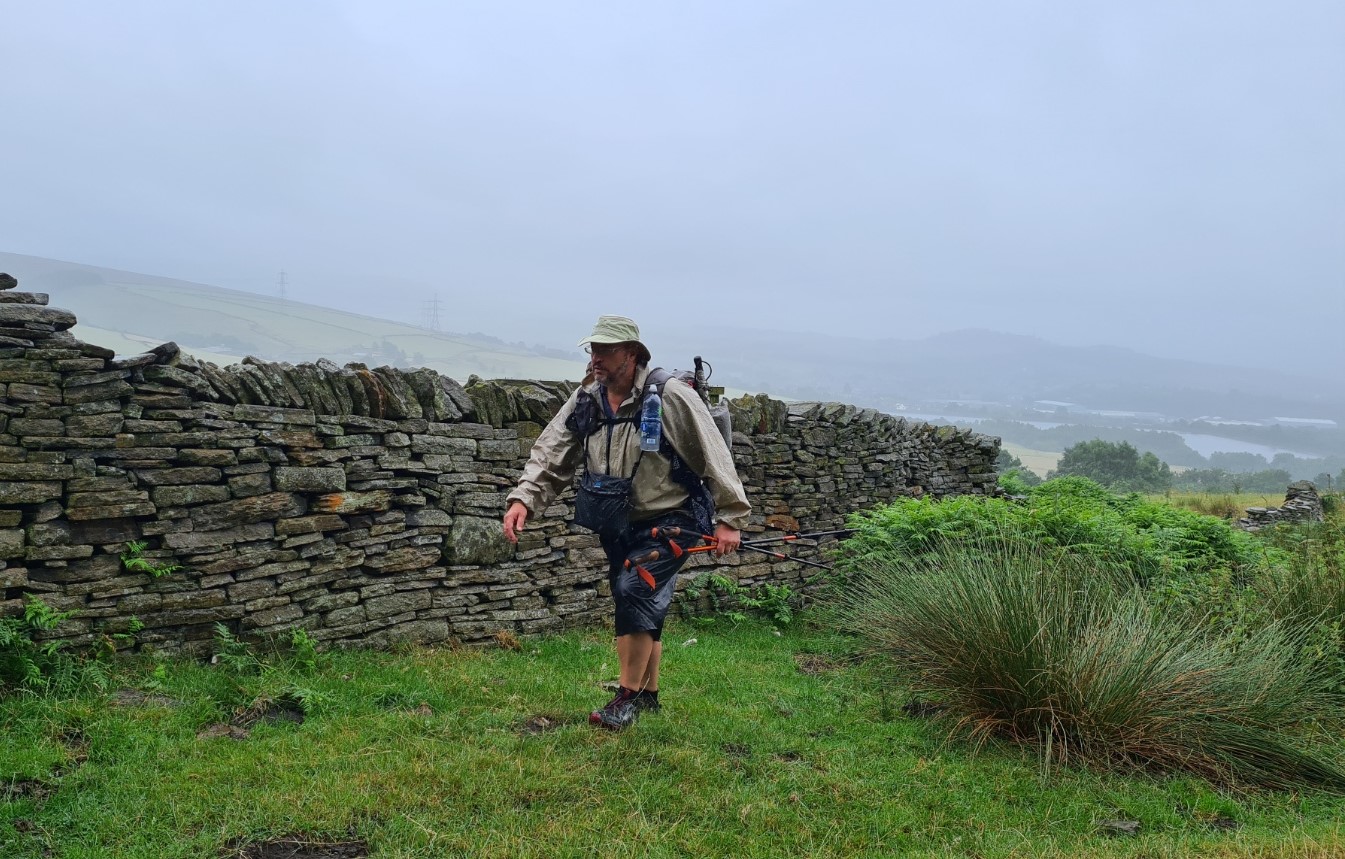
It rained hard overnight, though barely disturbed my slumber. A long day travelling and walking followed by good food, a couple of pints of beer with Merlot nightcap meant I had slept well. It was still raining when I rose but I was in no great hurry as I planned a wildcamp that night and wanted to arrive fairly late. I bade goodbye to Flavia when she packed and walked off southward, I was packed and walking northward around ten. It was tipping it down. I had come prepared for days of hot sunny weather, but being practical, had also packed for British uncertainty. Frogg Toggs UltraLite 2 jacket and wide brimmed Tilley Hat were more than suffice and I was plenty warm enough to not mind my shorts and skiddies getting wet.
I was glad that my feet were still a little attuned to harder trails from walks earlier in the year as that first day on trail on hard tracks could be punishing to someone coming to the Pennine Bridleway with softer soles. Soon after leaving the Royal Oak I came across a sodden bedraggled bunch of Duke of Edinburghers, a couple of them limping quite badly. They all looked a bit pissed off and when I met a couple of their adult ‘handlers’ searching for them a bit further on down trail I heard that the group had set off 180° in the wrong direction earlier that morning. Mistakes happen to the best of us, but the dejected appearance I had seen earlier must have had something to do with fruitless miles combined with inclement weather. Character building I think we call it.
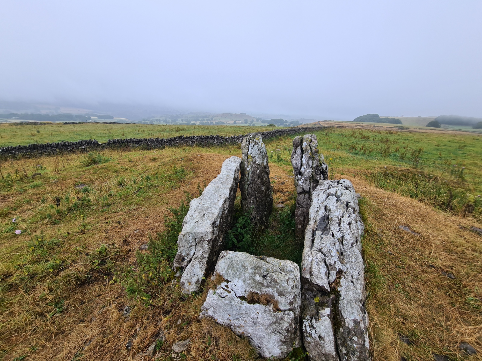
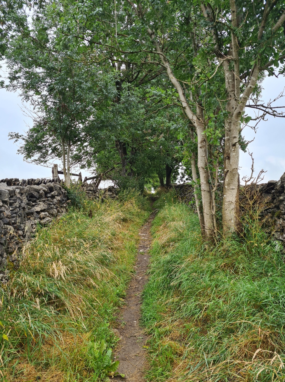
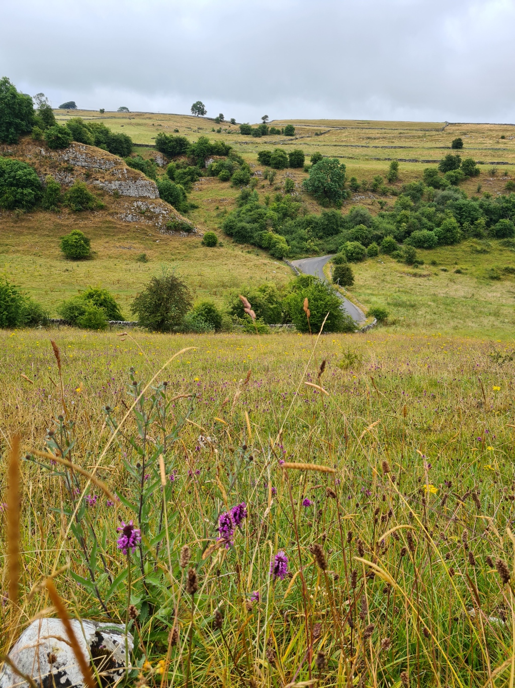
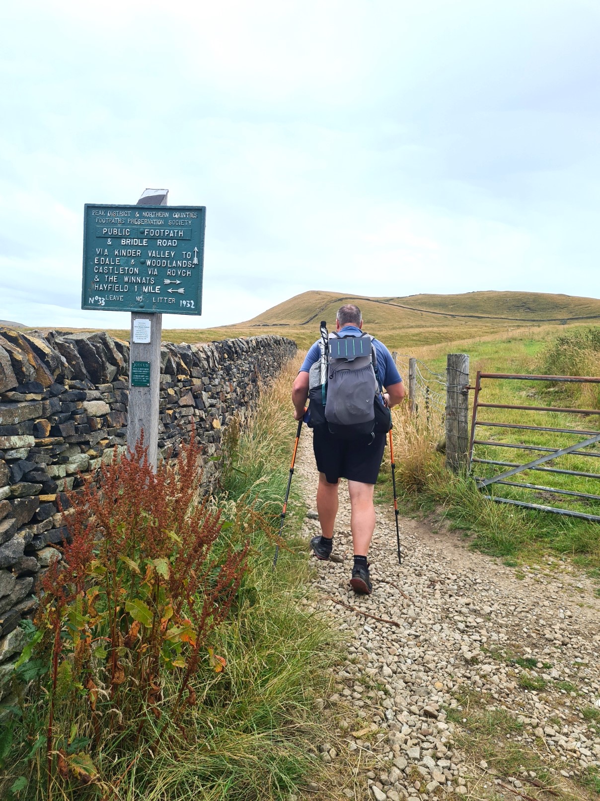
I only had a few miles left on the High Peak Trail before that ended and the Pennine Bridleway then struck off in an entirely different direction. After leaving the old railway, it isn’t long before I was following the Midshires Way, but that was abandoned south of Chelmorton. Four miles into the route, I took a diversion off trail across sodden fields of rank vegetation to visit the remains of a multi-chambered ‘cairn’, actually a Long Barrow, at Five Wells before returning through a herd of intrusively inquisitive cows, to resume the trail. The trail now began to follow what I would experience for much of the remainder of the Pennine Bridleway. A few miles of bridleway, followed by a few miles of quiet road walking, then a return to bridleway.

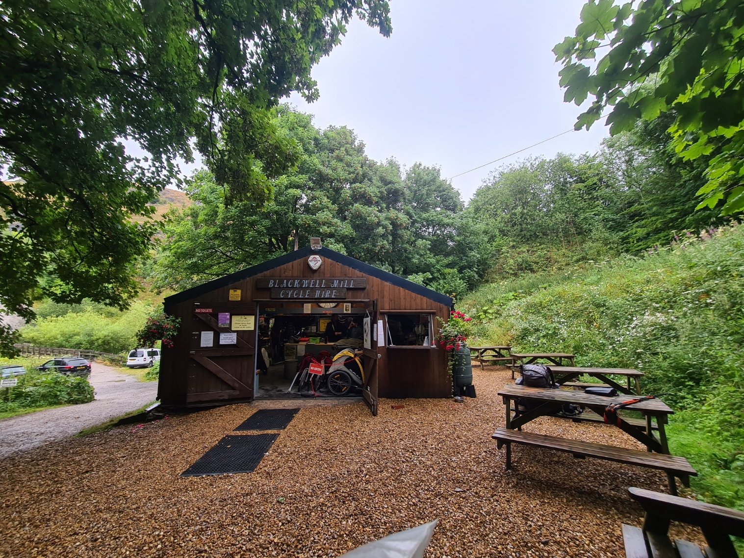
The views and walking began to improve as I approached the Monsal Trail. Dipping down into the valley there was a handily situated cycle hire shed, doing good trade renting out bikes for those wanting to enjoy the easy cycle down the old Monsal line into Bakewell. This was another long gone railway, closed in 1969 and converted to cycle track in 2010/11. It was again close enough to midday that it suited me to halt a while and partake of the minimal refreshment facilities they offered.
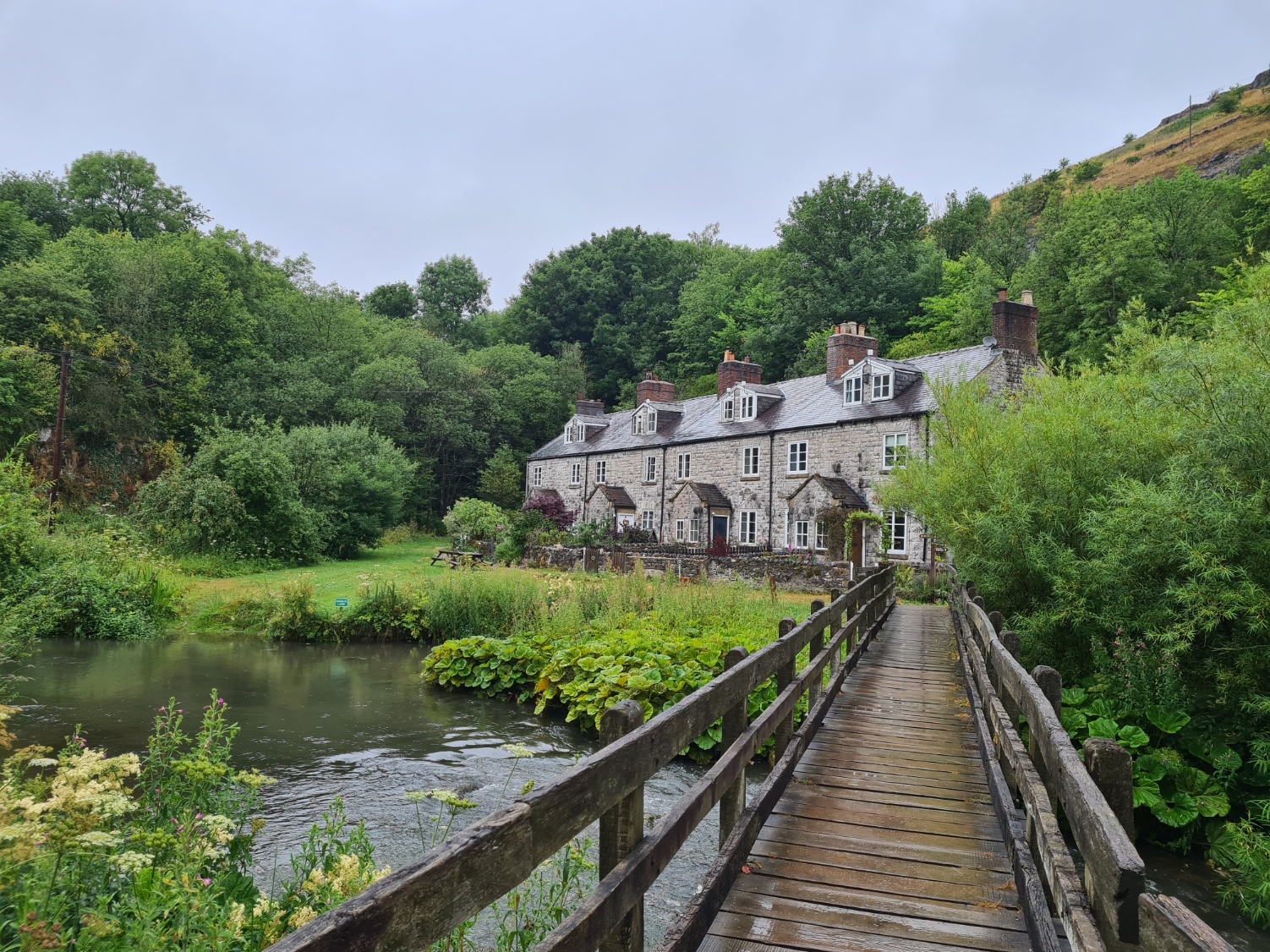
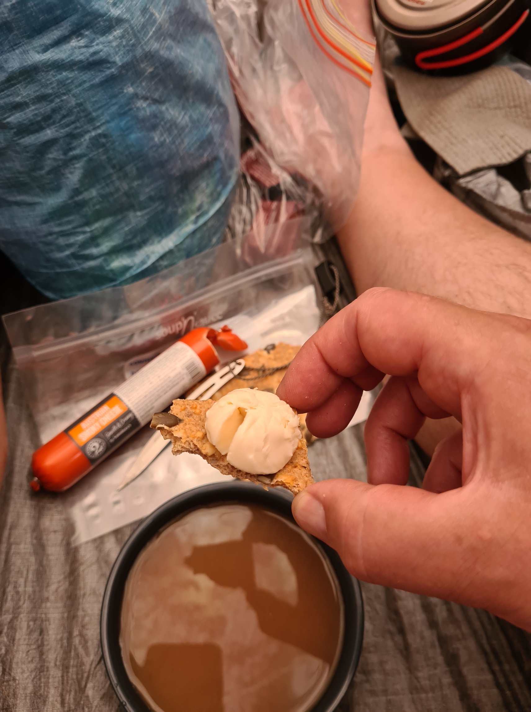
Despite having to sit outside, it was now only drizzling and I enjoyed a mug of tea with the first Pot Noodle I have eaten in over a decade, improved immensely by breaking two sausage rolls into it. After crossing the River Wye and walking through a tunnel beneath a branch of the railway it was then a steep climb up and out of the dale where, reaching the top and passing through a farm, I picked up a signal and was able to briefly chat to Mission Control. This was the first phone signal I had found for some time. The rain went away (don’t worry, I would see it again) and the day brightened considerably though it remained overcast and comfortable walking
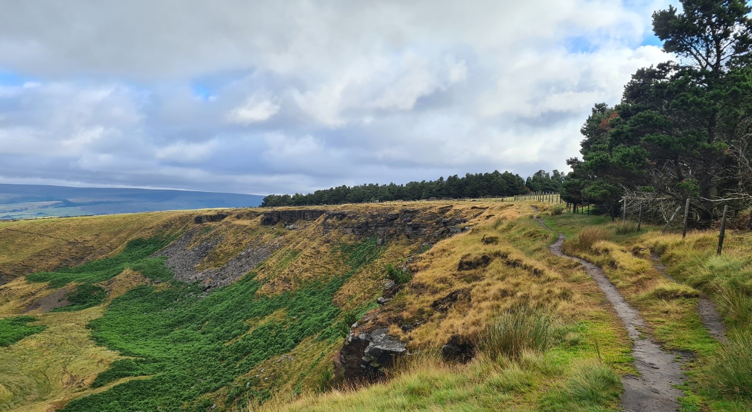
My second day on the Pennine Bridleway now began to reveal how ridiculous this trail can be at times. I descended through orchid rich meadows into the Monk’s Dale Nature Reserve. From there the trail continues up the other side, taking the horse-rider and cyclist up onto bridle paths and roads, to loop around the dales on the far side. The walker follows this route too however a glance at the map reveals the far better pedestrian only route through the bottom of Peter Dale and Hay Dale. I am a bit of a purist when it comes to trail routes but there are, and would be further on, far better alternative footpaths for those willing to branch off a little.
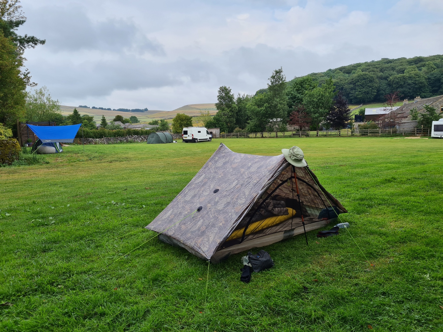
The road walking took me into Peak Forest. I had planned on a wildcamp at a, yet to be found, location. However walking through the little town I saw a ‘campsite’ sign at Fields Farm and turned in to see what it was. Not a lot. A field, with two tents and a couple of motorhomes. Why not I thought and enquired at the farmhouse. Encouraged to diversify during Covid, the farmer was providing simple facilities in an unused field. A single male and single female loo, each with small sink with running cold water was about the extent of facilities. He asked for twenty pounds to which I immediately and unintentionally loudly laughed. It dropped to fifteen and we walked out into the field together. I gently suggested that a lower fee might be more appropriate for a single night backpacker and it dropped again to ten. His issue was that Pitchup took a fiver from any online booking and while still too much in my mind for a square of grass, I agreed nonetheless. Tent up, I took over the little wooden loo block (that I had been informed cost 30 000 pounds to build), locked the door for three quarters of an hour and managed to wash myself completely and my hiking clothes, before hanging it all to dry from a line strung to my shelter, changed into ‘camp attire’ and walked round to the Devonshire Arms, just over the bordering stone wall. A basic, decent and busy pub, I had a couple of pints followed later by steak pie, chips and peas with that most necessary of companions, a jug of extra gravy.
Day Three– Peak Forest to Cown Edge Rocks. 13.7 miles, 2309 feet ascent
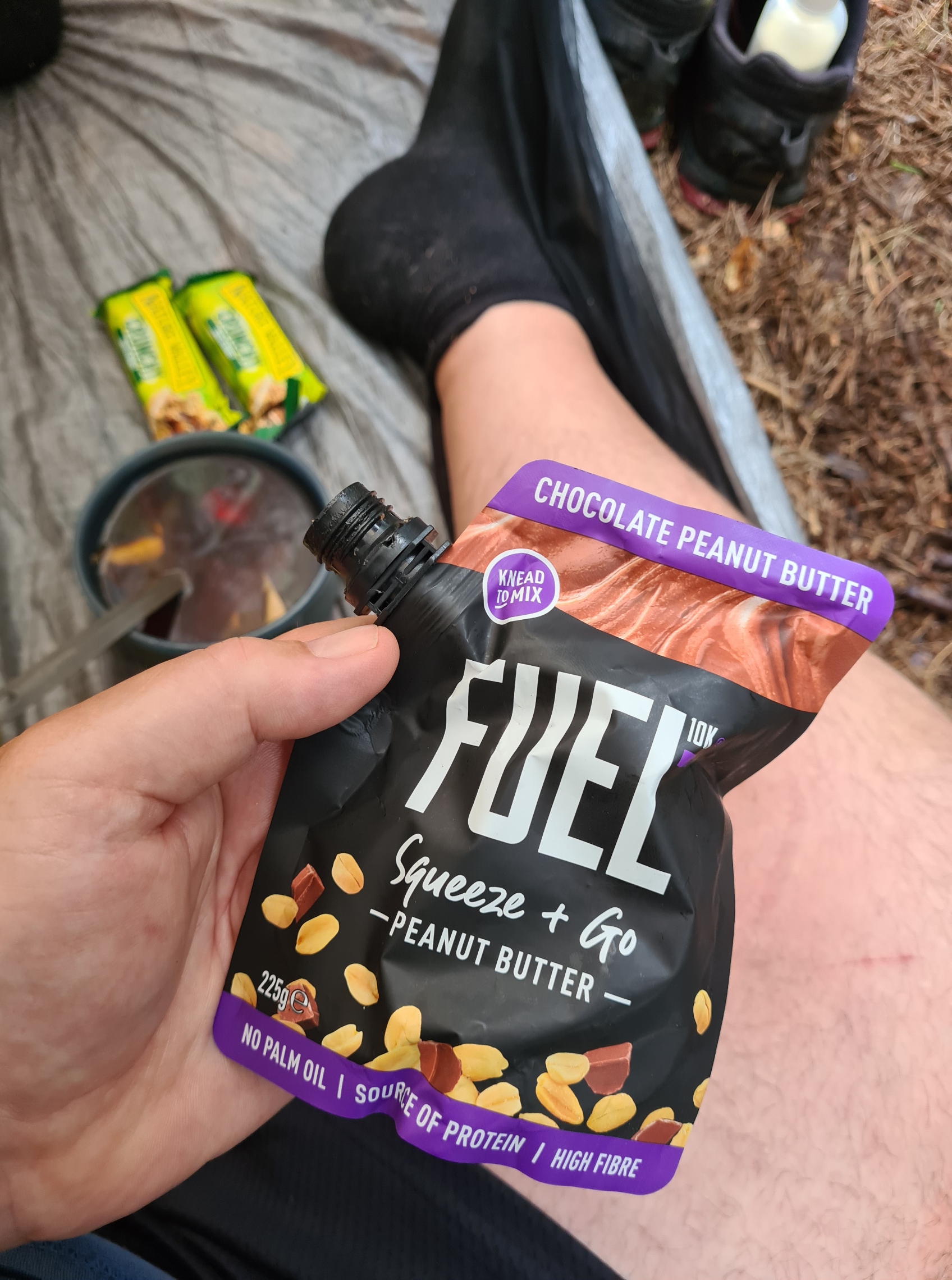
I slept well and there was little noise other than a couple of farm vehicles up and down the nearby road early morning. My few neighbours had made no noise and I couldn’t even hear the pub, not that far away. It had been a sensible and appreciated halt. I faffed around a little, sorting out gear and planning that night’s halt, entirely forgetting what I had decided during the previous nights study of the map. A pint of tea was enjoyed while I packed. Breakfast would be a couple of bars eaten while road walking over the next couple of hours. I was still slow moving and wasn’t packed and away until almost nine.
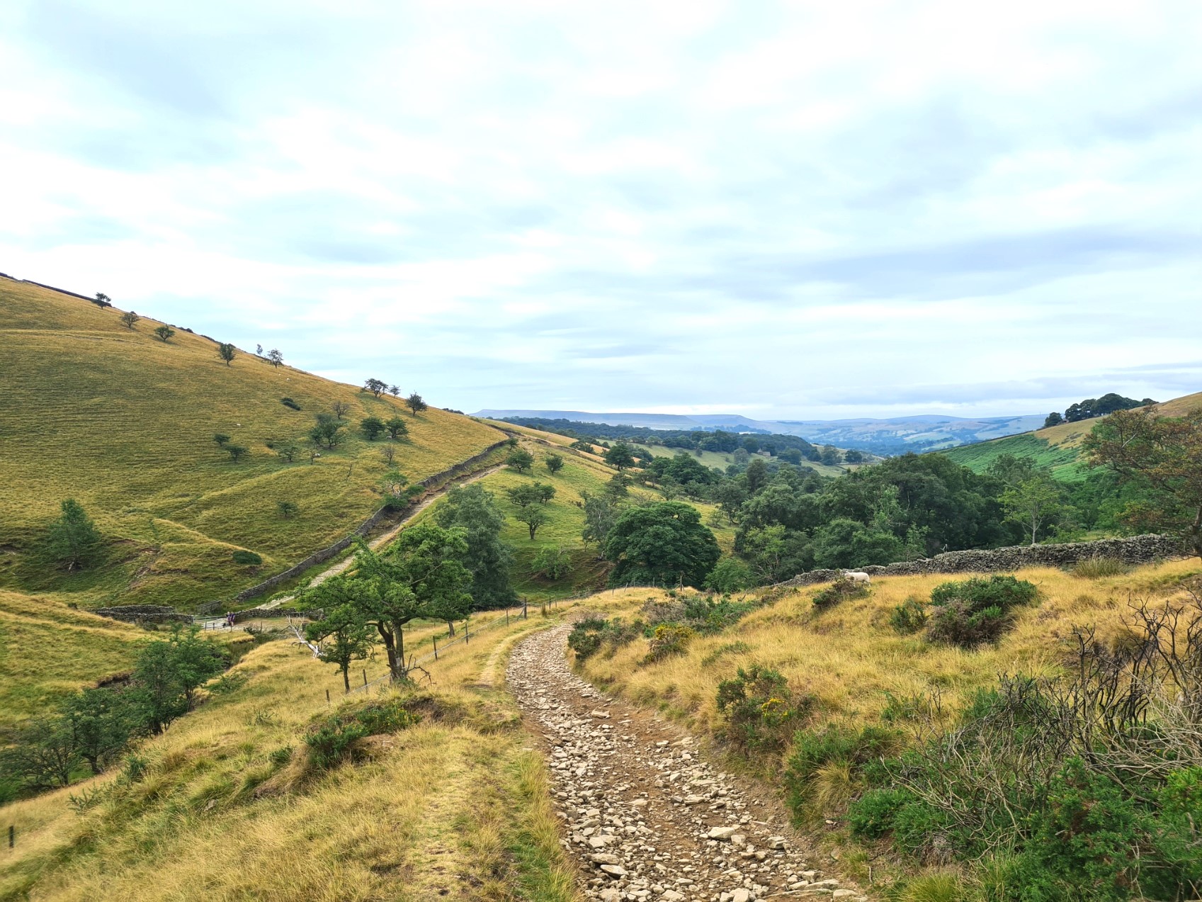
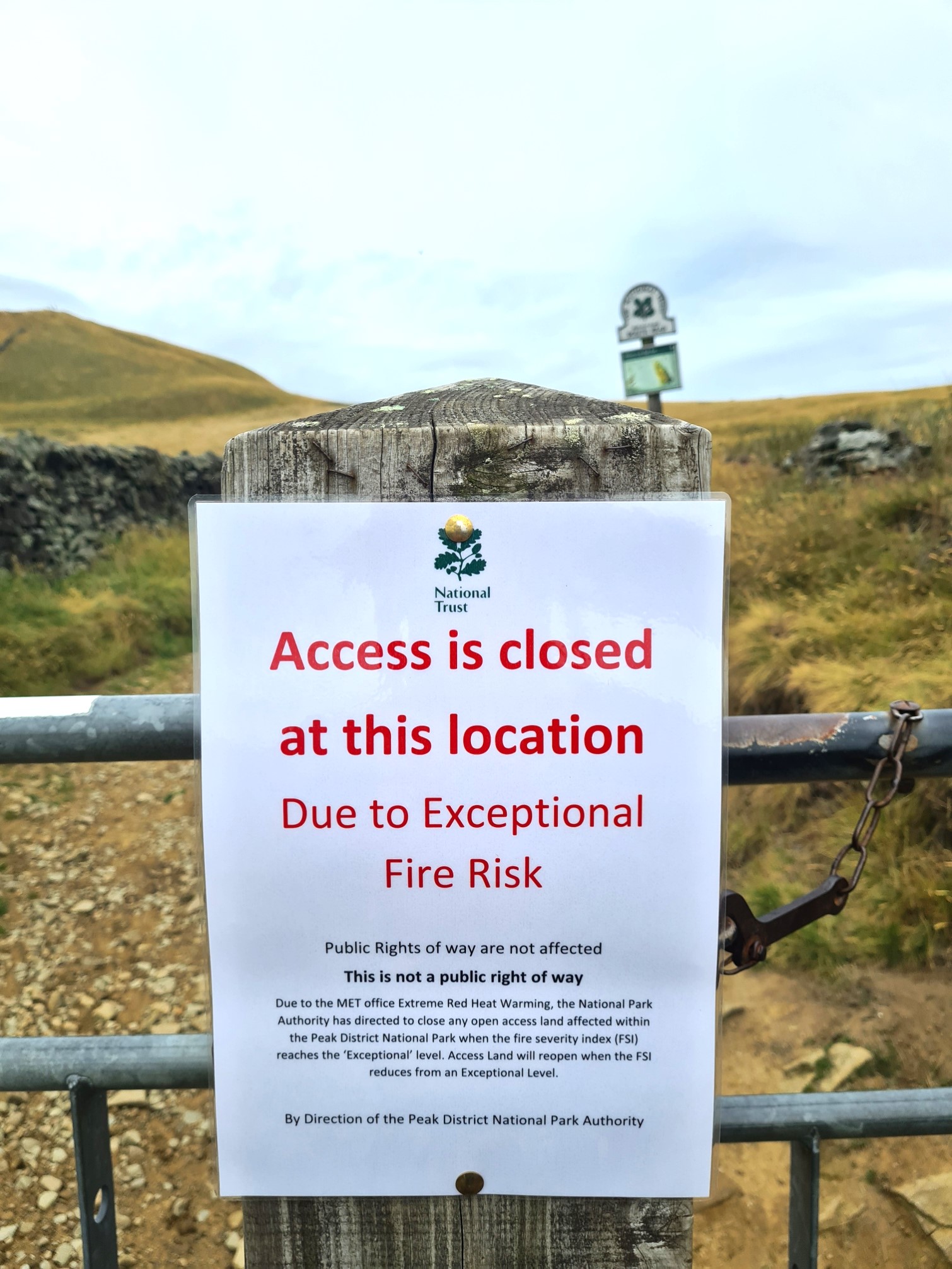
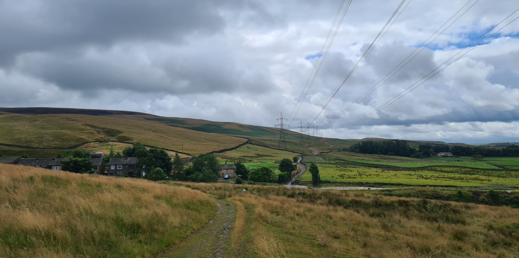
After the few miles of road walking, with barely a vehicle to be seen, it was onto decent tracks crossing fine walking country almost all the way to Hayfield. I enjoyed those few hours immensely though must admit I might have been baffled by a closure notice that ‘I didn’t see’. Nor did dozens of walkers, runners and cyclists see the notice either. It is worth noting that there was no alternative trail or route suggested. Yet again, on reaching Hayfield I had fallen on my feet with both timing and facilities.
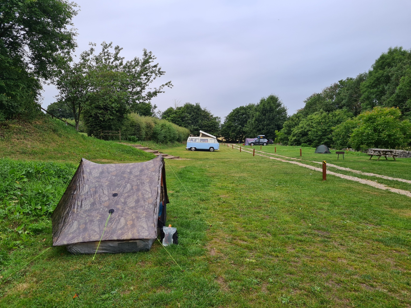
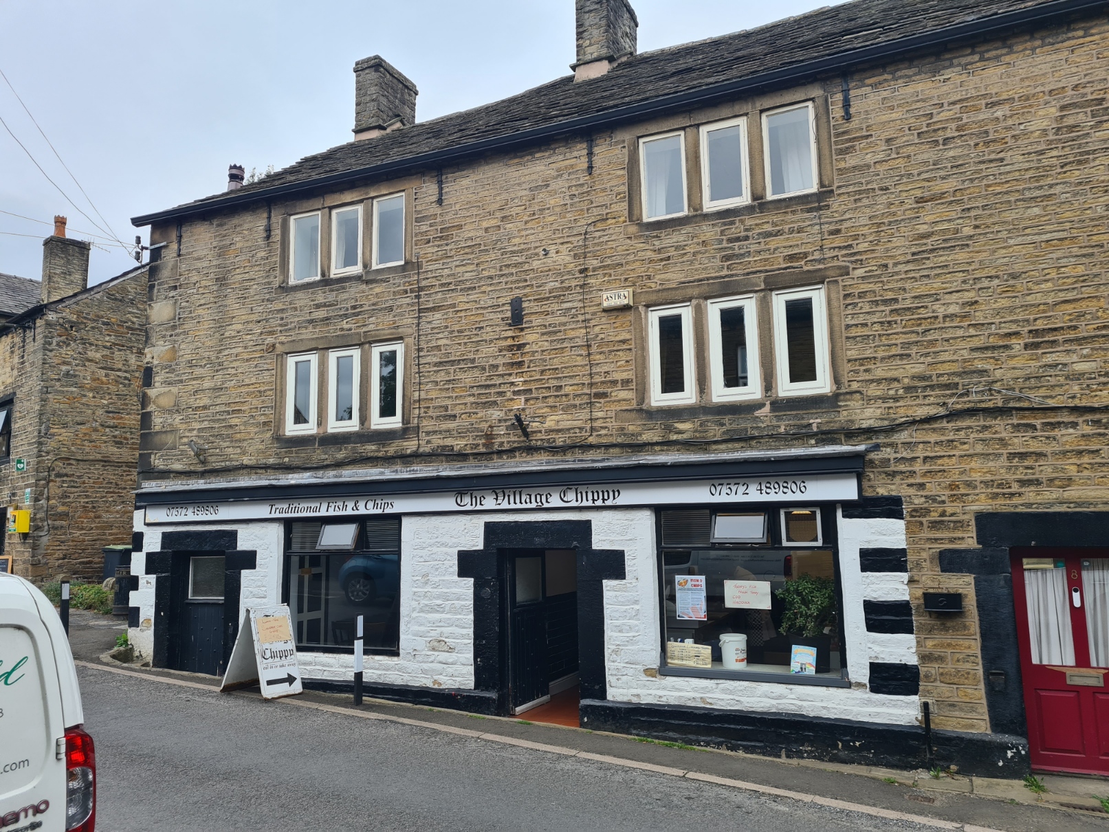
There is a decent Camping and Caravanning Club site at Hayfield and prior to leaving home I had thought about stopping there but it was far too early in the day so I carried on into town, a lost shrew joining me for fifty metres. Reaching the town I espied a chippy, asked if I could sit in to eat and he showed me to a small room just off the serving area where I enjoyed a decent meat pie and chips with gravy, obviously also with a mug of tea. I had known that power might be an issue on this trail and took the opportunity to plug in and top up my phone while eating. The chippy kept popping in to talk, customers came and were mostly ignored as he was too busy chatting with me. He would quickly leave, take their money and throw something in the fryer before returning to carry on where he had left off. Anyone expecting to quickly pop in for a quick takeaway was severely disappointed during my stay. Hayfield was the place from where many of the walkers set off on the famous (infamous?) mass trespass of Kinder Scout in 1932. The chippy had very obvious pride when he informed me that his mother’s aunt had been amongst those masses. I couldn’t say if my mother even had an aunt. They have long memories round these parts. I was also told that some of the local landowners and farmers still have a lingering resentment for what came out of the protests.

From Hayfield it is only a couple of miles and an enjoyable climb up on to Lantern Pike with a bit of a view and then only a couple more miles to one of the remaining headaches that Pennine Bridleway route planners have. The walkers trail round Glossop is a mess. Horse owners are advised to box horses round the town. Cyclists go off one way while walkers are sent another. The signage at least started off OK for me. But that wasn’t to last.
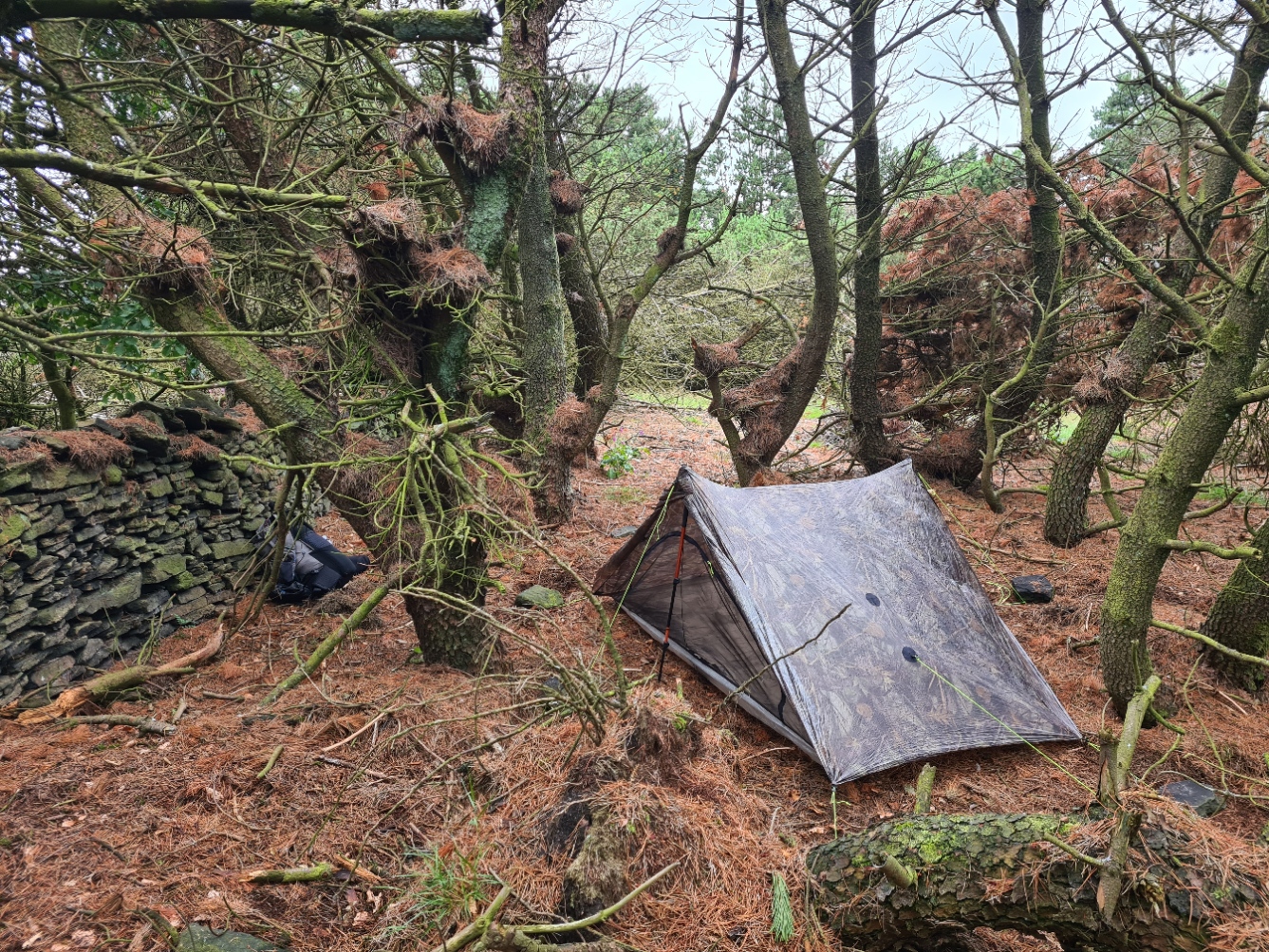
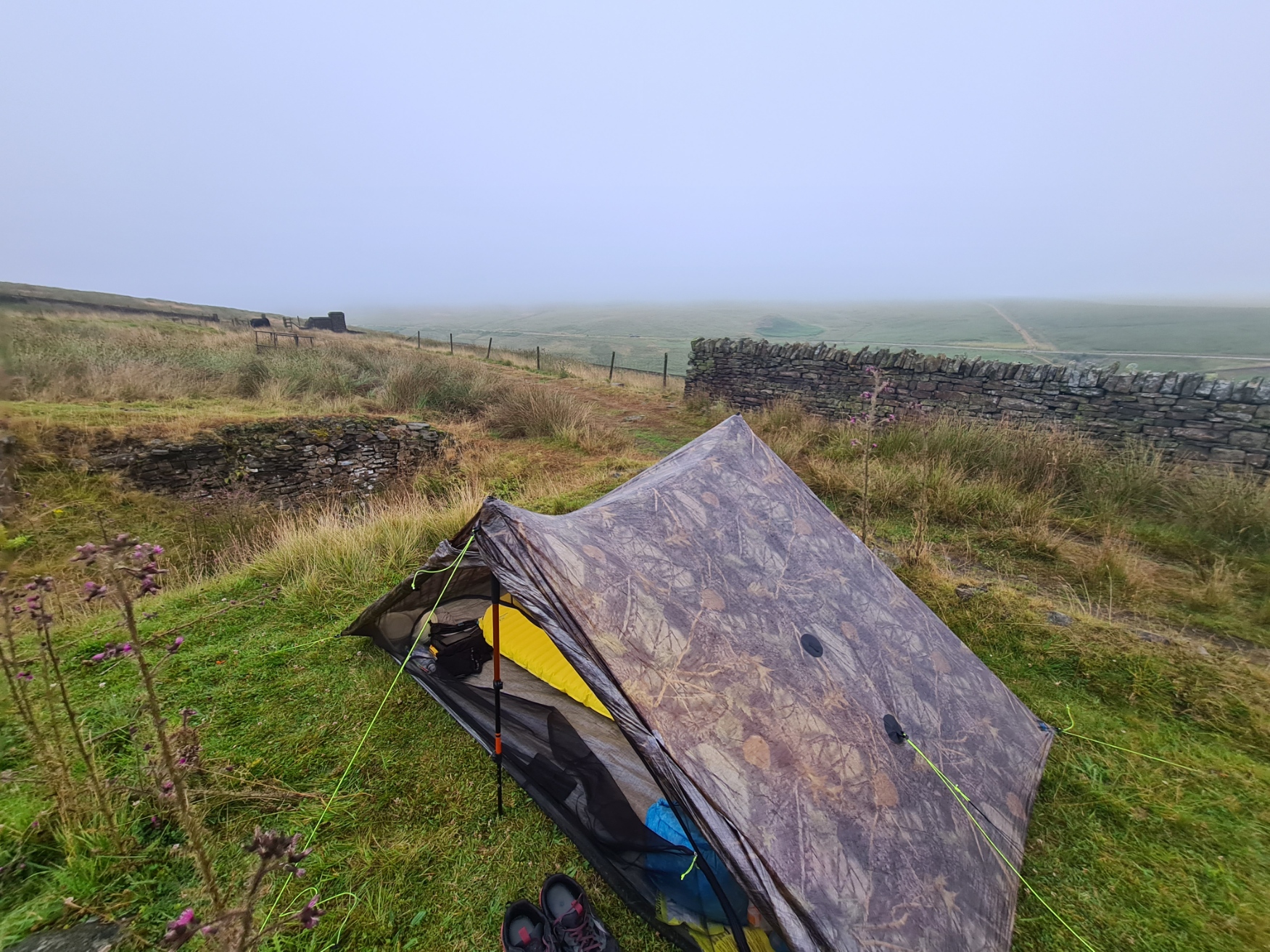
For my night’s wildcamp, I had my eye on a small woodland on the edge of Cown Edge Rocks. Not only did I want to stay away from sheep-filled fields but the wind had been building all afternoon and it was expected to get strong during the night. I wanted to tuck myself away and was able to find a decent enough, if small, clearing. I had no view from my pitch amongst the trees, but also no flies and it was out of sight of just about anyone.
My night’s pitch made for a perfectly good and sheltered overnight. Fortunately with no hanging deadmen overhead. Once the Duplex was up and I had placed already dislodged rocks from a nearby ancient wall on top of the pegs, I retreated to the shelter for a tent wash followed by an early OXO, followed later by the first of the dehydrated meals I was carrying for the first few days on this trail. My food bag was pretty big and heavy as I had been uncertain on resupply for much of the first three-quarters of the trail. As to my days walking, I had enjoyed it immensely.
Day Four– Cown Edge Rocks to Oldham Reservoirs. 20.58 miles. 3099 feet ascent
The wind did indeed pick up during the night and rain decided to join it for a few hours. It was a noisy pitch with boughs creaking and rattling for much of my night. But the shelter was untroubled, I stayed dry and between frequent waking, I got plenty of sleep. My day went downhill from there.
I did not enjoy the mornings walk at all. It is an ill-conceived and horrible walker’s route round Glossop, wending its way through anonymous housing, industrial and unkempt farms with lousy routes past dungheaps.
I was frequently uncertain of my way on this section despite having a perfectly good map. The guidebook was no use as that was for the cyclists route that wandered off somewhere else. I experienced the worst waymarking of the entire trail in this few miles. It really felt as though the hiker was the unloved forgotten cousin on this part of the Pennine Bridleway. Even if the waymarking had been better, much of the trail was indifferent to say the least.
The only thing that restored my good humour was while I was passing through Broadbottom I saw a sign for the Lymefield Garden Centre. Or more properly, the cafe at the Lymefield Garden Centre. A decent, nay, superb, fried breakfast there perked me up a little for the remainder of what was probably the worst day on trail. There was too much indifferent road-walking and I had to get past the built up areas to find a wildcamp that night. There really isn’t much to relate of the day.
I began to pass the many reservoirs found here and was shocked at the dramatic low levels of water. This despite the dreary weather. It rained for much of the day and my rain skirt had joined my waterproof overlayer. The day went on too long for me and when I passed the Diggle Inn at Diggle, signs advertising vacant rooms, ‘good ale and good food’ and a brass band playing that night I was so, so tempted. But a trail doesn’t get walked if you don’t actually walk, so I knuckled down and put out a few more miles.

I was hoping for a suitable wildcamp on the far side of Dowry Reservoir. This reservoir is one of the Oldham Reservoirs that supply that town with water. This was yet another reservoir that looked precariously low of contents. Walking up the hillside beyond the reservoir I could see that the area was populated by cows and thought I would have to move on. Now I don’t mind sheep around my tent too much, though I am wary of disturbing them with new lambs and equally as wary of the evening checks made by farmhands on quadbikes, but cows are another matter. They are big heavy curious beasts and will investigate new things, rub up against things and lazily trample a tent and its occupant before moving on to continue grazing. There were some ruined buildings on the slope. One of which had a strange arched roof over an underground void over which a thick rock covering had a decent layer of rabbit cropped grassy soil. I saw no evidence that cows had clambered up onto the raised platform from the path directly below it so pitched with impunity. I never saw the cows again until the following morning when one came wandering along the path with no more than a sideways glance at me. I hadn’t enjoyed much of my fourth day, which was a shame as the trail had been steadily improving from day one to day three. I was sure a brew, good meal, massage of feet with oily balm once they were cleaned and dried, followed by a good nights sleep would improve my temperament immensely.
Day Five. Oldham Reservoir to Watergrove Reservoir, on the Mary Towneley Loop. 13.65 miles. 2005 feet ascent
I slept well and woke in good spirits. I knew that I was about to complete the first ‘section’ of the Pennine Bridleway and would reach the Mary Towneley Loop today. Most people completing the trail will simply proceed up the clockwise half of the loop, or the anti-clockwise half of the loop, and continue up the linear Pennine Bridleway once they reached the turn off at Gorple Road. I had already decided that I would walk all of the 47 mile Mary Towneley Loop. Though I hadn’t worked out my logistics on how I would get back up to Gorple Road, or even whether I would walk clockwise or anti-clockwise.
The cloud base was low and my morning comprised of either walking in it and getting wet, or below it and getting wet. I cared not, I was warm and happy and the trail was an improvement on the previous day.

Dropping down into a valley running parallel to the M62 I paused at a collection of buildings, trying to work out their purpose. An aged farmer stopped in his pick-up to drop some sacks off and I queried as to the buildings. He was initially suspicious but relaxed as he could see my obvious interest.
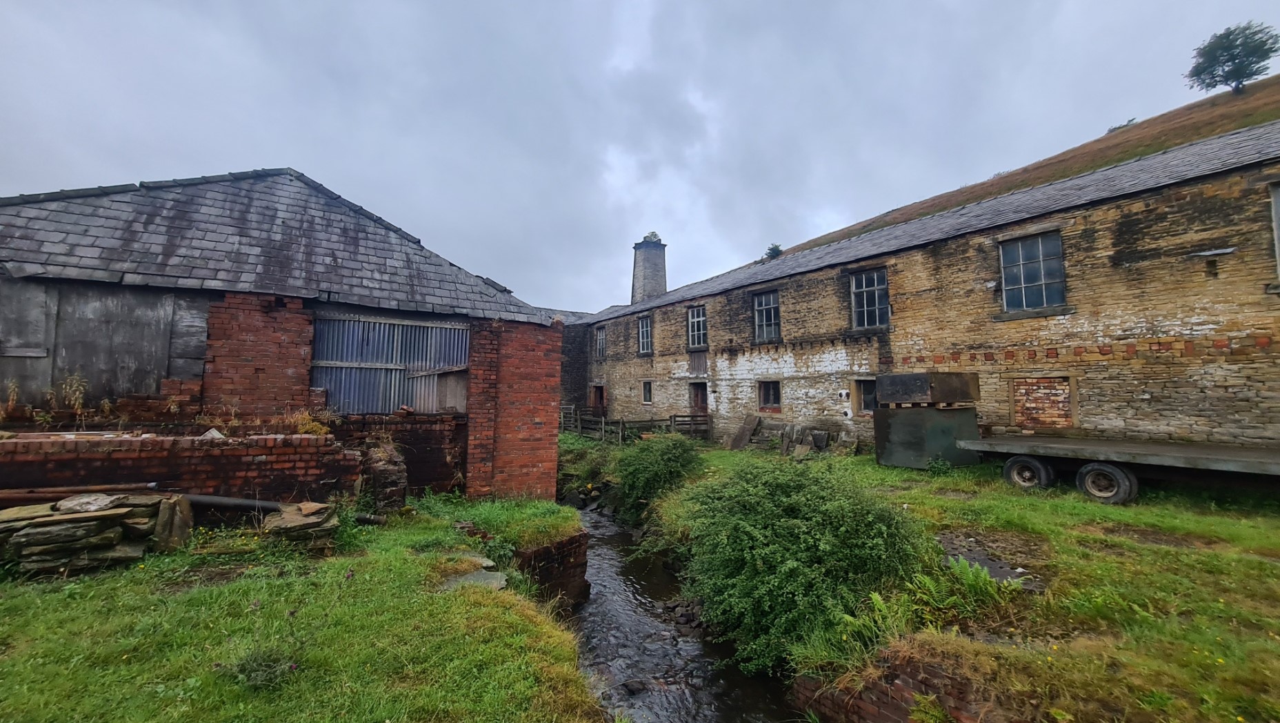
The still present farmhouse that originally stood there, was taken over between the wars and extended into a Woollen Mill. The channel in the photo was built and diverted water from the nearby stream to be used for washing the wool. The chimney is from the boiler house built to dry the wool. The army later added the red brick buildings however all eventually fell into disrepair after WWII as the work left the valley. I can only suspect it was supplying wool to the war effort and demand fell. You can see the different courses of different builds, the added or removed windows. It is a fascinating if mostly ruined building that many would walk past without more than a sideways glance. When the farmer lost his farm further up the valley when the M62 was built “this was derelict so I took it over“. I gained the impression that no money changed hands.
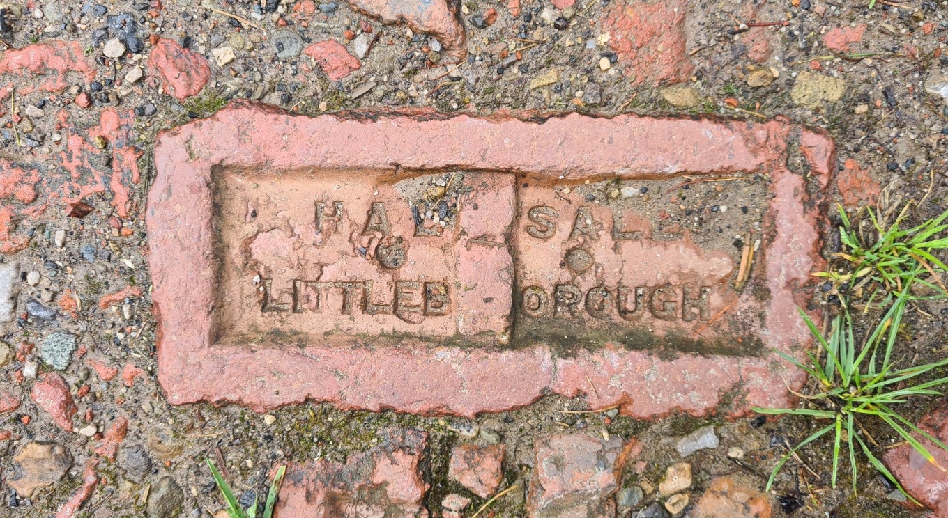
It pays to look up, around and down when on trail. Walking beneath the Rakehead viaduct carrying the M62 140 feet (43m) above me, I noticed that the rough track beneath my feet leading me toward Littleborough was comprised of hardcore. Amongst this was broken bricks carrying the town’s name. The maker’s name was also included. Halsall’s ran the Summit Brickworks near Littleborough, Lancashire from 1939 to 1973 when it closed. I was literally walking on the early industrial history of the area.
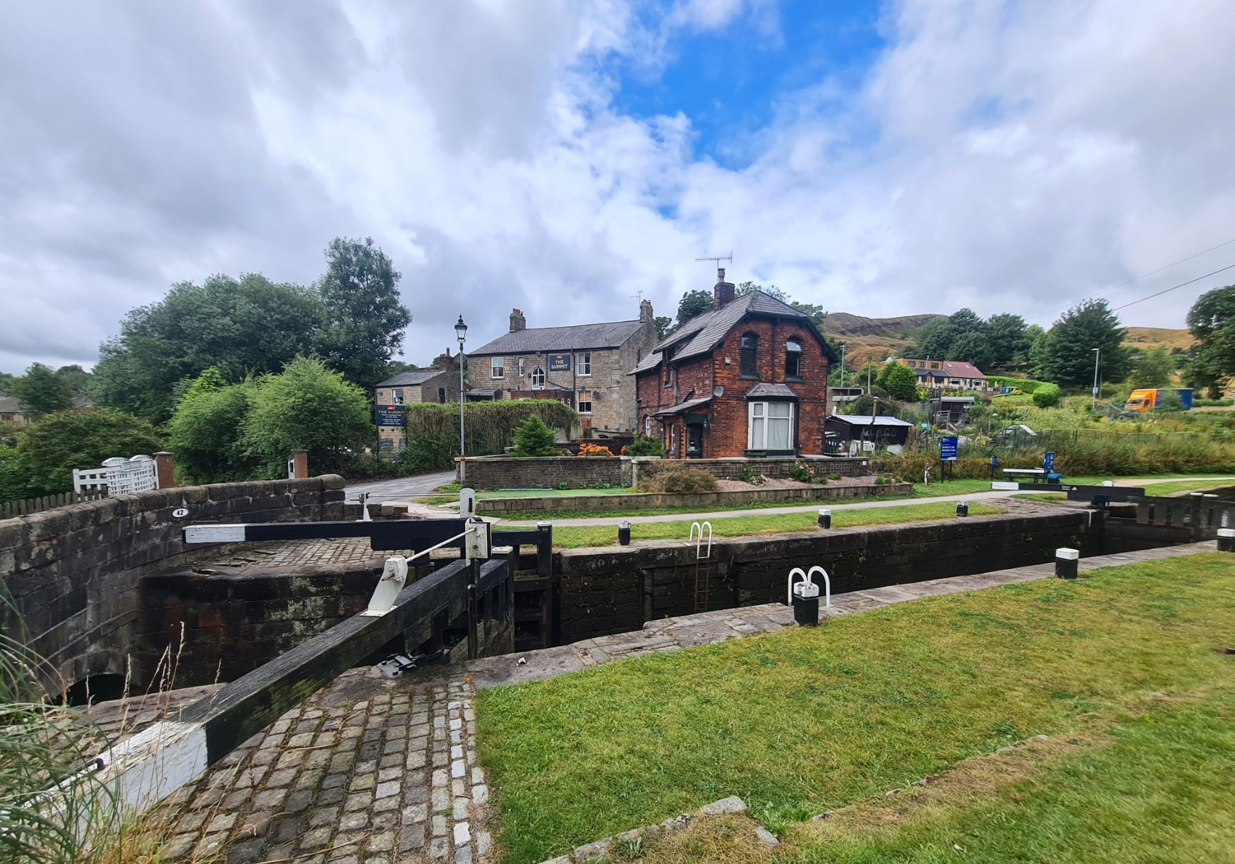
Skirting Littleborough it was back to road walking, down to the large Hollingworth Lake, popular for water sports and holidaymakers, before climbing back up the slopes and a few miles of hillside walking, past a large donkey sanctuary before a final descent down to cross the Rochdale Canal and I was at Summit. No time to celebrate my first 72 miles plus of trail as I had a few miles still to cover before I reckoned I could find a decent wildcamp for the night. I had moved directly on to the Mary Towneley Loop, but more of that in a later blog…
- Maps and Guidebook for the Pennine Bridleway
- Pennine Bridleway- The Mary Towneley Loop
- Pennine Bridleway- Mary Towneley Loop to Settle
- Pennine Bridleway- The Settle Loop
- Pennine Bridleway- Settle to The Street, Ravenstonedale
- Dry stone walls on the Pennine Bridleway
- Stone buildings on the Pennine Bridleway

6 replies »