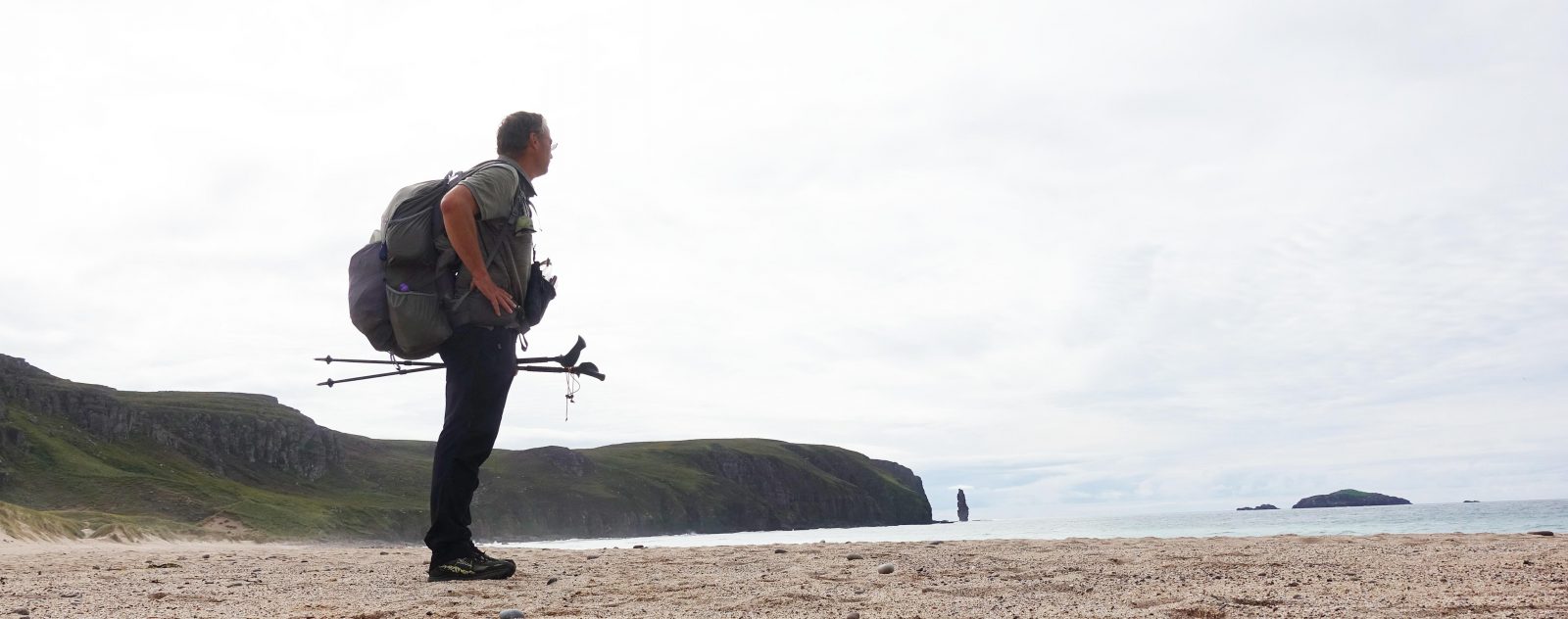
Three Points of the Compass walked the 205 mile Pennine Bridleway during the summer of 2022. Hot weather had given way to frequent rain. I had already walked some seventy miles from the start of the trail at Middleton Top. I now had the forty-seven mile Mary Towneley Loop to complete before I could continue my trail northward.
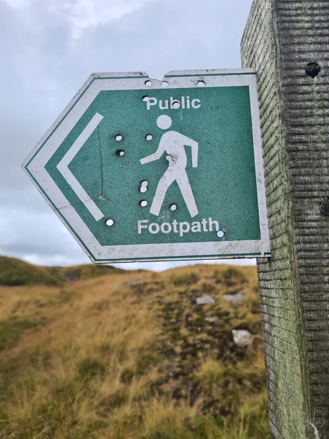
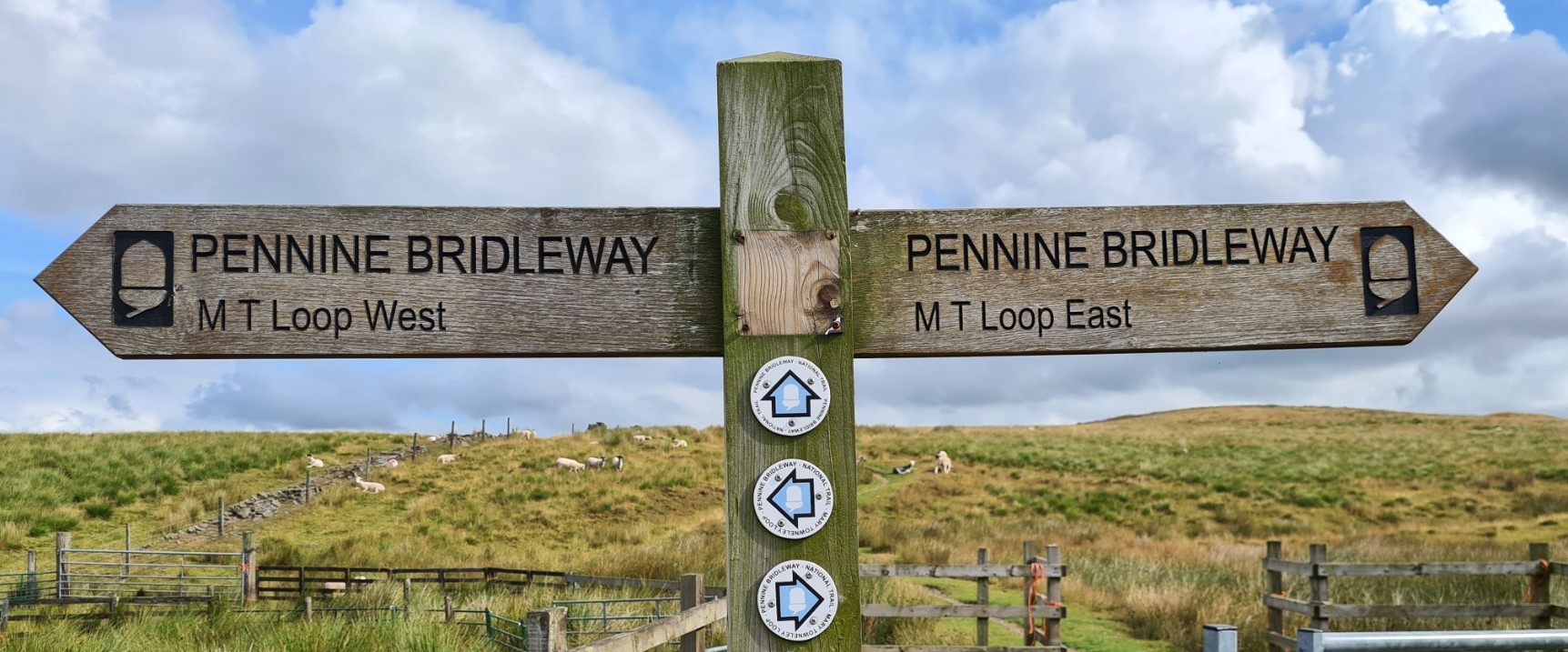
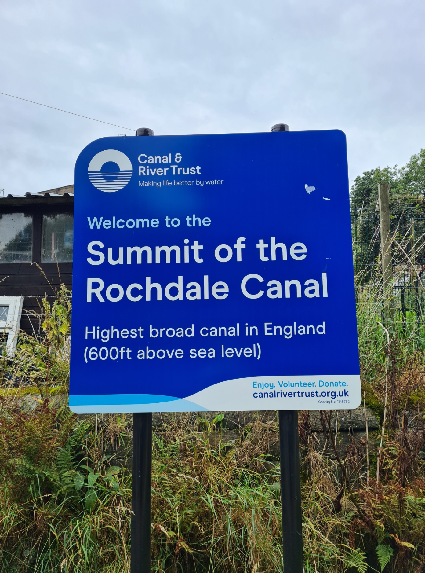
The Pennine Bridleway is a bit of an odd trail in that it includes two loops in its length. The first of these I reached when I got to the small town of Summit. The Mary Towneley Loop (MTL) passes through the South Pennines and is almost fifty miles of ups and downs with many many gates along its route. I joined the Mary Towneley Loop part way through my previous day’s hike (Day Five on the Pennine Bridleway). The Loop is popular with both horse-riders and cyclists, less so with walkers. I never encountered another backpacker walking the trail and few day walkers either.
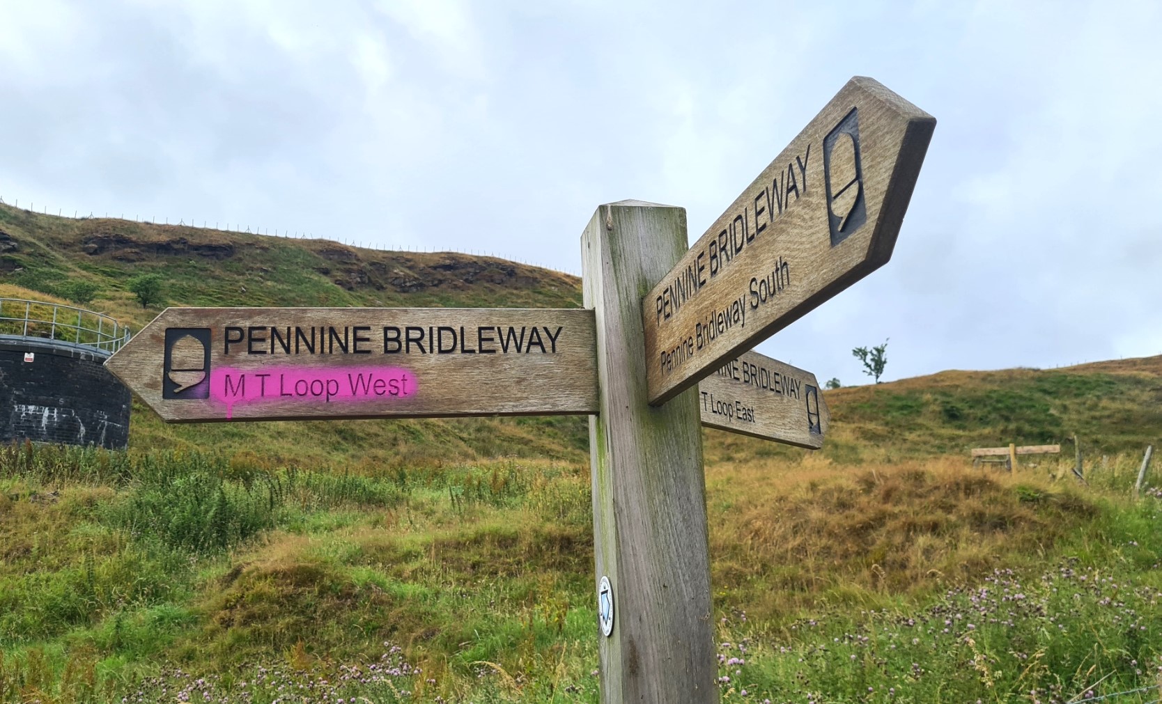
After a short but steep climb out of Summit, there is then the option of either heading left to follow the 29 mile southern/western ‘half’ or the 18 mile long northern/eastern ‘half’ before continuing up the main linear Pennine Bridleway trail at Gorple Road. I had already decided to walk the loop in its entirety but had not decided in which direction to go once I reached the junction at Summit. Reaching the three way finger post and thinking I might keep a bit more of the weather on my back (though I have no idea if that actually worked) I chose the Mary Towneley Loop West to start with. I would be back at this spot in just a handful of days, with no idea on how I would get back to Gorple Road.

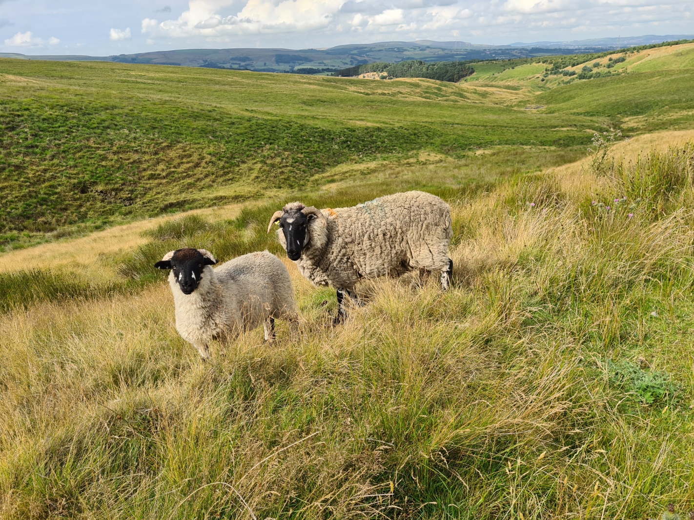
Leaving Summit I walked another 3.5 miles to find a quiet little wildcamp in the Watergrove valley, not far from the reservoir, making yet another fairly short day of just 13.65 miles. Even in my short distance on the MTL the countryside had already opened up a little and I had high hopes for the remainder. My wildcamp was a lovely little opening amongst the trees though there were a few flies around so I kept myself behind bug netting with the vestibule doors open for airflow. Two unconcerned grazing deer wandered past me behind my zipped netting. As the evening drew on they were replaced by more suspicious sheep approaching and staring at me before moving off. One deer obviously did take offence at my presence however and as dark fell, stood a few metres off loudly belching at me for ten minutes.
Day Six– Watergrove Reservoir to Worsthorne Moor, above Cant Clough Reservoir. 20.76 miles, 3221 feet ascent
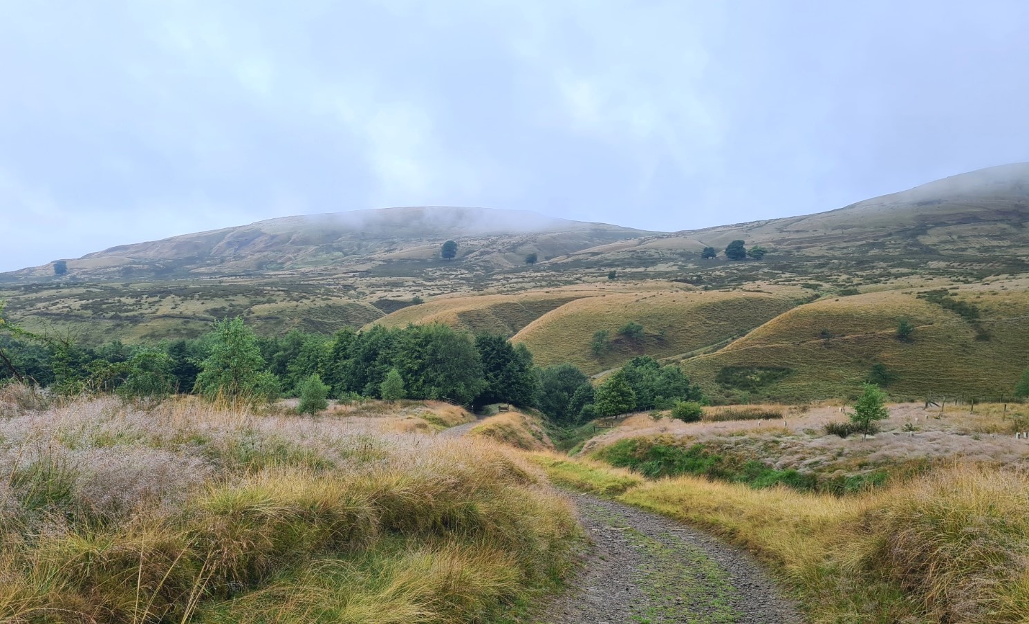
I slept well. The last of the evening’s out of sight dog walkers, shouting into their phones, had left at dusk. After a quiet night, there was no-one to be heard as I rose, drank my morning brew, packed and set off walking in the damp drifting mist. The slight mist rapidly cleared and I enjoyed my leg stretch up and round the Watergrove valley. Finally meeting three tough looking trail runners as they splattered through the mud, climbing a good deal faster than I was. Skirting the tops of both Brown Wardle Hill and Rushy Hill, I then passed quickly through quiet little Broadley, with around a mile of road walking before beginning the steady climb for the best part of the day. Broadley may be quiet today, however it used to have a bit of a reputation. The area was populated by colliers, weavers and quarrymen. A favourite activity was the nude kicking competitions where, naked apart from their clogs or boots, the violent contests could even result in fatalities. Apparently this ‘sport’ was very popular with spectators.

“…the vast progress which you have made in the short space of twenty months fills us with hope that every stain on your freedom will shortly be removed, and that the erasure of that foul blot on civilisation and Christianity – chattel slavery – during your presidency, will cause the name of Abraham Lincoln to be honoured and revered by posterity. We are certain that such a glorious consummation will cement Great Britain and the United States in close and enduring regards.”
excerpt from letter from Lancashire cotton workers to President Lincoln, drafted New Years Eve 1862
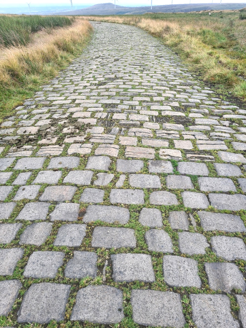
I had rain clouds chasing me all the way up the long climb to Top of Pike. This eventually caught me and passed as I reached Top of Leach on Rooley Moor. It is good underfoot however and never became the slippery mess it would have without the stone causeway; a multitude of setts are underfoot. These were likely laid during the Lancashire Cotton Famine in the 1860s as part of the Poor Relief effort. Severe unemployment resulted from the lack of raw cotton materials bought about by the American Civil War and it is interesting that despite the hardship being created, many Rochdale cotton mill workers supported the Union cause. The reason for this support was postulated by none other than Karl Marx.
“As long as the English cotton manufacturers depended on slave-grown cotton, it could truthfully be asserted that they rested on a two-fold slavery, the indirect slavery of the white man in England and the direct slavery of the black men on the other side of the Atlantic“
Karl Marx, New York Daily Tribune, 14 March 1861
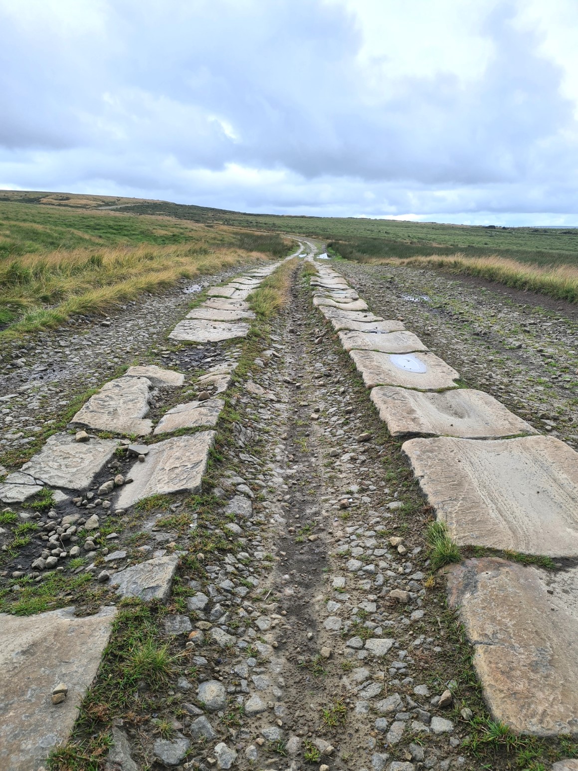
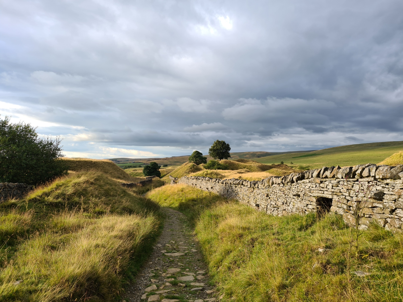
Eventually local Poor Law projects were instituted that provided continued employment to otherwise destitute workers and it is calculated that over 320 000 stone setts were laid on what is known locally as ‘Cotton Famine Road‘. It is a remarkable path and probably worthy of international recognition. It is also clear from the surviving paved path how much longer lasting the gritstone setts were compared to the porous alkaline limestone rock. Stone setts gave way toward the top to wide parallel stone rails, grooved depressions worn into them from countless thousands of wagons and carts. Modern day cycles continue the wear. I reached the site of Cragg Quarry, reputed to be the largest quarry in England in the late 1800s. The fine grained Haslington Flag had been found here, suitable for thin splitting and was used in roofing and other building work and is to be found paving places such as Trafalgar Square.
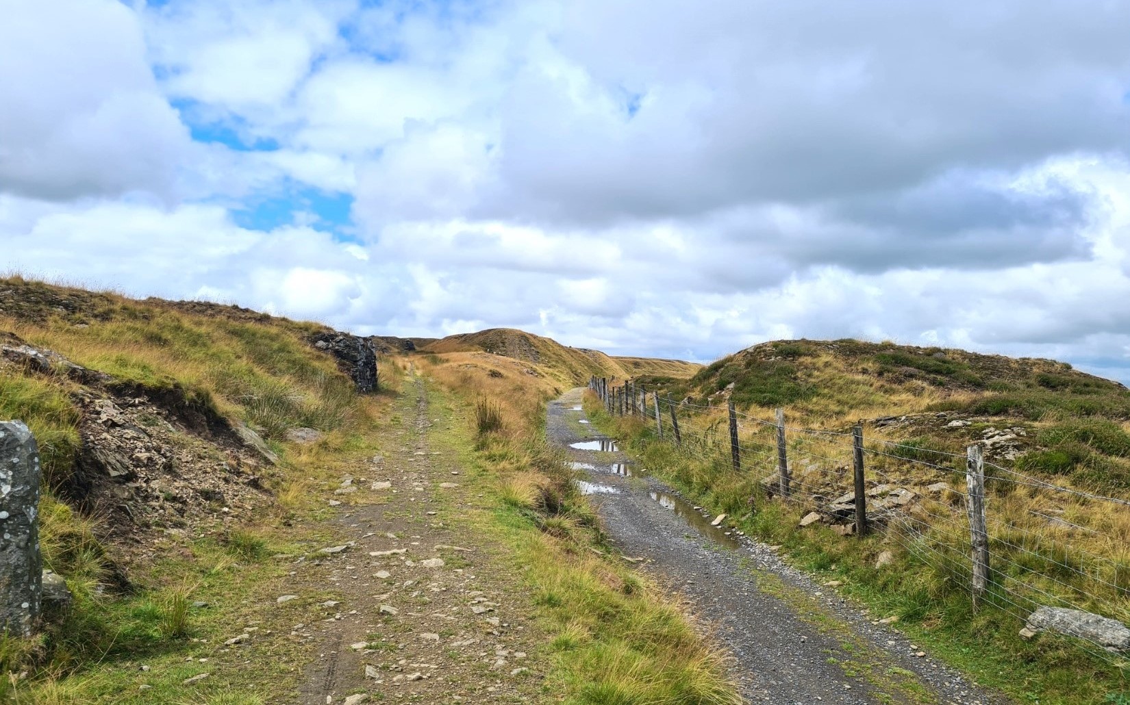
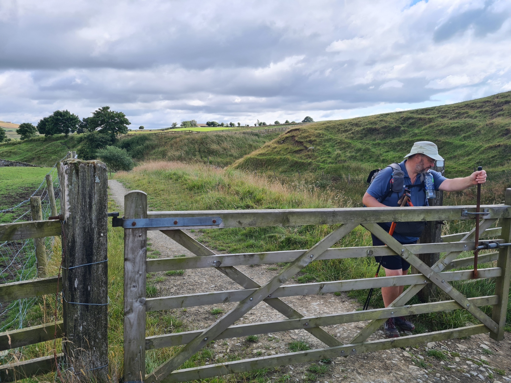
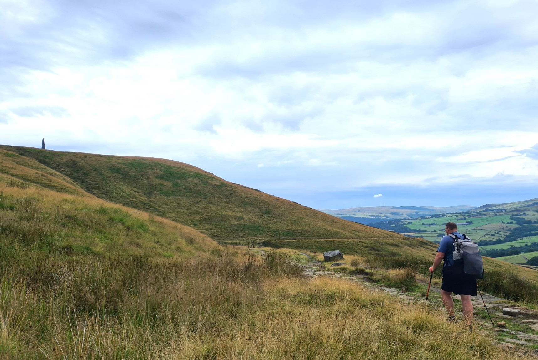
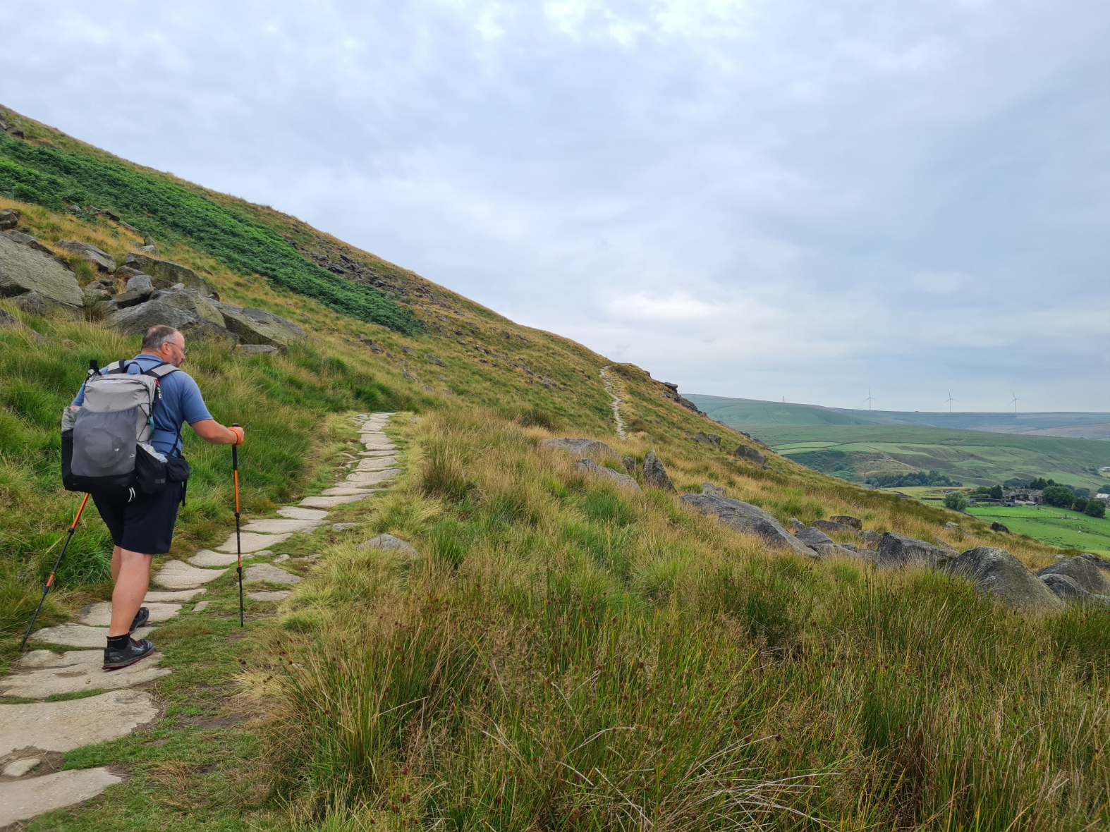
Five quarries were opened across the tops and all were linked by three-foot gauge steam railway. The narrow trackway can be seen in various places though the metal tracks themselves were lifted in 1920. It is a cracking walk along the tops here with expansive views. I had the whole of the moor to myself with not another soul seen between beginning the climb from Broadley to my eventual descent to Waterfoot. The Pennine Bridleway became a bit messy from there on. It is one of those trails obviously formulated by tying together bits of accessible countryside and sections of road. There are a lot of gates and it obviously took route planners a great deal of effort to bring together landowners with resultant installation of gates to lessen the chance of straying livestock. As usual in such cases, there was sometimes more than a hint of my presence being barely tolerated.

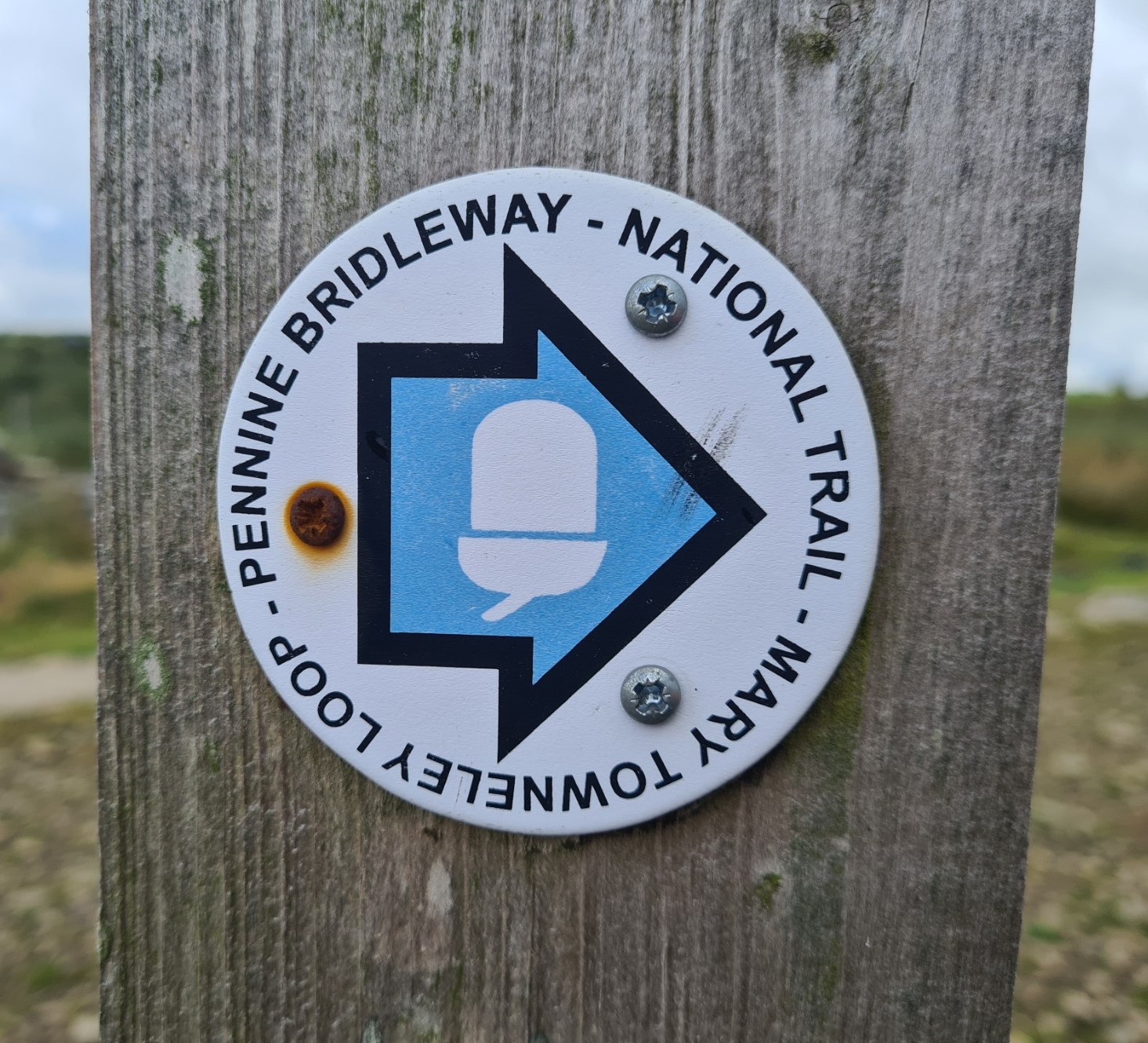
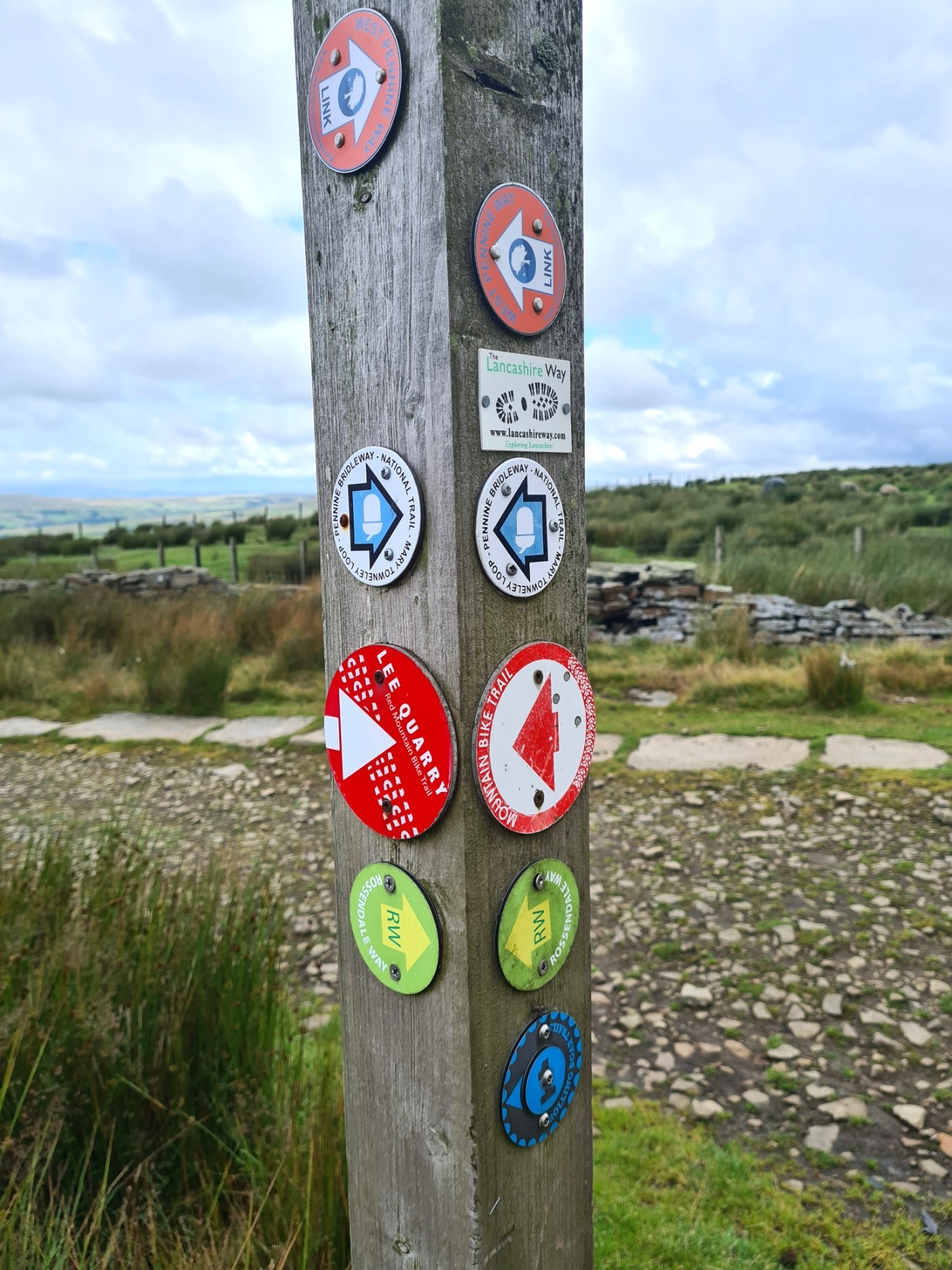
The sun came out and for the first time in a couple of days it got quite warm so I took forty minutes for a simple lunch of cheese and crackers, beef jerky and trailmix during which I took the opportunity to dry out my feet and footwear a little. I then simply got on with covering the miles. Thankfully the Mary Towneley Loop is probably the best waymarked part of the entire Pennine Bridleway and is simple to follow. Though I knew I would be encountering it during the day, it was still a pleasant surprise to open one gate and come across Mary’s Stone, overlooking the valley below.
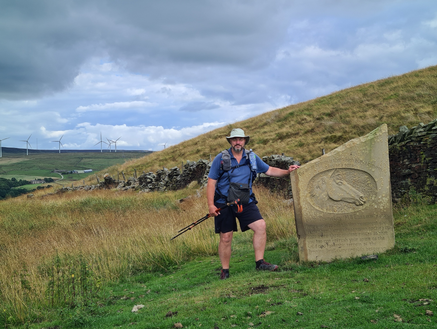
“The wind of heaven is that which blows between a horse’s ears”
Arabic saying, inscribed on Mary’s Stone
Mary Towneley had grown frustrated by lack of opportunity for horse riders and worked to create the multi-user Pennine Bridleway. The loop I was now walking eventually took her name. In September 1986, she, along with three friends, Dawn Baly, Mary Cranfield and Jane Rowell set off to prove that a ride from Corbridge, Northumberland to Parsley Hay in Derbyshire could be undertaken. They followed drove roads, corpse roads, packhorse trails and other long-forgotten and almost lost trails. It took them nine days to cover some 250 miles. That was insufficient in itself however and considerable lobbying was required to gain official support and eventually the Countryside Commission took on the challenge. The commission became the Countryside Agency when merged with the Rural Development Commission. That Agency became part of Natural England in 2006 and it is now Natural England that has overall responsibility for the trail. An eventual route, that differed in places from that suggested, was approved by the Secretary of State for the Environment in 1995 and the Mary Towneley Loop opened in 2002, followed by the southern section that I had walked from Middleton Top in May 2004. The Settle Loop followed in 2005 and the Pennine Bridleway opened fully in it’s current format in 2012. Whether it does ever fulfil its original aim of being extended into Scotland remains to be seen.
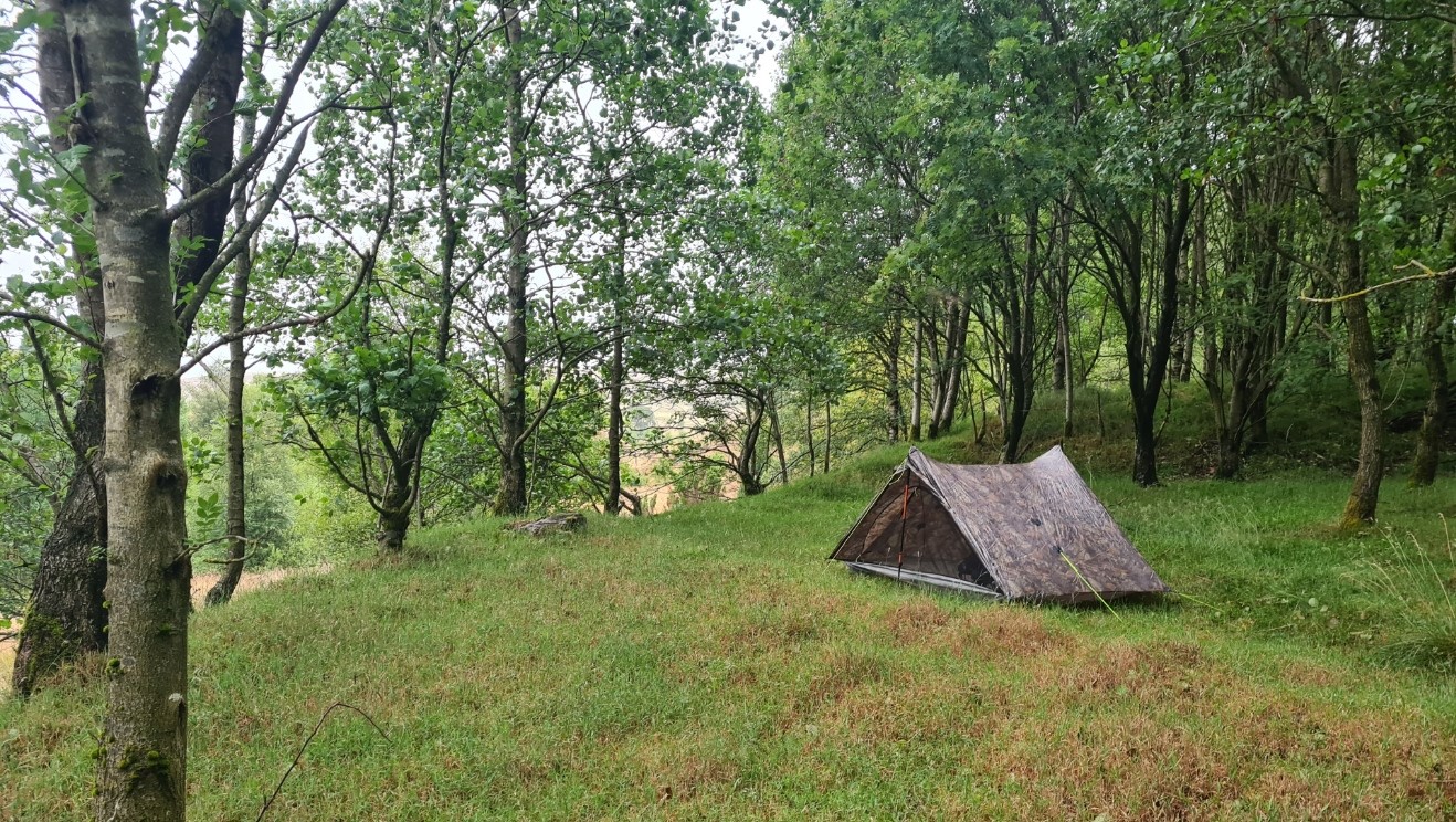
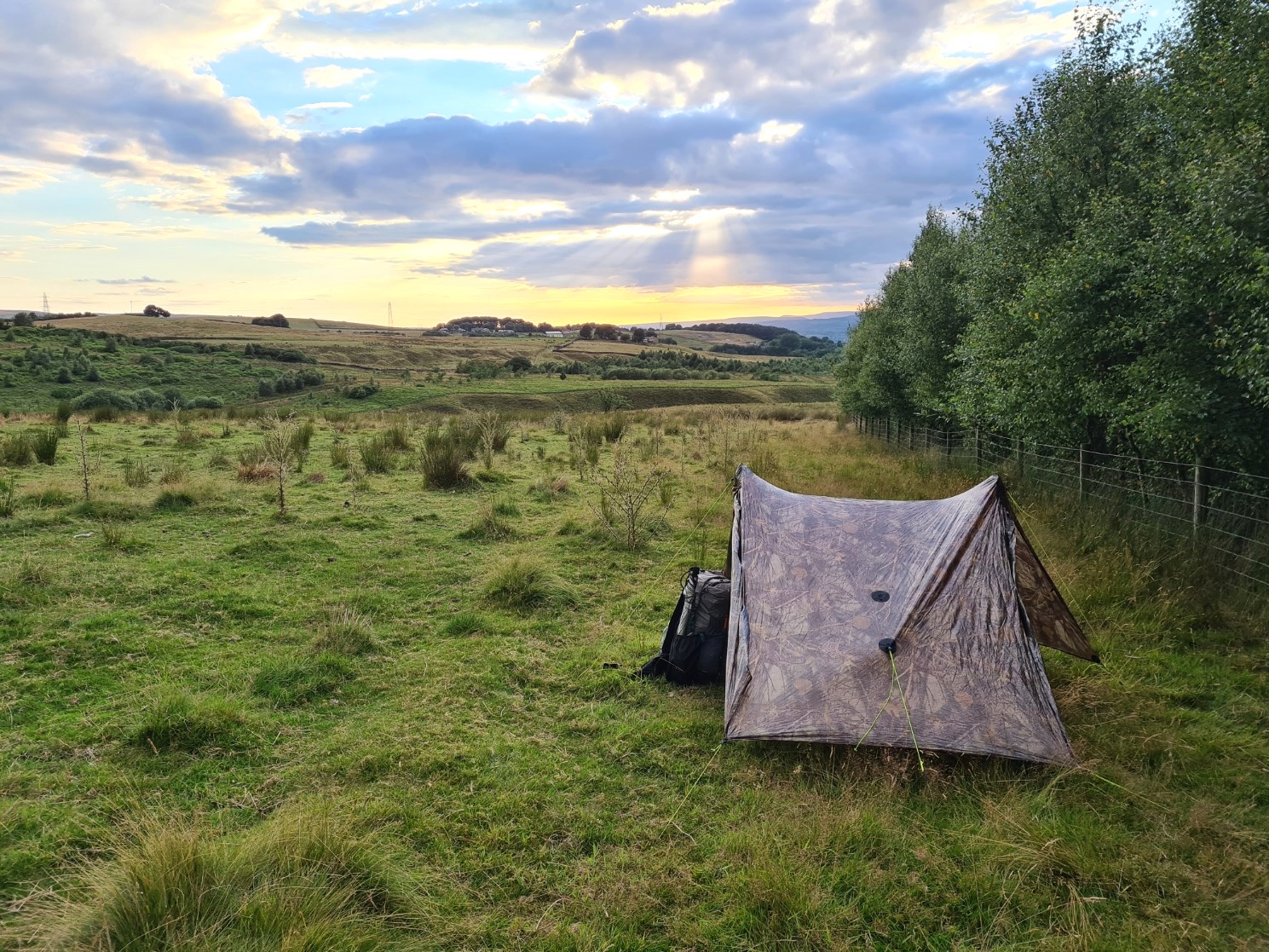
It had been a fairly demanding day and I was ready for it to end however few opportunities were opening up for a surreptitious wildcamp and I required water too for the evenings meal and brew. Eventually, passing through Shedden Clough I found a decent stream from which to filter three litres of water and soon after found no shortage of decent wildcamp opportunity. Tent up and tent wash. A welcome meal of rehydrated Chicken Tikka with Rice (to which I added smoked seasalt) was eaten as dusk fell and I watched a Barn Owl working its way up and down the turf. That drifted over my head and away when three last-of-the-day off road cyclists came labouring up a track some one-hundred metres away. I remained unseen in my muted colour shelter. I was sitting inside as the midges were out in force. The Duplex is sufficiently non-descript in tone that two badgers, startled by the cyclists, came lolloping up the slope toward me and almost joined me inside as they only saw me at the last moment and veered away at speed- “that wasn’t here last night“…
Day Seven– Worsthorne Moor to New Delight Inn, Jack’s Bridge. 10.14 miles, 1491 feet ascent
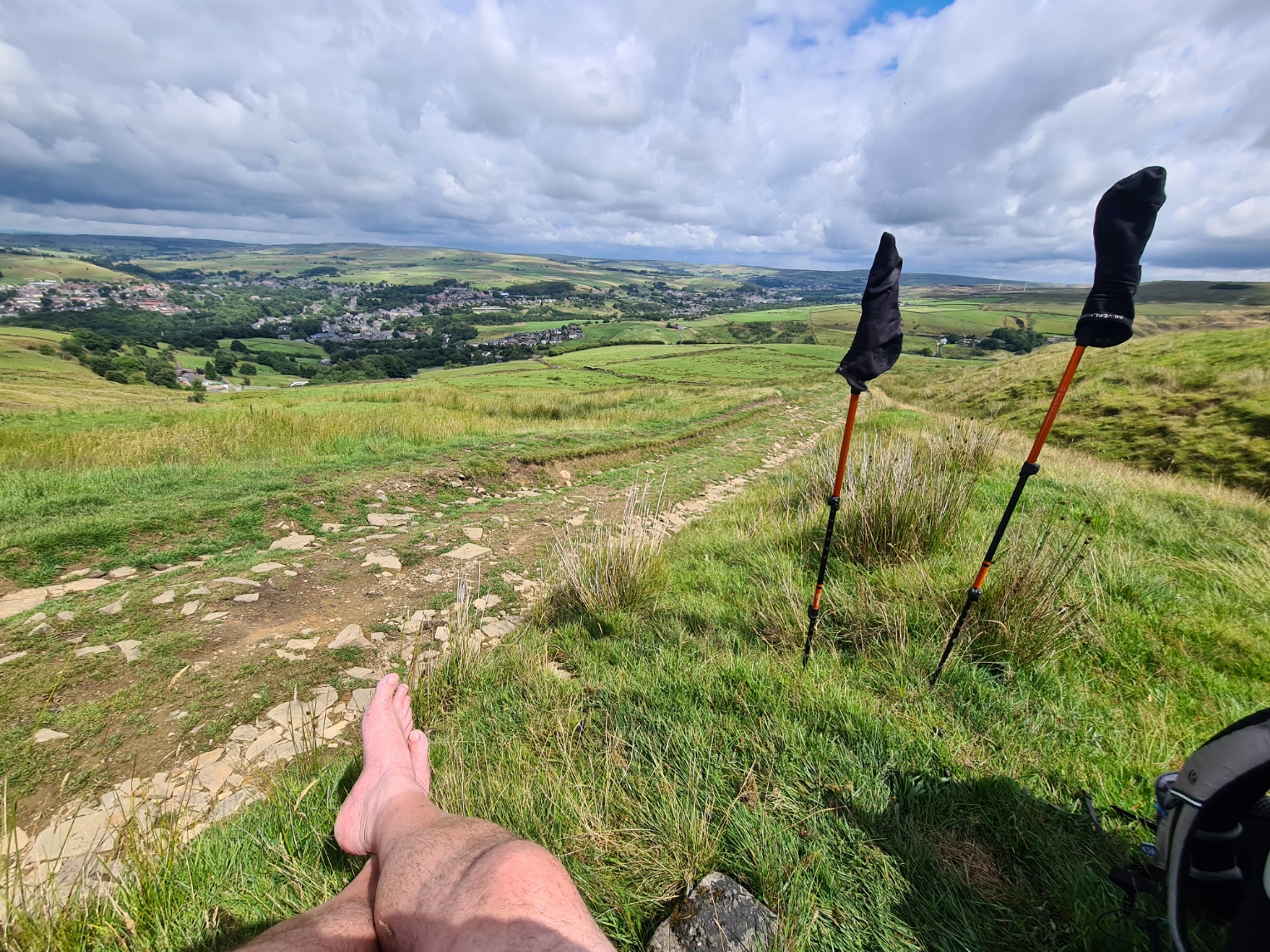
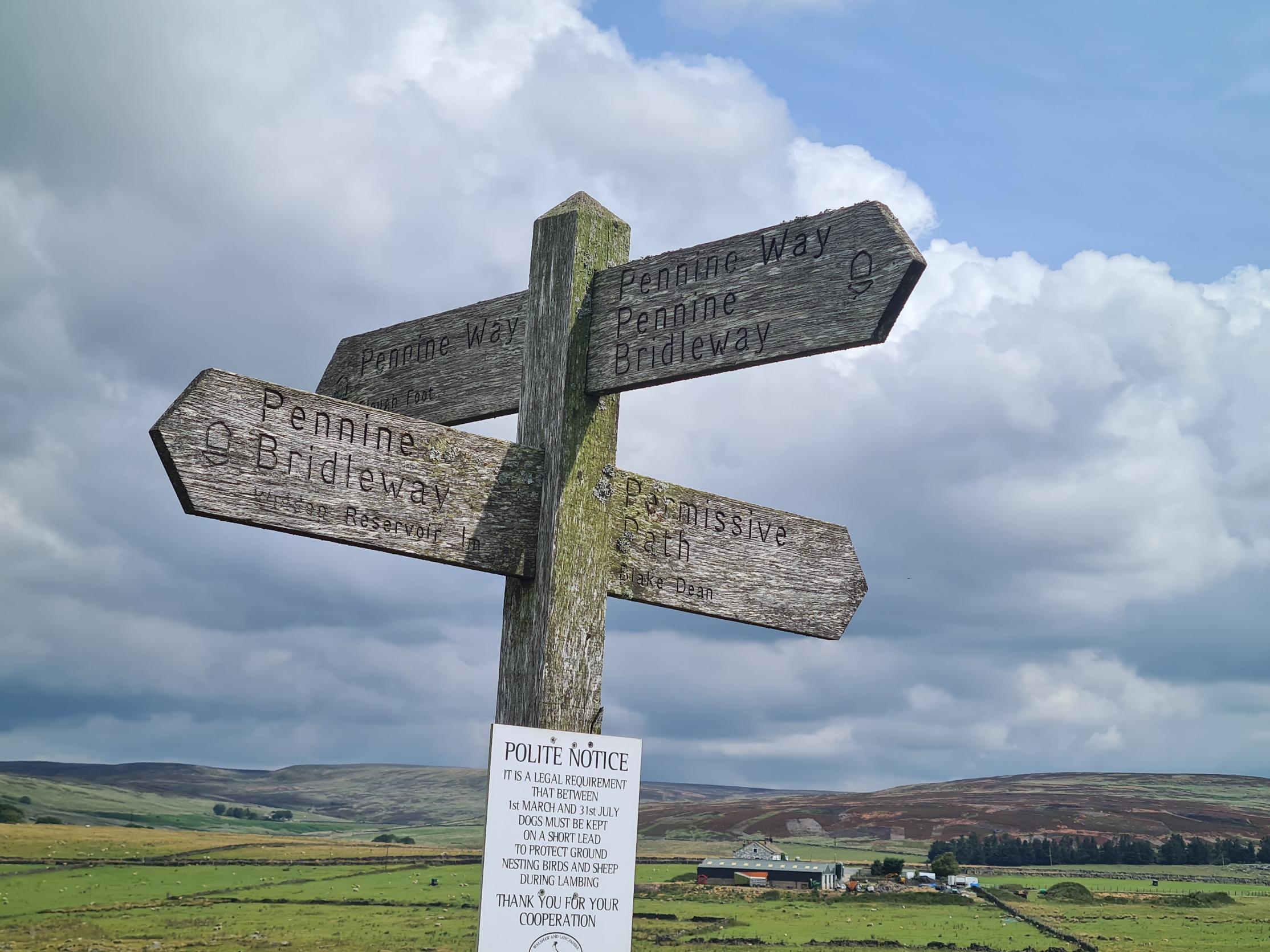
It was another quiet night with no disturbance apart from a few birds starting a modest chorus as dawn broke. On waking I was all too aware of how whiffy my socks and skiddies were and I felt it was time to fit in a modest clothes wash at some point, possibly that night if I could. I had camped just beyond Shedden Clough on the wide flank of Worsthorne Moor, one of the largest water catchments for the nearby towns and cities however I passed five reservoirs that morning and all were seriously low in contents. I met a birdwatcher at the first reservoir and we walked together for a couple of miles at first talking about all things avian before he took over the conversation and told me far more about his family concerns that I really cared to hear. I was carrying a little Opticron monocular with me and had been using it occasionally however the only new ‘trail bird’ I picked up at the reservoirs was a summer plumage resplendent Golden Plover. We passed the point where the Pennine Bridleway splits off to continue northward. I would, if everything went well, be back here in a couple of days. It was here that my companion decided to leave me and find someone else to talk at. He was very obviously a lonely chap looking for something to fill his days.
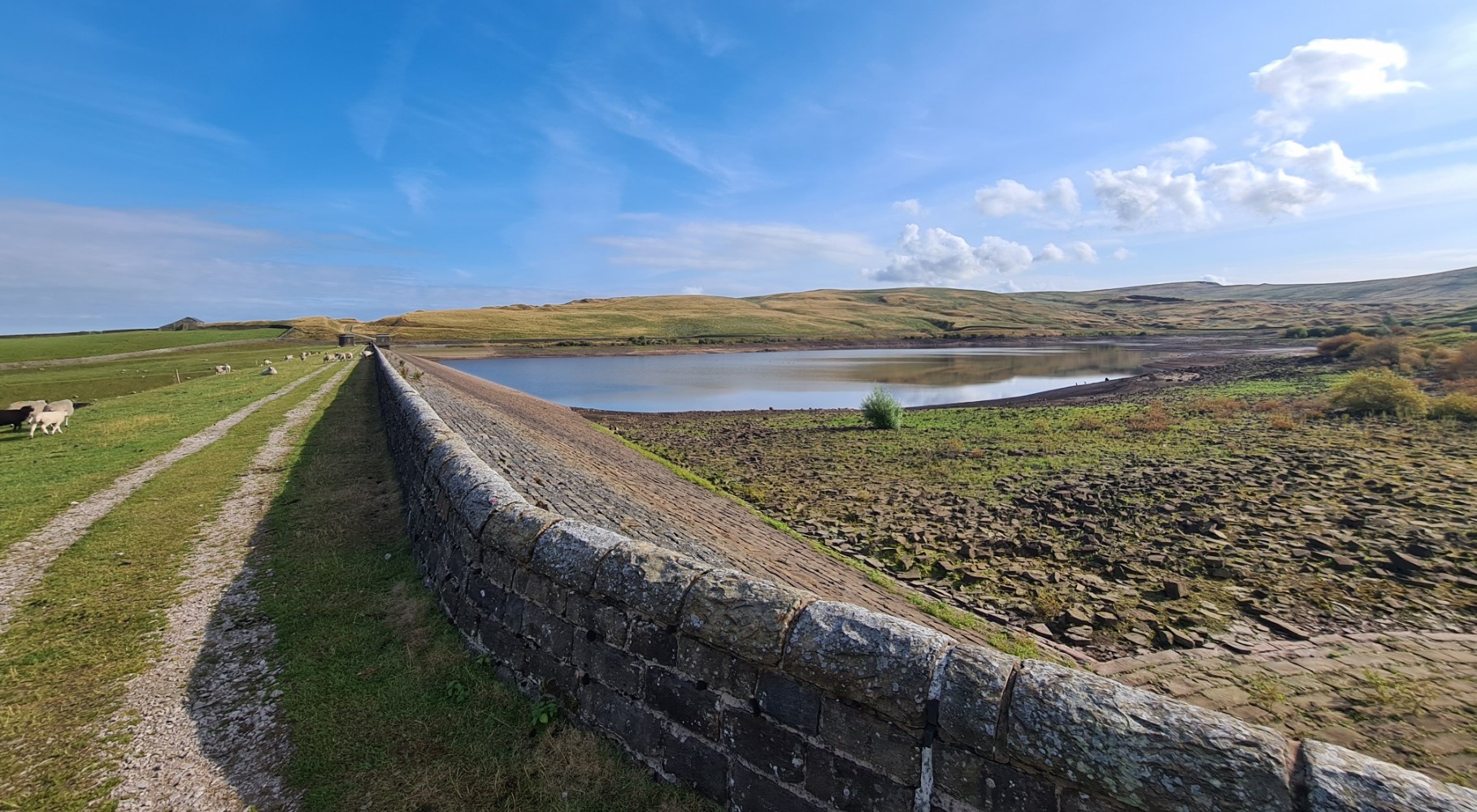

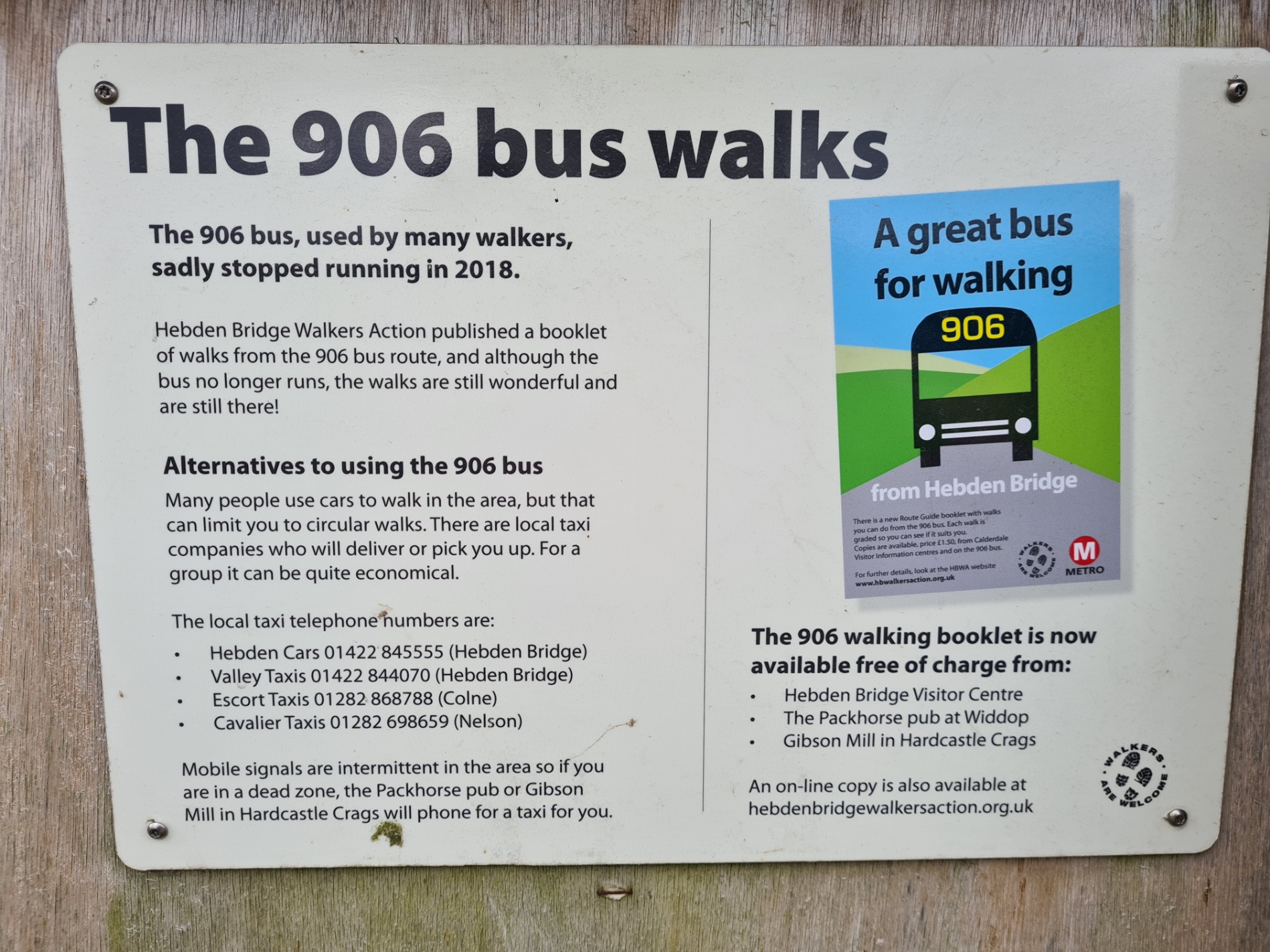
Further on, despite the lack of water, Widdop had purposely been emptied to allow maintenance work installing rabbit proof membranes on the grassy covering below the dam. Surely such works and wasting of water should have been postponed if there is a water shortage? I queried the sense of it with one of the workers there but he was more keen on telling me of the unique sloping screw design for the outlet valves, based on an Egyptian design I was enthusiastically informed. Beyond the dam, as I joined the road I came across a notice informing me that the useful bus that deposited walkers here had been discontinued. More on that problem later.
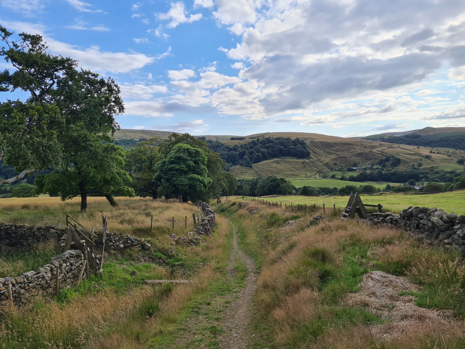
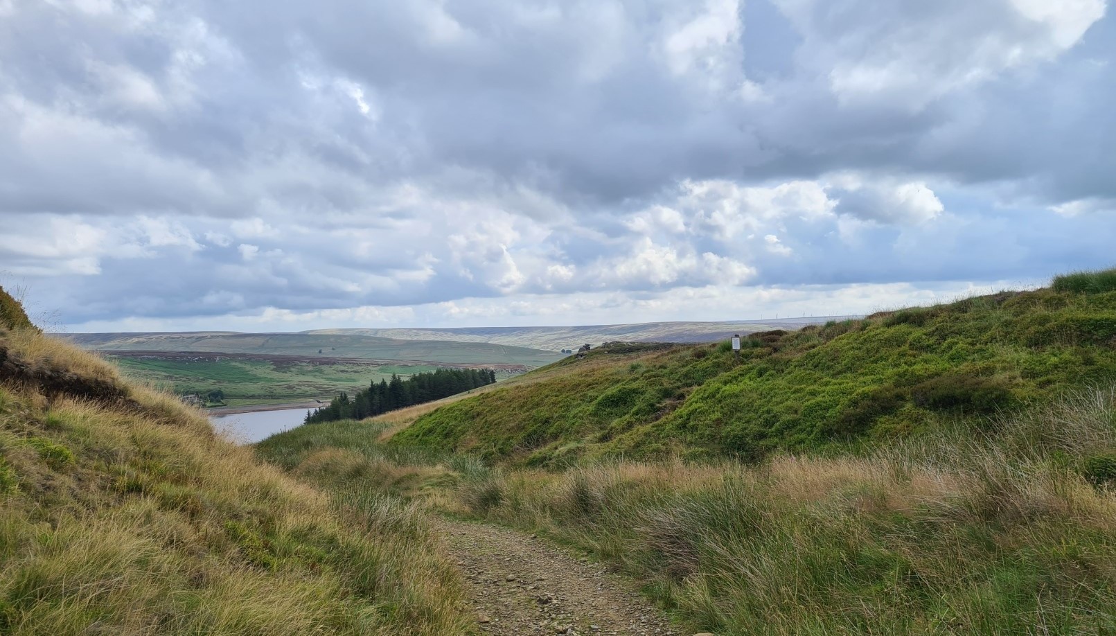
I was crossing moorland that was once well populated with opencast limestone mining. That 17th and 18th century industry is long gone and it takes a keen eye to spot the tell-tale signs. Many lumps in the landscape might be thought to be man-made but originally derived from water washing away softer limestones from between harder rock. The natural ‘hushing‘ left deposits to be picked out and burnt in the fifty plus limekilns in the area, all now gone. This day on the Loop is a good’un and I continued to enjoy much of what is, for many, an optional loop on the Pennine Bridleway.
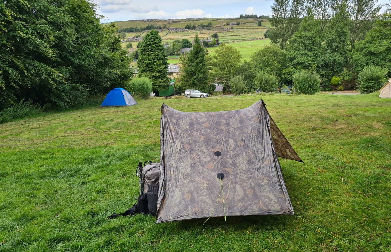
Looking at the map I could see that even if I had a fairly short day today I would still be OK for a decent half day’s walk to complete the Mary Towneley Loop at Summit the next day, theoretically leaving me plenty of time to sort out a transport option from there. I was ready for a campsite, early pitch and a bit of a rest rather than wildcamp for my nights halt after little more than a half day’s walk. I was also ready for a shower. I had previously read of a small field next to the New Delight Inn at Jack’s Bridge and set my sights on that. As it was, I arrived a half hour after they had shut after the lunchtime session and there was no one around and the doors to the Inn were locked. Taking a bit of a chance I went up to the camping field and found the closest I could to a flat spot at the top of the field. It was fairly near the road but further down I would be rolling out of the tent mid-slumber. I found a small shower block and happily sluiced myself clean. It was all very basic amenities but a perfectly adequate backpackers stop. Pennine Way backpackers obviously stop in here too and I chatted to a pair of knowledgeable backpackers, it became a bit of a gear fest as we chatted on all-things US ‘cottage’ company. I had washed out my hiking garb and strung that out on a line to my shelter to dry. The solar panel had gone out to catch the sun and that was, of course, enough to frighten the sun away, bring out the clouds, followed later by rain. Looked like I would be hiking in wet clothes the following day. Not for the first time but at least they wouldn’t smell so rank.
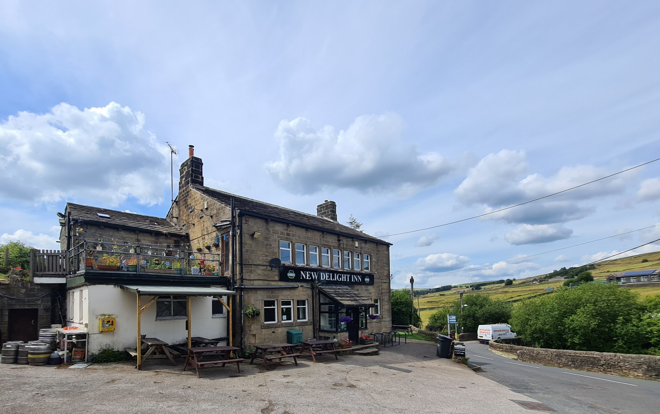
As important as a shower, I also had my mind on a decent pub meal. Much later, having rested, rehydrated with multiple brews and paid a fiver for my overnight stop, I enjoyed a huge ‘starter’ of chicken goujons (more like half an ostrich) followed by a basic bangers and mash. A couple or more pints of Vocation IPA slipped down equally as easily and I slept well with no noise from the nearby road bothering me in the slightest though it had rained heavily for a few hours. It had been a fairly undemanding and enjoyable half days walk.
Day Eight– New Delight Inn, Jack’s Bridge to Summit. 10.22 miles, 1626 feet ascent
The first couple of hours walking are heading toward Stoodley Pike with a surprising number of ups and downs before the final climb. I did stop for a long chat with one homeowner who came out to check on me when she saw me checking the map. She had ridden much of the Mary Towneley on her horse, a Dartmoor Pony/Gypsy Cob cross, but had now decided she was too old to fall off a horse and had retired both herself and her horse who now spent its time grazing in the field alongside her beloved donkeys. She told me they stayed mostly silent, unless they caught wind of the female donkey two miles up the valley. There was a feeling of progress about the morning and I was anticipating a good final day on the Loop. Correctly as it turned out. Despite being mid-week I was also joined on the trail by more cyclists and horse-riders than I had encountered in the previous days. This part of the Pennine Bridleway also periodically meets the Pennine Way and even if not running concurrent, backpackers can frequently be seen across the moor.
It is an enjoyable walk along the flanks of Stoodley Pike below the iconic monument on its summit and I am sure most Pennine Bridleway walkers would prefer to go over the top, visiting the 37m tall 19th century stone monument commemorating the defeat of Napoleon and the surrender of Paris. I had walked that way in 2018 when I completed the Pennine Way so stayed lower on this occasion, sticking to the Pennine Bridleway. Eventually the path descends to Mankinholes, passing the YHA where I stayed that previous occasion but that hostel is now only available for block bookings, don’t get me started…
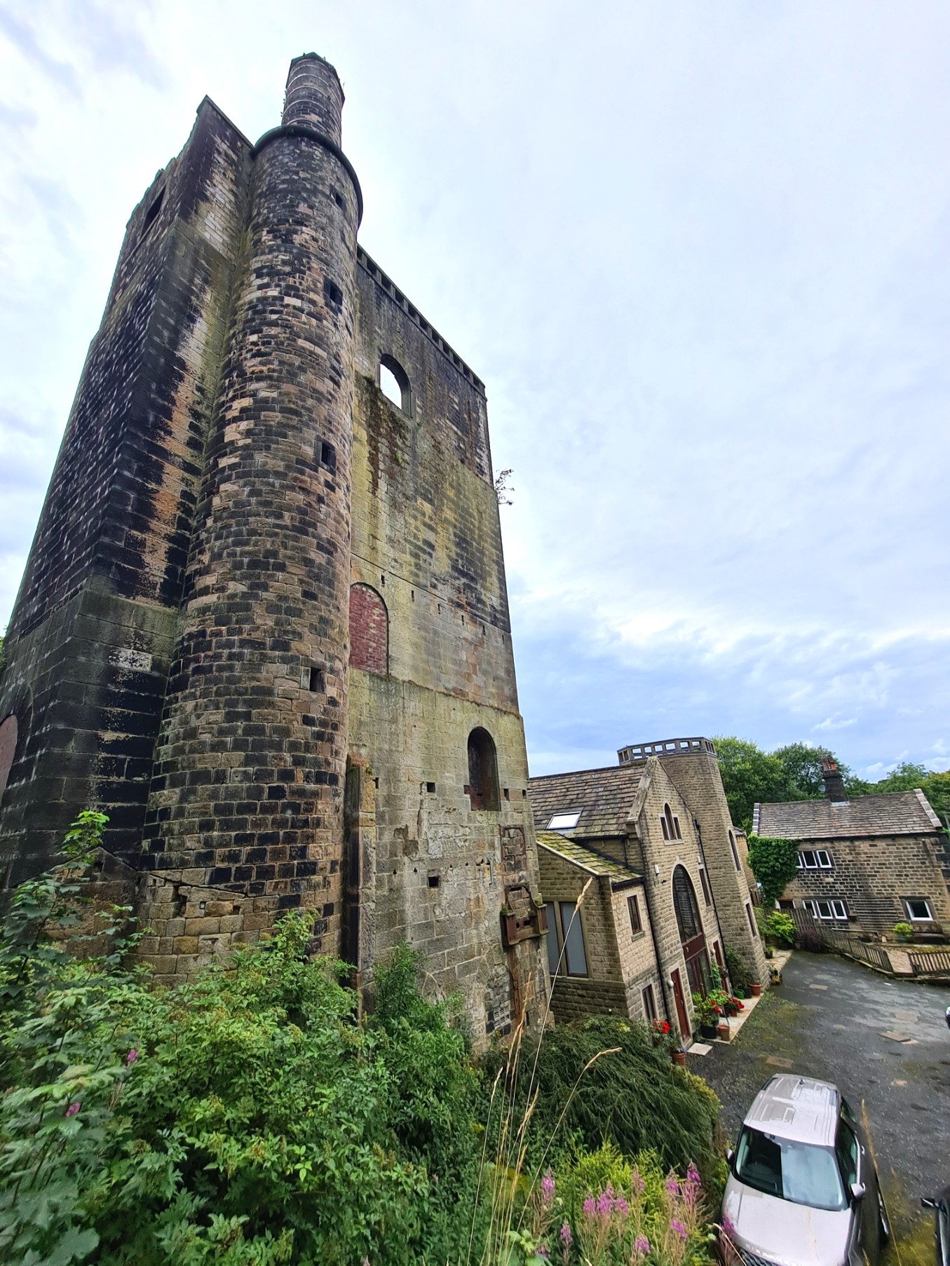
A walk down the fields from there took me past a decent pub (memories of good food there) and the water tower and Lumbutts Mill, a former cotton mill. The tower originally housed three water mills and even in its dilapidated state, the Grade II listed building remains a striking industrial remnant.
I have never walked a trail before where midday and a rumbling stomach have so many times coincided with a handy halt. Today was no exception. Walking up the Lumbutts road, away from the mill, I began to cross the road to start what looked to be an enjoyable climb up toward Walsden Moor, but then I glanced at the Shepherds Rest Country Inn to my right. I had previously had no intention of stopping there. It didn’t even look particularly inviting. I didn’t even care for the name. But on a whim I thought I would stop in for a pint of Orange Juice and lemonade, possibly a bag of nuts too. An hour later I waddled out stuffed with an excellent cheeseburger and two pints of Cumberland ale, with my phone fully charged and slightly resentful that I had to leave such friendly staff.

It is a pleasant easy wander along the moorland contours until having descended and rejoined quiet road and bridleway walking to Bottomley and a return to the Rochdale Canal. With my day drawing on it was then a speed march to Summit and completion of the Mary Towneley Loop. Feeling inordinately pleased with myself for some reason, I treated myself to a pint in the Summit Inn while I considered options. There weren’t many.
While supping my beer I chatted to the helpful lady at the bar and explored my transport options to Gorple Road. This is the location north of me, passed the previous day, where the Pennine Bridleway branched off from the Mary Towneley Loop and continued northward. It was all well and good my having decided to do all of the 47 mile long Mary Towneley Loop, whereas most people will take either the longer west half of the loop, or the shorter east half of the loop and then simply carry on along the linear Pennine Bridleway once they reach Gorple Road, but I had given myself the logistical headache of getting back up to the northern branch.
There are now no buses, no lifts from strangers, it was to a location in the middle of nowhere and a taxi looked to be the only solution other than walking back the way I had just come. I didn’t fancy that 18 mile walk again so logged onto the Uber app. First I was quoted £18. I accepted that, to be later informed that the ride was declined. Then I tried UberXL and was quoted almost twenty two quid. To be later informed that the ride had also been declined.
The lady serving my second pint gave me the number for a local taxi out of Littleborough. I was told it would cost £35 and five minutes later I was en route. My pint may have been downed at speed. It may be a steep price for a forty minute journey but needs must. My driver did try and get his Prius Hybrid as far as he could along the Gorple Road out of Worstholne but it became so rough I was convinced he would leave parts of the car behind if he carried on so told him to stop. I disembarked right next to Mooredge Farm and the entire household came out to see what was going on. There was a bit of banter but I think they were not only curious but also slightly relieved to see it wasn’t joyriders or flytippers. From there it was only slightly less than a mile walk to meet my path followed yesterday, and then turn off northward on the linear Pennine Bridleway. I had walked slightly over ten miles already today but still had a good few hours of hiking to complete. It was going to be long day. More on that in the next blog in this series.
- Maps and Guidebook for the Pennine Bridleway
- Pennine Bridleway- Middleton Top to the Mary Towneley Loop
- Pennine Bridleway- Mary Towneley Loop to Settle
- Pennine Bridleway- The Settle Loop
- Pennine Bridleway- Settle to The Street, Ravenstonedale
- Dry stone walls on the Pennine Bridleway
- Stone buildings on the Pennine Bridleway

5 replies »