
The Pennine Bridleway is a peculiar trail. Not only is it multi-user, it has a couple of add-on loops and link routes, and… years after it opened, it still isn’t complete! Finding maps and guidebooks for both planning and use on trail can be a challenge in itself. I know, as I have been searching them down in preparation for my own hike in 2022.
The Pennine Bridleway doesn’t get a great deal of attention, partly because it hasn’t yet been defined for its entire length and partly, I suspect, because of its name. It is a walking trail, combined with a cycle trail and a bridleway, though the three separate at times. It has been a long wait for the various authorities to get their act together and get all of this trail nailed down as an official route. Even now, with the various extensions the trail is not complete. It has long been hoped that it will eventually continue to Bryness in Northumberland, thereby making a 350 mile long trail. At the moment it is some 205 miles but that can vary according to the alternatives you might choose to hike.
As of June 2022 the Pennine Bridleway runs from Derbyshire to Cumbria. It begins (or ends) at Middleton Top (or Hartington for horse riders) and heads north 72 miles to Summit and the Mary Towneley Loop. The hiker then has a choice, hike all of the 47 mile Mary Towneley Loop returning to Summit, then continue northward (either repeating a section of the trail in the opposite direction or taking public transport to Gorple Road where the trail continues north), or just walk either the 29 mile southern/western side of the loop or the 18 mile northern/eastern side of the loop, and then keep heading north. Further north, at Settle, there is another loop off the main trail. This is the ten mile long Settle Loop, of which two miles are included in the route of the main Pennine Bridleway. From the Settle Loop the Pennine Bridlway continues north to end at either The Street, a little south of Ravenstonedale, or take a link route and finish at Hebden Bridge.
Some people will simply hike the Pennine Bridleway as a linear trail, eschewing the two additional loops. Others might branch off, walk each loop and continue on the main trail, missing out the miles between the loop turnoffs. Some hikers will want to walk all the miles. For those looking to complete the trail and have it added to the National Trails Register kept by the Long Distance Walkers Association, it is necessary, as a minimum, to walk from one of the two start locations in the south; Middleton Top or Hartington Station, and walk northward to Ravenstonedale, taking in either of the ‘halves’ of the Mary Towneley Loop, completion of the Settle Loop is not required.
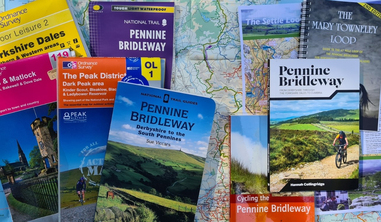
Three Points of the Compass has long had the Pennine Bridleway pencilled in for 2022 so has had ample time to look around at what digital and printed resources have been produced. Ever the planner, I own all those shown below and have found some more use than others. It may help others to have a brief glance at their various merits.
Paper maps
Ordnance Survey:
The Pennine Way is a long trail and it crosses quite a few Ordnance Survey sheets. The Explorer 1:25 000 are a helpful scale to have as these indicate which side of a stream, fence or hedge a path is routed. While this extra detail is useful and to be appreciated, much of the route also crosses moorland where a 1:50 000 scale is perfectly adequate. However as no additional maps are required at 1:25 000 scale, given the choice, you might as well plump for the greater detail if taking paper maps. The Pennine Bridleway is an ‘official’ long distance path so is marked on O.S. maps so digital mapping could be equally as useful for those who prefer that method.
Regardless of whether Landranger or Explorer are chosen, this number of map sheets is a lot of weight and bulk. Standard O.S. maps are not waterproof either so not only is a map case of some description required but unused maps also require sealing inside a waterproof bag in the pack. Alternatively O.S. produce waterproof ‘Active’ versions of their maps, but these not only increase the cost but also weight and bulk still further. It is worth noting that many of the guide books shown below include either 1:25 000 or 1:50 000 O.S. maps in their pages, usually the latter.
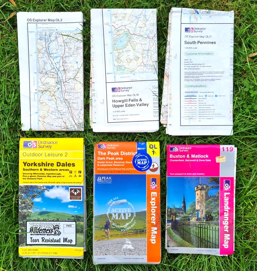
O.S. Landranger 1:50 000
- 91 Appleby-in-Westmoreland
- 98 Wensleydale & Upper Wharfedale
- 103 Blackburn & Burnley
- 109 Manchester
- 110 Sheffield & Huddersfield
- 119 Buxton & Matlock
O.S. Explorer 1:25 000
- OL 1 The Peak District- The Dark Peak
- OL 2 Yorkshire Dales- Southern and Western Areas
- OL 19 Howgill Fells & Upper Eden Valley
- OL 21 South Pennines
- OL 24 The Peak District- White Peak
- OL 41 Forest of Bowland & Ribblesdale (or print out the short section required)
Removing the covers will reduce the bulk of paper maps a little or print outs on to waterproof paper of relevant sections will reduce still further. The best option is to use the Harvey map below, possibly supplemented by the O.S. mapping in one of the few guide books also shown below. If you prefer O.S. mapping, then a subscription to digital O.S. Maps is preferable to a heavy and bulky bundle of paper maps.
It would be helpful if the A-Z Adventure Series of map books that incorporate O.S. mapping included the Pennine Bridleway amongst their range as this would bring the weight and bulk down considerably. A-Z managed to squeeze the Pennine Way into South and North volumes and could easily do the same for the Pennine Bridleway. I used the two A-Z map books when I hiked the Pennine Bridleway and they were terrific resources for that route. Let’s hope they do add them soon.
Harvey:
Harvey produce a large range of maps for specific long distance trails. There is always the danger of ‘walking off the map’ with what are, in essence, strip maps, but those they have prepared for the Pennine Bridleway for the most part include a good distance each side of the trail. They got in early with their Pennine Way South sheet that runs from Middleton Top north to Summit and the Mary Towneley Loop, also shown on the sheet. This sheet covered just 121 miles of what is now a 205 mile route. The short Torside Link is tucked onto the sheet too. Printed in 2004, this is waterproof and to a scale of 1:40 000. It weighs 82g . No North sheet was produced. If you were only walking the southern section or the Mary Towneley Loop this is still a perfectly good map but there is no need to purchase it now as Harvey have now produced the only map to the complete trail as it now stands.
In 2021 Harvey seem to have lost patience. They got on with the job of producing a sheet as no one else had or has. They committed the whole trail running between Middleton Top and Ravonstonedale to a map. This is the route that most people ‘in the know’ accept will be the final trail. This single-sheet map (printed on both sides) is welcomed by many and is, I believe, a unique printed resource. Not only that but it is also printed on the lighter weight ‘paper’ that Harvey now use.
The most recent (as of 2022) Harvey National Trail Pennine Bridleway map is waterproof, weighs 60g, and runs 205 miles from Middleton Top all the way north from Derbyshire to Cumbria, to finish either at Ravenstonedale or Kirkby Stephen. Included on the sheet are the 47 mile Mary Towneley Loop and the 10 mile Settle Loop. Not part of the official trail, the Torside Link is included on this map. The latest map from Harvey, printed 2021, is to their standard 1:40 000 scale and incorporates accurate, clear mapping and is now the only map you need to hike this trail. It is what I am using this summer.
The northern end of the trail ends at The Street, and a short link from there to Ravenstonedale is shown on the most recent Harvey map, alternatively, the trail keeps heading north a little further to end on the outskirts of Kirkby Stephen.

Harvey include further detail on their maps. There are addresses and phone numbers for Tourist Information Centres en route, Link and access suggestions, cycle hire and repair centres. The contact details for vets near the trail could be useful for both horse riders and those taking a dog with them.
There are also a small number of dedicated cycle route maps that include some of the Pennine Bridleway. The South Pennines & Peak District Off-road Cycle Map by Richard Peace and Excellent Books includes some good parts of this trail and many others as part of suggested day rides. Extremely tough and printed on waterproof paper, this is good but unsuited for tackling the Pennine Bridleway trail itself. Be aware, this map indicates height by shading rather than contours which can take a little getting used to.
Cycling UK incorporated the Pennine Bridleway into The Great North Trail. This is a cycle route from the Peak District to either Cape Wrath or John O’Groats. The Great North Trail Guide is available online (parts one and two). There is also a printed hard copy available.

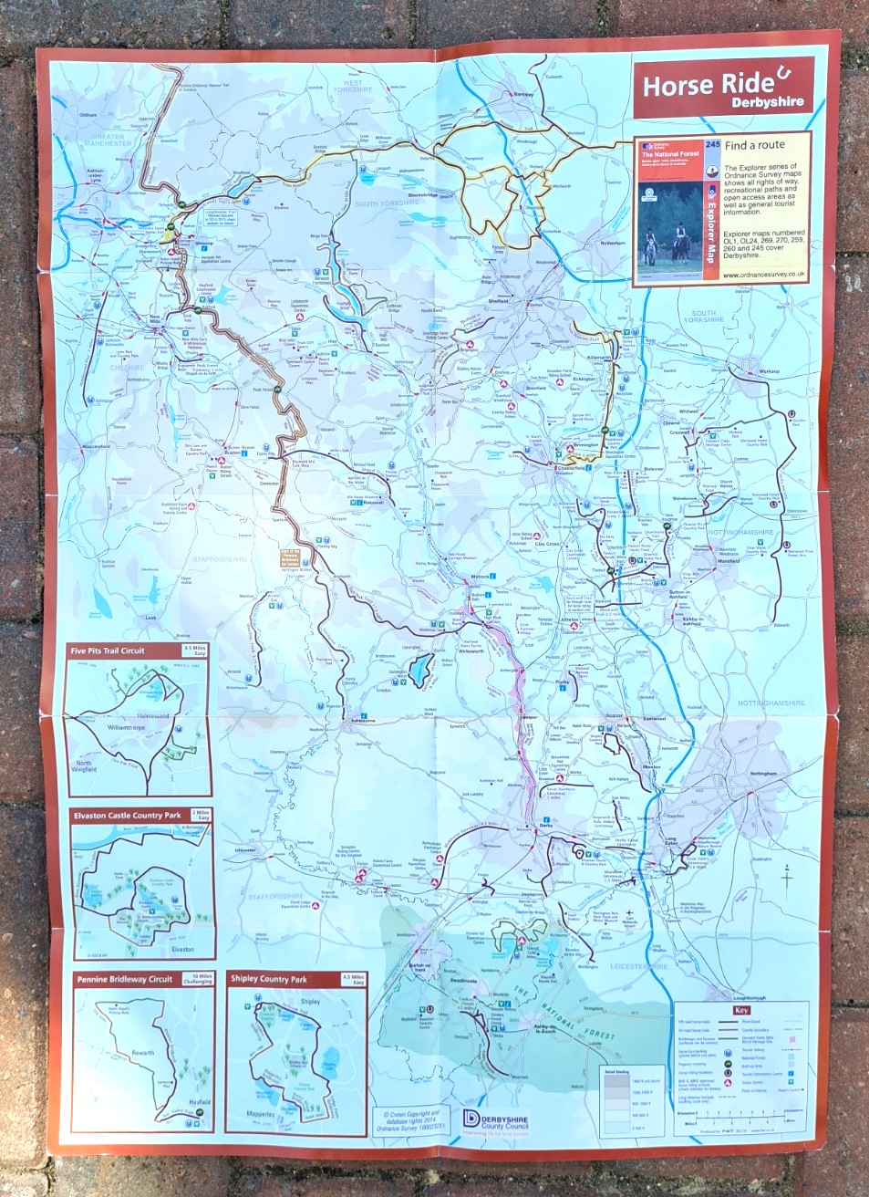
In 2014 Derbyshire County Council prepared a useful free map for horse riders showing a network of horse riding routes across Derbyshire. This includes the route of the Pennine Bridleway from Middleton Top (or Hartington Station for horses) northward to east of Oldham. This is a useful planning guide that includes contacts for the various routes. It is now also available online.
Guide books:
Compared to other trails such as the near by and far more popular Pennine Way, there have been few guidebooks produced for the user of the Pennine Bridleway. There have been issues with producing these. The number of people completing this trail are fewer in number than other trails so the buyers market is reduced. The trail is multi-user in intent- horse, cycle and walker, each having different requirements from a guidebook, and finally, the trail has been extended since some of the guide books were written and they have not been updated. I have shown those below in publication date order with the most up-to-date at the bottom. This demonstrates the problem, what was once the best volume for walkers is also the oldest.
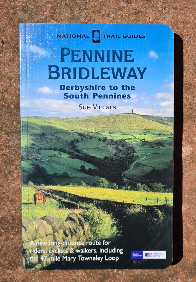
Pennine Bridleway, Derbyshire to the South Pennines. Sue Viccars. Aurum Press, ISBN 1-85410-957-X, 2004. 168pp, 290g
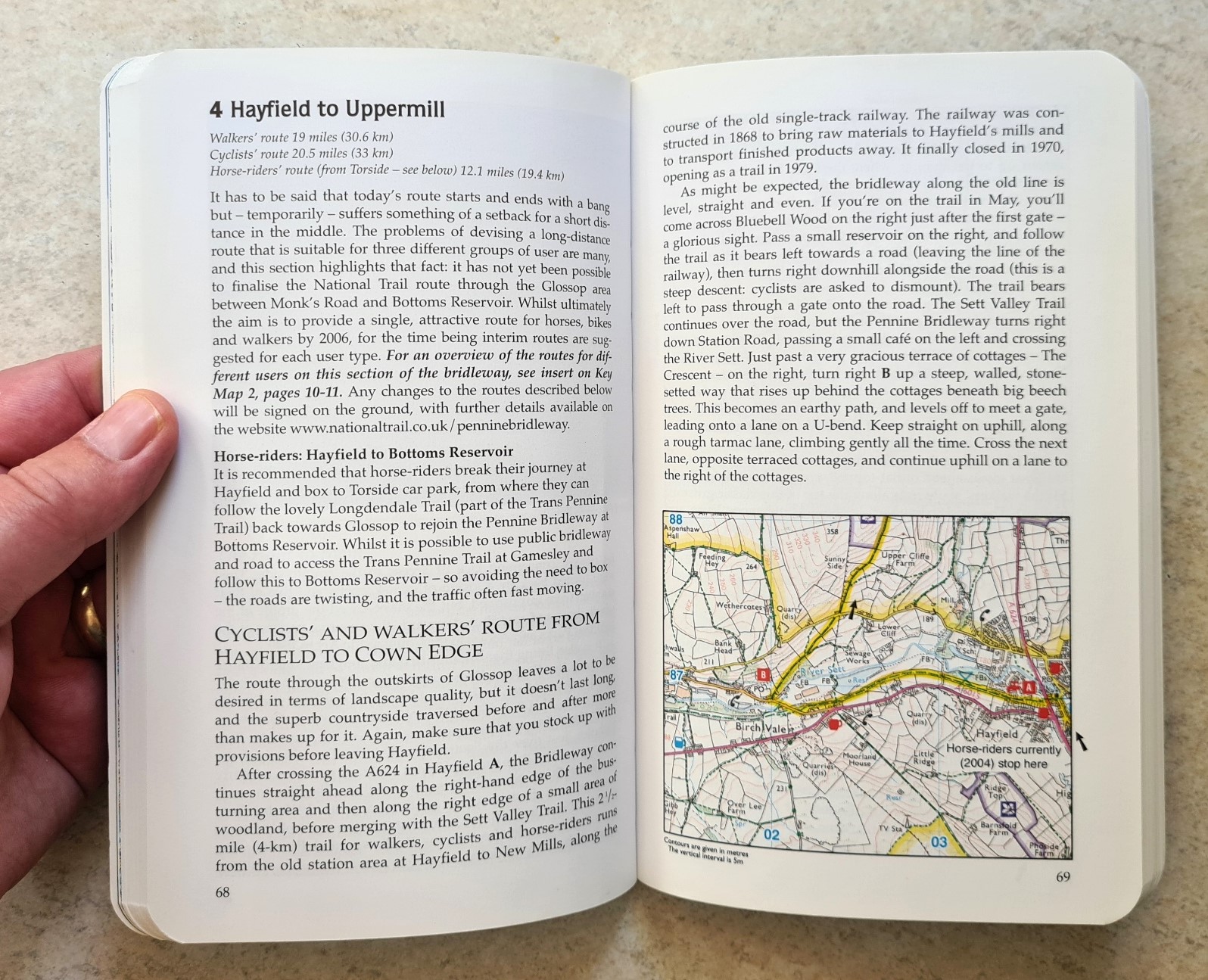
This is a National Trail Guide and part of an extensive series of ‘official’ volumes. It includes 1:25 000 O.S. mapping, a larger scale than that used by the two of the volumes above. It would be perfectly possible to forego paper maps and steer a course with this guidebook alone. Published in 2004, as usual, much of the information included on saddlers, farriers, vets, cycle hire and repair would need checking. But this book excels most as an on trail guide book to the route and points of interest. The geology and historical information included isn’t extensive and I would have preferred that the brief snippets were more. Unlike other guide books that focus on horse riders and cyclists this has walkers as a primary user in mind. This is easily the best, most useful and informative on trail guide book shown here, especially for walkers. But it now only covers part of the Pennine Bridleway and desperately requires updating. There is certainly a market for it.
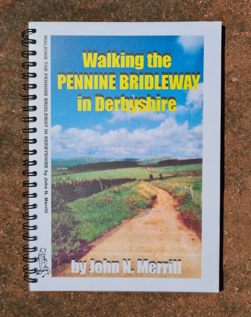
Walking the Pennine Bridleway in Derbyshire, John N. Merrill. ISBN 1-903627-61-3, 2004. 80pp, 151g
The John Merrill Foundation have produced a huge number of titles and this ring bound volume once filled a niche left bare by others. Some might be familiar with the style and use these guides extensively but I am not a fan of it. It is bulked out with uninformative pages and irrelevant to me suggestions of eight loop walks. The sketch maps could be followed but should not be relied on as a sole resource on trail. That said, there is a small degree of helpful trailside info crammed in amongst the less helpful filler. The publication covers just 41 miles of the trail in Derbyshire. It is now an old publication and has been overtaken by others. If you were holidaying in the area and just wanted a taster of the trail, this could still be a useful accompaniment. It sits on my shelves unused.

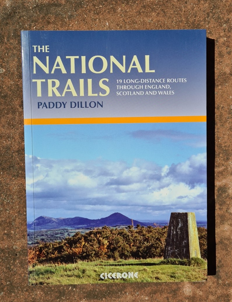
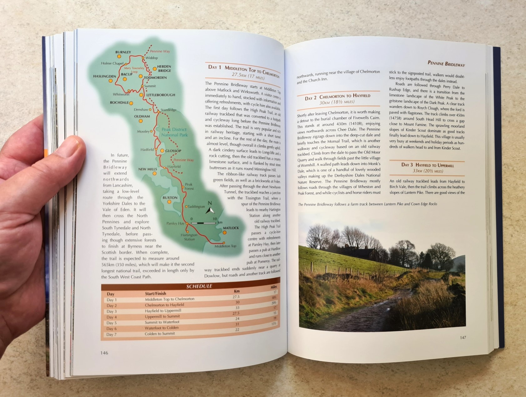
The National Trails, Paddy Dillon. Cicerone, ISBN 13-978-1-85284-504-9, 252pp of which just 8 cover the Pennine Bridleway. 2007
Paddy Dillon has walked all of the national trails in England, Scotland and Wales, some multiple times, and this is a general interest reader for 19 of them. The author knows how to write succinctly and in just eight pages still manages to give more information useful to planning than some others shown here. It only covers the 121 mile section from Middleton Top to Summit and it is to be hoped that Cicerone have a full walking guide book pencilled into their schedule. There is almost no historical information included instead what you get is a seven day itinerary and what to expect, plus a profile diagram. This sits on my shelf to be consulted in the early planning stages of any of the long distance trails in the UK and, for that, it excels.
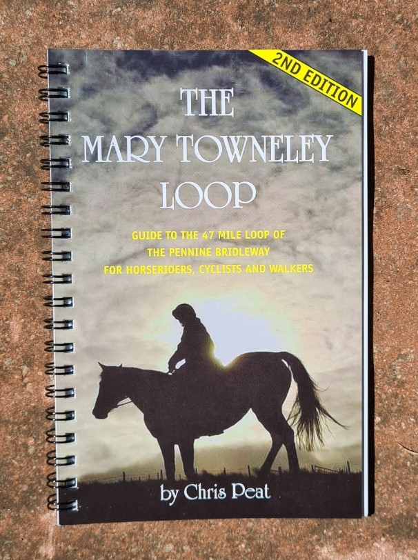
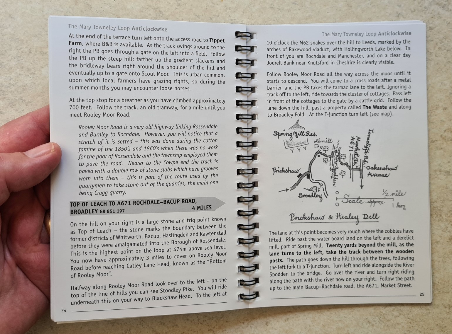
The Mary Towneley Loop, Chris Peat. Forest of Rossendale Bridleways Association, ISBN 0-9547813-0-9, 2nd edition. 39pp, 2009. 115g
This is the first printed guide for horse riders that I have ever purchased. The Pennine Bridleway is a multi-user trail of course and it was Mary herself that championed it’s creation with the Mary Towneley Loop opening in 2002. Beyond the Emperor Hadrian, she is probably the only person to give her name to a major section of UK national trail. Even Wainwright didn’t manage that! This is a little pocket book that covers just the 47 mile long loop. I could do without the blurry black and white photographs and would have preferred a little more historical content such as the included interesting background to the loop itself. The simple maps do seem to convey a lot of guidance to the actual turns and twists of the trail and some helpful orientation information in the text, e.g.“the first house on the left has a red telephone box in its garden” , isn’t going to be found elsewhere. If I was hiking just the loop, I would take the guide, but for the whole trail, this stays at home.
Pennine Bridleway National Trail, Holiday Guide 2009: Derbyshire to the South Pennines. Natural England. 72pp, 99g
You are now unlikely to come across this handy little pocket sized booklet. I picked up a free copy in a Tourist Information office years ago. It was designed so that it could (or can) be used in conjunction with the official Aurum guide book by Sue Viccars and the sections correspond to those suggested in that volume. There is no historical or geographical information in this at all. It has an easy to read well-designed uncluttered appearance that crams a lot of information in. Accommodation along the route could be helpful for planning though I have no idea how much of the information (with key) is now out of date and the online resources that have replaced it are no doubt more useful in this respect. It is (or was) of most use to horse riders with the included information on access and parking for horse boxes. Horse transport, tack shops, vets, farriers and cycle hire and repair contact details are included. The distance chart from Middleton Top to Summit, with intermediate points is useful. If this type of booklet were kept up to date each year it could be a small and lightweight helpful hardcopy addition to a saddlebag. But as it is, in common with so many publications shown here, it now only covers part of the trail and is now partly inaccurate in the occasional obsolete information included.

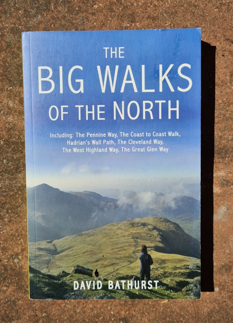
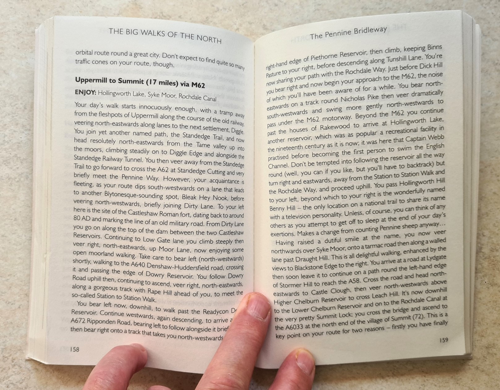
The Big Walks of the North, David Bathurst. Summersdale, ISBN 978-1-84953-023-1, 250pp of which 22 cover the Pennine Bridleway, 2010.
David Bathurst has walked all of the Long Distance National Trails and has given a taster of them across three published volumes. The Pennine Bridleway is given a scant 21 pages for its (then) 130 mile length when the author walked it. Two pages are given over to suggesting what route the trail might follow as it progresses further northward to Bryness. With a bunch of O.S. maps it would be possible to plot a route on them using this guide. These days, no-one needs to do that and this volume succeeds in doing the same as the Cicerone National Trails volume does, but in a less glossy format without the colour photos. Save your money unless you are desperate for partial route guidance for a weeks walking, from an accomplished trail walker, competent guide but slightly less inspiring writer.
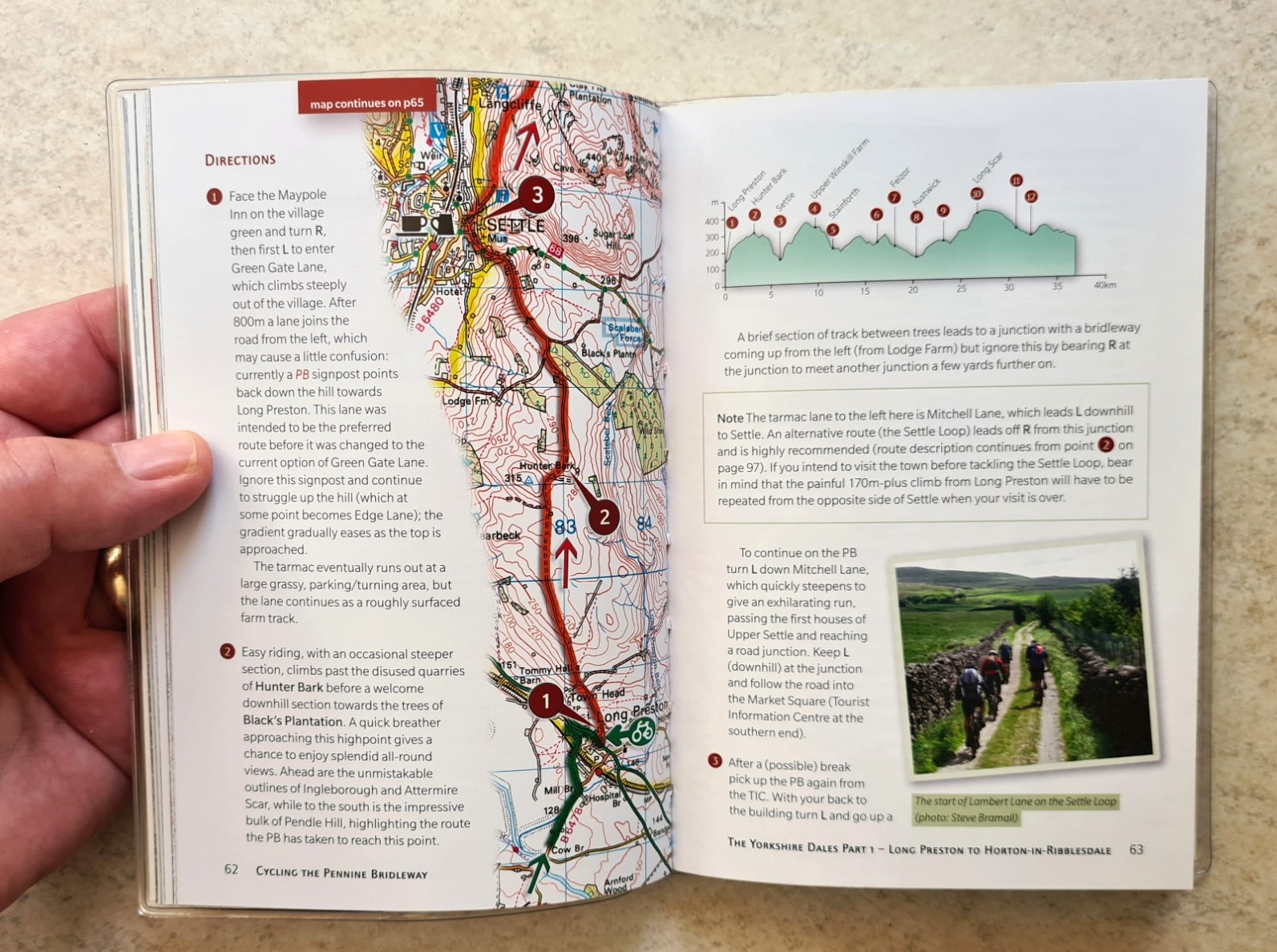
Cycling the Pennine Bridleway, Lancashire and the Yorkshire Dales. Keith Bradbury. Cicerone, ISBN 978-1-85284655-8, 2017 updated reprint. 201pp, 247g (228g without plastic cover), also available as an E-book
Part of Cicerone’s stable of cycling guides, this volume is compact and crams a lot of information in. It includes 1:50 000 O.S. mapping and could be used by cyclists as a sole resource both for planning and on trail as it is to the usual high Cicerone standard. Frustratingly only the section of trail from Summit to Ravenstonedale is covered, but at least that is the northern section not covered by volumes published prior to the trail being extended. A description for the Mary Towneley Loop is included but anti-clockwise only. The title is accurate as, unsurprisingly, it is mostly aimed at cyclists and I found it frustrating for planning a walking excursion.
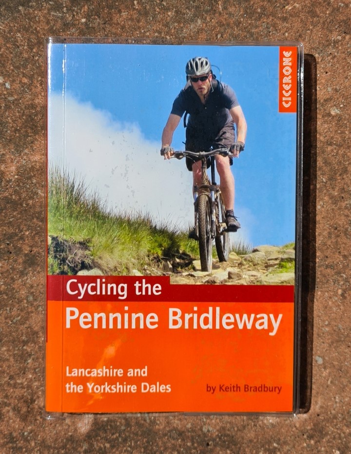
I am not a bikepacker but reckon this would be a superb aid for that. The information for walkers is sometimes in here, but there is too much that has to be glossed over and surface information and stage timings are irrelevant. The 11 additional day loops for cyclists are also not required by me. The included altitude profiles, linked to the text, are helpful to all. Photography is mostly good but some images are postage stamp size. The route for horse-riders and cyclists is sometimes different for walkers and I so want to see a Cicerone produce a hiking version of this guide for the whole route that is more relevant and useful to the backpacker.
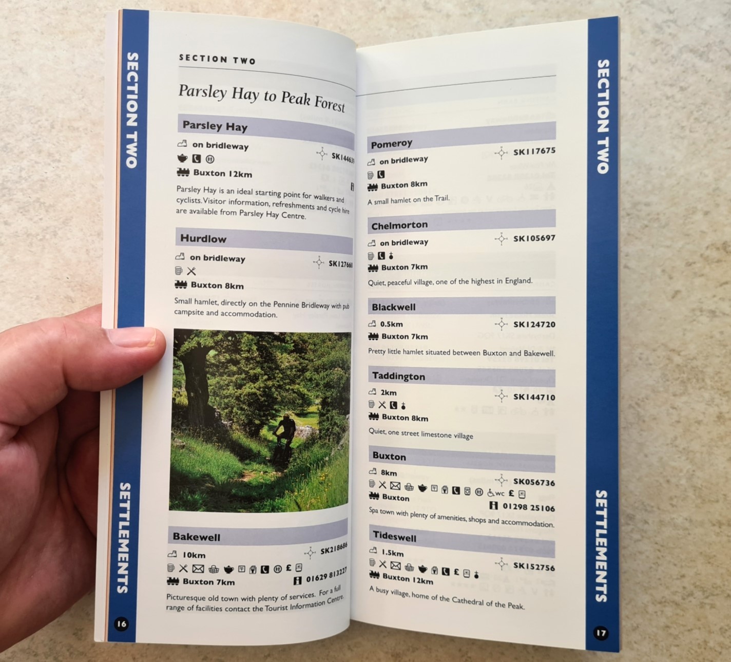
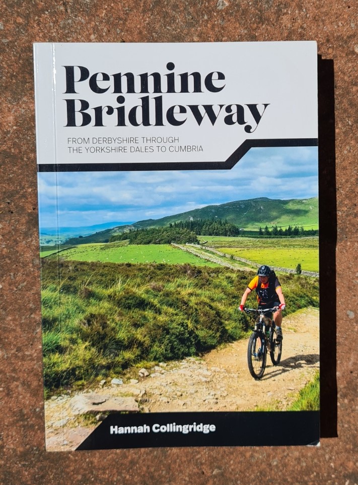
Pennine Bridleway, from Derbyshire through the Yorkshire Dales to Cumbria. Hannah Collingridge. Vertebrate Publishing, ISBN 978-1-83981-042-8, 2021, 116pp, 180g
Not only does handy little volume include accurate 1:50 000 O.S. mapping, but it also covers the whole route as it stands from Middleton Top all the way to The Street. It also includes the Mary Towneley Loop (both clockwise and anti-clockwise) and the Settle Loop. There is also an additional Charlie’s Loop (10pp), aimed at cyclists. The ‘cyclist’ info isn’t so much in your face and route information is better presented to the multi-user. The included route profiles are linked to the maps and are helpful guides on what to expect. Somehow, in such a slim volume, this includes more historical and interesting accompanying information than any other guide book looked at here. The author is to be congratulated. Photographs are bright and also convey an idea on the trail itself. A final plus point, this guidebook is bang up to date with the more recent changes to the route.

Tales from the Big Trails, Martyn Howe. Vertebrate Publishing, ISBN 978-1-83981-058-9. 299pp, of which 14 cover the Pennine Bridleway, 2021.
This is no guide book, but it is a good read. In common with Big Walks of the North, above, this is an account of the author’s walking of the long distance footpaths in the UK. Rather than dispense a dry as bones- turn left, turn right, discourse, this is a personal story of tribulation and success on trail, though the Pennine Bridleway chapter is less engaging than other parts of the book. Just 14 pages are used to convey the 205 mile journey and I feel it deserved a little more. The book is a celebration of just how good the UK is to walk through and, not that I needed one, a reminder that there is much on our doorstep to enjoy. Martyn’s account of his walk south on the Pennine Bridleway in often challenging conditions is also a reminder that long trails require a certain mindset and that mental resilience is one of the lightest yet most essential items of gear required on trail.
Of no practical use at all either before or on trail, but fairly interesting nonetheless (well it was to me), there is an online pdf of the 1999-01 Pennine Bridleway ‘Design Guide‘. This was produced as a guide for the authorities responsible for the implementation and maintenance of the trail.
So, which of the above to use for planning or taking on trail? There are probably enough accurate and up to date online resources for planning purposes that just those can be relied on. Despite only offering eight pages on the Pennine Bridleway, Paddy Dillon’s National Trails is helpful, particularly if you are planning to walk other national trails. But it is a coffee table book for browsing mostly and an expensive option for the little specificity included. The little lightweight Mary Towneley Loop guide might be a comfort in the pocket for those walking just those 47 miles but is superfluous if walking anything more of the trail. Of the cycling guides, that from Hannah Collingridge is by far the most useful to the walker. If you really wanted to carry a guide book, then this is the best option and at 180g is also both lighter and slightly less bulky than the print Cicerone guide which covers far less of the trail. Despite O.S. mapping being included in this volume, I would suggest you still carry a dedicated trail map. It is helpful that the 60g Harvey map is also the lightest hard copy map option. But there remains a gap in the market and it is high time an updated National Trail guidebook was produced for the Pennine Bridleway.
- Pennine Bridleway- Middleton Top to the Mary Towneley Loop
- Pennine Bridleway- The Mary Towneley Loop
- Pennine Bridleway- Mary Towneley Loop to Settle
- Pennine Bridleway- The Settle Loop
- Pennine Bridleway- Settle to The Street, Ravenstonedale
- Dry stone walls on the Pennine Bridleway

6 replies »