
Our walk to Bath continues- today brings us a neolithic burial site, a dramatic hill fort, a butterfly reserve and the highest point on the Cotswold Way.
Day Three: Winchcombe to Dowdeswell. 12 miles/19km
Because today is a bit longer than our previous two, and we have a transfer taxi waiting at the end, we opted for an earlier breakfast in the White Hart Inn. There was a decent choice of options, so I eschewed a fried breakfast and had a kipper, poached egg with stacks of buttered toast. Mrs TPOTC opted for Eggs Royale. We actually managed to start our trail a little earlier as planned, a bit of a miracle for us. The weather forecast wasn’t good, and our dry, bright, and cloudy start was expected to deteriorate.

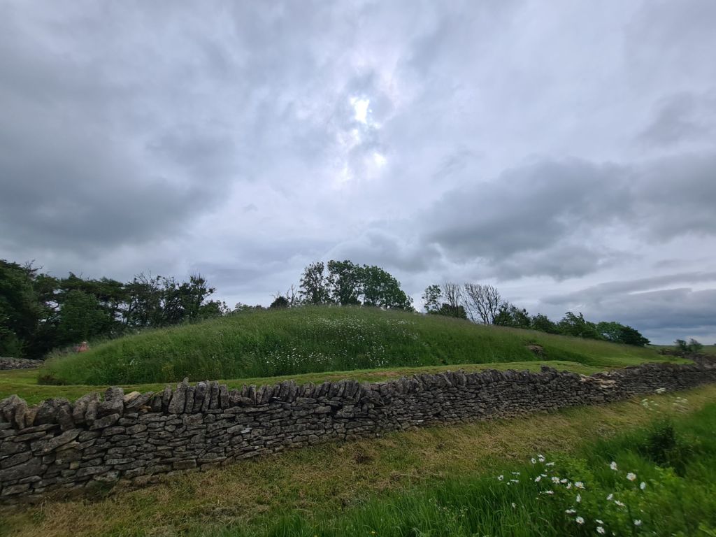
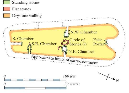
The long barrow of Belas Knap is one of the trail highlights and demands time out for exploring. It’s name means hilltop beacon and it is comprised of a large and heavily restored chambered tomb, measuring around 178 feet (54m) by 60 feet (18m) and is 13 feet (4m) high. It looks like a slumbering whale has been covered with grass. It had a false entrance at one end, possibly to deter grave robbers, but also has side entrances that would have been hidden when covered by earth. At least 38 burials took place, back in the day, both adult males and females were interred here, along with a number of children.
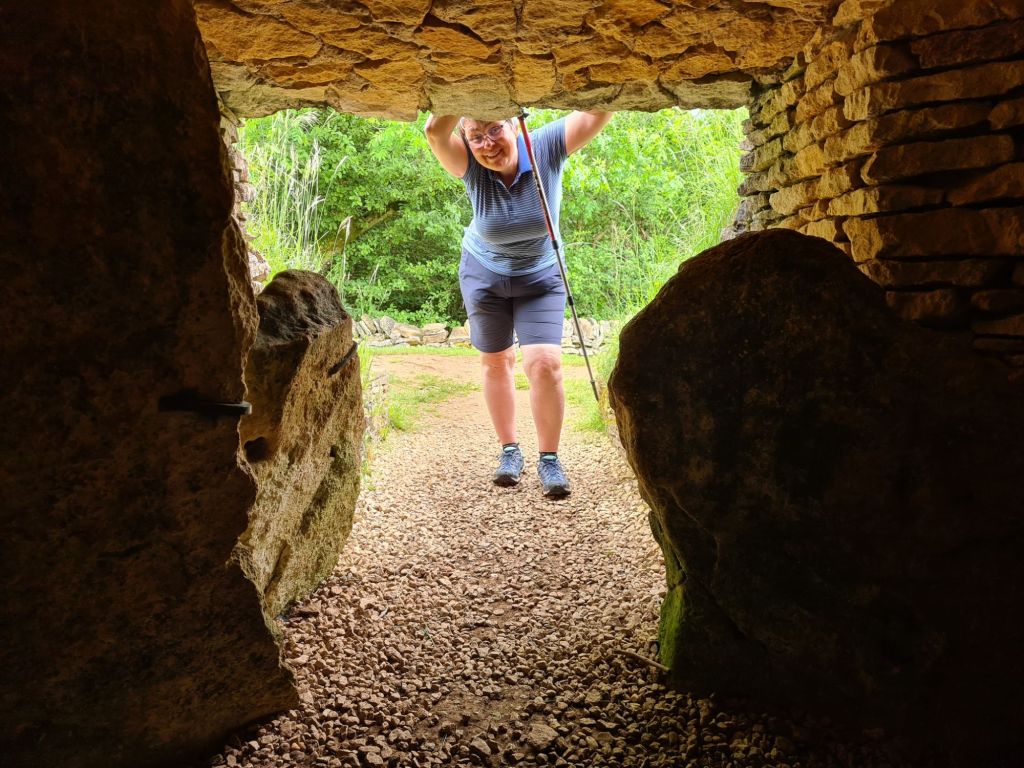
It is a remarkable survivor from 5500 years ago. We took turns climbing in the now exposed side entrances before setting off down the other side of the hillside, turning frequently to see the large elongated dollop on the hilltop behind us. The reverence that those people must have felt for the people they interred, that demanded so much toil to achieve, must have been remarkable.
The rain started on our descent. First splatters, finally building until a halt for waterproofs was required. Five minutes later the rain cleared off. Ten minutes later we stopped to pack away waterproofs. Ten minutes later it started raining again. And that was more or less the routine for much of the day. Sometimes we bothered with waterproofs, sometimes not.


By the time we reached the Cleeve Hill Golf Club it was raining hard so we retreated to the club house. It was just after midday so they had just started the lunchtime menu. Ham, eggs and chips with a pot of tea was just the ticket.
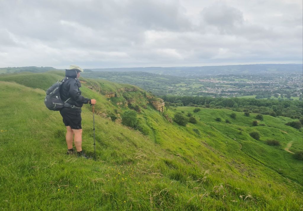
We reached the trig point on Cleeve Hill. Other than the ramparts of Broadway Tower that we climbed up to on day one, this is the highest point on the Cotswold Way at 317m though Cleeve Common has a 330m summit, but that is off route. Almost needless to say, being such a vantage point, we had a hill fort to visit too. Cleeve Cloud Camp is one of the clearest earthworks encountered on the trail. The ditches form additional hazards for golfers here. I am unsure what I think of this. The irony of a private golf course being built across a hill fort on a public common was not lost on me. It is lovely walking here, despite now being a damp day and a cold wind blowing up the side of the escarpment from the vale below.

Much of our walking here was through unimproved grassland. i.e. lacking the chemical inducement that deprives an area of diversity. The herb rich vegetation is a haven for invertebrate life and we walked through the Prestbury Hill Butterfly Reserve before the steady decent to Dowdeswell. It was too cold and windy for the fluttery things though so I had to content myself with the hundreds of orchids.

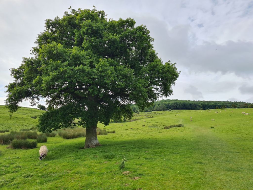
Beginning our descent and leaving the grasslands behind we had some quiet roads to walk, not a single car passing us. Magnificent mature beech trees border these roads. Then it was back in to woodland for the final stone clattering descent to the reservoir, A40 and our transfer.

Because there was a lack of available accommodation at the end of this section a solution has to be found. Cheltenham is a 40 minute walk, a 10 minute bus ride away, or a taxi transfer, arranged by our provider. As usual, we had stressed over arriving at our pre-arranged meet point with the driver. Prior to setting off on a day walk in an area totally new to you, it is an uncertainty as to how long it will take, what delights might delay you, or how weather and terrain will affect progress. Today was also our longest day so far and we had concerns about how much we might dawdle en route. Even over just a couple of days walking this trail I had seen how others, targeting a five, six or seven day completion, stop nowhere, striding past almost every point of interest, hell bent on crushing miles. I had rung the taxi company mid-morning and been told it was pre-booked for four in the afternoon. I put it back by an hour, to five. We arrived at the pick up point at three minutes after four. I was sorely tempted to visit Dunkerton’s cider maker, just five minutes walk down the road but fully expected it to be closed on arrival. So instead rung the taxi company again and owned up to being early, requesting an earlier pick up.
Our guest house is large, comfortable, and has the most amiable hosts imaginable. We have to venture out this evening to find somewhere to eat but fortunately have plenty of choice as Cheltenham is a large and well-provisioned town. Despite the change in weather, yet another great days walking.

- Cotswold Way- National Trail
- Cotswold Way: Chipping Campden to Stanton
- Cotswold Way: Stanton to Winchcombe
- Cotswold Way: Dowdeswell to Birdlip
- Cotswold Way: Birdlip to Painswick
- Cotswold Way: Painswick to King’s Stanley
- Cotswold Way: King’s Stanley to Dursley
- Cotswold Way: Dursley to Wotton-under-Edge
- Cotswold Way: Wotton-under-Edge to Old Sodbury
- Cotswold Way: Old Sodbury to Cold Ashton (Pennsylvania)
- Cotswold Way: Cold Ashton to Bath

10 replies »